Esri Public Sector
CIO Summit:
Supporting a Real Time
Enterprise
Dan Henderson Harry Moore
#ArcGISrealtime
#esricio18
• @hendomap

• Forward-Thinking Leadership & Strategy
• Data-Driven Decision Making
• Collaboration Across Departments
• Real-Time Awareness
• Civic Engagement
Character ist ics of
Smart Communit ies
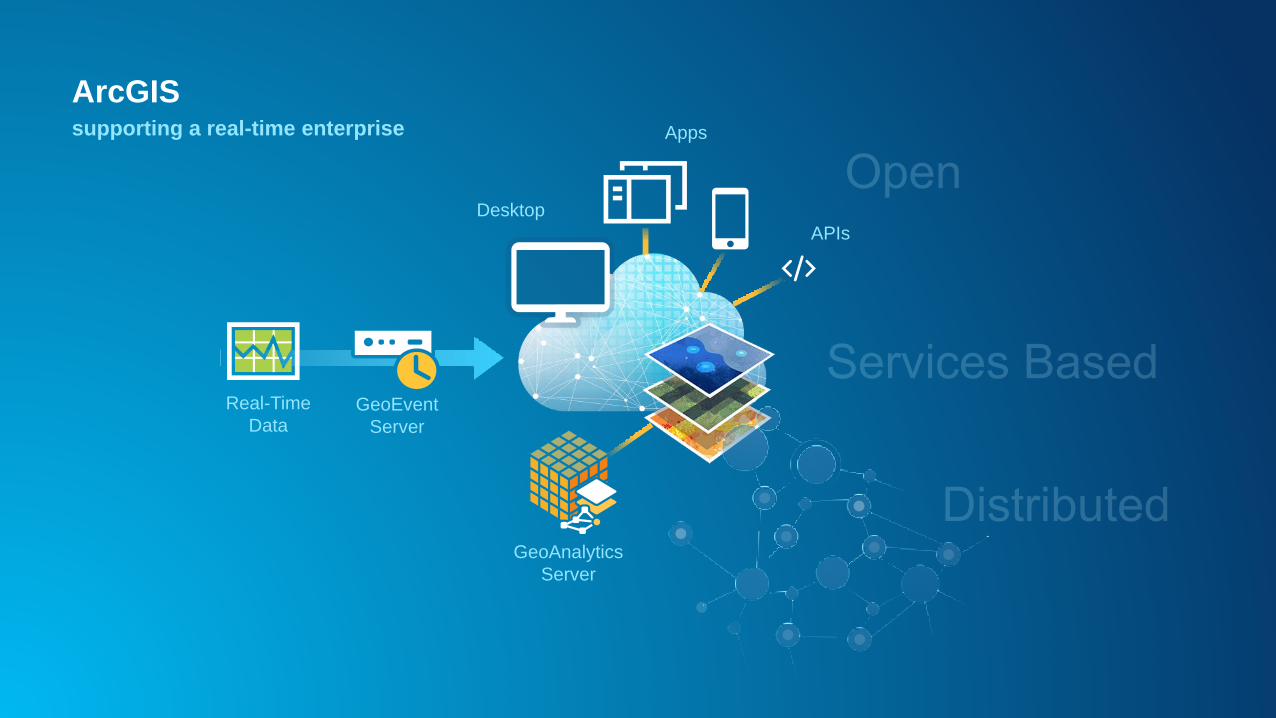
ArcGIS is IoT Ready
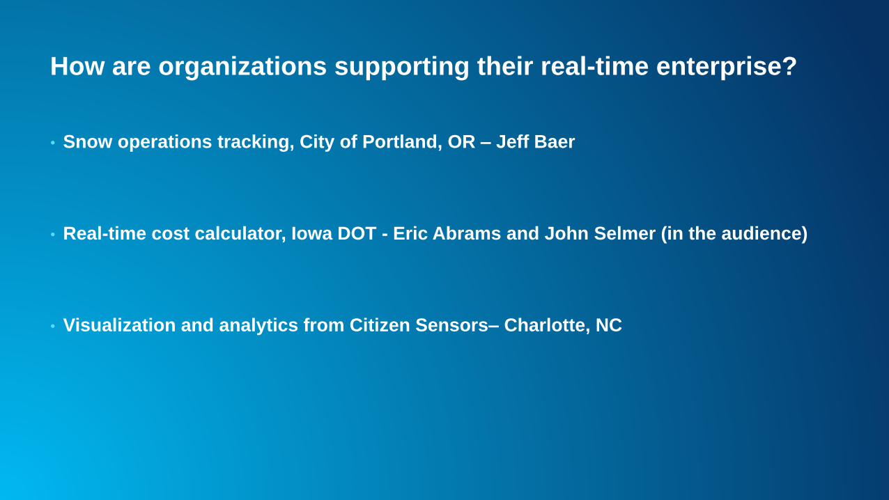
How are organizations supporting their real-time enterprise?
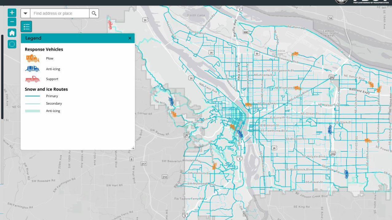
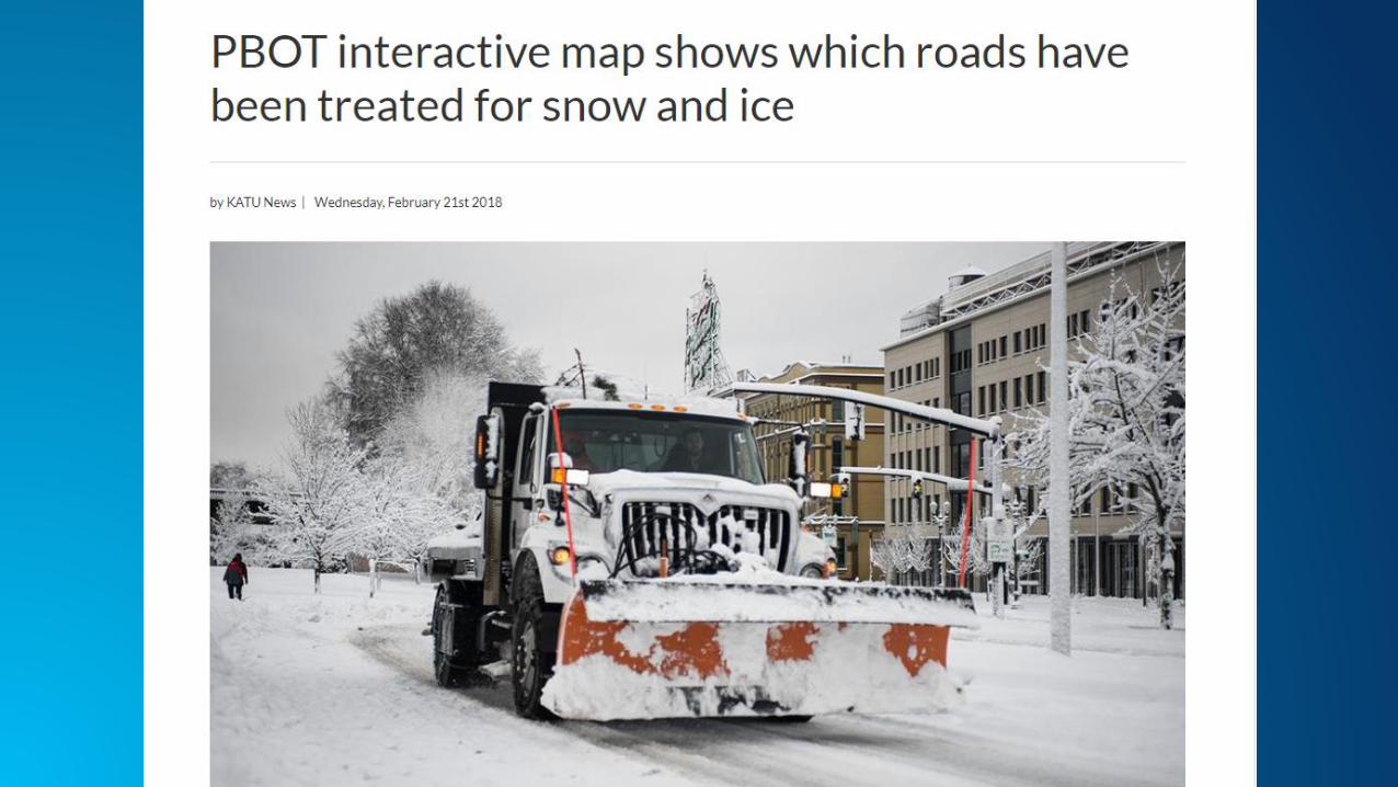
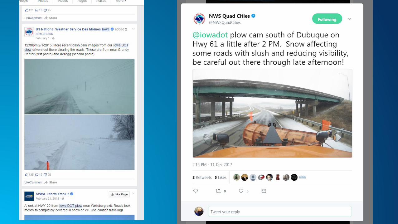
• Snow operations tracking, City of Portland, OR – Jeff Baer
• Real-time cost calculator, Iowa DOT - Eric Abrams and John Selmer (in the audience)
• Visualization and analytics from Citizen Sensors– Charlotte, NC

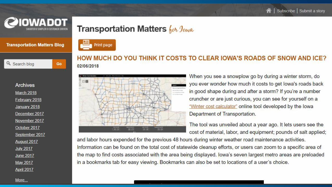
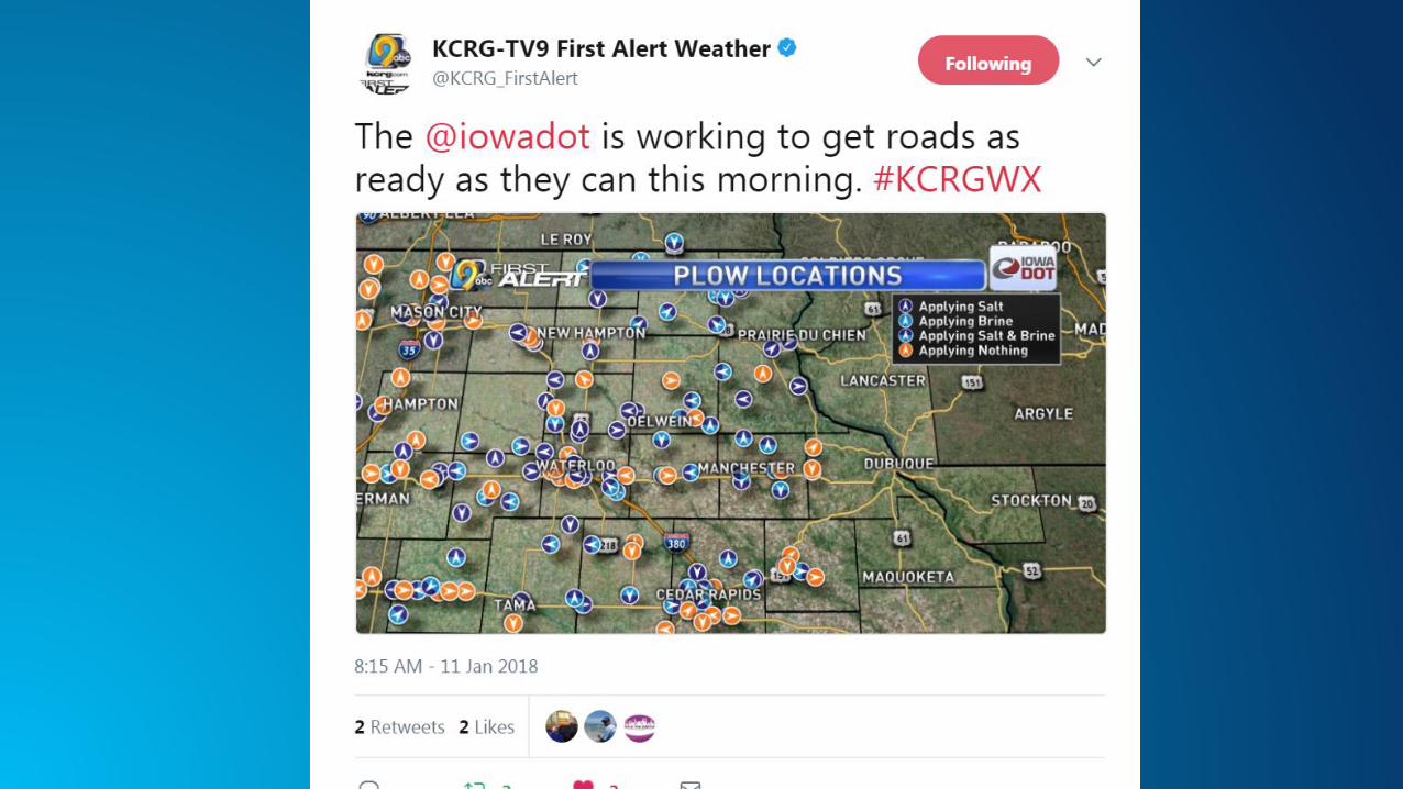

Real time cost
Calculator


Finding Potholes with Waze
Citizens as Sensors
Apps
Desktop
APIs
GeoEvent
Server
Real-Time
Data
GeoAnalytics
Server
ArcGISsupporting a real-time enterprise
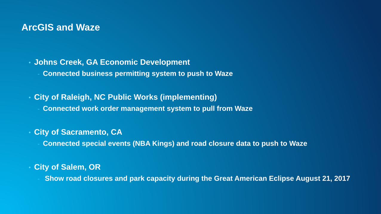
ArcGIS and Waze
• Johns Creek, GA Economic Development
- Connected business permitting system to push to Waze
• City of Raleigh, NC Public Works (implementing)
- Connected work order management system to pull from Waze
• City of Sacramento, CA
- Connected special events (NBA Kings) and road closure data to push to Waze
• City of Salem, OR
- Show road closures and park capacity during the Great American Eclipse August 21, 2017
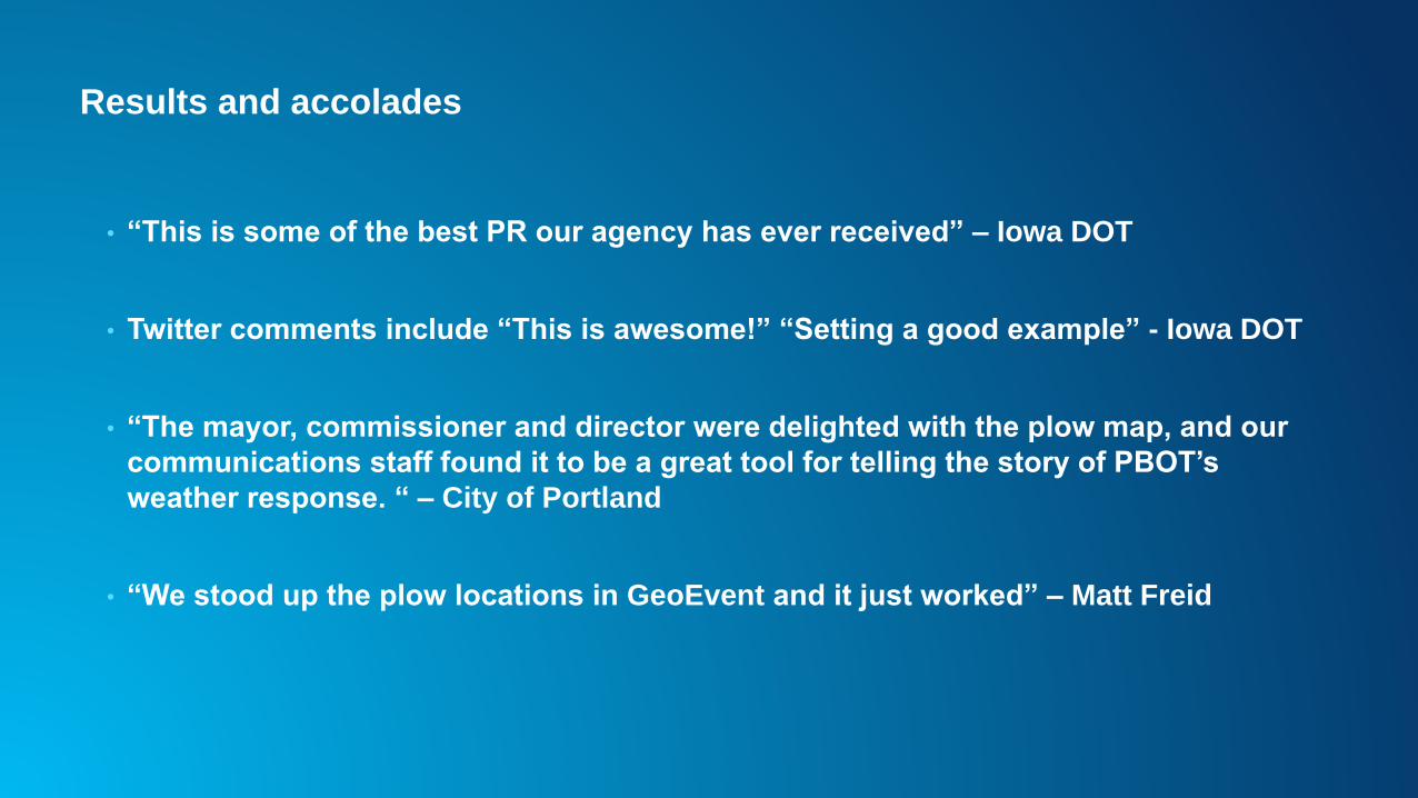
Results and accolades
• “This is some of the best PR our agency has ever received” – Iowa DOT
• Twitter comments include “This is awesome!” “Setting a good example” - Iowa DOT
• “The mayor, commissioner and director were delighted with the plow map, and our
communications staff found it to be a great tool for telling the story of PBOT’s
weather response. “ – City of Portland
• “We stood up the plow locations in GeoEvent and it just worked” – Matt Freid

#ArcGISrealtime
#esricio18
• @hendomap