Sea Level Measuring Systems
D. Sundar

Observed Sea Level = Mean Sea Level
+
Tide
+
Non tidal residuals
Why do we measure Sea level?
For navigation and dredging purposes.
For pollution studies.
Tide analysis and tide prediction.
Extreme events (Surge and Tsunami) studies.
Secular changes.

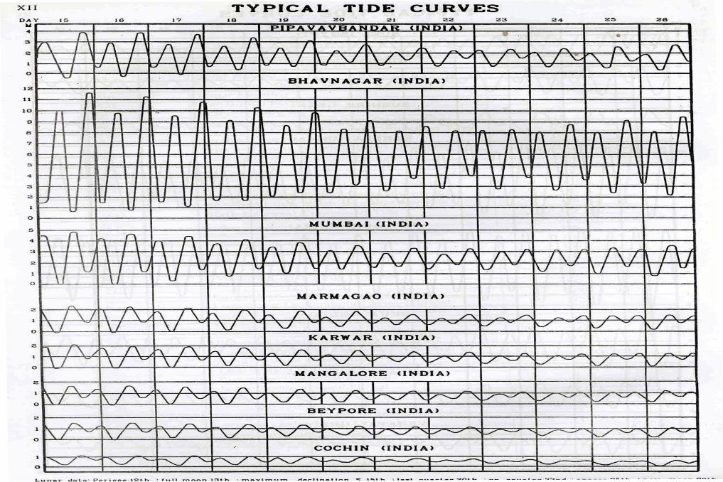
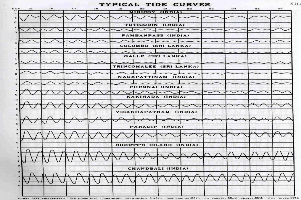
Tides - three pronged
Earth tides – affects the earth’s crust
Atmospheric tides – affects the height of the atmosphere
Ocean tides – affects the sea level

Gravitational Tides
Meteorological/Radiational Tides
Major design requirement of a sea level gauge is to resolve the large amplitude short period waves and the small amplitude long period tide.
GLOSS requires data accuracy better than:
0.01 m in height measurements
0.03 m/s in current observations
1 minute over one week in time
GLOSS requirements (some more) Recording interval needs to be 6 or 15 minutes. If
Tsunami detection is the objective, 1 min or less is preferred
Overall instrumentation should be compatible to target the required accuracies
Measurements should be with respect to TGBM
Atmospheric pressure and if possible wind and other environmental parameters must also be observed
Gauge sites should be equipped for automatic data transmission along with local recording
Regular monitoring of daily data

Site Selection Criteria Must be capable of withstanding worst environmental
conditions
Must be stable; no subsidence or erosion
Avoid river estuaries, if possible
Avoid areas where impounding may occur at low waters
Avoid proximities to outfall
Ensure mains power, telephone and satellite transmission access
Adequate access for maintenance and ensure safety from vandalism and theft.
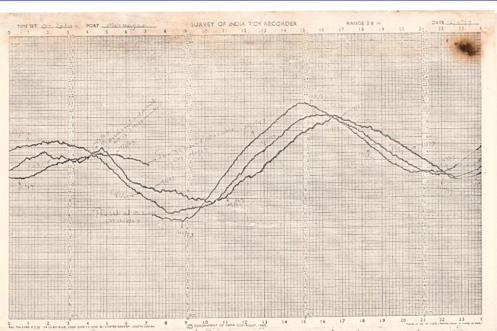
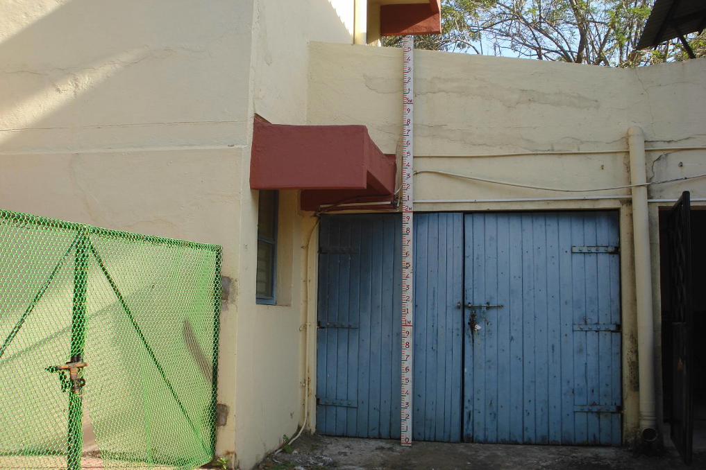
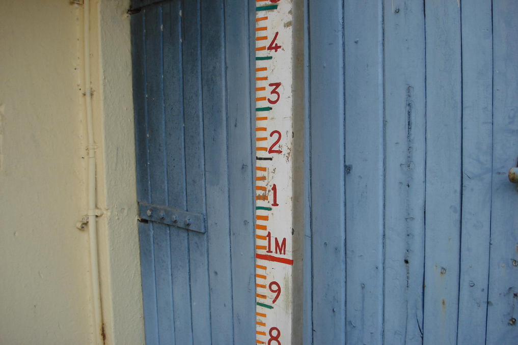
Types of Tide Gauges
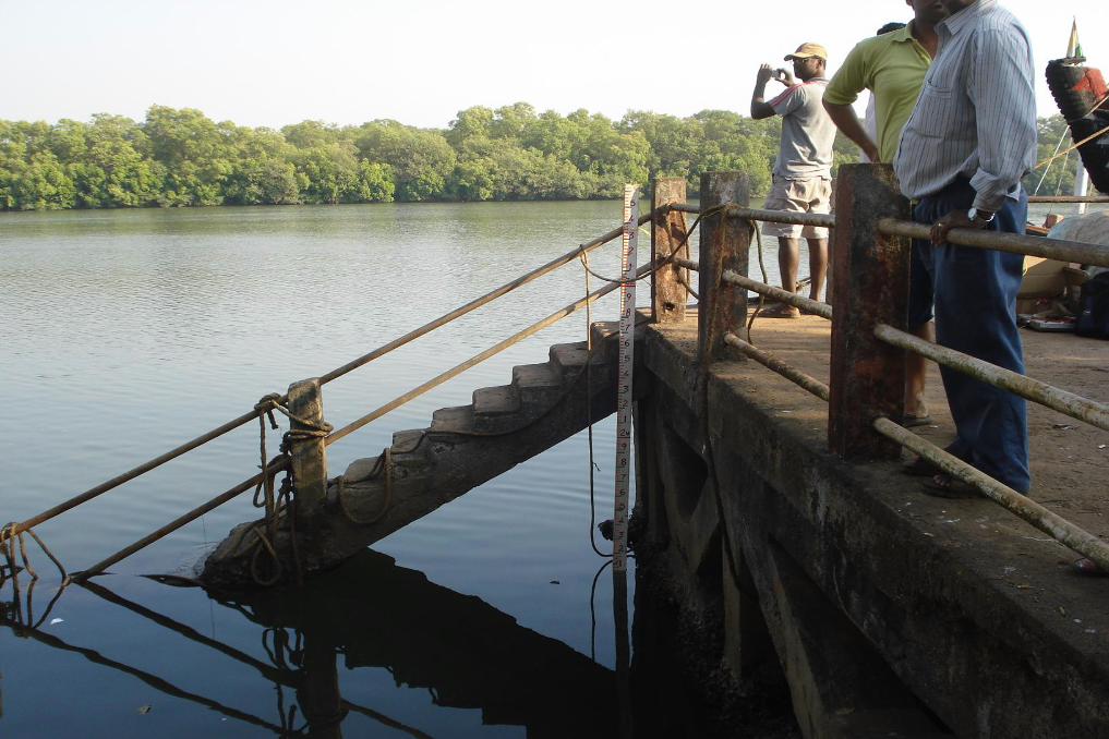
VTS (Visual Tide Staff) is a graduated pole made to stand upright in the sea.
Accuracy of about 0.02 to 0.10 m
Advantage is the low cost and ease of operation
Disadvantage is low accuracy due to the manual errors and difficulty in reading in rough weather (Alleviated to some extent by use of a transparent hollow tube).
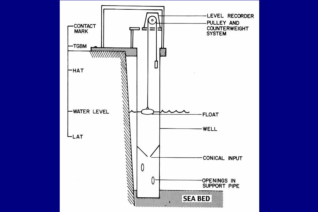


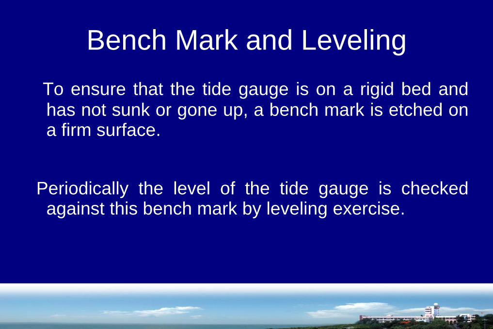
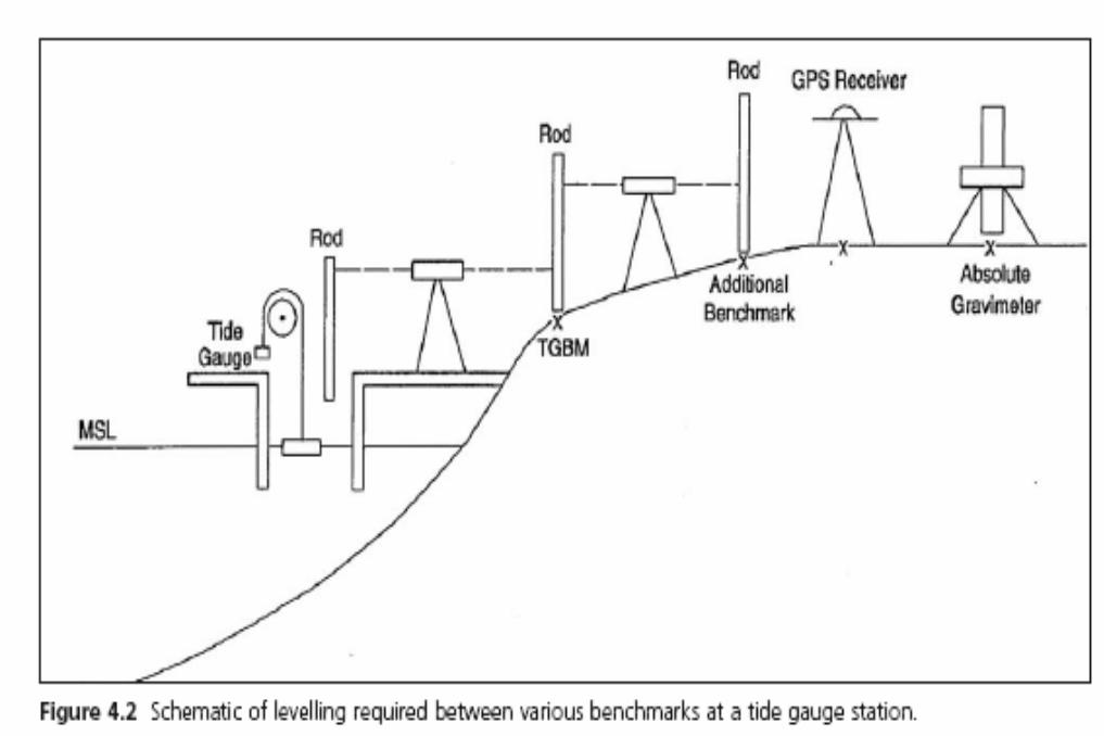
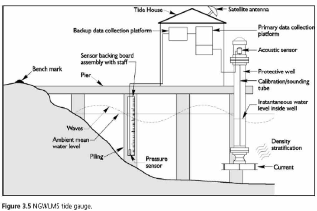
Bench Mark and Leveling
To ensure that the tide gauge is on a rigid bed andhas not sunk or gone up, a bench mark is etched ona firm surface.
Periodically the level of the tide gauge is checkedagainst this bench mark by leveling exercise.
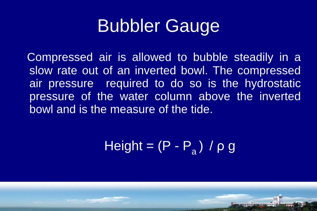
Bubbler Gauge
Compressed air is allowed to bubble steadily in aslow rate out of an inverted bowl. The compressedair pressure required to do so is the hydrostaticpressure of the water column above the invertedbowl and is the measure of the tide.
Height = (P - Pa) / ρ g

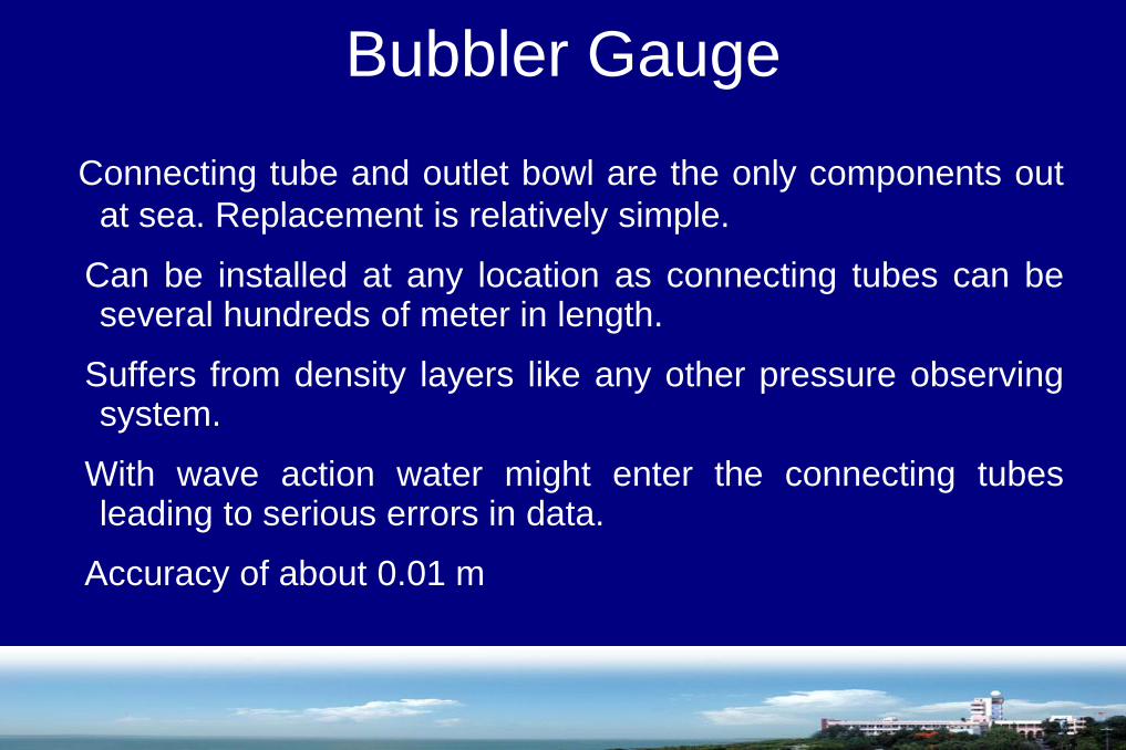
Bubbler Gauge
Connecting tube and outlet bowl are the only components out
at sea. Replacement is relatively simple.
Can be installed at any location as connecting tubes can beseveral hundreds of meter in length.
Suffers from density layers like any other pressure observingsystem.
With wave action water might enter the connecting tubesleading to serious errors in data.
Accuracy of about 0.01 m

Pressure Gauges
Digiquartz pressure sensor based gauges measurethe hydrostatic pressure of the water column abovethe gauges and which is the measure of the tide.
Height = (P - Pa ) / ρ g


Pressure Gauges
Absolute pressure sensor measures pressuredue to sea level and atmospheric pressureboth.
Vented differential pressure sensor measuresthe sea level pressure alone.
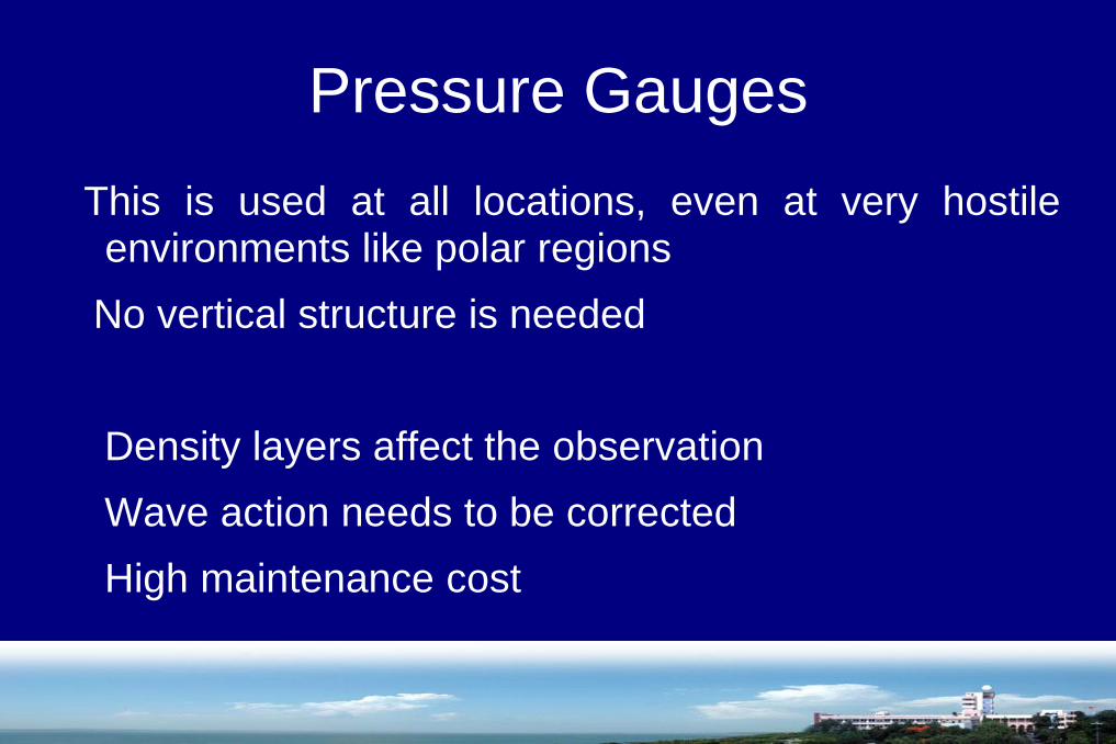
Pressure Gauges
This is used at all locations, even at very hostileenvironments like polar regions
No vertical structure is needed
Density layers affect the observation
Wave action needs to be corrected
High maintenance cost

Offshore Pressure Gauges
Used at shallow and deep waters both
Deep water gauge data from long time installation is retrieved through acoustic link through passing ships
Complements the satellite altimeter data at highlatitudes where satellites do not reach.
Used at places where long time data at fixedlocation with better temporal resolution is needed
Acoustic Tide Gauge
The principle of working is similar to the echosounders.
Sound pulses are emitted from the transducer at aknown height from the chart datum and their flighttime from the transducer to the water level and backis calculated.
Accuracy of about 0.005 to 0.01 m
Acoustic Tide Gauge
Velocity of Acoustic pulses in air changes with thechange in temperature gradient. Hence thermistorsare present to correct the temperature variation
Acoustic gauge in protective tube and in open air, bothoptions are available
Open air type suffers from secondary reflection fromdifferent surfaces of crest and trough of waves
Radar Gauge
Radio waves, instead of acoustic pulses, from thetransducer to get the height of the water level
Averages are taken over a period of minutes which limitsthe use in certain field
There are two types: 1) Frequency ModulatedContinuous Wave (FMCW) where phase shift isobserved. 2) Radar pulses are emitted and their flighttime is observed.
Accuracy of about 0.005 to 0.01 m


GPS on Surface buoys
Seems to be a straight forward observation that water level heights are with related to the reference ellipsoid.
Suffers from some defects:
Response of mean level of antenna in response to waves.
Bio-fouling affecting the settling of buoy over long period

Datum Reduction
Process of checking and preparation of data before submission to data banks
Correct data for timing errors
Height errors should be handled with utmost discretion
Gaps in data
Final stage is to deposit the data to oceanographic data bank along with:
meta data
datum correction, if any
interpolation of data, if any
GPS location coordinates

Data Sources
PSMSL – Permanent Service for Mean Sea Level
UHSLC – University of Hawaii Sea Level Center
GLOSS – Global Sea Level Observing System
Data Sources
Real time information:
for navigation, flood, tsunami warning-raw data-only automatic quality control done
Fast Data:
for gauge performance, ocean circulation variability forecast, to check satellite altimetry data stability
Delayed mode data:
Full quality control is done.

Thank you.