NRCS Global Positioning Systems (GPS) NRCS Global Positioning Systems (GPS) &&
Geographic Information Systems (GIS)Geographic Information Systems (GIS)
RESOURCE INVENTORYSoil SurveyNational Resources Inventory (NRI)Wetlands InventorySnow SurveyOthersEasements
REMOTE SENSINGAerial PhotographyAerial Digital ImagerySatellite ImageryAirborne Video
CUSTOMER SERVICE TOOLKITConservation PlanningResource AssessmentInterpreted Soils Information
GLOBAL POSITIONING SYSTEM (GPS)
Where on Earth?!!?
MAPPINGDIGITIZING
ANALYSIS
MAP PREPARATION
COMPUTER ASSISTED DESIGN
MODELING•AGNPS•AnnAGNPS•Others
GPS is a data collection tool for GIS
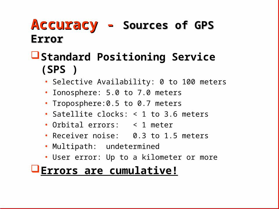
Accuracy - Accuracy - Sources of GPS ErrorSources of GPS Error
Standard Positioning Service (SPS )• Selective Availability: 0 to 100 meters• Ionosphere: 5.0 to 7.0 meters• Troposphere: 0.5 to 0.7 meters• Satellite clocks: < 1 to 3.6 meters• Orbital errors: < 1 meter• Receiver noise: 0.3 to 1.5 meters• Multipath: undetermined• User error: Up to a kilometer or more
Errors are cumulative!
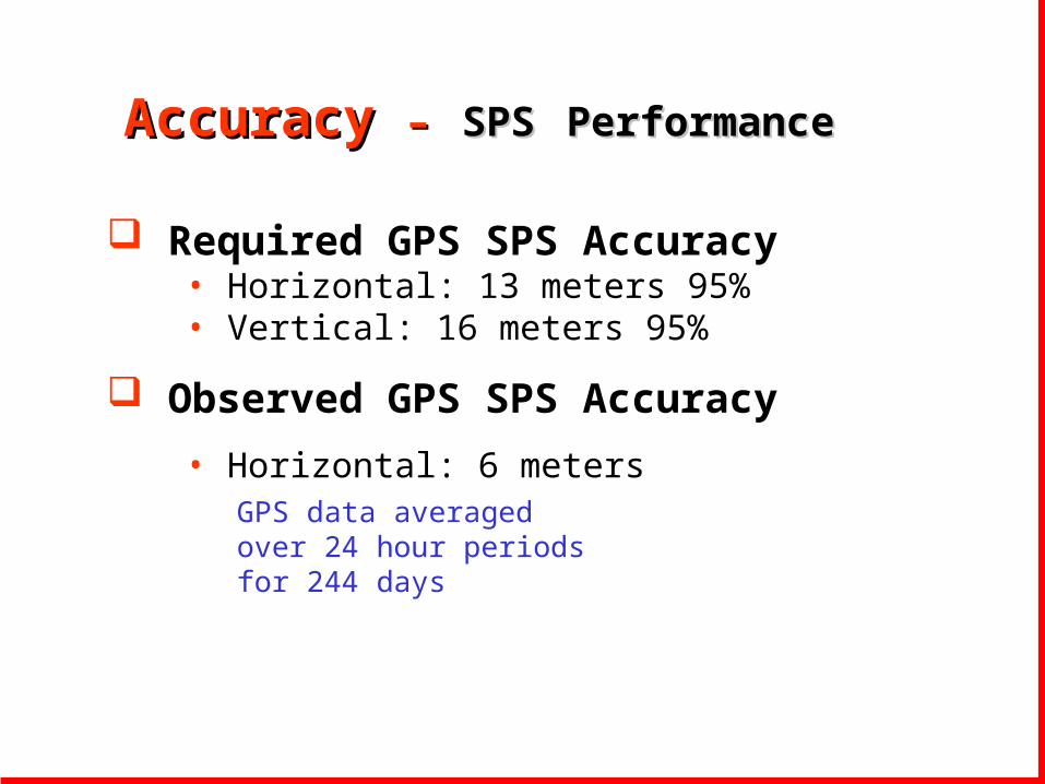
Accuracy Accuracy –– SPSSPS PerformancePerformance
Required GPS SPS Accuracy• Horizontal: 13 meters 95%• Vertical: 16 meters 95%
Observed GPS SPS Accuracy
• Horizontal: 6 metersGPS data averaged over 24 hour periods for 244 days

Must meet FGDC Geospatial data requirement: 10 meters @ 1:24,000 scale
Must meet NRCS Navigation and positioning requirements for NRCS programs and activities:
•National Resource Inventory: 5 -10 meters•Resource Planning: 5 - 10 meters•Soil Mapping: General 5 - 10 •Soil Mapping: Detailed 1 - 2 meters•Conservation Application: 1 - 2 meters•Conservation Certification: 1 - 2 meters•Survey & Engineering: Sub-meter
Accuracy - NRCS Requirements
Draft

Expected Accuracy varies by type of GPS unit
• Standard GPS - 15 m horizontal, 35m vertical
• NDGPS - 5 m horizontal
• WAAS - 7m total error, 3 m horizontal in tests
• Carrier Phase GPS - 10cm to 1meter
• Survey Grade - sub-centimeter
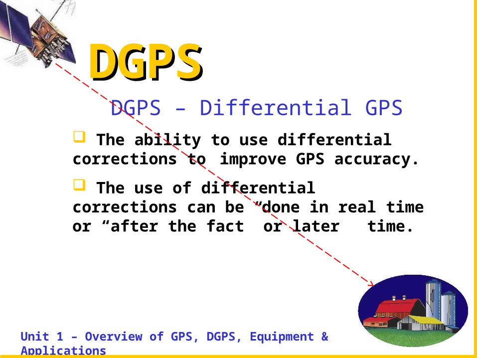
DGPSDGPS
Unit 1 – Overview of GPS, DGPS, Equipment & Applications
DGPS – Differential GPS The ability to use differential corrections to
improve GPS accuracy.
The use of differential corrections can be done in real time or “after the fact” or later time.

DGPS – DGPS – Correcting Errors & Correcting Errors & Improving AccuracyImproving Accuracy
Differential corrections attempt to eliminate or minimize the Ionospheric and Tropospheric errors that effect GPS accuracy.
Differential corrections can be provided by:
• GPS Reference Stations
• GPS Augmentations
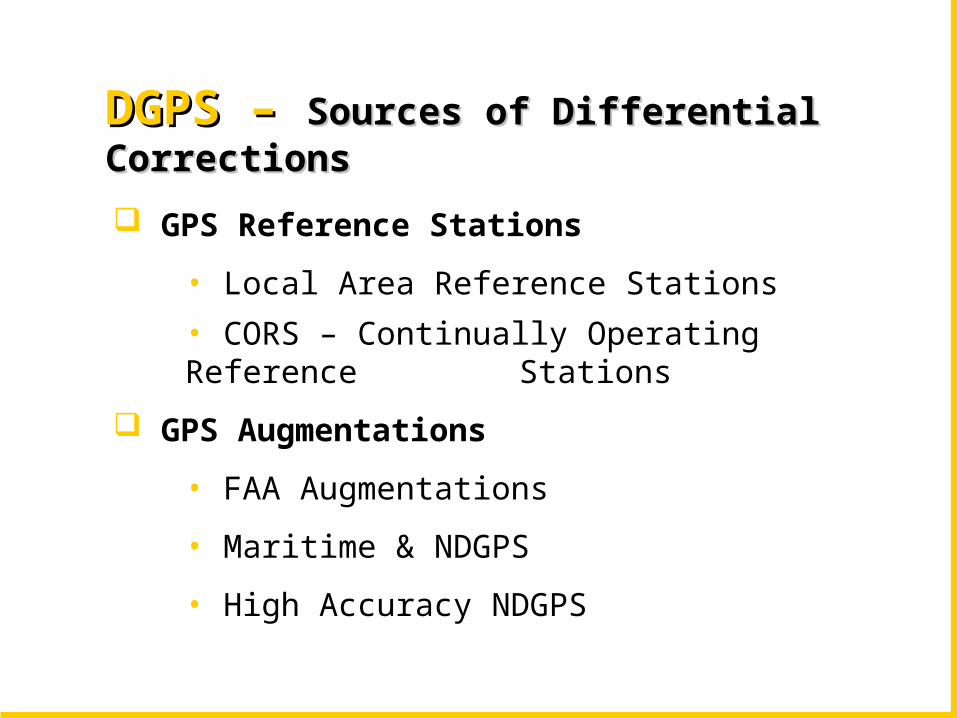
DGPS – DGPS – Sources of Differential CorrectionsSources of Differential Corrections
GPS Reference Stations
• Local Area Reference Stations
• CORS – Continually Operating Reference Stations
GPS Augmentations
• FAA Augmentations
• Maritime & NDGPS
• High Accuracy NDGPS
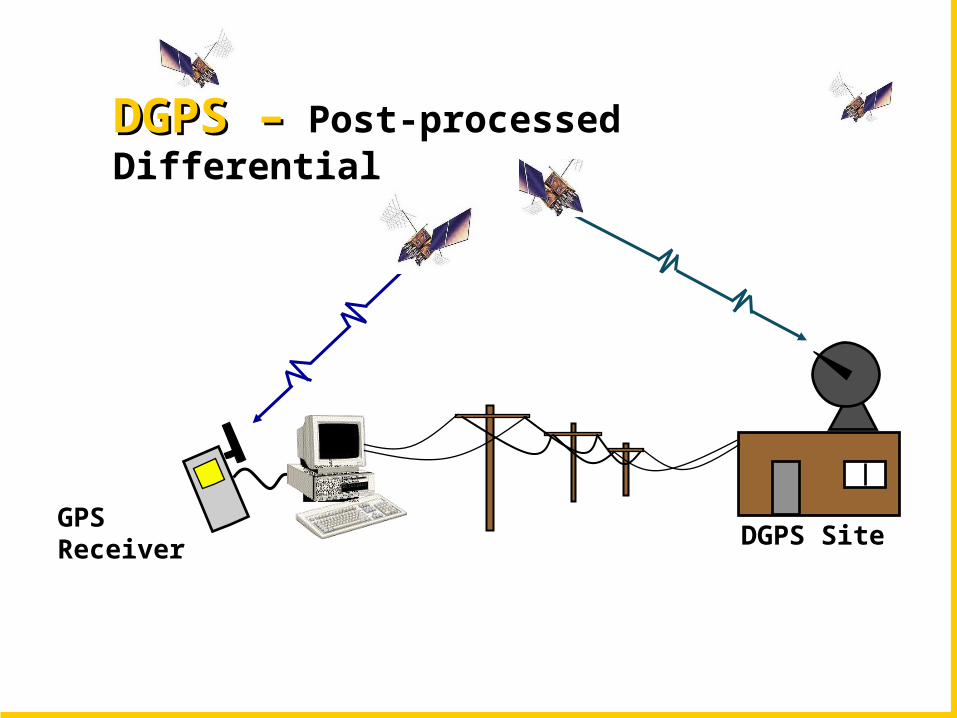
DGPS SiteGPSReceiver
DGPS –DGPS – Post-processed Differential

NDGPS Site
NDGPS Receiver
GPSReceiver
DGPS –DGPS – Real Time Differential

DGPS AugmentationsDGPS Augmentations
Space Based Augmentations• FAA Wide Area Augmentation Service (WAAS)• Commercial L Band Services
Ground Based Augmentations• FAA Local Area Augmentation Service (LAAS)• CORS - Continuous Operating Reference Stations• Maritime Navigation System & NDGPS• High Accuracy NDGPS
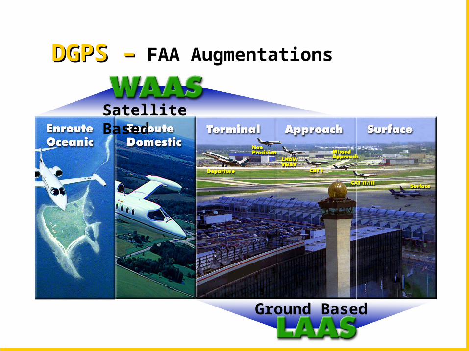
Ground Based
Satellite Based
DGPS –DGPS – FAA Augmentations
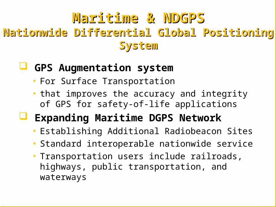
Maritime & NDGPSMaritime & NDGPSNationwide Differential Global Positioning SystemNationwide Differential Global Positioning System
GPS Augmentation system• For Surface Transportation• that improves the accuracy and integrity of GPS for
safety-of-life applications
Expanding Maritime DGPS Network • Establishing Additional Radiobeacon Sites • Standard interoperable nationwide service• Transportation users include railroads, highways,
public transportation, and waterways

NDGPSNDGPSNational Differential Global Positioning SystemNational Differential Global Positioning System
September 200284 Active Sites
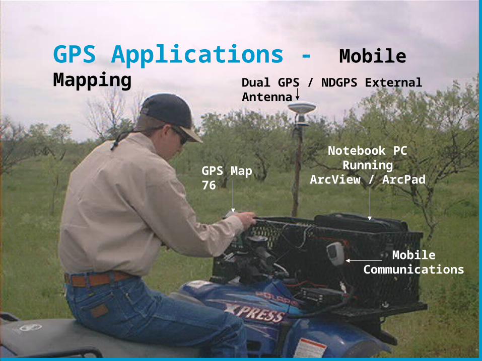
GPS Applications - Mobile MappingDual GPS / NDGPS External Antenna
Notebook PCRunning
ArcView / ArcPad
Mobile Communications
GPS Map 76

The USDA “Tool Box” Has An Assortment of Tools.
GPS ToolsConfiguration 1 & 2
Data Collection ToolsDigital Camera / Mobile Devices
Communication ToolsInternet / Mobile phones
Information ToolsDesktop Computing / Servers