Map skills

Words to knowp. 16
EquatorPrime meridianLatitudeLongitudeHemisphereScaleLegendCompass rosePolitical mapPhysical map
We will learn aboutall of these words and be
able to locate them.

Equator – an imaginary line of latitude located at zero degrees, dividing the Earth into the Northern and Southern Hemisphere.
Where is the
equator?
N
S

Prime Meridian – an imaginary line of longitude located at zero degrees, dividing the Earth into the Eastern and Western Hemisphere (opposite of the Prime Meridian at 180 degrees is the International Dateline.)
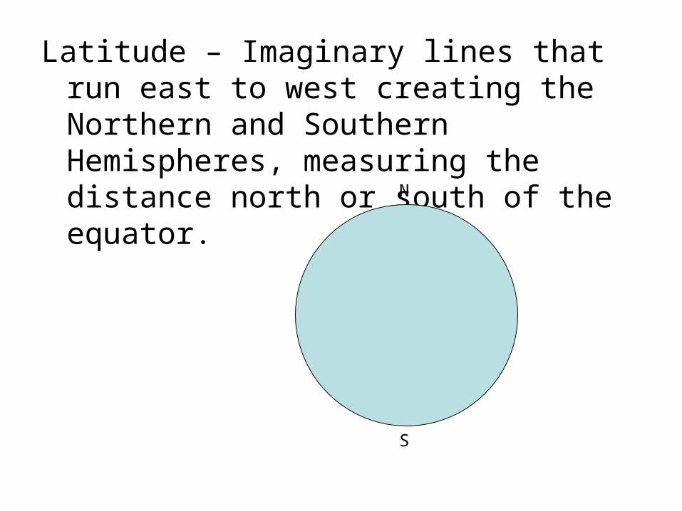
Latitude – Imaginary lines that run east to west creating the Northern and Southern Hemispheres, measuring the distance north or south of the equator.
N
S

Longitude – imaginary lines that run north to south, creating the Eastern and Western Hemispheres, measuring the distance east or west of the Prime Meridian.
N
S

Recall: Grid
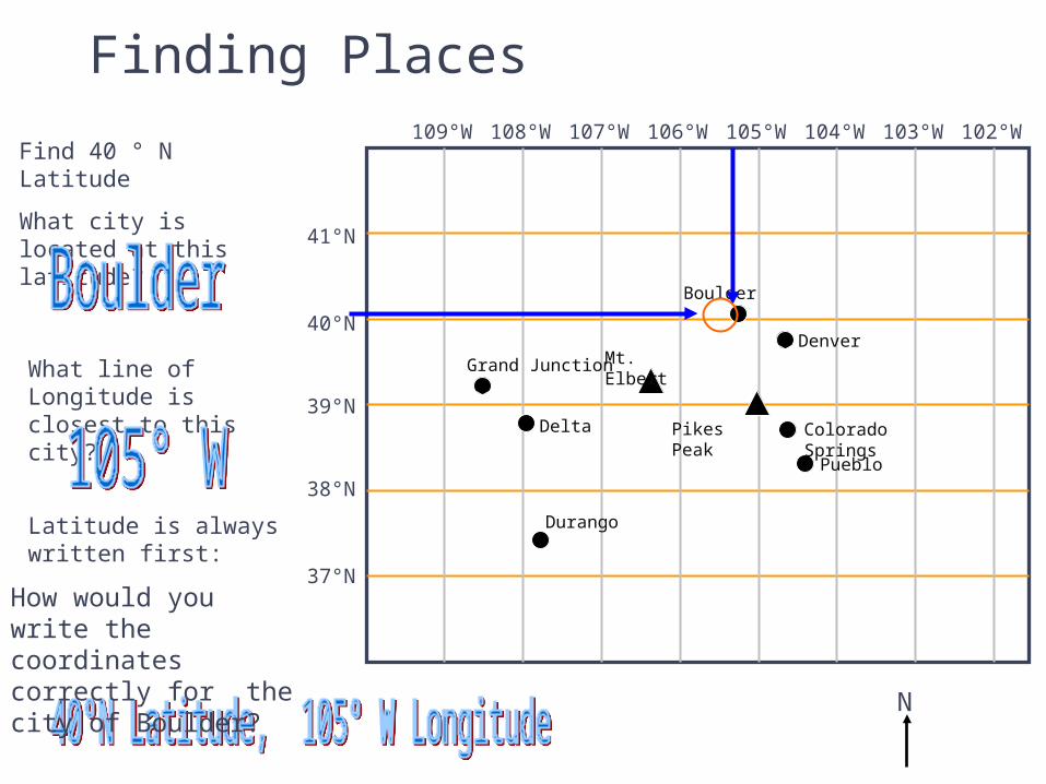
Finding Places
N
41°N
40°N
39°N
38°N
37°N
109°W 108°W 107°W 106°W 105°W 104°W 103°W 102°W
Grand Junction
Delta
Durango
Pueblo
Colorado SpringsPikes Peak
Mt. Elbert
Boulder
Denver
Find 40 ° N Latitude
What city is located at this latitude?
What line of Longitude is closest to this city?
Latitude is always written first:
How would you write the coordinates correctly for the city of Boulder?

Practicing Map Skills
1. Which line of Latitude runs near Pikes Peak?
2. Which line of Longitude runs near Pikes Peak?
3. Write the correct location for Pikes Peak using Longitude and Latitude
4. What city is near 39°N Latitude, 108°W Longitude?
41°N
40°N
39°N
38°N
37°N
109°W 108°W 107°W 106°W 105°W 104°W 103°W 102°W
Grand Junction
Delta
Durango
Pueblo
Colorado SpringsPikes Peak
Mt. Elbert
Boulder
Denver

Answers
1. 39°N
2. 105°W
3. 39° N Latitude, 105° W Longitude
4. Delta
41°N
40°N
39°N
38°N
37°N
109°W 108°W 107°W 106°W 105°W 104°W 103°W 102°W
Grand Junction
Delta
Durango
Pueblo
Colorado SpringsPikes Peak
Mt. Elbert
Boulder
Denver
What is the coordinates of the City of Durango?
37½° N Latitude,
108° W Longitude

Hemisphere – Half of the Earth; Northern Southern, Eastern, Western.
Scale – helps you find the distance on a map
Ex: 1 inch on a map = 100 miles
Legend (Map Key) – explains symbols on a map. (what are some
symbols you see on a map?)

Compass Rose – Shows the cardinal directions on a map
a. Cardinal – north, south, east, west
b. Intermediate – NW, NE, SW, SE
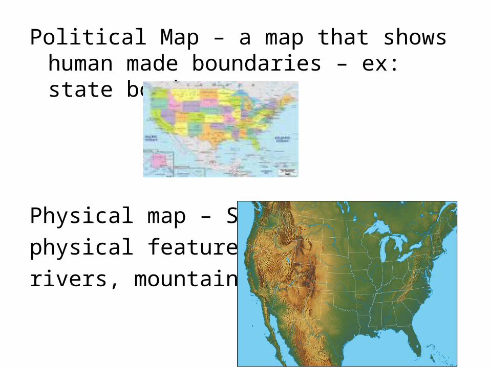
Political Map – a map that shows human made boundaries – ex: state borders
Physical map – Shows
physical features –
rivers, mountains

P. 15
Draw picture depicting each vocabulary word.