IS THERE ANYONE OUT THERE?
A science investigation pack for teachers of
9–12 year olds

© Centre for Industry Education Collaboration www.ciec.org.uk
IS THERE ANYONE OUT THERE?
A science investigation pack for teachers of 9–12 year olds
© Centre for Industry Education Collaboration www.ciec.org.uk
This resource was funded by the UK Space Agency and developed by ESERO-UK and the Centre for Industry Education Collaboration.
ESERO-UK
The aim of the European Space Education Resources Office in the UK (ESERO-UK) is to support the space sector by helping teachers open doors for young people from all backgrounds, by delivering inspiring world-class teaching in science, technology, engineering and mathematics (STEM).
Working alongside STEM Learning, ESERO-UK is able to provide influence, funding and services to improve the teaching of STEM subjects in schools and colleges and inspire young people through enrichment activities.
ESERO-UK is funded by the UK Space Agency and the European Space Agency and supported by the Science and Technology Facilities Council.
ESERO UK National STEM Centre University of York Heslington York, YO10 5DD
+44 (0)1904 328191
www.esero.org.uk
The Centre for Industry Education Collaboration
CIEC creates and sustains links between school science and industry’s people and practices; by promoting excellence in primary science teaching and learning, and increasing children’s and teachers’ awareness of STEM industries and careers.
Centre for Industry Education Collaboration Department of Chemistry University of York Heslington York, YO10 5DD
+44 (0)1904 322523
www.ciec.org.uk
ISBN: 978-1-85342-597-4
First published 2012 Redesigned and reprinted 2018© The contents of this book have limited copyright clearance. They may be photocopied or duplicated for use in connection with teaching provided that an ackowlegement of the source is given. They may not be duplicated for lending hire or sale.
© Centre for Industry Education Collaboration www.ciec.org.uk
ACKNOWLEDGEMENTS
Many people were involved in developing the activities in this resource and subsequent trialling, and we would like to offer thanks to them:
Jonathan Barton, Centre for Industry Education Collaboration
Dr Allan Clements, ESERO-UK
Joanne Rout, Centre for Industry Education Collaboration
Tanya Shields, Centre for Industry Education Collaboration
Michelle Smale, Centre for Industry Education Collaboration
Dr Lewis Dartnell, University College, London
Dr Nick Warner, Imperial College, London
Kate Goddard, Imperial College, London
Tom Lyons, Farnborough School
Graham Shirville, Amsat-UK
Heather MacRae, Venture Thinking
Andrew Kuh, UK Space Agency
Professor Sanjeev Gupta, Imperial College, London Andrew Kuh,
Sue Andrews, Author
Allan Clements, Joy Parvin and Gayle Pook, Editors
© Centre for Industry Education Collaboration www.ciec.org.uk
PHOTOGRAPHIC ACKNOWLEDGEMENTSWe thank the following companies, organisations and individuals for giving us permission to use photographs.
Curtis Akin, Yellowstone National Park
Sue Andrews
Dan Cowen, Upper Wright Valley Antarctica
European Space Agency
Valmai Firth
Professor Chuck Fisher, Methane Worm
Hanneke Luijtine, Mud flats
Gayle Pook, Lava
NASA
U.S. Geological Survey Hawaiian Volcano Observatory Pool
© Centre for Industry Education Collaboration www.ciec.org.uk
CONTENTS
Introduction 1Summary of activities 2Curriculum coverage 3
Life 5
Activity 1 Martian soil 5
Activity 2 Looking for evidence of microorganisms 8
Life images 16
Landscape 18
Activity 3 Landscape discussion 18
Activity 4 Investigating craters 21
Activity 5 Investigating powdery surfaces 23
Activity 6 Investigating muddy surfaces 24
Activity 7 Volcanoes and lava 27
Activity 8 Investigating water channels 32
Landscape images 37
Landing 38
Activity 9 Identifying the best landing site for a Mars rover 38
Landing images 51
Appendices
1 Advance preparation 58
2 Discussion strategies – DIPS 60
3 Mars facts and missions 62
4 Glossary 64
5 Useful websites 66
© Centre for Industry Education Collaboration www.ciec.org.uk1
INTRODUCTION
This resource is based upon the quest to discover more about our solar system through space projects such as the European space agency’s aurora programme, and NASA’s curiosity mission seeking to gather evidence of life on the planet Mars. The children take on the role of space scientists or space engineers to discover more about Mars
AGE RANGE The activities in this resource are designed for children aged 9-12 years. Activities in the Life and Landscape themes are suitable for children in Years 5-6. Activities in the Landing theme are intended for children in Year 7 or to challenge. Gifted and Talented primary children
APPROXIMATE DURATION The activities vary in duration from approximately 1 to 3 hours, depending on the circumstances in each school and class
ACTIVITIESThe activities are organised into three themes: Life, Landscape and Landing. They are designed to appeal to the imagination of children. See the table overleaf for a summary of the activities in each theme. Themes can be taught independently, and teachers can select the ideas in a particular section according to the interests of their pupils.
The investigative activities and images in each theme provide a sequence that helps the children to explore features of the planet Mars in practical ways involving the use of key skills. They introduce the children to a range of challenges each requiring the use of enquiry skills, discussion and problem solving consistent with UK curricula requirements.
It is intended that children develop their own ideas, and methods of recording and presenting their results and conclusions. To support this approach, hints and facts, and ideas for investigation and recording are provided, to be adapted by teachers to suit the needs of their children.
RESOURCE WEBSITEThe following websites can be used to download the images and .pdf of the written resource.
www.stem.org.uk/rx7kt
www.cciproject.org/topicBank/space.htm
GLOSSARYThe glossary contains definitions of words that appear throughout the teachers’ notes as highlighted text

© Centre for Industry Education Collaboration www.ciec.org.uk2
SUMMARY OF ACTIVITIES
Life Children consider the criteria essential for life and discuss what formlife might take. They go on to:
� compare and test samples of ‘soil’ identifying properties that indicate characteristics of Martian ‘soil’.
� test for the possible presence of microorganisms.
� investigate conditions affecting their growth.
Landscape The children study images from Mars to note significant features and make hypotheses about their formation.
They carry out and evaluate practical tasks to mimic crater formation, lava flow, and the creation of channels and deltas.
Landing Children consider data from the viewpoint of scientists or engineers to identify the best landing site for the rover.
They estimate the age of landing sites, identify landscape features such as craters, rocks, deltas, canyons, elevations and interpret scales, data and images.
The class debates to decide the most appropriate location.
Image of Mars surface from a lander
© Centre for Industry Education Collaboration www.ciec.org.uk3
CURRICULUM COVERAGE
ENGLANDAt the time of publication, the National Curriculum and assessment processes were undergoing review. For updates and information related to the 2013 curriculum and assessment, please visit www.ciec.org.uk.or the DfE website www.education.gov.ukschools/ teachingandlearning/curriculum/nationalcurriculum.
Science: The Life and Landscape themes cover substantial areas of Scientific Enquiry (Sc1)and Materials and their properties (Sc3) as well as Forces from Physical Processes (Sc4) in the current National Curriculum for Science. Aspects of Life and Living Processes (Sc2) are included in the Life theme. The activities can also be used to support work in Earth and Beyond (Sc4) and levels 3-5 of each assessment focus for Assessing Pupils’ Progress.
Maths and Geography: The Landscape and Landing themes cover Using and applying number (Ma2), Understanding measures (Ma3) and Using, applying and handling data (Ma4).There are opportunities to measure and record, use scales and produce and interpretgraphs and other data. They also include geographical enquiry and skills and understanding of places, patterns and processes. The children identify, compare and contrast key geographical features.
Literacy and ICT: There are ample opportunities for ‘speaking and listening’ due to the high levels of discussion promoted throughout the resource. The Landscape and Landing themes cover ICT via internet-based research and preparation of presentations respectively. The children develop ideas, exchange and share information and describe and talk about the effectiveness of their work.
KS3: The Landing theme covers key processes in science of critical understanding of evidence and use of ICT to communicate, to work creatively and collaboratively. In Maths the theme offers opportunities to apply competence and creativity (Key concepts) and to represent, analyse, interpret and evaluate in number and measures (Key processes). In Geography the children consider physical characteristics of places using geographical enquiry and visual literacy. The theme offers a creative context in English for speaking and listening, particularly in formal debate and presentation.
SCOTLAND Science: The Life theme covers aspects of biodiversity, body systems and cells, properties and uses of substances, and planet Earth. The Landscape theme focuses on forces, materials and properties and uses of substances. Topical science is covered in the Landing theme.
Maths: The themes interweave skills of using and manipulating number throughout the practical tasks. They allow the children to communicate and reason mathematically (Number, money and measurement). They analyse and interpret data and draw conclusions.(Information handling)
Literacy: All themes encourage children to share, explain and clarify their ideas, (Listeningand Talking), to find and use information (Reading) and to select and convey information. (Writing-Organising and using information and Creating texts)
Geography: The Landscape theme allows children to investigate factors affecting formation and shaping of landscapes. (People, place and environment)
ICT: All themes provide opportunities for using ICT to access information and to create and capture text and images to communicate in creative ways. (ICT to enhance learning)
© Centre for Industry Education Collaboration www.ciec.org.uk4
CURRICULUM COVERAGE
Third Level: The Landing theme allows pupils to use mathematical skills in applying number and measures, interpret maps and apply scale and to analyse a variety of data. In science they consider the possibility of life elsewhere in the universe (Planet Earth-Space). They can investigate the physical features of a natural environment and interpret images and geographical information. (Social studies). There are numerous opportunities for discussion, debate, persuasion and communication of ideas (Listening and Talking and Writing) and extracting and analysing information (Reading).
WALES Science and Maths: The Life and Landscape themes provide ample opportunities to carry out different kinds of enquiry, and to compare the properties and features of materials. The Landscape theme also covers the environment and living organisms. The Landing theme offers numerical opportunities for P7 children to use quantitative measurement, and use tables, charts and graphs to record their work.
Literacy, Geography and ICT: The themes offer contexts for developing skills of communicating confidently, reading a range of texts and writing for a purpose. The Landscape and Landing themes cover geographical skills of identifying and describing natural features and ICT via internet-based research and preparation of presentations. All themes encourage children to use creative ways of recording and communicating information.
KS3:Science: The Landing theme offers opportunity to search for information (Communication). In Maths, pupils use a range of mental and written computational strategies, read tables and graphs (Solving mathematical problems), and interpret mathematical information (Reason mathematically). They also use place value, calculate and use measures (Number) and interpret real data (Handling data). In Geography, the theme includes describing physical features, using maps and imagery to interpret locational information, communicating and answering questions.
NORTHERN IRELAND Science and Geography: The Life and Landscape activities include the variety of living things, conditions for life, forces, materials and landscape features, covering four strands of the World about us.
Maths: Children have a variety of opportunities for using number and applying mathematical skills in context, particularly in measuring and analysing and presenting data The Landing theme covers place value, area, scale and data handling.
Literacy: All themes encourage discussion, recording and presentation of ideas in a variety of ways, incorporating ICT skills.
KS3: In Science the Landing theme allows pupils to learn about the solar system and universe and in Maths to develop knowledge and understanding of number, measures and data handling, and apply skills to real life situations. There are opportunities to work collaboratively and justify logical argument, communicate effectively using mathematical and ICT formats, showing an awareness of audience. In Geography, pupils can develop geographical skills and manage information effectively to investigate geographical issues.
© Centre for Industry Education Collaboration www.ciec.org.uk5
1TEACHERS NOTES: LIFE
ACTIVITY 1: MARTIAN SOIL
OBJECTIVES
� To identify key criteria for life and recognise that life can adapt to, and exists in, extreme environments
� To compare mixtures of solids and use investigative skills to identify Key characteristics
� To describe rocks and soils on the basis of their characteristics, including appearance, texture and permeability
RESOURCES (PER GROUP OF FOUR CHILDREN)
� Activity sheets 1-3
� Images A-J from www.cciproject.org/topicBank/space.htm
� Role badges (optional)
� Soil samples A, B, C
� Magnifying lens
� 2 teaspoons
� 3 Petri dishes/shallow bowls
� Blue and red litmus paper (supplied by TTS or other suppliers)
� or vinegar and bicarbonate of soda (1/4 cup)
� 3 filter funnels and filter paper.
� 3 plastic cups
� 3 measuring cylinders
� Tea light and stand
� Foil evaporating dish
� Sand tray
� 4 pairs of safety glasses
ADVANCED PREPARATION
� Activity sheets 1-2 made into a set of cards
� Soil samples A,B, C (Appendix 1)
� Role badges (Appendix 1)
All the classroom sessions involve children working together in groups of four. A set of role badges for each group should be prepared before the lesson should the teacher wish to use them. (See page 56).
3 HOUR ACTIVITY
© Centre for Industry Education Collaboration www.ciec.org.uk6
TEACHERS NOTES: LIFE
INTRODUCTIONThe teacher uses the images A-D (see page 15 or website) to begin a discussion about the possibility of life on Mars and asks the children Can we see evidence of life on the surface? Where else could we look? ‘Rovers’ are being designed to search for signs of life on and below the Martian surface. Each pair in the group is asked to discuss how we know if something is alive. Pairs share their initial ideas with their group. Images of living/non living things (Activity sheet 1) can be used as a revision aid in a sorting activity to support discussions. The ‘Snowball technique’ (Appendix 2) could be used to share ideas between groups, before the class produces a consensus of key criteria for life.
The teacher describes conditions on Mars, using information in Appendix 3 and asks the children if they can suggest extreme places on Earth; they should consider examples of adaptations of living things in such environments. Images E-J of extremophiles and extreme habitats are shown. Considering this information about extremophiles, Is it possible that there has ever been life on Mars? What might that life look like? We need to find out as much as we can about conditions on Mars to answer these questions. They next consider the kinds of life (possibly microbial) and evidence that astrobiologists may be searching for on Mars.
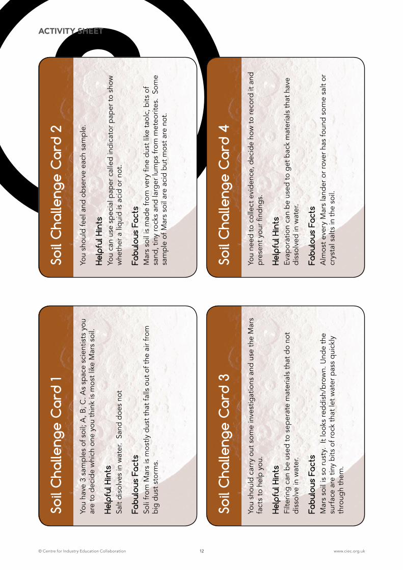
ACTIVITYThe teacher explains that one day, space scientists hope that real samples of Martian soil will be brought back to Earth but in this activity, they will simulate the work of space scientists investigating ‘mock samples’. The Space Agency has given each group three different samples of ‘soil’ and through observations and tests they must decide which might be most like Martian soil. Each child in the group is given a card from Activity sheet 2. The children should take turns at sharing their information with the rest of the group; the key facts will help them in their investigation. This activity is intended to be child-led and therefore they decide what evidence they need to collect and how they might record their observations, measurements and conclusions.
The children should be encouraged to observe each sample of soil closely, to feel the soil texture and note its characteristics. They use small quantities of each sample to carry out further tests. Activity sheet 3, if required, is provided for children to summarise their observations, results and conclusions.
SAFETY NOTES, PRACTICAL TIPS AND GUIDANCE
� Children should wear safety glasses to protect their eyes when evaporating water from salt solution, due to potential spitting.
� Tea light stands should be placed in a tray of sand for safety. Consult ASE’s Be Safe! for further guidance.
� Teachers should ensure that each soil recipe is mixed thoroughly. It is recommended that eachers test the mixtures before the lessons.
� Litmus paper1 can be used to show whether a liquid is acidic or not. Just add a teaspoon of soil to a cup, add water to cover the soil and mix. Then dip the paper into the liquid.
1 If you do not have litmus paper, put a teaspoon of soil into each of two containers. Then, add vinegar to one. If the soil bubbles or fizzes, it’s not acidic. If there’s no reaction, add water to the second sample and mix. Then, add two teaspoons of bicarbonate of soda. If the soil bubbles or fizzes the soil is very acidic.
© Centre for Industry Education Collaboration www.ciec.org.uk7
PLENARY The communications manager from each group reports their observations, measurements, results and conclusions to the class. The results may be collated on the whiteboard for display and discussion by the class. Unusual or unexpected results or observations may be noticed. The teacher can ask some of the following questions:
� Did all groups identify the same sample as most like Martian soil?
� Were there any disagreements?
� How did you decide which sample was the most like Martian soil?
� Did you recover any salt crystals?
� What methods did you use and what evidence did you have?
TEACHERS NOTES: LIFE
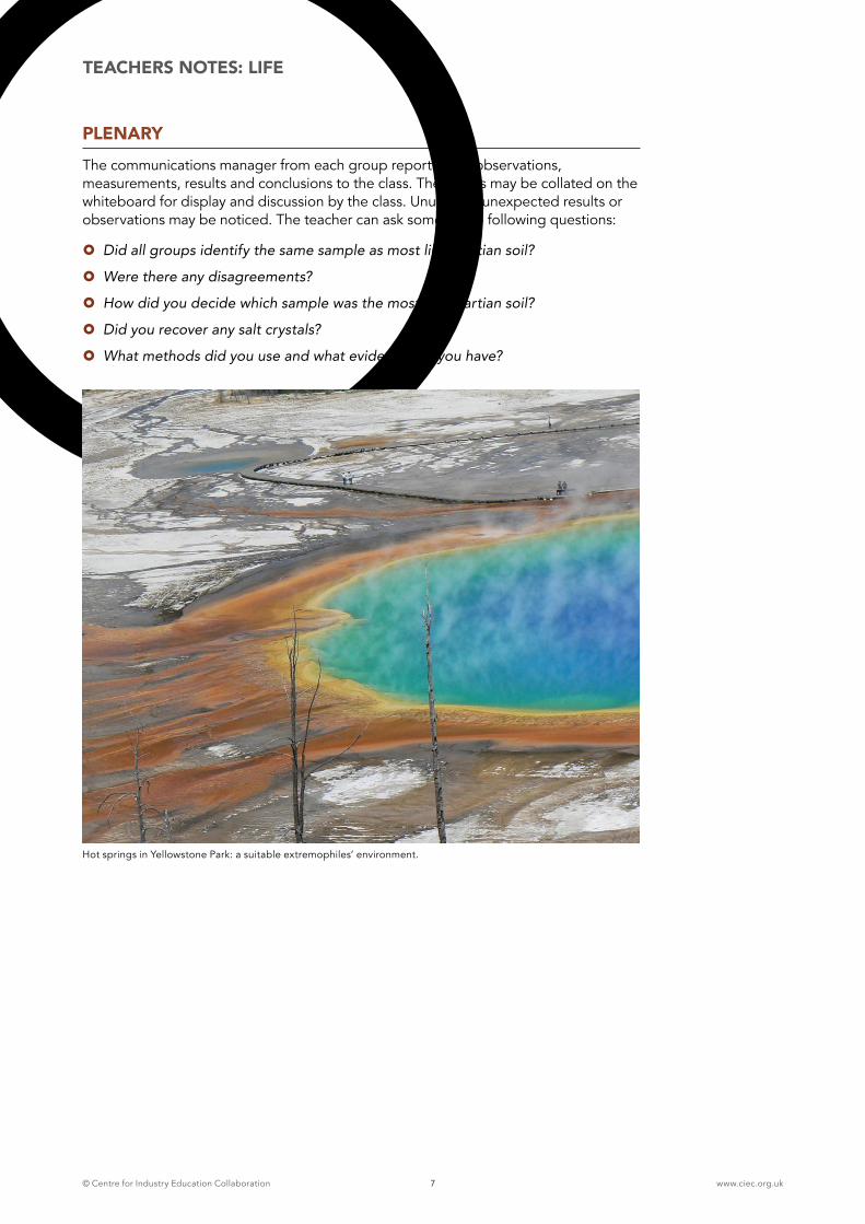
Hot springs in Yellowstone Park: a suitable extremophiles’ environment.
© Centre for Industry Education Collaboration www.ciec.org.uk8
2LEARNING OBJECTIVE
� To know that microorganisms are living organisms too small to be seen
� To know that some microorganisms produce carbon dioxide if suitable nutrients are provided
� To use observations, measurements or other data to draw conclusions
RESOURCES [PER GROUP OF FOUR CHILDREN]
� Activity sheets 4-5
� 2 tsp soil samples A-C
� ¼ cup sugar
� Thermometer
� Teaspoon
� Warm water (45-50°C)
� Plastic cup or beaker
ADVANCE PREPARATION
� Soil samples (Appendix 1)
� Add a packet of dried instant yeast to sample C, ensuring it remains completely salt-free.
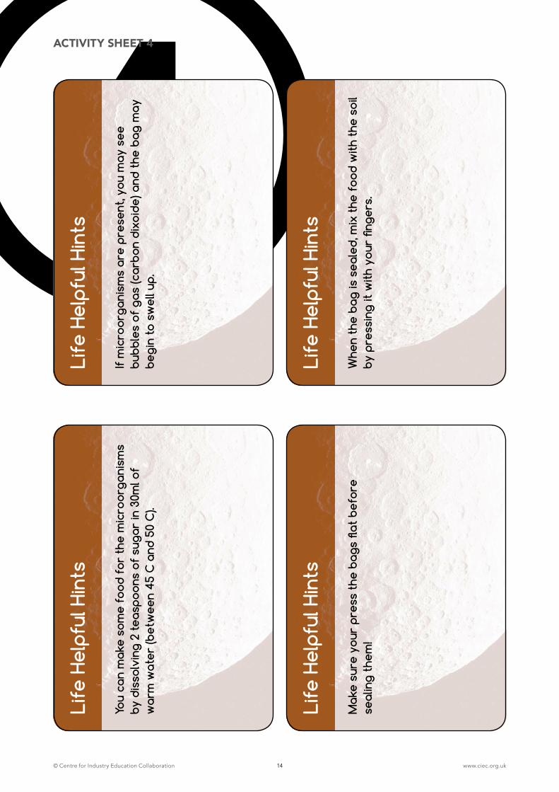
INTRODUCTIONThe teacher explains that the children will look for evidence of the presence of life (microorganisms) in the soils and record their observations. If life is present, adding warm water and sugar to each sample may result in the production of gas (carbon dioxide). Groups are provided with helpful hints and facts cards (Activity sheets 4-5).
ACTIVITYThe children:
1. Dissolve 2 teaspoons of sugar in 30ml of warm water (45-50°C) and quickly add this to the sample.
2. Press the bag to remove air excess air and seal.
3. Mix the contents together by gently pressing the contents with their fingers, ensuring that the bag is completely sealed to prevent escape of carbon dioxide should microorganisms be present.
The children may record the gradual inflation of the samples using drawings, video or photographs.
TEACHERS NOTES: LIFE
ACTIVITY 2: LOOKING FOR EVIDENCE OF MICROORGANISMS
1 HOUR ACTIVITY
© Centre for Industry Education Collaboration www.ciec.org.uk9
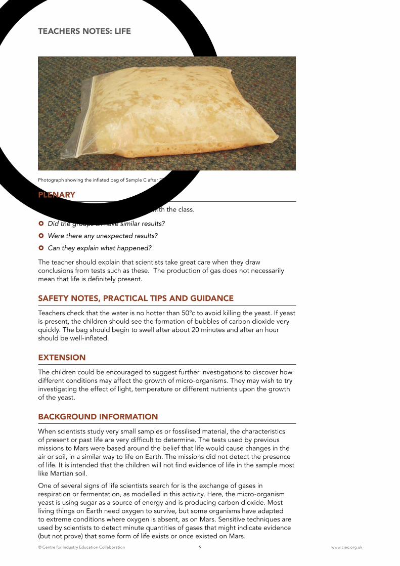
Photograph showing the inflated bag of Sample C after 20 minutes
PLENARYThe children share their observations with the class.
� Did the groups all have similar results?
� Were there any unexpected results?
� Can they explain what happened?
The teacher should explain that scientists take great care when they draw conclusions from tests such as these. The production of gas does not necessarily mean that life is definitely present.
SAFETY NOTES, PRACTICAL TIPS AND GUIDANCETeachers check that the water is no hotter than 50°c to avoid killing the yeast. If yeast is present, the children should see the formation of bubbles of carbon dioxide very quickly. The bag should begin to swell after about 20 minutes and after an hour should be well-inflated.
EXTENSIONThe children could be encouraged to suggest further investigations to discover how different conditions may affect the growth of micro-organisms. They may wish to try investigating the effect of light, temperature or different nutrients upon the growth of the yeast.
BACKGROUND INFORMATIONWhen scientists study very small samples or fossilised material, the characteristics of present or past life are very difficult to determine. The tests used by previous missions to Mars were based around the belief that life would cause changes in the air or soil, in a similar way to life on Earth. The missions did not detect the presence of life. It is intended that the children will not find evidence of life in the sample most like Martian soil.
One of several signs of life scientists search for is the exchange of gases in respiration or fermentation, as modelled in this activity. Here, the micro-organism yeast is using sugar as a source of energy and is producing carbon dioxide. Most living things on Earth need oxygen to survive, but some organisms have adapted to extreme conditions where oxygen is absent, as on Mars. Sensitive techniques are used by scientists to detect minute quantities of gases that might indicate evidence (but not prove) that some form of life exists or once existed on Mars.
TEACHERS NOTES: LIFE
© Centre for Industry Education Collaboration www.ciec.org.uk10
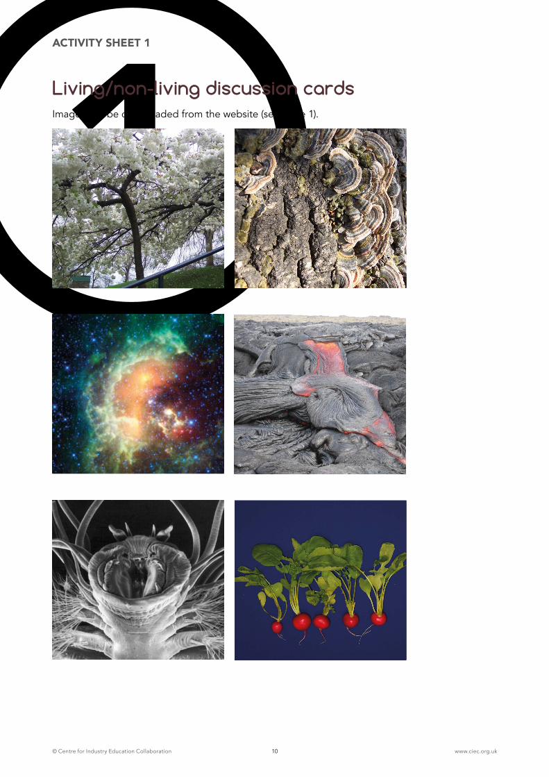
1ACTIVITY SHEET 1
Living/non-living discussion cardsImages can be downloaded from the website (see page 1).
© Centre for Industry Education Collaboration www.ciec.org.uk11
1ACTIVITY SHEET 1
© Centre for Industry Education Collaboration www.ciec.org.uk12
Soil
Cha
lleng
e C
ard
1
You
have
3 s
ampl
es o
f soi
l; A
, B, C
. As
spac
e sc
ient
ists
you
ar
e to
dec
ide
whi
ch o
ne y
ou t
hink
is m
ost l
ike
Mar
s so
il.
Help
ful H
ints
Sa
lt di
solv
es in
wat
er.
Sand
doe
s no
t
Fabu
lous
Fac
ts
Soli
from
Mar
s is
mos
tly d
ust t
hat f
alls
out
of t
he a
ir fr
om
big
dus
t sto
rms.
2So
il C
halle
nge
Car
d 2
You
shou
ld fe
el a
nd o
bse
rve
each
sam
ple.
Help
ful H
ints
Yo
u ca
n us
e sp
ecia
l pap
er c
alle
d in
dica
tor p
aper
to s
how
w
heth
er a
liq
uid
is a
cid
or n
ot.
Fabu
lous
Fac
ts
Mar
s so
il is
mad
e fr
om v
ery
fine
dus
t lik
e ta
olc,
bits
of
sand
, tin
y ro
cks
and
larg
er lu
mp
s fr
om m
eteo
rites
. So
me
sam
ple
of M
ars
soil
are
acid
but
mos
t are
not
.
Soil
Cha
lleng
e C
ard
3
You
shou
ld c
arry
out
som
e in
vest
igat
ions
and
use
the
Mar
s fa
cts
to h
elp
you.
Help
ful H
ints
Fi
lterin
g ca
n b
e us
ed to
sep
erat
e m
ater
ials
tha
t do
not
diss
olve
in w
ater
.
Fabu
lous
Fac
ts
Mar
s so
il is
so
rust
y. I
t loo
ks re
ddi
sh/b
row
n. U
nde
the
surf
ace
are
tiny
bits
of r
ock
that
let w
ater
pas
s q
uick
ly
thro
ugh
them
.
Soil
Cha
lleng
e C
ard
4
You
need
to c
olle
ct e
vid
ence
, dec
ide
how
to re
cord
it a
nd
pre
sent
you
r find
ngs.
Help
ful H
ints
Ev
apor
atio
n ca
n b
e us
ed to
get
bac
k m
ater
ials
tha
t hav
e di
ssol
ved
in w
ater
.
Fabu
lous
Fac
ts
Alm
ost e
very
Mar
s la
nder
or r
over
has
foun
d so
me
salt
or
crys
tal s
alts
in t
he s
oil.
ACTIVITY SHEET
© Centre for Industry Education Collaboration www.ciec.org.uk13
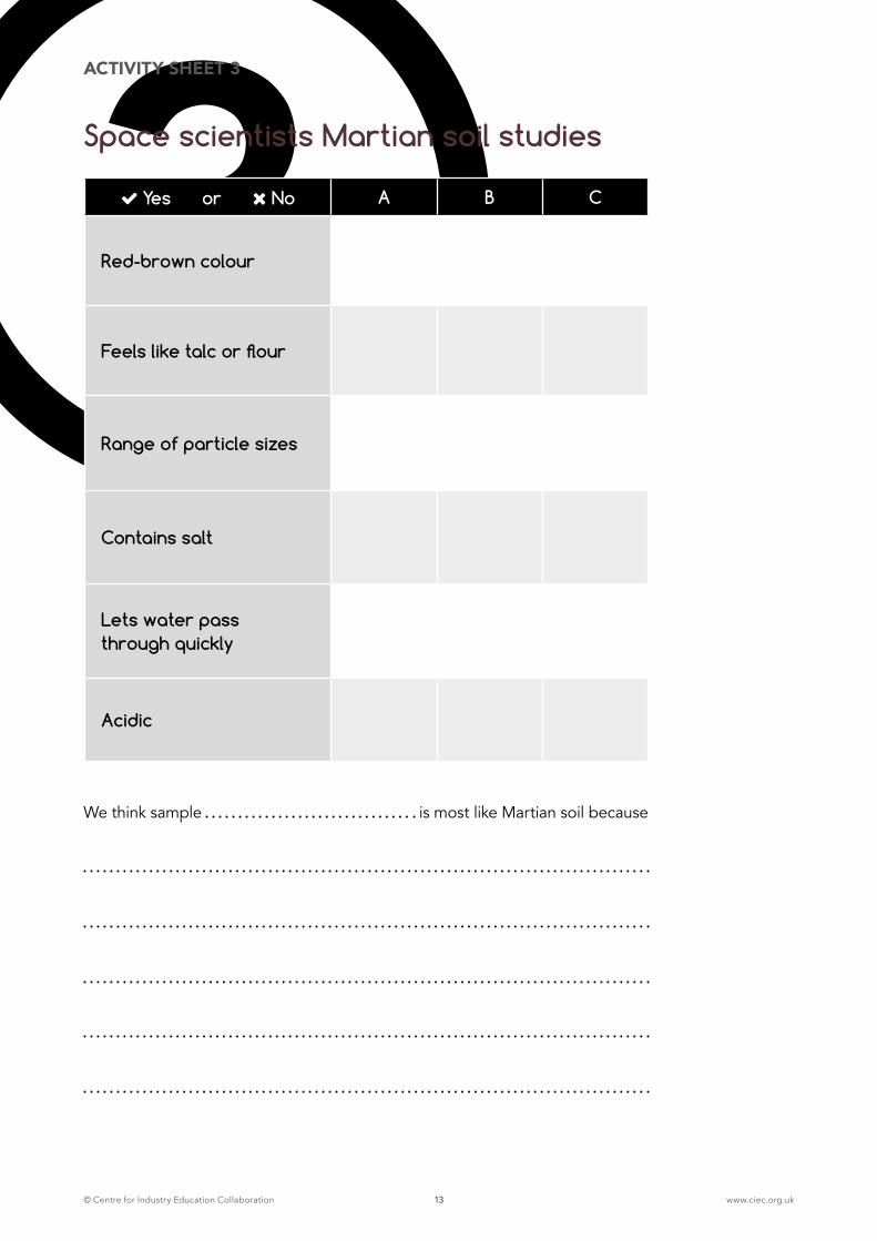
3ACTIVITY SHEET 3
Space scientists Martian soil studies
Yes or No A B C
Red-brown colour
Feels like talc or flour
Range of particle sizes
Contains salt
Lets water pass through quickly
Acidic
We think sample is most like Martian soil because
© Centre for Industry Education Collaboration www.ciec.org.uk14
4Li
fe H
elpf
ul H
ints
You
can
mak
e so
me
food
for
the
mic
roor
gani
sms
by d
isso
lvin
g 2
teas
poon
s of
sug
ar in
30m
l of
war
m w
ater
(bet
wee
n 45
C a
nd 5
0 C
).
Life
Hel
pful
Hin
ts
If m
icro
orga
nism
s ar
e pr
esen
t, yo
u m
ay s
ee
bubb
les
of g
as (c
arbo
n di
xoid
e) a
nd t
he b
ag m
ay
begi
n to
sw
ell u
p.
Life
Hel
pful
Hin
ts
Mak
e su
re y
our
pres
s th
e ba
gs fl
at b
efor
e se
alin
g th
em!
Life
Hel
pful
Hin
ts
Whe
n th
e ba
g is
sea
led,
mix
the
foo
d w
ith t
he s
oil
by p
ress
ing
it w
ith y
our
finge
rs.
ACTIVITY SHEET 4
Life Helpful Hints
© Centre for Industry Education Collaboration www.ciec.org.uk15
5Li
fe F
abul
ous
Fact
s
Livi
ng t
hing
s ne
ed w
ater
and
foo
d an
d th
e ri
ght
cond
ition
s to
sur
vive
.
Mar
s is
ver
y co
ld, d
ry, d
usty
and
win
dy.
IT h
as h
ardl
y an
y ox
ygen
and
has
a t
hird
of
Eart
h’s
grav
ity.
Life
Fab
ulou
s Fa
cts
Scie
ntis
ts b
elie
ve t
hat
wat
er e
xist
ed o
n M
ars
1 m
illio
n ye
ars
ago.
Wat
er m
ay b
e pr
esen
t un
der
the
surf
ace
of M
ars.
Life
Fab
ulou
s Fa
cts
Mic
roor
gani
sms
can
live
in v
ery
extr
eme
plac
es
on E
arth
. The
y m
ay o
nce
have
live
d on
Mar
s!
Mos
t liv
ing
thin
gs n
eed
oxyg
en b
ut n
ot a
ll m
icro
orga
nism
s do
.
Life
Fab
ulou
s Fa
cts
Mic
roor
gani
sms
may
pro
duce
gas
whe
n gi
ven
wat
er a
nd f
ood.
Spac
e sc
ient
ists
tes
t so
il sa
mpl
es f
or m
ater
ials
th
at h
ave
com
e fr
om li
ving
thi
ngs
in t
he p
ast.
ACTIVITY SHEET 5
© Centre for Industry Education Collaboration www.ciec.org.uk16
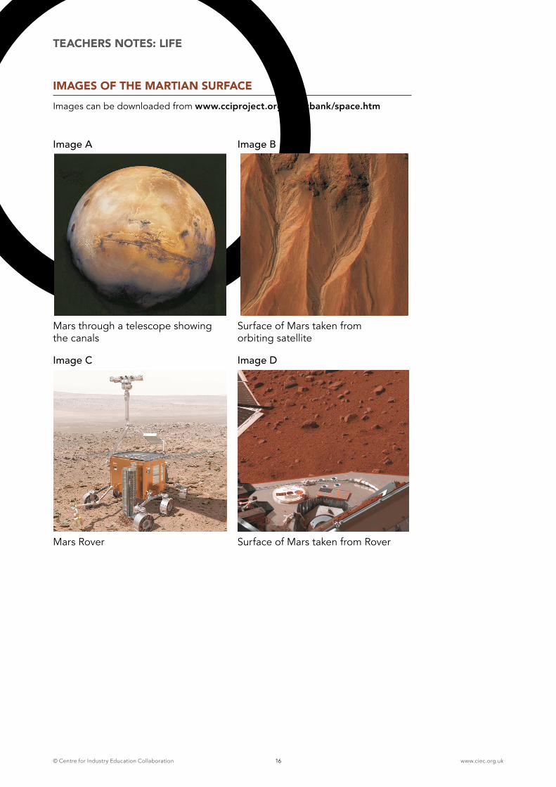
IMAGES OF THE MARTIAN SURFACEImages can be downloaded from www.cciproject.org/topicbank/space.htm
TEACHERS NOTES: LIFE
Mars through a telescope showing the canals
Surface of Mars taken from orbiting satellite
Mars Rover
Image A
Image C
Image B
Image D
Surface of Mars taken from Rover
© Centre for Industry Education Collaboration www.ciec.org.uk17
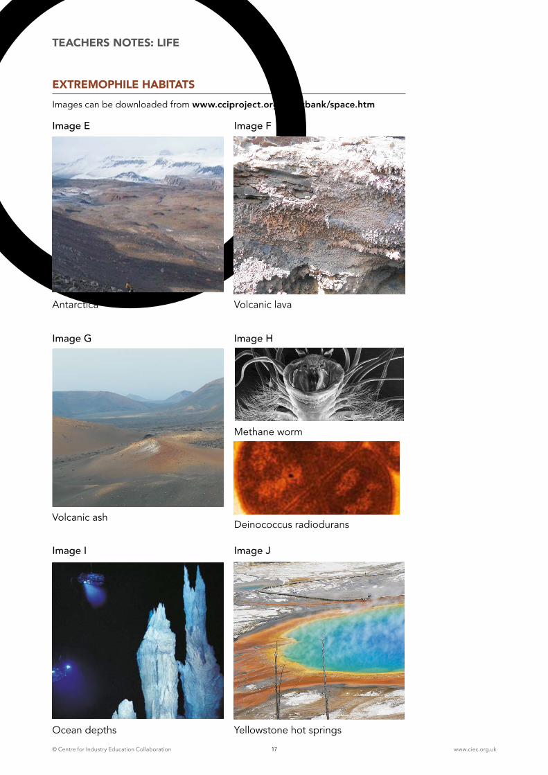
EXTREMOPHILE HABITATSImages can be downloaded from www.cciproject.org/topicbank/space.htm
TEACHERS NOTES: LIFE
Antarctica Volcanic lava
Volcanic ash
Ocean depths
Deinococcus radiodurans
Methane worm
Yellowstone hot springs
Image E
Image G
Image I
Image F
Image H
Image J
© Centre for Industry Education Collaboration www.ciec.org.uk18
½ HOUR ACTIVITY3TEACHERS NOTES: LANDSCAPE
ACTIVITY 3: LANDSCAPE DISCUSSION
LEARNING OBJECTIVES
� To know that science is about thinking creatively to try to explain how living and non-living things work, and to establish links between causes and effects.
� To know that comparing Mars’ key landscape features with similar features on Earth can help us to understand their formation.
RESOURCES (PER GROUP OF FOUR CHILDREN)
� Activity sheets 6-7 and 12
� Images K-U (Q for teacher use only (see page 36)
ADVANCED PREPARATIONActivity sheets made into cards
INTRODUCTIONThe teacher explains that the new Mars rover, searching for evidence of past or present life, will look in particular for the presence of water. Where water is or has been there is a chance of discovering evidence of life. On Earth, where volcanic heat and water interact, scientists have found life. The groups study images K-P. The task is to identify what each might be and how each might have been formed by comparing images of similar features from Earth to aid identification (Images R-U).
Groups may choose one of the key features and perform one of three practical tasks. The three practical tasks use models to simulate how the key Martian features may have been formed. Children use Activity sheets 6-7 to help them decide which feature to investigate. The whole class could try all three activities (3-4 hours) or a third of the class could each investigate one feature and report back to the others (1- 1½ hours). Later, they will compare their ideas with those of the ‘experts’ (Activity sheet 12). Finally, they share their ideas and evidence and suggest suitable locations for the rover landing and sampling sites.
Practical tasks, described in detail later in this section, include:
1. Exploring how the mass, size, shape, velocity, and angle of impact of falling bodies (meteorites) and the surface might affect the size and shape of the crater produced.
2. Investigating lava flow and layering patterns by making a ‘volcano’.
3. Studying patterns produced by flowing water across a surface.
© Centre for Industry Education Collaboration www.ciec.org.uk19
6La
ndsc
ape
Help
ful H
ints
Com
pari
ng im
ages
tak
en o
n Ea
rth,
may
hel
p yo
u to
iden
tify
impo
rtan
t fe
atur
es o
n M
ars.
Land
scap
e He
lpfu
l Hin
ts
Doi
ng p
ract
ical
tes
ts a
nd in
vest
igat
ions
may
hel
p yo
u to
find
out
how
the
se f
eatu
res
wer
e m
ade.
Scie
ntis
ts c
all t
his
‘mod
ellin
g’.
Land
scap
e He
lpfu
l Hin
ts
Aft
er y
our
expe
rim
ents
, rea
d th
e ex
pert
s in
form
atio
n ab
out
the
impo
rtan
t fe
atur
es y
ou
have
bee
n in
vest
igat
ing.
You
cou
ld fi
nd o
ut m
ore
from
boo
ks o
n th
e in
tern
et.
Land
scap
e He
lpfu
l Hin
ts
Talk
abo
ut y
our
obse
rvat
ions
and
mea
sure
men
ts.
How
do
you
thin
k th
e fe
atur
e w
as m
ade?
Do
your
con
clus
ions
agr
ee w
ith t
he e
xper
ts?
ACTIVITY SHEET 6
© Centre for Industry Education Collaboration www.ciec.org.uk20
7La
ndsc
ape
Fabu
lous
Fac
ts
A c
rate
r is
a h
ole,
usu
ally
cir
cula
r in
sha
pe, m
ade
whe
n a
piec
e of
roc
k (m
eteo
rite
) or
an ic
e/ro
ck
mix
ture
(com
et) f
rom
out
er s
pace
cra
shes
into
a
rock
y pl
anet
suc
h as
Mar
s.
Land
scap
e Fa
bulo
us F
acts
Mar
s is
ver
y co
ld a
nd t
empe
ratu
res
aver
age
-5
5 C
but
it m
ay n
ot a
lway
s ha
ve b
een
so c
old.
T
here
cou
ld b
e ic
e on
or
unde
r th
e su
rfac
e.
Scie
ntis
ts b
elie
ve t
hat
whe
re w
ater
is, o
r ha
s be
en t
here
, may
may
be
a ch
ance
of
findi
ng
evid
ence
of
Life
.
Land
scap
e Fa
bulo
us F
acts
Volc
anoe
s an
d/or
lava
flow
s ca
n be
fou
nd o
n al
l la
rge
rock
y pl
anet
s . L
ava
can
mak
e ch
anne
ls
sim
ilar
to t
hose
mad
e by
wat
er.
Land
scap
e Fa
bulo
us F
acts
Whe
re h
eat
from
vol
cano
es a
nd w
ater
are
clo
se
toge
ther
on
Eart
h, s
cien
tists
are
find
ing
life.
In
hot
spri
ngs
they
hav
e fo
und
diff
eren
t ki
nds
of
livin
g th
ings
.
© Centre for Industry Education Collaboration www.ciec.org.uk21
4TEACHERS NOTES: LANDSCAPE
ACTIVITY 4: INVESTIGATING CRATERS
LEARNING OBJECTIVES
� To use simple equipment and materials to make observations and measurements
� To use observations and measurements to draw conclusions
� To know that the size of a crater is dependent upon the size, weight or velocity of the object dropped
RESOURCES
� Activity sheet 8 cut into cards
� Tray ½ filled with sand
� A variety of ‘meteorites’ (e.g. marbles, rubber balls, stones)
� Tube for safely directing dropping/rolling ‘meteorites’
� Measuring device (see diagram on Activity sheet 8)
� Ruler
� Metre stick
ACTIVITY The children begin by investigating the effects of dropping various masseses , such as marbles, into a tray of sand. The children should be alerted to the safety issues when dropping objects. Using a tube through which to drop the objects would direct them safely to the tray.
Trays could be placed on the floor to allow the height of drop to be increased safely. Encourage discussion about fair testing, how the speed, density, size of the projectile is important, and how and why this affects the size of the crater produced.
PLENARY The communication manager from each group shares their results with the class. The results can be collated and displayed on the whiteboard for comparison. Interesting patterns or unusual figures could be highlighted. The importance of replication of results is emphasised. This is also an opportunity for graphs to be constructed and suitable graphing software to be employed. The children compare their craters with the images from Mars:
� Are they similar or not? Why?
� What are the limitations of the model?
� How would they improve their tests? Were they fair?
� Were the results reliable? Were they repeated?
� What have they learned about real crater formation?
1 HOUR ACTIVITY
© Centre for Industry Education Collaboration www.ciec.org.uk22
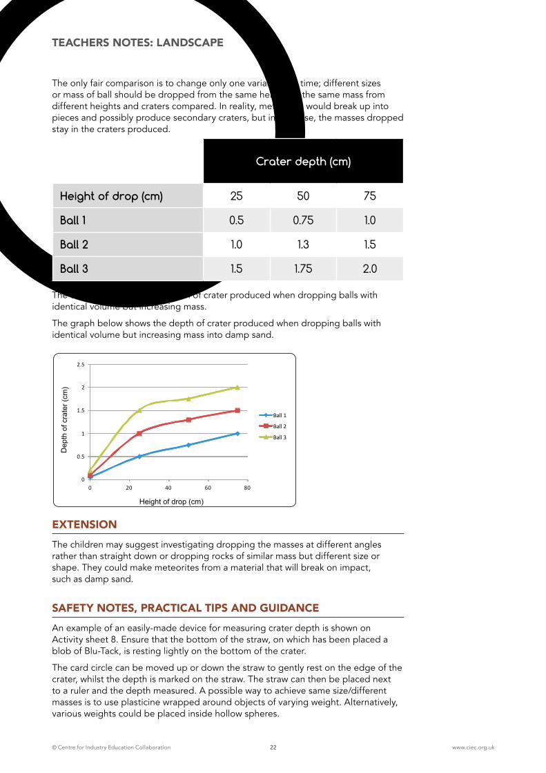
The only fair comparison is to change only one variable at a time; different sizes or mass of ball should be dropped from the same height, or the same mass from different heights and craters compared. In reality, meteorites would break up into pieces and possibly produce secondary craters, but in this case, the masses dropped stay in the craters produced.
The table below shows the depth of crater produced when dropping balls with identical volume but increasing mass.
The graph below shows the depth of crater produced when dropping balls with identical volume but increasing mass into damp sand.
EXTENSIONThe children may suggest investigating dropping the masses at different angles rather than straight down or dropping rocks of similar mass but different size or shape. They could make meteorites from a material that will break on impact, such as damp sand.
SAFETY NOTES, PRACTICAL TIPS AND GUIDANCEAn example of an easily-made device for measuring crater depth is shown on Activity sheet 8. Ensure that the bottom of the straw, on which has been placed a blob of Blu-Tack, is resting lightly on the bottom of the crater.
The card circle can be moved up or down the straw to gently rest on the edge of the crater, whilst the depth is marked on the straw. The straw can then be placed next to a ruler and the depth measured. A possible way to achieve same size/different masses is to use plasticine wrapped around objects of varying weight. Alternatively, various weights could be placed inside hollow spheres.
Dropping balls
Height of drop (cm)
Depth
of cra
ter
(cm
)
0
0.5
1
1.5
2
2.5
0 20 40 60 80
Ball 1
Ball 2
Ball 3
Crater depth (cm)
Height of drop (cm) 25 50 75
Ball 1 0.5 0.75 1.0
Ball 2 1.0 1.3 1.5
Ball 3 1.5 1.75 2.0
TEACHERS NOTES: LANDSCAPE
© Centre for Industry Education Collaboration www.ciec.org.uk23
5TEACHERS NOTES: LANDSCAPE
ACTIVITY 5: INVESTIGATING POWDERY SURFACES
LEARNING OBJECTIVES
� To understand that the greater the size, mass or velocity of an object dropped, the greater the impact crater produced
� To know that layers under a surface may be exposed or material ejected upon impact of a falling object body text
RESOURCES (PER GROUP OF FOUR CHILDREN)
� As in Activity 3 plus:
� A tray ½ filled with layers of sand, flour and thin top layer of chocolate
� Powder (to represent layers of Martian ‘soil’)
� Basalt rock samples (optional)
� 4 pairs of safety glasses
INTRODUCTION In order to simulate what may happen to the surface and underlying layers of Mars when a meteorite impacts, a second tray can be prepared to represent the Martian surface. The teacher points out that the cocoa/chocolate powder could be the iron oxide (rust) covering and the layer below represent the rocks of Mars, then explains what types they might be, e.g. Basalt (rocks from volcanoes). If rock samples are available in school, they could be shown to the children.
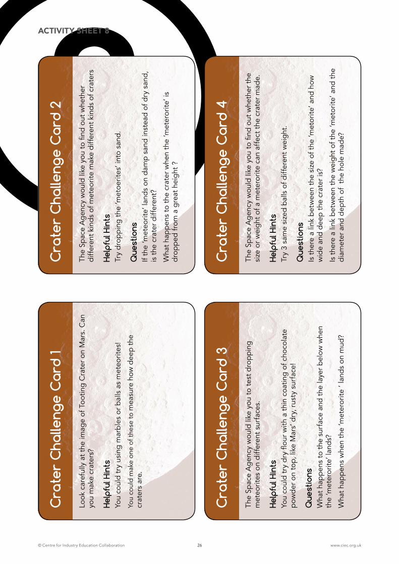
ACTIVITY The children choose suitable ‘meteorites’ and drop them on to the surface. After one or two drops, the children are encouraged to look at the pattern produced e.g. ejecta blanket (ejected matter that surrounds a crater) of white flour, and may notice that the material which was once low down is now on top. Explain that this can help scientists, allowing them access to look at the rocks under the surface of Mars. The children continue to investigate dropping meteorites of various sizes and from different heights. They can smooth the surface and add a fresh layer of flour and chocolate powder when necessary.
PLENARYThe children look again at the images and compare the patterns produced by their investigations with those on the images from Mars. Can they find similarities? What conclusions can they make?
SAFETY NOTES, PRACTICAL TIPS AND GUIDANCESince there is a danger of fine particles being dispersed into the air, it is advised that the children wear safety glasses during this investigation to prevent fine powder entering the eyes and care should be taken to prevent powder inhalation.
1 HOUR ACTIVITY
© Centre for Industry Education Collaboration www.ciec.org.uk24
6TEACHERS NOTES: LANDSCAPE
ACTIVITY 6: INVESTIGATING MUDDY SURFACES
LEARNING OBJECTIVES
� To investigate links between the size, weight or velocity of an object dropped onto a surface and the distance travelled by the material ejected
� To use observations and measurements to draw conclusions
RESOURCES (PER GROUP OF FOUR CHILDREN)
� Activity sheet 8 cut into cards
� A variety of ‘meteorites’ (eg marbles/rubber balls/stones).
� Tube for safely directing dropping/rolling ‘meteorites’
� Mud
� Large sheet of paper/card
� Ruler
� Metre stick
ACTIVITY The children are challenged to predict what patterns might be produced if meteorites had landed onto a wet Martian surface. They can prepare a mix of soil and water. The mud should be sufficiently sloppy to eject mud splats when the mass is dropped! The mud is placed into the middle of a large sheet of paper or card. The children drop a variety of ‘meteorites’ into the mud from different heights and observe the patterns produced. They measure the distance travelled by the mud ejected on impact.
PLENARYThe teacher shows the children the information about Tooting Crater provided by the experts (Activity sheet 12). The children look again at the images L and M of Tooting Crater and look for similarities between the images and the patterns they produced in their investigations. Teachers can ask the following questions:
� Did they find a link between the heights of drop and distance the mud travelled or size/weight of body dropped and the area covered by the splats?
� What do they think produced the patterns in the images?
� Do their conclusions agree with those of the experts?
EXTENSIONThe children could be encouraged to discover more about the key landscape features of Mars and reinforce their understanding by further reading or through internet-based research.
1 HOUR ACTIVITY
© Centre for Industry Education Collaboration www.ciec.org.uk25
SAFETY NOTES, PRACTICAL TIPS AND GUIDANCEIt is advisable to use soil rather than compost and to conduct this investigation outdoors. Dropping masses onto mud and observing ejecta would simulate meteorites landing in wet terrain. Allowing the splattered surface to dry would enable further observations and comparisons to be made between the images of Martian channels and the patterns produced. Children should wash their hands thoroughly after handling soil or wear protective gloves during the activity. For further information, see ASE’s Be Safe!1
BACKGROUND INFROMATION FOR TEACHERSAn object’s weight depends upon gravity. Since this investigation is taking place under the same gravitational conditions, we can use either weight or mass, depending upon the level of understanding of the children. The higher the drop, the greater the speed on impact. The greater the speed, the larger the impact crater. When dropped from a given height, the greater the mass (weight) the larger the crater. When dropped from a given height, the greater the size (volume), the larger the crater.
Impact craters are caused when a body (bolide) collides with a planet. It may be composed from rock (meteorite) or ice or a mixture of the two (comet). A crater’s size and features depend on the nature of the surface and the speed, size and mass of the body. The speed of the balls dropped in this case is low. In real impacts, compression shock waves run through the bolide and the surface; the body or meteorite would vaporise or be broken into small pieces. The target material is melted or fractured. Rebounds of the bolide cause further excavation of the surface and possible collapse caused by gravity. Secondary craters can be formed and material can be ejected on impact.
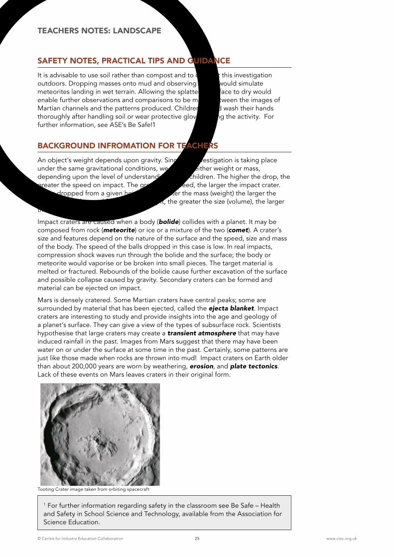
Mars is densely cratered. Some Martian craters have central peaks; some are surrounded by material that has been ejected, called the ejecta blanket. Impact craters are interesting to study and provide insights into the age and geology of a planet’s surface. They can give a view of the types of subsurface rock. Scientists hypothesise that large craters may create a transient atmosphere that may have induced rainfall in the past. Images from Mars suggest that there may have been water on or under the surface at some time in the past. Certainly, some patterns are just like those made when rocks are thrown into mud! Impact craters on Earth older than about 200,000 years are worn by weathering, erosion, and plate tectonics. Lack of these events on Mars leaves craters in their original form.
TEACHERS NOTES: LANDSCAPE
1 For further information regarding safety in the classroom see Be Safe – Health and Safety in School Science and Technology, available from the Association for Science Education.
Tooting Crater image taken from orbiting spacecraft
© Centre for Industry Education Collaboration www.ciec.org.uk26
8C
rate
r C
halle
nge
Car
d 1
Look
car
eful
ly a
t the
imag
e of
Too
ting
Cra
ter o
n M
ars.
Can
yo
u m
ake
crat
ers?
Help
ful H
ints
Yo
u co
uld
try
usin
g m
arbl
es o
r bal
ls a
s m
eteo
rites
!
You
coul
d m
ake
one
of t
hese
to m
easu
re h
ow d
eep
the
crat
ers
are.
Cra
ter
Cha
lleng
e C
ard
2
The
Spac
e A
gen
cy w
ould
like
you
to fi
nd o
ut w
heth
er
diff
eren
t kin
ds
of m
eteo
rite
mak
e di
ffer
ent k
ind
s of
cra
ters
Help
ful H
ints
Try
dro
ppi
ng t
he ‘m
etoe
rites
’ int
o sa
nd.
Que
stio
ns
If th
e ‘m
eteo
rite’
land
s on
dam
p sa
nd in
stea
d of
dry
san
d,
is t
he c
rate
r diff
eren
t?
Wha
t hap
pen
s to
the
cra
ter w
hen
the
‘met
eror
ite’ i
s d
rop
ped
from
a g
reat
hei
ght
?
Cra
ter
Cha
lleng
e C
ard
3
The
Spac
e A
gen
cy w
ould
like
you
to te
st d
rop
ping
m
eteo
rites
on
diff
eren
t sur
face
s.
Help
ful H
ints
Yo
u co
uld
try
dry
flou
r with
a t
hin
coat
ing
of c
hoco
late
p
owd
er o
n to
p, li
ke M
ars’
dry
, rus
ty s
urfa
ce!
Que
stio
ns
Wha
t hap
pen
s to
the
sur
face
and
the
laye
r bel
ow w
hen
the
‘met
eror
ite’ l
and
s?
Wha
t hap
pen
s w
hen
the
‘met
eror
ite ‘
land
s on
mud
?
Cra
ter
Cha
lleng
e C
ard
4
The
Spac
e A
gen
cy w
ould
like
you
to fi
nd o
ut w
heth
er t
he
size
or w
eig
ht o
f a m
eter
orite
can
aff
ect t
he c
rate
r mad
e.
Help
ful H
ints
Try
3 sa
me
size
d b
alls
of d
iffer
ent w
eig
ht.
Que
stio
nsIs
the
re a
link
bet
wee
n th
e si
ze o
f the
‘met
orite
’ and
how
w
ide
and
dee
p th
e cr
ater
is?
Is t
here
a li
nk b
etw
een
the
wei
ght
of t
he ‘m
etor
ite’ a
nd t
he
diam
eter
and
dep
th o
f th
e ho
le m
ade?
ACTIVITY SHEET 8
© Centre for Industry Education Collaboration www.ciec.org.uk27
7TEACHERS NOTES: LANDSCAPE
ACTIVITY 7: VOLCANOES AND LAVA
LEARNING OBJECTIVES
� To describe changes that occur when materials are mixed or heated
� To use models to mimic the eruption of a volcano and lava flowbody text
RESOURCES (PER GROUP OF FOUR CHILDREN)
Two methods are described for this activity. Option A mimics volcanic eruption and lava flow by using vinegar and sodium bicarbonate. Option B models lava flow by using melted chocolate. The teacher may choose either one. If choosing option A, teachers might want to point out to children that it is not a chemical change like this one that causes volcanoes to erupt but melting of the rock and pressure from within the Earth.
Option A: Vinegar and Sodium bicarbonate volcano
Option B: Chocolate volcano
Activity sheets 9-10 Activity sheets 9-10
A3 sheet of card Large card or plate
Small egg cup or tealight container Filter funnel or cardboard cone
1/2 cup bicarbonate of soda 3 x 100g baking chocolate (white, milk and dark
1/2 cup clear vinegar 3 small jugs or beakers
Teaspoon Apple corer
2 Plastic cups or containers Plastic straw
4 colours play dough* or plasticine Microwave and 3 microwavable bowls or hob, pan and glass bowl
Cylinder
2 waterproof markers
Paper towes
(5-10ml)ml measuring cylinder or syringe
Pipette
Large straw or transparent biro case
Cocktail stick or match stick
* there are many playdough recipes on the internet
1 HOUR ACTIVITY
© Centre for Industry Education Collaboration www.ciec.org.uk28
TEACHERS NOTES: LANDSCAPE
OPTION A: VINEGAR AND SODIUM BICARBONATE VOLCANO
ADVANCED PREPARATIONA die made or covered with the numbers 3, 4, 4, 5, 5, 6.
INTRODUCTIONThe teacher explains that the children are going use vinegar and sodium bicarbonate to mimic the eruption of a volcano and flow of lava. A set of volcano facts cards (Activity sheet 10) is provided. A throw of a die will decide the number of ‘eruptions’ that the children will model.
ACTIVITYEach group throws the die to determine how many eruptions there will be. The children then follow the first set of instructions on Activity sheet 9 to produce the ‘foam’ lava and record the flow with layers of coloured play dough. The teacher should encourage the groups to make a drawing of the distance, pattern and shape of each lava flow. Finally, a plastic drinking straw may be used to remove samples from the play dough layers.
SAFETY NOTES, PRACTICAL TIPS AND GUIDANCEIdeally, more than one group will choose to try the volcano activity, and then on completion, the volcanoes and their lava layers may be swapped between groups. Each group can map and take samples from a volcano whose pattern of lava flow is different from their own. This will simulate more closely how geologists study the geologic history of an area or feature. The children are encouraged to look carefully at the model volcano and suggest how they could discover what is below the surface without lifting the play dough layers. They should decide where to drill for samples and how many they would need in order to obtain most information. Straws or transparent biro cases can be used to simulate the drill taking the samples. They should be pushed gently and deeply through all the layers of play dough at each sampling point. Extracting the sample requires care.
© Centre for Industry Education Collaboration www.ciec.org.uk29
TEACHERS NOTES: LANDSCAPE
OPTION B: CHOCOLATE VOLCANO
ADVANCE PREPARATIONFor the ‘volcano’ either block the tip of a filter funnel or make a small cone from card.
INTRODUCTION The children follow the second set of instructions on Activity sheet 9 to produce layers of chocolate lava flow. A roll of the die determines the number of lava flows. The children could take photographs or draw the shape of the lava flow whilst waiting for the chocolate to begin to solidify. They can try putting obstacles , such as small stones in the lava path and observing the effect. When all thel ayers have been added, the children may then take samples of the chocolate lava layers, using an apple corer.
SAFETY NOTES, PRACTICAL TIPS AND GUIDANCEThe tables can be covered with newspapers or plastic sheeting. The children should wear aprons, old shirts or lab coats to protect clothes. Melt the chocolate in either a microwave oven or on the hob in a bowl over a pan of hot water. Stirring a little warm water into the melted chocolate improves its runniness, and reduces the amount of chocolate needed. Have 3 small beakers or jugs available for the children to collect the chocolate. As a guide, a minute in the microwave oven on full power should be sufficient to melt 100g chocolate.
PLENARYThe children look again at the images N and S and read the information about Volcano Ceraunius Tholus provided by the experts (Activity sheet 12). They report upon the success of their models and sampling and consider:
� What have they learned about lava flow patterns and layering?
� Did the lava always flow in the same direction or as far?
� Did they observe any lava flow patterns similar to the image on Mars?
� Do they agree with the experts’ opinions on how Ceraunius Tholus was formed?
� Do they believe that the rover should take samples from this area?
They should realise that the oldest flows are the deepest layers on the model and the newest are on the surface. They could reflect upon whether the process was similar to real life.
BACKGROUND INFORMATIONPhoto geologists use images taken by planes and satellites to interpret the history of a planet’s surface. If they can get to the surface, they take samples and draw maps.
Not all lava flows are buried by the next. Sometimes older flows can be visible. The direction of the lava flow can be affected by previous flows, by old lava or channels on the surface, and also by the speed of the eruption. The energy of an eruption can determine how far the lava can flow and how easily it passes obstructions. In real field studies, geologists would, of course, be unable to take such deep samples through all the lava layers. On Mars, scientists hope that a new rover will drill below the surface in order for samples to be collected and analysed.
© Centre for Industry Education Collaboration www.ciec.org.uk30
9Make a volcano1. Put an egg cup in the centre of a big piece of card
2. Put a teaspoon of bicarbonate of soda into the egg cup. Slowly pour 5-10 ml of vinegar to the cup. Your volcano should fizz!
3. When the lava has stopped flowing, quickly draw a line all around the lava and then mop it up with a paper towel.
4. Take a ball of play dough and roll it flat. Completely cover the shape left by the lava with the play dough – but not the egg cup!
5. Soak up the mixture from the egg cup with a paper towel. Place the egg cup in the centre of the flow and repeat the eruption. Use a different colour of play dough each time, and don’t worry if the last layer of play dough is covered a little.
6. When you have finished, try taking a sample of the lava layers by using a large straw. Push the straw vertically down into the play dough, twist and pull out the straw. Cut the straw just above the top of the play dough sample. Push out the sample with a cocktail stick or matchstick.
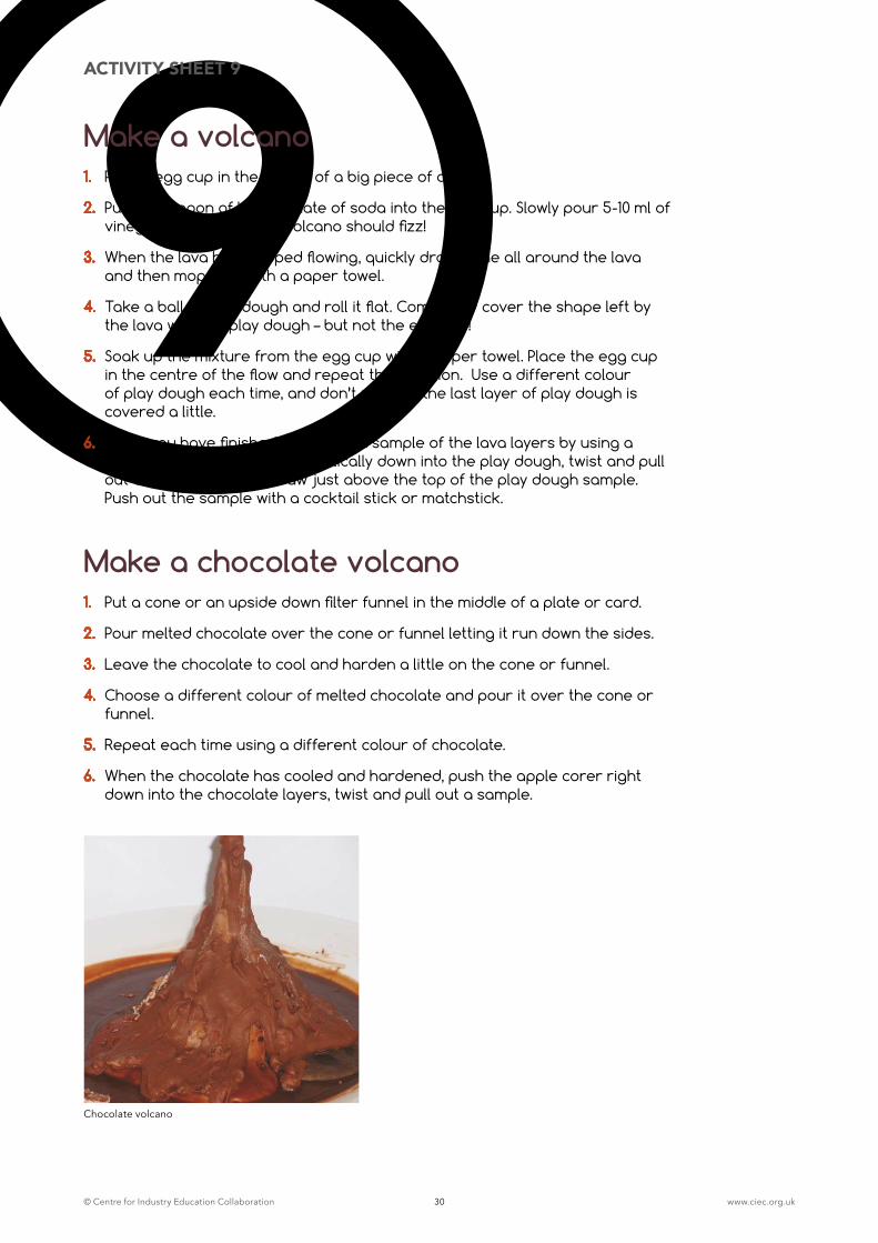
Make a chocolate volcano1. Put a cone or an upside down filter funnel in the middle of a plate or card.
2. Pour melted chocolate over the cone or funnel letting it run down the sides.
3. Leave the chocolate to cool and harden a little on the cone or funnel.
4. Choose a different colour of melted chocolate and pour it over the cone or funnel.
5. Repeat each time using a different colour of chocolate.
6. When the chocolate has cooled and hardened, push the apple corer right down into the chocolate layers, twist and pull out a sample.
ACTIVITY SHEET 9
Chocolate volcano
© Centre for Industry Education Collaboration www.ciec.org.uk31
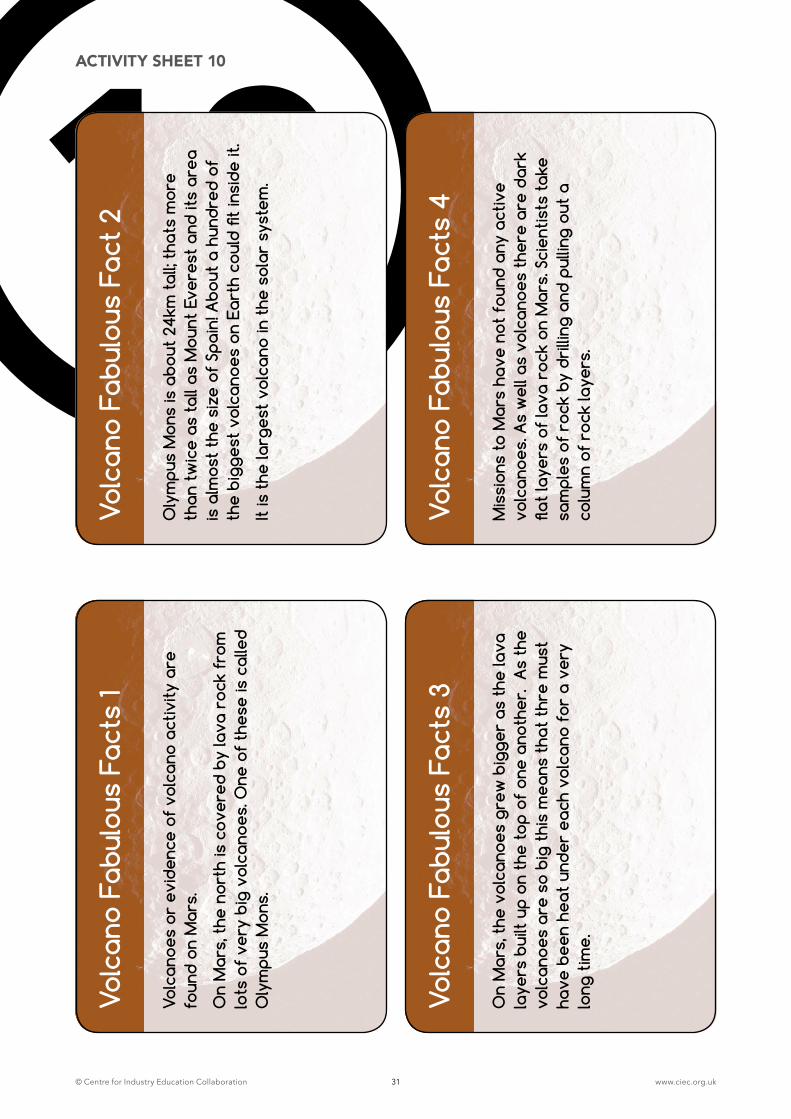
10Vo
lcan
o Fa
bulo
us F
acts
1
Volc
anoe
s or
evi
denc
e of
vol
cano
act
ivity
are
fo
und
on M
ars.
On
Mar
s, t
he n
orth
is c
over
ed b
y la
va r
ock
from
lo
ts o
f ve
ry b
ig v
olca
noes
. One
of
thes
e is
cal
led
Oly
mpu
s M
ons.
Volc
ano
Fabu
lous
Fac
t 2
Oly
mpu
s M
ons
is a
bout
24k
m t
all;
that
s m
ore
than
tw
ice
as t
all a
s M
ount
Eve
rest
and
its
area
is
alm
ost
the
size
of
Spai
n! A
bout
a h
undr
ed o
f th
e bi
gges
t vo
lcan
oes
on E
arth
cou
ld fi
t in
side
it.
It is
the
larg
est
volc
ano
in t
he s
olar
sys
tem
.
Volc
ano
Fabu
lous
Fac
ts 3
On
Mar
s, t
he v
olca
noes
gre
w b
igge
r as
the
lava
la
yers
bui
lt up
on
the
top
of o
ne a
noth
er.
As
the
volc
anoe
s ar
e so
big
thi
s m
eans
tha
t th
re m
ust
have
bee
n he
at u
nder
eac
h vo
lcan
o fo
r a
very
lo
ng t
ime.
Volc
ano
Fabu
lous
Fac
ts 4
Mis
sion
s to
Mar
s ha
ve n
ot f
ound
any
act
ive
volc
anoe
s. A
s w
ell a
s vo
lcan
oes
ther
e ar
e da
rk
flat
laye
rs o
f la
va r
ock
on M
ars.
Sci
entis
ts t
ake
sam
ples
of
rock
by
drill
ing
and
pulli
ng o
ut a
co
lum
n of
roc
k la
yers
.
ACTIVITY SHEET 10
© Centre for Industry Education Collaboration www.ciec.org.uk32
8TEACHERS NOTES: LANDSCAPE
ACTIVITY 8: INVESTIGATING WATER CHANNELS
LEARNING OBJECTIVES
� To think about what might happen or try things out when deciding what to do, what kind of evidence to collect and what equipment and materials to use
� To know that it is important to test ideas using evidence from observation and measurement
� To know that flowing water can wash away or make patterns in a surface body text
RESOURCES PER GROUP OF FOUR CHILDREN
� Activity sheet 11
� Images O-P, T-U (see page 36)
� Trough (wallpaper or planting) or deep tray
� 3cm layer of sand/gravel mixed, covering ¾ of tray’s length
� ½ cup of fine grit
� ½ cup small stones
� ½ cup larger stones
� Jug
� Filter funnel
� Bucket
ADVANCED PREPARATION
� Drill a drainage hole at one end of the tray or trough
� Activity sheet 11 made in to cards
INTRODUCTION The teacher asks the children to look carefully at the two images O-P, showing some interesting patterns on the surface of Mars, and explains that scientists believe that they could possibly have been made by water flowing across and washing away its surface a long time ago. Their task is to carry out investigations to discover whether water can change a surface such as sand. Their measurements and other observations could help scientists to understand more about the fascinating landscape of Mars.
ACTIVITYThe children prepare their trough with sand, grit and gravel, to a depth of 2-3cm. They smooth the surface of the sand and press out a short channel at one end. Pouring water through a funnel directs the water flow to the channel. The pupil cards (Activity sheet 11) provide challenges, hints and facts to support the activity.
1 HOUR ACTIVITY
© Centre for Industry Education Collaboration www.ciec.org.uk33
The children are encouraged to:
� make predictions about the effects of altering the angle of the trough
� change the volume or speed of the water they pour
� make careful observations and measurements of shapes and patterns formed on the surface or channels carved into the sand
� test whether water flows faster on the inside or outside of a bend
� discover how obstacles such as pebbles placed along the channel might produce a delta
� put tiny particles, such as grit, at the head of their ‘stream’ measuring how far and how quickly they are carried
� investigate adding a mixture of different sized particles
Images T-U showing channels from Earth or deltas, such as the Nile delta could be compared to the patterns they have made. They should discover that tiny particles are carried further along their ‘stream’ than larger particles. This would represent sediment in a natural situation.
The children can record their observations in a variety of ways, including video, photographs or drawings
PLENARYWhen discussing their observations, the children should look again at the image of channels on Mars and draw conclusions based on patterns they noted. They read the information about Eberswalde provided by the experts (Activity sheet 12), and consider the following:
� Do their ideas match those of the experts?
� How do they think the channels were made?
� Do they think water once flowed on Mars?
The children could prepare a report for the UK Space Agency. The children should be encouraged to include any measurements or other evidence to support conclusions. Communications managers from each group could act as ‘envoys’ (Appendix 2), moving on to a new group in order to summarise and explain their group’s ideas to others.
SAFETY NOTES, PRACTICAL TIPS AND GUIDANCE Teachers should ensure that excess water is drained or scooped out of the trough and into a bucket. A fresh layer of sand and gravel may be added each time if required. The children will soon discover that the sand is washed along the trough if they pour too much water too quickly or if the trough is supported at too steep an angle. If a small volume of water is poured slowly then the pattern of flow can be seen. The best results are obtained by positioning the tray at a very slight inclination.
TEACHERS NOTES: LANDSCAPE
© Centre for Industry Education Collaboration www.ciec.org.uk34
TEACHERS NOTES: LANDSCAPE
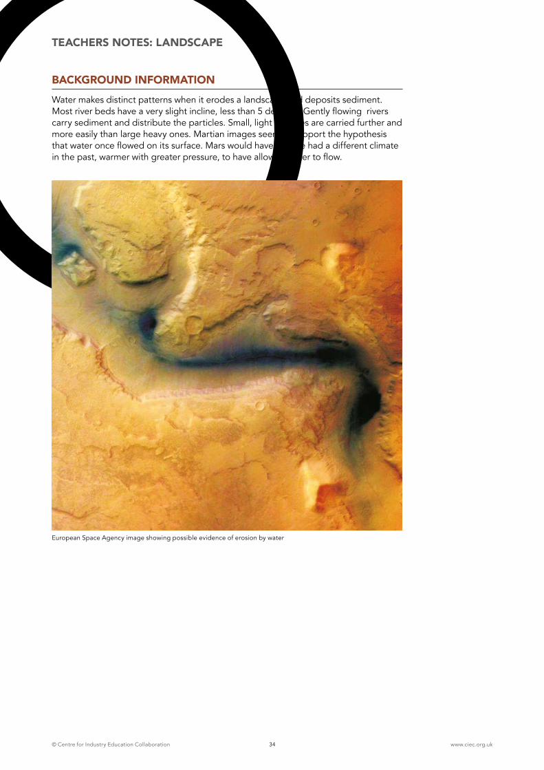
BACKGROUND INFORMATION Water makes distinct patterns when it erodes a landscape and deposits sediment. Most river beds have a very slight incline, less than 5 degrees. Gently flowing rivers carry sediment and distribute the particles. Small, light particles are carried further and more easily than large heavy ones. Martian images seem to support the hypothesis that water once flowed on its surface. Mars would have to have had a different climate in the past, warmer with greater pressure, to have allowed water to flow.
European Space Agency image showing possible evidence of erosion by water
© Centre for Industry Education Collaboration www.ciec.org.uk35
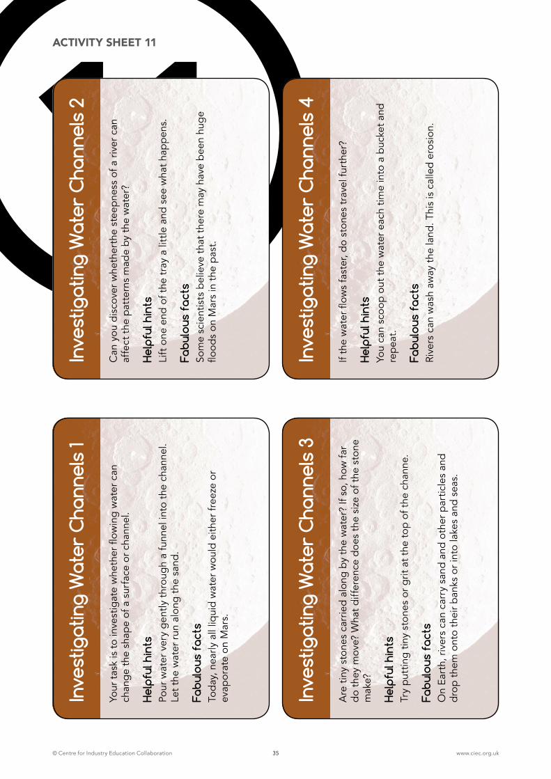
11In
vest
igat
ing
Wat
er C
hann
els
1
Your
tas
k is
to in
vest
igat
e w
heth
er fl
owin
g w
ater
can
ch
ang
e th
e sh
ape
of a
sur
face
or c
hann
el.
Help
ful h
ints
Po
ur w
ater
ver
y g
ently
thr
oug
h a
funn
el in
to t
he c
hann
el.
Let t
he w
ater
run
alo
ng t
he s
and.
Fabu
lous
fac
tsTo
day
, nea
rly a
ll liq
uid
wat
er w
ould
eith
er fr
eeze
or
evap
orat
e on
Mar
s.
Inve
stig
atin
g W
ater
Cha
nnel
s 2
Can
you
dis
cove
r whe
ther
the
stee
pne
ss o
f a r
iver
can
af
fect
the
pat
tern
s m
ade
by t
he w
ater
?
Help
ful h
ints
Li
ft o
ne e
nd o
f the
tra
y a
little
and
see
wha
t hap
pen
s.
Fabu
lous
fac
tsSo
me
scie
ntis
ts b
elie
ve t
hat t
here
may
hav
e b
een
hug
e flo
ods
on M
ars
in t
he p
ast.
Inve
stig
atin
g W
ater
Cha
nnel
s 3
Are
tiny
sto
nes
carr
ied
alon
g by
the
wat
er?
If so
, how
far
do
they
mov
e? W
hat d
iffer
ence
doe
s th
e si
ze o
f the
sto
ne
mak
e?
Help
ful h
ints
Try
put
ting
tiny
ston
es o
r grit
at t
he to
p of
the
cha
nne.
Fabu
lous
fac
ts
On
Eart
h, r
iver
s ca
n ca
rry
sand
and
oth
er p
artic
les
and
dro
p th
em o
nto
thei
r ban
ks o
r int
o la
kes
and
seas
.
Inve
stig
atin
g W
ater
Cha
nnel
s 4
If th
e w
ater
flow
s fa
ster
, do
ston
es t
rave
l fur
ther
?
Help
ful h
ints
You
can
scoo
p ou
t the
wat
er e
ach
time
into
a b
ucke
t and
re
pea
t.
Fabu
lous
fac
tsRi
vers
can
was
h aw
ay t
he la
nd. T
his
is c
alle
d er
osio
n.
ACTIVITY SHEET 11
© Centre for Industry Education Collaboration www.ciec.org.uk36
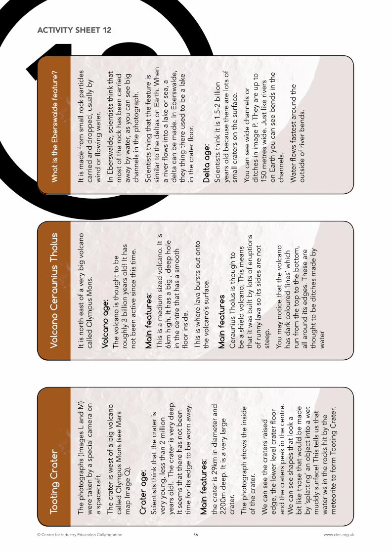
12To
otin
g C
rate
r
The
pho
togr
aphs
(Im
ages
L a
nd M
) w
ere
take
n by
a s
pec
ial c
amer
a on
a
spac
ecra
ft.
The
crat
er is
wes
t of a
big
vol
cano
ca
lled
Oly
mp
us M
ons
(see
Mar
s m
ap Im
age
Q).
Cra
ter
age:
Sc
ient
ists
thi
nk t
hat t
he c
rate
r is
very
you
ng, l
ess
than
2 m
illio
n ye
ars
old!
. Th
e cr
ater
is v
ery
dee
p.
It se
ems
that
the
re h
as n
ot b
een
time
for i
ts e
dg
e to
be
wor
n aw
ay.
Mai
n fe
atur
es:
the
crat
er is
29k
m in
dia
met
er a
nd
2200
m d
eep.
It is
a v
ery
larg
e cr
ater
.
The
pho
togr
aph
show
s th
e in
sid
e of
the
cra
ter.
We
can
see
the
crat
ers
rais
ed
edg
e, t
he lo
wer
leve
l cra
ter fl
oor
and
the
crat
ers
pea
k in
the
cen
tre.
W
e ca
n se
e sh
apes
tha
t loo
k a
bit l
ike
thos
e th
at w
ould
be
mad
e by
‘spl
attin
g’ a
n ob
ject
into
a w
et
mud
dy
surf
ace!
Thi
s te
lls u
s th
at
wat
er w
s in
the
rock
s hi
t by
the
met
eorit
e to
form
Too
ting
Cra
ter.
Volc
ano
Cer
auni
us T
holu
s
It is
nor
th e
ast o
f a v
ery
big
volc
ano
calle
d O
lym
pus
Mon
s.
Volc
ano
age:
The
volc
ano
is t
houg
ht to
be
roug
hly
3 bi
llion
yea
rs o
ld! I
t has
no
t bee
n ac
tive
sinc
e th
is ti
me.
Mai
n fe
atur
es:
This
is a
med
ium
siz
ed v
olca
no. I
t is
6km
hig
h. It
has
a b
ig ,
dee
p ho
le
in t
he c
entr
e th
at h
as a
sm
ooth
flo
or in
sid
e.
This
is w
here
lava
bur
sts
out o
nto
the
volc
ano’
s su
rfac
e.
Mai
n fe
atur
es
Cer
auni
us T
holu
s is
tho
ugh
to
be
a sh
ield
vol
cano
. Thi
s m
eans
th
at it
was
bui
lt by
lots
of e
rupt
ions
of
run
ny la
va s
o its
sid
es a
re n
ot
stee
p.
You
may
not
ice
that
the
vol
cano
ha
s d
ark
colo
ured
‘lin
es’ w
hich
ru
n fr
om t
he to
p to
the
bot
tom
, al
l aro
und
its e
dg
es. T
hese
are
th
oug
ht to
be
ditc
hes
mad
e by
w
ater
Wha
t is
the
Ebe
rsw
alde
fea
ture
?
It is
mad
e fr
om s
mal
l roc
k p
artic
les
carr
ied
and
dro
pp
ed, u
sual
ly b
y w
ind
or fl
owin
g w
ater
.
In E
ber
swal
de,
sci
entis
ts t
hink
tha
t m
ost o
f the
rock
has
bee
n ca
rrie
d aw
ay b
y w
ater
, as
you
can
see
big
chan
nels
in t
he p
hoto
grap
h.
Scie
ntis
ts t
hing
tha
t the
feat
ure
is
sim
ilar t
o th
e d
elta
s on
Ear
th. W
hen
a riv
er fl
ows
into
a la
ke o
r sea
, a
del
ta c
an b
e m
ade.
In E
ber
swal
de,
th
ey t
hing
the
re u
sed
to b
e a
lake
in
the
cra
ter fl
oor.
Del
ta a
ge:
Scie
ntis
ts t
hink
it is
1.5
-2 b
illio
n ye
ars
old
bec
ause
the
re a
re lo
ts o
f sm
all c
rate
rs o
n th
e su
rfac
e.
You
can
see
wid
e ch
anne
ls o
r di
tche
s in
imag
e P.
The
y ar
e up
to
150
met
res
wid
e. J
ust l
ike
river
s on
Ear
th y
ou c
an s
ee b
end
s in
the
ch
anne
ls.
Wat
er fl
ows
fast
est a
roun
d th
e ou
tsid
e of
riv
er b
end
s.
ACTIVITY SHEET 12
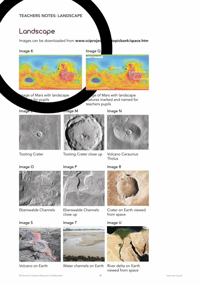
© Centre for Industry Education Collaboration www.ciec.org.uk37
LandscapeImages can be downloaded from www.cciproject.org/topicbank/space.htm
TEACHERS NOTES: LANDSCAPE
Image of Mars with landscape features for pupils
Image of Mars with landscape features marked and named for teachers pupils
Image K Image Q
Tooting Crater Tooting Crater close up Volcano Ceraunius Tholus
Image L Image M Image N
Eberswalde Channels Eberswalde Channels close up
Crater on Earth viewed from space
Image O Image P Image R
Volcano on Earth Water channels on Earth River delta on Earth viewed from space
Image S Image T Image U
© Centre for Industry Education Collaboration www.ciec.org.uk38
9TEACHERS NOTES: LANDING
ACTIVITY 9: IDENTIFYING THE BEST LANDING SITE FOR A MARS ROVER
LEARNING OBJECTIVES
� This section of the resource is suitable for children in Year 7 of Key Stage 3 or to challenge Gifted and Talented children in Year 6
� To obtain, record and analyse data from a range of secondary sources and use their findings to provide evidence for scientific explanations
� To use appropriate methods including ICT to communicate scientific information and contribute to presentation and discussion
� To be able to calculate the age of landing sites, identify landscape features such as craters, rocks, deltas, canyons, elevations and interpret data, scale and images
� To use the data to identify the best landing site for a Mars rover
RESOURCES
� Activity sheets 13-19
� Image V (see page 50)
� Calculator
� Activity sheets 13-14 made into two sets of cards bullets
ADVANCED PREPARATION
� Laminate images W-Z (see page 51-54)
� Half the class in groups of 4 scientists
� Half the class in groups of 4 engineers
INTRODUCTION To help the children to understand and identify craters and channels on Mars. Introduction Landing images 1-5 from the website should be displayed on the whiteboard and discussed. The table, on page 55, provides details of each of these images.
The teacher explains that the children have been asked by the Space Agency to identify the best landing site for a Martian rover. They are to study photographs from four different locations on Mars. The four photographs are real images, taken from space, of the surface of Mars. They are so detailed that if a car was parked on the surface of Mars, it could easily be seen! Image V is a topography map showing high and low areas on Mars and the positions of the four landing sites. The children are to analyse and interpret data from Mars. They are to consider the information from the viewpoint of either space scientists or space engineers when identifying the best landing site. The scientists are interested in finding evidence of life. Their main mission is to identify landing sites close to where water and/or heat may once have been. The engineers’ main concern is to identify sites that are stable, without obstacles and are ow enough for the parachute on the lander to have enough time to slow down the rover’s descent so that it makes a safe landing. Laminate images W-Z (see page 1-54).
3 HOUR ACTIVITY
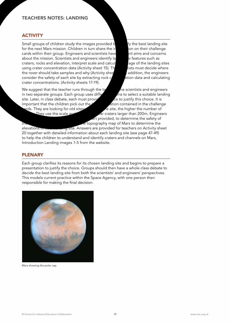
© Centre for Industry Education Collaboration www.ciec.org.uk39
TEACHERS NOTES: LANDING
ACTIVITYSmall groups of children study the images provided to identify the best landing site for the next Mars mission. Children in turn share the information on their challenge cards within their group. Engineers and scientists have different aims and concerns about the mission. Scientists and engineers identify landscape features such as craters, rocks and elevation, interpret scale and calculate the age of the landing sites using crater concentration data (Activity sheet 15). The scientists must decide where the rover should take samples and why (Activity sheet 16). In addition, the engineers consider the safety of each site by extracting rock concentration data and calculating crater concentrations. (Activity sheets 17-19).
We suggest that the teacher runs through the task with the scientists and engineers in two separate groups. Each group uses different criteria to select a suitable landing site. Later, in class debate, each must provide evidence to justify this choice. It is important that the children pick out the key information contained in the challenge cards. They are looking for old sites; the older the site, the higher the number of craters. They use the scale and look for circular craters larger than 200m. Engineers need to use the table and rock safety chart provided, to determine the safety of the site. They should also look at the topography map of Mars to determine the elevations of each landing site. Answers are provided for teachers on Activity sheet 20 together with detailed information about each landing site (see page 47-49) to help the children to understand and identify craters and channels on Mars, Introduction Landing images 1-5 from the website.
PLENARYEach group clarifies its reasons for its chosen landing site and begins to prepare a presentation to justify the choice. Groups should then have a whole class debate to decide the best landing site from both the scientists’ and engineers’ perspectives. This models current practice within the Space Agency, with one person then responsible for making the final decision.
Mars showing the polar cap
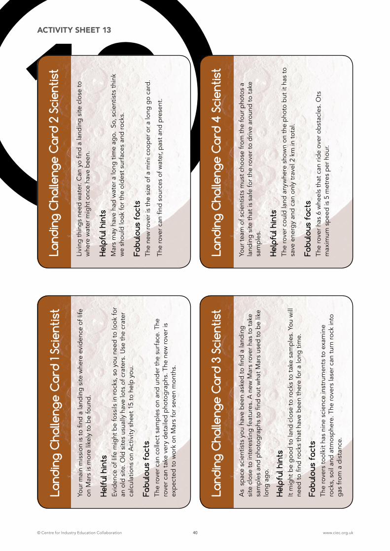
© Centre for Industry Education Collaboration www.ciec.org.uk40
13La
ndin
g C
halle
nge
Car
d 1 S
cien
tist
Your
mai
n m
issi
on is
to fi
nd a
land
ing
site
whe
re e
vid
ence
of l
ife
on M
ars
is m
ore
likel
y to
be
foun
d.
Helfu
l hin
tsEv
iden
ce o
f life
mig
ht b
e fo
ssils
in r
ocks
, so
you
need
to lo
ok fo
r an
old
site
. Old
site
s us
ually
hav
e lo
ts o
f cra
ters
. Use
the
cra
ter
calc
ulat
ions
on
Act
ivit
y sh
eet 1
5 to
hel
p yo
u.
Fabu
lous
fac
ts
The
rove
r can
col
lect
sam
ple
s on
and
und
er t
he s
urfa
ce. T
he
rove
r can
tak
e ve
ry d
etai
led
pho
tog
rap
hs. T
he n
ew r
over
is
exp
ecte
d to
wor
k on
Mar
s fo
r sev
en m
onth
s.
Land
ing
Cha
lleng
e C
ard
2 Sc
ient
ist
Livi
ng t
hing
s ne
ed w
ater
. Can
yo
find
a la
ndin
g si
te c
lose
to
whe
re w
ater
mig
ht o
nce
have
bee
n.
Help
ful h
ints
Mar
s m
ay h
ave
had
wat
er a
long
tim
e ag
o. S
o, s
cien
tists
thi
nk
we
shou
ld lo
ok fo
r the
old
est s
urfa
ces
and
rock
s.
Fabu
lous
fac
tsTh
e ne
w r
over
is t
he s
ize
of a
min
i coo
per
or a
long
go
card
.
The
rove
r can
find
sou
rces
of w
ater
, pas
t and
pre
sent
.
Land
ing
Cha
lleng
e C
ard
3 Sc
ient
ist
As
sp
ace
scie
ntis
ts y
ou h
ave
bee
n as
ked
to fi
nd a
land
ing
site
clo
se to
inte
rest
ing
feat
ures
. A n
ew M
ars
rove
r has
to t
ake
sa
mp
les
and
pho
tog
rap
hs to
find
out
wha
t Mar
s us
ed to
be
like
long
ag
o.
Help
ful h
ints
It
mig
ht b
e g
ood
to la
nd c
lose
to r
ocks
to t
ake
sam
ple
s. Y
ou w
ill
need
to fi
nd r
ocks
tha
t hav
e b
een
ther
e fo
r a lo
ng t
ime.
Fabu
lous
fac
tsTh
e ro
vers
tool
kit h
as n
ine
scie
nce
inst
rum
ents
to e
xam
ine
rock
s, s
oil a
nd a
tmos
phe
re. T
he r
over
s la
ser c
an t
urn
rock
into
g
as fr
om a
dis
tanc
e.
Land
ing
Cha
lleng
e C
ard
4 Sc
ient
ist
Your
team
of s
cien
tists
mus
t cho
ose
from
the
four
pho
tos
a la
ndin
g si
te t
hat i
s sa
fe fo
r the
rov
er to
driv
e ar
ound
to t
ake
sam
ple
s.
Help
ful h
ints
Th
e ro
ver c
ould
land
any
whe
re s
how
n on
the
pho
to b
ut it
has
to
save
ene
rgy
and
can
only
tra
vel 2
km
in to
tal.
Fabu
lous
fac
ts
The
rove
r has
6 w
heel
s th
at c
an r
ide
over
ob
stac
les.
Ots
m
axim
um s
pee
d is
5 m
etre
s p
er h
our.
ACTIVITY SHEET 13
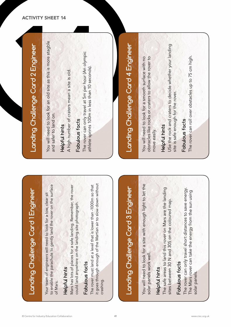
© Centre for Industry Education Collaboration www.ciec.org.uk41
14La
ndin
g C
halle
nge
Car
d 1 E
ngin
eer
Your
team
of e
ngin
eers
will
nee
d to
look
for a
low
, cle
ar s
it
to e
nab
le t
he p
arac
hute
to g
ently
land
the
rov
er o
n th
e su
rfac
e of
Mar
s.
Help
ful h
ints
M
ars
has
lots
of p
lace
s fo
r a s
afe
land
ing.
Rem
emb
er, t
he r
over
co
uld
land
any
whe
re o
n th
e la
ndin
g si
te p
hoto
gra
ph.
Fabu
lous
fac
tsTh
e ro
ver m
ust l
and
at a
leve
l tha
t is
low
er t
han
-100
0m s
o th
at
it g
oes
thro
ugh
enou
gh
of t
he M
artia
n ai
r to
slow
dow
n w
ithou
t cr
ashi
ng.
Land
ing
Cha
lleng
e C
ard
2 En
gine
er
You
will
nee
d to
look
for a
n ol
d si
te a
s th
is is
mor
e st
agbl
e an
d sa
fer t
o la
nd o
n.
Help
ful h
ints
A
hig
h nu
mb
er o
f cra
ters
mea
n a
site
is o
ld.
Fabu
lous
fac
tsTh
e ro
ver c
an o
nly
trav
el a
t 5m
per
hou
r (A
n ol
ympi
c at
hlet
e sp
rints
100
m in
less
tha
n 10
sec
ond
s).
Land
ing
Cha
lleng
e C
ard
3 En
gine
er
You
will
nee
d to
look
for a
site
with
eno
ugh
light
to le
t the
so
lar p
anel
s w
ork
wel
l.
Help
ful h
ints
Th
e sa
fe a
reas
to la
nd t
his
rove
r on
Mar
s ar
e th
e la
ndin
g si
tes
bet
wee
n 30
N a
nd 3
0S o
n th
e co
lour
ed m
ap.
Fabu
lous
fac
tsTh
e ro
ver c
an o
nly
trav
el s
hort
dis
tanc
es to
sav
e en
erg
y.
The
Mar
s ro
ver c
an t
ake
the
ener
gy
from
the
sun
usi
ng
sola
r pan
els.
Land
ing
Cha
lleng
e C
ard
4 En
gine
er
You
will
nee
d to
look
for a
sm
ooth
sur
face
with
no
obst
acle
s lik
e ro
cks
or c
rate
rs to
allo
w t
he ro
ver t
o
mov
e ea
sily
.
Help
ful h
ints
U
Se t
he ro
ck a
nd c
rate
rs to
dec
ide
whe
ther
you
r lan
ding
si
te is
saf
e en
oug
h fo
r the
rove
r.
Fabu
lous
fac
tsTh
e ro
ver c
an ro
ll ov
er o
bst
acle
s up
to 7
5 cm
hig
h.
ACTIVITY SHEET 14
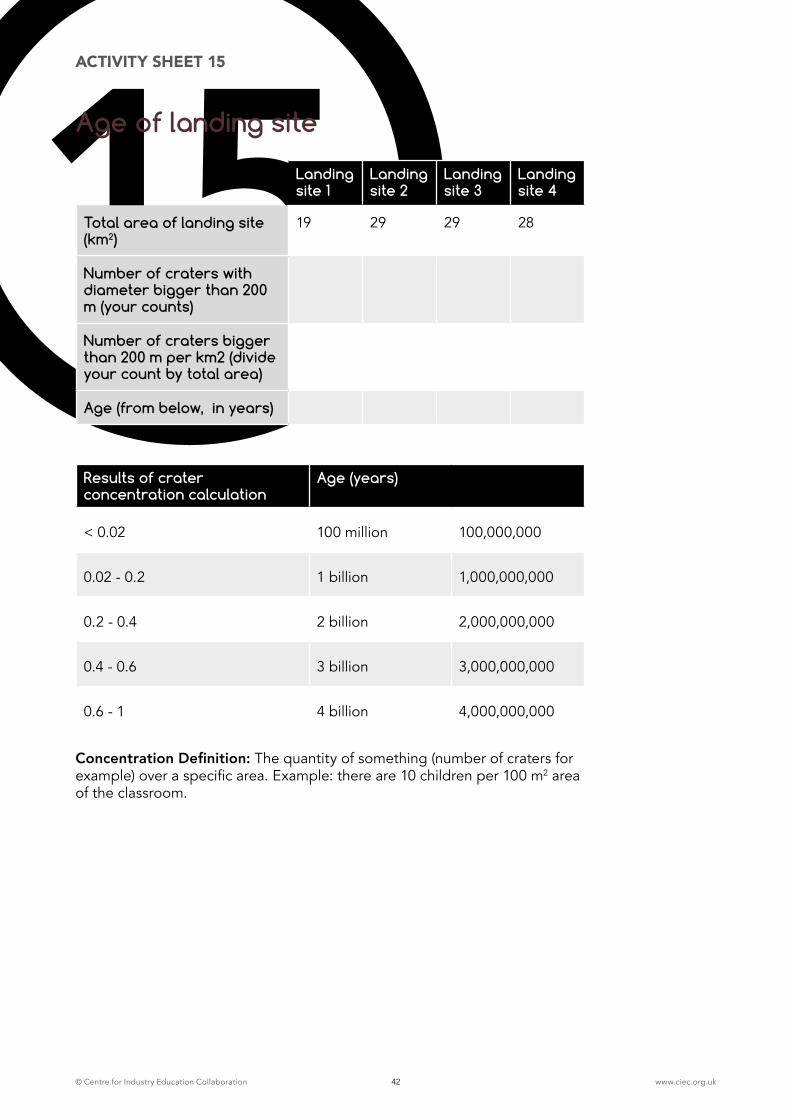
© Centre for Industry Education Collaboration www.ciec.org.uk42
15Landing site 1
Landing site 2
Landing site 3
Landing site 4
Total area of landing site (km2)
19 29 29 28
Number of craters with diameter bigger than 200 m (your counts)
Number of craters bigger than 200 m per km2 (divide your count by total area)
Age (from below, in years)
Results of crater concentration calculation
Age (years)
< 0.02 100 million 100,000,000
0.02 - 0.2 1 billion 1,000,000,000
0.2 - 0.4 2 billion 2,000,000,000
0.4 - 0.6 3 billion 3,000,000,000
0.6 - 1 4 billion 4,000,000,000
Concentration Definition: The quantity of something (number of craters for example) over a specific area. Example: there are 10 children per 100 m2 area of the classroom.
Age of landing site
ACTIVITY SHEET 15
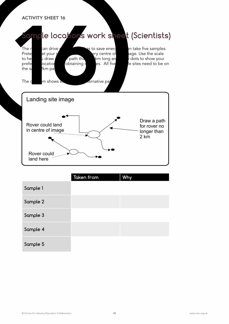
© Centre for Industry Education Collaboration www.ciec.org.uk43
16The rover can drive only 2 km. It has to save energy. It can take five samples. Pretend that your rover lands at the very centre of the image. Use the scale to help you draw a rover path that is 2 km long and draw dots to show your preferred locations for obtaining samples. All five sample sites need to be on the same 2km path.
The diagram shows examples of alternative pathways.
Sample locations work sheet (Scientists)
Draw a pathfor rover nolonger than2 km
Rover couldland here
Rover could landin centre of image
Landing site image
ACTIVITY SHEET 16
Taken from Why
Sample 1
Sample 2
Sample 3
Sample 4
Sample 5
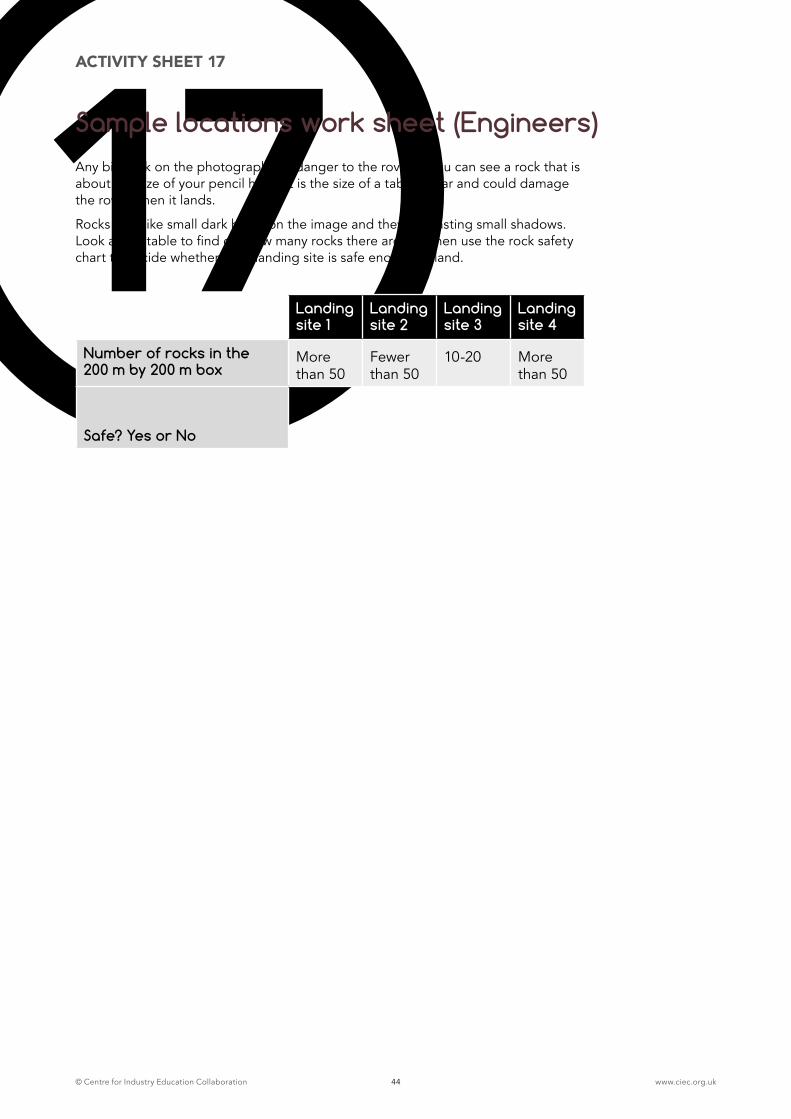
© Centre for Industry Education Collaboration www.ciec.org.uk44
17Any big rock on the photograph is a danger to the rover. If you can see a rock that is about the size of your pencil head, it is the size of a table or car and could damage the rover when it lands.
Rocks look like small dark blobs on the image and they are casting small shadows. Look at the table to find out how many rocks there are and then use the rock safety chart to decide whether each landing site is safe enough to land.
Landing site 1
Landing site 2
Landing site 3
Landing site 4
Number of rocks in the 200 m by 200 m box
More than 50
Fewer than 50
10-20 More than 50
Safe? Yes or No
ACTIVITY SHEET 17
Sample locations work sheet (Engineers)
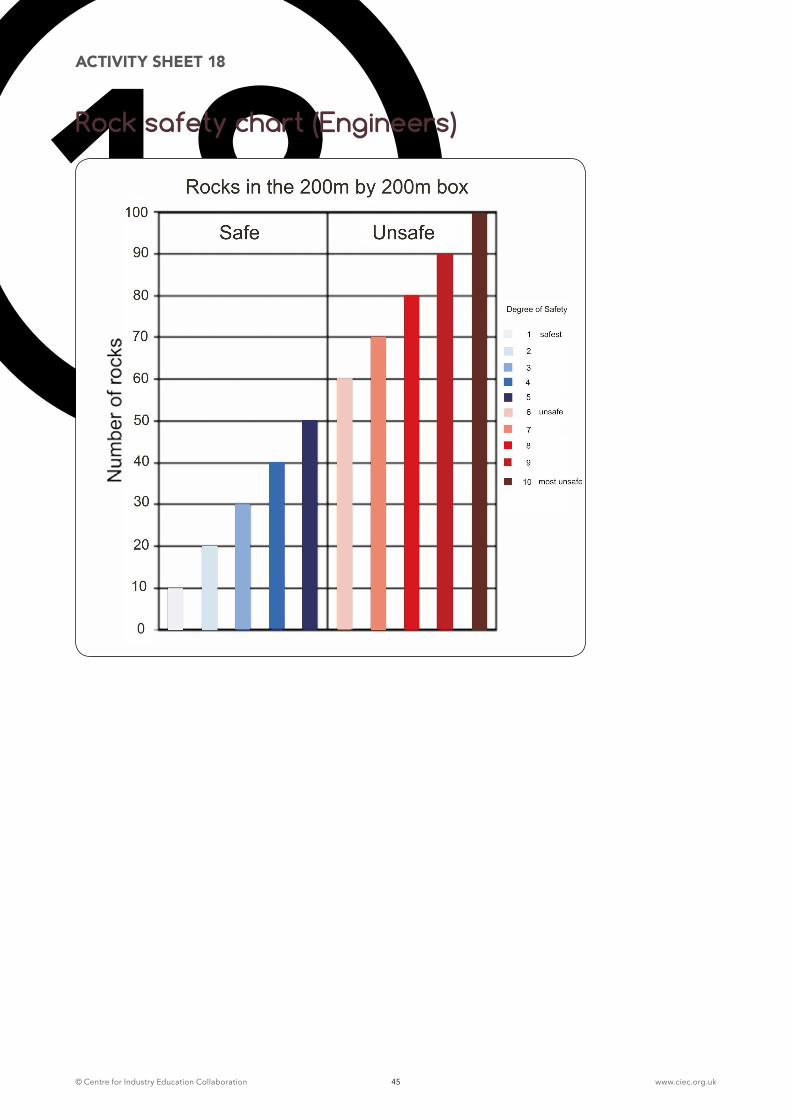
© Centre for Industry Education Collaboration www.ciec.org.uk45
18ACTIVITY SHEET 18
Rock safety chart (Engineers)
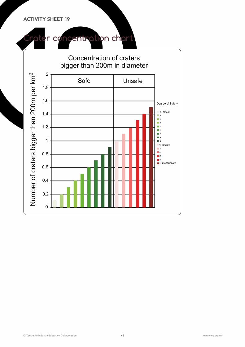
© Centre for Industry Education Collaboration www.ciec.org.uk46
19ACTIVITY SHEET 19
Crater concentration chart
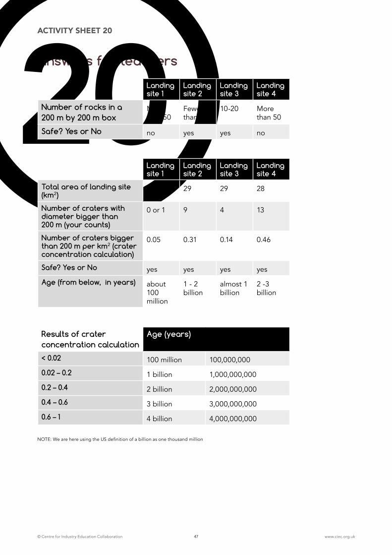
© Centre for Industry Education Collaboration www.ciec.org.uk47
Answers for teachers
ACTIVITY SHEET 20
20Landing site 1
Landing site 2
Landing site 3
Landing site 4
Number of rocks in a 200 m by 200 m box
More than 50
Fewer than 50
10-20 More than 50
Safe? Yes or No no yes yes no
Landing site 1
Landing site 2
Landing site 3
Landing site 4
Total area of landing site (km2)
19 29 29 28
Number of craters with diameter bigger than 200 m (your counts)
0 or 1 9 4 13
Number of craters bigger than 200 m per km2 (crater concentration calculation)
0.05 0.31 0.14 0.46
Safe? Yes or No yes yes yes yes
Age (from below, in years) about 100 million
1 - 2 billion
almost 1 billion
2 -3 billion
Results of crater concentration calculation
Age (years)
< 0.02 100 million 100,000,000
0.02 – 0.2 1 billion 1,000,000,000
0.2 – 0.4 2 billion 2,000,000,000
0.4 – 0.6 3 billion 3,000,000,000
0.6 – 1 4 billion 4,000,000,000
NOTE: We are here using the US definition of a billion as one thousand million

© Centre for Industry Education Collaboration www.ciec.org.uk48
Landing site 1, Lat. Long. 47.5 S, 5.3 E
Engineering ConstraintsSunlight: too far south
Elevation: too high
Rock Concentration: parts are too rocky, category 10 on the chart in places
Crater Concentration: very safe, category 0 on the chart
Science ConstraintsLife: Has very small gullies that were carved by water, possibly melted snow or groundwater coming from cliffs. If the source is groundwater, there is more potential here for life. Limited access to a lot of sediments deposited by water is a problem here.
Age: About 100 million years, very young surface for Mars (essentially modern). But, if the water came from underground, the water may carry with it evidence of much older things!
Secondary Science Objectives: Very interesting cliff of rocks here that will allow you to access millions of years of Mars history. This is the best landing site for secondary objectives.
Path Length: No matter where you land here, you can get to the gullies.
Landing site 2, Lat. Long. 13.2 S, 42 W
Engineering ConstraintsSunlight: OK
Elevation: OK
Rock Concentration: Safe, category 1-2
Crater Concentration: Safe, category 3
Science ConstraintsLife: Landing site is centered on an amazing channel system that is cut into a large fan of sediment. Any place on this image is a spot where water has deposited sediment. Similar to landing site 1, the channel itself may not have had water in it for long but the sediments carried by the channel might have a variety of rock types carried from far away and therefore deposits that might contain fossilized evidence for life.
Age: About 1 to 2 billion years, this is not the time of the ancient ‘Earth-like’ Mars but it is much older than landing site 1 and a better candidate for being a time when Mars had a thicker atmosphere.
LANDING SITE DETAILS FOR TEACHERS
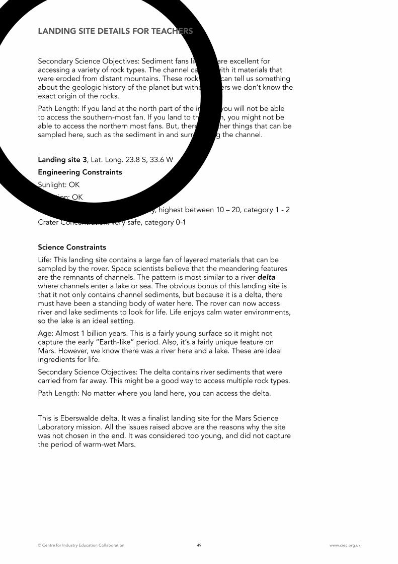
© Centre for Industry Education Collaboration www.ciec.org.uk49
Secondary Science Objectives: Sediment fans like this are excellent for accessing a variety of rock types. The channel carried with it materials that were eroded from distant mountains. These rock types can tell us something about the geologic history of the planet but without layers we don’t know the exact origin of the rocks.
Path Length: If you land at the north part of the image, you will not be able to access the southern-most fan. If you land to the south, you might not be able to access the northern most fans. But, there are other things that can be sampled here, such as the sediment in and surrounding the channel.
Landing site 3, Lat. Long. 23.8 S, 33.6 W
Engineering ConstraintsSunlight: OK
Elevation: OK
Rock Concentration: Not very rocky, highest between 10 – 20, category 1 - 2
Crater Concentration: very safe, category 0-1
Science ConstraintsLife: This landing site contains a large fan of layered materials that can be sampled by the rover. Space scientists believe that the meandering features are the remnants of channels. The pattern is most similar to a river delta where channels enter a lake or sea. The obvious bonus of this landing site is that it not only contains channel sediments, but because it is a delta, there must have been a standing body of water here. The rover can now access river and lake sediments to look for life. Life enjoys calm water environments, so the lake is an ideal setting.
Age: Almost 1 billion years. This is a fairly young surface so it might not capture the early “Earth-like” period. Also, it’s a fairly unique feature on Mars. However, we know there was a river here and a lake. These are ideal ingredients for life.
Secondary Science Objectives: The delta contains river sediments that were carried from far away. This might be a good way to access multiple rock types.
Path Length: No matter where you land here, you can access the delta.
This is Eberswalde delta. It was a finalist landing site for the Mars Science Laboratory mission. All the issues raised above are the reasons why the site was not chosen in the end. It was considered too young, and did not capture the period of warm-wet Mars.
LANDING SITE DETAILS FOR TEACHERS
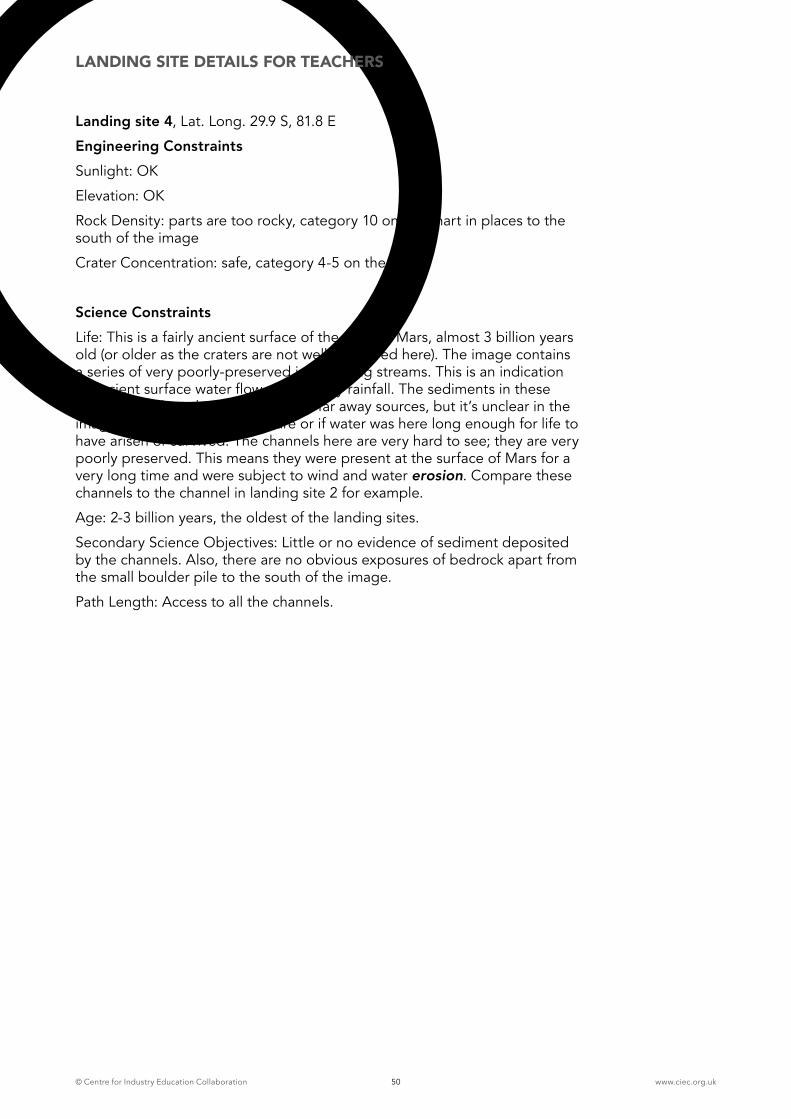
© Centre for Industry Education Collaboration www.ciec.org.uk50
Landing site 4, Lat. Long. 29.9 S, 81.8 E
Engineering ConstraintsSunlight: OK
Elevation: OK
Rock Density: parts are too rocky, category 10 on the chart in places to the south of the image
Crater Concentration: safe, category 4-5 on the chart
Science ConstraintsLife: This is a fairly ancient surface of the crust of Mars, almost 3 billion years old (or older as the craters are not well preserved here). The image contains a series of very poorly-preserved intersecting streams. This is an indication of ancient surface water flow, possibly by rainfall. The sediments in these streams may have been carried from far away sources, but it’s unclear in the image where these sediments are or if water was here long enough for life to have arisen or survived. The channels here are very hard to see; they are very poorly preserved. This means they were present at the surface of Mars for a very long time and were subject to wind and water erosion. Compare these channels to the channel in landing site 2 for example.
Age: 2-3 billion years, the oldest of the landing sites.
Secondary Science Objectives: Little or no evidence of sediment deposited by the channels. Also, there are no obvious exposures of bedrock apart from the small boulder pile to the south of the image.
Path Length: Access to all the channels.
LANDING SITE DETAILS FOR TEACHERS
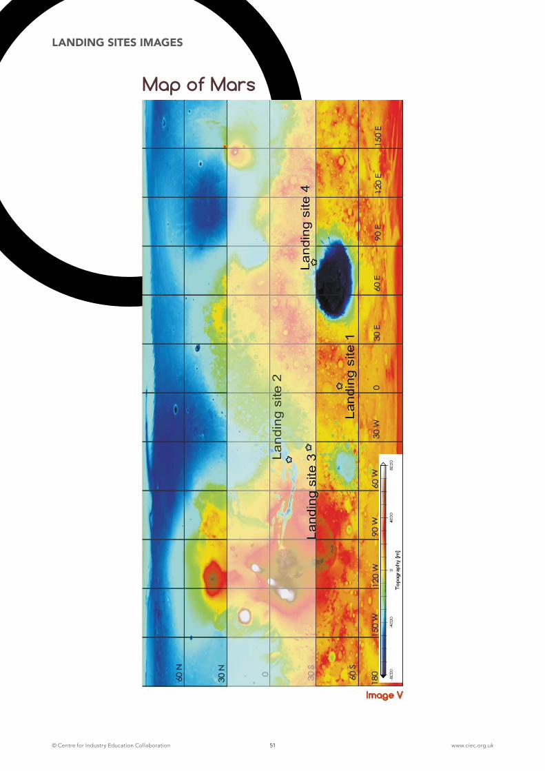
© Centre for Industry Education Collaboration www.ciec.org.uk51
LANDING SITES IMAGES
Map of Mars
Image V
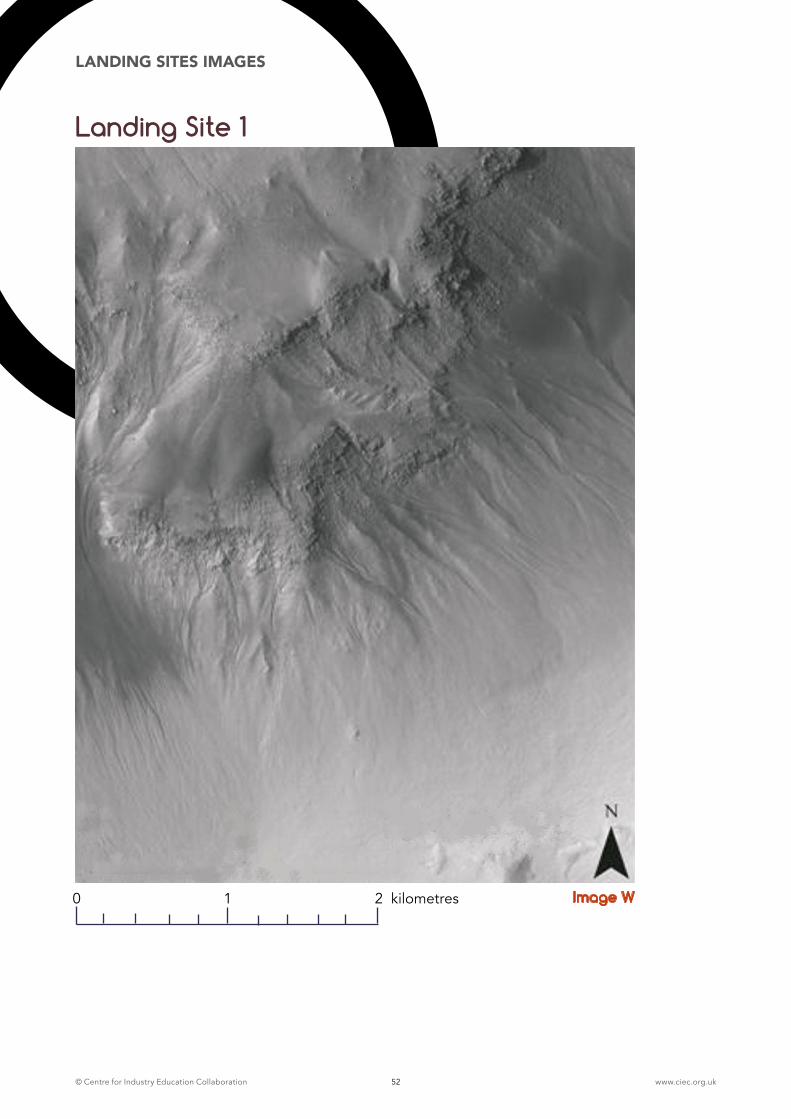
© Centre for Industry Education Collaboration www.ciec.org.uk52
LANDING SITES IMAGES
Landing Site 1
Image W0 1 2 kilometres
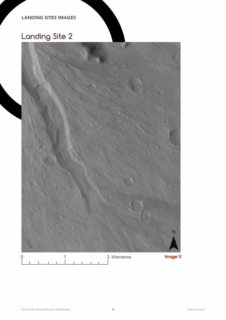
© Centre for Industry Education Collaboration www.ciec.org.uk53
LANDING SITES IMAGES
Landing Site 2
Image X0 1 2 kilometres
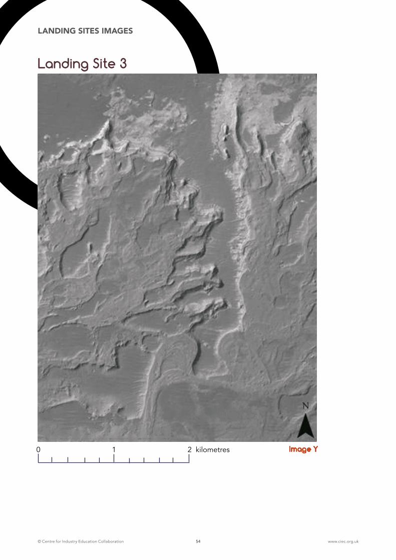
© Centre for Industry Education Collaboration www.ciec.org.uk54
LANDING SITES IMAGES
Landing Site 3
Image Y0 1 2 kilometres
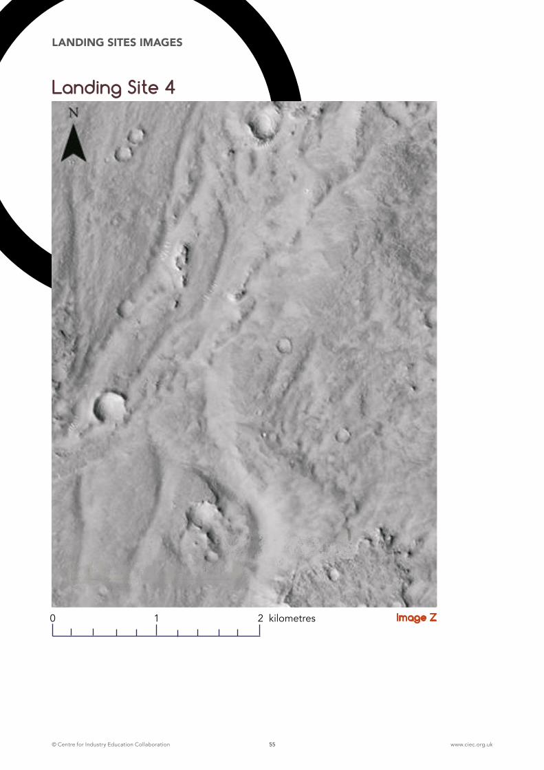
© Centre for Industry Education Collaboration www.ciec.org.uk55
LANDING SITES IMAGES
Landing Site 4
Image Z0 1 2 kilometres
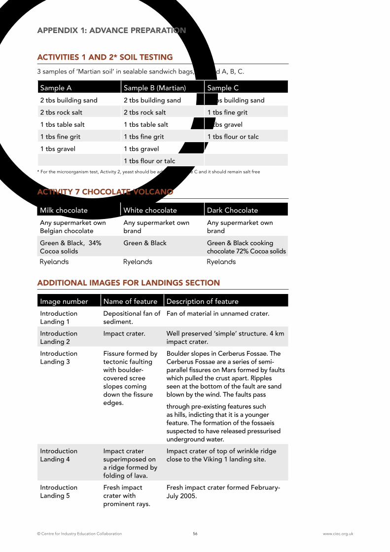
© Centre for Industry Education Collaboration www.ciec.org.uk56
APPENDIX 1: ADVANCE PREPARATION
ACTIVITIES 1 AND 2* SOIL TESTING 3 samples of ‘Martian soil’ in sealable sandwich bags, labelled A, B, C.
Sample A Sample B (Martian) Sample C2 tbs building sand 2 tbs building sand 2 tbs building sand
2 tbs rock salt 2 tbs rock salt 1 tbs fine grit
1 tbs table salt 1 tbs table salt 1 tbs gravel
1 tbs fine grit 1 tbs fine grit 1 tbs flour or talc
1 tbs gravel 1 tbs gravel
1 tbs flour or talc* For the microorganism test, Activity 2, yeast should be added to sample C and it should remain salt free
ACTIVITY 7 CHOCOLATE VOLCANO
Milk chocolate White chocolate Dark ChocolateAny supermarket own Belgian chocolate
Any supermarket own brand
Any supermarket own brand
Green & Black, 34% Cocoa solids
Green & Black Green & Black cooking chocolate 72% Cocoa solids
Ryelands Ryelands Ryelands
ADDITIONAL IMAGES FOR LANDINGS SECTION
Image number Name of feature Description of featureIntroduction Landing 1
Depositional fan of sediment.
Fan of material in unnamed crater.
Introduction Landing 2
Impact crater. Well preserved ‘simple’ structure. 4 km impact crater.
Introduction Landing 3
Fissure formed by tectonic faulting with boulder-covered scree slopes coming down the fissure edges.
Boulder slopes in Cerberus Fossae. The Cerberus Fossae are a series of semi-parallel fissures on Mars formed by faults which pulled the crust apart. Ripples seen at the bottom of the fault are sand blown by the wind. The faults pass
through pre-existing features such as hills, indicting that it is a younger feature. The formation of the fossaeis suspected to have released pressurised underground water.
Introduction Landing 4
Impact crater superimposed on a ridge formed by folding of lava.
Impact crater of top of wrinkle ridge close to the Viking 1 landing site.
Introduction Landing 5
Fresh impact crater with prominent rays.
Fresh impact crater formed February- July 2005.
© Centre for Industry Education Collaboration www.ciec.org.uk57
APPENDIX 1: ADVANCE PREPARATION
ROLE BADGES
All of the classroom sessions involve children working together in groups of four.
Each child is responsible for a different job or role within the group and wears a badge to identify this. The images below may be photocopied onto card and made into badges, by slipping them in to plastic badge sleeves. Keep sets of badges in ‘group’ wallets, to be used on a regular basis in all science lessons.
Children should be encouraged to swap badges in subsequent lessons; this will enable every child to experience the responsibilities of each role.
Administrator keeps a written and pictorial record for the group.
Resource Manager collects, sets up and returns all equipment used by the group.
Communications Officer collects the group’s ideas and reports back to the rest of the class.
Health and Safety Manager takes responsibility for the safety of the group, making sure everyone is working sensibly with the equipment.
Where groups of 5 are necessary, the following role can be used:
Personnel Manager – takes responsibility for resolving disputes within the group and ensuring the team works cooperatively.

© Centre for Industry Education Collaboration www.ciec.org.uk58
APPENDIX 1: ADVANCE PREPARATION
Role Badges
HELLO
Space Engineer: Communications Officer
Space Engineer: Resources Manager
© Centre for Industry Education Collaboration
Space Engineer: Administration Officer
© Centre for Industry Education Collaboration
Space Engineer: Health and Safety Manager
© Centre for Industry Education Collaboration
Space Engineer: Personnel Manager
© Centre for Industry Education Collaboration
© Centre for Industry Education Collaboration

© Centre for Industry Education Collaboration www.ciec.org.uk59
APPENDIX 1: ADVANCE PREPARATION
Role Badges
HELLO
Space Scientist: Communications Officer
Space Scientist: Resources Manager
© Centre for Industry Education Collaboration
Space Scientist: Administration Officer
© Centre for Industry Education Collaboration
Space Scientist: Health and Safety Manager
© Centre for Industry Education Collaboration
Space Scientist: Personnel Manager
© Centre for Industry Education Collaboration
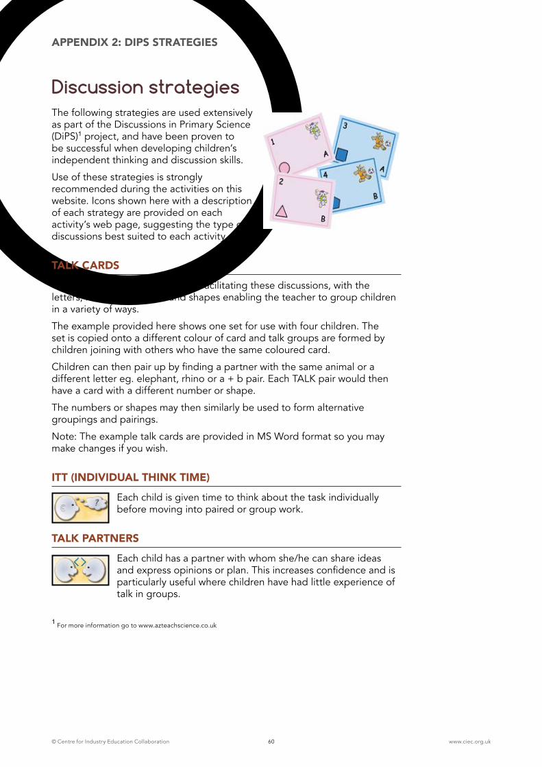
© Centre for Industry Education Collaboration www.ciec.org.uk60
APPENDIX 2: DIPS STRATEGIES
Discussion strategiesThe following strategies are used extensively as part of the Discussions in Primary Science (DiPS)1 project, and have been proven to be successful when developing children’s independent thinking and discussion skills.
Use of these strategies is strongly recommended during the activities on this website. Icons shown here with a description of each strategy are provided on each activity’s web page, suggesting the type of discussions best suited to each activity.
TALK CARDS
Talk cards support the teacher in facilitating these discussions, with the letters, numbers, pictures and shapes enabling the teacher to group children in a variety of ways.
The example provided here shows one set for use with four children. The set is copied onto a different colour of card and talk groups are formed by children joining with others who have the same coloured card.
Children can then pair up by finding a partner with the same animal or a different letter eg. elephant, rhino or a + b pair. Each TALK pair would then have a card with a different number or shape.
The numbers or shapes may then similarly be used to form alternative groupings and pairings.
Note: The example talk cards are provided in MS Word format so you may make changes if you wish.
ITT (INDIVIDUAL THINK TIME)
Each child is given time to think about the task individually before moving into paired or group work.
TALK PARTNERS
Each child has a partner with whom she/he can share ideas and express opinions or plan. This increases confidence and is particularly useful where children have had little experience of talk in groups.
1 For more information go to www.azteachscience.co.uk
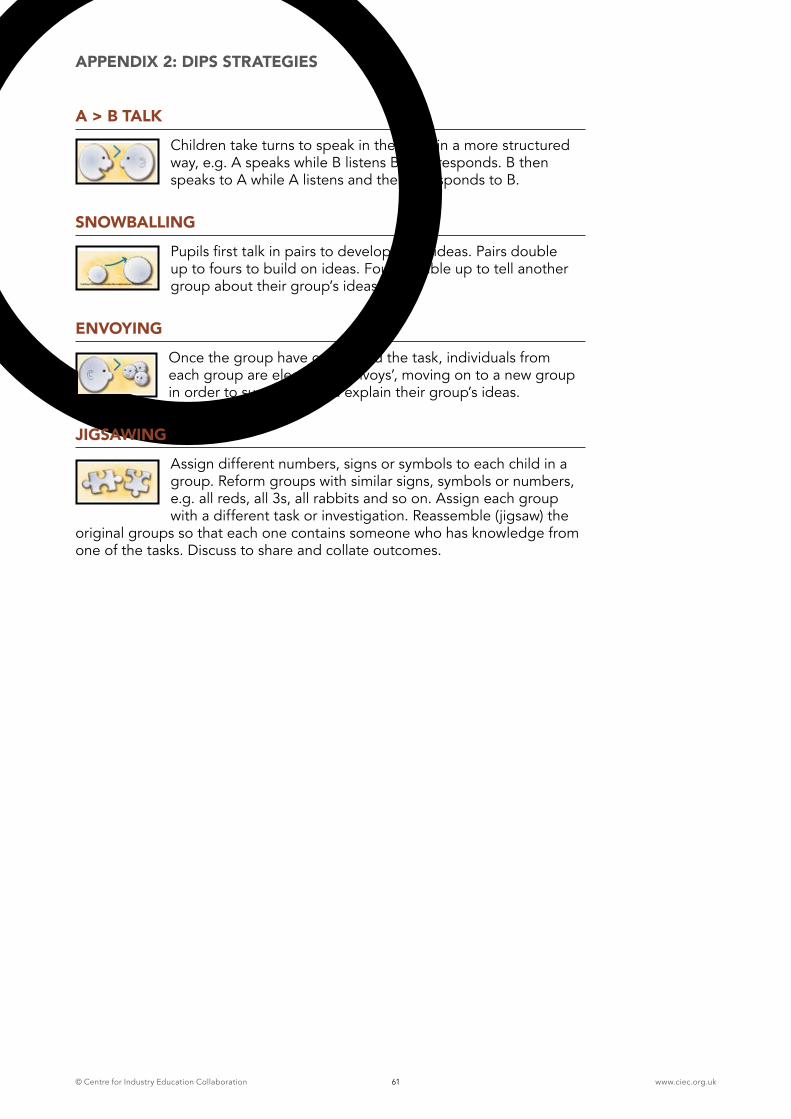
© Centre for Industry Education Collaboration www.ciec.org.uk61
APPENDIX 2: DIPS STRATEGIES
A > B TALK
Children take turns to speak in their pair in a more structured way, e.g. A speaks while B listens B then responds. B then speaks to A while A listens and then A responds to B.
SNOWBALLING
Pupils first talk in pairs to develop initial ideas. Pairs double up to fours to build on ideas. Fours double up to tell another group about their group’s ideas.
ENVOYING
Once the group have completed the task, individuals from each group are elected as ‘envoys’, moving on to a new group in order to summarise and explain their group’s ideas.
JIGSAWING
Assign different numbers, signs or symbols to each child in a group. Reform groups with similar signs, symbols or numbers, e.g. all reds, all 3s, all rabbits and so on. Assign each group with a different task or investigation. Reassemble (jigsaw) the
original groups so that each one contains someone who has knowledge from one of the tasks. Discuss to share and collate outcomes.
© Centre for Industry Education Collaboration www.ciec.org.uk62
APPENDIX 3: MARS FACTS AND MISSIONS
INFORMATION FOR TEACHERS
Mars is the fourth planet from the sun and the seventh largest. It has two tiny saellites Phobos and Deimos. Mars’ orbit is 227,940,000km, its diameter 6,794km and mass 1/10th of Earth’s. Early in its history, Mars was much more like Earth. Most of its carbon dioxide was used to form carbonate rocks but as it cannot recycle any of this back into the atmosphere, it is much colder than the Earth would be at that same distance from the sun. Mars’ orbit is elliptical. Its average temperature is approx -55°C but surface temperatures range widely from as low as -133°C at the winter pole to almost 27°C on the day side during summer. Mars is much smaller than Earth but its surface area is similar to Earth’s land surface. Mars has a very thin atmosphere composed of a tiny amount of carbon dioxide, nitrogen, argon and traces of oxygen and water. The average pressure is 1% of Earth’s but it is thick enough to support very strong winds and huge dust storms that cover the planet for months. Early telescopic observations revealed that Mars has permanent ice caps at both poles. We know they are composed of water ice and solid carbon dioxide (dry ice). Mars has some of the most highly varied and interesting terrain of any of the terrestrial planets, including;
� Olympus Mons - the largest mountain in the solar system rising 24km above the surrounding plains
� Tharsis - a huge bulge on the surface 4000km across and 10km high
� Valles Marineris - a system of canyons 4000km long and 2-7km deep
� Hellas Planitia - an impact crater in its southern hemisphere over 6km deep and 2000km in diameter
Much of the Martian surface is very old and cratered but there are younger rift valleys, ridges, hills and plains. None of this can be seen in detail with a telescope, not even the Hubble telescope but can be seen from spacecraft.
There does not appear to be any current volcanic activity but it is likely to have tectonic activity in the past. There is evidence of erosion in many places including large floods and small river systems. At some point in the past there was clearly some kind of fluid on the surface. Liquid water is a likely fluid but other possibilties exist. There may have been large lakes or oceans. Scientists believe that there were wet episodes that occurred briefly but very long ago.
Canals of Mars are apparent systems of long straight markings on the surface of Mars that we now know are caused by the chance alignment of craters and other natural surface features, observed through telescopes when the telescopes are nearly at the limit of their resolution. The Italian astronomer Giovanni Virginio Schiaparelli reported observing about 100 of these markings in 1877 and described them as canali (Italian for channels) but did not imply anything about their origin. Around the turn of the 20th century, American astronomer.
Percival Lowell described canal networks covering most of the planet. Many believed them to be bands of vegetation bordering irrigation ditches dug by intelligent beings to carry water from the polar caps. The controversy was finally resolved only when close-up images of the Martian surface were taken from spacecraft beginning with Mariner 4 (1965), 6 and 7 (1969). These images showed many craters and other features but nothing resembling networks of long linear channels.
© Centre for Industry Education Collaboration www.ciec.org.uk63
APPENDIX 3: MARS FACTS AND MISSIONS
Since 1960, the Russians and American Space Agencies have sent many spacecraft to Mars; some have been very successful. Mariner 4 was the first mission to make it successfully to Mars. Mariner 4, 6, 7 and 9 missions took many phot graphs of Mars and its moons. Then, the Russians sent Mars 2- 6, bringing back data about the Martian surface, atmosphere, temperature and gravity. The Viking missions were very successful in the 1970s, providing in excess of 50,000 images. After a quiet decade, Martian exploration took off again in the 1990s. In April 2001, the Mars Odyssey was launched. It has been successfully collecting data about the minerals and chemicals that make up the Martian surface.
In December 2003 the European Space Agency’s Mars Express Mission, including Beagle 2 Lander, arrived at Mars. NASA’s Mars Exploration Rovers, landed in 2004 and have been sending back information ever since!
The UK Space Agency is providing 165M Euro contibution to the European ExoMars programme, in addition to 25M for the development of instruments to search for signs of past or present life on Mars. The instruments are part of the scientific payload on a new rover currently being developed. Rovers have to be designed and built from materials that will not contaminate the planet in any way. The new rover is a robotic scientist which will search for evidence of past and present life and study the local Martian environment to understand when and where conditions that could have supported the development of life may have prevailed.
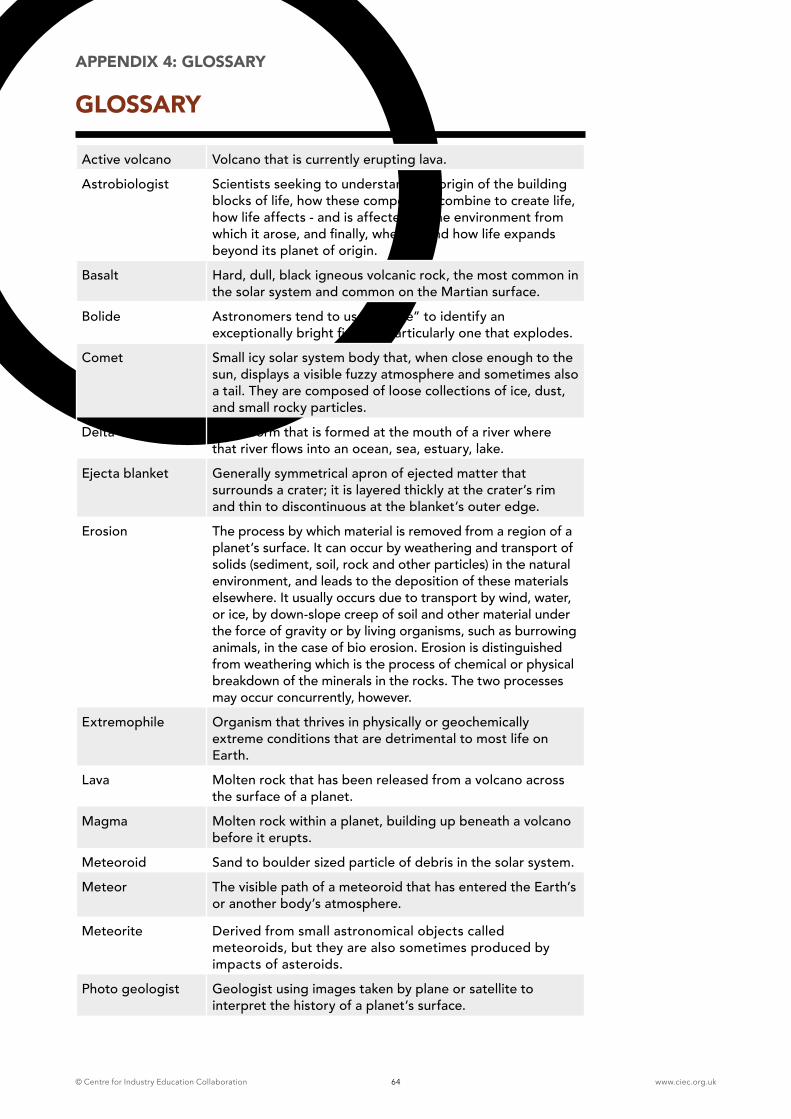
© Centre for Industry Education Collaboration www.ciec.org.uk64
APPENDIX 4: GLOSSARY
GLOSSARY
Active volcano Volcano that is currently erupting lava.
Astrobiologist Scientists seeking to understand the origin of the building blocks of life, how these compounds combine to create life, how life affects - and is affected by the environment from which it arose, and finally, whether and how life expands beyond its planet of origin.
Basalt Hard, dull, black igneous volcanic rock, the most common in the solar system and common on the Martian surface.
Bolide Astronomers tend to use “bolide” to identify an exceptionally bright fireball, particularly one that explodes.
Comet Small icy solar system body that, when close enough to the sun, displays a visible fuzzy atmosphere and sometimes also a tail. They are composed of loose collections of ice, dust, and small rocky particles.
Delta A landform that is formed at the mouth of a river where that river flows into an ocean, sea, estuary, lake.
Ejecta blanket Generally symmetrical apron of ejected matter that surrounds a crater; it is layered thickly at the crater’s rim and thin to discontinuous at the blanket’s outer edge.
Erosion The process by which material is removed from a region of a planet’s surface. It can occur by weathering and transport of solids (sediment, soil, rock and other particles) in the natural environment, and leads to the deposition of these materials elsewhere. It usually occurs due to transport by wind, water, or ice, by down-slope creep of soil and other material under the force of gravity or by living organisms, such as burrowing animals, in the case of bio erosion. Erosion is distinguished from weathering which is the process of chemical or physical breakdown of the minerals in the rocks. The two processes may occur concurrently, however.
Extremophile Organism that thrives in physically or geochemically extreme conditions that are detrimental to most life on Earth.
Lava Molten rock that has been released from a volcano across the surface of a planet.
Magma Molten rock within a planet, building up beneath a volcano before it erupts.
Meteoroid Sand to boulder sized particle of debris in the solar system.
Meteor The visible path of a meteoroid that has entered the Earth’s or another body’s atmosphere.
Meteorite Derived from small astronomical objects called meteoroids, but they are also sometimes produced by impacts of asteroids.
Photo geologist Geologist using images taken by plane or satellite to interpret the history of a planet’s surface.
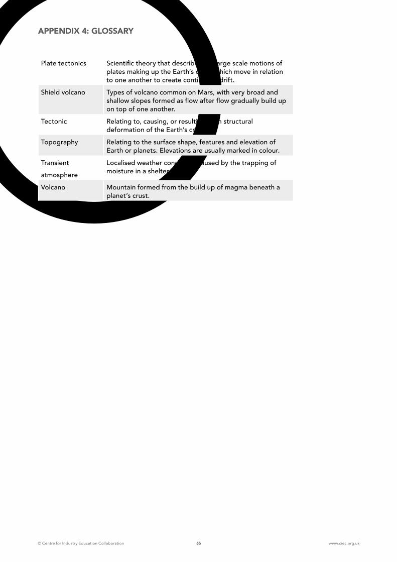
© Centre for Industry Education Collaboration www.ciec.org.uk65
APPENDIX 4: GLOSSARY
Plate tectonics Scientific theory that describes the large scale motions of plates making up the Earth’s crust, which move in relation to one another to create continental drift.
Shield volcano Types of volcano common on Mars, with very broad and shallow slopes formed as flow after flow gradually build up on top of one another.
Tectonic Relating to, causing, or resulting from structural deformation of the Earth’s crust.
Topography Relating to the surface shape, features and elevation of Earth or planets. Elevations are usually marked in colour.
Transient
atmosphere
Localised weather conditions caused by the trapping of moisture in a sheltered area
Volcano Mountain formed from the build up of magma beneath a planet’s crust.
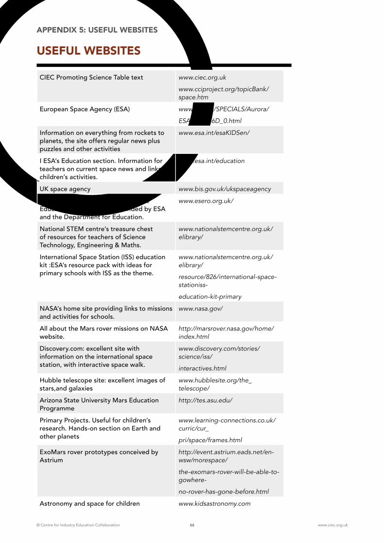
© Centre for Industry Education Collaboration www.ciec.org.uk66
APPENDIX 5: USEFUL WEBSITES
USEFUL WEBSITES
CIEC Promoting Science Table text www.ciec.org.uk
www.cciproject.org/topicBank/space.htm
European Space Agency (ESA) www.esa.int/SPECIALS/Aurora/
ESA9LZPV16D_0.html
Information on everything from rockets to planets, the site offers regular news plus puzzles and other activities
www.esa.int/esaKIDSen/
I ESA’s Education section. Information for teachers on current space news and links to children’s activities.
www.esa.int/education
UK space agency www.bis.gov.uk/ukspaceagency
Website of ESERO-UK, the UK Space Education Office, a project funded by ESA and the Department for Education.
www.esero.org.uk/
National STEM centre’s treasure chest of resources for teachers of Science Technology, Engineering & Maths.
www.nationalstemcentre.org.uk/elibrary/
International Space Station (ISS) education kit :ESA’s resource pack with ideas for primary schools with ISS as the theme.
www.nationalstemcentre.org.uk/elibrary/
resource/826/international-space-stationiss-
education-kit-primary
NASA’s home site providing links to missions and activities for schools.
www.nasa.gov/
All about the Mars rover missions on NASA website.
http://marsrover.nasa.gov/home/index.html
Discovery.com: excellent site with information on the international space station, with interactive space walk.
www.discovery.com/stories/science/iss/
interactives.html
Hubble telescope site: excellent images of stars,and galaxies
www.hubblesite.org/the_telescope/
Arizona State University Mars Education Programme
http://tes.asu.edu/
Primary Projects. Useful for children’s research. Hands-on section on Earth and other planets
www.learning-connections.co.uk/curric/cur_
pri/space/frames.html
ExoMars rover prototypes conceived by Astrium
http://event.astrium.eads.net/en-wsw/morespace/
the-exomars-rover-will-be-able-to-gowhere-
no-rover-has-gone-before.html
Astronomy and space for children www.kidsastronomy.com
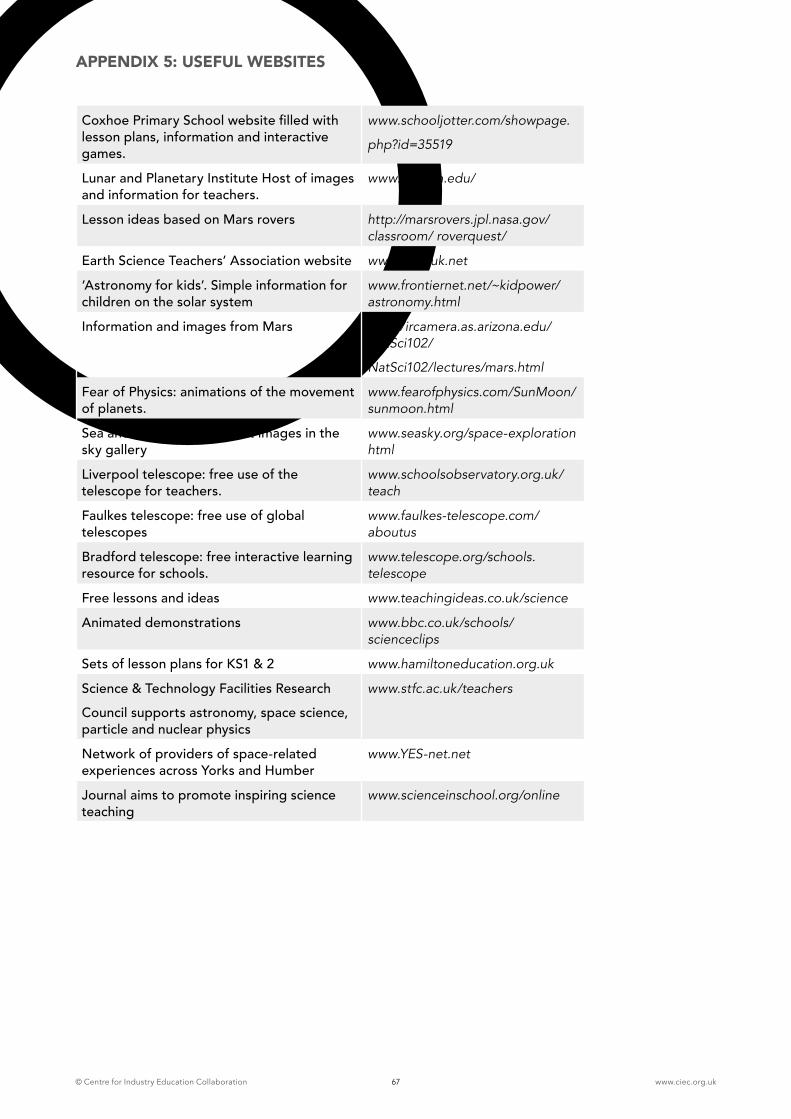
© Centre for Industry Education Collaboration www.ciec.org.uk67
APPENDIX 5: USEFUL WEBSITES
Coxhoe Primary School website filled with lesson plans, information and interactive games.
www.schooljotter.com/showpage.
php?id=35519
Lunar and Planetary Institute Host of images and information for teachers.
www.lpi.usra.edu/
Lesson ideas based on Mars rovers http://marsrovers.jpl.nasa.gov/classroom/ roverquest/
Earth Science Teachers’ Association website www.esta-uk.net
‘Astronomy for kids’. Simple information for children on the solar system
www.frontiernet.net/~kidpower/astronomy.html
Information and images from Mars http://ircamera.as.arizona.edu/NatSci102/
NatSci102/lectures/mars.html
Fear of Physics: animations of the movement of planets.
www.fearofphysics.com/SunMoon/sunmoon.html
Sea and Sky: some excellent images in the sky gallery
www.seasky.org/space-exploration html
Liverpool telescope: free use of the telescope for teachers.
www.schoolsobservatory.org.uk/teach
Faulkes telescope: free use of global telescopes
www.faulkes-telescope.com/aboutus
Bradford telescope: free interactive learning resource for schools.
www.telescope.org/schools.telescope
Free lessons and ideas www.teachingideas.co.uk/science
Animated demonstrations www.bbc.co.uk/schools/scienceclips
Sets of lesson plans for KS1 & 2 www.hamiltoneducation.org.uk
Science & Technology Facilities Research
Council supports astronomy, space science, particle and nuclear physics
www.stfc.ac.uk/teachers
Network of providers of space-related experiences across Yorks and Humber
www.YES-net.net
Journal aims to promote inspiring science teaching
www.scienceinschool.org/online
© Centre for Industry Education Collaboration www.ciec.org.uk68
It is a cold, dry, inhospitable place, with an atmosphere comprising almost entirely carbon dioxide. Even the Grand Canyon would be dwarfed by one of its valleys and the solar system’s largest volcano can be found here. Dust storms darken its skies. Despite this, Mars is the planet most like Earth and where scientists believe there may be a possibility of finding evidence of primitive life. After news of tantalising new evidence of frozen water lurking beneath its rusty surface, the UK Space Agency released funding for the development of instruments to search for signs of past or present life on Mars. The instruments are part of the potential scientific payload on a Rover being designed as part of a potential joint mission between the European Space Agency (ESA) and US space agency NASA.

© Centre for Industry Education Collaboration www.ciec.org.uk
For more information on the programmes and publications available from the Centre for Industry Education Collaboration, visit our web site at:
www.ciec.org.uk
or contact:
Centre for Industry Education Collaboration CIEC Department of Chemistry University of York York YO10 5DD
01904 322523