EAST POLLOKSHIELDS
DRAFT COPY
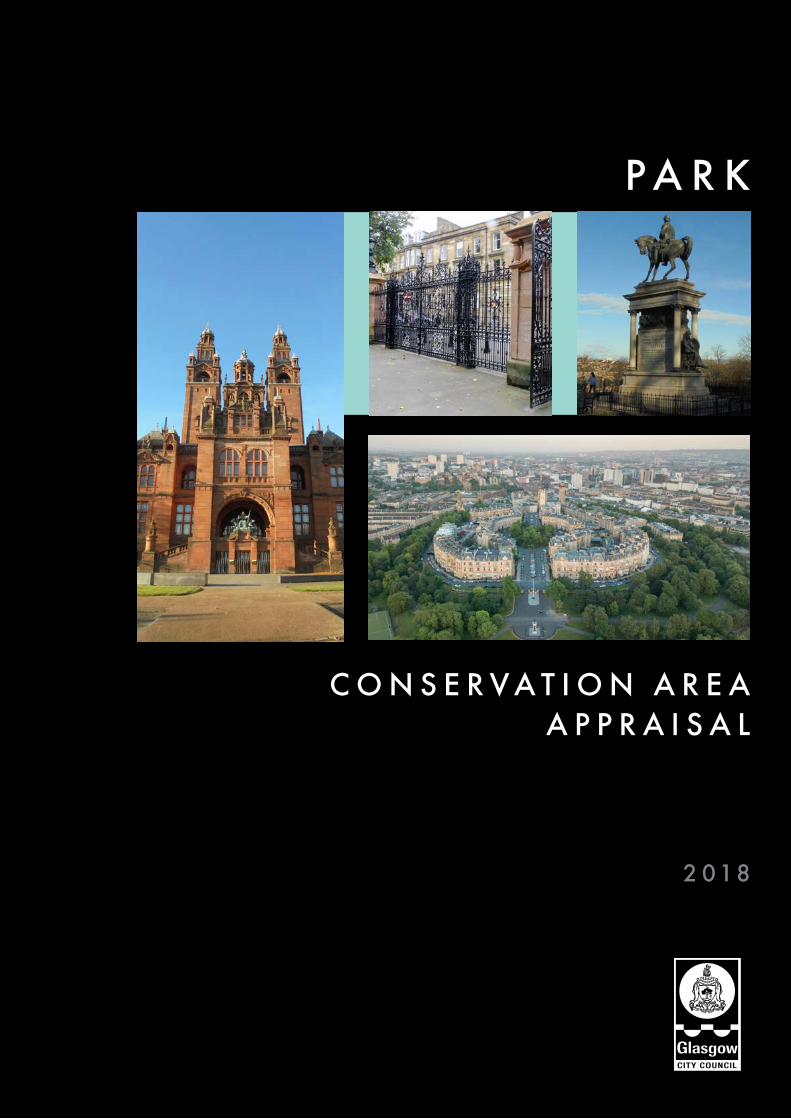
P A R K
2 018
C O N S E R V A T I O N A R E A A P P R A I S A L

Cover images - 1 Kelvingrove Art Gallery & Museum / 2 Kelvingrove Park Gateway to Kelvingrove Street / 3 Kelvingrove Park, Roberts Memorial / 4 Aerial of Park Circus

DRS/2018/1
PARK
2 INTRODUCTION
Location Definition of a Conservation Area What Does Conservation Area Status Mean? Purpose of a Conservation Area Appraisal Designation
4 HISTORICAL DEVELOPMENT Medieval History 18th Century 19th Century 1900 – Present
1 Decorative detail, 4 Park Gardens / 2 View of Park skyline from Hill Street
12 CHARACTER ASSESSMENT
Introduction Assessment of Buildings Listed Buildings Unlisted Buildings of Townscape Merit Key Features Key Challenges
17 CONSERVATION AREA BOUNDARY
6 TOWNSCAPE APPRAISAL
Topography Gateways Conservation Area Boundaries and Edges Street Pattern Plot Pattern Open Space Circulation and Permeability Views Activities/Uses Architectural Character Building Materials Townscape Detail Landscape and Trees Condition
18 PRESERVATION AND ENHANCEMENT
Introduction Opportunities for Preservation and Enhancement Grants
20 ARTICLE 4 DIRECTIONS
21 CITY DEVELOPMENT PLAN
22 FURTHER INFORMATION
23 BIBLIOGRAPHY
C O N T E N T S
1 2
21

PARK
2/DRS/2018
Location
The Park Conservation Area is located to the west of Glasgow city centre. It is bounded to the south by Gray Street, Derby Terrace Lane through to Fitzroy Lane, Sandyford Place Lane through Elderslie Street and along Kent Road. To the north it is bounded by the River Kelvin and Eldon Street, to the east by Woodlands Road and North Street/Motorway and to the west by the western boundary of Kelvingrove Park and a short stretch of Dumbarton Road which becomes Argyle Street returning into Sauchiehall Street.
Definition of a Conservation Area
Conservation areas were first introduced by the Civic Amenities Act 1967. The Planning (Listed Buildings and Conservation Area) (Scotland) Act 1997 provides the current
legislative framework for the designation of conservation areas.
A conservation area is defined in the Act as “an area of special architectural or historic interest, the character or appearance of which it is desirable to preserve or enhance”.
All planning authorities are required by this Act to determine which parts of their area merits conservation area status. Glasgow currently has 25 Conservation areas varying in character from the city centre and Victorian residential suburbs to a rural village and former country estate.
What Does Conservation Area Status Mean?
In a conservation area it is both the buildings and the spaces between them that are of architectural or historic interest. Planning control is therefore directed at maintaining the integrity of the entire area and enhancing its special character. Conservation area
status does not mean that new development is unacceptable, but care must be taken to ensure that the new development will not harm the character or appearance of the area.
Under current legislation, conservation area designation automatically brings the following works under planning control:
● Demolitionofbuildings
● Removalof,orworkto,trees
● Developmentinvolvingsmallhouse extensions, roof alterations, stone cleaning or painting of the exterior, window replacement, provision o f hard sur faces, works to boundaries and additional control with respect to satellite dishes.
Where a development would, in the opinion of the planning authority, affect the character or appearance of a conservation area, the application for planning permission will be advertised in the local press providing
1 Park Conservation Area / 2 View of 20 Claremont / 3 View Woodlands Terrace looking West
115
Yard
80
53
126
117
1205
91
ST VINC ENT CR ESCENT
LYMB
UR
N STR
EET
47
HAUGH ROAD
120
50
109
63
12
60
Builders
12.9m
Sub
Warehouse
65
122
1231
29
88
68
49
27
17.5m
53
1195
PALM
ERSTON PLA
CE
1192
KE
LVIN
HA
UG
H G
ATE
17
1243
Works
13.5m
70
85
61
58
14
19.1m
Pavilion
ESS
119
111
142
Bowling Greens
1196
40
56
41
130
65
KELVINHAUGH STREET
10
Sta
100
LUM
SD
EN
STR
EE
T
128
15
16.7mOV
ERNEW
TON
PLACE
Kelvingrove
67
El Sub Sta
52
PH
Halls
PLACE
YOR
KH
ILL
ST
RE
ET
El Sub Sta
69
47 40
93 to 107
Yorkhill Tunnel
109
172
101
1194
El
PH
45
1201
64
10
115
Garage
9
1
60
1198
67
61
62
46
17.1m
15.0m
141
66
54
79
81 to 91
180
KELVINHA
UGH
55
5712.4m
143
15
164
Depot
ST VI NCENT CRESCENT LANE
145
42
ARGYLE STREET
59
14.4m
61
43
44
115
69
63
36
51
124
77
48
61
1190
73
Fire Station
50
5
STR
EE
T
17.1m
SAND
YFO
RD
STR
EET
50
THO
RNBA
NK
35
75
CAR FR AE STREET
38
GILBERT STREET
80
6.6m
Yorkhill Tunnel
59
44
68
26
TEV
IOT
STR
EET
KELVINH AU GH STREET
Tower
13.9m
56
74
62
20
59
Theatre
CL
EV
EL
AN
D L
AN
E
121
559
75
126
10
81
Dorset Square
20.7m
9
9
43
144
19.2m65
51
122
74
BERKELEY STREET
53
17
563
237
5
TCB
7821.8m
60
20
10
32
26
87
571
BELTA
NE STR
EET
30
22.6m
23
23.7m
56
7
Mitchell Library
2
68
74
1
LB
Posts
BERKELEY TERRACE LANE
79
48
17
117
to
24
123
26
31
38
25
37
134
29
21.0m
66
84
8
22
153
to 1
59
72
102
78
128
36
5314
9
114
13
Clu
b
553
21
85
SANDYFORD PLACE LANE
13
555
20.1m
23
22.5m
PO
7
58
43
CHARING CROSS LANE
141
4
116
42 to 50
138
3
PW
57
33
47
527
147
108
551 245
72
54
229
71
Singh S
abha
Stewart House
529
63
132
75
Clu
b
Clu
b
91
69
15
84
Recreation Ground
PH
569
124
PH
KENT ROAD
34
GR
ANV
ILLE STREET
60
36
27
79
21
24
19
48
(Sikh Tem
ple)
15
239
39
145
122
6
539 to 543
88
110
531581
1
80
104
NE
WT
ON
ST
RE
ET
17
19
533
13
3
50
(public)
152
50
100
126
143
119
68
2
38
Bank
33
Newton Terrace
NEWTON TERRACE LANE
4
118
12
549545
63
Finnieston Tunnel
40
142
52
21
31 to 33
Fitzroy Place
15.4m
902 to 908
2220
21
216
1101
Hotel
19
10881095
6
KELV
ING
RO
VE S
TREE
T
PH
3 to
9
LB
29
15
903
1146
1093
30
220
3
923
28
1158 to 1166
31
Club
Hou
se
20
9
939
7
223
18
1142
38
36
LB
4
238
22
37
224
16
34 to 36c
5 to 9
17.1
m
1
1147
CLIFTON PLAC E
DERBY TERRACE LANE
941
Hotel1148 to 1156
PH
Finnieston
920 to 924
PH
29
83
8
12
1
73
219
SAUCHIEHALL STREET
1014
1042
235
16
6
16.2m
26
1087
Henderson
23
1111
918
1143
26a
23
3
1046 to 1056
178
18
28
1
17
6
214
Hotel
218
21
901
Wood
13
2
Henry
10
ROYAL C RESCEN T
PH
23
21
5
TCB
1
Church
1102
16
227 to 231
1105
931
1099
2
1100
222
949
19.6m
8
30
42
Terrace
25
15.2m
3
24SA ND YFORD PLAC E
15
14.9m
1036
1081
Kel
vinh
augh
Sandyfo rd -
LB
21.2m
24
1008
Tunnel
40910
KENT R OAD
1
Memorial
Hotel
ARGYLE STREET
Tunn
el
21
18.1m
14
26
1168 to 1176
234
4
9
1135
1113 to 1119
1137
PHST VINCENT CRESCENT
BREC
HIN
STREET
7
1026 to 1032
17
214 to 218
951
1091
15.0m
31
3
to
BERK ELEY STREET
4
12
1131
Westminster
15.9m
Hall
33
27
CLAR
EMO
NT STR
EET
213
13
220
39
30
Surg
ery
Bowling Green
44
19.2m
33
CORU
NNA
STRE
ET
El Sub Sta
1038
1109
3
to
1064
232
St Vincen t
21 19 17 15 1179
5
25 23
3
PO
1
1030
202
66
68
64
53
60
62
54
56
7
LB
9
TCBs
PH
TCBs
20
2a
102
57
64
60
62
200
El Sub Sta
Masts
Clinic
1071
1075
1079
16
1103
38
69
11
170
4
6
86
10
206
4
226
233
228
11 to 12
165
FITZR OY LA NE
1151
1076
1098
1020
1155
1163
10921082
27
1090
1136
10221016
1024
1138
1094
1072
1106
1110
1108
1078to1080
1114
1153
11341130
1126
1120
1116
11221124
1132
1129
1066106810581060
1159
25
1086
1125
74
6967
6
1189
1175
1185
1191
1213
1211
1221 1223
GlasgowGaelic School
1161
537
Shel ter
Shelter
Ga ntry
Shel ter
Shel ter
100
Play Area
Sports Fa cility
1097
54
161
PH
557
Hotel
107
West George Co lleg e
L Twr
L Twr
L Twr
Central Gurdwara Singh Sabha
Shel ter
Shel ter
Shel ters
Shel ter
TCB
TCB
TCB
El Sub Sta
University of Glasgow
20
Cairncross H ouse
99
Shel ter
Hunterian Museum
Hunter M emoria l
Bute Hall
East Quadrang le
Wes
t Qua
dra
ngl
e
Memorial Chapel38.5m
LB
SunlightCottages
37.7m
18.3m
Gilmore Hill
FS41.0m
1
5
11
12
13
52
1a
Kelvingrove Park
MemorialChapel
8
33
24
1307
11
1264
18
16
19.8m66
22
1071
1287
63
19.4m
1009
42
15
5
LB
1
48
CLA
YS
LAP
S R
OA
D
21
10 ARGYLE STREET
24
11
28
18
SAUCHIEHALL STREET
159
16
12
64
1248
1001
16
1019
14
39
Kelvingrove Museum
35
17
1397
10
55
1272
29
10
OVER NEWTON SQU AR E
46
Hotel
11
60
67
6
6
10
1027
36
12
Community
1295
41
3329
1407
54
17
6
34
1417
17
40
Sloping
PH
39
18.4m
RADN
OR S
TREE
T
37
20
52
66
31
18.0m
PH
12
1311
1276
50
2
14
1303
61
23
36
25
1291
19.3m
18.9m
31
1274
29
5
28
Bowling Greens
1278
35
98
Posts
68
PH
1299
PH
16
21.2m
57
58
30
56
34
18.0m
7
Muslim Mis son
5
15
37
masonry
35
22
23
25
1301
26
8
993
and Art Gallery
17.6m
1061
1260
Kelvin Hall
34
BLA
CK
IE S
TR
EE
T
PH
YOR
KH
ILL
STR
EET
31
20.8m
21
7
AR
TH
UR
ST
RE
ET
3
11
LUMSDEN LANE
NA
IRN
ST
RE
ET
9
1940
LUM
SD
EN
STR
EE
T
4
Bowling Greens
17
15
DALNA IR STR EET
6
9
16
El Sub Sta
LB
22.1m
PH
TCBs
12
OLD DUMBARTON ROAD
6
18
STREET
PH
Tennis Courts
13
104
HAST IE
Pavilion
18.6m
17
1268
54
1256
30
9
(PH )
2
1253
OVERNEWTON STREET
22.2m
41
LB
52
4551
16
17
27
1297
4
KELV
IN W
AY
23
2
War M emorial
23
Centre
War M emorial
25
1055
1065
9
10
1309
1313
12
979
21
Sloping
DUMBARTON ROAD
Sluic e
Partick Bridge
Mill Lade
ma sonry
13171315
Weir
12
Lis ter Statue
KelvinRiver
Kelv in Statue
17.8m
Putting Green
Weir
70
PH
Sluic e
7278
74
1263
76
12
20
1361
1355
1359
1232
Kelvingrove Park16.2m
1300
REGENT MORAY STREET
14.6m
11
1292
1347
42
1349
13.5m
9
1063
1294
BLANTYRE STREET
49
3
1222
1345
48
1214
1351
1208
1204
Regal
1298
1240
68
23
YOR KH ILL PARA DE
4147
4161
6 to 1 0
35
35
53
17
45
53
Yorkhill Tunnel
ESM
ON
D S
TRE
ET
18.1m
13.8m
El Sub Sta
12.0m
TCB
53
13.6m
BUNHOUSE ROAD
11
Chy
Car Pa rk
47
39
29
Sewage Pumping Station
174
175
13
214
23
FS
26
9
Sub Sta
162
6
164
62
20
23
CRESCENT
156
WILLOWBANK
226
242
44
275
218
39
35
208
141
80
269
311
WEST PRINCE'S STREET
67
212
226
BARRINGTON
218
The
192
19
98
95
170
51
33
216
14
21
of
160
Bowling Green
PARK DRIVE
Club
WOO
DLANDS ROAD
6
233
10 23.8m
61
147
22
177
34
13
189
Pavilion
185
52
36
69
WIL
LOW
BANK S
TREET
40
216
7
34
148
32
PH
31
87
School
20
99
34
17
Park Church
24
35
4
Hall
126
23.8m
35
18
House
Public Hous e
106
163
211
19
17
59
CAR
RING
TON
STR
EET
282
Willowbank
24.7
m
238
33
18
61
PH
214
13
14
27
21
160
DRIVE240
261
185
30
146
90
El
26.8m
2
2
315
12
175
26.3
m
33
34
2216
77DRIVE
228
STR
EET
79
28
57
45
260
56
207
(Club)
174
DUNE
ARN
30
118
Bowling Green
PH
167
245
66
WOODLANDS
11
15
25
206
26.5m
311
18
21.5m
276
24
247
Primary
WES
TEN
D PA
RK
STRE
ET
63
132
75
10
68
11
29
15
32
197
143
220
39
28
Worship
212
151
13
39
PARK
AVEN
UE
25.6m
24
23
31
15
9
12
235
210
23.5m
19
Baths
30
13
RUPE
RT
STRE
ET
198
30
20
PH
23.2m
31.4m
ELDON STREET
Gilmorehill
19.9m
21.1
m
Statue
Uni
vers
ity o
f Gla
sgow
QU AD RA NT
103
70
30
UNIVERSITY
42
PAR K
Football Ground
22.3
m
AVENUE
25.3m Westban k Co urt
Jam
es W
att B
uild
ing
42.0mBridge
Kel
ving
rove
Tun
nel
Hall
Kelvingrove Park
8
Hall
9
KELV
IN W
AY
St S ilas' English
WES
TBA
NK L
ANE
29.5m
99
5
107
TCBs
WESTBANK QUADRANT
Bridge
9
26.6m
Slop
ing
mas
onry
1
Church
17.9m
Slop
ing
mas
onry
Lodge
Prince o f Wales
144 t
o 148
3 to 9
Eldon Street
27 to 33
18.8m
Nursery
27.3m
Millennium P ark
29
WO
OD
SID
E C
RE
SC
EN
T
18
26
SAUCHIEHALL STREET
ST G
EORG
E'S R
OAD
PARK DRIVE
WIL
LOW
BANK
El
33.4m
27
231
PC
1
35
27
28
11
52
7
48
19
3
29
11
12
136
Host
el
13
ELD
ERSL
IE
Club
CLA IR MONT GA RD ENS
17
95
24
169
LAN
E
45
29.4m
40 to 42
24.7m
31
15
1
3
15
93
44 to 48
104
Club
9
54
45 to
56
43.2m
3
PO
7
1
15
29.5m
25
140
LYN
ED
OC
H
19
108
35
175
ASHL
EY S
TREE
T
2
7
1
2
ASHL
EY S
TREE
T
8
99
6
7
Sub Sta
35
38.6m
LANE
81
19
Statue
Park House
20
21 to 25
35.3m
12
to
29
Club
26
15
27
ESS
34.7m
14
1
WOODSIDE PLACE LANE
14
18
21
LANE
11
30
45
DW
20
61
SOMERS ET P LACE M EWS
Church
91
5
35.9m
21
14
107
Club
CLA REM ON T TER RAC E
13
83
ASH
LEY
LANE
2
D Fn
PARK
21 to 25
46
63
4
CARNARVON STREET
22
15
1
61
ST GEO
RG
E'S RO
AD
M 8
Tunn
el
PLA
CE
TERRACE
WOODSIDE PLAC E
15
LYNE
21
25
77
19
27
515
96
Club
26.6m
69
12
17
Sub Sta
6 to 10
ARLI
NG
TON
STR
EET
STREET
27
30
CRES
18
Club
11
56
9
9
44
22
92
16
38.7m
28
29.8m
LYNED OCH STR EET
73
Posts
STR
EET
5
12
29
20 to 23
138
11a
WES
TEN
D PA
RK
STRE
ET
60 to 68
45.1m
13
28.3
m
152 to 158
11a
LB
6
102
LANE
24
WOODSIDE TERRACE LANE
20
Posts
5
PH
TCB
28
140 to 148
WEST
7
2
WOODSIDE TERRACE LANE
FB
98
12
60
46 to 50
89
43
71
16
79
37
8
CLAR
EMO
NT PLA
CE 21
LY NEDOCH
6
47
26
174 to 188
PARK CIRCUS PLACE
23
8
4
1
8
28
1
3 to 7
30.4m
63
BALI
OL ST
REET
Hotel
12
Posts
117
58
41 to 45
PH
to 8
9
47
Charing Cross
CLIFF ROAD
38
CENT
13
17
PARK
7
110
PRINCE'S STREET
GRANT STREET
DOCH
18
28
3
30.1m
Club
LYNED
OCH
TERR
ACE
WOODLAND S GATE
El
9 to 16
48
9
56
132
WOODLANDS ROAD
CLAREMONT
164 to 172
21
El Sub Sta
22 to
26
97
BA
LIO
L L
AN
E
QUADRANT
PAR K TERR AC E EAST
1
37
27
10 to
14
33
58 to 62
Tunn
el
24.9m
42
El Sub Sta
20
65
NEWTON PLAC E
24
WOODSIDE TERR AC E
1
9
El
Hall
Club
51
22
11
Mosque
10
27 to
31
74
SOM ERSET PLA CE
97
14
CRESCENT
113
13
CIRCUS
WOODLAND S TERR ACE
Host
e l
71
3
18
Sta
43
6
Sub
93
4
LA BELLE PLACE
52
Pond
NO
RT
H C
LAR
EM
ON
T STR
EE
T
17
32
19.2m
46
Statue
18
Hotel
21
970
22
17
1
26
34
PARK
PAR
K
3
45.3m
PARKGROVE TERRACE
56
24
Clif ton House
22
CIRCUS
50
45
45.4m
1
21
18.9m
23
1 to 7
LB
39
9
TERR AC E
44
11
Statue
1
8
19
Stewa rt M emoria l Fountain
45
12
SW
22
4
13
20
Astoria
Kelvingrove Park
Playing Fi eld
28
20
48.4m
2
24
Hindu M andir
3
53
12
CIR CU S LANE
LANE
1
9
50
GRAY
STR
EET
40
CLIFT
ON
ST
RE
ET
12
37
37
PW
7
6
Posts
BENT INCK STREET
DERB
Y ST
REE
T
SW
2
46
9
D Fn
2
66
34
13
PARK GARDENS
Robe rts M emori al
38
Hall
14
7
37
11a
7
1
969
24
30
5
22
ROYAL TERRA CE
Kelv
ingr
ove
Tunn
el
4
PARK
STR
EET
SOUT
H
Bandsta nd
PARK TERRACE EAST LANE
1
Post
PAR K
30
TER
RA
CE
1
PARK GATE
16
CRAIGMADDIE TERRACE LANE
45.4m
PARKGROVE TERRACE LANE
PAR
K
36
18
35
20
15
TERRAC
E
Pond
973
29
Rive
r Kel
vin
40
16.6m
PARK GARDENS LANE
KE
LVIN
GR
OV
E S
TRE
ET
Terr
aces
Fountain
CLA REM ON T
23
KELV
IN W
AY
7
19.6m
14
49
LA BELLE ALLEE
SAUCHIEHALL STREET
20
Bank
4
ROYAL TERRACE LANE
17.1m
53
6
26
20.8m
47
LB
5
Roller Sk ating Ri nk
971
48
WOODLAND S TERR ACE
3
5
Footbridge
Garage
45
Gaelic
2
TCBs
26
28
3
1
30
20
2422
ARLINGTON PLACE
35
5
55
Youth Hostel
41
11
36
10
19
11
17
2726
11
17
35
144
30
3
8
37
33
24
2019
10
5
20
1011
1
5
11
28
8a
10
PCs
53
ESS
7
71
69
60
58
Burgh Const Bdy
CR
CR
Burgh Const Bdy
Burgh Const Bdy
CR
Burgh Const Bdy
CR
Burgh Const Bdy
War
d B
dy
Burg
h C
onst
Bdy
CR
Wa rd Bdy
Wa rd Bdy
ESS
14
11b
Nursing Home
56 54
52 to 56
1
1517
211
203
207
7
9 to
13
Cam psieHouse
7
18
64
19
62
MenteithHouse
89
19
3127
10
1110A
9
33A
2
9
958
960
17
5
20
7
18
30 28
948
940944
964
950
Angus Hotel
11
95
138
97
79
136
PRO
FES
SO
RS
96
1381
1323
1319
Ardgowan
13
90
PH
11
1377 to 1
37913
7313
83 to 1
385
1248
1268
92
1288
94
1375
TreesTrees
Trees
Trees
Trees
Trees
Trees
Trees
Trees
TreesTrees
TreesTrees
Trees
Trees
Trees
Trees
116
192
124
To 130
19 20
14
194
114
School (dis)
PrimarySchoo l
Western Infirmary
Anderso n'sCollege
Primary School
Tree
s
244
119 to 127
246
284 to 288
171
169
248250 to 254
161
163
135
244
147
151
44a
44b
149
246
157
22
199
197
20
195
262
266270
264
258
193
3020 WoodsideHouse
University OfGlasgow
62
18
47
59
6 to 1 0
Shel ter
Shel ter
Shelter
Terraces
LB
Play Area
Play Area
Play Area
Shel ter
Shel ter
Shel ter
Shel ter
Shel ter
Shel ter
Shel ter
Posts
Post
FSs
Tree
Tree
5
12
6567
ESS
ESS
Pavilion
Car Pa rk
265
261
1
93 to
97
St GeorgesStudio
5
WoodlandsCommunity Garden
278
Woo
dside B
usiness Centre
University of GlasgowSt Andrew's Building
138136
18
13
(Sports Facility)
1331
1325
L Twr
ESSs
Ward Bdy
SM
Shel ter
Shel ter
Shel ter
Shel ter
Shel ter
Shel ter
TCBsLB
Play Area
Terrace Lane
Wa rd Bdy
Ward B
dy
Def
8
1113
2218
8
Shel ter
6
Shel ter
TCB
House
Charing
Government Offices
5
Newton
Sub Sta
10
Hotel
Station
349
Cross
300
457
El
501
ELMB AN K C RESC ENT
PH
Finnieston Tunnel
Tay House
441 to 453
101
65
Subway
27
CROM
WELL
STREET
11
44
35
El Sub Sta
QUEEN'S
1
8
CROMWELL LANE
52
112
103 to 115
95
CRESCENT
65
6
Fn
9
57
8
58
41
540
351
534
3
357
3
310
30
542to
143
1
4
113
341
20 to 28
67
38
4
51
353359
48
18
PH
141
85
518
139
73
63
El Sub Sta
528
129
147
14
Garage
308
137
24
546
49
532
347
33
2
8 to 12
516
18
40 to 44
11
PH
61
14
37
46
26.8m
119
to 1
25
22
79
534a
35
25
343
536538
345
MEL
RO
SEST
REET
46
42
8791
93
9799
120
126 to 128
130
124
79
54
50
10
2
25
31
29
4
33
37
122
L Twr
TCBs
Cycl e Hi re Station
10
19
Cycl eHireStation
Cycl eHireStation
© C
row
n C
opyr
ight
and
dat
abas
e rig
ht 2
017.
All
right
s re
serv
ed. O
S Li
cenc
e N
o. 1
0002
3379
1
INTRODUCTION

DRS/2018/3
PARK
2
3
an opportunity for public comment. Views expressed on material planning grounds are taken into account by the local planning authority when making a decision on the application.
In order to protect the conservation areas, designation requires the City Council to formulate and publish proposals for their preservation and enhancement.
Local residents and property owners also have a major role to play in protecting and enhancing the character and appearance of the conservation area by ensuring that properties are regularly maintained and original features retained.
Purpose of a Conservation Area Appraisal
Conservation area designation should be regarded as the first positive step towards an area’s protection and enhancement.
Planning authorit ies and the Scottish Government are required by law to protect conservation areas from development which would be detrimental to their character. It is
necessary therefore for planning authorities, residents and property owners to be aware of the key features which together create the area’s special character and appearance.
The purpose of this conservation area appraisal is to define what is important about the character and appearance of the area; to identify its important characteristics and ensure that there is a full understanding of what is worthy of preservation. It identifies the area’s special features and changing needs through a process which includes researching its historical development, carrying out a detailed townscape analysis and preparing a character assessment.
Conservation area appraisals provide an opportunity to reassess current boundaries, to make certain that they accurately reflect what is of special interest and ensure that they are logically drawn. This document will provide a framework for the controlled and positive management of change in the Park Conservation Area and form a material consideration in planning decisions in the area. It will also identify opportunities
and prior i t ies for enhancement. The Conservation Area Appraisal will be regarded as supplementary to the policies set out in the City Development Plan (2017) and will have the status of ‘material consideration’ in the assessment of development proposals.
I t is recognised that the successful management of conservation areas can only be achieved with support and input from stakeholders, and in particular local residents and property owners.
Designation
Glasgow District Council originally approved the designation of the Park Conservation Area in September 1970, with the boundary initially extended in 1982. A further extension in 1990 facilitated the inclusion of the whole of Kelvingrove Park and parts of Gray Street, Bentinck Street, Derby Street, Sauchiehall Street, Kelvingrove Street and Eldon Street.

PARK
4/DRS/2018
Medieval History
During Medieval times the area was characterised by estates flanking the River Kelvin, with agricultural uses and woodlands. The River Kelvin was also noted for its mills and early records show these present during the mid-1500s.There was a snuff mill at Clayslaps, where the Kelvingrove Art Gallery and Museum is now located.
18th Century
As trade brought prosperity to the city, wealthy industrialists purchased country estates outwith the then city boundaries in the area now known as Park. Glasgow Provost Patrick Colquhoun (1745-1820), a wealthy tobacco lord, purchased an estate near the Kelvin and built Kelvingrove House in 1782 as a country seat. Part of these estates form the basis of the present Kelvingrove Park and the area was noted for its woodland or sylvan character. Present day Woodlands Terrace is believed to have been named after the late 18th Century home of James McNayr, LLD, the first editor of the Glasgow Herald, called ‘Woodlands’ which once sat at the top of Woodlands Hill – near the western end of the current gardens within Park Circus.
HISTORICALDEVELOPMENT
3
Historical Mapping 1860 © Crown copyright and Landmark Information © Crown Copyright and database right 2017. All rights reserved. OS Licence No. 100023379
circa 1860
1
1 Historical Map c1860 / 2 Kelvingrove Park c1890 / 3 Aerial c1930 / 4 Historical Map c1920
2
© Photographs courtesy of M
itchell Library
DRS/2018/5
PARK
19th Century
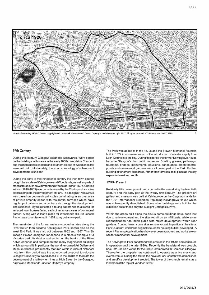
During this century Glasgow expanded westwards. Work began on the buildings in this area in the early 1830s. Woodside Crescent and the more gentle eastern and southern slopes of Woodlands Hill were laid out. Unfortunately, the exact chronology of subsequent developments is unclear.
During the early to mid-nineteenth century the then town council bought the estates of Kelvingrove and Woodlands, as well as parts of other estates such as Clairmont and Woodside. In the 1850’s, Charles Wilson (1810-1863) was commissioned by the City to produce a few plan to complete the development at Park. The design of Park Circus was based on geometric principles culminating in an oval area of private amenity space with residential terraces which have regular plot patterns and a central axis through the development. The residential layout reflected a feuing pattern which allowed for terraced town houses facing each other across areas of communal garden. Along with Wilson’s plans for Woodlands Hill, Sir Joseph Paxton was commissioned in 1854 to lay out a new park.
The remainder of the former mature wooded estates along the River Kelvin then became Kelvingrove Park, known also as the West End Park. It was laid out between 1852 and 1867. This Sir Joseph Paxton designed landscape is a classic example of a Victorian park. Its design and setting on the banks of the River Kelvin enhance and compliment the many magnificent buildings which surround it, in particular the world renowned Art Gallery and Museum which is prominently featured within it. Also of historical note from this period was the abandoned proposal to relocate Glasgow University to Woodlands Hill in the 1840s to facilitate the development of a railway terminus at High Street by the Glasgow, Airdrie and Monklands Junction Railway Company.
The Park was added to in the 1870s and the Stewart Memorial Fountain built in 1872 in commemoration of the introduction of a water supply from Loch Katrine into the city. During this period the former Kelvingrove House became Glasgow’s first public museum. Bowling greens, pathways, fountains, bridges, monuments, pavilions, bandstands, amphitheatre, ponds and ornamental gardens were all developed in the Park. Further building of tenement properties, rather than terraces, took place as the city expanded west and south.
1900 - Present
Relatively little development has occurred in the area during the twentieth century and the early part of the twenty-first century. The present art gallery and museum was built at Kelvingrove on the Clayslaps lands for the 1901 International Exhibition, replacing Kelvingrove House which was subsequently demolished. Some other buildings were built for the exhibition but of these only the Sunlight Cottages survive.
Within the areas built since the 1830s some buildings have been lost due to redevelopment and the sites rebuilt on an infill basis. While some redensification has taken place with mews development within rear gardens, fronting lanes, some sites remain vacant. In particular the site at Park Quadrant which was originally feued for housing but not developed. A recent Planning Application has however been approved and works are on site for a residential development.
The Kelvingrove Park bandstand was erected in the 1920s and continued in operation until the late 1990s. Recently the bandstand was brought back into use as a venue for the 2014 Commonwealth Games in Glasgow. Thereafter the property has continued to operate as a live music and events venue. During the 1960s the nave of Park Church was demolished and an office development erected. The tower of the church remains as a landmark at the top of Lynedoch Street.
circa 1920
2Historical Mapping 1920 © Crown copyright and Landmark Information © Crown Copyright and database right 2017. All rights reserved. OS Licence No. 100023379

PARK
6/DRS/2018
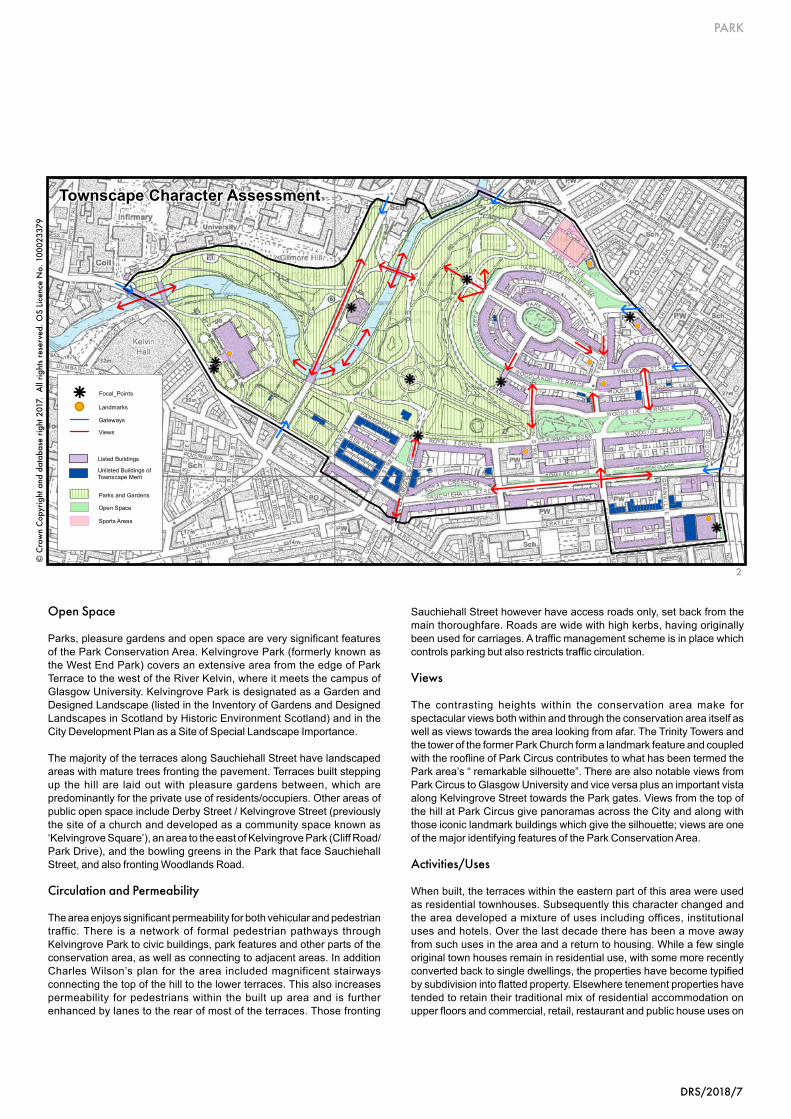
Topography
Woodlands Hill is a drumlin feature and this helps determine the special character of the townscape. The ground slopes steeply away to the valley of the River Kelvin in the west. To the north, south and east the slopes of the drumlin are more gradual. The southern slopes become almost level south of the Park and the terraces off Sauchiehall Street.
Gateways
There are several identifiable gateways into the area. One of the main gateways into Kelvingrove Park is formed by the tree lined Kelvin Way which bisects the Park from Gibson Street in the north to Sauchiehall Street and the Kelvin Way Bridge in the south. The Partick Bridge entrance to the Park also forms a gateway from the west. The main gateway into the heart of the built up area of Park Circus is from Lynedoch Street in the east, although there are others to the north and east. There is further gateway into the area from Charing Cross where it meets Sauchiehall Street and from the Eldon Street entrance to Kelvingrove Park to the north of the area.
Conservation Area Boundaries and Edges
The edge of Kelvingrove Park forms a strong boundary to the north, west and southwest. Towards the south the boundary becomes less coherent and more fragmented as it encounters various tenements and terraces. To the east there is a clear edge along Woodlands Road. Street Pattern
The street pattern reflects the early importance of Sauchiehall Street as a route to the west. Early terraces to the north followed the contours of the drumlin to create an oval “circus” on the hilltop. The contours similarly influenced a grid iron layout on the lower slopes characterised by long sweeping terraces running east/west. This is especially apparent in the terraces north and south of Sauchiehall Street.
Plot Pattern
Within the built up area, plot patterns are very regular and are based on geometric principles. Where redevelopment has taken place, original plot patterns have not been respected and generally such plots have been enlarged.
TOWNSCAPE APPRAISAL
1 View 7-16 Park Circus / 2 Townscape Character Assessment
1
DRS/2018/7
PARK
Open Space
Parks, pleasure gardens and open space are very significant features of the Park Conservation Area. Kelvingrove Park (formerly known as the West End Park) covers an extensive area from the edge of Park Terrace to the west of the River Kelvin, where it meets the campus of Glasgow University. Kelvingrove Park is designated as a Garden and Designed Landscape (listed in the Inventory of Gardens and Designed Landscapes in Scotland by Historic Environment Scotland) and in the City Development Plan as a Site of Special Landscape Importance.
The majority of the terraces along Sauchiehall Street have landscaped areas with mature trees fronting the pavement. Terraces built stepping up the hill are laid out with pleasure gardens between, which are predominantly for the private use of residents/occupiers. Other areas of public open space include Derby Street / Kelvingrove Street (previously the site of a church and developed as a community space known as ‘Kelvingrove Square’), an area to the east of Kelvingrove Park (Cliff Road/ Park Drive), and the bowling greens in the Park that face Sauchiehall Street, and also fronting Woodlands Road.
Circulation and Permeability
The area enjoys significant permeability for both vehicular and pedestrian traffic. There is a network of formal pedestrian pathways through Kelvingrove Park to civic buildings, park features and other parts of the conservation area, as well as connecting to adjacent areas. In addition Charles Wilson’s plan for the area included magnificent stairways connecting the top of the hill to the lower terraces. This also increases permeability for pedestrians within the built up area and is further enhanced by lanes to the rear of most of the terraces. Those fronting
Sauchiehall Street however have access roads only, set back from the main thoroughfare. Roads are wide with high kerbs, having originally been used for carriages. A traffic management scheme is in place which controls parking but also restricts traffic circulation.
Views
The contrasting heights within the conservation area make for spectacular views both within and through the conservation area itself as well as views towards the area looking from afar. The Trinity Towers and the tower of the former Park Church form a landmark feature and coupled with the roofline of Park Circus contributes to what has been termed the Park area’s “ remarkable silhouette”. There are also notable views from Park Circus to Glasgow University and vice versa plus an important vista along Kelvingrove Street towards the Park gates. Views from the top of the hill at Park Circus give panoramas across the City and along with those iconic landmark buildings which give the silhouette; views are one of the major identifying features of the Park Conservation Area.
Activities/Uses
When built, the terraces within the eastern part of this area were used as residential townhouses. Subsequently this character changed and the area developed a mixture of uses including offices, institutional uses and hotels. Over the last decade there has been a move away from such uses in the area and a return to housing. While a few single original town houses remain in residential use, with some more recently converted back to single dwellings, the properties have become typified by subdivision into flatted property. Elsewhere tenement properties have tended to retain their traditional mix of residential accommodation on upper floors and commercial, retail, restaurant and public house uses on
2
!(
!(
!(
!(
!(
!(
!(
k
k
k
k
k
k
k
k
k
Unlisted Buildings of Townscape Merit
Listed Buildings
Parks and Gardens
Open Space
Sports Areas
Views
Gateways
!( Landmarks
k Focal_Points
Townscape Character Assessment
2
© C
row
n C
opyr
ight
and
dat
abas
e rig
ht 2
017.
All
right
s re
serv
ed. O
S Li
cenc
e N
o. 1
0002
3379
PARK
8/DRS/2018
the ground floors. In addition, some of Glasgow’s main civic and cultural buildings are located in this area including Kelvingrove Museum and Art Gallery and the Mitchell Library. A substantial part of the area is open space comprising areas for both public and private use.
Architectural Character
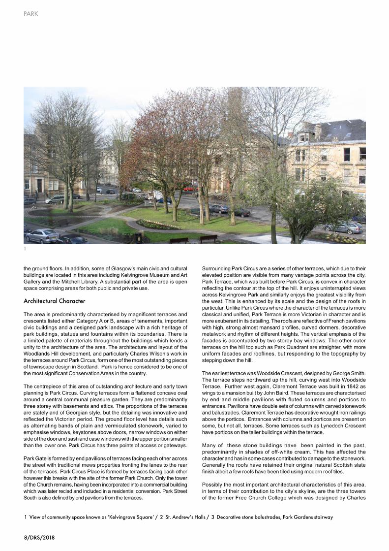
The area is predominantly characterised by magnificent terraces and crescents listed either Category A or B, areas of tenements, important civic buildings and a designed park landscape with a rich heritage of park buildings, statues and fountains within its boundaries. There is a limited palette of materials throughout the buildings which lends a unity to the architecture of the area. The architecture and layout of the Woodlands Hill development, and particularly Charles Wilson’s work in the terraces around Park Circus, form one of the most outstanding pieces of townscape design in Scotland. Park is hence considered to be one of the most significant Conservation Areas in the country.
The centrepiece of this area of outstanding architecture and early town planning is Park Circus. Curving terraces form a flattened concave oval around a central communal pleasure garden. They are predominantly three storey with basements and attics. The proportions of the terraces are stately and of Georgian style, but the detailing was innovative and reflected the Victorian period. The ground floor level has details such as alternating bands of plain and vermiculated stonework, varied to emphasise windows, keystones above doors, narrow windows on either side of the door and sash and case windows with the upper portion smaller than the lower one. Park Circus has three points of access or gateways. Park Gate is formed by end pavilions of terraces facing each other across the street with traditional mews properties fronting the lanes to the rear of the terraces. Park Circus Place is formed by terraces facing each other however this breaks with the site of the former Park Church. Only the tower of the Church remains, having been incorporated into a commercial building which was later reclad and included in a residential conversion. Park Street South is also defined by end pavilions from the terraces.
Surrounding Park Circus are a series of other terraces, which due to their elevated position are visible from many vantage points across the city. Park Terrace, which was built before Park Circus, is convex in character reflecting the contour at the top of the hill. It enjoys uninterrupted views across Kelvingrove Park and similarly enjoys the greatest visibility from the west. This is enhanced by its scale and the design of the roofs in particular. Unlike Park Circus where the character of the terraces is more classical and unified, Park Terrace is more Victorian in character and is more exuberant in its detailing. The roofs are reflective of French pavilions with high, strong almost mansard profiles, curved dormers, decorative metalwork and rhythm of different heights. The vertical emphasis of the facades is accentuated by two storey bay windows. The other outer terraces on the hill top such as Park Quadrant are straighter, with more uniform facades and rooflines, but responding to the topography by stepping down the hill.
The earliest terrace was Woodside Crescent, designed by George Smith. The terrace steps northward up the hill, curving west into Woodside Terrace. Further west again, Claremont Terrace was built in 1842 as wings to a mansion built by John Baird. These terraces are characterised by end and middle pavilions with fluted columns and porticos to entrances. Pavilions have double sets of columns with carved stonework and balustrades. Claremont Terrace has decorative wrought iron railings above the porticos. Entrances with columns and porticos are present on some, but not all, terraces. Some terraces such as Lynedoch Crescent have porticos on the taller buildings within the terrace.
Many of these stone buildings have been painted in the past, predominantly in shades of off-white cream. This has affected the character and has in some cases contributed to damage to the stonework. Generally the roofs have retained their original natural Scottish slate finish albeit a few roofs have been tiled using modern roof tiles.
Possibly the most important architectural characteristics of this area, in terms of their contribution to the city’s skyline, are the three towers of the former Free Church College which was designed by Charles
1
1 View of community space known as ‘Kelvingrove Square’ / 2 St. Andrew’s Halls / 3 Decorative stone balustrades, Park Gardens stairway

DRS/2018/9
PARK
Wilson together with the tower of the former Park Church. Woodlands Parish Church also contributes but sits at the bottom of the hill to the north. These are important landmarks for the City.
In this area there are important cultural and civic buildings which contribute to the richness of the architectural quality of the area such as the Mitchell Library (incorporating the former St. Andrew’s Halls), Kelvingrove Art Gallery and Museum, the former Queen’s Rooms at La Belle Place, and the various listed buildings, statues and fountains within Kelvingrove Park.
Also contributing to the architectural character are the steps linking the different levels of terraces. These are separately listed structures, and formed part of Charles Wilson’s overall design concept. Some of the steps are in natural stone, some are granite. Stone balustrades are unifying features and some flights are straight, others such as the Clifton Steps are designed to lead from one flight into two.
There have been a few modern interventions on gap sites or redevelopment of existing buildings. Some of these detract from the quality of architecture in the area.
2
3

PARK
10/DRS/2018
Building Materials
The traditional building materials found in Park Conservation Area are: -
l sandstone
l natural Scottish slate
l timber sliding sash and case windows
l glass; clear etched and stained
l cast iron
l wrought iron
l brick rear boundary walls
l lead
l copper
l Caithness slab
l granite
Modern materials include:-
l render
l paint
l roof tiles
l upvc windows
l plastic guttering/downpipes
l tarmacadam
Townscape Detail
A variety of unique townscape details enriches the character of the Park Conservation Area: -
l decorative wrought iron roof ridges
l decorative railings around rows of chimneys
l chimneys with original pots
l rounded dormers with decorative finials.
l heavy cornices with dentils
l leaded, etched and stained glass windows
l stained glass rear extensions
l cast iron as decorative construction
1
4
3
2
1 Cast iron lamp, Park Gate entrance / 2 Window detail, 22 Park Circus / 3 Decorative stone staircase, Park Gardens / 4 Decorative cast iron railings, Woodlands Terrace / 5 Decorative work, Park Gardens / 6 Stewart Memorial Fountain, Kelvingrove Park
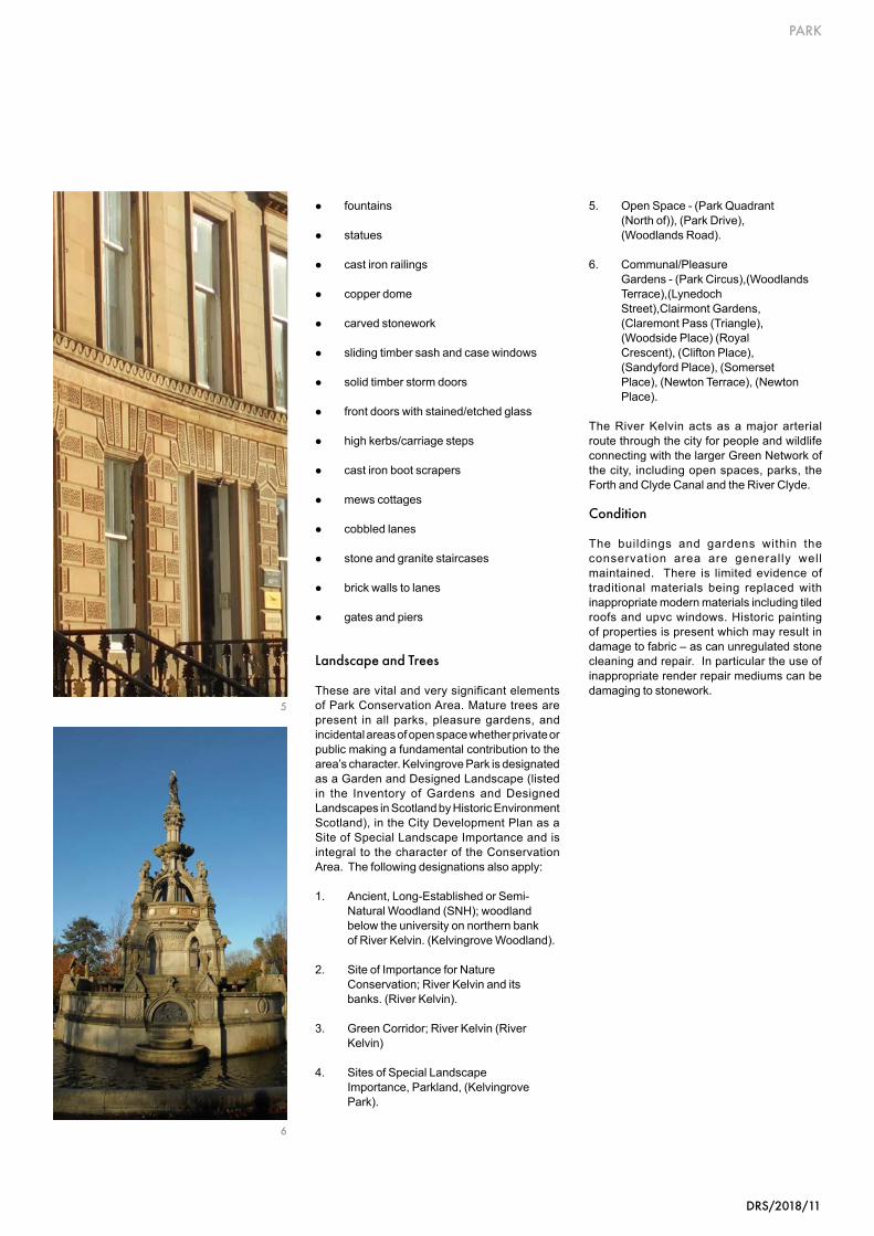
DRS/2018/11
PARK
l fountains
l statues
l cast iron railings
l copper dome
l carved stonework
l sliding timber sash and case windows
l solid timber storm doors
l front doors with stained/etched glass
l high kerbs/carriage steps
l cast iron boot scrapers
l mews cottages
l cobbled lanes
l stone and granite staircases
l brick walls to lanes
l gates and piers
Landscape and Trees
These are vital and very significant elements of Park Conservation Area. Mature trees are present in all parks, pleasure gardens, and incidental areas of open space whether private or public making a fundamental contribution to the area’s character. Kelvingrove Park is designated as a Garden and Designed Landscape (listed in the Inventory of Gardens and Designed Landscapes in Scotland by Historic Environment Scotland), in the City Development Plan as a Site of Special Landscape Importance and is integral to the character of the Conservation Area. The following designations also apply:
1. Ancient, Long-Established or Semi- Natural Woodland (SNH); woodland below the university on northern bank of River Kelvin. (Kelvingrove Woodland). 2. Site of Importance for Nature Conservation; River Kelvin and its banks. (River Kelvin).
3. Green Corridor; River Kelvin (River Kelvin)
4. Sites of Special Landscape Importance, Parkland, (Kelvingrove Park).
5. Open Space - (Park Quadrant (North of)), (Park Drive), (Woodlands Road). 6. Communal/Pleasure Gardens - (Park Circus),(Woodlands Terrace),(Lynedoch Street),Clairmont Gardens, (Claremont Pass (Triangle), (Woodside Place) (Royal Crescent), (Clifton Place), (Sandyford Place), (Somerset Place), (Newton Terrace), (Newton Place).
The River Kelvin acts as a major arterial route through the city for people and wildlife connecting with the larger Green Network of the city, including open spaces, parks, the Forth and Clyde Canal and the River Clyde.
Condition
The buildings and gardens within the conservation area are generally well maintained. There is limited evidence of traditional materials being replaced with inappropriate modern materials including tiled roofs and upvc windows. Historic painting of properties is present which may result in damage to fabric – as can unregulated stone cleaning and repair. In particular the use of inappropriate render repair mediums can be damaging to stonework.
5
6
PARK
12/DRS/2018
Listed Buildings
Buildings that are “listed” have already been assessed by Historic Environment Scotland as being of special architectural or historic interest and are included on the Scottish Ministers statutory list.
There are many fine listed buildings in Park Conservation Area, which are described in the Architectural Character section of this Appraisal. Listed buildings contribute posi t ively to the appearance of the conservation area, provide points of interest and enrich the areas special character.
Unlisted Buildings of Townscape Merit
There are very few buildings which are not listed within Park Conservation Area. However, of those that are not listed many make a positive, visual contribution to the character and appearance of the Conservation Area. These include the unlisted tenement buildings in the western portion of the Conservation Area around Bentinck Street. These properties help to define the historic street pattern of Park and are integral to the character of the Conservation Area. These are not landmark buildings however they are component parts of the planned residential suburb which unify the townscape in terms of their age, height, building line and palette of materials.
Also of note is the 1970s extension to the Mitchell Library which is a high quality piece of architecture that has been carefully designed to fit its surroundings and echo the architecture of St Andrews Hall. It should be noted however that buildings not identified as being of townscape importance are still likely to make some contribution to the character of the area and therefore proposals for their replacement require to be adequately justified.
Key Features and Key Challenges
Having carried out a detailed assessment of buildings and areas it is now possible to identify:-
The Key Features - which define the special architectural and historic character of the area and
The Key Challenges - inappropriate elements which detract from the character and appearance of the area.
Introduction
Having examined the townscape of Park Conservation Area, it is now possible to identify those features which contribute to its character and appearance as an area of special architectural and historic interest.
Assessment of Buildings
An important part of character assessment involves the evaluation of buildings, identifying those that make a valuable contribution and are worthy of retention as well as those which make no positive contribution or which detract from the character and appearance of the conservation area.
1 Parkgrove Terrace looking west to Kelvingrove Art Gallery & Museum / 2 Listed Buildings / 3 Cobbled lane, Park Terrace Lane
CHARACTER ASSESSMENT
1
DRS/2018/13
PARK
Key Features
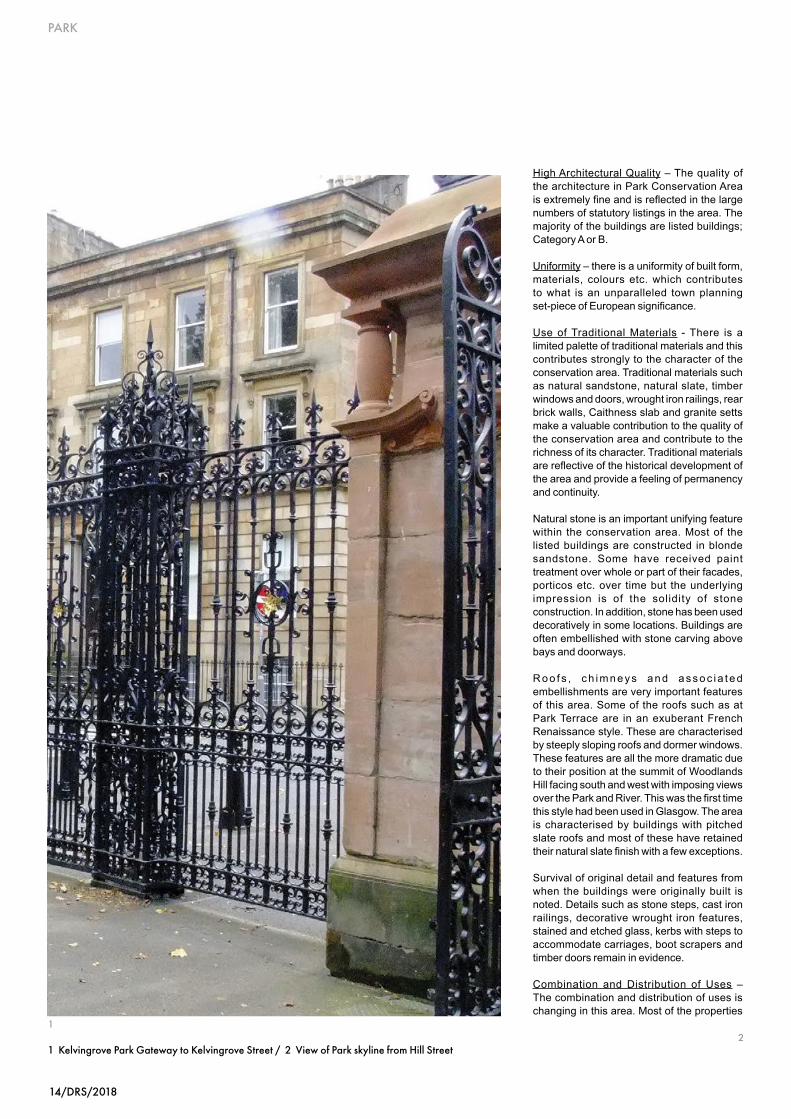
Street Pattern - The street pattern respects the topography with long terraces and rectangular street blocks on the flatter ground to the south on either side of Sauchiehall Street and the streets behind. To the north and east curving terraces step up to reflect the contours of the drumlin, culminating in an oval Circus at the summit. Between the terraces and street blocks are lanes, some of which have a variety of commercial and residential mews buildings.
Building Line - The building line is of fundamental importance as a feature of this conservation area. The established discipline found in the prevailing townscape is predominantly that of terraces which have a main plane to the front façade, with bays and often porticos, projecting beyond the building line. This line is usually strongly reinforced by railings to either basement wells or front gardens dividing these from the pavement. The line of the railings maintains a consistent distance from the building line so that the streets have a regular appearance. In tenemental blocks within the area a similar discipline applies.
3
© Crown Copyright and database right 2017. All rights reserved. OS Licence No 100023379.
Listed Buildings
A
B
C
2
© C
row
n C
opyr
ight
and
dat
abas
e rig
ht 2
017.
All
right
s re
serv
ed. O
S Li
cenc
e N
o. 1
0002
3379
PARK
14/DRS/2018
1 Kelvingrove Park Gateway to Kelvingrove Street / 2 View of Park skyline from Hill Street2
High Architectural Quality – The quality of the architecture in Park Conservation Area is extremely fine and is reflected in the large numbers of statutory listings in the area. The majority of the buildings are listed buildings; Category A or B.
Uniformity – there is a uniformity of built form, materials, colours etc. which contributes to what is an unparalleled town planning set-piece of European significance.
Use of Traditional Materials - There is a limited palette of traditional materials and this contributes strongly to the character of the conservation area. Traditional materials such as natural sandstone, natural slate, timber windows and doors, wrought iron railings, rear brick walls, Caithness slab and granite setts make a valuable contribution to the quality of the conservation area and contribute to the richness of its character. Traditional materials are reflective of the historical development of the area and provide a feeling of permanency and continuity.
Natural stone is an important unifying feature within the conservation area. Most of the listed buildings are constructed in blonde sandstone. Some have received paint treatment over whole or part of their facades, porticos etc. over time but the underlying impression is of the solidity of stone construction. In addition, stone has been used decoratively in some locations. Buildings are often embellished with stone carving above bays and doorways.
R oo f s , ch imne ys an d asso c i a t ed embellishments are very important features of this area. Some of the roofs such as at Park Terrace are in an exuberant French Renaissance style. These are characterised by steeply sloping roofs and dormer windows. These features are all the more dramatic due to their position at the summit of Woodlands Hill facing south and west with imposing views over the Park and River. This was the first time this style had been used in Glasgow. The area is characterised by buildings with pitched slate roofs and most of these have retained their natural slate finish with a few exceptions.
Survival of original detail and features from when the buildings were originally built is noted. Details such as stone steps, cast iron railings, decorative wrought iron features, stained and etched glass, kerbs with steps to accommodate carriages, boot scrapers and timber doors remain in evidence.
Combination and Distribution of Uses – The combination and distribution of uses is changing in this area. Most of the properties
1

DRS/2018/15
PARK
were originally built as residential town houses, however, office and commercial uses moved in during the second half of the 20th Century. These commercial uses are, in turn, gradually moving out and residential uses are returning through conversion of properties.
Other features - There are a number of important additional features of this area which are exceptional in their contribution to the character of this particular conservation area, reflect the relationship of topography and built form and provide visual and physical linkages between areas.
These include:
Balustrades/railings – Park Terrace, the balustrade, railings and gateway to Kelvingrove Park (Charles Wilson) (1855) and stone balustrading on the south side of Park Terrace carriageway with gates west to Lord Robert’s statue are important decorative features unique to the Park area. Also the towers of the former Trinity College, Park Circus Church and St Silas Church form important prominent features on the city skyline.
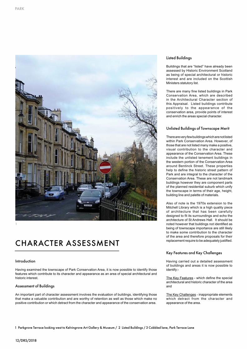
Kelvingrove Park - the Park was designed in conjunction with the housing development by Charles Wilson, Sir Joseph Paxton and Thomas Kyle (surveyor) in what was the first venture of its kind. There are many listed features such as buildings, bridges, fountains and statues within the Park itself including:
Kelvingrove Museum & Art Gallery (1901)Italian Gardens (1915)Cameronians War Memorial (1924)Normandy Veterans Association Monument (1994)Snowbridge (1800)Dumbarton Road gateway (1914)Sunlight Cottages (1901)Chalybeate Spring Well (1800)Burnhouse Weir and Lade (c1450-1900)Remains of Clayslaps Mill (c1650 – 1880)The Psalmist (1972)Tom John Honeyman Seating Area (1972)
Lord Lister Statue (1924)Pulham Rockery and Cascade (1901)Lord Kelvin Statue (1913)Bandstand and Amphitheatre (1924)Kelvinway Gate PiersThomas Carlyle Statue (1916)Prince of Wales Bridge (1894-95)Highland Light Infantry Monument (1906)An Clachan Memorial (1912)Lobey Dosser Statue (1992)Park Terrace retaining wall and balustrade (c1855)Lord Roberts VC Monument (1916)Bengal Tigress Statue (1867)Granite Staircase (1853-54)Café and playground shelter (1913)Herbaceous Border Jubilee Gateway at Derby Street (1897)Stewart Memorial Fountain (1872)Cyprus Pond (1885)Skateboard Park (2004)Bowling and Croquet Pavilions (1922)Kelvinway Gate Piers (1913-14)Kelvinway Bridge (1913-14).
Outwith Kelvingrove Park there is a fountain at the foot of Woodside Crescent (the Category B listed Cameron Memorial Fountain), and a modern statue at Woodlands Gate that are also significant features.
Rear Lanes provide connectivity, permeability and also contribute to the character of the conservation area. Some of these have retained original character, particularly around Park Circus, with cobbled setts and narrow footpaths. In other areas they have been resurfaced extensively with tarmac.
2
2

PARK
16/DRS/2018
1
1 View of Trinity Halls
Key Challenges
Loss of original architectural detail -Original architectural detail makes a defining contribution to the character and appearance of any conservation area. Its retention and repair is therefore an important aspect of the preservation and enhancement of an area. By contrast, inappropriate replacement doors, windows, roof coverings and loss of chimney stacks has, to some extent, eroded the special character of the Park Conservation Area. The reversal of this trend is important.
Use of inappropriate materials -The use of materials in any conservation area is another impor tant e lement of i ts character design and location and appearance. Where these are replaced with modern materials there will normally be a loss of character. A common example is the replacement of original timber windows with modern plastic substitutes which are not in keeping with the character of the buildings. A particular issue in this area is the use of paint on stonework and while some buildings have been painted for many years it is important to encourage the removal of paint from stonework as a long term objective. Given the predominant building material is natural stone, the use of inappropriate repair materials such as render is prevalent.
The Public Realm - The quality and upkeep of the public realm within the conservation area is important. Damage to paving surfaces by utilities and other contractors, design and location of street furniture, street lighting, proliferation of street signs and the maintenance of amenity spaces, all need to be addressed to ensure the character and appearance of the conservation area is maintained
Landscaping - Kelvingrove Park has over the years been the subject of inappropriate over planting which has weakened the original design intent. Land and Environmental Services are seeking to address the issue. An opportunity exists for enhancement of the Park in conjunction with Glasgow University who are working to a Master Plan which includes the new area of the University which abuts the western edge of the Park and includes the former Western Infirmary site.
The greatest changes to the existing landscape are likely to be in the immediate vicinity of the Snow Bridge where the boundaries between the Park and the University are likely to become more indistinct, with a planned connection for the general public, as well as University students and staff, running diagonally from the park, through the new campus and up to Byres Road.
The pleasure gardens throughout the conservation area would benefit from more comprehensive maintenance regimes in order to retain their intended character and design, and prevent the further loss of trees. They add greatly to the views along the various Terraces on Sauchiehall Street; Royal Crescent; the Woodside and Claremont/Clairmont areas; Lynedoch Street and Park Circus. It is the combination of the park, communal gardens, and planned townscape that gives the area its unique character.
Advertising -Recently there have been examples of inappropriate forms of advertising such as banners in the area. In addition, unauthorised canopies attached to listed buildings or free standing within the curtilage are in evidence.
Building Maintenance -The character and appearance of the conservation area is greatly enhanced when buildings are properly maintained. While the majority of buildings are well maintained, there are some which require attention.

DRS/2018/17
PARK
CONSERVATION AREA BOUNDARY
1
2
An important element of this appraisal is the assessment of existing conservation area boundaries.
Examination of the Park Conservation Area boundary has shown that it is clearly and logicallydefinedrequiringnoamendment.
115
Yard
80
53
126
117
1205
91
ST VINC ENT CR ESCENT
LYMB
UR
N STR
EET
47
HAUGH ROAD
120
50
109
63
12
60
Builders
12.9m
Sub
Warehouse
65
122
1231
29
88
68
49
27
17.5m
53
1195
PALM
ERSTON PLA
CE
1192
KE
LVIN
HA
UG
H G
ATE
17
1243
Works
13.5m
70
85
61
58
14
19.1m
Pavilion
ESS
119
111
142
Bowling Greens
1196
40
56
41
130
65
KELVINHAUGH STREET
10
Sta
100
LUM
SD
EN
STR
EE
T
128
15
16.7m
OVERN
EWTO
N PLAC
E
Kelvingrove
67
El Sub Sta
52
PH
Halls
PLACE
YOR
KH
ILL
ST
RE
ET
El Sub Sta
69
47 40
93 to 107
Yorkhill Tunnel
109
172
101
1194
El
PH
45
1201
64
10
115
Garage
9
1
60
1198
67
61
62
46
17.1m
15.0m
141
66
54
79
81 to 91
180
KELVINHA
UGH
55
5712.4m
143
15
164
Depot
ST VI NCENT CRESCENT LANE
145
42
ARGYLE STREET
59
14.4m
61
43
44
115
69
63
36
51
124
77
48
61
1190
73
Fire Station
50
5
STR
EE
T
17.1m
SAND
YFO
RD
STR
EET
50
THO
RNBA
NK
35
75
CAR FR AE STREET
38
GILBERT STREET
80
6.6m
Yorkhill Tunnel
59
44
68
26
TEV
IOT
STR
EET
KELVINH AU GH STREET
Tower
13.9m
56
74
62
20
59
Theatre
CL
EV
EL
AN
D L
AN
E
121
559
75
126
10
81
Dorset Square
20.7m
9
9
43
144
19.2m
65
51
122
74
BERKELEY STREET
53
17
563
237
5
TCB
7821.8m
60
20
10
32
26
87
571
BELTA
NE STR
EET
30
22.6m
23
23.7m
56
7
Mitchell Library
2
68
74
1
LB
Posts
BERKELEY TERRACE LANE
79
48
17
117
to
24
123
26
31
38
25
37
134
29
21.0m
66
84
8
22
153
to 1
59
72
102
78
128
36
53
149
114
13
Clu
b
553
21
85
SANDYFORD PLACE LANE
13
555
20.1m
23
22.5m
PO
7
58
43
CHARING CROSS LANE
141
4
116
42 to 50
138
3
PW
57
33
47
527
147
108
551 245
72
54
229
71
Singh S
abha
Stewart House
529
63
132
75
Clu
b
Clu
b
91
69
15
84
Recreation Ground
PH
569
124
PH
KENT ROAD
34
GR
ANV
ILLE STREET
60
36
27
79
21
24
19
48
(Sikh Tem
ple)
15
239
39
145
122
6
539 to 543
88
110
531581
1
80
104
NE
WT
ON
ST
RE
ET
17
19
533
13
3
50
(public)
152
50
100
126
143
119
68
2
38
Bank
33
Newton Terrace
NEWTON TERRACE LANE
4
118
12
549545
63
Finnieston Tunnel
40
142
52
21
31 to 33
Fitzroy Place
15.4m
902 to 908
2220
21
216
1101
Hotel
19
1088
1095
6
KELV
ING
RO
VE S
TREE
T
PH
3 to
9
LB
29
15
903
1146
1093
30
220
3
923
28
1158 to 1166
31
Club
Hou
se
20
9
939
7
223
18
1142
38
36
LB
4
238
22
37
224
16
34 to 36c
5 to 9
17.1
m
1
1147
CLIFTON PLAC E
DERBY TERRACE LANE
941
Hotel1148 to 1156
PH
Finnieston
920 to 924
PH
29
83
8
12
1
73
219
SAUCHIEHALL STREET
1014
1042
235
16
6
16.2m
26
1087
Henderson
23
1111
918
1143
26a
23
3
1046 to 1056
178
18
28
1
17
6
214
Hotel
218
21
901
Wood
13
2
Henry
10
ROYAL C RESCEN T
PH
23
21
5
TCB
1
Church
1102
16
227 to 231
1105
931
1099
2
1100
222
949
19.6m
8
30
42
Terrace
25
15.2m
3
24SA ND YFORD PLAC E
15
14.9m
1036
1081
Kel
vinh
augh
Sandyfo rd -
LB
21.2m
24
1008
Tunnel
40910
KENT R OAD
1
Memorial
Hotel
ARGYLE STREET
Tunn
el
21
18.1m14
26
1168 to 1176
234
4
9
1135
1113 to 1119
1137
PHST VINCENT CRESCENT
BREC
HIN
STREET
7
1026 to 1032
17
214 to 218
951
1091
15.0m
31
3
to
BERK ELEY STREET
4
12
1131
Westminster
15.9m
Hall
33
27
CLAR
EMO
NT STR
EET
213
13
220
39
30
Surg
ery
Bowling Green
44
19.2m
33
CORU
NNA
STRE
ET
El Sub Sta
1038
1109
3
to
1064
232
St Vincen t
21 19 17 15 1179
5
25 23
3
PO
1
1030
202
66
68
64
53
60
62
54
56
7
LB
9
TCBs
PH
TCBs
20
2a
102
57
64
60
62
200
El Sub Sta
Masts
Clinic
1071
1075
1079
16
1103
38
69
11
170
4
6
86
10
206
4
226
233
228
11 to 12
165
FITZR OY LA NE
1151
1076
1098
1020
1155
1163
10921082
27
1090
1136
10221016
1024
1138
1094
1072
1106
1110
1108
1078to1080
1114
1153
11341130
1126
1120
1116
11221124
1132
1129
1066106810581060
1159
25
1086
1125
74
6967
6
1189
1175
1185
1191
1213
1211
1221 1223
GlasgowGaelic School
1161
537
Shel ter
Shelter
Ga ntry
Shel ter
Shel ter
100
Play Area
Sports Fa cility
1097
54
161
PH
557
Hotel
107
West George Co lleg e
L Twr
L Twr
L Twr
Central Gurdwara Singh Sabha
Shel ter
Shel ter
Shel ters
Shel ter
TCB
TCB
TCB
El Sub Sta
University of Glasgow
20
Cairncross H ouse
99
Shel ter
Hunterian Museum
Hunter M emoria l
Bute Hall
East Quadrang le
Wes
t Qua
dra
ngl
e
Memorial Chapel38.5m
LB
SunlightCottages
37.7m
18.3m
Gilmore Hill
FS41.0m
1
5
11
12
13
52
1a
Kelvingrove Park
MemorialChapel
8
33
24
1307
11
1264
18
16
19.8m66
22
1071
1287
63
19.4m
1009
42
15
5
LB
1
48
CLA
YS
LAP
S R
OA
D
21
10 ARGYLE STREET
24
11
28
18
SAUCHIEHALL STREET
159
16
12
64
1248
1001
16
1019
14
39
Kelvingrove Museum
35
17
1397
10
55
1272
29
10
OVER NEWTON SQU AR E
46
Hotel
11
60
67
6
6
10
1027
36
12
Community
1295
41
3329
1407
54
17
6
34
1417
17
40
Sloping
PH
39
18.4m
RADN
OR S
TREE
T
37
20
52
66
31
18.0m
PH
12
1311
1276
50
2
14
1303
61
23
36
25
1291
19.3m
18.9m
31
1274
29
5
28
Bowling Greens
1278
35
98
Posts
68
PH
1299
PH
16
21.2m
57
58
30
56
34
18.0m
7
Muslim Mis son
5
15
37
masonry
35
22
23
25
1301
26
8
993
and Art Gallery
17.6m
1061
1260
Kelvin Hall
34
BLA
CK
IE S
TR
EE
T
PH
YOR
KH
ILL
STR
EET
31
20.8m
21
7
AR
TH
UR
ST
RE
ET
3
11
LUMSDEN LANE
NA
IRN
ST
RE
ET
9
1940
LUM
SD
EN
STR
EE
T
4
Bowling Greens
17
15
DALNA IR STR EET
6
9
16
El Sub Sta
LB
22.1m
PH
TCBs
12
OLD DUMBARTON ROAD
6
18
STREET
PH
Tennis Courts
13
104
HAST IE
Pavilion
18.6m
17
1268
54
1256
30
9
(PH )
2
1253
OVERNEWTON STREET
22.2m
41
LB
52
4551
16
17
27
1297
4
KELV
IN W
AY
23
2
War M emorial
23
Centre
War M emorial
25
1055
1065
9
10
1309
1313
12
979
21
Sloping
DUMBARTON ROAD
Sluic e
Partick Bridge
Mill Lade
ma sonry
13171315
Weir
12
Lis ter Statue
KelvinRiver
Kelv in Statue
17.8m
Putting Green
Weir
70
PH
Sluic e
7278
74
1263
76
12
20
1361
1355
1359
1232
Kelvingrove Park16.2m
1300
REGENT MORAY STREET
14.6m
11
1292
1347
42
1349
13.5m
9
1063
1294
BLANTYRE STREET
49
3
1222
1345
48
1214
1351
1208
1204
Regal
1298
1240
68
23
YOR KH ILL PARA DE
4147
4161
6 to 1 0
35
35
53
17
45
53
Yorkhill Tunnel
ESM
ON
D S
TRE
ET
18.1m
13.8m
El Sub Sta
12.0m
TCB
53
13.6m
BUNHOUSE ROAD
11
Chy
Car Pa rk
47
39
29
Sewage Pumping Station
174
175
13
214
23
FS
26
9
Sub Sta
162
6
164
62
20
23
CRESCENT
156
WILLOWBANK
226
242
44
275
218
39
35
208
141
80
269
311
WEST PRINCE'S STREET
67
212
226
BARRINGTON
218
The
192
19
98
95
170
51
33
216
14
21
of
160
Bowling Green
PARK DRIVE
Club
WOO
DLANDS ROAD
6
233
10 23.8m
61
147
22
177
34
13
189
Pavilion
185
52
36
69
WIL
LOW
BANK S
TREET
40
216
7
34
148
32
PH
31
87
School
20
99
34
17
Park Church
24
35
4
Hall
126
23.8m
35
18
House
Public Hous e
106
163
211
19
17
59
CAR
RING
TON
STR
EET
282
Willowbank
24.7
m
238
33
18
61
PH
214
13
14
27
21
160
DRIVE
240
261
185
30
146
90
El
26.8m
2
2
315
12
175
26.3
m
33
34
2216
77DRIVE
228
STR
EET
79
28
57
45
260
56
207
(Club)
174
DUNE
ARN
30
118
Bowling Green
PH
167
245
66
WOODLANDS
11
15
25
206
26.5m
311
18
21.5m
276
24
247
Primary
WES
TEN
D PA
RK
STRE
ET
63
132
75
10
68
11
29
15
32
197
143
220
39
28
Worship
212
151
13
39
PARK
AVEN
UE
25.6m
24
23
31
15
9
12
235
210
23.5m
19
Baths
30
13
RUPE
RT
STRE
ET
198
30
20
PH
23.2m
31.4m
ELDON STREET
Gilmorehill
19.9m
21.1
m
Statue
Uni
vers
ity o
f Gla
sgow
QU AD RA NT
103
70
30
UNIVERSITY
42
PAR K
Football Ground
22.3
m
AVENUE
25.3m Westban k Co urt
Jam
es W
att B
uild
ing
42.0mBridge
Kel
ving
rove
Tun
nel
Hall
Kelvingrove Park
8
Hall
9
KELV
IN W
AY
St S ilas' English
WES
TBA
NK L
ANE
29.5m
99
5
107
TCBs
WESTBANK QUADRANT
Bridge
9
26.6m
Slop
ing
mas
onry
1
Church
17.9m
Slop
ing
mas
onry
Lodge
Prince o f Wales
144 t
o 148
3 to 9
Eldon Street
27 to 33
18.8m
Nursery
27.3m
Millennium P ark
29
WO
OD
SID
E C
RE
SC
EN
T
18
26
SAUCHIEHALL STREET
ST G
EORG
E'S R
OAD
PARK DRIVE
WIL
LOW
BANK
El
33.4m
27
231
PC
1
35
27
28
11
52
7
48
19
3
29
11
12
136
Host
el
13
ELD
ERSL
IE
Club
CLA IR MONT GA RD ENS
17
95
24
169
LAN
E
45
29.4m
40 to 42
24.7m
31
15
1
3
15
93
44 to 48
104
Club
9
54
45 to
56
43.2m
3
PO
7
1
15
29.5m
25
140
LYN
ED
OC
H
19
108
35
175
ASHL
EY S
TREE
T
2
7
1
2
ASHL
EY S
TREE
T
8
99
6
7
Sub Sta
35
38.6m
LANE
81
19
Statue
Park House
20
21 to 25
35.3m
12
to
29
Club
26
15
27
ESS
34.7m
14
1
WOODSIDE PLACE LANE
14
18
21
LANE
11
30
45
DW
20
61
SOMERS ET P LACE M EWS
Church
91
5
35.9m
21
14
107
Club
CLA REM ON T TER RAC E
13
83
ASH
LEY
LANE
2
D Fn
PARK
21 to 25
46
63
4
CARNARVON STREET
22
15
1
61
ST GEO
RG
E'S RO
AD
M 8
Tunn
el
PLA
CE
TERRACE
WOODSIDE PLAC E
15
LYNE
21
25
77
19
27
515
96
Club
26.6m
69
12
17
Sub Sta
6 to 10
ARLI
NG
TON
STR
EET
STREET
27
30
CRES
18
Club
11
56
9
9
44
22
92
16
38.7m
28
29.8m
LYNED OCH STR EET
73
Posts
STR
EET
5
12
29
20 to 23
138
11a
WES
TEN
D PA
RK
STRE
ET
60 to 68
45.1m
13
28.3
m
152 to 158
11a
LB
6
102
LANE
24
WOODSIDE TERRACE LANE
20
Posts
5
PH
TCB
28
140 to 148
WEST
7
2
WOODSIDE TERRACE LANE
FB
98
12
60
46 to 50
89
43
71
16
79
37
8
CLAR
EMO
NT PLA
CE 21
LY NEDOCH
6
47
26
174 to 188
PARK CIRCUS PLACE
23
8
4
1
8
28
1
3 to 7
30.4m
63
BALI
OL ST
REET
Hotel
12
Posts
117
58
41 to 45
PH
to 8
9
47
Charing Cross
CLIFF ROAD
38
CENT
13
17
PARK
7
110
PRINCE'S STREET
GRANT STREET
DOCH
18
28
3
30.1m
Club
LYNED
OCH
TERR
ACE
WOODLAND S GATE
El
9 to 16
48
9
56
132
WOODLANDS ROAD
CLAREMONT
164 to 172
21
El Sub Sta
22 to
26
97
BA
LIO
L L
AN
E
QUADRANT
PAR K TERR AC E EAST
1
37
27
10 to
14
33
58 to 62
Tunn
el
24.9m
42
El Sub Sta
20
65
NEWTON PLAC E
24
WOODSIDE TERR AC E
1
9
El
Hall
Club
51
22
11
Mosque
10
27 to
31
74
SOM ERSET PLA CE
97
14
CRESCENT
113
13
CIRCUS
WOODLAND S TERR ACE
Host
e l
71
3
18
Sta
43
6
Sub
93
4
LA BELLE PLACE
52
Pond
NO
RT
H C
LAR
EM
ON
T STR
EE
T
17
32
19.2m
46
Statue
18
Hotel
21
970
22
17
1
26
34
PARK
PAR
K
3
45.3m
PARKGROVE TERRACE
56
24
Clif ton House
22
CIRCUS
50
45
45.4m
1
21
18.9m
23
1 to 7
LB
39
9
TERR AC E
44
11
Statue
1
8
19
Stewa rt M emoria l Fountain
45
12
SW
22
4
13
20
Astoria
Kelvingrove Park
Playing Fi eld
28
20
48.4m
2
24
Hindu M andir
3
53
12
CIR CU S LANE
LANE
1
9
50
GRAY
STR
EET
40
CLIFT
ON
ST
RE
ET
12
37
37
PW
7
6
Posts
BENT INCK STREET
DERB
Y ST
REE
T
SW
2
46
9
D Fn
2
66
34
13
PARK GARDENS
Robe rts M emori al
38
Hall
14
7
37
11a
7
1
969
24
30
5
22
ROYAL TERRA CE
Kelv
ingr
ove
Tunn
el
4
PARK
STR
EET
SOUT
H
Bandsta nd
PARK TERRACE EAST LANE
1
Post
PAR K
30
TER
RA
CE
1
PARK GATE
16
CRAIGMADDIE TERRACE LANE
45.4m
PARKGROVE TERRACE LANE
PAR
K
36
18
35
20
15
TERRAC
E
Pond
973
29
Rive
r Kel
vin
40
16.6m
PARK GARDENS LANE
KE
LVIN
GR
OV
E S
TRE
ET
Terr
aces
Fountain
CLA REM ON T
23
KELV
IN W
AY
7
19.6m
14
49
LA BELLE ALLEE
SAUCHIEHALL STREET
20
Bank
4
ROYAL TERRACE LANE
17.1m
53
6
26
20.8m
47
LB
5
Roller Sk ating Ri nk
971
48
WOODLAND S TERR ACE
3
5
Footbridge
Garage
45
Gaelic
2
TCBs
26
28
3
1
30
20
2422
ARLINGTON PLACE
35
5
55
Youth Hostel
41
11
36
10
19
11
17
2726
11
17
35
144
30
3
8
37
33
24
2019
10
5
20
1011
1
5
11
28
8a
10
PCs
53
ESS
7
71
69
60
58
Burgh Const Bdy
CR
CR
Burgh Const Bdy
Burgh Const Bdy
CR
Burgh Const Bdy
CR
Burgh Const Bdy
War
d B
dy
Burg
h C
onst
Bdy
CR
Wa rd Bdy
Wa rd Bdy
ESS
14
11b
Nursing Home
56 54
52 to 56
1
1517
211
203
207
7
9 to
13
Cam psieHouse
7
18
64
19
62
MenteithHouse
89
19
3127
10
1110A
9
33A
2
9
958
960
17
5
20
7
18
30 28
948
940944
964
950
Angus Hotel
11
95
138
97
79
136
PRO
FES
SO
RS
96
1381
1323
1319
Ardgowan
13
90
PH
11
1377 to 1
37913
7313
83 to 1
385
1248
1268
92
1288
94
1375
TreesTrees
Trees
Trees
Trees
Trees
Trees
Trees
Trees
TreesTrees
TreesTrees
Trees
Trees
Trees
Trees
116
192
124
To 130
19 20
14
194
114
School (dis)
PrimarySchoo l
Western Infirmary
Anderso n'sCollege
Primary School
Tree
s
244
119 to 127
246
284 to 288
171
169
248250 to 254
161
163
135
244
147
151
44a
44b
149
246
157
22
199
197
20
195
262
266270
264
258
193
3020 WoodsideHouse
University OfGlasgow
62
18
47
59
6 to 1 0
Shel ter
Shel ter
Shelter
Terraces
LB
Play Area
Play Area
Play Area
Shel ter
Shel ter
Shel ter
Shel ter
Shel ter
Shel ter
Shel ter
Posts
Post
FSs
Tree
Tree
5
12
6567
ESS
ESS
Pavilion
Car Pa rk
265
261
1
93 to
97
St GeorgesStudio
5
WoodlandsCommunity Garden
278
Woo
dside B
usiness Centre
University of GlasgowSt Andrew's Building
138136
18
13
(Sports Facility)
1331
1325
L Twr
ESSs
Ward Bdy
SM
Shel ter
Shel ter
Shel ter
Shel ter
Shel ter
Shel ter
TCBsLB
Play Area
Terrace Lane
Wa rd Bdy
Ward B
dy
Def
8
1113
2218
8
Shel ter
6
Shel ter
TCB
House
Charing
Government Offices
5
Newton
Sub Sta
10
Hotel
Station
349
Cross
300
457
El
501
ELMB AN K C RESC ENT
PH
Finnieston Tunnel
Tay House
441 to 453
101
65
Subway
27
CROM
WELL
STREET
11
44
35
El Sub Sta
QUEEN'S
1
8
CROMWELL LANE
52
112
103 to 115
95
CRESCENT
65
6
Fn
9
57
8
58
41
540
351
534
3
357
3
310
30
542to
143
1
4
113
341
20 to 28
67
38
4
51
353359
48
18
PH
141
85
518
139
73
63
El Sub Sta
528
129
147
14
Garage
308
137
24
546
49
532
347
33
2
8 to 12
516
18
40 to 44
11
PH
61
14
37
46
26.8m
119
to 1
25
22
79
534a
35
25
343
536538
345
MEL
RO
SEST
REET
46
42
8791
93
9799
120
126 to 128
130
124
79
54
50
10
2
25
31
29
4
33
37
122
L Twr
TCBs
Cycl e Hi re Station
10
19
Cycl eHireStation
Cycl eHireStation
1 Park Conservation Area / 2 Aerial c1930 / 3 Aerial Park Circus
© C
row
n C
opyr
ight
and
dat
abas
e rig
ht 2
017.
All
right
s re
serv
ed. O
S Li
cenc
e N
o. 1
0002
3379

PARK
18/DRS/2018
Introduction
The appl icat ion of planning pol ic ies and provision of information and advice encouraging sympathetic maintenance and repair are important tools in the preservation of the areas’ unique character and are dealt with in the following pages.
A number of specific sites/issues have also been identified as opportunities for enhancement.
Opportunities for Preservation and Enhancement
Maintenance - The best means of preserving the character and appearance of any area is through the routine maintenance of buildings. Roofs, domes, statuary, chimneys, windows, doors, guttering, stonework, entrance steps, need regular attention to prolong their life secure the future of the building and enhance its setting. Regular, coordinated maintenance programmes can help reduce costs in the long term.
Development - Minor works such as the removal of chimneys and replacement or alteration of traditional windows, doors, and roofs with modern styles and materials are evident and can have the cumulative effect of eroding the character and appearance of the conservation area. The City Council is committed to the preservation of the areas’ unique character through the application of City Development Plan policies. Information relating to the key policies which promote the sympathetic design, repair and maintenance of property can be found in the Glasgow City Development Plan and online at www.glasgow.gov.uk
Design of new buildings – Park has a very strong and consistent architectural character. The scale, massing, formality and high quality of the architecture are important elements of the established character. New buildings should reflect these characteristics in order to maintain the character of the area and in accordance with the City Development Plan.
Information and Advice - Property owners and residents have a major role to play in the preservation and enhancement of the Park Conservation Area. Information on the implications of living in a Listed Building/Conservation Area is available on the Council’s website. Residents may contact the Council with any Planning or conservation queries.
1 Detail, 18 Park Terrace / 2 Decorative detail, Kelvin Way Bridge
PRESERVATIONAND ENHANCEMENT
1

DRS/2018/19
PARK
Street Furniture – The standardisation and coordination of streetscape elements such as pedestrian barriers, litter bins, street signage, lighting, street name panels, phone boxes and traffic control boxes would complement the formal lines of the prevailing architecture and reinforce the character of the conservation area.
Lighting – It is important that street lighting fixtures complement the architectural and historic character of the area. All lighting fixtures will be assessed on their merit. Land and Environmental Services and Development and Regeneration Services must be satisfied that lighting proposals meet the Council’s design standards with regard to light quality and enhancement of the historic environment.
Public Realm – redevelopment works and repeated excavations by statutory undertakers have resulted in the gradual loss of traditional materials from the Conservation Area. Some historic materials survive and their reinstatement should be encouraged as per City Development Plan 2017 Policy SG9 Historic Environment, which states that repairs should be carried out to match traditional materials, where they still exist. Bituminous patching is not acceptable. Where complete resurfacing is required, high quality materials should be used, e.g. Caithness/stone flags/granite setts or, alternatively, high quality textured pre-cast concrete blocks of similar colour and scale. Continuous bituminous surfacing is not acceptable. Allowance should be made for sustainable urban drainage, tree pits and green swales where possible as integral features of the conservation area and especially where these are already historic features of the streetscape. Original kerbs should be retained, wherever possible. Original details such as pavement lights and cast iron manhole covers should be retained in situ wherever possible. In addition the location and number of telecommunications apparatus, including Broadband and other cabinets on pavements, should not be detrimental to the character or setting of a Listed Building or visual amenity of a Conservation Area.
2
Grants
Possible sources of grant funding would include Historic Environment Scotland and/or Glasgow City Heritage Trust. Glasgow City Heritage Trust currently prioritises their limited funding in line with their aims and those of their funders. The Trust aims to target funds where the justification is greatest. In practice this means eligible buildings must clearly demonstrate economic, social, environmental and regeneration benefits. Applicants should be aware that the award of grant is discretionary and subject to availability.
Certain kinds of work are eligible including:• Repair or reinstatement of original
architectural features such as windows, decorative work and railings
• Repair of structural elements including masonry, roofs and joinery
For further information contact: Glasgow City Heritage Trust,54 Bell Street,GlasgowG1 1LQTelephone: 0141 552 1331Email: [email protected]: www.glasgowheritage.org.uk

PARK
20/DRS/2018
ARTICLE 4 DIRECTIONS
In addition to the specific conservation area controls mentioned in What Does Conservation Area Status Mean above, further controls can be applied called Article 4 Directions. These have the effect of controlling minor works which, over time, could erode the character and appearance of the conservation area.
The effect of an Article 4 Direction is to control minor works which, over time, could erode the character and appearance of the conservation area. Article 4 Directions do not preclude the carrying out of these works but planning permission must be sought.
The Park Conservation Area has Article 4 Directions covering the following Classes of Development:
● Class1Theenlargement,improvementorotheralterationofa dwelling house.
● Class 3 The provision within the curtilage of a dwelling house of any building or enclosure, swimming or other pool required for a purpose incidental to the enjoyment of the dwelling house, or the maintenance, improvement or other alteration of such a building or enclosure.
● Class 7 The erection, construction, maintenance, improvement or other alteration of a gate, fence, wall or other means of enclosure.
● Class27Thecarryingoutonlandwithintheboundariesofaprivate road or private way of works required for the maintenance or improvement of the road or way.
1 St. Andrew’s Halls / 2 Kelvingrove Park Bandstand and Amphitheatre/ 3 Decorative Detail, 18 Park Circus/ 4 Kelvingrove Art Gallery & Museum
1
2

DRS/2018/21
PARK
The General Permitted Development Order (GPDO) which came into force on the 6th February 2012 has in effect removed all permitted development (PD) rights for householders (i.e. dwellings or flatted residential properties) within conservation areas without the planning authority having to apply for Article 4 Directions. Flats have no Permitted Development rights in a conservation area. As the rights have been removed by statute any application requires a fee.
Where article 4 directions exist for householder development (e.g. the old Class 1 and Class 3) these are in effect superseded by the new GPDO. However the article 4 directions which exist for Class 7 (fences walls) and Class 27 roads still apply as these are not altered by the new GPDO.
CITY DEVELOPMENT PLAN
The quality and character of the Park Conservation Area, as identified in this Appraisal, will be maintained through the implementation of policies contained within the adopted City Development Plan (2017).
The City Development Plan can be accessed at www.glasgow.gov.uk.
The completion of the Park Conservation Area Appraisal provides an opportunity for the interpretation of these policies at a more local level, focusing on the unique character of the area, architectural features and townscape detailing.
3
4

PARK
22/DRS/2018
Useful Publications:-
INFORM Guides, available from Historic Environment Scotland or downloadable f rom the i r webs i te . These lea f le ts give owners of t radi t ional bui ld ings information on repair and maintenance. www.historic-scotland.gov.uk
Useful Contacts:-
For all planning, conservation, landscape, tree, building control and public safety related enquires: Development & Regeneration S e r v i c e s P h o n e 0 1 4 1 2 8 7 8 5 5 5 . www.glasgow.gov.uk
Historic Environment Scotland Phone 0131 668 8600 www.historic-scotland.gov.uk
IHBC Institute of Historic Building Conservation www.ihbc.org.uk
Under One Roof – Impartial advice on repair and maintenance for flat owners in Scotlandwww.underoneroof.scot
FURTHER INFORMATION
1
1 Decorative detail, Kelvingrove Art Gallery & Museum / 2 Woodlands Terrace stairway to Clifton Street

DRS/2018/23
PARK
‘Glasgow: The Forming of the City’, edited by Peter Reid 1993
‘Along Great Western Road’, by Gordon Urquhart
‘Charles Wilson - A Question of Style’, by Fiona Sinclair- Published by Park Circus Promotions
‘The Architecture of Glasgow’, by Gomme and Walker 1968
‘The Buildings of Scotland-Glasgow’, by Elizabeth Williams, Anne Riches and Malcolm Higgs; 1990
‘Park Circus Study Area Appraisal’ M Holloway (MAST Architects) for Park and Woodlands Heritage Group, 2016
‘Kelvingrove Park Heritage Trail’Glasgow City Council, LES, 2015
BIBLIOGRAPHY
2