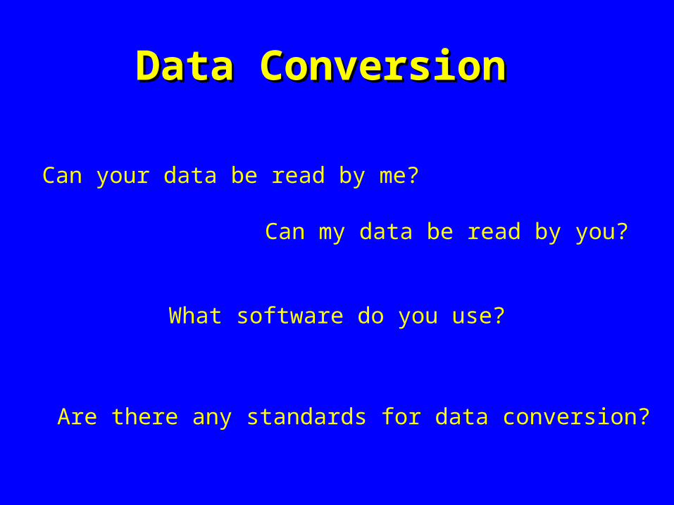
Data ConversionData Conversion
Can your data be read by me?
Can my data be read by you?
What software do you use?
Are there any standards for data conversion?
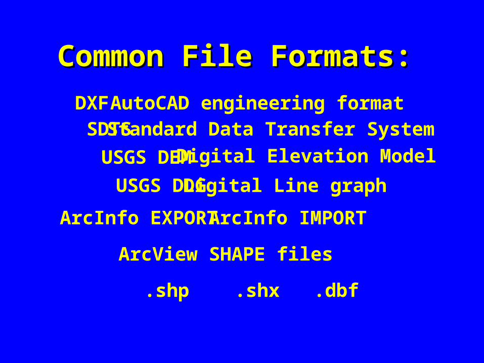
Common File Formats:Common File Formats:
DXFSDTS
USGS DEM
USGS DLG
ArcInfo EXPORT ArcInfo IMPORT
ArcView SHAPE files
Standard Data Transfer System
Digital Elevation Model
Digital Line graph
AutoCAD engineering format
.shp .shx .dbf
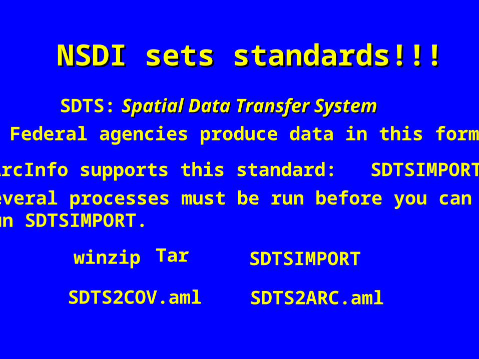
NSDI sets standards!!!NSDI sets standards!!!
SDTS: Spatial Data Transfer SystemSpatial Data Transfer System
All Federal agencies produce data in this format.
ArcInfo supports this standard: SDTSIMPORT
Several processes must be run before you can run SDTSIMPORT.
winzip Tar SDTSIMPORT
SDTS2COV.aml SDTS2ARC.aml
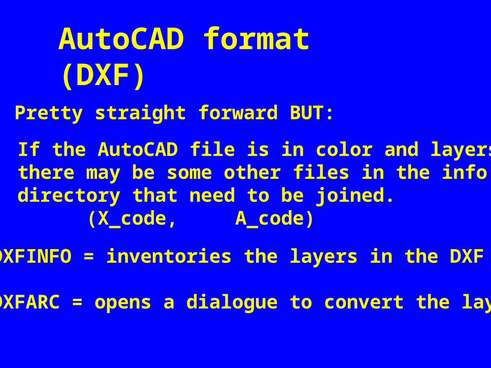
AutoCAD format (DXF)
Pretty straight forward BUT:
If the AutoCAD file is in color and layersthere may be some other files in the info directory that need to be joined. (X_code, A_code)
Arc:\DXFINFO = inventories the layers in the DXF file
Arc:\DXFARC = opens a dialogue to convert the layers
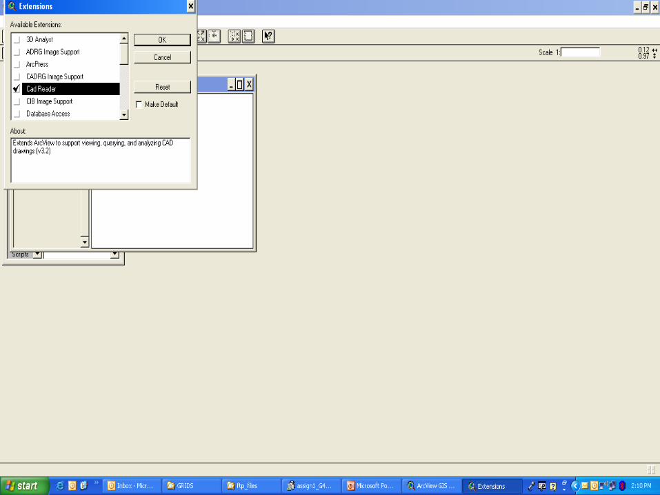
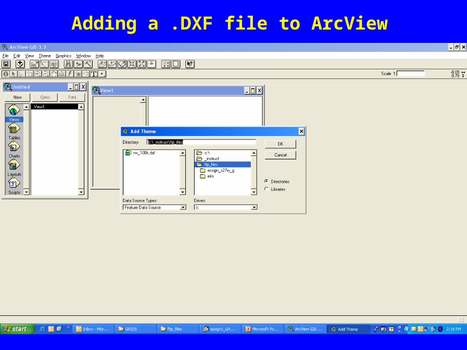
Adding a .DXF file to ArcView
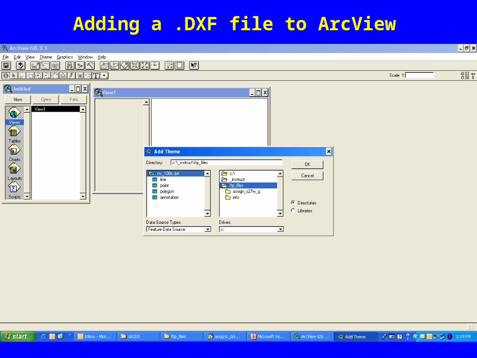
Adding a .DXF file to ArcView
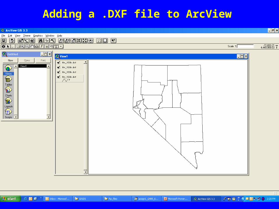
Adding a .DXF file to ArcView
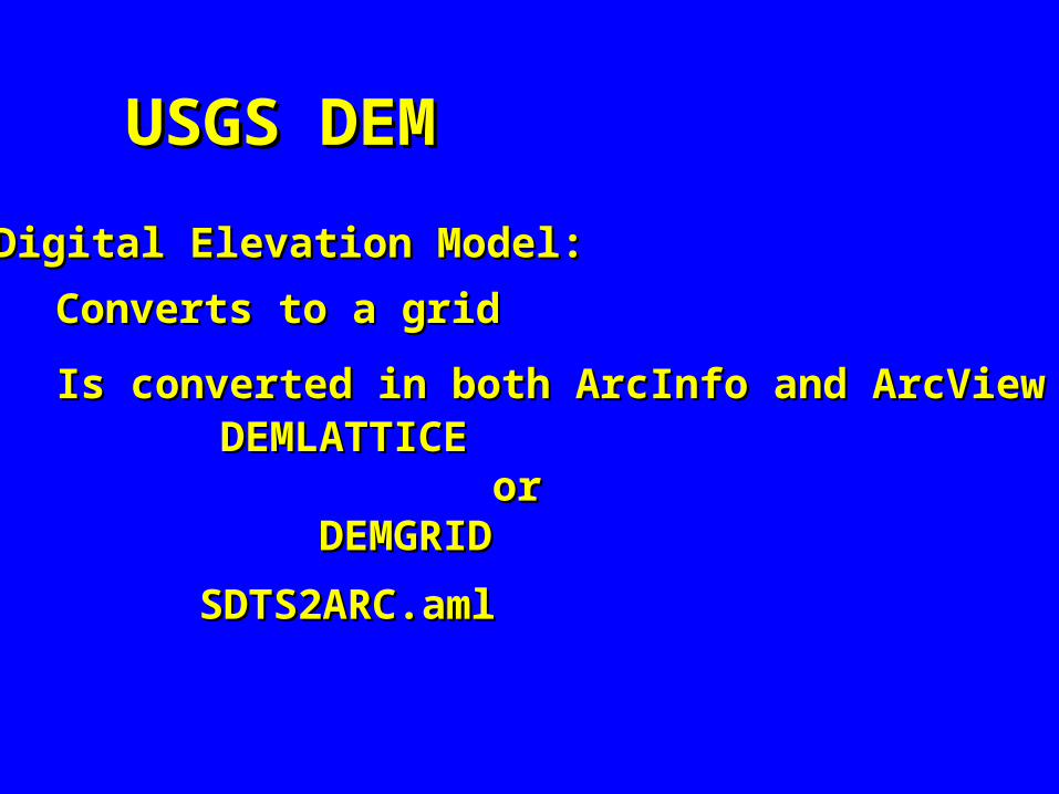
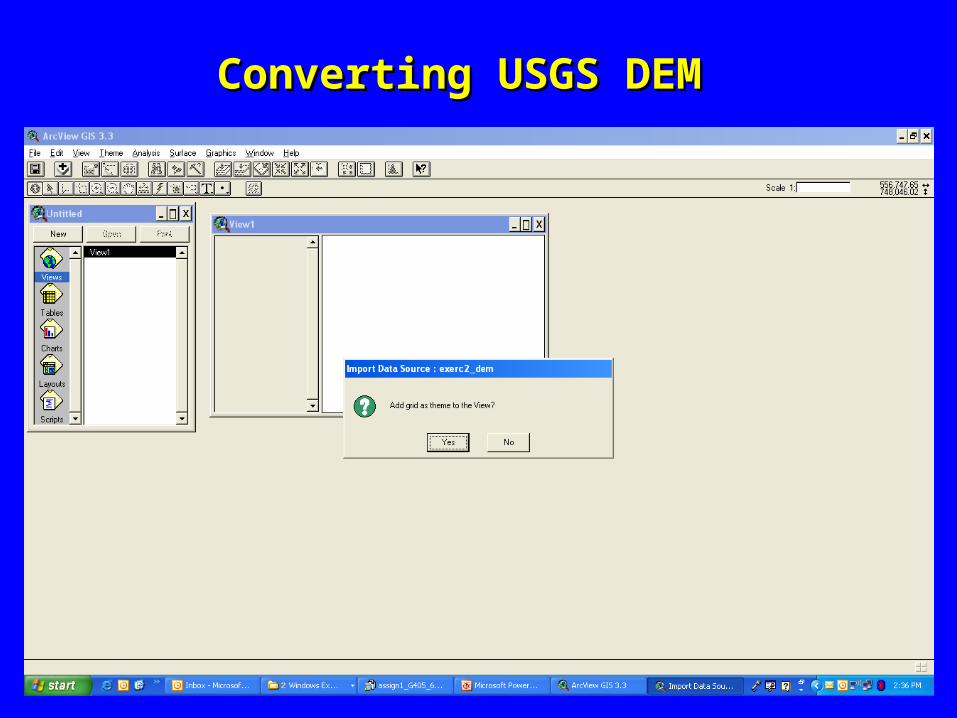
USGS DEMUSGS DEM
Digital Elevation Model:Digital Elevation Model:
Converts to a gridConverts to a grid
Is converted in both ArcInfo and ArcViewIs converted in both ArcInfo and ArcViewDEMLATTICEDEMLATTICE oror DEMGRIDDEMGRID
SDTS2ARC.amlSDTS2ARC.aml

Converting USGS DEMConverting USGS DEM

Converting USGS DEMConverting USGS DEM
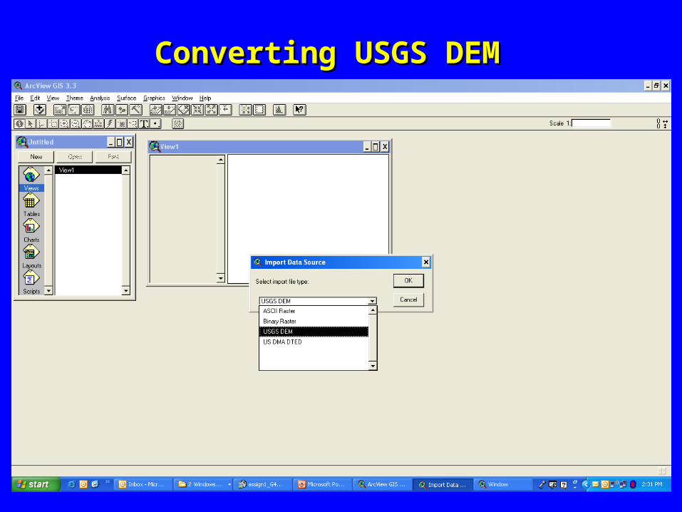
Converting USGS DEMConverting USGS DEM

Converting USGS DEMConverting USGS DEM

Converting USGS DEMConverting USGS DEM
Converting USGS DEMConverting USGS DEM
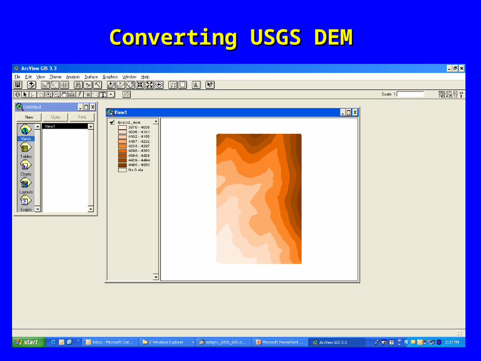
Converting USGS DEMConverting USGS DEM
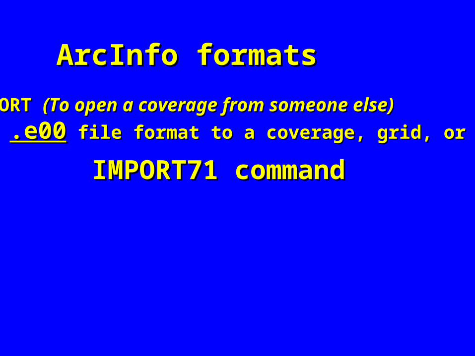
ArcInfo formatsArcInfo formats
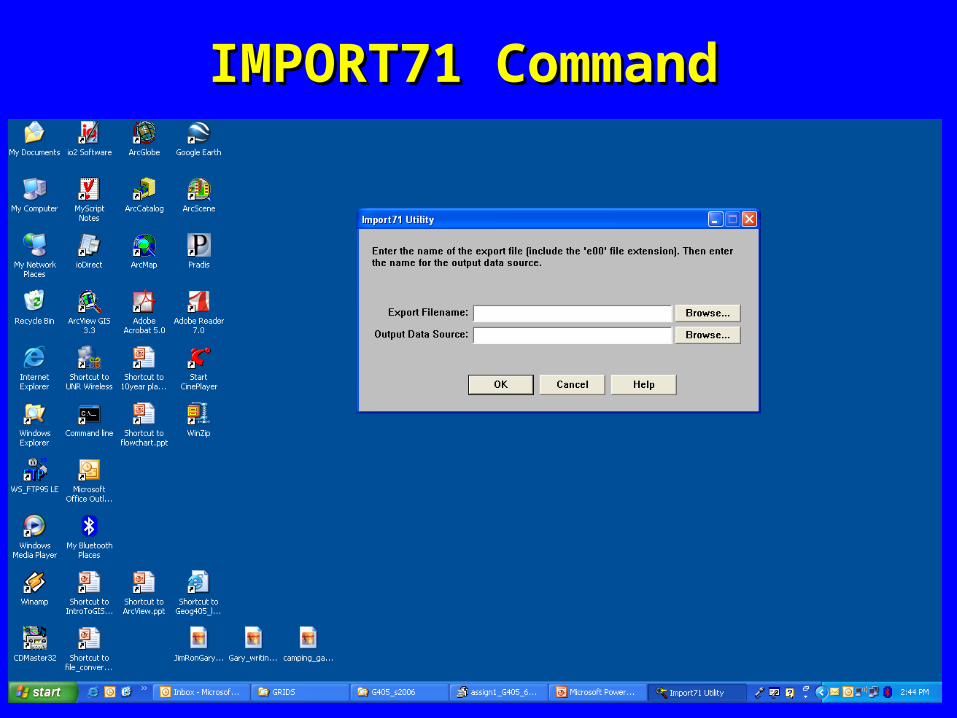
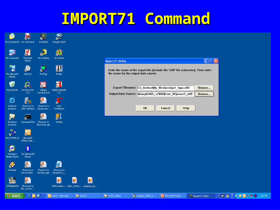
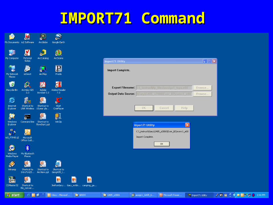
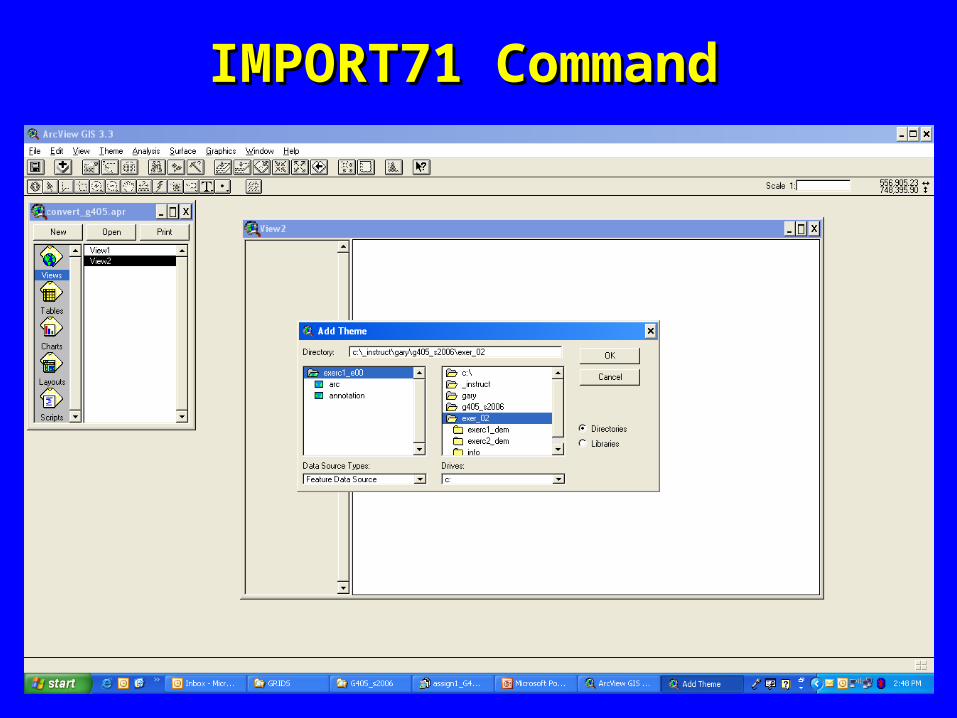
To IMPORT To IMPORT (To open a coverage from someone else)(To open a coverage from someone else)
a a .e00.e00 file format to a coverage, grid, or others: file format to a coverage, grid, or others:
IMPORT71 commandIMPORT71 command
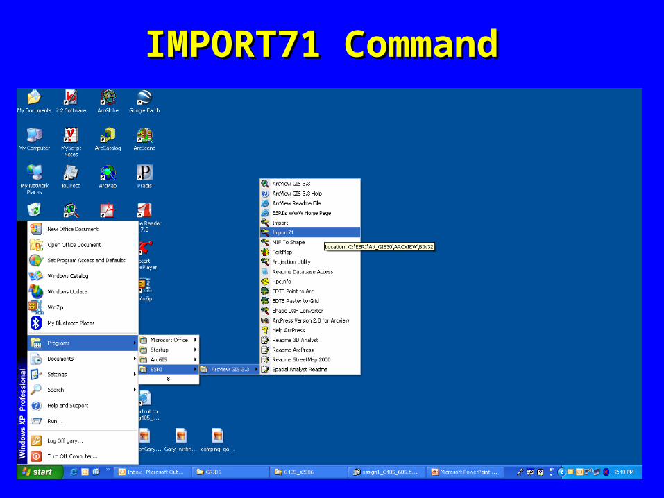
IMPORT71 CommandIMPORT71 Command
IMPORT71 CommandIMPORT71 Command
IMPORT71 CommandIMPORT71 Command
IMPORT71 CommandIMPORT71 Command
IMPORT71 CommandIMPORT71 Command

IMPORT71 CommandIMPORT71 Command
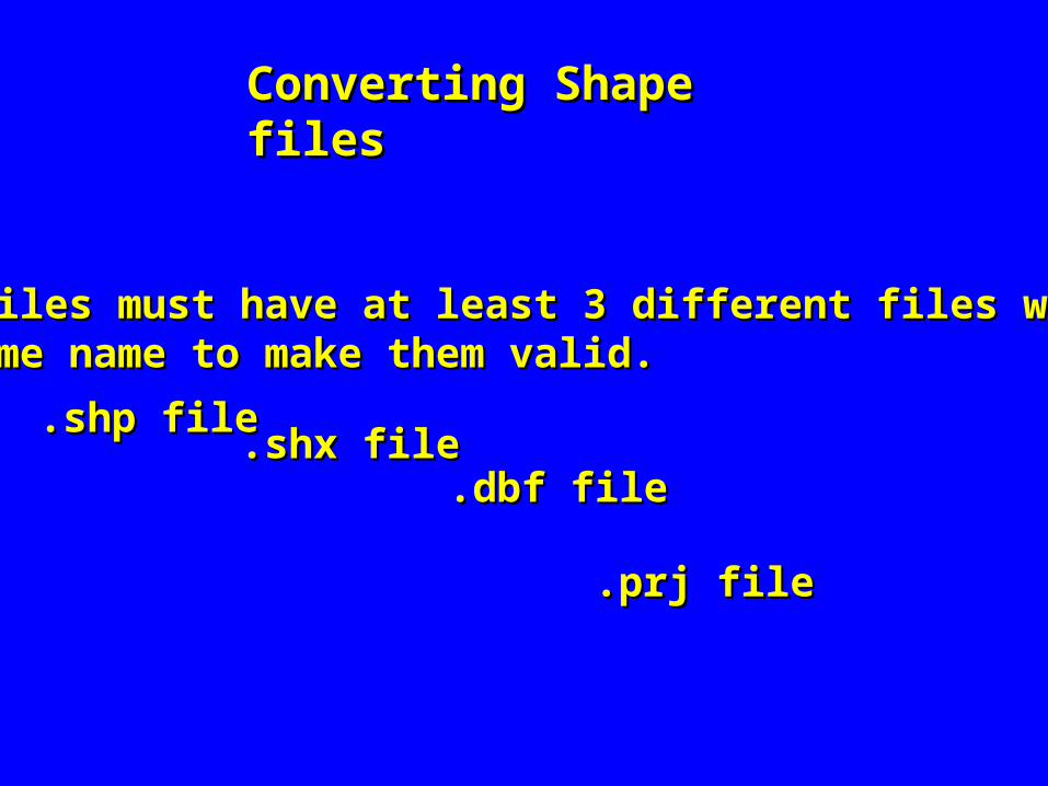
Converting Shape filesConverting Shape files
Shape files must have at least 3 different files with theShape files must have at least 3 different files with the same name to make them valid.same name to make them valid.
.shp file.shp file.shx file .shx file
.dbf file.dbf file
.prj file.prj file

Converting Shape filesConverting Shape files
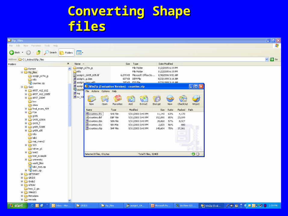
Converting Shape filesConverting Shape files

Converting Shape filesConverting Shape files
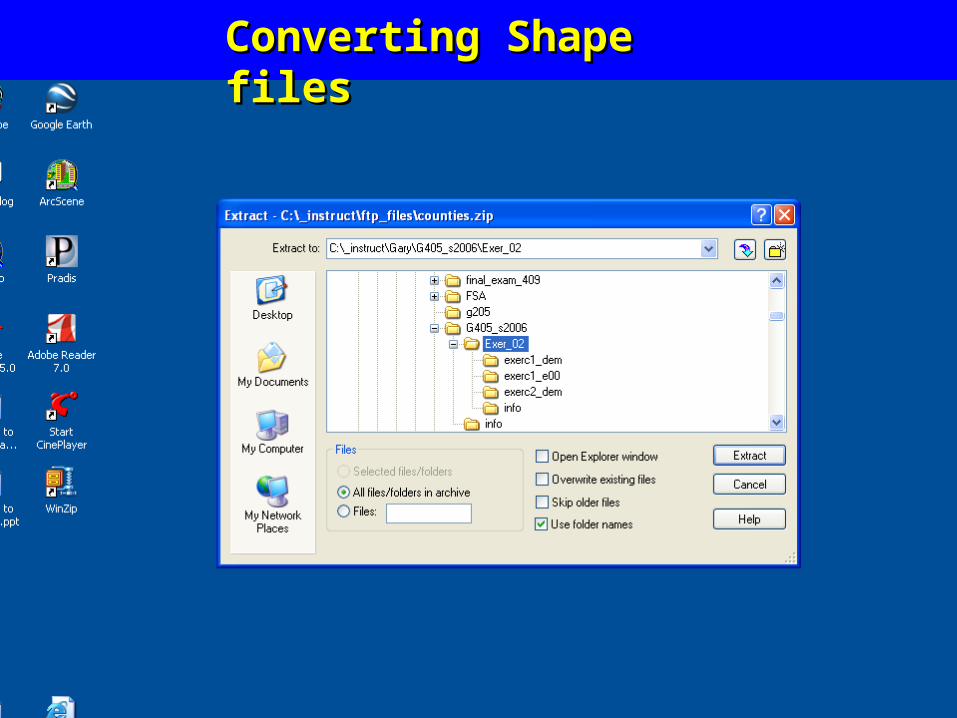
Converting Shape filesConverting Shape files

Converting Shape filesConverting Shape files

Other formats:Other formats:
Adobe IllustratorAdobe Illustrator
PostscriptPostscript
RTLRTL
PIC to DXFPIC to DXF

www.nbmg.unr.edu

All the files are located at _instruct/ftp_files
ftp the four files into your workspace and convert the first 4 of them to an Arc/Info format.assign1_g.demassign1_topo.e00counties.zipNV_100k.DXF
Assign_g405_605.tif (Save this file for a February digitizing assignment.)Put the different files in an ArcView layout and print the results of your file conversions. Remember to have your name, date, and the exercise number in the layout.
Exercise 2