Cartography and GIS(Geovisualization)
GIS 200Lo & Yeung, Ch 7

Showker, Krimmer 2007 2
Review of Spatial Analysis
Spatial analysis requires:GIS and spatial/statistical data analysis functionality
Key objectives of spatial analysis:Investigate spatial patterns and discover relationships
Examples of statistical analysis:Summary statistics (sum, mean), histograms, bar charts
Common spatial analysis techniques:Analytical cartography, query, measurement, buffering, transformation, map overlay, spatial interpolation
2 types of (ways to use) buffers and examples:Inclusive and exclusionary (exclusive)Build within 300m of sewer, but not build in floodplain
Showker, Krimmer 2007 3
Review of Spatial Analysis
What types of map overlay functions are these?
IdentityIntersectUnionUpdate
What types of transformation functions are these?
Clip, Dissolve, Append***

Showker, Krimmer 2007 4
Desired Learning Objectives Define cartography Give examples of generalizations made to represent spatial data List some cartographic map elements Describe what makes up a cartographic database Discuss why cartography is more than just “computerized” map making List the two broad categories/types of maps Discuss why cartography is essential in producing a good map
Cartography and GIS (Geovisualization)
Showker, Krimmer 2007 5
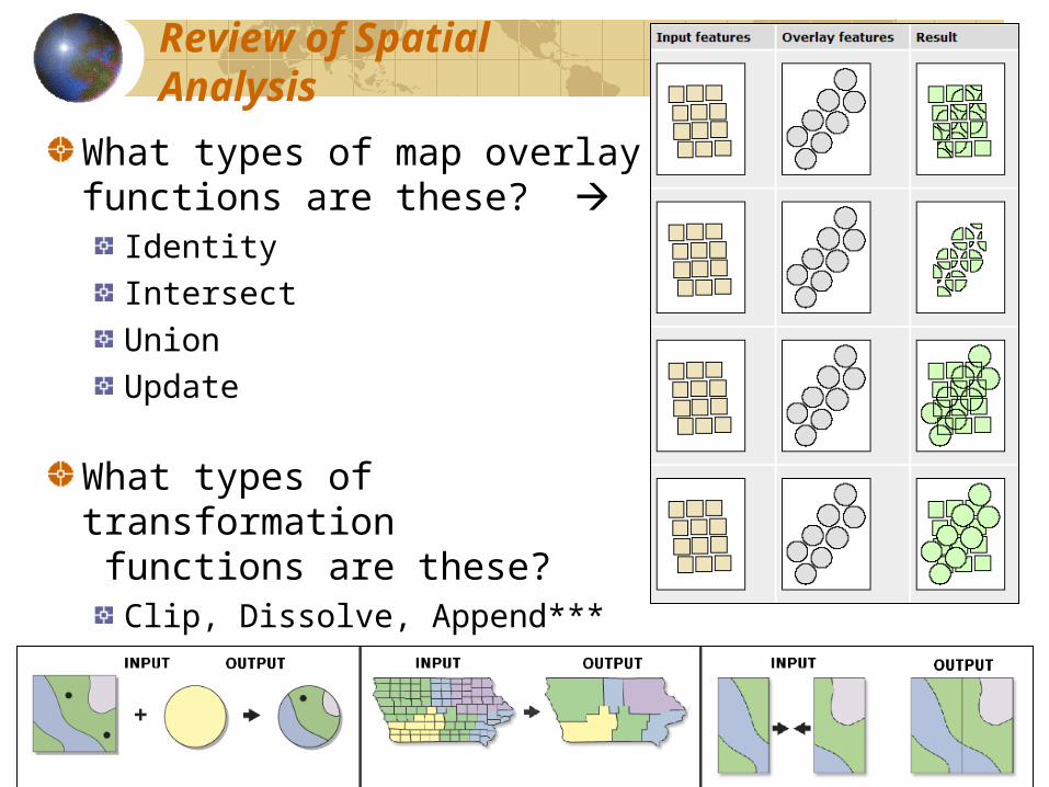
What are Maps?Maps are abstract modelsof realityMaps are important communication and decision support tools Maps are both storage and communication mechanisms Many maps today are dynamic and interactive via internet and server systems Maps are often the interface to geospatial information and the end product of GIS analysis
http://strangemaps.wordpress.com/
Showker, Krimmer 2007 6
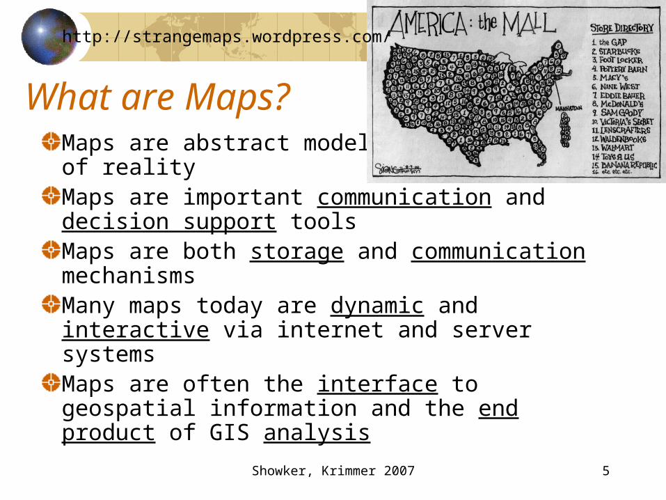
What is Cartography?The art and science of map makingContemporary cartography employs knowledge of computer science (technology) to more fully realize the power of geovisualization
Geovisualization integrates GISand Scientific & InformationVisualization, Cartography,Image Analysis, andExploratory Data Analysisfor the visual exploration,analysis, synthesis andpresentation of geospatialinformation.
Web Trend Maphttp://www.visualcomplexity.com/vc/
Showker, Krimmer 2007 7
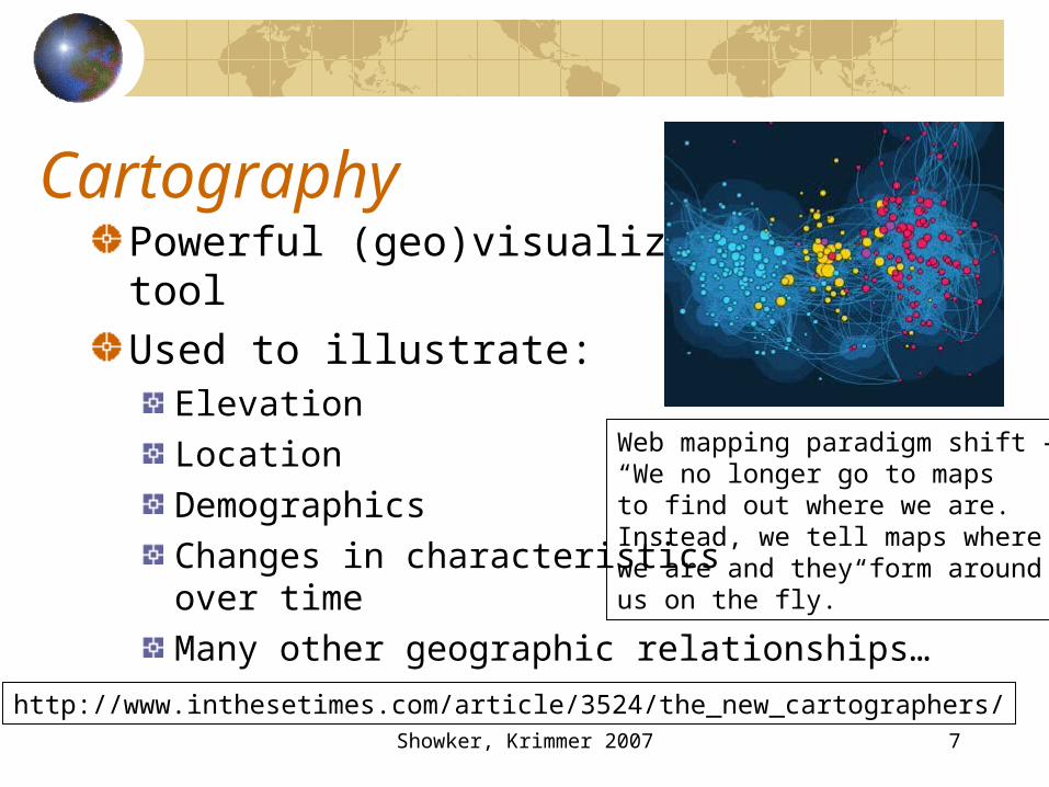
CartographyPowerful (geo)visualizationtoolUsed to illustrate:
ElevationLocationDemographicsChanges in characteristicsover timeMany other geographic relationships…
Web mapping paradigm shift –“We no longer go to mapsto find out where we are.Instead, we tell maps wherewe are and they form aroundus on the fly.”
http://www.inthesetimes.com/article/3524/the_new_cartographers/
Showker, Krimmer 2007 8
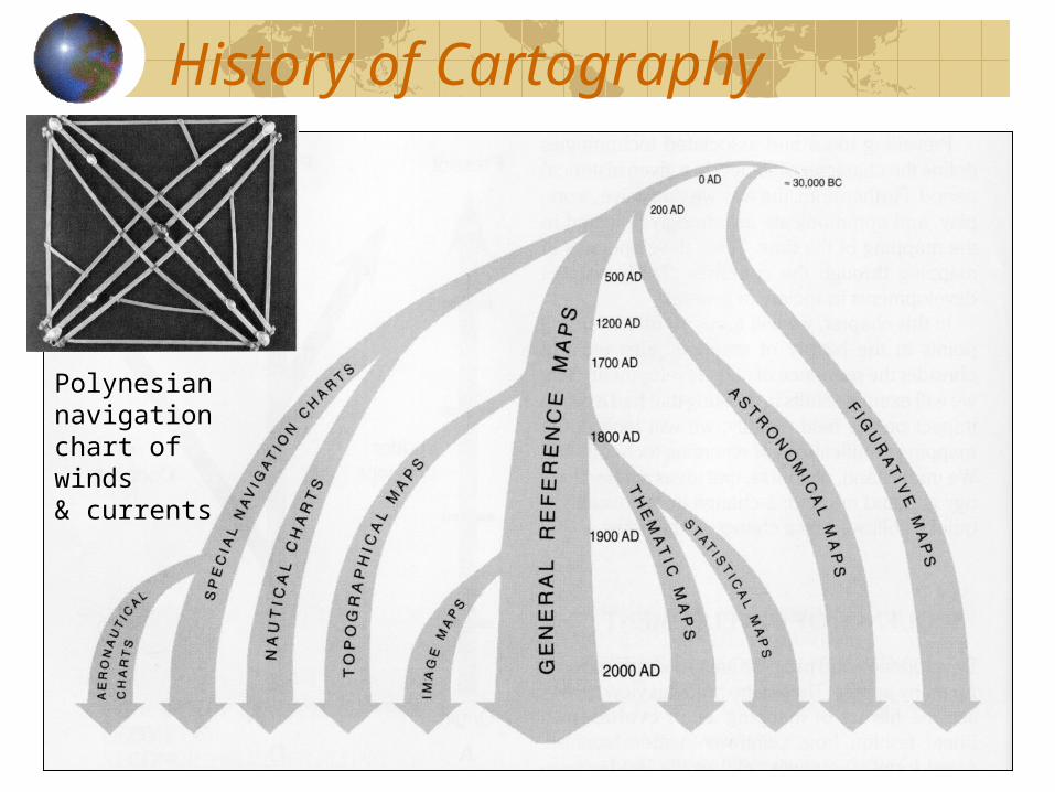
History of Cartography
Polynesiannavigationchart of winds& currents
Showker, Krimmer 2007 9
Contemporary issuesCartography is a niche in GISTraditional cartographic methods “lost art”
Replaced by technology Fewer people now trained/educated in cartography
GIS makes it easy for anyone to make a map with little/no knowledge of cartographyIndustry, government, educators havemis-communicated
The tradecraft of cartography Where/how cartography fits into the GIS world
Showker, Krimmer 2007 10
Re-invention of CartographyMany industries rely on cartographic principles
Map accuracy AestheticsUnderstanding of traditional maps
Modern advances in GIS and Cartography emphasize the utility & necessity of mapsGIS and web mapping allows
Interaction with maps, not just passive viewingDynamic, animated maps3-D virtual maps (simulations)
Showker, Krimmer 2007 11
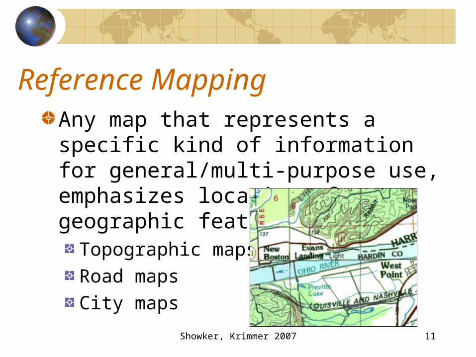
Reference MappingAny map that represents a specific kind of information for general/multi-purpose use, emphasizes location of geographic features.
Topographic mapsRoad mapsCity maps
Showker, Krimmer 2007 12
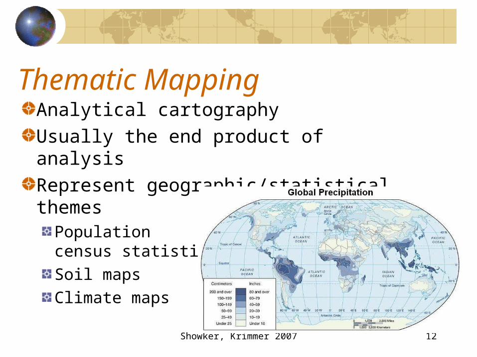
Thematic MappingAnalytical cartographyUsually the end product of analysisRepresent geographic/statistical themes
Populationcensus statisticsSoil mapsClimate maps
Showker, Krimmer 2007 13
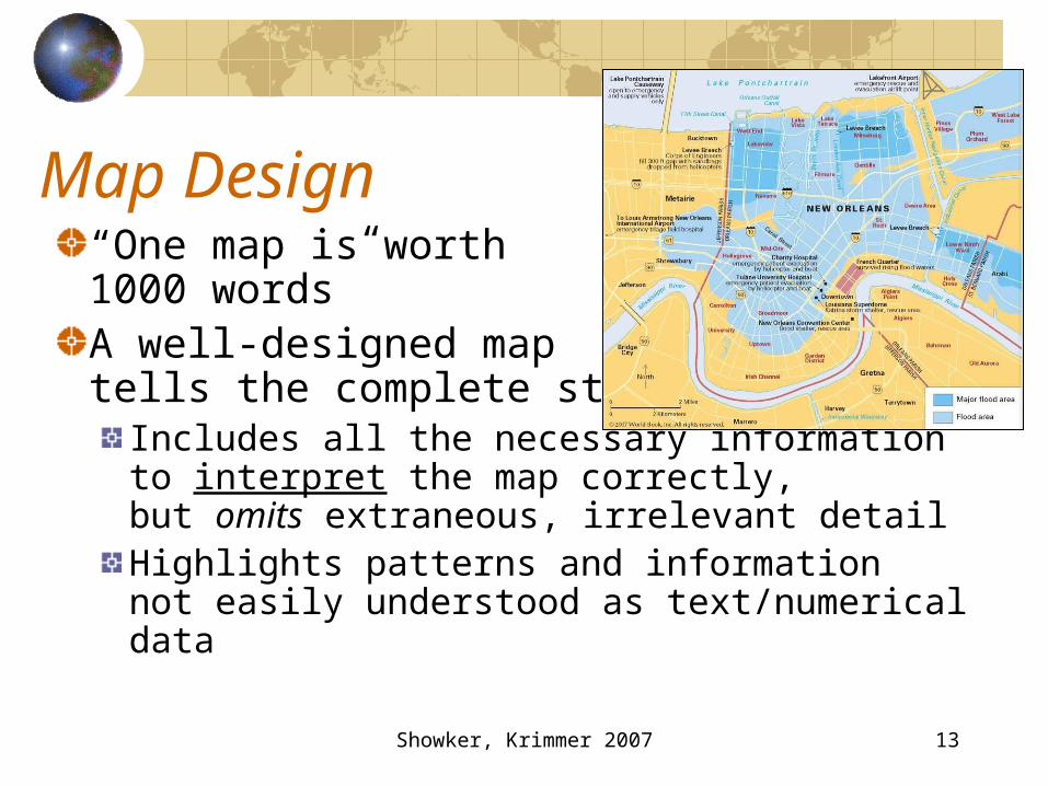
Map Design“One map is worth1000 words”A well-designed maptells the complete story
Includes all the necessary information to interpret the map correctly,but omits extraneous, irrelevant detailHighlights patterns and informationnot easily understood as text/numerical data

Showker, Krimmer 2007 14
Map compositionMap body
the actual mapOverview map helps“position” the main mapInset map enlarges areasto show more detailTitleNeatlineDateAuthorLegendScaleDirection: north arrowSources and map metadata
text needed to help explain the map (history or background).
http://www.cartogis.org/

Showker, Krimmer 2007 15
Map
TitleNorth Arrow
Text and Source
Legend
Map Inset
Picture
Inset
Scalebar
Neatline
Scalebars for both maps
Frame & Neatline
End of Cartography Part 1