
Welcome message from author
This document is posted to help you gain knowledge. Please leave a comment to let me know what you think about it! Share it to your friends and learn new things together.
Transcript
Heritage and Landscape as Human Values Conference Proceedings - General Interest Paysage et Patrimoine en tant que Valeurs Humaines Actes de la Conférence - Intérêt général

2
3
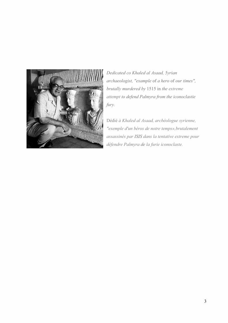
Dedicated co Khaled al Asaad, 5yrian
archaeologist, "example of a hero of our times",
brutally murdered by 1515 in the extreme
attempt to defend Palmyra from the iconoclastie
fury.
Dédié à Khaled al Asaad, arcbéologue syrienne,
"exemple d'un béros de notre temps»,brutalement
assassinés par ISIS dans la tentative extreme pour
défendre Palmyra de la furie iconoclaste.

4
5
Roberto Di Stefano, in Restauro quaderni di restauro dei monumenti e di urbanistica dei centri antichi - n. 1/1972, p. 3.
6
7

8
9
10
11
12
13
Table of Content The Florence Declaration on Heritage and Landscape as Human Value 16 Theme1 26 Sharing and experiencing the identity of communities through tourism and interpretation
1-1 New Tourism Frameworks 27
Itineraries through the Monuments of Vancouver: the Shift of Intentions in Canadian Public Art
and Heritage Preservation 27 José Luis CHACÓN
1-2 Experiencing and Conserving the Cultural Landscape 35 The Interpretation of Vodnjan Cultural Landscape in the Online Presentation 35 Goran ANDLAR, Sonja BUTULA, Olga KINKELA
1-3 Sustainable Tourism and the Viability of Cultural Traditions 43 The Dr. Sun Yat-Sen Classical Chinese Garden: a Bridge between Cultures 43 Jeannette HLAVACH
1-4 Empowerment of the Local Community in Tourism Activities 50 The Infiltration of Heritage in Quotidian Life: Informal Education through Calendars as a Mean for 50 Preserving Cultural Heritage Guillermo BARZUNA PÉREZ, Melvin CAMPOS OCAMPO
Theme 2 58 Landscape as cultural habitat 2-1 Knowledge and values 60
World Cultural Heritage Site - the Eastern Qing Tombs Cultural Landscape - the Highest
Expression of Chinese Fengshui Theory 60
WANG Zhaohua , LI Xiuqing The technical, political, social and aesthetical issues of the Simplon road, considered
as a large landscape garden 67 Margherita AZZI VISENTINI
Documenting the Santa Fe Trail in Kansas 68 Amanda K. LOUGHLIN LANDSCAPE: FROM THE IDENTITY TO THE SUSTAINABILITY. 75
A path through the historical iconographic knowledge Patrizia FALZONE The Formation and Significance of the Modern War Memorial Hall in Taiwan 82 Cheng-Yu TU, Chao-Ching FU Rio de Janeiro ou l’urbanité sportive comme identification culturelle et appropriation
du territoire par les Cariocas 86 Jean-Pierre BLAY 2-2 Use and protection 95 El Real de Minas de las Once Mil Vírgenes. Historical, Cultural and Human Heritage
in Northwest Mexico 95
Cristina SÁNCHEZ DEL REAL
14
Wood Doors in Patrimonial Buildings in México City 102 Cecilia HAUPT Use and Protection of the Shore and the Island for the Tatei Haramara wixarika
Ritual in the San Blas Nayarit México 104 María De Guadalupe Zepeda Martínez Danba Diaolou Buildings and Villages – the Stereoscopic Culture Landscape for
Jiarong (Rgyalrong) Tibetan Ethnic Group in Tibetan Plateau 107 Fanding DU, Niudou DUAN 2-3 Urban landscape 113 Okazaki in Kyoto: the Conservation of Suburban Area in the Historical City Olimpia NIGLIO, Noriko INOUE Carthage : le projet du parc archeologique urbain 120
Arfaoui WIDED HERITAGE IN THE URBAN GREAT PARKS OF HAVANA 126 José Fornés Conservation of Historic Urban Areas: the Case of Ataköy Settlement 133 Ebru HARMAN ASLAN, Ahmet Suvar ASLAN 2-4 Rural landscape 141 Processes and Transformations in the Creation of Current Landscapes: a Slovenian Case Study 141 Daniela RIBEIRO, Mateja ŠMID HRIBAR, Mimi URBANC 2-5 Archaeological landscape 149 Talayotic Minorca: a serial approach to an archaeological landscape 149 Angela ROJAS Ancient Theatres as Landscape Elements: the Cases of Teos and Erythrai in Turkey 155 Işılay Tiarnagh SHERIDAN 2-6 Landscape policies, regulations, practices 163 La patrimonialisation du Paysage culturel du Lac de Patzcuaro, outil ou contrainte 163 Ana Lucía GONZALEZ IBAÑEZ Sado Gold and Silver Mine 170
Hiroshi YOSHIDA, Yumiko ODA, Ryo KITAMURA The Nicosia International Airport as a Valuable Landscape 175
Emilia SIANDOU Considerations on the Right to the Landscape 183 Tomás de Albuquerque LAPA, Igor Jordão Coutinho de ALBUQUERQUE
2-7 Landscape hazards 188 Re-establishing Identity: Reconstructing Lyttelton’s Timeball Station 188 Ian BOWMAN 2-8 Landscape analysis, evaluation, planning and design 195
From a Road to a Cultural Route in a Multilayered Cultural Landscape:
the Road between Milas and Labraunda 195 Elifnaz DURUSOY, A. Güliz BİLGİN ALTINÖZ Theme 3 203 Landscape as cultural habitat 3-2 Value of traditional knowledge and practices as the basis for balanced technological, innovative development programmes and sustainable development 205 « La voûte à nervures et son potentiel constructif et bioclimatique :
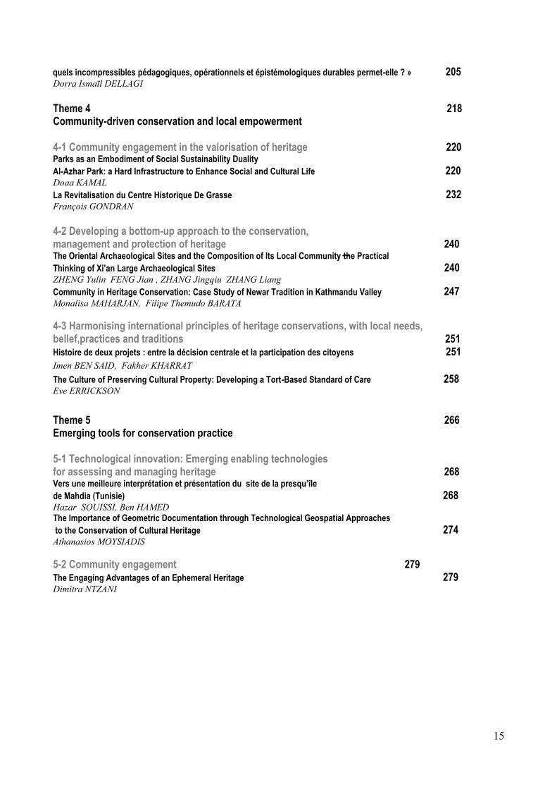
15
quels incompressibles pédagogiques, opérationnels et épistémologiques durables permet-elle ? » 205
Dorra Ismaïl DELLAGI Theme 4 218 Community-driven conservation and local empowerment 4-1 Community engagement in the valorisation of heritage 220 Parks as an Embodiment of Social Sustainability Duality
Al-Azhar Park: a Hard Infrastructure to Enhance Social and Cultural Life 220 Doaa KAMAL La Revitalisation du Centre Historique De Grasse 232 François GONDRAN 4-2 Developing a bottom-up approach to the conservation, management and protection of heritage 240 The Oriental Archaeological Sites and the Composition of Its Local Community-the Practical
Thinking of Xi’an Large Archaeological Sites 240
ZHENG Yulin FENG Jian , ZHANG Jingqiu ZHANG Liang Community in Heritage Conservation: Case Study of Newar Tradition in Kathmandu Valley 247 Monalisa MAHARJAN, Filipe Themudo BARATA 4-3 Harmonising international principles of heritage conservations, with local needs, bellef,practices and traditions 251 Histoire de deux projets : entre la décision centrale et la participation des citoyens 251
Imen BEN SAID, Fakher KHARRAT The Culture of Preserving Cultural Property: Developing a Tort-Based Standard of Care 258
Eve ERRICKSON Theme 5 266 Emerging tools for conservation practice 5-1 Technological innovation: Emerging enabling technologies for assessing and managing heritage 268 Vers une meilleure interprétation et présentation du site de la presqu’île
de Mahdia (Tunisie) 268 Hazar SOUISSI, Ben HAMED The Importance of Geometric Documentation through Technological Geospatial Approaches
to the Conservation of Cultural Heritage 274
Athanasios MOYSIADIS 5-2 Community engagement 279 The Engaging Advantages of an Ephemeral Heritage 279
Dimitra NTZANI
16
The Florence Declaration Heritage and Landscape as Human Values (2014)

17
18
The Florence Declaration on Heritage and Landscape as Human Values (2014) Declaration of the principles and recommendations on the value of cultural heritage and landscapes for promoting peaceful and democratic societies Preamble Over 1,650 participants from 94 countries came together in Florence from 9-14 November 2014 for the 18th General Assembly of the International Council on Monuments and Sites (ICOMOS). 1300 technical proposals and the exchange between heritage specialists have culminated in the following Declaration of principles and recommendations on the value of cultural heritage and landscapes for promoting peaceful and democratic societies. All individuals and communities have the right to benefit from cultural heritage and landscape to the same extent that they have a duty to preserve its authenticity and cultural diversity as a human right. This declaration encourages deep reflection on heritage management ethics and practices so that the challenges facing present and future generations can be addressed. ICOMOS can steer this process thanks to a holistic vision of harmonious development focused on the potential of cultural heritage as a testimony of peace and cohesion. In 2014 ICOMOS celebrated its 18th General Assembly and Scientific Symposium dedicated to the theme of “Cultural Heritage and Landscape as Human Values”. This declaration reflects the aims of ICOMOS and its work with UNESCO in assessing tangible and intangible values associated with World Heritage properties, and is an opportunity to bring together the organisation’s specialist skills. Among other discussions that took place at the Florence Symposium, it was suggested that evaluating and assessing a site as World Heritage should be considered as an ethical commitment to safeguarding and respecting human “values” in order to protect the spirit of place 1 and people’s identity so as to improve their quality of life. This is also an extraordinary occasion for the ICOMOS community to celebrate the 50th Anniversary of the Venice Charter and the 20th Anniversary of the Nara Document. We therefore celebrate both our own founding act, demonstrating its potential, and also a key document resulting from many scientific and philosophical debates on authenticity 2 , that has promoted the diversity of cultural expression 3. In response to today’s challenges, the main aim of the 2014 Symposium was to facilitate the inclusion and participation of people and groups from a variety of cultures and to move forward in defining principles, strategies, standards and practices that can contribute both to the recognition of the human values of cultural heritage, as well as to safeguarding and encouraging cultural diversity, working together to develop the necessary organizational frameworks and skills 4 . These principles have been well expressed in previous international documents 5 and founding charters on safeguarding and protecting human rights and cultural heritage 6 . ICOMOS views the Symposium theme in the context of sustainable development (UN Sustainable Development Goals), making up for the lost opportunity caused by the exclusion of culture from the UN Millennium Development Goals. UNESCO is already working towards this end through its contributions to the Post-2015 Development Agenda, which were discussed in October 2014 in Florence 7. ICOMOS, together with some of the world's largest cultural, intergovernmental and non-governmental organizations, has discussed these issues, presenting its reflections on them at the recent Symposium. The Symposium Declaration The ICOMOS 2014 Florence Declaration promotes a broad debate that will enable ICOMOS to provide insights for encouraging sustainable, harmonious and intercultural development, placing people at the centre of the cultural debate where cultural diversity is expressed through heritage and landscape values. We recognize our responsibility for fully integrating culture into society and the need for shared tools that can be used to translate ICOMOS’s ethical commitment into concrete action. We recognize the responsibility of ICOMOS members to cooperate actively in the development of resolutions, documents and conventions to
19
improve quality of life through the management of the world’s cultural heritage, producing shared technical resources that contribute to integration and interculturality. We acknowledge that landscapes are an integral part of heritage as they are the living memory of past generations and can provide tangible and intangible connections to future generations. Cultural heritage and landscape are fundamental for community identity and should be preserved through traditional practices and knowledge that also guarantees that biodiversity is safeguarded. Landscapes currently face unexpected threats that need be managed by applying new approaches to safeguarding the relationship between cultural and natural heritage by sharing practical experiences. An approach is needed that is based on the protection of human rights and on strengthening new and traditional knowledge and local governance. The participants at the 18th General Assembly address this Declarationto intergovernmental organisations, national and local authorities and all organizations and specialists, recommending the following actions:
1. Sharing and experiencing community identity through tourism and interpretation
1.1 Sharing community identities: opportunities to empower communities and tourists
a. Community identity is rarely uniform or static but is a living concept that is constantly evolving thanks to an interplay of past and present in the context of current geo-political circumstances. Around the world, contrasting - and often conflicting - community identities are expressed through (and can be shaped negatively or positively by) the range of activities and service provision offered at cultural heritage tourist destinations that are intended to take advantage of the economic, social and cultural benefits of tourism. b. Community engagement in tourism through service provision, entrepreneurship, cultural production or volunteer activities can mediate an appreciation of their cultural heritage and provide opportunities (supported by capacity building) for promoting the diverse identities of resident communities in a positive way. c. Community traditions - festivals, dances and culinary traditions - shared with visitors subtly change over time and this can lead to an inferior experience for residents and visitors alike. A community with highly-developed cultural awareness and the capacity to identify unique cultural values within their community is in a position to be empowered to protect the integrity, authenticity and continuity of the cultural heritage recognised within that community. d. Community involvement with cultural heritage sites affected by disaster and conflict offer opportunities for healing and reconciliation. In rebuilding the fabric of their own lives in the face of painful memories, communities retain or create physical memorials in the landscape recording the psychological damage of ‘crimes against humanity’ or devastation of disasters in terms of human lives lost. In turn, as visitor attractions, opportunities arise for a range of community interpretations and ongoing dialogue with tourists. e. Increasing knowledge and cultural awareness of the heritage of a place - tangible and intangible - among a host community and visitors fosters meaningful inter-cultural dialogue, engenders respect for cultural differences at a personal level and enhances the quality of the tourist experience, linked to the concept of travel for knowledge. It is the foundation for peaceful co-existence. 1.2 Cultural interactions and communication: building knowledge and changing perceptionsthrough experience
a. Sustainable conservation and safeguarding intangible cultural heritage in a local tourism context can be achieved only by fostering awareness, in-depth knowledge and understanding among local communities of the significance of their heritage and diverse influences that have come together to create - and continue to create - a unique culture.
20
b. Building intergenerational capacity among local community members, especially in young people, to support them in engaging with and interpreting their heritage and in communicating successfully with visitors, has the dual benefit of enhancing visitor experiences and strengthening their own sense of self-worth and identity. c. Two-way communication between visitors and communities can also stimulate curiosity, allow multiple interpretations (when appropriate), and enable hosts to recount their own stories in a personal way. d. Community-based tourism development responds to increasing visitor expectation for more personalized and life-enhancing experiences. Collaborative and ethical local tourism networks are drivers of specialist tourism where cultural interactions are central to active visitor participation. e. Authentic holistic immersive experiences of cultural heritage are a key component of intercultural dialogue through tourism and an important element of a community’s diaspora reengaging with its past as tourists. f. Cultural events are strategic tools for many communities seeking to attract tourism. Sharing and enhancing the balance of mutual knowledge, sorrow and enjoyment through a carefully structured inclusive approach to local rituals - religious or secular - and entertainment through cultural festivals can, if well managed, lead incrementally towards an enhanced territory. 1.3 Cultural places: finding frameworks for cultural heritage developments a. Creative solutions to planning the physical environment can lead to a deeper symbiotic relationship with a place for both visitors and communities. Cultural corridors, for example, can highlight the value of historic research and cultural significance with the sensitive reinstatement of traditional routes. b. Access to cultural heritage places at tourist destinations requires a multi-layered approach to planning and interpretation in order to be effective. Physical, intellectual, emotional and economic access need to be reconciled within bespoke strategies for interpretative planning and quality assurance mechanisms. c. Creative spaces - virtual and real - are dependent on the interwoven interrelationship between tangible and intangible cultural heritage. Memories of the ephemeral is itself an integral part of the visitor experience and new methods must be found to preserve them and enhance them for the future. d. Coherent community-led strategies for cultural tourism development depend on the recognition of the significant nexus between places and dynamic cultural traditions. e. Governance related to safeguarding, protecting and managing cultural heritage sites within tourist destinations requires a holistic set of integrated plans, policies, regulations and practices that embrace but go beyond conservation planning. f. Integrated spatial and tourism planning can: promote the role of communities; set an agenda for the co-creation of quality cultural products and cultural heritage experiences; support innovation and adaption to changing priorities across the global tourist and heritage industries in a particular place at a specific moment in time, thereby reinforcing community identities. 2. Landscape as cultural habitat
2.1 A community-based approach a. The concept of landscape, whether urban or rural, is increasingly becoming a new paradigm for harmonious development, offering an approach that can integrate economic, social and environmental processes. b. There are multiple interrelationships between urban and rural landscapes related to cultural, socio-economic and environmental processes, as well as to the well-being of the population. c. The involvement of local communities, the recognition of, and respect for, their cultural heritage, as well as innovative and traditional practices can favour more effective management and governance of multifunctional landscapes, contributing to their resilience and adaptability.
21
2.2 Landscape as a fusion of culture and nature a. Cultural landscapes should not only be interpreted as conservation areas but also as places where sustainable development strategies can be successfully applied. b. In many landscapes, concepts such as “natural” and “cultural” have lost much of their meaning, being replaced by a biocultural understanding, where not only settlements and agriculture, but also species and habitats are determined and preserved by people. c. The time has come to challenge the artificial separation between conservation and innovation, seeing cultural landscapes as lessons to be learnt in light of new models of economic development, responses to climate change, risk management, biodiversity conservation and the human wellbeing. 2.3 The landscape as a driver for growth a. In order to gain a better understanding of the interplay between biological and cultural diversity at a landscape level and its implications for livelihood and wellbeing, further interdisciplinary and trans-disciplinary research is needed. b. It is necessary to overcome major intellectual differences arising from the distinction between the natural sciences and the social sciences and humanities. Wide-ranging cooperation between these disciplines is needed in order to develop new tools for landscape planning, management and conservation. c. Public awareness and political action are needed to implement effectively national and international commitments related to cultural landscapes. 3. Sustainability through traditional knowledge 3.1 Quality of daily life produced by traditional knowledge a. Study and awareness raising of the role of traditional knowledge systems for development that are based on what has been handed down from previous civilizations should be promoted. b. The importance of identities, social cohesion, community involvement and quality of life produced by traditional knowledge should be recognized. c. Further research is required into the meaning, symbolism and rituals related to traditional techniques and procedures. d. Traditional systems held by communities with regard to well-being, nutrition and ways of life should be identified. e. Support is required for the rights of local communities and indigenous people who are the holders of traditional and indigenous knowledge and systems. 3.2 The value of traditional knowledge and practices as the basis for balanced technological, innovative development programmes and sustainable development a. Knowledge of traditional systems should be enhanced in order to promote a new technological paradigm. b. A typology identification system for traditional knowledge should be created, as should a database of case studies and best practice. c. A balanced use of traditional and modern techniques and technologies should be promoted using a holistic non-invasive and sustainable approach.
22
3.3 Respect for sites and the decision processes that safeguard communities and people a. Methods should be assessed for the protection of traditional knowledge that can be implemented by individuals, communities, disseminators and innovators of traditional techniques.
b. Resilient traditional techniques should be promoted, as should their use in every country in order to face global challenges and risks, such as climate change, natural catastrophe, migration, and poverty. Identify resilient technologies and promote the use of traditional knowledge to achieve energy efficiency and reduce CO2 emissions. c. The emergence of virtuous collective responses and participatory actions for the prevention of catastrophes should be encouraged, in order to better protect those heritage sites and properties at greater natural and anthropic risk. d. Communication and interpretation should be facilitated in order to create sustainable policies and programmes supported by learning systems and legislation. 4. Community-driven conservation and local empowerment 4.1 Community engagement in the enhancement of heritage a. The connection between communities and their heritage should be recognized, respecting the community’s right to identify values and knowledge systems embodied in their heritage. Heritage places, be they sites or landscapes, may take on different values for the various communities associated with them and the process of value identification must take each group into consideration. b. Collaborative networks should be set up at different levels among multiple stakeholders in order to address issues related to heritage and create new value chains through innovative synergies. c. Dynamic, flexible, inclusive and integrated processes of engagement need to be employed for assessing long-term social impacts of heritage conservation programmes. 4.2 Bottom-up approach for effective conservation and management of heritage a. It is important to establish an active role for communities within formal planning/management systems giving the community a voice within conservation decision-making processes. b. The role of heritage professionals should be recognized as being that of providing technical advice in community-led conservation initiatives and that of a facilitator when a community’s engagement with its heritage is fragmented. c. The ‘human’ scale of development as a foundation for creative bottom-up approaches should be reinstated. 4.3 Linking heritage conservation and sustainable local socio-economic development. a. Heritage conservation should contribute to sustainable development objectives. b. Good practices (based on measurable evidence) should be promoted, connected to the contribution of heritage to well-being, social cohesion, and sustainable economic development. c. Innovative approaches and tools, such as crowd-funding, should be used that can stimulate a proactive role for community networks, transforming desirable future visions into reality.
23
5. Emerging tools for conservation practice 5.1 Cultural heritage objectives need to drive the development of emerging tools, not vice versa, so they can consolidate the centrality of cultural heritage a. New tools and technologies should support the various steps of the conservation process, as a means and not an end, promoting the centrality of cultural heritage as a human right. b. Guidelines and networks should be drawn up and shared for theoretical and methodological objectives and applications to ensure authenticity in conservation practice. c. Guidelines should be developed for interdisciplinary research (including those related to funding policies) in a collaborative way in order to fill gaps - technological, but primarily cultural – between technology specialists and heritage practitioners, between managers and users of information. 5.2 Promote new technologies that are accessible and inclusive for shared cultural growth a. Local and traditional knowledge should be respected in order to ensure a fair and profitable balance between cultures, knowledge, materials, traditional and innovative technologies. b. The key role of non-governmental organisations in strategic partnerships should be recognized in order to improve conservation outcomes. c. Platforms and tools for the dissemination of knowledge should be consolidated and shared in order to overcome cultural and social inequalities. d. There should be an active contribution to the exchange of best practice in conservation processes through debate and discussion in professional communities, while seeking to avoid the duplication of efforts. 5.3 Facilitate collaborative standardization and simplification of procedures and tools a. Internationally recognised and applicable tools should be developed in order to ensure accuracy, reliability, and verifiability of results and ensure the possibility of comparative analysis both geographically and over time. b. Priority should be given to user-friendly and low-cost technologies to ensure the adoption of tools that can be used for cultural heritage documentation, conservation and monitoring, as part of a virtuous circle. c. On-line toolkits and open source platforms should be developed as a priority, to provide access to standards and procedures in cultural heritage conservation practice in a democratic way. d. It should be ensured that the application of technologies to cultural heritage responds to welldefined key objectives, avoiding the risk of only making progress in the technological sector without improving conservation practice. Florence, 14 November 2014 _________ 1. ICOMOS, Declaration on the spirit of place (Quebec, 2008). 2. ICOMOS, Nara+20: On heritage practices, cultural values and the concept of authenticity (2014). 3. UNESCO, Convention on the Protection and Promotion of the Diversity of Cultural Expressions (Paris, 2005). 4 ICOMOS, Heritage as a driver for development (Paris Declaration 2011) 5 Hangzhou Declaration, Placing Culture at the Heart of Sustainable Development Policies (2013). 4. UNESCO, Recommendation on Historic Urban Landscape (2011). 5. Barbados Declaration - Global Conference on the Sustainable Development of Small Island Developing

24
States (1994). 6 Council of Europe Framework Convention on the Value of Cultural Heritage for Society (2005) known as the Faro. 6. Declaration. It recognises UNESCO’s concerns that “...rights relating to cultural heritage are inherent in the right to participate in cultural life, as defined in the Universal Declaration of Human Rights”. 7. UNESCO, Dichiarazione di Firenze 4 Ottobre 2014 “ Cultura, creativita e sviluppo sostenibile. Ricerca, innovazione, opportunita”, Terzo Forum Mondiale dell’UNESCO sulla Cultura e le Industrie Culturali (2014).
25
26
27
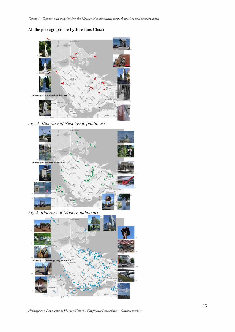
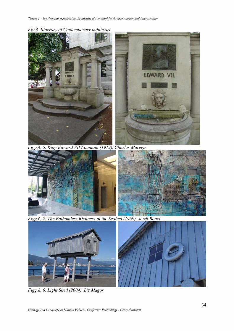
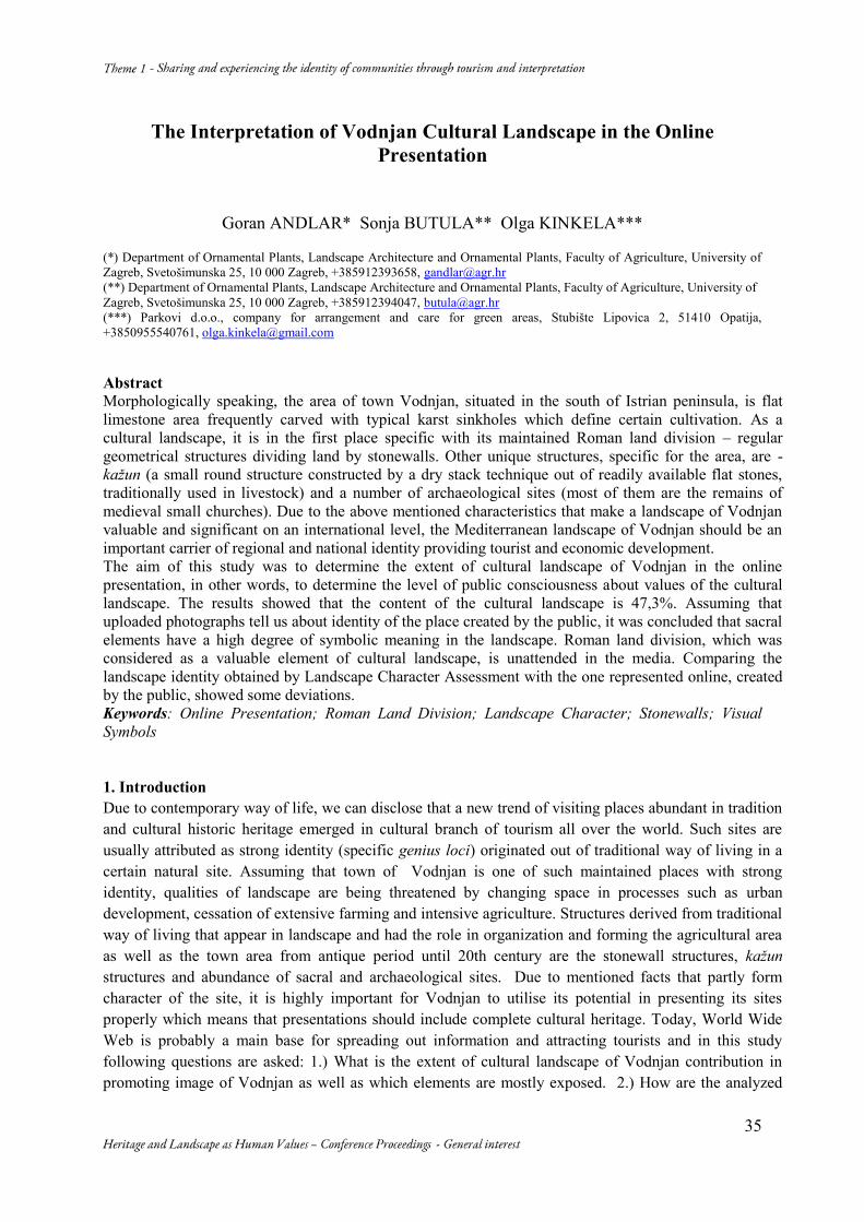
Itineraries through the Monuments of Vancouver: the Shift of Intentions in Canadian Public Art and Heritage Preservation José Luis CHACÓN Universidad de Los Andes, Facultad de Arquitectura y Diseño, Final Av. A. Carnevali, La Hechicera, Mérida-Venezuela, +58-424-7211797, [email protected] Abstract The monuments of Vancouver become highlighted among other works of public art, through itineraries based on historic and formal characteristics. This critical guide illustrates the shift of intentions as movement within complex urban patterns and as change of forms. Vancouver’s urban landscape is determined by geography, “Vancouverism” and public art. Its figurative memorials, abstract sculptures and realistic objects show a spiral of aesthetic and intentional changes. The proposed itineraries explore this collection in three categories: Neoclassic, Modern and Contemporary. Based on phenomenological observation the itineraries are drawn on the city map and described in-context. This strategy confirms that new artworks enlighten public heritage in a unique way. Vancouver is an example. Keywords: Itineraries of Public art; Vancouver Public Art; Monument Preservation 1. Introduction This paper is based on a research made in 2012 as part of the Faculty Research Program of the International Council for Canadian Studies of the Government of Canada1. It particularly shows how the monuments of Vancouver become highlighted among the other works of public art, through itineraries based on historic and formal characteristics. Our perspective in this case is a particular one; even though all public artworks cannot be considered as monuments, our approach shows the latter’s eventual becoming in time. The result is thus a critical guide that points out the important presence of monuments within public art. It is displayed on two dimensions: a graphic one, shown on the city map, and a literal one, explained as phenomenological descriptions of the artworks in the city. What becomes evidenced is a shift of intentions, illustrated as movement within complex urban patterns and as change of forms and styles. A secondary aspect presents how art, architecture and the city are closely intertwined in public art. 2. Public art in Canada Public art in Canada has changed in time and its presence has increased in the last fifty years. It is evident that “conceptions of public art have undergone multiple tectonic shifts”2; the forms, the styles, the attitudes, the themes, all of them have changed dramatically. “The most enduring form of public art, the monument, has given way to contemporary modes as diverse as street art, site-specific art, land art, art as architecture, paintings, photography, performance art, community art, and electronic art such
1 The title of that research was The Shift of Intentions in Canadian Public Art. Itineraries of Public Art in the cities of Montréal, Toronto and Vancouver, 2012. The original study approached Canadian public art in more general terms from which this paper’s theme was developed. 2 Gérin Annie, Introduction: Off Base, in Gérin Annie, McLean James (editors), Public art in Canada: Critical perspectives, University of Toronto Press, 2009: 19.
28
as media boards”3. References of public artworks have gone from gods to military heroes and sculptural additions to buildings, until coming down to earth, placed at street corners or in plazas, where they can be touched, or even stepped on4. Through its public art the complex and yet interesting social and cultural grid that structures Canadian society can be identified. From the French and English colonial roots to the First Nations renaissance, all of Canada’s cultural backgrounds are portrayed in the various examples of public art. A brief history shows how its expansion has been largely due to government initiatives, and more recently through the participation of private developers, with, nonetheless, the aesthetic contribution of the artists. From a social point of view a shift of ideals through time can be evidenced in Canadian public art. Although this same fact happens in all western nations, in Canada it takes place in a particular manner. The changes are directly related to the changes occurring in contemporary art and in society. The most appropriate way chosen to identify those changes through time was the use of itineraries5: “visual and critical journeys” through public artworks within the city. In the present, contemporary visitors take part in “secular pilgrimages” in cities “inspired by popular mythologies that continue to be generated, circulated, and retained within a specific kind of collective imagination”6. Based on this, and considering its pedagogical benefits, Canadian public art was explored by itineraries of selected locations of existing public art. The works considered were mainly sculptures, murals and installations, but it also included pavilions, parks, gardens, squares, bridges and even decorative elements. The method used was sheer observation and detailed description while the exploration was made by foot. That is why these itineraries are basically public art walks accompanied by descriptive observation in-context with the surrounding architecture and nature. 3. Vancouver Vancouver, a city of constant changes, is set upon natural surroundings of immense beauty in the west coast of Canada. It lies on a peninsula that protrudes onto Georgia Straight, bounded on the north by the Burrard Inlet and on the south by the Fraser River. The Downtown area lays on a smaller peninsula, a confined and isolated forest of office and residential towers, still in constant growth. The backdrop of mountains, the proximity of the sea and the presence of large wilderness areas are major considerations in the city’s perception. Although it lacks “the urbanity of larger centres, its gentle climate, proximity to water and wilderness, and clean, garden-city atmosphere”7, are important background elements for its public art. In addition, its unique urban growth was defined as “Vancouverism”, a term that relates to a phenomenon of dense urbanism that can be civilized as well. According to Trevor Boddy “Vancouverism at its best brings together a deep respect for the natural environment with high concentrations of residents”8. An idea whose credit lies originally in Arthur Erickson – Canada’s most international architect before Frank Gehry – who from the 1950’s envisioned Vancouver as a “Pacific metropolis”. This has been achieved with great success and it is one of the city’s most eye-catching characteristic. 3 Adair Annalee, Lacroix Laurier, Public Art, in http://www.thecanadianencyclopedia.com/articles/public-art, consulted 01/25/2013. 4 Cfr. Steil John, Stalker Aileen, Public Art in Vancouver. Angels among Lions, Touchwood Editions, Vancouver, 2009: XIV. 5 Itinerary is a term from the Latin itinerarium "account of a journey”. It is also the noun use of neuter of itinerarius "of a journey" from Latin itineris "journey". 6 McLean James S., The Public Part of Public Art: Tecnology and the Art of Public Communication, in Gérin Annie, McLean James (editors), Public art in Canada: Critical perspectives, University of Toronto Press, 2009: 309. 7 Kluckner Michael, Vanishing Vancouver, Whitecap Books, Vancouver, 1990: 11-12. 8 Sharp Dennis, Boddy Trevor, Vancouver, Vancouverize, Vancouverism: Building an Idea, in http://vancouverism.ca/vancouverism.php, consulted 01/25/2013.
29
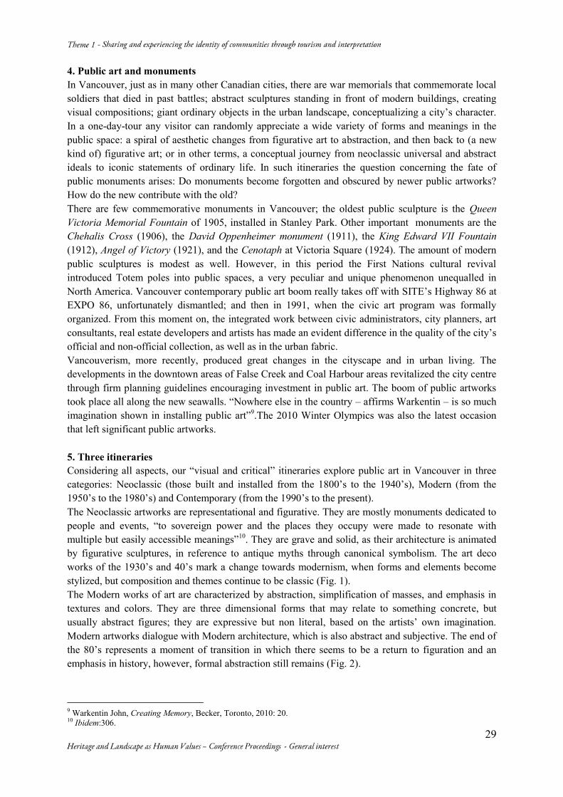
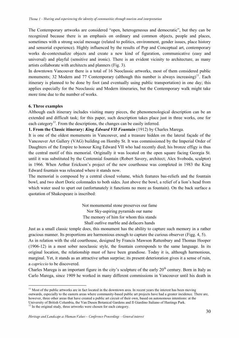
4. Public art and monuments In Vancouver, just as in many other Canadian cities, there are war memorials that commemorate local soldiers that died in past battles; abstract sculptures standing in front of modern buildings, creating visual compositions; giant ordinary objects in the urban landscape, conceptualizing a city’s character. In a one-day-tour any visitor can randomly appreciate a wide variety of forms and meanings in the public space: a spiral of aesthetic changes from figurative art to abstraction, and then back to (a new kind of) figurative art; or in other terms, a conceptual journey from neoclassic universal and abstract ideals to iconic statements of ordinary life. In such itineraries the question concerning the fate of public monuments arises: Do monuments become forgotten and obscured by newer public artworks? How do the new contribute with the old? There are few commemorative monuments in Vancouver; the oldest public sculpture is the Queen Victoria Memorial Fountain of 1905, installed in Stanley Park. Other important monuments are the Chehalis Cross (1906), the David Oppenheimer monument (1911), the King Edward VII Fountain (1912), Angel of Victory (1921), and the Cenotaph at Victoria Square (1924). The amount of modern public sculptures is modest as well. However, in this period the First Nations cultural revival introduced Totem poles into public spaces, a very peculiar and unique phenomenon unequalled in North America. Vancouver contemporary public art boom really takes off with SITE’s Highway 86 at EXPO 86, unfortunately dismantled; and then in 1991, when the civic art program was formally organized. From this moment on, the integrated work between civic administrators, city planners, art consultants, real estate developers and artists has made an evident difference in the quality of the city’s official and non-official collection, as well as in the urban fabric. Vancouverism, more recently, produced great changes in the cityscape and in urban living. The developments in the downtown areas of False Creek and Coal Harbour areas revitalized the city centre through firm planning guidelines encouraging investment in public art. The boom of public artworks took place all along the new seawalls. “Nowhere else in the country – affirms Warkentin – is so much imagination shown in installing public art”9.The 2010 Winter Olympics was also the latest occasion that left significant public artworks. 5. Three itineraries Considering all aspects, our “visual and critical” itineraries explore public art in Vancouver in three categories: Neoclassic (those built and installed from the 1800’s to the 1940’s), Modern (from the 1950’s to the 1980’s) and Contemporary (from the 1990’s to the present). The Neoclassic artworks are representational and figurative. They are mostly monuments dedicated to people and events, “to sovereign power and the places they occupy were made to resonate with multiple but easily accessible meanings”10. They are grave and solid, as their architecture is animated by figurative sculptures, in reference to antique myths through canonical symbolism. The art deco works of the 1930’s and 40’s mark a change towards modernism, when forms and elements become stylized, but composition and themes continue to be classic (Fig. 1). The Modern works of art are characterized by abstraction, simplification of masses, and emphasis in textures and colors. They are three dimensional forms that may relate to something concrete, but usually abstract figures; they are expressive but non literal, based on the artists’ own imagination. Modern artworks dialogue with Modern architecture, which is also abstract and subjective. The end of the 80’s represents a moment of transition in which there seems to be a return to figuration and an emphasis in history, however, formal abstraction still remains (Fig. 2).
9 Warkentin John, Creating Memory, Becker, Toronto, 2010: 20. 10 Ibidem:306.
30
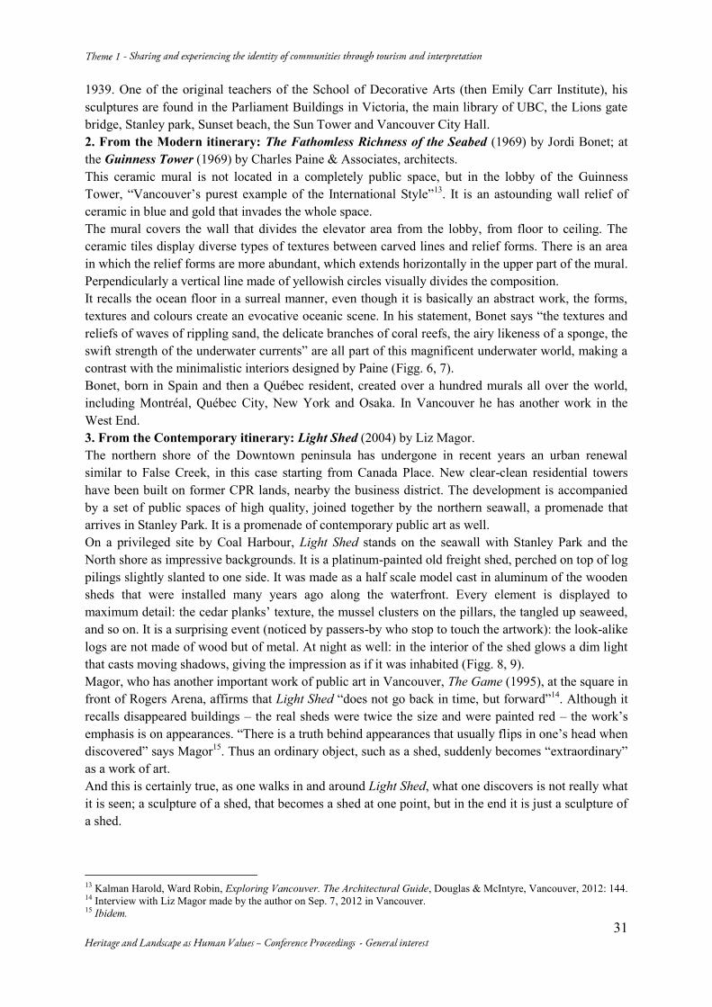
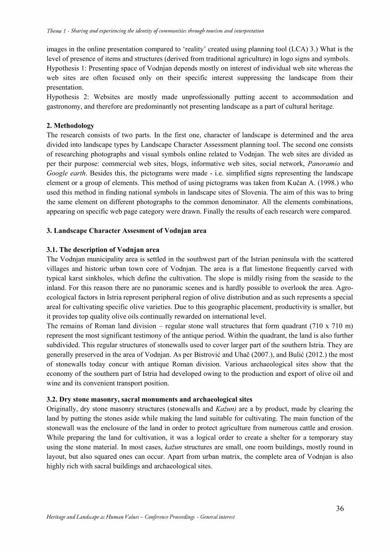
The Contemporary artworks are considered “open, heterogeneous and democratic”, but they can be recognized because there is an emphasis on ordinary and common objects, people and places, sometimes with a strong social message (related to politics, environment, gender issues, place history and sensorial experience). Highly influenced by the results of Pop and Conceptual art, contemporary works de-contextualize objects and create a new kind of figuration, communicative (easy and universal) and playful (sensitive and ironic). There is an evident vicinity to architecture, as many artists collaborate with architects and planners (Fig. 3). In downtown Vancouver there is a total of 16 Neoclassic artworks, most of them considered public monuments; 32 Modern and 77 Contemporary (although this number is always increasing)11. Each itinerary is planned to be done by foot (and eventually using public transportation) in one day; this applies especially for the Neoclassic and Modern itineraries, but the Contemporary walk might take more time due to the number of works. 6. Three examples Although each itinerary includes visiting many pieces, the phenomenological description can be an extended and difficult task; for this paper, such description takes place just in three works, one for each category12. From the descriptions, the changes can be easily inferred. 1. From the Classic itinerary: King Edward VII Fountain (1912) by Charles Marega. It is one of the oldest monuments in Vancouver, and a treasure hidden on the lateral façade of the Vancouver Art Gallery (VAG) building on Hornby St. It was commissioned by the Imperial Order of Daughters of the Empire to honour King Edward VII who had recently died; his bronze effigy is thus the central motif of this memorial. Originally it was located on the open square facing Georgia St. until it was substituted by the Centennial fountain (Robert Savery, architect; Alex Svoboda, sculptor) in 1966. When Arthur Erickson’s project of the new courthouse was completed in 1983 the King Edward fountain was relocated where it stands now. The memorial is composed by a central closed volume, which features bas-reliefs and the fountain bowl, and two short Doric colonnades to both sides. Just above the bowl, a relief of a lion’s head from which water used to spurt out (unfortunately it functions no more as fountain). On the back surface a quotation of Shakespeare is inscribed:
Not monumental stone preserves our fame Nor Sky-aspiring pyramids our name
The memory of him for whom this stands Shall outlive marble and defacers hands
Just as a small classic temple does, this monument has the ability to capture such memory in a rather gracious manner. Its proportions are harmonious enough to capture the curious observer (Figg. 4, 5). As in relation with the old courthouse, designed by Francis Mawson Rattenbury and Thomas Hooper (1906-12) in a most sober neoclassic style, the fountain corresponds to the same language. In its original location, the relationship must of have been grandiose. Today it is, although harmonious, marginal. Yet, it stands as an attractive urban surprise; its present deterioration gives it a sense of ruin, a capriccio to be discovered. Charles Marega is an important figure in the city’s sculpture of the early 20th century. Born in Italy as Carlo Marega, since 1909 he worked in many different commissions in Vancouver until his death in
11 Most of the public artworks are in fact located in the downtown area. In recent years the interest has been moving outwards, especially to the eastern areas where community-based public art projects have had a greater incidence. There are, however, three other areas that have created a public art circuit of their own, based on autonomous intentions: at the University of British Columbia, the Van Dusen Botanical Gardens and Il Giardino Italiano of Hastings Park. 12 In the original study, three artworks were chosen for each category.
31
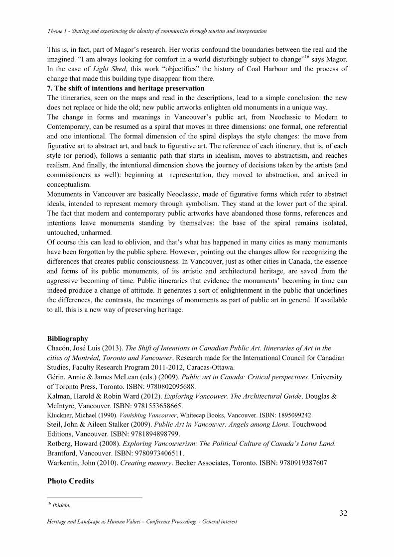
1939. One of the original teachers of the School of Decorative Arts (then Emily Carr Institute), his sculptures are found in the Parliament Buildings in Victoria, the main library of UBC, the Lions gate bridge, Stanley park, Sunset beach, the Sun Tower and Vancouver City Hall. 2. From the Modern itinerary: The Fathomless Richness of the Seabed (1969) by Jordi Bonet; at the Guinness Tower (1969) by Charles Paine & Associates, architects. This ceramic mural is not located in a completely public space, but in the lobby of the Guinness Tower, “Vancouver’s purest example of the International Style”13. It is an astounding wall relief of ceramic in blue and gold that invades the whole space. The mural covers the wall that divides the elevator area from the lobby, from floor to ceiling. The ceramic tiles display diverse types of textures between carved lines and relief forms. There is an area in which the relief forms are more abundant, which extends horizontally in the upper part of the mural. Perpendicularly a vertical line made of yellowish circles visually divides the composition. It recalls the ocean floor in a surreal manner, even though it is basically an abstract work, the forms, textures and colours create an evocative oceanic scene. In his statement, Bonet says “the textures and reliefs of waves of rippling sand, the delicate branches of coral reefs, the airy likeness of a sponge, the swift strength of the underwater currents” are all part of this magnificent underwater world, making a contrast with the minimalistic interiors designed by Paine (Figg. 6, 7). Bonet, born in Spain and then a Québec resident, created over a hundred murals all over the world, including Montréal, Québec City, New York and Osaka. In Vancouver he has another work in the West End. 3. From the Contemporary itinerary: Light Shed (2004) by Liz Magor. The northern shore of the Downtown peninsula has undergone in recent years an urban renewal similar to False Creek, in this case starting from Canada Place. New clear-clean residential towers have been built on former CPR lands, nearby the business district. The development is accompanied by a set of public spaces of high quality, joined together by the northern seawall, a promenade that arrives in Stanley Park. It is a promenade of contemporary public art as well. On a privileged site by Coal Harbour, Light Shed stands on the seawall with Stanley Park and the North shore as impressive backgrounds. It is a platinum-painted old freight shed, perched on top of log pilings slightly slanted to one side. It was made as a half scale model cast in aluminum of the wooden sheds that were installed many years ago along the waterfront. Every element is displayed to maximum detail: the cedar planks’ texture, the mussel clusters on the pillars, the tangled up seaweed, and so on. It is a surprising event (noticed by passers-by who stop to touch the artwork): the look-alike logs are not made of wood but of metal. At night as well: in the interior of the shed glows a dim light that casts moving shadows, giving the impression as if it was inhabited (Figg. 8, 9). Magor, who has another important work of public art in Vancouver, The Game (1995), at the square in front of Rogers Arena, affirms that Light Shed “does not go back in time, but forward”14. Although it recalls disappeared buildings – the real sheds were twice the size and were painted red – the work’s emphasis is on appearances. “There is a truth behind appearances that usually flips in one’s head when discovered” says Magor15. Thus an ordinary object, such as a shed, suddenly becomes “extraordinary” as a work of art. And this is certainly true, as one walks in and around Light Shed, what one discovers is not really what it is seen; a sculpture of a shed, that becomes a shed at one point, but in the end it is just a sculpture of a shed.
13 Kalman Harold, Ward Robin, Exploring Vancouver. The Architectural Guide, Douglas & McIntyre, Vancouver, 2012: 144. 14 Interview with Liz Magor made by the author on Sep. 7, 2012 in Vancouver. 15 Ibidem.
32
This is, in fact, part of Magor’s research. Her works confound the boundaries between the real and the imagined. “I am always looking for comfort in a world disturbingly subject to change”16 says Magor. In the case of Light Shed, this work “objectifies” the history of Coal Harbour and the process of change that made this building type disappear from there. 7. The shift of intentions and heritage preservation The itineraries, seen on the maps and read in the descriptions, lead to a simple conclusion: the new does not replace or hide the old; new public artworks enlighten old monuments in a unique way. The change in forms and meanings in Vancouver’s public art, from Neoclassic to Modern to Contemporary, can be resumed as a spiral that moves in three dimensions: one formal, one referential and one intentional. The formal dimension of the spiral displays the style changes: the move from figurative art to abstract art, and back to figurative art. The reference of each itinerary, that is, of each style (or period), follows a semantic path that starts in idealism, moves to abstractism, and reaches realism. And finally, the intentional dimension shows the journey of decisions taken by the artists (and commissioners as well): beginning at representation, they moved to abstraction, and arrived in conceptualism. Monuments in Vancouver are basically Neoclassic, made of figurative forms which refer to abstract ideals, intended to represent memory through symbolism. They stand at the lower part of the spiral. The fact that modern and contemporary public artworks have abandoned those forms, references and intentions leave monuments standing by themselves: the base of the spiral remains isolated, untouched, unharmed. Of course this can lead to oblivion, and that’s what has happened in many cities as many monuments have been forgotten by the public sphere. However, pointing out the changes allow for recognizing the differences that creates public consciousness. In Vancouver, just as other cities in Canada, the essence and forms of its public monuments, of its artistic and architectural heritage, are saved from the aggressive becoming of time. Public itineraries that evidence the monuments’ becoming in time can indeed produce a change of attitude. It generates a sort of enlightenment in the public that underlines the differences, the contrasts, the meanings of monuments as part of public art in general. If available to all, this is a new way of preserving heritage. Bibliography Chacón, José Luis (2013). The Shift of Intentions in Canadian Public Art. Itineraries of Art in the cities of Montréal, Toronto and Vancouver. Research made for the International Council for Canadian Studies, Faculty Research Program 2011-2012, Caracas-Ottawa. Gérin, Annie & James McLean (eds.) (2009). Public art in Canada: Critical perspectives. University of Toronto Press, Toronto. ISBN: 9780802095688. Kalman, Harold & Robin Ward (2012). Exploring Vancouver. The Architectural Guide. Douglas & McIntyre, Vancouver. ISBN: 9781553658665. Kluckner, Michael (1990). Vanishing Vancouver, Whitecap Books, Vancouver. ISBN: 1895099242. Steil, John & Aileen Stalker (2009). Public Art in Vancouver. Angels among Lions. Touchwood Editions, Vancouver. ISBN: 9781894898799. Rotberg, Howard (2008). Exploring Vancouverism: The Political Culture of Canada’s Lotus Land. Brantford, Vancouver. ISBN: 9780973406511. Warkentin, John (2010). Creating memory. Becker Associates, Toronto. ISBN: 9780919387607
Photo Credits
16 Ibidem.
33
All the photographs are by José Luis Chacó
Fig. 1. Itinerary of Neoclassic public art
Fig.2. Itinerary of Modern public art
34
Fig.3. Itinerary of Contemporary public art
Figg.4, 5. King Edward VII Fountain (1912), Charles Marega
Figg.6, 7. The Fathomless Richness of the Seabed (1969), Jordi Bonet
Figg.8, 9. Light Shed (2004), Liz Magor
35
The Interpretation of Vodnjan Cultural Landscape in the Online
Presentation
Goran ANDLAR* Sonja BUTULA** Olga KINKELA***
(*) Department of Ornamental Plants, Landscape Architecture and Ornamental Plants, Faculty of Agriculture, University of Zagreb, Svetošimunska 25, 10 000 Zagreb, +385912393658, [email protected] (**) Department of Ornamental Plants, Landscape Architecture and Ornamental Plants, Faculty of Agriculture, University of Zagreb, Svetošimunska 25, 10 000 Zagreb, +385912394047, [email protected] (***) Parkovi d.o.o., company for arrangement and care for green areas, Stubište Lipovica 2, 51410 Opatija, +3850955540761, [email protected] Abstract Morphologically speaking, the area of town Vodnjan, situated in the south of Istrian peninsula, is flat limestone area frequently carved with typical karst sinkholes which define certain cultivation. As a cultural landscape, it is in the first place specific with its maintained Roman land division – regular geometrical structures dividing land by stonewalls. Other unique structures, specific for the area, are - kažun (a small round structure constructed by a dry stack technique out of readily available flat stones, traditionally used in livestock) and a number of archaeological sites (most of them are the remains of medieval small churches). Due to the above mentioned characteristics that make a landscape of Vodnjan valuable and significant on an international level, the Mediterranean landscape of Vodnjan should be an important carrier of regional and national identity providing tourist and economic development. The aim of this study was to determine the extent of cultural landscape of Vodnjan in the online presentation, in other words, to determine the level of public consciousness about values of the cultural landscape. The results showed that the content of the cultural landscape is 47,3%. Assuming that uploaded photographs tell us about identity of the place created by the public, it was concluded that sacral elements have a high degree of symbolic meaning in the landscape. Roman land division, which was considered as a valuable element of cultural landscape, is unattended in the media. Comparing the landscape identity obtained by Landscape Character Assessment with the one represented online, created by the public, showed some deviations. Keywords: Online Presentation; Roman Land Division; Landscape Character; Stonewalls; Visual Symbols 1. Introduction Due to contemporary way of life, we can disclose that a new trend of visiting places abundant in tradition and cultural historic heritage emerged in cultural branch of tourism all over the world. Such sites are usually attributed as strong identity (specific genius loci) originated out of traditional way of living in a certain natural site. Assuming that town of Vodnjan is one of such maintained places with strong identity, qualities of landscape are being threatened by changing space in processes such as urban development, cessation of extensive farming and intensive agriculture. Structures derived from traditional way of living that appear in landscape and had the role in organization and forming the agricultural area as well as the town area from antique period until 20th century are the stonewall structures, kažun structures and abundance of sacral and archaeological sites. Due to mentioned facts that partly form character of the site, it is highly important for Vodnjan to utilise its potential in presenting its sites properly which means that presentations should include complete cultural heritage. Today, World Wide Web is probably a main base for spreading out information and attracting tourists and in this study following questions are asked: 1.) What is the extent of cultural landscape of Vodnjan contribution in promoting image of Vodnjan as well as which elements are mostly exposed. 2.) How are the analyzed
36
images in the online presentation compared to ‘reality’ created using planning tool (LCA) 3.) What is the level of presence of items and structures (derived from traditional agriculture) in logo signs and symbols. Hypothesis 1: Presenting space of Vodnjan depends mostly on interest of individual web site whereas the web sites are often focused only on their specific interest suppressing the landscape from their presentation. Hypothesis 2: Websites are mostly made unprofessionally putting accent to accommodation and gastronomy, and therefore are predominantly not presenting landscape as a part of cultural heritage. 2. Methodology The research consists of two parts. In the first one, character of landscape is determined and the area divided into landscape types by Landscape Character Assessment planning tool. The second one consists of researching photographs and visual symbols online related to Vodnjan. The web sites are divided as per their purpose: commercial web sites, blogs, informative web sites, social network, Panoramio and Google earth. Besides this, the pictograms were made - i.e. simplified signs representing the landscape element or a group of elements. This method of using pictograms was taken from Kučan A. (1998.) who used this method in finding national symbols in landscape sites of Slovenia. The aim of this was to bring the same element on different photographs to the common denominator. All the elements combinations, appearing on specific web page category were drawn. Finally the results of each research were compared. 3. Landscape Character Assesment of Vodnjan area 3.1. The description of Vodnjan area The Vodnjan municipality area is settled in the southwest part of the Istrian peninsula with the scattered villages and historic urban town core of Vodnjan. The area is a flat limestone frequently carved with typical karst sinkholes, which define the cultivation. The slope is mildly rising from the seaside to the inland. For this reason there are no panoramic scenes and is hardly possible to overlook the area. Agro-ecological factors in Istria represent peripheral region of olive distribution and as such represents a special areal for cultivating specific olive varieties. Due to this geographic placement, productivity is smaller, but it provides top quality olive oils continually rewarded on international level. The remains of Roman land division – regular stone wall structures that form quadrant (710 x 710 m) represent the most significant testimony of the antique period. Within the quadrant, the land is also further subdivided. This regular structures of stonewalls used to cover larger part of the southern Istria. They are generally preserved in the area of Vodnjan. As per Bistrović and Uhač (2007.), and Bulić (2012.) the most of stonewalls today concur with antique Roman division. Various archaeological sites show that the economy of the southern part of Istria had developed owing to the production and export of olive oil and wine and its convenient transport position.
3.2. Dry stone masonry, sacral monuments and archaeological sites Originally, dry stone masonry structures (stonewalls and Kažun) are a by product, made by clearing the land by putting the stones aside while making the land suitable for cultivating. The main function of the stonewall was the enclosure of the land in order to protect agriculture from numerous cattle and erosion. While preparing the land for cultivation, it was a logical order to create a shelter for a temporary stay using the stone material. In most cases, kažun structures are small, one room buildings, mostly round in layout, but also squared ones can occur. Apart from urban matrix, the complete area of Vodnjan is also highly rich with sacral buildings and archaeological sites.
37
3.3. Main factors in forming today’s area of vodnjan Main factors that formed today’s area of Vodnjan are Roman ager pattern (Fig.1) following paths and borders of agricultural areas as well as a typical way of functioning of Istrian settlement (Fig. 2). Usually, a settlement is placed in the middle while cultivated land is placed just around. This is because this type of land requires constant care. Pasture area requires quite less care, for they are placed farther from the settlement. It is clearly evident that if there had been no Roman land division, which partly determined the area, this zone would be formed in the ordinary concept. The fact that urban area has always been closely connected with the surrounding is evident, due to the fact that the town is surrounded by the agricultural areas, and the same can be concluded from the peripheral architecture. 3.4. The landscape character division of vodnjan’s area Generally, the entire area is a fragmented mosaic land, mostly agricultural. In reality there is no clear distinction between divided four landscape types (Fig. 3), but differences change gradually. 1. Mosaic system of woods and meadows (Fig. 4) Approximately 70% of the landscape type 1 is covered with dense wood which makes this area most natural. It is easy to notice that some extent of wood land used to be a cultivated land until recently. This cultivated area appears together with high wood vegetation. The remains of Roman land division are recognized in wood edges following it regularly in some parts. This type is poor in patterns. 2. Mosaic landscape of cultivable land, meadows, overgrown agricultural land and high vegetation (Fig. 5) The mosaic landscape of the cultivated land, meadows, overgrown agricultural land and high vegetation is composed of various landscape elements such as: combination of woods, pastures, cultivable land, olive groves, overgrowing agricultural land and scattered rural or semi-rural built objects. In the structural sense density of sink holes varies on different parts of this area. For this reason, it is the most heterogeneous due to a great number of them. Significant symbolic elements of this area are a number of archaeological sites. 3. Mosaic landscape of predominantly cultivated land (Fig. 6) Significance of this landscape type is that olive groves are mostly condensed in the central part, i.e. around the urban matrix. They create geometric shapes, but irregularly situated shapes which in some parts, especially in the south, follow the limes line. The buildings appear mainly in groups along the roads. They have rural or semi-urban characteristics. Due to the fact that there is no high vegetation in this landscape type part, dry stone masonry is extremely visible. The church tower situated in the urban area contributes to make the landscape symbolic for it is visible from all parts of landscape type 3. Beside the mentioned church tower, there are also a number of small medieval churches. 4. Urban landscape and industrial facility (Fig. 7) In comparison with a great number of towns in Istria, the ground plan disposition is not typical for the historic development. It has a linear structure, directed SW-NE. The old town is remarkable with its raster layout, narrow devious streets and compact residential objects. (Bistrović&Uhač, 2007) 4. Vodnjan’s area cultural landscape in the online presentation 4.1. About the research Various depictions and symbols connected to Vodnjan(goat, autochthonous Istrian cow boškarin, kažun and the Vodnjan emblem) area and Istra were taken into consideration. Owing to the fact that there were not many sites presenting the Vodnjan area, all the web sites containing at least two photographs of Vodnjan were taken into consideration. The web sites were divided as per their purpose: commercial web sites, blogs, informative web sites, social networks, Panoramio and Google earth. The photographs were classified into tables in which the landscape elements were grouped. The groups were the following ones: natural elements, agricultural elements, elements of Roman age, elements of dry
38
stone masonry, sacral elements, urban matrix elements, cartographic previews and symbols (Fig. 8). The purpose of these tables was to determine a number of appearing for an individual element. Besides, the pictograms (Fig. 9) were made - i.e. simplified signs representing or determined landscape element either the combination of elements by which various photograph scenes could be brought to the common denominator so that they could be easily analysed. The aim was to find out the number of appearing of elements combinations. 4.2. Interpretation of results This research showed that the cultural landscape is most presented on blogs, Google Earth and Panoramio. The poorest in presenting landscape were the informative web sites, portals and touristic agency web sites. The only web site we can claim to present cultural landscape and elements of urban matrix equally is the Vodnjan’s official web site. As regards to individual elements appearing in online presentation in generally the most frequent are motifs of woods, small church, elongated street perspective, church tower, houses in the urban matrix and olive grove. Kažun structures, olive groves and church tower are often appearing combined with other elements. Different motifs are very often appearing individually. Many combinations of different cultural landscape elements appear, but in a small percentage. Opposed to this, it is found that motifs of urban matrix and sacral elements appear in a considerably larger percentage. Tourist agencies and portal web sites are very low in any type of information and therefore they lack in appropriate presentation of space. This is particularly inconvenient for tourist agencies websites for it is them to provide an interesting experience seeking for potential tourists. 5. Discussion The research showed that there is no specific landscape motif which is characteristic for Vodnjan and neither is there such concrete location which represents Vodnjan in simplified manner. On the basis of frequency of appearance we can say this only for the motif of the Gothic palace. Although it is authentic of Vodnjan, kažun motif cannot represent Vodnjan in simplified way, for it has become a universal symbol of Istria appearing on the postcards of the places where they don’t exist in reality. On the basis of solely the area of Vodnjan we can say that the bell tower is also a very characteristic motif. However, if we compare it to the other small towns and villages in Istria we can conclude that this element is present in all Istrian towns. It was shown that the searched web sites of tourist agencies and the official tourist portals were very poor in promotional material. Emphasizing houses with pools, we can say that the city of Vodnjan does not use its high potential for attractive presentation. Generally speaking, in spite of the fact that lately there has been a growing interest in central Istria (Geografija, 2006.), the postcards are still poor in showing the authentic rural culture. Internet enables all of us to point out our opinions and attitudes, and posting photos on the web pages is ideal for observing the way in which people perceive space. In that sense, the most interesting pages are Virtualtourist, Google earth and Panoramio. On Virtualtourist images the most frequent are the city motifs but the motifs of the landscape are very rare. On the other hand, Google earth and Panoramio are rich in showing the landscape motifs, emphasizing sacral elements. It is difficult to assume the reasons for such a contrast. The extent of appearing images of sacral elements deviates from the reality. From this we can maybe conclude that planning tools are not satisfactory because they cannot give the planer precise information about space, and therefore, public participation is essential. Although the percentage of the presence of the cultural landscape in the space presentations of Vodnjan is 47,3% we cannot say in which degree its inhabitants identify with it. Throughout the history Vodnjan’s landscape was a rare motif or topic in art works (literature, painting or film) which can lead to the conclusion that the level of identifying of the local people with the landscape is low. This can be compared to England for example, where all forms of art throughout the history created a high level of
39
identifying with landscape among the people. It is important to note also that in the 2008. the city of Vodnjan published the competition for the visual identity of the town (Fig. 10). The concept of rewarded solution was based on a modern way of the transmission of visual data. It can be used in different situations through co-relation with different visual motifs. 6. Conclusion From all shown images of material, there were 66 visually simplified motifs. They gave us a simpler overview of the numbers of motifs and their content which helped us in a more detailed determination of the presented space of the city of Vodnjan. The analysis shows that the presence of cultural landscape motif is 47,3% while the presence of the urban ones is 52,7%. According to that, in relation with the overall space of the city of Vodnjan, the presentation shows that the dominant motifs are those of the city which in fact occupies a fairly small area. It is obvious from the presentation of Vodnjan that some elements are more frequent, and some less and the question rises if this depicts the real space image. We need to consider the crucial fact which determined the appearance of the motifs on research material, which is the flat slope of the Vodnjan area which does not allow a wider view of the area. This is why the presentation in one image depicts one to three motifs the most. Such a mosaic landscape is very difficult to read out from the presentation. Out of 567 images there is only one image (on two occasions) which gives a partial layout of the landscape types. Also, it is important to note that sinkhole is a rare motif. Actually, they are very scarce. The Roman land division cannot be seen at all, only its elements – the dry walls which usually mark the borders of ploughland, olive groves and meadows. Considering the fact that the presentation of the urban matrix is very frequently shown from the bird perspective, it is strange that there has been no need to take photographs and posting the images of the landscape from the bird perspective. The Roman land division is not seen on the web pages and logo signs of olive oil and vine which can be considered a great neglect in the use of the potential of cultural landscape in advertising. Significance of the online presentation is that sacral elements appear very often which shows the reshaped reality which is not the case in reality. Therefore it tells us that these elements in landscape indeed have a symbolic meaning. The considered web sites have higher level of information, and therefore most of them also offer the information about the cultural landscapes. The information of the web sites, which were not considered vary. Some of them have high level of the information, but do not offer the information about Vodnjan, and the other ones have low level of information, but it can be expected that they do not offer the information about Vodnjan. It is obvious that the way of the presentation of the town Vodnjan on the web sites depended on the sites purpose and interest. Naturally, the cultural landscape appears on the web sites promoting olive oil and wine. The awareness about the cultural landscapes is however evident on the commercial web sites, especially regarding tourist agencies, because on their web sites the motifs of the cultural landscapes appear very rarely. Tourist agencies did not consider it necessary to present their cultural landscapes as a part of the cultural heritage. Regarding symbols, the kažun structure appears most frequently. It is to be noted that its popularity grew lately, after the highway passed close and many of the kažun structures had been destroyed. After that, the inhabitants of Vodnjan became aware and approved kažun as “their” specific object. Subsequently, the kažun structures multiplied in different shapes and for various purposes and therefore it became a symbol not only for the inhabitants of Vodnjan, but for the entire Istria. Despite of the fact that this structure originally appeared only in the southern part of Istria, today it is spread along the whole Istria. The symbol of the goat is also very important for the entire Istrian peninsula, but it appears less then a symbol of kažun. Boškarin cattle appeares very rarely.
40
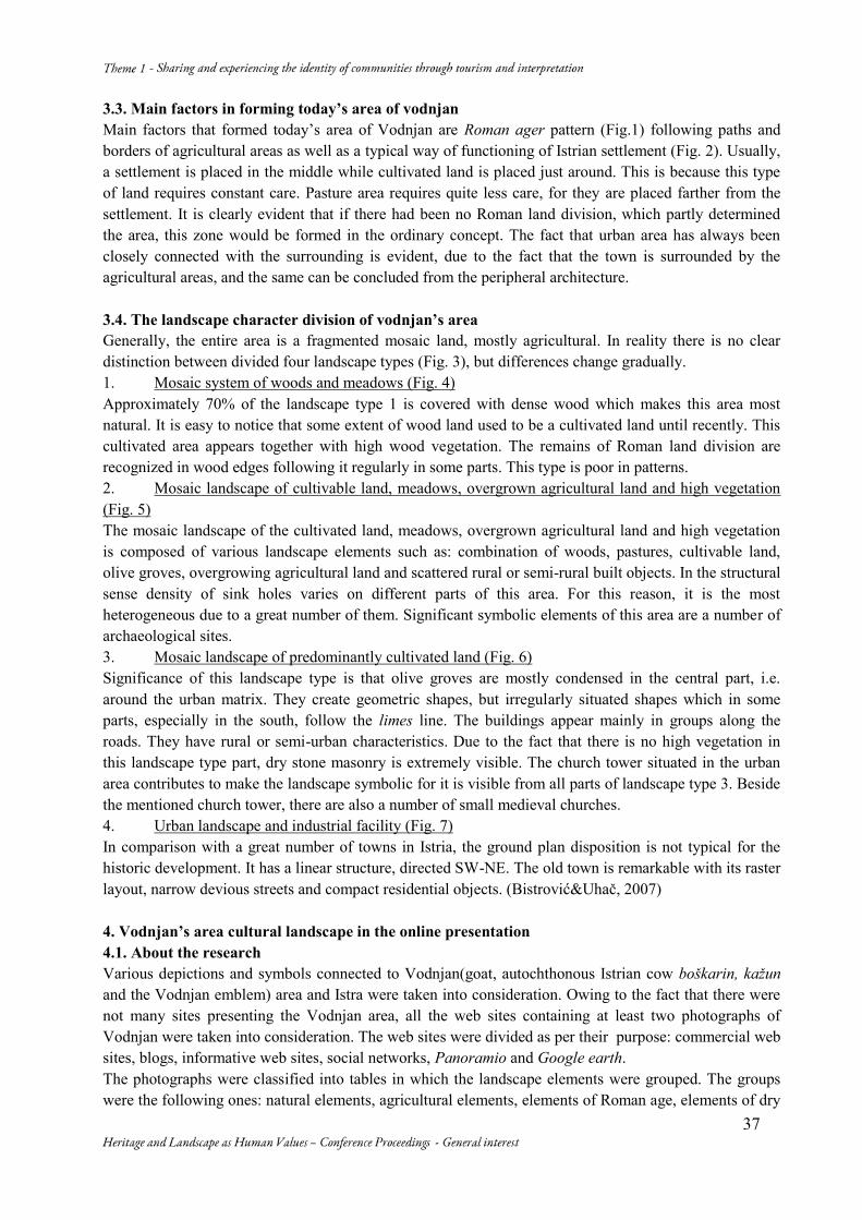
Bibliography Alempijević, Nevena Škrbić (2003). Značenja tradicijskog pri konstruiranju istarskih identiteta. Vol. 14/15, pp. 69-88. Antrop, Marc (2005). Why landscapes of the past are important for the future. Vol. 70 (1-2) , pp. 21-34. Andlar, Goran et al. (2011). Kulturni krajobraz i legislativa – stanje u Hrvatskoj. 20, 3; pp. 813-835. Baloglu, Seyhmus & McCleary, Ken W. (1999a). A model of destination image formation. 26(4), pp. 868–897. Bistrović i Uhač, (2007). Zaštićeni kulturni krajolik vodnjanštine, konzervatorski elaborat, consecvationsist elaborate, unpublished version. Bulić, Davor (2012). Rimska centuriacija Istre. 10904: 711. 41, pp. 50 -74. Buršić – Matijašić Klara (2011). Ne samo gradine. Vol. 21/2012, pp. 63-76. Cifrić, Ivan &Trako Tijana (2008). Kultivirani i tehnički krajobraz. Vol. 17, No. 3, pp. 215-235. Dumbović-Bilušić, Biserka & Šćitaroci Mladen Obad (2007). Kulturni krajolici u Hrvatskoj – identifikacija i stanje zaštite. Prostor. 712: 719 (497.5), pp. 260-271. Echtner, Charlotte M., Richie, J.R.Brent (2003.) The Meaning and Measurement of Destination Image. Vol. 14, No. 1, pp. 37-48. Kale, Jadran (2010). Prijedlog modela inventarizacije suhozida. 18, 2(40), pp. 452-467. Lisac, Rene & Ivanuš Martina (2010). Krajobrazni uzorci planinskih naselja sjevernoga Velebita. 18, 2 (40), pp. 424-437. Lynch, Kevin (1990). The Image of the City. The M.I.T. Press Massachusetts. Physical plan of Vodnjan, http://www.vodnjan.hr/web/dwn/Sluzbene_novine_04-2007.pdf (20.02.2013.) Sever, Taja (2010). Interpretacija upodobitve krajin na turističnih razglednicah izdanih med 1995 in 2008. Master’s thesis, Biotehinška fakulteta, Ljubljana. Špulerová, Jana & Petrovič František (2011). Historical Agricultural Landscape as a Subject of Landscape Ecological Research. 73/2, pp. 155-163. Stobbelaar, D. J. & B. Pedroli (2011). Perspectives on Landscape Identity: A conceptual Challenge. Vol. 36, No. 3, pp. 321-339. Swanwick, Carys (2003). Landscape Character Assessment Guidance. Countryside Agency. pp. 8-52. Vinšćak, Tomo (1998). Iz tradicijske baštine središnje istre, Vol 10/11, pp. 75-88. Vos, W., Meeks H. et al (1999). Trends in European cultural landscape development: perspectives for a sustainable future. Landscape and Urban Planning. Vol. 46, 1-3
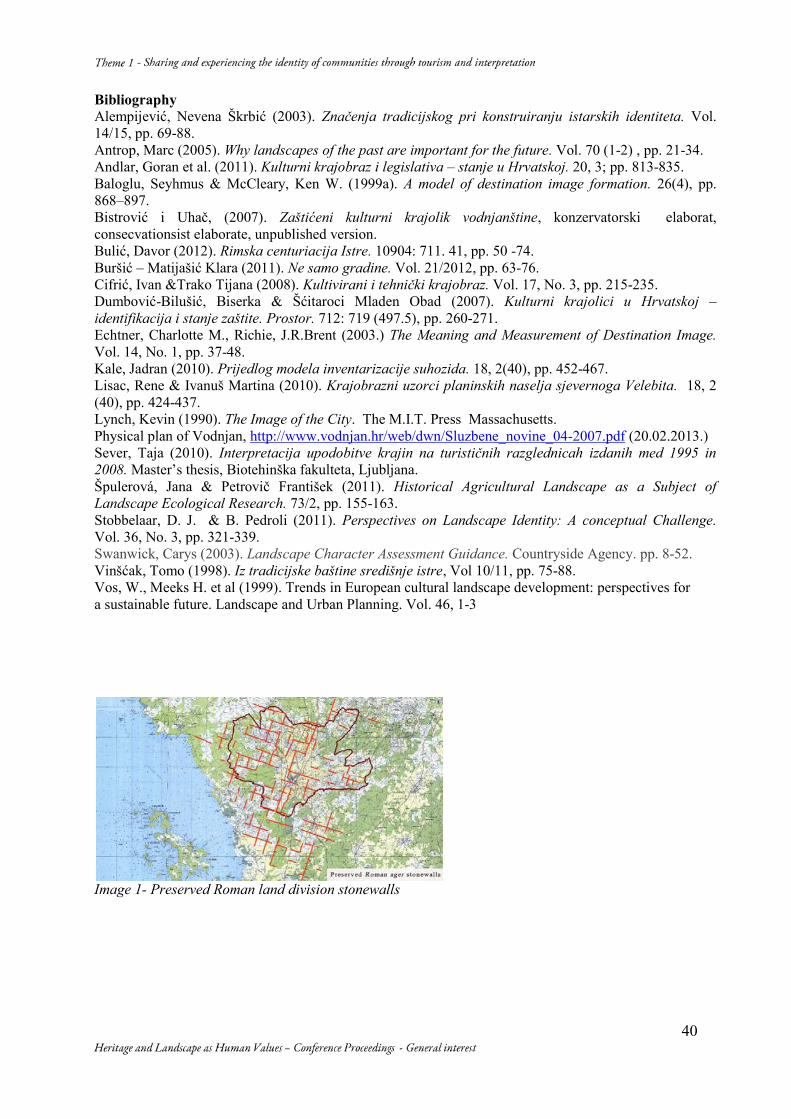
Image 1- Preserved Roman land division stonewalls
41
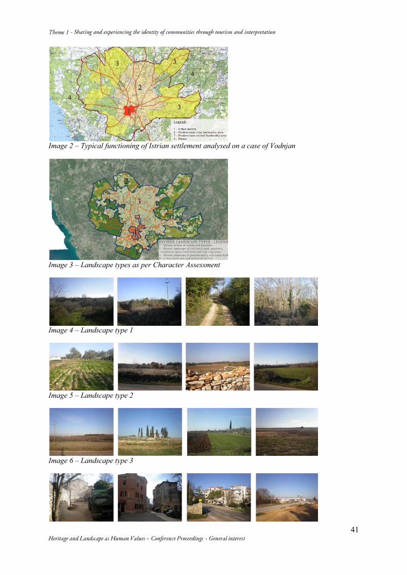
Image 2 – Typical functioning of Istrian settlement analysed on a case of Vodnjan
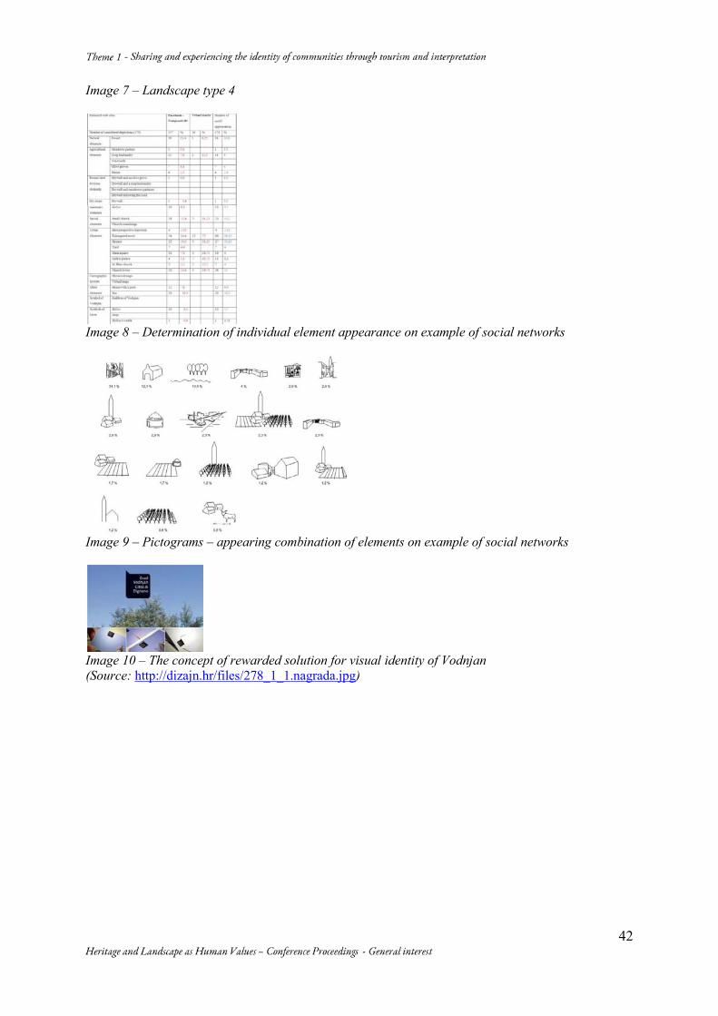
Image 3 – Landscape types as per Character Assessment
Image 4 – Landscape type 1
Image 5 – Landscape type 2
Image 6 – Landscape type 3
42
Image 7 – Landscape type 4
Image 8 – Determination of individual element appearance on example of social networks
Image 9 – Pictograms – appearing combination of elements on example of social networks
Image 10 – The concept of rewarded solution for visual identity of Vodnjan (Source: http://dizajn.hr/files/278_1_1.nagrada.jpg)
43
The Dr. Sun Yat-Sen Classical Chinese Garden: a Bridge between Cultures Jeannette HLAVACH ICOMOS Canada [email protected] • 604 224 4629 This paper presents a case study of the Dr. Sun Yat-Sen Classical Chinese Garden in Vancouver, British Columbia, Canada. The Garden is a cultural tourism heritage site which excels in interpreting the values of Ming Dynasty style gardens, while also playing a key role in the promotion of intercultural dialogue. Abstract A Community Led Inspiration: Solid citizen resistance in the late 1960s stopped a downtown freeway that would have cut through historic Chinatown. Recognition of the value of Chinatown led to plans to revitalize the area and entrench Chinese culture with the creation of a classical Chinese garden. Building the Dr. Sun Yat-Sen Classical Chinese Garden – An International Effort: The Garden is the first authentic Ming Dynasty-style scholar’s garden to be constructed outside of China. It was designed by the Suzhou Garden Administration, in association with local professionals. It was built in the traditional way by master craftsmen from Suzhou using building components, rocks and courtyard materials imported from China. It is a rare example of a Chinese cultural landscape in Canada. Intercultural Dialogue: The Garden is owned by the City of Vancouver and is cared for by the not-for-profit Garden Society, which employs 9 full-time staff. The Garden’s Vision is “To be a world-class experience, fostering inter-cultural harmony and understanding.” The Garden’s Mission is “Bring together cultures and communities through a classical Chinese garden.” Open to the Public: Annually, the Garden welcomes some 100,000 local, national and international visitors and coordinates programs for some 5,000 school children. The Garden operates with a budget of approximately $1 million. Interpretation of Tangible and Intangible: The Garden provides programs that showcase the culture of the city, embrace diversity and promote cultural understanding. This includes daily docent-led tours, public celebration of traditional Chinese holidays (New Year, Mid-Autumn Moon Festival, and Winter Solstice), concerts featuring music from around the world, and art exhibitions. Engagement Beyond the Garden: The Garden is a key player in efforts to revitalize Chinatown. It is recognized by the City of Vancouver as an economic generator and destination. Staff and Society Trustees are active in business, planning and tourism organizations. Recognition: The Garden was chosen in 2011 by National Geographic as the World’s Top City Garden and the 2012 Canadian Garden of the Year. It is located in Vancouver’s Chinatown, which in 2011 was declared a National Historic Site. The Garden was added to the Vancouver Heritage Register in 2014 as a Landscape Resource. Keywords: Cultural Understanding; International Recognition; Neighbourhood Revitalisation
44
1. A Community-led Inspiration In the late 1960s, Chinatown, the area where the Chinese first settled in the late 1800s, and Gastown, the original townsite of the current city, were targeted for the route of a new freeway to serve the Vancouver area. Although both Chinatown and Gastown are now National Historic Sites, there was no such recognition in those days. The broadly based opposition to the freeway drew attention to the value of these areas and raised awareness of their value. Public attitudes shifted from support of demolition and renewal to support of rehabilitation. In Chinatown, the defeat of the freeway, along with reform to Canada’s immigration laws, brought unprecedented value and attention to Chinatown and Chinese culture. To recognize, reinforce and promote Chinese culture, the idea arose of creating a Chinese Garden and Park in association with the construction of a Chinese Cultural Centre. The concept was to develop a large free public Park and a smaller fee-charging Classical Garden which, as a Scholar’s Garden, would include extensive, and expensive, architectural components that require a higher level of security and maintenance. A Garden would not only showcase China’s cultural legacy, it would also provide a way to bridge eastern and western cultures. A focussed community effort, involving both Chinese and non-Chinese, raised the necessary $6 million by securing both private and government funding. The government of China made a generous contribution of labour and materials. 2. Building the Dr. Sun Yat-Sen Classical Chinese Garden – an International Effort Changes in the People’s Republic of China in the late 1970s lead to unprecedented openness and opportunity. The Suzhou Garden Administration had just completed the construction of a Ming Dynasty scholar’s study and courtyard in the Metropolitan Museum in New York. The Administration was invited to Vancouver to discuss its possible participation in a garden project. China’s interest in establishing closer cultural ties with a Pacific Rim city, in which there was a sizeable Chinese community, lead to an offer of cooperation. The inspiration for the design of the Dr. Sun Yat-Sen Garden and Park was the classical Chinese gardens in Suzhou, China, which seek to recreate natural landscapes in miniature. Nine of these gardens, generally acknowledged to be masterpieces of the genre, are inscribed on the World Heritage list. These gardens are associated with the Ming Dynasty (1368-1644). It was through this unprecedented international cooperation with China, that the Dr. Sun Yat-Sen Garden became the first authentic Ming Dynasty-style scholar’s garden to be constructed outside of China. It was designed by the Suzhou Garden Administration, in association with local professionals. China supplied fifty-two master craftsmen from the City of Suzhou for one year to build the Garden. These artisans brought authentic tools and used Ming Dynasty construction techniques - that is, no nails, screws or glue. Some 90 crates of authentic materials were also provided, some of which are exceptionally rare, such as the Lake Tai limestone rocks (Fig. 1) and the 8 columns of nan wood. The work was successfully completed (Fig. 2) in 1986 in time for the opening of Vancouver’s World’s Fair, Expo 86. Subsequent to the initial Garden design, additions were completed in 2004. Designed in a complementary, but distinguishable style to the original Garden, the Hall of One Hundred Rivers provides space for educational programmes, exhibitions, large functions and concerts. Administrative offices and a larger gift shop were added in a contemporary style. The Garden was named after Dr. Sun Yat-Sen, who is widely credited as the father of modern China. Dr. Sun Yat-Sen was the first major Chinese figure to travel extensively in the west and bring western political ideas back to China. He was a key leader in the revolution that overthrew the last Chinese Emperor and brought China into the modern age.
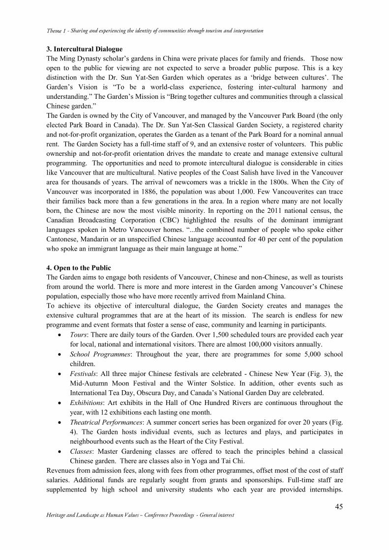
45
3. Intercultural Dialogue The Ming Dynasty scholar’s gardens in China were private places for family and friends. Those now open to the public for viewing are not expected to serve a broader public purpose. This is a key distinction with the Dr. Sun Yat-Sen Garden which operates as a ‘bridge between cultures’. The Garden’s Vision is “To be a world-class experience, fostering inter-cultural harmony and understanding.” The Garden’s Mission is “Bring together cultures and communities through a classical Chinese garden.” The Garden is owned by the City of Vancouver, and managed by the Vancouver Park Board (the only elected Park Board in Canada). The Dr. Sun Yat-Sen Classical Garden Society, a registered charity and not-for-profit organization, operates the Garden as a tenant of the Park Board for a nominal annual rent. The Garden Society has a full-time staff of 9, and an extensive roster of volunteers. This public ownership and not-for-profit orientation drives the mandate to create and manage extensive cultural programming. The opportunities and need to promote intercultural dialogue is considerable in cities like Vancouver that are multicultural. Native peoples of the Coast Salish have lived in the Vancouver area for thousands of years. The arrival of newcomers was a trickle in the 1800s. When the City of Vancouver was incorporated in 1886, the population was about 1,000. Few Vancouverites can trace their families back more than a few generations in the area. In a region where many are not locally born, the Chinese are now the most visible minority. In reporting on the 2011 national census, the Canadian Broadcasting Corporation (CBC) highlighted the results of the dominant immigrant languages spoken in Metro Vancouver homes. “...the combined number of people who spoke either Cantonese, Mandarin or an unspecified Chinese language accounted for 40 per cent of the population who spoke an immigrant language as their main language at home.” 4. Open to the Public The Garden aims to engage both residents of Vancouver, Chinese and non-Chinese, as well as tourists from around the world. There is more and more interest in the Garden among Vancouver’s Chinese population, especially those who have more recently arrived from Mainland China. To achieve its objective of intercultural dialogue, the Garden Society creates and manages the extensive cultural programmes that are at the heart of its mission. The search is endless for new programme and event formats that foster a sense of ease, community and learning in participants.
Tours: There are daily tours of the Garden. Over 1,500 scheduled tours are provided each year for local, national and international visitors. There are almost 100,000 visitors annually.
School Programmes: Throughout the year, there are programmes for some 5,000 school children.
Festivals: All three major Chinese festivals are celebrated - Chinese New Year (Fig. 3), the Mid-Autumn Moon Festival and the Winter Solstice. In addition, other events such as International Tea Day, Obscura Day, and Canada’s National Garden Day are celebrated.
Exhibitions: Art exhibits in the Hall of One Hundred Rivers are continuous throughout the year, with 12 exhibitions each lasting one month.
Theatrical Performances: A summer concert series has been organized for over 20 years (Fig. 4). The Garden hosts individual events, such as lectures and plays, and participates in neighbourhood events such as the Heart of the City Festival.
Classes: Master Gardening classes are offered to teach the principles behind a classical Chinese garden. There are classes also in Yoga and Tai Chi.
Revenues from admission fees, along with fees from other programmes, offset most of the cost of staff salaries. Additional funds are regularly sought from grants and sponsorships. Full-time staff are supplemented by high school and university students who each year are provided internships.
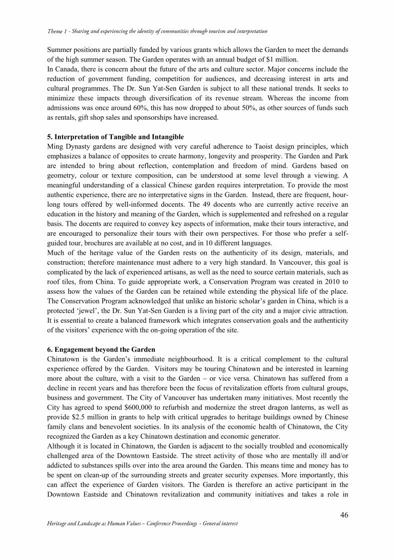
46
Summer positions are partially funded by various grants which allows the Garden to meet the demands of the high summer season. The Garden operates with an annual budget of $1 million. In Canada, there is concern about the future of the arts and culture sector. Major concerns include the reduction of government funding, competition for audiences, and decreasing interest in arts and cultural programmes. The Dr. Sun Yat-Sen Garden is subject to all these national trends. It seeks to minimize these impacts through diversification of its revenue stream. Whereas the income from admissions was once around 60%, this has now dropped to about 50%, as other sources of funds such as rentals, gift shop sales and sponsorships have increased. 5. Interpretation of Tangible and Intangible Ming Dynasty gardens are designed with very careful adherence to Taoist design principles, which emphasizes a balance of opposites to create harmony, longevity and prosperity. The Garden and Park are intended to bring about reflection, contemplation and freedom of mind. Gardens based on geometry, colour or texture composition, can be understood at some level through a viewing. A meaningful understanding of a classical Chinese garden requires interpretation. To provide the most authentic experience, there are no interpretative signs in the Garden. Instead, there are frequent, hour-long tours offered by well-informed docents. The 49 docents who are currently active receive an education in the history and meaning of the Garden, which is supplemented and refreshed on a regular basis. The docents are required to convey key aspects of information, make their tours interactive, and are encouraged to personalize their tours with their own perspectives. For those who prefer a self-guided tour, brochures are available at no cost, and in 10 different languages. Much of the heritage value of the Garden rests on the authenticity of its design, materials, and construction; therefore maintenance must adhere to a very high standard. In Vancouver, this goal is complicated by the lack of experienced artisans, as well as the need to source certain materials, such as roof tiles, from China. To guide appropriate work, a Conservation Program was created in 2010 to assess how the values of the Garden can be retained while extending the physical life of the place. The Conservation Program acknowledged that unlike an historic scholar’s garden in China, which is a protected ‘jewel’, the Dr. Sun Yat-Sen Garden is a living part of the city and a major civic attraction. It is essential to create a balanced framework which integrates conservation goals and the authenticity of the visitors’ experience with the on-going operation of the site. 6. Engagement beyond the Garden Chinatown is the Garden’s immediate neighbourhood. It is a critical complement to the cultural experience offered by the Garden. Visitors may be touring Chinatown and be interested in learning more about the culture, with a visit to the Garden – or vice versa. Chinatown has suffered from a decline in recent years and has therefore been the focus of revitalization efforts from cultural groups, business and government. The City of Vancouver has undertaken many initiatives. Most recently the City has agreed to spend $600,000 to refurbish and modernize the street dragon lanterns, as well as provide $2.5 million in grants to help with critical upgrades to heritage buildings owned by Chinese family clans and benevolent societies. In its analysis of the economic health of Chinatown, the City recognized the Garden as a key Chinatown destination and economic generator. Although it is located in Chinatown, the Garden is adjacent to the socially troubled and economically challenged area of the Downtown Eastside. The street activity of those who are mentally ill and/or addicted to substances spills over into the area around the Garden. This means time and money has to be spent on clean-up of the surrounding streets and greater security expenses. More importantly, this can affect the experience of Garden visitors. The Garden is therefore an active participant in the Downtown Eastside and Chinatown revitalization and community initiatives and takes a role in
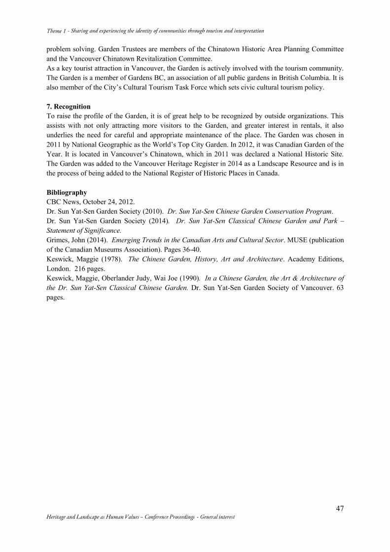
47
problem solving. Garden Trustees are members of the Chinatown Historic Area Planning Committee and the Vancouver Chinatown Revitalization Committee. As a key tourist attraction in Vancouver, the Garden is actively involved with the tourism community. The Garden is a member of Gardens BC, an association of all public gardens in British Columbia. It is also member of the City’s Cultural Tourism Task Force which sets civic cultural tourism policy. 7. Recognition To raise the profile of the Garden, it is of great help to be recognized by outside organizations. This assists with not only attracting more visitors to the Garden, and greater interest in rentals, it also underlies the need for careful and appropriate maintenance of the place. The Garden was chosen in 2011 by National Geographic as the World’s Top City Garden. In 2012, it was Canadian Garden of the Year. It is located in Vancouver’s Chinatown, which in 2011 was declared a National Historic Site. The Garden was added to the Vancouver Heritage Register in 2014 as a Landscape Resource and is in the process of being added to the National Register of Historic Places in Canada. Bibliography CBC News, October 24, 2012. Dr. Sun Yat-Sen Garden Society (2010). Dr. Sun Yat-Sen Chinese Garden Conservation Program. Dr. Sun Yat-Sen Garden Society (2014). Dr. Sun Yat-Sen Classical Chinese Garden and Park – Statement of Significance. Grimes, John (2014). Emerging Trends in the Canadian Arts and Cultural Sector. MUSE (publication of the Canadian Museums Association). Pages 36-40. Keswick, Maggie (1978). The Chinese Garden, History, Art and Architecture. Academy Editions, London. 216 pages. Keswick, Maggie, Oberlander Judy, Wai Joe (1990). In a Chinese Garden, the Art & Architecture of the Dr. Sun Yat-Sen Classical Chinese Garden. Dr. Sun Yat-Sen Garden Society of Vancouver. 63 pages.
48
Image 1 – Garden’s Ting with Lake Tai rocks
Image 2 - Jade Water Pavilion Image 3 - Chinese New Year celebration
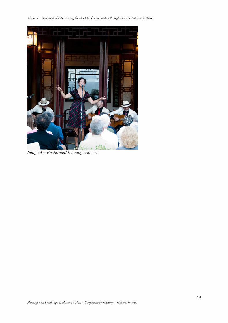
49
Image 4 – Enchanted Evening concert
50
The Infiltration of Heritage in Quotidian Life: Informal Education through
Calendars as a Mean for Preserving Cultural Heritage
Guillermo BARZUNA PÉREZ* Melvin CAMPOS OCAMPO** (*) Coordinator, Editorial Commission, ICOMOS Costa Rica / Professor, University of Costa Rica. San José, Costa Rica. (506) 2529-0514 | (506) 8301-9800. [email protected] (**) Vice-President and member of Editorial Commission, ICOMOS Costa Rica / Professor, University of Costa Rica. San José, Costa Rica. (506) 2234-7161 | (506) 8349-6443. [email protected]
Abstract Historically, Costa Rica had little regard for its heritage. Therefore, in an effort to help the people appreciate their heritage, since 2002 ICOMOS Costa Rica has published an annual calendar with photographs of the historical buildings that remain in our urban and rural landscapes. With each edition, we refined our strategy for the themes and involvement of the communities portrayed in the calendar. This article makes a historical voyage throughout the calendars and examines the role they play in the possible changes of the Costa Ricans’ collective vision towards their Cultural Heritage. Keywords: Informal Education; Costa Rican Heritage; Cultural Heritage Preservation; Interpretation of Heritage; Presentation of Heritage 1. Prelude (A country that disregards the ancient) In Costa Rica, as in most of Latin America’s countries, the 19th century was defined by the triumph and expansion of the liberal capitalist Modernity. The influence of Enlightened thought compelled our societies to revolt against our version of the Ancien Régime, a sort of creole feudalism, imposed by the Spanish Crown during the Colony. Even after the independence wars, in every new country there were conflicts between factions: the conservatives and the liberals; the first seeking to maintain this creole feudalism and to keep the catholic faith; the latter aiming for the future, wielding rationalism to construct the modern. The ancient world was defeated and a Nouveau Régime was able to build its new temples, devoted to the new values: democratic institutions, banks, schools, museums. Now, most Latin American countries preserved their architectural heritage associated to the old values of the Colony and, also, constructed the new buildings according to these new values. That’s how México, for example, keeps its Colonial and Neoclassical Architecture. But Costa Rica’s case is a particular one. The idea of rejecting the past and embracing the future, entered so deep in our collective psyche, that it remains today as a development path. The first big wave of construction in San José, dates from the late 19th century; the architectural styles varied from Neoclassical to an Eclectic and they gave the young city an identity. However the yearn for the new and the future, rapidly motivated the people to demolish buildings when they seemed too old for the new architectural tendencies. For example, from 1951 to 1972, San José demolished huge amounts of ancient buildings in order to widen the Second Avenue1 and to build newer versions of banks and libraries. Even today ICOMOS Costa Rica is fighting the Congress, because they are trying to build a huge modern building that would disrupt the skyline of an area filled with patrimonial constructions2. But not only our governments have little regard for the cultural heritage: lots of individuals have developed strategies to destroy ancient buildings without alerting the people or the authorities, like beginning the demolition from within a house and, by the time anyone notices, the frontage is thrown.
1 (Urbina, 2014). 2 More on this subject can be found at our web site: http://www.icomoscr.org/.
51
So, the misconception of development and the obsession with the modern, have had a terrible impact in the architectural heritage of our country. And this is what ICOMOS Costa Rica has been trying to change since its foundation in 1983. Lots of strategies have been followed to this end: from lectures to photograph expositions, from contests to public activities. One of these strategies — one of the more divulged — is an annual calendar that we have been publishing since 2002. This article is centred in this strategy. 2. A journey through time and heritage As Melvin Campos said in his speech at the 2013 AdCom, held in Costa Rica, the best way to ensure the survival of cultural heritage is to educate the people in the interpretation of their patrimonial landscapes and buildings, to help them see the value of their historic memory. In this same line of thought, Guillermo Barzuna and other members of ICOMOS Costa Rica started in 2002 the project of publishing a calendar with photographs of Victorian-influenced houses in different places of the country (Image 1). The intention at that time was to present the public with the beautiful buildings that remained in our landscape. It was a sales success and the beginning of a journey filled with the hope that this effort could make a change in the collective vision of Costa Rica’s Heritage. By 2014, thirteen calendars have been published: 2002 The Costa Rican House with Victorian influence 2003 The Neocolonial House in the City of San José 2004 Images of Costa Rican Heritage: Six pictures from the annual photograph contest by ICOMOS de Costa Rica. 2005 San José Art Deco 2006 The Neoclassic Influence in Costa Rican Architecture 2007 The Illusion of Modernity: San José 1930-1965 2008 Monuments of Knowledge. Architecture of Schools in Costa Rica. 2009 Patrimonial Temples. Religious Architecture in Costa Rica. 2010 By the Roads of the Train. Ancient railway stations in Costa Rica. 2011 To the very noble and loyal city of Cartago 2012 The Walls of our Land. Architecture on adobe and bahareque in Costa Rica 2013 Natural Heritage of Costa Rica 2014 That Hidden Architecture: Second floors in the city of San José So, we have focused in architectural styles: Art Deco and Neoclassic (Image 2), in trends for types of building: Schools (Image 3), Churches (Images 4, 5), Train Stations (Image 6), and in particularities of Costa Rican Heritage: Earth Architecture (Image 7). And we already have in print the 2015 calendar whose theme is “The Costa Rican Wooden House”. Every calendar consists of a set of beautiful photographs, each one captioned with an explanation of why that particular construction is relevant in the correspondent architectural style or type of building. Besides, each calendar has an essay on the correspondent theme, written by a specialist, member of ICOMOS Costa Rica. With each calendar, the Editorial Committee has been refining the strategy for the themes and the involvement of the communities portrayed in the calendar. Nowadays, the process begins with research to select the theme in order to help in the rescue of our collective memory, of the constructive forms, methods and styles for a certain period of local architecture. Then, we recur to the assistance of architects, photographers, historians and graphic designers, in order to develop a document that registers the remaining testimony of different architectural movements, and their link to a particular historic context. Since 1993, ICOMOS Costa Rica has organised a quite successful photograph contest, as a part of the celebration of April 18th. So, in 2008 the Editorial Committee tried a new experience: to use the theme of the photograph contest for the following year’s calendar. The result was not only successful in the quantity of the received photographs, but also provided an amount of great quality photographs
52
for the 2009 calendar (an example is shown in Images 4 and 5). The next years, two remarkable photographers offered their talent to both calendars. So the initiative was retaken on 2011, and has been the regular practice since: one year the photograph contest is called with the theme of the calendar for the next year. The results have been outstanding, not only because of the participation but also in the distribution of the calendar, because each year more photographers feel compelled to participate, and then to distribute their work. This has also elevated the quality of the contestant photographs (another example is Image 6). Now let’s meditate on the role these calendars have played in the construction of an awareness of cultural heritage in Costa Rica. 3. Windows to heritage First of all, the intention of the project is quite clear: to favour the sensitization of the people towards their heritage. This objective is accomplished by several ways. First, the selection of significant constructions as highlights for an architectural style or building trend, gives readers several samples of the beautiful remains that still surround them; therefore helping to generate an awareness of the value of built heritage. On second hand, the calendars also rise the curiosity of the viewer to find the buildings portrayed. A common question we notice among the viewers is: “How is it possible that I have not noticed this beautiful building, since I always walk nearby?” This is a particular sign that an awareness in topics of heritage is growing in these people. There have been even cases of people getting together to walk the city looking for the buildings presented in the calendar. A third manner in which the calendars help our goal is by the infiltration in the quotidian life of the viewer. Our calendars are for wall hanging and so, they are located in places where they are continually being seen by the inhabitants of the house. Besides, since 2011, we have designed the calendars with enough space for the people to write to-do notes for every day. This makes the calendar an instrument that will be consulted each day, maybe several times a day, hence exposing the viewer to the building quite regularly. So, the calendars become an ever present window to particular buildings of heritage value; a constant reminder to the inhabitants of the house that there still are remains of the past within an ever changing city. This labour of divulgation has also been improved with the link established between the April 18th Celebration, the Photograph Contest and our “Tertulias”. This is a regular activity that takes place in ICOMOS Costa Rica’s house: these are conversations, sort of non-academic conferences that aim to a wider audience, in order to educate on several aspects of our cultural heritage. Annually, one of these Conversations is dedicated to present the Calendar to the public and, thus, giving the common people a new sight of their patrimony. There was even the case in 2011, when the calendar was centred in the Cartago community, that the presentation actually took place at the Cartago City Hall, and brought together a huge amount of people to appreciate the beauties of their architectural heritage. Now, let us proceed to a more profound analysis of the interpretation and presentation offered to the public in the calendars. 4. A way to look at Cultural Heritage As we have pointed out, the intention of the calendars is to spread within the people an awareness and a more profound knowledge of Costa Rica’s Heritage. The first goal will be analysed later. The second of these goals is achieved by including divulgation texts in the calendars: written by specialists in each field — but with a more simple rhetoric —, these essays seek to get the reader closer to the several architectural styles that can be found in our country. But, also — and more important —, they explain the relation between a political or ideological project and a particular architectural style.
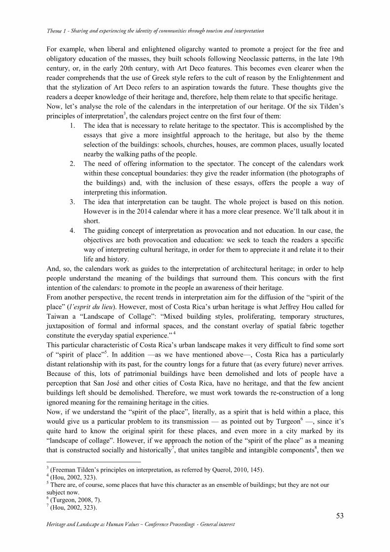
53
For example, when liberal and enlightened oligarchy wanted to promote a project for the free and obligatory education of the masses, they built schools following Neoclassic patterns, in the late 19th century, or, in the early 20th century, with Art Deco features. This becomes even clearer when the reader comprehends that the use of Greek style refers to the cult of reason by the Enlightenment and that the stylization of Art Deco refers to an aspiration towards the future. These thoughts give the readers a deeper knowledge of their heritage and, therefore, help them relate to that specific heritage. Now, let’s analyse the role of the calendars in the interpretation of our heritage. Of the six Tilden’s principles of interpretation3, the calendars project centre on the first four of them:
1. The idea that is necessary to relate heritage to the spectator. This is accomplished by the essays that give a more insightful approach to the heritage, but also by the theme selection of the buildings: schools, churches, houses, are common places, usually located nearby the walking paths of the people.
2. The need of offering information to the spectator. The concept of the calendars work within these conceptual boundaries: they give the reader information (the photographs of the buildings) and, with the inclusion of these essays, offers the people a way of interpreting this information.
3. The idea that interpretation can be taught. The whole project is based on this notion. However is in the 2014 calendar where it has a more clear presence. We’ll talk about it in short.
4. The guiding concept of interpretation as provocation and not education. In our case, the objectives are both provocation and education: we seek to teach the readers a specific way of interpreting cultural heritage, in order for them to appreciate it and relate it to their life and history.
And, so, the calendars work as guides to the interpretation of architectural heritage; in order to help people understand the meaning of the buildings that surround them. This concurs with the first intention of the calendars: to promote in the people an awareness of their heritage. From another perspective, the recent trends in interpretation aim for the diffusion of the “spirit of the place” (l’esprit du lieu). However, most of Costa Rica’s urban heritage is what Jeffrey Hou called for Taiwan a “Landscape of Collage”: “Mixed building styles, proliferating, temporary structures, juxtaposition of formal and informal spaces, and the constant overlay of spatial fabric together constitute the everyday spatial experience.” 4
This particular characteristic of Costa Rica’s urban landscape makes it very difficult to find some sort of “spirit of place”5. In addition —as we have mentioned above—, Costa Rica has a particularly distant relationship with its past, for the country longs for a future that (as every future) never arrives. Because of this, lots of patrimonial buildings have been demolished and lots of people have a perception that San José and other cities of Costa Rica, have no heritage, and that the few ancient buildings left should be demolished. Therefore, we must work towards the re-construction of a long ignored meaning for the remaining heritage in the cities. Now, if we understand the “spirit of the place”, literally, as a spirit that is held within a place, this would give us a particular problem to its transmission — as pointed out by Turgeon6 —, since it’s quite hard to know the original spirit for these places, and even more in a city marked by its “landscape of collage”. However, if we approach the notion of the “spirit of the place” as a meaning that is constructed socially and historically7, that unites tangible and intangible components8, then we 3 (Freeman Tilden’s principles on interpretation, as referred by Querol, 2010, 145). 4 (Hou, 2002, 323). 5 There are, of course, some places that have this character as an ensemble of buildings; but they are not our subject now. 6 (Turgeon, 2008, 7). 7 (Hou, 2002, 323).
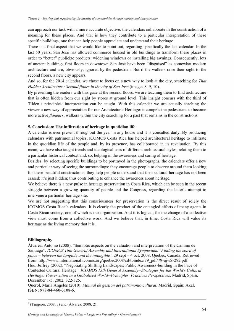
54
can approach our task with a more accurate objective: the calendars collaborate in the construction of a meaning for these places. And that is how they contribute to a particular interpretation of these specific buildings, one that can help people appreciate and understand their heritage. There is a final aspect that we would like to point out, regarding specifically the last calendar. In the last 50 years, San José has allowed commerce housed in old buildings to transform these places in order to “better” publicize products: widening windows or installing big awnings. Consequently, lots of ancient buildings first floors in downtown San José have been “disguised” as somewhat modern architecture and are, obviously, ignored by the pedestrian. But if the walkers raise their sight to the second floors, a new city appears. And so, for the 2014 calendar, we chose to focus on a new way to look at the city, searching for That Hidden Architecture: Second floors in the city of San José (images 8, 9, 10). By presenting the readers with this gaze at the second floors, we are teaching them to find architecture that is often hidden from our sight by stores at ground level. This insight concurs with the third of Tilden’s principles: interpretation can be taught. With this calendar we are actually teaching the viewer a new way of appreciation for our Architectural Heritage: it compels the pedestrians to become more active flâneurs, walkers within the city searching for a past that remains in the constructions. 5. Conclusion: The infiltration of heritage in quotidian life A calendar is ever present throughout the year in any house and it is consulted daily. By producing calendars with patrimonial topics, ICOMOS Costa Rica has helped architectural heritage to infiltrate in the quotidian life of the people and, by its presence, has collaborated in its revaluation. By this mean, we have also taught trends and ideological uses of different architectural styles, relating them to a particular historical context and, so, helping in the awareness and caring of heritage. Besides, by selecting specific buildings to be portrayed in the photographs, the calendars offer a new and particular way of seeing the surroundings: they encourage people to observe around them looking for these beautiful constructions; they help people understand that their cultural heritage has not been erased: it’s just hidden; thus contributing to enhance the awareness about heritage. We believe there is a new pulse in heritage preservation in Costa Rica, which can be seen in the recent struggle between a growing quantity of people and the Congress, regarding the latter’s attempt to intervene a particular heritage site. We are not suggesting that this consciousness for preservation is the direct result of solely the ICOMOS Costa Rica’s calendars. It is clearly the product of the entangled efforts of many agents in Costa Rican society, one of which is our organization. And it is logical, for the change of a collective view must come from a collective work. And we believe that, in time, Costa Rica will value its heritage as the living memory that it is. Bibliography Álvarez, Antonio (2008). “Semiotic aspects on the valuation and interpretation of the Camino de Santiago”. ICOMOS 16th General Assembly and International Symposium: ‘Finding the spirit of place – between the tangible and the intangible’. 29 sept – 4 oct, 2008, Quebec, Canada. Retrieved from: http://www.international.icomos.org/quebec2008/cd/toindex/79_pdf/79-ujwS-292.pdf Hou, Jeffrey (2002). “Negotiating Shifting Landscapes: Public Awareness-building in the Face of Contested Cultural Heritage”. ICOMOS 13th General Assembly--Strategies for the World's Cultural Heritage: Preservation in a Globalised World--Principles, Practices Perspectives. Madrid, Spain. December 1-5, 2002, 322-325. Querol, María Ángeles (2010). Manual de gestión del patrimonio cultural. Madrid, Spain: Akal. ISBN: 978-84-460-3108-6.
8 (Turgeon, 2008, 3) and (Álvarez, 2008, 2).
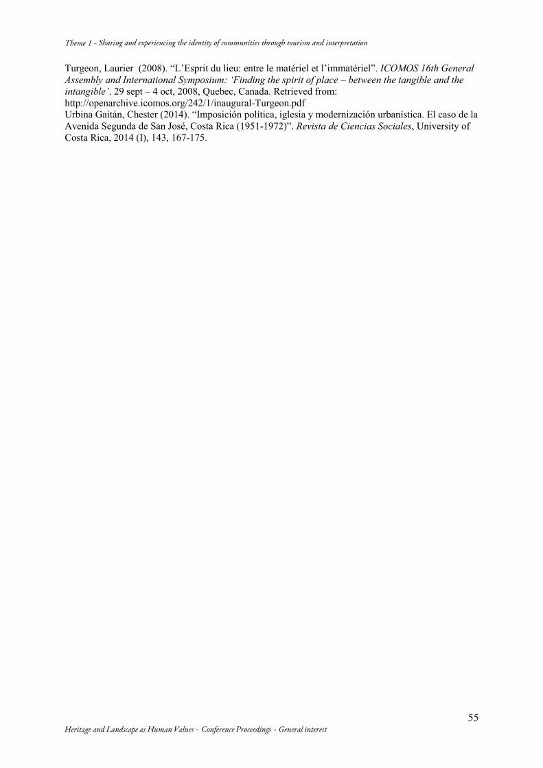
55
Turgeon, Laurier (2008). “L’Esprit du lieu: entre le matériel et l’immatériel”. ICOMOS 16th General Assembly and International Symposium: ‘Finding the spirit of place – between the tangible and the intangible’. 29 sept – 4 oct, 2008, Quebec, Canada. Retrieved from: http://openarchive.icomos.org/242/1/inaugural-Turgeon.pdf Urbina Gaitán, Chester (2014). “Imposición política, iglesia y modernización urbanística. El caso de la Avenida Segunda de San José, Costa Rica (1951-1972)”. Revista de Ciencias Sociales, University of Costa Rica, 2014 (I), 143, 167-175.
Heritage and Landscape as Human Value – General interest 56
Image 1 – ICOMOS Costa Rica 2002 Calendar: The Costa Rican House with Victorian influence. Cover. Photographer: Rodrigo Quesada. Design: Marianela Ruiz.
Image 3 – ICOMOS Costa Rica 2008 Calendar: Monuments of Knowledge. Architecture of Schools in Costa Rica. April: San Luis Gonzaga High School. Photographer: Will Arce.
Image 2 – ICOMOS Costa Rica 2006 Calendar: The Neoclassic Influence in Costa Rican Architecture. Cover. Melico Salazar Theatre. Photographer: Inti Picado. Image 4 – ICOMOS Costa Rica 2009 Calendar: Patrimonial Temples. Religious Architecture in Costa Rica. Church of Orosi. Photographer: Ana Joyce Chinchilla Roversi.
Image 5 – ICOMOS Costa Rica 2009 Calendar: Patrimonial Temples. Religious Architecture in Costa Rica. July. Church of Saint Rafael, Escazú. Photographer: Laura Millet.
Image 6 – ICOMOS Costa Rica 2010 Calendar: By the Roads of the Train. Ancient railway stations in Costa Rica. Cartago Train Station. Photographer: Marco Vargas Canales. Winner of the XVI Photograph Contest, 2009.
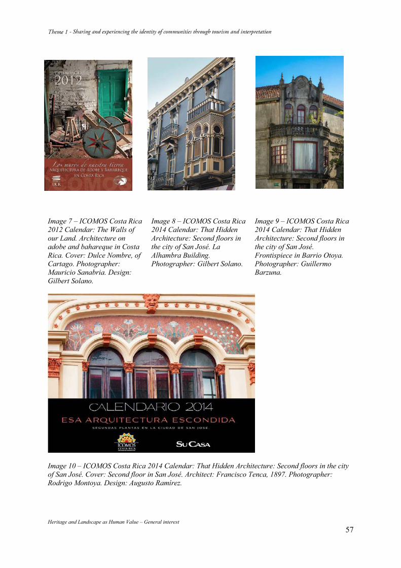
Heritage and Landscape as Human Value – General interest 57
Image 7 – ICOMOS Costa Rica 2012 Calendar: The Walls of our Land. Architecture on adobe and bahareque in Costa Rica. Cover: Dulce Nombre, of Cartago. Photographer: Mauricio Sanabria. Design: Gilbert Solano.
Image 8 – ICOMOS Costa Rica 2014 Calendar: That Hidden Architecture: Second floors in the city of San José. La Alhambra Building. Photographer: Gilbert Solano.
Image 9 – ICOMOS Costa Rica 2014 Calendar: That Hidden Architecture: Second floors in the city of San José. Frontispiece in Barrio Otoya. Photographer: Guillermo Barzuna.
Image 10 – ICOMOS Costa Rica 2014 Calendar: That Hidden Architecture: Second floors in the city of San José. Cover: Second floor in San José. Architect: Francisco Tenca, 1897. Photographer: Rodrigo Montoya. Design: Augusto Ramírez.
Heritage and Landscape as Human Value – General interest 58
Heritage and Landscape as Human Value – General interest 59
Heritage and Landscape as Human Value – General interest 60
World Cultural Heritage Site - the Eastern Qing Tombs Cultural Landscape - the Highest Expression of Chinese Fengshui Theory
WANG Zhaohua LI Xiuqing The Eastern Qing Tombs Management Department of Cultural Relics, Zunhua, Hebei Province, China
Abstract Located at the foot of Changrui Mountain in the northwest of Zunhua City, Hebei Province, the Eastern Qing Tombs were inscribed on the World Cultural Heritage list in 2000. The cultural landscape of the Eastern Qing Tombs inherited the Chinese traditional “fengshui” theory, achieves the highest unification in the harmony existence of buildings and environment. Fengshui theory has a long history in China. It is the philosophy studying the environment and the law of the universe. Its core is the thought of “integration of man with nature.” Although the old theory is a little superstitious, it contains rich connotation in such aspects as ancient Chinese philosophy, aesthetics, psychology, geology, geography, ecology, landscape and architecture. It is theory about the ancient Chinese people how to choose the living or burial environment and how to deal with the change rule of the universe. It also contains the law about human beings how to comply with the nature.
The ancient Chinese nation, cherishing the traditional virtue of respecting ancestors, has long stressed the burial of and sacrifice offering to the deceased. Since the Jin Dynasty China had the saying that “bury the dead in the animated place. Wind can make gas diffusing, but water can make a line to block the passage of gas... Mountains and rivers are the most important elements for an ideal tomb site. Mountains can hide the wind and rivers can gather the gas. Rivers are more important than mountains for a good tomb site”. Chinese have the tradition of attaching importance to the burial of the dead and sacrifice. People doing this is not only to cherish the memory of and commemorate the deceased but also to pray for the ancestors to shade later generations. Feudal rulers regarded the mausoleum building as a matter relating ups and downs of the dynasty. In Qing Dynasty, this idea was pushed to its peak. The Qing emperors paid more attention to the mausoleum site selection and construction. They think this would have great influence on the survival and downfall of the dynasty and power. The traditional Chinese fengshui theory was fully adopted in the selection of tomb site and design and layout in order to reflect the world outlook of “integration of man with nature” according to the principle that “tombs fit the surrounding mountains and rivers” and “Tombs should be built to reflect the ceremonial system and accommodate the topography of mountains and rivers”. As human spirits become part of the nature, an image of nobleness, greatness and eternity is thus created. In architectural scale and quality, the tombs are grandiose, magnificent and exquisite to reflect the extreme authority of an emperor and the imperial style and solemnness. The Eastern Qing Tombs are an outstanding carrier of this traditional perception. It is to follow the important philosophical thought of “integration of man with nature” that makes the Eastern Qing Tombs have a unique flavor. The buildings keeps a harmonious unity with the surrounding environment; the distribution of buildings echo the surrounding mountains and rivers; the ritual of center for honor and pecking order is fully embodied; the 6,000 km long sacred way is the tombs’ axis line. Although winding, it obviously stretches from south to north along the mountain slope, indicating the imperial hierarchy and intensifying the artistic effect of the tomb. Surrounded by natural mountains and rivers, the Eastern Qing Tombs have beautiful scenery. In the grand imperial mausoleum are many exquisite buildings. They represented the highest architectural and artistic level at that time.
In the use and protection of the Eastern Qing Tombs cultural landscape, the local government respect “the Convention on Protection of the World Cultural and Natural Heritage”; formulate laws and regulations which accords with the situation of China; delimit protective zone and construction control zone; dismantle or remove buildings that influence cultural landscape; control project construction that effect cultural landscape; put education and display function of the cultural landscape into full play;
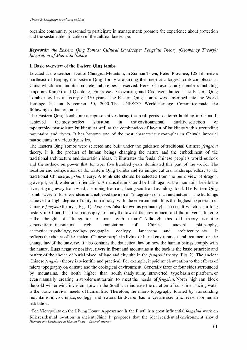
Heritage and Landscape as Human Value – General interest 61
organize community personnel to participate in management; promote the experience about protection and the sustainable utilization of the cultural landscape.
Keywords: the Eastern Qing Tombs; Cultural Landscape; Fengshui Theory (Geomancy Theory); Integration of Man with Nature 1. Basic overview of the Eastern Qing tombs Located at the southern foot of Changrui Mountain, in Zunhua Town, Hebei Province, 125 kilometers northeast of Beijing, the Eastern Qing Tombs are among the finest and largest tomb complexes in China which maintain its complete and are best preserved. Here 161 royal family members including emperors Kangxi and Qianlong, Empresses Xiaozhuang and Cixi were buried. The Eastern Qing Tombs now has a history of 350 years. The Eastern Qing Tombs were inscribed into the World Heritage list on November 30, 2000. The UNESCO World Heritage Committee made the following evaluation on it: The Eastern Qing Tombs are a representative during the peak period of tomb building in China. It achieved the most perfect situation in the environmental quality, selection of topography, mausoleum buildings as well as the combination of layout of buildings with surrounding mountains and rivers. It has become one of the most characteristic examples in China’s imperial mausoleums in various dynasties. The Eastern Qing Tombs were selected and built under the guidance of traditional Chinese fengshui theory. It is the product of human beings changing the nature and the embodiment of the traditional architecture and decoration ideas. It illustrates the feudal Chinese people’s world outlook and the outlook on power that for over five hundred years dominated this part of the world. The location and composition of the Eastern Qing Tombs and its unique cultural landscape adhere to the traditional Chinese fengshui theory. A tomb site should be selected from the point view of dragon, grave pit, sand, water and orientation. A mausoleum should be built against the mountain, beside the river, staying away from wind, absorbing fresh air, facing south and avoiding flood. The Eastern Qing Tombs were fit for these ideas and achieved the aim of “integration of man and nature”. The buildings achieved a high degree of unity in harmony with the environment. It is the highest expression of Chinese fengshui theory ( Fig. 1). Fengshui (also known as geomancy) is an occult which has a long history in China. It is the philosophy to study the law of the environment and the universe. Its core is the thought of “Integration of man with nature”. Although this old theory is a little superstitious, it contains rich connotation of Chinese ancient philosophy, aesthetics, psychology, geology, geography ecology, landscape and architecture, etc. It reflects the choice of the ancient Chinese people in living or burial environment and treatment on the change law of the universe. It also contains the dialectical law on how the human beings comply with the nature. Hugs negative positive, rivers in front and mountains at the back is the basic principle and pattern of the choice of burial place, village and city site in the fengshui theory (Fig. 2). The ancient Chinese fengshui theory is scientific and practical. For example, it paid much attention to the effects of micro topography on climate and the ecological environment. Generally three or four sides surrounded by mountains, the north higher than south, shady sunny introverted type basin or platform, or even manually creating a supplement terrain to meet the needs of fengshui. North high can block the cold winter wind invasion. Low in the South can increase the duration of sunshine. Facing water is the basic survival needs of human life. Therefore, the micro topography formed by surrounding mountains, microclimate, ecology and natural landscape has a certain scientific reason for human habitation.
“Ten Viewpoints on the Living House Appearance Is the First” is a great influential fengshui work on folk residential location in ancient China. It proposes that the ideal residential environment should
Heritage and Landscape as Human Value – General interest 62
be “there is flowing water left, called the black dragon; there is a long road left, called the white tiger; there is a sewage pond in front, called rosefinch; there is a hill at the back, called tortoise (God of the Northern Sky); the legendary dragon, white tiger, rosefinch and the tortoise represent the four directions. Breeding pool, bamboo hills, flowing water for washing, convenient transportation for farm all have very high practical value for farmers in their production life. Another obvious feature of Chinese ancient fengshui theory is the high harmony and unity of the buildings with the surrounding landscape, with certain elements of aesthetics. The layout, style, size and color of the buildings are all coordinated with the surrounding landscape, blended the human activities and residence with nature.
2. The Tombs and Fengshui In ancient China, Chinese believed that a human body died, but his soul would never perish and that he would continue to live in another world. So they have the tradition of attaching importance to the life after death. They not only paid more attention to the effects of fengshui on house site, but also the effect on the tomb site. They thought good residence could flourish the house owner and the graveyard could bless and protect their off springs The ancient Chinese nation, cherishing the traditional virtue of respecting ancestors, has long stressed the burial of and sacrifice offering to the deceased. Since the Jin Dynasty China had the saying that “bury the dead in the animated place. Wind can make gas diffusing, but water can make a line to block the passage of gas... Mountains and rivers are the most important elements for an ideal tomb site. Mountains can hide the wind and rivers can gather the gas. Rivers are more important than mountains for a good tomb site”. Chinese have the tradition of attaching importance to the burial of the dead and sacrifice. People doing this is not only to cherish the memory of and commemorate the deceased but also to pray for the ancestors to shade later generations. Feudal rulers regarded the mausoleum building as a matter relating ups and downs of the dynasty. In Qing Dynasty, this idea was pushed to its peak. The Qing emperors paid more attention to the mausoleum site selection and construction. They think this would have great influence on the survival and downfall of the dynasty and power. The traditional Chinese fengshui theory was fully adopted in the selection of tomb site and design and layout in order to reflect the world outlook of “integration of man with nature” according to the principle that “tombs fit the surrounding mountains and rivers” and “Tombs should be built to reflect the ceremonial system and accommodate the topography of mountains and rivers”. As human spirits become part of the nature, an image of nobleness, greatness and eternity is thus created. In architectural scale and quality, the tombs are grandiose, magnificent and exquisite to reflect the extreme authority of an emperor and the imperial style and solemnness. The Eastern Qing Tombs are an outstanding immortal carrier of this traditional perception (Fig. 3). The dragon is the totem of the Chinese nation. The Chinese people are the descendants of the dragon. The emperor called himself the real dragon and son of the heaven. The dragon vein is the ideal precious land pursued by the emperor, high officials and noble lords. In fact the dragon vein is the mystification and visualization of the mountains and water systems (see Fig. 2, 3). The Chinese has the tradition of building tombs against the mountain. Actually “Good site is more important than the magnificent and luxury appearance”, “Tombs, fitting the surrounding mountains and rivers, are different” mean that buildings are subordinate to the natural landscape In Figure 3 the dragon vein of the Eastern Qing Tombs starting from the ancestral mountain - Changbai Mountain , went through the parents mountain – Yanshan Mountain, then reached the main mountain - Changshui Mountain. It is the background of the tombs and served as a foil to the tombs.
Heritage and Landscape as Human Value – General interest 63
Mountains beyond mountains, range upon range, formed a multi-level three-dimensional contour, increase the depth and distance feelings of the scenery. The borrowing scene and symmetrical scene based on the reflection mountain (the mountain which faces the tomb in the front) and tablet mountain (a small hill between burial chamber and Reflection Mountain like a table) formed the composition center of a distant view in front of the base, make the sight to destination. Double mountains also enrich the level sense and depth perception of the landscape. The front view based on the river and water bond broaden people’s horizon. While looking back across the water, you will see brilliant images formed by the vivid shimmering; with Shuikou Mountain as barrier scene and screen isolated the base, forming a spatial contrast, people will become suddenly enlightened and see a beautiful spot when you click into the place. In this way, the base selection is corresponding to the tomb site, complying with fengshui Theory. Just as the famous British scientific historian Joseph Needham said: “The royal tombs are a major achievement in the Chinese architecture history, ... The content of the whole design may be the greatest example which combines humanitarian beauty of mausoleum buildings and natural beauty of the landscape.” “All the buildings are blended into environment”, “It is the highest level of art”1. 3. Feng Shui Pattern and mending of the Single Tomb Not only the Eastern Qing Tombs complex meet the standard of fengshui theory, but also the pattern of each imperial mausoleum is in line with the elements of fengshui theory. Once one element is short of, methods such as artificial piled hills, planting trees, ditching or canal building, blazing a path can be used for mending. Other structures such as pavilions, garden landscape, screen tower can also make up for the deficiency of fengshui, so as to achieve the rational pattern of fengshui. Dingdong Tomb for the famous woman politician Cixi is a typical example. The original tomb site, identified at the foot of mountains Putuoyu and Puxiangyu, is good. But there are no mountains on both sides of the tomb site,that means lack of the left green dragon and right white tiger. In order to meet the standard of fengshui theory, two artificial sand hills were built on both sides of the tomb site ( Figg. 4, 5). These examples are shown in all the Qing imperial tombs. Either in their ancestors’ tombs outside Shanhaiguan Pass or the Eastern and Western Qing Tombs inside, the buildings are all in harmony and unity with the surrounding mountains and rivers, and the supplemented artificial auxiliary construction is given priority to the nature. They all achieve the realm of “integration of man with nature” (Fig. 6).
4. Protection and Utilization of the Eastern Qing Tombs Cultural Landscape In the use and protection of the Eastern Qing Tombs cultural landscape, the local government has been respecting “the Convention on Protection of the World Cultural and Natural Heritage”. They dismantle the buildings that influence cultural landscape , control project construction that effect cultural landscape, repair all the ancient buildings and all kinds of collections of cultural relics on the verge of damage, restore the historical and cultural environment style. Formulate laws and regulations which accords with the situation of China; In the premise of “Cultural Relics Protection Law of the People’s Republic of China”, “Management Measures on the Protection of the Eastern Qing Tombs” aiming at the conservation and utilization was formulated and approved by He-bei province people’s congress (NPC). Thus it ensured the protection and utilization legal status of the Eastern Qing Tombs, delineated the scope of the protection and construction control. And this World Heritage site can be protected and utilized in accordance with law. Put the education and display functions of the cultural landscape into full play. One is to establish official website (http://www.qingdongling.com. mailbox: [email protected]), making the world
1 Needham, Joseph. Science & Civilisation in China,Vo1. 4:3, Cambridge University Press, p. 143.
Heritage and Landscape as Human Value – General interest 64
people know this World Heritage site. The second is organizing cultural relics exhibition tour. Now we have held several exhibitions in Beijing, Shanghai and other domestic cities. We are going to hold exhibition tour abroad. The third is organizing exhibitions combining the body of the cultural relics architecture with col-lections of cultural relics, showing the essence of the Eastern Qing Tombs to the visitors. The forth is or-ganizing community personnel to involve in the protection and management,displaying the social man-agement functions. Promote the experience about protection and the sustainable utilization of the cultural landscape. Make full use of various media and occasions publicize and promote the experience of the Eastern Qing Tombs on conservation and sustainable utilization of this world cultural landscape. All the mankind can share the achievements in the protection of the world cultural heritage. Bibliography Liu, Dunzhen (1984). History of Ancient Chinese Architecture. Chinese Building Industry Press. ISBN: 9787112019298. Song, Dachuan, Xia Lianbao (2007). Studies on the Mausoleum System of Qing Dynasty. Cultural Relics Publishing House. Wang, Qiheng (1992). Research on the Fengshui (Geomancy) Theory. Tianjin University Publishing House, ISBN: 9787561810088. Yu, Xixian (2010). Influence of Fengshui Theory Culture on the World. The World Knowledge Press. ISBN: 978-7-5012-3806-4. Yu, Xixian, Yu Yong (2005). The Theory and Practice of Chinese Ancient Fengshui Theory. Guangming Daily Press. ISBN: 780206151. Yuan, Shouding (Qing) (2010). Translated by Jin Zhiwen. Geographic Taste of Sugarcane. The World Knowledge Press. ISBN: 9787501239030. Zhao, Yucai (Qing) (2010). Translated by Jin Zhiwen. Geographical Five Tactic. The World Knowledge Press. ISBN: 9787501237685. The People’s Republic of China State Bureau of Cultural Relics (1999). “Royal Mausoleum of Ming and Qing Dynasty” (declaration text). Yin, Hongji, Sha Luyin, Research in the History of Natural Science, the first issue in 1989: On the Origin and Development of Chinese Ancient Geomancy Theory.
Fig.1 The Sketch map of the Eastern Qing Tombs
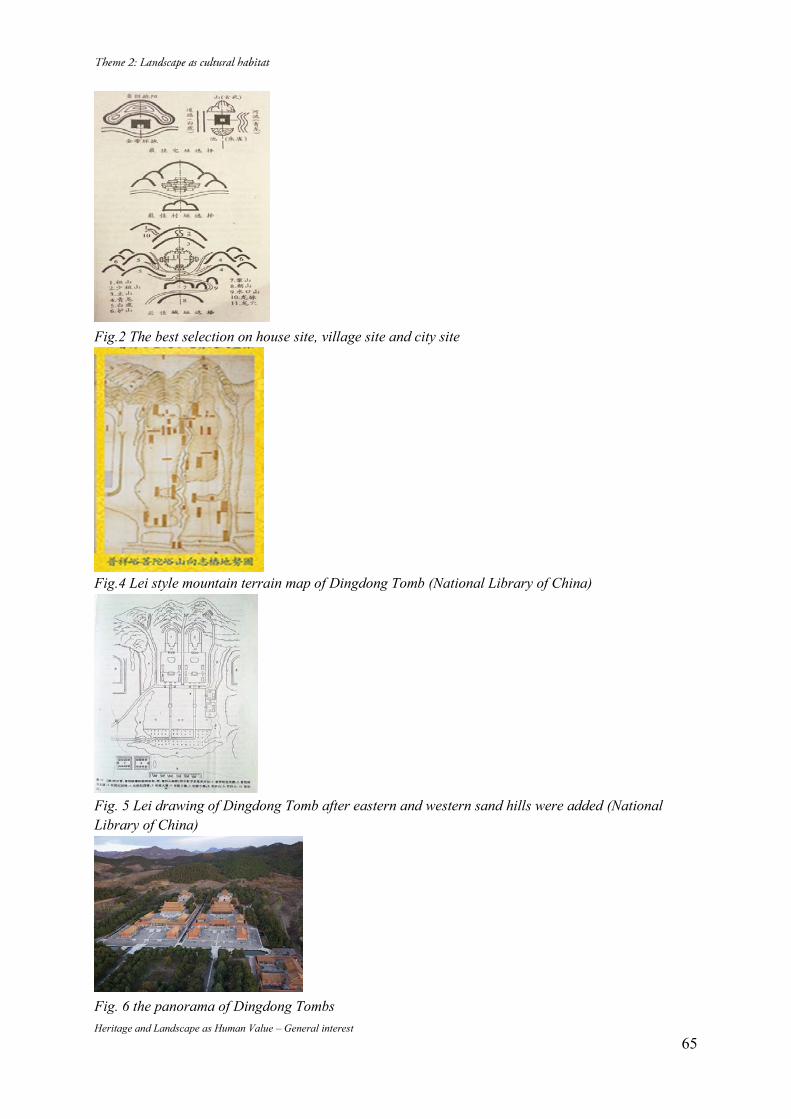
Heritage and Landscape as Human Value – General interest 65
Fig.2 The best selection on house site, village site and city site
Fig.4 Lei style mountain terrain map of Dingdong Tomb (National Library of China)
Fig. 5 Lei drawing of Dingdong Tomb after eastern and western sand hills were added (National Library of China)
Fig. 6 the panorama of Dingdong Tombs
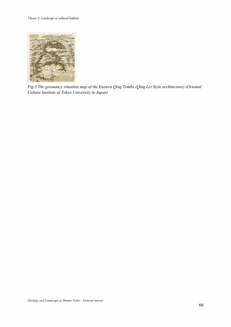
Heritage and Landscape as Human Value – General interest 66
Fig.3 The geomancy situation map of the Eastern Qing Tombs (Qing Lei Style architecture) (Oriental Culture Institute of Tokyo University in Japan)
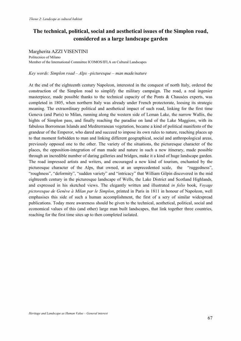
Heritage and Landscape as Human Value – General interest 67
The technical, political, social and aesthetical issues of the Simplon road, considered as a large landscape garden
Margherita AZZI VISENTINI Politecnico of Milano Member of the International Committee ICOMOS/IFLA on Cultural Landscapes Key words: Simplon road – Alps –picturesque – man made/nature At the end of the eighteenth century Napoleon, interested in the conquest of north Italy, ordered the construction of the Simplon road to simplify the military campaign. The road, a real ingenier masterpiece, made possible thanks to the technical capacity of the Ponts & Chausées experts, was completed in 1805, when northern Italy was already under French protectorate, loosing its strategic meaning. The extraordinary political and aesthetical impact of such road, linking for the first time Geneva (and Paris) to Milan, running along the western side of Leman Lake, the narrow Wallis, the hights of Simplon pass, and finally reaching the paradise on land of the Lake Maggiore, with its fabulous Borromean Islands and Mediterranean vegetation, became a kind of political manifesto of the grandeur of the Emperor, who dared and succeed to impose its own rules to nature, reaching places up to that moment forbidden to man and linking different geographical, social and anthropological areas, previously opposed one to the other. The variety of the situations, the picturesque character of the places, the opposition-integration of man made and nature in such a new itinerary, made possible through an incredible number of daring galleries and bridges, make it a kind of huge landscape garden. The road impressed artists and writers, and encouraged a new kind of tourism, enchanted by the picturesque character of the Alps, that owned, at an unprecedented scale, the “ruggedness”, “roughness”, “deformity”, “sudden variety” and “intricacy” that William Gilpin discovered in the mid eighteenth century in the picturesque landscape of Wells, the Lake District and Scotland Highlands, and expressed in his sketched views. The elegantly written and illustrated in folio book, Voyage pictoresque de Genève à Milan par le Simplon, printed in Paris in 1811 in honour of Napoleon, well emphasises this side of such a human accomplishment, the first of a sery of similar widespread publications. Today more awareness should be given to the technical, aesthetical, political, social and economical values of this (and other) large man built landscapes, that link together three countries, reaching for the first time sites up to then completed isolated.
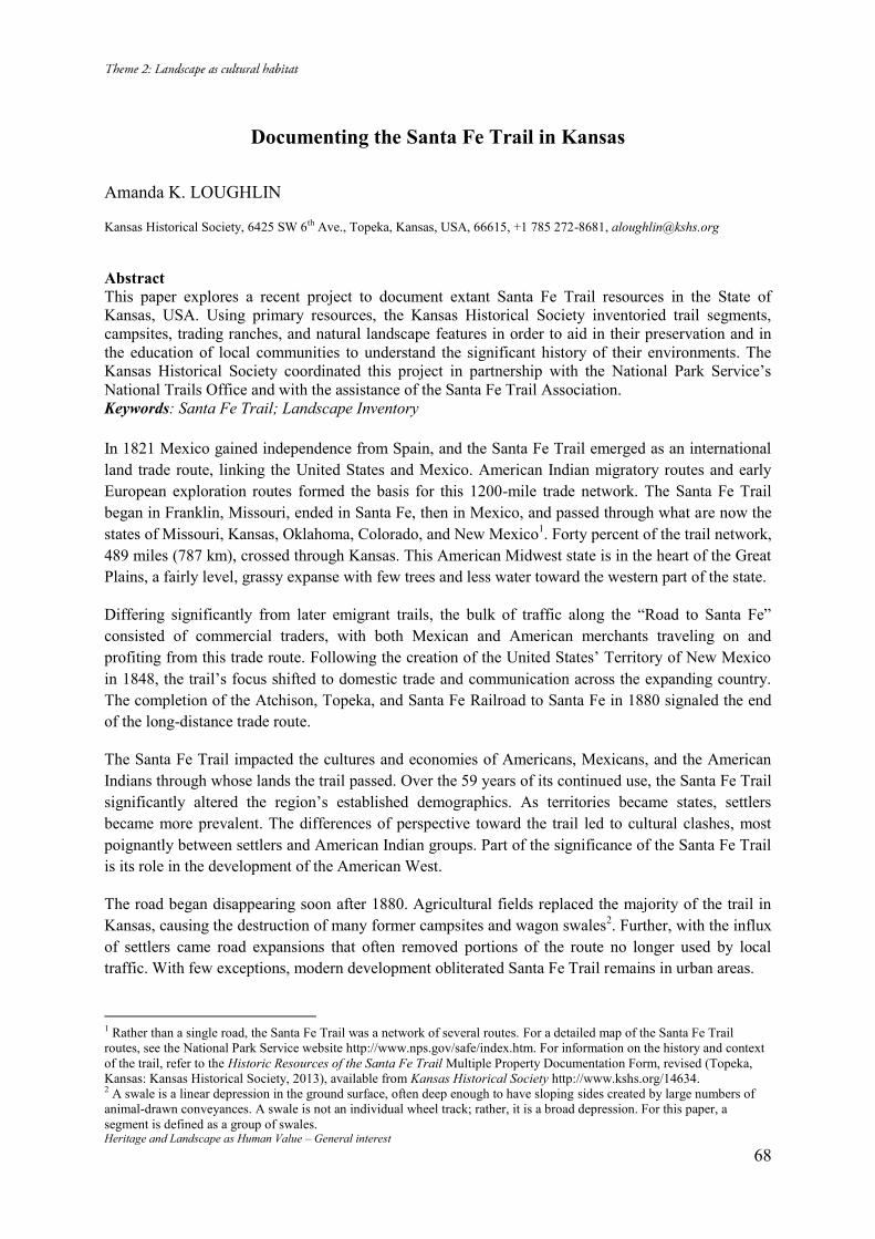
Heritage and Landscape as Human Value – General interest 68
Documenting the Santa Fe Trail in Kansas
Amanda K. LOUGHLIN Kansas Historical Society, 6425 SW 6th Ave., Topeka, Kansas, USA, 66615, +1 785 272-8681, [email protected]
Abstract This paper explores a recent project to document extant Santa Fe Trail resources in the State of Kansas, USA. Using primary resources, the Kansas Historical Society inventoried trail segments, campsites, trading ranches, and natural landscape features in order to aid in their preservation and in the education of local communities to understand the significant history of their environments. The Kansas Historical Society coordinated this project in partnership with the National Park Service’s National Trails Office and with the assistance of the Santa Fe Trail Association. Keywords: Santa Fe Trail; Landscape Inventory In 1821 Mexico gained independence from Spain, and the Santa Fe Trail emerged as an international land trade route, linking the United States and Mexico. American Indian migratory routes and early European exploration routes formed the basis for this 1200-mile trade network. The Santa Fe Trail began in Franklin, Missouri, ended in Santa Fe, then in Mexico, and passed through what are now the states of Missouri, Kansas, Oklahoma, Colorado, and New Mexico1. Forty percent of the trail network, 489 miles (787 km), crossed through Kansas. This American Midwest state is in the heart of the Great Plains, a fairly level, grassy expanse with few trees and less water toward the western part of the state.
Differing significantly from later emigrant trails, the bulk of traffic along the “Road to Santa Fe” consisted of commercial traders, with both Mexican and American merchants traveling on and profiting from this trade route. Following the creation of the United States’ Territory of New Mexico in 1848, the trail’s focus shifted to domestic trade and communication across the expanding country. The completion of the Atchison, Topeka, and Santa Fe Railroad to Santa Fe in 1880 signaled the end of the long-distance trade route.
The Santa Fe Trail impacted the cultures and economies of Americans, Mexicans, and the American Indians through whose lands the trail passed. Over the 59 years of its continued use, the Santa Fe Trail significantly altered the region’s established demographics. As territories became states, settlers became more prevalent. The differences of perspective toward the trail led to cultural clashes, most poignantly between settlers and American Indian groups. Part of the significance of the Santa Fe Trail is its role in the development of the American West.
The road began disappearing soon after 1880. Agricultural fields replaced the majority of the trail in Kansas, causing the destruction of many former campsites and wagon swales2. Further, with the influx of settlers came road expansions that often removed portions of the route no longer used by local traffic. With few exceptions, modern development obliterated Santa Fe Trail remains in urban areas.
1 Rather than a single road, the Santa Fe Trail was a network of several routes. For a detailed map of the Santa Fe Trail routes, see the National Park Service website http://www.nps.gov/safe/index.htm. For information on the history and context of the trail, refer to the Historic Resources of the Santa Fe Trail Multiple Property Documentation Form, revised (Topeka, Kansas: Kansas Historical Society, 2013), available from Kansas Historical Society http://www.kshs.org/14634. 2 A swale is a linear depression in the ground surface, often deep enough to have sloping sides created by large numbers of animal-drawn conveyances. A swale is not an individual wheel track; rather, it is a broad depression. For this paper, a segment is defined as a group of swales.
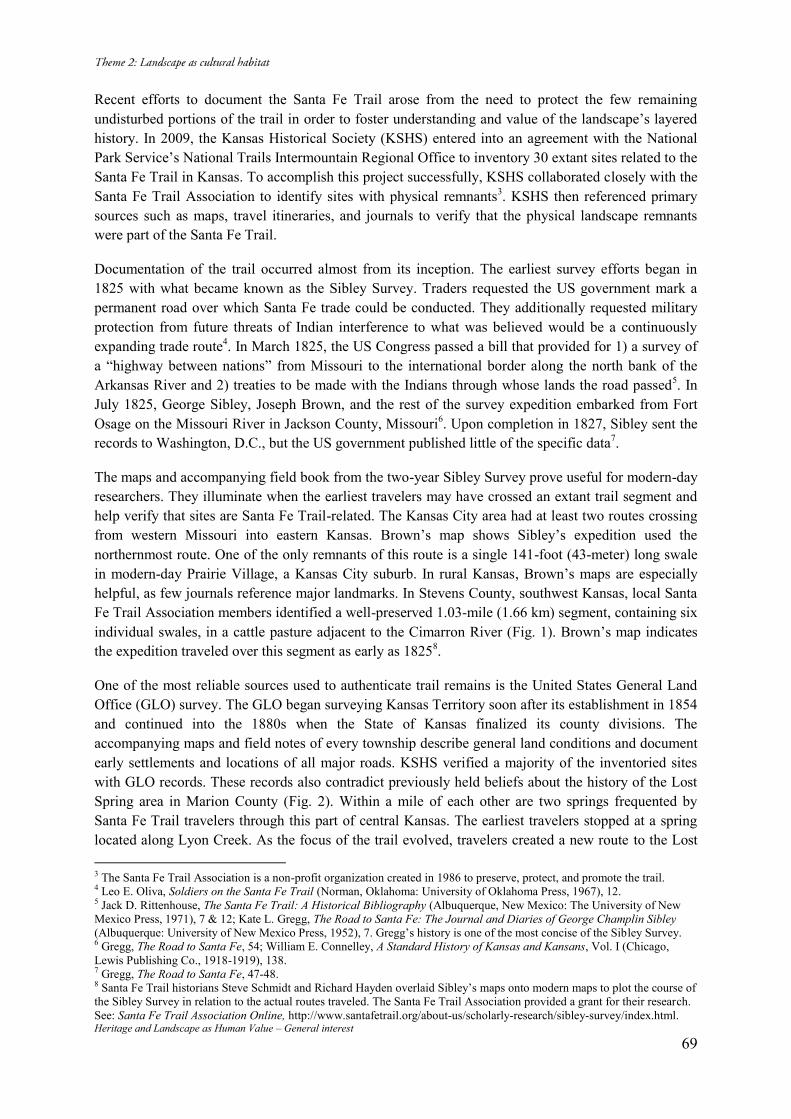
Heritage and Landscape as Human Value – General interest 69
Recent efforts to document the Santa Fe Trail arose from the need to protect the few remaining undisturbed portions of the trail in order to foster understanding and value of the landscape’s layered history. In 2009, the Kansas Historical Society (KSHS) entered into an agreement with the National Park Service’s National Trails Intermountain Regional Office to inventory 30 extant sites related to the Santa Fe Trail in Kansas. To accomplish this project successfully, KSHS collaborated closely with the Santa Fe Trail Association to identify sites with physical remnants3. KSHS then referenced primary sources such as maps, travel itineraries, and journals to verify that the physical landscape remnants were part of the Santa Fe Trail.
Documentation of the trail occurred almost from its inception. The earliest survey efforts began in 1825 with what became known as the Sibley Survey. Traders requested the US government mark a permanent road over which Santa Fe trade could be conducted. They additionally requested military protection from future threats of Indian interference to what was believed would be a continuously expanding trade route4. In March 1825, the US Congress passed a bill that provided for 1) a survey of a “highway between nations” from Missouri to the international border along the north bank of the Arkansas River and 2) treaties to be made with the Indians through whose lands the road passed5. In July 1825, George Sibley, Joseph Brown, and the rest of the survey expedition embarked from Fort Osage on the Missouri River in Jackson County, Missouri6. Upon completion in 1827, Sibley sent the records to Washington, D.C., but the US government published little of the specific data7.
The maps and accompanying field book from the two-year Sibley Survey prove useful for modern-day researchers. They illuminate when the earliest travelers may have crossed an extant trail segment and help verify that sites are Santa Fe Trail-related. The Kansas City area had at least two routes crossing from western Missouri into eastern Kansas. Brown’s map shows Sibley’s expedition used the northernmost route. One of the only remnants of this route is a single 141-foot (43-meter) long swale in modern-day Prairie Village, a Kansas City suburb. In rural Kansas, Brown’s maps are especially helpful, as few journals reference major landmarks. In Stevens County, southwest Kansas, local Santa Fe Trail Association members identified a well-preserved 1.03-mile (1.66 km) segment, containing six individual swales, in a cattle pasture adjacent to the Cimarron River (Fig. 1). Brown’s map indicates the expedition traveled over this segment as early as 18258.
One of the most reliable sources used to authenticate trail remains is the United States General Land Office (GLO) survey. The GLO began surveying Kansas Territory soon after its establishment in 1854 and continued into the 1880s when the State of Kansas finalized its county divisions. The accompanying maps and field notes of every township describe general land conditions and document early settlements and locations of all major roads. KSHS verified a majority of the inventoried sites with GLO records. These records also contradict previously held beliefs about the history of the Lost Spring area in Marion County (Fig. 2). Within a mile of each other are two springs frequented by Santa Fe Trail travelers through this part of central Kansas. The earliest travelers stopped at a spring located along Lyon Creek. As the focus of the trail evolved, travelers created a new route to the Lost 3 The Santa Fe Trail Association is a non-profit organization created in 1986 to preserve, protect, and promote the trail. 4 Leo E. Oliva, Soldiers on the Santa Fe Trail (Norman, Oklahoma: University of Oklahoma Press, 1967), 12. 5 Jack D. Rittenhouse, The Santa Fe Trail: A Historical Bibliography (Albuquerque, New Mexico: The University of New Mexico Press, 1971), 7 & 12; Kate L. Gregg, The Road to Santa Fe: The Journal and Diaries of George Champlin Sibley (Albuquerque: University of New Mexico Press, 1952), 7. Gregg’s history is one of the most concise of the Sibley Survey. 6 Gregg, The Road to Santa Fe, 54; William E. Connelley, A Standard History of Kansas and Kansans, Vol. I (Chicago, Lewis Publishing Co., 1918-1919), 138. 7 Gregg, The Road to Santa Fe, 47-48. 8 Santa Fe Trail historians Steve Schmidt and Richard Hayden overlaid Sibley’s maps onto modern maps to plot the course of the Sibley Survey in relation to the actual routes traveled. The Santa Fe Trail Association provided a grant for their research. See: Santa Fe Trail Association Online, http://www.santafetrail.org/about-us/scholarly-research/sibley-survey/index.html.
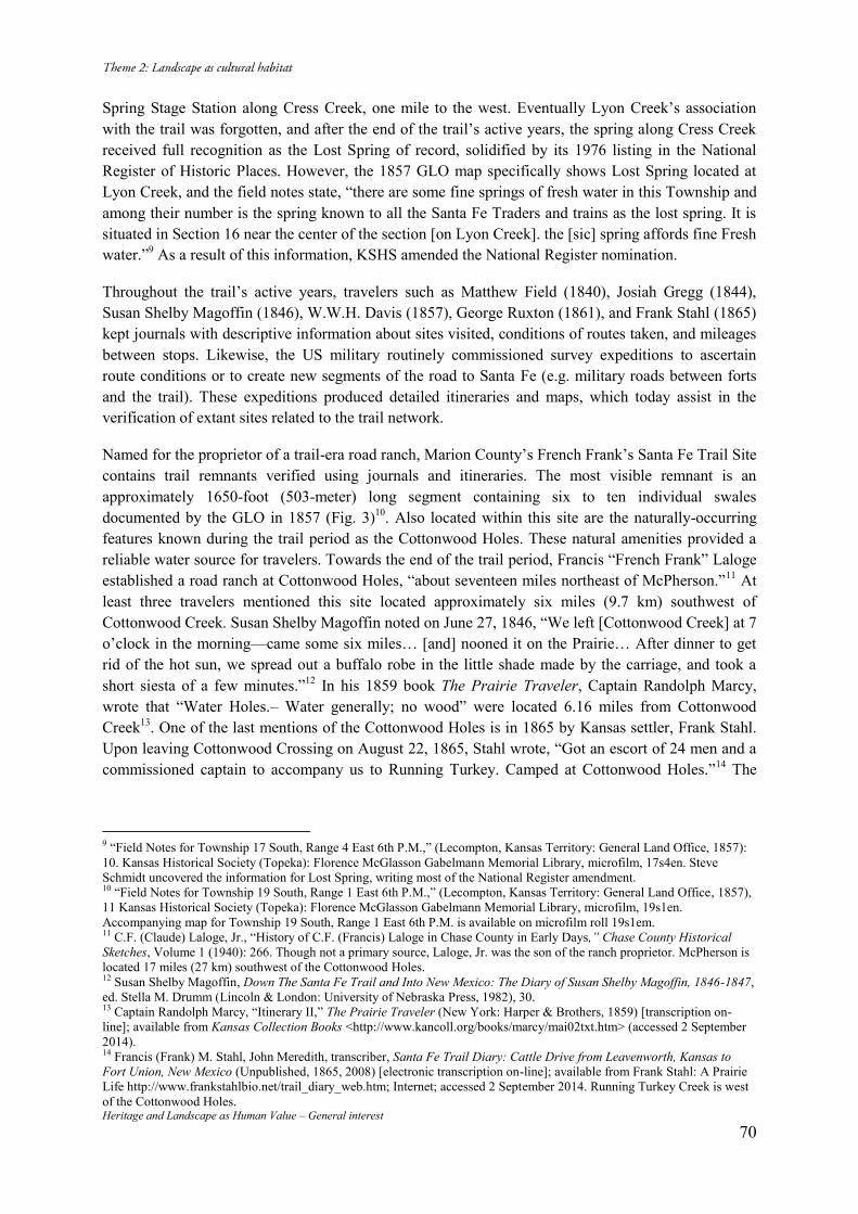
Heritage and Landscape as Human Value – General interest 70
Spring Stage Station along Cress Creek, one mile to the west. Eventually Lyon Creek’s association with the trail was forgotten, and after the end of the trail’s active years, the spring along Cress Creek received full recognition as the Lost Spring of record, solidified by its 1976 listing in the National Register of Historic Places. However, the 1857 GLO map specifically shows Lost Spring located at Lyon Creek, and the field notes state, “there are some fine springs of fresh water in this Township and among their number is the spring known to all the Santa Fe Traders and trains as the lost spring. It is situated in Section 16 near the center of the section [on Lyon Creek]. the [sic] spring affords fine Fresh water.”9 As a result of this information, KSHS amended the National Register nomination.
Throughout the trail’s active years, travelers such as Matthew Field (1840), Josiah Gregg (1844), Susan Shelby Magoffin (1846), W.W.H. Davis (1857), George Ruxton (1861), and Frank Stahl (1865) kept journals with descriptive information about sites visited, conditions of routes taken, and mileages between stops. Likewise, the US military routinely commissioned survey expeditions to ascertain route conditions or to create new segments of the road to Santa Fe (e.g. military roads between forts and the trail). These expeditions produced detailed itineraries and maps, which today assist in the verification of extant sites related to the trail network.
Named for the proprietor of a trail-era road ranch, Marion County’s French Frank’s Santa Fe Trail Site contains trail remnants verified using journals and itineraries. The most visible remnant is an approximately 1650-foot (503-meter) long segment containing six to ten individual swales documented by the GLO in 1857 (Fig. 3)10. Also located within this site are the naturally-occurring features known during the trail period as the Cottonwood Holes. These natural amenities provided a reliable water source for travelers. Towards the end of the trail period, Francis “French Frank” Laloge established a road ranch at Cottonwood Holes, “about seventeen miles northeast of McPherson.”11 At least three travelers mentioned this site located approximately six miles (9.7 km) southwest of Cottonwood Creek. Susan Shelby Magoffin noted on June 27, 1846, “We left [Cottonwood Creek] at 7 o’clock in the morning—came some six miles… [and] nooned it on the Prairie… After dinner to get rid of the hot sun, we spread out a buffalo robe in the little shade made by the carriage, and took a short siesta of a few minutes.”12 In his 1859 book The Prairie Traveler, Captain Randolph Marcy, wrote that “Water Holes.– Water generally; no wood” were located 6.16 miles from Cottonwood Creek13. One of the last mentions of the Cottonwood Holes is in 1865 by Kansas settler, Frank Stahl. Upon leaving Cottonwood Crossing on August 22, 1865, Stahl wrote, “Got an escort of 24 men and a commissioned captain to accompany us to Running Turkey. Camped at Cottonwood Holes.”14 The
9 “Field Notes for Township 17 South, Range 4 East 6th P.M.,” (Lecompton, Kansas Territory: General Land Office, 1857): 10. Kansas Historical Society (Topeka): Florence McGlasson Gabelmann Memorial Library, microfilm, 17s4en. Steve Schmidt uncovered the information for Lost Spring, writing most of the National Register amendment. 10 “Field Notes for Township 19 South, Range 1 East 6th P.M.,” (Lecompton, Kansas Territory: General Land Office, 1857), 11 Kansas Historical Society (Topeka): Florence McGlasson Gabelmann Memorial Library, microfilm, 19s1en. Accompanying map for Township 19 South, Range 1 East 6th P.M. is available on microfilm roll 19s1em. 11 C.F. (Claude) Laloge, Jr., “History of C.F. (Francis) Laloge in Chase County in Early Days,” Chase County Historical Sketches, Volume 1 (1940): 266. Though not a primary source, Laloge, Jr. was the son of the ranch proprietor. McPherson is located 17 miles (27 km) southwest of the Cottonwood Holes. 12 Susan Shelby Magoffin, Down The Santa Fe Trail and Into New Mexico: The Diary of Susan Shelby Magoffin, 1846-1847, ed. Stella M. Drumm (Lincoln & London: University of Nebraska Press, 1982), 30. 13 Captain Randolph Marcy, “Itinerary II,” The Prairie Traveler (New York: Harper & Brothers, 1859) [transcription on-line]; available from Kansas Collection Books <http://www.kancoll.org/books/marcy/mai02txt.htm> (accessed 2 September 2014). 14 Francis (Frank) M. Stahl, John Meredith, transcriber, Santa Fe Trail Diary: Cattle Drive from Leavenworth, Kansas to Fort Union, New Mexico (Unpublished, 1865, 2008) [electronic transcription on-line]; available from Frank Stahl: A Prairie Life http://www.frankstahlbio.net/trail_diary_web.htm; Internet; accessed 2 September 2014. Running Turkey Creek is west of the Cottonwood Holes.
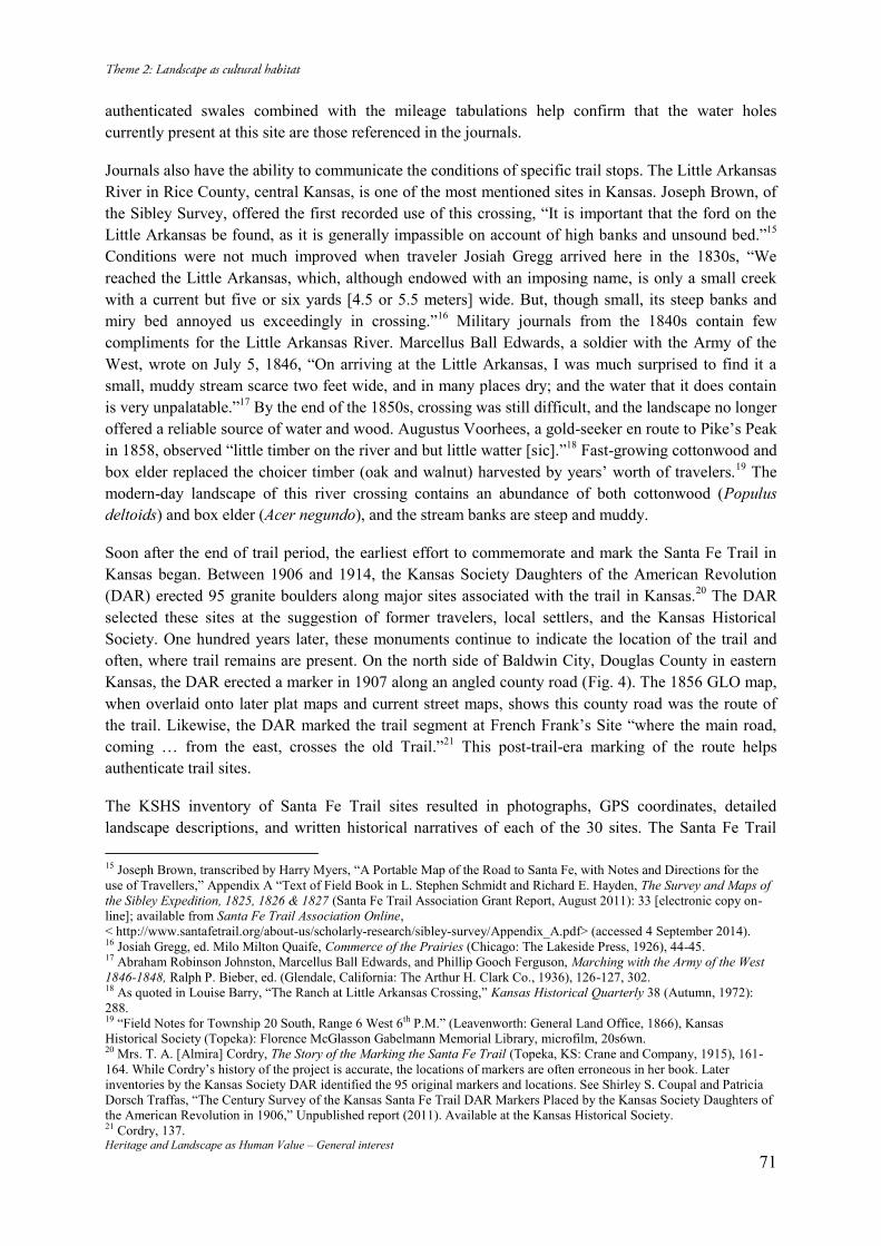
Heritage and Landscape as Human Value – General interest 71
authenticated swales combined with the mileage tabulations help confirm that the water holes currently present at this site are those referenced in the journals.
Journals also have the ability to communicate the conditions of specific trail stops. The Little Arkansas River in Rice County, central Kansas, is one of the most mentioned sites in Kansas. Joseph Brown, of the Sibley Survey, offered the first recorded use of this crossing, “It is important that the ford on the Little Arkansas be found, as it is generally impassible on account of high banks and unsound bed.”15 Conditions were not much improved when traveler Josiah Gregg arrived here in the 1830s, “We reached the Little Arkansas, which, although endowed with an imposing name, is only a small creek with a current but five or six yards [4.5 or 5.5 meters] wide. But, though small, its steep banks and miry bed annoyed us exceedingly in crossing.”16 Military journals from the 1840s contain few compliments for the Little Arkansas River. Marcellus Ball Edwards, a soldier with the Army of the West, wrote on July 5, 1846, “On arriving at the Little Arkansas, I was much surprised to find it a small, muddy stream scarce two feet wide, and in many places dry; and the water that it does contain is very unpalatable.”17 By the end of the 1850s, crossing was still difficult, and the landscape no longer offered a reliable source of water and wood. Augustus Voorhees, a gold-seeker en route to Pike’s Peak in 1858, observed “little timber on the river and but little watter [sic].”18 Fast-growing cottonwood and box elder replaced the choicer timber (oak and walnut) harvested by years’ worth of travelers.19 The modern-day landscape of this river crossing contains an abundance of both cottonwood (Populus deltoids) and box elder (Acer negundo), and the stream banks are steep and muddy.
Soon after the end of trail period, the earliest effort to commemorate and mark the Santa Fe Trail in Kansas began. Between 1906 and 1914, the Kansas Society Daughters of the American Revolution (DAR) erected 95 granite boulders along major sites associated with the trail in Kansas.20 The DAR selected these sites at the suggestion of former travelers, local settlers, and the Kansas Historical Society. One hundred years later, these monuments continue to indicate the location of the trail and often, where trail remains are present. On the north side of Baldwin City, Douglas County in eastern Kansas, the DAR erected a marker in 1907 along an angled county road (Fig. 4). The 1856 GLO map, when overlaid onto later plat maps and current street maps, shows this county road was the route of the trail. Likewise, the DAR marked the trail segment at French Frank’s Site “where the main road, coming … from the east, crosses the old Trail.”21 This post-trail-era marking of the route helps authenticate trail sites.
The KSHS inventory of Santa Fe Trail sites resulted in photographs, GPS coordinates, detailed landscape descriptions, and written historical narratives of each of the 30 sites. The Santa Fe Trail 15 Joseph Brown, transcribed by Harry Myers, “A Portable Map of the Road to Santa Fe, with Notes and Directions for the use of Travellers,” Appendix A “Text of Field Book in L. Stephen Schmidt and Richard E. Hayden, The Survey and Maps of the Sibley Expedition, 1825, 1826 & 1827 (Santa Fe Trail Association Grant Report, August 2011): 33 [electronic copy on-line]; available from Santa Fe Trail Association Online, < http://www.santafetrail.org/about-us/scholarly-research/sibley-survey/Appendix_A.pdf> (accessed 4 September 2014). 16 Josiah Gregg, ed. Milo Milton Quaife, Commerce of the Prairies (Chicago: The Lakeside Press, 1926), 44-45. 17 Abraham Robinson Johnston, Marcellus Ball Edwards, and Phillip Gooch Ferguson, Marching with the Army of the West 1846-1848, Ralph P. Bieber, ed. (Glendale, California: The Arthur H. Clark Co., 1936), 126-127, 302. 18 As quoted in Louise Barry, “The Ranch at Little Arkansas Crossing,” Kansas Historical Quarterly 38 (Autumn, 1972): 288. 19 “Field Notes for Township 20 South, Range 6 West 6th P.M.” (Leavenworth: General Land Office, 1866), Kansas Historical Society (Topeka): Florence McGlasson Gabelmann Memorial Library, microfilm, 20s6wn. 20 Mrs. T. A. [Almira] Cordry, The Story of the Marking the Santa Fe Trail (Topeka, KS: Crane and Company, 1915), 161-164. While Cordry’s history of the project is accurate, the locations of markers are often erroneous in her book. Later inventories by the Kansas Society DAR identified the 95 original markers and locations. See Shirley S. Coupal and Patricia Dorsch Traffas, “The Century Survey of the Kansas Santa Fe Trail DAR Markers Placed by the Kansas Society Daughters of the American Revolution in 1906,” Unpublished report (2011). Available at the Kansas Historical Society. 21 Cordry, 137.
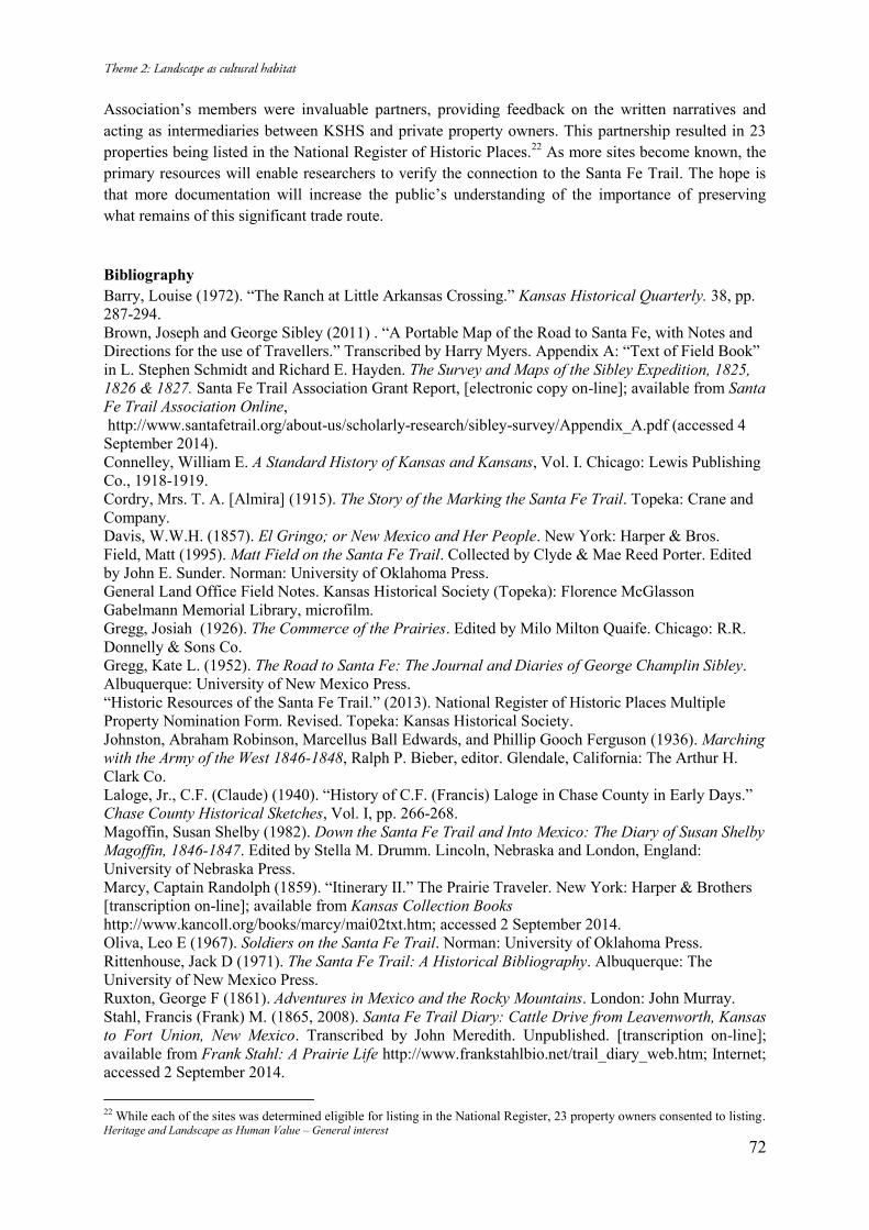
Heritage and Landscape as Human Value – General interest 72
Association’s members were invaluable partners, providing feedback on the written narratives and acting as intermediaries between KSHS and private property owners. This partnership resulted in 23 properties being listed in the National Register of Historic Places.22 As more sites become known, the primary resources will enable researchers to verify the connection to the Santa Fe Trail. The hope is that more documentation will increase the public’s understanding of the importance of preserving what remains of this significant trade route.
Bibliography Barry, Louise (1972). “The Ranch at Little Arkansas Crossing.” Kansas Historical Quarterly. 38, pp. 287-294. Brown, Joseph and George Sibley (2011) . “A Portable Map of the Road to Santa Fe, with Notes and Directions for the use of Travellers.” Transcribed by Harry Myers. Appendix A: “Text of Field Book” in L. Stephen Schmidt and Richard E. Hayden. The Survey and Maps of the Sibley Expedition, 1825, 1826 & 1827. Santa Fe Trail Association Grant Report, [electronic copy on-line]; available from Santa Fe Trail Association Online, http://www.santafetrail.org/about-us/scholarly-research/sibley-survey/Appendix_A.pdf (accessed 4 September 2014). Connelley, William E. A Standard History of Kansas and Kansans, Vol. I. Chicago: Lewis Publishing Co., 1918-1919. Cordry, Mrs. T. A. [Almira] (1915). The Story of the Marking the Santa Fe Trail. Topeka: Crane and Company. Davis, W.W.H. (1857). El Gringo; or New Mexico and Her People. New York: Harper & Bros. Field, Matt (1995). Matt Field on the Santa Fe Trail. Collected by Clyde & Mae Reed Porter. Edited by John E. Sunder. Norman: University of Oklahoma Press. General Land Office Field Notes. Kansas Historical Society (Topeka): Florence McGlasson Gabelmann Memorial Library, microfilm. Gregg, Josiah (1926). The Commerce of the Prairies. Edited by Milo Milton Quaife. Chicago: R.R. Donnelly & Sons Co. Gregg, Kate L. (1952). The Road to Santa Fe: The Journal and Diaries of George Champlin Sibley. Albuquerque: University of New Mexico Press. “Historic Resources of the Santa Fe Trail.” (2013). National Register of Historic Places Multiple Property Nomination Form. Revised. Topeka: Kansas Historical Society. Johnston, Abraham Robinson, Marcellus Ball Edwards, and Phillip Gooch Ferguson (1936). Marching with the Army of the West 1846-1848, Ralph P. Bieber, editor. Glendale, California: The Arthur H. Clark Co. Laloge, Jr., C.F. (Claude) (1940). “History of C.F. (Francis) Laloge in Chase County in Early Days.” Chase County Historical Sketches, Vol. I, pp. 266-268. Magoffin, Susan Shelby (1982). Down the Santa Fe Trail and Into Mexico: The Diary of Susan Shelby Magoffin, 1846-1847. Edited by Stella M. Drumm. Lincoln, Nebraska and London, England: University of Nebraska Press. Marcy, Captain Randolph (1859). “Itinerary II.” The Prairie Traveler. New York: Harper & Brothers [transcription on-line]; available from Kansas Collection Books http://www.kancoll.org/books/marcy/mai02txt.htm; accessed 2 September 2014. Oliva, Leo E (1967). Soldiers on the Santa Fe Trail. Norman: University of Oklahoma Press. Rittenhouse, Jack D (1971). The Santa Fe Trail: A Historical Bibliography. Albuquerque: The University of New Mexico Press. Ruxton, George F (1861). Adventures in Mexico and the Rocky Mountains. London: John Murray. Stahl, Francis (Frank) M. (1865, 2008). Santa Fe Trail Diary: Cattle Drive from Leavenworth, Kansas to Fort Union, New Mexico. Transcribed by John Meredith. Unpublished. [transcription on-line]; available from Frank Stahl: A Prairie Life http://www.frankstahlbio.net/trail_diary_web.htm; Internet; accessed 2 September 2014.
22 While each of the sites was determined eligible for listing in the National Register, 23 property owners consented to listing.
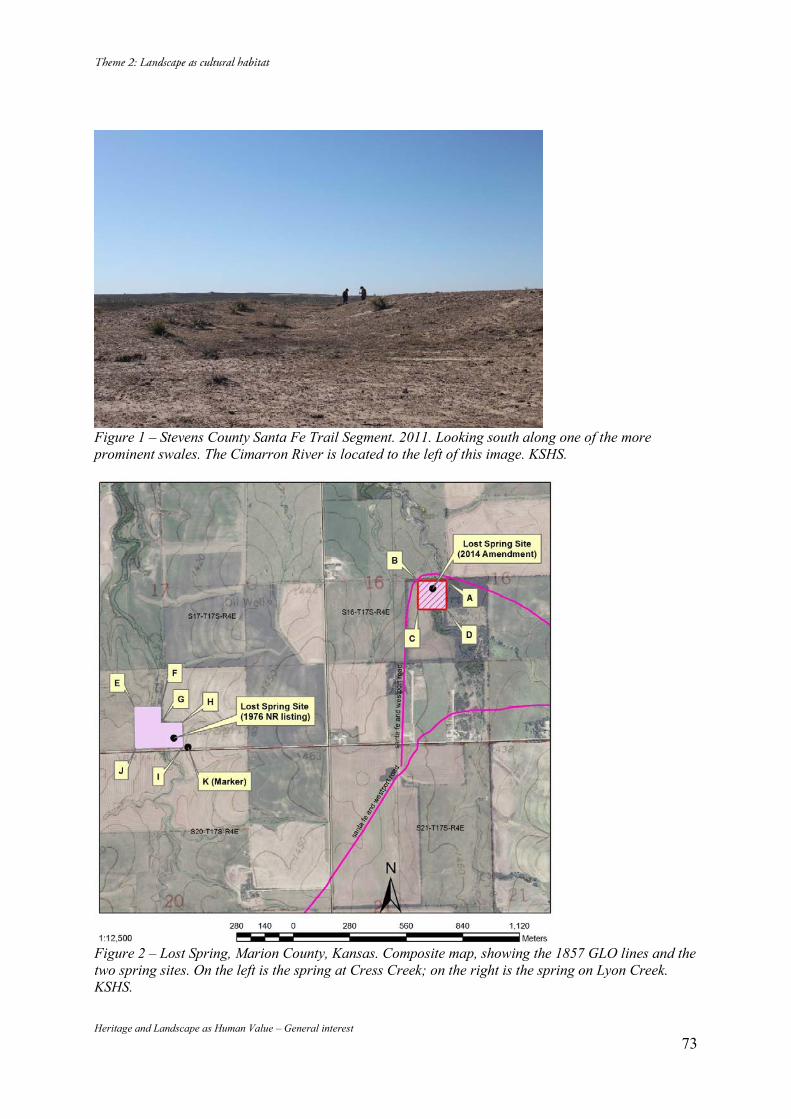
Heritage and Landscape as Human Value – General interest 73
Figure 1 – Stevens County Santa Fe Trail Segment. 2011. Looking south along one of the more prominent swales. The Cimarron River is located to the left of this image. KSHS.
Figure 2 – Lost Spring, Marion County, Kansas. Composite map, showing the 1857 GLO lines and the two spring sites. On the left is the spring at Cress Creek; on the right is the spring on Lyon Creek. KSHS.
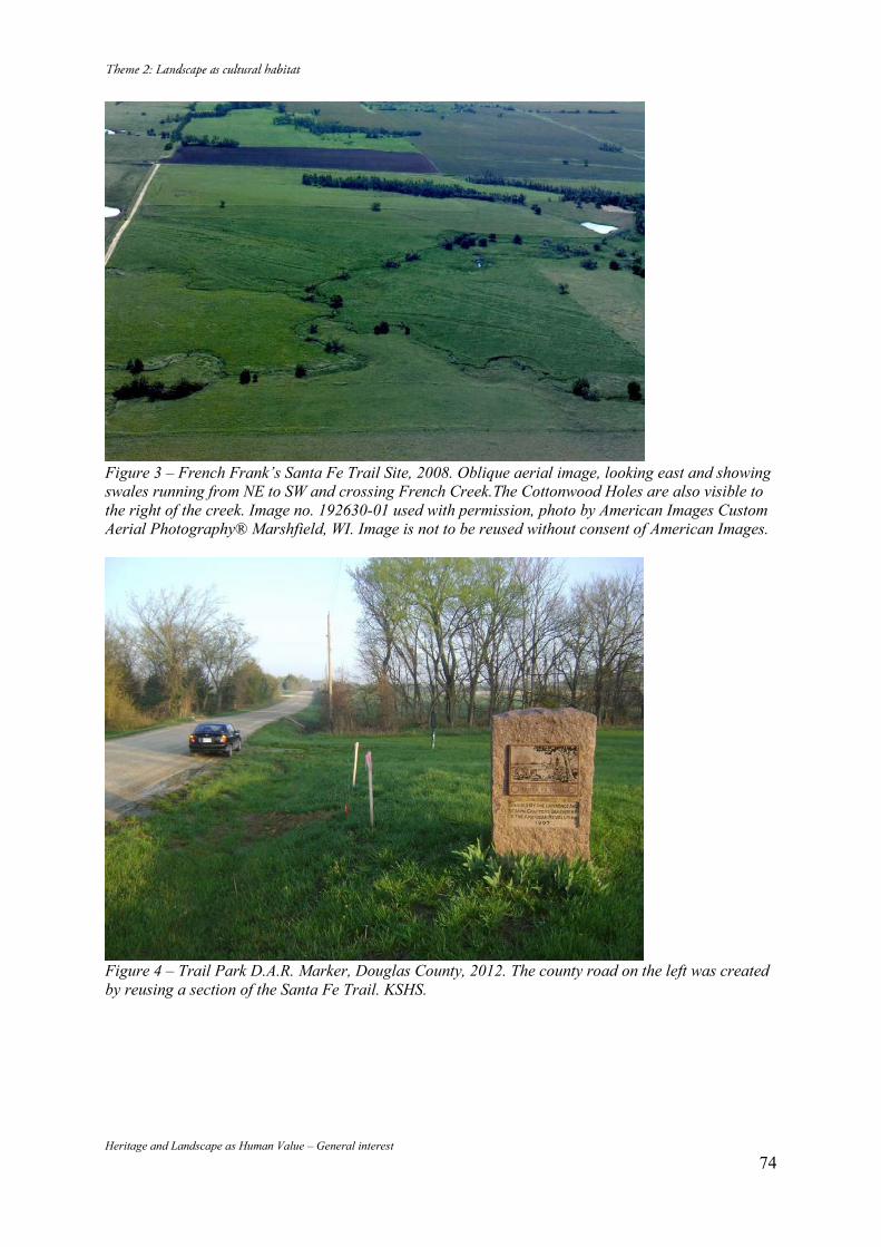
Heritage and Landscape as Human Value – General interest 74
Figure 3 – French Frank’s Santa Fe Trail Site, 2008. Oblique aerial image, looking east and showing swales running from NE to SW and crossing French Creek.The Cottonwood Holes are also visible to the right of the creek. Image no. 192630-01 used with permission, photo by American Images Custom Aerial Photography® Marshfield, WI. Image is not to be reused without consent of American Images.
Figure 4 – Trail Park D.A.R. Marker, Douglas County, 2012. The county road on the left was created by reusing a section of the Santa Fe Trail. KSHS.
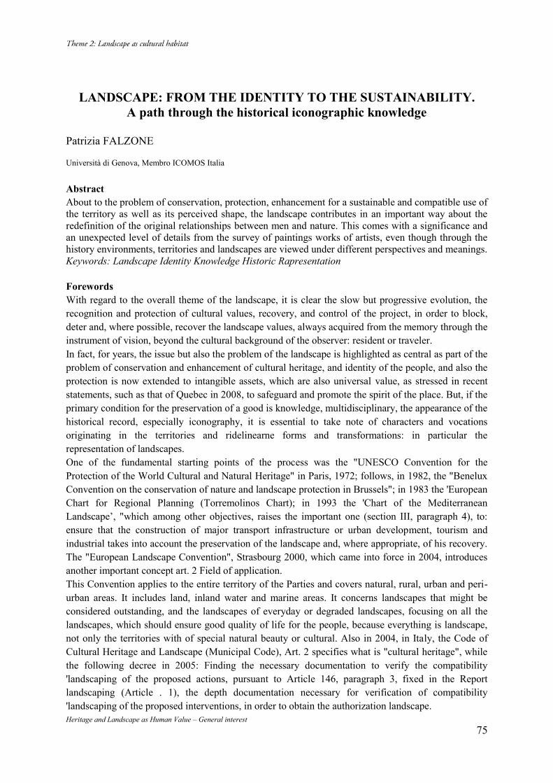
Heritage and Landscape as Human Value – General interest 75
LANDSCAPE: FROM THE IDENTITY TO THE SUSTAINABILITY. A path through the historical iconographic knowledge
Patrizia FALZONE Università di Genova, Membro ICOMOS Italia Abstract About to the problem of conservation, protection, enhancement for a sustainable and compatible use of the territory as well as its perceived shape, the landscape contributes in an important way about the redefinition of the original relationships between men and nature. This comes with a significance and an unexpected level of details from the survey of paintings works of artists, even though through the history environments, territories and landscapes are viewed under different perspectives and meanings. Keywords: Landscape Identity Knowledge Historic Rapresentation Forewords With regard to the overall theme of the landscape, it is clear the slow but progressive evolution, the recognition and protection of cultural values, recovery, and control of the project, in order to block, deter and, where possible, recover the landscape values, always acquired from the memory through the instrument of vision, beyond the cultural background of the observer: resident or traveler. In fact, for years, the issue but also the problem of the landscape is highlighted as central as part of the problem of conservation and enhancement of cultural heritage, and identity of the people, and also the protection is now extended to intangible assets, which are also universal value, as stressed in recent statements, such as that of Quebec in 2008, to safeguard and promote the spirit of the place. But, if the primary condition for the preservation of a good is knowledge, multidisciplinary, the appearance of the historical record, especially iconography, it is essential to take note of characters and vocations originating in the territories and ridelinearne forms and transformations: in particular the representation of landscapes. One of the fundamental starting points of the process was the "UNESCO Convention for the Protection of the World Cultural and Natural Heritage" in Paris, 1972; follows, in 1982, the "Benelux Convention on the conservation of nature and landscape protection in Brussels"; in 1983 the 'European Chart for Regional Planning (Torremolinos Chart); in 1993 the 'Chart of the Mediterranean Landscape’, "which among other objectives, raises the important one (section III, paragraph 4), to: ensure that the construction of major transport infrastructure or urban development, tourism and industrial takes into account the preservation of the landscape and, where appropriate, of his recovery. The "European Landscape Convention", Strasbourg 2000, which came into force in 2004, introduces another important concept art. 2 Field of application. This Convention applies to the entire territory of the Parties and covers natural, rural, urban and peri-urban areas. It includes land, inland water and marine areas. It concerns landscapes that might be considered outstanding, and the landscapes of everyday or degraded landscapes, focusing on all the landscapes, which should ensure good quality of life for the people, because everything is landscape, not only the territories with of special natural beauty or cultural. Also in 2004, in Italy, the Code of Cultural Heritage and Landscape (Municipal Code), Art. 2 specifies what is "cultural heritage", while the following decree in 2005: Finding the necessary documentation to verify the compatibility 'landscaping of the proposed actions, pursuant to Article 146, paragraph 3, fixed in the Report landscaping (Article . 1), the depth documentation necessary for verification of compatibility 'landscaping of the proposed interventions, in order to obtain the authorization landscape.
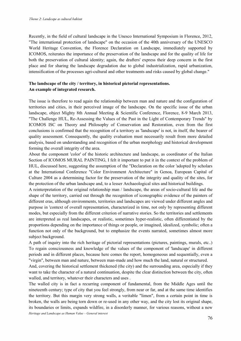
Heritage and Landscape as Human Value – General interest 76
Recently, in the field of cultural landscape in the Unesco International Symposium in Florence, 2012, "The international protection of landscape" on the occasion of the 40th anniversary of the UNESCO World Heritage Convention, the Florence Declaration on Landscape, immediately supported by ICOMOS, reiterates the importance of the preservation of the landscape and for the quality of life for both the preservation of cultural identity; again, the drafters' express their deep concern in the first place and for sharing the landscape degradation due to global industrialization, rapid urbanization, intensification of the processes agri-cultural and other treatments and risks caused by global change." The landscape of the city / territory, in historical pictorial representations. An example of integrated research. The issue is therefore to read again the relationship between man and nature and the configuration of territories and cities, in their perceived image of the landscape. On the specific issue of the urban landscape, object Mighty 8th Annual Meeting & Scientific Conference, Florence, 8-9 March 2013, "The Challenge HUL, Re-Assessing the Values of the Past in the Light of Contemporary Trends" by ICOMOS ISC on Theory and Philosophy of Conservation and Restoration, even from the first conclusions is confirmed that the recognition of a territory as 'landscape' is not, in itself, the bearer of quality assessment. Consequently, the quality evaluation must necessarily result from more detailed analysis, based on understanding and recognition of the urban morphology and historical development forming the overall integrity of the area. About the component 'color' of the historic architecture and landscape, as coordinator of the Italian Section of ICOMOS MURAL PAINTING, I felt it important to put it in the context of the problem of HUL, discussed here, suggesting the assumption of the "Declaration on the color 'adopted by scholars at the International Conference "Color Environment Architecture" in Genoa, European Capital of Culture 2004 as a determining factor for the preservation of the integrity and quality of the sites, for the protection of the urban landscape and, to a lesser Archaeological sites and historical buildings. A reinterpretation of the original relationship man / landscape, the areas of socio-cultural life and the shape of the territory, carried out through the recognition of iconographic evidence of the painters of different eras, although environments, territories and landscapes are viewed under different angles and purpose in 'context of overall representation, characterized in time, not only by representing different modes, but especially from the different criterion of narrative stories. So the territories and settlements are interpreted as real landscapes, or realistic, sometimes hyper-realistic, often differentiated by the proportions depending on the importance of things or people, or imagined, idealized, symbolic; often a function not only of the background, but to emphasize the events narrated, sometimes almost more subject background. A path of inquiry into the rich heritage of pictorial representations (pictures, paintings, murals, etc..) To regain consciousness and knowledge of the values of the component of 'landscape' in different periods and in different places, because here comes the report, homogeneous and sequentially, even a "virgin", between man and nature, between man-made and how much the land, natural or structured. And, covering the historical settlement thickened (the city) and the surrounding area, especially if they want to take the character of a natural continuation, despite the clear distinction between the city, often walled, and territory, whatever their characters and uses . The walled city is in fact a recurring component of fundamental, from the Middle Ages until the nineteenth century; type of city that you feel strongly, from near or far, and at the same time identifies the territory. But this margin very strong walls, a veritable "limen", from a certain point in time is broken, the walls are being torn down or re-used in any other way, and the city lost its original shape, its boundaries or limits, expands wildfire, in a disorderly manner, for various reasons, without a new
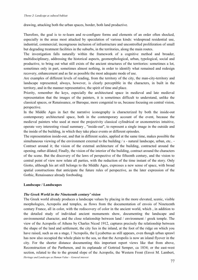
Heritage and Landscape as Human Value – General interest 77
drawing, attacking both the urban spaces, border, both land productive. Therefore, the goal is to re-learn and re-configure forms and elements of an order often shocked, especially in the areas most attacked by speculation of various kinds: widespread residential use, industrial, commercial; incongruous inclusion of infrastructure and uncontrolled proliferation of small but degrading treatment facilities in the suburbs, in the territories, along the main routes. The investigation falls naturally within the framework of a cognitive method and broader, multidisciplinary, addressing the historical aspects, geomorphological, urban, typological, social and productive, to bring out what still exists of the ancient structures of the territories: sometimes a lot, sometimes only in part, sometimes almost nothing, in order to identify what remained and redesign recovery, enhancement and as far as possible the most adequate mode of use. Are examples of different levels of reading, from the territory of the city, the man-city-territory and landscape represented; always, however, is clearly perceptible in the characters, in built in the territory, and in the manner representative, the spirit of time and place. Priority, remember the keys, especially the architectural space in medieval and late medieval representation that the images of the painters, it is sometimes difficult to understand, unlike the classical spaces, or Renaissance, or Baroque, more congenial to us, because focusing on central vision, perspective. In the Middle Ages in fact the narrative iconography is characterized by both the inside-out contemporary architectural space, both in the contemporary account of the event, because the medieval painters who used at most the projectivity classical cylindrical or axonometries intuitive, operate very interesting visual summary , "inside-out", to represent a single image in the outside and the inside of the building, in which they take place events or different episodes. The representation inside-out, and that in different scales, applied at the same time, makes possible the simultaneous viewing of the environment external to the building / s - natural landscape, urban, etc.. - Contract around it; the vision of the external architecture of the building, contracted around the opening, rather dilated; Finally, the vision of the interior of the building, contract around the characters of the scene. But the discovery of the laws of perspective of the fifteenth century, and the vision to central point of view now relate all parties, with the reduction of the time instant of the story. Only Giotto, although his art still belongs to the Middle Ages, expresses a new sense of space, with broad spatial constructions that anticipate the future rules of perspective, as the later expression of the Gothic, Renaissance already foreboding. Landscape / Landscapes The Greek World in the Nineteenth century’ vision The Greek world already produces a landscape values by placing in the more elevated, scenic, visible morphologies, Acropolis and temples, as flows from the documentation of envois of Nineteenth century France, all in color, with the rediscovery of color in the ancient world, which , in addition to the detailed study of individual ancient monuments show, documenting the landscape and environmental character, and the close relationship between land / environment / greek temple. The view of the Acropolis of Athens by Charles Nicod 1912, captures precisely the relationship between the shape of the land and settlement, the city lies in the inland, at the foot of the ridge on which you have raised, such as on a stage, l 'Acropolis, the Lycabettus as still appears, even though urban sprawl has now also occupied the whole plain to the sea, so that the Acropolis is now an island flyover in the city. For the shorter distance documenting this important report views like that from above, Reconstruction of the Parthenon, and its esplanade of Gottried Semper, ca 1834; or the east-west section, related to the to the ground slope of the Acropolis, the Western Front (Envoi M. Lambert,
Heritage and Landscape as Human Value – General interest 78
1877). The importance of the topography of the area also stems in the Envoi of P. Domenc, 1936-1937, View of the Acropolis of Lindos in Rhodes, which emphasizes the elevated position above the village and the monumentality of the Acropolis, now only partially preserved while the current photo shows the texture intact building in the village. The Middle Ages and the Walled town in the Territory The landscape comes from medieval paintings like that of Andrea Bonaiuto, Triumphant Church, mid-1300 (Spanish Chapel), Florence, where for the first time, below, shows the character of the place, and life, as a background to the scene religious on the distant mountain ridge is a walled city, houses, farmers, animals, travelers and, in the foreground, lush trees of various kinds. Still symbolic protagonist but instead becomes Giotto in the landscape, where natural element - often bare rocky ridges and isolated trees - buildings, walled cities and characters are reconnected in a dramatic symbolism in the main lines of the composition, with the perspective, often play a fundamental role in the composition of the narrative, as in the Stories of St. Francis of the Scrovegni Chapel (1303-1305). The ratio of the medieval city and territory, later in the fourteenth century, is still characterized by iconic and stereometric volumes built, which rise from an abstract territory and tormented, mountains towered, marked only by the precincts of the city or of the camps, as in the painting Simone Martini, Guidoriccio da Fogliano, 1328, or in view of the seaside town of Ambrogio Lorenzetti, where the turreted city has already identified more shapes and rich polychrome world Gothic. Much more realistic representation of Ambrogio Lorenzetti, Effects of Good Government. The City and Country, 1338-39, where the city is more realistic in the proportions of the buildings and the architectural and stylistic features, with slender ogival mullioned windows, and colors that allude to the materials; and so ordered the countryside, outside the walls, in his figures of teeming life, in reference both to the work activities of leisure of citizens, who have in the limit of the walls more than the meeting point of separation. Even the background to the subject, the sacred, the Flight into Egypt, 1436 by Giovanni di Paolo, Siena, occupies a large part of the painting, where the deep, broad perspective shows a rich and varied agricultural activities in the territory articulate, more subject to background scene. The Late International Gothic. Man-made territory, walled towns and urban environments. At the Courts paintings of late international Gothic style as for the view of Masolino in the Collegiate Castiglione Olona, 1435, showing a landscape with fantastic intonation, in the mountains which rise from pointy unreal and turreted walled cities, or elegant port towns lay on the line coastal, or as in the backdrop of the city of towers, built from perforated like lace, as the subject of the painting by Pisanello, leave St. George's Princess, 1433-1438, or in the painting of the Brothers De Limbourg, 1413-1416, where, typical scene in front of the polite world, it is a neat and realistic context: a covering plant in the different specializations in forest, garden, green cultivation, and glimpse a corner portion of the wall of the typical "hortus conclusus" medieval. Even in the urban space, the environment is often a scenario symbolic events, such as the landscape background in Herod's Feast, 1435, by Masolino at Castiglione Olona. The Fifteenth century. The walled city: the county and the symbolic landscape. The symbolic-political component of the landscape finds its highest expression in the work of Mantegna, where the natural environment, the walled city and are often an episode narrated integrated continuum that connects nature in harmonious unity, cities and personalities. As in The Prayer in the Garden, where the pace of climb league wide walled city, the curate natural environment and the steep rocky ridges that separate the dramatic scene from the life of every day, and in the 'Meeting of Ludovico Gonzaga and his son Francesco , 1471-1474, natural environment and the walled city still constitute a continuum, with the bottom narrated the scene, and in the development of the upward
Heritage and Landscape as Human Value – General interest 79
path, the buildings bandied around the classical world. The natural territory, albeit partial, is increasingly integrated in the built environment and backdrop to events, as in the case of "Stories of St. Ursula," by Vittore Carpaccio, 1495; here in the city of Venice is a perspective central point of view: wallpapers, large urban environments where the event takes place, groups of figures. The Madonna of the Meadow, 1505 by Giovanni Bellini, the atmosphere is more intimate, and the whole landscape background is a representation of bucolic, but very realistic, continuous relationship between the medieval walled town and structured agricultural land, where he plays the quietly work in the fields. The High Renaissance: Spatial agricultural natural environment between symbolism and realism. By now the natural environment is also represented in the forms agricultural work of man, to whose work allude to the scene from which it springs, sometimes with interpretation almost idyllic, sometimes more realistic, the orderly pattern, which can take a character you'd like more landscape, you want more agricultural, but always on time. In the Renaissance the agricultural exploitation for large property gives rise to particular territorial organizations such as the phenomenon of the Medici villas, one of the villas of the Genoese nobility in the east and in the west citizen, or the Venetian villas, Palladio, both from the point of view of the landscape from the one that architectural, to the establishment of a reality where peculiar landscape, farming, building parks and Renaissance gardens form a unique identifier of the places and the genius loci. To Tuscany's famous bird's eye views of the most important properties, lunettes painted in 14, between 1599-1601, by Giusto Utens, a strong intention documentary, but also landscaping, documenting this in a timely manner of the harmonic design and culture the close link between both compositional and cultural building and the environment in the organization of production zones and the recreational area (parks and gardens). Even the background to the subject, the sacred, the Flight into Egypt by Giovanni di Paolo, Siena, 1436, it occupies a large part of the painting, and the deep, broad perspective shows a rich and varied agricultural activities in the territory articulate, more subject to the background scene . For Liguria documenting the typical structure of the territory, for villas with their arable land outside the city of Genoa, along the coast and inland valleys, paintings and drawings that relate to the Levante Genovese villas Albaro: the painting of Alexander Magnasco, of the 1st half of the eighteenth century, and for the five-century western painting with the view of the Imperial Family in the villa of Sampierdarena, against the backdrop of the garden; and G. Dufou, r of the early twentieth century, Le Cornigliano villas, villas with view of the agricultural land in front, to the sea, still with the original structure of the land use and its characteristics, production, architectural and environmental immediately before industrial development that irretrievably alter this and many other landscapes.
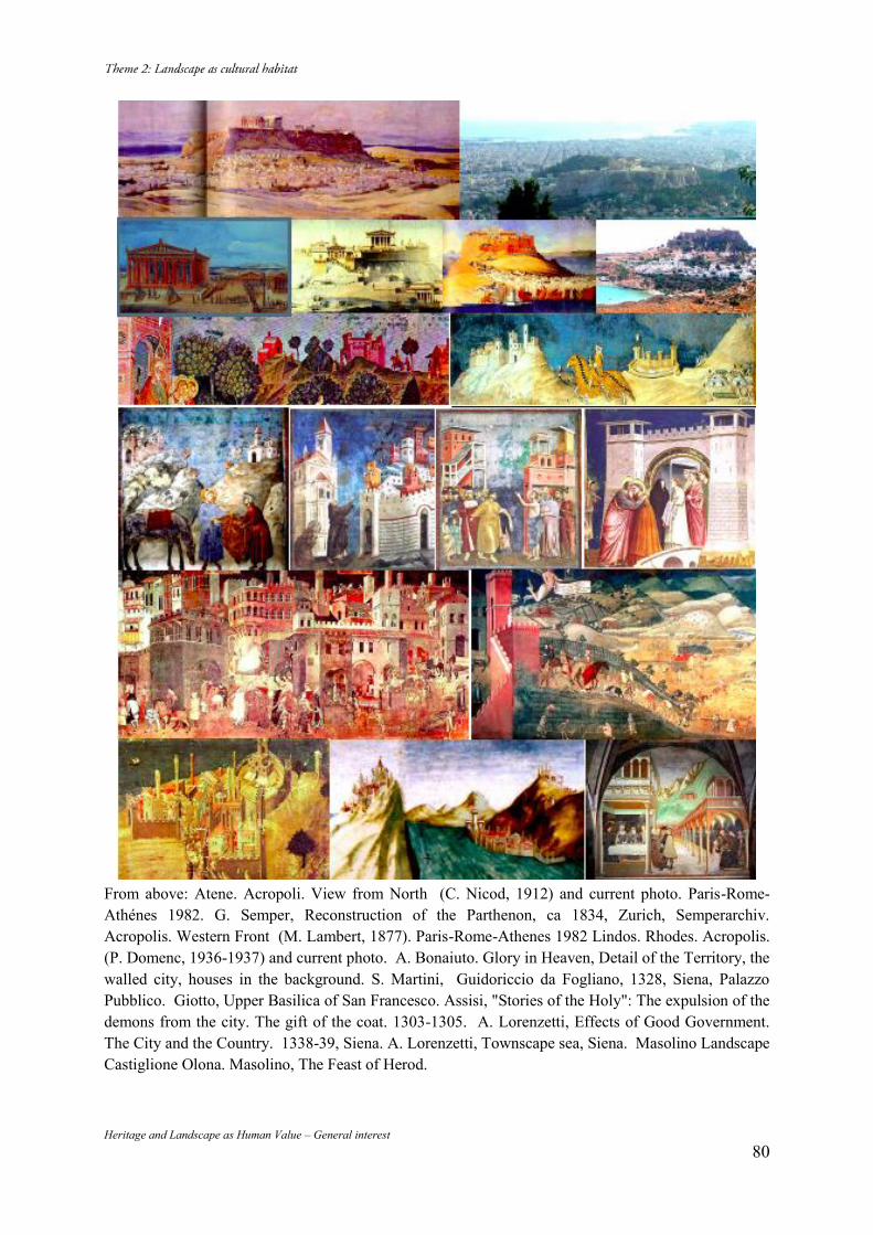
Heritage and Landscape as Human Value – General interest 80
From above: Atene. Acropoli. View from North (C. Nicod, 1912) and current photo. Paris-Rome-Athénes 1982. G. Semper, Reconstruction of the Parthenon, ca 1834, Zurich, Semperarchiv. Acropolis. Western Front (M. Lambert, 1877). Paris-Rome-Athenes 1982 Lindos. Rhodes. Acropolis. (P. Domenc, 1936-1937) and current photo. A. Bonaiuto. Glory in Heaven, Detail of the Territory, the walled city, houses in the background. S. Martini, Guidoriccio da Fogliano, 1328, Siena, Palazzo Pubblico. Giotto, Upper Basilica of San Francesco. Assisi, "Stories of the Holy": The expulsion of the demons from the city. The gift of the coat. 1303-1305. A. Lorenzetti, Effects of Good Government. The City and the Country. 1338-39, Siena. A. Lorenzetti, Townscape sea, Siena. Masolino Landscape Castiglione Olona. Masolino, The Feast of Herod.
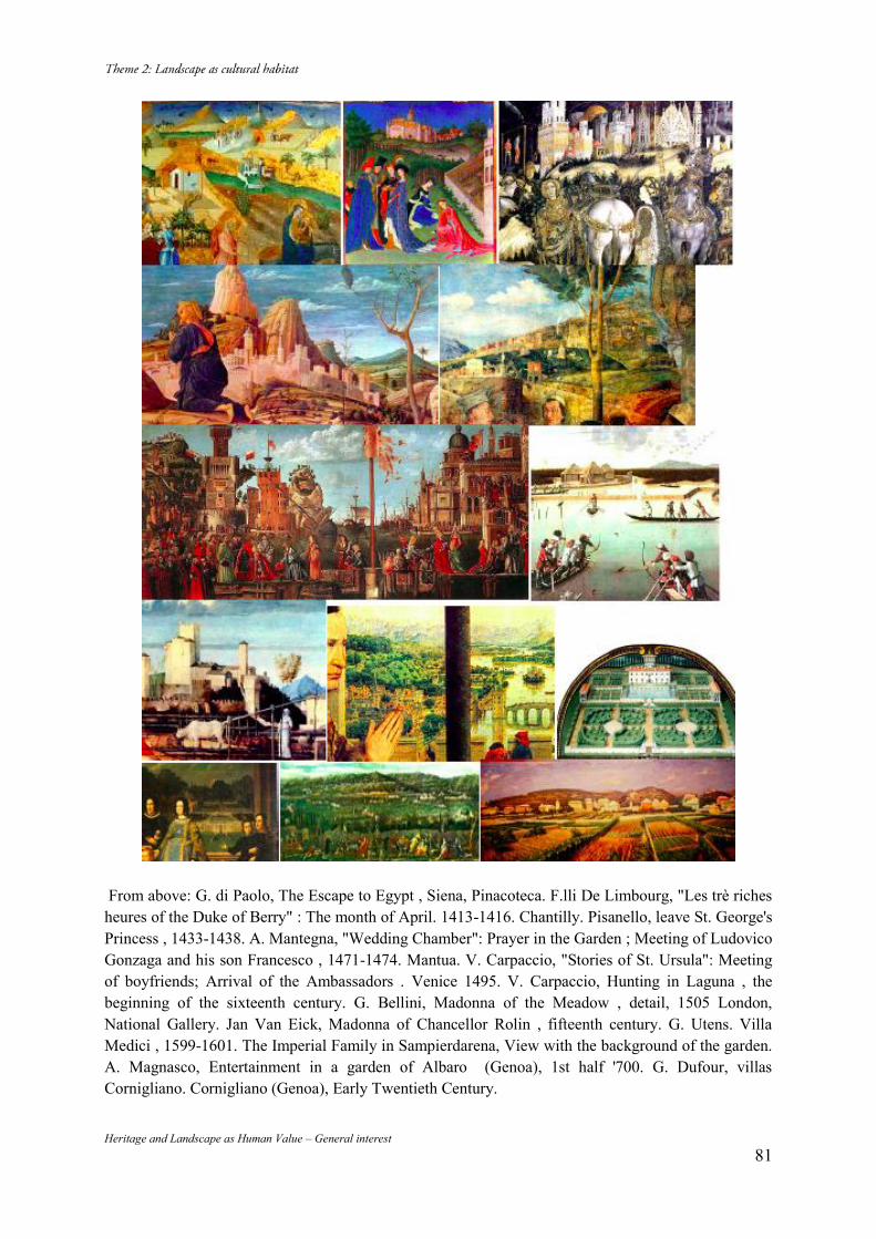
Heritage and Landscape as Human Value – General interest 81
From above: G. di Paolo, The Escape to Egypt , Siena, Pinacoteca. F.lli De Limbourg, "Les trè riches heures of the Duke of Berry" : The month of April. 1413-1416. Chantilly. Pisanello, leave St. George's Princess , 1433-1438. A. Mantegna, "Wedding Chamber": Prayer in the Garden ; Meeting of Ludovico Gonzaga and his son Francesco , 1471-1474. Mantua. V. Carpaccio, "Stories of St. Ursula": Meeting of boyfriends; Arrival of the Ambassadors . Venice 1495. V. Carpaccio, Hunting in Laguna , the beginning of the sixteenth century. G. Bellini, Madonna of the Meadow , detail, 1505 London, National Gallery. Jan Van Eick, Madonna of Chancellor Rolin , fifteenth century. G. Utens. Villa Medici , 1599-1601. The Imperial Family in Sampierdarena, View with the background of the garden. A. Magnasco, Entertainment in a garden of Albaro (Genoa), 1st half '700. G. Dufour, villas Cornigliano. Cornigliano (Genoa), Early Twentieth Century.
Heritage and Landscape as Human Value – General interest 82
The Formation and Significance of the Modern War Memorial Hall in Taiwan
Cheng-Yu TU* Chao-Ching FU** (*)Department of History, National Cheng Kung University, 1 University Road, Tainan City, Taiwan,+886-6-2080265, [email protected] (**)Department of Architecture, National Cheng Kung University, 1 University Road, Tainan City, Taiwan,+886-6-2080265, , [email protected] Abstract In this essay, we discuss the history and monumentality of the War and Peace Monument Hall in Taiwan. Human values and the visions of landscape design and historical Interpretation would be the main issues of our discussion. Keywords: Human Values; War Memorial; National Identity; Historical Representation 1. Introduction
In the past, many Taiwanese veterans thought that they didn’t have their own field of modern war memorial. From the Japanese shrines to the postwar Chinese martyrs, these buildings only represented the regime transformation from Japan to the Republic of China. Before the end of White Terror period (1949-1987), their stories had been oppressed because they were once the Taiwanese Imperial Japan Servicemen and fought with the allied forces. After Japan’s surrender, some Taiwanese later joined the nationalist army and attended the Chinese Civil War. Some of them were captured, became the communist soldiers and fought against the allied forces again during the Korean War. From 1942 to 1953, there were over 2 hundred thousand Taiwanese soldiers served in Netherlands East Indies, Solomon Islands, New Guinea, Indochina Peninsula, Korea and Mainland China. However, their memories can not be easily removed. Through occasional gatherings, worshiping fallen comrades in certain temples, searching for lost companions, and the “Veterans Movement” campaign, they finally set up the War and Peace Monument in Kaohsiung. After a veteran self-immolation incident, with city government’s compensation, Taiwan’s only one modern war memorial hall was sequentially built in the same site. This article explores the melancholy story behind this memorial site. By theories of historical representation and memorial landscape, the authors tried to discourse the meanings of landscape as Human Values and how to face the confused national identity in Taiwan History. 2. Chao-jung Hsu and the Modern War Memorial
Taiwan was Japan’s colony from 1895 to 1945. During the Pacific war, a Taiwanese, Chao-jung Hsu (1928~2008), was drafted into the Japanese army. After the war, Republic of China (ROC) took over the sovereign of Taiwan. Again, Hsu became a soldier but served as a Chinese naval sergeant. The Chinese Civil War was resumed, and many Taiwanese were recruited for the war between 1945 and 1949. Some 30,000 Taiwanese army soldiers were shipping to mainland China and fought against the Communists. However, the Nationalists were gradually defeated, only a few Taiwanese soldiers were able to come back to Taiwan. Most of them were captured and forced to join the Communist army. After the foundation of the People’s Republic of China, these captured Taiwanese soldiers were sent to fight in the Korean War. During the China’s Cultural Revolution period, 1960s to 1970s, these
Heritage and Landscape as Human Value – General interest 83
Taiwanese-born soldiers afflicted for their former status: Nationalists and Taiwanese. New age has draw, Deng Xiaoping became the leader of China in the 1980s and the ban on cross-strait exchanges was lifted. For upholding the justice and rights of these Taiwanese soldiers, Chao-jung Hsu founded ‘the Association of Taiwanese Veterans and Their Survivors’ (台籍老兵暨遺族協會) in 1994. He led his fellow veterans investigated the whereabouts of Taiwanese soldiers who were stranded in China, identified their birthplace or proof of identity, composed rolls of their names and recent addresses, required the Military of National Defence, Taiwan make compensations to them or their family and published many books, such as The Jeremiad Story of Taiwanese Veterans (台籍老兵血淚故事), for propagating their sob stories.1 The most important action of the Association is to set the “Memorial of Unknown Taiwanese Soldiers”. Hsu worked diligently for lobbying and fundraising, Kaohsiung City government support this plan and Cijin (旗津) was chosen to be the location. However, after acquiring land from government, Hsu didn’t get enough money to build the memorial. The only thing he could do is to donate his entire savings. When the memorial completed, many Taiwanese Imperial Japan Veterans gather in Cijin, they wearing Japanese veteran uniforms, waving the Japanese Empire flag, and sing loudly for Japanese military songs. The war time memory seems represented in Taiwan. Hsu named the constructing land which was surrounding the memorial as ‘War and Peace Memorial Park’. But, unfortunately, Kaohsiung City Council had different opinion and named the park as ‘Peace Memorial Park’. Hsu was angry and decided to burn himself to death on 20 May 2008. One year later in 2009 May 20, the ‘War and Peace Park’ was open to the public.
3. The Design Ideas of the Modern War Memorial
There is a memorial wall of light inside War and Peace Park which tells the stories of Taiwanese soldiers, Memorial Lampposts that symbolize anti-war sentiment, the Monument Plaza and the Circle of Reverence that are full of memories and tributes. All of the facilities represent special memorial significance. (Image 1) The park also has Taiwan’s only exhibition hall that commemorates Taiwanese soldiers who perished in the Pacific War, Civil War and Korean War. The search system for the deaths of Taiwanese soldiers in the hall is also the only database of Taiwanese soldiers who died in the wars.2 The white peace pigeon in the park is a sculpture made from marble and shell sand. Its appearance is in a symmetrical heart shape, and in the middle are two flying pigeons, which also look like two hands, symbolizing hands put together in a prayer for peace. The wall of the exhibition hall presents a Taiwanese wearing Japanese, R.O.C, and P.R.C military uniforms for symbolizing what the confused national identities are during the war time. The light wall in the park utilized 24 captioned pictures to depict historical incidents. There are also an engraved pigeon of peace and a reverse gun in the ground. In response to the theme of the park, all the stands of the signs in the park are designed like reversed bombs in the ground symbolizing an anti-war sentiment. The ground space of the plaza monument nearby is called the ‘heart of echoes’; visitors can stand here, feel the wind blowing from the sea, pay their condolence to these warriors. In front of the heart of echoes, is the meaningful plaza of the monument. The exhibition hall holds regular training for tour volunteers and various events.3 The Association of Taiwanese Veterans continues to collect life stories of Taiwanese veterans and helps the masses understand the war time history of Taiwan,4 by publishing literature, executing research seminars, dealing with community empowerment projects, and trying to preserve military
1 (Hsu, 2005; Hok-iu Tzeng, 2011). 2 (War Memorial Park). 3 (Human Rights Learning Studio). 4 (Lin, 2010).
Heritage and Landscape as Human Value – General interest 84
heritages. Every May 20th, people gather in the War and Peace Park for commemorating Taiwanese veterans and Chao-Jung Hsu. (Image 2) 4. The Interpretation of the History behind the Modern War Memorial
Hsu killed himself by self-immolation. However, before the accident, Chen Chu, mayor of Kaohsiung city has already threw efforts into the memorial and offered a place and budgets to build a memorial park. So, how to analyze Hsu’s suicide? Tseng thought that Hsu chose suicide because “many of the Taiwanese-born soldiers had died in China without the world knowing of their sacrifices.”5 Cowsill replenished: “Hsu’s suicide in 2008 in protest to the Taiwanese government's neglect of Taiwanese veterans.”6 Tsao believed Hsu was protesting that “Taiwan does not seem like a country, where the government ignores the fact that former soldiers who are Taiwan nationals have not received just treatment”.7 After reviewing the history of the war memorial, we thought that the reasons above are probably just personal opinions. If Taiwan government really neglected the veterans’ rights and interests, why they got compensation from the Military of National Defence? If Taiwan government ignored the history of these veterans, why Kaohsiung city offer a land and funds on commemorating their history? In fact, Hsu’s personal emotion prefer to Japan. He spoke Japanese language, wrote article and letters in Japanese, and was proud of that he was once a Japanese imperial soldier. When Japan celebrated crown prince’s wedding in 1993, he submitted a paper to Japan media, in his mind, Japanese government had administrate very well when colonizing Formosa and Taiwanese should gratitude to Japan empire’s benevolent and geniality. On the other side, it’s easy to find out his hostility to Nationalist Party from his personal writings. The reason why he so hated Nationalists is that he was imprisoned and suffering during the cold war because he attended Taiwan independence movement. His suicide was not simply just because he protested the alteration of the park’s name, but he refused to share the park with another group: the Veterans of the battle of Kinmen which was represented as a symbol of Nationalist Army. And in 2008, Nationalist regained the regime of Taiwan through the presidential election. Ying-Jeou Ma inaugurated the president on 20 May and that is why Hsu chose the date as his death. 5. Conclusion
The island of Taiwan has a complex history as a Dutch colonial outpost, an Eastern frontier of the Qing dynasty, a colony of Japan and then the Nationalist China (Harrison, 2014), and now a democracy regime. Preserving the history should give a place its unique character, provide a link of the land and its people, and promote to the quality of everyone’s life. Although the Modern War Memorial Hall was made by a tragedy, the best way for us to face this confused history should be: remember the war, but forget the animosity. Hatred and abhorrence can’t become the motion of civilized advance. Bibliography Hok-iu Tzeng (2011). The Heartbreaking Story of Taiwanese Soldiers. Tainan: National University of Tainan. Hsu, Chao-jung (2005). The Jeremiad Story of Taiwanese Veterans. Nantou: Taiwan Historica. Human Rights Learning Studio, War and Peace Memorial Park and Theme Hall: http://hr-learning.ouk.edu.tw/cityguide_war%20_and_peace.html. I-fan Lin (2010), Taiwan: In memory of Chao-Jung Hsu, a Taiwanese WWII veteran, 2010: 5 (Hok-iu Tzeng, 2011). 6 (Cowsill, 2010). 7 (Tsao, 2009).
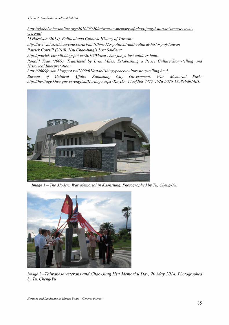
Heritage and Landscape as Human Value – General interest 85
http://globalvoicesonline.org/2010/05/20/taiwan-in-memory-of-chao-jung-hsu-a-taiwanese-wwii-veteran/. M Harrison (2014). Political and Cultural History of Taiwan: http://www.utas.edu.au/courses/art/units/hmc325-political-and-cultural-history-of-taiwan Patrick Cowsill (2010). Hsu Chao-jung’s Lost Soldiers: http://patrick-cowsill.blogspot.tw/2010/03/hsu-chao-jungs-lost-soldiers.html. Ronald Tsao (2009). Translated by Lynn Miles. Establishing a Peace Culture:Story-telling and Historical Interpretation: http://2009forum.blogspot.tw/2009/02/establishing-peace-culturestory-telling.html. Bureau of Cultural Affairs Kaohsiung City Government, War Memorial Park: http://heritage.khcc.gov.tw/english/Heritage.aspx?KeyID=44aef3b8-3477-462a-b026-18a8ebdb14d1.
Image 1 – The Modern War Memorial in Kaohsiung. Photographed by Tu, Cheng-Yu.
Image 2 –Taiwanese veterans and Chao-Jung Hsu Memorial Day, 20 May 2014. Photographed by Tu, Cheng-Yu
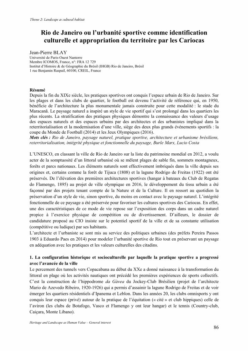
Heritage and Landscape as Human Value – General interest 86
Rio de Janeiro ou l’urbanité sportive comme identification culturelle et appropriation du territoire par les Cariocas
Jean-Pierre BLAY Université de Paris-Ouest Nanterre Membre ICOMOS, France, n°: FRA 12 729 Institut d’Histoire & de Géographie du Brésil (IHGB) Rio de Janeiro, Brésil 1 rue Benjamin Raspail, 60100, CREIL, France
Résumé Depuis la fin du XIXe siècle, les pratiques sportives ont conquis l’espace urbain de Rio de Janeiro. Sur les plages et dans les clubs de quartier, le football est devenu l’activité de référence qui, en 1950, bénéficie de l’architecture la plus monumentale jamais construite pour cette modalité : le stade du Maracanã. Le paysage naturel a inspiré un style de vie sportif qui s’est prolongé dans les quartiers les plus récents. La stratification des pratiques physiques démontre la connaissance des valeurs d’usage des espaces naturels et des espaces urbains par des architectes et des urbanistes impliqué dans la reterritorialisation et la modernisation d’une ville, siège des deux plus grands événements sportifs : la coupe du Monde de Football (2014) et les Jeux Olympiques (2016). Mots clés : Rio de Janeiro, paysage naturel, pratique sportive, architecture et urbanisme brésiliens, reterritorialisation, intégrité physique et fonctionnelle du paysage, Burle Marx, Lucio Costa L’UNESCO, en classant la ville de Rio de Janeiro sur la liste du patrimoine mondial en 2012, a voulu acter de la somptuosité d’un littoral urbanisé où se mêlent plages de sable fin, sommets montagneux, forêts et parcs nationaux. Les éléments naturels sont effectivement imbriqués dans la ville depuis ses origines et, certains comme la forêt de Tijuca (1808) et la lagune Rodrigo de Freitas (1922) ont été préservés. De l’élévation des premières architectures sportives (hangar à bateaux du Club de Regatas do Flamengo, 1895) au projet de ville olympique en 2016, le développement du tissu urbain a été façonné par des projets tenant compte de la Nature et de la Culture. Il en ressort au quotidien la préservation d’un style de vie, sinon sportive, du moins en contact avec le paysage naturel. L’intégrité fonctionnelle de ce paysage a été préservée pour favoriser les cultures sportives des Cariocas. En effet, une des caractéristiques de ce mode de vie repose sur l’exposition des corps dans un cadre naturel propice à l’exercice physique de compétition ou de divertissement. D’ailleurs, le dossier de candidature proposé au CIO insiste sur le potentiel sportif de la ville et de sa constante utilisation (compétitive ou ludique) par ses habitants. L’architecte et l’urbaniste se sont mis au service des politiques urbaines (des préfets Pereira Passos 1903 à Eduardo Paes en 2014) pour modeler l’urbanité sportive de Rio tout en préservant un paysage en adéquation avec les pratiques et les valeurs culturelles des citadins. 1. La configuration historique et socioculturelle par laquelle la pratique sportive a progressé avec l’avancée de la ville Le percement des tunnels vers Copacabana au début du XXe a donné naissance à la transformation du littoral en plage où les activités nautiques ont précédé les premières expériences de sports collectifs. C’est la construction de l’hippodrome da Gàvea du Jockey-Club Brésilien (projet de l’architecte Mario de Azevedo Ribeiro, 1920-1926) qui a permis d’assainir la lagune Rodrigo de Freitas et de voir émerger les quartiers résidentiels d’Ipanema et Leblon. Dans les années 20, les clubs omnisports y ont conquis leur espace (privé) autour de la pratique de l’équitation (« cité » et club hippiques) celle de l’aviron (les clubs de Botafogo, Vasco et Flamengo y ont leur hangar) et le tennis (Country-club, Caiçara, Monte Libano).
Heritage and Landscape as Human Value – General interest 87
Ces pratiques élitistes n’ont pas freiné l’essor du football, pratiqué sur les places et, surtout les plages de Botafogo et Copacabana. L’ancrage du football s’opère dans la zone centrale et la zone Nord. Tout d’abord, le Fluminense Football Club fondé à Laranjeiras (1902) et le Bangu Athletic Club fondé dans la banlieue industrielle (1904). Entre une appropriation informelle de l’espace public et l’édification de stades, on assiste à un étirement du périmètre sportif qui rend nécessaire l’édification d’un grand stade en raison de la création des compétions professionnelles (1933). Une convergence d’opinions rend viable le projet architectural du Maracanã. Le conseiller municipal communiste Iguatemi Ramos déclare en commission que cette construction serait « bien plus qu’un divertissement du peuple, ce serait une école de la démocratie, source de santé pour les masses »1. Les intellectuels se mobilisent également. Le compositeur de la fameuse chanson « Aquarela do Brasil », Ary Barroso demande à un institut de sondage, I.B.O.P¨.E., de mener une enquête auprès des supporters des clubs de Rio. C’est un projet consensuel qu’approuvent 79,2% des sondés qui s’accordent à 85,2% sur sa location, envisagée sur l’ancien hippodrome du Jockey-Club. Le préfet de Rio, le Général Mendes de Morais, confirme la vox populi en argumentant que la facilité de l’accès au futur stade sera garantie par sa position centrale dans le réseau des transports et qu’on améliorerait l’assainissement des quartiers les plus peuplés en canalisant le cours d’eau Maracanã. Le 29 octobre 1947, le Conseil municipal adopte le projet 161-B relatif à la construction du stade. Le permis de construite est signé par Mendès de Morais le 14 novembre au siège de la fédération de football (Confederação Brasileira Desportes) en présence des architectes : Rafael Galvão, Orlando da Silva, Pedro Paulo Bastos, et Antonio Augusto Dias Carneiro. Afin d’équilibrer les équipements sportifs entre la zone nord (stade), la zone sud (hippodrome de Lagoa) et la zone ouest, le député de l’opposition, Carlos Lacerda2 propose la construction d’une « ville olympique » à Jacarepaguà. Ce projet de 1947 croise celui de Lucio Costa qui, à la même époque, prétend que la ville y trouvera une extension logique et que la concentration d’activités et de population à la Barra da Tijuca en fera le nouvel épicentre de la ville. Dans l’esprit des décideurs politiques, très influencés par la reprise du sport international dans le contexte de l’après guerre, le Brésil se doit de gagner sa place de façon pacifique parmi les grandes nations. L’architecture sportive sert à la fois l’image de marque de la capitale brésilienne et sa réforme urbaine3. La ferveur sportive des Cariocas est bien perçue par la classe politique qui à se propose de modeler le paysage urbain pour répondre à des nécessités hygiéniques urgentes de la zone nord, améliorer les conditions de vie et, surtout sécuriser un lieu réservé à la population pour exprimer des émotions, interdites dans tout autre lieux public. Paradoxalement, l’architecture sportive devient un élément de séduction de l’électorat, alors que la visée première du pouvoir politique est de contenir la violence populaire dans un processus civilisateur matérialisé dans un édifice monumental.4 Dans les années 50, à travers la rénovation des lignes architecturales et des matériaux, la nouvelle configuration de la ville s’inscrit dans un projet de modernisation mené dès le retour à la République et se poursuivra même sous la dictature militaire dans la décennie suivante. De 1961 à 1965, le quartier de Flamengo est doté d’une zone tampon entre les immeubles et la plage afin de dégager deux voies de transition rapide entre le centre et l’aéroport en direction de Copacabana. Les concepteurs du tracé ondoyant du parc de Flamengo, Eduardo Reidy et Burle Marx obéissent aux injonctions de la politique des viaducs (« perimetral » du port, pont Rio-Nitéroi) et des voies express qui concernent aussi la maîtrise des habitations sauvages et la désodorisation de l’espace publique (déplacement d’habitants pauvres dans les nouveaux quartiers de Vila Kennedy, Aliança, Esperança et Cidade de
1 Jornal do Esporte, 22 août 1947. 2 Gisella de Araujo Moura, O Rio corre para o Maracanã, FGV Editora, 1998, p.29. [NB : on y disputera les GP de F1 dans les années 70.] 3 cf, Margarida de Souza Neves (1991). 4 cf. Roberto da Matta (1994).
Heritage and Landscape as Human Value – General interest 88
Deus). Mais, ils n’oublient pas d’intégrer dans le parc de Flamengo des terrains de sport (tennis, football, basket-ball) accessibles à tous les habitants de Gloria, Catete, Flamengo et Botafogo qui bénéficient d’aménagements créant les conditions de l’urbanité sportive. Les paysages dessinés par Burle Marx sur le littoral urbain et le pourtour de la baie de Guanabara et le réalignement et l’élargissement de la plage de Copacabana ont épousé intégralement la morphologie paysagère tout en apportant de meilleures conditions de pratiques sportives (élargissement de la plage, piste cyclable…). Phénomène qui s’est poursuivi dans les années 70 avec l’extension du quartier sud-ouest (Barra da Tijuca). Dans les années 1990, l’avenue Princesa Isabel gagne une composition scénique en son centre : arbres, fontaines lumineuses, revêtement… conformément aux passages pédestres et des pistes cyclables qui font la jonction par le tunnel du Pasmado et le tunnel Novo entre Botafogo et Copacabana. La charte graphique des trottoirs (pierres portugaises dessinant en noir et blanc une vague) imposé par Burle Marx est respectée de sorte que la voie des 2 roues, peinte en rouge, est identifiable instantanément.5 Les progrès de l’urbanisme ont été clairement dirigés vers cette simplification des transports de courtes distances vers les espaces balnéaires qui ont fait la réputation de la « cidade maravilhosa ». La mise en réseau de ces espaces s’achève au début du XXIème siècle, et elle est d’autant mieux acceptée que, dans chaque quartier, subsistent des marques anciennes d’architecture sportive, du mobilier urbain (pour le sport) et des voies de circulation non polluante. 2. L’identité culturelle revendiquée par les différents utilisateurs sportifs du territoire urbain Bien des quartiers ont une histoire liée au football dont les stades représentent des sanctuaires de la vie du club et des valeurs que les « socios » (supporters) défendent (stade das Laranjeira pour le Fluminense, stade da Gàvea pour le Flamengo, stade do Maurisco du Botafogo)… Mais à partir des années 80, l’économie du football mondial se modifie sous l’action des sponsors qui conçoivent leur marketing autour du maillot et des joueurs. Le sport échappe aux clubs et à ses supporters. Le géographe Gilmar Mascarenhas6 constate que le stade n’est pas seulement une architecture monumentale, elle représente un ensemble de normes flexibles et inflexibles qui jouent sur l’utilisation de l’espace. Les stades anciens comme le Maracanã (Rio) et le Minerão (Belo Horizonte) ont été davantage modernisés que restaurés selon les matériaux et l’agencement des espaces d’accueil et de circulation interne. Les principales innovations à Rio concernent l’installation d’une couronne de loges VIP et la suppression de la marquise en béton armée au profit d’une verrière récupérant l’eau de pluie pour l’arrosage de la pelouse. Les architectes ont respecté une charte environnementale sur le recyclage des débris de béton armé en les réutilisant in situ pour le terrassement et le drainage de la pelouse. En 1950, le stade Mario Filho (Maracanã) avait été conçu pour recevoir les 3 classes sociales idéalisées de la population carioca à une époque où la télévision n’existait pas : la geral (anneau bétonné incliné autour de la pelouse) pour les supporters populaires debout, l’arquibancada (gradins de béton) pour la classe moyenne (assise dans le haut des tribunes), enfin les chaises numérotées en bois7 pour une public plus aisé dans la tribune d’honneur. 200 000 amateurs de football pouvaient prendre place, plus ou moins confortablement. Aujourd’hui, avec une capacité maximale de 76 000 sièges, le spectateur carioca est confronté à un modèle d’architecture sportive qui impose des normes dictées par la FIFA en totale contradiction avec la culture de « torcidas » (groupes de supporters dans le stade) centenaires. La norme de la place assise attribuée
5 cf. Rio cidade, o urbanismo de volta as ruas. Ce livre (commandé par le préfet de Rio, César Maia en 1996). rassemble les plans d’urbanisme quartier par quartier. 6 Mascarenhas, Gilmar. Entrada e bandeiras : a conquista do Brasil pelo futebol, Edition UeRJ, 2014. 7 A l’origine, on mit en vente 30 000 chaises pour une période 5 ans. Les chaises n°1 et 2 furent acquises par le président de la République Dutra et le Préfet de la ville (maire) Mendes de Morais.
Heritage and Landscape as Human Value – General interest 89
nominalement a amené les clubs de Flamengo et Fluminense à renégocier leur espace traditionnel, notamment lors de leur derby. Désormais, la mobilité des groupes de supporters organisés est réduite, au profit de l’augmentation des personnes âgées, des femmes et des enfants. La disparition de la geral aseptise le spectacle sportif. L’animation des stades brésiliens est conforme à celle des arènes européennes. Les effets de la mondialisation ont ici des aspects pacificateurs. Cependant, on constate aussi une forme d’exclusion sociale dommageable pour une pratique culturelle supposée démocratique, celle des communautés des favelas qui n’ont pas les moyens de payer un ticket d’entrée. Parmi les raisons invoquées de la défaite du Brésil lors du dernier Mondial, le manque de ferveur transmise aux joueurs, par les chants des torcidas de clubs locaux, révèle cette modification profonde de l’usage d’un territoire urbain, car le Maracanã est un quartier à part entière. Il y a en effet une relation directe entre le stade Maracanã et des phénomènes urbains plus amples : l’insularité voire la sanctuarisation de l’édifice et de ses alentours. La vie de rue perd de sa vibration pour des lieux et des espaces fermés et contrôlés comme les resorts, les shopping centers, et les résidences de luxe (condominios) qui émergent dans toute la ville. Le grand stade s’est isolé. La norme FIFA de l’exploitation commerciale de l’événement réservée au « Top sponsors » a évacué du périmètre du stade les kiosques des marchands ambulants qui participaient à l’économie parallèle. Mais la translation des voyageurs du métro vers le stade y a gagné en fluidité et en sécurité. Les travaux de restauration ont modifié l’intégrité fonctionnelle du stade qui a gagné en visiteurs et en prestige depuis l’ouverture d’une aire muséale dédiée aux idoles du ballon rond. Pour le reste, le paysage urbain de Rio est vécu par des millions de Cariocas comme un habitat culturel où cohabitent : le footballeur, le surfeur, les joueurs de « peteca » (jeu d’opposition avec la paume de la main projetant au dessus d’un filet une sorte de gros volant de badminton), celui de « frescobol » (jeu de raquette en bois) ou de « futevôlei ». Ces sports nés sur les plages ont leurs lieux de pratiques immuables, connus de tous et inscrits dans une stratification urbaine. Le dernier en date, le « Zaccaro ball » s’avère une variante de la « peteca ». Son inventeur Sergio Zaccaro en a déposé les règles et commercialisé le matériel (gants en bois) depuis février 2014. Il a négocié avec les pratiquants du « futebol de praia » de diviser un terrain de foot en plusieurs courts entre les postes 4 et 5 de Copacabana le samedi. Dans cet espace de grande exposition, il profite de la lenteur et de la densité des promeneurs pour augmenter le nombre de ses adeptes. Cette activité a profité du regain du tennis qui demeure une pratique élitiste. Ce sport connaît une variante démocratisée sous la forme du « tênis de praia »8 qui tend à détrôner la « peteca » et le volley-ball car moins exigeant physiquement et plus ludique. Les tennismen et les tenniswomen ont dû également chercher des terrains qu’ils partagent en fait avec les 2 autres sports d’opposition avec filet. La plage voit se succéder du matin au soir des pratiquants de tous les âges. Le joggeur et le cycliste se rencontrent à toute heure. En revanche, le footballeur attend la fin d’après midi pour jouer sur un sable moins brûlant. Les sports collectifs de petits terrains se déroulent sur la partie de la plage la plus proche du trottoir pour bénéficier des branchements d’eau des postes de secours afin d’arroser leur aire de jeu en plein soleil. Les baigneurs et les surfeurs s’étendent sur le bord de mer selon des repérages parfois marqués, à l’instar du poste 9 d’Ipanema et Arproador pour les surfeurs. Le dimanche matin, la Orla (front de mer) est interdite aux voitures (sens Leblon-Copacabana) et permet l’extension de la zone pédestre. La rencontre programmée entre habitants du quartier a débouché sur des pratiques véritablement sportives. Des clubs de coureurs à pied, à vélo et en rollers se sont développés dans un paysage urbain totalement dédié au bien être. Le paysage de Rio a inspiré de nombreuses formes d’art (musique, Bossa Nova) qui ont valorisé les éléments identificateurs à l’échelon mondial. Ainsi, la chanson « Garota de Ipanema » (Tom Jobim &
8 Le tennis de plage est moins éprouvant que le volley-ball et bénéficie d’un éventail d’âges plus important.
Heritage and Landscape as Human Value – General interest 90
Vinicius de Moraes) a de nombreuses descendantes qui considèrent, encore aujourd’hui, la plage et le quartier d’Ipanema comme un paysage, tropical et urbain, vécu comme un habitat culturel signifiant d’un mode de vie très brésilien que la globalité de l’urbanité sportive a contribué à sauvegarder car basé sur le culte du corps. Cette forme de pratique culturelle est d’autant revendiquée qu’elle s’inscrit dans un décor naturel en voie de préservation. Le Secrétariat Municipal du Milieu Ambiant (SMAC) a revitalisé les dunes résiduelles d’Ipanema et Leblon en délimitant par un périmètre de barrières basses (piler en bois de 1,20m et fil de fer de fine section) qui garantit une couverture végétale endémique. Cela touche à la requalification de la plage dans son intégralité de zone naturelle originale, tout en faisant du plagiste un utilisateur respectueux de l’environnement. D’ailleurs, la préservation de ces zones a été sponsorisée par une marque de sportwear : les sandales « Havaianas » qui se veulent un élément identificateur de la garde-robe de tout Carioca puisque parfaitement adapté à la transition domicile / plage. L’urbanité sportive a des incidences sur la mode et les comportements auxquels l’architecte apporte des solutions ; notamment en systématisant dans les parties communes des immeubles d’habitation, des pédiluves pour le retour de la plage et des garde volumes pour le matériel sportif (planche de surf, vélo…). Insérées au niveau du play-ground (entre les étages de stationnement et ceux des appartements) des salles de musculation et de fitness servent à préparer son apparence avant d’aller à la plage. 3. La requalification du tissu urbain en faveur de l’urbanité sportive La requalification du tissu urbain est plus récente. Le Comité Olympique Brésilien a repensé la pratique sportive pour tous les âges. Ainsi, les urbanistes et les paysagistes ont remodelé les squares pour enfants pour y favoriser la mixité des générations de 7 à 77 ans. Des couloirs pédestres serpentent entre les appareils de musculation et de gymnastiques douces, permettant de la sorte l’acquisition de la motricité pour les plus jeunes et le contrôle de la posture pour les autres. Ce genre d’espaces récréatifs se rencontre dans tous les quartiers et à proximité des favelas de sorte que le sport continue d’être une forme d’apprentissage de la démocratie.9 Les dossiers de candidatures présentés au CIO et à la FIFA ont mis en valeur la ville des prochains Jeux Olympiques et de la finale du mondial de football 2014. L’intégrité des éléments naturels et structurels essentiels, à partir desquels la ville s’est développée, garantit à chaque carioca une vie sportive qui a été élevée au niveau d’une urbanité sportive unique au monde. Cependant, les autorités du sport veulent renforcer le réseau des infrastructures sportives de proximité (gratuite) et celles pour les compétitions (payantes). Selon le London Evening Standar (24 juin 2014) à moins deux ans de la cérémonie d’ouverture les sites olympiques de Rio sont construits à 10%, contre 40% pour Athènes et 60% pour Londres au même niveau du compte à rebours. Eduardo Paes (maire de Rio) promet de remettre les installations sportives en décembre 2015 au « Comité Organisateur RIO 2016 » qui réalisera 45 événements tests avant les olympiades prévues le 5 août 2016.10 L’Autorité Publique Olympique (APO) garantit de son côté que le calendrier sera respecté et que le parcours de golf doté d’une exceptionnelle couverture végétale fait partie des œuvres les plus avancées.
9 Nous n’évoquerons pas ici les programmes sociaux entrepris par la Municipalité ou par les institutions privées (ex : école de Samba da Mangueira) qui financent infrastructures et animations d’éducation physique et sportive dans les quartiers démunis. 10 O GLOBO, mardi 5 août 2014, “cidade em obras”, p.6. 45 événements sportifs du 2 août 2014 (voile) au 1er mai 2016 (athlétisme) [NB : 3 000 ouvriers travaillent en équipe 24/24h sur le seul chantier olympique de Barra da Tijuca].
Heritage and Landscape as Human Value – General interest 91
La requalification du tissu urbain concerne des espaces plus centraux comme le Sambodromo prévu pour les épreuves de tir à l’arc et l’arrivée du marathon. Les aménagements vont porter sa capacité de places assises de 60 000 à 72 500. La modernisation du Maracanã et l’urbanisation du quartier incitèrent à étendre ces améliorations à d’autres installations de son périmètre : le stade (couvert) du Maracanãzinho (volley-ball) et le parc Julio de Lamarre (polo aquatique)11. Quant à la modernisation de la Marina du quartier de Gloria (voile), elle vise surtout à encourager la voile olympique au détriment d’un nautisme plus routinier. Les régates pré-olympiques (août 2014) ont démontré que la nouvelle configuration des infrastructures nautiques s’adaptait à bien des gabarits d’embarcations sportives.12 Les travaux intervenus après le classement par l’UNESCO devaient garantir la non modification de l’intégrité physique et visuelle du paysage naturel, ainsi que la vison habituelle de puis la Marina du parc do Flamengo, du monument dos Pracinhas et du musée d’Art moderne ; ceci, tout en améliorant (exigence du CIO) l’intégrité fonctionnelle de l’accès à la baie de Guanabara. Devant l’urgence des décisions, un accord fut signé à Brasilia entre le CIO, le gouvernement brésilien, la préfecture de Rio de Janeiro, l’Institut des Architectes Brésiliens (I.A.B.) et Institut du Patrimoine Historique & Artistique National (I.P.H.A.N.). En l’occurrence, c’est principalment l’architecture intérieure de l’édifice de la capitainerie qui a été réaménagée. 40 salles sont destinées à la location commerciale dont 4 restaurants. Située dans l’axe de l’avenue Rio Branco, la Marina doit s’intégrer plus directement à la vie économique du centre ville historique et, remplir une fonction touristique et sportive plus intense. Ainsi, la réorganisation fonctionnelle et l’extension du territoire de la ville de Rio de Janeiro doivent beaucoup aux exigences du dossier olympique, mais celui-ci incite à repenser ou requalifier l'ensemble du paysage culturel du sportif dont l’empreinte se ressent toute la journée. Le Secrétariat Municipal du Milieu Ambiant (S.M.A.C.) inaugurera en novembre 2014, 14 km de piste cyclable dans la zone sud (de Flamengo à Leblon). Il s’agit de favoriser la circulation cycliste sur le bord des plages et en la prolongeant dans un réseau intérieur d’une quarantaine de rues. L’idée est d’encourager l’usage des 2 roues dans des couloirs matérialisés en rouge sans réduire les trottoirs de pierre portugaise dont les différents motifs identifient les quartiers. Les urbanistes et décorateurs urbains ont dû réfléchir sur un nouveau mobilier comme les bancs, les stations de vélib’ (près de 200 bicicletàrios) les postes de soin ainsi que des places interdites aux voitures, tout en proposant une nouvelle signalétique. La « sportivisation » des transports de moyennes distances est clairement visée et, dans le quartier de Copacabana, d’après l’ONG « Transporte Ativo », 60 000 translations sont effectuées chaque jour en vélo dont 12 000 sont des livraisons commerciales. L’exercice physique, à défaut d’une réelle a pratique sportive compétitive, est une réponse aux problèmes urbains liés aux embouteillages et à la pollution. C’est ainsi que les Cariocas semblent se réapproprier des espaces dominés par la voiture ; D’ailleurs, le nouveau maillage viaire impose dans ces quartiers une vitesse de 30km/h. 4. La barra da Tijuca, requalification tardive d’une aire naturelle L’ensemble du projet olympique se monte à 12,53 milliards d’euros dont 27% [sources : Veja Rio, 6/8/2014] sont dévolus à la construction du village des athlètes, les arènes sportives et les réseaux de transports routiers et ferroviaires. L’implication des architectes et des ingénieurs représente une part considérable du budget du Parc Olympique de Deodoro situé dans la pointe sud du quartier de Barra de Tijuca. Ils ont répondu à des exigences dont leurs prédécesseurs ne s’étaient jamais souciés pour 11 Réforme de la piscine principale, implantation d’un parking de 250 places, implantation d’une nouvelle tribunes de 1 000 places. 12 Du 2 au 9 août 2014, la Marina da Gloria a accueilli : 324 athlètes de 30 pays, 325 embarcations de 10 classes olympiques.
Heritage and Landscape as Human Value – General interest 92
répondre à la pratique sportive notamment en préservant le paysage naturel et en dépolluant les aires humides (lagune de Marapendi et canal de Joatinga). Soucieux de la santé des athlètes et du niveau de performance, le C.I.O. est très vigilant sur les conditions d’hygiène dans lesquelles se déroulent les épreuves. Seize modalités sportives (sur 28) se dérouleront à Barra sur 1,18 millions de m² avec un minimum de rejets polluants, puisque, selon la Empresa Olimpica Municipal (E.O.M.) qui coordonne les travaux dépendant du secteur public, il a été ajouté aux différents réseaux : 9,6 km de canaux de drainage, 5,3 km d’adduction d’eau, 3,5 km de canalisation de lutte incendie, 10,9 km de télécommunication. Les travaux du Parc Olympique prévoient encore la construction de 7,5 km de rues dont la « Via Olimpica » qui aura 1 km d’extension à partir de l’avenue Abelardo Bueno jusqu’au Live Site (espace d’entraînement proche du Village des athlètes). Ce parc bordera la lagune de Jacarepaguà qui bénéficiera d’un traitement paysager : piste de contournement (pédestre & cycliste) de 30 m de large, postes d’observation de la faune aquatique, passerelles reliées au réseau viaire existant. Les travaux de réhabilitation et de mises aux normes olympiques du Parc Aquatique Maria Lenk et la construction du Centre de Tennis, du vélodrome, du centre hand-ball et des édifices des médias ont obéi aux principes de la réduction des impacts sur les écosystèmes prônés par les concepteurs de l’E.O.M. Dans leur esprit, il faut s’inspirer de l’environnement pour envisager les formes et les usages d’une urbanité sportive qui trouve ses limites. Ce ne fut pas toujours le cas. Dans les années 60, les premiers édifices élevés à Barra da Tijuca ne dépassait pas la cime des arbres. Puis, en raison de la pression démographique de la classe moyenne supérieure, soucieuse de trouver son logis, les autorités publiques libérèrent la hauteur des habitations collectives jusqu’à ce que le 1er Sommet mondial sur l’écologie (Eco 1992) ne vienne alerter les urbanistes et les architectes sur la prise en compte des milieux ambiants sur toute la planète. Cependant, à Rio, pendant une vingtaine d’années, les projets de bétonnage du littoral s’embarrassèrent peu du paysage naturel. Il fallait construire en bordure de plage. Mais quand l’extension de l’espace bâti vers l’intérieur (en direction de Jacarepaguà et Recreio) croisa les nouvelles exigences du cadre de vie et le respect (tardif) du paysage, les architectes mirent en évidence dans leur communication commerciale, cette prise en compte du style de vie recherché par les nouveaux arrivants qui prétendaient se comparer à ceux d’Ipanema et Leblon, dans leur style de vie. Le projet immobilier (Ilha Pura, 2014) lancé par la compagnie immobilière Sirela tient compte du contexte olympique et de l’écosystème qui le borde. Ilha Pura a été conçu selon le cahier des charges de Rio 2016. Les 823 000 m² de ce « condominio » (ensemble résidentiel) de 31 immeubles de 18 étages, bénéficient de 8 500 m² de miroir d’eau intégrés à un ensemble paysager conçu par Burle Marx. Les installations de sports et de loisirs sont reliées par 4,5km de pistes privées. De là, il est possible d’accéder à des aires naturelles préservées de l’automobile : le massif forestier de la Pedra Branca et la plage de la Reserva (ndlr : réserve naturelle). Ilha Pura a reçu le label LEED ND relatif aux normes de préservation (eaux, éléments naturels). Ces concepteurs prétendent bénéficier de 30 ans d’urbanisme, notamment dans l’équilibre entre la mobilité interne de ce quartier de la Barra da Tijuca, et dans la mobilité rapide et variée vers les points stratégiques de la ville (aéroports, centre d’affaires) grâce aux voies rapides (Transolimpica13, Transoeste, Transcarioca) et la ligne 4 du métro14. La loi municipale 5.715, votée en juin 2014, prévoit d’augmenter les transports maritimes sur les lagunes et le littoral par un réseau de 5 stations afin de proposer une alternative aux voies terrestres
13 La Transolimpica représente 16 ponts et viaducs, 18 stations d’autobus, 2 terminaux autoroutiers, 1 tunnel de 2 galeries de 1,8km de long. Le temps de transport par la Transcarioca jusqu’à l’aéroport international passerait de 2 heures (autobus) à 70mn. 14 La ligne 4 est conçue pour transporter 300 000 passagers/jour.
Heritage and Landscape as Human Value – General interest 93
classiques15. Les prévisions sont estimées à 30 millions de passagers par an à l’horizon 2016. Un des objectifs est de développer le tourisme maritime. Le premier (d’un point de vue chronologique) ensemble d’habitations de la Barra, le Jardim Oceânica qui intègre le canal de Joatinga, verra ce dernier doté d’une digue plus longue (de 30 à 180 m) le protégeant de l’ensablement, tout en augmentant le flux des marées dans le canal et, conséquemment, favorisant les effets de la dépollution. Selon l’océanographe, David Zee les sports nautiques seront ainsi favorisés. La Barra da Tijuca évolue vers une autonomisation de ses fonctions urbaines qui fait entrevoir un possible détachement administratif de la ville de Rio de Janeiro dont elle est, géographiquement, séparée par un relief semi montagneux dominé par la Pedra da Gavea. Ses habitants militent pour le travail de proximité avec le développement d’édifices commerciaux et industriels pour éliminer de leur quotidien le désagrément des 2 heures de transport (voiture) nécessaires pour relier le Centro. L’enquête d’opinion menée par le journal O GLOBO (cahier spécial du samedi 2 août 2014 6 pages) fait ressortir que l’ambition des habitants de la Barra est de laisser leur voiture au garage et de vivre une autarcie, sans nul doute, toute moderne. Anticipant sur ce processus, le siège social des institutions sportives (Comité Olympique Brésilien et Confédération Brésilienne de Football) ont déménagé du centre vers la Barra de Tijuca. D’un siècle à un autre, le paysage naturel est devenu un paysage culturel par le quel les architectes ont contribué à donner une continuité à des valeurs d’usage issues de pratiques sportives. Conclusion Lucio Costa avait projeté, il y a 40 ans l’extension de la ville de Rio de Janeiro vers la Barra da Tijuca dont il faisait le nouveau centre métropolitain, sans pour autant imaginer que la confluence des projets sportifs de niveau international et le goût prononcé (désormais dans toutes les classes sociales) de la pratique physique chez les Cariocas, y joueraient un rôle décisif. Rio de Janeiro, encadrée par de merveilles naturelles, s’est développée en transformant l’héritage colonial avec la modernité architecturale de Lucio Costa et Oscar Niemeyer. Ce fut cette miscégénation culturelle que la délégation brésilienne présenta comme argument devant ses pairs de l’Union Internationale des Architectes (U.I.A. Durban, Af.S, 10 /08 / 14) et gagna ainsi l’honneur d’accueillir, en 2020, la 27e édition du congrès mondial de l’U.I.A. autour du thème : « Tous les mondes, un seul monde, architecture 21 ». Pour le professeur J.L. Cohen de la New-York University16 cette attribution est amplement méritée car « la contribution du Brésil à l’architecture moderne et son implication dans la résolution des problèmes affrontés par les villes contemporaines s’incarnent dans la ville de Rio. » Après les Journées Mondiales de la Jeunesse et la Coupe des Confédérations en 2013, la coupe du monde en 2014, les Jeux Olympiques en 2016, la communauté internationale des architectes aura l’occasion de faire un bilan des ouvrages réalisés. Pour l’architecte Nireu Cavalcanti, « le congrès pourra à partir de là décider des tendances de la production architectonique et indiquer les nouvelles pratiques professionnelles. »17 Alors, l’urbanité sportive, comprise comme une valeur et vécue comme mode de vie, se sera peut-être imposée comme la relation la plus adéquate de l’homme à la ville, grâce aux réponses apportées par les architectes et les urbanistes. L’exemple de l’expansion urbaine de Rio de Janeiro démontre que la stratification historique des valeurs d’usage du paysage naturel a été prise en compte en même temps que la réduction des risques des pollutions liés aux projets architecturaux et de leur impact sur la requalification de l’espace bâti et de l’espace naturel.
15 O GLOBO, samedi 2 août 2014. « transporte lagunar » p. 3. 16 O GLOBO, lundi 11 août 2014. «a copa da arquitetura», p. 7. 17 Idem.
Heritage and Landscape as Human Value – General interest 94
Bibliographie : Histoire du sport & du football -Araujo Moura, Gisella de. O Rio corre para o Maracanã, FGV Editora, 1998, -Blay Jean-Pierre. « Espaços urbanos, praticas fisicas e sociedade esportiva na cidade de Rio de Janeiro no século XX ». Revue de L’Instituto Historico e Geografico Brasileiro (IGHB), a.168, n°437, oct-dec 2007, pp. 251-273. -De Souza Neves, Margarida. Brasil, acertai vossos ponteiros. Rio de Janeiro, Museu de astronomia e ciências, Afins/Governo do Brasil, 1991 -Da Matta, Roberto. Universo do futebol, Pinakotheke, Rio de Janeiro, 1982. “Antropologia do obvio”, Revue de l’Université de São Paulo, dossier n° 22 Futebol, juin-août 1994. -Galeano, Eduardo. Futebol ao sol e sombra, Porto Alegre, L & PM, 1995. -Mattos, Claudia, Cem anos de paixão, uma mitologia carioca no futebol, Rio de Janeiro, Rocco, 1997. Histoire du projet de candidature « Rio 2016 » Comitê Olimpico Brasileiro. Trabalhando pela transformação,Stilgraf Rio, 2013. 2012 : ano olimpico, Stylgraf Rio, 2011. 90 years of the C.O.B., editora C.O.B., 2004. Sonhos & conquistas, o Brasil nos Jogos Olimpicos do seculo XX, SNEL, 2004. Histoire de la ville & de l’urbanisme -Braga Gaspar, Claudia. Orla carioca, Historia e cultura, Metalivro, São Paulo, 2004. -Cohen, Alberto, Fridman, Sergio, Siqueira ricardo. Rio de Janeiro, ontem & hoje, Amazon, Rio, 1998. -Préfecture de Rio de Janeiro, (s.a.). Rio cidade, o urbanismo de volta as ruas, Mauad Consultoria e Planejamento Editorial, R.J., 1996. -Rosso del Brenna, Giovanna. O Rio de Janeiro de Pereira Passos, uma cidade em questão, editora P.U.C./R.J., 1985. Géograhie urbaine -Czaijkowski, Jorge. Do cosmografo ao satélito, cartografia de uma cidade, Editora Centro de Arquitetura & de Urbanismo do Rio de Janeiro, 2000. -Mascarenhas, Gilmar. Entrada e bandeiras : a conquista do Brasil pelo futebol, Edition UeRJ, 2014.
Heritage and Landscape as Human Value – General interest 95
El Real de Minas de las Once Mil Vírgenes.
Historical, Cultural and Human Heritage in Northwest Mexico Cristina SÁNCHEZ DEL REAL Juan Palomar y Arias #86-801, Guadalajara, Jalisco, México CP 44690, [email protected] Abstract The territory, of the outstanding Mining Cultural Landscape, is located in the State of Sinaloa, México, is an exceptional example of how the human mining settlements were established in harmony with the natural and complex heritage landscape. It is still showing evidence from the various stages, therefore it must be considered from different perspectives. The mining and rural activities produced architecture with its own typology. The construction systems were managed to create comfortable spaces in spite of the rather extreme climate. The necessity of saving it in fact comes from the stem in the relative isolation evolved and thanks that, now a days, it has become in a vulnerable place, especially due to the recent tourism flow, which has been increasing during last years because of the promotion campaigns without adequate control. It might put it in risk or compromise the landscape’s conservation. Keywords: Historic; Cultural Diversity; Architecture Tourism and Tangible Natural Heritage 1. El Real de Minas de las Once Mil Vírgenes Thus named by the first Spanish settlers who arrived at the area in the 16th century, the territory which supplied richness to the Spanish Crown (the gold and silver taken from the mines), the Once Mil Vírgenes refers to the legend of Saint Ursula, who was martyred along with her 11,000 virgin maidens, though there is no documentation to give an explanation or reason of naming the place after the virgins, even though the name of the Saint was not included. 1 The Heritage area was recognized by the owners as a Mining Cultural Landscape, and includes the settlements of Cosalá (a provincial town), San José de las Bocas, Town (or Misión) de Alayá, Santa Cruz de Alayá, Nuestra Señora de la Candelaria, El Rodeo and Guadalupe de los Reyes. Before the Spaniards arrived at this area, it was colonized by few native groups. The Property includes the valleys containing these settlements and the boundaries running along the rivers which pass through them. The whole territory is located in the jurisdiction of the town of Cosalá, bordering with the State of Durango. The perimeter of the territory is outlined by the basins, there where the main mines located and that have allowed this territory to maintain its authenticity and integrity. The boundaries of the property are shown in the annexed map. The buffer zones are located within the jurisdiction of Cosalá. There was no need to propose a larger buffer zone, because human settlements in the region did not mean a threat and the orthographic features created natural barriers around the Property. The Property represents the prototype of a landscape integrated with an extractive economy in the valleys of the Sierra Madre Occidental mountain range, which was colonized because of the high quantity of precious minerals in the region: gold, silver and copper. Before the Spanish colonization, the area was barely populated by Acaxee tribes. 2 About the arrival of the Spaniards, the region was transformed in harmony with its natural setting. The extraction system of the mines and the processing of the raw materials in other to allow excavation areas along the veins, within the limits of the available resources, avoiding the use of quarrying techniques which could have damaged vegetation significantly; likewise, thanks to the absence of waste materials from the metal processing.
1 Enciclopedia de los Municipios y Delegaciones de México, Estado de Sinaloa. Cosala. www.local.gob.mx/work/templates/enciclo/EMM25sinaloa/municipios/25005ª. 2 Nakayama Arce, Antonio (1982). Sinaloa. Un bosquejo de su historia, Culiacán, Libros de México.
Heritage and Landscape as Human Value – General interest 96
Furthermore, poor connections with surrounding regions fostered the development of a self-sufficient economy slightly placed, in situ with commerce, agricultural and livestock farms, raised by the very miners; most of the constructions were related to mining operation and its services. Agriculture could spread in those areas deforested due to the use of wood for the mines, while animal farms were established in areas with simple fences to delineate boundaries. There are two different kinds of settlements in the region: worker´s villages established in a close proximity to the mines, settlements built as temporary to be abandoned when the mine were closed; isolated farms along the mineral transportation routes, which could perform as service stations. The climate in the region influenced the construction of buildings with wide porches, as most of the daily activities were developed outdoors, by using indoors only for sleeping and storage. Trees had an important role in isolated spaces; these reached monumental heights protecting buildings and providing shelter for livestock, also acting as true outdoor stables. Generally, buildings have their main portico facing south. In urban buildings, such as those in Cosalá, the fences on the facade have been eliminated and not all in the buildings face south, but following an urban layout resembling more than an organic settlement rather than a strict, geometric one. The main road infrastructure is composed by solid construction in transportation routes, robust, paved roads and roads carved on the rock to transport the heavy loads. They have been provided with structural elements, some of them which were of considerable dimensions, such as heaps and buttresses in steeper slopes or bridges to cross the rivers. An important site for this mixed economy was Cosalá which, is located near the middle of the region. It became a trade center. The double role of Cosalá, as mining settlement and a market, saved it of being abandoned like it happened to other towns since its foundation in 1562 had maintained an important role even at a national and international scale.3 Other settlements suffered the same changes of the mines that were built for this purpose and now are villages with mostly rural economies, but which bear a great archaeological importance; some of the towns have been recognized at national level and protected through parks. The territory is an outstanding example of how human mining settlements have been established in harmony with the natural heritage and the landscape, it is still showing evidence from various stages. The way of life developed in a unique form, producing a local culture and civilization through the population’s serene philosophy towards life, their exceptional sensitivity related to the environment and their pride in their own territory. This attitude created a rich heritage of habits and customs like in any other of the surrounding regions. The pre-Hispanic rock paintings on the banks of the rivers and the old mines remain as vestiges of the man-made heritage. There is local flora and fauna. The climate is tropical, with abundant and regular rainy seasons, allowing a rich biodiversity and a wide variety of natural resources. Along with man, there are cattle and crops, there are wild animals also, some of which are fierce, native birds of the region, and rare exotic plants. The local traditions are deeply rooted and emigrants from the region often return to celebrate them. Due to these outstanding characteristics, the territory of Cosalá is considered by Mexicans to be unique; Cosalá has been named “Magical Territory”, with its own protection laws, and it has been expected that it could be inscribed in the World Heritage List. 2. Cosalá It is the provincial capital, founded on March 15, 1562, after the discovery of mineral deposits in its surroundings; it was populated one hundred years later. The settlement was at first built with defensive features in a relatively opened area between two rivers because of the hostility of natives.4 The town was not laid following the grid plan as American colonial towns usually were done. The main axis for the settlement was the path leading from the mines in the south to the foundries in the north. The main square is central and it is dominated by the church of Saint Ursula, while public and government offices are located in another side, in a smaller square, as intending to separate physically
3 Eustaquio Buelna Eustaquio. 1877 Compendio histórico, geográfico y estadístico del estado de Sinaloa, México, Imprenta y Litografía de Ireneo Paz. p. 144. 4 López Castillo, Gilberto (1998). El Real de las once mil vírgenes y su Distrito. Breve historia colonial de Cosalá. Culiacán, Sinaloa, México, INAH/ H. Ayuntamiento de Cosalá.
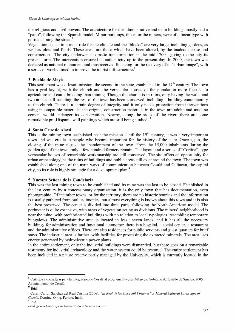
Heritage and Landscape as Human Value – General interest 97
the religious and civil powers. The architecture for the administrative and main buildings mostly had a “patio”, following the Spanish model. Minor buildings, those for the miners, were of a linear type with porticos lining the street.5 Vegetation has an important role for the climate and the “blocks” are very large, including gardens, as well as plots and fields. These areas are those which have been altered, by the inadequate use and constructions. The city underwent a drastic transformation in the mid-1700s, giving to the city its present form. The intervention ensured its authenticity up to the present day. In 2000, the town was declared as national monument and thus received financing for the recovery of its “urban image”, with a series of works aimed to improve the tourist infrastructure.6 3. Pueblo de Alayá This settlement was a Jesuit mission, the second in the state, established in the 17th century. The town has a grid layout, with the church and the vernacular houses of the population more focused to agriculture and cattle breeding than mining. Though the church is in ruins, only having the walls and two arches still standing, the rest of the town has been conserved, including a building contemporary to the church. There is a certain degree of integrity and it only needs protection from interventions using incompatible materials; the original construction materials in the town are adobe and mud, so cement would endanger its conservation. Nearby, along the sides of the river, there are some remarkable pre-Hispanic wall paintings which are still being studied. 7 4. Santa Cruz de Alayá This is the mining town established near the mission. Until the 19th century, it was a very important town and was cradle to people who became important for the history of the state. Once again, the closing of the mine caused the abandonment of the town. From the 15,000 inhabitants during the golden age of the town, only a few hundred farmers remain. The layout and a series of “Cortina”, type vernacular houses of remarkable workmanship are still conserved. The site offers an opportunity for urban archaeology, as the ruins of buildings and public areas still exist around the town. The town was established along one of the main ways of communication between Cosalá and Culiacán, the capital city, so its role is highly strategic for a development plan.8 5. Nuestra Señora de la Candelaria This was the last mining town to be established and its mine was the last to be closed. Established in the last century by a concessionary organization, it is the only town that has documentation, even photographic. Of the other towns, or for the territory, there are no historic sources and the information is usually gathered from oral testimonies, but almost everything is known about this town and it is also the best preserved. The center is divided into three parts, following the North American model. The perimeter is quite extensive, with areas of vegetation acting as divisions. The miners’ neighborhood is near the mine, with prefabricated buildings with no relation to local typologies, resembling temporary bungalows. The administrative area is located in less uneven lands, and it has all the necessary buildings for administration and functional autonomy: there is a hospital, a social center, a restaurant and the administrative offices. There are also residences for public servants and guest quarters for brief stays. The industrial area is farther, with facilities for processing the extracted minerals. The area uses energy generated by hydroelectric power plants. In the entire settlement, only the industrial buildings were dismantled, but there goes on a remarkable testimony for industrial archaeology and the water system could be restored. The entire settlement has been included in a nature reserve partly managed by the University, which is currently located in the
5 Criterios a considerar para la integración de Cosalá al programa Pueblos Mágicos. Gobierno del Estado de Sinaloa. 2005. Ayuntamiento de Cosalá. 6 Ibid. 7 Cesari Carlo, Sánchez del Real Cristina (2006). “El Real de las Once mil Vírgenes” A Mineral Cultural Landscape of Cosalá. Demine. O.n.g. Ferrara, Italia 8 Ibid.
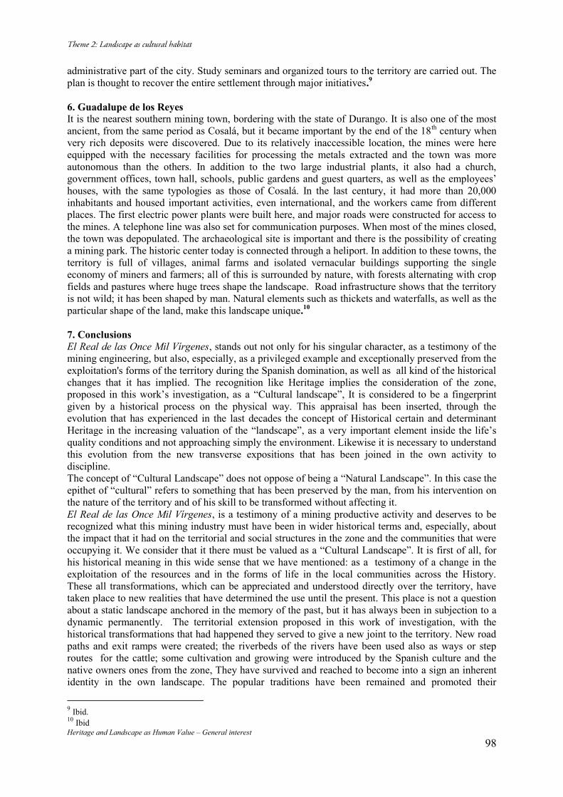
Heritage and Landscape as Human Value – General interest 98
administrative part of the city. Study seminars and organized tours to the territory are carried out. The plan is thought to recover the entire settlement through major initiatives.9 6. Guadalupe de los Reyes It is the nearest southern mining town, bordering with the state of Durango. It is also one of the most ancient, from the same period as Cosalá, but it became important by the end of the 18th century when very rich deposits were discovered. Due to its relatively inaccessible location, the mines were here equipped with the necessary facilities for processing the metals extracted and the town was more autonomous than the others. In addition to the two large industrial plants, it also had a church, government offices, town hall, schools, public gardens and guest quarters, as well as the employees’ houses, with the same typologies as those of Cosalá. In the last century, it had more than 20,000 inhabitants and housed important activities, even international, and the workers came from different places. The first electric power plants were built here, and major roads were constructed for access to the mines. A telephone line was also set for communication purposes. When most of the mines closed, the town was depopulated. The archaeological site is important and there is the possibility of creating a mining park. The historic center today is connected through a heliport. In addition to these towns, the territory is full of villages, animal farms and isolated vernacular buildings supporting the single economy of miners and farmers; all of this is surrounded by nature, with forests alternating with crop fields and pastures where huge trees shape the landscape. Road infrastructure shows that the territory is not wild; it has been shaped by man. Natural elements such as thickets and waterfalls, as well as the particular shape of the land, make this landscape unique.10 7. Conclusions El Real de las Once Mil Vírgenes, stands out not only for his singular character, as a testimony of the mining engineering, but also, especially, as a privileged example and exceptionally preserved from the exploitation's forms of the territory during the Spanish domination, as well as all kind of the historical changes that it has implied. The recognition like Heritage implies the consideration of the zone, proposed in this work’s investigation, as a “Cultural landscape”, It is considered to be a fingerprint given by a historical process on the physical way. This appraisal has been inserted, through the evolution that has experienced in the last decades the concept of Historical certain and determinant Heritage in the increasing valuation of the “landscape”, as a very important element inside the life’s quality conditions and not approaching simply the environment. Likewise it is necessary to understand this evolution from the new transverse expositions that has been joined in the own activity to discipline. The concept of “Cultural Landscape” does not oppose of being a “Natural Landscape”. In this case the epithet of “cultural” refers to something that has been preserved by the man, from his intervention on the nature of the territory and of his skill to be transformed without affecting it. El Real de las Once Mil Vírgenes, is a testimony of a mining productive activity and deserves to be recognized what this mining industry must have been in wider historical terms and, especially, about the impact that it had on the territorial and social structures in the zone and the communities that were occupying it. We consider that it there must be valued as a “Cultural Landscape”. It is first of all, for his historical meaning in this wide sense that we have mentioned: as a testimony of a change in the exploitation of the resources and in the forms of life in the local communities across the History. These all transformations, which can be appreciated and understood directly over the territory, have taken place to new realities that have determined the use until the present. This place is not a question about a static landscape anchored in the memory of the past, but it has always been in subjection to a dynamic permanently. The territorial extension proposed in this work of investigation, with the historical transformations that had happened they served to give a new joint to the territory. New road paths and exit ramps were created; the riverbeds of the rivers have been used also as ways or step routes for the cattle; some cultivation and growing were introduced by the Spanish culture and the native owners ones from the zone, They have survived and reached to become into a sign an inherent identity in the own landscape. The popular traditions have been remained and promoted their
9 Ibid. 10 Ibid
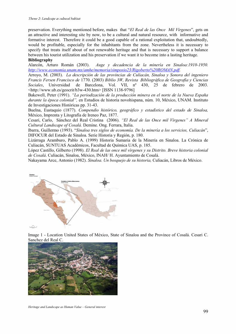
Heritage and Landscape as Human Value – General interest 99
preservation. Everything mentioned before, makes that “El Real de las Once Mil Vírgenes”, gets on an attractive and interesting site by now, to be a cultural and natural resource, with informative and formative interest. Therefore it could be a good capable of a rational exploitation that, undoubtedly, would be profitable, especially for the inhabitants from the zone. Nevertheless it is necessary to specify that treats itself about of not renewable heritage and that is necessary to support a balance between his tourist utilization and his preservation if we want it to become into a lasting heritage. Bibliography Alarcón, Arturo Román (2003). Auge y decadencia de la minería en Sinaloa:1910-1950. http://www.economia.unam.mx/amhe/memoria/simposio23/Rigoberto%20ROMAN.pdf. Arroyo, M. (2003). La descripción de las provincias de Culiacán, Sinaloa y Sonora del ingeniero Francis Fersen Francisco de 1770. (2003) Biblio 3W, Revista Bibliográfica de Geografía y Ciencias Sociales, Universidad de Barcelona, Vol. VII, nº 430, 25 de febrero de 2003. <http://www.ub.es/geocrit/b3w-430.htm> [ISSN 1138-9796] Bakewell, Peter (1991). “La periodización de la producción minera en el norte de la Nueva España durante la época colonial”, en Estudios de historia novohispana, núm. 10, México, UNAM. Instituto de Investigaciones Históricas pp. 31-43. Buelna, Eustaquio (1877). Compendio histórico, geográfico y estadístico del estado de Sinaloa, México, Imprenta y Litografía de Ireneo Paz, 1877. Cesari, Carlo, Sánchez del Real Cristina (2006). “El Real de las Once mil Vírgenes” A Mineral Cultural Landscape of Cosalá. Demine. Ong. Ferrara, Italia. Ibarra, Guillermo (1993). “Sinaloa tres siglos de economía. De la minería a los servicios, Culiacán”, DIFOCUR del Estado de Sinaloa. Serie Historia y Región, p. 180. Lizárraga Aramburo, Pablo A. (1999) Historia Sumaria de la Minería en Sinaloa. La Crónica de Culiacán, SUNTUAS Académicos, Facultad de Química UAS, p. 185. López Castillo, Gilberto (1998). El Real de las once mil vírgenes y su Distrito. Breve historia colonial de Cosalá. Culiacán, Sinaloa, México, INAH/ H. Ayuntamiento de Cosalá. Nakayama Arce, Antonio (1982). Sinaloa. Un bosquejo de su historia, Culiacán, Libros de México.
Image 1 - Location United States of México, State of Sinaloa and the Province of Cosalá. Cesari C. Sanchez del Real C.
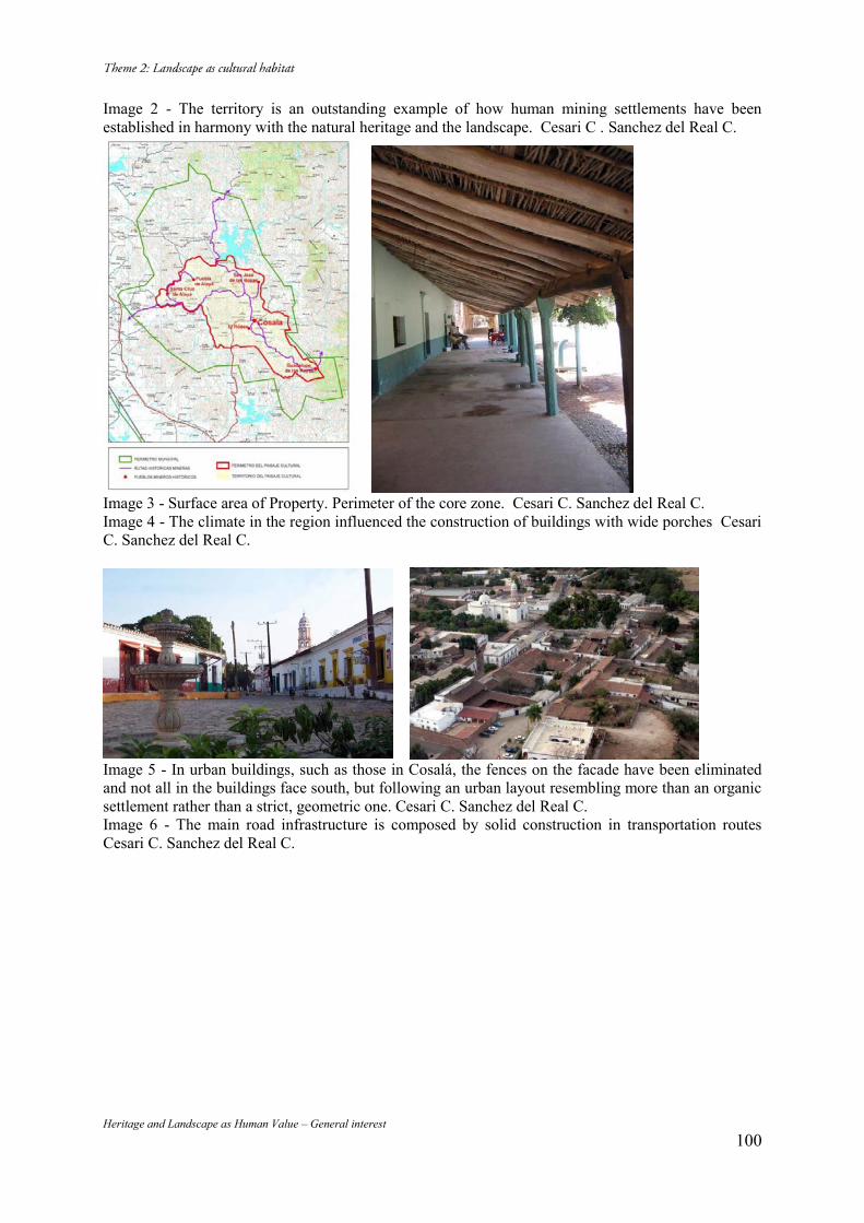
Heritage and Landscape as Human Value – General interest 100
Image 2 - The territory is an outstanding example of how human mining settlements have been established in harmony with the natural heritage and the landscape. Cesari C . Sanchez del Real C.
Image 3 - Surface area of Property. Perimeter of the core zone. Cesari C. Sanchez del Real C. Image 4 - The climate in the region influenced the construction of buildings with wide porches Cesari C. Sanchez del Real C.
Image 5 - In urban buildings, such as those in Cosalá, the fences on the facade have been eliminated and not all in the buildings face south, but following an urban layout resembling more than an organic settlement rather than a strict, geometric one. Cesari C. Sanchez del Real C. Image 6 - The main road infrastructure is composed by solid construction in transportation routes Cesari C. Sanchez del Real C.

Heritage and Landscape as Human Value – General interest 101
Image 7 - The prehispanic rock paintings on the banks of the rivers and the old mines remain as vestiges of the man-made heritage Cesari C. Sanchez del Real C. Image 8 - The main square is central and it is dominated by the church of Saint Ursula Cesari C. Sanchez del Real C.
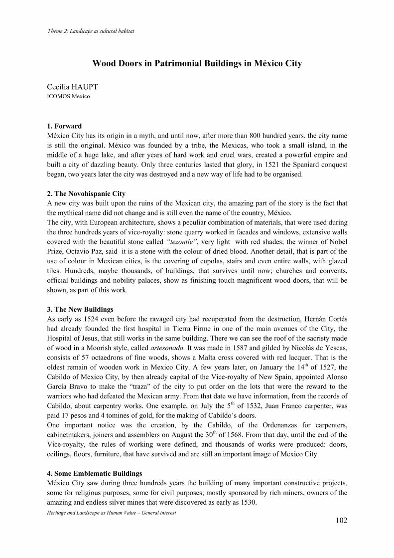
Heritage and Landscape as Human Value – General interest 102
Wood Doors in Patrimonial Buildings in México City
Cecilia HAUPT ICOMOS Mexico
1. Forward México City has its origin in a myth, and until now, after more than 800 hundred years. the city name is still the original. México was founded by a tribe, the Mexicas, who took a small island, in the middle of a huge lake, and after years of hard work and cruel wars, created a powerful empire and built a city of dazzling beauty. Only three centuries lasted that glory, in 1521 the Spaniard conquest began, two years later the city was destroyed and a new way of life had to be organised. 2. The Novohispanic City A new city was built upon the ruins of the Mexican city, the amazing part of the story is the fact that the mythical name did not change and is still even the name of the country, México. The city, with European architecture, shows a peculiar combination of materials, that were used during the three hundreds years of vice-royalty: stone quarry worked in facades and windows, extensive walls covered with the beautiful stone called “tezontle”, very light with red shades; the winner of Nobel Prize, Octavio Paz, said it is a stone with the colour of dried blood. Another detail, that is part of the use of colour in Mexican cities, is the covering of cupolas, stairs and even entire walls, with glazed tiles. Hundreds, maybe thousands, of buildings, that survives until now; churches and convents, official buildings and nobility palaces, show as finishing touch magnificent wood doors, that will be shown, as part of this work. 3. The New Buildings As early as 1524 even before the ravaged city had recuperated from the destruction, Hernán Cortés had already founded the first hospital in Tierra Firme in one of the main avenues of the City, the Hospital of Jesus, that still works in the same building. There we can see the roof of the sacristy made of wood in a Moorish style, called artesonado. It was made in 1587 and gilded by Nicolás de Yescas, consists of 57 octaedrons of fine woods, shows a Malta cross covered with red lacquer. That is the oldest remain of wooden work in Mexico City. A few years later, on January the 14th of 1527, the Cabildo of Mexico City, by then already capital of the Vice-royalty of New Spain, appointed Alonso García Bravo to make the “traza” of the city to put order on the lots that were the reward to the warriors who had defeated the Mexican army. From that date we have information, from the records of Cabildo, about carpentry works. One example, on July the 5th of 1532, Juan Franco carpenter, was paid 17 pesos and 4 tomines of gold, for the making of Cabildo’s doors. One important notice was the creation, by the Cabildo, of the Ordenanzas for carpenters, cabinetmakers, joiners and assemblers on August the 30th of 1568. From that day, until the end of the Vice-royalty, the rules of working were defined, and thousands of works were produced: doors, ceilings, floors, furniture, that have survived and are still an important image of Mexico City. 4. Some Emblematic Buildings México City saw during three hundreds years the building of many important constructive projects, some for religious purposes, some for civil purposes; mostly sponsored by rich miners, owners of the amazing and endless silver mines that were discovered as early as 1530.
Heritage and Landscape as Human Value – General interest 103
5. Nuns Convents One important group of buildings, were the 21 convents for nuns of the religious orders; including the first built in America, founded in 1540 by the first Archbishop fray Juan de Zumárraga, for daughters and orphans of conquers. Two very important young ladies decided to enter the convent; Catalina and Isabel Cano Moctezuma, granddaughters of Emperor Moctezuma, mestizas, daughters of princess doña Isabel Moctezuma, and Juan Cano Saavedra. The Convent of the Pura y Limpia Concepción of the Concepcionista Order de Santa Beatriz de Silva, was destroyed in the middle of 19th century, but the church is still in service, with its very old wood doors. Another church convent of the same concepcionista order, that keep the most beautiful doors of the city, is Santa Inés (Saint Agnes). It was founded in 1596 with the donation of a rich pair; Diego Caballero and Inés de Velasco, owners of two huge sugar refineries. The two facades, built around 1770, keep the doors that show scenes of the life and martyrdom of Saint Agnes, as well as the figures of the donors. Another convent, Corpus Christi, of the order of Capuchinas Descalzas of Saint Francis was founded in 1720 by the viceroy Baltasar de Zúñiga Guzmán, to shelter noble lady indians, or daughters of caciques; it was the first and only convent that allowed indians to become nuns. It was built in a huge space, out of the limits of the “traza”. In front of the great public garden the Alameda Central, the first public garden in America. The architect Pedro de Arrieta decided to change the traditional schema of nuns convents, with two facades, and designed a very original entrance to the church, with just one important wood door, that still pervives. The families, important in vice-royalty society, were pleased with the chance of having a place for their girls, the entrance of the young Indians into the convent meant a festivity, with music and fireworks. Among the names of the young nuns are Maria Teresa de los Reyes Valeriano y Moctezuma, the sixth granddaughter of emperor Moctezuma; the daughter of the cacique of Mexico City, Apolonia de la Santísima Trinidad, and many more from cities as far from Mexico City as Oaxaca, Puebla, Tlaxcala, Valladolid and Jalisco. The three convents were object of vandalism in XIX century, the altarpieces, archives, libraries, even the bells and jewels were removed. 6. Nobility Houses The first noble title in New Spain, was granted by emperor Charles the fifth, to Hernán Cortés, as Marquis of Oaxaca Valley. Many more were granted to the conquers and to rich miners, who decided to built important houses, palaces, in some cities of the vice-royalty, mostly in Mexico City. A sum of 32 buildings, some still complete, but none of them inhabited. The first title of earl was designed to Fernando de Altamirano, under the name of Santiago de Calimaya. The house built for the family, shows a splendid facade built by architect Francisco de Guerrero y Torres in 1776, the door was made in Phillipine Islands and is still a beautiful example of wood work. The palace of San Mateo de Valparaiso earl is also a work of Francisco de Guerrero y Torres, finished in 1769. A very original facade with big windows and a decoration of chains; around the big door the architect put a baroque decoration with young Atlantes and the moto of the family. The Palace of the earl of Heras Soto, the notices explain the house was built in 1760, not as a palace, buy later was adapted for the owners who had the title. Has a beautiful facade, with excellent ornamental work, the materials: stone, tezontle, iron and the huge wood door, is an excellent example of a noble Mexican house of XVIIIth century. It is used now to keep the archives of the city, it houses documents from XVIth century till now.
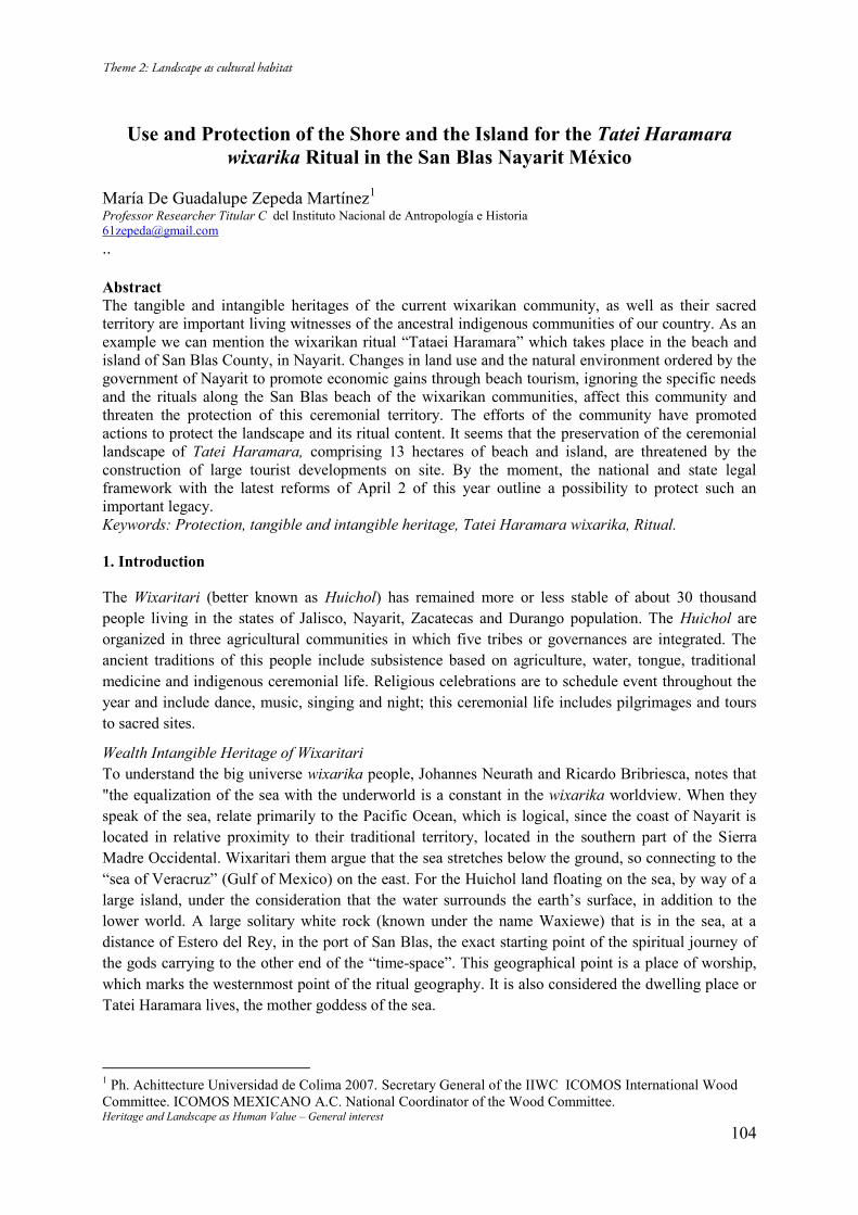
Heritage and Landscape as Human Value – General interest 104
Use and Protection of the Shore and the Island for the Tatei Haramara
wixarika Ritual in the San Blas Nayarit México
María De Guadalupe Zepeda Martínez1 Professor Researcher Titular C del Instituto Nacional de Antropología e Historia [email protected] ..
Abstract The tangible and intangible heritages of the current wixarikan community, as well as their sacred territory are important living witnesses of the ancestral indigenous communities of our country. As an example we can mention the wixarikan ritual “Tataei Haramara” which takes place in the beach and island of San Blas County, in Nayarit. Changes in land use and the natural environment ordered by the government of Nayarit to promote economic gains through beach tourism, ignoring the specific needs and the rituals along the San Blas beach of the wixarikan communities, affect this community and threaten the protection of this ceremonial territory. The efforts of the community have promoted actions to protect the landscape and its ritual content. It seems that the preservation of the ceremonial landscape of Tatei Haramara, comprising 13 hectares of beach and island, are threatened by the construction of large tourist developments on site. By the moment, the national and state legal framework with the latest reforms of April 2 of this year outline a possibility to protect such an important legacy. Keywords: Protection, tangible and intangible heritage, Tatei Haramara wixarika, Ritual. 1. Introduction
The Wixaritari (better known as Huichol) has remained more or less stable of about 30 thousand people living in the states of Jalisco, Nayarit, Zacatecas and Durango population. The Huichol are organized in three agricultural communities in which five tribes or governances are integrated. The ancient traditions of this people include subsistence based on agriculture, water, tongue, traditional medicine and indigenous ceremonial life. Religious celebrations are to schedule event throughout the year and include dance, music, singing and night; this ceremonial life includes pilgrimages and tours to sacred sites.
Wealth Intangible Heritage of Wixaritari To understand the big universe wixarika people, Johannes Neurath and Ricardo Bribriesca, notes that "the equalization of the sea with the underworld is a constant in the wixarika worldview. When they speak of the sea, relate primarily to the Pacific Ocean, which is logical, since the coast of Nayarit is located in relative proximity to their traditional territory, located in the southern part of the Sierra Madre Occidental. Wixaritari them argue that the sea stretches below the ground, so connecting to the “sea of Veracruz” (Gulf of Mexico) on the east. For the Huichol land floating on the sea, by way of a large island, under the consideration that the water surrounds the earth’s surface, in addition to the lower world. A large solitary white rock (known under the name Waxiewe) that is in the sea, at a distance of Estero del Rey, in the port of San Blas, the exact starting point of the spiritual journey of the gods carrying to the other end of the “time-space”. This geographical point is a place of worship, which marks the westernmost point of the ritual geography. It is also considered the dwelling place or Tatei Haramara lives, the mother goddess of the sea.
1 Ph. Achittecture Universidad de Colima 2007. Secretary General of the IIWC ICOMOS International Wood Committee. ICOMOS MEXICANO A.C. National Coordinator of the Wood Committee.
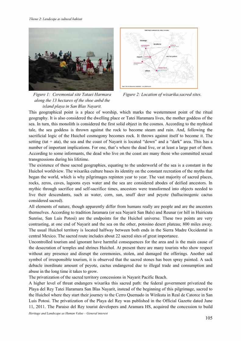
Heritage and Landscape as Human Value – General interest 105
Figure 1: Ceremonial site Tataei Harmara along the 13 hectares of the shoe anbd the
island playa in San Blas Nayarit.
Figure 2: Location of wixarika.sacred sites.
This geographical point is a place of worship, which marks the westernmost point of the ritual geography. It is also considered the dwelling place or Tatei Haramara lives, the mother goddess of the sea. In turn, this monolith is considered the first solid object in the cosmos. According to the mythical tale, the sea goddess is thrown against the rock to become steam and rain. And, following the sacrificial logic of the Huichol cosmogony becomes rock. It throws against itself to become it. The setting (tat + ata), the sea and the coast of Nayarit is located “down” and a “dark” area. This has a number of important implications. For one, that’s where the dead live, or at least a large part of them. According to some informants, the dead who live on the coast are many those who committed sexual transgressions during his lifetime. The existence of these sacred geographies, equating to the underworld of the sea is a constant in the Huichol worldview. The wixarika culture bases its identity on the constant recreation of the myths that began the world, which is why pilgrimages repinten year to year. The vast majority of sacred places, rocks, zeros, caves, lagoons eyes water and the sea are considered abodes of deified ancestors. In mythic through sacrifice and self-sacrifice times, ancestors were transformed into objects needed to live their descendants, such as water, corn, sun, snuff deer and peyote (hallucinogenic cactus considered sacred). All elements of nature, though apparently differ from humans really are people and are the ancestors themselves. According to tradition Jaramara (or sea Nayarit San Bals) and Reunar (or hill in Huiricuta Sunrise, San Luis Potosí) are the endpoints for the Huichol universe. These two points are very contrasting, at one end of Nayarit and the sea on the other, potosino desert plateau; 800 miles away. The usual Huichol territory is located halfway between both ends in the Sierra Madre Occidental in central Mexico. The sacred route includes about 22 sacred sites of great importance. Uncontrolled tourism and ignorant have harmful consequences for the area and is the main cause of the desecration of temples and shrines Huichol. At present there are many tourists who show respect without any presence and disrupt the ceremonies, stolen, and damaged the offerings. Another sad symbol of irresponsible tourism, it is observed that the sacred stones has been spray painted. A sack debacle inordinate amount of peyote, cactus endangered due to illegal trade and consumption and abuse in the long time it takes to grow. The privatization of the sacred territory concessions in Nayarit Pacific Beach. A higher level of threat endangers wixarika this sacred path: the federal government privatized the Playa del Rey Tatei Haramara San Blas Nayarit, instead of the beginning of this pilgrimage, sacred to the Huichol where they start their journey to the Cerro Quemado in Wirikuta in Real de Catorce in San Luis Potosi. The privatization of the Playa del Rey was published in the Official Gazette dated June 11, 2011. The Paraiso del Rey tourist developers and Aramara HS, acquired the concession to build
Heritage and Landscape as Human Value – General interest 106
resorts in millennial wixarika this sacred site. Before the written request of Braulio Muñoz Cayetano, maracame (head) wixarika asked to the president of Mexico Enrique Peña Nieto the sacred area of Nayarit to be returned to wixaritari people. Legislators in standing committee responded by asking the executive titles concessions granted to companies Tourist Development in Playa del Rey area within the sacred territory of Nayarit Wixarika reviewed. Nayarit Governor returned 3.5 hectares of the 13 hectares consisting of the sacred site, a small representation of the Union Wixarika ceremonial center of Jalisco, Durango and Nayarit AC. Analysis of laws: Law of Conservation, Protection and Value Enhancement of Historical and Cultural Heritage of the State of Nayarit Law and Indigenous Rights and Culture of the State of Nayarit. Aspects to be considered in the following analysis are: definitions, where those corresponding to contemplate intangible heritage, indigenous cultures, the sacred territories and regular ceremonies tangible expressions of culture; the Heritage Register so defined; and protection mechanisms in the system. The Law of Conservation, Protection and Value Enhancement of Historical and Cultural Heritage of the State of Nayarit, refers exclusively to the protection of tangible cultural heritage, monuments and areas from an architectural point of view. In the text no mention of the issue of intangible cultural heritage of indigenous communities and the issue of the sacred territory is not integrated, even as an instance of natural site of cultural value however the population of that entity is formed of 33.6-52% of indigenous inhabitants. While the Law on Indigenous Rights and Culture of the State of Nayarit to the latest revision published in the official newspaper of April 2, 2014, recognizes and protects indigenous peoples of the state are: Cora, Huichol, and Mexicaneros Tepehuanos and defined in its protection: indigenous peoples, the indigenous community, the sacred land, sacred place, ceremonial center in Chapter I in Article 3 of the General Provisions. Then in Chapter VI of Culture and Education in the addenda made on May 8, 2013, defines who is considered ceremonial centers and sacred places those who according to the customs of each indigenous people with a presence in the state, representing the various stages expression. And define the Ceremonial centers and sacred sites as follows: I. The traditional place baptizes or membership of a particular indigenous people begins. II center or place where they gather to pray or worship their gods. III The building or place where converge to discuss matters of government or international organization; IV The cemetery where members of their communities and V, every place or area to which by its nature or location will keep cult because of their spiritual or sacred significance are buried. Conclusions Tourism development should recognize anthropological and cultural values of the tangible and intangible heritage in order to contribute to the social development of the indigenous communities of our country. The preservation of the sacred territory and ceremonial sites of indigenous communities, is guaranteed by the citizen complaint and objection and whose effects are addenda and amendments to the relevant laws, creating a hopeful outlook in the protection of intangible cultural heritage of Mexico. Bibliography
Ley de Derechos y Cultura Indígena del Estado de Nayarit. Ultima reforma publicada en el Periódico
Oficial del 2 de Abril del 2014.
Neurath Johannes y Bibriesca Pacheco Ricardo Claudio. Atlas de Culturas del Agua en América
Latina y el Caribe. Pueblos Indígenas de México y el Agua: Huicholes (Wixarika) Instituto Nacional
de Antropología e Historia. Consultado en
www.unesco.org.uy/mab/fleadmin/phi/aguaycultura/México/05_Huicholespdf.
Heritage and Landscape as Human Value – General interest 107
Danba Diaolou Buildings and Villages – the Stereoscopic Culture
Landscape for Jiarong (Rgyalrong) Tibetan Ethnic Group in Tibetan Plateau
Fanding DU* Niudou DUAN** (*)Comprehensive Studio Three at Cultural Heritage Conservation Center of GUO WEN YAN Co., Ltd.Room701A, Dongsheng Mansion, No.8, Zhongguancun East Rd. Haidian Dist, Beijing 100083, P.R.China 8610-82527963-862,[email protected] (**)Comprehensive Studio Three at Cultural Heritage Conservation Center of GUO WEN YAN Co., Ltd.Room701A, Dongsheng Mansion, No.8, Zhongguancun East Rd. Haidian Dist, Beijing 100083, P.R.China Abstract Danba County lies in Sichuan Province. The ancient Diaolou, combined with villages and natural landscape, formed a rare type of three-dimensional landscape on the Tibetan Plateau. It displays the production, lifestyle, religious belief and historical changes of Jiarong Tibetan people, and has been added into UNESCO World Heritage Tentative List. As head writer of the report “applying for Diaolou Buildings and Villages of Tibetan and Qiang Ethnic Group’s recognition as World Culture javascript:void(0); Heritage”, the author analyzes features and formation of this Stereoscopic Culture Landscape , and summarizes its OUV. Keywords: Diaolou Buildings; Traditional Villages; Jiarong (Rgyalrong) Tibetan Ethnic Group; Mountain Worship; Stereoscopic Culture Landscape 1. Overview of the landscape of Diaolou buildings and villages in Danba County The Danba County is located in Ganzi Tibetan Autonomous Prefecture of Sichuan Province in the east edge of Tibetan Plateau and alpine and gorge region at the upper ranges of Dadu River (Fig. 1). The county enjoys an altitude between 1,500 and 5,000 meters, in accordance with which climate and vegetation distributing vertically and distinctly. For this reason, the local agricultural production modes demonstrate a gradual transition from animal husbandry to crop farming along with the altitude. Consequently, diversified crops and categories of agricultural products emerged and a rare type of stereoscopic agricultural civilization came into being in the Qinghai-Tibet Plateau. The historical evolution is complicated in this area for its numerous ethnic groups, language and religions. As part of the Tibetan-Yi Corridor, the area is of importance in the formation and fusion of ethnic groups in south-west China. As a unique ethic group, Jiarong (Rgyalrong) Tibetan Ethnic Groups not only follows the basic features of Tibetan culture, but also reserves some cultural features of early ancestors. What’ s more, it blended the cultural characteristics of Mongolian and Han people, with folk religion including celestials and god of mountains prevailing, and at the same time, with Bon and Tibetan Buddhism belief. Under the influence of various elements, mountains, woods, meadows, rivulets and canyons are often endowed with significant spiritual meanings and combined with religious buildings such as Marnyi Stone, temples and White Pagoda as well as religious activities. In addition, the site selection and layout as well as the appearance of Diaolou buildings and villages also demonstrate its material and spiritual pursuit. The above-mentioned culture, together with nature, material and spirit connects with each other to form a harmonious and unified system of cultural landscape (Fig. 2). Possessing high level historical,cultural and aesthetic value, it has been listed in the World Heritage Tentative List as an important part of the Diaolou Buildings and Villages for Tibetan and Qiang Ethnic Groups.
Heritage and Landscape as Human Value – General interest 108
2. The Component of Diaolou buildings and villages Stereoscopic Culture Landscape The essential elements composing the cultural landscape of Diaolou Buildings and Villages in Danba County can be generally categorized into two categories: the tangible element and intangible element. The former includes mountains, woods, meadows, pastures, race courses, temples, Marnyi Stone, White Pagoda, traditional Tibetan residents, farm land, orchards, ferries, and rivers. The latter includes legends, mountain worship, Bonism, Tibetan Buddhism and folk festivals. Sequenced in accordance with the attitude from high to low, the essential elements and their cultural connections are listed as below: 1) High mountain and mountain worship: Danba County belongs to the mountainous area of Minshan Mountain and Qionglai Mountain, where South-to-North mountains that are 3,500-5,500 meters high are distributed here. Just like other areas in Tibet, residents here also worship high mountains. With Mo’erduo Mountain as the core, a giant system of belief in sacred mountains has taken shape and each village here has its own worshiped holy mountain. For example, in Pujiaoding District in Danba County, there are 3 villages (Gala, Zegong and Zezhou), and 5 sacred mountains( Miri Peak ,Achuzhega Peak, Gonghei Peak, Zega Peak, and Amirega Peak ). Every village has their own Holy Mountain. (Fig. 3) 2) Woods: the areas of high elevation close to the peak of the mountain are usually distributed with coniferous forest or mixed coniferous forest and broad-leaved forest, mainly including fir, birch, sanders, etc. Because the forest is near Sacred Mountain, they not only have great significance for soil and water conservation protecting the village, but also be regarded as “sacred trees” by the residents. 3) Alpine meadow and racecourse: within the territory of Danba County there are alpine meadows on the mountains and they serve as the important pastures for local residents. Water melt from the perpetual snow on the high mountain flows through the meadows, providing water for production and living of the residents in the villages. Hence, meadows are also sacred to some extent, especially those flat ones located at the foot of the sacred mountains. Those alpine meadows are utilized by the residents as squares for offering sacrifices to holy mountains and holding festival celebrations, and there are horse courses and Marnyi Stone established there. On every April 15th, residents from each village will gather around their own horse course to offer sacrifices to the holy mountains and hold collective activities such as horse racing, dancing and dinner party. 4) Traditional dwelling house: Folk houses of the Tibetan people are mainly distributed among the relatively flatten terrain at the foot of high mountains. And the houses are mostly 2 to 4-storied flat-roofed blockhouses, with square shape, mixed structure of stone and wood, and clay roofing. The first floor is for livestock and the middle ones are for residence and storage. The principle rooms are equipped with fireplace and the top floor is balcony.The four corners of the roof are piled with white stones to demonstrate the local popular worship of mountain and white stones. 5) Diao buildings: The Diaolou buildings are some high watchtowers built in stone. A Diaolou building is usually 10 to 60 meters high and covers an area of 25 to 100 m2.On each floor, it is designed with openings, floor slabs and a single wooden ladder. There are often with embrasures on the facade. Besides the rectangular planes, the planes of the Diaolou buildings are often in star shape with 5, 6, 8, 12, or 13 corners on the planes. The techniques used in the construction of the Diaolou buildings include masonry in order from inside to outside, the entasis of outer walls, the use of wooden bars for reinforcement, and etc., all of which represent the highest level of traditional Chinese stone buildings. Most of Diaolou buildings are located around the village, but some are located in alpine meadow or sacred woods (Fig. 4).
Heritage and Landscape as Human Value – General interest 109
6) Temples: Residents of Jiarong Tibetan Ethnic Groups in Danba County commonly believe in Bonism and Tibetan Buddhism, and the temples are mainly distributed in the center or at the transportation junction of the village. 7) Farmlands and orchards: Terraces, as the major form of farmland in Danba, are distributed around folk houses and Diaolou buildings. The crops here mainly include wheat, corn, and highland barley. In the farmland, there are some small and medium-sized orchards producing apples, pears, peppers and walnuts, etc. 8)Rivers:Within the border of the county, the water system is quite developed with more than 131 rivers running vertically and horizontally. In the high mountains, the permanent snows melt, run along the valley, flowing into these rivers at the lowest point and finally into the Dadu River at the east of the county. 3. Features of Cultural Landscape of Diaolou Buildings and Villages Stereoscopic Culture Landscape in Danba County and the Factors Which Leading to its Forming All kinds of components vertical distributed according to different elevation to produce a Stereoscopic-space is the main characteristic of Diaolou buildings and village culture. Sacred mountain and sacred woods are located at the areas of elevation between 3000 and 5500 meters, alpine meadow and pasture are mainly distributed in areas of elevation between 2600 and 4000 meters, villages are between 1800 and 2600 meters, Diaolou buildings are between 1900 and 3200 meters and rivers are between 1700 and 1900 meters. The forming of this character is associated with geographical and climate of Danba County, historical evolution of this area and Tibetan people's spiritual belief. (Fig. 5) Factors of geographical and climate: Danba County is located at the transitional region between Sichuan Basin and Tibetan Plateau and it has the typical mountain-ravines topography. Its terrain varies greatly with the altitude. Mountain peak—high altitude tableland—large and gentle slope—deep river valley is the basic landform of the operating areas of residents in Danba County. Such a special terrain of high mountains and river valleys has exerted decisive influences on local climates. The typical vertical climatic belt replaced the horizontal (altitude) climatic belt. The climate varies obviously from the river valley to the mountain top and people even can experience four seasons in one mountain. The distribution of climatic belt decides the mode of production. For example, the region whose altitude is below 3000 meters is arable land, between 1,700-2,600 meters is the land of three harvests within two years, above 3000 meters is suitable for animal husbandry. Therefore, it can be said that geography and climate are the basic factors leading to the features of the three-dimensional cultural landscape of Diaolou Buildings and villages in Danba County. Historic evolution: As shown by the archaeology materials and literature, people began to live in Danba County as early as the New Stone Age and evidence of a certain number of tribes and Diaolou buildings could be found in the Han Dynasty. After the 7th century AD, Tubo people (the ancient Tibetans) came to this region. Then, with the introduction of Bonismo and Tibetan Buddhism into Danba, the architectural forms of temples, pagodas and Marnyi Stone began to take shape. The Nomadic culture also exerted great influence on this region and horse courses appeared. Since the 20th century AD, the new road along the Dadu River thoroughly changed the transportation system based on mountain roads. Some of the villages moved to the low-altitude regions which were nearer to the highways, thus making the An stereoscopic culture cultural landscape extend to the river valley zone. Factors of religions and believes: The religions idea that regards Height as Sacred is prevailing in Jiarong (Rgyalrong) Tibetan Ethnic Group, which reflected clearly in the worship of Sacred Mountain. The cloud-kissing peaks can be regard as the staircase of Heaven, and the God of Mountain is real. The forest on the peak are also sacred trees, they are not only offering ecological-guarantee to the residents but also important spiritual protective screen between the residents and the unpredictable
Heritage and Landscape as Human Value – General interest 110
fate. And the alpine meadow which located between sacred mountain and villages is the communicate-space for God and human. The closely connection between Height and Sacred is also embodied by the Diaolou buildings, the peculiar height and appearance expressing the attempting to approaching God by high buildings. So, in the stereoscopic culture landscape for Jiarong (Rgyalrong) Tibetan ethnic groups, the distribution range of Diaolou buildings are larger than the scopes of villages, even in alpine meadow and sacred trees – Diaolou buildings are Totem of sacred mountain belief and bond of God and human.The religions idea that deeming Height as Sacred endows three-dimensional culture landscape of Diaolou buildings and villages in Danba County spiritual meanings and cultural relevance. 4. The Outstanding and Universal Value of Diaolou Buildings and Villages in Danba County1 The Diaolou Buildings and Villages in Danba County— Stereoscopic Culture Landscape for Jiarong (Rgyalrong) Tibetan Ethnic Group in Qinghai-Tibet Plateau justify Criteria (i), (ii), (iii), (iv), and (v) of World Heritage nomination. In the meantime, in consideration of the backgrounds of the agricultural societies on the plateau and their diversity in ethnic groups, the nominated properties pertain to the continuing landscape in the category of organically evolved landscape, which testify the multicultural traditions. Criterion (i): The Diaolou Buildings and Villages in Danba County are the masterpiece of architecture created by the local ancestors limited and inspired by the severe natural environments, which take stones, soil and wood as the constructing materials, and have fulfilled remarkable achievements in the aspects of stability, height and volume of architecture through the unique complicated and consummate techniques. Of the large number of Diaolou buildings, the spiritual functions as natural worship and religious beliefs are combined with the residential and defensive ones. Most of the Diaolou buildings survived the Sichuan Earthquake in 2008, which demonstrate the great aseismic capacity. Criterion (ii): The forms, functions and techniques of the Diaolou Buildings and the locations of the villages of Jiarong (Rgyalrong) Tibetan Ethnic Group in Danba County and their diversity in layout are the results of the inheritance and developments of different ethnic groups in various areas for more than 2000 years, which manifest the diversity of languages, ethnic groups and religions in the Tibetan-Yi Corridor area in west south China, and their ethic migrations and cultural changes as well, especially the transformation from nomadic civilization to agricultural one, and the cultural influence of Tibetan Buddhism. Criterion (iii): The Diaolou Buildings in Danba County reflect the unique culture that has always emphasized the spiritual connection between height and divinity ever since the ancient time. The stereoscopic landscape and its relative intangible heritages together formed by the Diaolou Buildings and Villages of Jiarong (Rgyalrong) Tibetan Ethnic Group, as an evidence to their history and traditional societies, which authentically manifest the cultural features and evolving processes of the agricultural civilization on the Qinghai-Tibet Plateau. Criterion (iv): The Diaolou buildings, featuring their large volumes,sophisticated techniques and various forms, fulfill the highest achievements of the traditional architecture of Jiarong (Rgyalrong) Tibetan Ethnic Group, and constitute a unique landscape of agricultural settlements on the Qinghai-Tibet Plateau in combination of such elements as sacred mountains, sacred trees, alpine meadow, residences, temples, farmlands, Orchards, valleys, rivers and others, which reflect the complicated social transitions in the Tibetan-Yi Corridor area on the large context of time and space through their rich meanings. Criterion (v): The locations and layouts of the villages of Jiarong (Rgyalrong) Tibetan Ethnic Group in Qinghai-Tibet Plateau manifest multiple functions of defense, disaster relief, production, religion and others as a model example of human settlements with full respect to the natural laws and a example of the stereoscopic agriculture vertical
1 Fanding Du, Niudou Duan. 2012. The application materials of World Heritage Tentative List of Diaolou Buildings and Villages for Tibetan and Qiang Ethnic Groups, http://whc.unesco.org/en/tentativelists/5815/ , UNESCO.
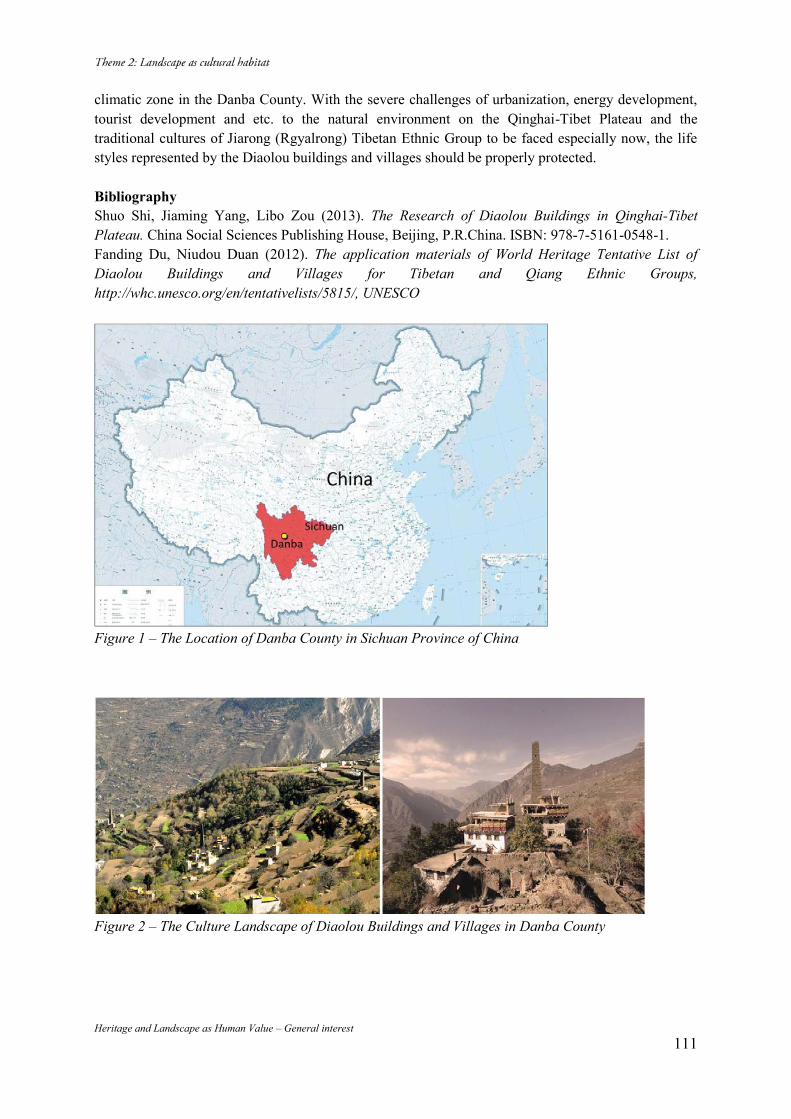
Heritage and Landscape as Human Value – General interest 111
climatic zone in the Danba County. With the severe challenges of urbanization, energy development, tourist development and etc. to the natural environment on the Qinghai-Tibet Plateau and the traditional cultures of Jiarong (Rgyalrong) Tibetan Ethnic Group to be faced especially now, the life styles represented by the Diaolou buildings and villages should be properly protected. Bibliography Shuo Shi, Jiaming Yang, Libo Zou (2013). The Research of Diaolou Buildings in Qinghai-Tibet Plateau. China Social Sciences Publishing House, Beijing, P.R.China. ISBN: 978-7-5161-0548-1. Fanding Du, Niudou Duan (2012). The application materials of World Heritage Tentative List of Diaolou Buildings and Villages for Tibetan and Qiang Ethnic Groups, http://whc.unesco.org/en/tentativelists/5815/, UNESCO
Figure 1 – The Location of Danba County in Sichuan Province of China
Figure 2 – The Culture Landscape of Diaolou Buildings and Villages in Danba County
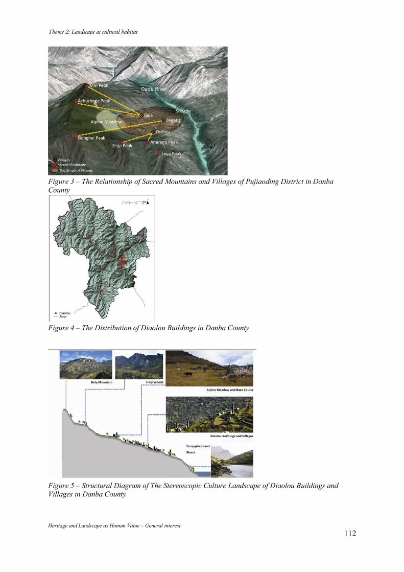
Heritage and Landscape as Human Value – General interest 112
Figure 3 – The Relationship of Sacred Mountains and Villages of Pujiaoding District in Danba County
Figure 4 – The Distribution of Diaolou Buildings in Danba County
Figure 5 – Structural Diagram of The Stereoscopic Culture Landscape of Diaolou Buildings and Villages in Danba County
Heritage and Landscape as Human Value – General interest 113
Okazaki in Kyoto: the Conservation of Suburban Area in the Historical City
Olimpia NIGLIO*, Noriko INOUE** (*) Universidad de Bogotá Jorge Tadeo Lozano, Bogotá, Colombia, +57 1 2427930, [email protected] (**) Otemon Gakuin University, Osaka, Japan, +81-72-641-9631, [email protected]
Abstract Okazaki area, east of Kyoto city, was built as an important noble and religious place in the Heian period (794-1185). We supposed that at the end of the 16th century there would be settlements enclosed by fossa similar to landscapes represented in Rakuchu Rakugai-zu, a series of paintings of Kyoto by local artists, which is one of the most important urban iconographies of Japan. In the Edo period (1603-1867) Okazaki area assumed the role of suburban agricultural zone which provided the food production to the urban habitants. It also could be the place of scenic beauty in which the intellectuals commonly lived there. But after the Meiji Restoration, the role of Okazaki area changed completely. In 1885, Kyoto prefecture started the great public canalization project as the water supply between Kyoto and Otsu of Shiga prefecture. Kyoto prefecture also planed the industrial district construction in Okazaki area. In 1895 pavilion buildings were built for the 4th Inner National Exhibition of Japan and at the same time Heian-Jingū Shrine was constructed for the millennium ceremony for foundation of Kyoto city. After that the territory prepared for the exhibition was reused for the cultural district. The cottage area of bourgeois and politicians was created at the eastern part of Okazaki area. The canal project accompanied the electric generation plant. Okazaki area became the symbol of the modernization of Kyoto city. This contribution intends to analyze the different styles of architecture especially constructed after the Meiji period which are the main components of the Historic Urban Landscape of Okazaki area. Tangible and intangible signs remained as modern gardens, significant museums and cultural institutions among the ancient temples provide opportunities to reflect on the important role of Okazaki area of the historical city. These studies are supported by archival documents and with current measures and policies for landscape conservation by Kyoto Municipality. This contribution will analyze also important and actual interventions of restoration in Okazaki area. Keywords: Okazaki; Landscape Planning; Historic Urban Landscape; Option and Sustainable Solution for Historical Landscape 1. Okazaki area in Kyoto. From 12th century to 18th century Kyoto is the ancient capital of Japan in the Heian period (794-1185). The origin of the city structure had the grid-plan. The present street pattern of Kyoto city is still strictly accordance with this old form1. Okazaki area as the subject of this study is located in the eastern hill district of Kyoto city. At the end of the Hian period the emperor Shirakawa ordered the construction of an important Buddhism temple called Hossho-ji in Okazaki area. Recently the Kyoto City Archaeological Institutions discovered a part of the building foundation which seemed to be that of the nine story pagoda in the portion of the site of Zoological garden2. Because of the earthquake in 1185, the built environment in Okazaki area was destroyed. We can now only find some remains of villages through excavation in the layer after that. We can suppose that the landscape of Okazaki area in the end of the 16th century could be composed of settlements with farm lands, enclosed by fossa, which is very similar to what Rakuchu Rakugai-zu represents today. In the Edo period (1603-1867), Okazaki area assumed the role of suburban agricultural zone which provided the food production to the urban inhabitants3. It also
1 高橋康夫 吉田伸之 宮本正明 伊藤毅編集( ) 2 財団法人 京都市埋蔵文化財研究所( )
水本邦彦編( )
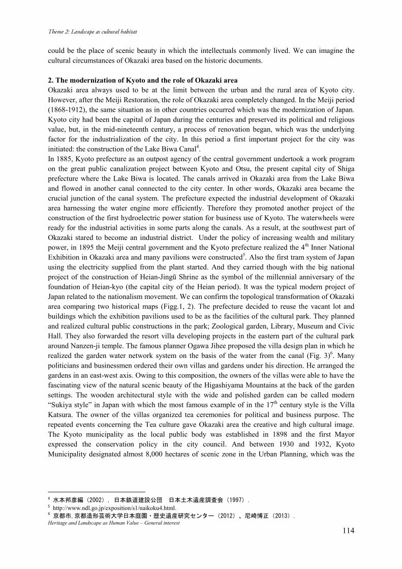
Heritage and Landscape as Human Value – General interest 114
could be the place of scenic beauty in which the intellectuals commonly lived. We can imagine the cultural circumstances of Okazaki area based on the historic documents. 2. The modernization of Kyoto and the role of Okazaki area Okazaki area always used to be at the limit between the urban and the rural area of Kyoto city. However, after the Meiji Restoration, the role of Okazaki area completely changed. In the Meiji period (1868-1912), the same situation as in other countries occurred which was the modernization of Japan. Kyoto city had been the capital of Japan during the centuries and preserved its political and religious value, but, in the mid-nineteenth century, a process of renovation began, which was the underlying factor for the industrialization of the city. In this period a first important project for the city was initiated: the construction of the Lake Biwa Canal4. In 1885, Kyoto prefecture as an outpost agency of the central government undertook a work program on the great public canalization project between Kyoto and Otsu, the present capital city of Shiga prefecture where the Lake Biwa is located. The canals arrived in Okazaki area from the Lake Biwa and flowed in another canal connected to the city center. In other words, Okazaki area became the crucial junction of the canal system. The prefecture expected the industrial development of Okazaki area harnessing the water engine more efficiently. Therefore they promoted another project of the construction of the first hydroelectric power station for business use of Kyoto. The waterwheels were ready for the industrial activities in some parts along the canals. As a result, at the southwest part of Okazaki stared to become an industrial district. Under the policy of increasing wealth and military power, in 1895 the Meiji central government and the Kyoto prefecture realized the 4th Inner National Exhibition in Okazaki area and many pavilions were constructed5. Also the first tram system of Japan using the electricity supplied from the plant started. And they carried though with the big national project of the construction of Heian-Jingū Shrine as the symbol of the millennial anniversary of the foundation of Heian-kyo (the capital city of the Heian period). It was the typical modern project of Japan related to the nationalism movement. We can confirm the topological transformation of Okazaki area comparing two historical maps (Figg.1, 2). The prefecture decided to reuse the vacant lot and buildings which the exhibition pavilions used to be as the facilities of the cultural park. They planned and realized cultural public constructions in the park; Zoological garden, Library, Museum and Civic Hall. They also forwarded the resort villa developing projects in the eastern part of the cultural park around Nanzen-ji temple. The famous planner Ogawa Jihee proposed the villa design plan in which he realized the garden water network system on the basis of the water from the canal (Fig. 3)6. Many politicians and businessmen ordered their own villas and gardens under his direction. He arranged the gardens in an east-west axis. Owing to this composition, the owners of the villas were able to have the fascinating view of the natural scenic beauty of the Higashiyama Mountains at the back of the garden settings. The wooden architectural style with the wide and polished garden can be called modern “Sukiya style” in Japan with which the most famous example of in the 17th century style is the Villa Katsura. The owner of the villas organized tea ceremonies for political and business purpose. The repeated events concerning the Tea culture gave Okazaki area the creative and high cultural image. The Kyoto municipality as the local public body was established in 1898 and the first Mayor expressed the conservation policy in the city council. And between 1930 and 1932, Kyoto Municipality designated almost 8,000 hectares of scenic zone in the Urban Planning, which was the
水本邦彦編( ) 日本鉄道建設公団 日本土木遺産調査会( )
http://www.ndl.go.jp/exposition/s1/naikoku4.html. 6京都市 京都造形芸術大学日本庭園・歴史遺産研究センター( )、尼崎博正( )
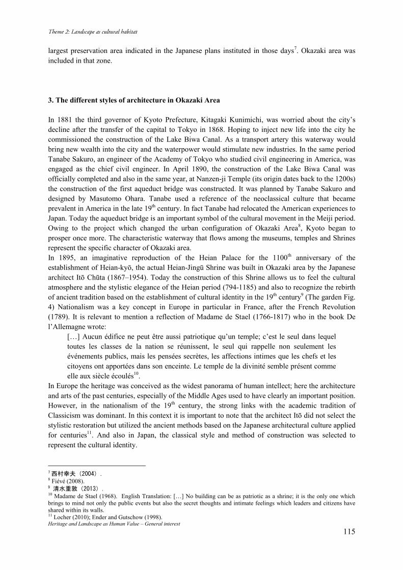
Heritage and Landscape as Human Value – General interest 115
largest preservation area indicated in the Japanese plans instituted in those days7. Okazaki area was included in that zone. 3. The different styles of architecture in Okazaki Area In 1881 the third governor of Kyoto Prefecture, Kitagaki Kunimichi, was worried about the city’s decline after the transfer of the capital to Tokyo in 1868. Hoping to inject new life into the city he commissioned the construction of the Lake Biwa Canal. As a transport artery this waterway would bring new wealth into the city and the waterpower would stimulate new industries. In the same period Tanabe Sakuro, an engineer of the Academy of Tokyo who studied civil engineering in America, was engaged as the chief civil engineer. In April 1890, the construction of the Lake Biwa Canal was officially completed and also in the same year, at Nanzen-ji Temple (its origin dates back to the 1200s) the construction of the first aqueduct bridge was constructed. It was planned by Tanabe Sakuro and designed by Masutomo Ohara. Tanabe used a reference of the neoclassical culture that became prevalent in America in the late 19th century. In fact Tanabe had relocated the American experiences to Japan. Today the aqueduct bridge is an important symbol of the cultural movement in the Meiji period. Owing to the project which changed the urban configuration of Okazaki Area8, Kyoto began to prosper once more. The characteristic waterway that flows among the museums, temples and Shrines represent the specific character of Okazaki area. In 1895, an imaginative reproduction of the Heian Palace for the 1100th anniversary of the establishment of Heian-kyō, the actual Heian-Jingū Shrine was built in Okazaki area by the Japanese architect Itō Chūta (1867–1954). Today the construction of this Shrine allows us to feel the cultural atmosphere and the stylistic elegance of the Heian period (794-1185) and also to recognize the rebirth of ancient tradition based on the establishment of cultural identity in the 19th century9 (The garden Fig. 4) Nationalism was a key concept in Europe in particular in France, after the French Revolution (1789). It is relevant to mention a reflection of Madame de Stael (1766-1817) who in the book De l’Allemagne wrote:
[…] Aucun édifice ne peut être aussi patriotique qu’un temple; c’est le seul dans lequel toutes les classes de la nation se réunissent, le seul qui rappelle non seulement les événements publics, mais les pensées secrètes, les affections intimes que les chefs et les citoyens ont apportées dans son enceinte. Le temple de la divinité semble présent comme elle aux siècle écoulés10.
In Europe the heritage was conceived as the widest panorama of human intellect; here the architecture and arts of the past centuries, especially of the Middle Ages used to have clearly an important position. However, in the nationalism of the 19th century, the strong links with the academic tradition of Classicism was dominant. In this context it is important to note that the architect Itō did not select the stylistic restoration but utilized the ancient methods based on the Japanese architectural culture applied for centuries11. And also in Japan, the classical style and method of construction was selected to represent the cultural identity.
西村幸夫( )
8 Fiévé (2008). 清水重敦( )
10 Madame de Stael (1968). English Translation: […] No building can be as patriotic as a shrine; it is the only one which brings to mind not only the public events but also the secret thoughts and intimate feelings which leaders and citizens have shared within its walls. 11 Locher (2010); Ender and Gutschow (1998).
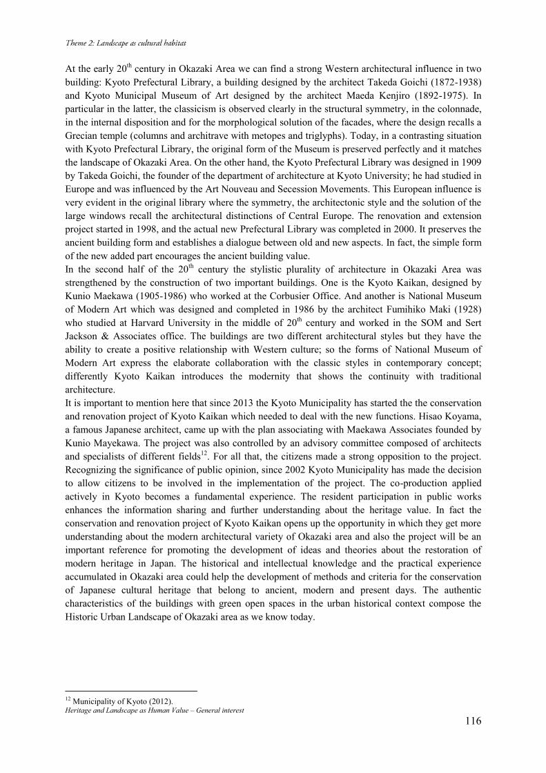
Heritage and Landscape as Human Value – General interest 116
At the early 20th century in Okazaki Area we can find a strong Western architectural influence in two building: Kyoto Prefectural Library, a building designed by the architect Takeda Goichi (1872-1938) and Kyoto Municipal Museum of Art designed by the architect Maeda Kenjiro (1892-1975). In particular in the latter, the classicism is observed clearly in the structural symmetry, in the colonnade, in the internal disposition and for the morphological solution of the facades, where the design recalls a Grecian temple (columns and architrave with metopes and triglyphs). Today, in a contrasting situation with Kyoto Prefectural Library, the original form of the Museum is preserved perfectly and it matches the landscape of Okazaki Area. On the other hand, the Kyoto Prefectural Library was designed in 1909 by Takeda Goichi, the founder of the department of architecture at Kyoto University; he had studied in Europe and was influenced by the Art Nouveau and Secession Movements. This European influence is very evident in the original library where the symmetry, the architectonic style and the solution of the large windows recall the architectural distinctions of Central Europe. The renovation and extension project started in 1998, and the actual new Prefectural Library was completed in 2000. It preserves the ancient building form and establishes a dialogue between old and new aspects. In fact, the simple form of the new added part encourages the ancient building value. In the second half of the 20th century the stylistic plurality of architecture in Okazaki Area was strengthened by the construction of two important buildings. One is the Kyoto Kaikan, designed by Kunio Maekawa (1905-1986) who worked at the Corbusier Office. And another is National Museum of Modern Art which was designed and completed in 1986 by the architect Fumihiko Maki (1928) who studied at Harvard University in the middle of 20th century and worked in the SOM and Sert Jackson & Associates office. The buildings are two different architectural styles but they have the ability to create a positive relationship with Western culture; so the forms of National Museum of Modern Art express the elaborate collaboration with the classic styles in contemporary concept; differently Kyoto Kaikan introduces the modernity that shows the continuity with traditional architecture. It is important to mention here that since 2013 the Kyoto Municipality has started the the conservation and renovation project of Kyoto Kaikan which needed to deal with the new functions. Hisao Koyama, a famous Japanese architect, came up with the plan associating with Maekawa Associates founded by Kunio Mayekawa. The project was also controlled by an advisory committee composed of architects and specialists of different fields12. For all that, the citizens made a strong opposition to the project. Recognizing the significance of public opinion, since 2002 Kyoto Municipality has made the decision to allow citizens to be involved in the implementation of the project. The co-production applied actively in Kyoto becomes a fundamental experience. The resident participation in public works enhances the information sharing and further understanding about the heritage value. In fact the conservation and renovation project of Kyoto Kaikan opens up the opportunity in which they get more understanding about the modern architectural variety of Okazaki area and also the project will be an important reference for promoting the development of ideas and theories about the restoration of modern heritage in Japan. The historical and intellectual knowledge and the practical experience accumulated in Okazaki area could help the development of methods and criteria for the conservation of Japanese cultural heritage that belong to ancient, modern and present days. The authentic characteristics of the buildings with green open spaces in the urban historical context compose the Historic Urban Landscape of Okazaki area as we know today.
12 Municipality of Kyoto (2012).
Heritage and Landscape as Human Value – General interest 117
Bibliography Chessshire, Charles (2009). A Practical Guide to Japanese Gardening: An inspirational and practical guide to creating the Japanese garden style, from design options and materials to planting techniques and decorative features. Anness Publishing. Leicester. ISBN 978-07548-17727. Fiévé, Nicolas (2008). Atlas historique de Kyoto: Analyse spatiale des systèmes de mémoire d’une ville, de son architecture et de son paysage urbain. Les éditions de l’Amateur. Paris. ISBN 978-28591-74866. Locher, Mira (2010). Traditional Japanese Architecture. Tuttle Publishing. Tokyo. ISBN 978-48053-09803. Madame de Stael (editor Simone Balayé, 1968). De l’Allemagne. GF Flammarion. Paris. ISBN 978-20807-01664. Municipality of Kyoto (2012). Landscape of Kyoto. Kyoto. Nishi Kazuo & Hozumi Kazuo (2012). What is Japanese architecture?. Kodansha USA. New York. ISBN 978-15683-64124. Young David and Michiko (2004). Introduction to Japanese Architecture. Periplus Edition. Singapore. ISBN 978-07946-01003. 尼崎博正(2013)「第5節 琵琶湖疏水で結ばれた岡崎・南禅寺界隈庭園群の成立」『京都
岡崎の文化的景観調査報告書』京都市 京都市,京都造形芸術大学日本庭園・歴史遺産研究センター(2012)『岡崎・南禅寺界隈の
庭の調査』 財団法人 京都市埋蔵文化財研究所(2010)「法勝寺八角九重塔跡発掘調査現地説明会資
料」(http://www.kyoto-arc.or.jp/news/gensetsu/182zoo.pdf) 清水重敦(2013)「創建神社の造営と近代京都」『近代日本の歴史都市』高木博志編, 思文
閣出版ISBN978-4-7842-1700-7 高橋康夫 吉田伸之 宮本正明 伊藤毅編集(1993) 『図集 日本都市史(An Illustrated History of Japanese Cities) 』東京大学出版会. ISBN 978-4-13-026052-7 西村幸夫(2004)「都市保全計画」東京大学出版会. ISBN 4-13-061128-3 日本鉄道建設公団 日本土木遺産調査会(1997)『蹴上インクライン 史跡琵琶湖疏水蹴上
インフライン復元工事報告書(ダイジェスト版)』 水本邦彦編(2002)『京都と京街道』吉川弘文館. ISBN 4-642-06232-7
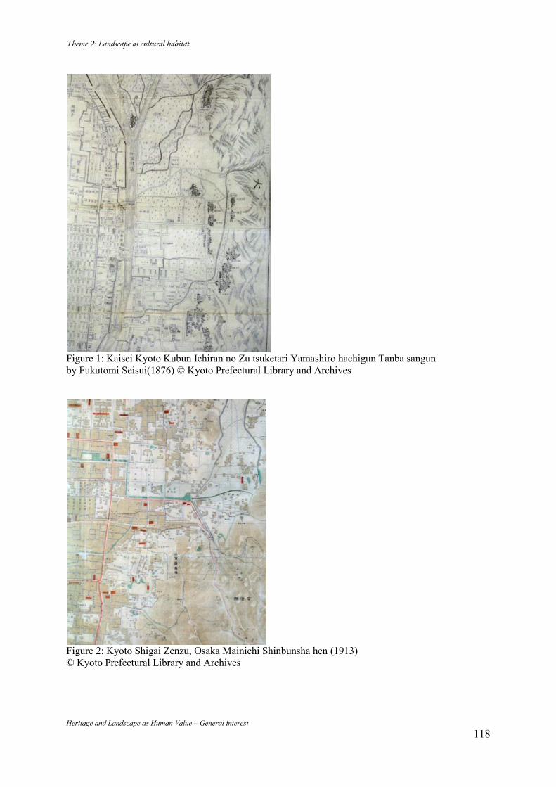
Heritage and Landscape as Human Value – General interest 118
Figure 1: Kaisei Kyoto Kubun Ichiran no Zu tsuketari Yamashiro hachigun Tanba sangun by Fukutomi Seisui(1876) © Kyoto Prefectural Library and Archives
Figure 2: Kyoto Shigai Zenzu, Osaka Mainichi Shinbunsha hen (1913) © Kyoto Prefectural Library and Archives
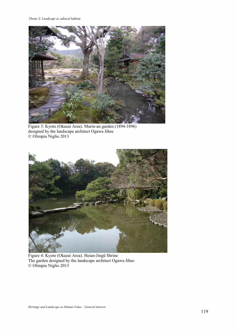
Heritage and Landscape as Human Value – General interest 119
Figure 3: Kyoto (Okazai Area). Murin-an garden (1894-1896) designed by the landscape architect Ogawa Jihee © Olimpia Niglio 2013
Figure 4: Kyoto (Okazai Area). Heian-Jingū Shrine The garden designed by the landscape architect Ogawa Jihee © Olimpia Niglio 2013
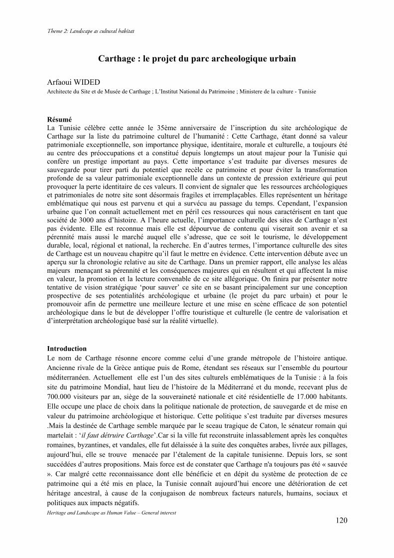
Heritage and Landscape as Human Value – General interest 120
Carthage : le projet du parc archeologique urbain
Arfaoui WIDED Architecte du Site et de Musée de Carthage ; L’Institut National du Patrimoine ; Ministere de la culture - Tunisie Résumé La Tunisie célèbre cette année le 35ème anniversaire de l’inscription du site archéologique de Carthage sur la liste du patrimoine culturel de l’humanité : Cette Carthage, étant donné sa valeur patrimoniale exceptionnelle, son importance physique, identitaire, morale et culturelle, a toujours été au centre des préoccupations et a constitué depuis longtemps un atout majeur pour la Tunisie qui confère un prestige important au pays. Cette importance s’est traduite par diverses mesures de sauvegarde pour tirer parti du potentiel que recèle ce patrimoine et pour éviter la transformation profonde de sa valeur patrimoniale exceptionnelle dans un contexte de pression extérieure qui peut provoquer la perte identitaire de ces valeurs. Il convient de signaler que les ressources archéologiques et patrimoniales de notre site sont désormais fragiles et irremplaçables. Elles représentent un héritage emblématique qui nous est parvenu et qui a survécu au passage du temps. Cependant, l’expansion urbaine que l’on connaît actuellement met en péril ces ressources qui nous caractérisent en tant que société de 3000 ans d’histoire. A l’heure actuelle, l’importance culturelle des sites de Carthage n’est pas évidente. Elle est reconnue mais elle est dépourvue de contenu qui viserait son avenir et sa pérennité mais aussi le marché auquel elle s’adresse, que ce soit le tourisme, le développement durable, local, régional et national, la recherche. En d’autres termes, l’importance culturelle des sites de Carthage est un nouveau chapitre qu’il faut le mettre en évidence. Cette intervention débute avec un aperçu sur la chronologie relative au site de Carthage. Dans un premier rapport, elle analyse les aléas majeurs menaçant sa pérennité et les conséquences majeures qui en résultent et qui affectent la mise en valeur, la promotion et la lecture convenable de ce site allégorique. On finira par présenter notre tentative de vision stratégique ‘pour sauver’ ce site en se basant principalement sur une conception prospective de ses potentialités archéologique et urbaine (le projet du parc urbain) et pour le promouvoir afin de permettre une meilleure lecture et une mise en scène efficace de son potentiel archéologique dans le but de développer l’offre touristique et culturelle (le centre de valorisation et d’interprétation archéologique basé sur la réalité virtuelle).
Introduction Le nom de Carthage résonne encore comme celui d’une grande métropole de l’histoire antique. Ancienne rivale de la Grèce antique puis de Rome, étendant ses réseaux sur l’ensemble du pourtour méditerranéen. Actuellement elle est l’un des sites culturels emblématiques de la Tunisie : à la fois site du patrimoine Mondial, haut lieu de l’histoire de la Méditerrané et du monde, recevant plus de 700.000 visiteurs par an, siège de la souveraineté nationale et cité résidentielle de 17.000 habitants. Elle occupe une place de choix dans la politique nationale de protection, de sauvegarde et de mise en valeur du patrimoine archéologique et historique. Cette politique s’est traduite par diverses mesures .Mais la destinée de Carthage semble marquée par le sceau tragique de Caton, le sénateur romain qui martelait : ‘il faut détruire Carthage’.Car si la ville fut reconstruite inlassablement après les conquêtes romaines, byzantines, et vandales, elle fut délaissée à la suite des conquêtes arabes, livrée aux pillages, aujourd’hui, elle se trouve menacée par l’étalement de la capitale tunisienne. Depuis lors, se sont succédées d’autres propositions. Mais force est de constater que Carthage n'a toujours pas été « sauvée ». Car malgré cette reconnaissance dont elle bénéficie et en dépit du système de protection de ce patrimoine qui a été mis en place, la Tunisie connaît aujourd’hui encore une détérioration de cet héritage ancestral, à cause de la conjugaison de nombreux facteurs naturels, humains, sociaux et politiques aux impacts négatifs.
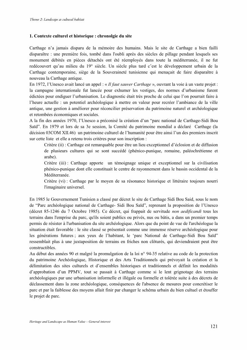
Heritage and Landscape as Human Value – General interest 121
1. Contexte culturel et historique : chronolgie du site Carthage n’a jamais disparu de la mémoire des humains. Mais le site de Carthage a bien failli disparaître : une première fois, tombé dans l'oubli après des siècles de pillage pendant lesquels ses monument débités en pièces détachés ont été réemployés dans toute la méditerranée, il ne fut redécouvert qu’au milieu du 19° siècle. Un siècle plus tard c’est le développement urbain de la Carthage contemporaine, siège de la Souveraineté tunisienne qui menaçait de faire disparaître à nouveau la Carthage antique. En 1972, l’Unesco avait lancé un appel : « Il faut sauver Carthage », ouvrant la voie à un vaste projet : la campagne internationale fut lancée pour exhumer les vestiges, des normes d’urbanisme furent édictées pour endiguer l’urbanisation. Le diagnostic était très proche de celui que l’on pourrait faire à l’heure actuelle : un potentiel archéologique à mettre en valeur pour recréer l’ambiance de la ville antique, une gestion à améliorer pour réconcilier préservation du patrimoine naturel et archéologique et retombées économiques et sociales. A la fin des années 1970, l’Unesco a préconisé la création d’un “parc national de Carthage-Sidi Bou Saïd”. En 1979 et lors de sa 3e session, la Comité du patrimoine mondial a déclaré Carthage (la décision 03COM XII.46) un patrimoine culturel de l’humanité pour être ainsi l’un des premiers inscrit sur cette liste et elle a retenu trois critères pour son inscription :
Critère (ii) : Carthage est remarquable pour être un lieu exceptionnel d’éclosion et de diffusion de plusieurs cultures qui se sont succédé (phénico-punique, romaine, paléochrétienne et arabe). Critère (iii) : Carthage apporte un témoignage unique et exceptionnel sur la civilisation phénico-punique dont elle constituait le centre de rayonnement dans le bassin occidental de la Méditerranée. Critère (vi) : Carthage par le moyen de sa résonance historique et littéraire toujours nourri l'imaginaire universel.
En 1985 le Gouvernement Tunisien a classé par décret le site de Carthage Sidi Bou Said, sous le nom de “Parc archéologique national de Carthage- Sidi Bou Saïd”, reprenant la proposition de l’Unesco (décret 85-1246 du 7 Octobre 1985). Ce décret, qui frappait de servitude non aedificandi tous les terrains dans l'emprise du parc, qu'ils soient publics ou privés, nus ou bâtis, a dans un premier temps permis de résister à l'urbanisation du site archéologique. Alors que du point de vue de l'archéologue la situation était favorable : le site classé se présentait comme une immense réserve archéologique pour les générations futures ; aux yeux de l’habitant, le ‘parc National de Carthage-Sidi Bou Saïd” ressemblait plus à une juxtaposition de terrains en friches non clôturés, qui deviendraient peut être constructibles. Au début des années 90 et malgré la promulgation de la loi n° 94-35 relative au code de la protection du patrimoine Archéologique, Historique et des Arts Traditionnels qui prévoyait la création et la délimitation des sites culturels et d’ensembles historiques et traditionnels et définit les modalités d’approbation d’un PPMV, tout se passait à Carthage comme si le lent grignotage des terrains archéologiques par une urbanisation informelle et illégale ou formelle et tolérée suite à des décrets de déclassement dans la zone archéologique, conséquences de l'absence de mesures pour concrétiser le parc et par la faiblesse des moyens allait finir par changer le schéma urbain du bien cultuel et étouffer le projet de parc.
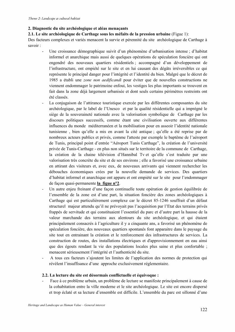
Heritage and Landscape as Human Value – General interest 122
2. Diagnostic du site archéologique et aléas menaçants 2.1. Le site archéologique de Carthage sous les méfaits de la pression urbaine (Figue 1): Des facteurs complexes et variés menacent la survie et pérennité du site archéologique de Carthage à savoir :
- Une croissance démographique suivit d’un phénomène d’urbanisation intense ; d’habitat informel et anarchique mais aussi de quelques opérations de spéculation foncière qui ont engendré des nouveaux quartiers résidentiels ; accompagné d’un développement de l’infrastructure, ont empiété sur le site et en lui causant des dégâts irréversibles ce qui représente le principal danger pour l’intégrité et l’identité du bien. Malgré que le décret de 1985 a établi une zone non aedificandi pour éviter que de nouvelles constructions ne viennent endommager le patrimoine enfoui, les vestiges les plus importants se trouvent en fait dans la zone déjà largement urbanisée et dont seuls certains périmètres restreints ont été classés.
- La conjugaison de l’attirance touristique exercée par les différentes composantes du site archéologique, par le label de l’Unesco et par la qualité résidentielle qui a imprégné le siège de la souveraineté nationale avec la valorisation symbolique de Carthage par les discours politiques successifs, comme étant une civilisation ouverte aux différentes influences du monde méditerranéen et la mobilisation pour en asseoir l’identité nationale tunisienne , bien qu’elle a mis en avant la cité antique ; qu’elle a été reprise par de nombreux acteurs publics et privés, comme l'atteste par exemple le baptême de l’aéroport de Tunis, principal point d’entrée “Aéroport Tunis Carthage”, la création de l’université privée de Tunis-Carthage - en plus non situés sur le territoire de la commune de Carthage, la création de la chaine télévision d’Hannibal Tv et qu’elle s’est traduite par une valorisation très concrète du site et de ses environs ; elle a favorisé une croissance urbaine en attirant des visiteurs et, avec eux, de nouveaux arrivants qui viennent rechercher les débouches économiques crées par la nouvelle demande de services. Des quartiers d’habitat informel et anarchique ont apparu et ont empiété sur le site pour l’endommager de façon quasi-permanente la figue n°2.
- Un autre enjeu freinant d’une façon continuelle toute opération de gestion équilibrée de l’ensemble de la zone est d’une part, la situation foncière des zones archéologiques à Carthage qui est particulièrement complexe car le décret 85-1246 souffrait d’un défaut structurel majeur attendu qu’il ne prévoyait pas l’acquisition par l’Etat des terrains privés frappés de servitude et qui constituaient l’essentiel du parc et d’autre part la hausse de la valeur marchande des terrains aux alentours du site archéologique, et qui étaient principalement consacrés à l’agriculture il y a cinquante ans, a favorisé un phénomène de spéculation foncière, des nouveaux quartiers spontanés font apparaitre dans le paysage du site tout en entrainant la création et le renforcement des infrastructures de services. La construction de routes, des installations électriques et d'approvisionnement en eau ainsi que des égouts rendant la vie des populations locales plus saine et plus confortable ; menacent sérieusement l’intégrité et l’authenticité du site.
- A tous ces facteurs s’ajoutent les limites de l’application des normes de protection qui révèlent l’insuffisance d’une approche exclusivement réglementaire.
2.2. La lecture du site est désormais conflictuelle et équivoque : - Face à ce problème urbain, un problème de lecture se manifeste principalement à cause de
la cohabitation entre la ville moderne et le site archéologique. Le site est encore dispersé et trop éclaté et sa lecture d’ensemble est difficile. L’ensemble du parc est sillonné d’une
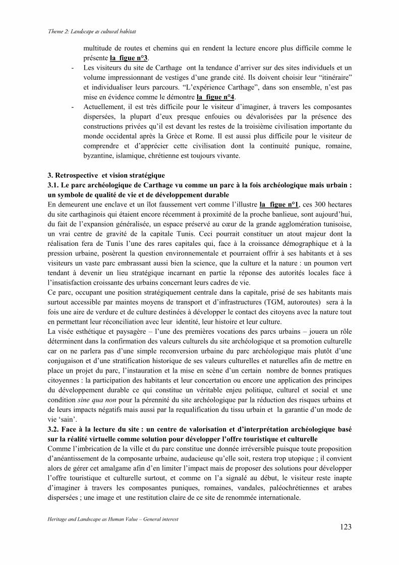
Heritage and Landscape as Human Value – General interest 123
multitude de routes et chemins qui en rendent la lecture encore plus difficile comme le présente la figue n°3.
- Les visiteurs du site de Carthage ont la tendance d’arriver sur des sites individuels et un volume impressionnant de vestiges d’une grande cité. Ils doivent choisir leur “itinéraire” et individualiser leurs parcours. “L’expérience Carthage”, dans son ensemble, n’est pas mise en évidence comme le démontre la figue n°4.
- Actuellement, il est très difficile pour le visiteur d’imaginer, à travers les composantes dispersées, la plupart d’eux presque enfouies ou dévalorisées par la présence des constructions privées qu’il est devant les restes de la troisième civilisation importante du monde occidental après la Grèce et Rome. Il est aussi plus difficile pour le visiteur de comprendre et d’apprécier cette civilisation dont la continuité punique, romaine, byzantine, islamique, chrétienne est toujours vivante.
3. Retrospective et vision stratégique 3.1. Le parc archéologique de Carthage vu comme un parc à la fois archéologique mais urbain : un symbole de qualité de vie et de développement durable En demeurent une enclave et un îlot faussement vert comme l’illustre la figue n°1, ces 300 hectares du site carthaginois qui étaient encore récemment à proximité de la proche banlieue, sont aujourd’hui, du fait de l’expansion généralisée, un espace préservé au cœur de la grande agglomération tunisoise, un vrai centre de gravité de la capitale Tunis. Ceci pourrait constituer un atout majeur dont la réalisation fera de Tunis l’une des rares capitales qui, face à la croissance démographique et à la pression urbaine, posèrent la question environnementale et pourraient offrir à ses habitants et à ses visiteurs un vaste parc embrassant aussi bien la science, que la culture et la nature : un poumon vert tendant à devenir un lieu stratégique incarnant en partie la réponse des autorités locales face à l’insatisfaction croissante des urbains concernant leurs cadres de vie. Ce parc, occupant une position stratégiquement centrale dans la capitale, prisé de ses habitants mais surtout accessible par maintes moyens de transport et d’infrastructures (TGM, autoroutes) sera à la fois une aire de verdure et de culture destinées à développer le contact des citoyens avec la nature tout en permettant leur réconciliation avec leur identité, leur histoire et leur culture. La visée esthétique et paysagère – l’une des premières vocations des parcs urbains – jouera un rôle déterminent dans la confirmation des valeurs culturels du site archéologique et sa promotion culturelle car on ne parlera pas d’une simple reconversion urbaine du parc archéologique mais plutôt d’une conjugaison et d’une stratification historique de ses valeurs culturelles et naturelles afin de mettre en place un projet du parc, l’instauration et la mise en scène d’un certain nombre de bonnes pratiques citoyennes : la participation des habitants et leur concertation ou encore une application des principes du développement durable ce qui constitue un véritable enjeu politique, culturel et social et une condition sine qua non pour la pérennité du site archéologique par la réduction des risques urbains et de leurs impacts négatifs mais aussi par la requalification du tissu urbain et la garantie d’un mode de vie ‘sain’. 3.2. Face à la lecture du site : un centre de valorisation et d’interprétation archéologique basé sur la réalité virtuelle comme solution pour développer l’offre touristique et culturelle Comme l’imbrication de la ville et du parc constitue une donnée irréversible puisque toute proposition d’anéantissement de la composante urbaine, audacieuse qu’elle soit, restera trop utopique ; il convient alors de gérer cet amalgame afin d’en limiter l’impact mais de proposer des solutions pour développer l’offre touristique et culturelle surtout, et comme on l’a signalé au début, le visiteur reste inapte d’imaginer à travers les composantes puniques, romaines, vandales, paléochrétiennes et arabes dispersées ; une image et une restitution claire de ce site de renommée internationale.
Heritage and Landscape as Human Value – General interest 124
L’opportunité exceptionnelle pourra se manifester dans le cadre du projet de réaménagement du musée de Carthage en y projetant un futur centre de valorisation et d’interprétation archéologique ; qui à partir des nouveaux outils technologiques, des animations permettant de visualiser différents sites ; monuments et objets retrouvés, l’intérieur des monuments emblématiques de chaque période, la vie de la cité à l’époque punique ; romaine et chrétienne avec l’application de procédés narratifs -la technique de la Storytelling- communiquant la résonance historique et littéraire de cette Carthage qui a toujours nourri l’imaginaire universel ( la légende de Elyssa-Didon ; fondatrice de la ville punique - l’histoire d’ Hannibal ; l’un des grands stratèges militaires de l’histoire, le martyr de Saint Cyprien et à Saint Augustin etc…) ; avance au visiteur une restitution adéquate du site. L’utilisation des nouvelles technologies, et notamment de tablettes numériques, permettra aussi aux visiteurs de s’immerger dans le quotidien des habitants de la cité antique. Habitations urbaines de l’antiquité punique, Acropole, Tophet, Villas romaines, Thermes et tous les aménagements urbains seront illustrés pour que le visiteur s’approprie le quotidien des habitants de Carthage punique, romaine et chrétienne. Conclusion Depuis le début de l’année 2011, plusieurs initiatives ont été prises en encouragent dans la mesure où elles s’orientent vers la protection du site, revenant sur les abus qui avaient été commis pendant le régime Ben Ali. Alors, la préservation du site a été remise en nouveau sur l’agenda public, avec le positionnement de certaines parties prenantes. Mais en dépit de tous les espoirs suscités, la révolution n’a pas fait disparaître les intérêts puissants, ni mis fin au rapport de force territorial qui avait mis en danger le site de Carthage. C’est justement pour cela qu’il faut considérer le citoyen comme un allié de la préservation du patrimoine et en conséquence, lui associer dans cette mission qui n’est autre que la préservation de son identité ce qui constitue un véritable enjeu politique, culturel et social. Il faut associer à priorité égale les principes du développement durable et la protection du patrimoine, parce que la ressource doit être protégée pour les habitants de la ville et pour l’humanité entière et sur le long terme si la notion de durabilité a un sens, sinon ce n’est qu’un mot. Bibliographie Le Courrier, Mensuel publié par l’UNESCO Organisation des Nations Unies pour l’Éducation, la Science et la Culture DÉCEMBRE 1970 XXIIIs ANNÉE. Le Courrier, Mensuel publié par l’UNESCO : Parc national de Carthage/Sidi Bou Saïd – Résultats et recommandations du projet - Rapport technique final - publié 1983. Le Courrier, Mensuel publié par l’UNESCO : “Carthage’s long - Awaited rescue”, Par Sophie Bessis - SEPTEMBRE 1999. la Revue du patrimoine mondial No.16 : “L’art romain en Afrique du Nord : Son avenir.” Par Abdelmajid Ennabli SEPTEMBRE 2000. CEDAC : Le bulletin édité par le Centre de Documentation Archéologique de la Conservation de Carthage, dépendant de l’Institut National du Patrimoine (Bull. 1, Sept. 1978, Bull. 2, Juin. 1979, Bull. 3, Juin.1980, Bull. 4, Nov. 1981, Bull. 7, Mars. 1986, Bull. 16-17, juin 1997, Hommage à Friedrich Rakob) .
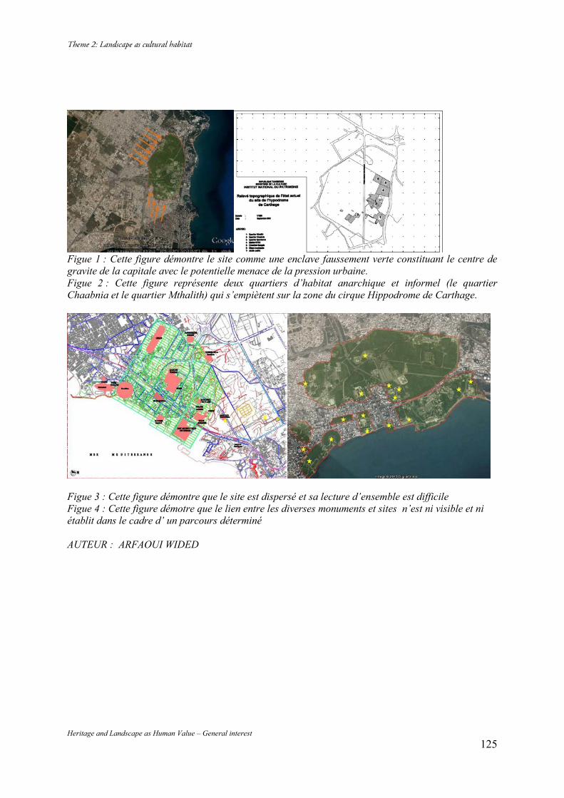
Heritage and Landscape as Human Value – General interest 125
Figue 1 : Cette figure démontre le site comme une enclave faussement verte constituant le centre de gravite de la capitale avec le potentielle menace de la pression urbaine. Figue 2 : Cette figure représente deux quartiers d’habitat anarchique et informel (le quartier Chaabnia et le quartier Mthalith) qui s’empiètent sur la zone du cirque Hippodrome de Carthage.
Figue 3 : Cette figure démontre que le site est dispersé et sa lecture d’ensemble est difficile Figue 4 : Cette figure démotre que le lien entre les diverses monuments et sites n’est ni visible et ni établit dans le cadre d’ un parcours déterminé AUTEUR : ARFAOUI WIDED
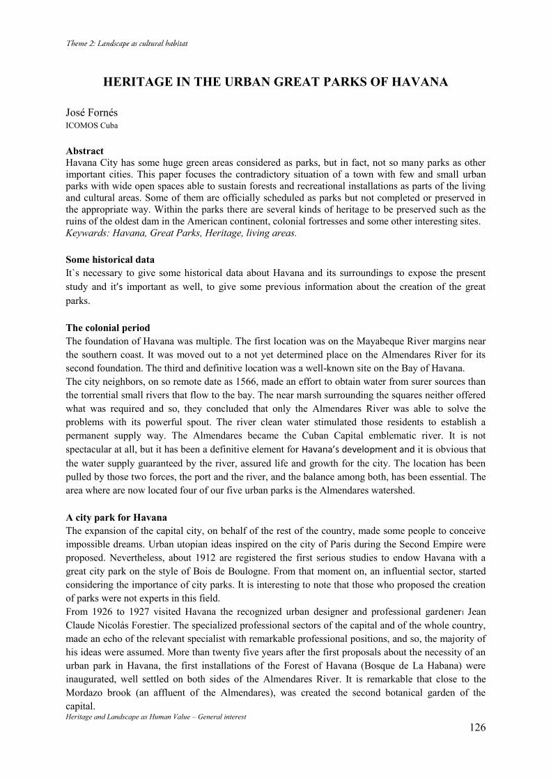
Heritage and Landscape as Human Value – General interest 126
HERITAGE IN THE URBAN GREAT PARKS OF HAVANA
José Fornés ICOMOS Cuba Abstract Havana City has some huge green areas considered as parks, but in fact, not so many parks as other important cities. This paper focuses the contradictory situation of a town with few and small urban parks with wide open spaces able to sustain forests and recreational installations as parts of the living and cultural areas. Some of them are officially scheduled as parks but not completed or preserved in the appropriate way. Within the parks there are several kinds of heritage to be preserved such as the ruins of the oldest dam in the American continent, colonial fortresses and some other interesting sites. Keywards: Havana, Great Parks, Heritage, living areas. Some historical data It`s necessary to give some historical data about Havana and its surroundings to expose the present study and it’s important as well, to give some previous information about the creation of the great parks. The colonial period The foundation of Havana was multiple. The first location was on the Mayabeque River margins near the southern coast. It was moved out to a not yet determined place on the Almendares River for its second foundation. The third and definitive location was a well-known site on the Bay of Havana. The city neighbors, on so remote date as 1566, made an effort to obtain water from surer sources than the torrential small rivers that flow to the bay. The near marsh surrounding the squares neither offered what was required and so, they concluded that only the Almendares River was able to solve the problems with its powerful spout. The river clean water stimulated those residents to establish a permanent supply way. The Almendares became the Cuban Capital emblematic river. It is not spectacular at all, but it has been a definitive element for Havana’s development and it is obvious that the water supply guaranteed by the river, assured life and growth for the city. The location has been pulled by those two forces, the port and the river, and the balance among both, has been essential. The area where are now located four of our five urban parks is the Almendares watershed. A city park for Havana The expansion of the capital city, on behalf of the rest of the country, made some people to conceive impossible dreams. Urban utopian ideas inspired on the city of Paris during the Second Empire were proposed. Nevertheless, about 1912 are registered the first serious studies to endow Havana with a great city park on the style of Bois de Boulogne. From that moment on, an influential sector, started considering the importance of city parks. It is interesting to note that those who proposed the creation of parks were not experts in this field. From 1926 to 1927 visited Havana the recognized urban designer and professional gardener1 Jean Claude Nicolás Forestier. The specialized professional sectors of the capital and of the whole country, made an echo of the relevant specialist with remarkable professional positions, and so, the majority of his ideas were assumed. More than twenty five years after the first proposals about the necessity of an urban park in Havana, the first installations of the Forest of Havana (Bosque de La Habana) were inaugurated, well settled on both sides of the Almendares River. It is remarkable that close to the Mordazo brook (an affluent of the Almendares), was created the second botanical garden of the capital.
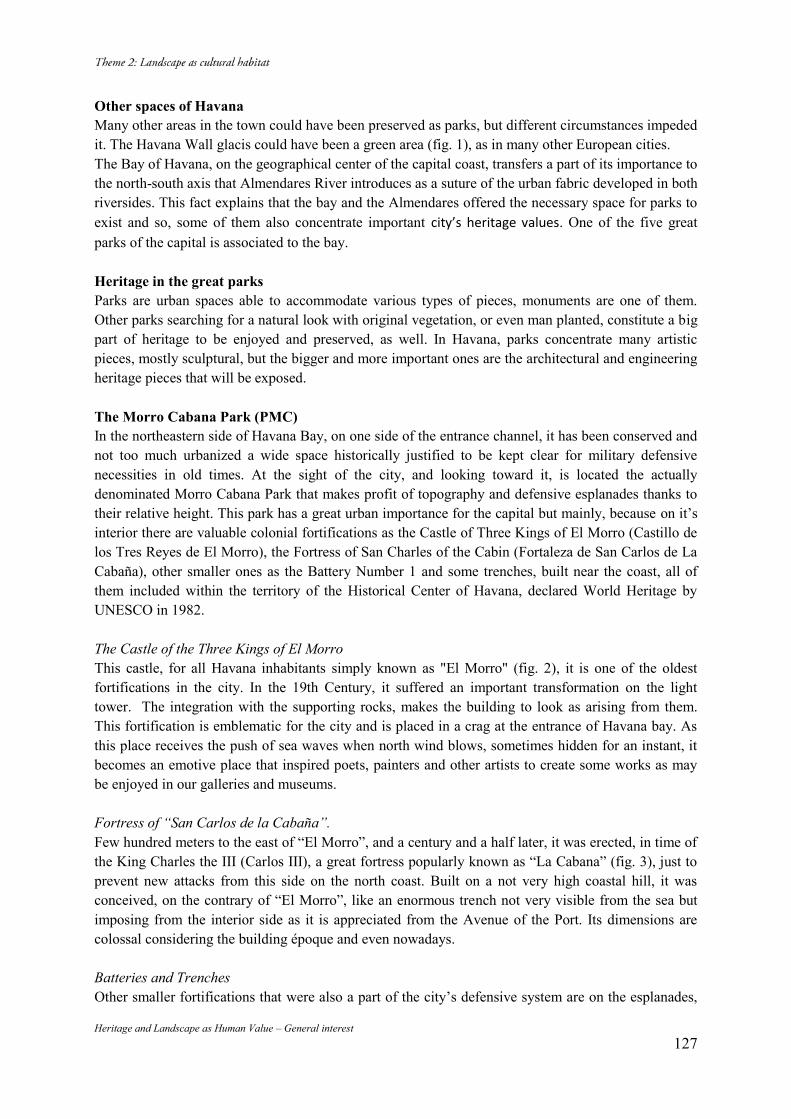
Heritage and Landscape as Human Value – General interest 127
Other spaces of Havana Many other areas in the town could have been preserved as parks, but different circumstances impeded it. The Havana Wall glacis could have been a green area (fig. 1), as in many other European cities. The Bay of Havana, on the geographical center of the capital coast, transfers a part of its importance to the north-south axis that Almendares River introduces as a suture of the urban fabric developed in both riversides. This fact explains that the bay and the Almendares offered the necessary space for parks to exist and so, some of them also concentrate important city’s heritage values. One of the five great parks of the capital is associated to the bay. Heritage in the great parks Parks are urban spaces able to accommodate various types of pieces, monuments are one of them. Other parks searching for a natural look with original vegetation, or even man planted, constitute a big part of heritage to be enjoyed and preserved, as well. In Havana, parks concentrate many artistic pieces, mostly sculptural, but the bigger and more important ones are the architectural and engineering heritage pieces that will be exposed. The Morro Cabana Park (PMC) In the northeastern side of Havana Bay, on one side of the entrance channel, it has been conserved and not too much urbanized a wide space historically justified to be kept clear for military defensive necessities in old times. At the sight of the city, and looking toward it, is located the actually denominated Morro Cabana Park that makes profit of topography and defensive esplanades thanks to their relative height. This park has a great urban importance for the capital but mainly, because on it’s interior there are valuable colonial fortifications as the Castle of Three Kings of El Morro (Castillo de los Tres Reyes de El Morro), the Fortress of San Charles of the Cabin (Fortaleza de San Carlos de La Cabaña), other smaller ones as the Battery Number 1 and some trenches, built near the coast, all of them included within the territory of the Historical Center of Havana, declared World Heritage by UNESCO in 1982. The Castle of the Three Kings of El Morro This castle, for all Havana inhabitants simply known as "El Morro" (fig. 2), it is one of the oldest fortifications in the city. In the 19th Century, it suffered an important transformation on the light tower. The integration with the supporting rocks, makes the building to look as arising from them. This fortification is emblematic for the city and is placed in a crag at the entrance of Havana bay. As this place receives the push of sea waves when north wind blows, sometimes hidden for an instant, it becomes an emotive place that inspired poets, painters and other artists to create some works as may be enjoyed in our galleries and museums. Fortress of “San Carlos de la Cabaña”. Few hundred meters to the east of “El Morro”, and a century and a half later, it was erected, in time of the King Charles the III (Carlos III), a great fortress popularly known as “La Cabana” (fig. 3), just to prevent new attacks from this side on the north coast. Built on a not very high coastal hill, it was conceived, on the contrary of “El Morro”, like an enormous trench not very visible from the sea but imposing from the interior side as it is appreciated from the Avenue of the Port. Its dimensions are colossal considering the building époque and even nowadays. Batteries and Trenches Other smaller fortifications that were also a part of the city’s defensive system are on the esplanades,
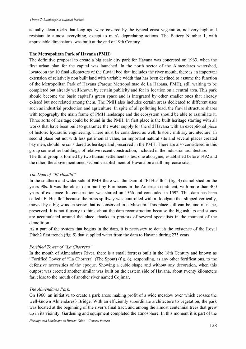
Heritage and Landscape as Human Value – General interest 128
actually clean rocks that long ago were covered by the typical coast vegetation, not very high and resistant to almost everything, except to man's depredating actions. The Battery Number 1, with appreciable dimensions, was built at the end of 19th Century. The Metropolitan Park of Havana (PMH) The definitive proposal to create a big scale city park for Havana was concreted on 1963, when the first urban plan for the capital was launched. In the north sector of the Almendares watershed, locatedon the 10 final kilometers of the fluvial bed that includes the river mouth, there is an important extension of relatively non built land with variable width that has been destined to assume the function of the Metropolitan Park of Havana (Parque Metropolitnao de La Habana, PMH), still waiting to be completed but already well known by certain publicity and for its location on a central area. This park should become the basic capital’s green space and is integrated by other smaller ones that already existed but not related among them. The PMH also includes certain areas dedicated to different uses such as industrial production and agriculture. In spite of all polluting load, the fluvial structure shares with topography the main frame of PMH landscape and the ecosystem should be able to assimilate it. Three sorts of heritage could be found in the PMH. In first place is the built heritage starting with all works that have been built to guarantee the water supply for the old Havana with an exceptional piece of historic hydraulic engineering. There must be considered as well, historic military architecture. In second place but not with less patrimonial value, an important natural site and several places created bay men, should be considered as heritage and preserved in the PMH. There are also considered in this group some other buildings, of relative recent construction, included in the industrial architecture. The third group is formed by two human settlements sites: one aborigine, established before 1492 and the other, the above mentioned second establishment of Havana on a still imprecise site. The Dam of “El Husillo” In the southern and wider side of PMH there was the Dam of “El Husillo”, (fig. 4) demolished on the years 90s. It was the oldest dam built by Europeans in the American continent, with more than 400 years of existence. Its construction was started on 1566 and concluded in 1592. This dam has been called “El Husillo” because the press spillway was controlled with a floodgate that slipped vertically, moved by a big wooden screw that is conserved in a Museum. This place still can be, and must be, preserved. It is not illusory to think about the dam reconstruction because the big ashlars and stones are accumulated around the place, thanks to protests of several specialists in the moment of the demolition. As a part of the system that begins in the dam, it is necessary to detach the existence of the Royal Ditch2 first trench (fig. 5) that supplied water from the dam to Havana during 275 years. Fortified Tower of “La Chorrera” In the mouth of Almendares River, there is a small fortress built in the 18th Century and known as “Fortified Tower of “La Chorrera” (The Spout) (fig. 6), responding, as any other fortifications, to the defensive necessities of the epoque. Showing a cubic shape and without any decoration, when this outpost was erected another similar was built on the eastern side of Havana, about twenty kilometers far, close to the mouth of another river named Cojimar. The Almendares Park. On 1960, an initiative to create a park arose making profit of a wide meadow over which crosses the well-known Almendares3 Bridge. With an efficiently subordinate architecture to vegetation, the park was located at the beginning of the river’s final tract, and among the almost centennial trees that grew up in its vicinity. Gardening and equipment completed the atmosphere. In this moment it is part of the
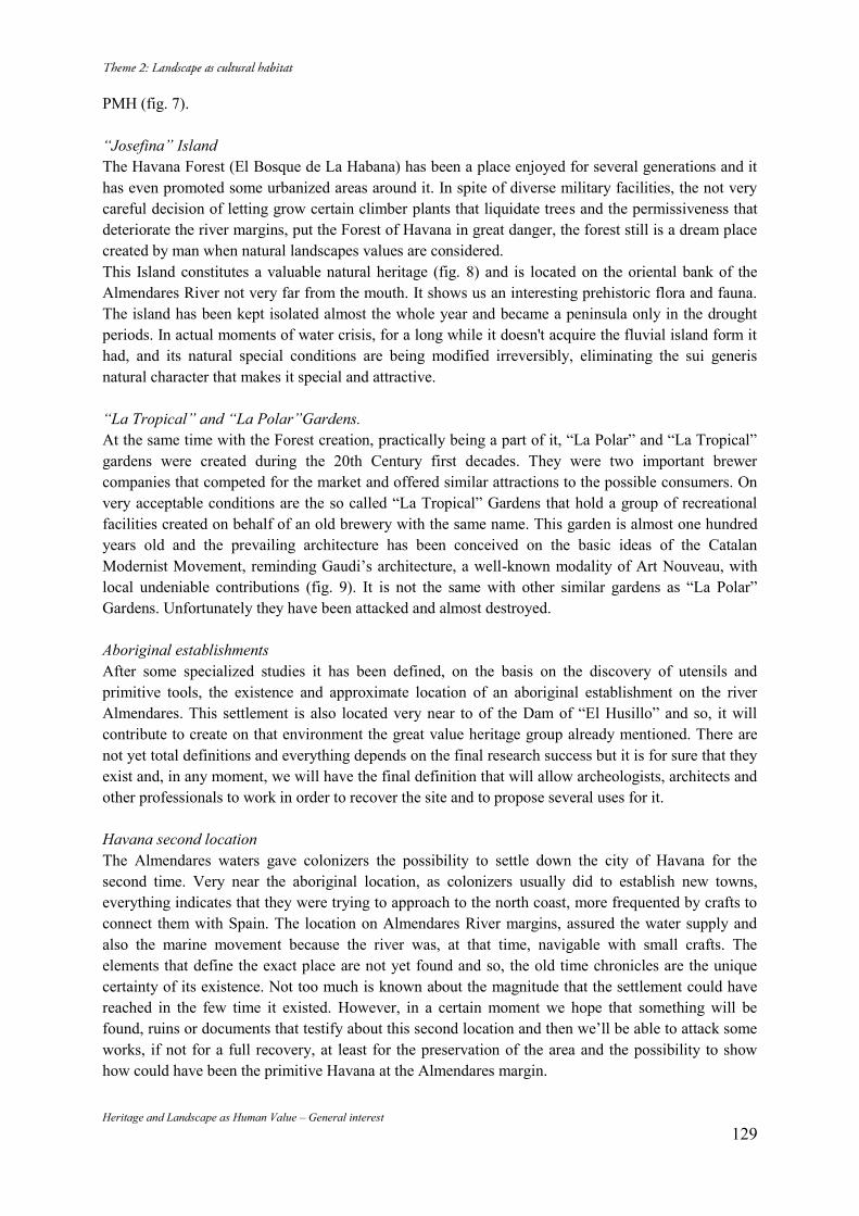
Heritage and Landscape as Human Value – General interest 129
PMH (fig. 7). “Josefina” Island The Havana Forest (El Bosque de La Habana) has been a place enjoyed for several generations and it has even promoted some urbanized areas around it. In spite of diverse military facilities, the not very careful decision of letting grow certain climber plants that liquidate trees and the permissiveness that deteriorate the river margins, put the Forest of Havana in great danger, the forest still is a dream place created by man when natural landscapes values are considered. This Island constitutes a valuable natural heritage (fig. 8) and is located on the oriental bank of the Almendares River not very far from the mouth. It shows us an interesting prehistoric flora and fauna. The island has been kept isolated almost the whole year and became a peninsula only in the drought periods. In actual moments of water crisis, for a long while it doesn't acquire the fluvial island form it had, and its natural special conditions are being modified irreversibly, eliminating the sui generis natural character that makes it special and attractive. “La Tropical” and “La Polar”Gardens. At the same time with the Forest creation, practically being a part of it, “La Polar” and “La Tropical” gardens were created during the 20th Century first decades. They were two important brewer companies that competed for the market and offered similar attractions to the possible consumers. On very acceptable conditions are the so called “La Tropical” Gardens that hold a group of recreational facilities created on behalf of an old brewery with the same name. This garden is almost one hundred years old and the prevailing architecture has been conceived on the basic ideas of the Catalan Modernist Movement, reminding Gaudi’s architecture, a well-known modality of Art Nouveau, with local undeniable contributions (fig. 9). It is not the same with other similar gardens as “La Polar” Gardens. Unfortunately they have been attacked and almost destroyed. Aboriginal establishments After some specialized studies it has been defined, on the basis on the discovery of utensils and primitive tools, the existence and approximate location of an aboriginal establishment on the river Almendares. This settlement is also located very near to of the Dam of “El Husillo” and so, it will contribute to create on that environment the great value heritage group already mentioned. There are not yet total definitions and everything depends on the final research success but it is for sure that they exist and, in any moment, we will have the final definition that will allow archeologists, architects and other professionals to work in order to recover the site and to propose several uses for it. Havana second location The Almendares waters gave colonizers the possibility to settle down the city of Havana for the second time. Very near the aboriginal location, as colonizers usually did to establish new towns, everything indicates that they were trying to approach to the north coast, more frequented by crafts to connect them with Spain. The location on Almendares River margins, assured the water supply and also the marine movement because the river was, at that time, navigable with small crafts. The elements that define the exact place are not yet found and so, the old time chronicles are the unique certainty of its existence. Not too much is known about the magnitude that the settlement could have reached in the few time it existed. However, in a certain moment we hope that something will be found, ruins or documents that testify about this second location and then we’ll be able to attack some works, if not for a full recovery, at least for the preservation of the area and the possibility to show how could have been the primitive Havana at the Almendares margin.
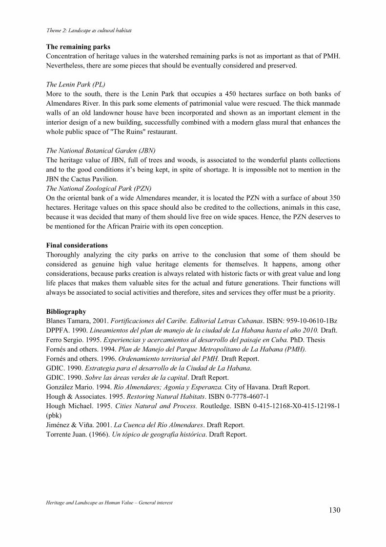
Heritage and Landscape as Human Value – General interest 130
The remaining parks Concentration of heritage values in the watershed remaining parks is not as important as that of PMH. Nevertheless, there are some pieces that should be eventually considered and preserved. The Lenin Park (PL) More to the south, there is the Lenin Park that occupies a 450 hectares surface on both banks of Almendares River. In this park some elements of patrimonial value were rescued. The thick manmade walls of an old landowner house have been incorporated and shown as an important element in the interior design of a new building, successfully combined with a modern glass mural that enhances the whole public space of "The Ruins" restaurant. The National Botanical Garden (JBN) The heritage value of JBN, full of trees and woods, is associated to the wonderful plants collections and to the good conditions it’s being kept, in spite of shortage. It is impossible not to mention in the JBN the Cactus Pavilion. The National Zoological Park (PZN) On the oriental bank of a wide Almendares meander, it is located the PZN with a surface of about 350 hectares. Heritage values on this space should also be credited to the collections, animals in this case, because it was decided that many of them should live free on wide spaces. Hence, the PZN deserves to be mentioned for the African Prairie with its open conception. Final considerations Thoroughly analyzing the city parks on arrive to the conclusion that some of them should be considered as genuine high value heritage elements for themselves. It happens, among other considerations, because parks creation is always related with historic facts or with great value and long life places that makes them valuable sites for the actual and future generations. Their functions will always be associated to social activities and therefore, sites and services they offer must be a priority. Bibliography Blanes Tamara, 2001. Fortificaciones del Caribe. Editorial Letras Cubanas. ISBN: 959-10-0610-1Bz DPPFA. 1990. Lineamientos del plan de manejo de la ciudad de La Habana hasta el año 2010. Draft. Ferro Sergio. 1995. Experiencias y acercamientos al desarrollo del paisaje en Cuba. PhD. Thesis Fornés and others. 1994. Plan de Manejo del Parque Metropolitano de La Habana (PMH). Fornés and others. 1996. Ordenamiento territorial del PMH. Draft Report. GDIC. 1990. Estrategia para el desarrollo de la Ciudad de La Habana. GDIC. 1990. Sobre las áreas verdes de la capital. Draft Report. González Mario. 1994. Río Almendares; Agonía y Esperanza. City of Havana. Draft Report. Hough & Associates. 1995. Restoring Natural Habitats. ISBN 0-7778-4607-1 Hough Michael. 1995. Cities Natural and Process. Routledge. ISBN 0-415-12168-X0-415-12198-1 (pbk) Jiménez & Viña. 2001. La Cuenca del Río Almendares. Draft Report. Torrente Juan. (1966). Un tópico de geografía histórica. Draft Report.
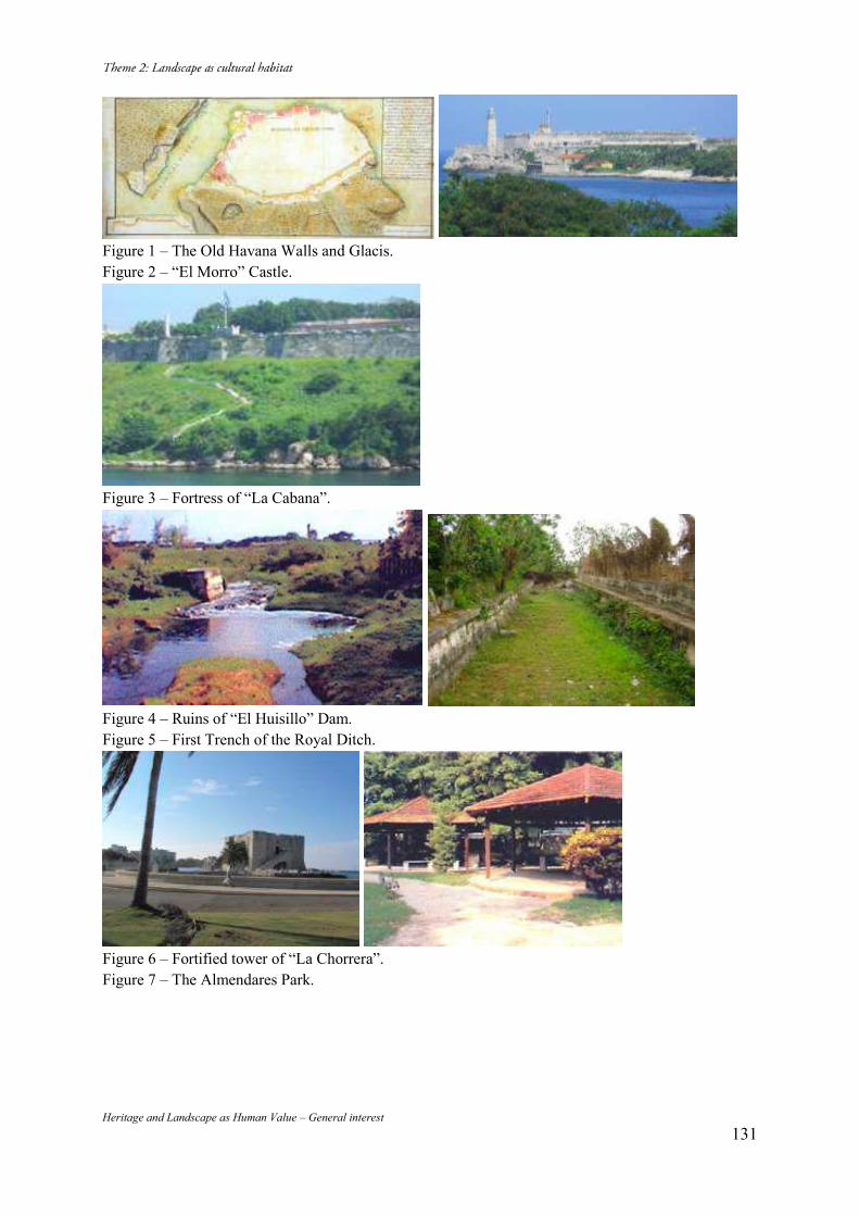
Heritage and Landscape as Human Value – General interest 131
Figure 1 – The Old Havana Walls and Glacis. Figure 2 – “El Morro” Castle.
Figure 3 – Fortress of “La Cabana”.
Figure 4 – Ruins of “El Huisillo” Dam. Figure 5 – First Trench of the Royal Ditch.
Figure 6 – Fortified tower of “La Chorrera”. Figure 7 – The Almendares Park.
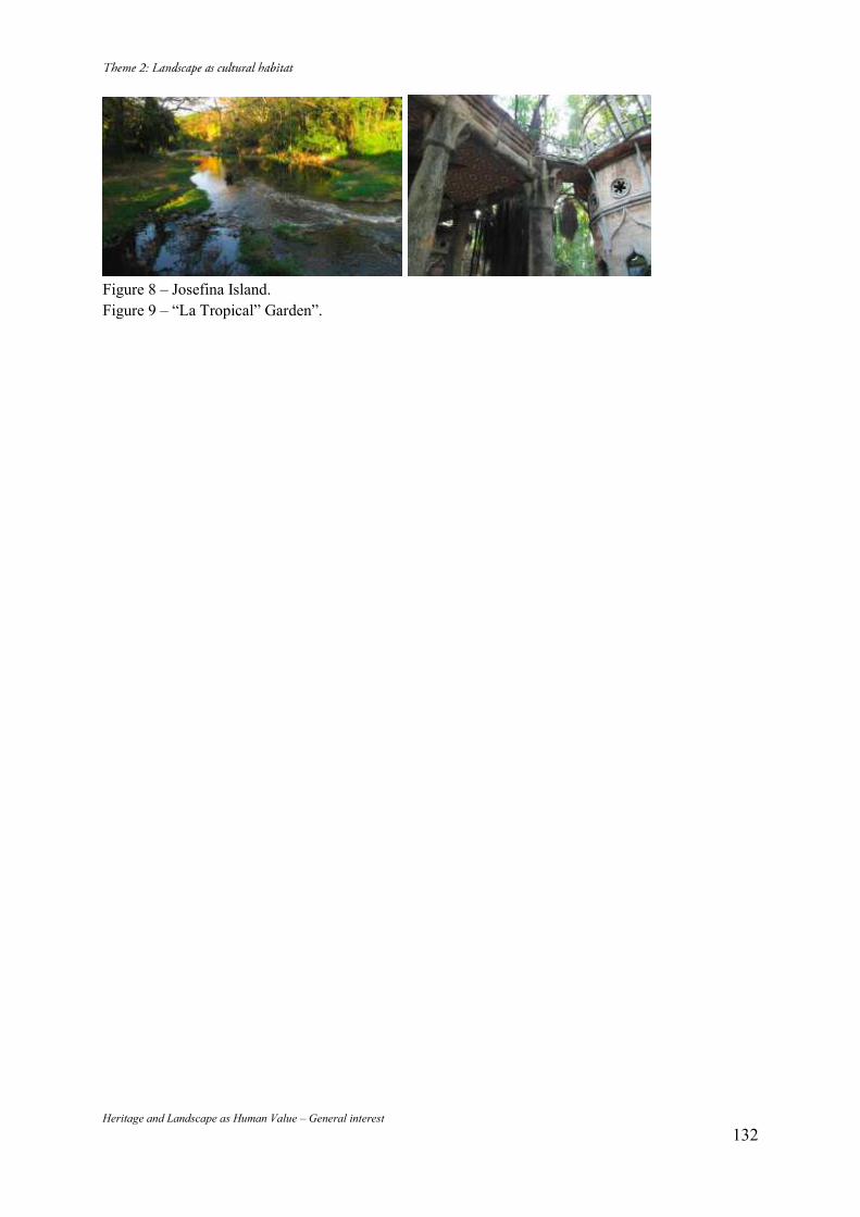
Heritage and Landscape as Human Value – General interest 132
Figure 8 – Josefina Island. Figure 9 – “La Tropical” Garden”.
Heritage and Landscape as Human Value – General interest 133
Conservation of Historic Urban Areas: the Case of Ataköy Settlement
Ebru HARMAN ASLAN* Ahmet Suvar ASLAN** (*) Yildiz Technical University, Faculty of Architecture, Istanbul, Turkey, +90 505 5947993, [email protected] (**)Yildiz Technical University, Faculty of Architecture, Istanbul, Turkey, +90 505 4783550, [email protected] Abstract The main subject of this research is to examine the pressures and impacts of development projects on historic urban fabric and landscapes. The study aims to explore the development and transformation process of Ataköy in respect to physical, social, economic and aesthetic value contexts. By assessing the layering elements, natural and cultural values and the current situation of Ataköy, this work is further intended to present a discussion on the issues regarding conservation of the area. Keywords: Historic Urban Areas; Modern Architectural Heritage; Conservation; Urban regeneration 1. Introduction In recent decades, in which the reflections of globalization on space has become more visible, the main issues negatively affecting authenticity and integrity of historic urban areas are urban development (infrastructure projects, contemporary architecture, high-rise buildings) and regeneration projects. For managing of change in historic urban areas and finding a solution to these issues, in particular landscape-based approaches are being discussed recently at international level. The UNESCO (2011) recommendation on the Historic Urban Landscape guides such landscape-based approaches. In this recommendation, urban area is defined as “the result of an historic layering of cultural and natural values and attributes” in a broader urban context without a specific geographic demarcation such as historic center or ensemble. In respect of this concept, the definition of cultural heritage is being stretched and conservation of all layers of cultural significance is proposed in the urban landscape. At this point with its multi-layered physical and cultural tissue, Ataköy Settlement emerges as a sample area that may shed light on transformation of historic urban areas and pressures of urban development in Istanbul. 2. Conceptual Framework Spatial change and transformation processes in Istanbul have been realized in different speeds with different factors and qualifications in the republican era. Among these factors, the impact of political economy on the national and international level has been the main actor. The features of Istanbul inherited from its past and the demand for using its former networks in national policies has brought about having different roles at the international level. Castells mentions about a new economy emerging in the last quarter of the 20th century and indicates that this new economy is formed by flows through the global networks.1 Inclusion of Istanbul to the new geography in which globalization and/or neo-liberal policies formed by flows through the global networks occurs by political economy introduced after 1980. However, along with the reorganization of urban spaces with this new hierarchy, conservation of historical environments has become more vulnerable in historic cities such as Istanbul. Urban space had also a structure based on the production and reproduction of surplus value before this change of political economy. Within this structure, field of urban planning rules are determined substantially by ruling elites and capital owners. Following the process of political economic changing,
1 (Castells, 2010).
Heritage and Landscape as Human Value – General interest 134
the balance of forces determining the rules of the field has changed, but basically the domination of the same agents have proceeded. These agents determine rules of the field through their own process of capital accumulation. As Harvey emphasizes it, urbanization is needed for absorption of surplus product.2 After 1980, urban rent sharing in Istanbul was different from the previous processes. In this new period, in conjunction with the articulation of international actors to previous agents, sharing of urban rent has become more unequal. Thus, new trends emerge in spatial transformation. These trends have started to create high pressures on the historic fabric and its users. In last 10-year period, construction sector has become the dominant sector of economic growth especially in Istanbul and the city is based upon capital accumulation model. Istanbul has hit to a new level in which the investments groups and state power take joint decisions and determine the rules of urban planning field through their own interests. In this process, in order to reproduce space, as part of mega projects conflicting decisions with the principles of urban planning are tried to implement. Housing Development Administration of Turkey (TOKI), remaining in a gray area between capital and state power, is the coordinator of these processes. On one hand TOKI defines legislative framework and tries to resolve roughness, on the other hand it has become a big employer of contractors. In this new phase significant historic urban fabric of Istanbul such as Tarlabasi, Sulukule districts, is declared as urban regeneration areas. More often historic urban fabric could not resist the pressure of rising rents, and consequently residents have been displaced. Thereby, these conservation areas, integrated in terms of urban and building scales, began to have a new identity drawn by ruling elites in accordance with their global city image of Istanbul. These practices indicate that new conservation policies are needed for preservation of historical urban landscape to cope with these new challenges. Ataköy Housing Estate, in the sub-center of the Istanbul, was established in the second half of the 20th
century as a suburb out of the historical peninsula (Fig. 1). Atakoy has a special significance as it is one of the first housing estates in the urban development history of Istanbul and it also affects its successors in terms of design and planning process. In the case of Ataköy, this research aims to discuss pressures of urban development and high-rise buildings on historic urban areas within a landscape approach. 3. Urban Development of Ataköy Including Ataköy Settlement at the present time, Bakırköy was known as Hebdemon in the Roman period and was hosting summer palaces, hunting lodges and gardens in that era. This area was located on Via Egnetia that connected Byzantium to Europe. In the Byzantine era this region continued to be used as a summer resort and there are still remains of a cistern witnessing the era in Ataköy.3 In the Ottoman period there were gardens and farmsteads, known since 16th century, became widespread in 19th century outside the historical peninsula of Istanbul. Also on the land where Ataköy was built, there was a royal garden called İskender Çelebi Garden in 16th century. In 1699 a gunpowder factory was built in this area and the district began to be called as Baruthane.4 Besides the gunpowder factory buildings, the area remained as a huge and empty space possessing a beach, a small port on Marmara Sea side.5 Baruthane was attached to the Military Factories Administration in the republican period, and in 1955 was transferred to the Mechanical and Chemical Industry Corporation.6 A watchtower, a fountain, four smelter (Kalhane) buildings surrounded by inner walls and boundary walls of the complex with two guard towers and also an Ispirtohane7 reached today from the Historical 2 (Harvey, 2008). 3 (Dünden Bugüne İstanbul Ansiklopedisi, Bakırköy article, 1993). 4 (Erdoğan, 1958). 5 (Dünden Bugüne İstanbul Ansiklopedisi, Ataköy article, 1993). 6 (Dünden Bugüne İstanbul Ansiklopedisi, Baruthaneler article, 1993). 7 Building where spirit is produced.
Heritage and Landscape as Human Value – General interest 135
Gunpowder Factory Complex (Fig. 2). These buildings represent significant information in respect of the military architecture and defense technologies of their times. 3.1. Development and Values of Ataköy Housing Estate In order to meet the increasing demand for housing after 1950 in Istanbul, Turkey Real Estate and Credit Bank has undertaken the task of setting up new neighborhoods composed of mass housing in various regions of the city. By purchasing the land in 1955 on which Ataköy would built, this bank initiated the infrastructure and planning works for generating a housing estate site within that area. Since the area was outside the boundaries of the historic center, the relation with the sea and convenience of access to the city center were the factors which took important roles in site selection.8 By evaluating the best project proposals selected as a result of the international competition for organizing the area in 1956, application projects were produced by a design office that was set up afterwards. The coordinator of this design team was Ertuğrul Menteş and the consultant was Prof. Luigi Piccinato, an Italian architect, who would play an active role in the planning processes of next period.9 The outcome was a remarkable example including buildings, recreation areas and landscape designs representing modernist planning and architectural concepts (Fig. 3). Ataköy Housing Estate was built on a huge empty land with approximately sizes of 4.000.000 m².10 Located on the west development axes, this area was essential for controlling the growth of the city and was also close to the international airport. Ataköy Settlement is not only among the first examples of mass housing areas but also one of the largest housing estate projects until recently. It includes socio-cultural infrastructures with the functions of education, commerce, entertainment and et cetera, green areas, parks and recreation areas as well as residential buildings (Figg. 3, 4). The Housing Estate features similar architectural styles and also characterizes modernist planning and design concepts from urban to detail scales. Buildings were organized in large green areas and usage of reinforced concrete construction system in Ataköy formed a common outline for settlement. Ataköy Housing Estate was built gradually in various stages. Among these stages, in particular Ist and IInd ones are emerged as qualified areas representing 20th century modern architectural features. The construction of Ataköy Ist stage was completed between the years of 1957-1962. It consists of 3-4-5-8 and 13-storey 52 buildings, including 662 dwelling units. The largest of these housing units are 200 m² while the smallest are 110 m². As for IInd stage consists of 3-4-6-10 and 13-storey 39 buildings, embracing 824 dwelling units. The largest of these housing units are 140 m² while the smallest are 85 m². The dwellings of Ist and IInd stages that were built quite above the standards of social housing at that time, were designed for the upper and upper-middle class. Besides, to include these stages there is a primary school building which was registered in 2006 as 1st degree cultural asset. Modernist architectural characteristics of the buildings comprising of Ataköy Ist and IInd Stages are respected in terms of mass forms, facade arrangements, plan schemas, materials and construction systems and colors contexts. Housing units are designed due to the zeitgeist and the changing needs of their era. Functional requirements come to the forefront in generating of the plans. Structures are formed by cubic masses that are raised on pilotis and clustered using different patterns. Façade arrangements are composed by horizontal and vertical effects. The vertical effect comprised by ongoing dead walls all along building and the horizontal effect generated by parapet walls of balconies and floor beams balance each other. Service shafts, chimneys and reinforced concrete pergolas rising on the terrace roofs are can be regarded as crucial repetitious fragments (Fig. 5a, b, c, d). Large window surfaces are used in façade arrangements in order to benefit optimally from daylight for illuminating the interior spaces. Ataköy Ist and IInd stages were one of the first examples in which spatial comfort conditions, physical environment and climate controls and mechanical infrastructure
8 (Dünden Bugüne İstanbul Ansiklopedisi, Ataköy article, 1993). 9 (Cansever, 2008). 10 (Menteşe, 1958).
Heritage and Landscape as Human Value – General interest 136
needs were considered during the architectural design process.11 Furthermore, these stages are remarkable for their intensity of green spaces possessed. Today the settlement is one of the residential areas where the population density is at the very least in Istanbul. Within the scope of the House Estate Project, a landscape design was created on the coastal area of Ataköy comprising beach motels (ABC motels), beach houses, camping and playfields and beach facilities in a holistic manner.12 This recreation area respected as an extension of Ataköy Ist and IInd stages with regards to planning concepts and architectural features, met the needs of the entertainment and recreation of the citizens and tourists of Istanbul. Historical Gunpowder Factory Complex was included this landscape design by renovating them as well.13 The low-rise motel buildings which were built near the gunpowder factory facilities were compatible with the Ottoman heritage (Fig. 5e-f). In terms of all these features, functional, aesthetics, social and economic values of Ataköy reveal its cultural significance. Thus, this historically valuable area becomes an integrated symbol area for Istanbul. Ist and IInd stages of Ataköy and the landscape designs on the coastal area have subjected to many national and international publications as a complex that have hosted substantial examples in the history of architecture and urbanism of Turkey. Illustrating design and construction phases or afterwards, early samples of these studies were published in Arkitekt, one of the popular journals of that era. This also defines a reference value. 3.2. Regeneration and Problems of Ataköy Housing Estate Professor Luigi Piccinato, design team adviser of Ataköy Settlement plans, was present in Istanbul between the years 1960-67 to manage the development of the city.14 The former development of the city in the form of concentric circles was replaced by a linear growth model, so it caused a fundamental shift in city planning of Istanbul. The plan of Piccinato has managed to sustain until recently, when city was predicated on capital accumulation process. Thanks to this plan, the remaining forest areas in the northern parts of the city largely preserved. However, at the present day these forest areas are under the risk of destruction due to the projects of the third airport and the bridge. Piccinato not only preserved natural landscape of the north part of city by suggesting a linear growth for Istanbul, but he has also succeeded in creating a rare urban fabric for Istanbul by Ataköy project. Although Ataköy was on the periphery at the time of its construction, after a period of 50 years it has become one of the sub-centers of Istanbul today. From the times of construction of Ataköy Ist and IInd stages to the present, the differentiations of modern life styles have altered user’s needs and comfort requirements; as a consequence of that, plan schemas and façade arrangements have begun to change by users’ interventions. Owing to the lack of conservation measures and discretionary interventions of users, changes damaging the authentic characteristics of the settlement increasingly go on. In 1955, the land of Ataköy Housing Estate was purchased for 60 million TL, a substantial amount of money for that time. Ataköy Ist and IInd Stages have appeared as an urbanization practice that have appealed to upper-middle class due to the high cost of initial investment and large size of the dwelling units. It is also observed that there has not been any change of social class later on for these two stages. The gunpowder factory complex was registered as cultural assets in 1956. Ist and IInd stages of the settlement are recognized within the context of modern architectural heritage in recent academic studies on the subject. Not only having outstanding characteristics such as homogeneous urban fabric, aesthetics and architectural qualifications, vacancy rate, size of active green fields; but also possessing an integrated physical and natural environment brings into question of
11 (DOCOMOMO Turkey, 2008). 12 (Kökten, 1967). 13 (Kökten, 1967). 14 (Dünden Bugüne İstanbul Ansiklopedisi, Ataköy article, 1993).
Heritage and Landscape as Human Value – General interest 137
registering these stages as an urban conservation area. However, initiatives intended to preserve the area is not approved by the conservation board. While Istanbul is trying to be articulated to global networks, new development decisions are taken for Ataköy because of the increasing rent pressures. From 1991 various planning works have been conducted for Ataköy, including recreation area along the coastline with the motel buildings and Gunpowder Factory and also Ataköy Ist and IInd stages. These plans do not cover the study area as a whole, but include it fragmentally. Ataköy was announced as a tourism center by council of ministers decision in 1989. Afterwards, master development plans and implementary development plans were made by Ministry of Culture and Tourism in 1991. According to this plan, construction conditions are determined for the development of coastal areas between the coastal road and sea with floor area ratio of 2 and 72 meters building height (Fig. 8). In 2012 on the purpose of conserving the silhouette of historic areas of Istanbul, this plan was modified and building height was decreased to 70 meters from 72 meters but floor area ratio remained the same. A plan was made for the region comprising Ataköy Ist stage in 2007. In this plan the right was given for transformation of existing residential buildings of Ist stage into hotels and optional usage right was provided for the lot numbered-14, the green area. According to the right, if mentioned green area transformed into a tourism area, floor area ratio would be 2 with 72 meters building height. The modified plan reduced the building height to 70 meters. In the period when the 1991 plan was produced, urban rent increased in Ataköy district because of its near location to historic city center and international airport so this plan has intended to benefit from the urban rent. However, this request could not be performed for a long time due to various reasons. Projected in previous development plans, in recent decades works have started for constructing high-rise and high-density buildings on coastal areas of Ataköy. In this process, bureaucracy is used for developing the area by Housing Development Administration of Turkey (TOKI) like allotting plots and unifying the allotting plots again to create different lots. Beach motels (ABC motels) were demolished in 2008 and the privatization of coastal areas were carried out in 2009. 51 trees have been registered as natural monuments by conservation board decision taken in 2009, while all the others were transferred to proper areas. TOKI have made plans for the area with its superior authority, afterwards it was marketed to investors. Residents of Ataköy objected to the revised plans and went to law. Besides, residents have discussed the problems of their neighborhood in forums and organize protest march occasionally for conserving the area (Fig. 10). In July 2014 court canceled the construction license of buildings adjacent to the listed gunpowder factory complex. On the other hand, constructions have been continuing to rise (Figg. 7-9). One of the ongoing constructions largely completed, also the other building group has been keeping on construction activities. As a result, cultural and natural landscape elements formed in the historical continuum and social structure of the area began to be suppressed. 4. Conclusion Ataköy was developed as a residential area with its recreational facilities according to the modernist city planning principles. However, there have been many attempts to transform this historically valuable area into a mixed-use zone with high density because of increasing rent pressures for 23 years now. In the last period in which the central and local bureaucracies have proceeded by common action, these attempts achieved success in spite of the legal struggles of its residents. Thus, it is observed that high-rise luxury residential and hotel buildings have been constructing on the coastal area (Figg. 7-8). As a result of this problematic attempt, cultural and natural landscape elements composed in the historical continuum has been witnessing diverse changes and development pressures. Ataköy is a part of the stratified historic urban landscape of Istanbul whose historical areas are included in World Heritage List of UNESCO. The high-rise buildings that have been constructing will weaken the visual
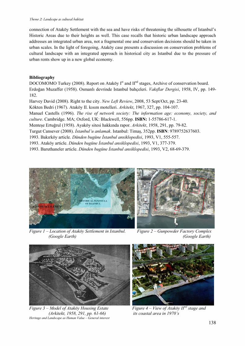
Heritage and Landscape as Human Value – General interest 138
connection of Ataköy Settlement with the sea and have risks of threatening the silhouette of Istanbul’s Historic Areas due to their heights as well. This case recalls that historic urban landscape approach addresses an integrated urban area, not a fragmental one and conservation decisions should be taken in urban scales. In the light of foregoing, Ataköy case presents a discussion on conservation problems of cultural landscape with an integrated approach in historical city as Istanbul due to the pressure of urban rents show up in a new global economy. Bibliography DOCOMOMO Turkey (2008). Report on Ataköy Ist and IInd stages, Archive of conservation board. Erdoğan Muzaffer (1958). Osmanlı devrinde Istanbul bahçeleri. Vakıflar Dergisi, 1958, IV, pp. 149-182. Harvey David (2008). Right to the city. New Left Review, 2008, 53 Sept/Oct, pp. 23-40. Kökten Bedri (1967). Ataköy II. kısım motelleri. Arkitekt, 1967, 327, pp. 104-107. Manuel Castells (1996). The rise of network society: The information age: economy, society, and culture. Cambridge. MA; Oxford, UK: Blackwell, 556pp. ISBN: 1-55786-617-1. Menteşe Ertuğrul (1958). Ayaköy sitesi hakkında rapor. Arkitekt, 1958, 291, pp. 79-82. Turgut Cansever (2008). İstanbul’u anlamak. Istanbul: Timaş, 352pp. ISBN: 9789752637603. 1993. Bakırköy article. Dünden bugüne İstanbul ansiklopedisi, 1993, V1, 555-557. 1993. Ataköy article. Dünden bugüne İstanbul ansiklopedisi, 1993, V1, 377-379. 1993. Baruthaneler article. Dünden bugüne İstanbul ansiklopedisi, 1993, V2, 68-69-379.
Figure 1 – Location of Ataköy Settlement in Istanbul. Figure 2 – Gunpowder Factory Complex (Google Earth) (Google Earth)
Figure 3 – Model of Ataköy Housing Estate Figure 4 – View of Ataköy IInd stage and (Arkitekt, 1958, 291, pp. 61-66) its coastal area in 1970’s
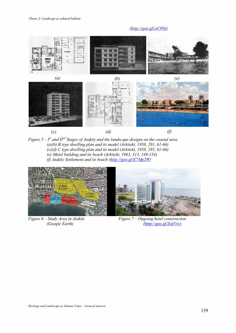
Heritage and Landscape as Human Value – General interest 139
(http://goo.gl/ctC0Nj)
Figure 5 – Ist and IInd Stages of Ataköy and the landscape designs on the coastal area (a)(b) B type dwelling plan and its model (Arkitekt, 1958, 291, 61-66) (c)(d) C type dwelling plan and its model (Arkitekt, 1958, 291, 61-66) (e) Motel building and its beach (Arkitekt, 1963, 313, 149-154) (f) Ataköy Settlement and its beach (http://goo.gl/E7Mp2W)
Figure 6 – Study Area in Ataköy Figure 7 – Ongoing hotel construction (Google Earth) (http://goo.gl/ZatYtv)
(a) (b) (e)
(c) (d) (f)
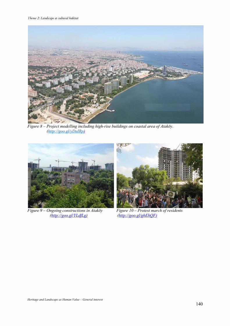
Heritage and Landscape as Human Value – General interest 140
Figure 8 – Project modelling including high-rise buildings on coastal area of Ataköy. (http://goo.gl/yDuIRp)
Figure 9 – Ongoing constructions in Ataköy Figure 10 – Protest march of residents (http://goo.gl/YLdfLg) (http://goo.gl/ghEhQF)
Heritage and Landscape as Human Value – General interest 141
Processes and Transformations in the Creation of Current Landscapes: a
Slovenian Case Study
Daniela RIBEIRO* Mateja ŠMID HRIBAR** Mimi URBANC*** (*) Anton Melik Geographical Institute, ZRC SAZU, Gosposka ulica 13, Ljubljana, +386 2002735, [email protected] (**) Anton Melik Geographical Institute, ZRC SAZU, Gosposka ulica 13, Ljubljana, +386 4706352, [email protected] (***) Anton Melik Geographical Institute, ZRC SAZU, Gosposka ulica 13, Ljubljana, 386 4706354, [email protected]
Abstract The creation of current landscapes depends on the values and activities that people have in their environment. Today’s rural landscapes organically evolved based on the relationship between people and nature and based on traditional practices. Identifying and recognizing drivers of changes and their interactions is most important when seeking to influence and steer the future landscapes. Through our work, we aim to better understand environmental history, long-term processes, and transformations. The spatial and temporal analyses will help in understanding the current landscapes for two in-depth case studies on landscape changes based on historical datasets, field recordings, and oral histories. Keywords: Rural Landscape; Processes; Transformations; Traditions; Cultural Heritage; Slovenia 1. Introduction The cultural landscape reflects natural environmental and human activities that are carried out in the context of society, economics, technology, and politics, and include tangible and intangible elements. The basic characteristic of a landscape is its dynamics because a landscape changes constantly despite its apparent permanence and solidity. Landscape elements change with differing speeds and strengths. The main causes of current land transformation identified by Forman (1995) are deforestation, suburbanization, corridor construction, desertification, agricultural intensification, and reforestation. The main drivers of changes were identified as agriculture modernization (Matthews & Selman, 2006) alongside other economic activities such as building and highway construction (Van Eetvelde & Antrop, 2004; Matthews & Selman, 2006), natural and human-induced factors as climate change, and the impact of public policies (Matthews & Selman, 2006). Some landscape ecologists (Bender et al., 2005) state that extensively managed traditional land use is disappearing due to intensification of agricultural production on the one hand, and the retreat of agriculture from unfavorable areas on the other hand. In contrast, others (Matthews & Selman, 2006) argue that traditional farming practices, which were highly valued by society in their inherited form, now appear obsolete and are no longer viable with technological development and modernization of agriculture. The impact and effects of public policies on the landscape may have negative consequences in landscape changes because these policies are typically created far away from local actors such as farmers (Primdahl et al., 2013). For instance, financial incentives (such as subsidies for special land use) for rural landscapes are typically detached from the historical and ecological value of local landscapes, and therefore they usually do not take into account natural characteristics and local needs. At the lowest level, the history and land use of a landscape plays the key role in its biological and cultural diversity (Jongman & Bunce, 2000). However, the regional differences in landscapes and markets are currently disappearing in Slovenia. In the past, land use was driven by the land’s structure, geomorphology, soil conditions, and water availability. Nowadays, technology and trade policies are the most important determinants of agricultural development, which strongly influences landscape diversity. This also determines
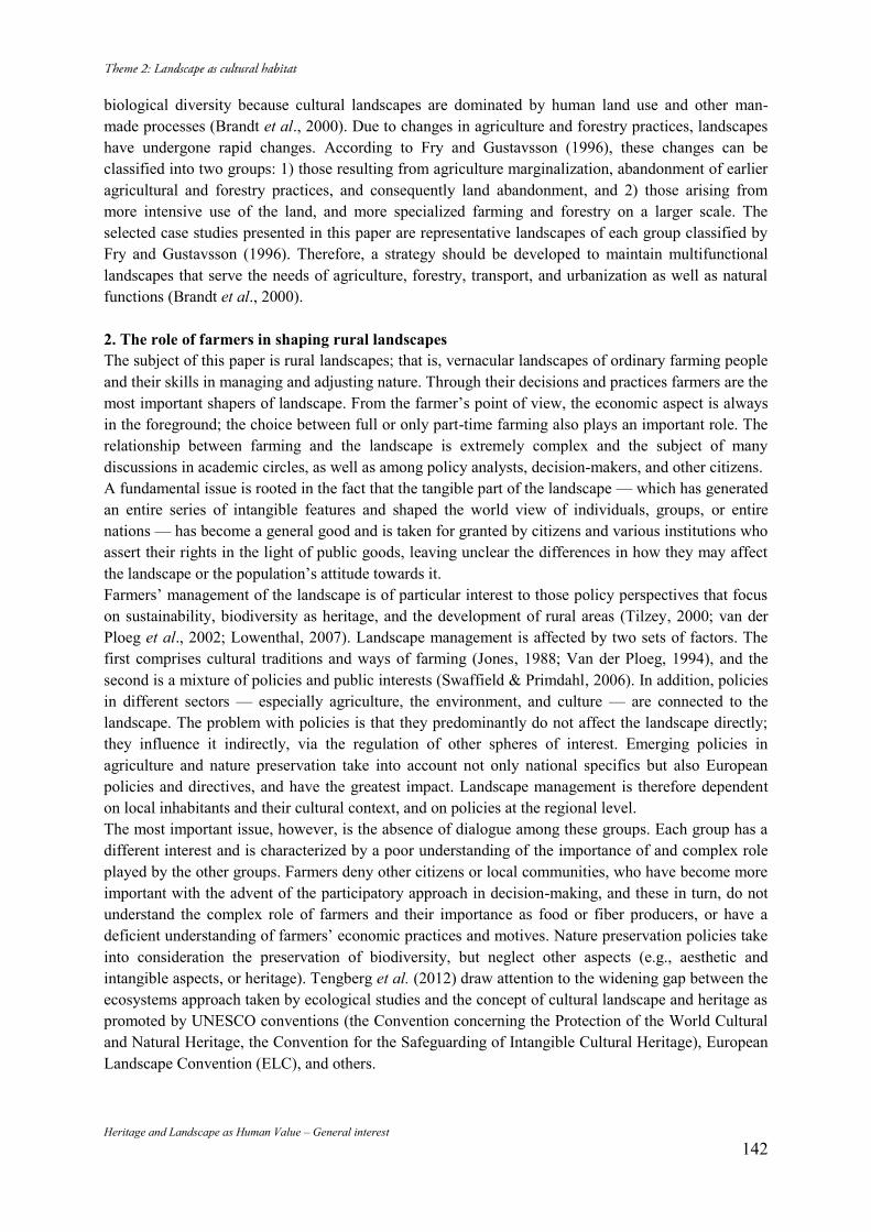
Heritage and Landscape as Human Value – General interest 142
biological diversity because cultural landscapes are dominated by human land use and other man-made processes (Brandt et al., 2000). Due to changes in agriculture and forestry practices, landscapes have undergone rapid changes. According to Fry and Gustavsson (1996), these changes can be classified into two groups: 1) those resulting from agriculture marginalization, abandonment of earlier agricultural and forestry practices, and consequently land abandonment, and 2) those arising from more intensive use of the land, and more specialized farming and forestry on a larger scale. The selected case studies presented in this paper are representative landscapes of each group classified by Fry and Gustavsson (1996). Therefore, a strategy should be developed to maintain multifunctional landscapes that serve the needs of agriculture, forestry, transport, and urbanization as well as natural functions (Brandt et al., 2000). 2. The role of farmers in shaping rural landscapes The subject of this paper is rural landscapes; that is, vernacular landscapes of ordinary farming people and their skills in managing and adjusting nature. Through their decisions and practices farmers are the most important shapers of landscape. From the farmer’s point of view, the economic aspect is always in the foreground; the choice between full or only part-time farming also plays an important role. The relationship between farming and the landscape is extremely complex and the subject of many discussions in academic circles, as well as among policy analysts, decision-makers, and other citizens. A fundamental issue is rooted in the fact that the tangible part of the landscape — which has generated an entire series of intangible features and shaped the world view of individuals, groups, or entire nations — has become a general good and is taken for granted by citizens and various institutions who assert their rights in the light of public goods, leaving unclear the differences in how they may affect the landscape or the population’s attitude towards it. Farmers’ management of the landscape is of particular interest to those policy perspectives that focus on sustainability, biodiversity as heritage, and the development of rural areas (Tilzey, 2000; van der Ploeg et al., 2002; Lowenthal, 2007). Landscape management is affected by two sets of factors. The first comprises cultural traditions and ways of farming (Jones, 1988; Van der Ploeg, 1994), and the second is a mixture of policies and public interests (Swaffield & Primdahl, 2006). In addition, policies in different sectors — especially agriculture, the environment, and culture — are connected to the landscape. The problem with policies is that they predominantly do not affect the landscape directly; they influence it indirectly, via the regulation of other spheres of interest. Emerging policies in agriculture and nature preservation take into account not only national specifics but also European policies and directives, and have the greatest impact. Landscape management is therefore dependent on local inhabitants and their cultural context, and on policies at the regional level. The most important issue, however, is the absence of dialogue among these groups. Each group has a different interest and is characterized by a poor understanding of the importance of and complex role played by the other groups. Farmers deny other citizens or local communities, who have become more important with the advent of the participatory approach in decision-making, and these in turn, do not understand the complex role of farmers and their importance as food or fiber producers, or have a deficient understanding of farmers’ economic practices and motives. Nature preservation policies take into consideration the preservation of biodiversity, but neglect other aspects (e.g., aesthetic and intangible aspects, or heritage). Tengberg et al. (2012) draw attention to the widening gap between the ecosystems approach taken by ecological studies and the concept of cultural landscape and heritage as promoted by UNESCO conventions (the Convention concerning the Protection of the World Cultural and Natural Heritage, the Convention for the Safeguarding of Intangible Cultural Heritage), European Landscape Convention (ELC), and others.
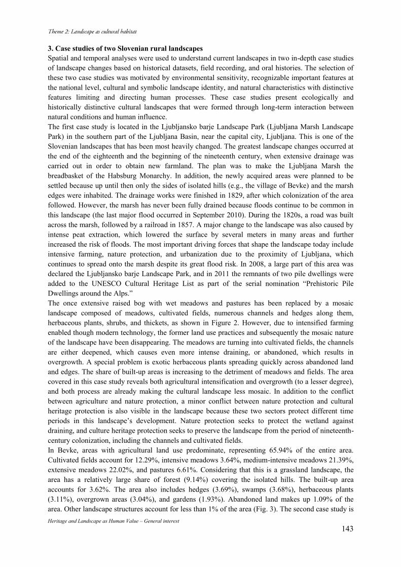
Heritage and Landscape as Human Value – General interest 143
3. Case studies of two Slovenian rural landscapes Spatial and temporal analyses were used to understand current landscapes in two in-depth case studies of landscape changes based on historical datasets, field recording, and oral histories. The selection of these two case studies was motivated by environmental sensitivity, recognizable important features at the national level, cultural and symbolic landscape identity, and natural characteristics with distinctive features limiting and directing human processes. These case studies present ecologically and historically distinctive cultural landscapes that were formed through long-term interaction between natural conditions and human influence. The first case study is located in the Ljubljansko barje Landscape Park (Ljubljana Marsh Landscape Park) in the southern part of the Ljubljana Basin, near the capital city, Ljubljana. This is one of the Slovenian landscapes that has been most heavily changed. The greatest landscape changes occurred at the end of the eighteenth and the beginning of the nineteenth century, when extensive drainage was carried out in order to obtain new farmland. The plan was to make the Ljubljana Marsh the breadbasket of the Habsburg Monarchy. In addition, the newly acquired areas were planned to be settled because up until then only the sides of isolated hills (e.g., the village of Bevke) and the marsh edges were inhabited. The drainage works were finished in 1829, after which colonization of the area followed. However, the marsh has never been fully drained because floods continue to be common in this landscape (the last major flood occurred in September 2010). During the 1820s, a road was built across the marsh, followed by a railroad in 1857. A major change to the landscape was also caused by intense peat extraction, which lowered the surface by several meters in many areas and further increased the risk of floods. The most important driving forces that shape the landscape today include intensive farming, nature protection, and urbanization due to the proximity of Ljubljana, which continues to spread onto the marsh despite its great flood risk. In 2008, a large part of this area was declared the Ljubljansko barje Landscape Park, and in 2011 the remnants of two pile dwellings were added to the UNESCO Cultural Heritage List as part of the serial nomination “Prehistoric Pile Dwellings around the Alps.” The once extensive raised bog with wet meadows and pastures has been replaced by a mosaic landscape composed of meadows, cultivated fields, numerous channels and hedges along them, herbaceous plants, shrubs, and thickets, as shown in Figure 2. However, due to intensified farming enabled though modern technology, the former land use practices and subsequently the mosaic nature of the landscape have been disappearing. The meadows are turning into cultivated fields, the channels are either deepened, which causes even more intense draining, or abandoned, which results in overgrowth. A special problem is exotic herbaceous plants spreading quickly across abandoned land and edges. The share of built-up areas is increasing to the detriment of meadows and fields. The area covered in this case study reveals both agricultural intensification and overgrowth (to a lesser degree), and both process are already making the cultural landscape less mosaic. In addition to the conflict between agriculture and nature protection, a minor conflict between nature protection and cultural heritage protection is also visible in the landscape because these two sectors protect different time periods in this landscape’s development. Nature protection seeks to protect the wetland against draining, and culture heritage protection seeks to preserve the landscape from the period of nineteenth-century colonization, including the channels and cultivated fields. In Bevke, areas with agricultural land use predominate, representing 65.94% of the entire area. Cultivated fields account for 12.29%, intensive meadows 3.64%, medium-intensive meadows 21.39%, extensive meadows 22.02%, and pastures 6.61%. Considering that this is a grassland landscape, the area has a relatively large share of forest (9.14%) covering the isolated hills. The built-up area accounts for 3.62%. The area also includes hedges (3.69%), swamps (3.68%), herbaceous plants (3.11%), overgrown areas (3.04%), and gardens (1.93%). Abandoned land makes up 1.09% of the area. Other landscape structures account for less than 1% of the area (Fig. 3). The second case study is
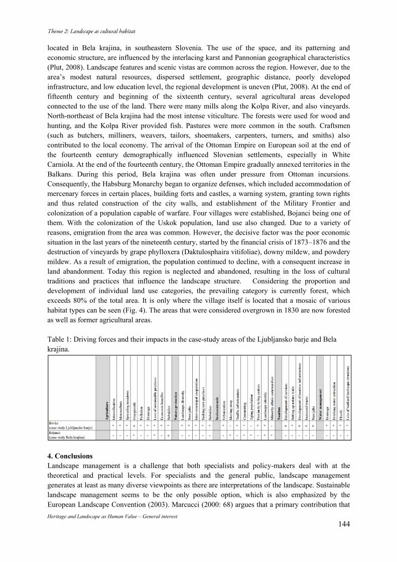
Heritage and Landscape as Human Value – General interest 144
located in Bela krajina, in southeastern Slovenia. The use of the space, and its patterning and economic structure, are influenced by the interlacing karst and Pannonian geographical characteristics (Plut, 2008). Landscape features and scenic vistas are common across the region. However, due to the area’s modest natural resources, dispersed settlement, geographic distance, poorly developed infrastructure, and low education level, the regional development is uneven (Plut, 2008). At the end of fifteenth century and beginning of the sixteenth century, several agricultural areas developed connected to the use of the land. There were many mills along the Kolpa River, and also vineyards. North-northeast of Bela krajina had the most intense viticulture. The forests were used for wood and hunting, and the Kolpa River provided fish. Pastures were more common in the south. Craftsmen (such as butchers, milliners, weavers, tailors, shoemakers, carpenters, turners, and smiths) also contributed to the local economy. The arrival of the Ottoman Empire on European soil at the end of the fourteenth century demographically influenced Slovenian settlements, especially in White Carniola. At the end of the fourteenth century, the Ottoman Empire gradually annexed territories in the Balkans. During this period, Bela krajina was often under pressure from Ottoman incursions. Consequently, the Habsburg Monarchy began to organize defenses, which included accommodation of mercenary forces in certain places, building forts and castles, a warning system, granting town rights and thus related construction of the city walls, and establishment of the Military Frontier and colonization of a population capable of warfare. Four villages were established, Bojanci being one of them. With the colonization of the Uskok population, land use also changed. Due to a variety of reasons, emigration from the area was common. However, the decisive factor was the poor economic situation in the last years of the nineteenth century, started by the financial crisis of 1873–1876 and the destruction of vineyards by grape phylloxera (Daktulosphaira vitifoliae), downy mildew, and powdery mildew. As a result of emigration, the population continued to decline, with a consequent increase in land abandonment. Today this region is neglected and abandoned, resulting in the loss of cultural traditions and practices that influence the landscape structure. Considering the proportion and development of individual land use categories, the prevailing category is currently forest, which exceeds 80% of the total area. It is only where the village itself is located that a mosaic of various habitat types can be seen (Fig. 4). The areas that were considered overgrown in 1830 are now forested as well as former agricultural areas. Table 1: Driving forces and their impacts in the case-study areas of the Ljubljansko barje and Bela krajina.
4. Conclusions Landscape management is a challenge that both specialists and policy-makers deal with at the theoretical and practical levels. For specialists and the general public, landscape management generates at least as many diverse viewpoints as there are interpretations of the landscape. Sustainable landscape management seems to be the only possible option, which is also emphasized by the European Landscape Convention (2003). Marcucci (2000: 68) argues that a primary contribution that
Heritage and Landscape as Human Value – General interest 145
can be made towards sustaining landscapes is to deal with the landscape as a whole and to understand change as a major challenge to landscape planning. We found that landscape structures, functions, and changes vary over time in Ljubljansko Barje (case study 1) and Bela krajina (case study 2), and that these differences are the result of cultural, historical, and economic factors. The cases presented show that cultural landscapes, which are our heritage, are being lost due to intensification of agriculture and overgrowth. Moreover, both processes may be present within the same landscape, as in the case of the Ljubljansko barje (case study 1). The decreased of agricultural areas and inadequate demographic composition of the population, are the basic elements of the transformation in Bela krajina. The selected case studies showed that common policies that do not take specific local features into consideration are inadequate for all landscapes, and this raises issues beyond the local level. The authors agree with Rohring and Gailing (2005) that sustainable landscape management demands sufficient knowledge of the driving forces of change in a given area and the astuteness to recognize the opportunities for affecting these processes. In addition, they confirm the finding of Tengberg et al. (2012) that it is vital to be familiar with all landscape structures and the associated cultural services. Only through familiarity with landscape structures and their services, as well as the specific driving forces in individual areas, can adapted measures be formulated in order to guide the landscape’s future development in the desired direction. Therefore, strategies should be developed to maintain multifunctional landscapes that serve not only agricultural purposes, but also forestry, transport, and urbanization needs as well as the natural functioning of ecosystems. However, developing suitable measures requires demanding negotiations between stakeholders, especially with farmers as the main shapers of the rural landscape. It is obvious that landscape management requires a dialogue to be held among various stakeholders in which various contexts and interests may be examined. One of the key future challenges is to find means and possibilities for landscape management that will not only consider the economic benefits to landowners alone, but also ensure soft benefits for local communities and citizens in general. In addition to international treaties, activities at the local, regional, or national levels must also be present in order to provide incentives for various actors. We therefore encourage proactivity, and we stress the importance of individuals and, perhaps most importantly, empowering local communities to manage their landscapes. Bibliography Bender, O., Boehmer H. J., Jens D. and Schumacher K P (2005). Using GIS to analyse long-term cultural landscape change in Southern Germany. Landscape and Urban Planning. 70: pp. 111-125. DOI:10.1016j.landurbplan.2003.10.008. Brandt, J., Tress B. and Tress G. (2000). Multifunctional Landscapes: Interdisciplinary Approaches to Landscape Research and Management. Conference material for the international conference on “Multifunctional Landscapes: Interdisciplinary Approaches to Landscape Research and Management”. Centre for Landscape Research, University of Roskilde, Denmark. European Landscape Convention. 2003. Forman, R. T. T. (1995). Land Mosaics: The Ecology of Landscapes and Regions. Cambridge University Press, New York. Fry, G. and Gustavsson R. (1996). Testing landscape design principles: the Landscape Laboratory. In: Jongmann Rob H G (ed.) Ecological and Landscape Consequences of Land Use Change. ECNC-publication series on man and nature, Volume 2: pp. 143-154. Jones, M. (1988). Land-Tenure and Landscape Change in Fishing Communities on the Outer Coast of Central Norway, c. 1880 to the Present: Methodological Approaches and Modes of Explanation. Geografiska Annaler. Series B, Human Geography: pp. 197-204. DOI: 10.2307/490755. Jongman, Rob H. G. (2000). The difficult relationship between Biodiversity and Landscape diversity. In: Brandt B., Tress B. and Tress G. Multifunctional Landscapes: Interdisciplinary Approaches to Landscape Research and Management. pp. 72-83.
Heritage and Landscape as Human Value – General interest 146
Jongmann, Rob H. G. and Bunce R. G. H. (2000). Landscape classification, scales and (bio)diversity in Europe. In: Jongmann Rob H G and Mander Ü (eds.) Consequences of Land Use Changes. Advances in Ecological Sciences 5. Computational Mechanics Publications, Southampton, Boston: pp. 11-38. Lowenthal, D. (2007). Living with and looking at landscape. Landscape Research 32. Marcucci, D. J. (2000). Landscape History as a Planning Tool. Landscape and Urban Planning 49: pp. 67-81. Matthews, R. and Selman P. (2006). Landscape as a Focus for Integrating Human and Environmental Processes. Journal of Agricultural Economics, Vol. 57, No. 2: pp. 199–212. Plut, D. (2008). Basic geographic features of Bela krajina (SE Slovenia) and the Lahinja Landscape Park. In: Plut, D. (ed.) Bela krajina in Krajinski park Lahinja. Ljubljana: Znanstvena založba Filozofske fakultete Univerze v Ljubljani. Primdahl, J., Kristensena L. S. and Swaffield S. (2013). Guiding rural landscape change: Current policy approaches and potentials of landscape strategy making as a policy integrating approach. Applied Geography 42: pp. 86-94. DOI: 10.1016/j.apgeog.2013.04.004. Rohring, A, and Gailing L. (2005). Institutional problems and management aspects of shared cultural landscapes. IRS. Swaffield, S. R. and Primdahl J. (2006). Spatial concepts in landscape analysis and policy: some implications of globalisation. Landscape Ecology 21(3): pp. 315-331. Tengberg, A., Fredholm S., Elisasson I., Knez I., Saltzman K. and Watterberg O. (2012). Cultural ecosystem services provided by landscapes. Ecosystem Services 2: pp. 14–26. Tilzey, M. (2000). Natural Areas, the whole countryside approach and sustainable agriculture. Land Use Policy 17. Van der Ploeg, J, D. (1994). Styles of farming. In: Van der Ploeg J. D. and Long A. (eds.) Born from within: Practice and Perspectives of Endogenous Rural Development. Uitgeverij Van Gorcum. Van Eetvelde, V. and Antrop M. (2004). Analyzing structural and functional changes of traditional landscapes – two examples from Southern France. Landscape and Urban Planning 67: pp. 79-95.
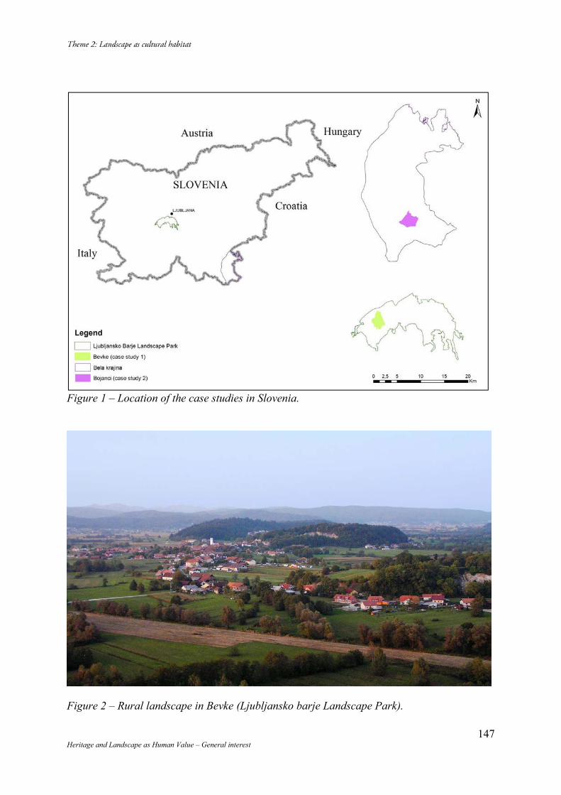
147 Heritage and Landscape as Human Value – General interest
Figure 1 – Location of the case studies in Slovenia.
Figure 2 – Rural landscape in Bevke (Ljubljansko barje Landscape Park).
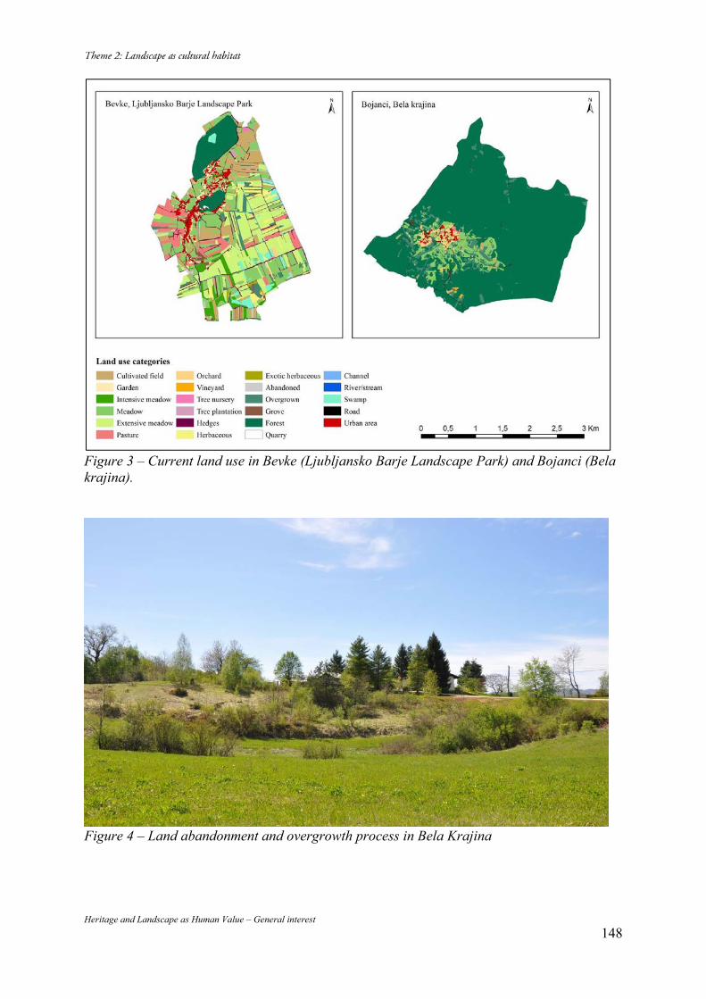
Heritage and Landscape as Human Value – General interest 148
Figure 3 – Current land use in Bevke (Ljubljansko Barje Landscape Park) and Bojanci (Bela krajina).
Figure 4 – Land abandonment and overgrowth process in Bela Krajina
Heritage and Landscape as Human Value – General interest 149
Talayotic Minorca:
a serial approach to an archaeological landscape Angela ROJAS ICOMOS / Cuba, A 9301, Altahabana, Havana, Cuba, (+537) 644 1077, [email protected] Abstract Territorial complexity can be approached, described and analyzed to find values, preserve and conserve them on a sustainable basis through a systemic approach to heritage. This paper shows an important archaeological landscape that was created by the Talayotic Culture of Minorca. Its most interesting feature is the relationship between Prehistoric Architecture and its settings, but also it will be shown how building traditions are still in use in current times, creating a particular spiritual link between the peasants and other inhabitants of the island with their heritage. Keywords: cultural landscape, archaeological landscape, serial properties.
Minorca through a systemic approach Heritage is composed by objective facts already there, that cannot be created but just described, assessed and, of course, enhanced, protected and presented to communities and visitors. But also there are subjective or intangible aspects that are more difficult to assess. Hence the most interesting aspect of looking to heritage as a system is that those links among elements of heritage are not only functional but first, historic, and second: functional, symbolic, typological, results of a process, etc. A systemic approach means to take into account: -Territorial pattern and types: cultural landscapes, series, cultural routes. -Anthropological approach. How people and community give significance to heritage. -A holistic approach to heritage including all scales and significance of values. -Understanding history as a process, not only with regard to facts but also to dynamics in history. -Management as a system. -Risk preparedness as a system. -Presentation and interpretation as a system. This approach includes all World Heritage categories, but also their links to intangible, movable and underwater heritage. And although it is not a World Heritage category, the territorial system of settlements (that includes prehistoric ones in the case of Minorca) because of its importance as a net of places that have their own identity as a whole. Developing the concept of cultural landscape has been a very important step toward a holistic approach to heritage and to the understanding of the relationship with spiritual values of heritage. Cultural landscapes are part of those territorial systems created by history and, because of that, they can also be approached as heritage series, using the same concept developed for World Heritage, but in this case applied not only to that with outstanding universal value. This idea reinforces the concept of heritage as an exponent of an historic - cultural fact or process and not as a mechanism for inscription in the World Heritage List. In this particular case a nomination dossier is being prepared through a serial approach based on the selection of 32 sites that clearly contribute to the outstanding universal value of Talayotic Minorca. At the beginning we had two possible approaches for the nomination: to propose the archaeological landscape that includes almost all the island or to select a series of sites that could represent the whole Minorca’s Talayotic Culture. But although the landscape seems visually intact, therefore keeping its integrity, life has developed along centuries, so prehistoric architecture coexists together with modern factories, houses and resorts.
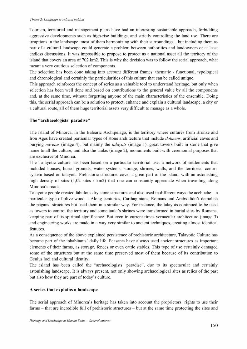
Heritage and Landscape as Human Value – General interest 150
Tourism, territorial and management plans have had an interesting sustainable approach, forbidding aggressive developments such as high-rise buildings, and strictly controlling the land use. There are irruptions in the landscape, most of them harmonizing with their surroundings…but including them as part of a cultural landscape could generate a problem between authorities and landowners or at least endless discussions. It was impossible to propose to protect as a national asset all the territory of the island that covers an area of 702 km2. This is why the decision was to follow the serial approach, what meant a very cautious selection of components. The selection has been done taking into account different frames: thematic - functional, typological and chronological and certainly the particularities of this culture that can be called unique. This approach reinforces the concept of series as a valuable tool to understand heritage, but only when selection has been well done and based on contributions to the general value by all the components and, at the same time, without forgetting anyone of the main characteristics of the ensemble. Doing this, the serial approach can be a solution to protect, enhance and explain a cultural landscape, a city or a cultural route, all of them huge territorial assets very difficult to manage as a whole. The “archaeologists’ paradise” The island of Minorca, in the Balearic Archipelago, is the territory where cultures from Bronze and Iron Ages have created particular types of stone architecture that include dolmens, artificial caves and burying navetas (image 4), but mainly the talayots (image 1), great towers built in stone that give name to all the culture, and also the taulas (image 2), monuments built with ceremonial purposes that are exclusive of Minorca. The Talayotic culture has been based on a particular territorial use: a network of settlements that included houses, burial grounds, water systems, storage, shrines, walls, and the territorial control system based on talayots. Prehistoric structures cover a great part of the island, with an astonishing high density of sites (1,02 sites / km2) that one can constantly appreciate when travelling along Minorca’s roads. Talayotic people created fabulous dry stone structures and also used in different ways the acebuche – a particular type of olive wood -. Along centuries, Carthaginians, Romans and Arabs didn’t demolish the pagans’ structures but used them in a similar way. For instance, the talayots continued to be used as towers to control the territory and some taula’s shrines were transformed in burial sites by Romans, keeping part of its spiritual significance. But even in current times vernacular architecture (image 3) and engineering works are made in a way very similar to ancient techniques, creating almost identical features. As a consequence of the above explained persistence of prehistoric architecture, Talayotic Culture has become part of the inhabitants’ daily life. Peasants have always used ancient structures as important elements of their farms, as storage, fences or even cattle stables. This type of use certainly damaged some of the structures but at the same time preserved most of them because of its contribution to Genius loci and cultural identity. The island has been called the “archaeologists’ paradise”, due to its spectacular and certainly astonishing landscape. It is always present, not only showing archaeological sites as relics of the past but also how they are part of today’s culture. A series that explains a landscape The serial approach of Minorca’s heritage has taken into account the proprietors’ rights to use their farms – that are incredible full of prehistoric structures – but at the same time protecting the sites and
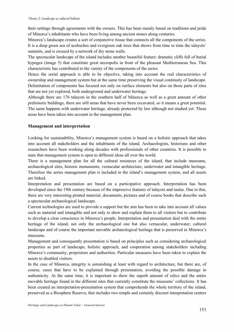
Heritage and Landscape as Human Value – General interest 151
their settings through agreements with the owners. This has been mainly based on traditions and pride of Minorca’s inhabitants who have been living among ancient stones along centuries. Minorca’s landscape creates a sort of conjunctive tissue that connects all the components of the series. It is a deep green sea of acebuches and evergreen oak trees that shows from time to time the talayots’ summits, and is crossed by a network of dry stone walls. The spectacular landscape of the island includes another beautiful feature: dramatic cliffs full of burial hypogea (image 5) that constitute great necropolis in front of the pleasant Mediterranean Sea. This characteristic has contributed to the variety of the components of the series. Hence the serial approach is able to be objective, taking into account the real characteristics of ownership and management system but at the same time preserving the visual continuity of landscape. Delimitation of components has focused not only on surface elements but also on those parts of sites that are not yet explored, both underground and underwater heritage. Although there are 176 talayots in the southern half of Minorca as well as a great amount of other prehistoric buildings, there are still areas that have never been excavated, so it means a great potential. The same happens with underwater heritage, already protected by law although not studied yet. These areas have been taken into account in the management plan. Management and interpretation Looking for sustainability, Minorca’s management system is based on a holistic approach that takes into account all stakeholders and the inhabitants of the island. Archaeologists, historians and other researchers have been working along decades with professionals of other countries. It is possible to state that management system is open to different ideas all over the world. There is a management plan for all the cultural resources of the island, that include museums, archaeological sites, historic monuments, vernacular architecture, underwater and intangible heritage. Therefore the series management plan is included in the island’s management system, and all assets are linked. Interpretation and presentation are based on a participative approach. Interpretation has been developed since the 19th century because of the impressive features of talayots and taulas. Due to this, there are very interesting printed material, documents, pictures and of course books that describe such a spectacular archaeological landscape. Current technologies are used to provide a support but the aim has been to take into account all values such as material and intangible and not only to show and explain them to all visitors but to contribute to develop a clear conscience in Minorca’s people. Interpretation and presentation deal with the entire heritage of the island, not only the archaeological one but also vernacular, underwater, cultural landscape and of course the important movable archaeological heritage that is preserved in Minorca’s museums. Management and consequently presentation is based on principles such as considering archaeological properties as part of landscape, holistic approach, and cooperation among stakeholders including Minorca’s community, proprietors and authorities. Particular measures have been taken to explain the assets to disabled visitors. In the case of Minorca, integrity is astonishing at least with regard to architecture, but there are, of course, cases that have to be explained through presentation, avoiding the possible damage to authenticity. At the same time, it is important to show the superb amount of relics and the entire movable heritage found in the different sites that currently constitute the museums’ collections. It has been created an interpretation-presentation system that comprehends the whole territory of the island, preserved as a Biosphere Reserve, that includes two simple and certainly discreet interpretation centers
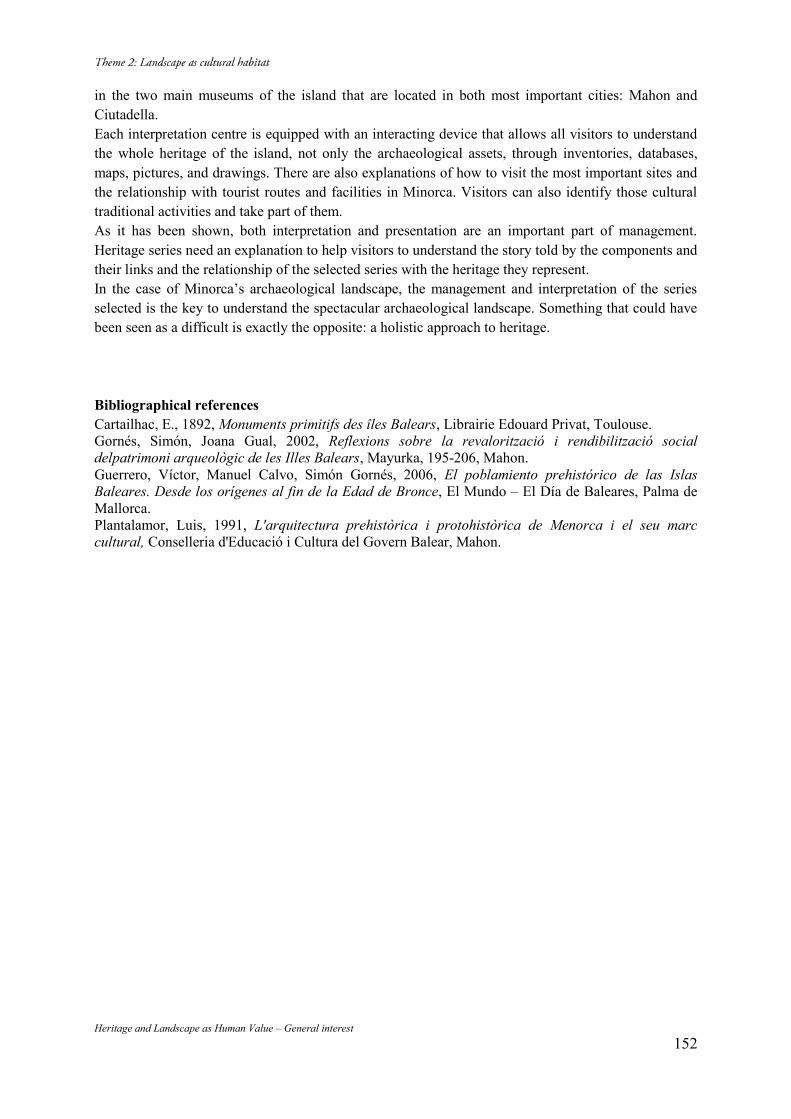
Heritage and Landscape as Human Value – General interest 152
in the two main museums of the island that are located in both most important cities: Mahon and Ciutadella. Each interpretation centre is equipped with an interacting device that allows all visitors to understand the whole heritage of the island, not only the archaeological assets, through inventories, databases, maps, pictures, and drawings. There are also explanations of how to visit the most important sites and the relationship with tourist routes and facilities in Minorca. Visitors can also identify those cultural traditional activities and take part of them. As it has been shown, both interpretation and presentation are an important part of management. Heritage series need an explanation to help visitors to understand the story told by the components and their links and the relationship of the selected series with the heritage they represent. In the case of Minorca’s archaeological landscape, the management and interpretation of the series selected is the key to understand the spectacular archaeological landscape. Something that could have been seen as a difficult is exactly the opposite: a holistic approach to heritage. Bibliographical references Cartailhac, E., 1892, Monuments primitifs des îles Balears, Librairie Edouard Privat, Toulouse. Gornés, Simón, Joana Gual, 2002, Reflexions sobre la revalorització i rendibilització social delpatrimoni arqueològic de les Illes Balears, Mayurka, 195-206, Mahon. Guerrero, Víctor, Manuel Calvo, Simón Gornés, 2006, El poblamiento prehistórico de las Islas Baleares. Desde los orígenes al fin de la Edad de Bronce, El Mundo – El Día de Baleares, Palma de Mallorca. Plantalamor, Luis, 1991, L'arquitectura prehistòrica i protohistòrica de Menorca i el seu marc cultural, Conselleria d'Educació i Cultura del Govern Balear, Mahon.
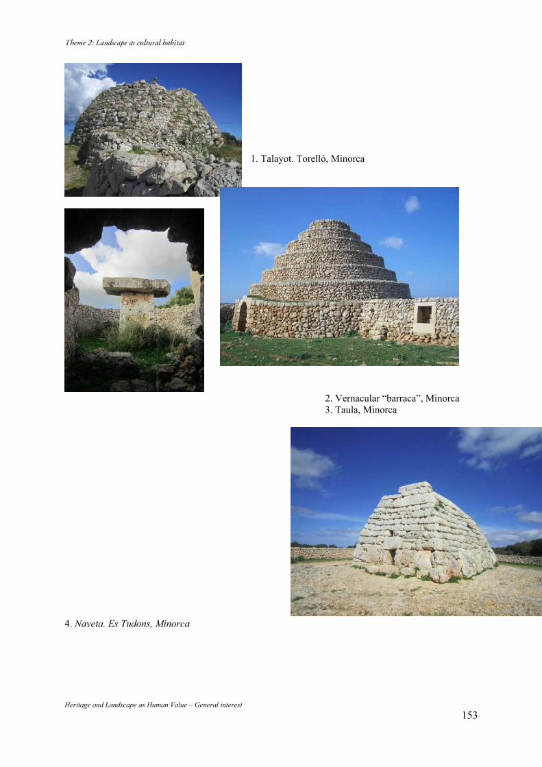
Heritage and Landscape as Human Value – General interest 153
1. Talayot. Torelló, Minorca
2. Vernacular “barraca”, Minorca 3. Taula, Minorca
4. Naveta. Es Tudons, Minorca
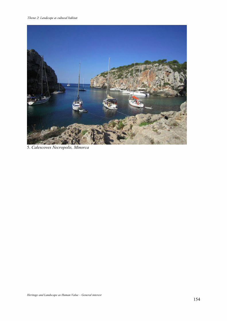
Heritage and Landscape as Human Value – General interest 154
5. Calescoves Necropolis, Minorca
Heritage and Landscape as Human Value – General interest 155
Ancient Theatres as Landscape Elements: the Cases of Teos and Erythrai in Turkey
Işılay Tiarnagh SHERIDAN METU, METU Faculty of Architecture Ankara-TURKEY, 0505 922 67 22, [email protected] Abstract Among ancient monuments, theatres are widely in demand for use by the responsible authorities as a single architectural accomplishment resulting in their isolation from the surrounding landscape. In fact, they were originally constructed carefully as an integral part of the site, i.e natural and man-made topography, physical and cultural landscape. This study presents two cases from Karaburun Peninsula of Izmir in Turkey to suggest a handling of ancient theatres as an integral part in the planning of archaeological landscapes to prevent their isolation from their physical and social context. Keywords: Archaeological Landscape; Ancient Theatres; Teos; Erythrai 1. Introduction: Original Context of the Ancient Theatre’s within the Landscape
Ancient Greek theatres exhibit one of the best examples of a collaborative work between human and nature with their architecture. There are many theories about the origin of their design but among them, a significant one is very intriguing. It suggests that the circular form of the orchestra, “the dancing place”, derives from the threshing floor used in Greek villages. A threshing floor is indeed a circular area paved with stone for choral performances after harvests. These performances were for the celebrations as well as ritual ceremonies to honour gods.1 Around this circular area people used to gather to “see” the performance just as we do to watch artists in street performances today. Later, these performances took the form of Dionysiac religion practices in more developed surroundings. They had regular schedules since they were associated with the rituals. For all these acts had ritual affiliations, the theatre building was considered as part of the temple complex even long after the secularization of theatrical performances. Many of these buildings started to have small temples built in the vicinity. The area was chosen on a steep slope so that people could sit on the ground to “see” the performances and processions taking place in and around the circular area called the “orchestra”. In the process, wooden seats were temporarily built for the participants previously sitting on the ground. The sitting area started to be called as theatron, “the seeing place”, prioritizing the observation over hearing as we mostly do today. The orchestra continued to serve as the main performance area, with a stage building appearing gradually for the differentiation of a few actors from the group performers, in a demountable nature at the beginning. One explanation for the name skene for the stage is its derivation from the Ancient Greek word for a tent out of animal skin (that of the defeated Persian generals in the case of the early Theatre of Dionysus in Athens) temporarily erected facing the audience for the purpose of performances. In later Hellenistic theatres, decoration of the stage was also temporary, consisting of changeable painted panels. As the plays became more complex in their context, the theatre building continued to change accordingly. Then the wooden seats were replaced due to their inefficiency with stone seating blocks constructed following the natural contours of the hillside. As the stone seat design developed, analemmata walls and entrances started to appear where arrangement needed outside of the natural contours. All these arrangements were in association with the topography and the landscape for acoustical, spiritual and visual needs. The performance also included the surrounding area, landscape
1 (Arnott, 1971).
Heritage and Landscape as Human Value – General interest 156
and cityscape by having no strict boundaries. In some plays actors representing gods and goddesses appeared in between the trees as if they were to come out of the divine light.2 In some others, the temples in the background of the orchestra were at a lower level enabling the ghostly figures to be more effective in front of the eternal sky as in the case of the phantom of Darius in the Persians, or enhance the illusion of the descent of Prometheus.3 The effect of such scenes diminished slowly with the construction of the more permanent stage building behind the orchestra. The stage building got higher and more decorated in course of time. The decorated Roman scaenae frons cut the audience from the surrounding landscape and demanded more attention on itself rather than the site. In the later large Roman theatres in urban contexts we see an enclosed space for theatrical performances without the connection to their surroundings. The transition in the name of the space also indicates this radical change in the understanding of the nature of the plays. The theatron “for seeing” is exchanged with the auditorium “for hearing”, thus, leaving the importance of the observation of the play within the site. However, demountable stages stayed in use in several theatres throughout history and geography, including the acropolis theatre in Pergamon in western Anatolia and the Roman period theatre in Sparta in the Peleponnesus. Smaller Roman theatres, are also observed to have maintained their integrity with the natural topography especially in the construction of their seating area.4
2. Teos and Erythrai Theatres: Past - The Evolution of the Original
The theatres in Teos and Erythrai, located in the western Anatolia-Turkey, in a city called Izmir, represent such integrated relationship between human and nature. They are both examples of Hellenistic architecture having later additions of Roman Period, therefore are designed to rest on a natural hill with the view of the city and the sea on the skirts of their acropolises in the vicinity of the temples. The Roman additions to the skene and the cavea slightly damages these visual relationships with vistas and surrounding landscapes but the theatre culture was mainly kept alive until its ban under the Christian Roman Empire. Together with the change in the religious scope and the ways of living, these theatres lost their importance. In further times, there was no such tradition in the Ottoman Empire also and thus these structures lost their use. As a result, the stone blocks started to be re-used for the aid of building fortifications, public buildings and houses. In Teos, the temple on the Acropolis stands as the closest structure to the Sığacık Castle of Ottoman Period and the theatre is the second. As an outcome of this topographical situation once more, their blocks are mostly damaged ones compared with the other structures as Dionysus Temple, bouleuterion or the cistern that are located at the lower part of the city. Now, structure of the stage building can be observed though the seating part was almost completely destroyed. (Fig. 1) As a result, it became the natural topographical feature of the farmlands up until today. The same is also valid for the Erythrai theatre. In this case, the continued inhabitation caused the damage of the stone blocks to create building material for new constructions of the village houses. (Fig. 2) The continuity in religious use of the acropolis can also be seen within this scope. The Matrone Church of the previous occupants of the village before the massive Greco-Turkish population exchange in the Period of World War I in 1923 also stands on the acropolis.5 The remains of the church and the Temple of Athena can only be accessed through the theatre today. This change also explains the process of the theatre’s becoming a natural pathway within the physical landscape. (Fig. 3) 2 (Arnott, 1971). 3 (Bieber, 1961). 4 (Aktüre, 2003). 5 (Kul & Çil, 2014).
Heritage and Landscape as Human Value – General interest 157
This whole scenario actually creates the history of the theatres, the story behind their evolution. Since they were slowly abandoned and looted in terms of architectural elements, they step by step turned to their actual root – the nature-. Today they are out of their context in terms of theatrical properties, but give us information about the structure, how the relation to topography was established in the section, the history of the surrounding land and its effect on these structures and are the elements of the archaeological landscape rather than the cityscape, up to their revival as modern places of performance. 3. Teos and Erythrai Theatres: Present - The Organization of the Evolved
In both cases, Teos and Erythrai, there has been demand from the central authority in charge of registered archaeological heritage in Turkey for the preparation of the sites in view of their modern use. Such a will exists since these areas lay in the variant junctions of archaeological, urban and natural conservation areas of different degrees according to the Turkish conservation law in force and they occupy large touristic sea-side regions. One of the most important conservation considerations in both sites is that the two, like many western Anatolian archaeological sites, are within rural areas, especially in wide olive groves. These groves are also under the protection of related conservation laws. The olive trees within these areas constitute an important part of all the civilizations of western Anatolia ever since the ancient times. They have great significance not only as a landscape element but also as food, oil, soap and fragrance supply and in the case of the theatres, they intentionally created aforementioned atmosphere of the plays in the natural landscape, together with the city and the seascapes. (Fig. 4) In order to meet this demand, the model adopted at Teos is an integrated landscaping project since the outstanding characteristic of the area is a rich uninhabited natural setting together with its olive groves and farmlands that are densely used both by the locals for agricultural and recreational purposes and by visitors. The acropolis temple, gymnasium, theatre, bouleuterion, agora, the Temple of Dionysus inside the city walls of Teos are situated in quite remote locations to each other within dense vegetation and farmlands. Due to this situation, the routes were complicated and the damaged structures as the acropolis temple and the theatre were not easy to discover. Therefore, in the scope of the integrated landscaping project short, medium and long routes were examined and in order to have them easily traceable pathways created via detected natural elements. (Fig. 5) These routes were indicated inside the guide book and necessary info-boards were installed. This solution enabled the minimum disturbance for the farmlands that were previously walked all over by the visitors. It also enabled the minimum expropriation which can cause conflicts between the excavation team and the inhabitants of the area. Moreover, with the 3D laser scanning and other techniques each architectural remnant was documented. During the 3D scanning of the theatre not only the blocks but also the surrounding landscape in close vicinity was documented for further development. The project did not only cover such kind of arrangements and documentations but also integration of the historical context to the public participation. Recognized as the residence of the Asiatic branch of the artists of Dionysus and the home of the famous poets, ancient Teos was at the heart of poetry and theatre. This is also the intangible archaeological legacy of the sociological context of the city as well as the theatre associated with them. In order to revive this context together with the structures, Anacreon poetry readings, annual theatre gatherings and concerts were arranged for public participation in different locations in the city since the theatre was not suitable for gatherings. For Erythrai, there exist no such holistic planning approach whilst the excavation team and the architects working for the site wanted a conservation project together with the village. The reason behind was the lack of funds for the desired management plan. The legislative frame of the area is very complex for the village stands inside the city walls of Erythrai in 1st degree conservation site creating difficulties for the inhabitants. They are
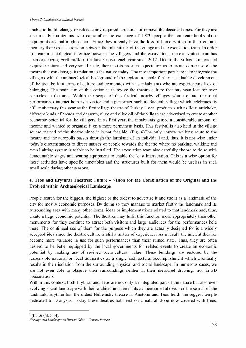
Heritage and Landscape as Human Value – General interest 158
unable to build, change or relocate any required structures or remove the decadent ones. For they are also mostly immigrants who came after the exchange of 1923, people feel on tenterhooks about expropriations that might occur.6 Since they already have the loss of home written in their cultural memory there exists a tension between the inhabitants of the village and the excavation team. In order to create a sociological interface between the villagers and the excavations, the excavation team has been organizing Erythrai/Ildırı Culture Festival each year since 2012. Due to the village’s untouched exquisite nature and very small scale, there exists no such expectation as to create dense use of the theatre that can damage its relation to the nature today. The most important part here is to integrate the villagers with the archaeological background of the region to enable further sustainable development of the area both in terms of culture and economics with its inhabitants who are experiencing lack of belonging. The main aim of this action is to revive the theatre culture that has been lost for over centuries in the area. Within the scope of this festival, nearby villages who are into theatrical performances interact both as a visitor and a performer such as Bademli village which celebrates its 80th anniversary this year as the first village theatre of Turkey. Local products such as Ildırı artichoke, different kinds of breads and desserts, olive and olive oil of the village are advertised to create another economic potential for the villagers. In its first year, the inhabitants gained a considerable amount of income and wanted to organize it on a more permanent basis. This festival is also held in the village square instead of the theatre since it is not feasible. (Fig. 6)The only narrow walking route to the theatre and the acropolis passes through the farmland of an individual and, thus, it is not wise under today’s circumstances to direct masses of people towards the theatre where no parking, walking and even lighting system is viable to be installed. The excavation team also carefully choose to do so with demountable stages and seating equipment to enable the least intervention. This is a wise option for these activities have specific timetables and the structures built for them would be useless in such small scale during other seasons.
4. Teos and Erythrai Theatres: Future - Vision for the Combination of the Original and the Evolved within Archaeological Landscape People search for the biggest, the highest or the oldest to advertise it and use it as a landmark of the city for mostly economic purposes. By doing so they manage to market firstly the landmark and its surrounding area with many other items, ideas or implementations related to that landmark and, thus, create a huge economic potential. The theatres may fulfil this function more appropriately than other monuments for they continue to attract both visitors and large audiences for the performances held there. The continued use of them for the purpose which they are actually designed for is a widely accepted idea since the theatre culture is still a matter of experience. As a result, the ancient theatres become more valuable in use for such performances than their ruined state. Thus, they are often desired to be better equipped by the local governments for related events to create an economic potential by making use of revived socio-cultural value. These buildings are restored by the responsible national or local authorities as a single architectural accomplishment which eventually results in their isolation from the surrounding physical and social landscape. In numerous cases, we are not even able to observe their surroundings neither in their measured drawings nor in 3D presentations. Within this context, both Erythrai and Teos are not only an integrated part of the nature but also ever evolving social landscape with their architectural remnants as mentioned above. For the search of the landmark, Erythrai has the oldest Hellenistic theatre in Anatolia and Teos holds the biggest temple dedicated to Dionysus. Today these theatres both rest on a natural slope now covered with trees,
6 (Kul & Çil, 2014).
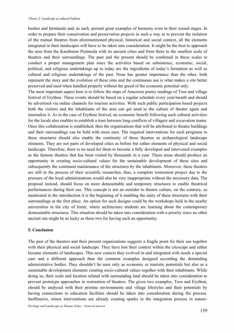
Heritage and Landscape as Human Value – General interest 159
bushes and farmlands and, as such, present great examples of harmony even in their ruined stages. In order to prepare their conservation and preservation projects in such a way as to prevent the isolation of the mutual theatres from aforementioned physical, historical and social context, all the elements integrated in their landscapes will have to be taken into consideration. It might be the best to approach the area from the Karaburun Peninsula with its ancient cities and from there to the smallest scale of theatres and their surroundings. The past and the present should be combined in these scales to conduct a proper management plan since the activities based on subsistence, economic, social, political, and religious undertakings up to today are the ingredients of today’s formation as well as cultural and religious undertakings of the past. None has greater importance than the other, both represent the story and the evolution of these sites and the continuous use is what makes a site better preserved and used when handled properly without the greed of the economic potential only. The most important aspect here is to follow the steps of Anacreon poetry readings of Teos and village festival of Erythrai. These events should be based on a regular schedule every year/month and should be advertised via online channels for tourism activities. With such public participation based projects both the visitors and the inhabitants of the area can get used to the culture of theatre again and internalize it. As in the case of Erythrai festival, an economic benefit following such cultural activities for the locals also enables to establish a trust between long-conflicts of villagers and excavation teams. Once this collaboration is established, then the organizations that will be attributed to theatre buildings and their surroundings can be held with more ease. The required interventions for such programs to these structures should also enable the continuity of these theatres as archaeological landscape elements. They are not parts of developed cities as before but rather elements of physical and social landscape. Therefore, there is no need for them to become a fully developed and intervened examples as the famous theatres that has been visited by thousands in a year. These areas should produce an opportunity in creating socio-cultural values for the sustainable development of these sites and subsequently the continued maintenance of the structures by the inhabitants. Moreover, these theatres are still in the process of their scientific researches, thus, a complete restoration project due to the pressure of the local administrations would also be very inappropriate without the necessary data. The proposal instead, should focus on more demountable and temporary structures to enable theatrical performances during their use. This concept is not an outsider to theatre culture, on the contrary, as mentioned in the introduction it is the beginning of it enabling the unity of these structures with their surroundings at the first place. An option for such designs could be the workshops held in the nearby universities in the city of Izmir, where architecture students are learning about the contemporary demountable structures. This situation should be taken into consideration with a priority since no other ancient site might be as lucky as these two for having such an opportunity.
5. Conclusion
The past of the theatres and their present organizations suggests a fragile point for their use together with their physical and social landscape. They have lost their context within the cityscape and rather became elements of landscapes. This new context they evolved in and integrated with needs a special care and a different approach than the common examples designed according the demanding administrative bodies. They shouldn’t be seen only as economic or touristic potentials but also as a sustainable development elements creating socio-cultural values together with their inhabitants. While doing so, their scale and location related with surrounding land should be taken into consideration to prevent prototype approaches in restoration of theatres. The given two examples, Teos and Erythrai, should be analysed with their pristine environments and village lifestyles and their potentials by having connections to education facilities should be taken into consideration during the process. Inoffensive, minor interventions are already creating sparks in the integration process in nature-
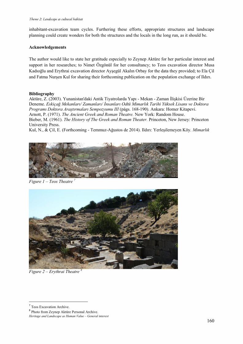
Heritage and Landscape as Human Value – General interest 160
inhabitant-excavation team cycles. Furthering these efforts, appropriate structures and landscape planning could create wonders for both the structures and the locals in the long run, as it should be.
Acknowledgements
The author would like to state her gratitude especially to Zeynep Aktüre for her particular interest and support in her researches; to Nimet Özgönül for her consultancy; to Teos excavation director Musa Kadıoğlu and Erythrai excavation director Ayşegül Akalın Orbay for the data they provided; to Ela Çil and Fatma Nurşen Kul for sharing their forthcoming publication on the population exchange of Ildırı.
Bibliography Aktüre, Z. (2003). Yunanistan'daki Antik Tiyatrolarda Yapı - Mekan - Zaman İlişkisi Üzerine Bir Deneme. Eskiçağ Mekanları/ Zamanları/ İnsanları Odtü Mimarlık Tarihi Yüksek Lisans ve Doktora Programı Doktora Araştırmaları Sempozyumu III (págs. 168-190). Ankara: Homer Kitapevi. Arnott, P. (1971). The Ancient Greek and Roman Theatre. New York: Random House. Bieber, M. (1961). The History of The Greek and Roman Theater. Princeton, New Jersey: Princeton University Press. Kul, N., & Çil, E. (Forthcoming - Temmuz-Ağustos de 2014). Ildırı: Yerleşilemeyen Köy. Mimarlık
Figure 1 – Teos Theatre 7
Figure 2 – Erythrai Theatre 8
7 Teos Excavation Archive. 8 Photo from Zeynep Aktüre Personal Archive.
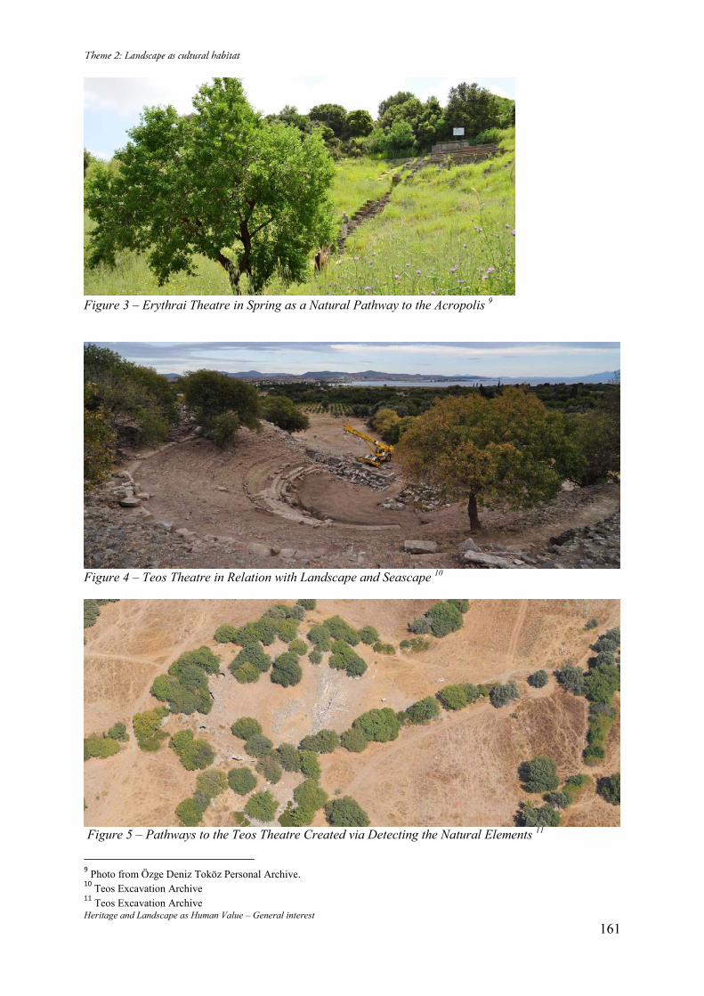
Heritage and Landscape as Human Value – General interest 161
Figure 3 – Erythrai Theatre in Spring as a Natural Pathway to the Acropolis 9
Figure 4 – Teos Theatre in Relation with Landscape and Seascape 10
Figure 5 – Pathways to the Teos Theatre Created via Detecting the Natural Elements 11
9 Photo from Özge Deniz Toköz Personal Archive. 10 Teos Excavation Archive 11 Teos Excavation Archive
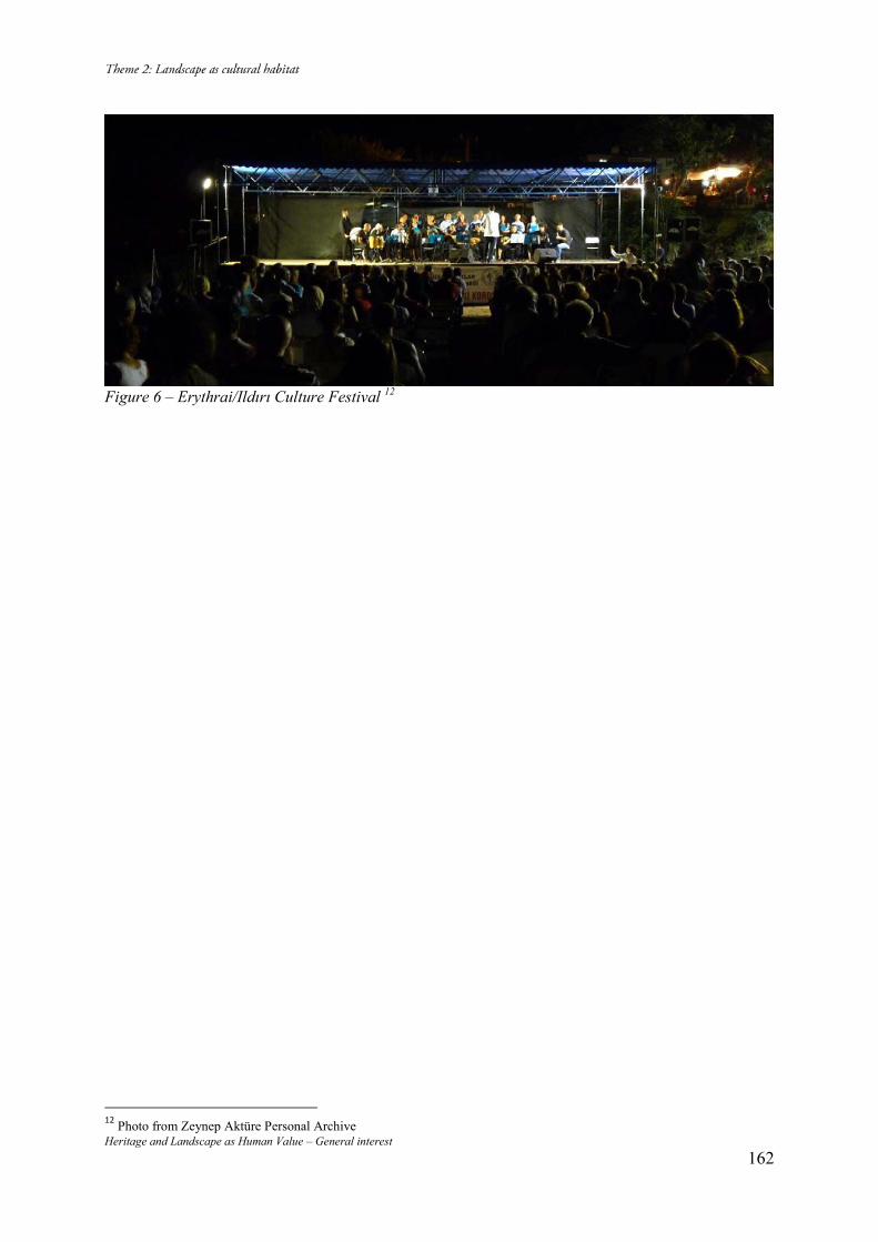
Heritage and Landscape as Human Value – General interest 162
Figure 6 – Erythrai/Ildırı Culture Festival 12
12 Photo from Zeynep Aktüre Personal Archive
Heritage and Landscape as Human Value – General interest 163
La patrimonialisation du Paysage culturel du Lac de Patzcuaro, outil ou
contrainte Ana Lucía GONZALEZ IBAÑEZ Taller Patrimonio & Metrópoli - ICOMOS MEXICANO-ICICH, adresse: AV LA PAZ 2121-506 GUADALAJARA JALISCO MEXICO, Phone +52.33.36.15.32.14.Mobile : 33 114344459 email : [email protected] Résumé L’état de Michoacan subit aujourd’hui une situation délicate : La violence du crime organisé. Malgré cette circonstance, les communautés continuent à reproduire et préserver leurs traits identitaires. La région du lac de Patzcuaro, se conforme d’un paysage naturel réceptacle de l’imaginaire de sa cosmogonie. La fête des morts proclamée en 2003 patrimoine immatériel de l’humanité, a détoné un des phénomènes touristiques les plus importants du Mexique. Une approche critique à partir des outils normatifs et techniques de la conservation sera le point de départ pour la réflexion à présenter. Mots clés : Patzcuaro, paysage culturel, cosmogonie, patrimonialisation, modèles de gestion 1. La patrimonialisation Le lac de Patzcuaro est sans doute un lieu, de culture vivante. L’esprit du lieu, à la région du lac retrouve un exemple très clair face â la déclaration de Québec (2008) qui exprime : Cette Déclaration s’inscrit dans une série de mesures et d’actions entreprises depuis quelques années par ICOMOS pour sauvegarder et promouvoir l’esprit des lieux, principalement leur caractère vivant, social et spirituel.1 A partir de cette idée, il est convenable de mettre sur la table les réalités et contextes diverses selon lesquels les mesures proclamés par les organismes chargés de la préservation du patrimoine culturel, du point de vue internationale, mais surtout locale, ont fait un impact sur les communautés et leur esprit du lieu. D’une part, le tourisme massif est un des plus forts impacts qui ont dépouillé les lieux des significations. La cosmogonie, les traditions, transmises de génération en génération, se sont transformées en marché de spectacle pour faire part de la logique de compétitivité des villes. D’autre part, le thème de la situation de marginalisation et pauvreté, a trouvé un instrument de solution ou panacée au discours du développement locale, que voit aussi dans l’activité touristique, son slogan. Ceux deux approches / stratégies, entre autres, ont été le point de départ dans cette région du lac de Patzcuaro, pour monter des différents programmes, méthodes de gestion, au trois niveaux du gouvernement. Pour poser un seul exemple, dû la limite du texte, le programme Pueblos Mágicos, commencé en 2001 au Mexique, est un programme sectoriel qui a pour but la mise en scène de « la magie » des villages, pour y engager les possibilités de création d’emploi, de développement locale. Depuis lors, au Mexique on compte 83 Pueblos Mágicos. Nombreux études de comités scientifiques et de networks thématiques s’occupent de cet impact, entre autres, nous trouvons auteurs comme Méndez Sainz, Lopez Levy, Valverde, Chumillas, Hiernaux, González I. Les conclusions générales jusqu'à présent se prononcent pour dévoiler le masque des mises en scène et faire ressortir les vrais imaginaires qui sont la base de la préservation de la culture, jusqu’à présent. L’investissement pour le programme d’ici au 2018 sera de 4 mil millions de pesos (300 millions de USD). C’est un investissement historique, et l’état de Michoacan aura un montant assez important car la plus part de Pueblos Mágicos se trouvent dans son territoire. Face à cette réalité, on peut regarder les niveaux de
1 http://quebec2008.icomos.org/fr/99_introblog.htm Pag 2.
Heritage and Landscape as Human Value – General interest 164
pauvreté multidimensionnelle,2 de l’état de Michoacan qui en 2012 ont été plus élevés que ceux du pays entier. Le 54.7% des Michoacanos demeurent en condition de pauvreté, le 8.7 % plus que la moyenne nationale. Les communautés autour du lac, depuis trente cinq ans ont subi une chute importante en ce qui concerne la qualité de vie, l’accès aux opportunités de conditions élémentaires, et des conditions pour leurs marchés locales de production et commercialisation d’artisanat, agriculture, pêche. Depuis le long du 20ème siècle, cette ségrégation culturelle, éducative, de santé a provoqué un état de déséquilibre, d’inégalité que l’on peut élucider aujourd’hui, c’est la base de cette violence et par conséquence, l’appropriation du territoire par le crime organisé. Malgré les efforts des conventions issues de l’UNESCO, ICOMOS, et d’autres organismes nationaux, la réalité dépasse les postulats théoriques, les bonnes intentions. La condition de pauvreté, force l’acceptation de ces programmes, qui banalisent d’une part tous leurs savoirs, leurs histoires et traditions, et d’autre part construisent l’illusion d’un futur meilleur. 2. La Région - Cosmogonie Le paysage culturel du lac de Patzcuaro, est une région composée de trois éléments naturels : eau, ciel et caves qui ont une étroite relation avec l’imaginaire de sa cosmogonie. Le territoire a été occupé par le groupe connu comme purhepecha, bien avant l’arrivée des conquéreurs. Ils ont conformé un système de commercialisation, de division du travail exceptionnel, et en plus ils ont consolidé et articulé, les établissements humains autour du lac répondait à des relations avec des positions astronomiques3. L’arrivé du dernier groupe, au lac - les uacusechas - au XII siècle a consolidé cette structure commerciale assez puissante conformé par les différents villages établis préalablement autour du lac. Cela a facilité le renforcement du pouvoir et leur expansion à l’occident et n’avoir jamais été soumis par les aztèques. (Fig . 1) La conception du monde, la métaphore de la géographie de l’univers était très similaire à celle des autres peuples mésoaméricains, mais la différence se retrouve surtout dans les expressions culturelles actuelles du peuple purhepecha. L'univers était fait de trois parties: Le Ciel (Arándaro). La Terre (Echerendo), une déesse à quatre quarts : les 4 points cardinaux. Et l’inframonde (cumiechucuaro), qui était la place des morts associé aux cavernes, souris, serpents, à présent ce ci joue un rôle important dans leur quotidien. Comme indiqué préalablement, les quatre quarts de la terre, c’est à dire les quatre points cardinaux, avaient une quatrième dimension : le centre. Chaque orientation était associée avec une couleur. Le nord (tsimpambeuca) jaune ; le rouge pour l’est (charapecua) ; l’ouest représenté par le blanc (urahuas); et le bleu (chupicua) par le centre, selon Pollard à partir de Gilberti, M (1987). Le nord et le sud associés aussi, avec la droite et la gauche respectivement en référence à la lever de soleil ; et l’ouest associé avec la déité de la mer et l’est encore avec la déesse de la terre, Cueruaperi, direction para laquelle elle a envoyé la pluie. (Fig. 2) En ce qui concerne les espaces sacrés, la nature, les montagnes les eaux thermales et les caves, il est intéressant de mentionner que Pollard signale à partir de la Relation de Michoacán, que la montagne était le médiateur par excellence entre le ciel et la terre, et se constituait le lieu de rituels, refuge en temps difficiles, parmi lesquelles, le Cerro Tzirate, Cerro Tariácuri et le Cerro Tancítaro sont des montagnes sacrés autour du lac. (Fig. 3) Les eaux thermales, principalement d’eau minérale étaient la demeure de la Déesse Cuerauperi, ainsi que la déesse de la fertilité, Xaratanga, identifiée aussi avec les lacs et les terrains de « tule ».
2 Définition: un individu se trouve dans cette situation quand il ne possède pas les moyens pour accéder aux services minimaux de santé, éducation, sécurité sociale, alimentation, et espaces de qualité de son habitat. Coneval http://www.coneval.gob.mx. 3 Pollard,Helen, Gorestein Shirley, 1983.
Heritage and Landscape as Human Value – General interest 165
Cette relation avec la nature, a été adoptée par les uacusechas, qui ont imposé leur manière d’organisation et de pouvoir entre les différents villages. L’idéologie du pouvoir était conformé par la classe sociale dominante. Certainement á la lumière de nos jours, le groupe au pouvoir, agissait de manière autocratique imposant leurs formes et vision de l’univers. Les établissements plus importants étaient Patzcuaro, Tzintzuntzan, Erongaricuaro ; la population du lac était nombreuse et a l’arrivée des espagnols, de même. Des remarquables routes de transport, de commercialisation ont été construites et tracées par terre et par eau. Pollard ainsi que Espejel Carvajal ont fait des études en ce domaine dans les années 80. (Figg. 4, 5) Cette complexité d’organisation et de cosmogonie, après la Conquista, Don Vasco de Quiroga la trouvera de même exceptionnelle. La relation homme-nature, l’eau sous toutes ces formes, élément précieux et symbolique; la maison qui reproduisait dans sa construction l’ordre de l’univers ; les montagnes et animaux, leur relation avec ce monde et l’inframonde voire la relation avec ses morts, a été un élément de cohésion sociale et culturelle extraordinaire et leur principe de division de travail, qui a été adapté par Vasco de Quiroga. Il écrira, « la ville de Dieu est ici ». Il décida construire son utopie, à partir des Hospitales Pueblo organisation communale de production et éducation. Les différentes activités artisanales se développent fortement, et Vasco de Quiroga se rend le plus important des promoteurs de cette structure qui se préserve à nos jours. Les savoirs et connaissances ont continué à se reproduire a travers le temps et aujourd’hui s’expriment à travers la production artisanale et les festivités diverses ; l’une d’elles, la fête des morts proclamé en 2003 patrimoine immatériel de l’humanité, inscrite en 2008 dans la Liste. La fête des morts de Janitzio, île centrale du lac, pendant des décades a été un icône de cette expression culturelle issue de ces croyances authentiques. Malheureusement, aujourd`hui cette fête est une de plus importantes mises en scène pour l’attraction touristique. (Fig. 6) 3. Les transformations - Bouleversements Depuis longtemps un phénomène très important se présente cycliquement : la dégradation du contexte naturel. Des projets multidisciplinaires en cours révèlent que cette dégradation a été partie de la vie des communautés, qui en même temps procuraient mettre les bases pour la rénovation du territoire. Au lac de Patzcuaro, les études de Christopher Fisher (2007-2010) mettent une perspective assez intéressante. Bien que ces études sont une démonstration de la connaissance profonde des habitants de leur territoire, il est question aussi, de faire attention dans le contexte décrit au début, qui part de l’épuisement du territoire et même les valeurs patrimoniaux, par le marché financier, soit sous forme de tourisme, soit sous forme du marché immobilier, développements touristiques massifs, etc. Les transformations socio-spatiales, la banalisation des fêtes traditionnelles, de savoirs anciens, et d’autres expressions du patrimoine se déguisent en stratégies de Conservation. Des programmes touristiques sont mis en faveur de projets du marché en troublant leurs modes d’habiter et de relation avec la Nature et la diversité des expressions culturelles. La fête des Morts, une célébration de trois jours, avec un sens spirituel de communication avec ceux qui sont partis, visite de l’inframonde, appelant à leur conception de l’univers, aujourd’hui est un spectacle majeur.4 En 2012, la chiffre de visiteurs fut de 20 mil touristes, pour fêter dans une petite île de 2 500 habitants uniquement. Les habitants originaires commencent à célébrer chez eux, pas au cimetière, car l’intimité de la rencontre avec ses proches morts, est bouleversée. Donc, l’authenticité et intégrité des valeurs patrimoniaux, leur sens du lieu se transforment en attrait touristique potentiel, en détriment des valeurs et expressions authentiques et d’intégrité des porteurs de ce patrimoine. (Fig. 7) La région du lac de Patzcuaro articulé avec les croyances mythes et rites reste aujourd’hui, malgré tout, comme élément symbolique très important des ces populations, pas uniquement purhepechas mais métisses ; élément symbolique contre la pauvreté, les stratégies de tourisme, comme mécanisme d’échange multiculturel, due à la
4 http://www.animalpolitico.com/blogueros-codices-geek/2012/10/26/a-patzcuaro-en-dia-de-muertos-no-por-favor/.
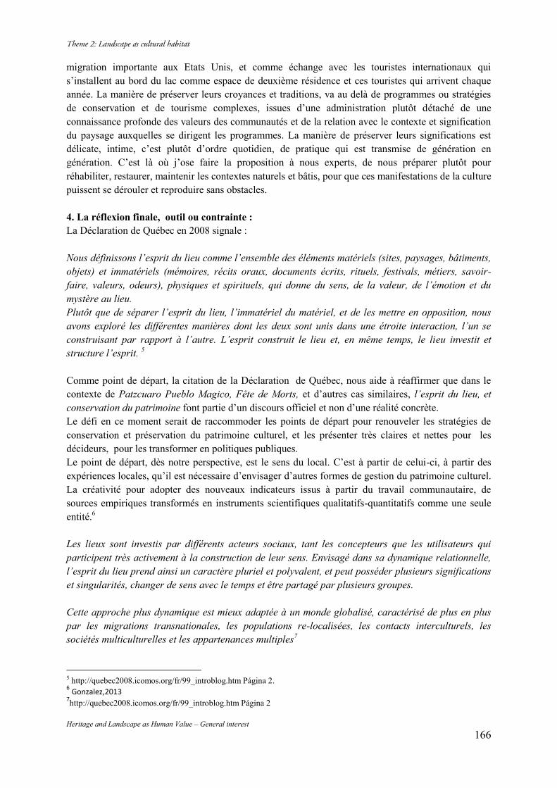
Heritage and Landscape as Human Value – General interest 166
migration importante aux Etats Unis, et comme échange avec les touristes internationaux qui s’installent au bord du lac comme espace de deuxième résidence et ces touristes qui arrivent chaque année. La manière de préserver leurs croyances et traditions, va au delà de programmes ou stratégies de conservation et de tourisme complexes, issues d’une administration plutôt détaché de une connaissance profonde des valeurs des communautés et de la relation avec le contexte et signification du paysage auxquelles se dirigent les programmes. La manière de préserver leurs significations est délicate, intime, c’est plutôt d’ordre quotidien, de pratique qui est transmise de génération en génération. C’est là où j’ose faire la proposition à nous experts, de nous préparer plutôt pour réhabiliter, restaurer, maintenir les contextes naturels et bâtis, pour que ces manifestations de la culture puissent se dérouler et reproduire sans obstacles. 4. La réflexion finale, outil ou contrainte : La Déclaration de Québec en 2008 signale : Nous définissons l’esprit du lieu comme l’ensemble des éléments matériels (sites, paysages, bâtiments, objets) et immatériels (mémoires, récits oraux, documents écrits, rituels, festivals, métiers, savoir-faire, valeurs, odeurs), physiques et spirituels, qui donne du sens, de la valeur, de l’émotion et du mystère au lieu. Plutôt que de séparer l’esprit du lieu, l’immatériel du matériel, et de les mettre en opposition, nous avons exploré les différentes manières dont les deux sont unis dans une étroite interaction, l’un se construisant par rapport à l’autre. L’esprit construit le lieu et, en même temps, le lieu investit et structure l’esprit. 5 Comme point de départ, la citation de la Déclaration de Québec, nous aide à réaffirmer que dans le contexte de Patzcuaro Pueblo Magico, Fête de Morts, et d’autres cas similaires, l’esprit du lieu, et conservation du patrimoine font partie d’un discours officiel et non d’une réalité concrète. Le défi en ce moment serait de raccommoder les points de départ pour renouveler les stratégies de conservation et préservation du patrimoine culturel, et les présenter très claires et nettes pour les décideurs, pour les transformer en politiques publiques. Le point de départ, dès notre perspective, est le sens du local. C’est à partir de celui-ci, à partir des expériences locales, qu’il est nécessaire d’envisager d’autres formes de gestion du patrimoine culturel. La créativité pour adopter des nouveaux indicateurs issus à partir du travail communautaire, de sources empiriques transformés en instruments scientifiques qualitatifs-quantitatifs comme une seule entité.6 Les lieux sont investis par différents acteurs sociaux, tant les concepteurs que les utilisateurs qui participent très activement à la construction de leur sens. Envisagé dans sa dynamique relationnelle, l’esprit du lieu prend ainsi un caractère pluriel et polyvalent, et peut posséder plusieurs significations et singularités, changer de sens avec le temps et être partagé par plusieurs groupes. Cette approche plus dynamique est mieux adaptée à un monde globalisé, caractérisé de plus en plus par les migrations transnationales, les populations re-localisées, les contacts interculturels, les sociétés multiculturelles et les appartenances multiples7 5 http://quebec2008.icomos.org/fr/99_introblog.htm Página 2. 6 Gonzalez,2013 7http://quebec2008.icomos.org/fr/99_introblog.htm Página 2
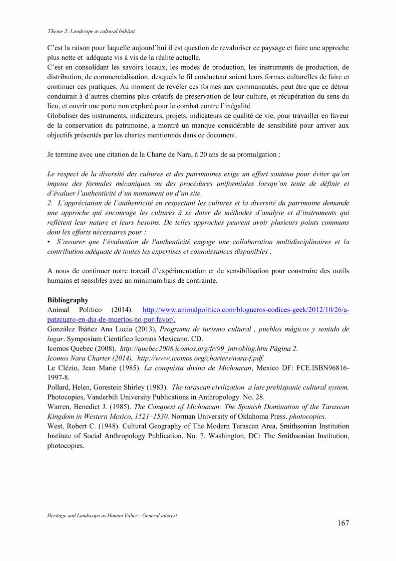
Heritage and Landscape as Human Value – General interest 167
C’est la raison pour laquelle aujourd’hui il est question de revaloriser ce paysage et faire une approche plus nette et adéquate vis à vis de la réalité actuelle. C’est en consolidant les savoirs locaux, les modes de production, les instruments de production, de distribution, de commercialisation, desquels le fil conducteur soient leurs formes culturelles de faire et continuer ces pratiques. Au moment de révéler ces formes aux communautés, peut être que ce détour conduirait à d’autres chemins plus créatifs de préservation de leur culture, et récupération du sens du lieu, et ouvrir une porte non exploré pour le combat contre l’inégalité. Globaliser des instruments, indicateurs, projets, indicateurs de qualité de vie, pour travailler en faveur de la conservation du patrimoine, a montré un manque considérable de sensibilité pour arriver aux objectifs présentés par les chartes mentionnés dans ce document. Je termine avec une citation de la Charte de Nara, à 20 ans de sa promulgation : Le respect de la diversité des cultures et des patrimoines exige un effort soutenu pour éviter qu’on impose des formules mécaniques ou des procédures uniformisées lorsqu’on tente de définir et d’évaluer l’authenticité d’un monument ou d’un site. 2. L’appréciation de l’authenticité en respectant les cultures et la diversité du patrimoine demande une approche qui encourage les cultures à se doter de méthodes d’analyse et d’instruments qui reflètent leur nature et leurs besoins. De telles approches peuvent avoir plusieurs points communs dont les efforts nécessaires pour : • S’assurer que l’évaluation de l'authenticité engage une collaboration multidisciplinaires et la contribution adéquate de toutes les expertises et connaissances disponibles ; A nous de continuer notre travail d’expérimentation et de sensibilisation pour construire des outils humains et sensibles avec un minimum bais de contrainte. Bibliography Animal Político (2014). http://www.animalpolitico.com/blogueros-codices-geek/2012/10/26/a-patzcuaro-en-dia-de-muertos-no-por-favor/. González Ibáñez Ana Lucia (2013), Programa de turismo cultural , pueblos mágicos y sentido de lugar. Symposium Cientifico Icomos Mexicano. CD. Icomos Quebec (2008). http://quebec2008.icomos.org/fr/99_introblog.htm Página 2. Icomos Nara Charter (2014). http://www.icomos.org/charters/nara-f.pdf. Le Clézio, Jean Marie (1985). La conquista divina de Michoacan, Mexico DF: FCE.ISBN96816-1997-8. Pollard, Helen, Gorestein Shirley (1983). The tarascan civilization a late prehispanic cultural system. Photocopies, Vanderbilt University Publications in Anthropology. No. 28. Warren, Benedict J. (1985). The Conquest of Michoacan: The Spanish Domination of the Tarascan Kingdom in Western Mexico, 1521–1530. Norman University of Oklahoma Press. photocopies. West, Robert C. (1948). Cultural Geography of The Modern Tarascan Area, Smithsonian Institution Institute of Social Anthropology Publication, No. 7. Washington, DC: The Smithsonian Institution, photocopies.
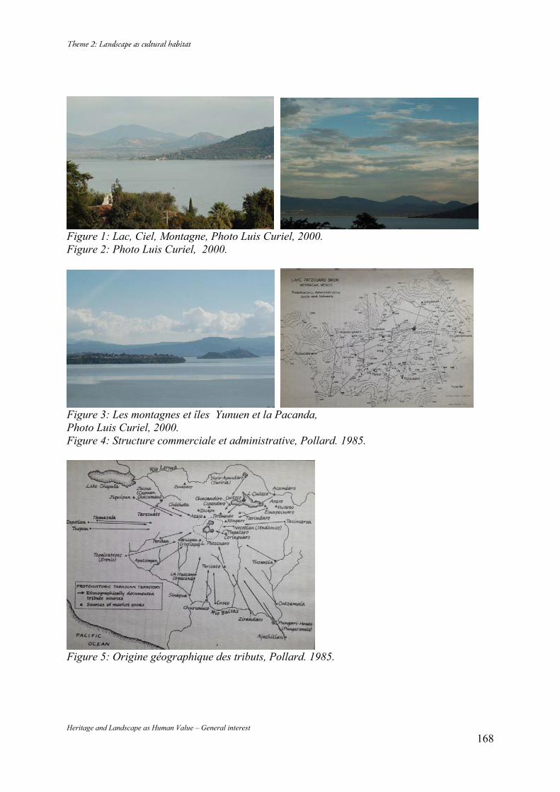
Heritage and Landscape as Human Value – General interest 168
Figure 1: Lac, Ciel, Montagne, Photo Luis Curiel, 2000. Figure 2: Photo Luis Curiel, 2000.
Figure 3: Les montagnes et îles Yunuen et la Pacanda, Photo Luis Curiel, 2000. Figure 4: Structure commerciale et administrative, Pollard. 1985.
Figure 5: Origine géographique des tributs, Pollard. 1985.
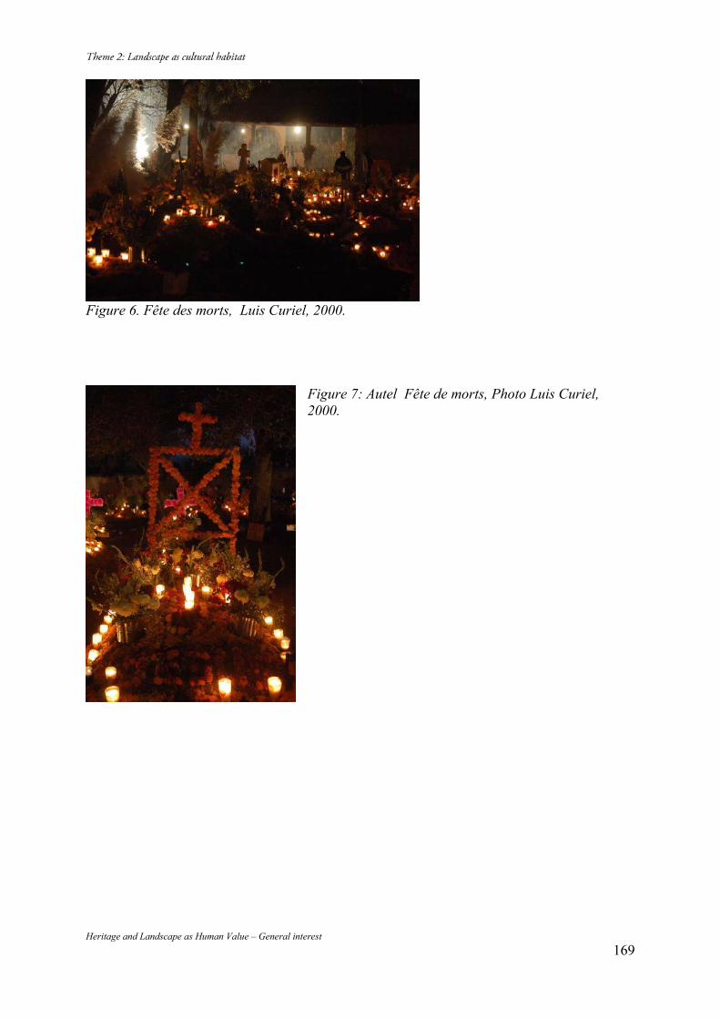
Heritage and Landscape as Human Value – General interest 169
Figure 6. Fête des morts, Luis Curiel, 2000.
Figure 7: Autel Fête de morts, Photo Luis Curiel, 2000.
170 Heritage and Landscape as Human Value – General interest
Sado Gold and Silver Mine
Hiroshi YOSHIDA* Yumiko ODA** Ryo KITAMURA*** Niigata Prefectural Board of Education, 4-1 Shinko-cho, Chuo-ku, Niigata-shi, Japan 950-8570, Tel. 81-25-280-5726, e-mail: [email protected]
Abstract The Sado Gold Mine is a very unique example of preserving the testimonies of progress in the history of mining technology from the days of alluvial gold mining to the days of modernized technology. Here you can see the ruins of alluvial mining, outcrop mining, horizontal tunnel mining and vertical shaft type mining, which is from the days of mining by hand to the days of mining by modern machines. Keywords: Gold Mine; Mining Landscape; History of Mining Technology; Coin Minting; Sado 1. Geographic situation of Sado In the northwest of mainland Japan lies a small island called Sado, off the prefecture of Niigata, about 40 kilometers away from the mainland in the Sea of Japan, the size of which is about 855 square kilometers. Though it is a very tiny island with the population of about 60 thousand people, it is the island which played a very important role in the production of gold in the history of Japan. 2. History of gold mines in Sado and its characteristics On this island were dotted fourteen gold and silver deposits, large and small, from the epithermal deposits formed by the volcanic activity, among which Aikawa gold and silver mine had large-scale groups of ore and was one of the largest mines in its scale in Japan. Besides, we had an alluvial gold deposit from the buried gold deposit in Nishimikawa, which is the only mine of its type in Japan and is also quite unique even in the world. On this Sado Island people were producing two different types of gold for more than four hundred years. The reason of having been able to produce two different types of gold up until 1989 is that they introduced the most excellent and the forefront techniques of gold production of the day during those years of production and the newer techniques were always renovated, improved and progressed to keep up with the request of the times. The history of the gold production in Sado, according to the tradition, goes back to the 11th century, and the full-scale of the operation started in the middle of the 16th century and ended at the end of 20th century. From among more than fifty mines on the island, I would like to introduce the three typical mines. 2.1. Nishimikawa Alluvial Gold Deposit and its history Nishimikawa alluvial mine is a group of alluvial gold mines which consists of gold deposit. The buried gold deposits seen here are very unique and can scarcely be seen even around the world. Nishimikawa alluvial mine was first developed, according to the tradition, in around 1460, but the real operation was thought to be started around the end of the 16th century. In this mine, the sedimented layers of the alluvial gold was dug out and the mud from these layers was washed away by the force of the flow of the water which was led by the waterway dug by human hand. By using this method of ‘O-nagashi’ or great flow, which is gravity screening, the miners tried to remove unnecessary gravels for exploiting necessary gold. Aiming at the Nishimikawa mine, eight man-made waterways were constructed.
Heritage and Landscape as Human Value – General interest 171
The remains of those technology of the well-organized operation have been preserved in a very good condition in this area, such as waterways, dikes, alluvial gold mining sites which show a gold production system, as well as sites of the community which used be utilized as miners’ housing and is still being utilized as residential areas for the descendant of past workers, the remains of the office of the local magistrate who was sent from the headquarter of Sado, the house of a headman of the community who had control over community people, and the shrine which was dedicated to the mining-related god. These remains show the whole picture of gold production system and the community which supported that system, and they are preserved in a very good condition and form a very unique landscape related the gold production and the history thereof. 2.2. Tsurushi Silver Mine and its history Tsurushi Silver Mine is a mining site which is situated about 1.2 kilometers south of Aikawa Gold and Silver Mine, later discovered. The mineral which contains the ore in this area is mainly silver, and it also contains copper. In this area, about 600 remains of outcrop mining and ruins of 100 horizontal tunnels still can bee seen and well preserved together with mining-related administration facilities, remains of dressing and refining system and remains of the mining community in a good condition. The development of Tsurushi Silver Mine, according to the history of Sado, started in 1542. Tsurushi Mine was the largest one in Sado until Aikawa Gold and Silver Mine was discovered later. In 1589 a daimyo, a head of samurai clan, invaded Sado with a purpose of controlling the mines all over Sado. This daimyo established an administration facility in Tsurushi and placed a local magistrate to control over the management of the mine. Moreover, under his control, mine technicians who were invited from Iwami Silver Mine area introduced a new technology for digging horizontal tunnels and thanks to those newer technologies, the scale of the mining of this area became larger and larger. According to the recent excavation survey, the ruins of the local magistrate’s office and its neighboring mining community were carefully examined in their conditions and it was confirmed that there were administration faculties for dressing and refining, together with the housing community. The mining community in its early stage was established on the slope after slope with unorganized terraces. Of course there were some narrow lanes connecting each division, but it is thought that the traffic of the area was done by moving along the edges of the terraces. Later, in this area, large-scale mines were redeveloped and the plural number of temples and shrines were constructed. As this mine prospered, a port town was developed in the seaside area and the road connecting the port and the mine was newly developed. The prosperity, however, did not last long, and when more energy was poured into the development of Aikawa mine, the temples and the miners’ town moved to Aikawa area. With the decline of the Tsurushi Silver Mine, the community disappeared very soon and it got to sleep in the long history of Sado. The beginning of the following Aikawa Gold and Silver Mine started when the mine surveyors of Tsurushi Silver Mine surveyed new vein and finally found an excellent vein. The production technology for gold and silver was rapidly progressed in Tsurushi mine, and with that progressed technology, the development of Aikawa Gold and Silver Mine was preceded. Anyway, with the rapid development of Aikawa Gold and Silver Mine, Tsurushi disappeared from the history and the remains still survive in a very good condition. 2.3. Aikawa Gold and Silver Mine and its history Aikawa Gold and Silver Mine was the biggest mine in Japan as for the production of gold and silver is concerned from the end the 16th century to the end of the 20th century. During most of those years this mine was under the control of federal government and all the gold and silver produced here was minted to coins. As the mine which supported the federal government financially, this mine always enjoyed renovation of facilities and improvement of technology, and was under the strong patronage
Heritage and Landscape as Human Value – General interest 172
of the government. As the result, that made it possible to maintain the production of gold for four hundred years, and many properties were left behind which showed the progress of the mining technology. (Image 1) The history of Aikawa Gold and Silver Mine started when excellent veins were discovered in Aikawa area by the mine surveyors of Tsurushi Mine. At the beginning, the hilly area which was close to the mines were under development and a new large-scale community was formed. At the top of the hill a shrine was constructed, dedicated to the god of mountain and some new roads were constructed. Along those roads on the terrace were formed rectangle shaped allots based upon newly introduced community plan. The sides of the developed flat allot were enforced by the rock arrangement. The houses for living and the huts for the operation of dressing and refining are thought to have been built on those enforced allot. After a large-scale development got on the track in Aikawa, this area was placed under the control of the government and the magistrate was appointed. Accordingly, the mines in Aikawa area were improved and the Aikawa townscape as mining town was prepared and constructed. The newly appointed magistrate gathered talented people into Aikawa, moved the local magistrate office from Tsurushi to Aikawa, and moved his office from its original mountainous mining area to a tableland closer to the coast. The Aikawa Magistrate Office promoted the mining management, gathered many miners from around Japan and introduced the newest technology of survey, mining, and refining. They also tried to make the management more efficient, organized the town plan to provide more daily necessities more stably, and worked on the maintenance of the main streets and the port for the transportation of gold and goods. All those elements supported the system to control over the gold and silver mine more systematically. As the result, the original mining community which used to be around the mining area moved down to the newly organized town around the magistrate’s office and continued to grow to be a new large–scale mining town including coast area. Since around the end of the 18th century, the production of gold continued to drop down. As the Tokugawa government, however, thought the gold very important as the material for minting coins, they continued to operate and support the mine even though they had to face a lot of loss from their budget. Even after the Meiji era, the position of Sado Mine was thought to be very important and the government invested a lot of money for it. The government invited and employed many talented foreign technology experts. The most of the technology introduced this time was the newest one in Japan and they contributed the development of mining and it spread oven even other mines in Japan. Even after the latter half of the 19th century, the mines on Sado played a central role in the field of research and development by Japanese technicians as well as in the field of education of domestic technicians. Sado Mine was later sold to a private company, Mitsubishi, and this mine still was the basic industry for the company and it played the same role as it had had as the leading mine for other Japanese mines. In the latter half of the 20th century, a national policy to increase the production of gold was introduced and the production became the largest in its history. This condition, however, did not last long and in 1989 when the material was exhausted, the Aikawa Gold and Silver Mine stopped its operation and the period was put on the long history of Sado mines. This Aikawa mine formed its production system by including the processes of mining, dressing, refining, as well as the system for electronic energy and the transportation of goods. Especially so far as the modern heritage is concerned, this mine preserves central facilities used for the operation for mining, dressing and refining, and the truck railways which connected each facility, as well as the transportation facility such as inclines, belt-conveyers, power plant such as hydropower generation and the thermal power generation. Those important elements which compose the gold production system are still preserved in the form of buildings and the ruins, and together with the old towns still alive, it forms a very interesting mining community. These mines on the Sado Island continued to be operated as one of the most leading mines in Japan as well as in the East Asia among many gold and silver mines until it
Heritage and Landscape as Human Value – General interest 173
stopped its operation in 1989 because of a financial reason. As the result, they produced 78 tons of gold and 2300 tons of silver as the biggest gold and silver mine in Japan, and it became the most important mine as it contributed the stability of the finance of the government at the time of its operation. 3. Uniqueness of Sado Gold Mine The gold and silver mines on Sado are very unique in the following three features after comparing with other gold mines in the world: a) For a long time of more than 400 years from its first development in the end of the 16th century, this mine introduced and developed cutting-edge technologies of mining domestically and internationally, providing physically visible evidences, forming cultural traditions in remains, architectures and urban planning related to the production of gold. b) This is a historical complex of mining, in which we can identify all the steps of the history of the mining technologies. c) Because the coin minted in Sado became the foundation of the social and economical system of the Tokugawa Shogunate and the Meiji Government, it remained as a state-operated mine even under the gradual decrease of the production of gold and silver. 4. Surviving mining town and its landscape There are more than 50 mining sites on Sado, among which three major sites still have outstanding remains of the complex of mining and those remains constitute present industrial landscape. When we think of the usual history of mines, it is quite rare to be able to see old mining landscape remain as it was and to see miners’ houses, mainly wooden, still remain and all of those elements constitute industrial landscape of each day. In the case of the Nishimikawa Alluvial Gold Deposit, those workers who got involved in mining, even after the decline of the mine, tried to remain in the same area. In general miners who give up one vein will then move to other areas to search for a new vein and form a new community surrounding a newly discovered mine. In Nishimikawa, however, the workers even after the decline of the production of gold survived in the same area, by changing their occupation from mining to agriculture. Accordingly, in the area you can see both the mining landscape from the old time and the landscape formed by the operation of agriculture in the later times existing at the same time, which provides a very unique scenery to viewers. The life span of Tsurushi Silver mine was very short — around sixty years. From this area the workers made a great immigration to Aikawa area where a new vein was discovered, even including whole community. Besides that, as this movement was done in such a short time, the community of Tsurushi which used to prosper disappeared all of a sudden and became like a ‘ghost town’. As the people in the community disappeared, the wooden houses also decayed and they remain as ruins as they were. Tsurushi Silver mine is now in the deep sleep of the history, leaving all the ruins of the history of mining technique, including the sites of outcrop mining and horizontal tunnel mining. So it is a very precious site where we are still able to see the look of prosperity of the time. In the case of Aikawa Gold and Silver Mine, the same type of movement of the community occurred as happened in Tsurushi because the development of the mine was limited in very narrow areas. As the result, abandoned towns still exist according to the time. This area is the place where the production of gold continued to take place from the Edo period to the Meiji era, and up until very recently. So we can see very clearly how the mining community was formed from the beginning of the development to present. From the Edo period when workers dug the mining tunnels and drainage tunnels by hand to the time of modern industrialization when modern technology was implemented, Aikawa is the place you can see very easily those ruins of the production of gold of all ages. (Fig.2) In
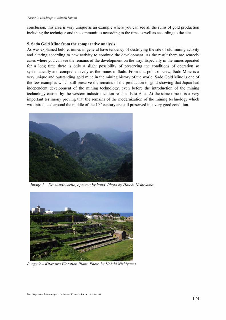
Heritage and Landscape as Human Value – General interest 174
conclusion, this area is very unique as an example where you can see all the ruins of gold production including the technique and the communities according to the time as well as according to the site. 5. Sado Gold Mine from the comparative analysis As was explained before, mines in general have tendency of destroying the site of old mining activity and altering according to new activity to continue the development. As the result there are scarcely cases where you can see the remains of the development on the way. Especially in the mines operated for a long time there is only a slight possibility of preserving the conditions of operation so systematically and comprehensively as the mines in Sado. From that point of view, Sado Mine is a very unique and outstanding gold mine in the mining history of the world. Sado Gold Mine is one of the few examples which still preserve the remains of the production of gold showing that Japan had independent development of the mining technology, even before the introduction of the mining technology caused by the western industrialization reached East Asia. At the same time it is a very important testimony proving that the remains of the modernization of the mining technology which was introduced around the middle of the 19th century are still preserved in a very good condition.
Image 1 – Doyu-no-warito, opencut by hand. Photo by Hoichi Nishiyama.
Image 2 – Kitazawa Flotation Plant. Photo by Hoichi Nishiyama
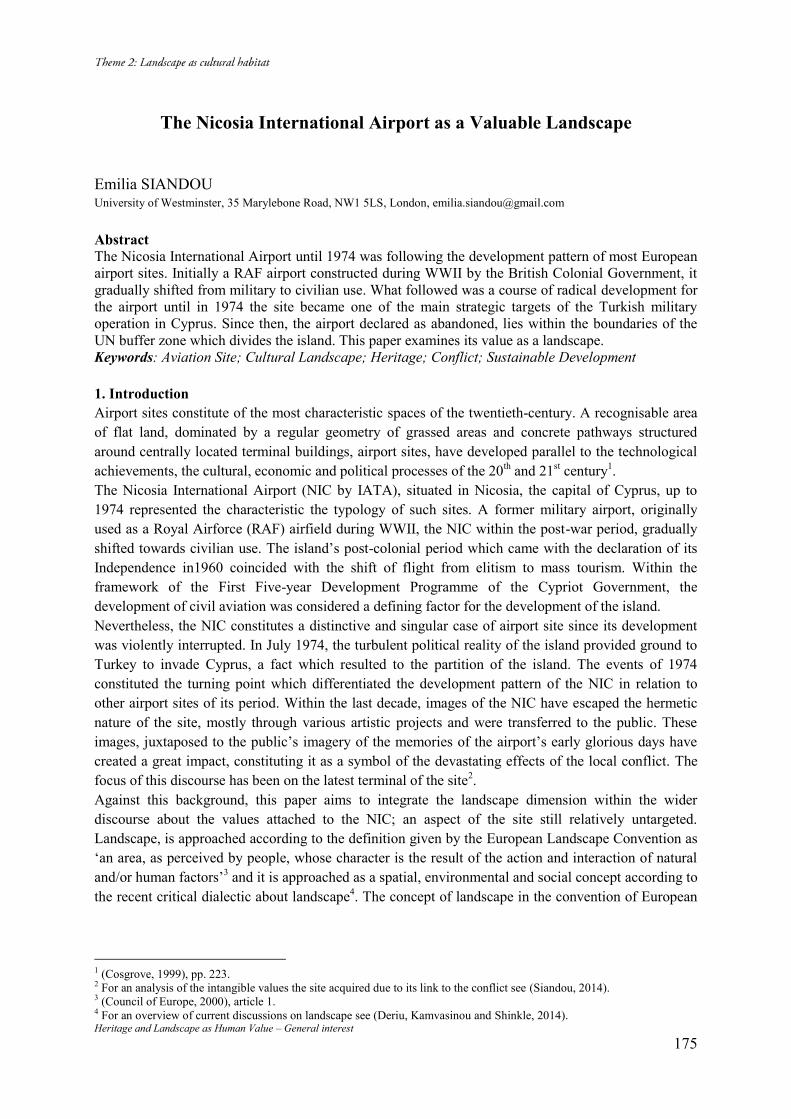
Heritage and Landscape as Human Value – General interest 175
The Nicosia International Airport as a Valuable Landscape
Emilia SIANDOU University of Westminster, 35 Marylebone Road, NW1 5LS, London, [email protected] Abstract The Nicosia International Airport until 1974 was following the development pattern of most European airport sites. Initially a RAF airport constructed during WWII by the British Colonial Government, it gradually shifted from military to civilian use. What followed was a course of radical development for the airport until in 1974 the site became one of the main strategic targets of the Turkish military operation in Cyprus. Since then, the airport declared as abandoned, lies within the boundaries of the UN buffer zone which divides the island. This paper examines its value as a landscape. Keywords: Aviation Site; Cultural Landscape; Heritage; Conflict; Sustainable Development 1. Introduction Airport sites constitute of the most characteristic spaces of the twentieth-century. A recognisable area of flat land, dominated by a regular geometry of grassed areas and concrete pathways structured around centrally located terminal buildings, airport sites, have developed parallel to the technological achievements, the cultural, economic and political processes of the 20th and 21st century1. The Nicosia International Airport (NIC by IATA), situated in Nicosia, the capital of Cyprus, up to 1974 represented the characteristic the typology of such sites. A former military airport, originally used as a Royal Airforce (RAF) airfield during WWII, the NIC within the post-war period, gradually shifted towards civilian use. The island’s post-colonial period which came with the declaration of its Independence in1960 coincided with the shift of flight from elitism to mass tourism. Within the framework of the First Five-year Development Programme of the Cypriot Government, the development of civil aviation was considered a defining factor for the development of the island. Nevertheless, the NIC constitutes a distinctive and singular case of airport site since its development was violently interrupted. In July 1974, the turbulent political reality of the island provided ground to Turkey to invade Cyprus, a fact which resulted to the partition of the island. The events of 1974 constituted the turning point which differentiated the development pattern of the NIC in relation to other airport sites of its period. Within the last decade, images of the NIC have escaped the hermetic nature of the site, mostly through various artistic projects and were transferred to the public. These images, juxtaposed to the public’s imagery of the memories of the airport’s early glorious days have created a great impact, constituting it as a symbol of the devastating effects of the local conflict. The focus of this discourse has been on the latest terminal of the site2. Against this background, this paper aims to integrate the landscape dimension within the wider discourse about the values attached to the NIC; an aspect of the site still relatively untargeted. Landscape, is approached according to the definition given by the European Landscape Convention as ‘an area, as perceived by people, whose character is the result of the action and interaction of natural and/or human factors’3 and it is approached as a spatial, environmental and social concept according to the recent critical dialectic about landscape4. The concept of landscape in the convention of European
1 (Cosgrove, 1999), pp. 223. 2 For an analysis of the intangible values the site acquired due to its link to the conflict see (Siandou, 2014). 3 (Council of Europe, 2000), article 1. 4 For an overview of current discussions on landscape see (Deriu, Kamvasinou and Shinkle, 2014).
Heritage and Landscape as Human Value – General interest 176
Landscape Convention differs from the traditional definition of landscape in the way that it incorporates the aspects of cultural landscapes5 within the wider concept of landscape. 2. Historical development The first airstrip at Yerolakkos area (Fig. 1), the area where the Nicosia International Airport site later developed, was constructed in 1939 for the flights of RAF6. This was not the first airstrip constructed in Cyprus, since the airstrips of Kathari area (1930) and of Aliki area (1936), both located in Larnaka, had preceded it by a few years7. The first civil air connection of Cyprus with other countries were the flights of Misr Airlines that connected Larnaka to Cairo. Post-1945, Misr Airlines and other airline companies started landing their flights to Nicosia8. After WWII the Nicosia Airport was used both by air-crafts of the military service and air-crafts of civil aviation9. As civil aviation first started using the site, its first services were sheltered in the former military barracks, until in 1949 the first official airport’s terminal was designed by the colonial Public Works Department (RIBA architect H.M. MacKay) 10. These first terminal buildings were opened on the 23rd of May 1949 by officials of the Colonial Government, and were considered the most modern airport infrastructure in the Middle East (Fig. 2)11. Nevertheless, the 20th century was a period of rapid advances in aviation. The technological progress, the tremendous increase in the number of air-passengers and the use of flight for international trade, shaped the post-war typology of International airports. The development of tourism and the political turbulence in the Middle East resulted to an exponential increase in the number of passengers using the NIC; from 29,124 passengers that the terminal serviced in 1949 to 145,545 by 1959 in a ten years period12. On the 16th of August 1960, Cyprus became an independent Republic. As a young nation, it aspired to be connected with the rest of the world and the airport was its gate13. Already, in 1960 the Ministry of Communications and Works of the Republic of Cyprus was discussing the construction of a new modern terminal building with the architectural office of Dorsch-Gehrmann (Wiesbaden, Germany)14. It was clear that the existing terminal buildings were not compatible with the image the newfound republic wanted to project on the International stage. For Cyprus, modernity was a goal that had yet to be achieved15. Modern architecture in Cyprus, and the wider area of Middle East, was employed as both a symbol and a tool of modernization, in the process of decolonization and nation building16. The construction works for the new terminal began in October 1964. During the same year, the United Nations Peacekeeping Force in Cyprus (UNFICYP) was established, following recurring violent episodes between the island’s two major communities and a constitutional crisis which led the Turkish Cypriot to withdraw from the government, parliament and all state institutions. Unfortunately, the plans for prosperity and economic development of the Republic of Cyprus were drawn in the foreground of an unstable political, social and ethnic scene. UNFICYP, situates its headquarters within the grounds of the NIC. UNFICYP’s arrival was punctuated by the appearance of military style headquarters and camps for the accommodation of the military personnel and their families within the grounds of the NIC (Fig. 3). The new terminal was inaugurated on the 27th of March 1968. It was a 5 Cultural landscapes according to the Operational Guidelines for the Implementation of the World Heritage Convention are the “combined works of nature and of man” (WHC, 2012), article 2. 6 (Moiseos, 2010), p. 6. 7 (larnakahistory.wordpress, 2014). 8 (Georghiou, 2013), pp. 236-238. 9 Cyprus Airways, the national carrier of Cyprus, was founded by the Colonial Government in 1947. 10 For an extensive description of the terminal buildings see (Georghiou, 2013), p. 238. 11 (Georghiou, 2013), p. 236-238. 12 Official data from the Civil Aviation Department, Cyprus. 13 (Suspended spaces workshop, 2011), p. 7. 14 (Phileleutheros, 22/12/1960), p. 8. 15 (Papadakis, 2006), p.17. 16 (Pyla, 2009), p. 32.
Heritage and Landscape as Human Value – General interest 177
small scale, modern, up to date terminal, an architectural triumph for Cyprus (Fig. 4). Military aviation had already abandoned the site since 1966 under the pressure of the constantly increasing civil aircraft traffic and the new terminal reflected the new social character of the airport. It contained a big viewing platform, a restaurant, cafeteria, bank bureau, post office, telegraph office and duty free shops. It was immediately incorporated in Nicosia’s social life network. Only six years following its inauguration, the Nicosia International Airport was one of the main strategic targets of the Turkish military operation in Cyprus (Fig. 5). The sovereignty of the NIC site constituted a crucial strategic point between the parties involved in the conflict17. UNFICYP took over its administration in order to ensure its neutrality. From 1974 onward, the airport lies within the UN buffer zone which divides the island and its two conflicted communities, Greek- and Turkish- Cypriots. As an airport it is declared as abandoned by ICAO (International Civil Aviation Organization). Immediately after the seizure of the NIC airport, a ‘temporary’ airport was constructed at the airstrip of Aliki in Larnaka to meet the needs of the island for an airport18. 3. Analysis of the NIC site The area between Yerolakkos village and Lakatameia, in the valley below Pentadaktylos Mountain where the airport developed -a rural area of rough pasture fields and bare rocks, grains cultivation, but also olive trees, eucalyptus and acacia plantations19- met the morphological requirements for the airport site (Fig. 6). Flat land, which offers continuity of surface and ease of visual and physical movement across and through large scale spaces and low vegetation which should be sufficient enough in order to prevent dust and earth removal by jet-blast, and at the same time insufficient for nesting and cover, to avoid bird strikes20. The landscape still maintains the same character (Fig. 7). The airstrip of 1939 was the first element related to the airport, which was constructed within the landscape. Aircraft requirements of take off and landing into the wind determined the original geometry of the runway. The invisible spaces of air traffic control determined the height and disposition of buildings21. The development of the site in order to meet the new technological achievements, the needs of the airport’s users and the political developments, created the airport ensemble as it exists today. The site is organised into the separate functional areas which include many different building types such as control towers (Fig. 8), hangars (Fig. 9), technical and training buildings, barracks, officers’ messes and other domestic buildings which accommodated the personnel of RAF and later UNFICYP (Fig. 10). Interesting in this specific case, is the way in which the geopolitical developments have created an important shift to the airport’s pattern of uses. Today, the main use of the site constitute the UNFICYP quarters. The airfield is now used only for UNFICYP air-crafts. The site also accommodates the Cyprus Peace talks, within the Chief admissions building and the Good Offices buildings (airport’s first terminal buildings)22. Additionally, in a complex of temporary structures within the site, the “Project on the Exhumation, Identification and Return of Remains of Missing Persons in Cyprus” by the Committee on Missing Persons in Cyprus (CMP21) takes place. 4. The NIC as a valuable landscape The NIC landscape constitutes a carrier of multiple values at the International level as:
17 (Asyrmatos, 6/10/1974). 18 These airport facilities serviced as the International Airport of Larnaka for 31 years until the inauguration of the new International Airport of Larnaka in November 2009. 19 (Department of Lands and Surveys, 1973). 20 (Cosgrove, 1999), p. 225. 21 (Cosgrove, 1999), p. 226. 22 Several governmental and nongovernmental organizations are allowed to use these spaces for bicommunal actions.
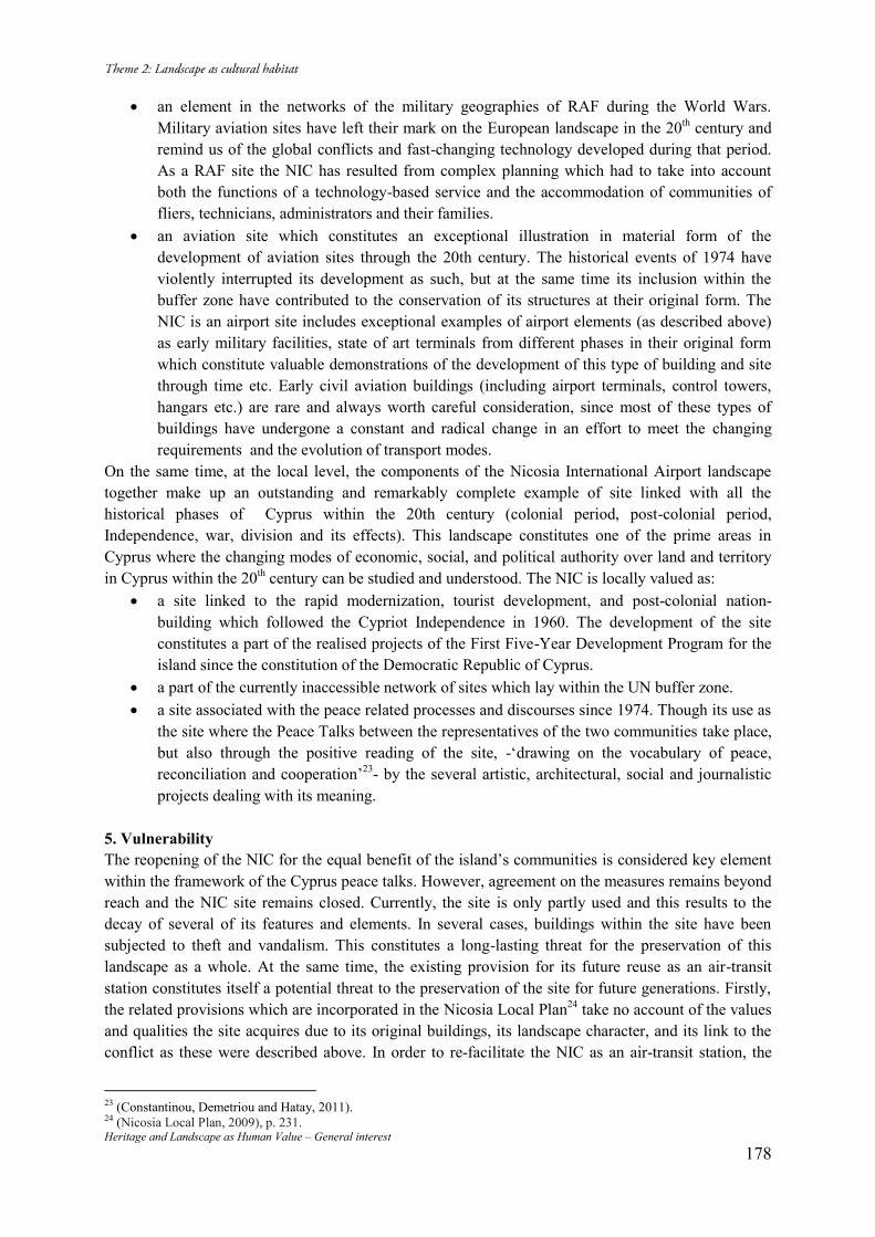
Heritage and Landscape as Human Value – General interest 178
an element in the networks of the military geographies of RAF during the World Wars. Military aviation sites have left their mark on the European landscape in the 20th century and remind us of the global conflicts and fast-changing technology developed during that period. As a RAF site the NIC has resulted from complex planning which had to take into account both the functions of a technology-based service and the accommodation of communities of fliers, technicians, administrators and their families.
an aviation site which constitutes an exceptional illustration in material form of the development of aviation sites through the 20th century. The historical events of 1974 have violently interrupted its development as such, but at the same time its inclusion within the buffer zone have contributed to the conservation of its structures at their original form. The NIC is an airport site includes exceptional examples of airport elements (as described above) as early military facilities, state of art terminals from different phases in their original form which constitute valuable demonstrations of the development of this type of building and site through time etc. Early civil aviation buildings (including airport terminals, control towers, hangars etc.) are rare and always worth careful consideration, since most of these types of buildings have undergone a constant and radical change in an effort to meet the changing requirements and the evolution of transport modes.
On the same time, at the local level, the components of the Nicosia International Airport landscape together make up an outstanding and remarkably complete example of site linked with all the historical phases of Cyprus within the 20th century (colonial period, post-colonial period, Independence, war, division and its effects). This landscape constitutes one of the prime areas in Cyprus where the changing modes of economic, social, and political authority over land and territory in Cyprus within the 20th century can be studied and understood. The NIC is locally valued as:
a site linked to the rapid modernization, tourist development, and post-colonial nation-building which followed the Cypriot Independence in 1960. The development of the site constitutes a part of the realised projects of the First Five-Year Development Program for the island since the constitution of the Democratic Republic of Cyprus.
a part of the currently inaccessible network of sites which lay within the UN buffer zone. a site associated with the peace related processes and discourses since 1974. Though its use as
the site where the Peace Talks between the representatives of the two communities take place, but also through the positive reading of the site, -‘drawing on the vocabulary of peace, reconciliation and cooperation’23- by the several artistic, architectural, social and journalistic projects dealing with its meaning.
5. Vulnerability The reopening of the NIC for the equal benefit of the island’s communities is considered key element within the framework of the Cyprus peace talks. However, agreement on the measures remains beyond reach and the NIC site remains closed. Currently, the site is only partly used and this results to the decay of several of its features and elements. In several cases, buildings within the site have been subjected to theft and vandalism. This constitutes a long-lasting threat for the preservation of this landscape as a whole. At the same time, the existing provision for its future reuse as an air-transit station constitutes itself a potential threat to the preservation of the site for future generations. Firstly, the related provisions which are incorporated in the Nicosia Local Plan24 take no account of the values and qualities the site acquires due to its original buildings, its landscape character, and its link to the conflict as these were described above. In order to re-facilitate the NIC as an air-transit station, the
23 (Constantinou, Demetriou and Hatay, 2011). 24 (Nicosia Local Plan, 2009), p. 231.
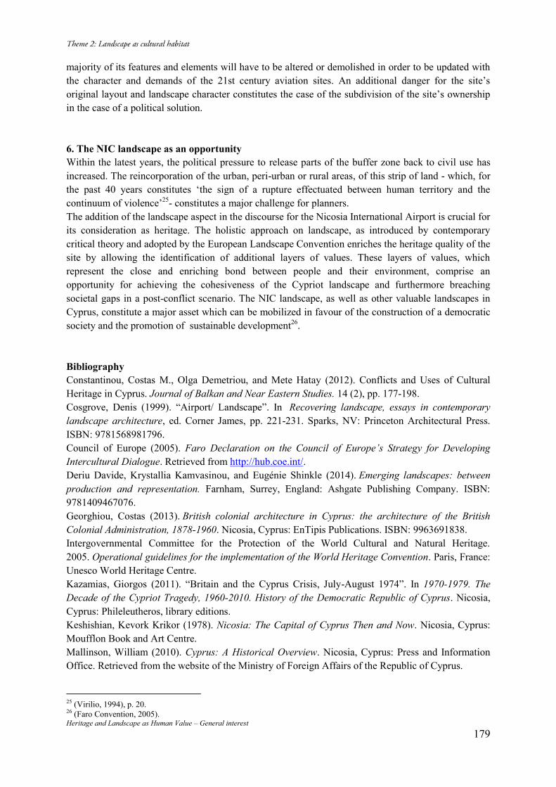
Heritage and Landscape as Human Value – General interest 179
majority of its features and elements will have to be altered or demolished in order to be updated with the character and demands of the 21st century aviation sites. An additional danger for the site’s original layout and landscape character constitutes the case of the subdivision of the site’s ownership in the case of a political solution. 6. The NIC landscape as an opportunity Within the latest years, the political pressure to release parts of the buffer zone back to civil use has increased. The reincorporation of the urban, peri-urban or rural areas, of this strip of land - which, for the past 40 years constitutes ‘the sign of a rupture effectuated between human territory and the continuum of violence’25- constitutes a major challenge for planners. The addition of the landscape aspect in the discourse for the Nicosia International Airport is crucial for its consideration as heritage. The holistic approach on landscape, as introduced by contemporary critical theory and adopted by the European Landscape Convention enriches the heritage quality of the site by allowing the identification of additional layers of values. These layers of values, which represent the close and enriching bond between people and their environment, comprise an opportunity for achieving the cohesiveness of the Cypriot landscape and furthermore breaching societal gaps in a post-conflict scenario. The NIC landscape, as well as other valuable landscapes in Cyprus, constitute a major asset which can be mobilized in favour of the construction of a democratic society and the promotion of sustainable development26. Bibliography Constantinou, Costas M., Olga Demetriou, and Mete Hatay (2012). Conflicts and Uses of Cultural Heritage in Cyprus. Journal of Balkan and Near Eastern Studies. 14 (2), pp. 177-198. Cosgrove, Denis (1999). “Airport/ Landscape”. In Recovering landscape, essays in contemporary landscape architecture, ed. Corner James, pp. 221-231. Sparks, NV: Princeton Architectural Press. ISBN: 9781568981796. Council of Europe (2005). Faro Declaration on the Council of Europe’s Strategy for Developing Intercultural Dialogue. Retrieved from http://hub.coe.int/. Deriu Davide, Krystallia Kamvasinou, and Eugénie Shinkle (2014). Emerging landscapes: between production and representation. Farnham, Surrey, England: Ashgate Publishing Company. ISBN: 9781409467076. Georghiou, Costas (2013). British colonial architecture in Cyprus: the architecture of the British Colonial Administration, 1878-1960. Nicosia, Cyprus: EnTipis Publications. ISBN: 9963691838. Intergovernmental Committee for the Protection of the World Cultural and Natural Heritage. 2005. Operational guidelines for the implementation of the World Heritage Convention. Paris, France: Unesco World Heritage Centre. Kazamias, Giorgos (2011). “Britain and the Cyprus Crisis, July-August 1974”. In 1970-1979. The Decade of the Cypriot Tragedy, 1960-2010. History of the Democratic Republic of Cyprus. Nicosia, Cyprus: Phileleutheros, library editions. Keshishian, Kevork Krikor (1978). Nicosia: The Capital of Cyprus Then and Now. Nicosia, Cyprus: Moufflon Book and Art Centre. Mallinson, William (2010). Cyprus: A Historical Overview. Nicosia, Cyprus: Press and Information Office. Retrieved from the website of the Ministry of Foreign Affairs of the Republic of Cyprus.
25 (Virilio, 1994), p. 20. 26 (Faro Convention, 2005).
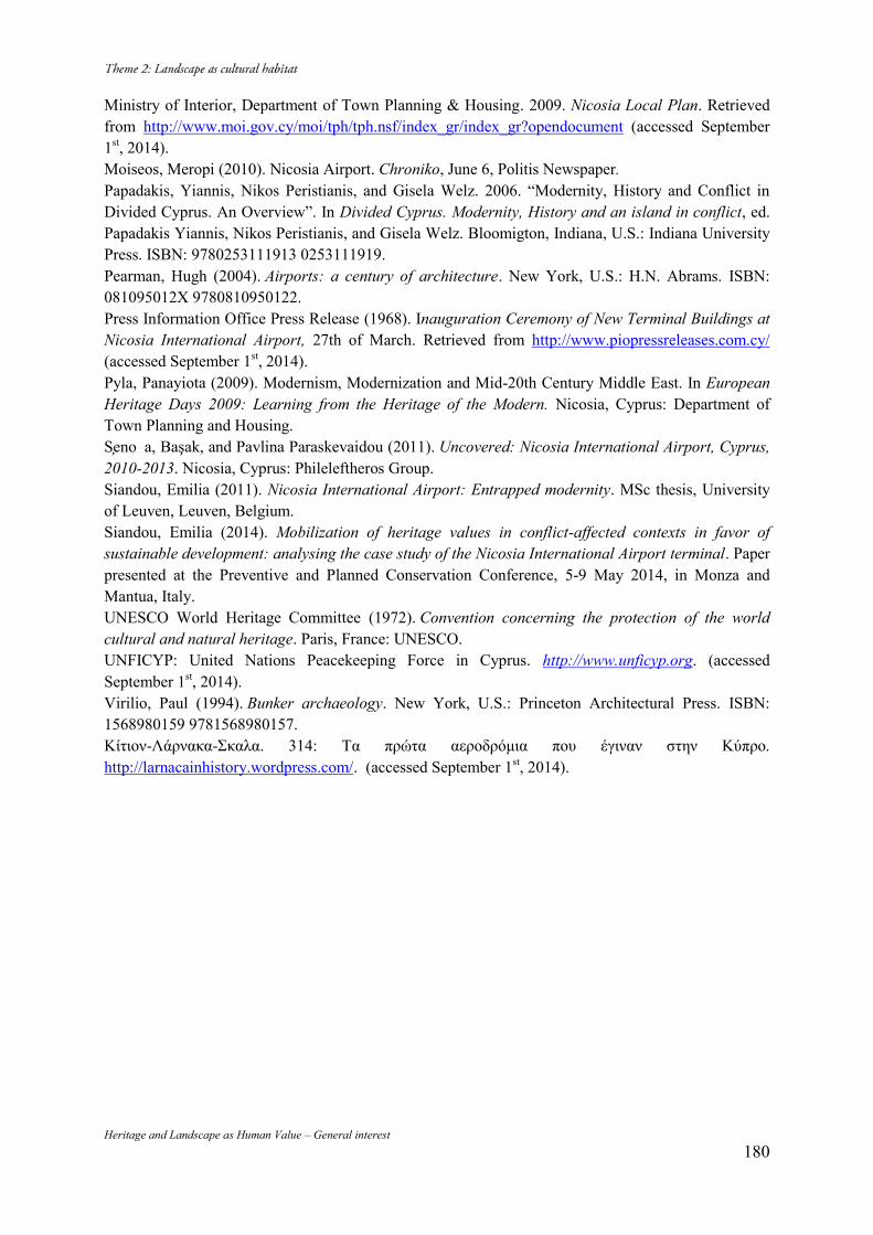
Heritage and Landscape as Human Value – General interest 180
Ministry of Interior, Department of Town Planning & Housing. 2009. Nicosia Local Plan. Retrieved from http://www.moi.gov.cy/moi/tph/tph.nsf/index_gr/index_gr?opendocument (accessed September 1st, 2014). Moiseos, Meropi (2010). Nicosia Airport. Chroniko, June 6, Politis Newspaper. Papadakis, Yiannis, Nikos Peristianis, and Gisela Welz. 2006. “Modernity, History and Conflict in Divided Cyprus. An Overview”. In Divided Cyprus. Modernity, History and an island in conflict, ed. Papadakis Yiannis, Nikos Peristianis, and Gisela Welz. Bloomigton, Indiana, U.S.: Indiana University Press. ISBN: 9780253111913 0253111919. Pearman, Hugh (2004). Airports: a century of architecture. New York, U.S.: H.N. Abrams. ISBN: 081095012X 9780810950122. Press Information Office Press Release (1968). Inauguration Ceremony of New Terminal Buildings at Nicosia International Airport, 27th of March. Retrieved from http://www.piopressreleases.com.cy/ (accessed September 1st, 2014). Pyla, Panayiota (2009). Modernism, Modernization and Mid-20th Century Middle East. In European Heritage Days 2009: Learning from the Heritage of the Modern. Nicosia, Cyprus: Department of Town Planning and Housing. Seno a, Başak, and Pavlina Paraskevaidou (2011). Uncovered: Nicosia International Airport, Cyprus, 2010-2013. Nicosia, Cyprus: Phileleftheros Group. Siandou, Emilia (2011). Nicosia International Airport: Entrapped modernity. MSc thesis, University of Leuven, Leuven, Belgium. Siandou, Emilia (2014). Mobilization of heritage values in conflict-affected contexts in favor of sustainable development: analysing the case study of the Nicosia International Airport terminal. Paper presented at the Preventive and Planned Conservation Conference, 5-9 May 2014, in Monza and Mantua, Italy. UNESCO World Heritage Committee (1972). Convention concerning the protection of the world cultural and natural heritage. Paris, France: UNESCO. UNFICYP: United Nations Peacekeeping Force in Cyprus. http://www.unficyp.org. (accessed September 1st, 2014). Virilio, Paul (1994). Bunker archaeology. New York, U.S.: Princeton Architectural Press. ISBN: 1568980159 9781568980157. Κίτιον-Λάρνακα-Σκαλα. 314: Τα πρώτα αεροδρόμια που έγιναν στην Κύπρο. http://larnacainhistory.wordpress.com/. (accessed September 1st, 2014).
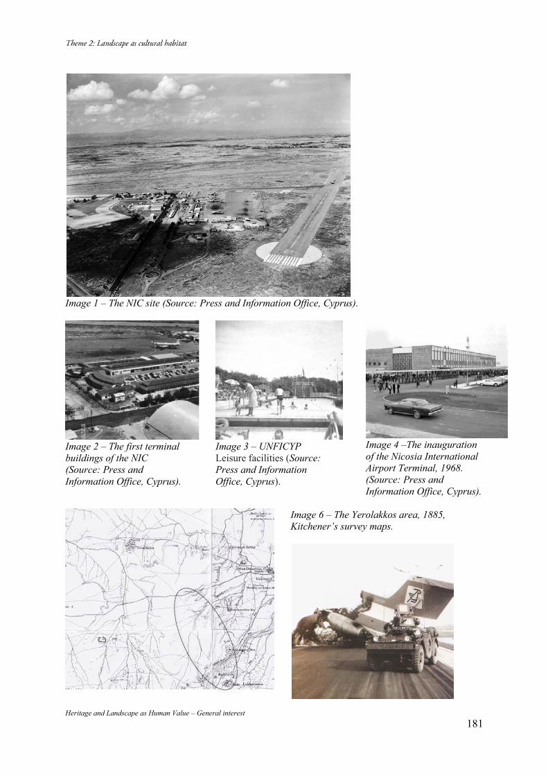
Heritage and Landscape as Human Value – General interest 181
Image 1 – The NIC site (Source: Press and Information Office, Cyprus).
Image 2 – The first terminal buildings of the NIC (Source: Press and Information Office, Cyprus).
Image 3 – UNFICYP Leisure facilities (Source: Press and Information Office, Cyprus).
Image 4 –The inauguration of the Nicosia International Airport Terminal, 1968. (Source: Press and Information Office, Cyprus).
Image 6 – The Yerolakkos area, 1885, Kitchener’s survey maps.
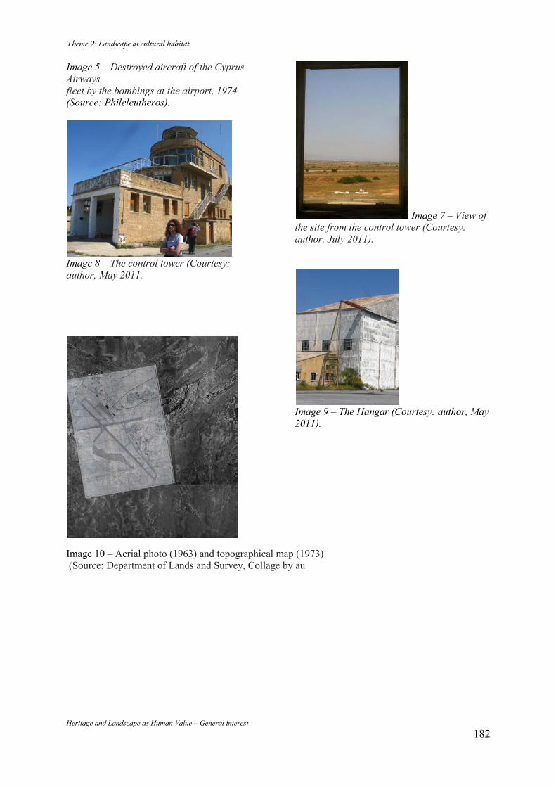
Heritage and Landscape as Human Value – General interest 182
Image 5 – Destroyed aircraft of the Cyprus Airways fleet by the bombings at the airport, 1974 (Source: Phileleutheros).
Image 8 – The control tower (Courtesy: author, May 2011.
Image 7 – View of the site from the control tower (Courtesy: author, July 2011).
Image 9 – The Hangar (Courtesy: author, May 2011).
Image 10 – Aerial photo (1963) and topographical map (1973) (Source: Department of Lands and Survey, Collage by au
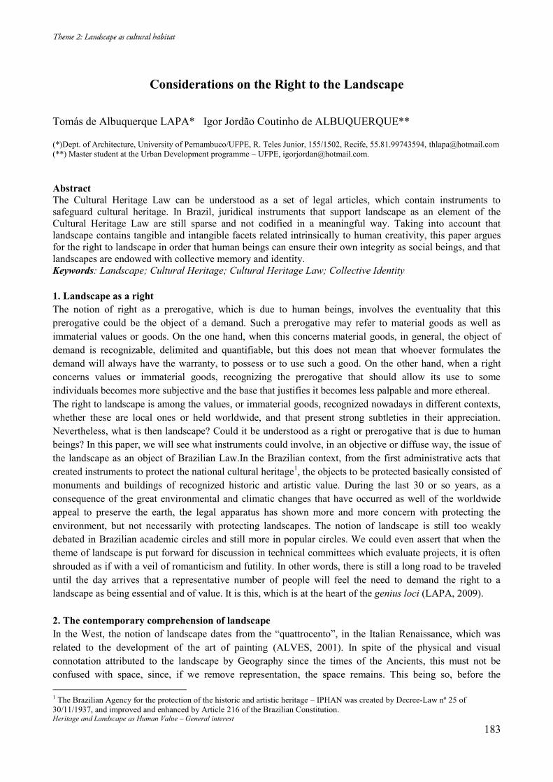
Heritage and Landscape as Human Value – General interest 183
Considerations on the Right to the Landscape Tomás de Albuquerque LAPA* Igor Jordão Coutinho de ALBUQUERQUE** (*)Dept. of Architecture, University of Pernambuco/UFPE, R. Teles Junior, 155/1502, Recife, 55.81.99743594, [email protected] (**) Master student at the Urban Development programme – UFPE, [email protected]. Abstract The Cultural Heritage Law can be understood as a set of legal articles, which contain instruments to safeguard cultural heritage. In Brazil, juridical instruments that support landscape as an element of the Cultural Heritage Law are still sparse and not codified in a meaningful way. Taking into account that landscape contains tangible and intangible facets related intrinsically to human creativity, this paper argues for the right to landscape in order that human beings can ensure their own integrity as social beings, and that landscapes are endowed with collective memory and identity. Keywords: Landscape; Cultural Heritage; Cultural Heritage Law; Collective Identity 1. Landscape as a right The notion of right as a prerogative, which is due to human beings, involves the eventuality that this prerogative could be the object of a demand. Such a prerogative may refer to material goods as well as immaterial values or goods. On the one hand, when this concerns material goods, in general, the object of demand is recognizable, delimited and quantifiable, but this does not mean that whoever formulates the demand will always have the warranty, to possess or to use such a good. On the other hand, when a right concerns values or immaterial goods, recognizing the prerogative that should allow its use to some individuals becomes more subjective and the base that justifies it becomes less palpable and more ethereal. The right to landscape is among the values, or immaterial goods, recognized nowadays in different contexts, whether these are local ones or held worldwide, and that present strong subtleties in their appreciation. Nevertheless, what is then landscape? Could it be understood as a right or prerogative that is due to human beings? In this paper, we will see what instruments could involve, in an objective or diffuse way, the issue of the landscape as an object of Brazilian Law.In the Brazilian context, from the first administrative acts that created instruments to protect the national cultural heritage1, the objects to be protected basically consisted of monuments and buildings of recognized historic and artistic value. During the last 30 or so years, as a consequence of the great environmental and climatic changes that have occurred as well of the worldwide appeal to preserve the earth, the legal apparatus has shown more and more concern with protecting the environment, but not necessarily with protecting landscapes. The notion of landscape is still too weakly debated in Brazilian academic circles and still more in popular circles. We could even assert that when the theme of landscape is put forward for discussion in technical committees which evaluate projects, it is often shrouded as if with a veil of romanticism and futility. In other words, there is still a long road to be traveled until the day arrives that a representative number of people will feel the need to demand the right to a landscape as being essential and of value. It is this, which is at the heart of the genius loci (LAPA, 2009). 2. The contemporary comprehension of landscape In the West, the notion of landscape dates from the “quattrocento”, in the Italian Renaissance, which was related to the development of the art of painting (ALVES, 2001). In spite of the physical and visual connotation attributed to the landscape by Geography since the times of the Ancients, this must not be confused with space, since, if we remove representation, the space remains. This being so, before the 1 The Brazilian Agency for the protection of the historic and artistic heritage – IPHAN was created by Decree-Law nº 25 of 30/11/1937, and improved and enhanced by Article 216 of the Brazilian Constitution.
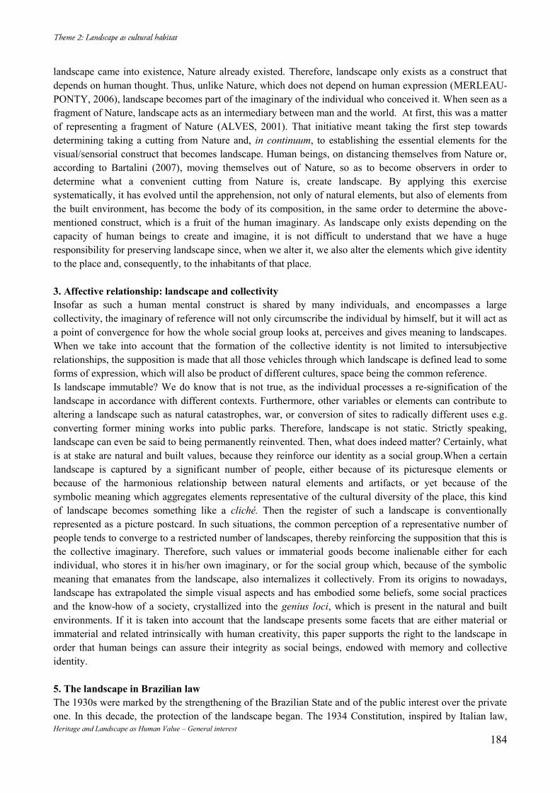
Heritage and Landscape as Human Value – General interest 184
landscape came into existence, Nature already existed. Therefore, landscape only exists as a construct that depends on human thought. Thus, unlike Nature, which does not depend on human expression (MERLEAU-PONTY, 2006), landscape becomes part of the imaginary of the individual who conceived it. When seen as a fragment of Nature, landscape acts as an intermediary between man and the world. At first, this was a matter of representing a fragment of Nature (ALVES, 2001). That initiative meant taking the first step towards determining taking a cutting from Nature and, in continuum, to establishing the essential elements for the visual/sensorial construct that becomes landscape. Human beings, on distancing themselves from Nature or, according to Bartalini (2007), moving themselves out of Nature, so as to become observers in order to determine what a convenient cutting from Nature is, create landscape. By applying this exercise systematically, it has evolved until the apprehension, not only of natural elements, but also of elements from the built environment, has become the body of its composition, in the same order to determine the above-mentioned construct, which is a fruit of the human imaginary. As landscape only exists depending on the capacity of human beings to create and imagine, it is not difficult to understand that we have a huge responsibility for preserving landscape since, when we alter it, we also alter the elements which give identity to the place and, consequently, to the inhabitants of that place. 3. Affective relationship: landscape and collectivity Insofar as such a human mental construct is shared by many individuals, and encompasses a large collectivity, the imaginary of reference will not only circumscribe the individual by himself, but it will act as a point of convergence for how the whole social group looks at, perceives and gives meaning to landscapes. When we take into account that the formation of the collective identity is not limited to intersubjective relationships, the supposition is made that all those vehicles through which landscape is defined lead to some forms of expression, which will also be product of different cultures, space being the common reference. Is landscape immutable? We do know that is not true, as the individual processes a re-signification of the landscape in accordance with different contexts. Furthermore, other variables or elements can contribute to altering a landscape such as natural catastrophes, war, or conversion of sites to radically different uses e.g. converting former mining works into public parks. Therefore, landscape is not static. Strictly speaking, landscape can even be said to being permanently reinvented. Then, what does indeed matter? Certainly, what is at stake are natural and built values, because they reinforce our identity as a social group.When a certain landscape is captured by a significant number of people, either because of its picturesque elements or because of the harmonious relationship between natural elements and artifacts, or yet because of the symbolic meaning which aggregates elements representative of the cultural diversity of the place, this kind of landscape becomes something like a cliché. Then the register of such a landscape is conventionally represented as a picture postcard. In such situations, the common perception of a representative number of people tends to converge to a restricted number of landscapes, thereby reinforcing the supposition that this is the collective imaginary. Therefore, such values or immaterial goods become inalienable either for each individual, who stores it in his/her own imaginary, or for the social group which, because of the symbolic meaning that emanates from the landscape, also internalizes it collectively. From its origins to nowadays, landscape has extrapolated the simple visual aspects and has embodied some beliefs, some social practices and the know-how of a society, crystallized into the genius loci, which is present in the natural and built environments. If it is taken into account that the landscape presents some facets that are either material or immaterial and related intrinsically with human creativity, this paper supports the right to the landscape in order that human beings can assure their integrity as social beings, endowed with memory and collective identity. 5. The landscape in Brazilian law The 1930s were marked by the strengthening of the Brazilian State and of the public interest over the private one. In this decade, the protection of the landscape began. The 1934 Constitution, inspired by Italian law,
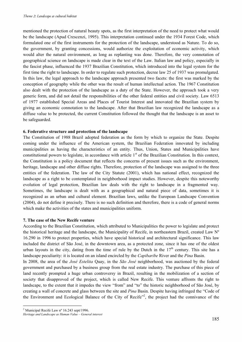
Heritage and Landscape as Human Value – General interest 185
mentioned the protection of natural beauty spots, as the first interpretation of the need to protect what would be the landscape (Apud Crescenzi, 1995). This interpretation continued under the 1934 Forest Code, which formulated one of the first instruments for the protection of the landscape, understood as Nature. To do so, the government, by granting concessions, would authorize the exploitation of economic activity, which would alter the natural environment, as long as replanting was done. Therefore, the very connotation of geographical science on landscape is made clear in the text of the Law. Italian law and policy, especially in the fascist phase, influenced the 1937 Brazilian Constitution, which introduced into the legal system for the first time the right to landscape. In order to regulate such protection, decree law 25 of 1937 was promulgated. In this law, the legal approach to the landscape approach presented two facets: the first was marked by the conception of geography while the other was the result of human intellectual action. The 1967 Constitution also dealt with the protection of the landscape as a duty of the State. However, the approach took a very generic form, and did not detail the responsibilities of the other federal entities and civil society. Law 6513 of 1977 established Special Areas and Places of Tourist Interest and innovated the Brazilian system by giving an economic connotation to the landscape. After that Brazilian law recognized the landscape as a diffuse value to be protected, the current Constitution followed the thought that the landscape is an asset to be safeguarded. 6. Federative structure and protection of the landscape The Constitution of 1988 Brazil adopted federation as the form by which to organize the State. Despite coming under the influence of the American system, the Brazilian Federation innovated by including municipalities as having the characteristics of an entity. Thus, Union, States and Municipalities have constitutional powers to legislate, in accordance with article 1st of the Brazilian Constitution. In this context, the Constitution is a policy document that reflects the concerns of present issues such as the environment, heritage, landscape and other diffuse rights. Therefore, protection of the landscape was assigned to the three entities of the federation. The law of the City Statute (2001), which has national effect, recognized the landscape as a right to be contemplated in neighborhood impact studies. However, despite this noteworthy evolution of legal protection, Brazilian law deals with the right to landscape in a fragmented way. Sometimes, the landscape is dealt with as a geographical and natural piece of data, sometimes it is recognized as an urban and cultural element. Brazilian laws, unlike the European Landscape Convention (2004), do not define it precisely. There is no such definition and therefore, there is a code of general norms which make the activities of the states and municipalities uniform. 7. The case of the New Recife venture According to the Brazilian Constitution, which attributed to Municipalities the power to legislate and protect the historical heritage and the landscape, the Municipality of Recife, in northeastern Brazil, created Law Nº 16.290 in 1996 to protect properties, which have special historical and architectural significance. This law included the district of São José, in the downtown area, as a protected zone, since it has one of the oldest urban layouts in the city, dating from the time of rule by the Dutch in the 17th century. This site has a landscape peculiarity: it is located on an island encircled by the Capibaribe River and the Pina Basin. In 2008, the area of the José Estelita Quay, in the São José neighborhood, was auctioned by the federal government and purchased by a business group from the real estate industry. The purchase of this piece of land recently prompted a huge urban controversy in Brazil, resulting in the mobilization of a section of society that disapproved of the project, which is called New Recife. This venture affronts the right to landscape, to the extent that it impedes the view “from” and “to” the historic neighborhood of São José, by creating a wall of concrete and glass between the site and Pina Basin. Despite having infringed the “Code of the Environment and Ecological Balance of the City of Recife”2, the project had the connivance of the
2 Municipal Recife Law nº 16.243 sept/1996.
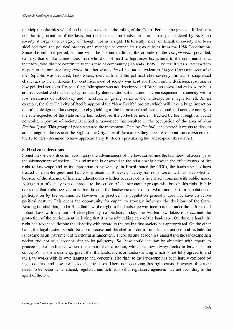
Heritage and Landscape as Human Value – General interest 186
municipal authorities who found means to overrule the ruling of the Court. Perhaps the greatest difficulty is not the fragmentation of the laws, but the fact that the landscape is not usually considered by Brazilian society at large as a category of thought nor as a right. Historically, most of Brazilian society has been sidelined from the political process, and managed to extend its rights only as from the 1988 Constitution. Since the colonial period, in line with the Iberian tradition, the attitude of the conquistador prevailed, namely, that of the autonomous man who did not need to legitimize his actions to the community and, therefore, who did not contribute to the sense of community (Holanda, 1995). The result was a vacuum with respect to the notion of respublica. In other words, Brazil had no equivalent to Magna Carta and even after the Republic was declared, landowners, merchants and the political elite severely limited or suppressed challenges to their interests. For centuries, most of society was kept apart from public decisions, resulting in low political activism. Respect for public space was not developed and Brazilian towns and cities were built and reinvented without being legitimized by democratic participation. The consequence is a society with a low awareness of collectivity and, therefore, of giving value to the landscape as a right for all. As an example, the City Hall city of Recife approved the “New Recife” project, which will have a huge impact on the urban design and landscape, thereby yielding to the interests of real estate capital and acting contrary to the role expected of the State as the last redoubt of the collective interest. Backed by the strength of social networks, a portion of society launched a movement that resulted in the occupation of the area of José Estelita Quay. This group of people started the movement “Occupy Estelita”, and started lawsuits to discuss and strengthen the issue of the Right to the City. One of the matters they raised was about future residents of the 13 towers - designed to have approximately 40 floors - privatizing the landscape of this district. 8. Final considerations Sometimes society does not accompany the advancement of the law, sometimes the law does not accompany the advancement of society. This mismatch is observed in the relationship between the effectiveness of the right to landscape and to its appropriation by society. In Brazil, since the 1930s, the landscape has been treated as a public good and liable to protection. However, society has not internalized this idea whether because of the absence of heritage education or whether because of its fragile relationship with public space. A large part of society is not opposed to the actions of socioeconomic groups who breach this right. Public decisions that authorize ventures that threaten the landscape are taken in what amounts to a simulation of participation by the community. However, in practice, the population generally does not have an active political posture. This opens the opportunity for capital to strongly influence the decisions of the State. Bearing in mind that, under Brazilian law, the right to the landscape was incorporated under the influence of Italian Law with the aim of strengthening nationalism, today, the written law takes into account the protection of the environment believing that it is thereby taking care of the landscape. On the one hand, the right has advanced, despite the disparity with regard to the feeling that society has appropriated. On the other hand, the legal system should be more precise and detailed in order to limit human actions and include the landscape as an instrument of territorial arrangement. Theorists and academics understand the landscape as a notion and not as a concept, due to its polysemy. So, how could the law be objective with regard to protecting the landscape, which is no more than a notion, while the Law always seeks to base itself on concepts? This is a challenge given that the landscape is an understanding which is not fully agreed to and the Law works with its own language and concepts. The right to the landscape has been hardly explored by legal doctrine and case law lacks specific cases. There is no denying this right exists. However, this right needs to be better systematized, regulated and defined so that regulatory agencies may act according to the spirit of the law.
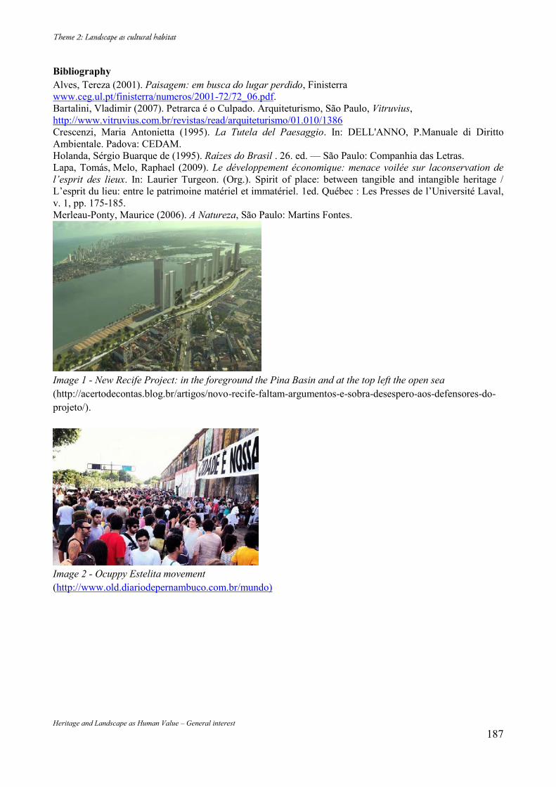
Heritage and Landscape as Human Value – General interest 187
Bibliography Alves, Tereza (2001). Paisagem: em busca do lugar perdido, Finisterra www.ceg.ul.pt/finisterra/numeros/2001-72/72_06.pdf. Bartalini, Vladimir (2007). Petrarca é o Culpado. Arquiteturismo, São Paulo, Vitruvius, http://www.vitruvius.com.br/revistas/read/arquiteturismo/01.010/1386 Crescenzi, Maria Antonietta (1995). La Tutela del Paesaggio. In: DELL'ANNO, P.Manuale di Diritto Ambientale. Padova: CEDAM. Holanda, Sérgio Buarque de (1995). Raízes do Brasil . 26. ed. — São Paulo: Companhia das Letras. Lapa, Tomás, Melo, Raphael (2009). Le développement économique: menace voilée sur laconservation de l’esprit des lieux. In: Laurier Turgeon. (Org.). Spirit of place: between tangible and intangible heritage / L’esprit du lieu: entre le patrimoine matériel et immatériel. 1ed. Québec : Les Presses de l’Université Laval, v. 1, pp. 175-185. Merleau-Ponty, Maurice (2006). A Natureza, São Paulo: Martins Fontes.
Image 1 - New Recife Project: in the foreground the Pina Basin and at the top left the open sea (http://acertodecontas.blog.br/artigos/novo-recife-faltam-argumentos-e-sobra-desespero-aos-defensores-do-projeto/).
Image 2 - Ocuppy Estelita movement (http://www.old.diariodepernambuco.com.br/mundo)
Heritage and Landscape as Human Value – General interest 188
Re-establishing Identity: Reconstructing Lyttelton’s Timeball Station Ian BOWMAN 68 Britannia Heights, Nelson, New Zealand, [email protected] Abstract Lyttelton’s Timeball Station was constructed in 1876 as part of a worldwide system of time keeping improving navigation. The Station was purposely located high above the Port of Lyttelton on a ridge overlooking the town to give good views of the port and harbour entrance. In September 2010, when it was damaged in an earthquake, it was one of few working Timeballs in the world. Aftershocks in December 2010, February, March and July 2011 caused increasingly severe damage, which led to its dismantling, stone by stone. This paper examines the significance of the building, arguments for its reconstruction and progress on the project to date. Keywords: Timeball; Reconstruction; Earthquake; Stone; New Zealand 1. The timeball system1 Timeballs originated from the need for sailors to accurately calculate longitude. Up until 1829, when the timeball system was invented by Captain Robert Wauchop in Portsmouth, sailors could establish latitude relatively easily by the use of sextants, but without longitude they could not accurately determine their location2. After the invention of an accurate chronometer that was able to be used at sea, longitude could be established by calculating the difference between local time on ships and the standard time of a known place. Ensuring the accuracy of the chronometer was the next problem to be solved and, for a period, this was measured by time signals from shore using flags, cannons, rockets or torches. The dropping of the timeball in Portsmouth in 18293, established a system that was quickly adopted all over the world. Innovations soon occurred. One was the galvanic system invented in 1852 by Sir George Airy, the seventh Astronomer Royal, where the time to drop the ball was controlled by a master clock with signals sent through telegraph lines. The first application of the principle was at Deal in Kent in 18554. The first timeball in New Zealand was dropped in Wellington from the Customhouse in Jervois Quay. in 1864. Shortly after Canterbury politicians were asking for a timeball to be erected in Lyttelton. Port Lyttelton was established in 1849 where the first four ships of the Canterbury Association brought settlers to the region in 18505. In 1874, the Lyttelton Timeball station building was completed; the third in New Zealand, following one built in Dunedin in 1868. It was designed using the galvanic system. Because of its function, the building was located high up on a ridge overlooking the harbour and town of Lyttelton. The port was on one side of the ridge and entry to the harbour on the other side. One of the first structures on the site was a flagpole for signalling ships. For 134 years the Timeball Station was a prominent element of the skyline, a highly visible sentinel and a major element in Lyttelton’s landscape.
1 (The Old Royal Observatory, The Story of Astronomy and Time, n.d.). 2 (Bartky, 1981). 3 (Bartky, 1981). 4 (Murray, 1999). 5 (Scotter, 1968).
Heritage and Landscape as Human Value – General interest 189
In 1973, the building and site came under the ownership of the then New Zealand Historic Places Trust (NZHPT), now Heritage New Zealand (HNZ), a Crown Entity that lists and advocates for built heritage. In 1983 the NZHPT listed the building Category 1, its highest category. It was also listed on the District Plan heritage schedule of the local authority. The building was designed in the Victorian Tudor Gothic style with a crenelated tower and accommodation. It was designed by the Canterbury Provincial architect, architect Thomas Cane. It was planned with a four-storey high corner tower supporting the timeball and the attached accommodation building was three storeys. The living quarters were located on the ground floor, while the clock room was on the first floor and the watch room on the top floor. Additions were made in 1878 and 1912. The original 1876 building and 1878 additions were constructed of Port Hills Andesite for the stairs and foundations while Port Hills Tuff was used for walls. Cane selected Oamaru Limestone for quoins, window and door openings and crenelations. William Brassington was appointed the stonemason for the first stage of the building. The walls leaked and roughcast cement was applied over the Tuff in 1880 which was specified by Frederick Strouts, the Lyttelton Harbour Board’s architect. In 1912, an addition to the building was designed by Lyttelton Harbour Board engineer, Cyrus Williams. It was constructed in brick with Oamaru limestone detailing, but finished with rough cast render matching that specified by Strouts. Many timeballs were installed on existing buildings such as at Southampton South Western Hotel while others were attached to lighthouses. A number of timeball stations were stand-alone towers only or fixed to timber masts such as at Brest in France. Of the approximately 250 Timeball Stations constructed throughout the world few were Gothic inspired crenelated towers, like that at Lyttelton. Those built using this design included the Victoria Tower, Liverpool in England, Fort Gellibrand Williamstown in Australia, Yantai in China, and Karachi in Pakistan. Today there are fewer than 30 Timeball Stations remaining. In 2010 the Lyttelton Timeball was one of the few still operational in the world. 2. Significance of the Lyttelton Timeball6 In 2000, a conservation plan was prepared by HNZ conservation architect Jim Espie, and this was later updated in 2013 by the author. In this revised plan, it was established that the building had national significance as New Zealand’s last remaining Timeball Station, had been one of few operational in the world prior to its dismantling and that it was intimately associated with New Zealand’s maritime history as well as the growth and development of the Port of Lyttelton. It had architectural value as a rare example a Tudor Gothic Timeball Station and as an illustration of the work of regionally important architects Thomas Cane and Frederick Strouts. Because of the highly visible nature of the site from the harbour and township, essential for its original function, the setting of the building was an intrinsic attribute of the Timeball Station as well as reflecting the influence of the Picturesque Movement on the Victorian Tudor revival style of the building. The ridge on which the building was constructed forms the visible north eastern physical boundary of the township and the former building was a significant marker of this boundary on the skyline. Between 2002 and 2010, the building underwent significant conservation. These included stone repairs, initial strengthening of the building, reroofing, repainting the interior to the original colour
6 (Bowman, 2013).

Heritage and Landscape as Human Value – General interest 190
schemes and landscape conservation. The building was to be officially opened following the eight years of conservation work in late 2010. 3. Earthquake damage In 2010 and 2011, the Canterbury region experienced a number of strong earthquakes. On 4 September, a Richter scale magnitude 7.1 earthquake centred at Darfield7, caused damaged to the Timeball Station. A chimney collapsed, water pipes burst, and there was significant cracking of masonry. The author, with engineer Grant Wilkinson, inspected the building on 10 September and recommendations for repairs and strengthening were prepared. A number of further site visits were made to finalise recommendations. On 26 December a small aftershock occurred, causing further damage, however on 22 February 2011 a Richter scale magnitude 6.3, MM IX, earthquake centred near to Lyttelton caused so much damage such that engineers recommended the dismantling of the building8. The same earthquake killed 185 people in the Canterbury region and approximately half of all buildings in Lyttelton were so badly damaged that they were demolished. In June, 3-D scans of the damaged building were taken from which the author was able to label and uniquely identify each remaining, visible stone. On 13 June a Richter scale magnitude 6.3 earthquake struck during dismantling and further damage occurred. By September, the dismantling had largely been completed. It was supervised by HNZ engineer Win Clark, the author, HNZ project manager John Le Harivel, archaeologist Katharine Watson and curator Jan Titus. All possible material was salvaged, and the curator and archaeologist arranged for it to be uniquely identified, photographed, and described in a database before storage in a long-term storage facility. A substantial portion of the building and timeball mechanism was rescued. 4. Options for the building Following the deconstruction of the building HNZ staff member Robert McLean wrote a Heritage Impact Statement (HIA) for the HNZ Board in which the options for the site and building were explored9. These included: retaining the site as a ruin; partial reconstruction; full reconstruction; a new building or a combination. The recommendation was to rebuild the tower and reinstate the flagpole. Two options for rebuilding the tower were proposed: a a faithful reconstruction using original material and the original construction method b a reconstruction using a reinforced concrete core with original material fixed to it The arguments for reconstruction were: • its national significance and international rarity • public ownership of the property • the timeball is a landmark and symbol of Lyttelton • reconstruction would enable the repair of the timeball mechanism • reopening the site would allow the navigation story pivotal to the role of the Timeball station
to be told to the public As part of the decision making process HNZ carried out surveys of local residents in December 2012. The results were that 99% of the 800 people surveyed wanted the building reconstructed. 7 (GNS Science, Earthquake Commission). 8 (GNS Science, Earthquake Commission). 9 (McLean, 2012).
Heritage and Landscape as Human Value – General interest 191
This reflected the importance of the building to the community as a physical presence, as a key element in the local landscape and as a symbol of rebuilding and hope for the future of the township10. In late 2012 the organisation Landmark Incorporated donated $1 million for its reconstruction. 5. The conservation plan and guidance on reconstruction A third element in the decision making process was the preparation of the revised conservation plan. The plan consulted a number of national and international charters, standards, guidelines and policies for advice on the appropriateness or otherwise of rebuilding the Timeball Station, particularly those relating to buildings destroyed by man-made or natural disasters. These included the: • ICOMOS New Zealand Charter11 • Australian Burra Charter12 • Venice Charter13 • Lausanne Charter14 • Dresden Declaration15 • Nara Document on Authenticity16 • US Department of the Interior standards for Rehabilitation, Treatment of Historic Properties
and for reconstruction17 • English Heritage Policy on restoration, reconstruction, and recreation on archaeological
sites18 • British Standard BS 791319 The meaning of reconstruction used in the plan was to build again to the original form using mostly original material. Reconstruction of a building can be a valid conservation process according to the: • Venice Charter only by anastylosis (reassembly) • Lausanne and Burra Charters, the Secretary of the Interior’s Standards and the British
Standard where there is sufficient evidence, it reveals cultural significance and is essential for an understanding of the site
• ICOMOS NZ Charter where the cultural heritage value is recovered and it does not “constitute the majority of a place or structure”
• English Heritage Policy where the significance of the site is maintained Reconstruction following a natural or man-made disaster is also considered acceptable under the: • Riga Charter, where it “can be carried out without conjecture or compromising existing in
situ remains, and that any reconstruction is legible, reversible, and the least necessary for the conservation and presentation of the site”
10 (Trust). 11 (ICOMOS NZ, 2010). 12 (Australia ICOMOS, 1999). 13 (ICOMOS, 1964). 14 (ICOMOS, 1990). 15 (ICOMOS, 1982). 16 (ICOMOS, 1994). 17 (US National Park Service, 2013). 18 (English Heritage, 2001). 19 (British Standard, 1998).
Heritage and Landscape as Human Value – General interest 192
• Nara Document when the place “has outstanding artistic, symbolic or environmental (whether urban or rural) significance for regional history and cultures….the reconstruction does not falsify the overall urban or landscape context; and existing significant historic fabric will not be damaged; and providing always that the need for reconstruction has been established through full and open consultations among national and local authorities and the community concerned”. In addition reconstruction should not be conjectural
• Declaration of Dresden where the meaning and impact of an historic site, and its spiritual, political and intellectual values initiates a desire to reconstruct following war
A consistent edict of these documents is that reconstruction can only take place where there is incontrovertible evidence to allow for rebuilding authentically. The Nara Document lists a number of areas of potential authenticity. The first of these comprise form and design, materials and substance. Previous measured drawings of the Timeball Station, 3-D mapping, extensive photography, and an inventory and description of fabric from the first conservation plan all provide irrefutable evidence to allow for an accurate reconstruction and to regain these areas of authenticity. Authenticity of materials is possible by using a maximum of the sound, recovered fabric. It’s former use and function as a museum can be regained while other areas of authenticity in the Nara Document of traditions, techniques and workmanship, will be dependent on the means of reconstruction. A new building is required to comply with the New Zealand Building Code and the original stone masonry gravity construction is not possible. However, traditional stone masonry techniques and workmanship will need to be employed in conjunction with modern building technology. New internal plaster and external roughcast render will need to be applied, but their composition, mixing and application should follow techniques and methods of the Victorian period. The final areas of authenticity listed in the Nara Document are those of location and setting. The location remains the same as before, as does the natural setting. The township of Lyttelton has survived the earthquakes but with many fewer buildings. The conservation plan also recognised HNZ’s own policy. Objective 5 requires “All physical interventions, activities, works and uses at historic places owned or managed by the NZHPT should be guided by”… the ICOMOS NZ Charter, HNZ Guidelines, appropriate technical advice, research and assessment, and consultation20. Conservation should avoid inappropriate use, modification or development to ensure retention of heritage values. The conservation plan recommended reconstruction of the building with recognition that staging of the project will be required as there will be on-going funding constraints. The elements of the building that had most visible impact were the tower and timeball. While reconstruction of these elements only would enhance authenticity of location and setting, the design of the reconstructed tower should allow for some rebuilding of the sidewalls to indicate that there was more than just the tower alone. This would avoid historical confusion with stand alone lighthouse-type Timeball Stations, a separate building type to that in Lyttelton, while also allowing for a structural connection to rebuild the lost walls at a later stage. Integrating these ‘stub’ sidewalls into the remaining foundations will also assist in interpretation of the site. If and when funds become available, the remainder of the building could be reconstructed following the original chronology of building modification.
20 (New Zealand Historic Places Trust, n.d.).
Heritage and Landscape as Human Value – General interest 193
6. Reconstruction of the Tower confirmed
In mid 2014, the HNZ Board confirmed that the tower with the Timeball and mechanism will be reconstructed using a reinforced concrete core with original stonework fixed to it. This would achieve compliance with the New Zealand National Building Standard (NBS) for new buildings, which would have been difficult with the traditional form of construction. Wing walls will be required to allow for the possible reconstruction of the main building. A project manager has been appointed as has an engineer, architects and the author as architect conservator. An initial consultants meeting took place on 17 July to begin documentation. Fund raising is on-going.
7. Conclusion
Despite damage from a major earthquake and aftershocks in 2010 and 2011, the potential to reconstruct an internationally important maritime treasure was made possible through documenting and saving of a substantial quantity of original fabric during its deconstruction. The owner of Lyttelton’s Timeball Station, who is also New Zealand’s national statutory heritage agency, sought local public opinion on whether the building should be reconstructed. Support for reconstruction was overwhelming as it would reinstate a much loved, highly visible structure, which was the physical symbol of the town and a major landscape element. HNZ also commissioned a conservation plan to provide advice on the conservation principles of reconstruction. The plan found that international charters, guidelines and policies allowed reconstruction where there was incontrovertible evidence of the previous form of the building. The decision of HNZ is to reconstruct the tower with a working timeball and design work is now underway. Bibliography Australia ICOMOS (1999). The Burra Charter. The Australia ICOMOS Charter for Places of Cultural Significance. Bartky, I. D. (1981, xii). The First Time Balls. Journal of the History of Astronomy. Bowman, I. (2013). Conservation Plan Timeball Station, Lyttleton December 2013. New Zealand Historic Places Trust. British Standard (1998). Guide to the principles of the conservation of historic buildings. British Government. English Heritage (2001). English Heritage Policy Statement on Restoration, Reconstruction, and Speculative Recreation of Archaeological Sites including Ruins. English Heritage. GNS Science, Earthquake Commission. (n.d.). M7.1 Darfield (Canterbury), 4 September 2010. Retrieved from Geonet: http://info.geonet.org.nz/display/quake/M+7.1%2C+Darfield+%28Canterbury%29%2C+4+September+2010 Howse, D. (1980). Greenwich time and the discovery of the longitude. Oxford: Oxford University Press. ICCROM (2000). The Riga Charter on Authenticity and Historical Reconstruction in Relationship to Cultural Heritage. ICCROM. ICOMOS (1990). Charter for the Protection and Management of the Archaeological Heritage. The Lausanne Charter . ICOMOS (1964). International Charter for the Conservation and Restoration of Monuments and Sites. The Venice Charter . ICOMOS NZ (2010). ICOMOS NZ Charter for the Conservation of Places of Cultural Heritage Value. ICOMOS NZ Charter for the Conservation of Places of Cultural Heritage Value . ICOMOS NZ. ICOMOS (1982). The Declaration of Dresden. ICOMOS. ICOMOS (1994). The Nara Document of Authenticity. ICOMOS. McLean, R. (2012). Heritage Impact Statement - Lyttelton Timeball Station. New Zealand Historic Places Trust. New Zealand Historic Places Trust. Murray, J. (1999). The Lyttelton Timeball Station A Historical Report. New Zealand Historic Places Trust.
Heritage and Landscape as Human Value – General interest 194
New Zealand Historic Places Trust (n.d.). General Policy for the Management, Administration, Control and Use of all Historic Buildings Owned or Controlled by the New Zealand Historic Places Trust or Vested in it. Scotter, W. (1968). A History of the Port of Lyttelton. Christchurch. The Old Royal Observatory, The Story of Astronomy and Time. (n.d.). London. Trust, N. Z. (n.d.). Landmsakr Donation to Rebuild Timeball Station. Retrieved from Lyttelton Harbour Review: http://www.diamondharbour.info/Data/Sites/1/media/lytteltonreview/85_lyttelton_review_may_27_2013.pdf US National Park Service (2013, August 13). Standards for Reconstruction and Guidelines for Reconstructing Historic Buildings. Retrieved August 14, 2013, from National Park Service: http://www.nps.gov/hps/tps/standguide/reconstruct/reconstruct_index.htm
Heritage and Landscape as Human Value – General interest 195
From a Road to a Cultural Route in a Multilayered Cultural Landscape: the Road between Milas and Labraunda1
Elifnaz DURUSOY* A. Güliz BİLGİN ALTINÖZ** (*) Yildiz Technical University, Barbaros Bulvarı 34349 Istanbul Turkiye, +90 (538) 9641608, [email protected] (**) Middle East Technical University, Inonu Bulvarı 06531 Ankara Turkiye, +90 (312) 2106207, [email protected]
Abstract Cultural landscapes are the products of relation between human beings and their natural environment throughout time. They indicate connection of different cultures with their nature through a continual process, thus making them multi-layered cultural habitats in time. Anatolia has been subject to continuous inhabitancy. Thereby, there has been a network of roads in its multi-layered cultural landscapes. In this frame, this paper aims to present analysis, evaluation as well as a cultural route proposal for the road between Milas and Labraunda as one of the good representative of such old roads. Keywords: Road; Cultural Route; Multi-Layered Cultural Landscape; Management; Planning; Milas; Labraunda 1. Introduction: Roads in Multi-layered Cultural Landscapes Cultural landscapes that can be defined as consequences of relation between human beings and their neighboring natural setting throughout time express a recent and extensive category under the main heading of cultural heritage. According to a report prepared by the committee of World Heritage Convention in 1992 on this special field, cultural landscapes are identified as “the illustration of the evolution of human society and settlement over time, under the influence of the physical constraints and/or opportunities presented by their natural environment and of successive social, economic and cultural forces, both external and internal”2. Thereby, rarely being the product of a single period, cultural landscapes, in most of the cases, can be outlined as indicators of the connection between different cultures together with their natural context through a continual historical process that in turn transforms them into multi-layered cultural landscapes. Multi-layered cultural landscapes, as continual existence of cultural landscapes, have presented stratification of physical, natural, social and spiritual components from different periods in a specific spiritual context with nature. One of the components that belongs to the physical context of multi-layered cultural landscapes is “roads”. Roads connect places, settlements, peoples and even cultures to each other by ensuring communication from one to another point. Indeed; since roads are the circulatory system of living, they can be respected as one of the most crucial and basic necessities of human beings3. In addition to recently constructed modern roads and highways, there are also historical roads as traces of history in today’s world.4 Some of these old roads have been quite visible and still in use for different purposes by various groups of people throughout the history. They bear diverse cultural elements within their boundaries and reflect cultural accumulation, thus should be appreciated as added cultural values for the multi-cultural landscapes they are located in. However, some roads may be elapsed or lost in the course of time. Major reasons behind their loss can be related with economic preferences, natural disasters, political
1 This paper is an improved version of research produced from the master thesis of the author “From an Ancient Road to a Cultural Route: Conservation and Management of the Road between Milas and Labraunda” that was supervised by A. Güliz Bilgin Altınöz and completed in the Graduate Program of Restoration in Architecture, METU, 2013. It concentrates more on multi-layered cultural landscapes that hosts ancient roads via the case of the road between Milas and Labraunda. For further information please look: Durusoy, Elifnaz. “From an Ancient Road to a Cultural Route: Conservation and Management of the Road between Milas and Labraunda” ODTÜ Fen Bilimleri Enstitüsü, Mimarlık Bölümü, Restorasyon Anabilim Dalı Yüksek Lisans Tezi, 2013. 2 UNESCO World Heritage Centre and ICOMOS, 1992. 3 Belloc, 1911: 4 and Forest, 2007: 2. 4 Forest, 2007: 3.
Heritage and Landscape as Human Value – General interest 196
movements, religious actions and/or disordered urban developments in the forms of growth or destruction. Consequently, these kinds of unused or missing old roads have created great problems for the conservation of cultural heritage within multi-cultural habitats. 2. Conservation of Roads as Cultural Routes within Multi-layered Cultural Landscapes Since they have shown stratified patterns, conservation of historical roads within multi-cultural landscapes necessitates particular understanding of each component and layer together with physical, natural, social and spiritual contexts, as well as inclusive comprehension of their superimposition with each other. Accordingly, only through a thorough knowledge about the multi-layered landscape, it becomes possible to define tangible and intangible values of old roads, all of which provide the basis for the safeguarding decisions. The concept of cultural routes that was founded for bringing unknown places into light, easing visits to these places and improving economy of regions in which they are located is one of the recently developing heritage types. They have been used as an alternative tool for reevaluating old roads of cultural habitats with suitable planning and management decisions5. Therefore, the concept of cultural routes helps to revalorize multi-layered cultural landscapes that host historically significant old roads and their cultural accumulation. Cultural routes, in their general sense, represent “cooperating, active, varying and upgrading processes of communal histories and life as a complete picture by displaying the valuable diversity of contributions that characterized the communities”6. Therefore, as in the case of multi-layered cultural landscapes, analysis and evaluation of the components and context of cultural routes should be presented in different layers for providing a basis for conservation, management and planning. Afterwards, these analyses should be superimposed in order to compose an overall spatio-temporal view of roads, as well as to evaluate the values, problems and potentials they have been possessing in time. Only in this way, evolution of the fabric, current situation and future decisions of regions which host old roads analyzed can be identified in a holistic perspective. Considering these information by depending on the guidelines and standards developed by numerous institutions, organizations and researchers previously, the stages of “understanding the place”, “assessing the place” and finally “making decisions for the future of the place”, in the form of a three-fold structure, can be determined as the main phases for the conservation, planning and management of historical roads to be transformed into cultural routes within multi-layered cultural landscapes (Table 1)7. 3. From the Road between Milas and Labraunda to a Cultural Route Anatolia is home to several historical old road networks connecting settlements with each other in diverse multi-cultural landscapes thanks to its continuous inhabitancy process since the early ages onwards. As mentioned above, some of these roads represent stratified grounds in the forms of added cultural value. On and around these kinds of valuable roads, the physical and social indicators of the continuous relation of men and nature can easily be found, thus, it becomes possible to read the multi-layered cultural landscape in a holistic way. The road between Milas and Labraunda that have been in use continuously since antiquity onwards is a good representative of such precious old roads found in Western Anatolia. Starting on the examination of the first stage – “understanding the place” for the road between Milas and Labraunda in a more detailed manner; after its starting point at Milas-Baltalı Kapı Monument, the road runs from south to north from the heart of Milas, crosses over the fruitful landscape of Sarıçay River, orients through the olive forests of the region, continues into the mountainous, rocky and wild areas and finally ends in the sanctuary of Labraunda, a crucial archaeological site 700 m above sea and 14 km away from the center (Fig. 1)8. To extend, it was
5 ICOMOS, 2008. 6 Durusoy, 2013: 26. 7 Durusoy, 2013: 45. 8 Baran, 2011: 51-52.
Heritage and Landscape as Human Value – General interest 197
considered to be built as a stone paved road complex in the first half of the 4th century B.C.9. Within this period of time, the road between Milas and Labraunda was assumed to be braced with bridges, drainage channels, strong retaining walls, fountains, wells, tombs, fortification towers and honey towers for the purposes of easing the transportation and increasing the security of the neighboring region (Fig. 2-a)10. Following these kinds of construction and development activities; the road was called as the “Sacred road of Labraunda” because of its pilgrimage usage for annual festivals in a spiritual context from Milas to the sanctuary of Labraunda11. During Turkish Period, the environs of the road was started to be built-up with settlements showing different characteristics that in turn has revealed a social and cultural diversity. In the 19th century, it was assumed to be a part of the complex trade system as it stood within the caravan and long-distance trade route network of Western Anatolia12. Eventually, the road between Milas and Labraunda that hosts a number of commercial and administrative units at the present is called as “Labraunda Boulevard”. To continue in depth on the phase of understanding of the case study area, cultural accumulation of the road between Labraunda and Milas can be grouped under three main categories as; natural components, man-made components and social and cultural components (Table 2). Thanks to these component groups, it can be said that there has been a diverse and stratified cultural accumulation with special cultural values interrelated from each other at macro to micro scales along the road between Milas and Labraunda thanks to its areas rich in cultural, historical and natural heritage together with the local, architectural and spiritual values over the years (Fig. 3). Accordingly, it can easily be respected as a crucial asset that has been connecting several settlements in different periods and it has been passing across an important cultural habitat presenting physical and social indicators of continuous relation of men and nature. Hence, it should not be regarded just as a “road”, but it should be re-considered as a “cultural route” within its special multi-layered cultural landscape. After completing the section of “understanding the place”, the conservation and management process should continue with the second stage – “assessing the place”. Thereupon, especially the unique location, distinctive nature, special nearby cultural accumulation, ongoing inhabitance pattern, continuing social and cultural character, different usage patterns, visually and aesthetically rich charm, economic sustainability, legends and memories attached to the road between Milas and Labraunda should be underlined as crucial assets for the multi-cultural landscape of the case study area. However, the road between Milas and Labraunda have transformed into a transportation path together with static components including non-valuable structures with the negative effects of present days (Fig. 2-b). Especially, unused and/or empty sections of the area, nonvisible state of the road itself, difficult accessibility conditions to specific areas, inadequate care of the region, insufficient presentation of the path, disappearing social and cultural values of nearby settlements, deficient interest groups working to improve the general state of the site, present usage and relationships between the road with its setting, disappeared visual and aesthetic integrity, insufficient financial sources, deficiency of conservation and increase in new construction works that are not compatible with the historical state have been changing the original identity of the multi-cultural landscape and the road between Milas and Labraunda day by day. Although the above mentioned weaknesses and threats trigger several barriers and obstacles regarding the future development of the site, it can undoubtedly be said that the road between Milas and Labraunda together with its strengths and opportunities is one of the most important surviving old roads of a cultural mosaic. Containing a large number of evidence of the stratification of physical, natural, social and spiritual contexts from different periods, the road and the multi-cultural landscape that it is located in, offer a complete picture comprised with different settings. Due to its characteristic contexts, it is necessary to set general decisions and principals for the future conservation,
9 Baran, 2011: 52. 10 Baran, 2011: 52 and Hellström, 2007: 151-153. 11 Hellström, 2007: 145. 12 Tekeli, 2006: 67-70.
Heritage and Landscape as Human Value – General interest 198
preservation, maintenance and sustainable transformation of the site into a cultural route as an opportunity not only for increasing awareness of people, but also for presenting cultural assets in a dynamic way. Since the concept of multi-cultural landscapes together with cultural routes they include singular values, the main frame of the final stage – “making decisions for the future of the place” should be structured and built upon not only a statement of significance but also a general theme of transformation that assist the overall process of interpretation by enhancing a public awareness and building up a better understanding regarding a region. According to this information, connected to the above mentioned information given related with the case study area; the statement of significance for the historical identity and the statement significance for the road between Milas and Labraunda can be specified as “Re-cording the road between Milas and Labraunda by registering the records, reconnecting the individual pieces and correlating the people through strengthening its meanings, highlighting its spirit of place and valorizing its records”. In the light of this statement of significance, the appropriate general theme of the transformation proposal for the road between Milas and Labraunda can be identified as “re(-)cord” thanks to its extensive meaning covering the connotations of “register”, “reconnect” and “correlate” as general policies. Considering the statement of significance and the theme of the transformation project developed for the conservation, planning and management of the road between Milas and Labraunda as crucial points of development, general principles and preliminary decisions that include the main conceptual and contextual basis of the proposed cultural route proposal can be determined under four main captions. These can be scheduled as “1-Reinstituting the significance of the road between Milas and Labraunda by experiencing and recreating the meaning and spirit behind the multi-cultural landscape it is located in”, “2-Increasing the state of conservation, preservation, maintenance and sustainability of the road between Milas and Labraunda and the cultural accumulation on and around it together with their values, archaeological entities, cultural landscape and agricultural activities”, “3-Ensuring local residents to view the site as a part of their identity to pass on to their next generations and to continue their inhabitance with harmonized conditions” and “4-Attracting visitors and researchers to come and enjoy with proposed improvements and developments of the whole site together with its near surroundings within a framework constructed by the collaborative work of all key interest groups and partners”. Following the identification of the general principles and preliminary decisions which all are specified to maintain the existing strengths minimize the weaknesses and threats as well as attained the determined opportunities regarding the case study, strategies and related projects should be identified according to the specified general policies. In this respect, strategies for the transformation process of the road between Milas and Labraunda into a cultural route are identified under the headings of “register”, “reconnect” and “correlate” as shown in the Table 3. Once the composition of strategies and projects are completed, different scenarios should be proposed for relevant interest groups of the multi-layered cultural landscape. Connected to the stratified usage tissue of the case study area between Milas and Labraunda, there are three different interest groups as residents – as are the permanent inhabitants of the traditional urban and traditional rural settlements, tourist – as the temporary guests of the region and researchers – as the voluntary visitors of the site. To sum, thanks to this transformation realized in the multi-layered cultural landscape within the special and stratified geography between Milas and Labraunda, the significance of Labraunda and Milas can be multiplied, the state of conservation, preservation, maintenance, sustainability and interpretation levels of Labraunda and Milas can be increased, local inhabitants living in the traditional settlements along the cultural route between Milas and Labraunda can be safeguarded and tourists as well as researchers can be concerned. Therefore, by easing to reach information during “Out-reach and Pre-arrival”, to find the components belong to different contexts with the help of recent presentation technologies on orientation and access such as symbolic codes, way markings and GPS points during “On-site Exploration” as well as to enjoy with the material with “Off-site Programming and Links”; this kind of a cultural route between Milas and Labraunda can reshape and revalorize the importance of the multi-layered landscape by attaching archaeological, architectural, natural and/or historical values to them in a stratified manner (Fig. 4).
Heritage and Landscape as Human Value – General interest 199
4. Conclusion Old roads that can be regarded as the living witnesses of the histories and progressions of revolution of multi-layered landscapes in which they are located are important resources not only to better understand and appreciate the historical practices of people; but also the history, culture, knowledge, science, economy, tradition, architecture and even the current living styles at the present. Therefore, the holistic protection and preservation of these kinds of roads together with their tangible and intangible components in the forms of traces reflecting the past ways of life as common heritage values within multi-layered landscapes should be respected as a general scale responsibility. This task can be realized with the help of a recently developing concept: cultural routes. Cultural routes as itineraries of communication of cultural values between peoples and regions over periods of time express social, political and again dynamic cultural processes together with heritage elements and cultural traditions. They can be specified as a broad and a wide-ranging topic to build up a holistic understanding of a multi-layered cultural landscape that hosts a road together with its stratified cultural accumulation. In order to reach a complete study regarding the planning and management of cultural routes, each cultural route should be evaluated in terms of their own structures. As shown in the case of the road between Milas and Labraunda, this process should begin with the analysis of internal and external dynamics, continue with assessment of these data and finalize with decisions covering conservation, management and planning principles, strategies and actions for redefining “roads” as “cultural routes” across multi-layered cultural landscapes. Bibliography Baran, Abdülkadir (2011). “The Sacred Way and the Spring Houses of Labraunda Sanctuary.” Labraunda and Karia, Proceedings of the International Symposium Commemorating Sixty Years of Swedish Archaeological Work in Labraunda. The Royal Swedish Academy of Letters, History and Antiquities. Stockholm, November 20-21, 2008. Uppsala Universitet. pp. 70-94. Print. Belloc, Hilaire (2013). “The Old Road.” London Constable and Company Limited, 1911. Digitalized by the internet archive in 2007 with funding from Microsoft Corporation. N.p, n.d. Web. <http://archive.org/details/theoldroad00belluoft>. Bremen, Riet Van and Carbon, Jan-Mathieu. “Hellenistic Karia.” Proceedings of the First International Conference on Hellenistic Karia, Oxford, 29 June - 2 July 2006, 2010. 602. Print. Durusoy, Elifnaz (2013). “From an Ancient Road to a Cultural Route: Conservation and Management of the Road between Milas and Labraunda” ODTÜ Fen Bilimleri Enstitüsü, Mimarlık Bölümü, Restorasyon Anabilim Dalı Yüksek Lisans Tezi. Forest, Jim (2007). “The Road to Emmaus: Pilgrimage as a Way of Life.” Maryknoll, New York: Orbis Books. Print. Hellström, Pontus (2007). “Labraunda: Karya Zeus Labraundos Kutsal Alanı Gezi Rehberi.” Ege Yayınları, Eski Anadolu Kentleri Dizisi. Print. Henry, Olivier (2010). “Karia, Karians and Labraunda.” Mylasa Labraunda / Milas Çomakdağ: Güney Ege Bölgesinde Arkeoloji ve Kırsal Mimari, Milli Reasürans Sanat Galerisi. pp. 69-79. Print. Henry, Olivier (2010). “The Necropolis of Labraunda.” Mylasa Labraunda / Milas Çomakdağ: Güney Ege Bölgesinde Arkeoloji ve Kırsal Mimari, Milli Reasürans Sanat Galerisi. pp. 93-105. Print. ICOMOS (2008). “ICOMOS Charter on Cultural Routes.” N.p, n.d. Web. 2 Feb. 2013. <http://www.international.icomos.org/charters/culturalroutes_e.pdf>. Karataş, Esra (2011). “The Role of Cultural Route Planning in Cultural Heritage Conservation: The Case of Central Lycia.” ODTÜ, Fen Bilimleri Enstitüsü, Mimarlık Bölümü, Restorasyon Anabilim Dalı Yüksek Lisans Tezi. Tekeli, İlhan (2006). “Tarih İçinde Muğla.” Muğla Belediyesi Yayınları, Muğla. Print. United Nations Education, Scientific and Cultural Organization (UNESCO) (1972). Recommendation Concerning the Protection at National Level, of the Cultural and Natural Heritage. Available at: http://www.iicc.org.
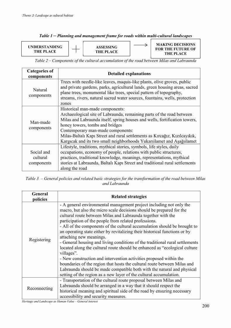
Heritage and Landscape as Human Value – General interest 200
Table 1 – Planning and management frame for roads within multi-cultural landscapes
Table 2 – Components of the cultural accumulation of the road between Milas and Labraunda
Categories of components Detailed explanations
Natural components
Trees with needle-like leaves, maquis-like plants, olive groves, public and private gardens, parks, agricultural lands, green housing areas, sacred plane trees, monumental like trees, special pattern of topography, streams, rivers, natural sacred water sources, fountains, wells, protection zones
Man-made components
Historical man-made components: Archaeological site of Labraunda, remaining parts of the road between Milas and Labraunda itself, spring houses and wells, fortification towers, honey towers, tombs and bridges Contemporary man-made components: Milas-Baltalı Kapı Street and rural settlements as Kırcağız, Kızılcayıkık, Kargıcak and its two small neighborhoods Yukarıilamet and Aşağıilamet
Social and cultural
components
Lifestyle, traditions, mythical stories, symbols, life styles, daily occupations, economy of people, relations with public structures, practices, traditional knowledge, meanings, representations, mythical stories at Labraunda, Baltalı Kapı Street and traditional rural settlements along the road
Table 3 – General policies and related basic strategies for the transformation of the road between Milas
and Labraunda
General policies Related strategies
Registering
- A general environmental management project including not only the macro, but also the micro scale decisions should be prepared for the cultural route between Milas and Labraunda together with the participation of the people from related professions. - All of the components of the cultural accumulation should be brought to an operating state either by revitalizing their historical functions or by attaching new meanings. - General housing and living conditions of the traditional rural settlements located along the cultural route should be enhanced as “ecological culture villages”. - New construction and intervention activities proposed within the boundaries of the region that hosts the cultural route between Milas and Labraunda should be made compatible both with the natural and physical setting of the region as a new layer of the cultural accumulation.
Reconnecting
- Transportation of the cultural route proposal between Milas and Labraunda should be arranged in a way that it should respect the historical meaning and spiritual side of the road by ensuring necessary accessibility and security measures.
UNDERSTANDING THE PLACE
ASSESSING THE PLACE
MAKING DECISIONS FOR THE FUTURE OF
THE PLACE
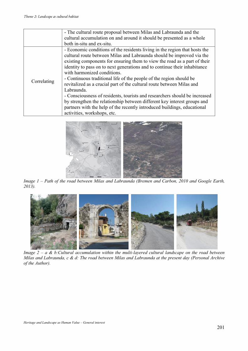
Heritage and Landscape as Human Value – General interest 201
- The cultural route proposal between Milas and Labraunda and the cultural accumulation on and around it should be presented as a whole both in-situ and ex-situ.
Correlating
- Economic conditions of the residents living in the region that hosts the cultural route between Milas and Labraunda should be improved via the existing components for ensuring them to view the road as a part of their identity to pass on to next generations and to continue their inhabitance with harmonized conditions. - Continuous traditional life of the people of the region should be revitalized as a crucial part of the cultural route between Milas and Labraunda. - Consciousness of residents, tourists and researchers should be increased by strengthen the relationship between different key interest groups and partners with the help of the recently introduced buildings, educational activities, workshops, etc.
Image 1 – Path of the road between Milas and Labraunda (Bremen and Carbon, 2010 and Google Earth, 2013).
Image 2 – a & b:Cultural accumulation within the multi-layered cultural landscape on the road between Milas and Labraunda, c & d: The road between Milas and Labraunda at the present day (Personal Archive of the Author).
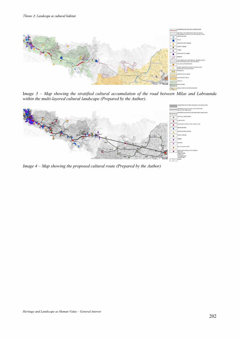
Heritage and Landscape as Human Value – General interest 202
Image 3 – Map showing the stratified cultural accumulation of the road between Milas and Labraunda within the multi-layered cultural landscape (Prepared by the Author).
Image 4 – Map showing the proposed cultural route (Prepared by the Author)
Heritage and Landscape as Human Value – General interest 203
Heritage and Landscape as Human Value – General interest 204
Heritage and Landscape as Human Value – General interest 205
« La voûte à nervures et son potentiel constructif et bioclimatique : quels incompressibles pédagogiques, opérationnels et épistémologiques
durables permet-elle ? » Dorra Ismaïl DELLAGI Résumé : Dans un premier temps, cette communication tentera d’ouvrir des pistes de développement autour d’un questionnement : Qu’est-ce qu’une connaissance constructive en architecture et dans quelle mesure la transmettre, l’expérimenter, l’augmenter et/ou la réactiver ? Il s’agit d’identifier et de rendre explicite la portée réflexive d’une connaissance constructive tant dans la situation de praxis, que de recherche et d’enseignement en architecture. La distinction physique entre un ouvrage clavé et un ouvrage assisé est un point d’entrée méthodologique. Lors de l’édification du Dôme de Florence (1416-1431), Brunelleschi a su utiliser une structure clavée alors qu’elle paraissait assisée. Ce recours au principe assisé (en-deçà de 30°) dans un ouvrage clavé, est une technique de la voûte nubienne. Aussi, est-il possible de comprendre la synthèse constructive faite par Brunelleschi sans une intelligibilité de la voûte nubienne pour les ouvrages clavés ? Peut-on faire l’économie d’une connaissance précise du système constructif du Dôme en briques d’Oldjeitu (en Azerbaïdjan iranien, 1304-1312) ? Comment interpréter et dater les voûtes nubiennes de Remada au Sud de la Tunisie ? Dans l’enseignement, la scission entre l’objet architectural en tant que système constructif d’une part et formel/artistique d’autre part, met en péril la façon de penser, de faire et d’enseigner l’architecture via le ‘seul Projet’. Par-delà les durées géopolitiques et culturelles, l’œuvre élevée au rang de référent/événement’ nous interroge et devient un moment/moyen pour développer des connaissances constructives, épistémologiques d’un point de vue disciplinaire ; d’où le concept d’« événementialité ». « L’événementialité » devient un moment critique pour une double inclusion : développer une connaissance et l’interroger en retour. Cette réflexivité « constitutive » est à la fois, un enjeu pédagogique/recherche et un enjeu de praxis. Nous interrogeons la situation d’enseignement par le biais de retours réflexifs sur travaux d’étudiant(e)s en architecture. Mots-clés : Voûte à nervures, incompressible, système constructif, durable, événementialité. Dans un deuxième temps, la présentation d’un projet de construction (actuellement en fin de chantier) nous permettra de faire opérer les niveaux de complexités et de référentiels qui interviennent dans une situation de praxis. Ce cas de projet opérationnel révèle les enjeux tant bioclimatiques que techniques, formelles et épistémologiques de la forme voûtée et notamment la voûte croisée d’ogives. Ces enjeux permettent de faire valoir l’intérêt de réactualiser d’une manière contemporaine des principes traditionnels qui ont montré leur substance/valeur dans le cadre d’une opérativité durable. En conclusion, il s’agira de mettre en place une base d’échanges sur les modalités de transferts et d’incompressibles tant techniques, que tectoniques et architecturales durables de savoirs anciens tout en ouvrant le débat sur l’intérêt de réactiver ce qu’une événementialité en architecture révèle en substance plutôt que de mimer ses saillances. Qu’est-ce qu’une connaissance constructive en architecture ? Qu’est-ce qu’une connaissance constructive en architecture et dans quelle mesure la transmettre, l’expérimenter, l’augmenter et/ou la ré-activer ?
Heritage and Landscape as Human Value – General interest 206
Il s’agit d’identifier et de rendre explicite la portée réflexive d’une connaissance constructive tant dans la situation de praxis, que de recherche et d’enseignement en architecture. La distinction physique entre un ouvrage clavé et un ouvrage assisé est un point d’entrée méthodologique. Point d’entrée par le biais duquel des œuvres, ayant le statut de ‘référents’ en architecture, sont interrogées et mises en parallèle avec des objets architecturaux situés dans des ères géopolitiques et historiques différentes. Qu’est-ce qu’une connaissance constructive en architecture et comment la définir, la configurer en tant que savoir et la transmettre ? Ce questionnement implique un retour réflexif (D. Schön, 1993) du professionnel sur son agir selon trois niveaux imbriqués : sa praxis en tant qu’architecte penseur et bâtisseur, sa recherche en tant qu’architecte qui remodèle les savoirs qu’ils manipulent, et enfin en tant qu’architecte enseignant qui interroge les fondements de son enseignement et les contours épistémologiques de son positionnement et de sa transmission en situation pédagogique. Produire une connaissance, interpréter ou transmettre une connaissance en architecture relève d’une complexité tant épistémologique que du point de vue de la notion de temps (durée). La problématique est donc de pouvoir rendre cette complexité mesurable et partageable. Le but étant de faire en sorte que l’événement-référence, qui est un objet qui alimente à la fois les pratiques, mais également la réflexion sur les pratiques, soit pensé (Arendt, 1989) et observé afin de produire des connaissances dans le champ de l’architecture. Interpréter l’événement dans sa momentanéité et dans son interprétation univoque, le banalise et rend sa substance inaccessible. Prenons par exemple de l’Opéra de Sydney, connu, reconnu, médiatisé, figure qui a une place importante dans les revues, les discours, les formations, tous les biais rhétoriques en rapport avec l’architecture (refiguration1 tant heuristique que référentielle). Le parcours constitutif, qui en ressort pour l’essentiel, est lié à l’image des voiles des bateaux de la Baie de Benelong Point, de Sydney. Lorsqu’on tente d’interroger les mécanismes en œuvre de cette « référence » architecturale, les enjeux tant de chantier que d’écarts entre les intentions de l’architecte de réaliser des coques autoportantes et la réalité d’exécution de ces derniers, révèlent la complexité de compréhension de cette événementialité (Ismaïl, 2009). Les écarts tant budgétaires (16 fois le budget initialement prévu – durée de chantier : 15 ans) que techniques et programmatiques (salles de concert plutôt que d’Opéra, compte tenu de l’exiguïté des espaces générés par les formes) mettent en évidence le risque interprétatif de cet événement architectural dans la mesure où l’architecte n’a pas pu réaliser des coques autoportantes, mais des structures tridimensionnelles2 courbées. Ces disjonctions (au niveau de la configuration de l’objet architectural) entre les intentions formelles et architecturales et la réalité tant tectonique que constructive, dénotent des parcours constitutifs qui rendent l’événementialité de l’Opéra de Sydney intéressante dans le champ de la discipline, puisqu’elle permet de mettre en corrélation la connaissance et la compréhension des structures arquées. Jörn Utzon méconnaissait-il le principe de la précontrainte de la forme arquée ? L’arc dans sa compréhension géométrique n’est-il pas en soi un élément autoportant (d’un tout : voûte, dôme, sphère, ou autres) ? Dans son approche de la portion de la sphère, Utzon en relève la dimension formelle/géométrique (entité de la sphère) et non pas tectonique3 (élément géométrique fini du « tout » sphère). À titre d’exemple la connaissance du principe du vérin au droit de la clé pour le
1 Voir à ce propos l’approche narrative de Paul Ricoeur et la triade Aristotélicienne : préfiguration, configuration et refiguration. 2 Réticulées, triangulées. 3 Tectonique est un champ de réflexion mis en place en Allemagne au milieu du XIXème siècle. Cependant, d’autres cultures ont également donné un cadre théorique et épistémologique à cette pensée du construit sans recourir à ce terme. La pensée en architecture permet de traverser les connaissances géopolitiques sans les restreindre à la seule définition ni à un cadre théorique. Les stalactites de l’époque arabo-musulmane, le carré tournant en tant qu’abstraction physique du dôme, ne procèdent-ils pas de logiques tectoniques ?
Heritage and Landscape as Human Value – General interest 207
décintrement des coffrages des ponts par Freyssinet (1928), n’aurait-elle pas pu être une piste pour Utzon pour penser ses coques autoportantes comme des nervures post-contraintes ? Questionnement de la tectonique au regard de la discipline architecture Y a-t-il une pensée simultanée entre tectonique et architecture ou plutôt une hiérarchisation ? Y a-t-il des échelles tectoniques ? Y a-t-il une possibilité de penser complexité en intégrant l’approche tectonique dans le procès architectural et urbain ? Y a-t-il lieu à une triade : tectonique, sciences de l’ingénierie et architecture ? Est-ce que la tectonique ce ne serait pas l’expression de l’architecture ? Dans le sens où c’est la tectonique qui nous différencie des autres disciplines (médecine, droit, …). Dans la mesure où l’architecture pense, produit, met en tension des tectoniques (au sens épistémologique du terme : expression matérialisée et immatérielle du rapport à la matière - micro/macro - aux systèmes constructifs et esthétiques). Comment les rapports (différents niveaux de complexité qui sont imbriqués) à la matière, à la connaissance historique et technique, l’évaluation énergétique, les besoins anthropologiques, peuvent-ils être nuancés et rendus intelligibles, voire mesurables dans le procès conceptuel et/ou analytique dans le champ de la discipline architecture ? Questionnement de l’enseignabilité de l’histoire de la construction en architecture Alain Rénier structure une pensée pédagogique et ses possibilités réflexives en donnant un cadre théorique à cette situation pédagogique du fait conceptuel. A la confluence entre l’analyse structurale Greimassienne et le nouveau paradigme scientifique Saussurien, il tente de distinguer l’objet architectural de l’œuvre qui, elle, engramme un niveau de complexités dépassant le seul stade de la décomposition « cartésienne ». Par-delà, le structurel, le « structural » permet de produire du sens et de procéder à des déconstructions/reconstructions du procès. « En sémantique structurale, on cherche à reconstruire le procès par lequel les contenus de signification de ‘l’objet’ considéré sont engendrés selon une suite d’opérations au terme desquelles du sens est produit. »4. En tentant de rompre avec le précepte de l’angle droit, de la représentation planaire et des analyses procédant par analogie et non pas par découpage et re-constructions logiques du mode de conception architecturale, Alain Rénier tente de faire valoir les possibilités tant spatiales, que formelles et structurelles d’une forme comme le triangle (en vue de l’engendrement de pentagones, hexagones et tétraèdres5) dans une opération de conjonction entre la géométrie computationnelle (mécanique) et de la géométrie cristallographique (nécessitant la connaissance du procès opératoire par- delà le geste plastique). L’intérêt de cette expérimentation pédagogique du procès d’explorations spatiales réside davantage dans les catégories et niveaux de complexités, d’hésitations et d’écarts relevés que dans le résultat en soi. Dans ce décryptage, Alain Rénier a pu rendre, intelligibles et nuancées, trois catégories
4 A. RENIER, « Géométrie et Sémantique : la génération du structural », 1er séminaire international sur la morphologie structurale, Montpellier ; 7-11 Septembre 1992, p. 26-42., cit. p. 3 5 A. Rénier reste lui-même tributaire (malgré sa connaissance de la stéréotomie) d’une compréhension moderne du paradigme de la matière réduite à des approximations souvent liées aux formes droites et linéaires (triangle, tétraèdre,…) de la vision structurale/mécanique comme chemin cognitif pour aborder la forme/structure (aussi complexe soit-elle). La forme courbée (clavée) et en éléments finis ne relevant pas des mêmes mécanismes cognitifs.
Heritage and Landscape as Human Value – General interest 208
intervenant dans le procès qu’il définit ainsi : le sujet « logique », le sujet « historique » et le sujet « contextuel ». Ce qui retient notre attention dans cette approche relevant de la morphologie structurale, ce sont les niveaux de complexités inhérents au procès de conception architecturale et notamment ce qui distingue le niveau géométrique de celui sémantique. Cette nuanciation/distanciation donne un cadre (Goffman, 1991) théorique pour faire valoir la conjonction entre forme plastique, opérations géométriques et enfin déductions constructives en vue de rendre la dimension tectonique appréhendable en situation pédagogique. Comment, en situation d’enseignement, faire prendre conscience aux étudiants de cette complexité inhérente aux durées (historiques, culturelles, conjoncturelles, paradigmatiques, heuristiques, philosophiques, herméneutiques, anthropologiques, situationnelles, …) que l’on convoque, interroge ou manipule dans notre activité qu’elle soit dans la praxis, la recherche ou l’enseignement ? Praxis : comment les nuances permettent-elles d’asseoir une méthodologie consciente du fond épistémologique et opérationnel dans le champ architecture ? Recherche : retour sur le questionnement(s) et les hypothèses en vue de produire de la connaissance. Développement / Catégorisation des nuances et des niveaux de complexités. Enseignement : les mise en situation(s), les niveaux de complexités et de temporalités permettent d’évaluer des écart(s) constitutifs dans le niveau et entre les niveaux, en rendant une connaissance transmissible/partageable. La tectonique, terme compris dans l’optique où ce qui y est engrammé comme sens technique, historique, constructif, socio-géographique, nous distancie d’un langage prisonnier de la forme. À titre d’exemple, l’approche pharaonique de la tectonique (même si elle est engrammée et non intelligibilisée en tant que telle) dénote d’un savoir et d’un savoir-faire hautement maitrisé au niveau de la connaissance chimique des matériaux (géopolymères6), connaissance mécanique et structurelle des matériaux (franchissement de la pierre en linteau ou en encorbellement, franchissement en voûte et en terre crue comme pour les greniers du Ramesseum) et navigation sur des pirogues en fibres végétales (y compris pour le transport des matériaux de construction). Ces connaissances multiples et interconnectées déplacent intrinsèquement le discours sur et de l’architecture de logiques morphologiques, et/ou typologiques vers une connaissance traversante du savoir tectonique. Du point de vue de l’événementialité en architecture, la tectonique est un point d’entrée par l’intermédiaire duquel des connaissances traversantes et des figures historiques peuvent être comparables, voire interprétables ; par-delà les écarts tant géopolitiques que temporels qui spécifient ces comparaisons. « L’événementialité » devient un moment critique pour une double inclusion : développer une connaissance et l’interroger en retour. Cette réflexivité « constitutive » est à la fois, un enjeu pédagogique/recherche et un enjeu de praxis. Nous interrogeons la situation d’enseignement par le biais d’un exercice donné dans le cadre d’un atelier de 3ème année architecture relatif au « séminaire de structure ». Nous abordons la situation de praxis par la présentation d’un projet de construction et ses extensions théoriques et techniques. La tectonique entre savoir(s), outil(s) et transmission(s) dans la durée
6 Voir hypothèse de Jospeh Davidovits : http://www.davidovits.info/
Heritage and Landscape as Human Value – General interest 209
Joël Sakarovitch (Sakarovitch, 1998) dans sa compréhension du principe de la géométrie descriptive, met en corrélation le savoir et l’expérimentation de l’appareillage (ou la stéréotomie - méthodes et tracés des appareilleurs). Selon lui, ces savoirs et savoir-faire des appareilleurs constituent la matrice du principe de la géométrie descriptive en tant que représentation tant conceptuelle que matérielle. Aussi, la disjonction entre le savoir-faire des matériaux et le savoir-faire conceptuel et figuratif des architectes contemporains, ne traduit-elle pas cette disjonction du savoir architectural en tant que forme tectonique également, et non pas exclusivement formelle, métrique ou typologique ? Kenneth Frampton (Frampton, 2001) parle de régionalisme critique, nous comprenons cela par résistance culturelle et épistémologique. Cependant, K. Frampton limite (selon nous) la notion de modernité à l’ère géopolitique occidentale, tout en conceptualisant intrinsèquement que l’espace est un passage obligé vers l’architecture dites « moderne ». De même, K. Frampton, fait de l’expression technique (matière) d’une architecture une finalité en tant que savoir tectonique. Or, l'Égypte antique, où la tectonique est une approche fractale (de l’habitat en roseaux vers le monument / temple), constitue un contre-exemple de ce positionnement théorico-épistémologique de K. Frampton. D’où le questionnement suivant : comment retisser ces liens avec le savoir technique traditionnel du point de vue tectonique, indépendamment de délimitations géopolitiques ou paradigmatiques ? Comment aborder la tectonique du point de vue de l’épistémologie7 de la connaissance en architecture :
- Est-ce un outil pédagogique ? - Est-ce une grille analytique et/ou conceptuelle (compréhensions, extensions, limites) ? - Est-ce un point d’entrée pour faire émerger une connaissance traversante ?
Exemple de réflexivité en situation pédagogique (fig. 1) Ce Procès du groupe d’étudiant(e)s de 3ème année dans le cadre du séminaire structure (Chef de file Hanen Bahri - A.U. 2002/03), met en évidence des déperditions au niveau de la correspondance entre potentiel d’expression de l’approche plastique/architecturale de départ (a) et possibilité constructive. Les étudiant(e)s ont préféré le recours à un dispositif structurel pré-établi (la roue de bicyclette (c)) au lieu de comprendre le principe mécanique et physique de cette mise en tensions des nervures porteuses conformément à la forme plastique de départ basée sur des formes triangulaires et non pas circulaires ((a) & (b)). La réflexivité sur cet écart, en situation pédagogique, entre approche plastique et matérialisation du système constructif met en évidence une défaillance au niveau de la compréhension « tectonique » d’un artéfact architectural. Cet exemple nous interroge sur les niveaux de transmission et de compréhension d’un savoir architectural en situation d’enseignement. Cet écart entre potentiel d’expression et possibilité constructive ne nous mène-t-il pas vers la tectonique comme point d’entrée traversant en situation d’enseignement ?
7 Voir à ce propos les travaux de l’épistémologue André Pichot.
Heritage and Landscape as Human Value – General interest 210
De la connaissance vers la configuration et la refiguration du principe de la « nervure » Evénementialité et épistémologie de la connaissance en architecture Inscrire dans la praxis un savoir/savoir-faire, c’est tout d’abord, en maîtriser les contours, les limites et les extensions. L’exemple de l’Opéra de Sydney nous a permis de simuler la corrélation entre connaissance et possibilités d’extensivité d’un savoir en rapport avec la forme arquée. Ainsi, dans quelle mesure est-il possible de mettre en parallèle la technicité de la voûte croisée d’ogives présente dans le site archéologique de Dougga/Thugg88 (1500 av JC) avec celle de la Cathédrale Saint Louis de Carthage (1884-1890), de celles des voûtes catalanes de Guastavino ou les voûtes à chaînettes de Jujol et de Gaudi (Fin XIXe – Début XXe siècle) ? Quels incompressibles peuvent être dégagés et transmissibles dans cette mise en relation diachronique par le biais du système constructif ? « L’événementialité », qui est notre objet de questionnement et de recherche, joue le rôle de trame épistémologique au travers de laquelle s’échafaude notre réflexion sur l’histoire de la construction en architecture, sa (ses) transmission(s), déconstruction(s), réception(s), moyen(s) de transferts, « écarts » et « risques » dans la durée(s). Mesurer les niveaux de transférabilité d’une connaissance ou d’un savoir-faire nécessite, au préalable, l’identification des niveaux de compréhension de ce dernier. Dans cet ordre d’idée, le savoir/savoir-faire franchissement clavé est interrogé du point de vue de la discipline architecture. La précontrainte est-elle une connaissance traversante ou ponctuellement identifiable ? (fig. 2). Lors de l’édification du Dôme de Florence (1416-1431), Brunelleschi a su utiliser une structure clavée alors qu’elle paraissait assisée. Ce recours au principe assisé (en-deçà de 30°) dans un ouvrage clavé9, est une technique de la voûte nubienne. Aussi, est-il possible de comprendre la synthèse constructive faite par Brunelleschi sans une intelligibilité de la voûte nubienne pour les ouvrages clavés ? Peut-on faire l’économie d’une connaissance précise du système constructif du Dôme en briques d’Oldjeitu (en Azerbaïdjan iranien, 1304-1312) ? Comment interpréter et dater les voûtes nubiennes de Remada au sud de la Tunisie ? Est-il possible de comprendre l’apport de Freyssinet pour les ouvrages en béton armé et notamment la poutre précontrainte sans connaître les travaux des catalans Guastavino, Jujol ou Gaudi sur les ouvrages clavés ? Dans l’enseignement, la scission entre l’objet architectural en tant que système constructif d’une part et formel/artistique d’autre part, met en péril la façon de penser, de faire et d’enseigner l’architecture via le « seul Projet ». Lorsque le « star system » prédomine, comment donner une place professionnelle et théorique à la tectonique en tant qu’objet empirique et épistémologique et à l’histoire de la construction qui en émerge ? Les architraves étrusques puis grecques, avec leurs armatures métalliques, ne deviennent plus cantonnées dans une ère géopolitique, mais les connaissances qu’elles cristallisent convoquent des savoirs constructifs en termes de sollicitations en compression/traction et de poutres précontraintes. Le franchissement taillé droit qui travaille à la traction avec armatures intégrées
8 Le nom actuel de Dougga provient du nom latin Thugga qui est lui-même une dérivation du nom ancien Tukka retrouvé sur des inscriptions lybiques signifiant "Roc à pic". Voir. http://www.dougga.rnrt.tn/ 9 L’hypothèse empirique des 30° provient du schéma de Vitruve : voir J-P. ADAM, La Construction Romaine, Paris, Picard, 1995. Viollet Le Duc, au XIXème siècle est arrivé à approcher les 35°. Les calculs et modélisations contemporains ont atteint l’angle des 38°. Voir à ce propos : R. MOUTERDE, F. FLEURY, Comprendre simplement la résistance des matériaux. La structure, principes et enjeux pour la construction, Paris, Le Moniteur, 2006.
Heritage and Landscape as Human Value – General interest 211
dans l’architrave ; ce système n’est-il pas l’ancêtre du principe de la précontrainte ? Puisque ces agrafes reprennent les efforts à la traction (la pierre ne travaillant pas à la traction). Par-delà les durées géopolitiques et culturelles, l’œuvre élevée au rang de « référent/événement » nous interroge et devient un moment/moyen pour développer des connaissances constructives, épistémologiques d’un point de vue disciplinaire ; d’où le concept d’événementialité. Exemple de disjonctions entre logique couvrement / espace et tectonique : la Mosquée de Carthage (fig. 3). Cet exemple du mode constructif de la galerie extérieure de la Mosquée de Carthage (Tunisie 2007) illustre bien les disjonctions entre savoir constructif et approche typologique. Lorsqu’on a la connaissance des principes constructifs inhérents aux ouvrages clavés (exemple la voûte croisée), on peut analyser un mode constructif par la simple observation. Dans le cas de la galerie extérieure de la Mosquée, il est évident que l’architecte ignorait les principes de chevet avec déambulatoires et chapelles rayonnantes10 (A. E. et A-B. M. BRANDEBOURG, 2003) donc les géométries des nervures qui rattrapent les altimétries différentielles rayonnantes/concentriques en absorbant les imperfections, les épaisseurs ou les changements de directions (niveaux). Aussi, il a comblé l’erreur géométrique du croisement, par le recours à une masse de maçonnerie. De plus, s’il s’agissait d’un vrai couvrement en voûte croisée (et non pas d’un camouflage de fausses voûtes croisées en plâtre, rapportées en-dessous de la dalle béton), il aurait pensé et dessiné les proportions de sa galerie en fonction de la contrainte géométrique et constructive et non pas en ayant recours à une masse inutile ni à un dédoublement d’une travée de la galerie. La subtilité géométrique du vestibule d’entrée de la Petite Mosquée Al-Akmar (1125, Le Caire, Egypte), illustre cette conjonction entre espace/structure/couvrement pour rattraper des niveaux, des échelles ou des directions, tout en gardant une unité de l’ensemble (d). Positionnement / Référentiel : l’expérimentation VCO2 et tentative de re-figuration tectonique de la nervure La tectonique de voûte nervurée versus la voûte croisée est le support épistémologique et disciplinaire pour relever des niveaux de compréhensions (voire de complexités) et de transferts de la mécanique de l’arc. Plusieurs auteurs se sont intéressés à la question de la relation entre la maçonnerie de la voûte (arc/sphère) et plus spécifiquement le rôle structurel et géométrique des nervures dans l’architecture gothique notamment (Frankl – 1960, Sanders -1816, Pugin -1825, Willis 1835, Wittman – 1879, Planat – 1887, Sabouret – 1924, Coste – 1947, Heymann – 2008, Huerta - 2009,…). Cependant, le rôle structurel des nervures reste non démontré jusqu’à présent, y compris avec les nouvelles techniques de mesures mécaniques développées très récemment. Victor Sabouret provoque l’orthodoxie de l’architecture gothique et notamment les approches structurelles de Viollet Le Duc en développant l’idée du rôle simplement décoratif des nervures dans les constructions des voûtes gothiques (Sabouret, 1928). Sabouret persiste dans son hypothèse dans la mesure où, pour lui, les nervures sont séparées de la coque11 (J-M. PEROUSE DE MONCLOT, 2011) de la voûte compte tenu des mouvements de cette dernière (Huerta, 2008). 10 Les Brandebourg décrivent les typologies des églises et cathédrales de l’époque du Moyen Age en France et en Europe, en particulier. Parmi des typologies; figurent le Chevet avec déambulatoire et chapelles rayonnantes. 11 C’est-à-dire le berceau de voûte, aussi simple ou complexe soit-il.
Heritage and Landscape as Human Value – General interest 212
Cependant, cette hypothèse n’a pas été confirmée, au jour d’aujourd’hui, y compris par les nouvelles méthodes d’analyses statiques (Heymann, 1972) et de modélisations micro-macro tels que FEM et DEM (discrete element methods). Si le débat sur le rôle structurel des nervures, notamment dans la transmission des charges au niveau de la voûte, a pris plusieurs tournures, il n’en reste pas moins vrai qu’aucune théorie ou recherche statique (Fangary, 2010), de plasticité ou géométrique n’a pu infirmer le rôle des nervures dans l’augmentation des efforts donc la reprise de ces derniers et leur transmission vers le sol12. Aussi, notre positionnement n’est ni de s’inscrire dans une optique de démonstration ou d’infirmation du rôle structurel des nervures pour les formes arquées. Nos propos visent plutôt à inscrire la connaissance tectonique (d’un point de vue tant géométrique que constructif) que ce procédé antique (bien antérieur aux constructions gothiques) en vue d’inscrire ce savoir/savoir-faire dans un continuum et une dynamique de réactivation tant théorique, qu’archéologique et constructive (en tant que système constructif portant en soi une capacité à s’adapter et à évoluer). La transcription d’un projet construit aux Berges du Lac de Tunis, permet d’illustrer la possibilité d’une approche de praxis contemporaine imprégnée d’un savoir à la fois conceptuel et constructif, mais également en tant que principe épistémologique de la tectonique de la nervure dans les ouvrages clavés. Cet exemple de praxis permet de faire valoir dans quelle mesure la connaissance du clavé/assisé permet des extensivités dans la façon de modeler le système constructif/spatial de la nervure à géométrie variable (fig. 4. (e)). Lorsque la voûte est conceptualisée, à partir d’une approche des possibilités géométriques de la nervure (donc en tant que système en éléments finis) et non pas en tant que tout structurel rigide (coque et/ou membrane), l’adaptation de ce système constructif à une tectonique spatiale devient possible. Les images (Fig. 4 . (c) & (d)) explicitent comment le désaxement de la clé de voûte a permis d’adapter une répartition spatiale des chambres avec des proportions plus adéquates tout en jouant sur une illusion; dans la mesure où la voûte paraît symétrique à l’extérieur. Cette nouvelle façon d’observer le système voûte en tant que système constructif/couvrement, mais également en tant que forme hygrothermiquement confortable (la maison est de classe énergétique A 13 selon une étude fluides, sans recours à une climatisation artificielle, mais par une simple gestion thermodynamique de l’air par une installation d’appoint d’extracteurs mécanisés – principe ancien tunisien de la Fawara14 réactivé) permet de simuler les possibilités contemporaines des techniques et typologies traditionnelles (les avantages bioclimatiques et structurels, voire tectoniques de la forme voûtée). La forme générée par la voûte croisée est intrinsèquement bioclimatique de par son exposition partielle à l’ensoleillement.
12 La structure procède par mode « transmission des charges et des sollicitations » jusqu’à arriver à un sol stable et capable de porter ces charges. Ce mode nécessite un principe, celui de la « continuité de la matière ». Nous pensons que la structure fonctionne par relais, chaîne de transmission, articulation, entre éléments et ensembles qui se transmettent les uns aux autres, les sollicitations (charges). Ainsi, selon les cas, un élément (ou un ensemble) peut être une « structure primaire » ou « structure quaternaire ». Et vice versa. Donc, berceau, nervure, brique, calcite, joint de chaux ou cale en tuile ou en bois, il y a des matières qui peuvent transmettre les sollicitations, alors que d’autres sont elles-mêmes la sollicitation. 13 Classification selon la norme internationale de classification du comportement énergétique des bâtiments. Etude thermique effectuée en 2009 par Dr Mohamed Bouallègue, Ingénieur thermicien ENIT (école nationale d’ingénieurs de Tunis - TUNISIE). 14 La Fawara : est un dispositif traditionnel répandu sur le territoire tunisien (notamment dans le sud du pays) qui joue le rôle d’extracteur d’air, il permet de ventiler d’une manière continue un espace de par sa position à la partie la plus haute d’un volume. Cette ouverture joue le rôle de ventilation haute (modulable à volonté) tandis que des petites ouvertures sous les baies jouent le rôle de ventilation basse.
Heritage and Landscape as Human Value – General interest 213
De plus l’économie générée au niveau de la superstructure a permis d’investir dans l’enveloppe ce qui contribue à l’amélioration de l’inertie aussi bien des murs que du couvrement. Ce procès, vise à illustrer les fondements possibles d’une démarche de praxis imprégnée d’une connaissance tectonique, épistémologique et bioclimatique du principe traversant et contemporain de la voûte d’ogives. Cette expérimentation de la nervure, comme élément (support/structure) du principe de l’ouvrage clavé, permet les extrapolations suivantes :
- la nervure comme génératrice de formes et de possibilités d’espace/couvrement à géométrie variable,
- l’alternative au système poteau/poutre peut s’esquisser dans une réappropriation de l’ouvrage clavé en tant que système tectonique et non pas typologique, géométrique ou morphologique uniquement,
- l’espace généré est pensé dans une conjonction et non pas une disjonction avec son système constructif et mécanique.
La connaissance du clavé / assisé permet des extensivités dans la façon de modeler le système constructif/spatial de la nervure à géométrie variable. Cette connaissance déplace également la question théorique et épistémologique, du rôle mécanique et structurel de la nervure, par un raisonnement inversé dans la mesure où la démarche relève d’une « archéologie expérimentale15 » plutôt que d’une démarche déductive. Une certification (2012) par le Centre technique des matériaux de construction et de verre (CTMCCV - Tunisie) du système constructif de cette maison, confirme le rôle des nervures dans la stabilité globale de la voûte et dans la répartition des efforts vers le sol. De plus, cette expérimentation à double entrée (expérimentale et de recherche) a permis d’entrevoir des extensions possibles vers un nouveau système constructif QAWS®16 basé sur un matériau composite permettant à la nervure de devenir un ensemble d’éléments finis emboîtables et superposables en vue de générer des géométries variables. Une connaissance en architecture (approchée ici par un système constructif), vérifiée, questionnée, critiquée, déplacée, expérimentée et inscrite dans la durée(s) devient :
- Un savoir/savoir-faire extrapolable d’une manière singulière dans une situation de Praxis ; - Un objet/questionnement de recherche menant vers des incompressibles dans la discipline
; - Une connaissance empirique partageable en situation d’Enseignement.
Le terme « tectonique », et ses extensions théoriques et expérimentales, trouve ici une place épistémologique importante. La tectonique devient un point d’entrée pour aborder l’histoire constructive. C’est dans ce sens que le concept d’événementialité, nous a permis d’aborder l’architecture selon des points de vue qui ne la cantonnent dans aucune discipline ni méthodologie connexes. L’événementialité, par sa nature insaisissable car soumise aux temps et aux transferts pluriels, aborde l’architecture sous un angle libre de toute appartenance ; le concept donne aux œuvres leur
15 Terminologie que l’archéologue Dr. Fabienne Féraud (École du Louvre) associe à mon approche expérimentale des principes constructifs historiques. 16 QAWS® (Qartbun Architectural Working Systems) est un projet industriel (promoteurs mehdi dellagi & dorra ismaïl dellagi associés), en cours de développement technique et financier, en vue de produire un cintre porteur à géométrie variable pour la superstructure de tout type de bâtiment.
Heritage and Landscape as Human Value – General interest 214
statut de moments, moyens, occasions et/ou prétextes, pour dégager des incompressibles de l’architecture, et non pas des références à élever au statut d’événements intemporels. L’exemple du dôme de Florence, œuvre emblématique qui, par-delà son événementialité, nous permet d’interroger et de mettre en corrélations des incompressibles (Ismaïl, 2009-2014) liés aux principes du franchissement et des structures physiques d’un ouvrage clavé à la différence d’un ouvrage assisé. Le questionnement de fond qui alimente ce débat étant le suivant : Dans quelle mesure le Dôme de Florence, tout comme le Dôme du Rocher, le Mausolée d’Oljeitu, un Temple Hindoue, un édifice chinois ou une station spatiale sur la planète Mars sont-ils des supports en termes de connaissances sur les systèmes constructifs indépendamment de leurs connotations temporelles, morphologiques, géopolitiques ou idéologiques ? Par extension, l’histoire de la construction ne se limite plus à une lecture linéaire ou paradigmatique, elle se connecte avec les multiples durées et épaisseurs géopolitiques, afin de révéler des savoirs incompressibles et les inscrire dans un continuum praxéologique. Le cas de la nervure en tant que savoir constructif, révélant plusieurs durées épistémologiques et historiques, permet de nuancer les différents niveaux de complexités qui sont à l’œuvre dans un processus réflexif. Que cette réflexivité soit sur l’histoire, l’expérimentation, la praxis, la recherche ou l’enseignement, elle nous positionne dans une attitude d’interrogation continue. Bibliographie
H. ARENDT, Penser l’événement, traduit sous la direction de Claude Habib, Paris, Belin, 1989. M. AUBERT, « Les plus anciennes croisées d'ogives; leur rôle dans la construction », Bulletin Monumental, 93, p. 5-67, 137-237, 1934. J.P. ADAM, La construction romaine, Paris, Picard, 1995. J.P. ADAM, L’archéologie devant l’imposture, Paris, R. Laffont, 1975. A. E. BRANDENBOURG ; A-B. M. BRANDENBOURG, Du Moyen Âge à la Renaissance. IVe siècle – début XVIe siècle, Histoire de l’Architecture Française, Paris, Mengès, 2003. E. GOFFMAN, Les cadres de l’expérience, Paris, Minuit, (coll. Le sens commun), 1991. A. A. H. FANGARY, « Graphics Analysis of Gothic Vaults », Master’s Thesis, Advanced Masters in Structural Analysis of Monuments and Historical Constructions, Spain, Erasmus Mundus, 2010. J. HEYMANN, The Stone Skeleton. Structural Engineering of Masonry Architecture, Cambridge, Cambridge Univ.Press, 2005. J. HEYMANN, Structural analysis: a historical approach, Cambridge, Cambridge University Press, 2008. S. HUERTA, «The Debate about the Structural Behaviour of Gothic Vaults: From Viollet-le- Duc to Heyman», Proceedings of the Third International Congress on Construction History, Cottbus, May 2009. S. HUERTA, «The use of simple models in the teaching of the essentials of masonry arch behaviour», G. Mocchi, Theory and practice of constructions, Ravenna, 2, (Eprint: www.ad.upm.es), 2005, p. 747-761. S. HUERTA, «The Analysis of Masonry Architecture. A Historical Approach», Architectural Science Review 51, 2008, p. 297-328. D. ISMAIL, La pensée en architecture au « risque » de l’événementialité, Paris, Harmattan, 2009. D. ISMAIL, « Enseigner et Penser une discipline : un positionnement à trans-paraître et à trans-mettre dans l’interaction », Paris, « Transmettre », Biennale de l’éducation, CNAM 03- 06 juillet 2012.
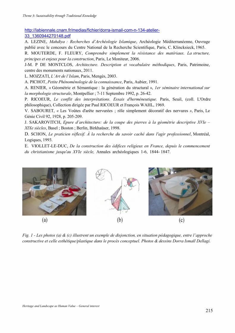
Heritage and Landscape as Human Value – General interest 215
http://labiennale.cnam.fr/medias/fichier/dorra-ismail-com-n-134-atelier-33_1360944270148.pdf A. LEZINE, Mahdiya : Recherches d’Archéologie Islamique, Archéologie Méditerranéenne, Ouvrage publié avec le concours du Centre National de la Recherche Scientifique, Paris, C. Klincksieck, 1965. R. MOUTERDE, F. FLEURY, Comprendre simplement la résistance des matériaux. La structure, principes et enjeux pour la construction, Paris, Le Moniteur, 2006. J-M. P DE MONTCLOS, Architecture. Description et vocabulaire méthodiques, Paris, Patrimoine, centre des monuments nationaux, 2011. L. MOZZATI, L’Art de l’Islam, Paris, Mengès, 2003. A. PICHOT, Petite Phénoménologie de la connaissance, Paris, Aubier, 1991. A. RENIER, « Géométrie et Sémantique : la génération du structural », 1er séminaire international sur la morphologie structurale, Montpellier ; 7-11 Septembre 1992, p. 26-42. P. RICOEUR, Le conflit des interprétations. Essais d'herméneutique. Paris, Seuil, (coll. L'Ordre philosophique), Collection dirigée par Paul RICOEUR et François WAHL, 1969. V. SABOURET, « Les Voûtes d'arête nervurées ; rôle simplement décoratif des nervures », Paris, Le Génie Civil 92, 1928, p. 205-209. J. SAKAROVITCH, Epure d’architecture: de la coupe des pierres à la géométrie descriptive XVIe – XIXe siècles, Basel ; Boston ; Berlin, Birkhaüser, 1998. D. SCHON, Le praticien réflexif. À la recherche du savoir caché dans l'agir professionnel, Montréal, Logiques, 1993. E. VIOLLET-LE-DUC, De la construction des édifices religieux en France, depuis le commencement du christianisme jusqu'au XVIe siècle, Annales archéologiques 1-6, 1844- 1847.
Fig. 1 - Les photos (a) & (c) illustrent un exemple de disjonction, en situation pédagogique, entre l’approche constructive et celle esthétique/plastique dans le procès conceptuel. Photos & dessins Dorra Ismaïl Dellagi.
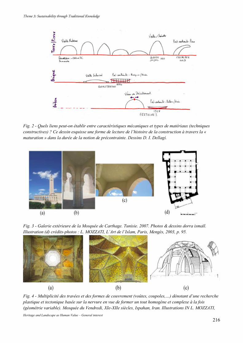
Heritage and Landscape as Human Value – General interest 216
Fig. 2 - Quels liens peut-on établir entre caractéristiques mécaniques et types de matériaux (techniques constructives) ? Ce dessin esquisse une forme de lecture de l’histoire de la construction à travers la « maturation » dans la durée de la notion de précontrainte. Dessins D. I. Dellagi.
Fig. 3 - Galerie extérieure de la Mosquée de Carthage. Tunisie. 2007. Photos & dessins dorra ismaïl. Illustration (d) crédits-photos : L. MOZZATI, L’Art de l’Islam, Paris, Mengès, 2003, p. 95.
Fig. 4 - Multiplicité des travées et des formes de couvrement (voûtes, coupoles,…) dénotant d’une recherche plastique et tectonique basée sur la nervure en vue de former un tout homogène et complexe à la fois (géométrie variable). Mosquée du Vendredi, XIe-XIIe siècles, Ispahan, Iran. Illustrations IN L. MOZZATI,
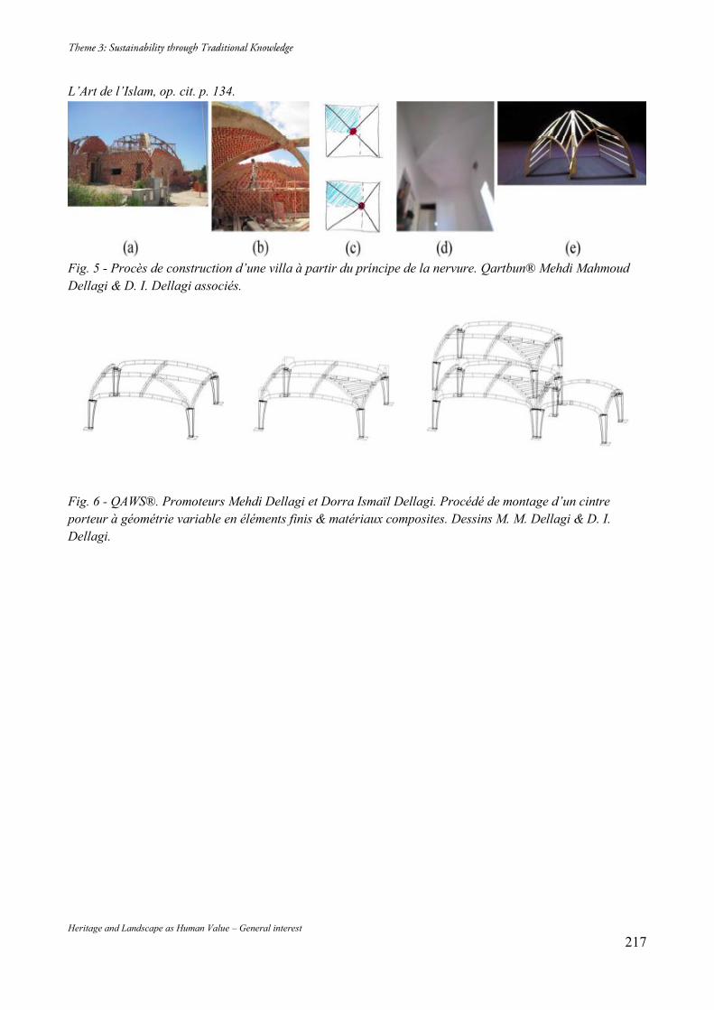
Heritage and Landscape as Human Value – General interest 217
L’Art de l’Islam, op. cit. p. 134.
Fig. 5 - Procès de construction d’une villa à partir du príncipe de la nervure. Qartbun® Mehdi Mahmoud Dellagi & D. I. Dellagi associés.
Fig. 6 - QAWS®. Promoteurs Mehdi Dellagi et Dorra Ismaïl Dellagi. Procédé de montage d’un cintre porteur à géométrie variable en éléments finis & matériaux composites. Dessins M. M. Dellagi & D. I. Dellagi.
Heritage and Landscape as Human Value – General interest 218
Heritage and Landscape as Human Value – General interest 219
Heritage and Landscape as Human Value – General interest 220
Parks as an Embodiment of Social Sustainability Duality
Al-Azhar Park: a Hard Infrastructure to Enhance Social and Cultural Life
Doaa KAMAL Ain Shams University, Architectural Engineering Department, Abbassia, Cairo, Egypt, +20 1222303072, [email protected] Abstract “Place-making” facilities as hard infrastructures of social sustainability play an important role in enhancing soft infrastructure, i.e. social capital. Among these facilities are parks which provide collective activities and social urban spaces. In this respect, it is worthy to highlight the establishment of Al-Azhar Park that has proven to be a powerful catalyst for urban renewal in the neighboring district of Al-Darb Al-Ahmar – one of the poorest districts in Cairo yet one of the richest concentrations of Islamic art and architecture in the world. Hence, this study aimed at reviewing Al-Azhar Park’s social sustainability via proposing framework criteria based on the Trust for Public Land (TPL) studies and sustainable sites initiative “SITES”, in addition to basic studies about people’s contentment in public open spaces. Keywords: Al-Azhar Park; Social Sustainability; Hard and Soft Infrastructures; Place-making 1. Introduction Al-Azhar Park project onset had been in the mid-eighties of the last century, while the sustainability concept emerged later. In addition, the local context lacks the knowledge and the practice of sustainability; this can be easily noticed in the educational programs and local media1. Furthermore, since the emergence of widespread concerns over environmental degradation in the 1960s, a great deal of work has been put into the concept of environmental sustainability in the late-eighties and after, regardless of the fact that a community is much more than its physical form. More recently, social sustainability has been adopted as an interrelated concern. In this respect, it is prompting to investigate Al-Azhar Park in terms of its social sustainability. The Park project was a part of the rehabilitation of Al-Darb Al-Ahmar district that was intended to test the assumption that there is an alternative to traditional remedies for the decline of historic neighborhoods. These usually involved isolating monuments by the forced removal of people in the surrounding context. The approach of the Aga Khan Trust for Culture (AKTC) has been to stimulate rehabilitation by ensuring that residents have a stake in the future of their community2. The construction of Al-Azhar Park is meant to be a catalyst for social and economic development in its context. The park offers a new vantage point for Historic Cairo’s countless architectural treasures, which will no doubt draw tourists and the inhabitants of greater Cairo to the once-neglected area. Thus, it can be inferred that the project has the potentials to be socially sustainable though it has not been articulated as a clear target by the AKTC. Therefore, this study aims at locating the parks’ role among the social sustainability scheme in order to build framework criteria upon which investigating Al-Azhar Park social sustainability could be achieved. 2. Research Methodology To achieve the research aim, a preliminary content analysis of relevant studies about social sustainability in general and open public spaces and parks in particular was carried out, in order to find out the role of the parks in the social sustainability scheme and hence building framework criteria for socially sustainable parks.
1 Mostafa, Abeer M., and Doaa K. Kamel (2013). Al-Azhar Park Sustainability: An Environmental Review of a Distinct Model in Local Landscape. Democratic Transition and Sustainable Communities: Overcoming Challenges Through Innovative Practical Solutions, SB13 Cairo Conference, p. 178. 2 Aga Khan Development Network Press Center (2005). Aga Khan Creates New 30-hectare Park in Historic Cairo (Media Advisory), 20th Jan. 2014 < http://www.akdn.org/Content/475 > .
Heritage and Landscape as Human Value – General interest 221
Then, Al-Azhar Park social sustainability was investigated via semi-structured interviews with key-persons involved in the park creation, field visits and literature review, following the proposed framework criteria. 3. Literature Review Although social sustainability is an equally fundamental component of sustainable development, it has been neglected in the majority of sustainability debates3. It is hampered by definition issue, difficulties in operationalizing its concepts and the way of measuring them. Over the past ten years, there was a growing body of evidence that the economic benefits of providing social infrastructure far out-weigh the costs of provision and result in a net return on investment. Thus, many researches started to state definitions for social sustainability, and a growing awareness by governments of its importance in urban planning for achieving broader public policy outcome has been emerged4. The Young Foundation – a non-profit, non-governmental think tank based in London that specializes in social innovation – developed a framework to build new communities. This framework contains four essential elements: amenities and social infrastructure; social and cultural life; voice and influence; space to grow5. The Young Foundation defines social sustainability as follows: “A process for creating sustainable, successful places that promote well-being by understanding what people need from the places they live and work in. Social sustainability combines design of the physical realm with design of the social world – infrastructure to support social and cultural life, social amenities, and systems for citizen engagement and space for people and places to evolve6.” Consequently, social sustainability comprises Hard and Soft infrastructures.7 Hard infrastructure includes the amenities which can be classified into basic needs, community facilities and public buildings, whereas the Soft infrastructure is the social networks and social cohesion. In this respect, it is significant to assure the right understating of the relevant term Social Capital as: “... not simply the sum of institutions, which underpin society; it is also the glue that holds them together. It includes the shared common sense of ‘civic’ responsibility that makes society more than just a collection of individuals8.” Therefore, social capital is the soft infrastructure – the raw material of civil society. It is created from the myriad everyday interactions among people. It is associated with themes of participation, reciprocity, trust, the commons and proactivity9. This could be concluded simply in people’s sense of place. Creating opportunities for people to interact with neighbors through local events and public meetings is an approach that is proven to be effective at engaging residents and supporting strong social networks among different social groups10. 4. Socially Sustainable Parks Framework Criteria It is significant to find parks’ positioning among social sustainability scheme in order to establish the base upon which a socially sustainable parks framework criteria could be founded. Based on the previous literature review, a brief of the social sustainability duality scheme could be illustrated in (Fig. 1), which shows two interrelated phases to build communities: “structuring” and “shaping”. Structuring communities
3 OECD Centre for Educational Research and Innovation (2001). The Wellbeing of Nations: The Role of Human and Social Capital. OECD: 15th Oct. 2013 <http://www.oecd.org/site/worldforum/33703702.pdf>, pp. 9, 10. 4 Casey, Sharyn (2005). Establishing Standards for Social Infrastructure. The University of Queensland: 6th Dec. 2013. <http://www.uq.edu.au/boilerhouse/docs/establishing%20standards%20web.pdf>, pp. 1, 3, 4. 5 Woodcraft, Saffron, Tricia Hackett and Lucia Caistor-Arendar (2011). Design for Social Sustainability: A Framework for Creating Thriving New Communities. Homes and Communities Agency: 15th Sep. 2013 <http://social-life.co/media/files/DfSS_2nd_ed_for_online.pdf>, p. 21. 6 Woodcraft, p. 16. 7 Casey, p. 1. 8 The World Bank. (2011) Social Capital: 2nd Jan. 2014. <http://web.worldbank.org/WBSITE/EXTERNAL/TOPICS/EXTSOCIALDEVELOPMENT/EXTTSOCIALCAPITAL/0,contentMDK:20185164~menuPK:418217~pagePK:148956~piPK:216618~theSitePK:401015,00.html>. 9 Bullen, Paul and Jenny Onyx (1998). Measuring Social Capital in Five Communities in NSW. Centre for Australian Community Organisations and Management (CACOM), University of Technology, Sydney: 23th Appril 2014 <http://www.mapl.com.au/a2.htm>. 10 Woodcraft, p. 28.
Heritage and Landscape as Human Value – General interest 222
means establishing the skeleton in which people could exist; while shaping communities means the spirit of each community. Such spirit depends on promoting social capital via community facilities that play an important role in Place-Making. One of the major proponents of Place-Making is the Project for Public Spaces (PPS) which describes Place-Making as a multi-faceted approach to the planning, design and management of public spaces11. Among these public spaces are parks which provide shared spaces that foster local networks, belonging and community identity12. Parks can engage residents: build relationship between residents and government and foster stewardship, which, in turn, create a shared vision of community in addition to its economic, health and environmental benefits13. The Trust for Public Land (TPL) mission, which was founded in 1972, is to conserve land for people to enjoy as parks and other natural places. TPL outlines seven measures of an excellent city park system. These measures are concerned with city parks as a system, i.e. park creation policy within a whole city. Twenty percent of the area of Cairo, the Egyptian capital that was built by the Fatimids, was devoted to open space. But by the second half of the 20th century, as more people from rural areas moved into the city and new high-rise housing was built, it became one of the densest metropolises in the world14. After 1952 revolution, many historical gardens shrank, disappeared or deteriorated due to the high rate of population growth and lack of long-term planning, in addition to the absence of coordination among concerned bodies. In addition to TPL’s measures, landscape sustainability performance benchmarks were created in 2009 (Sustainable Sites Initiative “SITES”). However, “SITES” is mostly oriented towards environmental sustainability, except for the item of “Human Health and Well-Being” which is a sub-issue from site design phase15. Consequently, a comparative analysis was carried out between TPL mission and contributions, Sustainable Sites Initiative and a previous study of the researcher’s PhD book “People and Open Spaces: Psychological Contentment and Landscape Narratives”16, reaching a strategy in planning open public spaces associated with achieving people’s satisfaction. The analysis revealed that measures of an excellent city park system mostly cover what is stated by Sites concerning “Human Health and Well-Being”, but in a more socially-oriented view. More considerations also emerged by TPL’s. The measure of “User Satisfaction” in TPL’s was enriched by the study of people’s psychological contentment at open spaces, that was built upon theories and contributions of Appleton, Kaplan and Kaplan, Lynch, Tuan, Jan Gehl and others. The measure of “Sufficient Assets” at TPL’s was excluded because it is concerned with city park systems, while the focus of the research is only on Al-Azhar Park and Cairo lacks the existence of a city park system as mentioned previously. Accordingly, framework criteria to assess parks in terms of social sustainability can be drawn as shown in (Table 1). 5. Findings of Reviewing Al-Azhar Park Social Sustainability Regarding the framework criteria in (Table 1), Al-Azhar Park social sustainability could be drawn as follows: 5.1. Clear Expression of Purpose A community must determine a purpose for the park. A creation of a strong mission statement, core values and master plan ensures that the park programming and initiatives will be protected from external political, legislative and administrative influences. 5.1.1. Written Mission Statement and Written Core Services 11 Healthy Communities Initiatives (2012). City of Flint: Parks Policy Review. The Flint Healthy kids and University of Michigan: 2nd Jan. 2014 <http://www.crim.org/activeliving/KidsPlayFiles/66827GPreport_08.pdf>, p. 6. 12 Woodcraft, p. 22. 13 Healthy Communities Initiatives, p. 5. 14 Aga Khan Trust for Culture (2005). Al-Azhar Park, Cairo and the Revitalisation of Darb Al-Ahmar. Project Brief: 15th Dec. 2013. < http://www.akdn.org/publications/2007_aktc_egypt.pdf>, pp. 2, 3. 15 American Society of Landscape Architects, Lady Bird Johnson Wildflower Center at The University of Texas at Austin,& United States Botanic Garden (2009). The Sustainable Sites Initiative: Guidelines and Performance Benchmarks. USA, p.142. 16 Hassan, Doaa (2012). People and Open Spaces: Psychological Contentment and Landscape Narratives. Lambert Academic Publishing.
Heritage and Landscape as Human Value – General interest 223
The creation of Al-Azhar Park was a part of the whole project of Al-Darb Al-Ahmar revitalization that aimed not only at the creation of the park and the restoration of landmark buildings, but at wide-based socio-economic development17. Therefore, Al-Azhar Park has a cultural, educational and recreational mission which is irregularly written and reviewed. Mission and core services are highly related, since mission could not be materialized without the embodiment of certain activities and physical attributes. Al-Azhar Park is considered a botanical garden where cultural events and displays (associated with El-Genena theatre) are organized from time to time. The existence of such green and clean gate for the old town positively affects the overall attitude of the neighboring district. Guest relation team follows up the park’s users' behavior indirectly by signage and procures (circulated notes), and directly via regular interviews. Training on traditional crafts was offered by local master craftsmen. Traditional products are also sold in the Park. Regarding the recreational role, the park services include: active recreation via organized tours around the park and its nearby old town, sports activities for the residents of Al-Darb Al-Ahmar and informal walking opportunities, passive activities, such as family and friend gathering and children’s play area. 5.1.2. Annual Report with Hard Numerical Information There are no annual reviews that are publicly available to identify services, budgets and impacts of the park – the park's successes and failures. However, internal reviews are carried out occasionally for following up with AKTC head office abroad. 5.2. Ongoing Planning and Community Involvement A comprehensive master plan should be reviewed and updated regularly with an active community involvement. 5.2.1. Integration Into the City-Wide Comprehensive Master Plan To reach a complete integration into the city-wide comprehensive plan, an inventory of natural, recreational, historical and cultural resources, a needs’ analysis, an implementation strategy including a description of other parks and recreation providers’ roles and a budget for both capital and operating expenses should be implemented. Despite the lack of a city system, an inventory of Al-Azhar Park site resources could be described as follows: First, about the inventory of site resources, Al-Azhar Park represents a distinct example of converting a brownfield site into a functional useful site, which is one of the most significant features of Al-Azhar Park creation. Regarding human resources, the park’s adjacency to Al-Darb Al-Ahmar neighborhood helps in residents’ participation in the park’s ongoing activities and its construction. Historical and cultural resources were considered through two approaches: the park creation was accompanied with the restoration of about 1.5 kilometer section of the excavated 12th century historic Ayyubid wall, in addition to the restoration and cultural rehabilitation of the surrounding historic buildings. On the other hand, the park design optimized its site potentials, overlooking the 15th century Mamluk “City of the Dead” promoted by the refined hilly topography mostly caused by the previous accumulations of the debris during the site previous use. Particularly, the park provides panoramic views of Cairo’s Islamic skylines by the main spine that runs from the Hill Top restaurant to the Lakeside Café emphasizing the unique Citadel complex view. Second, concerning a needs analysis, Cairo was in need of more green spaces18 due to population growth and stresses in the urban fabric.19 The site of Al-Azhar Park was a location which was of suitable scale and proposed itself to rehabilitation, especially being in such historical place. Thus, and based on the aim of the AKTC, the development should include both an environmental aspect as well as socio-cultural and economic aspects. Therefore, the construction of Al-Azhar Park is a part of the environmental development, in addition to its cultural and economic values. Third, there is no implementation strategy including a description of other
17 Aga Khan Trust for Culture, pp. 6, 7. 18 Nassar, H. F. (2011). Cairo’s Great Oasis. Landscape Architecture Magazine, pp. 90-100. 19 Aga Khan Trust for Culture, pp. 2, 3.
Heritage and Landscape as Human Value – General interest 224
parks and recreation providers’ roles, since Cairo has no city park system. Nevertheless, the park management was keen to introduce different cultural activities. This can be seen in the partnership with Cultural Resource “Al-Mawred Al-Thaqafy” – a regional non-profit organization that supports culture and art in the Arab region20 – in the operation of El-Genena Theatre. Fourth, budget studies for both capital and operating expenses is crucial in the case of city park systems to guarantee that no project trespasses another. However, it is also effective on the level of constructing a single mega park like Al-Azhar Park. There was an initial study for both capital and operating expenses. The Park was expected to experience a deficit for the first two to three years of operation. AKTC was expected to cover this shortfall. It was supposed that there would be about 2000 visitors per day (the rate of green space per person is equal to 150 m2)21. Actually, the number of visitors reaches 40,000 per day at weekends and holidays, and more than 1.2 million visitors per year22. The rate of green space per person becomes 6 m2. By comparing this rate with a study about European cities, it is shown that even in crowded days the rate is still more than that of dense areas in Europe which is 4 square meters of green space per person in southern and Eastern Europe23. Therefore, the park during the operation phase succeeded to be economically self-sustained. The main sources of income for the Park are: entrance fees, revenue from the restaurants and the sale of snack kiosks, special events, parking fees and sale of plants. 5.2.2. Master Plan Regular Review There is not any official regular review for the park plan. However, based on occasional surveys of the park area, observations are always documented for improvement. Short-term planning (not more than six months) is often implemented. For example, design changes in the kids’ area was accomplished upon users’ demands. Some plant species were altered to fit usage and a paved path across the green to the pergola area was added to provide a suitable shortcut that many users were spontaneously taking on the green cover. 5.2.3. Citizen Advisory Board or Similar Community Involvement Mechanism The Aga Khan Development Network realized that the “top-down” approach to development does not work. They have seen that the best development ideas come from the residents themselves. The role of an external institution is to help residents identify their own needs and provide some of the means and expertise to create development solutions24. The AKTC brought together institutional partners, local non-governmental organizations, neighborhood representatives, and local businessmen in order to determine the community’s own development priorities25. Regarding the park itself, no official and regular meetings with authorized bodies representing the surrounding community are held. Nevertheless, fair surveys are prepared to detect any complains or problems. Around 50% of the park employees are from Al-Darb Al-Ahmar which facilitates continuous contact. 5.2.4. Contracts with External Public/ Private Organizations Partnerships provide important low-cost services and programs to residents and users. They also provide staffing and stewardship of properties which increase the use and value of the parks26. Such partnerships or contracts can be seen in the overlooking Old Cairo, Studio Masr and Alain le Notre restaurants, which are run by Amer Group, that are located on a hilltop at the park. The lakeside café and restaurant and Al-Masraweya Café which replaced Trianon Café, are run by the Park administration. Other contracts at the kid’s area have been signed with private organizations to run food and candy booths and the 7D Cinema. Shows and displays that are held at Al-Genena Theater – a cultural venue – run by the Cultural Resource. 20 Nassar, Aya (2013). Being in Al-Azhar Park: Public Spaces in Cairo. The Open Urban Studies Journal, (Suppl 1: M6) pp. 65-74: 30th Dec. 2013 <http://www.academia.edu/3055969/Being_in_Al-Azhar_Park_Public_Spaces_in_Cairo>, p. 70. 21 Aga Khan Trust for Culture, pp. 12, 13. 22 El-Masry, Laila (2013). Landscape Architecture in Egypt: Landscape Architecture and the Planting Design of Al-Azhar Park. Shorouk International, p. 72. 23 European Commission (2009). Access to Green Spaces in European Cities. Science for Environment Policy, DG Environment News Alert Service: 28th Feb. 2014. <http://ec.europa.eu/environment/integration/research/newsalert/pdf/146na2.pdf>. 24 Aga Khan Trust for Culture, p. 14. 25 Aga Khan Trust for Culture, p. 7. 26 Healthy Communities Initiatives, p. 18.
Heritage and Landscape as Human Value – General interest 225
There is also Al-Mazalla Association for social development that is concerned with vocational training programs in traditional handicrafts, in addition to retail channels at the park. 5.3. Equitable Park Access Parks should be designed to be accessible regardless of the residents’ physical ability, age and other factors. However, Al-Azhar Park is a gated garden with entrance fee. 5.3.1. The Percentage of Residents Living within ¼ Mile from a Park The TPL asserts that residents in more densely populated areas are most likely to utilize parks that are within a 5-10 minutes (¼ mile or 0.4 km) walking distance from their homes27. Al-Azhar Park Project was created as part of the revitalization of Al-Darb Al-Ahmar, a historic district (1.2 km2) in Cairo with 100,000 inhabitants in 200328. Based on the fact that we have no city park system that considers parks distribution within cities, it becomes intelligible that Al-Azhar Park became the “Green Lung” for the Greater Cairo, since it is mostly the only maintained public open space with this huge area, unique location and facilities. 5.3.2. Supportive Surrounding Built Environment Parks must consider not only the distance, but also the surrounding built environment. In the case of Al-Azhar Park, contextual analysis was carried out including the nearby traffic flow, accessibility and gates locations, especially from the western side attached to the historic wall and old Cairo. Accessibility via many public transportation means is provided from the adjacent road of Salah Salem at the eastern side. The Park adjacency to Al-Darb Al-Ahmar provides a pedestrian access through a gate at the western side. Before January 25th Revolution there were guided tours organized by the parks’ administration to the Fatimid Cairo. 5.3.3. Usable Products and Environments by All People Most areas in the park are easily accessible for all users including the handicapped. In addition to the hilly topography of the park, ramps are constructed carefully to facilitate accessibility. Furthermore, toilets and parking areas for the handicapped are considered. A number of electric cars are available upon request, mostly for the elderly or handicapped visitors’ circulation. In this respect, it is important to assure that pricing does not have a fixed boundary since prices shift from weekdays, weekends and public holidays; special prices are granted for families and reduced tickets for children. Another category on the pricing list is people from Al-Darb Al-Ahmar and Al-Gamaliyah, who can enter on a reduced ticket. 5.4. User Satisfaction People act and react towards outdoor physical attributes in order to fulfill their psychological contentment. Users’ satisfaction is concerned mainly with the design of the park and its contexts beside certain operational procedures as it will be described. 5.4.1. Understanding and Exploration Understanding can be realized by the cohesion and legibility of concept, forms, materials, and landscape morphology, while exploration is the result of complexity and mystery. These features can be seen in the unifying element – the main pedestrian spine. It is characterized by geometric pavement patterns, accentuated by various water features: fountain bowls, water runnels and cascades. The axial boulevard also incorporated rows of palms, aromatic plants and shade trees. On both sides of the main spine are secondary walkways with secluded sitting areas as well as sunken gardens and citrus orchards. The series of geometric, sequential gardens blend meaningfully with the curvilinear and rolling topography of the site, creating an oasis-like feeling of rich scenes and mystery, which all support exploration experience. Nevertheless,
27 Healthy Communities Initiatives, p. 42. 28 Inclusive Cities Observatories. (2009). Cairo, Egypt: The Al-Darb Al-Ahmar Housing Rehabilitation Programme. UCLG Committee on Social Inclusion, Participatory Democracy and Human Rights: 15th March 2014 <http://www.uclg-cisdp.org/sites/default/files/Cairo_2010_en_FINAL.pdf>, pp. 1, 5.
Heritage and Landscape as Human Value – General interest 226
previous studies detected some difficulties in way-finding and signage system29. Consequently, “You are here!” maps were added at six points to facilitate way-finding. 5.4.2. Security and Safety Safety is a psychological need that can be defined as the desire to believe that one will be defended from physical attacks on their body, and psychological attacks on their self-respect and dignity. Security and safety can be evaluated in terms of prospect and refuge possibilities, privacy, spaciousness and crowding, and monitoring and maintenance30. The design of Al-Azhar Park supports various possibilities of prospect and refuge that provide different experiences to suit users’ needs. The appropriate distribution of various prospects (panoramas, interrupted panoramas and vistas) considering refuge symbols, affects the balanced sense of spaciousness and crowdedness; namely, feeling free while enjoying sociality. Regarding privacy, it is known that intergenerational open spaces have an impact on both physical and spiritual safety. Thus, in Al-Azhar Park, there is an allocated area for children’s play; in addition, various sitting areas are designated to suit individuals and groups with adequate clearance. Walkways’ widths are of suitable dimensions to facilitate both seating and wandering. Finally, it is monitoring and maintenance that provide a signal that spaces are cared for. Al-Azhar Park is a gated public garden, in which electronic gates have been added after the 25th of January Revolution. A police office also exists for dealing with any case of vandalism or abuse. Continuous litter gathering and plants mowing processes, in addition to an adequate distribution of security personnel, could also be noticed. Related to the issue of monitoring is lighting systems. According to a study that handled aspects of the park’s post occupancy evaluation, about one third of the study’s respondents considered lighting levels insufficient at some places causing them to look unsafe31. Therefore, nocturnal lights were increased by about 30-40%. 5.4.3. Freedom and Control The need for freedom is a sequel of achieving safety32. However, it is exasperating for users to be restrained by oppressive control. Thus, it is important to drive people to use the area as intended without any obligations. Nevertheless, at the promenade nearby the Ayyubid wall, people are not allowed to walk after sunset for security reasons. Playing with balls and bicycling are not allowed regarding the intergenerational use. Smoking is not permitted. Signage is implemented to direct users for different usage. Different possibilities of prospect and refuge symbols affect spaciousness and crowdedness and, in turn, feeling free, as mentioned before. 5.4.4. Positive Connection-Fascination Positive connection is a topophilic feeling that results from relevant and delightful physical quality: character and personality of function, orientation and imageability of space33. However, the impetus for positive connections varies; it can be social, emotional, aesthetic or functional engagement. Al-Azhar Park spatial characteristics symbolize its potentials as an intergenerational public open space that supports different passive and active recreation, in addition to children’s play. Orientation or imageability may be considered the second step after legibility of spaces. Legibility insists on the readability, while imageability accentuates the impressive characteristics of spaces that enhance powerfully structured mental images. The main spine, hilltop lookout kiosk, hilltop restaurants, the lake and lake café, the Ayyubid wall, the citadel view, the manipulation of different form themes using various hardscape materials and plantation are all physical features that emphasize the imageability of the Park. 5.4.5. Identity
29 Salama, Ashraf M. (2008). Media Coverage and Users’ Reactions: Al-Azhar Park in the Midst of Criticism and Post- Occupancy Evaluation. METU Journal of the Faculty of Architecture. 2008/1 (25:1). pp. 105-125: 2nd July 2014 <http://jfa.arch.metu.edu.tr/archive/0258-5316/2008/cilt25/sayi_1/105-125.pdf>, p. 118. 30 Hassan, Doaa, p. 163. 31 Ashraf M. Salama, p. 119. 32 Wine, Sherwin T. (1988). Humanism and Freedom. Rethinking Humanism: History, Philosophy and Science. Humanism Today Journal: volume 4, North American Council for Humanism: 17th Feb. 2009 < http://www.humanisimtoday.org/vol4/> p.14. 33 Hassan, Doaa, p. 173.
Heritage and Landscape as Human Value – General interest 227
People’s feeling of identity is correlated with the concept of Geius Loci (the spirit of place), which is a consequence of both natural and social processes. Al-Azhar Park location acquires its identity via its context, in addition to its own design. It is located at the city center, where the historic town had been established. Its design makes use of its unique location via the creation of the main spine that supports a vista to the Citadel and the Sultan Hassan Complex, in addition to its adjacency to the Ayyubid wall creating the nearby promenade. Generally, Al-Azhar Park hilly topography supports different panoramas to the old town. 5.5. Benefits for the City Beyond the Boundaries of the Park When the project of turning a rubble dump into a park that would act as a catalyst for development was first mentioned more than 25 years ago, it was considered outlandish. At that time, the concept of environmental improvement in cities was limited to planting trees in a few streets. Now, and after the Park has been opened for the public since 2005, it becomes clear that a number of benefits beyond the boundaries of the Park have been achieved: Cleaner air and positive effect on health in general. Improving learning opportunities. Al-Azhar Park is a botanical garden where more than 650 plant species
are vegetated. Herbal plants are also cultivated for both educational aims and limited trading. Literacy classes for adults are held at the park and a range of sessions for raising awareness have been held for children on various issues of life34. Furthermore, it is worthy to mention that educational trips and outdoor classes organized by other bodies for enhancing the environmental awareness of flora and fauna are also welcomed in the park.
Al-Azhar Park became one of the Cairo’s tourist attractions as stated on Egypt’s Official Tourism website35. It is considered the gate to Fatimid Cairo, where guided tours to the historical town start their journey, increasing the urban tourism which consequently has an economic impact.
Encouraging business based on employer and employee attraction. This could be seen to some extent in contracts signed with other organizations and bodies as previously mentioned. In addition, specific training and employee exhibition are held at the park.
Natural beauty and respite from deteriorated districts affect people’s perception and awareness of how to establish a healthy environment. This can be seen in the demands of housing rehabilitation and their attitudes towards the value of beauty to some extent.
Based on the above-mentioned findings a conclusion for achievements and deficiencies is summarized in (Table 2) in order to facilitate discussion. 6. Discussion Based on the findings of reviewing Al-Azhar Park in terms of its social sustainability, assessment could be drawn applying Likert scale general format via constructing a matrix of items and response categories to make them readable, by allowing fairly accurate decisions about qualitative findings as shown in (Table 3) and (Fig. 2). It can be inferred that Al-Azhar Park is extensively, but not completely, an embodiment of social sustainability duality; i.e. Al-Azhar Park as a hard infrastructure – place-making entity – enhances social and cultural life of its surrounding contexts and beyond. The investigation and the detailed analysis of the five measures of the socially sustainable parks reveal extensive aspects of success and a limited shortage. Most of these shortcomings are due to: The absence of a local policy in establishing a city park system. The lack of knowledge in the local practices in the field of social sustainability. 34 Halem, Mofed, Albeer Louka Mansour and Roshdy Fathy Kamel (2012). The report summary of the Final evaluation Of Al Darb Al Ahmar’s project. The Social Fund for Development and other bodies, the second and third phases from 2005 till 2012 Funded: 2nd July 2014 <http://www.sfdegypt.org/c/document_library/get_file?uuid=4d554ec7-725d-45a9-8cb5-14d835c91b40&groupId=10136>, pp. 10, 15. 35 Egypt’s Official Tourism Website. 15th March 2014 <http://en.egypt.travel/>.
Heritage and Landscape as Human Value – General interest 228
The local beliefs and cultural values that almost search for the direct and concrete benefits, not for the long-term outcomes.
The difficulty in changing the socio-cultural schemata, namely, the process of socialization, even by raising awareness and conducting training courses.
The negative effects on the economic aspects of the January 25th Revolution. 7. Conclusion and Recommendation It can be concluded that social sustainability is reconciliation between hard infrastructure (basics and place-making entities) and soft infrastructure (social capital). Place-making facilities that promote the quality of life, economic development and social equity play an important role in shaping communities. One of those crucial spaces is public parks. Here, in Cairo, it has been proved that Al-Azhar Park is an embodiment of social sustainability duality. It can be described as a successful and distinct model in terms of social sustainability in the local context, since it achieved an extensive rate as an average on the socially sustainable park scale. However, specific deficiencies have been detected, especially with issues of clear expression of purpose, as well as ongoing planning and community involvement. Therefore action plan can be recommended as follows: Establishing local policy to build a city park system. Incorporating professionals in social sustainability studies with eligible authorities. Their tasks should
include: reviewing and, if necessary, updating mission and vision statements and, accordingly, defining core services, as well as producing regular annual reviews that are made publicly available to identify services, budgets and impacts of the park.
Providing more efforts on communities’ involvement. Achieving short-term outcomes for communities to promote the values of participation, reciprocity, trust,
social norms, the commons and proactivity, which all enrich sense of belonging instead of the value of searching for direct, quick and concrete benefits.
Encouraging more formal partnerships and tracking impacts of partnership activities. Bibliography Abeer, M. Mostafa and Doaa K. Kamel (2013). Al-Azhar Park Sustainability: An Environmental Review of a Distinct Model in Local Landscape. Democratic Transition and Sustainable Communities: Overcoming Challenges through Innovative Practical Solutions, SB13 Cairo Conference. Aga Khan Development Network Press Center (2005). Aga Khan Creates New 30-hectare Park in Historic Cairo (Media Advisory), 20th Jan. 2014 <http://www.akdn.org/Content/475>. Aga Khan Trust for Culture (2005). Al-Azhar Park, Cairo and the Revitalisation of Darb Al-Ahmar. Project Brief: 15th of Dec. 2013. < http://www.akdn.org/publications/2007_aktc_egypt.pdf >. American Society of Landscape Architects, Lady Bird Johnson Wildflower Center at The University of Texas at Austin & United States Botanic Garden (2009). The Sustainable Sites Initiative: Guidelines and Performance Benchmarks. USA. Ashraf, M. Salama (2008). Media Coverage and Users’ Reactions: Al-Azhar Park in the Midst of Criticism and Post Occupancy Evaluation. METU Journal of the Faculty of Architecture. 2008/1 (25:1). pp. 105-125: 2nd July 2014 <http://jfa.arch.metu.edu.tr/archive/0258-5316/2008/cilt25/sayi_1/105-125.pdf>. Aya, Nassar (2013). Being in Al-Azhar Park: Public Spaces in Cairo. The Open Urban Studies Journal, (Suppl 1: M6) pp. 65-74: 30th Dec. 2013 < http://www.academia.edu/3055969/Being_in_Al-Azhar_Park_Public_Spaces_in_Cairo>. Doaa, Hassan (2012). People and Open Spaces: Psychological Contentment and Landscape Narratives. Lambert Academic Publishing. Egypt’s Official Tourism Website. 15th March, 2014, <http://en.egypt.travel/>. European Commission (2009). Access to Green Spaces in European Cities. Science for Environment Policy, DG Environment News Alert Service: 28th Feb. 2014. <http://ec.europa.eu/environment/integration/research/newsalert/pdf/146na2.pdf>.
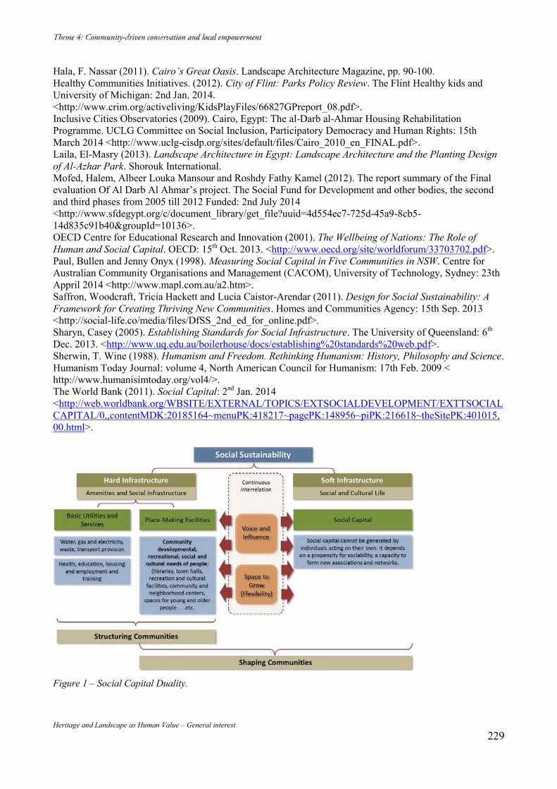
Heritage and Landscape as Human Value – General interest 229
Hala, F. Nassar (2011). Cairo’s Great Oasis. Landscape Architecture Magazine, pp. 90-100. Healthy Communities Initiatives. (2012). City of Flint: Parks Policy Review. The Flint Healthy kids and University of Michigan: 2nd Jan. 2014. <http://www.crim.org/activeliving/KidsPlayFiles/66827GPreport_08.pdf>. Inclusive Cities Observatories (2009). Cairo, Egypt: The al-Darb al-Ahmar Housing Rehabilitation Programme. UCLG Committee on Social Inclusion, Participatory Democracy and Human Rights: 15th March 2014 <http://www.uclg-cisdp.org/sites/default/files/Cairo_2010_en_FINAL.pdf>. Laila, El-Masry (2013). Landscape Architecture in Egypt: Landscape Architecture and the Planting Design of Al-Azhar Park. Shorouk International. Mofed, Halem, Albeer Louka Mansour and Roshdy Fathy Kamel (2012). The report summary of the Final evaluation Of Al Darb Al Ahmar’s project. The Social Fund for Development and other bodies, the second and third phases from 2005 till 2012 Funded: 2nd July 2014 <http://www.sfdegypt.org/c/document_library/get_file?uuid=4d554ec7-725d-45a9-8cb5-14d835c91b40&groupId=10136>. OECD Centre for Educational Research and Innovation (2001). The Wellbeing of Nations: The Role of Human and Social Capital. OECD: 15th Oct. 2013. <http://www.oecd.org/site/worldforum/33703702.pdf>. Paul, Bullen and Jenny Onyx (1998). Measuring Social Capital in Five Communities in NSW. Centre for Australian Community Organisations and Management (CACOM), University of Technology, Sydney: 23th Appril 2014 <http://www.mapl.com.au/a2.htm>. Saffron, Woodcraft, Tricia Hackett and Lucia Caistor-Arendar (2011). Design for Social Sustainability: A Framework for Creating Thriving New Communities. Homes and Communities Agency: 15th Sep. 2013 <http://social-life.co/media/files/DfSS_2nd_ed_for_online.pdf>. Sharyn, Casey (2005). Establishing Standards for Social Infrastructure. The University of Queensland: 6th Dec. 2013. <http://www.uq.edu.au/boilerhouse/docs/establishing%20standards%20web.pdf>. Sherwin, T. Wine (1988). Humanism and Freedom. Rethinking Humanism: History, Philosophy and Science. Humanism Today Journal: volume 4, North American Council for Humanism: 17th Feb. 2009 < http://www.humanisimtoday.org/vol4/>. The World Bank (2011). Social Capital: 2nd Jan. 2014 <http://web.worldbank.org/WBSITE/EXTERNAL/TOPICS/EXTSOCIALDEVELOPMENT/EXTTSOCIALCAPITAL/0,,contentMDK:20185164~menuPK:418217~pagePK:148956~piPK:216618~theSitePK:401015,00.html>.
Figure 1 – Social Capital Duality.
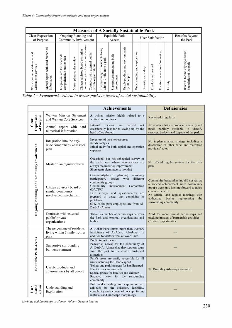
Heritage and Landscape as Human Value – General interest 230
Measures of A Socially Sustainable Park Clear Expression
of Purpose Ongoing Planning and
Community Involvement Equitable Park
Access User Satisfaction Benefits Beyond the Park
Writ
ten
mis
sion
state
men
t and
w
ritte
n co
re se
rvic
es
Ann
ual r
epor
t with
har
d nu
mer
ical
in
form
atio
n
Inte
grat
ion
into
the
city
-wid
e co
mpr
ehen
sive
mas
ter p
lan
Mas
ter p
lan
regu
lar r
evie
w
Citi
zen
advi
sory
boa
rd o
r sim
ilar
com
mun
ity in
volv
emen
t mec
hani
sm
Con
tract
s with
ext
erna
l pub
lic/
priv
ate
orga
niza
tions
The
perc
enta
ge o
f res
iden
ts li
ving
w
ithin
¼ m
ile fr
om a
par
k
Supp
ortiv
e su
rroun
ding
bui
lt en
viro
nmen
t
Usa
ble
prod
ucts
and
env
ironm
ents
by
all
peop
le
Und
erst
andi
ng a
nd e
xplo
ratio
n
Secu
rity
and
safe
ty
Free
dom
and
con
trol
Posit
ive
conn
ectio
n-fa
scin
atio
n
Iden
tity
Ben
efits
for t
he c
ity b
eyon
d th
e bo
unda
ries o
f the
par
k
Table 1 – Framework criteria to assess parks in terms of social sustainability.
Achievements Deficiencies
Cle
ar
Exp
ress
ion
of P
urpo
se Written Mission Statement
and Written Core Services A written mission highly related to a written core services Reviewed irregularly
Annual report with hard numerical information
Internal reviews are carried out occasionally just for following up by the head office abroad
No reviews that are produced annually and made publicly available to identify services, budgets and impacts of the park
Ong
oing
Pla
nnin
g an
d C
omm
unity
Invo
lvem
ent
Integration into the city-wide comprehensive master plan
Inventory of the site resources Needs analysis Initial study for both capital and operation expenses
No implementation strategy including a description of other parks and recreation providers’ roles
Master plan regular review Occasional but not scheduled survey of the park area where observations are always recorded for improvement Short-term planning (six months)
No official regular review for the park plan
Citizen advisory board or similar community involvement mechanism
Community-based planning involving participatory design with different community groups Community Development Corporation (DACDC) Fair surveys and questionnaires are prepared to detect any complains or problems 50% of the park employees are from Al-Darb Al-Ahmar
Community-based planning did not realize a noticed achievement since community groups were only looking forward to quick concrete benefits No official and regular meetings with authorized bodies representing the surrounding community
Contracts with external public/ private organizations
There is a number of partnerships between the Park and external organizations and bodies
Need for more formal partnerships and tracking impacts of partnership activities Creative opportunities
Equ
itabl
e Pa
rk A
cces
s
The percentage of residents living within ¼ mile from a park
Al-Azhar Park serves more than 100,000 inhabitants of Al-Adrab Al-Ahmar, in addition to visitors from all over Cairo
−−
Supportive surrounding built environment
Public transit means Pedestrian access for the community of Al-Darb Al-Ahmar that also supports tours from the park to the context historical attractions
−−
Usable products and environments by all people
Park’s areas are easily accessible for all users including the Handicapped Toilets and parking areas for handicapped Electric cars are available Special prices for families and children Reduced ticket for the surrounding community
No Disability Advisory Committee
Use
r Sa
tisf
actio
n Understanding and Exploration
Both understanding and exploration are achieved by the cohesion, legibility, complexity and richness of concept, forms, materials and landscape morphology
−−
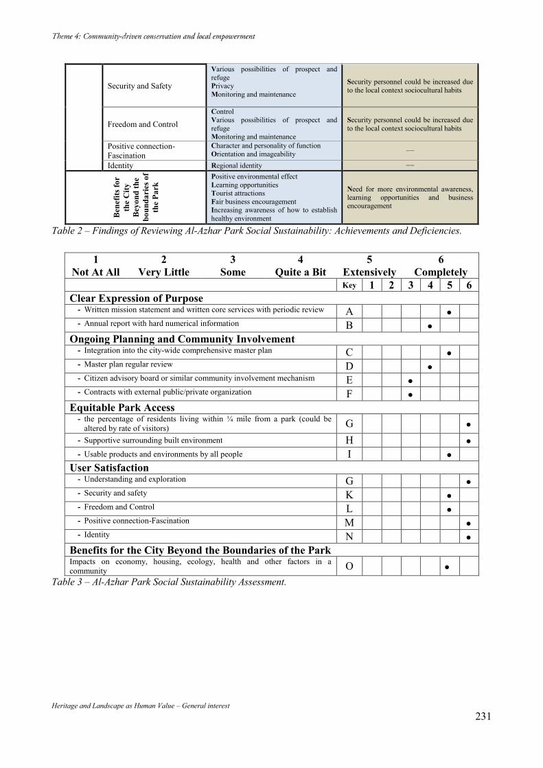
Heritage and Landscape as Human Value – General interest 231
Security and Safety
Various possibilities of prospect and refuge Privacy Monitoring and maintenance
Security personnel could be increased due to the local context sociocultural habits
Freedom and Control Control Various possibilities of prospect and refuge Monitoring and maintenance
Security personnel could be increased due to the local context sociocultural habits
Positive connection-Fascination
Character and personality of function Orientation and imageability −−
Identity Regional identity −−
Ben
efits
for
the
City
B
eyon
d th
e bo
unda
ries
of
the
Park
Positive environmental effect Learning opportunities Tourist attractions Fair business encouragement Increasing awareness of how to establish healthy environment
Need for more environmental awareness, learning opportunities and business encouragement
Table 2 – Findings of Reviewing Al-Azhar Park Social Sustainability: Achievements and Deficiencies.
1 2 3 4 5 6 Not At All Very Little Some Quite a Bit Extensively Completely Key 1 2 3 4 5 6 Clear Expression of Purpose
- Written mission statement and written core services with periodic review A - Annual report with hard numerical information B
Ongoing Planning and Community Involvement - Integration into the city-wide comprehensive master plan C - Master plan regular review D - Citizen advisory board or similar community involvement mechanism E - Contracts with external public/private organization F
Equitable Park Access - the percentage of residents living within ¼ mile from a park (could be
altered by rate of visitors) G - Supportive surrounding built environment H - Usable products and environments by all people I
User Satisfaction - Understanding and exploration G - Security and safety K - Freedom and Control L - Positive connection-Fascination M - Identity N
Benefits for the City Beyond the Boundaries of the Park Impacts on economy, housing, ecology, health and other factors in a community O
Table 3 – Al-Azhar Park Social Sustainability Assessment.
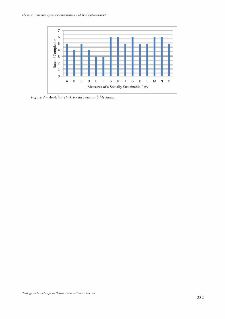
Heritage and Landscape as Human Value – General interest 232
Figure 2 – Al-Azhar Park social sustainability status.
0
1
2
3
4
5
6
7
A B C D E F G H I G K L M N O
Rat
e of
Com
plet
ion
Measures of a Socially Sustainable Park
Heritage and Landscape as Human Value – General interest 233
La Revitalisation du Centre Historique De Grasse François GONDRAN DRAC Provence, ICOMOS FRANCE Abstract Grasse is a historic city where awareness of heritage is made slowly, despite the creation of a preservation area. The creation of cultural amenities with mediation services sensitizes the inhabitants to the history of their city. This cultural mediation based on a renewal of knowledge and partnerships change the urban policies and local tourism related to the perfume industry. A rich debate about spirit of place stands between economic and cultural actors. It carries human values which regenerate the esteem that people feel for their city. Mots-clés : Paysage, ville historique, parfums, immigration. Une ancienne photographie de Grasse36, œuvre du peintre Charles Nègre prise en 1860, montre le paysage emblématique de la ville des parfums telle que les guides touristiques la rêvent. Face à la côte méditerranéenne, lovée autour du clocher en pierre blanche de la cathédrale, la ville historique apparait comme une mer agitée de toitures de tuiles. Sous la ligne d’horizon bleu sombre de la Méditerranée, des collines en ombre chinoise forment un fond végétal ponctué de fermes et hameaux, avec en premier plan des champs d’oliviers à perte de vue. Dans la pente à l’entour, un faubourg laisse deviner d’anciens moulins à huile, des ateliers et des jardins en terrasses. Un siècle et demi après, la cathédrale est intacte, la nappe des toitures de la vieille ville a quelques accrocs, mais les champs d’oliviers et la campagne idyllique ont disparu. Ils sont remplacés par une urbanisation hétéroclite. Là se concentrent l’essentiel des activités et résidences de Grasse. En un siècle et demi, la population de la ville a quadruplé, celle du centre historique a été divisée par trois, celle de la campagne multipliée par dix. Ce paysage est la résultante de l’action des hommes sur un milieu naturel karstique, au bord d’un piémont orienté vers le sud et la mer, le long d’une ligne de sources à fort débit : La mise en place d’un réseau de canaux et de fontaines a permis une concentration urbaine derrière un rempart fortifié, une proto-industrie de tanneries liée à l’élevage du bétail des montagnes et une agriculture intensive dans les jardins en terrasses entourant les remparts. Au-delà, dans la campagne environnante, blés, vignes et oliviers ont formé la base de cultures faciles à conserver et à commercialiser. Grasse s’est donc construite très tôt sur la transformation des produits agricoles de son hinterland37 et un commerce dynamique, orienté vers son port, Cannes. Une récente mission d’inventaire du patrimoine réalisée par le service régional de l’inventaire et les services culturels de la ville a montré l’existence d’une soixantaine d’anciens moulins à huile. La redécouverte de ces moulins a mis en lumière le rôle de Grasse comme centre majeur de production d’huile. Des recherches complémentaires ont montré que les savonneries de Marseille en étaient les principaux clients, et que Grasse avait une production locale dont celle de savons parfumés. 36 Photothèque historique du Musée d’Art et d’Histoire de Provence, Grasse. 37 Ernest Hildesheimer Grasse au Moyen-âge in Histoire de Grasse 1984 Ed. Horvath
Heritage and Landscape as Human Value – General interest 234
Ces moulins furent agrandis et complétés par de nouvelles constructions durant la seconde moitié de XIXème siècle, au moment où l’économie grassoise s’est massivement consacrée à la fabrication des parfums. Cette industrie à haute valeur ajoutée a connu un premier développement sous l’ancien régime, au sein d’une corporation des gantiers parfumeurs qui comptait 70 maitres artisans en 174538. Ces artisans parfumeurs avaient alors leurs ateliers dans des cours d’immeubles et des rez-de-chaussée de la ville historique de Grasse et quelques boutiques à Paris. A partir de 1860, l’amélioration de systèmes d’adduction d’eau et d’irrigation contribue à la mise en place simultanée de cultures florales et d’usines de parfumerie, en contrebas des anciens remparts. Cette aventure industrielle bouleverse le paysage en remplaçant une grande partie des oliveraies et des anciennes vignes par des cultures de fleurs, (roses, jasmins, tubéreuses, bigaradiers). La construction de grandes usines, de logements ouvriers et de riches demeures patronales dont l’architecture s’assimile à celle de résidences de villégiature ; la construction d’infrastructures ferroviaires (deux gares, un funiculaire), de voiries nouvelles et viaducs poursuivent ce bouleversement du paysage au début du XXème siècle. Cette industrie qui rassemble la production des matières premières et les unités de transformation dans un même terroir connait une évolution insoupçonnée avec un début de mise en tourisme. Plusieurs industriels et investisseurs eurent l’idée de créer des usines-musées dans d’anciens ateliers. Elles permettaient de commercialiser sur ces sites dédiés une partie de leur production, destinée aux nombreux touristes en villégiature sur la Côte d’Azur. C’est alors que l’alliance de familles d’entrepreneurs grassois avec la grande bourgeoisie parisienne trouve un exemple fameux, avec le mariage en 1897 de Valentine Chiris, fille d’un grand industriel du parfum, avec François Carnot, fils du président de la République Sadi Carnot. Grand mécène et collectionneur d’art, président de la société des arts décoratifs français, François Carnot crée à Grasse, en 1921, le musée d’art et d’histoire de Provence39, dans l’ancien Hôtel particulier de la marquise de Cabris, sœur de l’avocat révolutionnaire Mirabeau. Il met en place un mécénat à travers la Société Fragonard, (du nom de Jean Honoré Fragonard, grand peintre du siècle des Lumières, né à Grasse), qui permet de réunir d’importantes collections, (peinture, archéologie, art et traditions populaires de Provence orientale, objets liés à l’industrie ancienne de la parfumerie). Les Musées de Grasse bénéficient encore aujourd’hui de cet élan fondateur. Après la Grande Guerre et la disparition de nombreux jeunes gens, la demande de main d’œuvre crée une forte immigration économique, principalement venue d’Italie. Les immigrés successifs, (Piémontais, Calabrais, habitants de Murcie, de Tunisie et d’Algérie) trouvent naturellement à se loger dans le centre historique tandis que les populations plus anciennes construisent des habitations nouvelles hors les murs. Se crée ainsi progressivement tout au long du XXème siècle une coupure entre les habitants anciens qui abandonnent le centre historique et les nouveaux arrivants pauvres qui y sont logés. Ce phénomène classique de paupérisation de la ville historique avec des habitats insalubres, des logements vacants, des écroulements partiels, des curetages, une insécurité réelle et fantasmée, met en péril le centre ancien de Grasse, qui prend, à l’échelle de la région, le statut peu enviable de
38 Hervé de Fontmichel Histoire de la Parfumerie grassoise in Histoire de Grasse op.cit. 39 Marie-Christine Grasse Naissance des musées de Grasse revue Grasse au fil du temps 2002
Heritage and Landscape as Human Value – General interest 235
réserve de logements vétustes et indignes, parfois associés à l’immigration clandestine, lui conférant une image dégradée. La période de l’après-guerre aura été néfaste au patrimoine urbain et paysager de Grasse : Il fut choisi de ne pas reconstruire la ligne de chemin de fer du sud40 qui reliait Nice à Aix en Provence en passant par Vence, Grasse et la Provence intérieure. De même, ni la ligne de tramway qui allait jusqu’à Cagnes-sur-Mer, ni le funiculaire qui reliait le centre ancien avec la gare du bas de la ville à destination de Cannes (sur le réseau de chemin de fer PLM, Paris, Lyon, Marseille) n’ont été maintenues. Le choix qui s’est imposé fut celui des véhicules à essence, bus et voitures individuelles, qui ont progressivement asphyxié cette ville handicapée par son relief. D’autre part, suivant les effets de la loi sur la rénovation urbaine de 1955, le curetage d’une partie des quartiers de l’est de la ville historique détruisit un ancien couvent et de nombreux immeubles anciens, à proximité de l’ancien cimetière, déplacé juste avant le guerre. Heureusement cette loi de 1955, qui persistera en France jusqu’en 1976 fut contrebalancée dès 1962 par la Loi Malraux sur les Secteurs sauvegardés. La Loi Malraux rassemble les ministères de la Culture et de l’Urbanisme pour penser une planification urbaine qui conserve et met en valeur le patrimoine architectural et urbain. Grasse fait l’objet de la création d’un secteur sauvegardé en 1974. L’intégralité des études du Plan de Sauvegarde et de Mise en Valeur du secteur sauvegardé de Grasse n’a été achevée qu’en 2013, mais les phases d’études ont été accompagnées de nombreux chantiers de réhabilitation, grâce à des financements publics exceptionnels et des dispositifs de défiscalisation destinés aux investisseurs immobiliers. Jean-Pierre Leleux, Maire de Grasse de 1995 à 2014 et sénateur qui préside la commission nationale des secteurs sauvegardés, a été particulièrement attentif à cette politique de sauvegarde du centre historique41. Prenant conscience de sa valeur et du désamour dont il est l’objet, par ignorance, de la part de la majorité des habitants du reste de la ville, il n’a eu de cesse d’y favoriser la mixité sociale, une diversité d’activités, et d’en valoriser l’image dans l’esprit de ses concitoyens. Avec l’aide de l’Etat, par ses services du Ministère du Logement, (Agence Nationale pour l’Amélioration de l’Habitat et Agence Nationale de Rénovation Urbaine) et du Ministère de la Culture (Direction Régionale des Affaires Culturelles), le Maire de Grasse a créé deux structures locales dédiées au secteur sauvegardé : - La Société d’économie mixte Grasse Développement, chargée de cofinancer et organiser la réhabilitation des logements en centre ancien. Cette société a une politique d’acquisition foncière et de montage d’opération ; elle dynamise le marché par des aides ciblées dans le domaine du logement et des services de proximité. La Maison du patrimoine, porteuse du label « Ville d’Art et d’Histoire » réseau de villes historiques qui ont une convention avec le Ministère de la Culture. Cette convention engage les villes à organiser des visites-conférences, des expositions, favoriser la recherche historique, développer l’éducation artistique et culturelle, sensibiliser les habitants des villes concernées à leur patrimoine urbain et paysager. L’originalité grassoise a consisté à rapprocher ces deux services par un partage de locaux (une ancienne usine de parfumerie jouxtant une chapelle désaffectée). Cette proximité leur a permis
40 Laurence Argueyrolle Les entrées de ville 2013 revue Venir à Grasse ISBN 978-2-919566-00-6 41 Jean-Pierre Leleux Paroles d’élus, les secteurs sauvegardés ont cinquante ans 2012 A.N.V.P.A.H.
Heritage and Landscape as Human Value – General interest 236
d’associer leurs politiques d’information des populations locales sur le projet urbain du secteur sauvegardé. Le service « Ville d’Art et d’Histoire », créé en 2004 et dirigé par une archéologue de formation a été chargé en priorité de mettre en valeur la politique de revitalisation du centre historique et de la rendre plus compréhensible pour le grand public. La complexité des montages financiers dans un secteur sauvegardé où la propriété foncière est divisée en très petites unités, la lenteur des études et les problèmes sociaux récurrents donnaient en effet une mauvaise image à ce vaste chantier de réhabilitation. C’est pourquoi il a été décidé de renforcer une médiation culturelle, spécifique au secteur sauvegardé, auprès de ses habitants et des entreprises locales, à travers une explication régulière des chantiers en cours. Les guides-conférenciers ont suivi systématiquement les réunions de chantiers ordinaires et les permanences de l’architecte des bâtiments de France, et ont accompagné les chargés d’études qui concevaient le document d’urbanisme du secteur sauvegardé, le Plan de Sauvegarde et de Mise en Valeur. Ils étaient ainsi en mesure de réaliser des visites conférences présentant les chantiers aux habitants, et dans certaines conditions, aux enfants des écoles. De plus, au fur et à mesure de l’avancement des études, des conférences, expositions et visites thématiques furent organisées à destination du conseil municipal, du grand public, des touristes, (majoritairement des habitants de l’agglomération) et des commerçants et professionnels locaux. Cette pratique des visites de chantiers permet à la population de mieux comprendre la conservation et la mise en valeur du centre historique. Fonctionnant comme une série à épisodes, en renouvelant les lieux à découvrir, ces visites créent une appétence pour la découverte de l’Histoire de la Ville. En dix années d’existence, à l’instigation du maire et de ses adjoints, la Maison du Patrimoine a développé un réseau d’acteurs sensibilisés à la politique de revitalisation de la ville historique : - Les enseignants et parents d’élèves sont les premiers sensibilisés autour des 4500 enfants encadrés chaque année par les guides conférenciers, suivant des programmes d’ateliers et visites qui durent tout au long de l’année scolaire. - Les professionnels, (architectes, archéologues, restaurateurs d’art et entreprises du bâtiment, professionnels du tourisme, élus municipaux et commerçants volontaires) sollicités pour les visites du secteur sauvegardé sont aussi mobilisés pour des débats permettant de partager des convictions sur le projet de sauvegarde de la ville ancienne. Les institutions culturelles, telles que les musées, la bibliothèque, les archives municipales, le théâtre, l’office de tourisme, implantés dans le centre historique, sont sollicités ainsi que des acteurs extérieurs comme l’université de Nice et les sociétés savantes pour concevoir des expositions, participer à des publications, à des conférences ou des colloques. On notera que les musées sont situés à l’entrée ouest de la ville ancienne (ancienne porte Ayguière, vers la Provence), le Théâtre à l’entrée nord (ancienne Porte de la Foux, vers Nice et la montagne), le Conservatoire de musique, hors les murs, au sud et qu’un projet de création d’une nouvelle médiathèque est prévu dans la partie est de la vieille ville, à l’emplacement d’un ancien curetage. La Mairie est implantée dans l’ancien palais épiscopal, au cœur de la ville historique, à l’ombre de la cathédrale. Ces équipements valorisants sont donc intimement liés au secteur sauvegardé, ainsi que l’ancienne Parfumerie Fragonard, la principale parfumerie-musée privée de la ville qui a développé des extensions dans plusieurs rez-de-chaussée d’immeubles de petites boutiques et cafés.
Heritage and Landscape as Human Value – General interest 237
On notera la politique particulièrement dynamique des musées grassois, proches de la Parfumerie Fragonard et très complémentaires de la Maison du Patrimoine : Le regroupement récent de l’administration du Musée d’Art et d’Histoire et son annexe de la Villa Fragonard avec le Musée International de la Parfumerie et son Conservatoire des Plantes à Parfum situé dans une ancienne ferme de la campagne grassoise a permis pour ces quatre sites de disposer d’un service de médiation culturelle d’une très grande qualité, qui fonctionne en réseau avec la Maison du Patrimoine. Ainsi, les enfants des écoles et du centre d’action sociale encadrant les enfants du quartier historique pendant les vacances scolaires sont particulièrement sensibilisés au patrimoine urbain et muséal de leur ville. Le service médiation des musées a également fortement développé les programmes destinés à des publics empêchés, à l’hôpital, en prison, auprès de personnes handicapées mentales, en grande difficulté sociale, ou sans emploi. Lors de ces interventions principalement consacrées à la thématique du parfum et du sens olfactif, couplées avec des démarches artistiques d’écriture, de danse, théâtre, arts plastiques, les travailleurs sociaux et l’encadrement médical sont eux aussi sensibilisés à cette culture spécifique au patrimoine grassois. Le Musée de la Parfumerie a également une action en direction des entreprises à travers des programmes qui se tiennent dans les murs de la ville ancienne ou dans les jardins de leur conservatoire des plantes florales, valorisant ainsi autant l’écrin muséal que les collections. Ces entreprises de l’agglomération de Nice-Cannes ont ainsi une image positive de la tradition historique de cette ville singulière. Grasse fait partie du réseau de l’association nationale des villes et pays d’art et d’histoire, (ANVPAH) et sa Maison du Patrimoine comme ses musées ont vu leur travail particulièrement reconnu. C’est ainsi que l’association a choisi Grasse comme lieu de formation sur l’action sociale en secteur sauvegardé et les moyens de lutter contre la paupérisation des centres anciens. La question sociale est en effet centrale pour aborder la sauvegarde ce centre ancien. Or, les outils classiques de rénovation urbaine et d’inventaire des architectures existantes, mis à la disposition d’architectes formés à l’intervention sur des bâtiments anciens, bien que nécessaires, ne suffisent pas. De nombreux signes d’échec de cette politique, pourtant pertinente techniquement, apparaissent, tels que la dégradation accélérée d’immeubles fraichement restaurés, la difficulté de rapprocher offres et demandes de logements et de stabiliser les habitants… Il faut donc agir sur les mentalités et bâtir un projet de revitalisation qui fasse consensus et soit compris de la population. La connaissance du passé, l’explication et la valorisation des multiples aspects de l’histoire de ce lieu, doivent pouvoir insuffler des idées nouvelles pour ajuster au mieux les investissements à des projets individuels pertinents. La mixité sociale et la vitalité économique d’un centre historique ne peuvent se décréter, mais peuvent être encouragées, voire suscitées par un contexte favorable. L’animation d’un urbanisme de projet discuté avec les habitants et les acteurs économiques locaux doit être portée par le pouvoir politique. Des investissements publics ciblés, tels que ceux portant sur des équipements culturels ou des aménagements d’espaces publics, peuvent servir d’éléments déclenchants qui inversent une spirale négative. Mais une attention forte doit être apportée aux potentialités du lieu et à la créativité des acteurs locaux, ce qui suppose de faciliter les démarches de projet et de les encadrer par le dialogue des habitants entre eux et avec la collectivité. Il semblerait utile à cet égard de bien identifier les points de blocage, les actions délictueuses ou l’économie souterraine dans ce qu’elles ont de profondément nocif pour l’intérêt public.
Heritage and Landscape as Human Value – General interest 238
Un récent colloque42 organisé par la Ville de Grasse et l’Université de Nice, « Etrangers et immigrés à Grasse, histoire et patrimoine, (XIXème-XXème siècles) apparait particulièrement pertinent à cet égard qui puisse servir d’antidote à la stigmatisation d’un centre historique qui abrite de nombreuses populations immigrées. Le regard attentif porté par des chercheurs et universitaires sur l’immigration de travail et l’immigration de villégiature, mais aussi sur les politiques d’accueil menées par les pouvoirs publics et les acteurs économiques sont un apport significatif à la compréhension du tissu social de la ville de Grasse, de nature à éclairer les décideurs. On notera la place particulière tenue dans ce colloque par la description d’actions de terrain telles que les « balades patrimoniales sur l’immigration », avec des exemples à Marseille, Grasse et la région parisienne. C’est ainsi que le travail exemplaire de la maison du patrimoine de Grasse a pu se comparer avec les expériences de deux très grandes agglomérations françaises confrontées à l’immigration. Sans pouvoir affirmer que le processus de revitalisation du Centre historique de Grasse est en voie de réussite, tant les difficultés sont nombreuses et récurrentes, on peut affirmer que l’opiniâtreté des responsables politiques et le talent de leurs collaborateurs sont un gage de réussite à venir. La complexité de l’action urbanistique dans un milieu patrimonial est en tout état de cause une réalité féconde pour la réflexion. Les valeurs humanistes qui président à notre réunion de Florence sont certainement l’apport le plus précieux que puisse apporter nos collègues italiens, pour qui l’urbanisme et la civilité sont un art de vivre. Qu’ils en soient remerciés, ainsi que les organisateurs de ce symposium… Bibliographie Paul GONNET & Col. (1984) Histoire de Grasse et sa région Roanne Editions Horvath Collectif. (2007) Sensibiliser les habitants au cadre de vie. Toulouse Collection « Architectures à suivre » ANVPAH et Ministère de la Culture et de la Communication Collectif. (2010) Connaitre pour mieux valoriser. Toulouse Collection « Architectures à suivre » ANVPAH et Ministère de la Culture et de la Communication Collectif. (2013) A l’école de l’architecture et des patrimoines. Toulouse Collection « Architectures à suivre » ANVPAH et Ministère de la Culture et de la Communication Collectif (2013) Les secteurs sauvegardés. Cinquante ans d’une politique au service des centres anciens et de ses habitants. Paris, Amitiés Internationales André Malraux, ANVPAH, Ministère de la Culture et de la Communication, Philippe OLLIVIER.(2013) Patrimoines. L’histoire en mouvement. , Toulouse Editions Privat
42 Actes en cours de publication coordonnés par le Professeur Yvan Gastaut Université de Nice, Laboratoire URMIS.
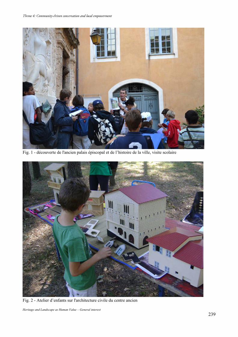
Heritage and Landscape as Human Value – General interest 239
Fig. 1 - découverte de l'ancien palais épiscopal et de l’histoire de la ville, visite scolaire
Fig. 2 - Atelier d’enfants sur l'architecture civile du centre ancien
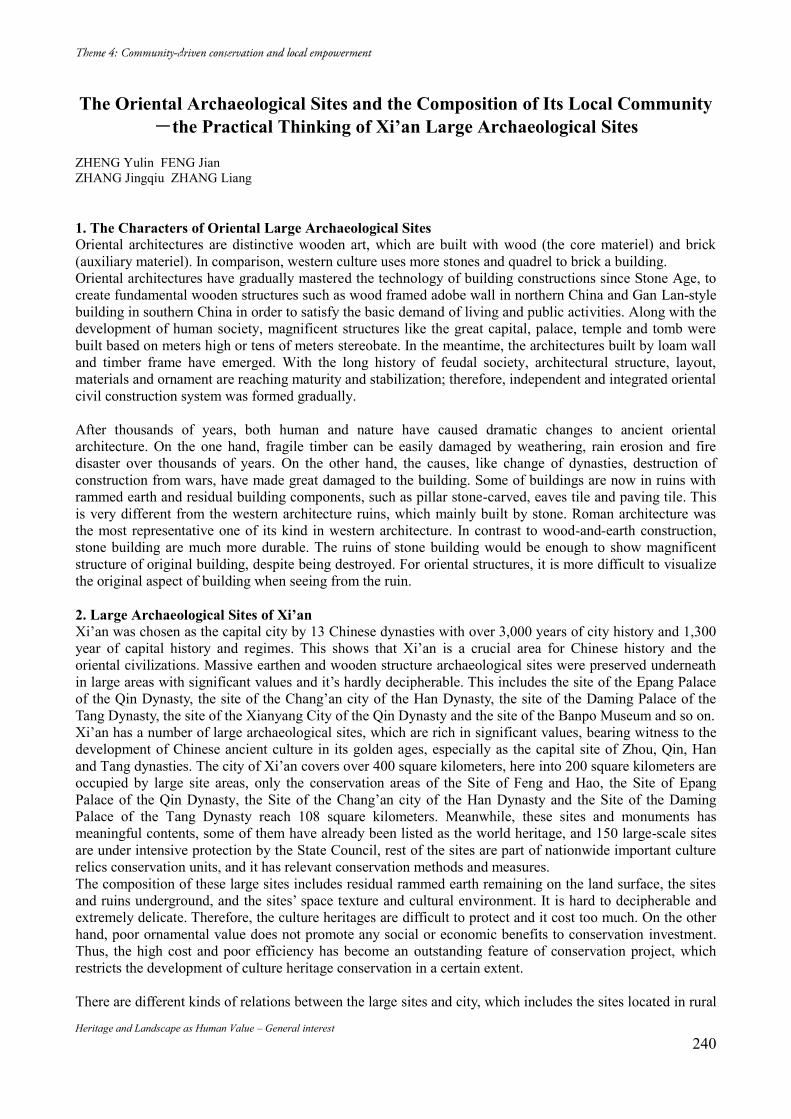
Heritage and Landscape as Human Value – General interest 240
The Oriental Archaeological Sites and the Composition of Its Local Community-the Practical Thinking of Xi’an Large Archaeological Sites
ZHENG Yulin FENG Jian ZHANG Jingqiu ZHANG Liang 1. The Characters of Oriental Large Archaeological Sites Oriental architectures are distinctive wooden art, which are built with wood (the core materiel) and brick (auxiliary materiel). In comparison, western culture uses more stones and quadrel to brick a building. Oriental architectures have gradually mastered the technology of building constructions since Stone Age, to create fundamental wooden structures such as wood framed adobe wall in northern China and Gan Lan-style building in southern China in order to satisfy the basic demand of living and public activities. Along with the development of human society, magnificent structures like the great capital, palace, temple and tomb were built based on meters high or tens of meters stereobate. In the meantime, the architectures built by loam wall and timber frame have emerged. With the long history of feudal society, architectural structure, layout, materials and ornament are reaching maturity and stabilization; therefore, independent and integrated oriental civil construction system was formed gradually. After thousands of years, both human and nature have caused dramatic changes to ancient oriental architecture. On the one hand, fragile timber can be easily damaged by weathering, rain erosion and fire disaster over thousands of years. On the other hand, the causes, like change of dynasties, destruction of construction from wars, have made great damaged to the building. Some of buildings are now in ruins with rammed earth and residual building components, such as pillar stone-carved, eaves tile and paving tile. This is very different from the western architecture ruins, which mainly built by stone. Roman architecture was the most representative one of its kind in western architecture. In contrast to wood-and-earth construction, stone building are much more durable. The ruins of stone building would be enough to show magnificent structure of original building, despite being destroyed. For oriental structures, it is more difficult to visualize the original aspect of building when seeing from the ruin. 2. Large Archaeological Sites of Xi’an Xi’an was chosen as the capital city by 13 Chinese dynasties with over 3,000 years of city history and 1,300 year of capital history and regimes. This shows that Xi’an is a crucial area for Chinese history and the oriental civilizations. Massive earthen and wooden structure archaeological sites were preserved underneath in large areas with significant values and it’s hardly decipherable. This includes the site of the Epang Palace of the Qin Dynasty, the site of the Chang’an city of the Han Dynasty, the site of the Daming Palace of the Tang Dynasty, the site of the Xianyang City of the Qin Dynasty and the site of the Banpo Museum and so on. Xi’an has a number of large archaeological sites, which are rich in significant values, bearing witness to the development of Chinese ancient culture in its golden ages, especially as the capital site of Zhou, Qin, Han and Tang dynasties. The city of Xi’an covers over 400 square kilometers, here into 200 square kilometers are occupied by large site areas, only the conservation areas of the Site of Feng and Hao, the Site of Epang Palace of the Qin Dynasty, the Site of the Chang’an city of the Han Dynasty and the Site of the Daming Palace of the Tang Dynasty reach 108 square kilometers. Meanwhile, these sites and monuments has meaningful contents, some of them have already been listed as the world heritage, and 150 large-scale sites are under intensive protection by the State Council, rest of the sites are part of nationwide important culture relics conservation units, and it has relevant conservation methods and measures. The composition of these large sites includes residual rammed earth remaining on the land surface, the sites and ruins underground, and the sites’ space texture and cultural environment. It is hard to decipherable and extremely delicate. Therefore, the culture heritages are difficult to protect and it cost too much. On the other hand, poor ornamental value does not promote any social or economic benefits to conservation investment. Thus, the high cost and poor efficiency has become an outstanding feature of conservation project, which restricts the development of culture heritage conservation in a certain extent. There are different kinds of relations between the large sites and city, which includes the sites located in rural
Heritage and Landscape as Human Value – General interest 241
areas, such as the site of Feng and Hao, it preserved the original condition of the sites; the sites located at urban fringe, such as the site of the Epang Palace of the Qin Dynasty and the site of the Chang’an city of the Han Dynasty, the outside physical space of the sites and internal residents conditions have been facing with radical changes during the city development; the sites surround by city, such as the site of the Daming Palace of the Tang dynasty and the site of the Xingqing Palace, the sites have already become parts of the city function, sustainable conservation of the sites must be adapted to accommodate the city’s development. In the mean time, there are three different types of relationship between the sites and residents. The first is the sites and residents are relatively independent, they only close to the sites on the geographical position, for instance the sites of the temple of heaven. The second is the sites are relevant to the residents, whilst they are not living within the area, they still could practice daily activities around or within the sites, for instance the City Walls of the Tang Dynasty Heritage Park, the site of the Daming Palace of the Tang Dynasty, its surrounding residents could play, do exercise and have a rest inside the sites. The last is the sites mixed up with residents, the residents is living in the sites for generations, for instance, the internal villages inside the site of the Chang’an city of the Han Dynasty. 3. The proposal issues of sites and community In terms of community is a group of people who live in the same place or having a particular characteristic in common; a community shall contain some elements such as a certain amount of people, a scope of area, a scale of facilities, a particular characteristic of cultural and living under the same type of organizations. In western countries, the sites commonly refer to Architectural Heritage. The characteristics of this type of heritages are highly decipherable and have strong ornamental values, and deliver clear historical information. Furthermore these heritages come with great cultural charisma as well, and existing on real live community with same style of surroundings whether internal or external to promote a harmonious and positive environment, they are influenced to voluntarily protect the sites by this unique environment, which leads to a sustainable development of the sites. Thus these communities forming to a cultural community and gives a positive force on harmonious coexistence with sites. For instance, the Acropolis in Athens, the Colosseum in Rome and the ancient city of Jerusalem. Currently eastern countries classify sites according to the type of sites, it can be classified into two types: historic sites and monuments. A. Monuments Some monuments like the Big Wild Goose Pagoda, the Small Wild Goose Pagoda and Bell and Drum Tower can be considered as clear and visible monuments. In comparison with western cultural community, such monuments exist in a very similar way. It is easily arise relative cultural community. The lifestyle and cultural custom of the residents who live there are highly influenced by this unique culture and environment, themselves and the sites have already become part of the site culture. Other monuments like temple of Heaven of Sui and Tang Dynasties located at inside of Shaanxi Normal University campus in Xi’an. They are places where Tang dynasty held ceremonies to worship heaven in the 300 years of the dynasty history with a significant Symbolism and historical status. Although it is an Architectural Heritage, it does not open to public yet. This is due to the fact that they are newly excavated monuments and the implementation body protection project is being applied. The development plan for the monument and the city are on process. Therefore, it does not impact residents and it does not appear a cultural community around the site of temple of Heaven of Sui and Tang Dynasties. B. Sites Because of the function of architectural sites is completely loss, it more exists like an extinction cultural phenomenon or a symbol of a period history, which are hardly to decipherable. Thus, it is difficult to understand by surrounding residents, and it hardly gets benefit from tourism without conservation and presentation, in addition it cannot bring obvious economic incomes to the residents directly, therefore, it is too difficult to form an internal or external cultural community which could affect surrounding residents. The main urban area of the sites of Chang’an city of Han dynasty reached 36 square kilometers, it has comparatively clear border of city wall and rammed earth remains, which is the one of the most complete
Heritage and Landscape as Human Value – General interest 242
preservation city sites. 55 villages are distributed inside the city sites, and over 50,000 farmers live in collective ownership, due to the long times of culture heritage conservation limitation, their living conditions and production mode is limited, hence, these farmers’ income are much different compare with those of residents who live outside the sites. However, the sites are their place of abode and generate a unique community structure, besides local government promote culture heritage conservation for a long term that enable the residents to process a certain protection consciousness and conscious action to protect the sites. When they faced the benefits, the yearn for development and the aspiration of rich, this kind of consciousness and action become to very fragile. Therefore, these kind of community has a certain culture attribute but very weak. The sites of the Feng and Hao of the Zhou Dynasty is the capital of the Western Zhou Dynasty, it is a root of Chinese culture formation that influenced following generations, located in the southwest of Xi’an, covering an area of 17 square kilometers. Through over 50 years archaeological excavations, it has a basic understanding on the scope of capital, the key area of sacrifice, and the burial area. But it is still blank for the information of the whole capital pattern, road and palace, and there are no obvious tower ruins. And the residents who live there are only aware of its history regions and all kinds of government policy, but they themselves cannot understand the sites, and their life style and production mode are the same as the surrounding villages, so it is not an authentic cultural community. As a result, the Oriental architectures sites as the fence of human history, it does not only witness the history of the people who create it, but also witness the history of existence and development with human. On the other hand, the site should be protected in a sustainable conservation and become to a positive power of strengthen region development, and then it should generate the sustainable conservation and development of community. However, with its own features, it is hard to be recognized by public, therefore, it is difficult to form an authentic cultural community. 4. Study on community issues based on the Xi’an case A. The composition of single archaeological sites’ community Based on the uninterrupted excavate cultural connotation for heritage sites, and protection of the single archaeological sites while forming a certain range of cultural community. The Site of West Market of Tang dynasty is the birthplace of ancient silk roads, where the ancient domestic and overseas merchants having trade activities, which represented the highest level of the developed commercial civilization that time. Meanwhile, the conservation and development case of the sites of west market of Tang dynasty is the only private heritage site on national conservation and presentation project. Through the conservation and presentation as well as the cultural industry in original real estate project planning, the sites are transformed into a unique west market area combined with cultural heritage conservation, antique trade and business community. The established theme international tourism and culture industry projects of Silk Roads West Market of Tang dynasty on the original site of west market of Tang dynasty reflect the Tang dynasty’s commercial culture and civil culture. In the meantime, the site conservation solved the issues of poor environment and infrastructure in the site. After the conservation, a cultural atmosphere emerges together with a west market of Tang dynasty cultural community combined with the merchant inside the site and the surrounding residents. B. The composition of lineal archaeological sites’ community A series of sites are distributed as single sites like the site of the Chang’an city of the Sui and Tang dynasties, where the Yanping Gate conservation and presentation project and the Site of the South Outer City (Nanguocheng) (located in the Qujiang District) original location presentation project were carried out, combining the site presentation and urban landscaping buildings. These projects built linear gardens which extend part of the city walls with identified green plants. The combination of amusement and leisure facilities and plants are not only the logo of the city walls, but also show the grand scale of the site of the Chang’an city walls of the Sui and Tang dynasties to visitors, and provide a recreation area to nearby residents. Thus, a featured culture area is formed, and the surrounding residents obtain a continuous deepening understanding of the site and new living habits. Therefore, the sites of the city walls of the Sui and
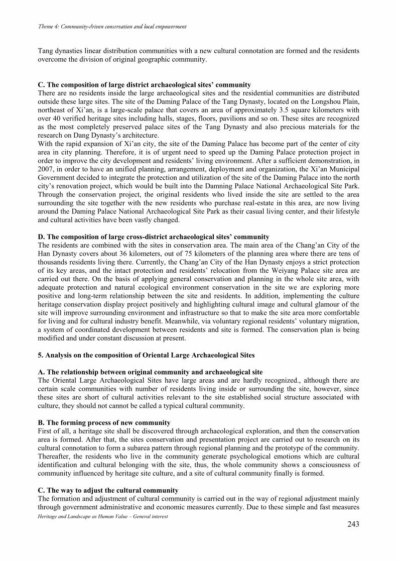
Heritage and Landscape as Human Value – General interest 243
Tang dynasties linear distribution communities with a new cultural connotation are formed and the residents overcome the division of original geographic community. C. The composition of large district archaeological sites’ community There are no residents inside the large archaeological sites and the residential communities are distributed outside these large sites. The site of the Daming Palace of the Tang Dynasty, located on the Longshou Plain, northeast of Xi’an, is a large-scale palace that covers an area of approximately 3.5 square kilometers with over 40 verified heritage sites including halls, stages, floors, pavilions and so on. These sites are recognized as the most completely preserved palace sites of the Tang Dynasty and also precious materials for the research on Dang Dynasty’s architecture. With the rapid expansion of Xi’an city, the site of the Daming Palace has become part of the center of city area in city planning. Therefore, it is of urgent need to speed up the Daming Palace protection project in order to improve the city development and residents’ living environment. After a sufficient demonstration, in 2007, in order to have an unified planning, arrangement, deployment and organization, the Xi’an Municipal Government decided to integrate the protection and utilization of the site of the Daming Palace into the north city’s renovation project, which would be built into the Damning Palace National Archaeological Site Park. Through the conservation project, the original residents who lived inside the site are settled to the area surrounding the site together with the new residents who purchase real-estate in this area, are now living around the Daming Palace National Archaeological Site Park as their casual living center, and their lifestyle and cultural activities have been vastly changed. D. The composition of large cross-district archaeological sites’ community The residents are combined with the sites in conservation area. The main area of the Chang’an City of the Han Dynasty covers about 36 kilometers, out of 75 kilometers of the planning area where there are tens of thousands residents living there. Currently, the Chang’an City of the Han Dynasty enjoys a strict protection of its key areas, and the intact protection and residents’ relocation from the Weiyang Palace site area are carried out there. On the basis of applying general conservation and planning in the whole site area, with adequate protection and natural ecological environment conservation in the site we are exploring more positive and long-term relationship between the site and residents. In addition, implementing the culture heritage conservation display project positively and highlighting cultural image and cultural glamour of the site will improve surrounding environment and infrastructure so that to make the site area more comfortable for living and for cultural industry benefit. Meanwhile, via voluntary regional residents’ voluntary migration, a system of coordinated development between residents and site is formed. The conservation plan is being modified and under constant discussion at present. 5. Analysis on the composition of Oriental Large Archaeological Sites A. The relationship between original community and archaeological site The Oriental Large Archaeological Sites have large areas and are hardly recognized., although there are certain scale communities with number of residents living inside or surrounding the site, however, since these sites are short of cultural activities relevant to the site established social structure associated with culture, they should not cannot be called a typical cultural community. B. The forming process of new community First of all, a heritage site shall be discovered through archaeological exploration, and then the conservation area is formed. After that, the sites conservation and presentation project are carried out to research on its cultural connotation to form a subarea pattern through regional planning and the prototype of the community. Thereafter, the residents who live in the community generate psychological emotions which are cultural identification and cultural belonging with the site, thus, the whole community shows a consciousness of community influenced by heritage site culture, and a site of cultural community finally is formed. C. The way to adjust the cultural community The formation and adjustment of cultural community is carried out in the way of regional adjustment mainly through government administrative and economic measures currently. Due to these simple and fast measures
Heritage and Landscape as Human Value – General interest 244
the cultural community’s formation speed and quality are limited. However, the adoption of voluntary adjustment by the residents turn the adjustment to a initiative way. The projects put the residents self chose in the core which stimulates the residents concerning of their interrelationship with the site and are more beneficial for the forming of cultural community and ideal situation allowing residents and site sharing the fruit of the development. Bibliography [1] Liang, Sicheng (2011). A History of Chinese Architecture. Beijing: SDX Joint Publishing Company. [2] Zheng, Yulin (2014). Arousal Remains: The problem of conservation and utilization of large-scale site in the Process of Urbanization. Beijing: Cultural Relics Publishing House. [3] Shaanxi Cultural Relics Bureau (2014). Exploration and Practices on the Protection of Large-sized Archaeological Sites in Shaanxi Province. Beijing: Cultural Relics Publishing House. [4] Ferdinand Tonnies (2011). Community and Society. Dover Publications. [5] Chen, Wenliang, Yang Xinjun, Zhao Rong (2007). A Study of Rural Residents’ Living Quality on the Large Sites in the Suburb —A Case Study of Chang'an City of Han Dynasty. P lanners. 2: pp. 84-88. [6] Bi, Jinglong, Wang Hui (2011). Analysis of Space Form and Culture Quality of Xi'an Tang King Market. HUAZHONG ARCHITECTURE. 2: pp. 146-148. [7] Ge, Chengyong (2013). The new knowledge of the monuments: In the humanities and the baptism of the architectural heritage. Beijing: Cultural Relics Publishing House.
Figure 1.1: The rammed earth site of Chang’an city of the Han Dynasty
Figure 1.2: The Colosseum
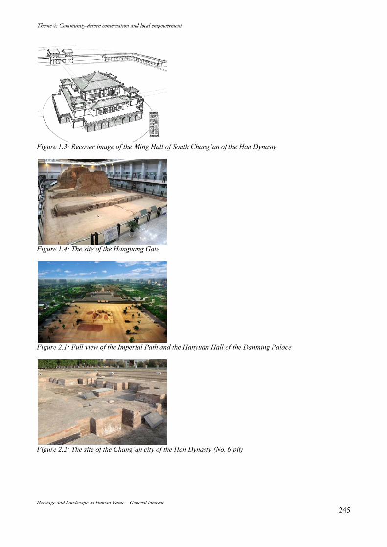
Heritage and Landscape as Human Value – General interest 245
Figure 1.3: Recover image of the Ming Hall of South Chang’an of the Han Dynasty
Figure 1.4: The site of the Hanguang Gate
Figure 2.1: Full view of the Imperial Path and the Hanyuan Hall of the Danming Palace
Figure 2.2: The site of the Chang’an city of the Han Dynasty (No. 6 pit)
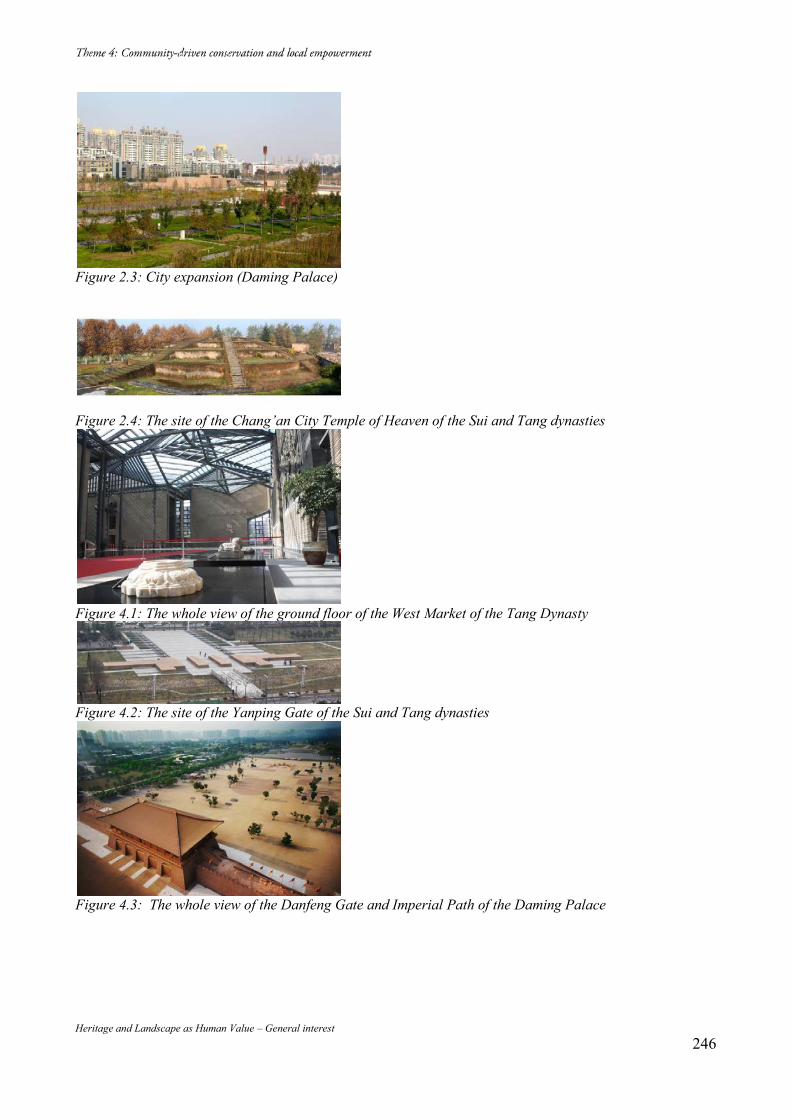
Heritage and Landscape as Human Value – General interest 246
Figure 2.3: City expansion (Daming Palace)
Figure 2.4: The site of the Chang’an City Temple of Heaven of the Sui and Tang dynasties
Figure 4.1: The whole view of the ground floor of the West Market of the Tang Dynasty
Figure 4.2: The site of the Yanping Gate of the Sui and Tang dynasties
Figure 4.3: The whole view of the Danfeng Gate and Imperial Path of the Daming Palace
Heritage and Landscape as Human Value – General interest 247
Community in Heritage Conservation: Case Study of Newar Tradition in Kathmandu Valley
Monalisa MAHARJAN* Filipe Themudo BARATA** (*) PhD Student, University of Évora, Evora, Portugal, EMMA Student. E-mail: [email protected] (**) CIDEHUS and UNESCO Chair Intangible Heritage and Traditional Know-how: Linking Heritage, Palácio do Vimioso, Apartado 94, 7002-554 Évora, Portugal. E-mail: [email protected]
Abstract Indigenous people of Kathmandu have a unique traditional way of taking care of their cultural and built heritage called Guthi, which has been continuing for centuries. For them, it’s more of living their social life being with community rather than formal way of conserving heritage. According to this system, every community, locality, certain caste groups or family is responsible for certain festivals or management of monuments. The attempt by government to introduce top down approach fifty years back and the modern life styles, which people are adapting, is making people abandon their traditional community life and Guthi. Keywords: Indigenous System;Conservation; Community and Cultural Heritage 1. Newars in Kathmandu Valley Kathmandu Valley (KV), having namesake Kathmandu the capital city of Nepal also has seven World Heritage Monument Zones as a single UNESCO World Heritage Site (WHS). KV was inscribed as WHS according to the criteria iii, iv and iv. Unique Newari Culture with highly developed craftsmanship in wood, bricks, bronzes and stone in traditional urban society. The blending of Hinduism and Buddhism in Newar Culture in KV which is indistinguishable to the outsiders is unique in the World describes criteria iii and vi. (GoN, 2007). Apart from these World Heritage Monument Zones there are many more temples, rest houses, water sprouts etc scattered around the KV that are examples of excellent craftsmanship and creativity. Many writers had written that there is more number of temples than houses in KV (Anderson, 2010), though the scenario is changing due to massive urban growth. Newars are the indigenous people of Kathmandu Valley with unique cultural heritage and people with communal feelings (Slusser, 1998). Newars known for the unique festivals all round the year and are known as the people who contribute more time and money to cultural activities and festivals than any other communities of Nepal. Newars are farmers, skilled craftsmen, artisans and many more whose examples can be seen in the form of excellent woodcarvings in temples, beautiful stone and bronze status of gods and goddess etc. Even the artisans from KV were called to build temples in Tibet and China that spread Newar architecture even to Japan (Anderson, 2010). Newars are divided according to the double-headed caste hierarchies of Buddhism and Hinduism (Gellner, 2003). In old days people only practiced the professions, which are given to them according to their castes. For example: Manandhars are the caste who pressed oil, Chitrakars are people who where painters and mask makers, Maharjans are farmers and as such. This caste system also made the communities dependent on each other and live together. 2. Guthi System: a traditional way of Community Participation Newars are able to contribute so much to the cultural heritage because of their age-old traditions of working together in community and this system is called Guthi. It is the association of people to fulfill the certain tasks, which are of great importance in the traditional society and culture of Kathmandu Valley (Toffin, 2008). Guthi came from the Sanskrit word Gosthi meaning association of people (Regmi, 1968). But Guthi has got many functions other than just gather people of same or different caste like to perform certain social and religious tasks, take of monuments, carry out every day rituals in temples, organize yearly festivals and as such. In this system people who are member of Guthi are called guthiyar. Elderly person in the guthi is responsible for decision-making and all the members had to obey (Toffin, 2008). Guthiyars are responsible for the smooth operation of their respective guthi. Every Newar household is a part of at least one or many
Heritage and Landscape as Human Value – General interest 248
Guthis. Some are compulsory like Sana Guthi meaning death Guthi which takes care of all the rituals related to the death of family members where as some are optional Guthi like being a member to caretaker of temples or rituals and as such (ibdi). Toffin had tried to divide Guthi into three categories according to their function even though there is numerous Guthis each with different functions. First is Guthi formed to take care of certain temples and organize certain festivals, second is Sana or Si Guthi which is associated with cremation ceremony. This Sana Guthi doesnot have any type of endowment and all the religious functions of this Guthi takes place from the contributions of Guthi members. Third is Tva: Guthi, which is related with place of origin or locality. (Toffin, 2008) The excellent example of tva: Guthi is Maharjans or farmer of Kathmndu for teaching music. As in old city of Kathmandu was dived into 32 tva: or locality. Maharjans of Kathmandu is allowed to enroll in the musical classes of only tva which they are related and this passed on from father to sons (Toffin, 1994). This Guthi seem to be responsible for teaching music only but its interconnection with place, rituals, traditions and tangible form of heritage as well like house of god, temple of music god and so on widens the responsibility and importance of Guthi. Guthi did not organize just people for the social work but also had endowments for its maintenance as the land and revenue generated by it was utilized for its operations. Kathmandu Valley’s main occupation was agriculture and has a very fertile soil, which yield many surplus grains. So the surplus grains were the main income for the smooth operation of Guthis. Also to avoid confiscation of land by government during the time of political unrest, lands endowment were made in the name of temples as it was considered a crime to confiscate the Guthi lands (Regmi, 1968). In ancient times, who gave land endowments were considered to be of the high statues in society. Not only kings but also general people made land, property or jewelry endowments with the belief of spiritual blessings for seven generation in family (Toffin, 2008). This land endowment system supplied steady flow of funds for the smooth operation of rituals, taking care of temples and festivals as well as provided source of income for the community who tilled the land. The monuments and temples that are seen in Kathmandu Valley have existed for so long not just because of design and material used but also due to the system of reconstruction renewal, which is enhanced, by the indigenous system Guthi (Tiwari, 2002). For Newars guthi is the association of people connected by purpose, caste or place to fulfill certain tasks but for non-newars it’s an endowment made in the name of temples and festivals (Regmi, 1968). As a whole this system takes care of god, living and the dead. Guthi is traditional and self-sufficient way of managing heritage, which is not well recognized by the government of Nepal. The Ancient Monument Preservation act 1954 also emphasis on the top down way of management (GoN, 1956). Even the Integrated management framework, which was formulated after KV was kept in World Heritage Site in Danger List, talks about the community management but fails to address the indigenous management system (GoN, 2007). 3. Institutionalization of traditional system In 1964 AD as a government initiative to formalize all the indigenous system of conservation in one organization, Guthi Sansthan, a government institution was formed and all land under Guthi system were nationalized. Under this system some of Guthis were directly under supervision of government, some partial and some under private. Direct supervision Guthis under government were called Raj Guthi or Royal Guthi, and under that Guthi there are 717 temples and 647 rest houses according to the Guthi Sansthan and 2082 recorded public Guthis (Unknown, 2011). According to Toffins there are many private Guthis and only few are recognized by Guthi Sansthan (Toffin, 2008). The Guthi act 1976, mainly focus on record keeping of lands, giving money for the operational of festivals and rituals as in traditional ways, renting the properties of guthis under it and as such. It insists on the management of properties rather than the cause, neither process it was formed for nor it talks about tackling challenges of the modern times. Lands were just a means for meeting the needs for taking care of temples and all intangible this associated with it. (GoN, 1976)
Heritage and Landscape as Human Value – General interest 249
Lack of record keeping system about the properties of Guthi is making it loose income. Land and properties are becoming very rare in Kathmandu Valley. So the encroachment and embezzlement of it has become a major concern. The High also emphasized the difficulty of Guthi members to conduct traditional festivals with money being distributed by Guthi Sanasthan and other various issues. (Bajracharya, 2009) There are numerous festivals that take place in Kathmandu Valley all around the year and as a saying goes somewhere everyday there is a festival in Nepal (Anderson, 2010). These all festivals are associated with temples and places. The organizations of these festivals are taken care by the people in a community level. There are many Guthi under private ownership (Toffin, 2008) as government has recognized only the Guthis that has land endowments. 4. Guthi in the changing context The managements, which were truly in, the hands of indigenous people changed after 1964. The indigenous system then turned to government bureaucratic system which were responsible for the operations of festivals and maintenance of monuments. Which later due to mismanagements of properties led to the loss of endowments in the name of Guthis. The lack of record keeping and mismanagement is even accepted by Guthi Sansthan (Unknown, 2011). The traditional system was mainly kept intact due to the agriculture based community and community management of the system. The Guthi systems loosen its grip as government introduced the top down approach. Guthi people have to depend in government for any expenses. The bureaucratic process that people has to face for the money for expenses made it more difficult for guthiyars (Bajracharya, 2008). Next challenge for the traditional system is changing lifestyle of people. Kathmandu Valley is developing in such a fast pace. People are no longer involved in the traditional occupations and now contribute less time to the community and traditional activities. Modern lifestyle and salaried work, is also reason for the loss of traditional values. Movement of people out of old towns where most of traditional activities takes place for modern houses and more space for the growing population is also next reason to make people far from the community. The attachment to place is also a main feature of Guthi. In add to that the younger generations feel reluctant to attend the Guthi fest and its activities (Toffin, 2008). Even though Guthi facing so many challenges, still there are numerous Guthi operating still date some with the occasional support of government or some with the initiation of the local people only. Most of the guthi are facing the serious crisis of funds which is shown by the high level study committee report that is made after the revolution made by people when government curtailed the budget to celebrate Indra Jatra festival in KV (GoN, 2009). This revolution not only helped to raise issues of Guthi members to operate Indra Jatra festival but also raised issues facing by Guthis nation wide. 5. Conclusions Guthi system present in KV since 2,000 years ago is still continuing to date even though it has lost some of its functions and its charm. Agriculture and surplus grains were the main source of income for conservation and continuity of Guthi which were taken forward by the community co-operation. In today’s context of individual and salary life, traditional Guthi system is loosing its value. Even with the pressure of urbanization and modernization in society, the community participation plays vital role in conservation and continuity of cultural heritage which still does not give makes us loose our hope for the importance of traditional management. This is a high time that the indigenous system of conservation should be seen as a important aspect of conservation by the concerned bodies instead of seeing this system just a form of land. In the international context also indigenous system and community participation is being seen as an important means of heritage conservation. Guthi system should be also considered for making plans for heritage conservation as still most of the cultural activities take place in KV with this indigenous Guthi system.
Heritage and Landscape as Human Value – General interest 250
Bibliography David, N. Gellner (2003). Introduction. In Contested Hierarchies: A collaborative Ethonography of Caste Among the Newars of the Kathmandu Valley Nepal. New Delhi: David N. Gellner and Declan Quigley (eds.), 2003, pp. 1-37. Gérard, Toffin (2008). Newar Society: City, Village and Periphery. Kathmandu: Social Science Baha. 2008. Gérard, Toffin (1994). The Farmers in the City. The Social and Territorial Organization of the Maharjan of Kathmandu. Anthropos, 1994, pp. 433-459. Government of Nepal (GoN) (2007). Kathmandu Valley World Heritage Site Integrated Management Framework. Kathmandu: Department of Archeology. 2007. Government of Nepal (GoN) (1976). The Guthi Corporation Act, 2033 (1976). Kathmandu: Guthi Saansthan. 1976. Government of Nepal (GoN) (1956). Ancient Monument Preservation Act, 2013 (1956 AD). Kathmandu: Department of Archeology. 1956. Mahesh, C. Regmi (1968). Land Tenure and Taxation in Nepal. Berkeley: University of California. 1968. Mary, Shepherd Slusser (1998). Nepal Mandala: A Cultural Study of the Kathmandu Valley. Kathmandu: Mandala Book Point. 1998. Pabitra, Bajracharya (2009). Justification of Guthi Sansthan and seen problems in operation of Newa Culture (Guthi Saansthan ko Auchitya ra Newa Sanskriti Saanchalanma Dekhiyeko Saamashya in Nepali) Government of Nepal Ministry of Federal Affairs, Constituent Assembly, Parliamentary Affairs and Culture (2009). Hanuman Dhoka, Kathmandu. Sudarshan, Raj Tiwari (2002). The Temples of the Kirata Nepal. Vaastu. 2002. Vol. 2 accessed from http://www.kailashkut.com/pagepublications/templesofkiratnepal.pdf (Accessed on August 2nd 2014). Unknown (2011). Introduction. Guthi Sansthan. 2011 Accessed from http://guthisansthan.org.np/about-us.html (Accesses on July 20th 2014) . Mary, M. Anderson (2010). The Festivals of Nepal. New Delhi: Rupa Publications India Pvt. Ltd. 2010.
Heritage and Landscape as Human Value – General interest 251
Histoire de deux projets :
entre la décision centrale et la participation des citoyens Imen BEN SAID* Fakher KHARRAT** (*) PAE3C1, ENAU, Rue al Qods 2026 Sidi Bou Said, Tunis, Tunisie. 0021622453123, [email protected] (**)PAE3C, ENAU, Rue al Qods 2026 Sidi Bou Said, Tunis, Tunisie, 0021621166760, [email protected] Résumé Cet article propose une étude historique sur le contexte socio-politique de deux projets de réhabilitation urbaine réalisés dans la ville de Tunis, l’un dans la ville européenne et l’autre dans la Médina. Il s’agit tout d’abord de présenter le projet de la ville européenne qui a été dévoilé sans la consultation ni des professionnels, ni de la population locale, ce qui a provoqué des revendications sociales. Ces réclamations ont permis de réajuster le projet et de faire participer les propriétaires locaux. Suite à cette expérience, dans le projet de réhabilitation de la Médina, les citoyens ont été consultés et ils ont accepté la condition de garder les ruelles de la Médina piétonnes. Après la révolution, un changement d’attitude s’est propagé et la voiture a envahi la Médina. Mots clés : Réhabilitation urbaine, Ville européenne, Médina de Tunis, Population locale, Pétition 1. Introduction Le patrimoine, quel que soit son âge, ancien ou récent, ne peut être préservé que par la restauration qui le met en valeur et par la réhabilitation urbaine qui valorise son entourage. Ces opérations sont commandées généralement par les politiciens et c’est la population locale qui en bénéficie puisqu’elle utilise directement les espaces intérieurs réhabilités et les espaces publics réaménagés. La ville de Tunis a connu deux grands projets de réhabilitation urbaine qui ont permis de la valoriser, l’un dans la ville européenne et l’autre dans la Médina. En cours de leurs réalisations, les attitudes des commanditaires et de la population locale étaient différentes. Nous proposons à travers cet article de répondre aux questions suivantes : Quelles sont les raisons de naissance de ces deux projets ? Comment se sont-ils déroulés et dans quel contexte politique et social ? Est-ce que la population locale a été consultée ? A-t-elle accepté ces projets ? 2. Méthode Pour répondre à ces questionnements, nous nous basons sur la méthode historique où nous utilisons d’abord la documentation relative au sujet et les journaux de l’époque, ensuite l’enquête sur site avec l’interview des personnes sources2 et la visite sur site des deux parcours urbains réhabilités pour dégager leur état actuel. Après ces étapes de documentation et de travail sur site, nous procédons à la description, la comparaison, l’évaluation et l’interprétation. 3. Plan de l’article Pour ce faire le plan de travail de notre article se présente comme suit. Il sera composé de deux parties. La première partie concerne le projet de réhabilitation urbaine de la ville européenne. Nous présenterons d’abord l’état dégradé de l’avenue Habib Bourguiba et la décision de la réalisation d’un projet d’embellissement. Ensuite, nous expliquerons le projet proposé par la Municipalité de Tunis sans la 1 Unité de recherche PAE3C Patrimoine, Architecture, Environnement, Connaissance, Compréhension et Conservation. 2 Madame Leila Ammar, architecte et enseignante universitaire, qui a pris l’initiative de rédiger la pétition contre le premier projet proposé par la Municipalité de Tunis pour le réaménagement de l’avenue Habib Bourguiba.

Heritage and Landscape as Human Value – General interest 252
consultation des professionnels. Puis nous présenterons les contestations contre le projet et ses différentes raisons. Après, nous expliquerons le deuxième projet réajusté selon les revendications. Puis nous présenterons les travaux réalisés. Enfin, nous parlerons de l’implication des citoyens à travers l’application des cahiers des charges. La deuxième partie s’intéresse au projet de réhabilitation urbaine dans la Médina. Nous expliquerons d’abord le choix d’un parcours à réhabiliter et ses différents problèmes. Ensuite nous parlerons de la consultation des citoyens concernant les études et leur acceptation de la piétonisation des ruelles de la Médina. Puis nous présenterons les travaux réalisés. Enfin, nous parlerons du changement d’attitude des citoyens après la révolution, qui ont réintégré la voiture dans la Médina piétonne. Notre article sera clôturé par une conclusion où nous comparerons les deux contextes socio-politique des deux projets pour essayer de dégager une solution intermédiaire. 4. Le projet d’embellissement de l’Avenue Habib Bourguiba dans la ville européenne Présentation de l’état dégradé de l’avenue Habib Bourguiba L’Avenue Habib Bourguiba représente le grand axe fondateur de la ville européenne, l’ancienne promenade de la marine. Cette avenue est connue par son terre-plein central et ses doubles rangées de Ficus (Fig. 1). Malgré qu’elle représente l’image de la capitale, elle a connu plusieurs phénomènes de dégradation. En effet, elle présentait un vieillissement de son patrimoine immobilier et un délabrement par manque d’entretien, une incompatibilité de certaines activités avec les fonctions d’un centre-ville, comme les industries et les dépôts, une anarchie du secteur tertiaire, des difficultés majeures de circulation véhiculaire et de stationnement, une détérioration générale de la trame urbaine et des réseaux viaires devenus inadaptés aux besoins du trafic actuel et enfin une mal exploitation et une dégradation des espaces publics. Le premier projet proposé par la Municipalité de Tunis En Aout 1999, lors du conseil Municipal de la ville, les grandes lignes d’un vaste projet de réaménagement du centre de la capitale a été présenté. Il incluait des travaux de restauration de bâtiments et des transformations urbaines capitales dont l’impact majeur était l’enlèvement du terre-plein central avec ses rangées de Ficus. Les détails se présentent comme suit :
1. L’élargissement des voies véhiculaires à l’emplacement du terre-plein central pour créer deux voies va et vient avec chacune 3 files de circulation et 1 file de stationnement (Fig. 2).
2. L’enlèvement de tout le terre-plein central et le déplacement des kiosques fleuris, des kiosques à journaux et surtout des Ficus.
3. L’élargissement des trottoirs latéraux de 6 à 18 mètres pour créer des esplanades et des terrasses de cafés et de restaurants, avec la réimplantation, à leurs limites, des Ficus déplacés du terre-plein central.
Ce projet a été élaboré en comité fermé sans la participation ni des professionnels, ni des citoyens et l’information a été diffusée à travers la presse nationale. La pétition contre le projet Suite à la prise d’information par la presse, ces décisions de modifications urbaines majeures, surtout l’enlèvement du terre-plein central et des Ficus, symboles de l’avenue, ont suscité un mécontentement et une opposition d’abord chez les professionnels puis chez la société civile. En effet, des architectes et des urbanistes, accompagnés de Mme Leila AMMAR architecte et enseignante universitaire, ont signé une pétition contre ce projet et l’ont présentée au Maire de Tunis et au Ministre de l’environnement et de l’aménagement du territoire. Cette pétition a été signée par plus que 250 citoyens incluant des architectes, des urbanistes, des artistes-peintres, des cinéastes, des enseignants, des étudiants, des avocats, des médecins, des infirmiers, des pharmaciens, des journalistes, des cadres administratifs, etc. Les signataires de cette pétition ne s’opposent pas au principe de la réhabilitation de l’Avenue Habib Bourguiba puisqu’ils sont conscients de la nécessité de sa réalisation vu la dégradation majeure de cette
Heritage and Landscape as Human Value – General interest 253
avenue ; mais ils s’opposent à l’impact négatif du projet dans sa forme proposée sur les plans de la qualité de l’environnement, du fonctionnement, de la mémoire collective, de l’image et des pratiques urbaines. En effet, ce projet va causer la perte d’un espace public de mémoire avec ses pratiques sociales citoyenne (où se faisaient les grandes marches, les rassemblements, les fêtes, les promenades et les rencontres), l’altération des arbres centenaires, l’aggravation des nuisances atmosphériques et sonores à cause des étranglements de circulation qui vont se faire au niveau de la statue d’Ibn Khaldoun et surtout la désintégration du commerce moyen au profit d’un commerce de luxe qui installera le sentiment d’exclusion chez les citoyens. Ces contestations réclament « une large consultation professionnelle et citadine pour doter le Tunis de XXIème siècle d’un centre-ville pour nous, d’un centre-ville pour tous »3. Ceci a été discuté et débattu avec les politiciens pour arriver enfin à les convaincre de réajuster le projet. Des réunions de travail ont été faites et des débats ont été ouverts. Après plusieurs discussions, au bout d’une année, en Aout 2000, la presse publie le projet final réajusté et accepté par les professionnels et la société civile. Le projet réajusté suite aux revendications professionnelles et sociales Les mesures qui ont été prises pour améliorer le projet et pour sauver les composantes essentielles de l’avenue étaient les suivantes :
1. Le terre-plein central réservé aux piétons sera maintenu mais réduit de 30 à 16 mètres pour pouvoir élargir les trottoirs latéraux (Fig. 3).
2. Les Ficus seront réimplantés sur les bords des nouvelles limites du terre-plein central et garderont le charme de l’avenue avec ses rangées d’arbre. En effet, pour les réimplanter, ils devraient être transplantés ailleurs. « Pour ne pas les perdre on les replanta en bordure d’un espace, récupéré à cet effet, sur des terrains vagues, à quelques kilomètres de leur emplacement initial ».4
3. Les trottoirs latéraux seront élargis pour passer de 4 à 12 mètres pour accueillir les terrasses des cafés et des restaurants et seront bordés aussi, chacune d’une rangée de Ficus.
4. Les fleuristes installés sous les Ficus seront transférés près du TGM (Tunis Gare Maritime) 5. Quatre cents lampadaires et une vingtaine de colonnes Morris seront installés. 6. Une fontaine musicale sera implantée à l’emplacement de l’horloge. 7. Des monuments publics et privés seront restaurés. 8. Des parkings à étage seront construits pour faciliter la circulation au centre-ville.
Les travaux réalisés Suite à ces rectifications, le premier coup de pioche du projet d’embellissement de l’avenue a commencé en Décembre 2000. Le projet a été entièrement réalisé en Juin 2001. L’hyper-centre de Tunis a retrouvé sa convivialité avec ses nouveaux trottoirs dallés en pierre noble, ses arbres entretenus et son éclairage public approprié (Fig. 4). A côté des travaux urbains réalisés, un travail de restauration des bâtiments a été effectué par l’ASM5, chargée des études et de la réalisation des travaux par la municipalité de Tunis. Elle a procédé d’abord à un inventaire, ensuite à un diagnostic et enfin à la restauration. Ces travaux de restauration ont été réalisés sur les monuments historiques et sur des bâtiments privés vu leur importance architecturale et historique. « Quatre restaurations sont réalisées par l’ASM : les deux théâtres construits en 1902, le théâtre municipal et l’ex-Politeama Rossini, […], qui avait perdu depuis les années cinquante le couronnement majestueux de la partie centrale de sa façade principale ainsi que deux immeubles d’habitation construits tous les deux en 1906, celui sis au 58 avenue Bourguiba et celui au 48 de la même avenue ».6 L’implication des citoyens à travers l’application des cahiers des charges
3 Extrait de la pétition. 4 (Ben Becher, 2003). 5 L’Association de Sauvegarde de la Médina de Tunis. 6 (Akrout-Yaïche, 2006).
Heritage and Landscape as Human Value – General interest 254
D’autres immeubles ont subi des travaux de leurs propriétaires suivant un cahier des charges prédéfini. En effet, « les propriétaires d’immeubles et de locaux commerciaux ont été incités à réhabiliter les façades et à améliorer les intérieurs de leurs bâtiments en faisant bénéficier, ceux qui le désiraient, de prêts pour la réhabilitation, accordés par la municipalité. Des cahiers des charges élaborés par l’ASM concernant le traitement architectural, les auvents, les enseignes et les terrasses des cafés ou de restaurants leur ont été distribués et ont servi de base pour accorder les autorisations d’implantation de terrasses sur le trottoir »7. Les citoyens propriétaires ont été impliqués dans la réalisation du projet à travers l’application de ces cahiers des charges. Ils ont participé à la préservation du patrimoine récent de l’avenue à travers le respect du cadre esthétique, du règlement d’urbanisme, des matériaux et des couleurs utilisés. Les auvents et les enseignes s’intègrent et respectent les façades puisqu’ils répondent à des exigences bien précises de formes, dimensions, matériaux et couleurs (Fig. 5). Ce projet a réconcilié le centre de Tunis avec ses visiteurs et ses habitants et permis d’y animer la vie économique et culturelle. Il a permis d’améliorer la qualité de la vie quotidienne et de se réapproprier les espaces publics. 5. Le projet de réhabilitation urbaine de circuit touristique dans la Médina Choix d’un parcours à réhabiliter et ses différents problèmes La Médina de Tunis est classée par l’UNESCO comme patrimoine mondial de l’humanité en 1979. Elle a depuis, bénéficié de plusieurs projets de restauration, de réhabilitation et de mise en valeur. Des circuits touristiques et culturels ont été créés comme celui de Dar Ben Abdallah au Sud de la Médina et celui des souks lié surtout à l’artisanat. Un autre circuit touristique et culturel a été réalisé dans la Médina centrale, entre 2008 et 2010, comme une continuité et un prolongement des anciens circuits. En effet, « la Municipalité et l’ASM ont jugé le moment propice pour la réalisation d’une opération pilote d’embellissement urbain susceptible de rendre compte du potentiel considérable du paysage traditionnel. […] Le choix fut enfin porté sur un circuit long de plus d’un kilomètre reliant deux symboles de la ville : la Mosquée Zitouna entourée de ses souks et la zaouia de Sidi Ibrahim Riahi ». 8 Ce circuit choisi, qui nous intéresse dans notre article, présentait des problèmes au niveau du bâti et de l’espace urbain. Par rapport au bâti, les façades souffraient de déversements muraux, de décollement d’encadrements de portes, de dégradation d’éléments architectoniques et d’altération des enduits. La lecture des façades est interrompue à cause de l’anarchie des réseaux électriques, téléphoniques et des évacuations des eaux pluviales. Par rapport à l’espace urbain, il souffre d’un éclairage public et d’une chaussée en mauvais état. Mais le problème majeur réside dans la circulation automobile et le stationnement des voitures qui détériorent le dallage et font perdre le charme de la Médina (Fig. 6). La consultation des citoyens Ces problèmes ont fait l’objet d’une étude au sein de l’Association de Sauvegarde de la Médina de Tunis (ASM) qui est chargée par la Municipalité. On a respecté dans l’étude puis dans les travaux l’authenticité de la Médina avec son tissu urbain, ses façades et ses détails architectoniques. Les politiciens ont tenu compte de l’expérience du premier projet réalisé à l’avenue Habib Bourguiba, et pour éviter les contestations, ils ont consulté la population locale. Pour chaque intervention sur une propriété privée, les professionnels de l’ASM présentaient au propriétaire le dossier d’étude graphique et leur expliquaient l’impact de l’intervention sur leur bien. En cas de litige, ils essayaient toujours de trouver une solution à l’amiable. Ceci pour s’assurer de l’acceptabilité de la population locale de ce projet pour garantir la sauvegarde et l’entretien des travaux à
7 (Akrout-Yaïche, 2013). 8 (Akrout-Yaïche, 2013).
Heritage and Landscape as Human Value – General interest 255
réaliser. Les citoyens ont accepté et adopté ce projet car ils étaient conscients de l’importance de ces travaux qui améliorent la qualité de vie au sein de la Médina. Les travaux réalisés Les travaux réalisés dans l’intervention, sur les deux niveaux, bâti et urbain, sont les suivants :
1. Les bâtiments à risque d’effondrement ont été traités en urgence. 2. Les déversements des murs et les passages couverts ont été restaurés. 3. L’enduit rugueux des façades a été décapé et remplacé par un enduit lisse et blanc. 4. La lecture harmonieuse des façades s’est accentuée par l’utilisation de la menuiserie en bois de
couleur verte (la couleur originelle de la Médina) avec ses différents éléments, portes, fenêtres, auvents et écrans en claire-voie.
5. Les façades ont été nettoyées et dépolluées des câbles électriques et téléphoniques apparents qui ont été enterrés avec les réseaux de gaz et d’eaux (potable, usée et pluviale).
6. Les descentes d’eau pluviale ont été remplacées et couvertes de tuiles émaillés. 7. L’éclairage public a été entièrement rénové. 8. La végétation a été intégrée dans le parcours urbain (Fig. 7). 9. Les places et les placettes ont été aménagées par un mobilier urbain.
10. Le bitume de la chaussée a été remplacé par un pavage en pierre et la circulation véhiculaire a été interdite ainsi que le stationnement dans les places (Fig. 8). Le changement d’attitude des citoyens après la révolution C’est vrai que la population locale a accepté la condition dans ce projet de ne pas intégrer la voiture dans la Médina vu ses différentes nuisances urbaine, sonore et environnementale. Après la révolution, l’attitude des citoyens a changé. Les voitures ont envahi les ruelles, et les places de la Médina comme on le voit dans la place Romdhane Bey (Fig. 9). Les ruelles souffrent des embouteillages, de la pollution et de la détérioration rapide des pavages piétons. Les places, qui étaient des espaces publics de rencontre, sont devenues des places de stationnement. Ceci peut être dû à un sentiment postrévolutionnaire de liberté excessive qui a permis aux habitants d’enfreindre la loi et de rompre le contrat moral avec les autorités. Mais peut être que le problème est beaucoup plus grand et que ce changement d’attitude prouve que les solutions trouvées dans ce projet, dans la période de l’ancien régime, n’étaient pas suffisantes. En effet, l’attitude des citoyens est contradictoire car ils autorisent le stationnement durant la journée et pendant les manifestations sociales ou rituelles comme les veillées de Ramadan, ils l’interdissent pour faire profiter les piétons des espaces publics (Fig. 10). Ceci prouve encore que les habitants veulent bien garder la Médina piétonne et profiter économiquement de cette zone réhabilitée mais le problème de la voiture n’est pas encore bien résolu. 6. Conclusion Ces deux projets ont servi à améliorer la qualité de vie quotidienne, mettre en valeur des bâtiments à intérêt architectural et renforcer la continuité entre l’environnement historique de la ville européenne avec celui de la Médina. Bien qu’ils aient été réalisés dans la période de l’ancien régime, leurs contextes socio-politiques étaient différents. Dans le projet d’embellissement de l’avenue Habib Bourguiba, l’attitude de la dictature était claire vu l’annonce du premier projet sans la consultation ni des professionnels, ni de la population. Heureusement que le courage de certains a permis de faire entendre la voix des contestataires pour sauver l’avenue. Les politiciens ont pris ce projet comme leçon et ont consulté les citoyens pour le deuxième projet de la Médina pour éviter les revendications. Mais après la chute du régime, la voiture a été réintégrée au sein de la Médina suite à un sentiment d’impunité et de liberté excessive installé chez les citoyens ou à une révolte contre une acceptation sous pression sous un régime dictateur. Ceci prouve que les solutions trouvées dans ce projet, dans la période de l’ancien régime, n’étaient pas suffisantes et que le problème n’était pas bien discuté et bien traité. Ceci demande actuellement un débat entre les autorités et les habitants pour
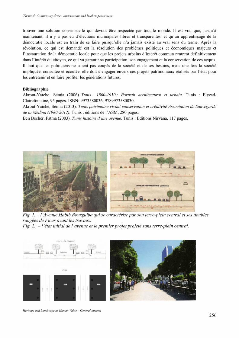
Heritage and Landscape as Human Value – General interest 256
trouver une solution consensuelle qui devrait être respectée par tout le monde. Il est vrai que, jusqu’à maintenant, il n’y a pas eu d’élections municipales libres et transparentes, et qu’un apprentissage de la démocratie locale est en train de se faire puisqu’elle n’a jamais existé au vrai sens du terme. Après la révolution, ce qui est demandé est la résolution des problèmes politiques et économiques majeurs et l’instauration de la démocratie locale pour que les projets urbains d’intérêt commun rentrent définitivement dans l’intérêt du citoyen, ce qui va garantir sa participation, son engagement et la conservation de ces acquis. Il faut que les politiciens ne soient pas coupés de la société et de ses besoins, mais une fois la société impliquée, consultée et écoutée, elle doit s’engager envers ces projets patrimoniaux réalisés par l’état pour les entretenir et en faire profiter les générations futures. Bibliographie Akrout-Yaïche, Sémia (2006). Tunis : 1800-1950 : Portrait architectural et urbain. Tunis : Elyzad-Clairefontaine, 95 pages. ISBN: 9973580036, 9789973580030. Akrout-Yaïche, Sémia (2013). Tunis patrimoine vivant conservation et créativité Association de Sauvegarde de la Médina (1980-2012). Tunis : éditions de l’ASM, 280 pages. Ben Becher, Fatma (2003). Tunis histoire d’une avenue. Tunis : Editions Nirvana, 117 pages.
Fig. 1. – l’Avenue Habib Bourguiba qui se caractérise par son terre-plein central et ses doubles rangées de Ficus avant les travaux. Fig. 2. – l’état initial de l’avenue et le premier projet projeté sans terre-plein central.
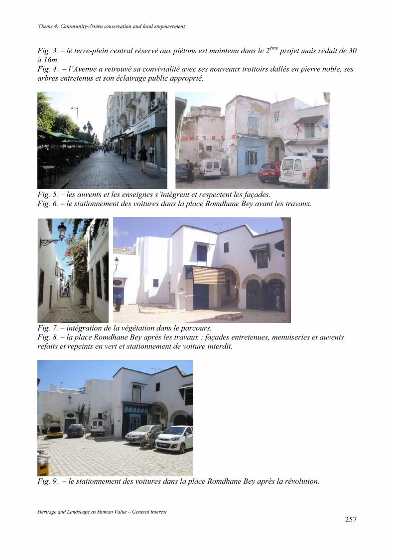
Heritage and Landscape as Human Value – General interest 257
Fig. 3. – le terre-plein central réservé aux piétons est maintenu dans le 2ème projet mais réduit de 30 à 16m. Fig. 4. – l’Avenue a retrouvé sa convivialité avec ses nouveaux trottoirs dallés en pierre noble, ses arbres entretenus et son éclairage public approprié.
Fig. 5. – les auvents et les enseignes s’intègrent et respectent les façades. Fig. 6. – le stationnement des voitures dans la place Romdhane Bey avant les travaux.
Fig. 7. – intégration de la végétation dans le parcours. Fig. 8. – la place Romdhane Bey après les travaux : façades entretenues, menuiseries et auvents refaits et repeints en vert et stationnement de voiture interdit.
Fig. 9. – le stationnement des voitures dans la place Romdhane Bey après la révolution.
Heritage and Landscape as Human Value – General interest 258
The Culture of Preserving Cultural Property:
Developing a Tort-Based Standard of Care Eve ERRICKSON Smithsonian Institution, Office of Contracting ICOMOS Member, Scientific Subcommittee Member, ICLAFI Abstract Concerns over the applicability of property law to cultural property and cultural heritage are not new. The litany of proposed solutions is tired, for many, as one scholar has observed, legal schemes for protecting cultural heritage and cultural property have become rather predictable. Proposed methodologies for enhancing cultural protections revolve around broadening property rights; creating new registries, lists or inventories; sometimes in the context of adding concepts derived from human rights law, historic preservation, or civil rights. As a result, cultural property often result feedback from property rights advocates guarding their business interests or from academics concerned with the self-determination of source jurisdictions, each competing for the limited attention of people whose entire understanding of these issues comes from watching the last episode of Antiques Roadshow or a re-run of The Thomas Crown Affair. Sadly, despite centuries of debate over ethical standards in the art market, items with dubious or incomplete provenance are still readily accepted as gifts or purchases from anonymous sources. Accordingly, this paper looks to address a specific concern amongst the many problems associated with applying property laws to cultural property: the assertion that clear provenance as an ethical standard for acquisition of cultural property is somehow ambiguous. Cultural property and heritage advocates may disagree about any number of philosophical issues, but the need for a chain of legitimate title, to confirm that items on the auction block were not confiscated under threat or outright stolen, is not one of them. The illicit trade of cultural property continues as a condition of this persistent misconception. The goal of this paper is provide a general commentary on areas of law touching cultural property for the purpose of generating discussion on the idea of a legally enforceable standard of care on the basis of negligence in lieu of more traditional, property-based claims such as replevin or conversion. Tort claims may not wield the force of criminal law, but they can begin the work of clarifying a duty of care for the purchase of art and objects in commerce by encouraging more ethical business practices in the art market. Activists can continue to advocate for more powerful rules of law that require not only theoretical protection of cultural property but also compulsory return of looted cultural property, but until such time as consensus is reached on the best method for achieving this goal, negligence theories may provide an interim solution. All authorities are drawn from U.S. case law for the sake of brevity. Keywords: Legal Advocacy; Cultural Property Preservation 1. Introduction As cultural heritage advocacy under the UNESCO Convention enters its 44th year, a count of nationally passed laws for the protection of cultural heritage, including the ratification of treaties, laws against looting, trafficking, and export restrictions, number in the hundreds. As a consequence, the definitions of what constitutes cultural heritage and cultural property have also multiplied. Courts and judges are often at a loss to determine the applicability of such laws; these problems are routinely compounded by the need to determine proper forum, jurisdiction and choice of laws. In the recent case of U.S. vs. Cambodian Sandstone Sculpture located at Sotheby’s auction house, counsel for Sotheby’s lamented that the U.S. had failed to cite ‘a clear and unambiguous law’ as grounds to return the iconic temple guardian statue to the government of Cambodia. Correspondence in the case includes a letter from Sotheby’s attorney reflecting that the civil forfeiture action instituted by the Department of Justice was ‘difficult to understand’:
Heritage and Landscape as Human Value – General interest 259
The [US] government’s continued failure to identify a clear and unambiguous ownership law… means that the motion… should be denied. The absence of such a law also prevents the government from calling into question the good faith of…Sotheby’s. Both were entitled to conclude from the absence of any clear law vesting ownership in Cambodia that the statue was not stolen when removed from Cambodia. And both were certainly entitled to conclude that it did not remain stolen at the time of import into the United States, almost two decades after the period allotted by English law for Cambodia to make a claim had expired.9
As Director-General Bokova noted in 2011, heritage lost is ‘damage to the soul of its people and its identity.’10 Cultural heritage is key to cohesion for congregations, ethnicities, spiritual groups, nations, families and other traditions, and is vulnerable to forced sales, opportunistic looting and theft during periods of civil unrest and armed conflict. For purchasers in market countries far removed from the fray, emotional appeals often do not suffice, and, as one scholar has observed, it is unrealistic to expect a “global system to care for every object of merely modest, local interest but without importance for science or in its aesthetic respect.”11 What is reasonable is to expect that the loss of items and places which embody spiritual, political, or historic significance will continue to destabilize countries and communities. The loss of cultural value embodied in tangible and intangible cultural heritage, and related harms such as the cessation of traditions, activities, and loss of information--cannot be feasibly be remedied using traditional attacks on title. The gravamen of cultural heritage disputes is the return of cultural heritage as that heritage exists for source communities. As such, the assessment of cultural heritage disputes must leverage not only financial interests of the source community, but also the rights of its constituents to express themselves freely, to associate politically or culturally with a nation or an ethnicity, and to engage in religious expression and historic interpretation. In common law jurisdictions, the failure of one individual to appropriately recognize his or her obligations to another individual is the bailiwick of tort claims. The goal of this paper is provide a general commentary on areas of law touching cultural property for the purpose of generating discussion on the idea of a legally enforceable standard of care in lieu of more traditional, property-based claims such as replevin or conversion. Case law is taken from U.S. sources, focusing on basic legal concepts which also resound in civil jurisdictions. 2. Property and Tort Property law precedents in the United States originate out of the experience of legal practitioners; as a result, the most developed areas of law deal with common types of property in common types of exchanges. In mounting a good faith purchaser defense, limited case law in tandem with exclusionary evidence rules pose a tremendous advantage, creating a vacuum in which a plaintiff has only stale, circumstantial evidence to prove that an item of cultural property lost decades ago is precisely the same one purchased by the defendant. Statutes of limitation act arbitrarily to place additional burdens of proof on the cultural property plaintiff to show its due diligence after the theft. Courts allow good title to be established in the absence of evidence to the contrary, even in circumstantial cases of theft or looting in areas affected by armed conflict. The use of tort theory calls for thinking about cultural heritage outside the context of connoisseurship, museums, and curators. The cultural heritage in our markets derives its value from ritual, meaning and life outside the walls of our cultural shrines. Torts provide mechanisms to remedy harms between private parties 9 April 4, 2012 Letter of Peter Neiman, 12 Civ. 2600 (GBD). 10 Cunliffe, Emma and Global Heritage Fund “Damage to the Soul: Syria’s Cultural Conflict” http://ghn.globalheritagefund.com/uploads/documents/document_2107.pdf Accessed July 31, 2014, citing Bokova, UNESCO Media Services 30 March 2012. 11 Milligan, Ashlyn, “Targeting Cultural Property: The Role of International Law” at https://www.princeton.edu/jpia/past-issues-1/2008/5.pdf Accessed July 31, 2012, at p. 103, citing Fechner, Frank G. 1998. The Fundamental Aims of Cultural Property Law. International Journal of Cultural Property, Vol. 7, 2, pp. 376-394.
Heritage and Landscape as Human Value – General interest 260
when that value is exploited but not fairly acknowledged. Source jurisdictions can ascribe harms not only to the initial circumstances of loss but also with continued deprivation of cultural heritage. As such, the use of torts can implicate not only immediate thievery, but also transmission and transmutation through the black and grey markets from middle men to collectors and auction houses. Torts as a field are concerned with behavior and relationships, specifically with the resolution of a vast array of harms that occur between private parties. Tort claims occupied a critical role in the development of professional and business standards as a result of cases pursued in the mid to late 20th century against manufacturers and sellers of materials such as asbestos and tobacco. The growth of tort law has since contributed to safer products and services brought about by changes in business practices throughout the United States. Although torts are not mentioned specifically in the Constitution or the Bill of Rights, the 14th amendment’s guarantee to due process has in the past been understood by lawmakers to include rights to laws for redress of wrongs. English jurists Coke and Blackstone considered a right of redress as a critical component to England’s constitution. A majority of the thirteen original states included redress as a basic rights in their constitutional documents. As one scholar of tort law writes:
There is little doubt that the first section of the Fourteenth Amendment includes a right of access to law of the sort traditionally provided by common law courts, including a right to law that enables victims to redress wrongs done to them by others.
Among the many torts in common practice, product liability claims are notable for their ability to ascribe duties of care across multiple relationships in business. In the twentieth century, courts set aside traditional contract law standards which only allowed recovery between parties to a contractual relationship, called the privity requirement, on public policy grounds. It was, however, 19th century judges who began to create exemptions from the privity requirement, at first limited to cases where extremely serious harms were foreseeable to specific types of users. As an example, where a chemist mis-labeled a poisonous chemical, and sold it under the wrong label, resulting in the death of the buyer’s wife, the court held that the chemist was liable due to the inherent danger of the chemical being put into the stream of commerce. Other exceptions to privity included cases of fraudulent sales of defective products and concealment of dangers. Twentieth century judge, Benjamin Cardozo writing in 1916, explicitly set privity aside and created a new, general rule for products liability:
We have put aside the notion that the duty to safeguard life and limb, whenever consequences of negligence may be foreseen, grows out of contract and nothing else. We have put the obligation where it ought to be. We have put it in the law.
Where dangers were known or could be understood by the creators of such products, twentieth century jurists became less and less willing to hold buyers accountable for risks that were actively concealed. Risks and the care required for handling those risks increasingly became the bailiwick of the vendor. Tort-based negligence cases now span the entire conceivable range of activities in preparation of products for sale — selection, manufacturing, packaging, inspections, testing, advertisements, sales, and disclosures. In all these activities, the product creator must exercise the care of a reasonable person under the circumstances. Put another way, the plaintiff in a negligence case must show that the negligent conduct of the creator or seller was the cause of the injuries or that the injury was the result of their failure to use reasonable skill or care. In determining a defendant’s negligence, courts review the conduct of the product creator and whether they acted reasonably in choosing the terms of sale, design specifications, materials, or structure for the product, in light of the risks it knew about or should have known about. The determination of whether a creator acted reasonably is established through expert testimony — whether the defendant was “reasonably aware of scientific knowledge and discoveries touching his product and techniques and devices used by practical men in his field.” If the dangers of a specific product are known to one company, then the same risks are discoverable by any other company operating in a given industry. Proponents of traditional property rules cite the importance of predictability and stability in the marketplace. However, the risks undertaken by sellers and distributors are premised on basic legal assumptions, such as
Heritage and Landscape as Human Value – General interest 261
trade in an open market and notice to potential claimants. When sellers routinely assume the risk of selling unprovenanced items and collectors depend on apparent legitimacy, it may also be argued every participant in this chain of commerce can assume liability for harms to reasonably foreseeable plaintiffs such as dispossessed heirs of Holocaust victims, indigenous peoples, refugees, communities in occupied territories, victims of religious persecution or groups targeted for ethnic cleansing. Recent scholarship on art theft has identified systematic patterns of contacts in illicit markets. The critical gap between early stage intermediaries and late stage intermediaries is problematic from the legal perspective for the same reasons that troubled early products liability plaintiffs — lack of privity. However, in the context of a tort claim brought against known intermediaries, sellers, and collectors, the absence of knowledge may eventually come to be used as evidence of a breach of duty, particularly as scholars continue to de-mystify the illicit trade of cultural property from vulnerable jurisdictions. Reported cases reflect that expert testimony on culture is already used to show emotional harms associated with deprivation of cultural heritage in cases related to the adoption of children of Native American tribes, and the languages used in public education, among other matters. Art experts are consulted as a matter of course in business disputes involving art and objects; and not unironically, to establish whether source countries had performed due diligence in reporting the loss and seeking the return of lost cultural property. The intangible losses associated with cultural property — whether emotional, social, or both, may also be established through expert testimony. Disruptions in the source community may include loss of income associated with tourism and physical damage to the looted items and its surrounding property. Other types of less concrete damages associated with a disintegration of community would require additional research, but are not out of reach. Military strategists are currently making efforts to protect cultural property in venues in areas such as Iraq and Afghanistan, as part of efforts to reinforce shared histories that enhance stabilization efforts in post-war reconstruction. Critics of this approach may counter that the reification of social losses in legally enforceable proceedings could be used for economic protectionism. However, participation in private law or tort-based claims is an entirely voluntary process, allowing plaintiffs to articulate harms specific to their loss or circumstance. 3. Theoretical Application Looking at the case of Autocephalous Greek Orthodox Church of Cyprus vs. Goldberg & Feldman Fine Arts, Inc., the drawbacks of property law can be demonstrated in the abstract. To recap the salient facts briefly, the Autocephalous Greek-Orthodox Church of Cyprus and the Republic of Cyprus brought a replevin action in the U.S. District Court of Indiana to recover from Peg Goldberg and her Indiana art gallery four priceless Byzantine mosaics removed from a church in Northern Cyprus likely between 1976 and 1979 during a period of Turkish occupation. Ms. Goldberg purchased the mosaics in 1988 from a “Turkish antiquities dealer” who claimed to have found them in an abandoned church. Ms. Goldberg’s purchase was based on a brief meeting with the seller and inspections of the mosaics at the Geneva airport. The seller claimed to have found the pieces in an ‘extinct’ church while assigned to work as an archaeologist for Turkey in northern Cyprus. Cyprus sought return of the mosaics, or in the alternative, damages, on a replevin claim in the Southern Federal District of Indiana, and prevailed. Under the replevin claim, however, the Church was legally required to prove 1) its right of possession; 2) that the mosaics were unlawfully detained; and 3) the defendant possessed them unlawfully. Strategically, the replevin claim puts a tremendous onus of required proof on an already disadvantaged plaintiff. Assuming the same jurisdiction, choice of law, and statute of limitations analysis, in the context of a negligence claim, the presentation of evidence might have followed a different path. Applying Indiana laws on negligence in lieu of replevin, the court would determine first whether the defendant owed a duty to the plaintiff on the basis of the following factors: (1) the parties’ relationship;
Heritage and Landscape as Human Value – General interest 262
(2) the harm’s reasonable foreseeability to the injured person; and (3) concerns of public policy. The ‘relational’ prong depends on the cause of action. The theft and looting standards promulgated via UNESCO, the International Council of Museums and other organizations could have been taken into account to establish the Church as a foreseeable plaintiff; the harm to foreseeable plaintiffs would be demonstrable on the basis of art historical testimony. The concerns of public policy could take into account the impact of continued looting, the impact to the defendant’s business, or other factors. Strategically, the negligence claim would allow the plaintiff to lead with evidence of its expert testimony on the nature of the duty of care as it would have been relevant to an art dealer in the trade of Cypriot antiquities. Plaintiffs would be permitted to show the mosaics first as an architectural element installed at its home church, instead of an expensive item featured in a gallery. Negligence claims allow for a personal, holistic presentation of what has been lost, instead of a quasi-curatorial assessment — describing the mosaics from the point of view of the Greek Orthodox parish to which it belonged instead of garbing it with museum mystique. The purchase of the mosaics without defendant’s contacting Cyprus authorities resulted in their transportation farther from Cyprus and additional administrative efforts to eventuate their return. The continued detention of the mosaics after the sale deprived the Church of their historical and aesthetic value, necessitating repairs to the mosaics, Church itself and cutting off income from tourism activities. Less concrete types of loss, such as the emotional damages to the Church congregants, might be proven up through the testimony of workers in the area assisting with rebuilding efforts in the post-occupation era. It is common for source jurisdictions to avail themselves instead of diplomatic channels to negotiate the return of cultural property. However, informal negotiations are also strongly influenced by the power of legal precedent. In the case of the Phanom Rung lintel, the country of Thailand requested its return from the Art Institute of Chicago in 1988. The AIC demanded proof the lintel had been stolen, resulting in a ten-year delay in the return of the lintel, and delay of the reopening of the Phanom Rung temple. The dialogue between Thailand and the AIC aped the legal narratives imposed by property-based recovery actions. Likewise, in a negligence claim, the Phanom Rung lintel could be assessed not only in terms of the devaluation of the carving, but of damage to the structure left behind. Given the temple’s critical importance for cyclical pilgrimage in Hindu and Buddhist faith traditions, the delay in opening could provide the basis for economic recovery as calculated through the study of comparable temples or attendance records from Thailand’s Tourism Authority. Whether such a claim would be pursued by a source community or not would be determinable as an internal matter, or perhaps with the assistance of other organizations. 4. Hypothetical Application In 2011, reports emerged from Syria that the Colonnade in the city of Apamea had been illegally excavated, vandalized and pillaged.12 The Colonnade’s historic and cultural value resounds broadly as the remains of the ancient Roman city, and a prominent architectural feature emblematic of Roman building techniques and decorative elements. Numerous sources have reported shelling in the area, resulting in the pillar and lintels composing the Colonnade and tanks churning the ground beneath it, devastating the site’s incredible archaeological value. In the future, when Syria’s bloody civil war has ended, its victims and families will seek the return of cultural heritage critical to its history. Gathering the physical remnants of cultural heritage has been shown to
12 Franks, Seven, A Blog About History citing Sabbagh, H. Archaelogical Sites in Ancient City of Apamea Vandalized and Pillaged, SANA, accessed at http://www.ablogabouthistory.com/2011/09/22/ancient-city-of-apamea-vandalized-and-looted/#sthash.AtUJ9x3M.dpbshttp://www.ablogabouthistory.com/2011/09/22/ancient-city-of-apamea-vandalized-and-looted/#sthash.AtUJ9x3M.dpbs on July 31, 2014.
Heritage and Landscape as Human Value – General interest 263
assist not only with historic preservation efforts but also with fuller understanding of the conflict.13 Looted cultural heritage sold via black market intermediaries may have provided funding sources for the continuation of the conflict. Traditional claims for the return of looted architectural elements taken, as an example, from the site of the Grand Colonnade, would provide for the return of the item, perhaps premised by a third party donation to compensate the purchaser. However, the reports of groups like Patrimonie Syrien, detailing the destruction of cultural heritage in Syria, in essence are creating standards and information needed by dealers for to perform due diligence. UNESCO’s efforts in publicizing such reports and raising awareness of Syria’s exceptionally diverse cultural history likewise provide benchmarks to gauge for future sales by collectors of Roman antiquities in the “Apamea” style. In spite of the efforts of those engaged in the documentation of war crimes in Syria, U.S. jurisprudence will not develop to allow such observations in the pursuit of a conversion claim against a would-be good faith purchaser. Assuming, arguendo, that a lintel from the Grand Colonnade was discovered in the collection of a large, Western museum, and requested to be returned as part of a replevin action, under current case law, the museum’s response could easily be a demand for proof of theft. For collectors of Roman architectural remnants and archaeological goods, awareness of reports of unauthorized excavation at the Grand Colonnade is reasonable to mitigate the risk of acquiring antiquities obtained through atrocity. As a follow on, dealers considering purchase of architectural remnants of the Apamean site are in the best position to mitigate those risks. In the event they elect to forego reasonable care under the circumstance, those who suffer harm as a result could seek information, cooperation and assistance with in restoration of Apamea through proving breach of duty. 5. Conclusion Experiments in international cultural property law are by definition experiments in property law, and inevitably confront highly politicized questions of exclusive ownership rights, economic fairness and national sovereignty. If it is unrealistic to expect that the world should care about every item of local cultural heritage, it is not unreasonable to suggest that the world should care about those items of local significance that are required for religious observance, historic integrity, or cultural identity. Ideally, tort-based recovery theory in cultural property could provide a platform for source jurisdictions both in the pursuit of cultural property return and the continued need for collective self-determination. Tort claims do not wield the force of criminal law, but they can begin the work of clarifying a duty of care for the purchase of art and objects in commerce by encouraging more ethical business practices in the art market. Activists can continue to advocate for more powerful rules of law that require not only theoretical protection of cultural property but also compulsory return of looted cultural property, but until such time as consensus is reached on the best method for achieving this goal, negligence theories may provide an interim solution.
13 O’Donnell, Therese, “The Restitution of Holocaust Looted Art and Transitional Justice: The Perfect Storm or the Raft of Medusa?” EJIL, Vol. 22, No. 1, p. 53, Accessed at https://ejil.oxfordjournals.org on July 25, 2014.
Heritage and Landscape as Human Value – General interest 264
Bibliography Blackstone, William. Book 2, Chapter 2, Of Real Property; and First, of Corporeal Hereditaments, Commentaries on the Laws of England (1765-1769). Campbell, Peter B. (2013). “The Illicit Antiquities Trade as a Transnational Criminal Network: Characterizing and Anticipating Trafficking of Cultural Heritage” International Journal of Cultural PropertyVol. 20, pp. 113-153. Cardi, Jonathan W. (2010). “The Hidden Legacy in Palsgraf: Modern Duty Law in Microcosm” Boston University Law Review. Vol. 91, pp. 1873-1913. Caruthers, Claudia. “Comment: International Cultural Property: Another Tragedy of the Commons.” Pacific Rim Law & Policy Association 7 Pac. Rim L. & Pol'y J. 143 January 1998. Cunliffe, Emma and Global Heritage Fund “Damage to the Soul: Syria’s Cultural Conflict” http://ghn.globalheritagefund.com/uploads/documents/document_2107.pdf Accessed July 31, 2014, citing Bokova, UNESCO Media Services 30 March 2012. Felch, Jason. “Blood Antiquities: After Lengthy Fight, Sotheby’s Agrees to Return Looted Khmer Statue.” Chasing Aphrodite, Blog, published December 16, 2013 at http://www.chasingaphrodite.com. Franks, Sevan, A Blog About History citing Sabbagh, H. Archaelogical Sites in Ancient City of Apamea Vandalized and Pillaged, SANA, accessed at http://www.ablogabouthistory.com/2011/09/22/ancient-city-of-apamea-vandalized-and-looted/#sthash.AtUJ9x3M.dpbshttp://www.ablogabouthistory.com/2011/09/22/ancient-city-of-apamea-vandalized-and-looted/#sthash.AtUJ9x3M.dpbs on July 31, 2014. Gerstenblith, P. (2007). “Controlling the International Market in Antiquities: Reducing the Harm, Preserving the Past”. Chicago Journal of International Law. Accessed at ProQuest Research Library, p. 169. Gerstenblith, P. (2012). Art, Culture, Heritage and the Law, Third Edition. Carolina Academic Press. Giles, Linda and Monica Udvardy. “Looted Memorial Statues Returned to Kenyan Family” published June 23, 2011 at http://www.savingantiquities.org/author/monica-udvardy-and-linda-giles/. Goldberg, CP. (2005). “The Constitutional Status of Tort Law: Due Process and the Right to a Law for the Redress of Wrongs.” The Yale Law Journal, Vol. 115, No. 3. Milligan, Ashlyn, “Targeting Cultural Property: The Role of International Law” at https://www.princeton.edu/jpia/past-issues-1/2008/5.pdf Accessed July 31, 2012, at p. 103, citing Fechner, Frank G. (1998). The Fundamental Aims of Cultural Property Law. International Journal of Cultural Property, Vol. 7, 2, pp. 376-394. Noce, Vincent. “The smuggling scandal that’s ready to erupt” The Art Newspaper. Retrieved September 18, 2013 http://theartnewspaper.com/articles/The-smuggling-scandal-thats-ready-to-erupt/30304# O’Donnell, Therese, “The Restitution of Holocaust Looted Art and Transitional Justice: The Perfect Storm or the Raft of Medusa?” EJIL, Vol. 22, No. 1, p. 53, Accessed at https://ejil.oxfordjournals.org on July 25, 2014. Pollock, Frederick (1907) . English Law before the Norman Conquest. Boston: Little, Brown and Company. Prosser & Keaton on Torts, 5th Edition. West Group (2004) Prott, Lyndel V. and Patrick J. O’Keefe. “ ‘Cultural Heritage’ or ‘Cultural Property’ ?” in Gerstenblith, Art Culture, Heritage and the Law. Priest, George L. “The Constitutionality of State Tort Reform Legislation and Lochner” 31 Seton Hall Law Review 681 (2000-2001). Schofield Sezgimat, Catherine. “Was the repatriation of a footless 10th century statue to Cambodia this month related to Sotheby’s history of selling Khmer pieces with “no published provenance” or “weak” collecting histories?” Published in the Association for Research into Crimes Against Art blog on December 29, 2013 at http://art-crime.blogspot.com/2013/12/was-repatriation-of-footless-10th.html. Sprankling, John (2000). Understanding Property Law, 3rd Edition. Matthew Bender (2007, 2012). Stoebuck & Whitman, The Law of Property, 3rd Edition. West Group. Tuan, Tran Huu and Stale Navrud (2008). “Capturing the Benefits of Preserving Cultural Heritage,” Journal of Cultural Heritage 9 pp. 326-337. Turner, M.A (2010). “Recent Developments in Indiana Tort Law” Indiana Law Review. Vol. 43, pp. 1054-1087. Watson, Alan. “The Structure of Blackstone’s Commentaries”, 97 Yale Law Journal 795 (1987-1988) pp. 795-821.
Heritage and Landscape as Human Value – General interest 265
Yates, Donna. “Does the Illicit Antiquities Trade Fund al-Qaeda?” Property of an Anonymous Swiss Collector, Blog, published November 2, 2013 at https://www.property of ananonymousswisscollector.com Report of the Panel for a National Dialogue on Museum/Native American Relations 2/28/1990. United National Declaration on the Rights of Indigenous Peoples. United Nations (2008). De legibus et consuetudinibus Angliae attributed to Henry of Bratton, translated by Samuel E. Thorne; http://amesfoundation.law.harvard.edu/digital/Bracton/bracton.html. Cases Consulted Autocephalous Greek-Orthodox Church v. Goldberg, 717 F. Supp. 1374 (S.D. Ind. 1989) Clary v. Dibble, 903 N.E. 2d 1032 (Ind.Ct.App), trans denied, 919 N.E. 2d 546 (Ind. 2009) Henningsen vs. Bloomfield Motors, 161 A.2d 69 (1960) In the Matter of the Estate of Mark Rothko, Deceased. 84 Misc.2d 830 (1975) MacPherson v. Buick Motor Company, 217 N.Y. 382 (N.Y. 1916) Palsgraf v. Long Island Rail Road, 162 N.E. 99, 99 (N.Y. 1928) United States of America v. A 10th Century Cambodian Sandstone Sculpture, Currently Located at Sotheby’s in New York, New York. Stipulation and Order of Settlement, 12 Civ. 2600, Filed December 12, 2013 Webb v. Jarvis, 575 N.E.2d 992 (Ind.1992)
Heritage and Landscape as Human Value – General interest 266
Heritage and Landscape as Human Value – General interest 267
Heritage and Landscape as Human Value – General interest 268
Vers une meilleure interprétation et présentation
du site de la presqu’île de Mahdia (Tunisie) Hazar SOUISSI, Ben HAMED P.A.E.3C1, 16 Rue Al Kods, 2026 Sidi Bou Said, Tunis, Tunisie, +216 98 430 648, [email protected] Résumé Cet article propose une étude particulière du site culturel et patrimonial fatimide en Ifrikiya médiévale : la presque île de Mahdia en Tunisie. Il s’agit tout d’abord de décrire son potentiel patrimonial. Ensuite, de montrer les insuffisances et les limites relevées lors du diagnostic en termes de communication, de présentation et d’interprétation. Puis d’en proposer les solutions adéquates afin de sensibiliser les décideurs et les citoyens de la nécessité de la gestion, la sauvegarde, la conservation et de mise en valeur du patrimoine défensif à travers différents outils privilégiés. Mots clés : interprétation, patrimoine défensif, Mahdia, numérisation, modélisation 1. Introduction Le diagnostic entrepris dans le cadre de mes recherches de mastère en sciences du patrimoine2 sur le site fatimide de la presque île de Mahdia m’a permis de s’interroger sur le degré de transfert et d’évaluation de l’information patrimoniale par les citoyens. Ceci à travers des outils privilégiés de communication du potentiel patrimonial permettant de rendre intelligible la complexité des legs des civilisations antérieures. On se propose dans cet article/communication à partir de l’étude architecturale et archéologique -basées sur des relevés des vestiges existants des composantes du système défensif de la capitale fatimide de l’Ifrikiya médiévale- de fournir une restitution en trois dimensions. L’étude architecturale a servit comme point de départ pour l’essai de restitution et la réalisation des 3D. En effet, on a essayé par le biais des outils numériques de retracer les images des fortifications au Xème siècle , d’expliquer les composantes du système défensif afin de connaître l’importance de cet héritage militaire, et de faire comprendre au grand public et aux spécialistes l’agencement des structures défensives. L’outil numérique constitue un outil parmi d’autres dans le cadre du processus de transmission et de partage des connaissances patrimoniales permettant d’une part le transfert de l’information historique, archéologique et architecturale vers le grand public. D’autres parts, l’interprétation du patrimoine archéologique fatimide a pour but sa conservation et sa mise en valeur. Les propos de cet article/communication est de montrer : Quels sont les meilleurs outils pour retracer et dessiner les traits et les caractéristiques de l’architecture militaire et défensive de cette ville à l’époque de sa fondation sous le règne des fatimides ? Comment la modélisation en trois dimensions pourrait-elle sensibiliser le public ? 2. Présentation du site Le site de la presque île de Mahdia est un site à la fois culturel et patrimonial. En effet, l’occupation humaine dans cette région remonte à la préhistoire. Ensuite, la ville a été connue comme un comptoir phénicien,
1 Unité de recherche : Patrimoine, Architecture, Environnement, Connaissance, Compréhension et Conservation. (P.A.E.3C). 2 Hazar Souissi Ben Hamed, 2009, Les fortifications fatimides de Mahdia : essais et propositions de mise en valeur, mémoire de Mastère soutenue à la (F.S.H.S.T) Faculté des sciences humaines et sociales de Tunis, sous la direction de M Adnan LOUHICHI, 2009.
Heritage and Landscape as Human Value – General interest 269
romain3 puis comme capitale de la dynastie chiite de l’Ifrikiya médiévale vers le Xème siècle. La ville a connu aussi la présence des Hilaliens, chrétiens, espagnols et Turcs. Depuis sa fondation jusqu'au XVIème siècle, Aphrodisium, Gummi, Jemma « 4«جمة ou Mahdia garde encore les traces de diverse civilisations. La situation géo-historique privilégiée, le système défensif complexe et l’ouverture sur un espace maritime dynamique à savoir le bassin méditerranéen ont conféré à la ville de Mahdia un rôle de premier plan. Elle a connu un essor considérable depuis la préhistoire et en particulier au cours du moyen âge comme étant la métropole politique, économique et culturelle de l’Ifriqiya. 3. Diagnostic et limites Le site archéologique de la presque île de Mahdia montre outre la présence de nécropole punique différents vestiges médiévales à savoir des tronçons des remparts maritimes et terrestres, la mosquée fatimide fondée en 916 par Obeid Allah Al Mahdi. Le port de Mahdia (Fig.1) compte parmi les plus actifs et prospères du Maghreb médiéval et de la méditerranée dès sa fondation qui remonte à l’époque punique jusqu’à la conquête par les troupes de Charles Quint. Il est à mentionner aussi la présence d’un arsenal, un complexe palatin dont le palais d’Al-kaïm-bi-Amrallah qui a été construit par le prince fondateur de la dynastie fatimide. En plus, on note l’existence de l’imposante forteresse ottomane érigée en 1595 par Abou Abdallah Mohamed Pacha celle de Bordj El Kébir ou Borj Erras. L’ensemble des vestiges et monuments sont agencés dans un paysage agréable s’ouvrant sur la mer et offrant au site un avantage naturel étendu exploitable. Ce paysage est ponctué par la constance du cimetière marin. Les structures existantes sont protégées par le code du patrimoine tunisien5. En effet, Borj El Kébir de Mahdia6, la grande mosquée7 et la porte de la médina8 sont classés en tant que monuments historiques par les services compétents relevant de l’Institut National du Patrimoine tunisien (I.N.P). A proximité de la Squifa Kahla ou Bab Zouila9 (Fig. 2), vient se placer le musée régional de Mahdia. Il s’agit d’un petit musée archéologique et patrimonial tunisien qui abrite outre des collections archéologiques (puniques, romaines, byzantines et islamiques), des éléments liés aux traditions populaires de la région. On ne peut cacher les carences de ce musée en termes de nouveaux outils attractifs et didactiques à savoir : les systèmes interactifs, les enregistrements sonores, les vidéos, l’ambiance lumineuse… etc. A l’intérieur du site archéologique, la richesse de l’architecture militaire est bien documentée. Toutefois, les itinéraires empruntés ne sont jalonnés par différents types de signalétiques : directionnelle, d’identification des monuments, panneaux d’information ou bien de présentation des vestiges. On relève aussi l’absence d’équipements et services d’interprétation visibles tels que kiosques et sentiers.
3 Attestation par la mosaïque d'époque romaine d'Ostie. 4 Djelloul. Néji pense que l’appellation de « ججج» est une altération du toponyme antique de Gummi en se basant sur un témoignage historique à travers le texte d’Al Maliki. و" م ه و من سري أب و ال ن أصل د ب هللا عب مي ج د ال متعب قصر ال ة ب م عرف ج ن وي قصر اال اط ب رب ان ال ل من ك ه د أ ه ز ة ال اد عب و وال نسك و ال فضل و ال ة اب ه االج ة من أصل م و ج ان ه ك ا ل ه وت ب ان ه يتجر ح ا ب م ال في ك م ي رك ث ك ت و ذل ذ ا نب ي دن و ال اط قصر سكن رب و ال د جر م ت ا قي لليل و ال م ا ار صي ه ن ."ال
كي ال م اض ال نفوس ري حقيق ال بكوش بشير ت ة ال الث ا ث ازج ر غرب دا المي ال س روتب اإل جزء 1983 ي ا ال واال 43ص 5 Loi n° 94-35 du 24 février 1994 relative au code du patrimoine archéologique, historique et des arts traditionnels tunisien. 6 Date du classement : 13-03-1912. 7 Date du classement : 03-03-1915. 8 Date du classement : 03-03-1915. 9 Cette forteresse datant du XVIème siècle constitue l’accès principal au centre historique de Mahdia. Une importante porte fortifiée datant à l'origine du Xème siècle (élevée entre 916 et 921) puis restaurée et reconstruite au XVIème siècle à l’aide de matériaux provenant de la première porte érigée six siècles auparavant . Elle appartient au rempart terrestre de la ville, ayant servi à surveiller depuis 1595 la pointe du cap Afrique et à protéger le pays contre les envahisseurs. Ce vestibule à niches et banquettes est dotée d'un passage voûté s’étendant sur une dizaine mètres d’épaisseurs.
Heritage and Landscape as Human Value – General interest 270
De l’extérieur, on remarque malheureusement qu’aucune interprétation et présentation n’a été installé en dehors du site. L’accès physique à notre site culturel patrimonial devrait être valorisé et par moment limité, pour des exigences de sécurité et d’aménagements. Car, comme étant ouvert aux visiteurs, le site subit l’incidence de leurs fréquentation sur les caractéristiques physiques, les valeurs culturelles, l’intégrité et l’environnement naturel. Les récits des chroniqueurs arabes et des témoins oculaires n’en manquent pas fournissant des témoignages historiques très utiles pour la signification du site. Pourtant, aucun équipement ou services d’interprétation n’est mis en place afin d’exploiter ces sources écrites, orales, iconographiques et photographiques. 4. Propositions 4.1. Objectifs On a voulu à travers nos actions entreprises d’interprétation et de présentation du site fatimide de faciliter la compréhension du grand public des composantes du système défensif fatimide. Tel qu’énonce la charte de l’I.C.O.M.O.S relative à la gestion du patrimoine archéologique : « La présentation au grand public du patrimoine archéologique est un moyen essentiel de le faire accéder à la connaissance des origines et du développement des sociétés modernes. En même temps, c'est le moyen le plus important pour faire comprendre la nécessité de protéger ce patrimoine. »10 On arrive ainsi à inciter les Mahdois d’une part à renforcer et augmenter leur conscience de la nécessité de la protection et de la conservation des vestiges archéologiques et architecturaux. D’autres part, à encourager les associations à monter leurs propres perceptions selon leurs relations envisagées avec le site de la presque île de Mahdia. Notre cible est à la fois touristes et résidents : citoyens, associations, autorités, spécialistes, jeunes. 4.2. Démarche Notre démarche adoptée pour l’interprétation du site a été basée sur une étude architecturale, archéologique et historique à savoir le relevé des vestiges existants (Figg. 3, 4) qui constituent une archive d’un patrimoine militaire et défensif. Tout d’abord, il s’agit de mener un levé topographique pour situer le tracé des fortifications dans son environnement immédiat puis un relevé archéologique et architectural des tronçons existants. Ce qui rejoint parfaitement le deuxième principe énoncé dans la charte ICOMOS relative à l’interprétation et la présentation des sites culturels patrimoniaux11, « L’interprétation et la présentation devraient reposer sur les preuves recueillies par les méthodes scientifiques et de recherche communément admises ainsi que sur les traditions culturelles vivantes. »12 Notre reconstruction visuelle (Figg. 5-8) a été largement documentée, appuyée sur des travaux de terrain et basée sur des analyses détaillées et systématiques des données archéologiques, architecturales et historiques. La comparaison avec d’autres restitutions telle que celle réalisée par Jean Claude GOLVIN nous a permis de soigner les détails de notre proposition. Certes la restitution précédemment présentée reste toujours hypothétique, mais elle peut toutefois servir pour des expositions muséographiques sur Mahdia. Des bandes sons basées sur les essais de modélisation à
10 Charte internationale pour la gestion du patrimoine archéologique (1990) Préparée par le Comité International pour la Gestion du Patrimoine Archéologique (ICAHM). Article7 : Présentation, Information, Reconstitution. 11 Charte ICOMOS Pour l’interprétation et la présentation des sites culturels patrimoniaux : Proposition de version définitive. Révisée sous les auspices du Comité scientifique I.C.O.M.O.S sur l’interprétation et la présentation Le 10 avril 2007. 12 Op.cit.Principe 2 : Sources d'Information, p. 9.
Heritage and Landscape as Human Value – General interest 271
travers la visite virtuelle, des images d’archives confrontés aux perspectives de restitutions, de nombreuses photos, des vidéos... peuvent jalonner notre parcours muséographique adapté à tous les visiteurs. Notre restitution permet d’interpréter l’ensemble des vestiges fatimides de Mahdia. Le musée moderne et interactif d'histoire du Xème siècle est conçu comme un lieu de mémoire, mais aussi comme un outil pédagogique et culturel. Plus qu’un mémorial sur les fatimides, c’est un espace de réflexion et de débats sur les problèmes contemporains à la lumière des événements passés pour l’ensemble des visiteurs soit les spécialistes du domaine du patrimoine soit citoyens mais aussi pour les jeunes. On sait que le jeune public constitue une cible sensible dans le cadre de l’interprétation et la présentation vu leurs préjugés tenaces concernant le patrimoine en général et la visite d'un musée en particulier. Dans nos propositions d’interprétation, on aura recours aux divers media (tels que les présentations multi media in situ, ou au musée, l’installation de supports électroniques, les visites guidées d’éducation, les brochures… etc.). Un programme d’exposition temporaire, de conférence, de rencontre sera proposé tout au long de l’année. On en propose aussi d’intégrer les témoignages historiques relatifs aux récits des chroniqueurs arabes et des témoins oculaires soit directement par le biais des discours oraux, soit indirectement, par la participation active de membres des communautés associées en tant que guides. Sans oublier que Mahdia est riche aussi en potentiel immatériel tels que : traditions culturelles, spirituelles, folklore (musique et danse), coutumes locales, art culinaire, productions artisanales – une fois intégré - contribueront à une meilleure interprétation du potentiel matériel du site. Le patrimoine immatériel constitue à son tour un potentiel qui agrémente nos propositions d’interprétations où se mêlent les festivals : le cas du Festival Estival de Mahdia, Festival de la Mer, Festival Nuit de Mahdia, celui de la Médina13. 5. Conclusion A travers la modélisation des fortifications de Mahdia, on a pu poursuivre l’exploration des outils offerts par les nouvelles technologies en information. Appliqués aux structures archéologiques restantes des remparts terrestres et maritimes, l’apport de ces outils numériques s’avère considérable afin de diffuser les valeurs intrinsèques de la ville de Mahdia. Subséquemment, Citoyens et décideurs participent dans le montage des projets de valorisation et de mise en valeur des projets qui affectent leur vie quotidienne. A partir de l’étude de l’exemple de la presque île de Mahdia, on peut dire que l’expérience tunisienne en termes d’interprétation du potentiel patrimonial représente un réel enjeu pour permettre le développement touristique et économique local et international. Appuyé sur les propres valeurs que recèle le site à savoir : culturelle, historique, archéologique, architecturale et urbanistique, sociale, pédagogique… etc. qui pourraient être d’autant plus exploité ; on parviendra à établir un patrimoine de marketing qui répond à des fins touristiques et économiques. Ainsi, le développement touristique du site, les attentes des touristes et des résidents restent tributaire de la mise en œuvre d’un plan de gestion appuyé sur une stratégie de communication, de présentation et d’interprétation du potentiel patrimonial. Bibliographie Charte ICOMOS pour l’interprétation et la présentation des sites culturels patrimoniaux : proposition de version définitive, révisée sous les auspices du Comité scientifique ICOMOS sur l’interprétation et la présentation Le 10 avril 2007. Charte internationale pour la gestion du patrimoine archéologique (1990), préparée par le Comité International pour la Gestion du Patrimoine Archéologique (ICAHM). Néji Djelloul et Abderrazak Khéchine (2003), Mahdia : capitale des Fâtimides, éd. Contraste, Sousse.
13 Ce festival se déroule pendant la 2ème moitié de Mois de Ramadan.
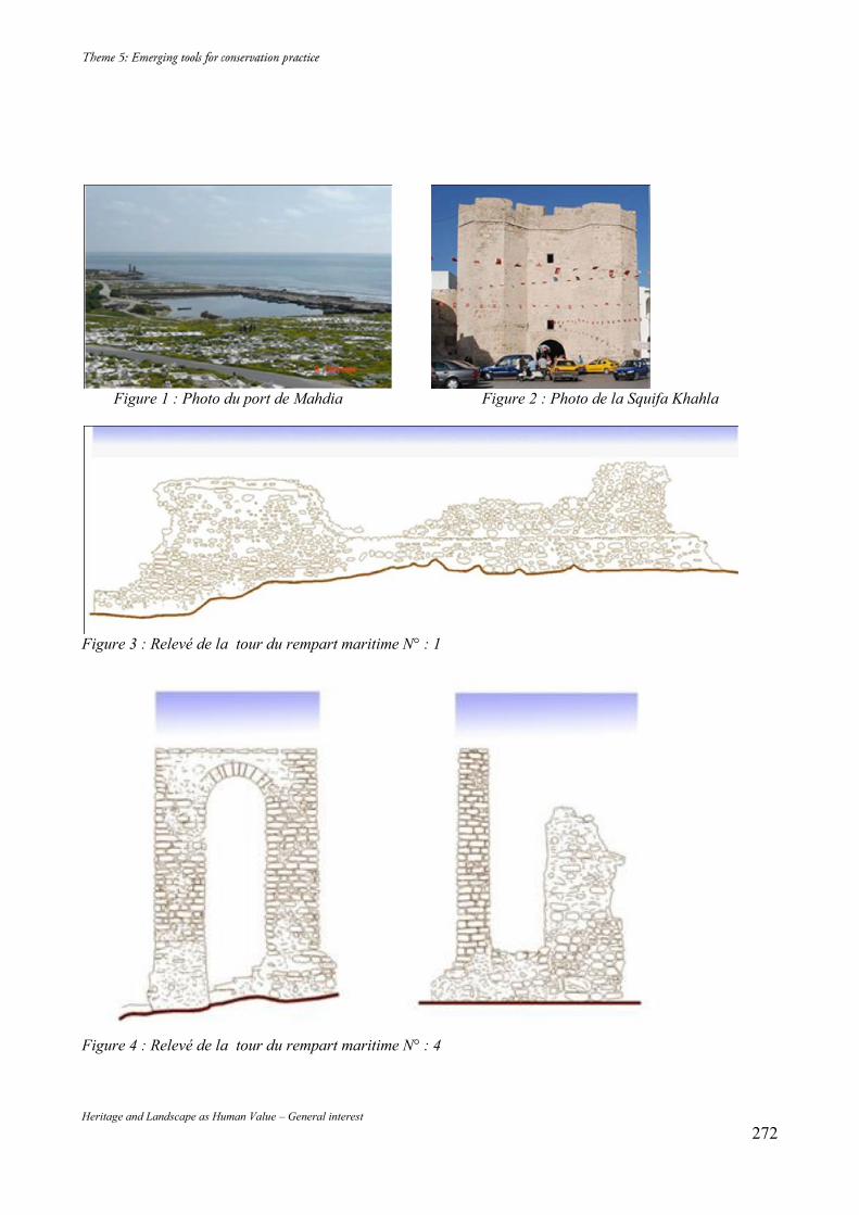
Heritage and Landscape as Human Value – General interest 272
Figure 1 : Photo du port de Mahdia Figure 2 : Photo de la Squifa Khahla
Figure 3 : Relevé de la tour du rempart maritime N° : 1
Figure 4 : Relevé de la tour du rempart maritime N° : 4
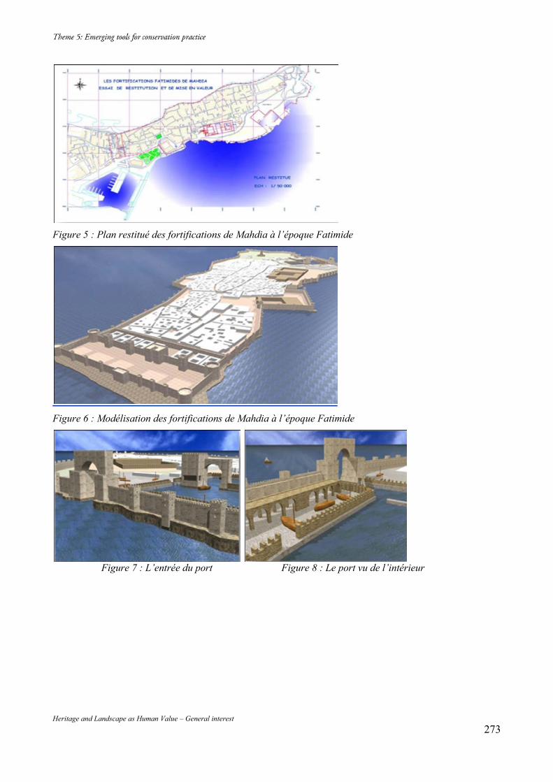
Heritage and Landscape as Human Value – General interest 273
Figure 5 : Plan restitué des fortifications de Mahdia à l’époque Fatimide
Figure 6 : Modélisation des fortifications de Mahdia à l’époque Fatimide
Figure 7 : L’entrée du port Figure 8 : Le port vu de l’intérieur
Figure 7 : L’entrée du port
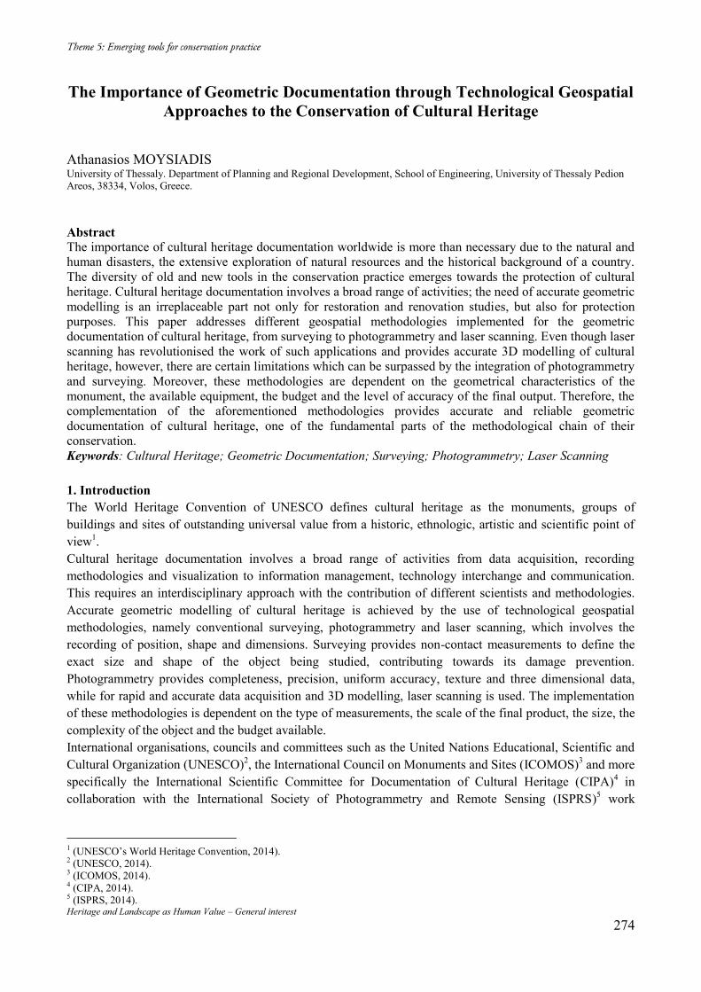
Heritage and Landscape as Human Value – General interest 274
The Importance of Geometric Documentation through Technological Geospatial Approaches to the Conservation of Cultural Heritage
Athanasios MOYSIADIS University of Thessaly. Department of Planning and Regional Development, School of Engineering, University of Thessaly Pedion Areos, 38334, Volos, Greece.
Abstract The importance of cultural heritage documentation worldwide is more than necessary due to the natural and human disasters, the extensive exploration of natural resources and the historical background of a country. The diversity of old and new tools in the conservation practice emerges towards the protection of cultural heritage. Cultural heritage documentation involves a broad range of activities; the need of accurate geometric modelling is an irreplaceable part not only for restoration and renovation studies, but also for protection purposes. This paper addresses different geospatial methodologies implemented for the geometric documentation of cultural heritage, from surveying to photogrammetry and laser scanning. Even though laser scanning has revolutionised the work of such applications and provides accurate 3D modelling of cultural heritage, however, there are certain limitations which can be surpassed by the integration of photogrammetry and surveying. Moreover, these methodologies are dependent on the geometrical characteristics of the monument, the available equipment, the budget and the level of accuracy of the final output. Therefore, the complementation of the aforementioned methodologies provides accurate and reliable geometric documentation of cultural heritage, one of the fundamental parts of the methodological chain of their conservation. Keywords: Cultural Heritage; Geometric Documentation; Surveying; Photogrammetry; Laser Scanning 1. Introduction The World Heritage Convention of UNESCO defines cultural heritage as the monuments, groups of buildings and sites of outstanding universal value from a historic, ethnologic, artistic and scientific point of view1. Cultural heritage documentation involves a broad range of activities from data acquisition, recording methodologies and visualization to information management, technology interchange and communication. This requires an interdisciplinary approach with the contribution of different scientists and methodologies. Accurate geometric modelling of cultural heritage is achieved by the use of technological geospatial methodologies, namely conventional surveying, photogrammetry and laser scanning, which involves the recording of position, shape and dimensions. Surveying provides non-contact measurements to define the exact size and shape of the object being studied, contributing towards its damage prevention. Photogrammetry provides completeness, precision, uniform accuracy, texture and three dimensional data, while for rapid and accurate data acquisition and 3D modelling, laser scanning is used. The implementation of these methodologies is dependent on the type of measurements, the scale of the final product, the size, the complexity of the object and the budget available. International organisations, councils and committees such as the United Nations Educational, Scientific and Cultural Organization (UNESCO)2, the International Council on Monuments and Sites (ICOMOS)3 and more specifically the International Scientific Committee for Documentation of Cultural Heritage (CIPA)4 in collaboration with the International Society of Photogrammetry and Remote Sensing (ISPRS)5 work
1 (UNESCO’s World Heritage Convention, 2014). 2 (UNESCO, 2014). 3 (ICOMOS, 2014). 4 (CIPA, 2014). 5 (ISPRS, 2014).
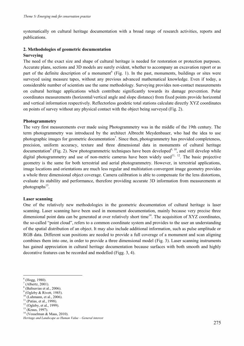
Heritage and Landscape as Human Value – General interest 275
systematically on cultural heritage documentation with a broad range of research activities, reports and publications. 2. Methodologies of geometric documentation Surveying The need of the exact size and shape of cultural heritage is needed for restoration or protection purposes. Accurate plans, sections and 3D models are surely evident, whether to accompany an excavation report or as part of the definite description of a monument6 (Fig. 1). In the past, monuments, buildings or sites were surveyed using measure tapes, without any previous advanced mathematical knowledge. Even if today, a considerable number of scientists use the same methodology. Surveying provides non-contact measurements on cultural heritage applications which contribute significantly towards its damage prevention. Polar coordinates measurements (horizontal/vertical angle and slope distance) from fixed points provide horizontal and vertical information respectively. Reflectorless geodetic total stations calculate directly XYZ coordinates on points of survey without any physical contact with the object being surveyed (Fig. 2). Photogrammetry The very first measurements ever made using Photogrammetry was in the middle of the 19th century. The term photogrammetry was introduced by the architect Albrecht Meydenbauer, who had the idea to use photographic images for geometric documentation7. Since then, photogrammetry has provided completeness, precision, uniform accuracy, texture and three dimensional data in monuments of cultural heritage documentation8 (Fig. 2). New photogrammetric techniques have been developed9, 10, and still develop while digital photogrammetry and use of non-metric cameras have been widely used11, 12. The basic projective geometry is the same for both terrestrial and aerial photogrammetry. However, in terrestrial applications, image locations and orientations are much less regular and multistation convergent image geometry provides a whole three dimensional object coverage. Camera calibration is able to compensate for the lens distortions, evaluate its stability and performance, therefore providing accurate 3D information from measurements at photographs13. Laser scanning One of the relatively new methodologies in the geometric documentation of cultural heritage is laser scanning. Laser scanning have been used in monument documentation, mainly because very precise three dimensional point data can be generated at over relatively short time14. The acquisition of XYZ coordinates, the so-called “point cloud”, refers to a common coordinate system and provides to the user an understanding of the spatial distribution of an object. It may also include additional information, such as pulse amplitude or RGB data. Different scan positions are needed to provide a full coverage of a monument and scan aligning combines them into one, in order to provide a three dimensional model (Fig. 3). Laser scanning instruments has gained appreciation in cultural heritage documentation because surfaces with both smooth and highly decorative features can be recorded and modelled (Figg. 3, 4).
6 (Hogg, 1980). 7 (Albertz, 2001). 8 (Baltsavias et al., 2006). 9 (Ogleby & Rivett, 1985). 10 (Luhmann, et al., 2006). 11 (Patias, et al., 1998). 12 (Ogleby, et al., 1999). 13 (Kraus, 1997). 14 (Vosselman & Maas, 2010).
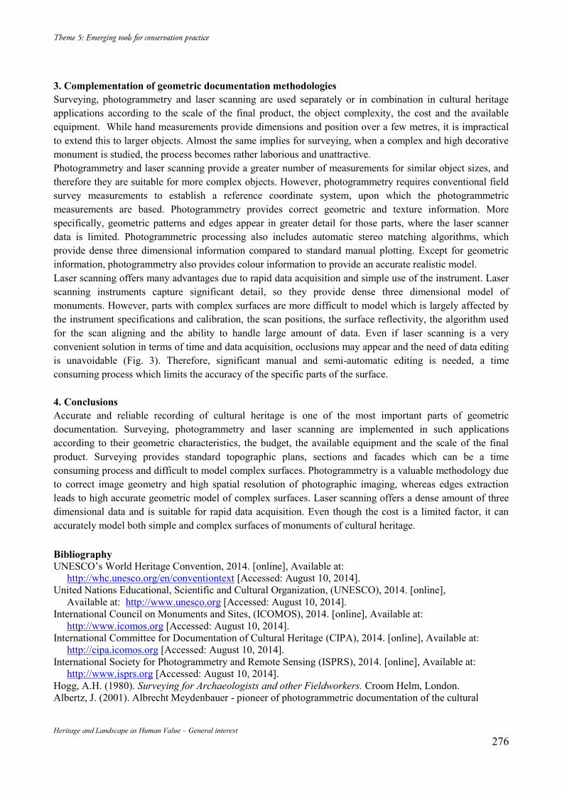
Heritage and Landscape as Human Value – General interest 276
3. Complementation of geometric documentation methodologies Surveying, photogrammetry and laser scanning are used separately or in combination in cultural heritage applications according to the scale of the final product, the object complexity, the cost and the available equipment. While hand measurements provide dimensions and position over a few metres, it is impractical to extend this to larger objects. Almost the same implies for surveying, when a complex and high decorative monument is studied, the process becomes rather laborious and unattractive. Photogrammetry and laser scanning provide a greater number of measurements for similar object sizes, and therefore they are suitable for more complex objects. However, photogrammetry requires conventional field survey measurements to establish a reference coordinate system, upon which the photogrammetric measurements are based. Photogrammetry provides correct geometric and texture information. More specifically, geometric patterns and edges appear in greater detail for those parts, where the laser scanner data is limited. Photogrammetric processing also includes automatic stereo matching algorithms, which provide dense three dimensional information compared to standard manual plotting. Except for geometric information, photogrammetry also provides colour information to provide an accurate realistic model. Laser scanning offers many advantages due to rapid data acquisition and simple use of the instrument. Laser scanning instruments capture significant detail, so they provide dense three dimensional model of monuments. However, parts with complex surfaces are more difficult to model which is largely affected by the instrument specifications and calibration, the scan positions, the surface reflectivity, the algorithm used for the scan aligning and the ability to handle large amount of data. Even if laser scanning is a very convenient solution in terms of time and data acquisition, occlusions may appear and the need of data editing is unavoidable (Fig. 3). Therefore, significant manual and semi-automatic editing is needed, a time consuming process which limits the accuracy of the specific parts of the surface. 4. Conclusions Accurate and reliable recording of cultural heritage is one of the most important parts of geometric documentation. Surveying, photogrammetry and laser scanning are implemented in such applications according to their geometric characteristics, the budget, the available equipment and the scale of the final product. Surveying provides standard topographic plans, sections and facades which can be a time consuming process and difficult to model complex surfaces. Photogrammetry is a valuable methodology due to correct image geometry and high spatial resolution of photographic imaging, whereas edges extraction leads to high accurate geometric model of complex surfaces. Laser scanning offers a dense amount of three dimensional data and is suitable for rapid data acquisition. Even though the cost is a limited factor, it can accurately model both simple and complex surfaces of monuments of cultural heritage. Bibliography UNESCO’s World Heritage Convention, 2014. [online], Available at:
http://whc.unesco.org/en/conventiontext [Accessed: August 10, 2014]. United Nations Educational, Scientific and Cultural Organization, (UNESCO), 2014. [online],
Available at: http://www.unesco.org [Accessed: August 10, 2014]. International Council on Monuments and Sites, (ICOMOS), 2014. [online], Available at:
http://www.icomos.org [Accessed: August 10, 2014]. International Committee for Documentation of Cultural Heritage (CIPA), 2014. [online], Available at:
http://cipa.icomos.org [Accessed: August 10, 2014]. International Society for Photogrammetry and Remote Sensing (ISPRS), 2014. [online], Available at:
http://www.isprs.org [Accessed: August 10, 2014]. Hogg, A.H. (1980). Surveying for Archaeologists and other Fieldworkers. Croom Helm, London. Albertz, J. (2001). Albrecht Meydenbauer - pioneer of photogrammetric documentation of the cultural
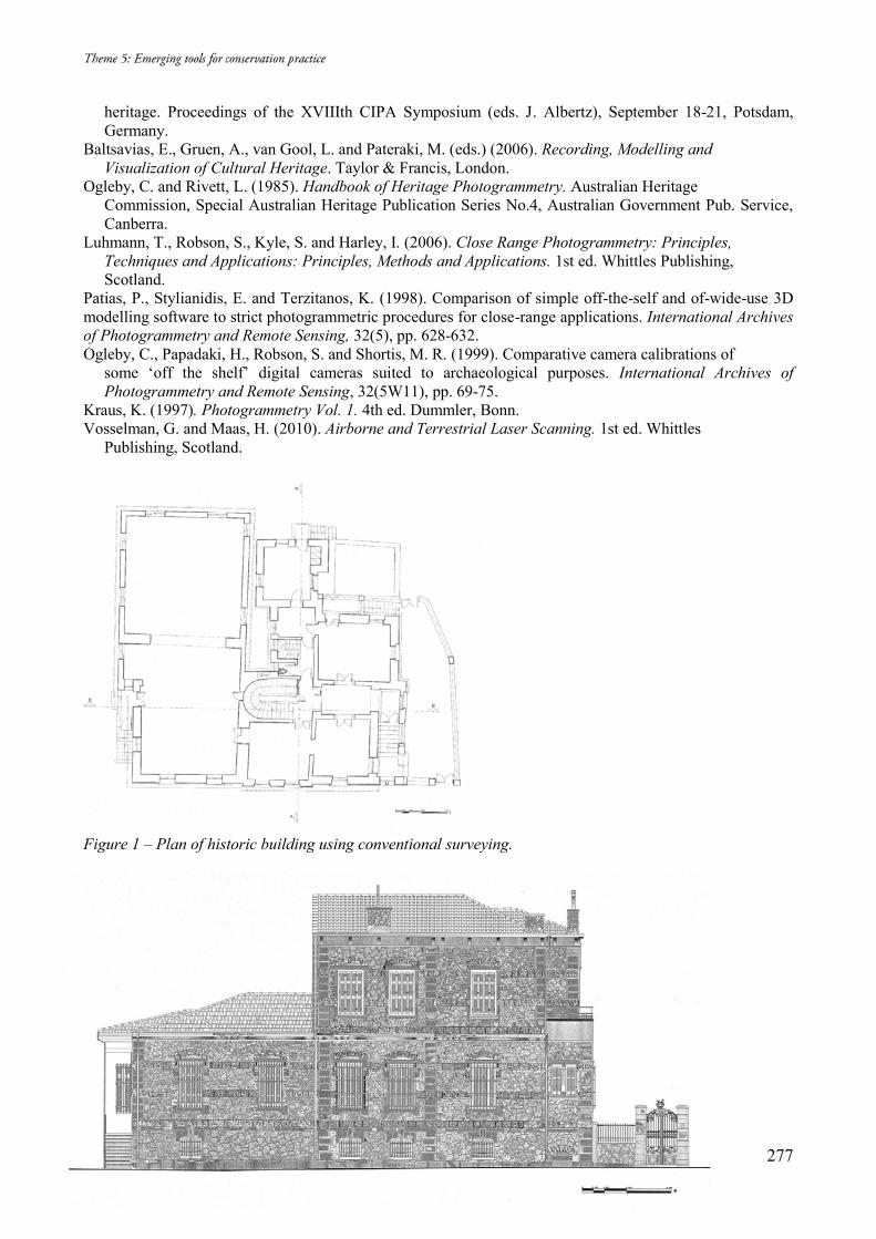
Heritage and Landscape as Human Value – General interest 277
heritage. Proceedings of the XVIIIth CIPA Symposium (eds. J. Albertz), September 18-21, Potsdam, Germany.
Baltsavias, E., Gruen, A., van Gool, L. and Pateraki, M. (eds.) (2006). Recording, Modelling and Visualization of Cultural Heritage. Taylor & Francis, London.
Ogleby, C. and Rivett, L. (1985). Handbook of Heritage Photogrammetry. Australian Heritage Commission, Special Australian Heritage Publication Series No.4, Australian Government Pub. Service, Canberra.
Luhmann, T., Robson, S., Kyle, S. and Harley, I. (2006). Close Range Photogrammetry: Principles, Techniques and Applications: Principles, Methods and Applications. 1st ed. Whittles Publishing, Scotland.
Patias, P., Stylianidis, E. and Terzitanos, K. (1998). Comparison of simple off-the-self and of-wide-use 3D modelling software to strict photogrammetric procedures for close-range applications. International Archives of Photogrammetry and Remote Sensing, 32(5), pp. 628-632. Ogleby, C., Papadaki, H., Robson, S. and Shortis, M. R. (1999). Comparative camera calibrations of
some ‘off the shelf’ digital cameras suited to archaeological purposes. International Archives of Photogrammetry and Remote Sensing, 32(5W11), pp. 69-75.
Kraus, K. (1997). Photogrammetry Vol. 1. 4th ed. Dummler, Bonn. Vosselman, G. and Maas, H. (2010). Airborne and Terrestrial Laser Scanning. 1st ed. Whittles
Publishing, Scotland.
Figure 1 – Plan of historic building using conventional surveying.
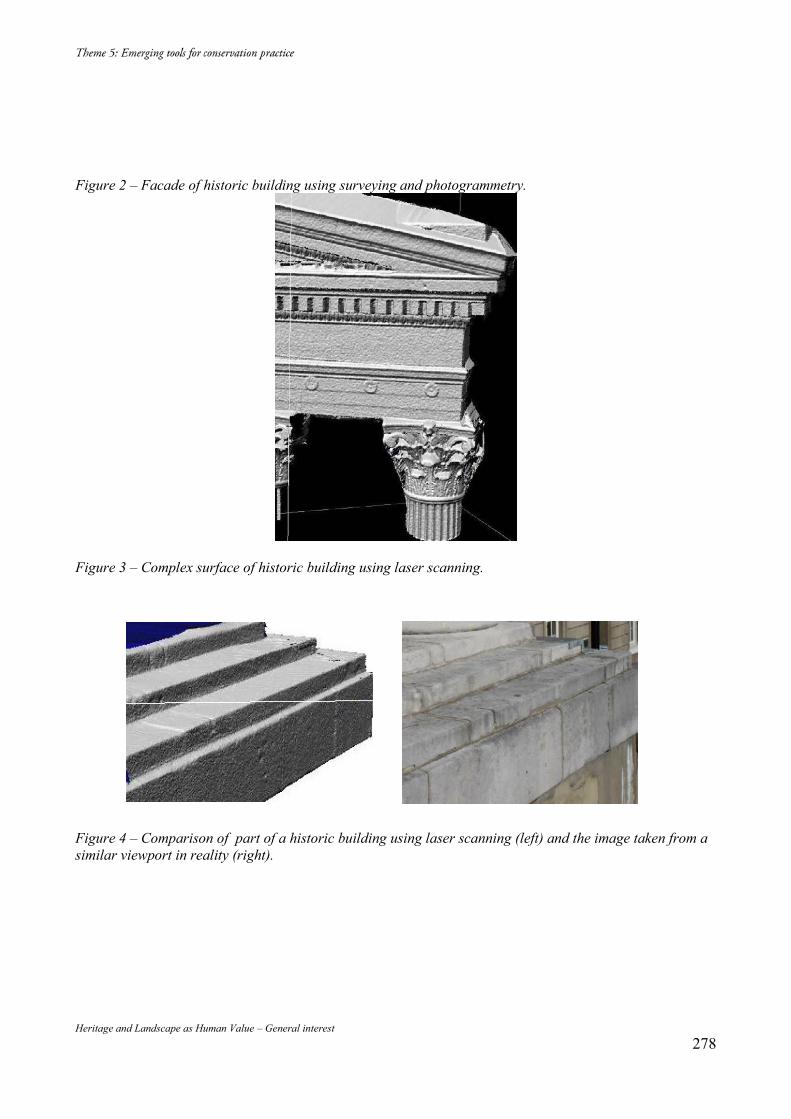
Heritage and Landscape as Human Value – General interest 278
Figure 2 – Facade of historic building using surveying and photogrammetry.
Figure 3 – Complex surface of historic building using laser scanning.
Figure 4 – Comparison of part of a historic building using laser scanning (left) and the image taken from a similar viewport in reality (right).
Heritage and Landscape as Human Value – General interest 279
The Engaging Advantages of an Ephemeral Heritage
Dimitra NTZANI University of Edinburgh, 20-22 Chambers St, Edinburgh EH1 1JZ, +447547450528, [email protected]
Abstract In Scottish Caithness, during a series of archaeological walkover-surveys, volunteers are taught to read obscure archaeological remains, known as ephemera. The paper demonstrates how the reading metaphor shapes the identification and communication of an ephemeral heritage; sediment of extensive natural and cultural processes. It discusses obscure traces’ ability to attract attention and trigger new enquiries. The paper also highlights the role of temporary traces during the public’s engagement with ephemera and the latter’s contribution to a wide network of coherent archaeological remains. Keywords: Caithness; Ephemera; Engagement; Reading; Metaphor
1. Introduction (Im.1) In the Scottish county of Caithness, members of the local community and visitors to the area are taught to read the landscape. During a number of walkover surveys, organised as public engagement programmes by a commercial archaeology company1, members of the public are introduced to outdoor archaeological practices. They are asked to unravel early formations and to identify the time depth of obscure archaeological remains, known as ephemera. In Caithness, the reading metaphor is employed by archaeologists to communicate the identification of ancient ephemeral traces and to manage the production of temporary ones. The metaphor was bequeathed to archaeology by memory literature, where it has been repeatedly employed to describe recollection and presupposed the conceptualisation of memory as an inscribing or writing process. By examining the Freudian apparatus of the Mystic Writing Pad, I present a dominant conceptual frame supported by inscription metaphors and Ι identify the three kinds of traces it produces. I then demonstrate that these traces support and constrain the identification of archaeological remains. Through the means of ethnography, I highlight the essential role of temporary traces during the participants’ engagement with ephemeral ones. Caithness’ reading workshops reveal the abiliephemeraty of to trigger new enquiries and to support the communication of a wider network of coherent archaeological remains. 2. Metaphors as vectors of culture The role of language as “a vector of cultural memory and identity” has been repeatedly discussed in UNESCO’s conferences and conventions2. Language as a vector of memory and therefore as a tool of human cognition is extensively investigated by George Lakoff and Mark Johnson. For the two cognitive linguists, widely employed metaphors are cognitive tools that help us make sense of complex notions or ideas by thinking of one conceptual domain (e.g. of public engagement programmes) in terms of another (in terms of reading and writing). Johnson and Lakoff advocate that "the locus of metaphor is thought not language”3 and 1 http://www.aocarchaeology.com/news/lidar-survey-in-and-around-yarrows-call-for-volunteers. 2 Note 27, p.23 in Final Report of Intergovernmental Conference on Cultural Policies for Development, Stockholm Sweden, April 1998. Accessed: http://unesdoc.unesco.org/images/0011/001139/113935eo.pdf. Convention for the Safeguarding of Intangible Culturale, “The ‘intangible cultural heritage’… is manifested in.. oral traditions and expressions, including language as a vehicle of the intangible cultural heritage;” Accessed: http://www.unesco.org/culture/ich/?pg=00053. 3 “First, the locus of metaphor is in concepts not words. Second, metaphor… is typically based on cross-domain correlations in our experience…Third, even our deepest and most abiding concepts—time, events, causation, morality, and mind itself—are understood and reasoned about via multiple metaphors. In each case, one conceptual domain (say, time) is reasoned about, as well as talked about, in terms of the conceptual structure of another domain (say, space). Fourth, the system of conceptual metaphors … is shaped
Heritage and Landscape as Human Value – General interest 280
that everyday practices “reflect our metaphorical understanding of experience”4. Following that thread, the paper investigates the effects that inscription metaphors have on public engagement with ephemera. Archaeology and psychoanalysis share an interest in the past and often employ similar metaphors to discuss and conceptualise it. For example, it is commonly suggested that archaeology seeks to read or reassemble a fragmented spatial narrative that supports collective memory5 and that psychoanalysis aims to read or reconstruct a discursive one that supports personal memory6. By employing the same metaphors, the two disciplines have developed theories and methodologies with similar qualities7. In this paper, I present conceptual frames supported by inscription metaphors and discuss their effect on the identification and communication of heritage.
3. Inscribing devices of memory literature Inscribing devices such as wax slates or tablets have supported the formulation of theories on perception and memory. Inscription metaphors are dominantly present in Plato’s Dialogue Theaetetus8 and in the Aristotelian treatise on Memory and Reminiscence9. Douwe Draaisma10 examines the role of inscribing and recording devices in psychological theories while David Krell11 investigates the writing metaphor’s employment in western philosophical discourse. Draaisma and Krell’s works on memory metaphors verify the persistence of inscription models and reveal a number of qualities that they have passed to memory theories up to the 20th century. Up to that point, memory is mainly discussed as a storing process that evolves in three sequential stages: the inscription or writing of memory traces, their permanent storage and their reading.12 Writing metaphors support the conceptualisation of perception and presuppose that even the vaguest element will leave a clear and delineated trace. The second stage, the storage of recently acquired traces, is inaugurated by an essential lapse of time, frequently conceptualised as an act of “detachment”13. Memory traces are then stored permanently in deeper memory recesses; recent traces reside on the surface and old ones lie underneath. Freud’s Mystic Writing Pad reflects all these qualities and allows us to observe in detail the conceptual frame supported by inscription metaphors. (Im. 2)
The Mystic Pad…claims to be nothing more than a writing tablet from which notes can be erased by an easy movement of the hand. But if it is examined more closely it will be found that its construction shows a remarkable agreement with my hypothetical structure of our perceptual apparatus.14
Freud’s apparatus consists of three layers: A. The upper celluloid layer prevents contact of perceived elements with the two layers that lie underneath it and enables them to leave traces. Hence, it supports the production of intangible traces.
to a significant extent by the common nature of our bodies and the shared ways that we all function in the everyday world.” (Lakoff and Johnson 1980, p. 244). 4 (Ortony 1979, p. 204). 5 “The soil is an historical document which, like a written record, must be deciphered, translated and interpreted before it can be used.” (Barker 1993, p. 13). 6(Freud, 1974). 7The common structure that metaphors bequeath to the two disciplines becomes evident when Freud uses archaeology as a metaphorical frame to discuss psychoanalysis. Still, in Civilisation and its Discontents one can see him contemplating over the false assumptions that such correlations support. (Freud 1963). 8(Plato and McDowell, 1973, p.78). 9(Aristotle, 1908, par. 450b). 10(Draaisma, 2000). 11(Krell, 1990). 12(Rosenfield, 1989). 13(Freud and Rieff 2008, p. 211). 14 “The Mystic Pad is a slab of dark brown resin or wax with a paper edging; over the slab is laid a thin transparent sheet, the top end of which is firmly secured to the slab while its bottom end rests upon it without being fixed to it. This transparent sheet is the more interesting part of the little device. It itself consists of two layers, which can be detached from each other except at their two ends. The upper layer is a transparent piece of celluloid; the lower layer is made of thin translucent waxed paper” (Freud and Rieff, 2008, p. 209).
Heritage and Landscape as Human Value – General interest 281
B. Underneath the celluloid layer lies a thin wax-paper layer, which hosts the perceived traces and renders them visible. These traces are erased once the wax paper is detached from the third deeper layer; therefore the wax-paper hosts temporary traces. C. The third and deeper layer is a thick wax slate. It works as a secure infinite storage, which hosts permanent traces. Moving from memory theories to archaeology, the reading metaphor appears as a popular cognitive tool in the identification and communication of heritage. It shapes multiple archaeological practices (e.g. excavation, landscape surveys) and methods like stratigraphy. Digging in layers regardless of the width or density of excavation trenches, is the main method that archaeologists employ to read the past15. The presentation of a dominant conceptual frame reflected in Freud’s memory apparatus helps us identify the ways that inscription metaphors shape public engagement during the readings of Caithness landscapes. 4. Artificialia and naturalia Caithness extends like a horn from the mainland towards the North Sea. Inland, it consists of peat and heather covered plains, flagstone quarries and agricultural plateaus. Oil platforms, wind farms and abandoned nuclear power stations are significant landmarks and indicators of the importance of the area as a national energy provider. For locals and visitors, the sparsely populated marshlands host remarkable flora and fauna and one of the densest concentrations of archaeological remains in the northern UK. In Caithness, distinguishing natural from artificial formations is a very complex activity. Extended forested areas are the product of tax relief policies; grassy or peat covered hills hide burial chambers and enclosures and agricultural plateaus conceal hut-circles and dismantled brochs. Naturally privileged settings provide an ideal base for human settlements and abandoned facilities are consumed by vegetation, northern winds and humidity. Pre-existing traces attract new ones, and new traces take advantage of the position or structure of old ones16. Caithness landscape is not a passive receptacle; its geological and climatic conditions pre-dispose certain areas as more fitted for human intervention. Just like the deep carvings of the lower Freudian slate may divert the hand from its route and alter the shape of new engravings, pre-existing traces provide a modifying context for emerging ones. In this entropic environment, artificialia and naturalia weave together a rich ephemeral heritage, which resists clear classifications and support complex narratives. The word ephemera has a 5th century BC Greek origin and it initially described short-lived insects or plants that sprung up and die within a day. Today, it is used to describe any object or action with short life span or of no lasting value. Caithness’ ephemera survive from the Neolithic to Post-Medieval periods17, constantly transformed by natural and human processes. Their name is not an ironic comment to their continuous presence, but a description of their constantly changing forms and utilisations. Ephemera consist of traces of previous spatial formations, archaeological ruins that have not been identified before in the area or archaeological sites whose recording and preservation has not been a priority. As participants observe natural resources transform into artificial formations and artificial formations being devoured by climatic and geological processes, it becomes apparent that ephemeral heritage emerges and is constantly reshaped by both man and nature. So how do locals and archaeologists read the ephemera? Ethnographic investigation reveals that inscription metaphors allow us to conceptualise entropic environments as the tabula rasa of human intervention and their overlaying timescapes as palimpsestic documents. Reading and writing metaphor become a dominant cognitive tool that supports the division of heritage to cultural and natural and the conceptualisation of
15 “The use the famous phrase, the landscape is a palimpsest… everything that has happened to it, is etched upon its face to various degrees.” (Carver, 2009, p. 64). 16 An exposed geological ridge becomes a quarry face exploited for the construction of medieval settlements. At a later stage, abandoned settlements may provide material for stone fences. 17 (Barber, 2001).
Heritage and Landscape as Human Value – General interest 282
ephemera as inscriptions on nature’s overused slate. Because of ephemera’s obscure nature, their readings call for additional non-discursive cognitive tools and practices presented below. 5. Reading the ephemera (Im. 3) As part of a wind farm investment, a commercial archaeology group was commissioned to undertake LiDAR and walkover surveys of the surrounding to the development area18. These were designed as public engagement programs, which aim to enhance accessibility of scheduled monuments by casting the spotlight on an ephemeral heritage that surrounds them in abundance. During the breaks of these self-guided tours, scheduled monuments are also visited and discussed as meaningful context, as cues to the ephemera’s readings. By drawing the public’s attention to ephemera, archaeologists draw attention on scheduled monuments’ generative context and along with the participants sketch the Neolithic, Iron Age or Medieval landscape of the area. These public explorations are organised around sites of interest identified by LiDAR surveys. The data gathered are sampled and ‘cleaned’19. This selective discarding of information uncovers traces that geological processes, climatic conditions and human activity has rendered obscure. The digital uplifting of top layers reveals traces that lie in the deeper recesses, which can be read only by those well acquainted with the ancient spatial languages. In LiDAR mappings, archaeologists identify traces that do not relate to contemporary activities and call for closer examination. Public walkover surveys are then achieved with GPS devices and maps of the area or with the use of iPads equipped with software that uses LiDAR data20. These in situ readings presuppose a working knowledge of flora and fauna, soil qualities, local history and social customs. Apparently, the layers that LiDAR can’t record and that the software has removed play a key role during the walkover surveys. 6. Carving the voids of detachment: the role of temporary traces In memory theories that make use of inscription metaphors, past is a realm clearly detached from the present, safely preserved in deeper recesses of consciousness. Indoor and outdoor musealised environments acknowledge the need for detachment and draw a thick line between vita activa and vita contemplativa; CCTV cameras, prohibiting signs and fences keep “significant” cultural elements detached from their generative context and from erosive aspects of everyday life. This detachment is not just a preservation technique translated into spatial conditions. It has been considered to help us focus on complex cognitive tasks21. While inscription metaphors create room for contemplation, they leave behind an inherent paradox: distant archaeological traces have better chances to remain intact and unspoilt, but they are also more easily forgotten. Frequently accessed traces, on the other hand, are well embedded in memory, but do not stay faithful to their initial formations. The same distance that supports the preservation of traces, impedes their recollection and by extension a stronger engagement with heritage. Archaeologists acknowledge this paradox and works directly on the void that detachment leaves behind. The participatory character of Caithness readings triggers the production of two essential layers: one of intangible and one of temporary traces that support the identification and representation of ephemera. As the programme participants confront the scattered elements, they establish a cognitive filter that allows specific features to be engraved. This intangible celluloid layer shrinks the stored information by allowing the culturally familiar and coherent to leave their mark. But the familiar and coherent are rarely present. Hence, an additional layer of temporary traces is reassembled to fill in the cognitive gaps: a Cartesian interpretation of the ephemera often play that role. The grid’s virtual lines are aligned to already recorded traces and are
18 http://www.aocarchaeology.com/news/lidar-survey-in-and-around-yarrows-call-for-volunteers. 19 LiDAR stands for ‘Light Detection And Ranging’, and is a means of surveying large areas from the air. Source: http://www.aocarchaeology.com/Baillie/new/what-is-lidar/. 20 (Ntzani, 2013). 21 (Cassirer, 1963).
Heritage and Landscape as Human Value – General interest 283
marked with mobile elements, metric rods, tapes and pins. Sketches and discursive representations anchor ephemera to scheduled monuments, hiking paths, stone fences and irrigation ditches. The overall practice articulates ancient and new traces to known geophysical locations and reveals geometrical analogies, dismantled shapes and metric relations. To re-unite the fragmented traces, the team activates an intangible layer and recreates an temporary tangible one, between the silent past and the enquiring present. 7. The Engaging Advantages of an Ephemeral Heritage (Im. 4) Besides shaping memory theories and archaeological practices, writing and reading metaphors have also supported conflicts. One of them evolves around whether memory traces -as signs of an ancient alphabet- support or weaken memory.22 The paper attempts to escape the constrains set by inscription metaphors and reshapes the proposed enquiry: What kinds of traces support memory as a cultural and collectively modified practice? Caithness ephemera are not the delineated signs of an ancient well-studied language. Altered or dismantled, they spread in the vast moors of Caithness as half-stated enquiries and not as well hidden answers. Through several distortions and adaptations, they have served multiple purposes and survived through centuries. It is their obscure and enquiring character that increases their engaging value and supports multiple narratives. Hence, Caithness ephemera work more successfully as memory triggers and less as memory deposits. In Caithness, a commercial archaeology company turns the spotlight on a kind of heritage, which surrounds us in abundance but resists current cultural taxonomies. The participants’ response verifies ephemera’s engaging advantages and their willingness and ability to take over an active role. By examining the cognitive value of constantly transforming traces and of temporary ones, I have discussed the effects that inscription metaphors have on the identification and communication of heritage. Thinking of culture as a cognitive process23 and of participants as active cognitive agents allows us to closely engage with an ephemeral heritage and to employ relict landscapes as cognitive maps for communicating time-past. Acknowledgements The research on ephemera was inspired by AOC Archaeology Group’s work with Caithness local communities. I owe deep gratitude to John Barber, Andy Heald and people of Caithness for allowing me to observe their work in progress but also to my thesis supervisors Prof. Richard Coyne and Prof. John Lee for their support and guidance. Bibliography Aristotle (1908). The complete work of Aristotle translated into english, Volume III, The Parva naturalia. Oxford: Clarendon Press. Barber, John (2001). Guidelines for the Preservation of Areas of Rig and Furrow in Scotland Edinburgh. UK: STAR, p. 28. ISBN: 9780953997800. Barker, Philip (1993). Techniques of archaeological excavation. London: Batsford, p. 285. ISBN: 9780713471694. Carver, Martin (2009). Archaeological investigation. London: Routledge, pp. xxxviii-424. ISBN: 9780415489188. Cassirer, Ernst (2000). The individual and the cosmos in Renaissance philosophy. New York: Dover, pp. xii-199. ISBN: 9780486414386. Draaisma, Douwe (2000). Metaphors of memory: a history of ideas about the mind. Cambridge, U.K., New York: Cambridge University Press, pp. xiv-241. ISBN: 9780521650243.
22 The ancient enquiry makes its appearance in Plato in the Dialogue “Phaedrus”, where Plato uses the myth of Teuth and Thamus to address it (Plato and Waterfield, 2002). 23 (Hutchins, 1995, p. 354)
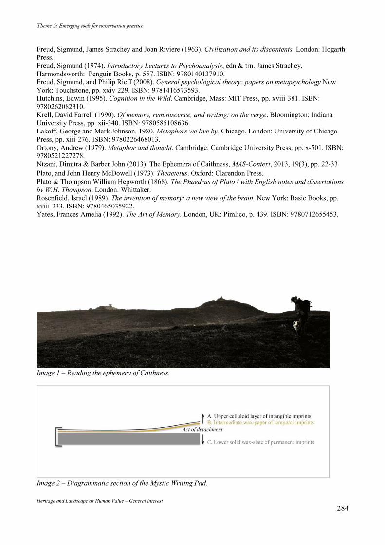
Heritage and Landscape as Human Value – General interest 284
Freud, Sigmund, James Strachey and Joan Riviere (1963). Civilization and its discontents. London: Hogarth Press. Freud, Sigmund (1974). Introductory Lectures to Psychoanalysis, edn & trn. James Strachey, Harmondsworth: Penguin Books, p. 557. ISBN: 9780140137910. Freud, Sigmund, and Philip Rieff (2008). General psychological theory: papers on metapsychology New York: Touchstone, pp. xxiv-229. ISBN: 9781416573593. Hutchins, Edwin (1995). Cognition in the Wild. Cambridge, Mass: MIT Press, pp. xviii-381. ISBN: 9780262082310. Krell, David Farrell (1990). Of memory, reminiscence, and writing: on the verge. Bloomington: Indiana University Press, pp. xii-340. ISBN: 9780585108636. Lakoff, George and Mark Johnson. 1980. Metaphors we live by. Chicago, London: University of Chicago Press, pp. xiii-276. ISBN: 9780226468013. Ortony, Andrew (1979). Metaphor and thought. Cambridge: Cambridge University Press, pp. x-501. ISBN: 9780521227278. Ntzani, Dimitra & Barber John (2013). The Ephemera of Caithness, MAS-Context, 2013, 19(3), pp. 22-33 Plato, and John Henry McDowell (1973). Theaetetus. Oxford: Clarendon Press. Plato & Thompson William Hepworth (1868). The Phaedrus of Plato / with English notes and dissertations by W.H. Thompson. London: Whittaker. Rosenfield, Israel (1989). The invention of memory: a new view of the brain. New York: Basic Books, pp. xviii-233. ISBN: 9780465035922. Yates, Frances Amelia (1992). The Art of Memory. London, UK: Pimlico, p. 439. ISBN: 9780712655453.
Image 1 – Reading the ephemera of Caithness.
Image 2 – Diagrammatic section of the Mystic Writing Pad.
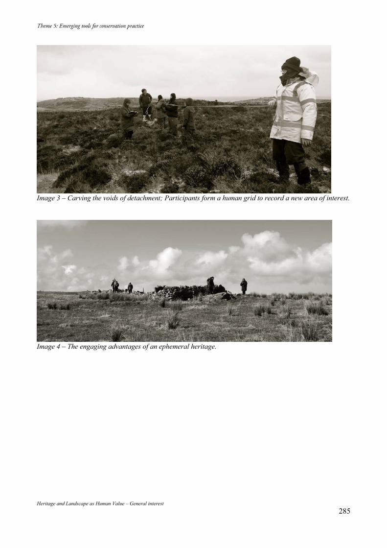
Heritage and Landscape as Human Value – General interest 285
Image 3 – Carving the voids of detachment; Participants form a human grid to record a new area of interest.
Image 4 – The engaging advantages of an ephemeral heritage.
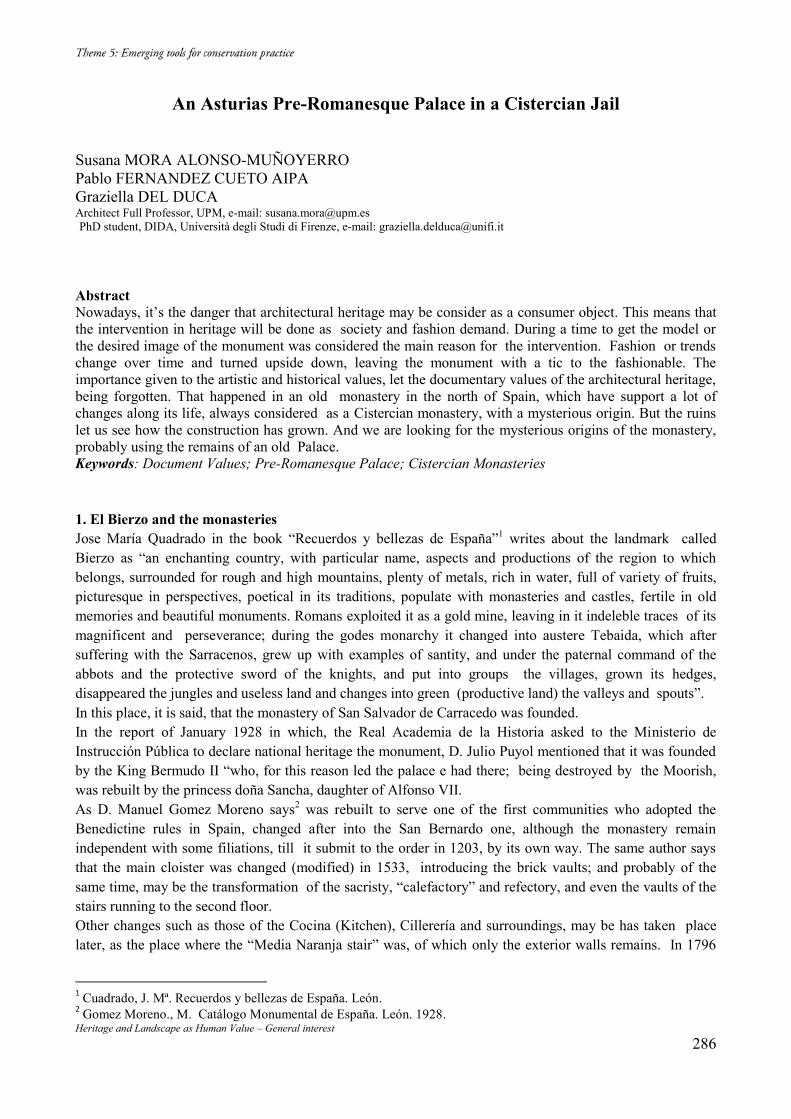
Heritage and Landscape as Human Value – General interest 286
An Asturias Pre-Romanesque Palace in a Cistercian Jail Susana MORA ALONSO-MUÑOYERRO Pablo FERNANDEZ CUETO AIPA Graziella DEL DUCA Architect Full Professor, UPM, e-mail: [email protected] PhD student, DIDA, Università degli Studi di Firenze, e-mail: [email protected] Abstract Nowadays, it’s the danger that architectural heritage may be consider as a consumer object. This means that the intervention in heritage will be done as society and fashion demand. During a time to get the model or the desired image of the monument was considered the main reason for the intervention. Fashion or trends change over time and turned upside down, leaving the monument with a tic to the fashionable. The importance given to the artistic and historical values, let the documentary values of the architectural heritage, being forgotten. That happened in an old monastery in the north of Spain, which have support a lot of changes along its life, always considered as a Cistercian monastery, with a mysterious origin. But the ruins let us see how the construction has grown. And we are looking for the mysterious origins of the monastery, probably using the remains of an old Palace. Keywords: Document Values; Pre-Romanesque Palace; Cistercian Monasteries 1. El Bierzo and the monasteries Jose María Quadrado in the book “Recuerdos y bellezas de España”1 writes about the landmark called Bierzo as “an enchanting country, with particular name, aspects and productions of the region to which belongs, surrounded for rough and high mountains, plenty of metals, rich in water, full of variety of fruits, picturesque in perspectives, poetical in its traditions, populate with monasteries and castles, fertile in old memories and beautiful monuments. Romans exploited it as a gold mine, leaving in it indeleble traces of its magnificent and perseverance; during the godes monarchy it changed into austere Tebaida, which after suffering with the Sarracenos, grew up with examples of santity, and under the paternal command of the abbots and the protective sword of the knights, and put into groups the villages, grown its hedges, disappeared the jungles and useless land and changes into green (productive land) the valleys and spouts”. In this place, it is said, that the monastery of San Salvador de Carracedo was founded. In the report of January 1928 in which, the Real Academia de la Historia asked to the Ministerio de Instrucción Pública to declare national heritage the monument, D. Julio Puyol mentioned that it was founded by the King Bermudo II “who, for this reason led the palace e had there; being destroyed by the Moorish, was rebuilt by the princess doña Sancha, daughter of Alfonso VII. As D. Manuel Gomez Moreno says2 was rebuilt to serve one of the first communities who adopted the Benedictine rules in Spain, changed after into the San Bernardo one, although the monastery remain independent with some filiations, till it submit to the order in 1203, by its own way. The same author says that the main cloister was changed (modified) in 1533, introducing the brick vaults; and probably of the same time, may be the transformation of the sacristy, “calefactory” and refectory, and even the vaults of the stairs running to the second floor. Other changes such as those of the Cocina (Kitchen), Cillerería and surroundings, may be has taken place later, as the place where the “Media Naranja stair” was, of which only the exterior walls remains. In 1796
1 Cuadrado, J. Mª. Recuerdos y bellezas de España. León. 2 Gomez Moreno., M. Catálogo Monumental de España. León. 1928.
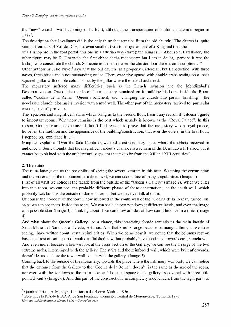
Heritage and Landscape as Human Value – General interest 287
the “new” church was beginning to be built, although the transportation of building materials began in 17873. The description that Jovellanos did is the only thing that remains from the old church: “The church is quite similar from this of Val-de-Dios, but even smaller; two stone figures, one of a King and the other of a Bishop are in the font portal, this one in a asturian way (taste); the King is D. Alfonso el Batallador, the other figure may be D. Florencio, the first abbot of the monastery; but I am in doubt, perhaps it was the bishop who consecrate the church. Someone tells me that over the cloister door there is an inscription…”. Other authors as Julio Puyol4 says that the old church isn’t properly Cistercian, but Benedictine, with three naves, three abses and a not outstanding cruise. There were five spaces with double archs resting on a near squared pillar with double columns nearby the pillar where the lateral archs rest. The monastery suffered many difficulties, such as the French invasion and the Mendizabal’s Desamortizacion. One of the monks of the monastery remained on it, building his home inside the Room called “Cocina de la Reina” (Queen’s Kitchen), and changing the church into parish, finishing the neoclassic church closing its interior with a mud wall. The other part of the monastery arrived to particular owners, basically privates. The spacious and magnificent stairs which bring us to the second floor, hasn’t any reason if it doesn’t guide to important rooms. What now remains is the part which usually is known as the “Royal Palace”. In this reason, Gomez Moreno explains: “I didn’t find reasons to prove that the monastery was a royal palace, however the tradition and the appearance of the building/construction, that over the others, in the first floor, I stepped on, explained it …”. Mingote explains: “Over the Sala Capitular, we find a extraordinary space where the abbots received in audience… Some thought that the magnificent abbot’s chamber is a remain of the Bermudo’s II Palace, but it cannot be explained with the architectural signs, that seems to be from the XII and XIII centuries”. 2. The ruins The ruins have given us the possibility of seeing the several stratum in this area. Watching the construction and the materials of the monument as a document, we can take notice of many singularities. (Image 1) First of all what we notice is the façade from the outside of the “Queen’s Gallery” (Image 2). When we enter into this room, we can see the probable different phases of these construction, as the south wall, which probably was built as the outside of dome´s room , but we have yet talk about it. Of course the “roleos” of the tower, now involved in the south wall of the “Cocina de la Reina”, turned on, so as we can see them inside the room. We can see also two windows at different levels, and even the image of a possible stair (Image 3). Thinking about it we can draw an idea of how can it be once in a time. (Image 4) And what about the Queen’s Gallery? At a glance, this interesting facade reminds us the main façade of Santa Maria del Naranco, a Oviedo, Asturias. And that’s not strange because so many authors, as we have seeing, have written about certain similarities. When we come near it, we notice that the columns rest on bases that rest on some part of vaults, unfinished now, but probably have continued towards east, somehow. And even more, because when we look at the cross section of the Gallery, we can see the arrange of the two extreme archs, interrumped with the gallery. The stairs and the reinforced wall, which were built afterwards, doesn’t let us see how the tower wall is unit with the gallery. (Image 5) Coming back to the outside of the monastery, towards the place where the Infirmery was built, we can notice that the entrance from the Gallery to the “Cocina de la Reina”, doesn’t is the same as the axe of the room, nor even with the windows to the main cloister. The small space of the gallery, is covered with three little pointed vaults (Image 6). And this part of the construction, is completely independent from the right part , to
3 Quintana Prieto. A. Monografía histórica del Bierzo. Madrid, 1956. 4 Boletín de la R.A.de B.B.A.A. de San Fernando. Comisión Central de Monumentos. Tomo IX 1890.
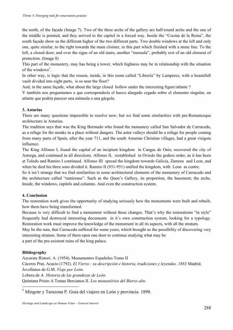
Heritage and Landscape as Human Value – General interest 288
the north, of the façade (Image 7). Two of the three archs of the gallery are half-round archs and the one of the middle is pointed, and they arrived to the capitel in a forced way. Inside the “Cocina de la Reina”, the south façade show us the different higher of the two different parts. Two double windows at the left and only one, quite similar, to the right towards the main cloister, in this part which finished with a stone line. To the left, a closed door; and over the signs of an old stairs, another “mensula”, probably rest of an old element of protection. (Image 8) This part of the monastery, may has being a tower, which highness may be in relationship with the situation of the windows5. In other way, is logic that the rosson, inside, in this room called “Librería” by Lamperez, with a beautifull vault divided into eight parts, is so near the floor? And, in the same façade, what about the large closed hollow under the interesting figure/atlante ? Y también nos preguntamos a que correspondería el hueco alargado cegado sobre el elemento singular, un atlante que podría parecer una ménsula o una gárgola. 3. Asturias There are many questions impossible to resolve now, but we find some similarities with pre-Romanesque architecture in Asturias. The tradition says that was the King Bermudo who found the monastery called San Salvador de Carracedo, as a refuge for the monks in a place without dangers. The astur valleys should be a refuge for people coming from many parts of Spain, after the year 711, and the south Asturian Christian villages, had a great visigote influence. The King Alfonso I, found the capital of an incipient kingdom in Cangas de Onís; recovered the city of Astorga, and continued in all directions. Alfonso II, restablished in Oviedo the godess order, as it has been at Toledo and Ramiro I continued. Alfonso III spread the kingdom towards Galicia, Zamora and Leon, and when he died his three sons divided it. Ramiro II (931-951) unified the kingdom, with Leon as centre. So it isn’t strange that we find similarities in some architectural elements of the monastery of Carracedo and the architecture called “ramirense”. Such as the Quen’s Gallery, its proportion, the basement; the archs. Inside, the windows, capitels and columns. And even the construction system. 4. Conclusion The restoration work gives the opportunity of studying seriously how the monuments were built and rebuilt, how them have being transformed. Because is very difficult to find a monument without these changes. That’s why the restorations “in style” frequently had destroyed interesting documents in it´s own construction system, looking for a typology. Restoration work must improve the knowledge of the monument in all its aspects, with all the stratum. May be the ruin, that Carracedo suffered for some years, which brought us the possibility of discovering very interesting stratum. Some of them open one door to continue studying what may be a part of the pre-existent ruins of the king palace. Bibliography Azcarate Ristori. A. (1954). Monumentos Españoles Tomo II Cáceres Prat, Acacio (1792). El Vierzo : su descripción e historia, tradiciones y leyendas. 1883 Madrid. Jovellanos de G.M. Viaje por León. Lobera de A Historia de las grandezas de León. Quintana Prieto A Temas Bercianos II. Los monastérios del Bierzo alto 5 Mingote y Tarazona P. Guia del viajero en León y provincia. 1890.
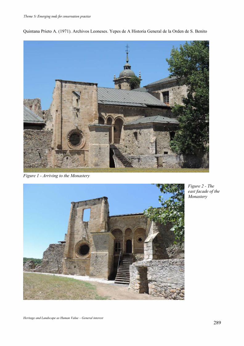
Heritage and Landscape as Human Value – General interest 289
Quintana Prieto A. (1971). Archivos Leoneses. Yepes de A Historia General de la Orden de S. Benito
Figure 1 - Arriving to the Monastery
Figure 2 - The east facade of the Monastery
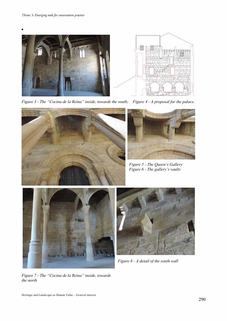
Heritage and Landscape as Human Value – General interest 290
Figure 3 - The “Cocina de la Reina” inside, towards the south; Figure 4 - A proposal for the palace.
Figure 5 - The Queen’s Gallery Figure 6 - The gallery’s vaults
Figure 8 - A detail of the south wall
Figure 7 - The “Cocina de la Reina” inside, towards the north

This e-book was made in Italy, in the year 2016
Related Documents


