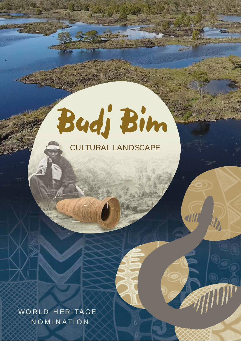
WORLD HERITAGE NOMINATION Budj Bim CULTURAL LANDSCAPE

Welcome message from author
This document is posted to help you gain knowledge. Please leave a comment to let me know what you think about it! Share it to your friends and learn new things together.
Transcript
WO R L D H E R I TAG E N OM I N AT I O N
Budj Bim CULTURAL LANDSCAPE
Aboriginal and Torres Strait Islander people are advised that this document contains images, names, quotes and other references to people who have passed away.
© Commonwealth of Australia, December 2017
This work is copyright. Apart from any use as permitted under the Copyright Act 1968, no part may be reproduced by any process without prior written permission from the Commonwealth, available from the Australian Government Department of the Environment and Energy.
Published by:Department of the Environment and EnergyJohn Gorton BuildingKing Edward TerraceParkes ACT 2600AustraliaGPO Box 787Canberra ACT 2601Australia
National Library of Australia Cataloguing-in-Publication data: Commonwealth of Australia
Budj Bim Cultural Landscape: World Heritage Nomination
Australia. Dept. of the Environment and Energy
ISBN: 978-1-921069-08-6
Front Cover. Composite image; including Gunditjmara ancestor Jennie Green circa 1865 weaving grass basket.
Cultural Landscape
Budj Bim
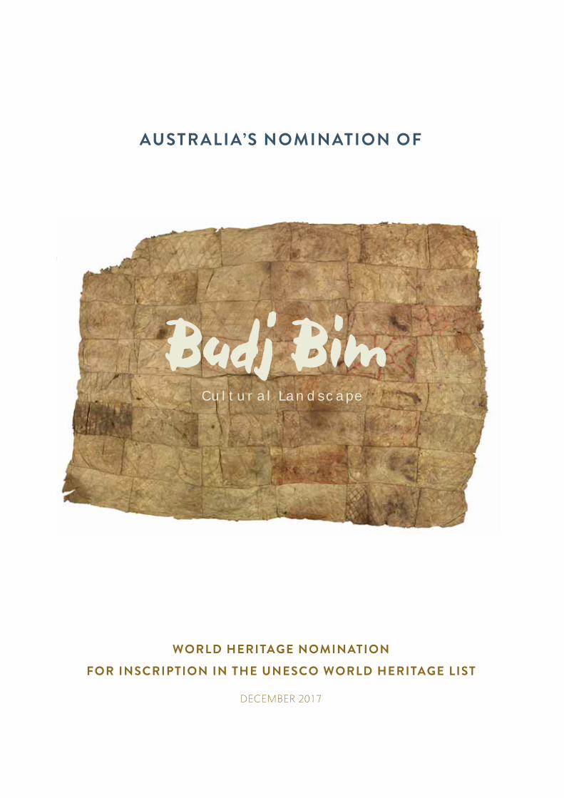
WORLD HERITAGE NOMINATION
FOR INSCRIPTION IN THE UNESCO WORLD HERITAGE LIST
DECEMBER 2017
AUSTRALIA’S NOMINATION OF
CONTENTS
WELCOME TO COUNTRY VISTATEMENT BY THE GUNDITJMARA TRADITIONAL OWNERS VIIMINISTERS’ MESSAGE VIIIEXECUTIVE SUMMARY XDRAFT STATEMENT OF OUTSTANDING UNIVERSAL VALUE XVKEY TERMS XVIIGUNDITJMARA WORDS AND PHRASES XVIIIPART 1 IDENTIFICATION OF THE PROPERTY 1
1.A Country 21.B State, province or region 21.C Name of property 21.D Geographical coordinates 21.E Maps showing the boundaries of the nominated property 21.F Area of nominated property 2
PART 2 DESCRIPTION 92.A Description of property 102.B History and development 36
PART 3 JUSTIFICATION FOR INSCRIPTION 833.1.A Brief synthesis 843.1.B Criteria under which inscription is proposed 853.1.C Statement of integrity 893.1.D Statement of authenticity 913.1.E Protection and management requirements 953.2 Comparative analysis 1003.3 Draft statement of Outstanding Universal Value 111
PART 4 STATE OF CONSERVATION AND FACTORS AFFECTING THE PROPERTY 1134.A Present state of conservation 1144.B Factors affecting the property 1164.B(i) Development pressures 1174.B(ii) Environmental pressures 1184.B(iii) Natural disasters and risk preparedness 122 4.B(iv) Responsible visitation at World Heritage sites 1264.B(v) Number of inhabitants within the property 128
PART 5 PROTECTION AND MANAGEMENT OF THE PROPERTY 1295.A Ownership 130
5.B Protective designation 1315.C Means of implementing protective measures 1375.D Existing plans related to municipality and region 1405.E Property management system 1445.F Sources and levels of finance 1485.G Sources of expertise and training in conservation and management techniques 1495.H Visitor facilities and infrastructure 1505.I Policies and programs related to the presentation and promotion of the property 1595.J Staffing levels and expertise 161
IV
PART 6 MONITORING 1626.A Key indicators for measuring state of conservation 1636.B Administrative arrangements for monitoring property 1656.C Results of previous reporting exercises 166
PART 7 DOCUMENTATION 1697.A Photographs and audiovisual image inventory and authorisation form 1707.B Texts relating to protective designation 1887.C Form and date of most recent records/inventory of property 1887.D Address where inventory, records and archives are held 1897.E Bibliography 189
PART 8 CONTACT INFORMATION OF RESPONSIBLE AUTHORITIES 1978.A Preparer 1978.B Official local institution 1978.C Other local institutions 1978.D Official web address 197
PART 9 SIGNATURE ON BEHALF OF THE STATE PARTY 198ACKNOWLEDGEMENTS 200ANNEXES 203
A. Australian Government World Heritage Management Principles 204B. Management plans for the nominated property 205
B.1 Ngootyoong Gunditj Ngootyoong Mara South West Management Plan (Parks Victoria, 2015)B.2 Budj Bim Indigenous Protected Area Plan of Management 2015-2019
(Gunditj MirringTraditional Owners Aboriginal Corporation, 2015) B.3 Tyrendarra Indigenous Protected Area Management Action Plan 2015-2018
(Winda-Mara Aboriginal Corporation, 2015)C. Budj Bim Cultural Landscape: Nominated property boundary (1:30,000) 205
LIST OF MAPSES.1 Budj Bim Cultural Landscape: Nominated property boundary XIES.2 Budj Bim Cultural Landscape: Budj Bim (northern) component – nominated property boundary XIIES.3 Budj Bim Cultural Landscape: Kurtonitj (central) component – nominated property boundary XIIIES.4 Budj Bim Cultural Landscape: Tyrendarra (southern) component – nominated property boundary XIV1.1 Budj Bim Cultural Landscape: Nominated property boundary (Annex C) 3 1.2 Budj Bim Cultural Landscape: Budj Bim (northern) component – nominated property boundary 41.3 Budj Bim Cultural Landscape: Kurtonitj (central) component – nominated property boundary 51.4 Budj Bim Cultural Landscape: Tyrendarra (southern) component – nominated property boundary` 61.5 Budj Bim Cultural Landscape: Land tenure 71.6 Budj Bim Cultural Landscape: Location 82.1 Budj Bim Cultural Landscape: Regional setting 112.2 Budj Bim (northern) component: Locations of aquaculture complexes on the margins of Tae Rak (Lake Condah) 192.3 Kurtonitj (central) component: Location of aquaculture complex 222.4 Tyrendarra (southern) component: Location of aquaculture complex 232.5 Budj Bim lava flow: Extent 272.6 Budj Bim Cultural Landscape: Aboriginal-owned land parcels 655.1 Budj Bim Cultural Landscape: Visitor Experience Areas 150
V
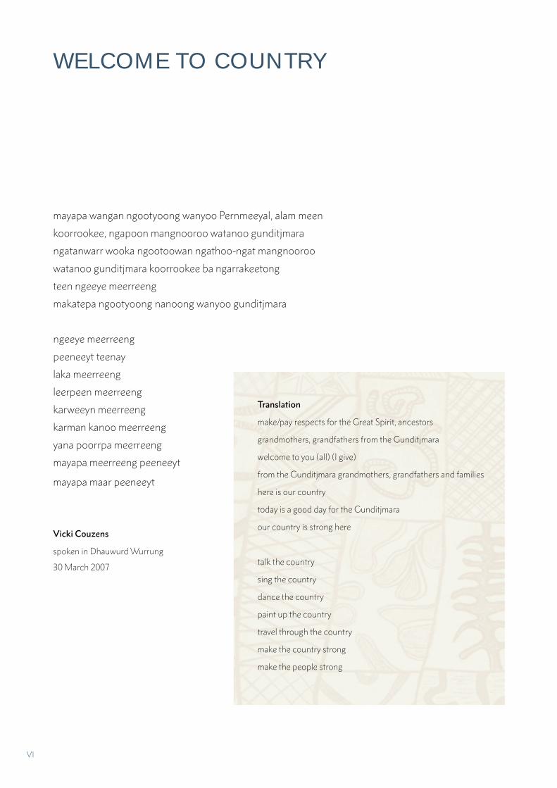
mayapa wangan ngootyoong wanyoo Pernmeeyal, alam meen
koorrookee, ngapoon mangnooroo watanoo gunditjmara
ngatanwarr wooka ngootoowan ngathoo-ngat mangnooroo
watanoo gunditjmara koorrookee ba ngarrakeetong
teen ngeeye meerreeng
makatepa ngootyoong nanoong wanyoo gunditjmara
ngeeye meerreeng
peeneeyt teenay
laka meerreeng
leerpeen meerreeng
karweeyn meerreeng
karman kanoo meerreeng
yana poorrpa meerreeng
mayapa meerreeng peeneeyt
mayapa maar peeneeyt
Vicki Couzens
spoken in Dhauwurd Wurrung
30 March 2007
WELCOME TO COUNTRY
Translation
make/pay respects for the Great Spirit, ancestors
grandmothers, grandfathers from the Gunditjmara
welcome to you (all) (I give)
from the Gunditjmara grandmothers, grandfathers and families
here is our country
today is a good day for the Gunditjmara
our country is strong here
talk the country
sing the country
dance the country
paint up the country
travel through the country
make the country strong
make the people strong
VI
STATEMENT BY THE GUNDITJMARA TRADITIONAL OWNERS
Over the past 15 years Gunditjmara Traditional Owners and members of the Winda-Mara Aboriginal Corporation have worked together to develop a World Heritage nomination for the Budj Bim Cultural Landscape. A World Heritage nomination for the Budj Bim Cultural Landscape was first proposed in 1989; and in 2002 was a key objective of the Lake Condah Sustainable Development Project, an initiative of the Gunditjmara. In January 2017 the Budj Bim Cultural Landscape was included on Australia’s Tentative World Heritage List.
With the support of both the Commonwealth and State governments, Gunditjmara Traditional Owners have acquired a number of land parcels over the years and have actively managed them for the protection of their interconnected cultural and natural values. Currently we manage 3,000 hectares of land declared as Indigenous Protected Areas, and also have a co-management agreement with the State government over the Budj Bim (formerly Mount Eccles) National Park.
Gunditjmara have a cultural responsibility to protect what is one of the world’s oldest freshwater aquaculture systems that is still in existence today; a system that was first constructed by our ancestors at least 6,600 years ago.
In 2007, the Australian Federal Court recognised the native title rights of the Gunditjmara and noted;
“The Gunditjmara were able to prove their strong and unrelenting connection to this
area where their ancestors farmed eels for food and trade at the time of European
settlement and back through millennia”
Gunditjmara have enjoyed strong community support in our pursuit of the nomination of the Budj Bim Cultural Landscape to the UNESCO World Heritage List.
June Gill Roslyn Pevitt
On behalf of all ChairGunditjmara Traditional Owners Winda-Mara Aboriginal Corporation
VII
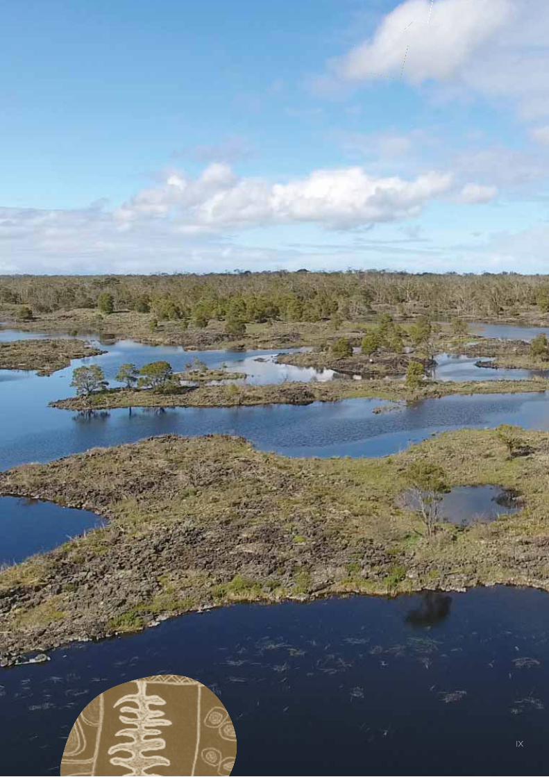
The Budj Bim Cultural Landscape is located within the traditional Country of the Gunditjmara in south-eastern Australia. It has been maintained through the continuity of Gunditjmara cultural and social practices and active management; and contains evidence of one of the world’s largest and oldest aquaculture systems. It is a rare, intact and representative example of a continuing cultural landscape. The scale and complexity of the Gunditjmara aquaculture system makes the Budj Bim Cultural Landscape an exceptional representative example of a landscape constructed through Indigenous modification and use of wetlands and aquatic resources.
We acknowledge and commend the Gunditj Mirring Traditional Owners Aboriginal Corporation and Winda-Mara Aboriginal Corporation for initiating and leading the World Heritage nomination and working closely with governments and scientific experts in the preparation of this Nomination Dossier.
The Gunditjmara Traditional Owners are committed to the ongoing management of the Budj Bim Cultural Landscape in partnership with the Australian and Victorian Governments and in cooperation with local government and community partners. Australia’s robust legislative framework also supports the obligations that come with being recognised as a World Heritage place.
The Australian Government, together with the Government of Victoria, works in partnership with the Gunditj Mirring Traditional Owners Aboriginal Corporation and the Winda-Mara Aboriginal Corporation to ensure the Budj Bim Cultural Landscape heritage values are protected and conserved for the use and enjoyment of future generations.
The Hon Josh Frydenberg MP The Hon Natalie Hutchins MP
Australian Government Minister for Victorian Minister for Aboriginal Affairsthe Environment and Energy on on behalf of the Victorian Government behalf of the Australian Government
MINISTERS’ MESSAGE
VIII
IX
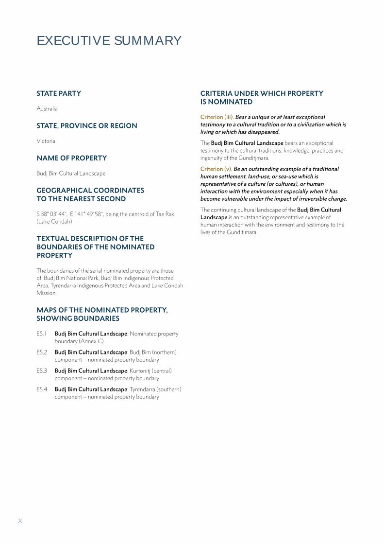
EXECUTIVE SUMMARY
STATE PARTY
Australia
STATE, PROVINCE OR REGION
Victoria
NAME OF PROPERTY
Budj Bim Cultural Landscape
GEOGRAPHICAL COORDINATES TO THE NEAREST SECOND
S 38° 03’ 44’’, E 141° 49’ 58’’, being the centroid of Tae Rak (Lake Condah)
TEXTUAL DESCRIPTION OF THE BOUNDARIES OF THE NOMINATED PROPERTY
The boundaries of the serial nominated property are those of Budj Bim National Park, Budj Bim Indigenous Protected Area, Tyrendarra Indigenous Protected Area and Lake Condah Mission.
MAPS OF THE NOMINATED PROPERTY, SHOWING BOUNDARIES
ES.1 Budj Bim Cultural Landscape: Nominated property boundary (Annex C)
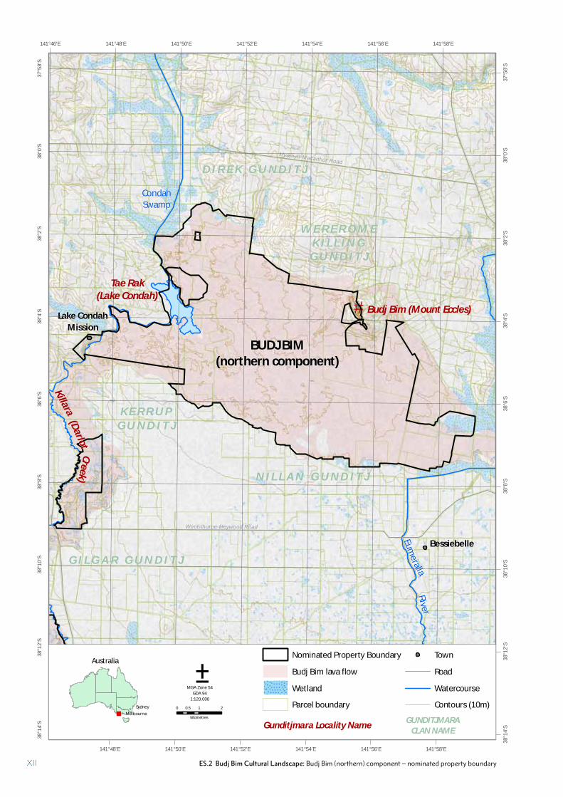
ES.2 Budj Bim Cultural Landscape: Budj Bim (northern) component – nominated property boundary
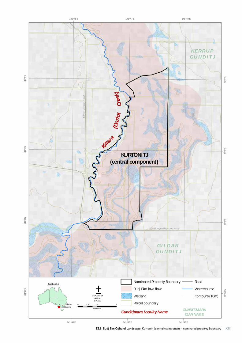
ES.3 Budj Bim Cultural Landscape: Kurtonitj (central) component – nominated property boundary
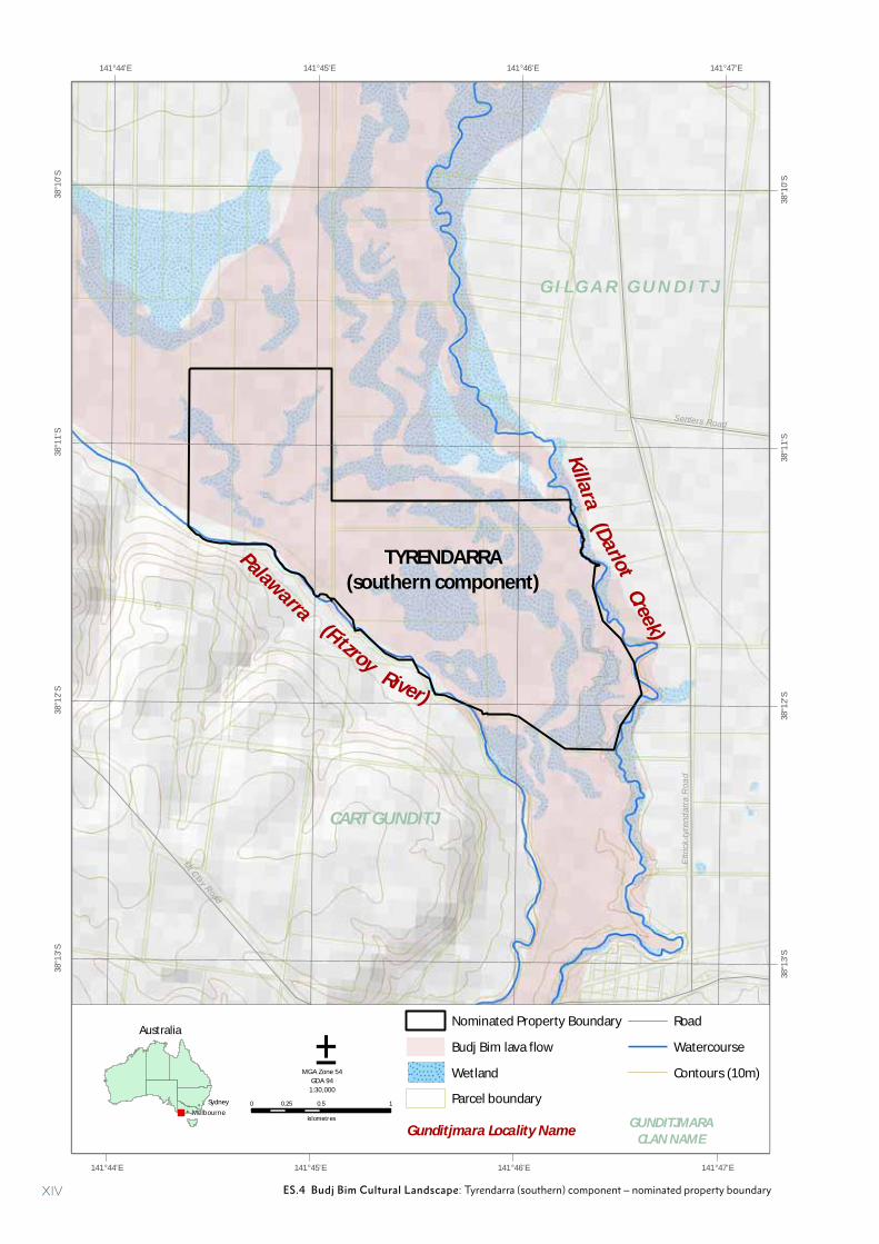
ES.4 Budj Bim Cultural Landscape: Tyrendarra (southern) component – nominated property boundary
CRITERIA UNDER WHICH PROPERTY IS NOMINATED
Criterion (iii). Bear a unique or at least exceptional testimony to a cultural tradition or to a civilization which is living or which has disappeared.
The Budj Bim Cultural Landscape bears an exceptional testimony to the cultural traditions, knowledge, practices and ingenuity of the Gunditjmara.
Criterion (v). Be an outstanding example of a traditional human settlement, land-use, or sea-use which is representative of a culture (or cultures), or human interaction with the environment especially when it has become vulnerable under the impact of irreversible change.
The continuing cultural landscape of the Budj Bim Cultural Landscape is an outstanding representative example of human interaction with the environment and testimony to the lives of the Gunditjmara.
X

#*
CondahSwamp
Eum
eralla
Riv
er
PRINCES HIGHWAY
HEN
TY H
IGH
WAY
Milltown
Macarthur
Codrington
Tyrendarra
Bessiebelle
Lake Condah Mission
142°2'E
142°2'E
142°0'E
142°0'E
141°58'E
141°58'E
141°56'E
141°56'E
141°54'E
141°54'E
141°52'E
141°52'E
141°50'E
141°50'E
141°48'E
141°48'E
141°46'E
141°46'E
141°44'E
141°44'E
141°42'E
141°42'E
141°40'E
141°40'E
37°5
6'S
37°5
6'S
37°5
8'S
37°5
8'S
38°0
'S
38°0
'S
38°2
'S
38°2
'S
38°4
'S
38°4
'S
38°6
'S
38°6
'S
38°8
'S
38°8
'S
38°1
0'S
38°1
0'S
38°1
2'S
38°1
2'S
38°1
4'S
38°1
4'S
38°1
6'S
38°1
6'S
38°1
8'S
38°1
8'S
38°2
0'S
38°2
0'S
38°2
2'S
38°2
2'S
Tae Rak
(Lake Condah)
W E R E R O M EK I L L I N G
G U N D I T J
N I L L A N G U N D I T J
K E R R U PG U N D I T J
CART GUNDITJ
G I L G A R G U N D I T JPalawarra
(Darlo
t
P o r t l a n d B a y
Budj Bim (Mount Eccles)
0 2.5 51.25
kilometres
Nominated Property Boundary
Budj Bim lava flow
Wetland
Town
Highway
Main road
Watercourse
Contour (20m)
Gunditjmara Locality Name
±MGA Zone 54
GDA 94
1:200,000
GUNDITJMARA CLAN NAME
BUDJ BIM(northern component)
KURTONITJ(central component)
TYRENDARRA(southern component)
K I L C A R E RG U N D I T J
D I R E K G U N D I T J
W E E R I PW E E R I P
G U N D I T J
Killara
(FitzroyCreek)
Rive
r)
Australia
!
!
Melbourne
Sydney
ES.1 Budj Bim Cultural Landscape: Nominated property bounday (See Annex C for 1:30,000 version) XI
#*
Condah
Swamp
Eume
rallaR
iver
Rive
r
Tyrendarra
Bessiebelle
Lake Condah
Mission
Woolsthorpe-Heywood Road
Myamyn-Macarthur Road
141°58'E
141°58'E
141°56'E
141°56'E
141°54'E
141°54'E
141°52'E
141°52'E
141°50'E
141°50'E
141°48'E
141°48'E141°46'E37
°58'
S
37°5
8'S
38°0
'S
38°0
'S
38°2
'S
38°2
'S
38°4
'S
38°4
'S
38°6
'S
38°6
'S
38°8
'S
38°8
'S
38°1
0'S
38°1
0'S
38°1
2'S
38°1
2'S
38°1
4'S
38°1
4'S
Tae Rak(Lake Condah)
W E R E R O M EK I L L I N G
G U N D I T J
N I L L A N G U N D I T J
K E R R U PG U N D I T J
G I L G A R G U N D I T J
(Darlot
Budj Bim (Mount Eccles)
0 1 20.5
kilometres
±MGA Zone 54
GDA 94
1:120,000
BUDJ BIM(northern component)
D I R E K G U N D I T J
Killara
Creek)
Australia
!
!
Melbourne
Sydney
Gunditjmara Locality NameGUNDITJMARA
CLAN NAME
Nominated Property Boundary
Budj Bim lava flow
Wetland
Parcel boundary
Town
Road
Watercourse
Contours (10m)
ES.2 Budj Bim Cultural Landscape: Budj Bim (northern) component – nominated property boundaryXII
Woolsthorpe-Heywood Road
Ettr
ick-
Con
dah
Roa
d
141°48'E
141°48'E
141°47'E
141°47'E
141°46'E
141°46'E
38°7
'S
38°7
'S
38°8
'S
38°8
'S
38°9
'S
38°9
'S
38°1
0'S
38°1
0'S
K E R R U PG U N D I T J
G I L G A R G U N D I T J
(Da
rlo
t
0 0.5 10.25
kilometres
±MGA Zone 54
GDA 94
1:30,000
KURTONITJ(central component)
Killara
Cre
ek)
Australia
!
!
Melbourne
Sydney
Gunditjmara Locality NameGUNDITJMARA
CLAN NAME
Nominated Property Boundary
Budj Bim lava flow
Wetland
Parcel boundary
Road
Watercourse
Contours (10m)
ES.3 Budj Bim Cultural Landscape: Kurtonitj (central) component – nominated property boundary XIII
Ettr
ick-
tyre
ndar
ra R
oad
Mt Clay Road
Princes Highway
Settlers Road
141°47'E
141°47'E
141°46'E
141°46'E
141°45'E
141°45'E
141°44'E
141°44'E
38°1
0'S
38°1
0'S
38°1
1'S
38°1
1'S
38°1
2'S
38°1
2'S
38°1
3'S
38°1
3'S
CART GUNDITJ
G I L G A R G U N D I T J
Palawarra
(Darlot
0 0.5 10.25
kilometres
±MGA Zone 54
GDA 94
1:30,000
TYRENDARRA(southern component)
Killa
ra
(Fitzroy
Creek)
River)
Australia
!
!
Melbourne
Sydney
Gunditjmara Locality NameGUNDITJMARA
CLAN NAME
Nominated Property Boundary
Budj Bim lava flow
Wetland
Parcel boundary
Road
Watercourse
Contours (10m)
ES.4 Budj Bim Cultural Landscape: Tyrendarra (southern) component – nominated property boundaryXIV
XV
BRIEF SYNTHESIS
The Budj Bim Cultural Landscape is located in the traditional Country of the Gunditjmara Aboriginal people in south-eastern Australia. The three serial components of the property contain one of the world’s most extensive and oldest aquaculture systems. Over a period of at least 6,600 years the Gunditjmara created, manipulated and modified local hydrological regimes and ecological systems. They utilised the abundant local volcanic rock to construct channels, weirs and dams and manage water flows in order to systematically trap, store and harvest kooyang (short-finned eel – Anguilla australis) and support enhancement of other food resources. The highly productive aquaculture system provided a six millennia-long economic and social base for Gunditjmara society. This deep time interrelationship of Gunditjmara cultural and environmental systems is documented through present-day Gunditjmara cultural knowledge, practices, material culture, scientific research and historical documents. It is evidenced in the aquaculture system itself and in the inter-related geological, hydrological and ecological systems.
JUSTIFICATION FOR CRITERIA
Criterion (iii): The Budj Bim Cultural Landscape bears an exceptional testimony to the cultural traditions, knowledge, practices and ingenuity of the Gunditjmara. The extensive networks and antiquity of the constructed and modified aquaculture system of the Budj Bim Cultural Landscape bears testimony to the Gunditjmara as engineers and kooyang fishers. For at least the past 6,600 years the Gunditjmara created and adapted a system of aquaculture based on deliberate manipulation, modification and management of wetlands and waterways. Gunditjmara knowledge and practices have endured and continue to be passed down through their Elders and are recognisable across the wetlands of the Budj Bim Cultural Landscape in the form of ancient and elaborate systems of stone-walled kooyang husbandry (or aquaculture) facilities. Gunditjmara cultural traditions, including associated storytelling, dance and basket weaving, continue to be maintained by their collective multigenerational knowledge.
Criterion (v): The continuing cultural landscape of the Budj Bim Cultural Landscape is an outstanding representative example of human interaction with the environment and testimony to the lives of the Gunditjmara. The Budj Bim Cultural Landscape was created by the Gunditjmara who purposefully harnessed the productive potential of the patchwork of wetlands on the Budj Bim lava flow. They achieved this by creating, modifying and maintaining an extensive hydrological engineering system that manipulated water flow in order to trap, store and harvest kooyang that migrate seasonally through the system. The key
DRAFT STATEMENT OF OUTSTANDING UNIVERSAL VALUE
elements of this system are the interconnected clusters of constructed and modified water channels, weirs, dams, ponds and sinkholes in combination with the lava flow, water flow and ecology and life-cycle of kooyang. The Budj Bim Cultural Landscape exemplifies the dynamic ecological-cultural relationships evidenced in the Gunditjmara’s deliberate manipulation and management of the environment.
STATEMENT OF INTEGRITY
The Budj Bim Cultural Landscape has a high level of integrity. The serial property incorporates intact and outstanding examples of aquaculture complexes at Tae Rak (Lake Condah), Tyrendarra and Kurtonitj. Each complex includes all the physical elements of the system (that is, channels, weirs, dams and ponds) that demonstrate the operation of Gunditjmara aquaculture. The property also includes Budj Bim, a Gunditjmara Ancestral Being and volcano that is the source of the lava flow on which the aquaculture system is constructed. The 9,935-hectare property is sufficient in size to incorporate the cultural features and ecological processes that illustrate the ways multiple systems – social, spiritual, geological, hydrological and ecological – interact and function. The reinstatement of traditional water flows into Tae Rak through the construction of a cultural weir in 2010, following extensive draining of the lake in the 1950s, has returned and enhanced the water flow across the aquaculture system. This restoration, the rugged environment, the use of stone, the relatively intact vegetation and the lack of major development within the Budj Bim Cultural Landscape mean that the extensive aquaculture system has survived, is in good condition and can be readily identified in the landscape.
STATEMENT OF AUTHENTICITY
The Budj Bim Cultural Landscape has a high degree of authenticity. Gunditjmara traditional knowledge is demonstrated by millennia of oral transmission, through continuity of practice and is supported by documented Gunditjmara cultural traditions and exceptionally well-preserved archaeological, environmental and historical evidence. The authenticity of the Budj Bim Cultural Landscape is evident in the continuing connection of the Gunditjmara to their landscape and their traditional and historical knowledge of the life cycle of kooyang. Authenticity is also evident in the practices associated with the trapping, storage and harvesting of kooyang; including the construction of stone weirs and weaving of fibre baskets. In 2007, the Australian Federal Court recognised the native title rights of the Gunditjmara for their “strong and unrelenting connection to this area where their ancestors farmed eels for food and trade, at the time of European settlement and back through millennia.”
XV
REQUIREMENTS FOR PROTECTION AND MANAGEMENT
All of the Budj Bim Cultural Landscape is Aboriginal-owned and/or managed and is managed to respect the customary and legal rights and obligations of the Gunditjmara Traditional Owners. The nominated property is protected and managed through an adaptive and participatory management framework of overlapping and integrated customary, governance, legislative and policy approaches.
The Gunditjmara Traditional Owners apply customary knowledge and scientific approaches through two management regimes; a co-operative arrangement with the Victorian Government for Budj Bim National Park; and Indigenous ownership of the Budj Bim and Tyrendarra Indigenous Protected Areas. The Budj Bim Cultural Landscape management system is established through the 2015 Ngootyoong Gunditj, Ngootyoong Mara South West Management Plan. A team of Budj Bim Rangers, funded through the Australian Government’s Indigenous Advancement Strategy program, manage, conserve and protect the heritage values of the nominated property in accordance with property management plans.
The majority of the Budj Bim Cultural Landscape is included on Australia’s National Heritage List, and is protected by the Environment Protection and Biodiversity Conservation Act 1999. Once included on the World Heritage List, the entire property will be recognised as a ‘Matter of National Environmental Significance’ and protected by the Act. All Gunditjmara cultural heritage on Budj Bim Cultural Landscape is protected by Victoria’s Aboriginal Heritage Act 2006.
There are no major threats to either the aquaculture system or to the maintenance of associated Gunditjmara cultural traditions, knowledge and practices. Nevertheless there are pressures on the nominated property associated with pest plants and animals, water flow and quality, sustaining kooyang populations, unauthorised access of cattle and regrowth of trees within some aquaculture features. The restoration of Tae Rak in 2010 has contributed to maintaining and rejuvenating water flows through the aquaculture system; thereby ensured the ongoing viability of living Gunditjmara cultural traditions and practices.
The 2014 Budj Bim (Tourism) Master Plan establishes requirements for sustainable tourism and visitation, as well as educational opportunities, for the Budj Bim Cultural Landscape.
NAME AND CONTACT INFORMATION OF OFFICIAL LOCAL INSTITUTIONAL AGENCY
Australian Government Department of the Environment and Energy
GPO Box 787Canberra ACT 2601Australia
Tel: 61 2 6274 1111E-mail: [email protected] address: www.environment.gov.au
XVI
KEY TERMS
Aboriginal Descendants of the original inhabitants of Australia.
aquaculture The rearing of aquatic animals or the cultivation of aquatic plants for food. For the purpose of this Nomination Dossier, ‘Gunditjmara aquaculture’ refers to the Gunditjmara system of constructing and utilising channels, weirs, dams, ponds and sinkholes to manage water and water flows and systematically trap, harvest and farm kooyang (eel).
Budj Bim Gunditjmara name for Mount Eccles, a volcano located within the Western Victorian Volcanic Plains, Australia. The volcano is inactive.
Budj Bim lava flow The lava flow resulting from the eruption of Budj Bim between 30,000 and 39,000 years ago.
Budj Bim National Park The National Park, as defined in the National Parks Act 1975, that lies within the Budj Bim Cultural Landscape. The park was, until December 2017, named Mount Eccles National Park.
Country Aboriginal-English word that refers to a knowledge system and concept with a whole-of-landscape meaning. For contemporary Australian Aboriginal people, the concept of ‘caring for Country’ is a complex notion related to both personal and group belonging and to maintaining and looking after the ecological and spiritual wellbeing of the land and of oneself.
Cultural weir Weir constructed in 2010 to reinstate traditional water flows to Tae Rak.
eco-cultural landscape A landscape that is the product of human interaction with, and deliberate manipulation of, the environment (that is, ecology and culture). The phrase is used in this Nomination Dossier in preference to, for example biocultural landscape, since eco-cultural refers to all dimensions of ecosystems, rather than solely biodiversity.
Elder An Aboriginal person who has gained recognition as a custodian of knowledge and law, and who has permission to disclose knowledge and beliefs. Aboriginal people typically refer to an Elder as ‘Aunty’ or ‘Uncle’, which are used as respectful terms of address.
Gunditj Mirring Traditional Owners Aboriginal Corporation (GMTOAC) Prescribed Body Corporate (established 2005) that formally represents the native title holders and manages the native title consent determination of the Gunditjmara. GMTOAC is vested with control of the Budj Bim Indigenous Protected Area and Lake Condah Mission within the Budj Bim Cultural Landscape and implements the Cooperative Management Agreement with regard to Budj Bim National Park together with the Victorian Government.
Gunditjmara 1. The traditional Country of the Gunditjmara (and corresponding Dhauwurd Wurrung language area) that lies east of the Glenelg River, south of the Wannon River and west of the Hopkins River in Victoria, south-eastern Australia. 2. The Traditional Owners use ‘Gunditjmara’ in preference to Aboriginal, Indigenous, Gunditjmara people or Gunditjmara community.
Indigenous (capital ‘I’) Term used to refer to Australian Aboriginal and Torres Strait Islander peoples.
indigenous (lower case ‘i’) Collective term used for first nations peoples in all parts of the world.
Indigenous Protected Area (IPA) Community-conserved Protected Area in Australia voluntarily dedicated to conservation by Indigenous groups on Indigenous owned and/or managed land. Two IPAs lie wholly within the Budj Bim Cultural Landscape; Budj Bim IPA (owned and managed by the GMTOAC) and Tyrendarra IPA (owned and managed by the Winda-Mara Aboriginal Corporation).
Native title Recognises the traditional rights and interests to land and waters of Aboriginal and Torres Strait Islander peoples. Under the Australian Government Native Title Act 1993, native title claimants can make an application to the Federal Court to have their native title recognised by Australian law. The Gunditjmara native title consent determination for the area incorporating the Budj Bim Cultural Landscape was reached by the Federal Court of Australia in 2007.
Pastoralism An economic system or way of life based on the raising and herding of livestock. In Australia, pastoralism is primarily concerned with the management of sheep and cattle.
Registered Aboriginal Party (RAP) Organisation that holds decision-making responsibilities under the State of Victoria’s Aboriginal Heritage Act 2006 for protecting Aboriginal cultural heritage in a specified geographical area. The GMTOAC is the appointed RAP for an area that includes the Budj Bim Cultural Landscape.
Traditional Knowledge A living body of knowledge passed on from generation to generation within a community. It often forms part of a people’s cultural and spiritual identity. Includes Indigenous traditional ecological knowledge.
Traditional Owner Indigenous person with particular knowledge about traditions, observances, customs or beliefs associated with an area; and who is a member of a family or clan group that is recognised as having responsibility under Aboriginal tradition for significant Aboriginal places located in – or significant Aboriginal objects originating from, that area. (Aboriginal Heritage Act 2006, s.7)
XVII
Visitor Experience Area Key location identified by Parks Victoria that provides opportunities for visitors to experience the cultural and/or natural landscape. There are seven identified Visitor Experience Areas within the Budj Bim Cultural Landscape.
Welcome to Country A formal welcome – typically delivered by Australian Traditional Owners, at the beginning of a formal event. A Welcome to Country can take many forms; including singing, dancing, smoking ceremonies and/or a speech in traditional language or English.
GU NDITJMARA WORDS AND PHRASES
Winda-Mara Aboriginal Corporation Community organisation that provides services to local Aboriginal communities in south-western Victoria, Australia. Winda-Mara Aboriginal Corporation is vested with ownership and control of the Tyrendarra Indigenous Protected Area.
Budj Bim 1. ‘high head’ – the head of a Gunditjmara Creation Ancestor 2. Place name for ‘Budj Bim (formerly Mount Eccles) volcano.’
Bunjil Spiritual Creator of the Gunditjmara people who gave life to the first people and their Country.
gnarraban Woven, elongated basket (or funnel) used to capture eels (kooyang) and control their movement.
gunditj Means ‘belonging to’, and refers to the whole of the environment including nature and culture and material and spiritual components.
Gunditjmara ‘gunditj’ means ‘belonging to’ and ‘mara’ is the word for ‘people’.
Gunditj Mirring Name used to refer to Gunditjmara Traditional Owners. Gunditj means ‘belonging to’ and Mirring means ‘Country’.
Killara Place name for Darlot Creek. Literal meaning ‘always there’ – that is, there is always water in Killara to sustain kooyang and other aquatic resources.
kooyang Short-finned eel (Anguilla australis).
kurtonitj Means ‘crossing place’.
linger / liangle Stick or wood rod onto which eels are threaded and transported.
mara Means ‘people’.
Mirring The word for Country. ‘Mirring’ is interchangeable with the word for birthplace.
Ngootyoong Gunditj, Ngootyoong Mara 1. Healthy Country, Healthy People. The phrase recognises that the environmental, cultural, economic and social benefits of being on, and caring for, Country leads to healthy people and communities. 2. Title of the Parks Victoria 2015 South West Management Plan.
Palawarra Place name for Fitzroy River.
puunyaart Grass (Carex spp.) gathered and used to weave gnarraban.
Tae Rak Place name for Lake Condah.
Tappoc Place name for Mount Napier; an inactive volcano located to the north of Budj Bim volcano.
Tungatt Mirring Stone Country, centred on volcanoes and lava flows, including Budj Bim volcano and the Budj Bim lava flow.
weeok Means ‘place of fish’. Place name for Lake Condah Mission.
yereoc 1. Modified or constructed water channel 2. A wood structure built to form a weir (or barrier) across a channel or narrow waterway.
XVIII
PART 1
IDENTIFICATION OF PROPERTY
1
PART 1 IDENTIFICATION OF THE PROPERTY
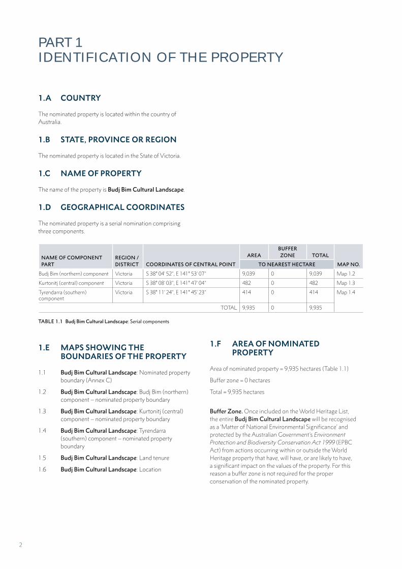
1.A COUNTRY
The nominated property is located within the country of Australia.
1.B STATE, PROVINCE OR REGION
The nominated property is located in the State of Victoria.
1.C NAME OF PROPERTY
The name of the property is Budj Bim Cultural Landscape.
1.D GEOGRAPHICAL COORDINATES
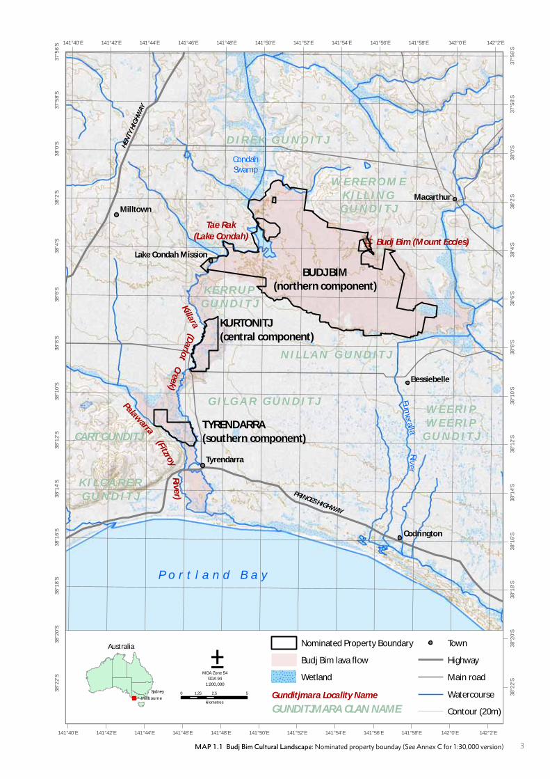
The nominated property is a serial nomination comprising three components.
NAME OF COMPONENT PART
REGION / DISTRICT COORDINATES OF CENTRAL POINT
AREABUFFER ZONE TOTAL
MAP NO.TO NEAREST HECTARE
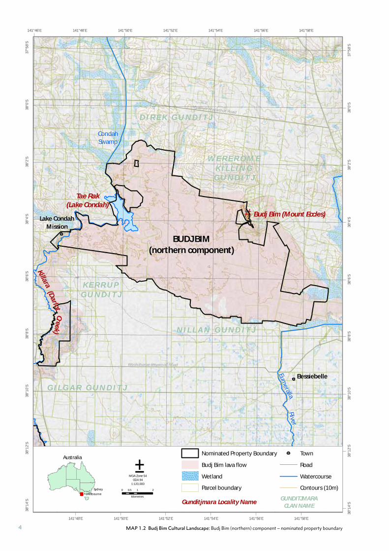
Budj Bim (northern) component Victoria S 38° 04’ 52’’, E 141° 53’ 07’’ 9,039 0 9,039 Map 1.2
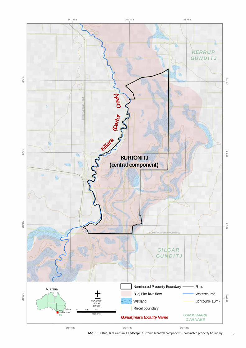
Kurtonitj (central) component Victoria S 38° 08’ 03’’, E 141° 47’ 04’’ 482 0 482 Map 1.3
Tyrendarra (southern) component
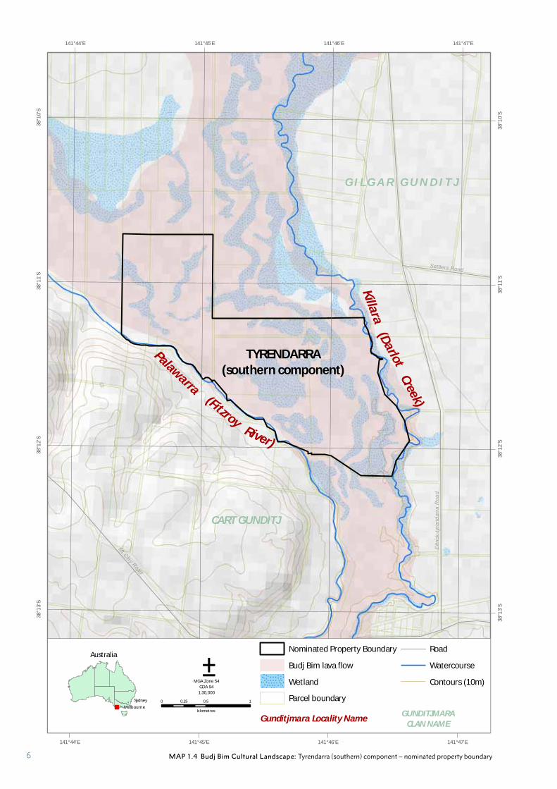
Victoria S 38° 11’ 24’’, E 141° 45’ 23’’ 414 0 414 Map 1.4
TOTAL 9,935 0 9,935
TABLE 1.1 Budj Bim Cultural Landscape: Serial components
1.E MAPS SHOWING THE BOUNDARIES OF THE PROPERTY
1.1 Budj Bim Cultural Landscape: Nominated property boundary (Annex C)
1.2 Budj Bim Cultural Landscape: Budj Bim (northern) component – nominated property boundary
1.3 Budj Bim Cultural Landscape: Kurtonitj (central) component – nominated property boundary
1.4 Budj Bim Cultural Landscape: Tyrendarra (southern) component – nominated property boundary
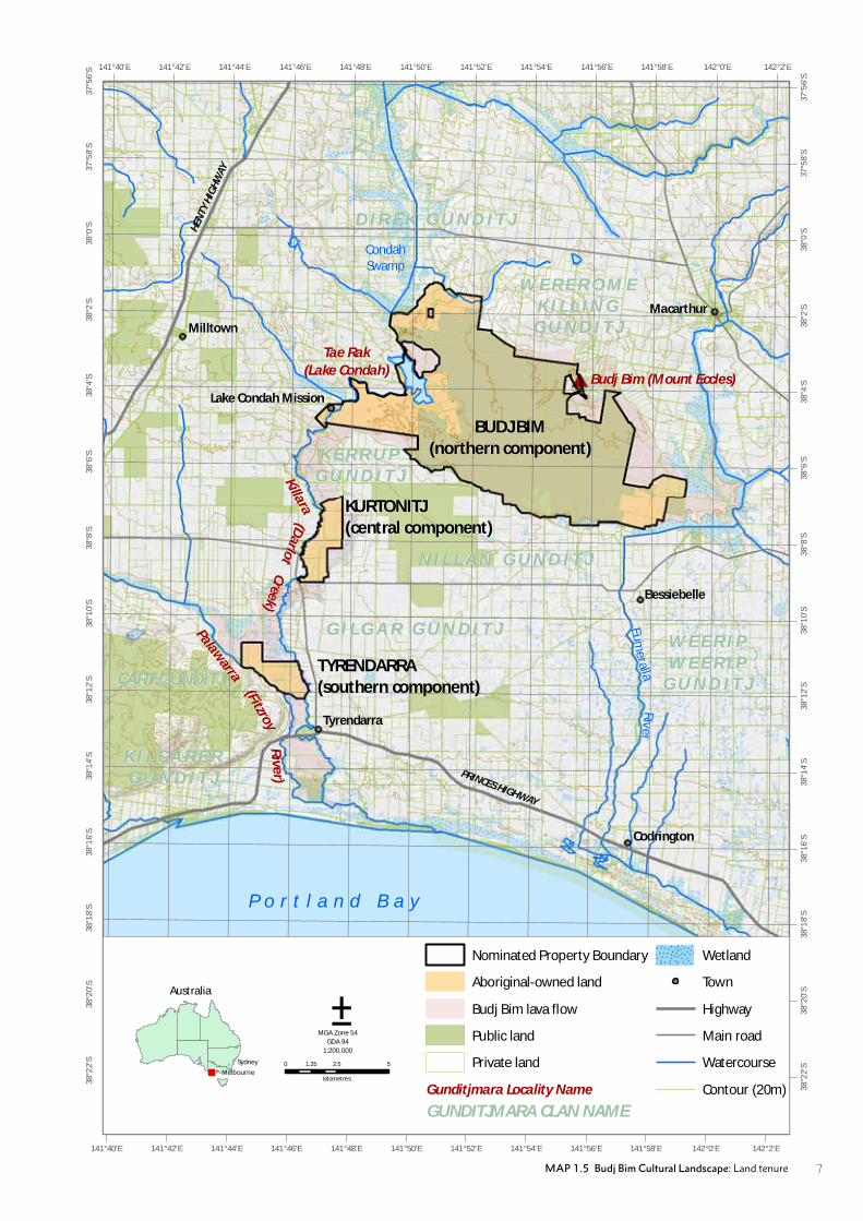
1.5 Budj Bim Cultural Landscape: Land tenure
1.6 Budj Bim Cultural Landscape: Location
1.F AREA OF NOMINATED PROPERTY
Area of nominated property = 9,935 hectares (Table 1.1)
Buffer zone = 0 hectares
Total = 9,935 hectares
Buffer Zone. Once included on the World Heritage List, the entire Budj Bim Cultural Landscape will be recognised as a ‘Matter of National Environmental Significance’ and protected by the Australian Government’s Environment Protection and Biodiversity Conservation Act 1999 (EPBC Act) from actions occurring within or outside the World Heritage property that have, will have, or are likely to have, a significant impact on the values of the property. For this reason a buffer zone is not required for the proper conservation of the nominated property.
2
#*
CondahSwamp
Eum
eralla
Riv
er
PRINCES HIGHWAY
HEN
TY H
IGH
WAY
Milltown
Macarthur
Codrington
Tyrendarra
Bessiebelle
Lake Condah Mission
142°2'E
142°2'E
142°0'E
142°0'E
141°58'E
141°58'E
141°56'E
141°56'E
141°54'E
141°54'E
141°52'E
141°52'E
141°50'E
141°50'E
141°48'E
141°48'E
141°46'E
141°46'E
141°44'E
141°44'E
141°42'E
141°42'E
141°40'E
141°40'E
37°5
6'S
37°5
6'S
37°5
8'S
37°5
8'S
38°0
'S
38°0
'S
38°2
'S
38°2
'S
38°4
'S
38°4
'S
38°6
'S
38°6
'S
38°8
'S
38°8
'S
38°1
0'S
38°1
0'S
38°1
2'S
38°1
2'S
38°1
4'S
38°1
4'S
38°1
6'S
38°1
6'S
38°1
8'S
38°1
8'S
38°2
0'S
38°2
0'S
38°2
2'S
38°2
2'S
Tae Rak
(Lake Condah)
W E R E R O M EK I L L I N G
G U N D I T J
N I L L A N G U N D I T J
K E R R U PG U N D I T J
CART GUNDITJ
G I L G A R G U N D I T JPalawarra
(Darlo
t
P o r t l a n d B a y
Budj Bim (Mount Eccles)
0 2.5 51.25
kilometres
Nominated Property Boundary
Budj Bim lava flow
Wetland
Town
Highway
Main road
Watercourse
Contour (20m)
Gunditjmara Locality Name
±MGA Zone 54
GDA 94
1:200,000
GUNDITJMARA CLAN NAME
BUDJ BIM(northern component)
KURTONITJ(central component)
TYRENDARRA(southern component)
K I L C A R E RG U N D I T J
D I R E K G U N D I T J
W E E R I PW E E R I P
G U N D I T J
Killara
(FitzroyCreek)
Rive
r)
Australia
!
!
Melbourne
Sydney
MAP 1.1 Budj Bim Cultural Landscape: Nominated property bounday (See Annex C for 1:30,000 version) 3
#*
Condah
Swamp
Eume
rallaR
iver
Rive
r
Tyrendarra
Bessiebelle
Lake Condah
Mission
Woolsthorpe-Heywood Road
Myamyn-Macarthur Road
141°58'E
141°58'E
141°56'E
141°56'E
141°54'E
141°54'E
141°52'E
141°52'E
141°50'E
141°50'E
141°48'E
141°48'E141°46'E37
°58'
S
37°5
8'S
38°0
'S
38°0
'S
38°2
'S
38°2
'S
38°4
'S
38°4
'S
38°6
'S
38°6
'S
38°8
'S
38°8
'S
38°1
0'S
38°1
0'S
38°1
2'S
38°1
2'S
38°1
4'S
38°1
4'S
Tae Rak(Lake Condah)
W E R E R O M EK I L L I N G
G U N D I T J
N I L L A N G U N D I T J
K E R R U PG U N D I T J
G I L G A R G U N D I T J
(Darlot
Budj Bim (Mount Eccles)
0 1 20.5
kilometres
±MGA Zone 54
GDA 94
1:120,000
BUDJ BIM(northern component)
D I R E K G U N D I T J
Killara
Creek)
Australia
!
!
Melbourne
Sydney
Gunditjmara Locality NameGUNDITJMARA
CLAN NAME
Nominated Property Boundary
Budj Bim lava flow
Wetland
Parcel boundary
Town
Road
Watercourse
Contours (10m)
MAP 1.2 Budj Bim Cultural Landscape: Budj Bim (northern) component – nominated property boundary4
Woolsthorpe-Heywood Road
Ettr
ick-
Con
dah
Roa
d
141°48'E
141°48'E
141°47'E
141°47'E
141°46'E
141°46'E38
°7'S
38°7
'S
38°8
'S
38°8
'S
38°9
'S
38°9
'S
38°1
0'S
38°1
0'S
K E R R U PG U N D I T J
G I L G A R G U N D I T J
(Da
rlo
t
0 0.5 10.25
kilometres
±MGA Zone 54
GDA 94
1:30,000
KURTONITJ(central component)
Killara
Cre
ek)
Australia
!
!
Melbourne
Sydney
Gunditjmara Locality NameGUNDITJMARA
CLAN NAME
Nominated Property Boundary
Budj Bim lava flow
Wetland
Parcel boundary
Road
Watercourse
Contours (10m)
MAP 1.3 Budj Bim Cultural Landscape: Kurtonitj (central) component – nominated property boundary 5
Ettr
ick-
tyre
ndar
ra R
oad
Mt Clay Road
Princes Highway
Settlers Road
141°47'E
141°47'E
141°46'E
141°46'E
141°45'E
141°45'E
141°44'E
141°44'E38
°10'
S
38°1
0'S
38°1
1'S
38°1
1'S
38°1
2'S
38°1
2'S
38°1
3'S
38°1
3'S
CART GUNDITJ
G I L G A R G U N D I T J
Palawarra
(Darlot
0 0.5 10.25
kilometres
±MGA Zone 54
GDA 94
1:30,000
TYRENDARRA(southern component)
Killa
ra
(Fitzroy
Creek)
River)
Australia
!
!
Melbourne
Sydney
Gunditjmara Locality NameGUNDITJMARA
CLAN NAME
Nominated Property Boundary
Budj Bim lava flow
Wetland
Parcel boundary
Road
Watercourse
Contours (10m)
MAP 1.4 Budj Bim Cultural Landscape: Tyrendarra (southern) component – nominated property boundary6
CondahSwamp
Eum
eralla
Riv
er
PRINCES HIGHWAY
HEN
TY H
IGH
WAY
Milltown
Macarthur
Codrington
Tyrendarra
Bessiebelle
Lake Condah Mission
142°2'E
142°2'E
142°0'E
142°0'E
141°58'E
141°58'E
141°56'E
141°56'E
141°54'E
141°54'E
141°52'E
141°52'E
141°50'E
141°50'E
141°48'E
141°48'E
141°46'E
141°46'E
141°44'E
141°44'E
141°42'E
141°42'E
141°40'E
141°40'E
37°5
6'S
37°5
6'S
37°5
8'S
37°5
8'S
38°0
'S
38°0
'S
38°2
'S
38°2
'S
38°4
'S
38°4
'S
38°6
'S
38°6
'S
38°8
'S
38°8
'S
38°1
0'S
38°1
0'S
38°1
2'S
38°1
2'S
38°1
4'S
38°1
4'S
38°1
6'S
38°1
6'S
38°1
8'S
38°1
8'S
38°2
0'S
38°2
0'S
38°2
2'S
38°2
2'S
Tae Rak
(Lake Condah)
W E R E R O M EK I L L I N G
G U N D I T J
N I L L A N G U N D I T J
K E R R U PG U N D I T J
CART GUNDITJ
G I L G A R G U N D I T JPalawarra
P o r t l a n d B a y
Budj Bim (Mount Eccles)
0 2.5 51.25
kilometres
Nominated Property Boundary
Aboriginal-owned land
Budj Bim lava flow
Public land
Private land
Wetland
Town
Highway
Main road
Watercourse
Contour (20m)Gunditjmara Locality Name
±MGA Zone 54
GDA 94
1:200,000
GUNDITJMARA CLAN NAME
BUDJ BIM(northern component)
KURTONITJ(central component)
TYRENDARRA(southern component)
K I L C A R E RG U N D I T J
D I R E K G U N D I T J
W E E R I PW E E R I P
G U N D I T J(FitzroyR
iver)
Australia
!
!
Melbourne
Sydney
(Darlo
tKillara
Creek)
MAP 1.5 Budj Bim Cultural Landscape: Land tenure 7
Sources: Esri, USGS, NOAA
150°0'E
150°0'E
140°0'E
140°0'E
130°0'E
130°0'E
120°0'E
120°0'E
110°0'E
10
°0'S
10
°0'S
20
°0'S
20
°0'S
30
°0'S
30
°0'S
40
°0'S
40
°0'S
0 500 1,000250
kilometres±Geographics
GDA 94
1:25,000,000
VICTORIA
NEW SOUTH WALES
QUEENSLAND
NORTHERNTERRITORY
TASMANIA
WESTERN AUSTRALIA
SOUTH AUSTRALIA
Indonesia
Timor Leste
Papua New Guinea
S o u t h e r n O c e a n
I n d i a nO c e a n
T i m o r S e a
A r a f u r a S e a
T a s m a nS e a
C o r a l S e a
MAP 1.6 Budj Bim Cultural Landscape: Location
8
PART 2A
DESCRIPTION OF PROPERTY
9
During the time of creation, Gunditjmara
Country was inhabited by beings that were
sometimes human, sometimes animal,
sometimes neither, and these beings brought
the Country into life. Their movements are
written across Gunditjmara Country and give
meaning to the contemporary landscape.
From at least 6,600 years ago, the Gunditjmara
created an extensive and complex aquaculture
network where modified channels diverted
water and kooyang (short-finned eel) into
holding ponds. Here kooyang grew fat and
were harvested with woven baskets set in weirs
built from volcanic rocks and wood lattice
structures.
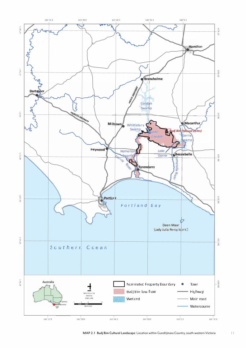
The Budj Bim Cultural Landscape, located
within Gunditjmara Country in south-eastern
Australia, is a serial property comprised
of three components; Budj Bim (northern)
component, Kurtonitj (central) component and
Tyrendarra (southern) component (Map 1.1).
Each component contains extensive evidence
of the Gunditjmara’s aquaculture system.
The Gunditjmara have customary rights and
obligations to their traditional Country and a
continuing and evolving relationship with the
Budj Bim Cultural Landscape.
The Budj Bim Cultural Landscape incorporates significant components of an area that the Gunditjmara call Tungatt Mirring (Stone Country); an area centred on dramatic volcanoes and lava flows. The area encompasses Budj Bim volcano, the Budj Bim lava flow, extensive wetlands and lakes, including Tae Rak (Lake Condah), and Killara (Darlot Creek). Tungatt Mirring today is marked by rugged stony landscapes cloaked with Manna Gum woodland; interspersed with species-rich, wetland environments.
Budj Bim volcano is the source of the Budj Bim lava flow. More than 30,000 years ago, lava spewed across a distance of over 50 kilometres west and south towards the sea, dramatically altering the local waterways and wetlands. The lava flow provided the environments necessary for the Gunditjmara to develop an extensive and complex aquaculture network. The quantities of food produced allowed for and supported semi-permanent settlements. The success of the aquaculture system was such that excess kooyang (short-finned eel) supported large-scale ceremonial events and trade with neighbouring groups (Part 2.B).
This section describes the Gunditjmara with regard to their rights and obligations to their traditional Country and their continuing and evolving relationship with the Budj Bim Cultural Landscape. It also describes the broader geography of the nominated property as well as its cultural and environmental attributes. Detailed descriptions are provided of the serial components of the Budj Bim Cultural Landscape with regard to their topography, geology, hydrology and ecology; as well as the Gunditjmara cultural heritage elements within them – including those features that comprise the aquaculture system.
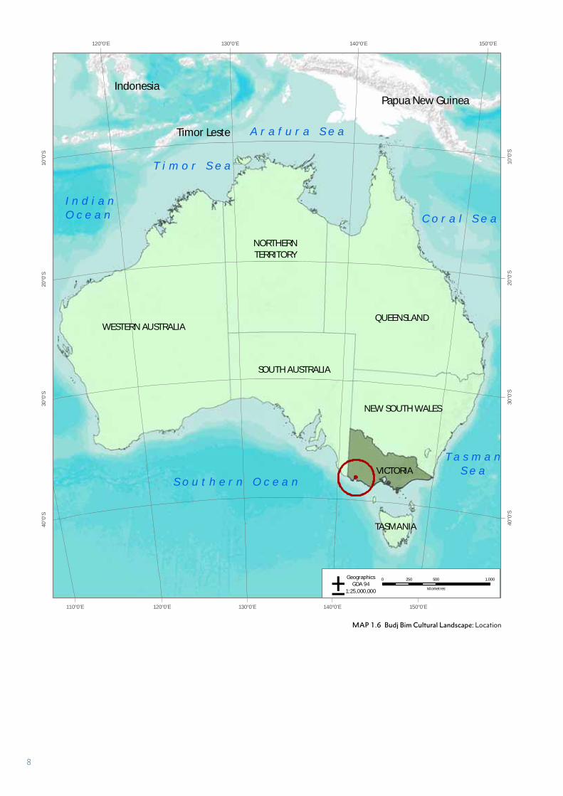
LOCATION
The Budj Bim Cultural Landscape is located within Australia (Map 1.6). It is situated in the south-eastern part of mainland Australia and within the State of Victoria (Victoria), one of seven states, together with federated territories, which comprise the Commonwealth of Australia.
Victoria covers an area of 227,416 square kilometres and has a population of over six million people.1 The State's capital, Melbourne, contains approximately 70 percent of the State's population. Victoria shares a political border with New South Wales to the north and with South Australia to the west (Map 1.6). Victoria is topographically, geologically and climatically diverse; with areas ranging from the wet, temperate climate region in the south-east, to the snow-covered Victorian alpine areas (which rise to almost 2,000 metres) in the north, and extensive semi-arid plains to the west and north-west. Outside the manufacturing and service centre of Melbourne, agriculture dominates the Victorian economy, particularly in those areas of rich soils, a Mediterranean climate and reliable winter rainfall.2
1 Australian Bureau of Statistics. ‘Australian Demographic Statistics, Dec 2016’, http://www.abs.gov.au/AUSSTATS/[email protected]/mf/3101.0
2 Victoria. ‘Geography’, http://www.victoria.org.au/Geography.htm
PART 2.A DESCRIPTION OF PROPERTY
10
iittzzrrooyy
RR
uurryy
(( aanndd))
HHEENN
TTY
PPRRPPPP II
HHWWAAWWWWYY
HHeeyyww
llttoonn
MMiill
aanndddddd
oorr
hhuurr
aa
142°0'E
142°0'E
141°50'E
141°50'E
141°40'E
141°40'E
141°30'E
141°30'E
141°20'E
141°20'E
142°10'E
37°4
0'S
37°4
0'S
37°5
0'S
37°5
0'S
38°0
'S
38°0
'S
38°1
0'S
38°1
0'S
38°2
0'S
38°2
0'S
38°3
0'S
38°3
0'S
38°4
0'S
38°4
0'S
P o r t l a n d B a y
0 6 123
kilometres
Nominated Property Boundary
Budj Bim lava flow
Wetland
ToTT wn
Highway
Main road
Watercourse
±MGA Zone 54
GDA 94
1:500,000
S o u t h e r nn O c e a n
MAP 2.1 Budj Bim Cultural Landscape: Location within Gunditjmara Country, south-western Victoria 11
JARDWADJALI
MT CHAUCER
MT KINCAID
MT VANDYKE
DJAB WURRUNG
GIR
AI W
UR
RU
NG
BUANDIG
Casterton
HamiltonGrange Burn
Wannon River
Mustons Creek
Merri
Spring CreekRiver
Crawford River
Hop
kins
Riv
er
Stokes River
Palawarra (Fitzroy River)
(Gle
nelg
Riv
er)
Boca
ra
Killa
ra
Shaw
Moy
ne R
iver
alleremuE
(Dar
lot
Creek)
Rive
r
River
Muddy Creek
Portland
MT RICHMONDMT CLAY
HEATH POINT
BUDJ BIM
TOWER HILL
MT HOTSPUR
MT ROUSE
TUPPOC
WarrnamboolPort Fairy
Deen Maar (Lady Julia
Percy Island)
0 5 10 15 20 25 30
Kilometres
Gunditjmara Country
Note: Continuous linesindicate boundariesalong rivers, streams and lakes.
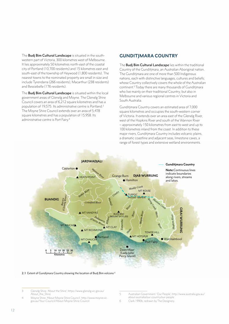
The Budj Bim Cultural Landscape is situated in the south-western part of Victoria, 300 kilometres west of Melbourne. It lies approximately 50 kilometres north-east of the coastal city of Portland (10,700 residents) and 15 kilometres east and south-east of the township of Heywood (1,800 residents). The nearest towns to the nominated property are small in size and include Tyrendarra (266 residents), Macarthur (238 residents) and Bessiebelle (176 residents).
The Budj Bim Cultural Landscape is situated within the local government areas of Glenelg and Moyne. The Glenelg Shire Council covers an area of 6,212 square kilometres and has a population of 19,575. Its administrative centre is Portland.3 The Moyne Shire Council extends over an area of 5,478 square kilometres and has a population of 15,958. Its administrative centre is Port Fairy.4
3 Glenelg Shire. ‘About the Shire’, https://www.glenelg.vic.gov.au/About_the_Shire
4 Moyne Shire. ‘About Moyne Shire Council’, http://www.moyne.vic.gov.au/Your-Council/About-Moyne-Shire-Council
GUNDITJMARA COUNTRY
The Budj Bim Cultural Landscape lies within the traditional Country of the Gunditjmara, an Australian Aboriginal nation. The Gunditjmara are one of more than 500 Indigenous nations, each with distinctive languages, cultures and beliefs; whose Country collectively covers the whole of the Australian continent.5 Today there are many thousands of Gunditjmara who live mainly on their traditional Country; but also in Melbourne and various regional centres in Victoria and South Australia.
Gunditjmara Country covers an estimated area of 7,000 square kilometres and occupies the south-western corner of Victoria. It extends over an area east of the Glenelg River, west of the Hopkins River and south of the Wannon River – approximately 150 kilometres from east to west and up to 100 kilometres inland from the coast. In addition to these major rivers, Gunditjmara Country includes volcanic plains, a dramatic coastline and adjacent seas, limestone caves, a range of forest types and extensive wetland environments. 6
5 Australian Government. ‘Our People’, http://www.australia.gov.au/about-australia/our-country/our-people
6 Clark 1990b, redrawn by The Designery.
2.1 Extent of Gundijmara Country showing the location of Budj Bim volcono 6
12
Gunditjmara Elders describe Country in a way that conveys their deep sense of connectedness through cultural traditions,
spirit and feeling, relationships, stories and landscape.
For Gunditjmara people, ‘Country’ includes all living things – none better than the other but equal in their importance in forming this diverse landscape that is Gunditjmara Country. Country means people, plants and animals alike. It embraces the seasons, stories and spirits of the creation. This flowing, connected cultural landscape possesses its own sacred places, languages, ceremonies, totems, art, clan groupings and law.
Our spirit is in this Country … across the wetlands to Budj Bim and Tungatt Mirring. Our Country is a place of belonging and pride that comes with this belonging. We are proud to share many aspects of our land, art and culture with visitors/guests. It is a part of us and who we are, and we ask that you care for it when you visit.
It is our responsibility to look after Country, our children will continue to look after Country, because that’s the way it is and will be.7
Throughout Gunditjmara Country there are many places that embody their history – places that evidence the creation and shaping of the landscape, their traditions of care and management, their determination to retain their rights to land following the arrival of European colonisers and the sad and joyful stories of Mission life and afterwards. All of these places express tangible and intangible connections to land, culture, family and community for the Gunditjmara.
There is a strong link between healthy Country and healthy people for the Gunditjmara. Through their legal ownership of parts of traditional Country and cooperative management agreements with the Victorian Government, the Gunditjmara are able to care for Country, be and work on Country and pass on cultural traditions, knowledge and practices concerning Country. Looking after Country involves caring for all aspects of Country – all living things, water, land and oneself.
7 Cited in Context 2012a:19
NATIVE TITLE AND GUNDITJMARA LAND OWNERSHIP
Native title is recognition under Australian law of Indigenous peoples’ rights and interests to ancestral lands and waters based on laws and customs that have endured since colonisation. For native title to be determined, the onus of proof is on the Indigenous descendants to provide evidence that their traditional laws and customs endure.
The Gunditjmara achieved native title for an area which includes the Budj Bim Cultural Landscape in 2007. The Australian Government recognised the Gunditjmara’s native title rights and interests over almost 133,000 hectares of vacant Crown land, National Parks, Reserves, rivers, creeks and sea, bounded on the west by the Glenelg River and to the north by the Wannon River. The area includes Budj Bim (formerly Mount Eccles) National Park. Following the recognition of native title, the Victorian Government and the Gunditjmara agreed to co-operative management of Budj Bim National Park (Part 3.1.E) and the transfer of the freehold title of Lake Condah Reserve to the Gunditj Mirring Traditional Owners Aboriginal Corporation (GMTOAC).8
Gunditmara native title rights and interests are non-exclusive and sit alongside the broader community's right to enjoy these places.9 The recognised Gunditjmara native title rights and interests include the right to:
• have access to or enter and remain on the land and waters
• camp on the land and waters landward of the high water mark of the sea
• use and enjoy the land and waters
• protect places and areas of importance on the land and waters
• take resources of the land and water.
8 Parks Victoria 2015:6 9 GMTOAC 2015:6-7
13
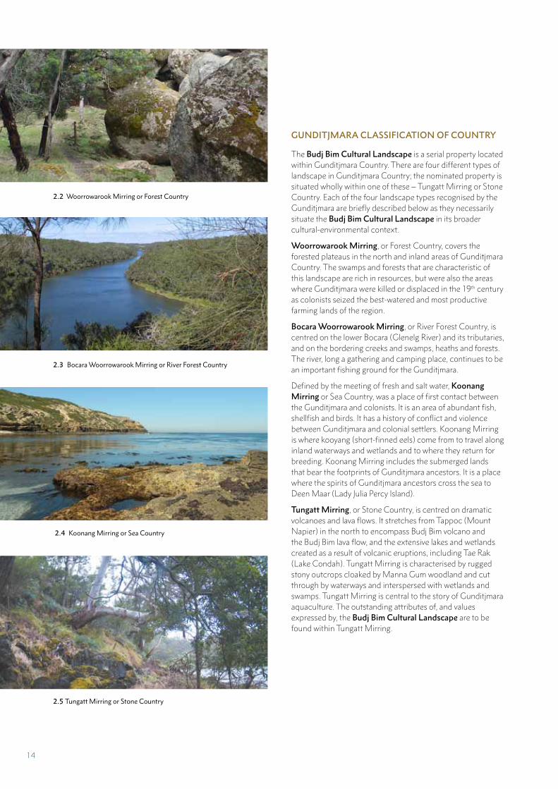
GUNDITJMARA CLASSIFICATION OF COUNTRY
The Budj Bim Cultural Landscape is a serial property located within Gunditjmara Country. There are four different types of landscape in Gunditjmara Country; the nominated property is situated wholly within one of these – Tungatt Mirring or Stone Country. Each of the four landscape types recognised by the Gunditjmara are briefly described below as they necessarily situate the Budj Bim Cultural Landscape in its broader cultural-environmental context.
Woorrowarook Mirring, or Forest Country, covers the forested plateaus in the north and inland areas of Gunditjmara Country. The swamps and forests that are characteristic of this landscape are rich in resources, but were also the areas where Gunditjmara were killed or displaced in the 19th century as colonists seized the best-watered and most productive farming lands of the region.
Bocara Woorrowarook Mirring, or River Forest Country, is centred on the lower Bocara (Glenelg River) and its tributaries, and on the bordering creeks and swamps, heaths and forests. The river, long a gathering and camping place, continues to be an important fishing ground for the Gunditjmara.
Defined by the meeting of fresh and salt water, Koonang Mirring or Sea Country, was a place of first contact between the Gunditjmara and colonists. It is an area of abundant fish, shellfish and birds. It has a history of conflict and violence between Gunditjmara and colonial settlers. Koonang Mirring is where kooyang (short-finned eels) come from to travel along inland waterways and wetlands and to where they return for breeding. Koonang Mirring includes the submerged lands that bear the footprints of Gunditjmara ancestors. It is a place where the spirits of Gunditjmara ancestors cross the sea to Deen Maar (Lady Julia Percy Island).
Tungatt Mirring, or Stone Country, is centred on dramatic volcanoes and lava flows. It stretches from Tappoc (Mount Napier) in the north to encompass Budj Bim volcano and the Budj Bim lava flow, and the extensive lakes and wetlands created as a result of volcanic eruptions, including Tae Rak (Lake Condah). Tungatt Mirring is characterised by rugged stony outcrops cloaked by Manna Gum woodland and cut through by waterways and interspersed with wetlands and swamps. Tungatt Mirring is central to the story of Gunditjmara aquaculture. The outstanding attributes of, and values expressed by, the Budj Bim Cultural Landscape are to be found within Tungatt Mirring.
2.2 Woorrowarook Mirring or Forest Country
2.3 Bocara Woorrowarook Mirring or River Forest Country
2.4 Koonang Mirring or Sea Country
2.5 Tungatt Mirring or Stone Country
14
GUNDITJMARA AQUACULTURE SYSTEM
The Budj Bim Cultural Landscape contains extensive physical evidence of deliberate manipulation, modification and management of water flow and ecosystems by the Gunditjmara in order to increase their available food resources. Manipulation of resources is evident in kooyang (eel) trapping, containment and live storage. This resource manipulation, which began at least 6,600 years ago, involved large-scale modification of local hydrological regimes to capture kooyang and artificially-constructed holding ponds to enhance kooyang containment and availability.10 Anthropologist Ian Keen notes that “the complex system of eel canals in western Victoria”, within which the nominated property is situated, is “perhaps the most elaborate example of environmental control recorded” for Aboriginal Australia.11
KOOYANG AQUACULTURE
Since the 1970s, the Gunditjmara have worked with archaeologists to record and map numerous kooyang trapping and associated aquaculture facilities across the Budj Bim Cultural Landscape.12 This work has revealed facilities comprising complex and intricate combinations of structures, such as excavated channels (cut through sediment and basalt lava) and constructed stone walls made from basalt lava. These features have been established at strategic points in the landscape to manipulate local waterways and flood regimes and thus to enable the capture and live storage of kooyang. Large-scale, multi-dimensional (that is, made to work at multiple water elevations or levels) and multi-component (comprising various configurations of structures such as channels, weirs and dams) facilities are referred to as trapping ‘complexes’. Collectively the complexes comprise the Gunditjmara aquaculture system.
A range of terms have been used to describe the different structures that comprise the aquaculture complexes of the Budj Bim Cultural Landscape. This range of terms can be simplified to three basic structures – channels, weirs and dams (Table 2.1). Archaeologists and other researchers use these terms interchangeably to describe the various structures rather than their function. It is probable that the Gunditjmara altered the functions of different structures, depending on situational needs.13
10 McNiven et al. 201511 Keen 2004:9512 The Victorian Aboriginal Heritage Register lists over 100 features re-
lated to the Gunditjmara aquaculture system that are located within the nominated property.
13 For example, archaeologist Heather Builth (2002:236) states that “the terms, weir, barrage and dam, are to a certain extent, interchangeable”.
14 151617181920212223242526
14 Builth 2002, 2004, 2006; Clarke 1991:17 15 Clarke 1991:17 16 Coutts et al. 1978:12 17 Coutts et al. 1978; Builth 2002, 2004, 2006 18 Clarke 1991:16 19 Coutts et al. 1978:12; Clarke 1991:16 20 Builth 2002, 2004, 200621 Coutts et al. 1978:1222 Clarke 1991:1723 Builth 200424 Johns cited in Worsnop 1897; Richards 201125 Builth 2002; Richards 2011, 201326 Alexander Ingram, cited in Richards 2011:68, 74
STRUCTURE DESCRIPTION
Channels
(yereoc)
Type 1. Channels excavated through lava bedrock (by removal of basalt blocks) which may also be lined with a parallel row of low stone walls. Type 2. Channels (natural channels and drainage lines as well as channels excavated through sediment) lined with a parallel row of low stone walls. Artificially modified channels (types 1 and 2) are usually one metre wide and are up to 200 metres long and strategically direct water and kooyang between locations.14 These channels are also referred to in the archaeological literature as ‘stone-lined channels’ and ‘modified channels’,15 and ‘canals’ and ‘stone races’.16
Weirs Low walls (less than one metre high) of basalt blocks constructed across natural waterways and drainage lines, and across artificially constructed channels; with gaps or apertures to accommodate insertion of gnarraban (woven kooyang baskets).17 Some weir walls also incorporate natural outcrops of basalt lava.18 Weirs are also referred to as ‘traps’.19
Dams Low walls (less than one metre high) of basalt blocks constructed across low points of the lava flow and extending between high points to hold back flood waters. Most dam walls are less than 10 metres long. Many dams are associated with the creation of ponds for holding kooyang.20 Dams are also referred to as ‘stone walls’,21 ‘stone alignments’,22 ‘barrages’,23 barricades’,24 ‘barriers’25 and ‘low winged walls’.26
TABLE 2.1 Budj Bim Cultural Landscape: Structural components of the Gunditjmara aquaculture complexes
15
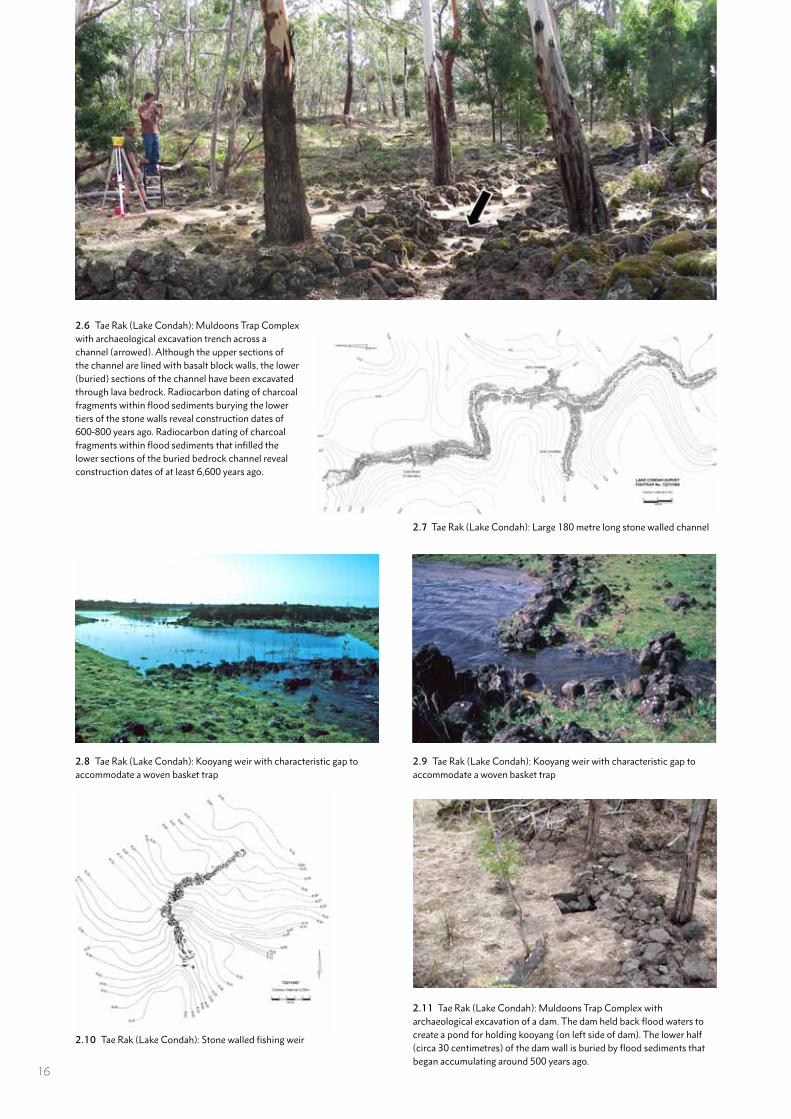
2.6 Tae Rak (Lake Condah): Muldoons Trap Complex with archaeological excavation trench across a channel (arrowed). Although the upper sections of the channel are lined with basalt block walls, the lower (buried) sections of the channel have been excavated through lava bedrock. Radiocarbon dating of charcoal fragments within flood sediments burying the lower tiers of the stone walls reveal construction dates of 600-800 years ago. Radiocarbon dating of charcoal fragments within flood sediments that infilled the lower sections of the buried bedrock channel reveal construction dates of at least 6,600 years ago.
2.7 Tae Rak (Lake Condah): Large 180 metre long stone walled channel
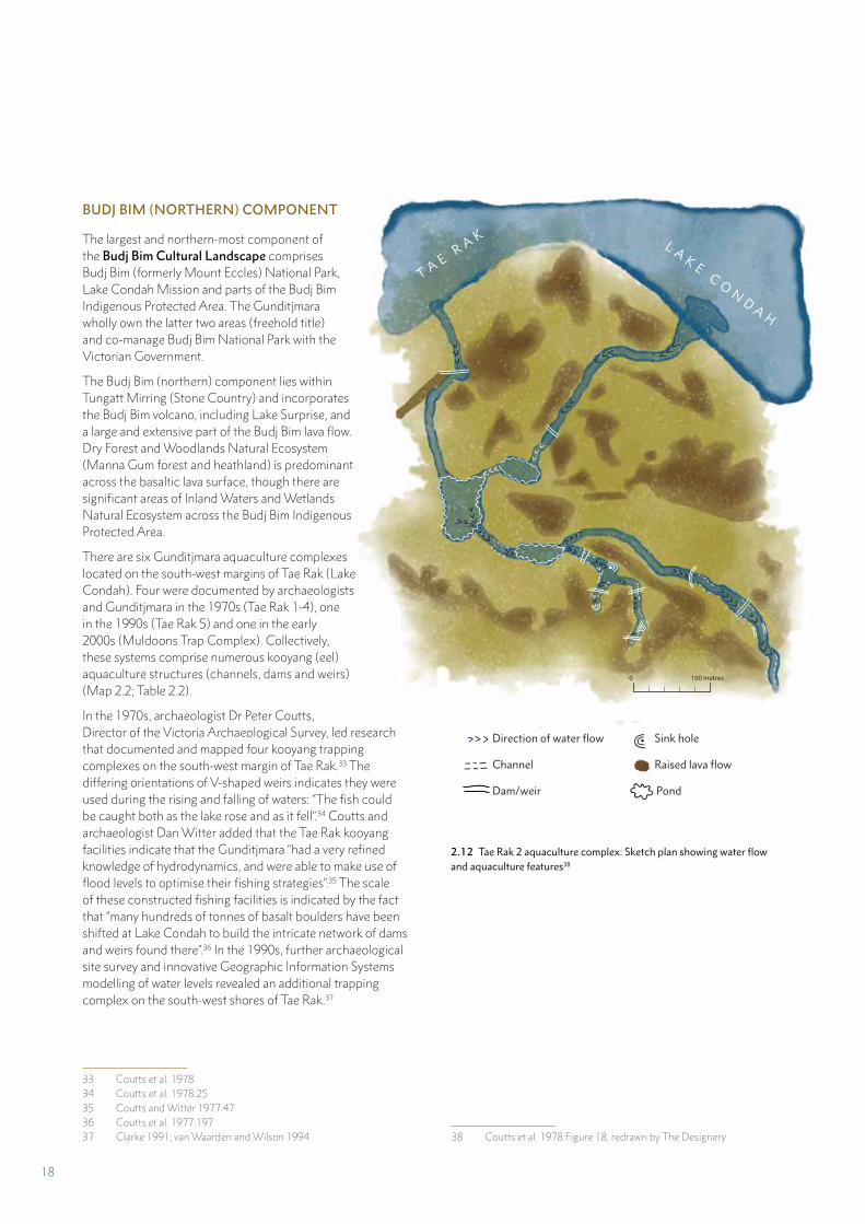
2.8 Tae Rak (Lake Condah): Kooyang weir with characteristic gap to accommodate a woven basket trap
2.9 Tae Rak (Lake Condah): Kooyang weir with characteristic gap to accommodate a woven basket trap
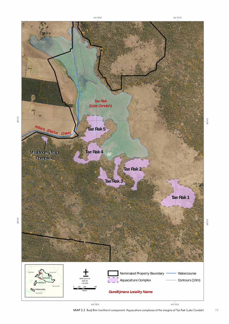
2.10 Tae Rak (Lake Condah): Stone walled fishing weir
2.11 Tae Rak (Lake Condah): Muldoons Trap Complex with archaeological excavation of a dam. The dam held back flood waters to create a pond for holding kooyang (on left side of dam). The lower half (circa 30 centimetres) of the dam wall is buried by flood sediments that began accumulating around 500 years ago.
16
KOOYANG GROWING PONDS AND LIVE STORAGE
Each of the most extensive kooyang trapping complexes – located at Tae Rak, Kurtonitj, and Tyrendarra – feature constructed channels, weirs and dams used to contain flood waters and create holding and growing ponds for kooyang. The key function of these ponds was the live storage of kooyang and to keep them within a confined area for consumption through the different seasons.27
KOOYANG HARVESTING AND PROCESSING
Based on Gunditjmara knowledge - and supported by information documented in 19th century ethnographic observations from south-west Victoria, the Gunditjmara used gnarraban (woven baskets) set within weirs to capture kooyang across the Budj Bim Cultural Landscape.28 Kooyang in artificially-constructed holding ponds were able to be speared during different seasons.29 Additionally, it is “possible that the weirs are also positioned to double-up as traps during the mature eel migration runs by incorporating the arrabines [gnarraban] or woven traps into their structure”.30 Although smoking and preservation of kooyang for trade has been hypothesised,31 ethnographic and archaeological evidence for such activities is ambiguous.32
27 Builth 2002:268, 307; Lane 2008:89; Richards 2013:19528 Robinson 1841 cited in McNiven and Bell 2010; Dawson 1881:44,
75, 94-9529 Builth 2002:25330 Builth 2002:25331 Builth 2004, 201432 Keen 2006:27; Lane 2008:89; Richards 2013:211
BUDJ BIM CULTURAL LANDSCAPE: SERIAL COMPONENTS AND AQUACULTURE COMPLEXES
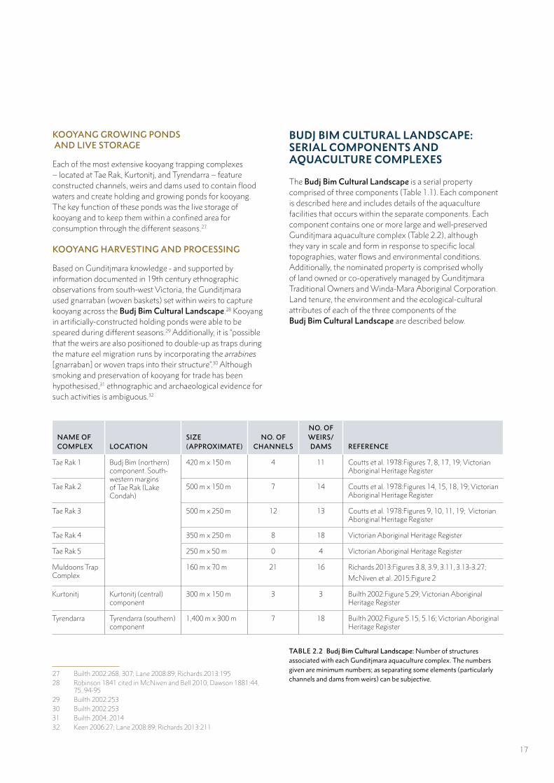
The Budj Bim Cultural Landscape is a serial property comprised of three components (Table 1.1). Each component is described here and includes details of the aquaculture facilities that occurs within the separate components. Each component contains one or more large and well-preserved Gunditjmara aquaculture complex (Table 2.2), although they vary in scale and form in response to specific local topographies, water flows and environmental conditions. Additionally, the nominated property is comprised wholly of land owned or co-operatively managed by Gunditjmara Traditional Owners and Winda-Mara Aboriginal Corporation. Land tenure, the environment and the ecological-cultural attributes of each of the three components of the Budj Bim Cultural Landscape are described below.
NAME OF COMPLEX LOCATION
SIZE (APPROXIMATE)
NO. OF CHANNELS
NO. OF WEIRS/DAMS REFERENCE
Tae Rak 1 Budj Bim (northern) component. South-western margins of Tae Rak (Lake Condah)
420 m x 150 m 4 11 Coutts et al. 1978:Figures 7, 8, 17, 19; Victorian Aboriginal Heritage Register
Tae Rak 2 500 m x 150 m 7 14 Coutts et al. 1978:Figures 14, 15, 18, 19; Victorian Aboriginal Heritage Register
Tae Rak 3 500 m x 250 m 12 13 Coutts et al. 1978:Figures 9, 10, 11, 19; Victorian Aboriginal Heritage Register
Tae Rak 4 350 m x 250 m 8 18 Victorian Aboriginal Heritage Register
Tae Rak 5 250 m x 50 m 0 4 Victorian Aboriginal Heritage Register
Muldoons Trap Complex
160 m x 70 m 21 16 Richards 2013:Figures 3.8, 3.9, 3.11, 3.13-3.27;
McNiven et al. 2015:Figure 2
Kurtonitj Kurtonitj (central) component
300 m x 150 m 3 3 Builth 2002:Figure 5.29; Victorian Aboriginal Heritage Register
Tyrendarra Tyrendarra (southern) component
1,400 m x 300 m 7 18 Builth 2002:Figure 5.15, 5.16; Victorian Aboriginal Heritage Register
TABLE 2.2 Budj Bim Cultural Landscape: Number of structures associated with each Gunditjmara aquaculture complex. The numbers given are minimum numbers; as separating some elements (particularly channels and dams from weirs) can be subjective.
17
T A E R A K L A K E C ON
D A H
0 100 metres
BUDJ BIM (NORTHERN) COMPONENT
The largest and northern-most component of the Budj Bim Cultural Landscape comprises Budj Bim (formerly Mount Eccles) National Park, Lake Condah Mission and parts of the Budj Bim Indigenous Protected Area. The Gunditjmara wholly own the latter two areas (freehold title) and co-manage Budj Bim National Park with the Victorian Government.
The Budj Bim (northern) component lies within Tungatt Mirring (Stone Country) and incorporates the Budj Bim volcano, including Lake Surprise, and a large and extensive part of the Budj Bim lava flow. Dry Forest and Woodlands Natural Ecosystem (Manna Gum forest and heathland) is predominant across the basaltic lava surface, though there are significant areas of Inland Waters and Wetlands Natural Ecosystem across the Budj Bim Indigenous Protected Area.
There are six Gunditjmara aquaculture complexes located on the south-west margins of Tae Rak (Lake Condah). Four were documented by archaeologists and Gunditjmara in the 1970s (Tae Rak 1-4), one in the 1990s (Tae Rak 5) and one in the early 2000s (Muldoons Trap Complex). Collectively, these systems comprise numerous kooyang (eel) aquaculture structures (channels, dams and weirs) (Map 2.2; Table 2.2).
In the 1970s, archaeologist Dr Peter Coutts, Director of the Victoria Archaeological Survey, led research that documented and mapped four kooyang trapping complexes on the south-west margin of Tae Rak.33 The differing orientations of V-shaped weirs indicates they were used during the rising and falling of waters: “The fish could be caught both as the lake rose and as it fell”.34 Coutts and archaeologist Dan Witter added that the Tae Rak kooyang facilities indicate that the Gunditjmara “had a very refined knowledge of hydrodynamics, and were able to make use of flood levels to optimise their fishing strategies”.35 The scale of these constructed fishing facilities is indicated by the fact that “many hundreds of tonnes of basalt boulders have been shifted at Lake Condah to build the intricate network of dams and weirs found there”.36 In the 1990s, further archaeological site survey and innovative Geographic Information Systems modelling of water levels revealed an additional trapping complex on the south-west shores of Tae Rak.37
33 Coutts et al. 197834 Coutts et al. 1978:2535 Coutts and Witter 1977:4736 Coutts et al. 1977:19737 Clarke 1991; van Waarden and Wilson 1994
2.12 Tae Rak 2 aquaculture complex: Sketch plan showing water flow and aquaculture features38
Channel
Dam/weir
Sink hole
Raised lava flow
Pond
Direction of water flow
38
38 Coutts et al. 1978:Figure 18, redrawn by The Designery
18
60
70
50
60
50
60
60
60
60
60
60
60
60
60
60
60
60
60
60
60
60
60
60
60
60
60
60
60
60
60
60
141°51'E
141°51'E
141°50'E
141°50'E38
°4'S
38°4
'S
38°5
'S
38°5
'S
Tae Rak
(Lake Condah)
(Darlot
0 200 400100
Meters
±MGA Zone 54
GDA 94
1:20,000
Killara
Creek)
Gunditjmara Locality Name
Nominated Property Boundary
Aquaculture Complex
Watercourse
Contours (10m)
Muldoons TrapComplex
Tae Rak 5
Tae Rak 4
Tae Rak 3
Tae Rak 2
Tae Rak 1
!
!
!!Milltown Macarthur
Tyrendarra
Bessiebelle
BUDJ BIM
KURTONITJ
TYRENDARRA
MAP 2.2 Budj Bim (northern) component: Aquaculture complexes of the margins of Tae Rak (Lake Condah) 19
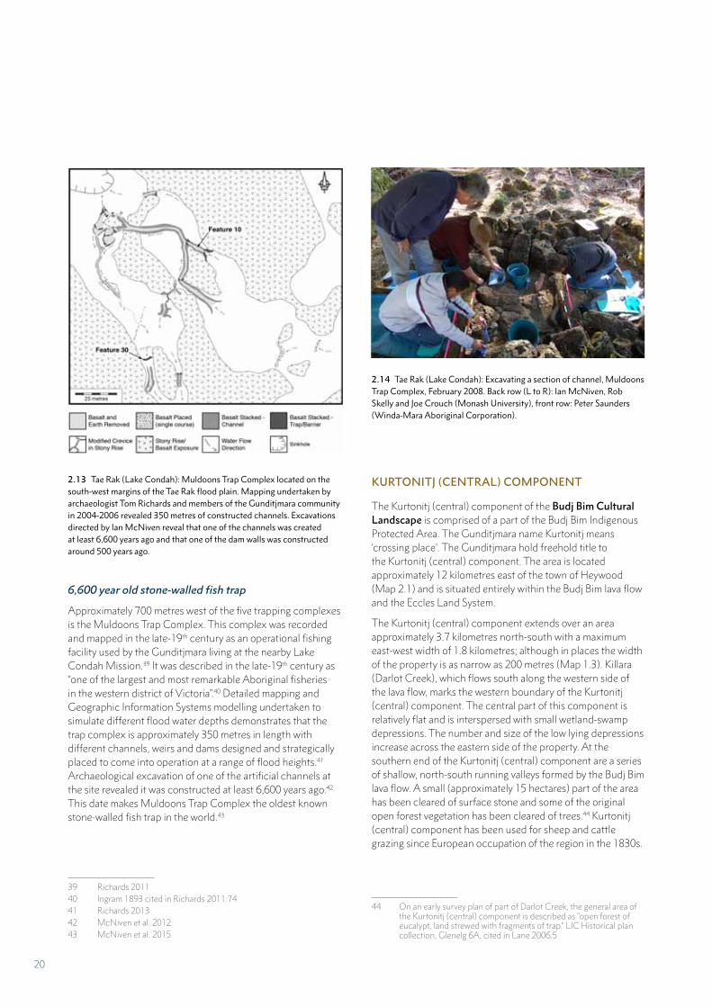
6,600 year old stone-walled fish trap
Approximately 700 metres west of the five trapping complexes is the Muldoons Trap Complex. This complex was recorded and mapped in the late-19th century as an operational fishing facility used by the Gunditjmara living at the nearby Lake Condah Mission.39 It was described in the late-19th century as “one of the largest and most remarkable Aboriginal fisheries in the western district of Victoria”.40 Detailed mapping and Geographic Information Systems modelling undertaken to simulate different flood water depths demonstrates that the trap complex is approximately 350 metres in length with different channels, weirs and dams designed and strategically placed to come into operation at a range of flood heights.41 Archaeological excavation of one of the artificial channels at the site revealed it was constructed at least 6,600 years ago.42 This date makes Muldoons Trap Complex the oldest known stone-walled fish trap in the world.43
39 Richards 201140 Ingram 1893 cited in Richards 2011:7441 Richards 201342 McNiven et al. 201243 McNiven et al. 2015
2.13 Tae Rak (Lake Condah): Muldoons Trap Complex located on the south-west margins of the Tae Rak flood plain. Mapping undertaken by archaeologist Tom Richards and members of the Gunditjmara community in 2004-2006 revealed 350 metres of constructed channels. Excavations directed by Ian McNiven reveal that one of the channels was created at least 6,600 years ago and that one of the dam walls was constructed around 500 years ago.
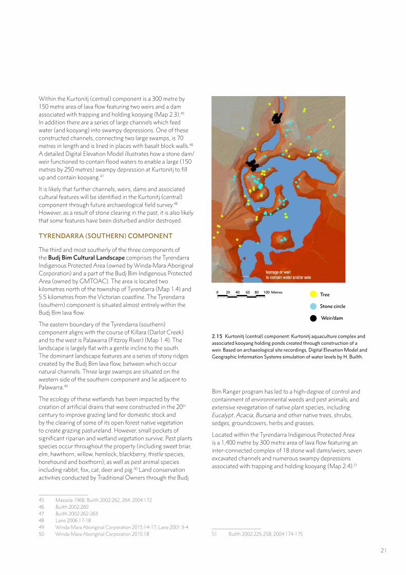
2.14 Tae Rak (Lake Condah): Excavating a section of channel, Muldoons Trap Complex, February 2008. Back row (L to R): Ian McNiven, Rob Skelly and Joe Crouch (Monash University), front row: Peter Saunders (Winda-Mara Aboriginal Corporation).
KURTONITJ (CENTRAL) COMPONENT
The Kurtonitj (central) component of the Budj Bim Cultural Landscape is comprised of a part of the Budj Bim Indigenous Protected Area. The Gunditjmara name Kurtonitj means ‘crossing place’. The Gunditjmara hold freehold title to the Kurtonitj (central) component. The area is located approximately 12 kilometres east of the town of Heywood (Map 2.1) and is situated entirely within the Budj Bim lava flow and the Eccles Land System.
The Kurtonitj (central) component extends over an area approximately 3.7 kilometres north-south with a maximum east-west width of 1.8 kilometres; although in places the width of the property is as narrow as 200 metres (Map 1.3). Killara (Darlot Creek), which flows south along the western side of the lava flow, marks the western boundary of the Kurtonitj (central) component. The central part of this component is relatively flat and is interspersed with small wetland-swamp depressions. The number and size of the low lying depressions increase across the eastern side of the property. At the southern end of the Kurtonitj (central) component are a series of shallow, north-south running valleys formed by the Budj Bim lava flow. A small (approximately 15 hectares) part of the area has been cleared of surface stone and some of the original open forest vegetation has been cleared of trees.44 Kurtonitj (central) component has been used for sheep and cattle grazing since European occupation of the region in the 1830s.
44 On an early survey plan of part of Darlot Creek, the general area of the Kurtonitj (central) component is described as “open forest of eucalypt, land strewed with fragments of trap.” LIC Historical plan collection, Glenelg 6A, cited in Lane 2006:5
20
Within the Kurtonitj (central) component is a 300 metre by 150 metre area of lava flow featuring two weirs and a dam associated with trapping and holding kooyang (Map 2.3).45 In addition there are a series of large channels which feed water (and kooyang) into swampy depressions. One of these constructed channels, connecting two large swamps, is 70 metres in length and is lined in places with basalt block walls.46 A detailed Digital Elevation Model illustrates how a stone dam/weir functioned to contain flood waters to enable a large (150 metres by 250 metres) swampy depression at Kurtonitj to fill up and contain kooyang.47
It is likely that further channels, weirs, dams and associated cultural features will be identified in the Kurtonitj (central) component through future archaeological field survey.48 However, as a result of stone clearing in the past, it is also likely that some features have been disturbed and/or destroyed.
TYRENDARRA (SOUTHERN) COMPONENT
The third and most southerly of the three components of the Budj Bim Cultural Landscape comprises the Tyrendarra Indigenous Protected Area (owned by Winda-Mara Aboriginal Corporation) and a part of the Budj Bim Indigenous Protected Area (owned by GMTOAC). The area is located two kilometres north of the township of Tyrendarra (Map 1.4) and 5.5 kilometres from the Victorian coastline. The Tyrendarra (southern) component is situated almost entirely within the Budj Bim lava flow.
The eastern boundary of the Tyrendarra (southern) component aligns with the course of Killara (Darlot Creek) and to the west is Palawarra (Fitzroy River) (Map 1.4). The landscape is largely flat with a gentle incline to the south. The dominant landscape features are a series of stony ridges created by the Budj Bim lava flow, between which occur natural channels. Three large swamps are situated on the western side of the southern component and lie adjacent to Palawarra.49
The ecology of these wetlands has been impacted by the creation of artificial drains that were constructed in the 20th century to improve grazing land for domestic stock and by the clearing of some of its open forest native vegetation to create grazing pastureland. However, small pockets of significant riparian and wetland vegetation survive. Pest plants species occur throughout the property (including sweet briar, elm, hawthorn, willow, hemlock, blackberry, thistle species, horehound and boxthorn); as well as pest animal species including rabbit, fox, cat, deer and pig.50 Land conservation activities conducted by Traditional Owners through the Budj
45 Massola 1968; Builth 2002:262, 264; 2004:17246 Builth 2002:26047 Builth 2002:262-26348 Lane 2006:17-1849 Winda-Mara Aboriginal Corporation 2015:14-17; Lane 2001:3-450 Winda-Mara Aboriginal Corporation 2015:18
2.15 Kurtonitj (central) component: Kurtonitj aquaculture complex and associated kooyang holding ponds created through construction of a weir. Based on archaeological site recordings, Digital Elevation Model and Geographic Information Systems simulation of water levels by H. Builth.
Bim Ranger program has led to a high-degree of control and containment of environmental weeds and pest animals; and extensive revegetation of native plant species, including Eucalypt, Acacia, Bursaria and other native trees, shrubs, sedges, groundcovers, herbs and grasses.
Located within the Tyrendarra Indigenous Protected Area is a 1,400 metre by 300 metre area of lava flow featuring an inter-connected complex of 18 stone wall dams/weirs, seven excavated channels and numerous swampy depressions associated with trapping and holding kooyang (Map 2.4).51
51 Builth 2002:225-258; 2004:174-175
Tree
Stone circle
Weir/dam
0 20 40 60 80 100 Metres
21
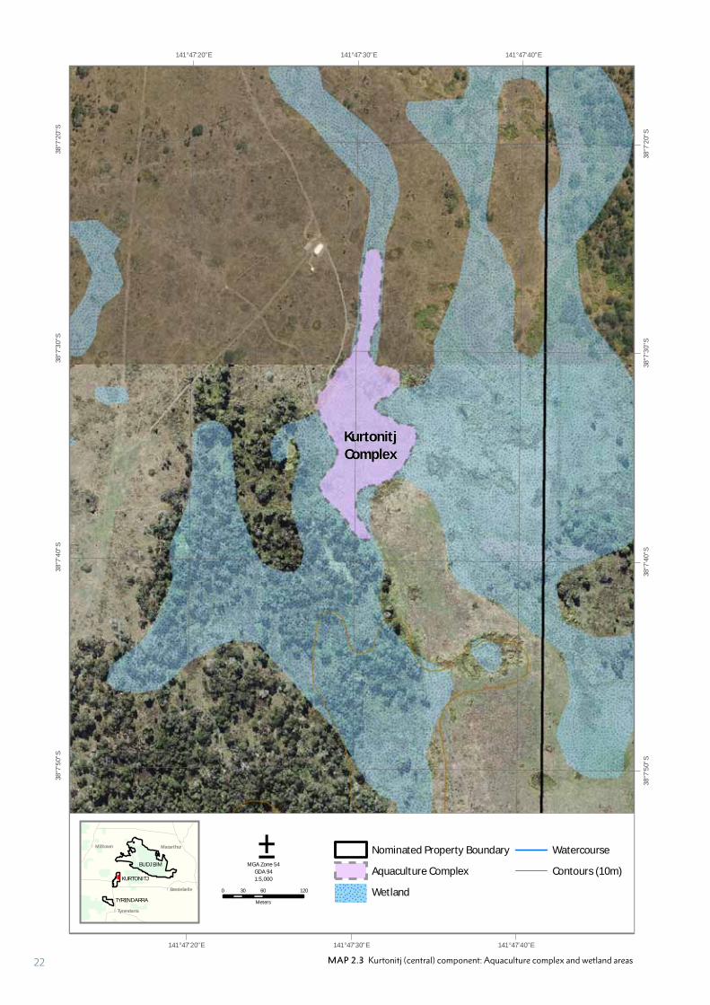
MAP 2.3 Kurtonitj (central) component: Aquaculture complex and wetland areas
30
141°47'40"E
141°47'40"E
141°47'30"E
141°47'30"E
141°47'20"E
141°47'20"E38
°7'2
0"S
38°7
'20"
S
38°7
'30"
S
38°7
'30"
S
38°7
'40"
S
38°7
'40"
S
38°7
'50"
S
38°7
'50"
S
0 60 12030
Meters
±MGA Zone 54
GDA 94
1:5,000
Nominated Property Boundary
Aquaculture Complex
Wetland
Watercourse
Contours (10m)
!
!
!!Milltown Macarthur
Tyrendarra
Bessiebelle
BUDJ BIM
KURTONITJ
TYRENDARRA
KurtonitjComplex
22
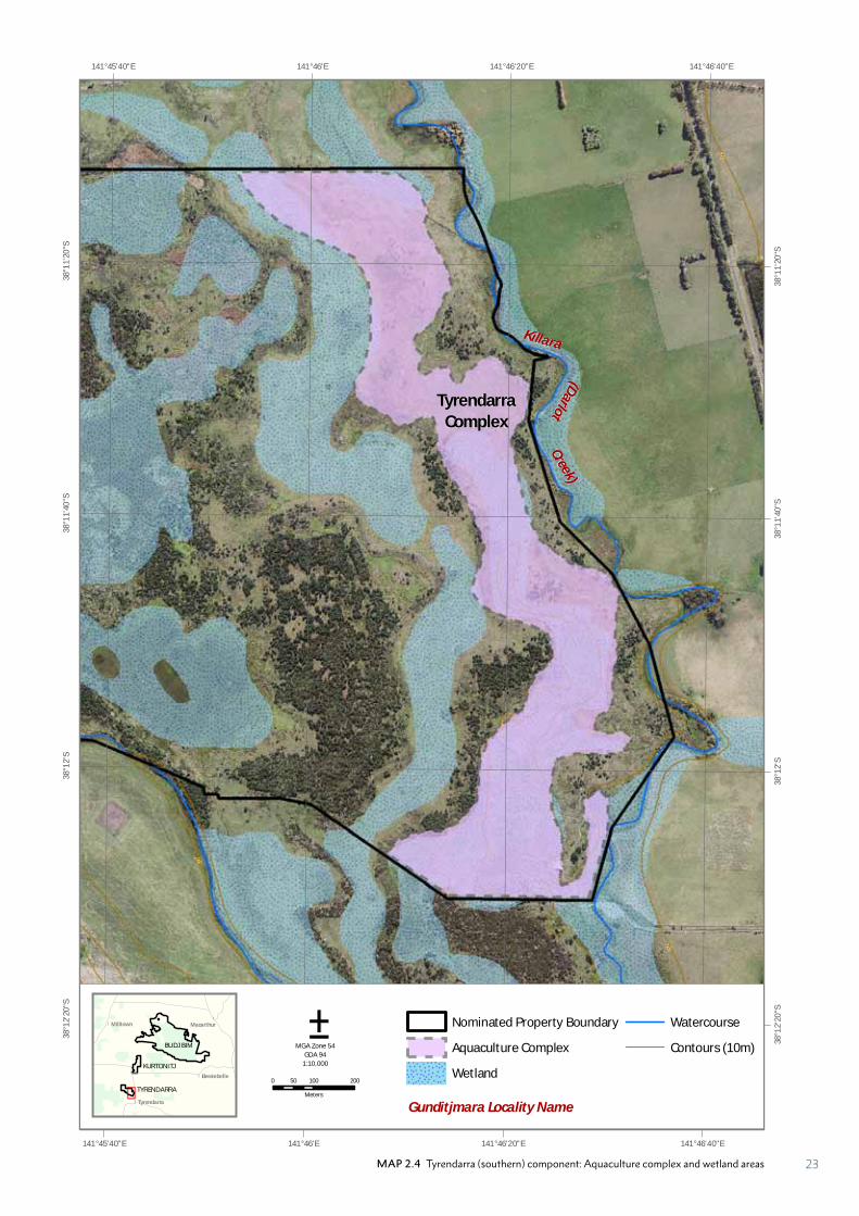
MAP 2.4 Tyrendarra (southern) component: Aquaculture complex and wetland areas
10
2030
4050
60
10
20
141°46'40"E
141°46'40"E
141°46'20"E
141°46'20"E
141°46'E
141°46'E
141°45'40"E
141°45'40"E38
°11'
20"S
38°1
1'20
"S
38°1
1'40
"S
38°1
1'40
"S
38°1
2'S
38°1
2'S
38°1
2'20
"S
38°1
2'20
"S
0 100 20050
Meters
±MGA Zone 54
GDA 94
1:10,000
Gunditjmara Locality Name
Nominated Property Boundary
Aquaculture Complex
Wetland
Watercourse
Contours (10m)
!
!
!!Milltown Macarthur
Tyrendarra
Bessiebelle
BUDJ BIM
KURTONITJ
TYRENDARRA
(Darlot
Killara
Creek)
TyrendarraComplex
23
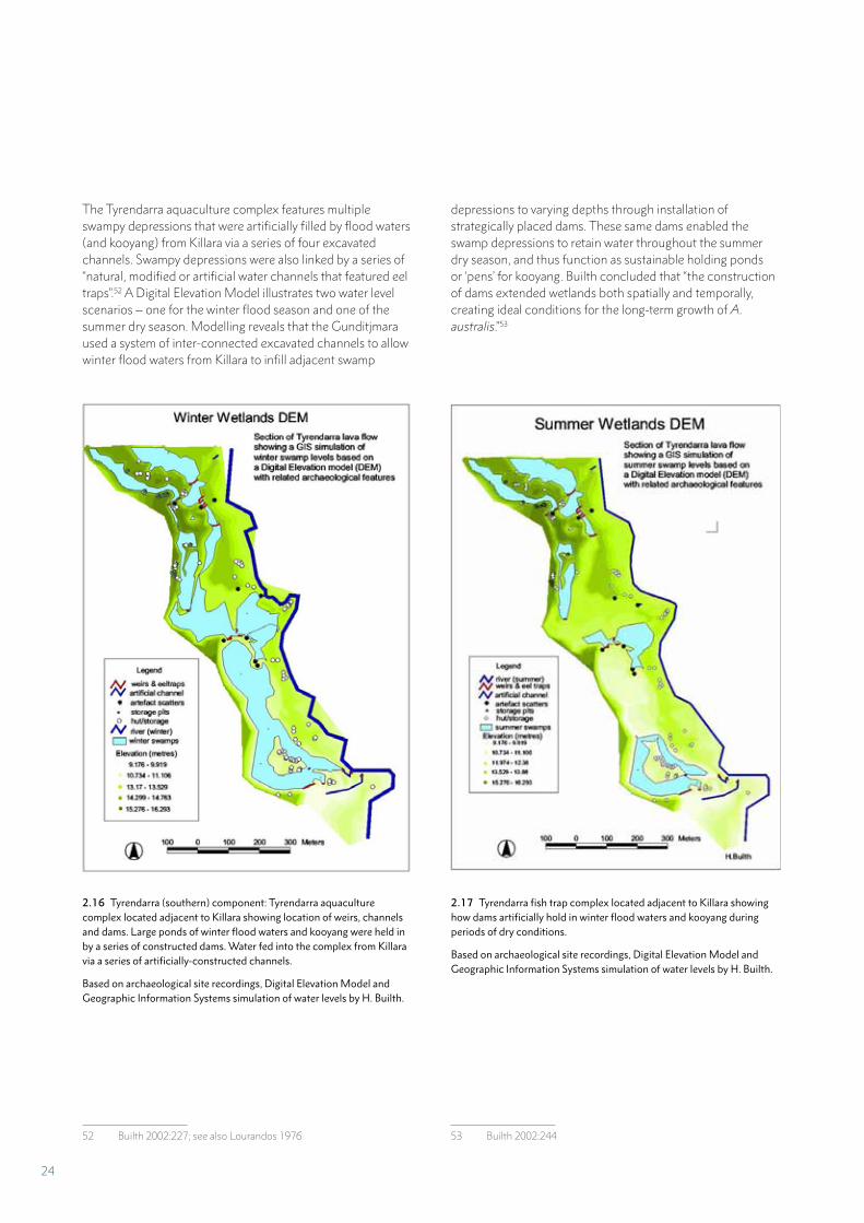
The Tyrendarra aquaculture complex features multiple swampy depressions that were artificially filled by flood waters (and kooyang) from Killara via a series of four excavated channels. Swampy depressions were also linked by a series of “natural, modified or artificial water channels that featured eel traps”.52 A Digital Elevation Model illustrates two water level scenarios – one for the winter flood season and one of the summer dry season. Modelling reveals that the Gunditjmara used a system of inter-connected excavated channels to allow winter flood waters from Killara to infill adjacent swamp
52 Builth 2002:227; see also Lourandos 1976
depressions to varying depths through installation of strategically placed dams. These same dams enabled the swamp depressions to retain water throughout the summer dry season, and thus function as sustainable holding ponds or ‘pens’ for kooyang. Builth concluded that “the construction of dams extended wetlands both spatially and temporally, creating ideal conditions for the long-term growth of A. australis.”53
53 Builth 2002:244
2.16 Tyrendarra (southern) component: Tyrendarra aquaculture complex located adjacent to Killara showing location of weirs, channels and dams. Large ponds of winter flood waters and kooyang were held in by a series of constructed dams. Water fed into the complex from Killara via a series of artificially-constructed channels.
Based on archaeological site recordings, Digital Elevation Model and Geographic Information Systems simulation of water levels by H. Builth.
2.17 Tyrendarra fish trap complex located adjacent to Killara showing how dams artificially hold in winter flood waters and kooyang during periods of dry conditions.
Based on archaeological site recordings, Digital Elevation Model and Geographic Information Systems simulation of water levels by H. Builth.
24
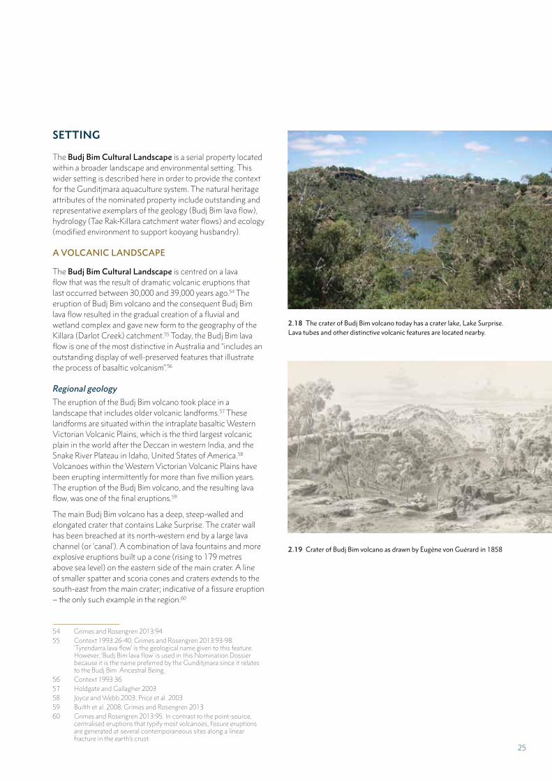
SETTING
The Budj Bim Cultural Landscape is a serial property located within a broader landscape and environmental setting. This wider setting is described here in order to provide the context for the Gunditjmara aquaculture system. The natural heritage attributes of the nominated property include outstanding and representative exemplars of the geology (Budj Bim lava flow), hydrology (Tae Rak-Killara catchment water flows) and ecology (modified environment to support kooyang husbandry).
A VOLCANIC LANDSCAPE
The Budj Bim Cultural Landscape is centred on a lava flow that was the result of dramatic volcanic eruptions that last occurred between 30,000 and 39,000 years ago.54 The eruption of Budj Bim volcano and the consequent Budj Bim lava flow resulted in the gradual creation of a fluvial and wetland complex and gave new form to the geography of the Killara (Darlot Creek) catchment.55 Today, the Budj Bim lava flow is one of the most distinctive in Australia and “includes an outstanding display of well-preserved features that illustrate the process of basaltic volcanism”.56
Regional geology
The eruption of the Budj Bim volcano took place in a landscape that includes older volcanic landforms.57 These landforms are situated within the intraplate basaltic Western Victorian Volcanic Plains, which is the third largest volcanic plain in the world after the Deccan in western India, and the Snake River Plateau in Idaho, United States of America.58 Volcanoes within the Western Victorian Volcanic Plains have been erupting intermittently for more than five million years. The eruption of the Budj Bim volcano, and the resulting lava flow, was one of the final eruptions.59
The main Budj Bim volcano has a deep, steep-walled and elongated crater that contains Lake Surprise. The crater wall has been breached at its north-western end by a large lava channel (or ‘canal’). A combination of lava fountains and more explosive eruptions built up a cone (rising to 179 metres above sea level) on the eastern side of the main crater. A line of smaller spatter and scoria cones and craters extends to the south-east from the main crater; indicative of a fissure eruption – the only such example in the region.60
54 Grimes and Rosengren 2013:9455 Context 1993:26-40; Grimes and Rosengren 2013:93-98.
‘Tyrendarra lava flow’ is the geological name given to this feature. However, ‘Budj Bim lava flow’ is used in this Nomination Dossier because it is the name preferred by the Gunditjmara since it relates to the Budj Bim Ancestral Being.
56 Context 1993:3657 Holdgate and Gallagher 200358 Joyce and Webb 2003; Price et al. 200359 Builth et al. 2008; Grimes and Rosengren 201360 Grimes and Rosengren 2013:95. In contrast to the point-source,
centralised eruptions that typify most volcanoes, fissure eruptions are generated at several contemporaneous sites along a linear fracture in the earth’s crust.
2.18 The crater of Budj Bim volcano today has a crater lake, Lake Surprise. Lava tubes and other distinctive volcanic features are located nearby.
2.19 Crater of Budj Bim volcano as drawn by Eugène von Guérard in 1858
25
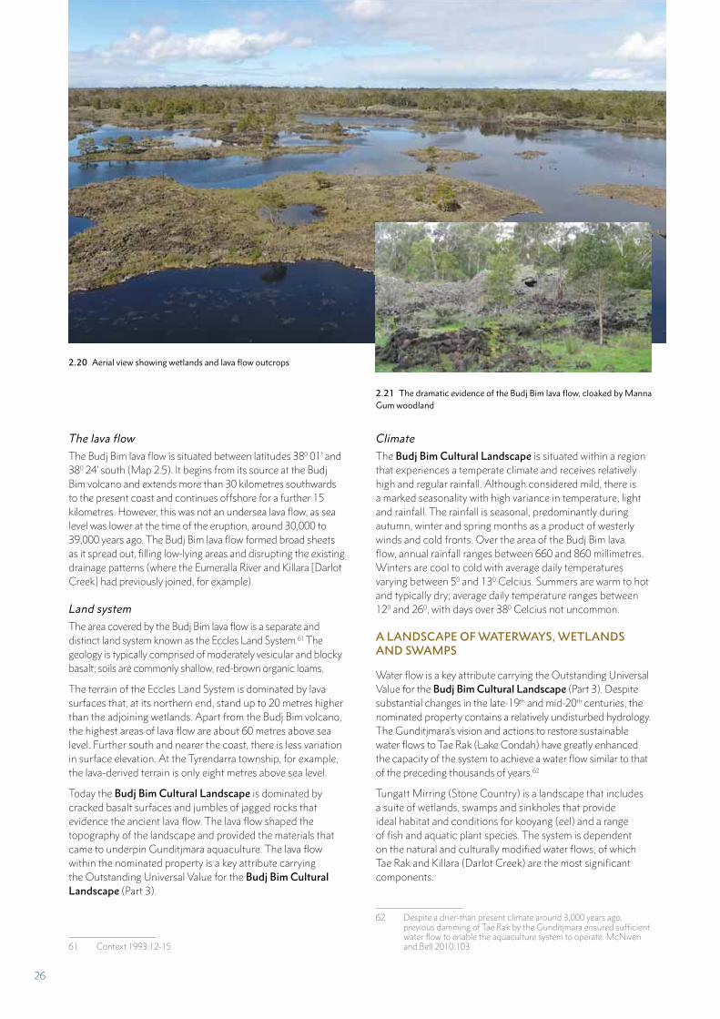
The lava flow
The Budj Bim lava flow is situated between latitudes 380 01’ and 380 24’ south (Map 2.5). It begins from its source at the Budj Bim volcano and extends more than 30 kilometres southwards to the present coast and continues offshore for a further 15 kilometres. However, this was not an undersea lava flow, as sea level was lower at the time of the eruption, around 30,000 to 39,000 years ago. The Budj Bim lava flow formed broad sheets as it spread out, filling low-lying areas and disrupting the existing drainage patterns (where the Eumeralla River and Killara [Darlot Creek] had previously joined, for example).
Land system
The area covered by the Budj Bim lava flow is a separate and distinct land system known as the Eccles Land System.61 The geology is typically comprised of moderately vesicular and blocky basalt; soils are commonly shallow, red-brown organic loams.
The terrain of the Eccles Land System is dominated by lava surfaces that, at its northern end, stand up to 20 metres higher than the adjoining wetlands. Apart from the Budj Bim volcano, the highest areas of lava flow are about 60 metres above sea level. Further south and nearer the coast, there is less variation in surface elevation. At the Tyrendarra township, for example, the lava-derived terrain is only eight metres above sea level.
Today the Budj Bim Cultural Landscape is dominated by cracked basalt surfaces and jumbles of jagged rocks that evidence the ancient lava flow. The lava flow shaped the topography of the landscape and provided the materials that came to underpin Gunditjmara aquaculture. The lava flow within the nominated property is a key attribute carrying the Outstanding Universal Value for the Budj Bim Cultural Landscape (Part 3).
61 Context 1993:12-15
Climate
The Budj Bim Cultural Landscape is situated within a region that experiences a temperate climate and receives relatively high and regular rainfall. Although considered mild, there is a marked seasonality with high variance in temperature, light and rainfall. The rainfall is seasonal, predominantly during autumn, winter and spring months as a product of westerly winds and cold fronts. Over the area of the Budj Bim lava flow, annual rainfall ranges between 660 and 860 millimetres. Winters are cool to cold with average daily temperatures varying between 50 and 130 Celcius. Summers are warm to hot and typically dry; average daily temperature ranges between 120 and 260, with days over 380 Celcius not uncommon.
A LANDSCAPE OF WATERWAYS, WETLANDS AND SWAMPS
Water flow is a key attribute carrying the Outstanding Universal Value for the Budj Bim Cultural Landscape (Part 3). Despite substantial changes in the late-19th and mid-20th centuries, the nominated property contains a relatively undisturbed hydrology. The Gunditjmara’s vision and actions to restore sustainable water flows to Tae Rak (Lake Condah) have greatly enhanced the capacity of the system to achieve a water flow similar to that of the preceding thousands of years.62
Tungatt Mirring (Stone Country) is a landscape that includes a suite of wetlands, swamps and sinkholes that provide ideal habitat and conditions for kooyang (eel) and a range of fish and aquatic plant species. The system is dependent on the natural and culturally modified water flows, of which Tae Rak and Killara (Darlot Creek) are the most significant components.
62 Despite a drier-than present climate around 3,000 years ago, previous damming of Tae Rak by the Gunditjmara ensured sufficient water flow to enable the aquaculture system to operate. McNiven and Bell 2010:103
2.20 Aerial view showing wetlands and lava flow outcrops
2.21 The dramatic evidence of the Budj Bim lava flow, cloaked by Manna Gum woodland
26
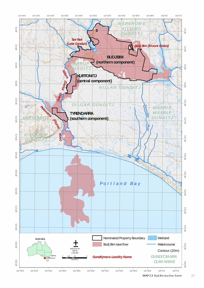
#*
Eum
eralla
Rive
r
142°2'E
142°2'E
142°0'E
142°0'E
141°58'E
141°58'E
141°56'E
141°56'E
141°54'E
141°54'E
141°52'E
141°52'E
141°50'E
141°50'E
141°48'E
141°48'E
141°46'E
141°46'E
141°44'E
141°44'E
141°42'E
141°42'E
141°40'E
141°40'E38
°2'S
38°2
'S
38°4
'S
38°4
'S
38°6
'S
38°6
'S
38°8
'S
38°8
'S
38°1
0'S
38°1
0'S
38°1
2'S
38°1
2'S
38°1
4'S
38°1
4'S
38°1
6'S
38°1
6'S
38°1
8'S
38°1
8'S
38°2
0'S
38°2
0'S
38°2
2'S
38°2
2'S
38°2
4'S
38°2
4'S
38°2
6'S
38°2
6'S
38°2
8'S
38°2
8'S
Tae Rak
(Lake Condah)
W E R E R O M EK I L L I N G
G U N D I T J
N I L L A N G U N D I T J
K E R R U PG U N D I T J
CART GUNDITJ
G I L G A R G U N D I T JPalawarra
P o r t l a n d B a y
Budj Bim (Mount Eccles)
0 2.5 51.25
kilometres
Nominated Property Boundary
Budj Bim lava flow
Wetland
Watercourse
Contour (20m)
Gunditjmara Locality Name
±MGA Zone 54
GDA 94
1:200,000
GUNDITJMARA CLAN NAME
BUDJ BIM(northern component)
KURTONITJ(central component)
TYRENDARRA(southern component)
K I L C A R E RG U N D I T J
W E E R I PW E E R I P
G U N D I T J(FitzroyR
iver)
Australia
!
!
Melbourne
Sydney
(Darlo
tKillara
Creek)
MAP 2.5 Budj Bim lava flow: Extent 27
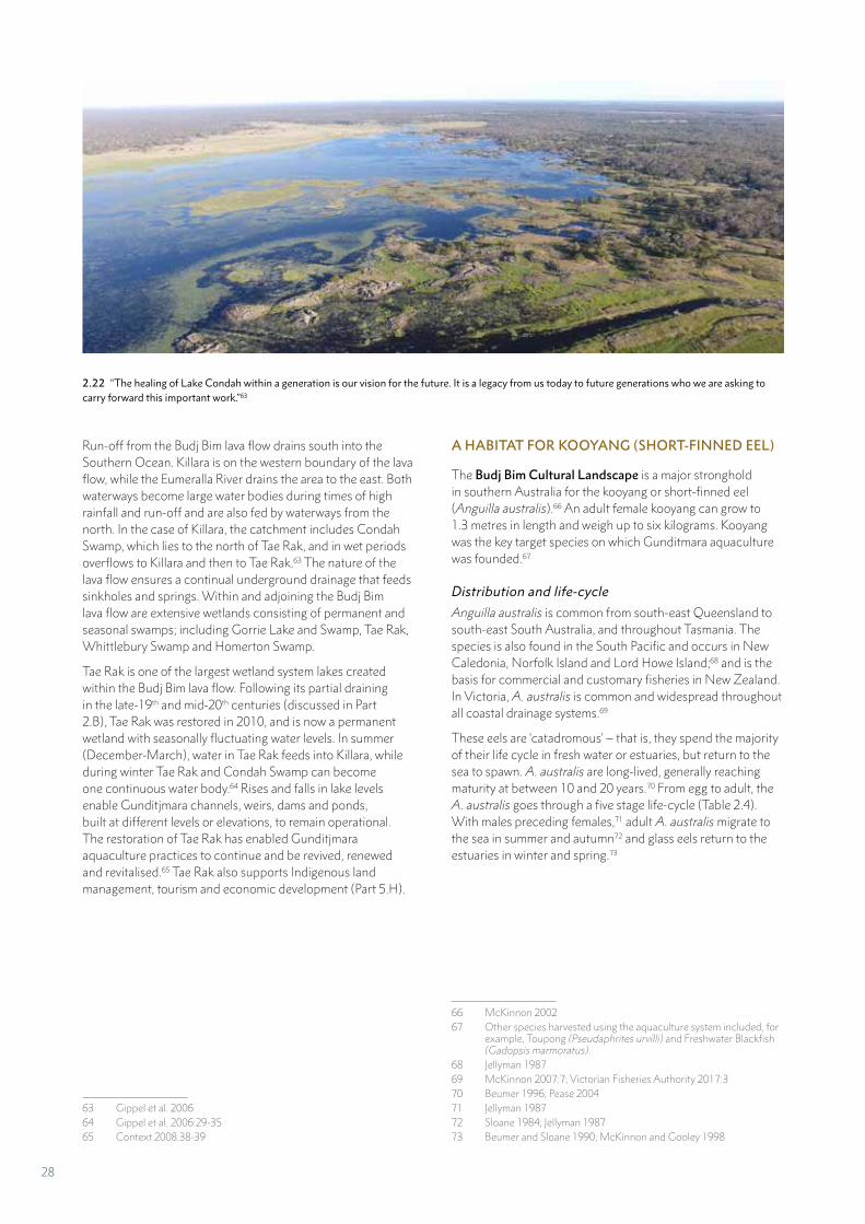
Run-off from the Budj Bim lava flow drains south into the
Southern Ocean. Killara is on the western boundary of the lava flow, while the Eumeralla River drains the area to the east. Both waterways become large water bodies during times of high rainfall and run-off and are also fed by waterways from the north. In the case of Killara, the catchment includes Condah Swamp, which lies to the north of Tae Rak, and in wet periods overflows to Killara and then to Tae Rak.63 The nature of the lava flow ensures a continual underground drainage that feeds sinkholes and springs. Within and adjoining the Budj Bim lava flow are extensive wetlands consisting of permanent and seasonal swamps; including Gorrie Lake and Swamp, Tae Rak, Whittlebury Swamp and Homerton Swamp.
Tae Rak is one of the largest wetland system lakes created within the Budj Bim lava flow. Following its partial draining in the late-19th and mid-20th centuries (discussed in Part 2.B), Tae Rak was restored in 2010, and is now a permanent wetland with seasonally fluctuating water levels. In summer (December-March), water in Tae Rak feeds into Killara, while during winter Tae Rak and Condah Swamp can become one continuous water body.64 Rises and falls in lake levels enable Gunditjmara channels, weirs, dams and ponds, built at different levels or elevations, to remain operational. The restoration of Tae Rak has enabled Gunditjmara aquaculture practices to continue and be revived, renewed and revitalised.65 Tae Rak also supports Indigenous land management, tourism and economic development (Part 5.H).
63 Gippel et al. 200664 Gippel et al. 2006:29-3565 Context 2008:38-39
2.22 “The healing of Lake Condah within a generation is our vision for the future. It is a legacy from us today to future generations who we are asking to carry forward this important work.”63
A HABITAT FOR KOOYANG (SHORT-FINNED EEL)
The Budj Bim Cultural Landscape is a major stronghold in southern Australia for the kooyang or short-finned eel (Anguilla australis).66 An adult female kooyang can grow to 1.3 metres in length and weigh up to six kilograms. Kooyang was the key target species on which Gunditmara aquaculture was founded.67
Distribution and life-cycle
Anguilla australis is common from south-east Queensland to south-east South Australia, and throughout Tasmania. The species is also found in the South Pacific and occurs in New Caledonia, Norfolk Island and Lord Howe Island;68 and is the basis for commercial and customary fisheries in New Zealand. In Victoria, A. australis is common and widespread throughout all coastal drainage systems.69
These eels are ‘catadromous’ – that is, they spend the majority of their life cycle in fresh water or estuaries, but return to the sea to spawn. A. australis are long-lived, generally reaching maturity at between 10 and 20 years.70 From egg to adult, the A. australis goes through a five stage life-cycle (Table 2.4). With males preceding females,71 adult A. australis migrate to the sea in summer and autumn72 and glass eels return to the estuaries in winter and spring.73
66 McKinnon 200267 Other species harvested using the aquaculture system included, for
example, Toupong (Pseudaphrites urvilli) and Freshwater Blackfish (Gadopsis marmoratus).
68 Jellyman 198769 McKinnon 2007:7; Victorian Fisheries Authority 2017:370 Beumer 1996; Pease 200471 Jellyman 198772 Sloane 1984; Jellyman 198773 Beumer and Sloane 1990; McKinnon and Gooley 1998
28
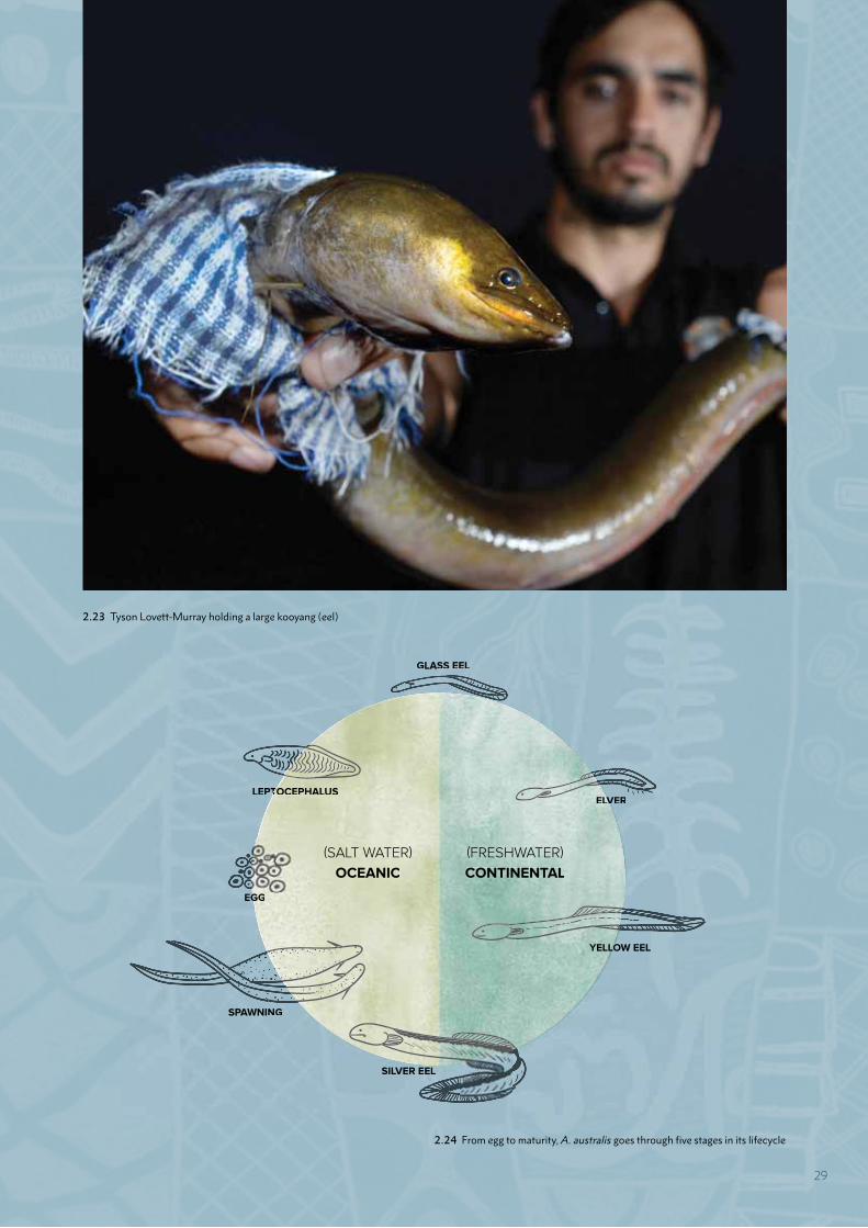
2.23 Tyson Lovett-Murray holding a large kooyang (eel)
2.24 From egg to maturity, A. australis goes through five stages in its lifecycle
GLASS EEL
LEPTTOCEPHALUSLVERELV
LOW EELYELLO
SILVER EEL
SPAWNING
EGGG
OCEANIC
(SALT WATER) (FRESHWATER)
CONTINENTAL
29
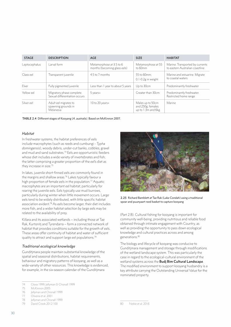
Habitat
In freshwater systems, the habitat preferences of eels include macrophytes (such as reeds and cumbungi - Typha domingensis), woody debris, under-cut banks, cobbles, gravel and mud and sand substrates.74 Eels are opportunistic feeders whose diet includes a wide variety of invertebrates and fish; the latter comprising a greater proportion of the eel’s diet as they increase in size.75
In lakes, juvenile short-finned eels are commonly found in the margins and shallow areas.76 Lakes typically favour a high proportion of female eels in the population.77 Aquatic macrophytes are an important eel habitat; particularly for rearing the juvenile eels. Eels typically use mud burrows, particularly during winter when little movement occurs. Large eels tend to be widely distributed, with little specific habitat association evident.78 As eels become larger, their diet includes more fish, and a wider habitat selection by large eels may be related to the availability of prey.
Killara and its associated wetlands – including those at Tae Rak, Kurtonitj and Tyrendarra – form a connected network of habitat that provides conditions suitable for the growth of eels. These areas offer continuity of habitat and water of sufficient quality to attract and support large eel populations.79
Traditional ecological knowledge
Gunditjmara people maintain substantial knowledge of the spatial and seasonal distributions, habitat requirements, behaviour and migratory patterns of kooyang, as well as a wide-variety of other resources. This knowledge is evidenced, for example, in the six-season calendar of the Gunditjmara
74 Glova 1999; Jellyman & Chisnall 199975 McKinnon 200576 Jellyman and Chisnall 199977 Oliveira et al. 200178 Jellyman and Chisnall 199979 David Crook 2012:100
STAGE DESCRIPTION AGE SIZE HABITAT
Leptocephalus Larval form Metamorphose at 3.5 to 6 months (becoming glass eels)
Metamorphose at 55 to 60mm
Marine. Transported by currents to eastern Australian coastline
Glass eel Transparent juvenile 4.5 to 7 months 55 to 60mm;
0.1-0.2g in weight
Marine and estuarine. Migrate to coastal waters
Elver Fully pigmented juvenile Less than 1 year to about 5 years Up to 30cm Predominantly freshwater
Yellow eel Migratory phase complete. Sexual differentiation occurs
5 years+ Greater than 30cm Predominantly freshwater. Restricted home range
Silver eel Adult eel migrates to spawning grounds in Melanesia
10 to 20 years+ Males up to 50cm and 250g; females up to 1.3m and 6kg.
Marine
TABLE 2.4 Different stages of Kooyang (A. australis). Based on McKinnon 2007.
(Part 2.B). Cultural fishing for kooyang is important for community well-being, providing nutritious and reliable food obtained through intimate engagement with Country, as well as providing the opportunity to pass down ecological knowledge and cultural practices across and among generations.80
The biology and lifecycle of kooyang was conducive to Gunditjmara management and storage through modifications of the wetland landscape system. This was particularly the case in regard to the ecological-cultural environment of the wetland systems across the Budj Bim Cultural Landscape. The modified environment to support kooyang husbandry is a key attribute carrying the Outstanding Universal Value for the nominated property.
80 Noble et al. 2016
2.25 Richard Bamblett at Tae Rak (Lake Condah) using a traditional spear and puunyaart reed basket to capture kooyang
30
A DIVERSE ECOLOGICAL-CULTURAL ENVIRONMENT
The Budj Bim lava flow contains some of the most recent and best-preserved lava flow features in south-east Australia.81 The area contains a suite of significant plant and animal species and ecosystems that collectively have a high conservation status and significance. Many of the species present in the Budj Bim Cultural Landscape have important uses and cultural associations for the Gunditjmara.
Vegetation
At its broadest level, the natural ecosystems of the Budj Bim lava flow are categorised in Western ecological terms as ‘Dry Forests and Woodlands’ and ‘Inland Waters and Wetlands’.82 Both systems are well represented in each of the three serial components of the Budj Bim Cultural Landscape.
Vegetation studies undertaken by Ecology Australia in 1991 and 2006, recognise two Ecological Vegetation Classes within the Dry Forests and Woodlands Natural Ecosystem (or dryland vegetation) and 17 Ecological Vegetation Classes within the Inland Waters and Wetlands Natural Ecosystem (wetland vegetation); the latter representing a huge and diverse range of plant species (Table 2.5).83 In all, 551 botanical taxa (species, subspecies, varieties and cultivars) have been recorded as occurring across the Budj Bim lava flow.84 Of these, 335 are native taxa comprised of mosses, liverworts, ferns and fern allies, monocotyledons and dicotyledons and 216 are exotic (or introduced) naturalised conifers, monocotyledons and dicotyledons. Despite the number and coverage of introduced plant species, the moderately to highly intact indigenous vegetation of the Eccles Land System has been assessed to be of National conservation significance.85
The condition of the vegetation within the Budj Bim Cultural Landscape is variable. The dryland vegetation is vulnerable to invasive plant species, introduced feral (or wild) animal species and cattle grazing; but the condition of the wetland vegetation is relatively good. This has especially been the case with increased water flow following the restoration of Tae Rak in 2010 and higher-than-average rainfall in subsequent and recent years.
81 Context 1993:2882 Parks Victoria 2015:29-40. In Victoria, 14 broad Natural Ecosystems
are recognised. These are derived from Ecological Vegetation Classes, which categorise Victoria’s native (indigenous) vegetation.
83 Carr et al. 2006; Context 1993:41-69, 340-371; Ecology Australia 2007
84 Ecology Australia 2007:56-68, Appendix 185 Ecology Australia 2007:56
Fauna86
The native fauna of the Eccles Land System is considered distinctive with a high level of species diversity. Mammals found in the area include the Eastern Grey Kangaroo (Macropus giganteus), two species each of wallaby and possum, Koala (Phascolarctus cinereus), Short-beaked echidna (Tachyglossus aculeatus), Spot-tailed Quoll (Dasyurus maculatus maculatus), Southern Brown Bandicoot (Isoodon obesulus obesulus), Common Dunnart (Sminthopsis murina murina), three species of glider and four species of antechinus. Introduced feral (or wild) animal species include European Rabbit (Oryctolagus cuniculus), goat (Capra aegagrus hircus), fox (Vulpes vulpes), pig (Sus domesticus), deer (Cervus spp.), dog (Canis lupus familiaris), cat (Felis catus), House Mouse (Mus musculus) and bees (Apis mellifera).
Five species of bats, as well as the nationally endangered Southern Bent-wing Bat (Miniopterus schreibersii), inhabit some of the lava flow caves and voids as well as forested environments. A number of venomous snakes are found in the area and include the Tiger Snake (Notechis scutatus), Eastern Brown (Pseudonaja textilis), Red-bellied Black (Pseudechis porphyriacus) and Lowland Copperhead (Austrelaps superbus). Other reptiles include a range of lizards and skinks. A wide range of insects is known from the area – including the spectacular, but rare, Mountain Grasshopper or Katydid (Acripeza reticulata).
The area provides habitat for at least 105 native and six non-native bird species.87 These species include a variety of birds of prey, black swan, brolga, egrets, owls, parrots, wrens, ducks and coots; as well as bird species classified as threatened such as the South-eastern Red-tailed Black Cockatoo (Calyptorhynchus banksii graptogyne), Pied Cormorant (Phalacrocorax varieus), Whiskered Tern (Childonias hybrida), Great Egret (Egretta alba) and Grey Goshawk (Accipiter novaehollandiae).
Surveys of Killara and Tae Rak have identified 12 native fish species, which include Kooyang (Short-finned Eel – Anguilla australis), Toupong (Pseudaphrites urvilli) and Freshwater Blackfish (Gadopsis marmoratus).88 Four introduced species have been recorded, including Tench (Tinca tinca), all of which occurs in low abundance in Killara.89 The Eastern Snake-necked Tortoise (Chelodina longicollis) and native crayfish (Geocharax sp.) can be found in local swamps, lakes and creeks;90 as well as Common Freshwater Shrimp (Paratya australiensis) and Freshwater Spider Crab (Amarinus lacustris). Eight species of frog have been documented, as well as two species of freshwater mussel.
86 Species list for nominated property provided by Gary Peterson, Program Manager Biodiversity, Department of Environment, Land, Water and Planning, 30 October 2017.
87 Context 1993:788 Context 1993:72; Gippel et al. 200789 Crook et al. 2008:3090 McKinnon 2007:69
31
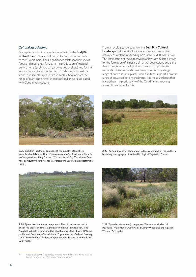
Cultural associations
Many plant and animal species found within the Budj Bim Cultural Landscape are of particular cultural importance to the Gunditjmara. Their significance relates to their use as foods and medicines, for use in the production of material culture items (such as cloaks, spears and baskets) and for their associations as totems or forms of ‘kinship with the natural world’.91 A sample is presented in Table 2.6 to indicate the range of plant and animal species utilised and/or associated with Gunditjmara culture.
91 Rose et al. 2003. The phrase ‘kinship with the natural world’ is used here in preference to ‘totem’ or ‘totem species’.
2.26 Budj Bim (northern) component: High quality Stony Rises Woodland with Manna Gum (Eucalyptus viminalis), Blackwood (Acacia melanoxylon) and Shiny Cassinia (Cassinia longifolia). The Manna Gums have particularly healthy canopies. Foreground vegetation is substantially exotic.
2.27 Kurtonitj (central) component: Extensive wetland on the southern boundary; an aggregate of wetland Ecological Vegetation Classes
2.28 Tyrendarra (southern) component: The 14 hectare wetland is one of the largest and most significant in the Budj Bim lava flow. The Aquatic Herbfield is dominated here by Running Marsh-flower (Villarsia reniformis), Southern Water-ribbons (Triglochin alcockiae) and Floating Dock (Rumex bidens). Patches of open water mark sites of former Black Swan nests.
2.29 Tyrendarra (southern) component: The near-to-dry bed of Palawarra (Fitzroy River), with Plains Swampy Woodland and Riparian Wetland Aggregate.
From an ecological perspective, the Budj Bim Cultural Landscape is distinctive for its extensive and productive network of wetlands extending across the Budj Bim lava flow. The intersection of the extensive lava flow with Killara allowed for the formation of a mosaic of natural depressions and dams that subsequently developed into diverse and productive wetlands. These wetlands have been colonised by a large range of native aquatic plants, which, in turn, support a diverse range of aquatic macroinvertebrates. It is these wetlands that have driven the productivity of the Gunditjmara kooyang aquaculture over millennia.
32
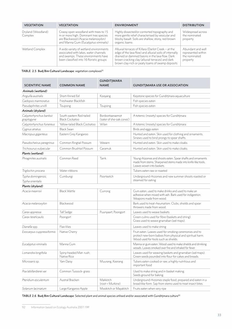
VEGETATION VEGETATION ENVIRONMENT DISTRIBUTION
Dryland (Woodland) Complex
Grassy open woodland with trees to 15 m or more high. Dominant tree species are Blackwood (Acacia melanoxylon) and Manna Gum (Eucalyptus viminalis)
Highly dissected/or contorted topography and more gentle relief characterised by vesicular and blocky basalt. Soils are shallow, stony, red-brown organic loams
Widespread across the nominated property
Wetland Complex A wide variety of wetland environments associated with lakes, water channels and swamps. These environments have been classified into 16 floristic groups
Alluvial terraces of Killara (Darlot Creek – at the edge of the lava flow) and alluvial soils of internally drained or dammed basins in the lava flow. Dark brown cracking clay (alluvial terraces) and dark brown clay-rich or peaty loams of swamp deposits
Abundant and well represented within the nominated property
TABLE 2.5 Budj Bim Cultural Landscape: vegetation complexes92
SCIENTIFIC NAME COMMON NAME
GUNDITJMARA
NAME GUNDITJMARA USE OR ASSOCIATION
Animals (wetland)
Anguilla australis Short-finned Eel Kooyang Keystone species for Gunditjmara aquaculture
Gadopsis marmoratus Freshwater Blackfish Fish species eaten
Pseudaphrites urvilli Toupong Toupong Fish species eaten
Animals (dryland)
Calyptorhynchus banksii graptogyne
South-eastern Red-tailed Black Cockatoo
Bonbontaeraemot (‘eater of she-oak cones’)
A totemic (moiety) species for Gunditjmara
Calyptorhynchus funereus Yellow-tailed Black Cockatoo Wilan A totemic (moiety) species for Gunditjmara
Cygnus atratus Black Swan Birds and eggs eaten
Macropus giganteus Eastern Grey Kangaroo Hunted and eaten. Skin used for clothing and ornaments. Sinews used to bind prongs to spear shafts.
Pseudocheirus peregrinus Common Ringtail Possum Weearn Hunted and eaten. Skin used to make cloaks.
Trichosurus vulpecular Common Brushtail Possum Garamuk Hunted and eaten. Skin used to make cloaks.
Plants (wetland)
Phragmites australis Common Reed Tarrk Young rhizomes and shoots eaten. Spear shafts and ornaments made from stems. Sharpened stems made into knife-like tools. Leaves woven into baskets.
Triglochin procera Water-ribbons Tubers eaten raw or roasted
Typha domingensis;
Typha orientalis
Cumbungi Poorteetch Underground rhizomes and new summer shoots roasted or steamed for eating
Plants (dryland)
Acacia mearnsii Black Wattle Currong Gum eaten, used to make drinks and used to make an adhesive when mixed with ash. Bark used for indigestion. Weapons made from wood.
Acacia melanoxylon Blackwood Bark used to treat rheumatism. Clubs, shields and spear throwers made from wood.
Carex appressa Tall Sedge Puunyaart, Poongort Leaves used to weave baskets
Carex tereticaulis Poongort Green culms used for fibre (baskets and string). Grass used to weave gnarraban (eel-traps).
Dianella spp. Flax-lilies Leaves used to make string
Exocarpus cuppressiformis Native Cherry Fruit eaten. Leaves used for smoking ceremonies and to protect new-born babies from physical and spiritual harm. Wood used for tools such as shields.
Eucalyptus viminalis Manna Gum Manna or gum eaten. Wood used to make shields and drinking vessels. Leaves smoked over fire and inhaled for fever.
Lomandra longifolia Spiny-headed Mat- rush; Native Rice
Leaves used for weaving baskets and gnarraban (eel-traps). Green seeds pounded into flour for cakes and breads.
Microseris sp. Yam Daisy Muurang, Keerang Tubers eaten cooked or raw; a highly nutritious and important food
Poa labillardierei var. Common Tussock- grass Used to make string and in basket making. Seeds ground for baking.
Pteridium esculentum Austral Bracken Makkitch (root = Murkine)
Underground rhizomes staple food; prepared and eaten in a bread-like form. Sap from stems used to treat insect bites.
Solanum laciniatum Large Kangaroo Apple Mookitch or Mayakitch Fruits eaten when very ripe
TABLE 2.6 Budj Bim Cultural Landscape: Selected plant and animal species utilised and/or associated with Gunditjmara culture92
92 Information based on Ecology Australia 2007:19ff
33
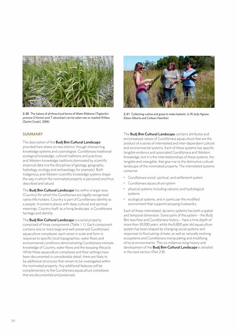
2.30 The tubers of all three local forms of Water Ribbons (Triglochin procera (2 forms) and T. alcockiae) can be eaten raw or roasted (Killara [Darlot Creek], 2006)
2.31 Collecting rushes and grass to make baskets. (L-R) Jody Agnew, Eileen Alberts and Colleen Hamilton
The Budj Bim Cultural Landscape contains attributes and encompasses values of Gunditjmara aquaculture that are the product of a series of interrelated and inter-dependent cultural and environmental systems. Each of these systems has specific tangible evidence and associated Gunditjmara and Western knowledge; but it is the interrelationships of these systems, the tangible and intangible, that give rise to the distinctive cultural landscape of the nominated property. The interrelated systems comprise:
• Gunditjmara social, spiritual, and settlement system
• Gunditjmara aquaculture system
• physical systems including volcanic and hydrological systems
• ecological systems, and in particular the modified environment that supports kooyang husbandry.
Each of these interrelated, dynamic systems has both a spatial and temporal dimension. Some parts of the system – the Budj Bim lava flow and Gunditjmara history – have a time depth of more than 30,000 years, while the 6,600 year old aquaculture system has been shaped by changing social systems and responses to fluctuating climate; as well as naturally evolving ecosystems and Gunditjmara manipulating and modifying of local environments. This six millennia-long history and development of the Budj Bim Cultural Landscape is detailed in the next section (Part 2.B).
SUMMARY
The description of the Budj Bim Cultural Landscape provided here draws on two distinct, though intersecting, knowledge systems and cosmologies: Gunditjmara traditional ecological knowledge, cultural traditions and practices; and Western knowledge traditions dominated by scientific empirical data (via the disciplines of geology, geography, hydrology, ecology and archaeology, for example). Both Indigenous and Western scientific knowledge systems shape the way in which the nominated property is perceived and thus described and valued.
The Budj Bim Cultural Landscape lies within a larger area (Country) for which the Gunditjmara are legally recognised native title holders. Country is part of Gunditjmara identity as a people. It contains places with deep cultural and spiritual meanings. Country itself, as a living landscape, is Gunditjmara heritage and identity.
The Budj Bim Cultural Landscape is a serial property comprised of three components (Table 1.1). Each component contains one or more large and well-preserved Gunditjmara aquaculture complexes: each varies in scale and form in response to specific local topographies, water flows and environmental conditions demonstrating Gunditjmara intimate knowledge of Country, water flows and the kooyang lifecycle. While these aquaculture complexes and their settings have been documented in considerable detail, there are likely to be additional structures that remain to be investigated within the nominated property. Any additional features will be complementary to the Gunditjmara aquaculture complexes that are documented and preserved.
34
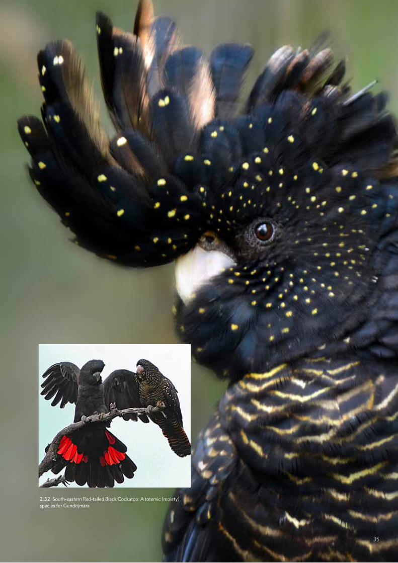
2.32 South-eastern Red-tailed Black Cockatoo: A totemic (moiety) species for Gunditjmara
35
PART 2B
HISTORY AND DEVELOPMENT
36
Gunditjmara Country has many stories
stretching back more than 30,000 years.
Over time, Gunditjmara Elders and
people have told stories of Ancestral
Creation Beings revealing themselves
in the landscape; erupting volcanoes;
tsunamis; mountains forming; sea
Country creeping up onto the land;
rivers changing; the relationship between
people, animals and plants; abundant
natural resources; settlement and
aquaculture; the arrival of other people to
Gunditjmara Country; and of our ongoing
spirituality and well being.
(Damein Bell, 2009)93
The Budj Bim Cultural Landscape is central to
the story of the Gunditjmara. It is a landscape
in which Gunditjmara aquaculture developed
and continued over more than 6,600 years.
It is also a landscape of plenty, of refuge, of
loss, of family and community, of inequity and
justice, of the Lake Condah Mission and nearby
family settlements: a place where wars were
fought and wetlands drained and then restored.
From a Western science perspective, the Budj Bim Cultural Landscape may appear to be a
natural landscape; but in reality it is intensely
cultural. The Budj Bim Cultural Landscape is
a remarkable area because it has a powerful
deep time, colonial and recent history; which is
characterised by the continuing connection and
adaptation by the Gunditjmara to their Country
and to their aquaculture practices.
93 Damein Bell in Weir 2009: 3
Over the past 40 years, the lands comprising the three serial components (Budj Bim, Kurtonitj and Tyrendarra) of the Budj Bim Cultural Landscape have been acquired by or returned to the Gunditjmara. This situation is a consequence of Gunditjmara activism, social justice, advocacy, and the eventual legal recognition by governments of Gunditjmara rights and obligations to their Country through native title.
The history and development of the Budj Bim Cultural Landscape is a ‘deep time’ story. For the Gunditjmara, deep time refers to the idea that they have always been here. From an archaeological perspective, deep time refers to the more than 32,000 years that Aboriginal people have occupied and lived on the Western Victorian Volcanic Plains. Archaeological and environmental evidence demonstrates that aquaculture – as evidenced in the manipulation, modification and management of water flows, commenced at least 6,600 years ago. Over this time period, and up to the present day, the Gunditjmara developed, maintained and adapted their knowledge and practices of aquaculture. That is, Gunditjmara traditional knowledge and aquaculture practice endured and actively adapted to new circumstances; despite the profound impacts of colonisation from the early 19th century.
CREATION
At the dawn of time, it was the Ancestral Beings – part human, part beast – who brought what was previously barren land to life. At the end of the Dreaming journeys, the Ancestral Being left aspects of themselves behind transformed into part of the landscape. To the Gunditjmara people, Budj Bim’s domed hill represents the forehead of one such Being, with the lava that spat out as the head burst through the earth forming his teeth. In the Dhauwurd wurrung language, budj bim means “high head,” and tung att means “teeth belonging to it”, referring to the scattered red scoria… In the absence of law men, Budj Bim’s site is guarded by the gneering – or weeping she-oaks that stand like sentinels close to the summit. When the wind blows, you can hear the trees whispering softly to you.94
The southward journey of the lava flow created by the Budj Bim Ancestral Being expressed the creative powers of Dreaming spirits. This spirit-scape also extends out to sea with the sacred site of Deen Maar (Lady Julia Percy Island) located 8 kilometres off the coast to the immediate east of the lava flow. “The forbidding cliffs of Deen Maar … guard the final resting place of the spirits of Gunditjmara people when they die.”95 The Gunditjmara buried their dead with their heads facing Deen Maar.96 This spirit resting place is as much a part of contemporary Gunditjmara culture as it was in the past.97
94 Gunditjmara 2010:7. In Australia, the ‘Dreaming’ is linked to the creation process and spiritual ancestors. It refers to the past, present and future. Dreaming stories pass on important knowledge, cultural values and belief systems to later generations.
95 Gill and West 1971; Gunditjmara 2010:796 Read 2007:6997 Dawson 1881:51
PART 2.B HISTORY AND DEVELOPMENT
37
All of the Dreaming creator spirit beings who gave form, meaning and purpose to Gunditjmara Country “were all subservient to the chief Creator Being, Bunjil”.98 Bunjil, who is often depicted as a wedge-tailed eagle, is widely recognised by contemporary Aboriginal groups in south-eastern Australia as the principal Ancestral Being.
Gunditjmara Elder, Aunty Eileen Alberts, explains:
In the Dreaming, the Ancestral Creators gave the Gunditjmara people the resources to live a settled lifestyle. They diverted the waterways, and gave us the stones and rocks to help us build the aquaculture system. They gave us the wetlands where the reeds grew so that we could make the eel baskets, and they gave us the food-enriched landscape for us to survive.99
Gunditjmara Elder, Aunty Iris Lovett-Gardiner, adds:
My people lived with the spirituality that’s there; a spirit of place that’s sacred to my people. The stone from the mountain was put there for a purpose. There’s always a purpose for something, unless people destroy it. The stone came from the earth; it connected the people to the earth.100
It is in this spiritual sense that the Gunditjmara people see the Budj Bim Cultural Landscape as “imbued with meaning and a sense of purpose”.101
Gunditjmara Elder, Uncle Kenny Saunders, also speaks of the ancestors and their ‘great knowledge’ that imbues the Budj Bim Cultural Landscape with vitality and a “cultural spiritual footprint that is still here on this Country and so very, very much alive”.102 The spiritual essence and vitality of Gunditjmara Country is universally acknowledged by the Gunditjmara and is central to Gunditjmara identity and sense of place and belonging.
Walking the land is important to us because we love the land. The land talks to us; it sings songs and talks to us. Even the birds tell us things … Each animal’s got a story to tell. We’ve still got those things. They’re still here. They’re very important. This is the spirituality we’ve got. We walk this land and we listen and we see and hear them all. Because we love the land we get messages from this and that. (Aunty Iris Lovett-Gardiner)103
We as Aboriginal people feel that without land you don’t have a spirit. Our connection to the land is that the land is our mother, it gave birth to us, it created all the things that are there for us as a people. This connection to the land is so strong that spiritually, religiously, culturally, it contains
98 Mathew 1905:95; Read 2007:6699 Gunditjmara 2010:7100 Winda-Mara Aboriginal Corporation cultural display information
panel, Heywood101 Gunditjmara 2010:7102 Dean and Martin 2013103 Winda-Mara Aboriginal Corporation cultural display information
panel, Heywood
all the dreaming that we believe in as Aboriginal people. (Uncle John Lovett)104
Gunditjmara artist Thomas Day, the grandson of Aunty Euphemia Day, makes the important point that to the Gunditjmara, “Our ancestors are interpreted through our art, song and dance.” Art, song and dance are significant to contemporary Gunditjmara as a means to transmit spirituality and connection to Country across generations. That is, these forms of creative expression, which can be symbolically and emotionally charged, give tangible expression to Gunditjmara cultural traditions, knowledge and practices (discussed further at the end of Part 2.B).
DEEP TIME HISTORY
By 40,000 years ago, all parts of the Australian mainland and Tasmania had been occupied; evidenced for example in the World Heritage listed properties of Kakadu National Park105 and Willandra Lakes Region.106 At the time of European colonisation of Australia in 1788, there were approximately 500 different Aboriginal nations or groups made up of people who spoke different languages – each having a diversity of cultural beliefs, practices and traditions.
Archaeological evidence indicates that Aboriginal people have been in western Victoria for at least 32,000 years.107 However, this is likely to be a minimum age, given the evidence for Aboriginal peoples’ presence at least 40,000 years ago in other parts of southern Australia.108
ENVIRONMENTAL CHANGE
The last major eruption of the Budj Bim volcano – which is understood by Gunditjmara to be when the Ancestral Creator revealed himself – occurred between 30,000 and 39,000 years ago.109 It resulted in the Budj Bim lava flow, which began from its source point at the Budj Bim volcano and extended almost 50 kilometres southward; today part of the lava flow is below sea level as a consequence of sea level rise after 18,000, and before 6,000, years ago. The Budj Bim lava flow formed broad sheets spreading out; filling the low-lying areas, damming pre-existing valleys and disrupting prior streams (Part 2.A).110
Diversion and ponding eventually lead to the development of new streams, lakes and swamps – determined initially by the gradients and topography of the primary lava surface. Underground drainage also occurred through horizontal
104 Winda-Mara Aboriginal Corporation cultural display information panel, Heywood
105 UNESCO World Heritage List. ‘Kakadu National Park’, http://whc.nesco.org/en/list/147
106 UNESCO World Heritage List. ‘Willandra Lakes Region’, http://whc.unesco.org/en/list/167
107 Richards et al. 2007108 Hiscock 2008109 Builth et al. 2008; Grimes and Rosengren 2012110 Joyce and Webb 2003
38
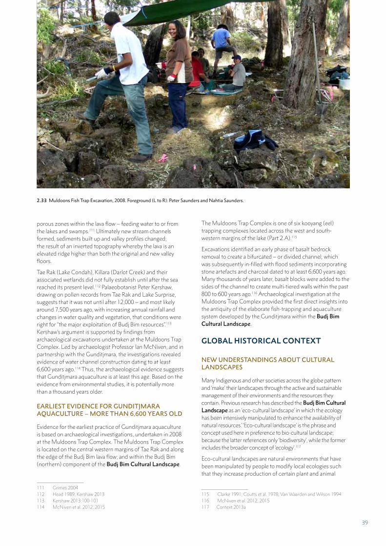
porous zones within the lava flow – feeding water to or from the lakes and swamps.111 Ultimately new stream channels formed, sediments built up and valley profiles changed; the result of an inverted topography whereby the lava is an elevated ridge higher than both the original and new valley floors.
Tae Rak (Lake Condah), Killara (Darlot Creek) and their associated wetlands did not fully establish until after the sea reached its present level.112 Palaeobotanist Peter Kershaw, drawing on pollen records from Tae Rak and Lake Surprise, suggests that it was not until after 12,000 – and most likely around 7,500 years ago, with increasing annual rainfall and changes in water quality and vegetation, that conditions were right for “the major exploitation of Budj Bim resources”.113 Kershaw’s argument is supported by findings from archaeological excavations undertaken at the Muldoons Trap Complex. Led by archaeologist Professor Ian McNiven, and in partnership with the Gunditjmara, the investigations revealed evidence of water channel construction dating to at least 6,600 years ago.114 Thus, the archaeological evidence suggests that Gunditjmara aquaculture is at least this age. Based on the evidence from environmental studies, it is potentially more than a thousand years older.
EARLIEST EVIDENCE FOR GUNDITJMARA AQUACULTURE – MORE THAN 6,600 YEARS OLD
Evidence for the earliest practice of Gunditjmara aquaculture is based on archaeological investigations, undertaken in 2008 at the Muldoons Trap Complex. The Muldoons Trap Complex is located on the central western margins of Tae Rak and along the edge of the Budj Bim lava flow; and within the Budj Bim (northern) component of the Budj Bim Cultural Landscape.
111 Grimes 2004112 Head 1989; Kershaw 2013113 Kershaw 2013:100-101 114 McNiven et al. 2012, 2015
The Muldoons Trap Complex is one of six kooyang (eel) trapping complexes located across the west and south-western margins of the lake (Part 2.A).115
Excavations identified an early phase of basalt bedrock removal to create a bifurcated – or divided channel; which was subsequently in-filled with flood sediments incorporating stone artefacts and charcoal dated to at least 6,600 years ago. Many thousands of years later, basalt blocks were added to the sides of the channel to create multi-tiered walls within the past 800 to 600 years ago.116 Archaeological investigation at the Muldoons Trap Complex provided the first direct insights into the antiquity of the elaborate fish-trapping and aquaculture system developed by the Gunditjmara within the Budj Bim Cultural Landscape.
GLOBAL HISTORICAL CONTEXT
NEW UNDERSTANDINGS ABOUT CULTURAL LANDSCAPES
Many Indigenous and other societies across the globe pattern and ‘make’ their landscapes through the active and sustainable management of their environments and the resources they contain. Previous research has described the Budj Bim Cultural Landscape as an ‘eco-cultural landscape’ in which the ecology has been intensively manipulated to enhance the availability of natural resources.’ ‘Eco-cultural landscape’ is the phrase and concept used here in preference to bio-cultural landscape; because the latter references only ‘biodiversity’, while the former includes the broader concept of ‘ecology’.117
Eco-cultural landscapes are natural environments that have been manipulated by people to modify local ecologies such that they increase production of certain plant and animal
115 Clarke 1991; Coutts et al. 1978; Van Waarden and Wilson 1994116 McNiven et al. 2012, 2015117 Context 2013a
2.33 Muldoons Fish Trap Excavation, 2008. Foreground (L to R): Peter Saunders and Nahtia Saunders.
39
resources. Such manipulations contrast with more extreme modifications involving radical transformation of local ecologies; including replacing endemic plant and animal communities with domesticated crops and animals, and terraforming landscapes to transform local hydrology for water storage (dams and reservoirs, for example) and water movement (irrigation channels, for example). In marked contrast, a key dimension of eco-cultural landscapes is that local ecologies are not necessarily radically altered but selectively and strategically enhanced. As such, eco-cultural landscapes bear the cultural imprint not just of human agency, but of individual societies strategically manipulating environments into culturally relevant and meaningful ‘constructed landscapes’118 and even ‘domesticated landscapes’.119
The deliberate enhancement and maintenance of extant ecological processes means that management practices associated with these landscapes are likely to be sustainable and reversible.
GLOBAL CONTEXT
All human societies are sustained by modifications of the ‘natural’ environment. For subsistence regimes, the degree and intensity of modification ranges widely across the world. At one end of the gradient of modification is the subtle manipulation of ‘natural’ ecosystems by small-scale societies – especially those living in tropical rainforests or Arctic tundras. At the other end of the gradient is the dramatic and large-scale removal of natural vegetation and its replacement with cultivated fields of domesticated crops irrigated by artificially constructed water channels, that underpins large-scale, state-based urban societies.
Traditionally, discussions of scales of human landscape modifications have been couched in terms of ‘hunter-gatherers’ versus ‘agriculturalists’.120 Over recent decades, the purported dichotomy between ‘hunter-gatherers’ and ‘agricultural societies’ has been challenged by anthropological and archaeological scholarship demonstrating that previous representations of both groups have been constructed to emphasise polarised cultural differences.
118 McNiven 2008119 Erickson 2006; Yen 1989120 Erickson 2006; Lightfoot et al. 2013
New understandings have emerged; revealing major cultural overlaps between so-called ‘hunter-gatherer’ and ‘agricultural’ societies in four key areas:121
• First, the social complexity of many ‘hunter-gatherers’ not only overlaps with, but in some cases rivals, that of many small-scale agricultural societies122
• Second, most if not all ‘hunter-gather’ societies manipulated the environment to some degree, and in some cases to such an extent that plants and animals were intensively managed in ways more commonly associated with small-scale agricultural societies. As such, the boundary between ‘hunter-gatherers’ and ‘agriculturalists’ is blurred123
• Third, ‘hunter-gatherer’ manipulations also include hydrological engineering
• Fourth, the movement to agriculture and the use and development of domesticated plants by many societies includes plant manipulation practices well known to many ‘hunter-gatherers’.
An important outcome of the development of these new understandings of ‘hunter-gatherer’ social and ecological complexity is that agriculture no longer is seen as a natural progression from a hunting and gathering way of life. A more fruitful and meaningful approach to comparative studies is the selection of a particular set of cultural practices, such as manipulation of the environment, to explore the form and scale of such manipulations and transformations by different societies. Of particular interest is how humans have adapted to differing geographical contexts, variable resources and a constantly changing climate; reflected in the accumulated remains of human behaviour and continuing cultural traditions of interaction with the natural environment.
In this global context, the Budj Bim Cultural Landscape is an outstanding exemplar of a cultural landscape in which human interaction with the environment is an eco-cultural relationship of dynamic manipulation and management of natural resources. It is illustrative of the creation, modification and maintenance of an extensive hydrological engineering system that manipulated water flow in order to trap, store and harvest kooyang (eel) that migrate seasonally through the system. A comparative analysis of the nominated property with other sites on the World Heritage List and Tentative Lists; as well as sites in Australia and elsewhere, is provided in Part 3.2.
121 McNiven in Context 2013a:26-28122 Keeley 1995:268; Price and Brown 1985; Roscoe 2002:159123 Harris 1989; Smith 1998, 2001; Terrell et al. 2003:328
40
GUNDITJMARA SOCIAL SYSTEM
At the time of arrival of the Europeans into the region in the early 19th century, the Gunditjmara aquaculture system was functioning and well-maintained. The system was an integral part of the Gunditjmara way of living. To understand the context of this system, the early-19th century Gunditjmara social and settlement systems are briefly outlined here.
TERRITORY, LANGUAGE AND SOCIAL STRUCTURE
In the 19th century, as now, Gunditjmara Country covered a large area extending approximately 150 kilometres from east-to-west and up to 100 kilometres inland from the coast. They were speakers of a distinctive language (Dhauwurd wurrung) with four to five different dialects.124 The Gunditjmara people comprised around 60 family-based clans spaced around 10-to-20 kilometres apart; and focused on resource rich areas along the coast and along inland creeks, lakes and swamps.125 Based on the 1840s observations and recordings of George Augustus Robinson, Chief Protector of Aborigines in the Port Phillip District (Victoria) from 1839 to 1849, archaeologist Harry Lourandos argues that interactions between Gunditjmara clans tended to be on a coastal-inland (north-south) axis more than an east-west axis.126 Movement of individuals between clan groups and clan territories took place for a range of social (including marriage) and economic (reciprocal access to resources, for example) reasons.127 According to local pastoralist and amateur ethnographer James Dawson writing in 1881, but recalling the 1860s, families possessed an ‘exclusive right’ to particular tracts of land and associated resources through inheritance enforced by strict rules against trespassing.128 Today, the Gunditjmara continue to associate and identify families with clan groups and territories.
POPULATION SIZE
According to Chief Protector George Augustus Robinson, the population of an individual Gunditjmara clan was estimated to be minimally 40-60 people, with some clans numbering over 100 people.129 As such, the Gunditjmara likely numbered 3,000-to-4,000 people in the 1830s.130 This figure may be doubled if the impacts of disease from initial contact with Europeans are taken into account.131 Lourandos points out that Gunditjmara population densities are atypical for Aboriginal Australia and are “at the highest end of the Australian Aboriginal scale.”132 He also suggests that while the
124 Clark 1990a; Gunditjmara 2010; Lourandos 1977; Tindale 1974125 Clark 1990a; Dawson 1881; Lourandos 1977126 Lourandos 1977127 Lourandos 1977128 Dawson 1881:7129 Lourandos 1977130 Clarke 1990a; Lourandos 1977131 Butlin 1983132 Lourandos 1976:181
high population density probably reflects “the high resource potential of the region (especially the wetland and coastal environments)”, it is also likely that “elaborate procurement systems and technologies”, especially those associated with kooyang (eel) aquaculture, “also were contributing factors.”133
‘GREAT MEETINGS’
The mid- to late-19th century ethnographic records of Robinson and Dawson demonstrate clearly that the Gunditjmara participated in an elaborate system of inter- and intra-regional gatherings.134 Intra-regional gatherings were between various Gunditjmara clans with attendees sometimes numbering in the hundreds. Inter-regional gatherings (referred to as ‘great meetings’ by Dawson)135 were attended by hundreds and up to a thousand people from different groups across south-west Victoria. These gatherings were for a broad range of social, political, economic, trade/exchange and ceremonial reasons. They were scheduled to coincide with seasonal and localised abundances of food resources, such as the kooyang season in autumn and winter.136 One such inter-regional gathering was hosted by the Gunditjmara and took place at the ‘great swamp’, which is most likely Condah Swamp – located to the immediate north of Tae Rak (Lake Condah).137
HEREDITARY CHIEFS
Hereditary chiefs were a feature of Gunditjmara society; an expression of high population densities, the associated complex organisational structures required to regulate various scales of interactions between people and resources, to manage inter-regional gatherings, and operate large-scale kooyang facilities.138 Archaeologist Thomas Richards points out that the heads of lineages in Gunditjmara society were termed ‘Wung’it’ and ‘Gnern neetch’ which Dawson translated as ‘chief’.139 Although chiefs were generally not a feature of Australian Aboriginal societies,140 anthropologists and archaeologists with expertise in Gunditjmara ethnography agree that the Gunditjmara possessed an atypical social organisational structure for Australia and did indeed have hereditary male chiefs who were heads of corporate lineages and managers of clan assets (that is, resources and associated infrastructure such as kooyang aquaculture facilities), and who exercised considerable social, political, and economic power.141
133 Lourandos 1976:181134 Clark 1998a, 2000; Dawson 1881135 Dawson 1881136 Lourandos 1976, 1977137 McBryde 1986138 Lourandos 1977139 Dawson 1881:vii; Richards 2013:175140 Keen 2006141 For example, ethnographers Dawson 1881 and Fison and Howitt
1880:277; and archaeologists Builth 2006, 2014; Lourandos 1977; and Richards 2013:196-199
41
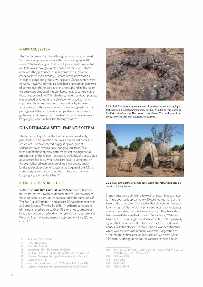
MARRIAGE SYSTEM
The Gunditjmara, like other Aboriginal groups in southwest Victoria, were polygamous – with chiefs having up to 10 wives.142 Richards argues that Gunditjmara chiefs supported multiple wives through “wealth, based on the surplus food resources they produced, primarily from the substantial eel harvest”.143 More broadly, Richards concludes that, as “Heads of corporate groups, Wung’it and Gnern neetch, were certainly powerful individuals, who had a considerable degree of control over the resources of their group, and in this region, the surpluses produced through kooyang aquaculture made these groups wealthy”.144 It is in this context that much prestige was accrued by Gunditjmara chiefs, who hosted gatherings supported by eel surpluses – made possible by kooyang aquaculture. Both Lourandos and Richards suggest that such prestige would have fostered a competitive aspect to such gatherings and provided an impetus for the enhancement of kooyang aquaculture facilities through time.145
GUNDITJMARA SETTLEMENT SYSTEM
The settlement system of the Gunditjmara immediately prior to British colonisation features stone-based domestic structures – often clustered; suggesting a degree of sedentism that is atypical for Aboriginal Australia. To a large extent, these atypical patterns reflect the high natural productivity of the region – especially wetlands and associated aquaculture facilities, which were artificially augmented by the sophisticated manipulation of local waterways and a landscape-scale system of kooyang (eel) aquaculture. Many stone house structures are located in close proximity to kooyang aquaculture facilities.146
STONE HOUSE STRUCTURES
Within the Budj Bim Cultural Landscape, over 300 stone house structures have been documented.147 The majority of these stone house structures are located in the surrounds of Tae Rak (Lake Condah)148 and at least 10 have been recorded at Gorrie Swamp,149 in the Budj Bim (northern) component of the nominated property. Over 50 stone house structures have been documented within the Tyrendarra (southern) and Kurtonitj (central) components – adjacent to Killara (Darlot Creek).150
142 Richards 2013:202-204143 Richards 2013:203144 Richards 2013:207145 Lourandos 1988:159; Richards 2013:208146 Coutts et al. 1978:33; Builth 2002:78-80, 246-252, 262-272147 Victorian Aboriginal Heritage Register (Aboriginal Victoria)148 Clarke 1991:31, 33149 Johns cited in Westrop 1897:106; Williams 1988; Lane 2010150 Victorian Aboriginal Heritage Register (Aboriginal Victoria)
2.34 Budj Bim (northern) component: Stone house after archaeological test excavation. Located immediately north of Muldoons Trap Complex, Tae Rak (Lake Condah). This house is one of over 25 stone houses in a 50-by-20 metre area that suggests a village site.
2.35 Budj Bim (northern) component: Digital reconstruction based on remains of stone houses
Stone houses are built with a low wall of basalt blocks of two-to-three courses (approximately 50 centimetres high) at the base, and U-shaped or C-shaped with a diameter of three-to-four metres. While the Gunditjmara and most archaeologists refer to these structures as ‘stone houses’,151 they have also been termed ‘stone-walled huts’ and ‘stone huts’,152 ‘stone-based huts’,153 ‘dwellings’154 and ‘stone circles’.155 It is generally agreed that these stone structures are the bases of domed houses; with the stones used to support a wooden structure which was covered with branches and other vegetation as a ‘thatch’ and at times sealed (or surfaced) with clay. Most 19th century ethnographic sources associate these circular
151 Gunditjmara 2010; Bird and Frankel 1991; Builth 2014; Coutts et al. 1977; Richards 2013; Wesson 1981,
152 Williams 1988153 Lane 2008 154 Builth 2014155 Clarke 1994:4
42
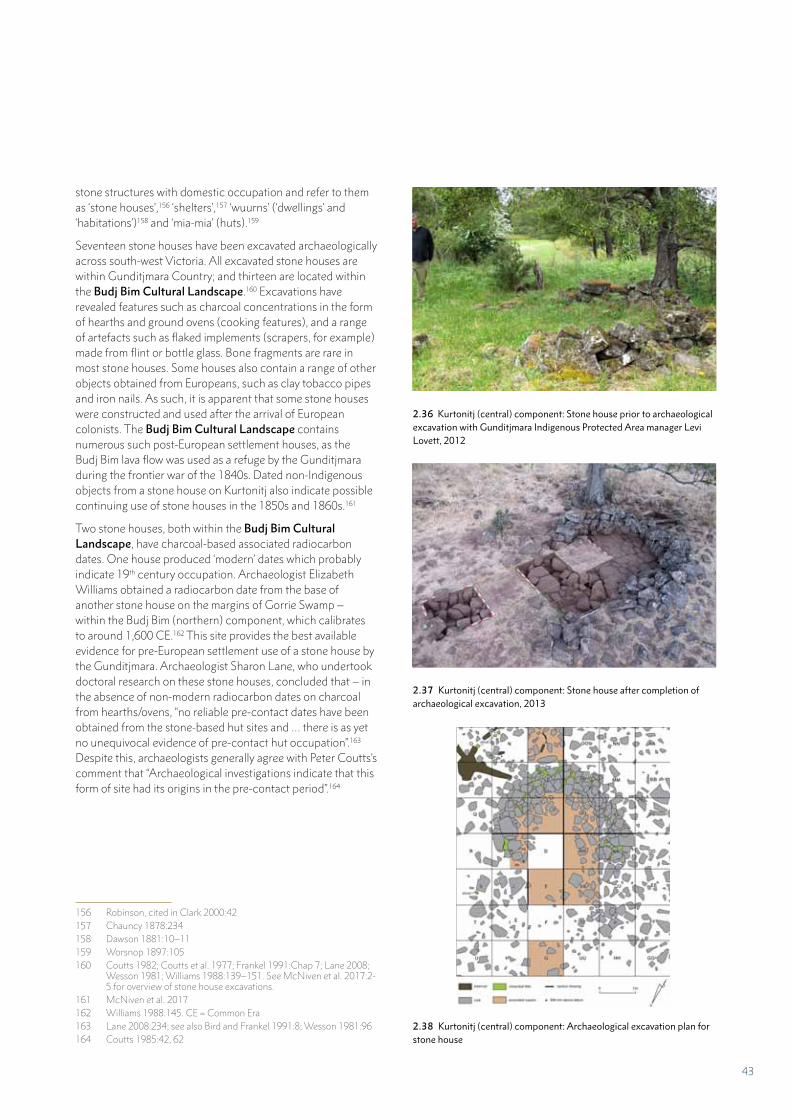
stone structures with domestic occupation and refer to them as ‘stone houses’,156 ‘shelters’,157 ‘wuurns’ (‘dwellings’ and ‘habitations’)158 and ‘mia-mia’ (huts).159
Seventeen stone houses have been excavated archaeologically across south-west Victoria. All excavated stone houses are within Gunditjmara Country; and thirteen are located within the Budj Bim Cultural Landscape.160 Excavations have revealed features such as charcoal concentrations in the form of hearths and ground ovens (cooking features), and a range of artefacts such as flaked implements (scrapers, for example) made from flint or bottle glass. Bone fragments are rare in most stone houses. Some houses also contain a range of other objects obtained from Europeans, such as clay tobacco pipes and iron nails. As such, it is apparent that some stone houses were constructed and used after the arrival of European colonists. The Budj Bim Cultural Landscape contains numerous such post-European settlement houses, as the Budj Bim lava flow was used as a refuge by the Gunditjmara during the frontier war of the 1840s. Dated non-Indigenous objects from a stone house on Kurtonitj also indicate possible continuing use of stone houses in the 1850s and 1860s.161
Two stone houses, both within the Budj Bim Cultural Landscape, have charcoal-based associated radiocarbon dates. One house produced ‘modern’ dates which probably indicate 19th century occupation. Archaeologist Elizabeth Williams obtained a radiocarbon date from the base of another stone house on the margins of Gorrie Swamp – within the Budj Bim (northern) component, which calibrates to around 1,600 CE.162 This site provides the best available evidence for pre-European settlement use of a stone house by the Gunditjmara. Archaeologist Sharon Lane, who undertook doctoral research on these stone houses, concluded that – in the absence of non-modern radiocarbon dates on charcoal from hearths/ovens, “no reliable pre-contact dates have been obtained from the stone-based hut sites and … there is as yet no unequivocal evidence of pre-contact hut occupation”.163 Despite this, archaeologists generally agree with Peter Coutts’s comment that “Archaeological investigations indicate that this form of site had its origins in the pre-contact period”.164
156 Robinson, cited in Clark 2000:42157 Chauncy 1878:234158 Dawson 1881:10–11159 Worsnop 1897:105160 Coutts 1982; Coutts et al. 1977; Frankel 1991:Chap 7; Lane 2008;
Wesson 1981; Williams 1988:139–151. See McNiven et al. 2017:2-5 for overview of stone house excavations.
161 McNiven et al. 2017162 Williams 1988:145. CE = Common Era163 Lane 2008:234; see also Bird and Frankel 1991:8; Wesson 1981:96164 Coutts 1985:42, 62
2.36 Kurtonitj (central) component: Stone house prior to archaeological excavation with Gunditjmara Indigenous Protected Area manager Levi Lovett, 2012
2.37 Kurtonitj (central) component: Stone house after completion of archaeological excavation, 2013
2.38 Kurtonitj (central) component: Archaeological excavation plan for stone house
43
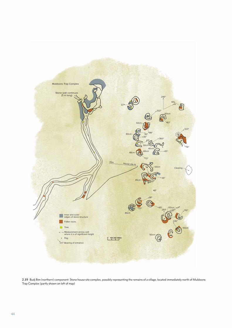
2.39 Budj Bim (northern) component: Stone house site complex, possibly representing the remains of a village, located immediately north of Muldoons Trap Complex (partly shown on left of map)
Stone wall continues(5 m long)
Muldoons Trap Complex
33mHouse site N
45cm
48cm60cm
235o
312o283o65o
45cm
23o
50cm
50cm
Fallen Tree50cm
38o
48o
55o
95o
72o
22o
35o
43o360o
35o
10o
45o86o
332o
N
295o
40o
Clearing50cm
50cm
40cm
60cm
50cm
323o
76o
82o
60cm
B
A
R
Z
WX
Y
BB
AA
T
V
U
P O
IK
N
MJ
L
G
C
O
S
E
D
Fallen rocks
Tree
Measurement across wallwhere it is of significant height
Peg
Bearing of entrance
Inner and outeredges of stone structure
325o
0 100 200 300m
44
Many stone houses occur in clusters, giving rise to questions of contemporaneity and the possibility of villages. For example, most (68%) stone houses recorded at Tae Rak (Lake Condah) occur in clusters of five or more sites with only 11 (14%) occurring as single sites.165 One cluster at Tae Rak features 16 stones houses.166 Another cluster adjacent to the Muldoons Trap Complex, features over 25 stone houses within a 50-by-20 metre area. Due to the limited dating available for stone houses, archaeologists have tended to take a conservative approach to interpreting stone house clusters as villages; and the contemporaneity issue remains unresolved.167 However, Coutts and colleagues hypothesised that the large stone house clusters at Kinghorn to the immediate north of the nominated property represent ‘hamlets’ and that “it is tempting to argue that … all structures were occupied contemporaneously” by hundreds of people.168 Similarly, McNiven and colleagues stated that “from a theoretical perspective, the possibility of stone house clusters representing villages (that is, contemporaneous occupation of multiple houses within a confined area) is plausible given numerous nineteenth century ethnographic recordings of Aboriginal ‘village’ sites in southwest Victoria”.169 For example, in May 1841 Robinson recorded a ‘village’ on the edge of Condah Swamp immediately north of the Budj Bim Cultural Landscape:
The natives are still the undisputed occupants, no white man having been there to dispossess them. The people who occupy the country have fixed residences. At one village were thirteen large huts. They are warm and well-constructed. In the shape of a cupola or kraal, a strong frame of wood is first made, and the whole covered with thick turf with the grass inwards. There are several varieties. Those like a kraal are sometimes double, having two entrances; others are semi-circular. Some are made with boughs and grass, and last are the temporary screens. One hut measured 10 feet in diameter by 5 feet high, and sufficiently strong for a man on horseback to ride over.170
165 Clarke 1994:7166 Clarke 1991:28167 Bird and Frankel 1991; Clarke 1994; Lane 2008; Wesson 1981168 Coutts et al. 1977:38169 McNiven et al. 2017; see also Williams 1984 and Lane
2008:Chapter 4170 Robinson 1841 cited in Kenyon 1928:150
SEASONALITY AND SEDENTISM
Stone houses are the primary domestic occupation site-type known in the Budj Bim Cultural Landscape. While permanent occupation of stone houses has entered popular discourse;171 all available ethnographic and archaeological evidence points to short-term (possibly seasonal) occupation.172 McNiven considers short-term usage over a period of weeks or months does not discount repeated use of houses and villages during the course of a single year, or over a series of years.173 Lourandos concludes that for the Gunditjmara and south-west Victoria more generally, “These ‘villages’ formed part of a permanent network of base camps between which the population redistributed itself throughout the year.”174
Lourandos, and more recently Builth, conclude that the large-scale network of kooyang aquaculture facilities artificially increased food availability to support relatively permanent and sedentary occupation of the Budj Bim Cultural Landscape by the Gunditjmara.175 In particular, penned kooyang “were available throughout all seasons and over many years”.176 As Builth notes, the landscape was deliberately manipulated and engineered by the Gunditjmara as a ‘landform for all seasons’.177 Thus “there were no large scale seasonal movements” of people beyond inter-regional gatherings.178 No evidence exists for broad-scale coastal-inland population movement and seasonal abandonment of areas. The Gunditjmara settlement system was about moving foci of activity; as opposed to large-scale population movements. In this regard, “Coastal areas were more productive in spring and early summer, and would have supported higher population densities during these seasons.”179 It is also probable that the Budj Bim Cultural Landscape supported higher population densities during the kooyang migration periods associated with autumn (the start of adult kooyang downstream migration), winter and spring rains.180
171 Clarke 1994:11-12172 Coutts 1985:52; Coutts et al. 1977:38; Gerritsen 2000:35; Lane
2008:Chapter 4; Wesson 1981:76173 McNiven et al. 2017174 Lourandos 1980:249175 Builth 2004; Lourandos 1980176 Builth 2002:253177 Builth 2004178 Lourandos 1977:220179 Lourandos 1977:220; see also Builth 2004:178; Godfrey 1994;
Richards and Johnston 2004180 Builth 2002:40, 83; 2004; Coutts et al. 1978:8-11
45
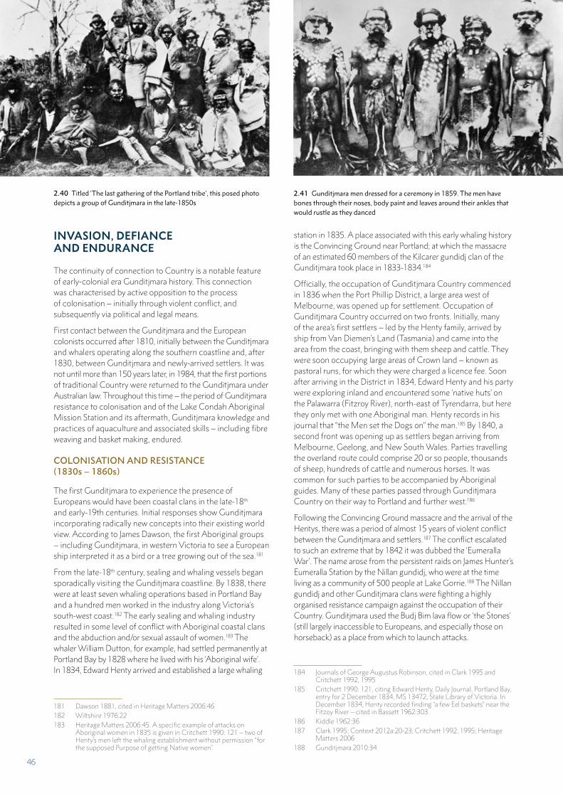
INVASION, DEFIANCE AND ENDURANCE
The continuity of connection to Country is a notable feature of early-colonial era Gunditjmara history. This connection was characterised by active opposition to the process of colonisation – initially through violent conflict, and subsequently via political and legal means.
First contact between the Gunditjmara and the European colonists occurred after 1810, initially between the Gunditjmara and whalers operating along the southern coastline and, after 1830, between Gunditjmara and newly-arrived settlers. It was not until more than 150 years later, in 1984, that the first portions of traditional Country were returned to the Gunditjmara under Australian law. Throughout this time – the period of Gunditjmara resistance to colonisation and of the Lake Condah Aboriginal Mission Station and its aftermath, Gunditjmara knowledge and practices of aquaculture and associated skills – including fibre weaving and basket making, endured.
COLONISATION AND RESISTANCE (1830s – 1860s)
The first Gunditjmara to experience the presence of Europeans would have been coastal clans in the late-18th and early-19th centuries. Initial responses show Gunditjmara incorporating radically new concepts into their existing world view. According to James Dawson, the first Aboriginal groups – including Gunditjmara, in western Victoria to see a European ship interpreted it as a bird or a tree growing out of the sea.181
From the late-18th century, sealing and whaling vessels began sporadically visiting the Gunditjmara coastline. By 1838, there were at least seven whaling operations based in Portland Bay and a hundred men worked in the industry along Victoria’s south-west coast.182 The early sealing and whaling industry resulted in some level of conflict with Aboriginal coastal clans and the abduction and/or sexual assault of women.183 The whaler William Dutton, for example, had settled permanently at Portland Bay by 1828 where he lived with his ‘Aboriginal wife’. In 1834, Edward Henty arrived and established a large whaling
181 Dawson 1881, cited in Heritage Matters 2006:46182 Wiltshire 1976:22183 Heritage Matters 2006:45. A specific example of attacks on
Aboriginal women in 1835 is given in Critchett 1990: 121 – two of Henty’s men left the whaling establishment without permission “for the supposed Purpose of getting Native women”.
station in 1835. A place associated with this early whaling history is the Convincing Ground near Portland; at which the massacre of an estimated 60 members of the Kilcarer gundidj clan of the Gunditjmara took place in 1833-1834.184
Officially, the occupation of Gunditjmara Country commenced in 1836 when the Port Phillip District, a large area west of Melbourne, was opened up for settlement. Occupation of Gunditjmara Country occurred on two fronts. Initially, many of the area’s first settlers – led by the Henty family, arrived by ship from Van Diemen’s Land (Tasmania) and came into the area from the coast, bringing with them sheep and cattle. They were soon occupying large areas of Crown land – known as pastoral runs, for which they were charged a licence fee. Soon after arriving in the District in 1834, Edward Henty and his party were exploring inland and encountered some ‘native huts’ on the Palawarra (Fitzroy River), north-east of Tyrendarra, but here they only met with one Aboriginal man. Henty records in his journal that “the Men set the Dogs on” the man.185 By 1840, a second front was opening up as settlers began arriving from Melbourne, Geelong, and New South Wales. Parties travelling the overland route could comprise 20 or so people, thousands of sheep, hundreds of cattle and numerous horses. It was common for such parties to be accompanied by Aboriginal guides. Many of these parties passed through Gunditjmara Country on their way to Portland and further west.186
Following the Convincing Ground massacre and the arrival of the Hentys, there was a period of almost 15 years of violent conflict between the Gunditjmara and settlers.187 The conflict escalated to such an extreme that by 1842 it was dubbed the ‘Eumeralla War’. The name arose from the persistent raids on James Hunter’s Eumeralla Station by the Nillan gundidj, who were at the time living as a community of 500 people at Lake Gorrie.188 The Nillan gundidj and other Gunditjmara clans were fighting a highly organised resistance campaign against the occupation of their Country. Gunditjmara used the Budj Bim lava flow or ‘the Stones’ (still largely inaccessible to Europeans, and especially those on horseback) as a place from which to launch attacks.
184 Journals of George Augustus Robinson, cited in Clark 1995 and Critchett 1992, 1995
185 Critchett 1990: 121, citing Edward Henty, Daily Journal, Portland Bay, entry for 2 December 1834, MS 13472, State Library of Victoria. In December 1834, Henty recorded finding “a few Eel baskets” near the Fitzoy River – cited in Bassett 1962:303.
186 Kiddle 1962:36187 Clark 1995; Context 2012a:20-23; Critchett 1992, 1995; Heritage
Matters 2006188 Gunditjmara 2010:34
2.40 Titled ‘The last gathering of the Portland tribe’, this posed photo depicts a group of Gunditjmara in the late-1850s
2.41 Gunditjmara men dressed for a ceremony in 1859. The men have bones through their noses, body paint and leaves around their ankles that would rustle as they danced
46
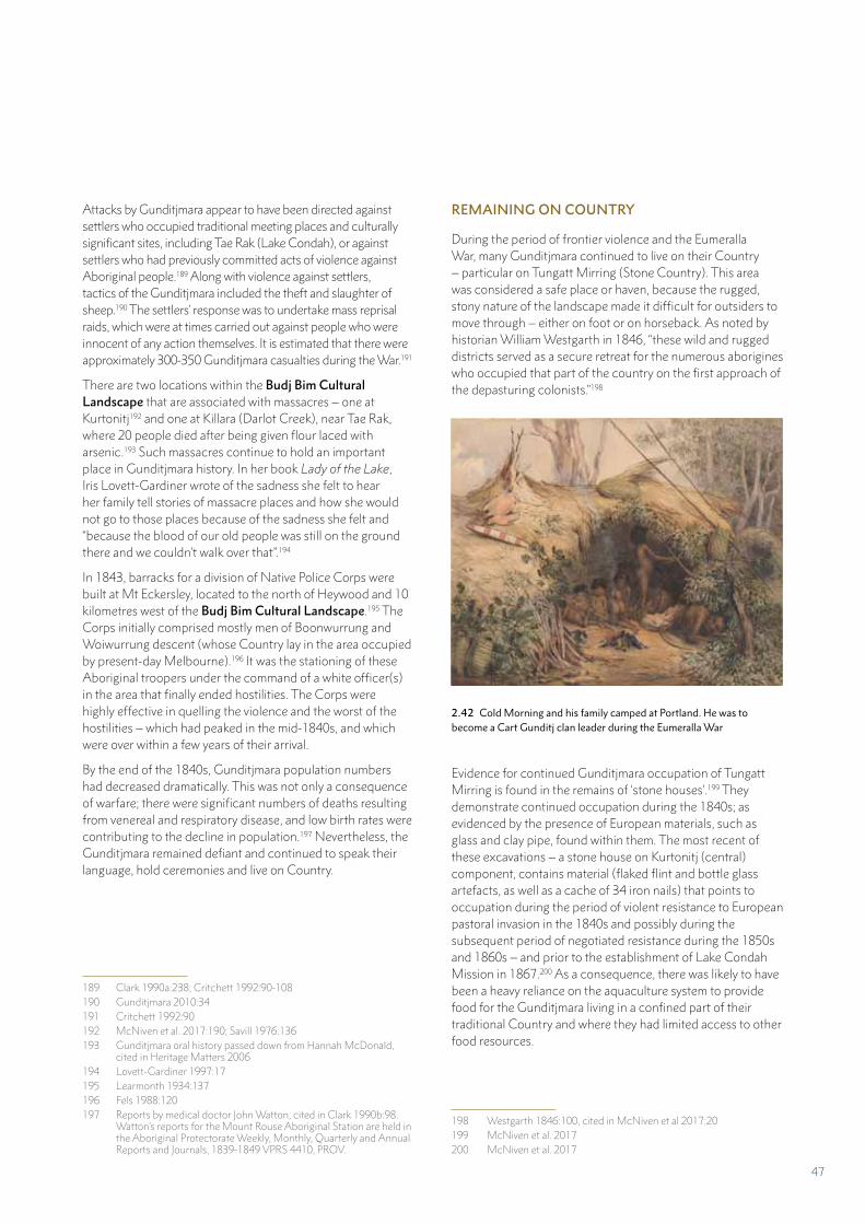
Attacks by Gunditjmara appear to have been directed against settlers who occupied traditional meeting places and culturally significant sites, including Tae Rak (Lake Condah), or against settlers who had previously committed acts of violence against Aboriginal people.189 Along with violence against settlers, tactics of the Gunditjmara included the theft and slaughter of sheep.190 The settlers’ response was to undertake mass reprisal raids, which were at times carried out against people who were innocent of any action themselves. It is estimated that there were approximately 300-350 Gunditjmara casualties during the War.191
There are two locations within the Budj Bim Cultural Landscape that are associated with massacres – one at Kurtonitj192 and one at Killara (Darlot Creek), near Tae Rak, where 20 people died after being given flour laced with arsenic.193 Such massacres continue to hold an important place in Gunditjmara history. In her book Lady of the Lake, Iris Lovett-Gardiner wrote of the sadness she felt to hear her family tell stories of massacre places and how she would not go to those places because of the sadness she felt and “because the blood of our old people was still on the ground there and we couldn’t walk over that”.194
In 1843, barracks for a division of Native Police Corps were built at Mt Eckersley, located to the north of Heywood and 10 kilometres west of the Budj Bim Cultural Landscape.195 The Corps initially comprised mostly men of Boonwurrung and Woiwurrung descent (whose Country lay in the area occupied by present-day Melbourne).196 It was the stationing of these Aboriginal troopers under the command of a white officer(s) in the area that finally ended hostilities. The Corps were highly effective in quelling the violence and the worst of the hostilities – which had peaked in the mid-1840s, and which were over within a few years of their arrival.
By the end of the 1840s, Gunditjmara population numbers had decreased dramatically. This was not only a consequence of warfare; there were significant numbers of deaths resulting from venereal and respiratory disease, and low birth rates were contributing to the decline in population.197 Nevertheless, the Gunditjmara remained defiant and continued to speak their language, hold ceremonies and live on Country.
189 Clark 1990a:238; Critchett 1992:90-108190 Gunditjmara 2010:34191 Critchett 1992:90192 McNiven et al. 2017:190; Savill 1976:136193 Gunditjmara oral history passed down from Hannah McDonald,
cited in Heritage Matters 2006194 Lovett-Gardiner 1997:17 195 Learmonth 1934:137196 Fels 1988:120197 Reports by medical doctor John Watton, cited in Clark 1990b:98.
Watton’s reports for the Mount Rouse Aboriginal Station are held in the Aboriginal Protectorate Weekly, Monthly, Quarterly and Annual Reports and Journals, 1839-1849 VPRS 4410, PROV.
REMAINING ON COUNTRY
During the period of frontier violence and the Eumeralla War, many Gunditjmara continued to live on their Country – particular on Tungatt Mirring (Stone Country). This area was considered a safe place or haven, because the rugged, stony nature of the landscape made it difficult for outsiders to move through – either on foot or on horseback. As noted by historian William Westgarth in 1846, “these wild and rugged districts served as a secure retreat for the numerous aborigines who occupied that part of the country on the first approach of the depasturing colonists.”198
Evidence for continued Gunditjmara occupation of Tungatt Mirring is found in the remains of ‘stone houses’.199 They demonstrate continued occupation during the 1840s; as evidenced by the presence of European materials, such as glass and clay pipe, found within them. The most recent of these excavations – a stone house on Kurtonitj (central) component, contains material (flaked flint and bottle glass artefacts, as well as a cache of 34 iron nails) that points to occupation during the period of violent resistance to European pastoral invasion in the 1840s and possibly during the subsequent period of negotiated resistance during the 1850s and 1860s – and prior to the establishment of Lake Condah Mission in 1867.200 As a consequence, there was likely to have been a heavy reliance on the aquaculture system to provide food for the Gunditjmara living in a confined part of their traditional Country and where they had limited access to other food resources.
198 Westgarth 1846:100, cited in McNiven et al 2017:20199 McNiven et al. 2017200 McNiven et al. 2017
2.42 Cold Morning and his family camped at Portland. He was to become a Cart Gunditj clan leader during the Eumeralla War
47
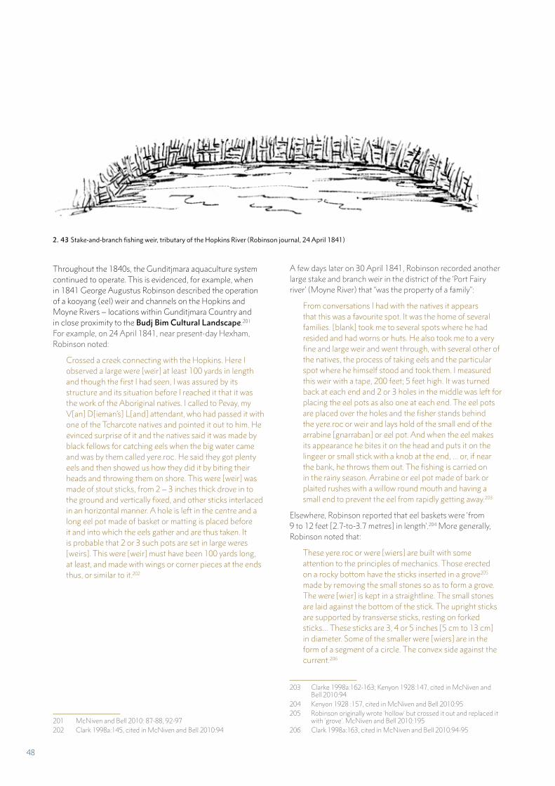
2. 43 Stake-and-branch fishing weir, tributary of the Hopkins River (Robinson journal, 24 April 1841)
Throughout the 1840s, the Gunditjmara aquaculture system continued to operate. This is evidenced, for example, when in 1841 George Augustus Robinson described the operation of a kooyang (eel) weir and channels on the Hopkins and Moyne Rivers – locations within Gunditjmara Country and in close proximity to the Budj Bim Cultural Landscape.201 For example, on 24 April 1841, near present-day Hexham, Robinson noted:
Crossed a creek connecting with the Hopkins. Here I observed a large were [weir] at least 100 yards in length and though the first I had seen, I was assured by its structure and its situation before I reached it that it was the work of the Aboriginal natives. I called to Pevay, my V[an] D[ieman’s] L[and] attendant, who had passed it with one of the Tcharcote natives and pointed it out to him. He evinced surprise of it and the natives said it was made by black fellows for catching eels when the big water came and was by them called yere.roc. He said they got plenty eels and then showed us how they did it by biting their heads and throwing them on shore. This were [weir] was made of stout sticks, from 2 – 3 inches thick drove in to the ground and vertically fixed, and other sticks interlaced in an horizontal manner. A hole is left in the centre and a long eel pot made of basket or matting is placed before it and into which the eels gather and are thus taken. It is probable that 2 or 3 such pots are set in large weres [weirs]. This were [weir] must have been 100 yards long, at least, and made with wings or corner pieces at the ends thus, or similar to it.202
201 McNiven and Bell 2010: 87-88, 92-97202 Clark 1998a:145, cited in McNiven and Bell 2010:94
A few days later on 30 April 1841, Robinson recorded another large stake and branch weir in the district of the ‘Port Fairy river’ (Moyne River) that “was the property of a family”:
From conversations I had with the natives it appears that this was a favourite spot. It was the home of several families. [blank] took me to several spots where he had resided and had worns or huts. He also took me to a very fine and large weir and went through, with several other of the natives, the process of taking eels and the particular spot where he himself stood and took them. I measured this weir with a tape, 200 feet; 5 feet high. It was turned back at each end and 2 or 3 holes in the middle was left for placing the eel pots as also one at each end. The eel pots are placed over the holes and the fisher stands behind the yere.roc or weir and lays hold of the small end of the arrabine [gnarraban] or eel pot. And when the eel makes its appearance he bites it on the head and puts it on the lingeer or small stick with a knob at the end, ... or, if near the bank, he throws them out. The fishing is carried on in the rainy season. Arrabine or eel pot made of bark or plaited rushes with a willow round mouth and having a small end to prevent the eel from rapidly getting away.203
Elsewhere, Robinson reported that eel baskets were ‘from 9 to 12 feet [2.7-to-3.7 metres] in length’.204 More generally, Robinson noted that:
These yere.roc or were [wiers] are built with some attention to the principles of mechanics. Those erected on a rocky bottom have the sticks inserted in a grove205 made by removing the small stones so as to form a grove. The were [wier] is kept in a straightline. The small stones are laid against the bottom of the stick. The upright sticks are supported by transverse sticks, resting on forked sticks… These sticks are 3, 4 or 5 inches [5 cm to 13 cm] in diameter. Some of the smaller were [wiers] are in the form of a segment of a circle. The convex side against the current.206
203 Clarke 1998a:162-163; Kenyon 1928:147, cited in McNiven and Bell 2010:94
204 Kenyon 1928 :157, cited in McNiven and Bell 2010:95205 Robinson originally wrote 'hollow' but crossed it out and replaced it
with 'grove'. McNiven and Bell 2010:195 206 Clark 1998a:163, cited in McNiven and Bell 2010:94-95
48
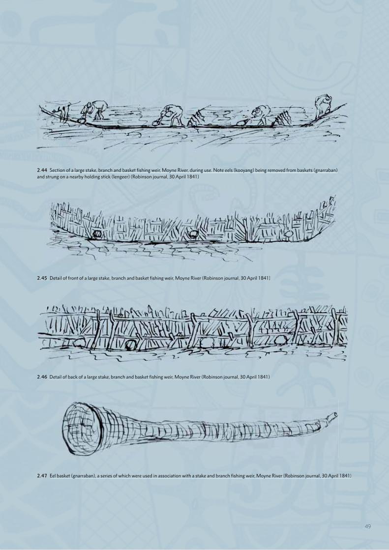
2.45 Detail of front of a large stake, branch and basket fishing weir, Moyne River (Robinson journal, 30 April 1841)
2.46 Detail of back of a large stake, branch and basket fishing weir, Moyne River (Robinson journal, 30 April 1841)
2.47 Eel basket (gnarraban), a series of which were used in association with a stake and branch fishing weir, Moyne River (Robinson journal, 30 April 1841)
2.44 Section of a large stake, branch and basket fishing weir, Moyne River, during use. Note eels (kooyang) being removed from baskets (gnarraban) and strung on a nearby holding stick (lengeer) (Robinson journal, 30 April 1841)
2.45 Detail of front of a large stake, branch and basket fishing weir, Moyne River (Robinson journal, 30 April 1841)
2.46 Detail of back of a large stake, branch and basket fishing weir, Moyne River (Robinson journal, 30 April 1841)
2.47 Eel basket (gnarraban), a series of which were used in association with a stake and branch fishing weir, Moyne River (Robinson journal, 30 April 1841)
2.44 Section of a large stake, branch and basket fishing weir, Moyne River, during use. Note eels (kooyang) being removed from baskets (gnarraban)and strung on a nearby holding stick (lengeer) (Robinson journal, 30 April 1841)
49

THE MISSION (1867 – 1918)
The Lake Condah Aboriginal Mission Station (the Mission) was established in the 1860s. The creation of a mission system was a response to the conflicts over land and resources between the European settlers and Aboriginal people over the preceding decades. Following an official inquiry by the Victorian Government in 1858 into the injustices to Aboriginal people, the Victorian colonial government invited missionaries to form reserves where Aboriginal people could be protected and provided with an education.207
The decision to establish the Mission at Lake Condah followed the refusal by the Gunditjmara from the area to leave their Country. The Gunditjmara name for the site of the Mission is ‘weeok’ (place of fish), which was a traditional camping place of the Kerrupjmara clan.208 Weeok and Tae Rak were part of the Condah Hills ‘run’ taken up in 1850 by Cecil Pybus Cooke.
207 Report of the Select Committee on the Aborigines (Vic.) 1858-59208 Evidence of this occupation site was revealed in the 1980s during
archaeological excavations beneath the former Mission Dormitory Building. Rhodes and Stocks 1985
Cooke had allowed Gunditjmara to continue to camp at Tae Rak (Lake Condah) and employed them on his station.209
In 1866, 2,043 acres (827 hectares) were excised from Cooke’s station and set aside as an Aboriginal Reserve. The reserved land included the extensive aquaculture facilities on the south-western margins of Tae Rak (Part 2.A). The following year the reserve was gazetted and building commenced. The Anglican Mission to Aborigines managed the Mission until 1875, followed by the Moravian Mission until 1913 – after which the Victorian Government’s Board for the Protection of Aborigines assumed control. In 1885, a further 1,710 acres (692 hectares) of Tungatt Mirring (Stone Country) were added to the Mission lands with the intent of safeguarding Gunditjmara hunting grounds.210 An additional 38 acres was reserved in 1886, adjoining the margins of Tae Rak.211
During its early years the Mission was home to approximately 70 Gunditjmara, reaching its maximum number of 117 people in 1889. At the height of the Mission’s development in the 1880s, there were 26 stone or timber cottages, a mission house, storeroom, school and church. Both Gunditjmara and non-Aboriginal children attended the school, and the local community worshipped at St Mary’s Church (located on the Mission), which had opened in 1885.212 In 1918, the Victorian Government closed the Mission, though Gunditjmara people continued to visit or live there, occupying the buildings until the late-1950s and worshipping at the church until 1957.
209 Cole 1984:14; Heritage Matters 2006:91, citing Kiddle 1961:123210 Cole 1984: 26. The original reservation, described as a ‘Site for
the use of the Aborigines’ appears in the Victorian Government Gazette. 25 March 1885, p.936. The rationale for this additional land reservation in 1885, noted in the annual report of the Board for the Protection of the Aborigines in 1885, was to increase the area available to the .Aborigines as hunting grounds (BPA Annual Report 1885, Government Printer, Melbourne, p.9)
211 Victorian Government Gazette, 12 November 1886:3172212 Gunditjmara 2010:43
2.48 Plan of the Parish of Condah (circa 1889) showing the additional land of 1,710 acres set aside in 1885 to safeguard Gunditjmara hunting grounds
2.49 Budj Bim (northern) component: Lake Condah Aboriginal Mission Station, circa 1874
50
Similarly, Aunty Euphemia Day recalled:
On the mission they weren’t allowed – you lost your song and dance, the language that was taken away from us so we weren’t allowed to speak your language ... My grandmothers were both in their nineties and I never ever heard them speak any language because they knew the consequences of that action.218
218 Cited in Weir 2009:10
While the Mission was established by Europeans to provide accommodation and impose their culture on the Gunditjmara living there; it also provided a means by which the Gunditjmara could both retain ties with their traditional land and culture – including aquaculture practices, and adapt to conditions created by European settlement.213
For the Gunditjmara, life on the Mission was subject to restrictive rules, including Government regulations such as the requirement to apply for a permit to travel off the reserve, to obtain work and to marry. It was commonplace for these permits not to be granted. Some children were removed from their parents’ home and housed within a separate children’s dormitory for ‘education’ purposes. At the Mission, education included the teaching of Christianity, English and basic numeracy. Gunditjmara cultural practice and language were forbidden. Physical violence and withholding of rations were regularly exercised as punishment for breaking the rules of the Mission.214
For men such as Ernest Mobourne, who had been evicted from the Lake Condah Mission to Lake Tyers Mission in south-eastern Victoria, the conditions for Aboriginal people on the Victorian missions were comparable to slavery.215 In 1907, Mobourne wrote to the Victorian Government on behalf of the Aboriginal people at the Lake Condah Mission, requesting that plans for their removal be reconsidered. He wrote:
Our fathers were brought here some forty years back to form a mission station here and were then informed that if they built houses, fenced in and cleared the reserve, the mission station would remain theirs for them and their children’s children ... our fathers have passed peacefully to rest and we would wish to live and work and be buried beside them.216
Aunty Iris Lovett-Gardiner, writing of the history of her family, has described how little traditional knowledge was passed down as a result of the Mission period in Gunditjmara history, and how much was lost. She wrote:
I never heard them speak the language when I was young, even in the bush. It was more or less gone by that time. We never had that when we grew up. So it was sort of a different era by the time I was born [1926]. But in our hearts we knew who we were and where we came from.217
213 Context 1993:16214 Gunditjmara 2010:39-41215 Ernest Moborne to His Excellency Sir Arthur Stanley, Governor of
Victoria, 6 March 1916, Australian Archives (Victoria), Series B337, 507, 1996T/2448, cited in Critchett 1998:178
216 The Aboriginals of Lake Condah to Members of the Cabinet, 2 July 1907, Chief Secretary’s Incoming Correspondence, A5318/1907, VPRS 3992, Unit 1457, PROV, cited in Critchett 1980:211 and Weir 2009:10
217 Lovett-Gardiner 1997:17
2.50 Lake Condah Mission: School (left), church (centre) and mission house (right)
2.51 Lake Condah Mission: Houses built by the Gunditjmara
2.52 Residents at St Mary’s Church
51

CONTINUING GUNDITJMARA AQUACULTURE (1860s – 1920s)
Despite the restrictions on freedom that were part of Mission life, the Gunditjmara continued to access and use the aquaculture system. This continuing practice is evidenced, for example, in the Mission records provided to the Board for the Protection of Aborigines, that show that Gunditjmara occupants, in the late 1860s and 1870s, spent a day or two a week hunting or fishing for eels and blackfish.219 For the Mission’s purposes, this was to supplement food supplies, but for the Gunditjmara it was an opportunity to continue their aquaculture traditions (and probably other cultural practices) away from the gaze of the missionaries.
Gunditjmara knowledge of the aquaculture system is also evidenced in the designs made on traditional possum skin cloaks. Such cloaks served a utilitarian purpose (protection from cold) as well as being used in ceremonies. A cloak produced at the Mission in 1872 (and now held by the Museum of Victoria) is made up of 50 possum skin panels – each of which has been decorated with designs etched into the skin, coloured using ochres and sealed with kangaroo fat.220 The designs themselves illustrate aspects of Gunditjmara Country, including representations of kooyang (eel) aquaculture.221
219 Brazier 1874; Shaw 1871a, 1871b, 1873 – cited in Richards 2011:77 and Gunditjmara 2010:40
220 The cloak was made by five men, including James Lovett. Thomas Day, cited in Gibbins 2010:140
221 Gunditjmara 2010:12-13.
In March 1878, and at the end of an exceptionally dry Australian summer, a correspondent for the Portland Guardian newspaper wrote about coming across a camp of “half a dozen” Gunditjmara at Tae Rak (Lake Condah). At that time, the lake was the driest it had been in over 30 years. The author writes that the Gunditjmara spoke of:
…the unfairness of white people coming and taking the fish without giving them something in this way, they said we get our living by catching the fish and they are on our reserve and you have no right to them, if we went into a whitefellows paddock and took his sheep, as many as we wanted, you soon put us in gaol. …[The eels] were in thousands and as you put your foot down you felt you were up to the knees in a living moving mass… [The Gunditjmara] in half an hour had two flour bags full to the brim. The quantity of fish must be seen to be appreciated, they are there in the thousands…222
It is also clear that there were Aboriginal people living on Country – beyond the confines of the Mission, who continued to harvest kooyang. For example, Thomas (Tommy) White (circa 1832-1892), a Gunditjmara man who was born and lived in the area of Condah Swamp, “made a living by catching eels, which he kept in wooden cages in the river until he had
222 Portland Guardian 1878
2.53 Possum skin cloak made at Lake Condah Mission in 1872. The design of 50 panels is resonant of a swamp viewed from above, including details of rushes, eel traps and other features of the Budj Bim Cultural Landscape.
2.54 Aunty Iris Lovett-Gardiner wearing a possum skin cloak
52
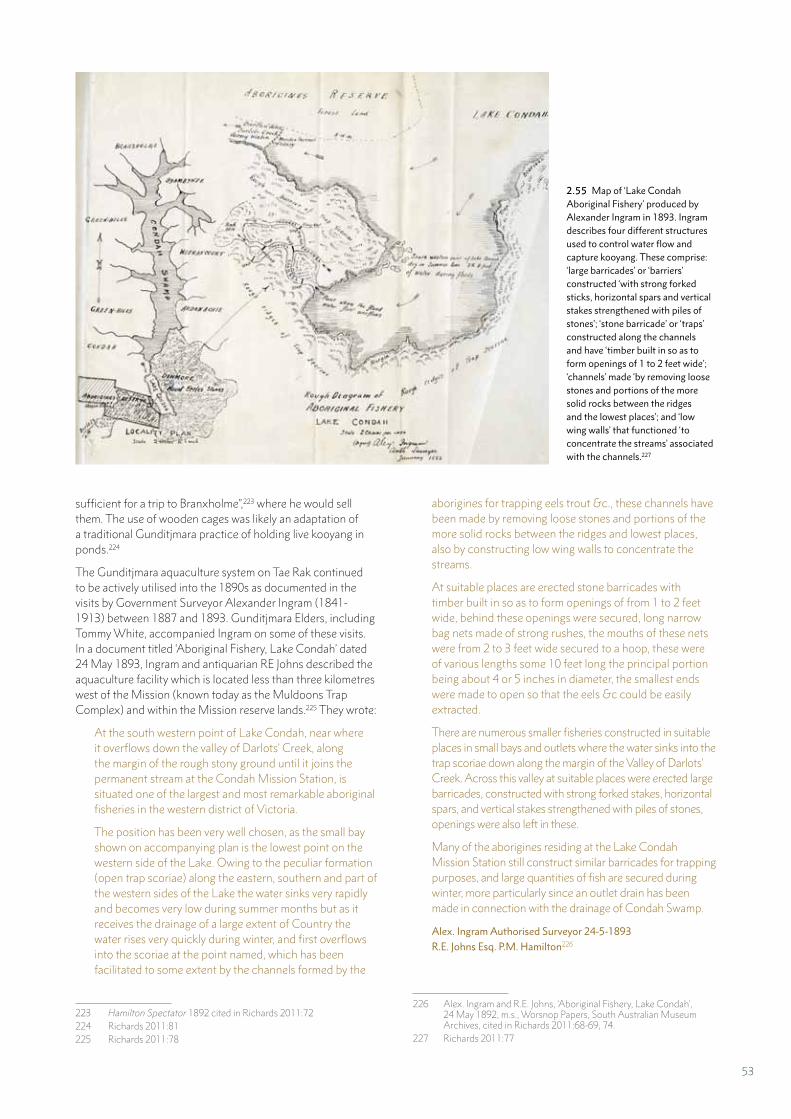
sufficient for a trip to Branxholme”,223 where he would sell them. The use of wooden cages was likely an adaptation of a traditional Gunditjmara practice of holding live kooyang in ponds.224
The Gunditjmara aquaculture system on Tae Rak continued to be actively utilised into the 1890s as documented in the visits by Government Surveyor Alexander Ingram (1841-1913) between 1887 and 1893. Gunditjmara Elders, including Tommy White, accompanied Ingram on some of these visits. In a document titled ‘Aboriginal Fishery, Lake Condah’ dated 24 May 1893, Ingram and antiquarian RE Johns described the aquaculture facility which is located less than three kilometres west of the Mission (known today as the Muldoons Trap Complex) and within the Mission reserve lands.225 They wrote:
At the south western point of Lake Condah, near where it overflows down the valley of Darlots’ Creek, along the margin of the rough stony ground until it joins the permanent stream at the Condah Mission Station, is situated one of the largest and most remarkable aboriginal fisheries in the western district of Victoria.
The position has been very well chosen, as the small bay shown on accompanying plan is the lowest point on the western side of the Lake. Owing to the peculiar formation (open trap scoriae) along the eastern, southern and part of the western sides of the Lake the water sinks very rapidly and becomes very low during summer months but as it receives the drainage of a large extent of Country the water rises very quickly during winter, and first overflows into the scoriae at the point named, which has been facilitated to some extent by the channels formed by the
223 Hamilton Spectator 1892 cited in Richards 2011:72224 Richards 2011:81225 Richards 2011:78
aborigines for trapping eels trout &c., these channels have been made by removing loose stones and portions of the more solid rocks between the ridges and lowest places, also by constructing low wing walls to concentrate the streams.
At suitable places are erected stone barricades with timber built in so as to form openings of from 1 to 2 feet wide, behind these openings were secured, long narrow bag nets made of strong rushes, the mouths of these nets were from 2 to 3 feet wide secured to a hoop, these were of various lengths some 10 feet long the principal portion being about 4 or 5 inches in diameter, the smallest ends were made to open so that the eels &c could be easily extracted.
There are numerous smaller fisheries constructed in suitable places in small bays and outlets where the water sinks into the trap scoriae down along the margin of the Valley of Darlots’ Creek. Across this valley at suitable places were erected large barricades, constructed with strong forked stakes, horizontal spars, and vertical stakes strengthened with piles of stones, openings were also left in these.
Many of the aborigines residing at the Lake Condah Mission Station still construct similar barricades for trapping purposes, and large quantities of fish are secured during winter, more particularly since an outlet drain has been made in connection with the drainage of Condah Swamp.
Alex. Ingram Authorised Surveyor 24-5-1893R.E. Johns Esq. P.M. Hamilton226227
226 Alex. Ingram and R.E. Johns, ‘Aboriginal Fishery, Lake Condah’, 24 May 1892, m.s., Worsnop Papers, South Australian Museum Archives, cited in Richards 2011:68-69, 74.
227 Richards 2011:77
2.55 Map of ‘Lake Condah Aboriginal Fishery’ produced by Alexander Ingram in 1893. Ingram describes four different structures used to control water flow and capture kooyang. These comprise: ‘large barricades’ or ‘barriers’ constructed ‘with strong forked sticks, horizontal spars and vertical stakes strengthened with piles of stones’; ‘stone barricade’ or ‘traps’ constructed along the channels and have ‘timber built in so as to form openings of 1 to 2 feet wide’; ‘channels’ made ‘by removing loose stones and portions of the more solid rocks between the ridges and the lowest places’; and ‘low wing walls’ that functioned ‘to concentrate the streams’ associated with the channels.227
53
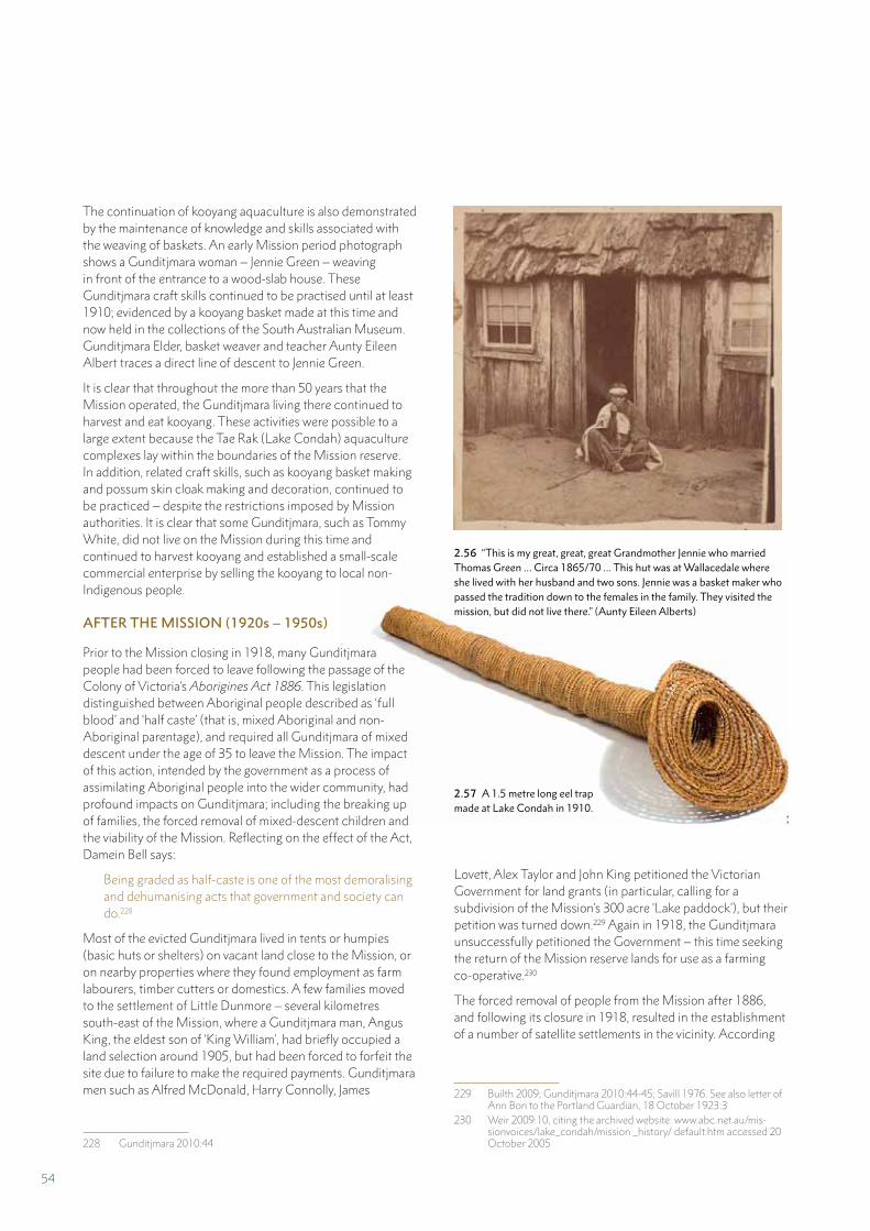
The continuation of kooyang aquaculture is also demonstrated by the maintenance of knowledge and skills associated with the weaving of baskets. An early Mission period photograph shows a Gunditjmara woman – Jennie Green – weaving in front of the entrance to a wood-slab house. These Gunditjmara craft skills continued to be practised until at least 1910; evidenced by a kooyang basket made at this time and now held in the collections of the South Australian Museum. Gunditjmara Elder, basket weaver and teacher Aunty Eileen Albert traces a direct line of descent to Jennie Green.
It is clear that throughout the more than 50 years that the Mission operated, the Gunditjmara living there continued to harvest and eat kooyang. These activities were possible to a large extent because the Tae Rak (Lake Condah) aquaculture complexes lay within the boundaries of the Mission reserve. In addition, related craft skills, such as kooyang basket making and possum skin cloak making and decoration, continued to be practiced – despite the restrictions imposed by Mission authorities. It is clear that some Gunditjmara, such as Tommy White, did not live on the Mission during this time and continued to harvest kooyang and established a small-scale commercial enterprise by selling the kooyang to local non-Indigenous people.
AFTER THE MISSION (1920s – 1950s)
Prior to the Mission closing in 1918, many Gunditjmara people had been forced to leave following the passage of the Colony of Victoria’s Aborigines Act 1886. This legislation distinguished between Aboriginal people described as ‘full blood’ and ‘half caste’ (that is, mixed Aboriginal and non-Aboriginal parentage), and required all Gunditjmara of mixed descent under the age of 35 to leave the Mission. The impact of this action, intended by the government as a process of assimilating Aboriginal people into the wider community, had profound impacts on Gunditjmara; including the breaking up of families, the forced removal of mixed-descent children and the viability of the Mission. Reflecting on the effect of the Act, Damein Bell says:
Being graded as half-caste is one of the most demoralising and dehumanising acts that government and society can do.228
Most of the evicted Gunditjmara lived in tents or humpies (basic huts or shelters) on vacant land close to the Mission, or on nearby properties where they found employment as farm labourers, timber cutters or domestics. A few families moved to the settlement of Little Dunmore – several kilometres south-east of the Mission, where a Gunditjmara man, Angus King, the eldest son of ‘King William’, had briefly occupied a land selection around 1905, but had been forced to forfeit the site due to failure to make the required payments. Gunditjmara men such as Alfred McDonald, Harry Connolly, James
228 Gunditjmara 2010:44
2.56 “This is my great, great, great Grandmother Jennie who married Thomas Green … Circa 1865/70 … This hut was at Wallacedale where she lived with her husband and two sons. Jennie was a basket maker who passed the tradition down to the females in the family. They visited the mission, but did not live there.” (Aunty Eileen Alberts)
2.57 A 1.5 metre long eel trap made at Lake Condah in 1910.
Lovett, Alex Taylor and John King petitioned the Victorian Government for land grants (in particular, calling for a subdivision of the Mission’s 300 acre ‘Lake paddock’), but their petition was turned down.229 Again in 1918, the Gunditjmara unsuccessfully petitioned the Government – this time seeking the return of the Mission reserve lands for use as a farming co-operative.230
The forced removal of people from the Mission after 1886, and following its closure in 1918, resulted in the establishment of a number of satellite settlements in the vicinity. According
229 Builth 2009; Gunditjmara 2010:44-45; Savill 1976. See also letter of Ann Bon to the Portland Guardian, 18 October 1923:3
230 Weir 2009:10, citing the archived website: www.abc.net.au/mis-sionvoices/lake_condah/mission _history/ default.htm accessed 20 October 2005
54
Sunday Creek
Tae Rak (Lake Condah)
Old Condah South Post OfficeLittle
Dunmore
Lake Condah Mission
Ta
Palawarra
(Fitzroy Killa
ra
(Dar
lot
Creek)
River)
Debs Waterhole
The Forest
DUNMORE
MYAMYN
CONDAH
MILLTOWN
GREENVALE
TYRENDARRA
TO PORTLAND
CASTLEMADDIE
HEYWOOD
to Iris Lovett-Gardiner,231 the Hart, Albert and Carter families lived at Little Dunmore,232 Jim Arden at Heatherleigh, the Clark family at Woodlands, the King family were at The Forest and the Lovett family at Greenvale. However, by the 1920s, some people also began returning to live in the former Mission buildings and hold services in St Mary’s Church.233 In 1939, there were 70 people in residence at the former Mission, some remaining there until 1957 when they were finally forced out by the Government.234
Along with the continued occupation of the former Mission, the satellite settlements that sprung up around the Mission are an important part of 20th century Gunditjmara history. They tell the story of both removal from – and ongoing connection to – the Mission. Many of the settlements were formed around houses relocated from the Mission and such houses became
231 Lovett-Gardiner 1997:29232 Eileen Alberts recalls, “Little Dunmore was where the Alberts family
lived. After the marriage of Angus Alberts and Frances Carter, the Carter family moved to Little Dunmore as well. The Kings moved close by.”
233 Weir 2009:10234 Context 2012b:29
centres of home and family life for generations. Memories of family and social life during this time tell of visiting families at the Mission and the different settlements, as well as camping, picnicking or travelling through Country. A number of families also moved far away from their Country after the Mission closed – including into Melbourne, due to fears of having their children taken from them.235
Although each local settlement produced its own food, and shared it with other family and friends, there was never enough food.236 As Barry Fary stated: “We still had to hunt for survival.”237 In addition to hunting rabbits, robbing beehives, shooting kangaroo or black swan, the Gunditjmara continued to fish and harvest kooyang (eels). Following winter floods
235 The ‘Stolen Generations’ refers to the phenomenon of the gov-ernment-sponsored removal of children from Aboriginal families. The children were institutionalised and/or fostered or adopted by non-Indigenous people. See Gunditjmara 2010:56-58
236 Gunditjmara 2010:50237 Gunditjmara 2010:50
2.58 Locations where Gunditjmara lived following the closure of Lake Condah Mission. Daryl Rose 1988, redrawn by The Designery
55
2.59 Picnic at Tae Rak (Lake Condah), circa 1920. Bessie Carter is at the right of the photograph
along Killara (Darlot Creek), they spent time repairing the aquaculture complexes at Tae Rak (Lake Condah), harvesting kooyang and sharing the catch among the community.238
Many people who continued to live on the former Mission or at the nearby settlements have strong memories of catching and eating kooyang. For many Gunditjmara, attending the Sunday service in St Mary’s Church (at Lake Condah Mission) was an important occasion. After the service, the families would typically sit down to a cooked Sunday dinner – often with roast rabbit or kooyang acting as the centrepiece. Great Aunty Lyall Foster said that kooyang could be either baked in the oven or fried in a pan on the stove.239
Aunty Tina Saunders recalled how catching kooyang was important for providing her family’s food, but also for making an income.
Dad [Chris Saunders] used to just get the fish – the eels and the toupon from the fishtraps because they were still working then. Mainly the eels. He sold them at the pub, up at Hamilton, Portland.240
Aunty Rene Onus also recalled, “For food we had the lovely fish from the Mission. Creek Eels and Toupon. That’s Mountain Trout.”241 Aunty Tina Saunders said that her family would catch fish and kooyang – “we’d eat eels”. She also observed that in the 1980s the kooyang were “still there”.242 Similarly, Aunty Rene Onus said, “we used to catch eels”.243 Aunty June Gill tells a story of her father [Samuel Alexander Peacock Lovett], who liked to eat kooyang, catching a huge kooyang at the traps near to the Mission.244
Aunty Phemie (Euphemia) Day gave the following account of the hard times experienced by her family, and of a method used to catch kooyang.
Well, it was survival at its utmost and at its best. The men there all went fishing – there was no work there. If it looked like a storm coming up you’d see them with their worms and every man – Uncle Bobby Carter, Dad [Herbert Lovett], Uncle Jacko and Uncle George Fary, Uncle Monty, the Dunmore Mob – they’d all come over to the old Mission and they’d fish and at that time they’d make what is called a bob. They’d have cotton, they’d thread it with worms and it became a clump, like a fish and they’d put it in the water and the eel would grab it and they would throw him up on the bank – he couldn’t get away from it. There would be one fellow there catching the eels and
238 Gunditjmara 2010: 51239 Aboriginal History Programme 1988:29. Demolition of St Mary’s
Church in 1957 by the State government was intended to finally force Gunditjmara off the Mission land.
240 Oral testimony in Aboriginal History Programme 1988:31. ‘Toupon’ is the name for Mountain trout.
241 Oral testimony in Aboriginal History Programme 1988:31242 Oral testimony in Aboriginal History Programme 1988:31243 Oral testimony transcript 1983244 Oral testimony in Aboriginal History Programme 1988:39
2.60 (L-R) Uncle Norman Lovett, Aunty Connie Hart and Uncle Roderick (Mookeye) Alberts with their catch of kooyang, circa 1930s
2.61 Donald Alberts as a boy catching eels with a spear made from reed, circa 1950. At rear are (L-R): Angus Alberts, Andy Arden, unknown, Moya Harrison, Rita Wilson, Lorna Cousins and Frances Carter.
56
57
another putting them in a bag. They made this big box and they bored holes in it and sunk it with stones in the Willows down the Mission and they’d keep all these fish in there. The next day they divide the fish up and they’d sell eels for 2/- and toupon for 3/- and they’d all have enough to sell and share and that’s the way it was with them. In those days, bread and butter was very cheap and they’d buy it with those 2/- selling the eels and fish.
Aunty Maude Pepper also talked about a place where kooyang were caught.
I’d like to say something about the Mission, Uncle Jim Arden, he used to have his fishery down near the bridge and during the winter the first flood would come down the Lake and the toupon used to come down well he’d had his net there. The Ardens, the Fosters, and all the Kings families and all from Dunmore and all my family, they’d go up on top, there’s a drain that connects the creek running around by the Stones and there was natural fishing traps up there, and they used to set their nets up there, and after the second flooding the eels used to come down. And that was their living. They used to catch all the fish and share it around.245
Aunty Iris Lovett-Gardiner spoke of a technique for catching eels that was an adaptation of the traditional puungyaart (grass) woven kooyang baskets.
Some of the men would use the old stone weirs at the lake [Tae Rak]. They’d make a fish trap out of wire and set it between the stones where the waters kept running. They’d get eels like that.246
Uncle Theo Saunders described the practice of sharing food in the following way.
It was all share, share, share, tucker, everything. If somebody had a feed up the road and they knew you or somebody down the road was battling, they’d be down.247
245 Oral testimony in Aboriginal History Programme 1988:75. Australia’s currency until 1966 comprised pounds, shillings and pence: 2/- stands for two shillings.
246 Lovett-Gardiner 1997: 131247 Gunditjmara 2010:51
SUMMARY
The early to mid-20th century was a challenging time for the Gunditjmara. It was the time when children were forcibly removed from their families; when Gunditjmara men fought for Australia in the two World Wars – where they were recognised as equals on the battlefield, but non-citizens when they returned to their Country; when families established lives for themselves away from the confines of the Mission; and when land become increasingly privatised and as a consequence restricted Gunditjmara access to their Country. Throughout this time many, but not all, Gunditjmara continued to live on their Country. The maintenance of the Gunditjmara aquaculture system continued, in particular the Tae Rak complexes, enabling the continued harvesting of kooyang – a food source that was particularly important for Gunditjmara families during times of scarcity.
LOSS OF COUNTRY (1960s-1970s)
Me and dad, old Uncle Wally, when they used to fish, they used to use the fish traps up the top, up there near the old lakes. Then they got too old. So they started rebuilding the ones down the bottom of the mission there … and we fished that. Probably me and Donny Alberts would have been the last two who actually worked those. I was the last one to work them, you know, I was working them right up to the early sixties [1960s]. We’d go down and build them up, me and Donny, during the summer when there was no water. Make our nets, set everything up. (Theo Saunders)248
The 1960s and 1970s continued to be challenging times for the Gunditjmara. The last of the Mission reserve had been subdivided and sold to non-Gunditjmara people, which meant that all of the Gunditjmara aquaculture facilities on the margins of Tae Rak (Lake Condah) were located on private land. The Gunditjmara were for the most part unable to access these aquaculture complexes. To catch kooyang (eels), they were dependent on the use of small areas of public or Crown land along Killara (Darlot Creek) and Palawarra (Fitzroy River) and the good will of non-Indigenous land owners. Uncle Denis Rose describes his experience of catching kooyang during this period.
As a teenager (late 1960s and early 70s) I spent lots of time catching eels and to a lesser extent, Toupon and Blackfish. We lived in Heywood, 100 metres from the Fitzroy River and usually fished just behind the house. When the eels were running we (cousins and friends) also used to camp at Debs Waterhole at the junction of the Fitzroy and the Sunday Creek. We would usually take sleeping bags or blankets and camp the night at Debs, then bring home a good feed of eels.
248 Theo Saunders, cited in Lovett-Gardiner 1997: 129
58
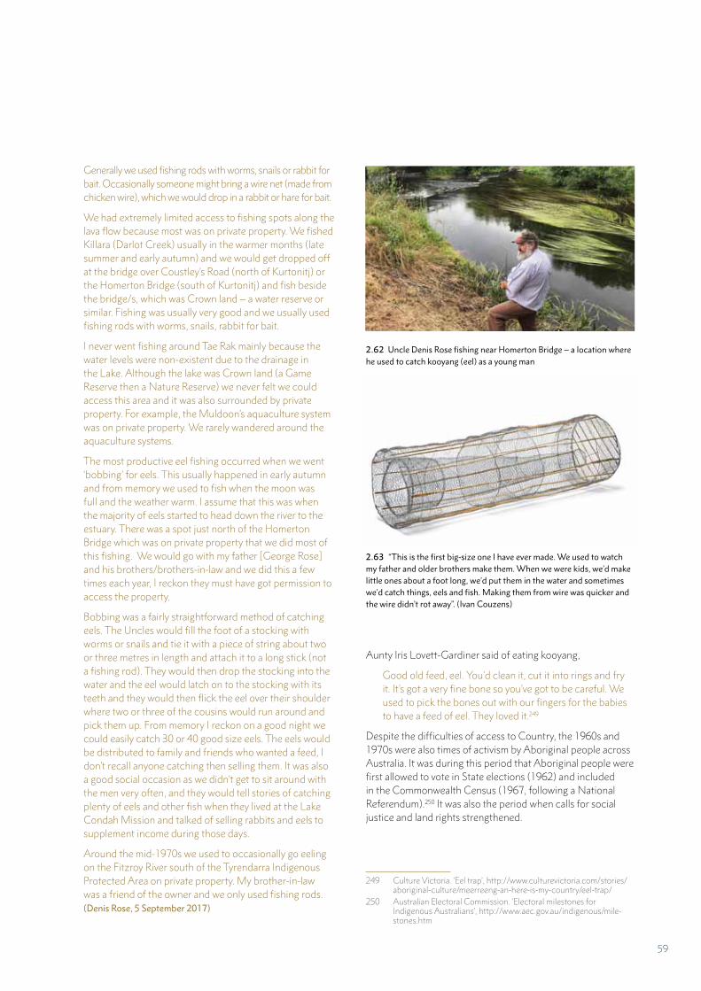
Generally we used fishing rods with worms, snails or rabbit for bait. Occasionally someone might bring a wire net (made from chicken wire), which we would drop in a rabbit or hare for bait.
We had extremely limited access to fishing spots along the lava flow because most was on private property. We fished Killara (Darlot Creek) usually in the warmer months (late summer and early autumn) and we would get dropped off at the bridge over Coustley’s Road (north of Kurtonitj) or the Homerton Bridge (south of Kurtonitj) and fish beside the bridge/s, which was Crown land – a water reserve or similar. Fishing was usually very good and we usually used fishing rods with worms, snails, rabbit for bait.
I never went fishing around Tae Rak mainly because the water levels were non-existent due to the drainage in the Lake. Although the lake was Crown land (a Game Reserve then a Nature Reserve) we never felt we could access this area and it was also surrounded by private property. For example, the Muldoon’s aquaculture system was on private property. We rarely wandered around the aquaculture systems.
The most productive eel fishing occurred when we went ‘bobbing’ for eels. This usually happened in early autumn and from memory we used to fish when the moon was full and the weather warm. I assume that this was when the majority of eels started to head down the river to the estuary. There was a spot just north of the Homerton Bridge which was on private property that we did most of this fishing. We would go with my father [George Rose] and his brothers/brothers-in-law and we did this a few times each year, I reckon they must have got permission to access the property.
Bobbing was a fairly straightforward method of catching eels. The Uncles would fill the foot of a stocking with worms or snails and tie it with a piece of string about two or three metres in length and attach it to a long stick (not a fishing rod). They would then drop the stocking into the water and the eel would latch on to the stocking with its teeth and they would then flick the eel over their shoulder where two or three of the cousins would run around and pick them up. From memory I reckon on a good night we could easily catch 30 or 40 good size eels. The eels would be distributed to family and friends who wanted a feed, I don’t recall anyone catching then selling them. It was also a good social occasion as we didn’t get to sit around with the men very often, and they would tell stories of catching plenty of eels and other fish when they lived at the Lake Condah Mission and talked of selling rabbits and eels to supplement income during those days.
Around the mid-1970s we used to occasionally go eeling on the Fitzroy River south of the Tyrendarra Indigenous Protected Area on private property. My brother-in-law was a friend of the owner and we only used fishing rods. (Denis Rose, 5 September 2017)
Aunty Iris Lovett-Gardiner said of eating kooyang,
Good old feed, eel. You’d clean it, cut it into rings and fry it. It’s got a very fine bone so you’ve got to be careful. We used to pick the bones out with our fingers for the babies to have a feed of eel. They loved it.249
Despite the difficulties of access to Country, the 1960s and 1970s were also times of activism by Aboriginal people across Australia. It was during this period that Aboriginal people were first allowed to vote in State elections (1962) and included in the Commonwealth Census (1967, following a National Referendum).250 It was also the period when calls for social justice and land rights strengthened.
249 Culture Victoria. ‘Eel trap’, http://www.culturevictoria.com/stories/aboriginal-culture/meerreeng-an-here-is-my-country/eel-trap/
250 Australian Electoral Commission. ‘Electoral milestones for Indigenous Australians’, http://www.aec.gov.au/indigenous/mile-stones.htm
2.62 Uncle Denis Rose fishing near Homerton Bridge – a location where he used to catch kooyang (eel) as a young man
2.63 “This is the first big-size one I have ever made. We used to watch my father and older brothers make them. When we were kids, we’d make little ones about a foot long, we’d put them in the water and sometimes we’d catch things, eels and fish. Making them from wire was quicker and the wire didn’t rot away”. (Ivan Couzens)
59
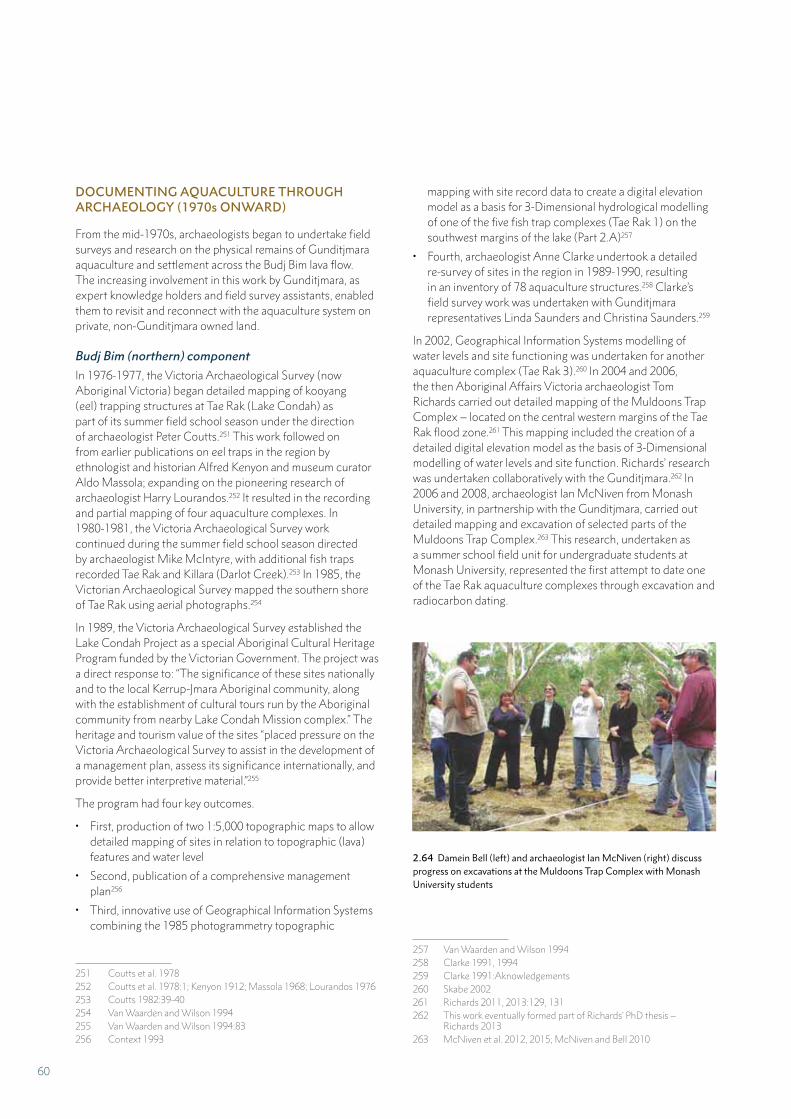
mapping with site record data to create a digital elevation model as a basis for 3-Dimensional hydrological modelling of one of the five fish trap complexes (Tae Rak 1) on the southwest margins of the lake (Part 2.A)257
• Fourth, archaeologist Anne Clarke undertook a detailed re-survey of sites in the region in 1989-1990, resulting in an inventory of 78 aquaculture structures.258 Clarke’s field survey work was undertaken with Gunditjmara representatives Linda Saunders and Christina Saunders.259
In 2002, Geographical Information Systems modelling of water levels and site functioning was undertaken for another aquaculture complex (Tae Rak 3).260 In 2004 and 2006, the then Aboriginal Affairs Victoria archaeologist Tom Richards carried out detailed mapping of the Muldoons Trap Complex – located on the central western margins of the Tae Rak flood zone.261 This mapping included the creation of a detailed digital elevation model as the basis of 3-Dimensional modelling of water levels and site function. Richards’ research was undertaken collaboratively with the Gunditjmara.262 In 2006 and 2008, archaeologist Ian McNiven from Monash University, in partnership with the Gunditjmara, carried out detailed mapping and excavation of selected parts of the Muldoons Trap Complex.263 This research, undertaken as a summer school field unit for undergraduate students at Monash University, represented the first attempt to date one of the Tae Rak aquaculture complexes through excavation and radiocarbon dating.
257 Van Waarden and Wilson 1994258 Clarke 1991, 1994259 Clarke 1991:Aknowledgements260 Skabe 2002261 Richards 2011, 2013:129, 131262 This work eventually formed part of Richards’ PhD thesis –
Richards 2013263 McNiven et al. 2012, 2015; McNiven and Bell 2010
DOCUMENTING AQUACULTURE THROUGH ARCHAEOLOGY (1970s ONWARD)
From the mid-1970s, archaeologists began to undertake field surveys and research on the physical remains of Gunditjmara aquaculture and settlement across the Budj Bim lava flow. The increasing involvement in this work by Gunditjmara, as expert knowledge holders and field survey assistants, enabled them to revisit and reconnect with the aquaculture system on private, non-Gunditjmara owned land.
Budj Bim (northern) component
In 1976-1977, the Victoria Archaeological Survey (now Aboriginal Victoria) began detailed mapping of kooyang (eel) trapping structures at Tae Rak (Lake Condah) as part of its summer field school season under the direction of archaeologist Peter Coutts.251 This work followed on from earlier publications on eel traps in the region by ethnologist and historian Alfred Kenyon and museum curator Aldo Massola; expanding on the pioneering research of archaeologist Harry Lourandos.252 It resulted in the recording and partial mapping of four aquaculture complexes. In 1980-1981, the Victoria Archaeological Survey work continued during the summer field school season directed by archaeologist Mike McIntyre, with additional fish traps recorded Tae Rak and Killara (Darlot Creek).253 In 1985, the Victorian Archaeological Survey mapped the southern shore of Tae Rak using aerial photographs.254
In 1989, the Victoria Archaeological Survey established the Lake Condah Project as a special Aboriginal Cultural Heritage Program funded by the Victorian Government. The project was a direct response to: “The significance of these sites nationally and to the local Kerrup-Jmara Aboriginal community, along with the establishment of cultural tours run by the Aboriginal community from nearby Lake Condah Mission complex.” The heritage and tourism value of the sites “placed pressure on the Victoria Archaeological Survey to assist in the development of a management plan, assess its significance internationally, and provide better interpretive material.”255
The program had four key outcomes.
• First, production of two 1:5,000 topographic maps to allow detailed mapping of sites in relation to topographic (lava) features and water level
• Second, publication of a comprehensive management plan256
• Third, innovative use of Geographical Information Systems combining the 1985 photogrammetry topographic
251 Coutts et al. 1978252 Coutts et al. 1978:1; Kenyon 1912; Massola 1968; Lourandos 1976253 Coutts 1982:39-40254 Van Waarden and Wilson 1994255 Van Waarden and Wilson 1994:83256 Context 1993
2.64 Damein Bell (left) and archaeologist Ian McNiven (right) discuss progress on excavations at the Muldoons Trap Complex with Monash University students
60
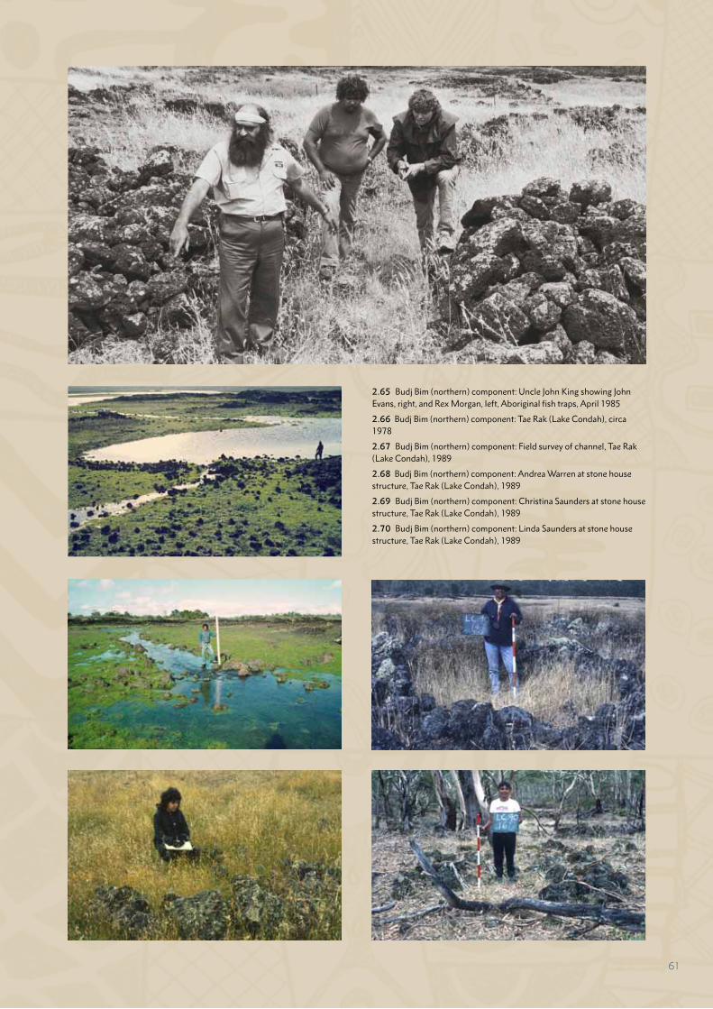
2.65 Budj Bim (northern) component: Uncle John King showing John Evans, right, and Rex Morgan, left, Aboriginal fish traps, April 1985
2.66 Budj Bim (northern) component: Tae Rak (Lake Condah), circa 1978
2.67 Budj Bim (northern) component: Field survey of channel, Tae Rak (Lake Condah), 1989
2.68 Budj Bim (northern) component: Andrea Warren at stone house structure, Tae Rak (Lake Condah), 1989
2.69 Budj Bim (northern) component: Christina Saunders at stone house structure, Tae Rak (Lake Condah), 1989
2.70 Budj Bim (northern) component: Linda Saunders at stone house structure, Tae Rak (Lake Condah), 1989
61
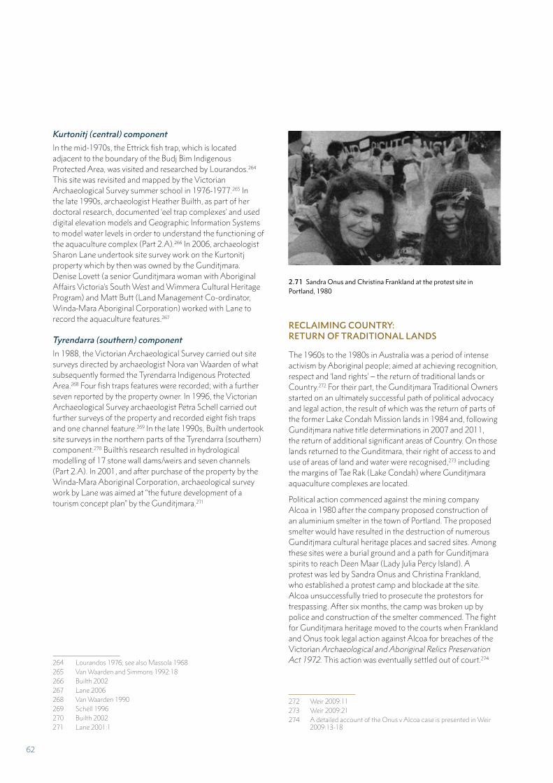
Kurtonitj (central) component
In the mid-1970s, the Ettrick fish trap, which is located adjacent to the boundary of the Budj Bim Indigenous Protected Area, was visited and researched by Lourandos.264 This site was revisited and mapped by the Victorian Archaeological Survey summer school in 1976-1977.265 In the late 1990s, archaeologist Heather Builth, as part of her doctoral research, documented ‘eel trap complexes’ and used digital elevation models and Geographic Information Systems to model water levels in order to understand the functioning of the aquaculture complex (Part 2.A).266 In 2006, archaeologist Sharon Lane undertook site survey work on the Kurtonitj property which by then was owned by the Gunditjmara. Denise Lovett (a senior Gunditjmara woman with Aboriginal Affairs Victoria’s South West and Wimmera Cultural Heritage Program) and Matt Butt (Land Management Co-ordinator, Winda-Mara Aboriginal Corporation) worked with Lane to record the aquaculture features.267
Tyrendarra (southern) component
In 1988, the Victorian Archaeological Survey carried out site surveys directed by archaeologist Nora van Waarden of what subsequently formed the Tyrendarra Indigenous Protected Area.268 Four fish traps features were recorded; with a further seven reported by the property owner. In 1996, the Victorian Archaeological Survey archaeologist Petra Schell carried out further surveys of the property and recorded eight fish traps and one channel feature.269 In the late 1990s, Builth undertook site surveys in the northern parts of the Tyrendarra (southern) component.270 Builth’s research resulted in hydrological modelling of 17 stone wall dams/weirs and seven channels (Part 2.A). In 2001, and after purchase of the property by the Winda-Mara Aboriginal Corporation, archaeological survey work by Lane was aimed at “the future development of a tourism concept plan” by the Gunditjmara.271
264 Lourandos 1976; see also Massola 1968265 Van Waarden and Simmons 1992:18266 Builth 2002267 Lane 2006268 Van Waarden 1990269 Schell 1996270 Builth 2002271 Lane 2001:1
RECLAIMING COUNTRY: RETURN OF TRADITIONAL LANDS
The 1960s to the 1980s in Australia was a period of intense activism by Aboriginal people; aimed at achieving recognition, respect and ‘land rights’ – the return of traditional lands or Country.272 For their part, the Gunditjmara Traditional Owners started on an ultimately successful path of political advocacy and legal action, the result of which was the return of parts of the former Lake Condah Mission lands in 1984 and, following Gunditjmara native title determinations in 2007 and 2011, the return of additional significant areas of Country. On those lands returned to the Gunditmara, their right of access to and use of areas of land and water were recognised,273 including the margins of Tae Rak (Lake Condah) where Gunditjmara aquaculture complexes are located.
Political action commenced against the mining company Alcoa in 1980 after the company proposed construction of an aluminium smelter in the town of Portland. The proposed smelter would have resulted in the destruction of numerous Gunditjmara cultural heritage places and sacred sites. Among these sites were a burial ground and a path for Gunditjmara spirits to reach Deen Maar (Lady Julia Percy Island). A protest was led by Sandra Onus and Christina Frankland, who established a protest camp and blockade at the site. Alcoa unsuccessfully tried to prosecute the protestors for trespassing. After six months, the camp was broken up by police and construction of the smelter commenced. The fight for Gunditjmara heritage moved to the courts when Frankland and Onus took legal action against Alcoa for breaches of the Victorian Archaeological and Aboriginal Relics Preservation Act 1972. This action was eventually settled out of court.274
272 Weir 2009:11273 Weir 2009:21274 A detailed account of the Onus v Alcoa case is presented in Weir
2009:13-18
2.71 Sandra Onus and Christina Frankland at the protest site in Portland, 1980
62
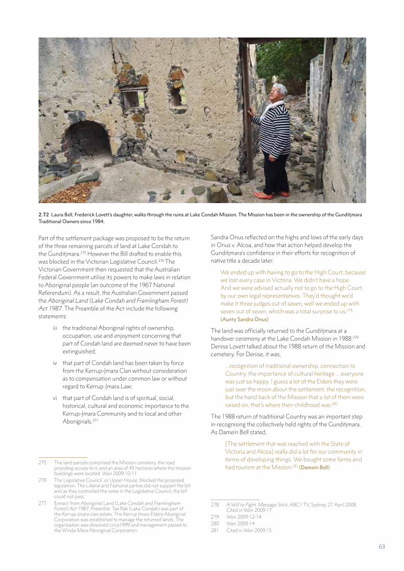
Part of the settlement package was proposed to be the return of the three remaining parcels of land at Lake Condah to the Gunditjmara.275 However the Bill drafted to enable this was blocked in the Victorian Legislative Council.276 The Victorian Government then requested that the Australian Federal Government utilise its powers to make laws in relation to Aboriginal people (an outcome of the 1967 National Referendum). As a result, the Australian Government passed the Aboriginal Land (Lake Condah and Framlingham Forest) Act 1987. The Preamble of the Act include the following statements:
iii the traditional Aboriginal rights of ownership, occupation, use and enjoyment concerning that part of Condah land are deemed never to have been extinguished;
iv that part of Condah land has been taken by force from the Kerrup-Jmara Clan without consideration as to compensation under common law or without regard to Kerrup-Jmara Law;
vi that part of Condah land is of spiritual, social, historical, cultural and economic importance to the Kerrup-Jmara Community and to local and other Aboriginals.277
275 The land parcels comprised the Mission cemetery, the road providing access to it, and an area of 43 hectares where the mission buildings were located. Weir 2009:10-11
276 The Legislative Council, or Upper House, blocked the proposed legislation. The Liberal and National parties did not support the bill and as they controlled the votes in the Legislative Council, the bill could not pass.
277 Extract from Aboriginal Land (Lake Condah and Framlingham Forest) Act 1987, Preamble. Tae Rak (Lake Condah) was part of the Kerrup-jmara clan estate. The Kerrup Jmara Elders Aboriginal Corporation was established to manage the returned lands. The organisation was dissolved circa1999 and management passed to the Winda-Mara Aboriginal Corporation.
Sandra Onus reflected on the highs and lows of the early days in Onus v. Alcoa, and how that action helped develop the Gunditjmara’s confidence in their efforts for recognition of native title a decade later:
We ended up with having to go to the High Court, because we lost every case in Victoria. We didn’t have a hope. And we were advised actually not to go to the High Court, by our own legal representatives. They’d thought we’d make it three judges out of seven, well we ended up with seven out of seven, which was a total surprise to us.278 (Aunty Sandra Onus)
The land was officially returned to the Gunditjmara at a handover ceremony at the Lake Condah Mission in 1988.279 Denise Lovett talked about the 1988 return of the Mission and cemetery. For Denise, it was,
...recognition of traditional ownership, connection to Country, the importance of cultural heritage ... everyone was just so happy. I guess a lot of the Elders they were just over the moon about the settlement, the recognition, but the hand back of the Mission that a lot of them were raised on, that’s where their childhood was.280
The 1988 return of traditional Country was an important step in recognising the collectively held rights of the Gunditjmara. As Damein Bell stated,
[The settlement that was reached with the State of Victoria and Alcoa] really did a lot for our community in terms of developing things. We bought some farms and had tourism at the Mission.281 (Damein Bell)
278 A Will to Fight, Message Stick, ABC1 TV, Sydney, 27 April 2008. Cited in Weir 2009:17
279 Weir 2009:12-14280 Weir 2009:14 281 Cited in Weir 2009:15
2.72 Laura Bell, Frederick Lovett’s daughter, walks through the ruins at Lake Condah Mission. The Mission has been in the ownership of the Gunditjmara Traditional Owners since 1984.
63
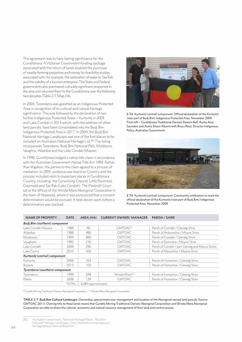
In 2003, Tyrendarra was gazetted as an Indigenous Protected Area in recognition of its cultural and natural heritage significance. This was followed by the declaration of two further Indigenous Protected Areas – Kurtonitj in 2009 and Lake Condah in 2013 which, with the addition of other land parcels, have been consolidated into the Budj Bim Indigenous Protected Area in 2017. In 2004, the Budj Bim National Heritage Landscape was one of the first places to be included on Australia’s National Heritage List.282 The listing incorporates Tyrendarra, Budj Bim National Park, Muldoons, Vaughns, Allambie and the Lake Condah Mission.
In 1996, Gunditjmara lodged a native title claim in accordance with the Australian Government Native Title Act 1993. Rather than litigation, the parties to the claim agreed to a process of mediation. In 2005, evidence was heard on Country and the process included visits to important places in Gunditjmara Country, including: the Convincing Ground, Little Dunmore, Greenvale and Tae Rak (Lake Condah). The (Federal) Court sat at the offices of the Winda-Mara Aboriginal Corporation in the town of Heywood, where it was announced that a consent determination would be pursued. It took eleven years before a determination was reached.
282 Australian Government. ‘National Heritage Places - Budj Bim National Heritage Landscape’, http://www.environment.gov.au/heritage/places/national/budj-bim
The agreement was to have lasting significance for the Gunditjmara. A Victorian Government funding package associated with the return of lands enabled the purchase of nearby farming properties and money for feasibility studies associated with, for example, the restoration of water to Tae Rak and the viability of a tourism enterprise. The State and Federal governments also purchased culturally significant properties in the area and returned them to the Gunditjmara over the following two decades (Table 2.7; Map 2.6).
2.73 Kurtonitj (central) component: Official declaration of the Kurtonitj (now part of Budj Bim) Indigenous Protected Area, November 2009. From left – Gunditjmara Traditional Owners Damein Bell, Aunty Amy Saunders and Aunty Eileen Alberts with Bruce Rose, Director Indigenous Policy, Australian Government.
2.74 Kurtonitj (central) component: Community celebration to mark the official declaration of the Kurtonitj (now part of Budj Bim) Indigenous Protected Area, November 2009
* Gunditj Mirring Traditional Owners Aboriginal Corporation ** Winda-Mara Aboriginal Corporation
NAME OF PROPERTY DATE AREA (HA) CURRENT OWNER/ MANAGER PARISH / SHIRE
Budj Bim (northern) componentLake Condah Mission 1988 40 GMTOAC* Parish of Condah / Glenelg ShireAllambie 1988 480 GMTOAC Parish of Ardonachie / Moyne ShireMuldoons 1994 660 GMTOAC Parish of Condah / Glenelg ShireVaughans 1995 270 GMTOAC Parish of Dunmore / Moyne ShireLake Condah 2008 290 GMTOAC Parish of Condah / part Glenelg and Moyne ShiresLake Gorrie 2010 503 GMTOAC Parish of Macarthur / Moyne ShireKurtonitj (central) componentKurtonitj 2006 353 GMTOAC Parish of Homerton / Glenelg ShireBryants 2013 103 GMTOAC Parish of Homerton / Glenelg ShireTyrendarra (southern) componentTyrendarra 1999 248 Winda-Mara** Parish of Homerton / Glenelg ShirePeters 2008 129 GMTOAC Parish of Homerton / Glenelg Shire
TOTAL 3,085 (approximate)
TABLE 2.7 Budj Bim Cultural Landscape: Ownership, approximate size, management and location of the Aboriginal-owned land parcels (Source: GMTOAC 2011). Owning title to these lands means that Gunditj Mirring Traditional Owners Aboriginal Corporation and Winda-Mara Aboriginal Corporation are able to direct the cultural, economic and natural resource management of their land and control access.
64
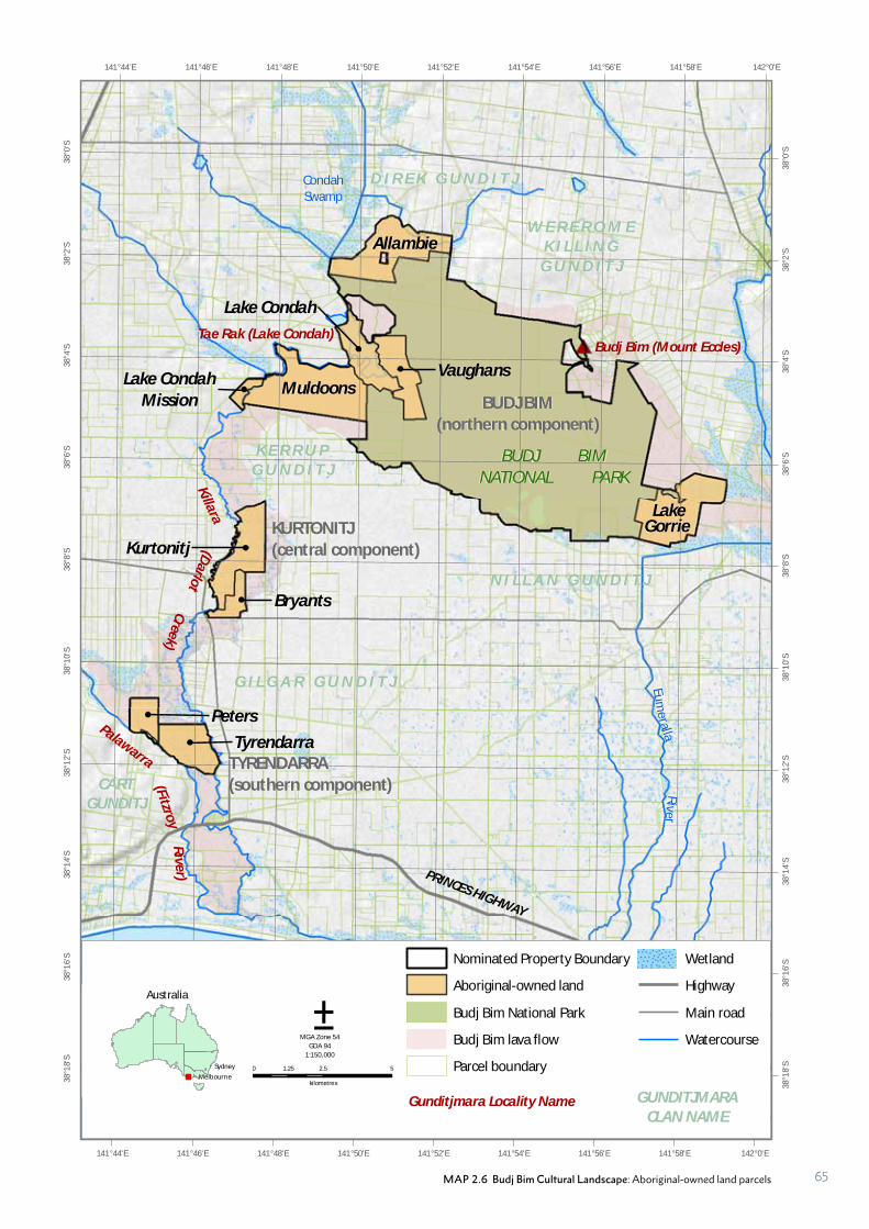
CondahSwamp
Eumeralla
River
PRINCES HIGHWAY
142°0'E
142°0'E
141°58'E
141°58'E
141°56'E
141°56'E
141°54'E
141°54'E
141°52'E
141°52'E
141°50'E
141°50'E
141°48'E
141°48'E
141°46'E
141°46'E
141°44'E
141°44'E38
°0'S
38°0
'S
38°2
'S
38°2
'S
38°4
'S
38°4
'S
38°6
'S
38°6
'S
38°8
'S
38°8
'S
38°1
0'S
38°1
0'S
38°1
2'S
38°1
2'S
38°1
4'S
38°1
4'S
38°1
6'S
38°1
6'S
38°1
8'S
38°1
8'S
Tae Rak (Lake Condah)
W E R E R O M EK I L L I N G
G U N D I T J
N I L L A N G U N D I T J
K E R R U PG U N D I T J
CARTGUNDITJ
G I L G A R G U N D I T J
Palawarra
Budj Bim (Mount Eccles)
0 2.5 51.25
kilometres
Nominated Property Boundary
Aboriginal-owned land
Budj Bim National Park
Budj Bim lava flow
Parcel boundary
Wetland
Highway
Main road
Watercourse
Gunditjmara Locality Name
±MGA Zone 54
GDA 941:150,000
GUNDITJMARACLAN NAME
BUDJ BIM(northern component)
KURTONITJ(central component)
TYRENDARRA(southern component)
BUDJ BIMNATIONAL PARK
D I R E K G U N D I T J
(Fitzroy
Rive
r)
Australia
!
!
MelbourneSydney
Allambie
Lake CondahMission
Muldoons
Lake Condah
Vaughans
Lake
Kurtonitj
Bryants
Peters
Tyrendarra
Gorrie
(Darlo
tK
illara
Creek)
MAP 2.6 Budj Bim Cultural Landscape: Aboriginal-owned land parcels 65
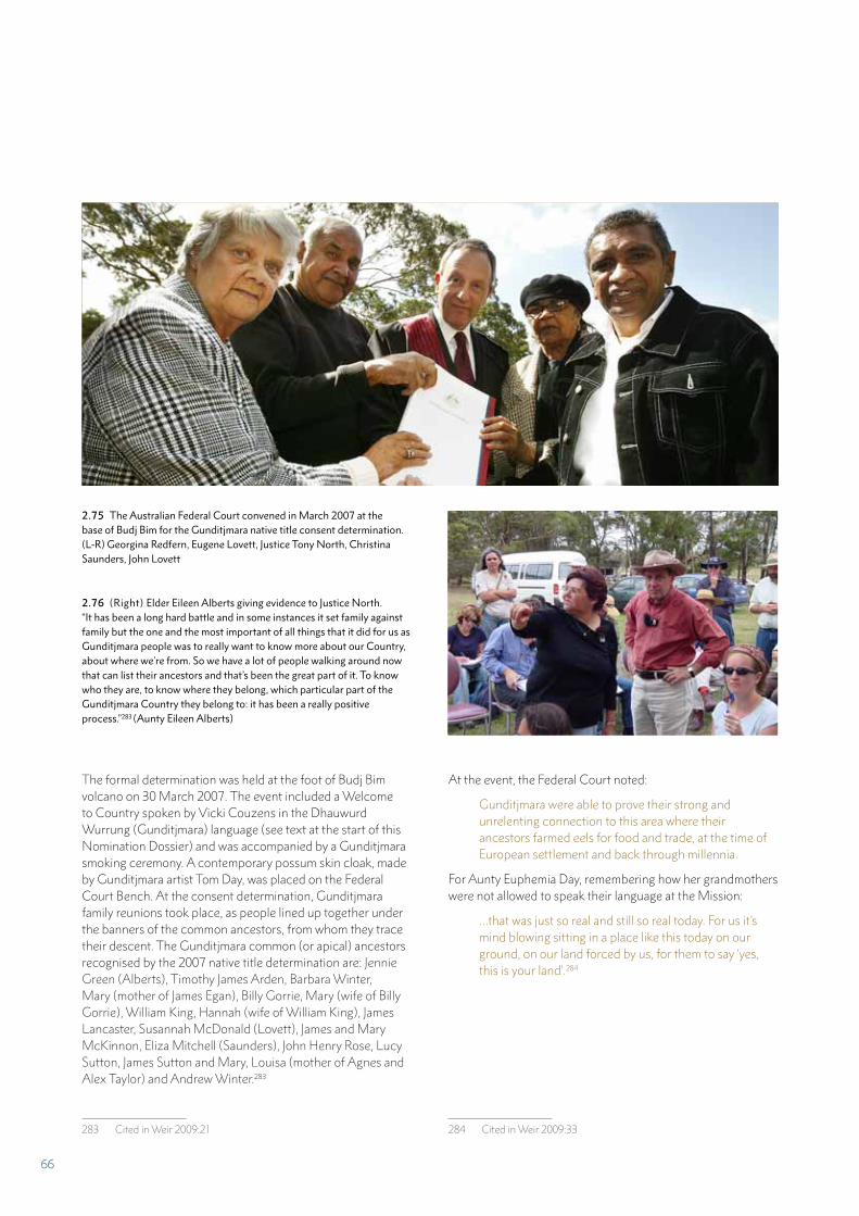
2.75 The Australian Federal Court convened in March 2007 at the base of Budj Bim for the Gunditjmara native title consent determination. (L-R) Georgina Redfern, Eugene Lovett, Justice Tony North, Christina Saunders, John Lovett
2.76 (Right) Elder Eileen Alberts giving evidence to Justice North. “It has been a long hard battle and in some instances it set family against family but the one and the most important of all things that it did for us as Gunditjmara people was to really want to know more about our Country, about where we’re from. So we have a lot of people walking around now that can list their ancestors and that’s been the great part of it. To know who they are, to know where they belong, which particular part of the Gunditjmara Country they belong to: it has been a really positive process.”283 (Aunty Eileen Alberts)
The formal determination was held at the foot of Budj Bim volcano on 30 March 2007. The event included a Welcome to Country spoken by Vicki Couzens in the Dhauwurd Wurrung (Gunditjmara) language (see text at the start of this Nomination Dossier) and was accompanied by a Gunditjmara smoking ceremony. A contemporary possum skin cloak, made by Gunditjmara artist Tom Day, was placed on the Federal Court Bench. At the consent determination, Gunditjmara family reunions took place, as people lined up together under the banners of the common ancestors, from whom they trace their descent. The Gunditjmara common (or apical) ancestors recognised by the 2007 native title determination are: Jennie Green (Alberts), Timothy James Arden, Barbara Winter, Mary (mother of James Egan), Billy Gorrie, Mary (wife of Billy Gorrie), William King, Hannah (wife of William King), James Lancaster, Susannah McDonald (Lovett), James and Mary McKinnon, Eliza Mitchell (Saunders), John Henry Rose, Lucy Sutton, James Sutton and Mary, Louisa (mother of Agnes and Alex Taylor) and Andrew Winter.283
283 Cited in Weir 2009:21
At the event, the Federal Court noted:
Gunditjmara were able to prove their strong and unrelenting connection to this area where their ancestors farmed eels for food and trade, at the time of European settlement and back through millennia.
For Aunty Euphemia Day, remembering how her grandmothers were not allowed to speak their language at the Mission:
…that was just so real and still so real today. For us it’s mind blowing sitting in a place like this today on our ground, on our land forced by us, for them to say ‘yes, this is your land’.284
284 Cited in Weir 2009:33
66
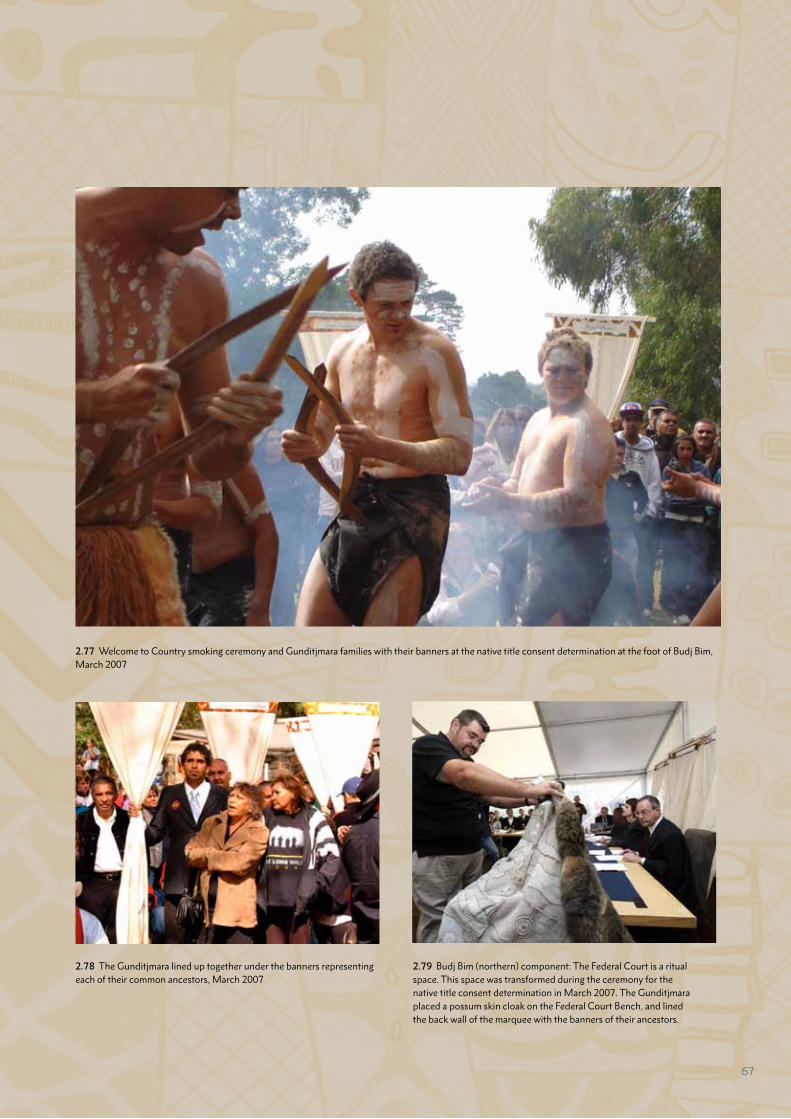
2.77 Welcome to Country smoking ceremony and Gunditjmara families with their banners at the native title consent determination at the foot of Budj Bim, March 2007
2.78 The Gunditjmara lined up together under the banners representing each of their common ancestors, March 2007
2.79 Budj Bim (northern) component: The Federal Court is a ritual space. This space was transformed during the ceremony for the native title consent determination in March 2007. The Gunditjmara placed a possum skin cloak on the Federal Court Bench, and lined the back wall of the marquee with the banners of their ancestors.
67
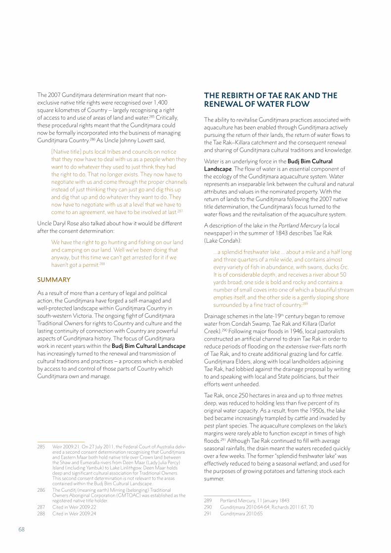
The 2007 Gunditjmara determination meant that non-exclusive native title rights were recognised over 1,400 square kilometres of Country – largely recognising a right of access to and use of areas of land and water.285 Critically, these procedural rights meant that the Gunditjmara could now be formally incorporated into the business of managing Gunditjmara Country.286 As Uncle Johnny Lovett said,
[Native title] puts local tribes and councils on notice that they now have to deal with us as a people when they want to do whatever they used to just think they had the right to do. That no longer exists. They now have to negotiate with us and come through the proper channels instead of just thinking they can just go and dig this up and dig that up and do whatever they want to do. They now have to negotiate with us at a level that we have to come to an agreement, we have to be involved at last.287
Uncle Daryl Rose also talked about how it would be different after the consent determination:
We have the right to go hunting and fishing on our land and camping on our land. Well we’ve been doing that anyway, but this time we can’t get arrested for it if we haven’t got a permit.288
SUMMARY
As a result of more than a century of legal and political action, the Gunditjmara have forged a self-managed and well-protected landscape within Gunditjmara Country in south-western Victoria. The ongoing fight of Gunditjmara Traditional Owners for rights to Country and culture and the lasting continuity of connection with Country are powerful aspects of Gunditjmara history. The focus of Gunditjmara work in recent years within the Budj Bim Cultural Landscape has increasingly turned to the renewal and transmission of cultural traditions and practices – a process which is enabled by access to and control of those parts of Country which Gunditjmara own and manage.
285 Weir 2009:21. On 27 July 2011, the Federal Court of Australia deliv-ered a second consent determination recognising that Gunditjmara and Eastern Maar both hold native title over Crown land between the Shaw and Eumeralla rivers from Deen Maar (Lady Julia Percy) Island (including Yambuk) to Lake Linlithgow. Deen Maar holds deep and significant cultural association for Traditional Owners. This second consent determination is not relevant to the areas contained within the Budj Bim Cultural Landscape.
286 The Gunditj (meaning earth) Mirring (belonging) Traditional Owners Aboriginal Corporation (GMTOAC) was established as the registered native title holder.
287 Cited in Weir 2009:22288 Cited in Weir 2009:24
THE REBIRTH OF TAE RAK AND THE RENEWAL OF WATER FLOW
The ability to revitalise Gunditjmara practices associated with aquaculture has been enabled through Gunditjmara actively pursuing the return of their lands, the return of water flows to the Tae Rak–Killara catchment and the consequent renewal and sharing of Gunditjmara cultural traditions and knowledge.
Water is an underlying force in the Budj Bim Cultural Landscape. The flow of water is an essential component of the ecology of the Gunditjmara aquaculture system. Water represents an inseparable link between the cultural and natural attributes and values in the nominated property. With the return of lands to the Gunditjmara following the 2007 native title determination, the Gunditjmara’s focus turned to the water flows and the revitalisation of the aquaculture system.
A description of the lake in the Portland Mercury (a local newspaper) in the summer of 1843 describes Tae Rak (Lake Condah):
…a splendid freshwater lake ... about a mile and a half long and three quarters of a mile wide, and contains almost every variety of fish in abundance, with swans, ducks &c. It is of considerable depth, and receives a river about 50 yards broad; one side is bold and rocky and contains a number of small coves into one of which a beautiful stream empties itself, and the other side is a gently sloping shore surrounded by a fine tract of country.289
Drainage schemes in the late-19th century began to remove water from Condah Swamp, Tae Rak and Killara (Darlot Creek).290 Following major floods in 1946, local pastoralists constructed an artificial channel to drain Tae Rak in order to reduce periods of flooding on the extensive river-flats north of Tae Rak, and to create additional grazing land for cattle. Gunditjmara Elders, along with local landholders adjoining Tae Rak, had lobbied against the drainage proposal by writing to and speaking with local and State politicians, but their efforts went unheeded.
Tae Rak, once 250 hectares in area and up to three metres deep, was reduced to holding less than five percent of its original water capacity. As a result, from the 1950s, the lake bed became increasingly trampled by cattle and invaded by pest plant species. The aquaculture complexes on the lake’s margins were rarely able to function except in times of high floods.291 Although Tae Rak continued to fill with average seasonal rainfalls, the drain meant the waters receded quickly over a few weeks. The former “splendid freshwater lake” was effectively reduced to being a seasonal wetland; and used for the purposes of growing potatoes and fattening stock each summer.
289 Portland Mercury, 11 January 1843290 Gunditjmara 2010:64-64; Richards 2011:67, 70 291 Gunditjmara 2010:65
68
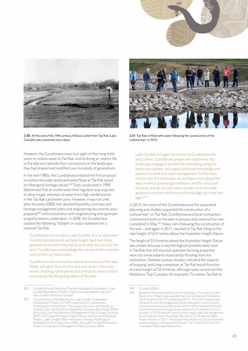
However, the Gunditjmara never lost sight of their long-held vision to restore water to Tae Rak, and by doing so, restore life to the lake and rekindle their connections to the landscape they had shaped and modified over hundreds of generations.
In the mid-1980s, the Gunditjmara initiated the first proposal to restore the water levels and water flows at Tae Rak based on Aboriginal heritage values.292 Trials conducted in 1990 determined that an outlet water level regulator was required to allow longer retention of water from high rainfall events in the Tae Rak catchment zone. However, it was not until after the early-2000s that detailed feasibility, business and heritage management plans and engineering documents were prepared293 and consultation with neighbouring and upstream property owners undertaken. In 2008, the Gunditjmara created the following ‘Yarkeen’ or vision statement for a restored Tae Rak:
Gunditjmara will conserve Lake Condah. It is an important Gunditjmara place and we have fought hard over many generations to see it returned to us so that we can heal this land. Gunditjmara acknowledge the ancestral Kerrup Jmara and the Kerrup Jmara today.
Gunditjmara will restore the natural abundance of the lake. Water will again flow into the lake and remain there year round, enabling native plants and animals to return and be nurtured by the life-giving waters of the lake.
292 Gunditj Mirring Traditional Owners Aboriginal Corporation. ‘Lake Condah Restoration Project’, https://www.gunditjmirring.com/lake-condah-restoration-project
293 The work was undertaken by the Lake Condah Sustainable Development Project (LCSDP) (now Budj Bim Sustainable Development Partnership). The preparatory plans and studies in-cluded: Lake Condah Water Restoration Business Plan (Ruge 2004); Mt Eccles Lava Flow Botanical Management Plan (Ecology Australia 2007); Mt Eccles/Mt Napier Digital Flyover and Terrain Modelling Project; Lake Condah Water Restoration Project Hydrological Feasibility Study (Gippel et al. 2006); and Lake Condah Restoration Project: Conservation Management Plan (Context 2008).
Lake Condah will again be central to Gunditjmara life and culture. Gunditjmara people will experience the landscape, engage in eel and fish harvesting using the stone trap systems, and apply traditional knowledge and practices in land and water management. As the water returns into this landscape, we will learn more about the ways in which previous generations cared for and used the land, and we will pass what we learn onto the next generation so that traditions and knowledge are never lost again.294
In 2010, the vision of the Gunditjmara and the associated planning and studies supported the construction of a ‘cultural weir’ on Tae Rak. Gunditjmara and local contractors commenced work on the weir in January and construction was completed in May.295 Heavy rains following the construction of the weir – and again in 2011, resulted in Tae Rak filling to the new height of 52.4 metres above the Australian Height Datum.
The height of 52.4 metres above the Australian Height Datum was chosen because it was the highest possible water level in Tae Rak that still ensured upstream farming properties were not unnecessarily impacted by flooding from the restoration. Detailed contour studies indicated the majority of kooyang (eels) trap complexes at Tae Rak would function at a weir height of 52.4 metres; although some would not (the Muldoons Trap Complex, for example). To restore Tae Rak to
294 Context 2008:iii295 Based on the scope and success of the project, the Lake Condah
Restoration Project was awarded the Civil Contractors Federation Earth Award in 2010 (Gunditjmara 2011). The Earth Awards have the specific aim of recognising outstanding work in construction and environmental excellence and which reflect development and use of the best technologies and practices by Australian civil con-tractors. In 2010, the weir construction project was also recognised by winning the South Australian Society of Civil Engineers Best Project Award. In 2011, the project was the Runner Up at Australia’s most prestigious environmental award, The Thiess River Prize for Australian Waterways Restoration.
2.80 At the end of the 19th century, Killara’s outlet from Tae Rak (Lake Condah) was converted into a drain
2.81 Tae Rak re filled with water following the construction of the ‘cultural weir’ in 2010
69
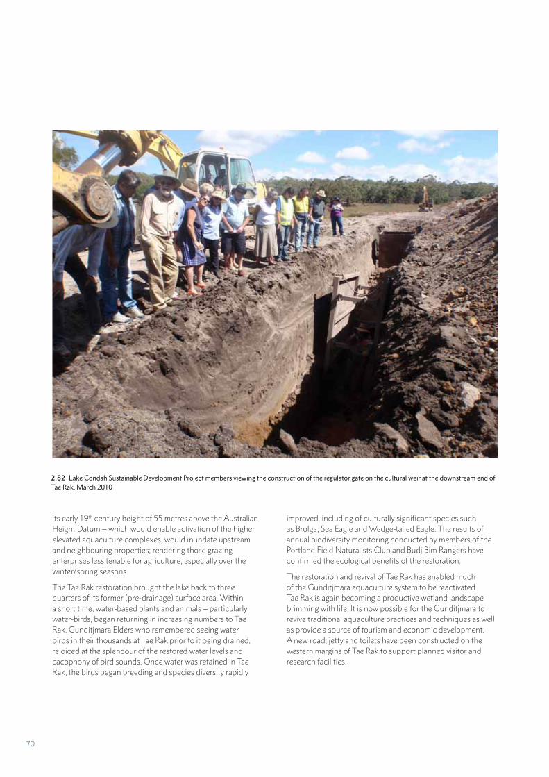
2.82 Lake Condah Sustainable Development Project members viewing the construction of the regulator gate on the cultural weir at the downstream end of Tae Rak, March 2010
its early 19th century height of 55 metres above the Australian Height Datum – which would enable activation of the higher elevated aquaculture complexes, would inundate upstream and neighbouring properties; rendering those grazing enterprises less tenable for agriculture, especially over the winter/spring seasons.
The Tae Rak restoration brought the lake back to three quarters of its former (pre-drainage) surface area. Within a short time, water-based plants and animals – particularly water-birds, began returning in increasing numbers to Tae Rak. Gunditjmara Elders who remembered seeing water birds in their thousands at Tae Rak prior to it being drained, rejoiced at the splendour of the restored water levels and cacophony of bird sounds. Once water was retained in Tae Rak, the birds began breeding and species diversity rapidly
improved, including of culturally significant species such as Brolga, Sea Eagle and Wedge-tailed Eagle. The results of annual biodiversity monitoring conducted by members of the Portland Field Naturalists Club and Budj Bim Rangers have confirmed the ecological benefits of the restoration.
The restoration and revival of Tae Rak has enabled much of the Gunditjmara aquaculture system to be reactivated. Tae Rak is again becoming a productive wetland landscape brimming with life. It is now possible for the Gunditjmara to revive traditional aquaculture practices and techniques as well as provide a source of tourism and economic development. A new road, jetty and toilets have been constructed on the western margins of Tae Rak to support planned visitor and research facilities.
70
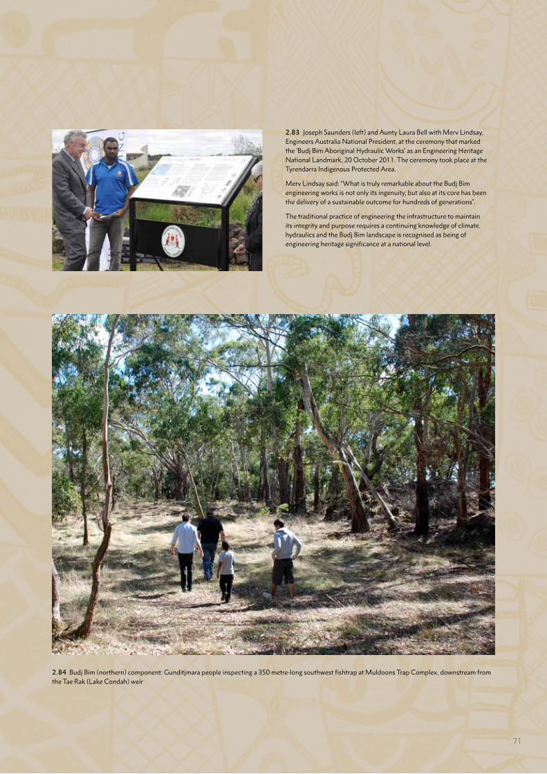
2.83 Joseph Saunders (left) and Aunty Laura Bell with Merv Lindsay, Engineers Australia National President, at the ceremony that marked the ‘Budj Bim Aboriginal Hydraulic Works’ as an Engineering Heritage National Landmark, 20 October 2011. The ceremony took place at the Tyrendarra Indigenous Protected Area.
Merv Lindsay said: “What is truly remarkable about the Budj Bim engineering works is not only its ingenuity, but also at its core has been the delivery of a sustainable outcome for hundreds of generations”.
The traditional practice of engineering the infrastructure to maintain its integrity and purpose requires a continuing knowledge of climate, hydraulics and the Budj Bim landscape is recognised as being of engineering heritage significance at a national level.
2.84 Budj Bim (northern) component: Gunditjmara people inspecting a 350 metre-long southwest fishtrap at Muldoons Trap Complex, downstream from the Tae Rak (Lake Condah) weir
71
CULTURAL RENEWAL: MAINTAINING AND REVITALISING GUNDITJMARA AQUACULTURE
The continuation and revival of Gunditjmara traditional knowledge is evidenced in the maintenance work undertaken on the channels, weirs, dams and ponds within the Budj Bim Cultural Landscape, and by the renewal of weaving skills and the re-making of possum skin cloaks (with their associated landscape designs). Cultural renewal is exemplified by the creation of new dances; and establishing new ways of transmitting cultural knowledge across generations – through dance and artistic expression more generally, contemporary education programs and the Budj Bim Ranger program.
THE SIX SEASONS OF GUNDITJMARA COUNTRY
Over the totality of their traditional lands, the Gunditjmara recognise four types of Country – Woorrowarook Mirring (Forest Country), Bocara Woorrowarook Mirring (River Forest Country), Koonang Mirring (Sea Country) and Tungatt Mirring (Stone Country) (Part 2.A). The management of each type of Country is aligned with the six seasons identified by the Gunditjmara.296
The seasons are identified by dominant weather patterns and marked by the availability of water, the abundance of plant and animal foods and the behaviour of particular animal species – including kooyang (eel). Thus the calendar recognises those periods when kooyang feed in shallow waters (Fattening Up – October to December), swim upstream (Flowering Time – August to November) and retreat into the mud (Big Dry – January to April). These periods in turn shape traditional and contemporary management of the kooyang aquaculture system.
The Gunditjmara management framework for Country is underpinned by a philosophy of Ngootyoong Gunditj, Ngootyoong Mara (Healthy Country, Healthy People), which seeks to reinforce and encourage the connections between a healthy environment and a healthy community.297 The philosophy is enacted through the integration of traditional knowledge associated with the six seasons; and an adaptive management framework as applied in Protected Area management (Part 5).298 Specific features of the latter approach include the use of monitoring, evaluation, reporting and improvement to record Gunditjmara learnings, implement a risk assessment approach, store and manage information, and use technology to assist in land management activities.299
296 GMTOAC 2015:14; Parks Victoria 2015:7297 Parks Victoria 2015:12298 Parks Victoria:12-13; and discussed further in Part 5.E of this
Nomination Dossier299 GMTOAC 2015:12-13
MAINTAINING AND RESTORING THE GUNDITJMARA AQUACULTURE SYSTEM
The Budj Bim Cultural Landscape includes the eight largest Gunditjmara aquaculture complexes (Tae Rak – six complexes, Tyrendarra and Kurtonitj) (Part 2.A) and representative examples of smaller structures (including along Killara and at Lake Gorrie). In the period from the early 1960s until the mid-1990s, the Tae Rak (Lake Condah)complexes received little or no maintenance, largely as a result of the inability of Gunditjmara to access these complexes after the land on which they are situated became privately owned. Nevertheless, the Gunditjmara aquaculture system is remarkably resilient – many parts of the system continue to operate; and the channels, weirs, dams and ponds have survived in remarkably good condition. In this regard, archaeologist Tom Richards notes:
In 2004 members of the Winda-Mara Aboriginal Corporation, under the direction of Daryl Rose, cleared this vegetation [at Muldoons Trap Complex] in preparation for the archaeological investigations, revealing this system to be considerably more extensive than recorded by Ingram. The Aboriginal features indicated by Ingram are both readily identifiable and exceptionally well preserved.300
The current work on the Gunditjmara aquaculture system has three foci: using and repairing the kooyang (eel) channels, weirs, dams and ponds (in line with customary and legal obligations regarding cultural heritage), learning more about the ways that the complexes operate under the water regime resulting from the installation of the weir on Tae Rak in 2010, and managing vegetation growth where it is impacting on the aquaculture features.301 This latter aspect includes the documentation and removal of trees that impede the channels’ abilities to fully function, and the application of a ‘cultural burning’ regime. Cultural burning is the use of fire to frequently and regularly burn small areas of vegetation to create a mosaic or diversity of habitats. The aims of cultural burning are manyfold; but include providing improved access to waterways for kooyang harvesting and promoting the growth of those plants with traditional uses – puunyaart grass for basket making, for example.302
There is also an experimental component to the continuation and renewal of Gunditjmara aquaculture. This includes re-learning to construct wood lattice barriers that were once integral to the system. An example of such a structure has been constructed within the Tyrendarra Indigenous Protected Area.
300 Richards 2013301 GMTOAC 2015:33, 56302 GMTOAC 2015:56
72
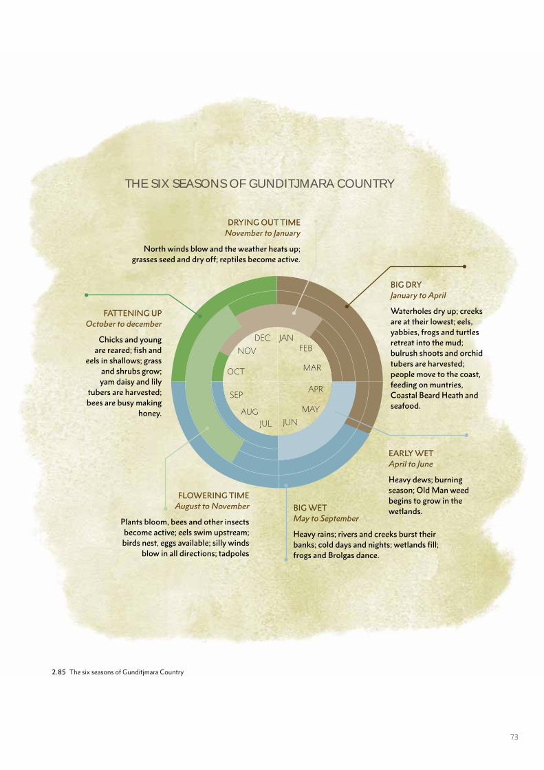
2.85 The six seasons of Gunditjmara Country
JANFEB
JUN
MAR
APR
MAY
JULAUG
SEP
OCT
NOV
DEC
BIG DRYJanuary to April
Waterholes dry up; creeks are at their lowest; eels, yabbies, frogs and turtles retreat into the mud; bulrush shoots and orchid tubers are harvested; people move to the coast, feeding on muntries, Coastal Beard Heath and seafood.
EARLY WETApril to June
Heavy dews; burning season; Old Man weed begins to grow in the wetlands.BIG WET
May to September
Heavy rains; rivers and creeks burst their banks; cold days and nights; wetlands fill; frogs and Brolgas dance.
FLOWERING TIMEAugust to November
Plants bloom, bees and other insects become active; eels swim upstream;
birds nest, eggs available; silly winds blow in all directions; tadpoles
DRYING OUT TIMENovember to January
North winds blow and the weather heats up; grasses seed and dry off; reptiles become active.
FATTENING UPOctober to december
Chicks and young are reared; fish and
eels in shallows; grass and shrubs grow; yam daisy and lily
tubers are harvested; bees are busy making
honey.
THE SIX SEASONS OF GUNDITJMARA COUNTRY
73
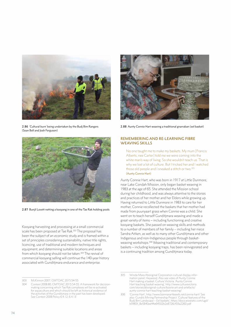
Kooyang harvesting and processing at a small commercial scale has been proposed at Tae Rak.303 The proposal has been the subject of an economic study and is framed within a set of principles considering sustainability, native title rights, licencing, use of traditional and modern techniques and equipment, and determining suitable locations and areas from which kooyang should not be taken.304 The revival of commercial kooyang selling will continue the 140-year history associated with Gunditjmara endurance and enterprise.
303 McKinnon 2007; GMTOAC 2015:54-55304 Context 2008:80; GMTOAC 2015:54-55. A framework for decision-
making concerning which Tae Rak complexes will be re-activated for aquaculture and which should be left as historical evidence of the activities of the Gunditjmara in the past has been developed. See Context 2008:Policy 6.4.12, 6.4.13
2.86 ‘Cultural burn’ being undertaken by the Budj Bim Rangers (Sean Bell and Josh Ferguson)
2.87 Bunjil Lovett netting a kooyang in one of the Tae Rak holding pools
REMEMBERING AND RE-LEARNING FIBRE WEAVING SKILLS
No one taught me to make my baskets. My mum [Francis Alberts, nee Carter] told me we were coming into the white man’s way of living. So she wouldn’t teach us. That is why we lost a lot of culture. But I tricked her and I watched those old people and I sneaked a stitch or two.305 (Aunty Connie Hart)
Aunty Connie Hart, who was born in 1917 at Little Dunmore, near Lake Condah Mission, only began basket weaving in 1983 at the age of 65. She attended the Mission school during her childhood, and was always attentive to the stories and practices of her mother and her Elders while growing up. Having returned to Little Dunmore in 1983 to care for her mother, Connie recollected the baskets that her mother had made from puunyaart grass when Connie was a child. She went on to teach herself Gunditjmara weaving and made a great variety of items – including functioning and creative kooyang baskets. She passed on weaving skills and methods to a number of members of her family – including her niece Sandra Aitken, as well as to many other Gunditjmara and other Indigenous and non-Indigenous people through basket-weaving workshops.306 Weaving traditional and contemporary baskets – including kooyang traps, has been reinvigorated and is a continuing tradition among Gunditjmara today.
305 Winda-Mara Aboriginal Corporation cultural display infor-mation panel, Heywood. Also see video of Aunty Connie Hart making a basket. Culture Victoria. ‘Aunty Connie Hart teaching basket weaving’, http://www.culturevictoria.com/stories/aboriginal-culture/koorie-art-and-artefacts/aunty-connie-hart-teaching-basket-weaving/
306 ‘Connie Hart’, http://www.bonmarartleewik.net/connie-hart/ See also: Gunditj Mirring Partnership Project. ‘Cultural features of the Budj Bim Landscape – Eel baskets’, https://docs.wixstatic.com/ugd/b5965f_8e5840ee44e64502b2e8726cf03a2260.pdf
2.88 Aunty Connie Hart weaving a traditional gnarraban (eel basket)
74
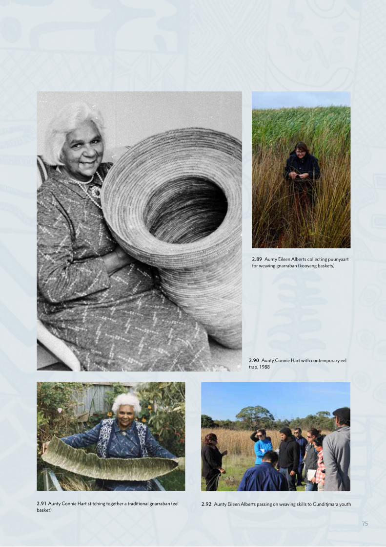
2.90 Aunty Connie Hart with contemporary eel trap, 1988
2.91 Aunty Connie Hart stitching together a traditional gnarraban (eel basket)
2.89 Aunty Eileen Alberts collecting puunyaart for weaving gnarraban (kooyang baskets)
2.92 Aunty Eileen Alberts passing on weaving skills to Gunditjmara youth
75
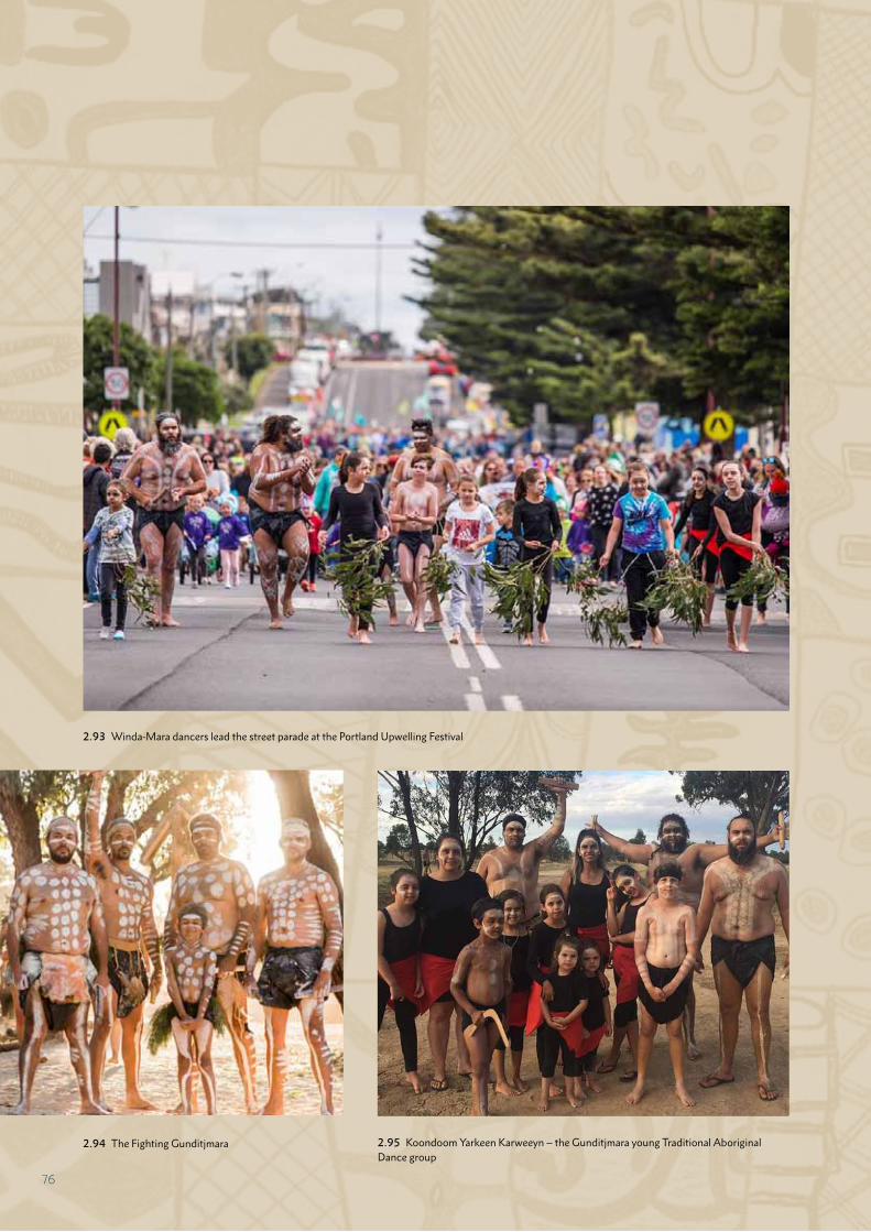
2.94 The Fighting Gunditjmara
2.93 Winda-Mara dancers lead the street parade at the Portland Upwelling Festival
2.95 Koondoom Yarkeen Karweeyn – the Gunditjmara young Traditional Aboriginal Dance group
76
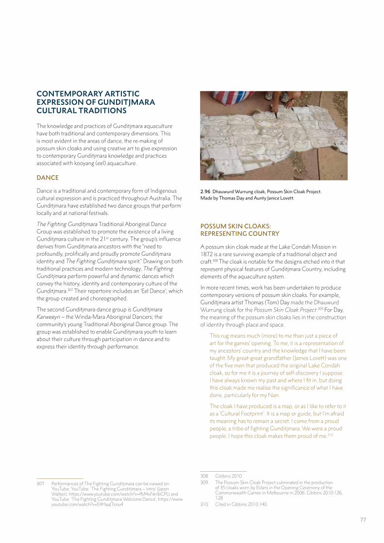
CONTEMPORARY ARTISTIC EXPRESSION OF GUNDITJMARA CULTURAL TRADITIONS
The knowledge and practices of Gunditjmara aquaculture have both traditional and contemporary dimensions. This is most evident in the areas of dance, the re-making of possum skin cloaks and using creative art to give expression to contemporary Gunditjmara knowledge and practices associated with kooyang (eel) aquaculture.
DANCE
Dance is a traditional and contemporary form of Indigenous cultural expression and is practiced throughout Australia. The Gunditjmara have established two dance groups that perform locally and at national festivals.
The Fighting Gunditjmara Traditional Aboriginal Dance Group was established to promote the existence of a living Gunditjmara culture in the 21st century. The group’s influence derives from Gunditjmara ancestors with the “need to profoundly, prolifically and proudly promote Gunditjmara identity and The Fighting Gunditjmara spirit.” Drawing on both traditional practices and modern technology, The Fighting Gunditjmara perform powerful and dynamic dances which convey the history, identity and contemporary culture of the Gunditjmara.307 Their repertoire includes an ‘Eel Dance’, which the group created and choreographed.
The second Gunditjmara dance group is Gunditjmara Karweeyn – the Winda-Mara Aboriginal Dancers; the community’s young Traditional Aboriginal Dance group. The group was established to enable Gunditjmara youth to learn about their culture through participation in dance and to express their identity through performance.
307 Performances of The Fighting Gunditjmara can be viewed on YouTube. YouTube. ‘The Fighting Gunditjmara – Intro’ (Jason Walker), https://www.youtube.com/watch?v=fM4xNnIbCPU and YouTube. ‘The Fighting Gunditjmara Welcome Dance’, https://www.youtube.com/watch?v=E4HaaJ7snu4
POSSUM SKIN CLOAKS: REPRESENTING COUNTRY
A possum skin cloak made at the Lake Condah Mission in 1872 is a rare surviving example of a traditional object and craft.308 The cloak is notable for the designs etched into it that represent physical features of Gunditjmara Country, including elements of the aquaculture system.
In more recent times, work has been undertaken to produce contemporary versions of possum skin cloaks. For example, Gunditjmara artist Thomas (Tom) Day made the Dhauwurd Wurrung cloak for the Possum Skin Cloak Project.309 For Day, the meaning of the possum skin cloaks lies in the construction of identity through place and space.
This rug means much (more) to me than just a piece of art for the games’ opening. To me, it is a representation of my ancestors’ country and the knowledge that I have been taught. My great-great grandfather (James Lovett) was one of the five men that produced the original Lake Condah cloak, so for me it is a journey of self-discovery I suppose. I have always known my past and where I fit in, but doing this cloak made me realise the significance of what I have done, particularly for my Nan.
The cloak I have produced is a map, or as I like to refer to it as a ‘Cultural Footprint’. It is a map or guide, but I’m afraid its meaning has to remain a secret. I come from a proud people, a tribe of fighting Gunditjmara. We were a proud people. I hope this cloak makes them proud of me.310
308 Gibbins 2010309 The Possum Skin Cloak Project culminated in the production
of 35 cloaks worn by Elders in the Opening Ceremony of the Commonwealth Games in Melbourne in 2006. Gibbins 2010:126, 128
310 Cited in Gibbins 2010:140.
2.96 Dhauwurd Wurrung cloak, Possum Skin Cloak Project. Made by Thomas Day and Aunty Janice Lovett.
77
Vicki Couzens is an artist renowned for her work in making possum skin cloaks. She made the Grandmothers’ Possum Skin Cloak, Koorookee Kooramook, a thirty-skin cloak that is decorated with designs that require cultural knowledge to relate to the following statement that accompanies this cloak:
The Grandmothers are the keepers of the family, kinship, knowledge and relationship, women’s business, birth, death, the songs and the land. This cloak shows the Grandmothers’ connection to daughters and grandchildren. It also depicts the three parts of a woman’s life from young girl to woman and mother and then grandmother and wise woman.311
Of possum skin cloaks more generally, Vicki Couzens says:
My work is an expression of my spirituality. Some works have specific messages related to community issues, while other works are personal expressions of my inner world, my relationships to all within the different dimensions. My culture keeps me strong; it guides and teaches me. It is a well of knowledge and wisdom to keep our people and all people strong.
311 Cited in Gibbins 2010:130-131
2.97 Possum skin cloak. Made by Vicki Couzens and Debra Couzens in 2002. Vicki Couzens is a multimedia artist, best known as a maker of possum skin cloaks such as this one; a replica of the 1872 Lake Condah cloak in the Museum Victoria collections.
The safety and the warmth of a cloak is a real thing, you wrap it around you and carry your children, it’s used in everyday life. In most instances it’s used in death as well. You’re wrapped in your cloak and buried. I read a quote once about a blanket of love. For me the possum skin cloak is symbolic of wrapping that love and that culture around you, it’s symbolic of the warmth and the safety of belonging and of knowing who you are.312
312 Culture Victoria. ‘Possum skin cloak’, http://www.culturevictoria.com/stories/aboriginal-culture/meerreeng-an-here-is-my-country/possum-skin-cloak/
78
SCULPTURE
Another creative form of expression of connection to Gunditjmara Country is evidenced in large-scale stone sculptures. Two such structures have been constructed that lie within the Budj Bim Cultural Landscape. They are constructed from local volcanic stone – part of the Budj Bim lava flow. The first of these is a large and impressive stone art sculpture titled Fresh and Salty. The sculpture illustrates the journey of the kooyang (eels) from fresh water to salty water and back again. It was constructed in November 2007 and lies within the Kurtonitj (central) component. Gunditjmara artist Vicki Couzens and Celtic artist Carmel Wallace designed the artwork. It was constructed with Gunditjmara participants Travis Bannam, Leon Walker and Yaran Bundle. The second is a kooyang sculpture produced from Budj Bim lava flow stone and is situated within the Tyrendarra (southern) component. It was produced by a group of International Student Volunteers.
2.98 Budj Bim Cultural Landscape: Fresh and Salty is a large-scale stone sculpture. The work is the result of a collaboration between established artists Vicki Couzens (right) and Carmel Wallace. The sculpture references traditional Indigenous and European farming methods.
2.99 Tyrendarra (southern) component: Kooyang (eel) sculpture
79
CONTEMPORARY MUSIC
Gunditjmara cultural traditions, knowledge and experience are shared through contemporary music. Gunditjmara playwright, scriptwriter and musician Richard Frankland is influenced by his experiences of the Budj Bim Cultural Landscape, evident in the lyrics for Condah Mission, for example.313 Well-known Australian singer songwriter Shane Howard and Gunditjmara Elder the late Uncle Banjo Clarke co-wrote the song titled: The River Knows (Eel Song) (Kuuyang).
The south-west wind brings autumn rainTo fill the rivers once againThe eels will make their journey nowLonging for that salty water
Down the Tuuram stones they slitherIn their thousands down the riverHeaded for the river mouthFat and sleek, and slowly moving south
The river knowsThe river flowsThat old river knowsWatch us come and go
All the tribes will gather hereTravel in from everywhereFood to share and things to tradeSong and dance until it fades
Hear the stories being toldHanded down from young to oldSee the fires burning thereHear the voices echo through the air
The kuuyang move into the oceanRestless motionEven though they go away
The spirits all return to here again314
313 Richard Frankland 2002. The Charcoal Club: Meeting One, Taram Records
314 Shane Howard and Banjo Clarke 1996. Clan, EMI Music
THE RIVER KNOWS (EEL SONG) (KUUYANG)
80
INTER-GENERATIONAL TRANSMISSION OF GUNDITJMARA CULTURAL TRADITIONS, KNOWLEDGE AND PRACTICES
The Gunditjmara use the Budj Bim Cultural Landscape as a focus for cultural, community, education and tourism activities. These activities are important for transmitting knowledge of Country between and across different generations of the Gunditjmara, but also sharing selected parts of their knowledge and experiences of Country with non-Gunditjmara Indigenous people and non-Indigenous groups. For example, the Tyrendarra Indigenous Protected Area, which is owned and managed by Winda-Mara Aboriginal Corporation, is a place “to provide a location for all Aboriginal and Torres Strait Island peoples to walk on country”.315
For Gunditjmara Traditional Owners, connection with Country takes place through being in the landscape – including through community events at gathering and ceremony places (such as the Lake Condah Mission); through activities connected to aquaculture, hunting animals (including kooyang (eels)) and collecting plants (including puungyaart [grass]); and through sharing stories about Country.316 That is, Gunditjmara cultural traditions, knowledge and practices are typically transmitted and shared on Country. Through gatherings, activities and story-telling, the Gunditjmara draw on the Budj Bim Cultural Landscape as a place of teaching and learning to pass on knowledge to Gunditjmara youth.
Examples of activities that illustrate the broader transmission and sharing of knowledge on Country include:
• The Budj Bim Ranger program. Funded by the Australian Government, the program employs rangers who manage the Budj Bim and Tyrendarra Indigenous Protected Areas within the Budj Bim Cultural Landscape. The rangers have a range of management responsibilities related to caring for Country, which include native flora and fauna management, building and maintaining walking tracks, providing guided tours and monitoring.
• Visiting Schools Program. The Budj Bim Rangers run this program for school groups. Approximately 50 such visits take place each year.
• Budj Bim Tours. An enterprise established and operated by the Winda-Mara Aboriginal Corporation, it is an Indigenous owned tourism company that offers exclusive guided tours to selected areas within the nominated property. Budj Bim Tours operate out of Heywood, Victoria, and itineraries range from two hours to full days.
315 Winda-Mara Aboriginal Corporation 2015:13316 Parks Victoria 2015:63
2.100 Denise Lovett and her grandson, Nyawi Moore, visit Country to teach and learn about kooyang (eel) aquaculture
81
• Youth holiday activities. Winda-Mara Aboriginal Corporation and the Gunditj Mirring Traditional Owners Aboriginal Corporation (GMTOAC) run activities during the school holiday periods for local Gunditjmara children. The events can extend up to three days in length, include culture camps at the Lake Condah Mission and involve a range of traditional and community-based activities.
• Occasional programs. Run by the Gunditjmara for non-Indigenous youth, the programs include workshops run by Aunty Eileen Alberts who teaches basket weaving to women, for example.
• Cultural Awareness Training. The GMTOAC provides cultural awareness training to government departments, private organisations and university students. Such training aims to: extend participants’ knowledge of Gunditjmara history and culture; explore how attitudes and values can influence perceptions, assumptions and behaviours concerning Aboriginal people; and discuss respectful and informed ways to interact with the Gunditjmara.
SUMMARY
In the global context of human history, the Budj Bim Cultural Landscape is an outstanding exemplar of a cultural landscape in which human interaction with the environment is an eco-cultural relationship of dynamic manipulation and management of natural resources. It is illustrative of the creation, modification and maintenance of an extensive hydrological engineering system that manipulates water flow in order to trap, store and harvest kooyang (eel) that migrate seasonally through the system.
The Budj Bim Cultural Landscape represents a continuing tradition of Gunditjmara aquaculture that is more than 6,600 years old. More remains to be discovered about the earliest extent of the aquaculture system and how it operated; and work continues to be initiated by the Gunditjmara in partnership with archaeologists, palaeobotanists and geomorphologists.
In the 19th century history of Gunditjmara Country, considerable information on the operation of their aquaculture system was documented – by the Gunditjmara in designs applied to possum skin cloaks, for example; and by early European ethnographers including George Augustus Robinson (1840s), James Dawson (1850s-1860s) and Alexander Ingram (1890s). Each of these men visited parts of the aquaculture system in the company of Gunditjmara. Ingram’s visits, for example, were made with Gunditjmara Elders, including Tommy White. In all instances, the features of the aquaculture system described by Robinson, Dawson and Ingram were in use by the Gunditjmara – either in the nominated area or close by. Despite the destructive impacts of the Eumeralla War (1840s), confinement at the Lake Condah Aboriginal Mission Station (1867-1918) and government-driven assimilation policies (1920s-1960s), the Gunditjmara
survived. Over more than a century, the Gunditjmara continued to apply cultural traditions, knowledge, long-held aquaculture practices and creative approaches to the capture, storage and harvest of kooyang.
From the 1970s, after several decades of dispossession from their lands, the Gunditjmara successfully initiated and negotiated processes of reconnecting with the aquaculture complexes within the Budj Bim Cultural Landscape. These processes began, in part, with working with archaeologists from the mid-1970s in documenting the aquaculture features and associated cultural heritage. As the Gunditjmara gradually regained ownership of their Country from 1984 and had their native title rights recognised in 2007, they have increasingly come to manage their Country and their aquaculture system on their own terms. The Gunditjmara are the custodial managers of the Budj Bim Cultural Landscape and the outstanding aquaculture system that exists within it.
Ownership, along with rights and obligations to Country, has seen a resurgence and flourishing of creative expression through art, craft (including weaving and possum skin cloak making), dance, song and sculpture that reinforces Gunditjmara spirituality and connection to Country. Land ownership and active management enable the Gunditjmara to continue to care for the Budj Bim Cultural Landscape. Today, Gunditjmara cultural traditions, knowledge and practices continue to be part of the six-millennia long connection with the nominated property.
82
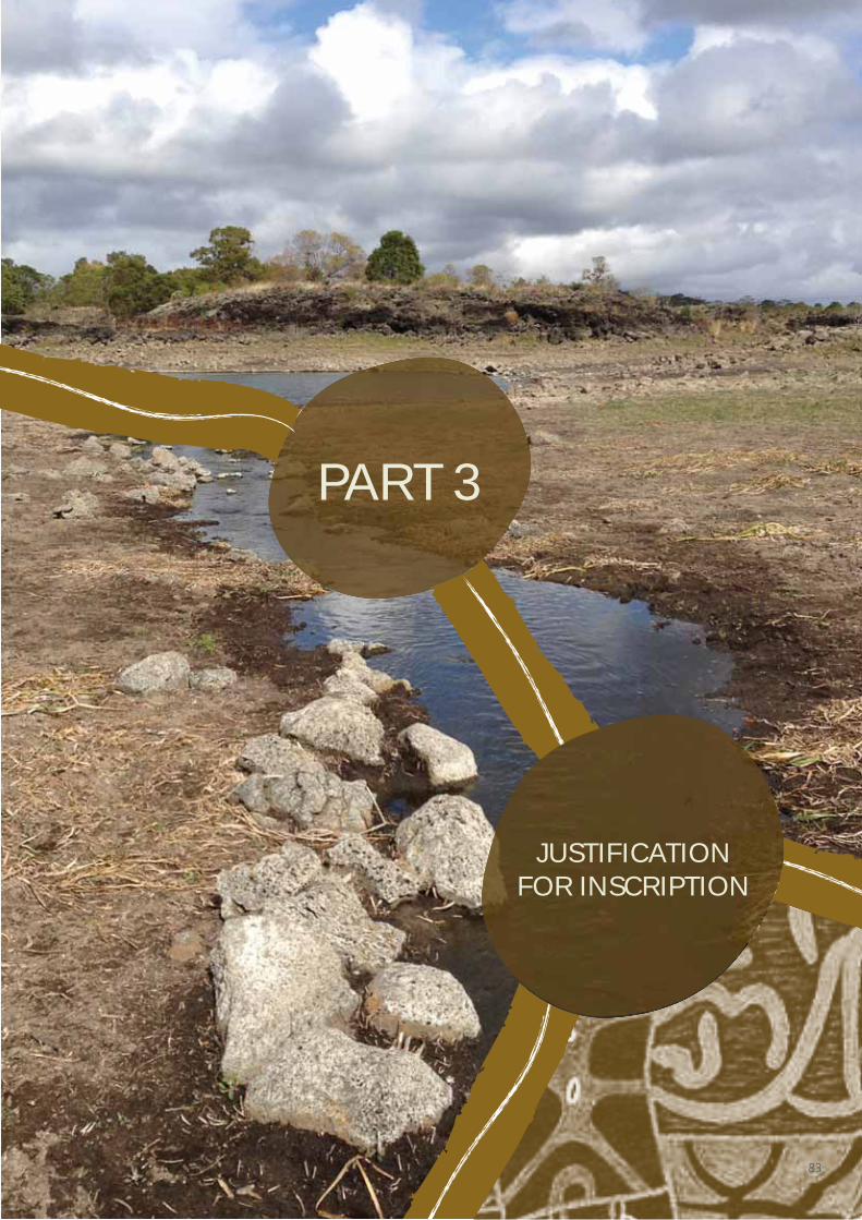
PART 3
JUSTIFICATION FOR INSCRIPTION
83
3.1.A BRIEF SYNTHESIS
The Budj Bim Cultural Landscape is located
in the traditional Country of the Gunditjmara
Aboriginal people in south-eastern Australia.
The three serial components of the property
contain one of the world’s most extensive and
oldest aquaculture systems. Over a period of
at least 6,600 years the Gunditjmara created,
manipulated and modified local hydrological
regimes and ecological systems. They utilised
the abundant local volcanic rock to construct
channels, weirs and dams and manage water
flows in order to systematically trap, store
and harvest kooyang (short-finned eel –
Anguilla australis) and support enhancement
of other food resources. The highly
productive aquaculture system provided a
six millennia-long economic and social base
for Gunditjmara society. This deep time
interrelationship of Gunditjmara cultural
and environmental systems is documented
through present-day Gunditjmara cultural
knowledge, practices, material culture,
scientific research and historical documents.
It is evidenced in the aquaculture system
itself and in the inter-related geological,
hydrological and ecological systems.
The Gunditjmara aquaculture system is one of the world’s oldest and most extensive (Part 2). Over a period of at least 6,600 years and continuing to the present day, the Gunditjmara have purposefully created, manipulated, modified and managed local hydrological regimes and ecological systems within the Budj Bim Cultural Landscape in order to systematically trap, store and harvest kooyang. The attributes that demonstrate the Gunditjmara aquaculture system and carry the Outstanding Universal Value of the nominated property are as follows.
1. GUNDITJMARA CULTURAL TRADITIONS, KNOWLEDGE AND PRACTICES
The Outstanding Universal Value of the Budj Bim Cultural Landscape is evidenced in Gunditjmara aquaculture as manifest in the practices of kooyang management, storage, and harvesting; as well as the associated manipulation, modification and management of the environment. Gunditjmara aquaculture knowledge and practices are also inclusive of sourcing grasses and weaving of gnarraban (kooyang baskets), traditional representations of Gunditjmara aquaculture (the designs produced on possum skin cloaks, for example), adaptation of traditional catching techniques (use of wire mesh baskets and wood crates for holding kooyang) and contemporary, creative artistic expressions of Gunditjmara aquaculture; evidenced in story-telling, dance, song, crafted objects and sculpture. Gunditjmara aquaculture knowledge is demonstrated by millennia of oral transmission; through continuity and adaptation of practice and is supported by well-documented Gunditjmara traditions.
2. THE PHYSICAL EVIDENCE OF GUNDITJMARA AQUACULTURE IN THE LANDSCAPE
The physical system is comprised of interconnected clusters of constructed and modified channels (yereoc), weirs (stone and wood), dams, ponds and sinkholes; developed to manage water and water flows in order to systematically trap, store and harvest kooyang. These physical elements occur in various combinations, with the largest and best-preserved complexes located at Tae Rak (Lake Condah) and within the Kurtonitj (central) and Tyrendarra (southern) components of the Budj Bim Cultural Landscape. The physical evidence of Gunditjmara aquaculture is supported by exceptionally well-preserved archaeological, environmental and historical evidence.
PART 3 JUSTIFICATION FOR INSCRIPTION
84
3. THE INTERCONNECTED GEOLOGICAL, HYDROLOGICAL AND ECOLOGICAL SYSTEMS
Gunditjmara aquaculture is centred on the Budj Bim lava flow that is the result of the dramatic volcanic eruption of Budj Bim between 30,000 and 39,000 years ago. The lava bedrock supported the establishment of a distinctive series of wetland, swamp and sinkhole environments. These environments gradually evolved to provide suitable conditions and habitat for kooyang. Gunditjmara aquaculture is dependent on natural and culturally modified water flows within which Tae Rak and Killara (Darlot Creek) are the central elements of the ecological-cultural system. The reinstatement of traditional water flows to Tae Rak through the construction of the cultural weir in 2010, enabling it to function as a productive lake and wetland after 140 years of being artificially drained, is an outstanding example of the restoration of an eco-cultural system and habitat values.
The Budj Bim Cultural Landscape is an expression of Gundijtmara intangible and tangible cultural heritage in combination with underlying volcanic and hydrological processes and kooyang ecology. These inter-related and interconnected systems include Gunditjmara knowledge and practices, the physical elements of the aquaculture system (channels, weirs, dams, ponds, sinkholes), the Budj Bim lava flow, the Tae Rak-Killara catchment water and water flow, and the modified environment to support kooyang husbandry.
The combination of these systems has created an eco-cultural landscape (Part 2.A) in which the local ecology has been manipulated by Gunditjmara to enhance the availability and accessibility of kooyang. The cultural landscape represents the combined works of nature and humans and is an expression of an organically evolved cultural landscape.317
The Budj Bim Cultural Landscape is a serial property of three components comprised of lands wholly owned or jointly managed by the Gunditjmara Traditional Owners and Winda-Mara Aboriginal Corporation. Indigenous land ownership and co-operative management are significant because they demonstrate that Gunditjmara’s free, prior and informed consent is integral to the long-term protection, management and presentation of the nominated property’s Outstanding Universal Value; and because Gunditjmara traditional and contemporary knowledge and practices are enabled through their land ownership and management.
317 McNiven in Context 2013a:28
3.1.B CRITERIA UNDER WHICH INSCRIPTION IS PROPOSED (AND JUSTIFICATION FOR INSCRIPTION UNDER THESE CRITERIA)
The Budj Bim Cultural Landscape is nominated under criteria (iii) and (v) for its Outstanding Universal Value.
Criterion (iii). Bear a unique or at least exceptional testimony to a cultural tradition or to a civilization which is living or which has disappeared.
The Budj Bim Cultural Landscape bears an exceptional testimony to the cultural traditions, knowledge, practices and ingenuity of the Gunditjmara. The extensive networks and antiquity of the constructed and modified aquaculture system of the Budj Bim Cultural Landscape bears testimony to the Gunditjmara as engineers and kooyang fishers. For at least the past 6,600 years the Gunditjmara created and adapted a system of aquaculture based on deliberate manipulation, modification and management of wetlands and waterways. Gunditjmara knowledge and practices have endured and continue to be passed down through their Elders and are recognisable across the wetlands of the Budj Bim Cultural Landscape in the form of ancient and elaborate systems of stone-walled kooyang husbandry (or aquaculture) facilities. Gunditjmara cultural traditions, including associated storytelling, dance and basket weaving, continue to be maintained by their collective multigenerational knowledge.
Budj Bim Cultural Landscape is a significant part of Gunditjmara Country. For Australian Aboriginal people, Country is a ‘nourishing terrain’ – a place that gives and receives life. Country is everything – people, plants, animals, earth, water, Dreaming, air, sky – and every Aboriginal person has a Country to which they belong.318
Each Country has its sacred origins – its Creation written in the land and known through traditions and cultural practices. Spiritual links to Country through the activities of Ancestral Creator beings at particular places are characteristic of Aboriginal societies throughout Australia. Through story and totems, the land, the people and non-human species are
318 Rose 1996:7-8
85
connected in a complex web of meanings, responsibilities and reciprocities. Creation time (or ‘Dreaming’) refers to the time in which the land was formed and shaped and living things created. Ancestral beings, such as Budj Bim, were the creators of all things. Creation time is not a past time or a past event that has concluded. Creation time is ever-present.
For the Gunditjmara, the whole of their Country is filled with the spirit of creation and rich with significance and stories of the ancestral past and present. For the Gunditjmara – as with all Aboriginal Australians, land management and cultural heritage are intertwined and inseparable. A distinctive dimension of Gunditjmara land management and cultural traditions is the conservation of waterways and wetlands within the area known as Tungatt Mirring (Stone Country) which corresponds to the Budj Bim lava flow. Freshwater not only nourishes Tungatt Mirring, it is the ancestral source of kooyang (eels), which play a significant role in Gunditjmara history, subsistence and identity. The interweaving of Gunditjmara land and waterway management, cultural heritage, kooyang and identity is exemplified in the Budj Bim Cultural Landscape.
GUNDITJMARA CULTURAL TRADITIONS, KNOWLEDGE AND PRACTICES
Ensuring conditions suitable to sustainable kooyang management and husbandry was and is a particular focus of Gunditjmara life and caring for Country. Their aquaculture traditions – and the knowledge associated with it, was passed down from Gunditjmara Elders over at least six millennia (representing more than 300 generations) and is enshrined across the wetland landscapes in the form of ancient and elaborate stone-walled fish trapping and aquaculture networks. Knowledge of Gunditjmara aquaculture is and always has been part of Gunditjmara oral history; with present-day families retaining many stories of catching kooyang from Tae Rak (Lake Condah) and Killara (Darlot Creek). As in the past, harvesting kooyang involves detailed knowledge of the seasonal cycle of water flows and kooyang; as well as knowledge and skills associated with kooyang management, storage, harvesting and the associated manipulation and modification of the environment.
As Gunditjmara Elder Daryl Rose explains,
What would happen, these low-lying areas here, the eels would come in here to feed, and then they would come swimming up these areas, the low areas, and then come to these channels. They would then be forced into these channels and moved down through here into places where the holding pens are. This is part of a farming system. We actually managed the eel. We just didn’t come out here and hunt and fish. We actually came out here to collect and manoeuvre and farm and move these eels into places where we wanted them to go so then we could pick them up when we wanted to pick them up.319
319 Daryl Rose, Gunditjmara Elder, Radio National 2007; cited in Bell and Johnstone 2010
CONTINUATION OF TRADITIONAL KNOWLEDGE THROUGH THE 19TH AND 20TH CENTURIES
Despite the profound and destructive impacts of colonisation on the Gunditjmara; their cultural traditions concerning aquaculture survived and continued to be transmitted across multiple generations to the present day (Part 2.B).
In the 19th century, the Gunditjmara provided information to George Augustus Robinson, James Dawson and Alexander Ingram – who documented Gunditjmara aquaculture knowledge and practices.320 Together, Robinson, Dawson and Ingram detailed differing scales of kooyang aquaculture employed by the Gunditjmara. These practices ranged from small groups spearing fish in lagoons to large-scale engineered complexes with hundreds of metres of constructed embankments, stone walls and excavated channels.321
In the period from the 1830s to the 1860s – despite intense levels of conflict with European settlers, the Gunditjmara occupied Tungatt Mirring (Stone Country) and continued their cultural traditions of aquaculture. The establishment of the Lake Condah Aboriginal Mission Station (the Mission) in 1867 incorporated the extensive Gunditjmara aquaculture complexes at the south-west edges of Tae Rak. Access to and use of the aquaculture system was continuous throughout the Mission period (1867-1918), with kooyang continuing to be harvested and consumed and the Tae Rak trap facilities maintained. After the Mission closed, and until the 1950s, Gunditjmara continued to use the Tae Rak complexes. Equally, Gunditjmara living in nearby settlements continued to catch and eat kooyang; an important food source during times of scarcity and a source of income from their sale. When access to the Tae Rak system was restricted following land privatisation after the 1950s, Gunditjmara caught kooyang from public waterways along Killara and on land parcels that allowed Gunditjmara access (Tyrendarra, for example).
With the return of traditional Country to the Gunditjmara from 1984, and in particular following the 2007 Australian Federal Court native title determination, the Gunditjmara gained ownership of lands containing each of the major Gunditjmara aquaculture complexes at Tae Rak, Tyrendarra and Kurtonitj – as well as the Lake Condah Mission and Cemetery. Today, access to traditional lands within the Budj Bim Cultural Landscape enables Gunditjmara culture and traditions to be reasserted and continue. Consequently, Gunditjmara cultural traditions concerned with aquaculture are demonstrated by millennia of oral transmission across multiple generations, through continuity and adaptation of practice; and are evidenced by documented Gunditjmara traditions and supported by historical evidence.
320 Robinson in Clark 1998a and Presland 1977; Dawson 1881; Richards 2011
321 McNiven and Bell 2010:87
86
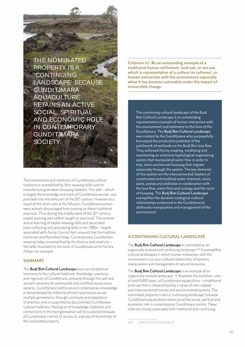
The transmission and resilience of Gunditjmara cultural traditions is exemplified by fibre weaving skills used to manufacture gnarraban (kooyang baskets). This skill – which is largely the knowledge and work of Gunditjmara women, was practised into the early part of the 20th century. However as a result of the strict rules at the Mission, Gunditjmara women were actively discouraged from passing on these traditional practices. Thus during the middle parts of the 20th century basket weaving was seldom taught or practiced. The renewal and re-learning of basket weaving skills and associated plant collecting and processing skills in the 1980s – largely associated with Aunty Connie Hart, ensured that the tradition continues and flourishes today. Contemporary Gunditjmara weaving today is exemplified by its vibrancy and creativity – the latter illustrated in the work of Gunditjmara artist Sandra Aitken, for example.
SUMMARY
The Budj Bim Cultural Landscape bears an exceptional testimony to the cultural traditions, knowledge, practices and ingenuity of Gunditjmara, primarily through the vast and ancient networks of constructed and modified aquaculture systems. Gunditjmara traditional and contemporary knowledge is demonstrated by millennia of oral transmission across multiple generations, through continuity and adaptation of practice, and is supported by documented Gunditjmara cultural traditions. Passing on of knowledge, traditions and connections to the next generation will be sustained because of Gunditjmara control of, access to, and use of the entirety of the nominated property.
Criterion (v). Be an outstanding example of a traditional human settlement, land-use, or sea-use which is representative of a culture (or cultures), or human interaction with the environment especially when it has become vulnerable under the impact of irreversible change.
The continuing cultural landscape of the Budj Bim Cultural Landscape is an outstanding representative example of human interaction with the environment and testimony to the lives of the Gunditjmara. The Budj Bim Cultural Landscape was created by the Gunditjmara who purposefully harnessed the productive potential of the patchwork of wetlands on the Budj Bim lava flow. They achieved this by creating, modifying and maintaining an extensive hydrological engineering system that manipulated water flow in order to trap, store and harvest kooyang that migrate seasonally through the system. The key elements of this system are the interconnected clusters of constructed and modified water channels, weirs, dams, ponds and sinkholes in combination with the lava flow, water flow and ecology and life-cycle of kooyang. The Budj Bim Cultural Landscape exemplifies the dynamic ecological-cultural relationships evidenced in the Gunditjmara’s deliberate manipulation and management of the environment.
A CONTINUING CULTURAL LANDSCAPE
The Budj Bim Cultural Landscape is nominated as an organically evolved and continuing landscape.322 It exemplifies cultural landscapes in which human interaction with the environment is an eco-cultural relationship of dynamic manipulation and management of natural resources.
The Budj Bim Cultural Landscape is an example of an ‘organically evolved landscape’. It illustrates the evolution, over at least 6,600 years, of Gunditjmara aquaculture – a traditional land-use that is characterised by a series of inter-related and interconnected human and environmental systems. The nominated property is also a ‘continuing landscape’ because Gunditjmara aquaculture retains an active social, spiritual and economic role in contemporary Gunditjmara society. These roles are closely associated with traditional and continuing
322 UNESCO 2016:73 (Annex 3)
THE NOMINATED PROPERTY IS A ‘CONTINUING LANDSCAPE’ BECAUSE GUNDITJMARA AQUACULTURE RETAINS AN ACTIVE SOCIAL, SPIRITUAL AND ECONOMIC ROLE IN CONTEMPORARY GUNDITJMARA SOCIETY.
87
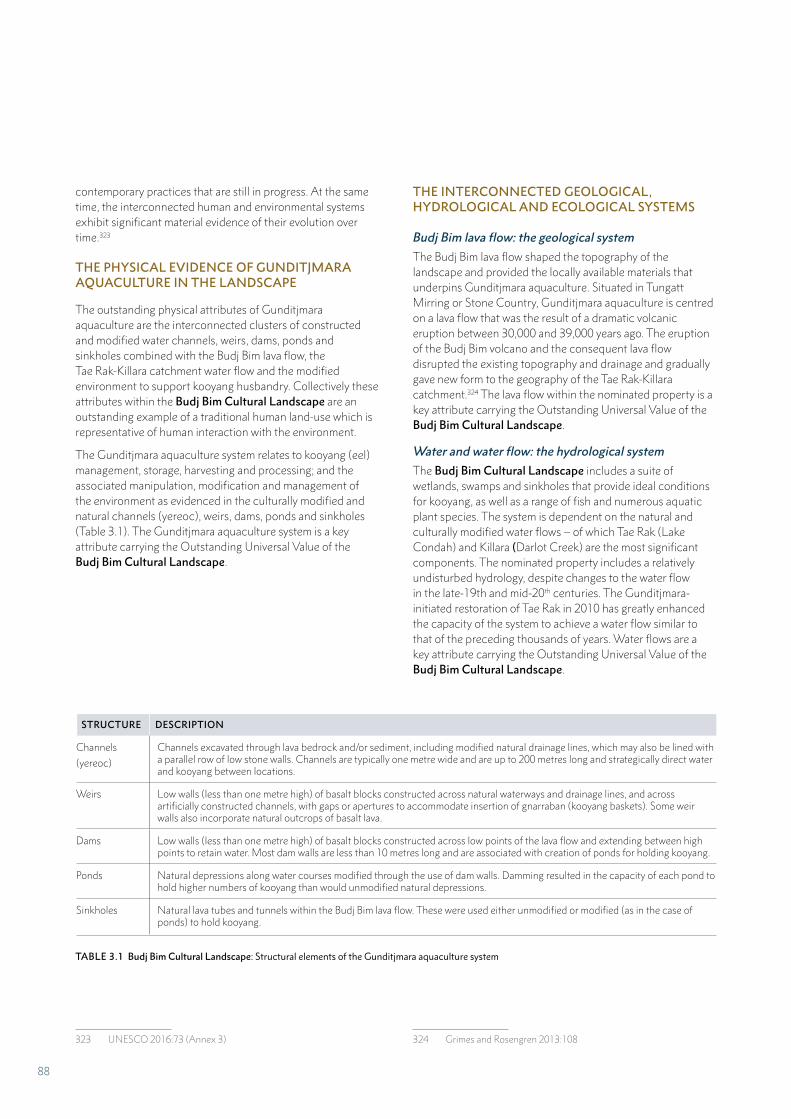
contemporary practices that are still in progress. At the same time, the interconnected human and environmental systems exhibit significant material evidence of their evolution over time.323
THE PHYSICAL EVIDENCE OF GUNDITJMARA AQUACULTURE IN THE LANDSCAPE
The outstanding physical attributes of Gunditjmara aquaculture are the interconnected clusters of constructed and modified water channels, weirs, dams, ponds and sinkholes combined with the Budj Bim lava flow, the Tae Rak-Killara catchment water flow and the modified environment to support kooyang husbandry. Collectively these attributes within the Budj Bim Cultural Landscape are an outstanding example of a traditional human land-use which is representative of human interaction with the environment.
The Gunditjmara aquaculture system relates to kooyang (eel) management, storage, harvesting and processing; and the associated manipulation, modification and management of the environment as evidenced in the culturally modified and natural channels (yereoc), weirs, dams, ponds and sinkholes (Table 3.1). The Gunditjmara aquaculture system is a key attribute carrying the Outstanding Universal Value of the Budj Bim Cultural Landscape.
STRUCTURE DESCRIPTION
Channels
(yereoc)
Channels excavated through lava bedrock and/or sediment, including modified natural drainage lines, which may also be lined with a parallel row of low stone walls. Channels are typically one metre wide and are up to 200 metres long and strategically direct water and kooyang between locations.
Weirs Low walls (less than one metre high) of basalt blocks constructed across natural waterways and drainage lines, and across artificially constructed channels, with gaps or apertures to accommodate insertion of gnarraban (kooyang baskets). Some weir walls also incorporate natural outcrops of basalt lava.
Dams Low walls (less than one metre high) of basalt blocks constructed across low points of the lava flow and extending between high points to retain water. Most dam walls are less than 10 metres long and are associated with creation of ponds for holding kooyang.
Ponds Natural depressions along water courses modified through the use of dam walls. Damming resulted in the capacity of each pond to hold higher numbers of kooyang than would unmodified natural depressions.
Sinkholes Natural lava tubes and tunnels within the Budj Bim lava flow. These were used either unmodified or modified (as in the case of ponds) to hold kooyang.
323 UNESCO 2016:73 (Annex 3)
THE INTERCONNECTED GEOLOGICAL, HYDROLOGICAL AND ECOLOGICAL SYSTEMS
Budj Bim lava flow: the geological system
The Budj Bim lava flow shaped the topography of the landscape and provided the locally available materials that underpins Gunditjmara aquaculture. Situated in Tungatt Mirring or Stone Country, Gunditjmara aquaculture is centred on a lava flow that was the result of a dramatic volcanic eruption between 30,000 and 39,000 years ago. The eruption of the Budj Bim volcano and the consequent lava flow disrupted the existing topography and drainage and gradually gave new form to the geography of the Tae Rak-Killara catchment.324 The lava flow within the nominated property is a key attribute carrying the Outstanding Universal Value of the Budj Bim Cultural Landscape.
Water and water flow: the hydrological system
The Budj Bim Cultural Landscape includes a suite of wetlands, swamps and sinkholes that provide ideal conditions for kooyang, as well as a range of fish and numerous aquatic plant species. The system is dependent on the natural and culturally modified water flows – of which Tae Rak (Lake Condah) and Killara (Darlot Creek) are the most significant components. The nominated property includes a relatively undisturbed hydrology, despite changes to the water flow in the late-19th and mid-20th centuries. The Gunditjmara-initiated restoration of Tae Rak in 2010 has greatly enhanced the capacity of the system to achieve a water flow similar to that of the preceding thousands of years. Water flows are a key attribute carrying the Outstanding Universal Value of the Budj Bim Cultural Landscape.
324 Grimes and Rosengren 2013:108
TABLE 3.1 Budj Bim Cultural Landscape: Structural elements of the Gunditjmara aquaculture system
88
Modified environment to support kooyang husbandry: the ecological system
Kooyang (short finned eel – Anguilla australis) is the key target species on which Gunditjmara aquaculture is founded. The biology and ecology of kooyang allowed for its management and increased availability resulting from Gunditjmara modifications to the wetland landscape. That is, the ecological-cultural landscape of the nominated property was conducive to the development of a productive kooyang harvesting system. The role of kooyang in Gunditjmara aquaculture is a key attribute carrying the Outstanding Universal Value for the Budj Bim Cultural Landscape.
The Budj Bim Cultural Landscape is an expression of Gunditjmara intangible and tangible cultural heritage in combination with underlying volcanic and hydrological processes and the modified environment to support kooyang husbandry.
A key dimension of this eco-cultural landscape is that local ecology is not radically altered; but selectively and strategically enhanced. It is for this reason that management practices associated with eco-cultural landscapes are relatively sustainable and resilient. Such eco-cultural landscapes bear the cultural imprint not just of human agency, but of individual societies strategically manipulating environments into culturally relevant and meaningful ‘constructed landscapes’.325
SUMMARY
The Budj Bim Cultural Landscape is a rare, intact and representative example of a cultural landscape that has survived through the continuity of Gunditjmara cultural and social practices and active management of the landscape. The nominated property includes the most outstanding and well-preserved physical attributes of the Gunditjmara kooyang aquaculture system, as well as representative examples of all parts of that system. Collectively the attributes within the nominated property are an outstanding example of a traditional land-use which is representative of human interaction with the environment. Budj Bim Cultural Landscape is an outstanding and representative example of an organically evolved, continuing cultural landscape.
325 McNiven in Context 2013a:28
3.1.C STATEMENT OF INTEGRITY
The Budj Bim Cultural Landscape has a high level of integrity.326 The serial property incorporates intact and outstanding examples of aquaculture complexes at Tae Rak (Lake Condah), Tyrendarra and Kurtonitj. Each complex includes all the physical elements of the system (that is, channels, weirs, dams and ponds) that demonstrate the operation of Gunditjmara aquaculture. The property also includes Budj Bim, a Gunditjmara Ancestral Being and volcano that is the source of the lava flow on which the aquaculture system is constructed. The 9,935-hectare property is sufficient in size to incorporate the cultural features and ecological processes that illustrate the ways multiple systems – social, spiritual, geological, hydrological and ecological – interact and function. The reinstatement of traditional water flows into Tae Rak through the construction of a cultural weir in 2010, following extensive draining of the lake in the 1950s, has returned and enhanced the water flow across the aquaculture system. This restoration, the rugged environment, the use of stone, the relatively intact vegetation and the lack of major development within the Budj Bim Cultural Landscape mean that the extensive aquaculture system has survived, is in good condition and can be readily identified in the landscape.
Integrity is a measure of the wholeness, completeness or intactness of the attributes that convey Outstanding Universal Value.327 The integrity of the Budj Bim Cultural Landscape is discussed under the following headings:
1. Wholeness: all the necessary attributes are within the property.
2. Intactness: all the necessary attributes are still present – none are lost or have been significantly damaged or have decayed.
3. Absence of threats: none of the attributes are threatened by development, deterioration or neglect.328
4. Cultural landscape: dynamic and functioning relationships between cultural and natural elements are present and essential to the cultural landscape’s distinctive character and continue to be maintained.329
326 UNESCO 2016:Paragraphs 87-89327 UNESCO 2011:65328 UNESCO 2011:65329 UNESCO 2016:Paragraph 89
89
WHOLENESS: ADEQUATE SIZE
Budj Bim Cultural Landscape is a serial property comprised of three components that collectively incorporate the eight largest Gunditjmara aquaculture complexes (Maps 2.2, 2.3, 2.4) and representative examples of smaller aquaculture systems. Each aquaculture complex demonstrates variation in its adaptation to specific local landscape environments. Together the three components contain representative examples of the interconnected Gunditjmara aquaculture system as well as the Budj Bim lava flow system, Tae Rak-Killara water flow system and the modified environment to support kooyang (short-finned eel) husbandry. Thus the 9,935-hectare serial property is sufficient in size to incorporate the cultural features and ecological processes that illustrate the ways multiple systems – social, spiritual, geological, hydrological and ecological – interact and function and demonstrate Gunditjmara kooyang (eel) aquaculture.
Gunditjmara Traditional Owners and Winda-Mara Aboriginal Corporation own all components of the Budj Bim Cultural Landscape with the exception of Budj Bim (formally Mount Eccles) National Park, which is a co-operative management arrangement between the Gunditjmara and the Victorian Government. That is, the nominated property is comprised wholly of lands owned or co-operatively managed by Aboriginal groups (GMTOAC and Winda-Mara Aboriginal Corporation). Therefore, the property and its boundaries are assured of the Gunditjmara’s free, prior and informed consent by virtue of their ownership, management and control.330 The wholeness of the property enables Gunditjmara cultural traditions, knowledge and practices to be expressed in the present and into the future as a consequence of the recognition of both their custodial and native title rights and obligations.
INTACTNESS: INCLUDES ALL ELEMENTS
The Budj Bim Cultural Landscape incorporates outstanding and representative examples of Gunditjmara aquaculture that express millennia-long cultural traditions, land-use and interaction with the environment. The attributes that comprise the Gunditjmara aquaculture system are:
• Gunditjmara cultural traditions, knowledge and practices, which are enabled by Aboriginal ownership, management and control of the nominated property
• The physical evidence of Gunditjmara aquaculture in the landscape, which comprises different combinations and scales of channels, weirs, dams, ponds and sinkholes that illustrate the manipulation, modification and management of the environment
• The interconnected geological, hydrological and ecological systems, which are fully represented in each of the three components of the nominated property.
330 UNESCO 2017:Paragraph 123
The nominated property also contains important features that express the spiritual and creation elements connected to the Gunditjmara landscape. Specifically, these are the Budj Bim volcano, a Gunditjmara Ancestral Being, and representative sections of the Budj Bim lava flow – upon which and from which the aquaculture system is constructed. In addition, the nominated property contains plant species associated with Gunditjmara aquaculture. These include puunyaart grass used to weave gnarraban (kooyang baskets) and tree species that provide the source material for the construction of wood lattice weirs.
Thus, the nominated property contains all the necessary elements required to demonstrate the dynamic ecological-cultural relationships that are evidenced in Gunditjmara manipulation, modification and management of the environment and of Gunditjmara kooyang aquaculture knowledge and practices. The Budj Bim Cultural Landscape includes all the elements necessary to express its Outstanding Universal Value.
ABSENCE OF THREATS OR ADVERSE EFFECTS
Ownership and/or cooperative management of the Budj Bim Cultural Landscape by the Gunditjmara means that the extensive aquaculture system will continue to be managed and renewed by the Gunditjmara into the future. The potential pressures on contemporary Gunditjmara cultural traditions, knowledge and practices continuing into the future include: cultural continuity and the ongoing transmission of traditional and contemporary Gunditjmara knowledge and practices across generations; and sustainable, long term financing to enable the ongoing employment of Budj Bim rangers and cover the costs associated with ‘caring for Country’.
The rugged environment, the use of stone and the lack of major development on the Budj Bim lava flow mean that the extensive aquaculture system within the Budj Bim Cultural Landscape has survived and can be readily identified in the landscape. Much of the lava flow within the nominated property has not been cleared of vegetation; and the aquaculture structures are in good condition. There are a number of ongoing pressures that are currently being managed by the Gunditjmara. These include water quality and water flow, pest plant and animal species, the unauthorised access of cattle, the regrowth of trees within some of the aquaculture channels, effects of climate change and the sustainability of kooyang populations (Part 4.B). Each of these matters is being currently addressed in accordance with the property management plans.331
331 Parks Victoria 2015; GMTOAC 2015; Winda-Mara Aboriginal Corporation 2015
90
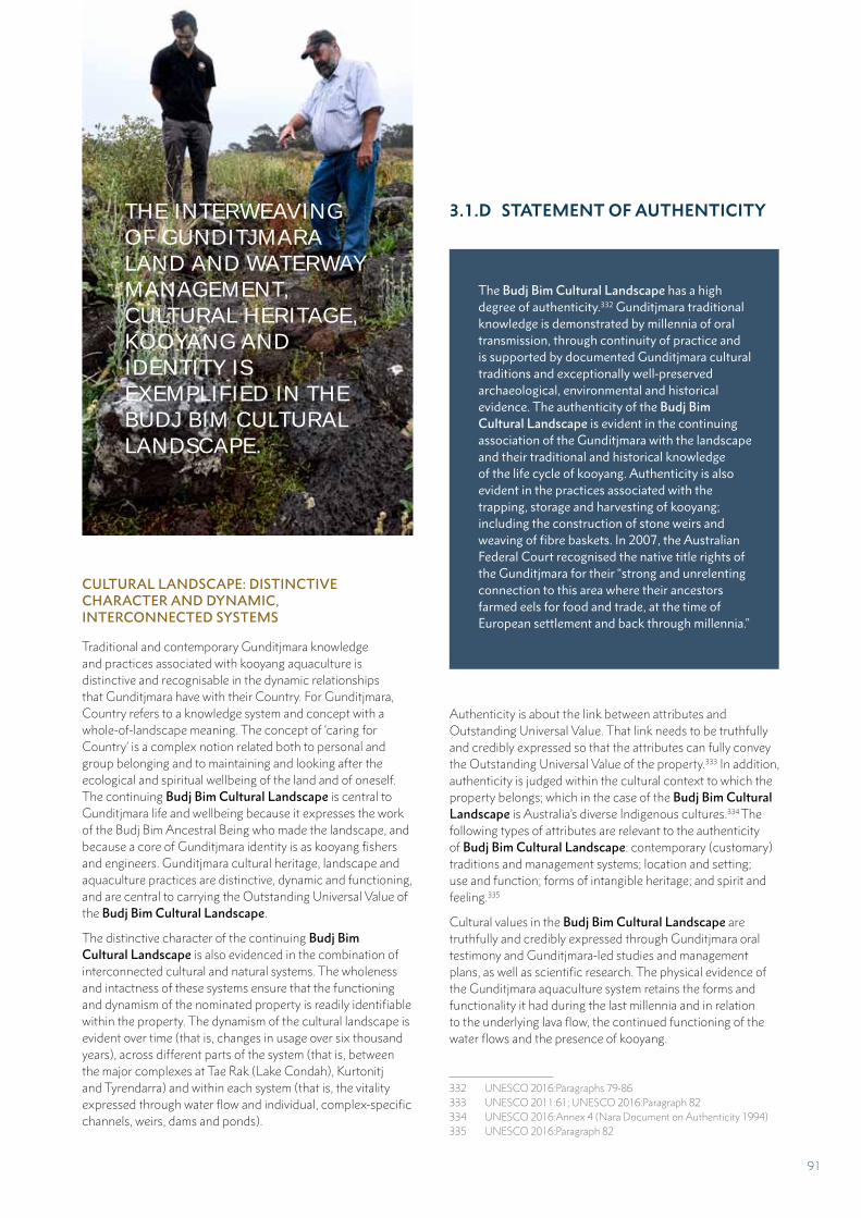
CULTURAL LANDSCAPE: DISTINCTIVE CHARACTER AND DYNAMIC, INTERCONNECTED SYSTEMS
Traditional and contemporary Gunditjmara knowledge and practices associated with kooyang aquaculture is distinctive and recognisable in the dynamic relationships that Gunditjmara have with their Country. For Gunditjmara, Country refers to a knowledge system and concept with a whole-of-landscape meaning. The concept of ‘caring for Country’ is a complex notion related both to personal and group belonging and to maintaining and looking after the ecological and spiritual wellbeing of the land and of oneself. The continuing Budj Bim Cultural Landscape is central to Gunditjmara life and wellbeing because it expresses the work of the Budj Bim Ancestral Being who made the landscape, and because a core of Gunditjmara identity is as kooyang fishers and engineers. Gunditjmara cultural heritage, landscape and aquaculture practices are distinctive, dynamic and functioning, and are central to carrying the Outstanding Universal Value of the Budj Bim Cultural Landscape.
The distinctive character of the continuing Budj Bim Cultural Landscape is also evidenced in the combination of interconnected cultural and natural systems. The wholeness and intactness of these systems ensure that the functioning and dynamism of the nominated property is readily identifiable within the property. The dynamism of the cultural landscape is evident over time (that is, changes in usage over six thousand years), across different parts of the system (that is, between the major complexes at Tae Rak (Lake Condah), Kurtonitj and Tyrendarra) and within each system (that is, the vitality expressed through water flow and individual, complex-specific channels, weirs, dams and ponds).
3.1.D STATEMENT OF AUTHENTICITY
The Budj Bim Cultural Landscape has a high degree of authenticity.332 Gunditjmara traditional knowledge is demonstrated by millennia of oral transmission, through continuity of practice and is supported by documented Gunditjmara cultural traditions and exceptionally well-preserved archaeological, environmental and historical evidence. The authenticity of the Budj Bim Cultural Landscape is evident in the continuing association of the Gunditjmara with the landscape and their traditional and historical knowledge of the life cycle of kooyang. Authenticity is also evident in the practices associated with the trapping, storage and harvesting of kooyang; including the construction of stone weirs and weaving of fibre baskets. In 2007, the Australian Federal Court recognised the native title rights of the Gunditjmara for their “strong and unrelenting connection to this area where their ancestors farmed eels for food and trade, at the time of European settlement and back through millennia.”
Authenticity is about the link between attributes and Outstanding Universal Value. That link needs to be truthfully and credibly expressed so that the attributes can fully convey the Outstanding Universal Value of the property.333 In addition, authenticity is judged within the cultural context to which the property belongs; which in the case of the Budj Bim Cultural Landscape is Australia’s diverse Indigenous cultures.334 The following types of attributes are relevant to the authenticity of Budj Bim Cultural Landscape: contemporary (customary) traditions and management systems; location and setting; use and function; forms of intangible heritage; and spirit and feeling.335
Cultural values in the Budj Bim Cultural Landscape are truthfully and credibly expressed through Gunditjmara oral testimony and Gunditjmara-led studies and management plans, as well as scientific research. The physical evidence of the Gunditjmara aquaculture system retains the forms and functionality it had during the last millennia and in relation to the underlying lava flow, the continued functioning of the water flows and the presence of kooyang.
332 UNESCO 2016:Paragraphs 79-86333 UNESCO 2011:61; UNESCO 2016:Paragraph 82334 UNESCO 2016:Annex 4 (Nara Document on Authenticity 1994)335 UNESCO 2016:Paragraph 82
THE INTERWEAVING OF GUNDITJMARA LAND AND WATERWAY MANAGEMENT, CULTURAL HERITAGE, KOOYANG AND IDENTITY IS EXEMPLIFIED IN THE BUDJ BIM CULTURAL LANDSCAPE.
91
EXCEPTIONAL EVIDENCE
Together, the physical elements that make up the interconnected Gunditjmara aquaculture systems occur in various combinations with the largest and best preserved complexes located at Tae Rak (Lake Condah), Tyrendarra and Kurtonitj. The physical evidence of Gunditjmara aquaculture is supported by exceptionally well preserved archaeological, environmental and historical evidence.
1. The exceptional historical evidence for the Gunditjmara aquaculture system takes two forms: traditional and contemporary Gunditjmara knowledge and practices, and supporting historical records. Gunditjmara knowledge and practices concerning kooyang (eel) aquaculture are living and continue to the present day. This knowledge has been documented in historical records, including 19th century descriptions by individuals such as George Augustus Robinson, James Dawson and Alexander Ingram; in Mission records; in recorded oral accounts by the Gunditjmara themselves; and in the Australian Federal Court’s native title consent determination.
2. The environmental evidence is provided by studies of the past and present biodiversity and geomorphology. The primary data used to reconstruct the ancient environments of the Budj Bim Cultural Landscape are pollen records. Pollen records from Tae Rak and Lake Surprise suggest that it was not until after 12,000 and most likely around 7,500 years ago; when increases in annual rainfall and changes in water quality and vegetation and the presence of kooyang made conditions suitable for “the major exploitation of Budj Bim resources”.336 This finding is complemented by evidence confirming a date of at least 6,600 years ago for the commencement of Gunditjmara aquaculture.
3. The archaeological evidence is the result of more than 40 years of field survey, recording, analysis and excavation (Part 2.B). This evidence includes extensive records of the eight largest and best-preserved aquaculture complexes; as well as a number of smaller, subsidiary facilities. Archaeological excavations at the Muldoons Trap Complex revealed two stages of construction: an early stage strongly suggested to have occurred at least 6,600 years ago, and a more recent stage occurring within the past 800 years.337 In addition, archaeological excavation has demonstrated continuity of settlement of the Budj Bim Cultural Landscape throughout the period of European settlement and occupation, including during the early colonial period (1830s-1860s).
336 Kershaw 2013:100-101337 McNiven and Bell 2010; McNiven et al. 2012, 2015
Criterion (iii)
The cultural values of the Budj Bim Cultural Landscape are truthfully and credibly expressed through cultural traditions, oral testimony, scientific research and Gunditjmara-led studies and plans that address the following attributes of authenticity: traditions, techniques and management systems; language and other forms of intangible heritage; location and setting; use and function; and spirit and feeling. Gunditjmara traditional knowledge is demonstrated by millennia of oral transmission, through continuity of practice and is supported by documented Gunditjmara cultural traditions and exceptionally well preserved archaeological, environmental and historical evidence. The authenticity of the nominated property is evident in the continuing Gunditjmara ownership of their landscape and their traditional and historical knowledge, the reinstatement of the cultural weir at Tae Rak and ongoing research of water flow, wetland ecology and the life cycle of kooyang. Authenticity is also evident in the practices associated with their kooyang trapping, storing and harvesting, including the construction of wood weirs and weaving of fibre baskets and sourcing of natural fibres.
TRADITIONS, TECHNIQUES AND MANAGEMENT SYSTEMS
Traditional and contemporary Gunditjmara knowledge and management practices concerning kooyang (eel) aquaculture have, and continue to be, transmitted to generations of community members through their Elders and through the work of Gunditjmara researchers. This practice is well documented in Gunditjmara histories (both oral and written) and supported by detailed and credible documentation by observers and scholars since the 1840s.
During this 180-year period, Gunditjmara traditions, techniques and management systems have been retained, but also adapted and evolved to changing circumstances – associated with dispossession and colonisation (1830s-1960s), the Mission period (1867-1918), its aftermath (1920s-1950s), the period of Gunditjmara loss of land and access to Country (1960s-1970s), and the return of traditional lands to the Gunditjmara (1980s-present) (Part 2.B). For example, traditional weaving to manufacture fibre baskets for
92
catching and channelling kooyang has remained relatively unchanged. As elsewhere in Indigenous Australia, the Gunditjmara adapted their techniques to incorporate new materials. For the Gunditjmara, the methods for trapping and harvesting kooyang have been adapted to incorporate the use of alternative materials; including for example, wire-mesh and nylon nets and wood-frame storage containers. In each case, the new objects continue to be used to undertake traditional functions. Ultimately, the material culture of kooyang aquaculture has both evolved and retained traditional functions.
Equally, management approaches concerned with the cultural heritage of kooyang aquaculture have evolved to become a mixture of traditional and scientific knowledge and approaches. This mix is demonstrated in the three management plans that cover the Budj Bim Cultural Landscape and that comprise the documentation of the management system for the nominated property (Part 5.E).338
LANGUAGE AND OTHER FORMS OF INTANGIBLE HERITAGE
A variety of forms of intangible heritage are intrinsically linked to the Gunditjmara aquaculture system. These include a revival in the use of language associated with Gunditjmara aquaculture (see word list); as well as weaving using natural puunyaart (grass) fibres to manufacture gnarraban (kooyang baskets), a practice and skill practiced by Gunditjmara women today. The making of possum skin cloaks has also been reinvigorated and includes the creation of traditional and contemporary designs etched into the cloaks to represent Gunditjmara landscapes, aquaculture networks and identities. A final form of intangible heritage associated with Gunditjmara aquaculture is dance; which is used to engage children, youth and adults in transferring knowledge of Gunditjmara culture. Amongst the dances created and performed by The Fighting Gunditjmara dance group is an ‘Eel Dance’. Language, weaving and dance represent traditional and revitalised forms of Gunditjmara knowledge and practice that truthfully and credibly express, and are intimately connected to, kooyang aquaculture.
LOCATION AND SETTING
Budj Bim Cultural Landscape is located wholly within the traditional Country of the Gunditjmara people; and this has been the case for thousands of years. The most outstanding and well-preserved Gunditjmara aquaculture complexes are situated within the boundaries of the nominated property. In turn, the aquaculture system is set within the spiritual and ecological landscape created by the Budj Bim Ancestral Being (a significant part of whom is located within the nominated property) and the volcanic lava flow (large and representative examples of the Budj Bim lava flow are included within the nominated property boundaries). Thus Gunditjmara cultural
338 GMTOAC 2015; Parks Victoria 2015; Winda-Mara Aboriginal Corporation 2015
traditions, knowledge, practices and ingenuity are attributes that are fully and credibly expressed within the nominated property.
USE AND FUNCTION
The form of the Gunditjmara kooyang aquaculture system has remained relatively unchanged for thousands of years. The system of creating channels (yereoc), weirs (from both stone and wood) and dams and modifying ponds and sinkholes is a continuing practice. Some knowledge concerning the functioning of the Gunditjmara aquaculture network was ‘lost’ during the 20th century, particularly when access to such places was restricted because of private ownership by non-Aboriginal people. Nevertheless, contemporary Gunditjmara aquaculture knowledge and practices are continuing and being renewed and revitalised because of recorded knowledge, historical documentation and contemporary adaptation.
Water flow – which is an attribute of the Gunditjmara aquaculture system, has been substantially returned to the Tae Rak-Killara system as a result of the Gunditjmara initiating the construction of a cultural weir on Tae Rak in 2010 (Part 2.B). This important ecological restoration, and the return of additional water to the aquaculture system, continues to enhance understanding of the system and has enabled the Gunditjmara to recollect oral and written knowledge associated with the functioning of the kooyang aquaculture network. Water flow is a key attribute in the Gunditjmara aquaculture system and its cultural significance is demonstrated in the millennia long practices of manipulating, modifying and managing water. Knowledge of how all parts of the system worked is not complete; for those systems that require higher-than-current water levels in order to function, for example. Thus, there are aspects of the aquaculture system that remain to be investigated.
SPIRIT AND FEELING
The return of Country and the renewal of Gunditjmara knowledge and practices concerning aquaculture have been powerful actions that have maintained and revitalised the Gunditjmara’s sense of spirit and feeling for the Budj Bim Cultural Landscape. This emotional response to the cultural landscape is evidenced and represented in the following statements.
We as Aboriginal people feel that without land you don’t have a spirit. Our connection to the land is that the land is our mother, it gave birth to us, it created all the things that are there for us as a people. This connection to the land is so strong that spiritually, religiously, culturally, it contains all the dreaming that we believe in as Aboriginal people. (Uncle John Lovett)339
339 Winda-Mara Aboriginal Corporation cultural display information panel, Heywood
93
Walking the land is important to us because we love the land. The land talks to us; it sings songs and talks to us. Even the birds tell us things … Each animal’s got a story to tell. We’ve still got those things. They’re still here. They’re very important. This is the spirituality we’ve got. We walk this land and we listen and we see and hear them all. Because we love the land we get messages from this and that. (Aunty Iris Lovett-Gardiner)340
Criterion (v)
The cultural values of the Budj Bim Cultural Landscape are truthfully and credibly expressed through oral testimony, scientific research, and Gunditjmara-led studies and plans that address the following attributes of authenticity: traditions, techniques and management systems; location and setting; and use and function. The outstanding attributes of Gunditjmara aquaculture comprise traditional and contemporary Gunditjmara knowledge and practice and the interconnected Budj Bim lava flow, Tae Rak-Killara water flow and the modified environment to support kooyang husbandry. All components of these inter-related systems continue to function at a high level, and thus underpin the Outstanding Universal Value of the continuing Budj Bim Cultural Landscape.
TRADITIONS, TECHNIQUES AND MANAGEMENT SYSTEMS
The contemporary management of the Gunditjmara aquaculture network is marked by a revitalised and robust Gunditjmara management system which draws on credible traditional and scientific knowledge and practices. This shared, or two-way, knowledge has enabled the enacting of a collaborative, customary and adaptive management framework (Part 5.E). Initially the management framework has focussed on renewing and re-learning traditional skills (cultural burning practice, for example) and removing threats to the aquaculture features (including regrowth of trees in channels and returning water flows to the system). To complement this knowledge, the Gunditjmara will continue to revitalise practices of kooyang (eel) management, storage and husbandry through the careful
340 Winda-Mara Aboriginal Corporation cultural display information panel, Heywood
and considered repair of cultural features and restoration of water flows. Thus, the Gunditjmara aquaculture management system and approach to continuing, renewing and maintaining the attributes of the system serve to truthfully and credibly convey the Outstanding Universal Value of the Budj Bim Cultural Landscape.341
LOCATION AND SETTING
The location and setting of the Budj Bim Cultural Landscape, within Tungatt Mirring (Stone Country) and the Budj Bim lava flow, has remained relatively unchanged over millennia. Despite significant changes to the local hydrology in the late-19th and mid-20th centuries, the construction of a cultural weir on Tae Rak (Lake Condah) in 2010 has largely returned and enhanced the hydrology of the system to its original functioning. Thus, the interconnected physical attributes of the Gunditjmara aquaculture system – the elements of the aquaculture system (channels, weirs, dams, ponds and sinkholes), the Budj Bim lava flow, the Tae Rak-Killara catchment water flow and the modified environment to support kooyang husbandry – continue to operate to a high degree and therefore truthfully and credibly convey the Outstanding Universal Value of the nominated property.
USE AND FUNCTION
Based on Gunditjmara knowledge and practices and supported by credible historical, archaeological and environmental evidence, the use and function of the aquaculture system is well understood and documented.342 Peer reviewed archaeological research investigations have shown that the Gunditjmara aquaculture system is at least 6,600 years old.343 The Gunditjmara aquaculture system has been extensively and well documented as a result of over 40 years of archaeological field survey, recording, analysis and excavation; although further documentation is still required for the Kurtonitj aquaculture complex.344 In addition, there remains enormous potential for continuing discovery and insight into the past use of the Gunditjmara aquaculture system, including the possibility of uncovering evidence of aquaculture earlier than 6,600 years ago.
The Victorian Government (Aboriginal Victoria) and the Gunditjmara maintain and manage the extensive records documenting the aquaculture system. More than 100 aquaculture features have been documented within the Budj Bim Cultural Landscape and more than 50 reports prepared that relate to the Gunditjmara aquaculture system.
341 UNESCO 2011:61; UNESCO 2016:Paragraph 82342 McNiven 2015; McNiven and Bell 2010;343 McNiven et al. 2012, 2015344 Lane 2006
94
In a general sense, the function of the Gunditjmara aquaculture system has survived unchanged over millennia. However, in the time since 1830 – when European colonists first occupied Gunditjmara Country, access to all parts of the aquaculture network gradually decreased for the Gunditjmara. This was particularly the case in the 1960s and 1970s due to the privatisation of lands on which the largest complexes are situated. However, this situation changed dramatically from the 1980s as areas of land within Country were progressively returned to the Gunditjmara. Access to and management control of all parts of the Budj Bim Cultural Landscape has enabled the Gunditjmara to renew the intensity of maintenance of the system with respect to the physical culture heritage features themselves, as well as the return of water flows and the accompanying increase in abundance of kooyang.
Like Gunditjmara culture, Gunditjmara aquaculture is a continuing practice that has adapted to changing times, as well as being enhanced and revitalised by the return of access to their traditional Country and by the renewal of water flows. Additionally, despite the ravages of the 20th century caused by the draining of the waterways and wetlands, damage from domestic stock grazing and the introduction of pest plant species and animal species, the landscape has proven to be resilient and the stone aquaculture features remain relatively intact and in situ.
3.1.E PROTECTION AND MANAGEMENT REGIME
A comprehensive management system has been developed to ensure the highest level of protection of the Budj Bim Cultural Landscape (Part 5). The management system is comprised of five interconnected elements:
1. Gunditjmara Traditional Owner customary rights and obligations, including legal recognition of such under the Australian Federal Court’s 2007 Native Title determination
2. Aboriginal ownership and/or cooperative management of all components of the nominated area (Part 5.A)
3. Comprehensive legislative, regulatory and statutory controls at Australian, Victorian and local government levels (Part 5.B)
4. Integrated governance with an emphasis on local-level decision making and implementation (Part 5.C)
5. A complementary suite of management plans, goals and strategies that combine Gunditjmara knowledge and practices with contemporary science and adaptive management practices (Part 5.D).
In the event that the Budj Bim Cultural Landscape is inscribed on the World Heritage List, it is the intention of the Gunditj Mirring Traditional Owners Aboriginal Corporation (GMTOAC), Winda-Mara Aboriginal Corporation and the Australian and Victorian governments that a Budj Bim Cultural Landscape World Heritage Strategic Management Framework be developed and adopted. While the Budj Bim Cultural Landscape is comprehensively protected and managed under the current management system, a strategic management framework will synthesise and further consolidate these current arrangements. In addition, the implementation and oversight of the framework will be undertaken by a Budj Bim Cultural Landscape World Heritage Steering Committee. This group will be established at such time as the nominated property is inscribed on the World Heritage List. Together, the Strategic Management Framework and the Steering Committee will provide the mechanism for ensuring the coordinated management of the three serial components of the Budj Bim Cultural Landscape.345
345 UNESCO 2016:Paragraph 114
GUNDITJMARA AQUACULTURE IS A CONTINUING PRACTICE THAT HAS ADAPTED TO CHANGING TIMES, AS WELL AS BEING ENHANCED AND REVITALISED BY THE RETURN OF THEIR TRADITIONAL COUNTRY AND BY THE RENEWAL OF WATER FLOWS.
95
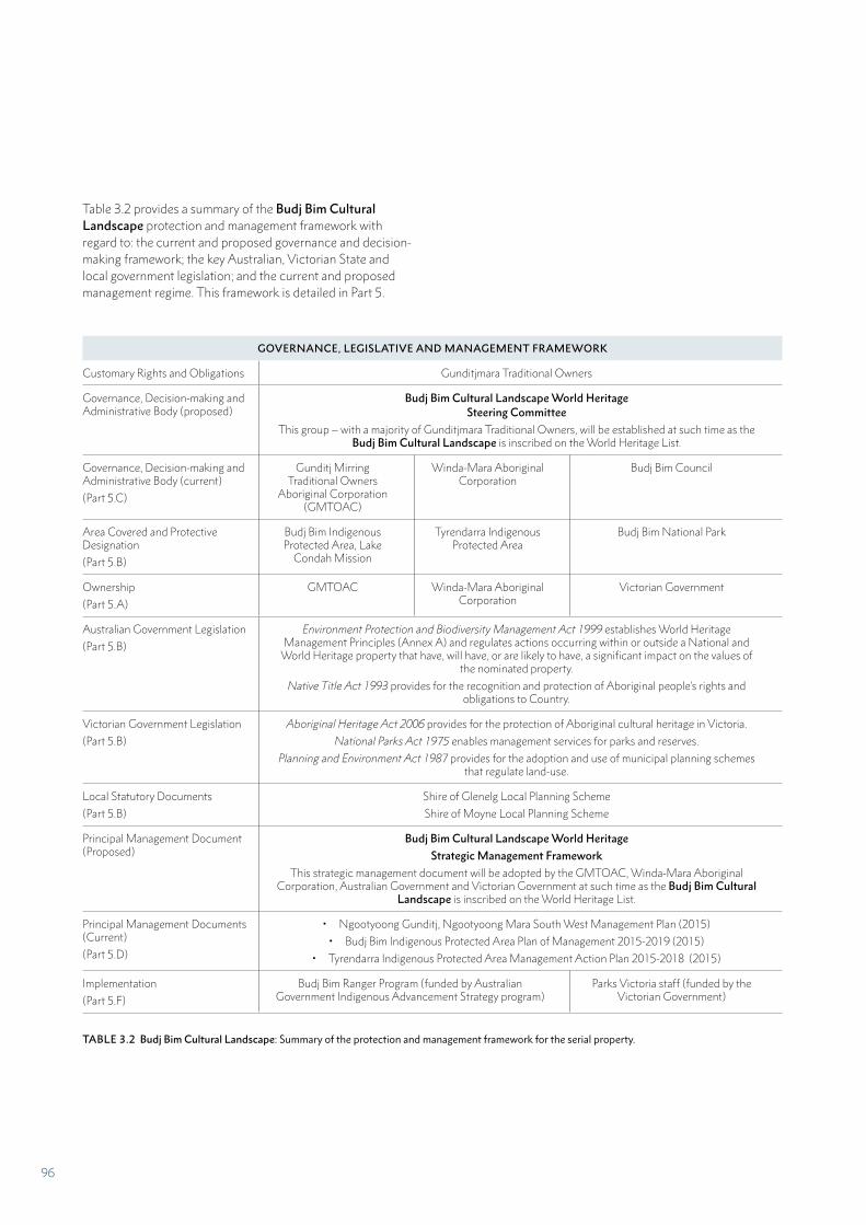
Table 3.2 provides a summary of the Budj Bim Cultural Landscape protection and management framework with regard to: the current and proposed governance and decision-making framework; the key Australian, Victorian State and local government legislation; and the current and proposed management regime. This framework is detailed in Part 5.
GOVERNANCE, LEGISLATIVE AND MANAGEMENT FRAMEWORK
Customary Rights and Obligations Gunditjmara Traditional Owners
Governance, Decision-making and Administrative Body (proposed)
Budj Bim Cultural Landscape World Heritage Steering Committee
This group – with a majority of Gunditjmara Traditional Owners, will be established at such time as the Budj Bim Cultural Landscape is inscribed on the World Heritage List.
Governance, Decision-making and Administrative Body (current)
(Part 5.C)
Gunditj Mirring Traditional Owners
Aboriginal Corporation (GMTOAC)
Winda-Mara Aboriginal Corporation
Budj Bim Council
Area Covered and Protective Designation
(Part 5.B)
Budj Bim Indigenous Protected Area, Lake
Condah Mission
Tyrendarra Indigenous Protected Area
Budj Bim National Park
Ownership
(Part 5.A)
GMTOAC Winda-Mara Aboriginal Corporation
Victorian Government
Australian Government Legislation
(Part 5.B)
Environment Protection and Biodiversity Management Act 1999 establishes World Heritage Management Principles (Annex A) and regulates actions occurring within or outside a National and
World Heritage property that have, will have, or are likely to have, a significant impact on the values of the nominated property.
Native Title Act 1993 provides for the recognition and protection of Aboriginal people’s rights and obligations to Country.
Victorian Government Legislation
(Part 5.B)
Aboriginal Heritage Act 2006 provides for the protection of Aboriginal cultural heritage in Victoria.
National Parks Act 1975 enables management services for parks and reserves.
Planning and Environment Act 1987 provides for the adoption and use of municipal planning schemes that regulate land-use.
Local Statutory Documents
(Part 5.B)
Shire of Glenelg Local Planning Scheme
Shire of Moyne Local Planning Scheme
Principal Management Document (Proposed)
Budj Bim Cultural Landscape World Heritage
Strategic Management Framework
This strategic management document will be adopted by the GMTOAC, Winda-Mara Aboriginal Corporation, Australian Government and Victorian Government at such time as the Budj Bim Cultural
Landscape is inscribed on the World Heritage List.
Principal Management Documents (Current)
(Part 5.D)
• Ngootyoong Gunditj, Ngootyoong Mara South West Management Plan (2015)
• Budj Bim Indigenous Protected Area Plan of Management 2015-2019 (2015)
• Tyrendarra Indigenous Protected Area Management Action Plan 2015-2018 (2015)
Implementation
(Part 5.F)
Budj Bim Ranger Program (funded by Australian Government Indigenous Advancement Strategy program)
Parks Victoria staff (funded by the Victorian Government)
TABLE 3.2 Budj Bim Cultural Landscape: Summary of the protection and management framework for the serial property.
96
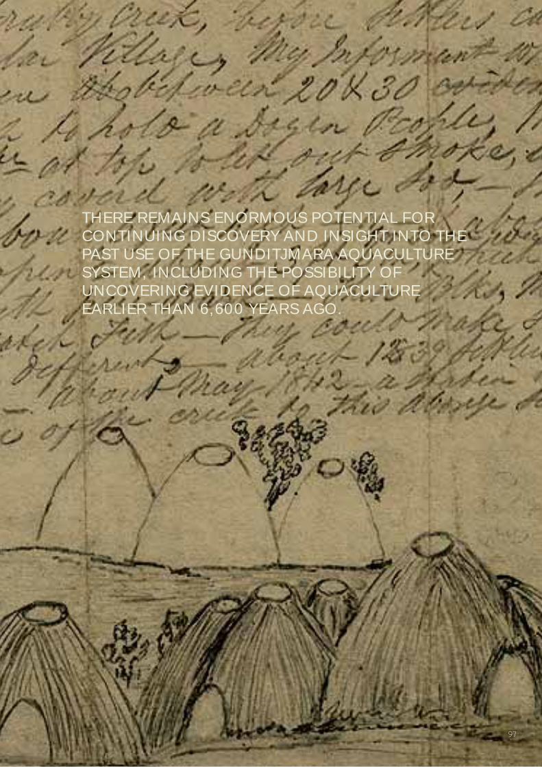
THERE REMAINS ENORMOUS POTENTIAL FOR CONTINUING DISCOVERY AND INSIGHT INTO THE PAST USE OF THE GUNDITJMARA AQUACULTURE SYSTEM, INCLUDING THE POSSIBILITY OF UNCOVERING EVIDENCE OF AQUACULTURE EARLIER THAN 6,600 YEARS AGO.
97
FRAMEWORK FOR MANAGEMENT AND PROTECTION
The Budj Bim Cultural Landscape comprises lands owned by the Gunditj Mirring Traditional Owners Aboriginal Corporation (GMTOAC) and Winda-Mara Aboriginal Corporation, and – in the case of Budj Bim National Park, a co-operative management arrangement between the Gunditjmara Traditional Owners and Parks Victoria. Thus, in recognition of Aboriginal ownership and/or management of the entirety of the nominated property, the rights and obligations of Gunditjmara Traditional Owners underpin the protection and management system.
The Budj Bim Cultural Landscape does not have a buffer zone. The setting is protected by the Australian Government’s Environment Protection and Biodiversity Conservation Act 1999. This legislation is supported by a combination of Victorian Government laws and local government land use planning schemes. Collectively these legislative and statutory arrangements mean that a formally designated buffer zone is not required to protect the outstanding heritage attributes and values of the nominated property.
Legislative framework
Legislation and associated planning and protection instruments have been established across three levels of government – Australian, Victorian State and local – to ensure the Budj Bim Cultural Landscape’s heritage attributes and values are comprehensively protected and managed. These legislative regimes are outlined below and discussed in detail in Part 5.B.
Australian Government legislation
The majority of the Budj Bim Cultural Landscape is currently included on Australia’s National Heritage List. It is recognised as a ‘Matter of National Environmental Significance’ protected from significant impacts by the Environment Protection and Biodiversity Conservation Act 1999 (EPBC Act). Once included on the World Heritage List, the entire nominated property will be recognised as a Matter of National Environmental Significance and protected from significant impacts by the EPBC Act. The EPBC Act regulates actions occurring within or outside a World Heritage property that have, will have, or are likely to have, a significant impact on the values of the property. The Environment Protection and Biodiversity Conservation Regulations 2000 establish World Heritage management principles (Annex A of this Nomination Dossier) that will apply to the nominated property at such time as it is inscribed on the World Heritage List.
The primary purpose of management of natural heritage and cultural heritage of a declared World Heritage property must be, in accordance with Australia’s obligations under the World Heritage Convention, to identify, protect, conserve, present, transmit to future generations and, if appropriate, rehabilitate the World Heritage values of the property. This includes developing a management plan for each declared world heritage property.
Victorian Government legislation
A suite of Victorian State laws protect the attributes and values of the Budj Bim Cultural Landscape. The Aboriginal Heritage Act 2006 establishes the GMTOAC as a Registered Aboriginal Party for the area which includes the nominated property. Registered Aboriginal Party status provides decision-making responsibilities to the Gunditjmara for protecting Aboriginal cultural heritage in their Country. Under the Aboriginal Heritage Regulations 2007, the Budj Bim lava flow is recognised as an area of cultural heritage sensitivity within which the removal of stone requires a permit.346 The Victorian National Parks Act 1975 protects the cultural and natural values of parks and reserves, including those of Budj Bim National Park. The Victorian Local Government Act 1989 requires that planning undertaken by each local government authority is consistent with a municipal planning scheme approved under the Planning and Environment Act 1987. The nominated property lies within the boundaries of two local councils: Glenelg and Moyne Shires.
Management and governance framework
The Australian Federal Court’s determination on 30 March 2007 recognised the Gunditjmara’s native title rights and interests over lands including Budj Bim National Park. Subsequently, the Gunditjmara and the Victorian Government established a co-operative management arrangement for Budj Bim National Park.347 Much of the remainder of the nominated property is Aboriginal-owned land that has been designated as the Budj Bim and Tyrendarra Indigenous Protected Areas. Consequently, the decision-making and administrative bodies that oversee and cooperate in the protection and management of the Budj Bim Cultural Landscape are the GMTOAC, Winda-Mara Aboriginal Corporation and the Budj Bim Council.
The Budj Bim Council was established as part of the co-operative management arrangement between the GMTOAC and the Victorian Government. The Budj Bim Council comprises representatives of Gunditjmara Traditional Owners (six members), Parks Victoria (two members), the Department of Environment, Land, Water and Planning (one member) and the Glenelg Hopkins Catchment Management Authority (one member). The Budj Bim Council’s role is to manage Budj Bim National Park to achieve both cultural and ecological objectives through joint decision-making. The primary management document developed by, and guiding the work of, the Budj Bim Council is the Parks Victoria 2015 Ngootyoong Gunditj, Ngootyoong Mara South West Management Plan.348 The implementation of the Management Plan (including operational planning, on-ground management,
346 Aboriginal Heritage Regulations 2007:Division 3, s33. The Victorian Government intends to extend protection of the Budj Bim Cultural Landscape to include Aboriginal intangible heritage.
347 Parks Victoria 2015:6 348 Parks Victoria 2015
98
monitoring and visitor presentation) is undertaken by staff employed by Parks Victoria, including Gunditjmara employees.
The 2015 Ngootyoong Gunditj, Ngootyoong Mara South West Management Plan establishes the customary and adaptive management approach for the Budj Bim Cultural Landscape.349 It is a strategic guide for managing and protecting over 130 Parks, Reserves and Indigenous Protected Areas in south-west Victoria and incorporates the three serial components of the nominated property. The plan integrates Gunditjmara Traditional Owners’ knowledge into all aspects of protection and management. In addition, two specific sub-management plans have been developed for the Gunditjmara-owned Budj Bim and Tyrendarra Indigenous Protected Areas.350
The Gunditj Mirring Traditional Owners Aboriginal Corporation (GMTOAC) was established in 2005 and, following the 2007 native title determination, holds and manages the native title rights of the Gunditjmara.351 The corporation is a Registered Native Title Body Corporate under the Australian Government Native Title Act 1993 and a Registered Aboriginal Party under the Victorian Aboriginal Heritage Act 2006.352 The GMTOAC promotes the continuing connection to Country by the Gunditjmara through its caring for Country programs and projects. The GMTOAC is the owner and manager of the Budj Bim Indigenous Protected Area and Lake Condah Mission.
Winda-Mara Aboriginal Corporation, established in 1992, provides services to the local Aboriginal communities in and around the far south-west Victorian towns of Heywood, Hamilton and Portland.353 Winda-Mara Aboriginal Corporation is the owner and manager of the Tyrendarra Indigenous Protected Area. It undertakes cultural heritage and land management initiatives in partnership with GMTOAC, as well as with key government agencies and non-government organisations. The Winda-Mara Aboriginal Corporation employs the Budj Bim Rangers who carry out land management and monitoring activities across all parts of the Budj Bim Cultural Landscape.
349 Parks Victoria 2015. This management plan was a partnership be-tween GMTOAC, Parks Victoria, Budj Bim Council and Department of Environment, Land, Water and Planning and was approved by each of the four organisations.
350 GMTOAC 2015; Winda-Mara Aboriginal Corporation 2015351 Gunditj Mirring Traditional Owners Aboriginal Corporation.
‘Gunditjmara Native Title Determination (Part A and B)’, https://www.gunditjmirring.com/single-post/2014/05/07/Gunditjmara-Native-Title-Determination-Part-A-B
352 Registered 28 May 2007. Aboriginal Victoria. ‘Heritage. Gunditj Mirring Traditional Owners Aboriginal Corporation’, corporation.htmlhttp://www.vic.gov.au/aboriginalvictoria/heritage/registered-ab-original-parties/gunditj-mirring-traditional-owners-aboriginal-corpo-ration.html
353 Winda-Mara Aboriginal Corporation. ‘About’, https://www.win-damara.com.au/about
The Budj Bim Cultural Landscape management system is undertaken through an Adaptive Management Framework (Part 5.E). The Framework allows for ongoing learning by continually assessing the success of actions in meeting management objectives and supporting adjustment to management actions in the future. The Framework requires the integration of various elements of management to provide an approach that systematically tests assumptions, promotes learning and continuous improvement and provides timely information to support management decisions. Ultimately, the Framework seeks to reinforce and encourage the connections between a healthy environment and a healthy society (Ngootyoong Gunditj, Ngootyoong Mara – Healthy Country, Healthy People).
99
3.2 COMPARATIVE ANALYSIS
The findings of the comparative analysis are that:
1. Examination of the World Heritage and Tentative List cultural landscapes identified nine properties that can be used for comparative analysis with Budj Bim Cultural Landscape.
2. The comparative analysis found that although all nine properties evidence an eco-cultural relationship of dynamic manipulation and management of natural resources, this relationship is expressed in diverse cultural practices and attributes that reflect local ecologies. None has a suite of attributes similar to those of the Budj Bim Cultural Landscape as expressed through the Gunditjmara aquaculture system.
3. Budj Bim Cultural Landscape is a rare intact example of an indigenous or traditional cultural landscape in which processes of eel harvesting pattern the landscape. Many other eeling sites known from the historical documentary record including Mt William and Toolondo in Australia, and those of Maori in Aotearoa/New Zealand, have been significantly impacted by processes of colonisation and changing land use. The scale and the ability to ‘read’ the system of aquaculture in the Budj Bim Cultural Landscape makes it not only representative of landscapes created by indigenous use of wetlands and aquatic resources, but also exceptional.
The aim of the cultural comparative analysis is to “explain the importance of the nominated property in its national and international context” by demonstrating there are no other similar properties already on the World Heritage List or on the Tentative Lists, and no comparable sites currently outside the World Heritage system that might be nominated in the future.354 Comparisons should be drawn with properties expressing the same values as the nominated property and within a defined geo-cultural area, but in some cases the geo-cultural framework may be global. 355
In line with UNESCO advice, the comparative analysis of the Budj Bim Cultural Landscape (a serial nomination of three components) is based on the whole property.’356
354 UNESCO 2016:Paragraph 132355 UNESCO 2011:67356 UNESCO 2011:67
ICOMOS has noted that few models exist for the comparative analysis for properties of indigenous values; especially for those, like the Budj Bim Cultural Landscape, where substantial built evidence or large-scale landscape modification does not exist and where the landscape is considered ‘natural’.357
An independent and expert comparative analysis study for the Budj Bim Cultural Landscape was undertaken in 2013 for the Gunditjmara and the Victorian Government.358 The study describes the Budj Bim Cultural Landscape as an exemplar of cultural landscapes in which human interaction with the environment is an eco-cultural relationship of dynamic manipulation and management of natural resources (see Section 2A). These cultural landscapes are indicative of very long-term cultural interactions with the environment. The practices of resource manipulation and management may be continuing or may have ceased, but cultural knowledge of the resource and the cultural association of a traditional community with the landscape continues
At their most general and for the purposes of comparative analysis, cultural landscapes that are comparable with Budj Bim Cultural Landscape will have the following characteristics:
1. The values of the landscape are indicative of the longevity of systems of knowledge and cultural practices expressed through interaction with the environment
2. The tangible evidence in the landscape reflects a continuing cultural tradition of use and management of a natural resource over a very long time period
3. The use, manipulation or management of natural resources is expressed in evidence of these practices at a landscape scale
4. The landscape evidence may also demonstrate increasing specialisation and intensity in the use of natural resources over time
5. Some landscapes will have evidence of the manipulation or use of water, water resources or hydrological systems.
The longevity of cultural connection to landscapes means that they will be associated with non-agricultural, small-scale cultivating societies. A significant subset of these landscapes will have evidence of the manipulation or use of water, water resources or hydrological systems (point 5 above); but this is not the primary characteristic for their selection as sites of comparative value.
357 ICOMOS 2016:65358 Context 2013a: Anita Smith was the principal author of the study.
Ian McNiven provided specialist input.
100
COMPARATIVE ANALYSIS OF SITES SELECTED FOR COMPARISON
The selection of sites for comparison with the Budj Bim Cultural Landscape draws from the UNESCO World Heritage List, the Tentative Lists and other sites from within Australia, the region and globally. Cultural landscapes selected for comparative analysis align with the characteristics of the Budj Bim Cultural Landscape, listed above.
They include both relict and continuing cultural landscapes created by communities over long periods of time in Europe, Africa, Australia, the Pacific Islands and North and South America. In some examples, the cultural processes that patterned the landscape have ceased to be practised, but in others – including the nominated property – the knowledge of these practices and traditional associations with the landscape continue, or have been adapted and are expressed in new ways. In each, these values are expressed in tangible evidence that directly reflects a community’s use of resources available in the local environment.
Table 3.3 lists cultural landscapes on the World Heritage List and Tentative Lists that have values similar to those of Budj Bim Cultural Landscape for the purposes of comparative analysis.
COMPARISON WITH SITES ON THE WORLD HERITAGE LIST
There are currently 1,073 properties inscribed on the World Heritage List. Of these, 832 are inscribed on cultural criteria of which 91 are designated as cultural landscapes. An initial review of cultural landscapes on the World Heritage List drew the following conclusions:
• A number of World Heritage properties are traditional cultural landscapes with primarily associative values. That is, their Outstanding Universal Value is primarily or exclusively intangible values; being storied landscapes or having spiritual or other cultural associations with ‘natural’ elements of the landscape. These include: Papahanamokuakea (Hawaii, United States of America), Uluru Kata-Tjuta (Australia), Chief Roi Mata’s Domain (Vanuatu) and Tongariro National Park (Aotearoa/New Zealand). Of these, only Uluru-Kata-Tjuta is associated with a non-agricultural society. In this latter site, a Statement of Outstanding Universal Value has not yet been developed, however the management of the cultural landscape is governed by the tjukurpa (law) of Anangu Traditional Owners and documented in rock art. Cultural practices such as burning are also part of the management regime for the property.
• A number of World Heritage properties are traditional cultural landscapes in which the Outstanding Universal Value is primarily expressed in rock art. These include five properties inscribed as cultural landscapes – Matobo Hills (Zimbabwe), Tsodilo (Botswana), Rock Shelters
of Bhimbtetka (India), Gorbustan Rock Art Cultural Landscape (Azerbaijan) and Petroglyphs within the Archaeological Landscape of Tamgaly (Kazakhstan) - and Kakadu National Park (Australia).359 Although all reflect the values of non-agricultural societies in their earliest rock art depictions and all provide evidence of natural resource exploitation over a long time period, evidence expressed through rock art is of a substantially different order to that of the Budj Bim Cultural Landscape. In the Budj Bim Cultural Landscape the evidence of natural resource exploitation is directly related to the processes of manipulation of the resources and their exploitation as expressed in the landscape; rather than through a visual depiction. In this sense, the Budj Bim Cultural Landscape is a direct outcome of the interaction of people and the landscape – rather than a depiction of those processes.
• A number of World Heritage properties are cultural landscapes associated with traditional systems of water manipulation. These include Cultural Landscapes of Bali Province (Indonesia), Aflaj systems of Oman (Oman), Rice Terraces of the Cordilleros (Philippines) and Cultural Landscape of the Honghe Hani Terraces (China).360 Although in each there is evidence for an increasing intensity in the manipulation of the water flow or system and each reflects traditional ecological knowledge of water as a natural resource; in all landscapes the manipulation of water is associated with irrigation to support large-scale agriculture.
Five World Heritage cultural landscapes were identified as having Outstanding Universal Value that is similar to the potential Outstanding Universal Value of Budj Bim Cultural Landscape (Table 3.3, Figures 3.1-3.5). These are:
• Saloum Delta, Senegal (inscribed on the World Heritage List in 2011)
• Kuk Early Agricultural Site, Papua New Guinea (2010)
• Head Smashed in Buffalo Jump, Canada (1981)
• Rock Islands Southern Lagoon, Palau (2012)
• Laponian Area, Sweden (1996)
The five properties included in this group are all organically evolved, continuing cultural landscapes and carry Outstanding Universal Value that is specifically related to the sustainable exploitation of natural resources. With the exception of the Rock Islands Southern Lagoon (Palau), all have evidence for increasing intensity in the use of the resources over time and are closely aligned to the Budj Bim Cultural Landscape in their values. In the Saloum Delta (Senegal) and Kuk Early
359 Kakadu National Park was inscribed in 1981 prior to the introduction of the cultural landscape category into the World Heritage system.
360 These properties align with the sub-theme concerning management and control of water as identified in the ICOMOS thematic study – Cultural Heritages of Water in the Middle East and Maghreb (ICOMOS 2015)
101
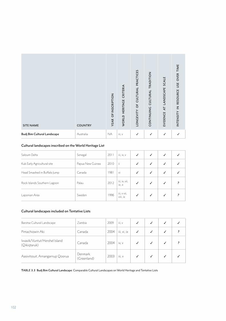
SITE NAME COUNTRY YEA
R O
F IN
SCR
IPT
ION
WO
RL
D H
ERIT
AG
E C
RIT
ERIA
Budj Bim Cultural Landscape Australia NA iii, v ✓ ✓ ✓ ✓
Cultural landscapes inscribed on the World Heritage List
Saloum Delta Senegal 2011 iii, iv, v ✓ ✓ ✓ ✓
Kuk Early Agricultural site Papua New Guinea 2010 ii ✓ ✓ ✓ ✓
Head Smashed in Buffalo Jump Canada 1981 vi ✓ ✓ ✓ ✓
Rock Islands Southern Lagoon Palau 2012 iii, iv, vii, ix, x ✓ ✓ ✓ ?
Laponian Area Sweden 1996 iii, v vii, viii, ix ✓ ✓ ✓ ?
Cultural landscapes included on Tentative Lists
Barotse Cultural Landscape Zambia 2009 iii, v ✓ ✓ ✓ ✓
Pimachiowin Aki Canada 2004 iii, vi, ix ✓ ✓ ✓ ?
Ivvavik/Vuntut/Hershel Island (Qikiqtaruk)
Canada 2004 iv, v ✓ ✓ ✓ ?
Aasivitssuit, Arnangarnup QooruaDenmark (Greenland)
2003 iii, v ✓ ✓ ✓ ✓
TABLE 3.3 Budj Bim Cultural Landscape: Comparable Cultural Landscapes on World Heritage and Tentative Lists
LON
GEV
ITY
OF
CU
LTU
RA
L P
RA
CT
ICES
CO
NT
INU
ING
CU
LTU
RA
L T
RA
DIT
ION
EVID
ENC
E A
T L
AN
DSC
AP
E S
CA
LE
INT
ENSI
TY
IN
RES
OU
RC
E U
SE O
VER
TIM
E
102
Agricultural Site (Papua New Guinea), the evidence for increasing intensity in resource use is associated with active management of the landscape to increase these resources. Head Smashed in Buffalo Jump (Canada) and Laponian Area (Sweden) have millennia-long histories of herding and manipulating large herds of terrestrial animals – buffalo and reindeer respectively.
The Budj Bim Cultural Landscape is a product of interrelated and interconnected cultural and environmental systems – each with its own specific evidence. Similarly, the intersection of natural and cultural systems are clearly evident at the landscape scale in the Saloum Delta, Head Smashed in Buffalo Jump, Laponian Area, and to a lesser extent the drainage systems, mounds and other landscape modifications evident in the archaeological deposits of the Kuk Early Agricultural Site. For the Rock Islands Southern Lagoon, these systems or processes are inferred through the analysis of archaeological deposits.
The Saloum Delta, Head Smashed in Buffalo Jump and Laponian Area have evidence for the processing of shellfish, buffalo and reindeer respectively. In all three the documentary and archaeological record indicates harvesting of these resources in large quantities – probably seasonally; and processing to preserve the food resource for future consumption and/or trade.
Each of these five World Heritage cultural landscapes reflect the traditional ecological knowledge of past and present traditional communities and illustrate cultural practices concerning the exploitation, manipulation and/or management of natural resources that were initiated many thousands of years ago. This may suggest that these values are already well represented on the World Heritage List, however it is evident that this small number of places globally represent a significant diversity of cultural traditions and practices. The attributes of each reflects the specific traditional cultures, environments and the resources that were or are the focus of these communities. None of these properties represent eel aquaculture or the six-millennia longevity of Gunditjmara aquaculture. As a consequence, the five properties are extremely diverse and different expressions of organically evolved cultural landscapes. They are not only located in different environments, but are spread across the globe – in the Pacific Islands, North America, Europe and Africa.
Rather than arguing against there being room on the World Heritage List for the Budj Bim Cultural Landscape, the small number, but great diversity in those cultural landscapes considered here, suggests that the Budj Bim Cultural Landscape – as an Indigenous Australian expression of these values – would fill a gap on the List. The inscription of Budj Bim Cultural Landscape on the World Heritage List will add a further representative example of properties of similar values expressed through a diversity of culturally specific attributes.
COMPARISON WITH SITES ON TENTATIVE LISTS
For the purpose of this comparative assessment, the Tentative Lists database (1,671 sites at October 2017) was searched for places identified as cultural landscapes (approximately 30 sites) and those suggested for nomination under Criterion (v) (over 350 sites), the criterion most commonly associated with cultural landscapes. The sites were assessed in relation to the key attributes and values for the Budj Bim Cultural Landscape. Most of the sites fall into one or more of the following groups:
• Agricultural landscapes, including those with evidence of large-scale manipulation of water to sustain agriculture over a long period of time – for example, Oasis of Fayoum, Hydraulic Remains and Ancient Cultural Landscapes (Egypt)
• Landscapes in which the values are evidenced in settlements and built heritage
• Landscapes with evidence of successive cultures, various land uses and settlements over a long period of time – for example, Valle Calchaqui (Argentina), which has evidence from nomadic hunters to colonial towns over a 12,000-year period
• Landscapes containing archaeological and geological deposits containing evidence of human evolution – for example, Melka Kunture and Bachilt Archaeological Site (Ethiopia)
• Landscapes with values and an extent defined by rock art – for example, Mwela Rock Paintings (Zambia)
• Primarily associative cultural landscapes patterned by the stories and/or spiritual beliefs of traditional peoples.
Ultimately, only four cultural landscapes connected with traditional peoples, their practices and associated with use or harvesting of natural resources were identified from the Tentative Lists as having values comparable to those of the Budj Bim Cultural Landscape (Table 3.3, Figures 3.7-3.10). These are:
• Barotse Cultural Landscape (Zambia)
• Pimachiowin Aki (Canada)
• Ivvavik / Vuntut / Herschel Island (Qikiqtaruk) (Canada)
• Aasivitssuit, Arnangarnup Qoorua (Denmark)
In two of these sites – Barotse Cultural Landscape (Zambia) and Ivvavik / Vuntut / Herschel Island (Qikiqtaruk) (Canada) – these values are primarily or partially expressed in the manipulation of water and/or aquatic water resources. Additionally, in Barotse Cultural Landscape and Aasivitssuit, Arnangarnup Qoorua (Denmark), the evidence indicates an increasing intensity in the exploitation of natural resources over time. All are associated with non-agricultural societies or those practising small-scale cultivation. Pimachiowin Aki (Canada) is not associated with the intensive manipulation of a specific natural resource, but rather a wide range of animal and plant species.
103
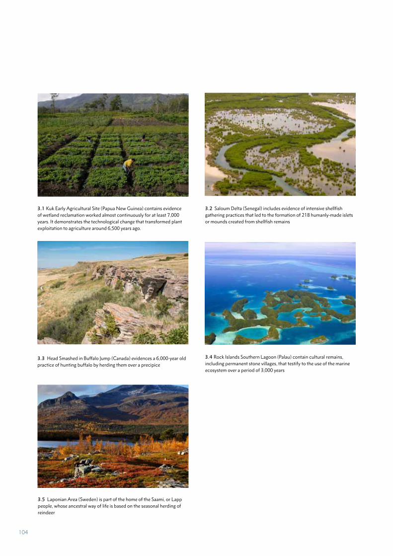
3.1 Kuk Early Agricultural Site (Papua New Guinea) contains evidence of wetland reclamation worked almost continuously for at least 7,000 years. It demonstrates the technological change that transformed plant exploitation to agriculture around 6,500 years ago.
3.2 Saloum Delta (Senegal) includes evidence of intensive shellfish gathering practices that led to the formation of 218 humanly-made islets or mounds created from shellfish remains
3.3 Head Smashed in Buffalo Jump (Canada) evidences a 6,000-year old practice of hunting buffalo by herding them over a precipice
3.4 Rock Islands Southern Lagoon (Palau) contain cultural remains, including permanent stone villages, that testify to the use of the marine ecosystem over a period of 3,000 years
3.5 Laponian Area (Sweden) is part of the home of the Saami, or Lapp people, whose ancestral way of life is based on the seasonal herding of reindeer
104
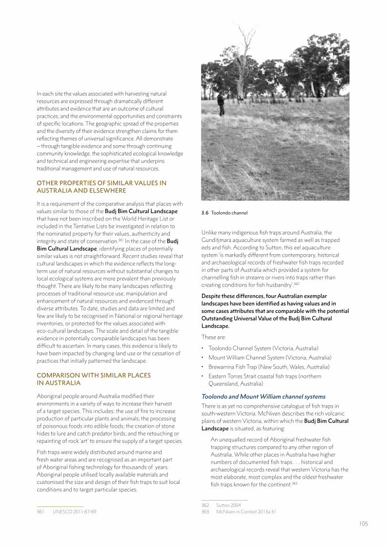
In each site the values associated with harvesting natural resources are expressed through dramatically different attributes and evidence that are an outcome of cultural practices; and the environmental opportunities and constraints of specific locations. The geographic spread of the properties and the diversity of their evidence strengthen claims for them reflecting themes of universal significance. All demonstrate – through tangible evidence and some through continuing community knowledge, the sophisticated ecological knowledge and technical and engineering expertise that underpins traditional management and use of natural resources.
OTHER PROPERTIES OF SIMILAR VALUES IN AUSTRALIA AND ELSEWHERE
It is a requirement of the comparative analysis that places with values similar to those of the Budj Bim Cultural Landscape that have not been inscribed on the World Heritage List or included in the Tentative Lists be investigated in relation to the nominated property for their values, authenticity and integrity and state of conservation.361 In the case of the Budj Bim Cultural Landscape, identifying places of potentially similar values is not straightforward. Recent studies reveal that cultural landscapes in which the evidence reflects the long-term use of natural resources without substantial changes to local ecological systems are more prevalent than previously thought. There are likely to be many landscapes reflecting processes of traditional resource use, manipulation and enhancement of natural resources and evidenced through diverse attributes. To date, studies and data are limited and few are likely to be recognised in National or regional heritage inventories, or protected for the values associated with eco-cultural landscapes. The scale and detail of the tangible evidence in potentially comparable landscapes has been difficult to ascertain. In many cases, this evidence is likely to have been impacted by changing land use or the cessation of practices that initially patterned the landscape.
COMPARISON WITH SIMILAR PLACES IN AUSTRALIA
Aboriginal people around Australia modified their environments in a variety of ways to increase their harvest of a target species. This includes: the use of fire to increase production of particular plants and animals; the processing of poisonous foods into edible foods; the creation of stone hides to lure and catch predator birds; and the retouching or repainting of rock ‘art’ to ensure the supply of a target species.
Fish traps were widely distributed around marine and fresh water areas and are recognised as an important part of Aboriginal fishing technology for thousands of years. Aboriginal people utilised locally available materials and customised the size and design of their fish traps to suit local conditions and to target particular species.
361 UNESCO 2011:67-69
Unlike many indigenous fish traps around Australia, the Gunditjmara aquaculture system farmed as well as trapped eels and fish. According to Sutton, this eel aquaculture system ‘is markedly different from contemporary, historical and archaeological records of freshwater fish traps recorded in other parts of Australia which provided a system for channelling fish in streams or rivers into traps rather than creating conditions for fish husbandry’.362
Despite these differences, four Australian exemplar landscapes have been identified as having values and in some cases attributes that are comparable with the potential Outstanding Universal Value of the Budj Bim Cultural Landscape.
These are:
• Toolondo Channel System (Victoria, Australia)
• Mount William Channel System (Victoria, Australia)
• Brewarrina Fish Trap (New South, Wales, Australia)
• Eastern Torres Strait coastal fish traps (northern Queensland, Australia)
Toolondo and Mount William channel systems
There is as yet no comprehensive catalogue of fish traps in south-western Victoria. McNiven describes the rich volcanic plains of western Victoria, within which the Budj Bim Cultural Landscape is situated, as featuring:
An unequalled record of Aboriginal freshwater fish trapping structures compared to any other region of Australia. While other places in Australia have higher numbers of documented fish traps . . . historical and archaeological records reveal that western Victoria has the most elaborate, most complex and the oldest freshwater fish traps known for the continent.363
362 Sutton 2004363 McNiven in Context 2013a:31
3.6 Toolondo channel
105
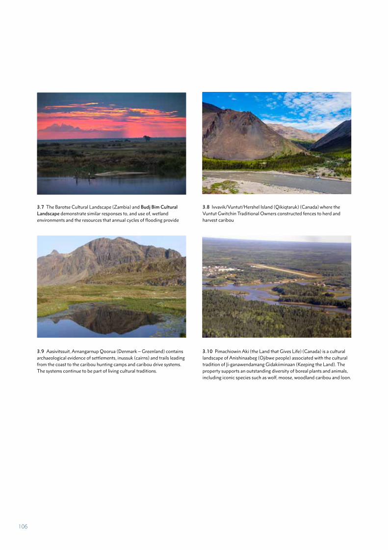
3.7 The Barotse Cultural Landscape (Zambia) and Budj Bim Cultural Landscape demonstrate similar responses to, and use of, wetland environments and the resources that annual cycles of flooding provide
3.8 Ivvavik/Vuntut/Hershel Island (Qikiqtaruk) (Canada) where the Vuntut Gwitchin Traditional Owners constructed fences to herd and harvest caribou
3.9 Aasivitssuit, Arnangarnup Qoorua (Denmark – Greenland) contains archaeological evidence of settlements, inussuk (cairns) and trails leading from the coast to the caribou hunting camps and caribou drive systems. The systems continue to be part of living cultural traditions.
3.10 Pimachiowin Aki (the Land that Gives Life) (Canada) is a cultural landscape of Anishinaabeg (Ojibwe people) associated with the cultural tradition of Ji-ganawendamang Gidakiiminaan (Keeping the Land). The property supports an outstanding diversity of boreal plants and animals, including iconic species such as wolf, moose, woodland caribou and loon.
106
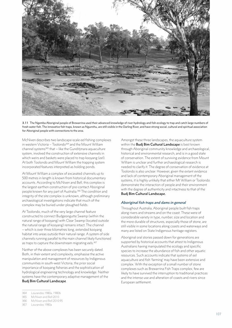
McNiven describes two landscape-scale eel fishing complexes in western Victoria – Toolondo364 and the Mount William channel systems365 that – like the Gunditjmara aquaculture system, involved the construction of extensive channels in which weirs and baskets were placed to trap kooyang (eel). At both Toolondo and Mount William the trapping system incorporated features interpreted as holding ponds.
At Mount William a complex of excavated channels up to 500 metres in length is known from historical documentary accounts. According to McNiven and Bell, this complex is the largest earthen construction of pre-contact Aboriginal people known for any part of Australia.366 The condition and integrity of the site complex is unknown, although preliminary archaeological investigations indicate that much of the complex may be buried under ploughed fields.
At Toolondo, much of the very large channel feature constructed to connect Budgeongutte Swamp (within the natural range of kooyang) with Clear Swamp (located outside the natural range of kooyang) remains intact. The channel – which is over three kilometres long, extended kooyang habitat into areas outside their natural range. A system of side channels running parallel to the main channel likely functioned as traps to capture the downstream migrating eels.367
Neither of the above complexes has been securely dated. Both, in their extent and complexity, emphasise the active manipulation and management of resources by Indigenous communities in south-west Victoria, the prior social importance of kooyang fisheries and the sophistication of hydrological engineering technology and knowledge. Neither systems have the contemporary adaptive management of the Budj Bim Cultural Landscape.
364 Lourandos 1980a, 1980b365 McNiven and Bell 2010366 McNiven and Bell 2010:95367 Lourandos 1980a
Amongst these three landscapes, the aquaculture system within the Budj Bim Cultural Landscape is best known through Aboriginal community knowledge and archaeological, historical and environmental research, and is in a good state of conservation. The extent of surviving evidence from Mount William is unclear and further archaeological research is needed to clarify it. The degree of conservation of evidence at Toolondo is also unclear. However, given the extant evidence and lack of contemporary Aboriginal management of the systems, it is highly unlikely that either Mt William or Toolondo demonstrate the interaction of people and their environment with the degree of authenticity and intactness to that of the Budj Bim Cultural Landscape.
Aboriginal fish traps and dams in general
Throughout Australia, Aboriginal people built fish traps along rivers and streams and on the coast. These were of considerable variety in type, number, size and location and the more durable of structures, especially those of stone, are still visible in some locations along coasts and waterways and many are listed on State Indigenous heritage registers.
Aboriginal oral stories passed down for generations are supported by historical accounts that attest to Indigenous Australians having manipulated the ecology and specific species to increase the abundance of fish and other aquatic resources. Such accounts indicate that systems of eel aquaculture and fish ‘farming’ may have been extensive and complex. With the exception of a small number of stone complexes such as Brewarrina Fish Traps complex, few are likely to have survived the interruption to traditional practices and the intense use and alteration of coasts and rivers since European settlement.
3.11 The Ngemba Aboriginal people of Brewarrina used their advanced knowledge of river hydrology and fish ecology to trap and catch large numbers of fresh water fish. The innovative fish traps, known as Ngunnhu, are still visible in the Darling River, and have strong social, cultural and spiritual association for Aboriginal people with connections to the area.
107
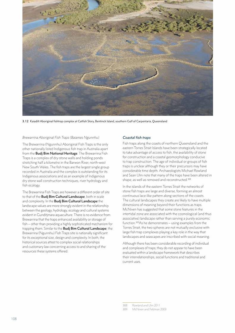
Brewarrina Aboriginal Fish Traps (Baiames Ngunnhu)
The Brewarrina (Ngunnhu) Aboriginal Fish Traps is the only other nationally listed Indigenous fish trap in Australia apart from the Budj Bim National Heritage. The Brewarrina Fish Traps is a complex of dry-stone walls and holding ponds stretching half a kilometre in the Barwon River, north-west New South Wales. The fish traps are the largest single group recorded in Australia and the complex is outstanding for its Indigenous associations and as an example of Indigenous dry stone wall construction techniques, river hydrology and fish ecology.
The Brewarrina Fish Traps are however a different order of site to that of the Budj Bim Cultural Landscape, both in scale and complexity. In the Budj Bim Cultural Landscape the landscape values are more strongly evident in the relationship between the geology, hydrology, ecology and cultural systems evident in Gunditjmara aquaculture. There is no evidence from Brewarrina that the traps enhanced availability or storage of fish – other than providing a highly sophisticated mechanism for trapping them. Similar to the Budj Bim Cultural Landscape, the Brewarrina (Ngunnhu) Fish Traps site is nationally significant for its exceptional size, design and complexity. In both, the historical sources attest to complex social relationships and customary law concerning access to and sharing of the resources these systems offered.
Coastal fish traps
Fish traps along the coasts of northern Queensland and the eastern Torres Strait Islands have been strategically located to take advantage of access to fish, the availability of stone for construction and a coastal geomorphology conducive to trap construction. The age of individual or groups of fish traps is unclear although they or their precursors may have considerable time depth. Archaeologists Michael Rowland and Sean Ulm note that many of the traps have been altered in shape, as well as removed and reconstructed.368
In the islands of the eastern Torres Strait the networks of stone fish traps are large and diverse, forming an almost continuous lace-like pattern along sections of the coasts. The cultural landscapes they create are likely to have multiple dimensions of meaning beyond their functions as traps. McNiven has suggested that some stone features in the intertidal zone are associated with the cosmological (and thus associative) landscape rather than serving a purely economic function.369As he demonstrates – using examples from the Torres Strait, the two spheres are not mutually exclusive with large fish trap complexes playing a key role in the way that landscapes and seascapes are inscribed with social meaning.
Although there has been considerable recording of individual and complexes of traps; they do not appear to have been evaluated within a landscape framework that describes their interrelationships, social functions and traditional and current uses.
368 Rowland and Ulm 2011369 McNiven and Feldman 2003
3.12 Kaiadilt Aboriginal fishtrap complex at Catfish Story, Bentinck Island, southern Gulf of Carpentaria, Queensland
108
Clam gardens, Canada
Although clam gardens have been known through ethnographic evidence since the early 20th century, systematic recording is relatively recent; commencing in the 1990s. The landscapes in which the clam gardens exist have a range of other evidence of Indigenous land uses including fish traps, house sites and middens. These landscapes are culturally rich. Many are protected because they lie within a protected area, however – the use and maintenance of many has ceased and the physical evidence of the clam gardens and other intertidal evidence are eroding and disappearing. Traditional knowledge of cultivating clams and constructing and caring for clam gardens has been recorded and is passed on in Indigenous communities on the west coast of Canada who continue to harvest clams.
The similarities between Gunditjmara kooyang (eel) aquaculture and the clam gardens and mariculture (that is, the cultivation of fish or other marine foods) of Canada’s west coast First Nations are striking. Both are considered potentially distinctive practices in their regions that enabled a rich food source to be enhanced through apparently simple processes that are underpinned by deep ecological knowledge and complex engineering.
Ahjumawi Lava Springs State Park, California, United States of America
Of all the sites identified in the comparative analysis as having values similar to the Budj Bim Cultural Landscape, the Ajumawi fish traps and ponds are the most similar in their attributes. In both, the wetland landscape has been created by a lava flow and the aquaculture systems evident in both used stone to construct traps and create habitat for aquatic species. In both cases these practices extend the seasonal availability of resources and enhance their overall numbers. Despite the similarities of their attributes and values, these sites are associated with distinct cultural groups whose origins lie in separate continents. The Ajumawi fish traps and ponds lie within the Ahjumawi Lava Springs State Park and are protected by this status and management planning that recognises cultural values. The extent to which these aquaculture and fishing sites and the associated remains of villages reflect the extent of the present or past Ajumawi cultural landscape is unclear.
OTHER PROPERTIES OF SIMILAR VALUES OUTSIDE OF AUSTRALIA
Four non-Australian landscapes were identified as having attributes and values matching the five defined characteristics and are therefore comparable with the potential Outstanding Universal Value of the Budj Bim Cultural Landscape (Figures 3.13-3.16). These are:
• Maori Eeling Sites – Te hopu tuna (Aotearoa/New Zealand)
• Hawaiian fish ponds and aquaculture (United States of America)
• Clam gardens (Canada)
• Ahjumawi Lava Springs State Park (United States of America)
Maori eeling sites – Te hopu tuna, Aotearoa/ New Zealand
A search of the Aotearoa/New Zealand Historic Places Trust Register did not reveal a specific heritage site related to Maori eeling, and no specific site or landscape with evidence of these activities has been identified through published or internet sources. Given that traditional Maori eel weirs and traps were primarily constructed from wood and brush, it is likely that little evidence remains of this once widespread practice, or at least as it was traditionally practiced. Unlike the Gunditjmara, it is unknown if the knowledge of eels, eeling and the construction of pa tuna (eel weirs) is held by Maori communities and whether the practice continues using modern materials and practices.
Hawaiian fish ponds and aquaculture
Aquaculture practices and use of fishponds in Hawai’i is unprecedented in the Pacific Islands. The enormous scale and associated labour required to construct and maintain the often very large stone walled ponds is indicative of the rapidly increasing population and power of the Hawaiian chiefs in the centuries immediately prior to European contact. Associated with this rapid social change towards what are described as kingdoms is the intensification of large-scale agriculture and irrigation systems. The aquaculture systems of Hawaiians are – in their complex engineering and technology – aligned with the aquaculture system of the Budj Bim Cultural Landscape. However, the scale and social context in which these systems developed and operated makes the Hawaiian landscapes more closely aligned with World Heritage properties associated with traditional manipulation of water resources in Indigenous agricultural societies - for example the Aflaj systems (Oman).
109
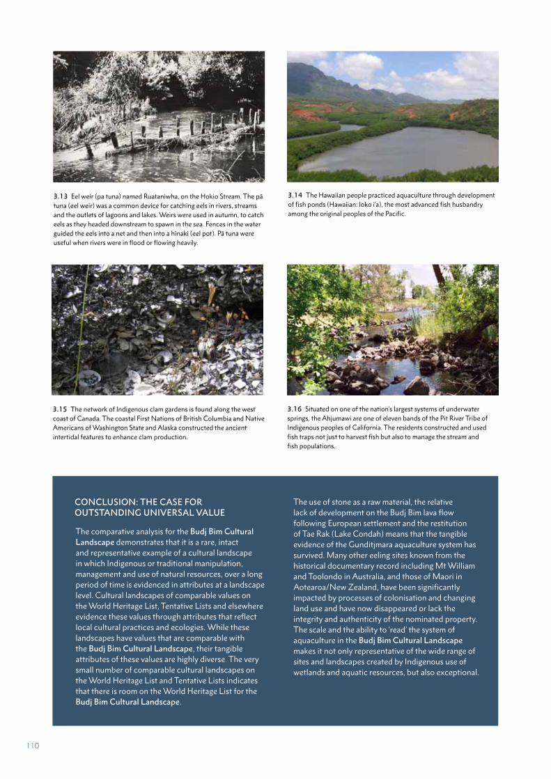
CONCLUSION: THE CASE FOR OUTSTANDING UNIVERSAL VALUE
The comparative analysis for the Budj Bim Cultural Landscape demonstrates that it is a rare, intact and representative example of a cultural landscape in which Indigenous or traditional manipulation, management and use of natural resources, over a long period of time is evidenced in attributes at a landscape level. Cultural landscapes of comparable values on the World Heritage List, Tentative Lists and elsewhere evidence these values through attributes that reflect local cultural practices and ecologies. While these landscapes have values that are comparable with the Budj Bim Cultural Landscape, their tangible attributes of these values are highly diverse. The very small number of comparable cultural landscapes on the World Heritage List and Tentative Lists indicates that there is room on the World Heritage List for the Budj Bim Cultural Landscape.
The use of stone as a raw material, the relative lack of development on the Budj Bim lava flow following European settlement and the restitution of Tae Rak (Lake Condah) means that the tangible evidence of the Gunditjmara aquaculture system has survived. Many other eeling sites known from the historical documentary record including Mt William and Toolondo in Australia, and those of Maori in Aotearoa/New Zealand, have been significantly impacted by processes of colonisation and changing land use and have now disappeared or lack the integrity and authenticity of the nominated property. The scale and the ability to ‘read’ the system of aquaculture in the Budj Bim Cultural Landscape makes it not only representative of the wide range of sites and landscapes created by Indigenous use of wetlands and aquatic resources, but also exceptional.
3.14 The Hawaiian people practiced aquaculture through development of fish ponds (Hawaiian: loko i‘a), the most advanced fish husbandry among the original peoples of the Pacific.
3.13 Eel weir (pa tuna) named Ruataniwha, on the Hokio Stream. The pā tuna (eel weir) was a common device for catching eels in rivers, streams and the outlets of lagoons and lakes. Weirs were used in autumn, to catch eels as they headed downstream to spawn in the sea. Fences in the water guided the eels into a net and then into a hīnaki (eel pot). Pā tuna were useful when rivers were in flood or flowing heavily.
3.15 The network of Indigenous clam gardens is found along the west coast of Canada. The coastal First Nations of British Columbia and Native Americans of Washington State and Alaska constructed the ancient intertidal features to enhance clam production.
3.16 Situated on one of the nation’s largest systems of underwater springs, the Ahjumawi are one of eleven bands of the Pit River Tribe of Indigenous peoples of California. The residents constructed and used fish traps not just to harvest fish but also to manage the stream and fish populations.
110
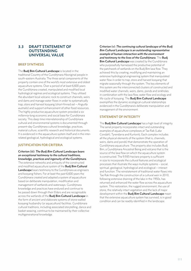
3.3 DRAFT STATEMENT OF OUTSTANDING UNIVERSAL VALUE
BRIEF SYNTHESIS
The Budj Bim Cultural Landscape is located in the traditional Country of the Gunditjmara Aboriginal people in south-eastern Australia. The three serial components of the property contain one of the world’s most extensive and oldest aquaculture systems. Over a period of at least 6,600 years the Gunditjmara created, manipulated and modified local hydrological regimes and ecological systems. They utilised the abundant local volcanic rock to construct channels, weirs and dams and manage water flows in order to systematically trap, store and harvest kooyang (short-finned eel – Anguilla australis) and support enhancement of other food resources. The highly productive aquaculture system provided a six millennia-long economic and social base for Gunditjmara society. This deep time interrelationship of Gunditjmara cultural and environmental systems is documented through present-day Gunditjmara cultural knowledge, practices, material culture, scientific research and historical documents. It is evidenced in the aquaculture system itself and in the inter-related geological, hydrological and ecological systems.
JUSTIFICATION FOR CRITERIA
Criterion (iii): The Budj Bim Cultural Landscape bears an exceptional testimony to the cultural traditions, knowledge, practices and ingenuity of the Gunditjmara. The extensive networks and antiquity of the constructed and modified aquaculture system of the Budj Bim Cultural Landscape bears testimony to the Gunditjmara as engineers and kooyang fishers. For at least the past 6,600 years the Gunditjmara created and adapted a system of aquaculture based on deliberate manipulation, modification and management of wetlands and waterways. Gunditjmara knowledge and practices have endured and continue to be passed down through their Elders and are recognisable across the wetlands of the Budj Bim Cultural Landscape in the form of ancient and elaborate systems of stone-walled kooyang husbandry (or aquaculture) facilities. Gunditjmara cultural traditions, including associated storytelling, dance and basket weaving, continue to be maintained by their collective multigenerational knowledge.
Criterion (v): The continuing cultural landscape of the Budj Bim Cultural Landscape is an outstanding representative example of human interaction with the environment and testimony to the lives of the Gunditjmara. The Budj Bim Cultural Landscape was created by the Gunditjmara who purposefully harnessed the productive potential of the patchwork of wetlands on the Budj Bim lava flow. They achieved this by creating, modifying and maintaining an extensive hydrological engineering system that manipulated water flow in order to trap, store and harvest kooyang that migrate seasonally through the system. The key elements of this system are the interconnected clusters of constructed and modified water channels, weirs, dams, ponds and sinkholes in combination with the lava flow, water flow and ecology and life-cycle of kooyang. The Budj Bim Cultural Landscape exemplifies the dynamic ecological-cultural relationships evidenced in the Gunditjmara’s deliberate manipulation and management of the environment.
STATEMENT OF INTEGRITY
The Budj Bim Cultural Landscape has a high level of integrity. The serial property incorporates intact and outstanding examples of aquaculture complexes at Tae Rak (Lake Condah), Tyrendarra and Kurtonitj. Each complex includes all the physical elements of the system (that is, channels, weirs, dams and ponds) that demonstrate the operation of Gunditjmara aquaculture. The property also includes Budj Bim, a Gunditjmara Ancestral Being and volcano that is the source of the lava flow on which the aquaculture system is constructed. The 9,935-hectare property is sufficient in size to incorporate the cultural features and ecological processes that illustrate the ways multiple systems – social, spiritual, geological, hydrological and ecological – interact and function. The reinstatement of traditional water flows into Tae Rak through the construction of a cultural weir in 2010, following extensive draining of the lake in the 1950s, has returned and enhanced the water flow across the aquaculture system. This restoration, the rugged environment, the use of stone, the relatively intact vegetation and the lack of major development within the Budj Bim Cultural Landscape mean that the extensive aquaculture system has survived, is in good condition and can be readily identified in the landscape.
111
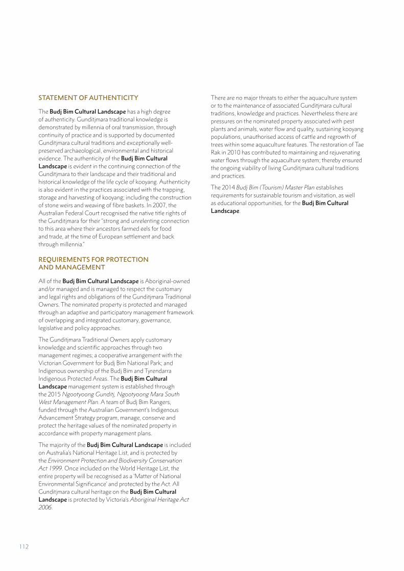
STATEMENT OF AUTHENTICITY
The Budj Bim Cultural Landscape has a high degree of authenticity. Gunditjmara traditional knowledge is demonstrated by millennia of oral transmission, through continuity of practice and is supported by documented Gunditjmara cultural traditions and exceptionally well-preserved archaeological, environmental and historical evidence. The authenticity of the Budj Bim Cultural Landscape is evident in the continuing connection of the Gunditjmara to their landscape and their traditional and historical knowledge of the life cycle of kooyang. Authenticity is also evident in the practices associated with the trapping, storage and harvesting of kooyang; including the construction of stone weirs and weaving of fibre baskets. In 2007, the Australian Federal Court recognised the native title rights of the Gunditjmara for their “strong and unrelenting connection to this area where their ancestors farmed eels for food and trade, at the time of European settlement and back through millennia.”
REQUIREMENTS FOR PROTECTION AND MANAGEMENT
All of the Budj Bim Cultural Landscape is Aboriginal-owned and/or managed and is managed to respect the customary and legal rights and obligations of the Gunditjmara Traditional Owners. The nominated property is protected and managed through an adaptive and participatory management framework of overlapping and integrated customary, governance, legislative and policy approaches.
The Gunditjmara Traditional Owners apply customary knowledge and scientific approaches through two management regimes; a cooperative arrangement with the Victorian Government for Budj Bim National Park; and Indigenous ownership of the Budj Bim and Tyrendarra Indigenous Protected Areas. The Budj Bim Cultural Landscape management system is established through the 2015 Ngootyoong Gunditj, Ngootyoong Mara South West Management Plan. A team of Budj Bim Rangers, funded through the Australian Government’s Indigenous Advancement Strategy program, manage, conserve and protect the heritage values of the nominated property in accordance with property management plans.
The majority of the Budj Bim Cultural Landscape is included on Australia’s National Heritage List, and is protected by the Environment Protection and Biodiversity Conservation Act 1999. Once included on the World Heritage List, the entire property will be recognised as a ‘Matter of National Environmental Significance’ and protected by the Act. All Gunditjmara cultural heritage on the Budj Bim Cultural Landscape is protected by Victoria’s Aboriginal Heritage Act 2006.
There are no major threats to either the aquaculture system or to the maintenance of associated Gunditjmara cultural traditions, knowledge and practices. Nevertheless there are pressures on the nominated property associated with pest plants and animals, water flow and quality, sustaining kooyang populations, unauthorised access of cattle and regrowth of trees within some aquaculture features. The restoration of Tae Rak in 2010 has contributed to maintaining and rejuvenating water flows through the aquaculture system; thereby ensured the ongoing viability of living Gunditjmara cultural traditions and practices.
The 2014 Budj Bim (Tourism) Master Plan establishes requirements for sustainable tourism and visitation, as well as educational opportunities, for the Budj Bim Cultural Landscape.
112
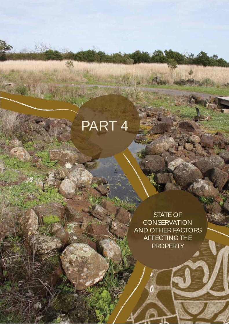
PART 4
STATE OF CONSERVATION
AND OTHER FACTORS AFFECTING THE
PROPERTY
113

PART 4 STATE OF CONSERVATION AND FACTORS AFFECTING THE PROPERTY
The elements of the three serial components of
the Budj Bim Cultural Landscape are currently
in good condition. None of the outstanding
attributes or values are under threat from major
development, environmental change, natural
disasters or tourism. Pressures on the property
relate to pest plants and animals, water flow and
quality, sustaining kooyang (eel) populations,
unauthorised entry of cattle and regrowth of
trees within some aquaculture features (Table
4.1). Each of these matters are being currently
addressed in accordance with the property
management plans (Part 5.D).
Through ownership and cooperative management arrangements, the three serial components of the Budj Bim Cultural Landscape are subject to Aboriginal traditional and customary management practices. The cultural features and landscape settings are maintained and cared for through management and monitoring undertaken through the Budj Bim Ranger program and by Parks Victoria staff. Comprehensive legal protection is in place across all levels of government – Australian, Victorian State and local – to ensure the present condition of the property is maintained to a high standard (Part 5.B). A comprehensive management system – which includes up-to-date management plans for the nominated property, is in place. The full suite of conservation and monitoring measures is detailed in Part 5 and Part 6.
4.A PRESENT STATE OF CONSERVATION
All of the fabric of the Gunditjmara aquaculture system, as well as the interconnected geological, hydrological and ecological systems, are in good physical condition and are not subject to major threats (Part 4.B). Despite limited access allowed to the Gunditjmara in the 20th century; the landscape setting has proven to be resilient and the stone aquaculture features remain in situ and are relatively intact. The Budj Bim Cultural Landscape is situated in a location with a small regional population and insignificant urban development. Tourism activities are sustainable and community-led; thus direct threats from human activities are assessed as low.
BUDJ BIM (NORTHERN) COMPONENT
The major aquaculture structures and landscape modifications; located within six complexes on the south-west margins of Tae Rak (Lake Condah) (Part 2.A), are in good condition. They continued to be used and maintained by the Gunditjmara until the 1950s (Part 2.B). Subsequently, ownership by non-Aboriginal people, a lack of recognition for the cultural heritage significance of the landscape and various incompatible land and resource uses had some impact on the aquaculture features. Archaeologists working with the Gunditjmara first began to document the extent and condition of the aquaculture facilities from the mid-1970s.370 Impacts on the cultural features noted at that time related to: physical disturbance of the basalt structures that comprise the fish traps (for example, the removal of small quantities of stone for dry stone wall construction and movement of stones by grazing cattle), soil erosion arising from compaction with the subsequent risks of undercutting of fish trap structures, and the creation of cattle trails (often coinciding with the location of channels) leading to localised erosion.371 From the late 1980s, the Gunditjmara increasingly regained ownership and access to their Country and the aquaculture system.
An inholding (small land parcel) located three kilometres north of Tae Rak, but excluded from the Budj Bim (northern) component (Map 1.2), contains a commercial basalt quarry and an associated crushing plant. Basalt, which is a ubiquitous part of the Budj Bim lava flow, is quarried from this area under an extraction licence. In the past this operation obtained stone from a wide area, though the Tae Rak aquaculture complexes were not impacted by the quarrying operation. Basalt quarrying is now confined to the inholding and obtaining basalt from outside this area is no longer legally permissible.
370 Clarke 1991; Coutts 1982; Coutts et al. 1977, 1978; Geering 1985; Wesson 1981; summarised in Context 2013b:18-20
371 Context 1993:89-91
114
More broadly, the landscape of the Budj Bim (northern) component – which is largely comprised of land reserved as National Park, is in relatively good condition. It includes some of the most intact parts of the volcanic plains of south-eastern Australia.372 The area contains a suite of significant plant and animal species and ecosystems that collectively are in good condition and have a high conservation status and significance.373 Nevertheless, pest plants and pest animals have created pressures on biodiversity. The current Budj Bim Ranger program provides the resources required to combat pest plants and animals; revegetation work using native plant species is enhancing the natural and cultural environment.
As a result of the Gunditjmara’s work to restore water levels and water flows in Tae Rak after 2010 (Part 2.B); water quality is generally good within the Tae Rak-Killara system. Farm fertiliser run off from adjoining pastoral properties (outside of the nominated serial components) has the potential to affect water quality in parts of Killara (Darlot Creek). However, with effective mitigation of off-farm environmental impacts in the Tae Rak-Killara catchment area - due in part to the efforts of the Glenelg Hopkins Catchment Management Authority and programs such as Landcare374 and the Gunditjmara’s ‘Yarns on Farms’; the likelihood is assessed as low.
KURTONITJ (CENTRAL) COMPONENT
The Kurtonitj (central) component of the Budj Bim Cultural Landscape is a part of the Budj Bim Indigenous Protected Area. The Gunditjmara hold freehold title to the Kurtonitj (central) component. A small section (10-15 hectares) of the property has been cleared of surface stone in the past and some of the original open forest vegetation has been cleared of trees. Nevertheless, the aquaculture features (channels, weirs, dams and ponds) are in good condition due to their relatively protected location along watercourses; and because land clearing in these areas has been minimal. Since European occupation of the region from the 1830s, parts of the Kurtonitj (central) component have been used for sheep and cattle grazing. Prior to the acquisition of this component (in 2006 and 2013) by the Gunditjmara, they had limited access to these lands and the aquaculture complex situated within them.
The Gunditjmara management plan covering the Kurtonitj (central) component recognises the following factors affecting the aquaculture system and its broader landscape setting:375
• There are undocumented and/or incompletely recorded cultural heritage sites – including aquaculture features, within the nominated component
372 Context 2013a:20 373 Parks Victoria 2015:33374 Landcare is a grassroots movement dedicated to managing envi-
ronmental issues in local communities across Australia. Landcare Australia. ‘Home’, https://landcareaustralia.org.au
375 GMTOAC 2015:35-36
• Parts of the aquaculture features (channels, weirs, dams and ponds) have become overgrown with vegetation, including the growth of trees within some channels
• Pest plant species are widespread and in some cases are displacing native species of importance to the Gunditjmara – for example, puunyaart (Carex spp.), which is a grass fibre necessary for kooyang basket making
• Impacts by pest animal species and cattle grazing have occurred in some areas containing aquaculture features and associated water flows
• There are periodic overpopulations of some native animals – including kangaroo and koala, which can impact on the wetland and treed ecological-cultural environments
• Impacts of water pollution on Killara (Darlot Creek) from fertiliser run-off from farming properties (situated outside the nominated property)
• Impacts of high-intensity wildfires on native plant species as well as the potential to damage or destroy management and tourism infrastructure
• Potential impacts of future land-use planning (for example, plantation forestry which can impact on ground water levels and the setting) on areas beyond and bordering the nominated property.
TYRENDARRA (SOUTHERN) COMPONENT
The third and most southerly of the three components of the Budj Bim Cultural Landscape is comprised of the Tyrendarra Indigenous Protected Area, for which the Winda-Mara Aboriginal Corporation have freehold title (acquired 1999); and a portion of the Budj Bim Indigenous Protected Area, for which the Gunditj Mirring Traditional Owners Aboriginal Corporation (GMTOAC) have freehold title (acquired 2008). Both properties have histories of tree clearing and use for pastoralism. In addition, the ecology of the largest wetlands has been impacted by the creation of artificial drains that were constructed to improve grazing land for domestic stock.
Many of the factors affecting the Tyrendarra (southern) component are the same as those listed for the Kurtonitj (central) component. The management plan for the Tyrendarra Indigenous Protected Area includes specific details concerning some of these factors:376
• Significant areas of pest plants occur throughout the property including: sweet briar (Rosa rubiginosa), elm (Ulmus spp.), hawthorn (Crataegus monogyna), willow (Salix spp.), hemlock (Conium maclatum), blackberry (Rubus fruticosus), thistle species (various), horehound (Marrubium vulgare) and boxthorn (Lycium ferocissimum).
• Rabbit (Oryctolagus cuniculus) and fox (Vulpes vulpes) are major pest species; wild pigs (Sus domesticus), which occur in the region but not on the property, may present a threat in the future.
376 Winda-Mara Aboriginal Corporation 2015:14-20
115
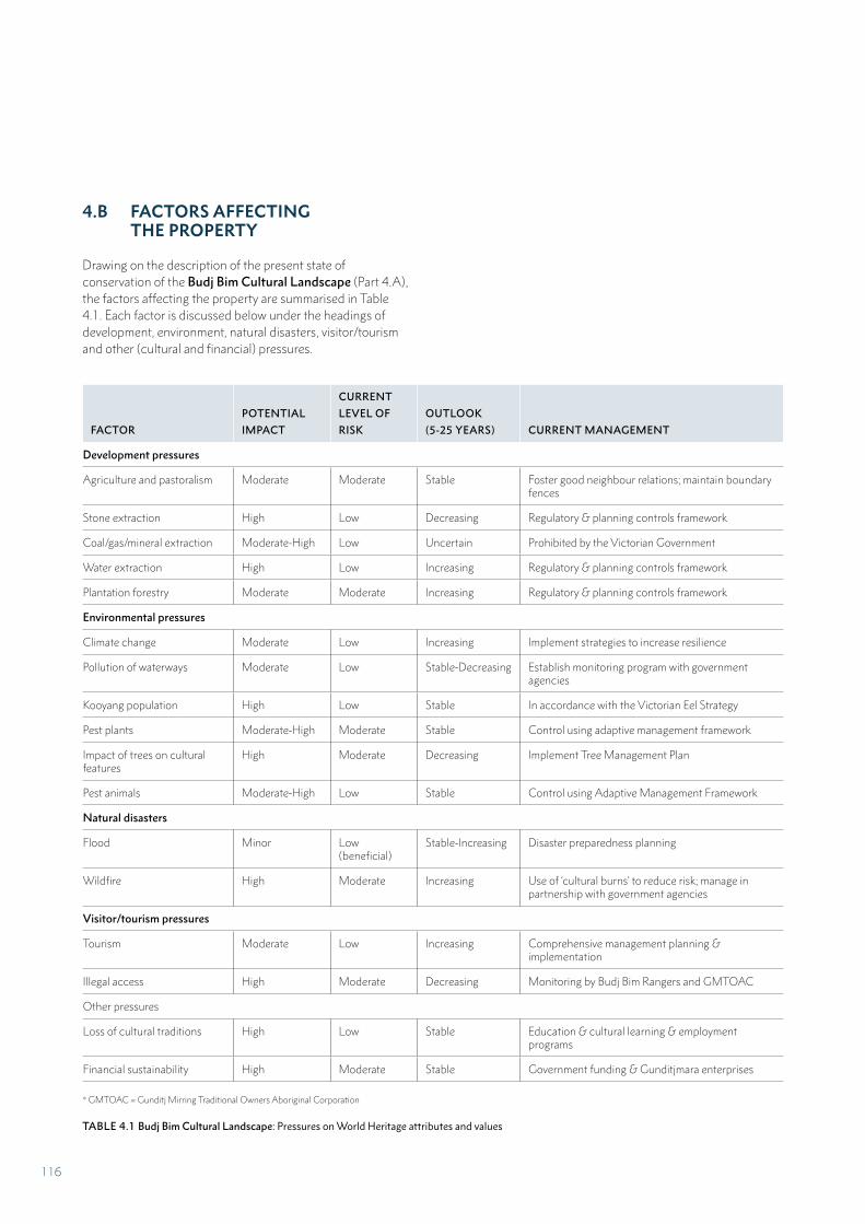
* GMTOAC = Gunditj Mirring Traditional Owners Aboriginal Corporation
TABLE 4.1 Budj Bim Cultural Landscape: Pressures on World Heritage attributes and values
4.B FACTORS AFFECTING THE PROPERTY
Drawing on the description of the present state of conservation of the Budj Bim Cultural Landscape (Part 4.A), the factors affecting the property are summarised in Table 4.1. Each factor is discussed below under the headings of development, environment, natural disasters, visitor/tourism and other (cultural and financial) pressures.
FACTOR
POTENTIAL
IMPACT
CURRENT
LEVEL OF
RISK
OUTLOOK
(5-25 YEARS) CURRENT MANAGEMENT
Development pressures
Agriculture and pastoralism Moderate Moderate Stable Foster good neighbour relations; maintain boundary fences
Stone extraction High Low Decreasing Regulatory & planning controls framework
Coal/gas/mineral extraction Moderate-High Low Uncertain Prohibited by the Victorian Government
Water extraction High Low Increasing Regulatory & planning controls framework
Plantation forestry Moderate Moderate Increasing Regulatory & planning controls framework
Environmental pressures
Climate change Moderate Low Increasing Implement strategies to increase resilience
Pollution of waterways Moderate Low Stable-Decreasing Establish monitoring program with government agencies
Kooyang population High Low Stable In accordance with the Victorian Eel Strategy
Pest plants Moderate-High Moderate Stable Control using adaptive management framework
Impact of trees on cultural features
High Moderate Decreasing Implement Tree Management Plan
Pest animals Moderate-High Low Stable Control using Adaptive Management Framework
Natural disasters
Flood Minor Low (beneficial)
Stable-Increasing Disaster preparedness planning
Wildfire High Moderate Increasing Use of ‘cultural burns’ to reduce risk; manage in partnership with government agencies
Visitor/tourism pressures
Tourism Moderate Low Increasing Comprehensive management planning & implementation
Illegal access High Moderate Decreasing Monitoring by Budj Bim Rangers and GMTOAC
Other pressures
Loss of cultural traditions High Low Stable Education & cultural learning & employment programs
Financial sustainability High Moderate Stable Government funding & Gunditjmara enterprises
116
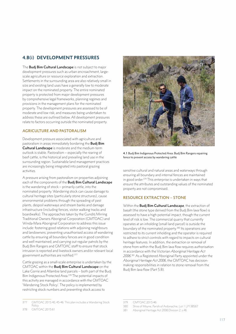
4.1 Budj Bim Indigenous Protected Area: Budj Bim Rangers repairing fence to prevent access by wandering cattle
4.B(i) DEVELOPMENT PRESSURES
The Budj Bim Cultural Landscape is not subject to major development pressures such as urban encroachment, large-scale agriculture or resource exploration and extraction. Settlements in the surrounding area are also relatively small in size and existing land uses have a generally low to moderate impact on the nominated property. The entire nominated property is protected from major development pressures by comprehensive legal frameworks, planning regimes and provisions in the management plans for the nominated property. The development pressures are assessed to be of moderate and low risk; and measures being undertaken to address these are outlined below. All development pressures relate to factors occurring outside the nominated property.
AGRICULTURE AND PASTORALISM
Development pressure associated with agriculture and pastoralism in areas immediately bordering the Budj Bim Cultural Landscape is moderate and the medium-term outlook is stable. Pastoralism – especially the rearing of beef cattle, is the historical and prevailing land use in the surrounding region. Sustainable land management practices are increasingly being integrated into pastoral grazing activities.
A pressure arising from pastoralism on properties adjoining each of the components of the Budj Bim Cultural Landscape is the wandering of stock – primarily cattle, into the nominated property. Wandering stock can cause damage to cultural heritage sites (particularly stone structures), cause environmental problems through the spreading of pest plants, despoil waterways and stream banks and damage infrastructure (including fences, visitor walking tracks and boardwalks). The approaches taken by the Gunditj Mirring Traditional Owners Aboriginal Corporation (GMTOAC) and Winda-Mara Aboriginal Corporation to address this issue include: fostering good relations with adjoining neighbours and landowners; preventing unauthorised access of wandering cattle by ensuring all boundary fences are in good condition and well maintained; and carrying out regular patrols by the Budj Bim Rangers and GMTOAC staff to ensure that stock intrusion is reported and livestock owners and/or relevant local government authorities are notified.377
Cattle grazing as a small-scale enterprise is undertaken by the GMTOAC within the Budj Bim Cultural Landscape on the Lake Gorrie and Allambie land parcels – both part of the Budj Bim Indigenous Protected Area.378 The potential impacts of this activity are managed in accordance with the GMTOAC ‘Wandering Stock Policy’. The policy is implemented by restricting stock numbers and preventing stock access to
377 GMTOAC 2015:40, 45-46. This plan includes a Wandering Stock Policy.
378 GMTOAC 2015:61
sensitive cultural and natural areas and waterways through ensuring all boundary and internal fences are maintained in good order.379 This enterprise is undertaken in ways that ensure the attributes and outstanding values of the nominated property are not compromised.
RESOURCE EXTRACTION – STONE
Within the Budj Bim Cultural Landscape, the extraction of basalt (the stone type derived from the Budj Bim lava flow) is assessed to have a high potential impact, though the current level of risk is low. The commercial quarry that currently operates at an inholding (small land parcel) is outside the boundary of the nominated property.380 Its operations are restricted to its current inholding and the operator is required to adhere to strict controls with regard to impacts on cultural heritage features. In addition, the extraction or removal of stone from within the Budj Bim lava flow requires authorisation in accordance with the Victorian Aboriginal Heritage Act 2006.381 As a Registered Aboriginal Party appointed under the Aboriginal Heritage Act 2006, the GMTOAC has decision-making responsibilities in relation to stone removal from the Budj Bim lava flow (Part 5.B).
379 GMTOAC 2015:46380 Shire of Moyne, Parish of Ardonachie, Lot 1 LP138567 381 Aboriginal Heritage Act 2006:Division 2; s.46
117
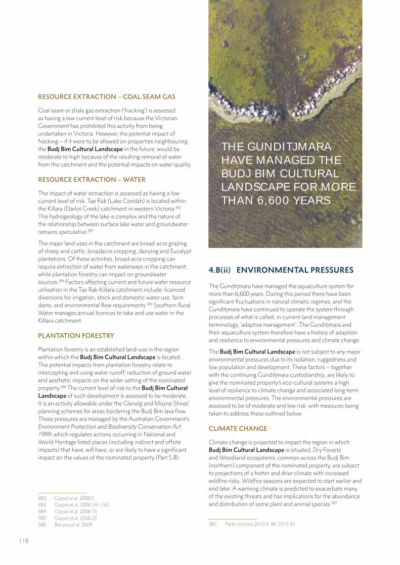
RESOURCE EXTRACTION – COAL SEAM GAS
Coal seam or shale gas extraction (‘fracking’) is assessed as having a low current level of risk because the Victorian Government has prohibited this activity from being undertaken in Victoria. However, the potential impact of fracking – if it were to be allowed on properties neighbouring the Budj Bim Cultural Landscape in the future, would be moderate to high because of the resulting removal of water from the catchment and the potential impacts on water quality.
RESOURCE EXTRACTION – WATER
The impact of water extraction is assessed as having a low current level of risk. Tae Rak (Lake Condah) is located within the Killara (Darlot Creek) catchment in western Victoria.382 The hydrogeology of the lake is complex and the nature of the relationship between surface lake water and groundwater remains speculative.383
The major land uses in the catchment are broad-acre grazing of sheep and cattle, broadacre cropping, dairying and Eucalypt plantations. Of these activities, broad-acre cropping can require extraction of water from waterways in the catchment; while plantation forestry can impact on groundwater sources.384 Factors affecting current and future water resource utilisation in the Tae Rak-Killara catchment include: licenced diversions for irrigation, stock and domestic water use, farm dams, and environmental flow requirements.385 Southern Rural Water manages annual licences to take and use water in the Killara catchment.
PLANTATION FORESTRY
Plantation forestry is an established land-use in the region within which the Budj Bim Cultural Landscape is located. The potential impacts from plantation forestry relate to intercepting and using water runoff, reduction of ground water and aesthetic impacts on the wider setting of the nominated property.386 The current level of risk to the Budj Bim Cultural Landscape of such development is assessed to be moderate. It is an activity allowable under the Glenelg and Moyne Shires’ planning schemes for areas bordering the Budj Bim lava flow. These pressures are managed by the Australian Government’s Environment Protection and Biodiversity Conservation Act 1999; which regulates actions occurring in National and World Heritage listed places (including indirect and offsite impacts) that have, will have, or are likely to have a significant impact on the values of the nominated property (Part 5.B).
382 Gippel at al. 2006:5383 Gippel et al. 2006:141-142384 Gippel et al. 2006:15 385 Gippel et al. 2006:23386 Benyon et al. 2 009
4.B(ii) ENVIRONMENTAL PRESSURES
The Gunditjmara have managed the aquaculture system for more than 6,600 years. During this period there have been significant fluctuations in natural climatic regimes, and the Gunditjmara have continued to operate the system through processes of what is called, in current land management terminology, ‘adaptive management’. The Gunditjmara and their aquaculture system therefore have a history of adaption and resilience to environmental pressures and climate change.
The Budj Bim Cultural Landscape is not subject to any major environmental pressures due to its isolation, ruggedness and low population and development. These factors – together with the continuing Gunditjmara custodianship, are likely to give the nominated property’s eco-cultural systems a high level of resilience to climate change and associated long-term environmental pressures. The environmental pressures are assessed to be of moderate and low risk; with measures being taken to address these outlined below.
CLIMATE CHANGE
Climate change is projected to impact the region in which Budj Bim Cultural Landscape is situated. Dry Forests and Woodland ecosystems; common across the Budj Bim (northern) component of the nominated property, are subject to projections of a hotter and drier climate with increased wildfire risks. Wildfire seasons are expected to start earlier and end later. A warming climate is predicted to exacerbate many of the existing threats and has implications for the abundance and distribution of some plant and animal species.387
387 Parks Victoria 2010:3, 46; 2015:33
THE GUNDITJMARA HAVE MANAGED THE BUDJ BIM CULTURAL LANDSCAPE FOR MORE THAN 6,600 YEARS
118
Inland Waters and Wetland ecosystems are considered vulnerable to climate change; with increased stress on waterways already under pressure from rising salinity levels and decreasing water quality. Cyclic periods of drought and flood are predicted with extended dry periods interspersed by periods of above-average rainfall and flooding.388 Changes in the extent and quality of wetlands may reduce the available habitat for kooyang (eels).
Due to the Gunditjmara’s restoration of Tae Rak (Lake Condah), its relative isolation, the low level of population and absence of major development – together with continuing Gunditjmara custodianship, the Budj Bim Cultural Landscape’s hydrological and ecological systems are likely to have a higher level of natural resilience to climate change than can be expected of coastal and alpine environments that are already suffering multiple environmental pressures.389
Work is currently being undertaken within the Budj Bim Cultural Landscape to prepare for the impacts of climate change on ecosystem values; including cooperative working arrangements between government agencies, land managers (including GMTOAC and Winda-Mara Aboriginal Corporation), scientists, research partners and communities to develop climate change adaptation measures.390
POLLUTION OF WATERWAYS
Water flow is a key attribute of the Budj Bim Cultural Landscape (Part 3.1.B). Management of water – particularly at Tae Rak and along Killara (Darlot Creek), is necessary to maintain the eco-cultural values of the nominated property (Part 3.1.B). The Gunditjmara’s reinstatement of a cultural weir on Tae Rak in 2010 allowed the lake to be successfully re-flooded and enabled much of the Gunditjmara aquaculture system to again become operable.
A potential threat to the water quality of Killara is pollution from runoff from agriculture lands, which can increase salinity and chemical levels (from fertilisers). The potential impact of such pollution is moderate to high;391 although the current level of risk is assessed as low. Monitoring of water quality is not currently undertaken for water flow volume (including height), salinity or nutrients in the Tae Rak-Killara system. The GMTOAC recognise the need for monitoring and is in discussion with the Glenelg Hopkins Catchment Management Authority to determine the best approach to undertaking this work.392
388 Parks Victoria 2010:3, 46; 2015:36389 Parks Victoria 2010390 Parks Victoria 2015:32391 Victorian Fisheries Authority 2017:9. The Victorian Eel Fishery
Management Plan notes that the risk to the eel fishery due to re-duced water quality (including due to drought and the modification of flow regimes) is high.
392 GMTOAC 2015:41-44
KOOYANG POPULATION
The potential impact of climate change, water quality and over-fishing on kooyang is high; though the current level of risk is low. In Victoria, the number of recreational fishers and the amount of catch taken by them is not known. Anecdotal observations suggest that the take from recreational eel fishing is currently low – in part because recreational anglers are limited to 10 eels per person per day.393
Aboriginal Victorians currently have a number of existing rights to access natural resources recognised under Australia’s laws. Members of Traditional Owner groups with a native title determination under the Australian Government’s Native Title Act 1993 have non-exclusive rights to hunt, fish and gather natural resources for personal, communal and cultural purposes – without the need to obtain a licence. This includes fishing for and harvesting eels. The Gunditjmara hold such rights.394 The Gunditjmara are currently investigating the scope for wild take from Tae Rak for cultural activities and for small-scale commercial purposes, but these proposals have not yet been subject to detailed feasibility studies.395 The principles for such a proposal have been drafted and cover sustainability, licensing agreements where required, use of modern and traditional techniques and equipment, maintaining cultural traditions, and health and safety.396
PEST PLANTS
The potential impact from the spread of invasive plants in the Budj Bim Cultural Landscape is assessed to be moderate to high; and the current level of risk as moderate. Uncontrolled spread of pest plants can smother and out-compete native vegetation, reduce biodiversity values and reduce the abundance of culturally important species (such as puunyaart – Carex spp. – necessary for weaving kooyang baskets). In addition, pest plants can also over-run aquaculture features (channels, weirs, dams and ponds), making it difficult to document, protect, maintain and monitor these features, and ensure their continued functioning.
Fifty-two pest plant (or weed) species have been documented as occurring within the Budj Bim lava flow; and control methods (herbicide treatments and physical methods) have been determined for each of these species.397 In the Inland Waters and Wetlands ecosystem, focus is currently given to eradicating new and emerging pest plants in aquatic and semi-aquatic environments; and reducing the extent of blackberry
393 Victorian Fisheries Authority 2017:8. The Victorian Eel Fishery Management Plan notes that there is no legal minimum length for eels taken by the recreational fishing sector; and that recreational eel fishing is permitted in all Crown waters which are open to recre-ational angling.
394 Victorian Fisheries Authority 2017:6395 GMTOAC 2015:54396 Context 2008 397 Carr et al. 2008:96-100; GMTOAC 2015:75-79 (Appendix 3)
119
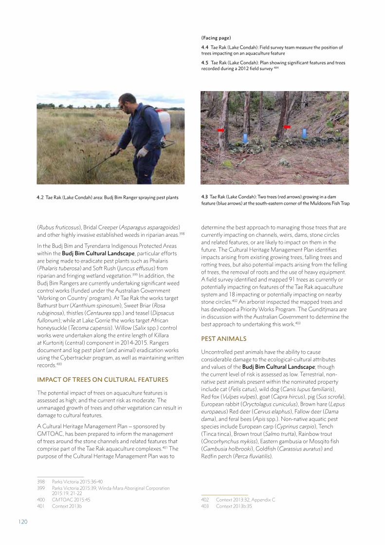
(Rubus fruticosus), Bridal Creeper (Asparagus asparagoides) and other highly invasive established weeds in riparian areas.398
In the Budj Bim and Tyrendarra Indigenous Protected Areas within the Budj Bim Cultural Landscape, particular efforts are being made to eradicate pest plants such as Phalaris (Phalaris tuberosa) and Soft Rush (Juncus effusus) from riparian and fringing wetland vegetation.399 In addition, the Budj Bim Rangers are currently undertaking significant weed control works (funded under the Australian Government ‘Working on Country’ program). At Tae Rak the works target Bathurst burr (Xanthium spinosum), Sweet Briar (Rosa rubiginosa), thistles (Centaurea spp.) and teasel (Dipsacus fullonum); while at Lake Gorrie the works target African honeysuckle (Tecoma capensis). Willow (Salix spp.) control works were undertaken along the entire length of Killara at Kurtonitj (central) component in 2014-2015. Rangers document and log pest plant (and animal) eradication works using the Cybertracker program, as well as maintaining written records.400
IMPACT OF TREES ON CULTURAL FEATURES
The potential impact of trees on aquaculture features is assessed as high; and the current risk as moderate. The unmanaged growth of trees and other vegetation can result in damage to cultural features.
A Cultural Heritage Management Plan – sponsored by GMTOAC, has been prepared to inform the management of trees around the stone channels and related features that comprise part of the Tae Rak aquaculture complexes.401 The purpose of the Cultural Heritage Management Plan was to
398 Parks Victoria 2015:36-40399 Parks Victoria 2015:39; Winda-Mara Aboriginal Corporation
2015:19, 21-22400 GMTOAC 2015:45401 Context 2013b
determine the best approach to managing those trees that are currently impacting on channels, weirs, dams, stone circles and related features, or are likely to impact on them in the future. The Cultural Heritage Management Plan identifies impacts arising from existing growing trees, falling trees and rotting trees, but also potential impacts arising from the felling of trees, the removal of roots and the use of heavy equipment. A field survey identified and mapped 91 trees as currently or potentially impacting on features of the Tae Rak aquaculture system and 18 impacting or potentially impacting on nearby stone circles.402 An arborist inspected the mapped trees and has developed a Priority Works Program. The Gunditjmara are in discussion with the Australian Government to determine the best approach to undertaking this work.403
PEST ANIMALS
Uncontrolled pest animals have the ability to cause considerable damage to the ecological-cultural attributes and values of the Budj Bim Cultural Landscape; though the current level of risk is assessed as low. Terrestrial, non-native pest animals present within the nominated property include cat (Felis catus), wild dog (Canis lupus familiaris), Red fox (Vulpes vulpes), goat (Capra hircus), pig (Sus scrofa), European rabbit (Oryctolagus cuniculus), Brown hare (Lepus europaeus) Red deer (Cervus elaphus), Fallow deer (Dama dama), and feral bees (Apis spp.). Non-native aquatic pest species include European carp (Cyprinus carpio), Tench (Tinca tinca), Brown trout (Salmo trutta), Rainbow trout (Oncorhynchus mykiss), Eastern gambusia or Mosqito fish (Gambusia holbrooki), Goldfish (Carassius auratus) and Redfin perch (Perca fluviatilis).
402 Context 2013:32, Appendix C403 Context 2013b:35
4.2 Tae Rak (Lake Condah) area: Budj Bim Ranger spraying pest plants 4.3 Tae Rak (Lake Condah): Two trees (red arrows) growing in a dam feature (blue arrows) at the south-eastern corner of the Muldoons Fish Trap
(Facing page)
4.4 Tae Rak (Lake Condah): Field survey team measure the position of trees impacting on an aquaculture feature
4.5 Tae Rak (Lake Condah): Plan showing significant features and trees recorded during a 2012 field survey 404
120
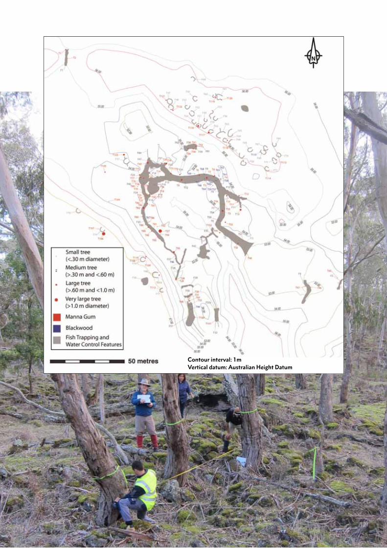
Contour interval: 1mVertical datum: Australian Height Datum
121
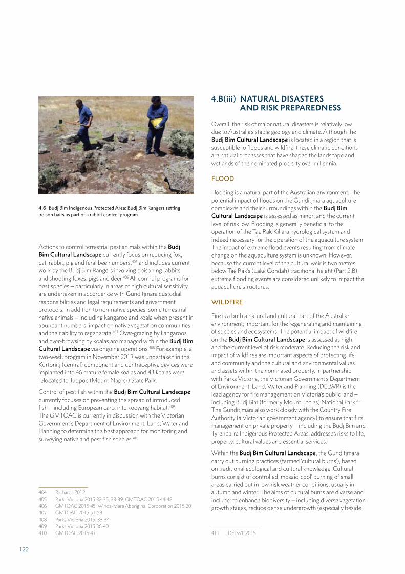
404
Actions to control terrestrial pest animals within the Budj Bim Cultural Landscape currently focus on reducing fox, cat, rabbit, pig and feral bee numbers,405 and includes current work by the Budj Bim Rangers involving poisoning rabbits and shooting foxes, pigs and deer.406 All control programs for pest species – particularly in areas of high cultural sensitivity, are undertaken in accordance with Gunditjmara custodial responsibilities and legal requirements and government protocols. In addition to non-native species, some terrestrial native animals – including kangaroo and koala when present in abundant numbers, impact on native vegetation communities and their ability to regenerate.407 Over-grazing by kangaroos and over-browsing by koalas are managed within the Budj Bim Cultural Landscape via ongoing operations.408 For example, a two-week program in November 2017 was undertaken in the Kurtonitj (central) component and contraceptive devices were implanted into 46 mature female koalas and 43 koalas were relocated to Tappoc (Mount Napier) State Park.
Control of pest fish within the Budj Bim Cultural Landscape currently focuses on preventing the spread of introduced fish – including European carp, into kooyang habitat.409 The GMTOAC is currently in discussion with the Victorian Government’s Department of Environment, Land, Water and Planning to determine the best approach for monitoring and surveying native and pest fish species.410
404 Richards 2012405 Parks Victoria 2015:32-35, 38-39; GMTOAC 2015:44-48406 GMTOAC 2015:45; Winda-Mara Aboriginal Corporation 2015:20407 GMTOAC 2015:51-53408 Parks Victoria 2015: 33-34409 Parks Victoria 2015:36-40410 GMTOAC 2015:47
4.B(iii) NATURAL DISASTERS AND RISK PREPAREDNESS
Overall, the risk of major natural disasters is relatively low due to Australia’s stable geology and climate. Although the Budj Bim Cultural Landscape is located in a region that is susceptible to floods and wildfire; these climatic conditions are natural processes that have shaped the landscape and wetlands of the nominated property over millennia.
FLOOD
Flooding is a natural part of the Australian environment. The potential impact of floods on the Gunditjmara aquaculture complexes and their surroundings within the Budj Bim Cultural Landscape is assessed as minor; and the current level of risk low. Flooding is generally beneficial to the operation of the Tae Rak-Killara hydrological system and indeed necessary for the operation of the aquaculture system. The impact of extreme flood events resulting from climate change on the aquaculture system is unknown. However, because the current level of the cultural weir is two metres below Tae Rak’s (Lake Condah) traditional height (Part 2.B), extreme flooding events are considered unlikely to impact the aquaculture structures.
WILDFIRE
Fire is a both a natural and cultural part of the Australian environment; important for the regenerating and maintaining of species and ecosystems. The potential impact of wildfire on the Budj Bim Cultural Landscape is assessed as high; and the current level of risk moderate. Reducing the risk and impact of wildfires are important aspects of protecting life and community and the cultural and environmental values and assets within the nominated property. In partnership with Parks Victoria, the Victorian Government’s Department of Environment, Land, Water and Planning (DELWP) is the lead agency for fire management on Victoria’s public land – including Budj Bim (formerly Mount Eccles) National Park.411 The Gunditjmara also work closely with the Country Fire Authority (a Victorian government agency) to ensure that fire management on private property – including the Budj Bim and Tyrendarra Indigenous Protected Areas, addresses risks to life, property, cultural values and essential services.
Within the Budj Bim Cultural Landscape, the Gunditjmara carry out burning practices (termed ‘cultural burns’), based on traditional ecological and cultural knowledge. Cultural burns consist of controlled, mosaic ‘cool’ burning of small areas carried out in low-risk weather conditions, usually in autumn and winter. The aims of cultural burns are diverse and include: to enhance biodiversity – including diverse vegetation growth stages, reduce dense undergrowth (especially beside
411 DELWP 2015
4.6 Budj Bim Indigenous Protected Area: Budj Bim Rangers setting poison baits as part of a rabbit control program
122
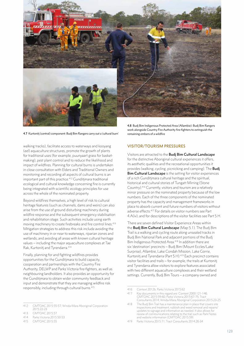
walking tracks), facilitate access to waterways and kooyang (eel) aquaculture structures, promote the growth of plants for traditional uses (for example, puunyaart grass for basket-making), pest plant control and to reduce the likelihood and impact of wildfires. Planning for cultural burns is undertaken in close consultation with Elders and Traditional Owners and monitoring and recording all aspects of cultural burns is an important part of this practice.412 Gunditjmara traditional ecological and cultural knowledge concerning fire is currently being integrated with scientific ecology principles for use across the whole of the nominated property.
Beyond wildfires themselves, a high level of risk to cultural heritage features (such as channels, dams and weirs) can also arise from the use of ground disturbing machinery during wildfire response and the subsequent emergency stabilisation and rehabilitation stage. Such activities include using earth moving machinery to create firebreaks and fire control lines.413 Mitigation strategies to address this risk include avoiding the use of machinery in or near to waterways, riparian zones and wetlands; and avoiding all areas with known cultural heritage values – including the major aquaculture complexes at Tae Rak, Kurtonitj and Tyrendarra.414
Finally, planning for and fighting wildfires provides opportunities for the Gunditjmara to build capacity, cooperation and partnerships with the Country Fire Authority, DELWP and Parks Victoria fire-fighters, as well as neighbouring landholders. It also provides an opportunity for the Gunditjmara to obtain wider community feedback and input and demonstrate that they are managing wildfire risk responsibly, including through cultural burns.415
412 GMTOAC 2015:55-57; Winda-Mara Aboriginal Corporation 2015:22-23
413 GMTOAC 2015:57414 Parks Victoria 2015:50-53415 GMTOAC 2015:55
VISITOR/TOURISM PRESSURES
Visitors are attracted to the Budj Bim Cultural Landscape for the distinctive Aboriginal cultural experiences it offers, its aesthetic qualities and the recreational opportunities it provides (walking, cycling, picnicking and camping). The Budj Bim Cultural Landscape is the setting for visitor experiences of a rich Gunditjmara cultural heritage and the spiritual, historical and cultural stories of Tungatt Mirring (Stone Country).416 Currently, visitors and tourism are a relatively minor pressure on the nominated property because of the low numbers. Each of the three components of the nominated property has the capacity and management frameworks in place to absorb current and future numbers of visitors without adverse effects.417 For details on visitor numbers see Part 4.A(iv); and for descriptions of the visitor facilities see Part 5.H.
There are seven defined Visitor Experience Areas within the Budj Bim Cultural Landscape (Map 5.1). The Budj Bim Trail is a walking and cycling route along unsealed tracks in Budj Bim National Park and adjacent portions of the Budj Bim Indigenous Protected Area.418 In addition there are six ‘destination’ precincts – Budj Bim (Mount Eccles/Lake Surprise), Allambie, Lake Condah Mission, Lake Gorrie, Kurtonitj and Tyrendarra (Part 5.H).419 Each precinct contains visitor facilities and trails – for example, the trails at Kurtonitj and Tyrendarra allow visitors to explore features associated with two different aquaculture complexes and their wetland settings. Currently, Budj Bim Tours – a company owned and
416 Context 2012b; Parks Victoria 2015:62417 Key documents in this regard are: Context 2000:121-146;
GMTOAC 2015:59-60; Parks Victoria 2015:67-75; Tract Consultants 2014; Winda-Mara Aboriginal Corporation 2015:23-25
418 The Budj Bim Trail has a maintenance plan in place that covers site inspections and treatment, rubbish and weed removal and repairs/updates to signage and information as needed. It also allows for review of communications relating to the trail such as Park Notes and website information (GMTOAC 2015:59).
419 Parks Victoria 2015:71; Tract Consultants 2014:26-34
4.7 Kurtonitj (central) component: Budj Bim Rangers carry out a ‘cultural burn’
4.8 Budj Bim Indigenous Protected Area (Allambie): Budj Bim Rangers work alongside Country Fire Authority fire-fighters to extinguish the remaining embers of a wildfire
123
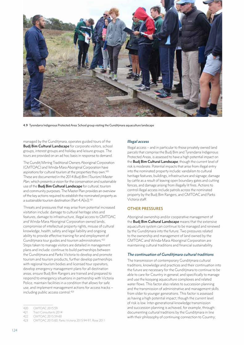
managed by the Gunditjmara, operates guided tours of the Budj Bim Cultural Landscape for corporate visitors, school groups, interest groups and holiday and leisure groups. The tours are provided on an ad hoc basis in response to demand.
The Gunditj Mirring Traditional Owners Aboriginal Corporation (GMTOAC) and Winda-Mara Aboriginal Corporation have aspirations for cultural tourism at the properties they own.420 These are documented in the 2014 Budj Bim (Tourism) Master Plan, which presents a vision for the conservation and sustainable use of the Budj Bim Cultural Landscape for cultural, tourism and community purposes. The Master Plan provides an overview of the key actions required to establish the nominated property as a sustainable tourism destination (Part 4.A[iv]).421
Threats and pressures that may arise from potential increased visitation include: damage to cultural heritage sites and features, damage to infrastructure, illegal access to GMTOAC and Winda-Mara Aboriginal Corporation owned lands, compromise of intellectual property rights, misuse of cultural knowledge, health, safety and legal liability and ongoing ability to provide effective training for and employment of Gunditjmara tour guides and tourism administrators.422 Steps taken to manage visitors are detailed in management plans and include: continue to build partnerships between the Gunditjmara and Parks Victoria to develop and promote tourism and tourism products, further develop partnerships with regional tourism bodies and licensed tour operators, develop emergency management plans for all destination areas, ensure Budj Bim Rangers are trained and prepared to respond to emergency situations in partnership with Victoria Police, maintain facilities in a condition that allows for safe use, and implement management actions for access tracks – including public access control.423
420 GMTOAC 2015:59421 Tract Consultants 2014422 GMTOAC 2015:59-60423 GMTOAC 2015:60; Parks Victoria 2015:94-97; Rose 2011
4.9 Tyrendarra Indigenous Protected Area: School group visiting the Gunditjmara aquaculture landscape
Illegal access
Illegal access – and in particular to those privately owned land parcels that comprise the Budj Bim and Tyrendarra Indigenous Protected Areas, is assessed to have a high potential impact on the Budj Bim Cultural Landscape; though the current level of risk is moderate. Potential impacts that arise from illegal entry into the nominated property include: vandalism to cultural heritage features, buildings, infrastructure and signage; damage by cattle as a result of leaving open boundary gates and cutting fences, and damage arising from illegally lit fires. Actions to control illegal access include patrols across the nominated property by the Budj Bim Rangers, and GMTOAC and Parks Victoria staff.
OTHER PRESSURES
Aboriginal ownership and/or cooperative management of the Budj Bim Cultural Landscape means that the extensive aquaculture system can continue to be managed and renewed by the Gunditjmara into the future. Two pressures related to the ownership and management of land owned by the GMTOAC and Winda-Mara Aboriginal Corporation are maintaining cultural traditions and financial sustainability.
The continuation of Gunditjmara cultural traditions
The transmission of contemporary Gunditjmara cultural traditions, knowledge and practices and their continuation into the future are necessary for the Gunditjmara to continue to be able to care for Country in general; and specifically to manage and use the kooyang aquaculture complexes and related water flows. This factor also relates to succession planning and the transmission of administrative and management skills from older to younger generations. This factor is assessed as having a high potential impact; though the current level of risk is low. Inter-generational knowledge transmission and succession planning is achieved, for example, through: documenting cultural traditions by the Gunditjmara in line with their philosophy of continuing connection to Country;
124
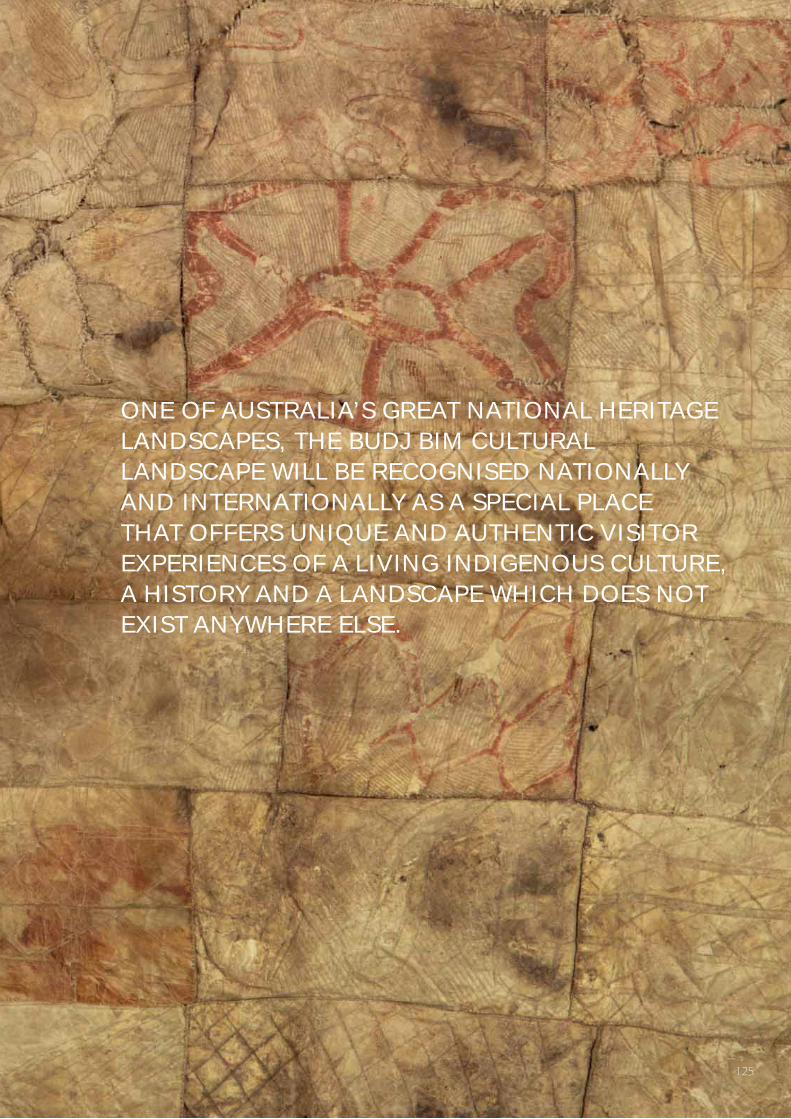
ONE OF AUSTRALIA’S GREAT NATIONAL HERITAGE LANDSCAPES, THE BUDJ BIM CULTURAL LANDSCAPE WILL BE RECOGNISED NATIONALLY AND INTERNATIONALLY AS A SPECIAL PLACE THAT OFFERS UNIQUE AND AUTHENTIC VISITOR EXPERIENCES OF A LIVING INDIGENOUS CULTURE, A HISTORY AND A LANDSCAPE WHICH DOES NOT EXIST ANYWHERE ELSE.
125
the Indigenous Protected Area program, which supports continuing connection to Country, working on and visiting Country; community programs (typically delivered on Country) that support cultural and family strengthening and involvement of youth in several Gunditjmara based traditional dance groups; as well as fostering an employment pathway for Gunditjmara youth in environment, health and education programs to support cultural and family strengthening.
The continuing connection to Country of the Gunditjmara Traditional Owners is supported through partnerships with Parks Victoria, the Department of Environment, Land, Water and Planning (DELWP) – including the Budj Bim Council; the Glenelg Aboriginal Partnership Agreement 2011-2020, the Country Fire Authority and the Glenelg Hopkins Catchment Management Authority. These partnerships integrate cultural knowledge and traditional land management into contemporary protected area and waterway management; respect Gunditjmara knowledge, and provide opportunities for ‘two-way’ learning.424
Financial sustainability
A second pressure relates to the ongoing availability of sustainable, long-term financing to enable the continuing employment of the Budj Bim Rangers and cover the costs associated with Caring for Country. Currently the major funding source for managing Gunditjmara lands is derived from the Australian Government’s ‘Working on Country’ program (which is linked to the Indigenous Advancement Strategy program) and through employment with Victorian Government agencies (including Parks Victoria, Aboriginal Victoria and DELWP). The development of a sustainable and resilient tourism program is a significant potential funding source for the Gunditjmara.425
424 Parks Victoria 2015:63-65425 Tract Consultants 2014; Winda-Mara Aboriginal Corporation
2015:24
4.B(iv) RESPONSIBLE VISITATION AT WORLD HERITAGE SITES
One of Australia’s great national heritage landscapes, the Budj Bim Cultural Landscape will be recognised nationally and internationally as a special place that offers unique and authentic visitor experiences of a living Indigenous culture, a history and a landscape which does not exist anywhere else.426
The Budj Bim (Tourism) Master Plan, which covers the whole of the Budj Bim Cultural Landscape, was prepared for the Gunditj Mirring Traditional Owners Aboriginal Corporation (GMTOAC) in 2014. It presents a vision for the conservation and sustainable use of the nominated property for cultural, tourism and community purposes; along with a range of potential infrastructure works that will enhance business potential and investment attraction and provide a nationally significant visitor experience in south-western Victoria. The Budj Bim (Tourism) Master Plan also recognises opportunities to continue to increase the capacity of the Gunditjmara to manage tourism and thereby increase local community employment.427
CURRENT VISITOR LEVELS
The Budj Bim Cultural Landscape comprises Budj Bim National Park, Budj Bim and Tyrendarra Indigenous Protected Areas and Lake Condah Mission (Part 5.B; Table 5.2). The visitor destination areas within the nominated property generally have a moderate level of site infrastructure (Part 5.H) and 2-wheel-drive road access to some destination areas is restricted. Nevertheless, the nominated property has established visitor walking trails at the Tyrendarra (southern) and Kurtonitj (central) components. Both trails include
426 Tract Consultants 2014:Cover427 Tract Consultants 2014:12
VISITOR TYPE MARKET
2009 2016
NO. % APPROX.
NO.
%
Corporate Visitors Government agencies, regulatory bodies and private companies in the region seeking cultural awareness programs and tours for professional development purposes
250 39% 200 5%
School Groups School groups within south-west Victoria and university students from Melbourne and Warrnambool undertaking field trips
178 27% 2,100 52%
Interest Groups History groups, conservation volunteers, bird watching clubs, photography groups, and mountain bike clubs
164 25% 400 10%
Holiday Visitors International visitors and older domestic visitors 56 9% 1,300 33%
TOTAL 648 100% 4,000 100%
TABLE 4.2 Budj Bim Cultural Landscape: Number of participants in Budj Bim Tours – 2009 and 2016
126
on-site interpretation and viewing areas; and allow visitors to see a variety of aquaculture features (channels, dams, weirs and ponds) without damaging the sites. In addition, both areas have buildings (Part 5.H) able to accommodate talks, educational activities and small-scale functions.
The estimated number of visitors to Budj Bim National Park is 30,000 people per year. Most visits are undertaken as daytrips, with visitation strongest in January, March and April.428 People visit the Budj Bim National Park to bushwalk, view the wildlife (especially koalas and kangaroos), picnic, visit Lake Surprise and explore the volcanic geology; though increasingly visitors are seeking information on the areas’ rich Aboriginal culture, history and heritage. There are no commercial services in Budj Bim National Park. There is a campground at Lake Surprise. Parks Victoria data on numbers of campers indicates that camping for the period July 2016 – June 2017 was 781.429
Budj Bim Tours – established in 2002 and operated by the Winda-Mara Aboriginal Corporation – offers exclusive guided tours to selected areas within the Budj Bim Cultural Landscape. Budj Bim Tours operates out of Heywood, Victoria; itineraries range from two hours to full days. Visitor numbers have increased significantly over the last decade or so (Table 4.2), both as part of the Budj Bim Tours enterprise and as independent travellers are able to access the Tyrendarra (southern) component interpretation trail.
Projected visitor levels and carrying capacity
Current visitor numbers to the Budj Bim Cultural Landscape are at relatively low levels and visitor facilities are adequate for the current numbers of day-visitors and specialist tour participants. Those visitors seeking specialist tours of the landscape with Gunditmara guides are currently well catered for, and the intimate character of such tours is readily managed due to the large area of the nominated property and the variety of available Visitor Experience Areas (described in Part H). However, future increases in visitor numbers to the nominated property will require the continued development of new and improved facilities and infrastructure, as well as the continued building of the Gunditjmara’s tourism business capacity.
The Budj Bim (Tourism) Master Plan identifies ambitious target visitation numbers for the Budj Bim Cultural Landscape – approximately 86,000 visitors by 2030.430 This target will be achieved through: existing visitor markets (school groups, special interest groups and corporate/business groups), expanding into the regional self-drive and bus/coach tour market; and broader ‘experience seeker markets’, both international and domestic, achievable through the development of various overnight accommodation options. Increased visitor numbers will necessarily expand business
428 Tract Consultants 2014:41. The number of visitors to the park as a whole is not monitored.
429 Information provided by Don Tumney, Area Chief Ranger - Glenelg, Parks Victoria, October 2017
430 Tract Consultants 2014:61-62, Table 7
and tourism experience within the Gunditjmara community (for example, through Budj Bim Tours) and require their participation in partnership arrangements with established tour providers to expand available guided tours.
The Budj Bim (Tourism) Master Plan recognises that the successful development of the Budj Bim Cultural Landscape will require a ‘slow build’ approach. That is, a need to build tourism markets, visitor numbers and site facilities progressively over time – through business partnerships and with available resources; rather than looking to meet all market needs in the initial tourism development phase.431 The ‘slow build’ approach also recognises that the nominated property will not function in isolation as a tourism destination. Rather, it recognises the necessity for the Gunditjmara to continue to engage with the regional tourism industry to leverage the skills and capacities of other tourism businesses.432
It is impossible to identify accurately the carrying capacity of the nominated property because of the uncertainty surrounding the funding and timing of upgrading existing facilities and infrastructure and constructing additional facilities (including accommodation). The distribution of visitors is uneven across the whole area – more tourists visit Budj Bim National Park than the Indigenous Protected Areas, for example.
Carrying capacity also assumes that all the social, economic and environmental systems within a landscape are stable and predictable. This is clearly not the case within the Budj Bim Cultural Landscape; it is a dynamic and complex place with many interdependencies. Given these factors, it is not appropriate to establish a carrying capacity for the nominated property.
Nevertheless, monitoring – in its broadest sense – through the indicators established in Part 6.A will determine if the impact of visitation is harming attributes that carry the Outstanding Universal Value; and thereby inform issues relating to carrying capacity. That is, monitoring of tourism levels and impacts will increasingly provide data on issues of carrying capacity. If carrying capacity did become a problem in the medium-term, there are opportunities to open new Visitor Experience Areas within the Budj Bim Cultural Landscape. Such an action would enable the carrying capacity to continue at a manageable scale.
Visitor pressures
Visitor/tourism pressures are identified in Table 4.1. Specific pressures relating to current and projected visitation, as well as steps currently being undertaken to manage these pressures, are discussed above.
431 Tract Consultants 2014:51, 60432 Tract Consultants 2014:51
127
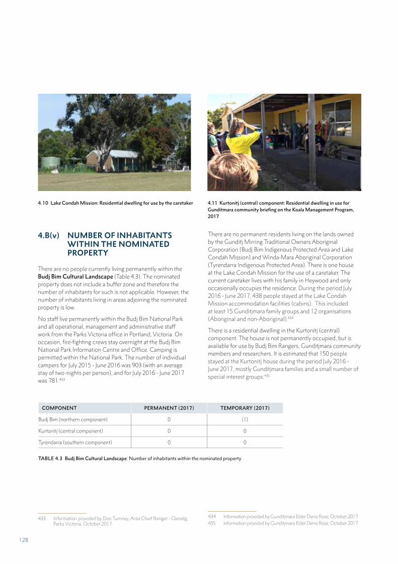
4.B(v) NUMBER OF INHABITANTS WITHIN THE NOMINATED PROPERTY
There are no people currently living permanently within the Budj Bim Cultural Landscape (Table 4.3). The nominated property does not include a buffer zone and therefore the number of inhabitants for such is not applicable. However, the number of inhabitants living in areas adjoining the nominated property is low.
No staff live permanently within the Budj Bim National Park and all operational, management and administrative staff work from the Parks Victoria office in Portland, Victoria. On occasion, fire-fighting crews stay overnight at the Budj Bim National Park Information Centre and Office. Camping is permitted within the National Park. The number of individual campers for July 2015 - June 2016 was 903 (with an average stay of two-nights per person), and for July 2016 - June 2017 was 781.433
433 Information provided by Don Tumney, Area Chief Ranger - Glenelg, Parks Victoria, October 2017
There are no permanent residents living on the lands owned by the Gunditj Mirring Traditional Owners Aboriginal Corporation (Budj Bim Indigenous Protected Area and Lake Condah Mission) and Winda-Mara Aboriginal Corporation (Tyrendarra Indigenous Protected Area). There is one house at the Lake Condah Mission for the use of a caretaker. The current caretaker lives with his family in Heywood and only occasionally occupies the residence. During the period July 2016 - June 2017, 438 people stayed at the Lake Condah Mission accommodation facilities (cabins). This included at least 15 Gunditjmara family groups and 12 organisations (Aboriginal and non-Aboriginal).434
There is a residential dwelling in the Kurtonitj (central) component. The house is not permanently occupied, but is available for use by Budj Bim Rangers, Gunditjmara community members and researchers. It is estimated that 150 people stayed at the Kurtonitj house during the period July 2016 - June 2017, mostly Gunditjmara families and a small number of special interest groups.435
434 Information provided by Gunditjmara Elder Denis Rose, October 2017435 Information provided by Gunditjmara Elder Denis Rose, October 2017
COMPONENT PERMANENT (2017) TEMPORARY (2017)
Budj Bim (northern component) 0 (1)
Kurtonitj (central component) 0 0
Tyrendarra (southern component) 0 0
TABLE 4.3 Budj Bim Cultural Landscape: Number of inhabitants within the nominated property
4.10 Lake Condah Mission: Residential dwelling for use by the caretaker 4.11 Kurtonitj (central) component: Residential dwelling in use for Gunditmara community briefing on the Koala Management Program, 2017
128
PART 5
PROTECTION AND MANAGEMENT OF
THE PROPERTY
129
PART 5 PROTECTION AND MANAGEMENT OF THE PROPERTY
The GMTOAC has developed guiding principles for implementing a customary approach to the management and protection of the Budj Bim Cultural Landscape. The five principles by which Gunditjmara make decisions on the management of the nominated property are:
• The protection of the Budj Bim Cultural Landscape is paramount
• The Budj Bim Cultural Landscape is a dynamic living place
• The Budj Bim Cultural Landscape is a place of learning
• Connections with the Budj Bim Cultural Landscape are strengthened
• All uses and users of the Budj Bim Cultural Landscape respect its significance.436
It is the intention of the GMTOAC, Winda-Mara Aboriginal Corporation, the Victorian Government and the Australian Government that a Budj Bim Cultural Landscape World Heritage Strategic Management Framework be developed. While the Budj Bim Cultural Landscape is already comprehensively managed and protected under the current system, a strategic management framework will synthesise and further consolidate these arrangements. In addition, the implementation and oversight of the framework will be undertaken by a Budj Bim Cultural Landscape World Heritage Steering Committee – a group that will be established at such time as the nominated property is inscribed on the World Heritage List. The Steering Committee will ensure the continued coordinated management of the nominated property.
5.A OWNERSHIP
The primary categories of land ownership are presented in Table 5.1. Owners of the different land parcels within the nominated area comprise the GMTOAC, Wind-Mara Aboriginal Corporation and the Victorian Government. The Budj Bim Indigenous Protected Area, which is owned and managed by the GMTOAC, includes land parcels in each of the three components of the nominated property.
436 GMTOAC 2015:12
The Budj Bim Cultural Landscape is comprehensively managed and protected under a system comprising Gunditjmara customary knowledge and practices in conjunction with National and State legislation, complementary management plans and associated policies and programs. The management system combines Traditional Owner and adaptive management approaches (Table 3.2), in which governance and decision-making is shared between the Gunditj Mirring Traditional Owners Aboriginal Corporation (GMTOAC), the Budj Bim Council and Winda-Mara Aboriginal Corporation. Each management group has a majority representation of Gunditjmara Traditional Owners; which ensures coordination across them.
The Budj Bim Council is responsible for overseeing the cooperative management of Budj Bim (formerly Mount Eccles) National Park. It demonstrates the ‘two-way’ sharing of expertise between Gunditjmara Traditional Owners and Victorian Government agencies. The 2015 Ngootyoong Gunditj, Ngootyoong Mara South West Management Plan, which covers all protected areas within Gunditjmara Country, establishes the management framework and mechanism for management coordination for the three serial components of the Budj Bim Cultural Landscape.
COMPONENT OWNERSHIP
Budj Bim (northern component)
Budj Bim National Park State of Victoria. A Co-operative Management Agreement for the National Park has been established between the GMTOAC* and the Victorian Government.
Budj Bim Indigenous Protected Area GMTOAC
Lake Condah Mission GMTOAC
Kurtonitj (central component)
Budj Bim Indigenous Protected Area GMTOAC
Tyrendarra (southern component)
Tyrendarra Indigenous Protected Area Winda-Mara Aboriginal Corporation
Budj Bim Indigenous Protected Area GMTOAC
* GMTOAC = Gunditj Mirring Traditional Owners Aboriginal Corporation
TABLE 5.1 Budj Bim Cultural Landscape: Ownership
130
5.B PROTECTIVE DESIGNATION
The Budj Bim Cultural Landscape is wholly within the Country of the Gunditjmara and is subject to the traditional and customary rights and obligations of the Gunditjmara Traditional Owners. These rights are recognised under the Australian Government’s Native Title Act 1993 and the Victorian Government’s Aboriginal Heritage Act 2006. The Gunditjmara’s traditional and customary rights and obligations are implemented through governance arrangements (Part 5.C). These rights and obligations are recognised in and enacted through property management plans (Parts 5.E).
DESIGNATION
The Budj Bim Cultural Landscape comprises land parcels whose tenure includes National Park, Indigenous Protected Area (both being components of Australia’s National Reserve System) and land owned by the Gunditjmara Traditional Owners (Table 5.2). In the latter case, the Lake Condah Mission on land owned and managed by the Gunditj Mirring Traditional Owners Aboriginal Corporation (GMTOAC).
Most of the nominated property was included on Australia’s National Heritage List in 2004 as the Budj Bim National Heritage Landscape. Some additional areas within the nominated property – and now incorporated into the Budj Bim Indigenous Protected Area, have been acquired by the Gunditjmara since the 2004 National listing. These areas are now recognised as integral to the Outstanding Universal Value of the Budj Bim Cultural Landscape. All listed National and World heritage values are protected under the Environment Protection and Biodiversity Conservation Act 1999.
INDIGENOUS PROTECTED AREA (IPA) PROGRAM
Indigenous practices of caring for habitats, species and ecological functions have been in existence for thousands of years. Since 1997, the Australian Government has formally recognised Aboriginal and Torres Strait Islander peoples’ management of Country (often referred to as ‘Caring for Country’) by including and funding Indigenous Protected Areas (IPAs) within Australia’s National Reserve System. IPAs currently make up almost 50 percent of the National Reserve System, and allow the Australian Government to meet its obligations under the international Convention on Biological Diversity.437
437 Convention on Biological Diversity. ‘The Convention on Biological Diversity’, https://www.cbd.int/convention/
IPAs are areas of land or sea Country that have been voluntarily dedicated by their Traditional Owners. IPAs are managed through an agreement between a Traditional Owner group and the Australian Government; established by a combination of legal and other administrative measures consistent with international Protected Area guidelines. They serve to promote biodiversity conservation, cultural maintenance and governance, customary sustainable resource use and community benefit-sharing.
The success of the IPA Program is underpinned by principles that empower Traditional Owners and Aboriginal and Torres Strait Islander communities. Caring for Country is a community-led, participatory planning process. IPA management plans combine traditional knowledge and customary decision-making with contemporary science and governance systems.
The IPA Program balances conservation with community benefits. Indigenous people are given the opportunity to apply their aspirations for their Country, which can include a mix of conservation activities and other land uses. The Program fosters Indigenous business development and increased economic participation; including sustainable grazing, ecotourism, bush tucker (native food plant) harvesting and ‘fee for service’ arrangements on adjoining agricultural, mining and conservation tenures. The Program enables Indigenous communities to form partnerships with government, business, researchers and philanthropic organisations. In addition to the environmental benefits, IPAs provide employment opportunities, promote community cohesion and improve relationships between Indigenous communities and other land and sea managers.
Independent reviews have consistently found that the IPA Program contributes to improved individual and family health, increased well-being and self-confidence, and lower rates of community violence, crime and incarceration rates. The Program is currently delivered by the Department of the Prime Minister and Cabinet’s Regional Network in combination with Indigenous rangers funded under the Indigenous Advancement Strategy.
IPAs are internationally recognised as successful models for community-conserved areas with an important role in the global Protected Area estate. International Union for the Conservation of Nature (IUCN) guidelines recognise Indigenous ownership and customary laws, institutions and traditional land management practices of Indigenous communities as effective mechanisms for delivering Protected Area management and responding to the management objectives of the IUCN Protected Area categories.438
438 IUCN. ‘Protected Areas’, https://www.iucn.org/theme/protected-areas/about/protected-area-categories
131
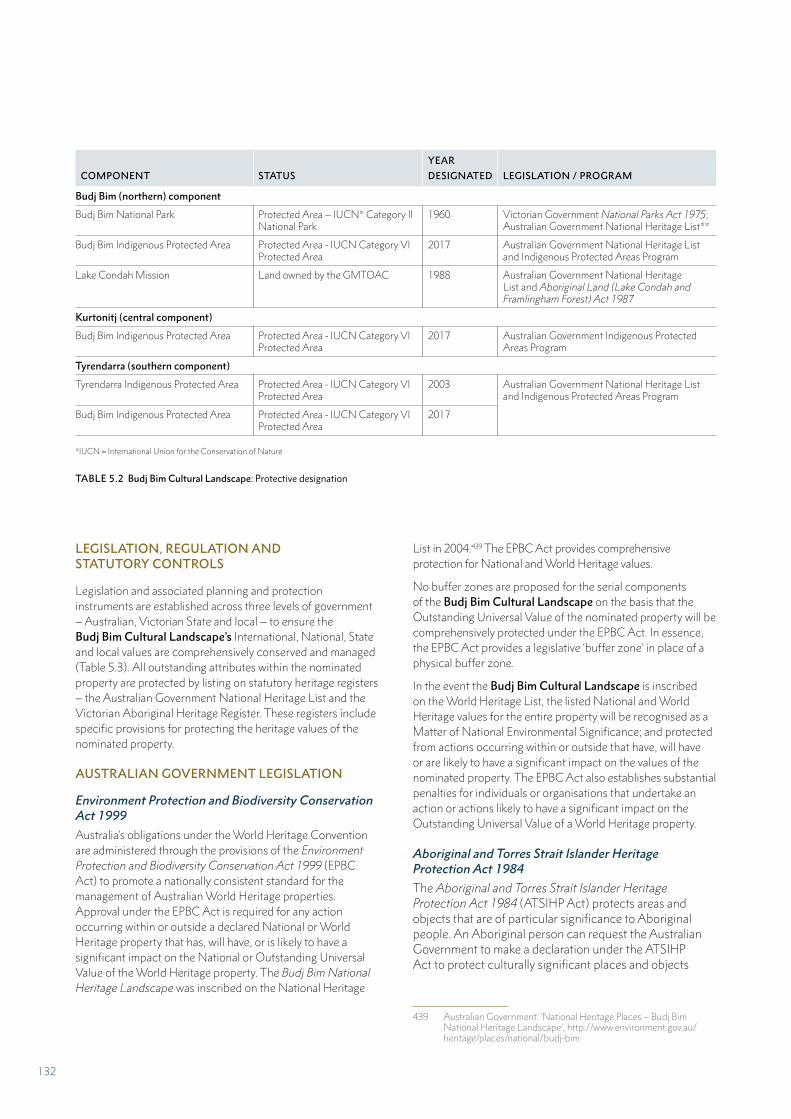
COMPONENT STATUS
YEAR
DESIGNATED LEGISLATION / PROGRAM
Budj Bim (northern) component
Budj Bim National Park Protected Area – IUCN* Category II National Park
1960 Victorian Government National Parks Act 1975; Australian Government National Heritage List**
Budj Bim Indigenous Protected Area Protected Area - IUCN Category VI Protected Area
2017 Australian Government National Heritage List and Indigenous Protected Areas Program
Lake Condah Mission Land owned by the GMTOAC 1988 Australian Government National Heritage List and Aboriginal Land (Lake Condah and Framlingham Forest) Act 1987
Kurtonitj (central component)
Budj Bim Indigenous Protected Area Protected Area - IUCN Category VI Protected Area
2017 Australian Government Indigenous Protected Areas Program
Tyrendarra (southern component)
Tyrendarra Indigenous Protected Area Protected Area - IUCN Category VI Protected Area
2003 Australian Government National Heritage List and Indigenous Protected Areas Program
Budj Bim Indigenous Protected Area Protected Area - IUCN Category VI Protected Area
2017
*IUCN = International Union for the Conservation of Nature
TABLE 5.2 Budj Bim Cultural Landscape: Protective designation
LEGISLATION, REGULATION AND STATUTORY CONTROLS
Legislation and associated planning and protection instruments are established across three levels of government – Australian, Victorian State and local – to ensure the Budj Bim Cultural Landscape’s International, National, State and local values are comprehensively conserved and managed (Table 5.3). All outstanding attributes within the nominated property are protected by listing on statutory heritage registers – the Australian Government National Heritage List and the Victorian Aboriginal Heritage Register. These registers include specific provisions for protecting the heritage values of the nominated property.
AUSTRALIAN GOVERNMENT LEGISLATION
Environment Protection and Biodiversity Conservation Act 1999
Australia’s obligations under the World Heritage Convention are administered through the provisions of the Environment Protection and Biodiversity Conservation Act 1999 (EPBC Act) to promote a nationally consistent standard for the management of Australian World Heritage properties. Approval under the EPBC Act is required for any action occurring within or outside a declared National or World Heritage property that has, will have, or is likely to have a significant impact on the National or Outstanding Universal Value of the World Heritage property. The Budj Bim National Heritage Landscape was inscribed on the National Heritage
List in 2004.439 The EPBC Act provides comprehensive protection for National and World Heritage values.
No buffer zones are proposed for the serial components of the Budj Bim Cultural Landscape on the basis that the Outstanding Universal Value of the nominated property will be comprehensively protected under the EPBC Act. In essence, the EPBC Act provides a legislative ‘buffer zone’ in place of a physical buffer zone.
In the event the Budj Bim Cultural Landscape is inscribed on the World Heritage List, the listed National and World Heritage values for the entire property will be recognised as a Matter of National Environmental Significance; and protected from actions occurring within or outside that have, will have or are likely to have a significant impact on the values of the nominated property. The EPBC Act also establishes substantial penalties for individuals or organisations that undertake an action or actions likely to have a significant impact on the Outstanding Universal Value of a World Heritage property.
Aboriginal and Torres Strait Islander Heritage Protection Act 1984
The Aboriginal and Torres Strait Islander Heritage Protection Act 1984 (ATSIHP Act) protects areas and objects that are of particular significance to Aboriginal people. An Aboriginal person can request the Australian Government to make a declaration under the ATSIHP Act to protect culturally significant places and objects
439 Australian Government. ‘National Heritage Places – Budj Bim National Heritage Landscape’, http://www.environment.gov.au/heritage/places/national/budj-bim
132
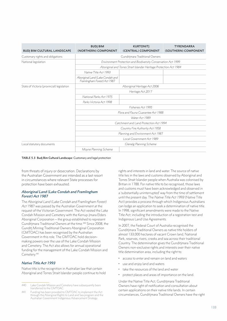
BUDJ BIM CULTURAL LANDSCAPE
BUDJ BIM
(NORTHERN) COMPONENT
KURTONITJ
(CENTRAL) COMPONENT
TYRENDARRA
(SOUTHERN) COMPONENT
Customary rights and obligations Gunditjmara Traditional Owners
National legislation Environment Protection and Biodiversity Conservation Act 1999
Aboriginal and Torres Strait Islander Heritage Protection Act 1984
Native Title Act 1993
Aboriginal Land (Lake Condah and Framlingham Forest) Act 1987
State of Victoria (provincial) legislation Aboriginal Heritage Act 2006
Heritage Act 2017
National Parks Act 1975
Parks Victoria Act 1998
Fisheries Act 1995
Flora and Fauna Guarantee Act 1988
Water Act 1989
Catchment and Land Protection Act 1994
Country Fire Authority Act 1958
Planning and Environment Act 1987
Local Government Act 1989
Local statutory documents Glenelg Planning Scheme
Moyne Planning Scheme
TABLE 5.3 Budj Bim Cultural Landscape: Customary and legal protection
from threats of injury or desecration. Declarations by the Australian Government are intended as a last resort in circumstances where relevant State processes for protection have been exhausted.
Aboriginal Land (Lake Condah and Framlingham Forest) Act 1987
The Aboriginal Land (Lake Condah and Framlingham Forest) Act 1987 was passed by the Australian Government at the request of the Victorian Government. The Act vested the Lake Condah Mission and Cemetery with the Kerrup-Jmara Elders Aboriginal Corporation – the group established to represent Gunditjmara Traditional Owners at the time.440 Since 2008, the Gunditj Mirring Traditional Owners Aboriginal Corporation (GMTOAC) has been recognised by the Australian Government in this role. The GMTOAC hold decision-making powers over the use of the Lake Condah Mission and Cemetery. The Act also allows for annual operational funding for the management of the Lake Condah Mission and Cemetery.441
Native Title Act 1993
Native title is the recognition in Australian law that certain Aboriginal and Torres Strait Islander people continue to hold
440 Lake Condah Mission and Cemetery have subsequently been transferred to the GMTOAC.
441 Funding has been provided to GMTOAC to implement the Act through the Aboriginal Rights to Land and Sea program and the Australian Government Indigenous Advancement Strategy.
rights and interests in land and water. The source of native title lies in the laws and customs observed by Aboriginal and Torres Strait Islander people when Australia was colonised by Britian in 1788. For native title to be recognised, those laws and customs must have been acknowledged and observed in a ‘substantially uninterrupted’ way from the time of settlement until the present day. The Native Title Act 1993 (Native Title Act) provides a process through which Indigenous Australians can lodge an application to seek a determination of native title. In 1998, significant amendments were made to the Native Title Act; including the introduction of a registration test and Indigenous Land Use Agreements.
In 2007, the Federal Court of Australia recognised the Gunditjmara Traditional Owners as native title holders of almost 133,000 hectares of vacant Crown land, National Park, reserves, rivers, creeks and sea across their traditional Country. The determination gives the Gunditjmara Traditional Owners non-exclusive rights and interests over their native title determination area, including the right to:
• access to enter and remain on land and waters
• use and enjoy land and waters
• take the resources of the land and water
• protect places and areas of importance on the land.
Under the Native Title Act, Gunditjmara Traditional Owners have right of notification and consultation about certain applications on their native title lands. In certain circumstances, Gunditjmara Traditional Owners have the right
133
to negotiate and raise native title issues with proponents of development and land use activities.
VICTORIAN GOVERNMENT LEGISLATION
Aboriginal Heritage Act 2006
The Aboriginal Heritage Act 2006 (Aboriginal Heritage Act) is Victoria’s principal legislation for the protection of Aboriginal cultural heritage and the management of Aboriginal cultural heritage in relation to development and land use activities. The Aboriginal Heritage Act protects all Aboriginal cultural heritage in Victoria; regardless of whether it has been recorded in the Register established under the Act, and prescribes significant penalties to ensure Aboriginal cultural heritage is protected from harm.
The Aboriginal Heritage Act legislates a central role for Aboriginal people in identifying, managing and protecting their cultural heritage. It does this by establishing Registered Aboriginal Parties; organisations with statutory decision-making responsibilities for Aboriginal cultural heritage in their appointed geographical area. These responsibilities include; approving and participating in the assessment of Cultural Heritage Management Plans, deciding Cultural Heritage Permits, advising the Victorian Government about Aboriginal cultural heritage and carrying out compliance and enforcement activities. Registered Aboriginal Parties are appointed by the Victorian Aboriginal Heritage Council (Council); a group comprising up to 11 Traditional Owners with extensive knowledge and experience in cultural heritage management. The Council appointed the Gunditj Mirring Traditional Owners Aboriginal Corporation (GMTOAC) as a Registered Aboriginal Party over Gunditjmara traditional Country (including the Budj Bim Cultural Landscape in its entirety) in 2007.442
The Aboriginal Heritage Act establishes mechanisms to ensure Aboriginal cultural heritage is properly managed during development and land use activities, or in regard to any act which may harm Aboriginal cultural heritage. Cultural Heritage Management Plans may be prepared for any proposed development or land use activity in Victoria and are mandatory for those activities that will, or are likely to harm Aboriginal cultural heritage. Cultural Heritage Management Plans require: an assessment of an activity area to determine the nature, extent and significance of Aboriginal cultural heritage present; and a written report which includes legislatively enforced management conditions.
In addition to these protection mechanisms, the Aboriginal Heritage Act also establishes the Victorian Aboriginal Heritage Register – for Victorian Traditional Owners to store information concerning: (1) their cultural heritage (including
442 Aboriginal Victoria. ‘Gunditj Mirring Traditional Aboriginal Corporation’, http://www.vic.gov.au/aboriginalvictoria/heritage/registered-aboriginal-parties/gunditj-mirring-traditional-owners-ab-original-corporation.html
Aboriginal intangible heritage); (2) Protection Declarations – to enforce specific protective measures over significant Aboriginal places; (3) Aboriginal Cultural Heritage Land Management Agreements – to protect Aboriginal places during routine land management activities; and (4) Aboriginal Intangible Heritage Agreements – to assist Traditional Owners decide if and how their intangible heritage is used by others.
The Aboriginal Heritage Regulations 2007 (Aboriginal Heritage Regulations) give effect to the Aboriginal Heritage Act, and prescribe the standards of assessment, forms and associated fees of the Aboriginal Heritage Act’s provisions – including for Cultural Heritage Management Plans. The Aboriginal Heritage Regulations specify the circumstances in which a Cultural Heritage Management Plan is required for an activity or class of activity. Specifically, a Cultural Heritage Management Plan is mandatory for any ‘high impact activity’ proposed in an ‘area of cultural heritage sensitivity’. High impact activities and areas of cultural heritage sensitivity are defined in the Aboriginal Heritage Regulations.
The Budj Bim Cultural Landscape is a defined area of cultural heritage sensitivity in its entirety. The Aboriginal Heritage Regulations define the extraction or removal of loose stone (including that related to the Budj Bim lava flow) on agricultural land associated with the Western Victorian Volcanic Plain as a high impact activity. This protects the nominated property from any agricultural activities which could harm the Budj Bim lava flow. Significant penalties apply to any person who damages, defaces, desecrates, destroys, disturbs, injures or interferes with any Aboriginal place or object unless in accordance with an approved Cultural Heritage Management Plan or Cultural Heritage Permit. GMTOAC is the approval body for all Cultural Heritage Management Plans and Cultural Heritage Permits for activities within the nominated property and across the whole of its Registered Aboriginal Party area.
Heritage Act 2017
The Heritage Act 2017 (Heritage Act) is Victoria’s principal legislation for the identification and management of ‘post-contact’ heritage places and objects of State significance, historical archaeological sites and maritime heritage. This includes historic buildings, structures and precincts; gardens, trees and cemeteries; historic archaeological sites; cultural landscapes; shipwrecks and associated relics; and significant objects. The Heritage Act does not apply to places of Aboriginal significance; as they are protected under the Aboriginal Heritage Act 2006 (see above). The Heritage Act establishes the Victorian Heritage Register, which lists and protects heritage places and objects significant to the history and development of Victoria. Any works or activities which may impact a listed place or object requires a heritage Permit issued by Heritage Victoria; the Victorian Government agency responsible for administering the Heritage Act.
134
The Heritage Act also provides for the management of places in Victoria that are inscribed in the World Heritage List. World Heritage listed properties must be recorded on the Victorian Heritage Register and this will apply to the Budj Bim Cultural Landscape in the event that it is so inscribed.
National Parks Act 1975
The National Parks Act 1975 is Victoria’s principal legislation for declaring protected areas (Parks) for the purposes of preserving and protecting the natural environment and archaeological or historical features and for the responsible management of Parks. The Act establishes the purposes of Parks, management responsibilities and permitted activities and works. The Act also sets out a range of offences and the penalties for non-compliance. Budj Bim (formerly Mount Eccles) National Park has been established under the provisions of the National Parks Act.
Parks Victoria Act 1998
The Parks Victoria Act 1998 establishes Parks Victoria as the Victorian Government agency responsible for providing services to the State and its agencies for the management of Parks, Reserves and other public land. With the approval of the relevant Minister, Parks Victoria may also provide land management services to the owner of any other land used for public purposes. Parks Victoria’s Ngootyoong Gunditj Ngootyoong Mara South West Management Plan – developed in partnership with the GMTOAC, covers all components of the Budj Bim Cultural Landscape, comprising Budj Bim National Park, Budj Bim and Tyrendarra Indigenous Protected Areas and Lake Condah Mission.443
Fisheries Act 1995
The Fisheries Act 1995 (Fisheries Act) provides the legislative framework for managing Victoria’s fisheries resources and sets out the general provisions applicable to all recreational fishing activities and commercial access licences, including the Eel Fishery Access Licence. The objectives of the Fisheries Act include: facilitating the management and development of Victoria’s fisheries, protection and conservation of fishery resources, and promoting sustainable fishing and aquaculture industries.
Under the Fisheries Act, the responsible Minister may declare a management plan be prepared for a Victorian Fishery. The purpose of Fishery Management Plans is to specify policies and strategies for the management of the fishery; having regard to the commercial, recreational, traditional and non-consumptive uses of the fishery. Fishery Management Plans may specify restrictions in fishery reserves, specify conditions and permit types, specify fishing capacities and licensing requirements.
443 Parks Victoria 2015
The Victorian Minister for Agriculture declared the Victorian Eel Fishery Management Plan in 2017.444 The Management Plan recognises access to eel resources as fundamental to the wellbeing of many Aboriginal Victorians, and recognises the fishing rights provided for by the Native Title Act 1993. The Management Plan also outlines management strategies to ensure its objectives are met. These objectives include the long-term sustainability of eel resources and equitable resource access and use. The management strategies include commercial and recreational eel harvest restrictions and restricting eel fishing from certain waterways.
Flora and Fauna Guarantee Act 1988
The Flora and Fauna Guarantee Act 1988 aims to conserve all of Victoria’s native plants and animals. The Act establishes a process for listing threatened species and communities and requires action plans describing the required actions to protect the threatened species. The Act also allows for the declaration of habitat critical to the survival of native plants and animals and interim conservation orders to protect and manage these areas. The Act controls the impact of activities on threatened plants and animals through a regulatory framework including permit requirements. The Act also establishes a range of compliance and enforcement mechanisms and provides powers to authorised officers to ensure businesses and the community comply with legislative requirements.
Water Act 1989
The Water Act 1989 (Water Act) is Victoria’s principal legislation related to water. The Water Act ensures water resources are properly managed by and conserved for all Victorians. The Water Act establishes the allocation and management of Victoria’s water resources, and the functions, rights, and obligations of Victoria’s water corporations. The Water Act provides for sustainable management principles for water corporations. These principles incorporate internationally recognised environmental concepts, which ensure water corporations sustainably manage water resources for use by future generations.
The Water Act controls water use through various licenses and entitlements. Among these are environmental entitlements, which provide for environmental releases of water from specified waterways to mimic seasonal flow patterns. Environmental releases contribute to enabling fish migration, maintaining and connecting habitats, and regenerating wetlands and floodplains. The GMTOAC has a requirement to maintain water flow from the weir at Lake Condah to ensure the environmental conditions of Killara (Darlot Creek) are maintained.
444 Victorian Fisheries Authority 2017
135
Catchment and Land Protection Act 1994
The Catchment and Land Protection Act 1994 establishes a framework for the management and protection of Victoria’s water catchments, as well as a system of controls on noxious weeds and pest animals. The Act achieves this by legislating Catchment Management Authorities across Victoria, which are responsible for ensuring the quality of the State’s land and water resources while maintaining and enhancing associated native plants and animals. The Glenelg Hopkins Catchment Management Authority is responsible for the Glenelg Hopkins Catchment, within which the Budj Bim Cultural Landscape is located. The Glenelg Hopkins Catchment Management Authority is responsible for reporting on the condition of water in the catchment, and assists with water quality monitoring.
Country Fire Authority Act 1958
The Country Fire Authority provides Victoria-wide coordination of wildfire, structural and transport-related fire and emergency response. The Country Fire Authority is also involved in a range of non-emergency activities; including supporting private landowners in fire prevention and planning, vegetation management, planned burning and sustainable fire management, including supporting Traditional Owners to undertake ‘cultural burns’ (Part 4).
Planning and Environment Act 1987
The Planning and Environment Act 1987 (Planning and Environment Act) establishes procedures for preparing and amending local planning schemes that set out how land may be used and developed within the framework of the Victorian Planning Provisions. It also has provisions for obtaining permits for development and rezoning land, and includes enforcing provisions. Two planning schemes under the Planning and Environment Act apply to the Budj Bim Cultural Landscape: the Glenelg and Moyne planning schemes.
Local Government Act 1989
The Local Government Act 1989 is Victoria’s principal legislation for the establishment and operation of local government authorities. The Act defines the purposes and functions of local government as well as providing the legal framework for establishing and administering the elected representative body (the council). Two local government authorities administer planning schemes under the Planning and Environment Act 1987 for their local government areas (including those areas within the Budj Bim Cultural Landscape) – the Glenelg Shire Council and Moyne Shire Council.
LOCAL STATUTORY DOCUMENTS
A ‘planning scheme’ is a statutory document which regulates the use and development of land to which it applies; through zoning, objectives, policies and specific provisions.445
Glenelg and Moyne Planning Schemes
The Glenelg and Moyne planning scheme establish a ‘special use zone’ over parts of the Budj Bim (northern) component of the Budj Bim Cultural Landscape, including Tae Rak (Lake Condah) and the Lake Condah Mission. The purpose of the special use zone is to provide for the development of land consistent with the protection, conservation and management of the natural and Aboriginal cultural values. The special use zone also provides for the continuation of Aboriginal cultural practices. The types of development activities permitted in the special use zone are restricted to those which support its purposes.
The planning schemes also establish a ‘public conservation and resource zone’ over Budj Bim National Park which provides for the development of the Park consistent with the protection and conservation of the natural environment and its historic, scientific, landscape, habitat and cultural values. The zone allows for the development of facilities that assist in public education and interpretation of the Park; so long as these have minimal impacts on the natural environment or natural processes.
The planning schemes also establish an ‘environmental significance overlay’ over Palawarra (Fitzroy River) and Killara (Darlot Creek), immediately adjacent to the serial components of the Budj Bim Cultural Landscape. The purpose of the zone is to prevent pollution by limiting inappropriate development and land use adjacent to significant wetlands and waterways. A permit is required for a broad range of activities in this zone. Decisions on permit applications must include an assessment of the likely environmental impact of the proposed activity to water quality and flora and landscape features.
Finally, the schemes also establish a ‘bushfire [wildfire] management overlay’ over much of the Budj Bim Cultural Landscape. The purpose of the overlay is to ensure that the protection of life and property, as well as strengthening community resilience to wildfire, is prioritised in current and future development and land use activities.
445 Victorian State Government. Planning Schemes Online. ‘About planning schemes’, http://planning-schemes.delwp.vic.gov.au/about
136
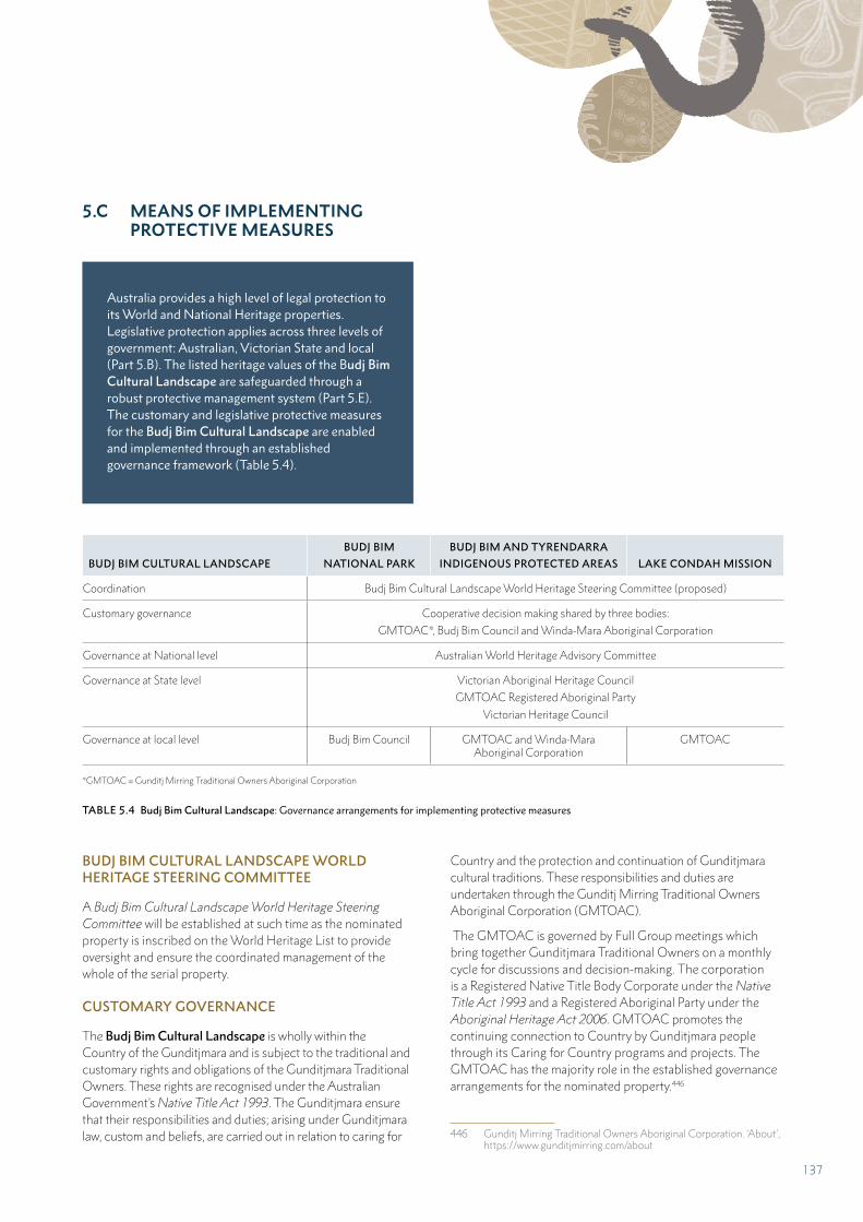
5.C MEANS OF IMPLEMENTING PROTECTIVE MEASURES
Australia provides a high level of legal protection to its World and National Heritage properties. Legislative protection applies across three levels of government: Australian, Victorian State and local (Part 5.B). The listed heritage values of the Budj Bim Cultural Landscape are safeguarded through a robust protective management system (Part 5.E). The customary and legislative protective measures for the Budj Bim Cultural Landscape are enabled and implemented through an established governance framework (Table 5.4).
BUDJ BIM CULTURAL LANDSCAPE
BUDJ BIM
NATIONAL PARK
BUDJ BIM AND TYRENDARRA
INDIGENOUS PROTECTED AREAS LAKE CONDAH MISSION
Coordination Budj Bim Cultural Landscape World Heritage Steering Committee (proposed)
Customary governance Cooperative decision making shared by three bodies:
GMTOAC*, Budj Bim Council and Winda-Mara Aboriginal Corporation
Governance at National level Australian World Heritage Advisory Committee
Governance at State level Victorian Aboriginal Heritage Council
GMTOAC Registered Aboriginal Party
Victorian Heritage Council
Governance at local level Budj Bim Council GMTOAC and Winda-Mara Aboriginal Corporation
GMTOAC
*GMTOAC = Gunditj Mirring Traditional Owners Aboriginal Corporation
TABLE 5.4 Budj Bim Cultural Landscape: Governance arrangements for implementing protective measures
BUDJ BIM CULTURAL LANDSCAPE WORLD HERITAGE STEERING COMMITTEE
A Budj Bim Cultural Landscape World Heritage Steering Committee will be established at such time as the nominated property is inscribed on the World Heritage List to provide oversight and ensure the coordinated management of the whole of the serial property.
CUSTOMARY GOVERNANCE
The Budj Bim Cultural Landscape is wholly within the Country of the Gunditjmara and is subject to the traditional and customary rights and obligations of the Gunditjmara Traditional Owners. These rights are recognised under the Australian Government’s Native Title Act 1993. The Gunditjmara ensure that their responsibilities and duties; arising under Gunditjmara law, custom and beliefs, are carried out in relation to caring for
Country and the protection and continuation of Gunditjmara cultural traditions. These responsibilities and duties are undertaken through the Gunditj Mirring Traditional Owners Aboriginal Corporation (GMTOAC).
The GMTOAC is governed by Full Group meetings which bring together Gunditjmara Traditional Owners on a monthly cycle for discussions and decision-making. The corporation is a Registered Native Title Body Corporate under the Native Title Act 1993 and a Registered Aboriginal Party under the Aboriginal Heritage Act 2006. GMTOAC promotes the continuing connection to Country by Gunditjmara people through its Caring for Country programs and projects. The GMTOAC has the majority role in the established governance arrangements for the nominated property.446
446 Gunditj Mirring Traditional Owners Aboriginal Corporation. ‘About’, https://www.gunditjmirring.com/about
137
GOVERNANCE AT NATIONAL LEVEL
Australian World Heritage Advisory Committee
The Australian World Heritage Advisory Committee (AWHAC) was established in 2008. It is a forum advising Australia’s Federal, State and Territory governments on issues affecting Australia’s World Heritage properties. The AWHAC comprises the Chairs of the advisory committees from each World Heritage property in Australia. Membership of the AWHAC includes two Traditional Owner representatives, who are also co-chairs of the Australian World Heritage Indigenous Network.
The role of this committee includes: providing a forum for World Heritage site managers to share information on best-practice management of World Heritage sites, facilitating the sharing of knowledge and experience, encouraging continual improvement in the protection of World Heritage properties, advising on the development of effective national policies, and identifying and considering matters that require an agreed common approach between multiple jurisdictions. Another of the AWHAC’s specific functions is to advise on research, monitoring and other information needs for World Heritage properties.
In the event the Budj Bim Cultural Landscape is inscribed on the World Heritage List, an authorised Gunditjmara Traditional Owner representative for the nominated property will be appointed to the AWHAC and to the Australian World Heritage Indigenous Network.
GOVERNANCE AT VICTORIAN STATE LEVEL
The Victorian Aboriginal Heritage Council (Council) was created under the Aboriginal Heritage Act 2006 to ensure that Traditional Owners in Victoria play a central role in the protection and management of their cultural heritage. The Council consists of up to 11 Traditional Owners who are appointed by the Minister for Aboriginal Affairs. All members are resident in Victoria and have extensive knowledge and relevant experience or knowledge of Aboriginal cultural heritage in Victoria. The Council determines applications for appointment as a Registered Aboriginal Party.
The GMTOAC was appointed as a Registered Aboriginal Party for Gunditjmara Country in 2007, an area that includes the Budj Bim Cultural Landscape. As such, the GMTOAC is recognised as the primary guardian, keeper and knowledge holder of Aboriginal cultural heritage for the Registered Aboriginal Party area, including the Budj Bim Cultural Landscape. Its responsibilities include evaluating Cultural Heritage Management Plans, determining Cultural Heritage Permits, making decisions about Cultural Heritage Agreements and providing advice on applications for interim and ongoing Protection Declarations.
The Victorian Heritage Council is established under the Heritage Act 2017. The Heritage Council, which includes a new membership role concerning Aboriginal heritage, has a role in regard to World Heritage listed properties in Victoria (Part 5.B). The Victorian Heritage Council and the Victorian Aboriginal Heritage Council will establish protocols for their respective governance and management roles under the Heritage Act 2017 and the Aboriginal Heritage Act 2006 in the event the Budj Bim Cultural Landscape is inscribed on the World Heritage List.
Governance at local level
The native title determination on 30 March 2007 recognised the Gunditjmara’s non-exclusive native title rights and interests over various lands, including Budj Bim National Park.447
The governance, decision-making and administrative bodies that oversee and cooperate in the protection and management of the Budj Bim Cultural Landscape are the Budj Bim Council, GMTOAC and Winda-Mara Aboriginal Corporation.
Budj Bim Council
The Budj Bim Council was established as part of the cooperative management agreement between GMTOAC and the Victorian government for the Budj Bim National Park. The Budj Bim Council comprises representatives of Gunditjmara Traditional Owners (six members) and the Victorian Government; represented by Parks Victoria (two representatives), the Department of Environment, Land, Water and Planning (one representative) and the Glenelg Hopkins Catchment Management Authority (one representative). The Budj Bim Council’s role is to manage Budj Bim National Park to achieve both cultural and ecological objectives through joint decision-making. The primary management document guiding the work of the Budj Bim Council is Parks Victoria’s Ngootyoong Gunditj, Ngootyoong Mara South West Management Plan.448 The on-ground implementation of the Management Plan is undertaken by staff employed by Parks Victoria, including Gunditjmara Traditional Owner employees.
Gunditj Mirring Traditional Owners Aboriginal Corporation (GMTOAC)
The GMTOAC was established in 2005 and – following the 2007 native title determination, holds and manages the native title rights of the Gunditjmara. The corporation is a Registered Native Title Body Corporate under the Australian Native Title Act 1993 and a Registered Aboriginal Party under the Victorian Aboriginal Heritage Act 2006.449 The GMTOAC promotes the continuing connection to Country
447 Parks Victoria 2015:7448 Parks Victoria 2015449 Registered 28 May 2007. Aboriginal Victoria. ‘Heritage. Gunditj
Mirring Traditional Owners Aboriginal Corporation’, corporation.htmlhttp://www.vic.gov.au/aboriginalvictoria/heritage/registered-ab-original-parties/gunditj-mirring-traditional-owners-aboriginal-corpo-ration.html
138
by the Gunditjmara through its Caring for Country programs and projects. Within the Budj Bim Cultural Landscape, the GMTOAC holds freehold areas of land comprising the Budj Bim Indigenous Protected Area and Lake Condah Mission (Table 5.1).
Winda-Mara Aboriginal Corporation
Winda-Mara Aboriginal Corporation (Winda-Mara), established in 1991, provides services to the local Aboriginal communities in and around the far south-west Victorian towns of Heywood, Hamilton and Portland (Map 2.1).450 Winda-Mara is the owner and manager of the Tyrendarra Indigenous Protected Area. It undertakes cultural heritage and land management initiatives in partnership with GMTOAC as well as with key government agencies and non-government organisations. In co-operation with GMTOAC, Winda-Mara employs the Budj Bim Rangers who carry out land management activities across all parts of the Budj Bim Cultural Landscape.
450 Winda Mara Aboriginal Corporation. ‘About’, https://www.windamara.com.au/about
5.1 Logo of the Gunditj Mirring Traditional Owners Aboriginal Corporation. The circle of stones in the centre represents the Gunditjmara 14 apical ancestors. The outside ring represents those clans/family groups that have been lost since the arrival of Europeans.
Designer: Thomas Day
5.2 Logo of Winda-Mara Aboriginal Corporation. The logo incorporates the shape of Tae Rak (Lake Condah) with infill designs derived from those used on a possum skin cloak.
Designer: Nadia Rose
139
5.D EXISTING PLANS RELATED TO MUNICIPALITY AND REGION
A variety of regional, property-wide and land parcel-based plans are in place to provide for the protection and management of the Budj Bim Cultural Landscape (Table 5.5). These documents provide objectives, policies, goals and strategies to protect and manage the heritage values of the nominated property. They cover a broad range of management topics including land management, cultural and natural heritage management, kooyang management, tourism planning and development and business planning.
Management planning for the area commenced in 1993 with the Lake Condah Heritage Management Plan and Strategy.451 Since that time, a variety of new and updated plans have been produced, with each plan responding to changing circumstances (including new land acquisition) and the needs of the Gunditjmara. Changes in land ownership has necessitated land management, tourism and business planning.
MANAGEMENT PLANS
The Budj Bim Cultural Landscape is managed under three current, inter-related management plans. The Ngootyoong Gunditj Ngootyoong Mara South West Management Plan is a regional plan which includes all components of the nominated property. The two management plans for the Indigenous Protected Areas within the nominated property are complementary to the regional plan. The Budj Bim Indigenous Protected Area Plan of Management 2015-2019 applies to the Budj Bim Indigenous Protected Area which is owned and managed by the Gunditj Mirring Traditional Owners Aboriginal Corporation (GMTOAC); the Tyrendarra Indigenous Protected Area Management Action Plan 2015-2018 applies to the Tyrendarra Indigenous Protected Area which is owned and managed by the Winda-Mara Aboriginal Corporation.
Ngootyoong Gunditj Ngootyoong Mara South West Management Plan
The 2015 Ngootyoong Gunditj Ngootyoong Mara South West Management Plan (Plan) is a strategic guide for managing Parks, Reserves and Aboriginal community-owned properties across a large proportion of Gunditjmara Country.
451 Context 1993
The Plan is regional in scope and includes all parts of the Budj Bim Cultural Landscape. It takes a landscape-scale approach to protecting cultural and natural values and undertaking recreational and tourism management.452 The Plan has a timeframe of 15 years commencing 2015.
The Ngootyong Gunditj Ngootyoong Mara South West Management Plan was the result of a partnership between GMTOAC, Parks Victoria, the Budj Bim Council and the Department of Environment, Land, Water and Planning and was approved by each of the four organisations.
Preparation of the Plan included an extensive program of community engagement across the region. The Plan was awarded a 2015 Planning Institute of Australia (Victoria) Commendation for Planning Excellence, in the category of Best Large Project.453
The Plan establishes how the Gunditjmara Traditional Owners and Parks Victoria work together; with particular emphasis on adaptive, respectful and mutually responsive processes and practices of ‘two-way’ listening and learning. This is illustrated, for example, in two actions: “Gunditjmara Traditional Owner’s ecological knowledge and practices and contemporary science and management practices will inform land, water and fire management”; and “Gunditjmara Traditional Owners retain decision-making for management of Indigenous cultural heritage places.”454
Driven by a shared vision of Ngootyoong Gunditj, Ngootyoong Mara (Healthy Country, Healthy People), the plan sets out goals and strategies related to:
• Caring for Country (including healthy ecosystems, catchments and water; fire management; and caring for geological features) (Chapter 4)
• Cultural Landscapes and Community Connections (caring for cultural heritage and maintaining Gunditjmara Traditional Owner connections to significant places, including aquaculture systems) (Chapter 5)
• People on Country (concerned with visitor experiences; recreation activities; interpretation; tourism; risks and safety; and authorised uses) (Chapter 6)
• Understanding Country (research and monitoring) (Chapter 7).455
A copy of the Ngootyoong Gunditj Ngootyoong Mara South West Management Plan is provided as an Annex to this Nomination Dossier (Annex B.1).
452 Parks Victoria 2015:v453 Planning Institute of Australia. ‘2015 Victorian Awards for Planning
Excellence’, https://www.planning.org.au/awards/2015-2454 Parks Victoria 2015:vii455 Parks Victoria 2015
140
SCOPE NAME OF PLAN
DATE
ADOPTED
AGENCY/GROUP RESPONSIBLE FOR
PREPARATION OF PLAN
Regional Plan Victoria’s Aboriginal Tourism Development Strategy 2013 – 2023
2013 Tourism Victoria
Glenelg Hopkins Catchment Management Authority Regional Catchment Strategy 2013 – 2019
2013 Glenelg-Hopkins Catchment Management Authority
* Ngootyyoong Gunditj, Ngootyoong Mara South West Management Plan
2015 Parks Victoria, GMTOAC, the Budj Bim Council and the Department of Environment, Land Water and Planning
Property Plan Budj Bim (Tourism) Master Plan 2014 GMTOAC** (Tract Consultants)
Land Parcel Plan (plan for parts of the nominated property)
Lake Condah Heritage Management Plan and Strategy 1993 Aboriginal Affairs Victoria and Kerrup Jmara Elders Aboriginal Corporation (Context Consultants)
Lake Condah Mission and Cemetery Conservation Management Plan
2000 Kerrup Jmara Aboriginal Corporation and Aboriginal Affairs Victoria (Context Consultants)
Budj Bim Sustainable Tourism Plan 2007 GMTOAC (Context Consultants)
Lake Condah Restoration Project Conservation Management Plan
2008 GMTOAC (Context Consultants)
* Budj Bim Indigenous Protected Area Plan of Management 2015 - 2019
2015 GMTOAC
* Tyrendarra Indigenous Protected Area Management Action Plan 2015 - 2018
2015 Winda-Mara Aboriginal Corporation
Species Plan Victorian Eel Fishery Management Plan 2017 Victorian Fisheries Authority
* Indicates primary current management plan **GMTOAC = Gunditj Mirring Traditional Owners Aboriginal Corporation
TABLE 5.5 Budj Bim Cultural Landscape: Regional, property-wide and land parcel plans
Budj Bim Indigenous Protected Area Plan of Management 2015-2019
The 2015 Budj Bim Indigenous Protected Area Plan of Management 2015-2019 covers land parcels owned by the GMTOAC. The land parcels are spread across each of the three serial components of the Budj Bim Cultural Landscape.
The aims of the Plan of Management are to:
• Incorporate new and emerging land and water management issues and propose new actions to care for Country
• Develop work plans for GMTOAC-owned and managed land parcels
• Determine resources required to complete the work plan
• Provide a sound basis for future funding applications
• Document GMTOAC’s best practice planning incorporating both traditional and contemporary management
• Encourage participation in planning for caring for Country
• Align the Plan of Management with the land management planning requirements of World Heritage listing
• Recognise the Ngootyoong Gunditj Noogootyoong Mara South West Plan and the opportunities it provides for improved management and protection of the Budj Bim Cultural Landscape.456
456 GMTOAC 2015:11
The Plan of Management incorporates three primary steps related to Indigenous Protected Areas and protecting the key values of Country and culture, and the linkages between them:
1. identify the most important values
2. identify the threats to these values
3. develop strategies to protect values and reduce threats.457
The Plan of Management identifies current partnership arrangements and 11 key management topics, each with defined actions. Many of the actions relate to increasing knowledge of the condition of the GMTOAC-managed areas through survey, documentation and monitoring. Key actions include:
• Undertake systematic field surveys to identify new cultural sites and further document and monitor known cultural heritage features458
• Monitor water quality and the effects that re-flooding of Tae Rak (Lake Condah) is having on ecosystems and the aquaculture complexes459
• Monitor pest plant and animal impacts in areas with high cultural heritage sensitivity and ensure control works are in line with customary and legal protocols460
457 Hill et al. 2011:29-41458 GMTOAC 2015:38-39459 GMTOAC 2015:41-43460 GMTOAC 2015:47
141
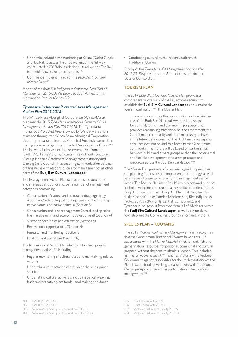
• Undertake eel and elver monitoring at Killara (Darlot Creek) and Tae Rak to assess the effectiveness of the fishway, constructed in 2010 alongside the cultural weir on Tae Rak, in providing passage for eels and fish461
• Commence implementation of the Budj Bim (Tourism) Master Plan.462
A copy of the Budj Bim Indigenous Protected Area Plan of Management 2015-2019 is provided as an Annex to this Nomination Dossier (Annex B.2).
Tyrendarra Indigenous Protected Area Management Action Plan 2015-2018
The Winda-Mara Aboriginal Corporation (Winda-Mara) prepared the 2015 Tyrendarra Indigenous Protected Area Management Action Plan 2015-2018. The Tyrendarra Indigenous Protected Area is owned by Winda-Mara and is managed through the Winda-Mara Aboriginal Corporation Board, Tyrendarra Indigenous Protected Area Sub-Committee and Tyrendarra Indigenous Protected Area Advisory Group.463 The latter includes, as needed, representatives from the GMTOAC, Parks Victoria, Country Fire Authority (Victoria), Glenelg Hopkins Catchment Management Authority and Glenelg Shire Council; thus ensuring communication between organisations with responsibilities for management of all other parts of the Budj Bim Cultural Landscape.
The Management Action Plan sets out desired outcomes and strategies and actions across a number of management categories comprising:
• Conservation of natural and cultural heritage (geology; Aboriginal/archaeological heritage; post-contact heritage; native plants; and native animals) (Section 3)
• Conservation and land management (introduced species; fire management; and economic development) (Section 4)
• Visitor opportunities and education (Section 5)
• Recreational opportunities (Section 6)
• Research and monitoring (Section 7)
• Facilities and operations (Section 8).
The Management Action Plan also identifies high priority management actions,464 including:
• Regular monitoring of cultural sites and maintaining related records
• Undertaking re-vegetation of stream banks with riparian species
• Undertaking cultural activities, including basket weaving, bush tucker (native plant foods), tool making and dance
461 GMTOAC 2015:53462 GMTOAC 2015:64463 Winda-Mara Aboriginal Corporation 2015:10464 Winda-Mara Aboriginal Corporation 2015:7, 28-33
• Conducting cultural burns in consultation with Traditional Owners.
A copy of the Tyrendarra IPA Management Action Plan 2015-2018 is provided as an Annex to this Nomination Dossier (Annex B.3).
TOURISM PLAN
The 2014 Budj Bim (Tourism) Master Plan provides a comprehensive overview of the key actions required to establish the Budj Bim Cultural Landscape as a sustainable tourism destination.465 The Master Plan:
… presents a vision for the conservation and sustainable use of the Budj Bim National Heritage Landscape for cultural, tourism and community purposes, and provides an enabling framework for the government, the Gunditjmara community and tourism industry to invest in the future development of the Budj Bim Landscape as a tourism destination and as a home to the Gunditjmara community. That future will be based on partnerships between public and private groups and on the incremental and flexible development of tourism products and resources across the Budj Bim Landscape.466
The Master Plan presents a future vision, guiding principles, site planning framework and implementation strategy; as well as analyses of business feasibility and management system needs. The Master Plan identifies 15 key projects and priorities for the development of tourism at key visitor experience areas: Budj Bim/Lake Surprise – Budj Bim National Park; Tae Rak (Lake Condah); Lake Condah Mission; Budj Bim Indigenous Protected Area (Kurtonitj [central] component); and Tyrendarra Indigenous Protected Area (all of which are within the Budj Bim Cultural Landscape), as well as Tyrendarra township and the Convincing Ground in Portland, Victoria.
SPECIES PLAN – KOOYANG
The 2017 Victorian Eel Fishery Management Plan recognises that the Gunditjmara Traditional Owners have rights – in accordance with the Native Title Act 1993, to hunt, fish and gather natural resources for personal, communal and cultural purpose, without the need to obtain a licence. This includes fishing for kooyang (eels).467 Fisheries Victoria – the Victorian Government agency responsible for the implementation of the Plan, is committed to working collaboratively with Traditional Owner groups to ensure their participation in Victoria’s eel management.468
465 Tract Consultants 2014:ii466 Tract Consultants 2014:iii467 Victorian Fisheries Authority 2017:6468 Victorian Fisheries Authority 2017:14
142
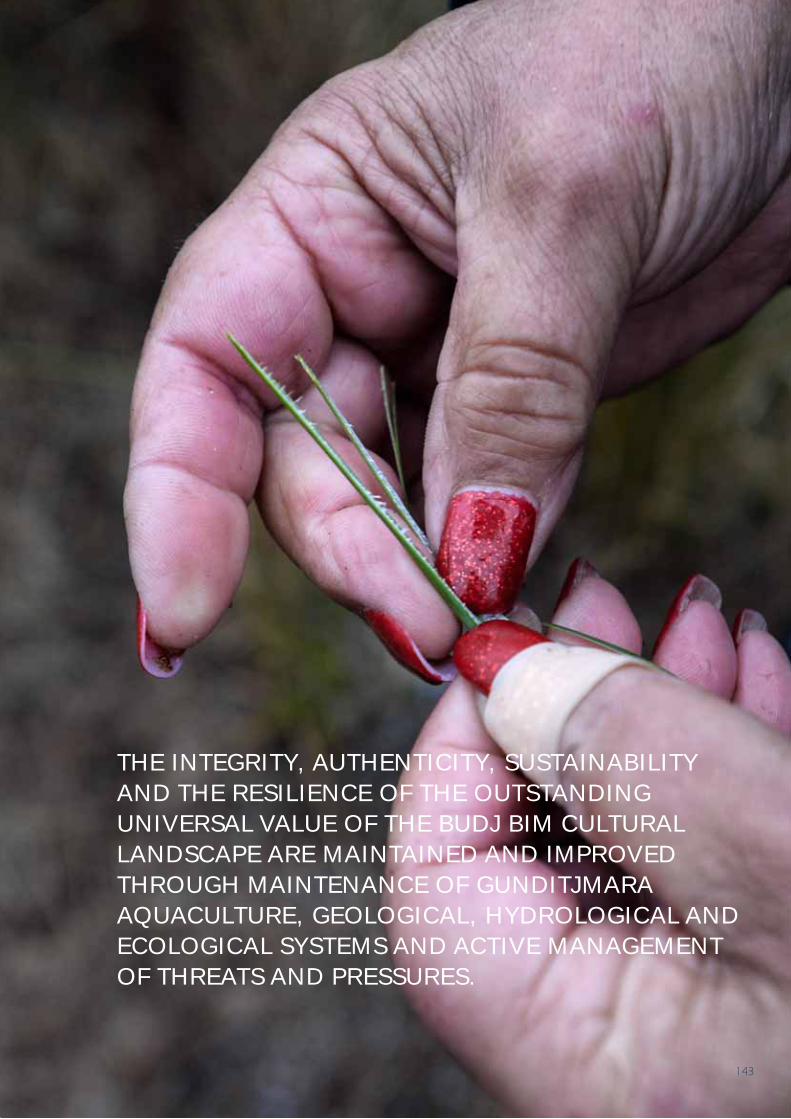
THE INTEGRITY, AUTHENTICITY, SUSTAINABILITY AND THE RESILIENCE OF THE OUTSTANDING UNIVERSAL VALUE OF THE BUDJ BIM CULTURAL LANDSCAPE ARE MAINTAINED AND IMPROVED THROUGH MAINTENANCE OF GUNDITJMARA AQUACULTURE, GEOLOGICAL, HYDROLOGICAL AND ECOLOGICAL SYSTEMS AND ACTIVE MANAGEMENT OF THREATS AND PRESSURES.
143
5.E PROPERTY MANAGEMENT PLAN OR OTHER MANAGEMENT SYSTEM
A comprehensive management system has been developed to ensure the highest level of protection of the Budj Bim Cultural Landscape (Table 5.6).469 The management system is comprised of five interconnected elements:
1. Gunditjmara Traditional Owner customary rights and obligations, including legal recognition of such under the Australian Federal Court’s 2007 Native Title determination;
2. Aboriginal ownership and/or cooperative management of all components of the nominated area (Part 5.A);
3. Comprehensive legislative, regulatory and statutory controls at National, State and local levels (Part 5.B);
4. Integrated governance with an emphasis on local-level decision making and implementation (Part 5.C); and
5. Complementary suite of management plans, goals and strategies that combine Gunditjmara knowledge and practices with contemporary science and adaptive management practices (Part 5.D).
In the event that the Budj Bim Cultural Landscape is inscribed on the World Heritage List, a number of actions will follow:
1. A Budj Bim Cultural Landscape World Heritage Steering Committee will be established. The committee will have a majority of Gunditjmara Traditional Owners and include local community representatives to advise on the management of the nominated property. An Australian Government representative will liaise with and support the Steering Committee’s Executive Officer.
2. A representative of the Budj Bim Cultural Landscape World Heritage Steering Committee will be appointed to the Australian World Heritage Advisory Committee and the Australian World Heritage Indigenous Network.
3. A Budj Bim Cultural Landscape World Heritage Strategic Management Framework will be finalised and adopted by all relevant parties (the Gunditj Mirring Traditional
469 UNESCO 2016:Paragraph 132
Owners Aboriginal Corporation, Winda-Mara Aboriginal Corporation, Australian and Victorian Governments) and will be the basis of the work of the Steering Committee. The framework will provide a synthesis of the existing management and governance arrangements and will ensure that there is effective integration across the five management system elements listed above to safeguard and ensure consistent and holistic management of all components of the nominated property.
MANAGEMENT APPROACH
The management approach for the Budj Bim Cultural Landscape sits within the context of Australian and Victorian Government legislation, international treaties, local government public and private land policies and plans, best-practice principles, strategies and guidelines. In synergy with the Gunditjmara’s philosophy of Ngootyoong Gunditj, Ngootyoong Mara (Healthy Country, Healthy People) – which aligns closely with that of Parks Victoria (‘Healthy Parks, Healthy People’), management planning seeks to reinforce and encourage the connections between a healthy environment and a healthy society. The approach encourages those from the health, environment, parks, tourism, recreation, community development and education sectors to work with the Gunditjmara to provide positive outcomes for all.470
Management planning also adopts a landscape approach: setting goals and strategies across public and private land tenures and coordinating programs with other agencies and communities. The alignment with broader Australian and Victorian Government strategies for the use, management and conservation of land and water is particularly important to achieving the desired management outcomes for the Budj Bim Cultural Landscape. This planning approach seeks to make direct links between management plans, annual programs and evaluation and reporting.
Safeguarding the values of the Budj Bim Cultural Landscape is undertaken within an ‘Adaptive Management Framework’; enabling ongoing learning and adaptation by continually assessing the success of actions in meeting management objectives, and allowing for adjustment of management actions in the future to best achieve the management goals. Adaptive management aims to integrate specific components of management to provide a framework that systematically tests assumptions, promotes learning and continuous improvement, as well as providing timely information to support management decisions.471
470 Parks Victoria 2015:12471 Parks Victoria 2015:12
144
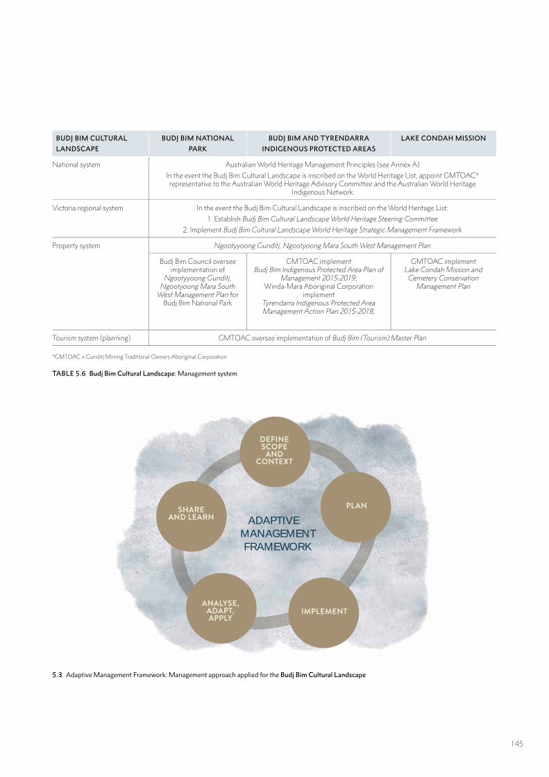
BUDJ BIM CULTURAL
LANDSCAPE
BUDJ BIM NATIONAL
PARK
BUDJ BIM AND TYRENDARRA
INDIGENOUS PROTECTED AREAS
LAKE CONDAH MISSION
National system Australian World Heritage Management Principles (see Annex A)
In the event the Budj Bim Cultural Landscape is inscribed on the World Heritage List, appoint GMTOAC* representative to the Australian World Heritage Advisory Committee and the Australian World Heritage
Indigenous Network
Victoria regional system In the event the Budj Bim Cultural Landscape is inscribed on the World Heritage List:
1. Establish Budj Bim Cultural Landscape World Heritage Steering Committee
2. Implement Budj Bim Cultural Landscape World Heritage Strategic Management Framework
Property system Ngootyyoong Gunditj, Ngootyoong Mara South West Management Plan
Budj Bim Council oversee implementation of
Ngootyyoong Gunditj, Ngootyoong Mara South
West Management Plan for Budj Bim National Park
GMTOAC implement Budj Bim Indigenous Protected Area Plan of
Management 2015-2019; Winda-Mara Aboriginal Corporation
implement Tyrendarra Indigenous Protected Area Management Action Plan 2015-2018;
GMTOAC implement Lake Condah Mission and
Cemetery Conservation Management Plan
Tourism system (planning) GMTOAC oversee implementation of Budj Bim (Tourism) Master Plan
*GMTOAC = Gunditj Mirring Traditional Owners Aboriginal Corporation
TABLE 5.6 Budj Bim Cultural Landscape: Management system
5.3 Adaptive Management Framework: Management approach applied for the Budj Bim Cultural Landscape
ADAPTIVE MANAGEMENT FRAMEWORK
DEFINE SCOPE
AND CONTEXT
PLAN
IMPLEMENTANALYSE,
ADAPT, APPLY
SHARE AND LEARN
145
BUDJ BIM CULTURAL LANDSCAPE MANAGEMENT SYSTEM: FIVE INTERCONNECTED ELEMENTS
1. Gunditjmara Traditional Owner customary rights and obligations
The Budj Bim Cultural Landscape is located within the traditional Country of the Gunditjmara. As such, the Gunditjmara have long-held rights, responsibilities and obligations to care for Country based on continuing traditional and contemporary Gunditjmara knowledge and practices. In addition, Gunditjmara rights are recognised under the Australian Government’s Native Title Act 1993 and the Victorian Government’s Aboriginal Heritage Act 2006. The Gunditjmara’s traditional and customary rights and obligations are implemented through governance arrangements (Part 5.C). These rights and obligations are recognised in and enacted through property management plans (Part 5.D).
Gunditjmara cultural traditions, knowledge and practices are evident in Gunditjmara aquaculture; as manifest in the changing practices of kooyang (eel) management, storage, harvesting and the associated manipulation, modification and management of water flows. Gunditjmara aquaculture knowledge and practices are also inclusive of sourcing grasses for the weaving of gnarraban (kooyang baskets), traditional representations of Gunditjmara aquaculture (for example, the complex designs produced on possum skin cloaks), adaptation of traditional catching techniques (for example, use of wire mesh baskets and wood crates for holding kooyang) and contemporary, creative artistic expressions of Gunditjmara aquaculture – evidenced in story-telling, dance, song, crafted objects and sculpture (Part 2.B).
2. Aboriginal ownership and co-operative management
Budj Bim Cultural Landscape is a serial property comprised of three components that collectively incorporate the eight largest Gunditjmara aquaculture complexes (Part 2.A) and representative examples of smaller aquaculture systems; as well as sufficient representative parts of their related geological, hydrological and ecological systems.
Aboriginal organisations own and manage all components of the nominated property with the exception of Budj Bim National Park, which is co-operatively managed by the Gunditjmara Traditional Owners and the Victorian Government. The nominated property is comprised wholly of lands owned or jointly managed by the GMTOAC and Winda-Mara Aboriginal Corporation. Therefore the property and its boundaries are assured of free, prior and informed consent by virtue of their ownership, management and control. The wholeness of the property enables Gunditjmara cultural traditions, knowledge and practices to be expressed in the present and into the future as a consequence of the recognition of both Gunditjmara custodial and native title rights and obligations (as outlined above).
3. Comprehensive legislative, regulatory and statutory controls
The Budj Bim Cultural Landscape comprises land parcels whose status includes National Park, Indigenous Protected Areas (both being components of Australia’s National Reserve System) and land owned by the Gunditjmara Traditional Owners (Table 5.2).
Legislation and associated planning and protection instruments are established across three levels of government – Australian, Victorian State and local – to ensure the nominated property’s International, National, State and local values are comprehensively conserved and managed (Part 5.B; Table 5.3). Aboriginal cultural heritage within the nominated area is protected by listing on statutory heritage registers – the Australian Government National Heritage List and the Victorian Aboriginal Heritage Register. These registers enable specific provisions for protecting the heritage values of the nominated property.
4. Integrated governance
The customary and legislative protective measures for the Budj Bim Cultural Landscape are enabled and implemented through an established governance framework (Part 5.C; Table 5.4). At the local level: the governance, decision-making and administrative bodies that oversee and cooperate in the protection and management of the nominated property are the Budj Bim Council, the Gunditj Mirring Traditional Owners Aboriginal Corporation (GMTOAC) and Winda-Mara Aboriginal Corporation.
The Budj Bim Council comprises representatives of Gunditjmara Traditional Owners (the majority of Council members) and the Victorian Government. Its role is to manage Budj Bim National Park to achieve both cultural and ecological objectives through joint decision-making. The GMTOAC manages the native title rights of the Gunditjmara and promotes continuing connection to Country by the Gunditjmara through its Caring for Country programs and projects. The GMTOAC owns and manages the Budj Bim Indigenous Protected Area and Lake Condah Mission, which lie wholly within the nominated property. Winda-Mara Aboriginal Corporation is the owner and manager of the Tyrendarra Indigenous Protected Area. It undertakes cultural heritage and land management initiatives in partnership with the GMTOAC as well as with key government agencies and non-government organisations.
5. Complementary suite of management plans
The Budj Bim Cultural Landscape is managed under three current, inter-related management plans – developed to meet Gunditjmara customary rights and obligations and the requirements of Australian and Victorian government legislation (Part 5.D; Table 5.5). The Ngootyoong Gunditj Ngootyoong Mara South West Management Plan is a regional plan which includes all components of the nominated
146
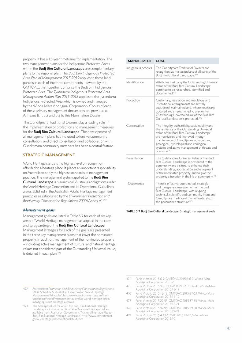
property. It has a 15-year timeframe for implementation. The two management plans for the Indigenous Protected Areas within the Budj Bim Cultural Landscape are complementary plans to the regional plan. The Budj Bim Indigenous Protected Area Plan of Management 2015-2019 applies to those land parcels in each of the three components – owned by the GMTOAC, that together comprise the Budj Bim Indigenous Protected Area. The Tyrendarra Indigenous Protected Area Management Action Plan 2015-2018 applies to the Tyrendarra Indigenous Protected Area which is owned and managed by the Winda-Mara Aboriginal Corporation. Copies of each of these primary management documents are provided as Annexes B.1, B.2 and B.3 to this Nomination Dossier.
The Gunditjmara Traditional Owners play a leading role in the implementation of protection and management measures for the Budj Bim Cultural Landscape. The development of all management plans has included extensive community consultation, and direct consultation and collaboration with Gunditjmara community members has been a central feature.
STRATEGIC MANAGEMENT
World Heritage status is the highest level of recognition afforded to a heritage place. It places an important responsibility on Australia to apply the highest standards of management practice. The management system applied to the Budj Bim Cultural Landscape is hierarchical. Australia’s obligations under the World Heritage Convention and its Operational Guidelines are established in the Australian World Heritage management principles as established by the Environment Protection and Biodiversity Conservation Regulations 2000 (Annex A).472
Management goals473
Management goals are listed in Table 5.7 for each of six key areas of World Heritage management as applied in the care and safeguarding of the Budj Bim Cultural Landscape. Management strategies for each of the goals are presented in the three key management plans that cover the nominated property. In addition, management of the nominated property – including active management of cultural and natural heritage values not considered part of the Outstanding Universal Value, is detailed in each plan.473
472 Environment Protection and Biodiversity Conservation Regulations 2000: Schedule 5. Australian Government. ‘World Heritage Management Principles’, http://www.environment.gov.au/heri-tage/about/world/management-australias-world-heritage-listed/managing-world-heritage-australia
473 The heritage values for which the Budj Bim National Heritage Landscape is inscribed on Australia’s National Heritage List are available from: Australian Government. ‘National Heritage Places – Budj Bim National Heritage Landscape’, http://www.environment.gov.au/heritage/places/national/budj-bim
474475476477 478479
474 Parks Victoria 2015:6-7; GMTOAC 2015:2, 6-9; Winda-Mara Aboriginal Corporation 2015:2
475 Parks Victoria 2015:99-101; GMTOAC 2015:37-41; Winda-Mara Aboriginal Corporation 2015:18-19
476 Parks Victoria 2015:12-13; GMTOAC 2015:37-63; Winda-Mara Aboriginal Corporation 2015:11-12
477 Parks Victoria 2015:29-55; GMTOAC 2015:37-63; Winda-Mara Aboriginal Corporation 2015:18-21
478 Parks Victoria 2015:92-95; GMTOAC 2015:59-60; Winda-Mara Aboriginal Corporation 2015:22-24
479 Parks Victoria 2015:4; GMTOAC 2015:28-30; Winda-Mara Aboriginal Corporation 2015:10
MANAGEMENT GOAL
Indigenous peoples The Gunditjmara Traditional Owners are recognised as the custodians of all parts of the Budj Bim Cultural Landscape.474
Identification Attributes that carry the Outstanding Universal Value of the Budj Bim Cultural Landscape continue to be researched, identified and documented.475
Protection Customary, legislation and regulatory and institutional arrangements are actively supported, maintained and, where necessary, updated and strengthened to ensure the Outstanding Universal Value of the Budj Bim Cultural Landscape is protected.476
Conservation The integrity, authenticity, sustainability and the resilience of the Outstanding Universal Value of the Budj Bim Cultural Landscape are maintained and improved through maintenance of Gunditjmara aquaculture, geological, hydrological and ecological systems and active management of threats and pressures.477
Presentation The Outstanding Universal Value of the Budj Bim Cultural Landscape is presented to the community and visitors, to enhance their understanding, appreciation and enjoyment of the nominated property, and to give the property a function in the life of community.478
Governance There is effective, coordinated, strategic and transparent management of the Budj Bim Cultural Landscape, with ongoing technical, scientific and community input and Gunditjmara Traditional Owner leadership in the governance structure.479
TABLE 5.7 Budj Bim Cultural Landscape: Strategic management goals
147
5.F SOURCES AND LEVELS OF FINANCE
The management of the Budj Bim Cultural Landscape is financed primarily through Australian and Victorian State Government programs and grants. In addition, supplementary funding from other sources is expended on the nominated property – including income generated from enterprises associated with the lands owned and managed by the Gunditj Mirring Traditional Owners Aboriginal Corporation (GMTOAC) and Winda-Mara Aboriginal Corporation. In the long-term, the Gunditjmara anticipate increased revenue from tourism, for which detailed planning has been undertaken.480
AUSTRALIAN GOVERNMENT FUNDING
The Australian Government has an obligation to ensure that the objectives of the World Heritage Convention are met for World Heritage properties. These objectives include the obligations to identify, protect, conserve, present and – where necessary, rehabilitate and transmit to future generations, the World Heritage values of the property. The Australian Government has competitive funding programs that provide assistance to protect and manage Australia’s heritage.
The primary funding provided by the Australian Government toward the care and management of the Budj Bim Cultural Landscape is through its Indigenous Protected Areas and Working on Country programs. In the financial year 2016-2017, the Australian Government provided a total of AUD $1,011,840 in funding to the Tyrendarra and Budj Bim Indigenous Protected Areas.481 These funds were primarily used for the employment of Budj Bim Rangers (11 full-time Budj Bim Rangers and two part-time Gunditjmara Elders) and the costs associated with their employment. Funding for the Indigenous Protected Areas within the nominated property is guaranteed until the 2018-2019 financial year.
In addition, the Australian Government – through its Indigenous Advancement Strategy, provided AUD $116,000 in 2016-2017 to the GMTOAC for the upkeep and maintenance of the Lake Condah Mission. In 2015-2016, the Australian Government – through its Community Heritage and Icons Grants Program, provided funding of $10,000 to support the development of the Budj Bim Field Guide App.482
480 Tract Consultants 2014481 AUD = Australian dollars482 This app presents descriptions and images of 250 species found in
and around the Budj Bim Cultural Landscape. The content was de-veloped by Museums Victoria in collaboration with the GMTOAC.
VICTORIAN GOVERNMENT FUNDING
The management of the Budj Bim National Park (wholly within the Budj Bim Cultural Landscape) is funded by the Victorian Government. Parks Victoria currently expends approximately AUD $230,000 annually on management of the National Park. The budget provides funds for staff and preparation and implementation of management plans; as well as actions related to the management of cultural heritage, flora and fauna, roads and trails, campgrounds and fire, visitor services and capital works. In addition, the Department of Environment, Land, Water and Planning (DELWP) provides annual funding of AUD $50,000 to support the activities of the Budj Bim Council; and provides funding and support for wildfire management and support for flora and fauna management in Budj Bim National Park. In 2017, DELWP provided funding and expertise for koala management within the Kurtonitj (central) component of the nominated property.
The Victorian Government provides an annual amount of AUD $50,000 to the GMTOAC for the management of the Lake Condah Mission and Cemetery.
The Victorian Government is providing AUD $8 million to the GMTOAC to implement stages one and two of the Budj Bim (Tourism) Master Plan.483 The funding, which is allocated over three years to 2020, is provided to support sustainable tourism infrastructure projects while providing economic opportunities for the Gunditjmara.
GMTOAC AND WINDA-MARA ABORIGINAL CORPORATION FUNDING
The GMTOAC and Winda-Mara Aboriginal Corporation generate income from business enterprises conducted within the Budj Bim Cultural Landscape. In the 2016-2017 financial year, the income generated from commercial tours, the provision of accommodation and the sale of cattle was $32,000.484 Approximately half of this amount was allocated to land management activities within the nominated property.
COLLABORATIVE RESEARCH FUNDING
Monash University, in partnership with the Gunditjmara, have an ongoing archaeological research and teaching program that is undertaken annually within the Budj Bim Cultural Landscape. The annual funding provided for the short-term employment of Gunditjmara researchers as part of this program is approximately AUD $7,000.
483 Tract Consultants 2014484 This amount does not include monies raised from the tours provided
to visiting schools, which is funded through Australian Government funding allocations.
148
5.G SOURCES OF EXPERTISE AND TRAINING IN CONSERVATION AND MANAGEMENT TECHNIQUES
Management of the Budj Bim Cultural Landscape is based on a collaborative system of custodial and scientific knowledge and adaptive management practices (Part 5.E). The primary source of expertise in the management of the property is the Gunditjmara Traditional Owners, who are the custodians of the Country that includes the nominated property. The Gunditjmara work collaboratively with a wide range of partners, including cultural heritage specialists (archaeologists, historians, architects, building and materials conservators), natural heritage specialists (ecologists, botanists, zoologists, geologists, palynologists, arborists) and specialist advisors (Protected Area managers, visitor and tourism specialists, business planners, hydrologists, engineers).
GUNDITJMARA TRADITIONAL OWNERS
The Gunditjmara have tens of thousands of years of experience in caring for Country; which includes at least 6,600 years of management, maintenance and monitoring of the kooyang (eel) aquaculture system and its setting. The Gunditjmara draw on cultural traditions, knowledge and practices in caring for the ecological, hydrological, cultural heritage and spiritual health of the Budj Bim Cultural Landscape. In addition to drawing on traditional ecological knowledge, the Gunditjmara undertake research – both with partners and in their own right, to increase understanding and learning concerning the functioning and management needs of the aquaculture system and its landscape context.
The Gunditj Mirring Traditional Owners Aboriginal Corporation (GMTOAC) and Winda-Mara Aboriginal Corporation each have a Board of Directors. The GMTOAC Board is comprised of Gunditjmara Traditional Owners, including members with extensive traditional and contemporary knowledge of the Budj Bim Cultural Landscape. The Winda-Mara Aboriginal Corporation currently has a Board comprising Gunditjmara Traditional Owners, though can include non-Gunditjmara members. The Budj Bim Rangers, who undertake day-to-day
management and maintenance work across the Budj Bim Cultural Landscape, receive cultural training and mentoring from their Gunditjmara Elders. The Budj Bim Rangers have Aboriginal cultural heritage and park management qualifications.485
The Gunditjmara organise and provide training programs for both external groups and for members of their own community. For example, the Gunditjmara provide ‘cultural awareness training’ to government agencies, regulatory bodies and private companies (Part 4.B[iv]); and the Budj Bim Rangers are mentored by Gunditmara Elders. The Gunditjmara also provide education programs, typically delivered on Country, for younger people; part of their practice of transmitting cultural traditions and knowledge to Gunditjmara youth (Part 4.B).
PROTECTED AREAS AND ADAPTIVE MANAGEMENT
Australia has a long history of Protected Area management and has developed expertise in applying an Adaptive Management Framework (Part 5.E). As the lead agency responsible for managing a large area of the Budj Bim (northern) component within the Budj Bim Cultural Landscape, Parks Victoria has a wealth of expertise and experience in conservation and management from on-ground staff through to scientific specialists. This includes specialist knowledge in relation to ecology (including native flora and fauna management and pest plant and animal control), fire management (undertaken in conjunction with the Department of Environment, Land, Water and Planning), asset management, and visitor and tourism management. The Gunditjmara provide specialist knowledge to Parks Victoria through the Budj Bim Council with regard to the conservation and management of cultural heritage within the Budj Bim National Park.
Parks Victoria officers who undertake day-to-day site management have tertiary qualifications in land conservation and management. All current Parks Victoria rangers who assist with the management and maintenance of the Budj Bim National Park have land management qualifications – either Technical and Further Education (TAFE) Certificates (Level 3 or 4) or higher qualifications as well as a range of hands-on skills achieved through training; such as First Aid, four-wheel driving, chemical handling and fire-fighting. Heritage advice is provided by GMTOAC staff with cultural heritage qualifications and experience, supported by Victorian Government officers (archaeologists in Aboriginal Victoria, for example) with tertiary qualifications in cultural heritage management. External consultants with specialist skills are engaged as required.
485 GMTOAC 2015:39
149
OTHER SOURCES OF EXPERTISE
Managers of Australian World Heritage properties can draw on specialist advice from a large pool of professional services within government departments, heritage advisory bodies, universities and private practice. The managers of the Budj Bim Cultural Landscape have access to specialist expert services as outlined below.
• At the National level, the Australian Government Department of the Environment and Energy provides advice on the protection, conservation and promotion of National Heritage and World Heritage properties
• At the State level, Victorian Government agencies such as Aboriginal Victoria, Parks Victoria and the Department of Environment, Land, Water and Planning provide advice on cultural and natural conservation and management techniques and act as a conduit to specialist services and training
• Archaeologists in universities or private practice undertake research and documentation in partnership with the Gunditjmara and provide advice on conservation issues486
• Ecologists at universities or in private practice undertake research and documentation (for example, on vegetation and kooyang (eel)) and provide advice on conservation issues
• Conservation consultants – including planners and heritage specialists, have been engaged to prepare and update conservation management plans for the Budj Bim Cultural Landscape
• Tourism consultants have been engaged to undertake studies and prepare tourism plans for the nominated property.
In all cases where external specialist expert services are engaged, the Gunditjmara Traditional Owners work in collaborative partnerships with the service providers.
486 A number of PhD research projects that focus on the Budj Bim Cultural Landscape have been undertaken (e.g., Builth 2002; Richards 2013). Monash University provides archaeological expertise through an ongoing teaching and research program (e.g., McNiven et al. 2015, 2017)
5.H VISITOR FACILITIES, INFRASTRUCTURE AND STATISTICS
The Budj Bim Cultural Landscape is a key destination in south-western Victoria. Its rich Aboriginal culture, history and heritage and the Budj Bim volcano and its lava flow are the major attractions to visitors. The relative remoteness of the area from large population centres provides an opportunity for visitors seeking less crowded experiences.487 In addition, interpretation and presentation of the Budj Bim Cultural Landscape and its values has also been provided off-site – including through Museums Victoria and inter-State museums, as well as through media interest. As more people learn about the nominated property, tourism interest is expected to grow, creating enhanced tourism marketing potential for the nominated property and surrounding rural towns.
Each year the Budj Bim Cultural Landscape receives a steady stream of visitors – estimated at around 31,000, mainly between September and April (Part 4.B[iv]). Most visitors stay in the adjacent towns of Heywood and Portland; though each year over 900 visitors camp within the nominated property (Part 4.B[vi]). Statistics for the Glenelg Shire – within which the majority of the nominated property is situated, show that there were 175,000 domestic overnight visitors in 2014, each staying on average 4.4 nights in the region and spending on average AUD $129 per night. Domestic overnight visitors are estimated to have spent $100 million in the region.488 These figures point to the potential tourism market available for the Budj Bim Cultural Landscape.
ACCESS – ROADS AND TRACKS
All areas within the Budj Bim Cultural Landscape are accessible by a network of public roads and vehicle tracks.489 Local public roads provide two-wheel drive access to the three components of the nominated property. Responsibility for the maintenance of local roads lies with local government (Glenelg and Moyne Shires). Parks Victoria, the Department of Environment, Land, Water and Planning, the Gunditj Mirring Traditional Owners Aboriginal Corporation (GMTOAC) and
487 Parks Victoria 2015:67488 National Visitor Survey, September 2014, Tourism Research
Australia, cited in Fox et al. 2015:85. Data for domestic day trip visitation and international overnight visitors are not available.
489 Parks Victoria 2015:Map 3A
150
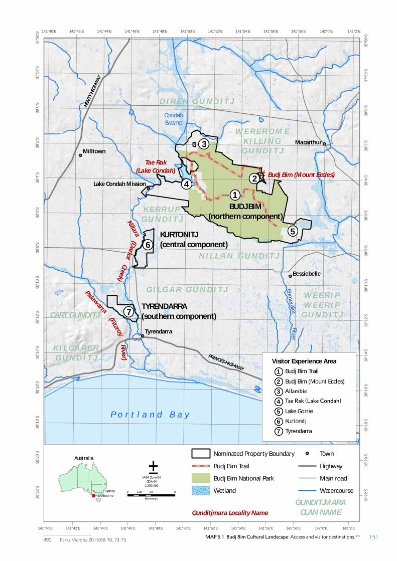
MAP 5.1 Budj Bim Cultural Landscape: Access and visitor destinations.490
490 Parks Victoria 2015:68-70, 73-75
#*
CondahSwamp
Eum
eralla
Riv
er
PRINCES HIGHWAY
HEN
TY H
IGH
WAY
Milltown
Macarthur
Codrington
Tyrendarra
Bessiebelle
Lake Condah Mission
142°2'E
142°2'E
142°0'E
142°0'E
141°58'E
141°58'E
141°56'E
141°56'E
141°54'E
141°54'E
141°52'E
141°52'E
141°50'E
141°50'E
141°48'E
141°48'E
141°46'E
141°46'E
141°44'E
141°44'E
141°42'E
141°42'E
141°40'E
141°40'E
37°5
6'S
37°5
6'S
37°5
8'S
37°5
8'S
38°0
'S
38°0
'S
38°2
'S
38°2
'S
38°4
'S
38°4
'S
38°6
'S
38°6
'S
38°8
'S
38°8
'S
38°1
0'S
38°1
0'S
38°1
2'S
38°1
2'S
38°1
4'S
38°1
4'S
38°1
6'S
38°1
6'S
38°1
8'S
38°1
8'S
38°2
0'S
38°2
0'S
38°2
2'S
38°2
2'S
Tae Rak
(Lake Condah)
W E R E R O M EK I L L I N G
G U N D I T J
N I L L A N G U N D I T J
K E R R U PG U N D I T J
CART GUNDITJ
G I L G A R G U N D I T JPalawarra
(Darlo
t
P o r t l a n d B a y
Budj Bim (Mount Eccles)
0 2.5 51.25
kilometres
Nominated Property Boundary
Budj Bim Trail
Budj Bim National Park
Wetland
Town
Highway
Main road
Watercourse
Gunditjmara Locality Name
±MGA Zone 54
GDA 94
1:200,000
GUNDITJMARACLAN NAME
BUDJ BIM(northern component)
KURTONITJ(central component)
TYRENDARRA(southern component)
K I L C A R E RG U N D I T J
D I R E K G U N D I T J
W E E R I PW E E R I P
G U N D I T J
Killara
(FitzroyCreek)
Rive
r)
Australia
!
!
Melbourne
Sydney
1
2
3
4
56
7
1Visitor Experience Area
Budj Bim Trail
2 Budj Bim (Mount Eccles)
3 Allambie
4 Lake Condah
5 Lake Gorrie
6 Kurtonitj
7 Tyrendarra
MAP 5.1 Budj Bim Cultural Landscape: Access and visitor destinations.495
Allambie
Tae Rak (Lake Condah)
151
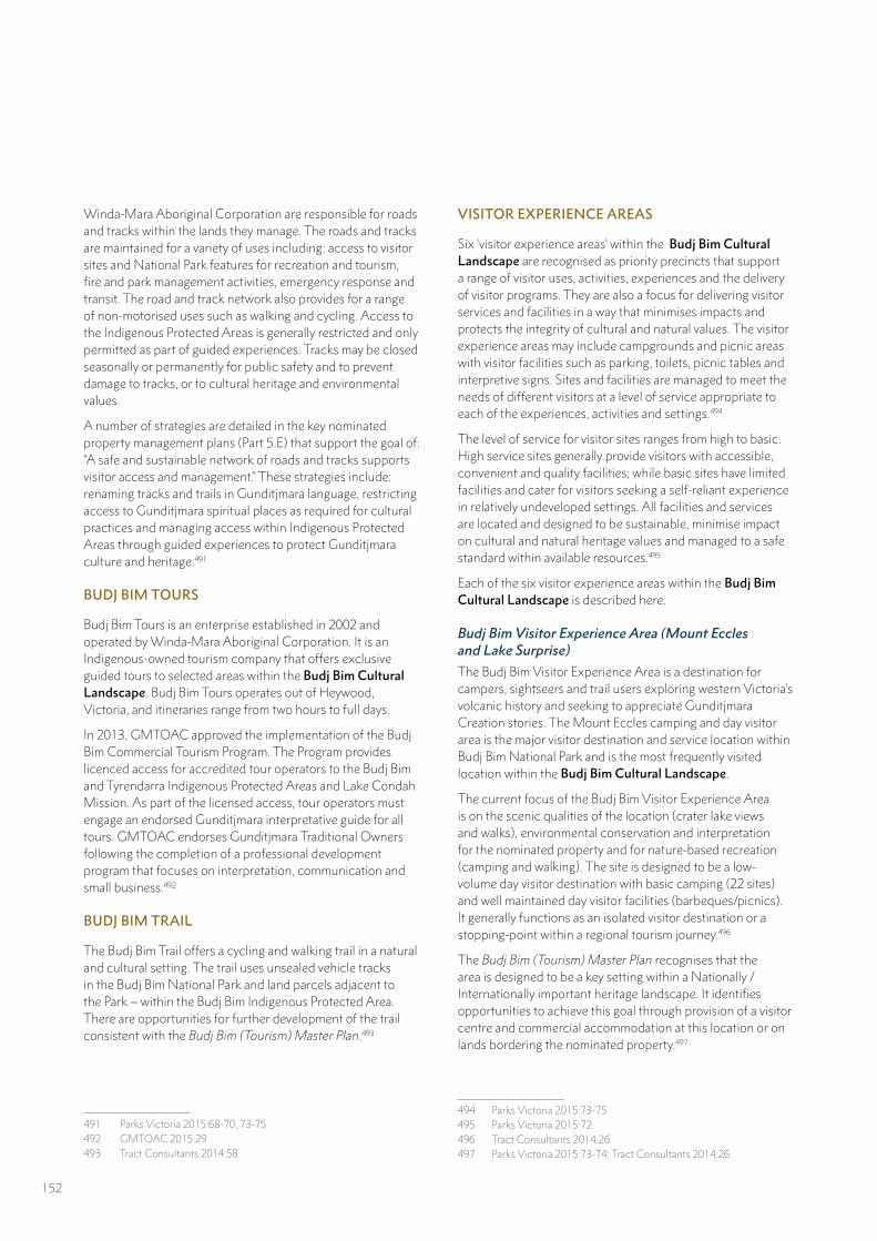
Winda-Mara Aboriginal Corporation are responsible for roads and tracks within the lands they manage. The roads and tracks are maintained for a variety of uses including: access to visitor sites and National Park features for recreation and tourism, fire and park management activities, emergency response and transit. The road and track network also provides for a range of non-motorised uses such as walking and cycling. Access to the Indigenous Protected Areas is generally restricted and only permitted as part of guided experiences. Tracks may be closed seasonally or permanently for public safety and to prevent damage to tracks, or to cultural heritage and environmental values.
A number of strategies are detailed in the key nominated property management plans (Part 5.E) that support the goal of: “A safe and sustainable network of roads and tracks supports visitor access and management.” These strategies include: renaming tracks and trails in Gunditjmara language, restricting access to Gunditjmara spiritual places as required for cultural practices and managing access within Indigenous Protected Areas through guided experiences to protect Gunditjmara culture and heritage.491
BUDJ BIM TOURS
Budj Bim Tours is an enterprise established in 2002 and operated by Winda-Mara Aboriginal Corporation. It is an Indigenous-owned tourism company that offers exclusive guided tours to selected areas within the Budj Bim Cultural Landscape. Budj Bim Tours operates out of Heywood, Victoria, and itineraries range from two hours to full days.
In 2013, GMTOAC approved the implementation of the Budj Bim Commercial Tourism Program. The Program provides licenced access for accredited tour operators to the Budj Bim and Tyrendarra Indigenous Protected Areas and Lake Condah Mission. As part of the licensed access, tour operators must engage an endorsed Gunditjmara interpretative guide for all tours. GMTOAC endorses Gunditjmara Traditional Owners following the completion of a professional development program that focuses on interpretation, communication and small business.492
BUDJ BIM TRAIL
The Budj Bim Trail offers a cycling and walking trail in a natural and cultural setting. The trail uses unsealed vehicle tracks in the Budj Bim National Park and land parcels adjacent to the Park – within the Budj Bim Indigenous Protected Area. There are opportunities for further development of the trail consistent with the Budj Bim (Tourism) Master Plan.493
491 Parks Victoria 2015:68-70, 73-75492 GMTOAC 2015:29493 Tract Consultants 2014:58
VISITOR EXPERIENCE AREAS
Six ‘visitor experience areas’ within the Budj Bim Cultural Landscape are recognised as priority precincts that support a range of visitor uses, activities, experiences and the delivery of visitor programs. They are also a focus for delivering visitor services and facilities in a way that minimises impacts and protects the integrity of cultural and natural values. The visitor experience areas may include campgrounds and picnic areas with visitor facilities such as parking, toilets, picnic tables and interpretive signs. Sites and facilities are managed to meet the needs of different visitors at a level of service appropriate to each of the experiences, activities and settings.494
The level of service for visitor sites ranges from high to basic. High service sites generally provide visitors with accessible, convenient and quality facilities; while basic sites have limited facilities and cater for visitors seeking a self-reliant experience in relatively undeveloped settings. All facilities and services are located and designed to be sustainable, minimise impact on cultural and natural heritage values and managed to a safe standard within available resources.495
Each of the six visitor experience areas within the Budj Bim Cultural Landscape is described here.
Budj Bim Visitor Experience Area (Mount Eccles and Lake Surprise)
The Budj Bim Visitor Experience Area is a destination for campers, sightseers and trail users exploring western Victoria’s volcanic history and seeking to appreciate Gunditjmara Creation stories. The Mount Eccles camping and day visitor area is the major visitor destination and service location within Budj Bim National Park and is the most frequently visited location within the Budj Bim Cultural Landscape.
The current focus of the Budj Bim Visitor Experience Area is on the scenic qualities of the location (crater lake views and walks), environmental conservation and interpretation for the nominated property and for nature-based recreation (camping and walking). The site is designed to be a low-volume day visitor destination with basic camping (22 sites) and well maintained day visitor facilities (barbeques/picnics). It generally functions as an isolated visitor destination or a stopping-point within a regional tourism journey.496
The Budj Bim (Tourism) Master Plan recognises that the area is designed to be a key setting within a Nationally / Internationally important heritage landscape. It identifies opportunities to achieve this goal through provision of a visitor centre and commercial accommodation at this location or on lands bordering the nominated property.497
494 Parks Victoria 2015:73-75495 Parks Victoria 2015:72496 Tract Consultants 2014:26497 Parks Victoria 2015:73-74; Tract Consultants 2014:26
152
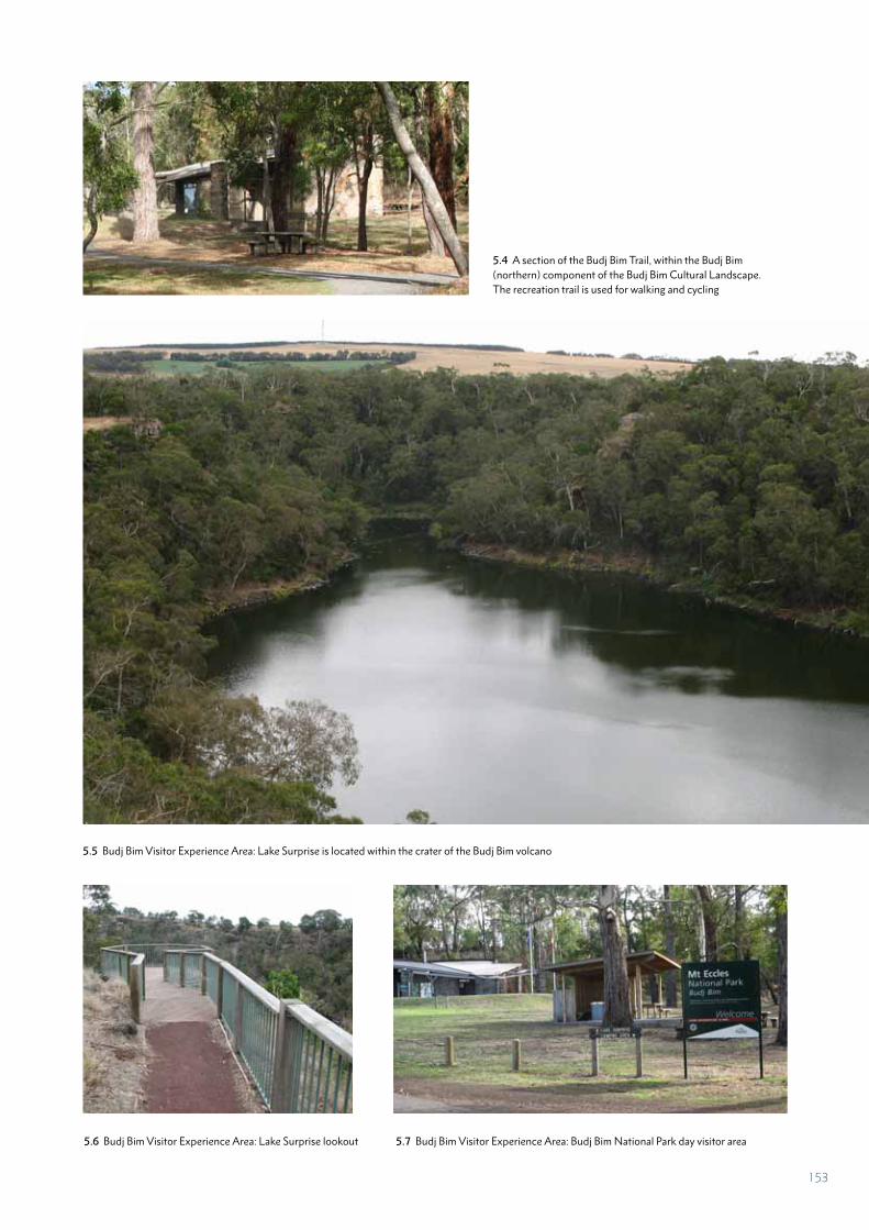
5.5 Budj Bim Visitor Experience Area: Lake Surprise is located within the crater of the Budj Bim volcano
5.6 Budj Bim Visitor Experience Area: Lake Surprise lookout 5.7 Budj Bim Visitor Experience Area: Budj Bim National Park day visitor area
5.4 A section of the Budj Bim Trail, within the Budj Bim (northern) component of the Budj Bim Cultural Landscape. The recreation trail is used for walking and cycling
153
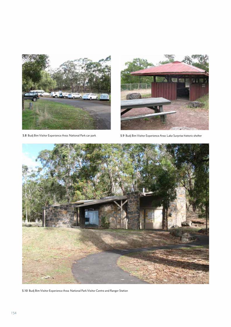
5.8 Budj Bim Visitor Experience Area: National Park car park 5.9 Budj Bim Visitor Experience Area: Lake Surprise historic shelter
5.10 Budj Bim Visitor Experience Area: National Park Visitor Centre and Ranger Station
154
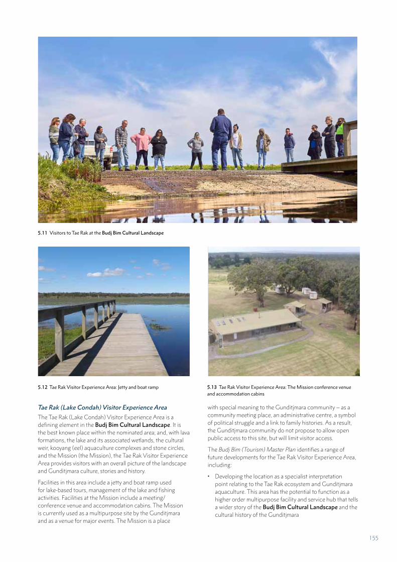
Tae Rak (Lake Condah) Visitor Experience Area
The Tae Rak (Lake Condah) Visitor Experience Area is a defining element in the Budj Bim Cultural Landscape. It is the best known place within the nominated area; and, with lava formations, the lake and its associated wetlands, the cultural weir, kooyang (eel) aquaculture complexes and stone circles, and the Mission (the Mission), the Tae Rak Visitor Experience Area provides visitors with an overall picture of the landscape and Gunditjmara culture, stories and history.
Facilities in this area include a jetty and boat ramp used for lake-based tours, management of the lake and fishing activities. Facilities at the Mission include a meeting/conference venue and accommodation cabins. The Mission is currently used as a multipurpose site by the Gunditjmara and as a venue for major events. The Mission is a place
with special meaning to the Gunditjmara community – as a community meeting place, an administrative centre, a symbol of political struggle and a link to family histories. As a result, the Gunditjmara community do not propose to allow open public access to this site, but will limit visitor access.
The Budj Bim (Tourism) Master Plan identifies a range of future developments for the Tae Rak Visitor Experience Area, including:
• Developing the location as a specialist interpretation point relating to the Tae Rak ecosystem and Gunditjmara aquaculture. This area has the potential to function as a higher order multipurpose facility and service hub that tells a wider story of the Budj Bim Cultural Landscape and the cultural history of the Gunditjmara
5.11 Visitors to Tae Rak at the Budj Bim Cultural Landscape
5.12 Tae Rak Visitor Experience Area: Jetty and boat ramp 5.13 Tae Rak Visitor Experience Area: The Mission conference venue and accommodation cabins
155
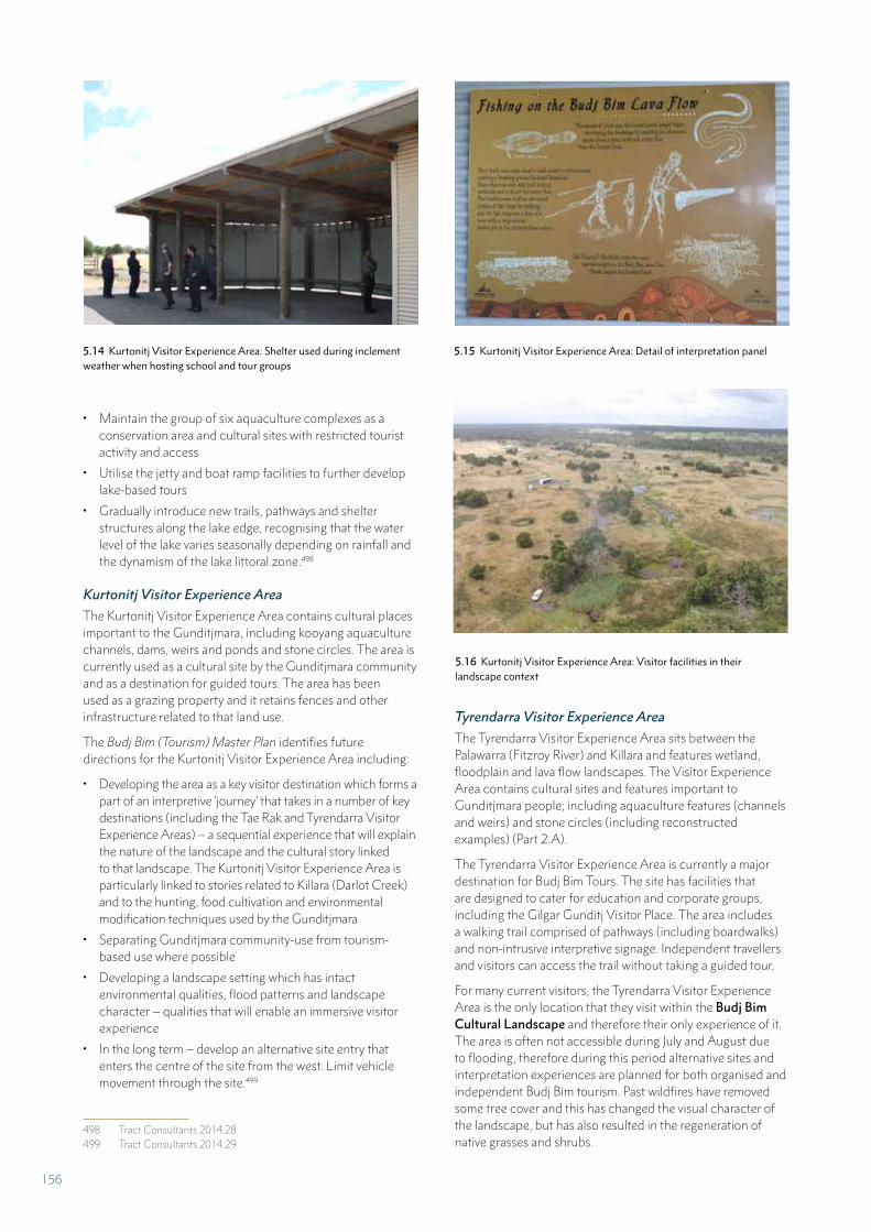
• Maintain the group of six aquaculture complexes as a conservation area and cultural sites with restricted tourist activity and access
• Utilise the jetty and boat ramp facilities to further develop lake-based tours
• Gradually introduce new trails, pathways and shelter structures along the lake edge, recognising that the water level of the lake varies seasonally depending on rainfall and the dynamism of the lake littoral zone.498
Kurtonitj Visitor Experience Area
The Kurtonitj Visitor Experience Area contains cultural places important to the Gunditjmara, including kooyang aquaculture channels, dams, weirs and ponds and stone circles. The area is currently used as a cultural site by the Gunditjmara community and as a destination for guided tours. The area has been used as a grazing property and it retains fences and other infrastructure related to that land use.
The Budj Bim (Tourism) Master Plan identifies future directions for the Kurtonitj Visitor Experience Area including:
• Developing the area as a key visitor destination which forms a part of an interpretive ‘journey’ that takes in a number of key destinations (including the Tae Rak and Tyrendarra Visitor Experience Areas) – a sequential experience that will explain the nature of the landscape and the cultural story linked to that landscape. The Kurtonitj Visitor Experience Area is particularly linked to stories related to Killara (Darlot Creek) and to the hunting, food cultivation and environmental modification techniques used by the Gunditjmara
• Separating Gunditjmara community-use from tourism-based use where possible
• Developing a landscape setting which has intact environmental qualities, flood patterns and landscape character – qualities that will enable an immersive visitor experience
• In the long term – develop an alternative site entry that enters the centre of the site from the west. Limit vehicle movement through the site.499
498 Tract Consultants 2014:28499 Tract Consultants 2014:29
Tyrendarra Visitor Experience Area
The Tyrendarra Visitor Experience Area sits between the Palawarra (Fitzroy River) and Killara and features wetland, floodplain and lava flow landscapes. The Visitor Experience Area contains cultural sites and features important to Gunditjmara people; including aquaculture features (channels and weirs) and stone circles (including reconstructed examples) (Part 2.A).
The Tyrendarra Visitor Experience Area is currently a major destination for Budj Bim Tours. The site has facilities that are designed to cater for education and corporate groups, including the Gilgar Gunditj Visitor Place. The area includes a walking trail comprised of pathways (including boardwalks) and non-intrusive interpretive signage. Independent travellers and visitors can access the trail without taking a guided tour.
For many current visitors, the Tyrendarra Visitor Experience Area is the only location that they visit within the Budj Bim Cultural Landscape and therefore their only experience of it. The area is often not accessible during July and August due to flooding, therefore during this period alternative sites and interpretation experiences are planned for both organised and independent Budj Bim tourism. Past wildfires have removed some tree cover and this has changed the visual character of the landscape, but has also resulted in the regeneration of native grasses and shrubs.
5.14 Kurtonitj Visitor Experience Area: Shelter used during inclement weather when hosting school and tour groups
5.16 Kurtonitj Visitor Experience Area: Visitor facilities in their landscape context
5.15 Kurtonitj Visitor Experience Area: Detail of interpretation panel
156
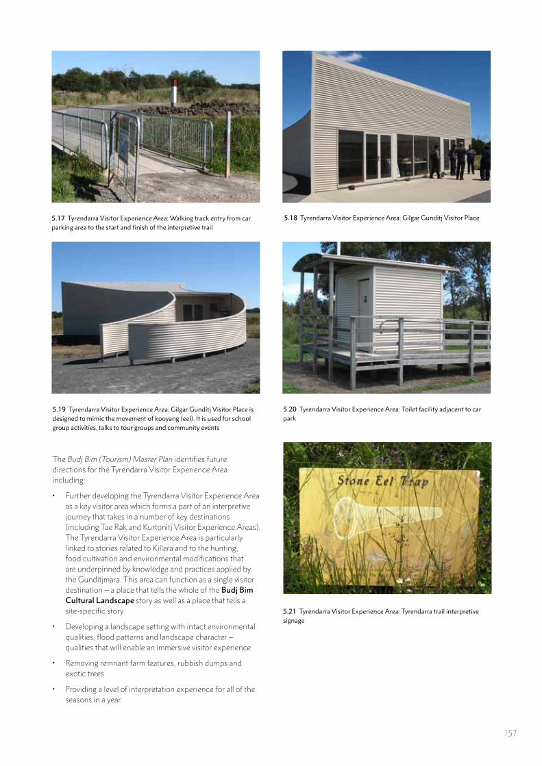
The Budj Bim (Tourism) Master Plan identifies future directions for the Tyrendarra Visitor Experience Area including:
• Further developing the Tyrendarra Visitor Experience Area as a key visitor area which forms a part of an interpretive journey that takes in a number of key destinations (including Tae Rak and Kurtonitj Visitor Experience Areas). The Tyrendarra Visitor Experience Area is particularly linked to stories related to Killara and to the hunting, food cultivation and environmental modifications that are underpinned by knowledge and practices applied by the Gunditjmara. This area can function as a single visitor destination – a place that tells the whole of the Budj Bim Cultural Landscape story as well as a place that tells a site-specific story
• Developing a landscape setting with intact environmental qualities, flood patterns and landscape character – qualities that will enable an immersive visitor experience.
• Removing remnant farm features, rubbish dumps and exotic trees
• Providing a level of interpretation experience for all of the seasons in a year.
5.17 Tyrendarra Visitor Experience Area: Walking track entry from car parking area to the start and finish of the interpretive trail
5.18 Tyrendarra Visitor Experience Area: Gilgar Gunditj Visitor Place
5.19 Tyrendarra Visitor Experience Area: Gilgar Gunditj Visitor Place is designed to mimic the movement of kooyang (eel). It is used for school group activities, talks to tour groups and community events
5.20 Tyrendarra Visitor Experience Area: Toilet facility adjacent to car park
5.21 Tyrendarra Visitor Experience Area: Tyrendarra trail interpretive signage
157
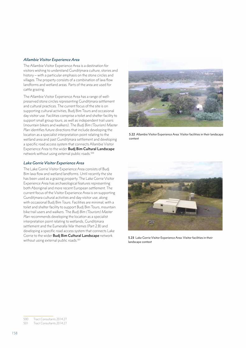
Allambie Visitor Experience Area
The Allambie Visitor Experience Area is a destination for visitors wishing to understand Gunditjmara culture, stories and history – with a particular emphasis on the stone circles and villages. The property consists of a combination of lava flow landforms and wetland areas. Parts of the area are used for cattle grazing.
The Allambie Visitor Experience Area has a range of well-preserved stone circles representing Gunditjmara settlement and cultural practices. The current focus of the site is on supporting cultural activities, Budj Bim Tours and occasional day visitor use. Facilities comprise a toilet and shelter facility to support small group tours, as well as independent trail users (mountain bikers and walkers). The Budj Bim (Tourism) Master Plan identifies future directions that include developing the location as a specialist interpretation point relating to the wetland area and past Gunditjmara settlement and developing a specific road access system that connects Allambie Visitor Experience Area to the wider Budj Bim Cultural Landscape network without using external public roads.500
Lake Gorrie Visitor Experience Area
The Lake Gorrie Visitor Experience Area consists of Budj Bim lava flow and wetland landforms. Until recently the site has been used as a grazing property. The Lake Gorrie Visitor Experience Area has archaeological features representing both Aboriginal and more recent European settlement. The current focus of the Visitor Experience Area is on supporting Gunditjmara cultural activities and day-visitor use, along with occasional Budj Bim Tours. Facilities are minimal; with a toilet and shelter facility to support Budj Bim Tours, mountain bike trail users and walkers. The Budj Bim (Tourism) Master Plan recommends developing the location as a specialist interpretation point relating to wetlands, Gunditjmara settlement and the Eumeralla War themes (Part 2.B) and developing a specific road access system that connects Lake Gorrie to the wider Budj Bim Cultural Landscape network without using external public roads.501
500 Tract Consultants 2014:27501 Tract Consultants 2014:27
5.22 Allambie Visitor Experience Area: Visitor facilities in their landscape context
5.23 Lake Gorrie Visitor Experience Area: Visitor facilities in their landscape context
158
5.I POLICIES AND PROGRAMS RELATED TO THE PRESENTATION AND PROMOTION OF THE PROPERTY
The Budj Bim Cultural Landscape is presented and promoted through the established, collaborative working arrangements between, and the shared goals of, the Gunditj Mirring Traditional Owners Aboriginal Corporation (GMTOAC), Parks Victoria and Winda-Mara Aboriginal Corporation. Land management plans, a thematic heritage study and tourism planning documents identify arrangements for presenting and promoting the Budj Bim Cultural Landscape.502 The significance of the property is communicated to visitors through strategies tailored to the diverse attributes of the nominated property.
GUNDITJMARA CUSTOMARY PRACTICES
As part of an Indigenous landscape, knowledge and cultural traditions concerning the Budj Bim Cultural Landscape are held by Gunditjmara Traditional Owners. They are transmitted from past to present generations and will continue to be transmitted to future generations. The nominated property is an important component of Gunditjmara Country, and for millennia has had a function in the life of the Gunditjmara community through their occupation, settlement and use. That is, for the past and present Traditional Owners of the Budj Bim Cultural Landscape, this place has and always will have a “function in the life of the community” through shared knowledge and practices and their “transmission to future generations”.503
In addition to customary approaches, the Gunditjmara have established programs to present the Budj Bim Cultural Landscape within their community. These include: education programs led by Gunditjmara Elders and undertaken with Gunditjmara youth within the nominated property; cultural activities, events and celebrations (at Lake Condah Mission, for example); and working on Country programs, such as the Budj Bim Ranger program. In addition, cultural knowledge is shared and expressed through creative arts projects illustrated in the activities of The Fighting Gunditjmara Traditional Aboriginal Dance Group and Gunditjmara Karweeyn – the Winda-Mara Aboriginal Dancers (Part 2.B).
502 Parks Victoria 2015; GMTOAC 2015; Winda-Mara Aboriginal Corporation 2015; Context 2012b; Tract Consultants 2014
503 UNESCO Convention Concerning the Protection of the World Cultural and Natural Heritage 1972:Articles 4 and 5.
PRESENTATION AND PROMOTION OF THE PROPERTY
A suite of management documents set out approaches for the presentation of the Budj Bim Cultural Landscape including external promotion and marketing.
• A study of the history and heritage of the Budj Bim Cultural Landscape identified key themes and stories underpinning the presentation of information, interpretation and education.504 These themes and storylines illustrate the interconnectedness of the nominated property’s history and demonstrate the connections to valued places across the nominated property and beyond. The landscape of the nominated property provides a setting within which to share stories and interpretation of the property and its history.
• The key management plans (Part 5.D) for the Budj Bim Cultural Landscape set out goals and strategies for presenting and promoting the heritage values of the nominated property.505 The key goals are: visitors feel welcomed, are well informed of the nomnated property’s values and are aware of the range of visitor opportunities available; visitors and locals appreciate the landscape, its ancient and recent history, cultural and ecological richness and the interwoven nature of peoples’ connections; and students are provided with a range of enjoyable educational experiences that inspire a strong appreciation of the nominated property and its values.506
• The Budj Bim (Tourism) Master Plan sets out a framework for the presentation and promotion of the Budj Bim Cultural Landscape with the aim of establishing it as an outstanding tourism destination (Parts 4.B[iv] and 5.H). A signage and interpretation plan will be developed for the Gunditjmara-owned properties in line with objectives of the Budj Bim (Tourism) Master Plan – with the intent to communicate Gunditjmara stories in relevant visitor experience areas and to reinstate traditional names.507
Interpretive mechanisms are in place to promote a good understanding of the heritage values of the Budj Bim Cultural Landscape. These include on-site interpretive panels that outline the cultural, historic and environmental values of the nominated property, Gunditjmara-led guided tours, brochures and publications – in particular, The People of Budj Bim.508 Information for visitors regarding the nominated property and its values is presented and promoted through accredited visitor information centres, regional Parks Victoria offices, websites – including YouTube videos, social media and local interpretation centres – such as that operated by the Winda-Mara Aboriginal Corporation in Heywood, Victoria.
504 Context 2012b; Parks Victoria 2015:57-62505 Parks Victoria 2015:92-93; GMTOAC 2015:59, 63; Winda-Mara
Aboriginal Corporation 2015:23-24506 Parks Victoria 2015:92-93507 GMTOAC 2015:59508 Gunditjmara 2010
159
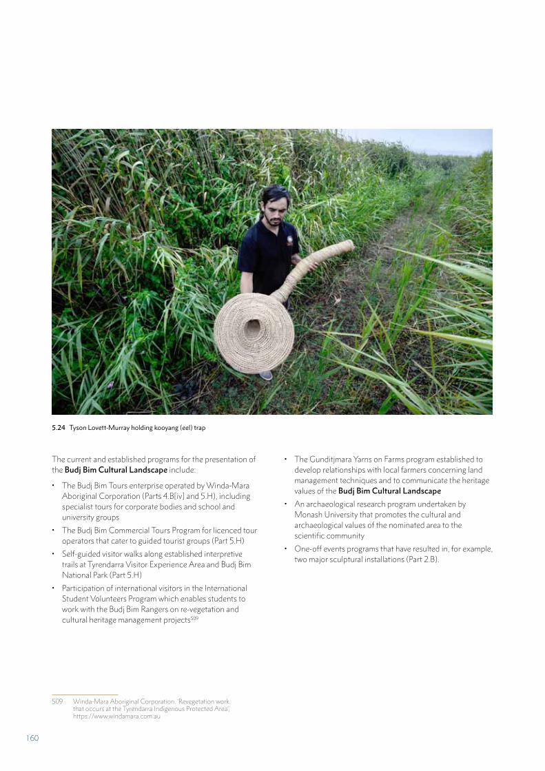
The current and established programs for the presentation of the Budj Bim Cultural Landscape include:
• The Budj Bim Tours enterprise operated by Winda-Mara Aboriginal Corporation (Parts 4.B[iv] and 5.H), including specialist tours for corporate bodies and school and university groups
• The Budj Bim Commercial Tours Program for licenced tour operators that cater to guided tourist groups (Part 5.H)
• Self-guided visitor walks along established interpretive trails at Tyrendarra Visitor Experience Area and Budj Bim National Park (Part 5.H)
• Participation of international visitors in the International Student Volunteers Program which enables students to work with the Budj Bim Rangers on re-vegetation and cultural heritage management projects509
509 Winda-Mara Aboriginal Corporation. ‘Revegetation work that occurs at the Tyrendarra Indigenous Protected Area’, https://www.windamara.com.au
• The Gunditjmara Yarns on Farms program established to develop relationships with local farmers concerning land management techniques and to communicate the heritage values of the Budj Bim Cultural Landscape
• An archaeological research program undertaken by Monash University that promotes the cultural and archaeological values of the nominated area to the scientific community
• One-off events programs that have resulted in, for example, two major sculptural installations (Part 2.B).
5.24 Tyson Lovett-Murray holding kooyang (eel) trap
160
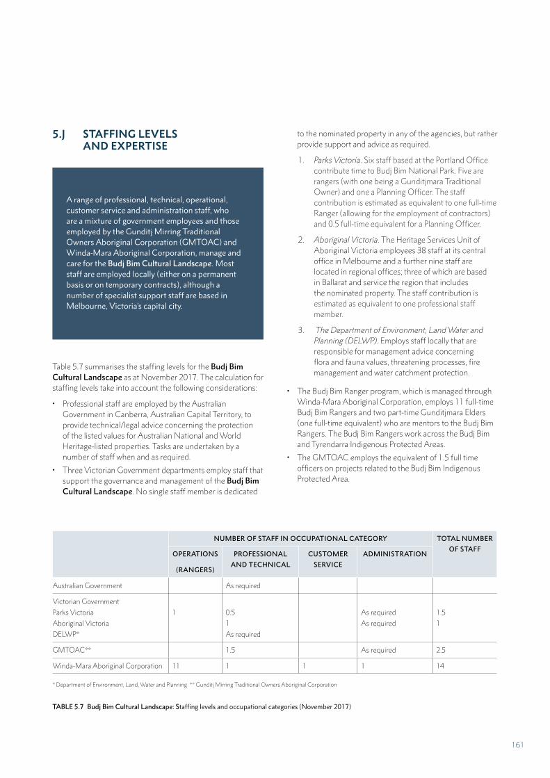
5.J STAFFING LEVELS AND EXPERTISE
A range of professional, technical, operational, customer service and administration staff, who are a mixture of government employees and those employed by the Gunditj Mirring Traditional Owners Aboriginal Corporation (GMTOAC) and Winda-Mara Aboriginal Corporation, manage and care for the Budj Bim Cultural Landscape. Most staff are employed locally (either on a permanent basis or on temporary contracts), although a number of specialist support staff are based in Melbourne, Victoria’s capital city.
Table 5.7 summarises the staffing levels for the Budj Bim Cultural Landscape as at November 2017. The calculation for staffing levels take into account the following considerations:
• Professional staff are employed by the Australian Government in Canberra, Australian Capital Territory, to provide technical/legal advice concerning the protection of the listed values for Australian National and World Heritage-listed properties. Tasks are undertaken by a number of staff when and as required.
• Three Victorian Government departments employ staff that support the governance and management of the Budj Bim Cultural Landscape. No single staff member is dedicated
to the nominated property in any of the agencies, but rather provide support and advice as required.
1. Parks Victoria. Six staff based at the Portland Office contribute time to Budj Bim National Park. Five are rangers (with one being a Gunditjmara Traditional Owner) and one a Planning Officer. The staff contribution is estimated as equivalent to one full-time Ranger (allowing for the employment of contractors) and 0.5 full-time equivalent for a Planning Officer.
2. Aboriginal Victoria. The Heritage Services Unit of Aboriginal Victoria employees 38 staff at its central office in Melbourne and a further nine staff are located in regional offices; three of which are based in Ballarat and service the region that includes the nominated property. The staff contribution is estimated as equivalent to one professional staff member.
3. The Department of Environment, Land Water and Planning (DELWP). Employs staff locally that are responsible for management advice concerning flora and fauna values, threatening processes, fire management and water catchment protection.
• The Budj Bim Ranger program, which is managed through Winda-Mara Aboriginal Corporation, employs 11 full-time Budj Bim Rangers and two part-time Gunditjmara Elders (one full-time equivalent) who are mentors to the Budj Bim Rangers. The Budj Bim Rangers work across the Budj Bim and Tyrendarra Indigenous Protected Areas.
• The GMTOAC employs the equivalent of 1.5 full time officers on projects related to the Budj Bim Indigenous Protected Area.
NUMBER OF STAFF IN OCCUPATIONAL CATEGORY TOTAL NUMBER
OF STAFFOPERATIONS
(RANGERS)
PROFESSIONAL
AND TECHNICAL
CUSTOMER
SERVICE
ADMINISTRATION
Australian Government As required
Victorian Government
Parks Victoria
Aboriginal Victoria
DELWP*
1 0.5
1
As required
As required
As required
1.5
1
GMTOAC** 1.5 As required 2.5
Winda-Mara Aboriginal Corporation 11 1 1 1 14
* Department of Environment, Land, Water and Planning ** Gunditj Mirring Traditional Owners Aboriginal Corporation
TABLE 5.7 Budj Bim Cultural Landscape: Staffing levels and occupational categories (November 2017)
161
PART 6
MONITORING
162
PART 6 MONITORING
A number of different land tenures and protective designations cover the Budj Bim Cultural Landscape (Part 5.B). The nominated area is managed and protected under a comprehensive system comprising Gunditjmara customary knowledge and practices in conjunction with Australian and Victorian Government legislation and management plans that implement an adaptive management approach (Part 5.E). Research and monitoring are essential components of adaptive management, providing objective evidence to support decision-making. The Budj Bim Cultural Landscape has an evaluation and monitoring regime in place to measure the effectiveness of management programs and monitor issues, threats and pressures relating to cultural heritage, geoheritage, water flow and quality, native flora and fauna (including kooyang (eel)), pest plants and animals, wildfire effects, visitor experience areas and assets.
The 2015 Ngootyoong Gunditj Ngootyoong Mara South West Management Plan provides an over-arching regional approach to monitoring and research that applies to all parts of the Budj Bim Cultural Landscape.510 The Budj Bim IPA Plan of Management 2015-2019 and the Tyrendarra IPA Management Action Plan 2015-2018 establish monitoring and evaluation approaches for their respective land parcels.511 While the approaches across the three property management plans are compatible, in the event that the Budj Bim Cultural Landscape is inscribed on the World Heritage List, a Budj Bim Cultural Landscape World Heritage Strategic Management Framework will be adopted to enhance the coordinated and property-wide approach to monitoring.
510 Parks Victoria 2015:Chapter 7511 GMTOAC 2015:66-68; Winda-Mara Aboriginal Corporation
2015:32-34
6.A KEY INDICATORS FOR MEASURING STATE OF CONSERVATION
Table 6.1 identifies key indicators to measure the state of conservation of the whole nominated property. The indicators, which relate to the attributes that carry Outstanding Universal Value, provide a basis for reporting on trends over time against the development, environmental, natural disaster and visitor/tourism pressures identified in Part 4 (Table 4.1). The key indicators reflect priorities for research, evaluation and monitoring, and contribute to the Gunditj Mirring Traditional Owners Aboriginal Corporation (GMTOAC), Parks Victoria and Winda-Mara Aboriginal Corporation Adaptive Management Framework for the Budj Bim Cultural Landscape.512 In the event that the nominated property is inscribed on the World Heritage List; the indicators, as well as related measures, will be incorporated into the Budj Bim Cultural Landscape World Heritage Strategic Management Framework.
The extent of previous monitoring within the Budj Bim Cultural Landscape varies according to land ownership. For Budj Bim (formerly Mount Eccles) National Park (established 1960), three monitoring and evaluation cycles have been undertaken through the Parks Victoria State of the Parks program – in 2000, 2007 and 2013.513 For the more recently established Indigenous Protected Areas of Tyrendarra (established 2003) and Budj Bim (established 2017), monitoring and evaluation processes have been designed and reporting is being implemented.514 Condition assessments of the aquaculture features have been undertaken as part of archaeological survey projects since the 1970s.515 These assessments – in the form of photographs, drawings and descriptions of cultural heritage features, and current inspection schedules, provide data to determine the current (‘good’) condition and enable longitudinal studies of the state of conservation of aquaculture structures and complexes and, ultimately, the Budj Bim Cultural Landscape aquaculture system as a whole.
512 Parks Victoria 2015:99-101; GMTOAC 2015:66-68; Winda-Mara Aboriginal Corporation 2015:25. For previous policies relating to monitoring, see Context 1993, 2000, 2008:97-98.
513 Parks Victoria. ‘State of the Parks’, http://park-web.vic.gov.au/park-management/environment/research-and-scientific-management/state-of-the-parks
514 GMTOAC 2015; Winda-Mara Aboriginal Corporation 2015515 For example, see Coutts 1977; Geering 1985; Clarke 1991
163
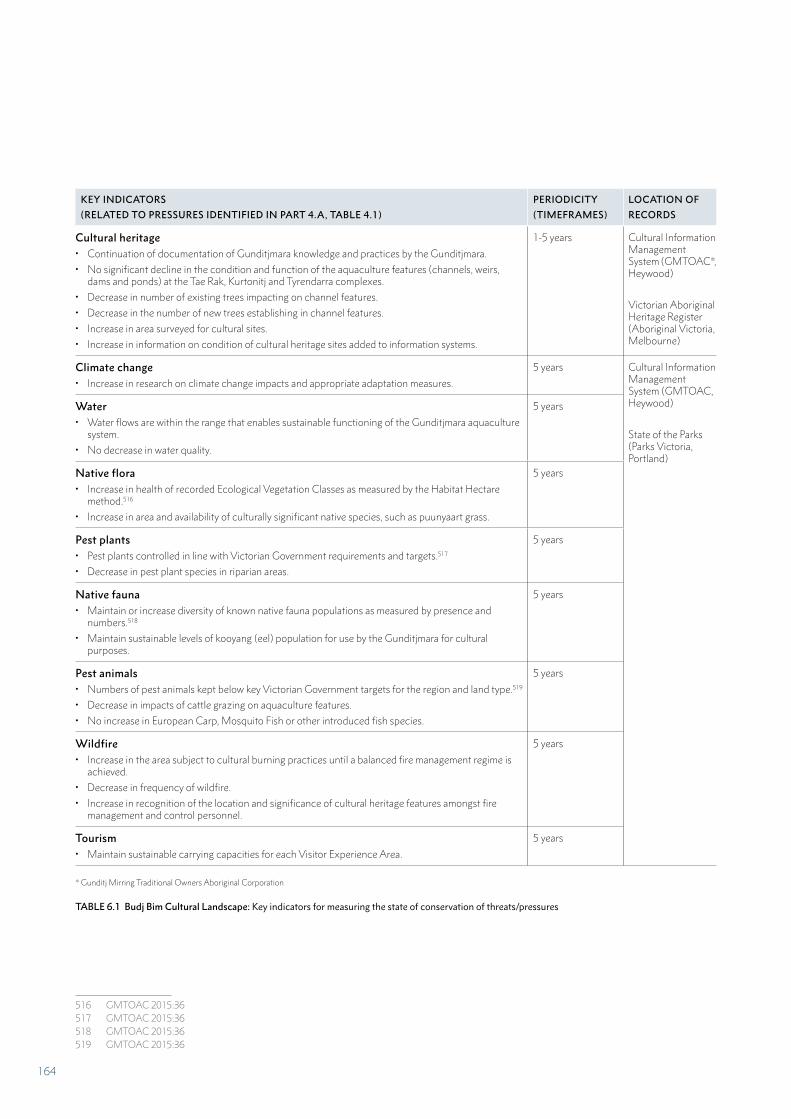
KEY INDICATORS
(RELATED TO PRESSURES IDENTIFIED IN PART 4.A, TABLE 4.1)
PERIODICITY
(TIMEFRAMES)
LOCATION OF
RECORDS
Cultural heritage• Continuation of documentation of Gunditjmara knowledge and practices by the Gunditjmara.
• No significant decline in the condition and function of the aquaculture features (channels, weirs, dams and ponds) at the Tae Rak, Kurtonitj and Tyrendarra complexes.
• Decrease in number of existing trees impacting on channel features.
• Decrease in the number of new trees establishing in channel features.
• Increase in area surveyed for cultural sites.
• Increase in information on condition of cultural heritage sites added to information systems.
1-5 years Cultural Information Management System (GMTOAC*, Heywood)
Victorian Aboriginal Heritage Register (Aboriginal Victoria, Melbourne)
Climate change• Increase in research on climate change impacts and appropriate adaptation measures.
5 years Cultural Information Management System (GMTOAC, Heywood)
State of the Parks (Parks Victoria, Portland)
Water• Water flows are within the range that enables sustainable functioning of the Gunditjmara aquaculture
system.
• No decrease in water quality.
5 years
Native flora• Increase in health of recorded Ecological Vegetation Classes as measured by the Habitat Hectare
method.516
• Increase in area and availability of culturally significant native species, such as puunyaart grass.
5 years
Pest plants • Pest plants controlled in line with Victorian Government requirements and targets.517
• Decrease in pest plant species in riparian areas.
5 years
Native fauna• Maintain or increase diversity of known native fauna populations as measured by presence and
numbers.518
• Maintain sustainable levels of kooyang (eel) population for use by the Gunditjmara for cultural purposes.
5 years
Pest animals • Numbers of pest animals kept below key Victorian Government targets for the region and land type.519
• Decrease in impacts of cattle grazing on aquaculture features.
• No increase in European Carp, Mosquito Fish or other introduced fish species.
5 years
Wildfire• Increase in the area subject to cultural burning practices until a balanced fire management regime is
achieved.
• Decrease in frequency of wildfire.
• Increase in recognition of the location and significance of cultural heritage features amongst fire management and control personnel.
5 years
Tourism• Maintain sustainable carrying capacities for each Visitor Experience Area.
5 years
* Gunditj Mirring Traditional Owners Aboriginal Corporation
TABLE 6.1 Budj Bim Cultural Landscape: Key indicators for measuring the state of conservation of threats/pressures
a516517518519
516 GMTOAC 2015:36517 GMTOAC 2015:36518 GMTOAC 2015:36519 GMTOAC 2015:36
164
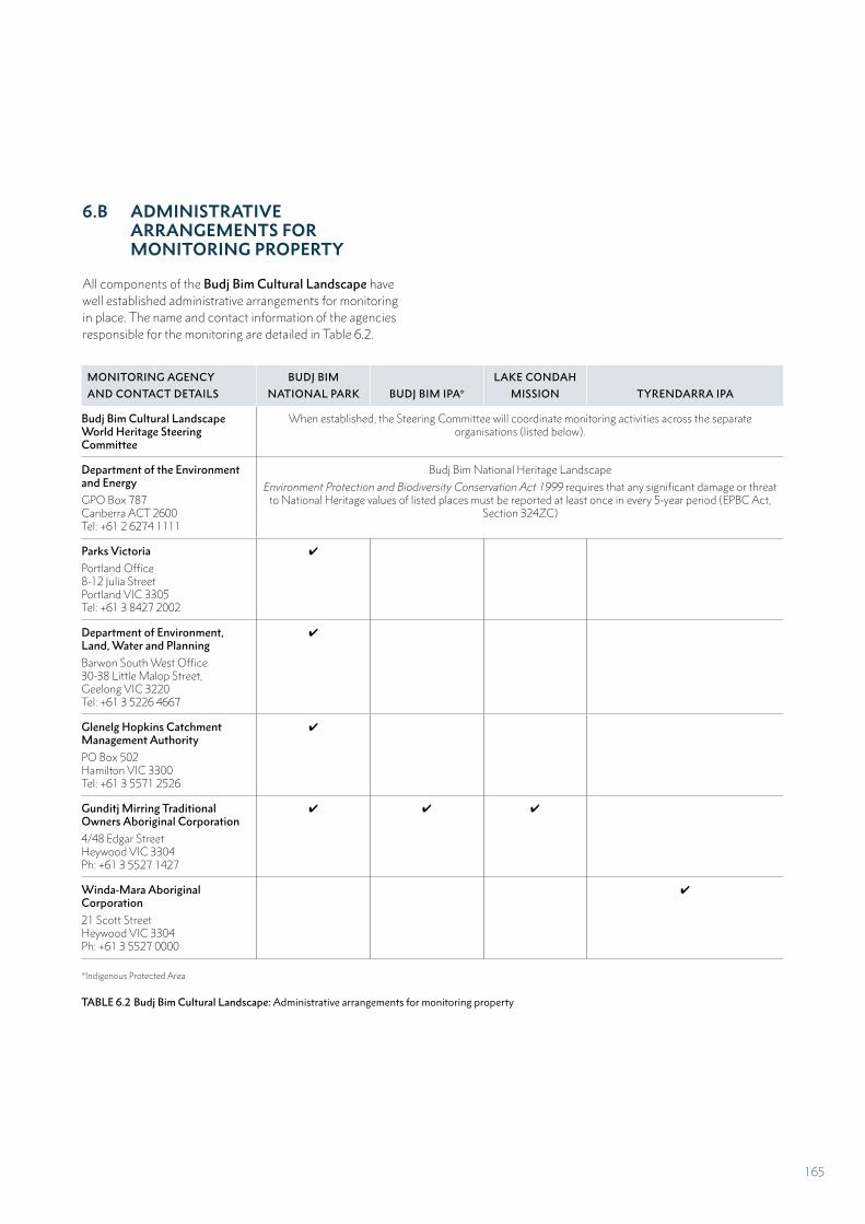
6.B ADMINISTRATIVE ARRANGEMENTS FOR MONITORING PROPERTY
All components of the Budj Bim Cultural Landscape have well established administrative arrangements for monitoring in place. The name and contact information of the agencies responsible for the monitoring are detailed in Table 6.2.
MONITORING AGENCY
AND CONTACT DETAILS
BUDJ BIM
NATIONAL PARK BUDJ BIM IPA*
LAKE CONDAH
MISSION TYRENDARRA IPA
Budj Bim Cultural Landscape World Heritage Steering Committee
When established, the Steering Committee will coordinate monitoring activities across the separate organisations (listed below).
Department of the Environment and Energy
GPO Box 787Canberra ACT 2600Tel: +61 2 6274 1111
Budj Bim National Heritage Landscape
Environment Protection and Biodiversity Conservation Act 1999 requires that any significant damage or threat to National Heritage values of listed places must be reported at least once in every 5-year period (EPBC Act,
Section 324ZC)
Parks Victoria
Portland Office8-12 Julia StreetPortland VIC 3305Tel: +61 3 8427 2002
✔
Department of Environment, Land, Water and Planning
Barwon South West Office30-38 Little Malop Street,Geelong VIC 3220Tel: +61 3 5226 4667
✔
Glenelg Hopkins Catchment Management Authority
PO Box 502Hamilton VIC 3300Tel: +61 3 5571 2526
✔
Gunditj Mirring Traditional Owners Aboriginal Corporation
4/48 Edgar StreetHeywood VIC 3304Ph: +61 3 5527 1427
✔ ✔ ✔
Winda-Mara Aboriginal Corporation
21 Scott StreetHeywood VIC 3304Ph: +61 3 5527 0000
✔
*Indigenous Protected Area
TABLE 6.2 Budj Bim Cultural Landscape: Administrative arrangements for monitoring property
165

6.C RESULTS OF PREVIOUS REPORTING EXERCISES
The results of previous reporting exercises are outlined below. They are presented in a form that correlates with the outstanding attributes of the Budj Bim Cultural Landscape – Gunditjmara cultural traditions, knowledge and practices; the physical evidence of Gunditjmara aquaculture in the landscape; and the interconnected geological, hydrological and ecological systems (Part 3.1.A).
A number of monitoring reports have been prepared that cover areas included within the Budj Bim Cultural Landscape. Reports are prepared for places on Australia’s National Heritage List. The 2016 Australian National Heritage List Monitoring Report for the Budj Bim National Heritage Landscape states that the condition of the values is improved since listing in 2004, but the risks to listed values are very high for the ability of the integrity to recover from inappropriate fire regimes; and pressures on the values are high for climate change, altered fire regimes, wildfire and pest species.
The Gunditj Mirring Traditional Owners Aboriginal Corporation (GMTOAC) and Winda-Mara Aboriginal Corporation prepare annual reports for the Australian Government with regard to the Indigenous Protected Areas and Working on Country programs. These reports provide descriptive information against a range of management areas including: cultural heritage management, Indigenous knowledge transfer, native flora and fauna management, pest plant and animal management, soil management, freshwater management, fire management, information management, visitor management, community education and development and staff training and development.
GUNDITJMARA CULTURAL TRADITIONS, KNOWLEDGE AND PRACTICES
Gunditjmara cultural traditions, knowledge and practices are not subject to formal processes of monitoring or reporting of their state of conservation. Nevertheless, the vitality and ingenuity of contemporary knowledge and practices are evidenced:
• increased Gunditjmara access to the aquaculture systems through property ownership by GMTOAC and the Winda-Mara Aboriginal Corporation (Part 5.A)
• increased documentation, management (including monitoring) and presentation of the aquaculture system by the Budj Bim Rangers program and Budj Bim Tours
• increased learning and skill-sharing associated with the sourcing of natural fibres and weaving of gnarraban (kooyang (eel) baskets)
• increased contemporary creative artistic expressions of Gunditjmara aquaculture, evidenced in story-telling, dance, crafted objects and sculpture
• increased research on the effects of improved water flows associated with the construction of the cultural weir on Tae Rak (Lake Condah) in 2010520
• development of management tools, such as the Gunditjmara Traditional Owners’ Ecological Tool Kit (for managing threatening processes across the Budj Bim Cultural Landscape)521 and the Gunditjmara Traditional Owner Cultural Information Management System (for archiving and managing information such as oral histories, historical documents and site records).
PHYSICAL EVIDENCE OF GUNDITJMARA AQUACULTURE IN THE LANDSCAPE
Tae Rak (Lake Condah) aquaculture complexes
The state of conservation of the physical evidence of Gunditjmara aquaculture (channels, dams, weirs and ponds) was initially undertaken at the time of the first archaeological field surveys to document the features in the late 1970s and 1980s.522 In 1990, archaeologist Anne Clarke revisited many of the previously recorded sites in the Tae Rak and Allambie areas and documented a number of new sites.523 Clarke’s resource inventory study provided basic condition assessments (good, fair, poor) for 88 aquaculture features (as well as 129 stone circles and 7 stone artefact scatters)524 and provided baseline data against which future assessments could be compared.
Archaeological surveys and investigations undertaken by Aboriginal Victoria (2004) and Monash University (since 2006), while focussed on particular elements of the Tae Rak aquaculture complexes, also documented the condition of selected aquaculture features.525 In 2011, archaeologists Sharon Lane and Alyssa Gilchrist carried out an audit of cultural heritage sites on the Allambie, Vaughans and Muldoons properties (prior to their transfer from the Victorian Government to the GMTOAC).526 The most recent assessment of the state of conservation of aquaculture features in the Tae Rak area was undertaken as part of the Tree Management Cultural Heritage Management Plan.527 While this survey focussed on the condition of 122 trees growing within or beside aquaculture features; it did so in the context of the existing and potential future impacts on the condition of the features.528
520 GMTOAC 2015:41-44521 Parks Victoria 2015:30522 Coutts 1982; Coutts et al. 1977, 1978; Geering 1985; Wesson 1981;
summarised in Context 2013a:18-20523 Clarke1991:45-46; summarised in Context 1993:77-91 524 Clarke 1991:Appendix 2525 Richards 2011; McNiven and Bell 2010; McNiven et al. 2012526 Lane and Gilchrist 2011. These land parcels have now been
incorporated into the Budj Bim Indigenous Protected Area. 527 Context 2013b528 Context 2013b:21
166
These reports and the Budj Bim Rangers routine inspections of the Tae Rak aquaculture features, boundary fences and visitor and other infrastructure facilities provide a baseline for current and future monitoring of the condition and state of conservation of the aquaculture features.
Kurtonitj aquaculture complex
The Kurtonitj aquaculture system, extending over an area of 300 metres by 150 metres (Part 2.A), was documented and investigated by archaeologist Heather Builth. Builth’s work provided baseline data on the condition and state of conservation of the weirs, dam and channels. 529 These reports and the Budj Bim Rangers annual inspections of the Kurtonitj aquaculture complex provide a baseline for current and future monitoring of the condition and state of conservation of the aquaculture features.
Tyrendarra aquaculture complex
The Tyrendarra aquaculture complex is a 1.4 kilometre by 0.3 kilometre area of lava flow featuring an inter-connected complex of 18 dams/weirs, seven excavated channels and numerous swampy depressions associated with trapping and holding kooyang (Part 2.A).530 Initially documented in 1990 and 1996,531 the complex was subsequently the subject of intensive study by Builth in the mid-to late-1990s. Lane undertook a further cultural heritage assessment of the property in 2001.532 These reports, and the documentation associated with the site records, provide a baseline for the future monitoring of the condition and state of conservation of the aquaculture features. These reports, the documentation associated with the site records, and the Budj Bim Rangers annual inspections of the aquaculture features provide a baseline for the current and future monitoring of the condition and state of conservation of the aquaculture features.
INTERCONNECTED GEOLOGICAL, HYDROLOGICAL AND ECOLOGICAL SYSTEMS
The state of conservation of the environment – and in particular of the Budj Bim lava flow, Tae Rak/Killara catchment and ecological health of the Budj Bim Cultural Landscape (including kooyang habitat) is documented in a number of reports and is the subject of ongoing monitoring by Parks Victoria, GMTOAC and Winda-Mara Aboriginal Corporation.
State of the Parks
Parks Victoria evaluates the effectiveness of park management activities in protected areas across Victoria through the State of the Parks program. The purpose of State of the Parks reporting is to: (1) undertake a systematic evaluation
529 Builth 2002:262, 264; 2004:172530 Builth 2002:225-258; 2004:174-175531 Schell 1996; Van Waarden 1990532 Lane 2001
of the outcomes of management programs and the extent to which park management objectives are being met; (2) review achievements, highlight current challenges and identify emerging issues; and (3) inform and adapt management programs following each review.
The process for State of the Parks is based around best-practice adopted by the International Union for the Conservation of Nature World Commission on Protected Areas, and is consistent with the Australian Government’s National Reserve System guidelines for the states and territories.533 State of the Parks assesses all park management output areas – environment, land and water; culture and heritage; visitors and community; fire and emergency management, and a sustainable organisation. State of the Parks surveys were undertaken in 2000, 2007 and 2013. Parks Victoria holds the data collected for each reporting period. State of the Parks data provide a baseline of information against which each protected area in Victoria is compared and evaluated.
Management Plans
The three key management plans for the Budj Bim Cultural Landscape outline strategies for monitoring the environment of the nominated property and establish research and monitoring programs.534
Baseline studies
The environmental attributes of the Budj Bim Cultural Landscape have been identified and assessed for state of conservation through a number of research studies.
Geological system
Geologists Ken Grimes and Neville Rosengren, in The Geology and Landforms of Budj Bim, Western Victoria,535 describe the geological history of an area that includes the Budj Bim Cultural Landscape. They conclude that the Budj Bim lava flow is well preserved, though “the smaller surface details have been modified by 36,000 years of weathering and disruption by tree roots” and “some features have been damaged or destroyed by quarrying and agricultural activities.” Despite these changes, the Budj Bim lava flow provides the physical and hydrological basis for the wetlands and is a source of the materials (loose basalt rocks) for Gunditjmara aquaculture engineering and construction.536
533 Parks Victoria. ‘State of the Parks’, http://park-web.vic.gov.au/park-management/environment/research-and-scientific-management/state-of-the-parks
534 Parks Victoria 2015:99-101; GMTOAC 2015:66-68; Winda-Mara Aboriginal Corporation 2015:25
535 Grimes and Rosengren 2013536 Grimes and Rosengren 2013:96
167
Hydrological system
A number of detailed studies of the Tae Rak-Killara catchment water flow were undertaken in advance of the reconstruction of the cultural weir on Tae Rak (Lake Condah) in 2010 (Part 2.B).537 The Tae Rak restoration brought the lake back to three quarters of its former (pre-drainage) surface area. Within a short time, water-based plants and animals, particularly water-birds, began returning in increasing numbers to Tae Rak. Once water was retained in Tae Rak, the birds began breeding and species diversity has rapidly increased; including of culturally significant species such as Brolga, Sea Eagle and Wedge-tailed Eagle. The results of annual biodiversity monitoring conducted by members of the Portland Field Naturalists Club and Budj Bim Rangers have confirmed the ecological values of the restoration.
Ecological system - vegetation
Two reports on the vegetation of the Budj Bim Cultural Landscape and its setting have been undertaken by Ecology Australia – in 1991 and 2006-2007.538 Despite the number and coverage of invasive pest plant species, the moderately to highly intact native vegetation of the Eccles Land System has been assessed to be of National conservation significance.539 The reports conclude that the condition of vegetation within the nominated property is variable (Part 2.A). The dryland vegetation is vulnerable to pest plant species, introduced animal species and cattle grazing, but the condition of the wetland vegetation is good. This has especially been the case with increased water retention and flow following the Gunditjmara’s restoration of Tae Rak in 2010; and higher-than-average rainfall in subsequent and recent years.
537 For example, Context 2008; Gippel et al. 2006 538 Carr et al. 2006; Context 1993:41-69, 340-371;
Ecology Australia 2007539 Ecology Australia 2007:56
Ecological system - kooyang (Short-finned eel)
Ecologist Lachlan McKinnon, in Short-finned Eel Harvest Capacity of the Budj Bim Landscape,540 states that the Budj Bim Cultural Landscape is a major stronghold for the kooyang short-finned eel - (Anguilla australis) in southern Australia.541 Killara and its associated wetlands – including those at Tae Rak, Kurtonitj and Tyrendarra, form an interconnected network of habitat that provides conditions suitable for kooyang. This is because these areas offer continuity of habitat and water of sufficient quality to attract and support kooyang populations.542 Furthermore, kooyang habitat has been substantially rejuvenated and extended with the Gunditjmara’s restoration of Tae Rak and its associated wetland environments. The construction of the cultural weir in 2010 was a major achievement in habitat restoration (Part 2.A).
The refilling of Lake Condah via installation of a weir and fishway has brought back to life the seed banks of aquatic plants and many waterbirds now use the lake as a breeding ground. After the weir was installed, the lake was quickly colonised by eels and other fish. Lake Condah is once again functioning as a productive wetland and provides an outstanding example of what can be achieved via ecologically sensitive restoration of habitat.
540 McKinnon 2007541 McKinnon 2002542 Crook 2013:88
168
PART 7
DOCUMENTATION
169
TABLE 7.1 Budj Bim Cultural Landscape: Photographs and audio-visual image inventory and authorisation form
PART 7 DOCUMENTATION7.A PHOTOGRAPHS AND AUDIO-VISUAL IMAGE INVENTORY AND AUTHORISATION FORM
ID. No. Format Caption Date of Photo (Mo/Yr)
Photographer Copyright Owner
Contact Details of Copyright Owner(Name, Address, Telephone, Email)
Non Exclusive Cession of Rights
Cover page (1)
Photograph Top of page – no caption (drone landscape image)
Nov. 2017
Tyson Lovett-Murray
Gunditj Mirring Traditional Owners Aboriginal Corporation
Gunditj Mirring Traditional Owners Aboriginal Corporation4/48 Edgar StreetHeywood Victoria 3304Tel: +61 3 5527 1427Email: [email protected]
Yes
Cover page (2)
Photograph Centre page – no caption (Jennie Green weaving; as photograph 2.56)
circa 1865
Unknown Out of copyright Not applicable
Held in the collection of the State Library of Victoria
Yes
Cover page (3)
Photograph Centre page – no caption (kooyang [eel] basket by Aunty Connie Hart)
2009 Graham Baring Koorie Heritage Trust
c/- Koorie Heritage TrustLevels 1 and 3, The Yarra BuildingFederation SquareCnr Swanston and Flinders StreetsMelbourne VIC 3000Tel: +61 3 8662 6300
Yes
Cover page (4)
Drawing Centre page – no caption (Crater of Budj Bim [Mount Eccles] volcano; same as drawing 2.19)
1858 Eugene von Guerard
Out of copyright Not applicable
Held in the collection of the National Gallery of Victoria
Yes
Cover page (5)
Illustration Centre page – no caption (possum skin cloak design)
2002 Unknown Museums Victoria
Museums VictoriaPO Box 666Melbourne VIC 3001Tel: +61 3 9392 4800Email: [email protected]
Yes
Title page Photograph No caption (Possum skin cloak, Lake Condah 1872; as photograph 2.53)
2009 Rodney Start Museums Victoria
Museums VictoriaPO Box 666Melbourne VIC 3001Tel: +61 3 9392 4800Email: [email protected]
Yes
Page ix Photograph No caption (drone landscape image)
Nov. 2017
Tyson Lovett-Murray
Gunditj Mirring Traditional Owners Aboriginal Corporation
Gunditj Mirring Traditional Owners Aboriginal Corporation4/48 Edgar StreetHeywood Victoria 3304Tel: +61 3 5527 1427Email: [email protected]
Yes
Part 1; front Photograph No caption (Aquaculture channel and pond)
Nov. 2017
Tyson Lovett-Murray
Gunditj Mirring Traditional Owners Aboriginal Corporation
Gunditj Mirring Traditional Owners Aboriginal Corporation4/48 Edgar StreetHeywood Victoria 3304Tel: +61 3 5527 1427Email: [email protected]
Yes
Part 2A; front Photograph No caption (Brolgas nesting on Tae Rak [Lake Condah])
Jul. 2016 Vin Gannon Winda-Mara Aboriginal Corporation
Winda-Mara Aboriginal Corporation21 Scott StreetHeywood Victoria 3304Tel: +61 3 5527 0000
Yes
170
ID. No. Format Caption Date of Photo (Mo/Yr)
Photographer Copyright Owner
Contact Details of Copyright Owner(Name, Address, Telephone, Email)
Non Exclusive Cession of Rights
2.1 Illustration Extent of Gundijmara Country
Nov. 2017
The Designery Aboriginal Victoria
Aboriginal VictoriaLevel 31 Treasury PlaceMelbourne VIC 3000Tel: 03 8392 5388
Yes
2.2 Photograph Woorrowarook Mirring or Forest Country
Jan. 2011 Parks Victoria - Parks VictoriaLevel 10, 535 Bourke StreetMelbourne VIC 3000
Yes
2.3 Photograph Bocara Woorrowarook Mirring or River Forest Country
Jan. 2010 Parks Victoria - Parks VictoriaLevel 10, 535 Bourke StreetMelbourne VIC 3000
Yes
2.4 Photograph Koonang Mirring or Sea Country
Feb. 2012 Peter Hill Parks Victoria Parks VictoriaLevel 10, 535 Bourke Street Melbourne VIC 3000
Yes
2.5 Photograph Tungatt Mirring or Stone Country
Nov. 2009
Mike Cusack Parks Victoria Parks VictoriaLevel 10, 535 Bourke Street Melbourne VIC 3000
Yes
2.6 Photograph Tae Rak (Lake Condah): Muldoons Trap Complex with archaeological excavation trench across a channel
Apr. 2008 Ian McNiven - c/- Monash UniversityMonash Indigenous Studies CentreClayton Campus VIC 3800Email: [email protected]
Yes
2.7 Illustration Tae Rak (Lake Condah): Large 180 metre long stone walled channel
1978 Peter Coutts Aboriginal Victoria
Aboriginal VictoriaLevel 3, 1 Treasury PlaceMelbourne VIC 3000Tel: +61 3 8392 5388
Yes
2.8 Photograph Tae Rak (Lake Condah): Kooyang weir
1990 Ian McNiven - c/- Monash UniversityMonash Indigenous Studies CentreClayton Campus VIC 3800Email: [email protected]
Yes
2.9 Photograph Tae Rak (Lake Condah): Kooyang weir
1990 Ian McNiven - c/- Monash UniversityMonash Indigenous Studies CentreClayton Campus VIC 3800Email: [email protected]
Yes
2.10 Illustration Tae Rak (Lake Condah): Stone walled fishing weir
1978 Peter Coutts Aboriginal Victoria
Aboriginal VictoriaLevel 3, 1 Treasury PlaceMelbourne VIC 3000Tel: +61 3 8392 5388
Yes
2.11 Photograph Tae Rak (Lake Condah): Muldoons Trap Complex with archaeological excavation of a dam
Feb. 2006 Ian McNiven - c/- Monash UniversityMonash Indigenous Studies CentreClayton Campus VIC 3800Email: [email protected]
Yes
2.12 Illustration Tae Rak 2 aquaculture complex: Sketch plan showing water flow and aquaculture features
Nov. 2017
The Designery Aboriginal Victoria
Aboriginal VictoriaLevel 3, 1 Treasury PlaceMelbourne VIC 3000Tel: +61 3 8392 5388
Yes
171
ID. No. Format Caption Date of Photo (Mo/Yr)
Photographer Copyright Owner
Contact Details of Copyright Owner(Name, Address, Telephone, Email)
Non Exclusive Cession of Rights
2.13 Illustration Tae Rak (Lake Condah): Muldoons Trap Complex
2006 Tom Richards - c/- Monash UniversityMonash Indigenous Studies CentreClayton Campus VIC 3800Email: [email protected]
Yes
2.14 Photograph Tae Rak (Lake Condah): Excavating a section of channel, Muldoons Trap Complex
Feb. 2008 Bruno David - c/- Monash UniversityMonash Indigenous Studies CentreClayton Campus VIC 3800Email: [email protected]
Yes
2.15 Illustration Kurtonitj (central) component: Kurtonitj aquaculture complex
Apr. 2002 Heather Builth - PO Box 85Upper Sturt SA 5156Email: [email protected]
Yes
2.16 Illustration Tyrendarra (southern) component: Tyrendarra aquaculture complex (winter)
Apr. 2002 Heather Builth - PO Box 85Upper Sturt SA 5156Email: [email protected]
Yes
2.17 Illustration Tyrendarra (southern) component: Tyrendarra aquaculture complex (summer)
Apr. 2002 Heather Builth - PO Box 85Upper Sturt SA 5156Email: [email protected]
Yes
2.18 Photograph The crater of Budj Bim volcano today has a crater lake, Lake Surprise
Jan. 2012 Parks Victoria - Parks VictoriaLevel 10, 535 Bourke Street Melbourne VIC 3000
Yes
2.19 Drawing Crater of Budj Bim volcano as drawn by Eugène von Guérard in 1858
1858 Eugene von Guerard
Out of copyright Not applicableHeld in the collection of the National Gallery of Victoria
Yes
2.20 Photograph Aerial view showing wetlands and lava flow outcrops
Nov. 2017
Tyson Lovett-Murray
Gunditj Mirring Traditional Owners Aboriginal Corporation
Gunditj Mirring Traditional Owners Aboriginal Corporation4/48 Edgar StreetHeywood Victoria 3304Tel: +61 3 5527 1427Email: [email protected]
Yes
2.21 Photograph The dramatic evidence of the Budj Bim lava flow, cloaked by Manna Gum woodland
Aug. 2015
Tyson Lovett-Murray
Gunditj Mirring Traditional Owners Aboriginal Corporation
Gunditj Mirring Traditional Owners Aboriginal Corporation4/48 Edgar StreetHeywood Victoria 3304Tel: +61 3 5527 1427Email: [email protected]
Yes
2.22 Photograph “The healing of Lake Condah within a generation is our vision for the future…”
Nov. 2017
Tyson Lovett-Murray
Gunditj Mirring Traditional Owners Aboriginal Corporation
Gunditj Mirring Traditional Owners Aboriginal Corporation4/48 Edgar StreetHeywood Victoria 3304Tel: +61 3 5527 1427Email: [email protected]
Yes
2.23 Photograph Tyson Lovett-Murray holding a large kooyang (eel)
Jan. 2015 Justin McManus
Fairfax Media Ltd
Fairfax Media LtdHead Office, GPO 506 Sydney NSW 2001Tel: +61 2 9282 2833
Yes
172
ID. No. Format Caption Date of Photo (Mo/Yr)
Photographer Copyright Owner
Contact Details of Copyright Owner(Name, Address, Telephone, Email)
Non Exclusive Cession of Rights
2.24 Illustration From egg to maturity, A. australis goes through five stages in its lifecycle
Nov. 2017
The Designery, after Gib Wettenhall 2010
Aboriginal Victoria
Aboriginal VictoriaLevel 3, 1 Treasury PlaceMelbourne VIC 3000Tel: +61 3 8392 5388
Yes
2.25 Photograph Richard Bamblett at Tae Rak (Lake Condah) using a traditional spear and puunyaart reed basket to capture kooyang
Unknown Damein Bell Gunditj Mirring Traditional Owners Aboriginal Corporation
Gunditj Mirring Traditional Owners Aboriginal Corporation4/48 Edgar StreetHeywood Victoria 3304Tel: +61 3 5527 1427Email: [email protected]
Yes
2.26 Photograph Budj Bim (northern) component: High quality Stony Rises Woodland with Manna Gum …
Nov. 2006
Geoff Carr Ecology Australia
Ecology Australia 88B Station StreetFairfield VIC 3078Tel: +61 3 9489 4191Email: [email protected]
Yes
2.27 Photograph Kurtonitj (central) component: Extensive wetland on the southern boundary…
Nov. 2006
Geoff Carr Ecology Australia
Ecology Australia 88B Station StreetFairfield VIC 3078Tel: +61 3 9489 4191Email: [email protected]
Yes
2.28 Photograph Tyrendarra (southern) component: The 14 hectare wetland is one of the largest and most significant in the Budj Bim lava flow…
Nov. 2006
Geoff Carr Ecology Australia
Ecology Australia 88B Station StreetFairfield VIC 3078Tel: +61 3 9489 4191Email: [email protected]
Yes
2.29 Photograph Tyrendarra (southern) component: The near-to-dry bed of Palawarra (Fitzroy River)…
Nov. 2006
Geoff Carr Ecology Australia
Ecology Australia 88B Station StreetFairfield VIC 3078Tel: +61 3 9489 4191Email: [email protected]
Yes
2.30 Photograph The tubers of all three local forms of Water Ribbons (Triglochin procera (2 forms) and T. alcockiae) can be eaten raw or roasted
Dec. 2006
Geoff Carr Ecology Australia
Ecology Australia 88B Station StreetFairfield VIC 3078Tel: +61 3 9489 4191Email: [email protected]
Yes
2.31 Photograph Collecting rushes and grass to make baskets
2008 Gib Wettenhall - Gib Wettenhall, em PRESS Publishing133 McPhans RdMollongghip VIC 3352Email: [email protected]
Yes
2.32 Photograph South-eastern Red-tailed Black Cockatoo: A totemic (moiety) species for Gunditjmara
Oct. 2008 Bob McPherson
- Bob McPherson25 Bennett Street, Portland VIC 3305. Tel: +61 3 5523 4779 Email: [email protected]
Yes
Page 29 Photograph No caption (cockatoo) Unknown Open source image
Not applicable Yes
Part 2B; front Photograph No caption (kooyang [eel basket] from Lake Condah, circa 1910)
Unknown South Australian Museum
- South Australian MuseumNorth TerraceAdelaide SA 5000Tel: +61 8 8207 7500Email: [email protected]
Yes
173
ID. No. Format Caption Date of Photo (Mo/Yr)
Photographer Copyright Owner
Contact Details of Copyright Owner(Name, Address, Telephone, Email)
Non Exclusive Cession of Rights
2.33 Photograph Muldoons Fish Trap: Excavation, 2008
Feb. 2008 Ian McNiven - c/- Monash UniversityMonash Indigenous Studies CentreClayton Campus VIC 3800Email: [email protected]
Yes
2.34 Photograph Budj Bim (northern) component: Stone house after archaeological test excavation…
Feb. 2006 Ian McNiven - c/- Monash UniversityMonash Indigenous Studies CentreClayton Campus VIC 3800Email: [email protected]
Yes
2.35 Digital recreation
Budj Bim (northern) component: Digital reconstruction of archaeological remains of stone houses
2013 First Footprints Productions
Flame FlameUnit 2, 65 Whiting StreetArtarmon NSW 2064Tel: +61 2 8065 4899
Yes
2.36 Photograph Kurtonitj (central) component: Stone house prior to archaeological excavation…
Oct. 2011 Ian McNiven - c/- Monash UniversityMonash Indigenous Studies CentreClayton Campus VIC 3800Email: [email protected]
Yes
2.37 Photograph Kurtonitj (central) component: Stone house after completion of archaeological excavation
Mar. 2013 Ian McNiven - c/- Monash UniversityMonash Indigenous Studies CentreClayton Campus VIC 3800Email: [email protected]
Yes
2.38 Illustration Kurtonitj (central) component: Archaeological excavation plan for stone house
Mar. 2013 Ian McNiven - c/- Monash UniversityMonash Indigenous Studies CentreClayton Campus VIC 3800Email: [email protected]
Yes
2.39 Illustration Budj Bim (northern) component: Stone house site complex…
Nov. 2017
The Designery Aboriginal Victoria
Aboriginal VictoriaLevel 3, 1 Treasury PlaceMelbourne VIC 3000Tel: +61 3 8392 5388
Yes
2.40 Photograph Titled ‘The last gathering of the Portland tribe’…
Late 1850s
Unknown Out of copyright Not applicable
Held in the collection of Museums Victoria
Yes
2.41 Photograph Gunditjmara men dressed for a ceremony in 1859…
circa 1859
Thomas Hannay
Out of copyright Not applicable
Held in the collection of Museums Victoria
Yes
2.42 Painting Cold Morning and his family camped at Portland…
1847 George French Angas
South Australian Museum
South Australian MuseumNorth TerraceAdelaide SA 5000Tel: +61 8 8207 7500Email: [email protected]
Yes
2.43 Archival sketch
Stake and branch fishing weir, tributary of the Hopkins River
Apr. 1841 George Augustus Robinson
Mitchell Collection, State Library of New South Wales
State Library of New South WalesMacquarie StreetSydney NSW 2000Tel: +61 2 9273 1414
Yes
174
ID. No. Format Caption Date of Photo (Mo/Yr)
Photographer Copyright Owner
Contact Details of Copyright Owner(Name, Address, Telephone, Email)
Non Exclusive Cession of Rights
2.44 Archival sketch
Section of a large stake, branch and basket fishing weir, Moyne River, during use…
Apr. 1841 George Augustus Robinson
Mitchell Collection, State Library of New South Wales
Aboriginal VictoriaLevel 3, 1 Treasury PlaceMelbourne VIC 3000Tel: +61 3 8392 5388
Yes
2.45 Archival sketch
Detail of front of a large stake, branch and basket fishing weir, Moyne River
Apr. 1841 George Augustus Robinson
Mitchell Collection, State Library of New South Wales
Aboriginal VictoriaLevel 3, 1 Treasury PlaceMelbourne VIC 3000Tel: +61 3 8392 5388
Yes
2.46 Archival sketch
Detail of back of a large stake, branch and basket fishing weir, Moyne River
Apr. 1841 George Augustus Robinson
Mitchell Collection, State Library of New South Wales
Aboriginal VictoriaLevel 3, 1 Treasury PlaceMelbourne VIC 3000Tel: +61 3 8392 5388
Yes
2.47 Archival sketch
Eel basket (gnarraban), a series of which were used in association with a stake and branch fishing weir, Moyne River
Apr. 1841 George Augustus Robinson
Mitchell Collection, State Library of New South Wales
Aboriginal VictoriaLevel 3, 1 Treasury PlaceMelbourne VIC 3000Tel: +61 3 8392 5388
Yes
2.48 Archival map Plan of the Parish of Condah (c.1889) showing the additional land of 1,710 acres set aside in 1885 to safeguard Gunditjmara hunting grounds
circa 1889
Unknown Out of copyright Not applicable
Held in the collection of the Public Record Office of Victoria
Yes
2.49 Drawing Budj Bim (northern) component: Lake Condah Aboriginal Mission Station, circa 1874
circa 1874
Unknown Out of copyright Not applicable
Held in the collection of the State Library of Victoria
Yes
2.50 Photograph Lake Condah Mission: School (left), church (centre) and mission house (right)
Unknown Unknown Out of copyright Not applicable Yes
2.51 Photograph Lake Condah Mission: Houses built by the Gunditjmara, circa 1914
circa 1914
Unknown Out of copyright Not applicable
Held in the collection of Museums Victoria
Yes
2.52 Photograph Lake Condah Mission: St Mary’s Church and the community that built it c.1914
circa 1914
Unknown Out of copyright Not applicable
Held in the collection of Museums Victoria
Yes
2.53 Photograph Possum skin cloak made at Lake Condah Mission in 1872…
2009 Rodney Start Museums Victoria
Museums VictoriaPO Box 666Melbourne VIC 3001Tel: +61 3 9392 4800Email: [email protected]
Yes
2.54 Photograph Aunty Iris Lovett-Gardiner wrapped in a possum skin cloak
Unknown Jim Berg - c/- Koori Heritage TrustLevels 1 and 3, The Yarra BuildingFederation SquareCnr Swanston and Flinders StreetsMelbourne VIC 3000Tel: +61 3 8662 6300
Yes
175
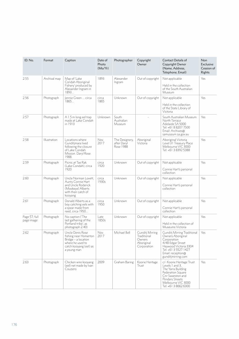
ID. No. Format Caption Date of Photo (Mo/Yr)
Photographer Copyright Owner
Contact Details of Copyright Owner(Name, Address, Telephone, Email)
Non Exclusive Cession of Rights
2.55 Archival map Map of ‘Lake Condah Aboriginal Fishery’ produced by Alexander Ingram in 1893…
1893 Alexander Ingram
Out of copyright Not applicable
Held in the collection of the South Australian Museum
Yes
2.56 Photograph Jennie Green … circa 1865…
circa 1865
Unknown Out of copyright Not applicable
Held in the collection of the State Library of Victoria
Yes
2.57 Photograph A 1.5 m long eel trap made at Lake Condah in 1910
Unknown South Australian Museum
- South Australian MuseumNorth TerraceAdelaide SA 5000Tel: +61 8 8207 7500Email: [email protected]
Yes
2.58 Illustration Locations where Gunditjmara lived following the closure of Lake Condah Mission. Daryl Rose 1988.
Nov. 2017
The Designery, after Daryl Rose 1988
Aboriginal Victoria
Aboriginal VictoriaLevel 31 Treasury PlaceMelbourne VIC 3000Tel: +61 3 8392 5388
Yes
2.59 Photograph Picnic at Tae Rak (Lake Condah), circa 1920
circa 1920
Unknown Out of copyright Not applicable
Connie Hart’s personal collection
Yes
2.60 Photograph Uncle Norman Lovett, Aunty Connie Hart and Uncle Roderick (Mookeye) Alberts with their catch of kooyang
circa 1930s
Unknown Out of copyright Not applicable
Connie Hart’s personal collection
Yes
2.61 Photograph Donald Alberts as a boy catching eels with a spear made from reed, circa 1950…
circa 1950
Unknown Out of copyright Not applicable
Connie Hart’s personal collection
Yes
Page 57; full page image
Photograph No caption (‘The last gathering of the Portland tribe’; as photograph 2.40)
Late 1850s
Unknown Out of copyright Not applicable
Held in the collection of Museums Victoria
Yes
2.62 Photograph Uncle Denis Rose fishing near Homerton Bridge – a location where he used to catch kooyang (eel) as a young man
Nov. 2017
Michael Bell Gunditj Mirring Traditional Owners Aboriginal Corporation
Gunditj Mirring Traditional Owners Aboriginal Corporation4/48 Edgar StreetHeywood Victoria 3304Tel: +61 3 5527 1427Email: [email protected]
Yes
2.63 Photograph Chicken wire kooyang (eel) net made by Ivan Couzens
2009 Graham Baring Koorie Heritage Trust
c/- Koorie Heritage TrustLevels 1 and 3, The Yarra BuildingFederation SquareCnr Swanston and Flinders StreetsMelbourne VIC 3000Tel: +61 3 8662 6300
Yes
176
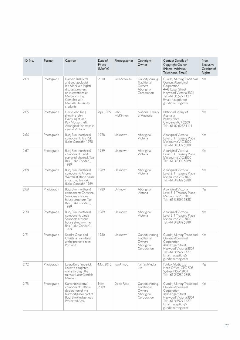
ID. No. Format Caption Date of Photo (Mo/Yr)
Photographer Copyright Owner
Contact Details of Copyright Owner(Name, Address, Telephone, Email)
Non Exclusive Cession of Rights
2.64 Photograph Damein Bell (left) and archaeologist Ian McNiven (right) discuss progress on excavations at Muldoons Trap Complex with Monash University students
2010 Ian McNiven Gunditj Mirring Traditional Owners Aboriginal Corporation
Gunditj Mirring Traditional Owners Aboriginal Corporation4/48 Edgar StreetHeywood Victoria 3304Tel: +61 3 5527 1427Email: [email protected]
Yes
2.65 Photograph Uncle John King showing John Evans, right, and Rex Morgan, left, Aboriginal fish traps in central Victoria
Apr. 1985 John McKinnon
National Library of Australia
National Library of AustraliaParkes PlaceCanberra ACT 2600Tel: +61 02 6262 1111
Yes
2.66 Photograph Budj Bim (northern) component: Tae Rak (Lake Condah), 1978
1978 Unknown Aboriginal Victoria
Aboriginal VictoriaLevel 3, 1 Treasury PlaceMelbourne VIC 3000Tel: +61 3 8392 5388
Yes
2.67 Photograph Budj Bim (northern) component: Field survey of channel, Tae Rak (Lake Condah), 1989
1989 Unknown Aboriginal Victoria
Aboriginal VictoriaLevel 3, 1 Treasury PlaceMelbourne VIC 3000Tel: +61 3 8392 5388
Yes
2.68 Photograph Budj Bim (northern) component: Andrea Warren at stone house structure, Tae Rak (Lake Condah), 1989
1989 Unknown Aboriginal Victoria
Aboriginal VictoriaLevel 3, 1 Treasury PlaceMelbourne VIC 3000Tel: +61 3 8392 5388
Yes
2.69 Photograph Budj Bim (northern) component: Christina Saunders at stone house structure, Tae Rak (Lake Condah), 1989
1989 Unknown Aboriginal Victoria
Aboriginal VictoriaLevel 3, 1 Treasury PlaceMelbourne VIC 3000Tel: +61 3 8392 5388
Yes
2.70 Photograph Budj Bim (northern) component: Linda Saunders at stone house structure, Tae Rak (Lake Condah), 1989
1989 Unknown Aboriginal Victoria
Aboriginal VictoriaLevel 3, 1 Treasury PlaceMelbourne VIC 3000Tel: +61 3 8392 5388
Yes
2.71 Photograph Sandra Onus and Christina Frankland at the protest site in Portland
1980 Unknown Gunditj Mirring Traditional Owners Aboriginal Corporation
Gunditj Mirring Traditional Owners Aboriginal Corporation4/48 Edgar StreetHeywood Victoria 3304Tel: +61 3 5527 1427Email: [email protected]
Yes
2.72 Photograph Laura Bell, Frederick Lovett’s daughter, walks through the ruins at Lake Condah Mission…
Mar. 2015 Joe Armao Fairfax Media Ltd
Fairfax Media LtdHead Office, GPO 506 Sydney NSW 2001Tel: +61 2 9282 2833
Yes
2.73 Photograph Kurtonitj (central) component: Official declaration of the Kurtonitj (now part of Budj Bim) Indigenous Protected Area
Nov. 2009
Denis Rose Gunditj Mirring Traditional Owners Aboriginal Corporation
Gunditj Mirring Traditional Owners Aboriginal Corporation4/48 Edgar StreetHeywood Victoria 3304Tel: +61 3 5527 1427Email: [email protected]
Yes
177
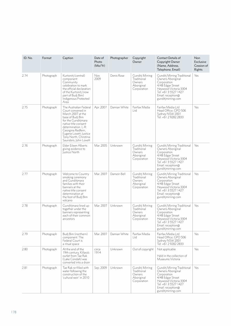
ID. No. Format Caption Date of Photo (Mo/Yr)
Photographer Copyright Owner
Contact Details of Copyright Owner(Name, Address, Telephone, Email)
Non Exclusive Cession of Rights
2.74 Photograph Kurtonitj (central) component: Community celebration to mark the official declaration of the Kurtonitj (now part of Budj Bim) Indigenous Protected Area
Nov. 2009
Denis Rose Gunditj Mirring Traditional Owners Aboriginal Corporation
Gunditj Mirring Traditional Owners Aboriginal Corporation4/48 Edgar StreetHeywood Victoria 3304Tel: +61 3 5527 1427Email: [email protected]
Yes
2.75 Photograph The Australian Federal Court convened in March 2007 at the base of Budj Bim for the Gunditjmara native title consent determination. L-R: Georgina Redfern, Eugene Lovett, Justice Tony North, Christina Saunders, John Lovett
Apr. 2007 Damian White Fairfax Media Ltd
Fairfax Media LtdHead Office, GPO 506 Sydney NSW 2001Tel: +61 2 9282 2833
Yes
2.76 Photograph Elder Eileen Alberts giving evidence to Justice North
Mar. 2005 Unknown Gunditj Mirring Traditional Owners Aboriginal Corporation
Gunditj Mirring Traditional Owners Aboriginal Corporation4/48 Edgar StreetHeywood Victoria 3304Tel: +61 3 5527 1427Email: [email protected]
Yes
2.77 Photograph Welcome to Country smoking ceremony and Gunditjmara families with their banners at the native title consent determination at the foot of Budj Bim volcano
Mar. 2007 Damein Bell Gunditj Mirring Traditional Owners Aboriginal Corporation
Gunditj Mirring Traditional Owners Aboriginal Corporation4/48 Edgar StreetHeywood Victoria 3304Tel: +61 3 5527 1427Email: [email protected]
Yes
2.78 Photograph Gunditjmara lined up together under the banners representing each of their common ancestors
Mar. 2007 Unknown Gunditj Mirring Traditional Owners Aboriginal Corporation
Gunditj Mirring Traditional Owners Aboriginal Corporation4/48 Edgar StreetHeywood Victoria 3304Tel: +61 3 5527 1427Email: [email protected]
Yes
2.79 Photograph Budj Bim (northern) component: The Federal Court is a ritual space
Mar. 2007 Damian White Fairfax Media Ltd
Fairfax Media LtdHead Office, GPO 506 Sydney NSW 2001Tel: +61 2 9282 2833
Yes
2.80 Photograph At the end of the 19th century, Killara’s outlet from Tae Rak (Lake Condah) was converted into a drain
circa 1914
Unknown Out of copyright Not applicable
Held in the collection of Museums Victoria
Yes
2.81 Photograph Tae Rak re-filled with water following the construction of the ‘cultural weir’ in 2010
Sep. 2009 Unknown Gunditj Mirring Traditional Owners Aboriginal Corporation
Gunditj Mirring Traditional Owners Aboriginal Corporation4/48 Edgar StreetHeywood Victoria 3304Tel: +61 3 5527 1427Email: [email protected]
Yes
178
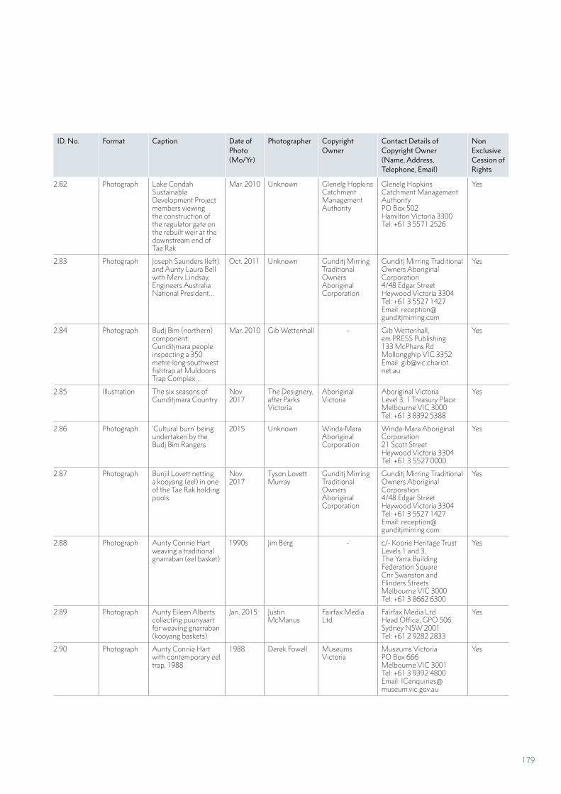
ID. No. Format Caption Date of Photo (Mo/Yr)
Photographer Copyright Owner
Contact Details of Copyright Owner(Name, Address, Telephone, Email)
Non Exclusive Cession of Rights
2.82 Photograph Lake Condah Sustainable Development Project members viewing the construction of the regulator gate on the rebuilt weir at the downstream end of Tae Rak
Mar. 2010 Unknown Glenelg Hopkins Catchment Management Authority
Glenelg Hopkins Catchment Management AuthorityPO Box 502Hamilton Victoria 3300Tel: +61 3 5571 2526
Yes
2.83 Photograph Joseph Saunders (left) and Aunty Laura Bell with Merv Lindsay, Engineers Australia National President…
Oct. 2011 Unknown Gunditj Mirring Traditional Owners Aboriginal Corporation
Gunditj Mirring Traditional Owners Aboriginal Corporation4/48 Edgar StreetHeywood Victoria 3304Tel: +61 3 5527 1427Email: [email protected]
Yes
2.84 Photograph Budj Bim (northern) component: Gunditjmara people inspecting a 350 metre-long southwest fishtrap at Muldoons Trap Complex…
Mar. 2010 Gib Wettenhall - Gib Wettenhall, em PRESS Publishing133 McPhans RdMollongghip VIC 3352Email: [email protected]
Yes
2.85 Illustration The six seasons of Gunditjmara Country
Nov. 2017
The Designery, after Parks Victoria
Aboriginal Victoria
Aboriginal VictoriaLevel 3, 1 Treasury PlaceMelbourne VIC 3000Tel: +61 3 8392 5388
Yes
2.86 Photograph ‘Cultural burn’ being undertaken by the Budj Bim Rangers
2015 Unknown Winda-Mara Aboriginal Corporation
Winda-Mara Aboriginal Corporation21 Scott StreetHeywood Victoria 3304Tel: +61 3 5527 0000
Yes
2.87 Photograph Bunjil Lovett netting a kooyang (eel) in one of the Tae Rak holding pools
Nov. 2017
Tyson Lovett Murray
Gunditj Mirring Traditional Owners Aboriginal Corporation
Gunditj Mirring Traditional Owners Aboriginal Corporation4/48 Edgar StreetHeywood Victoria 3304Tel: +61 3 5527 1427Email: [email protected]
Yes
2.88 Photograph Aunty Connie Hart weaving a traditional gnarraban (eel basket)
1990s Jim Berg - c/- Koorie Heritage TrustLevels 1 and 3, The Yarra BuildingFederation SquareCnr Swanston and Flinders Streets Melbourne VIC 3000Tel: +61 3 8662 6300
Yes
2.89 Photograph Aunty Eileen Alberts collecting puunyaart for weaving gnarraban (kooyang baskets)
Jan. 2015 Justin McManus
Fairfax Media Ltd
Fairfax Media LtdHead Office, GPO 506 Sydney NSW 2001Tel: +61 2 9282 2833
Yes
2.90 Photograph Aunty Connie Hart with contemporary eel trap, 1988
1988 Derek Fowell Museums Victoria
Museums VictoriaPO Box 666Melbourne VIC 3001Tel: +61 3 9392 4800Email: [email protected]
Yes
179
ID. No. Format Caption Date of Photo (Mo/Yr)
Photographer Copyright Owner
Contact Details of Copyright Owner(Name, Address, Telephone, Email)
Non Exclusive Cession of Rights
2.91 Photograph Aunty Connie Hart stitching together a traditional gnarraban (eel basket)
1990s Jim Berg - c/- Koorie Heritage TrustLevels 1 and 3, The Yarra BuildingFederation SquareCnr Swanston and Flinders StreetsMelbourne VIC 3000Tel: +61 3 8662 6300
Yes
2.92 Photograph Aunty Eileen Alberts passing on weaving skills to Gunditjmara youth
May 2014 Winda-Mara Aboriginal Corporation
- Winda-Mara Aboriginal Corporation21 Scott StreetHeywood Victoria 3304Tel: +61 3 5527 0000
Yes
2.93 Photograph
Winda-Mara dancers lead the street parade at the Portland Upwelling Festival
Unknown Daryl Cram Gunditj Mirring Traditional Owners Aboriginal Corporation
Gunditj Mirring Traditional Owners Aboriginal Corporation4/48 Edgar StreetHeywood Victoria 3304Tel: +61 3 5527 1427Email: [email protected]
Yes
2.94 Photograph The Fighting Gundijtmara
2017 Organic Photo (Francesco Vicenzi)
- c/Gunditj Mirring Traditional Owners Aboriginal Corporation4/48 Edgar StreetHeywood Victoria 3304Tel: +61 3 5527 1427Email: [email protected]
Yes
2.95 Photograph Koondoom Yarkeen Karweeyn – the Gunditjmara young Traditional Aboriginal Dance group
2017 Jessica Lovett - c/Gunditj Mirring Traditional Owners Aboriginal Corporation4/48 Edgar StreetHeywood Victoria 3304Tel: +61 3 5527 1427Email: [email protected]
Yes
2.96 Photograph Dhauwurd wurrung cloak, Possum Skin Cloak Project. Made by Thomas Day and Aunty Janice Lovett
Unknown Unknown Gunditj Mirring Traditional Owners Aboriginal Corporation
Gunditj Mirring Traditional Owners Aboriginal Corporation4/48 Edgar StreetHeywood Victoria 3304Tel: +61 3 5527 1427Email: [email protected]
Yes
2.97 Photograph Possum skin cloak made by Debra Couzens and Vicki Couzens in 2002. Vicki Couzens is a multimedia artist, best known as a maker of possum skin cloaks such as this one, a replica of the 1872 Lake Condah cloak.
2002 Unknown National Museum of Australia
National Museum of AustraliaGPO Box 1901Canberra ACT 2601Tel: +61 2 6208 5000
Yes
2.98 Photograph Budj Bim Cultural Landscape: Fresh and Salty is a large scale stone sculpture…
2012 Bindi Cole - Bindi ColeEmail: [email protected] Web address: https://www.bindicolechocka.com
Yes
180
ID. No. Format Caption Date of Photo (Mo/Yr)
Photographer Copyright Owner
Contact Details of Copyright Owner(Name, Address, Telephone, Email)
Non Exclusive Cession of Rights
2.99 Photograph Tyrendarra (southern) component: Kooyang (eel) sculpture
Unknown Unknown Winda-Mara Aboriginal Corporation
Winda-Mara Aboriginal Corporation21 Scott StreetHeywood Victoria 3304Tel: +61 3 5527 0000
Yes
Page 80 Photograph Tae Rak (Lake Condah): Kooyang weir (detail)
1990 Ian McNiven - c/- Monash UniversityMonash Indigenous Studies CentreClayton Campus VIC 3800Email: [email protected]
Yes
2.100 Photograph Denise Lovett and her grandson, Nyawi Moore, visit Country to teach and learn about kooyang (eel) aquaculture
Aug. 2007
Unknown Gunditj Mirring Traditional Owners Aboriginal Corporation
Gunditj Mirring Traditional Owners Aboriginal Corporation4/48 Edgar StreetHeywood Victoria 3304Tel: +61 3 5527 1427Email: [email protected]
Yes
Part 3; front
Photograph No caption (drone image)
Nov. 2017
Tyson Lovett-Murray
Gunditj Mirring Traditional Owners Aboriginal Corporation
Gunditj Mirring Traditional Owners Aboriginal Corporation4/48 Edgar StreetHeywood Victoria 3304Tel: +61 3 5527 1427Email: [email protected]
Yes
Page 87 Photograph No caption (Aquaculture channel and pond)
Nov. 2017
Tyson Lovett-Murray
Gunditj Mirring Traditional Owners Aboriginal Corporation
Gunditj Mirring Traditional Owners Aboriginal Corporation4/48 Edgar StreetHeywood Victoria 3304Tel: +61 3 5527 1427Email: [email protected]
Yes
Page 91 Photograph No caption (Tyson Lovett-Murray and Uncle Denis Rose on Country)
Jan. 2015 Justin McManus
Fairfax Media Ltd
Fairfax Media LtdHead Office, GPO 506 Sydney NSW 2001Tel: +61 2 9282 2833
Yes
Page 95 Photograph No caption (Tungatt Mirring or Stone Country; same as 2.5)
Nov. 2009
Mike Cusack Parks Victoria Parks VictoriaLevel 10, 535 Bourke StreetMelbourne VIC 3000
Yes
Page 97; full page
Drawing No caption (Brough Smythe sketch of stone houses)
circa 1840
Brough Smythe
Out of copyright Not applicable
Held in the collection of the State Library of Victoria
Yes
3.1 Photograph Kuk Early Agricultural Site (Papua New Guinea)
Unknown Amos Chapple OUR PLACE PUBLISHING Ltd
Amos ChappleEmail: [email protected]
Yes
3.2 Photograph Saloum Delta (Senegal)
Jan. 2009 Jean Goepp - Non-exclusive cession of rights held by UNESCO
Yes
3.3 Photograph Head Smashed in Buffalo Jump (Canada)
Jul. 2017 Geoff Sowrey - Creative Commons Yes
3.4 Photograph Rock Islands Southern Lagoon (Palau)
Feb. 2014 Charly W. Karl - Creative Commons Yes
3.5 Photograph Laponian Area (Sweden)
Sep. 2014 Kari Siren - Creative Commons Yes
181
ID. No. Format Caption Date of Photo (Mo/Yr)
Photographer Copyright Owner
Contact Details of Copyright Owner(Name, Address, Telephone, Email)
Non Exclusive Cession of Rights
3.6 Photograph Toolondo channel circa 1980
Harry Lourandos
Aboriginal Victoria
Aboriginal VictoriaLevel 3, 1 Treasury PlaceMelbourne VIC 3000Tel: +61 3 8392 5388
Yes
3.7 Photograph The Barotse Cultural Landscape (Zambia)
Nov. 2012
WorldFish - Creative Commons Yes
3.8 Photograph Ivvavik/Vuntut/Hershel Island (Qikiqtaruk) (Canada)
Jul. 2015 Daniel Case - Creative Commons Yes
3.9 Photograph Aasivitssuit, Arnangarnup Qoorua (Denmark – Greenland)
Aug. 2010
Patrick Müller - Creative Commons Yes
3.10 Photograph Pimachiowin Aki (the Land that Gives Life) (Canada)
Sep. 2003 Timkal - Wikimedia Creative Commons
Yes
3.11 Negative The Ngemba people of Brewarrina used their advanced knowledge of river hydrology and fish ecology to trap and catch large numbers of fresh water fish…
circa 1890
Henry King Out of copyright Not applicable Yes
3.12 Photograph Kaiadilt Aboriginal fishtrap complex at Catfish Story, Bentinck Island, southern Gulf of Carpentaria
Jun. 2013 Sean Ulm - Sean UlmCollege of Arts, Society and EducationJames Cook University QLD 4811Email: [email protected]
Yes
3.13 Photographic print
Eel weir (pa tuna) named Ruataniwha, on the Hokio Stream
Nov. 1925
G L Adkin Out of copyright Held in the collections of the Alexander Turnbull Library, Wellington, New Zealand
Yes
3.14 Photograph The Hawaiian people practiced aquaculture through development of fish ponds (Hawaiian: loko iʻa)…
May 2003 Collin Grady - Creative Commons Yes
3.15 Photograph The network of Indigenous clam gardens is found along the west coast of Canada…
Mar. 2008 Simon Fraser University
- Creative Commons Yes
3.16 Photograph Situated on one of the nation’s largest systems of underwater springs, the Ahjumawi are one of eleven bands of the Pit River Tribe of native peoples…
Jan. 2008 Marcia Wright - Wikimedia Commons Yes
Part 4; front Photograph No caption (Tyrendarra Indigenous Protected Area: Weir and channel alongside walking trail)
Nov. 2017
Tyson Lovett-Murray
Gunditj Mirring Traditional Owners Aboriginal Corporation
Gunditj Mirring Traditional Owners Aboriginal Corporation4/48 Edgar StreetHeywood Victoria 3304Tel: +61 3 5527 1427Email: [email protected]
Yes
182
ID. No. Format Caption Date of Photo (Mo/Yr)
Photographer Copyright Owner
Contact Details of Copyright Owner(Name, Address, Telephone, Email)
Non Exclusive Cession of Rights
4.1 Photograph Budj Bim Indigenous Protected Area: Budj Bim Rangers repairing fence…
Unknown Winda-Mara Aboriginal Corporation
- Winda-Mara Aboriginal Corporation21 Scott StreetHeywood Victoria 3304Tel: +61 3 5527 0000
Yes
Page 118 Photograph No caption (drone image of weir)
Nov. 2017
Tyson Lovett Murray
Gunditj Mirring Traditional Owners Aboriginal Corporation
Gunditj Mirring Traditional Owners Aboriginal Corporation4/48 Edgar StreetHeywood Victoria 3304Tel: +61 3 5527 1427Email: [email protected]
Yes
4.2 Photograph Tae Rak (Lake Condah) area: Budj Bim Ranger spraying pest plants
Not dated Winda-Mara Aboriginal Corporation
- Winda-Mara Aboriginal Corporation21 Scott StreetHeywood Victoria 3304Tel: +61 3 5527 0000
Yes
4.3 Photograph Tae Rak (Lake Condah): Two trees growing in a dam feature at the south-eastern corner of the Muldoons Trap Complex
May 2012 Ian Travers Context Heritage Consultants
Context Heritage Consultants22 Merri Street Brunswick VIC 3056Tel: +61 3 9380 6933
Yes
4.4 Photograph Tae Rak (Lake Condah): Field survey team measure the position of a tree impacting on an aquaculture feature
May 2012 Context Context Heritage Consultants
Context Heritage Consultants22 Merri Street Brunswick VIC 3056Tel: +61 3 9380 6933
Yes
4.5 Illustration Tae Rak (Lake Condah): Plan showing significant features and trees recorded during 2012 tree survey
May 2012 Thomas Richards
- c/- Monash UniversityMonash Indigenous Studies CentreClayton Campus VIC 3800Email: [email protected]
Yes
4.6 Photograph Budj Bim Indigenous Protected Area: Budj Bim Rangers setting poison baits as part of a rabbit control program
Unknown Winda-Mara Aboriginal Corporation
- Winda-Mara Aboriginal Corporation21 Scott StreetHeywood Victoria 3304Tel: +61 3 5527 0000
Yes
4.7 Photograph Kurtonitj (central) component: Budj Bim Rangers carry out a ‘cultural burn’
Unknown Winda-Mara Aboriginal Corporation
- Winda-Mara Aboriginal Corporation21 Scott StreetHeywood Victoria 3304Tel: +61 3 5527 0000
Yes
4.8 Photograph Tyrendarra Indigenous Protected Area: Budj Bim Rangers work alongside Country Fire Authority fire-fighters…
Unknown Winda-Mara Aboriginal Corporation
- Winda-Mara Aboriginal Corporation21 Scott StreetHeywood Victoria 3304Tel: +61 3 5527 0000
Yes
4.9 Photograph Tyrendarra Indigenous Protected Area: School group visiting the Gunditjmara aquaculture landscape
Unknown Winda-Mara Aboriginal Corporation
- Winda-Mara Aboriginal Corporation21 Scott StreetHeywood Victoria 3304Tel: +61 3 5527 0000
Yes
183
ID. No. Format Caption Date of Photo (Mo/Yr)
Photographer Copyright Owner
Contact Details of Copyright Owner(Name, Address, Telephone, Email)
Non Exclusive Cession of Rights
Page 125 Photograph No caption (Possum skin cloak, Lake Condah 1872; as photograph 2.53)
2009 Rodney Start Museums Victoria
Museums VictoriaPO Box 666Melbourne VIC 3001Tel: +61 3 9392 4800Email: [email protected]
Yes
4.10 Photograph Lake Condah Mission: Residential dwelling for use by the caretaker
Nov. 2013
Denis Rose Gunditj Mirring Traditional Owners Aboriginal Corporation
Gunditj Mirring Traditional Owners Aboriginal Corporation4/48 Edgar StreetHeywood Victoria 3304Tel: +61 3 5527 1427Email: [email protected]
Yes
4.11 Photograph Kurtonitj (central) component: Residential dwelling in use for Gunditjmara community briefing…
Nov. 2017
Denis Rose Gunditj Mirring Traditional Owners Aboriginal Corporation
Gunditj Mirring Traditional Owners Aboriginal Corporation4/48 Edgar StreetHeywood Victoria 3304Tel: +61 3 5527 1427Email: [email protected]
Yes
Part 5; front Photograph No caption (Kurtonitj [central] component: weir and pond]
Nov. 2017
Tyson Lovett-Murray
Gunditj Mirring Traditional Owners Aboriginal Corporation
Gunditj Mirring Traditional Owners Aboriginal Corporation4/48 Edgar StreetHeywood Victoria 3304Tel: +61 3 5527 1427Email: [email protected]
Yes
5.1 Illustration Logo of the Gunditj Mirring Traditional Owners Aboriginal Corporation
Unknown Thomas Day Gunditj Mirring Traditional Owners Aboriginal Corporation
Gunditj Mirring Traditional Owners Aboriginal Corporation4/48 Edgar StreetHeywood Victoria 3304Tel: +61 3 5527 1427Email: [email protected]
Yes
5.2 Illustration Logo of Winda-Mara Aboriginal Corporation
Unknown Nadia Rose Winda-Mara Aboriginal Corporation
Winda-Mara Aboriginal Corporation21 Scott StreetHeywood Victoria 3304Tel: +61 3 5527 0000
Yes
Page 139 Photograph No caption (Possum skin cloak made at Lake Condah Mission in 1872. Reproduction by Vicki Couzens and Debra Couzens; same as 2.97)
2002 Unknown National Museum of Australia
National Museum of AustraliaGPO Box 1901Canberra ACT 2601Tel: +61 2 6208 5000
Yes
Page 143 Photograph No caption (Aunty Eileen Alberts collecting grass)
Jan. 2015 Justin McManus
Fairfax Media Ltd
Fairfax Media LtdHead Office, GPO 506 Sydney NSW 2001Tel: +61 2 9282 2833
Yes
5.3 Illustration Adaptive Management Framework…
Nov. 2017
The Designery, after Parks Victoria
Aboriginal Victoria
Aboriginal VictoriaLevel 3, 1 Treasury PlaceMelbourne VIC 3000Tel: +61 3 8392 5388
Yes
5.4 Photograph A section of the Budj Bim trail – used for walking and cycling
May 2013 Tract Consultants Pty Ltd
- Tract Consultants Pty Ltd Level 6, 6 Riverside Quay Southbank VIC 3006Tel:. +61 3 9429 6133
Yes
184
ID. No. Format Caption Date of Photo (Mo/Yr)
Photographer Copyright Owner
Contact Details of Copyright Owner(Name, Address, Telephone, Email)
Non Exclusive Cession of Rights
5.5 Photograph Budj Bim Visitor Experience Area: Lake Surprise is located within the crater of the Budj Bim volcano
Dec. 2012
Tract Consultants Pty Ltd
- Tract Consultants Pty Ltd Level 6, 6 Riverside Quay Southbank VIC 3006Tel: +61 3 9429 6133
Yes
5.6 Photograph Budj Bim Visitor Experience Area: Lake Surprise lookout
Dec. 2012
Tract Consultants Pty Ltd
- Tract Consultants Pty Ltd Level 6, 6 Riverside Quay Southbank VIC 3006Tel: +61 3 9429 6133
Yes
5.7 Photograph Budj Bim Visitor Experience Area: National Park day visitor area
May 2013 Tract Consultants Pty Ltd
- Tract Consultants Pty Ltd Level 6, 6 Riverside Quay Southbank VIC 3006Tel: +61 3 9429 6133
Yes
5.8 Photograph Budj Bim Visitor Experience Area: National Park car park
May 2013 Tract Consultants Pty Ltd
- Tract Consultants Pty Ltd Level 6, 6 Riverside Quay Southbank VIC 3006Tel: +61 3 9429 6133
Yes
5.9 Photograph Budj Bim Visitor Experience Area: Lake Surprise historic shelter
Dec. 2012
Tract Consultants Pty Ltd
- Tract Consultants Pty Ltd Level 6, 6 Riverside Quay Southbank VIC 3006Tel: +61 3 9429 6133
Yes
5.10 Photograph Budj Bim Visitor Experience Area: National Park Visitor Centre and Ranger Station
May 2013 Tract Consultants Pty Ltd
- Tract Consultants Pty Ltd Level 6, 6 Riverside Quay Southbank VIC 3006Tel: +61 3 9429 6133
Yes
5.11 Photograph Visitors to Tae Rak at the Budj Bim Cultural Landscape
Unknown Unknown Gunditj Mirring Traditional Owners Aboriginal Corporation
Gunditj Mirring Traditional Owners Aboriginal Corporation4/48 Edgar StreetHeywood Victoria 3304Tel: +61 3 5527 1427Email: [email protected]
Yes
5.12 Photograph Tae Rak Visitor Experience Area: Jetty and boat ramp
Nov. 2017
Tyson Lovett-Murray
Gunditj Mirring Traditional Owners Aboriginal Corporation
Gunditj Mirring Traditional Owners Aboriginal Corporation4/48 Edgar StreetHeywood Victoria 3304Tel: +61 3 5527 1427Email: [email protected]
Yes
5.13 Photograph Tae Rak Visitor Experience Area: The Mission conference venue and accommodation cabins
Nov. 2017
Tyson Lovett-Murray
Gunditj Mirring Traditional Owners Aboriginal Corporation
Gunditj Mirring Traditional Owners Aboriginal Corporation4/48 Edgar StreetHeywood Victoria 3304Tel: +61 3 5527 1427Email: [email protected]
Yes
5.14 Photograph Kurtonitj Visitor Experience Area: Shelter…
Dec. 2012
Tract Consultants Pty Ltd
- Tract Consultants Pty Ltd Level 6, 6 Riverside Quay Southbank VIC 3006Tel:. +61 3 9429 6133
Yes
5.15 Photograph Kurtonitj Visitor Experience Area: Detail of interpretation panel…
Aug. 2017
Steve Brown - Gozinta807 Lower Boro RoadBoro NSW 2622
Yes
185
ID. No. Format Caption Date of Photo (Mo/Yr)
Photographer Copyright Owner
Contact Details of Copyright Owner(Name, Address, Telephone, Email)
Non Exclusive Cession of Rights
5.16 Photograph Kurtonitj Visitor Experience Area: Visitor facilities in their landscape context
Nov. 2017
Tyson Lovett-Murray
Gunditj Mirring Traditional Owners Aboriginal Corporation
Gunditj Mirring Traditional Owners Aboriginal Corporation4/48 Edgar StreetHeywood Victoria 3304Tel: +61 3 5527 1427Email: [email protected]
Yes
5.17 Photograph Tyrendarra Visitor Experience Area: Walking track entry from car parking area to the start and finish of the interpretive trail
May 2013 Tract Consultants Pty Ltd
- Tract Consultants Pty Ltd Level 6, 6 Riverside Quay Southbank VIC 3006Tel: +61 3 9429 6133
Yes
5.18 Photograph Tyrendarra Visitor Experience Area: Gilgar Gunditj Visitor Place
Dec. 2012
Tract Consultants Pty Ltd
- Tract Consultants Pty Ltd Level 6, 6 Riverside Quay Southbank VIC 3006Tel: +61 3 9429 6133
Yes
5.19 Photograph Tyrendarra Visitor Experience Area: Gilgar Gunditj Visitor Place is designed to mimic the movement of kooyang (eel)
Unknown Visit Victoria - Visit VictoriaLee Breakwater RoadPortland VIC 3305Tel: 1800 035 567
Yes
5.20 Photograph Tyrendarra Visitor Experience Area: Toilet facility adjacent to car park
Dec. 2012
Tract Consultants Pty Ltd
- Tract Consultants Pty Ltd Level 6, 6 Riverside Quay Southbank VIC 3006Tel: +61 3 9429 6133
Yes
5.21 Photograph Tyrendarra Visitor Experience Area: Tyrendarra trail interpretive signage
Dec. 2012
Tract Consultants Pty Ltd
- Tract Consultants Pty Ltd Level 6, 6 Riverside Quay Southbank VIC 3006Tel: +61 3 9429 6133
Yes
5.22 Photograph Allambie Visitor Experience Area: Visitor facilities in their landscape context
Nov. 2017
Gunditj Mirring Traditional Owners Aboriginal Corporation
- Gunditj Mirring Traditional Owners Aboriginal Corporation4/48 Edgar StreetHeywood Victoria 3304Tel: +61 3 5527 1427Email: [email protected]
Yes
5.23 Photograph Lake Gorrie Visitor Experience Area: Visitor facilities in their landscape context
Nov. 2017
Gunditj Mirring Traditional Owners Aboriginal Corporation
- Gunditj Mirring Traditional Owners Aboriginal Corporation4/48 Edgar StreetHeywood Victoria 3304Tel: +61 3 5527 1427Email: [email protected]
Yes
5.24 Photograph Tyson Lovett-Murray holding kooyang (eel) trap
Jan. 2015 Justin McManus
Fairfax Media Ltd
Fairfax Media LtdHead Office, GPO 506 Sydney NSW 2001Tel: +61 2 9282 2833
Yes
Part 6; front Photograph No caption (Jennie Green … circa 1865; as photograph 2.56)
circa 1870
Unknown Out of copyright Not applicable
Held in the collection of the State Library of Victoria
Yes
Part 7; front Photograph No caption (Basket by Aunty Connie Hart, made 1992 in Portland)
Unknown Museums Victoria
- Museums VictoriaPO Box 666Melbourne VIC 3001Tel: +61 3 9392 4800Email: [email protected]
Yes
186
ID. No. Format Caption Date of Photo (Mo/Yr)
Photographer Copyright Owner
Contact Details of Copyright Owner(Name, Address, Telephone, Email)
Non Exclusive Cession of Rights
Part 8; front Photograph No caption (Eels) Unknown Parks Victoria - Parks VictoriaLevel 10, 535 Bourke StreetMelbourne VIC 3000
Yes
Part 9; front Photograph No caption (Bunjil Lovett with eel)
Nov. 2017
Tyson Lovett-Murray
Gunditj Mirring Traditional Owners Aboriginal Corporation
Gunditj Mirring Traditional Owners Aboriginal Corporation4/48 Edgar StreetHeywood Victoria 3304Tel: +61 3 5527 1427Email: [email protected]
Yes
Acknlts., front
Photograph No caption (Uncle Denis Rose with plant)
Jan. 2015 Justin McManus
Fairfax Media Ltd
Fairfax Media LtdHead Office, GPO 506 Sydney NSW 2001Tel: +61 2 9282 2833
Yes
Annexes, front
Photograph No caption (Children with eel)
Nov. 2017
Tyson Lovett-Murray
Gunditj Mirring Traditional Owners Aboriginal Corporation
Gunditj Mirring Traditional Owners Aboriginal Corporation4/48 Edgar StreetHeywood Victoria 3304Tel: +61 3 5527 1427Email: [email protected]
Yes
Page 206 Photograph Tungatt Mirring or Stone Country (same as 2.5)
Nov. 2009
Mike Cusack Parks Victoria Parks VictoriaLevel 10, 535 Bourke StreetMelbourne VIC 3000
Yes
Back cover (1)
Photograph Top of page – no caption (drone landscape image)
Nov. 2017
Tyson Lovett-Murray
Gunditj Mirring Traditional Owners Aboriginal Corporation
Gunditj Mirring Traditional Owners Aboriginal Corporation4/48 Edgar StreetHeywood Victoria 3304Tel: +61 3 5527 1427Email: [email protected]
Yes
Back cover (2)
Illustration Centre page – no caption (possum skin cloak design)
2002 Unknown Museums Victoria
Museums VictoriaPO Box 666Melbourne VIC 3001Tel: +61 3 9392 4800Email: [email protected]
Yes
187
7.B TEXTS RELATING TO PROTECTIVE DESIGNATION, COPIES OF PROPERTY MANAGEMENT PLANS OR DOCUMENTED MANAGEMENT SYSTEMS AND EXTRACTS OF OTHER PLANS RELEVANT TO THE PROPERTY
LEGISLATION
Australian Government legislation
Environment Protection and Biodiversity Conservation Act 1999
Aboriginal Land (Lake Condah and Framlingham Forest) Act 1987
Aboriginal and Torres Strait Islander Heritage Protection Act 1984
Native Title Act 1993
Victorian Government legislation
Aboriginal Heritage Act 2006
Heritage Act 2017
National Parks Act 1975
Parks Victoria Act 1998
Fisheries Act 1995
Flora and Fauna Guarantee Act 1988
Water Act 1989
Catchment and Land Protection Act 1994
Country Fire Authority Act 1958
Planning and Environment Act 1987
Local Government Act 1989
MANAGEMENT PLANS
Primary current management plans (Annex B)
Ngootyyoong Gunditj, Ngootyoong Mara South West Management Plan (2015)
Budj Bim IPA Plan of Management 2015-2019 (2015)
Tyrendarra IPA Management Action Plan 2015-2018 (2015)
Other relevant plans
Budj Bim (Tourism) Master Plan (2014)
Budj Bim Sustainable Tourism Plan (2007)
Lake Condah Mission and Cemetery Conservation Management Plan (2000)
Lake Condah Restoration Project Conservation Management Plan (2008)
Lake Condah Heritage Management Plan and Strategy (1993)
Victorian Eel Fishery Management Plan (2017
In preparation
Budj Bim Cultural Landscape World Heritage Strategic Management Framework (in prep., 2018)
7.C FORM AND DATE OF MOST RECENT RECORDS OR INVENTORY OF PROPERTY
Table 7.2 lists the most recent records and inventories for the property. In addition, the management plans listed above and detailed in Part 5 outline much of the available information for the nominated property. 543544
543 Victoria State Government. ‘Victorian Biodiversity Atlas’, https://www.environment.vic.gov.au/biodiversity/victorian-biodiversity-atlas
544 Heritage Council Victoria. Victorian Heritage Database’, http://vhd.heritagecouncil.vic.gov.au
RECENT RECORDS OR INVENTORY
(INSTITUTION)
DATE FORM OF
RECORD
Cultural Information Management System
(Gunditj Mirring Traditional Owners Aboriginal Corporation)
Current Paper and electronic
Victorian Aboriginal Heritage Register
(Aboriginal Victoria)
Current Paper and electronic
State of the Parks
(Parks Victoria)
2013 Electronic
Victorian Biodiversity Atlas543
(Department of Environment, Land, Water and Planning)
Current Electronic
Victorian Heritage Database544
(Heritage Victoria)
Current Paper and electronic
Geologically Significant Features
(Geological Society of Australia)
Current Paper and electronic
TABLE 7.2 Budj Bim Cultural Landscape: Records and inventory for nominated property
188
7.D ADDRESS WHERE INVENTORY, RECORDS AND ARCHIVES ARE HELD
Gunditj Mirring Traditional Owners Aboriginal Corporation
4/48 Edgar StreetHeywood, Victoria 3304
Winda-Mara Aboriginal Corporation
21 Scott StreetHeywood, Victoria 3304
AUSTRALIAN GOVERNMENT
Department of the Environment and Energy
John Gorton BuildingKing Edward TerraceParkes, Australian Capital Territory 2600
VICTORIA GOVERNMENT
Aboriginal Victoria
Level 9, 1 Spring StreetMelbourne, Victoria 3000
Parks Victoria
Level 10, 535 Bourke StreetMelbourne, Victoria 3000
7.E BIBLIOGRAPHY
Aboriginal History Programme (1988). Memories Last Forever. Aboriginal History Program, Abbotsford, Victoria.
Aoyama J, Mochioka N, Otake T, Ishikawa S, Kawakami Y, Castle P, Nishida M and Tsukamoto K (1999). Distribution and dispersal of anguillid leptocephali in the western Pacific Ocean revealed by molecular analysis. Marine Ecology Progress Series 188:193-200.
Australian Heritage Commission (2002). Ask First – A National Guide to Respecting Indigenous Heritage Places and Values. Australian Heritage Commission, Canberra.
Bell, D and Johnston, C (2010). Budj Bim – Caring for the spirit and the people: Finding the spirit of place. In: Spirit of Place: Between Tangible and Intangible Heritage, Turgeon, L (ed.), Les Presses de l’Universite Laval, Quebec.
Benyon, RG, Doody, TM, Theiveyanathan, S and Koul, V (2009). Plantation Forest Water Use in Southwest Victoria. Unpublished. Prepared for Forest and Wood Products Australia, Melbourne.
Beumer JP (1996). Freshwater eels. In: Freshwater Fishes of South-Eastern Australia, McDowall R (ed.), pp. 39-43. Reed Books, Sydney.
Beumer J and Sloane R (1990). Distribution and abundance of glass-eels Anguilla spp. in East Australian waters. Internationale Revue der gesamten Hydrobiologie 75:721-736.
Bird, CFM and Frankel, D (1991). Chronology and explanation in western Victoria and south-east South Australia. Archaeology in Oceania 26(1):1-16.
Brazier, A (1874). Annual Report on the Lake Condah Mission Station for the Year 1873. In: Tenth Report for the Board for the Protection of Aborigines in the Colony of Victoria. Report to Parliament. John Ferres, Government Printer, Melbourne.
Builth, H (2002). The Archaeology and Socio-Economy of the Gunditjmara: A Landscape Approach. Unpublished. Doctoral Thesis. Flinders University. Adelaide.
Builth H (2004). Mt Eccles lava flow and the Gunditjmara connection: a landform for all seasons. Proceedings of the Royal Society of Victoria 116:165-184.
Builth, H (2006). Gunditjmara environmental management: The development of a fisher-gatherer-hunter society in temperate Australia. In: Beyond Affluent Foragers, Kim, J, Grier, C and Uchiyama, J (eds), pp. 4-23. Oxbow Books, Oxford.
Builth, H (2009). Intangible heritage of Indigenous Australians: A Victorian example. Historic Environment 22(3):24-31.
Builth, H (2014). Ancient Aboriginal Aquaculture Rediscovered: The Archaeology of an Australian Cultural Landscape. LAP Lambert Academic Publishing, Saarbrücken, Germany.
Builth, H, Kershaw, AP, White, C, Roach, A, Hartney, L, McKenzie, M, Lewis, T and Jacobsen, G (2008). Environmental and cultural change on the Mt Eccles lava-flow landscapes of southwest Victoria, Australia. The Holocene 18(3):413–424.
Bush Blitz Species Discovery Program (2011). Kurtonitj, Lake Condah, Tyrendarra Indigenous Protected Areas Victoria, 21 March to 1 April 2011. Unpublished. Winda-Mara Aboriginal Corporation, Heywood.
Butlin, NG (1983). Our Original Aggression: Aboriginal Populations of Southeastern Australia 1788-1850. George Allen and Unwin, Sydney.
Carr, GW, Ashby, LA, Kershaw, JS, Frood, D and Rosengren, NG (2008). Mount Eccles Lava Flow Botanical Management Plan: Field Survey and Analysis. Unpublished. Ecology Australia, Fairfield.
Carr, GW, Frood, D, Roberts, NR and Rosengren, N (2006). Mt Eccles Lava Flow Botanical Management Plan: Literature Review. Prepared for Winda-Mara Aboriginal Corporation. Ecology Australia, Fairfield.
189
Chauncy, P (1878). Appendix A: Notes and anecdotes of the Aborigines of Australia. In: The Aborigines of Victoria with Notes Relating to the Habits of the Natives of Other Parts of Australia and Tasmania, Volume 2, Smyth, RB, pp. 221-284. Government Printer, Melbourne.
Clark, ID (1990a) Aboriginal Languages and Clans: An Historical Atlas of Western and Central Victoria, 1800-1900. Monash Monographs in Geography No. 37. Department of Geography and Environmental Science, Monash University, Melbourne.
Clark, ID (1990b). The People of the Lake, Lake Condah, Victoria, Australia: An Information Manual. Unpublished. Report by Koorie Tourism Unit, Victorian Tourism Commission, Melbourne.
Clark, ID (1995). Scars in the Landscape: A Register of Aboriginal Massacre Sites in Western Victoria 1803 – 1859. Australian Institute of Aboriginal and Torres Strait Islander Studies, Canberra.
Clark, ID (1998a). The Journals of George Augustus Robinson, Chief Protector, Port Phillip Aboriginal Protectorate, Volume Two: 1 October 1840 to 31 August 1841. Heritage Matters, Melbourne.
Clark, ID (1998b). Understanding the Enemy: Ngammadjidj or Foreign Invader. Working Paper 73/98, Monash University Faculty of Business and Economics, Melbourne.
Clark, ID (2000). The Journals of George Augustus Robinson, Chief Protector, Port Phillip Aboriginal Protectorate, Volume Three: 1 September 1841 to 31 December 1843. Clarendon and Heritage Matters, Melbourne.
Clark, ID (2011). The convincing ground Aboriginal massacre at Portland Bay, Victoria: Fact or fiction? Aboriginal History 35:79–109.
Clarke, A (1991). Lake Condah Project Aboriginal Archaeology: Resource Inventory. Occasional Report No. 36. Victoria Archaeological Survey, Melbourne.
Clarke, A (1994). Romancing the Stones. The cultural construction of an archaeological landscape in the Western District of Victoria. Archaeology in Oceania 29(1):1-15.
Cole, K (1984). The Lake Condah Aboriginal Mission. Keith Cole Publications, Bendigo.
Context Pty Ltd (1993). Lake Condah Heritage Management Plan and Strategy. Prepared for Aboriginal Affairs Victoria and the Kerrup Jmara Elders Aboriginal Corporation. Context Pty Ltd, Brunswick.
Context Pty Ltd (in conjunction with the Kerrup Jmara Elders Aboriginal Corporation and Aboriginal Affairs Victoria) (2000). Lake Condah Mission and Cemetery Conservation Management Plan. Context Pty Ltd, Brunswick.
Context Pty Ltd (2008). Lake Condah Restoration Conservation Management Plan. Context Pty Ltd, Brunswick.
Context Pty Ltd (2012a). Ngootyoong Gunditj, Ngootyoong Mara, South West Management Plan: Cultural Heritage and Social Values Assessment. Volume 1: Heritage Places, Connections and Values – Overview Report. Unpublished. Prepared for Gunditj Mirring Traditional Owners Aboriginal Corporation and Parks Victoria. Context Pty Ltd, Brunswick.
Context Pty Ltd (2012b). Ngootyoong Gunditj, Ngootyoong Mara, South West Management Plan: Cultural Heritage and Social Values Assessment. Volume 2: Gunditjmara Thematic History. Unpublished. Prepared for Gunditj Mirring Traditional Owners Aboriginal Corporation and Parks Victoria. Context Pty Ltd, Brunswick.
Context Pty Ltd (2012c). Ngootyoong Gunditj, Ngootyoong Mara, South West Management Plan: Cultural Heritage and Social Values Assessment. Volume 3: Gunditjmara Archaeological Synthesis. Unpublished. Prepared for Gunditj Mirring Traditional Owners Aboriginal Corporation and Parks Victoria. Context Pty Ltd, Brunswick.
Context Pty Ltd (2012d). Ngootyoong Gunditj, Ngootyoong Mara, South West Management Plan: Cultural Heritage and Social Values Assessment. Volume 4: Valued Places. Unpublished. Prepared for Gunditj Mirring Traditional Owners Aboriginal Corporation and Parks Victoria. Context Pty Ltd, Brunswick.
Context Pty Ltd (2012e). Ngootyyoong Gunditj, Ngootyoong Mara South West Management Plan: Cultural Heritage and Social Values Assessment. Volume 5. Parks and Property Histories. Unpublished. Prepared for Gunditj Mirring Traditional Owners Aboriginal Corporation and Parks Victoria. Context Pty Ltd, Brunswick.
Context Pty Ltd (2013a). Budj Bim National Heritage Landscape: Australian and International Desktop Comparative Analysis. Final Report. Unpublished. Prepared for Office of Aboriginal Affairs Victoria. Context Pty Ltd, Brunswick.
Context Pty Ltd (2013b). Tree Management Cultural Heritage Plan: Muldoons Property, Lake Condah. Unpublished. Prepared for Gunditj Mirring Traditional Owners Aboriginal Corporation. Context Pty Ltd, Brunswick.
Coutts, PJF (1982). Victoria Archaeological Survey Activities Report 1980-81. Records of the Victoria Archaeological Survey 13:29–54.
Coutts, PJF (1985). An archaeological perspective of the Western District, Victoria. In: Settlement of the Western District from Prehistoric Times to the Present, Sherwood, J, Critchett, J and O’Toole, K (eds), pp. 21-67. Warrnambool Institute Press, Warrnambool.
Coutts, PJF and D. Witter D (1977). Summer field programme of the Victoria Archaeological Survey. Australian Archaeology 6:40-52.
Coutts, PJF, Witter, D and Parsons, D (1977). Impact of European settlement on Aboriginal society in western Victoria. Search 8(6):194-205.
190
Coutts, PJF, Frank, R and Hughes, P (1978). Aboriginal Engineers of Western Victoria. Records of the Victorian Archaeological Survey, Melbourne.
Critchett, J (1980). A History of Framlingham and Lake Condah Aboriginal Stations 1860-1918. Master of Arts Thesis. University of Melbourne, Melbourne.
Critchett, J (1992). A Distant Field of Murder – Western District Frontiers 1834 – 1848. Melbourne University Press, Melbourne.
Critchett, J (1995). A Study of Aboriginal Contact and Post-Contact History and Places. Historical Places Special Investigation South West Victoria. Unpublished. Paper for the Land Conservation Council, Melbourne.
Critchett, J. (1998). Untold Stories, Memories and Lives of Victorian Kooris. Melbourne University Press, Carlton.
Crook, D. (2013). Budj Bim Cultural Landscape: Ecological Character and Changes. In: Budj Bim National Heritage Landscape: Australian and International Desktop Analysis – Final Project Report, Context Pty Ltd, p. 88. Unpublished. Report for Office of Aboriginal Affairs Victoria, Melbourne.
Crook, D, Macdonald, J, Belcher, C, Lovett, D and Walker, A (2009). Lake Condah Restoration Project: Eel Movement and Migration Study. Arthur Rylah Institute for Environmental Research. Department of Sustainability and Environment, Heidelberg.
Crook, D, Macdonald, J, Belcher, C, O’Mahony, D, Dawson, D, Lovett, D, Walker, A, and Bannam, L (2008). Lake Condah Restoration Project – Biodiversity Assessments. Arthur Rylah Institute for Environmental Research. Department of Sustainability and Environment, Heidelberg.
Dawson, J 1881. Australian Aborigines: The Languages and Customs of Several Tribes of Aborigines in the Western District of Victoria, Australia. George Robertson, Melbourne.
Day, T and Govanstone, A (2009). Tyrendarra Indigenous Protected Area Management Action Plan, 2009-2014. Unpublished. Winda-Mara Aboriginal Corporation, Heywood.
DELWP (Department of Environment, Land, Water and Planning) (2015). Strategic Bushfire Management Plan: South Western. State of Victoria, Melbourne.
Ecology Australia (2007). Mt Eccles Lava Flow Botanical Management Plan: Field Survey and Analysis. Unpublished. Report prepared for Winda-Mara Aboriginal Corporation, Heywood.
Erickson, CL (2006). The domesticated landscapes of the Bolivian Amazon. In: Time and Complexity in Historical Ecology: Studies in the Neotropical Lowlands, Balée, W and Erickson CL (eds), pp. 235-278. Columbia University Press, New York.
Fels, M (1988). Good Men and True: The Aboriginal Police of the Port Phillip District 1837-1853. Melbourne University Press, Carlton.
Fison, L and Howitt AW (1880). Kamilaroi and Kurnai: Group-marriage and Relationship, and Marriage by Elopement. George Robertson, Melbourne.
Fox, B, Donovan, R, Flowers, K, Kayler-Thomson, W and Price, P (2015). Strategic Master Plan for the Great Ocean Road Region Visitor Economy 2015-2025. Great Ocean Road Regional Tourism, Warrnambool.
Framlingham Aboriginal Trust and Winda-Mara Aboriginal Corporation (2004). Kooyang Sea Country Plan. Framlingham Aboriginal Trust, Purnim, and Winda-Mara Aboriginal Corporation, Heywood.
Frankel, D (1991). Remains to be Seen: Archaeological Insights into Australian Prehistory. Longman Cheshire, Melbourne.
Gammage, B (2011). The Biggest Estate on Earth: How Aborigines Made Australia. Allen and Unwin, Sydney.
Geering, K (1985). Report on VAS Field Trips to Allambie, 12-16 March and 14-18 April 1985. Unpublished. Ministry for Planning and Environment, Melbourne.
Geering, K (1986). Management Recommendations for Aboriginal Stone Houses at ‘Allambie’, near Macarthur, Southwest Victoria. Report of the Victorial Archaeological Survey. Unpublished. Ministry for Planning and Environment, Melbourne.
Gerritsen, R (2000). The Traditional Settlement Pattern in South West Victoria Reconsidered. Intellectual Property Publications, Canberra.
Gibbins, H (2010). Possum skins cloaks: tradition, continuity and change. The La Trobe Journal 85:125-140.
Gill, ED and West, AL (1971). The Aborigines and Lady Julia Percy Island, Victoria. Victorian Naturalist 88:84-88.
Gippel, CJ, Macumber, PG, Fisher, G, Lloyd, L and Cooling, M (2006). Lake Condah Water Restoration Project Hydrological Feasibility Study. Unpublished. Report to Glenelg-Hopkins Catchment Management Authority, Hamilton. Fluvial Systems Pty Ltd, Stockton.
Glova GJ (1999). Cover preference tests of juvenile shortfinned eels (Anguilla australis) and longfinned eels (A. dieffenbachii) in replicate channels. New Zealand Journal of Marine and Freshwater Research 33:193-204.
GMTOAC (Gunditj Mirring Traditional Owners Aboriginal Corporation) (2015). Budj Bim Indigenous Protected Area Plan of Management 2015-2019. Unpublished. Gunditj Mirring Traditional Owners Aboriginal Corporation, Heywood.
Godfrey, MCS (1994). The Archaeology of the Invisible: Seasonality and Shellfishing at Discovery Bay Victoria: The Application of Oxygen Isotope Analysis. Unpublished. PhD Thesis. La Trobe University, Melbourne.
191
Gould, M and Bickford, A (1984). Report on the Existing Condition and History of the Lake Condah Mission Station. Unpublished. Report to the Gournditch-Jmara Tribe and the National Parks Service, Heywood and Melbourne.
Grimes, KG (2004). Hydrogeology of the Lake Condah area, Victoria. Unpublished. Report to Lake Condah Sustainable Development Project, Heywood.
Grimes, KG and Rosengren, N (2013). The geology and landforms of Budj Bim, western Victoria. In: Budj Bim National Heritage Landscape: Australian and International Desktop Analysis – Final Project Report, Context Pty Ltd, pp. 93-98. Unpublished. Report for Office of Aboriginal Affairs Victoria, Melbourne.
Gunditjmara (with Wettenhall, G) (2010). The People of Budj Bim: Engineers of Aquaculture, Builders of Stone House Settlements and Warriors Defending Country. em PRESS Publishing, Ballarat.
Gunditjmara (2011). Engineering Works of the Gundijmara at Lake Condah (Tae Rak) and Tyrendarra. Unpublished. Nomination submission to Engineering Heritage Australia, Melbourne.
Harris, DR (1989). An evolutionary continuum of people-plant interaction. In: Foraging and Farming: The Evolution of Plant Domestication, Harris, DR and Hillman, GC (eds), pp. 11- 26. One World Archaeology 13. Unwin Hyman, London.
Head, L (1988). Holocene vegetation, fire and environmental history of the Discovery Bay region, south-western Victoria. Australian Journal of Ecology 13(1):21-49.
Head, L (1989). Prehistoric Aboriginal impacts on Australian vegetation: an assessment of the evidence. Australian Geographer 20(1):37-46.
Heritage Matters (2006). Glenelg Heritage Study. Shire of Glenelg, Portland.
Hill, R, Walsh F, Davies, J and Sandford, M (2011). Our Country Our Way: Guidelines for Australian Indigenous Protected Area Management Plans. Australian Government, Canberra.
Hiscock, P (2008). Archaeology of Ancient Australia. Routledge, London.
Holdgate, GR, and Gallagher, SJ (2003). Tertiary (section 10.2, Otway Basin). In: Geology of Victoria, Birch, WD (ed.), Vol. 23:289-307. Geological Society of Australia.
ICOMOS (International Council on Monuments and Sites) (2015). Cultural Heritages of Water: Cultural Heritages of Water in the Middle East and Maghreb. International Council on Monuments and Sites, Charenton-Le-Pont, France.
ICOMOS (International Council on Monuments and Sites) (2016). Evaluations of Nominations of Cultural and Mixed Properties to the World Heritage List. International Council
on Monuments and Sites report to the World Heritage Committee, 40th ordinary session, Istanbul, 10-20 July 2016: 65.
Jellyman DJ (1987). Review of the marine life history of Australasian temperate species of Anguilla. In: Common Strategies of Anadromous and Catadromous Fishes: Symposium Proceedings, Dadswell MJ, Klauda RJ, Moffitt CM, Saunders RL, Rulifson RA and Cooper JE (eds), Vol. 1:276-285. American Fisheries Society, Massachusetts, USA.
Jellyman DJ and Chisnall BL (1999). Habitat preferences of shortfinned eels (Anguilla australis) in two New Zealand lowland lakes. New Zealand Journal of Marine and Freshwater Research 33:233-248.
Joyce, EB and Webb, JA (2003) Geomorphology, the evolution of Victorian landscapes (section 18.10, Western Plains). In: Geology of Victoria, Birch, WD (ed.), Vol. 23:553-554. Geological Society of Australia.
Keeley, LH (1995) Protoagricultural practices among hunter-gatherers: a cross-cultural survey. In: Last Hunters–First Farmers: New Perspectives on the Prehistoric Transition to Agriculture, Price TD and Gebauer, AB (eds), pp. 243-272. School of American Research Press, Santa Fe, New Mexico.
Keen, I (2004). Aboriginal Economy and Society. Oxford University Press, South Melbourne.
Keen, I (2006). Constraints on the development of enduring inequalities in Late Holocene Australia. Current Anthropology 47(1):7-38.
Kenyon, AS (1912). Camping places of the Aborigines of south-east Australia. Victorian Historical Magazine 2(3):97-110.
Kenyon, AS (1928). The Aboriginal Protectorate of Port Phillip: Report of an expedition to the Aboriginal tribes of the western interior by the Chief Protector, George Augustus Robinson. Victorian Historical Magazine, 12(47):146.
Kenyon, AS (1930). Stone structures of the Australian Aboriginal. Victorian Naturalist 47:71-75.
Kershaw, P (2013). The Budj Bim system – a palaeoenvironmental perspective. In: Budj Bim National Heritage Landscape: Australian and International Desktop Analysis – Final Project Report, Context Pty Ltd, pp. 98-102. Unpublished report prepared for Office of Aboriginal Affairs Victoria, Melbourne.
Kiddle, M (1961). Men of Yesterday: A Social History of the Western District of Victoria 1834–1890. Melbourne University Press, Parkville.
Lane, S (2001). Tyrendarra Cultural Heritage Assessment Project. Unpublished. Report to the Winda-Mara Aboriginal Corporation, Heywood, and Aboriginal Affairs Victoria, Melbourne.
192
Lane, S (2006). Preliminary survey of the Kurtonitj property southwest Victoria. Unpublished. Report to the Winda-Mara Aboriginal Corporation, Heywood, and Aboriginal Affairs Victoria, Melbourne.
Lane, S (2008). Shifting Stones: The Aboriginal Stone-Based Huts of the Mt Eccles Stony Rises, Southwestern Victoria. Unpublished. PhD Thesis. University of Sydney, Sydney.
Lane, S (2010). Preliminary Survey of the Lake Gorrie Property, Nr Bessiebelle, Southwestern Victoria. Unpublished. Report to Winda-Mara Aboriginal Corporation, Heywood.
Lane, S (2010). Supplementary Survey of the Kurtonitj Property, Homerton, Southwestern Victoria. Unpublished. Report to the Winda-Mara Aboriginal Corporation, Heywood, and Aboriginal Affairs Victoria, Melbourne.
Lane, S and Gilchrist, A (2011). Cultural Heritage Audit of the Allambie, Vaughans and Muldoons Properties. Unpublished. Report for Gundij Mirring Traditional Owners Aboriginal Corporation, Heywood.
Learmonth, NF (1934). The Portland Bay Settlement. McCarron, Bird and Co., Melbourne.
Lightfoot, KG, Cuthrell, RQ, Striplen, CJ and Hyljema, MG (2013). Rethinking the study of landscape management practices among hunter-gatherers in North America. American Antiquity 78(2):285-301.
Lourandos, H (1976). Aboriginal settlement and land use in south-western Victoria: A report on current field work. The Artefact 1(4):174-193.
Lourandos, H (1977). Aboriginal spatial organisation and population: South-western Victoria reconsidered. Archaeology and Physical Anthropology in Oceania 12(3):202-225.
Lourandos, H (1980a). Change or stability? Hydraulics, hunter-gatherers and population in temperate Australia. World Archaeology 11:245-266.
Lourandos, H (1980b). Forces of Change: Aboriginal Technology and Population in
Southwestern. Victoria. Unpublished. PhD Thesis. University of Sydney, Sydney.
Lourandos H (1987) Swamp managers of south-western Victoria. In: Australians to 1788, Mulvaney DJ and White JP (eds), pp. 293-307. Fairfax, Syme and Weldon, Sydney.
Lourandos, H (1988). Palaeopolitics: resource intensification in Aboriginal Australia. In: Hunters and Gatherers: History, Evolution and Social Change, Ingold, T, Riches, D and Woodburn, J (eds), pp. 148-160. Berg, New York.
Lovett-Gardiner, I (1997). Lady of the Lake – Aunty Iris’s Story. Koorie Heritage Trust, Melbourne.
Massola, A (1963). A History of Lake Condah Aboriginal Reserve. Victorian Historical Magazine 34(1):29-47.
Massola, A (1968). The Aboriginal fishtraps at Homerton. Victorian Naturalist 85:197-200.
Mathews, RH (1905). Ethnological Notes on the Aboriginal Tribes of New South Wales and Victoria. FW White, Sydney.
McBryde, I (1986). Artefacts, language and social interaction: A case study from south-eastern Australia. In: Stone Age Prehistory: Studies in Memory of Charles McBurney, Bailey, GN and Callow, P (eds), pp. 77-93. Cambridge University Press, Cambridge.
McKinnon L (2002.) Victorian Eel Fishery Management Plan. Marine and Freshwater Resources Institute, Queenscliff.
McKinnon LJ (2005) Investigation into the Potential for Shortfinned eel (Anguilla australis) to Predate on Carp. Report No. 58. Report to the Glenelg Hopkins Catchment Management Authority. Primary Industries Research Victoria, Queenscliff.
McKinnon L (2007). Shortfinned Eel Harvest Capacity of the Budj Bim Landscape. Unpublished. Final Report to Winda-Mara Aboriginal Corporation, Heywood.
McKinnon L, Gasior R, Collins A, Pease B and Ruwald F (2002). Assessment of eastern Australian Anguilla australis and A. reinhardtii glass eel stocks. In Assessment of Eastern Australian Glass Eel Stocks and Associated Eel Aquaculture. Final Report to the Fisheries Research and Development Corporation (Project No. 97/312). Gooley GJ and Ingram BA (eds), pp. 11-72. Marine and Freshwater Resources Institute, Alexandra.
McKinnon LJ and Gooley GJ (1998). Key environmental criteria associated with the invasion of Anguilla australis glass eels into estuaries of south-eastern Australia. Bulletin Francais de la Peche et de la Pisciculture 349:117-128.
McNiven, I and Feldman, R (2003). Ritually orchestrated seascapes: Hunting magic and dugong bone mounds in Torres Strait, NE Australia. Cambridge Archaeological Journal 13(2):169-194.
McNiven, IJ (2008). Inclusions, exclusions, transitions: Torres Strait Islander constructed landscapes over the past 4000 years. The Holocene 18(3):449-462.
McNiven, IJ and Bell, D (2010). Fishers and farmers: historicising the Gunditjmara freshwater fishery, western Victoria. The La Trobe Journal 85:83-105.
McNiven, IJ, Crouch, J, Richards, T, Gunditj Mirring Traditional Owners Aboriginal Corporation, Dolby N and Jacobsen, G. (2012). Dating Aboriginal stone-walled fishtraps at Lake Condah, southeast Australia. Journal of Archaeological Science 39(2):268-286.
193
McNiven, IJ, Crouch, J, Richards, T, Sniderman, K, Dolby, N. and Gunditj Mirring Traditional Owners Aboriginal Corporation (2015). Phased redevelopment of an ancient Gunditjmara fish trap over the past 800 years: Muldoons Trap Complex, Lake Condah, southwestern Victoria. Australian Archaeology 81:44-58.
McNiven, IJ, Dunn, JE, Crouch, J and Gunditj Mirring Traditional Owners Aboriginal Corporation (2017). Kurtonitj stone house: excavation of a mid-nineteenth century Aboriginal frontier site from Gunditjmara country, southwest Victoria. Archaeology in Oceania 52(3):171-197.
McNiven IJ, David B and Lourandos H (1999). Long-term Aboriginal use of western Victoria: Reconsidering the significance of recent Pleistocene dates for the Grampians–Gariwerd region. Archaeology in Oceania 34:83–85.
National Native Title Tribunal (2007). The Gunditjmara People’s Native Title Determinations, 30 March 2007, South-west Victoria. National Native Title Tribunal, Canberra.
Noble, M, Duncan, P, Perry, D, Prosper, K, Rose, D, Schnierer, S, Tipa, G, Williams, E, Woods, R and Pittock, J (2016). Culturally significant fisheries: keystones for management of freshwater social-ecological systems. Ecology and Society 21(2):22.
Oliveira K, McCleave JD, and Wippelhauser GS (2001). Regional variation and the effect of lake:river area on sex distribution of American eels. Journal of Fish Biology 58:943-952.
Pascoe, B (2014). Dark Emu. Magabala Books, Broome.
Parks Victoria (2010). Climate Change Strategic Risk Assessment: Final Report. Parks Victoria, Melbourne.
Parks Victoria (2015). Ngootyoong Gunditj, Ngootyoong Mara South West Management Plan. Parks Victoria, Melbourne.
Pease, B (ed.) (2004). Description of the Biology and an Assessment of the Fishery for Adult Longfinned Eels in New South Wales. New South Wales Fisheries, Cronulla.
Portland Guardian (1878). A visit to Lake Condah (Thursday 21 March 1878).
Presland G (1977). Journals of George Augustus Robinson. March to May 1841. Records of the Victorian Archaeological Survey 6. Victorian Archaeological Survey. Melbourne.
Price, TD and Brown, JA (eds) (1985). Prehistoric Hunter-Gatherers: The Emergence of Cultural Complexity. Academic Press, Orlando.
Price, RC, Nicholls, IA, and Grey, CM (2003) Cainozoic Igneous Activity (section 12.4.6, Western District province). In: Geology of Victoria, Birch, WD (ed.), Vol. 23:366-370. Geological Society of Australia.
Read, TW (with Gunditjmara) (2007). Gunditjmara Country. Hawker Brownlow Education, Heatherton, Victoria.
Report of the Select Committee of the Legislative Council on the Aborigines (1859). John Ferres, Government Printer, Melbourne.
Rhodes, D and Stocks, R (1985). Excavations at Lake Condah Aboriginal Mission 1984-85. Historic Environment 4(4):4-12.
Richards, T (2011) A late nineteenth-century map of an Australian Aboriginal fishery at Lake Condah. Australian Aboriginal Studies 2:64-87.
Richards, T (2013). Transegalitarian Hunter-Gatherers of Southwest Victoria, Australia. Unpublished. PhD Thesis. Monash University, Melbourne.
Richards, T and Johnston, R (2004). Chronology and evolution of an Aboriginal landscape at Cape Bridgewater, south-west Victoria. The Artefact 27:97-112.
Richards, T, Pavlides, C, Walshe, K, Webber, H and Johnston, R. (2007). Box Gully: New evidence for Aboriginal occupation of Australia south of the Murray River prior to the last glacial maximum. Archaeology in Oceania 42 (1):1-11.
Roscoe, P (2002). The hunters and gatherers of New Guinea. Current Anthropology 43:153-162.
Rose, Daryl (2011). Allambie and Kurtonitj Access Feasibility Study and Implementation Project. Unpublished. Report for Gunditj Mirring Traditional Owners Aboriginal Corporation, Heywood.
Rose, Daryl (2007). Native Title. Australia Wide. ABC Radio National, Broadcast 16 April 2007.
Rose, Deborah (1996). Nourishing Terrains: Australian Aboriginal Views of Landscape and Wilderness. Australian Heritage Commission, Canberra.
Rose, Deborah, James, D and Watson, C (2003). Indigenous Kinship with the Natural World in NSW. New South Wales National Parks and Wildlife Service, Hurstville.
Rowland, M and Ulm, S (2011). Indigenous fish traps and weirs of Queensland. QueenslandArchaeological Research 14:1-58.
Ruge, P (2004). Lake Condah Water Restoration Business Plan. Unpublished. Report to Lake Condah Sustainable Development Project, Heywood.
Savill, V (1976). Dear Friends, Lake Condah Mission, Etc. Kalprint Graphics, Hamilton.
Schell, P (1996). An Archaeological Survey of Tyrendarra, Western Victoria. Unpublished. Report for Aboriginal Affairs Victoria, Melbourne.
194
Shaw, J (1871a). Appendix IV, Annual report on the Lake Condah Mission Station for the seventeen months ending 31 December 1870. In: Seventh Report for the Board for the Protection of Aborigines in the Colony of Victoria. Report to Parliament. John Ferres, Government Printer, Melbourne.
Shaw, J (1871b). Appendix IV, Annual report on the Lake Condah Mission Station for the Year 1873. In: Seventh Report for the Board for the Protection of Aborigines in the Colony of Victoria. Report to Parliament. John Ferres, Government Printer, Melbourne.
Shaw, J (1873). Appendix VII, Annual report on the Lake Condah Mission Station for the Year ending 8 September 1972. In: Ninth Report for the Board for the Protection of Aborigines in the Colony of Victoria. Report to Parliament. John Ferres, Government Printer, Melbourne.
Skabe, D (2002). GIS and Archaeology: GIS Modelling of Indigenous Archaeology at Lake Condah. Unpublished. BA Honours Thesis. University of South Australia, Adelaide.
Sloane RD (1984). Preliminary observations of migrating adult freshwater eels (Anguilla australis australis Richardson) in Tasmania. Australian Journal of Marine and Freshwater Research 35:471-476.
Smith, BD (1998). Between foraging and farming. Science 279:1651-1652.
Smith, BD (2001). Low-level food production. Journal of Archaeological Research 9(1):1-43.
Stähle, JH (1885). Appendix IV, Annual report on the Lake Condah Mission Station for the Year ending 32 December 1985. In: Twenty-First Report of the Board for the Protection of the Aborigines in the Colony of Victoria. Report to Parliament. John Ferres, Government Printer, Melbourne.
Sutton, M (2004). A Comparative Study of Indigenous Fresh Water Fish Traps. Unpublished Report to Indigenous Heritage Assessment Section, Department of the Environment and Energy, Canberra.
Terrell, JE, Hart, JP, Barut, S, Cellinese, N, Curet, A, Denham, T, Kusimba, CM, Latinis, K, Oka, R, Palka, J, Pohl, MED, Pope, KO, Williams, PR, Haines, H and Staller, JE (2003). Domesticated landscapes: the subsistence ecology of plant and animal domestication. Journal of Archaeological Method and Theory 10(4):323-368.
Tindale, NB (1974). Aboriginal Tribes of Australia. University of California Press, Berkeley.
Tract Consultants (in association with Urban Enterprise / Louise Thomas) (2014). Budj Bim Master Plan. Prepared for Gunditj Mirring Traditional Owners Aboriginal Corporation. Tract Consultants, Melbourne.
UNESCO (United Nations Education, Scientific and Cultural Organisation) (2011). Preparing World Heritage Nominations. World Heritage Resource Manual. World Heritage Centre, Paris.
UNESCO (United Nations Education, Scientific and Cultural Organisation) (2016). Operational Guidelines for the Implementation of the World Heritage Convention. World Heritage Centre, Paris.
van Waarden, NJ (1990). An Archaeological Survey at Tyrendarra, Western Victoria. Unpublished. Aboriginal Affairs Victoria, Melbourne.
van Waarden, N and Simmons, S (1992). Regional Archaeological Summary: Lake Condah Area. Victoria Archaeological Survey, Melbourne.
van Waarden, N and Wilson, B (1994). Developing a hydrological model of the Lake Condah fish traps in western Victoria using GIS. In: Methods in the Mountains, Sydney University Archaeological Methods Series No. 2, Johnson, I (ed.), pp. 81-90. The University of Sydney, Sydney.
Victorian Fisheries Authority (2017). Victorian Eel Fishery Management Plan. Victorian Fisheries Authority, Melbourne.
Victorian Government (2012). Aboriginal Tourism Development Strategy 2013-2023. Tourism Victoria, Melbourne.
Weir, JK (2009). The Gunditjmara Land Justice Story. Australian Institute of Aboriginal and Torres Strait Islander Studies (Native Title Research Unit), Canberra.
Wesson, JP (1981). Excavations of Stone Structures in the Condah Area, Western Victoria. Unpublished. Masters Preliminary Thesis. La Trobe University, Melbourne.
Westgarth, W (1846). Report on the Condition, Capabilities, and Prospects of the Australian Aborigines. William Clark, Melbourne.
Williams, E (1984). Documentation and archaeological investigation of an Aboriginal village site in south-western Victoria. Aboriginal History 8:173-188.
Williams, E (1988). Complex Hunter-Gatherers: A Late Holocene Example from Temperate Australia. BAR International Series 423. British Archaeological Reports, Oxford.
Winda-Mara Aboriginal Corporation (2009). Tyrendarra Indigenous Protected Area Fire Protection Plan. Winda-Mara Aboriginal Corporation, Heywood.
Winda-Mara Aboriginal Corporation (2015). Tyrendarra Indigenous Protected Area Management Action Plan 2015-2018. Winda-Mara Aboriginal Corporation, Heywood.
Worsnop, T (1897). The Prehistoric Arts, Manufactures, Works, Weapons, etc., of the Aborigines of Australia. Government Printer, Adelaide.
Yen, D (1989). The domestication of environment. In: Foraging and Farming: The Evolution of Plant Exploitation, Harris, D and Hillman, G (eds), pp. 55-78. Unwin Hyman, London.
195
PART 8
CONTACT INFORMATION
OF RESPONSIBLE AUTHORITIES
196
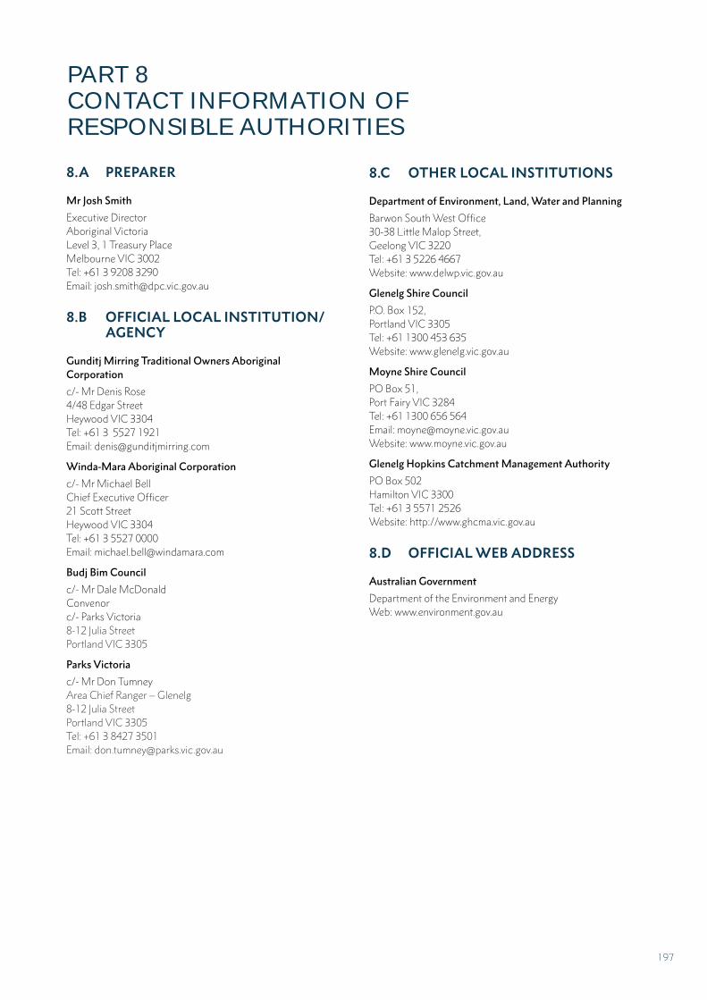
8.A PREPARER
Mr Josh Smith
Executive Director Aboriginal VictoriaLevel 3, 1 Treasury PlaceMelbourne VIC 3002Tel: +61 3 9208 3290 Email: [email protected]
8.B OFFICIAL LOCAL INSTITUTION/ AGENCY
Gunditj Mirring Traditional Owners Aboriginal Corporation
c/- Mr Denis Rose4/48 Edgar StreetHeywood VIC 3304Tel: +61 3 5527 1921Email: [email protected]
Winda-Mara Aboriginal Corporation
c/- Mr Michael BellChief Executive Officer21 Scott StreetHeywood VIC 3304Tel: +61 3 5527 0000Email: [email protected]
Budj Bim Council
c/- Mr Dale McDonaldConvenorc/- Parks Victoria8-12 Julia StreetPortland VIC 3305
Parks Victoria
c/- Mr Don TumneyArea Chief Ranger – Glenelg8-12 Julia StreetPortland VIC 3305Tel: +61 3 8427 3501 Email: [email protected]
8.C OTHER LOCAL INSTITUTIONS
Department of Environment, Land, Water and Planning
Barwon South West Office30-38 Little Malop Street,Geelong VIC 3220Tel: +61 3 5226 4667Website: www.delwp.vic.gov.au
Glenelg Shire Council
P.O. Box 152,Portland VIC 3305Tel: +61 1300 453 635Website: www.glenelg.vic.gov.au
Moyne Shire Council
PO Box 51, Port Fairy VIC 3284Tel: +61 1300 656 564Email: [email protected]: www.moyne.vic.gov.au
Glenelg Hopkins Catchment Management Authority
PO Box 502Hamilton VIC 3300Tel: +61 3 5571 2526Website: http://www.ghcma.vic.gov.au
8.D OFFICIAL WEB ADDRESS
Australian Government
Department of the Environment and Energy Web: www.environment.gov.au
PART 8 CONTACT INFORMATION OF RESPONSIBLE AUTHORITIES
197
PART 9
SIGNATURE ON BEHALF OF THE STATE PARTY
FULL PAGE BACKGROUND IMAGE
PART 9
SIGNATURE ON BEHALF OF THE
STATE PARTY
198
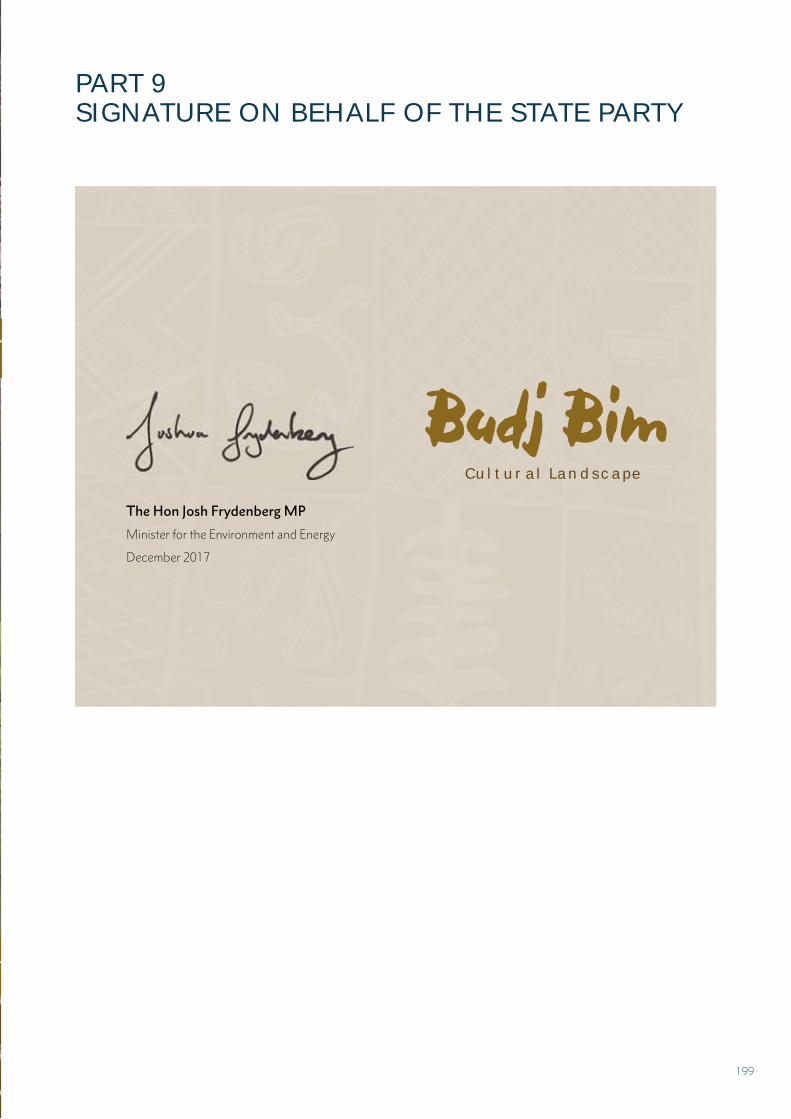
PART 9 SIGNATURE ON BEHALF OF THE STATE PARTY
The Hon Josh Frydenberg MP
Minister for the Environment and Energy
December 2017
Cultural Landscape
Budj Bim
199
ACKNOWLEDGEMENTS
FULL PAGE BACKGROUND IMAGE
ACKNOWLEDGEMENTS
200
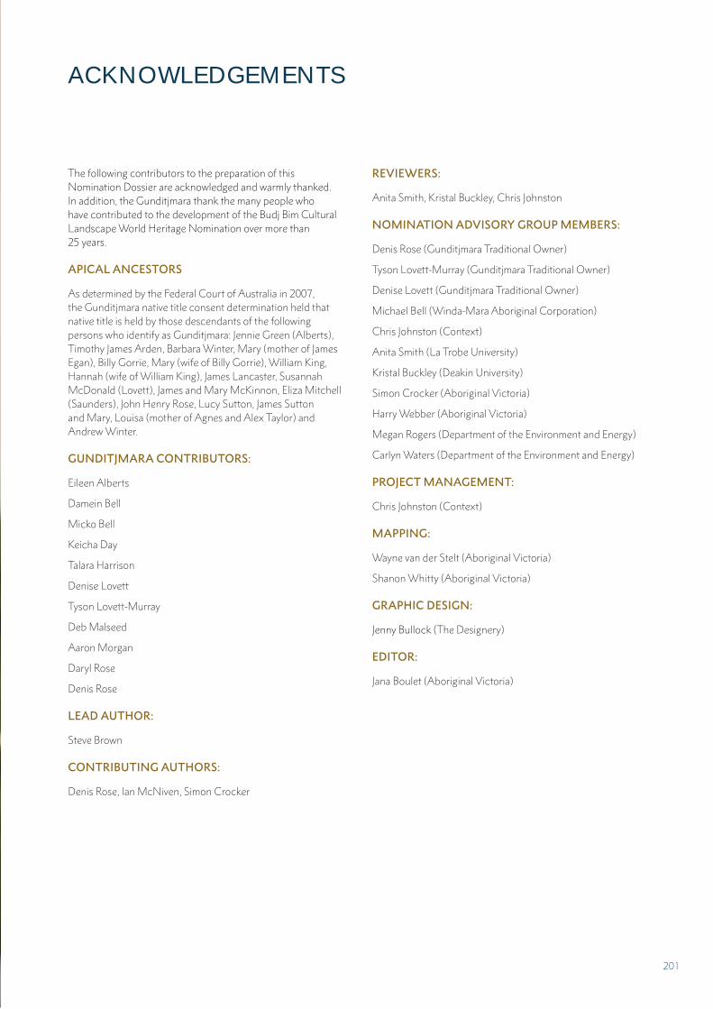
The following contributors to the preparation of this Nomination Dossier are acknowledged and warmly thanked. In addition, the Gunditjmara thank the many people who have contributed to the development of the Budj Bim Cultural Landscape World Heritage Nomination over more than 25 years.
APICAL ANCESTORS
As determined by the Federal Court of Australia in 2007, the Gunditjmara native title consent determination held that native title is held by those descendants of the following persons who identify as Gunditjmara: Jennie Green (Alberts), Timothy James Arden, Barbara Winter, Mary (mother of James Egan), Billy Gorrie, Mary (wife of Billy Gorrie), William King, Hannah (wife of William King), James Lancaster, Susannah McDonald (Lovett), James and Mary McKinnon, Eliza Mitchell (Saunders), John Henry Rose, Lucy Sutton, James Sutton and Mary, Louisa (mother of Agnes and Alex Taylor) and Andrew Winter.
GUNDITJMARA CONTRIBUTORS:
Eileen Alberts
Damein Bell
Micko Bell
Keicha Day
Talara Harrison
Denise Lovett
Tyson Lovett-Murray
Deb Malseed
Aaron Morgan
Daryl Rose
Denis Rose
LEAD AUTHOR:
Steve Brown
CONTRIBUTING AUTHORS:
Denis Rose, Ian McNiven, Simon Crocker
REVIEWERS:
Anita Smith, Kristal Buckley, Chris Johnston
NOMINATION ADVISORY GROUP MEMBERS:
Denis Rose (Gunditjmara Traditional Owner)
Tyson Lovett-Murray (Gunditjmara Traditional Owner)
Denise Lovett (Gunditjmara Traditional Owner)
Michael Bell (Winda-Mara Aboriginal Corporation)
Chris Johnston (Context)
Anita Smith (La Trobe University)
Kristal Buckley (Deakin University)
Simon Crocker (Aboriginal Victoria)
Harry Webber (Aboriginal Victoria)
Megan Rogers (Department of the Environment and Energy)
Carlyn Waters (Department of the Environment and Energy)
PROJECT MANAGEMENT:
Chris Johnston (Context)
MAPPING:
Wayne van der Stelt (Aboriginal Victoria)
Shanon Whitty (Aboriginal Victoria)
GRAPHIC DESIGN:
Jenny Bullock (The Designery)
EDITOR:
Jana Boulet (Aboriginal Victoria)
ACKNOWLEDGEMENTS
201
IMAGES COLLATION AND PERMISSIONS:
Tyson Lovett Murray (Gunditjmara commissioned photographer)
Lucy De Kretser (Aboriginal Victoria)
Jessica Antolino (Context)
Chairim Byun (Context)
Eleanor Adams (South Australian Museum)
Don Alberts
Eileen Alberts
Jim Berg
Ian Black (Hamilton History Centre)
Geoff Carr (Ecology Australia)
Charlotte Christie (Koorie Heritage Trust)
Bindi Cole
Vicki Couzens
Darryl Cram
Ian Foletta (Parks Victoria)
Lea Gardam (South Australian Museum)
Lisa Hilli (Museums Victoria)
Ian McNiven
Bob McPherson
Kimberley Moulton (Museums Victoria)
Oona Phillips (Aboriginal Victoria)
Mark Reilly (Tract Consultants)
Merryl Robson
Angela Spillman (Hamilton Gallery)
Jane Walton (Koorie Heritage Trust)
Gib Wettenhall
ADDITIONAL SUPPORT AND ADVICE:
Helen Doyle (Context)
Andrew Govanstone (Consultant)
Gary Peterson (Department of Environment, Land, Water and Planning)
Sarah Titchen (Department of the Environment and Energy)
Don Tumney (Parks Victoria)
202
ANNEXES
203
ENVIRONMENT PROTECTION AND BIODIVERSITY CONSERVATION REGULATIONS 2000 - SCHEDULE 5
Australian World Heritage Management Principles
1 GENERAL PRINCIPLES
1.01 The primary purpose of management of natural heritage and cultural heritage of a declared World Heritage property must be, in accordance with Australia’s obligations under the World Heritage Convention, to identify, protect, conserve, present, transmit to future generations and, if appropriate, rehabilitate the World Heritage values of the property.
1.02 The management should provide for public consultation on decisions and actions that may have a significant impact on the property.
1.03 The management should make special provision, if appropriate, for the involvement in managing the property of people who:
(a) have a particular interest in the property; and
(b) may be affected by the management of the property.
1.04 The management should provide for continuing community and technical input in managing the property.
2 MANAGEMENT PLANNING
2.01 At least one management plan should be prepared for each declared World Heritage property.
2.02 A management plan for a declared World Heritage property should:
(a) state the World Heritage values of the property for which it is prepared; and
(b) include adequate processes for public consultation on proposed elements of the plan; and
(c) state what must be done to ensure that the World Heritage values of the property are identified, conserved, protected, presented, transmitted to future generations and, if appropriate, rehabilitated; and
(d) state mechanisms to deal with the impacts of actions that individually or cumulatively degrade, or threaten to degrade, the World Heritage values of the property; and
(e) provide that management actions for values, that are not World Heritage values, are consistent with the management of the World Heritage values of the property; and
(f) promote the integration of Commonwealth, State or Territory and local government responsibilities for the property; and
(g) provide for continuing monitoring and reporting on the state of the World Heritage values of the property; and
(h) be reviewed at intervals of not more than 7 years.
3 ENVIRONMENTAL IMPACT ASSESSMENT AND APPROVAL
3.01 This principle applies to the assessment of an action that is likely to have a significant impact on the World Heritage values of a property (whether the action is to occur inside the property or not).
3.02 Before the action is taken, the likely impact of the action on the World Heritage values of the property should be assessed under a statutory environmental impact assessment and approval process.
3.03 The assessment process should:
(a) identify the World Heritage values of the property that are likely to be affected by the action; and
(b) examine how the World Heritage values of the property might be affected; and
(c) provide for adequate opportunity for public consultation.
3.04 An action should not be approved if it would be inconsistent with the protection, conservation, presentation or transmission to future generations of the World Heritage values of the property.
3.05 Approval of the action should be subject to conditions that are necessary to ensure protection, conservation, presentation or transmission to future generations of the World Heritage values of the property.
3.06 The action should be monitored by the authority responsible for giving the approval (or another appropriate authority) and, if necessary, enforcement action should be taken to ensure compliance with the conditions of the approval.
ANNEX A
204
MANAGEMENT PLANS FOR THE NOMINATED PROPERTY
B.1 Ngootyoong Gunditj Ngootyoong Mara South West Management Plan (Parks Victoria, 2015)
B.2 Budj Bim Indigenous Protected Area Plan of Management 2015-2019 (Gunditj Mirring Traditional Owners Aboriginal Corporation, 2015)
B.3 Tyrendarra Indigenous Protected Area Management Action Plan 2015-2018 (Winda-Mara Aboriginal Corporation, 2015)
These management plans are provided as three separate, bound documents that accompany this Nomination Dossier.
LARGE FORMAT MAP OF THE NOMINATED PROPERTY
Budj Bim Cultural Landscape: Nominated property boundary (Scale. 1:30,000)
This AO-size plan is provided as a separate document that accompanies this Nomination Dossier.
ANNEX B ANNEX C
205
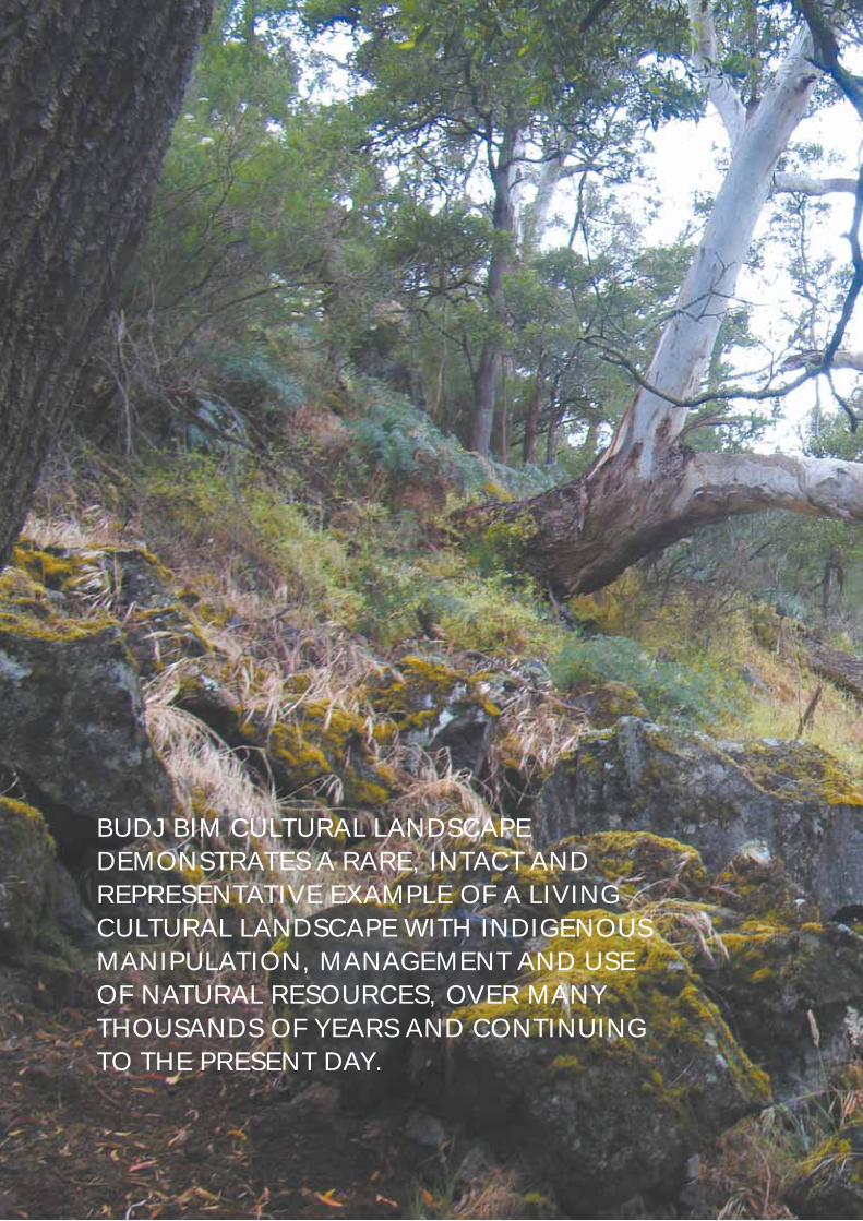
BUDJ BIM CULTURAL LANDSCAPE DEMONSTRATES A RARE, INTACT AND REPRESENTATIVE EXAMPLE OF A LIVING CULTURAL LANDSCAPE WITH INDIGENOUS MANIPULATION, MANAGEMENT AND USE OF NATURAL RESOURCES, OVER MANY THOUSANDS OF YEARS AND CONTINUING TO THE PRESENT DAY.
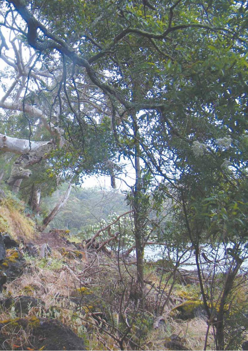


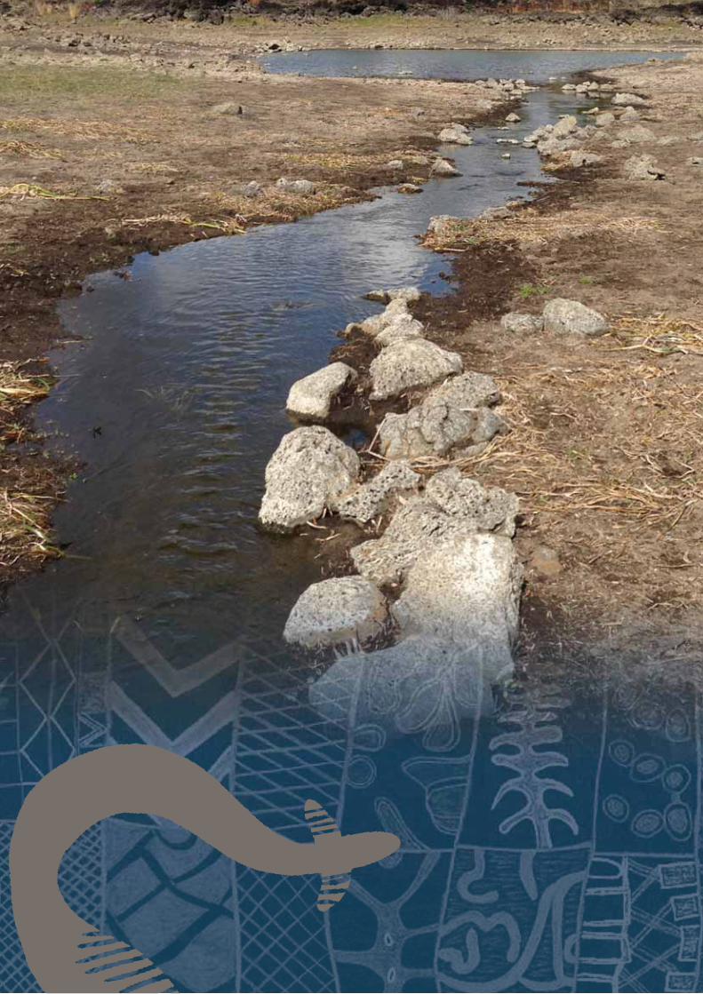
Related Documents