METHODS AND TOOLS TO ACHIEVE COLLABORATIVEHEALTH AND BIO SURVEILLANCE
USPACOM S&T ConferenceMarch 2013
Health Surveillance
(c) Copyright 2006-2010 - PDC
Public health surveillance is the continuous, systematic collection, analysis and interpretation of health-related data needed for the planning, implementation, and evaluation of public health practice. Such surveillance can:
serve as an early warning system for impending public health emergencies;
document the impact of an intervention, or track progress towards specified goals; and
monitor and clarify the epidemiology of health problems, to allow priorities to be set and to inform public health policy and strategies.
(World Health Organization)
Biosurveillance
“..the process of active data-gathering with appropriate analysis and interpretation of biosphere data that might relate to disease activity and threats to human or animal health — whether infectious, toxic, metabolic, or otherwise, and regardless of intentional or natural origin — in order to achieve early warning of health threats, early detection of health events, and overall situational awareness of disease activity” (Homeland Security Presidential Directive 21 (HSPD-21), 2007)
(c) Copyright 2006-2010 - PDC
(c) Copyright 2006-2010 - PDC
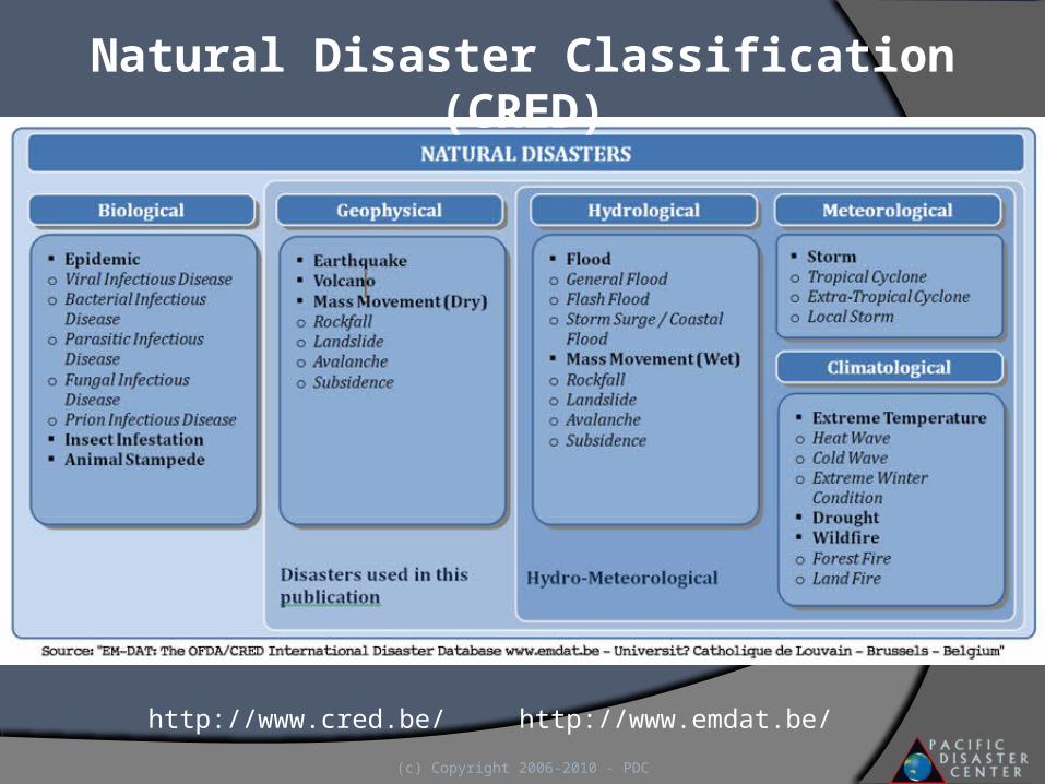
Natural Disaster Classification (CRED)
http://www.cred.be/ http://www.emdat.be/
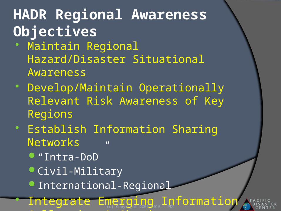
HADR Regional Awareness Objectives Maintain Regional Hazard/Disaster Situational
Awareness Develop/Maintain Operationally Relevant Risk
Awareness of Key Regions Establish Information Sharing Networks
“Intra-DoD”Civil-MilitaryInternational-Regional
Integrate Emerging Information Collection & Sharing Technologies
(c) Copyright 2006-2010 - PDC
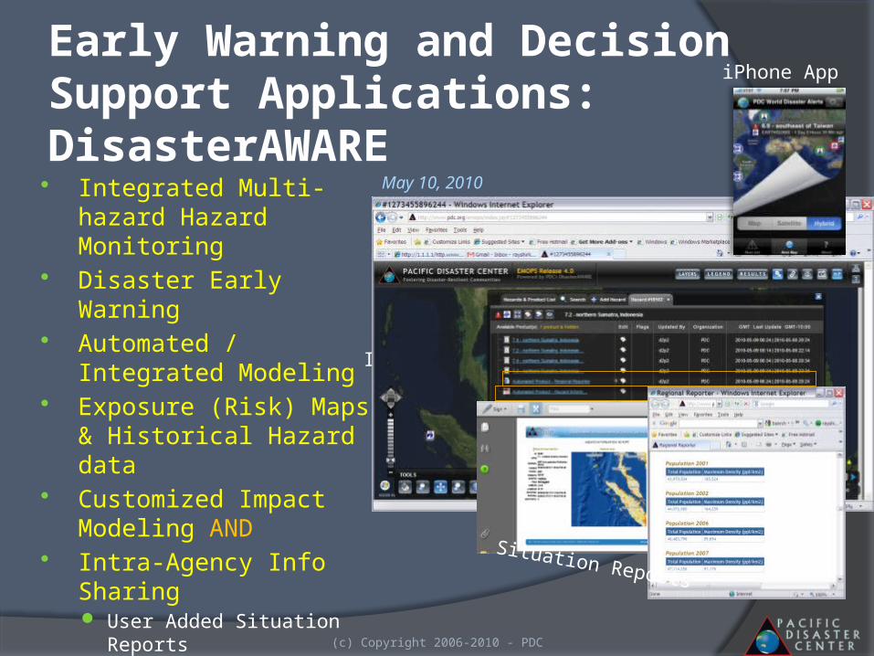
Early Warning and Decision Support Applications: DisasterAWARE Integrated Multi-hazard
Hazard Monitoring Disaster Early Warning Automated / Integrated
Modeling Exposure (Risk) Maps &
Historical Hazard data Customized Impact Modeling
AND Intra-Agency Info Sharing
User Added Situation Reports Damage Products, …
Remote Access
(c) Copyright 2006-2010 - PDC
EQVolcano
Hot Spots
RainTsunami Travel Time
Storm, EQ, Volcano Intensity Zones
Shake Maps (MMI)
Info Sharing
iPhone App
Situation Reports
May 10, 2010
(c) Copyright 2006-2010 - PDC
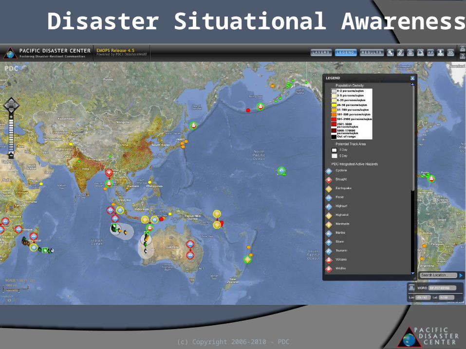
Disaster Situational Awareness
(c) Copyright 2006-2010 - PDC
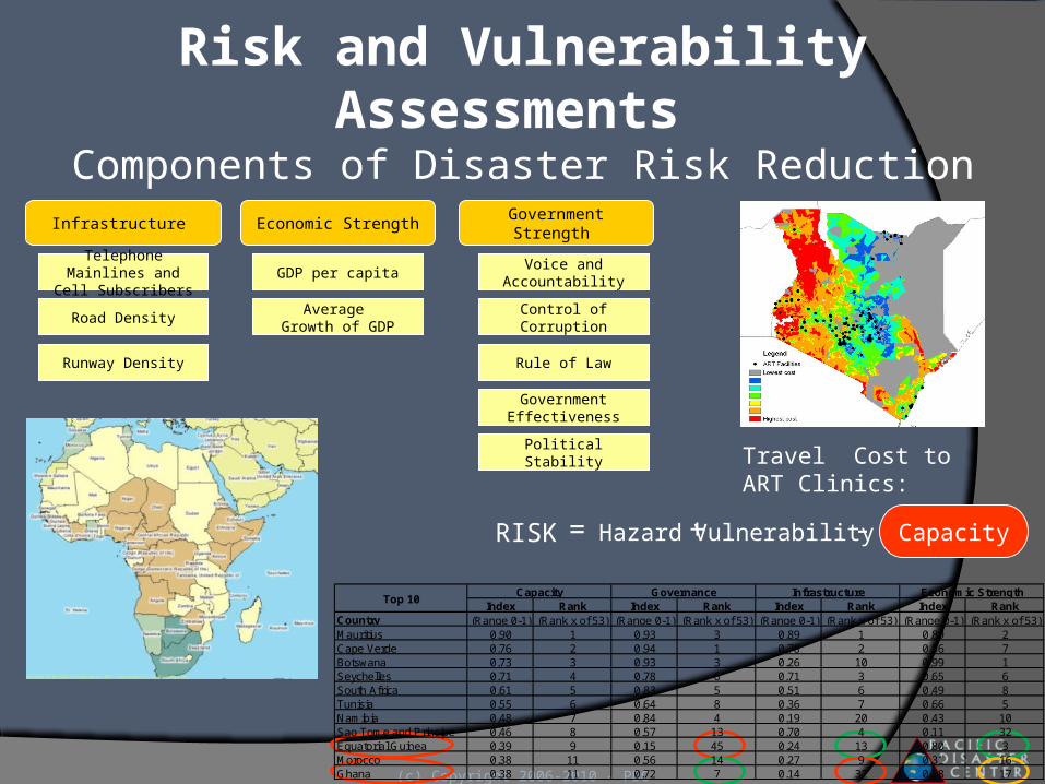
GDP per capita
Average Growth of GDP
Economic Strength
Political Stability
Control of Corruption
Voice and Accountability
Rule of Law
Government Effectiveness
Government Strength
Telephone Mainlines and Cell Subscribers
Road Density
Runway Density
Infrastructure
=RISK Hazard CapacityVulnerability+ -
Index Rank Index Rank Index Rank Index RankCountry (Range 0-1) (Rank x of 53) (Range 0-1) (Rank x of 53) (Range 0-1) (Rank x of 53) (Range 0-1) (Rank x of 53)Mauritius 0.90 1 0.93 3 0.89 1 0.89 2Cape Verde 0.76 2 0.94 1 0.78 2 0.56 7Botswana 0.73 3 0.93 3 0.26 10 0.99 1Seychelles 0.71 4 0.78 6 0.71 3 0.65 6South Africa 0.61 5 0.83 5 0.51 6 0.49 8Tunisia 0.55 6 0.64 8 0.36 7 0.66 5Namibia 0.48 7 0.84 4 0.19 20 0.43 10Sao Tome and Principe 0.46 8 0.57 13 0.70 4 0.11 32Equatorial Guinea 0.39 9 0.15 45 0.24 13 0.80 3Morocco 0.38 11 0.56 14 0.27 9 0.31 16Ghana 0.38 11 0.72 7 0.14 32 0.28 17
Economic StrengthTop 10
Capacity Governance Infrastructure
Risk and Vulnerability Assessments Components of Disaster Risk Reduction
Travel Cost to ART Clinics:
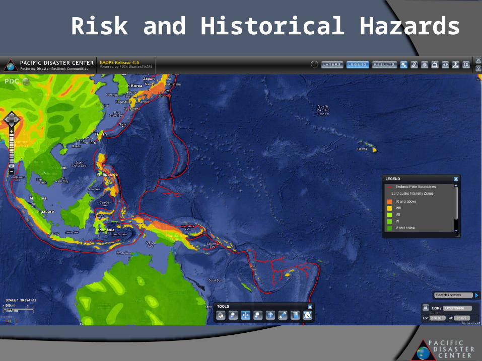
Risk and Historical Hazards
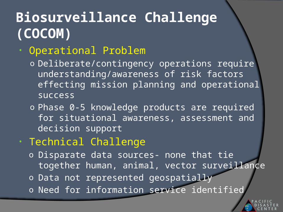
• Operational Problemo Deliberate/contingency operations require
understanding/awareness of risk factors effecting mission planning and operational success
o Phase 0-5 knowledge products are required for situational awareness, assessment and decision support
• Technical Challengeo Disparate data sources- none that tie together human,
animal, vector surveillanceo Data not represented geospatiallyo Need for information service identified
Biosurveillance Challenge (COCOM)
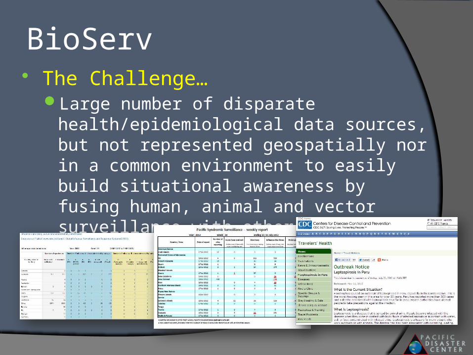
BioServ The Challenge…
Large number of disparate health/epidemiological data sources, but not represented geospatially nor in a common environment to easily build situational awareness by fusing human, animal and vector surveillance with other key data
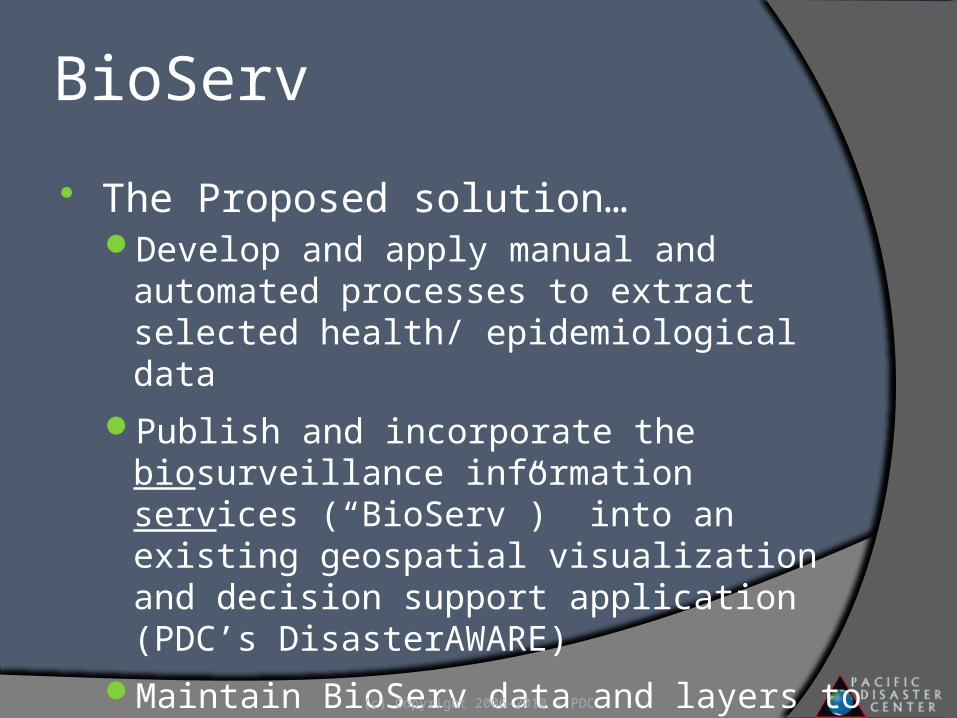
BioServ
The Proposed solution…Develop and apply manual and automated
processes to extract selected health/ epidemiological data
Publish and incorporate the biosurveillance information services (“BioServ”) into an existing geospatial visualization and decision support application (PDC’s DisasterAWARE)
Maintain BioServ data and layers to provide up-to-date health surveillance data.
(c) Copyright 2006-2010 - PDC
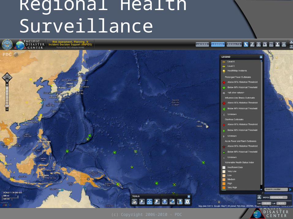
Regional Health Surveillance
(c) Copyright 2006-2010 - PDC
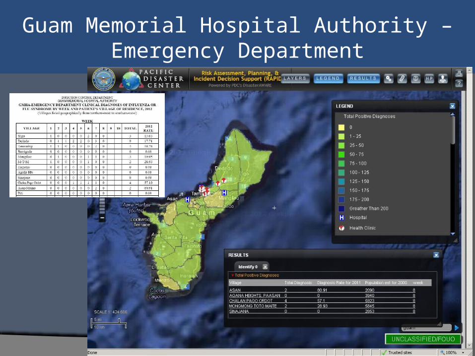
Guam Memorial Hospital Authority –Emergency Department
Total Influenza or Flu-Syndrome Cases
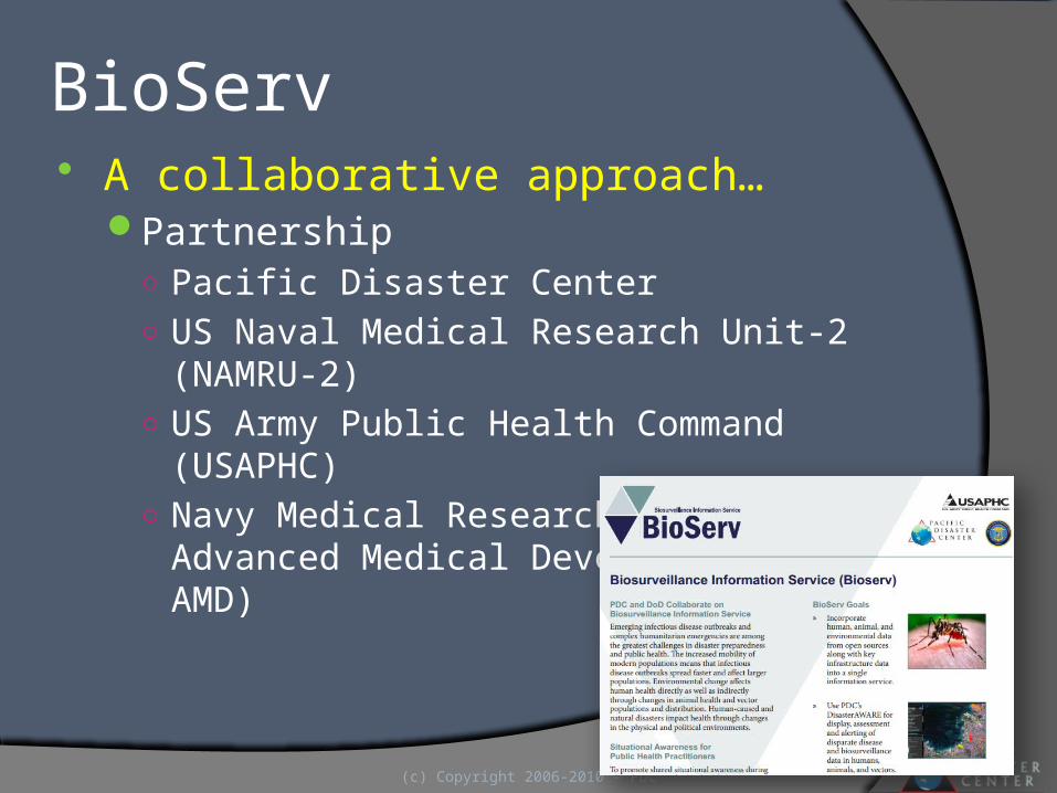
BioServ A collaborative approach…
Partnership○ Pacific Disaster Center○ US Naval Medical Research Unit-2 (NAMRU-2)○ US Army Public Health Command (USAPHC)○ Navy Medical Research Center, Advanced Medical
Development (NMRC AMD)
(c) Copyright 2006-2010 - PDC
The Future … Emerging Use of Social Media/Networking to Provide
Timely Health Information in “Austere” Environments ONR Social Networking Initiatives Increased Use of “Ubiquitous” data collection resources
Increase Information Sharing & Collaboration Through Adoption of Open Standards & Interoperability Mil-Civ Trusted Environment ---Increasing “Social Capital” Open Standards/Interoperability -- ROGUE JCTD Increasing Engagement of Health “Communities of Practice” Growth of New Regional Data/Information Networks
Adoption of “System Agnostic” Knowledge Data/Information Resources
(c) Copyright 2006-2009 - PDC
Fostering Disaster-Resilient Communities
For More Information:http://WWW.PDC.ORG
Follow us on: DisasterAWARE
Contact Us At: [email protected]