Western University Western University
Scholarship@Western Scholarship@Western
Electronic Thesis and Dissertation Repository
2-15-2018 1:30 PM
Pushing the Limits: Testing, Magnetometry and Ontario Lithic Pushing the Limits: Testing, Magnetometry and Ontario Lithic
Scatters Scatters
John E. Dunlop, The University of Western Ontario
Supervisor: Ellis, Christopher J., The University of Western Ontario
A thesis submitted in partial fulfillment of the requirements for the Master of Arts degree in
Anthropology
© John E. Dunlop 2018
Follow this and additional works at: https://ir.lib.uwo.ca/etd
Part of the Archaeological Anthropology Commons
Recommended Citation Recommended Citation Dunlop, John E., "Pushing the Limits: Testing, Magnetometry and Ontario Lithic Scatters" (2018). Electronic Thesis and Dissertation Repository. 5255. https://ir.lib.uwo.ca/etd/5255
This Dissertation/Thesis is brought to you for free and open access by Scholarship@Western. It has been accepted for inclusion in Electronic Thesis and Dissertation Repository by an authorized administrator of Scholarship@Western. For more information, please contact [email protected].

ii
Abstract
Lithic scatters, small ephemeral clusters of stone artifacts on cultivated surfaces, lie on the
periphery of archaeology. These sites are often too ephemeral to be fully understood through
standardized fieldwork methodologies mandated in Ontario CRM archaeology and yet, they
are widely regarded as worth documenting with hundreds now recorded. In this thesis, it is
argued that what are small artifact scatters on the surface can belie more complex subsurface
finds of significant cultural and historical value. As such, there is a need to reconsider the
approaches made to the investigation of these sites. Geophysical techniques applied early in a
scatter’s investigation, particularly magnetometry, have the ability to facilitate the extraction
of more pertinent data about past peoples and their activities from such sites. Archaeological
work was carried out at two sites near Kitchener, Ontario, in order to evaluate whether
surface and excavated artifact densities correlate with preserved subsurface cultural deposits.
This work also included a direct and positive attempt at one of the sites to test the utility of
magnetometry in this process.
Keywords
Archaeology, Lithic Scatters, Geophysics, Magnetometry, CRM

iii
Acknowledgments
I am thankful to many individuals who have given their support, guidance and wisdom over the years. First and foremost my supervisor, Dr. Chris Ellis for his patience and continual guidance, his insightful and constructive comments, and his continued willingness to constantly talk about all things Archaic and Lithics. Chris was has been an idol and a mentor and his wisdom and good counsel were always taken. I also wish to thank Mr. Ed Eastaugh for always being around to talk all things archaeo-geophysics and for co-hosting our session at the Canadian Archaeological Conference on the topic. I wish to thank my review committee, Dr. Jean-Francois Millaire, Dr. Lisa Hodgetts and Dr. Chris Watts for the comments and thoughts regarding this work. It is a pleasure to have known all of you and deeply appreciate your insights on this thesis. I also wish to the thank the Anthropology Department at the University of Western Ontario, specifically Dr. Neal Ferris, Dr. Peter Timmins, Dr. Ian Colquhoun and all other faculty member for their encouragement and support. This thesis is derived from data collected as part of an archaeological assessment in Ontario, carried out by Archaeological Services Inc. (ASI) for Mattamy Homes. I am indebted to Mattamy Homes for their willingness to allow the information from AiHd-159 and AiHd-160 to be used in this thesis. I also wish to thank Dr. Ron Williamson, Dr. Rob MacDonald, and Mr. David Robertson and Mr. Jonas Fernandez for their constant support for this thesis during my time at ASI. I also extend my thanks to Mr. Doug Todd for his insights and work on the lithic analysis from these sites. The commitment of the individuals at ASI to disseminate the information collected is truly admirable and I cannot thank you enough. To my field crew; Field Directors Rob Wojtowicz, Jessica Lytle, Kiara Beaulieu, Robb Bhardwajj, Elizabeth Matwey, and Kora Stapelfeldt, thank you for your work on these excavations. My thanks to the field technicians Jesse Knapp, Rameesha Wickramazuriya, Nicole Belanger Adam Cassel, Jackson Darby, Allan Jones, Stuart Karrow, Margaret Long, Liam McGreer, Josh Misfud, Janice Mitchell, Simon Newcombe, Zack Shaw, Dan Slavic, Andreas Vatistas, Lauren Vince, Blake Williams, Christian Wilson and Karen Hansen. This thesis is the result of understanding that past peoples, the Annishnabec, Algonkian and Haudenosaunee have been on the lands we currently inhabit long before us, and for that I thank them, and their descendants who engaged in the archaeologicalwork which took place; Joanne Thomas, Terrance Hill Jr, Craig General, Caroline Miller and Jubal Jamieson. Without their wisdom I would still be trying to understand the past cultures and peoples who created these archaeological sites. I also wish to thank my colleagues in the Archaeology Unit of the Ontario Ministry of Tourism, Culture and Sport; Mr. Jim Sherratt, Mrs. Kathryn Bryant, Ms. Meagan Brooks, Mr. Malcolm Horne, Ms. Andrea Williams, Dr. Crystal Forrest and Mr. Ian Hember for their support for this thesis. Finally, this thesis is dedicated to my wife Alexis, my daughters Ivy and Astrid, and all my family. Thank you all for helping me with this task. Any errors, omissions or mistakes are the sole responsibility of the author.

iv
Table of Contents
Abstract ............................................................................................................................... ii
Acknowledgments.............................................................................................................. iii
Table of Contents ............................................................................................................... iv
List of Tables ..................................................................................................................... vi
List of Figures ................................................................................................................... vii
List of Plates .................................................................................................................... viii
List of Appendices ............................................................................................................. ix
Preface ................................................................................................................................. x
Chapter 1 : Introduction and Background ........................................................................... 1
1 Thesis Goal and Outline ................................................................................................. 1
1.1 Lithic Scatters ......................................................................................................... 1
1.2 Lithic Scatters in Ontario ........................................................................................ 3
1.3 Scatters and Geophysical Surveys .......................................................................... 8
1.4 Selection of Sites for Investigation ....................................................................... 10
Chapter 2 : Lithic Scatters: Their Relationship with CRM Archaeology and Problems with Standard Approaches to their Investigation ......................................................... 13
2 Lithic Scatters............................................................................................................... 13
2.1 CRM Standards and Guidance for Lithic Scatters in Ontario ............................... 13
2.2 Challenges Arising from the Standardized Approaches ....................................... 15
2.3 Lithic Scatters in Ontario ...................................................................................... 21
Chapter 3 : Geophysical Survey Applications in Ontario and in CRM Archaeology ...... 26
3 Geophysical Survey to Maximize Cultural/Historical Data......................................... 26
3.1 Applications of Geophysical Survey within an Archaeological Context ............. 26
3.1.1 Geophysical Survey and CRM Archaeology ............................................ 32

v
3.2 Geophysical Applications to the Ontario Archaeological Record ........................ 34
3.2.1 The Davidson Site ..................................................................................... 35
Chapter 4 ........................................................................................................................... 38
4 AiHd-159 and AiHd-160, Site Identification and Archaeological Investigations ....... 38
4.1 AiHd-159 and AiHd-160 and their Archaeological Assessment .......................... 39
4.1.1 AiHd-159 and AiHd-160 Spatial Organization ........................................ 43
4.1.2 Regional Context of AiHd-159 and AiHd-160 ......................................... 44
4.1.3 Field Investigations ................................................................................... 45
4.1.4 AiHd-160 Geophysical Survey ................................................................. 46
4.1.5 Geophysical Survey Data Processing ....................................................... 52
4.1.6 Archaeological Excavations: AiHd-159 and AiHd-160 ........................... 56
4.1.7 AiHd-159 Field Investigation Results ...................................................... 57
4.1.8 AiHd-160 Surface Collection and Test Unit Results ................................ 58
4.1.9 AiHd-160 Geophysical Survey Results .................................................... 65
4.2 Interpreting AiHd-159 and AiHd-160 .................................................................. 71
Chapter 5 ........................................................................................................................... 80
5 Conclusions .................................................................................................................. 80
References Cited ............................................................................................................... 85
Appendices ...................................................................................................................... 100
Curriculum Vitae ............................................................................................................ 200
vi
List of Tables
Table 1: A Sample Comparison of Archaeological Site Types in the OASD .......................... 4
Table 2:Results of the OLS Multiple Linear Regression Test: Site Area and Artifact Density
as Variable Determinants of Cultural Features ......................................................... 23
Table 3:Results of the OLS Linear Regression Test: Percentage of Site Excavated as a
Variable Determinant of Presence of Cultural Features ............................................ 24
Table 4: Cultural Features Encountered at AiHd-160 ............................................................ 62

vii
List of Figures
Figure 1: The General Location of Sites AiHd-159 and Aihd-160 ........................................ 40
Figure 2: The Stage 2 Surface Collection and Organization of AiHd-159 and AiHd-160 ..... 42
Figure 3: General location of all Registered Archaeological Sites within 5 km of AiHd-159
and AiHd-160 ......................................................................................................... 47
Figure 4: General location of all Archaic Period Sites within 5 km of AiHd-159 and AiHd-
160 .......................................................................................................................... 48
Figure 5: General location of all Late Woodland sites within 5 km of AiHd-159 and AiHd-
160 .......................................................................................................................... 49
Figure 6: Stage 3 Field Investigations at AiHd-159 ............................................................... 60
Figure 7: Stage 3 Field Investigation Results for AiHd-160 .................................................. 61
Figure 8: Cultural Features Encountered at AiHd-159 ........................................................... 63
Figure 9: Field Investigation Results and Location of Cultural Features, AiHd-160 ............. 64
Figure 10: Gradiometer Survey Results for Aihd-160 ............................................................ 66
Figure 11: Gradiometer Survey Results and Archaeological Excavation Results, AiHd-160 67
Figure 12: Geophysical Anomalies and Cultural Features in Girds 1 and 2, AiHd-160 ........ 74
Figure 13: Geophysical Anomalies and Cultural Features in Grid 3, AiHd-160 .................... 75

viii
List of Plates
Plate 1: Depth of Deep Clay deposit encountered at AiHd-160 ............................................. 69
Plate 2: Limestone drain encountered in unit 550-170 ........................................................... 70

ix
List of Appendices
Appendix A: Site data of 400 randomly selected Archaeological Sites from the Ontario
Archaeological Sites Database ......................................................................... 101
Appendix B: Sample of Lithic Scatter sites in Ontario ......................................................... 116
Appendix C:Artifact Catalogue from Site AiHd-159 ........................................................... 117
Appendix D: Artifact Catalogue from Site AiHd-160 .......................................................... 141
x
Preface
“I can tell you that, deep down in my core, I know we aren’t dealing with these sites
properly”. When I was seeking sites to carry out the investigations on my thesis I was
reaching out to several archaeological consultation firms within Ontario. In my discussions
with the leaders of these companies I heard the same refrain over and over again. Lithic
scatters have meaning, but what is that meaning? Lithic scatters need to be investigated in a
more meaningful way, but what is that methodology? Ever since the Innes site (Lennox
1986) was encountered in the early days of regulated Cultural Resource Management in
Ontario there has been a general unease about how these sites are investigated, what cultural
heritage value and interest is being placed on them, and how and where they fit into the
Ontario Archaeological record. The 1996 Ontario Archaeology Society conference held a
session dedicated to ‘small sites’ in which lithic scatters featured prominently (Pilon and
Perkins 1997). Other jurisdictions, such as New York, Pennsylvania, Michigan, as well as
England and Europe have all had conferences and conference sessions dedicated to lithic
scatters in an attempt to understand how they should best be dealt with in a CRM
environment (e.g., Beckerman 2002, EH 2000, Reith 2008, Smit 2012).
This thesis came about after almost 20 years of finding, excavating and thinking about lithic
scatters across Ontario. One of the first sites I ever dug was in a heavy clay field in Oakville,
Ontario, where we spent months collecting flakes out of clay that would barely go through
our screens. When we had completed the excavation and collected the majority of the site
from the ploughzone we shovel shined the subsoil for features, found none, and called a halt
to the excavation. I was struck by trying to understand the site; what activities had created
this site? How do we know we have found everything of value? Why was this site here?
This thesis seeks to answer the questions by taking an expanded investigative and
interpretive approach to lithic scatters. Can additional archaeological data be obtained from
mundane sites through additional and different kinds of fieldwork, and can their place within
the past occupation of Ontario be considered in a more meaningful manner?
1
Chapter 1 : Introduction and Background
1 Thesis Goal and Outline
The goal of this thesis is to critically examine the way lithic scatters are handled in a
CRM context and to evaluate them through alternate and expanded testing methods than
those normally employed. Specifically, the thesis examines the uses and benefits of
exploring areas at lower artifact densities at the periphery of two sites (AiHd-159; AiHd-
160), areas that would not be normally investigated under current CRM standard
procedures. Aside from expanded site test excavation, a geophysical technique rarely
used in the area, magnetometer survey, was employed at one of the sites to explore the
usefulness of this technique in yielding significant archaeological information, including
the site’s extent and undetected subsurface cultural features.
1.1 Lithic Scatters
As with many site types, an over-arching definition of a lithic scatter is typically
regionally based, and may reference the area, cultural and temporal affiliations of the site.
In CRM Archaeology, with the industry’s drive to accurately determine and record the
presence of any archaeological site within a particular parcel of land slated for
development, the term often serves as a convenient label for a high percentage of
archaeological resources encountered by the industry (Bond 2010, 2011). The term itself
in one which has been created very much from the CRM industry, and is associated
primarily with archaeological survey work, as opposed to more investigative excavations
(Reith 2008). Indeed the term lithic scatter denotes a lack of information that could be
obtained from a site (Binzen 2008). The naming of a site ‘type’ is a requirement within
Ontario, although there is very little standardization of what term is applied to what site
(von Bitter et al. 1999). The very definition of a lithic scatter as a site type can be
profoundly difficult as such definitions not only vary regionally but also differ depending
on the biases of the researcher (Yarrow 2006).
Such sites may be minimally characterized as a somewhat ephemeral concentration or
cluster of stone artifacts, but the problem becomes in defining just how ephemeral in

2
terms of artifact yield a scatter has to be to remain a scatter and how one determines the
spatial limits of a given example. Hence, most definitions will include a clause regarding
the type of artifact, the overall area of the site, and the nature of ‘scatter’. Reith (2008:1)
summarizes several definitions of lithic scatter as consisting solely of chipped or knapped
tools and debitage, having few or no subsurface cultural features and being of less than
half an acre in size. Another presented definition describes these sites as having fewer
than 30 flakes and fewer than five bifaces or formal tools or point types [encountered
during the initial survey], and being smaller than 100 square metres with no mention of
features (Beckerman 2002). Yet another definition contains even more restrictive clauses:
it characterizes these sites organizationally as a scatter on the surface of a ploughed field,
as restricted to a small area (<30 metres square), and as having an overall low yield of
artifacts (n=50) featuring few, if any formal tools, bifaces or ceramics (Reith 2008). In
seeking a standardized definition, Ontario’s 2011 Standards and Guidelines for
Consultant Archaeologists (MTCS 2011:166) offer a similar definition focusing on the
site’s organization and its artifact components; a loose or tight concentration of stone
flakes and tools resulting from the manufacture and sometimes the use of one or more
stone tools. This definition, unlike many of the others, does not feature a restriction on
the overall size of the scatter, other than the fact these sites consist solely of stone
artifacts including flaking debris. What is lacking in any of these definitions is a sense of
the implication of the term lithic scatter and its definition, as it relates to the
archaeological importance and value of these sites. The term is widely used within an
archaeological survey context the term denotes the presence of a small pre-contact
Indigenous site which can be implied to have no further investigative interest (Binzen
2008, Bond 2011, Reith 2008). In Ontario, the 2011 Standards and Guidelines for
Consultant Archaeologists sets a threshold of surface scatter artifact density in order to
determine if there is a need to conduct further investigation. However, sites which
undergone further investigation tend to evolve from a lithic scatter, in identification and
definition, to a more descriptive kind of site (campsite, tool manufacture site, butchery
site etc…) (Binzen 2008, von Bitter et al. 1999).
For the purposes of this thesis, and unless otherwise noted, this thesis will follow a
definition of a lithic scatter similar to that in the Standards and Guidelines as: a grouping

3
of artifacts, either dense or ephemeral, on the surface of a ploughed field with an
unknown archaeological value. The expansion of the final statement in this definition
from the formal definition suggested within the Standards and Guidelines is purposeful
by the author as it relates to the challenges discussed in Chapter 2. Lithic scatters often
lack sufficient information obtained from a standard single-pass survey (Shott 1995).
Note that in this definition the “grouping” need not be an entire “site” as is implied in the
Guidelines definition, but could only be a segment of a site. For the sake of this thesis,
unless otherwise noted, the definition of ‘site’ is in the traditional archaeological sense as
an area which contains tangible/preserved evidence of past human occupation or
activity. However, sometimes in order to record sites as places on the landscape,
investigators may pragmatically lump together several scatters in close juxtaposition as a
single site. Hence, a single surface scatter and the site as a whole need not be
coextensive, as a single site may consist of several scatters or scatters plus other kinds of
finds. These locations will be called “registered” sites to make their meaning clear in
subsequent discussions. Also, for various reasons discussed in detail in the next chapter,
the surface scatter used to denote and delimit a site initially does not necessarily denote
the actual spatial extent of the tangible evidence of past human activity. This disconnect
may be because of the potential unreliability of single-pass surface collected scatters to
accurately demarcate site limits, or the possibility of buried deposits undisturbed by
cultivation that extend beyond the known surface scatter. Because the initially recorded
site may not actually delimit its true extent, the term “actual” site is employed below to
refer to its true limits.
1.2 Lithic Scatters in Ontario
Lithic scatters are ubiquitous across southern Ontario, and are one of the most recorded
type of archaeological site encountered in southern Ontario and are typically held as one
of the most commonly recorded sites in the archaeological record in most areas (Bond
2011; Reith 2008). This view is backed up by a random sample of 400 Borden entries
that I reviewed in order to determine the frequency of recorded lithic scatter sites within
the Ontario archaeological record (see Appendix A). The analysis of the Borden sample
revealed that 208 sites are either described or classified as lithic scatters or, in some

4
cases, campsites. The “campsites” were originally encountered as lithic scatters and it
was only after additional investigations and excavations that a more formal site function
was ascribed to the initially recorded scatter. This change in terminology is crucial in
understanding how lithic scatters are understood in the CRM industry. Typically, as noted
above, additional information obtained form more comprehensive investigation of the site
will result in a new understanding of the archaeological value of said site, and the site
changes from a lithic scatter to another type of site. In essence, further investigation
meets the criteria set out in the definition of the lithic scatter presented for this thesis, in
that the additional investigation has resulted in a determination of archaeological value,
and a new term can be assigned to the site (Von Bitter et al 1999, Yarrow 2006).
This sample indicates that, at a minimum, over half of the Ontario archaeological record
consists of lithic scatters. Table 1 indicates the full breakdown of site types encountered
in the sample. It should be noted that the site types presented in this sample are the types
entered into the archaeological record by the original researcher.
The scatters noted above were found predominantly during systematic surveys, usually
carried out as part of the cultural resource (CRM) industry’s required pre-development
assessment for archaeological and heritage value of a particular parcel of land. Their
ubiquity and their ephemeral nature often cast them as mundane or lacking in substantive
cultural and archaeological content/information. Yet, despite this overall lack of
archaeological content, they are almost universally recognized by descendant
communities, archaeologists and regulators as having heritage value and as such are
required to be registered and documented.
Table 1: A Sample Comparison of Archaeological Site Types in the OASD
Site Type Quantity
Historic Euro-Canadian Sites
Cemetery 2
Homestead 28
19th Century Industrial/ Transportation 2
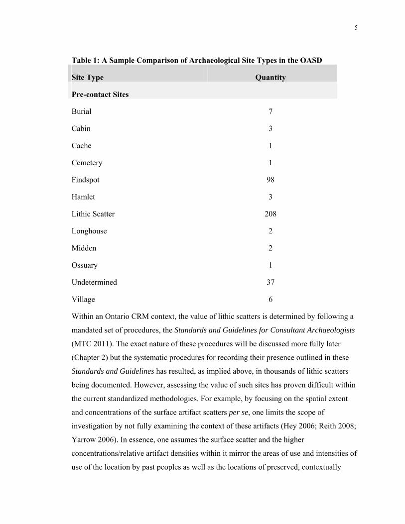
5
Table 1: A Sample Comparison of Archaeological Site Types in the OASD
Site Type Quantity
Pre-contact Sites
Burial 7
Cabin 3
Cache 1
Cemetery 1
Findspot 98
Hamlet 3
Lithic Scatter 208
Longhouse 2
Midden 2
Ossuary 1
Undetermined 37
Village 6
Within an Ontario CRM context, the value of lithic scatters is determined by following a
mandated set of procedures, the Standards and Guidelines for Consultant Archaeologists
(MTC 2011). The exact nature of these procedures will be discussed more fully later
(Chapter 2) but the systematic procedures for recording their presence outlined in these
Standards and Guidelines has resulted, as implied above, in thousands of lithic scatters
being documented. However, assessing the value of such sites has proven difficult within
the current standardized methodologies. For example, by focusing on the spatial extent
and concentrations of the surface artifact scatters per se, one limits the scope of
investigation by not fully examining the context of these artifacts (Hey 2006; Reith 2008;
Yarrow 2006). In essence, one assumes the surface scatter and the higher
concentrations/relative artifact densities within it mirror the areas of use and intensities of
use of the location by past peoples as well as the locations of preserved, contextually

6
intact, subsoil remnants of features such as pits or hearths. Excavation of these sites,
when it does occur, does not extend beyond the limit of the surface artifact scatter,
indicating that there is an inherent assumption that the scatter extent is the whole
occupation/use area and obviating any need to explore and seek to understand the locale
in any more depth.
Attributing scatters to a specific date or culture is not always feasible, due to the lack of
diagnostic artifacts obtained during their identification and collection. When diagnostics
are obtained from these sites, they are often attributed to the Archaic Period in Pre-
Contact Ontario (ca. 11,000-3,000 years ago), and it is often assumed that the vast
majority of scatters without any diagnostics are also of that age (Reith 2008). This
assumed Archaic cultural attribution along with the domination of the record by scatters,
explains, in part, why the Archaic period as a whole is often seen as mundane and lacking
in substantial archaeological data or value (Burgar 1997; Dodd 1997; Emerson and
McElrath 2009; Fisher et al. 1997; Fisher 1997; Kenyon and Lennox 1997; Lennox 1986,
1997; Ramsden 1997; Sassaman 2010; Steiss, et al. 1997; Woodley 1990). Ellis et al.
(2009a:790) note that an assumption of an Archaic affiliation is based on the fact the sites
lack the ceramics of the subsequent Woodland period after 3000 BP and, given their
antiquity, that Archaic sites are more unlikely to yield preserved surface organics. In
addition, Archaic peoples are assumed by archaeologists to be very residentially mobile
hunter-gatherers so these scatters are seen as the inevitable ephemeral evidence of the
small, band-sized groups of hunter-gatherer/foragers moving frequently across the
landscape (Emerson and McElrath 2009). They are assumed to be less settled than their
Woodland counterparts who relied to some extent on domesticates and other means of
manipulating environments to their own advantage. Finally, Archaic groups produced
very few distinctive stone tool forms and did not often use stone materials exotic to a
region unlike earlier, pre-11,000 year old, Paleoindian peoples (see Ellis and Poulton
2014). Hence, such scatters, deficient as they are in distinctive tools and utilizing more
local materials, are Archaic rather than Paleoindian in age.
Generally, sites of note dating to the Archaic period are stereotyped as either the few
dense habitation sites found in littoral areas and/or near major water sources or
7
alternatively sites associated with the identification of formal artifact types such as
weapon tips (see, for example, Ellis et al. 1990, 2009b). The vast majority of “Archaic”
sites that are identified in Ontario government records actually are not given formal
names and are referred to simply by their Borden Site System Number – they are
recorded but assumed to be limited in what they can tell us about Archaic peoples. Such
an attitude suggests that sites are undervalued by characterizing them as surface scatters;
that they are of insufficient value to warrant further investigation. Too often CRM
archaeologists, pressed for time and budget, adhere to the standards governing their work
to make determinations on the resources they encountered, without stopping to consider
them within a larger, archaeological framework. AiHd-159, discussed within this study,
is one such site that lacked the required surface artifact density to warrant further
investigation. Another site investigated in CRM, the Mt. Albert site (Forsythe 2016), was
also considered ephemeral and lacking in sufficient artifact density to warrant further
concern. Chapter 2 will also discuss the Innes site (Lennox 1986), amongst other
examples, of lithic scatters which were initially found to have small, ephemeral artifact
surface scatters but yielded much more significant finds during excavation (Kenyon and
Lennox 1997). These sites were considered in a context beyond the mandated standards
of practice, resulting in the documentation of culturally significant information and, in the
case of the Mt. Albert site, notably good evidence for certain kinds of previously
undocumented sacred ritual activities some 5000 years ago.
For the past twenty years, there has been a noted re-considering of the archaeological
data that has been generated from forty years of CRM archaeology (Cain 2012). These
data continue to increase and industry professionals and academics have all noticed the
problem that has arisen from an ever increasing and inaccessible ‘grey literature’ of CRM
archaeology. While lithic scatters still are documented almost exclusively in technical
reports, in the past ten years there has been an increase in publication on lithic scatters in
many areas (Cain 2012; Smit 2012; Reith 2008). Also, multiple regional archaeological
conferences have featured sessions on these sites, all seeking to add to their value as
archaeological resources. This work has been partially successful; more and more
archaeologists in certain regions have begun to consider lithic scatters and the legislation
and regulations regarding lithic scatters have changed to reflect the increased awareness

8
and their potential value as markers of past peoples activities and habitations (Bond
2011).
This increased recognition is a laudable achievement and demonstrates how far the
archaeological community has come to understand the limitations of older approaches
and the need to confront the record in new ways rather than ignore it. Increased
recognition/valuation though does not equal increased understanding. Currently, in
Ontario the increased valuation of lithic scatters has meant only an increase in their
excavation through the same artifact distribution and density focused approaches guided
by the density and distribution of the original/initial surface collection. Lithic scatter
reports, regardless of the archaeologist, feature an emphasis simply on artifact typology
(i.e. what kind of tools are present, if any) and documenting flaking debris types type and
their relative proportions. Usually high and low excavation unit yields, average artifact
yields, and/or areas of a certain artifact density, are employed to demonstrate that a
suitable majority of the artifacts were collected and that the scatter distribution itself has
been thoroughly explored, including determining the spatial limits of tangible/preserved
remnants of past human activity.
However, are surface scatter locations and artifact densities the most meaningful metric
for understanding these particular sites and maximizing the information contained in
them, for example by discovering intact feature remnants? As discussed more in the next
chapter, a large and growing body of literature, in some cases extending back 30 years or
more, suggests such an approach is unrealistic (e.g., Binford 1966; Hasenstab 2008;
Lennox 1982; Shott 1987, 1995).
1.3 Scatters and Geophysical Surveys
There is a real need then, to try to develop better ways of assessing the value of the
tremendous number of lithic scatters and improve how they are investigated. One means
explored in this thesis is to employ geophysical survey. Geophysical survey has long
been used as a prospection method of intra-site investigation. Its primary focus has been
to detect subsurface deposits related to a possible archaeological site. It is a fast, accurate
and reliable method of determining the quality and quantity of subsurface features.

9
Kvamme (2003) suggests that it could have an expanded role in anthropological
archaeological perspectives by accessing more useful data. By changing the scale of the
survey and notably by moving beyond the researcher determined spatial limits of the site
founded on traditional excavation and survey methods, Kvamme (2003) was able to
determine using geophysical means that the ‘site’ limits only encapsulated a portion of
the overall archaeological deposits. In another study, Jones and Munson (2005) were able
to differentiate between ephemeral Plains campsites that were situated in close spatial
context through the use of multi-technique geophysical surveys. Nelson (2012) used
geophysical survey to examine a Mississippian domestic site and used the data to gain a
more nuanced understanding of the ‘spaces in-between’ the positive geophysical
anomalies. Finally, and most relevant to this thesis, Eastaugh et al. (2013; Ellis et al.
2016) carried out geophysical surveys on the Davidson Site, a Late Archaic site in
Ontario. They did so not only to prospect for potential subsurface deposits but also to
gain a more nuanced understanding of the overall site structure and the site’s changing
use over time. These examples also illustrate the ability of geophysical survey to detect
subsurface cultural features prior to excavation, allowing for detailed and focused
ground-truthing of those features (Hargrave 2006; Kvamme 2006a).
Even in the case of lithic scatters, where subsurface cultural features may be insubstantial
or have been impacted by land clearing and agricultural activities, geophysical surveys
have been employed to detect similarly poorly preserved archaeological features (Dunlop
et al. 2012; Jones and Munson 2005; Parkyn 2010; Venter et al. 2006). Indeed, when
applied appropriately, geophysical survey methodologies have proven ideal for detecting
features that otherwise could be missed or misinterpreted through standard excavation
practices (Campana 2009; Dalan and Bevan 2002; Eastaugh et al. 2013; EH 2008;
Gaffney 2008; Jones and Munson 2005; Jordan 2009; Lowe and Fogel 2010; Parkyn
2010; Prio et al. 2010; Watters 2009; Venter et al. 2006). Moreover, the use of
geophysical surveys has been demonstrated to be useful within southern Ontario and on
more ephemeral Archaic age sites, and there is a demand for further proven and
appropriate applications of these techniques (Dunlop et al. 2012; Eastaugh et al. 2013;
Ellis et al. 2009b, 2016; Johnson 2006; Peterson and Monaghan 2009).

10
1.4 Selection of Sites for Investigation
The goal of this thesis is to explore the utility of using magnetometer survey to maximize
the relevant cultural/historical information contained in the ubiquitous lithic scatters
dotting the landscape of Ontario and many other areas. This end will be achieved by
surface collection, magnetometer survey and test pitting of thirteen surface scatters
organized into two “sites” for government record keeping purposes, located outside the
City of Kitchener, Ontario to compare information from magnetometer survey with a
standardized approach. In order to achieve this goal it was of paramount importance that
certain criteria fell into place: a) there should be a parcel, or parcels, of land within close
proximity containing several lithic scatters were encountered; b) the assessment process
should not have passed the Stage 2 assessment phase and the lithic scatters must be slated
to undergo Stage 3 site-specific assessment; and c), permission to carry out this study
would be granted by all stakeholders. Ultimately, these criteria were met at the Gehl
Place development property in the City of Kitchener, Region of Waterloo, Ontario. The
subject property features thirteen lithic scatters that were encountered during the Stage 2
property assessment and were recommended for Stage 3 site-specific assessment: AiHd-
159, a single scatter site, and AiHd-160, a large site consisting of twelve discrete surface
scatters.
However, Gehl Place, and sites AiHd-159 and AiHd-160, were not the preferred option
as sites to test for this thesis. The optimal sites which would be investigated for this thesis
were, at its inception, a series of lithic scatters recently encountered during an as yet
completed Stage 2 property survey in a CRM context. Due to the challenges faced in the
CRM industry such as project delay and cancellation, lack of support for research from
proponents and a lack of permission to carry out this work, AiHd-159 and AiHd-160
became the first opportunity to investigate sites for this thesis after repeated attempts and
requests for permission, extending from 2012 through 2014, to find a property which fit
the requirements listed above. Requests were made to ASI, Archaeological Heritage
Services and four other CRM firms within the province for access to lithic scatters.
Despite interest and support from all the firms, the above mentioned obstacles persisted.
As this thesis required testing of the sites between Stage 2 and Stage 3 assessments as

11
well as all the other permissions, the Gehl Place property became the first suitable
property to investigate for this thesis. Site AIHd-160, though, is problematic. As
discussed in Chapter 4, despite the site consisting of twelve discrete surface scatters, it
was readily apparent to the author that part, or all, of the site would require further
investigation. As such, it does not fit the ‘mundane’ nature of a typical lithic scatter as not
threatened with a lack of investigation. However, as no other suitable sites could be
accessed and given the variability of the surface scatters encountered at AiHd-160, it was
felt that at least part of this site would provide useful data for this thesis.
The Gehl Place property is owned by Mattamy Homes who consented to have all data
recovered from the archaeological assessments of their property used in this thesis. All
assessment work was carried out by ASI, Archaeological and Heritage Services Inc. who
have given their permission to use all available data for this thesis. Finally, all work
carried out for this thesis was done as part of the overall archaeological assessment
process, which involved the full knowledge of the Six Nations of the Grand River and the
Mississaugas of the New Credit.
A review of lithic scatters must be undertaken to thoroughly understand their significance
and the problems in their interpretation. Chapter 2 will discuss in detail the
archaeological concept of lithic scatters as a site “type” and what means are used to
investigate these sites as mandated by the Ontario Standards and Guidelines. In turn, the
potential challenges with using such an approach highlighted by other researchers and
through examples from Ontario. These challenges are also evaluated through an analysis
of a data base compiled from a sample of Ontario archaeological assessment reports.
Chapter 3 will discuss the role of geophysical survey applications as a means of
overcoming these potential challenges and will examine the suggested investigative
methodology with the results of a similar geophysical survey carried out on the Davidson
Archaic site in Ontario (e.g., Eastaugh et al. 2013; Ellis et al. 2016).
Chapter 4 will describe the two sites investigated for this thesis; AiHd-159 and AiHd-
160. Their regional context shall be discussed, as well as their characterization as “sites”
and the methodology of all fieldwork carried out for this thesis. That chapter also reviews

12
the results of the geophysical survey and provides a discussion of the assessment results,
which are fully documented in the technical licensing reports submitted to the Ministry of
Tourism, Culture and Sport by ASI for these sites (ASI 2013, 2015 and 2016). Chapter 5
summarizes the conclusions of the thesis.

13
Chapter 2 : Lithic Scatters: Their Relationship with CRM Archaeology and Problems with Standard Approaches to
their Investigation
2 Lithic Scatters
“Lithic scatter” has become a catch-all term for sites containing lithic artifacts found
during survey. In many cases, the lithic artifacts are unsurprisingly the only source of
data available on such sites, as they most often appear in the archaeological record as
surface scatters of artifacts within a ploughed field context. Researchers are therefore
required to rely on measures such as artifact yields, scatter area, artifact typology and
diagnostic metrics when collecting what little data were available (Bond 2009, 2011).
These commonly applied measurements were seen as offering the most effective means
of gathering information about the past activities that occurred and created lithic scatters
(Cowan 1999; Jones 2008; Kenyon and Lennox 1997). However, there is an
acknowledgement that the focus on artifacts and scatters per se actually involves placing
somewhat artificial researcher-imposed limits on the process of determining the nature
and full area of past human activities (Bond 2009; Cain 2012; Hey 2006; Kenyon and
Lennox 1997; Kvamme 2003; Shott 1995; Yarrow 2006).
2.1 CRM Standards and Guidance for Lithic Scatters in Ontario
In Ontario, the current CRM methodologies used to detect and investigate lithic scatters
are set out in the 2011 Standards and Guidelines for Consultant Archaeologists (MTCS
2011). Under current CRM archaeology regulations for the province of Ontario, all
properties undergoing development under one of several ‘triggering’ legislations require
an assessment for the potential of impacts to archaeological resources prior to
development or a Stage 1 archaeological assessment (Ferris 2007; MTCS 2011;
Williamson 2011). If the Stage 1 assessment determines that there is the potential for
impacts to archaeological resources then it will be followed by a Stage 2 archaeological
assessment. Archaeological sites, including lithic scatters, are identified and documented
during this Stage 2 Field Assessment (MTCS 2011: 27). The assessment involves the

14
systematic survey of a property or study area at regular survey intervals, set at five
metres. Although there are multiple means of carrying out surveys, the majority of lithic
scatters are identified in ploughed field contexts (Banning 2002; Bond 2011), and so I
outline the survey methodologies used for lithic scatters in ploughed field contexts in
Ontario below.
The Stage 2 field assessment of cultivated surfaces consists of a single-pass pedestrian
survey with a team of archaeologists continually visually inspecting the surface at set
transect intervals (Banning 2002; MTCS 2011). When lithic artifacts are encountered, the
transect interval is reduced from five metres to one metre for a radius of twenty metres
beyond the scatter outliers. Scatters which meet certain criteria concerning artifact yield
and spatial concentration require further investigation involving a Stage 3 Site-Specific
Archaeological Assessment (MTCS 2011:40). These criteria include: 1) one diagnostic
artifact or fire-cracked rock and two non-diagnostic lithic artifacts within a ten metre by
ten metre area; or 2), in locations west and south of the Niagara Escarpment ten or more
lithic artifacts (including diagnostic artifacts and fire-cracked rock) within a ten by ten
metre area or 3), in locations east and north of the Niagara Escarpment five lithic artifacts
within a ten by ten metre area. It should be noted that scatters that fall outside of the
above-mentioned specifications may also be recommended for Stage 3 Site-Specific
Archaeological Assessment, based on the judgment of the consultant archaeologist.
The Stage 3 Site-Specific Archaeological Assessment involves an additional pedestrian
survey at one-metre intervals across the previously documented scatter area, as well as
the excavation of one metre square test units at set intervals across the scatter area, either
one every five metres or, if the site has already been determined to require full excavation
or other form of mitigation, every ten metres (MTCS 2011:50). For sites which are tested
at five metre intervals, an additional number of test units equal to 20% of the final
number of grid units must be placed across the site area. For sites which are tested at ten
metre intervals, this additional number of units must equal 40% of the overall number of
grid units. Test units are excavated until the site limits have been determined. All soils
excavated from all test units are screened through mesh with an aperture of six
millimetres, although sites dating to the Paleoindian or Early Archaic or containing the
15
potential for the recovery of specific artifacts such as trade beads require sampling using
mesh with three millimeter apertures (MTCS 2011:49). There are no formal standards
used to determine the limits of the sites, but the guidance offered within the 2011
Standards and Guidelines for Consultant Archaeologists notes that indicators of site
limits may include repetitive low artifact yields from test units, natural barriers such as
changes in topography, or typical characteristics of similar sites within a regional context
(MTCS 2011:50). Finally, the conditions under which archaeological survey and site-
specific investigations are carried out must allow for the easy identification of artifacts on
the surface; fields must be recently ploughed and allowed to weather (i.e. several
rainfalls) and must be demonstrably clear of crop debris and other hindrances; the surface
of the fields must be 80% visible during all pedestrian surveys. These conditions are
regulated in order to maximize the potential for the identification and recovery of surface
artifacts (Banning 2002).
2.2 Challenges Arising from the Standardized Approaches
Challenges have been identified in the manner with which the standardized process
outlined above is used by CRM archaeologists and there are clear implications as to how
these challenges bear on lithic scatters. First, there is the challenge of the initial single-
pass survey carried out during the Stage 2 assessment. Most Stage 2 surveys (or their
equivalent in other jurisdictions) are carried out on a single day and sites are rarely
surveyed more than a single time (Hasenstab 2008; Nolan 2017; Shott 1995). The
difficulty lies in obtaining sufficient information from a single visit to understand if these
scatters are representative of a more substantial site from which cultural features and
other archaeological resources may be obtained or if they are simply a small, ephemeral
scatter of debitage on the surface (Bond 2010; Kenyon and Lennox 1997; Lennox 1997,
Nolan 2017; Shott 1995). Shott (1995) stresses that single pass surveys are unreliable as
collection strategies as they only provide a single instance of sampling and are more
reliant on and representative of the conditions under which the survey was carried out,
such as the kind of ploughing, surface weathering and lighting, than on the actual
archaeological resources represented by the detected scatter. Such implications extend to
the nature of the soil matrices found within the sites; archaeological sites located within

16
deeper contexts may only be partially impacted by ploughing and are hence
underrepresented by a surface scatter (Banning 2002; Shott 1987). Depending on the
depth reached by ploughing, the relatively small amount of material brought to the
surface could be a poor indicator of more deeply buried archaeological remains (Shott
1987). It is this first challenge which causes the greatest concern with regards to the
identification of sites as lithic scatters. In Ontario, a lithic scatter can be deemed
sufficiently tested through a single pass (Stage 2) survey. However, when considering the
definition of brought forward by the author of a lithic scatter for this thesis, there is a
concern that sites are being overlooked without having their archaeological value fully
understood. By using the term lithic scatter, CRM archaeologists are linking their finds
more to their survey activities then to any pontifical archaeology that may be represented
by the observed surface scatter.
The second challenge regarding lithic scatters within a CRM context involves the
determination of actual site limits versus scatter limits. In Ontario, this challenge most
often presents itself when transitioning from Stage 2 (initial documentation after a single
pass survey) to Stage 3 (Site-specific intensive sampling). Standardized Stage 3
assessment strategies focus on the Stage 2 results, which introduces a level of researcher
bias by creating an artificial boundary around what then becomes known as the ‘site’,
while in reality it remains the ‘scatter’ and may not be the “actual” site (Binzen 2008;
Bond 2011; Hasenstab 2008; Hey 2006; Reith 2008; Zvelebil et al. 1992). The 2011
Standards and Guidelines for Consultant Archaeologists require a second surface survey
during the Stage 3 assessment in order to confirm the results of the first surface survey.
However, as previously noted, the unreliability of single pass surveys may result in a lack
of finds or the second survey may not exceed the limits of the first survey, thus producing
a ‘double-negative’ result for the areas surrounding the site. Based on field studies, this
second surface survey is also as unreliable as the first survey at detecting subsurface
cultural material not represented by the surface scatter (e.g., Shott 1987).
This factor presents a challenge in interpreting the site structure represented by the lithic
scatter: the lithic scatter is representative mainly of knapping and tool production activity,
which may, or may not be part of a larger occupation site (Binzen 2008; Keeley 1982;

17
Morgan and Andrews 2016; Schiffer 1972). By focusing solely on the scatter the site can
be readily interpreted as a small tool production area, forgoing the necessity to investigate
if the tool production area was related to a larger, still undetected habitation area. Binford
(1980) presents a certain settlement model in his discussion of the lifeways apparent in
hunter-gatherer archaeology. Habitation/everyday domestic activities are carried out at a
centrally placed site, theoretically represented by a higher concentration of the diverse
kinds of artifacts produced by such use. These major camps are surrounded by smaller
sites (logistical sites) occupied by specific task groups to carry out a limited range of
activities (Banning 2002; Cowan 1999; Perazio 2008). This presents a challenge to a
CRM archaeologist. Does a given lithic scatter constitute either a small logistical
encampment site or is it part of a potentially larger habitation site? Interpreting lithic
scatters based solely on the scatter itself creates a situation where significant
archaeological resources, related to activities beyond tool production and use, can be lost.
Such might include areas related to specific activities carried out by women and children
that may not be related to the manufacture of lithic tools (Gero 1991; Keeley 1982;
Woodley 1990, 1996). It has further been noted in several studies that knapping creates
waste products (debitage) which would contaminate and render habitation areas unsafe.
Hence there is a need to carry out these activities away from the main occupation and
food storage areas (Grills 2008; Morgan and Andrews 2016; Rinehart 2008). These ideas
further reinforce the notion that the observed surface scatters, dominated as they are by
lithic debitage, often represent only a portion of the area of past human activity. They are
the knapping areas, located some distance from areas of other activities (Grills 2008;
Morgan and Andrews 2016; Rinehart 2008).
A third challenge related to the interpretation of single pass detected lithic scatters relates
to the previous two challenges and concerns the reliability of surfaces scatters as reliable
indicators of subsurface, undetected cultural material. As previously noted, surface
scatters are more representative of the conditions in which these sites are found than the
actual cultural remains present. This incongruity between subsurface deposits and surface
scatter can relate to several factors. These factors include: 1) as just discussed, site
composition and structure; 2) the strong potential for an insufficient sample of subsurface
deposits to be brought to the surface during cultivation (Shott 1987); and 3), the

18
unreliability of standardized survey and assessment methodologies to detect subsurface
cultural features (c.f. Banning 2002:68; Krakker et al. 1983:471; Shott 1987:367).
Standardized survey intervals seek to balance the constraints of a budget for any CRM
archaeological investigation versus the need to find, or effectively sample, a site (Barker
2010). However, numerous analyses have all demonstrated the inefficiency of placing
standardized test pits or units as a meaningful way of detecting subsurface cultural
features (Banning 2002; Keeley 1982; Kvamme 2003; Shott 1987). The lack of a reliable
method for balancing the budgetary concerns versus accurately identifying and
interpreting the nature of a site related to a surface scatter, is the strongest argument for
including geophysical surveys to archaeological investigations. This concept is fully
examined in Chapter 3. The 2011 Standards and Guidelines for Consultant
Archaeologists provides an intensive sampling methodology or requires additional units
to be excavated in areas of interest across the site (either 20% or 40% of all gridded units,
depending on the assessment strategy) (MTCS 2011:51). However, the challenge for the
archaeologist is to determine what the areas of interest are on any specific site or scatter;
areas of high or low artifact concentrations? Areas without artifacts? As previously
discussed within the first two challenges, the unreliability of a surface scatter to represent
subsurface cultural remains creates a significant problem for archaeologists in
determining the placement of their test units. Furthermore, by the time archaeologists are
excavating test units they have carried out several surface surveys and are basing their
strategies on the results they have at hand, as opposed to interpretations based an
expanded understanding of the potential for a larger, or more complex, site (Shott 1995;
Nolan 2017). As such, test units are used to test the surface lithic scatter, not the potential
site that extends well beyond that tangible surface scatter.
This problem is compounded by the continued collection of more desirable, or diagnostic,
artifacts from sites prior to their formal investigation (Nolan 2017). Some sites are well
known to relic collectors and/or they have been farmed for decades and become sources
of curiosity for non-archaeologists who find projectile points, bifaces, and formal tools in
their fields while they work the land (Nolan 2017). While some of these finds are
registered, the majority of them are not (Nolan 2017). Also, even if a site is registered,

19
the extent of the material that has been removed from the site by collectors and others
over decades could be considerable. An example is the DeRyk site south of St. Thomas,
Ontario (Borden No. AeHf-21; Chris Ellis: personal communication, December 10,
2017). This site was recorded by archaeologist Dana Poulton in the Ontario
Archaeological Sites Database for Ontario based on a single 1980 surface survey. A
small artifact yield of six lithic flakes plus some fire-cracked rock was reported – it could
be seen as simply a lithic scatter. However, the site record indicates there are at least two
avocational collections from the site and that “lots of points” have been recovered. One
of these collections, assembled by non-professional George Connoy, is now housed at the
University of Western Ontario. It contains two banker’s boxes with hundreds of artifacts
from the site that indicate, among other things, a very substantial Late Woodland
(Middleport) occupation. Without access to the complete collection of artifacts removed
from the surface, archaeologists must interpret their findings based solely on their single
pass survey results or limited surface scatter information. It becomes more and more
difficult for an archaeologist to make the necessary inferences regarding the
archaeological sites they are investigating and they base their sampling strategies on
unreliable data (Nolan 2017; Shott 1987). A small, disparate scatter of debitage has more
in common with the logistical/special purpose sites discussed above in the central
habitation model, than expected finds at a more substantial occupation site (Perazio
2008).
In Ontario, a specific Archaic site, the Innes site, has been used to argue for more
rigorous survey and sampling methodologies (Kenyon and Lennox 1997). The extension
of Highway 403 through central-southern Ontario and, more importantly through the
Grand River watershed, was one of the first times that standardized survey techniques,
considerations of archaeological and heritage value, and intensive investigation were
carried out in advance of development. Upon the completion of archaeological
investigations, the Innes site yielded significant cultural data and insights pertaining to
the Late Archaic occupation of Ontario. These data/advances included refinement of
Small Point Late Archaic projectile point typologies. As well radiocarbon dates were
obtained from subsurface cultural features and the thousands of artifacts recovered and

20
spatial data revealed significant details about site organization and use (see Kenyon and
Lennox 1997; Lennox 1986).
The original identification of the site was made through a standardized single–pass
surface survey of a ploughed field, and was originally described as a small, discrete and
loose scatter of flakes across the surface of that field (Lennox 1986). Following standard
practices, this yield would have resulted in no further need to investigate this scatter
beyond the initial single pass collection (Kenyon and Lennox 1997). The site was found
prior to the formal adoption of any standards for survey and sampling in Ontario. As
Lennox (1986) stresses, at the time of initial documentation many sites with a surface
scatter size similar to that of the Innes site would have been ignored and otherwise left
undocumented, resulting in their loss to development.
The notion that lithic scatters should not be considered solely on their surface yields, was
not a novel concept in archaeology. However, at the time very little data had been
collected in Ontario to fully analyze and interpret the relationship between surface lithic
scatters and underlying cultural features and the resulting data yields. Like other
jurisdictions, prior to the introduction of standardized cultural resource management
practices, lithic scatter identifications in Ontario predominantly served as markers across
a landscape and were seldom investigated beyond a cursory collection of artifacts on the
surface. Again, the sites were stereotyped as representing the small, logistical
encampments associated with a larger, central habitation site located within the general
vicinity.
The Innes site provided a key focus for the debate regarding lithic scatters in Ontario and
is representative of the challenges outlined above; the surface scatter was not
representative of either the overall area of the site, the activities which took place at the
site, the nature of the subsurface deposits or of course, the value of the site in cultural
interpretation. Researchers conducting excavations and CRM assessments throughout
Ontario continued to test and probe lithic scatters of varying sizes for further information
regarding their structure and to attempt to determine whether or not there was a relation
between surface scatter artifact density and the presence of subsurface cultural features
21
(cf. Fisher et al. 1997; Lennox 1986; Steiss et al. 1997; Woodley 1996). This strategy has
proven difficult within a CRM context as this often involves ‘selling’ the idea of doing
more work than required to proponents (Barker 2010).
2.3 Lithic Scatters in Ontario
In order to evaluate more fully the validity in an Ontario context of the above challenges
to how scatters are investigated and interpreted, an analysis of lithic scatters that have
undergone extensive excavation in the CRM industry in Ontario was made. The goal was
to determine the rate at which excavations yielded results beyond the typically described
and defined scatter (e.g., a scatter of lithic artifacts in the ploughzone lacking any other
archaeological context). The sites used in the analysis were selected from the report
database and library at Archaeological Services Inc., Toronto, as well as a search of
accessible technical reports and Borden forms within the MTCS online database platform
Past Port (www.pastport.mtc.gov.on.ca). The selection of these sources was in an effort
to examine the ‘grey literature’ of the CRM industry.
The search parameters for the data consisted of sites that were identified as a lithic
scatter, unknown or undefined pre-contact Indigenous sites, or Archaic sites. The sites
also must have undergone complete excavation (known as Stage 4 mitigation). The
search parameters were selected in order to filter out earlier Paleo-Indian sites and later
Woodland period sites as these sites can contain features and are investigated using
distinct methodologies from Archaic sites and lithic scatters (MTCS 2011). Also, sites
which did not continue beyond an earlier assessment stage, or were subject to partial
excavation or protection and avoidance, were not selected as they did not have sufficient
recorded data to be included within the sample.
The sampling included five characteristics of the sites and their excavation. These include
the site area (the total scatter area for the artifacts on the surface of the site in m2); artifact
density (artifacts per m2 from all stages of excavation); the presence or absence of formal
tools in the artifact assemblage; the presence or absence of cultural features at the site;
the number, if any, of cultural features encountered at each site; the proximity or spatial
relationship between cultural features and dense artifact clusters at each site; the

22
percentage of the site excavated; and the artifact yield cut-off for ceasing excavation of
each site. These characteristics were selected as they represent the most frequent ways
lithic scatters are delimited and investigated within technical reports and academic
discussions (Bond 2009, 2011; MTCS 2011; Kenyon and Lennox 1997; Lennox 1986,
1997; Reith 2008; Rensink and Bond 2013; Smit 2012).
The sample size for this analysis was 40, so that a meaningful statistical analysis could be
carried out (Drennan 1996). A larger sample size was sought; however, it was observed
during the data sampling that very few sites from the target population met the sampling
requirements. Many such sites are interpreted as lacking sufficient interest for full
excavation and many others, encountered during infrastructure projects, were avoided or
only partially excavated. Therefore, the overall population that met these sample
requirements is very small, despite the fact that, as noted above, lithic scatters comprise a
majority of the archaeological record in Ontario.
For this analysis the null hypothesis is that the presence of cultural features is factor-
dependent on site area and artifact density, as these are two site characteristics which are
based on data obtained from surface scatters and which are often used to guide the test
unit sampling strategies. It is often assumed that the areas of greatest surface lithic
artifact density will correspond to feature locations and that the larger a site is the more
features will be present. As discussed previously, this assumption has been demonstrated
in previous studies elsewhere to be faulty. A single alternate hypothesis is that cultural
features are not dependent on any given site’s area or artifact density measured as total
number of formal tools and debitage, in keeping with the challenges discussed above.
An ordinary least squares multiple linear regression test was conducted in an attempt to
understand if there was a statistically significant relationship among the test variables.
Our independent variables were site area and artifact density and our dependent variable
was the number of features recorded at each site (Appendix B). All calculations were
carried out in Excel.

23
Table 2: Results of the OLS Multiple Linear Regression Test: Site Area and Artifact Density as Variable Determinants of Cultural Features
Significance level (alpha) 5%
R Square 0.038073263
Observations 40
Coefficients P-value
Intercept 0.492340465 0.106311
Site Area 7.05592E-06 0.960056
Artifact Density 0.007661239 0.233919
As noted in Table 2, at the .05 (five percent) significance level this test indicates that
neither site area nor artifact density are significant predictors of the number of features
present on any site population from which the sample was collected: lithic scatters,
undetermined/unknown pre-contact Indigenous sites, and Archaic sites. The results
showed a p-value of 0.96 and 0.233 for site area and artifact density, respectively. These
results do not allow for a rejection of the alternative hypothesis in favour of the null
hypothesis. Essentially, area and artifact density do not statistically impact the number of
features found on a lithic scatter or similar site. This result supports the conclusions
reached by numerous researchers mentioned above such as Shott (1995) and Lennox
(1986) and suggests that these characteristics may not be essential in determining whether
a lithic scatter is associated with undetected archaeological deposits. Furthermore, site
area and artifact density exhibit an inverse relationship of -0.051. This relationship
suggests that even as independent variables they are correlated, which in turn indicates
that there are other explanatory factors that may serve as an indicator of the presence of
cultural features within a site.
A second linear regression analysis was done in order to test the possibility that cultural
features, and hence more archaeological data, are located within the sites, outer spatial
limits, or areas which were not excavated. For this second test a null hypothesis was
posited that the percentage of the site area excavated was a factor in the presence of
identified cultural features. As the excavation of lithic scatters and similar sites is focused
on the main area of highest artifact density, cultural features may be located within

24
portions of the site that did not warrant excavation under the Standards and Guidelines
(MTCS 2011), or essentially in areas at the site periphery that had low artifact yields.
Table 3: Results of the OLS Linear Regression Test: Percentage of Site Excavated as a Variable Determinant of Presence of Cultural Features
Significance level (alpha) 5%
R Square 0.048044
Observations 40
Coefficients P-value
Intercept 1.006359 0.004416
% of site area excavated 0.169194 0.174177
As the p-value for this test results in 0.17 at the .05 level of significance, this second test
also fails to reject the alternative hypothesis in favour of the null hypothesis and suggests
that the percentage of the site area excavated is not significant in determining the number
of features found. However, a p=0.17 suggests there may be some structure to these data
as opposed to the results from the site area and the area density tests. This result may
suggest that the percentage of the site area excavated is more important in locating
cultural features than site area and artifact density. In sum, it is not surprisingly a
sampling and overall population size problem.
Other characteristics collected from the data sample were determined to be too
problematic to be used in the analysis. Only four sites (10% of the data sample) did not
yield formal tools or diagnostic artifacts, indicating that these types of artifacts are fairly
common on such sites although the sample is biased to sites that were investigated more
fully by excavation. Such sites are more likely to yield tools and diagnostics than the
average lithic scatter as the mere presence of such artifacts can favour more investigation.
However, as noted in Nolan (2017) and discussed above, this result may be a product of
surface collection by others prior to formal investigation such as collectors who focus on
points and other diagnostic artifacts. Finally, the cut off point for excavation unit yields
had a median of 10 artifact recoveries and a mean of 12, which suggests that this
characteristic was not statistically significant to determine its impact on the excavation of
the sites.

25
Overall, and in line with previous work discussed above, these analyses suggest that the
site area and artifact density of lithic scatters in Ontario are not significant characteristics
in predicting the presence or absence of cultural features. The percentage of the site area
that underwent excavation may be a more meaningful characteristic, but is still not a
significant variable.
The above discussion indicates there is a clearly identified need to approach lithic scatters
with alternative investigative methods. The assumed link between subsurface cultural
feature locations and the site area spatial limits determined by the distribution of surface
recoveries and/or artifact density, is highly suspect. This result, in turn, affects the
researchers’ ability to determine the archaeological significance of the site without
having to resort to an expansive excavation, which may yield little to no significant data.
These results, and the cautionary tales of sites like Innes speaks to the need to probe
beyond the regulatory imposed spatial limits of surface scatters. It demonstrates the
problem of relying on existing standardized scales of investigation. Revising or going
beyond those standards may result in a more nuanced understanding of the nature of the
site and the activities carried out within it. As noted, excavation by itself can be an
inefficient means of testing the site limits or boundaries. Geophysical survey
methodologies, on the other hand, present a unique approach to archaeological site
investigation and serve as a means of quickly and more fully extracting useful landscape
information from lithic scatters.
26
Chapter 3 : Geophysical Survey Applications in Ontario and in CRM Archaeology
3 Geophysical Survey to Maximize Cultural/Historical Data
Geophysical survey applications have predominantly served as a prospection technique
within archaeological sites, used to identify targets for investigation, such as buried
structural remains and cultural features (Gaffney and Gater 2003). They have been in use
as archaeological investigative techniques for well over fifty years; however they have
not been widely applied to sites within Ontario. This limited use is often attributed to the
more ephemeral nature of archaeological sites within the province compared to those in
Europe (Nobes 1994). When geophysical surveys were carried out in the 1970s and
1980s in Ontario, the results were underwhelming and the most success was on post-
contact Euro-Canadian sites with their more extensive structures (Doroszenko 2011,
MTCS 2010, Nobes 1994).
However, technological advances over the past 25 years have resulted in increased
resolution and reliability that can now detect the sites which, in contrast to the Roman
and Medieval sites originally targeted by geophysical survey in Europe, are also typically
found in Ontario. In particular, wide ranging use of geophysical surveys on earlier dating,
more ephemeral, European Mesolithic sites in recent years indicates that these techniques
would be useful within Ontario (Arias et al. 2015; Schmidt et al. 2015). This utility has
been demonstrated in multiple studies published over the past five years, which are
providing a strong argument for the successful application of geophysical surveys on pre-
contact archaeological sites in Ontario (Birch 2016; Dunlop 2014; Dunlop et al. 2012;
Eastaugh et al. 2013; Kellogg 2014; Martelle et al. 2014; Venovecs et al. 2015).
3.1 Applications of Geophysical Survey within an Archaeological
Context
Geophysical survey techniques use a series of active and passive methods for detecting
variation in subsurface deposits (Gaffney and Gater 2003). These techniques detect the

27
variations in archaeological deposits based on their physical and chemical structures
(Conyers 2010). These variations are often the subsurface cultural features and structural
remains that make up portions of an archaeological site (Gaffney and Gater 2003). The
practical application of geophysical survey within archaeological investigations have
expanded incredibly since their inception in the 1950s in England, and are now a standard
investigative approach for many archaeologists (Aitken 1958; Clark 1990; Gaffney 2008;
Gaffney and Gater 2003; Johnson 2006; Scollar et al. 1990). Geophysical survey
techniques are appealing to archaeologists given their unintrusive nature. Archaeological
excavation is, by nature, a destructive method and so the ability to collect data without
having to either excavate or otherwise remove any archaeological deposits from their in
situ context has wide appeal.
Although there are upwards of a dozen different geophysical survey techniques, there are
five major techniques which are most commonly applied to archaeological investigations
and make up over 98% of all documented geophysical surveys. They include:
magnetometry/gradiometry, electrical resistivity, ground-penetrating radar (GPR)
magnetic susceptibility and electromagnetics (Gaffney 2008). Of these five,
magnetometry is by far the most commonly used, constituting approximately 80% of all
geophysical surveys. Magnetometry is also the only passive method listed; meaning that
it does not require interactions of any kind with soil in order to record its findings.
Electrical resistivity requires the insertion of probes into the ground and the passing of a
current between them, and GPR, electromagnetics and magnetic susceptibility all require
the passing of an electromagnetic wave at a set frequency through the soils. The
popularity of magnetometry is due to its ability to detect deposits that have an altered
magnetic signature compared to the surrounding soil.
Such alterations would include pits, ditches and features which have been dug out and
filled, foundations and trenches which have been purposely placed into the ground, and
hearths, campfires, kilns and all other features that have been exposed to heat or include
fire-cracked rock concentrations such as middens (Gaffney and Gater 2003; Jones and
Munson 2005; Kvamme 2006a). There are three main processes which affectively alter
the magnetic signature of buried deposits, making them detectable through magnetometer

28
survey (Gaffney and Gater 2003: 36). First, the cultural features created through heating
in particular tend to feature an abrupt and noticeable change in their magnetic signature
due to a process known as thermoremance, wherein the magnetic signature of a material
is reset due to heat exposure (Gaffney and Gater 2003; Kvamme 2006a). The second
process which affects the magnetic signature of cultural features is a fermentation
biological-pedological process where the breakdown of iron oxides in topsoils resulting
from organic activity results in a detectable difference in magnetic signature from the
underlying, or surrounding sterile subsoils (Gaffney and Gater 2003, Kvamme 2006).
These processes are further enhanced in middens, where the bacteria encourages this
organic breakdown of iron oxides (Hodgetts and Eastaugh 2017). Finally, the
anthropogenic activities which create cultural features also contribute to the creation of
the variability in magnetic signatures. Pits, trenches and other such features dug into
lower sterile soils and filled with magnetically stronger topsoils are an immediate
influence on the detection of these subsurface features (Gaffney and Gater 2003). These
abilities of magnetometry make it the most applicable for the more ephemeral, less
pronounced deposits found on lithic scatters and other pre-contact indigenous sites in
Ontario in ploughed field contexts, where hindrances such as trees do not occur
(Eastaugh et al. 2013; Jones and Munson 2005; Nobes 1994).
Despite these strength, magnetometry, as a survey technique, is not free of obstacles.
There is no way of determining the nature of a subsurface deposit, nor its depth, and
magnetometry only offers a single plan view of the subsurface, as opposed to more
depth-sensitive techniques such as resistivity and ground penetrating radar (Gaffney and
Gater 2003). Further obstacles, such as the geology of any particular study area, can also
greatly interfere with magnetometer readings. Areas rich in igneous, high-ferrous rock,
such as the Canadian Shield, create stronger magnetic signatures than most subsurface
cultural features, greatly hindering the usefulness of magnetometry in these areas
(Kvamme 2006). For this thesis, the study area is located on a glacial till moraine, a mix
sediment created through glacial retreat (Karrow and Warner 1990). The nature of the till
is an uneven sand and gravel mix, with high-ferrous bearing rocks mixed into the soil
matrix. The highly variable nature of the sediments wherein the site is located can create
false positives and provide some interference for the equipment (Gaffney and Gater

29
2003). Finally, the presence of any modern metal within the study area can further
obscure readings and create false positives with magnetometer survey (Gaffney and Gater
2003). Chapter 4 will discuss the steps taken during the fieldwork for this thesis as to
how these obstacles were identified and mitigated for this study.
The other four major geophysical survey techniques have various attributes that make
them less appropriate for such survey. Electrical resistivity is the next most commonly
applied technique for such sites (Somers 2006), as it detects the variation in the rate at
which an electrical charge passes from probes inserted into the soil itself. Although
electrical resistivity has advanced considerably since its inception to become much easier
and efficient to employ, it still lacks the versatility and resolution afforded to
magnetometry (Somers 2006; Watters 2009). Ground penetrating radar (GPR) has
become the fastest adopted geophysical survey technique, first in North America and now
globally (Conyers 2010). It has benefitted the most in technological advances and certain
instruments have given rise to a high level of ease of use, which have made it far more
attractive for archaeological investigations. GPR is best suited to Euro-Canadian sites for
which the typical deposits reflect the radar waves passing through the ground in a much
greater degree than buried hearths and pits (Conyers 2010; Venovcecs et al. 2015).
Electromagnetics and magnetic susceptibility are seeing a rapid uptake in their
application, however they are most effective at determining a presence or absence of
subsurface deposits, and lack the high degree of resolution offered by magnetometry
(Dalan 2006; Dalan and Bevan 2002; Eastaugh et al. 2014).
Geophysical survey applications to archaeology are predominantly a means of within site
prospection and are used to identify ‘targets’: anomalies within the readings that are
indicative of potential subsurface archaeological deposits including cultural features
(Gaffney 2008; Gaffney and Gater 2003). These surveys generally focus on areas of
interest, such as artifact concentrations or perhaps within the locale of mapped historical
buildings or graves (cf. Conyers 2010; Gaffney 2008; Venovcecs et al. 2015).
Geophysical surveys have also been applied in larger scale archaeological surveys, used
as a means of detecting archaeological sites themselves beyond standard visual and
shovel testing methods of survey (Banning 2002; Johnson 2006). These methods are still

30
gaining acceptance as it is more difficult to positively identify sites based solely on
geophysical survey results, and, in order to ensure that all sites, ranging from lithic
scatters and Archaic campsites to larger Late Woodland villages are encountered, the
survey interval is often inefficiently small (U.S. Army Engineer Corps 2007, Gaffney and
Gater 2003). Finally, geophysical surveys are also used to test the limits of archaeological
sites by determining the extent of the buried deposits (Eastaugh et al. 2013, Gaffney
2008). This application is most relevant to this thesis as it provides the most efficient
means of answering the challenges presented in Chapter 2.
The applicability of geophysical surveys for small scale, more ephemeral archaeological
sites has been questioned many times (Gaffney 2008; Gaffney and Gater 2003; Jones
2009; Somers 2006). However, surveys carried out prior to the 1990s were indeed
promising and seemed to suggest that magnetometry and earth resistivity surveys held the
most promise for detecting subsurface deposits related to these types of sites (Kvamme
2003; Nobes 1994). Yet, many of these surveys lacked any real definition or resolution
(cf. Nobes 1994) and hence were viewed as an unnecessary expense by many
archaeologists (Johnson 2006). In many more cases, the deposits were too ephemeral for
the equipment of the day to detect, and they were seen as failures (Aspinall et al. 2008).
In this way, geophysical survey applications fell away in Ontario and across most of
North America, but remained popular in Europe, where more robust sites generated
continued positive survey results, enabling a continued regular use of the techniques.
By the turn of the 21st century, geophysical survey methods were again becoming popular
as precision in the equipment increased and more portable computer and GIS technology
came into the fore. Even increased battery power made geophysical surveys faster,
cheaper, more effective and more accurate (Aspinall et al. 2008). This increase in
resolution and decrease in cost gave researchers cause to consider these methodologies
once more for pre-contact Indigenous and other such ephemeral sites (Jones and Munson
2005; Jordan 2009; Lowe and Fogol 2010; Parkyn 2010). By this time in Britain, there
had been sufficient data collected on the archaeological application of geophysical
surveys that the regulatory body, English Heritage, began examining their application to
the country’s CRM industry (EH 2008; Jordan 2009). Many CRM archaeologists had

31
been incorporating geophysical survey into their survey and site excavation
methodologies for years. The results of several regional studies (cf. Jordan 2009)
indicated that, when used appropriately, geophysical surveys provided an excess of 90%
success during survey and prospection. The key note in this statement is appropriate use,
which harkens back to the misapplication of these techniques on sites which feature
adverse conditions. Many survey results were never published as a negative result was
seen as a failure and not a learning opportunity (Aspinall et al. 2008). Regardless,
geophysical survey had, by this time, been widely adopted in Europe and was now being
regulated as part of the CRM industry in Britain and across Europe (Kamermans et al.
2014).
In North America, use of archaeogeophysics was more limited (Conyers 2004; Johnson
2006). The perceived lack of resolution and ability to detect the ephemeral pre-contact
Indigenous sites had limited its growth as an alternative to standard survey and
excavation (Johnson 2006; Somers 2006). In the United States, the U.S. Army Corps
produced a set of standards on the use of geophysical surveys for use on federal lands
(U.S. Army Engineer Corps 2007). This document followed a similar concept to that of
its European counterparts, although it was more limited in standardized and specific
methodologies. As there were few published studies available, the standards relied on
technical reports produced by the National Parks Service, as well as grey literature results
from academics and the CRM industry (Johnson 2006). In Canada, and specifically in
Ontario, the adoption of geophysical survey for use in archaeological investigations
remained limited (Dunlop 2014). This result clearly was due to a lack of reliable insights
from earlier surveys, especially on pre-contact sites (Nobes 1994), and from the
prevailing attitude of the CRM industry that sites were to either undergo complete
excavation or be deemed to have no archaeological value (Williamson 2011). This
viewpoint was compounded by the relative lack of available and appropriate equipment
for many archaeologists, as the equipment was typically located in other departments at
universities (and not usually appropriate for archaeological applications) or advertised
solely to the mining and construction industries (Gaffney 2008). Given this viewpoint,
there was limited demand for a methodology that favored non-intrusive approaches and
which would only add cost to an assessment (Lockhart and Green 2006).

32
Regardless, the technology persisted in its adoption as attitudes towards the value and
approach to the assessment of small scale, pre-contact indigenous sites across North
America began to accept that standard survey and excavation methodologies were not
recognizing the full extent of sites (Kvamme 2003). Site scales, based on surficial artifact
scatters were not fully capturing the extent of the buried subsurface cultural features,
particularly in the Plains region of North America, where a highly mobile society
persisted throughout the exclusive indigenous occupation of this region. However, as
with lithic scatters, there was no firm grasp as to how best to address this concern (Lowe
and Fogol 2010). Geophysical survey methodologies began to be sought out as a means
of quickly and reliably surveying these smaller sites (Jones and Munson 2005; Kvamme
2003; Lowe and Fogol 2010). These surveys produced positive results, and, a better
understanding of the appropriate conditions under which they can be applied.
Methodologies on how to carry out geophysical surveys on pre-contact indigenous sites
began to see wider and wider adoption (Dunlop 2014; Eastaugh et al. 2013; Johnson
2006; Kvamme 2003).
3.1.1 Geophysical Survey and CRM Archaeology
This study focuses on improving lithic scatter studies within CRM archaeology. The role
of geophysical survey, as it is applied to CRM archaeology, is very much dependent on
the specific jurisdiction and set of regulations governing the CRM industry in each
jurisdiction. CRM archaeology is most often described as a highly prescriptive and
regulated approach to a problem, the archaeological resource, for which a standardized
approach is rarely effective (Barker 2010; Williamson 2011). Ontario’s 2011 Standards
and Guidelines for Consultant Archaeologists does not provide any standard approaches
to geophysical survey but does provide guidance about when these applications can be
used during the archaeological assessment process (during Stage 2 and Stage 3
assessments) (MTCS 2011). As the procedures governing CRM industries are
prescriptive, many CRM archaeologists do not carry out fieldwork that goes beyond the
prescribed regulation and procedures (Barker 2010; Ferris 2007). As such, the industry is
governed by a set of procedures that do not always produce accurate results or maximize
the interpretive potential of sites (Barker 2010).

33
Geophysical survey applications have been a useful addition to CRM archaeology for
several reasons (Gaffney and Gaffney 2014; Jordan 2009; Lockhart and Green 2006).
First, as their cost has diminished they have become a welcome alternative to standard
survey approaches (Banning et al. 2006; Lockhart and Green 2006). Although this
application has gained little acceptance within the CRM industry, due perhaps to the
perceived unreliability of these techniques (Gaffney 2008), improved technologies and
reviews of surveys carried out in regulatory jurisdictions in Europe have indicated that
geophysical survey methodologies are highly reliable (Jordan 2009).
Second, despite there being no standardized method for approaching geophysical surveys,
there are many published methodologies related to best practices, conditions and external
factors that may impact geophysical surveys (cf. U.S. Army Engineer Corps 2007;
Conyers 2004; Dalan 2006; EH 2008; Kvamme 2006b, c; Somers 2006; Watters 2009).
As a result, there is no reason that these techniques cannot easily be entered into the rote-
practices of the CRM industry, enabling their rapid implementation and inclusion within
an already established regulatory and procedural system.
Finally, as geophysical survey methodologies are capable of detecting archaeological
resources non-intrusively, they are also useful in detecting and in turn, avoiding
disturbance to archaeological sites, or parts thereof, throughout the development process.
An example of the practical application of geophysical survey methodologies within a
CRM context is examined in a study of the BREBEMI project in Italy, a large scale
infrastructure project (highway) which involved a high degree of archaeological
investigation (Campana 2009). Archaeology was a consideration at the onset of the
project and geophysical surveys were carried out across a majority of the study area in
order to assist in identifying archaeological sites (Campana 2009). The results assisted in
the planning of the project to avoid major archaeological finds and allowing for their
continued preservation. Geophysical survey allowed for rapid, effective and reliable
means of identifying the archaeology in advance of development, and therefore allowed
for these resources to be considered within the planning phases of the project. It is these
abilities of geophysical survey that most appeals to the CRM industry and, when
combined with some standardized fieldwork, work to create a means of accessing more

34
information and interpretive value from the sites documented within that industry (Ferris
2007).
3.2 Geophysical Applications to the Ontario Archaeological Record
Although geophysical surveys have been carried out in an archaeological context in
Ontario since the 1970s, very few of them have been published or disseminated beyond
personal conversations (Dunlop 2014). The use of these techniques within Ontario
follows a similar pattern to other parts of North America; early adoption in the 1970s and
80s, frustration with the ambiguous, unreliable or inaccurate results, followed by a
general distrust of the techniques and a belief that they ‘do not work in Ontario’ (Dunlop
2014; Nobes 1994). When surveys were carried out, they were limited to specific,
typically urban settings, such as to probe beneath parking lots for graves and historic
structures (Dunlop 2014).
Geophysical survey studies have predominantly focused on sites that favour good results
(Aspinall et al 2008). This bias is due to the need to continually demonstrate the accurate
applications of these techniques to archaeologists, although where these methodologies
have become more established, such as England and Italy, the expansion of their use to
other types of sites is becoming more common (Gaffney and Gaters 2003; Jordan 2009).
In this regard, the applications of geophysical survey in Ontario strove to copy the
European model of success by focusing on larger, more substantial sites yielding
structural and architectural remains (Doroszenko 2011; Dunlop 2014). Later in time, as
the techniques underwent their technical renaissance, they began a period of testing
within the province to determine the overall applicability.
In Ontario, there still has been a disproportionate number of surveys have been carried
out on later dating sites, either Euro-Canadian sites or Late Woodland village sites as
these sites offered the greatest opportunities for successful positive results and were
always subject to more extensive investigation (Birch 2016; Doroszenko 2011; Dunlop
2014; Dunlop et al. 2012; Eastaugh et al 2014; Kellogg 2014; Martelle 2014; Venovcevs
et al. 2015) -- no one is willing, for example, to write off an Iroquoian village without
extensive investigation. Moreover, geophysical surveys of Indigenous sites have been
35
limited largely to villages and cabin sites as these denser, richer sites for survey would
predict greater positive results.
Overall, these surveys are indicative of what Gaffney (2008:50) calls the resurgence of
geophysical survey within the 21st century. Although the overall number of surveys
within Ontario remains small, the number of published and presented surveys has
increased from nil in 2005 to over 30 by 2015 (Dunlop 20141). Of these surveys, six have
been carried out on portions of Late Woodland villages and all of them have involved
magnetometer/gradiometer survey. Half of these studies have also included magnetic
susceptibility surveys (Birch 2016; Dunlop 2014; Eastaugh et al 2014; Kellogg 2014). As
is the case with many published geophysical surveys, the results were significant and
positive, with at least some portion of the buried archaeological deposits detected and
targeted for excavation.
3.2.1 The Davidson Site
The exception to the pattern of previous geophysical survey applications in Ontario is the
survey conducted on the Davidson site, a Late Archaic Broad Point and Small Point site
(ca. 4500-3000 cal. BP) located on the Ausable River in southwestern Ontario (Eastaugh
et al. 2013; Ellis 2006, 2015; Ellis et al. 2009b 2014a, 2014b, 2015, 2016). The work at
the Davidson site was not carried out as part of a CRM investigation but rather as an
academic investigation of the site using geophysical survey methodologies. One of the
goals of the research conducted at the Davidson site was to test the effectiveness of
geophysical survey methodologies on sites within Ontario.
Originally identified in the late 1970s through some salvage excavation of an eroding
riverbank paleosol, the Davidson Site was characterized as a predominantly Late Archaic
Broad Point site. The northwestern site area was buried under a meter and a half of
alluvial deposits deposited by overbank river flooding over the past 200 years, but the
1 This number is reflective of a continued monitoring of all published surveys since the paper discussing the upward trend in geophysical survey applications in Ontario was first presented in 2014.

36
rest of the site was shallow and in an area invaded by cultivation (Ellis et all 2009b;
Eastaugh et al. 2013). Archaeological investigations at the site resumed in 2006 and
continued until 2015. The site is larger in size than many Archaic sites in the province,
with a surface scatter(s) extending over 1.9+ ha (Ellis et al. 2014a, 2014b). This
information, combined with its many complex features, such as houses and location
adjacent to a major river, suggests that the site was a semi-sedentary seasonal habitation
site (Ellis 2006; Ellis et al. 2009b, 2014a, 2014b, 2015).
During the archaeological investigations at the Davidson site an initial magnetometer
survey was conducted across the site in order to determine its’ overall layout and its
spatial limits. The results of the magnetometer survey were highly successful and
identified hundreds of often large and complex subsurface features/magnetic anomalies.
These results indicated a far richer and more complex site than had been previously
interpreted based on the surface scatter alone (Eastaugh et al. 2013). Subsequent survey
and excavation reinforced these conclusions (Ellis et al. 2014a, 2014b). This example is
the Innes site cautionary tale writ large; the interpretations of a surface scatter collected
some years ago identified this site as a Late Archaic campsite or smaller scale occupation
along the river and while there is no doubt that an excavation would have identified the
subsurface features, it would have required a far more expansive excavation program
than previously considered to document their density and full spatial distribution/area of
preservation. Although not carried out as part of a CRM investigation, the challenges
pertaining to the relationships and interpretations of lithic scatters (and Archaic sites) is
clearly illustrated at the Davidson site, and confirms that such challenges extend beyond
the CRM industry and have implication for all such sites.
The problem-based geophysical survey application at the Davidson site was used to
understand the relationship between the ‘scatter’ and the ‘site’. As noted in Chapter 1
there is a distinction between these two archaeological concepts. Until the discussed
investigations took place at Davidson, it was a scatter, although registered and considered
a site. However, the scatter was not representative of the overall nature of the actual site,
which was only discovered through multiple controlled surface collections over several
years, excavation and geophysical survey. Due to the overall nature of the site, a semi-

37
permanent habitation site, the questions asked by the researchers were focused not just on
boundaries but also on documenting internal site structure and the understanding of the
temporal and spatial organization of the site. When compared to the problem of lithic
scatters, their structure and their limits/edges vis a vis past human activities, there is an
apparent sameness to the study conducted on the Davidson site. Geophysical survey
applications were applied to ask spatial and anthropological questions regarding the site,
and its overall layout and boundaries. The results reinforce the notion that the acceptance
of the surface scatter as representative and as marking the actual site boundary is faulty
and not reflective of the actual nature of the cultural deposits located therein (Hey 2006;
Shott 1995). They can be applied to lithic scatters in order to gain a more nuanced
understanding of their extent and organization. It is also notable that continuing work at
the site has actually targeted for excavation gradiometer anomalies associated with Broad
Point related finds, low yield, surface, artifact concentrations in the less densely occupied
southern part of the site. These successfully exposed a series of features associated with
those anomalies including one that yielded a Broad Point age radiocarbon date of 3750
+/-30 RCYBP (ICA 17C/0120; Ellis 2015; Ellis et al. 2016 and personal
communication).

38
Chapter 4
4 AiHd-159 and AiHd-160, Site Identification and Archaeological Investigations
In order to fully investigate the challenges facing archaeologists and their interpretations
of lithic scatters under a standardized CRM framework and in order to validate the
comparative site analysis of recorded sites carried out in Chapter 2, an on-going
archaeological assessment project carried out by Archaeological Services Inc. was used
as a field case for examination. The fieldwork was carried out on two “lithic scatters”
located within close proximity to each other: 1) a single, very large ‘site’, which actually
consisted of 12 different recognizable lithic scatters across a ploughed field registered as
AiHd-160; and 2) a smaller site located 50 m to the east and co-extensive with a single
isolated spatial lithic scatter, registered as AiHd-159.
As noted in Chapter 1, sites AiHd-159 and AiHd-160 were not the optimal choice of site
for this thesis and it was apparent from the primary Stage 2 survey findings that at least
some part of AiHd-160 would require further investigation. Ultimately it was fully
included in this thesis not only because it was the first site for which permission had been
granted but that components of the site exhibited characteristics of lithic scatters
rendering it suitable for inclusion within this thesis. Notably, within the confines of the
AiHd-160 ‘site’ it contained both the spatial scatters and their surrounding areas which
would be subject to assessment and comparison in order to address the challenges
outlined in Chapter 2. The following sections shall discuss: the site; the rationale behind
its registration as a single site for record keeping purposes despite the presence of 12
lithic scatters within it; the archaeological fieldwork carried out as part of the
archaeological assessment; and the geophysical survey carried out across approximately
half of the site.

39
4.1 AiHd-159 and AiHd-160 and their Archaeological Assessment
AiHd-159 and AiHd-160 were both documented in May 2013 as part of the Stage 1 and 2
archaeological assessment of a development property on the southwest edge of the City
of Kitchener, Ontario. For the property within which AiHd-160 is located, the
archaeological survey consisted of a single visual pedestrian surface survey of the entire
property, all ploughed fields, at five metre intervals. This approach was in keeping with
the 2011 Standards and Guidelines for Consultant Archaeologists.
AiHd-159 and AiHd-160 were encountered along a high lying ridgeline, which extends
north-south across the property adjacent to two kettle lakes (Figures 1 and 2). AiHd-159
is located approximately 50 m east of AiHd-160 on the edge of the terrace and on the
opposite side of the largest, easterly, kettle lake. AiHd-160 is also bounded, to the
southwest, by the development property limit, thus limiting the site area to lands
inclusive of only ploughed agricultural fields; one of the kettle lakes to the southwest of
the site was located within a protected woodlot and it was clear, based on the proximity
of surface finds to this woodlot, that the site extends into it for an unknown distance.
AiHd-159 was identified as a diffuse cluster of fourteen lithic artifacts across an area 40
m by 60 m (ASI 2015). The diffuse nature of the scatter presented an artifact
concentration of 0.005 artifacts per square metre and would not immediately qualify the
site for further investigation. There were no artifacts found on the surface of this site that
could attribute it to any particular temporal use or cultural affiliation.
AiHd-160 was identified as a site with high cultural heritage value and interest and it was
suggested that it may represent an Archaic component (ASI 2015). The assessment
process required that the site undergo further investigation (MTCS 2011) consisting of a
Stage 3, site-specific assessment. As discussed earlier, this level of assessment involves
the testing of a site through the excavation of one metre-square test units in order to
achieve two goals: to provide a sample of artifacts in order to understand the site’s
cultural affiliation and to determine the extent of the site. The site actually consists of
twelve scatters, given field designations P05, P12, P21, P22, P23, P24, P27, P35, P39,
P48 and P49 and 26 isolated finds located between and around those scatters (Figure 2).

40
The scatters were identified as areas of artifact concentration and it was debated how to
classify and record them. Should it be considered a single registered site? Or should each
scatter be registered as a separate site? Or should the finds be divided into thirds, with
P12, P21, P22, P48 and P49 as a grouping/registered site including the northernmost
scatters, P27, P35, P39 and P41 as a central grouping/registered site of scatters, and P05,
P23 and P24 as a southern group/registered site of scatters?
However, the additional 26 isolated finds in the area suggested that the occupation/site
extended beyond the limits of the artifact clusters and given the overall proximity of the
finds, the location was considered as a single site.
Two Brewerton Points, one Innes Point and one Nettling Point were all recovered from
the surface of AiHd-160; the Nettling Point, dating to the Early Archaic period (9,500-
8,900 RCYBP) was found in in Scatter P22, the northernmost scatter in AiHd-160. The
Figure 1: The General Location of Sites AiHd-159 and Aihd-160

41
two Brewerton points, dating to the Middle Archaic period (5,500-4,500 RCYBP) each
were isolated finds from between the largest and most central scatter and the adjacent
kettle lake. Finally the Innes point, dating to the Small Point Late Archaic period (3,500-
2,900 RCYBP) was found in scatter P27, located centrally. As there were no diagnostic
artifacts or other indicators that would assist in dividing the surface finds by cultural
tradition, this factor also led to the area being treated as single site and it was interpreted,
along with AiHd-159, as a continuation of Archaic occupations located along the
ridgeline.
Given the proximity of both sites along the ridgeline and through the engagement of
representatives of descendant Indigenous communities from the Six Nations of the Grand
River and the Mississaugas of the New Credit with the proponent, it was determined that
both sites would be subject to Stage 3 archaeological assessment in order to determine if
the smaller AiHd-159 was a continuation of the larger AiHd-160. This work would also
present an opportunity to test the idea of two different ‘sites’ and evaluate the overall
thirteen discrete scatters interpretation for this thesis.
The Stage 3 assessments of AiHd-159 and AiHd-160 commenced in 2014. Both
assessments would meet the standardized strategies as per the Standards and Guidelines
for Consultant Archaeologists (MTC 2011), but, as indicated in Chapter 2, these would
be augmented with some additional field testing in the form of geophysical survey and
some additional fieldwork including more extensive test excavation for the purposes of
this thesis. Work continued through the 2014 field season; however due to scheduling
issues the process was halted by the development proponent at the end of the 2014 field
season and the permission to continue further archaeological work within the property
was withheld until a later date, which was undetermined at that time. This event resulted
in a halt to the overall data collection for this thesis although recently (Fall 2017),
excavation was continued at the site.

42
Figure 2: The Stage 2 Surface Collection and Organization of AiHd-159 and AiHd-160

43
4.1.1 AiHd-159 and AiHd-160 Spatial Organization
AiHd-159, as previously discussed, consisted of a single scatter of fourteen lithic artifacts
across an area approximately 40 metres by 60 metres. It is located approximately 50 m
east of AiHd-160 and on the opposite side of a large (approximately 40 metres in
diameter) kettle lake.
As noted, site AiHd-160 was originally observed in the field as a series of twelve discrete
artifact scatters with an additional 26 isolated finds located in and around the twelve
clusters, extending across the ridgeline in an area roughly 275 m by 150 m. An overall
count of 520 artifacts was observed on the surface of the site. If considered as a single
site, this diffuse scatter of artifacts produces approximately 0.01 artifact per square metre,
which is not suggestive of a particularity rich occupation location. However, as
discussed, the site consisted of twelve denser concentrations across the surface and as
such, the artifacts obviously were not uniform in their distribution.
The decision to group all scatters into a single registered “site” for the purposes of
government records, as opposed to treating each one individually, was made by the
author. It was done purposefully, not only to take into account factors discussed above
but also to address the central hypothesis examined within this thesis: that the distribution
of surface artifacts and their relative densities in and of themselves doe not necessarily
reliably measure what specifically is the actual site (e.g., the whole area with significant,
tangible remnants of past human activities). In essence, by grouping all twelve scatters
into a single unit they could be investigated and assessed as a whole, thus incorporating
the adjoining internal edges of each scatter into the site area investigated. This strategy
would allow the opportunity to test the areas outside the limits of each scatter and provide
insights as to the nature of the site and whether those areas of low density were lacking in
significant archaeological information such as features.
The characterization of both sites as two separate entities was due to the distance and
orientation of each site around the kettle lake. The twelve scatters and other more diffuse
isolated surface finds that were incorporated into AiHd-160 were grouped together as

44
they had only approximately 20 m in distance between them. AiHd-159 was much further
away, and was located on its own on the other side of a kettle lake, so it was designated
as a separate site for recording purposes.
4.1.2 Regional Context of AiHd-159 and AiHd-160
As noted, sites AiHd-159 and AiHd-160 were encountered along the top of a ridgeline,
extending along the western extent of a development property outside of the City of
Kitchener, Ontario (Figure 1). This ridgeline comprises the eastern edge of the Waterloo
Moraine, a large band of glacial sediments consisting of ice-contact sandy soils and Port
Stanley till with a depth ranging from 30 to 100 m (MNR 1984). The moraine consists of
sand, gravel and bedrock boulder sediments deposited during the retreat of the Laurentian
ice sheet 20,000 BP (Karrow and Warner 1990). The ridgeline where the two sites are
located sits on the very eastern edge of the Moraine and provides a commanding view of
the Grand River watershed valley to the east (Figure 1).
AiHd-160 is bounded on three sides by kettle lakes; deep bodies of water created when
large concentrations of glacial ice or glacial runoff became submerged in the sediments
within the recently formed moraine, creating a void, which filled with water and some
sediment. AiHd-159 is located northeast of the kettle lake which bounds AiHd-160 to the
east.
Despite sitting some distance outside of the general predictive modelling buffers of
watercourses and pre-contact Indigenous sites in Ontario (MTCS 2011; Williamson
2011), kettle lakes appear to have been an attractive destination for the pre-contact
Indigenous populations, as demonstrated in other extensive site clusters around the
Westminster Ponds in London and Wilcox Lake in Richmond Hill. Both systems are
larger and feature a more extensive series of kettles. Nevertheless, the kettles in
proximity to AiHd-159 and AiHd-160 would have provided some of the necessary
resources required for an extensive occupation (Walker 2015).
To place the sites within a regional context, data were obtained from the on-line Ontario
Archaeological Sites Database. It was accessed in 2014 to obtain the location and basic

45
cultural affiliation data of sites within a five kilometer radius around site AiHd-160,
which was used as a central point for the data search. Seventy-seven pre-contact
Indigenous sites have been registered within this region (Figure 3). The majority of the
sites are clustered around Strasburg Creek, a major tributary of the Grand River. There
are several other sites clustered around Alder Lake and its tributaries; however the
database search is somewhat inconclusive as areas west of site AiHd-159 and AiHd-160
are not yet available for development and have not been intensively surveyed in CRM
projects. This limitation is a critical point in understanding the regional context of these
sites; while areas to the far east of the five kilometer radius underwent development prior
to the standardized surveys of CRM archaeology, the sites within the western portion of
the five kilometer radius are known through academic and avocational endeavors and so
contain researcher bias in what is identified and recorded.
Sites dating to the Archaic period abound within this region of Ontario as noted in Figure
4. Sites dating to the entire range of the Archaic period are featured within proximity to
the ridgeline, although none have been registered in the unexplored area to the west.
Woodland Period sites are also plentiful as Strasburg Creek features many sites dating to
the Middle and Late Iroquoian period (750-500 RCYBP) (Figure 5). Despite the richness
of the regional archaeological record, none of the other sites are similar to AiHd-160 in
terms of its use through time. All other sites within the region are relatively discrete in
time, each having a single cultural component. So the multi-component nature of AiHd-
160 suggests that this ridgeline was a place of return, or a persistent place, for groups
over an extended period of time.
4.1.3 Field Investigations
Considering the challenges discussed in Chapter 2, in doing the Stage 2 assessment of the
sites, several strategies were developed based on the comparative analysis discussed in
that earlier chapter and the related identified problems. First, both sites would be subject
to a standard Stage 3 assessment. AiHd-159 would undergo an additional surface survey
and collection followed by the excavation of one metre units across a set grid at five
metre intervals, along with an additional 20% of the total of the gridded units in places of
interest. For AiHd-160, as it was clear from the initial survey that it would require full

46
excavation, a broader sampling strategy was created for its Stage 3 assessment involving
an additional surface survey and one metre square test units excavated at ten metre
intervals across a set grid.
A geophysical survey consisting of a gradiometer survey of a portion of AiHd-160 was
devised as a means of investigating the areas around the 12 surface scatters contained
within the site in a rapid and low impact manner. Additionally, a series of one metre
square units was excavated at five metre intervals for a distance of ten metres around the
surface scatter limits of AiHd-159 in order to determine if standardized approaches could
be expanded in order to address the challenges set out in Chapter 2. This latter strategy
was based on the results of the comparative analysis of presence of cultural features and
percentage of site area excavated discussed in Chapter 2 and to address the challenge that
the scatter was not representative of the overall site area.
The distance of 10 m was selected based on the results of the comparative analysis and as
a measure of seeking to balance the additional amount of fieldwork versus the continual
budgetary concerns typical of CRM work (Barker 2010).
4.1.1 AiHd-160 Geophysical Survey
The geophysical survey of site AiHd-160 consisted of three survey grids oriented the
same as the assessment grid set up across the site. The goal of these initial grids was to
test areas inside and outside of the general site area, the surface artifact clusters within the
site, and the peripheries of these clusters. The original plan was to assess the results and
return to the field to survey a greater area of the site and its periphery in 2015. However,
as noted previously, access to the site was withheld by the development proponent and
further work was not achieved. Grid 1 was 100 metres north-south by 25 metres, oriented
in grid lines 330 to 430 (north-south) and 230 to 255 (east-west). Grid 1 was positioned
to cover the central portion of surface scatters P05, P23, P24 and P27, as well as an area
to the south, outside the finds area. Grid 1 was surveyed on July 1, 2014 (Figure 10).

47
Figure 3: General location of all Registered Archaeological Sites within 5 km of AiHd-159 and AiHd-160
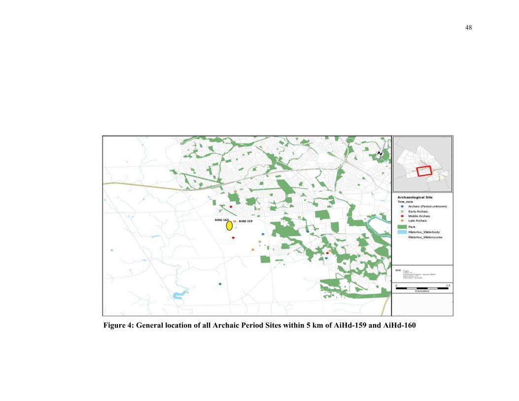
48
Figure 4: General location of all Archaic Period Sites within 5 km of AiHd-159 and AiHd-160

49
Figure 5: General location of all Late Woodland sites within 5 km of AiHd-159 and AiHd-160

50
Grid 2 was located north of Grid 1 and was 60 metres by 65 metres, oriented in grid lines
435 to 495 (north-south) and 220-285 (east-west) and extended across the eastern portion
of surface cluster P41 and its eastern periphery, towards the kettle lake. Grid 3 was
located immediately west of Grid 2 and extended 85 m by 60 m oriented in grid lines 465
to 550 (north-south) and 160 to 220 (east-west) (Figure 10). Girds 2 and 3 were both
collected on July 22, 2014. Overall, the entire gradiometer survey at AiHd-160
encompassed an area of 9000 m2.
The survey conditions were ideal for magnetometer survey. The summer season of 2014
saw more precipitation than normal and thus, allowed for staggering of the survey in
order to ensure that the soil moisture content was most appropriate (Kvamme 2006b).
Soil moisture is a consideration that must be kept in mind during all geophysical surveys
as the amount of moisture within the soil affects its conductivity. As previously
discussed, while magnetometer/gradiometer is a passive technique and not reliant on the
conductivity of soil, an increased or decreased soil moisture content can ‘smear’ the
results and introduce potential error in the data collection (Kvamme 2006b). Given the
nature of the soil (loam to clay loam), the moisture content of the soil was determined
through the ‘feel method’ of pinching a small sample to determine its malleability or
friability.
The geophysical survey was carried out using a GSM-19 Overhauser walking
gradiometer equipped with a differential GPS. The equipment was calibrated prior to the
initiation of each survey and the equipment was set to ‘walking mode’ meaning that it
would take continual readings and that the grid could be walked in a zig-zag pattern
without having to correct the data after the survey was complete. It should be noted that
this functionality is only achievable when the equipment is connected to the GPS,
otherwise it assumes that each survey transect begins at the zero line on the grid.
The GSM-19 Overhauser equipment was selected for this survey for two reasons. First, it
can be connected to a differential GPS with an accuracy of less than 10 centimetres
which allows for faster geo-referencing of the data. Second, it allows for a zig-zag
interval collection methodology, and it also has the capacity for grid surveys in the range

51
of 100 m by 100 m, allowing for fewer separate survey grids across the site, resulting in a
lessening of the amount of edge matching and ‘piecing together’ of the different survey
grids’ data.
All personnel measures were taken to ensure that there would be no interference caused
by the on-going archaeological work on site as follows; the geophysical surveyors were
bereft of any metallic or electronic items on their person and all grid areas were subject to
a metal detector survey at one metre intervals in order to determine if there were any
other sources of interference such as ferrous-rich rocks, modern metals, or any areas of
significant magnetic interference within the study area, as discussed in Chapter 3. During
this survey it was determined that the kettle lake located west of the site, inside the
woodlot but outside our recorded site area, had been subjected to several modern
dumping events, including large metal drums. It was therefore determined to set the
survey grids up at a distance of 25 m from this area in order to avoid these identified
sources of interference. No other sources of interference were identified prior to initiating
the survey.
The sensors on the Overhauser walking magnetometer/gradiometer were set to collect a
reading every 0.5 seconds, and all three grids were surveyed at 0.5 metre transect
intervals. This resulted in approximately four readings per metre squared. All equipment
was set up according to the directions as set out in the accompanying manual (Gem
Systems 2008). The overall preparation and set up work for the geophysical survey
including the field conditions assessment and instrument set up took approximately one
to one and a half hours, with some work such a GPS calibration happening in concert
with other preparatory activities. However, it should be noted that the author has
extensive experience with the Overhauser magnetometer and was able to configure and
calibrate the equipment quickly and competently. Calibration of the sensors was the most
crucial step in preparing the equipment and took approximately half an hour. This was
carried out in tandem with the GPS calibration and condition inspection for the sake of
efficiency. The grid setup was also quickly accomplished and took less than an hour,
although this was due to the access to 100 m measuring tapes and the fact that the
Overhauser magnetometer could process grids of 100 m. It should be noted that some

52
geophysical surveys are carried out on smaller grid sizes (e.g. 20 m by 20 m or 50 m by
50 m), and the setup of each smaller grid would have added some time to the overall
fieldwork.
As previously noted in Chapter 3, there are no standardized methods for conducting
geophysical surveys and survey design and strategy should be based on several factors;
the nature of the archaeological site and the deposits, the attributes of the local geology
and soils and any other environmental factors that may impede or otherwise effect the
outcome of the survey (EH 2008, Gaffney and Gater 2003).
All of these factors were taken into consideration when designing the geophysical survey
strategy for AiHd-160. Given that the site had presented as a series of lithic scatters with
diagnostic artifacts from the Archaic period, it was presumed that any cultural features
encountered would consist mainly of small pits and hearths. However given the extent of
the site, it was recognized that possibly some features associated with
occupation/habitation such as post molds or semi-subterranean houses might be
encountered (Eastaugh et al. 2013; Sassaman 2010). As discussed in Chapter 3,
magnetometer/gradiometer surveys are most effective at detecting such features, as
evidenced at the Davidson site specifically, but also at many other similar sites (Eastaugh
et al. 2013; Jones and Munson 2005; Kellogg 2014; Kvamme 2003). The grid set up and
survey intervals used were consistent with standard practices for geophysical surveys of
pre-contact Indigenous or similar sites in other jurisdictions (EH 2008; Johnson 2006).
The typical features encountered on pre-contact Indigenous sites, specifically ones dating
to the Archaic period, tend to consist of pits and hearths that present as amorphously
shaped cultural features (Ellis et al. 2009a). Hence, magnetometry presents the ideal
method of geophysical survey that can be used to detect these features (EH 2008:14 and
Table 3).
4.1.2 Geophysical Survey Data Processing
Data Processing is the most technically challenging aspect of geophysical survey
(Kvamme 2006c). While there are obstacles and technical challenges that must be
considered and taken into account during the field survey, the data itself cannot be
53
interpreted until it has been processed. The greatest strength of data processing is that,
given the modern capabilities of even the most basic computers, these data can be saved
at each step, different methods can be applied, and the data can be virtually tested in
order to determine its reliability. There are many software packages available that can
carry out all manner of data correction and processing automatically. For the purposes of
this study a more basic and manual approach was taken in order to ensure that the data
integrity remained high and that any inconsistencies encountered in the final interpreted
results were due to the processor/author and not virtual error; that is, any error introduced
into the results was not the result of computer applications but rather the author.
Therefore, this added a significant amount of time to the data processing, which was
carried out over three days from September 8 to 10, 2014 and then processed a second
time from the original data download April 24 and 25, 2017. This second data processing
event was done to check each step of the data processing and compare the results against
the original processing. Finally, it should be noted that, as discussed previously, this
processing was time consuming and there are multiple applications such as ArcGIS,
Geometrics and MagSurvey 3D which are capable of carrying out many of these
corrections and processing tasks at a much faster rate. In most instances, results can be
processed and viewed in a matter of minutes, even in the field, which can be extremely
valuable should significant errors or unforeseen interference cause problems with the
survey. The balance for the CRM industry, as noted in Johnson and Haley (2006) is the
need to balance the cost of a geophysical survey including equipment and software costs,
versus the efficiency and speed of obtaining results in the field.
All gradiometer data was downloaded from the onboard computer onto the author’s
personal computer. GSM systems download all data as standard text (.txt) files, and so all
data was then imported from text file into Microsoft Excel for processing. In total, 35,009
data points were collected from all survey grids. The data was sorted by GPS coordinate
and evaluated for three errors; de-staggering, un-bunching and de-spiking.
De-staggering errors result from differentials in the speed at which the survey is carried
out. The equipment was set up to collect a reading every 0.5 seconds, therefore when the
speed of the survey is slowed then the result will be a ‘staggering’ or duplicate effect on

54
the data. Although most pronounced in linear features, it can create false readings
especially if the equipment is left to continue collecting in a single location for more than
three or more reading intervals (1.5 seconds). As the equipment was set to continually
record and the surveyor required several seconds to align themselves with a new grid
transect there was significant staggering and duplication of readings along these survey
grid edges. This error was further increased by allowing the equipment to ‘rest’ for two
reading cycles at the beginning of each interval path, in order to reduce a second error of
reading bunching. This error factor could have been controlled by setting the equipment
to a different survey setting, which would have involved having the surveyor manually
turn the equipment on and off at the beginning and end of each survey transect. However,
in the personal experience of the author, this procedure often results in some transects
being lost due to human error (i.e., the surveyor forgot to manually control the
equipment). As discussed below, the surveyor is required to pay attention to multiple
aspects of the equipment to ensure functionality, therefore it was determined by the
author that correcting staggering (as well as bunching; see below) errors in the data were
preferable to introducing collection error in the field. The process for eliminating the
introduced staggered errors, or de-staggering the data, was to sort the data set by GPS
coordinate, define each set of duplicates, compare the nt values collected, determine the
mean of the nt values, and replace all duplicates with a single mean value for that
reading. This procedure resulted in the correction of approximately 1500 readings.
Bunching errors can be caused by the rapid alteration of the sensor heading when
carrying out a survey in a zig-zag pattern. These alterations cause a reading error in the
sensors. In order to mitigate this predicted error in the field, the equipment was allowed
to ‘rest’ at each interval beginning for two readings (one second) in order to eliminate it.
Although this process increased the staggering error in the data this error was accounted
for and corrected as discussed above. Un-bunched errors were corrected by eliminating
readings from the same UTM coordinates. This correction was done by sorting the data in
Excel and identifying duplicate X and Y coordinates pairs. All readings with duplicate X
and Y coordinates were deleted, with the exception of the reading that represented the
average nt value for that set of coordinate pairs. Approximately 600 readings were
eliminated due to unbunching.

55
In the GSM-19 equipment, there is a further error similar to un-bunching that results in
minor sensor error: the result of a loose wire or pinching of wires during survey. This
error is identified in the data when it is downloaded by a sensor accuracy reading taken
whenever the sensors take a measurement, and is represented by a percentage value.
GEM-systems advise that anything above 75% in value is reliable data (GEM-systems
2008). However, given the predicted ephemeral nature of the anomalies being surveyed,
only readings with a value of 99% were accepted for this study, resulting in the deletion
of approximately 200 readings.
Finally, the data were subject to de-spiking, which was only carried out once de-
staggering and un-bunching was complete. De-spiking gradiometer data involves
identifying the outliers in the data, which are often not produced by actual anomalies or
features of interest. These readings may represent a minor reading error, such as the
lower sensor accidently making contact with the ground, or a small random metallic
object in the field, which is not contextual (a nail, or small fragment of scrap metal). This
process must be carried out very carefully, as eliminating data readings can impact the
interpretable data. For this study, only readings which lay outside the third standard
deviation of approximately 7000 nt, were excluded from the data. This procedure resulted
in the removal of approximately 80 data readings.
After the data set was corrected, each survey grid was uploaded to Surfer 8 software,
gridded, and mapped into a greyscale contour map. Contouring effects were smoothed,
which had several effects on the data. It allowed for background ‘noise’ and distortion to
be removed from the plotted data, allowing for an easier visual identification of
anomalies. However, the smoothing also caused a blurring of the anomalies, resulting in a
visualized data plot that indicated the presence of an anomaly but may have subtly
distorted areas where several anomalies were located in close proximity to each other.
As the goal of this study was not prospection, such as the identification and interpretation
of intra-site anomalies and features (Eastaugh et al. 2013; Gaffney and Gater 2003;
Kvamme 2003), but rather a survey carried out to detect the presence or absence of any
anomalies, the decrease in overall detail in the plotted data was an acceptable loss against
the identification of anomalies.

56
4.1.3 Archaeological Excavations: AiHd-159 and AiHd-160
As the fieldwork investigations for AiHd-159 and AiHd-160 were being carried out as
part of an archaeological assessment in advance of development, the standardized
approaches for the fieldwork were implemented discussed in Chapter 2 following the
Standards and Guidelines for Consultant Archaeologists (MTCS 2011). As the locations
were in a ploughed field context the approaches consisted of a controlled surface pick-up
of all artifacts across the surface of both sites, followed by the excavation of one metre
square test units across the whole artifact scatter area (or across the 12 recognized scatter
areas within AiHd-160). Test units were excavated in a standardized fashion, with soil
matrices excavated at arbitrary layers through the ploughzone (every 10 cm for this
study) and units excavated five centimeters into sterile subsoil, with all walls and surfaces
troweled and examined for cultural features. All soils are screened in order to collect all
the archaeological unit material. For this study, a screen with a six millimeter aperture
was used.
For AiHd-159, a small lithic scatter with no diagnostic artifacts, the standards require that
a controlled surface pick-up of every artifact on the surface be carried out, followed by
one metre square test units excavated every five metres across the overall artifact scatter
area on an excavation grid. An additional 20% of the total number of these gridded units
is to be excavated in areas of interest across the site. This methodology seeks to carry out
an intensive testing of the site as it is not immediately apparent that further investigation
will be required. Therefore, as much cultural data as possible should be collected at this
stage of the assessment.
For this project the test units were extended for ten metres along each grid line around
AiHd-159 in order to test the peripheral areas of scatter. These units were additional
investigations carried out in excess of the required units under the Standards and
Guidelines for Consultant Archaeologists. As discussed in Chapter 2, there is not a
strong correlation between artifact scatter concentrations and subsurface cultural features
within ploughed field lithic scatter sites in Ontario, as well as elsewhere, and for many
potential reasons. Furthermore, the focus on artifact densities within the standards for

57
field investigations focuses on the artifact as the chief purveyor of cultural data to the
detriment of potentially significant subsurface features that may be present in those less
dense scatter areas. Therefore, a total of 200 test units were excavated across the scatter
area and a 10 m periphery around AiHd-159 (ASI 2015) (Figure 6).
For AiHd-160, it was understood that, given the size of the site and its perceived
complexity it would require complete mitigation, either full excavation or protection from
further impacts, based on the results of the Stage 3 assessment. The methodology for the
Stage 3 assessment would be a controlled surface pick-up of all artifacts across the
surface of the site area, followed by the excavation of one metre square units at ten metre
intervals across the entire site. As AiHd-160 consisted of an amalgamation of twelve
surface scatters, it was determined that the standardized excavation of one test unit every
ten metres, combined with the gradiometer survey, would be sufficient to test the overall
site area, which consists of the surface scatters and the spaces between them. As
illustrated on Figure 2, the ‘site’ area of AiHd-160 consisted of the twelve surface
scatters and additional isolated finds, as well as the spaces between the surface finds. The
site area did not extend outward from the surface scatter limits, in keeping with the
standard practice of defining a site in a CRM context. However, unlike single scatter
sites, this procedure allowed for both the gridded test units and the gradiometer survey to
test the areas within and between the surface scatters. It effectively addressed the
challenges discussed in Chapter 2, specifically the challenges that a site extends beyond
the limits of a surface scatter and that surface scatters are not reliable indicators of
subsurface cultural remains. The gradiometer survey in particular is an effective means of
addressing both these challenges, as discussed in Chapter 3. A total of 451 test unit were
excavated across the site area of AiHd-160 (ASI 2015) (Figure 7).
4.1.4 AiHd-159 Field Investigation Results
A total of 57 lithic artifacts were collected from AiHd-159 during the controlled surface
pick-up with a further 259 artifacts recovered during the test unit excavation, for a total of
316 artifacts (See Appendix B for full catalogue). The artifact assemblage consists of
three projectile points, all found during excavation; one Genesse point, one Adder
Orchard point and one incomplete untyped broad point. All three points date to the Late

58
Archaic Broad point period (4000-3400 RCYBP) (Ellis et al. 2009a: 814). Additional
material recovered from AiHd-159 includes one biface, one core, or core fragment, 11
biface fragments, eight primary thinning flakes, 15 primary reduction flakes, 62
fragments of shatter, 114 flake fragments and 66 secondary knapping flakes (ASI 2015).
Furthermore, two potential subsurface features were encountered within the site
periphery, outside of the overall surface scatter area (Figure 8). Feature 1 was located in
unit 463-203 and consists of an irregularly shaped blackened soil and ash deposit, which
was partially exposed during the excavation of the unit. Feature 2 is located within unit
491-179 and consists of a mottled ash and dark brown sandy clay soil. Feature 2 was also
partially exposed during the excavation of the unit. The test unit yields were very low,
with only one unit yielding ten or more artifacts.
4.1.5 AiHd-160 Surface Collection and Test Unit Results
A total of 1,312 artifacts were collected from the surface of AiHd-160, including 1,271
chipped lithic artifacts, five groundstone artifacts and 36 fauna remains. The artifacts
encountered aligned to the surface clustering encountered during the initial field survey
and did not alter the initial suggestions of the site spatial organization in any way. An
additional 1,962 artifacts were recovered from the 451 test units excavated across the
entirety of AiHd-160, including 1, 721 chipped lithic artifacts, 4 groundstone artifacts,
218 fragments of pottery and 19 faunal artifacts. The overall total number of artifacts
collected from the Stage 3 assessment of AiHd-160 was 3,274. Diagnostic point types
recovered during the Stage 3 assessment include four Nanticoke side-notched points,
dating to the Late Woodland period (600-400 RCYBP), a Levanna point which also dates
to Late Woodland period (1,300-350 RCYBP), an Early Woodland (2,600-2,200
RCYBP) Adena point, and an Innes point and a Crawford Knoll point, both of which date
to the Late Archaic Small Point tradition (3,500-2,900 RCYBP) (ASI 2016). The artifacts
recovered during the Stage 3 surface collection and test unit excavation, notably the
abundant Woodland material, dramatically shift the interpretation of the cultural and
temporal associations of AiHd-160. As discussed earlier, they also show how misleading
single surface collected assemblages can be. Care then, must be taken in understanding
where the artifacts were collected across the site in order to determine whether or not

59
certain surface clusters, or groups of clusters, may be associated with different
components. The Innes Point and Crawford Knoll points were both collected from the
surface of the site within the area of surface cluster P41 (Figure 7).
The Nanticoke points were clustered within the southern portion of the site, with three
points being found on the surface, within the P05-P23-P24 cluster area, and another point
coming from unit 400-240, located in the same portion of the site (Figure 7). The Adena
point and Levanna point were both recovered from the western extent of the site with the
Adena point coming from the surface west of P39 and the Levanna point collected from
unit 460-210 (Figure 7). Other lithics recovered from the site include 48 bifaces and
biface fragments, seven cores, and five scrapers. Debitage, ranging from primary
reduction flakes, through primary and secondary knapping flakes and trimming and
retouch flakes were all found in abundance within the assemblage.
The pottery recovered from AiHd-160 was recovered entirely from the test unit
excavation, and was predominately clustered towards the southern end of the site, with
171 artifacts (78% of the overall pottery assemblage) originating south of the 400 north-
south grid line, within the P05-P23-P24 surface cluster area. Identified ceramic types
within the assemblage include Huron Incised, Pound Necked, Lawson Opposed and
Ontario Horizontal indicating an association with the Middle-Late Ontario Iroquoian
phase (750-500 RCYBP); 88% (n=192) of the ceramic assemblage consisted of
unanalyzable sherds (ASI 2016).
The groundstone artifacts recovered from AiHd-160 consisted primarily of axes, adzes
and celt fragments made of chloride schist. Of note was a single steatite bead, which was
encountered in the P27 scatter, located centrally within the overall site. Finally, the faunal
remains consisted of a mix of wild and domesticated animals, including horse, deer, dog
and smaller animals such as turtle, squirrel and chipmunk. Given the presence of
domesticated animal remains, the faunal assemblage is indicative of the continued use of
the site area well into the 19th and 20th centuries.

60
Figure 6: Stage 3 Field Investigations at AiHd-159
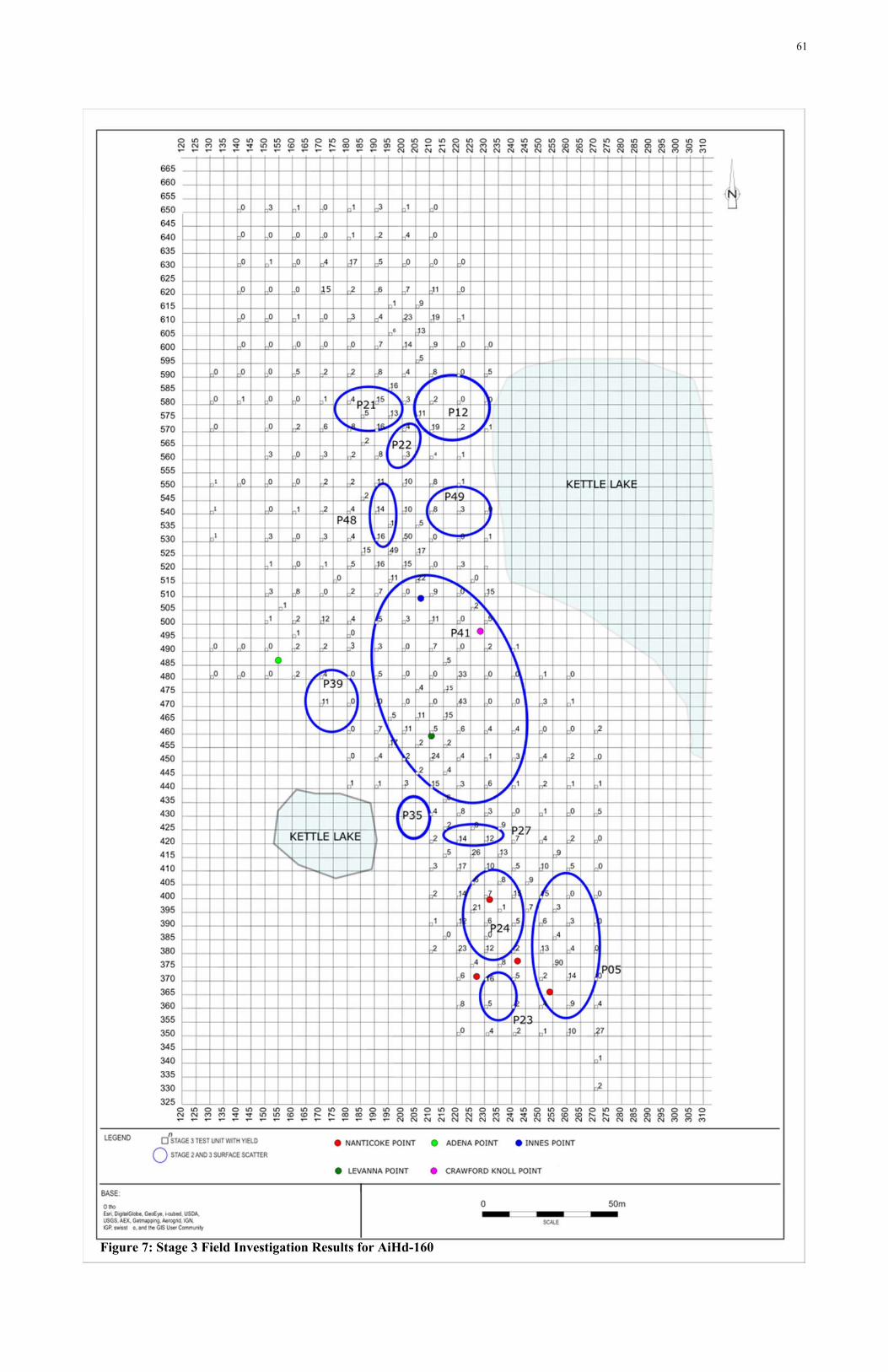
61
Figure 7: Stage 3 Field Investigation Results for AiHd-160

62
Units with high yields were determined using the standards pertaining to the
archaeological assessment process for lithic scatters, with units yielding ten or more
artifacts considered high. 42 units or approximately 10% of the units excavated across
AiHd-160, yielded artifact counts of 10 or greater. The diffuse nature of the artifact
concentrations is most likely the result of the continued ploughing of the site as opposed
to these yields being a reliable indicator of areas of archaeological interest. This is
noteworthy as illustrated in Figure 9, where there are areas of high artifact-yielding units
outside the surface scatter areas, specifically between P48 and P41, and north of the P12,
P21-P22 scatter area.
Table 4: Cultural Features Encountered at AiHd-160
Unit Description Exposure 590-200 Very dark gray loam 32 cm x 29 cm 575-205 Black and dark reddish-gray silty loam with
charcoal inclusions Incomplete exposure
570-200 Very dark grayish-brown silty loam Incomplete exposure 570-210 Yellowish brown sandy loam with ash Incomplete exposure 535-195 Very dark brown and black sandy loam Incomplete exposure 530-180 Dark brown silty loam with gray sand Incomplete exposure 525-205 Black sandy loam with dark reddish
compact silty loam Incomplete exposure
520-200 Very dark brown silty loam Incomplete exposure 520-210 Black sandy loam Incomplete exposure 510-180 Very dark brown sandy loam with grey sand Incomplete exposure 510-190 Very dark brown and grey loam with
reddish silty loam Incomplete exposure
480-220 Dark brown silty sand and black sandy loam with charcoal
Incomplete exposure
475-205 Black silt with heavy charcoal inclusions Incomplete exposure 475-215 Dark brown and gray silty loam with
charcoal inclusions Incomplete exposure
465-205 Dark brown silty loam with charcoal inclusions
Incomplete exposure
460-200 Dark brown silty loam Incomplete exposure 455-195 Black and very dark brown silty loam Incomplete exposure 450-260 Yellowish-brown silty sandy soil with
charcoal Incomplete exposure
410-220 Dark brown silty loam mottled with ash Incomplete exposure 380-220 Very dark brown loam mottled with black
sandy loam and ash Incomplete exposure
380-230 Yellowish-brown sand with ash Incomplete exposure 350-270 Light brownish-gray sand mottled with
charcoal 18 cm by 14 cm

63
Figure 8: Cultural Features Encountered at AiHd-159

64
Figure 9: Field Investigation Results and Location of Cultural Features, AiHd-160

65
4.1.6 AiHd-160 Geophysical Survey Results
The Gradiometer survey detected a total of 63 visually identified anomalies of varying
size and magnitude (Figure 10). As previously mentioned, the plotted gradiometer data
was smoothed during the analysis and so each anomaly does not represent a single
subsurface feature but may suggest a cluster or many small or tightly grouped subsurface
features. Therefore, a direct correlation cannot be made between the presence of an
anomaly and the presence of a subsurface feature and if these are cultural in origin or not.
Ground-truthing is a requirement of all geophysical surveys (Hargrave 2006), as an
anomaly represents simply a difference in the magnetic signature of these deposits. There
are natural phenomena and characteristics that may create false positives (rocks, tree
throws, root systems, changes in soil characteristics). Therefore, ground-truthing at least
a portion of all anomalies is crucial in understanding the success and accuracy of any
geophysical survey.
In order to test the results of the survey, the plotted geophysical data were compared to
the test unit excavation in order to determine if there was a correlation between some or
all of the anomalies and the exposed cultural features identified in the preceding section
(Figure 11). The ground-truthing of the geophysical survey results was carried out ‘blind’
from the test unit excavation, in that the presence or absence of anomalies did not affect
the placement of test units. Although this procedure resulted in a limited positive ground-
truthing correlation between identified cultural features in test units and identified
anomalies, it also presented a thorough testing of the areas free of anomalies. This
strategy provided a critical way of testing the efficacy of the geophysical survey.
Notably, every cultural feature identified in a test unit that was located within a
geophysical survey grid, was correlated to an identified anomaly. This matching strongly
indicates not only that the technique works in identifying subsoil features but also shows
that the procedures involved in processing the geophysical data used herein have
produced meaningful results (Figure 11).
Overall, the correlated results between the test unit excavation and geophysical survey
shows an overlap of 43 units located within the same location as an identified
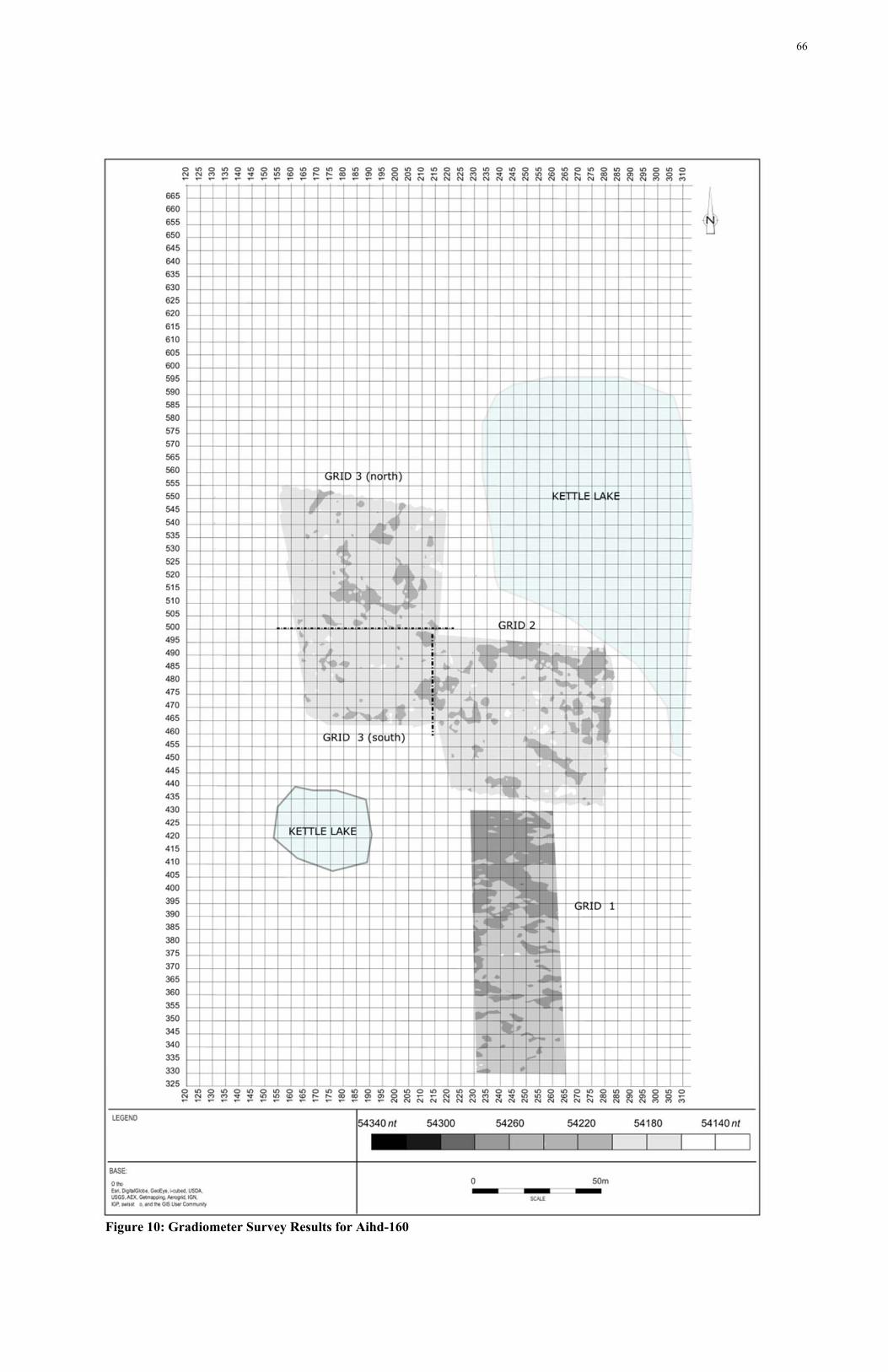
66
Figure 10: Gradiometer Survey Results for Aihd-160

67
.
Figure 11: Gradiometer Survey Results and Archaeological Excavation Results, AiHd-160

68
anomaly (Figure 11). Of those 43 units, ten units were found to correlate with cultural
features, one unit correlated to modern infrastructure, and nine units correlated to a
change in soil composition. These results are further discussed below. The remaining 23
units which correlated with anomalies did not result in the identification of any observed
subsurface deposits, which would readily indicate the presence of a feature, cultural or
natural. These anomalies then are considered false-positives. As noted above, false-
positives are common challenges related to geophysical survey and can be created in
several ways. They may represent cultural features which have been obliterated through
ploughing, or may represent areas of activity for which no tangible feature is left in the
soil. Both such instances are documented by Kvamme (2003) in his interpretation of open
spaces and plazas and in Dunlop et al. (2012) where the ‘living floor’ of a Late Woodland
longhouse was identified in the magnetometer data but was not visually or physically
identified during the excavation of the longhouse interior. These false-positives may also
represent natural occurrences, remnant tree root systems or geological features, such as
ferrous-rich rocks (Hargraves 2006). The probability of such geology within a moraine
further increases the chances of having a varied geology within the soil matrix. It is also
possible that given the ground-truthing through restricted test units that some remnant
subsoil anomalies were missed – at the Davidson Archaic site discussed earlier,
successful ground-truthing of anomalies required opening several adjacent one metre
units (see Ellis et al. 2016). Finally, the manner with which the data was processed, as
previously discussed, did contribute to the smearing of results. Although anticipated, this
may have over exaggerated the size and orientation of some of the stronger anomalies.
The detected anomalies are located across the entirety of the three geophysical survey
grids and are described in four areas related to the survey grids: Grid 1, Grid 2, Grid 3
north and Grid 3 south (Figures 10 and 11).
The anomalies in Grid 1 are dominated by a large, strong anomaly across the northern
portion of the grid. This anomaly is one of two which were ground-truthed to confirm
that, based on its size and shape, it was unlikely to be a cultural feature. This anomaly
instead aligned with an area of deep clay deposits, which were encountered and noted in
nine units; 420-230, 420-240, 420-250, 410-240 410-255, 410-260, 400-250, 395-235

69
Plate 1: Depth of Deep Clay deposit encountered at AiHd-160
and 390-250 (Plate 1). These units are located inside this anomaly and were found to
consist of a clay soil with a depth of 82 and 91 cm, respectively.
Surrounding units
featured shallower
deposits more in keeping
with standard topsoil
depths (30-50 cm) but
all units excavated
within this anomaly
featured a much higher
clay content
(approximately 90%)
than the balance of the
site. The clay deposit was
noted as extending from
approximately the 430 E-W line down to the 385 E-W line. Only one anomaly detected in
Grid 1 aligned with a detected subsurface archaeological feature encountered during the
test unit excavation, unit 380-230 (Figure 12). Another nine units are located within
proximity or within the area of an anomaly, excluding those encountered within the clay
deposit anomaly.
There were two distinct patterns observed in the anomalies detected in Grid 2 (Figure
10). There is a large grouping of anomalies in a semi-circular pattern extending from grid
point 490-230 to 460-280, and another grouping which begins at a cluster of anomalies at
grid point at 470-215 and extends south east, ending at 435-230. The first, semi-circular
grouping tends to conform to the site’s topography around the bend, at the top of bank
down to the adjacent kettle lake.
This portion of the site was not subject to any excavated “in-fill” units and so only three
test units were excavated in proximity to these features. None of these units detected any
cultural features; however the units are located on the edges of the plotted anomalies and

70
Plate 2: Limestone drain encountered in unit 550-170
may have missed their edges. The second grouping of anomalies in Grid 2 features five
anomalies over which test units were excavated. Two of these anomalies have been
positively identified through test unit excavation, with cultural features reported in units
480-220, 475-215 and 450-260 (Figure 11). These three units are all located well inside
the anomalies, indicating that while the geophysical data corresponds positively to a
cultural feature, the cultural feature may have been impacted and spread from years of
ploughing, or it may be the result of the smoothing of the geophysical data. This result
may indicate that other units excavated near the edges of anomalies may not be indicators
of false positive anomalies but may instead be misaligned from the actual location of the
cultural features indicated by the identified anomalies, a problem noted in other studies
(e.g. Ellis et al. 2016).
Grid 3 is divided into Grid 3 north and Grid 3 south by grid line 500 (Figure 10). Grid 3
south has the lowest concentration of anomalies, as they are all fairly small and grouped
around the exterior 15 m of survey area. Only three anomalies were located within the
vicinity of excavated test units. Two of these anomalies correlate with encountered
cultural features (475-205 and 465-205) with the other unit is located only on the edge of
the plotted anomaly.
Grid 3 north features
three large concentrations
of anomalies with other,
smaller anomalies
scattered throughout.
None of the smaller
anomalies were correlated
with the excavated test
units, and the three larger
anomalies and grouping
of anomalies were all
identified in test units.

71
The large linear anomaly in the northwest corner of the survey grid was found to consist
of a remnant limestone drain, in unit 550-170 (Plate 2). Such a large feature would be
expected to be historic and it reinforces the idea that the magnetometer survey can detect
areas that may have been significantly disturbed by more modern use and limit the areas
requiring excavation mitigation. The other two large anomalies corresponded with
cultural features identified (unit 535-195 and units 520-200, 510-180 and 510-190).
The fieldwork carried out for this study and the overall archaeological assessment of the
development property comprised the archaeological testing of AiHd-159 and AiHd-160
and the geophysical survey of portions of AiHd-160. This work resulted in the collection
of several thousand artifacts, dating from the Late Archaic through to the Late Woodland
period, as well as the documentation of multiple cultural features at each site. Based on
the sampling results of correlating encountered cultural features in test units with
geophysical anomalies, there is a confirmed direct and positive correlation between the
anomalies and the cultural features.
Finally, there is a small cluster of anomalies located in the southernmost portion of Grid
1, where the test unit excavation did not extend. These anomalies, bordered by grid lines
345 to the north and 230 and 255 to the east and west, are similar in orientation and
amplitude to those of documented Late Woodland longhouses (Dunlop et al 2012,
Kellogg 2014). No ground truthing had been carried out within this portion of the site,
however the concentrated presence of Late Woodland material in the ploughzone within
proximity to these features is indicative of a potentially significant Late Woodland
occupation area.
4.2 Interpreting AiHd-159 and AiHd-160
The archaeological investigations at AiHd-159 and AiHd-160 have produced a
substantial data set. While data are limited because the field project was not allowed to go
to its completion during the author’s participation, here I summarize some archaeological
conclusions that can be generated.

72
AiHd-159 is a single component, Late Archaic Broad Point site, located on the edge of
the Waterloo Moraine, adjacent to a kettle lake. AiHd-159 is one of four Late Archaic
sites within the region (Figure 4). However, it is the only Late Archaic site with a Broad
Point component, making it somewhat unique within the landscape. The site’s position is
unique in that artifacts dating to almost every other cultural affiliation of Ontario’s pre-
contact Indigenous occupation was encountered on the nearby AiHd-160, save for Broad
Point artifacts. They remain separated spatially from the rest of the documented pre-
contact occupations along the ridgeline landscape. This result is perhaps not surprising
because previous work on Broad Point sites shows they stand out as unusual within the
southern Ontario Late Archaic record. Besides the use of overly large bifaces, often on
coarser-grained rocks little used by other groups, and the fact they have stylistic ties to
the east/southeast rather than the western Great Lakes/Midwest, the unusually large size
of some components such as the 1.9 ha Davidson site is also notable (Ellis et al. 2014a,
2014b). These differences suggest very different histories and land use patterns by Broad
Point producing peoples versus those of other recognized Late Archaic peoples.
The AiHd-159 site consists of a fairly small collection of artifacts with low unit yield
across the site. If not for the additional units placed around the ten metre extent of the
surface scatter limits, it is notable that the two cultural features encountered within the
site would have remained undetected. The detection of these features though, was an
intensive investigation; an additional 70 units were excavated at AiHd-159 within the 10
m buffer around the observed surface scatter area and involved a greater number of test
units beyond the required amount of excavation. This level of effort should be considered
in terms of the return for that effort; although the two cultural features contain the
potential of further archaeological data, they may also prove to yield little more than a
larger artifact assemblage, resulting in a low return on the effort of examining the area
surrounding the surface scatter. However, it is entirely possible that they could have been
detected by a prior gradiometer survey, hence obviating the need for such an extensive
test pitting to locate them initially.
The cultural features are located closer to the kettle lake, away from the rest of the site.
As the features were not fully excavated as part of this study, their context within the site

73
is still unclear. However, the presence of the features, be they pits, hearths or remnants of
occupation areas, indicate that the site, despite the ethereal nature of the surface scatter,
represents a more complex range of activities than simple tool production. Storage, or
short-term habitation would have taken place at the site- activities which should not have
been observed based solely on the debitage surface scatter first documented.
Tool manufacture and knapping events occurred further away from the features. This
strategy may have been done to keep detritus from tool manufacture away from other
activity areas, or it may have been a result of multiple activities such as skinning,
butchering, cooking and so forth taking place simultaneously within the landscape. The
artifact assemblage from AiHd-159 contained a core, and core fragments, as well as a
considerable number of primary reduction flakes (4.4% of the overall assemblage).
This evidence suggests that cobbles of chert were being reduced at this site. Other
debitage categories, including primary and secondary knapping flakes, and secondary
retouch flakes, are further indicative of tool production taking place at the site. Cowan
(1999) suggests that Late Archaic technologies and site assemblages were highly
influenced by the mobility of the occupants; artifact assemblages such as those found at
AiHd-159 are more indicative of interior, or inland, residential camps (Cowan 1999:
597). Tools specific to resource procurement; points, scrapers and such, tend to be
manufactured on sites that feature a more logistical and procurement emphasis. Biface
manufacture and the relatively low number of points recovered is further evidence that
the site had a more residential, rather than hunting or gathering, focus.
Malleau (2015) and Ellis et al. (1990) note that most, but perhaps not all, groups of Late
Archaic peoples tended to aggregate in the spring-summer months in littoral zones, along
major waterways and lakes, breaking apart into smaller, band sized groups and moving
in-land for the fall and winter. AiHd-159, located as it is on top of a moraine, some
distance from the preferred littoral zones, may reflect this model and may represent a
smaller, inland, autumn-winter band camp, although the location of the site, on the edge
of a moraine, leaves the residents somewhat exposed to the harsher, winter elements.

74
Figure 12: Geophysical Anomalies and Cultural Features in Grids 1 and 2, AiHd-160
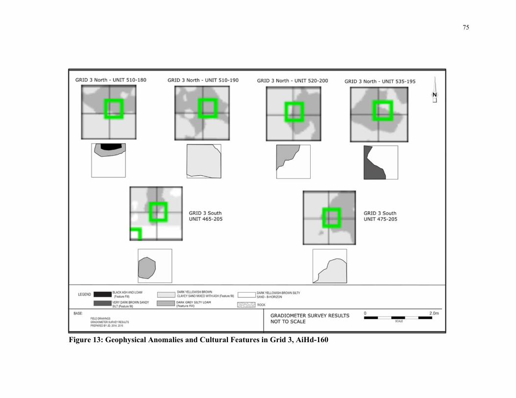
75
Figure 13: Geophysical Anomalies and Cultural Features in Grid 3, AiHd-160

76
Wind breaks, and other such landscape modifications may have been employed to
provide shelter.
The positioning of the features towards the kettle lake is also an indicator that there was a
residential aspect to this site. During archaeological investigations at another Indigenous
site outside of Brantford, Ontario, the author was engaged in a discussion with
representatives of the Six Nations of the Grand River on the orientation of a residential
feature, which faced a creek in very close proximity. It was noted by the Indigenous
peoples that there has been a tradition of winter residences always facing and closer to
the water, as it meant the shortest distance to travel for that resource. Houses facing the
water have been observed within the archaeological record in Ontario, notably at the
Davidson Site (Ellis et al. 2015) and the Davisville 2 Site (Horsfall and Warrick 2003).
This knowledge was considered during the interpretation of AiHd-159, as it suggests that
the lithic debitage, located away from the features and the kettle lake, may indicate tool
production took place away from the residential part of the site.
By understanding the challenges discussed in Chapter 2, that a single pass detected
surface lithic scatter may not be representative of a larger site and that scatter locations
are not representative of all activities that could have taken place within a site, further
data were obtained from AiHd-159. Although it remains unclear as to why the Late
Archaic Broad Point-making peoples chose to camp on the opposing side of the kettle
lake than almost everyone else, their presence has been identified, investigated, a more
detailed interpretation of their site has been achieved.
The field investigations and geophysical survey carried out at AiHd-160 yielded a
substantial amount of archaeological data, significantly altering the previous
interpretations of the site, its scatters and its place within the archaeological record.
First, the presence of Late Woodland artifacts, not encountered during the preliminary
(Stage 2) surface collection and only minimally encountered during the second survey
collection, widen the temporal use of the site, and broaden its cultural significance. With
the exception of several isolated points encountered during the second surface collection,

77
the majority of the Late Woodland artifacts were found within the southernmost surface
cluster, which corresponds to approximately one-third of the overall site. The pottery
recovered from this area has been interpreted as dating to the Middle and Late Iroquoian
period (Ferris and Spence 1995; MacNeish 1952). When considered within a larger
regional perspective, there are multiple sites located within the area, which temporally
match the Late Woodland component of AiHd-160 (Figure 5). There are several
significant settlements along Strasburg Creek, 1.5 kilometers east of the ridgeline that
date to the same period, indicating that the Late Woodland component of AiHd-160 may
be a smaller cabin or settlement on the periphery of these larger settlements (Birch and
Williamson 2012). The unit yields and geophysical survey results also indicate that the
site extends further south, into the adjacent agricultural fields that were not included
within the original development property. As previously noted, there is a series of
unexcavated anomalies which are oriented in a manner very similar to finds related to
longhouses on other Late Woodland sites. These anomalies, in relation to the artifacts,
indicate that there is a significant Late Woodland occupation within the southern confines
of AiHd-160.
The northern two-thirds of AiHd-160 retain a predominantly Archaic period use, based
on the artifacts recovered from the field investigations. The artifact assemblage for this
portion of the site is not as informative as that of AiHd-159, given the multi-component
nature of the site. Parsing the Late Woodland, potential Early and Middle Woodland and
Archaic components from each other within the ploughzone is not a realistic endeavor,
given the amount of mixing these soils may have undergone over the past two centuries.
Regardless, several observations regarding the nature of the lithic assemblage can be
made, as it speaks directly to the activities taking place within AiHd-160. As with AiHd-
159, the lithic assemblage is indicative of tool manufacture and repair, as well as biface
production, indicating a more residential focus to the site.
The presence of a substantial number of subsurface features extending across the entirety
of AiHd-160 is a further indication of the residential nature of the site. The test unit
excavation across the site identified 22 cultural features, although the results of the
geophysical survey indicate the potential for many more, upwards of 50 or so. The

78
excavation of these features will provide further context as to the activities taking place
within the site and their detection again provides a mean to assess and estimate better the
amount of work (and costs!) that would be needed to significantly mitigate the location.
The low spatial correlation between the surface artifact clusters and the subsurface
cultural features identified through test unit excavation corresponds to the findings
previously reported at AiHd-159 and sites elsewhere regarding the questionable
relationship between surface scatters/densities and subsurface features. Only eight of the
22 units featuring subsurface cultural features are located within the surface scatter
clusters.
The geophysical survey of portions of AiHd-160 further enhances the understanding of
the surface scatter and subsurface features. The gradiometer survey revealed a significant
number of anomalies (n=63). The correlation of cultural features encountered within test
units and these anomalies as revealed by ground-truthing, indicates a positive result for
the survey. This result means that the anomalies detected during the survey can generally
be considered to relate to subsurface cultural features as was also suggested at the
Davidson site (Eastaugh et al. 2013; Ellis 2015; Ellis et al. 2016), although it must be
cautioned that, large, inconsistent and abnormally strong anomalies, such as the limestone
drain and the clay deposit, were also detected during the survey. Identifying them through
ground-truthing was a crucial step in order to interpret the results of the gradiometer
survey as a whole but as stressed, it shows such survey results can also potentially help
determine in advance mitigation strategies by identifying and avoiding disturbed areas.
The plotted geophysical anomalies are located across all three survey grids. Their
relationship with the surface scatter offers further insights as to the overall correlation
between subsurface features and surface scatters. Their positioning verifies that some
features are located within, or within close proximity to, surface artifact scatters, but there
are a substantial number, approximately 50%, that are located outside the scatter limits
and a significant distance (beyond five metres) from these scatters. This distance is a
significant one; as noted at AiHd-159, the features were encountered at approximately the
same distance from the surface scatter. As Stage 3 assessment utilize a sampling interval
of five metres for the placement of test units, and expansion of the test unit excavation by

79
a single interval beyond the surface scatter may result in the further identification of
cultural features associated with the surface scatters. The anomalies encountered within
Grid 1, with the exception of the large, non-cultural, clay deposit, are rather small and fit
the patterning encountered on geophysical surveys of other Late Woodland sites (Kellogg
2014), whereas the anomalies encountered within Grids 2 and 3 are indicative of either
larger features or, as is evidenced by the exposed portions of cultural features
encountered in the test units, a series of moderate and smaller features grouped together
(e.g., a feature cluster, examples of which are common on Archaic sites (see Eastaugh et
al. 2014; Williamson and MacDonald 1997). Of particular note is the grouping of
anomalies extending in the semi-circular pattern in Grid 2, which follow the general
shape of the adjacent kettle lake. These anomalies were located well away from any
surface scatters but are some of the more extensive anomalies detected. There is most
likely a relationship between the lack of surface finds within this portion of the site and
the topography that slopes down into the kettle lake rather steeply. As a result many
surface finds may have been lost to erosion over time – yet another factor that can make
surface find distributions unreliable in detecting subsurface archaeological evidence.
However, the significant concentration of anomalies, or good candidates for features, that
are all facing/closer to the kettle lakes, speaks to a similar site organization as noted in
AiHd-159. Artifact scatters are located behind the features, indicating some spatial
organization to the activities taking place within this site.
Finally, it should be noted that the geophysical results, test unit yields and surface scatters
all seem to indicate that there are three foci within the overall site area: a northern focus
including the northernmost part of gradiometer Grid 3 north and surface clusters P12,
P21, P22, P48 and P49; a central focus around P41 and P39 and gradiometer Grid 2 and
Grid 3 south; and a southern, Late Woodland focus, around surface cluster P05, P23 and
P24. These three foci each feature significant artifact yields and geophysical anomalies
which, on their own, could each be classified as an archaeological site in the traditional
sense as a discrete locus with evidence of past human activity. Regardless, the overall
area of AiHd-160 was a persistent place for pre-contact Indigenous people for millennia,
with, based on current evidence, the notable exception of people of the Broad Point Late
Archaic tradition.
80
Chapter 5
5 Conclusions
Based on the results of the gradiometer survey of the one “site” examined herein, such
surveys are, when applied appropriately, an effective means of addressing the challenges
faced by CRM archaeologists in addressing lithic scatter finds. As noted in Chapter 4, the
results of the geophysical survey demonstrate that AiHd-160 extends beyond the surface
scatters and beyond the high yielding test units that are typically used as determinants of
site boundaries within a standard CRM practice.
Geophysical survey acts in a complementary fashion to more standardized approaches
involving the collection and interpretation of archaeological data. If, for example, the
number of anomalies detected at AiHd-160 were low then the site could have been
interpreted as more of a hunting ground or of a place of very short occupation but very
frequent activity, akin to the open spaces and plazas encountered in larger and later sites
(Kvamme 2003; Venter et al. 2006) and the estimates of how much mitigation work
would be required would be reduced. However, the presence of anomalies assisted the
interpretation of the sites as presented and suggests that this site may require much more
work before it can be written off. Such a perspective has been confirmed by more recent
excavation work at the site in the fall of 2017 by ASI, which has determined that there is
a significant Late Woodland occupation within the southern area of the site related to the
identified longhouse anomaly discussed in Chapter 4 (ASI, personal communication,
November 16, 2017). Although the fieldwork related to this more recent excavation is
still under analysis, these results further support the critical review of single-pass surveys
as discussed in Chapter 2, as the initial surface survey of AiHd-160 did not yield any Late
Woodland finds.
This thesis has clearly demonstrated that lithic scatters are representative of
archaeological sites but are not archaeological sites in and of themselves. Although there
are certainly scatters that are representative of smaller and less intensive activity or

81
occupation then AiHd-159 and AiHd-160, it is clear that surface scatters should always
be used as indicators of archaeology, rather than archaeological sites in and of
themselves.
This thesis has also demonstrated that geophysical survey is a reliable means of obtaining
site structure data on archaeological sites and determining the presence and location of
potentially significant sub-ploughzone features. Carrying out a geophysical survey within
and beyond the surface scatter limits is a demonstrably effective methodology of gaining
further understanding as to the relationship between surface scatters and underlying
cultural deposits. As discussed, earlier, some sites that normally would have been written
off because of low yields have, upon more extensive investigations than those required by
current CRM standards, proven to yield significant archaeological information. These
notably include rarely reported Archaic features such as at the Innes (Lennox 1986) and
Mt. Albert (Forsythe 2016) sites. However, gradiometer survey after the initial surface
collection probably would have revealed the presence of the radiocarbon datable features
at Innes or the large complex subsurface cultural feature cluster at Mt. Albert. It may
even have revealed anomalies/potential features beyond the areas investigated at the
Innes site, focused as that project was on the area of denser lithic finds. In turn, simple
targeted testing of the anomalies would indicate a need, even a mandate, for additional
fieldwork. The survey results from AiHd-160 indicate that by testing the margins of a
lithic scatter through geophysical survey, more and better data can be collected on such
sites.
It should also be kept in mind that, despite the potential for geophysical activities in
general and specifically magnetometer/gradiometer surveys, there are obstacles and
sources of interference which must be kept in mind while planning such surveys. As
discussed in Chapter 3, magnetometer surveys are hindered by the geology of any
particular study area. In the case of this thesis the soils consisted of a glacial till which
potentially contained high-ferrous content rocks randomly mixed into the soil matrix.
Areas dominated by igneous rock, such as the Canadian Shield, would mask any
anomalies representing cultural features and so magnetometry surveys in these areas are
not appropriate for archaeological investigations.

82
When the AiHd-160 results are compared to the number of units excavated at AiHd-159
to recover a similar amount of archaeological data, the efficacy of geophysical survey for
this type of investigation is immediately apparent. The results of such surveys reported
elsewhere (Eastaugh et al. 2013; Jones and Munson 2005; Kvamme 2003) and as
discussed and illustrated in this study, demonstrates the strength of this investigative
technique. The relationship between CRM archaeology and lithic scatters is symbiotic.
Lithic scatters, by their nature, do not seemingly hold enough archaeological data to be of
interest to academic or avocational archaeologists. The relative cost to equipment and
applications versus the overall speed at which a surface scatter could undergo
geophysical survey demonstrates the efficiency of these processes. As discussed in
Chapter 4, the author took opted to conduct the geophysical survey and data processing
work in a high-labour manner, opting to do several tasks manually as opposed to
allowing computer applications to carry out these functions in much less time. Even at
this high-labour pace, the pace at which results, the identification of subsurface cultural
features, were obtained through geophysical survey at AiHd-160 was much faster than
through standardized testing methods at AiHd-159. However, the required rapid
determinations of cultural heritage value and interest for these sites are highly reliant on
these easy to measure characteristics of the sites.
The work carried out at AiHd-159 also demonstrates the need to continually consider
what lies beyond the limit of the surface scatter and the need for archaeologists to think
critically about the context in which sites are found and the boundaries that are placed on
them. Although the results of AiHd-160 demonstrate that geophysical survey is a much
preferred methodology for investigation of these sites these techniques are still slow in
their widespread adoption in Ontario. As such, archaeologists are encouraged to consider
expanding the standardized techniques to test the boundaries of lithic scatters. As noted in
Chapter 4, both features at AiHd-159 were found within five metres of the surface scatter
limits, indicating that a minimal and easily standardized practice of expanding gridded
test units for one standard interval beyond the surface scatter limits may results in the
documentation of previously undetected cultural deposits. The cautionary tale of the
Ontario Archaic sites mentioned above suggest that quantifiable characteristics such as
lithic artifact frequency and density are not significant indicators of a sites’ cultural

83
heritage value or interest and that alternate factors may contribute to the archaeological
significance of these sites.
This thesis sought critically examine the manner in which lithic scatters are examined in a
CRM archaeological context. As a result of the positive outcomes there are several steps
for future considerations and excavations:
Lithic scatters are not merely geographic markers of past human activity on the
landscape but are a single representation of this past activity. As such, they
should not be considered archaeological sites in and of themselves, but should be
considered aspects, or part, of a site;
Pre-contact indigenous sites are suitable candidates for successful geophysical
surveys in Ontario. Despite the physical and chemical limitations present in some
field conditions these methodologies should be considered as effective and
efficient;
The use of geophysical survey in CRM archaeology can greatly assist the
planning of site excavation and is a rapid and cost-effective means of obtaining
reliable information about archaeological site; and
Caution must be exercised by CRM archaeologists when considering the
archaeological value of a surface scatter based on a single-pass survey. Where
possible, an abundance of information, such as multiple surveys or additional
investigations, should be obtained prior to determining the value and interest of
such sites.
Furthermore, the continuation of the work set out in this thesis should be as follows:
An increased range of lithic scatters, varying in both area and density, should
undergo similar geophysical and peripheral testing to understand the relationship
between surface scatters and archaeological sites; and

84
The results of any further studies should be used by the CRM industry to further
refine their methods for determining archaeological value and interest in sites
represented by surface lithic scatters.

85
References Cited
Aitken, M. J., 1958 Magnetic prospecting. I. The Water Newton survey. Archaeometry 1:24–
6.
Arias, P., Cubas, M., Fano, M., Jordá Pardo, J., Salzmann, C., Teichner, F., & Teira, L. 2015 Where are the ‘Asturian’ dwellings? An integrated survey programme on
the Mesolithic of northern Spain. Antiquity, 89(346), 783-799 Archaeological Services Inc. (ASI)
1989 An Archaeological Resource Assessment of the Kite Site (AiHb-62), Subdivision Plan 30T-88048, City of Cambridge, Regional Municipality of Waterloo. Unpublished license report on file at MTCS, Toronto.
1992 An Archaeological Assessment of Part of Lot 21, Concession 8 (Township
of Barton) Wentworth County, City of Hamilton, Ontario. Final Report on the Salvage Excavation of the Tanjo Site (AhGx-97). Unpublished license report on file at MTCS, Toronto.
1999 Stage 3 and 4 Investigations of the Ballantrae Site (BaGt-19), Lot 22,
Concession 8, Town of Whitchurch-Stouffville, Regional Municipality of York. Unpublished license report on file at MTCS, Toronto.
2000 Stage 4 Archaeological Salvage Excavation of the Deer Ridge Site (AiHc-
194), Deer Ridge Estates, Pioneer Tower West, City of Kitchener, Regional Municipality of Waterloo, Ontario. Unpublished license report on file at MTCS, Toronto.
2004 Stage 3& 4 Investigation of Plan of Subdivision 30T-88052, City of
Cambridge, Regional Municipality of Waterloo, Volume 1: Precontact Indigenous Sites. Unpublished license report on file at MTCS, Toronto.
2006 Stage 3 and 4 Archaeological Excavation of the Big Rock Site (AlGu-58),
Senang Property, Part of Lot 20, Concession 2, (Block 11, OPA 400), City of Vaughan, Regional Municipality of York. Unpublished license report on file at MTCS, Toronto.
2008 Stage 4 Archaeological Excavations of the Ransom Jay Site (AhGs-22),
Part of the Niagara Garrison Reserve, Town of Niagara-on-the-Lake, Regional Municipality of Niagara, Ontario. Unpublished license report on file at MTCS, Toronto.
2009 Stage 3& 4 Archaeological Investigation of the Chedmac Site (AhGx-
397), Part of Lot 56, Concession 2, Geographic Township of Ancaster,
86
Wentworth County, Now the City of Hamilton. Unpublished license report on file at MTCS, Toronto.
2010a Stage 2 Archaeological Resource Assessment of the Fort York Visitors
Centre (AjGu-28). Unpublished license report in file at MTCS, Toronto. 2010b Stage 4 Archaeological Excavation of Sites AgHb-278 and AgHb-280,
Draft Plan of Subdivision 29T-06504, Part of the Joseph Thomas Grant Tract, Geographic Township of Brantford East, City of Brantford. Unpublished license report on file at MTCS, Toronto.
2011 Stage 4 Salvage Excavations of Sites AhGv-36, AhGv-37, AhGv-39,
AhGv-41, and AhGv-42, 235-41 Main Street East, Town of Grimsby, Regional Municipality of Niagara, Ontario. Unpublished license report on file at MTCS, Toronto.
2012a Stage 4 Excavation- Site AbHm-19 (P2), Erieau-Blenheim Wind Project,
Lot 8, Concession IV, (Formerly Harwich Township, Kent County), Municipality of Chatham-Kent, Ontario. Unpublished license report on file at MTCS, Toronto.
2012b Stage 4 Excavation- Site AbHm-21 (P4), Erieau-Blenheim Wind Project,
Lot 3, Concession II, (Formerly Harwich Township, Kent County), Municipality of Chatham-Kent, Ontario. Unpublished license report on file at MTCS, Toronto.
2012c Stage 4 Excavation- Site AbHm-23 (P7), Erieau-Blenheim Wind Project,
Lot 14, Concession 2, (Formerly Harwich Township, Kent County), Municipality of Chatham-Kent, Ontario. Unpublished license report on file at MTCS, Toronto.
2012d Stage 1 Archaeological Resource Assessment (Revised) and Stage 2-3
Archaeological Resource Assessments of 271 Front Street East and 25 Berkeley Street, OPA/RA 11 120601 STE 28 OZ, City of Toronto, Ontario. Unpublished license report on file at MTCS, Toronto.
2013 Stage 1 and 2 Archaeological Assessment of the Gehl Place Property. Part
of Lots 141 and 142, German Company Tract Small Lot, Geographic Township of Waterloo, County of Waterloo, Now in the City of Kitchener, Regional Municipality of Waterloo, Ontario. Unpublished license report on file at MTCS, Toronto.
2015 Stage 3 Archaeological Resource Assessment of Pre-contact Site AiHd-
159. Part of Lot 141, German Company Tract Small Lot, Geographic Township of Waterloo, County of Waterloo, Now in the City of Kitchener,

87
Regional Municipality of Waterloo, Ontario. Unpublished license report on file at MTCS, Toronto.
2016 Stage 3 Archaeological Resource Assessment of Pre-contact Site AiHd-
160. Part of Lots 141 and 142, German Company Tract Small Lot, Geographic Township of Waterloo, County of Waterloo, Now in the City of Kitchener, Regional Municipality of Waterloo, Ontario. Unpublished license report on file at MTCS, Toronto.
Aspinall, A., C. Gaffney and L. Conyers
2008 Archaeological Prospection- the First Fifteen years. Archaeological Prospection 15:241-245.
Banning, E. B.,
2002 Archaeological Survey. Kluwer Academic, Toronto. Banning, T. E., A. Hawkins and S. Stewart
2006 Detection Functions for Archaeology Survey. American Antiquity 71(4): 723-742
Barker, P.
2010 The Process Made Me Do It Or, Would a Reasonably Intelligent Person Agree that CRM is Reasonably Intelligent? In L. Sebastian and W. Lipe (Eds.) Archaeology and Cultural Resource Management (pp. 65-90) SAR Press, Albuquerque.
Beckerman, I.
2002 Pennsylvania Upland Sites: The Agencies’ Perspective. Paper presented at the Byways to the Past Conference, Philadelphia, Pennsylvania.
Binford, L. R.
1966 Archaeology at Hatchery West, Carlyle, Illinois. Illinois University Museum Archaeological Salvage Report No. 25. Southern Illinois University Museum, Carbondale, Illinois.
1980 Willow Smoke and Dogs’ Tails: Hunter-Gatherer Settlement Systems and
Archaeological Site Formation. American Antiquity 45(1):4-20. Binzen, T.
2008 Where there’s Smoke, There’s Fire: Criteria for Evaluation of Small Lithic Sites in the Northeast. In C. Reith (Ed.), Current Approaches to the Analysis and Interpretation of Small Lithic Sites (pp. 37-40). New York State Museum, Albany.

88
Birch, J. 2016 Interpreting Iroquoian Site Structure through Geophysical Prospection and
Soil Chemistry: Insights form a Coalescent Community in Ontario, Canada. Journal of Archeological Science: Reports 8:102-111
Birch, J. and R. Williamson
2012 The Mantle Site; An Archaeological History of a Huron-Wendat Community. Alta-Mira Press, Toronto
Bond, C.
2009 Biographies of Stone and Landscape: Lithic Scatters. Internet Archaeology, (26) http://intarch.ac.uk/journal/issue26/1/toc.html
2010 The Portable Antiquities Scheme: The Contribution of Lithics and Lithic
Scatters. In S. Worrell (Ed.) A Decade of Discovery: Proceedings of the Portable Antiquities Scheme Conference 2007. BAR Series #520 pp 19-38. Archeopress, Oxford
2011 The Value, Meaning and Protection of Lithic Scatters. Lithics: the
Journal of the Lithic Studies Society 32:30–49. Burgar, R.
1997 Points of View from the Tegis Site (AkGv-118): A Newly Defined Archaic Component in South-Central Ontario. In P. Woodley and P. Ramsden (Eds.) Preceramic Southern Ontario (pp. 3-28). Occasional Publications in Northeastern Archaeology No. 9. Copetown Press, Hamilton
Cain, D.
2012 Revisiting Lithic Scatters: A CRM Perspective. Southeastern Archaeology 31(2):207-220
Campana, S.
2009 Archaeological Site Detection and Mapping: Some thoughts on differing scales of detail and archaeological ‘Non-visibility’. In S. Campana and S. Piro (Eds.) Seeing the Unseen, Geophysics and Landscape Archaeology (pp. 5-26). CRC Press, New York.
Clark, A.,
1990 Seeing Beneath the Soil. Batsford, London. Conyers, L.
2010 Ground-penetrating Radar for Anthropological Research. Antiquity 84 (323):175-184.
2004 Ground-penetrating Radar for Archaeology. AltaMira Press, Oxford

89
Cowan, F.
1999 Making Sense of Flake Scatters: Lithic Technological Strategies and Mobility. American Antiquity, 64 (4): pp. 593-607
Dalan, R.
2006 Magnetic Susceptibility. In Jay K. Johnson (Ed.) Remote Sensing in Archaeology: An Explicitly North American Perspective. , (pp. 161-204). University of Alabama Press.
Dalan, R. and B. Bevan
2002 Geophysical Indicators of Culturally Emplaced Soils and Sediments. Geoarchaeology 17:779-810.
Drennan, Robert
1996 Statistics for Archaeologists: A Common Sense Approach. Plenum Publishing, New York.
Dodd, C.
1997 The Trail Site: A Nettling Camp on the Grand River. In P. Woodley and P. Ramsden (Eds.) Preceramic Southern Ontario(pp. 65-76). Occasional Publications in Northeastern Archaeology No. 9. Copetown Press, Hamilton.
Doroszenko, D.
2011 Seeing the Unseen: Archaeology and Geophysics. Heritage Matters 9 (2). Ontario Heritage Trust, Toronto.
Dunlop, J.
2014 Integration of Geophysical Survey in the Cultural Resource Management Industry: the Blacker’s Brickworks Site. Unpublished paper presented at the Canadian Archaeological Association Conference, London, Ontario.
Dunlop, J., D. Kellogg and B. Williams
2012 Geophysical Survey Applications to the CRM Industry in Southern Ontario: Three case studies of success in southern Ontario. Unpublished paper presented at the Canadian Archaeological Association Annual Meeting, May 2012.
Eastaugh, E., C.J. Ellis, L. M. Hodgetts and J. R. Keron
2013 Problem-Based Magnetometer Survey at the late Archaic Davidson Site. Canadian Journal of Archaeology 37(2) 274-301.
Eastaugh, E., L. Hodgetts, J.-F. Millaire, C. Chapdelaine and C. Ellis
2014 Making Geophysical Prospection Relevant for Canadian Archaeologists. Using Magnetic Susceptibility to Map Pre-contact Archaeological sites in

90
Southern Ontario and Quebec. Unpublished Paper presented at the Canadian Archaeological Association Conference, London, Ontario.
Ellis, C. J.
2006 A Preliminary Report on the 2006 Test Excavations at the Davidson Site: An Archaic `Broad Point' Component. Kewa 6(7):1-16.
2015 Surface Surveying and Targeted Coring/Test Pitting/Excavations at the
Davidson (AhHk-54) Late Archaic Site. (ii + 44 pages). Archaeological License Report on file MTCS, Toronto, Ontario.
Ellis, C. J., E. Eastaugh, and J. Keron
2016 Using Magnetomer Survey to Locate Buried Cultural Features on Lithic Scatters: Examples from the Davidson (AhHk-54) Late Archaic Site. Kewa 16(1-3):15-32.
Ellis, C. J., E. Eastaugh, J. Keron and L. Foreman
2009b A Preliminary Overview of the 2008 Excavations at the Davidson (AhHk-54) ‘Broad Point’ Archaic Site. Kewa 9 (1-2):1-19.
Ellis, C. J., I. T. Kenyon and M. Spence
1990 The Archaic. In C. J.E. Ellis and N. Ferris (Eds.) The Archaeology of Southern Ontario to A.D. 1650 (pp. 65-124). Occasional Publications, London Chapter, Ontario Archaeological Society, No. 5.
Ellis, C.J. and D. Poulton
2014 The Gosling Site (AiHb-189), A Small Parkhill Phase Paleoindian Site in Guelph, Ontario. Ontario Archaeology 94: 81-111
Ellis, C. J., J. Keron, D. Dann, J. Desloges, E. Eastaugh, L. Hodgetts, K. Malleau, S. Monckton, L. Nielsen, R. Phillips, A. Stewart and N. Van Sas
2014a The Davidson Site, A Late Archaic, First Nations Ancestral Occupation near Parkhill, Ontario. Part II: The Broad Point and Small Point Components. Kewa 14(7-8):37-76.
Ellis, C. J., J. Keron, D. Dann, J. Desloges, E. Eastaugh, L. Hodgetts, K. Malleau, S. Monckton, L. Nielsen, R. Phillips, A. Stewart and N. Van Sas
2014b The Davidson Site, A Late Archaic, First Nations Ancestral Occupation near Parkhill, Ontario. Part I: Goals, Site Setting and Site Investigations. Kewa 14(5-6):2-36.
Ellis, C. J., J. R. Keron, J. H. Menzies, S. G. Monckton and A. Stewart
2015 For Immediate Occupancy: Cosy 3000 Year Old Heritage Winter House with River View Near Lake Huron. Apply to Terminal Archaic Realty. In B. Redmond and R. Genheimer (Eds.) Building the Past: Studies of

91
Prehistoric Wooden Post Architecture in the Ohio Valley-Great Lakes Region (pp. 29-62). University Presses of Florida, Gainesville.
Ellis, C. J., P. Timmins and H. Martelle
2009a At the Crossroads and Periphery: The Archaic Archaeological Record of Southern Ontario. In In T. Emerson, A. Fortier and D McElrath (Eds.) Archaic Societies: Diversity and Complexity Across the Midcontinent (pp. 787-839). State University of New York Press, Albany.
Emerson, T. E., and D. McElrath
2009 The Eastern Woodland Archaic and the Tyranny of Theory. In T. Emerson, A. Fortier and D. McElrath (Eds.) Archaic Societies: Diversity and Complexity Across the Midcontinent (pp. 23–38). State University of New York Press, Albany.
English Heritage (EH)
2008 Geophysical Survey in Archaeological Field Excavation. English Heritage Publishing, London.
2000 Managing Lithic Scatters: Archaeological Guidance for Planning
Authorities and Developers. English Heritage Publishing, London. Ferris, N.
2007 Always Fluid: Government Policy Making and Standards of Practice in Ontario Archaeological Resource Management. In W. Willems and M. van der Dries (Eds.) Quality Management in Archaeology (pp.78-99). Oxbow Books, Oxford.
Ferris, N. and M. Spence
1995 The Woodland Traditions in Southern Ontario. Revista del Arqueologia (Journal of American Archaeology) 9:.83-138
Fisher, J.A.
1997 The Adder Orchard Site (AgHk-16): Lithic Technology and Spatial Organization in the Broadpoint Late Archaic. Occasional Publications of the London Chapter, OAS, No. 3.
Fisher, J. A., J. S. Molnar and W. B. Stewart
1997 Northoway 2: An Early Middle Archaic Stanly/Neville Site, Burlington, Ontario. In P. Woodley and P. Ramsden (Eds.) Preceramic Southern Ontario (pp. 77-87). Occasional Publications in Northeastern Archaeology No. 9. Copetown Press, Hamilton, Ontario.
92
Forsythe, K. 2016 Buried Dreams: Refitting and Ritual at the Mount Albert Site, Southern
Ontario. MA Thesis, Dept. of. Anthropology, University of Western Ontario, London, Ontario.
Gaffney, C.
2008 Detecting Trends in the Prediction of the Buried Past: A Review of Geophysical Techniques in Archaeology. Archaeometry 50:313-336.
Gaffney, C. and V. Gaffney
2014 Through an Imperfect Filter: Geophysical Techniques and the Management of Archaeological Heritage. In D. Cowley (Ed) Remote Sensing for Archaeological Heritage Management. EAC Occasional Paper No. 5, (pp. 117-128). EAC, Brussels.
Gaffney, C. and J. Gater
2003 Revealing the Buried Past: Geophysics for Archaeologists. Tempus Publishing, London.
GEM Systems
2008 GSM-19 Instruction Manual, V. 7.0. Unpublished equipment manual. GEM Systems, Richmond Hill, Ontario, www.gemsys.ca.
Gero, J.,
1991 Genderlithics: Women’s Roles in Stone Tool Production. In J. Gero and M. Conkey (Eds.) Engendering Archaeology, Women and Prehistory (pp. 163-193). Blackwell, Oxford.
Grills, B. 2008 Placing Stone Tool Production in Context: Interpreting Small Lithic Sites
in the Upper Susquehanna River Valley. In C. Reith (Ed.) Current Approaches to the Analysis and Interpretation of Small Lithic Sites (pp.121-146). New York State Museum, Albany.
Hargrave, M.
2006 Ground Truthing the Results of Geophysical Survey. In J.K. Johnson (ed.) Remote Sensing in Archaeology: An Explicitly North American Perspective (pp. 269-304). University of Alabama Press, Tuscaloosa.
Hasenstab, R
2008 The “Lithic Scatter” as an Artifact of Field Testing. In C. Reith (Ed.) Current Approaches to the Analysis and Interpretation of Small Lithic Sites (pp. 11-35). New York State Museum, Albany.

93
Hey, G. 2006 Scale and Archaeological Evaluations: What Are We Looking For? In G.
Lock and B. L. Molyneaux, Confronting Scale in Archaeology: Issues of Theory and Practice (pp. 113-128). Springer Books, New York.
Hodgetts, L., and E. Eastaugh
2017 The Role of Magnetometry in Managing Arctic Archaeological Sites in the Face of Climate Change. Advances in Archaeological Practice. 5(2), pp. 110-124.
Horsfall, S. and G. Warrick
2003 The Davisville 2 Site (AgHb-242): report on 2001 Archaeological Excavations. Report on file with MTCS, Toronto
Johnson, J. (editor)
2006 Remote Sensing in Archaeology: An Explicitly North American Perspective. University of Alabama Press, Tuscaloosa.
Johnson, J. and B. Haley
2006 A Cost-Benefit Analysis of Remote Sensing Application in Cultural Resource Management Archaeology. In J.K. Johnson (ed.) Remote Sensing in Archaeology: An Explicitly North American Perspective (pp.33-46). University of Alabama Press, Tuscaloosa.
Jones, B.
2008 The Simple and the Complex: Two Middle Archaic Small Upland Lithic Sites in North Stonington, Connecticut. In C. Reith (Ed.) Current Approaches to the Analysis and Interpretation of Small Lithic Sites (pp.77-88). New York State Museum, Albany.
Jones, G. and G. Munson
2005 Geophysical Survey as an Approach to the Ephemeral Campsite Problem: Case Studies from the Northern Plains. Plains Anthropologist 50:31-43.
Jordan, D.
2009 How Effective is Geophysical Survey? A Regional Review. Archaeological Prospection 16:77-90.
Kamermans, H., M. Gojda and A. Posluschny (Editors)
2014 A Sense of the Past: Studies in Current Archaeological Applications of Remote Sensing and Non-invasive Prospection Methods. BAR International Series 2588. Archeopress, Oxford.
Karrow, P. F. and B. G., Warner
1990 The Geological and Biological Environment for Human Occupation in Southern Ontario. In C.J. Ellis and N. Ferris (Eds.) The Archaeology of
94
Southern Ontario to A.D. 1650 (pp. 5-35). Occasional Publication of the London Chapter of the Ontario Archaeological Society No. 5, London, Ontario
Keeley, L.,
1982 Hafting and Retooling; Effects on the Archaeological Record. American Antiquity 47:798-809
Kellogg, D.
2014 The Ground Beneath Their Feet: The Results of Four Magnetometry Surveys on Late Woodland Sites. Unpublished paper presented at the Canadian Archaeological Association Conference, London, Ontario.
Kenyon, I. and P. Lennox
1997 Missing the Point: A Consideration of Small Sites Archaeology. In J.-L. Pilon and R. Perkins (Eds.) Home is Where the Hearth is: The Contribution of Small Sites to Our Understanding of Ontario’s Past Proceedings of the 23rd Annual Symposium of the Ontario Archaeological Society (pp.3-11). Ottawa Chapter of the Ontario Archaeological Society and The Canadian Museum of Civilization, Ottawa, pp. 3-11.
Krakker, J., M. Shott and P. Welch
1983 Design and Evaluation of Shovel-Test Sampling in Regional Archeological Survey. Journal of Field Archaeology10:469-480.
Kvamme, K.
2003 Geophysical Surveys as Landscape Archaeology. American Antiquity 68: 435-458.
2006a Integrating Multidimensional Geophysical Data. Archaeological
Prospection 13:7-72 2006b Magnetometry: Nature’s Gift to Archaeology. In J. K. Johnson (Ed.)
Remote Sensing in Archaeology: An Explicitly North American Perspective (pp. 205-234). University of Alabama Press, Tuscaloosa.
2006c Data Processing and Presentation. In J. K. Johnson (Ed.) Remote Sensing
in Archaeology: An Explicitly North American Perspective (pp. 235-250). University of Alabama Press, Tuscaloosa.
Lennox, P.
1982 Bruner-Colasanti Site, An Early Late Woodland Component, Essex County, Ontario. National Museum of Man, Mercury Series 110, Ottawa
1986 The Innes Site: A Plow Disturbed Archaic Component, Brant County,
Ontario. The Midcontinental Journal of Archaeology 11: 221-268.

95
1997 Small Sites Archaeology: Bigger is Better? or Site Significance is not
Always a Function of Baseline Length. In J.-L. Pilon and R. Perkins (Eds.) Home is Where the Hearth is: The Contribution of Small Sites to Our Understanding of Ontario’s Past Proceedings of the 23rd Annual Symposium of the Ontario Archaeological Society (pp.12-24). Ottawa Chapter of the Ontario Archaeological Society and The Canadian Museum of Civilization, Ottawa.
Lockhart, J.J. and T. Green
2006 The Current and Potential Role of Archaeogeophysics in Cultural Resource Management in the United States. In J. K. Johnson (Ed.) Remote Sensing in Archaeology: An Explicitly North American Perspective (pp.12-32). University of Alabama Press, Tuscaloosa.
Lowe, K. and A. Fogel
2010 Understanding Northeastern Plains Village Sites Through Archaeological Geophysics. Archaeological Prospection 17:247-257.
MacNeish, R. S.
1952 Iroquois Pottery Types: A Technique for the Study of Iroquois Prehistory. National Museum of Canada Bulletin No. 124, Anthropological Series No. 31, National Museum of Canada, Ottawa.
Malleau, K. 2015 Practice Makes Projectiles: Genesee Biface Technology in Southern
Ontario. MA Thesis, Dept. of. Anthropology, University of Western Ontario, London, Ontario.
Martelle, H., T. Powarski and J. Sweeney
2014 Lessons Learned: Issues in and Methodological Approaches to the Use of Ground Penetrating Radar in Certain Southwestern Ontario Contexts. Unpublished paper presented at the Canadian Archaeological Association Conference, London, Ontario.
Morgan, B. and B. Andrews
2016 Folson Stone Tool Distribution at the Mountainner Block C Dwelling: Indoor and Outdoor Spaces as Activity Areas. PaleoAmerica 2(2) :179-187
Nelson, E.
2012 Intimate Landscapes: the Social Nature of the Spaces Between. Archaeological Prospection. 21 pp.49-57
Nolan, K.
2017 The Single-Pass Survey and the Collector: A Reasonable Effort in Good Faith? Unpublished paper presented at the 2017 MAC Sponsored

96
Symposium, Working with Responsible Private Collectors and Collections. Indianapolis, Indiana, November.
Nobes, D. C.
1994 Geophysics and Archaeology: Non-destructive Survey Techniques. In R. MacDonald (Ed.) Great Lakes Archaeology and Paleoecology: Exploring Interdisciplinary Initiatives for the Nineties ( pp. 367–411). Quaternary Sciences Institute, University of Waterloo, Waterloo, Ontario.
Ontario Ministry of Natural Resources (MNR)
1984 Ontario Geological Survey Map. Map scale 1: 50 000 Ontario Ministry of Tourism and Culture
2011 Standards and Guidelines for Consultant Archaeologists. Archaeology Programs Unit, Ontario Ministry of Tourism, Culture and Sport, Toronto, Ontario.
2010 Geophysics and Ontario Archaeology: an Overview of Methods and their
Application. Unpublished report on file, Archaeology Programs Unit, Ontario Ministry of Tourism, Culture and Sport, Toronto, Ontario.
Parkyn, A.
2010 A Survey in the Park: Methodological and Practical Problems Associated with Geophysical Investigation in a Late Victorian Municipal Park. Archaeological Prospection 17:161-174.
Peterson, S. and W. Monaghan
2009 The Role of Geophysical Survey in Buried Archaeological Site Discovery and Evaluation. Unpublished paper presented at the Canadian Archaeological Association Annual Meeting, Peterborough, Ontario.
Perazio, P.
2008 Small Things Too Frequently Overlooked- Prehistoric Sites in the Pocono Uplands. In C. Reith (Ed.) Current Approaches to the Analysis and Interpretation of Small Lithic Sites (pp. 89-100). New York State Museum, Albany.
Pilon, J.-L. and R. Perkins (Editors)
1997 Home is Where the Hearth is: The Contribution of Small Sites to Our Understanding of Ontario’s Past. Proceedings of the 23rd Annual Symposium of the Ontario Archaeological Society. Ottawa Chapter of the Ontario Archaeological Society and The Canadian Museum of Civilization, Ottawa.
97
Prio, S., P. Mauriello and F. Cammarano 2010 Quantitative Integration of Geophysical Methods for Archaeological
Prospection. Archaeological Prospection 7:203-213. Ramsden, P.
1997 Laurentian Archaic in the Kawartha Lakes and Haliburton. In P. Woodley and P. Ramsden (Eds.) Preceramic Southern Ontario (pp. 141-147). Occasional Publications in Northeastern Archaeology No. 9. Copetown Press, Hamilton, Ontario.
Reith, C. (editor)
2008 Current Approaches to the Analysis and Interpretation of Small Lithic Sites. New York State Museum, Albany.
Rensink, E. and J. Bond
2013 New Perspectives on Lithic Scatters and Landscapes: Evaluation and Selection in and outside of the Context of Archaeological Resource Management. The European Archaeologist 38:55-60.
Rinehart, N.
2008 Debitage Analysis: Reduction or Lithic Production? In C. Reith (Ed.) Current Approaches to the Analysis and Interpretation of Small Lithic Sites (pp. 63-76). New York State Museum, Albany
Sassaman, K.
2010 The Eastern Archaic, Historicized. Altamira Press, New York. Schiffer, M. B.
1972 Archaeological Context and Systemic Context. American Antiquity, Vol. 37 (2), pp. 156-165
Schmidt, A., P. Linford, N. Linford, A. David, C. Gaffney, A. Sarris and J. Fassbinder
2015 EAC Guidelines for the Use of Geophysics in Archaeology: Questions to Ask and Points to Consider. EAC Publications, Namur.
Scollar, I., A. Tabbagh, A., Hesse, and I. Herzog
1990 Archaeological Prospecting and Remote Sensing, Cambridge University Press, Cambridge.
Smit, B.I.
2012 ‘Lithic Scatters’: A Variety of Approaches, Methods and Ideas. The European Archaeologist 36:70-72
98
Somers, L. 2006 Resistivity Survey. In J. K. Johnson (Ed.) Remote Sensing in Archaeology:
An Explicitly North American Perspective (pp. 109-130). University of Alabama Press, Tuscaloosa.
Steiss, D., R. Williamson, C. Ramsden and B. Welsh
1997 Archaic Ancaster: Archaeology in the Meadowlands. In P. Woodley and P. Ramsden (Eds.) Preceramic Southern Ontario (pp. 97-118). Occasional Publications in Northeastern Archaeology No. 9. Copetown Press, Hamilton, Ontario.
Shott, M.
1987 Feature Discovery and the Sampling Requirements of Archaeological Evaluations. Journal of Field Archaeology 14:359-371.
1995 Reliability of the Archaeological Records on Cultivated Surfaces: A Michigan Case Study. Journal of Field Archaeology 22:475-490.
U.S. Army Engineer Corps
2007 Selecting Archaeological Sites for Geophysical Survey. Public Works Technical Bulletin (PWTB 200-4-42) U.S. Army Engineer Corp. Washington D.C.
Venovcecs, A., J. Dunlop, D. Kellogg and B. Williams
2015 Geospatial Data on Parade: The Results and Implications of a GIS Analysis of Remote Sensing and Archaeological Excavation Data at Fort York’s Central Parade Ground. Northeast Historical Archaeology 44: 18-33.
Venter, M., V. Thompson, M. Reynolds and J. Waggoner Jr.
2006 Integrating shallow geophysical survey: archaeological investigations at Totógal in the Sierra de los Tuxtlas, Veracruz, México. Journal of Archaeological Science 33:767-777.
von Bitter, R., P. Young, and R. Perkins
1999-Continuity and Change Within an Archaeological Sites Database. In R. Williamson and C. Watts (Eds.) Taming the Taxonomy; Towards a New Understanding of Great Lakes Archaeology. Eastendbooks, Toronto.
Walker, S.
2015 Cemeteries and Hunter-Gatherer Land Use Patterns. MA Thesis, Dept. of. Anthropology, Trent University, Peterborough, Ontario.
Watters, M.
2009 The Complementary Nature of Geophysical Survey Methods. In S. Campana and S. Piro (Eds.) Seeing the Unseen, Geophysics and Landscape Archaeology (pp. 183-200). CRC Press, New York.
99
Williamson, R. 2011 Planning for Ontario’s Archaeological Past: Accomplishments and
Continuing Challenges. Revista de Arqueología Americana (Journal of American Archaeology) 2:7-45.
Williamson, R., and R. MacDonald (Editors)
1997 In the Shadow of the Bridge: The Archaeology of the Peace Bridge Site (AfGr-9), 1994–1996 Investigations. Occasional Publications, Archaeological Services, Vol. 1. Toronto, Ontario.
Woodley, P. J. 1990 The Thistle Hill Site and Late Archaic Adaptations. Occasional Papers in
Northeastern Archaeology No. 4. Copetown Press, Dundas, Ontario.
1996 The Early Archaic Occupation of the Laphroaig Site, Brant County, Ontario. Ontario Archaeology 62:39-62.
Yarrow, Thomas
2006 Perspective Matters: Traversing Scale through Archaeological Practice. In G. Lock and B. L. Molyneaux (Eds.), Confronting Scale in Archaeology: Issues of Theory and Practice (pp. 77-88). Springer Books, New York
Zvelebil, M., S. W. Green, and M. G. Macklin
1992 Archaeological Landscapes, Lithic Scatters, and Human Behavior. In J. Rossignol and L. Wandsnider (Eds.) Space, Time, and Archaeological Landscapes (pp.193–226). Plenum, New York
100
Appendices
Appendix A: Site data of 400 randomly selected Archaeological Sites from the Ontario
Archaeological Sites Database
Appendix B: Sample of Lithic Scatter sites in Ontario
Appendix C: Artifact Catalogue from Site AiHd-159
Appendix D: Artifact Catalogue from Site AiHd-160

101
Appendix A: Site data of 400 randomly selected Archaeological Sites from the Ontario Archaeological Sites Database
Borden Site Name Site Type Cultural/Time Period Culture
AiHd-9 Goettling Buiral Undetermined Undetermined AgHb-19 Cooper Cemetery Burial Late Woodland EOI
AiHd-8 Suraras Springs Village Burial Late Woodland, MOI (13th-14th C.) Neutral
AiHc-20 Van Ordt-Duerrstein Burial Late Woodland, MOI (13th-14th C.) Neutral AgHb-144 Zamboni Cemetery Burial Transitional Woodland Princess Point
AiHd-10 Smith Burial Undetermined Undetermined AkHk-2 Morpeth burial Woodland
AgHb-241 Davisville 1 Cabin Historical Aboriginial Iroquoian
AgHb-2 Mohawk Chapel Cabin Late Woodland
AgHb-242 Davisville 2 Cabin LOI Late Woodland
AiHd-97 Detzler Cache Middle Woodland Middle Woodland AgHb-137 Colborne St. Cache Middle Woodland
AcHk-3 Morpeth South Campite Archaic to Woodland
AiHc-28 Good Campsite Early Archaic to Princess Point-Late Woodland
AbHl-10 Rondeau Bay 2 Campsite Early Woodland
AbHl-11 Rondeau Bay 3 Campsite Early Woodland
AiHc-289 No Name Campsite Late Archaic
AbHn-19 Raleigh Substation Precontact Campsite Late Archaic
AgHb-427 Campsite Late Paleo to Late Woodland
AiHc-389 Campsite Late Woodland Undetermined
AiHd-88 Equus Campsite Late Woodland Iroquoian
AiHd-23 Mannheim 2 Campsite Late Woodland, MOI (13th-14th C.) Neutral AgHb-190 Hardy Road Campsite Middle and Late Archaic Narrow Point
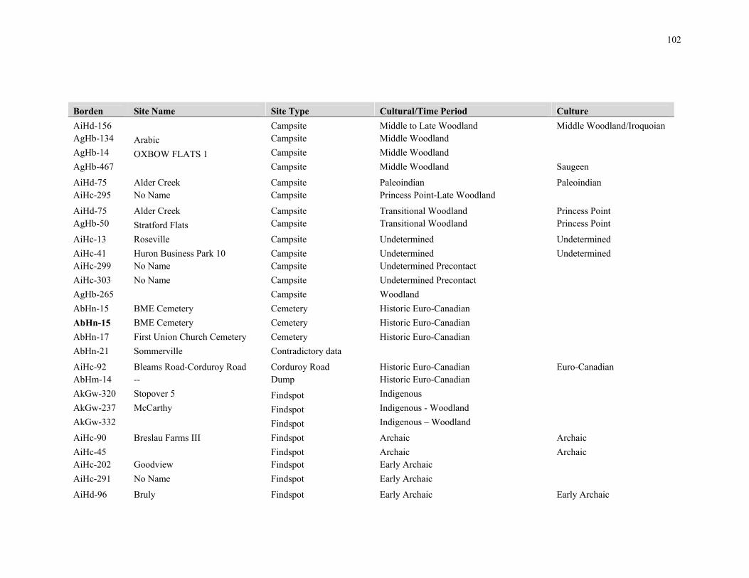
102
Borden Site Name Site Type Cultural/Time Period Culture
AiHd-156 Campsite Middle to Late Woodland Middle Woodland/Iroquoian AgHb-134 Arabic Campsite Middle Woodland
AgHb-14 OXBOW FLATS 1 Campsite Middle Woodland
AgHb-467 Campsite Middle Woodland Saugeen
AiHd-75 Alder Creek Campsite Paleoindian Paleoindian AiHc-295 No Name Campsite Princess Point-Late Woodland
AiHd-75 Alder Creek Campsite Transitional Woodland Princess Point AgHb-50 Stratford Flats Campsite Transitional Woodland Princess Point
AiHc-13 Roseville Campsite Undetermined Undetermined
AiHc-41 Huron Business Park 10 Campsite Undetermined Undetermined AiHc-299 No Name Campsite Undetermined Precontact
AiHc-303 No Name Campsite Undetermined Precontact
AgHb-265 Campsite Woodland
AbHn-15 BME Cemetery Cemetery Historic Euro-Canadian
AbHn-15 BME Cemetery Cemetery Historic Euro-Canadian
AbHn-17 First Union Church Cemetery Cemetery Historic Euro-Canadian
AbHn-21 Sommerville Contradictory data
AiHc-92 Bleams Road-Corduroy Road Corduroy Road Historic Euro-Canadian Euro-Canadian AbHm-14 -- Dump Historic Euro-Canadian
AkGw-320 Stopover 5 Findspot Indigenous
AkGw-237 McCarthy Findspot Indigenous - Woodland
AkGw-332 Findspot Indigenous – Woodland
AiHc-90 Breslau Farms III Findspot Archaic Archaic
AiHc-45 Findspot Archaic Archaic AiHc-202 Goodview Findspot Early Archaic
AiHc-291 No Name Findspot Early Archaic
AiHd-96 Bruly Findspot Early Archaic Early Archaic

103
Borden Site Name Site Type Cultural/Time Period Culture
AiHc-86 Huron Business Park 2 Findspot Early Archaic Early Archaic
AiHc-33 Huron Business Park 2 Findspot Early Archaic Early Archaic AgHb-454 Findspot Early Woodland Meadowood
AgHb-462 Findspot Early Woodland Meadowood
AgHb-486 Findspot Early Woodland Meadowood
AiHd-52 Findspot Early Woodland Meadowood AgHb-217 Findspot 2 Findspot Euro-Canadian
AiHc-297 No Name Findspot Late Archaic
AgHc-63 Findspot Late Archaic
AgHc-54 Findspot Late Archaic
AgHb-196 Findspot Late Archaic
AgHb-351 Findspot Late Archaic
AgHb-352 Findspot Late Archaic
AbHn-26 T24 Precontact Findspot Late Archaic
AbHn-6 Drew 1 Findspot Late Archaic
AgHb-264 Findspot Late Archaic-Early Woodland
AgHb-473 Findspot Late Woodland
AgHb-197 Findspot LOI Late Woodland
AiHc-293 No Name Findspot Meadowood-Early Woodland
AiHc-53 Rockway 1 Findspot Middle Archaic
AhHb-113 McNeil-Barcham 9 Findspot Middle Archaic
AgHc-49 Findspot Middle Archaic
AgHb-350 Findspot Middle Archaic Brewerton
AiHc-43 Findspot Middle Archaic Middle Archaic
AiHd-104 Findspot Middle Archaic Middle Archaic AgHb-135 Cyrillic Findspot Middle Woodland
AiHc-296 No Name Findspot Undermined Precontact

104
Borden Site Name Site Type Cultural/Time Period Culture AhHb-114 McNeil-Barcham 10 Findspot Undetermined
AgHc-52 Findspot Undetermined
AgHc-112 Findspot Undetermined
AgHb-353 Findspot Undetermined
AgHb-419 Findspot undetermined
AgHb-422 Findspot Undetermined
AgHb-475 Findspot undetermined
AgHb-476 Findspot Undetermined
AgHb-437 Findspot undetermined
AgHb-438 Findspot Undetermined
AgHb-439 Findspot Undetermined
AgHb-477 Findspot Undetermined
AgHb-478 Findspot Undetermined
AgHb-479 Findspot undetermined
AgHb-481 Findspot Undetermined
AgHb-484 Findspot Undetermined
AgHb-468 Findspot Undetermined
AgHb-469 Findspot Undetermined
AgHb-485 Findspot Undetermined
AiHc-163 Lujan Findspot Undetermined Undetermined
AiHc-359 Findspot Undetermined Undetermined
AiHc-360 Findspot Undetermined Undetermined
AiHc-369 Findspot Undetermined Undetermined
AiHd-150 Findspot Undetermined Undetermined
AiHd-93 Tarbox Findspot Undetermined Undetermined
AiHd-94 Nutria Findspot Undetermined Undetermined
AiHc-119 Findspot Undetermined Undetermined
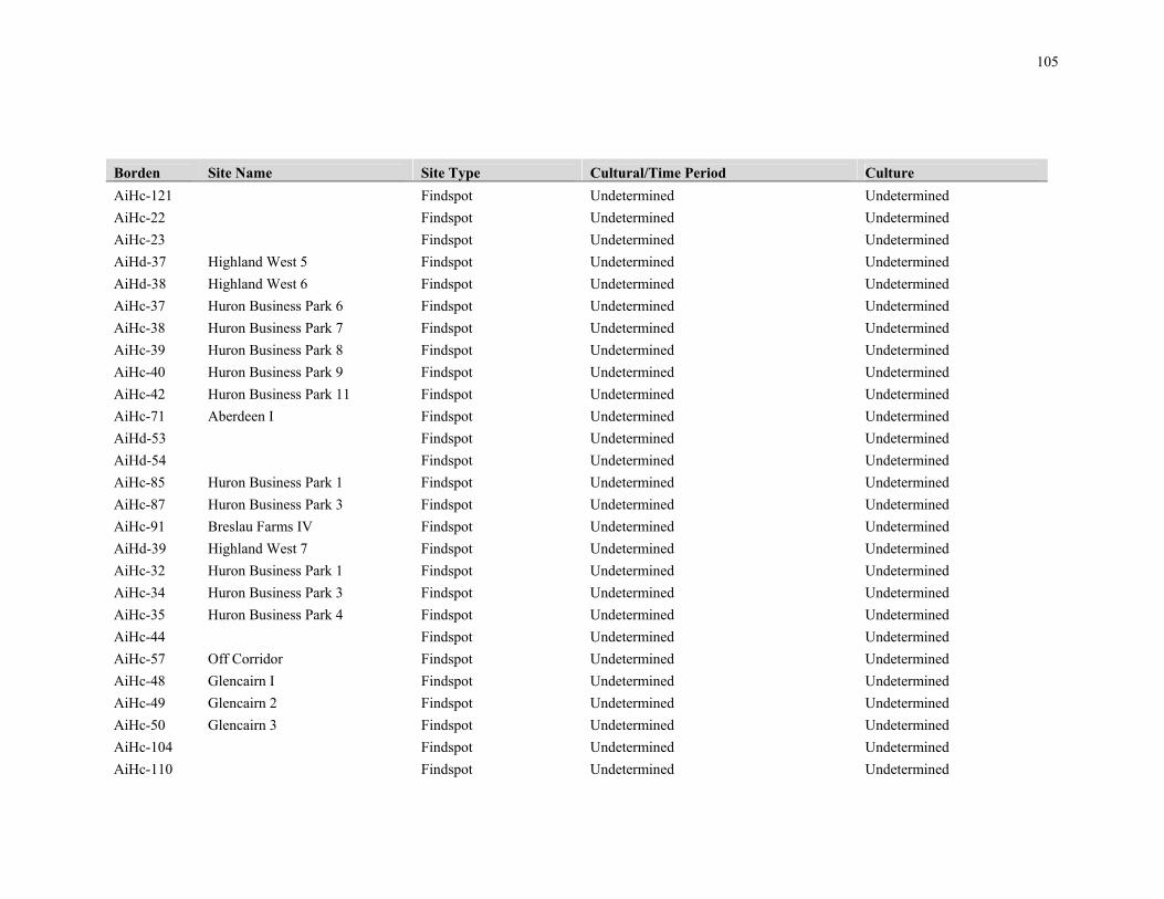
105
Borden Site Name Site Type Cultural/Time Period Culture
AiHc-121 Findspot Undetermined Undetermined
AiHc-22 Findspot Undetermined Undetermined
AiHc-23 Findspot Undetermined Undetermined
AiHd-37 Highland West 5 Findspot Undetermined Undetermined
AiHd-38 Highland West 6 Findspot Undetermined Undetermined
AiHc-37 Huron Business Park 6 Findspot Undetermined Undetermined
AiHc-38 Huron Business Park 7 Findspot Undetermined Undetermined
AiHc-39 Huron Business Park 8 Findspot Undetermined Undetermined
AiHc-40 Huron Business Park 9 Findspot Undetermined Undetermined
AiHc-42 Huron Business Park 11 Findspot Undetermined Undetermined
AiHc-71 Aberdeen I Findspot Undetermined Undetermined
AiHd-53 Findspot Undetermined Undetermined
AiHd-54 Findspot Undetermined Undetermined
AiHc-85 Huron Business Park 1 Findspot Undetermined Undetermined
AiHc-87 Huron Business Park 3 Findspot Undetermined Undetermined
AiHc-91 Breslau Farms IV Findspot Undetermined Undetermined
AiHd-39 Highland West 7 Findspot Undetermined Undetermined
AiHc-32 Huron Business Park 1 Findspot Undetermined Undetermined
AiHc-34 Huron Business Park 3 Findspot Undetermined Undetermined
AiHc-35 Huron Business Park 4 Findspot Undetermined Undetermined
AiHc-44 Findspot Undetermined Undetermined
AiHc-57 Off Corridor Findspot Undetermined Undetermined
AiHc-48 Glencairn I Findspot Undetermined Undetermined
AiHc-49 Glencairn 2 Findspot Undetermined Undetermined
AiHc-50 Glencairn 3 Findspot Undetermined Undetermined
AiHc-104 Findspot Undetermined Undetermined
AiHc-110 Findspot Undetermined Undetermined

106
Borden Site Name Site Type Cultural/Time Period Culture
AiHc-111 Findspot Undetermined Undetermined AbHm-11 T40 Access Road Findspot Undetermined
AbHm-12 T44 Turbine Findspot Undetermined
AiHc-100 Grand River III Findspot Undetermined Precontact
AiHc-101 Grand River IV Findspot Undetermined Precontact
AiHc-294 No Name Findspot Undetermined Precontact
AiHc-298 No Name Findspot Undetermined Precontact
AiHc-54 Rockway 2 Findspot Undetermined Precontact
AiHc-203 Challenger Findspot Undetermined Precontact
AiHc-292 No Name Findspot Undetermined Precontact
AiHc-416 Hamlet Late Woodland Undetermined
AiHc-424 Hamlet Late Woodland Undetermined
AiHc-427 Hamlet Late Woodland Undetermined
AiHc-414 Hamlet Undetermined Undetermined AkGw-15 Clearbrook Homestead Euro-Canadian
AkGw-16 Mellow Gardens Homestead Euro-Canadian
AkGw-88 Bartholomew Snell Homestead Homestead Euro-Canadian
AkGw-107 Elias Snell Pioneer Homestead Homestead Euro-Canadian
AkGx-48 Kilmanagh Crossroads Homestead Euro-Canadian
AkGx-49 Caesar Homestead Euro-Canadian
AbHn-1 Centre Road 1 Homestead Historic Euro-Canadian
AbHn-2 Centre Road 2 Homestead Historic Euro-Canadian
AbHn-3 Middle Road 1 Homestead Historic Euro-Canadian
AbHn-4 Middle Road 2 Homestead Historic Euro-Canadian
AbHn-22 Burns Homestead Historic Euro-Canadian
AiHc-425 Homestead Historic Euro-Canadian Euro-Canadian

107
Borden Site Name Site Type Cultural/Time Period Culture
AiHc-358 Borsch Homestead Historic Euro-Canadian Euro-Canadian
AiHd-92 Gehl Homestead Historic Euro-Canadian Euro-Canadian
AiHc-118 Homestead Historic Euro-Canadian Euro-Canadian
AiHc-14 New Aberdeen Homestead Historic Euro-Canadian Euro-Canadian
AiHc-65 Caryndale Homestead Historic Euro-Canadian Euro-Canadian
AiHd-56 Haist Homestead Historic Euro-Canadian Euro-Canadian
AiHc-89 George Israel Homestead Historic Euro-Canadian Euro-Canadian
AiHd-40 Highland West 8 Homestead Historic Euro-Canadian Euro-Canadian
AiHc-55 Williamsburg I Homestead Historic Euro-Canadian Euro-Canadian
AiHc-56 Williamsburg II Homestead Historic Euro-Canadian Euro-Canadian
AiHd-46 Highland Green Historic Homestead Historic Euro-Canadian Euro-Canadian
AiHc-430 Homestead Historic Euro-Canadian Euro-Canadian AiHc-336 Loc.1 Homestead Historic Euro-Canadian
AiHc-337 Loc.2 Homestead Historic Euro-Canadian
AgHb-282 Homestead Historic Euro-Canadian
AgHb-283 Homestead Historic Euro-Canadian
AkGx-57 Homestead Euro-Canadian Indigenous
AkGw-295 Heart Lake Garden Lithic Scatter Indigenous – Archaic
AcHm-22 Durfy 1 Lithic Scatter Archaic
AcHm-23 Durfy 2 Lithic Scatter Archaic
AcHk-4 Morpeth “A” Lithic Scatter Archaic
AiHd-3 Stoltz Lithic Scatter Archaic Archaic AgHb-3 CAMERON Lithic scatter Archiac
AhHb-117 McNeil-Barcham 13 Lithic scatter Early and Middle Archaic
AiHc-368 Lithic Scatter Early Archaic Early Archaic AgHb-238 Bluebox Lithic scatter Early Archaic

108
Borden Site Name Site Type Cultural/Time Period Culture
AgHc-60 Lithic scatter Early Archaic Nettling
AhHb-110 McNeil-Barcham-6 Lithic scatter Early Archaic Nettling
AgHc-109 Lithic scatter Early Archaic Nettling
AhHc-139 Lithic scatter Early Archaic Nettling
AbHn-13 Smoulder’s 4 Lithic Scatter Early Woodland
AcHl-7 Morpeth 5 Lithic Scatter Early Woodland
AcHl-8 Morpeth 6 Lithic Scatter Early Woodland
AiHd-155 Lithic Scatter Early Woodland Meadowood
AiHc-108 Lithic Scatter Early Woodland Meadowood AgHc-107 Lithic scatter Early Woodland
AgHb-223 Lithic Scatter Early Woodland Meadowood
AgHb-446 Lithic scatter Early Woodland Meadowood
AiHc-417 Lithic Scatter Late Archaic Late Archaic
AiHc-361 Lithic Scatter Late Archaic Late Archaic
AiHd-101 Lithic Scatter Late Archaic Late Archaic
AiHc-47 MacIntosh Lithic Scatter Late Archaic Late Archaic
AiHd-159 Lithic Scatter Late Archaic Late Archaic AgHc-82 TCGA Lithic scatter Late Archaic Crawford Knoll
AgHc-45 Lithic scatter Late Archaic Crawford Knoll
AgHb-155 Lithic scatter Late Archaic
AgHb-216 Findspot 1 Lithic scatter Late Archaic
AhHb-107 McNeil-Barcham 3 Lithic Scatter Late Archaic Small Point
AgHb-225 Lithic Scatter Late Archaic
AgHb-245 Lithic Scatter Late Archaic
AgHb-354 Lithic scatter Late Archaic
AgHb-434 Lithic scatter Late Archaic
AgHb-436 Lithic scatter Late Archaic

109
Borden Site Name Site Type Cultural/Time Period Culture AgHb-443 Lithic scatter Late Archaic
AgHb-444 Lithic scatter Late Archaic
AgHb-445 Lithic scatter Late Archaic
AgHb-459 Lithic scatter Late Archaic Small Point
AgHb-483 Lithic scatter Late Archaic Small Point
AgHb-483 Lithic scatter Late Archaic Small Point
AgHb-472 Lithic scatter Late Archaic
AbHm-8 T30 Turbine Lithic Scatter Late Archaic to Woodland
AbHn-12 Smoulder’s 3 Lithic Scatter Late Archaic to Woodland
AgHb-423 Lithic scatter Late Archaic to Woodland
AgHb-474 Lithic scatter Late Archaic to Woodland
AhHb-106 McNeil-Barcham 2 Lithic scatter Late Archaic, Middle and Late Woodland
AgHb-239 Snowhill Lithic scatter Late Paleo-Indian Hi-Lo
AgHb-240 Hampton Estates 3 Lithic scatter Late Paleo-Indian Hi-Lo
AbHn-11 Smoulder’s 2 Lithic Scatter Late Woodland
AcHl-9 Rondeau Bay 1 Lithic Scatter Late Woodland
AiHc-115 Lithic Scatter Late Woodland Undetermined AgHb-449 Lithic scatter Late Woodland
AhHb-109 McNeil-Barcham 5 Lithic scatter Middle and Late Archaic
AgHb-418 Lithic scatter Middle and Late Archaic
AgHb-421 Lithic scatter Middle and Late Archaic
AbHn-10 Smoulder’s 1 Lithic scatter Middle and Late Archaic
AcHl-6 Morpeth “B” Lithic scatter Middle and Late Archaic
AiHc-417 Lithic Scatter Middle Archaic Middle Archaic
AiHd-161 Lithic Scatter Middle Archaic Middle Archaic AhHb-108 McNeil-Barcham 4 Lithic scatter Middle Archaic

110
Borden Site Name Site Type Cultural/Time Period Culture AgHc-110 Lithic scatter Middle Archaic Brewerton
AgHb-247 Lithic Scatter Middle Archaic
AgHb-424 Lithic scatter Middle Archaic
AgHb-432 Lithic scatter Middle Archaic
AgHb-440 Lithic scatter Middle Archaic
AgHb-458 Lithic scatter Middle Archaic Brewerton
AgHb-460 Lithic scatter Middle Archaic Brewerton
AcHk-5 Morpeth “D” Lithic scatter Middle Archaic and Late Woodland
AgHb-471 Lithic scatter Middle to Late Archaic
AiHc-36 Steckle Lithic Scatter Paleoindian Paleoindian
AiHc-113 Lithic Scatter Undetermined Undetermined
AiHc-114 Lithic Scatter Undetermined Undetermined
AiHc-364 Becker Estates Lithic Scatter Undetermined Undetermined
AiHc-413 Lithic Scatter Undetermined Undetermined
AiHc-415 Lithic Scatter Undetermined Undetermined
AiHc-419 Lithic Scatter Undetermined Undetermined
AiHc-420 Lithic Scatter Undetermined Undetermined
AiHc-421 Lithic Scatter Undetermined Undetermined
AiHc-422 Lithic Scatter Undetermined Undetermined
AiHc-423 Lithic Scatter Undetermined Undetermined
AiHc-426 Lithic Scatter Undetermined Undetermined
AiHc-428 Lithic Scatter Undetermined Undetermined
AiHc-429 Lithic Scatter Undetermined Undetermined
AiHc-164 Keyoke Lithic Scatter Undetermined Undetermined
AiHc-363 Becker Estates Lithic Scatter Undetermined Undetermined
AiHc-370 Lithic Scatter Undetermined Undetermined
AiHc-394 Wards Pond II Lithic Scatter Undetermined Undetermined

111
Borden Site Name Site Type Cultural/Time Period Culture
AiHd-131 Higgins I Lithic Scatter Undetermined Undetermined
AiHd-95 Sacalait Lithic Scatter Undetermined Undetermined
AiHc-393 Wards Pond I Lithic Scatter Undetermined Undetermined
AiHc-116 Lithic Scatter Undetermined Undetermined
AiHc-117 Lithic Scatter Undetermined Undetermined
AiHc-120 Lithic Scatter Undetermined Undetermined
AiHc-122 Lithic Scatter Undetermined Undetermined
AiHd-76 Badenwald Lithic Scatter Undetermined Undetermined
AiHd-102 Lithic Scatter Undetermined Undetermined
AiHd-103 Lithic Scatter Undetermined Undetermined
AiHc-64 Breslau Farms Lithic Scatter Undetermined Undetermined
AiHd-55 Lithic Scatter Undetermined Undetermined
AiHd-66 Sandrock Lithic Scatter Undetermined Undetermined
AiHc-88 Huron Business Park 4 Lithic Scatter Undetermined Undetermined
AiHd-108 Lithic Scatter Undetermined Undetermined
AiHd-26 Code Lithic Scatter Undetermined Undetermined
AiHc-46 Lithic Scatter Undetermined Undetermined
AiHc-105 Lithic Scatter Undetermined Undetermined
AiHd-106 Lithic Scatter Undetermined Undetermined
AiHd-107 Lithic Scatter Undetermined Undetermined
AiHc-106 Lithic Scatter Undetermined Undetermined
AiHc-107 Lithic Scatter Undetermined Undetermined
AiHc-109 Lithic Scatter Undetermined Undetermined
AiHd-130 Lithic Scatter Undetermined Undetermined
AiHc-223 Norris-Sternberg Lithic Scatter Undetermined Undetermined
AiHc-112 Lithic Scatter Undetermined Undetermined
AiHd-157 Lithic Scatter Undetermined Undetermined

112
Borden Site Name Site Type Cultural/Time Period Culture
AiHd-158 Lithic Scatter Undetermined Undetermined AgHc-48 Lithic scatter Undetermined
AgHc-50 Lithic scatter Undetermined
AgHc-51 Lithic scatter Undetermined
AgHb-221 Mitchell Lithic scatter Undetermined
AgHc-53 Lithic scatter Undetermined
AgHc-57 Lithic scatter Undetermined
AgHc-58 Lithic scatter Undetermined
AgHc-59 Lithic scatter Undetermined
AgHc-61 Lithic scatter Undetermined
AgHc-62 Lithic scatter Undetermined
AgHc-83 TCGB Lithic scatter Undetermined
AgHc-55 Lithic scatter Undetermined
AgHc-56 Lithic scatter Undetermined
AgHc-99 Lithic scatter Undetermined
AgHc-85 TCBD Lithic scatter Undetermined
AgHb-243 Davisville 3 Lithic scatter Undetermined
AgHc-84 TCGC Lithic scatter Undetermined
AgHb-276 D'Aubigny Park Lithic scatter Undetermined
AgHc-103 TCG Materials 4 Lithic scatter Undetermined
AgHc-44 Lithic scatter Undetermined
AgHc-46 Lithic scatter Undetermined
AgHc-47 Lithic scatter Undetermined
AgHb-263 Lithic scatter Undetermined
AgHb-218 Findspot 3 Lithic scatter Undetermined
AgHb-219 Findspot 4 Lithic scatter Undetermined
AgHc-104 TCG Materials 5 Lithic scatter Undetermined

113
Borden Site Name Site Type Cultural/Time Period Culture AgHc-106 Lithic scatter Undetermined
AgHc-108 Lithic scatter Undetermined
AgHc-111 Lithic scatter Undetermined
AgHc-114 Lithic scatter Undetermined
AgHb-20 Ava Lithic scatter Undetermined
AgHb-222 Lithic Scatter Undetermined
AgHb-224 Lithic Scatter Undetermined
AgHb-246 Lithic Scatter Undetermined
AgHb-420 Lithic scatter Undetermined
AgHb-426 Lithic scatter Undetermined
AgHb-428 Lithic scatter Undetermined
AgHb-429 Lithic scatter Undetermined
AgHb-430 Lithic scatter Undetermined
AgHb-431 Lithic scatter Undetermined
AgHb-433 Lithic scatter undetermined
AgHb-435 Lithic scatter Undetermined
AgHb-441 Lithic scatter Undetermined
AgHb-442 Lithic scatter Undetermined
AgHb-447 Lithic scatter Undetermined
AgHb-448 Lithic scatter Undetermined
AgHb-450 Lithic scatter Undetermined
AgHb-451 Lithic scatter Undetermined
AgHb-480 Lithic scatter Undetermined
AgHb-452 Lithic scatter Undetermined
AgHb-453 Lithic scatter Undetermined
AgHb-455 Lithic scatter Undetermined
AgHb-456 Lithic scatter Undetermined

114
Borden Site Name Site Type Cultural/Time Period Culture AgHb-457 Lithic scatter Undetermined
AgHb-463 Lithic scatter Undetermined
AgHb-465 Lithic scatter Undetermined
AgHb-482 Lithic scatter Undetermined
AgHb-466 Lithic scatter Undetermined
AgHb-470 Lithic scatter Undetermined
AbHn-14 Drew 4 Lithic scatter Undetermined
AbHn-25 P. McKeon Lithic scatter undetermined
AcHm-24 Durfy 3 Lithic scatter Undetermined
AiHc-391 Huber 1 Lithic scatter Undetermined Precontact
AiHc-98 Grand River I Lithic scatter Undetermined Precontact
AiHc-99 Grand River II Lithic scatter Undetermined Precontact
AiHc-102 No Name Lithic scatter Undetermined Precontact
AiHc-103 No Name Lithic scatter Undetermined Precontact
AiHc-256 Fischer-Hallman Longhouse Late Woodland Undetermined
AiHc-257 Cornfield Longhouse Late Woodland Undetermined
AiHc-418 Midden Historic Euro-Canadian Historical Euro-Canadian
AiHc-362 Hewitt Farm Dump Midden Historic Euro-Canadian Euro-Canadian AgHb-131 Rogers Ossuary Ossuary Late Woodland
AbHn-20 T25 Turbine Precontact Pre-contact Camp site
AbHn-27 T26 Precontact IF Pre-contact Isolated find
AbHn-8 Drew 3 Undetermined Early Archaic, Early Woodlnd
AbHn-7 Drew 2 Undetermined Early Archaic, Early Woodlnd
AgHb-6 TUTELA Undetermined EOI Late Woodland Princess Point
AgHb-220 Findspot 5 Undetermined Euro-Canadian
AkGx-58 Undetermined Euro-Canadian Indigenous
AaHn-2 -- Undetermined Historic Euro-Canadian

115
Borden Site Name Site Type Cultural/Time Period Culture AaHn-3 -- Undetermined Historic Euro-Canadian
AgHb-283 Undetermined Historic Euro-Canadian
AgHb-282 Undetermined Historic Euro-Canadian
AbHn-9 Vandale 1 Undetermined Late Archaic
AgHb-215 Waste Not Undetermined MOI Late Woodland
AgHb-266 Ruijs & Kirchberger Undetermined Multi-Component-Early to Late
AgHb-1 Porteous Undetermined Transitional Woodland Princess Point
AgHb-34 Bow Park Undetermined Transitional Woodland Princess Point
AcHm-12 Molson Undetermined Undetermined
AcHm-19 Loews 1 Undetermined Undetermined
AcHm-20 Loews 2 Undetermined Undetermined
AcHm-25 Jenner Undetermined Undetermined
AcHm-26 Hellerman Undetermined Undetermined
AkGw-14 Allison Undetermined Undetermined
AkGw-309 Stopover 2 Undetermined undetermined
AkGw-310 Stopover 3 Undetermined Undetermined
AkGw-311 Stopover Undetermined Undetermined
AkGw-312 Stopover 4 Undetermined Undetermined
AiHc-456 Undetermined Undetermined Undetermined AcHm-21 Richardson Undetermined Undetermined
AbHm-27 Stewart 1 Undetermined Undetermined
AiHd-15 Mannheim Village Late Woodland Undetermined AgHb-18 Cooper Village Late Woodland EOI
AiHc-2 Moyer Village Late Woodland, MOI (13th-14th C.) Neutral
AiHc-255 Strasburg Creek Village Late Woodland, MOI (13th-14th C.) Neutral
AiHd-8 Suraras Springs Village Village Late Woodland, MOI (13th-14th C.) Neutral
AiHc-20 Van Ordt-Duerrstein Village Late Woodland, MOI (13th-14th C.) Neutral

116
Appendix B: Sample of Pre-Contact Indigenous sites in Ontario
Borden Number Distance to water (m)
Area (m2) Artifact Density
(per m2)
Formal Tools/ Diagnostics
(Y/N)
Presence of Features
(Y/N)
# of Features
Features in concentration of artifacts (Y/N)
Percentage of site area excavated Artifact yield cut off
AlGu-58 100 745 1.1 1 0 0 0 100% unknown BaGt-19 300 875 2.5 0 1 1 0 25% 10 per unit AiHb-140 50 375 5 1 1 1 1 33% 10 per unit AbHm-19 25 3750 5.2 1 0 0 0 2% 10 per unit AiHb-235 100 2025 6.9 1 1 1 1 14% 10 per unit AiHb-62 100 2500 9 1 0 0 0 2% unknown AiHb-272 50 2250 10.5 1 1 1 0 8% 10 per unit AiHb-132 100 600 11 1 0 0 0 32% 10 per unit AgHb-280 25 400 12.5 1 0 0 0 38% 10 per unit AiHb-124 50 1250 13 1 1 1 1 6% 20 per unit AbHm-21 100 450 13.48 1 0 0 0 27% 10 per unit AhGv-39 25 625 14.2 1 0 0 0 40% 10 per unit AbHm-23 25 2500 19.4 1 1 4 0 14% 10 per unit AhGs-22 100 1100 22 1 1 1 1 18% 10 per unit AhGx-97 100 400 24 0 0 0 0 20% 20 per unit AiHc-194 150 1050 29.5 1 0 0 0 13% 20 per unit AhGx-397 200 5000 37.5 1 1 1 1 1% 20 per unit AhGx-163 50 1225 60.7 1 1 5 1 22% 20 per unit AgHb-240 100 1000 92 1 1 1 1 40% 25 per unit AgHb-238 25 700 168 1 0 0 0 20% 25 per unit AeHh-149 100 5200 10.3 1 0 0 0 1% 10 per unit AgHb-461 50 4200 6.93 1 0 0 0 2% 10 per unit AgHb-443 50 1200 2 1 0 0 0 60% 10 per unit AgHb-459 25 400 0.25 1 0 0 0 4% 10 per unit AgHb-418 25 525 7 1 0 0 0 50% 10 per unit AgHb-442 25 225 24.5 1 1 2 1 95% 10 per unit AgGx-450 25 1000 0.55 1 0 0 0 0.50% 10 per unit AgGx-466 25 1500 0.15 1 0 0 0 0.10% 10 per unit AlGv-187 100 300 1 1 0 0 0 80% 10 per unit BaGt-40 150 400 5.5 1 1 1 1 17% 10 per unit AfGt-201 250 325 12.5 1 1 4 0 50% 10 per unit AgGt-227 300 1350 5.75 1 0 0 0 25% 10 per unit AfHa-921 200 800 0.3 0 0 0 0 3% 10 per unit AfHa-917 150 300 0.3 0 0 0 0 5% 10 per unit AgGu-214 100 4125 1.3 1 0 0 0 17% 10 per unit AgGx-548 50 1575 1.5 1 0 0 0 13% 10 per unit AgGx-539 50 600 0.07 1 0 0 0 3% 10 per unit AfHa-901 50 300 2.1 1 0 0 0 12% 10 per unit AfHa-903 100 600 0.175 1 0 0 0 3% 10 per unit AlGq-135 100 3500 0.25 1 1 1 1 3% 10 per unit

117
Appendix C: Artifact Catalogue from Site AiHd-159
Cat # Context Qty Type Material Length (mm)
Width (mm)
Thickness (mm) Comments
L46 Surface 1 Shatter Bois blanc
L38 Surface 1 Shatter Bois blanc Cortex
L39 Surface 1 Secondary knapping flake
Bois blanc
L51 Surface 1 Flake fragment Haldimand
L64 Surface 1 Flake fragment Haldimand
L42 Surface 1 Biface fragment Onondaga 36 13.1 5.9 Refined edge fragment
L44 Surface 1 Biface fragment Onondaga 32.9 25 7.6 Refined tip, possible point
fragment
L75 Surface 1 Biface fragment Onondaga 19.7 20.5 6 Refined medial fragment
L25 Surface 1 Flake fragment Onondaga
L29 Surface 1 Flake fragment Onondaga
L30 Surface 1 Flake fragment Onondaga

118
Cat # Context Qty Type Material Length (mm)
Width (mm)
Thickness (mm) Comments
L32 Surface 1 Flake fragment Onondaga
L33 Surface 1 Flake fragment Onondaga
L41 Surface 1 Flake fragment Onondaga
L43 Surface 1 Flake fragment Onondaga
L49 Surface 1 Flake fragment Onondaga
L53 Surface 1 Flake fragment Onondaga
L61 Surface 1 Flake fragment Onondaga
L62 Surface 1 Flake fragment Onondaga
L66 Surface 1 Flake fragment Onondaga
L68 Surface 1 Flake fragment Onondaga
L76 Surface 1 Flake fragment Onondaga
L79 Surface 1 Flake fragment Onondaga
L69 Surface 1 Projectile point Onondaga 51.1 26 8.4 Late Archaic Adder Orchard point

119
Cat # Context Qty Type Material Length (mm)
Width (mm)
Thickness (mm) Comments
L34 Surface 1 Primary reduction flake
Onondaga
Waterworn cobble fragment
L70 Surface 1 Primary reduction flake
Onondaga
L71 Surface 1 Primary reduction flake
Onondaga
L73 Surface 1 Primary reduction flake
Onondaga
L74 Surface 1 Primary reduction flake
Onondaga
L48 Surface 1 Primary thinning flake
Onondaga
L59 Surface 1 Primary thinning flake
Onondaga
L65 Surface 1 Primary thinning flake
Onondaga
L37 Surface 1 Shatter Onondaga
L52 Surface 1 Shatter Onondaga

120
Cat # Context Qty Type Material Length (mm)
Width (mm)
Thickness (mm) Comments
L54 Surface 1 Shatter Onondaga
L55 Surface 1 Shatter Onondaga
L67 Surface 1 Shatter Onondaga
L26 Surface 1 Secondary knapping flake
Onondaga
L28 Surface 1 Secondary knapping flake
Onondaga
L31 Surface 1 Secondary knapping flake
Onondaga
L35 Surface 1 Secondary knapping flake
Onondaga
L50 Surface 1 Secondary knapping flake
Onondaga

121
Cat # Context Qty Type Material Length (mm)
Width (mm)
Thickness (mm) Comments
L63 Surface 1 Secondary knapping flake
Onondaga
L72 Surface 1 Secondary knapping flake
Onondaga
L77 Surface 1 Secondary knapping flake
Onondaga
L80 Surface 1 Secondary knapping flake
Onondaga
L47 Surface 1 Secondary retouch flake
Onondaga
L57 Surface 1 Secondary retouch flake
Onondaga
L58 Surface 1 Secondary retouch flake
Onondaga
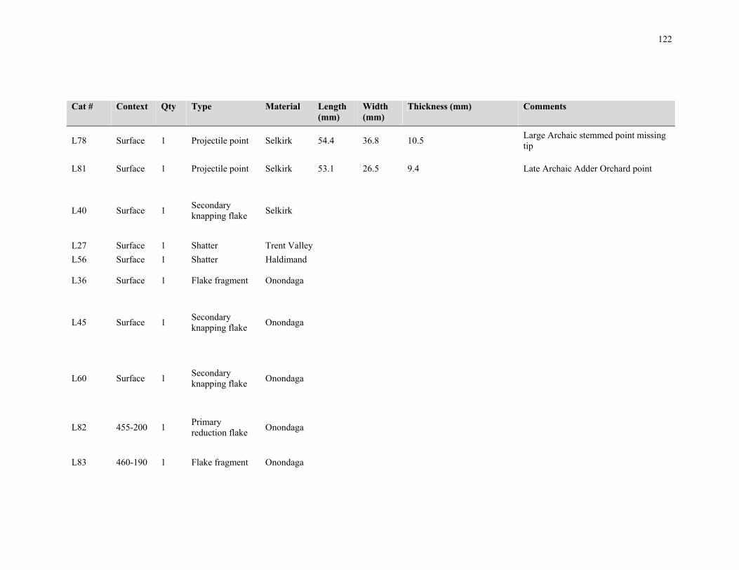
122
Cat # Context Qty Type Material Length (mm)
Width (mm)
Thickness (mm) Comments
L78 Surface 1 Projectile point Selkirk 54.4 36.8 10.5 Large Archaic stemmed point missing tip
L81 Surface 1 Projectile point Selkirk 53.1 26.5 9.4 Late Archaic Adder Orchard point
L40 Surface 1 Secondary knapping flake
Selkirk
L27 Surface 1 Shatter Trent Valley
L56 Surface 1 Shatter Haldimand
L36 Surface 1 Flake fragment Onondaga
L45 Surface 1 Secondary knapping flake
Onondaga
L60 Surface 1 Secondary knapping flake
Onondaga
L82 455-200 1 Primary reduction flake
Onondaga
L83 460-190 1 Flake fragment Onondaga

123
Cat # Context Qty Type Material Length (mm)
Width (mm)
Thickness (mm) Comments
L84 460-195 1 Flake fragment Bois blanc
L85 460-195 1 Flake fragment Onondaga
L86 460-200 1 Biface fragment Flint Ridge chalcedony
10 7.1 2.5 Small, refined edge fragment
L87 460-200 2 Shatter Onondaga
L92 460-205 1 Shatter Onondaga
L90 465-195 1 Shatter Onondaga
L88 465-195 2 Secondary knapping flake
Onondaga
L89 465-195 1 Secondary retouch flake
Onondaga
L91 465-200 1 Flake fragment Onondaga
L94 465-205 1 Flake fragment Bois blanc
L95 465-205 1 Flake fragment Onondaga
L93 465-205 1 Primary reduction flake
Onondaga

124
Cat # Context Qty Type Material Length (mm)
Width (mm)
Thickness (mm) Comments
L96 465-215 1 Secondary retouch flake
Onondaga
L97 468-208 1 Primary thinning flake
Bois blanc
L98 468-208 1 Flake fragment Onondaga
L99 470-175 1 Flake fragment Onondaga
L100 470-185 1 Secondary knapping flake
Onondaga
L101 470-185 1 Flake fragment Onondaga
L102 470-190 1 Flake fragment Onondaga
L106 470-195 1 Primary thinning flake
Onondaga
L105 470-195 1 Shatter Onondaga
L103 470-195 1 Secondary knapping flake
Onondaga

125
Cat # Context Qty Type Material Length (mm)
Width (mm)
Thickness (mm) Comments
L104 470-195 1 Secondary retouch flake
Onondaga
L107 470-198 1 Biface fragment Onondaga 24.5 19.5 6.2 Refined tip, possible point fragment
L109 470-200 1 Flake fragment Onondaga
L108 470-200 1 Secondary retouch flake
Onondaga
L110 470-205 1 Secondary retouch flake
Onondaga
L111 470-210 1 Flake fragment Onondaga
L113 474-237 1 Shatter Onondaga
L112 474-237 2 Secondary knapping flake
Onondaga
L114 475-175 2 Secondary knapping flake
Onondaga

126
Cat # Context Qty Type Material Length (mm)
Width (mm)
Thickness (mm) Comments
L115 475-185 1 Secondary knapping flake
Onondaga
L116 475-190 2 Secondary retouch flake
Onondaga
L117 475-200 1 Primary reduction flake
Bois blanc
L120 475-200 1 Shatter Bois blanc
L119 475-200 1 Shatter Onondaga
L118 475-200 1 Secondary knapping flake
Onondaga
L121 475-215 2 Flake fragment Onondaga
L122 475-220 1 Shatter Onondaga
L123 477-225 1 Primary reduction flake
Onondaga
L124 478-185 1 Secondary knapping flake
Onondaga

127
Cat # Context Qty Type Material Length (mm)
Width (mm)
Thickness (mm) Comments
L125 480-175 1 Shatter Onondaga
L126 480-185 1 Biface fragment Bois blanc 26.5 20.5 4.8 Crude tip, made from large flake, minimally worked on ventral face
L128 480-185 1 Shatter Onondaga
L127 480-185 3 Secondary knapping flake
Onondaga
L131 480-200 2 Flake fragment Onondaga
L130 480-200 1 Shatter Onondaga
L129 480-200 1 Secondary knapping flake
Onondaga
L133 480-210 1 Flake fragment Onondaga
L132 480-210 1 Secondary retouch flake
Onondaga
L135 480-215 3 Flake fragment Onondaga
L137 480-215 1 Flake fragment Onondaga
L136 480-215 1 Shatter Onondaga
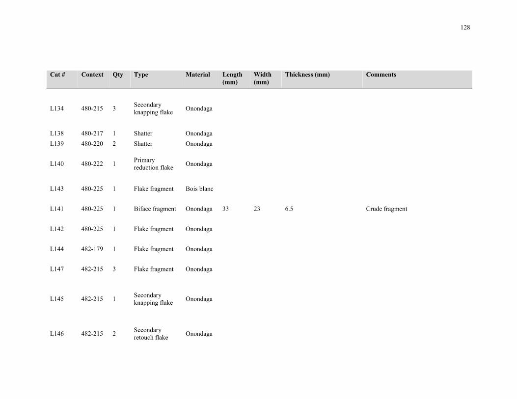
128
Cat # Context Qty Type Material Length (mm)
Width (mm)
Thickness (mm) Comments
L134 480-215 3 Secondary knapping flake
Onondaga
L138 480-217 1 Shatter Onondaga
L139 480-220 2 Shatter Onondaga
L140 480-222 1 Primary reduction flake
Onondaga
L143 480-225 1 Flake fragment Bois blanc
L141 480-225 1 Biface fragment Onondaga 33 23 6.5 Crude fragment
L142 480-225 1 Flake fragment Onondaga
L144 482-179 1 Flake fragment Onondaga
L147 482-215 3 Flake fragment Onondaga
L145 482-215 1 Secondary knapping flake
Onondaga
L146 482-215 2 Secondary retouch flake
Onondaga

129
Cat # Context Qty Type Material Length (mm)
Width (mm)
Thickness (mm) Comments
L148 482-236 1 Secondary knapping flake
Kettle point
L150 482-236 1 Flake fragment Onondaga
L149 482-236 1 Secondary knapping flake
Onondaga
L151 485-175 1 Secondary knapping flake
Onondaga
Modified along both ventral margins
L152 485-180 1 Primary reduction flake
Haldimand
Waterworn cobble fragment
L153 485-180 1 Secondary retouch flake
Onondaga
L155 485-184 2 Flake fragment Onondaga
L154 485-184 3 Shatter Onondaga
L156 485-190 1 Secondary retouch flake
Onondaga

130
Cat # Context Qty Type Material Length (mm)
Width (mm)
Thickness (mm) Comments
L159 485-195 1 Shatter Onondaga
L157 485-195 1 Secondary knapping flake
Onondaga
L158 485-195 1 Shatter Bois blanc
L160 485-205 1 Shatter Onondaga
L161 485-205 1 Secondary retouch flake
Onondaga
L165 485-210 1 Biface fragment Onondaga 20.8 16.7 5.6 Semi-refined edge fragment
L164 485-210 2 Flake fragment Onondaga
L166 485-210 1 Flake fragment Onondaga
L163 485-210 1 Shatter Onondaga
L167 485-210 1 Shatter Onondaga
L162 485-210 1 Secondary knapping flake
Onondaga
L170 485-215 1 Flake fragment Bois blanc
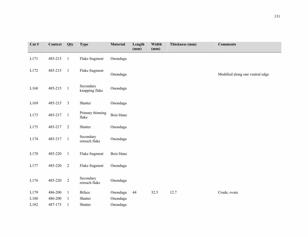
131
Cat # Context Qty Type Material Length (mm)
Width (mm)
Thickness (mm) Comments
L171 485-215 1 Flake fragment Onondaga
L172 485-215 1 Flake fragment Onondaga Modified along one ventral edge
L168 485-215 1 Secondary knapping flake
Onondaga
L169 485-215 3 Shatter Onondaga
L173 485-217 1 Primary thinning flake
Bois blanc
L175 485-217 2 Shatter Onondaga
L174 485-217 1 Secondary retouch flake
Onondaga
L178 485-220 1 Flake fragment Bois blanc
L177 485-220 2 Flake fragment Onondaga
L176 485-220 2 Secondary retouch flake
Onondaga
L179 486-200 1 Biface Onondaga 44 32.5 12.7 Crude, ovate
L180 486-200 1 Shatter Onondaga
L182 487-173 1 Shatter Onondaga

132
Cat # Context Qty Type Material Length (mm)
Width (mm)
Thickness (mm) Comments
L181 487-173 1 Secondary knapping flake
Onondaga
L185 487-210 7 Flake fragment Onondaga
L184 487-210 1 Shatter Onondaga
L183 487-210 1 Secondary retouch flake
Onondaga
L187 490-175 1 Flake fragment Onondaga
L186 490-175 1 Secondary knapping flake
Onondaga
L188 490-180 1 Primary reduction flake
Bois blanc
L190 490-180 1 Shatter Onondaga
L189 490-180 2 Secondary knapping flake
Onondaga
L192 490-185 1 Flake fragment Onondaga

133
Cat # Context Qty Type Material Length (mm)
Width (mm)
Thickness (mm) Comments
L191 490-185 1 Secondary retouch flake
Onondaga
L193 490-190 1 Flake fragment Onondaga
L194 490-195 1 Shatter Onondaga
L195 490-200 1 Flake fragment Onondaga
L196 490-200 1 Shatter Onondaga
L197 490-210 1 Secondary retouch flake
Onondaga
L199 490-212 1 Shatter Onondaga
L198 490-212 3 Secondary knapping flake
Onondaga
L201 490-215 6 Flake fragment Onondaga
L202 490-215 3 Shatter Onondaga
L200 490-215 1 Secondary knapping flake
Onondaga
L203 490-217 4 Flake fragment Onondaga

134
Cat # Context Qty Type Material Length (mm)
Width (mm)
Thickness (mm) Comments
L204 490-217 1 Secondary knapping flake
Onondaga
L205 490-220 3 Flake fragment Onondaga
L206 490-220 2 Secondary retouch flake
Onondaga
L207 490-225 1 Secondary knapping flake
Onondaga
L208 491-179 3 Flake fragment Onondaga
L209 491-179 2 Secondary knapping flake
Onondaga
L212 492-173 1 Core/Core fragment
Onondaga
L210 492-173 2 Flake fragment Onondaga
L213 492-173 2 Flake fragment Onondaga

135
Cat # Context Qty Type Material Length (mm)
Width (mm)
Thickness (mm) Comments
L211 492-173 1 Secondary knapping flake
Onondaga
L214 492-173 2 Secondary knapping flake
Onondaga
L215 495-175 1 Secondary knapping flake
Haldimand
L216 495-175 3 Flake fragment Onondaga
L217 495-180 1 Flake fragment Onondaga
L218 495-180 1 Secondary knapping flake
Onondaga
L219 495-180 1 Shatter Onondaga
L221 495-185 1 Flake fragment Onondaga
L220 495-185 1 Primary thinning flake
Onondaga
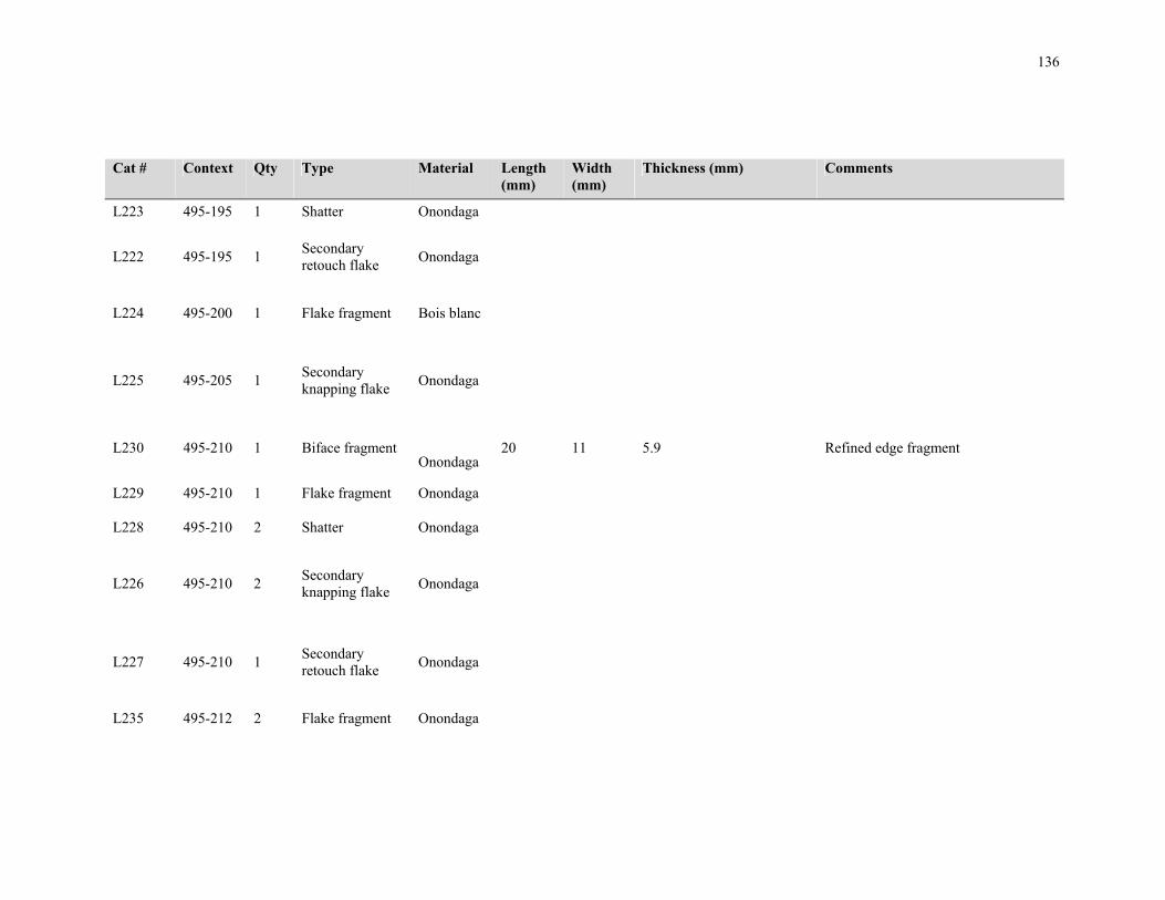
136
Cat # Context Qty Type Material Length (mm)
Width (mm)
Thickness (mm) Comments
L223 495-195 1 Shatter Onondaga
L222 495-195 1 Secondary retouch flake
Onondaga
L224 495-200 1 Flake fragment Bois blanc
L225 495-205 1 Secondary knapping flake
Onondaga
L230 495-210 1 Biface fragment Onondaga
20 11 5.9 Refined edge fragment
L229 495-210 1 Flake fragment Onondaga
L228 495-210 2 Shatter Onondaga
L226 495-210 2 Secondary knapping flake
Onondaga
L227 495-210 1 Secondary retouch flake
Onondaga
L235 495-212 2 Flake fragment Onondaga

137
Cat # Context Qty Type Material Length (mm)
Width (mm)
Thickness (mm) Comments
L233 495-212 2 Primary reduction flake
Onondaga
L234 495-212 1 Secondary retouch flake
Onondaga
L231 495-215 2 Flake fragment Onondaga
L232 495-215 1 Shatter Onondaga
L236 495-220 1 Flake fragment Onondaga
L237 495-220 4 Shatter Onondaga
L239 495-225 1 Shatter Onondaga
L238 495-225 1 Secondary knapping flake
Onondaga
L241 497-215 2 Flake fragment Onondaga
L240 497-215 2 Secondary retouch flake
Onondaga
L242 500-170 1 Secondary retouch flake
Onondaga
L244 500-180 2 Shatter Onondaga
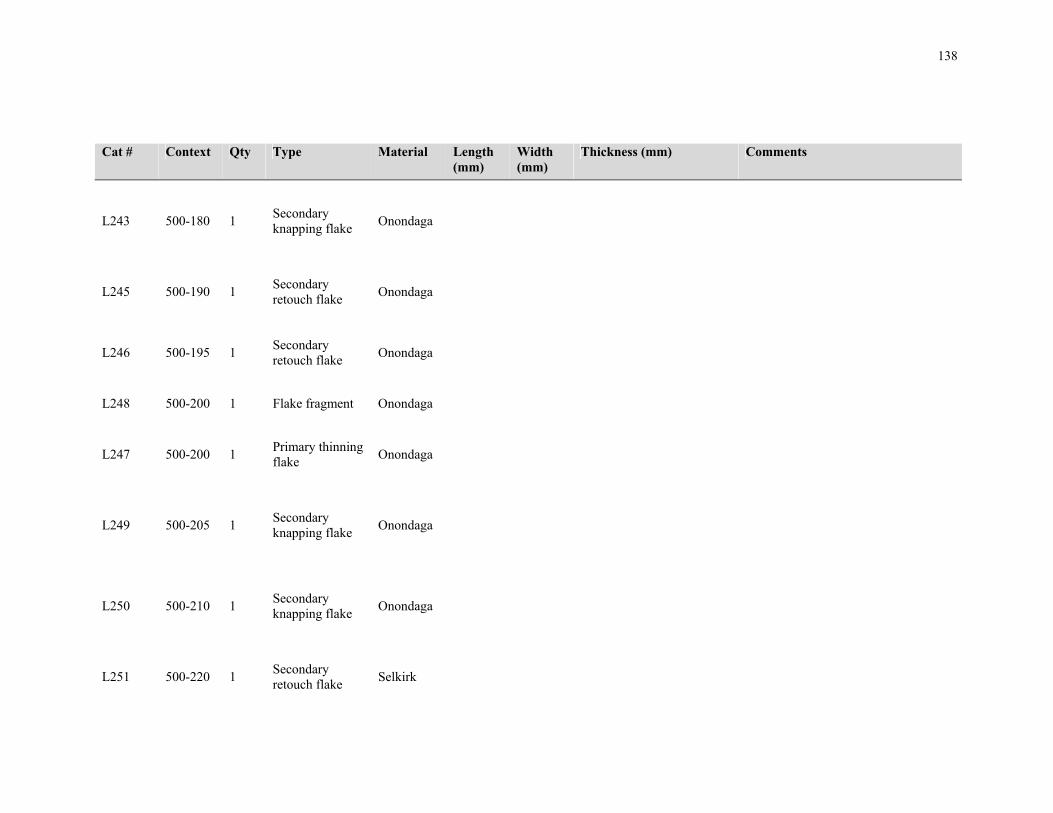
138
Cat # Context Qty Type Material Length (mm)
Width (mm)
Thickness (mm) Comments
L243 500-180 1 Secondary knapping flake
Onondaga
L245 500-190 1 Secondary retouch flake
Onondaga
L246 500-195 1 Secondary retouch flake
Onondaga
L248 500-200 1 Flake fragment Onondaga
L247 500-200 1 Primary thinning flake
Onondaga
L249 500-205 1 Secondary knapping flake
Onondaga
L250 500-210 1 Secondary knapping flake
Onondaga
L251 500-220 1 Secondary retouch flake
Selkirk

139
Cat # Context Qty Type Material Length (mm)
Width (mm)
Thickness (mm) Comments
L270 505-160 1 Shatter Onondaga
L252 505-200 1 Secondary retouch flake
Onondaga
L253 505-205 1 Secondary retouch flake
Onondaga
L254 505-215 2 Flake fragment Onondaga
L255 505-220 1 Flake fragment Onondaga
L269 505-225 1 Biface fragment Bois blanc 17.8 17.5 5.2 Refined medial fragment, possible
L266 510-170 1 Flake fragment Onondaga
L267 510-180 1 Flake fragment Onondaga
L268 510-180 2 Secondary knapping flake
Onondaga
L262 510-210 1 Secondary knapping flake
Onondaga
L263 510-210 1 Shatter Onondaga

140
Cat # Context Qty Type Material Length (mm)
Width (mm)
Thickness (mm) Comments
L260 510-215 1 Secondary knapping flake
Onondaga
L256 510-230 1 Flake fragment Onondaga
L259 515-205 1 Flake fragment Onondaga
L257 515-220 2 Flake fragment Onondaga
L258 520-180 1 Biface fragment Onondaga 33.2 8.3 8.8 Crude edge fragment
L261 520-205 1 Primary reduction flake
Onondaga
L265 520-220 1 Shatter Onondaga
L264 564-184 1 Flake fragment Onondaga

141
Appendix D: Artifact Catalogue from Site AiHd-160
Appendix C.1 Lithic Artifacts Cat # Context Type Stratum Qty Material Notes L100 370N-250E Flake fragment Ploughzone 2 Onondaga
L101 370N-260E Biface Ploughzone 1 Onondaga Refined/late stage, thin triangular biface missing tip w/expanding convex base; L 22.4 mm W 27 mm T 4.3 mm
L102 370N-260E Primary thinning flake Ploughzone 1 Onondaga
L103 370N-260E Secondary retouch flake Ploughzone 1 Onondaga
L104 370N-260E Shatter Ploughzone 7 Onondaga
L105 370N-260E Flake fragment Ploughzone 3 Onondaga
L106 380N-210E Secondary knapping flake Ploughzone 1 Onondaga
L107 380N-210E Shatter Ploughzone 1 Onondaga
L108 380N-220E Secondary knapping flake Ploughzone 1 Onondaga
L109 380N-220E Shatter Ploughzone 3 Onondaga
L110 380N-220E Flake fragment Ploughzone 4 Onondaga

142
Cat # Context Type Stratum Qty Material Notes L111 380N-220E Secondary retouch flake Ploughzone 1 Onondaga
L112 380N-220E Flake fragment Ploughzone 1 Onondaga
L113 380N-230E Primary thinning flake Ploughzone 1 Onondaga
L114 380N-230E Secondary knapping flake Ploughzone 1 Onondaga
L115 380N-230E Secondary retouch flake Ploughzone 1 Onondaga
L116 380N-230E Shatter Ploughzone 5 Onondaga
L117 380N-230E Flake fragment Ploughzone 3 Onondaga
L118 380N-240E Flake fragment Ploughzone 2 Onondaga
L119 380N-250E Secondary retouch flake Ploughzone 2 Onondaga
L120 380N-250E Shatter Ploughzone 8 Onondaga
L121 380N-260E Flake fragment Ploughzone 2 Onondaga
L122 380N-260E Shatter Ploughzone 1 Onondaga
L123 390N-210E Shatter Ploughzone 1 Onondaga
L124 390N-220E Primary reduction flake Ploughzone 1 Onondaga Large flake, possibly intended to be a biface blank
L125 390N-220E Primary thinning flake Ploughzone 1 Onondaga

143
Cat # Context Type Stratum Qty Material Notes L126 390N-220E Secondary retouch flake Ploughzone 3 Onondaga
L127 390N-220E Shatter Ploughzone 2 Onondaga
L128 390N-220E Flake fragment Ploughzone 4 Onondaga
L129 390N-230E Secondary knapping flake Ploughzone 1 Onondaga
L130 390N-230E Flake fragment Ploughzone 2 Onondaga
L131 390N-240E Flake fragment Ploughzone 2 Onondaga
L132 390N-240E Biface fragment Ploughzone 1 Onondaga Crude/early stage, blocky edge fragment; L 26 mm W 18 mm T 12.2 mm
L133 390N-240E Biface fragment Ploughzone 1 Onondaga Refined/early stage, thin basal or tip fragment; L 21.9 mm W 17.9 mm T 5.5 mm
L134 390N-250E Primary thinning flake Ploughzone 2 Onondaga
L135 390N-250E Shatter Ploughzone 2 Onondaga
L136 390N-250E Flake fragment Ploughzone 2 Onondaga
L137 390N-260E Shatter Ploughzone 2 Onondaga
L138 390N-260E Flake fragment Ploughzone 1 Onondaga
L139 400N-210E Shatter Ploughzone 1 Onondaga
L140 400N-210E Flake fragment Ploughzone 1 Onondaga
L141 400N-220E Secondary retouch flake Ploughzone 2 Onondaga
L142 400N-220E Shatter Ploughzone 6 Onondaga

144
Cat # Context Type Stratum Qty Material Notes L143 400N-220E Flake fragment Ploughzone 1 Onondaga
L144 400N-230E Shatter Ploughzone 2 Onondaga
L145 400N-230E Flake fragment Ploughzone 2 Onondaga
L146 400N-240E Projectile point Ploughzone 1 Onondaga Nanticoke Side-Notched; Small Late Woodland side-notched point; L 23.3 mm W 9 mm T 3.5 mm
L147 400N-240E Secondary retouch flake Ploughzone 1 Onondaga
L148 400N-240E Shatter Ploughzone 4 Onondaga
L149 400N-240E Flake fragment Ploughzone 6 Onondaga
L150 400N-250E Primary thinning flake Ploughzone 1 Onondaga
L151 400N-250E Secondary knapping flake Ploughzone 5 Onondaga
L152 400N-250E Secondary retouch flake Ploughzone 1 Onondaga
L153 400N-250E Shatter Ploughzone 7 Onondaga
L154 400N-250E Flake fragment Ploughzone 1 Onondaga
L155 410N-210E Flake fragment Ploughzone 1 Onondaga
L156 410N-210E Secondary knapping flake Ploughzone 1 Onondaga
L157 410N-210E Shatter Ploughzone 1 Onondaga
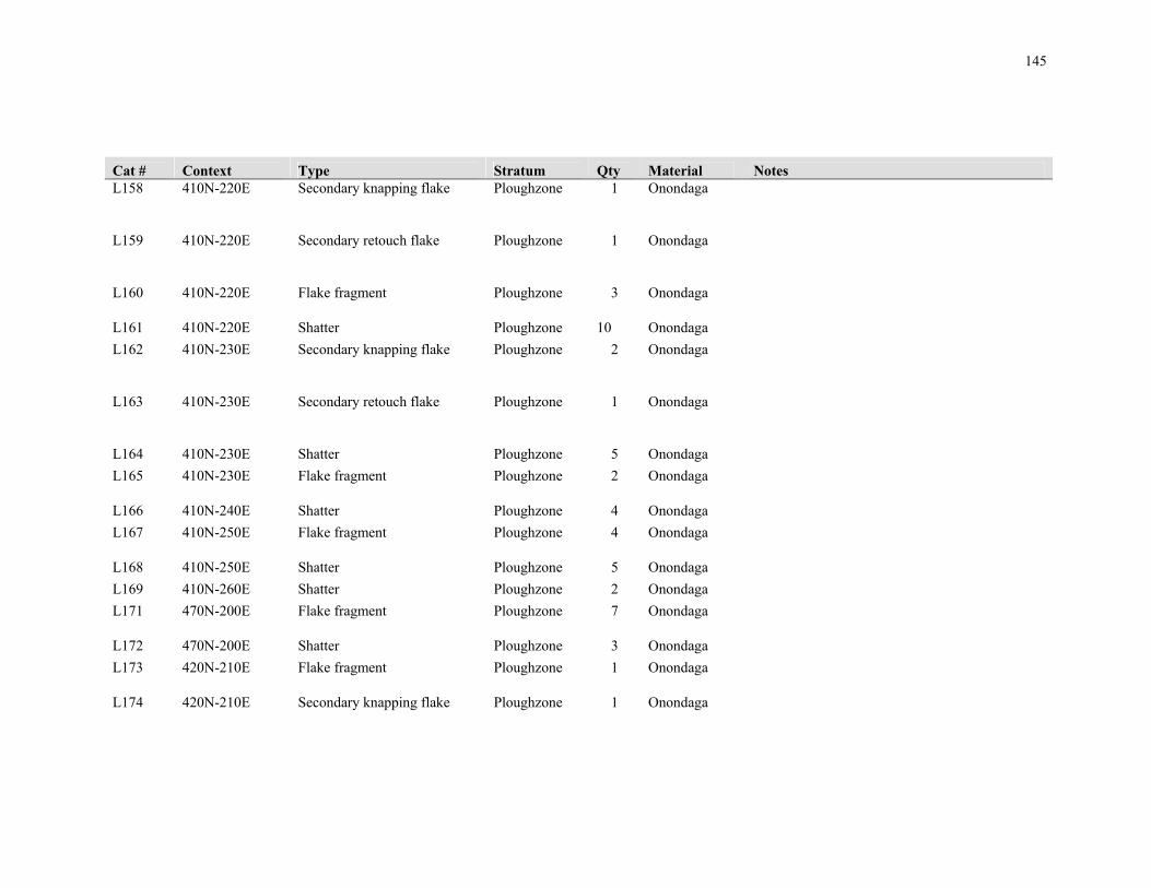
145
Cat # Context Type Stratum Qty Material Notes L158 410N-220E Secondary knapping flake Ploughzone 1 Onondaga
L159 410N-220E Secondary retouch flake Ploughzone 1 Onondaga
L160 410N-220E Flake fragment Ploughzone 3 Onondaga
L161 410N-220E Shatter Ploughzone 10 Onondaga
L162 410N-230E Secondary knapping flake Ploughzone 2 Onondaga
L163 410N-230E Secondary retouch flake Ploughzone 1 Onondaga
L164 410N-230E Shatter Ploughzone 5 Onondaga
L165 410N-230E Flake fragment Ploughzone 2 Onondaga
L166 410N-240E Shatter Ploughzone 4 Onondaga
L167 410N-250E Flake fragment Ploughzone 4 Onondaga
L168 410N-250E Shatter Ploughzone 5 Onondaga
L169 410N-260E Shatter Ploughzone 2 Onondaga
L171 470N-200E Flake fragment Ploughzone 7 Onondaga
L172 470N-200E Shatter Ploughzone 3 Onondaga
L173 420N-210E Flake fragment Ploughzone 1 Onondaga
L174 420N-210E Secondary knapping flake Ploughzone 1 Onondaga

146
Cat # Context Type Stratum Qty Material Notes L175 420N-220E Secondary knapping flake Ploughzone 1 Onondaga
L176 420N-220E Secondary retouch flake Ploughzone 1 Onondaga
L177 420N-220E Shatter Ploughzone 10 Onondaga
L178 420N-220E Flake fragment Ploughzone 1 Onondaga
L179 420N-230E Secondary knapping flake Ploughzone 2 Onondaga
L180 420N-230E Secondary retouch flake Ploughzone 2 Onondaga
L181 420N-230E Shatter Ploughzone 5 Onondaga
L182 420N-230E Flake fragment Ploughzone 2 Onondaga
L183 420N-240E Secondary knapping flake Ploughzone 2 Onondaga
L184 420N-240E Secondary retouch flake Ploughzone 1 Onondaga
L185 420N-240E Flake fragment Ploughzone 2 Onondaga
L186 420N-240E Shatter Ploughzone 1 Onondaga
L187 420N-250E Flake fragment Ploughzone 3 Onondaga
L188 420N-250E Shatter Ploughzone 1 Onondaga
L189 420N-260E Secondary knapping flake Ploughzone 1 Onondaga

147
Cat # Context Type Stratum Qty Material Notes L190 430N-210E Flake fragment Ploughzone 1 Onondaga
L191 430N-210E Secondary knapping flake Ploughzone 1 Onondaga
L192 430N-210E Shatter Ploughzone 1 Onondaga
L193 430N-220E Secondary knapping flake Ploughzone 1 Onondaga
L194 430N-220E Shatter Ploughzone 5 Onondaga
L195 430N-220E Flake fragment Ploughzone 1 Onondaga
L196 430N-230E Shatter Ploughzone 1 Onondaga
L197 430N-230E Flake fragment Ploughzone 1 Onondaga
L198 430N-250E Shatter Ploughzone 1 Onondaga
L199 440N-190E Shatter Ploughzone 1 Onondaga
L200 440N-200E Secondary knapping flake Ploughzone 1 Onondaga
L201 440N-200E Shatter Ploughzone 1 Onondaga
L202 440N-200E Flake fragment Ploughzone 1 Onondaga Modified along portions of one ventral lateral margin, two dorsal lateral margins and along the entire distal/dorsal end
L203 440N-210E Secondary knapping flake Ploughzone 1 Onondaga
L204 440N-210E Shatter Ploughzone 11 Onondaga
L205 440N-210E Flake fragment Ploughzone 4 Onondaga
L206 440N-220E Flake fragment Ploughzone 2 Onondaga

148
Cat # Context Type Stratum Qty Material Notes L207 440N-220E Shatter Ploughzone 1 Onondaga
L208 440N-230E Secondary knapping flake Ploughzone 2 Onondaga
L209 440N-230E Shatter Ploughzone 2 Onondaga
L210 440N-230E Flake fragment Ploughzone 2 Onondaga
L211 440N-240E Secondary knapping flake Ploughzone 1 Onondaga
L212 440N-250E Flake fragment Ploughzone 1 Onondaga
L213 440N-250E Secondary retouch flake Ploughzone 1 Onondaga
L214 450N-190E Secondary knapping flake Ploughzone 1 Onondaga
L215 450N-190E Shatter Ploughzone 1 Onondaga
L216 450N-190E Flake fragment Ploughzone 1 Onondaga
L217 450N-200E Secondary knapping flake Ploughzone 1 Onondaga
L218 450N-200E Flake fragment Ploughzone 1 Onondaga
L219 450N-210E Primary reduction flake Ploughzone 1 Onondaga
L220 450N-210E Shatter Ploughzone 16 Onondaga
L221 450N-210E Secondary retouch flake Ploughzone 1 Onondaga

149
Cat # Context Type Stratum Qty Material Notes L222 450N-210E Flake fragment Ploughzone 4 Onondaga
L223 450N-220E Secondary retouch flake Ploughzone 1 Onondaga
L224 450N-220E Shatter Ploughzone 2 Onondaga
L225 450N-220E Flake fragment Ploughzone 1 Onondaga
L226 450N-230E Flake fragment Ploughzone 1 Onondaga
L227 450N-240E Shatter Ploughzone 2 Onondaga
L228 450N-250E Secondary retouch flake Ploughzone 1 Onondaga
L229 450N-250E Shatter Ploughzone 2 Onondaga
L230 450N-250E Flake fragment Ploughzone 1 Onondaga
L231 460N-190E Secondary retouch flake Ploughzone 1 Onondaga
L232 460N-190E Shatter Ploughzone 4 Onondaga
L233 460N-190E Flake fragment Ploughzone 2 Onondaga
L234 460N-200E Secondary knapping flake Ploughzone 1 Onondaga
L235 460N-200E Shatter Ploughzone 6 Onondaga
L236 460N-200E Flake fragment Ploughzone 2 Onondaga
L237 460N-210E Projectile point Ploughzone 1 Onondaga Levanna; Middle/Late Woodland Levanna point; L 31.3 mm W 19.3 mm T 4.5 mm
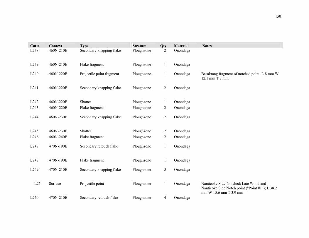
150
Cat # Context Type Stratum Qty Material Notes L238 460N-210E Secondary knapping flake Ploughzone 2 Onondaga
L239 460N-210E Flake fragment Ploughzone 1 Onondaga
L240 460N-220E Projectile point fragment Ploughzone 1 Onondaga Basal/tang fragment of notched point; L 8 mm W 12.1 mm T 3 mm
L241 460N-220E Secondary knapping flake Ploughzone 2 Onondaga
L242 460N-220E Shatter Ploughzone 1 Onondaga
L243 460N-220E Flake fragment Ploughzone 2 Onondaga
L244 460N-230E Secondary knapping flake Ploughzone 2 Onondaga
L245 460N-230E Shatter Ploughzone 2 Onondaga
L246 460N-240E Flake fragment Ploughzone 2 Onondaga
L247 470N-190E Secondary retouch flake Ploughzone 1 Onondaga
L248 470N-190E Flake fragment Ploughzone 1 Onondaga
L249 470N-210E Secondary knapping flake Ploughzone 5 Onondaga
L25 Surface Projectile point Ploughzone 1 Onondaga Nanticoke Side-Notched; Late Woodland Nanticoke Side Notch point ("Point #1"); L 38.2 mm W 15.6 mm T 3.9 mm
L250 470N-210E Secondary retouch flake Ploughzone 4 Onondaga

151
Cat # Context Type Stratum Qty Material Notes L251 470N-210E Shatter Ploughzone 11 Onondaga
L252 470N-210E Flake fragment Ploughzone 6 Onondaga
L253 470N-220E Biface Ploughzone 1 Onondaga Refined/late stage, crescent-shaped w/concave base; L 21.4 mm W 25.5 mm T 5.1 mm
L254 470N-220E Secondary knapping flake Ploughzone 5 Onondaga
L255 470N-220E Secondary retouch flake Ploughzone 5 Onondaga
L256 470N-220E Shatter Ploughzone 16 Onondaga
L257 470N-220E Flake fragment Ploughzone 16 Onondaga
L258 470N-230E Secondary retouch flake Ploughzone 1 Onondaga
L259 480N-180E Shatter Ploughzone 1 Onondaga
L26 Surface Projectile point Ploughzone 1 Onondaga Adena; Early Woodland Adena point heavily resharpened into a "bunt", ("Tool #1"); L 28 mm W 20.8 mm T 5.7 mm
L260 480N-180E Flake fragment Ploughzone 1 Onondaga
L261 480N-190E Secondary retouch flake Ploughzone 1 Onondaga
L262 480N-190E Shatter Ploughzone 2 Onondaga
L263 480N-190E Flake fragment Ploughzone 1 Onondaga
L264 480N-200E Secondary retouch flake Ploughzone 2 Onondaga

152
Cat # Context Type Stratum Qty Material Notes L265 480N-200E Flake fragment Ploughzone Onondaga
L266 480N-210E Secondary knapping flake Ploughzone 4 Onondaga
L267 480N-210E Secondary retouch flake Ploughzone 2 Onondaga
L268 480N-210E Shatter Ploughzone 3 Onondaga
L269 480N-210E Flake fragment Ploughzone 2 Onondaga
L27 Surface Biface fragment Ploughzone 1 Haldimand Refined tip, possible point fragment, ("Point #2"); L 28 mm W 20.8 mm T 5.7 mm
L270 480N-220E Primary thinning flake Ploughzone 1 Onondaga
L271 480N-220E Secondary knapping flake Ploughzone 9 Onondaga
L272 480N-220E Secondary retouch flake Ploughzone 3 Onondaga
L273 480N-220E Shatter Ploughzone 1 Onondaga
L274 480N-220E Flake fragment Ploughzone 19 Onondaga
L275 490N-160E Shatter Ploughzone 1 Onondaga
L276 490N-160E Biface fragment Ploughzone 1 Onondaga Semi-refined/medium stage basal fragment; L 26.5 mm W 21.1 mm T 7 mm
L277 490N-170E Shatter Ploughzone 1 Onondaga
L278 490N-170E Flake fragment Ploughzone 1 Onondaga
L279 490N-180E Biface fragment Ploughzone 1 Onondaga Refined tip, possible point fragment; L 21.8 mm W 16 mm T 4 mm

153
Cat # Context Type Stratum Qty Material Notes L28 Surface Biface fragment Ploughzone 1 Onondaga Refined, thin blade fragment,
resharpened/modified with spokeshave-like margin; L 57.2 mm W 35 mm T 5.5 mm
L280 490N-180E Flake fragment Ploughzone 1 Onondaga
L281 490N-200E Shatter Ploughzone 2 Onondaga
L282 490N-200E Shatter Ploughzone 2 Onondaga
L283 490N-210E Secondary retouch flake Ploughzone 1 Onondaga
L284 490N-210E Flake fragment Ploughzone 4 Onondaga
L285 490N-220E Secondary knapping flake Ploughzone 3 Onondaga
L286 490N-220E Secondary retouch flake Ploughzone 1 Onondaga
L287 490N-220E Shatter Ploughzone 1 Onondaga
L288 490N-220E Flake fragment Ploughzone 5 Onondaga
L289 490N-190E Secondary knapping flake Ploughzone 1 Onondaga
L29 Surface Biface Ploughzone 1 Onondaga Large, refined/late stage tear drop-shaped
L290 490N-190E Flake fragment Ploughzone 1 Onondaga
L292 490N-230E Flake fragment Ploughzone 1 Onondaga
L293 495N-160E Primary thinning flake Ploughzone 1 Onondaga
L294 495N-160E Shatter Ploughzone 1 Onondaga

154
Cat # Context Type Stratum Qty Material Notes L295 500N-160E Secondary knapping flake Ploughzone 1 Onondaga
L296 500N-160E Flake fragment Ploughzone 1 Onondaga
L297 500N-170E Secondary knapping flake Ploughzone 2 Onondaga
L298 500N-170E Shatter Ploughzone 7 Onondaga
L299 500N-170E Flake fragment Ploughzone 2 Onondaga
L30 Surface Projectile point fragment Ploughzone 1 Upper Mercer Refined, narrow tip, possible point fragment; L 20.6 mm W 10.8 mm T 3.1 mm
L300 500N-180E Shatter Ploughzone 2 Onondaga
L301 500N-190E Primary thinning flake Ploughzone 1 Onondaga
L302 500N-190E Secondary retouch flake Ploughzone 1 Onondaga
L303 500N-190E Shatter Ploughzone 1 Onondaga
L304 500N-190E Flake fragment Ploughzone 1 Onondaga
L305 500N-200E Secondary knapping flake Ploughzone 1 Onondaga
L306 500N-200E Secondary retouch flake Ploughzone 1 Onondaga
L307 500N-200E Flake fragment Ploughzone 1 Onondaga

155
Cat # Context Type Stratum Qty Material Notes L308 500N-210E Biface fragment Ploughzone 1 Onondaga Crude/early stage edge fragment; L 33.3 mm W
14.4 mm T 10 mm L309 500N-210E Secondary knapping flake Ploughzone 2 Onondaga
L31 Surface Core/Core fragment Ploughzone 2 Onondaga
L310 500N-210E Shatter Ploughzone 3 Onondaga
L311 500N-210E Flake fragment Ploughzone 5 Onondaga
L312 500N-220E Shatter Ploughzone 2 Onondaga
L313 500N-220E Flake fragment Ploughzone 5 Onondaga
L314 500N-230E Shatter Ploughzone 2 Onondaga
L315 500N-230E Flake fragment Ploughzone 1 Onondaga
L316 510N-150E Biface fragment Ploughzone 1 Onondaga Semi-refined/medium stage basal fragment; L 29 mm W 30.1 mm T 7.2 mm
L317 510N-150E Shatter Ploughzone 2 Onondaga
L318 510N-170E Shatter Ploughzone 6 Onondaga
L319 510N-170E Flake fragment Ploughzone 1 Onondaga
L32 Surface Biface fragment Ploughzone 1 Onondaga Refined, thin, rectangular base/midsection; L 23.4 mm W 19.8 mm T 5 mm
L320 510N-180E Secondary knapping flake Ploughzone 1 Onondaga
L321 510N-180E Flake fragment Ploughzone 1 Onondaga
L322 510N-190E Secondary knapping flake Ploughzone 1 Onondaga
L323 510N-190E Shatter Ploughzone 3 Onondaga

156
Cat # Context Type Stratum Qty Material Notes L324 510N-190E Flake fragment Ploughzone 2 Onondaga
L325 510N-190E Biface fragment Ploughzone 1 Onondaga Crude/early stage fragment; L 24.5 mm W 42.3 mm T 10.5 mm
L326 510N-200E Projectile point fragment Ploughzone 1 Onondaga Notched point/thin blade fragment w/one intact barb; L 19.5 mm W 19.8 mm T 3.8 mm
L327 510N-200E Flake fragment Ploughzone 3 Onondaga
L328 510N-200E Shatter Ploughzone 1 Onondaga
L329 510N-210E Secondary retouch flake Ploughzone 1 Onondaga
L33 Surface End scraper Ploughzone 1 Onondaga L 28.5 mm W 22.5 mm T 8.5 mm
L330 510N-210E Secondary retouch flake Ploughzone 1 Onondaga
L331 510N-210E Shatter Ploughzone 5 Onondaga
L332 510N-210E Flake fragment Ploughzone 1 Onondaga
L333 510N-220E Shatter Ploughzone 2 Onondaga
L334 510N-220E Flake fragment Ploughzone 1 Onondaga
L335 520N-170E Shatter Ploughzone 1 Onondaga
L336 520N-180E Secondary knapping flake Ploughzone 2 Onondaga
L337 520N-180E Shatter Ploughzone 1 Onondaga
L338 520N-180E Flake fragment Ploughzone 1 Onondaga
L339 520N-180E Flake fragment Ploughzone 1 Onondaga Modified along a portion of one ventral lateral margin

157
Cat # Context Type Stratum Qty Material Notes L34 Surface Projectile point fragment Ploughzone 1 Onondaga Nanticoke Side-Notched; Late Woodland
Nanticoke Side Notch point base; L 13.5 mm W 15.1 mm T 3.5 mm
L340 520N-190E Secondary retouch flake Ploughzone 1 Onondaga
L341 520N-190E Secondary retouch flake Ploughzone 1 Kettle point
L342 520N-190E Shatter Ploughzone 3 Onondaga
L343 520N-190E Flake fragment Ploughzone 6 Onondaga
L344 520N-200E Secondary knapping flake Ploughzone 3 Onondaga
L345 520N-200E Secondary retouch flake Ploughzone 1 Onondaga
L346 520N-200E Shatter Ploughzone 5 Onondaga
L347 520N-200E Flake fragment Ploughzone 4 Onondaga
L348 520N-210E Secondary knapping flake Ploughzone 3 Onondaga
L349 520N-210E Secondary retouch flake Ploughzone 4 Onondaga
L35 Surface Projectile point fragment Ploughzone 1 Onondaga Medial fragment; L 12 mm W 14 mm T 2.5 mm
L350 520N-210E Secondary retouch flake Ploughzone 1 Flint Ridge chalcedony

158
Cat # Context Type Stratum Qty Material Notes L351 520N-210E Shatter Ploughzone 3 Onondaga
L352 520N-210E Flake fragment Ploughzone 11 Onondaga
L353 520N-220E Flake fragment Ploughzone 2 Onondaga
L354 520N-230E Flake fragment Ploughzone 2 Onondaga
L355 530N-170E Shatter Ploughzone 2 Onondaga
L356 530N-180E Secondary retouch flake Ploughzone 1 Onondaga
L357 530N-180E Flake fragment Ploughzone 3 Onondaga
L358 530N-190E Secondary knapping flake Ploughzone 1 Onondaga
L359 530N-190E Shatter Ploughzone 3 Onondaga
L36 Surface Projectile point fragment Ploughzone 1 Onondaga Notched point fragment w/both barbs; L 15.5 mm W 18.7 mm T 4.9 mm
L360 530N-190E Flake fragment Ploughzone 8 Onondaga
L361 530N-200E Biface fragment Ploughzone 1 Onondaga Refined/late stage, elongated tip, possible point fragment; L 29.6 mm W 15.5 mm T 3.9 mm
L362 530N-200E Primary thinning flake Ploughzone 1 Onondaga Modified along a portion of the proximal dorsal end
L363 530N-200E Secondary knapping flake Ploughzone 11 Onondaga
L364 530N-200E Secondary retouch flake Ploughzone 5 Onondaga

159
Cat # Context Type Stratum Qty Material Notes L365 530N-200E Shatter Ploughzone 14 Onondaga
L366 530N-200E Flake fragment Ploughzone 18 Onondaga
L367 530N-210E Core/Core fragment Ploughzone 1 Onondaga
L368 530N-210E Primary thinning flake Ploughzone 1 Onondaga
L369 530N-210E Secondary knapping flake Ploughzone 1 Onondaga
L37 Surface End scraper Ploughzone 1 Onondaga Bit end fragment; L 15 mm W 18.5 mm T 7.4 mm
L370 530N-210E Secondary knapping flake Ploughzone 1 Flint Ridge chalcedony
L371 530N-210E Shatter Ploughzone 5 Onondaga
L372 530N-210E Flake fragment Ploughzone 5 Onondaga
L373 540N-170E Shatter Ploughzone 2 Onondaga
L374 540N-180E Core/Core fragment Ploughzone 1 Onondaga
L375 540N-180E Secondary knapping flake Ploughzone 1 Onondaga
L376 540N-180E Flake fragment Ploughzone 2 Onondaga
L377 540N-190E Secondary knapping flake Ploughzone 2 Onondaga

160
Cat # Context Type Stratum Qty Material Notes L378 540N-190E Secondary retouch flake Ploughzone 2 Onondaga
L379 540N-190E Shatter Ploughzone 4 Onondaga
L38 Surface Biface Ploughzone 1 Onondaga Small, refined/late stage, rectangular, missing tip; L 22.8 mm W 17.9 mm T 4.5 mm
L380 540N-190E Flake fragment Ploughzone 3 Onondaga
L381 540N-200E Secondary knapping flake Ploughzone 1 Onondaga
L382 540N-200E Shatter Ploughzone 4 Onondaga
L383 540N-200E Flake fragment Ploughzone 3 Onondaga
L384 540N-210E Shatter Ploughzone 3 Onondaga
L385 540N-210E Flake fragment Ploughzone 3 Onondaga
L386 550N-180E Shatter Ploughzone 1 Onondaga
L387 550N-180E Flake fragment Ploughzone 1 Onondaga
L388 550N-190E Biface fragment Ploughzone 1 Onondaga Crude/early stage fragment split longitudinally; L 43.8 mm W 24 mm T 9.5 mm
L389 550N-190E End scraper Ploughzone 1 Onondaga Large, bifacially-worked; L 40 mm W 32.8 mm T 11.5 mm
L39 Surface Biface fragment Ploughzone 1 Onondaga Refined/late stage, broad, rounded tip; L 14 mm W 21 mm T 4.9 mm
L390 550N-190E Secondary knapping flake Ploughzone 1 Onondaga
L391 550N-190E Shatter Ploughzone 3 Onondaga
L392 550N-190E Flake fragment Ploughzone 4 Onondaga
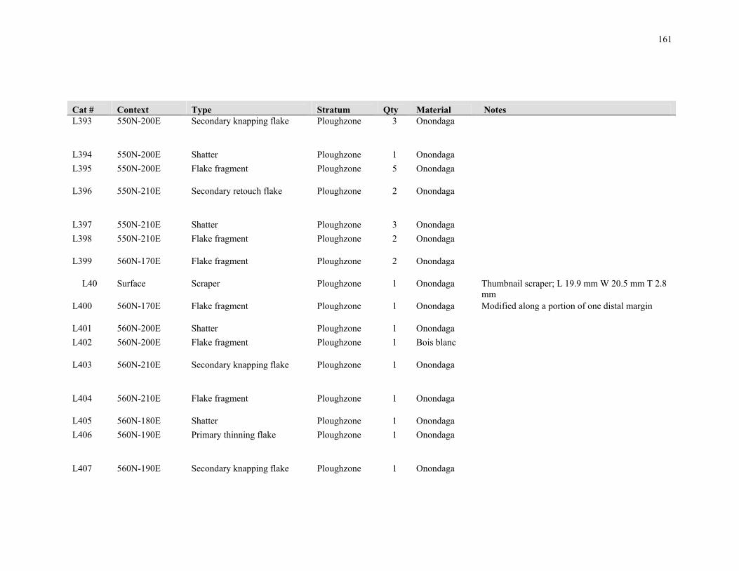
161
Cat # Context Type Stratum Qty Material Notes L393 550N-200E Secondary knapping flake Ploughzone 3 Onondaga
L394 550N-200E Shatter Ploughzone 1 Onondaga
L395 550N-200E Flake fragment Ploughzone 5 Onondaga
L396 550N-210E Secondary retouch flake Ploughzone 2 Onondaga
L397 550N-210E Shatter Ploughzone 3 Onondaga
L398 550N-210E Flake fragment Ploughzone 2 Onondaga
L399 560N-170E Flake fragment Ploughzone 2 Onondaga
L40 Surface Scraper Ploughzone 1 Onondaga Thumbnail scraper; L 19.9 mm W 20.5 mm T 2.8 mm
L400 560N-170E Flake fragment Ploughzone 1 Onondaga Modified along a portion of one distal margin
L401 560N-200E Shatter Ploughzone 1 Onondaga
L402 560N-200E Flake fragment Ploughzone 1 Bois blanc
L403 560N-210E Secondary knapping flake Ploughzone 1 Onondaga
L404 560N-210E Flake fragment Ploughzone 1 Onondaga
L405 560N-180E Shatter Ploughzone 1 Onondaga
L406 560N-190E Primary thinning flake Ploughzone 1 Onondaga
L407 560N-190E Secondary knapping flake Ploughzone 1 Onondaga

162
Cat # Context Type Stratum Qty Material Notes L408 560N-190E Shatter Ploughzone 5 Onondaga
L409 560N-190E Flake fragment Ploughzone 1 Onondaga
L41 Surface Biface fragment Ploughzone 1 Onondaga Semi-refined/medium stage fragment; L 31.8 mm W 17 mm T 8 mm
L410 570N-170E Primary thinning flake Ploughzone 1 Onondaga
L411 570N-170E Secondary retouch flake Ploughzone 3 Onondaga
L412 570N-170E Shatter Ploughzone 1 Onondaga
L413 570N-170E Flake fragment Ploughzone 1 Onondaga
L414 570N-180E Shatter Ploughzone 4 Onondaga
L415 570N-180E Flake fragment Ploughzone 2 Onondaga
L416 570N-180E Flake fragment Ploughzone 1 Onondaga Modified along one dorsal margin
L417 570N-180E Flake fragment Ploughzone 1 Bois blanc
L418 570N-190E Primary thinning flake Ploughzone 1 Onondaga
L419 570N-190E Secondary knapping flake Ploughzone 2 Onondaga
L42 Surface Biface fragment Ploughzone 1 Onondaga Rounded, semi-refined/medium stage tip fragment; L 19.9 mm W 19.5 mm T 5.5 mm
L420 570N-190E Secondary retouch flake Ploughzone 1 Onondaga
L421 570N-190E Shatter Ploughzone 5 Onondaga

163
Cat # Context Type Stratum Qty Material Notes L422 570N-190E Flake fragment Ploughzone 3 Onondaga
L423 570N-200E Primary thinning flake Ploughzone 1 Onondaga
L424 570N-210E Primary reduction flake Ploughzone 1 Onondaga
L425 570N-210E Secondary knapping flake Ploughzone 1 Onondaga
L426 570N-210E Shatter Ploughzone 6 Onondaga
L427 570N-210E Flake fragment Ploughzone 2 Onondaga
L428 570N-210E Shatter Ploughzone 1 Onondaga
L429 570N-210E Flake fragment Ploughzone 1 Onondaga
L43 Surface Biface fragment Ploughzone 1 Onondaga Semi-refined/medium stage basal fragment w/straight base; L 7.5 mm W 19.9 mm T 9.8 mm
L430 580N-180E Secondary knapping flake Ploughzone 1 Onondaga
L431 580N-180E Shatter Ploughzone 2 Onondaga
L432 580N-180E Flake fragment Ploughzone 1 Onondaga
L433 580N-190E Secondary knapping flake Ploughzone 2 Onondaga
L434 580N-190E Shatter Ploughzone 6 Onondaga
L435 580N-190E Flake fragment Ploughzone 2 Onondaga

164
Cat # Context Type Stratum Qty Material Notes L436 580N-200E Secondary knapping flake Ploughzone 1 Onondaga
L437 580N-200E Flake fragment Ploughzone 2 Onondaga
L438 590N-180E Secondary knapping flake Ploughzone 1 Onondaga
L439 590N-200E Shatter Ploughzone 2 Onondaga
L44 Surface Biface fragment Ploughzone 1 Onondaga Rounded, refined basal fragment; L 15.5 mm W 22.5 mm T 4.7 mm
L440 590N-200E Flake fragment Ploughzone 2 Onondaga
L441 590N-210E Flake fragment Ploughzone 2 Onondaga
L442 590N-230E Flake fragment Ploughzone 1 Onondaga
L443 600N-190E Secondary knapping flake Ploughzone 1 Onondaga Modified along a portion of one upper distal lateral margin
L444 600N-190E Flake fragment Ploughzone 3 Onondaga
L445 590N-190E Shatter Ploughzone 5 Onondaga
L446 590N-190E Flake fragment Ploughzone 2 Onondaga
L447 600N-200E Secondary knapping flake Ploughzone 3 Onondaga
L448 600N-200E Secondary retouch flake Ploughzone 1 Onondaga
L449 600N-200E Shatter Ploughzone 5 Onondaga

165
Cat # Context Type Stratum Qty Material Notes L45 Surface Biface fragment Ploughzone 1 Onondaga Crude fragment; L 27.7 mm W 25 mm T 7.5 mm
L450 600N-200E Flake fragment Ploughzone 3 Onondaga
L451 600N-210E Flake fragment Ploughzone 1 Onondaga
L452 600N-210E Shatter Ploughzone 4 Onondaga
L453 610N-180E Secondary knapping flake Ploughzone 1 Onondaga
L454 610N-190E Flake fragment Ploughzone 2 Onondaga
L455 610N-200E Secondary knapping flake Ploughzone 5 Onondaga
L456 610N-200E Secondary retouch flake Ploughzone 2 Onondaga
L457 610N-200E Shatter Ploughzone 2 Onondaga
L458 610N-200E Flake fragment Ploughzone 8 Onondaga
L459 610N-210E Primary thinning flake Ploughzone 1 Onondaga
L46 Surface Biface fragment Ploughzone 1 Onondaga Semi-refined, rounded basal fragment; L 23.8 mm W 21.5 mm T 5.1 mm
L460 610N-210E Secondary knapping flake Ploughzone 1 Haldimand
L461 610N-210E Secondary knapping flake Ploughzone 3 Onondaga

166
Cat # Context Type Stratum Qty Material Notes L462 610N-210E Secondary retouch flake Ploughzone 1 Onondaga
L463 610N-210E Shatter Ploughzone 2 Onondaga
L464 610N-210E Flake fragment Ploughzone 5 Onondaga
L465 620N-170E Secondary knapping flake Ploughzone 1 Onondaga
L465 465N-195E Shatter Ploughzone 3 Onondaga
L466 620N-170E Shatter Ploughzone 4 Onondaga
L467 620N-180E Shatter Ploughzone 1 Onondaga
L468 620N-190E Flake fragment Ploughzone 5 Onondaga
L469 620N-200E Flake fragment Ploughzone 2 Onondaga
L47 Surface Biface fragment Ploughzone 1 Onondaga Semi-refined fragment; L 25.2 mm W 19.9 mm T 8.5 mm
L470 620N-210E Shatter Ploughzone 1 Onondaga
L471 620N-210E Flake fragment Ploughzone 3 Onondaga
L472 630N-170E Secondary knapping flake Ploughzone 1 Onondaga
L473 630N-170E Shatter Ploughzone 1 Onondaga Modified along one ventral margin
L474 630N-180E Shatter Ploughzone 9 Onondaga
L475 630N-180E Secondary knapping flake Ploughzone 1 Onondaga
L476 630N-180E Primary thinning flake Ploughzone 1 Onondaga

167
Cat # Context Type Stratum Qty Material Notes L477 630N-180E Flake fragment Ploughzone 3 Onondaga
L478 630N-190E Secondary knapping flake Ploughzone 2 Onondaga
L479 630N-190E Shatter Ploughzone 3 Onondaga
L48 Surface Biface fragment Ploughzone 1 Onondaga Semi-refined/medium stage fragment; L 22.5 mm W 31.5 mm T 7 mm
L480 640N-190E Shatter Ploughzone 1 Onondaga
L481 640N-180E Shatter Ploughzone 1 Onondaga
L482 640N-200E Shatter Ploughzone 2 Onondaga
L483 650N-190E Shatter Ploughzone 2 Onondaga
L484 650N-200E Shatter Ploughzone 1 Onondaga
L485 Surface Projectile point fragment Ploughzone 1 Onondaga Innes; Late Archaic Innes point, missing tip; L 26.2 mm W 21.9 mm T 5.7 mm
L486 330N-270E Flake fragment Ploughzone 1 Onondaga
L487 330N-270E Shatter Ploughzone 1 Onondaga
L488 340N-270E Shatter Ploughzone 1 Onondaga
L489 350N-230E Shatter Ploughzone 3 Onondaga
L49 Surface Biface fragment Ploughzone 1 Onondaga Refined/late stage concave basal fragment; L 17.5 mm W 18.9 mm T 4.7 mm
L490 350N-230E Flake fragment Ploughzone 1 Onondaga
L491 350N-270E Secondary knapping flake Ploughzone 6 Onondaga
L492 350N-270E Secondary retouch flake Ploughzone 2 Onondaga
L493 350N-270E Shatter Ploughzone 4 Onondaga

168
Cat # Context Type Stratum Qty Material Notes L494 350N-270E Flake fragment Ploughzone 6 Onondaga
L495 360N-270E Secondary knapping flake Ploughzone 2 Onondaga
L496 360N-270E Flake fragment Ploughzone 1 Onondaga
L497 375N-225E Secondary knapping flake Ploughzone 1 Onondaga
L498 375N-225E Flake fragment Ploughzone 3 Onondaga
L499 375N-235E Secondary knapping flake Ploughzone 3 Onondaga
L50 Surface Biface fragment Ploughzone 1 Kettle point Crude/early stage fragment; L 28.4 mm W 28.8 mm T 10.1 mm
L500 375N-235E Shatter Ploughzone 2 Onondaga
L501 375N-235E Flake fragment Ploughzone 2 Onondaga
L502 375N-235E Core/Core fragment Ploughzone 1 Onondaga
L503 375N-255E Secondary knapping flake Ploughzone 8 Onondaga
L504 375N-255E Secondary retouch flake Ploughzone 5 Onondaga
L505 375N-255E Shatter Ploughzone 17 Onondaga
L506 375N-255E Flake fragment Ploughzone 15 Onondaga
L507 385N-255E Flake fragment Ploughzone 2 Onondaga

169
Cat # Context Type Stratum Qty Material Notes L508 395N-225E Secondary knapping flake Ploughzone 1 Onondaga
L509 395N-225E Secondary retouch flake Ploughzone 3 Onondaga
L51 Surface End scraper Ploughzone 1 Onondaga End scraper w/modification along one ventral margin, damaged dorsal face; L 33 mm W 17 mm T 9 mm
L510 395N-225E Shatter Ploughzone 1 Onondaga
L511 395N-225E Flake fragment Ploughzone 5 Onondaga
L512 395N-235E Secondary retouch flake Ploughzone 1 Onondaga
L513 395N-245E Secondary knapping flake Ploughzone 1 Onondaga
L514 395N-245E Secondary retouch flake Ploughzone 1 Onondaga
L515 395N-245E Flake fragment Ploughzone 4 Onondaga
L516 395N-245E Biface fragment Ploughzone 1 Onondaga Thin, refined fragment; L 19.6 mm W 19.9 mm T 3.3 mm
L517 395N-255E Secondary knapping flake Ploughzone 1 Onondaga
L518 395N-255E Shatter Ploughzone 1 Onondaga
L519 395N-255E Flake fragment Ploughzone 1 Onondaga
L52 Surface Biface fragment Ploughzone 1 Onondaga Semi-refined fragment; L 21.2 mm W 14.7 mm T 5.5 mm

170
Cat # Context Type Stratum Qty Material Notes L520 405N-225E Secondary knapping flake Ploughzone 1 Onondaga
L521 405N-225E Flake fragment Ploughzone 5 Onondaga
L523 405N-235E Secondary knapping flake Ploughzone 1 Onondaga
L524 405N-235E Shatter Ploughzone 5 Onondaga
L525 405N-235E Flake fragment Ploughzone 2 Onondaga
L526 405N-245E Secondary knapping flake Ploughzone 3 Onondaga
L527 405N-245E Secondary retouch flake Ploughzone 1 Onondaga
L528 405N-245E Shatter Ploughzone 2 Onondaga
L529 405N-245E Flake fragment Ploughzone 2 Onondaga
L53 Surface Primary reduction flake Ploughzone 1 Onondaga Modified along entire ventral circumference
L530 405N-245E Biface fragment Ploughzone 1 Onondaga Edge fragment; L 19 mm W 16.8 mm T 4.2 mm
L531 415N-215E Secondary retouch flake Ploughzone 1 Onondaga
L532 415N-215E Shatter Ploughzone 3 Onondaga
L533 415N-225E Core/Core fragment Ploughzone 1 Onondaga

171
Cat # Context Type Stratum Qty Material Notes L534 415N-225E Secondary knapping flake Ploughzone 1 Onondaga
L535 415N-225E Secondary retouch flake Ploughzone 2 Onondaga
L536 415N-225E Shatter Ploughzone 11 Onondaga
L537 415N-235E Secondary knapping flake Ploughzone 4 Onondaga
L538 415N-235E Shatter Ploughzone 3 Onondaga
L539 415N-235E Flake fragment Ploughzone 4 Onondaga
L54 Surface Secondary knapping flake Ploughzone 1 Onondaga Modified along one ventral margin
L540 415N-255E Secondary knapping flake Ploughzone 1 Onondaga
L541 415N-255E Secondary retouch flake Ploughzone 2 Onondaga
L542 415N-255E Shatter Ploughzone 1 Onondaga
L543 415N-255E Flake fragment Ploughzone 4 Onondaga
L544 425N-215E Secondary knapping flake Ploughzone 1 Onondaga
L545 425N-215E Secondary retouch flake Ploughzone 1 Onondaga

172
Cat # Context Type Stratum Qty Material Notes L546 425N-225E Secondary knapping flake Ploughzone 1 Onondaga
L547 425N-225E Secondary retouch flake Ploughzone 1 Onondaga
L548 425N-225E Shatter Ploughzone 3 Onondaga
L549 425N-225E Flake fragment Ploughzone 3 Onondaga
L55 Surface Secondary knapping flake Ploughzone 1 Onondaga Modified along one ventral margin
L550 425N-235E Secondary retouch flake Ploughzone 2 Onondaga
L551 425N-235E Shatter Ploughzone 1 Kettle point
L552 425N-235E Shatter Ploughzone 3 Onondaga
L553 425N-235E Flake fragment Ploughzone 3 Onondaga
L554 435N-215E Shatter Ploughzone 5 Onondaga
L555 435N-215E Flake fragment Ploughzone 1 Onondaga
L556 440N-180E Shatter Ploughzone 1 Onondaga
L557 440N-270E Flake fragment Ploughzone 1 Onondaga
L558 445N-205E Flake fragment Ploughzone 1 Onondaga
L559 445N-205E Shatter Ploughzone 1 Onondaga
L56 Surface Primary thinning flake Ploughzone 54 Onondaga

173
Cat # Context Type Stratum Qty Material Notes L560 445N-215E Secondary knapping flake Ploughzone 1 Onondaga
L561 445N-215E Secondary retouch flake Ploughzone 1 Onondaga
L562 445N-215E Shatter Ploughzone 2 Onondaga
L563 450N-260E Flake fragment Ploughzone 1 Onondaga
L564 455N-195E Secondary knapping flake Ploughzone 1 Onondaga
L565 455N-195E Secondary retouch flake Ploughzone 4 Onondaga
L566 455N-195E Shatter Ploughzone 5 Onondaga
L567 455N-195E Flake fragment Ploughzone 7 Onondaga
L568 455N-205E Biface fragment Ploughzone 1 Onondaga Small, refined, concave basal fragment, possible point fragment; L 8.1 mm W 16.5 mm T 3.9 mm
L569 455N-205E Secondary retouch flake Ploughzone 1 Onondaga
L57 Surface Secondary knapping flake Ploughzone 151 Onondaga
L570 455N-215E Flake fragment Ploughzone 2 Onondaga
L571 460N-270E Shatter Ploughzone 1 Onondaga
L573 465N-195E Flake fragment Ploughzone 2 Onondaga
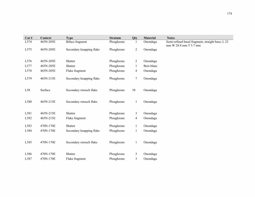
174
Cat # Context Type Stratum Qty Material Notes L574 465N-205E Biface fragment Ploughzone 1 Onondaga Semi-refined basal fragment, straight base; L 23
mm W 28.8 mm T 5.7 mm L575 465N-205E Secondary knapping flake Ploughzone 2 Onondaga
L576 465N-205E Shatter Ploughzone 2 Onondaga
L577 465N-205E Shatter Ploughzone 1 Bois blanc
L578 465N-205E Flake fragment Ploughzone 4 Onondaga
L579 465N-215E Secondary knapping flake Ploughzone 7 Onondaga
L58 Surface Secondary retouch flake Ploughzone 38 Onondaga
L580 465N-215E Secondary retouch flake Ploughzone 1 Onondaga
L581 465N-215E Shatter Ploughzone 3 Onondaga
L582 465N-215E Flake fragment Ploughzone 4 Onondaga
L583 470N-170E Shatter Ploughzone 1 Onondaga
L584 470N-170E Secondary knapping flake Ploughzone 1 Onondaga
L585 470N-170E Secondary retouch flake Ploughzone 1 Onondaga
L586 470N-170E Shatter Ploughzone 3 Onondaga
L587 470N-170E Flake fragment Ploughzone 3 Onondaga

175
Cat # Context Type Stratum Qty Material Notes L588 470N-250E Secondary retouch flake Ploughzone 2 Onondaga
L589 470N-250E Flake fragment Ploughzone 1 Onondaga
L59 Surface Flake fragment Ploughzone 339 Onondaga
L590 470N-260E Secondary retouch flake Ploughzone 1 Onondaga
L591 475N-205E Secondary knapping flake Ploughzone 2 Onondaga
L592 475N-205E Flake fragment Ploughzone 2 Onondaga
L593 475N-215E Secondary knapping flake Ploughzone 7 Onondaga
L594 475N-215E Secondary retouch flake Ploughzone 7 Onondaga
L595 475N-215E Shatter Ploughzone 7 Onondaga
L596 475N-215E Flake fragment Ploughzone 22 Onondaga
L597 480N-170E Secondary knapping flake Ploughzone 1 Onondaga
L598 480N-170E Shatter Ploughzone 1 Onondaga
L599 480N-170E Flake fragment Ploughzone 2 Onondaga
L60 Surface Shatter Ploughzone 382 Onondaga
L600 480N-160E Flake fragment Ploughzone 1 Onondaga

176
Cat # Context Type Stratum Qty Material Notes L601 480N-250E Secondary retouch flake Ploughzone 1 Onondaga
L602 485N-215E Biface fragment Ploughzone 1 Onondaga Refined edge fragment; L 21.3 mm W 5.1 mm T 3 mm
L603 485N-215E Shatter Ploughzone 3 Onondaga
L604 485N-215E Flake fragment Ploughzone 1 Onondaga
L605 500N-150E Projectile point fragment Ploughzone 1 Bois blanc Elongated, narrow, thin tip; L 20 mm W 10.5 mm T 3.9 mm
L606 505N-155E Flake fragment Ploughzone 1 Onondaga
L607 505N-225E Secondary knapping flake Ploughzone 1 Onondaga
L608 505N-225E Flake fragment Ploughzone 1 Onondaga
L609 510N-160E Flake fragment Ploughzone 2 Onondaga
L61 Surface Secondary knapping flake Ploughzone 1 Unknown Light grey w/white mottling, waxy, translucent
L610 510N-160E Shatter Ploughzone 6 Onondaga
L611 515N-195E Secondary knapping flake Ploughzone 3 Onondaga
L612 515N-195E Secondary retouch flake Ploughzone 1 Onondaga
L613 515N-195E Secondary retouch flake Ploughzone 1 Bois blanc

177
Cat # Context Type Stratum Qty Material Notes L614 515N-195E Shatter Ploughzone 2 Onondaga
L615 515N-195E Flake fragment Ploughzone 3 Onondaga
L616 515N-195E Flake fragment Ploughzone 1 Bois blanc
L617 515N-205E Secondary knapping flake Ploughzone 1 Onondaga
L618 515N-205E Secondary retouch flake Ploughzone 3 Onondaga
L619 515N-205E Shatter Ploughzone 3 Onondaga
L62 Surface Secondary knapping flake Ploughzone 1 Kettle point Shaping flake
L620 515N-205E Flake fragment Ploughzone 10 Onondaga
L621 525N-185E Primary thinning flake Ploughzone 1 Onondaga
L622 525N-185E Secondary knapping flake Ploughzone 2 Onondaga
L623 525N-185E Secondary retouch flake Ploughzone 3 Onondaga
L624 525N-185E Shatter Ploughzone 3 Onondaga
L625 525N-185E Flake fragment Ploughzone 5 Onondaga
L626 525N-195E Biface fragment Ploughzone 1 Onondaga Semi-refined medial fragment; L 21.2 mm W 25 mm T 7.2 mm

178
Cat # Context Type Stratum Qty Material Notes L627 525N-195E Secondary knapping flake Ploughzone 7 Onondaga
L628 525N-195E Secondary retouch flake Ploughzone 11 Onondaga
L629 525N-195E Shatter Ploughzone 9 Onondaga
L63 Surface Primary thinning flake Ploughzone 1 Kettle point
L630 525N-195E Flake fragment Ploughzone 19 Onondaga
L631 525N-205E Secondary knapping flake Ploughzone 3 Onondaga
L632 525N-205E Secondary retouch flake Ploughzone 2 Onondaga
L633 525N-205E Shatter Ploughzone 6 Onondaga
L634 525N-205E Flake fragment Ploughzone 6 Onondaga
L635 530N-130E Secondary knapping flake Ploughzone 1 Onondaga
L636 530N-230E Flake fragment Ploughzone 1 Onondaga
L637 535N-195E Primary thinning flake Ploughzone 1 Onondaga
L638 535N-195E Secondary knapping flake Ploughzone 2 Onondaga
L639 535N-195E Shatter Ploughzone 1 Onondaga

179
Cat # Context Type Stratum Qty Material Notes L64 Surface Flake fragment Ploughzone 1 Bois blanc
L640 535N-195E Flake fragment Ploughzone 3 Onondaga
L641 535N-195E Flake fragment Ploughzone 1 Onondaga Modified along one ventral margin
L642 535N-205E Secondary knapping flake Ploughzone 1 Onondaga
L643 535N-205E Shatter Ploughzone 1 Onondaga
L644 535N-205E Flake fragment Ploughzone 3 Onondaga
L645 540N-220E Flake fragment Ploughzone 3 Onondaga
L646 540N-160E Bipolar flake Ploughzone 1 Onondaga
L647 545N-185E Flake fragment Ploughzone 2 Onondaga
L648 550N-170E Flake fragment Ploughzone 1 Onondaga
L649 550N-220E Secondary knapping flake Ploughzone 1 Onondaga
L65 350N-240E Flake fragment Ploughzone 1 Onondaga
L650 560N-150E Flake fragment Ploughzone 2 Onondaga
L651 560N-220E Secondary retouch flake Ploughzone 1 Onondaga
L652 565N-185E Shatter Ploughzone 2 Onondaga
L653 570N-160E Secondary knapping flake Ploughzone 1 Onondaga

180
Cat # Context Type Stratum Qty Material Notes L654 570N-160E Shatter Ploughzone 1 Onondaga
L655 570N-220E Secondary retouch flake Ploughzone 1 Onondaga
L656 570N-220E Flake fragment Ploughzone 1 Onondaga
L657 570N-230E Biface fragment Ploughzone 1 Onondaga Refined, straight base, possible point fragment; L 9.8 mm W 21.7 mm T 3.6 mm
L658 575N-185E Shatter Ploughzone 5 Onondaga
L659 575N-185E Flake fragment Ploughzone 1 Onondaga
L66 350N-240E Shatter Ploughzone 1 Onondaga
L660 575N-195E Secondary knapping flake Ploughzone 1 Onondaga
L661 575N-195E Shatter Ploughzone 5 Onondaga
L662 575N-195E Flake fragment Ploughzone 3 Onondaga
L663 575N-195E Scraper Ploughzone 1 Onondaga Thumbnail scraper; L 19.8 mm W 17.5 mm T 7 mm
L664 575N-195E Biface fragment Ploughzone 1 Selkirk Large, refined tip, possible point fragment; L 25.1 mm W 26 mm T 7 mm
L665 575N-205E Flake fragment Ploughzone 1 Onondaga
L666 575N-205E Secondary retouch flake Ploughzone 1 Onondaga
L667 575N-205E Shatter Ploughzone 3 Onondaga
L668 580N-170E Shatter Ploughzone 1 Onondaga
L669 580N-210E Flake fragment Ploughzone 2 Onondaga
L67 350N-250E Flake fragment Ploughzone 1 Onondaga

181
Cat # Context Type Stratum Qty Material Notes L670 585N-195E Flake fragment Ploughzone 4 Onondaga
L671 585N-195E Secondary knapping flake Ploughzone 3 Onondaga
L672 585N-195E Secondary retouch flake Ploughzone 2 Onondaga
L673 585N-195E Shatter Ploughzone 5 Onondaga
L674 590N-160E Secondary knapping flake Ploughzone 1 Onondaga Modified along a portion of one lower ventral margin and a portion of one upper dorsal margin
L675 590N-160E Secondary retouch flake Ploughzone 1 Onondaga
L676 590N-160E Shatter Ploughzone 2 Onondaga
L677 595N-205E Secondary knapping flake Ploughzone 1 Onondaga
L678 595N-205E Shatter Ploughzone 3 Onondaga
L679 600N-180E Shatter Ploughzone 1 Onondaga
L68 350N-260E Secondary retouch flake Ploughzone 3 Onondaga
L680 605N-195E Shatter Ploughzone 5 Onondaga
L681 605N-195E Flake fragment Ploughzone 1 Onondaga
L682 605N-205E Biface fragment Ploughzone 1 Onondaga Crude fragment; L 24.6 mm W 23 mm T 8 mm
L683 605N-205E Flake fragment Ploughzone 3 Onondaga
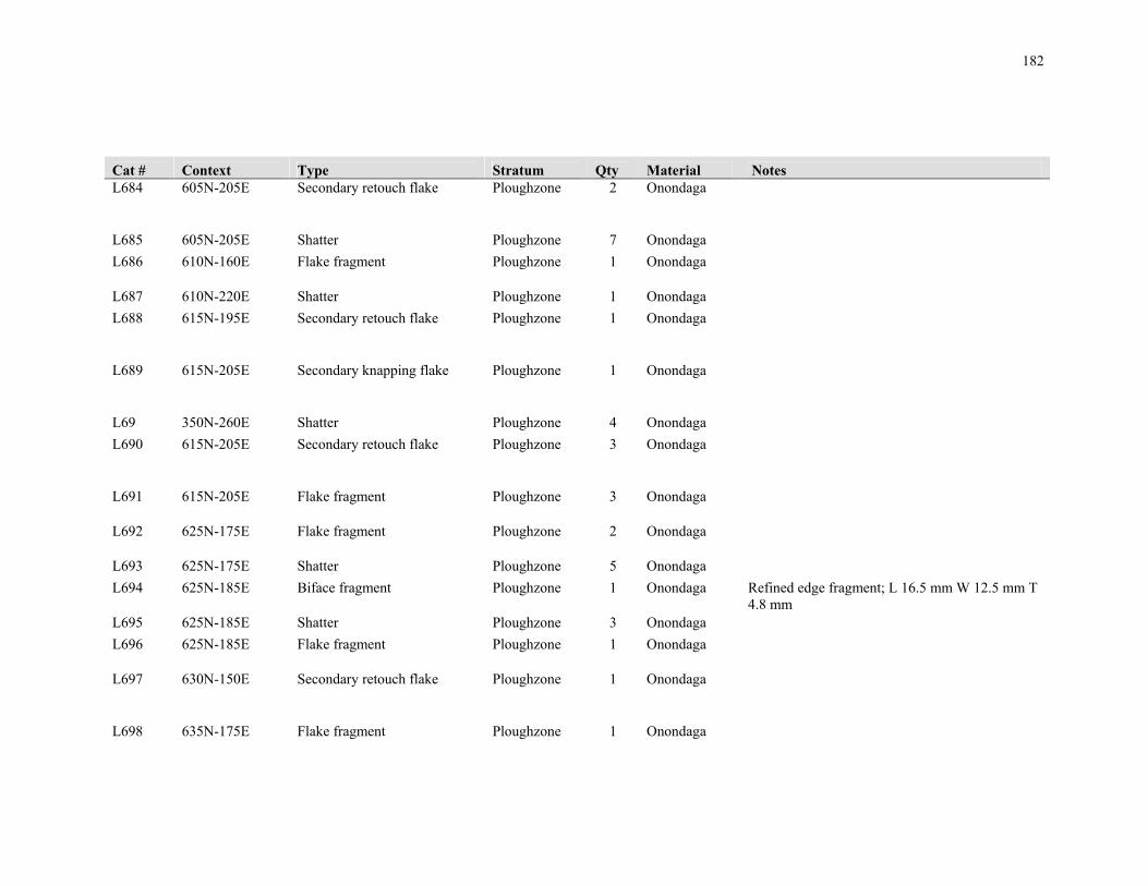
182
Cat # Context Type Stratum Qty Material Notes L684 605N-205E Secondary retouch flake Ploughzone 2 Onondaga
L685 605N-205E Shatter Ploughzone 7 Onondaga
L686 610N-160E Flake fragment Ploughzone 1 Onondaga
L687 610N-220E Shatter Ploughzone 1 Onondaga
L688 615N-195E Secondary retouch flake Ploughzone 1 Onondaga
L689 615N-205E Secondary knapping flake Ploughzone 1 Onondaga
L69 350N-260E Shatter Ploughzone 4 Onondaga
L690 615N-205E Secondary retouch flake Ploughzone 3 Onondaga
L691 615N-205E Flake fragment Ploughzone 3 Onondaga
L692 625N-175E Flake fragment Ploughzone 2 Onondaga
L693 625N-175E Shatter Ploughzone 5 Onondaga
L694 625N-185E Biface fragment Ploughzone 1 Onondaga Refined edge fragment; L 16.5 mm W 12.5 mm T 4.8 mm
L695 625N-185E Shatter Ploughzone 3 Onondaga
L696 625N-185E Flake fragment Ploughzone 1 Onondaga
L697 630N-150E Secondary retouch flake Ploughzone 1 Onondaga
L698 635N-175E Flake fragment Ploughzone 1 Onondaga
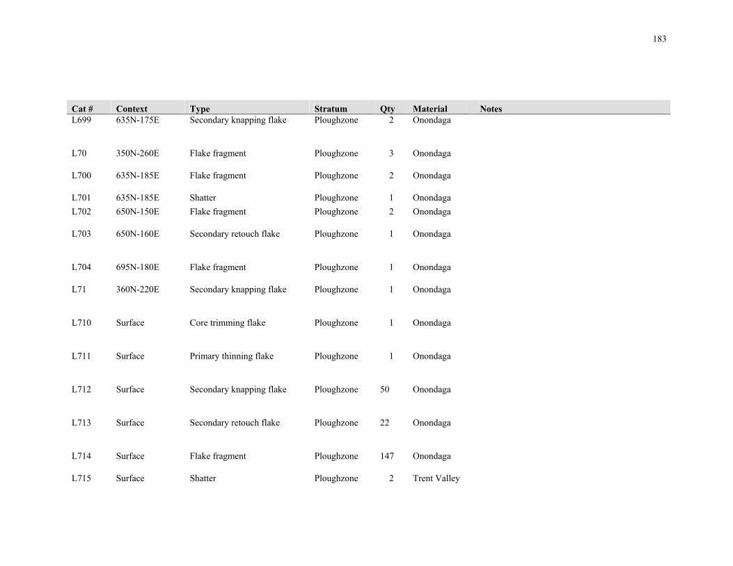
183
Cat # Context Type Stratum Qty Material Notes L699 635N-175E Secondary knapping flake Ploughzone 2 Onondaga
L70 350N-260E Flake fragment Ploughzone 3 Onondaga
L700 635N-185E Flake fragment Ploughzone 2 Onondaga
L701 635N-185E Shatter Ploughzone 1 Onondaga
L702 650N-150E Flake fragment Ploughzone 2 Onondaga
L703 650N-160E Secondary retouch flake Ploughzone 1 Onondaga
L704 695N-180E Flake fragment Ploughzone 1 Onondaga
L71 360N-220E Secondary knapping flake Ploughzone 1 Onondaga
L710 Surface Core trimming flake Ploughzone 1 Onondaga
L711 Surface Primary thinning flake Ploughzone 1 Onondaga
L712 Surface Secondary knapping flake Ploughzone 50 Onondaga
L713 Surface Secondary retouch flake Ploughzone 22 Onondaga
L714 Surface Flake fragment Ploughzone 147 Onondaga
L715 Surface Shatter Ploughzone 2 Trent Valley
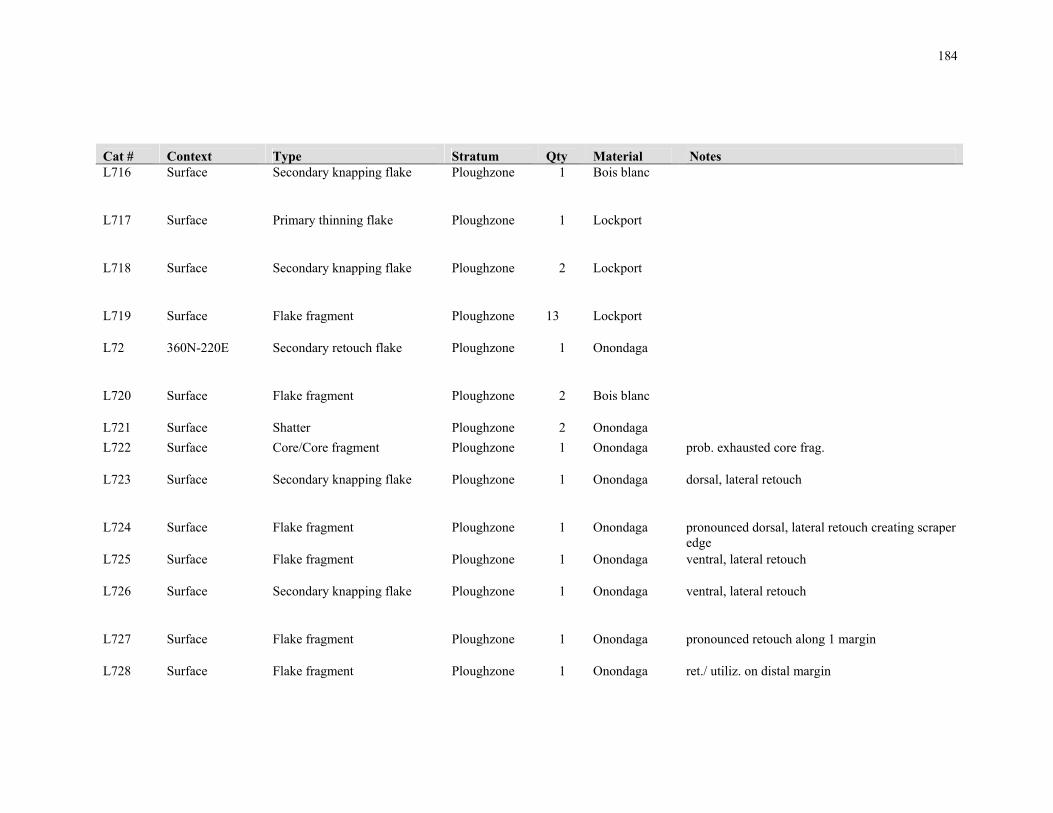
184
Cat # Context Type Stratum Qty Material Notes L716 Surface Secondary knapping flake Ploughzone 1 Bois blanc
L717 Surface Primary thinning flake Ploughzone 1 Lockport
L718 Surface Secondary knapping flake Ploughzone 2 Lockport
L719 Surface Flake fragment Ploughzone 13 Lockport
L72 360N-220E Secondary retouch flake Ploughzone 1 Onondaga
L720 Surface Flake fragment Ploughzone 2 Bois blanc
L721 Surface Shatter Ploughzone 2 Onondaga
L722 Surface Core/Core fragment Ploughzone 1 Onondaga prob. exhausted core frag.
L723 Surface Secondary knapping flake Ploughzone 1 Onondaga dorsal, lateral retouch
L724 Surface Flake fragment Ploughzone 1 Onondaga pronounced dorsal, lateral retouch creating scraper edge
L725 Surface Flake fragment Ploughzone 1 Onondaga ventral, lateral retouch
L726 Surface Secondary knapping flake Ploughzone 1 Onondaga ventral, lateral retouch
L727 Surface Flake fragment Ploughzone 1 Onondaga pronounced retouch along 1 margin
L728 Surface Flake fragment Ploughzone 1 Onondaga ret./ utiliz. on distal margin

185
Cat # Context Type Stratum Qty Material Notes L729 Surface Flake fragment Ploughzone 1 Onondaga utiliz./ret. on ventral, lateral margin
L73 360N-220E Shatter Ploughzone 2 Onondaga
L730 Surface Flake fragment Ploughzone 1 Onondaga bilateral retouch on ventral and dorsal surfaces
L731 Surface Secondary knapping flake Ploughzone 1 Onondaga ventral lateral retouch and possible distal margin retouch
L732 Surface Flake fragment Ploughzone 1 Onondaga dorsal lateral and proximal margin retouch; possible graver tip
L733 Surface Wedge Ploughzone 1 Onondaga square-shaped flake fragment with flaking from opposing ends; L 23 mm W 22 mm T 7 mm
L734 Surface Biface Ploughzone 1 Onondaga semi-refined triangular biface; L 50 mm W 40 mm T 12 mm
L735 Surface Biface fragment Ploughzone 1 Onondaga unrefined; L 31 mm W 19 mm T 13 mm
L736 Surface Biface Ploughzone 1 Onondaga thin; semi-refined; L 24 mm W 18 mm T 6 mm
L737 Surface Biface fragment Ploughzone 1 Onondaga refined; L 18 mm W 13 mm T 4 mm
L738 Surface Biface fragment Ploughzone 1 Onondaga L 15 mm W 13 mm T 4 mm
L739 Surface Biface fragment Ploughzone 1 Lockport semi-refined; L 31 mm W 19 mm T 10 mm
L74 360N-220E Flake fragment Ploughzone 3 Onondaga
L740 Surface Projectile point fragment Ploughzone 1 Onondaga stemmed or notched base; L 9 mm W 22 mm T 5 mm
L741 Surface Wedge Ploughzone 1 Bois blanc damage at opposing ends and evidence of flake removals ; L 38 mm W 30 mm T 11 mm
L742 Surface Chunk/Cobble Ploughzone 1 Lockport weathered rounded margins ; L 79 mm W 42 mm T 30 mm

186
Cat # Context Type Stratum Qty Material Notes L743 Surface End scraper Ploughzone 1 Onondaga bifacial; steep distal retouch on dorsal surface and
deep ventral retouch from both lateral margins ; L 32 mm W 22 mm T 7 mm
L744 Surface Biface Ploughzone 1 Lockport refined; tapered to proximal end; full bifacial flaking; beveled on one margin; L 35 mm W 21 mm T 9 mm
L745 Surface Biface fragment Ploughzone 1 Onondaga tip; dorsal retouch; L 20 mm W 21 mm T 6 mm
L746 Surface Projectile point fragment Ploughzone 1 Kettle point Crawford Knoll; partial base and midsection of small corner-notched pt.- prob. Late Archaic Crawford Knoll; retouched lateral margins; prob. ; L 21 mm W 20 mm T 4 mm
L747 Surface Projectile point Ploughzone 1 Lockport side-notched; straight base; base width = 20 mm, notch width = 8 mm depth = 3 mm; L 37 mm W 20 mm T 7 mm
L75 360N-230E Biface fragment Ploughzone 1 Onondaga Refined/late stage, thin basal fragment; L 16 mm W 15.5 mm T 4 mm
L76 360N-230E Secondary knapping flake Ploughzone 3 Onondaga
L77 360N-230E Flake fragment Ploughzone 1 Onondaga
L78 360N-240E Secondary knapping flake Ploughzone 1 Onondaga
L79 360N-240E Secondary retouch flake Ploughzone 1 Onondaga
L80 360N-250E Secondary retouch flake Ploughzone 1 Onondaga
L81 360N-250E Shatter Ploughzone 2 Onondaga

187
Cat # Context Type Stratum Qty Material Notes L818 340N-250E Secondary retouch flake Ploughzone 1 Onondaga
L819 340N-250E Secondary knapping flake Ploughzone 1 Onondaga
L82 360N-250E Flake fragment Ploughzone 1 Onondaga
L820 340N-250E Flake fragment Ploughzone 2 Onondaga
L821 340N-260E Secondary knapping flake Ploughzone 1 Onondaga dorsal retouch at distal end
L822 340N-260E Secondary retouch flake Ploughzone 4 Onondaga
L823 340N-260E Flake fragment Ploughzone 9 Onondaga
L824 340N-260E Flake fragment Ploughzone 2 Bois blanc
L825 340N-265E Secondary knapping flake Ploughzone 2 Onondaga
L826 340N-265E Flake fragment Ploughzone 8 Onondaga
L827 340N-265E Flake fragment Ploughzone 1 Lockport
L828 340N-265E Secondary retouch flake Ploughzone 2 Onondaga
L829 340N-265E Flake fragment Ploughzone 1 Kettle point

188
Cat # Context Type Stratum Qty Material Notes L83 360N-260E Secondary knapping flake Ploughzone 2 Onondaga
L830 340N-265E Flake fragment Ploughzone 1 Trent Valley
L831 340N-270E Flake fragment Ploughzone 1 Onondaga
L832 340N-275E Flake fragment Ploughzone 1 Bois blanc
L833 345N-260E Secondary knapping flake Ploughzone 3 Onondaga
L834 345N-260E Secondary retouch flake Ploughzone 1 Onondaga
L835 345N-260E Secondary retouch flake Ploughzone 1 Lockport
L836 345N-260E Flake fragment Ploughzone 8 Onondaga
L837 345N-265E Secondary knapping flake Ploughzone 5 Onondaga
L838 345N-265E Secondary knapping flake Ploughzone 1 Onondaga utiliz./ ret. on distal margin
L839 345N-265E Secondary retouch flake Ploughzone 3 Onondaga
L84 360N-260E Shatter Ploughzone 3 Onondaga
L840 345N-265E Secondary retouch flake Ploughzone 1 Kettle point

189
Cat # Context Type Stratum Qty Material Notes L841 345N-265E Secondary retouch flake Ploughzone 2 Lockport
L842 345N-265E Flake fragment Ploughzone 1 Lockport
L843 345N-265E Shatter Ploughzone 1 Trent Valley
L844 345N-265E Flake fragment Ploughzone 16 Onondaga
L845 345N-265E Biface fragment Ploughzone 1 Onondaga frag. with bifacial flaking; L 26 mm W 17 mm T 8 mm
L846 345N-270E Secondary knapping flake Ploughzone 4 Onondaga
L847 345N-270E Secondary knapping flake Ploughzone 1 Onondaga pronounced retouch on ventral, lateral margin
L848 345N-270E Secondary retouch flake Ploughzone 6 Onondaga
L849 345N-270E Flake fragment Ploughzone 13 Onondaga
L85 360N-260E Flake fragment Ploughzone 3 Onondaga
L850 345N-275E Secondary knapping flake Ploughzone 2 Onondaga
L851 345N-275E Secondary retouch flake Ploughzone 1 Onondaga
L852 345N-275E Flake fragment Ploughzone 2 Onondaga
L853 345N-275E Flake fragment Ploughzone 1 Bois blanc
L854 345N-275E Flake fragment Ploughzone 1 Onondaga retouched along 1 margin- poss. Wedge

190
Cat # Context Type Stratum Qty Material Notes L855 350N-265E Flake fragment Ploughzone 1 Kettle point
L856 350N-275E Secondary retouch flake Ploughzone 3 Onondaga
L857 350N-275E Flake fragment Ploughzone 1 Trent Valley
L858 355N-265E Secondary knapping flake Ploughzone 1 Onondaga
L859 355N-265E Flake fragment Ploughzone 2 Onondaga
L86 370N-220E Secondary knapping flake Ploughzone 3 Onondaga
L860 355N-270E Secondary knapping flake Ploughzone 1 Onondaga
L861 355N-270E Secondary retouch flake Ploughzone 2 Onondaga
L862 355N-275E Flake fragment Ploughzone 1 Lockport
L863 355N-275E Secondary retouch flake Ploughzone 1 Onondaga
L864 360N-260E Secondary knapping flake Ploughzone 1 Trent Valley
L865 360N-260E Flake fragment Ploughzone 1 Trent Valley
L866 360N-260E Flake fragment Ploughzone 1 Onondaga

191
Cat # Context Type Stratum Qty Material Notes L866 360N-260E Secondary retouch flake Ploughzone 3 Onondaga
L87 370N-220E Secondary retouch flake Ploughzone 1 Onondaga
L88 370N-220E Flake fragment Ploughzone 3 Onondaga
L89 370N-220E Flake fragment Ploughzone 1 Bois blanc
L90 370N-230E Flake fragment Ploughzone 1 Onondaga
L91 370N-230E Secondary knapping flake Ploughzone 1 Onondaga
L92 370N-230E Secondary retouch flake Ploughzone 2 Onondaga
L93 370N-230E Shatter Ploughzone 10 Onondaga
L94 370N-240E Secondary knapping flake Ploughzone 1 Onondaga Modified along one dorsal margin
L95 370N-240E Secondary retouch flake Ploughzone 1 Onondaga
L96 370N-240E Shatter Ploughzone 2 Onondaga
L97 370N-240E Flake fragment Ploughzone 1 Onondaga
L98 370N-250E Secondary knapping flake Ploughzone 2 Onondaga
L99 370N-250E Shatter Ploughzone 2 Onondaga

192
Appendix C.2 Ceramic Artifacts
Cat # Context Stratum Type Portion Qty Comments
P1 380N-220E Ploughzone Analyzable
Vessel Lip-Neck 1
TYPE: Huron Incised; MORPHOLOGY: Rim - Outflaring and Collared (Poorly-Developed and Angular); Lip - Flat; Collar Height: 19.58 mm; Max
Collar Thickness: 10.62 mm; Lip Thickness: 7.05 mm; SURFACE TREATMENT: Smoothed lip; Smoothed exterior; Smoothed
interior; DECORATION: Plain [Lip] over Incised Verticals [Rim] over Plain [Upper Neck]; Interior - Plain [Rim] over Plain [Neck]
P2 380N-220E Ploughzone Analyzable
Vessel Lip-Neck 1
TYPE: Pound Necked; MORPHOLOGY: Rim - Outflaring and Collared (Poorly-Developed and Rounded); Lip - Flat; Collar Height: 20.64 mm; Max Collar Thickness: 5.11 mm; Lip Thickness: 8.6 mm; SURFACE TREATMENT: Smoothed lip; Smoothed exterior; Smoothed interior;
DECORATION: Plain [Lip] over Incised Right Hatches superimposed with Incised Right Obliques [Rim] over Incised Horizontals (x1) [Upper Neck];
Interior - Plain [Rim] over Plain [Neck]
P3 380N-220E Ploughzone Analyzable
Sherd Body 2
SURFACE TREATMENT: Rib Paddled exterior; Smoothed interior; DECORATION: Plain [Body]
P4 390N-230E Ploughzone Unanalyzable
Sherd Fragmentary
Sherd 7
P5 400N-220E Ploughzone Unanalyzable
Sherd Fragmentary
Sherd 1
P6 400N-220E Ploughzone Unanalyzable
Sherd Fragmentary
Sherd 2
P7 400N-230E Ploughzone Unanalyzable
Sherd Fragmentary
Sherd 1
P8 410N-220E Ploughzone Unanalyzable
Sherd Fragmentary
Sherd 1
P9 420N-220E Ploughzone Unanalyzable
Sherd Fragmentary
Sherd 1
P10 490N-180E Ploughzone Unanalyzable
Sherd Fragmentary
Sherd 1
P11 370N-230E Ploughzone Unanalyzable
Sherd Fragmentary
Sherd 1
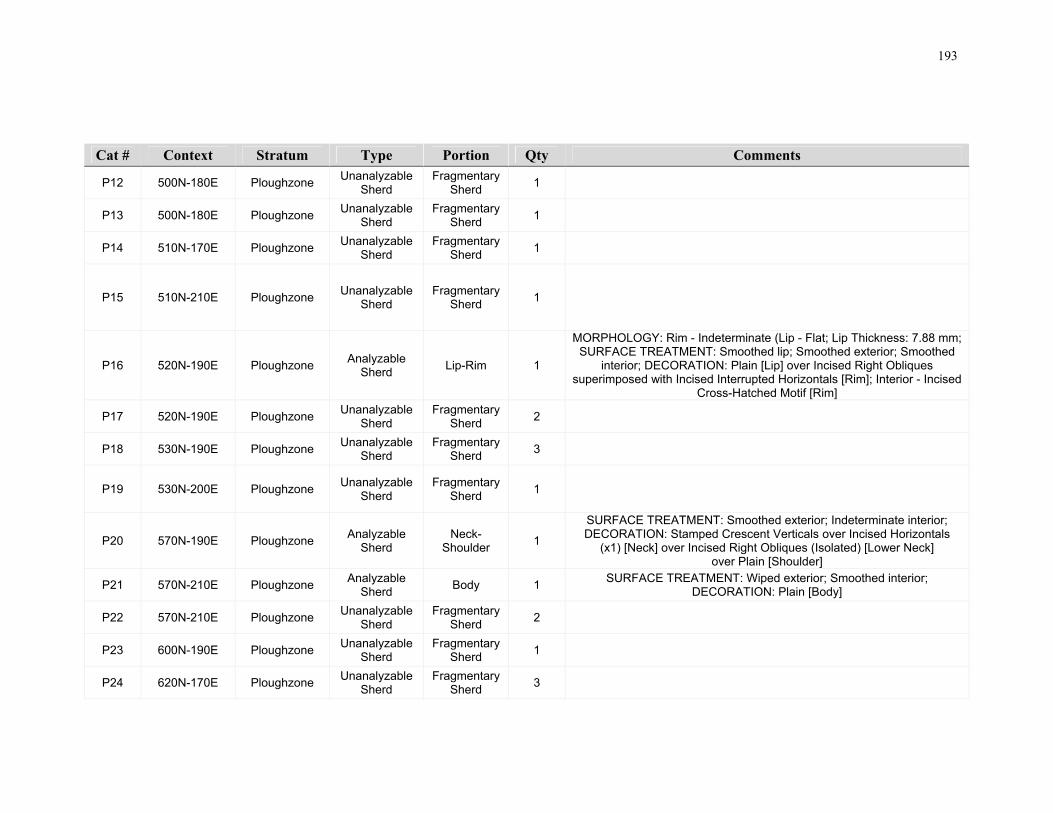
193
Cat # Context Stratum Type Portion Qty Comments
P12 500N-180E Ploughzone Unanalyzable
Sherd Fragmentary
Sherd 1
P13 500N-180E Ploughzone Unanalyzable
Sherd Fragmentary
Sherd 1
P14 510N-170E Ploughzone Unanalyzable
Sherd Fragmentary
Sherd 1
P15 510N-210E Ploughzone Unanalyzable
Sherd Fragmentary
Sherd 1
P16 520N-190E Ploughzone Analyzable
Sherd Lip-Rim 1
MORPHOLOGY: Rim - Indeterminate (Lip - Flat; Lip Thickness: 7.88 mm; SURFACE TREATMENT: Smoothed lip; Smoothed exterior; Smoothed
interior; DECORATION: Plain [Lip] over Incised Right Obliques superimposed with Incised Interrupted Horizontals [Rim]; Interior - Incised
Cross-Hatched Motif [Rim]
P17 520N-190E Ploughzone Unanalyzable
Sherd Fragmentary
Sherd 2
P18 530N-190E Ploughzone Unanalyzable
Sherd Fragmentary
Sherd 3
P19 530N-200E Ploughzone Unanalyzable
Sherd Fragmentary
Sherd 1
P20 570N-190E Ploughzone Analyzable
Sherd Neck-
Shoulder 1
SURFACE TREATMENT: Smoothed exterior; Indeterminate interior; DECORATION: Stamped Crescent Verticals over Incised Horizontals
(x1) [Neck] over Incised Right Obliques (Isolated) [Lower Neck] over Plain [Shoulder]
P21 570N-210E Ploughzone Analyzable
Sherd Body 1
SURFACE TREATMENT: Wiped exterior; Smoothed interior; DECORATION: Plain [Body]
P22 570N-210E Ploughzone Unanalyzable
Sherd Fragmentary
Sherd 2
P23 600N-190E Ploughzone Unanalyzable
Sherd Fragmentary
Sherd 1
P24 620N-170E Ploughzone Unanalyzable
Sherd Fragmentary
Sherd 3
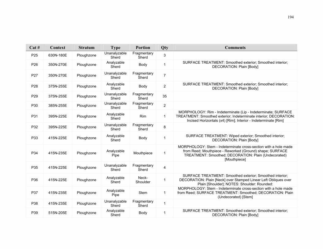
194
Cat # Context Stratum Type Portion Qty Comments
P25 630N-180E Ploughzone Unanalyzable
Sherd Fragmentary
Sherd 3
P26 350N-270E Ploughzone Analyzable
Sherd Body 1
SURFACE TREATMENT: Smoothed exterior; Smoothed interior; DECORATION: Plain [Body]
P27 350N-270E Ploughzone Unanalyzable
Sherd Fragmentary
Sherd 7
P28 375N-255E Ploughzone Analyzable
Sherd Body 2
SURFACE TREATMENT: Smoothed exterior; Smoothed interior; DECORATION: Plain [Body]
P29 375N-255E Ploughzone Unanalyzable
Sherd Fragmentary
Sherd 35
P30 385N-255E Ploughzone Unanalyzable
Sherd Fragmentary
Sherd 2
P31 395N-225E Ploughzone Analyzable
Sherd Rim 1
MORPHOLOGY: Rim - Indeterminate (Lip - Indeterminate; SURFACE TREATMENT: Smoothed exterior; Indeterminate interior; DECORATION:
Incised Horizontals (x4) [Rim]; Interior - Indeterminate [Rim]
P32 395N-225E Ploughzone Unanalyzable
Sherd Fragmentary
Sherd 8
P33 415N-225E Ploughzone Analyzable
Sherd Body 1
SURFACE TREATMENT: Wiped exterior; Smoothed interior; DECORATION: Plain [Body]
P34 415N-235E Ploughzone Analyzable
Pipe Mouthpiece 1
MORPHOLOGY: Stem - Indeterminate cross-section with a hole made from Reed; Mouthpiece - Reworked (Ground) shape; SURFACE TREATMENT: Smoothed; DECORATION: Plain (Undecorated)
[Mouthpiece]
P35 415N-225E Ploughzone Unanalyzable
Sherd Fragmentary
Sherd 4
P36 415N-225E Ploughzone Analyzable
Sherd Neck-
Shoulder 1
SURFACE TREATMENT: Smoothed exterior; Smoothed interior; DECORATION: Plain [Neck] over Stamped Linear Left Obliques over
Plain [Shoulder]; NOTES: Shoulder: Rounded:
P37 415N-235E Ploughzone Analyzable
Pipe Stem 1
MORPHOLOGY: Stem - Indeterminate cross-section with a hole made from Reed; SURFACE TREATMENT: Smoothed; DECORATION: Plain
(Undecorated) [Stem]
P38 415N-235E Ploughzone Unanalyzable
Sherd Fragmentary
Sherd 1
P39 515N-205E Ploughzone Analyzable
Sherd Body 1
SURFACE TREATMENT: Smoothed exterior; Smoothed interior; DECORATION: Plain [Body]

195
Cat # Context Stratum Type Portion Qty Comments
P40 515N-205E Ploughzone Unanalyzable
Sherd Fragmentary
Sherd 2
P41 525N-205E Ploughzone Unanalyzable
Sherd Fragmentary
Sherd 1
P42 525N-205E Ploughzone Unanalyzable
Sherd Fragmentary
Sherd 1
P43 520N-150E Ploughzone Unanalyzable
Sherd Fragmentary
Sherd 1
P44 525N-195E Ploughzone Unanalyzable
Sherd Fragmentary
Sherd 1
P45 535N-195E Ploughzone Unanalyzable
Sherd Fragmentary
Sherd 1
P46 625N-175E Ploughzone Unanalyzable
Sherd Fragmentary
Sherd 1
P101 Ploughzone Ploughzone Analyzable
Sherd Lip-Rim 1
TYPE: Indeterminate; MORPHOLOGY: Rim - Indeterminate and Collared (Lip - Flat; Collar Height: 16 mm; Max Collar Thickness: 9 mm; Lip
Thickness: 6 mm; SURFACE TREATMENT: Smoothed lip; Smoothed exterior; Smoothed interior; DECORATION: Plain [Lip] over Incised
Opposed (Horizontal/Simple) [Rim]; Interior - Plain [Rim]
P102 Ploughzone Ploughzone Unanalyzable
Sherd Fragmentary
Sherd 1
P103 Ploughzone Ploughzone Unanalyzable
Sherd Fragmentary
Sherd 1
P104 Ploughzone Ploughzone Unanalyzable
Sherd Fragmentary
Sherd 1
P105 Ploughzone Ploughzone Unanalyzable
Sherd Fragmentary
Sherd 1
P106 345N-275E Ploughzone Unanalyzable
Sherd Fragmentary
Sherd 2
P107 350N-265E Ploughzone Unanalyzable
Sherd Fragmentary
Sherd 2

196
Cat # Context Stratum Type Portion Qty Comments
P108 350N-265E Ploughzone Analyzable
Pipe Stem 1
MORPHOLOGY: Stem - Indeterminate cross-section with a hole made from Reed; DECORATION: Plain (Undecorated) [Stem]; NOTES: Red
ochre wash on piece
P109 345N-260E Ploughzone Unanalyzable
Sherd Fragmentary
Sherd 2
P110 240N-265E Ploughzone Unanalyzable
Sherd Fragmentary
Sherd 2
P111 230N-265E Ploughzone Unanalyzable
Sherd Fragmentary
Sherd 2
P112 350N-275E Ploughzone Unanalyzable
Sherd Fragmentary
Sherd 1
P113 355N-270E Ploughzone Unanalyzable
Sherd Fragmentary
Sherd 1
P114 345N-265E Ploughzone Unanalyzable
Sherd Fragmentary
Sherd 45
P115 345N-270E Ploughzone Unanalyzable
Sherd Fragmentary
Sherd 32
P116 345N-270E Ploughzone Analyzable
Sherd n/a 6 SURFACE TREATMENT: Smoothed exterior; Smoothed interior
P117 345N-270E Ploughzone Analyzable
Vessel Lip-Neck 1
TYPE: Lawson Opposed; MORPHOLOGY: Rim - Outflaring and Collared (Well-Developed and Angular); Lip - Flat; Collar Height: 28 mm; Max
Collar Thickness: 12 mm; Lip Thickness: 6 mm; SURFACE TREATMENT: Smoothed lip; Smoothed and Wiped exterior; Smoothed
interior; DECORATION: Plain [Lip] over Incised Opposed (Simple/Simple) [Rim] over Plain [Neck]; Interior - Plain [Rim]

197
Appendix C.3 Groundstone Artifacts
Cat Context Stratum Type Qty Material Complete Notes
G1 495N-160E
Ploughzone Indeterminate 1 Chlorite Schist
No Miscellaneous ground stone piece appears to be bevelled along one lateral margin and ground and polished.
G2 Surface Ploughzone Axe 1 Chlorite Schist
No Bit/midsection of a chlorite schist axe. Symetrical bit is chipped. Piece derived from a lateral section of the axe. Appears to be thermally altered as attested to by firecracking and oxidization.
G3 Surface Ploughzone Celt 1 Chlorite Schist
No Bit/midsection of a chlorite schist celt. Appears to be a bit spall that may have detached due to impact. Surface polish.
G4 400N-230E
Ploughzone Chisel 1 Chlorite Schist
Yes Near complete chlorite schist chisel with chipped symetrical bit. Tapers towards the poll. Polish is restricted to the bit area suggesting that it was hafted.
G5 Surface Ploughzone Axe 1 Chlorite Schist
No Bit/midsection of a chlorite schist axe. Symetrical bit is honed and polished. Piece derived from a lateral section of a large axe.
G6 Surface Ploughzone Axe 1 Chlorite Schist
Yes Small chlorite schist axe. Complete except missing a portion of the poll. Symetrical bit is polished and chipped. Most of the exterior surface is polished. Thickness suggests a small axe rather than a chisel.
G7 550N-190E
Ploughzone Hammer 1 Dolomite Yes Large hammer made on dolomite cobble with centrally placed grip pitting on one side and grip roughening on the obverse side. Side with the grip roughening has been ground flat. Multiple hammer facets on lateral margins.
G8 Surface Ploughzone Adze 1 Chlorite Schist
No Bit/midsection of a chlorite schist adze. Asymetrical bit is chipped. Missing a portion of the lateral section of the adze and the poll.
G9 440N-200E
Ploughzone Bead 1 Steatite Yes Complete tubular black steatite bead with surface polish. Perforation is bidirectional.
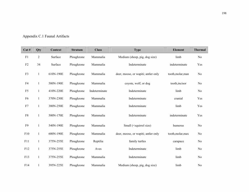
198
Appendix C.1 Faunal Artifacts
Cat # Qty Context Stratum Class Type Element Thermal
F1 2 Surface Ploughzone Mammalia Medium (sheep, pig, dog size) limb No
F2 34 Surface Ploughzone Mammalia Indeterminate indeterminate Yes
F3 1 610N-190E Ploughzone Mammalia deer, moose, or wapiti; antler only tooth,molar,man No
F4 1 580N-190E Ploughzone Mammalia coyote, wolf, or dog tooth,incisor No
F5 1 410N-220E Ploughzone Indeterminate Indeterminate limb No
F6 1 370N-230E Ploughzone Mammalia Indeterminate cranial Yes
F7 1 380N-250E Ploughzone Mammalia Indeterminate limb Yes
F8 1 500N-170E Ploughzone Mammalia Indeterminate indeterminate Yes
F9 1 540N-190E Ploughzone Mammalia Small (<squirrel size) humerus No
F10 1 600N-190E Ploughzone Mammalia deer, moose, or wapiti; antler only tooth,molar,max No
F11 1 375N-255E Ploughzone Reptilia family turtles carapace No
F12 1 375N-255E Ploughzone Aves Indeterminate limb No
F13 1 375N-255E Ploughzone Mammalia Indeterminate limb No
F14 1 395N-225E Ploughzone Mammalia Medium (sheep, pig, dog size) limb No

199
Cat # Qty Context Stratum Class Type Element Thermal
F15 1 490N-240E Ploughzone Mammalia Indeterminate limb No
F16 1 530N-150E Ploughzone Mammalia horse tooth,molar No
F17 1 535N-195E Ploughzone Mammalia Indeterminate indeterminate No
F18 1 480N-160E Ploughzone Mammalia Indeterminate limb No
F19 1 240N-260E Ploughzone Mammalia Indeterminate indeterminate Yes
F20 2 240N-260E Ploughzone Mammalia Indeterminate indeterminate No

200
Curriculum Vitae
Name: Dunlop, John Egan Post-secondary University of Toronto Education and Toronto, Ontario, Canada Degrees: 1998-2003 B.A. Hons
Honours and Ontario Archaeological Society Student Award Awards: 2013 Canadian Archaeological Association Student Award 2014 Related Work Research Archaeologist and Archaeological Geophysicist Experience Royal Ontario Museum
1999-2003 Archaeologist, Project Manager and Archaeological Geophysicist Archaeological Services Inc. 2003-2016 Archaeology Review Officer Ontario Ministry of Tourism, Culture and Sport 2016-present
Publications:
(in press) Geophysical Survey Applications to Ontario Archaeology, Past Trends and Future Implications. Ontario Archaeology
(in press) Geophysical Prospection of the Juno Beach Battlefield, Normandy, France. Archaeological Prospection.
2015 Geospatial Data on Parade: The Results and Implications of a GIS Analysis of Remote Sensing and Archaeological Excavation Data at Fort York’s Central Parade Ground. Northeast Historical Archaeology, Vol. 44, 18-33
AiHd-160; a further understanding of Archaeological Landscapes. Six OAS chapter presentation meetings, 2014-2015
Conference Session Chair: Geophysical Survey Application in Archaeology, a Canadian Perspective. Canadian Archaeological Association Conference, May 2014.