Sources of NHD Data
InterMountain GIS 2014NHD Workshop
April 7, 2014

Where is the best place to get NHD data?
• What do you need the data for?
• How recent do you need the data to be?

Montana Spatial Data Infrastructure (MSDI)
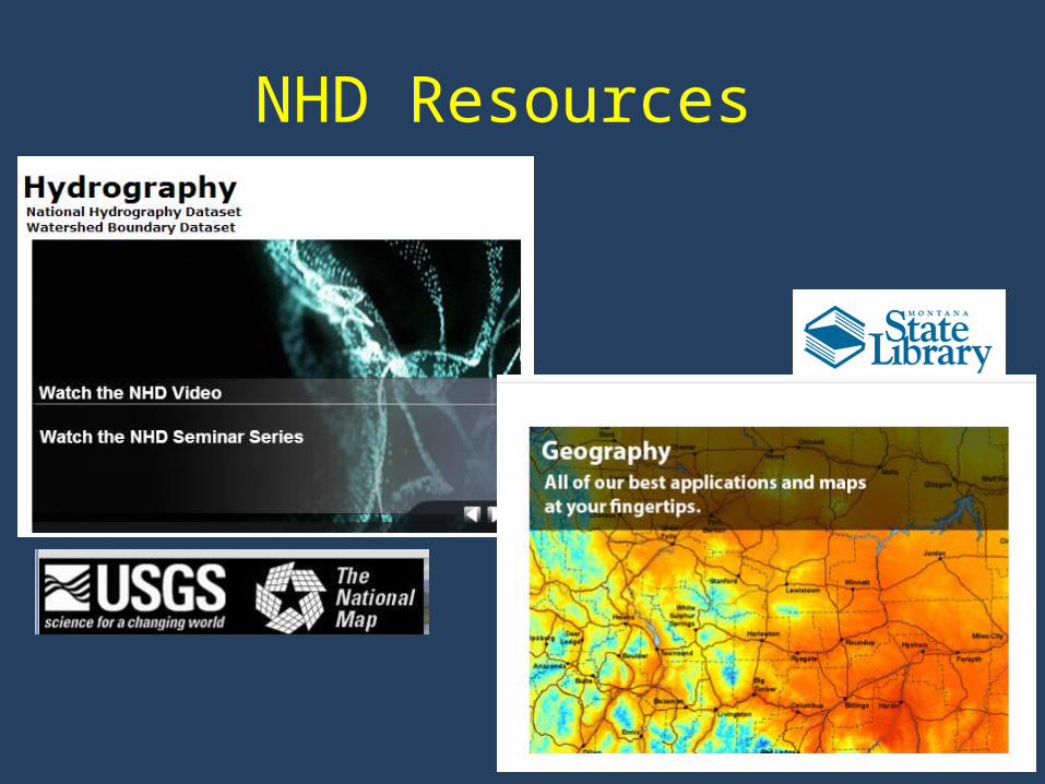
• http://geoinfo.montanastatelibrary.org/data/msdi/
Climate Montana Climate Office Michael Sweet In progress

Hydrography

NHD High Resolution (1:24K) Data
http://geoinfo.montanastatelibrary.org/geography/water/nhd/nhd_download/
Available in Montana State Plane Coordinate System (NAD_1983_StatePlane_Montana_FIPS_2500_meters).
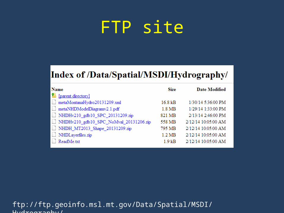
FTP site
ftp://ftp.geoinfo.msl.mt.gov/Data/Spatial/MSDI/Hydrography/

USGS Hydrography
• Multiple ways to download and view NHD data from the USGS– NHD Viewer– NHD extracts by state– Pre-staged subregions– Map services
http://nhd.usgs.gov/index.html
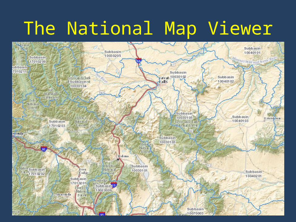
The National Map Viewer

Product Availability
http://viewer.nationalmap.gov/viewer/

NHD Extracts by State
• High resolution = 1:24K• Medium resolution =
1:100K• Local resolution = 1:5K
or greater
ftp://nhdftp.usgs.gov/DataSets/Staged/States/
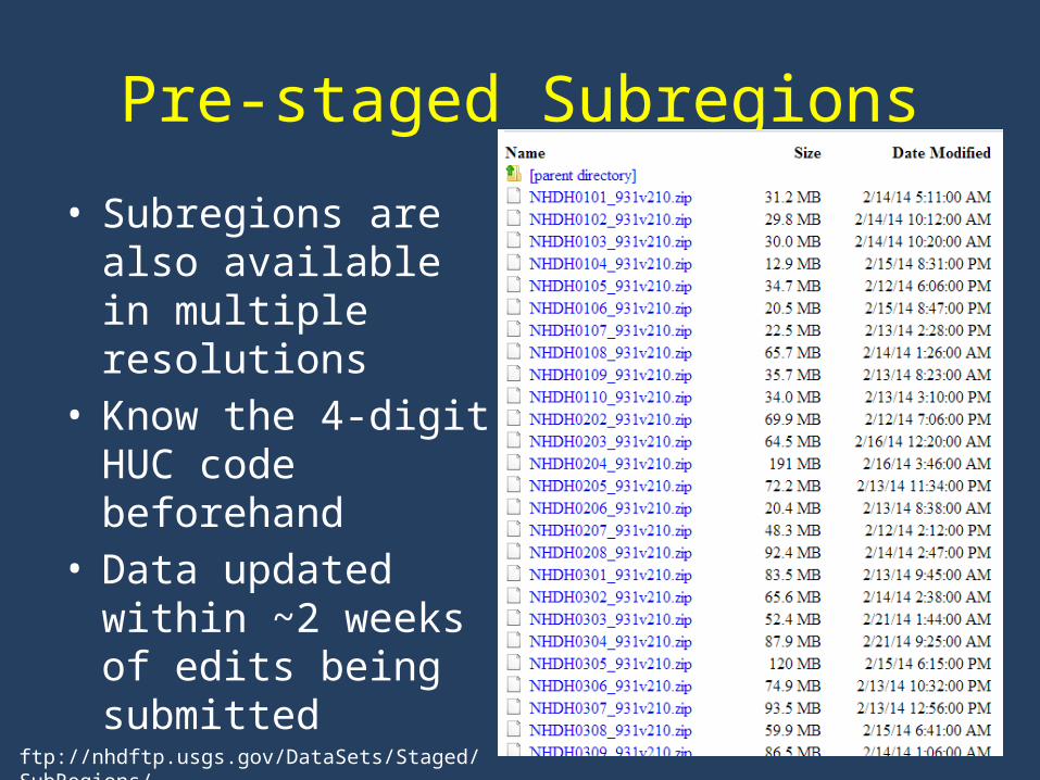
Pre-staged Subregions
• Subregions are also available in multiple resolutions
• Know the 4-digit HUC code beforehand
• Data updated within ~2 weeks of edits being submitted
ftp://nhdftp.usgs.gov/DataSets/Staged/SubRegions/

USGS Rest MapService Endpoint
• NHD as a map service• Can view in:– ArcGIS.com Map– Google Earth– ArcGIS Desktop
http://basemap.nationalmap.gov/arcgis/rest/services/USGSHydroNHD/MapServer
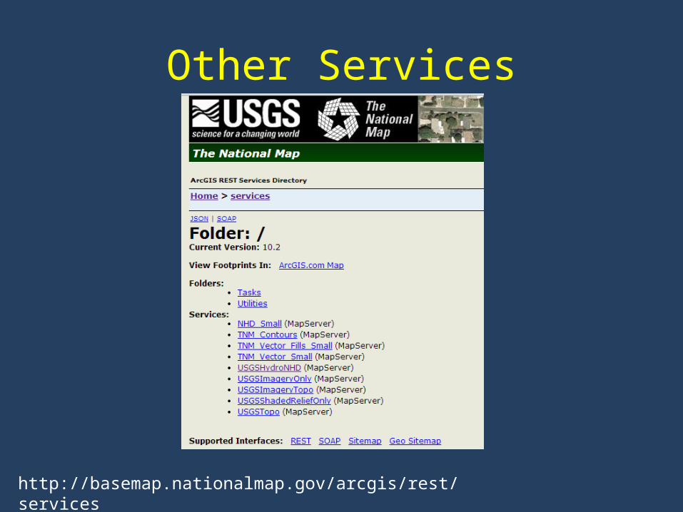
Other Services
http://basemap.nationalmap.gov/arcgis/rest/services
NHD Resources