PH – 1 5335516
Public Hearing Agenda
Public Notice is hereby given of a Regular Council Meeting for Public Hearings being held on:
Monday, March 20, 2017 – 7 p.m.
Council Chambers, 1st Floor Richmond City Hall
6911 No. 3 Road Richmond, BC V6Y 2C1
OPENING STATEMENT Page
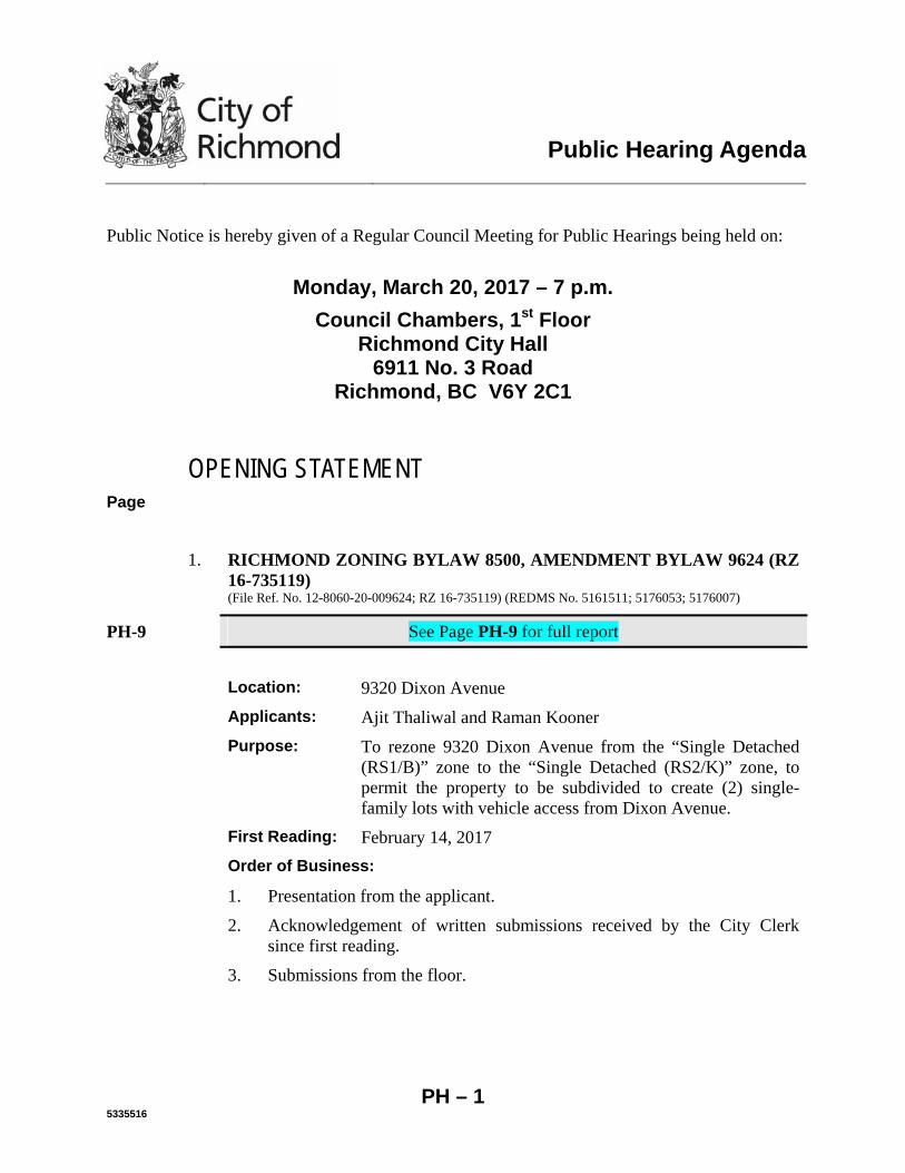
1. RICHMOND ZONING BYLAW 8500, AMENDMENT BYLAW 9624 (RZ
16-735119) (File Ref. No. 12-8060-20-009624; RZ 16-735119) (REDMS No. 5161511; 5176053; 5176007)
PH-9 See Page PH-9 for full report
Location: 9320 Dixon Avenue
Applicants: Ajit Thaliwal and Raman Kooner
Purpose: To rezone 9320 Dixon Avenue from the “Single Detached (RS1/B)” zone to the “Single Detached (RS2/K)” zone, to permit the property to be subdivided to create (2) single-family lots with vehicle access from Dixon Avenue.
First Reading: February 14, 2017
Order of Business:
1. Presentation from the applicant.
2. Acknowledgement of written submissions received by the City Clerk since first reading.
3. Submissions from the floor.
Public Hearing Agenda – Monday, March 20, 2017 Page
PH – 2
Council Consideration:
1. Action on second and third readings of Richmond Zoning Bylaw 8500, Amendment Bylaw 9624.
2. RICHMOND ZONING BYLAW 8500, AMENDMENT BYLAW 9659 (RZ
10-552879) (File Ref. No. 12-8060-20-009659; RZ 10-552879 ) (REDMS No. 5243375; 5243365; 5243365)
PH-25 See Page PH-25 for full report
Location: 9851, 9891/9911 Steveston Highway & 10931 Southgate Road
Applicant: 1002397 BC Ltd.
Purpose: To rezone the subject properties from the “Single Detached (RS1/E)” zone to the “Low Density Townhouses (RTL4)” zone, to permit development of 11 townhouse units on the subject property, with vehicle access to and from Steveston Highway.
First Reading: February 14, 2017
Order of Business:
1. Presentation from the applicant.
2. Acknowledgement of written submissions received by the City Clerk since first reading.
3. Submissions from the floor.
Council Consideration:
1. Action on second and third readings of Richmond Zoning Bylaw 8500, Amendment Bylaw 9659.
3. RICHMOND ZONING BYLAW 8500, AMENDMENT BYLAW 9668 (RZ
16-741244) (File Ref. No. 12-8060-20-009668; RZ 16-741244) (REDMS No. 5257121; 5262680; 5261595)
PH-57 See Page PH-57 for full report
Location: 7140/7160 Marrington Road
Applicant: Westmark Developments Ltd.
Public Hearing Agenda – Monday, March 20, 2017 Page
PH – 3
Purpose: To rezone the subject property from the “Two-Unit Dwellings (RD1)” zone to the “Single Detached (RS2/B)” zone, to permit the property to be subdivided to create two (2) single-family lots, with vehicle access from Marrington Road.
First Reading: February 14, 2017
Order of Business:
1. Presentation from the applicant.
2. Acknowledgement of written submissions received by the City Clerk since first reading.
3. Submissions from the floor.
Council Consideration:
1. Action on second and third readings of Richmond Zoning Bylaw 8500, Amendment Bylaw 9668.
4. RICHMOND ZONING BYLAW 8500, AMENDMENT BYLAW 9670 (ZT
16-740866) (File Ref. No. 12-8060-20-009670; ZT 16-740866 ) (REDMS No. 5210355 v. 4; 5210400; 5210430)
PH-77 See Page PH-77 for full report
Location: 4331 and 4431 Vanguard Road
Applicant: Christopher Bozyk Architects Ltd.
Purpose: To amend the “Industrial Retail (IR1)” zone to allow “vehicle sale/rental” as an additional use at 4331 and 4431 Vanguard Road. The “vehicle sale/rental” use will be limited to a maximum of 10% of the building gross floor area.
First Reading: February 27, 2017
Order of Business:
1. Presentation from the applicant.
2. Acknowledgement of written submissions received by the City Clerk since first reading.
3. Submissions from the floor.
Public Hearing Agenda – Monday, March 20, 2017 Page
PH – 4
Council Consideration:
1. Action on second and third readings of Richmond Zoning Bylaw 8500, Amendment Bylaw 9670.
5. RICHMOND ZONING BYLAW 8500, AMENDMENT BYLAW 9673 (RZ
16-741547) (File Ref. No. 12-8060-20-009673; RZ 16-741547) (REDMS No. 5256478; 5283946; 5283965)
PH-107 See Page PH-107 for full report
Location: 11660/11680 Montego Street
Applicant: Sansaar Investments Ltd.
Purpose: To rezone the subject property from the “Two-Unit Dwellings (RD1)” zone to “Single Detached (RS2/C)” zone, to permit the property to be subdivided to create two (2) single-family lots, with vehicle access from Montego Street.
First Reading: February 14, 2017
Order of Business:
1. Presentation from the applicant.
2. Acknowledgement of written submissions received by the City Clerk since first reading.
3. Submissions from the floor.
Council Consideration:
1. Action on second and third readings of Richmond Zoning Bylaw 8500, Amendment Bylaw 9673.
6. RICHMOND ZONING BYLAW 8500, AMENDMENT BYLAW 9680 (RZ
16-741423) (File Ref. No. 12-8060-20-009680; 16-741423) (REDMS No. 5280131; 5303112; 5303106)
PH-124 See Page PH-124 for full report
Location: 9760 Sealily Place
Applicant: Focus Construction Ltd.
Public Hearing Agenda – Monday, March 20, 2017 Page
PH – 5
Purpose: To rezone the property from the “Single Detached (RS1/E)” zone to the “Single Detached (RS2/B)” zone, to permit the property to be subdivided to create two (2) single-family lots with vehicle access from Sealily Place.
First Reading: February 27, 2017
Order of Business:
1. Presentation from the applicant.
2. Acknowledgement of written submissions received by the City Clerk since first reading.
3. Submissions from the floor.
Council Consideration:
1. Action on second and third readings of Richmond Zoning Bylaw 8500, Amendment Bylaw 9680.
7. RICHMOND ZONING BYLAW 8500, AMENDMENT BYLAW 9681 (RZ
15-713048) (File Ref. No. 12-8060-20-009681; RZ 15-713048) (REDMS No. 5304796 v. 3; 5324617; 5306617; 5301009)
PH-142 See Page PH-142 for memorandum from Director, Development
PH-172 See Page PH-172 for full report
Location: 4300, 4320, 4340 Thompson Road, and 4291, 4331, 4431 and 4451 Boundary Road
Applicant: Kaimanson Investments Ltd.
Purpose: To rezone the subject property from “Single Detached (RS1/F)” and “Two-Unit Dwellings (RD1)” to “High Density Townhouses (RTH1)” to allow for construction of a 120-unit townhouse development with access from Boundary Road and Thompson Road.
First Reading: February 27, 2017
Order of Business:
1. Presentation from the applicant.
2. Acknowledgement of written submissions received by the City Clerk since first reading.
PH-221 (a) Jose Gonzalez, 4340 Thompson Road
Public Hearing Agenda – Monday, March 20, 2017 Page
PH – 6
3. Submissions from the floor.
Council Consideration:
1. Action on second and third readings of Richmond Zoning Bylaw 8500, Amendment Bylaw 9681.
8. RICHMOND ZONING BYLAW 8500, AMENDMENT BYLAW 9682 (RZ
15-701939) (File Ref. No. 12-8060-20-009682; RZ 15-701939) (REDMS No. 5271445 v. 2; 5302497; 5302500)
PH-222 See Page PH-222 for full report
Location: 7760 Garden City Road
Applicant: Incircle Projects Ltd.
Purpose: To rezone the subject property from “Single Detached (RS1/F)” zone to “Town Housing (ZT49) - Moffatt Road, St. Albans Sub-Area and South McLennan Sub-Area (City Centre)” zone, to permit development of four (4) three storey townhouse units with vehicle access from 7733 Turnill Street.
First Reading: February 27, 2017
Order of Business:
1. Presentation from the applicant.
2. Acknowledgement of written submissions received by the City Clerk since first reading.
3. Submissions from the floor.
Council Consideration:
1. Action on second and third readings of Richmond Zoning Bylaw 8500, Amendment Bylaw 9682.
9. RICHMOND ZONING BYLAW 8500, AMENDMENT BYLAW 9683 (RZ
15-716841) (File Ref. No. 12-8060-20-009683; RZ 15-716841) (REDMS No. 5302073; 5302094; 5302116)
PH-245 See Page PH-245 for full report
Location: 3411/3431 Lockhart Road
Public Hearing Agenda – Monday, March 20, 2017 Page
PH – 7
Applicant: Aman Hayer
Purpose: To rezone the subject property from the “Single Detached (RS1/E)” zone to the “Single Detached (RS2/B)” zone, to permit the property to be subdivided to create two (2) lots with vehicle access to Lockhart Road.
First Reading: February 27, 2017
Order of Business:
1. Presentation from the applicant.
2. Acknowledgement of written submissions received by the City Clerk since first reading.
3. Submissions from the floor.
Council Consideration:
1. Action on second and third readings of Richmond Zoning Bylaw 8500, Amendment Bylaw 9683.
10. DEVELOPMENT PERMIT (DP 16-741981)
(File Ref. No. DP 16-741981) (REDMS No. 5217500; 5298017; 5341599 v. 1A)
PH-262 See Page PH-262 for memorandum from Director, Development
PH-295 See Page PH-295 for full report
Location: 10788 No. 5 Road
Applicant: Townline Gardens Inc.
Purpose of the Permit:
To permit the construction of one (1) 10-storey residential building and three (3) 3-storey residential buildings at 10788 No. 5 Road on a site zoned “Commercial Mixed Use (ZMU18) – The Gardens (Shellmont)”; and
Public Hearing Agenda – Monday, March 20, 2017 Page
PH – 8
To vary the provisions of Richmond Zoning Bylaw 8500 to:
(a) For the most westerly building (Building E1), increase the maximum height over a parkade structure from six (6) storeys and 25.0 m, to ten (10) storeys and 33.6 m; and
(b) For the most westerly building (Building E1), increase the allowable projection of unenclosed balconies into a side yard setback abutting the Agricultural Land Reserve, from a maximum of 0.9 m to 1.8 m.
PH-380 Dates: Development Permit Panel Considered the application on November 30, 2016 (See Page PH-380 for minutes excerpt).
PH-383 Council referred the application to Public Hearing on January 9, 2017 (See Page PH-383 for minutes excerpt).
PH-384 Council referred the application to Public Hearing on February 20, 2017 (See Page PH-384 for minutes excerpt).
DP 16-741981 was considered at the February 20, 2017 Public Hearing and referred to the March 20, 2017 Public Hearing for further review and discussion of options.
Order of Business:
1. Presentation from the applicant.
2. Acknowledgement of written submissions received by the City Clerk since the February 20, 2017 Public Hearing.
3. Submissions from the floor.
Council Consideration:
1. Action on Development Permit for 10788 No. 5 Road (also referred to as 10780 No. 5 Road and 12733 Steveston Highway) (16-741981).
ADJOURNMENT
City of Richmond
To: Planning Committee
From: Wayne Craig Director, Development
Report to Committee Planning and Development Division
Date: January 25, 2017
File: RZ 16-735119
Re: Application by Ajit Thaliwal and Raman Kooner for Rezoning at 9320 Dixon Avenue from "Single Detached (RS1/B)" to "Single Detached (RS2/K)"
Staff Recommendation
That Richmond Zoning Bylaw 8500, Amendment Bylaw 9624, for the rezoning of 9320 Dixon Avenue from "Single Detached (RSl/B)" to "Single Detached (RS2/K)", be introduced and ·given first reading.
L/ ~~~~elop_m_e_n_t-
WC:blg _ Att. 7
ROUTED TO:
Affordable Housing
5161511
REPORT CONCURRENCE
CONCURRENCE CONCURRENCE OF GENERAL MANAGER
PH - 9
January 25,2017 - 2 - RZ 16-735119
Staff Report
Origin
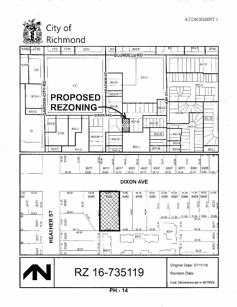
Ajit Thaliwal and Raman Kooner have applied to the City of Richmond for permission to rezone 9320 Dixon A venue from the "Single Detached (RS 1/B)" zone to the "Single Detached (RS2/K)" zone to permit the property to be subdivided to create two (2) single-family lots with vehicle access from Dixon A venue (Attachment 1 ). The proposed subdivision plan is shown in Attachment 2. There is an existing home on the property, which would be demolished.
Findings of Fact
A Development Application Data Sheet providing details about the development proposal is provided in Attachment 3.
Surrounding Development
Development immediately surrounding the subject site is as follows: • To the North, across Dixon Avenue: Two (2) single-family dwellings on lots zoned
"Single Detached (RS 1/B)," fronting Dixon A venue. • To the South: A townhouse complex on a lot zoned "Low Density Townhouses
(RTLl)," with vehicle access from Dayton Avenue. • To the East and West: Single-family dwellings on lots zoned "Single Detached
(RSl/B)," fronting Dixon Avenue.
Related Policies & Studies
Official Community Plan!Broadmoor Area Plan
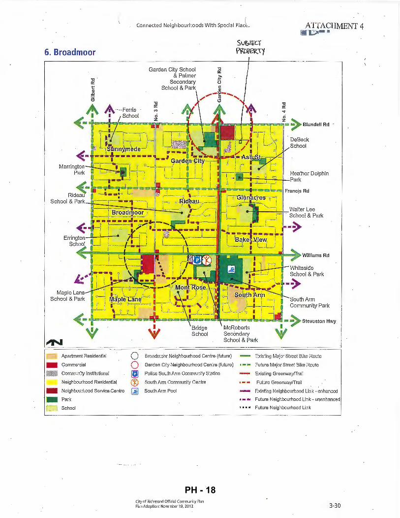
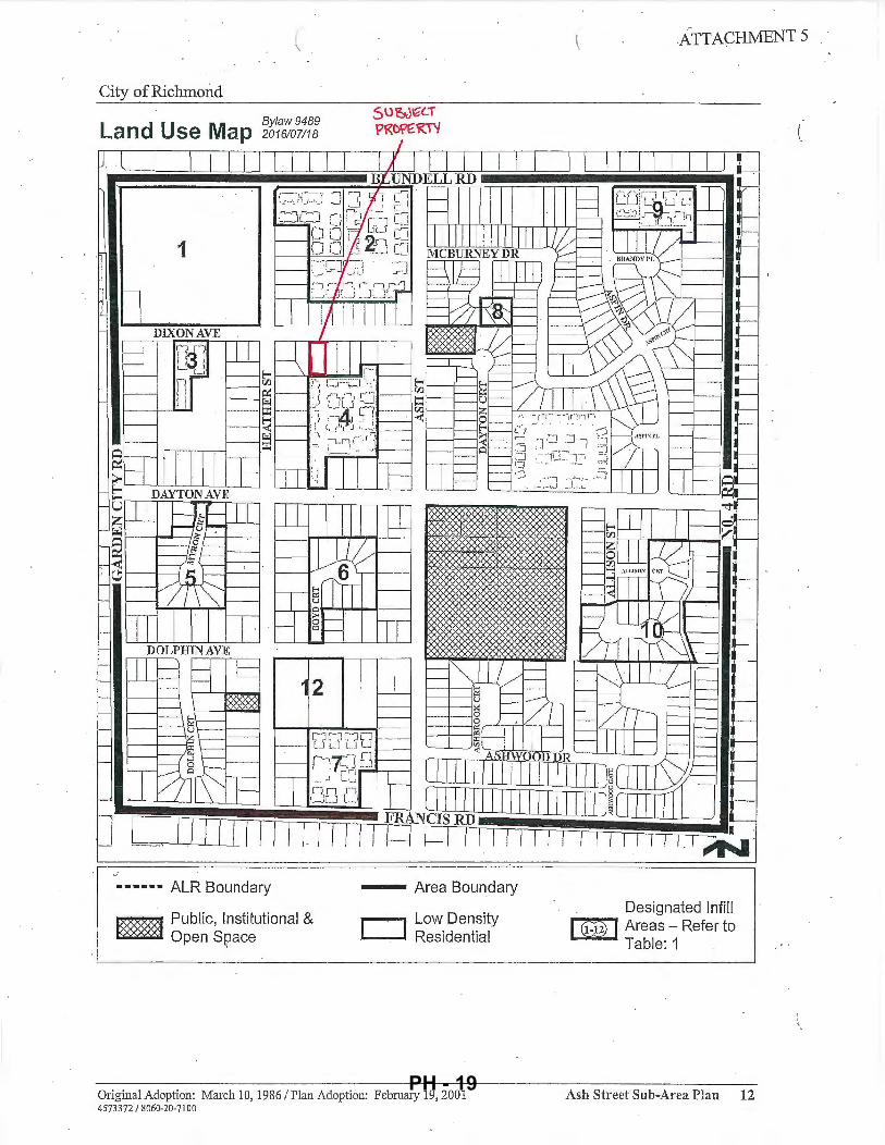
The subject property is located in the Broadmoor planning area. The Official Community Plan (OCP) designation for the subject property is "Neighbourhood Residential" (Attachment 4). The proposed rezoning is consistent with this designation.
The subject property is located within the area governed by the Ash Street Sub-Area Plan contained in the OCP. The land use designation for the subject property is "Low Density Residential" (Attachment 5). The proposed rezoning is consistent with this designation.
The Ash Street Sub-Area Plan permits development of lands outside of designated infill sites shown on the Land Use Map to be governed by the City's normal development application process. Lots fronting Dixon Avenue on this block range from widths of 10.63 m to 22.60 m. The proposed rezoning and subdivision would result in lots 11.31 m wide; generally consistent with other properties in the area. There are six ( 6) existing lots zoned "Single Detached (RS 1/K)" on this block to the east of the subject property. Two (2) additional properties across Dixon A venue have similar subdivision potential.
5161511 PH - 10
January 25, 2017 - 3 - RZ 16-735119
Floodplain Management Implementation Strategy
The proposed redevelopment must meet the requirements of the Richmond Flood Plain Designation and Protection Bylaw 8204. Registration of a flood indemnity covenant on Title is required prior to final adoption of the rezoning bylaw.
Public Consultation
A rezoning sign has been installed on the subject property. Staff have not received any comments from the public about the rezoning application in response to the placement of the rezoning sign on the property.
Should the Planning Committee endorse this application and Council grant first reading to the rezoning bylaw, the bylaw will be forwarded to a Public Hearing; where any area resident or interested party will have an opportunity to comment. Public notification for the Public Hearing will be provided as per the Local Government Act.
Analysis
Existing Legal Encumbrances
There is an existing 3.0 m wide statutory right-of-way (SRW) across the entire south property line for the sanitary sewer; which will not be impacted by this application. The applicant is aware that encroachment into the SR W is not permitted.
Transportation and Site Access
Vehicle access is proposed from Dixon A venue via separate driveway crossings to each new lot.
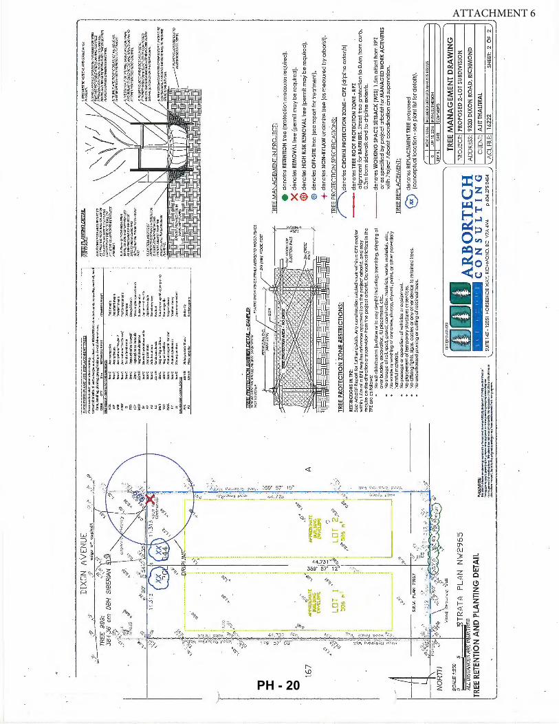
Tree Retention and Replacement
The applicant has submitted a Certified Arborist' s Report; which identifies on-site and off-site tree species, assesses tree structure and condition, and provides recommendations on tree retention and removal relative to the proposed development. The Report assesses one (1) bylaw-sized tree on the subject property.
The City's Tree Preservation Coordinator has reviewed the Arborist's Report and supports the findings of the applicant's arborist: • One (1) 59 em DBH Siberian Elm tree on the subject site (Tag# 999) has structural defects
(linear crack in trunk, cavities developing where limb was removed) and 30% of the upper canopy is in conflict with an overhead hydro line. In addition, this tree is located 53 em below exiting street grade, and will be impacted by required grade changes on City property for street improvements. The tree will be removed and replaced at a 2:1 ratio.
Tree Replacement
The applicant wishes to remove the one (1) on-site tree (Tag # 999). The 2:1 replacement ratio would require a total of two (2) replacement trees. Council Policy No. 5032 requires the
5161511 PH - 11
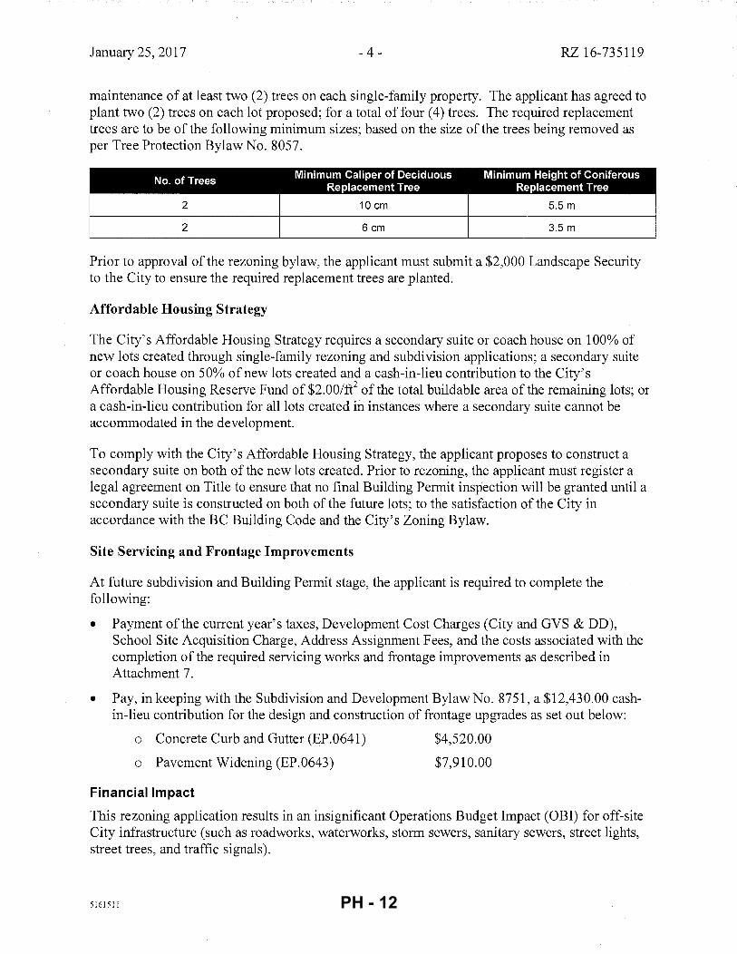
January 25, 2017 -4- RZ 16-735119
maintenance of at least two (2) trees on each single-family property. The applicant has agreed to plant two (2) trees on each lot proposed; for a total of four (4) trees. The required replacement trees are to be of the following minimum sizes; based on the size of the trees being removed as per Tree Protection Bylaw No. 8057.
2 10 em 5.5 m
2 6 em 3.5 m
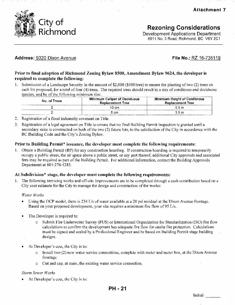
Prior to approval of the rezoning bylaw, the applicant must submit a $2,000 Landscape Security to the City to ensure the required replacement trees are planted.
Affordable Housing Strategy
The City's Affordable Housing Strategy requires a secondary suite or coach house on 100% of new lots created through single-family rezoning and subdivision applications; a secondary suite or coach house on 50% of new lots created and a cash-in-lieu contribution to the City's Affordable Housing Reserve Fund of $2. OO/ft2 of the total buildable area of the remaining lots; or a cash-in-lieu contribution for all lots created in instances where a secondary suite cannot be accommodated in the development.
To comply with the City's Affordable Housing Strategy, the applicant proposes to construct a secondary suite on both of the new lots created. Prior to rezoning, the applicant must register a legal agreement on Title to ensure that no final Building Permit inspection will be granted until a secondary suite is constructed on both of the future lots; to the satisfaction of the City in accordance with the BC Building Code and the City's Zoning Bylaw.
Site Servicing and Frontage Improvements
At future subdivision and Building Permit stage, the applicant is required to complete the following:
• Payment of the current year's taxes, Development Cost Charges (City and GVS & DD), School Site Acquisition Charge, Address Assignment Fees, and the costs associated with the completion of the required servicing works and frontage improvements as described in Attachment 7.
• Pay, in keeping with the Subdivision and Development Bylaw No. 8751, a $12,430.00 cashin-lieu contribution for the design and construction of frontage upgrades as set out below:
o Concrete Curb and Gutter (EP. 0641)
o Pavement Widening (EP.0643)
Financial Impact
$4,520.00
$7,910.00
This rezoning application results in an insignificant Operations Budget Impact (OBI) for off-site City infrastructure (such as roadworks, waterworks, storm sewers, sanitary sewers, street lights, street trees, and traffic signals).
5161511 PH - 12
January 25, 2017 - 5- RZ 16-735119
Conclusion
The purpose of this application is to rezone 9320 Dixon Avenue from the "Single Detached (RS 1/B)" zone to the "Single Detached (RS2/K)" zone; to permit the property to be subdivided to create two (2) single-family lots.
This rezoning application complies with the land use designations and applicable policies for the subject site contained within the OCP and Richmond Zoning Bylaw 8500.
The list of rezoning considerations is included in Attachment 7; which has been agreed to by the applicant (signed concurrence on file).
It is recommended that Richmond Zoning Bylaw 8500, Amendment Bylaw 9624 be introduced and given first reading.
Jordan Rockerbie Planning Technician (604-276-4092)
JR:blg
Attachment 1 : Location Map and Aerial Photo Attachment 2: Proposed Subdivision Plan Attachment 3: Development Application Data Sheet Attachment 4: Broadmoor Area Land Use Map Attachment 5: Ash Street Sub-Area Plan Attachment 6: Tree Management Plan Attachment 7: Rezoning Considerations
5161511 PH - 13
City of Richmond
ATTACHMENT 1
RAMJI ZT45 '-----c_P_2-+-_z_T4_6-t---=z=-=-T.:....:s1:__ _ _/J LRnj 1 RS11F 1 J RP 1 .fSIIIJ 1 ZT60
~-Jr1~--~-----L-1 --~1 ----------~--B~UNDE~~RD----~·--~--~---~--_-t•=~==~=j•t:::~
RA) !RSII/C I.
!-'-+---.,
1-.,......_ _ _,.g i r-R-S-1/-E---1 RTL I I I I I I I """ CC !(( RSI/A
~ ~-!--\_-1 ~ q I H I l -RTtJ- ~ PROPOSED RS
2/A ~ 1-j
1-R-Sl-/E -+~ ..__R_E_Z_O_N_I_N_G_:"""""""~~Sl\ I I I I I I ~A~ ~.~~~-+~---1 (!) DIXON·AVE "'!i!!l ~
~Sl/e I I K ~~ R~l!B J .l I RSI!B
-I~ T l R~l/f IRSI/A,__::_-_-_-,--<
RTLI ~I \/ ....,. _ _. ZT20 r-- RSl/B ~t== I 77
r-RSl!B- , . .. . . , ~ · f-RS"l"/K-
RSI/B'-
CN
SI
--
RTLl RTLI
-RSIIK}--RSl/C I RSI/B RTL2 _RSl/A
22.40
00 ~~ ~I "' 0 N :;; 0 "' 00 ..,; ... . "' "1 "' "' '( '(
"' 0)0 0 0 0 0 0 0 0
"' "' 9317 gl9331
"' "' "' "' "' "' 9271 9311 9337 9351 9357 9371 9391
22.93 15.94 14.13 14.13 14.13 14.13 14.13 14.13 14.13
9395 9.88 7.00/
DIXON AVE
.24 15.24 26.97 18.29 14.66 16.16 14.41 11.30 11.30 11.34 11.34 10.63 12.00
00 9280 9320 9340 9346 9360 9380 9382 9388 9408 9420 .... ..... ~o
<") '( h .... oqco
"' 0 0 ;:::
~ ~ N '( ~~ N "' .... "' ..,; ~ ~ ... .... oi oi N (0"'
N N 0 0 0 oi N N
"' "' "' N
1- ~ ro ... 26.97 00
24 15.24 ..,; ..,; (/) \'
... ... 26 11.31 11.31 11.34 11.33 10.63 12.00
0:: NC) 45.25 ..... "'C) ... 0) "' ...
~ ~ N N w "'"'> "'
~ 0
(0 .,; ~co ..,; .,;
25 J: 40.17 14.66 16.16 14.36 45.26 co ~
< "' C) 45.26
~ ~ ..... '":N "' ~ "' .,._ N w ~ C') ;:! ~ ~ C') ": ~co :;::
co ~ J: 45.25 29
"' co ~ N 00 "' ~ ~
..... :::~ :;::
~ N ~ <
C') ~ 45.27 9311 ~ !1-, 45.25 <')~ cor-- O>C)
"' .....
~ Original Date: 07/11/16
RZ 1 6-73511 9 Revision Date:
Note: Dimensions are in METRES
PH - 14
City of Richmond
RZ 16-735119 Original Date: 07/11/16
Revision Date:
Note: Dimensions are in METRES
I
I '
PH - 15
TOPOGRAPHIC SURVEY AND PROPOSED . SUBDIVISION OF PARCEL "644" SECTION 22 BLOCK 4 NORTH RANGE 6 WEST NEW WESTMINSTER DISTRICT REFERENCE PLAN 66597 #9320 DIXON AVENUE, RICHMOND, B.C. P. I.O 003-890-643
0 0 0 .-<
~
0
~
(d) denotes deciduous
~ denotes power pole
® denotes round catch basin
MH@ denotes manhole
Ill denotes water meter
'*' denotes water valve
co denotes cleanout
T denotes top of wall
NR denotes north rim
NQTI;: Elevations shown are based on City of Richmond HPN · Benchmark network.
Benchmark: HPN #234, Control Monument 77H4891 Elevation = 1.125 metres
(Benchmark: HPN #204, . Control Monument 02H2452
Elevation = 1.559 metres)
© copyright
167
DIXON AYENUE
.._!""' ..._'trv .... ~ · ,!-oro crown of road .... ~o:. :>f--~-~---------*-'- - -------~----
LOT 1 506 m2
#9320 2-STOREY DWELLING
ATTA-CHMENT 2
J. C. Tam and Associates Canada and B.C. Land SuNeyor--------~~~~~~~~~~~~~~~~~~~~~~~~~~~~~~-------------11 5 - 8833 Odlin Crescent Richmond, B.C. V6X 3Z7 Telephone: 214-8928 Fox: 214- 8929 E-mail: [email protected] Website: www.jctam.com
Job No. 6497 FB-304 P 146-149; FB-309 P4
Drown By: MY
DWG No. 6497-TOPO
CERTIFIED CORRECT:
STRATA PLAN NW2965
B.C.L.S.
MAY 12th; 2016. PH - 16
City of Richmond
Development Application Data Sheet Development Applications Department
RZ 16-735119 Attachment 3
Address: 9320 Dixon Avenue
Applicant: Ajit Thaliwal and Raman Kooner
Planning Area(s): Broadmoor- Ash Street Sub-Area
Existing Proposed
Owner: Malhi Construction Ltd. To be determined 0754912 BC Ltd.
Site Size (m2): 1,012 m2 Lot 1: 506 m"
Lot 2: 506m2
Land Uses: One (1) single-family home Two (2) single-family homes
OCP Designation: Neighbourhood Residential No change
Sub-Area Plan Designation: Low Density Residential No change
Zoning: Single Detached (RS1/B) Single-Detached (RS2/K)
On Future I Bylaw Requirement Proposed Variance Subdivided Lots
Max. 0.55 for lot Max. 0.55 for lot
Floor Area Ratio: area up to 464.5 m2 area up to 464.5 m2
None permitted plus 0.3 for area in plus 0.3 for area in excess of 464.5 m2 excess of 464.5 m2
Lot 1: Max. 267.9 m2 Lot 1: Max. 267.9 m2
Buildable Floor Area (m2):* (2,883.9 ft2) (2,883.9 ft2)
None permitted Lot 2: Max. 267.9 m2 Lot 2: Max. 267.9 m2
(2,883.9 ft2) (2,883.9 fF)
Building: Max. 45% Building: Max. 45% Lot Coverage (% of lot area): Non-porous Surfaces: Non-porous Surfaces: None
Max. 70% Max. 70%
Lot Size: Min. 315m 2 506m 2 None
Lot Dimensions (m): Width: Min. 10 m Width: 11.31 m None Depth: Min. 24 m Depth: 44.73 m
Front: Min. 6 m Front: Min. 6 m Setbacks (m): Rear: Min. 6 m Rear: Min. 6 m None
Side: Min. 1.2 m Side: Min. 1.2 m
Height: Max. 9.0 m Max. 9.0 m None
Other: Tree replacement compensation required for loss of bylaw-sized trees.
* Preliminary estimate; not inclusive of garage; exact building size to be determined through zoning bylaw compliance review at Building Permit stage.
5161511 PH - 17
6. Broadmoor
Apartment Residential
- Commercial
~J?i&i1l1 Community Institutional
Neighbourhood Residential
- Neighbourhood Service.Centre
· - Park
;-- - · School
Connected Nei~hbourhoods With Special Plac~ ~ ATTACHMENT4 0 •=o - .
Garden City School & Palmer
Secon School &
Heather Dolphin ---1t--;-:........:;-..:;::;._4-Park
Franc[s Rd
Whiteside School & Park
-~
Steveston Hwy
(_) Broadmoor Neighbourhood Centre (future) Existing Major Street Bike Route
() Garden City Neighbourhood Centre (future) • "'• Future Major Street Bike Route
[;] Police South Arm Community Station - Existing Greenway/Trail
® South Arm Community Centre Future Greenway/Trail
~ South Arm Pool Existing Neighbourhood Link- enhanced
Future Neighbourhood Link - unenhanced
Future Neighbourhood Link
City of Richmond Official Community Plan Plan Adoption: November 19, 2012 3-30
PH - 18
City ofRichmond
Land Use Map
1
Bylaw9489 2016/07/18
•••••• ALR Boundary
1@8@ Public, Institutional & ~-=~ Open Space
I
SU&)~(.T
p~bV'£~T'/
-- Area Boundary
,..... ......... Low Density ..._ __ 1 Residential
Original Adoption: March 10, 1986 I Plan Adoption: February 19, 2001 4573372 I 8060-20-7100
I I I
\ .ATTACHMENT 5
Designated lnfill ,..., @=t-t=z-.·1 Areas- Refer to
Table: 1
Ash Street Sub-Area Plan 12 PH - 19
DI
XON
AV
ENU
E .;J
.'___
_;l.'
? ... }
' ~~t
>
~::-dg'"
' of
o.sp
ho.l
t .
!~~-~t-'
..._w
.,)'?>
~,....,
TRE
E
99
9:
'.'.
.:'''
\''"
38~~
'6
em
DB
H
SIB
ER
IAN
1(M
I
,::r!~· _;.
.• ,. ;:
"~ I
,,;:O
:fqoe
· ;1
..:51
5
"'--.-...~-
16
7
''" jf
:r
0,
-,~i~;,~~~'
QIRifL
/ ......
~ >l
.:;....,.,'
· 1 .
.. ''
~-,1~
. ).
,j;
, -·~~r:>'
.... ,.
~-~~I ~jf;:l,
i!l. 11
n H
.~
\~n:
BUll.
DIH
G (O
V[U
li>
r.
LOT
5
06
...
--"'"'~1 ... ....
"'"
' ,,
I" "'
c-~
• _.
~ ~ ~;~
!
~ ,':·
::lr '1'-~;
,,~
>·i
t .. "l f!r
"'
~·' ;(
APPROX
I,;.~ .
.,. ·~
DU
\Lili
HO·.
,, r~~
·•
. LO
T '2o
'' l-·
, o,l>
..:s
l'l.r
,
/ \:
•.,.
.,'-'
,.(~
' V
Q "'
0~'
r.;..,
~
.,. ' .b
li i:J !:1 ·.·.'ill. ' !i: ~! . !]
.,.v·'":
. '
lll S
.R.\
1.
PL61
\1 7C!t~7
A
I l\
,~::'~;
:}~~~-· ;_,< ~
:_._"·~-~··· ···;';
:;'"
' ,
),
'""'I-.;
/'?
\
,'!~'r•l'' <,:
.-..
~ '...,,-,.
,~c:;' "'-' --------
NO
RT
H
' -'}
·'"
,, ~"
"
' "
)•02
("
" ,_
, "
• ,,
"'' ''
... '.J~
-""''"
\,'
...
~~
Wrm
!:l!
\:{i.'.'~.
c:.,o·.,,-,~
v::t
SC
AL
E1
:25
0
0 5
TRA
TA
PLA
N
NV
2965
A
LL D
ISTA
NC
ES
AR
E IN
ME
TR
ES
TREE
RE
TE
NT
ION
AN
D P
LA
NT
ING
DE
TA
IL
~
·suGG
ESTE
D'PiA
NTi.iS
T;"RE
P"LAC
EME'N
'T'TRi-
Es ....
.... i
Pln!
oeu•ebotanlt:~ln~mewhenorderlng.
L Curr
ent
~bori
rollur.albestmanagementpractlcesandBC.SlA/8CLNAstandardsapp
lyto
;qua
lity
,roo
tboll
,hu
l\
form
,h~n
dlln
g,pl
anti
ng,e
uyin
g/st
akin
gand
est~
blls
hmcn
tare
. ·
CO
DE
Q
TY
Siz
e B
OT
AN
ICA
lNA
ME
B
RO
AC
I.E
AF-
5MA
I.l.
TO M~CIUM S
CA
t£:
AC
A
6cm
C
Acerto~mpest~
&;m
,C
Ate
rtrl
5eum
.,,
""
PSA
R
"
~mo
3.S
mH
''""
''""
3.S
mH
""''
~mo
""''
EV~RGRHN-SMAUSCAt£:
"'
1\ce
rru
bru
m'B
ow
hal
l'
Ace
rru
bru
m'R
edS
um
et'
Dav
ldl;
(nvo
lucr
ata
Fac
ussy
lval
lc.J
'Oaw
yck'
F
acu
ssy
lvat
!a'P
end
ula'
M
agno
Uas
oula
ngea
na
Ste
war
tlap
seud
o<.a
mel
lla
Ace
rpal
mat
um
Arb
utu
sun
cdo
Cerds
to~n
adensls
Mag
nol!
a&r.
lndi
flor
.J
Mag
noli
ast
ella
ta
Pru
nu
ss•r
&en
tii'R
and
!o'
Pru
nu
sxy
edo
ensi
s S
tyru
)ap
on
lcu
s
Abl
upro
cer.
a'G
iauc
.<t'
P!c
uo
mo
rik
a
Fie
ld m
aple
Pa
pe
rbar
km
aple
B
owha
1lm
aplc
R
ed
Su
nse
t m
aple
Dov
e tr
ee
Oaw
ydcb
eech
W
ee,p
lngE
urop
ean
beed
l
Sau
cerm
•cn
ol!
a Ja
pan
ese
stew
arti
a Ja
pan
ese
map
/!!
st ..
wb
erry
tree
R
edbu
d
So
uth
crn
mag
no
lla(
ever
eree
n)
'S
tarm
agn
oll
• S
arR
entc
herT
Y Y
osh
ino
d!c
rrf
J3p~ncs ..
sn
awb
ell
Ser
bl;
msp
ruce
mf.'J
.f,f{T
JYO
PET
AL
B. P
LAN
IING
HO
LE M
UST
BE
DU
G T
O
At T
WIC
E 1H
E R
OO
T !IA
!.L O
R S
iZE
OR
tO
A M
INIM
UM
30
0m
m (1
2 IN
CH
ES
/ UO
.RG
ER T
HAN
THE
RO
OT
!!.A
U O
N
All
SID
ES A
S N
'PR
OV
ED
BY
PR
OJE
CT
ARBO
R/ST
.
P.A
75
mm
(3
INC
H/
HIG
H B
ERM
/D
YKE}
Of S
OIL
MU
ST B
E IN
STAL
LED
A
T1H
EP
ER
IME
TER
OF
1HE
'RO
OT
SA
ttT
OA
JO!N
O/R
fCt!
NG
;:;,~;:EME/'ITAJ.
WAT
ER T
O T
l-lf R
OO
T
TREE
MA
NA
GE
ME
NT
IN P
RO
JEC
T:
5!~ " ~0..~
.()
·~,·,>.
..A~A.
'~'/
' • .J\r
;}';_):
;,AJ".
;'ji;,
}\/•.){.
.,K.r·,~·-"!· --''-N
~,~~l\r'
' :·,r
·.,
~;~R
OSS
~-:~
'~0_0
>\0-'/
'·•'-'•AAA
?,_,
?-·•·
'·''
:...:...
.::..:.:
::::..:.
..._•~·~
---+
~I
I iii
iic=
iii
Ill
iii
I (((\
TREE
PR
OTE
CTI
ON
ZO
NE
RE
STR
ICTI
ON
S:
RE
STR
ICTI
ON
S IN
lP
Z:
.See
Arb
oris
l R!;:
!por
t fo
r fu
rthe
r.de
tai!S
'. A
ny
con
sfru
clio
n r
ela
ted
wo
rk w
ithin
a C
.PZ
on
d/o
r w
ith
in l
.Orn
of·
a R
Pl r
equi
res
ad
va
nce
ap
prO
val
from
~he p
roje
ct a
rbor
isl.
an
d m
ay
req
uir
e o
n-si
te d
ire
ctio
n o
r su
perv
isio
n fr
om
·Jhe
pro
ject
arb
oris
l. G
en
era
l res
tric1
ions
in !
he
T
Pl o
re a
s fo
llow
s:
No
soi
l dis
turb
an
ce (
surf
ace
or
to a
ny d
ep
th}
incl
ud
ing
; tre
nch
ing
. st
ripp
ing
of
ove
r-b
urd
en
, e
xco
valio
n,
fill p
lace
me
nt.
etc
.• N
o s
tora
ge o
f soi
l. sp
oil.
grov
el. c
on
sfrv
clio
n m
ater
ials
. w
ast
e m
ater
ials
. elc
.. N
o w
osl
e o
r w
ash
ing
of
con
cre
te, s
tucc
o,
dry
wa
ll, p
oin
t, o
r o
the
r po
len
tia
lly
l1or
mfu
l m
aler
!ols
. N
o p
ass
ag
e o
r op
era
tio
n o
f ve
hic
les
or
eq
uip
me
nt,
·
No
pla
cem
en
t o
f te
mp
ora
ry s
truc
ture
s o
r ser
vice
s.
No
aff
ixin
g li
ghts
, sig
ns,
cab
les
or a
ny o
the
r de
vice
Ia
re
tain
ed
tre
es.
No
un
ou
lho
rize
d p
run
ing
or
culli
ng
of r
eta
ine
d tr
ees.
aclg
rau
p.c
a
e d
en
ofe
s R
ETEN
TIO
N f
ree
(p
rofe
cfio
n m
ea
sure
s re
qu
ire
d).
X d
~nofes R
EM
OV
AL
fre
e (
pe
rmit
ma
y b
e r
eq
uir
ed
).
®d
en
ote
s H
IGH
RIS
K R
EM
OV
AL
fre
e (
pe
rmit
ma
y b
e r
eq
uire
d),
@
de
no
tes
OFF
-SIT
E tr
ee
(se
e re
po
rt f
or
tre
atm
en
t),
+ de
no
fes
NO
N·B
YLA
W u
nder
size
fre
e (
as m
easu
ra·d
by a
rbor
ist)
,
. TR
EE P
RO
TEC
TIO
N S
PE
CIF
ICA
TIO
NS
:
~de
note
s CR
OW
N.P
RO
TEC
TtO
N Z
ON
E-
CP
Z (d
rip
line
ext
ents
)
-d
en
ote
s TR
EE R
OO
T P
RO
TEC
ITO
N Z
ON
E-
RPZ
a
lign
me
nf
for
BAR
RIE
RS,
Str
eet
fre
e p
rofe
c!io
n f
a 0
.6m
fro
m c
urb
, 0.
3m
fro
m s
ide
wa
lk a
nd
to
dri
plin
e e
xte
nts
.
--- --
·de
no
tes
WO
RK
ING
SP
AC
E S
ETB
AC
K (
WSS
J 1 .
Sm
off
sef
fro
m R
PZ
or
os s
pe
cifi
ed
by p
roje
ct a
rbor
ist
for M
AN
AG
ED
WO
RK
AC
TIV
ITIE
S
wit
h P
roje
ct A
rbor
ist
coo
rdin
ati
on
cin
d s
uper
visi
on.
TREE
RE
PLA
CE
ME
NT:
0 d
en
ote
s R
EP
LAC
EM
EN
T TR
EE p
rop
ose
d
(co
nce
p!u
allo
ca
!io
n-
see
pla
nt l
is!
for d
eta
ils).
NO
V 7
. 201
6 ]IN
CLU
DE
D D
ErA
ILE
D A
NA
LYS
IS R
ESUL
TS
JUN
15,
2016
]iN
inA
LSU
BM
ISS
ION
RE
V I
t D
ATE
C
OM
ME
NT
S
[ID
TREE
MA
NA
GE
ME
NT
DR
AW
ING
II AR
BO
RT
EC
H
PR
OJE
CT:
I P
RO
PO
SE
D 2
-LO
T S
UB
DtV
ISIO
N
\I
1 ,,
I
I I
11
I
L_. ·-
------
----
--tr
;, ..
... ,.,,,.,...,...,d:-.\J'
...;
>I>'.
...J
t•rmqp
<W>:
IS..""'~
If.C
IS).h"J
'I'.,.
-.,It'I.,
C'.j<""lf'•~lln
' I'K
I!DI
I""'
\a:l
tn:.
lll
IJio
M,,
.,..j
b .,..
-~<1>1"'
•'\IOi
tl ..
. -u:l"' l
o hJot>loo0
4'oQO:o;l:n~
"'"'
~'21>-o
m:m'l~cr,.,.,, c
r .,,.
:,a;;o
J ~""
'· n
;t """'~on noh"o~a~t.;l' ..
.,..,l
l!y t
t-., o~o.•UC"T
ol f.:lc<>~-.u o
: ~~~ ...
.. ,."
' <ln
..,.,.,.,,
,,...,.
,..,,
,R•tf~t:.O U
oc. ~?
f!Ql
o:t,.,..;o':)'~<>mll':r"' !"'>k~~~
!:.t
i""'
"'P'
S?''
""·
--
-----
CO
NS
UL
TIN
G
SUIT
E 1
45
-12
05
1 H
OR
SE
SH
OE
WA
Y.
RIC
HM
ON
D,
BC
V
7A
4V
4
p 60
4 27
5 34
84
AC
L FI
LE:!
1622
2 SH
_E_e
r:__2
()_
F_:
AD
DR
ES
S:
9320
DIX
ON
RO
AD
, R
ICH
MO
ND
~
CLI
EN
T:
AJI
TT
HA
LIW
AL
!
ATTACHMENT 6
PH - 20
City of Richmond
Address: 9320 Dixon Avenue
Attachment 7
Rezoning Considerations Development Applications Department
6911 No. 3 Road, Richmond, BC V6Y 2C1
File No.: RZ 16-735119
Prior to final adoption of Richmond Zoning Bylaw 8500, Amendment Bylaw 9624, the developer is required to complete the following: 1. Submission of a Landscape Security in the amount of $2,000 ($500/tree) to ensure the planting of two (2) trees on
each lot proposed, for a total offour ( 4) trees. The required trees should result in a mix of coniferous and deciduous . db fhfill. . species, an eo t e o owmg mmimum size:
No. of Trees Minimum Caliper of Deciduous Minimum Height of Coniferous Replacement Tree Replacement Tree .
2 10 em 5.5 m 2 6 em 3.5 m
2. Registration of a flood indemnity covenant on Title.
3. Registration of a legal agreement on Title to ensure that no final Building Permit inspection is granted until a secondary suite is constructed on both of the two (2) future lots, to the satisfaction of the City in accordance with the BC Building Code and the City's Zoning Bylaw.
Prior to Building Permit* issuance, the developer must complete the following requirements: 1. Obtain a Building Permit (BP) for any construction hoarding. If construction hoarding is required to temporarily
occupy a public street, the air space above a public street, or any part thereof, additional City approvals and associated fees may be required as part of the Building Permit. For additional information, contact the Building Approvals Department at 604-276-4285.
At Subdivision* stage, the developer must complete the following requirements: 1. The following servicing works and off-site improvements are to be completed through a cash contribution based on a
City cost estimate for the City to manage the design and construction of the works:
Water Works
• Using the OCP model, there is 234 Lis of water available at a 20 psi residual at the Dixon Avenue frontage. Based on your proposed development, your site requires a minimum fire flow of95 Lis.
• The Developer is required to:
o Submit Fire Underwriter Survey (FUS) or International Organization for Standardization (ISO) fire flow calculations to confirm the development has adequate fire flow for onsite fire protection. Calculations must be signed and sealed by a Professional Engineer and be based on Building Permit stage building designs.
• At Developer's cost, the City is to:
o Install two (2) new water service connections, complete with meter and meter box, at the Dixon Avenue frontage.
o Cut and cap, at main, the existing water service connection.
Storm Sewer Works
• At Developer's cost, the City is to:
Initial: ---
PH - 21
- 2 -
o Install a new storm service connection at the adjoining property line of the two (2) newly subdivided lots, complete with inspection chamber and dual service leads.
o Cut, cap, and remove the existing storm service connection and inspection chamber STIC42263.
Sanitary Sewer Works
• At Developer's cost, the City is to:
o Install a new sanitary service connection at the adjoining property line of the two (2) newly subdivided lots, complete with inspection chamber and dual service leads.
o Cut, cap, and remove the existing sanitary service connection and inspection chamber SIC 1516.
Frontage Improvements
• The Developer is required to:
o Coordinate with BC Hydro, Telus, and other private communication service providers:
• When relocating/modifying any of the existing power poles and/or guy wires within the property frontages.
• To determine if above ground structures are required and coordinate their locations (e.g. Vista, PMT, LPT, Shaw cabinets, Telus Kiosks, etc.). These should be located on-site.
o Pay, in keeping with the Subdivision and Development Bylaw No. 8751, a $12,430.00 cash-in-lieu contribution for the design and construction of frontage upgrades as set out below:
• Concrete Curb and Gutter (EP.0641) $4,520.00
• Pavement Widening (EP.0643) $7,910.00
General Items
• The Developer is required to: o Enter into, if required, additional legal agreements, as determined via the subject development's Servicing
Agreement(s) and/or Development Permit(s), and/or Building Permit(s) to the satisfaction of the Director of Engineering, including, but not limited to: site investigation, testing, monitoring, site preparation, de-watering, drilling, underpinning, anchoring, shoring, piling, pre-loading, ground densification or other activities that may result in settlement, displacement, subsidence, damage or nuisance to City and private utility infrastructure.
Note:
* •
This requires a separate application.
Where the Director of Development deems appropriate, the preceding agreements are to be drawn not only as personal covenants of the property owner, but also as covenants pursuant to Section 219 of the Land Title Act.
All agreements to be registered in the Land Title Office shall have priority over all such liens, charges and encumbrances as is considered advisable by the Director of Development. All agreements to be registered in the Land Title Office shall, unless the Director of Development determines otherwise, be fully registered in the Land Title Office prior to enactment of the appropriate bylaw.
The preceding agreements shall provide security to the City including indemnities, warranties, equitable/rent charges, letters of credit and withholding permits, as deemed necessary or advisable by the Director of Development. All agreements shall be in a form and content satisfactory to the Director of Development.
• Additional legal agreements, as determined via the subject development's Servicing Agreement(s) and/or Development Permit(s), and/or Building Permit(s) to the satisfaction of the Director of Engineering may be required including, but not limited to: site investigation, testing, monitoring, site preparation, de-watering, drilling, underpinning, anchoring, shoring, piling, pre-loading, ground densification or other activities that may result in settlement, displacement, subsidence, damage or nuisance to City and private utility infrastructure.
• Applicants for all City Permits are required to comply at all times with the conditions of the Provincial Wildlife Act and Federal Migratory Birds Convention Act, which contain prohibitions on the removal or disturbance of both birds and their nests. Issuance of Municipal permits does not give an individual authority to contravene these legislations. The City of Richmond recommends
Initial: ---
PH - 22
- 3 -
that where significant trees or vegetation exists on site, the services of a Qualified Environmental Professional (QEP) be secured to perform a survey and ensure that development activities are in compliance with all relevant legislation.
Signed Date
PH - 23
City of , Richmond
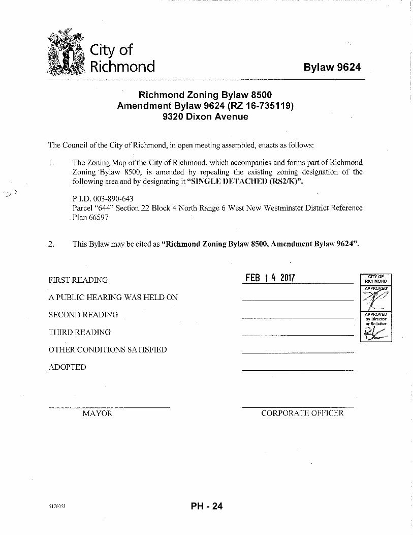
Richmond Zoning Bylaw 8500 Amendment Bylaw 9624 (RZ 16-735119)
9320 Dixon Avenue
Bylaw 9624
The Council of the City of Richmond, in open meeting assembled, enacts as follows:
1. The Zoning Map of the City of Richmond, which accompanies and forms part of Richmond Zoning ·Bylaw 8500, is amended by repealing the existing zoning designation of the following area and by designating it "SINGLE DETACHED (RS2/K)".
P.I.D. 003-890-643 Parcel "644" Section 22 Block 4 North Range 6 West New Westminster District Reference
. Plan 66597
2. This Bylaw may be cited as "Richmond Zoning Bylaw 8500, Amendment Bylaw 9624".
FIRST READING FEB 1 4 2017
A PUBLIC HEARING WAS HELD ON
SECOND READING
THIRD READING
OTHER CONDITIONS SATISFIED
ADOPTED
MAYOR CORPORATE OFFICER
5176053 PH - 24
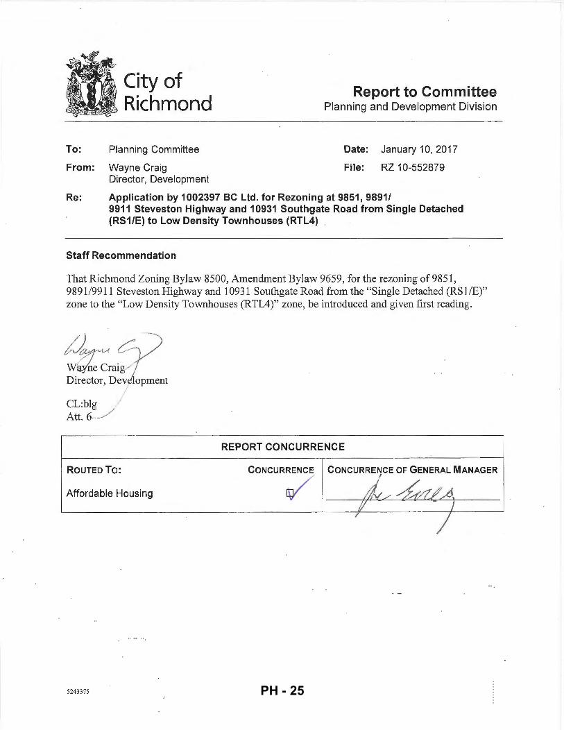
City of Richmond
To: Planning Committee
From: Wayne Craig Director, Development
Report to Committee Planning and Development Division
Date: January 10, 2017
File: RZ 10-552879
Re: Application by 1002397 BC Ltd. for Rezoning at 9851, 9891/ 9911 Steveston Highway and 10931 Southgate Road from Single Detached (RS1/E) to Low Density Townhouses (RTL4)
Staff Recommendation
That Richmond Zoning Bylaw 8500, Amendment Bylaw 9659, for the rezoning of9851, 9891 /9911 Steveston Highway and 10931 Southgate Road from the "Single Detached (RSl/E)" zone to the "Low Density Townhouses (RTL4)" zone, be introduced and given first reading.
1Jtj1~ ~ Wa(ne Craig...; Director, Deve opment
CL:blg // Att. 6___/
ROUTED To:
I
Affordable Housing
5243375
REPORT CONCURRENCE
CONCURRENCE CONCURRENCE OF GENERAL MANAGER
~
PH - 25
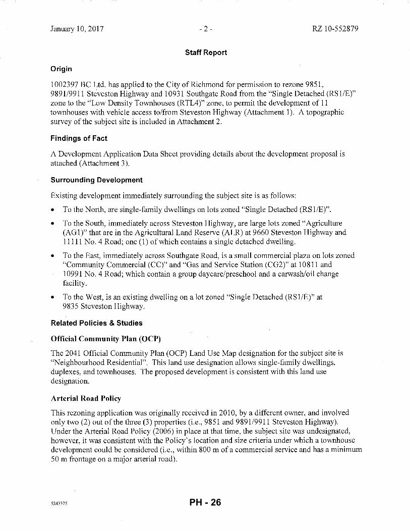
January 10, 2017 - 2 - RZ 10-552879
Staff Report
Origin
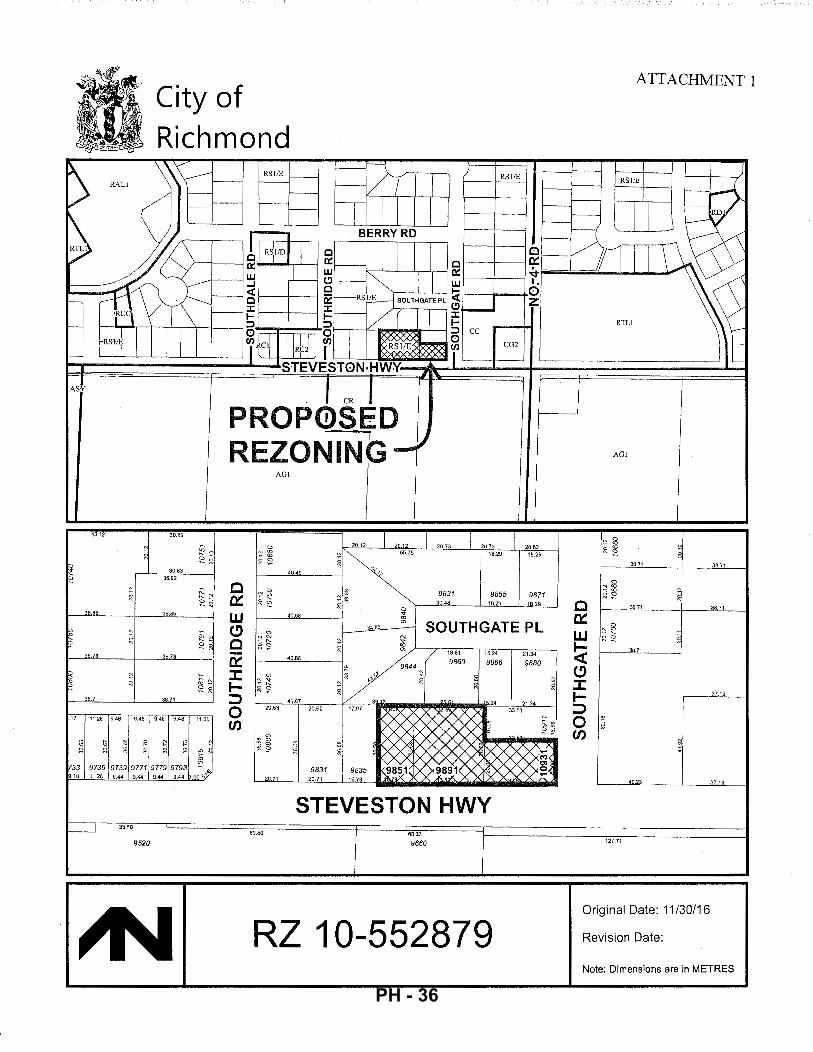
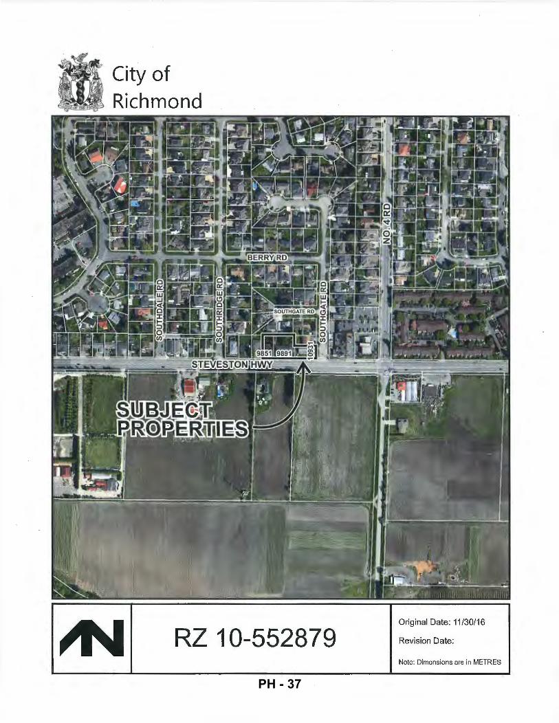
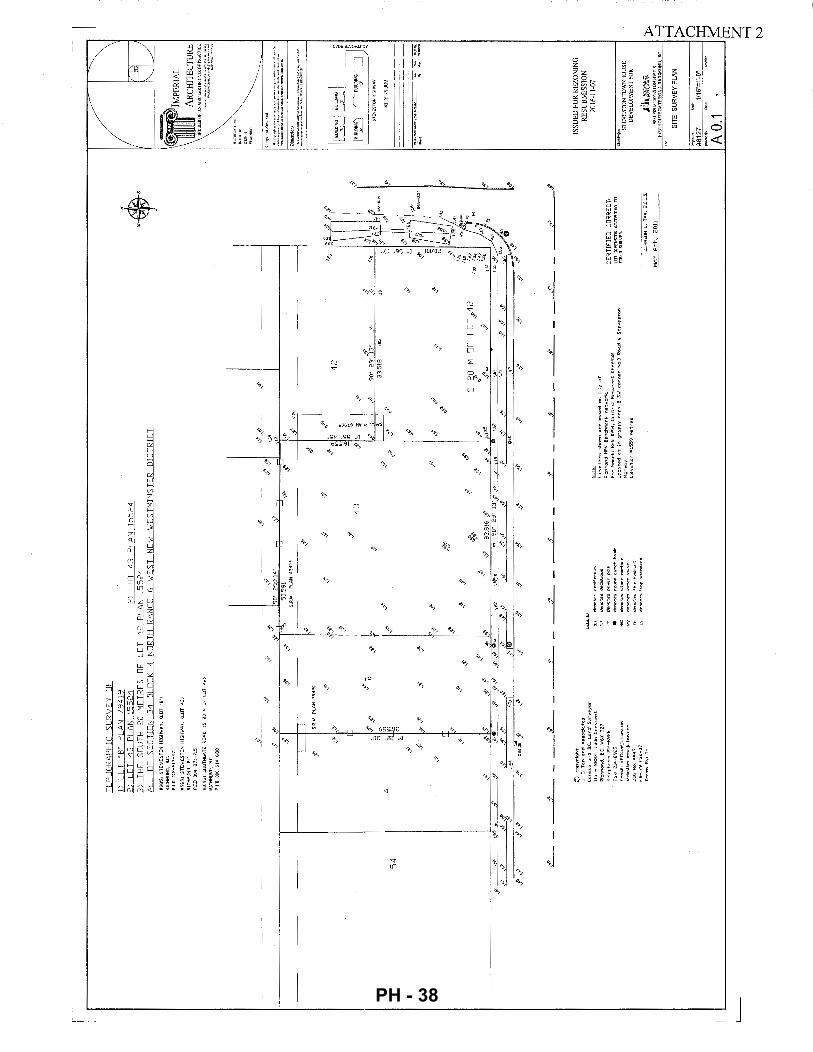
1002397 BC Ltd. has applied to the City of Richmond for permission to rezone 9851, 9891/9911 Steveston Highway and 10931 Southgate Road from the "Single Detached (RS liE)" zone to the "Low Density Townhouses (RTL4)" zone, to permit the development of 11 townhouses with vehicle access to/from Steveston Highway (Attachment 1). A topographic survey of the subject site is included in Attachment 2.
Findings of Fact
A Development Application Data Sheet providing details about the development proposal is attached (Attachment 3).
Surrounding Development
Existing development immediately surrounding the subject site is as follows:
• To the North, are single-family dwellings on lots zoned "Single Detached (RSl/E)".
• To the South, immediately across Steveston Highway, are large lots zoned "Agriculture (AG 1 )" that are in the Agricultural Land Reserve (ALR) at 9660 Steveston Highway and 11111 No.4 Road; one (1) ofwhich contains a single detached dwelling.
• To the East, immediately across Southgate Road, is a small commercial plaza on lots zoned "Community Commercial (CC)" and "Gas and Service Station (CG2)" at 10811 and 10991 No.4 Road; which contain a group daycare/preschool and a carwashloil change facility.
• To the West, is an existing dwelling on a lot zoned "Single Detached (RS1/E)" at 9835 Steveston Highway.
Related Policies & Studies
Official Community Plan (OCP)
The 2041 Official Community Plan (OCP) Land Use Map designation for the subject site is "Neighbourhood Residential". This land use designation allows single-family dwellings, duplexes, and townhouses. The proposed development is consistent with this land use designation.
Arterial Road Policy
This rezoning application was originally received in 2010, by a different owner, and involved only two (2) out of the three (3) properties (i.e., 9851 and 9891/9911 Steveston Highway). Under the Arterial Road Policy (2006) in place at that time, the subject site was undesignated, however, it was consistent with the Policy's location and size criteria under which a townhouse development could be considered (i.e., within 800 m of a commercial service and has a minimum 50 m frontage on a major arterial road).
5243375 PH - 26
January 10, 2017 - 3 - RZ 10-552879
In 2011, the rezoning application was taken over by a new property owner and the scope of the application increased with the addition of the thitd lot at 10931 Southgate Road. Due to the lot configuration, site planning has been a challenge and became more so with changes to the townhouse design guidelines adopted under the 2012 Arterial Road Policy. The rezoning application was subsequently taken over by the current property owner in 2015 and the applicant worked with staff to develop and submit an acceptable layout in late 2016.
On December 19th, 2016, City Council adopted an updated Arterial Road Policy. Under the new Arterial Road Land Use Policy, the subject site is designated as "Arterial Road Town House". The rezoning application at the subject site is consistent with the land use designation under the new Policy.
Agricultural Land Reserve (ALR) Buffer
Consistent with the OCP guidelines for multi-family developments adjacent to ALR lands but separated by a road, the applicant is required to register a covenant on title prior to rezoning to secure a 4.0 m wide landscaped buffer on-site (as measured from the south property line) along the Steveston Highway frontage. The covenant is to identify the buffer area and ensure that landscaping planted within the buffer is maintained and will not be abandoned or removed. The covenant is also to indicate that the property is potentially subject to impacts of noise, dust, and odour resulting from agricultural operations.
The conceptual development plans included in Attachment 4 illustrate the proposed off-site landscaping treatment along Steveston Highway, which will include grass, trees, and a new sidewalk within the boulevard, as well as the on-site yard on Steveston Highway, which is also proposed to contain a variety of trees, shrubs and fencing.
An earlier version of this redevelopment proposal was presented to the Agricultural Advisory Committee (AAC) on March 14, 2013, and was supported unanimously. The revised conceptual development plans included in Attachment 4 include a reduction of the number of townhouse units from what was proposed in the earlier version (from 14 units down to 11 units), while maintaining a similar on-site landscaping buffer treatment along Steveston Highway that is large enough to accommodate a variety of trees, shrubs, and fencing.
Floodplain Management Implementation Strategy
The proposed redevelopment must meet the requirements of the Richmond Flood Plain Designation and Protection Bylaw 8204. Registration of a flood indemnity covenant on Title is required prior to final adoption of the rezoning bylaw.
Public Consultation
A rezoning sign has been installed on the subject property. Other than two inquiries about the status of the rezoning application, received by one ofthe residents in the immediate surrounding area, staff have not received any comments from the public about the rezoning application in response to the placement of the rezoning sign on the property.
5243375 PH - 27
January 10,2017 - 4 - RZ 10-552879
Should the Planning Committee endorse this application and Council grant first reading to the rezoning bylaw, the bylaw will be forwarded to a Public Hearing where any area resident or interested party will have an opportunity to comment.
Public notification for the Public Hearing will be provided as per the Local Government Act.
Analysis
Site Planning, Access, and Parking
This proposal is to develop 11 townhouse units on a land assembly of 2,506.59 m2 (26,980 ft2) in
area (after road dedication), located on Steveston Highway and the west side of Southgate Road in the Broadmoor planning area. Prior to final adoption of the rezoning bylaw, the existing three (3) lots at the subject site must be consolidated. Conceptual development plans proposed by the applicant are contained in Attachment 4.
The proposed site layout consists of: two (2) buildings containing a total of seven (7) units along Steveston Highway (three-storeys in height, stepping down to two-storeys at either end), south of a proposed east-west internal drive-aisle that bisects the site; and two (2) two-storey duplexes to the north of the internal drive-aisle and along the interface with the adjacent existing singlefamily lots. The siting ofthe buildings enables:
a) the common outdoor amenity space to be provided in a visible and centrally-located· portion of the site opposite the main vehicle access point;
b) easier on-site vehicle manoeuvring; and,
c) a treed and landscaped yard along Southgate Road, which provides visual interest to the public realm.
A single vehicle access point to the site is proposed from Steveston Highway, and is positioned approximately mid-block. The internal east-west drive-aisle on-site is intended to provide shared access to future developments to the northeast and to the west. Registration of a Statutory Rightof-Way for public right-of-passage on title is a condition of final adoption ofthe rezoning bylaw.
Pedestrian access to the site is proposed from Steveston Highway via the internal drive-aisle, and from Southgate Rd via a walkway. Opportunities to enhance the treatment of the drive-aisle to highlight its dual-purpose for both pedestrian and vehicle access will be reviewed as part of the Development Permit application process.
The main pedestrian unit entries for the south buildings are proposed to front onto Steveston Highway. Secondary pedestrian unit entries for the south buildings, and the main pedestrian unit entries for the north buildings, are proposed to front the internal drive-aisle. Ground floor garages are arranged along the east-west internal drive-aisle.
Consistent with the parking requirements in Richmond Zoning Bylaw 8500, a total of 22 resident vehicle parking spaces are proposed, all of which are in a side-by-side arrangement. Also consistent with the Zoning Bylaw, a total of three (3) visitor vehicle parking spaces are proposed on-site, one (1) of which is identified for use by disabled persons only.
5243375 PH - 28
January 10, 2017 - 5- RZ 10-552879
Also consistent with Zoning Bylaw 8500, a total of 20 resident bicycle parking spaces (Class 1) are proposed within the townhouse units, and a bicycle rack for three (3) visitor bicycle parking spaces (Class 2) is proposed within the common outdoor amenity space between the north buildings.
Future Development Potential- 10911 Southgate Road
The property to the northeast of the subject site, at 10911 Southgate Road is not included in this redevelopment proposal. The applicant has provided a preliminary concept for how the property at 10911 Southgate Road could redevelop for townhouses in the future, a copy of which is on file.
The applicant has provided written confirmation that he has been in contact with the property · owners of 1 0911 Southgate Road to purchase the property and to advise of their future redevelopment potential should they wish to redevelop their site for townhouses in the future, and that they are not interested in redeveloping their property at this time.
To enable potential shared use of facilities at the subject site by 1 0911 Southgate Rd if it were to redevelop in the future, the following legal agreements are required to be registered on title of the subject site prior to final adoption of the rezoning bylaw:
• a statutory right-of-way for public access over the entire internal drive-aisle for vehicle access to 1 0911 Southgate Road.
• a legal agreement for shared access to the garbage and recycling room to enable a single point of cart storage and collection for both sites.
Amenity Space & Private Outdoor Space
Consistent with the OCP and Council Policy 5041, the applicant proposes a contribution to the City in the amount of $11,000 ($1 ,000/unit) prior to rezoning, in-lieu of providing on-site indoor amenity space.
Common outdoor amenity space is proposed on-site, in a central location between the north buildings. Based on the preliminary design, the proposed 89.25 m2 outdoor amenity space exceeds the OCP guideline of a minimum 6m2 per unit (66m2
).
In addition to common outdoor amenity space, private outdoor space is proposed on-site for the use of each unit, which is generally consistent with the minimum size and shape that is encouraged in the OCP guidelines. Private outdoor space is proposed in the form of yards at grade, and balconies/decks on upper storeys. The applicant has carefully considered the proposed size and location of upper balconies/decks to address potential concerns of overlook onto adjacent single-family lots, as shown in Attachment 4.
Variances Requested
This redevelopment proposal complies with the Zoning Bylaw, with the exception of the variances noted below.
5243375 PH - 29
January 10, 2017 - 6 - RZ 10-552879
The applicant requests to vary Richmond Zoning Bylaw 8500 to:
• Allow seven (7) small-sized resident parking spaces.
(Staff is supportive of this variance, as it enables all of the required resident parking spaces to be provided within the garages of each unit, in a side-by-side arrangement).
• Allow a minimum 5.0 m yard front yard and exterior side yard setback along Steveston Highway and Southgate Road.
(Staff is supportive of this variance request for the following reasons:
- A reduction in the building setback from the south property line along Steveston Highway enables a wider setback to be provided from the north property line, resulting in a more desirable inteiface with the existing single-family housing to the north.
- A reduction in the building setback from the east property line will create a more desirable public realm along Southgate Road. By shifting the buildings to the east, a wider setback can be provided from the west property line along the interface with the existing adjacent single-family housing, which, in turn, has the added benefit of accommodating the required visitor suiface parking, which will be screened from public view.
Tree Retention and Replacement
The applicant has submitted a Certified Arborist's Report; which identifies on-site and off-site tree species, assesses tree structure and condition, and provides recommendations on tree retention and removal relative to the proposed development. The Report assesses 14 bylaw-sized trees on the subject property, and a total of five (5) trees that are either on a neighbouring property or on shared lot lines with neighbouring properties.
The City's Tree Preservation Coordinator has reviewed the Arborist's Report and has the following comments:
• 12 trees are in poor condition, as they have been previously topped and/or exhibit structural defects such as cavities at the main branch union and co-dominant stems with inclusions, are dead, dying (sparse canopy foliage), or have been topped by BC Hydro for line clearance (Trees# 1, 2, 3, 4, 5, 10, 13 and 3051, 3054, 3055, 3056, 3057). As a result, these trees are not good candidates for retention and should be removed and replaced.
• Two (2) Spruce trees (# 3058 and 3059) are in fair condition, however, they are located in the center of the development site and will be impacted by both building conflicts and the required raising of the finished grade by approximately 1. 0 m from the existing lot grade. These two (2) trees should be replaced with larger caliper coniferous trees (min. 7 m high) located along the street frontage.
• One (1) tree on the neighbouring property at 9835 Steveston Highway (Tree# 11) and One (1) tree on the shared lot with the neighbouring property at 1 0911 Southgate Road (Tree # 7), are to be protected as per City of Richmond Tree Protection Information Bulletin TREE-03.
5243375 PH - 30
January 10,2017 - 7- RZ 10-552879
• One (1) tree(# 9) located on the neighbouring property at 9860 Southgate Place, and two (2) trees(# 8 and 3061) located on the shared lot line with the neighbouring property at 1 0911 Southgate Road are recommended for removal in the Arborist report due to their existing poor condition. Prior to removal of these trees, the applicant must obtain written permission from the adjacent property owners with whom the trees are shared, and obtain a valid tree removal permit. If permission to remove the trees is not granted by the adjacent property owners, these trees must be retained and protected as per City of Richmond Tree Protection Information Bulletin TREE-03. (Note: Subsequent to the City's review of the applicant's Arborist report, however, the property owner at 9860 Southgate Place obtained a tree removal permit to remove Tree# 9 from their property).
• Replacement trees should be specified at 2: 1 ratio as per the OCP.
The proposed tree retention plan is shown in Attachment 5.
Tree Protection
Two (2) trees on the neighbouring properties at 9835 Steveston Highway and 10911 Southgate Road are to be retained and protected. The applicant has submitted a tree retention plan showing the trees to be retained (Attachment 5). To ensure that the trees identified for retention are protected at development stage, the applicant is required to complete the following items:
• Prior to final adoption of the rezoning bylaw, submission to the City of a contract with a Certified Arborist for the supervision of all works conducted within or in close proximity to tree protection zones. The contract must include the scope of work required, the number of proposed monitoring inspections at specified stages of construction, any special measures required to ensure tree protection, and a provision for the arborist to submit a postconstruction impact assessment to the City for review.
• Prior to demolition of the existing dwellings on the subject site, installation of tree protection fencing on-site around the off-site trees to be retained. Tree protection fencing must be installed to City standard in accordance with the City's Tree Protection Information Bulletin TREE-03 prior to any works being conducted on-site, and remain in place until construction and landscaping on-site is completed.
Tree Replacement & Landscaping
The applicant wishes to remove 16 on-site trees (Trees# 1, 2, 3, 4, 5, 8, 10, 13 and 3051, 3054, 3055, 3056, 3057, 3058, 3059, and 3061), two (2) of which are located on the common property line with 1 0911 Southgate Road. Consistent with the 2: 1 tree replacement ratio specified in the OCP, a total of 32 replacement trees required.
The preliminary Landscape Plan included in Attachment 4 shows that 23 replacement trees are proposed to be planted on-site. Through the Development Permit application review process, opportunities for additional tree planting on-site will be explored. If the total required number of replacement trees cannot be accommodated in the final Landscape Plan at the Development Permit application review stage, the applicant will be required to provide a contribution in the amount of$500/tree to the City's Tree Compensation Fund in lieu of planting the remaining required replacement trees on-site.
5243375 PH - 31
January 10, 2017 - 8 - RZ 10-552879
Affordable Housing Strategy
Consistent with the City's Affordable Housing Strategy, the applicant proposes to submit a cash-in-lieu contribution to the Affordable Housing Reserve Fund in the amount of $4.00 per buildable square foot prior to final adoption of the rezoning bylaw (i.e., $64,754).
Public Art
Consistent with the City's Public Art Program (Policy 8703), the applicant is required to submit a contribution to the City's Public Art Reserve Fund based on the current rate of $0.81 per buildable square foot prior to rezoning (i.e., $13,113).
Townhouse Energy Efficiency and Renewable Energy Policy
The applicant has committed to achieving an EnerGuide Rating System (ERS) score of 82 and to providing pre-ducting for solar hot water heating for the proposed development. The applicant has submitted an evaluation report by a Certified Energy Auditor (CEA), which provides details about the construction requirements that are needed to achieve the rating. Specifically, the CEA's report identifies that, in addition to using current common building practices and meeting the minimum requirements of the 2012 BC Building Code, the installation of an Air Source Heat Pump is required to achieve an EnerGuide 82 rating.
Prior to rezoning, the applicant is required to register a restrictive covenant on Title specifying that all units are to be built and maintained to ERS 82 or higher, as detailed in the CEA's evaluation report, and that all units are to be solar hot water-ready.
Impacts of Traffic Noise
To protect the future dwelling units at the subject site from potential noise impacts generated by traffic on Steveston Highway, a restrictive covenant is required to be registered on Title prior to final adoption of the rezoning bylaw to ensure that noise attenuation is required to be incorporated into dwelling unit design and construction.
Prior to a Development Permit application being considered by the Development Permit Panel, the applicant is required to submit an acoustical and thermal report and recommendations, prepared by a registered professional, to comply with the requirements of the restrictive covenant.
Existing Legal Encumbrances
There are existing statutory right-of-ways for sanitary sewer registered on Title of the subject lots. Encroachments into the right-of-ways are not permitted. The owner is aware of the charges on Title and the proposed conceptual plans do not show any encroachments into the right-ofways.
There is also an existing restrictive covenant on Title of 9851 Steveston Highway (AB211969) that requires: a) any dwelling on the land to be designed to enable vehicles to enter and leave the property without having to reverse onto the street; and b) that the land not be subdivided to
5243375 PH - 32
January 10, 2017 - 9 - RZ 10-552879
create lots having a frontage of less than 16 m and that the front yard setback not be less than 9 m. This covenant is required to be discharged from the Title of the lot prior to rezoning.
Site Servicing and Off-Site Improvements
Prior to rezoning, the applicant is required to:
• Provide a 4 m x 4 m corner cut road dedication at the northeast corner of the subject site; and,
• Submit a contribution in the amount of $20,000 towards the future installation of a special crosswalk at the intersection of Southgate Road and Steveston Highway.
Prior to Building Permit issuance, the applicant is required to:
• Enter into a Servicing Agreement for the design and construction of off-site improvements, as well as water, storm and sanitary service connections as outlined in Attachment 6. Generally, the required upgrades and improvements include boulevard improvements along both Steveston Highway and Southgate Road, as well as upgrading the existing open ditch to a storm sewer on Southgate Road and upgrading the storm sewer system on Steveston Highway.
Rezoning Considerations
The list of Rezoning Considerations is included in Attachment 6, which has been agreed to by the applicant (signed concurrence on file).
Design Review and Future Development Permit Application Considerations
A Development Permit application is required for the subject proposal to ensure consistency with the design guidelines for townhouses contained in the OCP, and with the existing neighbourhood context.
Further refinements to site planning, landscaping, and architectural character will be made as part of the Development Permit application review process, including:
• Showing conceptual locations for aboveground street light, traffic signal, Shaw cable, and Telus kiosks, as well as the necessary right-of-way dimensions for these above-ground structures.
• Addressing transitions in lot grading at the property lines within tree protection zones of Trees # 7 and 11 on adjacent properties.
• Ensuring that landscaping does not conflict with the required clearances next to vehicle parking locations.
• Refinement to the design of the internal drive-aisle to enhance on-site permeability, and to highlight its' dual-purpose for both vehicle and pedestrian circulation through the use of varied materials.
• Refinement to landscape design to incorporate larger sized trees on-site and a greater abundance of shrubs and ground cover within the landscaped ALR buffer along Steveston Highway.
5243375 PH - 33
January 10, 2017 - 10- RZ 10-552879
• Refinement to the design of the buildings to further articulate fac;ades and break up the building mass.
• Revisions to upper storeys and roof forms of buildings at the transition from three-storeys down to two-storeys.
• Review of the proposed colour palette and exterior building materials to ensure consistency with the OCP design guidelines for townhouses.
• Demonstrating that all of the relevant accessibility features are incorporated into the design of the proposed Convertible Unit, and that aging-in-place features can be incorporated into all units.
• Reviewing the applicant's design response to the principles of Crime Prevention Through Environmental Design (CPTED).
Additional items may be identified as part of the Development Permit application review process. The Development Permit application must be processed to a satisfactory level prior to rezoning approval.
Financial Impact
The rezoning application results in an insignificant Operational Budget Impact (OBI) for off-site City infrastructure (such as roadworks, waterworks, storm sewers, sanitary sewers, street lights, street trees and traffic signals).
Conclusion
This redevelopment proposal is to rezone 9851, 9891/9911 Steveston Highway and 10931 Southgate Road from the "Single Detached (RS liE)" zone to the "Low Density Townhouses (RTL4)" zone, to permit the development of 11 townhouses.
The proposal is consistent with the land use designation contained within the OCP, and is consistent with the location criteria in the OCP for the consideration of townhouses along arterial roads.
With respect to site planning, vehicle access, and built form, the proposed conceptual development plans are generally consistent with the design guidelines for townhouses contained in the OCP. Further design review and analysis will be undertaken as part of the Development Permit application.
It is recommended that Zoning Bylaw 8500, Amendment Bylaw 9659 be introduced and given first reading.
Cynthia Lussier Planner 1 (604-276-4108)
CL:blg
5243375 PH - 34
January 10, 2017
Attachments: Attachment 1: Location Map Attachment 2: Site Survey
- 11 -
Attachment 3: Development Application Data Sheet Attachment 4: Conceptual Development Plans Attachment 5: Proposed Tree Retention Plan Attachment 6: Rezoning Considerations
5243375
RZ 10-552879
PH - 35
AS~
City of Richmond
PROP~SJo REZONING - 11
AGI
RZ 1 0-552879
ATTACHMENT 1
RSIIE ..1 -1
RDI 1--
KrLI
l
AGI
Original Date: 11/30/16
Revision Date:
Note: Dimensions are in METRES
PH - 36
City of Richmond
RZ 1 0-552879 Original Date: 11/30/16
Revision Date:
Note: Dimensions are in METRES
PH - 37
1--
----
-
54
,'?'~-________ip'-
~">
t"'""
. J?
"'"
" v,
'b
. !~
... ~"'
,.P.
.... ~~
... ~"'
;t:_
_
._:."'
TD~OCRAPHIC
SU
RV
EY
O
F
D
LOT
'T
PL
LIN
/9
41
9
2l
LOT
4
3
PL
AN
1
55
?4
2
) LO
T
43
P•
AN
1
55
24
3J
TH
E
SO
UTH
2
0
ME
TR
ES
O
F LO
T
42
P
' AN
1
55
24
A
LL
O
F S
EC
TIO
N
34
B
LOC
K
4 N
OR
TH
RLI
NG
, 6
\JE
ST
N
E\J
\J
'ST
MIN
ST
ER
D
IST
RIC
T
1198
51
ST
EV
ES
TO
N
HfG
HV
AY
, (L
OT
"B
'l
RIC
HM
ON
D,
li.C
.
P.I
.DD
12
-21
3-4
7l
1198
91
ST
EV
ES
TO
N
HIG
HV
AY
. (L
OT
4
3)
RIC
HM
ON
D,
H.C
P
.I.D
00
4-8
71
-71
5
11JQ
931
SO
UT
HG
AT
E
RO
AD
, ($
2
0
H or
LD
1"
42
)
RlC
HM
DN
D,li
.C.
P.I
.DO
Oil-
-61
4-6
88
A
,<;>"'
... -,."'
,Y
,<#'
.f
,.,<>
Lf-
J ,'I-"
' S
.R.V
. P
LAN
7
94
20
,&>
,1'!_ ... '-
""' g,: ,1P
-t
' B
~
0 -.,P
,f
1-...lo
,of
,'?~
,,,
_, ,'I
-,":>
"'
-..'-"'<
> -s·"
' ~
.<o"
,'i
'·S;-
.... ~"'
,'9'1:>
© c
op
yri
gh
"t
J.C
.To
no
nc!A
sso
c:i
ote
s
Co
nn
do
nn
tiB
.C.L
nn
tiS
u.-
vey
or
11
5-8
83
3
Dtl
lln
CrE
"scen
t
Ric
h!'
lon
d.
B.C
. V
6X
3
27
TE
"lep
hor>
E"'
21~-8928
><
>x•2
14
-89
29
E
-,..
,nil
•off
k:e
@jc
to.n
.co
n
VE
"bsl
-te•
w
ww
.jct<
>I"
I.C
cn
Job
No
.-o
l-4
-'1
9
FB
-17
9P
32
-37
Dr"
"'"
'By
•TH
_ .... "'""
,'I-"'
f' ---
,1"
,,•
\:>?.
.
1-..'!·:~-
-..,,.
,"'
,,.,'>'I>
,:-,.
"' ,, ....
..._., ...
,'>"
,'>"'
43
<:>"'
,-,.'1>
,o'
f!
... :>'~-
'-'""'
,, ,'!-
«>
"'~'\
83.8
16 "
'~0,
.;;."'
,•'
,r
"':~
--~
,p
,Y"'
...,'<>
b"
'
,•'
-9
0"
29
' 13
" .,.,
.. ~ ...
. r.o
" -~
.. \~~-
... ~~--
-.,"'"'
'9'-~..._'9"'
-:"
,,
..._'?"
" ..._
":>'-
,,r
__
__
:i:_
_
"""""'
do-no-t~s
<;c
nlf
..-r
cus
deno
tPS
dt>
cldu
oL.O
S
i>P
d.-
no
-tesp
c ..
erp
olt
>
e dt
>no
tt>
s ro
un
d
cn-t
ch
b<>s
ln
f"H
de
,..,o
-t.-
s fir~
hydr
nr>
-t
LS
de
no1:
-"S
lO"P
S1:
<>
nd<
>.r
d
,":>"
'
,.,
-:-,'I>
,1?
' ,'?"
' \.
09
\.\1'
1
.,'!-"'
" ,"!>"
/!.7
9
<>":o
""'
J ' ~~
tg""""
m
~tR
~ .... .o
0
~ o' •'
,,~,
•' "
.... """"
' ,.,..
.. ,., ....
"
. "
,.,"'
,•'
·"' ,11
'
,~""
..,'>"'
o;,.'?>
"
......
-J
...... ;
.25
•" ;.o
:.<'-
._,")."'
,:.
' ,.
~"
,•:l"'
,'P,
..._, .... .. ,•'
,:."'
----
.:f:
.._
_
=
+
42
•' 90
" 2
9'"
b·
33.5
18
.,.~"'
S
20
M
O
F
·"" ..,'!-<!; .
..
\,(,
\
\,71 ,, ,'?
lo
.:!>"'
Ele
vc.t
ion
s
sh
ow
n
<>re
b
nsed
o
n
Cit
y o
f
Ric
h,.
,on
d
HP
N
Ben
c:hM
<>
rk
ne
"tw
ork
.
Be,
.,:;
hl'
nrk
: H
PN
~204,
Co
n-t
rol
Mon~D"~ent 02H2~52
_<}}'
LD
T, ••
42
,P
-.'?"'
,'?"'
-•' ,'?
">
Lo
co. t
ed
o"
t ln
g
ro.s
sy
nre
o@
S
V co
rner
No.
3 R
oo.d
1!.
S
tt>
vest
on
f.ig
h"'
"Y
Ele
v<
>tl
on
=1
.55
9!"
1e
tr ..
s
..._.:) '
w.s
g
--
-- '~,
IE~ "U" ,•" 1,
•' I , ,,
I .
•_Jt 1
'F
-" r.._
k• \:.
'0
h"'
..._?.>
,Y
\:.
, 0
If'"
' l
! \."
:! ..
~nJI
•''
·"':
, ;;·~,
I ,,,
_,,,
""
~9-; fl
l.--!1
l<f'
I_J~~
l.E
B
!.--!1
J.rs
-(>
. ;%
.,.,.
1.0
7 ~~
. -~1
J.41
J.
s6
l":>"'
..._'?'
b<e
._').""
"' ._:
. _.
.._"9
'0
CE
RT
IFIE
D
CO
RR
ECT:
L
OT
DlM
EN
SIO
NII
CC
OR
OIN
GT
O
riE
!.D
SU
RV
EY
.
-lDH
NS
DN
C
. T
lll-t
,
MA
Y
6th
, 20
11
( ~~
\
DL
("op
yrlg
luR
.-'"
'"''1
IMP
ER
IAL
AR
CH
ITE
CT
UR
E
1AIB
CC
ER
TlF
lCA
TE
!lFP
RA
CT
1CI::
.....
.. ,.,.,
,.,.,.
,.,.,,
.. .,.,,
,.,..,
""'
" ''
"'~'
""'"
'--'
'"""
"'""
'•'·
""'"
""
n. ~
.. ·=~···",.,..,. ......
....... ~-·
""-~'-.«!) "'"
'" ~-!
~"" ·~'
~ '"
''""
"~·•
·'-•
w~•A
•-""
•=•~
"'"
",."
"""
""''"
"
~l
u:J
I
L_
_
ri:SJ
I ~ ~
~
KE
Y P
LAN
/
._
.,,_
.•
,.
» a~ ""m
k~'""'
.,. --
TfW
J>D
ISSU
ED F
OR
RE
ZO
NIN
G
RES
UB
M1S
SIO
N
2016
-11-
07
Cio
@ro
ioc:
STE
VE
STO
N T
OW
NH
OU
SE
DE
VE
LO
PME
NT
!-'O
R
ih~~
.~~.
~ >
Jt\
931 s~~i~~~~:~~~~l~~~io~n. e
r ..
...,
->-
:l >
SIT
E
SU
RV
EY
PlA
N
#8
12
7
' 1/
16"=
1'-0
" ~
I r""'"' ~
-----ll
n •
/\"" 0
,1 '
~ '
'Mo
• ~ ~ N
PH - 38
City of , Richmond
Development Application Data Sheet Development Applications Department
RZ 1 0-552879 Attachment 3
Address: 9851, 9891/9911 Steveston Highway and 10931 Southgate Road
Applicant: 1002397 BC Ltd.
Planning Area(s): Broad moor
Existing Proposed
Owner: 1002397 BC Ltd. To be determined
Site Size (m2): Approx. 2,520 m2 (27,125 fe)
2,506.59 mL (26,980 ftL) after corner cut road dedication
Land Uses: Single-family and duplex housing Townhousing
OCP Designation: Neighbourhood Residential No change --Zoning: Single Detached (RS1/E) Low Density Townhouses (RTL4)
Number of Units: 4 11
Max. 0.60
Buildable Floor Area (m2):* 1503.95 m2 (16,188 ft2) 1503.87 m2 (16,188 ft2)
Building: Max. 40% Building: Max. 40%
Lot Coverage (%of lot area): Buildings, Structures and Non- Buildings, Structures and Non- none porous Surfaces: Max. 65% porous Surfaces: Max. 65% Live nt material: Max. 25% Live material: Max. 25%
Width: N/A Width: N/A Lot Dimensions (m): none
Variance Front (east): Min. 6.0 m Front (east): Min. 5.0 m requested
Setbacks (m): Rear (west): Min. 3.0 m Rear (west): Min. 3.2 to 4.4 m for 5.0 m Interior Side (north): Min. 3.0 m Interior Side (north): Min. 4.5 m front yard & Exterior Side (south): Min. 6.0 m Exterior Side (south): Min.5.0 m exterior
side rd
Height (m): 12.0 m 11.85 m none
On-site Vehicle Parking none
25 25 none
On-site Bike Parking Spaces: none
On-site Bike Parking Spaces 17 23 none -Total:
5243375 PH - 39
January 10, 2017 -2- RZ 10-552879
On Future I Bylaw Requirement I Proposed I Variance
Subdivided Lots
Tandem Parking Spaces: Permitted - Maximum of 50%
none none of required spaces
Amenity Space- Indoor: Min. 50 m~ or Gash-in-lieu at $1,000 per unit
none cash-in-lieu at $1,000 per unit Total: $11,000
Amenity Space- Outdoor: Min. 6 mL per unit
Total: 66m2 89.25 m2 none
Other: Tree replacement compensation required for loss of bylaw-sized trees.
* Preliminary estimate; not inclusive of garage; exact building size to be determined through zoning bylaw compliance review at Development Permit and Building Permit stage.
5243375 PH - 40
9B31
STEV
ESTO
NHW
Y
OV
ER
AL
L S
ITE
PLA
N
NT13
IL
> s: :r:
I .~
,::o I~ .~
,a.
PRO
JEC
T SI
TE
STEV
ESTO
N H
IGH
WAY
PRO
JECT
SIT
E
lw
lz
,::o
0 C3 n:::
w
!;;(
C.9 :r:
f :::::l
0 (f)
0 C3 n:::
w !;;(
C.9 :r:
f :::::l
0 (f)
1091
1N04
RD
L ___
____
__ _
@
.. ~
"'-m
'
Copy
righr
R.o<
tTYt
rl
... ,
m,...,.....,.n.,n•~-><~or
.•"
'"'
"""'
""'"
•w•n
onc"
''"....
.u>"
'
n.~ ...
......
..... .-~._._ ..
.... _
•• _
...
...-
.. ...
,..,
.....
......
..... _
...
. _
... ~v_ ...
_....
._ ..
_
.,._
.. ,.
.,._
,. _
_ ,
.l..
.,..
WA
"".
-
~ ~ ~
LU
I ..
·-
.. ~ "
'=
,;,;.,
~_ .. ,,_
.,_"""
" ....
........
....... .
ku
..O
.. _
,._
ISSU
ED F
OR
REZ
ON
ING
R
E-SU
BM
ISSI
ON
20
16-1
2-05
-STEV
ESTO
N T
OW
NH
OU
SE
DEV
ELO
PMEN
T FO
R
~ 1
#1"12
7 -
1'=2
0'-0
' 1 ~
--
~~
(l ::r:
~ ~ ..., ..j:
::.
PH - 41
lr
1--i'"
<
\- \'0
~~-
T
hi
~
I
h -J
tr--
---~
-----~
ltA
NO
SCA
P
UHIT
108
(TY
PEC
I) UN
IT10
9 (T
YPEC
2)
...... ,.
19\1
"29'
14'
1-·-· .
. ~/
"''"
""'"
~'·
~_L ~
I -
_j
---
------------------------
---~
----l
-----=
\ --T
~~~=~~-----
---------
--~
NO
~-
~u.:
=~I'
Voll
;
UHIT
IIO
{T
YPED
!)
~~~*Wi
ll
UNIT
Ill
(T
YFE0
2)
OOEST
PA11
Ktlll0Nf£'.1'1
().1
,1J(
l~~£TIILOPW
GKI.
T1'Kl,D:,GAAOEITCII'OGIW'I«:BWll'tM.~
GAAT1'flTORB\I,IIjAS'IIIrniiiT!!a~lrCm~m~
ASPERRECOI.UI.tl.lmNSI~
AIUIORISTRfl'OII
T
1109
11 S
OUT
HGAT
E RD
I
0 (§
0::::
UJ ~
(9
::r:
1-
:::>
0 (f)
~~
JAL
['
l'C
r''l
'TT
VC
~
·--~
""':
:':.
::::
""'~
I ~~
:::n
··,.
))f$
!tlN
I
""'"'"
Cop
)'rlg
lnR
t .. r
ml
I I ;:
;.:.".
,:::;:
::.::.
.,~;:.
~:.-::
.:-·--
Etj
~
a ""\
/ __ ,
~
/
~
3 ~I ~
~.,.,....:::::.""'=
... _::::
, ===::
:, §
PROP
ERTY
lM
~o·
29
• 13
•
--,,,,
'
ll!..f
...l
u1s
:Ma'.
o'
<::../.
! '
~
.... ~ .. -
~
KEY
PLAN
.. ._
.. .......,
~ITIOI
rco~
~~UNIT
) I
II ;:::
;:::::::
:::::::~
~ :;
:: :::
:;
I
,,--7'9=tc-
-+---1--_jj__~
'_:~::i "'""'m
I
! ; "'
j !!I
I
I l
II
• /
'II
.,... II
It
;,_-_
=rt---
'" -r-_
t --
--~
-sO
· cs
· 13
' -
--
--e--
--;R
OPERTY
~rN~
·
c9)-
w·
Jl'
. I •
I!
~;t=
=~.-.. :::;~~~ ..... ~~=====§~~mrr:
;i 1
---
! ... ;:;
,;;~-i
STEV
I I IS
SU
ED
FOR
RE
ZO
NIN
G
ESTO
N H
IGH
WAY
--
=--J~
~ ~:~~
':;";'"
ICIR~c; ..
......
.,,
i\
S!OE
WAL
K
\
L= PR
OPO
SED
AVER
AGE
FINI
SHE
D SI
TE G
RADE
: 1.6
0 (B
ASED
ON
GRA
DES
AT C
ORN
ERS
AS 1
.57,
1.5
7, 1
.63,
1.6
3 AN
D 1.
60)
D
A S
TATU
ARY
RIG
HT
.OF-
WAY
OVE
R TH
E EN
TIRE
VEH
ICLE
DRI
VE A
ISLE
IS TO
BE
REG
ISTE
RED
FOR
PUB
LIC
RIG
HT .O
F-PA
SSAG
E
CEt
trER
LJNE
------------_
I
(1
\ S
ITE
PL
AN
~SCALE
3/32
"=1
'-0"
PLAN
#1
NOTE
: 1.
REFE
R TO
LAN
DSCA
PE
FOR
MO
RE IN
FO. O
N LA
YOU
T O
F SO
FT A
ND
HAR
D LA
NDSC
APE
COM
PONE
NTS
2. R
EFER
TO
LAN
DSCA
PE F
OR
MO
RE IN
FO. O
N SI
TE G
RADI
NG
3. RE
FER
TO L
ANDS
CAPE
FOR
MO
RE IN
FO. O
N W
OO
D RE
TAIN
ING
WAL
L/FE
NC
E I G
RADI
NG D
IFFE
RENC
E B
ETW
EEN
PRO
JECT
SIT
E AN
D A
DJAC
ENT
PRO
PERT
IES.
4.
REF
ER T
O L
ANDS
CAPE
FOR
MOR
E IN
FO. O
N O
FF S
ITE
DEV
ELOP
MEN
T ON
STE
VEST
ON
'rfN
Y AN
D SO
UTH
GAT
E RO
AD
@
DEV
ELO
PMEN
T FO
R
.. ~h~.~
~~.~
?R5
1,989
1STE
VEST
ON
HIV
Y &
lL
"),II
SO
t.mlC
lATE
RO
AD
, RJC
:HM
OND
. IIC
SITE
PLA
N
I ;,21
-
3!32
.=1'
-0"
~-
1'1\"1
.0·~.
=.J
PH - 42
lr
~
I I I I
t---r
--I
'".:.£:.
..!'~
-PR
OPER
TYU
NE
I I
I
LL
_r _
___
__ J _
_____
_ r':·,"~
~·i __
___ J
______
J ~ T ~
~ = ~ ~ =
~ ~ = ~ ~ =
~ ~ =-----
---~
IJNIT
106
(f(P
EC1
) U
MTI
O!I
""'"'
UN
IT11
0 (T
YPE
D!)
I --
----
--l
('NPE
OZ
) UN
IT11
1 I
I r-
--T
---
, r-
--T
---
, r-
--
, ~
~---
p.,D
r---
,1
·!~~---:
. ~~~
~~~
mi~i~
i ~~~
~~ :a]r
;. i
~~. !'I
1:
: U
JI
I I
: :
: :
1 :
I :
~~ ...
II 11
I
: :
~~..
1 1
t~
•W•·
: •i:!
Ji u
-----L
:
1 lT
---'
-'\-
-/
---1
_,r
\_
o•:Oi:t
l:l.'q
rt'<P
J .,.
,....
..._
-t§
ru
•GD
IGV
IIE
!lw.M
!IU
I\\li
iiSt
tn
.,.,
."'
1 ',,
,.,""
l
',,
mR
tE
lv,-CAal.
EniP.US5'1S1Ei
lfTYP~.E "
DR
I"W
AV
~
',
DR
NE\
'IAV
,f
',
i
DRIV
EWAY
l.l
ll);c
AII£
•
" '
~ I
, ~C
U!ll
lflW
J ~
I .r
ftOIJ.Cl.'
l!ll(ll~.l
----
......
.. ---
I /R
GU
.W.U
[1'1
PJ
!::: 6
I~. ,
lsl L
_.!_
__~I.
L_ _!_
~
ll
CJ
~~--
CJ
----
L_ -t_
-L~~;
~'_ --
----
PROPE<:_TY~NE-
----
-~
l ·,
', ',
/ r
C1
~ j
~ i!
'• a .. >, ,--
--;-
--~ ~
giT N~'
/ ~l-/i
~g'
r.
---,
r.
~ r.
-[-
--~ ~
----;--
--~
0
if T
,....,
, I
I I
I I
Y"'~
I I
,...,I
-
I ,
I r-
I ,
I I
I I
,,....
, I
11
1 :1-
:1
1 It
i 1r ~
: 1
111
F:
,1_1 1:
• A
t :"::
1
1 1
1:;;:
l
I I
1 1.
. 1-
~ 1
,, 13
11 I
IJ I
1
3 1
I I
I l!
4i
j!l__
i m[~[
~~ ~~~
~~ .-
~= ~g-
~ [~]
~_;-!l~J
~_;-!lg
,~~gjgj
c ~~ !
I
Ulii
T101
lA
-JIT
102
L_
_
., ..
. ,..
, ,.
r-
----
UN
IT10
3 U
t.IT
II>'
U
NIT
105
UNIT
tO&
UNIT
107
) •
! ~
L ,J
~-
L ,J
·v--
= L ~J
~·· _j
:-··
,J
L"'~
L",
J /
n <>
-,
J :::
:!.__
_/
11.
r--
--
-r-
--
...--
--
--
--
-·-
---
----
@-~-
-~
-:;:
':1
0"29
' 3
' ~---
PRO
PERT
Yli
NE
~
@
_/
\\
SID
EWA
LX
q;1
_/
\ i}
LS
"""
.. [~ {n
~
·~·
·~·
r."
l I
I I
I I
I I
I I
I I
I !:
I I
~ I
I ~
I I
; I
I •
I I
~ I
I
!__
! ! __
_ ! t;
WC
SIAU(4i.lXM~11
$1~NO~R0$1A
L.L(
2.5~
1X 5
.5M
) SI
ML.LSTAL.LIZ.l
t.IXU
~11
lt8
H01
ll!O
N11
0.li
!II:
'IC
U!6
P/o
.Cf(
fWW
JE)
(UII.
U:D
.iM
J
PAR
KIN
G C
ALC
ULA
TIO
N
RE
QU
IRE
D:
1160
10~!
0:
VIS
I!C
IIl;
AES
IOEi
lTS:
VISI
TOII
S:
TOTA
l.:
STEV
ESTO
N HI
GHW
AY
UT
AU
.II.
tlrT
X1
1U
tfiS
•ZU
T.O
.U.S
US
TA
U/W
ITX
II
IIM
IS•U
!l'II
U!l
[3S
TA
U.S
J
2U!l
'I.O
.U.S
(2SS
TJ.
U.S
1
,,~=
::~:
~:;~
BIC
YCLE
PAR
KIN
G
CA
LCU
LAT
ION
lllSI
'AC
E.'l
tSP.
..CES
CENT
ERU
NE
ff\
PA
RK
ING
PLA
N
~SC
ALE
3132
"=1'
-0"
l-VM\Av~f: R
tci.J
a':-
.;\
II A
STA
TUAR
Y R
IGH
T-O
F-W
AY O
VER
THE
ENTI
RE V
EHIC
LE D
RIVE
AIS
LE IS
TO
L
__
j BE
REG
ISTE
RED
FO
R PU
BLIC
RIG
HT-
OF-
PASS
AGE
PLAN
#2 •
0 <(
0 0:::
UJ ~
<.9
I 1-
::::>
0 (f)
EX
ISm
GFI
RE
m"'""
' ,., @
1~"18101.
""""'
Cop
yriG
)t!Rc
wr-
..tl
'*'"'""nnnmm.••-••o.
or.
•·"~'
...... -
......... -
:=."'
.:::;:
.:
""'-
"" .....
_
...... _
.....
....... -~ ... -..
..,..,.,
,...,...
., ...... "
"......
.__· ...
........
..........
........ ..
,.
..._
_ ... ..
,....... __
_ .. _._
n.r
_..
.,, .
... ,,
._,.
.,_
,"'"
"..
,_..
..,,
. -
.. ~.-......I'IJ~tJl~"'lECIA"I"'\~
II I
. ST
EVES
TON
HIG
tfNA
V
_I
KE
Y P
LAN
1-·~·--
-~ E
llE!!:
, ..
.._.....
.. .....
....
.......
~_..
• -;
;;;l
...
....
.
ISSU
ED F
OR
REZ
ON
ING
R
E-SU
BM
IS.S
ION
20
16-I
2-05
--STEV
ESTO
N T
OW
NH
OU
SE
DEV
ELO
PMEN
T FO
R
.tlh~
.!1!lil.~
'JH~
I.?~
91S'nOVESmN !1
\VY
&
!I~J
.II
SOU
TIIG
AY
ERO
AD
, R!!
.IIM
ON
D.
II!.
PAR
KIN
G P
LAN
-~
#812
7 3/
32'=
1'-0
'
-~
~
A1.
1 · ~
PH - 43
lr
~
A
~
~
l 36
'-3"[
11.0
5M]
T
29'4
'[8.9
4MJ
I OnkJJl~1bDl1
2'l ---r----r----------------f-------~-~-=~
I I --
----
----
----
-[--
----
----
1:0
I ~
' '
I I ---------------~ F
11
EZ
:III
IIII
IIII
IIII
IIr-
:-lb
lbd
dfl
--1
1
II 11
r r
rill
I
0E
L:2
.11
16
.92
'l
9vti~~
·1:~l\
i I
BU
ILD
ING
A S
OU
TH
ELE
VA
TIO
N
SC
ALE
3/
16"=
1'-0
"
2 B
UIL
DIN
G A
NO
RT
H E
LEV
AT
ION
El:
11.9
2(39
.12'
)1""
"\
ROO)
-RI
DG!:.
EL
·\1
.25
13
69
2'0
L: 8
.21
(26
.92
'\f\
EL:4
.BSJ
15_9
_2~
l..t
Vtl
EL
:2.1
1(5
.92
')(\
EL:L
E!11 r}
rs.z
s'V
\ AV
ERAG
E GR
ADE
I :::"'"
""_"'_
__
¥ :e;:
;;-.:::;
ISSU
ED
FO
R R
EZ
ON
ING
R
ESU
BM
ISSI
ON
20
16-1
1-07
Cl\e
n~Pr
o,ec
l STE
VE
STO
N T
OW
NH
OU
SE
DE
VE
LOP
ME
NT
FOR
J~h
~~~,~~
rg 9R
5!,9
891S
TEV
ESTO
N H
WY
&
lll93
1 SO
lJrH
GA
TE R
OA
D, R
ICH
MO
ND
, D
C
BLD
G A
ELE
VA
TIO
NS
-·· #812
7 D~~'
"'' 3/
16"=
1'-D
" S
CA
LE
3/
16":
::1'
-0"
L=
A 3
.0
, =-_
j
PH - 44
lr
~
~
(.:i)
l 28
'-7"[8
.71M
J l
~---
-------...---------I
I EL:
~b6f~f
&J2Y
I ~
A3.
1
2 A3.
1
i ~
BU
ILD
ING
A E
AS
T E
LEV
AT
ION
S
CA
LE
3
/16
"=1
'-0
"
BU
ILD
ING
A W
ES
T E
LEV
AT
ION
S
CA
LE
3
/16
"=1
'-0
"
EL
:8.2
1(2
59
z'l
0
LEVE
C3
EL
:4.B
5(1
59
2'l
Q
LEVE
L2
(.:i)
c;)
I 28
'-7'[B
.71M
] l
"\fL
~~Mn
,hT,
1.1n
-------~--------
I
1
3 A3.
1
4 A3.
1
BU
ILD
ING
B W
ES
T E
LEV
AT
ION
S
CA
LE
3
/16
"=1
'-0
"
c;)
(.:)
~
25'-1
0"17
.87M
] l
I _
__
__
__
.;_
__
_ _
BU
ILD
ING
BE
AS
T E
LEV
AT
ION
S
CA
LE
3
/16
"=1
'-0
"
I I
)~"T
ERJO
R
DE-~!GN
Ccr
pyrig
hiR
e<cr
vcd
\llHitlt)11ln>l<i:'ntm,t.L"""->l~lr,IF>M
""'~'""'"um1mLn"'"'"~""''"'
;r;:;;;:;,":';"~~~·:J,~.;;<;;"~~;~~~~~~~·w"',;~<"' ""
"'"'''"
I :.:'"·""···"
'-·~ ~ ~ ;;;::;;
ISSU
ED F
OR
REZ
ON
ING
R
ESU
BM
ISSI
ON
20
16-1
1-07
Cl\e
nVPr
ojocl ST
EVES
TON
TO
WN
HO
USE
D
EVEL
OP:
MEN
T FO
R
.. 1 h/:
f,SJ.~
/.R
98~1,9B91STEVESTONHWY &
1!.
1931
SO
tirH
GA
TE
RO
AD
. RIC
HM
ON
D,
BC
BLD
G A
& B
SID
E E
LEV
ATI
ON
S
Pmp:l~.
·~
#812
7 3/
16"=
1'-0
" D,....,g~o.
~
A3
.1
" =-_
j
PH - 45
lr
~
26'..Q
"[7.92
M]
26'..Q
'[7.9
2M]
26'-ll
"(7.9
2M]
40'..S
"[12
.32M
]
n-i----------:;7-----+--------------+-------------+-----------~~---i--------r---------------t-"=(J~Mr~r&~u
J 1'
>-I
/ 1
I ~t;;~~bj~~~~~~~~~~~t:~~db:~~F~~~~~~~~MQ]l:o:#~~~~~~~~~~4=1J:g:J±:c:~~~~~~~~~~;:4~dgf~~~ -
----------------l-
li%lttX
8 ~l~R
1t6 d
IL
~lml
]]
NOTE
: H
IGH
ESTP
OIN
TOFA
OJA
CEN
TRO
AD:1
.61M
GSC
G
ROUN
D LE
VEL
(L 1)
ELE
VATI
ON:
2.1
1M G
SC
GRO
UND
LEVE
L (L
1) E
LEVA
TIO
N IS
0.3
M H
IGHE
R TH
AN T
HE H
IGHE
ST P
OIN
T OF
ADJ
ACEN
T RO
AD
A3.
2
BU
ILD
ING
B S
OU
TH
ELE
VA
TIO
N
SC
AL
E
3/16
"=1'
...()
" I 2
BU
ILD
ING
B N
OR
TH
ELE
VA
TIO
N
A3
.2
SC
AL
E
3116
"=1'
-0"
~mJ]
NO
TE:
H1G
HE
STP
OIN
TOFA
DJA
CE
NTR
OA
D:1
.B1M
GS
C
GR
OU
ND
LEV
EL(
L1)E
LEV
ATI
ON
:2.1
1MG
SC
G
RO
UN
DLE
VEL(
L1)E
LEVA
TIO
NIS
0.3M
HIG
HER
THAN
THEH
IGH
ESTP
OIN
TOFA
DJA
CEN
TRO
AD
I I
ISSU
ED
FO
R R
EZ
ON
ING
R
E-S
UB
MIS
SIO
N
2016
-12-
05
PH - 46
U5ft£1Ht:Mr«<DDl£tAIIH~
r~lrHMI::MW~ODFENC.E,
5t:E
LIJI
DS
Uft
ti...
.,..
GP
'INII
~
-•--
•--
4' H
T. H
OO
D P
ICK
ET
FE
NC
E
~·
b' H
T. S
OLI
D H
OO
D S
C.R
EE
N/N
e FE
NC
E
b' 1
-fT.
SO
LID
WO
OD
PER
IME
TER
FEN
C.E
--
--
-4
2"\
HT.
DE
CO
RA
TIV
E M
ETA
L FE
NC
E
TREE
PR
OTE
CTI
ON
FEN
CE
PRO
PER
TY
LIN
E
---
__ I!
";~
t_:::
: ..
. :: ~;
,t:.
:: . ::
:-;:t~i!J :
: '::
:::;
'JI(i :
~:::
:: :,.
:: 1
%
~;~~~
__
_
I ---
-----j
6'
11
r,5
0l/
tiH
::IO
D"'
~""
"'
Sff
UF
OR
D£
rM5
ST
EV
ES
TO
N H
/6H
HA
Y
/OC!
/1 SO
UTH
GA
TE R
OA
D
D ~ ~ ~ es \S
J
o::-~-
...... 1 ......
....
....
-..
111~
0 _
..,.
_.M
li,N
oi_
At<
JI_
oct
oo
OII
....
.,oo
oiN
f<
pn>
<lo
aof.
.,.,..
.lat
.,..
orpn
>jK
!Iw
MO
U!.
Itto
lrpo
,...
..._
LANO
SCAP
E AR
CHITE
CTUR
E #2
20-
26 L
orn
e M
ews
New
Wes
tmin
ster
, Bri
tish
Col
um
bia
V3
M3
L7
Tel
: 604
.553
.004
4 Fa
x: 6
04.5
53.0
045
Eman
: o
ffic
e@m
21a.
com
~
MU
L n
-FA
MIL
Y D
EV
EL
OP
ME
NT
98
51 A
ND
989
1 S1
'EY
ES'T
ON
HIC
IHW
AY;
RJC
HM
()t£
), B
C
LA
ND
SCA
PE
P
LA
N L
1 O
F7
L_-----------------------------------------------------------------------------,--------~,.
,.,.,
~~
'!_/t'
M21
A.P
IIO
ICT
NU
MU
R:
12
-J0
4
PH - 47
f-
2xf>
CA
PJ.
Ilnl
:Y
4'0
1A
H'E
RE
DS
E5
~sssss
ss~sss
sss·sn
~~~"~
3(4
'C
r,•-o
•
~~~~~~
~~~~-
r r'"
fF I. ~~~~~I'E~TOC5ASTHIDARDAWEWatr5
2.
ALL
Orn"'R~ T
O B
E C
ED
AR
. "2(~TRl!CTION/6RADEMINII-UI.
4 A
FP
!.Y
2WA
T5E
XIE
RIO
R5T
Aif
iTO
I'(o
l.fU
'AC
TW
ER
SS
PfC
IFIC
AT
IOft
fi
NIS
H5E
l.E
CT
ION
A5N
"F'R
RV
ED
BI'P
RO
.fG
TII
RC
HIT
EC
L
5 A
l.l.
FE
NC
ES
TO
ElE
LE
I;H
..C
HA
ileE
SIN
!SR
AV
ET
OE
lEIN
I2'-
Iti'S
TE
P5
/HN
().
5A
P5
TO
f;R
I\D
f TO
FO
I.l.
l»l
FIN
ISH
6R
AP
E. M
P T
O ff ~·.
CO
NC
RE
TfR
ET
Aif
iiN61
'W.L
/'
fi.E
FIR
TO
EII
5'5D
1'15
5NID
A
RC
H1
1l'C
nR
AL
!m5
5}
6'
HT.
SO
LID
HO
OD
PE
RIM
ET
ER
FE
NC
E
L4
J
SC
.ALE
, 3
/4'
= 1
'-0'
ELE
VA
TIO
N
~=·
I, A
LL
HX
'DP
.T.t
eV
FIR
2.
!'
>TAl
~ TO
HA
TCH
AR
CH
. TN
? W
AfS
PRE
HII.o
-1 ~TieR P
RO
of I
f~:;
5T"I~
3.A
LL
fA5
TE
HE
I<S
fl:)
T-O
ll'f'
fi'5
AL
VA
NIZ
W
6'
HT.
HO
OD
SC
RE
EN
INS
FE
NC
E
L4
!
SC
ALE
' 1
/2'"
1'-Q
"
ST
EP
PIN
S L
OS
S
L4
J
SG
ALE
'
1/2"
= 1
'-0"
PO
WE
R C
OA
T C
OLO
R C
O-D
RD
!NA
TE H
!TH
B
LOe
TRIM
-FI
NAL
SE
LEC
TIO
N B
Y O
HN
ER
S
IMIL
AR
c---------8
'-o
"--------
2"x2
"xl/
8" P
OST
Ill
ll~lrl
l-11"1
11 ~Il
l II
II II
II jl
II III
II !I
s:
II II
II II
II II
II II
II II
II II
II II
II II
II II
II II 11
JI¢i
:J~;
~~~~
bu~E
cf~:
cr:
) I
,·..
,I
1
--
. ,
, S
TR
IPF
OO
T/N
e
42
" H
T. D
EC
OR
AT
IVE
ME
TA
L FE
NC
E A
ND
SA
TE
(S
TR
EE
T F
RO
NT
AS
E)
SG
AL
E,
3/4
' =
1'-
0'
SEG
TIO
N
1 ...
J o
1 H
OO
D T
RE
LLIS
HIT
H B
RIC
K C
OLU
MN
S A
T A
ME
NIT
Y A
RE
A E
NT
RY
L
4
SC
.ALE
, 3/
f';"
= 1
'0"
'" 4~41'05T
POST
CA
P 2
x4 N
AIL
E '6
r''
.+
-l
ti'O
.G.M
AX
I
!J lj
.J
r ~"'~
'L'-
1 ' I
All.P05T51'RE~TI<EATEDTOC5A5TANDAROAND~C!lr5
Tll£
o\T
ED
HIT
HFl
<E'E
RV
ITiv
!'.
2. Al.l.OTHEI<:~TOBECEDAR.•2(~WU::T10We;RA!?EHINIM.M.
:>. ALLHARPHI<RE~TDIFH;Oo5Al_VANIZED.
I '
4.
AP
PL
Y2W
ArS
Ba'
ER
I0R
ST
AIN
TO
WIM
AC
TI.
RE
RS
!>"'
alfi
CA
T10
N.
1-
FIN
I51!
5fi.
E<
;TIO
NA
SA
A'R
OV
ED
BJ'
fRO
.ET
IIR
CH
in;(
.T.
5.
AI.
Lfa
t:E
ST
OB
EL
EV
EL
.CH
AN
5BIN
5F<
'AD
I'T
OB
EIN
12'-
Iti'S
TE
"S!H
'X).
M
ET
AL
6A
TE
5l.
ffD
RT
6
AP
ST
06
RA
DE
TO
FO
LL
OH
FIN
I$H
6R
AO
E.6
1\P
TO
BE
3-6
'.
_, 4
2"
HT.
H
OO
D P
ICK
ET
FE
NC
E
I S
AT
E
SC
ALE
, 1
/2"
= 1'
-0"
lANDS
CAPE
ARC
HITEC
TURE
#
22
0-
26 L
orne
Mew
s N
ew W
estm
inst
er,
Bri
tish
Col
umbi
a V
3M
3L
7
Tel
: 60
4.55
3,00
44
Fax:
604
.553
.004
5 E
mai
l: of
fice@
m2t
a.co
m
MU
LTI-F
AM
ILY
DE
VE
LOP
ME
NT
9851
A1C
J 98
91 S
TEV
EST
ON
HIG
HW
AY,
RICH
MO
ND
, B
C
LA
ND
SC
AP
E
DE
TA
ILS
IL5
OF
7
'-------------------------------------------------------------------------------------"'"""-'"":'C~':':'I'!_
M2l
APR
OJE
CT
NIJ
MB
fR:
12-1
04
PH - 48
f'O
I-V
ER
WA
TE
DS
'TE
Ell
AT
IIC
.E
~-=
SE
CT
ION
A-A
TR
ELL
IS A
T T
HE
EN
D O
F TH
E D
RIV
E A
ISL
E
HO
NTA
HA
6FRC
. ~ (
lot:
;oa
/0
. ~2<13 •
~>a
:l",
CO
I..C'
IR.
A.A
65
TO
Nf')
~GOH:RET'El1D.(><><w~ele.uwr.!
oQ
~~
~~~:;::
I~ B
OU
LDE
RS
AT
AM
EN
ITY
AR
EA
\V
SC.A
LE,
V4
' =
t•-o
•
-··--
----
---
........ --
.oo~·---.......
.............. .
. --
----
-..-
.... ..
______
... _._,. ...
.. _,
____ ... _
__ ,__~-----
.... ...--.
--.. ·~-
.... ---··
EL
EV
AT
ION
-·
·---
---·
---
::::.:
=--.!
:::;..
-·----
-·-·-
TR
ELL
IS A
T T
HE
EN
D O
F T
HE
DR
IVE
AIS
LE
___ .. __
____
____
_ ___
..__ .
.... _~_ ...
..........
. __
DR
"f S
TRE
AM
BE
D
BALA
>I<O
E B
EA
H5
J 2
3/b
' P
FE
C.R
055
PIEC
.ES,
50
0 o
.c..
b~5f>XI:25P05TS
~~~3a')X300X(Sit>
')
40
& X
40
8 P
ED
EST
AL
.5 A
T P
OS
TS
c.
Em
RE
PO
STS
AT
PE
DE
5TA
L5
20
0 l'
llOE
HA
LL B
Elr
ffN
t--'
f---
---~~
D~HTToP I
60
TIO
I1
ISW
1t6
00
1'M
ALT
.f-
oo
t:S
FOO
TIN
G
(Ga
me1
ime)
~...:;
:::;:::--1=--:-~=
-: ,.,:;:;--
==
~=~
!gf£g
~~~ I
.
-·-·--
-·'"·
··-1,,
.,. .....
... ,.,. .
.. I
~~f~
1~·!~
~=~~;."
i --
~ .-...
.. .. , ........
. ...,. f...
.., *
I
__ .. __
_ , __ ,._
, __ _
.... _
....... _,
... __ ... _
__
, .. __ .. _
.... --
-·---
-
t1 A#'
.~!Y,9
'1l ~4
u;J»a
ve "
""'
Fr~ A
ndre
w-=
-:c
---==
--'-
'-,.-
'-'--
,-:-
. RY
:DW
M+
Si
te F
umish
1ngs
Ltd
=
""""'-
_.,
._.!
.rM
l!II
Mnd
Oo
.. _
..
,ll"l'b
ll
_.,._
,_...
, ~-""""'
... _ .. ,._
..
-·--
-·--
....
... ;o
o.o ..
....
....
_..,
...-
.-.. -·
-.. --
·-_,
__to
o':nl
-"lllo
lq
fll-·
_ ... .._.
... ... _
.. --
-=~
~:.~
'!
~ ~
~fii ... "
MI•~
......
.....
:;;-;
;;;
~liM I=-
~
~fillr
uli·-
~
UDLill
lJ.i<-
-·~~
'"'"
1---
----
''" ""
'-'"'
L
--+---
---"2
X2
AA
f!.ll
i6
. ~.c:::::=.
:::::.~
:;} u
-~~.':=. ...
NO
OD
BR
ID6
E A
T A
ME
NIT
Y A
RE
A
L5
SC.A
LE '
3/1
>" :
1'-
o"
t,l
caiS
nt.
mo
•ndb
fllt
r•ll
onD
ptlo
no_
,,.
... _
Fra.
Jtee
f And
rew
-=
Site
Fur
nish
ings
Lt~
~
ll!•
•llm
•l· 1·1'1
-- ------
·s· P
'-J•
I11"
111n
1.,.
!\i"
P""
''•'
,..~..,\o:"IIU>of_..,
..........
... -.-
-·----
-_.
, __ _
..,
.__.
.,.,"'
"_ ...
__
.,..
, __
n4
-.
_ .. __ .,,
_ ...
-.... ·-
-1
~ -~----
.. ~-----
------·~-
_ ... __
_ .... _ .... _
~_ ....
,..__
--.-
... -...
··-·-
·--__
.....
........ .
,....,
lolfn4
1--·
__
A......
, ......
... _
. __
,._...,_
-.. -
.... ~, .... "
"""""
~-.,., ... .-
....... ...
--..
--~-~-
.. o.
~ ==
-,.--... ~
b ..
_ .....
. , ..... !"'--"
" :=
:...::e
..z;.."
'.: ==
=-~.
=...
.~=
... ,;.. __
... __
__ ... _
., __ ,
_, ..
,_.~"-
_ .... ____ _
....
... __ ... ,,...
.;6
. -l-·
··-
[Ji
. .
.. ~1?
;:.:
-~1s
::::;:
::"..'!
"
~~~
:fr~:~ "iri
[p _ ""1
0
M
6J
(J"o
pyrlt
flt .
. .-M
d.T
iolo
d ....
.. o
lood
M>
II"II
!Ioo
P
"'"'
"'"'
"'Z
t.o
oh
u,.
.....
~Oon1ood,_y_h
....
... -., ..
. df.
,..,
.. , ..
)o ..
....
....
.. ~.~ ...
....
....
.
LAND
SCAP
E AR
CHITE
CTUR
E 1#
220
· 2
6lo
rne
Mew
s N
ew W
estm
inst
er,
Bri
tish
Col
um
bia
V3
M3
l7
Tel
: 60
4.55
3.00
114
Fax:
604
.553
.004
5 Em
ail:
offi
ce@
m21
a.co
m
MU
LTI-
FA
MIL
Y D
EV
ELO
PM
EN
T
9BS
I AIC
J 98
91 S
TlN
ES
TO
N H
QI-/
WA
Y,
RJC
>f.fO
ND
, BC
LA
ND
SC
AP
E
DE
TA
ILS
L6
01
'7
L-----------------------------------------------------------------------------------
_c-~~~4>!:.
.1 M
ILA
PR
OJ[C
fNU
MII
l"ft
: 12
-104
PH - 49
,{I>
....
.....
._<J>
.,.'}"
S"
S'
._'}"
... '~>..
..f
... ~
... "'~-
,t/1'
Crc
wn
ofR
oo
<l
ST
EV
ES
TO
N
HIG
HW
AY
@ a
om""
"'ro"
'"'""
"'
~ ~
'"~-'-
"'""""
" 1107EoE>CISTIN6~011,0,V..JAa:N!'~TT'
roBEREM::M:t>~YJo.FIERI<EV!EW!JYCITT'OF
~~I$TAID!i6HI5510NOFALETTEROF
~SliS!fi)!Jl'~OI'ICl6!eO!RlH5F'RI:
~~~-=-- • . '
I _:j-
=:;,:
=:;::
.:;;::
__
@'t
llt!
l!l'
f!C
I'n
!CT
ION
IIA
IIII
II!I
I
New
Wes
tmin
ster
, B
ritis
h C
olum
bia
V3M
3L7
Tel
: 60
4.55
3.00
44
Fax:
604
.553
.004
5 E
mai
l: of
fice
@m
21a.
com
~
TO
WN
HO
US
E
DE
VE
LO
PM
EN
T
9851
, 98
91 S
teve
sto
n H
wy,
&
10
931
So
ufh
gaf
l!l
Ro
ad
RIC
HM
ON
D,
BC
AR
BO
RIS
T P
LAN
'"'w
"' x
iL 1
AR
B
OF
2
L:::=:=:=:=:=:=:=:=:=:=:=:=:=:=:=:=:=:=:=:=:=:=:=:=:=:=:=:=:=:=:=:=:=:=:=:=:=:=:=:=:=:=:=:=:=:=:=:=:=:=:=:=:=:=:=:=:=:=:=:=:=:=:=:=:=:=:=:=:=:=:=:=:=:=:=:=:=:=::::::!~~~ M
ZlA
PRO
Jt:C
TNU
MB
ER:
12·0
72
~ ~ ;:»
n ~ ~ ~ VI
PH - 50
City of Richmond
ATTACHMENT 6
Rezoning Considerations Development Applications Department
6911 No. 3 Road, Richmond, BC V6Y 2C1
Address: 9851,9891/9911 Steveston Highway and 10931 Southgate Road File No.: RZ 10-552879
Prior to final adoption of Richmond Zoning Bylaw 8500, Amendment Bylaw 9659, the applicant is required to complete the following: 1. Consolidation of all lots atthe subject site (9851, 989119911 Steveston Highway & 10931 Southgate Road) into a
single parcel (which will require the demolition of the existing dwellings).
2. Dedication of a 4 m x 4 m corner cut as road at the southeast corner of the subject site (at the intersection of Steveston Highway and Southgate Road).
3. Submission of a Contract entered into between the applicant and a Certified Arborist for supervision of any on-site works conducted within the tree protection zone ofthe off-site trees to be retained (i.e., Trees# 7 and# 11). The Contract should include the scope of work to be undertaken, including: the proposed number of site monitoring inspections (at specified stages of construction), and a provision for the Arborist to submit a post-construction assessment report to the City for review.
4. Contribution of $1,000 per dwelling unit in-lieu of providing on-site indoor amenity space (i.e. $11,000).
5. The City's acceptance of the applicant's voluntary contribution of $4.00 per buildable square foot to the City's Affordable Housing Reserve Fund (i.e. $64,754).
6. The City's acceptance ofthe applicant's voluntary contribution of$20,000 towards the future installation of a special pedestrian crosswalk at the intersection of Southgate Road and Steveston Highway.
7. Discharge of restrictive covenant (AB211969) from title of 9851 Steveston Highway.
8. Registration of a flood indemnity covenant on Title.
9. Registration of a statutory right-of-way (SRW) on Title for public-right-of-passage over the entire internal drive-aisle to provide legal means of public access to future developments located both northeast and west of the subject site. (the drive-aisle is to be constructed and maintained by the property owner).
10. Registration of a legal agreement on title to enable shared use of the garbage and recycling room by any future townhouse complex at 10911 Southgate Road, to enable a single point of cart storage and collection for both sites.
11. Registration of a legal agreement on title identifying that the proposed development must be designed and constructed to meet or exceed EnerGuide 8~ criteria for energy efficiency and that all dwellings are pre-ducted for solar hot water heating.
12. Registration of a legal agreement on title to ensure that a 4.0 m wide landscaping buffer planted on-site along Steveston Highway (as measured from the south property line) is maintained and will not be abandoned or removed. The legal agreement is also to indicate that the property is potentially subject to impacts of noise, dust, and odour resulting from agricultural operations since it is located across from a lot which is in the ALR.
13. Registration of a legal agreement on Title identifying that the proposed development must be designed and constructed in a manner that mitigates traffic noise from Steveston Highway to the proposed dwelling units. Dwelling units must be designed and constructed to achieve:
a) CMHC guidelines for interior noise levels as indicated in the chart below:
Portions of Dwelling Units Noise Levels (decibels)
Bedrooms 35 decibels
Living, dining, recreation rooms 40 decibels Kitchen, bathrooms, hallways, and utility rooms 45 decibels
b) The ASHRAE 55-2004 "Thermal Environmental Conditions for Human Occupancy" standard for interior living spaces.
PH - 51
- 2 -
14. The submission and processing of a Development Permit* application completed to a level deemed acceptable by the Director of Development.
Prior to a Development Permit* application being forwarded to the Development Permit Panel for consideration, the developer is required to:
• Complete an acoustical and thermal report and recommendations prepared by an appropriate registered professional, which demonstrates that the interior noise levels and noise mitigation standards comply with the City's Official Community Plan and Noise Bylaw requirements. The standard required for air conditioning systems and their alternatives (e.g. ground source heat pumps, heat exchangers and acoustic ducting) is the ASHRAE 55-2004 "Thermal Environmental Conditions for Human Occupancy" standard and subsequent updates as they may occur. Maximum interior noise levels (decibels) within the dwelling units must achieve CMHC standards follows:
Portions of Dwelling Units Noise Levels (decibels) Bedrooms 35 decibels Living, dining, recreation rooms 40 decibels
Kitchen, bathrooms, hallways, and utility rooms 45 decibels
• Complete a townhouse energy efficiency report and recommendations, prepared by a Certified Energy Advisor, which demonstrates how the proposed construction will meet or exceed the required townhouse energy efficiency standards (EnerGuide 82 or better), in compliance with the City's OCP.
At Demolition Permit* stage, the applicant must complete the following requirements: • Installation of appropriate tree protection fencing around all trees to be retained as part of the development (Trees
# 7 and 11) prior to any construction activities, including building demolition, occurring on-site. Tree protection fencing must be installed to City standard in accordance with the City's Tree Protection Information Bulletin TREE-03, and must remain in place until construction and landscaping on-site is completed.
At Building Permit* stage, the applicant must complete the following requirements: • Enter into a Servicing Agreement* for the design and construction of off-site improvements, as well as water,
storm, and sanitary service connections. Works include, but are not limited to:
Water Works
o Using the OCP Model, there are 518 Lis of water available at 20 psi residual at the hydrant at the south side of Steveston Highway and 284 Lis of water available at 20 psi residual at the hydrant at the northwest corner of the Steveston Highway and Southgate Road intersection. Based on the proposed development, the site requires a minimum fire flow of 220 Lis. At Building Permit stage, the applicant is required to submit Fire Underwriter Survey (FUS) or International Organization for Standardization (ISO) fire flow calculations to confirm the development has adequate fire flow for onsite fire protection. Calculations must be signed and sealed by a Professional Engineer and be based on Building Permit Stage designs.
o At the applicant's cost, the City will:
Cut and cap at the main the existing water service connections at the Steveston Highway frontage.
Install a new water connection to service the proposed development. Connection to the existing 500 mm diameter watermain along the north side of Steveston Highway is not permitted. Details of the new water service shall be finalized via the Servicing Agreement design review process.
Relocate the existing fire hydrant at the northwest corner of Steveston Highway and Southgate Road intersection to match the required frontage improvements (as identified by the City's Transportation Department).
Storm Sewer Works
o The applicant is required to upgrade the existing ditch along Southgate Road to a single 1050 mm storm sewer at road centerline. The length of the ditch upgrade shall match the extent of the required frontage
PH - 52
- 3 -
improvements (as identified by the City's Transportation Department). Tie-ins of the proposed 1050 mm storm sewers shall be as follows:
The south end ofthe new 1050 mm storm sewer at Southgate Road centerline shall tie-in to the existing storm sewer alignment along the north side of Steveston Highway via a new manhole.
The north end of the new 1050 mm storm sewer shall tie-back to the existing drainage systems along the east and west sides of Southgate Road via new manholes and/or storm sewer inlet structures.
o The applicant is required to upgrade the existing 525 mm diameter storm sewer to 750 mm diameter (approximately 102m long) along Steveston Highway from the proposed site's west property line to the existing manhole STMH2902 (located at the northeast corner of Steveston Highway and Southgate Road). The storn1 sewer upgrade along Steveston Highway shall include (but is not limited to) the following:
Removal of existing manholes STMH280 1 and STHMH 2803.
Provide new manholes at the west property line and at the junction of the proposed 750 mm diameter storm sewer along Steveston Highway with the proposed 1050 mm diameter storm sewer along Southgate Road.
o The applicant is required to upgrade the existing 600 mm diameter storm sewer to 1050 mm diameter (approximately 8 m long) from the new manhole at the junction of Steveston Highway and Southgate Road and tie-in to the existing manhole STMH2902 via a reducer. Existing manhole STMH2902 shall be replaced if it is found to be in poor condition.
o The applicant is required to install a new storm sewer connection to service the proposed site. Details of the new storm service shall be finalized via the Servicing Agreement design review process.
o At the applicant's cost, the City will:
Extend the existing drainage connections at the Southgate Road frontage of 10811 No. 4 Road to Southgate Road centerline and connect it to the new 1050 mm storm sewer.
Plug the existing pipe opening at the north side of manhole STMH2902.
Sanitary Sewer Works
o The applicant is required to provide a sanitary service connection to the proposed site off of the existing sanitary main at Southgate Road.
o At the applicant's cost, the City will cap at the property line the existing sanitary service connections for 9851 and 9891 Steveston Highway and 10931 Southgate Road.
Frontage Improvements
o The applicant is required to coordinate with BC Hydro, Telus, and other private communication service providers to:
Underground the existing overhead service lines along the Steveston Highway frontage.
Pre-duct for future hydro, telephone and cable utilities along all road frontages.
Locate all above ground utility cabinets and kiosks required to service the proposed development within the developments site (see list below for examples). A functional plan showing conceptual locations for such infrastructure shall be included in the Development Permit application design review process. Please coordinate with the respective private utility companies and the project's lighting and tr.affic signal consultants to confirm the right-of-way dimensions and the locations for the aboveground structures. If a private utility company does not require an aboveground structure, that company shall confirm this via a letter to be submitted to the City. The following are examples that shall be shown in the functional plan and registered prior to Servicing Agreement design approval:
BC Hydro PMT- 4 m W X 5 m (deep) Traffic signal UPS-2m W X 1.5 m (deep) BC Hydro LPT- 3.5 mW X 3.5 m (deep) Shaw cable kiosk- 1 m W X 1m (deep) Street light kiosk- 1.5 m W X 1.5 m (deep) Telus FDH cabinet- 1.1 m W X 1 m (deep) Traffic signal kiosk- 1 m W X 1 m (deep)
PH - 53
- 4-
o The applicant is required to upgrade the boulevard along Steveston Highway to the ultimate condition, including (but not limited to) installation of a treed/ grass boulevard at the existing curb and a 1.5 m wide concrete sidewalk at or near the south property line of the subject site.
o The applicant is required to upgrade the road and boulevard along Southgate Road, including (but not limited to): road widening to achieve a minimum pavement width of 11.2 m (note: examination of the existing road base is also required to determine if new road base construction is required); installation of curb and gutter, a 1.5 m wide treed/grass boulevard, and a 1.5 m wide concrete sidewalk at or near the east property line of the subject site. The curb return at the southeast comer of the subject site is to have a 9.0 m radius. .
o The applicant is required to provide street lighting along Steveston Highway and Southgate Road frontages.
General Items
o If pre-load is required, the applicant is required to:
Provide, prior to pre-load installation, a geotechnical assessment of preload and soil preparation impacts on the existing utilities fronting or within the development site (e.g., existing sanitary mains along the north property line and existing 150 mm diameter watermain along Southgate Road frontage), proposed utility installations, the existing houses along the north property line, and provide mitigation recommendations. The mitigation recommendations shall be incorporated into the first Servicing Agreement design submission or prior to pre-load.
o Additional legal agreements, as determined via the subject development's Servicing Agreement(s) and/or Development Permit(s), and/or Building Permit(s) to the satisfaction of the Director of Engineering may be required, including, but not limited to, site investigation, testing, monitoring, site preparation, de-watering, drilling, underpinning, anchoring, shoring, piling, pre-loading, ground densification or other activities that may result in settlement, displacement, subsidence, damage or nuisance to City and private utility infrastructure.
• Submission of a Construction Parking and Traffic Management Plan to the Transportation Department. The Management Plan shall include location for parking for services, deliveries, workers, loading, application for any lane closures, and proper construction traffic controls as per Traffic Control Manual for works on Roadways (by Ministry ofTransportation) and MMCD Traffic Regulation Section 01570.
• Incorporation of accessibility measures in Building Pennit (BP) plans as determined via the Rezoning and/or Development Permit processes.
• Incorporation of noise attenuation measures in Building Permit (BP) plans as outlined in the acoustical and thermal report and recommendations prepared by the appropriate registered professional as part of the Development Permit application, which demonstrates that the interior noise levels and noise mitigation standards comply with the City's Official Community Plan and Noise Bylaw requirements (as per the noise covenant registered on Title prior to rezoning).
• Obtain a Building Permit (BP) for any construction hoarding. If construction hoarding is required to temporarily occupy a public street, the air space above a public street, or any part thereof, additional City approvals and associated fees may be required as part of the Building Permit. For additional information, contact the Building Approvals Department at 604-276-4285.
Note:
* •
This requires a separate application.
Where the Director of Development deems appropriate, the preceding agreements are to be drawn not only as personal covenants of the property owner, but also as covenants pursuant to Section 219 of the Land Title Act.
All agreements to be registered in the Land Title Office shall have priority over all such liens, charges and encumbrances as is considered advisable by the Director of Development. All agreements to be registered in the Land Title Office shall, unless the
PH - 54
- 5 -
Director of Development determines otherwise, be fully registered in the Land Title Office prior to enactment of the appropriate bylaw.
The preceding agreements shall provide security to the City including indemnities, warranties, equitable/rent charges, letters of credit and withholding permits, as deemed necessary or advisable by the Director of Development. All agreements shall be in a form and content satisfactory to the Director of Development.
• Additional legal agreements, as determined via the subject development's Servicing Agreement(s) and/or Development Permit(s), and/or Building Permit(s) to the satisfaction of the Director ofEngineering may be required including; but not limited to, site investigation, testing, monitoring, site preparation, de-watering, drilling, underpinning, anchoring, shoring, piling, pre-loading, ground densification or other activities that may result in settlement, displacement, subsidence, damage or nuisance to City and private utility infrastructure.
• Applicants for all City Permits are required to comply at all times with the conditions of the Provincial Wildlife Act and Federal Migratory Birds Convention Act, which contain prohibitions on the removal or disturbance of both birds and their nests. Issuance of Municipal permits does not give an individual authority to contravene these legislations. The City of Richmond recommends that where significant trees or vegetation exists on site, the services of a Qualified Environmental Professional (QEP) be secured to perform a survey and ensure that development activities are in compliance with all relevant legislation.
(signed original on file)
Signed Date
PH - 55
City of Richmond
Richmond Zoning Bylaw 8500 Amendment Bylaw 9659 (RZ 1 0-552879)
Bylaw 9659
9851, 9891/9911 Steveston Highway and 10931 Southgate Road
The Council of the City of Richmond, in open meeting assembled, enacts as follows:
1. The Zoning Map of the City of Richmond, which accompanies and forms part of Richmond Zoning Bylaw 8500, is amended by repealing the existing zoning designation of the following area and by designating it "LOW DENSITY TOWNHOUSES (RTL4)".
P.I.D. 012-213-471 Lot "B" Section 34 Block 4 North Range 6 West New Westminster District Plan 79419
P.I.D. 004-871-715 Lot 43 Section 34 Block 4 North Range 6 West New Westminster District Plan 15524
P.I.D. 000-614-688 The South 20 Metres of Lot 42 Section 34 Block 4 North Range 6 West New Westminster District Plan 15524
2. This Bylaw may be cited as "Richmond Zoning Bylaw 8500, Amendment Bylaw 9659".
FIRST READING FEB 1 4 2017
A PUBLIC HEARING WAS HELD ON
SECOND READING
THIRD READING
OTHER CONDITIONS SATISFIED
ADOPTED
MAYOR CORPORATE OFFICER
5243365
APPROVED by Director or Solicitor
PH - 56
City of Richmond
To:· Planning Committee
From: Wayne Craig Director, Development
Report to Committee Planning and Development Division
Date: January 23, 2017
File: RZ 16-741244
Re: Application by Westmark Developments Ltd. for Rezoning at 7140/ 7160 Marrington Road from Two-Unit Dwellings (RD1) to Single Detached (RS2/B)
Staff Recommendation
That Richmond Zoning Bylaw 8500, Amendment Bylaw 9668, for the rezoning of7140/ 7160 Marrington Road from "Two-Unit Dwellings (RDl)" to "Single Detached (RS2/B)", be introduced and given first reading.
WC:jr Att. 8
ROUTED TO:
Affordable Housing
5257121
REPORT CONCURRENCE
CONCURRENCE CONCURRE,CE OF GENERAL MANAGER
g ;A ~// .. . v /";"'7/ /(1 .• .· ~/:: "t./ ·~.:., 4' l
PH - 57
January 23, 2017 - 2 - RZ 16-741244
Staff Report
Origin
Westmark Developments Ltd. has applied to the City of Richmond for permission to rezone 7140/7160 Marrington Road from the "Two-Unit Dwellings (RDl)" zone to the "Single Detached (RS2/B)" zone, to permit the property to be subdivided to create two (2) single-family lots, with vehicle access from Marrington Road (Attachment 1). The proposed subdivision plan is shown in Attachment 2. There is an existing duplex on the property, which would be demolished ..
Findings of Fact
A Development Application Data Sheet providing details about the development proposal is provided in Attachment 3.
Surrounding Development
Development immediately surrounding the subject site is as follows:
• To the North: A duplex on a lot zoned "Single Detached (RS 1/E)", with vehicle access from Marrington Road.
• To the South, across Moresby Drive: Single-family dwellings on lots zoned "Single Detached (RS1/E)", with vehicle access from Moresby Drive.
• To the East: A single-family dwelling on a lot zoned "Single Detached (RSl/C)", with vehicle access from Moresby Drive.
• To the West, across Marrington Road: A single-family dwelling on a lot zoned "Single Detached (RSl/E)", with vehicle access from Marrington Road.
Related Policies & Studies
Official Community Plan/Seafair Area Plan
The subject site is located in the Seafair planning area. The Official Community Plan (OCP) designation for the subject site is "Neighbourhood Residential" (Attachment 4). The proposed rezoning and subdivision is consistent with this designation.
Richmond Zoning Bylaw 8500/Single-Family Lot Size Policy No. 5447
The subject site is located in the area governed by Single-Family Lot Size Policy No. 5447, which was adopted by Council on September 16, 1991, and subsequently amended on July 20, 1998, and October 20, 2003 (Attachment 5). The subject property is permitted to subdivide as per the requirements of the "Single Detached (RS2/B)" zoning bylaw only. The proposed rezoning and subdivision is consistent with this Policy.
5257121 PH - 58
January 23, 2017 - 3 - RZ 16-741244
Floodplain Management Implementation Strategy
The proposed redevelopment must meet the requirements of the Richmond Flood Plain Designation and Protection Bylaw 8204. Registration of a flood indemnity covenant on Title is required prior to final adoption of the rezoning bylaw.
Public Consultation
A rezoning sign has been installed on the subject property. Staff have not received any comments from the public about the rezoning application in response to the placement of the rezoning sign on the property.
Should the Planning Committee endorse this application and Council grant first reading to the rezoning bylaw, the bylaw will be forwarded to a Public Hearing; where any area resident or interested party will have an opportunity to comment. Public notification for the Public Hearing will be provided as per the Local Government Act.
Analysis
Built Form and Architectural Character
As the subject property is a corner lot, the applicant has submitted conceptual development plans showing the proposed architectural elevations of the dwelling on the south-most proposed corner lot at the intersection of Marrington Road and Moresby Drive (Attachment 6).
The proposed elevation plans show the entrance to the primary dwelling on the south face of the building, fronting Moresby Drive. The west face, fronting Marrington Road, includes the entry to the garage. Both building faces include architectural projections to articulate the fa<;ade, and the use of secondary eaves to demarcate the first and second storeys.
Prior to final adoption of the rezoning bylaw, the applicant is required to register a legal agreement on Title; specifying that the Building Permit application and ensuing development of the corner lot must be generally consistent with the plans included in Attachment 6. The Building Permit application process includes coordination between Building Approvals and Planning Department staff to ensure that the covenant is adhered to.
Plans submitted at Building Permit application stage must also demonstrate compliance with Richmond Zoning Bylaw 8500 and all City regulations at the time of submission.
Existing Legal Encumbrances
There are two (2) existing statutory right-of-way (SR W) agreements registered on Title. One (1) SRW, with registration number RD48997, is a 1.5 x 6.0 m area in the northwest corner of the property for the sanitary sewer. One (1) SRW, with registration number K99414, no longer applies to this property, and can be discharged from Title. The applicant is aware that encroachment into the SR W is not permitted.
5257121 PH - 59
January 23, 2017 - 4 - RZ 16-741244
There is an existing covenant registered on each Strata Title that restricts the property use to duplex only (Registration number Z168971). This covenant must be discharged from Title prior to subdivision approval.
Cancellation of the existing Strata Plan NW2680 is required prior to subdivision approval.
Transportation and Site Access
Vehicle access to each lot is proposed from separate driveway crossings to Marrington Road.
Tree Retention and Replacement
The applicant has submitted a Certified Arborist's Report; which identifies on-site and off-site tree species, assesses tree structure and condition, and provides recommendations on tree retention and removal relative to the proposed development. The Report assesses two (2) trees on neighbouring properties and three (3) trees on City property. There are no bylaw-sized trees on the subject property.
The City's Tree Preservation Coordinator has reviewed the Arborist's Report and supports the findings of the applicant's arborist:
• Two (2) trees (Tag# 4 and 5) located on adjacent neighbouring properties are identified to be retained and protected. Provide tree protection as per City of Richmond Tree Protection Information Bulletin Tree-03.
Parks Department staff have reviewed the Arborist' s Report and support the findings of the applicant's arborist:
• Three (3) Crab Apple trees (Tag# 1, 2, and 3) located in the City boulevard are in poor condition and should be removed and replaced.
Tree Replacement
The applicant wishes to remove three (3) trees on City property. Compensation of$3,250 is required for the City to plant five (5) trees at or near the development site, or in other areas of the city.
Council Policy No. 5032 requires the maintenance of at least two (2) trees on each single-family property. The applicant has agreed to plant two (2) trees on each lot proposed; for a total of four (4) trees. The required trees are to be ofthe following minimum sizes:
Tree Protection
Two (2) trees (Tag# 4 and 5) on a neighbouring property are to be retained and protected. The applicant has submitted a tree protection plan showing the trees to be retained and the measures taken to protect them during development stage (Attachment 7). To ensure that the trees
5257121 PH - 60
January 23, 2017 - 5 - RZ 16-741244
identified for retention are protected at development stage, the applicant is required to complete the following items:
• Prior to final adoption of the rezoning bylaw, submission to the City of a contract with a Certified Arborist for the supervision of all works conducted within or in close proximity to tree protection zones. The contract must include the scope of work required, the number of proposed monitoring inspections at specified stages of construction, any special measures required to ensure tree protection, and a provision for the arborist to submit a post-construction impact assessment to the City for review.
• Prior to demolition of the existing dwelling on the subject site, installation of tree protection fencing around all trees to be retained. Tree protection fencing must be installed to City standard in accordance with the City's Tree Protection Information Bulletin Tree-03 prior to any works being conducted on-site, and remain in place until construction and landscaping on-site is completed.
Affordable Housing Strategy
The City's Affordable Housing Strategy requires a secondary suite or coach house on 100% of new lots created through single-family rezoning and subdivision applications, a secondary suite or coach house on 50% of new lots created and a cash-in-lieu contribution to the City's Affordable Housing Reserve Fund of $2.00/ft2 of the total buildable area of the remaining lots, or a cash-in-lieu contribution for all lots created in instances where a secondary suite cannot be accommodated in the development.
To comply with the City's Affordable Housing Strategy, the applicant proposes to contribute $10,576.93 to the City's Affordable Housing Reserve Fund; which is equal to $2.00/ft2 ofthe total buildable area for both lots. The applicant has identified the maximum buildable area and the constraints of development on a narrow lot as reasons for not accommodating a secondary suite in the development.
Site Servicing and Frontage Improvements
At future subdivision and Building Permit stage, the applicant is required to complete the following:
• Payment to the City, in accordance with the Subdivision and Development Bylaw No. 8751, a $32,463.20 cash~in-lieu contribution for the design and construction of frontage improvements to Marrington Road. The frontage improvements, which include road widening, installation of concrete curb and gutter, concrete sidewalk, landscaped boulevard, and road lighting, were completed through a capital works project in 2016.
• Completion of the site servicing requirements as described in Attachment 8.
Financial Impact
This rezoning application results in an insignificant Operational Budget Impact (OBI) for off-site City infrastructure (such as roadworks, waterworks, storm sewers, sanitary sewers, street lights, street trees, and traffic signals).
5257121 PH - 61
January 23,2017 - 6 - RZ 16-741244
Conclusion
The purpose of this application is to rezone 7140/7160 Marrington Road from the "Two-Unit Dwellings (RD1)" zone to the "Single Detached (RS2/B)" zone, to permit the property to be subdivided to create two (2) single-family lots with vehicle access from Marrington Road.
This application complies with the land use designations and applicable policies for the subject site contained in the OCP and Richmond Zoning Bylaw 8500.
The list of rezoning considerations is included in Attachment 8; which has been agreed to by the applicant (signed concurrence on file).
It is recommended that Richmond Zoning Bylaw 8500, Amendment Bylaw 9668 be introduced and given first reading.
Jordan Rockerbie Planning Technician ( 602-2 7 6-4092)
JR:blg
Attachment 1: Location Map and Aerial Photo Attachment 2: Proposed Subdivision Plan Attachment 3: Development Application Data Sheet Attachment 4: Seafair Area Land Use Map Attachment 5: Single-Family Lot Size Policy 5447 Attachment 6: Conceptual Development Plans Attachment 7: Tree Protection Plan Attachment 8: Rezoning Considerations
5257121 PH - 62
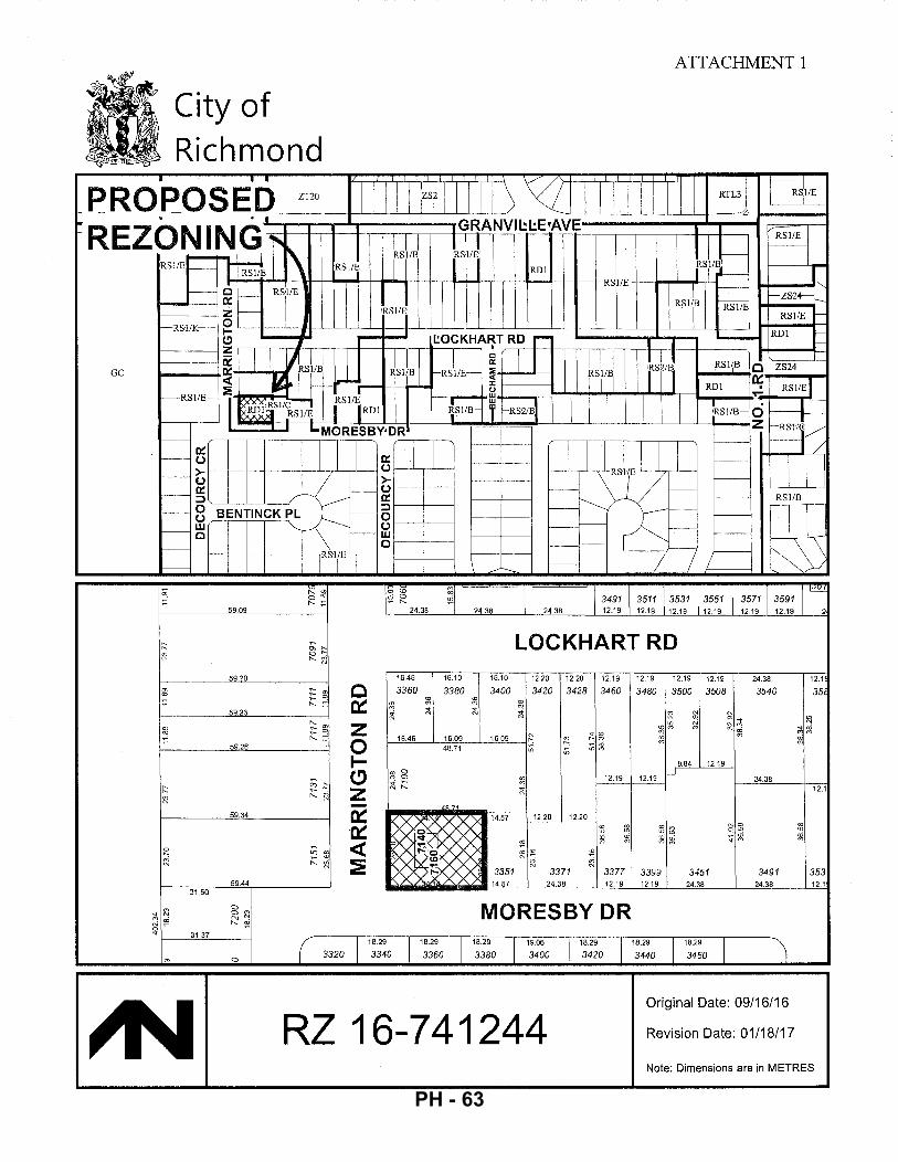
GC
;1; N 0 ..
City of Richmond
59.09
59.20
:::fB c r--------5~9~.23L-_______ ~_-~; ~
f:: fl
:2 M
31.50
?'] ~
31.37
"'
59.26
59.34
59.44
0 0 ?'] ~ oi
0 ( 3320
z 0 1-(!) z -~ ·~ <t :?!
iri <o ~ ~
24.38
16.46
3360
:!; :!; ..;
;i "'
16.10
3380
16.46 16.09 48.71
AO 7'
24.38
g ;i
16.10
3400
16.09
14.57
3351 14.5'7
ATTACHMENT 1
3491 3511 3531 24.38 12.19 12.19 12.19
3551 12.19
LOCKHART RD 12.20 12.20
3420 3428
~ ;i
'" ~ N
" u; u;
"' '" ;i
12.20 12.20
~ cO tO
N~ 3371
24.38
12.19
3460
"' "' '" -"' """
12.19
3377 12.19
12.19 12.19 12.19
3480 3500 3508
fl N
"' ~~ g ~
8.84 12.19
12.19 _)
3399 3451 12.19 24.38
f-ZS24- :-
RSl/E
RDl
3571 3591 12.19 12.19
"' ~~ M~
24.38
3540
24.38
3491 24.38
12.1
35
~ ~~ ~
12.1
353 12.1
MORESBY DR 18.29
3340 18.29
3360 1
18.29
3380 19.06
3400 1
18.29
1
18.29 I
3420 3440 18.29 I 3460
Original Date: 09/16/16
RZ 16-741244 Revision Date: 01/18/17
Note: Dimensions are in METRES
PH - 63
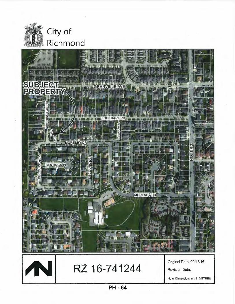
City of Richmond
RZ 16-741244 Original Date: 09/16/16
Revision Date:
Note: Dimensions are in METRES
PH - 64
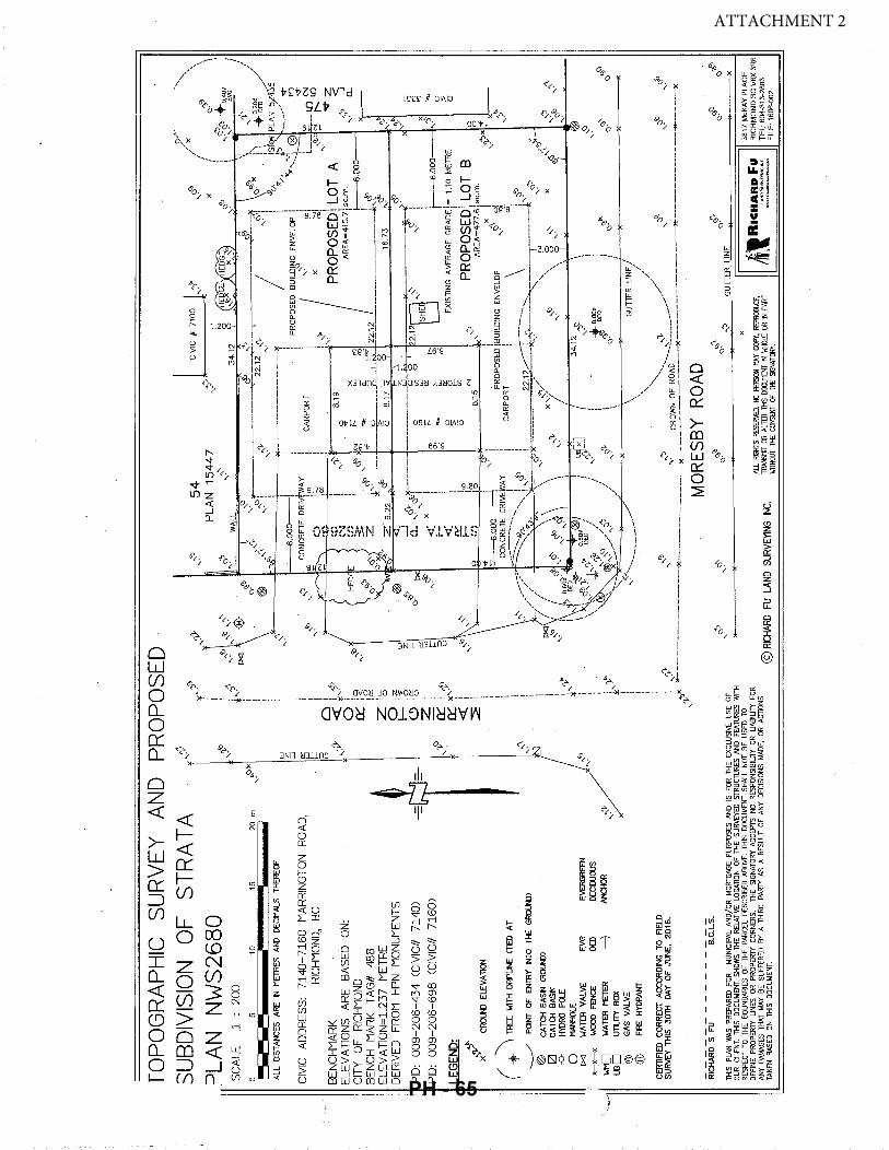
~d
SU
RV
EY
A
ND
S
TRA
TA
fOP
OG
RA
PH
IC
SUB
DIV
ISIO
N
OF
PR
OP
OS
ED
?LA
N
NW
S26
80
SC
ALE
1
: 2
00
0
5 1
0
15
2
0
m
~~--
I I
ALL
D
ISTA
NC
ES
ARE
IN
MET
RES
AN
D D
ECIM
ALS
THER
EOF
CIV
IC
AD
DR
ES
S:
71
40
-71
60
H
AR
RIN
GTO
N
RO
AD
, R
ICH
MO
ND
, B
C
BE
NC
HM
AR
K
ELE
VA
TIO
NS
A
RE
B
AS
ED
O
N:
CIT
Y
OF
RIC
HM
ON
D
BE
NC
H
MA
RK
T
AG
# 48
8 E
LE\1
AT
ION
=1.
237
ME
TRE
D
ER
IVE
D
FRO
M
HP
N
MO
NU
ME
NTS
PID
: 0
09
-20
6-4
34
C
CIV
IC#
71
40
)
PID
: 0
09
-20
6-6
98
C
CIV
IC#
71
60
)
LEG
END:
..,..
. ~
X
GR
QU
N)
ELE
VA
TIO
N
( ..
. ""\ T
REE
W
ITH
D
RP
LI'.E
<T
ED
AT
....
..__
/ PO
INT
OF
ENTR
Y N
TO
THE
GR
OU
ND
)
®
l2l
-o-
0 l><J
X-X
-X
Wr{
] l.l
30
CA
TCH
8A
SN
<
RO
lHll
C
ATC
H
8AS
N
HYDR
O PO
LE
MAN
HO
LE
WAT
ER
VA
LVE
EVG
O
ED
---7
EVER
GRE
EN
DEO
OU
OU
S AN
CH
OR
''" ....
I}
~(JX
,.
<0
,. '""' ,. w
z :::; "' :=! >- G ;__'Y'"
'"" ,. " ~ ~
,.
""" "'""
I i i ~~
*""
i I i i l i ! ' i l 0 <
( i
'?f..)
0 0::: *'' i 'o
!<
( ~~
Ziu
.. 'o
0
lz
1-
''i<
'o
C
) 15
z!
fr::
! {:'
0:::
~,.
<(!
~~ i i i
.,. ,. ~~
*"'
,_'b
,.
lXI
'"'" ,. ,ro "
:."
" <6
r
'\
," ""' ,.
,_'b
....
w
z :::; "' w t= 15 ,<o
,. "" ,.
"" (J
·
®
~
,. """ ,.
(J?
" ·-
-,
/ '
R>
/X
·,
,
,r::;s
/'
CJ.JD
J \
PL
AN
1
54
47
,'?
, X
I
"' ()·
\ ,,
\
..._?aO
J ·+
-a.4
olll
, w
''"
3
4.1
2
I ,.
EVG
I
54
"~r-----
----~---
--------
.._.2.;2
.12..._'
:>;-i:--
.-------
--------
--..,9~-
~611
""'"x
l'1 ~:o
~· //
t-
""--
---'
-·-1
-j _
__
_,"~------
----------
---------~
-I
. \ "'o
'- 7•
~~~ ~=
~-~}Z~
S I
I '5<
': 'V
I 1
PR
OP
OS
ED
BU
IL~~
G E
NV
ELO
P
~ '}(
•. :
(8)
~
CA
RP
OR
T
i I ,.
~~
L ____
~.--1[) ~
1 X
....
. q
,OJ)
C'
\! f'.
. :
,~x
Oll
,.
...--..q
-. :
.v s.
19
'"
P
RO
PO
SE
D!
LOT
A
~
\ •v
~
X
AR
EA
=4
15
.7ls
q.m
. 0:
1. ...?
0; ~
::
~ ~
~.000
I<J10
...;
. :J
:-
""'<
~-22
12
•arc
*-~..:._____
-----~ ___
_____ o
_ _
_ _L~
__
_: _
__
__
__
__
__
__
__
__
__
__
__
__
__
_ *~XJ
9.2
2
>:..~X:!
(3
8
.17
:;i
0
16
.73
•v
1
-~
()
"~~ (JfQ
i-----
------
----~-
------
-t-t .
2.126
<~' ----
------
---;~-
-1'.
~ ,
.. !
<D
w
S
HE
l
~
x l
~ ;.:::
~ b;
1-
----
s.oo
o o
<....
\ cO
:
~ u::
i E
XIS
TIN
G
AV
ER
AG
E
GR
AD
El=
1
.10
M
E1R
E
~ ~
~~ ~
~ ..,
PR
OP
OS
ED
\ LO
T B
o
{f)
~~
8:15
,~
A
RE
A=
47
7.6
\ sq
.m.
.__SS
l
:\X
!
PR
OP
OS
ED
!B
UIL
DIN
G
EN
VE
LOP
,_
';'
:iSi
0 0
o/)'1
:! ....
x--
"~~
-~~=o~::o:
~~~~~';~~~
::.:1~;j,~
~:_~-::-_-
_-,,~;-i __
_ T ___
___ J
,_';''>()"'> l..-.,L.-.i'--l~-~'+\9.--"t===='i§>liF
'b
/ ',
"'
,.
t::x::J
x
· ... .'~/
" tO
',
\
8 ""
x
,_b.
--\'
J ,, ,._
c'P
,~
ro
,;.'"'v
/ ,~
\ o
•v
/
\ ....
' I /1 '
-14.
12 ""
" \
u@
,.
) t0
,80
1l!
'1-
'V
OED
" ,.
(J
· "'
),
,.
·"
'bO; I
0,~
(J·
~{
"" ,. o,
" (J
·
" ,.
"" ()
•
-->
<
@
~
WO
OD
FEN
CE
WAT
ER
MET
ER
UT
UT
Y
BO
X
GAS
V
ALV
E FI
<E
HYD
RAN
T
......... /
=--,._~
' .
\ G
UT
TE
R
LIN
E I
i '
J i
'"'"
""
',
/ C
ERTI
FlED
C
OR
REC
T AC
CO
RD
ING
TO
FJ
ELD
SU
RVE
Y TH
IS
30TH
D
AY
OF
JUN
E,
20
16
. ,'Y
""* ~~
------
----
----
----
--~--
----
----
----
----
::~----:
~9~-?~-
~~~~-~~-
£::=:-:=
~~~~----
--------
~:------
--------
--~": ___
__ :';'"'
MO
RES
BY
RO
AD
Ri
cHAR
D-s -
FU-
--
--
--
a.C
:Ls.
THIS
PL
AN
WAS
PR
EPAR
ED
FOR
MU
NIC
IPAL
AN
O/O
R
MO
RTG
AGE
PUR
POSE
S AN
O
IS
FOR
THE
EXC
LUSI
VE
USE
O
F O
UR
CLI
ENT.
TH
IS
DO
CU
MEN
T SH
OW
S TH
E R
ElAT
IVE
LOCA
TIO
N O
F TH
E SU
RVEY
ED
STR
UC
TUR
ES A
ND
FEAT
URES
WIT
H R
ESPE
CT
TO
THE
BOU
ND
ARIE
S O
F TH
E PA
RC
EL D
ESC
RIB
ED A
BOVE
. TH
IS
DOCU
MEN
T SH
ALL
NO
T BE
U
SED
TO
D
EFIN
E PR
OPE
RTY
LIN
ES
OR
PRO
PER
TY C
OR
NER
S.
THE
SIG
NATO
RY A
CCEP
TS
NO
RES
PON
SIBI
LITY
OR
LIAB
ILIT
Y FO
R AN
Y DA
MAG
ES T
HAT
MAY
BE
SUFF
ERED
BY
A T
HIR
D
PART
Y />
5 A
RES
ULT
OF
ANY
DEC
ISIO
NS
MAD
E,
OR
ACTI
ONS
TA
KEN
BASE
D O
N TH
IS
DOCU
MEN
T.
. :\
~
""
'b"
~
()"
0.lDJ
o~
o'P
<0·
o·
"?
"\.·
o·
,"':J
GU
TTE
R
LIN
E
~
@ R
K:HA
RD F
U LA
ND S
URVE
YING
IN
C.
X
AU. R~HTS
RESE
RVED
. NO
PER
SON
MAY
COPY
, RE
PRDI
Jiucr,
1W
INSI
1T O
R AL
TER
TliS
lXl
O.J!1
ENT ~ '<
IHOL
£ OR
N P
ART
Wllli
OU
T T
l£ C
ONSE
NT O
F T
l£ S~NATORY.
llmlR•
c~~~~:
:f~
3817
McK
AY
PLA
CE
R
ICH
MO
ND
BC
V6X
3R
6 TE
L: 6
04·3
13·2
883
FIL
E:
1606
·002
ATTACHMENT 2
PH - 65

City of . Richmond
Development Application Data Sheet Development Applications Department
RZ 16-741244 Attachment 3
Address: 7140/7160 Marrington Road
Applicant: Westmark Developments Ltd.
Planning Area(s): Seafair ~~~------------------------------------------------------
Existing Proposed
Owner: Westmark Developments Ltd. To be determined
Site Size (m2): 893.3 m2 Lot A: 415.7 m2
Lot B: 477.6 m2
Land Uses: One (1) duplex Two (2) single-family dwellings
OCP Designation: Neighbourhood Residential No change
702 Policy Designation: Single Detached (RS2/B) Single Detached (RS2/B)
Zoning: Two-Unit Dwellings (RD1) Single Detached (RS2/B)
On Future I Bylaw Requirement I Proposed I Variance
Subdivided Lots Max. 0.55 for lot Max. 0.55 for lot
Floor Area Ratio: area up to 464.5 m2 area up to 464.5 m2 none plus 0.3 for area in plus 0.3 for area in permitted excess of 464.5 m2 excess of 464.5 m2
Lot A: Max. 228.6 m2 Lot A: Max. 228.6 m2
Buildable Floor Area (m2):* (2,461.0 ft2) (2,461.0 ft2) none
Lot B: Max. 262.68 m2 Lot B: Max. 262.68 m2 permitted (2,827.5 ft2) (2,827.5 ft2)
Building: Max. 45% Building: Max. 45% Lot Coverage (% of lot area): Non-porous Surfaces: Non-porous Surfaces: none
Max. 70% Max. 70%
Lot Size: Min. 360.0 m2 Lot A: 415.7 m2
none Lot B: 477.6 m2
Lot A Width: Min. 12.0 m Lot A Width: 12.8 m Lot Dimensions (m): Lot B Width: Min. 14.0 m Lot B Width: 14.0 m none
Depth: Min. 24.0 m Depth: 34.12 m
Front: Min. 6.0 m Front: Min. 6.0 m
Setbacks (m): Rear: Min. 6.0 m Rear: Min. 6.0 m Side: Min. 1.2 m Side: Min. 1.2 m
none
Exterior Side: Min. 3.0 m Exterior Side: Min. 3.0 m
Height (m): Max. 9.0 m Max. 9.0 m none
Other: Tree replacement compensation required for loss of bylaw-sized trees.
* Preliminary estimate; not inclusive of garage; exact building size to be determined through zoning bylaw compliance review at Building Permit stage.
5257121 PH - 66
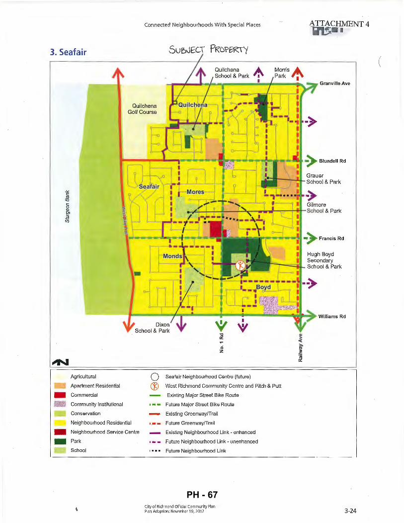
. -'
3. Seafair
Connected Neighbourhoods W ith Special Places
Quilchena School & Park
Quilchena Golf Course
Agricultural
- Apartment Residential
- Commercial
Community Institutional
Conservation
Neighbourhood Residential
Neighbourhood Service Centre
Park
School
t
ci z
I
~
(_) Seafair Neighbourhood Centre (future)
® West Richmond Community Centre and Pitch & Putt
Existing Major Street Bike Route
• • • Future Major Street Bike Route
Existing Greenway/Trail
•.•- Future Greenway/Trail
Existing Neighbourhood Link - enhanced
Future Neighbourhood Link- unenhanced
' • • • Future Neighbourhood Link
City of Richmond Official Community Plan Plan Adoption : November 19, 201 2
Granville Ave
Williams Rd
3-24
PH - 67

, .... .; 1 of 2
City of Richmond
Adopted by Council: September 16, 1991
Amended by Council: July 20, 1998
ATTACHMENT 5
Policy Manual
File Ref: 4430-00.
POLICY 5447:
The following policy establishes. lot sizes in a portion of Section 15-4-7, located generally between the south side of Granville Avenue, the west side of Marrington Road, the north side of Moresby Drive and No. 1 Road:
1081048
That properties within the area generally bounded by the south side of Granville Avenue, the north side. of Moresby Drive, the west side of Marrington Ro~d and No. 1 Road, irt a portion of Section 15-4-7, be permitted to subdivide in accordance with the provisions of Single-Family Housing District (R1/B) in Zoning and Development Bylaw 5300, with the following provisions:
a)
(b)
That properties between and including 3620 and 3780 Granville Avenue be permitted to subdivide as per Single-Family Housing District (R1/C) zoning; .
That properties between and including 7151 arid 7031 Marrington Road be· . permitted to subdivide as per Single-Family Housing District, Subdivision Area K (R1/K) zoning;·
and that this policy, as shown· on the accompanying plan, be used to determine the disposition of future single-family rezoning applications in this area, fora period of not less than five years, unless changed by the amending procedures contained in the Zoning and Development Bylaw. ·
PH - 68
(
/
\
(
~ Subdivision permitted as per R1/B with the following provisions:
~ 1. Between 3620 and 3780 Granville Avenue R1/C.
2. Between 7151 and 7031 Marrington Road Rl/K.
Policy 5447 Section 15-4-7
Adopted Date: 09/16/91 Amended Date: 07/20/98 Amended Date: 10/20/03
Note: Dimensions are in METRES
PH - 69
9 ('<
'"' 91 " ,,, I
i'-8
" l
4'·
i0"
8'·
4"
9 ;;,
Bed
12\1
18
"' '
(\
'-
ll'·
'i"
Bed
llxl?
0'-!
0"
Qlll
@l~
' ~
~' ~t.
~> ..
£-0
:;;;; :
;Bat
!{
"':/e
;o,l?
11'·0
"
Bed
llxl?
Q
@
/\;i
~~~;=\
!==~=i
ne=n=!
.f>l /VI
o?~
~ 0
1'·
6"
W.l.C
. 6i
0xl0
2
W=/\
i0'·
6"
?'·
0"
l 1 l I I I
Cov
'd
I o
I '
Patio
I I I I I I ~
Q
[~ '"
~u 11
~-' =
I
A
L ,
w-z
" lj
4'·C
" l
7'-0"~~
l 6'
-2"
f ~'-4"
l 7'
-5"
~~ f·
1
: 1
l v
'{
""
Mas
ter
172 xl
6 ~
'£
Q
:'t
i'-8
"
Q
iQ t ~I r.
~
r-1 I I
I I
I I
I I
Ll , I I I
H1~h
Cei
hn~
14'-0
":1:
fo4e
r ep I
Hi~h
Ceihn~
,.__
16
'-4"
Roof
~
:;., ~
I L
Q3--
----
----
~ ----~------------T
L--
----
----
-.J
[5'-
211
2?'
-1"
- -~
~
Gara
~e
T
24i0
xl7
,.__ ? "'
8'·
0"
9'·
0"
6i'·
O'
6'-
iO"
Be
~~
~aun
dr4,
J-.,6
x1
I II
0 '
~) "'~r--+r-,
n ·
I u-
I ~
~'-2
11
t7en
112 xl26
11'-8
"
~ "? ;0
~p "
~~
~~~ ~
§l§l
=d'f
~ till
1'-(
111
f-'
8'-
0"
9'-
0"
6i'·O
"
11'·0
" i8
'-2
"
66
' 0
"
6'-iO
" i0
'-6"
11'·6
" '7
'-0"
1 1
~
~ . '
t7in
in~
115 xl2
i2'·8
"
l?ui
lkin
5h:!V
il\:1
Kitch
en
Cov'
d 10
6xl4
i0
Patio
c;] r ,
---,
!77.
?0ft
'~l
Nook
Isl
and
I llx
ll 8x
46
'---
?'·O
"i
Cire
at R
oom
16:r2
0
i0'-
0"
i6'-
t"
l::.'-
6''
~ .~ I~
?'·
0"
? ;,-
? :"
?
01 "'
' '
cy._ ~
?
I or f
loor
Plan
s,
.,L
<f/
4"-1
'-0'
'
i?ulk:
~e
ss S
tairs
/ f 04
er:
lop
floor
fAR
: Gr
ound
floo
r fAR
:
Iota
! fAR
:
1,48
8.?5
ft2
107
ft2
1,?8
l,??f
V
1.41
0.?8
f\,2
2.191
.91 f\
,2
I'Jiow
able
fAR:
2,
7925
1 f\
,2
5tai
rs/ f
oyer
ZAdu
al):
140.
?8 f\
,2
Grou
nd fl
oor P
lan
~..kl/
'1"-
1'·0
"
fAR:
1,
410.
?8 f
t2
Gar.3
01':
444,
?? f
t2
Grou
nd fl
oor f
AR:
1.8?
4,91
f\,2
ATTACHMENT 6
PH - 70
PH - 71
.... ,. ,., ,.
,•~· ,,
, A
~ ~
· ~
.,_<::>
q,">
,.
<:>·
,c
~
,.
10~ .
.......
,-:;.
,. I~
EP/D
W
....
~
,__
___-
CA
NO
PY
'
.>
-.. ,
PR
OTE
CTl
ON
ZO
NE
(MP
Z)
FEN
CIN
G
DIM
ENSI
ON
S N
MET
RES
APP
END
IX 3
T
R.E
E P
RO
TE
CT
ION
PL
AN
-wli:
"
""' ,.
LEG
EN
D
34
.12
c'l:fi
A/FD
< ,<J
N
BC
~
..._fO
EVG
~
cq,
,.
<::>"
' ,.
cs
GS
<:l~N
c" ,. \
<:>· SP
K .. ~
<0
:....
"'
GS
1"1
o,l
<:>· u
~ "'
"' l:::
i l[
) ,':
' '!"
" I' v .,.,
, ,.
cs
TREE
PR
OPO
SED
FO
R
REM
OVA
L
Po.
ge
8
~
SC
ALE
D
TO
FIT
2
.5
0 5
70
ALL
D
IST
AN
CE
S
AR
E I
N
ME
TRE
S
.A. ~
TR
EE
IN
VE
NT
OR
Y
Act
ion
D
BH
M
PZ
NO
lES!
1.
SI
TE L
AY
OU
T INFOR~AllON
AN
D
lRE
E
SUR
VEY
DA
TA P
ER
SUPP
UED
D
RA\
\1N
G
2.
REFE
R 1
0 A
TTAC
HED
TR
EE P
RO
TEC
TIO
N
REP
OR
T FO
R IN
FOR
MAT
ION
C
ON
CER
NIN
G
TREE
SPE
CIE
S,
STEM
D
IAM
ETER
. H
EIG
HT.
C
ANO
PY S
PREA
D
AND
C
ON
DIT
ION
.
3.
All.
MEA
SUR
EMEN
lS A
RE
MET
RIC
DB
H
Me
tre
s
Fee
· .. 3
5cm
4.
0m
13
.1ft
1
5cm
2.
0m
6.6
ft
Fro
gger
s C
reek
T
ree
Co
nsu
ltan
ts L
td
77tJ
J 1t1
cGrw
Jor A
......
,u.
Bu
ma
by
BC
1-5
.1 41
14
T~l'loM: ~721-t1002 Fa
x: ~-.f..J7-D970
7140
Jla
rrln
gfon
R
oad
Ric
hmon
d
TR
EI
PRO
TEr:
TIO
N P
IAN
TH
E
DRAW
ING
PL
OTS
ALL
TR
EES
, PR
OPO
SED
fO
R
RETE
NTlO
N,
REM
OVAL
. TH
EIR
CANO
PIES
, PR
OTEC
TION
D
IIAW
H l
iT:
Glot
ZONE
S AN
D PR
OTEC
TION
FE
NCIN
G IN
RE
I.ATI
ON T
O PR
OPO
SED
lAYO
UT
.hlly
2SI,
20
11
ATTACHMENT 7
PH - 72
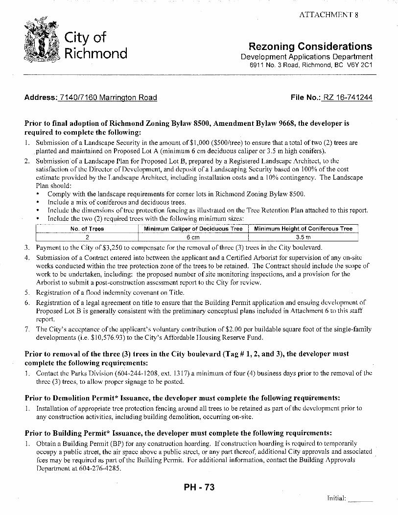
ATTACHMENT 8
City of Richmond
Rezoning Considerations Development Applications Department
6911 No. 3 Road, Richmond, BC V6Y 2C1
Address: 7140/7160 Marrington Road File No.: RZ 16-741244
Prior to final adoption of Richmond Zoning Bylaw 8500, Amendment Bylaw 9668, the developer is required to complete the following: 1. Submission of a Landscape Security in the amount of $1,000 ($500/tree) to ensure that a total of two (2) trees are
planted and maintained on Proposed Lot A (minimum 6 em deciduous caliper or 3.5 m high conifers).
2. Submission of a Landscape Plan for Proposed Lot B, prepared by a Registered Landscape Architect, to the satisfaction of the Director of Development, and deposit of a Landscaping Security based on 100% of the cost estimate provided by the Landscape Architect, including installation costs and a 10% contingency. The Landscape Plan should: • Comply with the landscape requirements for comer lots in Richmond Zoning Bylaw 8500. • Include a mix of coniferous and deciduous trees. • Include the dimensions of tree protection fencing as illustrated on the Tree Retention Plan attached to this report. • Include the two (2) required trees with the following minimum sizes:
No. of Trees Minimum Caliper of Deciduous Tree Minimum Height of Coniferous Tree 2 6 em 3.5 m
3. Payment to the City of $3,250 to compensate for the removal of three (3) trees in the City boulevard.
4. Submission of a Contract entered into between the applicant and a Certified Arborist for supervision of any on-site works conducted within the tree protection zone of the trees to be retained. The Contract should include the scope of work to be undertaken, including: the proposed number of site monitoring inspections, and a provision for the Arborist to submit a post-construction assessment report to the City for review.
5. Registration of a flood indemnity covenant on Title.
6. Registration of a legal agreement on title to ensure that the Building Permit application and ensuing development of Proposed Lot B is generally consistent with the preliminary conceptual plans included in Attachment 6 to this staff report.
7. The City's acceptance of the applicant's voluntary contribution of $2.00 per buildable square foot of the single-family developments (i.e. $10,576.93) to the City's Affordable Housing Reserve Fund.
Prior to removal of the three (3) trees in the City boulevard (Tag# 1, 2, and 3), the developer must complete the following requirements: 1. Contact the Parks Division ( 604-244-1208, ext. 1317) a minimum of four ( 4) business days prior to the removal of the
three (3) trees, to allow proper signage to be posted.
Prior to Demolition Permit* Issuance, the developer must complete the following requirements: 1. Installation of appropriate tree protection fencing around all trees to be retained as part of the development prior to
any construction activities, including building demolition, occurring on-site.
Prior to Building Permit* Issuance, the developer must complete the following requirements: 1. Obtain a Building Permit (BP) for any construction hoarding. If construction hoarding is required to temporarily
occupy a public street, the air space above a public street, or any part thereof, additional City approvals and associated fees may be required as part of the Building Permit. For additional information, contact the Building Approvals Department at 604-276-4285.
Initial: ---
PH - 73
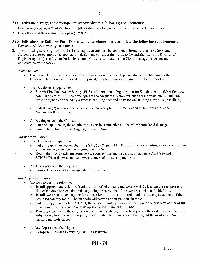
- 2 -
At Subdivision* stage, the developer must complete the following requirements: 1. Discharge of covenant Zl68971 from the title of the strata lots; which restricts the property to a duplex.
2. Cancellation of the existing strata plan (NWS2680).
At Subdivision* or Building Permit* stage, the developer must complete the following requirements: 1. Payment of the current year's taxes. 2. The following servicing works and off-site improvements may be completed through either: a) a Servicing
Agreement entered into by the applicant to design and construct the works to the satisfaction of the Director of Engineering; or b) a cash contribution based on a City cost estimate for the City to manage the design and construction of the works.
Water Works: • Using the OCP Model, there is 238 Lis of water available at a 20 psi residual at the Marrington Road
frontage. Based on the proposed development, the site requires a minimum fire flow of 95 Lis.
• The Developer is required to: o Submit Fire Underwriter Survey (FUS) or International Organization for Standardization (ISO) fire flow
calculations to confirm the development has adequate fire flow for onsite fire protection. Calculations must be signed and sealed by a Professional Engineer and be based on Building Permit Stage Building designs.
o Install two (2) new water service connections complete with meters and meter boxes along the Marrington Road frontage.
• At Developers cost, the City is to: o Cut and cap, at main, the existing water service connections at the Marrington Road frontage. o Complete all tie-ins to existing City infrastructure.
Storm Sewer Works: • The Developer is required to:
o Cut and cap, at inspection chambers STIC60525 and STIC48270, the two (2) existing service connections on the northwest and southeast corners of the lot.
o Retain the two (2) existing storm service connections and inspection chambers STIC4 7926 and STIC5450 1 at the west and southwest corners of the development site.
• At Developers cost, the City is to: o Complete all tie-ins to existing City infrastructure.
Sanitary Sewer Works: • The Developer is required to:
o Install approximately 25 m of sanitary main off of existing manhole SMH1554, along the east property line of the development site to the adjoining property line of the two (2) newly subdivided lots.
o Install two (2) new sanitary service connections off of the proposed manhole at the upstream end of the proposed sanitary main. The manhole will serve as an inspection chamber.
o Cut and cap, at manhole SMH1554, the existing sanitary service connection at the northeast corner of the development site, and remove existing inspection chamber SIC16665.
o Provide, at no cost to the City, a new 6.0 m wide statutory right-of-way along the east property line of the subject site, from the south property line extending to 1.0 m beyond the edge of the most upstream sanitary manhole barrel.
• At Developers cost, the City is to: o Complete all tie-ins to existing City infrastructure.
Initial: ---
PH - 74
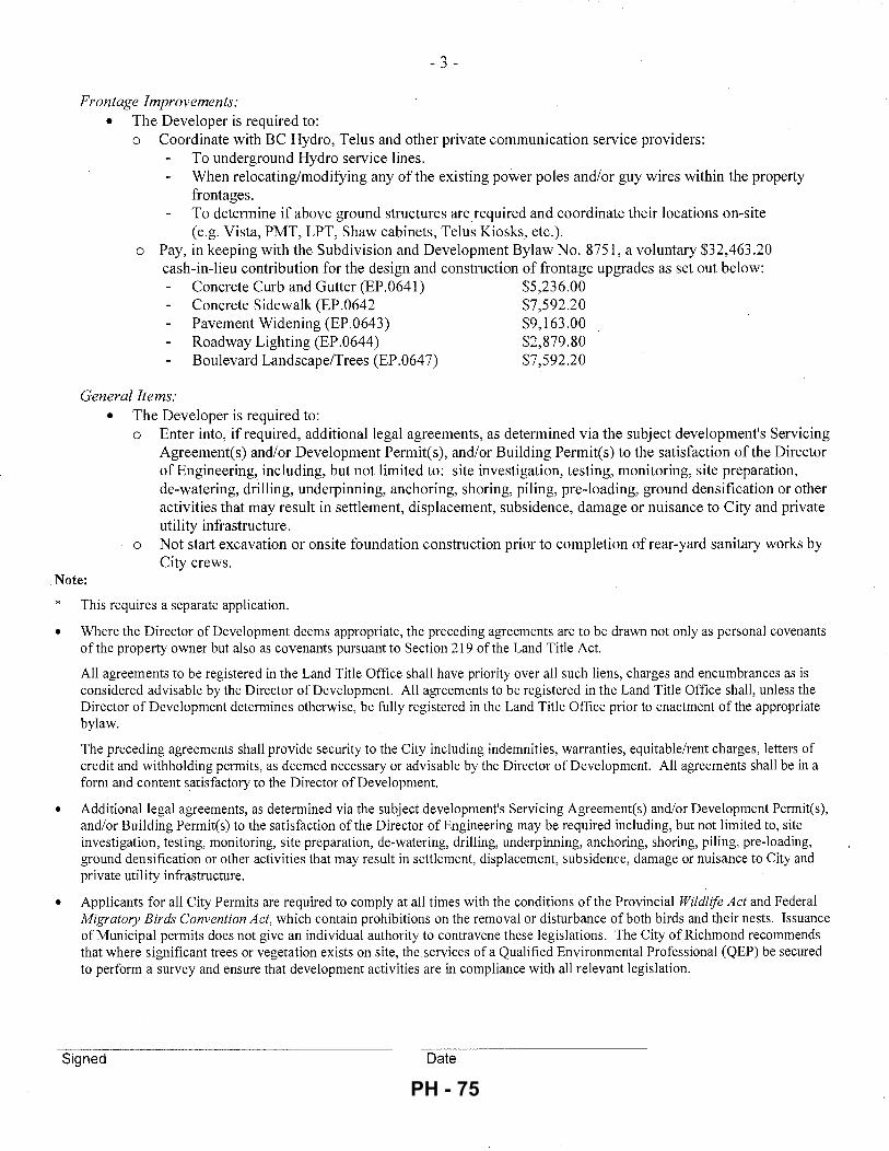
- 3 -
Frontage Improvements: • The Developer is required to:
o Coordinate with BC Hydro, Telus and other private communication service providers: To underground Hydro service lines. When relocating/modifying any of the existing power poles and/or guy wires within the property frontages. To determine if above ground structures are required and coordinate their locations on-site (e.g. Vista, PMT, LPT, Shaw cabinets, Telus Kiosks, etc.).
o Pay, in keeping with the Subdivision and Development Bylaw No. 8751, a voluntary $32,463.20 cash-in-lieu contribution for the design and construction of frontage upgrades as set out below:
Concrete Curb and Gutter (EP.0641) $5,236.00 Concrete Sidewalk (EP.0642 $7,592.20 Pavement Widening (EP.0643) $9,163.00 Roadway Lighting (EP.0644) $2,879.80 Boulevard Landscape/Trees (EP.0647) $7,592.20
General Items: • The Developer is required to:
o Enter into, if required, additional legal agreements, as determined via the subject development's Servicing Agreement(s) and/or Development Permit(s), and/or Building Permit(s) to the satisfaction ofthe Director of Engineering, including, but not limited to: site investigation, testing, monitoring, site preparation, de-watering, drilling, underpinning, anchoring, shoring, piling, pre-loading, ground densification or other activities that may result in settlement, displacement, subsidence, damage or nuisance to City and private utility infrastructure.
o Not start excavation or onsite foundation construction prior to completion of rear-yard sanitary works by City crews.
Note:
* •
This requires a separate application.
Where the Director of Development deems appropriate, the preceding agreements are to be drawn not only as personal covenants of the property owner but also as covenants pursuant to Section 219 of the Land Title Act.
All agreements to be registered in the Land Title Office shall have priority over all such liens, charges and encumbrances as is considered advisable by the Director of Development. All agreements to be registered in the Land Title Office shall, unless the Director of Development determines otherwise, be fully registered in the Land Title Office prior to enactment of the appropriate bylaw.
The preceding agreements shall provide security to the City including indemnities, warranties, equitable/rent charges, letters of credit and withholding permits, as deemed necessary or advisable by the Director of Development. All agreements shall be in a form and content satisfactory to the Director of Development.
• Additional legal agreements, as determined via the subject development's Servicing Agreement(s) and/or Development Permit(s), and/or Building Permit(s) to the satisfaction of the Director of Engineering may be required including, but not limited to, site investigation, testing, monitoring, site preparation, de-watering, drilling, underpinning, anchoring, shoring, piling, pre-loading, ground densification or other activities that may result in settlement, displacement, subsidence, damage or nuisance to City and private utility infrastructure.
• Applicants for all City Permits are required to comply at all times with the conditions of the Provincial Wildlife Act and Federal Migratory Birds Convention Act, which contain prohibitions on the removal or disturbance of both birds and their nests. Issuance of Municipal permits does not give an individual authority to contravene these legislations. The City of Richmond recommends that where significant trees or vegetation exists on site, the services of a Qualified Environmental Professional (QEP) be secured to perform a survey and ensure that development activities are in compliance with all relevant legislation.
Signed Date
PH - 75
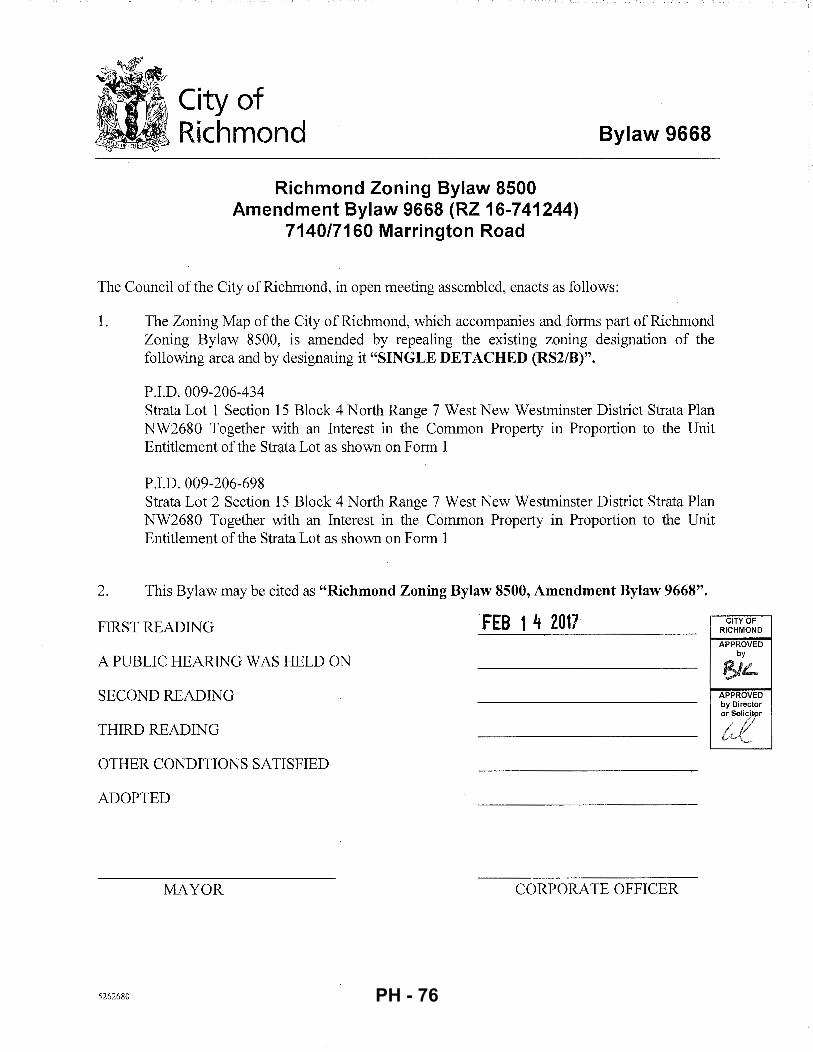
City of Richmond
Richmond Zoning Bylaw 8500 Amendment Bylaw 9668 (RZ 16-741244)
7140/7160 Marrington Road
Bylaw 9668
The Council of the City of Richmond, in open meeting assembled, enacts as follows:
1. The Zoning Map of the City of Richmond, which accompanies and forms part of Richmond Zoning Bylaw 8500, is amended by repealing the existing zoning designation of the following area and by designating it "SINGLE DETACHED (RS2/B)".
P.I.D. 009-206-434 Strata Lot 1 Section 15 Block 4 North Range 7 West New Westminster District Strata Plan NW2680 Together with an Interest in the Common Property in Proportion to the Unit Entitlement of the Strata Lot as shown on Form 1
P.I.D. 009-206-698 Strata Lot 2 Section 15 Block 4 North Range 7 West New Westminster District Strata Plan NW2680 Together with an Interest in the Common Property in Proportion to the Unit Entitlement of the Strata Lot as shown on Form 1
2. This Bylaw may be cited as "Richmond Zoning Bylaw 8500, Amendment Bylaw 9668".
FIRST READING FEB 1 4 2017
A PUBLIC HEARING WAS HELD ON
SECOND READING
THIRD READING
OTHER CONDITIONS SATISFIED
ADOPTED
MAYOR CORPORATE OFFICER
5262680
CITY OF RICHMOND
APPROVED by
1$/L APPROVED by Director or Solicilpr
~,e D ... , ,
PH - 76
City of Richmond
To: Planning Committee
From: Wayne Craig Director, Development
Report to Committee Planning and Development Division
Date: February 16, 2017
File: ZT 16-740866
Re: Application by Christopher Bozyk Architects Ltd. for a Zoning Text Amendment to the "Industrial Retail (IR1)" zone to Allow "Vehicle Sale/Rental" on up to 10% of the Gross Floor Area as an Additional Use at 4331 and 4431 Vanguard Road ·
Staff Recommendation
That Richmond Zoning Bylaw 8500, Amendment Bylaw 9670, for a Zoning Text Amendment to the "Industrial Retail (IR1 )"zone to allow "vehicle sale/rental" limited to a maximum of 10% of the gross floor area as an additional use at 4331 and 4431 Vanguard Road, be introduced and given first reading.
/ /
~. i~·~~·J Craig //
Director, Development ~·/
DB:blg Att. 5
5210355
REPORT CONCURRENCE
CONCURRENq,E OF GENERAL MANAGER
!){ c ~ ~· ,,( I V _,//.'-": 4'_,/· i . /i' f~ , , . r.?c/ , ~. ~ )
I
PH - 77
February 16, 2017 - 2 -
Staff Report
Origin
Christopher Bozyk Architects Ltd. has applied for permission to amend zoning district "Industrial Retail (IR1 )"zone to allow "vehicle sale/rental" as an additional use at 4331 and 4431 Vanguard Road. The proposed "vehicle sale/rental" use will be limited to a maximum of 10% of the building gross floor area. The subject site is located in the East Cambie Planning Area (see Attachments 1 and 2 for location maps and the East Cambie Land Use Map).
Findings of Fact
Project Description The proponent proposes to undertake the construction of a new three storey (including the roof deck) vehicle storage and repair facility for Autowest BMW. The Zoning Text Amendment will allow approximately 930 m2 (1 0,010 ft2
) of the facility to be used as a showroom for sale of preowned vehicles. The applicant has indicated that the showroom is essential to the successful operation of the vehicle repair facility. The overall design incorporates 10 workshop bays, a detail shop, a car wash, an 18 space pre-owned vehicle showroom and vehicle storage areas for approximately 279 vehicles. A total of 98 parking spaces are provided for staff and visitors (Attachment 3).
A Development Application Data Sheet providing details about the development proposal is provided in Attachment 4.
Surrounding Development
The two existing lots will be consolidated to create a single 9,303 m2 (100,145 ft2) property (net
of road dedications). Both properties are currently vacant with no existing structures and no significant vegetation with the exception of three Japanese Cherry trees, two of which are bylaw sized. Surrounding development is as follows:
• To the North and East: Medium sized industrial lots (0.12 ha to 0.25 ha) (0.3 acto 0.6 ac.) all zoned "Industrial Retail (IR1)" and used for various general industrial purposes.
• To the South: An east-west leg of Vanguard Road and Highway 99.
• To the West: Shell Road, the Shell Road rail corridor and Highway 99.
Related Policies & Studies
Official Community Plan/East Cambie Area Plan The 2041 Official Community Plan (OCP) designates the subject site as "Mixed Employment (MEMP)". The MEMP designation applies to areas of the City where the principal uses are industrial and stand-alone office development, with a limited range of support services. In certain areas, a limited range of commercial uses are permitted including the retail sale of building and garden supplies, household furnishings, and similar warehouse goods.
5210355
PH - 78
February 16, 2017 - 3 -
The East Cambie Area Plan (Attachment 2) designates the subject site as "Industrial" which is defined in the OCP as those areas of the City where the principal uses provide for the production, manufacturing, processing, assembling, fabrication, storing, transporting, distributing, testing, cleaning, servicing or repair of goods, materials or things.
The site's current "Industrial Retail (IR1)" zoning provides for a range of general industrial uses, stand-alone offices and a limited range of general retail uses. Retail uses currently permitted in the IR1 zone are generally limited to retail goods that require large floor areas like furniture, carpet, home appliances and building materials. Under the proposed Zoning Text Amendment the proposed vehicle sale/rental use will be ancillary to the industrial uses and will be limited to a maximum of 10% ofthe building's gross floor area.
It is acceptable to consider and allow limited automobile sales in this OCP designated Mixed Employment area for the following reasons:
• ABC economic consultant has advised that automobile dealership and mechanic repair uses provide the same or more number of jobs and the same or higher salaries, as industrial warehouse uses. This statement is supported by 2016 Statistics Canada information which indicates that an automotive service mechanic I technician can earn between $28,000 -78,000 annually;
• In comparison, 2016 Stats Can data indicates that an industrial warehouse worker can earn between $18,000 to $54,000 per year and, as with any type of job, the higher paid workers are more skilled (e.g., a forklift operator);
• The density of jobs for the proposed uses are typically higher than for warehouse storage operations. The applicant anticipates that the proposed facility will provide approximately 20 full time jobs over the long term.
In summary, the proposed text amendment to allow limited vehicle sale/rental supports the existing auto service use already permitted on the site and the proposed development is expected to generate the same or more jobs and the same, or better, paying jobs as industrial warehouse uses.
Floodplain Management Implementation Strategy The proposed redevelopment must meet the requirements of the Richmond Flood Plain Designation and Protection Bylaw 8204. Registration of a flood indemnity covenant on Title is required prior to final adoption of the rezoning bylaw.
Public Consultation
A rezoning sign has been installed on the subject property. Staff have only received a single enquiry from the public about the rezoning application in response to the placement of the rezoning sign on the property. No comments were offered by the caller.
Should the Planning Committee endorse this application and Council grant first reading to the Zoning Text Amendment bylaw, the bylaw will be forwarded to a Public Hearing; where any area resident or interested party will have an opportunity to comment.
Public notification for the Public Hearing will be provided as per the Local Government Act.
5210355 PH - 79
February 16, 2017 -4-
Analysis
Site Contamination
The subject site had previously been used for automotive repair and machine shop operations. Both of these prior uses are classed as Schedule 2 uses under the Provincial Environmental Management Act and the site therefore requires a detailed site review. The Province has issued a letter to advise that the City should not adopt the rezoning for this site until the Province has received and reviewed further information on the contamination and the proposed remediation.
The applicant has engaged a consultant who is preparing the information required for the Province. The consultant has advised City staff that the contamination is primarily hydrocarbon based, and is relatively contained. A plan for excavating and removing the contaminated soils is being prepared for Ministry review. The Zoning Text Amendment Considerations include a requirement that the City receive an acceptable instrument of release prepared by the Province prior to the Bylaw adoption. Prior to the Bylaw adoption the City will requ.ire confirmation that any road dedications are not subject to contamination.
Built Form and Architectural Character
Although the proposed building is primarily intended to house industrial permitted uses, it has been designed with the knowledge that this location has an important visual presence from Highway 99, Shell Road and Vanguard Road. The lower floor will be primarily concrete masonry blocks and the main entrance will be emphasized with glazing, a living green wall and a two-storey tilt up concrete panel wall feature. The second floor showroom has a flush glazed curtain wall facing the southern and western elevations visible from adjacent roads. Cast in place concrete will be used for the car wash and detailing facility, as well as the upper floor parking area in the main building. Natural lighting will be provided to interior work areas and solar panels will be affixed to certain rooftop areas to supplement the operation's power requirements.
Landscape and treed islands are to be provided throughout the at-grade parking area. Lower height shrubs, vines, perennials and grasses are proposed around the perimeter of the site.
It should be noted that if the Zoning Text Amendment proceeds, a Development Permit will be required.
Existing Legal Encumbrances
Public Utility Statutory Rights-of-Way (SRW Plan 53071 and Plan 45376) run across the subject property adjacent to the east property boundary and a portion of the southern property boundary. The proposed development does not encroach into these 3m (10ft.) wide SRWs; however, the Servicing Agreement works may result in the relocation of some portions of the utilities along the eastern property line which may make some sections of the SRW superfluous. A determination of whether the SR W can be reconfigured will be made through the Servicing Agreement.
5210355
PH - 80
February 16, 2017 - 5 -
BC Hydro and BC Telephone have utility right-of-way agreements registered on the Titles of the two properties. The proponent will address requirements of these external agencies as necessary.
Transportation and Site Access
The subject site is adjacent to a sharp bend in Vanguard Road; which turns from a north-south roadway to an east-west roadway and then makes its way under Highway 99.
Through discussions with the applicant, a two-step approach is proposed to improve the geometry at this bend. Through the Zoning Text Amendment Considerations, a 31.81 m2 (342.4 ft2
) road dedication will be required to address the most critical portion of the corner realignment. To allow for future widening as properties redevelop south of Highway 99 and more traffic moves along Vanguard Road, an agreement will be placed on Title, allowing the City to acquire an additional 385.07 m2
( 4,145 ft2) if and when required. The intent is that if
redevelopment occurs south of Highway 99 that requires rezoning and warrants road improvements at the corner, those developments will be required to acquire the additional road widening on behalf of the City. The area for future dedication can be used only for parking in accordance with the Zoning Bylaw (Attachment 3).
Vehicle access to the site will be provided by two accesses to Vanguard Road located a safe distance away from the corner bend in the roadway. A pedestrian access will be provided from the main building to the north-south leg of Vanguard Road.
Zoning Bylaw parking requirements for 94 parking spaces will be fully addressed with the proposed on-site parking arrangement. One large loading area is provided and also allows for two medium loading spaces as shared space with the large loading space. The proposed building's parkade will provide up parking and medium-term storage for up to 279 inventory vehicles. Both Class 1 and Class 2 bicycle parking will be addressed through the Development Permit review, but will be required to meet the Zoning Bylaw requirements or provide supportable rationale for a variance to be considered. ·
Because of the proximity of the development site to Highway 99 and the proposed road dedications, the development plans were required to be reviewed by the Ministry of Transportation and Infrastructure (MOTI). Having no concerns, MOTI has provided a one-year preliminary approval for this development and will have to approve the final Zoning Text Amendment Bylaw.
Tree Retention and Replacement
The applicant has submitted a Certified Arborist's Report; which identifies on-site and off-site tree species, assesses tree structure and condition, and provides recommendations on tree retention and removal relative to the proposed development. The report assesses two bylaw-sized trees and one non-bylaw sized tree on the subject property. The report indicates that there are no trees on neighbouring properties, or street trees on City property. The three trees are located overtop of a sanitary sewer line; which will need to be removed as part of the redevelopment.
5210355
PH - 81
February 16, 2017 - 6 -
The City's Tree Preservation Coordinator has reviewed the Arborist's Report and supports the Arborist's findings with the following comments: • The three on-site Cherry trees are too close to the proposed structure and cannot be retained. • Replacement trees should be specified at 2:1 ratio as per the OCP.
Tree Replacement
Locations of the replacement trees will be determined through the landscaping plan provided with the Development Permit application.
Green Roof Bylaw Response
City of Richmond Green Roof Bylaw No. 8385 applies to this development as the proposed gross floor area will exceed 2,000 m2
. The proponent's response to the Green Roof Bylaw includes the following:
• Provision of 20% roof rain water run-off management by means of underground storage tank; with an integrated vegetation irrigation system using the captured storm water.
• Provision of vertical landscaping, plus living/green wall along portions of the eastern and southern elevations of the building. Sections of the green wall will be placed to frame the entrances on these two building faces.
The applicant has submitted a consultant's report providing details on the proposed underground storage reservoir that will be used to collect surface storm water from the building's rooftop. This stored roof water will then be distributed to landscaped portions of the site during the growing season via an irrigation system. The consultant's calculations indicate that the proposed system will achieve the minimum 20% volume reduction generated by a conventional rooftop of equal area.
Details on the plant selections for the vertical landscaping will be provided as part of the required Development Permit application.
The combination of the storm water reduction and the vertical landscaping will achieve the required 100 points necessary for an acceptable response to the Green Roof Bylaw. Registration of a legal agreement is to ensure that the Green Roof response features are installed and maintained is a condition of the Zoning Text Amendment Bylaw adoption.
Proposed Variances
The conceptual development plans (Attachment 3) indicate that there are three areas of the proposed building which will exceed the 12m maximum height established by the site's "Industrial Retail (IR1 )"zoning. These include:
• A tilt up entrance panel is proposed as both an architectural feature/highlight and a functional feature intended to clearly identify the main entrance of the building and is proposed to be 14.02 m ( 46 ft.) tall.
5210355
PH - 82
February 16, 2017 - 7 -
• The show room roof is proposed to be 12.5 m ( 41.0 ft.) tall which is needed to accommodate, in particular, clearances for the two floors below
• The proposed roof parapet at 12.62 m (41.42 ft.) to screen parking from surrounding properties.
Details for the requested variances will be addressed in more detail through the Development Permit review.
Site Servicing and Frontage Improvements
As discussed under the "Transportation and Site Access" section of this report, a 31.81 m2
(342.4 ft2) road dedication will be required at the bend of Vanguard Road.
A Servicing Agreement is required in the Zoning Text Amendment Considerations to address frontage improvements and the installation of utility services. Frontage improvements include, but are not limited to the following:
• Removal of existing water service connections and installation of new water connections with a water meter.
• Installation of fire hydrants. • Installation of an approximately 152m ( 499 ft.) length of storm sewer with manholes and
catch basins along the east property line of the site. • Installation of a new storm service connection with an inspection chamber along
Vanguard Road. • Installation of approximately 96 m (315 ft.) of new sanitary sewer with manholes along
Vanguard Road (east property line) and the removal of the old existing sanitary sewer lines from the subject property.
• Installation of a concrete sidewalk, treed/grassed boulevard, curb and gutter, plus road widening along the eastern property boundary of Vanguard Road.
Issues To Be Resolved Through the Development Permit
A Development Permit/Development Variance Permit (DP/DVP) is required under the Zoning Text Amendment Considerations. The following issues will be addressed through the Development Permit review:
• Proposed height variances to accommodate the entrance tilt panel feature and the proposed building height.
• Reorganizing surface parking to eliminate overlapping handicapped parking spaces. • Details for the vertical wall planting installation and plant selections. • Review and refine the landscaping species selections and sizes as necessary. Addressing
landscaping security requirements. • Clarifying the location of a sediment separator and details of maintenance by the owner. • Provision of bike parking spaces (indoor and outdoor) in compliance with the Zoning
Bylaw.
5210355
PH - 83
February 16, 2017 - 8 -
• Modification of both driveway entrances to ensure a maximum throat width of 7.5 m and installation of a driveway letdown. Roll-over curbs may be accommodated outside the driveway letdown area for large vehicles.
Financial Impact or Economic Impact
The rezoning application results in an insignificant Operational Budget Impact (OBI) for off-site City infrastructure (such as roadworks, waterworks, storm sewers, sanitary sewers, street lights,
street trees and traffic signals).
Conclusion
Staff recommend support for the Zoning Text Amendment of the "Industrial Retail (IR1)" zone at 4331 and 4431 Vanguard Road to allow up to a maximum of 10% of the building gross floor area to accommodate "vehicle sale/rental" as an additional use. It is recommended that Zoning Bylaw 8500, Amendment Bylaw 9670 be introduced and given first reading.
David Brownlee Planner 2
DCB:blg
Attachment 1 : Location Map Attachment 2: East Cambie Land Use Map Attachment 3: Conceptual Development Plans Attachment 4: Development Application Data Sheet Attachment 5: Rezoning Considerations
5210355
PH - 84
z 0 w
0 3"
CD
::::l en
5"
::::l en
Q) m
:;- ;;;::
m
-1
;:o
m
(/)
N
-I
.....l
..
0)
I ~ ~
0 (X)
0)
0)
:::0
(1) <
(ii" 6"
:::l 0 Ol CD
0 .....
tCi" s·
9:!..
0 Ol CD
.. 0 <0 --_. ~
_.
0)
/
/
I
44
51
1B.2~
111.
2\l
44
60
c,rS"
1-
/ / 30
22
4
50
0
~-
/
/
"'' •" /
,f
/
/
/
/
/ ~~/
.. ~J
/ --~,.
/
~~-
/
/~
/
r-,-
/ /
/
/
<o~
/ /
/
/
46
78
44
40
/
/ VA
NG
UA
RD
RD
18
29
~0 j
1
44
24
20.1
2 1a
2s
44
00
43
60
20.7
3 ~0.23
1~.2
<:1
111.
29
111.
23
f~
/ 3041
1
43
40
so.~e
Hl.2~
4311
SH
E[C
RD
/~/
_,-~~0
~
I I
I I I
'fo-#
V
AN
GU
AR
D R
D
~
/
n -·
r-+
'<
0 --
h
>-- >--3
>--3 >-- n I >--
3 .....
..
PH - 85
City of Richmond
ZT 16-7 40866
}
Original Date: 09/13/16
Revision Date:
Note: Dimensions are in METRES
PH - 86
City of Richmond
Land Use Map
~ Residential
~ Residential
Bylaw8948 2016110124
~ (Single-Family Only)
.. Commercial
~Industrial
~ School/Park Institutional
Original Adoption: September 12, 1988/ Plan Adoption: October 21, 2002 2221494
ATTACHMENT 2
Agricultural Land Reserve Boundary
--- Area Boundary
East Cambie Area Plan 9 PH - 87
REZ
ON
ING
TEX
T AM
END
MEN
T AP
PLIC
ATIO
N
P.P.
Ef&
.W.E
tiii
i.C
CJJ
I i.C
.I .1
.1.
0 V
IEW
FR
OM
SO
UT
H
CD VI
EW
FR
OM
HIG
HW
AY
COF'
YRI
GH
TNO
TIC
E:
Alr
lght
sres
erv.
.t.
All
deu
,d ..
. lgns,<lnowings~ndroprcductionsrin..,;,p<lntorelectronlcformna
relhl
propt<tyoiChrist<>pherBorvkArc
hite
ctslll:l.,3nda
reanlnstrumenlafceNice
tht m
tv n
llt b
e uu
d, IOIW
II~.
-1 1
o ot
hers
,lnln
s!1'
1ln.
d, d
own
loa
ded
01 r
epr
<>du
a.d
eith
er In
pri
nt o
r el
ectr
onic
: fo
rmat
. w
ithou
t th
e n
pre
ssw
ritte
n pe
rmis
olon
of l
h• onpy~g
l>l
....
..,.
,,
.. t!J
-¥
5 ..
tS
!EJ
tiJ
SIJ
I !J
i.IJ
!E_
-·
-·.
. -·-
---
--
~ n I ,...., w
PH - 88
ST
An
irn
cs I
GE
NE
RA
L
EX
IST
ZO
NIN
G:
1R1
PR
INC
IPA
L U
SE
: A
CC
ES
SO
RY
US
ES
: V
EH
ICLE
ST
OR
AG
E (
279
UN
ITS
) P
RE
-OW
NE
D V
EH
ICLE
RE
PA
IR
PR
E·O
WN
ED
VE
HIC
LE
SA
LE
S
SIT
E A
RE
A (
RD
DE
DIC
AT
ION
DE
DU
CT
ED
): 1
00
,14
5 S
F /
4.5
4 A
FS
R (
90,5
85 S
F, 3
RD
OP
EN
DE
CK
EX
CL)
: 0
.9 (
1.0
ALL
OW
ED
) C
OV
ER
AG
E {
46,4
67 S
F):
46.4
% (
60%
ALL
OW
ED
) H
EIG
HT
: -
14M
(12
M A
LLO
WE
D)
SE
TB
AC
KS
: S
EE
IND
ICA
TIO
N O
N P
lAN
ST
AT
lST
lCS
I P
AR
KIN
G
PA
RK
ING
PR
OV
IDE
D (
RE
QU
IRE
D:
94):
98
W
OR
K S
H,
DE
TA
IL S
H,
SE
RV
ICE
, E
NT
R, C
AR
WA
SH
(R
EQ
'D 2
2,18
0@1/
1,0
76
:21
+ 1
4 B
AY
SX3:
:42
+ 2
W
AS
HB
AY
SX
1=2:
65)
S
HO
WR
OO
M (
RE
Q'D
1 0,
400@
3/1
,075
=29
) M
AJN
, 2N
D,
3RD
FL
VE
HIC
LE S
TO
RA
GE
N/A
SM
ALL
CA
R P
RO
PO
RT
ION
: H
C S
PA
CE
S I
NC
LU
DE
D:
VA
RIA
NC
ES
1. H
EIG
HT
EX
CE
SS
v
33/3
4% (
50%
MA
X}
2/2
% (
2%
MIN
)
REZ
ON
ING
TEX
T AM
END
MEN
T AP
PLIC
ATIO
N
431
& 4
33
1 V
AN
GU
AR
D R
f I ! ·:0
./
... .-\
~
.<i")
~
'
\
HIG
HW
AY
99
~ V
AN
GU
AR
DR
D
2-oG
;!J6.
. ?O
tH:!1
8
CD SI
TE
I M
AIN
FLO
OR
1"
= 4
0'-0
"
CO
PY
RIG
HT
NO
TIC
E;
All
right
s re
HrY
ed
. A
ll ic
len
, d
uig
no
. d
raw
ing
s an
d re
prod
uctio
n•
eilll•r
In p
rint
or
el•
ctro
nic
bnna~ •
re ti
le I>
I'OP
•"Y
o/
cnri
stcp
he
r B
ozy
k A
rch
ilect
s Lt
d .•
and
are
en in
str~
ment
~ u
rvlc
e
the
t m
ay
no
t be
uu
<l,
forw
ard
ed
\o
oth
ers,
ua
nsm
itte
d. d
ow
nlo
ad
ed
or
repr
oduo
o<l H
n ..
in p
rln!O
< ..
. ctro
nk: I
O<m
et • .
..-th
e e
xpre
ss w
rll!e
n pe
rmis
sion
of l
he
copy
righ
t ""
""•'
·
11
7-5
"'
~'5
r§
d "l
~ "' •;
}l
ST
AT
IST
ICS
f G
RO
SS
FL
OO
R A
RE
AS
MA
IN F
LOO
R A
!W
OR
KS
HO
P &
VE
HIC
LE S
TO
M
AIN
FLO
OR
8
I CA
R W
AS
H
GD
\D
3723
5 S
F
915
SF
2N
D F
LOO
R
!VE
HIC
LE S
TO
& R
OO
FE
D R
AM
P
1-39
925
SF
3RD
FLO
OR
A
SH
OW
RO
OM
(10
%/S
ITE
) 10
010
SF
3RD
FLO
OR
8
VE
HIC
LE S
TO
RA
GE
(O
PE
N D
EC
K)
3147
0 S
F
3RO
FLO
OR
C
LOB
BY
& R
OO
FE
D R
AM
P
2500
SF
GR
OS
S T
OT
AL
: ~
..,..,
..,.,.
, '"'
"'
PH - 89
® 3R
D F
LOO
R
2 1"
= 40
'-0"
" ~
22'·
6"
REZ
ON
ING
TEX
T AM
END
MEN
T AP
PLIC
ATIO
N
».D.Z
P.L
.D.Z
LJLU
J.C
hS
LI.
IJ.i
.i.
CO
PY
RIG
HT
NO
TIC
E:
~
\lWJ
liS
~\ \ \ I
1'~----
II
I I I
~I
/ , , /
, ,
~
---
11
/' --
!fP
/ ~~
" ~ I
~ I
I I I I
~
~
6.
I
~ I I .I• I I.
VE
HIC
LE
ST
OR
AG
E
b
:~ "
-~
(126
) 1l
:~
"''-"
"' 7
.08M
GE
OD
/+19
'-0"
T
I
I 'II
z I.
0
I ~
I ~
I I I I lo
I I I I l _
__
_
···-......
~tl ~-
I] 9
6'-
g'
------------------
-!·~ -------------------
_l
ST
AT
IST
ICS
I G
RO
SS
FLO
OR
AR
EA
S
MA
IN F
LOO
R A
W
OR
KS
HO
P &
VE
HIC
LE S
TO
3723
5 S
F
CD 2~
0 F~O_()R
MA
IN F
LOO
R B
C
AR
WA
SH
91
5 S
F 2N
D F
LOO
R
VE
HIC
LE S
TO &
RO
OF
ED
RA
MP
39
925
SF
3RD
FLO
OR
A
SH
OW
RO
OM
(10
%/S
ITE
) 10
010
SF
3RD
FLO
OR
B
VE
HIC
LE S
TO
RA
GE
{O
PE
N D
EC
K)
3147
0 S
F 3
RD
FLO
OR
C
LOB
BY
& R
OO
FED
RA
MP
-·
--
--
GR
OS
S T
OT
AL:
AM
r!gh
lllr
eSIO
P<&d
, A
llklus,designs,drawingsandreproductionse
itherinpr!ntorelectronicfcrmata
rethepropertyofChristopherBoz~kAtchllemLid.,
andarea
ninstrumentolurv
i<:to
tha
t m
oy n
ot b
e u.
..,d,
lot
w.a
ft!e
d to
Olh
ers,
tra
nsm
itte
d, d
ow
nlo
ad
ed
or
rep
rod
uce
d e
ither
In
prin
t or
ele
ctro
nic
fo
rma
t. w
l111
oulll
1e e
xp
ren
wri
tte
n p
erm
issi
on o
l lh
e c
opyO
ght
ow
ne
r.
L.]~
i-W·
&J-]
-i4W
-f-1
-::i
-]8·
i-~l
....
.. na::
<::t~l
l.t R
. R
1=
7f"
'\l\t
tro
.rr-
Rl=
\/tC
:If'
lP\I
C:
PH - 90
)
~ ~
??b"
@ E
-W S
EC
TIO
N T
O N
OR
TH
1"
-.3
0'-0
"
----
----
VE
HIC
LE S
TOR
AG
E &
PA
RK
ING
0 W
ES
T E
LEV
AT
ION
1"
= 3
0'-0
"
CD SO
UT
H E
LEV
AT
ION
1"
= 30
'-0"
REZ
ON
ING
TEX
T AM
END
MEN
T AP
PLIC
ATIO
N
P. P. t
i &.W
. ttl
! itJ
.C.4 P
J I i.
i ~I .
i ~I.
C
OP
YR
IGH
T N
OT
ICE
: A
ll ri
gh
ts re
serv
ed.
An
ldu
s,
desi
gns.
dr;
owin
gs a
nd r
ep
rod
uct
ion
s et
ther
In p
rin
ter elet:troni~
form
at,
are
the
pt<>
Per
ty o
r C
hris
toph
er Bo~yk 1
\rch
ilf!c
ts L
td.,
and
are
an
ins
trum
ent o
f se
rvic
e th
at
ma
y no
t be
use
d.
foJW
ard.
d to
oth
er&
, tt
ansm
itt&
d, d
ow
nlo
ad
lid o
r re
pro
du
ced
e<t
her
In p
rior
or
etec
:tm
nic
r ...
m,t,
with
ou
t th
e e
xpre
ss w
ritt
en p
erm
issi
on
of
the
cop
yrig
ht
owne
r.
_Q
J_
CJ
P_
QC
&.&
S&
SU
I Z
JP_C
QI_
&,.
..,.
........
, .........
, ..
........
........
........
........
........
. ,,. ...
... , ......
... ,
--
----
----
----
-~?
?;. ~
_]BQF}~?~ ~
2NDF
1L~?~ ~
MAIN
FL~?
~ ~
-~?
?t. ~
_lB_
D F}~
?~ ~
__2_
1iD F 1L~
?~ ~
MAI
N FL 09?
~ ~
l
PH - 91
-~?
?6-~
IF_I~_,_. __ -.·-_._:_._. __
... _·_:_._, __ -.· __ .. _. __ -._:_._
.. _:_-_ .. _. __ ·._-_._._. __ ._-._-._:_
._l_':':i_:_··
·_:_s_d
lb
F
, r -·
r =:~ ~
c
.. -~_:
_.:--~=:
~---
-----
-----
--·-I
~lr
HI!
I I
I "JQ
CMAINFL~?~ ~
CO
PY
RIG
HT
NO
TIC
E:
.-.n
rl~ht>;
re..
,rve
d.
All
ide
u, d
esi
gns,
dra
win
gs a
nd r~pmduotions e
Eihe
r In
pri
nte
r el
ectr
onic
lorma~
are
!he
prop
erty
ofC
hri
sla
ph
er Bcz~k A
rchi
tect
s Lt
d.,
and
are
an
Inst
rum
en
t of s
eN ic
e lh
olm
ayn
otb
eu
sed
,lcrw
ard
ed
tocth
ers
,tra
nsm
itte
d,d
cwn
lcod
ed
crr
epro
duce
dei
ther
inpr
into
rele
ctJ<
>nic
lorm
at.
wilh
ou
tlh
ee
xp
ress
wti
tto
np
erm
issi
on
cllh
eco
pyr
igh
tow
ne
r .
. ;'lf
r.Si
if•l
~i·8
31fl
f),\
lifa
i~G&
n~~~
~t-1
R. ot:
71'"\~
rr~r~"
' n
,,,,
..,,
._ •
.,
CD E
AS
T E
LEV
AT
ION
1"
= 30
'-0"
~??6-~
Fi~?
~ ~
lr
Fri<
:'FF
aF
llilF 1L?
?~ ~
FL~?
~. ~
PH - 92
PICEAO~ORI
I(,t.,'EIRVNS'
THW
O.P
LJC
O.T
A'O
CE
LSA
'
!:~:f~i~~~~~~~~K~~~~~I~~~~~~~1~!~~~v~l?~Jl(~~o
SUE!
Sn
TV
TIO
NS
I'IIl.
L !IE
REJ
ECT
EO •
.W..O
WA
Mitl
li.W
io1 O~FNEOA.YS P
RIO
R T
O D
ELN
ER
Y F
OR
REQ
UES
T TO
SU
!ISTI
WTE
. S
U8S
TITU
T10f
!SA
RE
SU
8JE
CTT
O
CA
.W.O
IA.f!
lAO
OSC
APE
STA
NO
oi.R
O-O
EFI
NIT
lON
OFC
ON
OIT
lON
SOFA
VA
I\.A
BIU
TY
,Alll
AO
OSC
APE
W.T
ER
IAL
AJ.
IlV
..OR
IOM
NS"
'PM
\JST
ME
ET
OR
EX
CE
EO
~NI.AIJOSCAPESTANO-I.RD'SI.ATESTEO!TlON.AU.PI.AilTW.TERIAll<IVSTBEPROVDE!>FROJ.ICEIITIAEODISE.\SEFREEWRSEI!Y
Sllile
C\0
0-4185Siil!C~&k0<Mo
Bwn~by
. B
ritis
.hC
ok.m
biao
, V
5C 6
G9
p
:50
42
94
-«<
tt:t
BD
429
4.00
Z2
CC
opyr
lghl
rese
rwd.
Th
isd
-.in
go
..,...
<IK
ign
isN
....
mit~
iun.
Lpt
<>
pert
vciP
MG
Lan
dsca
p•A
tcii
Dds
311d
...,
.not
tt.
pn:o
duc:
odor
'-"l
orol
htfp
roje
ctsv
.ih<
lllt
thli
t
CLI
ENT
NA
ME
A
UTO
WE
ST B
MW
VA
NG
UA
RD
RO
AD
R
ICH
MO
ND
, BC
HIG
H\V
AY
99
VA
NG
UAR
D
RD
~
LAN
DS
CA
PE
P
LAN
ll
OF
2
16-1
44
PH - 93
PL
AN
T s
cHE
DU
LE
S
KR
UB
S
'"I'"'" ~ "' " ~· "' n " '" ~
GR
AS
S
VI~
20S
P~NN
IA~
8 45
0
=0
"'
BU
XU
SS
EM
PE
RV
IRE
NS
CE
AN
OT
HU
ST
HY
RS
IHO
RIJ
S\I
lCT
OR
IA'
CO
RN
US
SE
RIC
EA
'KE
lSE
Yf
EU
ON
YM
US
AlA
TA
'CO
MP
AC
TU
S'
RO
SA
RU
GO
SA
'PIN
K P
AV
EM
EN
T
SPIRAEAJAPONICA'UTTLEPRI~ESS'
SY
MP
HD
RJC
AR
PO
SA
lBU
S'M
AG
ICB
ER
RY
'
TA
XU
SX
ME
D!A
'HIC
KS
ir
DW
AR
F K
ELSE
Y O
OG
WO
OD
C
OM
PA
CT
IMN
GE
OB
UR
NIN
GB
US
H
OC
EA
I>IS
PR
AY
P
RIV
ET
HO
NE
YS
UC
I(J.
E
UT
TL
EP
Rit
<C
ES
SS
PIR
AE
A,P
JNK
PIN
KS
NO
V.S
ER
RY
EN
GI.
.IS
HlA
\IE
N!J
ER
.CO
MP
AC
T;D
EE
PP
UR
PL
E
#3
PO
T:S
OC
:M
UlP
OT
.SO
CM
~~~~
~ ~~~
~:~O
~~~~
H~;~
~~t:
~ s;~
::;g
~~o;
;~~'
isi~
E TAHREE~~A~~~~:~cc~~~:BT~N:~~: ~T
~S;R
E~g;
~~(;
~~~~
O~ F~
~EgE
~~ig
'IEO
C
ON
TA
INE
R M
EA
SU
RE
ME
NT
S A
ND
OT
HE
R P
lAN
T M
AT
ER
IAL
RE
OU
IRE
r.1E
NT
S.
• S
EA
RC
H A
ND
RE
VIE
W M
AK
E P
LAN
T M
AT
ER
IAL
AV
AilA
BlE
FO
R O
PT
ION
Al
RE
VIE
W B
Y L
AN
DS
CA
PE
AR
CH
ITE
CT
AT
SO
UR
CE
OF
SU
PP
lY.
AR
EA
OF
SE
AR
CH
TO
IN
ClU
DE
LO
WE
R I
MIN
LA
ND
AN
D F
RA
SE
R V
ALL
EY
. •
SU
BS
TITU
TIO
NS
~~~~IT~~~;N~~~:~~~~~~~~D~~~~~n:'I~~~C6r~~;:~~Rp~~~~~J6Nri~~~BF~~~~~;~;~c::~a:~~~UA:SE~~~~~::p::~x:JECTTO
CA
NA
DIA
NLA
NO
SC
AP
ES
TA
NO
AR
D-D
EF
lNfT
ION
OF
CO
N!J
ITIO
NS
OF
AV
AIL
AB
IUT
Y . .oJ.LLANOSCAPEMA.TERIALANDI'\ORI<MANSHIP~UST~EETOREXCEED
CANADIANlANDSCAPESTANOAR(TSlATESTEDITION.AU.PlANTMATERIALMUSTSEPROVIDEOFRO~CERTIAEDDISEASEFREENURSER'f
Su
ll&
C1
00
-4
1B
SS
ttii
Cre
ekD
"""
Bu
rnab
y,B
nll
Sh
Co
lum
bta
,VS
C6
G9
p,
6Q.o
l294
-001
1 t6
04
2!M
-(1
!12
2
«)Ct>pytlghlrese<Ved.Th,.dra"""gandd.,.lgnt~th~
pro
pe
rtyo
iPM
GL
an
d<
ea
f>"A
r<:t
ut.
,<$
an
dm
ayn
<>
tbft
Lro
du
ced
cr""
ttd
tcra
!Mtp
rcl"
c!>
'''U
"'u
tU..
Ir
~"''
"''"
"'"'
Cli
EN
T N
AM
E
AU
TO
WE
ST
BM
W
VA
NG
UA
RD
RO
AD
R
ICH
MO
ND
, BC
b<'.<
'l-'
LAN
DS
CA
PE
P
LAN
l2
PH - 94
. ~ ~ ~ : liil!ll~
.-•
PH - 95
REZ
ON
ING
TEX
T AM
END
MEN
T AP
PLIC
ATIO
N
P.i.Z
J&
.U.Z
EJ
&h
.i C
IS I
1.1.
1 .. 1
.I ..
0 V
IEW
FR
OM
SO
UT
H
CD VI
EW
FR
OM
HIG
HW
AY
CO
PYR
IGH
T N
OTI
CE:
A
Uri
;Msre
wrv
ed
, Alldus,
desi
gns,dnowlll!lsandreprcducticnseim.,.in""ntoralectronlc
lo""
''L'
'elheJIICPNll'CfChri
stap
harBozykArch~ee
t5LI
Il.,
andareanlnslrumtntd•trvlca
tha
t ""
V n
ot b
t u
sed
, fo
rwa
rde
d t
o <>
!hal
'S, t
ran:
s.m
il!&
d, d
o....
, loa
ded
or
rapr
oduo
od e
ithe
r In
pri
nt
or
elee
fron
k: f
orm
at.
wlt
lcu
l th
e n
prn
s w
ntt
en
J>
l'rm
issi
on c
llh
e C<J
p~ri
sJM
OW
I\tt
•
• 1::
S.t
5.1
S:S
:::J
lil:
Sil
i:i.t1
:C .....
.........
......
.........
. ,. ...
.... .,
HE
IGH
T V
AR
IAN
CE
PH - 96
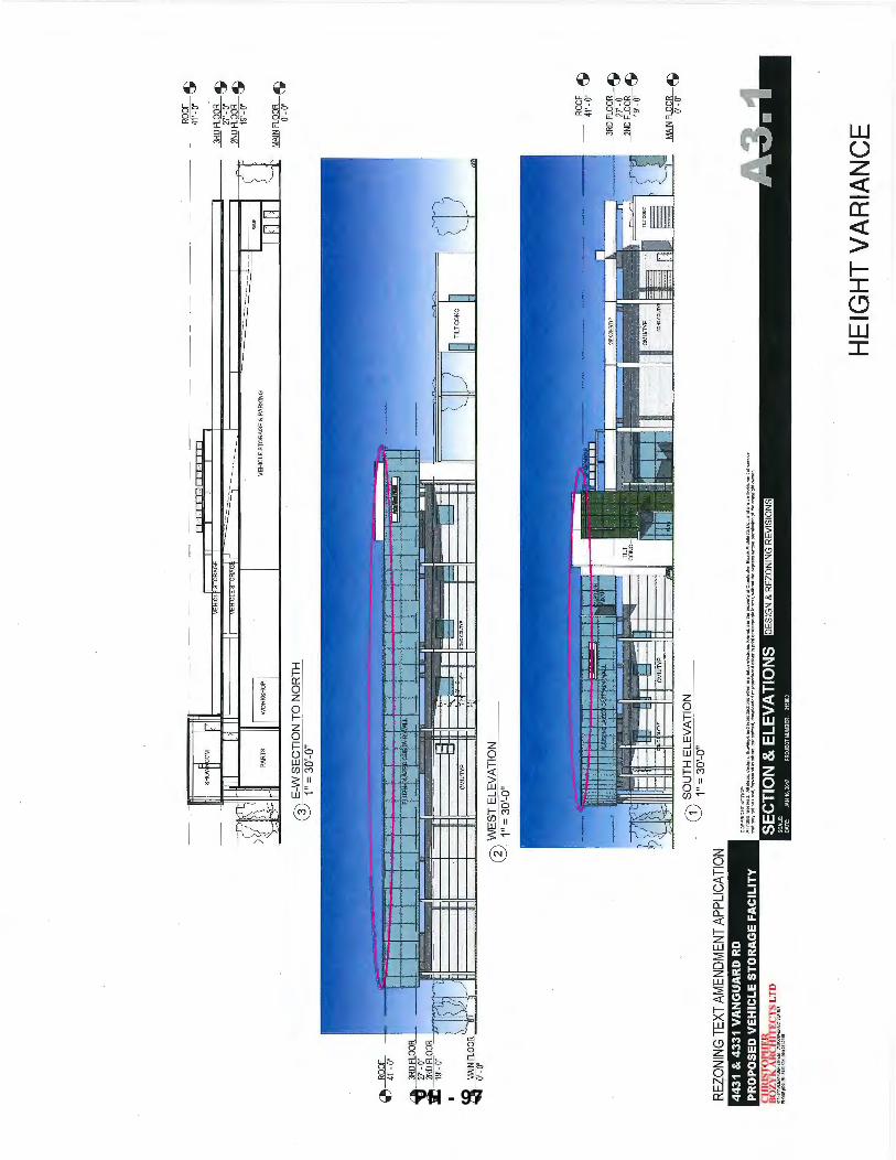
--
---
---
--
---
----
-SHOf
M
'•,
,.
,. '
VE
HIC
L"
STO
RA
GE
Ill
I vt
HIO
CE
STOR
AG~ ~
--=
==.,-
---
-
~ ~
PA
RTS
II W
OR
KS
HO
P I
I V
EH
ICLE
ST
OR
AG
E &
PA
RK
ING
@) E
-W S
EC
TIO
N T
O N
OR
TH
1"
= 3
0'-0
"
~
~1??6.
0 W
ES
T E
LEV
AT
ION
1"
= 30
'-0"
REZ
ON
ING
TEX
T AM
END
MEN
T AP
PLIC
ATIO
N
l.#
.t)&
.&.ll
#.L
UJ.
C h
SL
i.IJ
.1.1
.
Q)
SO
UT
H E
LEV
AT
ION
1"
= 30
'-0"
CO
PY
RIG
HT
NO
TIC
E;
A•<
lgh
iS r
ese"
'a•l
. AU
!an
, d
ulg
no,
d"'..
w-.
;,5 a
nd <
apn>
duct
ionl
allh
al I
to prinlor•l•cl
lt>n
ic::
lorm
a~ a
re Ill•
P«>P
•rtv
ofC
hri
sb:>
I!M
r8o
<v'
:Ait
:hill
lcb
Lid
., a
nd
•••
•n
lnft
rum
enlo
loe<
Yic
e lh
atrn
ayno
tbft
ltS
ed,l
..,.
....
rd ..
. IOOih•~ tr~
nsml!lad.downlooad..,.orreproduc.d""..--. p
<Wot
o<...
.,<1n
>nie
hxm
.c.w
il>o
<'ll
l\4
0a
•prn
s-ii!
An
poo
omi>
K>
noi.
,.CO
JI)'r
igl'l
tow
n..-
.
!i:S
::C
SP
-4 C
&.&
S&
:Sii
.LS
f-4
CP
:C .....
,,...,,.
... .. ,
o ...
.. ,..
....,.
,.... ..
....
,,..
..
.....
,...
,,.
,..,,
... .
. ,
---
--
--
----
--,
"'"
1nn
l
ROOF
ilL
-
41~'-'
3RDF
}fl~
~
2NDFg
!?~ ~
MAIN
FL~?
~ ~
-~?
?t. ~
_]B_
D F}~
?~ ~
_ft
iD F 1L?
?~ ~
MAINFL~?~ ~
HE
IGH
T V
AR
IAN
CE
PH - 97
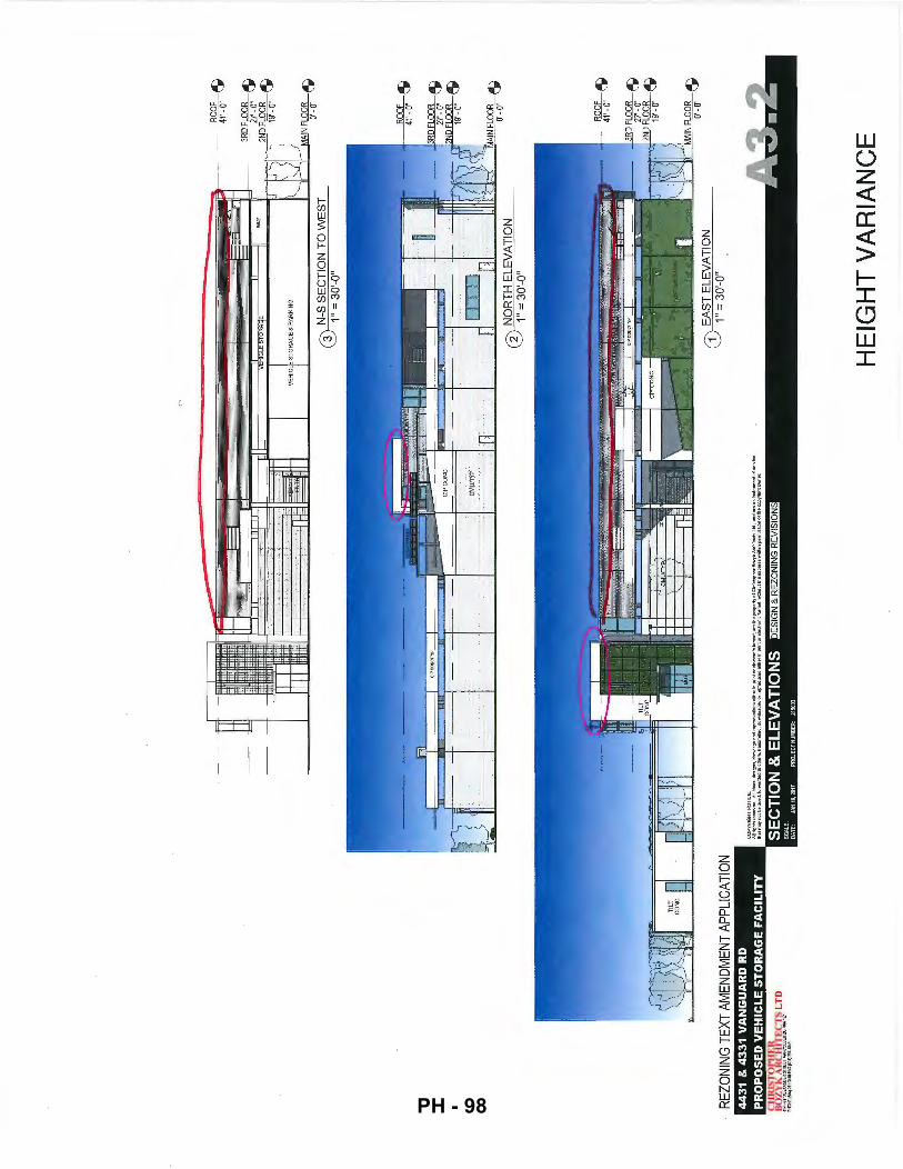
REZ
ON
ING
TEX
T AM
END
MEN
T AP
PLIC
ATIO
N
43
1 &
43
31
VA
NG
UA
RD
R
flQ
QE
_.:
'\
-41
'-0"
\J
____3B
DFLO
OR ~
'i!:b:Q
EZ
JI b
I
vtt,c,E
sroRA9
• II
jj ""
" t: D
~~oF
}8?~
~
VEH
ICLE
ST
OR
AG
E &
PA
RK
ING
Yb~----~------~-----------------------b~~~~~~IN
FL~?~ ~
CO
PY
RIG
HT
NO
TIC
E:
All
right
s , .. er
ved.
Alldn~. d
es9
ns.
~raw!ng1 "!
"' '"
""'d
otct
ian•
•itk
er In
pri
nl o
r ~l
eo;t
ron;
~ form~t.
3"'
the
pr-
rty
o!
CM
stop
heo
Sozy
k '!r
<:h!
loct
< U
d .• en
d'"
an
lnW
...,
.nta
f ..
. rvi
<:tl
lha!maynotbeused
,l.
.......ardedtool!oe"-b""smitted
·d-adedorrep•oduoodeithetlnprintorele<:trt>nlclor...-t.w!lhouttheuprnswrtlen!"'rmio.~afll'leoopy!
lght_,
.,,,
:siiiii:S
I:ar-••
•·•.,.•
=••·c
:lr-• 4
t::&
...... r-
....
....
....
..
o ...
.. ,..
....,.
....
....
....
....
.. ,
.,.,
....
......
......
......
&
G)
N-S
SE
CT
ION
TO
WE
ST
1"
= 3
0'-0
"
@N
OR
TH
ELE
VA
TIO
N
1" =
30'
-0"
~??6-~
Fi??
~ ~
It
Ftl
l::'f
f c:J
"'uF
1L~?~ ~
I I
Ill
IVIt
\ll'l FL
OO
R 6
\
CD EA
ST
ELE
VA
TIO
N
~\J
1" =
30'
-0"
HE
IGH
T V
AR
IAN
CE
PH - 98
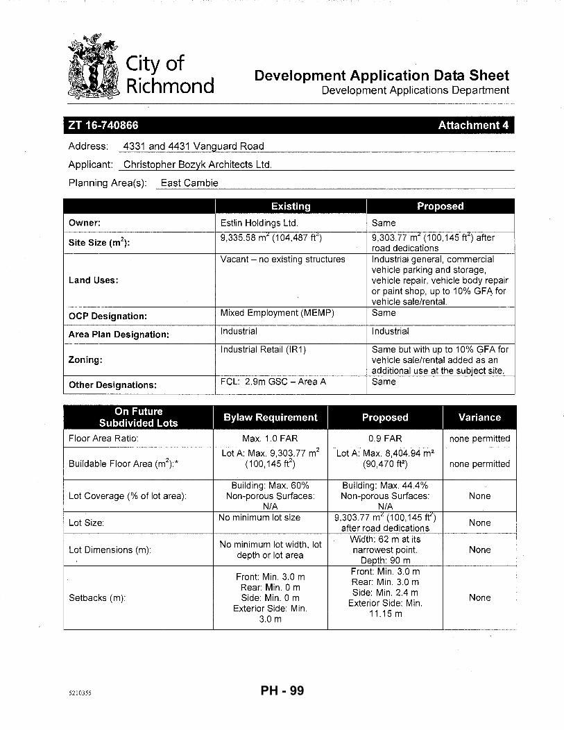
City of Richmond
Development Application Data Sheet Development Applications Department
ZT 16-740866 Attachment 4
Address: 4331 and 4431 Vanguard Road
Applicant: Christopher Bozyk Architects Ltd.
Planning Area(s): East Cambie ----------------------------------------------------------
Existing Proposed
Owner: Estlin Holdings Ltd. Same
Site Size (m2):
9,335.58 m~ (1 04.487 ft~) 9,303.77 m~ (100,145 ft~) after road dedications
Vacant- no existing structures Industrial general, commercial vehicle parking and storage,
Land Uses: vehicle repair, vehicle body repair or paint shop, up to 10% GFA for vehicle sale/rental.
OCP Designation: Mixed Employment (MEMP) Same
Area Plan Designation: Industrial Industrial
Industrial Retail (IR1) Same but with up to 10% <?FA for Zoning: vehicle sale/rental added as an
additional use at the subject site.
Other Designations: FCL: 2.9m GSC- Area A Same
On Future I
Bylaw Requirement I Proposed I
Variance Subdivided Lots
Floor Area Ratio: Max. 1.0 FAR 0.9 FAR none permitted
Lot A: Max. 9.303. 77 mL Lot A: Max. 8.404.94 m2
Buildable Floor Area (m\* (100,145 fe) . (90.470 ft2) none permitted
Building: Max. 60% Building: Max. 44.4% Lot Coverage (% of lot area): Non-porous Surfaces: Non-porous Surfaces: None
N/A N/A
Lot Size: No minimum lot size 9,303.77 m" (100,145 ft")
None after road dedications
No minimum lot width, lot Width: 62 m at its
Lot Dimensions (m): narrowest point. None depth or lot area
Depth: 90 m
Front: Min. 3.0 m Front: Min. 3.0 m
Rear: Min. 0 m Rear: Min. 3.0 m
Setbacks (m): Side: Min. 0 m Side: Min. 2.4 m None Exterior Side: Min.
Exterior Side: Min. 11.15 m
3.0 m
5210355 PH - 99
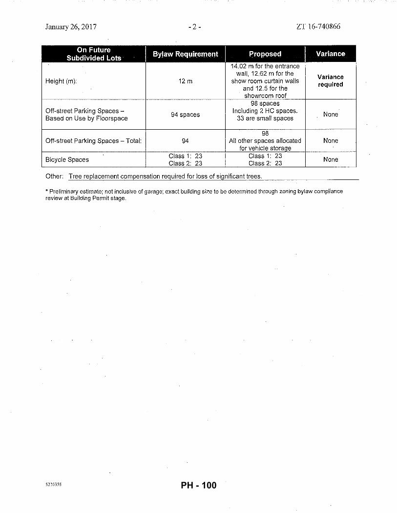
January 26, 2017 -2- ZT 16-740866
On Future ByJaw Requil'ement I Proposed I Variance
Subdivided Lots 14.02 m for the entrance
wall, 12.62 m for the Variance Height (m): 12m show room curtain walls required
and 12.5 for the showroom roof
98 spaces Off-street Parking Spaces-
94 spaces Including 2 HC spaces. None
Based on Use by Floorspace 33 are small spaces
98 Off-street Parking Spaces- Total: 94 All other spaces allocated None
for vehicle storage
Bicycle Spaces Class 1: 23 Class 1: 23 None Class 2: 23 Class 2: 23
Other: Tree replacement compensation required for loss of significant trees.
* Preliminary estimate; not inclusive of garage; exact building size to be determined through zoning bylaw compliance review at Building Permit stage.
5210355 PH - 100
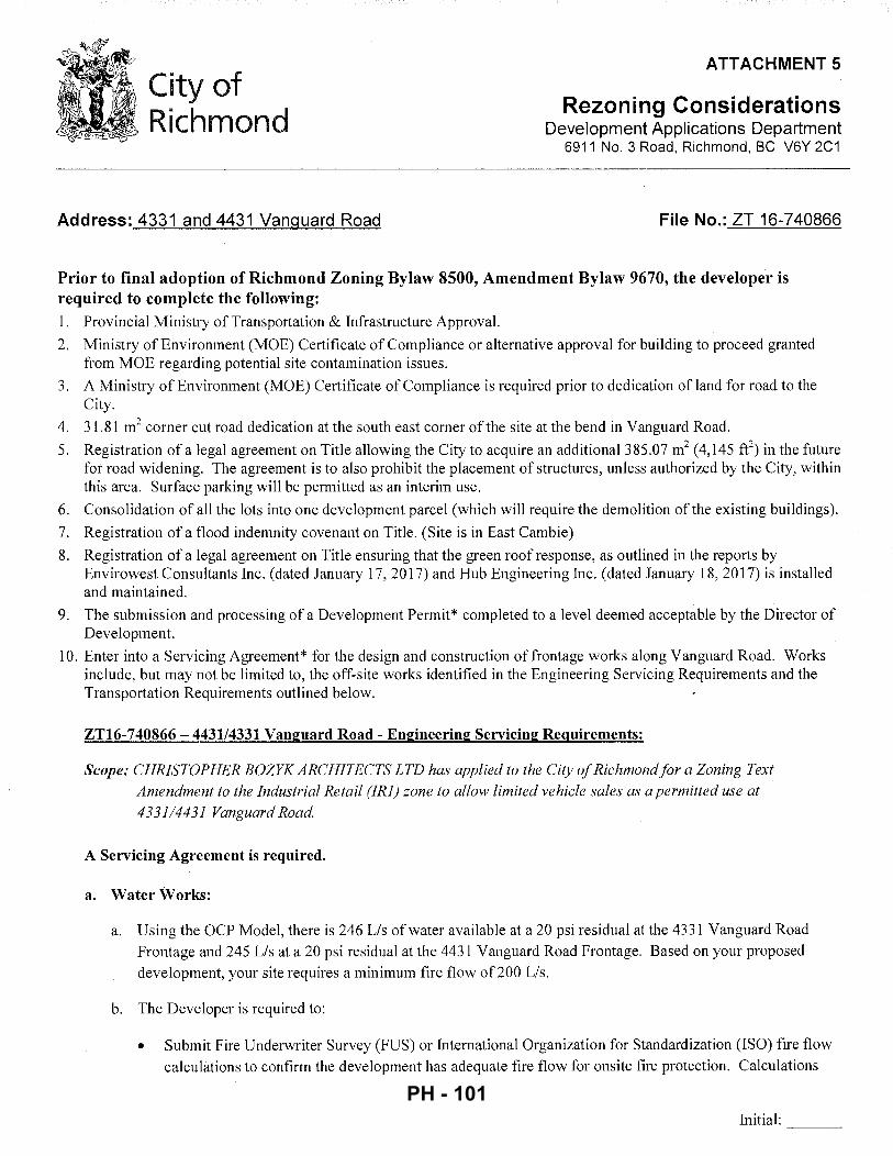
ATTACHMENT 5
City of Richmond
Rezoning Considerations Development Applications Department
6911 No. 3 Road, Richmond, BC V6Y 2C1
Address: 4331 and 4431 Vanguard Road File No.: ZT 16-740866
Prior to final adoption of Richmond Zoning Bylaw 8500, Amendment Bylaw 9670, the developer is required to complete the following: 1. Provincial Ministry of Transportation & Infrastructure Approval.
2. Ministry of Environment (MOE) Certificate of Compliance or alternative approval for building to proceed granted from MOE regarding potential site contamination issues.
3. A Ministry of Environment (MOE) Certificate of Compliance is required prior to dedication of land for road to the City.
4. 31.81 m2 corner cut road dedication at the south east corner of the site at the bend in Vanguard Road.
5. Registration of a legal agreement on Title allowing the City to acquire an additional385.07 m2 (4,145 ft2) in the future
fot road widening. The agreement is to also prohibit the placement of structures, unless authorized by the City, within this area. Surface parking will be permitted as an interim use.
6. Consolidation of all the lots into one development parcel (which will require the demolition of the existing buildings).
7. Registration of a flood indemnity covenant on Title. (Site is in East Cambie)
8. Registration of a legal agreement on Title ensuring that the green roof response, as outlined in the reports by Envirowest Consultants Inc. (dated January 17, 20 17) and Hub Engineering Inc. (dated January 18, 20 17) is installed and maintained.
9. The submission and processing of a Development Permit* completed to a level deemed acceptable by the Director of Development.
10. Enter into a Servicing Agreement* for the design and construction offrontage works along Vanguard Road. Works include, but may not be limited to, the off-site works identified in the Engineering Servicing Requirements and the Transportation Requirements outlined below.
ZT16-740866- 443114331 Vanguard Road- Engineering Servicing Requirements:
Scope: CHRISTOPHER BOZYK ARCHITECTS LTD has applied to the City of Richmond for a Zoning Text
Amendment to the Industrial Retail (IR1) zone to allow limited vehicle sales as a permitted use at
4331/4431 Vanguard Road.
A Servicing Agreement is required.
a. Water Works:
a. Using the OCP Model, there is 246 Lis of water available at a 20 psi residual at the 4331 Vanguard Road
Frontage and 245 Lis at a 20 psi residual at the 4431 Vanguard Road Frontage. Based on your proposed
development, your site requires a minimum fire flow of200 Lis.
b. The Developer is required to:
• Submit Fire Underwriter Survey (FUS) or International Organization for Standardization (ISO) fire flow
calculations to confirm the development has adequate fire flow for onsite fire protection. Calculations
Initial: ---
PH - 101
- 2-
must be signed and sealed by a Professional Engineer and be based on Building Permit Stage Building designs.
• Remove existing water service connection servicing 4331 Vanguard Road. Install a new water service connection, complete with water meter, off of the existing AC watermain fronting the site's east property line.
• Install fire hydrants spaced as per City standard along the proposed development's frontages at Van guard Road.
• Provide a 3m x 85 m Utility Statutory Right-of-Way along the south property line. Do not place any permanent structures or trees within the Statutory Right-of-Way and ensure the proposed site's designated parking spaces do not encroach into the Utility Statutory Right-of-Way.
• If the south access to the proposed site requires any widening or repaving, relocate the portion of the existing AC watermain to be affected by potential driveway widening at the south property line.
c. At the Developers cost, the City is to:
• Perform tie-ins, cutting, and capping of all proposed works to existing City infrastructure.
b. Storm Sewer Works:
a. The Developer is required to:
• Install a 600 mm storm sewer, complete with manholes and catch basins in the roadway fronting the east prope1iy line of the proposed development, approximately 152 m. The proposed storm main shall tie into the existing ditches to the east and west side of Vanguard Road via headwalls.
• Install a new storm service connection, complete with an Inspection Chamber, off of the proposed 600 mm diameter storm sewer along Vanguard Road to service the proposed development.
b. At Developer's cost, the City is to:
• Perform tie-ins, cutting, and capping of all proposed works to existing City infrastructure.
c. Sanitary Sewer Works:
a. The Developer is required to:
• Install new 200 mm sanitary sewer complete with manholes, spaced as per City standard, along Vanguard Road fronting the east property line of the proposed development; approximately 96 m. The proposed sanitary pipe shall tie into existing sanitary sewer at north prope11y line via manholes.
• Once the proposed 200 mm sanitary sewer along Vanguard Road is operational, remove and dispose offsite existing 150 mm and 200 mm sanitary sewer located within the property and all existing sanitary service connections off of existing sanitary sewer. Discharge existing Utility Statutory Right-of Way (SRW 53071) along the proposed development's frontage once the existing sanitary main has been removed.
Initial: ---
PH - 102
- 3 -
• Install a new service connection off of proposed sanitary sewer to service the proposed development and reconnect sanitary service to the properties across the street to the east.
• A possible alternative to relocating the sanitary pipe involves moving the proposed building edge back to establish a minimum of 3 m from the existing 150 mm sanitary pipe. That is, the pipe must be at least 3 m from the any proposed onsite works (soil densification, preloading, foundation, etc.). In addition, provide a geotechnical investigation to confirm any impact to the existing on-site sanitary pipe located at minimum 3.0 m from the proposed building edge. If the geotechnical investigation confirms no impact, the existing on-site sanitary pipe can remain at its current location within a 6 m Utility SRW (3m on either side of the pipe) as per the City's Engineering Design Specifications. Ifthe geotechnical investigation identifies impact to the on-site sanitary pipe from proposed onsite works, relocate the sanitary pipe in accordance to the requirements above.
b. At Developer's cost, the City is to:
• Perform tie-ins, cutting, and capping of all proposed works to existing City infrastructure.
d. Frontage Improvements:
a. The Developer is required to:
• Coordinate with BC Hydro, Telus, and other private communication service providers:
• When relocating/modifying any of the existing power poles and/or guy wires within the property frontages.
• When determining required clearance from the existing distribution lines located at the west property line to the proposed building edge.
• To pre-duct for future hydro, telephone and cable utilities along all road frontages.
• To determine if above ground structures are required and coordinate their locations (e.g. Vista, PMT, LPT, Shaw cabinets, Telus Kiosks, etc.). These shall be located on-site, as described below.
• Locate all above ground utility cabinets and kiosks required to service the proposed development within the developments site (see list below for examples). A functional plan showing conceptual locations for such infrastructure shall be included in the rezoning staff report and the development process design review. Please coordinate with the respective private utility companies and the project's lighting and traffic signal consultants to confirm the requirements and the locations for the aboveground structures. If a private utility company does not require an aboveground structure, that company shall confirm this via a letter to be submitted to the City. The following are examples of SRWs that shall be shown in the functional plan and registered prior to SA design approval:
1. BC Hydro PMT- 4 m W X 5 m (deep) 2. BC Hydro LPT- 3.5 m W X 3.5 m (deep) 3. Street light kiosk- 1.5 m W X 1.5 m (deep) 4. Traffic signal kiosk- 1 m W X 1 m (deep) 5. Traffic signal UPS-2m W X 1.5 m (deep) 6. Shaw cable kiosk- 1m W X 1 m (deep)- show possible location in functional plan 7. Tel us FDH cabinet - 1.1 m W X 1 m (deep)- show possible location in functional plan
• Other' frontage improvements as per Transportation's requirements
Initial: ---
PH - 103
- 4-
e. General Items:
a. The Developer is required to:
Enter into, if required, additional legal agreements, as determined via the subject development's Servicing Agreement(s) and/or Development Permit(s), and/or Building Permit(s) to the satisfaction of the Director of Engineering, including, but not limited to, site investigation, testing, monitoring, site preparation, de-watering, drilling, underpinning, anchoring, shoring, piling, pre-loading, ground densification or other activities that may result in settlement, displacement, subsidence, damage or nuisance to City and private utility infrastructure.Transportation Requirements
MoTI approval required. Road dedication required as shown in the attached PDF to allow for the future normalization and/or widening of the intersection. Applicant responsible for the design and construction of the following frontage improvements along Van guard Road:
o 1.5 m wide concrete sidewalk at the property line. o 1.5 m wide treed/grassed boulevard. o 0.15 m wide curb and gutter. o Road widening to complete the western 12 of the ultimate 12m wide driving surface.
One vehicular access off each frontage can be considered. Maximum driveway throat width at 7.5 m. Any additional width required for large vehicles can be accommodated with roll-over curbs outside the driveway letdown area. Use driveway letdown (as opposed to curb returns). Relocate the proposed driveway off Vanguard Road (east/west portion) to as far west as possible. Size of parking stalls: confirm size of all stalls meets the Zoning Bylaw (ZB) requirements by showing on the plan the typical stall size. The following are the ZB requirements as the minimum stall dimensions:
o Regular-size stall: Length (5.5 m) x width (2.65 m). o Small-size stall: Length (5.0 m) x width (2.4 m). o Handicapped stall: Length (5.5 m) x width (3.7 m).
Width of maneuvering drive aisles should be no less than 7.5 m. Ensure on-site loading spaces proposed as per bylaw requirements. Applicant to address. Ensure both Class 1 and 2 on-site bicycle parking spaces are provided as per bylaw requirements. Applicant to address and show these on the plans. Reorganize the surface parking to eliminate overlapping handicapped parking spaces. Each handicapped space must be a minimum of 3. 7 m wide. Prior to the issuance of BP, a construction parking and traffic management plan to be provided to the Transportation Division (Ref: http://www.Richmond.ca/services/ttp/special.htm>)
Prior to Building Permit Issuance, the developer must complete the following requirements: 1. Submission of a Construction Parking and Traffic Management Plan to the Transportation Department. Management
Plan shall include location for parking for services, deliveries, workers, loading, application for any lane closures, and proper construction traffic controls as per Traffic Control Manual for works on Roadways (by Ministry of Transportation) and MMCD Traffic Regulation Section 01570.
2. Incorporation of accessibility measures in Building Permit (BP) plans as determined via the Rezoning and/or Development Permit processes.
3. Obtain a Building Penn it (BP) for any construction hoarding. If construction hoarding is required to temporarily occupy a public street, the air space above a public street, or any part thereof, additional City approvals and associated fees may be required as part of the Building Permit. For additional information, contact the Building Approvals Department at 604-276-4285.
Note:
* This requires a separate application.
Initial: ---
PH - 104
- 5 -
• Where the Director of Development deems appropriate, the preceding agreements are to be drawn not only as personal covenants of the property owner but also as covenants pursuant to Section 219 of the Land Title Act.
All agreements to be registered in the Land Title Office shall have priority over all such liens, charges and encumbrances as is considered advisable by the Director of Development. All agreements to be registered in the Land Title Office shall, unless the Director of Development determines otherwise, be fully registered in the Land Title Office prior to enactment of the appropriate bylaw. ·
The preceding agreements shall provide security to the City including indemnities, warranties, equitable/rent charges, letters of credit and withholding permits, as deemed necessary or advisable by the Director of Development. All agreements shall be in a form and content satisfactory to the Director of Development.
• Additional legal agreements, as determined via the subject development's Servicing Agreement(s) and/or Development Permit(s), and/or Building Permit(s) to the satisfaction of the Director of Engineering may be required including, but not limited to, site investigation, testing, monitoring, site preparation, de-watering, drilling, underpinning, anchoring, shoring, piling, pre-loading, ground densification or other activities that may result in settlement, displacement, subsidence, damage or nuisance to City and private utility infrastructure.
• Applicants for all City Permits are required to comply at all times with the conditions of the Provincial Wildlife Act and Federal Migratory Birds Convention Act, which contain prohibitions on the removal or disturbance of both birds and their nests. Issuance of Municipal permits does not give an individual authority to contravene these legislations. The City of Richmond recommends that where significant trees or vegetation exists on site, the services of a Qualified Environmental Professional (QEP) be secured to perform a survey and ensure that development activities are in compliance with all relevant legislation.
Signed Date
PH - 105
City of Richmond Bylaw 9670
Richmond Zoning Bylaw 8500 Amendment Bylaw 9670 (ZT16-740866)
4331 and 4431 Vanguard Road
The Council of the City of Richmond, in open meeting assembled, enacts as follows:
1. Richmond Zoning Bylaw 8500 is amended by:
a) Adding "vehicle sale/rental" to Section 12.4.3 of the "Industrial Retail (IR1 )" zone.
b) Inserting the following Section into the "Industrial Retail (IR1 )" zone and renumbering subsequent Sections as necessary:
"12.4.11.7 "Vehicle sale/rental" uses shall be limited to a maximum of 10% Gross Floor Area (GFA) and shall be permitted only at the following site(s); 1
4 3 31 Van guard Road P.I.D. 001-404-008 Lot 22, Plan 23693, Section 36, Block 5 North Range 6 West, New Westminster District."
44 31 Vanguard Road P.I.D. 001-403-991 Lot 21, PL 22601 Section 36, Block 5 North Range 6 West, New Westminster District."
2. This Bylaw may be cited as "Richmond Zoning Bylaw 8500, Amendment Bylaw 9670".
FIRST READING FEB 2 7 2017 CITY OF RICHMOND
APPROVED by
PUBLIC HEARING JIJ) SECOND READING
THIRD READING
MINISTRY OF TRANSPORTATION AND INFRASTRUCTURE APPROVAL
OTHER CONDITIONS SATISFIED
ADOPTED
MAYOR
5210400
APPROVED by Director or Solicitor
(3(.(
CORPORATE OFFICER
PH - 106
City of . Richmond
To: Planning Committee
From: Wayne Craig Director, Development
Report to Committee Planning and Development Division
Date: January 23, 2017
File: RZ 16-741547
Re: Application by Sansaar Investments Ltd. for Rezoning at 11660/ 11680 Montego Street from Two-Unit Dwellings (RD1) to Single Detached (RS2/C)
Staff Recommendation
That Richmond Zoning Bylaw 8500, Amendment Bylaw 9673, for the rezoning of 11660/11680 Montego Street from "Two-Unit Dwellings (RD1)" to "Single Detached (RS2/C)", be introduced and given first reading.
REPORT CONCURRENCE
ROUTED To: CONCURRENCE CONCURRENCE OF GENERAL MANAGER
Affordable Housing ~·· ·~ jr( 7': f} /!: r~if /,;/// ',?f;.f' /'va
7 fd/ t
1 I
/
52564 78 PH - 107
January 23, 2017 -2- RZ 16-741547
Staff Report
Origin
Sansaar Investments Ltd. has applied to the City of Richmond for permission to rezone the property at 11660/11680 Montego Street from the "Two-Unit Dwellings (RD1)" zone to the "Single Detached (RS2/C)" zone, to permit the property to be subdivided to create two (2) single-family lots, with vehicle access from Montego Street (Attachment 1). The site is currently occupied by a duplex, which will be demolished. A site survey showing the proposed subdivision plan is included in Attachment 2.
Findings of Fact
A Development Application Data Sheet providing details about the development proposal is attached (Attachment 3).
Surrounding Development
Development immediately surrounding the site is as follows:
To the North:
To the South:
To the East & West:
Single-family dwellings on lots zoned "Single Detached (RS liE)" and "Single Detached (RS liB)" fronting Monte go Street.
Single-family dwellings on lots zoned "Single Detached (RS 1/E)" fronting Deerfield Crescent.
Single-family dwelling on a lot zoned "Single Detached (RS 1 /E)" fronting Montego Street.
Related Policies & Studies
Official Community Plan/East Cambie Area Plan
The Official Community Plan (OCP) land use designation for the subject property is "Neighbourhood Residential" (NRES). The East Cambie Area Plan land use designation for the subject property is "Residential (Single-Family Only)". The proposed rezoning and subdivision would comply with these designations.
Single-Family Lot Size Policy 5454/Zoning Bylaw 8500
The subject property is located within the area governed by Single-Family Lot Size Policy 5454 (adopted by Council on May 16, 1994 and last amended in 2003) (Attachment 4). The Policy permits properties with duplexes to be rezoned and subdivided into a maximum of two (2) lots. The proposed lots will be approximately 14m (46ft.) wide and 570m2 (6,135 ft2
) in area. The proposed rezoning and subdivision would comply with the requirements of the "Single Detached (RS2/C)" zone and Single-Family Lot Size Policy 5454.
5256478 PH - 108
January 23, 2017 - 3 - RZ 16-741547
Aircraft Noise Sensitive Development Policy
The subject property is located within the Aircraft Noise Sensitive Development (ANSD) Policy Area 2. Registration of an aircraft noise-sensitive use covenant on Title is required prior to final adoption of the rezoning bylaw to address public awareness and to ensure aircraft noise mitigation is incorporated into dwelling design and construction.
Ministry of Transportation & Infrastructure Approval
As the subject property is located within 800 m of an intersection of a Provincial Limited Access Highway and a City road, this redevelopment proposal was referred to the Ministry of Transportation and Infrastructure (MOTI). Confirmation has been received from MOTI indicating that they have no objections to the proposed redevelopment and that preliminary approval has been granted for a period of one year. Final approval from MOTI is required prior to final adoption of the rezoning bylaw.
Floodplain Management Implementation Strategy
The proposed redevelopment must meet the requirements of the Richmond Flood Plain Designation and Protection Bylaw 8204. Registration of a flood indemnity covenant on Title is requited prior to final adoption of the rezoning bylaw.
Public Consultation
A rezoning sign has been installed on the subject property. Staff have not received any comments from the public about the rezoning application in response to the placement of the rezoning sign on the property.
Should the Planning Committee endorse this application and Council grant first reading to the rezoning bylaw, the bylaw will be forwarded to a Public Hearing; where any area resident or interested party will have an opportunity to comment. Public notification for the Public Hearing will be provided as per the Local Government Act.
Analysis
Existing Legal Encumbrances
There is an existing restrictive covenant registered on Title; restricting the use of the subject property to a duplex (Document No. BF305981). The covenant must be discharged from Title as a condition of rezoning.
Site Access
Vehicle access to the proposed lots is to be from Montego Street via separate driveway crossings.
5256478 PH - 109
January 23, 2017 -4- RZ 16-741547
Tree Retention and Replacement
A Certified Arborist' s Report was submitted by the applicant, which identifies tree species, assesses tree structure and condition, and provides recommendations on tree retention and removal relative to the proposed development. The report assesses six (6) bylaw-sized trees located on the subject site, two (2) trees located on the neighbouring property and two (2) City-owned trees.
The City's Tree Preservation Coordinator has reviewed the Arborist' s Report, conducted an on-site visual tree assessment, and concurs with the Arborist's recommendations to:
• Remove and replace all six (6) trees (tag# 1201, 1202, 1203, 1206, 1207 & 1208) located on the subject site in poor condition due to Bronze Birch Borer infestation (20, 47, 87, 43, 25, 28 em dbh).
• Remove and replace two (2) trees (tag# OS1204 & OS1205) located on the neighbouring property to the south due to poor condition. Prior to removal, the applicant is required to obtain written permission from the property owner and obtain a valid tree removal permit. If permission to remove the trees is not granted, the trees must be protected as per Tree Protection Information Bulletin Tree-03.
• Remove and replace two (2) City-owned Lombardy Poplar trees (tag# C1 & C2) located in front of the subject site (both 100 em dbh). The City's Parks Arborist has assessed the trees and agreed to the removal, due to poor condition and conflict with the proposed driveway. The applicant has received approval from the Parks Department and must contact the department four ( 4) days prior to removal. Compensation of $2,600 is required for removal of the trees; in order for the Parks Department to plant four (4) trees at or near the subject property.
Tree Replacement
For the removal of the six ( 6) trees on-site, the OCP tree replacement ratio goal of 2: 1 requires 12 replacement trees to be planted and maintained on the proposed lots. The applicant has proposed to plant and maintain three (3) replacement trees on each lot; for a total of six (6) replacement trees.
As per Tree Protection Bylaw No. 8057, based on the sizes of the on-site trees being removed (20, 25, 28, 43, 47, 87 em dbh), replacement trees shall be the following minimum sizes:
or
5256478 PH - 110
January 23, 2017 - 5 - RZ 16-741547
To ensure that six (6) replacement trees are planted on-site at development stage, the applicant is required to submit a Landscaping Security in the amount of $3,000 ($500/tree) prior to final adoption of the rezoning bylaw. Securities will not be released until a landscaping inspection has been passed by City staff after construction and landscaping has been completed. The City may retain a portion of the security for a one year maintenance period from the date of the landscape inspection.
The applicant is also required to submit a cash-in-lieu contribution in the amount of$3,000 ($500/tree) to the City's Tree Compensation Fund for the balance of required replacement trees not planted on the proposed lots (six (6) trees).
Affordable Housing Strategy
The City's Affordable Housing Strategy for single-family rezoning applications requires a secondary suite on 100% of new lots, or a secondary suite on 50% of new lots, plus a cash-in-lieu contribution of $2.00/ft2 of total buildable area towards the City's Affordable Housing Reserve Fund for the remaining 50% of new lots, or a 100% cash-in-lieu contribution if secondary suites cannot be accommodated.
The applicant proposes to provide a legal secondary suite on both of the two (2) lots proposed at the subject site. To ensure that the secondary suites are built to the satisfaction of the City in accordance with the City's Affordable Housing Strategy, the applicant is required to enter into a legal agreement registered on Title, stating that no final Building Permit inspection will be granted until the secondary suite is constructed to the satisfaction of the City in accordance with the BC Building Code and Richmond Zoning Bylaw 8500. Registration of this legal agreement is required prior to final adoption of the rezoning bylaw.
Site Servicing and Frontage Improvements
At Subdivision stage, the applicant is required to complete the following:
• Payment of current year's taxes and the costs associated with the completion of the required servicing works as described in Attachment 6.
• Payment to the City, in accordance with the Subdivision and Development Bylaw No. 8751, a $69,149.60 cash-in-lieu contribution for the design and construction of frontage upgrades; including storm sewer upgrades, new concrete curb and gutter, concrete sidewalk, pavement widening, roadway lighting and boulevard landscape/trees.
Financial Impact or Economic Impact
The rezoning application results in an insignificant Operational Budget Impact (OBI) for off-site City infrastructure (such as roadworks, waterworks, storm sewers, sanitary sewers, street lights, street trees and traffic signals).
5256478 PH - 111
January 23, 2017 - 6- RZ 16-741547
Conclusion
The purpose of this rezoning application is to rezone the property at 11660/11680 Montego Street from the "Two-Unit Dwellings (RD 1 )" zone to the "Single Detached (RS2/C)" zone, to permit the property to be subdivided to create two (2) single-family lots.
This rezoning application complies with the land use designations and applicable policies contained within the OCP for the subject site.
The list of rezoning considerations is included in Attachment 6, which has been agreed to by the applicant (signed concurrence on file).
On this basis, it is recommended that Richmond Zoning Bylaw 8500, Amendment Bylaw 9673 be introduced and given first reading.
Steven De Sousa Planning Technician- Design (604-276-8529)
SDS:blg
Attachment 1: Location Map/ Aerial Photo Attachment 2: Proposed Subdivision Plan Attachment 3: Development Application Data Sheet Attachment 4: Single-Family Lot Size Policy 5454 Attachment 5: Tree Management Plan Attachment 6: Rezoning Considerations
5256478 PH - 112
~
su
20.12
\'" 'b
City of Richmond
20.12 20.12 18.29 18.29
Q)
t--; !";::
~ RZ
ASY
SI
20.12 20.12 'K-<lX 18.29 18.29 1t .L~
;;: "'" ex:> ~
16-741547
ATTACHMENT 1
S~E f------RsiJB-1-- 1--1-- 1-- RTLl 1-- 1--
' 1-- 1--
V7 '---- 1-- 1--- 1-- f--
I T I T -:::;:::::2 -
20.12 14.17 14.17 1ti.L! 18.29 18.29 18.
"'" ""' a;
Original Date: 09/16/16
Revision Date:
Note: Dimensions are in METRES
PH - 113
City of Richmond
~ RZ Original Date: 09/16/16
16-741547 Revision Date:
Note: Dimensions are in METRES
PH - 114
TOPOGRAPHIC SURVEY AND PROPOSED SUBDIVISION OF LOT 22 SECTION 36 BLOCK 5 NORTH RANGE 6 WEST .N NEW WESTMINSTER DISTRICT PLAN 17398 scALE: 1:200 w
#11660 MONTEGO STREET,o ;:.iiiiiiiiiiiiiiiiiiiiiiiiiiii~5~~~~~10~iiiiiiiiiiiiiiiiiiiii~15 RICHMOND, B.C. • P.I.D. 004-243-455
Top of Ditch
lii~ -g., ~~
lx,.x ,.
~ 21 g,x':.:t:
..._"? 'if; 0
© copyright 193 J. C. Tam and Associates Canada and B.C. L.and Surveyor
115 - 8833 Odlin Crescent
Richmond, B.C. V6X 3Z7
Telephone: 214-8928 Fax: 214-8929
E-mail: [email protected]
Website: www.jctam.com
Job No. 6557
FB-316 P1-2
Drawn By. 10
:t ~
r-. I")
"!I ~I
I <§>I .._.
MONTEGO
Roof: x8.56
ALL DISTANCES ARE IN METRES AND DECIMALS THEREOF UNLESS OTHERWISE INDICATED
STREET
;-1.20 \..:>"' I , .os -1 I <:>"' I Overhang 1.35 ~. 0ro I I "" I I x I nalt . 1 I #11660 ti~•~aY I I EXISllNG I I 2-STOREY I 1 DWEWNG 1 ~ g I I ,g~ I G
""' i :->; I i,!"'" x"':>"> !""d> \·~"''·ss
""
1' "' X
oec~ til : !,':>9 I • L )(1-J."-·-·-·-·-·-·-·-·-·-·-·-·* It-- co -----r:- IT LJil 1n o
APPROXIMATE BUILDING ENVELOPE
""' ,. X
LOT A 570m 2
I :: ~ I APPROXIMATE I "! : ':q-1 ':q- "! I BUILDING I~ I b 1 r' ~ 1 ENVELOPE -,"> 1 i
I o ! 1><1.37 x"" I ! <:>"' ! I 11alt I I "" I I LOT 8 ti~ewaY I i X
I I 570m 2 _,..., I:> I *I ,':><:> x"· I';;.)
~I I-~ ~~ 1:
I I I I I I I I I I
'o ""' I GO(og• I " ,. I I
,-~~-------3---~ ~r----T--------~i I >- ')f 1 _::- ~ 9?
....._<J I ' I ·- Q C: • I _..------.._ 1-- l ~tf 8 ""&:::;;::..._--...... ,')·..:-------........... . ---- a
• -'/1'. ...... ' )5. ' ... v.... ........ a to //f0.29._· t>')'¢0.L~ \ /' t---'-'''-,-_ ___c<o~·------__j I //,c) CD8C? {;1.22 \ \ / \ \ ,
c"' [ { 1 ¢0.26~-l[D) '.fP-56,(0.47 ~i;f¢OJB '(J25 1 g, ,. i1.bk ',(D)@_~14.17.3!D)dg ,~,;;::(D) '\. 114.173 '·rs x"'?
1.14x
195
NOTE: NOTE: Use site Benchmark
23
Elevations shown are based on
City of Richmond HPN Benchmark network.
Benchmark: HPN #190
Tag #1702 for construction elevation control.
CERTIFIED CORRECT:
Control Monument 94H1624 Elevation: 2.353m
Benchmark: HPN #202
(C) (D)
• --o
denotes conifer denotes deciduous denotes manhole denotes cleanout
LOT DIMENSION ACCORDING TO FIELD S RVEY.
B.C.L.S.
DWG No. 6557-Topo I Control Monument 77H4623
Elevation: 1.452m MF
/NV. denotes main floor denotes invert
I JOHNSON c. TAM,
d6NE 28th, 2016.
ATTACHMENT 2
PH - 115
City of Richmond
Development Application Data Sheet Development Applications Department
RZ 16-741547 Attachment 3
Address: 11660/11680 Montego Street
Applicant: Sansaar Investments Ltd.
Planning Area(s): East Cambie --~~------------------------------------------------------
Existing Proposed
Owner: A Hownam-Meek To be determined
Site Size: 1,140 m2 (12,270 ff) Lot A: 570 m2 (6, 135 fe) Lot B: 570 m2 (6, 135 ff)
Land Uses: Single-family residential No change
OCP Designation: Neighbourhood Residential Complies
Area Plan Designation: Residential (Single-Family Only) Complies
Lot Size Policy Designation: Properties with duplexes into a Complies
maximum of two (2) lots
Zoning: Two-Unit Dwellings (RD1) Single Detached (RS2/C)
On Future I
Bylaw Requirement I
Proposed I Variance Subdivided Lots
Floor Area Ratio: Max. 0.55 for 464.5 m2 of Lot Max. 0.55 for 464.5 m2 of Lot None
Area+ 0.3 for remainder Area+ 0.3 for remainder Permitted
Buildable Floor Area:* Max. 287 m2 (3,090 ft2) Max. 287 m2 (3,090 ft2) None
Permitted Building: Max. 45% Building: Max. 45%
Lot Coverage: Non-porous: Max. 70% Non-porous: Max. 70% None Landscaping: Min. 25% Landscaping: Min. 25%
Lot Size: Min. 360.0 m2 570m2 None
Lot Dimensions: Width: Min. 13.5 m Width: 14m
None Depth: Min. 24.0 m Depth: 40 m
Front: Min. 6 m Front: Min. 6 m Setbacks: Rear: Min. 6 m Rear: Min. 6 m None
Side: Min. 1.2 m Side: Min. 1.2 m
Height: Max. 2 % storeys Max. 2 % storeys None
Other: Tree replacement compensation required for loss of significant trees.
* Preliminary estimate; not inclusive of garage; exact building size to be determined through zoning bylaw compliance review at Building Permit stage.
PH - 116
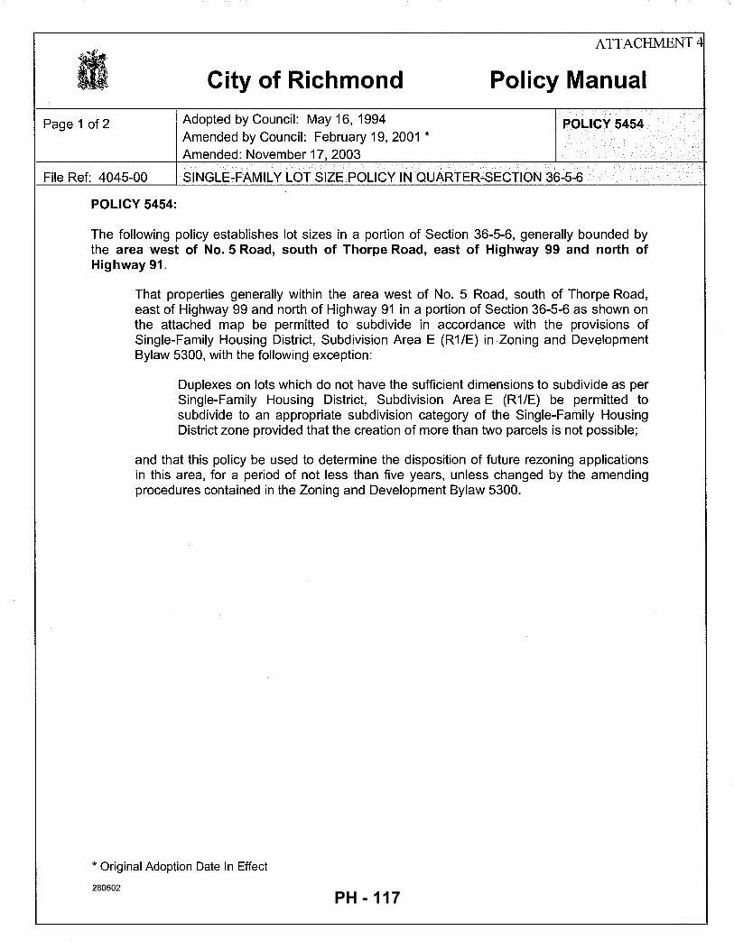
Page 1 of 2
City of Richmond
Adopted by Council: May 16, 1994 Amended by Council: February 19, 2001 *
Amended: November 17, 2003
ATTACHMENT 4
Policy Manual
POLICY 5454
File Ref: 4045-00 SINGLE-FAMILY LOT SIZE POLICY IN QUARTER-SECTION 36-5-6
POLICY 5454:
The following policy establishes lot sizes in a portion of Section 36-5-6, generally bounded by the area west of No. 5 Road, south of Thorpe Road, east of Highway 99 and north of Highway 91.
That properties generally within the area west of No. 5 Road, south of Thorpe Road, east of Highway 99 and north of Highway 91 in a portion of Section 36-5-6 as shown on the attached map be permitted to subdivide in accordance with the provisions of Single-Family Housing District, Subdivision Area E (R1/E) in .zoning and Development Bylaw 5300, with the following exception:
Duplexes on lots which do not have the sufficient dimensions to subdivide as per Single-Family Housing District, Subdivision Area E (R1/E) be permitted to subdivide to an appropriate subdivision category of the Single-Family Housing District zone provided that the creation of more than two parcels is not possible;
and that this policy be used to determine the disposition of future rezoning applications in this area, for a period of not less than five years, unless changed by the amending procedures contained in the Zoning and Development Bylaw 5300.
* Original Adoption Date In Effect
280602 PH - 117
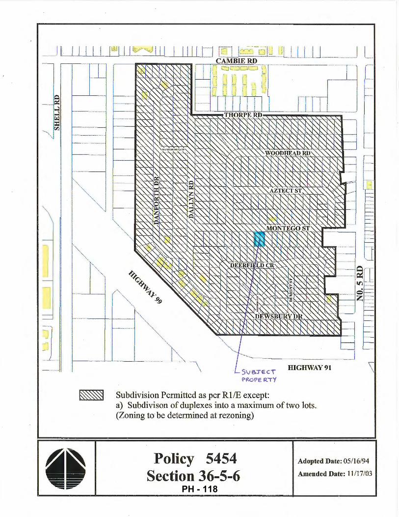
\ i
t- - -+-t-------1'"''
SV&.J EC.T
\>ROPE.RTY
m Subdivision Permitted as per Rl/E except:
HIGHWAY91
a) Subdivison of duplexes into a maximum of two lots. (Zoning to be determined at rezoning)
Policy 5454 Section 36-5-6
Adopted Date: 05/16/94
Amended Date: 11/17/03
PH - 118
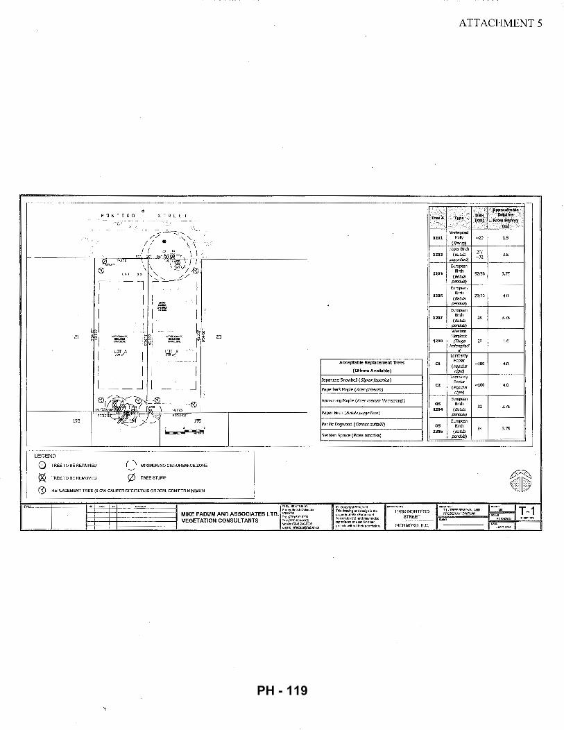
~
MONT EGO STREET
- --~---::.::::~
// ''-" I I • \\
I I a c' \ \ so· o· o ... --EQ~-,..
0STUMP 14.172
\ "-!'~ 1 I 1', 0 \ \!:"'vl-0
" 1"'- //
I l r~~l
I I I I iS I I I I ;
~~I J I ~~~ 2l ~~I IIPI'Ii!JJIMATE
I~EI IJ'fllli1[11ATI: 23
w~~ WII..UW. I"~ ~~' ~d ~ ., ,.
I LOT A
I I LOT B
I 570n' 5lD ,~
I I I I L J L J 0!~0.'< -~
14.171207 ~~~ 0 ~\ 14.173
90~0'"'-~-k' \ ,,,,' 90'20'02.
193 !95 , _ _;:..-t---=-:.-=-~r~~r
LEGEND
TREE TO BE RETAINED MINIMUM NO DISTURBANCE ZONE
TREE TO BE REMOVED 0 TREE STUMP
REPLACEMENT TREE (5 CM. CALIPER DECIDUOUS OR 3CM. CONIFER MINIMUM
SUm!y,8ritishColumb"a
MIKE FADUM AND ASSOCIATES LTD. ~~~,:;;,,, . .,,
ATTACHMENT 5
Approximate
Tree# Type DBH Dripline (em) fromSwvey
(m)
Variegated 1201 Holly N20 15
(Ilexsp) PaperBirdl
26/ 1202 (Betula N32 35 papyrifera)
European Birch
1203 (Betula
'52./56 3.75
pendu/a)
European
1206 Birch
"23/30 4.0 (Betula
pendula)
European
1207 Birch
25 3.75 (Betula
pendu/a) western Hemlock
1208 {Tsuga 28 1.6 /Jeterophy/1
a Lombardy
Acceptable Replacement Trees C1 Poplar
-100 4,0 (Populus
(Others Available) nigra)
Japanese Snowbell (Styraxjaponica} Lombardy
Poplar C2
(Populus ..vlOO 4.0
Paperbark Maple (Acergriseum) nigra)
Annstrong Maple (Acer rubrum 'Armsb"ong') European OS Birch
32 3.75 1204 (Betula
Paper Birch (Betula papyrifera) pendula)
European Pacific Dogwood (Comus nuttallii) OS Bird!
1205 (Betula 34 3.75
Serbian Spruce (Plcea omorlka) pendu/a)
~ @Copyright Reserved. Thisdrawinganddesignisthe pmpertyofMikeFadumand Asrodalaslld.andmaynotbe reproducedorusedf<M"olher projeclswilhoutlheirpermission.
-~-1,:-6H-~:-M0o-:N-~-.:-Gc_o_F'-"' ~
PH - 119
City of Richmond
Address: 11660/11680 Montego Street
ATTACHMENT 6
Rezoning Considerations Development Applications Department
6911 No. 3 Road, Richmond, BC V6Y 2C1
File No.: RZ 16-741547
Prior to final adoption of Richmond Zoning Bylaw 8500, Amendment Bylaw 9673, the developer is required to complete the following: 1. Provincial Ministry of Transportation & Infrastructure Approval.
2. Submission of a Landscape Security in the amount of $3,000 ($500/tree) to ensure that a total of six (6) replacement trees (three (3) in each lot) are planted and maintained on the proposed lots with the following minimum sizes:
or
The security will not be released until a landscaping inspection is passed by City staff. The City may retain a portion of the security for a one-year maintenance period.
3. City acceptance of the developer's offer to voluntarily contribute $3,000 to the City's Tree Compensation Fund for the planting of replacement trees within the City.
4. City's acceptance of the applicant's voluntary contribution of $2,600 for the removal of the two (2) City-owned trees; in order for the City to plant four ( 4) trees at or near the developments site.
5. Registration of an aircraft noise sensitive use covenant on Title.
6. Registration of a flood indemnity covenant on Title.
7. Registration of a legal agreement on Title to ensure that no final Building Permit inspection is granted until a secondary suite is constructed on two (2) ofthe two (2) future lots, to the satisfaction of the City in accordance with the BC Building Code and the City's Zoning Bylaw.
8. Discharge ofthe existing covenant registered on Title of the subject property (i.e. BF305981); which restricts the use of the subject property to a duplex.
At Demolition Permit* stage, the developer must complete the following requirements: 1. Obtain wrjtten authorization from the neighbouring property owners at 44 71 Deerfield Crescent to remove trees (tag#
OS 1204 & OS 1205) located on the neighbouring property. If written authorization is not obtained by the applicant, these trees must be retained and protected in accordance with the City's Tree Protection Information Bulletin TREE-03 prior to any works being conducted on-site, and must remain in place until construction and landscaping on-site is completed.
2. Contact the City's Parks Department a minimum of four (4) days in advance to enable signage to be posted for the removal ofthe City-owned trees (tag# C1 & C2).
At Subdivision* and Building Permit* stage, the developer must complete the following requirements: 1. Payment of current year's taxes and the costs associated with the completion of the required servicing works and
frontage improvements.
2. The following servicing works and off-site improvements may be completed through either: a) a Servicing Agreement* entered into by the applicant to design and construct the works to the satisfaction of the Director of Engineering; or b) a cash contribution based on a City cost estimate for the City to manage the design and construction of the works: Water Works:
• Using the OCP Model, there is 164 Lis of water available at a 20 psi residual at the Montego Street frontage. Based on your proposed development, your site requires a minimum fire flow of95 Lis.
Initial: ---
PH - 120
- 2 -
• The Developer is required to: • Submit Fire Underwriter Survey (FUS) or International Organization for Standardization (ISO) fire flow
calculations to confirm the development has adequate fire flow for onsite fire protection. Calculations must be signed and sealed by a Professional Engineer and be based on Building Permit Stage Building designs.
• At Developer's cost, the City is to: • Install two (2) new 25 mm water service connections complete with meter and meter box off of the
150 mm AC watermain along Montego Street. • Cut and cap at main, the existing 20 mm water service connection.
Storm Sewer Works:
• At Developer's cost, the City is to: • Install a new storm service connection at the adjoining property line of the two (2) newly subdivided lots,
complete with inspection chamber and dual service leads off of the 600 mm concrete storm sewer fronting the subject site.
Sanitary Sewer Works: • At Developer's cost, the City is to:
• Install a new sanitary service connection at the adjoining property line of the two (2) newly subdivided lots, complete with inspection chamber and dual service leads off of the 200 mm PVC sanitary sewer fronting the subject site.
• Cut and cap the existing sanitary service connection and remove existing inspection chamber at the northwest comer of the subject site.
Frontage Improvements: • The Developer is required to:
• Coordinate with BC Hydro, Telus and other private communication service providers. When relocating/modifying any of the existing power poles and/or guy wires within the property frontages. To determine if above ground structures are required and coordinate their locations (e.g. Vista, PMT, LPT, Shaw cabinets, Telus Kiosks, etc.). These should be located on-site.
• Pay, in keeping with the Subdivision and Development Bylaw No. 8751, a $69,149.60 cash-in-lieu contribution for the design and construction of frontage upgrades as set out below:
• Storm Sewer (EP.0640) $34,008.00 • Concrete Curb and Gutter (EP.0641) $5,668.00 • Concrete Sidewalk (EP.0642) $8,218.60 • Pavement Widening (EP.0643) $9,919.00 • Roadway Lighting (EP.0644) $3,117.40 • Boulevard Landscape/Trees (EP.0647) $8,218.60
• Complete other frontage improvements as per Transportation's requirements.
Note:
* •
This requires a separate application.
Where the Director of Development deems appropriate, the preceding agreements are to be drawn not only as personal covenants of the property owner but also as covenants pursuant to Section 219 of the Land Title Act.
All agreements to be registered in the Land Title Office shall have priority over all such liens, charges and encumbrances as is considered advisable by the Director of Development. All agreements to be registered in the Land Title Office shall, unless the Director of Development determines otherwise, be fully registered in the Land Title Office prior to enactment of the appropriate bylaw.
The preceding agreements shall provide security to the City including indemnities, warranties, equitable/rent charges, letters of credit and withholding permits, as deemed necessary or advisable by the Director of Development. All agreements shall be in a form and content satisfactory to the Director of Development.
• Additional legal agreements, as determined via the subject development's Servicing Agreement(s) and/or Development Permit(s), and/or Building Permit(s) to the satisfaction of the Director of Engineering may be required including, but not limited to, site
Initial: ---
PH - 121
- 3 -
investigation, testing, monitoring, site preparation, de-watering, drilling, underpinning, anchoring, shoring, piling, pre-loading, ground densification or other activities that may result in settlement, displacement, subsidence, damage or nuisance to City and private utility infrastructure.
• Applicants for all City Permits are required to comply at all times with the conditions of the Provincial Wildlife Act and Federal Migratory Birds Convention Act, which contain prohibitions on the removal or disturbance of both birds and their nests. Issuance of Municipal permits does not give an individual authority to contravene these legislations. The City of Richmond recommends that where significant trees or vegetation exists on-site, the services of a Qualified Environmental Professional (QEP) be secured to perform a survey and ensure that development activities are in compliance with all relevant legislation.
[Signed copy on file]
Signed Date
PH - 122
City of Richmond
Richmond Zoning Bylaw 8500 Amendment Bylaw 9673 (RZ 16•741547)
11660/11680 Montego Street
Bylaw 9673
The Council of the City of Richmond, in open meeting assembled, enacts as follows:
1. The Zoning Map of the City of Richmond, which accompanies and forms part of Richmond Zoning Bylaw 8500, is amended by repealing the existing zoning designation of the following area and by designating it "SINGLE DETACHED (RS2/C)".
P.I.D. 004-243-455 Lot 22 Section 36 Block 5 North Range 6 West New Westminster District Plan 17398
2. This Bylaw may be cited as "Richmond Zoning Bylaw 8500, Amendment Bylaw 9673".
FIRST READING
A PUBLIC HEARING WAS HELD ON
SECOND READING
THIRD READING
OTHER CONDITIONS SATISFIED
MINISTRY OF TRANSPORTATION AND INFRASTRUCTURE APPROVAL
ADOPTED
MAYOR
5283946
FEB 1 4 2017
CORPORATE OFFICER
CITY OF RICHMOND
APPROVED
gt~ APPROVED by Director or Solicitor
PH - 123
City of Richmond
Report to Committee Planning and Development Division
To: Planning Committee Date: February 6, 2017
From: Wayne Craig File: RZ 16-741423 Director, Development
Re: Application by Focus Construction Ltd. for Rezoning at 9760 Sealily Place from "Single Detached (RS1/E)" to "Single Detached (RS2/B)"
Staff Recommendation
That Richmond Zoning Bylaw 8500, Amendment Bylaw 9680, for the rezoning of 9760 Sealily Place from "Single Detached (RS 1/E)" to "Single Detached (RS2/B)", be introduced and given first reading.
/) /) 4/"111,.1.. "''"~~>:;,
Wayne Craig . Director,; Devel_opment
: _,,"
JR:blg Att. 7
ROUTED TO:
Affordable Housing
5280131
REPORT CONCURRENCE
CONCURRENCE CONCURRENCE OF GENERAL MANAGER
PH - 124
February 6, 2017 - 2-
Staff Report
Origin
Focus Construction Ltd. has applied to the City of Richmond for permission to rezone 9760 Sealily Place from the "Single Detached (RS 1/E)" zone to the "Single Detached (RS2/B)" zone, to permit the property to be subdivided to create two single-family lots with vehicle access from Sealily Place (Attachment 1 ). The proposed subdivision plan is shown in Attachment 2. There is an existing dwelling on the property, which would be demolished.
Findings of Fact
A Development Application Data Sheet providing details about the development proposal is provided in Attachment 3.
Surrounding Development
Development immediately surrounding the subject site is as follows:
• To the North: Single-family dwellings on lots zoned "Single Detached (RS 1/E)."
• To the South: Two single-family dwellings on lots zoned "Single Detached (RS 1/E),". with vehicle access from Seaton Place.
• To the East: A duplex on a lot zoned "Single Detached (RS 1/E)"; fronting Sealily Place and with vehicle access from the rear lane.
• To the West: A single-family dwelling on a lot zoned "Single Detached (RS 1/E)," with vehicle access from Sealily Place. There is a pending rezoning application for this property (RZ 16-735240), to rezone the property from the "Single Detached (RS1/E)" zone to the "Single Detached (RS2/B)" zone, to permit a subdivision to create two single-family lots. This application was given third reading on November 21, 2016.
Related Policies & Studies
Official Community Plan/Shellmont Area Plan
The subject site is located in the Shellmont planning area. The Official Community Plan (OCP) designation for the subject site is "Neighbourhood Residential" (Attachment 4). The proposed rezoning and subdivision is consistent with this designation.
Richmond Zoning Bylaw 8500/Single-Family Lot Size Policy No. 5409
The subject site is located in the area governed by Single-Family Lot Size Policy No. 5409, which was adopted by Council on April 10, 1989, and subsequently amended on October 16, 1995, July 16, 2001, and October 21, 2013 (Attachment 5). The subject property is permitted to rezone and subdivide as per the requirements of the "Single-Detached (RS2/B)" Zoning Bylaw only. The proposed rezoning and subdivision is consistent with this Policy.
5280131 PH - 125
February 6, 2017 - 3 -
Public Consultation
A rezoning sign has been installed on the subject property. Staff have not received any comments from the public about the rezoning application in response to the placement of the rezoning sign on the property.
Should the Planning Committee endorse this application and Council grant first reading to the rezoning bylaw, the bylaw will be forwarded to a Public Hearing; where any area resident or interested party will have an opportunity to comment. Public notification for the Public Hearing will be provided as per the Local Government Act.
Analysis
Existing Legal Encumbrances
There is an existing Statutory Right-of-Way (SRW) for the sanitary sewer service in the southeast corner of the subject property. An additional SRW for an extension of the sanitary sewer to service the newly subdivided lots will be required. The applicant is aware that encroachment into the SR W is not permitted.
Transportation and Site Access
Vehicle access to each lot is proposed from separate driveways with a shared driveway crossing to Sealily Place.
Tree Retention and Replacement
The applicant has submitted a Certified Arborist's Report; which identifies on-site and off-site tree species, assesses tree structure and condition, and provides recommendations on tree retention and removal relative to the proposed development. The Report assesses six ( 6) bylaw-sized trees on the subject property.
The City's Tree Preservation Coordinator has reviewed the Arborist's Report and supports the findings of the applicant's arborist, with the following comments:
• Two Western Red Cedar trees (Tag# 171 and 173) located on the development site are to be retained and protected.
• One Crimson King Maple tree (Tag# 174) located on the development site is to be retained and protected.
• Two Lombardy Poplar trees (Tag # 169 and 170) located on the development site; between 100 em and 96 em DBH in size, have been historically topped and are in poor condition. Remove and replace.
• One Silver Maple tree (Tag # 172) located on the development site; 66 em DBH in size, has been historically topped and is in poor condition. Remove and replace.
• Replacement trees should be specified at 2:1 ratio as per the Official Community Plan (OCP).
5280131 PH - 126
February 6, 2017 - 4 -
Parks Department staff has reviewed the application as it impacts landscaping in the City-owned boulevard. Staff have authorized the removal of the Laurel and Cedar hedge, and have determined that no compensation is required.
Tree Replacement
The applicant wishes to remove three on-site trees (Tag# 169, 170, and 172). The 2:1 replacement ratio would require a total of six replacement trees. The applicant has agreed to plant three trees on each lot proposed; for a total of six trees. The required replacement trees are to be of the following minimum sizes; based on the size ofthe trees being removed as per Tree Protection Bylaw No. 8057.
Prior to final adoption of the rezoning bylaw, the applicant must provide a $3,000 Landscape Security to ensure that six required replacement trees are planted.
Tree Protection
Three trees (Tag# 171, 173, and 174) on the subject property are to be retained and protected. The applicant has submitted a tree protection plan showing the trees to be retained and the measures taken to protect them during development stage (Attachment 6). To ensure that the trees identified for retention are protected at development stage, the applicant is required to complete the following items:
• Prior to final adoption of the rezoning bylaw, submission to the City of a contract with a Certified Arborist for the supervision of all works conducted within or in close proximity to tree protection zones. The contract must include the scope of work required, the number of proposed monitoring inspections at specified stages of construction, any special measures required to ensure tree protection, and a provision for the arborist to submit a post-construction impact assessment to the City for review.
• Prior to final adoption of the rezoning bylaw, submission to the City of a $20,000 Tree Survival Security.
• Prior to demolition of the existing dwelling on the subject site, installation of tree protection fencing around all trees to be retained. Tree protection fencing must be installed to City standard in accordance with the City's Tree Protection Information Bulletin Tree-03 prior to any works being conducted on-site, and remain in place until construction and landscaping on-site is completed.
5280131 PH - 127
February 6, 2017 - 5 -
Affordable Housing Strategy
The City's Affordable Housing Strategy requires a secondary suite or coach house on 100% of new lots created through single-family rezoning and subdivision applications; a secondary suite or coach house on 50% of new lots created to~ether with a cash-in-lieu contribution to the City's Affordable Housing Reserve Fund of$2.00/ft of the total buildable area ofthe remaining lots; or a cash-in-lieu contribution for all lots created in instances where a secondary suite cannot be accommodated in the development.
To comply with the City's Affordable Housing Strategy, the applicant proposed to build a secondary suite on both of the new lots. Prior to final adoption of the rezoning bylaw, the applicant must register a legal agreement on Title stating that no final Building Permit inspection will be granted until a secondary suite is constructed to the satisfaction of the City, in accordance with the BC Building Code and the City's Zoning Bylaw.
Site Servicing and Frontage Improvements
At future subdivision and Building Permit stage, the applicant is required to complete the following:
• Payment of the current year's taxes, Development Cost Charges (City and GVS & DD), School Site Acquisition Charge, Address Assignment Fees, and the costs associated with the completion of the required servicing works and frontage improvements as described in Attachment 7.
Financial Impact
This rezoning application results in an insignificant Operations Budget Impact (OBI) for off-site City infrastructure (such as roadworks, waterworks, storm sewers, sanitary sewers, street lights, street trees, and traffic signals).
Conclusion
The purpose of this application is to rezone 9760 Sealily Place from the "Single Detached (RS 1/E)" zone to the "Single Detached (RS2/B)" zone, to permit the property to be subdivided to create two single-family lots with vehicle access from Sealily Place.
This rezoning application complies with the land use designations and applicable policies for the subject site contained within the OCP and Richmond Zoning Bylaw 8500.
The list of rezoning considerations is included in Attachment 7; which has been agreed to by the applicant (signed concurrence on file).
5280131 PH - 128
February 6, 2017 - 6-
It is recommended that Richmond Zoning Bylaw 8500, Amendment Bylaw 9680 be introduced and given first reading.
Jordan Rockerbie Planning Technician ( 604-2 7 6-4092)
JR:blg
Attachment 1: Location Map and Aerial Photo Attachment 2: Proposed Subdivision Plan Attachment 3: Development Application Data Sheet Attachment 4: Shellmont Area Land Use Plan Attachment 5: Single-Family Lot Size Policy No. 5409 Attachn1ent 6: Tree Management Plan Attachment 7: Rezoning Considerations
5280131 PH - 129
31
.57
tVo
G.o
;J
10.~:::1
SE
AG
RA
VE
RD
.57
20
.60
19
.52
19.5
1 19
.51
19.5
1
820
9800
97
80
9760
97
40
9720
~~
m . ;;
c -~Nt:.L.:L:"KU
I~ S
) I C
-
~-
.. "'
"'"'
"'
"' "'
, ~~
:0-S
HE~I:-RD
"' "'
"'
"' w
"'
I (o
(o
i:.n
0,
0,
0,
"' "'
"'
w
"' "'
-'<
0
.57
I 20
.71
I 19
.51
I 19
.51
I 19
.51
I 19
.51
Ill ~
--
-n 1
-~--11 ==
L ~
I I
I I
I I
I I
I i'i
J II
:;;;:
---t
'\
;o I "OO
15.1
3 4
1.4
9
22.2
5
I~ 3
5
N
---l
i.
K~~
.... "' "6
' 0
,
0)
·.>"
01
\-gl-X
l I~
I "s"
"' 0
'!>.,;
£\
~
0
~
--l.
. u--
(0
,6-v
£ S
EA
LIL
Y P
L
~
1\J w
I I
'\..
_ ~.._,
I
~M lr
' H
t::=
i LL
-l h
II
~
"' Co "' 3.
2!:>
21
.95
z ;::o
0
·oz
L9.
,Z
18.3
8 18
.38
0 <D
....
I 18
.38
~
:S.
t9:
0 U
l ::::
1 w
"'
a·
01
"'
~j"
Ol
01
....
"' ::::
1 -
:..
(o
0,
"' "'
CJ)
0 0
1
"' ....
0,
"' "'
>
:::l
0 ~
0,
.... C
/)
Ol
0 0
, .....
.J a·
O
l CD
"'
:::l
CD
......J
C/)
..
0 31
98
11
9791
97
71
>
Ql
9751
c;;
~
.12
20
.12
18
.29
18.3
2 n
:;·
...>
. 18
.38
~
m
s:: --
~
m
...>
.
SE
AC
OT
E R
D
-1
m
~ ;:o
m
C/
l .....
.J ·o
z I
20.2
0 18
.29
18.3
2 I~
......
PH - 130
City of Richmond
RZ 16-741423 Original Date: 09/16/16
Revision Date:
Note: Dimensions are in METRES
PH - 131
TOPOGRAPHIC SURVEY AND PROPOSED SUBDIVISION PLAN OF
LOT 297 SECTION 25 BLOCK 4 NORTH RANGE 6 WEST
NEW WESTMINSTER DISlliiCT PLAN 42425 #9760 SEALlLY PLACE, RICHMOND, B.C. P.l.O. 003-653-871
© copyight J. C. Tom and Associates Canada and B.C. Land SUrveyor 115 - 8833 Odlin Crescent Richmond, B. C. VBX J:Z7
Telephone: 214-8928 Fax: 214-8929 £-moll: [email protected]
Website: www.)ctam.com
Job No. 6622 FB-309 Pl27, 129-131 Drown By. JO
DWG No. 6622-TOP0-031
4
>....Jw -0
296
= Elevations shown ore based on City of Richmond HPN Benchmark network. Benchmark: HPN #190 Control Monument 94H1624 £/evotkm: 2.35Jm Benchmark: HPN #191 Control Monument 02H245J Elevation: 1.664m
= Use site Benchmark Tog #911 for construction elevation control,
Will:!ll;.
(C) denotes conifer {D) denotes deciduous [;iii denotes catch basin e denotes round catch basin * denotes water valve 111 denotes wat!ir meter
-0 denotes c/eonout (R) denotes radial bearing
,, ~: APPROX/MA 7E"
fJU/LD/NG ENYaOPE Arto "'258 m1
6
ATTACHMENT 2
SCALE:: 1:200 10 15
ALL DISTANCES ARE IN METRES AND DECIMALS THEREOF UNLESS OTHERWISE INDICATED
------6.10·-----
CERllFIED CORRECT: LOT DIMENSION ACCORDING TO FJELD SURVEY.
PH - 132
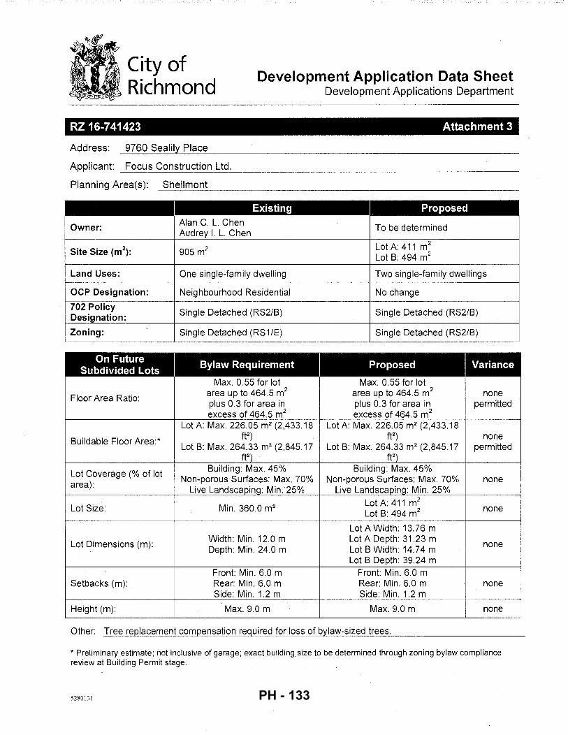
City of , Richmond
Development Application Data Sheet Development Applications Department
RZ 16-741423 Attachment 3
Address: 9760 Sealily Place
Applicant: Focus Construction Ltd.
Planning Area(s): Shellmont ~~~~~-----------------------------------------------
Existing Proposed
Owner: Alan C. L. Chen To be determined Audrey I. L. Chen
Site Size (m2): 905m2 Lot A: 411 m2
Lot B: 494m2
Land Uses: One single-family dwelling Two single-family dwellings --
OCP Designation: Neighbourhood Residential No change
702 Policy Single Detached (RS2/B) Single Detached (RS2/B) Designation:
Zoning: Single Detached (RS1/E) Single Detached (RS2/B)
------
On Future Bylaw Requirement Proposed Variance Subdivided Lots Max. 0.55 for lot Max. 0.55 for lot
Floor Area Ratio: area up to 464.5 m2 area up to 464.5 m2 none plus 0.3 for area in plus 0.3 for area in permitted excess of 464.5 m2 excess of 464.5 m2
Lot A: Max. 226.05 m2 (2,433.18 Lot A: Max. 226.05 m2 (2,433.18
Buildable Floor Area:* ft2) ft2) none
Lot B: Max. 264.33 m2 (2,845.17 Lot B: Max. 264.33 m2 (2,845.17 permitted ft2) ft2)
Lot Coverage (% of lot Building: Max. 45% Building: Max. 45%
area): Non-porous Surfaces: Max. 70% Non-porous Surfaces: Max. 70% none
Live Landscaping: Min. 25% Live Landscaping: Min. 25%
Lot Size: Min. 360.0 m2 Lot A: 411 m2
Lot B: 494m2 none
Lot A Width: 13.76 m
Lot Dimensions (m): Width: Min. 12.0 m Lot A Depth: 31.23 m Depth: Min. 24.0 m Lot B Width: 14.74 m none
Lot B Depth: 39.24 m Front: Min. 6.0 m Front: Min. 6.0 m
Setbacks (m): Rear: Min. 6.0 m Rear: Min. 6.0 m none Side: Min. 1.2 m Side: Min. 1.2 m
Height (m): Max. 9.0 m Max. 9.0 m none
Other: Tree replacement compensation required for loss of bylaw-sized tree-=-s'-. ____________________ _
* Preliminary estimate; not inclusive of garage; exact building size to be determined through zoning bylaw compliance review at Building Permit stage.
5280131 PH - 133
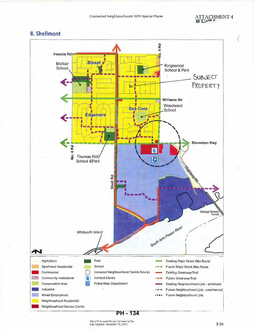
-- I
Connected Neighbourhoods With Special Places ATTACHMENT 4
8. Shellmont
<- II l !
Sue,J~CT
fKOfE.RT1
<· •"C..__HII __ ._.Hit-/..;.1"'1.~'---r~~-. !"-~lb-c~:=:r!~~!::::::o-c~IIWI-.t=-.... Steveston Hwy
0:: '<t
~ Thomas Kidd School &Park
Agriculture - Park
Apartment Residential
Commercial
Community Institutional
Conservation Area
Industrial
Mixed Employment
Neighbourhood Residential
- Neighbourhood Service Centre
School
() Ironwood Neighbourhood Centre (future)
[jJ lronwod Library
[;] Police Main Detachment
City of Richmond Official Community Plan Plan Adoption: November 19, 20 12
- Existing Major Street Bike Route
Future Major Street Bike Route
Existing Greenway/Trail
Future Greenway/Trail
Existing Neighbourhood Link - enhanced
Future Neighbourhood Link- unenhanced
Future Neighbourhood Link
3-34
(
PH - 134
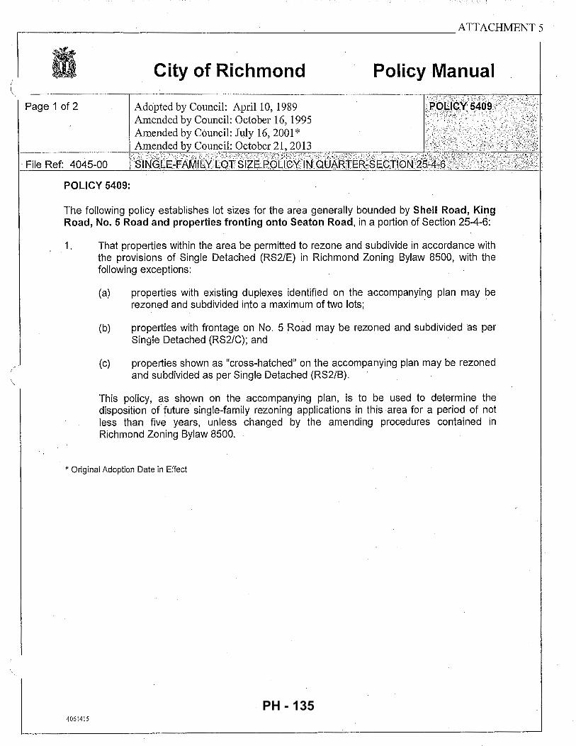
.-------------------------------------~-------------------ATTACHMENTS
City of Richmond Policy Manual
Page 1 of 2
· File Ref: 4045-00
POLICY 5409:
The following policy establishes lot sizes for the area generally bounded by Shell Road, King Road, No. 5 Road and properties fronting onto Seaton Road, in a portion of Section 25-4-6:
1. That properties within the area be permitted to rezone and subdivide in accordance with the provisions of Single Detached (RS2/E) in Richmond Zoning Bylaw 8500, with the following exceptions:
(a) properties with existing duplexes identified on the accompanying plan may be rezoned and subdivided into a maximum of two lots; · ·
(b) properties with frontage on No. 5 Road may be rezoned and subdivided as per Single Detached (RS2/C); and
(c) properties shown as "cross-hatched" on the accompanying plan may be rezoned and subdivided as per Single Detached (RS2/B).
This policy, as shown on the accompanying plan, is to be used to determine the disposition of future single-family rezoning applications in this area for a period of not less than five years, unless changed by the amending procedures contained in Richmond Zoning Bylaw 8500.
* Original Adoption Date in Effect
4061415
PH - 135
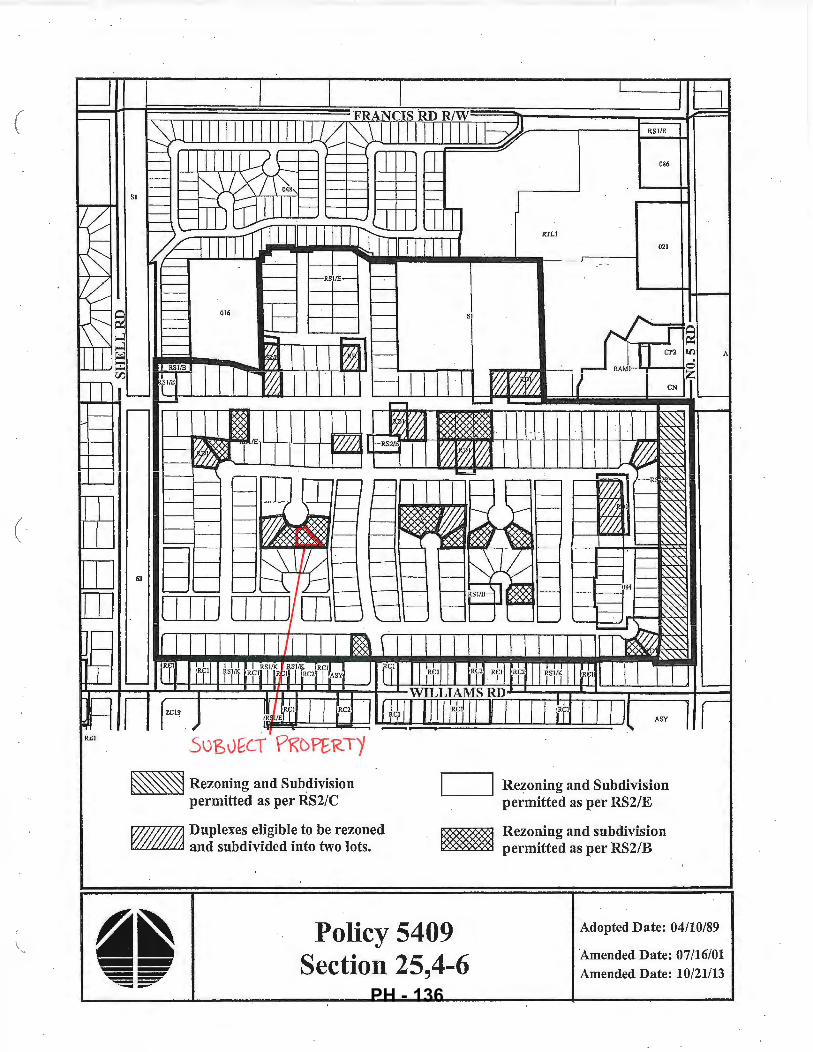
----- j
(
(
~ Rezoning and Subdivision permitted as per RS2/C
VI//////J1 Duplexes eli.gible to be rezoned LL.~u..LLL..LLLJ and subdivided into two lots.
~..--_ __.I Rezoning and Subdivision permitted as per RS2/E
~ Rezoning and subdivision to::>~== permitted as per RS2/B
Policy 5409 Section 25,4-6
Adopted Date: 04/10/89
Amended Date: 07/16/01 Amended Date: 10/21/13
PH - 136
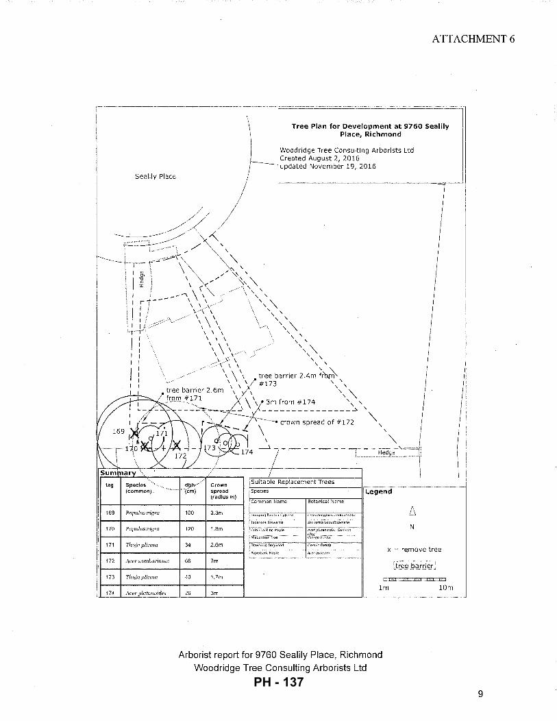
ATTACHMENT 6
\1
Tree Plan for Development at 9760 Sealily Place, Richmond
) Woodridge Tree Consulting Arborists Ltd Created August 2, 2016
/ updated November 19, 2016
Sealily Place j
///1 ~~·=.::/ / ~' -TI;;;_p~'\ >:>,
<V : / /'~, "\
: I! \ \ \'\ '\ ' ' \ '\ : I : ---"\ \ ' ' \
169
170
171
172
173
174
: _,__ \ \ \ "\ ,1r, ,,, '" ~,If \-'\\ ,, . I : \ \ \ ', \ ! I \\\ '"\ ;It,:·· \\ \"\ '"t"']" \ \ \ \ \
I \ \ \ ', \
I \ \ \' \ "\ I \ \.-·· ', "\ I ).· :).\ \ \ \ I ::>\" \ \ \ ' I \ \ ' ~ 1 ' \ , tree barrier 2.4m from I \ 'I #173 \ ' I \ \ ' \ 1 tree barner 2.6m , ,/, , "\
from #171
2,/.\' ', "\
... ............. ~3m from #174 , '
- -- --~:=7:::-' ,_\:=.: :r:~: s-p~e:~:f-#~~;' ''\.,
I \ - ' \o ' '\. ' ___).- ------------- -- .... ,'\...u~'-''''!
Popuhts nigl'(l
Popul1ts 11iyra
'fh1{io plicntn
Aeer succlwrinlllll
Th1~ja plirota
100
120
34
66
40
Crown spread (radius m)
3.3m
1.8m
2.6m
7m
1.7m
:. ............ ~~~9.~ .............. :
I [Suitable Replacement Trees f-=--,-----------------------i·r.--·~·--....... - ........ __ ,_ ............... _, Species Legend ~C~o~m~m~o~n~N~a=m~e--~Bo~t~an~ic=aTIN~a=m~e~-~1
~ N I
x = remove tree
t:..~=
lm 10m L_ __ ~L_ ______ J, ___________________________ Jl ....................... - .•...• ---··--······-·· .. ·····················•· .. ·····' Act•r plot_«_!!!!_!!!::.:__ __ 26 3m
Arborist report for 9760 Sealily Place, Richmond Woodridge Tree Consulting Arborists Ltd
9 PH - 137
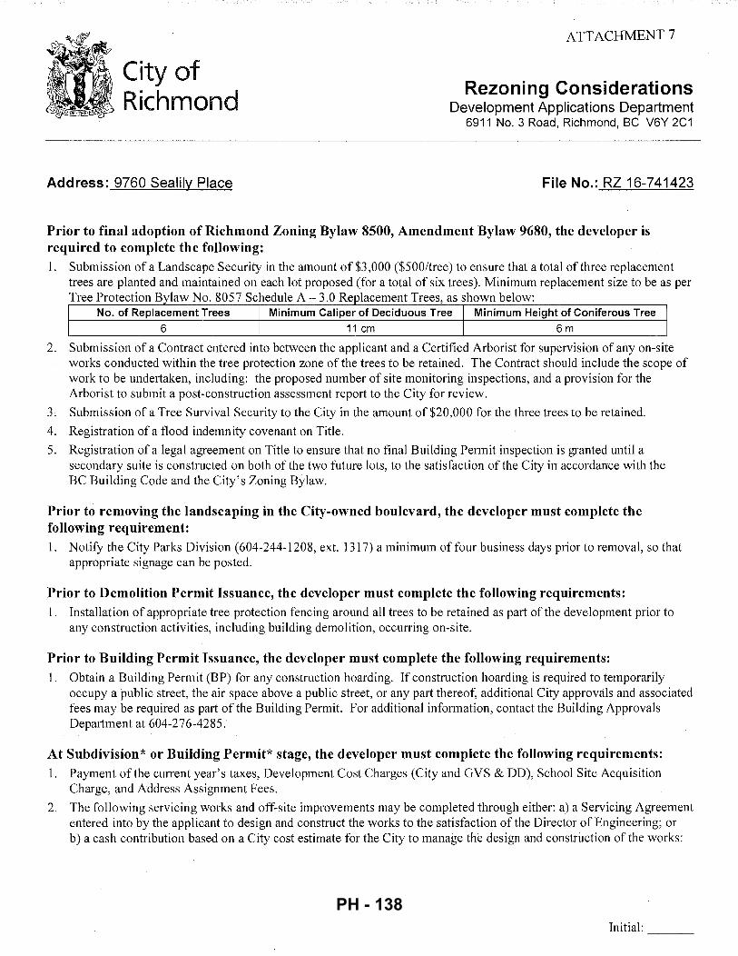
City of Richmond
Address: 9760 Sealily Place
ATTACHMENT 7
Rezoning Considerations Development Applications Department
6911 No. 3 Road, Richmond, BC V6Y 2C1
File No.: RZ 16-741423
Prior to final adoption of Richmond Zoning Bylaw 8500, Amendment Bylaw 9680, the developer is required to complete the following: 1. Submission of a Landscape Security in the amount of $3,000 ($500/tree) to ensure that a total of three replacement
trees are planted and maintained on each lot proposed (for a total of six trees). Minimum replacement size to be as per Tree Protection Bylaw No. 8057 Schedule A- 3.0 Re lacement Trees, as shown below:
No. of Replacement Trees Minimum Caliper of Deciduous Tree Minimum Height of Coniferous Tree
6 11 em 6m
2. Submission of a Contract entered into between the applicant and a Certified Arborist for supervision of any on-site works conducted within the tree protection zone of the trees to be retained. The Contract should include the scope of work to be undertaken, including: the proposed number of site monitoring inspections, and a provision for the Arborist to submit a post-construction assessment report to the City for review.
3. Submission of a Tree Survival Security to the City in the amount of $20,000 for the three trees to be retained.
4. Registration of a flood indemnity covenant on Title.
5. Registration of a legal agreement on Title to ensure that no final Building Permit inspection is granted until a secondary suite is constructed on both of the two future lots, to the satisfaction of the City in accordance with the BC Building Code and the City's Zoning Bylaw.
Prior to removing the landscaping in the City-owned boulevard, the developer must complete the following requirement: 1. Notify the City Parks Division ( 604-244-1208, ext. 1317) a minimum of four business days prior to removal, so that
appropriate signage can be posted.
Prior to Demolition Permit Issuance, the developer must complete the following requirements: 1. Installation of appropriate tree protection fencing around all trees to be retained as part of the development prior to
any construction activities, including building demolition, occurring on-site.
Prior to Building Permit Issuance, the developer must complete the following requirements: 1. Obtain a Building Permit (BP) for any construction hoarding. If construction hoarding is required to temporarily
occupy a public street, the air space above a public street, or any part thereof, additional City approvals and associated fees may be required as part of the Building Permit. For additional information, contact the Building Approvals Department at 604-276-4285.
At Subdivision* or Building Permit* stage, the developer must complete the following requirements: 1. Payment of the current year's taxes, Development Cost Charges (City and GVS & DD), School Site Acquisition
Charge, and Address Assignment Fees.
2. The following servicing works and off-site improvements may be completed through either: a) a Servicing Agreement entered into by the applicant to design and construct the works to the satisfaction of the Director of Engineering; or b) a cash contribution based on a City cost estimate for the City to manage the design and construction of the works:
Initial: ---
PH - 138
- 2-
Water Works
• Using the OCP Model, there is 128 Lis of water available at a 20 psi residual at the Seaport Avenue frontage. Based on your proposed development, your site requires a minimum fire flow of 95 Lis.
• The Developer is required to: o Submit Fire Underwriter Survey (FUS) or International Organization for Standardization (ISO) fire flow
calculations to confirm the development has adequate fire flow for onsite fire protection. Calculations must be signed and sealed by a Professional Engineer and be based on Building Permit Stage Building designs.
• At Developer's cost, the City is to: o Install two new water service connections complete with meter and meter box off of the existing 150 mm
AC watermain on Sealily Place. o Cut and cap, at main, the existing water service connection.
Storm Sewer Works:
• At Developer's cost, the City is to: o Install a new storm service connection complete with inspection chamber and dual service leads at the
adjoining property line of the two newly subdivided lots. o Cut and cap the existing storm service lead at the northeast corner of the subject site. Remove the
inspection chamber if it is no longer in use by 9771 Sealily Place.
Sanitary Sewer Works:
• The Developer is required to: o Install approximately 30m of sanitary sewer along the south property line of 9760 and 9740 Sealily Place
complete with tie-in to the existing manhole SMH362. Terminate sewer with a new manhole and dual service leads off of the manhole.
o Provide additional utility SRW along the south property line for the proposed sanitary sewer. o Tie-in the sanitary service connection for 9740 Sealily Place to the new proposed sanitary sewer along the
south property line. Ensure Lot 9740 is adequately serviced during and after the construction process.
• At Developer's cost, the City is to: o Perform all tie-ins of proposed works to existing City infrastructure. o Cut, cap and remove the existing sanitary service connection and inspection chamber at the southwest
corner of the subject site.
Frontage Improvements:
• The Developer is required to: o Coordinate with BC Hydro, Telus and other private communication service providers
• When relocating/modifying any of the existing power poles and/or guy wires within the property frontages.
• To determine if above ground structures are required and coordinate their locations (e.g. Vista, PMT, LPT, Shaw cabinets, Telus Kiosks, etc.). These should be located on-site.
o Remove and replace concrete sidewalk panels and driveway letdowns as required.
General Items:
• The Developer is required to: o Enter into, if required, additional legal agreements, as determined via the subject development's Servicing
Agreement(s) and/or Development Permit(s), and/or Building Permit(s) to the satisfaction of the Director
Initial: ---
PH - 139
- 3 -
of Engineering, including, but not limited to, site investigation, testing, monitoring, site preparation, de-watering, drilling, underpinning, anchoring, shoring, piling, pre-loading, ground densification or other activities that may result in settlement, displacement, subsidence, damage or nuisance to City and private utility infrastructure.
Note:
* •
This requires a separate application.
Where the Director of Development deems appropriate, the preceding agreements are to be drawn not only as personal covenants of the property owner, but also as covenants pursuant to Section 219 of the Land Title Act.
All agreements to be registered in the Land Title Office shall have priority over all such liens, charges and encumbrances as is considered advisable by the Director of Development. All agreements to be registered in the Land Title Office shall, unless the Director of Development determines otherwise, be fully registered in the Land Title Office prior to enactment of the appropriate bylaw.
The preceding agreements shall provide security to the City including indemnities, warranties, equitable/rent charges, letters of credit and withholding permits, as deemed necessary or advisable by the Director of Development. All agreements shall be in a form and content satisfactory to the Director of Development.
• Additional legal agreements, as determined via the subject development's Servicing Agreement(s) and/or Development Permit(s), and/or Building Permit(s) to the satisfaction of the Director of Engineering may be required including, but not limited to, site investigation, testing, monitoring, site preparation, de-watering, drilling, underpinning, anchoring, shoring, piling, pre-loading, ground densification or other activities that may result in settlement, displacement, subsidence, damage or nuisance to City and private utility infrastructure.
• Applicants for all City Permits are required to comply at all times with the conditions of the Provincial Wildlife Act and Federal Migratory Birds Convention Act; which contain prohibitions on the removal or disturbance of both birds and their nests. Issuance of Municipal pennits does not give an individual authority to contravene these legislations. The City of Richmond recommends that, where significant trees or vegetation exists on site, the services of a Qualified Environmental Professional (QEP) be secured to perform a survey and ensure that development activities are in compliance with all relevant legislation.
Signed Date
PH - 140
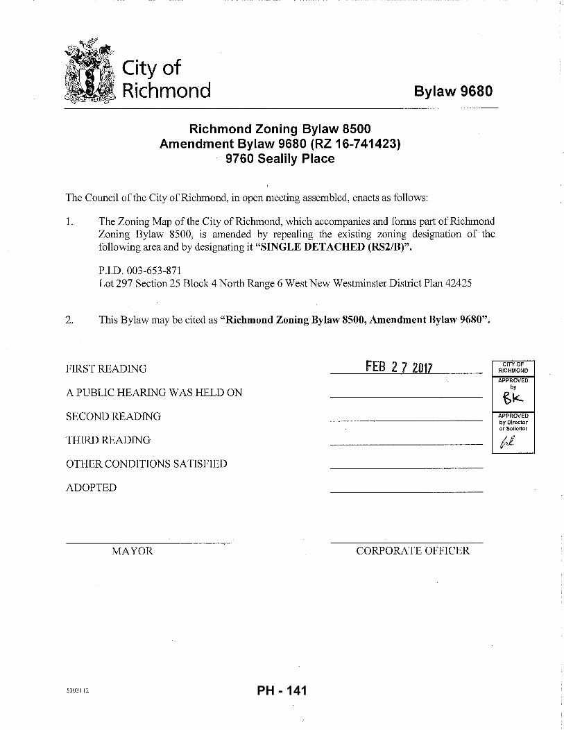
City of Richmond
Richmond Zoning Bylaw 8500 Amendment Bylaw 9680 (RZ 16-741423)
9760 Sealily Place
Bylaw 9680
The Council ofthe City of Richmond, in open meeting assembled, enacts as follows:
1. The Zoning Map of the City of Richmond, which accompanies and forms part of Richmond Zoning Bylaw 8500, is amended by repealing the existing zoning designation of· the following area and by designating it "SINGLE DETACHED (RS2/B)".
P.I.D. 003-653-871 Lot 297 Section 25 Block 4 North Range 6 West New Westminster District Plan 42425
2. This Bylaw may be cited as "Richmond Zoning Bylaw 8500, Amendment Bylaw 9680".
FIRST READING FEB 2 7 2017
A PUBLIC HEARING WAS HELD ON
SECOND READING
THIRD READING
OTHER CONDITIONS SATISFIED
ADOPTED
MAYOR CORPORATE OFFICER
5303112
CITY OF RICHMOND
APPROVED by
tk APPROVED by Director or Solicitor
PH - 141
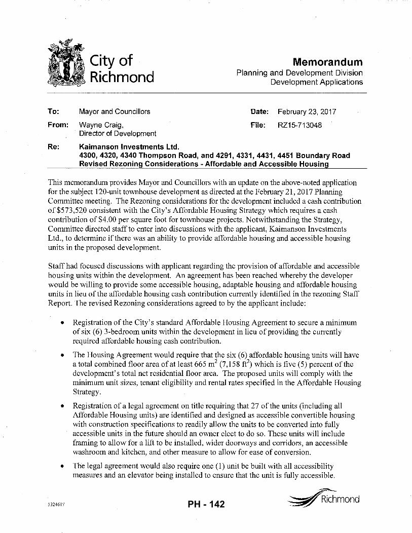
City of Richmond
Memorandum Planning and Development Division
Development Applications
To: Mayor and Councillors Date: February 23, 2017
From: Wayne Craig, File: RZ15-713048 Director of Development
Re: Kaimanson Investments Ltd. 4300, 4320, 4340 Thompson Road, and 4291, 4331, 4431, 4451 Boundary Road Revised Rezoning Considerations -Affordable and Accessible Housing
This memorandum provides Mayor and Councillors with an update on the above-noted application for the subject 120-unit townhouse development as directed at the February 21, 2017 Planning Committee meeting. The Rezoning considerations for the development included a cash contribution of $573,520 consistent with the City's Affordable Housing Strategy which requires a cash contribution of $4.00 per square foot for townhouse projects. Notwithstanding the Strategy, Committee directed staff to enter into discussions with the applicant, Kaimanson Investments Ltd., to determine ifthere was an ability to provide affordable housing and accessible housing units in the proposed development.
Staff had focused discussions with applicant regarding the provision of affordable and accessible housing units within the development. An agreement has been reached whereby the developer would be willing to provide some accessible housing, adaptable housing and affordable housing units in lieu of the affordable housing cash contribution currently identified in the rezoning Staff Report. The revised Rezoning considerations agreed to by the applicant include:
•
•
•
•
5324617
Registration of the City's standard Affordable Housing Agreement to secure a minimum of six ( 6) 3-bedroom units within the development in lieu of providing the currently required affordable housing cash contribution.
The Housing Agreement would require that the six (6) affordable housing units will have a total combined floor area of at least 665 m2 (7, 15 8 fe) which is five ( 5) percent of the development's total net residential floor area. The proposed units will comply with the minimum unit sizes, tenant eligibility and rental rates specified in the Affordable Housing Strategy.
Registration of a legal agreement on title requiring that 27 of the units (including all Affordable Housing units) are identified and designed as accessible convertible housing with construction specifications to readily allow the units to be converted into fully accessible units in the future should an owner elect to do so. These units will include framing to allow for a lift to be installed, wider doorways and corridors, an accessible washroom and kitchen, and other measure to allow for ease of conversion.
The legal agreement would also require one (1) unit be built with all accessibility measures and an elevator being installed to ensure that the unit is fully accessible.
~mond PH - 142
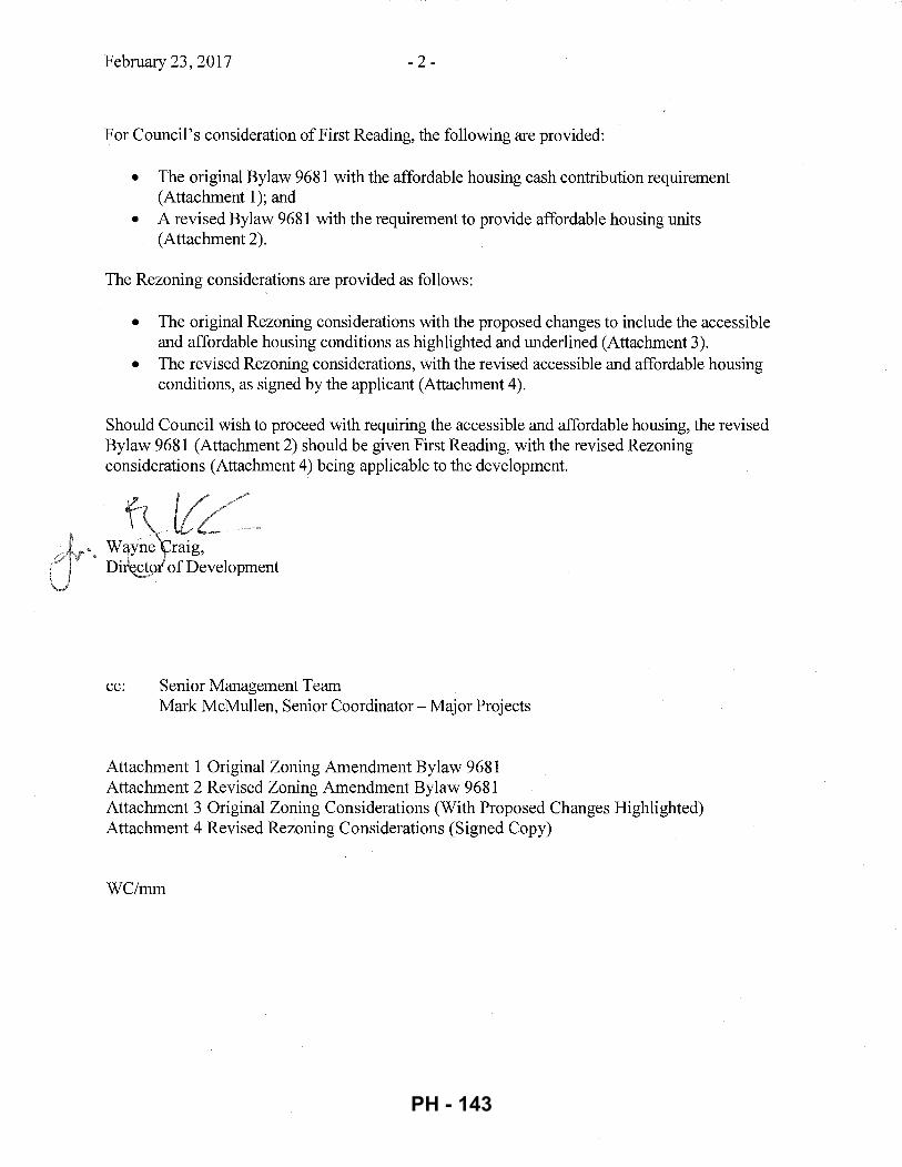
February 23, 2017 -2-
For Council's consideration of First Reading, the following are provided:
• The original Bylaw 9681 with the affordable housing cash contribution requirement (Attachment 1); and
• A revised Bylaw 9681 with the requirement to provide affordable housing units (Attachment 2).
The Rezoning considerations are provided as follows:
• The original Rezoning considerations with the proposed changes to include the accessible and affordable housing conditions as highlighted and underlined (Attachment 3).
• The revised Rezoning considerations, with the revised accessible and affordable housing conditions, as signed by the applicant (Attachment 4).
Should Council wish to proceed with requiring the accessible and affordable housing, the revised Bylaw 9681 (Attachment 2) should be given First Reading, with the revised Rezoning considerations (Attachment 4) being applicable to the development.
• \\1~ raig, Di~ofDevelopment
cc: Senior Management Team Mark McMullen, Senior Coordinator- Major Projects
Attachment 1 Original Zoning Amendment Bylaw 9681 Attachment 2 Revised Zoning Amendment Bylaw 9681 Attachment 3 Original Zoning Considerations (With Proposed Changes Highlighted) Attachment 4 Revised Rezoning Considerations (Signed Copy)
WC/mm
PH - 143
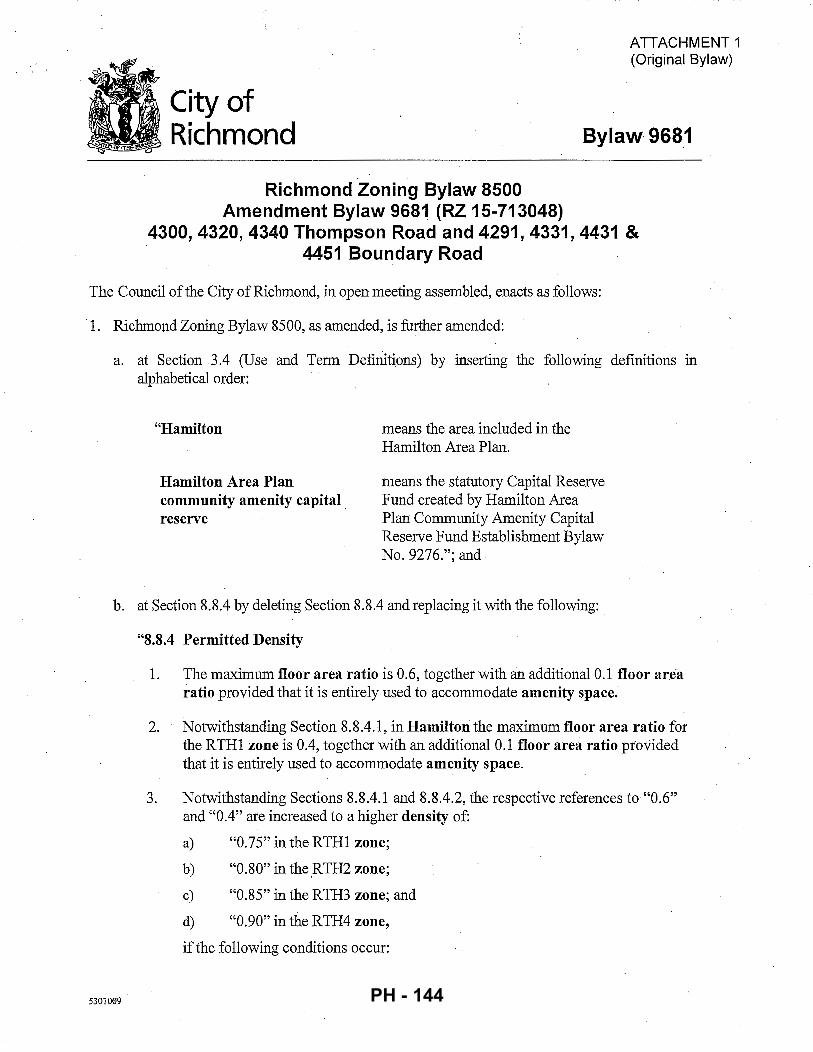
City of Richmond
Richmond Zoning Bylaw 8500 Amendment Bylaw 9681 (RZ 15-713048)
ATTACHMENT 1 (Original Bylaw)
Bylaw9681
4300, 4320, 4340 Thompson Road and 4291, 4331, 4431 & 4451 Boundary Road
The Council of the City of Richmond, in open meeting assembled, enacts as follows:
·1. Richmond Zoning Bylaw 8500, as amended, is further amended:
a. at Section 3.4 (Use and Term Defimtions) by inserting the following definitions in alphabetical order:
"Hamilton
Hamilton Area Plan community amenity capital . reserve
means the area included in the Hamilton Area Plan.
means the statutory Capital Reserve Fund created by Hamilton Area Plan Community Amenity Capital Reserve Fund Establishment Bylaw No. 9276."; and
b. at Section 8.8.4 by deleting Section 8.8.4 and replacing it with the following:
5301009
"8.8.4 Permitted Density
1. The maximum floor area ratio is 0.6, together with an additional 0.1 floor area ratio provided that it is entirely used to accommodate amenity space.
2. Notwithstanding Section 8. 8.4 .1, in Hamilton the maximum floor area ratio for the RTH1 zone is 0.4, together with an additional 0.1 floor area ratio provided that it is entirely used to accommodate amenity space.
3. Notwithstanding Sections 8.8.4.1 and 8.8.4.2, the respective references to "0.6" and "0.4" are increased to a higher density of:
a) "0.75" in the RTH1 zone;
b) "0.80" in the.RTH2 zone;
c) "0.85" in the RTH3 zone; and
d) "0.90" in the RTH4 zone,
if the following conditions occur:
PH - 144
Bylaw9681
e)
f)
Page2
the owner, at the time Council adopts a zoning amendment bylaw to include the owner's lot in,. the RTHI, RTH2, RTH3 or RTH4 zone, pays into the affordable housing reserve the sum specified in Section 5.15 of this bylaw; and
for rezoning applications within Hamilton, if the owner, at the time Council adopts a zoning amendment bylaw to include the owner's lot in the RTHI zone, pays into the Hamilton Area Plan community amenity capital reserve, a sum based on $70.50 per square meter of total residential floor area."
2. The Zoning Map of the City of Richmond, which accompanies and forms part of Richmond Zoning Bylaw 8500, as amended, is further amended by repealing the existing zoning designation of the following area and by designating it "High Density Townhouses (RTHl)":
That area shown cross-hatched on "Schedule A attached to and forming part of Bylaw No. 9681".
3. This Bylaw may be cited as "Richmond Zoning Bylaw 8500, Amendment Bylaw 9681".
FIRST READING
A PUBLIC HEARING WAS HELD ON
SECOND READING
THIRD READING
OTHER CONDITIONS SATISFIED
MINISTRY OF TRANSPORTATION AND INFRASTRUCTURE APPROVAL
LEGAL REQUIREMENTS SATISFIED
ADOPTED
MAYOR
5301009
CORPORATE OFFICER
CITY OF RICHMOND
APPROVED by
e.K APPROVED by Director or Solicitor
PH - 145
( \
Bylaw 9681 Page3
"Schedule A attached to and forming part of Bylaw No. 9681"
lit City of IIJ Richmond v
RSIIF
sr
I/
~----~M~67------~·~
RZ 15-713048
5301009
Original Date: 01/05/16
Revision Date: 01/07/16
Note: Dimensions are in METRES
PH - 146
ATTACHMENT 2 (Revised Bylaw with Built Affordable Housing)
City of Richmond
Richmond Zoning Bylaw 8500 Amendment Bylaw 9681 (RZ 15-713048)
Bylaw 9681
4300, 4320, 4340 Thompson Road and 4291, 4331, 4431 & 4451 Boundary Road
The Council of the City of Richmond, in open meeting assembled, enacts as follows:
1. Richmond Zoning Bylaw 8500, as amended, is further amended:
a. at Section 3.4 (Use and Term Definitions) by inserting the following definitions m alphabetical order:
"Hamilton
Hamilton Area Plan community amenity capital reserve
means the area included in the Hamilton Area Plan.
means the statutory Capital Reserve Fund created by Hamilton Area Plan Community Amenity Capital Reserve Fund Establishment Bylaw No. 9276."; and
b. at Section 8.8.4 by deleting Section 8.8.4 and replacing it with the following:
5301009
"8.8.4 Permitted Density
1. The maximum floor area ratio is 0.6, together with an additional 0.1 floor area ratio provided that it is entirely used to accommodate amenity space.
2. Notwithstanding Section 8.8.4.1, in Hamilton the maximum floor area ratio for the RTH1 zone is 0.4, together with an additional 0.1 floor area ratio provided that it is entirely used to accommodate amenity space.
3. Notwithstanding Sections 8.8.4.1 and 8.8.4.2, the respective references to "0.6" and "0.4" are increased to a higher density of:
a) "0.75" in the RTH1 zone;
b) "0.80" in the RTH2 zone;
c) "0.85" in the RTH3 zone; and
d) "0.90" in the RTH4 zone,
if the following conditions occur:
PH - 147
Bylaw 9681
e) (i)
Page 2
the owner, at the time Council adopts a zoning amendment bylaw to include the owner's lot in the RTH1, RTH2, RTH3 or RTH4 zone, pays into the affordable housing reserve the sum specified in Section 5.15 ofthis bylaw; or
(ii) prior to first occupancy of any building, the owner:
(A) has constructed on the lot to the satisfaction of the City affordable housing units with a combined habitable space of the affordable housing units comprising at least 5% of the buildable floor area resulting from the maximum permitted floor area ratio; and
(B) enters into a housing agreement with respect to the affordable housing units and registers the housing agreement against the title to the lot, and files a notice in the Land Title Office; and
g) for rezoning applications within Hamilton, if the owner, at the time Council adopts a zoning amendment bylaw to include the owner's lot in the RTH1 zone, pays into the Hamilton Area Plan community amenity capital reserve, a sum based on $70.50 per square meter of total residential floor area."
2. The Zoning Map of the City of Richmond, which accompanies and forms part of Richmond Zoning Bylaw 8500, as amended, is further amended by repealing the existing zoning designation ofthe following area and by designating it "High Density Townhouses (RTHl)":
That area shown cross-hatched on "Schedule A attached to and forming part of Bylaw No. 9681".
3. This Bylaw may be cited as "Richmond Zoning Bylaw 8500, AJ.ll,e,pdnwnt Bij~w 9681". FIRST READING ttH L 7 l
A PUBLIC HEARING WAS HELD ON
SECOND READING
THIRD READING
OTHER CONDITIONS SATISFIED
MINISTRY OF TRANSPORTATION AND INFRASTRUCTURE APPROVAL
ADOPTED
MAYOR
5301009
CORPORATE OFFICER
CITY OF RICHMOND
APPROVED by .
1SIL APPROVED by Director or Solicitor
PH - 148
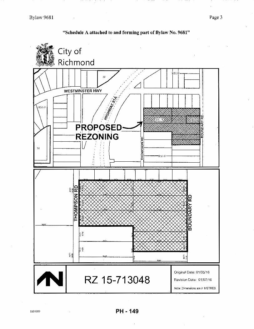
Bylaw 9681 Page 3
"Schedule A attached to and forming part of Bylaw No. 9681"
*City of UJ Richmond
I/
r-----~"=·67------~·~
RZ 15-713048
5301009
Original Date: 01/05/16
Revision Date: 01/07/16
Note: Dimensions are in METRES
PH - 149
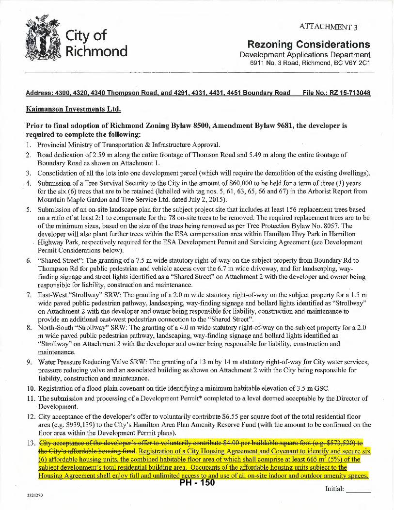
City of Richmond
ATTACHMENT 3
Rezoning Considerations Development Applications Department
6911 No. 3 Road, Richmond, BC V6Y 2C1
Address: 4300, 4320, 4340 Thompson Road, and 4291, 4331, 4431, 4451 Boundary Road File No.: RZ 15-713048
Kaimanson Investments Ltd.
Prior to final adoption of Richmond Zoning Bylaw 8500, Amendment Bylaw 9681, the developer is required to complete the following: 1. Provincial Ministry of Transportation & Infrastructure Approval.
2. Road dedication of2.59 m along the entire frontage of Thomson Road and 5.49 m along the entire frontage of Boundary Road as shown on Attachment 1.
3. Consolidation of all the lots into one development parcel (which will require the demolition of the existing dwellings).
4. Submission of a Tree Survival Security to the City in the amount of $60,000 to be held for a term of three (3) years for the six (6) trees that are to be retained (labelled with tag nos. 5, 61, 63, 65, 66 and 67) in the Arborist Report from Mountain Maple Garden and Tree Service Ltd. dated July 2, 2015).
5. Submission of an on-site landscape plan for the subject project site that includes at least 156 replacement trees based on a ratio of at least 2:1 to compensate for the 78 on-site trees to be removed. The required replacement trees are to be of the minimum sizes, based on the size of the trees being removed as per Tree Protection Bylaw No. 8057. The developer will also plant further trees within the ESA compensation area within Hamilton Hwy Park in Hamilton Highway Park, respectively required for the ESA Development Permit and Servicing Agreement (see Development Permit Considerations below).
6. "Shared Street": The granting of a 7.5 m wide statutory right-of-way on the subject property from Boundary Rd to Thompson Rd for public pedestrian and vehicle access over the 6.7 m wide driveway, and for landscaping, wayfinding signage and street lights identified as a "Shared Street" on Attachment 2 with the developer and owner being responsible for liability, construction and maintenance.
7. East-West "Strollway" SRW: The granting of a 2.0 m wide statutory right-of-way on the subject property for a 1.5 m wide paved public pedestrian pathway, landscaping, way-finding signage and ballard lights identified as "Strollway" on Attachment 2 with the developer and owner being responsible for liability, construction and maintenance to provide an additional east-west pedestrian connection to the "Shared Street".
8. North-South "Strollway" SRW: The granting of a 4.0 m wide statutory right-of-way on the subject property for a 2.0 m wide paved public pedestrian pathway, landscaping, way-finding signage and ballard lights identified as "Strollway" on Attachment 2 with the developer and owner being responsible for liability, construction and maintenance.
9. Water Pressure Reducing Valve SRW: The granting of a 13m by 14m statutory right-of-way for City water services, pressure reducing valve and an associated building as shown on Attachment 2 with the City being responsible for liability, construction and maintenance.
10. Registration of a flood plain covenant on title identifying a minimum habitable elevation of 3.5 m GSC.
11. The submission and processing of a Development Permit* completed to a level deemed acceptable by the Director of Development.
12. City acceptance ofthe developer's offer to voluntarily contribute $6.55 per square foot of the total residential floor area (e.g. $939,139) to the City' s Hamilton Area Plan Amenity Reserve Fund (with the amount to be confirmed on the floor area within the Development Permit plans).
13. City acceptance of the developef' s offef to 'rOh:tntarily contfib1:1te $4 .00 pef b1:1ildable sq1:1afe foot (e.g. $573 ,520) to the City's affofdable ho1:1sing fund. Registration of a City Housing Agreement and Covenant to identify and secure six (6) affordable housing units, the combined habitable floor area of which shall comprise at least 665m2 (5%) of the subject development's total residential building area. Occupants of the affordable housing units subject to the Housing Agreement shall enjoy full and unlimited access to and use of all on-site indoor and outdoor amenity spaces.
Initial: ---5324270
PH - 150
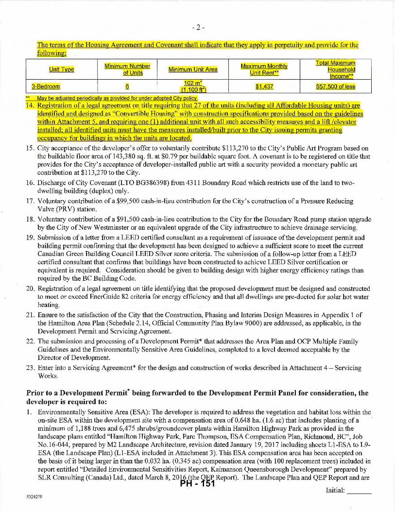
- 2 -
The terms of the Housing Agreement and Covenant shall indicate that they apply in perpetuity and provide for the following·
Minimum Number Maximum Monthly Total Maximum
Unit Type Minimum Unit Area Household of Units Unit Rent**
Income**
3-Bedroom Q 102 mL
$1.437 ~57,500 of less (1 1 00 ft2)
May be adjusted periodically as provided for under adopted City policy.
14. Registration of a legal agreement on title requiring that 27 of the units (including all Affordable Housing units) are [dentified and designed as "Convertible Housing" with construction specifications provided based on the guidelines within Attachment 5, and requiring one (1) additional unit with all such accessibility measures and a lift /elevator [nstalled; all identified units must have the measures installed/built prior to the City issuing permits granting occupancy for buildings in which the units are located.
15. City acceptance of the developer's offer to voluntarily contribute $113,270 to the City's Public Art Program based on the buildable floor area of 143,380 sq. ft. at $0.79per buildable square foot. A covenant is to be registered on title that provides for the City's acceptance of developer-installed public art with a security provided a monetary public art contribution at $113,270 to the City.
16. Discharge of City Covenant (LTO BG386398) from 4311 Boundary Road which restricts use of the land to twodwelling building (duplex) only.
17. Voluntary contribution of a $99,500 cash-in-lieu contribution for the City's construction of a Pressure Reducing Valve (PRV) station.
18. Voluntary contribution of a $91 ,500 cash-in-lieu contribution to the City for the Boundary Road pump station upgrade by the City of New Westminster or an equivalent upgrade of the City infrastructure to achieve drainage servicing.
19. Submission of a letter from a LEED certified consultant as a requirement of issuance of the development permit and building permit confirming that the development has been designed to achieve a sufficient score to meet the current Canadian Green Building Council LEED Silver score criteria. The submission of a follow-up letter from a LEED certified consultant that confirms that buildings have been constructed to achieve LEED Silver certification or equivalent is required. Consideration should be given to building design with higher energy efficiency ratings than required by the BC Building Code.
20. Registration of a legal agreement on title identifYing that the proposed development must be designed and constructed to meet or exceed EnerGuide 82 criteria for energy efficiency and that all dwellings are pre~ducted for solar hot water heating.
21. Ensure to the satisfaction of the City that the Construction, Phasing and Interim Design Measures in Appendix 1 of the Hamilton Area Plan (Schedule 2.14, Official Community Plan Bylaw 9000) are addressed, as applicable, in the Development Permit and Servicing Agreement.
22. The submission and processing of a Development Permit* that addresses the Area Plan and OCP Multiple Family Guidelines and the Environmentally Sensitive Area Guidelines, completed to a level deemed acceptable by the Director of Development. ·
23. Enter into a Servicing Agreement* for the design and construction of works described in Attachment 4- Servicing Works.
Prior to a Development Permit* being forwarded to the Development Permit Panel for consideration, the developer is required to: 1. Environmentally Sensitive Area (ESA): The developer is required to address the vegetation and habitat loss within the
on-site ESA within the development site with a compensation area of 0.648 ha. (1 .6 ac) that includes planting of a minimum of 1,188 trees and 6,475 shrubs/groundcover plants within Hamilton Highway Park as provided in the landscape plans entitled "Hamilton Highway Park, Pare Thompson, ESA Compensation Plan, Richmond, BC", Job No.16-044, prepared by M2 Landscape Architecture, revision dated January 19, 2017 including sheets Ll-ESA to L9-ESA (the Landscape Plan) (Ll-ESA included in Attachment 3). This ESA compensation area has been accepted on the basis of it being larger in than the 0.032 ha. (0.345 ac) compensation area (with 100 replacement trees) included in report entitled "Detailed Environmental Sensitivities Report, Kaimanson Queensborough Development" prepared by SLR Consulting (Canada) Ltd., dated March 8, 2016 (the QEP Report) . The Landscape Plan and QEP Report and are
Initial: ---5324270
PH - 151
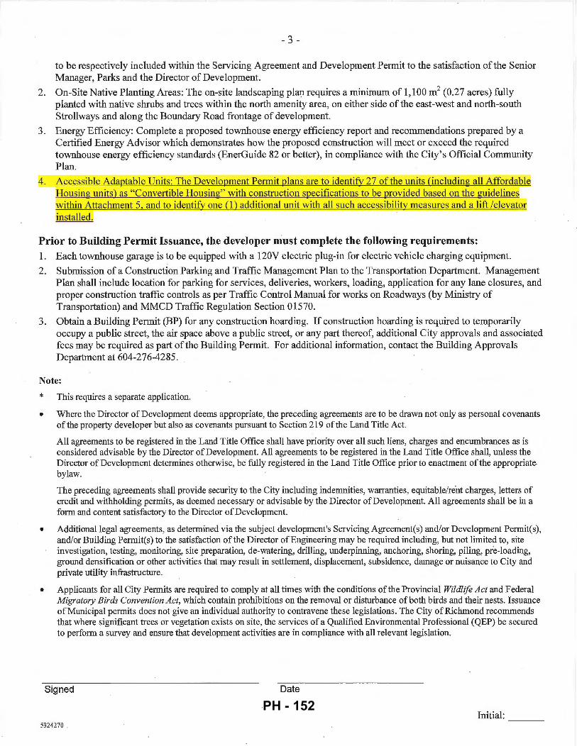
- 3-
to be respectively included within the Servicing Agreement and Development Permit to the satisfaction of the Senior Manager, Parks and the Director of Development.
2. On-Site Native Planting Areas: The on-site landscaping plap. requires a minimum of 1,100 m2 (0.27 acres) fully planted with native shrubs and trees within the north amenity area, on either side of the east-west and north-south Strollways and along the Boundary Road frontage of development.
3. Energy Efficiency: Complete a proposed townhouse energy efficiency report and recommendations prepared by a Certified Energy Advisor which demonstrates how the proposed construction will meet or exceed the required townhouse energy efficiency standards (EnerGuide 82 or better), in compliance with the City's Official Community Plan.
4 . Accessible Adaptable Units: The Development Permit plans are to identify 27 ofthe units (including all Affordable Housing units) as "Convertible Housing" with construction specifications to be provided based on the guidelines within Attachment 5, and to identify one (1) additional unit with all such accessibility measures and a lift /elevator installed.
Prior to Building Permit Issuance, the developer must complete the following requirements: I. Each townhouse garage is to be equipped with a 120V electric plug-in for electric vehicle charging equipment.
2. Submission of a Construction Parking and Traffic Management Plan to the Transportation Department. Management Plan shall include location for parking for services, deliveries, workers, loading, application for any lane closures, and proper construction traffic controls as per Traffic Control Manual for works on Roadways (by Ministry of Transportation) and MMCD Traffic Regulation Section 01570.
3. Obtain a Building Permit (BP) for any construction hoarding. If construction hoarding is required to temporarily occupy a public street, the air space above a public street, or any part thereof, additional City approvals and associated fees may be required as part of the Building Permit. For additional information, contact the Building Approvals Department at 604-276-4285 .
Note:
* •
This requires a separate application.
Where the Director of Development deems appropriate, the preceding agreements are to be drawn not only as personal covenants of the property developer but also as covenants pursuant to Section 219 of the Land Title Act.
All agreements to be registered in the Land Title Office shall have priority over all such liens, charges and encumbrances as is considered advisable by the Director of Development. All agreements to be registered in the Land Title Office shall, unless the Director of Development determines otherwise, be fully registered in the Land Title Office prior to enactment of the appropriate bylaw.
The preceding agreements shall provide security to the City including indemnities, warranties, equitable/rent charges, letters of credit and withholding permits, as deemed necessary or advisable by the Director of Development. All agreements shall be in a form and content satisfactory to the Director of Development.
• Additional legal agreements, as determined via the subject development's Servicing Agreement(s) and/or Development Permit(s), and/or Building Permit(s) to the satisfaction of the Director of Engineering may be required including, but not limited to, site investigation, testing, monitoring, site preparation, de-watering, drilling, underpinning, anchoring, shoring, piling, pre-loading, ground densification or other activities that may result in settlement, displacement, subsidence, damage or nuisance to City and private utility infrastructure.
• Applicants for all City Permits are required to comply at all times with the conditions of the Provincial Wildlife Act and Federal Migratory Birds Convention Act, which contain prohibitions on the removal or disturbance of both birds and their nests. Issuance of Municipal permits does not give an individual authority to contravene these legislations. The City of Richmond recommends that where significant trees or vegetation exists on site, the services of a Qualified Environmental Professional (QEP) be secured to perform a survey and ensure that development activities are in compliance with all relevant legislation.
Signed Date
Initial: ---5324270
PH - 152
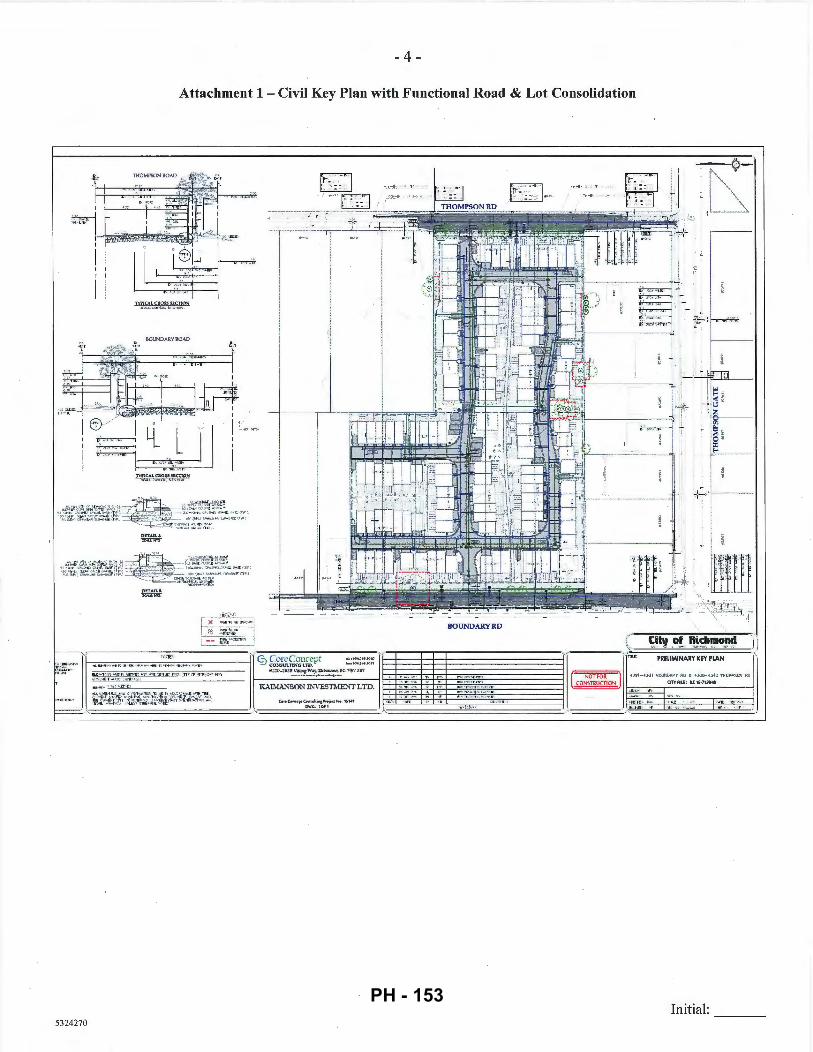
- 4-
Attachment 1 - Civil Key Plan with Functional Road & Lot Consolidation
I I
4~'=J "'~" . "61 ~
' , .. ~·~
TYI'ICAL CII.OS!i Sf.c.TIOS
LlOUNDARY ROAD
I
·:--·--;:-,--T -----··
·"'('"
I 6Y I • I :_. ~-: ~ y_ lJI ~I
5324270
TYPICALClt0555ECTION ,.,..._,,....,,._ ... .._ ,.._ .... ,.
DETAIL A. ~
9 £~;ti~<~lfi%Pt •:Z0-2639\'\CJig:W:¥j. Rkhn~ !IC. VD\' DBj
-~--·~oa...~ ......... KAIM.>,'lSON INVESTMENT LTD.
'1--------,----u. ~_:.
~ i 7:~~r---
BOUNDARYRD
Initial: ---
PH - 153
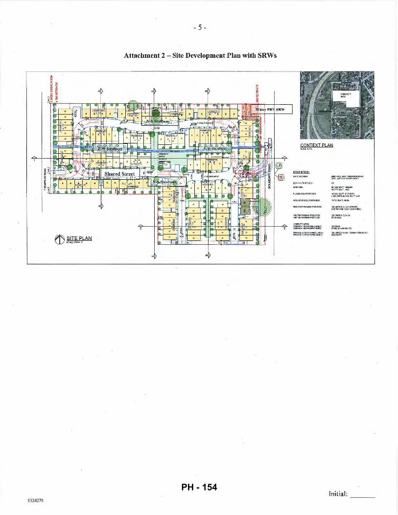
- 5 -
Attachment 2- Site Development Plan with SRWs
~ SITE PLAN U}scALE:11J2'~1·4'
5324270
AMENrTYAAEA: COMMON tNOOOFI (FI:EOU~EO~ COMMON lt•mOOR (PROVIOEOr.
PFUVAiEOUlOOORIREOUIR=tlt PRIVATEOUTOOOR(PF!OVlOEOI
-~::~ ~g:;: ~~;ss '').l80SO.FT. (0.75FAR) =120UNIT$CII94$0.FT. AVE
12G \!HITS :II 2 ,. ~~~ SP...CES i116TANDEM. t2•SIDE-6Y..SIOE}
1005(U.l . 37SO. M. I•OOSC. FT.)
1ltlUNITSX&$M"nt!SMm50SO.FT.) U!IOSO.FT
Initial: ----
PH - 154

5324270
- 6 -
Attachment 3- Hamilton Highway Park, Pare Thompson, ESA Compensation Plan
ll.ioCI: IWflii.M <l!""'>fl'<lt
l.t:;U..,IW.U'
IUt.:loll ll~
.,,"'' ·~·
= :KI «:!'!"' '"'""~'"" ~l'Qo:ti<Lll .. ,., , =~· GGI!IU'i"Hfl~ Jl l'll l =~ IWIS<""11fCI UI ~.,., = "'' osu....-II.:H IU> I!.=II >Jit><UJ<Ilfl = -,.,_ """"" _. ....... ~ l::<>l '-""-.'":t= ~~ IUIJl l'-fl~ Jl !l:>l = '""' ll.l$~li:.I.<UI'> ~KotllR':r = """ '>'fft,(_.'\IUQ,._ 11 1'01 = tl~ ,..._.,.,t>.:.,..v..... l'l'IA .. ,r == !'tl ~fln::Ri:.Jofl"UJ•W._, ~UU'l:WT JI !'QI
0Ail·f+-'ft> ...._lf"<7•U0 1ff"lll "'' ,"'f.II~I<UP>U"' TOL1i~"•:.U> .. I ~I_,..U.t111!1 1r .;:t~ I\AII Iflll.!l ,.;lt • "'' >~-"""•.U IK-'Gf'rlJoltDl<lt'II<H· I#laal3~.~"....:> o w.I I;5~ ... ,""' -IIJWrlo_1fiG :0..._...,_11<u>,t;Jo:,t1--"'ITfl>ll -...t.MIA
HAILTOOifGIWAYPARK p~ THa.I'SCW UACOUI'UrSATIOIII'WI
U)IMOtiD,lt.
ENVIRONMENTAL SITE ASSESSMENT
Initial: PH - 155
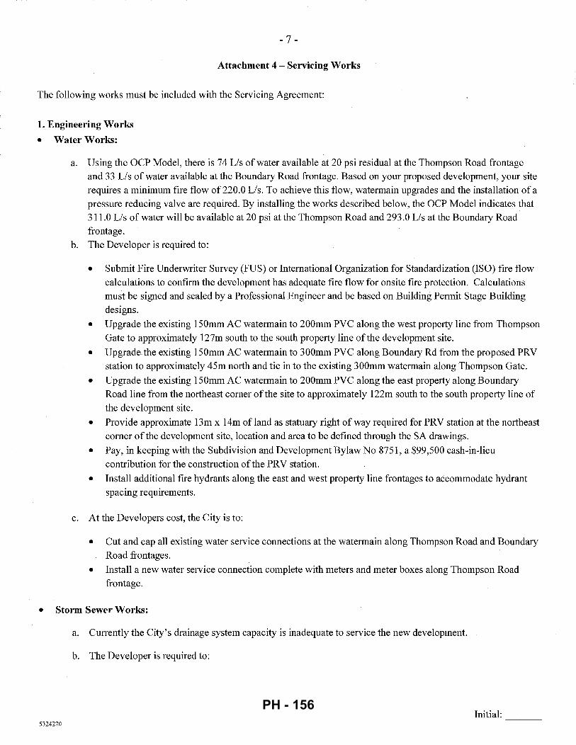
- 7 -
Attachment 4- Servicing Works
The following works must be included with the Servicing Agreement:
1. Engineering Works
• Water Works:
a. Using the OCP Model, there is 74 Lis of water available at 20 psi residual at the Thompson Road frontage and 33 Lis of water available at the Boundary Road frontage. Based on your proposed development, your site requires a minimum fire flow of 220.0 Lis. To achieve this flow, watermain upgrades and the installation of a pressure reducing valve are required. By installing the works described below, the OCP Model indicates that 311.0 Lis of water will be available at 20 psi at the Thompson Road and 293.0 Lis at the Boundary Road frontage.
b. The Developer is required to:
• Submit Fire Underwriter Survey (FUS) or International Organization for Standardization (ISO) fire flow calculations to confirm the development has adequate fire flow for onsite fire protection. Calculations must be signed and sealed by a Professional Engineer and be based on Building Permit Stage Building designs.
• Upgrade the existing 150mm AC watermain to 200mm PVC along the west property line from Thompson Gate to approximately 127m south to the south property line of the development site.
• Upgrade. the existing 150mm AC watermain to 300mm PVC along Boundary Rd from the proposed PRV station to approximately 45m north and tie in to the existing 300mm watermain along Thompson Gate.
• Upgrade the existing 150mm AC watermain to 200mm PVC along the east property along Boundary Road line from the northeast comer of the site to approximately 122m south to the south property line of the development site.
• Provide approximate 13m x 14m ofland as statuary right of way required for PRV station at the northeast comer of the development site, location and area to be defmed through the SA drawings.
• Pay, in keeping with the Subdivision and Development Bylaw No 8751, a $99,500 cash-in-lieu contribution for the construction of the PRV station.
• Install additional fire hydrants along the east and west property line frontages to accommodate hydrant spacing requirements.
c. At the Developers cost, the City is to:
• Cut and cap all existing water service connections at the watermain along Thompson Road and Boundary Road frontages.
• Install a new water service connection complete with meters and meter boxes along Thompson Road frontage.
• Storm Sewer Works:
a. Currently the City's drainage system capacity is inadequate to service the new development.
b. The Developer is required to:
Initial: ---5324270
PH - 156
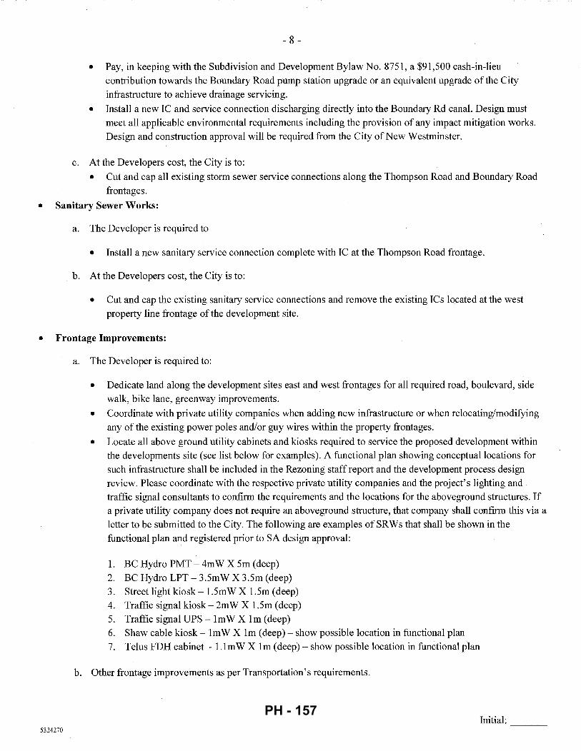
- 8 -
• Pay, in keeping with the Subdivision and Development Bylaw No. 8751, a $91,500 cash-in-lieu
contribution towards the Boundary Road pump station upgrade or an equivalent upgrade of the City infrastructure to achieve drainage servicing.
• Install a new IC and service connection discharging directly into the Boundary Rd canal. Design must meet all applicable environmental requirements including the provision of any impact mitigation works. Design and construction approval will be required from the City ofNew Westminster.
c. At the Developers cost, the City is to:
• Cut and cap all existing storm sewer service connections along the Thompson Road and Boundary Road
frontages.
• Sanitary Sewer Works:
a. The Developer is required to
• Install a new sanitary service connection complete with IC at the Thompson Road frontage.
b. At the Developers cost, the City is to:
• Cut and cap the existing sanitary service connections and remove the existing ICs located at the west property line frontage of the development site.
• Frontage Improvements:
5324270
a. The Developer is required to:
• Dedicate land along the development sites east and west frontages for all required road, boulevard, side walk, bike lane, greenway improvements.
• Coordinate with private utility companies when adding new infrastructure or when relocating/modifying any of the existing power poles and/or guy wires within the property frontages.
• Locate all above ground utility cabinets and kiosks required to service the proposed development within the developments site (see list below for examples). A functional plan showing conceptual locations for such infrastructure shall be included in the Rezoning staff report and the development process design review. Please coordinate with the respective private utility companies and the project's lighting and traffic signal consultants to confirm the requirements and the locations for the aboveground structures. If a private utility company does not require an aboveground structure, that company shall confirm this via a letter to be submitted to the City. The following are examples of SRWs that shall be shown in the functional plan and registered prior to SA design approval:
1. BC Hydro PMT- 4mW X 5m (deep) 2. BC Hydro LPT- 3.5mW X 3.5m (deep) 3. Street light kiosk- 1.5mW X 1.5m (deep) 4. Traffic signal kiosk- 2m W X 1.5m (deep) 5. Traffic signal UPS -lmW X lm (deep) 6. Shaw cable kiosk- lm W X lm (deep) - show possible location in functional plan 7. Telus FDH cabinet - l.lmW X lm (deep)- show possible location in functional plan
b. Other frontage improvements as per Transportation's requirements.
Initial: ---
PH - 157
- 9-
• General Items:
a. The Developer is required to:
• Coordinate with the City ofNew Westminster for works involving Private Utility servicing within the east half of Boundary Rd.
• Provide street lighting along the sites east and west frontages, design required through Servicing Agreement to the satisfaction of the City as follows:
Thompson Road (East side of street) • Pole colour: Grey • Roadway lighting@ back of curb: Type 7 (LED) INCLUDING 1 street luminaire on
every pole, but EXCLUDING any banner arms, duplex receptacles, pedestrian luminaires, flower basket holders, or irrigation.
Boundary Road (West side of street) • Pole colour: Grey • Roadway lighting@ back of curb: Type 7 (LED) INCLUDING 1 street luminaire on
every pole with pedestrian luminaires, but EXCLUDING any banner arms, duplex receptacles, flower basket holders, or irrigation. (NOTE: "Pedestrian luminaires" are intended to light the 3.0 m wide sidewalk/off-street bike path. Luminaire arms must be set perpendicular to the direction of travel.)
• Provide, within the first SA submission, a geotechnical assessment of preload, soil preparation and dewatering impacts on the existing utilities fronting or within the development site and provide mitigation recommendations.
• Enter into, if required, additional legal agreements, as determined via the subject development's Servicing Agreement(s) and/or Development Permit(s), and/or Building Permit(s) to the satisfaction of the Director of Engineering, including, but not limited to, site investigation, testing, monitoring, site preparation, dewatering, drilling, underpinning, anchoring, shoring, piling, pre-loading, ground densification or other
activities that may result in settlement, displacement, subsidence, damage or nuisance to City and private utility infrastructure .
• 2. Transportation Works
The required road works as shown on Attachment 1 that include:
a. Boundary Road development frontage: Use the existing east edge of the roadway as the reference, widen the road to the west to provide: • Roadside barriers (0.9m); • Paved 1.5m wide shoulder; • Paved 7.0 wide driving surface; • 0.15m wide curb and gutter; • 1.5m wide treed and grassed boulevard; and • 3 .Om wide concrete sidewalk/pathway.
b. Thompson Road development frontage: Use the existing west edge of the roadway as the reference, widen the road to the east to provide: • Paved 1.0m wide shoulder; • Paved 8.5m wide driving surface; • 0.15m wide curb and gutter; • 1.5m wide treed and grassed boulevard; and • 1.5m wide concrete sidewalk.
Initial: ---5324270
PH - 158
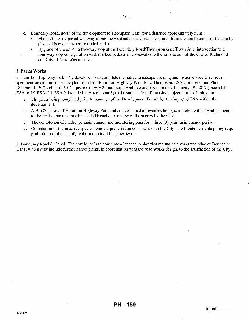
- 10-
c. Boundary Road, north of the development to Thompson Gate (for a distance approximately 50m): • Min. 1.5m wide paved walkway along the west side of the road, separated from the southbound traffic lane by
physical barriers such as extruded curbs. • Upgrade ofthe existing two-way stop at the Boundary Road/Thompson Gate/Ewan Ave. intersection to a
four-way stop configuration with marked pedestrian crosswalks to the satisfaction of the City ofRichmond and City ofNew Westminster.
3. Parks Works 1. Hamilton Highway Park: The developer is to complete the native landscape planting and invasive species removal specifications in the landscape plans entitled "Hamilton Highway Park, Pare Thompson, ESA Compensation Plan, Richmond, BC", Job No.16-044, prepared by M2 Landscape Architecture, revision dated January 19, 2017 (sheets LlESA to L9-ESA; Ll-ESA is included in Attachment 3) to the satisfaction ofthe City subject, but not limited, to:
a. The plans being completed prior to issuance of the Development Permit for the impacted ESA within the development.
b. A BLCS survey of Hamilton Highway Park and adjacent road allowances being completed with any adjustments to the landscaping as may be needed based on a review of the survey by the City.
c. The completion of landscape maintenance and monitoring plan for a three (3) year maintenance period.
d. Completion of the invasive species removal prescription consistent with the City's herbicide/pesticide policy (e.g. prohibition of the use of glyphosate to treat blackberries).
2. Boundary Road & Canal: The developer is to complete a landscape plan that maintains a vegetated edge of Boundary Canal which may include further native plants, in coordination with the road works design, to the satisfaction of the City.
Initial: ---5324270
PH - 159
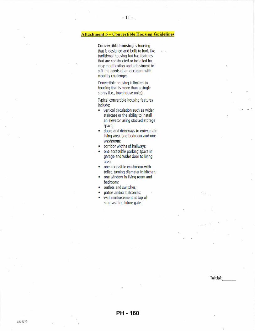
5324270
- 11 -
Attachment 5 - Convertible Housing Guidelines
Convertible housing is housing that is designed and built to look like traditional housing but has features that are constructed or installed for easy modification and adjustment to suit the needs of an occupant with mobility challenges.
Convertible housing is limited to . housing that is more than a single storey (i.e., townhouse units).
Typical convertible housing features include: • vertical circulation such as wider
staircase or the ability to install an elevator using stacked storage space;
• doors and doorways to entry, main living area, one bedroom and one washroom;
• corridor widths of hallways; • one accessible parking space in
garage and wider door to living area;
• one accessible washroom with toi let. turning diameter in kitchen;
• one window in living room and bedroom;
• outlets and switches; • patios and/or balconies; • wall reinforcement at top of
staircase for future gate.
Initial: ---
PH - 160
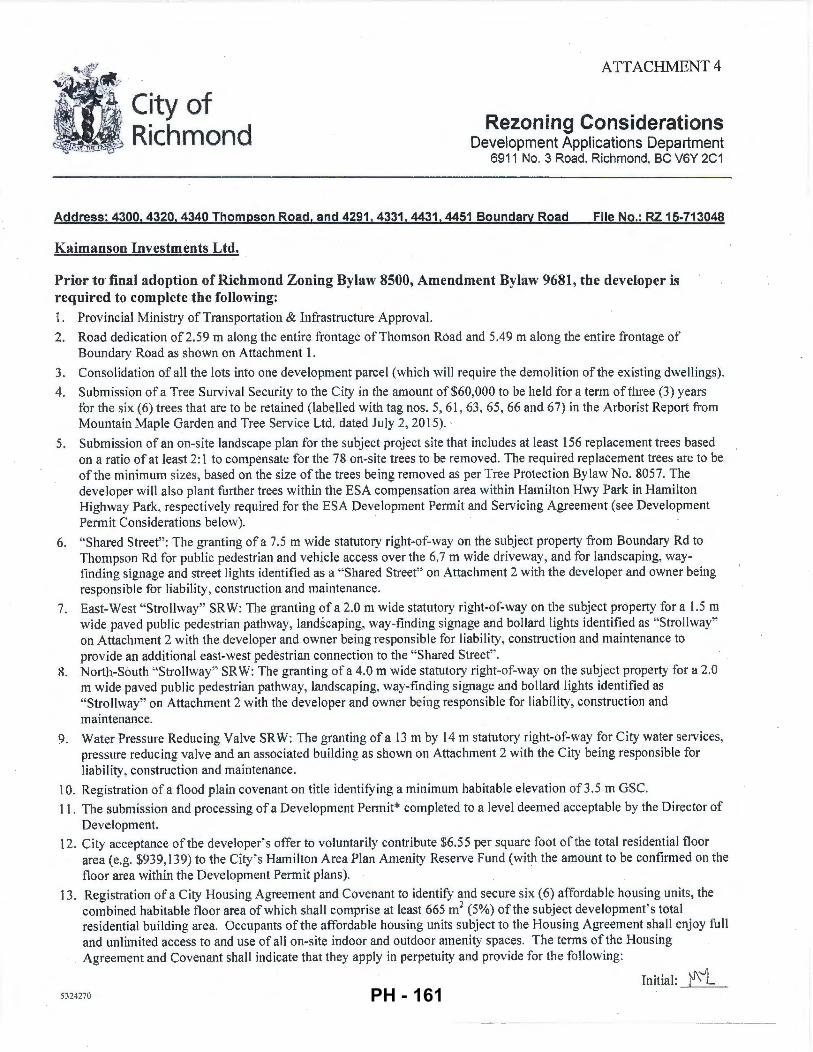
City of Richmond
ATTACHMENT 4
Rezoning Considerations Development Applications Department
6911 No. 3 Road, Richmond, BC V6Y 2C1
Address: 4300,4320,4340 Thompson Road, and 4291.4331,4431,4451 Boundary Road File No.: RZ 15-713048
Kaimanson Investments Ltd.
Prior to final adoption of Richmond Zoning Bylaw 8500, Amendment Bylaw 9681, the developer is required to complete the following: 1. Provincial Ministry of Transportation & Infrastructure Approval.
2. Road dedication of2.59 m along the entire frontage of Thomson Road and 5.49 m along the entire frontage of Boundary Road as shown on Attachment 1.
3. Consolidation of all the lots into one development parcel (which will require the demolition of the existing dwellings).
4. Submission of a Tree Survival Security to the City in the amount of$60,000 to be held for a term ofthree (3) years for the six (6) trees that are to be retained (labelled with tag nos. 5, 61 , 63 , 65, 66 and 67) in the Arborist Report from Mountain Maple Garden and Tree Service Ltd. dated July 2, 2015). ·
5. Submission of an on-site landscape plan for the subject project site that includes at least 156 replacement trees based on a ratio of at least 2:1 to compensate for the 78 on-site trees to be removed. The required replacement trees are to be of the minimum sizes, based on the size of the trees being removed as per Tree Protection Bylaw No. 8057. The developer will also plant further trees within the ESA compensation area within HamiltonHwy Park in Hamilton Highway Park, respectively required for the ESA Development Pennit and Servicing Agreement (see Development Permit Considerations below). ·
6. "Shared Street" : The granting of a 7.5 m wide statutory right-of-way on the subject property from Boundary Rd to Thompson Rd for public pedestrian and vehicle access over the 6. 7 m wide driveway, and for landscaping, wayfinding signage and street lights identified as a "Shared Street" on Attachment 2 with the developer and owner being responsible for Liability, construction and maintenance.
7. East-West "Strollway" SRW: The granting of a 2.0 m wide statutory right-of-way on the subject property for a 1.5 m widepaved public pedestrian pathway, landscaping, way-finding signage and bollard lights identified as "Strollway" on Attachment 2 with the developer and owner being responsible for liability, construction and maintenance to provide an additional east-west pedestrian connection to the "Shared Street''.
8. North-South "Strollway" SRW: The granting of a 4.0 m wide stahltory right-of-way on the subject property for a 2.0 m wide paved public pedestrian pathway, landscaping, way-finding signage and bollard lights identified as "Strollway" on Attachment 2 with the developer and owner being responsible for liability, construction and maintenance.
9. Water Pressure Reducing Valve SRW: The granting of a 13m by 14m statutory right-of-way for City water services, pressure reducing valve and an associated building as shown on Attachment 2 with the City being responsible for liability, construction and maintenance.
10. Registration of a flood plain covenant on title identifYing a minimum habitable elevation of3.5 m GSC.
11. The submission and processing of a Development Permit* completed to a level deemed acceptable by the Director of Development.
12. City acceptance of the developer' s offer to voluntarily contribute $6.55 per square foot of the total residential floor area (e.g. $939, 139) to the City 's Hamilton Area Plan Amenity Reserve Fund (with the amount to be confirmed on the floor area within the Development Permit plans).
13. Registration of a City Housing Agreement and Covenant to identify and secure six (6) affordable housing units, the combined habitable floor area of which shall comprise at least 665m2 (5%) of the subject development's total residential building area. Occupants ofthe affordable housing units subject to the Housing Agreement shall enjoy full and unlimited access to and use of all on-site indoor and outdoor amenity spaces. The terms of the Housing Agreement and Covenant shall indicate that they apply in perpetuity and provide for the following:
Initial: )'1\i_ 5324270 PH - 161
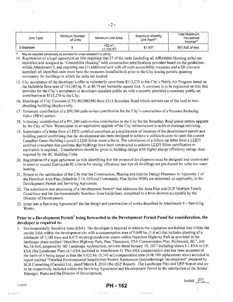
- 2-
I ' Total Maximum
Unit Type Minimum Number
Minimum Unit Area Maximum Monthly
Household of Units Unit Rent**
Income**
3-Bedroom 6 102 mL
$1,437 $57,500 of less (1,100ff)
May be adjusted periodically as provided for under adopted City policy. 14. Registration of a legal agreement on title requiring that 27 ofthe units (including all Affordable Housing units) are
identified and designed as ''Convertible Housing" vvith construction specifications provided based on the guidelines within Attachment 5. and requiring one (I) additional unit with all such accessibility measures and a lift /elevator installed; all identified units must have the measures installed/built prior to the City issuing permits granting occupancy for buildings in which the units are located.
15. City acceptance of the developer's offer to voluntarily contribute $113,270 to the City's Public Art Program based on the buildable floor area of 143.380 sq. ft. at $0.79 per buildable square foot. A covenant is to be registered on title that provides for the City's acceptance of developer-installed public art with a security provided a monetary public art contribution at $113,270 to the City.
16. Discharge of City Covenant (LTO BG386398) from 4311 Boundary Road which restricts use of the land to twodwelling building (duplex) only.
17. Voluntary contribution of a $99,500 cash- in-lieu contribution for the City's construction of a Pressure Reducing Valve (PRY) station.
18. Voluntary contribution of a $91,500 cash-in-lieu contribution to the City for the Boundary Road pump station upgrade by the City ofNew Westminster or an equivalent upgrade ofthe City infrastructure to achieve drainage servicing.
19. Submission of a letter from a LEED certified consultant as a requirement of issuance of the development permit and building permit confim1ing that the development has been designed to achieve a sufficient score to meet the current Canadian Green Building Council LEED Silver score criteria. The submission of a follov.r-up letter from a LEED ce1iified consultant that confirms that buildings have been constructed to achieve LEED Silver certification or equivalent is required. Consideration should be given to building design with higher energy efficiency ratings than required by the BC Building Code.
20. Registration of a legal agreement on title identifying that the proposed development must be designed and constructed to meet or exceed EnerGuide 82 criteria for energy efficiency and that all dwellings are pre-ducted for solar hot water heating.
21. Ensure to the satisfaction ofthe City that the Construction, Phasing and Interim Design Measures in Appendix I of the Hamilton Area Plan (Schedule 2.14, Official Community Plan Bylaw 9000) are addressed, as applicable, in the Development Permit and Servicing Agreement.
22. The submission and processing of a Development Permit* that addresses the Area Plan and OCP Multiple Family Guidelines and the Environmentally Sensitive Area Guidelines. completed to a level deemed acceptable by the Director of Development.
23. Enter into a Servicing Agreement* for the design and construction of works described in Attachment 4- Servicing Works.
Prior to a Development Permit* being forwarded to the Development Permit Panel for consideration, the developer is required to: l. Environmentally Sensitive Area (ESA): The developer is required to address the vegetation and habitat loss within the
on-site ESA within the development site with a compensation area of 0.648 ha. ( 1.6 ac) that includes planting of a minimum of 1,188 trees and 6.4 75 shrubs/groundcover plants within Hamilton Highway Park as provided in the landscape plans entitled "Hamilton Highway Park, Pare Thompson, ESA Compensation Plan, Richmond, BC", Job No.16-044, prepared by M2 Landscape Architecture, revision dated January 19, 2017 including sheets L 1-ESA to L9-ESA (the Landscape Plan) (Ll-ESA included in Attachment 3 ). This ESA compensation area has been accepted on the basis of it being larger in than the 0.03 2 ha. (0.345 ac) compensation area (with 100 replacement trees) included in report entitled "Detailed Environmental Sensitivities Rep01t. Kaimanson Queensborough Development" prepared by SLR Consulting (Canada) Ltd .. dated March 8, 2016 (the QEP Repo1i). The Landscape Plan and QEP Report and are to be respectively included within the Servicing Agreement and Development Permit to the satisfaction of the Senior Manager, Parks and the Director of Development.
Initial: tf\j_ 5324270 PH - 162
- 3 -
2. On-Site Native Planting Areas: The on-site landscaping plan requires a minimum of I , I 00 m2 (0.27 acres) fully planted with native shrubs and trees within the north amenity area, on either side of the east-west and north-south Stroll ways and along the Boundary Road frontage of development.
3. Energy Efficiency: Complete a proposed townhouse energy efficiency rep011 and recoinmen'dations prepared by a Certified Energy Advisor which demonstrates how the proposed construction will meet or exceed the required townhouse energy efficiency standards (EnerGuide 82 or better), in compliance with the City ' s Official Community Plan.
4. Accessible Adaptable Units: The Development Permit plans are to identify 27 of the units (including all Affordable · Housing units) as "Convertible Housing" with construction specifications to be provided based on the guidelines within Attachment 5, and to identifY one (I) additional unit with all such accessibility measures and a lift /elevator installed.
Prior to Building Permit Issuance, the developer must complete the following requirements: 1. Each townhouse garage is to be equipped with a 120V electric plug-in for electric vehicle charging equipment.
2. Submission of a Construction Parking and Traffic Management Plan to the Transportation Depa11ment. Management Plan shall include location for parking for services, deliveries, workers, loading, application for any Jane closures, and proper construction traffic controls as per Traffic Control Manual for works on Roadways (by Ministry of Transp011ation) and MMCD Traffic Regulation Section 01570.
3. Obtain a Building Permit (BP) for any construction hoarding. If construction boarding is required to temporarily occupy a public street, the air space above a public street, or any part thereof, additional City approvals and associated fees may be required as part of the Building Permit. For additional information, contact the Building Approvals Department at 604-276-4285.
Note:
* •
This requires a separate application.
W11ere the Director of Development deems appropriate, the preceding agreements are to be drawn not only as personal covenants of the property developer but also as covenants pursuant to Section 219 of the Land Title Act.
All agreements to be registered in the Land Title Office shall have priority over all such liens, charges and encumbrances as is considered advisable by the Director of Development. All agreements to be registered in the Land Title Office shall, unless the Director of Development determines othenvise, be fully registered in the Land Title Office prior to enactment ofthe appropriate bylaw.
The preceding agreements shall provide security to the City including indemnities, warranties, equitable/rent charges, letters of credit and withholding penn its, as deemed necessary or advisable by the Director of Development. All agreements shall be in a form and content satisfactory to the Director of Development.
• Additional legal agreements. as determined via the subject development's Servicing Agreement(s) and/or Development Pennit(s), and/or Building Pennit(s) to the satisfaction of the Director of Engineering may be required including, but not limited to, site investigation, testing, monitoring, site preparation, de-watering, drilling, underpinning, anchoring, shoring, piling, pre-loading, ground densification or other activities that may result in settlement, displacement, subsidence, damage or nuisance to City and private utility infrastructure.
• Applicants for all City Permits are required to comply at all times with the conditions of the Provincial Wildl[fe Act and Federal Migratory Birds Convention Act, which contain prohibitions on the removal or disturbance of both birds and their nests. Issuance of Municipal penn its does not give an individual authority to contravene these legislations. The City of Richmond recommends that where significant trees or vegetation exists on site, the services of a Qualified Environmental Professional (QEP) be secured to perform a survey and ensure that development activities are in compliance with all relevant legislation.
Signed Date
',, A'-1}
1 nit ia I: ____:_'"---== 'L::__ 5324270 PH - 163
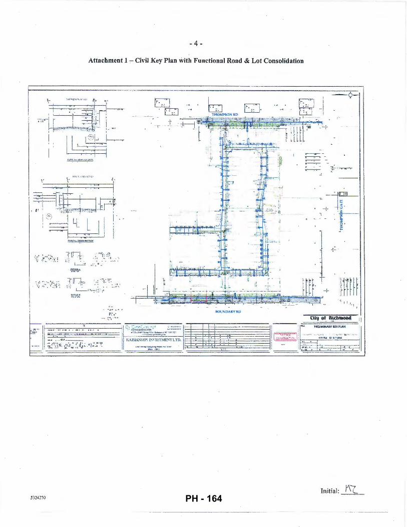
- 4 -
Attachment 1 - Civil Key Plan with Functional Road & Lot Consolidation
--:I_'ITI .. - : .-.·. ,. --_ .• . ·..:- ... _ ~- ~- ~ ."'- . : :, 1: -L -·; ": . ' . -;; ·: I . . • . .
L___ :~ .. ~:~- ,.i
BOt 11'\:"U .... R'r RD
-- L'\ """
:, ~-1 ,'_7j · · •. : .... · , · • • ··, .! ~ ,~ ' · -·,, ~ ::;" '\ .,-t_ n ... ...It" ~---..-=':";i..,. •!,.., r -n
5324270
~
~ -
- ¢-
~ :f- · ·~
--v--0 - .,_ I= < . . -:- ~
. . -,-
·g--!;
Q· ;::
lj I I 1
·c(.f ~: . .~~ _,.. • , · - - ~ "' .. ,, - I II II""' PREUMINARY ~EY PlAN I
( ,,~,,._.,,;,.J , ·:. •· '""" '"'"'""" I
Initial: Y\(_ PH - 164
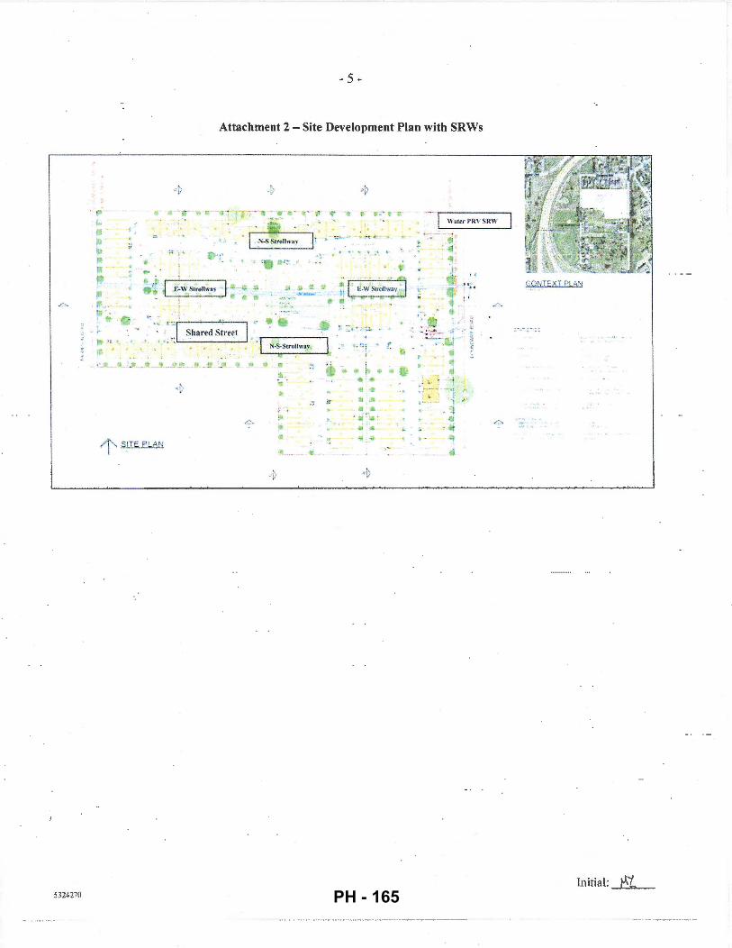
- 5 -
Attachment 2- Site Development Plan with SRWs
.u- ~ ~~ - · r·r-: ·-- 1 - ·· -.,., .... ·,...· ...
~ 1 .,__ •
... '"' .il ::
.o. t' : Ill
' ft· -'---~--4· ·~--~ ~ • ~ : T Shared Street I
1 ' · l ~ ,.C , <l N-S-Stronw&_y ;
.. .... l
• .. f
9-!10 !ll ..
• 1" S_ITE PLAN
t
5324270
lot * lj ..
) · ·
'!'
•: i . !~ ft I
.. i .. "' .. ...
• II ,!It
... ... ,.. - ...
"' ...
---~ Watrr PRV SRW
~ -
lr r .. ..
.; ! : .o.
. -l
CONTEXT PLAN
' ...... , .·
Initial: tAL. PH - 165
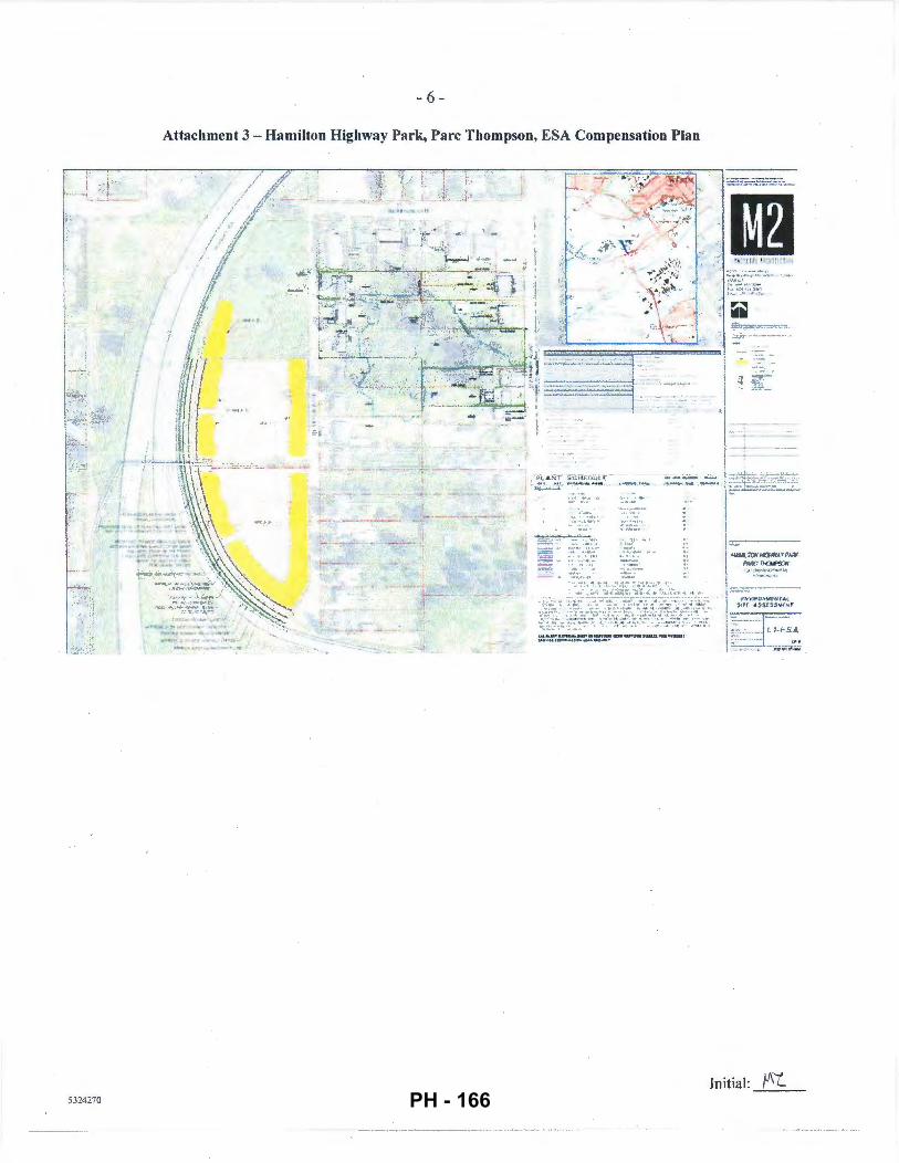
j
5324270
- 6-
Attachment 3 - Hamilton Highway Park, Pare Thompson, ESA Compensation Plan
\.~ ~.
- ~ : -::/~~~·· , · ... . ~~ ...
· ~ .. } •"
... ......... ..:....,. .. ....
~o~o~. ~•nu;.o~. ._,.. ._ .. _ _ u_fi'..\.U.U._ \natl
-.-o.u-...••---•·
1--=--- --! ~t.UA.i'Ci'i~JiYI")..QI:'
I'M¥::~
( NV¥fO.'<Mt' tl tAL Sir( II $Sts'SVlH1
Initial: }J\L_ PH - 166
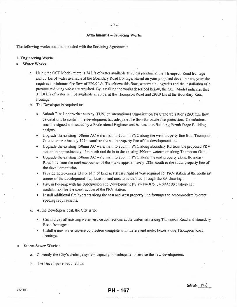
- 7 -
Attachment 4- Servicing Works
The following works must be included with the Servicing Agreement:
1. Engineering Works
• Water Works:
a. Using the OCP Model, there is 74 Lis of water available at 20 psi residual at the Thompson Road frontage and 33 Lis of water available at the Boundary Road frontage. Based on your proposed development, your site requires a minimum fire flow of 220.0 Lis. To achieve this flow, watermain upgrades and the installation of a pressure reducing valve are required. By installing the works described below, the OCP Model indicates that 311.0 Lis of water will be available at 20 psi at the Thompson Road and 293.0 Lis at the Boundary Road frontage.
b. The Developer is required to:
• Submit Fire Underwriter Survey (FUS) or International Organization for Standardization (ISO) fire flow calculations to confirm the development has adequate fire flow for onsite fire protection. Calculations must be signed and sealed by a Professional Engineer and be based on Building Permit Stage Building designs.
• Upgrade the existing 150mm AC watermain to 200mm PVC along the west property line from Thompson Gate to approximately 127m south to the south property line of the development site.
• Upgrade the existing 150mm AC watermain to 300mm PVC along Boundary Rei from the proposed PRY station to approximately 45m north and tie in to the existing 300mm watermain along Thompson Gate.
o Upgrade the existing J50mm AC ·watermain to 200mm PVC along the east property along Boundary Road line from the northeast corner of the site to approximately 122m south to the south property line of the development site.
• Provide approximate 13m x 14m of land as stantary right of way required for PRY station at the northeast corner of the development site, location and area to be defined through the SA drawings.
• Pay, in keeping with the Subdivision and Development Bylaw No 8751 , a $99,500 cash-in-Ueu contribution for the construction of the PRY station.
• Install additional tire hydrants along the east and west property line frontages to accommodate hydrant spacing requirements.
c. At the Developers cost, the City is to:
• Cut and cap all existing water service connections at the watermain along Thompson Road and Boundary Road frontages.
• Install a new water service connection complete with meters and meter boxes along Thompson Road frontage:
• Storm Sewer Works:
a. CutTently the City 's drainage system capacity is inadequate to service the new development.
b. The Developer is required to:
IV\"'/ I n iti a I : ----'-' --' 'l-=----
53242 70 PH - 167
- 8 -
• Pay, in keeping with the Subdivision and Development Bylaw No. 8751, a $91 ,500 cash- in-lieu
contribution towards the Boundary Road pump station upgrade or an equivalent upgrade ofthe City
infrastructure to achieve drainage servicing.
• Install a new IC and service connection discharging directly into the Boundary Rd canal. Design must
meet all applicable environmental requirements including the provision of any impact mitigation works.
Design and construction approval will be required from the City of New Westminster.
c. At the Developers cost, the City is to:
• Cut and cap all existing storm sewer service connections along the Thompson Road and Boundary Road frontages.
• Sanitary Sewer Works:
a. The Developer is required to
• Install a new sanitary service com1ection complete with IC at the Thompson Road frontage.
b. At the Developers cost, the City is to:
• Cut and cap the existing sanitary service connections and remove the existing !Cs located at the west property line frontage of the development site.
• Frontage Improvements:
5324270
a. The Developer is required to:
• Dedicate land along the development sites east and west frontages for all required road, boulevard, side
walk, bike lane, greenway improvements.
• Coordinate with private utility companies when adding new infrastructure or when relocating/modifying
any of the existing power poles and/or guy wires within the property frontages .
• Locate all above ground utility cabinets and kiosks required to service the proposed development within
the developments site (see list below for examples). A functional plan showing conceptual locations for
such infrastructure shall be included in the Rezoning staff report and the development process design
review. Please coordinate with the respective private utility companies and the project's lighting and
traffic signal consultants to confirm the requirements and the locations for the aboveground structures. [f
a private utility company does not require an aboveground structure. that company shall confinn this via a
letter to be submitted to the City. The following are examples of SRWs that shall be shown in the
functional plan and registered prior to SA design approval:
I. BC Hydro PMT-4mW X Sm (deep)
2. BC Hydro LPT- 3.5mW X 3.5m (deep)
3. Street light kiosk~ I .5mW X l.Sm (deep)
4. Traffic signal kiosk- 2mW X l.Sm (deep)
5. Traffic signal UPS- lmW X lm (deep)
6. Shaw cable kiosk- lmW X lm (deep)- show possible location in functional plan 7. Tel us FDH cabinet - 1.1 m W X I m (deep)- show possible location in functional plan
b. Other frontage improvements as per Transportation ' s requirements.
Initial: fll'j PH - 168
- 9 -
• Generalltems:
a. The Developer is required to:
• Coordinate with the City of New Westminster for works involving Private Utility servicing within the
east half of Boundary Rd.
• Provide street lighting along the sites east and west frontages , design required through Servicing
Agreement to the satisfaction of the City as follows:
Thompson Road (East side of street) • Pole colour: Grey • Roadway lighting @ back of curb: Tvpe 7 (LED) INCLUDING I street luminaire on
every pole, but EXCLUDING any banner arms, duplex receptacles, pedestrian luminaires , flower basket holders, or irrigation.
Boundary Road (West side of street) • Pole colour: Grey • Roadway lighting @ back of curb: I.Y.!2U (LED) INCLUDING 1 street luminaire on
every pole with pedestrian luminaires, but EXCLUDING any banner arms, duplex receptacles, flower basket holders, or irrigation. Ct:JOTE: "Pedestrian luminaires" are intended to light the 3.0 m wide sidewalk/off-street bike path. Luminrure arms must be set perpendicular to the direction of travel.)
• Provide, within the first SA submission, a geotechnical assessment of preload, soil preparation and
dewatering impacts on the existing utilities fronting or within the development site and provide mitigation
recommendations.
• · Enter into, if required , additional legal agreements, as detennined via the subject development's Servicing
Agreement(s) and/or Development Permit(s), and/or Building Pennit(s) to the satisfaction of the Director
of Engineering, including, but not limited to, site investigation, testing, monitoring, site preparation, de
watering, drilling, underpinning, anchoring, shoring, piling, pre-loading, ground densification or other
activities that may result in senlement, displacement, subsidence, damage or nuisance to City and private
utility infrastructure .
• 2. Transportation Works The required road works as shown on Attachment 1 that include:
a. Boundary Road development frontage: Use the existing east edge of the roadway as the reference, widen the road to the west to provide: • Roadside barriers (0.9m); • Paved 1.5m wide shoulder; • Paved 7.0 wide driving surface; • 0.15m wide curb and guner; • 1.5m wide treed and grassed boulevard; and • 3.0m wide concrete sidewalk/pathway.
b. Thompson Road development frontage: Use the existing west edge of the roadway as the reference, widen the road to the east to provide: • Paved ! .Om wide shoulder; • Paved 8.5m wide driving surface; • 0.15m wide curb and gutter; • l .5m wide treed and grassed boulevard; and • 1.5m wide concrete sidewalk.
Initial: f\"<._ 5324270 PH - 169
- 10 -
c. Boundary Road, north of the development to Thompson Gate (for a distance approximately 50m): • Min. 1.5m wide paved walkway along the west side of the road. separated from the southbound traffic lane by
physical barriers such as extruded curbs. • Upgrade of the existing two-way stop at the Boundary Road/Thompson Gate/Ewan Ave. intersection to a
four-way stop configuration with marked pedestrian crosswalks to the satisfaction ofthe City of Richmond and City ofNew Westminster.
3. Parks Works
1. Hamilton Highway Park: The developer is to complete the native landscape planting and invasive species removal · specifications in the landscape plans entitled "Hamilton Highway Park. Pare Thompson. ESA Compensation Plan, Richmond. BC'', Job No.16-044. prepared by M2 Landscape Architecture. revision dated January 19. 2017 (sheets L 1-ESA to 19-ESA; L 1-ESA is included in Attachment 3) to the satisfaction of the City subject. but not limited. to:
a. The plans being completed prior to issuance of the Development Permit for the impacted ESA within the development.
b. A BLCS survey of Hamilton Highway Park and adjacent road allowances being completed with any adjustments to the landscaping as may be needed based on a review of the survey by the City.
c. The completion of landscape maintenance and monitoring plan for a three (3) year maintenance period.
d. Completion of the invasive species removal prescription consistent with the City's herbicide/pesticide policy (e.g. prohibition of the use of glyphosate to treat blackberries).
2. Boundary Road & Canal: The developer is to complete a landscape plan that maintains a vegetated edge of Boundary Canal which may include further native plants. in coordination with the road works design. to the satisfaction of the City.
Initial: !J'0 532-1270 PH - 170
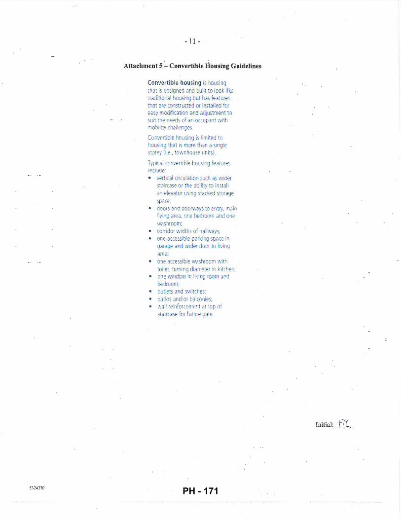
5324270
- 11 -
Attachment 5 - Convertible Housing Guidelines
Convertible housing is housing that is designed and built to look like traditio"Jal housing hut has f<;:ature5 mai are mnsuucted or installed or easy . odiiication and adjustment 10
suit the needs of an occupant wi th mobility challenges.
Co 1vertible housing is limited to housing nat is mor-e han a sing!e storey (i.e., townhouse units).
Typica l converti ble housi ng featu res includ.e: • verHcal circulation such as \VIder
staircase or the abili ty ro install an elevator using stacked storage space;
• doors and doorwa s to entry, • ain living area. one bedroom and one washroom;
• corridor widths of hallways; • one accessible parki11g space in
garage and wider door to li, ing area:
• one accessible washroom with wilet. turni ng diameter in ki tchen;
• one window in living morn and bedroom:
• outlets ar~d switches; • patios and/or balconies; • wal l reinforcement at top of
staircase 1or future gate.
Initial: ·fit
PH - 171
City of Richmond
To: Planning Committee
From: Wayne Craig Director, Development
Report to Committee Planning and Development Division
Date: February 14, 2017
File: RZ 15-713048
Re: Application by Kaimanson Investments Ltd. for Rezoning at 4300, 4320, 4340 Thompson Road and 4291, 4331, 4431 and 4451 Boundary Road from "Single Detached (RS1/F)" and "Two-Unit Dwellings (RD1 )" to "High Density Townhouses (RTH1 )"
Staff Recommendations
That Richmond Zoning Bylaw 8500, Amendment Bylaw 9681 to:
1. Include the Hamilton Area Plan density bonus and community amenity provisions within the "High Density Townhouses (RTH1)" zone; and
2. Rezone 4300, 4320, 4340 Thompson Road, and 4291, 4331, 4431 and 4451 Boundary Road from "Single Detached (RS 1/F)" and "Two-Unit Dwellings (RD1 )"to "High Density Townhouses (RTH1)";
be introduced and given first reading.
REPORT CONCURRENCE
ROUTED TO:
Parks Services Engineering Affordable Housin
5304796
CONCURRENCE
~ ~ ~y
CONCURRErE OF GENERAL MANAGER
'l /,v
PH - 172
February 14, 2017 -2-
Staff Report
Origin
Kaimanson Investments Ltd. has applied to rezone a 1. 781 ha. ( 4.40 acre) site located at 4300, 4320,4340 Thompson Road and 4291,4331,4431 and 4451 Boundary Road from "Single Detached (RSl!F)" and "Two-Unit Dwellings (RD1)" to "High Density Townhouses (RTH1)" (Attachment 1). There is an additional amendment to include the Hamilton Area Plan's density bonus and community amenity contribution provisions within the "High Density Townhouses (RTH1)" zone. The proposed townhouse development includes 120 units within 24 three-storey buildings (Attachment 2).
Findings of Fact
A Development Application Data Sheet providing details about the development proposal is included in Attachment 3.
Surrounding Development
Development surrounding the subject site is as follows:
• To the North: Single-family properties zoned "Single Detached (RSIIF)" and designated "Neighbourhood Residential (Townhouse 0.75 FAR)" within the Hamilton Area Plan.
• To the South: Single-family properties zoned "Single Detached (RSIIF)" and designated "Neighbourhood Residential (Townhouse 0.75 FAR)" within the Hamilton Area Plan.
• To the East: Boundary Road and Boundary Canal within the City of New Westminster.
• To the West: Thompson Road and Hamilton Highway Park which is zoned "Single Detached (RS 1/F)".
Related Policies & Studies
Official Community Plan I Hamilton Area Plan
The Official Community Plan (OCP) designates the subject site as "Neighbourhood Residential (NRES)" and the Hamilton Area Plan designates the site as "Neighbourhood Residential (Townhouse 0.75 FAR)" which allows for three-storey, ground-oriented townhouses (Attachment 4). The development's main east-west driveway will connect to both Boundary Road and Thompson Road to allow for public access via a statutory-right-of-way (SRW) to be registered for the "Shared Street" designated within the Hamilton Area Plan (shown on Site Plan in Attachment 7). There also is a proposed north-south pathway secured through registration of a SRW for public pedestrian access. This pathway will be part of the "Stroll way" route designated within the Hamilton Area Plan that will connect Thompson Gate to future developments to the south.
5304796 PH - 173
February 14, 2017 - 3 -
The applicant is also required ensure that the engineering and servicing provisions in the "Construction, Phasing and Interim Design Measures" in Appendix 1 of the Hamilton Area Plan are addressed in the Development Permit and Servicing Agreement. In summary, the development proposal is consistent with the OCP and Hamilton Area Plan.
Environmentally Sensitive Area (ESA)
The development site includes approximately 1.2 ha. (2.96 acres) ofESA which is part of a larger contiguous 1.87 ( 4.62 acre) ESA that extends south of the development site (Attachment 5). The applicant's Qualified Environmental Professional (QEP) has completed an assessment of the habitat value of the ESA and made recommendations for habitat compensation in accordance with the OCP ESA Development Permit Guidelines. A Development Permit will be required to be considered by the Development Permit Panel prior to consideration of adoption of the zoning bylaw amendment. In summary, the QEP report concludes that:
• 35% ofthe ESA is non-contiguous "upland forest" with the majority of the trees (Cottonwood and Alder) nearing their end oflife and being subject to blow down.
• 65% of the ESA encompasses "old field habitat" which evolved after residential development of the area in the 1960's. Most ofthe existing small plants consist of invasive species (mainly introduced Red Canary grass) characteristic of overgrown rural lots.
Due to the relatively low habitat value of the ESA and the site grading requirements, the QEP recommended off-site habitat compensation. This compensation included a total of 100 native trees and shrubs to be planted within a small320 m2 (0.08 acre) area of Hamilton Highway Park.
In consultation with City Parks and Environmental Sustainability staff, off-site compensation habitat was pursued to improve the natural character of the adjacent Hamilton Area Park as part of the City's Ecological Network. The ESA habitat compensation area includes:
• A total area of6,300 m2 (1.6 acres) ofthe currently open grass field is proposed to be replanted with trees in groves averaging 15.0 m (48ft.) in width along the west side of Hamilton Highway Park adjacent to Highway 91, as well as smaller groves of trees along Thompson Road. These areas will be planted with native vegetation with a minimum of 1,188 trees and 6,475 shrubs/groundcover plants.
• Removal ofthe areas of invasive species (e.g. blackberries, broom and horsetail) from the southern 2.2 ha. (5.45 acres) of the park to encourage the successful establishment of the proposed native trees and under-storey plants in this portion of the park.
The proposed habitat compensation area will be of a higher habitat value than the existing ESA area within the development site.
In summary, the proposed ESA compensation areas will provide for well-developed, wind-firm, native forested areas that support the City's Ecological Network goal of improving habitat in City parks and creating a public amenity.
5304796 PH - 174
February 14, 2017 -4-
In addition to the off-site habitat compensation, the development will include following native vegetation:
• Six ( 6) existing coniferous trees will be protected as described in the Tree Retention section below.
• There will be a minimum area of 1,100 m2 (0.27 acres) fully planted with native shrubs and trees included within the landscape plans required within the Development Permit; the areas include the north amenity area, on either side of the east-west and north-south Strollways, and along the Boundary Road frontage of development.
Should the rezoning application proceed, the applicant will be required to complete the landscape plan for the habitat compensation in Hamilton Highway Park for the Servicing Agreement. The QEP will also prepare a follow-up report required for the ESA Development Permit on the landscape plans which include the finalized landscape restoration, native p~anting and invasive species removal specifications, and also include a monitoring and maintenance plan for the ESA compensation area.
Floodplain Management Implementation Strategy
The proposed redevelopment must meet the requirements of the Richmond Flood Plain Designation and Protection Bylaw 8204. Registration of a flood indemnity covenant on Title is required prior to final adoption of the rezoning bylaw.
Public Consultation
A rezoning sign has been installed on the subject property. Staff have received several inquiries from the public about the rezoning application in response to the placement of the rezoning sign on the property. These inquiries did not include concerns regarding the development itself and were related to development process for the subject development and adjacent properties should they be developed.
Should the Planning Committee endorse this application and Council grant 1st Reading to the rezoning bylaw, the bylaw will be forwarded to a Public Hearing, where any area resident or interested party will have an opportunity to comment.
Public notification for the Public Hearing will be provided as per the Local Government Act.
Approval from the Ministry of Transportation and Infrastructure will be required prior to Council consideration of adoption of the zoning amendment bylaw.
Analysis
Built Form and Architectural Character
The proposed development includes 120 townhouse units and an amenity building (Attachment 2). The proposed development includes the following elements:
• There are 24 buildings comprised of seven (7) different modern buildings types designed and shaped to provide architectural variation and allow for tree protection.
5304796 PH - 175
February 14, 2017 - 5-
• Units will have an average floor area of approximately of 111 m2 (1, 194 ft2).
• The typical building height is three (3) storeys with a maximum of building height of 11.65 m (38ft.), consistent with the RTH1 zone.
• The two (2) main east-west driveways and one main east-west pathway include gentle curves to provide visual interest. The southern driveway is designated as a "Shared Street" under the Hamilton Area Plan and the pathway provides public pedestrian access between Thompson and Boundary Roads.
• · There are also three (3) north-south driveways which connect the two (2) main east-west driveways. There is also a north-south pathway linking the outdoor amenity areas designated as a "Strollway" within the Hamilton Area Plan to provide additional public access to future developments to the north and south.
• The proposed project has 4.5 m (14.8 ft.) side yard setbacks to the adjacent single-family residential areas to the north and south of the development site.
• Setbacks to Boundary Road will be 5.0 m (16.5 ft.) and setbacks to Thompson Road will be 4.5 (15.0 ft.).
• There will be wide central, garden mews of 11m (38.5 ft.) to 15m (48. ft.) in width, with common pathways, located between the central rows of townhouse buildings.
• There will be 62 units with side-by-side double garages and 58 units with tandem double garages providing for more unit choice and variation in building forms.
At Development Permit stage, design elements to be addressed include:
• Adding further small-scale articulation and architectural detailing of the townhouse buildings, particularly those facing onto the public realm.
• Adding way-finding signage and lighti!lg for the pathways and driveways.
Existing Legal Encumbrances
There is an existing City covenant (LTO No. BG386398) registered on the Title of 4311 Boundary Road, which restricts use of the lot to a two-dwelling building (duplex). This covenant will be required to be discharged prior to adoption of Bylaw 9681.
Transportation and Site Access
Vehicle and Pedestrian Access As noted above, vehicle and pedestrian access will be provided by the proposed main east-west driveway which will connect to both Boundary Road and Thompson Road. This driveway will also provide mainly for public vehicle access via a statutory-right-of-way (SRW) to be registered on Title to secure it as a "Shared Street" as required within the Hamilton Area Plan. There will be an east-west central "Strollway" within a SRW to be registered on Title that provides the main public pedestrian connection between Thompson and Boundary Roads. There also is a requirement to provide a north-south pedestrian pathway within a SR W to be registered on Title that provides for a public pedestrian access as part of a "Strollway" within the Hamilton Area Plan. This north-west "Strollway" will connect Thompson Gate in the north to future
5304796 PH - 176
February 14, 2017 - 6 -
developments to the south. The developer and owner will be responsible for liability, construction and maintenance of the Shared Street, north-south Strollway and east-west Strollway.
Parking
The subject development complies with the parking requirements within Zoning Bylaw 8500. There are a total of 240 resident parking spaces within double garages within each of the 120 townhouse units and 24 surface visitor parking spaces. Of the resident spaces, 116 spaces (48.3%) are in 58 tandem garages and 124 spaces are within 62 side-by-side garages.
The applicant will register an electric vehicle parking covenant on Title requiring that 100% of resident parking spaces will be equipped with 120V electric plug-ins for electric vehicle charging equipment.
LEED I Energy Efficiency and Renewable Energy Development
As required by the Hamilton Area Plan, the developer has agreed to ensure that the project has been designed to achieve a Canadian Green Building Council LEED Silver rating. This will require review from a LEED certified consultant which confirms that buildings have been designed at Development Permit and constructed at Building Permit to achieve the required LEED certification or equivalent.
The LEED Silver assessment will include a review of the City-wide townhouse energy efficiency requirements. These requirements include registration of a legal agreement on Title, identifying that the proposed development will be designed and constructed to meet or exceed EnerGuide 82 criteria for energy efficiency and that all dwelling units will be pre-ducted for solar hot water heating, is required before zoning amendment bylaw adoption.
Tree Retention and Replacement
The applicant has submitted a certified Arborist's Report and tree survey (Attachment 6) which identifies on-site and off-site tree species, assesses tree structure and condition, and provides recommendations on tree retention and removal relative to the proposed development. The Report assesses:
• 78 trees located on the development site to be removed and replaced. • 11 trees located on adjacent neighbouring properties are identified to be retained and
protected and to be provided tree protection as per City of Richmond Tree Protection Information Bulletin Tree-03.
The City's Tree Preservation Coordinator has reviewed the Arborist's Report and supports the arborist's findings with the following comments:
• Six (6) trees (labelled with tag nos. 5, 61, 63, 65, 66 and 67) are located on the development site are proposed to be retained and protected. The applicant will provide a $60,000 tree survival security for these trees.
• A total of 156 replacement trees are required at a 2:1 ratio for the 78 trees to be removed.
5304796
Tree species and sizes are to be confirmed and included within the Development Permit landscape plans.
PH - 177
February 14, 2017 - 7-
Tree Replacement The applicant wishes to remove 78 on-site trees. The 2:1 replacement ratio would require a total of 156 replacement trees. The preliminary landscape plans include 165 trees on the development site. The off-site landscape plans for the ESA compensation area in Hamilton Highway Park also include 1,188 trees native tree species within the Servicing Agreement park landscape plans to be finalized as a condition of ESA Development Permit issuance.
Hamilton Area Plan Amenity Contributions
This Hamilton Area Plan requires amenity contributions of $70.50 per square meter ($6.55 per square foot) for townhouse developments. Based on the proposed development design, the developer will provide $939,139 to be contributed to the City's Hamilton Area Plan Amenity Reserve Fund (with the final amount to be confirmed on the total residential floor area shown on the Development Permit plans).
Affordable Housing Strategy
The City's Affordable Housing Strategy is applicable to this development which requires a contribution of $4.00 per buildable square foot or $573,520 to the City's Affordable Housing Fund.
Public Art Program
The City's Public Art Program is applicable to this application. The applicant has agreed to make a voluntary contribution of$0.79 per buildable square foot or $113,270 to the City's Public Art Program.
Amenity Space
The proposed project will include a 100m2 (1,076 ft2) common indoor amenity building located
within main outdoor amenity space near the centre of the development site. There will also be 738m2 (7,944 ft2
) of common outdoor amenity area located largely in two (2) outdoor amenity areas located near the centre and on the north side of the development site. The proposed amenity areas are consistent with the requirements of the OCP.
Main features of the central amenity area include: • Large play area with play equipment and climbing rocks. • Community BBQ. • Large open air seating areas. • Walking pathways. • Garden planters.
The north amenity area includes three (3) retained trees and the north-south "Strollway", along with park benches.
5304796 PH - 178
February 14, 2017 - 8 -
Site Servicing and Frontage Improvements
The applicant will be undertaking a range of works under a Servicing Agreement for the development as provided in the Rezoning Considerations (Attachment 7), including but not limited to the following elements.
Boundary Road Improvements Road dedication along the site's entire road frontage to accommodate pavement widening, a 3.0 m (9.8 ft.) wide concrete multi-use pathway, boulevard with grass and street trees, and installation of street lights. The entire surface of Boundary Road will also be replaced and there will be an interim sidewalk built from the development's north property line to the intersection of the Thompson Gate and Boundary Road. The applicant will also upgrade the existing two-way stop at the Boundary Road and Thompson Gate intersection to a four-way stop configuration with marked pedestrian crosswalks.
Thompson Road Improvements Road dedication taken from the property's entire road frontage will accommodate pavement widening, a concrete sidewalk, boulevard with grass and street trees, and installation of street lights. The entire surface of the road will also be replaced.
Water Servicing
The applicant is required to upgrade the existing 150 mm diameter watermains along the Boundary Road and Thompson Road frontages northward to Thompson Gate. The applicant will also make a voluntary contribution of $99,500 for the City's construction of a Pressure Reducing Valve (PRV) station. The PRV will be built by the City within a 13m (42.7 ft.) by 14m (45.9 ft.) SRW to be registered on Title on the northwest corner of the site.
Storm Sewer Works
The applicant will install a storm main connection to Boundary Canal and make a voluntary contribution of a $91,500 for the Boundary Road pump station upgrade being built by the City of New Westminster or alternative storm sewer works to be built by the City of Richmond.
Sanitary Sewer Works
The applicant will install a new sanitary service connection on the Thompson Road frontage.
Financial Impact or Economic Impact
As a result of the proposed development, the City will take ownership of developer contributed assets; such as roadworks, waterworks, storm sewers, sanitary sewers, street lights, street trees and traffic signals. The anticipated operating budget impact for the ongoing maintenance of these assets is $30,000. This will be considered as part ofthe 2018 Operating budget.
5304796 PH - 179
February 14, 2017 - 9 -
Conclusion
The proposed 120-unit townhouse development is the first townhouse rezoning application to be considered under the Hamilton Area Plan and the first new development east of Highway 91.
The development will provide a multi-use pathway on its Boundary Road frontage with pedestrian improvements to the Boundary Road/Thompson Gate intersection and the first leg of a public "Strollway" located between Thompson Road and Boundary Road.
This development will also provide major improvements to Hamilton Highway Park; with the planting of over 7,000 native trees and shrubs to create forested groves totalling over 0.65 ha. (1.6 acres), contributing to the City's Ecological Network.
Thus, it is recommended that Zoning Bylaw 8500, Amendment Bylaw 9681, be introduced and
giv44l~giL
Mark McMullen Senior Coordinator- Major Projects (604-276-4173)
MM:blg
Attachment 1 : Location Map Attachment 2: Conceptual Development Plans Attachment 3: Development Application Data Sheet Attachment 4: Hamilton Area Plan Land Use Map Attachment 5: Environmentally Sensitive Area Report and Map Excerpts Attachment 6: Tree Survey Attachment 7: Rezoning Considerations
5304796 PH - 180
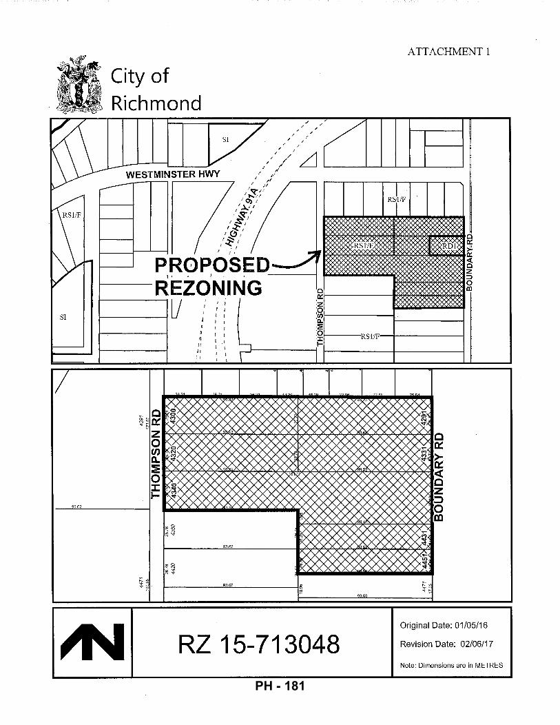
SI
96.62
City of Richmond
SI
ATTACHMENT 1
1-----Rst/F'--t--------1
93.67
r------~93~.~~----~w ~
93.60
Original Date: 01/05/16
RZ 15-713048 Revision Date: 02/06/17
Note: Dimensions are in METRES
PH - 181
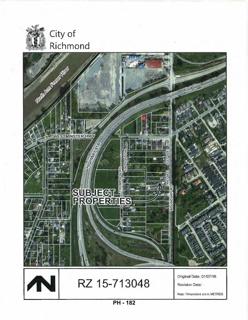
City of Richmond
RZ 15-713048 Original Date: 01/07/16
Revision Date:
Note: Dimensions are in METRES
PH - 182
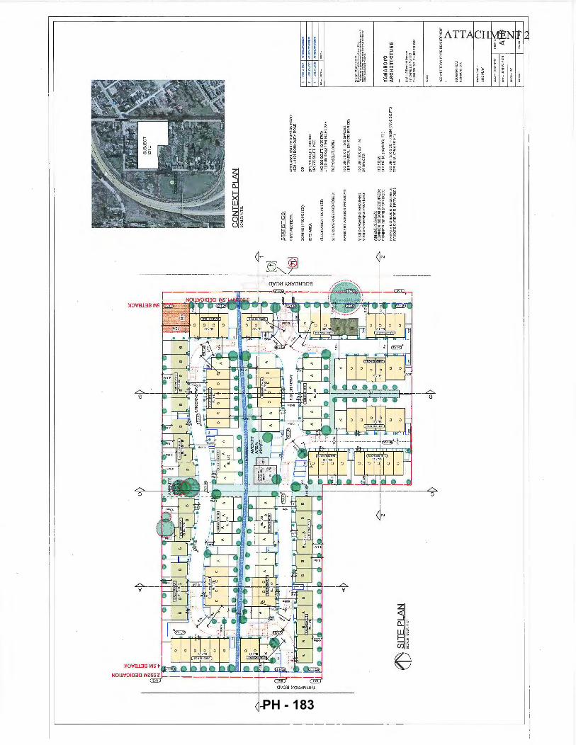
eJ) ~
.1!.~.
f.'LA
N
CO
NT
EX
T P
LAN
S
CA
LE:N
.l.t
>.
ST
AT
ISTI
CS
:
CIV
IC A
DD
RE
SS
:
ZO
NIN
G (
PR
OP
OS
ED
):
FL
OO
R A
RE
A P
RO
PO
SE
D:
SIT
E C
OV
ER
AG
E P
RO
PO
SE
D:
VIS
ITO
R P
AR
KIN
G R
EQ
UIR
ED
: V
ISIT
OR
PA
RK
I NG
PR
OV
IDE
D:
~8;
CO
MM
ON
IN
DO
OR
(R
EQ
UIR
ED
):
CO
MM
ON
IND
OO
R (
PR
OV
IDE
D):
PR
IVA
TE
OU
TD
OO
R {
RE
QU
IRE
D):
PR
IVA
TE O
UT
DO
OR
(PR
OV
IDE
D}:
4300
,432
0, 4
340
TH
OM
PSO
N R
OA
D
4291
-44
51 B
OU
ND
AR
Y R
OA
D
201,
105
SQ
.FT
. G
RO
SS
19
1,7
75
SQ
.FT.
N
ET
14
3,3
80
SQ
.FT.
(0
.75
FA
R)
:: 1
20 U
NIT
S@
;! 1
194
SQ
.FT
.AV
E
76
,71
0S
Q.F
T.(4
0'Y
o)
12
0 U
NIT
S X
2"'
24
0 S
PA
CE
S
(116
TA
ND
EM
, 1
24
SID
E-B
Y-S
IDE
)
12
0U
NIT
SX
0.2
=2
4
24 S
PA
CE
S
10
0S
Q.M
, 1
00
SQ
. M
. (1
07
6 S
Q.
FT
.)
12
0 U
NIT
S X
6 S
M =
72
0S
M (
77
50
SQ
.FT
.)
7JB
SQ
.M.(
79
44
SO
.FT
.)
[~i~~~
~~~~;~
~~~~:~
:
YA
MA
MO
TO
AR
CH
ITE
CT
UR
E
PH - 183
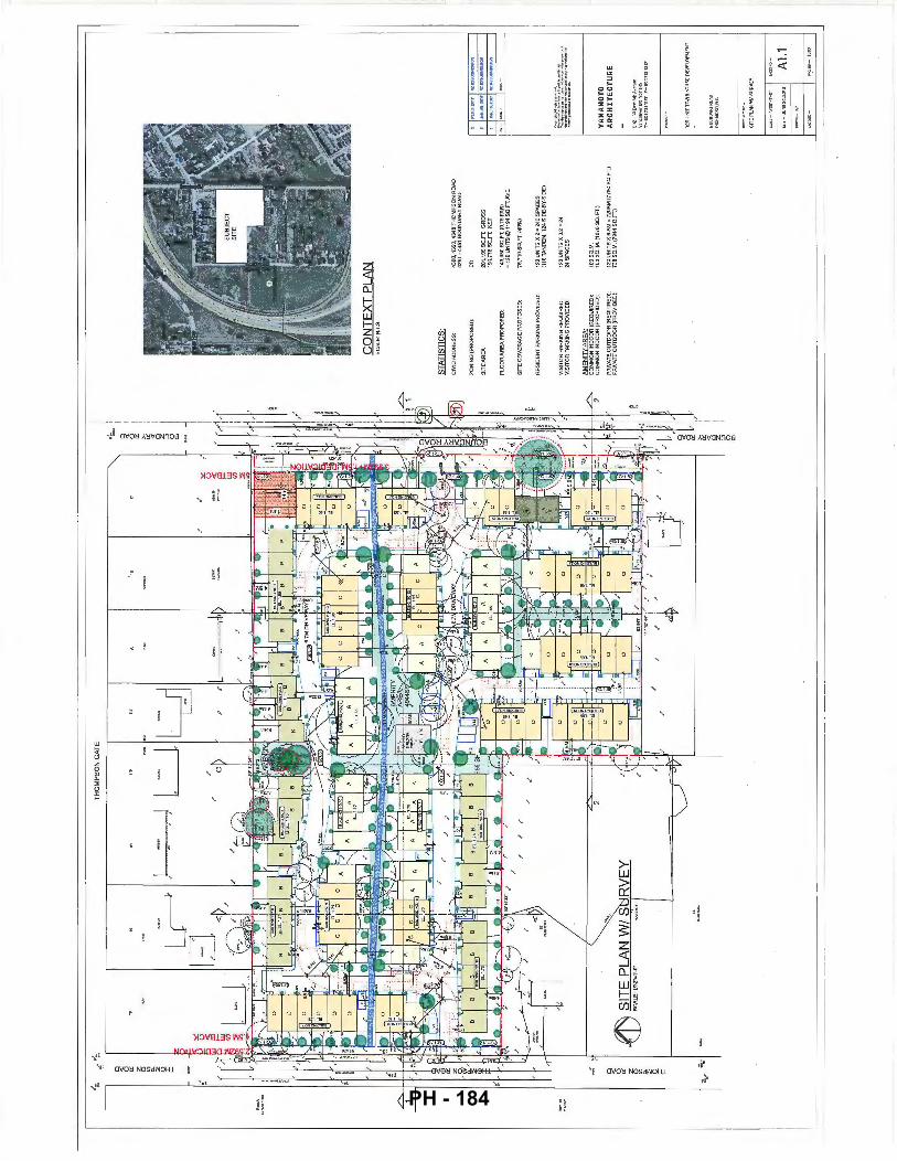
.-;;._
_ .. :.
~ -
0 "' 0 a: z 0 "' 0. " 0 I t- z ~ " 0 F'
::. ....
~.-'
I :~
.
.I
·'
TH
OM
PS
ON
GA
TE
LJI
U '
--~---
J
·'
.--
.-=... ~ ~ z g ~ ir <'i z ::>
£
CO
NT
EX
T P
LAN
ST
AT
IST
ICS
:
CIV
IC A
DD
RE
SS
:
ZO
NIN
G (
PR
OP
OS
ED
):
SIT
E A
RE
A
SIT
E C
OV
ER
AG
E P
RO
PO
SE
D:
RE
SID
EN
T P
AR
KIN
G P
RO
VID
ED
:
VIS
ITO
R P
AR
KIN
G R
EQ
UIR
ED
: V
ISIT
OR
PA
RK
ING
PR
OV
IDE
D:
AM
EN
ITY
AR
EA
· C
OM
MO
N I
ND
OO
R (
RE
QU
IRE
D):
C
OM
MO
N I
ND
OO
R (
PR
OV
IDE
D):
PR
IVA
TE
OU
TD
OO
R (
RE
OU
IRE
O):
P
RIV
ATE
OU
TD
OO
R (
PR
OV
IDE
D):
43
00
,43
20
,43
40
TH
OM
PS
ON
RO
AD
42
91 -
44
51
BO
UN
DA
RY
RO
AD
201,
105
SQ
.Ft
GR
OS
S
191
,77
5 S
O.F
T.
NE
T
1 43
,36
0S
C.F
T.{
0.7
5F
AR
I "1
20
UN
ITS
4i,l
119
4 S
O.F
T.A
VE
76
,71
0S
C.F
T.(
40
'f,)
120
UN
ITS
X 2
• 2
40
SP
AC
ES
11
10 T
AN
DE
M.
124
SLO
E-E
lY-S
LOE
)
120
UN
ITS
X0
.2.,
24
24
SP
AC
ES
10
0S
O.M
. 1
oo
sa
. M.I
107e
sa
. F
T.I
120
UN
ITS
X 6
SM
" 7
20
SM
(n
50
SO
. FT.
) 7
36
SO
.M.(
79
44
SO
.FT
.)
~ .. ~.~
·.-::
:;."".
-... ~-
··'"'·
~;:;
=;=.
_:::
:.·;
;:;;-:
.~~ ..
YA
MA
MO
TO
A
RC
HIT
EC
TU
RE
20
2•3
-J(n
!&II
IJW
•n ..
. v
.,eo
.,..
.,B
CV
5T
IRS
T-1
10
'7l1
11
V
F-1
10
'73
11
3V
BO
UN
DA
ifii!O
AO
R
!CH
MO
NO
.S.C
.
A1.1
PH - 184
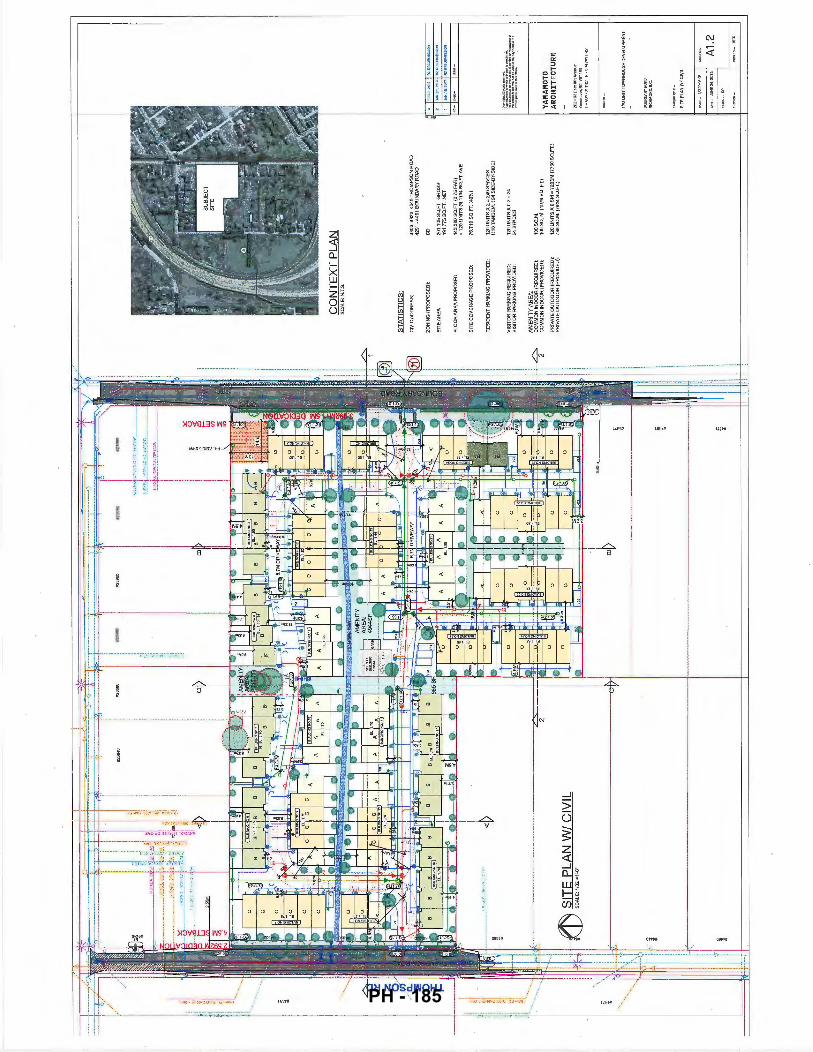
SIT
E P
LAN
W/
CIV
IL
SCA
LE
: 11
32"=
1'-0
"
CO
NT
EX
T P
LAN
ST
AT
ISTI
CS
:
CIV
IC A
DD
RE
SS
:
ZO
NIN
G {
PR
OP
OS
ED
):
SIT
E A
RE
A
FL
OO
R A
RE
A P
RO
PO
SE
D:
SIT
E C
OV
ER
AG
E P
RO
PO
SE
D:
VIS
ITO
R P
AR
KIN
G R
EQ
UIR
ED
: V
ISIT
OR
PA
RK
ING
PR
OV
IDE
D:
AM
EN
ITY
AR
EA
· C
OM
MO
N I
ND
OO
R {
RE
QU
IRE
D):
C
OM
MO
N I
ND
OO
R !
PR
OV
IDE
D):
PRIV
ATE
OU
TD
OO
R (
RE
OU
IRE
DJ•
P
R!V
AT
E O
UT
DO
OR
(P
RO
VID
ED
):
4300
, 43
20,
43
40
TH
OM
PS
ON
RO
AD
4
29
1 -4
45
1 B
OU
ND
AR
Y R
OA
D
201
,10
5 S
Q.F
T.
GR
OS
S
19
1,7
75
SQ
.FT
. N
ET
143,
380
SC
.FT.
{0.
75 F
AR
! =
120
UNITS~ 1
194
SQ
.FT
.AV
E
76,7
10S
O.F
T.(
40%
)
120
UN
ITS
X 2
= 2
40
SP
AC
ES
(1
16
TA
ND
EM
.12
4 S
IDE
-BY
-SID
E)
12
0U
NIT
SX
0.2
=24
24
SP
AC
ES
10
0S
Q.M
. 1
00
SO
,M,(
10
76
SQ
, F
T.l
120
UN
ITS
X 6
SM
= 7
20
SM
(7
75
0 S
O.F
T.)
738
SO.M
. (7
944
SO.F
T.)
~..;::;.:·r~·:
;, .. ...,,u
,_,.,,
_ ~~
~~.=,::
:,;·:
:r:;7:
?:·;;
;~:;:~
":"::~
:'
YA
MA
MO
TO
AR
CH
ITE
CT
UR
E
PH - 185
! IS
' ~~.~ ttl!l
l ~
T
HO
MP
SO
N
.r.' l
.· >
RO
AD
..
! •
!
SE
CT
ION
1
PL
I I ~--·
~ _I I,
-q
::'':""
J ~~
:~y
-1
-.;;j
>-~'!'- SE
CT
ION
A
SE
CT
ION
B
PL
I P
L '
SE
CT
ION
2
PL '
j I
[d. :.
· ··
· :
:. -···,
00~·
·:
··
:.
: .. · ..
sM
m·
· "
' -
··
··· :
.· ·.
1s
.sZ
rn·
··.
: _·_
:·,
l
3~. ········
·· Tl·
····· .
... T'
H
l II
D.II
\Cl'O
NT
Sl"'G
I.£
! ;
BL
OC
.4
B.lD
G
11
~~'t'ci'
~ .
. .
-...
.. ··
.·· ...
1: .. ·.
~~~.1·;_
'·"""'
BLO
C.
19
7-:=
-:·-----~
-· :.:·::
• c.: .
..•• ·:=
0:
:':.._
7"-'-
·-;)--=
-= . 7-~
;:1:~,~~
:\,,~ml
, ...
......
.. · ...
....
.. •••,;
;,e
;;;;
;;;=
····
.. ·· .
... ~ ..
~·,;;Oi,.,
;,;···· .. ·
-.
4 ~
~'j.
~""o~"
a.~·
1 c~tll
~
SE
CT
ION
C
7
YAM
AMOT
O A
RC
HIT
ECTU
RE A
1.4
PH - 186
" I I
BO
UN
DA
RY
RD
. ST
RE
ET
SC
AP
E
SCA
lE:·
,.,
-, .
..,
BO
UN
DA
RY
RD
. ST
RE
ET
SC
AP
E C
ON
T.'D
S
CA
lE:
lro
"lA
/
'r~
c ·..!>
.
....::
:::?- ';'
13
MS
.R.W
.
~&:t
f~~·
E::=
~~
YA
MA
MO
TO
AR
CH
ITE
CT
UR
E
202
-3
3r.
.SI8
!hil'
tf:n
!lf:
V
aiii
:Ollv
er,
BC
V5
TIR
'5
T-6
04
73
11
12
i'F
-6
04
73
113
2l'
12
0U
NIT
TO
WN
HO
US
ED
EV
EL0
PM
EN
T
A4
.1
PH - 187
l> f> N
I l
"'0 ::0 m () m 0 m z -i
s: ~ m (f)
I "'"' "'"' "" "'"' .... ,. -to m-t no ..., c ~
i·!~i
lll!! Hh! j:p! • h!" • HI I !l i'i_
l ; ~ i ~
' ' • • • I I i i
-I I 0 s: "'0 (f)
0 z ::0 0
~ ::0 m m -i (f) () :t> "'0 m
PH - 188
OJ 0 c z 0 )>
~ ::0 0 "Tl r 0 0 ::0 "'0 );: z (/)
I r I I I
(/) m 0 0 z 0 , r 0 0 ;o -u ~
z rt=~======~~~ ""i I I I
-·---·---·-·-r-,.-========~-.<---1~---·-·-·---·-
-l :I: Jj 0 , 5 0 ;o -u ~ z
e
PH - 189
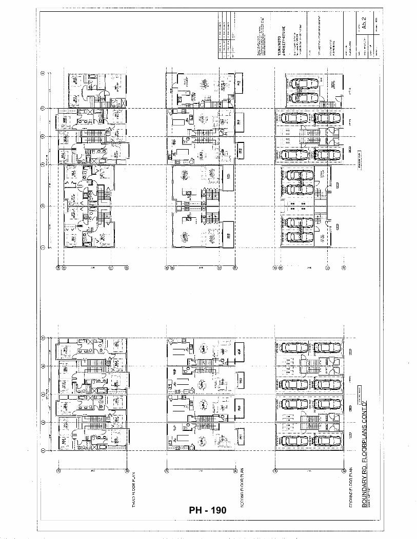
G)
0 0
0 ®
G
) 0
0 0
®
®
TH
IRD
FLO
OR
PLA
N
-----------,----------·-
SE
CO
ND
FL
OO
R P
LAN
GR
OU
ND
FL
OO
R P
LAN
I ""''
""""
"n I
!
BU
ILO
ING
N0
<4
1
BO
UN
DA
RY
RD
. F
LO
OR
PL
AN
S C
ON
T.D
' A
5.2
PH - 190
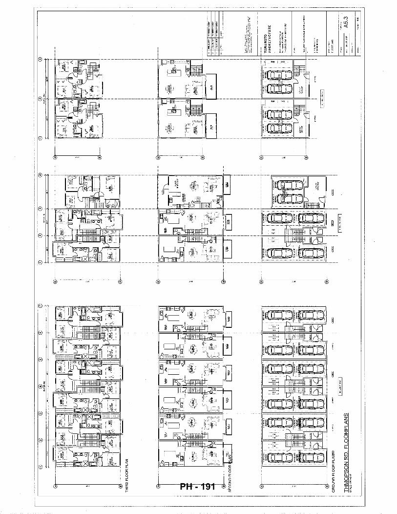
®
0 @
0
0
I G
RO
UN
D F
LOO
R P
LA
=
=
""""
I I
BU
ILD
ING
N0
.7 I
TH
MO
PS
ON
RD
. F
LO
OR
PL
AN
S
SC
ALE
:1/B
"=1'
-0'
0 CD
®
0
@
CD
S<
r-S
ilS
O'o
lj
i ,,.
,. ~~·.,..
•~s
I B
UIL
PIN
GN
OB
I
®
~
I""'~""'
"" I
0 I I •o
~ YAM
AMOT
O A
RC
HIT
ECTU
RE A
5.3
PH - 191
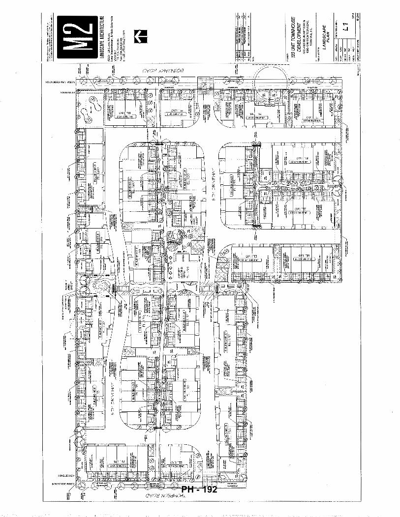
~· ~ z C
l ~ ~
#2
20
~ 2
6 Lo
rne
Me
ws
New
Wes
tmin
ster
, B
ritis
h C
olum
bia
V3
M3
L7
T
el:
604,
553.
0044
Fa
x: 6
04.5
53.0
045
Em
ail:
offi
ce@
m21
a.co
m
~
120
UNIT
TO
WNH
OUS
E DE
VELO
PMEN
T 42
91·4
331
BOUN
DARY
ROA
D &
43
00-4
340T
HO
MPS
ON
RO
AD,
RICH
MO
ND, B
.C.
LA
ND
SC
AP
E
PL
AN
L1
OFB
L _
__
__
__
__
__
__
__
__
__
__
__
__
__
__
__
__
__
__
__
__
__
__
__
__
__
__
__
__
__
__
__
__
__
__
__
__
__
__
__
__
__
_;'~=~;.c"•:;.".J
MlL
APR
OJE
CfN
UM
SER
: 16
-{}4
4
PH - 192
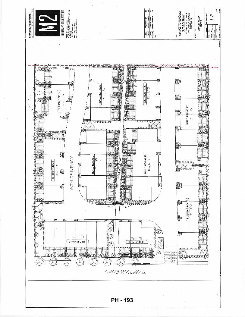
D
<:(
C)
0::': :z:
C)
\f)
Q__ 2:::
C) ::r::
f--
II
I \ ... J
.,.O::.U
. .. i..
.l. .. \
......
1 v
;;b
:,i
II
Rllll n
ltl.
lr:!
fl
.ln
1
1ii:
I "'
\'J
I I
tjU
JL
UII
\Il.
:J N
U. I~
I I
=
LAND
SCAP
E AR
CHITE
CTUR
E #
22
0-
26
lorn
e M
ews
New
Wes
tmin
ster
, B
riti
sh C
olum
bia
V3
M3
L7
Tel
: 60
4.55
3.0
044
Fa)(
: 6
04
.55
3.0
04
5
Em
ail:
offi
c:e@
m21
a.c
om
I ;J
::J
I~!"GW~
I:::;
120
UNIT
TO
WNH
OUS
E D
EVEL
OPM
ENT
~291
-433
1 BO
UNDA
RY R
OAD
&
430D
-434
0 TH
OMPS
ON R
OAD,
RI
CHM
OND,
B.C
.
SH
RU
B
PL
AN
W
EST L
2 CJ
FB
L-------------------------------------------------~----------------------------------__;
'::OO<.:_:<·
cc;l<z::'
.J Mll
APRO
J!CTN
UMBE
R: 16
--()44
PH - 193
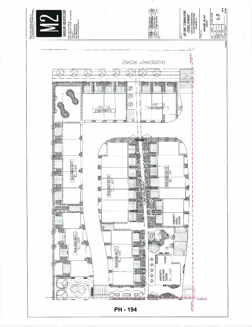
I I
lANDS
CAPE
ARC
HITEC
TURE
#
22
0 •
26 L
ome
Mew
s N
ew W
estm
inst
er,
Bri
tish
Col
umbi
a V
3M
3L
7
Tel
: 604
.553
.004
4 Fa
x: 6
04.5
53.0
045
Em
ail:
offi
ce@
m21
a.co
m
D
<t:
C) ex:
>-I
ex:
<t:
I li8
~I'OR;Rf'Zr'MIIIJ
lg
D
---
RE
VIS
(f:J
RR
<:a
+B
II!i
z '
~-~
=::::>
I C
) lD
I I I
120
UNIT
TO
WNH
OUS
E
II DE
VELO
PMEN
T 42
91-4
331
BOUN
DAR
Y RO
AD &
•'
43
00-4
340
THO
MPS
ON
ROAD
,
~I
RICH
MON
D, B
.C.
~I S
HR
UB
P
LA
N
~I
EA
ST
DRA
WIN
G N
UM
B!
L3
OF
B
M2L
APR
OJE
CTN
UM
BER
:
""'''
PH - 194
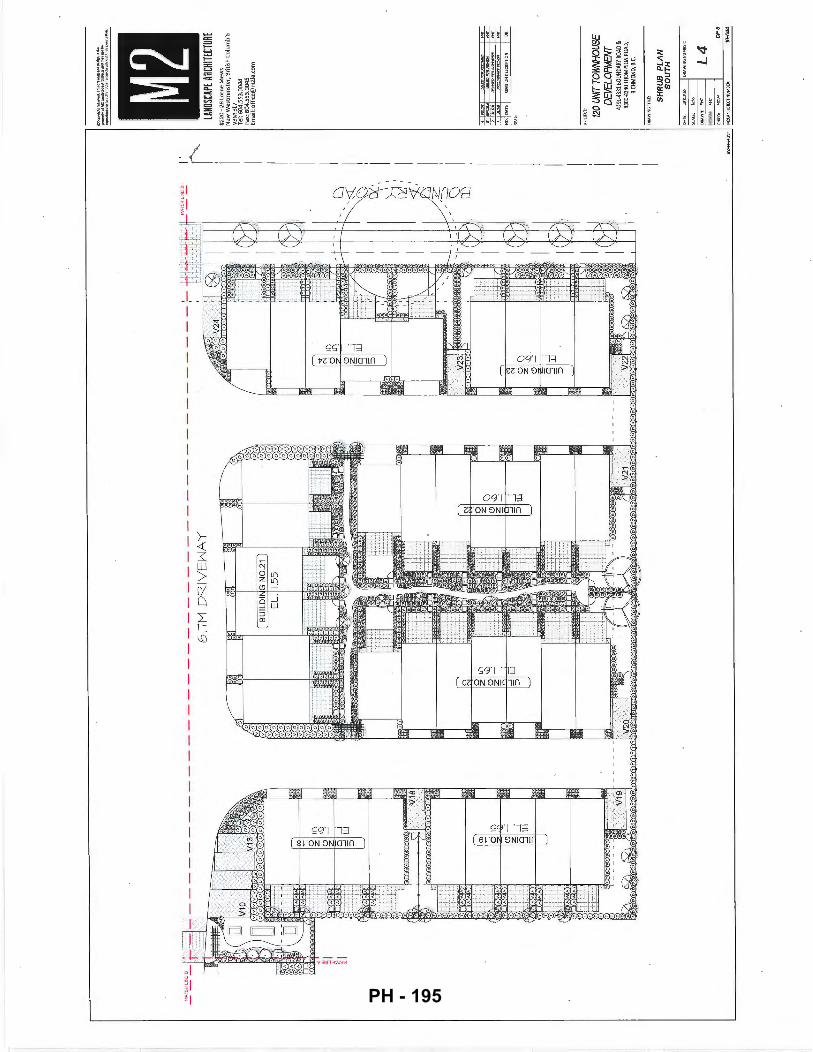
6.lM
DR
IVE
NA
Y
I'
~""-
lANDS
CAPE
ARC
HITEC
TURE
#
22
0-
26
Lo
me
Mew
s N
ew W
estm
inst
er,
Bri
tish
Col
umb
ia
V3
M3
L7
Tel
: 60
4.55
3.00
44
Fax:
604.
553
.004
5 Em
ail:
offi
ce@
m21
a.co
m
~~!<t'I'II'H
""
120
UNIT
TO
WNH
OUS
E D
EVEL
OPM
ENT
4291
-433
1 BO
UNOA
RV R
OAD
&
4300
-434
0 TH
OM
PSON
ROA
D,
RICH
MON
D, B
.C.
SH
RU
B
PL
AN
S
OU
TH
L4
OF
B
L---------------------------------------------------------------------------------
_:__ _
_:,
~W<~~~·~
::::.J
Mli.
APR
OJE
CT
NU
MaE
R;
f6-(
)44
PH - 195

""""
z 0 =~~: ~=~
~~~~
:;,"
:"· ... ~·
;~~~
. ~~~%L~~~r;-~~~~~~~~*;~
il ~ ~
•'""
""'d
<>r
mod
lo<
oth
< p~J•m wit~out t~•
l< """""~"
~~~
Lcg;
~l.~-~~~r~
-~-t'
i::r~~
'"'l.ll!:
r'.
~ ~ ~
" e.~
,.
lANDS
CAPE
ARC
HITEC
TURE
#
22
0-
26 L
orne
Me
ws
New
Wes
tmin
ster
, B
ritis
h C
olum
bia
V3M
3L7
fl----
------
---1
11-_.
..J
1-e
I
I 1:
:1-.,
I.O
VI
I I
I 1-
-l I
I ~
I/.
:it11
u.J
I II
I (I
I
I•LA
LD1ff
iGN0.9
1J I ~
BU
ILD
I N
OW
I ql
II 1~
,:'~"11
I
II I
II I
II I
II Jl
I ~
-l ~ 1\
I
D
J r
I I
I I
I I
I E
L.
11
0
I [l)
·-[d
l :
I (
I 6
~ ( Ill
•
1:
• J
: rl ~~
--.~
~ J
Jl
U1-
Jl10
rLJ rU
U
U
q~~::'
J~ " /~~~
~ ~~·
. •
i I ~
~ -
~o •
Uw
-l ~
JllM
lJlu
1
<:o<:o
<:o<:o
<:o ~-~ :_<Jll)
-§
a
l J
1 ~~
I( ;~
~ :z
~co
AM
EN
ITY
1
-lf"
LJ1
~ I
1 ID
~ I
1: : _j
[ '
BU
ILD
I G
ND
.l
ll"\"i"
ti' BUIL~L.
1.~~14 1
( ~i~~
: B
D 0
BUI~~-
1.~~13 tl
tr II 1
!
\ E
L.
1.10
V
9 •
I .• ~
r ~~~
~TY 1
"_ _ .
1 1
, ~~
)---
~ 1.-:
49
44S
F
~
: ~
:\
I I
. 1~1
~110
~
~ 1
IT
V14
V
17
I[__
/ ;
: !?
='
c'J,..
11-:1
1:
v71
'-' •
•·
. '
Cc;
'1ll
r r
------
--=.
II>"'
···-
-·-····
·······
····•
11"'1
, o
~F
~-
' :~/
f~-1
,1--'
:
--2
.8%
6
.1M
DR
IVE
HA
Y
..
1
~ 1v
24
J' ~ 1
D V1
0 B
UIL
DIN
N
0.1
7
13
_ B
IL
DIN
G N
0.1
~
EL
. 1.
10
D
"""'
L..
__
j B
UlL
DI
G N
0.2
1 f.
I
Tel
: 60
4.55
3.00
44
Fax:
604
.553
.004
5 E
mai
l: of
fice@
m21
a.co
m
~
J :
~ )__] v
~ T
J-
Jr-r
.1
;:.-
J r ~
" Jz
I(
lw·oC;~fl t
" ;;;
,J ~i l#.
k~1>d
~ I:F· t
ft
~I J;
0 ~
• .
U'' ~~
~rPI
W '·
:1 11
1 -
--
-1,:
-
'~Ji:
;§J
955S
F~
: ~-
I~~~
k ~"'
.L.
.,·:.t.·
·p··.,
I No
.lcAT
EI ~
=,·-
w= .. ·-~
f
·-~ ,
..
, '"
i--
15
rrJ ·.r
I ..
. f~
1 CJ
~<~ ~ W
~
g ~1J
" I ~
:: '1
,
,.
gr
r :
m
I 1fJ
,
; '-"
' ~
joe h
' ·
I _:
~
. :
··.j
-L
_.·
~
o ~
m
~ --
-.
V23
'
T( _
.
'~ >-
g m
~t
g 0
1 I
~ .2
!.
If)
~~
h.---
-[I]
~-Q
"'
120
UNIT
TO
WNH
OUS
E D
EVEL
OPM
ENT
~
-1
~
sw
Sid
~£
](
1~
'" ~
>-D\
. 0
• I
4291
-433
180U
ND
AR
Y R
OAD
&
4300
-434
0 TH
OM
PSON
RO
AD,
RICH
MON
D, B
.C.
'E~!
i?J;PEL! ~
~ I [
! ~
rrJ '(
,~w"'=•
· ~=~~~
·~
'" Jl
G>
.
' G
RA
DIN
G
;c=
>
r-;;;
16:
I ~
PL
AN
••
_,.
_-
;;
( 0
1 '-
=,
__ _
_ _
_ __
__
__ .0
7. :<: _
____
____
. ,.
.. .. .
.
--1:-.
--I
I:C:I
""'
..,. ••
Jo"
w'"'
""""
V
20 ]~
~~?-
----
---·
___ ,d
!. __
'1
t1
J.2
L
::J2Z
:..::t
:..=
---{
) I
c~ S
CALE
: J,~
J
(()1
DR
AW
N;
PH
T J
L5
lf'-:1
DE
SIG
N:
Fff
l
lCJ
CH
K'D
: H
1L
M
OF
B
L------------------------------------------------------------------------------------'
~~~·~:
::.1
MllAP~
OJECTN
UMBER:
1
6-{
)44
PH - 196
PL
AN
T
SC
HE
DU
LE
~Qt'
MZ
.1
08
N
UM
81
!1!:
'1$·0~4
PL
AN
TI!
D
81Z
I!
/ II
EM
AR
ICS
(f.
~'!PAA!Sit:li:7Jt:A'If!MmaLA
'
GAATJ.ff;l.6~1Al'Ht.l
l'
Ol.a
>l1!
iiA T
. to
l15
'!oi
te.l
t!-1
' W6MOLII\>r'fl.~
~~, ....
_. ltif'llttltlOT'I<:A(;~
,...
.._
5D
CU
!l.!
5C
.Nil
ntw
mt:
ll!l
l ~TIOE'I'I..OGI.'$1
wz.
.oa
:TH
w.6
1a
.lo
'.
""""""
"'""""
' - """"
I()!;NlEUAfOtWtO~
~
Bfi<JlfRI5\IB!RLCU.~
noa00lo5~
:, ::,~~=
""'
o:;G
IRW
$5fl
!li:
,U.'I
:fU
ei'J
' 11<
1 I.DI!io'A'KAIITIDA~
!Gle~~ll
~ ~~~
~'atllllieoiW'I'51fml!'
~""""~
IDT
~~'Rl«.ftllloO.
'
114
Sl::t+U.~/'Oli'W.V
n sa::t+IIA~Ix:.WU)
~
51'1
RII
fA}(
~ '
UT
!I.E
PR
K.E
6'
TA:<lO:.Xtu>IA~
II'
~~....,..~/fii'OT)
-~~
""""
""'""
" ""
"""'"
"""
1-£'<1c.AN~OI'CAN6I!
~~""""""
LO
II\U
itA
W.Y
eR
EB
I f~MOU.Yo~l+llll'!
~fU;OPIC
-~
~~Tl,LI'Io'."l'"
""""
""""
""""
·~~
~-
.....
~-
.....
UTTI.£f'RII&e'6~PN::
~--
~·
DAVIDS~
!203
~llSAGIIII'l.O!U<IWU.I'Of~1'l:R'
'II
GAAE><'IGED~E'
n2
GHID(~I'.o.&RfO'IAAJf.&ATA'
JM
I'!'~AI.~IW't'UII'
-Pf~~\.rrn.fEIMII"
F~TEP.Rf'E06RM.6
51
LV
I'RV
Alti
i!8A
i!D!f
PI5
f eo
t.D
BIV
AA
16
AW
J.'.!
'Ne>
E5
fD5E
D
I-W
!I'I'
CIH
IAJN
61U
6'5
UT
TU
!I!U
HfF
C;W
T..
_,.e
AA
$
~~~ --
-!C
eo
~'J>TW.AO'ORO'
D
1'14
.01C
51al
.AT
A
~RU:>eU.I:Io'.l.n'A
TDT060LD'
-VI'WO'DA'I'I. ..
Y
""""
'"""'
@)
:61
~XD.AAI.~~SIW'Ir'
@
~l
lW5
.'. K
W!F
~-
....
... I
VN
l litl
OM
:>rl
l!:>
e-.
..rJ
.'rJ
IIli!.
I.Jl!
PIO
:QI
·~-~
~···-·--
---r:
Q
rn ~·aar~~-.l'!P
sr.-lf<'R)~
• •
•
~~~~~v
v v
Ti1
D"U
PN
!HX
IPIV
J«
5
OO'*'I'M!!ll:l!~
~le<'-UHSII<~tNtleJ#'
____ J :-
Ji
211H
T,e•
e 6C.H~
Illtt~TO;IIII
!I
:: ~ :::
~~~~·
6(.Hc.Al,J~,TO,Il1D
"~
"~
"~
"~
"~
"~
~::·~
.,l'!n
,6(X
.KIM
f118
"~
"~
"21'
111"
1l!O
a"'
~""
''""
"~
..,P
OT
,eo:
xl'l
··~
"21'
111"
,!50C
M
''""
"""
''""
··~
ST
EP
PIN
G L
06
S
Lb
I SG
ALE
I 1/
2' •
1'-o
"
ELE
VA
TIO
N
=~
~~'
RA
ISE
D P
LA
NT
ER
NE
66
1E
PLO
TS S
> C
OM
MU
NIT
Y 6
AR
DE
N
-LAI.I.t()(.l[)P
.T.t
f:WF
II!.
Lb
I
5GA
LE I
3
/4"
" 1'.
.0"
ob<~
P0
5T
F
t:>
5T'-
N'
2x~~
r7
-~
t~ .. ~
&'O
.t:,.M
A.JC
I
v
l ~'g~~~~TOt::
S'ISTA/QIIRONO
BOCQ
I'$
2.AU.OT1-6t~TO
tllt.~
'2(r
.otl
51Rl
tTlo
:W.s
RAD!
/'!!
HIIo
t.M
3.AU.~HO'I"PIPF'I!PISo'II..VAh"llR'.
<f.
N'R..l'2CCI'It!lfX15!.10RSTAlNWI-Wlf'
At::
n.Rf
fl!>~l"IOH.
ftHI51151l.ECJIOHAS~I'l'"~TARU!lJECT.
l,
'!.TMITOW.TGI1.-RGI1.'M)WA~Pit&'ILHI£ATI£RPROofDeST
!i.,O,UrASl5ti!SIOT·~6H. ...
AA
IZm
'
ED 6' H
T. H
OO
D P
RIV
AC
Y S
CR
EE
N
Lb
SGA
LE '
1/2
" =
I'-
D'
L,~--u
l r-
-.-..
· I
r mrn:
---'---:va
RAI!-
1105
~ _
:;::
:;:;
L
-
-2X
2 D
EU
!N6
!1. ~~~"j~~~~g,:~~'SlV'5(HAJCJ
.
f1j; -
• -
~J] .. ~~
------
~
42
' H
T. P
IGK
ET
FE
NC
E a
6A
TE
H
OO
D B
RID
6E
L6
I
SC.A
LE I
11
2' z
I'-
D'
SC.A
LE I
3/
r!J'
• I'-
D'
fW!IIAis,.-.•~o...--
....
-
f.ICFILlAATIOH!tl'!iT&!TOBE~8"1'GIVIL
n=rnn=fl'n=r'T
'T'l~r=c=T'T"T"T''=ti'-~t~
.... R-
1 I I
I Ill
I I I
I I I
I I I
I I I
I'Y-1-
--· ~kt
'·'~
"·.,... :,
·. -~=
...
... l.
•
• !il
.e6R
AD
E
' O
R
• PA
TlO
OW
5LA
B
~·-o'l'lo'..>C.0£..----1
12'x
l:2'x
2<4'
GO
N::;
.FO
OTI
H6
KO
MP
AN
Pro
duct
Info
f-::·
. -
~ ·
~~~~
~ ~$ ~ ~~:
;;: §.
'~~
}'
UN
IT P
AV
ER
DE
TA
IL
Lb
I
SC
ALE
I
N.T
.5.
.,...
I. A
LL P
O$T
S. ~ T
REA
TEO
TO
GS>
A ST
N!D
AR
D A
tD E
I!D O
JTS
TR
EA
TE
DH
inlP
RE
SER
VIT
II/E.
,~~Of'~~DAAIW.Sf
2.
ALL
OM
R M
E)'
[BE
I'5
TO
&
CED
AR
. t2
(c.o
t6TR
IX::n
oW 6
RA
DE
Hlll
i!-U
-1.
4,
AP
f'L
Y 2
WA
T5
EX
TE
RIO
R S
TA
IN T
O M
A).
Lf',o
,c:n
RE
RS
SP
EC
IFIG
AT
IOII
. FI
NISH
SB
.&;T
ION
AS
APf
'RO
.tED
B'l'
PR
O..E
GT
AR.
CHfT
EGT.
5,
ALL
F~ T
O 8
E L
&a
. G~ ~ 6
AA
De
TO B
E lll
l2"·
1!)'
5lB
"51K
o\X
).
&N
'5 T
O 6
RA
DE
TO
FO
U..O
W F
ltiS
H 6
RA
DE
. &
AP
TO
flf
:H>
'.
6'
HT.
HO
OD
PE
RIM
ET
ER
FE
NC
E
L6
I
sc.A
LE •
1/2
" =
1'·0
'
2ICt
l P.
T.I£
HJF
IR H
OO
D E
D6E
/>
6M
OH
IN5
5T
RIF
'""-
'N5
l.E
NI5
TH
OF
D
RA
IN S
TR
IP S
TAK
E E
VE
R1'
1..21
0111
OC
.. O
J"!>!
'Y'lt
~··'"
''''""
'l
DR
IP S
TRIP
L
6
I S
C.A
Lf I
3
/4'
= I'
-D"
ST
EP
PIN
6 S
TON
ES
L
6
J SG
ALE
, 3
/4'
• I'-
D'
P"""""
!lflG
H "<
-~ W~-b
,,c-
e
C.LI
MB
IN6
RO
C-K.
b.J B
lgTC
¥
ST
EP
PIN
5 L
OS
S
lANDS
CAPE
ARC
HITEC
TURE
#
22
0-
26 l
crn
e M
ews
New
Wes
tmin
ster
, B
ritis
h C
olu
mbi
a V
3M3
L7
Te
l: 60
4.55
3.00
44
Fax:
604
.553
.004
5 Em
ail:
off
ice@
m21
a.co
m
-~ ~~RM&I
;;;;-
120
UNIT
TO
WNH
OUS
E D
EVEL
OPM
ENr
4291
-433
li!OU
NO
ARY
ROAD
&
4300
-434
0 TH
OM
PSO
N RO
AD,
RICH
MON
D, B
.C.
LA
ND
SC
AP
E
DE
TA
ILS
L6
OF
B
'-------------------------------------------------------------------------------------"
""'='"':
::'~::...
J M
21.A
PR
CJE
ctN
UM
BE
fl:
16-0
44
PH - 197
PR
.CJD
CS
FD
BU
I/_D
IN:3
I ool
j,~;
'~RI
T;/
SE
CT
ION
A-A
SC
ALE
1/4'
= I
'-D
'
l.,t.ll~DI-ti'BER5TOEIE~TREATEPTOG~,O..!">TAIVAADS
2.
N.l.
IW
WW
IRE
TO
Bf
f'OT
-PIP
I'I'D
eA
LVA
NIZ
ED
!:I.N'A..Yll'CW.O,TSOF!">TidNTOW\Tc.HWJ.I>~(TOeE~PI'l"f
Ol<folERCR~Idi'allEGoT)
<1. WATA~lCIIfSI/RF,o.c.ESI'JTH51MlLAI1:PI<'.E5ERVA11\II':I-6~
"""-
""' r'·~---"'ro~~~-·""-·"='
~ (
~'"'
r· , '
i·Q·
::: '"'
1\ • I/
:31'
05TI
N~2'
11'
C.O
NG
f<ET
EFO
OTJ
/.If;
~
.
:'l'DRAIIIRX~
HO
OD
TR
ELL
IS
SC
ALE
, 1
/2'
= I'
-D"
""""""
~'"'
" ""
"''
FOR
Lie
liTI/-
15
'"
'"'
PR
OP
C'S
EU
E
't!iL
DIH
G
f"H
TH
"Y.£
>
;~~IT
• •&;~~
~::::=
=="'m~
~ =====
....'"
"~· -~
SE
CT
ION
B-B
S
CA
LE ,
1/4
" 1'
-0"
NO
TES
,
I. A
l.L W
OO
D 5
45
, P
.T.
HE
M/fi
R;
PO
STS
TO
BE
FR
EE
OF
CR
AC
KS
2.
C
OA
T A
LL W
OO
D W
ITH
2 G
OA
TS P
REM
IUM
WE
ATH
ER
PR
OO
FIN
6 N
OO
D S
TAIN
, SU
GH
AS
BE
HR
SE
MIT
RA
NS
PA
RE
NT
STA
IN 6
RE
EN
~'1
04 (
CO
NFI
RM
r!IT
H
LAN
DS
CA
PE
AR
CH
ITE
CT
PR
IOR
TO
AP
PLI
GA
TIO
N
~[c:l
I.e:
PRCJ.9~c,ED
BU
ILD
ING
SE
CT
ION
C-C
S
CA
LE ,
1/4
" =
1'-0
"
,.,,_
)"t"
"-D
I)
TRE
ES
P
RO
TE
CT
ED
B
Y
SP
EC
IES
A""""
f.I
OTE
, A
LL T
REE
5 I<
Ee"
'RD
J..E
6 O
F S
IZE
AR
E F
RO
TEC
TEO
IN
Hle
H E
N\1
7/i'.
a<H
EN
rALL
Y"
5EN
SIT
IV!'
AR
EA
!">
e .... R
RY
"OA
K
PACI
FIGIX'
I5H?O
O If···
· .. ·
·~4~
:;;,
. "">
w",:.·
~p·K
<t,-,."'
~,~1 ~-~
~"\I
.• '·t
~-I.
'tJ-o-'!
.,,. •"
-'i'
\;;~
, i~'14
:.> "
~' ;:·~
t
TRE
E
PR
OT
EC
TIO
N O
IST
AN
CE
T
AB
LE
""' JffiN
MlN
IH.H
RE
a!I
RE
D
"'~
F'R
OT
EG
TIO
NR
AO
I!i!
lrlc
m.o
(VIST~f'RD/1
""'·'
TR
JNK
INI-
fl"R
ES)
~
'" "
, "'
" "
'·' <o
, ..
" '"'
~
' "
" w
"
" <
5
•o '
"" E
xrR
AP
OLA
TEP
I<O
TEC
l101
1RA
01U
SFO
R
TR
EE
SU..R
eER
TH
AN
IOO
CK
<h'l.
'IO
IAM
E'TE
R A
T B
RE
A5T
IIE
I6H
T O
R 1
.4K
f'R
D/1
6R
AD
£;1
TRE
E P
RO
TE
CT
ION
FE
NC
IN6
Ll
/ S
CA
LE
' N
.T5.
~-
,..:
1--
---
14X
4 G
RO
SS
PIE
CE
CU
RV
ED
PE
R6
0L
A
SGAL
E '
3/EY
' =
1'-0
"
DO
UB
LE
lbX
2
CU
RV
ED, B
LUED
A
ND
NA
ILE
D T
O&
ETH
ER
lANDS
CAPE
ARC
HITEC
TURE
#
22
0 -
26 l
orn
e M
ews
Ne
w W
est
min
ste
r, B
ritis
h C
olum
bia
V3
M3
L7
T
el:
604,
553,
0044
Fa
x: 6
04.5
53.0
045
Em
ail:
offic
e@m
21a.
com
120
UNIT
TO
WNH
OUS
E DE
VELO
PMEN
T'
4291
-433
1 BO
UNDA
RY R
OAD
&
4300
-434
0 TH
OM
PSO
N RO
AD,
RICH
MO
ND, B
.C.
LAN
DSC
AP
E
DE
TAIL
S L7
"""
'-~--------------~~--~-----------------------------------------------------------------'--~"C''""':.JIP M
llAPR
O!EC
TNUM
BER:
16-o
44
PH - 198
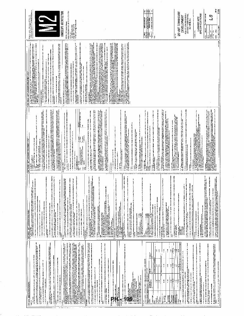
mm
'11'1 !I r ~t
(I)
~~ £1:c: :!]~ (\') ~~
r--:l, 00 ~'"
i (I)
~
i! ~f lfilf r H n
~~~~~~ j ~1-HHH-+-+-1 i
! '"!' ' I H-HI-H---1---1
I; .. ~ i i
r !i
jl!io
¥{ I!
~ ;ot; ~~ oo zs; .a~
~~
i
i i ! ~ J . [
.
' I U f
i\5 0
~~ pj==: oo -u:;;: ffi~ ~0
as rn
illl i ~~ t !It
~u
m IH
II II = u:
l ~i
i I
i i i
iH
U! . ' j ~ 1 a ~
PH - 199
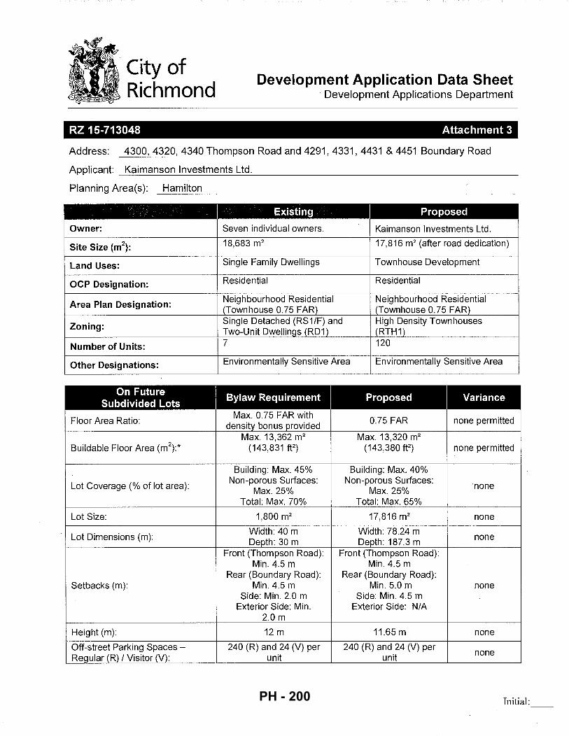
City of Richmond
Development Application Data Sheet Development Applications Department
RZ 15-713048 Attachment 3
Address: 4300, 4320, 4340 Thompson Road and 4291, 4331, 4431 & 4451 Boundary Road
Applicant: Kaimanson Investments Ltd.
Planning Area(s): Hamilton ----------------------------------------------------------
Existing Proposed
Owner: Seven individual owners. Kaimanson Investments Ltd.
Site Size (m2):
18,683 m2 17,816 m2 (after road dedication)
Land Uses: Single Family Dwellings Townhouse Development
OCP Designation: Residential Residential
Area Plan Designation: Neighbourhood Residential Neighbourhood Residential (Townhouse 0.75 FAR) (Townhouse 0.75 FAR)
Zoning: Single Detached (RS1/F) and High Density Townhouses Two-Unit Dwellings (RD1) (RTH1)
Number of Units: 7 120
Other Designations: Environmentally Sensitive Area Environmentally Sensitive Area
On Future I
Bylaw Requirement I
Proposed I
Variance Subdivided Lots
Floor Area Ratio: Max. 0.75 FAR with
0.75 FAR none permitted density bonus provided Max. 13,362 m2 Max. 13,320 m2
Buildable Floor Area (m\* (143,831 ft2) (143,380 ff) none permitted
Building: Max. 45% Building: Max. 40%
Lot Coverage (%of lot area): Non-porous Surfaces: Non-porous Surfaces:
none Max. 25% Max. 25%
Total: Max. 70% Total: Max. 65%
Lot Size: 1,800 m2 17,816 m2 none
Lot Dimensions (m): Width: 40 m Width: 78.24 m Depth: 30m Depth: 187.3 m none
Front (Thompson Road): Front (Thompson Road): Min. 4.5 m Min. 4.5 m
Rear (Boundary Road): Rear (Boundary Road): Setbacks (m): Min. 4.5 m Min. 5.0 m none
Side: Min. 2.0 m Side: Min. 4.5 m Exterior Side: Min. Exterior Side: N/A
2.0 m
Height (m): 12m 11.65 m none
Off-street Parking Spaces- 240 (R) and 24 (V) per 240 (R) and 24 (V) per none
Regular (R) I Visitor (V): unit unit
Initial: PH - 200
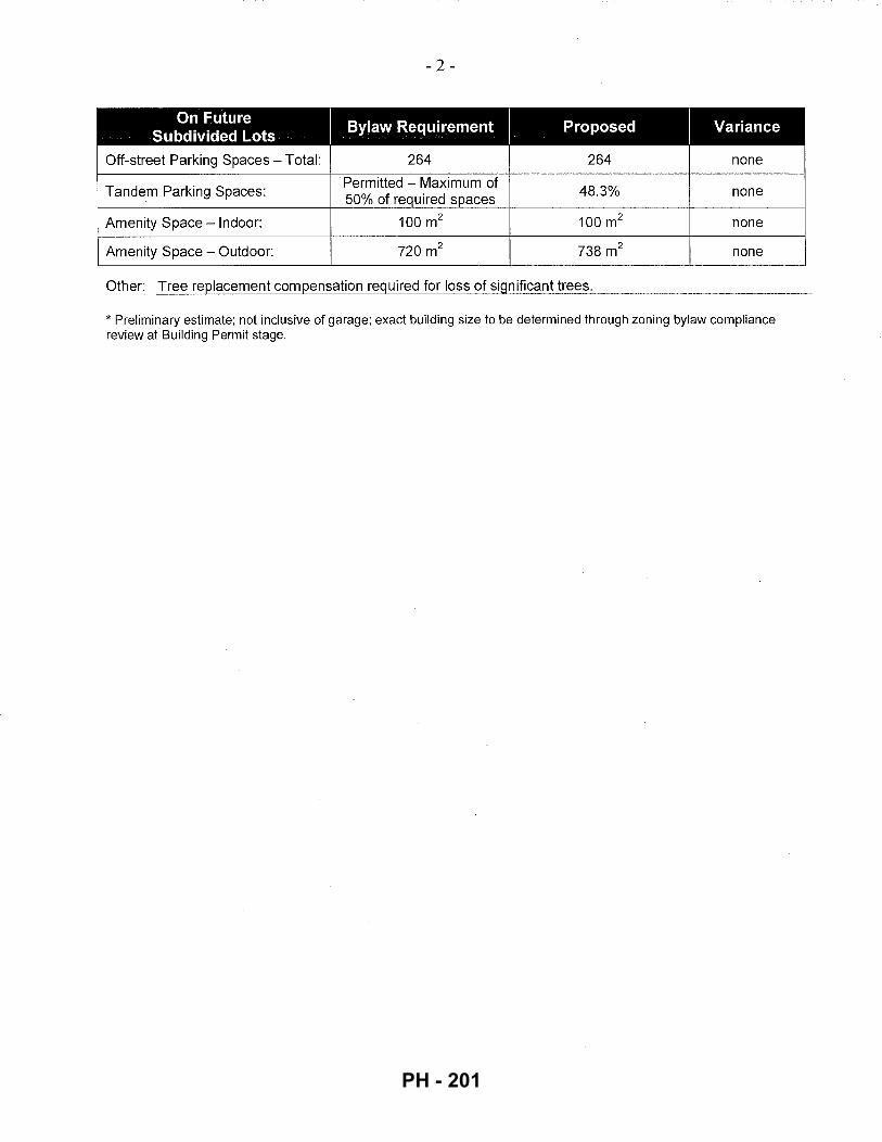
- 2-
On Future Bylaw Requirement Proposed Variance Subdivided Lots
Off-street Parking Spaces- Total: 264 264 none
Tandem Parking Spaces: Permitted - Maximum of
48.3% 50% of required spaces
none
Amenity Space -Indoor: 100m2 100m2 none
Amenity Space - Outdoor: 720m2 738m2 none
Other: Tree replacement compensation required for loss of significant trees.
* Preliminary estimate; not inclusive of garage; exact building size to be determined through zoning bylaw compliance review at Building Permit stage.
PH - 201
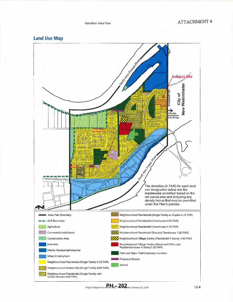
Land Use Map
- Area Plan Boundary
• • o ALR Boundary
Agriculture
i?i/?~ Community Institutional
- Conservation Area
- Industrial
- Marine Residential/Industrial
- Mixed Employment
Hamilton Area Plan ATTACHMENT 4
.....: Q) ... 1/J t:: -·-0 E
>-..,IIJ ·- Q) u:s:
== Q)
z
The densities (in FAR) for each land use designation below are the maximums permitted based on the net parcel area and including any density bonus that may be permitted under the Plan's policies.
- Neighbourhood Residential (Single Family or Duplex 0. 75 FAR)
l::'·(·~<· l Neighbourhood Residential (Townhouse 0.55 FAR)
i~!:/S; Neighbourhood Residential (Townhouse 0.75 FAR)
- Neighbourhood Residential (Stacked Townhouse 1.00 FAR)
•:•:•: Neighbourhood Village Centre (Residential 4 Storey 1.50 FAR)
- Neighbourhood Village Centre (Retail and Office with Residential above 4 Storey1.50 FAR)
- Park and Major Trail/Greenway Corridors
- Proposed Streets Neighbourhood Residential (Single Family 0.55 FAR)
- School ~ Neighbourhood Residential (Single Family 0.60 FAR)
~ Neighbourhood Residential (Single Family with Coach Houses 0.60 FAR)
Original Adoption: June 19, 1995 I Plan Adoption : February 25, 2014 12-4 PH - 202
I i
; !
I :
I I
I I
I II
I I
I I
. I
I I
I ·
I
~---
----
~---
L-~ _
__ L_~-------~ M
H.
TH
OM
PS
ON
G
AT
E
~·~---T---T---T--1--T--T-----~--~
""•
i i
"~ i I
,,
_ dl"
:'J i
' i
i i
I 1~
1 I
I I
I
I I B
I
I I
#2
39
60
J I
#
23
98
0
I #
23
98
8
j DE
CK
I NO
ACC
ESS
I EM
PTY
LOT
I I
~ ~ I
I U
>H
W I
I I WO
OD F
ENCE
I
~1.
I I
II
!'II
SIT
E L
OC
AT
ION
S
CA
LE 1
:500
00
WO
OD
FE
NC
E
.-->
..,-
---w
ii'i"E
'F'E
NCE
E
3""
'C
•
ES
AA
rea
.
w L----~
------r
WIRE
FEN
CE
..._w___~ _
=.!
I -
¢ ~cs
FHI
SH
ED
6
AR
A
E
f I
0 ~
~ I
I #
44
20
1;!
CAR
PORT
I I
I
~ I ~--
-----~
"',
I I
#4
44
0
N A N
OT
ES
: R
EF
ER
EN
CE
D F
RO
M:
SU
RV
EY
PL
AN
BY
MA
TS
ON
PE
CK
& T
OP
LIS
$
SU
RV
EY
OR
S &
EN
GIN
EE
RS
. DVI
IG.
Na.
R·1
S.1
7861
·TP
G,
DA
TE J
UN
E 9
, 201
5
LEG
AL
DE
SC
RIP
TIO
N:
l 75
SE
C 3
6 B
KS
NO
RT
H R
AN
GE
4 W
ES
T N
EW
WE
ST
MIN
ST
ER
Pl3
14
04
R
ICH
MO
ND
. BC
LEG
EN
D:
-----
PR
OP
ER
TY B
OU
ND
AR
Y
1::
:1
SIT
E B
OU
ND
AR
Y
----
EN
VIR
ON
ME
NT
AL
LY
SE
NS
ITIV
E A
RE
A
--
X--
FE
NC
E-
\NIR
E
ca•
FH($
> M
H.
LP.J:
l. P
PO
W
MO
ICO
UT
ILIT
IES
AN
D S
YM
BO
LS
C
AT
CH
BA
SIN
F
IRE
HY
DR
AN
T
MA
NH
OLE
P
OW
ER
PO
LE
W
AT
ER
VA
LV
E
WA
TE
R M
ET
RE
IN
SP
EC
TIO
N C
HA
MB
ER
SC
AL
E1
:1,0
00
VV
HEN
PLO
TTE
D C
OR
RE
CT
LY O
N A
1 tx
17
PA
GE
LA
YO
UT
N
AD
19
83 U
TM
Zo
ne
10
N
THIS
DR
AV
IIIN
G ts
FO
R C
ON
CE
PT
UA
L P
UR
PO
SE
S O
NLY
. A
CTU
AL
LOC
ATI
ON
S M
AY
VA
RY
AN
D N
OT
AL
L S
TRU
CTU
RE
S A
RE
SH
OW
N.
KA
IMA
NS
ON
IN
VE
ST
ME
NT
S L
TD
, T
HO
MP
SO
N R
OA
D A
ND
BO
UN
DA
RY
RO
AD
R
ICH
MO
ND
, B
C
PR
ELI
MIN
AR
Y E
NV
IRO
NM
EN
TA
L S
EN
SIT
IVIT
ES
R
EP
OR
T
EN
VIR
ON
ME
NT
AL
SIT
E A
SS
ES
SM
EN
T
BO
UN
DA
RY
0 J •
.., •• l
• I
3 I
· ~
V1
PH - 203
~~~"
i ·Y.i
f/.~•~
/
/'
:-.,:7/
--~-[ li
--~-f"
t·{
l=;;i
r*:-..
.:---!
··:·-
~.;.
t(~-
~4
.J--~
F&~-1-
.-~'"~.u
...~
f'/&~~
~r,-._.,
.~~Jft
P.I:Ja
X!.att
ll ..--l~,.~
lbiod-
q .... ~~, ..
... ~IM
M1
JO
B
NU
MB
ER
: 1
15
-04
4
PL
AN
TI!
D
SIZ
E
/ R
EM
AR
KS
"""'""
"" """""~·
PIN
.l!'>
CO
NTO
RTi
\
GA
AT
R61
.'5D
0!16
1..1
1511
P
k:U
.Sff
ae
61
S
PS
BO
OT
!l\S
A l
'£1l
ZI1
311
60
A
C.E
R w
.GIW
F'H
"i'LU
A'1
36
0 0
0-"
PL
IGA
TA
TSI.I
5AH
!:TER
OPH
'I1..L
A
G«<
.MJ5
.STO
LON
IA:A
A
"""'
""~"
""'
HA
HO
NIA
AG
I.IIfO
Lil.M
·-""""""
" """
'"""""
"""'
..... """""
""'
liWU
SSP{
GT
.'IB
iliS
""""""
""""""
"" sP
IRA
EA
D01
.16lA
511
'""'""
"""'"
""'
""""
""
"'-'G
<GC
ITO
O><
>OO
""""
......
.,..
'""'""
"' ~FIR
BIS
I.EA
F H
AP
LE
HE
5l'f
RN
R:E
DC
EV
AR
H
EST'
ER
NH
EI1
..0C
t:':
~.OSifRDOGH:::lOD
'"""""
""
""""
" RW~L.OI-ERI!6CIRRANT
""""
"""'
""""""
"' "'"
"""""'
""
'""""
"""
~
'AL
LS
ii!l
leS
AtD
~RSH::>HNOHA-.AI611<AATCIEP~
TO B
E 5
PA
GE
P A
T A
W C
M:R
.iii.L
DE
NS
ITY
OF
ON
E PI
.AH
'T P
ER
1.0
5G
.I'I
• T
OT
AL OVERALL~ 0
1' P
I.AH
'TIN
5 /Y
W.O
H) ~
lhO
At:.
RfS
(bi
415n
a)
""""
""
""
~""
~""
~''"
~""
~""
"""
"'"
"""
"""
"""
"""
"""
"""
•t P
OT
o TR
EES
GU
ANTI
T1E5
AR
E I
N A
DD
ITIO
N TO
5HI!le5I~R, P
\..AN
TED
IN
S»
E A
A£
A
t-t:
r!S
o '
PI.A
H'T
SIZE
S IN
TH
5 LI
5T A
RE
Sf'fC
,IFIE
tllo.
CC
OR
DII
I& T
O T
HE B
C.l.
.AII:
15C
.A.P
e ST
AW
DA
itti,I
.AT'
EST
EDIT
ION
C
ON
TA
if.E
R S
IZE
S 5
f'EG
\.FIE
D A
5 1
'51:
c.M
TA S
TA
I-I)J
.R:D
S.
ecm
t P
LAM
T S
IZE
Al-
l) G
ON
TA
rta
!: S
IZE
AA
f rn
E 1
'11N
I!-\.t
'l AC.GS"TAei.f~Z5.
'REF'ERTOSf'!:C,IFIGJ\Tl016~0EFII£PGON'IAJ!£R~AWOTlERPLANTMATERJAL
REa
JIR
EHEN
TS.
'SEAR!.HAIDREVI&I.~f"'.AHTW..1£RIALAVAILM..E~Of"'llOoW.IU:VIEH!tfL.Al'I)5GAf'f
~TAT~Of'9.m..Y. NlVo.Of'~TOIIUJ.[)£LOI-£R~AIOFRASBtV,+.UEY.
•
Sl.e
5TtM
'IOH
So 0
6TA
IH I
'RilT
llf
N'f'
RO
V'A
l ~ M
LA
ioD
5GA
PE A
AG
IITf
GT
f"'tt
iR T
O 1
-W::I
IIIS
AI«
5Lf
fiTIT
VTI
Ot6
TO
TH
E Sf
'f:C
JFIE
D MAtt:RIAL.~SlC'ST1MIOI61'tU. f
iE R
fET
fD.
ALJ
.OI-I
A M
IHII-
t.M O
f fiV
E D
AY
5 f'r
u::lR
TO
o
eL
M!n
' FO
R ~T T
O 5
Lff
ilT
J'll
l'f'.
Slm
TT
MIO
I-6
AA
f S
I.B
.ET
TO
Be.
I..A
NI::
I!':G
AP
ST
-"H
)AR
tl-
llEF
INm
oN
Of
~OFAVJ\II..AeiLm' •
ptop
orty
of
r.l1t
.aoc
hca
,oA
tch
hct
oo11
41m
oyf!O
tH
,.,,.....,....,.,..dfo<Q!I>upr<~jotto..-thtlrf'O"""'ID"
-
==\5£4
:'~~;~~~~ ...
~
c::::
::J :::
= ... ,,. ..
~,..~
~j
~ i=I
~ASf
fllt
<n'~
I~
IO
PJ• ~A
Sfm~
IT~
I
HAM
ILTO
N HI
GHW
AY P
ARK
PARC
THO
MPS
ON
ESA
COM
PENS
ATIO
N P
LAN
RICH
MDN
O,B.
C.
EN
VIR
ON
ME
NT
AL
S
ITE
A
SS
ES
SM
EN
T
"-""
' -·
1 L
1-E
SA
.J
j -~--_
"'~'·
·. j
I'....JI
I A
LL
PL
AN
TM
AT
ER
IAL
MU
ST
BE
PR
OV
IDE
DF
RO
MC
ER
TIF
IED
DIS
EA
SE
FR
EE
NU
R.S
ER
T,
' ~
~...-
.-~.
----
~_-j
.j~-
---A
'·c.<
: ~
PRO
VID
EC
ER
TIF
ICA
TIO
NU
PO
NR
EQ
UE
ST
.
IrE
·,..
..
...,.,
......
,..."'
:~~-~/-..
'1'"':
,,
-~-.
. l't
I~L
I-Ool.
zt:'
MlL
APR
OIE
CT
NU
M8E
R:
JOB
N0.
16-{)
44
OF
9
PH - 204
Dia
nthu
s ba
rbat
us,
Sw
eet W
illia
m
1.50
43
7,00
0 1.
24
Esc
hsch
olzi
a ca
lifom
ica,
Cal
iforn
ia P
opp
y 2
.00
250,
000
0.95
Fe
stuc
a oc
cide
ntal
is, W
este
rn F
escu
e•
5.00
49
9,00
0 4.
72
Fest
uca
ovin
a,
She
ep's
Fes
cue
Qua
tro
21.2
5 53
0,00
0 21
.31
Fest
uca
rubr
a va
r. ru
bra.
Cre
epin
g R
ed F
escu
e•
15.0
0 45
5,00
0 12
.91
Fest
uca
rubr
a, N
ativ
e R
ed F
escu
e 15
.00
600,
000
17.0
3 Lo
lium
mu
lliflo
rum
, A
nnua
l R
yegr
ass
(D
iplo
id}
30.0
0 21
7,00
0 12
.32
Lupi
nus
pere
nnls
, B
lue
Lupi
ne
3.00
20
,000
0
.11
• na
tive
to c
oast
al B
ritis
h C
olum
bia
100.
00
100.
00
PL
AN
T
SC
HE
DU
LE
M
2
JO
B
NU
MB
ER
: 1
6-0
44
KE
Y
QT
Y
BO
TA
NIC
AL
N
AM
E
CO
MM
ON
N
AM
E
PL
AN
TE
D
SIZ
E
I R
EM
AR
KS
TR
EE
:2 (
IIB
B T
ota
l)
8(3 3
0
ALN
IJS R
UB
RA
R
ED
ALD
ER
1C
H C
AL
30
PO
PULI
JS T
RIC
HO
CA
RP
A
BLA
CK
CO
TTO
NW
OO
D
1CH
CA
L 3
0
PIN
US C
ON
TOR
T A
SH
OR
E PI
NE
I.B
H H
T
~ 10
C
RA
T AE
61JS
DO
UG
LAS
II B
LAC
K H
AWTH
OR
N
#5 P
OT
BO
P
ICE
A S
ITC
HE
NS
IS
SIT
KA
SPR
UC
E #5
PO
T 3
60
P
SE
I!DO
TSU
GA
HE
NZI
ES
II D
OU
GLA
S F
IR
#5 P
OT
60
A
CE
R M
AC
RO
PH
YLL
UH
B
IGLE
AF
MA
PLE
#5
PO
T 3
60
TH
UJA
PLI
CA
TA
W
ESTE
RN
RE
D C
ED
AR
#5
PO
T 16
e>
TSU
GA
HETE
RO
PH
YLL
A
WES
TER
N H
EM
LOC
K
#5 P
OT
SHR
UBS
4 GROUND"~R (
24
15
Tot
al)
=3
g4
C
OR
NU
S S
TOLO
NIF
ER
A
RE
D-O
SIE
R D
OG
I"'O
OD
Ul
PO
T =
B5
3
CO
RY
LIJS
AM
ER
ICA
NA
H
AZEL
NU
T Ul
PO
T =
3g
4
HA
HO
NIA
AQ
UIF
OLI
UH
B
AR
BE
RR
Y
Ul P
OT
=B
53
RIB
ES
SAN
61JI
NEU
H
RE
D F
LOI"'
ER
ING
CU
RR
AN
T Ul
PO
T =
10
0
RO
SA
NO
OT
KA
TEN
SIS
NO
OTK
A R
OS
E
#I P
OT
=3
g4
R
U6I
JS P
AR
VIF
LOR
IJS
THIH
BLE
BE
RR
Y
Ul P
OT
=1B
O
RU6I
JS S
PE
C T
AB
ILIS
S
ALM
ON
BE
RR
Y
Ul P
OT
=1B
O
SAH
BUC
IJS
RA
CE
HO
SA
R
ED
ELD
ER
BE
RR
Y
Ul P
OT
=B
53
SP
IRA
EA
DO
UG
LAS
II H
AR
DH
AC
K
Ul P
OT
li"i2
Si'S
1Si"
3g
4
SY
HP
HO
RIC
AR
PO
S A
LBIJ
S'
SN
Oi"'
BE
RR
Y
Ul P
OT
•AL
L S
HR
UBS
AN
D G
RO
UN
DC
OV
ER
SH
OI"'
N O
N P
LAN
S I
N H
ATC
HE
D A
RE
AS
TO
BE
SP
AC
ED
AT
AN
OV
ER
ALL
DEN
SIT
Y O
F O
NE
PLA
NT
PE
R 1
.0 S
GI.H
TO
TAL
OV
ER
AL
L A
RE
A O
F P
LAN
11N
G (
YE
LLO
W)
o lb
O A
CR
ES
(6,
415m
2)
TREE
S Q
UAN
TITI
ES
AR
E I
N A
DD
ITIO
N T
O S
HR
UB
S/G
RO
UN
DC
OV
ER
; PLA
NTE
D I
N S
AM
E A
RE
A
NO
TES,
•
PLA
NT
SIZ
ES
IN
THIS
LIS
T A
RE
SPE
CIF
IED
AC
CO
RD
ING
TO
THE
Be
LAN
DS
CA
PE
STA
ND
AR
D,
LA
TEST
ED
ITIO
N.
CO
NTA
INER
SIZ
ES
SPE
CIF
IED
AS
PE
R C
NTA
STA
ND
AR
DS
. BO
TH P
LAN
T S
IZE
AN
D C
ON
TAIN
ER
SIZ
E A
RE
THE
MIN
IMUM
A
CC
EP
T AB
LE S
IZE
S.
• R
EFE
R T
O S
PE
CIF
ICA
TIO
NS
FO
R D
EFIN
ED C
ON
TAIN
ER M
EASU
REM
ENTS
AN
D O
THER
PLA
NT
HA
TER
IAL
REQ
UIR
EMEN
TS.
• S
EA
RC
H A
ND
RE
VIE
H,
HA
KE
PLA
NT
MA
TER
IAL
AV
AIL
AB
LE F
OR
OP
TIO
NA
L R
EV
IEI"'
BY
LA
ND
SC
AP
E
AR
CH
ITE
CT
AT
SOU
RC
E O
F S
UP
FLY
. A
RE
A O
F S
EA
RC
H T
O I
NC
LUD
E LO
WE
R M
AIN
LAN
D A
ND
FR
AS
ER
VA
LLE
Y.
• SU
BST
ITUT
ioN
S,
OB
TAIN
WR
ITTE
N A
PP
RO
VA
L FR
OM
THE
LA
ND
SC
AP
E A
RC
HIT
EC
T P
RIO
R T
O M
AK
IN6
AN
Y S
UBS
TITU
TIO
NS
TO
THE
SP
EC
IFIE
D M
ATE
RIA
L. U
NA
PP
RO
VE
D S
U65
TITU
TIO
NS
HIL
L BE
RE
JEC
TED
. A
LLO
H A
MIN
IMU
M O
F FI
VE
DA
YS
PR
IOR
TO
D
ELI
VE
RY
FO
R R
EQU
EST
TO S
U65
TITU
TE.
SU
65TI
TUTI
ON
S A
RE
SU
BJE
CT
TO B
e LA
ND
SC
AP
E S
TAN
DA
RD
-D
EF
INIT
ION
OF
C
ON
DIT
ION
S O
F A
VA
ILA
BIL
ITY
.
AL
L P
LA
NT
MA
TE
RIA
L M
US
T B
E P
RO
VID
ED
FR
OM
CE
RT
IFIE
D D
ISE
AS
E F
RE
E N
UR
SE
RY
. P
RO
VID
E C
ER
TIF
ICA
TIO
N U
PO
N R
EQ
UE
ST
.
1604
4ES
A L
l -
04
zlo
3 JA
N./3.
17
RfY
. P
fR C/T'f~.55tE' F
OR
REZ
ON
!/15
P>1T
2 re
;J4.
16
RE
VIS
ED
AS
PER
CIT
'/' W
MH
EN
TS
P>1T
I O
CTSJ
6 R
EVIS
ED A
S P
ER C
ITY
CO
MM
ENTS
P>
1T
NO.
DATE
RE
VISI
ON
DES
CRIP
TIO
N
DR.
SEAL
:
PRO
JECT
:
HAM
IL TO
N HI
GHW
AY P
ARK
PARC
THO
MPS
ON
ESA
COM
PENS
ATIO
N PL
AN
RICH
MO
ND, B
.C.
DRAW
ING
TIT
LE:
EN
VIR
ON
ME
NT
AL
S
ITE
A
SS
ES
SM
EN
T
DATE
: SE
PT
.520
/6
DR
AWIN
G N
UM
BER
:
SCAL
E:
/.15
0
DR
AWN
: PM
T L
1-E
SA
DE
SIG
N:
PMT
CHK'
D:
HT
I./1
OF
9
M2L
A P
ROJE
CT N
UM
BER
: J
OB
NO
. 16
-04
4
PH - 205
.... 2
~ i5
~ ~ "' ~ ~ z .... ~ ... "' C)
~ "' ~ [5 z
"'
·<'
~ I
< l
1 ~L . ., _j ... __,
I i ; L . _ _J
- - -
.. ., •,
' ' ' '
... '
I ' ' ' '· ...
Site Survey- Not to Scale
" '·
ATTACHMENT 6
'·
avO!! NOSdl'tOHl ., ..
Page 21 of30 PH - 206
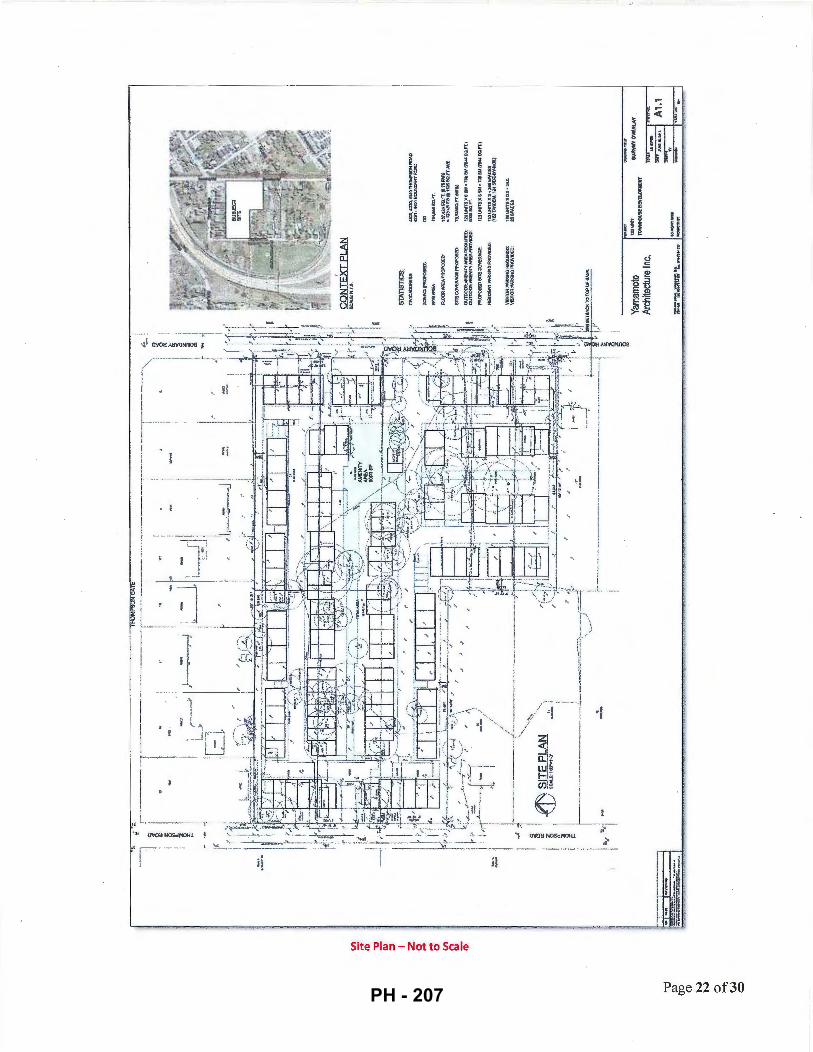
I I f-----1
I l I
l_i --
!
I
,.; i r·- ~
!
-~ I I
I
,I -,, I,
, r~ ~,
l I
i I t
,. L _ _ _ ___ , ~ n 0\frn:l NOScMot·U
~ ·~.
en~~ M I i ~~ ~ ~
rl 3 I i i I §~ ~ ~ ~ ~
~~ ~
~ ~i g § ~ ~ 2 ~ § "" " a • - • § ( ~
,, Jl
Site Plan - Not to Scale
r: • ~
< i
' g • 1;
u
I j I. H li
~§ u n g .. "'
i 0 I E. :J
0 e:! g -:::1 ou Ew ro:=::: )! E-5 ts ~~ u
·j
Page 22 of30 PH - 207

City of Richmond
ATTACHMENT 7
Rezoning Considerations Development Applications Department
6911 No. 3 Road, Richmond, BC V6Y 2C1
Address: 4300, 4320, 4340 Thompson Road, and 4291, 4331, 4431, 4451 Boundary Road File No.: RZ 15-713048
Kaimanson Investments Ltd.
Prior to final adoption of Richmond Zoning Bylaw 8500, Amendment Bylaw 9681, the developer is required to complete the following: 1. Provincial Ministry of Transportation & Infrastructure Approval.
2. Road dedication of2.59 m along the entire frontage of Thomson Road and 5.49 m along the entire frontage of Boundary Road as shown on Attachment 1.
3. Consolidation of all the lots into one development parcel (which will require the demolition of the existing dwellings).
4. Submission of a Tree Survival Security to the City in the amount of $60,000 to be held for a term of three (3) years for the six (6) trees that are to be retained (labelled with tag nos. 5, 61, 63, 65, 66 and 67) in the Arborist Report from Mountain Maple Garden and Tree Service Ltd. dated July 2, 2015).
5. Submission of an on-site landscape plan for the subject project site that includes at least 156 replacement trees based on a ratio of at least 2:1 to compensate for the 78 on-site trees to be removed. The required replacement trees are to be of the minimum sizes, based on the size of the trees being removed as per Tree Protection Bylaw No. 8057. The developer will also plant further trees within the ESA compensation area within Hamilton Hwy Park in Hamilton Highway Park, respectively required for the ESA Development Permit and Servicing Agreement (see Development Permit Considerations below).
6. "Shared Street": The granting of a 7.5 m wide statutory right-of-way on the subject property from Boundary Rd to Thompson Rd for public pedestrian and vehicle access over the 6. 7 m wide driveway, and for landscaping, wayfinding signage and street lights identified as a "Shared Street" on Attachment 2 with the developer and owner being responsible for liability, construction and maintenance.
7. East-West "Strollway" SRW: The granting of a 2.0 m wide statutory right-of-way on the subject property for a 1.5 m wide paved public pedestrian pathway, landscaping, way-finding signage and ballard lights identified as "Strollway" on Attachment 2 with the developer and owner being responsible for liability, construction and maintenance to provide an additional east-west pedestrian connection to the "Shared Street".
8. North-South "Strollway" SRW: The granting of a 4.0 m wide statutory right-of-way on the subject property for a 2.0 m wide paved public pedestrian pathway, landscaping, way-finding signage and ballard lights identified as "Strollway" on Attachment 2 with the developer and owner being responsible for liability, construction and maintenance.
9. Water Pressure Reducing Valve SRW: The granting of a 13m by 14m statutory right-of-way for City water services, pressure reducing valve and an associated building as shown on Attachment 2 with the City being responsible for liability, construction and maintenance.
10. Registration of a flood plain covenant on title identifying a minimum habitable elevation of3.5 m GSC.
11. The submission and processing of a Development Permit* completed to a level deemed acceptable by the Director of Development.
12. City acceptance of the developer's offer to voluntarily contribute $6.55 per square foot of the total residential floor area (e.g. $939,139) to the City's Hamilton Area Plan Amenity Reserve Fund (with the amount to be confirmed on the floor area within the Development Permit plans).
13. City acceptance of the developer's offer to voluntarily contribute $4.00 per buildable square foot (e.g. $573,520) to the City's affordable housing fund.
14. City acceptance of the developer's offer to voluntarily contribute $113,270 to the City's Public Art Program based on the buildable floor area of 143,380 sq. ft. at $0.79 per buildable square foot. A covenant is to be registered on title that
Initial: ---5255823
PH - 208
- 2 -
provides for the City's acceptance of developer-installed public art with a security provided a monetary public art contribution at $113,270 to the City.
15. Discharge of City Covenant (LTO BG386398) from 4311 Boundary Road which restricts use ofthe land to twodwelling building (duplex) only.
16. Voluntary contribution of a $99,500 cash-in-lieu contribution for the City's construction of a Pressure Reducing Valve (PRV) station.
17. Voluntary contribution of a $91,500 cash-in-lieu contribution to the City for the Boundary Road pump station upgrade by the City ofNew Westminster or an equivalent upgrade of the City infrastructure to achieve drainage servicing.
18. Submission of a letter from a LEED certified consultant as a requirement of issuance of the development permit and building permit confirming that the development has been designed to achieve a sufficient score to meet the current Canadian Green Building Council LEED Silver score criteria. The submission of a follow-up letter from a LEED certified consultant that confirms that buildings have been constructed to achieve LEED Silver certification or equivalent is required. Consideration should be given to building design with higher energy efficiency ratings than required by the BC Building Code.
19. Registration of a legal agreement on title identifying that the proposed development must be designed and constructed to meet or exceed EnerGuide 82 criteria for energy efficiency and that all dwellings are pre-ducted for solar hot water heating.
20. Ensure to the satisfaction of the City that the Construction, Phasing and Interim Design Measures in Appendix 1 of the Hamilton Area Plan (Schedule 2.14, Official Community Plan Bylaw 9000) are addressed, as applicable, in the Development Permit and Servicing Agreement.
21. The submission and processing of a Development Permit* that addresses the Area Plan and OCP Multiple Family Guidelines and the Environmentally Sensitive Area Guidelines, completed to a level deemed acceptable by the Director of Development.
22. Enter into a Servicing Agreement* for the design and construction of works described in Attachment 4- Servicing Works.
Prior to a Development Permit* bei~g forwarded to the Development Permit Panel for consideration, the developer is required to: 1. Environmentally Sensitive Area (ESA): The developer is required to address the vegetation and habitat loss within the
on-site ESA within the development site with a compensation area of 0.648 ha. ( 1.6 ac) that includes planting of a minimum of 1,188 trees and 6,475 shrubs/groundcover plants within Hamilton Highway Park as provided in the landscape plans entitled "Hamilton Highway Park, Pare Thompson, ESA Compensation Plan, Richmond, BC", Job No.16-044, prepared by M2 Landscape Architecture, revision dated January 19, 2017 including sheets Ll-ESA to L9-ESA (the Landscape Plan) (Ll-ESA included in Attachment 3). This ESA compensation area has been accepted on the basis of it being larger in than the 0.032 ha. (0.345 ac) compensation area (with 100 replacement trees) included in report entitled "Detailed Environmental Sensitivities Report, Kaimanson Queensborough Development" prepared by SLR Consulting (Canada) Ltd., dated March 8, 2016 (the QEP Report). The Landscape Plan and QEP Report and are to be respectively included within the Servicing Agreement and Development Permit to the satisfaction of the Senior Manager, Parks and the Director of Development.
2. On-Site Native Planting Areas: The on-site landscaping plan requires a minimum of 1,100 m2 (0.27 acres) fully planted with native shrubs and trees within the north amenity area, on either side of the east-west and north-south Strollways and along the Boundary Road frontage of development.
3. Energy Efficiency: Complete a proposed townhouse energy efficiency report and recommendations prepared by a Certified Energy Advisor which demonstrates how the proposed construction will meet or exceed the required townhouse energy efficiency standards (EnerGuide 82 or better), in compliance with the City's Official Community Plan.
Prior to Building Permit Issuance, the developer must complete the following requirements: 1. Each townhouse garage is to be equipped with a 120V electric plug-in for electric vehicle charging equipment.
2. Incorporation aging-in-place measures and other accessibility measures in Building Permit (BP) plans as determined via the Development Permit process.
Initial: ---5255823
PH - 209
- 3-
3. Submission of a Construction Parking and Traffic Management Plan to the Transportation Department. Management Plan shall include location for parking for services, deliveries, workers, loading, application for any lane closures, and proper construction traffic controls as per Traffic Control Manual for works on Roadways (by Ministry of Transportation) and MMCD Traffic Regulation Section 01570.
4. Obtain a Building Permit (BP) for any construction hoarding. If construction hoarding is required to temporarily occupy a public street, the air space above a public street, or any part thereof, additional City approvals and associated fees may be required as part of the Building Permit. For additional information, contact the Building Approvals Department at 604-276-4285.
Note:
* •
This requires a separate application.
Where the Director of Development deems appropriate, the preceding agreements are to be drawn not only as personal covenants of the property developer but also as covenants pursuant to Section 219 of the Land Title Act.
All agreements to be registered in the Land Title Office shall have priority over all such liens, charges and encumbrances as is considered advisable by the Director of Development. All agreements to be registered in the Land Title Office shall, unless the Director of Development determines otherwise, be fully registered in the Land Title Office prior to enactment of the appropriate bylaw.
The preceding agreements shall provide security to the City including indenmities, warranties, equitable/rent charges, letters of credit and withholding permits, as deemed necessary or advisable by the Director of Development. All agreements shall be in a form and content satisfactory to the Director of Development.
• Additional legal agreements, as determined via the subject development's Servicing Agreement(s) and/or Development Permit(s), and/or Building Permit(s) to the satisfaction of the Director of Engineering may be required including, but not limited to, site investigation, testing, monitoring, site preparation, de-watering, drilling, underpinning, anchoring, shoring, piling, pre-loading, ground densification or other activities that may result in settlement, displacement, subsidence, damage or nuisance to City and private utility infrastructure.
• Applicants for all City Permits are required to comply at all times with the conditions of the Provincial Wildlife Act and Federal Migratory Birds Convention Act, which contain prohibitions on the removal or disturbance of both birds and their nests. Issuance of Municipal permits does not give an individual authority to contravene these legislations. The City of Richmond recommends that where significant trees or vegetation exists on site, the services of a Qualified Environmental Professional (QEP) be secured to perform a survey and ensure that development activities are in compliance with all relevant legislation.
Signed Date
Initial: ----5255823
PH - 210
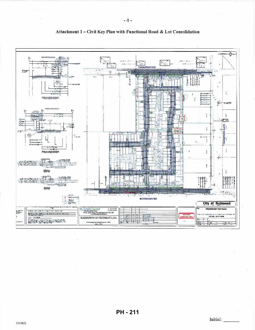
- 4 -
Attachment 1 - Civil Key Plan with Functional Road & Lot Consolidation
T\1'/C'AL t'::ntlS<'i !l f.CT/0~ ~ -..... ,, . .., , .... _ ·-·.~~ ·-
DOUND:\RYR(l.\0
D!TAtlA ~
·~~~,~~:t51~~mn~~~C[~\~~~~~·.~c::; · ~~~
,:;:,~"\0
I )( T:'-U:TJI~ - ~~:~J ... :,':!} >•f -1),';£>
- - ~~~[:~~~
5255823
T I I !
1:~ ~2-~.-~., ... ~:-~ :~ ~!
;T
BOUNDARYRD
~~~ oli.!., iit~~~!i )'1 <
(
I
PRELIMINARY KEY PLAN
[ ~~ J 1-;';;;'~,.' -_''-:;',-"_""T".::~"'TY::."::~::.:'.::~::.:~lC.:cs-~.::'~cc'.:_"_'"_"_"_"'_' _"'-1
Initial:
PH - 211
r'
- 5 -
Attachment 2 -Site Development Plan with SRWs
5255823
EfWJEXT PLAN
AMENITY AREA: OOMMCN INDOOR !REOUIREOt COMMON INCOOR (Pi'IOVIOEO ~
PRIVATE OUTDOOR IRECUIREOJ: PRIVATE OUTtlOOR IPROVIO EO):
1Q1,105SQ.FT. GROSS lr.l .I7SSOfT. NET
!·,l~~~~\0,:;~~~- AVE
1:10 VNITSX2~ NO SPACE$ ll i!;TJWOEJ.t, IUSIOE.SY-$10€)
IOOSOM. l7SO.t.l(4D0SO. FT.)
120UNITSX6SM = n OSMm'iCSQ.FTJ 6690SQ.FT
Initial:
PH - 212
5255823
- 6 -
Attachment 3 - Hamilton Highway Park, Pare Thompson, ESA Compensation Plan
....... ~-""' PQ\1>6 1W~
.. W <<iii.."U "
u•o.a_..:m~.,. tt:.l).m:lut.t. '""""""MJ> It .~IUI
'"""' HI!.<. t ~ t :...oGJ, II f iO:tlll\1_.
lt-'<.l ii\HOL...,_ \IIV><I ..... t.
1-l:lv.f-U IIU I':I Iil:":tIIU U •Il&!.t.
m>.;r,.·,~
.... Tl l.1 - h•• U~ ll£l lt.llt><........,h -••ttltflllll '.J41UitAI:1
'"'".:fltfllf:t -·~ m:lfU"f•
· ~ · · ~ · .. .... ··"'· OM
~~~-::;s::::'.~.-l!:..~-----··-
c:::::::::J --·----·--
HAIL TON IWJHNAY ~ARK PAW:l'IICM'IICII UA COUP'OISAOONMN
UJIMONO.LC.
ENVIRONMENTAL SITE ASSESSMENT
Initial:
PH - 213
- 7 -
Attachment 4- Servicing Works
The following works must be included with the Servicing Agreement:
1. Engineering Works
• Water Works:
a. Using the OCP Model, there is 74 Lis of water available at 20 psi residual at the Thompson Road frontage and 33 Lis of water available at the Boundary Road frontage. Based on your proposed development, your site requires a minimum fire flow of 220.0 Lis. To achieve this flow, watermain upgrades and the installation of a pressure reducing valve are required. By installing the works described below, the OCP Model indicates that 311.0 Lis of water will be available at 20 psi at the Thompson Road and 293.0 Lis at the Boundary Road frontage.
b. The Developer is required to:
• Submit Fire Underwriter Survey (FUS) or International Organization for Standardization (ISO) fire flow calculations to confirm the development has adequate fire flow for onsite fire protection. Calculations must be signed and sealed by a Professional Engineer and be based on Building Permit Stage Building designs.
• Upgrade the existing 150mm AC watermain to 200mm PVC along the west property line from Thompson Gate to approximately 127m south to the south property line of the development site.
• Upgrade the existing 150mm AC watermain to 300mm PVC along Boundary Rd from the proposed PRV station to approximately 45m north and tie in to the existing 300mm watermain along Thompson Gate.
• Upgrade the existing 150mm AC watermain to 200mm PVC along the east property along Boundary Road line from the northeast comer of the site to approximately 122m south to the south property line of the development site.
• Provide approximate 13m x 14m of land as statuary right of way required for PRV station at the northeast comer of the development site, location and area to be defined through the SA drawings.
• Pay, in keeping with the Subdivision and Development Bylaw No 8751, a $99,500 cash-in-lieu contribution for the construction of the PRV station.
• Install additional fire hydrants along the east and west property line frontages to accommodate hydrant spacing requirements.
c. At the Developers cost, the City is to:
• Cut and cap all existing water service connections at the watermain along Thompson Road and Boundary Road frontages.
• Install a new water service connection complete with meters and meter boxes along Thompson Road frontage.
• Storm Sewer Works:
a. Currently the City's drainage system capacity is inadequate to service the new development.
b. The Developer is required to:
Initial: ---5255823
PH - 214
- 8 -
• Pay, in keeping with the Subdivision and Development Bylaw No. 8751, a $91,500 cash-in-lieu contribution towards the Boundary Road pump station upgrade or an equivalent upgrade of the City infrastructure to achieve drainage servicing.
• Install a new IC and service connection discharging directly into the Boundary Rd canal. Design must meet all applicable environmental requirements including the provision of any impact mitigation works. Design and construction approval will be required from the City ofNew Westminster.
c. At the Developers cost, the City is to:
• Cut and cap all existing storm sewer service connections along the Thompson Road and Boundary Road frontages.
• Sanitary Sewer Works:
a. The Developer is required to
• Install a new sanitary service connection complete with IC at the Thompson Road frontage.
b. At the Developers cost, the City is to:
• Cut and cap the existing sanitary service connections and remove the existing ICs located at the west property line frontage of the development site.
• Frontage Improvements:
5255823
a. The Developer is required to:
• Dedicate land along the development sites east and west frontages for all required road, boulevard, side walk, bike lane, greenway improvements.
• Coordinate with private utility companies when adding new infrastructure or when relocating/modifYing any of the existing power poles and/or guy wires within the property frontages.
• Locate all above ground utility cabinets and kiosks required to service the proposed development within the developments site (see list below for examples). A functional plan showing conceptual locations for such infrastructure shall be included in the Rezoning staff report and the development process design review. Please coordinate with the respective private utility companies and the project's lighting and traffic signal consultants to confirm the requirements and the locations for the aboveground structures. If a private utility company does not require an aboveground structure, that company shall confirm this via a letter to be submitted to the City. The following are examples of SRWs that shall be shown in the functional plan and registered prior to SA design approval:
1. BC Hydro PMT -4mW X Sm (deep) 2. BC Hydro LPT- 3.5mW X 3.5m (deep) 3. Street light kiosk- 1.5m W X 1.5m (deep) 4. Traffic signal kiosk- 2m W X 1.5m (deep) 5. Traffic signal UPS -1mW X 1m (deep) 6. Shaw cable kiosk- 1m W X 1m (deep)- show possible location in functional plan
7. Telus FDH cabinet - L1mW X 1m (deep)- show possible location in functional plan
b. Other frontage improvements as per Transportation's requirements.
Initial: ---
PH - 215

- 9 -
• General Items:
a. The Developer is required to:
• Coordinate with the City ofNew Westminster for works involving Private Utility servicing within the east half of Boundary Rd.
• Provide street lighting along the sites east and west frontages, design required through Servicing Agreement to the satisfaction of the City as follows:
Thompson Road (East side of street) • Pole colour: Grey • Roadway lighting@ back of curb: Type 7 (LED) INCLUDING 1 street luminaire on
every pole, but EXCLUDING any banner arms, duplex receptacles, pedestrian luminaires, flower basket holders, or irrigation.
Boundary Road (West side of street) • Pole colour: Grey • Roadway lighting@ back of curb: Type 7 (LED) INCLUDING 1 street luminaire on
every pole with pedestrian luminaires, but EXCLUDING any banner arms, duplex receptacles, flower basket holders, or irrigation. (NOTE: "Pedestrian luminaires" are intended to light the 3.0 m wide sidewalk/off-street bike path. Luminaire arms must be set perpendicular to the direction of travel.)
• Provide, within the first SA submission, a geotechnical assessment of preload, soil preparation and dewatering impacts on the existing utilities fronting or within the development site and provide mitigation recommendations.
• Enter into, if required, additional legal agreements, as determined via the subject development's Servicing Agreement(s) and/or Development Permit(s), and/or Building Permit(s) to the satisfaction of the Director of Engineering, including, but not limited to, site investigation, testing, monitoring, site preparation, dewatering, drilling, underpiruiing, anchoring, shoring, piling, pre-loading, ground densification or other activities that may result in settlement, displacement, subsidence, damage or nuisance to City and private utility infrastructure .
• 2. Transportation Works
The required road works as shown on Attachment 1 that include:
a. Boundary Road development frontage: Use the existing east edge of the roadway as the reference, widen the road to the west to provide: • Roadside barriers (0.9m); • Paved 1.5m wide shoulder; • Paved 7.0 wide driving surface; • 0.15m wide curb and gutter; • 1.5m wide treed and grassed boulevard; and • 3.0m wide concrete sidewalk/pathway.
b. Thompson Road development frontage: Use the existing west edge of the roadway as the reference, widen the road to the east to provide: • Paved l.Om wide shoulder; • Paved 8.5m wide driving surface; • 0.15m wide curb and gutter; • 1.5m wide treed and grassed boulevard; and • 1.5m wide concrete sidewalk.
Initial: ---5255823
PH - 216

- 10-
c. Boundary Road, north of the development to Thompson Gate (for a distance approximately 50m): • Min. 1.5m wide paved walkway along the west side of the road, separated from the southbound traffic lane by
physical barriers such as extruded curbs. • Upgrade of the existing two-way stop at the Boundary Road/Thompson Gate/Ewan Ave. intersection to a
four-way stop configuration with marked pedestrian crosswalks to the satisfaction of the City of Richmond and City ofNew Westminster.
3. Parks Works 1. Hamilton Highway Park: The developer is to complete the native landscape planting and invasive species removal specifications in the landscape plans entitled "Hamilton Highway Park, Pare Thompson, ESA Compensation Plan, Richmond, BC", Job No.16-044, prepared by M2 Landscape Architecture, revision dated January 19, 2017 (sheets L1-ESA to L9-ESA; Ll-ESA is included in Attachment 3) to the satisfaction of the City subject, but not limited, to:
a. The plans being completed prior to issuance of the Development Permit for the impacted ESA within the development.
b. A BLCS survey of Hamilton Highway Park and adjacent road allowances being completed with any adjustments to the landscaping as may be needed based on a review of the survey by the City.
c. The completion of landscape maintenance and monitoring plan for a three (3) year maintenance period.
d. Completion of the invasive species removal prescription consistent with the City's herbicide/pesticide policy (e.g. prohibition of the use of glyphosate to treat blackberries).
2. Boundary Road & Canal: The developer is to complete a landscape plan that maintains a vegetated edge of Boundary Canal which may include further native plants, in coordination with the road works design, to the satisfaction of the City.
Initial: ---
5255823
PH - 217
City of Richmond
Richmond Zoning Bylaw 8500 Amendment Bylaw 9681 (RZ 15-713048) .
Bylaw 9681
4300, 4320, 4340 Thompson Road and 4291, 4331, 4431 & 4451 Boundary Road
The Council of the City of Richmond, in open meeting assembled, enacts as follows:
1. Richmond Zoning Bylaw 8500, as amended, is further amended:
a. at Section 3.4 (Use and Term Definitions) by inserting the following definitions in alphabetical order:
"Hamilton
Hamilton Area Plan community amenity capital reserve
means the area included in the Hamilton Area Plan.
means the statutory Capital Reserve Fund created by Hamilton Area Plan Community Amenity Capital Reserve Fund Establishment Bylaw No. 9276."; and
b. at Section 8.8.4 by deletingSection 8.8.4 and replacing it with the following:
5301009
"8.8.4 Permitted Density
1. The maximum floor area ratio is 0.6, together with an additional 0.1 floor area ratio provided that it is entirely used to accommodate amenity space.
2. Notwithstanding Section 8.8.4.1, in Hamilton the maximum floor area ratio for the RTH1 zone is 0.4, together with an additional 0.1 floor area ratio provided that it is entirely used to accommodate amenity space.
3. Notwithstanding Sections 8.8.4.1 and 8.8.4.2, the respective references to "0.6" and "0.4" are increased to a higher density of:
a) "0.75" in the RTH1 zone;
b) "0.80" in the RTH2 zone;
c) "0.85" in the RTH3 zone; and
d) "0.90" in the RTH4 zone,
if the following conditions occur:
PH - 218

Bylaw 9681
e) (i)
Page 2
the owner, at the time Council adopts a zoning amendment bylaw to include the owner's lot in the RTH1, RTH2, RTH3 or RTH4 zone, pays into the affordable housing reserve the sum specified in Section 5.15 ofthis bylaw; or
(ii) prior to first occupancy of any building, the owner:
(A) has constructed on the lot to the satisfaction of the City affordable housing units with a combined habitable space of the affordable housing units comprising at least 5% of the buildable floor area resulting from the maximum permitted floor area ratio; and
(B) enters into a housing agreement with respect to the affordable housing units and registers the housing agreement against the title to the lot, and files a notice in the Land Title Office; and
g) for rezoning applications within Hamilton, if the owner, at the time Council adopts a zoning amendment bylaw to include the owner's lot in the RTH1 zone, pays into the Hamilton Area Plan community amenity capital reserve, a sum based on $70.50 per square meter of total residential floor area."
2. The Zoning Map of the City of Richmond, which accompanies and forms part of Richmond Zoning Bylaw 8500, as amended, is further amended by repealing the existing zoning designation ofthe following area and by designating it "High Density Townhouses (RTHl)":
That area shown cross-hatched on "Schedule A attached to and forming part of Bylaw No. 9681".
3. This Bylaw may be cited as "Richmond Zoning Bylaw 8500, AJ.ll,e,pdnwnt Bij~w 9681". FIRST READING ttH L 7 l
A PUBLIC HEARING WAS HELD ON
SECOND READING
THIRD READING
OTHER CONDITIONS SATISFIED
MINISTRY OF TRANSPORTATION AND INFRASTRUCTURE APPROVAL
ADOPTED
MAYOR
5301009
CORPORATE OFFICER
CITY OF RICHMOND
APPROVED by .
1SIL APPROVED by Director or Solicitor
PH - 219
Bylaw 9681
"Schedule A attached to and forming part of Bylaw No. 9681"
City of Richmond
PROPOSED_. l• , ). <. •
REZONING
Page 3
SI
1-------i l/ I i
'
' I ~
n ' ,, ' " ' \
(•.6'~
r---------~93.6~·'----------4~
RZ 15-713048
5301009
Original Date: 01/05/16
Revision Date: 01/07/16
Note: Dimensions are In METRES
PH - 220
MayorandCouncillors
From: Sent: To: Subject:
Webgraphics Monday, 13 March 2017 10:46 MayorandCouncillors Send a Submission Online (response #1005J
Send a Submission Online (response #1005)
Survey Response , .................... ............................. ""'".._ ...........
Your Name Jose Gonzalez
Your Address 7171 Ash Street
Subject Property Address OR 4340 Thompson Road, Bylaw 9681
Bylaw Number
As the owner of 4340 Thompson Road, which is part of the March 20th Public Hearing, I support the Bylaw and proposed rezoning. This proposal brings
Comments much-needed modernization to Richmond's "far side" of the freeway. It will improve the area's livability for current and future residents, as well as deliver much-needed affordable housing units.
1
-
PH - 221
City of Richmond
To: Planning Committee
From: Wayne Craig Director, Development
Report to Committee Planning and Development Division
Date: February 6, 2017
File: RZ 15-701939
Re: Application by lncircle Projects Ltd. for Rezoning at 7760 Garden City Road from "Single Detached (RS1/F)" to "Town Housing (ZT49)- Moffatt Road, St. Albans Sub-Area and South McLennan Sub-Area (City Centre)"
Staff Recommendation
That Richmond Zoning Bylaw 8500, Amendment Bylaw 9682, for the rezoning of 7760 Garden City Road from "Single Detached (RS 1/F)" to "Town Housing (ZT49)Moffatt Road, St. Albans Sub-Area and South McLennan Sub-Area (City Centre)", be introduced and given first reading.
REPORT CONCURRENCE
ROUTED To: CONCURRENCE CONCURREI)ICE OF GENERAL MANAGER
Affordable Housing ~/
5271445 PH - 222
February 6, 2017 - 2 -
Staff Report
Origin
Incircle Projects Ltd. has applied to the City of Richmond for permission to rezone 7760 Garden City Road (Attachment 1) from "Single Detached (RSl/F)" to the "Town Housing (ZT49)- Moffatt Road, St. Albans Sub-Area and South McLennan Sub-Area (City Centre)" zone in order to permit the development of four three-storey townhouse units with vehicle access via a statutory right-of-way from the adjacent property at 7733 Tumill Street. A preliminary site plan, building elevations, and landscape plan are contained in Attachment 2. The site currently contains one single-family home; which will be demolished.
Findings of Fact
A Development Application Data Sheet providing details about the development proposal is attached (Attachment 3).
Surrounding Development
To the North: A 38-unit townhouse development on a site zoned "Town Housing (ZT33)South McLennan (City Centre)".
To the East and South: A 27-unit townhouse development on a site zoned "Town Housing (ZT49)- Moffatt Road, St. Albans Sub-Area and South McLennan Sub-Area (City Centre)".
To the West: Across Garden City Road, a 172-unit low-rise apartment development on a site zoned "Medium Density Low Rise Apartments (RAMI)".
Related Policies & Studies
Official Community Plan
The subject property is designated "Neighbourhood Residential (NRES)" in the Official Community Plan (OCP). This land use designation allows single-family, two-family and multiple family housing (specifically townhouses). This proposal is consistent with the OCP.
McLennan South Sub-Area Plan
The subject property is located within the McLennan South Sub-Area Plan (Schedule 2.1 OD of OCP Bylaw 7100) (Attachment 4- Land Use Map). The site is designated as "Neighbourhood A" for residential developments up to three storeys over one parking level. The current proposal of three-storey townhouse development in duplex form is consistent with the Sub-Area Plan.
5271445 PH - 223
February 6, 2017 - 3 -
Site Assembly Size
The subject site is an orphaned lot landlocked by existing townhouse developments to the north, east and south. Since a cross-access easement was secured from 7733 Turnill Street in anticipation of the development of the subject site, the proposed development can be considered as an extension of this adjacent townhouse development. A high quality pedestrian environment along the fronting street (i.e., Garden City Road) will be created, as no driveway access will be required or permitted.
Project Density
The base density permitted on the subject site is 0. 7 5 FAR, and the Area Plan provides allowances for density bonusing in order to achieve community amenities and affordable housing. The proposed rezoning to "Town Housing (ZT49)- Moffatt Road, St. Albans Sub-Area and South McLennan Sub-Area (City Centre)" would allow a maximum density of 0.78 (i.e., total buildable area approximately 502.5 m2 or 5,410 ft2
). This density would be in keeping with the range of densities of other projects in the area, and is supportable to staff.
Staff support the proposed density based on the following:
• As describe above, the Area Plan, adopted in 2006, supports use of density bonusing to promote housing affordability and the provision of affordable housing. The City's Affordable Housing Strategy supports the use of density bonusing to achieve the objectives of the Strategy. The applicant has agreed to provide a voluntary cash contribution in the amount of$21,638.49 ($4.00 per buildable square foot) to the City's Affordable Housing Reserve Fund in keeping with the Affordable Housing Strategy requirements for townhouse developments.
• The subject development is considered an extension of the townhouse development at 7733 Turnill Street as access to the proposed new townhouse units will be via the access easement registered on 7733 Turnill Street. The proposal is to rezone the subject site to the same zoning district as the adjacent townhouse development at 7733 Turnill Street.
• The Area Plan supports use of density bonusing to promote the development of barrier-free housing and the proposal will provide two convertible housing units.
• A 2.0 m wide road dedication across the entire Garden City Road development frontage and a 3.0 m wide Public Rights-of-Passage (PROP) along the new Garden City Road property line will be provided.
• Frontage improvements along Garden City Road; including a new concrete sidewalk and a grass and treed boulevard matching the existing frontage improvements works to the north and south of the subject site will be provided.
5271445 PH - 224
February 6, 2017 - 4 -
Floodplain Management Implementation Strategy
The proposed redevelopment must meet the requirements of the Richmond Flood Plain Designation and Protection Bylaw 8204. Registration of a flood indemnity covenant on Title is required prior to final adoption of the rezoning bylaw.
Public Consultation
A rezoning sign has been installed on the subject property. Staff have not received any comments from the public about the rezoning application in response to the placement of the rezoning sign on the property.
Should the Planning Committee endorse this application and Council grant first reading to the rezoning bylaw, the bylaw will be forwarded to a Public Hearing; where any area resident or interested party will have an opportunity to comment.
Public notification for the Public Hearing will be provided as per the Local Government Act.
Analysis
Built Form and Architectural Character
The applicant proposes to construct a total of four three-storey townhouse units in a total of two townhouse clusters. Two units will front onto Garden City Road, and the remaining two units will front onto the internal drive aisle. The amenity area will be situated along the north property line at the end of the internal drive aisle.
A Development Permit processed to a satisfactory level is a requirement of zoning approval. Through the Development Permit, the following issues are to be further examined:
• Demonstrate compliance with Development Permit Guidelines for multiple-family projects in the 2041 Official Community Plan Bylaw 9000 and the McLennan South Sub-Area Plan.
• Ensure the proposal follows the conditions stipulated by the project arborist related to driveway, sidewalk and patio/fence constructions/installations within the Tree Protection Zones.
• Review of size and species of replacement trees to ensure bylaw compliance and to achieve a mix of conifer and deciduous trees on-site.
• Address potential privacy concerns through landscaping and built form.
• Refinement ofthe outdoor amenity area design including the choice of play equipment.
• Review of a sustainability strategy for the development proposal including measures to achieve an EnerGuide Rating System (ERS) score of 82.
Additional issues may be identified as part of the Development Permit application review process.
5271445 PH - 225

February 6, 2017 - 5 -
Existing Legal Encumbrances
There is an existing 3.0 m wide statutory right-of-way (SRW) along the entire west property line of the site (i.e., along Garden City Road) registered on Title of the subject site for the existing sanitary sewer. A portion of this SRW is located outside of the required 2.0 m wide road dedication along Garden City Road will fall with the land after the road dedication. The 3.0 m wide Public Rights-of-Passage (PROP) along the new property line required for this rezoning and development will also allow for sanitary main maintenance.
Transportation and Site Access
No direct vehicular access is permitted to Garden City Road. Vehicular access to the subject site will be provided via the access easement over the internal drive-aisle at 7733 Turnill Street (registered under BV299944). This access arrangement was envisioned and secured when the adjacent townhouse development at 7733 Turnill Street developed in 2003. A legal opinion prepared by the. applicant's lawyer confirms that the City can rely on this access easement. The applicant also confirmed that the strata council and residents at 7733 Turnill Street have been informed. Staff have not received any feedbacks or comments on this issue from the residents at 7733 Turnill Street. Registration of a legal agreement on Title, ensuring vehicle access is limited to the SRW on 7733 Turnill Street and prohibiting access to Garden City Road, will be required prior to final adoption of the rezoning bylaw.
Tree Retention and Replacement
The applicant has submitted a Certified Arborist's Report; which identifies on-site and off-site tree species, assesses tree structure and condition, and provides recommendations on tree retention and removal relative to the proposed development. The Report assesses six bylaw-sized trees on the subject property and three trees on neighbouring properties.
The City's Tree Preservation Coordinator has reviewed the Arborist' s Report and supports the arborist's findings, with the following comments: • Six trees (tag# 101, 102, 103, 104, 105 and 106) located on the development site have all
been previously topped and as a resuli, are not good candidates for retention. These trees should be removed and replaced.
• Three trees (tag# 107, 108, 109) located on adjacent neighbouring properties are identified to be retained and protected. Developer is required to provide tree protection as per City of Richmond Tree Protection Information Bulletin Tree-03.
• Replacement trees should be specified at 2:1 ratio as per the OCP.
Tree Replacement
The applicant wishes to remove all bylaw-sized trees on-site (i.e., six trees). The 2:1 replacement ratio would require a total of 12 replacement trees. According to the Preliminary Landscape Plan provided by the applicant (Attachment 2), the developer is proposing to plant 17 new trees on-site. The size and species of replacement trees will be reviewed in detail through Development Permit and overall landscape design.
5271445 PH - 226
February 6, 2017 - 6 -
Tree Protection
Three trees (tag #107, 108 and 109) on neighbouring properties are to be retained and protected. The applicant has submitted a tree protection plan showing the trees to be retained and the measures taken to protect them during development stage (Attachment 5). To ensure that the trees identified for retention are protected at development stage, the applicant is required to complete the following items:
• Prior to final adoption of the rezoning bylaw, submission to the City of a contract with a Certified Arborist for the supervision of all works conducted within or in close proximity to tree protection zones. The contract must include the scope of work required, the number of proposed monitoring inspections at specified stages of construction, any special measures required to ensure tree protection, and a provision for the arborist to submit a post-construction impact assessment to the City for review.
• Prior to demolition of the existing dwelling on the subject site, installation of tree protection fencing around all trees to be retained. Tree protection fencing must be installed to City standard in accordance with the City's Tree Protection Information Bulletin Tree-03 prior to any works being conducted on-site, and remain in place until construction and landscaping on-site is completed.
• Should the applicant wish to begin site preparation work after third reading of the rezoning bylaw, but prior to final adoption of the rezoning bylaw and issuance of the Development Permit, the applicant will be required to obtain a Tree Permit, install tree protection around trees/hedge rows to be retained, and submit a landscape security in the amount of $3,000 to ensure the replacement planting will be provided.
Tandem Parking
Richmond Zoning Bylaw 8500 permits 100% tandem parking arrangement in a number of site specific townhouse zones including "Town Housing (ZT49)- Moffatt Road, St. Albans SubArea and South McLennan Sub-Area (City Centre)". The proposal will feature two units with a total of four stalls (50% of resident parking spaces proposed) in a tandem arrangement, which is consistent with the tandem parking provision of Richmond Zoning Bylaw 8500. A restrictive covenant to prohibit the conversion of the tandem garage area into habitable space is required prior to final adoption.
Variance Requested
The proposed development is generally in compliance with the "Town Housing (ZT49)Moffatt Road, St. Albans Sub-Area and South McLennan Sub-Area (City Centre)" zone with one proposed variance. The applicant has requested a variance to reduce the rear yard setback from 4.57 m to a minimum of 3.0 m; in order to accommodate a projection on the ground floor and open deck spaces on the second floor of the proposed Building #1 (i.e., the east building). This proposed rear yard (east) setback is similar to the setback provided on the adjacent townhouse units to the east of the subject site (i.e., approximately 3.0 m between the second floor balcony and the common property line). The setbacks to the second and third floor living space will remain at a minimum of 4.57 m from the east property line. This variance will be reviewed in the
5271445 PH - 227
February 6, 2017 - 7 -
context ofthe overall detailed design of the project; including architectural form, site design and landscaping at the Development Permit stage.
Affordable Housing Strategy
Consistent with the Affordable Housing Strategy, the applicant proposes to make a cash contribution to the Affordable Housing Reserve Fund at $4.00 per buildable square foot; for a contribution of $21,638.49.
Townhouse Energy Efficiency and Renewable Energy
The applicant has committed to achieving an EnerGuide Rating System (ERS) score of 82 and providing pre-ducting for solar hot water for the proposed development. A Restrictive Covenant; specifying all units are to be built and maintained to the ERS 82 or higher, and that all units are to be solar-hot-water-ready, is required prior to rezoning bylaw adoption. As part of the Development Permit Application review process, the developer is also required to retain a certified energy advisor (CEA) to complete an Evaluation Report to confirm details of construction requirements needed to achieve the rating.
Amenity Space
The applicant is proposing a contribution in-lieu of on-site indoor amenity space in the amount of $4,000 as per the Official Community Plan (OCP) and with Council Policy.
Outdoor amenity space will be provided on-site. Based on the preliminary design, the size of the proposed outdoor amenity space complies with the Official Community Plan (OCP) minimum requirements of 6 m2 per unit. Staff will work with the applicant at the Development Permit stage to ensure the configuration and design of the outdoor amenity space meets the Development Permit Guidelines in the OCP.
Site Servicing and Frontage Improvements
Prior to final adoption of the rezoning bylaw, the developer is required to provide a 2.0 m wide road dedication across the entire Garden City Road development frontage and a 3.0 m Public Rights- of-Passage (PROP) SRW along the new property line to align with the property line and the PROP SRW to the south along the Garden City Road frontage.
Then, prior to issuance of the Building Permit, the developer is required to enter into the City's standard Servicing Agreement to design and construct frontage beautification along the site frontages, as well as service connections (see Attachment 6 for details). All works are at the developer's sole cost. The developer is also required to pay DCC's (City & GVS & DD), School Site Acquisition Charge and Address Assignment Fee.
Financial Impact or Economic Impact
The rezoning application results in an insignificant Operational Budget Impact (OBI) for off-site City infrastructure (such as roadworks, waterworks, storm sewers, sanitary sewers, street lights, street trees and traffic signals).
5271445 PH - 228
February 6, 2017 - 8 -
Conclusion
The proposed four-unit townhouse development is consistent with the Official Community Plan (OCP) regarding developments within the McLennan South Sub-Area. The proposal would be consistent with the form and character of the surrounding area. Further review of the project design is required to ensure a high quality project and design consistency with the existing neighbourhood context, and this will be completed as part of the Development Permit application review process.
The applicant has agreed to the list of rezoning considerations (signed concurrence on file) outlined in Attachment 6.
It is recommended that Zoning Bylaw 8500, Amendment Bylaw 9682 be introduced and given first reading.
Edwin Lee Planner 1 (604-276-4121)
EL:blg
Attachment 1: Location Map Attachment 2: Proposed Development Plans Attachment 3: Development Application Data Sheet Attachment 4: McLennan South Sub-Area Plan Land Use Map Attachment 5: Tree Management Plan Attachment 6: Rezoning Considerations
5271445 PH - 229
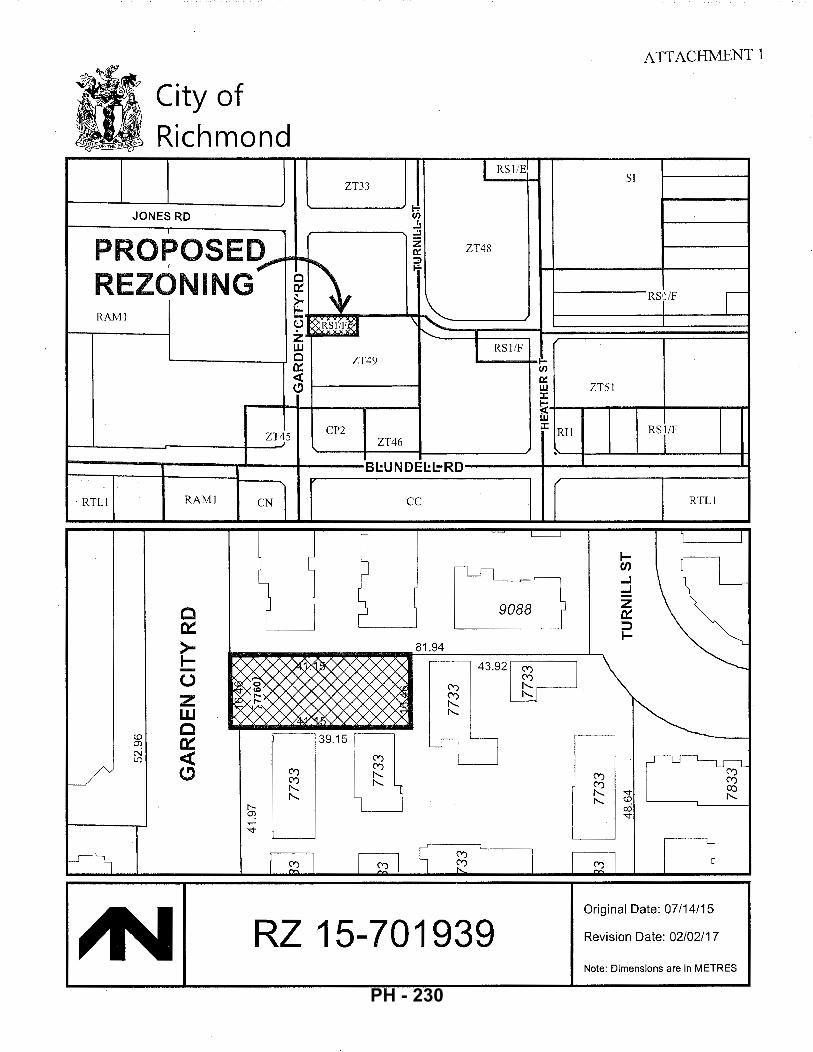
City of Richmond
JONES RD
PRO~OSED,.. REZONING RAMl
ZT~5
RTLl RAMI CN
I c ~
>-
c a:: ~ ~ z w c a:: <( (!)
I RSl/E
ZT33
~ (/)
.!1
..!1 z ZT48 ~
1\ ::;) ....
:&,ks11j)g \ ['....
I RSl/F ZT49 1'-
(/)
~ w J:
~ w CP2 J:
Ril ZT46 .
BI.:UNDEI.:L=-RD
cc
J ~ L____j
1\--ll
9088
81.94 1-
~ 43.92~ -(.)
<") f-2 z <") !'-..
!'-.. w !'-..
c 3915( §I <.0
~ I ~ N <( U)
___/ (!) (\')
f-2 "'" 1'-
~ ~
"<t
(\')
I ~ ~ I (\')J R?
~ RZ 15-701939
ATTACHMENT 1
Sl
RSil/F I I
ZT51
RSI/F
RTLl
I I
1-(fJ
...J
...J
z et:: ::> 1-
~-~ (\') (\')
(\') co !'-.. "<t !'-.. !'-.. <.0 cO "<t
~ l Original Date: 07/14/15
Revision Date: 02/02/17
Note: Dimensions are in METRES
PH - 230
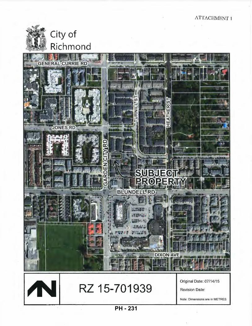
City of Richmond
RZ 15-701939
ATTACHMENT 1
Original Date: 07/14/15
Revision Date:
Note: Dimensions are in METRES
PH - 231
CO
NT
AC
TS
A
rchi
tect
ZO
NIN
G S
UM
MA
RY
Z
onin
g B
yla
w N
o. 8
500
INT
ER
FAC
E A
RC
HIT
EC
TU
RE
IN
C,
1!2
30
-11
50
0C
I\M
BIE
R.O
AD
RIC
HM
ON
D,B
.C,V
CX
3Z
5
Civ
il E
ng
ine
er
RIC
HM
ON
D,
BC
V
6Y31
1l
Em
al:
ko
n@lnll!rf~
co•rchlloclur-.c<>m
AH
n:D
AV
EL
EE
IAL
EX
SOO
PEK
E
IM1:
d8nle
e(ildo
le"!
ll,.
..~n
g.co
rn
7.2~QSF•0.167ACRES
[6n.
3M2J
RO
AO
OE
DIC
ATI
ON
: 2
.0M
OE
EP
•I6
.4S
9M
W!D
E[:
l2.9
2M
2)
U.936SF•0
.1~9ACRES
1644
.4 M
2)
PR
OP
GR
EE
NW
AY
: 3.
0M D
EE
P•
16.4
S'J
M W
IDE
[4~
.4 M
2J
~/N:IINO/NO
CIT
YC
EN
TR
E1
0/N
EIG
Ha
OU
RH
OO
DR
ES
IDE
NT1
Al.
Arb
ou
rlst
D
EN
SI"
TY
(MA
X):
I F
AR
II.T
6•0
.04
CO
VE
RE
DA
RE
JI
PR
OJE
CT
SP
EC
IFIC
S(P
RO
?OS
EO
)
ZH
9P
RO
PO
SE
D(S
OU
TilM
ClE
NN
AN
CI"
TY
CE
NTR
E)
~.O"Itti.46M
)WIDEX±121!"139.15M)DEEP
FAR0.78(5.404SFI6.~36SF)
FR
OG
GE
RS
CR
EE
K T
RE
E C
ON
SU
LT
AN
TS
LT
D.
nalMcG~Avon,.
IIU
RN
AD
Y,B
C V5J~H4
Su
rve
yor
DH
AU
WA
L A
N 0
AS
SO
CIA
TE
S
W21
6-1
21
!99
76
TH
AII
EN
UE
SU
RR
EY
,IIC
V'J
W1
EII
La
nd
sca
pe
Arc
hite
ct
K.R
.RO
SS
& A
SS
OC
IAT
ES
13
nCH
A.R
TW
Ell
CR
f!.t
E
WE
ST
VA
NC
OU
VE
R.
BC 1
17S
2il5
Ele
ctri
cal
En
gin
ee
r
Em
aD:o
.. nn
_m..
.,.y
t!l•
t.w
.co
Atln
: G
EN
EP
AU
LN
IKU
LA
,6C
LS
80
3
·~·
ErM
I:kr
r@!•
h..w
.co
SIO
EY
AR
O\(
N)
* !~E
RY;::o
2 1~~~ I
~~rM~~;
~~~~~~
N
1.0
MF
RO
NT.0
.6M
RE
AR
.SIO
E
2.1lMFRONT
.1.~MREAR
BY
CI\
SE
0.6
MR
EA
R.S
IDE
YD
12.0
M (3
9.3
71 M
AX (3
-ST
OR
EY
S)
HA
BF
LR
O.l
MM
INA
BO
VE
RO
CR
OW
N
40.
0~~
(2.
773
SF
I 6,9
36 S
F)
33.7
,-.(2
.33
5S
F/6
,93
6S
F]
6.02
M(1
9.79
1
1.n
M[S
.fi7
')
J.!l
7M
[1D
.!l7
'J*
0A
3M
(1M
1F
R0
Nf.
0.2
8M
[0.9
2')S
IDE
0.4
3M
{1.4
11
SID
E
•A
VG
FIN
ISH
EO
SIT
EG
RA
DE
•1.1
7M
)J.6
41
12.0
M(J
9.3
1")(
3-S
TO
RE
YS
)
1(0
.2/U
NifV
ISIT
OR
S)
1V
ISIT
OR
SP
AC
ES
(1S
TD
) U
EW
EN
GIN
EE
RIN
G L
ll),
n
l5·1
1711
0RIV
ERR
OA
D
RK
:HM
ON
D,B
.C.V
tiX1
Z7
6(
1.4
/UN
ifRE
SID
EN
TS
) 1
8R
ES
IDE
NfS
PA
CE
S(Z
itJN
IT)(
SS
Til
,2S
MA
Ll)
NO
NE
UP
TO
30
RE
QU
IRE
D S
PA
CE
S
2 S
WIL
L S
PA
CE
S P
RO
VID
ED
AB
OV
E T
HE
6 R
EC
IUIR
ED
TA
NO
EM
SP
AC
ES
I W
oX 5
0%
OF
tJN
ITS
50
% [
Z U
NIT
S 1
4 U
NIT
S)
CIT
Y P
ER
MIT
S
RE
ZON
ING
PE
RM
IT
AP
PLI
CA
TIO
N
DE
VE
LO
PM
EN
T P
ER
MIT
A
PPU
CA
TlO
N
BU
ILD
ING
PE
RM
IT
AP
PL!
CA
nO
N
ST
TE
SE
RV
ICI!I
.IG
AG
RE
EM
EN
T
Em
ali:
.U.W
.ogl
llli
!Jt&
Us,
,..l
RZ
15-
7019
39
PR
OJE
CT
DE
SC
RIP
TIO
N
S(1
.2S
PE
RU
NIT
)
AM
EN
ITY
SP
AC
E:
CO
MM
ON
OU
TD
R I
24
M2
(BM
2/l
JNih
4)
• 6-4.~
M2
(1{1
% O
F S
ITE
)
37
M2
[:l9
8S
F}'
UN
ITM
IN
1 ROLl
iNGCMIT
(~5!JDI)
tRO
lLIN
GC
AR
T(9
5!)1
01)
RE
CY
ClE
CO
NT
NI
1R
Olli
NG
CA
.RT
(9S
!JIII
l R
EC
YC
lEG
LA
SS
tR
OlL
ING
CA
RT(
65!)1
01)
FO
OO
SC
RA
PS
1
RO
lliN
GC
... R
T(6
5!J
I'fl
tRO
lliN
GC
AR
T(5
SIJ
III)
DR
AW
ING
LIS
T
Arc
hite
ctur
al
~ P
RO
YID
ED
IN4
UN
Jre
(WIT
liiN
UN
ITS
)
1T
OB
EP
RO
YID
ED
(Ol1
TD
OO
R)
24
M2
PR
OV
IDE
0{2
60
SF
J
•55
.GM
2P
RO
VID
ED
(M3
SF
)(8.
6%
0F
SIT
E)
3 U
NIT
S H
AV
E O
PE
N S
PA
CE
~31M2: U
NIT
114
HA
S 3
0M
2
CU
RB
SIO
EP
ICK
UP
RE
OU
ES
TE
O
1ROlUNGCART{~g
al)
1 R
OlU
NG
CA
RT
(95
glll
)
1R
OlU
NG
CA
RT
(05
glli
)
"1R
OlU
NG
CA
RT
(65
gll!
)
1R
OlU
NG
CA
RT
(65
gll!
)
1 ROlUNGCART(~5g
.ol)
Su
rve
y A
ZT~9 R
EZ
OtJ
itJG
OF
TH
E 6
7&.6
M2
[1".2
87 S
F) S
ITE
IN MCLEN~N S
OU
Tl-1
(O
CP
2.1
00)
IS S
OU
GH
T
TO P
ER
MIT
A 4
.UN
IT(L
OW
DE
NS
ITY
) TO
WN
HO
US
E P
RO
JEC
T (
2 O
OU
BLE
. 2
TA
ND
EM
UN
ITS
).
CU
RR
EN
Tl.Y
,IT
ISA
NE
XIS
T1
NG
SIN
GL
E.f
AM
llYS
ITE
(S<
I.O
'WID
EX
135.
0D
EE
P')O
RP
HA
NE
O
BE
TW
EE
N 2
EX
IST1
>1G
TO
WN
HO
US
E D
EV
ElO
PM
EN
TS
{[10
118.
J0N
ES
RO
llO T
O T
HE
N:I
RT
H (ZT33~
-;;r~;p~~~~~ ~T~~~~~~E S
OliT
H {n~9
]. ~ U
>IIT
S).
ITS
DE
VE
lOP
ME
NT
IS S
UB
JEC
T T
O T
HE
Al.
l P
RO
JEC
TD
ATA
AN
OS
ITE
AC
CE
SS
I'lA
N
FR
ON
TA
GE
DE
DIC
AT
ION
: A
2M
OE
DIC
AT
ION
ISR
EQ
UIR
ED
AT
fHE
FU
ll.G
AR
DE
>IC
il'IF
RO
NTA
GE
. B
EH
I>ID
TH
IS P
RO
PE
RlY
UN
E.
A F
UR
TH
ER
3M
DE
EP
PR
OP
(PU
BU
C-R
IGH
T..Q
F..P
AS
SA
GE
)IS
REOUIREDASIIPUBUCGREENWAYIPEDESTRMWAJ..tw'IAY.NETSITEIS6.9:ltiSF(J5.1.(1'~
.±12
8.4
5").
CR
OS
S-A
CC
ES
S:
TH
E S
ITE
IS 'l
OC
KE
D I
>I" B
ET
WE
EN
TW
O E
KIS
TJN
G M
ULT
I-FA
MIL
Y T
OW
NH
OU
SE
P
RO
JEC
TS
. TH
E E
XIS
TIN
G S
OU
TH
TO
WN
HO
US
E D
EV
ElO
PM
EN
T (7
733
TU
R>
IILl
ST
RE
ET
) Ho
O.S
A
RE
GIS
TE
RE
DA
CR
OS
S-A
CC
ES
SE
AS
EM
EN
T.P
ER
MIT
TIN
GY
EH
ICL
EA
CC
ES
SR
IGH
TS
TO
TH
E
SU
BJE
CT
SIT
EA
TT
HE
NO
RT
iiEO
GE
OF
TH
ETU
RN
II.LS
ITE
.
DE
NS
ITY
: 0
.78
FA
RIS
PR
OP
OS
ED
,SL
IGH
TL
YH
IGH
ER
TH
AN
TH
EP
ER
MIT
TE
DB
AS
E0
.75
FA
R.
~:
TOA
CH
IEV
E0
.78
FA
R.l
WO
CO
NV
ER
T1
BL
EU
NIT
SW
ITH
VE
RT
1C
AL
UF
TS
AR
E
PR
OP
OS
ED
IN
BU
ilD
ING
2(U
NIT
S J&~·TYPE"B"IJNITS).
~:THIS C
I"T
YC
EN
TR
ES
ITE
PE
RM
ITS
DW
EL
liNG
UN
ITS
WIT
HTA
ND
EM
PA
RK
ING
AN
OA
R
ES
ID8-
ITIA
LP
AR
KIN
GR
AT
IOA
T1
.4S
PA
CE
SP
ER
UN
IT(I
.E.6
RE
SIO
EN
HP
AC
ES
IN4
UN
ITS
).
TH
EP
RO
PO
SE
06
RE
SIO
EN
TP
AR
KIN
GS
PA
CE
SE
XC
EE
OS
TH
ISR
EO
UIR
EM
EN
T.
RE
OU
ES
TE
OV
AR
IAN
CE
: TH
EA
CT
UA
LR
£A
RY
AR
DS
ET
aA
CK
ISP
RO
PO
SE
DTO
BE
3.o
1M
-1.5
M
LES
S T
HA
N T
HE
RE
QU
IRE
D 4
.57
M --
1\T
THE
MA
IN F
LOO
R LEVELO~Y
. TH
E U
PP
ER
2LE
VE
LS A
RE
S
TE
PP
EO
SA
CI<
TO
CO
MP
LY
WIT
HT
HE
4.5
7M
SE
TB
AC
K.
A1.
2 S
ITE
.PA
RK
ING
.F
IRE
PR
OT
EC
T10
N.P
LAN
S
A2.
1 F
LOO
R P
LAN
S:
UN
ifS
A.B
K42
E
LEV
AT
ION
S:B
UIL
DJN
GS
1.2
A3.
1 S
ITE
SE
CT
ION
S:S
1.S
2.S
3
La
nd
sca
pe
Pla
n l·
l l.A
NO
SC
AP
EP
LAN
L-
2 D
ET
AIL
S
Civ
ii(O
ff-s
ite
) S
ER
VIC
EC
ON
CE
PT
OR
AW
ING
ISE
PT
1.2
1ll6
)
Arb
ou
rlst
T
RE
E P
RE
SE
RV
AT
ION
RE
PO
RT
'OA
TEO
AU
GU
ST
1D.
2015
'
DR
AW
ING
UP
DA
TE
OS
EP
TE
MD
ER
\8.2
016
FLO
OR
AR
EA
BR
EA
KD
OW
N (
UN
ITS
, B
LDG
S)
""
NO
. .!.
""
2(11
")
3(B
)
4(6
")
'"""
UN
IT
GR
OS
S
""" ""
SW
G1
(A
+A1
DlD
G2
(5
•81
AR~;~G I ~
~~E I ~~;
~ S
TA
IR II
. E
NT
RY
E
XE
MP
T
3,U
72s
f (8
42
sl)
I (3
12tl
)
FAR
"'-
'
LOC
AT
ION
PLA
N
jlll'
I 'I
.u
i
~:c'.i
r ! ! ! i ! i
~
! 11
:...~,
....._ l\JR
7 N~ST
~~~~
6 R~.I
' 7~~
-_.
:z~~-
-[
. ·a
/
LB
i i
--~-
------
--t"'
"""'r-
L _
__
___
___
__
__
__
__
___
___
___
__
____
___
__
__
__
___,
SIT
E A
CC
ES
S C
ON
TE
XT
PLA
N
~
OE
C03
.201
$ R~R .. L
ibmlo
olon
MA
Y2&
.20
o5
luc.dlo•R~IIpr>
\btk
>n
==:--
a-E
?:z.:
:::.:::.
.-E:
.::E-
""!.
"~ .. :::=
:::=-
:.:::'
::"'
?·=-=
~==-
INT6R
il'~
<el§
: S
ul11
0230
1
15
90
Ca
mb
leR
oR
d R
lch
mo
r>d
BC
C
.. ~RdA l
lfiX
3Z
S
T6
04
82
11
16
2
Fll0
48
21
11
46
www.(nto
rl~co"fchlln<:luro.o;:om
Pro
po
sed
4-U
ilit
Tow
llho
use
De
velo
pm
en
l
T76
0GB
rden
CIIy
Ro~d
Ric
hmon
d. B
.C.
PR
OJE
CT
IN
FO
RM
AT
ION
A
ND
SIT
E A
CC
ES
S
CO
NT
EX
T P
LAN
> >-]
>-
l >-1-
=--
••..• :
:;c-
,...
-----, n
I A1.
1 I~ z >-
l N
PH - 232
s ~ ~
~ s z ~
.·~~
~ ~
~ ~
' ' \ I
\ I
\ I
~ I
0
r--
1 I I I L--
FIR~ P_~?,
!.EC
TION A
ND
PA
RK
ING
PLA
N
~
.:/;
// ,
"%i
-/
r--
1 ·~
l
h : ~~
I /
L--
r=:-
1 ~
~;~-1:
-
iU
L--
.;:
PR
OP
OS
ED
SIT
E P
LAN
~
SC
AL
E:
110 ~ o
-v
~UC4,2015
RZ"-
•o~'"
"'"
IMY
2t.2
G\5
-F
or
RZ
Ap,
..l"
""
~~~~~:~~:
¥=-=-
==-
INTE
Ril'C
.<e§
: S
ul\1
1230
1
1~90 C
1mbl
e Ro~d
Rle
Mm
ondB
C
C~M!111VRXJZ5
T6
04
82
t1
t62
F
50
48
21
11
48
www.ln\erl~ce•rcMitoct..
..,.com
Proposed~-Unll
Tow
nhot
.tse
De
velo
pm
en
t
71
80
G•f
dH
ICI!
yRo
.a
Rlc
:tlm
ond.
B.C
.
OA
AW
NIV
ICY
C,S
RS.
IIL
SIT
E P
LA
N A
ND
F
IRE
PR
OT
EC
TIO
N A
ND
P
AR
KIN
G P
LA
N
A1.
2
PH - 233
ELE
VA
TIO
N:
BU
ILD
ING
2-
GA
RD
EN
CIT
Y R
D.(
WE
ST
) S
CA
LE:
118
"•1
'-0'
ELE
VA
TIO
N:
BU
ILD
ING
2 (
NO
RT
H)
SC
AL
E:
118"
=1'-0
"
EX
TE
RIO
R F
INIS
HE
S
(!]
HO
RIZ
ON
TAL
HA
RD
IE P
t.AN
K C
ED
AR
MIL
L S
IDIN
G
Mai
n w
al a
lld G
Abl
t Col
our.
M
ol'll
erey
T•~
(!]
CE
DA
R O
R H
AR
DIE
SH
ING
lE SIOI~
Str
alo)
IIIE
cl!
)eP
-'t
Col
our;
Monl<lrt~yT•upe
(}]
FIB
ER
GlA
SS
AS
PH
ALT
RO
OF
SH
ING
LE
S
Co
loo
c C
llan
:oal
!Mul
lcol
our,
Tu
ture
d)
III
2d
woo
o T
RIM
BO
AR
D. P
AIN
TED
[I)
8" D
EC
OR
AT
1VE
WO
OO
BR
AC
ES
C
lllo
ur;
Wh
lle
IIJ
2x6
WIN
DD
OW
TR
IM B
OA
RD
. PA
INT
ED
C
olou
r: W
hile
[l]
VII>
IYL·
FRA
ME
O D
OU
BLE
-GLA
ZED
WIN
DO
WS
Vlnyll&korEqut<A~nt.Cclllur:S!rA<\II!vory)
(!]
AL
UM
INU
MF
'AS
CIA
GU
TT
ER
Colour:GP8786N(BI~t<:kflrll•h
)
(!]
EN
TR
Y S
OL
ID W
OO
D D
OO
R W
ITH
SID
EL
IGH
T
D<
>tlr
Col
our:
GP
AJ:
:.I1
6N
(RI>
IIsl
ed
Pe
pp
er)
~
OV
ER
HE
AD
WO
OD
PA
NE
L G
AR
AG
E D
OO
R
Col
o..:
GP
CW
065W
(C
amel
!e)
fill
~IET
AL &
GLA
SS G
UA
RDRA
IL
Col
clur
:Sia
ctM
elal
ELE
VA
TIO
N:
BU
ILD
ING
2-
DR
IVE
AIS
LE (
EA
ST
) SC
AL
E:
118'
•1'..
()'
ELE
VA
TIO
N: B
UIL
DIN
G 2
(S
OU
TH
) S
CA
LE:
1/8"
=1'
-0"
ELE
VA
TIO
N:
BU
ILD
ING
1-
DR
IVE
AIS
LE (
WE
ST)
E
LEV
AT
ION
: B
UIL
DIN
G 1
-R
EA
R (
EA
ST
) S
CA
LE:
1/8
"=1'
-0"
SCA
LE
: 1/
8"•1
'-0'
ELE
VA
TIO
N:
BU
ILD
ING
1 (
NO
RT
H)
ELE
VA
TIO
N:
BU
ILD
ING
1 (
SO
UT
H)
SC
AL
E:
118"
=1'
-0"
SCA
LE:
118"
•1'-0
"
SU
e>JE
CT
SIT
E
77~~ T
UR
NIL
L S
T
ST
RE
ET
SC
AP
E -
GA
RD
EN
CIT
Y R
OA
D
SCA
LE
: 1/
8"=
1'-0
"
DE
CG
S,:W
IS
RZ
Rt>
Lot>
mln
k>rl
IMY
ZI,
20
15
l"..
.:llo
<fi
Zio
ppk
o!I
M
s;r.=
: .. ~:-z.:=.:::..-
.. ~.
::2·
==-=
--=:
-:..
::::
'::"
?::
=:-
==
-
INTER
iil~
(f;l
ll:
81~1&231)
11~90 C
11m
blo Ro~d
~~~~~~~c3Z!I
T6
04B
21
116
2 F
60
48
21
11
46
www.tntorf~"""'ct111DCiuro,com
Pro
pose
d4-U
nil
Tow
nhou
se D
evel
opm
ent
77
60
Gao
dfn
cty
lto
.d
Rlr
:tun
ond,
B,C
,
~llly.l)5,20
1'
ELE
VA
TIO
NS
: B
UIL
DIN
GS
1, 2
A2.
2
PH - 234
I GA
RD
EN
CIT
Y R
D.[
1.51
0.
92
0.71
1.
41
BLD
G I
1.
16
1.00
1.
00
1.06
BL
DG
2
1.57
1.
16
1.06
1.
47
AV
ER
AG
E F
INIS
HE
D S
ITE
GR
AD
E C
AL
CU
LA
TIO
N
4.5
5m
4.2
2m
5.2
6m
14
.03
m
(3.8
41
EX
IST
ING
36
-UN
IT
TO
WN
HO
US
E
~
~
ruiL
~
SC
AL
E:
1/B
"=1'
.()"
SC
AL
E:
1/8"
=1'
-U'
SC
ALE
: 11
6"=1
'-0"
IMY~.2015
....
_..
lofl
lZA
jlp
lco
loo
.. _ ... __
___ ... _ ..
.. ____
.....
.. ~---....
.... _ _. ..
... _
...... __
---
--·--
--..
---.....
..... _.
.. .... _
'" __
_ ,.,.. .....
-......... -
~-
···--..
··---
-....
INT
I!R
illt!l.~~:
;~~1 :o2 ~~
mblo
ROlll
d R
lchm
ondB
C
Clln
lldiiV6X3Z~
T6
04
U1
11
6l
F6
04
82
11
14
6
ww
wJn
t<>
rfa
ee
atc
hl!f
tt:W
tO.c
:om
Pro
pose
d4-U
nil
To
wn
ho
usa
Da
valo
pm
an
t
T76D
Gsr
denC
II:yR
<>ad
R
ichm
ond,
B.C
.
PR
OJE
CT
NO
,
151
\
Ala
y.05
.l'll
l4
SIT
E S
EC
TIO
NS
· 5
1.5
2,
53
A3.
1
PH - 235
~t:\}j
~I d. I
~~
\)• :;z!
tl\1
£>I ~I
-~Jg~~
_ Ii~~\L\...7f.
lan
dsca
pe
Pla
n 1/
8" =
1 '-0"
~<!
.·40
'\t?
.~
k _
~ ----~ ~ --
J=~~-~ ~~---~-~~~-~·
s _1
:_tfW
l<1
C' "
•.. ,...~
·· ·'
I E"
"~~.
~,.;
:i ~
cttftt
t ti
11
tt ..
:tt
tt
:~:t'F
ftln 7
em
i
,.~'1.>'1V~~
~ ~
•• .
,_>
"10
Z~
~
~~ -
J f
c"k
r"r "-~o
r·•";"""
--=-: ·
. ""
'" -·
· .-
~~ l.f
~ ·o,y.o
, i'>'~-"·
· 'i'"' ~-~!"' ·
--t
I I '
I -
"'"'"
t"4<~ ·•·
ci! II
II !
I 1
1
:1 li
II .J,_
. f o:
J .,
4_
. I
}JJb -:
--C
>t>
)i(.
.-~;r1~9' ~
::l"
~g.f
-lt
---J:,
Cy..-q
, r·~
r-tr
.-.--
--·
~tr·..,C."'!UC.., fi::'V/it-(~ --
-·w
""T
l?E
.:....
.c_
Pe
rgo
la F
ea
ture
at A
me
nit
y .. ·-
·· ...
-··
I I
L.!:
i-~;
..!'
~~·-
---~
---~
---~l
~r.1>wb.
I j-
--,
I I
l :v:
,__ .,
_\
i--:
i :
~ §
.L_ -4
~ 1;::
n~
I I r-
-·1
I
I I
I :
I .l
---4
' :2 ,·~ :ti :ill
.!..; _
__
_ _
PR
OJE
CT
NO
TE
S
Co
ncr
ete
Un
it P
av;r
s:
to b
e 'O
ld C
ount
ry S
tone
" su
pplie
d by
Abb
otsf
ord
Co
ncr
ete
Pro
du
cts(
ora
pp
rove
de
qu
al)
F
orw
alk
wa
ysa
nd
pe
de
stri
an
-on
lya
rea
suse
65
mm
de
pth
pa
vers
;"O
ese
rt
Sa
nd
"co
tou
rs;m
ixe
dsh
ap
es.
F
ora
llve
hlc
ula
rare
asu
se6
0m
md
ep
thp
ave
rs;"
Gra
ysB
ien
d"a
nd
"DesertSandBiends"colours-<~sperlandscapeplanl<~yout.
Pat
tern
: "R
ando
m O
ffset
Run
ner"
. F
or e
dge
bord
ers
use
sing
le c
olou
r st
an
da
rdp
ave
rsin
sold
ierc
ou
rse
.ln
sta
llasp
erm
an
ufa
clu
rer"
s sp
ecifi
catio
ns
completewlthinvisibleedgerestrainlstoapprov.ei~
Pe
rme
ab
lo C
on
cre
te U
nit
Pa
vers
: "A
QU
A-P
ave"
sup
plie
d by
Abb
otsf
ord
Co
ncr
ete
Pro
du
cts(
ora
pp
rove
de
qu
a\)
."G
rays
Bie
nd
"co
lou
rs.l
nst
alla
s pe
rman
ufa'
2!1:
!r..e
r'ssp
ecifi
catio
ns
com
ple
tew
ithin
visi
ble
ed
ge
rest
rain
ls.
Pre
cast
Co
ncr
ete
Sia
bs:
24
"x2
4"x
2"h
ydra
-pre
sse
dsl
ab
sbyA
bb
ots
ford
_c;;_oncret~.Products
(ora
pp
rqye
de
gu
al)
. N
atur
al c
olou
r.
Gra
vel A
rea
s:
tob
eo
/.''d
iam
ete
rcru
she
dg
ran
i\e
sto
ne
toa
pp
rova
l.
lnsl
all4
"de
ep
on
ap
pro
vmlw
ae
db
arr
ierf
ab
ric.
lnst
allt
rea
ted
limb
erw
oo
d
, •
~~1e~=
~i~:x:
~~:~ r~
~~:C~n
~;o2:~
~~~~~~
~s pr
oduc
t by
"Dyn
olle
x (o
r I
I a
pp
rove
de
qu
ai)
.Co
tou
rs:b
row
n"S
ton
eB
eig
e"w
ith
gre
en
"Fo
rest
Gre
en
" I
inch
eck
erb
oa
rdp
att
ern
ata
me
nit
yare
a,l
nst
alla
spe
rma
nu
fact
ure
r"s
aye
rto
ap
pro
vat.
Pe
rim
ele
rto
ha
ve2
"x8
"tre
ate
d!i
mb
ere
dg
ers
~cat
l.o .. o.
swil
hcom
pact
edsu
bgra
de·.
··'"
.ina
.ge,
g·m·
n~la
rbas
e,an
d ..
~d~ I!'
•J:h s
t_a~§__at_~O." o
,g. !
l}lQ
lfi)
UiJ
l. _
• _
-··
---·
i
WO
OD
ST
RU
CT
UR
ES
: •
Allw
oo
dfe
n0
0s,
ga
tesa
nd
pe
rgo
last
ob
ece
da
rwit
h2
coa
tso
fap
pro
v"rl
I
wo
od
sta
_in
.Co
lou
rto
ma
tch
arc
hit
ect
ura
l-to
ap
pro
vat.
•
Use
ga
lva
niz
ed
an
dlo
rsta
inle
ssst
ee
lha
rdw
are
(na
ils,s
cre
ws,
latc
he
s,
hin
qe
s.fi
ttin
gs,
etc
.)lo
pro
vid
eru
stp
roo
fco
nn
ect
ion
s
PL
AN
T L
IST
Q
TY
I B
OT
AN
ICA
L N
AM
E
CO
MM
Q.!'
t NA
ME
" H
p I'
P
o 114
s,
1"
H
y "
Vin
e M
aple
carp
inu
sbe
tulu
s'F
rilil
S··
··JF
railS
-f'o
nta
•ne
F
onta
ine'
'C
olu
mn
ar
Hor
nbea
m
~~~~
~~s W
hite
Won
der"
I ~~
~~~:
hite
Won
der
F2g
us s
ylva
\ica
'Oaw
ycki
i' I Da
wyc
k B
ee
ch-
Gre
en
Th
uja
occ
ide
nta
lis
IPyr
am
ida
\Ce
da
r 'F
astiQ
ata'
:~~~~=mpervirenS-1C6milmn B
oX\1
/ood
Hyd
ran
ge
ap
etio
lari
s I Cl
imbi
ng H
ydra
ngea
Pru
nu
sla
uro
cera
sus
iott
olu
yke
nL
au
rel
'Ott
ol.
u k
en
' S
pir
ae
ab
um
altl
a
IGo
ldfl
am
eS
pir
ae
a
"Gol
dfla
me'
la
xu
s x
me
dia
"H
icks
ii'
j H
ick'
s Y
ew
I I ~~
~~~~~i
8 FERNS
' bo
11
3 1 ~:
~~~~
~\~~
~~
i Blue
Oat
Gra
ss
js
50
Pac
hysa
ndra
term
inal
iS
IJa
pa
ne
seS
pu
rge
Lave
ndul
aang
usllf
olla
··I·:Englishlavendei"-~
'Hid
cote
' ,,
143
IPo
lyst
ich
um
mu
nit
um
··
·sw
ord
Fe
rn
CLI
MB
ING
VIN
ES
hh
4.~~
Mu-
lti-s
tem
1
6.5c
mca
l C
olum
nar
6.5c
mca
l.;
!'!!.
B .. _
6.5
cmca
l. 8
&8
2
4M
ht.
B
&B
#2
po
t:
30
cmo
.c.
#3
po
t
#3
po
t
#3
po
t
1.2
Mh
t;
B&
B
#3
po
t
10
cmp
ot:
1
30
cm
oc
#3
po
t
#2
po
t 4
5cm
o.c
.
~~\~
e~Ja
poni
ca
I Hall'
s H
oney
suck
le
: #3
pot
U=t!hS,"~ocissus
1B
ost
on
lvy
!#3
po
t tri
cusp
1dat
a I
__
__
l_
__
_ --.
. -..
·-··
----
-~-----
---------
Se
at
Pla
y-
Po
ds
-·-
--·
-·-·
··
Bik
e R
ack
RZ_
15 :
70
19
39
7760
GA
RD
EN
CIT
Y R
OA
D
4-U
NIT
RE
SID
EN
TIA
L D
EV
ELO
PM
EN
T
PH - 236
City of . Richmond
Development Application Data Sheet Development Applications Department
RZ 15-701939 Attachment 3
Address: 7760 Garden City Road
Applicant: lncircle Projects Ltd.
Planning Area(s): South Mclennan Sub-Area (City Centre)
Existing Proposed
Owner: Earl Kim Wing Luk To be determined
Queenie Yu Yuk Law
Site Size (m2): 677.0 m2 644.3 m2 (after road dedication)
Land Uses: Single-Family Residential Multiple-Family Residential
OCP Designation: Neighbourhood Residential No Change
CCAP: General Urban T4 South Mclennan Sub-Area Plan:
Area Plan Designation: Residential, Townhouse up to 3 storeys No Change over 1 parking level, Triplex, Duplex, Single-Family, with 0.75 base FAR
702 Policy Designation: N/A No Change
Town Housing (ZT49)- Moffatt
Zoning: Single Detached (RS1/F) Road, St. Albans Sub-Area and South Mclennan Sub-Area (City Centre)
Number of Units: 2 4
Other Designations: N/A No Change
On Future I
Bylaw Requirement I
Proposed I Variance
Subdivided Lots
Floor Area Ratio: Max. 0.78 0.78
none + 0.04 covered area permitted
Lot Coverage (% of lot area): Building: Max. 40% Building: Max. 40% none
Public Roads: Min. 6.0 m Public Roads: 6.04 m
Setbacks (m): North: Min. 1.5 m North: 1.52 m Variance South: Min. 1.5 m South: 1.73 m Requested East: Min. 4.57 m East: 3.07 m
Height (m): Max. 12 m or 3 Storeys 10.78 m and 3 storeys none
Off-street Parking Spaces - 1.4 (R) and 0.2 (V) per unit 2 (R) and 0.25 (V)
none Residential (R) I Visitor (V): per unit Off-street Parking Spaces- 6 (R) and 1 (V) 8 (R) and 1 (V) none Total:
Standard Parking Spaces: 7 7 none
Small Car Parking Spaces: None when fewer than 31 residential 2
spaces are required on site (surplus stalls) none
5271445 PH - 237
January 3, 2017 -2- RZ 15-701939
. On Future I Bylaw Requirement I
Proposed I
Variance Subdivided Lots
Tandem Parking Spaces: Permitted 4 none
Handicap Parking Spaces: None when fewer than 3 visitor
parking spaces are required 0 none
Bicycle Parking Spaces 1.25 (Class 1) and 1.5 (Class 1) and none
- Class 1 I Class 2: 0.2 (Class 2) per unit 0.25 (Class 2) per unit Off-street Bicycle Parking
5 (Class 1) and 1 (Class 2) 6 (Class 1) and
none Spaces- Total: 1 (Class 2)
Amenity Space- Indoor: Min. 70 m2 or Cash-in-lieu Cash-in-lieu none
Amenity Space- Outdoor: Min. 6 m2 x 4 units = 24 m2 24m2 Min. none.
Other: Tree replacement compensation required for removal of bylaw-sized trees.
5271445 PH - 238
City ofRichmond
Land Use Map Bylaw 9106 2015109114
PARK •• • •••••••
~ Residential, Townhouse up to ~ 3 storeys over 1 parking level,
Triplex, Duplex, Single-Family 0.75 base F.A.R.
~ Residential, 2 V. storeys ~ typical (3 storeys maximum)
Townhouse, Triplex, Duplex, Single-Family 0.60 base F.A.R.
V7777;J Residential, 2 V. storeys !:'L'iiLLI typical (3 storeys maximum),
predominantly Triplex, Duplex, Single-Family 0.55 base F.A.R.
~ Residential, Historic L::dJ Single-Family, 2 V. storeys
maximum 0.55 base F.A.R, Lot size along Bridge and Ash Streets: • Large-sized lots (e.g . 18m/59 ft.
min. frontage and 550m2/
5,920 ft2 min. area) Elsewhere: • Medium-sized lots (e .g. 11 .3 m/
37ft. min. frontage and 320 m2/
3,444 ft2 min . area), with access from new roads and General Currie Road;
Provided that the corner lot shall be considered to front the shorter of its two boundaries regardless of the orientation of the dwelling .
ATTACHMENT 4
• • • • Trail/Walkway
C Church
P Neighbourhood Pub
Note: Sills Avenue, Le Chow Street, Keefer Avenue, and Tumill Street are commonly referred to as the "ring road".
Original Adoption: May 12, 1996 I Plan Adoption: February 16, 2004 32 18459
McLennan South Sub-Area Plan 42 PH - 239
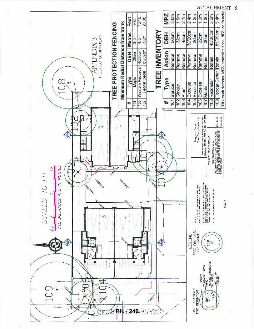
7-/
------~
-----
---~
1/ ,/
.... ,,
/ 10
9
'\\
25
S~AL
ED 5
TO
F
l TID
-----
' \
,.........
... ..
........
\ )
ALL
D
IST
AN
CE
S
AR
E
IN
ME
TRE
S
//1 0.
8 '\\
\ f
I I
\ I
I t
\ I
I [
\ /
\ I
\, ... ,
<:_
--
--~
APP
END
IX 3
./
TR
EE
PR
OT
EC
TIO
N P
LA
N
":: 3
.. ,,
_,_
'
----
-~=N-+-
.....P
.-_-__
----
-____ .. _ -..,
.--T
RE
E P
RO
TE
CT
ION
FE
NC
ING
--
. ~--·-·--·
_/
Min
imu
m R
ad
ial D
ista
nce
fro
m t
run
k 4
# o;Y
G
"
,. #
Typ
e
DB
H
Me
tre
s F
ee
t ~-
107
Map
le
20cm
3.
0m
9.8f
t C5
_
108
Wes
tern
Red
ceda
r 45
130c
m
4.0m
13
.1ft
CJ
109
Deo
dar
Ced
ar
8513
9cm
7.
0m
23.0
ft
0::::
'::::(
--
----
--
----
··--
-~
TREE
INV
ENTO
RY
\ -
# T
ype
A
ctio
n
DB
H
MP
Z
\ 1 0
1 S
pruc
e R
emo-
..e
50cm
3.
0m
I I
I 102
Gin
gko
Rem
o-..e
32
cm
1.9m
10
3 P
lum
-
·-\_
10
41E
xcel
sa
Rem
o-..e
I
30/2
0cm
I
2.4m
TR
EE
P
RO
PO
SE
D
NO
TES
: F
rog
ge
rs
Cre
ek
1051
Exc
elsa
R
emo-
..e
20cm
1.
2m
FOR
R
ETEN
TIO
N
LEGE
ND
TREE
P
RO
PO
SE
D
FOR
R
EMO
VAL
1.
SITE
L
AYO
UT
IN
FOR
I.tA
TlO
N
AN
D T
RE
E
SUR
VEY
DA
TA P
ER
SU
PP
UE
D
DR
AWIN
G
2.
RE
FER
TO
A
TT
AC
HE
D
TRE
E
PR
O'T
EC
TIO
N
REP
OR
T F
OR
INFO
RM
ATIO
N C
ON
CER
NIN
G
TREE
S
PEC
IES,
ST
EM
DIA
MET
ER,
HE
ICH
T,
CA
NO
PY
SPR
EA
D A
ND
CON
Dm
ON
.
Tre
e C
on
su
lta
nts
L
td
776.
:1 A
lcC
ff190
1" A
ven
u•
Bum
ab
y 8
C
115.1
#I~
Ttlle
phon
6:
6tH
-72
1-6
002
Fo
x:
60
4-i
f.J7
-o9
70
106
Exc
elsa
R
emo-
..e
22cm
1.
3m ~
~:.-
..:;..
.,.z..--
~~~~
CriiON
----...
,...
...,
/ 10
2 \
( X
)
\ '
\ ,/
.....
.... __
_ .......
3.
ALL
t.1
EAS
UR
EME
NTS
A
RE
M
ETR
IC
Pag
e 7
7760
Gor
dtm
f!_
"'y_ R
rxld
Ric
hmon
d
TREE
PR
OTE
CTI
ON
PLA
N
THE
D
RAW
ING
PL
OTS
A
LL
TREE
S.
PRO
POSE
D
FOR
R
ETEN
TIO
N,
REM
OVAL
. TH
EIR
CA
NO
PIES
, PR
OTE
CTIO
N
0RA1
11N 1
1'1:
CU
ZON
ES
AN
D
PRO
TECT
ION
FE
NCI
NG
IN
R
ElA
TIO
N
TO
PRO
POSE
D L
AYO
UT
J111
1uaiY
23,
201
1
107
Map
le
Ret
ain
20cm
1.
2m >
11
08 R
edce
dar
Ret
ain
45/3
0cm
3.
2m
n 1 0
9 D
eoda
r C
edar
Ret
ain
85/3
9cm
5.
4m ~
DB
H-
trun
k di
amet
er,
llt1PZ
-pr
otec
tion
zone
, N
FZ-
no fo
und
at ~
....,
Vl
PH - 240
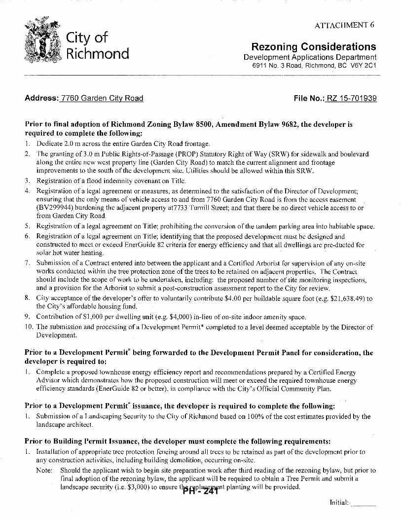
City of Richmond
Address: 7760 Garden City Road
ATTACHMENT 6
Rezoning Considerations Development .Applications Department
6911 No.3 Road, Richmond, BC V6Y 2C1
File No.: RZ 15-701939
Prior to final adoption of Richmond Zoning Bylaw 8500, Amendment Bylaw 9682, the developer is required to complete the following: 1. Dedicate 2.0 m across the entire Garden City Road frontage.
2. The granting of 3.0 m Public Rights-of-Passage (PROP) Statutory Right of Way (SRW) for sidewalk and boulevard along the entire new west property line (Garden City Road) to match the current alignment and frontage improvements to the south of the development site. Utilities should be allowed within this SRW.
3. Registration of a flood indemnity covenant on Title.
4. Registration of a legal agreement or measures, as determined to the satisfaction of the Director of Development; ensuring that the only means of vehicle access to and from 7760 Garden City Road is from the access easement (BV299944) burdening the adjacent property at7733 Turnill Street; and that there be no direct vehicle access to or from Garden City Road.
5. Registration of a legal agreement on Title; prohibiting the conversion of the tandem parking area into habitable space.
6. Registration of a legal agreement on Title; identifying that the proposed development must be designed and constructed to meet or exceed EnerGuide 82 criteria for energy efficiency and that all dwellings are pre-ducted for solar hot water heating.
7. Submission of a Contract entered into between the applicant and a Certified Arborist for supervision of any on-site works conducted within the tree protection zone ofthe trees to be retained on adjacent properties. The Contract should include the scope of work to be undertaken, including: the proposed number of site monitoring inspections, and a provision for the Arborist to submit a post-construction assessment report to the City for review.
8. City acceptance of the developer's offer to voluntarily contribute $4.00 per buildable square foot (e.g. $21,638.49) to the City's affordable housing fund.
9. Contribution of $1,000 per dwelling unit (e.g. $4,000) in-lieu of on-site indoor amenity space.
10. The submission and processing of a Development Permit* completed to a level deemed acceptable by the Director of Development.
Prior to a Development Permit* being forwarded to the Development Permit Panel for consideration, the developer is required to: 1. Complete a proposed townhouse energy efficiency report and recommendations prepared by a Certified Energy
Advisor which demonstrates how the proposed construction will meet or exceed the required townhouse energy efficiency standards (EnerGuide 82 or better), in compliance with the City's Official Community Plan.
Prior to a Development Permit* issuance, the developer is required to complete the following: 1. Submission of a Landscaping Security to the City of Richmond based on 100% of the cost estimates provided by the
landscape architect.
Prior to Building Permit Issuance, the developer must complete the following requirements: 1. Installation of appropriate tree protection fencing around all trees to be retained as part of the development prior to
any construction activities, including building demolition, occurring on-site.
Note: Should the applicant wish to begin site preparation work after third reading of the rezoning bylaw, but prior to final adoption of the rezoning bylaw, the applicant will be required to obtain a Tree Permit and submit a landscape security (i.e. $3,000) to ensure the replacement planting will be provided.
Initial:-
PH - 241
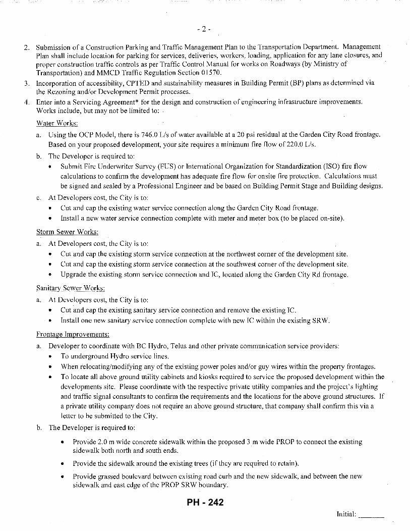
- 2 -
2. Submission of a Construction Parking and Traffic Management Plan to the Transportation Department. Management Plan shall include location for parking for services, deliveries, workers, loading, application for any lane closures, and proper construction traffic controls as per Traffic Control Manual for works on Roadways (by Ministry of Transportation) and MMCD Traffic Regulation Section 01570.
3. Incorporation of accessibility, CPTED and sustainability measures in Building Permit (BP) plans as determined via the Rezoning and/or Development Permit processes.
4. Enter into a Servicing Agreement* for the design and construction of engineering infrastructure improvements. Works include, but may not be limited to:
Water Works_;_
a. Using the OCP Model, there is 746.0 Lis of water available at a 20 psi residual at the Garden City Road frontage. Based on your proposed development, your site requires a minimum fire flow of220.0 Lis.
b. The Developer is required to:
• Submit Fire Underwriter Survey (FUS) or International Organization for Standardization (ISO) fire t1ow calculations to confirm the development has adequate fire flow for onsite fire protection. Calculations must be signed and sealed by a Professional Engineer and be based on Building Permit Stage and Building designs.
c. At Developers cost, the City is to:
• Cut and cap the existing water service connection along the Garden City Road frontage.
• Install a new water service connection complete with meter and meter box (to be placed on-site).
Storm Sewer Works:
a. At Developers cost, the City is to:
• Cut and cap the existing storm service connection at the northwest corner of the development site.
• Cut and cap the existing storm service connection at the southwest corner ofthe development site.
• Upgrade the existing storm service connection and IC, located along the Garden City Rd frontage.
Sanitary Sewer Works:
a. At Developers cost, the City is to:
• Cut and cap the existing sanitary service connection and remove the existing IC.
• Install one new sanitary service connection complete with new IC within the existing SRW.
Frontage Improvements:
a. Developer to coordinate with BC Hydro, Telus and other private communication service providers:
• To underground Hydro service lines.
• When relocating/modifying any of the existing power poles and/or guy wires within the property frontages.
• To locate all above ground utility cabinets and kiosks required to service the proposed development within the developments site. Please coordinate with the respective private utility companies and the project's lighting and traffic signal consultants to confirm the requirements and the locations for the above ground structures. If a private utility company does not require an above ground structure, that company shall confirm this via a .letter to be submitted to the City.
b. The Developer is required to:
• Provide 2.0 m wide concrete sidewalk within the proposed 3 m wide PROP to connect the existing sidewalk both north and south ends.
• Provide the sidewalk around the existing trees (if they are required to retain).
• Provide grassed boulevard between existing road curb and the new sidewalk, and between the new sidewalk and east edge ofthe PROP SRW boundary.
Initial: ---
PH - 242
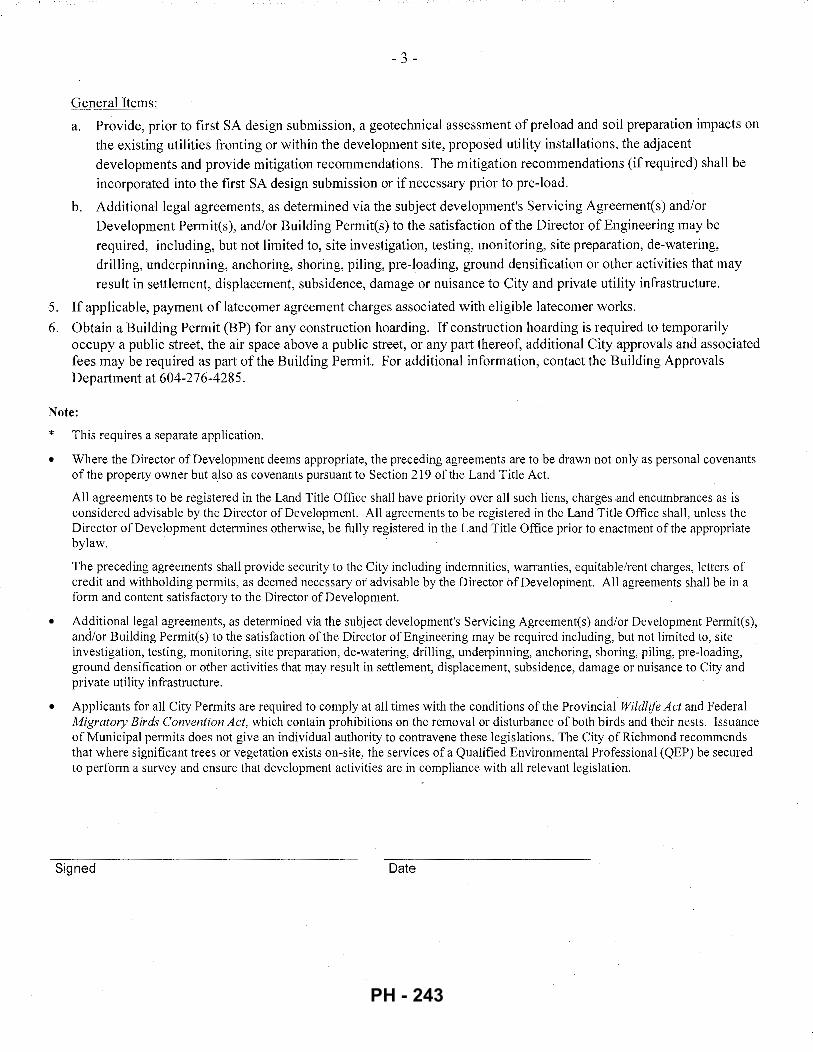
, - .) -
General Items:
a. Provide, prior to first SA design submission, a geotechnical assessment of preload and soil preparation impacts on the existing utilities fronting or within the development site, proposed utility installations, the adjacent developments and provide mitigation recommendations. The mitigation recommendations (if required) shall be incorporated into the first SA design submission or if necessary prior to pre-load.
b. Additional legal agreements, as determined via the subject development's Servicing Agreement(s) and/or Development Permit(s), and/or Building Permit(s) to the satisfaction of the Director of Engineering may be required, including, but not limited to, site investigation, testing, monitoring, site preparation, de-watering, drilling, underpinning, anchoring, shoring, piling, pre-loading, ground densification or other activities that may result in settlement, displacement, subsidence, damage or nuisance to City and private utility infrastructure.
5. If applicable, payment of latecomer agreement charges associated with eligible latecomer works.
6. Obtain a Building Permit (BP) for any construction hoarding. If construction hoarding is required to temporarily occupy a public street, the air space above a public street, or any part thereof, additional City approvals and associated fees may be required as part of the Building Permit. For additional information, contact the Building Approvals Department at 604-276-4285.
Note:
*
•
This requires a separate application.
Where the Director of Development deems appropriate, the preceding agreements are to be drawn not only as personal covenants of the property owner but also as covenants pursuant to Section 219 of the Land Title Act.
All agreements to be registered in the Land Title Office shall have priority over all such liens, charges .and encumbrances as is considered advisable by the Director of Development. All agreements to be registered in the Land Title Office shall, unless the Director of Development determines otherwise, be fully registered in the Land Title Office prior to enactment of the appropriate bylaw.
The preceding agreements shall provide security to the City including indemnities, warranties, equitable/rent charges, letters of credit and withholding permits, as deemed necessary or advisable by the Director of Development. All agreements shall be in a form and content satisfactory to the Director of Development.
• Additional legal agreements, as determined via the subject development's Servicing Agreement(s) and/or Development Permit(s), and!or Building Permit(s) to the satisfaction ofthe Director of Engineering may be required including, but not limited to, site investigation, testing, monitoring, site preparation, de-watering, drilling, underpinning, anchoring, shoring, piling, pre-loading, ground densification or other activities that may result in settlement, displacement, subsidence, damage or nuisance to City and private utility infrastructure.
• Applicants for all City Permits are required to comply at all times with the conditions of the Provincial Wildlife Act and Federal Migratory Birds Convention Act, which contain prohibitions on the removal or disturbance of both birds and their nests. Issuance of Municipal permits does not give an individual authority to contravene these legislations. The City of Richmond recommends that where significant trees or vegetation exists on-site, the services of a Qualified Environmental Professional (QEP) be secured to perform a survey and ensure that development activities are in compliance with all relevant legislation.
Signed Date
PH - 243
City of Richmond
Richmond Zoning Bylaw 8500 Amendment Bylaw 9682 (RZ 15-701939)
7760 Garden City Road
Bylaw 9682
The Council of the City of Richmond, in open meeting assembled, enacts as follows:
1. The Zoning Map of the City of Richmond, which accompanies and forms part of Richmond Zoning Bylaw 8500, is amended by repealing the existing zoning designation of the following area and by designating it "TOWN HOUSING (ZT49)- MOFFATT ROAD, ST. ALBANS SUB-AREA AND SOUTH MCLENNAN SUB-AREA (CITY CENTRE)".
P.I.D. 000-885-584 Lot 72 Section 15 Block 4 North Range 6 West New Westminster District Plan 46184
2. This Bylaw may be cited as "Richmond Zoning Bylaw 8500, Amendment Bylaw 9682".
FIRST READING FEB 2 7 2017
A PUBLIC HEARING WAS HELD ON
SECOND READING
THIRD READING
OTHER CONDITIONS SATISFIED
ADOPTED
MAYOR CORPORATE OFFICER
5302497
CITY OF RICHMOND
APPROVED by
APPROVED by Director or Solicitor
PH - 244
City of . Richmond
To: Planning Committee
From: Wayne Craig Director, Development
Report to Committee Planning and Development Division
Date: January 31, 2017
File: RZ 15-716841
Re: Application by Aman Hayer for Rezoning at 3411/3431 Lockhart Road from "Single Detached (RS1/E)" to "Single Detached (RS2/B)"
Staff Recommendation
That Richmond Zoning Bylaw 8500, Amendment Bylaw 9683, for the rezoning of 3411 /34 31 Lockhart Road from the "Single Detached (RS 1 /E)" zone to the "Single Detached (RS2/B)" zone, be introduced and given first reading.
·~5 7 ~z; crflig"
Dir:~;,pevelopment
CL:blg Att. 6
REPORT CONCURRENCE
ROUTED TO: CONCURRENCE CONCURRENCE OF GENERAL MANAGER
Affordable Housing
5302073 PH - 245
January 31, 2017 -2- RZ 15-716841
Staff Report
Origin
Aman Hayer has applied to the City of Richmond for permission to rezone the property at 3411/3431 Lockhart Road from the "Single Detached (RS1/E)" zone to the "Single Detached (RS2/B)" zone, to permit the property to be subdivided to create two lots (Attachment 1 ). A survey of the subject site, which illustrates the proposed subdivision. plan, is included in Attachment 2.
Findings of Fact
A Development Application Data Sheet providing details about the development proposal is attached (Attachment 3).
Site Description and Surrounding Development
The subject site is located on the north side of Lockhart Road; between Marrington Road and No. 1 Road, in the Seafair Planning Area. The subject site currently contains an existing non-conforming duplex, which will be demolished at future development stage.
Existing development immediately surrounding the subject site is as follows:
• To the North, fronting Granville Avenue, are two lots zoned "Single Detached (RS1/B)"; each containing a single-family dwelling.
• To the South, immediately across Lockhart Road, are two lots zoned "Single Detached (RS 1/B)"; each containing a single-family dwelling.
• To the East, is a property zoned "Single Detached (RS1/E)"; which contains an existing non-conforming duplex.
• To the West, fronting Marrington Road, are three lots zoned "Single Detached (RS liB)"; each containing a single-family dwelling.
Related Policies & Studies
Official Community Plan
The Official Community Plan (OCP) land use designation for the subject site is "Neighbourhood Residential". This redevelopment proposal is consistent with this designation.
Single-Family Lot Size Policy 5447
The subject site is located within the area governed by Single-Family Lot Size Policy 5447; adopted by Council on September 16, 1991, and subsequently amended in 1998 and 2003 (Attachment 4). The Policy permits properties on Lockhart Road to be rezoned and subdivided subject to the requirements of the "Single Detached (RS2/B)" zone.
5302073 PH - 246
January 31, 2017 - 3 - RZ 15-716841
This redevelopment proposal would allow for the creation of two lots of approximately 12m in width and 579m2 (6,232 ft2
) in area, consistent with the requirements of the "Single Detached (RS2/B)" zone.
Floodplain Management Implementation Strategy
The proposed redevelopment must meet the requirements of the Richmond Flood Plain Designation and Protection Bylaw No. 8204. Registration of a flood indemnity covenant on Title is required prior to final adoption of the rezoning bylaw.
Public Consultation
A rezoning sign has been installed on the subject property. Staff have not received any comments from the public about the rezoning application in response to the placement of the rezoning sign on the property.
Should the Planning Committee endorse this application and Council grant first reading to the rezoning bylaw, the bylaw will be forwarded to a Public Hearing where any area resident or interested party will have an opportunity to comment.
Public notification for the Public Hearing will be provided as per the Local Government Act.
Analysis
Existing Legal Encumbrances
There is currently a Statutory Right-of-Way registered on Title of the subject site for the existing sanitary sewer, which is located in the rear yard parallel to the north property line.
There is also currently a covenant that is registered on Title of the strata lots which restricts the use of the property to a duplex (i.e., RD52761). The covenant must be discharged from Title prior to approval of the subdivision application.
The existing Strata Plan NWS937 must also be discharged from Title prior to approval of the subdivision application.
Site Access
Vehicle access to the proposed lots is to be from Lockhart Road via separate driveway crossings.
Tree Retention and Replacement
The applicant has submitted a Certified Arborist's Report, which identifies on-site and off-site tree species, assesses tree structure and condition, and provides recommendations on tree retention and removal relative to the proposed development. The Report assesses one bylawsized tree on the subject property, and five trees on neighbouring properties.
The City's Tree Preservation Coordinator has reviewed the Arborist's Report and has the following comments:
5302073 PH - 247
January 31,2017 - 4 - RZ 15-716841
• One tree (tag# A) located on the subject site is in moderate condition and is suitable for retention. Tree protection must be provided as per City of Richmond Tree Protection Information Bulletin TREE-03. The tree protection area is to extend 4.0 m from the base of the tree in each direction. The proposed building footprint on the east lot must be outside of the tree protection area. All work within the tree protection area must be supervised by a Certified Arborist.
• Five trees (tag# B, C, 37, 38, 39) located on the adjacent neighbouring properties at 3491 Lockhart Road, 7016 and 7020 Marrington Road, and 3240 and 3260 Granville Avenue are identified to be retained and protected. Tree protection must be provided as per City of Richmond Tree Protection Information Bulletin TREE-03.
Tree Protection
A total of one tree on the subject site and five trees on neighbourhood sites are to be retained and protected. The applicant has submitted a tree retention plan showing the trees to be retained and the tree protection area to be installed at development stage (Attachment 5, annotated). To ensure that the trees identified for retention are protected at development stage, the applicant is required to complete the following items:
• Prior to final adoption of the rezoning bylaw, submission to the City of:
- A contract with a Certified Arborist for the supervision of all works conducted within or in close proximity to tree protection zones (tag #'sA, B, C, 37, 38, 39). The contract must include the scope of work required, the number of proposed monitoring inspections at specified stages of construction, any special measures required to ensure tree protection, and a provision for the arborist to submit a post-construction impact assessment to the City for review.
- A survival security in the amount of $10,000 for tree tag # A. The security will be held until construction and landscaping on the subject site is completed and a landscape inspection has been passed by City staff. The City may retain a portion of the security for a one-year maintenance period from the date of the landscape inspection to ensure that the tree survives.
• Prior to demolition of the existing dwelling on the subject site, installation of tree protection fencing around all trees to be retained (tag #'sA, B, C, 37, 38, 39). Tree protection fencing must be installed to City standard in accordance with the City's Tree Protection Information Bulletin TREE-03 prior to any works being conducted on-site, and remain in place until construction and landscaping on-site is completed.
Tree Planting
In accordance with City Policy 5032- Tree Planting (Universal), the applicant has agreed to plant two trees on the proposed west lot and one tree on the proposed east lot, which will result in a total of two trees per lot (minimum 6 em deciduous caliper or 3 m high conifer).
To ensure that the three new trees are planted and maintained on the proposed lots, the applicant is required to submit a Landscaping Security in the amount of $1,500 ($500/tree) prior to final
5302073 PH - 248
January 31, 201 7 - 5 - RZ 15-716841
adoption of the rezoning bylaw. The Security will not be released until construction and landscaping on the subject site is completed and a landscape inspection has been passed by City staff. The City may retain a portion of the security for a one-year maintenance period from the date of the landscape inspection.
Affordable Housing Strategy
The City's Affordable Housing Strategy for single-family rezoning applications requires: a) secondary suite(s) on 100% of new lots proposed; b) secondary suite(s) on 50% of new lots proposed and a cash-in-lieu contribution to the City's Affordable Housing Reserve Fund based on $2.00/ft2 of the total buildable area on the remaining lots; or c) in cases where a secondary suite cannot be accommodated, a cash-in-lieu contribution to the City's Affordable Housing Reserve Fund based on $2.00/ft2 of the total buildable area on 100% of new lots proposed.
Consistent with the Affordable Housing Strategy, the applicant proposes to construct a secondary suite on both proposed lots. Prior to rezoning, the applicant is required to register a legal agreement on Title stating that no final Building Permit inspection will be granted until the secondary suites are constructed to the satisfaction of the City in accordance with the BC Building Code and Richmond Zoning Bylaw 8500.
Site Servicing and Frontage Improvements
Prior to final adoption of the rezoning bylaw, the applicant is required to submit a cash contribution of $42,881.20 to the City for cost-recovery of the off-site improvements undertaken as part of a Capital works project on Lockhart Road in 2016, as follows:
• $12,650 for two new 25 mm water service connections each complete with meters and meter boxes, in keeping with Waterworks and Water Rates Bylaw No. 5637,
• $30,231.20 for the design and construction of road widening, street lighting, treed/grassed boulevard, concrete curb and gutter, and concrete sidewalk, in keeping with Subdivision and Development Bylaw No. 8751.
If the rezoning application is not completed, the/subject site will be added to the Works and Services Cost Recovery Bylaw No. 8752 as benefitting prOperty of the Capital works project undertaken in 2016.
At future Subdivision stage, the applicant is required to pay the costs associated with future storm sewer and sanitary connection works, as described in Attachment 6.
Financial Impact
This rezoning application results in an insignificant Operational Budget Impact (OBI) for off-site City infrastructure (such as roadworks, waterworks, storm sewers, sanitary sewers, street lights, street trees and traffic signals).
5302073 PH - 249
January 31,2017 - 6 - RZ 15-716841
Conclusion
The purpose of this application is to rezone the property at 341113431 Lockhart Road from the "Single Detached (RS 1/E)" zone to the "Single Detached (RS2/B)" zone; to permit the property to be subdivided to create two lots.
This rezoning application complies with the land use designation and applicable policies for the subject site that are contained within the OCP and Single-Family Lot Size Policy 5447.
The list of Rezoning Considerations is included in Attachment 6, which has been agreed to by the applicant (signed concurrence on file).
It is recommended that Richmond Zoning Bylaw 8500, Amendment Bylaw 9683 be introduced and given first reading.
Cynthia Lussier Planner 1 (604-276-41 08)
CL:blg
Attachment 1 : Location Map/ Aerial Photo Attachment 2: Site Survey Attachment 3: Development Application Data Sheet Attachment 4: Single Family Lot Size Policy 5447 Attachment 5: Proposed Tree Retention Plan Attachment 6: Rezoning Considerations
5302073 PH - 250
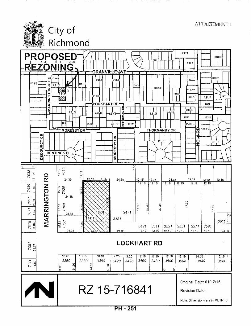
City of Richmond
c 0:: 24.39 12.19 12.19
z 0 IC) z -0:: 0:: ~ ~
24.38
16.46
3360 16.10
3380 16.10
3400
24.38 12.15 12.23 12.19 12.19
(J) (J) (j)
'<t '<t '<t r--: r--: r--:
bE '<t '<t '<t
3491 3511 24.38 12.19 12.19
LOCKHART RD
12.20 12.20 12.19
3420 3428 3460 12.19
3480
RZ 15-716841
ATTACHMENT 1
24.38 12.19 12.19 12.19 12.19 12.19 12.19 12.19
3531 12.19
12.19
3500
0 lO r--'<t
3551 12.19
12.19
3508
3571 3591 12.19 12.19
24.38
3540
~ ~ '<t
13611 3
24.38
12.19
3580
Original Date: 01/12/16
Revision Date:
Note: Dimensions are in METRES
PH - 251
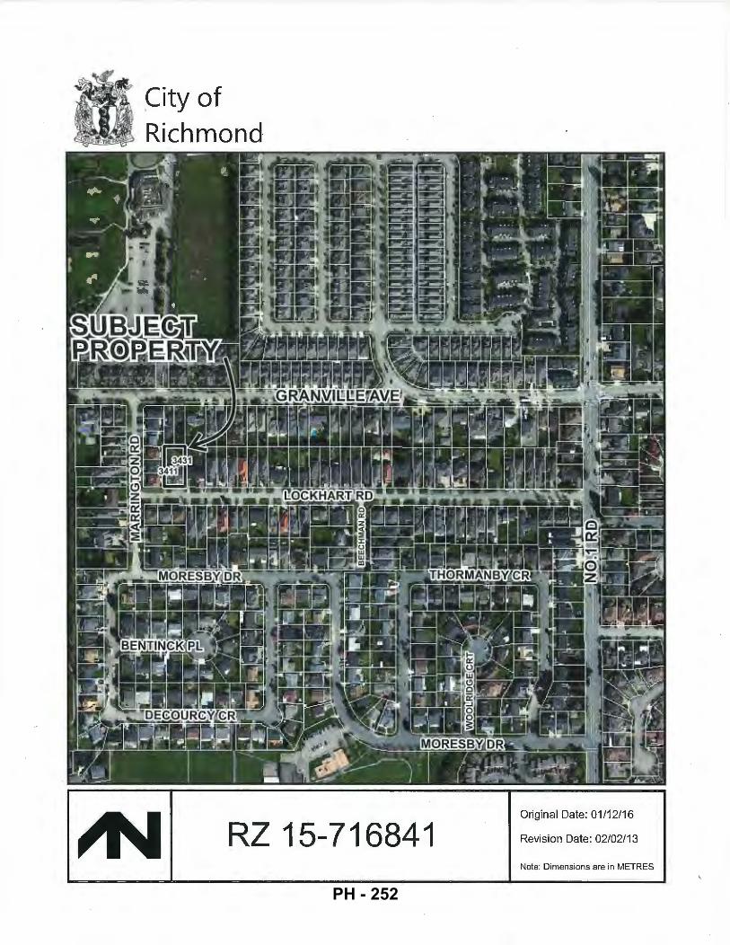
~ity of Richmond·
RZ 15-716841 Original Date: 01/12/16
Revision Date: 02/02/13
Note: Dimensions are in METRES
PH - 252
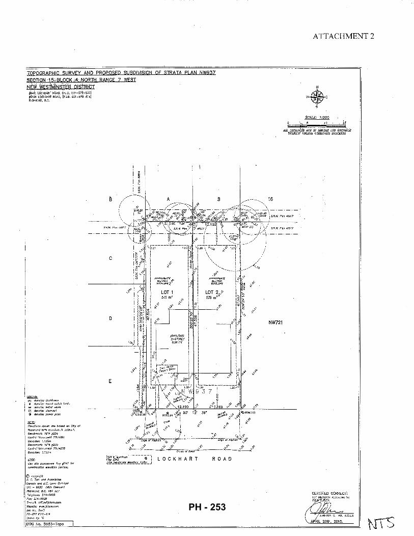
TOPOGRAPHIC SURVEY AND PROPOSED SUBDI\I!SION OF STRATA PLAN NW93?
SECTION 15tBLOCK 4 NORTH RANGE 7 WESI
NEW WEsTMiNStER DISlRICI #3411 i.OiJKHA~f ROAD, (P.I.D. 001-579-sSO) #3431 L6CK~L~Rt ROAb, (PJ.D. 001-5797 614) RICHMOND, B.C.
LEGEND· (D) denotes deciduous o denotes round catch basin t+:1 denotes water valve 0 denotes cleanout ~ denotes power post
!:lQ]I; Elevations shown ore based on City of Richmond HPN Benchmark network. Benchmark: HPN #234 Control Monument 77H4891 Elevation: 1.125m Benchmark: HPN #235 Control Monument 77H4885 Elevation: 1.10Jm
(1Qif; Use site Benchmark Tag #342 for construction elevation ,control.
@ copyright J. C. Tom and Associates Canada and B.C. Land Surveyor 115 - 8833 Odlin Crescent Richmond, B.C. V6X 3Z7 Telephone: 214-8928 Fax: 214-8929 £-moil: [email protected] Website: www.jctom.com Job No. 5983 FB-277 P111-114 Drawn By: 10
DWG No. 5983-Topo
c
D
L
E
LOCKHART R 0 AD
NW721
ATTACHMENT 2
SCALE: 1:200 ';,.· 10.
ALL DISTANCEs ARE m METRES. AND D.sciM.ALS THEREOF UNLESS OTHERP11SE JNDICATED
CERTIFIED CORRECT:
PH - 253
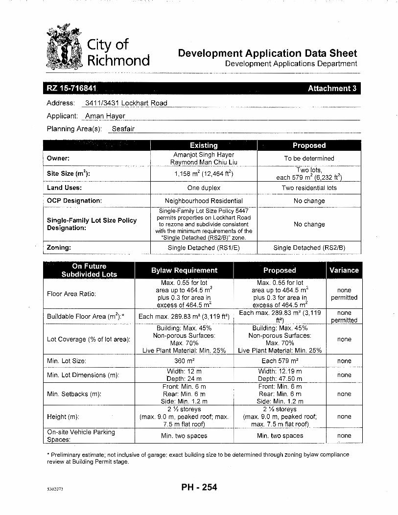
City of Richmond
Development Application Data Sheet Development Applications Department
RZ 15-716841 Attachment 3
Address: 3411/3431 Lockhart Road
Applicant: Aman Hayer
Planning Area(s): Seafair ~~~------------------------------------------------------
Existing Proposed
Owner: Amanjot Singh Hayer To be determined
Raymond Man Chiu Liu
Site Size (m2): 1,158 m2 (12,464 fe)
Two lots, each 579 m2 (6,232 fe)
Land Uses: One duplex Two residential lots
OCP Designation: Neighbourhood Residential No change
Single-Family Lot Size Policy 5447
Single-Family Lot Size Policy permits properties on Lockhart Road
Designation: to rezone and subdivide consistent No change with the minimum requirements of the
"Single Detached (RS2/B)" zone.
Zoning: Single Detached (RS1/E) Single Detached (RS2/B)
On Future I
Bylaw Requirement I
Proposed I Variance Subdivided Lots Max. 0.55 for lot Max. 0.55 for lot
Floor Area Ratio: area up to 464.5 m2 area up to 464.5 m2 none plus 0.3 for area in plus 0.3 for area in permitted excess of 464.5 m2 excess of 464.5 m2
Buildable Floor Area (m\* Each max. 289.83 m2 (3, 119 ft2) Each max. 289.83 m2 (3, 119 none
ft2) permitted Building: Max. 45% Building: Max. 45%
Lot Coverage (% of lot area): Non-porous Surfaces: Non-porous Surfaces: none Max. 70% Max. 70%
Live Plant Material: Min. 25% Live Plant Material: Min. 25%
Min. Lot Size: 360m2 Each 579m2 none
Min. Lot Dimensions (m): Width: 12m Width: 12.19 m Depth: 24m Depth: 47.50 m
none
Front: Min. 6 m Front: Min. 6 m Min. Setbacks (m): Rear: Min. 6 m Rear: Min. 6 m none
Side: Min. 1.2 m Side: Min. 1.2 m 2% storeys 2% storeys
Height (m): (max. 9.0 m, peaked roof; max. (max. 9.0 m, peaked roof; none 7. 5 m flat roof) max. 7.5 m flat roof)
On-site Vehicle Parking Min. two spaces Min. two spaces none
Spaces:
* Preliminary estimate; not inclusive of garage; exact building size to be determined through zoning bylaw compliance review at Building Permit stage.
5302073 PH - 254
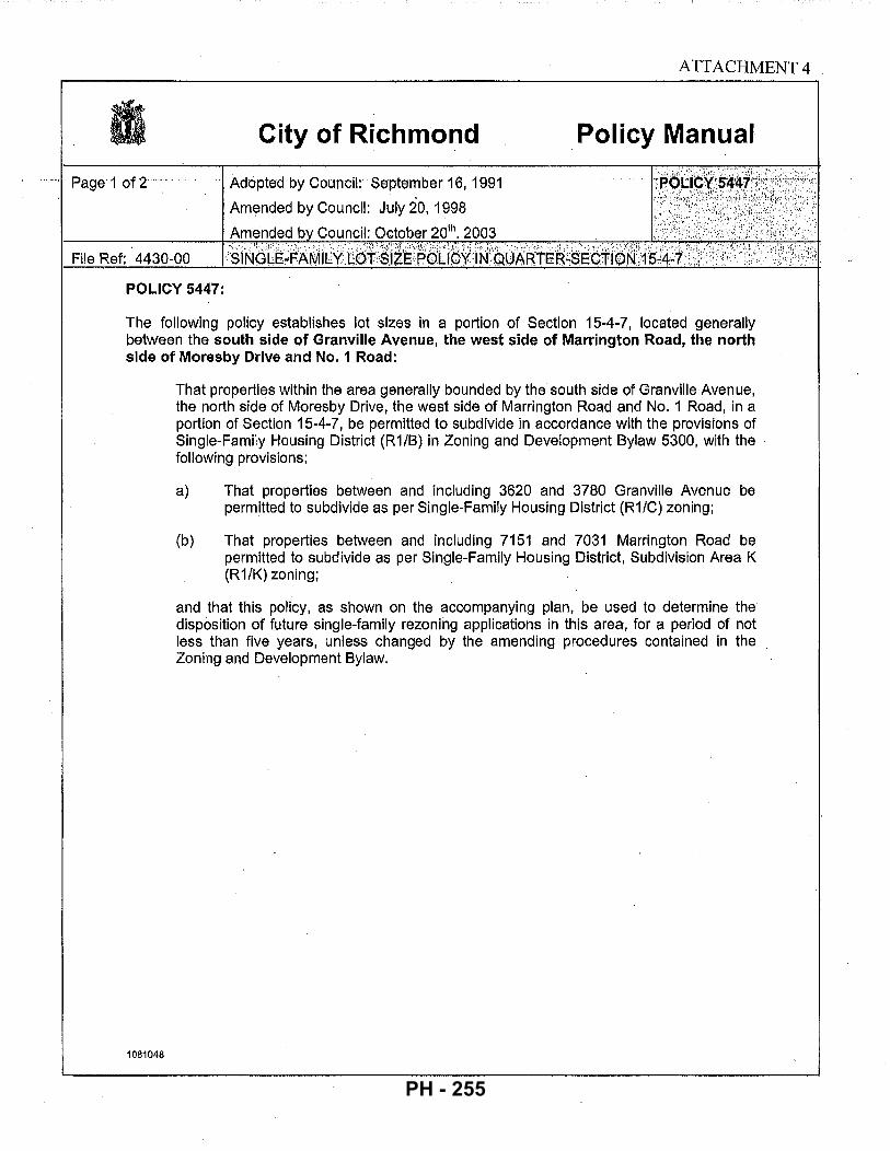
City of Richmond
Adopted by Council: September 16, 1991
Amended by Council: July 20, 1998
Amended b Council: October 201h. 2003
ATTACHMENT 4
Policy Manual
File Ref: 4430-00
POLICY 5447:
The following policy establishes lot sizes in a portion of Section 15-4-7, located generally between the south side of Granville Avenue, the west side of Marrington Road, the north side of Moresby Drive and No. 1 Road:
1081048
That properties within the area generally bounded by the south side of Granville Avenue, the north side of Moresby Drive, the west side of Marrington Road and No. 1 Road, in a portion of Section 15-4-7, be permitted to subdivide in accordance with the provisions of Single-Family Housing District (R1/B) in Zoning and Development Bylaw 5300, with the following provisions:
a) That properties between and including 3620 and 3780 Granville Avenue be permitted to subdivide as per Single-Family Housing District (R1/C) zoning;
(b) That properties betwE;Jen and including 7151 and 7031 Marrington Road be permitted to subdivide as per Single-Family Housing District, Subdivision Area K (R1/K) zoning;
and that this policy, as shown on the accompanying plan, be used to determine the disposition of future single-family rezoning applications in this area, for a period of not less than five years, unless changed by the amending procedures contained in the Zoning and Development Bylaw.
PH - 255
~ Subdivision permitted as per Rl/B with the following provisions:
~ 1. Between 3620 and 3780 Granville Avenue Rl/C.
MJ 2. Between 7151 and 7031 Marrington Road Rl/K.
Policy 5447 Section 15-4-7
Adopted Date: 09/16/91
Amended Date: 10/20/03
Note: DimenRions arc in METRES
PH - 256
Tree #39 Cherry 16 em DBH
c along PL, running 2.4 meters or 8' north to south center on tree trunk
D
E
L
Tree #37 Spruce group 33 em & 32 em DBH
LOCKHART
1.8 meters or 6' radial
8
R 0 A D
ATTACHMENT 5
TreeC Douglas Fir 40 em DBH
,~------ ....... 16
.._'\ .... X
Tree A Oak 63 em DBH
'-1.0 ~meters
or ~adial J-3. I I
NW721
Arborist Legend # - Tree ID
0 TPBArea
# - TPB Radial
ANNOTATED TREE RETENTION PLAN PH - 257
City of Richmond
Address: 3411/3431 Lockhart Road
ATTACHMENT 6
Rezoning Considerations Development Applications Department
6911 No. 3 Road, Richmond, BC V6Y 2C1
File No.: RZ 15-716841
Prior to final adoption of Richmond Zoning Bylaw 8500, Amendment Bylaw 9683, the applicant is required to complete the following:
1. Submission of a Contract entered into between the applicant and a Certified Arborist for supervision of any on-site works conducted within tree protection zones of the trees to be retained (tag #'sA, B, C, 37, 38, 39). The Contract should include the scope of work to be undertaken, including: the proposed number of site monitoring inspections, and a provision for the Arborist to submit a post-construction assessment report to the City for review. Notes: the tree protection area for tree tag# A is to extend 4.0 m from the base of the tree in each direction. The proposed building footprint on the east lot must be outside of the tree protection area.
2. Submission of a Tree Survival Security to the City in the amount of $10,000 for tree tag# A on-site to be retained. The security will be held until construction and landscaping on the subject site is completed and a landscape inspection has been passed by City staff. The City may retain a portion of the security for a one-year maintenance_ period from the date of the landscape inspection to ensure that the tree survives.
3. Submission of a Landscape Security in the amount of $1,500 ($500/tree) to ensure that two trees are planted and maintained on the proposed west lot, and that one tree is planted and maintained on the proposed east lot (fo_r a total of three trees); minimum 6 em deciduous caliper or 3.5 m high conifers. ·
4. City acceptance of the applicant's voluntary contribution in the amount of $12,650, for cost-recovery of the two new 25 mm water service connections each complete with meters and meter boxes; which was previously completed as part of a Capital works project on Lockhart Road in 2016.
5. City acceptance of the applicant's voluntary contribution in the amount of $30,231.20; for cost-recovery of the design and construction of road widening, street lighting, treed/grassed boulevard, concrete curb and gutter, and concrete sidewalk, which was previously completed as part of a Capital works project on Lockhart Road in 20 16."
6. Registration of a flood indemnity covenant on Title.
7. Registration of a legal agreement on Title to ensure that no final Building Permit inspection is granted until a secondary suite is constructed on each of the two lots proposed, to the satisfaction of the City in accordance with the BC Building Code and the City's Zoning Bylaw.
Prior to Demolition Permit* issuance, the applicant must complete the following requirements: • Installation of tree protection fencing around all trees to be retained (tag #'sA, B, C, 37, 38, 39). Tree protection
fencing must be installed to City standard in accordance with the City's Tree Protection Information Bulletin TREE-03 prior to any works being conducted on-site, and remain in place until construction and landscaping on-site is completed. Notes: the tree protection area for tree tag# A is to extend 4.0 m from the base of the tree in each direction.
Prior to Subdivision* approval, the applicant must complete the following requirements:
• Discharge of covenant RD 52761 from title of the strata lots, which restricts the use of the property to a duplex.
• Cancellation of Strata Plan NWS937.
• Pay the costs associated with the required service connections, as described below:
Water Works Using the OCP Model, there is 159.0 Lis of water available at a 20 psi residual at the hydrant on Marrington Road. Based on your proposed development, your site requires a minimum fire flow of95 Lis. At future Building Permit
PH - 258
- 2-
stage, the applicant is required to submit Fire Underwriter Survey (PUS) or International Organization for Standardization (ISO) fire flow calculations to confirm the development has adequate fire flow for on-site fire protection. Calculations must be signed and sealed by a Professional Engineer and be based on Building Permit Stage Building designs.
Storm Sewer Works
At the applicant's cost, the City is to retain the existing storm service connections at southeast and southwest corners of the development site.
Sanitary Sewer Works
At the applicant t' s cost, the City is to:
Cut and cap the existing sanitary service connection and remove the existing Inspection Chamber (IC) located at the northwest corner of the development site.
Install a new sanitary IC complete with dual service connection along the north common property line of the development site.
Note: All sanitary works must be completed prior to any on-site building construction.
Frontage Improvements:
The applicant is required to coordinate with BC Hydro, Telus and other private communication service providers:
To underground Hydro service lines.
When relocating/modifying any of the existing power poles and/or guy wires within the property frontages.
To determine if above ground structures are required and coordinate their locations on-site (e.g. Vista, PMT, LPT, Shaw cabinets, Telus Kiosks, etc.).
General Items:
The applicant is required to enter into, if required, additional legal agreements, as determined via the subject development's Servicing Agreement(s) and/or Development Permit(s), and/or Building Permit(s) to the satisfaction of the Director of Engineering, including, but not limited to, site investigation, testing, monitoring, site preparation, de-watering, drilling, underpinning, anchoring, shoring, piling, pre-loading, ground densification or other activities that may result in settlement, displacement, subsidence, damage or nuisance to City and private utility infrastructure.
Prior to Building Permit* issuance, the applicant must complete the following requirements:
• Submit a Construction Parking and Traffic Management Plan to the Transportation Department. The Management Plan shall include location for parking for services, deliveries, workers, loading, application for any lane closures, and proper construction traffic controls as per Traffic Control Manual for works on Roadways (by Ministry of Transportation) and MMCD Traffic Regulation Section 01570.
• Obtain a Building Permit (BP) for any construction hoarding. If construction hoarding is required to temporarily occupy a public street, the air space above a public street, or any part thereof, additional City approvals and associated fees may be required as part of the Building Permit. For additional information, contact the Building Approvals Department at 604-276-4285.
Note:
* •
This requires a separate application.
Where the Director of Development deems appropriate, the preceding agreements are to be drawn not only as personal covenants of the property owner, but also as covenants pursuant to Section 219 ofthe Land Title Act.
All agreements to be registered in the Land Title Office shall have priority over all such liens, charges and encumbrances as is considered advisable by the Director of Development. All agreements to be registered in the Land Title Office shall, unless the Director of Development determines otherwise, be fully registered in the Land Title Office prior to enactment of the appropriate bylaw.
PH - 259
- 3 -
The preceding agreements shall provide security to the City including indemnities, warranties, equitable/rent charges, letters of credit and withholding permits, as deemed necessary or advisable by the Director of Development. All agreements shall be in a form and content satisfactory to the Director of Development.
• Additional legal agreements, as determined via the subject development's Servicing Agreement(s) and/or Development Permit(s), and/or Building Permit(s) to the satisfaction of the Director of Engineering may be required including, but not limited to, site investigation, testing, monitoring, site preparation, de-watering, drilling, underpinning, anchoring, shoring, piling, pre-loading, ground densification or other activities that may result in settlement, displacement, subsidence, damage or nuisance to City and private utility infrastructure.
• Applicants for all City Permits are required to comply at all times with the conditions of the Provincial Wildlife Act and Federal Migratory Birds Convention Act; which contain prohibitions on the removal or disturbance of both birds and their nests. Issuance of Municipal permits does not give an individual authority to contravene these legislations. The City of Richmond recommends that where significant trees or vegetation exists on site, the services of a Qualified Environmental Professional (QEP) be secured to perform a survey and ensure that development activities are in compliance with all relevant legislation.
(signed concurrence on file)
Signed Date
PH - 260
City of Richmond
Richmond Zoning Bylaw 8500 Amendment Bylaw 9683 (RZ 15-716841)
3411/3431 Lockh~rt Road
Bylaw 9683
The Council of the City of Richmond, in open meeting assembled, enacts as follows:
1. The Zoning Map of the City of Richmond, which accompanies and forms part of Richmond Zoning Bylaw 8500, is amended by repealing the existing zoning designation of the following area and by designating it "SINGLE DETACHED (RS2/B)".
P.I.D. 001-579-550 Strata Lot 1 Section 15 Block 4 North Range 7 West New Westminster District Strata Plan NW937 together with an interest in the common property in proportion to the unit entitlement of the strata lot as shown on form 1.
P.I.D. 001-579-614 Strata Lot 2 Section 15 Block 4 North Range 7 West New Westminster District Strata Plan NW937 together with an interest in the common property in proportion to the unit entitlement of the strata lot as shown on form 1.
2. This Bylaw may be cited as "Richmond Zoning Bylaw 8500, Amendment Bylaw 9683".
FIRST READING FEB 2 7 2017
A PUBLIC HEARING WAS HELD ON
SECOND READING
THIRD READING
OTHER CONDITIONS SATISFIED
ADOPTED
MAYOR CORPORATE OFFICER
5302094
CITY OF RICHMOND
APPROVED by
%~ APPROVED by Director or Solicitor
PH - 261
City of Richmond
To: Mayor and Councillors
From: Wayne Craig Director, Development
Memorandum Planning and Development Division
Development Applications
Date: March 16, 2017
File: DP 16-741981
Re: Development Permit Application 16-741981 by Townline Gardens Inc. for 10788 No. 5 Road
Background
This memorandum responds to the following Council motion that was passed at the Public Hearing for DP 16-741981, on February 20, 2017:
(1) That Development Permit 16-741981 be referred to the March 20, 2017 Public Hearing to be held at 7:00pm in the Council Chambers; and
(2) That DP 16-7 41981 be referred back to staff for an exhaustive analysis and review, with the applicant, of all possibilities and potential revisions to the proposed development in response to concerns raised at the Public Hearing and report back at the next Public Hearing.
Applicant's Response
The applicant has assessed various development options for the site and provided a letter (Attachment 1) with various information that Council requested with respect to the available alternatives. This letter includes the details of development constraints related to: (1) structural engineering; (2) purchaser agreements; and (3) future expropriation of the northeasterly portion of the lot that the Province requires for the George Massey Tunnel Replacement Project.
Upon consideration of this information, Townline now wishes to amend the current proposal to remove the proposed ten-storey apartmentbuilding and to proceed with three (3) three-storey townhouse buildings, containing a total of23 units, on the eastern edge of the site adjacent to Hwy 99 as presented in revised plans (Attachment 2). The plans for the proposed townhouse area are consistent with the plans endorsed by the Development Permit Panel at the November 30, 2016 meeting. The ultimate development of the site would, therefore, include the two (2) eight-storey buildings, as approved in DP 15-708397 in June 2016, and three (3) three-storey townhouse buildings.
Analysis
The revised proposal requires amendments to the housing covenant currently registered on title. The existing legal agreement secured 5% of the proposed residential floor area as low-end market rental units in accordance with the zoning and the City's Affordable Housing Strategy. Under the currently registered housing covenant, twelve (12) of the affordable housing units
5341599 ~mond PH - 262
March 16,2017 -2-
were to be provided in the ten-storey apartment building and four ( 4) affordable housing units in the eight-storey building. As the revised proposal results in an overall reduction in residential floor area proposed, an amendment to the housing covenant is required. The applicant is willing to proceed with either of two options as shown in Table 1:
Table 1: The Gardens Phase 3 Proposed Options for Affordable Housing Units
File Studio 1 2 3 Total LEMR Residential %
Bed Bed Bed Units Floor Area Floor Area Provided Current Affordable
0 1 6 9 16 14,445 288,895 5.09% Housing Covenant DP 16-741981
1 1 5 8 15** 13,377 261,623 5.11% Option #1 DP 16-741981
1 4 5 6 16 13,185 261,623 5.04% Option #2 * * recommended option
Both options would meet the site's zoning requirements and the City's Affordable Housing Strategy requirements to provide 5% of total residential floor area as low-end market rental units. Staff are recommending Option #1 as the benefits to the City include two (2) additional threebedroom units, which are highly suitable for families.
Conclusion
Staff and the applicant will be present at the Public Hearing to answer any further questions regarding the revised proposal for the subject development permit.
Should Council wish to proceed with the revised proposal as outlined in this memorandum, the following resolution would be in order:
That DP 16-7 41981 in accordance with the DP plans provided in Attachment 2 of this memorandum be brought forward to a future Council meeting for consideration of DP issuance, subject to an amendment of the Housing Covenant registered on title as outlined in Table 1.
~7) Director,
Att. 1: Letter from Townline Gardens Inc., dated March 15, 2017, and Attachments, 2: Amended plans and amended Development Permit for DP 16-741981
cc: Joyce Rautenberg, Affordable Housing Coordinator Kim Somerville, Manager, Community Social Development
5341599 PH - 263
T 0 W N
Attn: Helen Cain City of Richmond 6911 No. 3 Road Richmond, BC V6Y 2C1
Dear Ms. Cain,
E Suite 1212, 450 SW Marine Drive Vancouver, BC, Canada V5X OC3
Main 604 327-87 60 Fax 604 327-5030
ATTACHMENT 1
www.townllne.co
March 15, 2017
RE: The Gardens- Phase 3 - Overall approach by Townline Gardens Inc. as it relates to the redistribution of height and Preferred Direction going forward.
Townline Approach on height redistribution after issuance of DP with variances (15-708397) In the Public Hearing on February 20, 2017 Council indicated that the applicant should provide more information to Planning on the overall approach that was taken as it relates to the redistribution of height which ultimately led to the application for DP 16-741981.
Our Development Permit with variances (15-708397) was approved by Council on June 13, 2016. Two days after approval of.DP 15-708397, Town line commenced sales on one of the proposed 8 storey buildings- the Calla (E2). Currently the Calla is 95% sold out
After the issuance of DP 15-708397 and sales start of the Calla building, more details emerged on the magnitude of the new Steveston Hwy and Hwy 99 interchange proposed by the Ministry of Transportation and the proposed widening of Hwy 99; this ultimately led to Townline applying for a new Development permit DP 16-741981
After sales began for the Calla, Townline considered the possibility of adding additional floors to the building. We obtained legal advice regarding potentially adding additional floors. After we received this legal advice we decided
not to proceed with this option. See attached letter from Blake, Cassels & Graydon LLP.
Construction on the Calla is well underway. At this point changing the building design from 8 to 10 storeys would require significant structural and seismic upgrading and would cause significant delays. See attached letter from Bryson, Markulin, Zickmantel Structural Engineers.
Townline's consideration on shifting density to the Eastern portion of Phase 3; Town line considered shifting density to the Eastern portion of Phase 3 of the Gardens, closer to the highway, however decided not to do so as we wanted to minimize the number of future residents being in close proximity to the widened highway.
Area of dedication as arterial highway to the Ministry of Transportation; I have attached survey Plan EPP63444 which we received from the Ministry of Transportation on August 8, 2016 which indicates 10,534 sq ft. of the Gardens Phase 3 to be dedicated as arterial highway.
PH - 264
Town line's Preferred Option going forward
After internal discussions we would like to confirm that we no longer seek a variance for building height as it relates to 10 storeys on Dahlia (E1). For Dahlia {E1) and Calla {E2) Townline would like to proceed based on the previously approved development permit with variances- DP 15-708397.
We are proposing that DP-16-741981 is updated to only reflect the 23 town homes located on the easterly portion of Phase 3. Everything else of the existing approved DP would stay the same which we already have approval for under DP 15-708397 approved by Council on June 16, 2016.
Benefits of this option:
• More family homes oriented homes overall, less future residents in closer proximity to the proposed widened Hwy. No height variance sought for 10 storeys.
Comparison table between tt1e Approved DP with Variances, the Currently Proposed DP and the Previously Proposed DP with Variances:
-~---
APPROVED CURRENTLY Proposed PREVIOUS Proposed Development Permit Development Permit DP-16- Development Permit with with variances DP-15- 74198'1 variances DP-16-741981 708397
--- ···---Number of Total 322 283 312 Units
(39 units less than approved DP)
Number of three 36 56 63
bedroom homes (20 units more than approved DP)
-------- ················-------
Total Phase FAR 281,554 261,623 288,895
(Sq. ft.) (19,931 less sq. ft. than approved I
DP)
--=--··-·--·--·········-·----------·- .. -------·- ···-·······--·--·· Overall Gardens .1.39 1.35 1.41 Site FAR
---::-;----·-·--.. ·---.. --.... ·----" -----·······-··-···---··-Number of Two (2) 8-storey buildings Two (2) 8-storey buildings One (1) 10-storey building
Buildings One (1) 4-storey building A cluster of three (3) three- One (1) 8-storey building
storey townhome buildings A cluster of three (3) three-
storey townhome buildings
Max Building Two (2) buildings at 26.9 Max building height as per One (1) building at 33.5
Height meters (88 feet) to top of approved DP with Variances meters ( 11 0 feet)
mechanical equipment One (1) building at 26.9 meters(88 feet)
--~-------
____ , __ , __________
PH - 265
Affordable Housing
The existing housing covenant was based on the previously proposed DP 16-741981 application which included the 10 storey Dahlia (E1) and 27,272 more in total floor area than the currently proposed DP 16-741981. Now that Townline is no longer seeking a height variance for 10 storeys and wants to proceed with the previously approved 8 storey Dahlia (E1) the existing legal agreement securing low end market housing will have to be updated due to our zoning requirements.
Town line is willing to proceed with one of two options:
Total Options Studio 1 bed 2 Bed 3 Bed Units
~---~---- ·----------- ____ ...... _ .. ___ ._ ------- ·-----·!---·---------·-.. --..
Option 2: Proposed at 16 units 1 4 5 6 16
Townline prefers option 1 which secures 15 affordable housing units and more 3-bedroom family homes than option 2. We are now asking Councils permission to amend the existing housing covenant.
In Summary
Townline respectfully seeks Council approval to:
• Approve the F townhomes as presented in the updated package
• To amend the existing housing covenant as outlined in the letter above based on option 1.
Sincerely,
Townline Gardens Inc.
Stefan Slot Development Manager
Documentation Enclosed: Letter by Blake, Cassels & Graydon LLP dated March 3, 2017 Letter by Bryson, Markulin, Zickmantel Structural Engineers dated march 3, 2107 Copy of Plan EPP63444
PH - 266
March 3, 2017
Townline #1212 - 450 SW Marine Drive Vancouver, British Columbia V5X OC3
Attention: Stefan Slot, Development Manager
Dear Sir:
Re: Calla (The Gardens), Richmond BC Our Reference Number: 30703A01
Suite #700- 609 West Hastings Street Vancouver, B.C. V6B 4W4
Tel: (604) 685-9533 www.bmzse.com
As requested and previously discussed on multiple occasions, we have reviewed the possibility of revising the number of levels that could be constructed for the Calla, currently under construction. This change would involve adding two additional floors to the building.
This building structure is designed for eight levels above the Ground Floor level. The Ground floor is a transfer slab that allows for horizontal (plan) offsets of the above grade and below grade support columns. Adding additional floor levels to the building would require this slab to be strengthened to safely support the additional structure weight. In addition, the foundation consists of a grade supported Raft. This would also require strengthening to safely support the additional weight. The additional building mass would significantly affect the existing Seismic design of the building as well. Upgrading of the Shearwalls already constructed would be required. As the Raft, Ground Floor slabs and Shearwalls have already been built, construction of the building would need to stop while this re-design took place. Significant structural upgrading of the Raft, Ground Floor and Shearwalls would be required to achieve this change. These upgrades could potentially affect the number of parking stalls below grade as well as Shearwall dimensions in the residential units above.
We trust the foregoing comments are clear. Please contact the writer should you have any questions.
n Markulin Zickmantel Structural Engineers
PH - 267
March 3, 2017
VIA EMAIL ([email protected])
Townline Gardens Inc. Ste 1212, 450 S.W. Marine Drive Vancouver, BC V5X OC3
Attention: Stefan Slot
Dear Stefan:
RE: Calla at The Gardens (the "Calla Development") 10788 No.5 Road, Richmond, B.C., legally described as
Blake, Cassels & Graydon LLP Barristers & Solicitors
Patent & Trade-mark Agents 595 Burrard Street, P.O. Box 49314
Suite 2600, Three Bentall Centre Vancouver BC V7X 1 L3 Canada
Tel: 604-631-3300 Fax: 604-631-3309
Gayle Hunter
Dir: 604.631.3352
Reference: 00092448/219
PID: 029-838-452, Lot 2 Section 31 Block 4 North Range 5 West NWD Plan EPP61209 Disclosure Statement filed with the Superintendent of Real Estate on June 15, 2016
As requested, I am providing this letter to you to confirm the outcome of our discussions regarding potential amendments to the Disclosure Statement for the Calla Development.
The Calla/Dahlia/Jasmine development was approved by Development Permit issued by the City on June 13, 2016 (the "June 13 DP"). Once the June 13 DP was issued, Townline filed the Calla Disclosure Statement with the Superintendent of Real Estate on June 15, 2016, in accordance with the Real Estate Development Marketing Act ("REDMA"). Townline then commenced marketing and preselling strata lots in the Calla Development.
The Calla Disclosure Statement set out that Townline would be constructing an 8 storey building, with 132 strata lots, including 4 affordable housing units.
After the filing of the Disclosure Statement, Townline considered the possibility of increasing density in the Calla Development by adding additional floors to the Calla building. This would require Townline to prepare and file an amendment to the Disclosure Statement with the Superintendent, and provide such an amendment to the purchasers who had already entered into purchase agreements to buy strata lots in the Calla Development. Townline would not be able to continue marketing the Calla Development until such an amendment was filed. The increase in density by adding additional floors to the Calla building could give rise to purchasers seeking legal remedies against Townline.
51030168.4
TORONTO CALGARY VANCOUVER MONTREAL OTTAWA NEW YORK LONDON RIYADH/AL·KHOBAA' BAHRAIN BEIJING
Blaka, Casn~l.'> & Graydon LLP I "Ao:ssodated Offices I blilkas.~om
PH - 268
Page 2
We trust this is helpful. We confirm our understanding that you do not intend, nor are we authorized, to waive client privilege with respect to the matters addressed in this letter.
Yours very truly,
Gayle Hunter
51030168.4
TORONTO CALGARY VANCOUVER wiONTA~AL OTTAWA NEW YORK LONDON RIYADH/AL·KHOBAR' BAHRAIN BEIJING
Brake, Ca~sels & Graydon l.l.P I •A!fsoc!atad Offices ] b!nkan.com
PH - 269
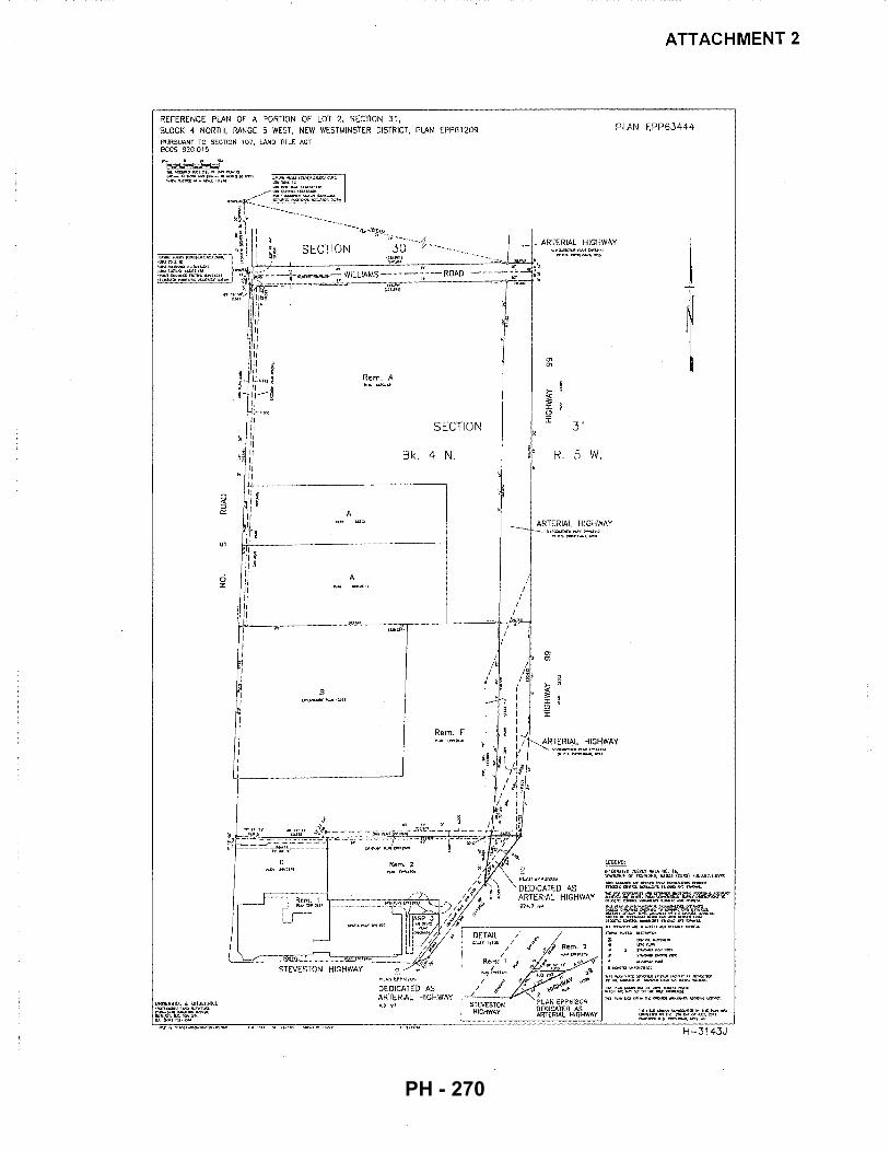
REFERENCE PLAN OF A PORTION OF LOT 2, SECTION 31, BLOCK 4 NORTH, RANGE 5 WESI, NEW WESTMINSTER DISTRICT, PLAN EPPB1209 PURSUANT TO SECTION 107, lAND TITLE ACT 6CGS 92G,015
d z
Rem. A
SECTION
Bk. 4 N.
........... --·--·---- ................... -
A
A
""'""'""-' ---,,..--_jL,_ __ ~+;· ~~UI)
Rem. F
I
I I
I I
"' "'
31
R. 5 W .
ATTACHMENT 2
PLAN EPP63444
ARTERIAL HIGHWAY
"' "'
ARTERIAL HIGHWAY V-'Cllii:Oilii'\;WTI"'Utf.l
troe"-t:tnor"""',IO::U
~
~~.~~0n~~~:~:o~tll~A]&{cm) A.c.u.uc.t.W!ll <:II:D\W'-Uif.ntlt~ornl>!<l<.!tll.mfi~J'<'I!I5~01 ~(l>tl:ll':(tlJ(<I!IJ.~In~.,.,'liU>O>N.L
l>j(\m/Wil!OW"'l)"SIJf\>Ufllol<llOif>~O<'jf.lli'Tl<ZillfW.IC;.',J<W:;f
:f~~~n:-'~m~-~~~""'ro<!ilO
~~::r\i;::&~~;;r~~~ ~I«T< ~ff.7. ~()II"~ tl'lt:l'U,} .>!<~ Ul<q'iP.
r--------------,I.U. ~H<;.::SIJ1( kl~rfi<OPdJO!C>W.$11-.a::!l)(.
DEDICATED AS ARTERIAL HIGHWAY
~\.~~·~~~r.'~~"'~Tttl ,, ... ~l< ...... <J.I<fOl•(>'t{...,.., .... ...,..ll "oliC•I""'IQI~O<I1ll(l•ll!"~~""'<'!·
l"l'll'V«I..Q'II<!IJ"I>OI;""I:AIIX~-u;m,>:;T.
H-3143J
PH - 270
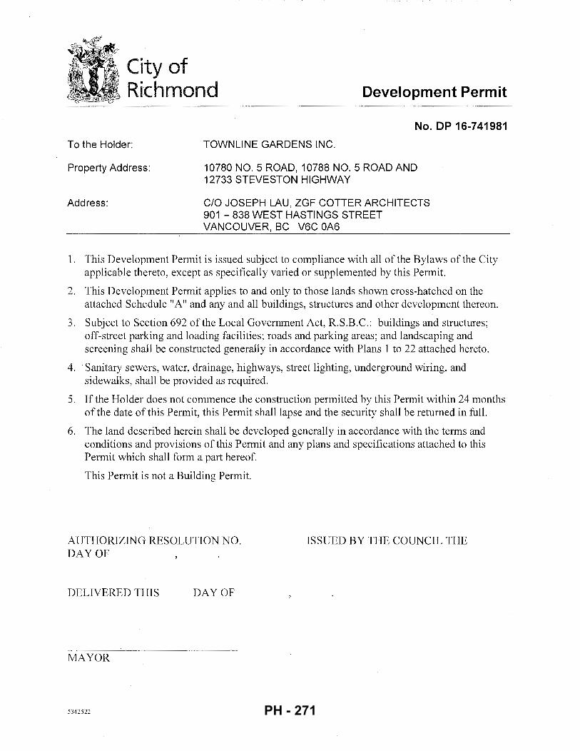
City of Richmond Development Permit
To the Holder:
Property Address:
Address:
No. DP 16-741981
TOWNLINE GARDENS INC.
10780 NO. 5 ROAD, 10788 NO. 5 ROAD AND 12733 STEVESTON HIGHWAY
C/0 JOSEPH LAU, ZGF COTTER ARCHITECTS 901-838 WEST HASTINGS STREET VANCOUVER, BC V6C OA6
1. This Development Permit is issued subject to compliance with all of the Bylaws of the City applicable thereto, except as specifically varied or supplemented by this Permit.
2. This Development Permit applies to and only to those lands shown cross-hatched on the attached Schedule "A" and any and all buildings, structures and other development thereon.
3. Subject to Section 692 of the Local Government Act, R.S.B.C.: buildings and structures; off-street parking and loading facilities; roads and parking areas; and landscaping and screening shall be constructed generally in accordance with Plans 1 to 22 attached hereto.
4. Sanitary sewers, water, drainage, highways, street lighting, underground wiring, and sidewalks, shall be provided as required.
5. If the Holder does not commence the construction permitted by this Permit within 24 months of the date of this Permit, this Permit shall lapse and the security shall be returned in full.
6. The land described herein shall be developed generally in accordance with the terms and conditions and provisions of this Permit and any plans and specifications attached to this Permit which shall form a part hereof.
This Permit is not a Building Permit.
AUTHORIZING RESOLUTION NO. DAY OF
DELIVERED THIS DAY OF
MAYOR
5342522
ISSUED BY THE COUNCIL THE
PH - 271
cc
991
City of Richmond
RS!!E
ASY
ZC!5
ZCI2
ZC26
AG!
ZMU!S
IBi
STEVESTON HWY
ZA3
ZC28
12339
DP 16-741981 SCHEDULE "A"
I •
I I I
I. I I I I
'-' I I \ I I l
\ I I
\I 11 I \ j
/ J
I I
\
'
'
/
'
I
' '
I
' .
I
' '
AGI
'
AGI
I I
:I: I I
:\,
Original Date: 09/19/16
Revision Date:
Note: Dimensions are in METRES
PH - 272
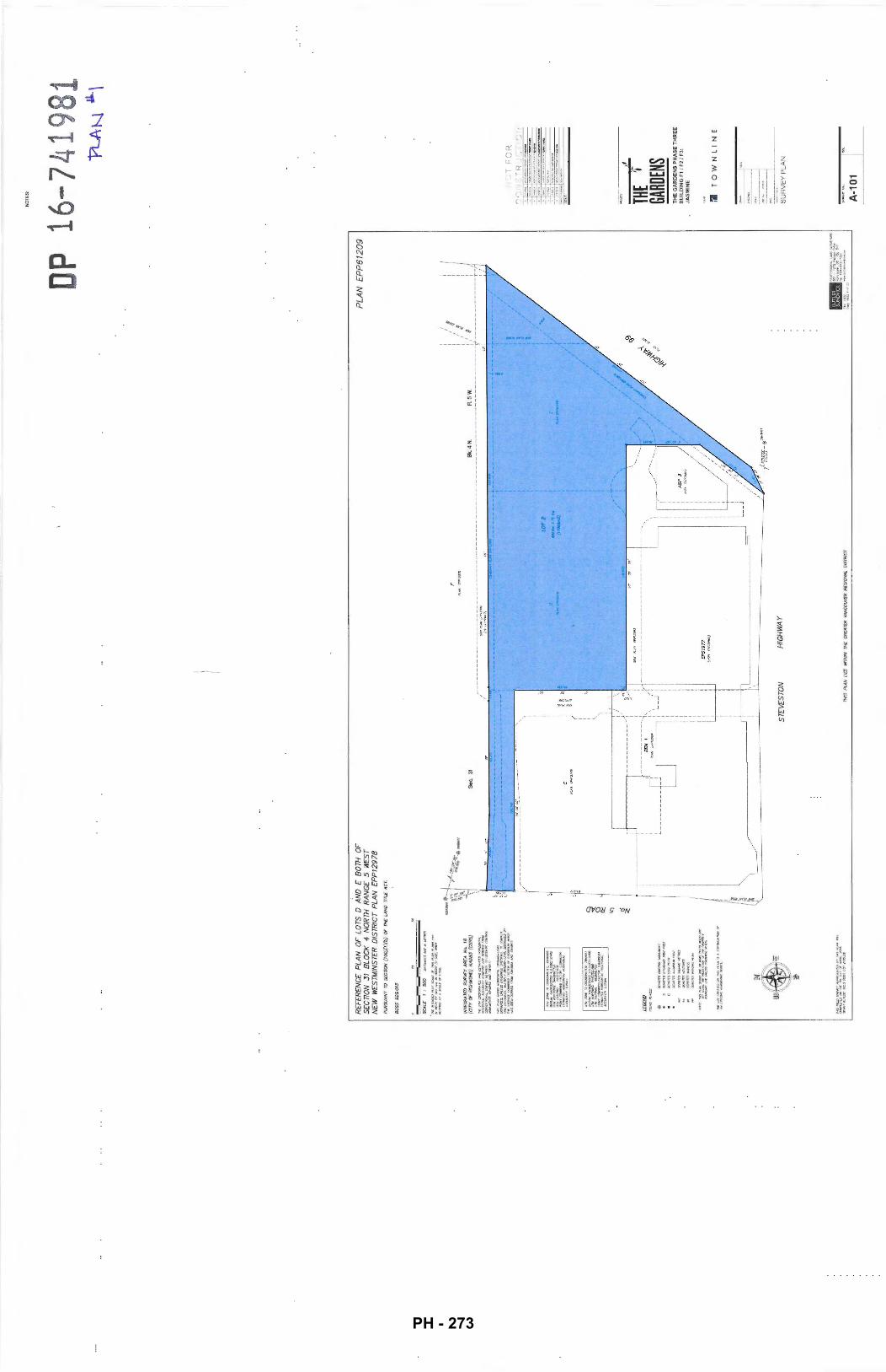
NO
TES
:
DP 1
6-74
1981
RE
FER
EN
CE
PL
AN
OF
LO
TS
D A
ND
£
BO
TH
O
F
SE
CTI
ON
31
B
LOC
K
4 N
OR
TH
RA
NG
£ 5
WE
ST
NE
W
WE
STM
INS
TER
D
IST
RIC
T P
LAN
£
PP
12
97
8
PU
RS
UA
NT
ro S
EC
nON
(1
00
){1
)(b
) O
F TH
£ LA
ND
71
n£ A
CT.
BC
GS
92G
.015
INT£
GR
AT'£
D
SU
R\If
Y A
RE
A
NQ
. 1
8
(01
Y O
F R
ICH
MO
ND
} N
AD
BJ
(CS
RS
)
IMS"'t.NNSHOIIS>ICJIIIIZf:HTOL~U1e.
DISI....USIJI'IUSSOIPOil5£~rDODMI'fiT£
'*"D
f'iT
N#
CC
S.
Wl.
(l>
"trr
:sK
.UD
-:.r
>..
nlll$
r»«
r.is
r IH£,0,\0fA.:C~f'M;TOtt!JFO.Jn.i~!>.-IIOt
... $6£V!Pf111ofli>'ROU~/.NO-U.
Sec
. 31
PLA
N
EP
P6
12
09
1 /I
l
) P
l#t
tH•l
iT4
1 ///
:
Bk.4
N
A.S
W
:/
( :
I
/~------------~~~~~-----------;--------------------------------------------~:r--------------T:
,----------
----
_ _!!~
"_«!....
. ~---------------,
'
@ .
00ol01l:$CCWTWO/.~T
!V<
Ofl
3S
1,>
.1if
)A/I
O/t
f!JN
P(f
SI
aaro~JJ.IRit'!iiAlPOSr
OC
N0
11
3so
.:.o
.;;£
UC
IRC
S
OlN
OI'!
:SI<
[CrA
IIE
S
/ ~ I I I I I I I I I ( I I I \. 1 I
I I
1---
----
----
~---
----
----
-~/ I I
-----------
-I
REM
1
""1,
LOT
2
W:A
• 1
71
Ito
(I~)
\ ' ~~·~
~---
----
----
----
----
-w~oo~-~
oo~-~-
----
----
----
---~
~--~
5/l
r<*P
<.P
<O
'P>l
WI.J
....
.....
----
----
----
----
----
----
----
--- i
I'
I\
' I
..._
_..
J
/--
Ill
.,. ---
-I I I I I I I I I I I I
ST
£V£S
TO
N
HIG
HW
AY
THIS
PLA
N
UE
S
WTT
HIN
TH£
GR
£A T
F:R
VAN
CO
UVE
R
REG
ION
AL
DIS
TRIC
T
·.
liii
"'!O
fES
9Ctl
"'-
IJ,H
iJ SI
JR~O
IIS
1GI-
1J7~Ua._,ll<l,.
v...
.,,.
.-.a
c v:
!l.::m
lo
l. 50•-~?l-7:111
....
. li
:IZ
...
......
... 1-
-~.-
.:J<
.QI
~nl2r-rc•
"Pt-A~
,&A..\
/
-
-~
"J- - - - - '
~
-IS
SU
!
II
THE
'1 GA
RDEN
S T
HE
GA
RD
EN
S P
HA
SE
TH
RE
E
BU
ILD
ING
F11
F2
1 F
3:
JAS
MIN
E
:1
TO
WN
LIN
E
SU
RV
EY
PL
AN
A-1
01
PH - 273
@ CO
NTE
XT
PLA
N
E1:
DA
HL
IA &
E2
: C
AL
LA
rT--~~;-jl
ft!U-~&
AS
PR
EV
IOU
SL
Y
AP
PR
OV
ED
WIT
H
DP
15-
7083
97.
NO
TES:
DP r:0
0i A
RE
A O
F ~
CURRENT
DE
VE
LOP
ME
NT
P
ER
MIT
F"]
AR
EA
OF
U
AP
PR
OV
ED
D
EV
ELO
PM
EN
T
PE
RM
IT 1
5-70
8397
~ A
RE
A O
F F
UT
UR
E
~ P
OT
EN
TIA
L M
OT
A
PP
RO
PR
IAT
ION
16-7
4198
1 'P
LA
N ~'l.
-'::'
) 1
3-:
: J-:
::-0 - - - - .
.
" IS
SU
E
ZG
F
CO
TTER
THE
'1 GA
RDEN
S T
HE
GA
RD
EN
S P
HA
SE
TH
RE
E
BU
ILD
ING
F1
/ F2
/ F3
: JA
SM
INE
:J
TO
WN
LIN
E
CO
NT
EX
T P
LA
N
A-1
02
PH - 274
' --
---
-----
-
I I I I I I
/1
I I
I :
I I
I I I I
I I
I I ,, \i II
I ,, I ,I ,, II ,, ,, ,, ,I ~: ~
,, 1: g
,, I 1: ,, ,, ,, ,, ,, ,, ,, II I'
II
II
II /I " " ,, II
,, ,, I' ,: :: II II " I " u
I I I I'
I I
I I ,, ,, 1: 1: 1: ,, ,, ,, ,, ,, ,, ,, II
II
I'
II
II
II /I ,, " ,, ;I ,, II 1: ,, ,, ,, ,, II " I " u
\ ,.
'i' '?
I' 'i'
I' .,
'i' .,
I' I'
I' I'
I' I'
I' '
I'
I'
'i' I'
~ I
'{-:--
----
-------==
:---=-=:=..=.=
<-"~~
---=----
-=--_-=
=--_-
--------------------
~ --
----
----
----
---
_,
: : T""'~~f~
tt~~
;tF~~c~-
~ ... ~-~-~-~.~~
-~~~-~ -~:~-~~~~?
~l~~~i
j~!~~:
':-"'=~_-
~.-;o~-~-~.~~=~-~~~;,
=~:~~~-~~-;~~~-~~-;:~~
~~:-~;~~:~~:~-~-~:~:~,;
:l~;~:i;-;_; __ ;;;;'~-.
::~~~:~:
:·~-~_:_-~-:: :,:
;_/_> 1
C
AM
ELL
IA
:!f'l
.~~=----i~~
=ft---i---
' '
' ' ' ' '
' ' ' ' ' ' I
' '
' ' ' '
' I
' I
I '
y
' I
' I
NO
TES
:
DP
16-7
4198
• ZGF
CO
TTER
'I TH
E GA
RDEN
S T
HE
GA
RD
EN
S P
HA
SE
TH
RE
E
BU
ILD
ING
F1
I F
2/
F3:
JA
SM
INE
ll
TO
WN
LI
NE
... -· ·
-I
OV
ER
AL
L S
ITE
P
AR
KIN
G P
LA
N
OV
ER
AL
L S
ITE
P2
PA
RK
ING
PLA
N
----
----
--....
_____
___
_ _
-11
A-1
11
PH - 275
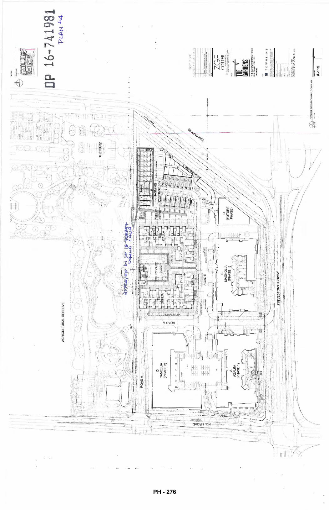
\ \ \
D
CA
ME
LL
IA
(PH
AS
E 2
)
>-<
/~~/
;,--=
L
~~
rx-
.., /
\~~;,·
II II
I I I I
NO
TE
S:
I :
i 1
I :op
16~7419 1
I 1
I;
' I I ==l
__
_ j
1: I
I .lf
'•
I 1/
/! ---
--1
_ _
_J
--=I
----
=~ ,-
TJ-1
I' ,,
I O
VE
RA
US
ITE
•n
rJ,.-ll
"' G
RO
UN
D F
LO
OR
p
I ~N
TH
E G
AR
DE
N
BU
ILD
ING
F1 ~F
~HAS
E TH
RE
E
JAS
MIN
E
I F
3:
ll
T 0
W
N ll N
i"""'i!"
"'"~ g~~~~~SITE
FL
OO
R P
LA
N
A-1
12
"PLA
N J
4
PH - 276
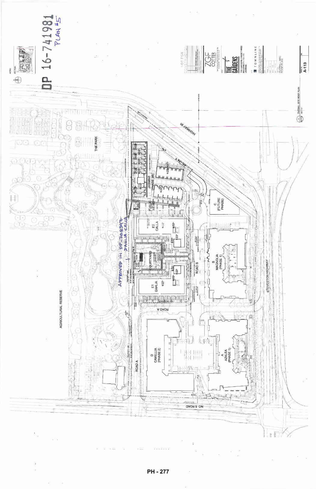
=
~-.
/ .,
~-'---"-
--''---"
--"--1
i-~>
'I'
~
_.,.
::_-
trr=
--~
..i..
-U
l ~--
:--1
_ '
-~-=
-~-~
~~/.
.. :
·r-~~~~
---
~
D
CA
ME
LLIA
(P
HA
SE
2)
--~-1
-==J
---i
---J I
---,
--I
---j
==:J
--j
,-~
::j
' ''
,/
' '
,l
I I
I , ; ~DP
I:
' '
~ /: I'
NO
TE
S: 16
-741
981
::;::;
~-~ Jr
_,-
::;
- THE
'r GA
RDEN
S
~
YLA
't--\
11_s
-
TH
E G
AR
DE
NS
PH
AS
E T
HR
EE
B
UIL
DIN
G F
1/
F2
1 F
J:
JAS
MIN
E
:1
TO
WN
LIN
E
OV
ER
AL
L S
ITE
R
OO
F P
LA
N
A-1
13
I~
PH - 277
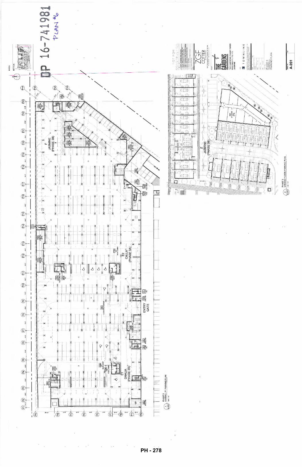
PH
AS
E3
OV
ER
ALL
P1
PA
RK
ING
PLA
N
-20
0
~~ ~-~ 1-
-~,
~-~~~----L~~¥=~~
~=~~
[~]-
: --
! !
------~---
1 I : I
~---
~~~~~
~-~=-~~-----"=-~
--~-~=-~
-1
0
-----, r--
---
--' L
__
_
I [~
:~~~~~==~~
-----
-~q~J~~
~:I&-
I _, -"
[]
D
----
-,
~L--..
____
_ , I
[~
---
-~~
;I
' J_
~
0
.. ,. '"
" ....
--:ID-
'0
/
, ,
, ',,
I
--~~ -
~ -~
-:-~
-~--
s ~ -_~_::;;~--;
'~,-
-,--~
---~ -
0'/,
',
'e
JAS
MIN
E'·
EJ
~!I , I I
"-_I=
_
__
__
[_
_
I
[~
ETI
PH
AS
E 3
I _I
2 G
RO
UN
D F
LOO
R P
AR
KIN
G P
LAN
-2
0
(PH
AS
E 3
8)
:!]
@j
/
I /
/
/ /
I /
/
I
I /
NO
TES
:
16-7
4198
1
r..~
r-:,;:
:-r
r .-.
':::;
1 ,..
..
• ZGF
CO
TTER
~
-JUIIufr.,aStt-.VDn<lxNrf.BC~«~
..........
,. .....
"''"
·~-
...... ··
-
TH
E G
AR
DE
NS
PH
AS
E T
HR
EE
B
UIL
DIN
G F
1 f
F2
/ F3
: JA
SM
INE
:I
TO
WN
LIN
E
PH
AS
E 3
O
VE
RA
LL
P
AR
KIN
G P
LA
N
A-2
01
VL
-1\N
~
PH - 278
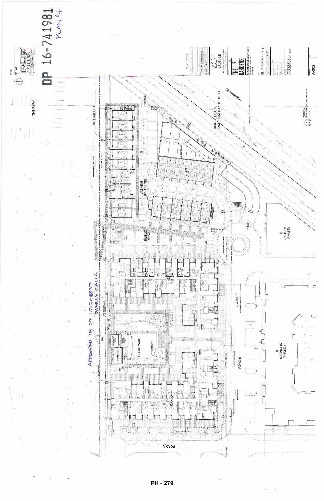
~FlR.EHYDRANT
i I \ -
__,_ __
--
-~-,
. .
I
RO
AD
B
B
MA
GN
OL
IA
(PH
AS
E 1
)
"""'_
j B
UIU
liNG
EHTR
Y
~. '\ \
""'~---
·~j J
c (F
UT
UR
E
PH
AS
E)
J .,
l __
_ c-------j
/
,'
L _
_ _
i __
TH
E P
AR
K
D
///
~~,
/··
//r/ ./
·. ,
_,_:· /
/ / /,
,'
, ./
./
//
/
,./r. /
;/
/. /
~ _--
' /
, '
/ I
::
. /
.,
..
J
PH
AS
E3
1 @
~~.~:
ROUI
ND FL
OO
R P
LAN
NO
TE
S;
16-7
4198
1
ZGF
CO
TTER
=.--:
---i=
~
"" ... .
. I
PH
AS
E 3
SIT
E
GR
OU
ND
FL
OO
R P
LA
N
A-2
02
I~
?L
AN
.11-=
1-
PH - 279
" l \ '
'
,. --j I
k Lj~
E1
DA
HLI
A -')
~
~
,~
: 1
L_
__
__
j!
.. ___
_____
______
_ !
8 M
AG
NO
LIA
(P
HA
SE
1)
...
:----~
~
__,..
.
E2
CA
LL
A
$W:"
'
c (F
UT
UR
E
PH
AS
E)
/ f-
---
---
~-----
I --;-----
~
......--
-.. --~-
I I
I'
I I
I .,
I I
I I
I I
I ,1
---
-------L_!..___j-r~-
// /
~'
~"
' '
' '
NO
TE
S: p
16-7
4198
1
~I
ZGF
CO
TTER
_.
.,.,.,.
....,.
.... J
!i<l·JSSiunordS~LVil~.
8CV6C~GS
.... ~ .. ,,.
.. _ ,. .•..
.. ,..,~·-··-
,, TH
E ~
GARD
ENS
PH
AS
E 3
SIT
E
RO
OF
PL
AN
A-2
03
I~
'?L
AN
Ag
PH - 280
(7'}
BU
ILO
ING
FI J
ASM
INE
!PH
ASE
JlL
EV
Eli/
A.O
OR
1-P
I.AN
~W
•l'-11
'
~
BUIL
DING
Fl J
ASM
INE
IPH
ASf
lllfV
EL
2/A
pO
R 2
-Pl
AN
~ur
-r.v
(')
"\
BUIL
DIP
+GFI
JA
SM
INE
!PH
AS
E3\
LEV
a3/F
LOO
R3-
PLA
N
\E!Y
W•
I'.(J
'
0 ~
UN
IT A
U
NIT
A
F1-
1 F
1-2
~
BUilD
ING
Fl J
A9AN
E!PH
ASE
3\R
OO
F-PL
AN
~W
·r.(l
'
F1-
3
fill
!~
~
UN
IT A
U
NIT
A
LANE
F1-
4 F
1-5
FH
i
llli!l
U
NIT
A
NO
TES
: Jl~
~·
7::
~
DP 1
6-74
1981
NO
T F
OR
C
ON
ST
RU
CT
' ON
ZG
F C
OTT
ER ,,
THE
1 -GA
RDEN
S T
HE
GA
RD
EN
S P
HA
SE
TH
RE
E
BU
ILD
ING
F1
/ F
2 I
F3:
JA
SM
INE
r.'l T
OW
N
,, '
BU
ILD
ING
F1
JAS
MIN
E
(PH
AS
E3
) F
LO
OR
PLA
NS
A-2
18
"PLA
N ~
PH - 281
F2-1
F2
-F2
-3
F2-4
18'-2
114'
11
1'-D"
26
'·21
U'
2- 2-
@
18'-
2114"@
18
'-0"@
26
'-211
4'
_DEC
K I
2-B
::::
.""
F2-5
,.
.. ~
,...
~
,...
~
-,.
.. -~
,...
2-
1 , •
. ,"'
2-1
LANE
28'-2
1/4"
Q
18'-
0"
y
l.-
"'"'
Q
18'-0
" v
l.
om<
I
-
Q
18'·0
" v
l.
'""
I -
18'-0
" e
18'-2
114"
®
l.
"''"
"--" ..
..... -
--ll.l
--''"
"-""
......
. __
/ I
I
2- 2- 2-B
2:-C
}--l_
__,;.j.
---f
---
--f---
--
--
' ---+
--
--
--,l
l-----f2
-
~-=--
~~-oEC
K---
I I
• ~-· '"
'""'
" '===
F
f:1 ~
':: o: ~
~ '=
~
I"'
·"""'"
' :F "
"'""" '
2-~
" "
----
----
---=
='
"""""
'' =
~·
--
--+
----
--3
'2-
DJ-t~ -
-1r-~
-~ ~
~
E ~
~"
-:: rn
· ~ ~ ~
i ~ ~
: ~ ~
i ~ ~
i ~~ ~
i ~ ~
UN
ITA
l =
U
NIT
Al
E
== '
:: ' ==
=
UN
ITA
2 : ~
UN
ITA
2 : ~
UN
ITA
2 : ~
UN
ITA
2 : E
U
NIT
A2
: ~
UN
ITA
2
~ ::
::
I= =
II
" ,
='= =
. =
, =
, =
, E
, :
:::
'=
~-~.
F=
I= ~~
:: ~ ~
" ~ =
: =
: =
~
=
~I=
~ =
~
i;
.,
g-+ ~
~: g
~ ~ ~ :
:: UNIT
C1
UN
ITC
2 ii
, ' ~ ~
hl ' @
hl
' ~
hl ~ ~
hl ' ~
hl ~ ~
hl ~
~ ~
~ ,~
--------
------
-----~
~ ~·,
~ ~
~ ~
~ ~
~ ~
~ .1
'}-+
--J.
----
~: ~::
:;'· ~-V+:"""''GIJ"
"'. o,~
lf1-
-Vf-
--I
I ['V
J'v-
rrn : 1
v \r
TG
IJ :
1 v
\rT
GIJ
: 1
v \n
-GIJ
: 1
v 'f\n
--GI;:
: 1
v ~ :
2 -~
lD DE
CK
_lD
DECK ~
: L
_
DECK
Dl
DE
CK Dl
DE
CK
Dl DE
CK Dl
DE
CK
Dl DE
CK Dl
=
2 2--F2
-Ft-
-+--
-"''-t--
2 ~
~
2- 2
~ . 2-
D
W
BUilD
ING
FZJA
SMIM
:IPH
ASE
3ll.E
VB
.21R
.OO
R2-
PLt.N
~1.11'•1'-V
F2-1
F2
-F2
-3
18'-
21/4
' 18
'-0'
~~~p~~
-
~
-
LP_
I ~ ~ ~
~
~ ~
I= ~~~
=
--
' _)~
LANE
F2-4
G
ARIJ
EHPA
RK
F2-
F2-0
26'-
211
4' 2i
i'-21
14"
18'-0
" 18
'-0"
---
--
~1
. -
"'>..
~---------
--------~
~L-t ~
-L-t
l!x
EC:E
E:'><~
..r::
b F e
, ..
2-2-
8 F2
-9
2-1
2-1
18'-0
' 18
'-0"
18'-0
" 18
'-21
/4'
---
------
----
-- --
----
:I r---
-rt I
I "'
:I Cl
,
~-L-t f
't:-L
-t rJ
\.L
-t ~L-t
m'><GE
8 IX
§
D:Xl§
f-~
!2:
~--
=
~~~ ~ bH~
~ }~
F2-0
1l=:
o
Hi~
. "~'~=
E
E
"~'
tt'l:fr
~"
" "~
' ·l
:l]jr·
r=:
"~'
J:t:
Jir·
E
,_..
'tt'
J:1l =
F2-0l
l mtJ
:[o
F2-1
0 J:tj~
' ~
FfL
u';;;T't
, L ~
UNIT
C2Ut
,~ ~
UNIT~
"----=fL
NIT
AZ_
!jC:
=bJ ==UNIT~
~ ;.
2-~
2-
~
UN
ITA
'.t:
J~
UNITf
='-
;)
~~ ~)
~ [~
~[J
t
4 I
L.l
l ·
·---
----
--
.--
----
-.
W
8Uil.
OIN
GF'
2JA
SM
!o'E
!PtW
iE3!
l.EV
8..3
/RO
OR
3·P
l.AN
\§
7 W
'•f-
4'
•---
----
---
-
-
EU
NIT
,.-F
-_)
t==
J~a
"=
~~\D
~
:~~TIJ
:Qt l
---------~
h_
fL
-l
I fL
-l
I -
---------~
----
----~
F2-1
F2
-F2
-3
F2-4
G
ARDE
N PA
RK
F2-5
F2
-0
2-
2- 2-B
2-
t _;
::r
18'-
0'
26'-
2114
' 26
'-211
4'
F2-0
2,
:
UN
TTA
1 1
,---tY~~ 1A;1h
U
NIT
C1
UN
TTC
2
F2-•=
" ~·
·,,~
=r=
=
:! F
2-l
'l--
-+--
4-t
--
~
BUI.O
ING
F2JA
SMlN
EIPH
ASE
J!RO
OF-P
lAN
~W'•I'J;/
LANE
18'-D
" 18
'-0"
"'
' '
''
•F2
~ ::
, F
2-Q
6 I:
:I ::'
NIT
, ,-t
7!
[-;JNrr.~
UNIT~
:=
NIT
5L
t
~a ~~a ~a ~q
l L
l
L l
L
fL-1
-~I
fi---J
-1
~
---------~
----
----
-·
...
---~
------
----
2-8
F2-9
2-
1
18'-
0'
18'-0
'
•:
F2-0
7 •
F2-0
8 :
• ,
+tUNIT
;~ ,,
: I
UN
ITA
2 ·:·,
18'-0
'
I IT
"
tIll,
''
'' """
:JI
18'-
21/4
'
" F2
-10
I I
NIT
2-1
2- 2 2 2-D 2- 2- 2- 2- F2-
NO
TES
:
DP 1
6·74
1981
"?
LA-N
~\0
NO
T F
OR
C
ON
ST
RU
CT
ION
ZG
F
CO
TTER
---
-·-.-... --
"""
... - ,,
THE
1-GA
RDEN
S TH
E G
AR
DE
NS
PH
AS
E T
HR
EE
B
UIL
DIN
G F
1 I F
2/
F3:
JAS
MIN
E
m TO
WN
IN
E
BU
ILD
ING
F2
JAS
MIN
E
(PH
AS
E3
) F
LO
OR
PLA
NS
A-2
19
PH - 282
(7\
BU
ilDIN
GF3
JAS
MIN
EfP
HA
SE
31lE
VE
l1/F
LOO
R1
-Pl.A
N
\eJ U
ll"~r
.oo
W
BUIL
DtNG
F3JA
SMIN
E!P
HA
SE
3!LE
VE
l2/R
.OO
R2-
PLA
N
'\§
} IW
'•1'
4"
.bA
~
€Y ~
b ~
~
Q
\J'
@ ~~GF3
JASMINE
fPHASE3!LEVB..J/FLOOR3-PI..AN
F3-1
F3
-2
F3-3
F3
-4
BI<E
PAVI
UO
N
ROOF
14'-1
0114
' 14
'-8'
14'-8
" 1•
·-a·
~
~
.. U
NIT
S
..U
NIT
B
F3-1
F3
-2
3-3
(7
\ BU
ILD
ING
F3JA
SM
lNE
(PH
AS
E3\
RO
OF
-PI..A
N r:
eJ I
.W'•
f4"
~
.. U
NIT
S
F3-4
BIKE
PAV
IliON
RO
OF
~
.. U
NIT
S
lAN
E
F3-7
F3
-8
14'-
8'
14'-
101/
4'
-
~
~
~
.dJN
ITB
..
UN
ITS
..,
UN
ITS
F3-5
3-
8 F3
-F3
-8
.c::-
~
3
NO
TES
:
KE
Y P
LAN
DP 1
6-74
1981
NO
T F
OR
C
ON
ST
RU
CT
ION
THE
1-GA
RDEN
S
TliE
GA
RD
EN
S P
HA
SE
TH
RE
E
BU
ILD
ING
F1
I F2
/ F3:
JA
SM
INE
ril
TO
WN
. N
f
BU
ILD
ING
F3
JAS
MIN
E
(PH
AS
E3)
F
LO
OR
PLA
NS
A-2
20
"\?LA~~\\
PH - 283
0 A
ER
IAL
VIE
W N
OR
TH
WE
ST
F
RO
M H
WY
99
KEY
PLA
N
8 A
ER
IAL
VIE
W
--
-.-:
;;;:
KEY
PLA
N
/ , I I ' ' / ' 1, \ __
PRO
POSA
L
PRO
POSA
L
NO
TE
S:
DP 1
6-74
1981
Er-,r,
, --;:.~~-·:,'
- -'
155U
f
ZG
F C
OTT
ER
:I
THE
'' GA
RDEN
S T
HE
GA
RD
EN
S P
HA
SE
TH
RE
E
BU
ILD
ING
F1
I F
2/
F3:
JAS
MIN
E
:JI
TO
WN
LIN
E
BU
ILD
ING
F
PE
RS
PE
CT
IVE
R
EN
DE
RIN
GS
"PL-AN~,~
1.
PH - 284
0 V
IEW
OF
EN
TR
AN
CE
TO
P
ED
ES
TR
IAN
ME
WS
~ r:~------
0
KE
Y P
LA
N
VIE
W N
OR
TH
AL
ON
G
PE
DE
ST
RIA
N M
EW
S
KE
Y P
LA
N
/
NO
TE
S:
DP 1
6 74
1981
, r,
-' ~
::;
T
--:_
-IS
SI!
f
. -Z
GF
C
OTT
ER
THE
'1 GA
RDEN
S T
HE
GA
RD
EN
S P
HA
SE
TH
RE
E
BU
ILD
ING
F1
I F2
I F
3:
JAS
MIN
E
:1
TO
WN
LIN
E
BU
ILD
ING
F
PE
RS
PE
CT
IVE
R
EN
DE
RIN
GS
A-3
08
I~
'P~N "
"t3
PH - 285
0 V
IEW
SO
UT
HW
ES
T F
RO
M G
AR
DE
N P
AR
K
KE
Y P
LA
N
PR
OP
OS
AL
NO
TE
S: &~
~-::>,-:_r:,
' -'
IS~V£
ZG
F
CO
TTER
,J
THE
'r GA
RDEN
S T
HE
GA
RD
EN
S P
HA
SE
TH
RE
E
BU
ILD
ING
F1
I F
2/
F3:
JA
SM
INE
:1
TO
WN
LIN
E
BU
ILD
ING
F
PE
RS
PE
CT
IVE
R
EN
DE
RIN
GS
A-3
09
I'"
PH - 286
(7
\ !K
JILDI
NG
F1JA
SMIN
E!f'H
ASE
31EA
STB.
EVA
.llO
N
~lr
•f4'
~:;om
---
(?\.
BU
ILDI
NG F
1 JA
SMIN
E !P
HA
SE 3!
NOR
TH E
l.PfA
TIO
O
\§Y
W
'•\'
4'
f7\
BUIL
DIN
GF1
JASM
"NE!
f'HA
SE3)
SOU
THEL
eyA
llON
~111":\
"4'
~
BUIW
ING
FI.w
>MIN
E!PH
ASE
31W
ESTE
LEV
AT1
0N
~1W
•\".t
r
~--------------------------
--------------------------------------------------------
==+=~~
----
--------------------
----
----------------------------
----------------------------
BUIL
DIN
G F
: JAS
MIN
E M
ATE
RIA
L LE
GEN
D
B1 -
BRIC
K TE
XTU
RED
FIN
ISH
(RED
ON
DO
G
REY
)
G1 -
VIN
YL
WIN
DO
WS
(WH
ilE T
RIM
) G
2 -G
LASS
GU
ARD
RAI
L
M1
-ME
TAL
SCR
EEN
ING
IDET
AIU
NG
M
2-G
ARAG
E D
OO
R
H1 -C
EMEN
T FI
BRE
BOAR
D S
HIP
LAP
SID
ING
(L
INEN
) H2
-C
EMEN
T FI
BRE
BOAR
D (
WH
ITE)
H
3-C
EMEN
T FI
BRE
BOAR
D (
LIG
HT
GRE
Y)
H4-
CEM
ENT
FIBR
E BO
ARD
(D
ARK
GRE
Y)
NO
TES
:
DP 1
6-74
1981
"P
LA
N l
ll_s"
NO
T F
OR
C
ON
ST
RU
CT
ION
ZG
F
CO
TTER
THE
if GA
RDEN
S T
HE
GA
RD
EN
S P
HA
SE
TH
RE
E
BU
ILD
ING
F1
/ F2
/ F3:
JA
SM
INE
:;,
TO
WN
IN
E
BU
ILD
ING
F1
JAS
MIN
E
(PH
AS
E 3
) E
LEV
AT
ION
S
A-3
15
PH - 287
'lJ T
O R
OO
FQEC
K
40.3
4'/I
Wm
\_
~fM&m----
~.iom---
CD
BUl
DING
F2JA
SM~E
!PHA
SEJI
EAST
B..f
VATION
~ur
~r.r
G\
BUR.
DING
F2J
ASM
INE
!PHA
SE 31
NO
RTH
8.EV
ATIO
N
~1
111'•1"
.V
0 T
O R
OO
F D
EC!(
4o.3
4'11
2.29
m \_
_
--0-fe~M&-m---
~
B\J
IDfiG
F:ZJ
AS
!IIIP
E!f'
HA
SE
3lSO
UTHE
L.EV
ATIO
N \e
7 l
ll'•
f.V
~.&4
m--
-
{7)
~~GF
2JAS
MINE
fPHA
SE3l
WEST
EL.f
VATION
'e7
BUIL
DIN
G F
: JAS
MIN
E M
ATER
IAL
LEG
ENP
B1 ·
BRIC
K lE
XlU
RE
D F
INIS
H (R
EDO
ND
O
GR
EY)
G1 ·
VIN
YL W
IND
OW
S (W
HITE
TR
IM)
G2
·GLA
SS
GU
ARD
RAI
L
M1
·ME
TAL
SCR
EEN
ING
IDET
AIU
NG
M
2 • G
ARAG
E DO
OR
H1 ·C
EMEN
T FI
BRE
BOAR
D SH
IPLA
P SI
DING
(L
INEN
) H2
·CEM
ENT
FIBR
E BO
ARD
(W
HIT
E)
H3 •
CEM
ENT
FIBR
E BO
ARD
(LI
GH
T G
REY)
H4
• CE
MEN
T FI
BRE
BOAR
D (
DAR
K G
REY)
NO
TES
:
KEY
PLAN
I~
J~
L
~
DP 1
6-74
198
NO
T F
OR
C
ON
ST
RU
CT
ION
ZG
F C
OTT
ER
,j
THE
1-CA
RDEN
S T
HE
GA
RD
EN
S P
HA
SE
TH
RE
E
BU
ILD
ING
F1
/ F
2/ F
J:
JAS
MIN
E
m T 0
W
N
1-.J
E
BU
ILD
ING
F2
JAS
MIN
E
(PH
AS
E3
) E
LEV
AT
ION
S
A-3
16
1
PH - 288
f7\
8UlD
ING
FJJA
SMit£
!PH
ASE
3lN
QR
TH8.
.EV
Al1
QN
\t
.§7
. ,...
,.,.
9UIL
OIN
GFJ
.lAS
MlN
Efi'H
AS
C3\
S()!
Jl'H
ElE
VA
T10N
t.
l'•1
'4'
~
BU
IDIN
GF3
JAS
MIN
E!ff
lAS
E3!
WE
ST
ElfV
AT1
0N
~U
I'•f
4'
BUIL
DIN
G F
: JAS
MIN
E M
ATE
RIA
L LE
GEN
D
B1 •
BR
ICK
TEXT
URED
FIN
ISH
(RED
OND
O
GR
EY)
G1 ·V
INY
L W
INDO
WS
(WHI
TE T
RIM
) G
2. G
LASS
GU
ARD
RAI
L
M1·
MET
AL S
CR
EEN
ING
/DET
AIU
NG
M
2 ·G
ARAG
E DO
OR
H1 •
CEM
ENT
FIBR
E BO
ARD
SH
IPLA
P SI
DING
(L
INEN
) H2
• CE
MEN
T FI
BRE
BOAR
D (
WHI
TE)
H3 •
CEM
ENT
FIBR
E BO
ARD
(LI
GH
T G
REY)
H4
• C
EMEN
T FI
BRE
BOAR
D (
DAR
K G
REY)
NO
TES
:
DP 1
6-74
1981
\?LA
-~~~~
NO
T F
OR
C
ON
ST
RU
CT
ION
ZG
F C
OTT
ER
,j
THE
1-GA
RDEN
S T
HE
GA
RD
EN
S P
HA
SE
TH
RE
E
BU
ILD
ING
F1
/ F2
/ F
3:
JAS
MIN
E
m T 0
W
N
·~IE
BU
ILD
ING
F3
JAS
MIN
E
(PH
AS
E3
} E
LEV
AT
ION
S
A-3
17
r-
PH - 289
BU
ILD
ING
D: C
AM
ELL
IA
(PH
AS
E 2
)
~~~-.l
i;·'G!-Q;I
'nB
.OO
'Tfl
~ I
1 S
ITE
ELE
VA
TIO
N A
-A
-40
SIT
E S
EC
TIO
N A
-A
-40
RO
AD
A
NO
TES
:
DP 1
6-74
1981
P
HA
SE
36
1
A'P
'PJC
:.oV
e:-'D
tJ 'P
V
15
--:r
oggq
-=1-
-"'
PA
+t u
It
c.~L
..L.
Ja,.
~-
--<"-----
B""U,I,LDING E
1: D
!'!;l
l iA
C
OU
RT
Y
D B
EY
ON
B
UIL
DIN
G E
2: C
ALL
A
I i
?LA~ ~
18
------~B~U~IL~D~I
NGF
:JASMINE~--------
--<"---+-=T~~
~~~~
T~O~
H~I~
G~H~
W~A~
Y~9~
9~7
I (P
HA
SE
36
) !
i ,IO
JQ>~~
jf~!!!lf.~
! /
I TO~.l~~~
!
I ~~··l
'l.Q(l
R_~_ ....
_ :
, 1fiii·""'l'T~
I
-::::-::
-t-:::--
::-::-C:
-~j;i~
ii;ii;
;:ii;i
i~.:i .
.. ~i;
ij;i;~~~
c-:__·"0:"-1
-~~. l--
-------
-------
-------
--~Bf
~~2R
1~~1
~~~6r~
~~~
·~·=-~"-
--I~~
: '
o I
PH
AS
E 3
8
BU
ILD
ING
E1:
DA
HLI
A &
E2:
CA
LLA
P
RE
VIO
US
LY
AP
PR
OV
ED
WIT
H O
P 1
5-7
08
39
7
I i ' ·~
~E:E!
J:!!f
·f:'
lle.
~
~~
__!!
[~
i~----
"
PH
AS
E3
A
ll~~
l
i'""'*'
'lll""~
I l '
-i~,.w,~ ::
;;;;9F
;;;;;;;;;;~~;;;;;;;;;;9'i~'
=c::-:
::-:-
--
--
--
+ "
floli1
?ffiD
J.ar )
,__:'::j=j:!
f·::-
:;9F;;;;;;;;;;;~R;;;;;;;;;;;;~F"=::::
l:-
( ~~Ji}~
i~~: ~
-~ ~-
i ~""
~--
j $ ~#J
~Hiim~
2 -
--
·
'~~
~1.:..
.00!1.
! -
--
BU
ILD
ING
E1
: D
AH
LIA
& E
2: C
AL
LA
P
RE
VIO
US
LY
AP
PR
OV
ED
WIT
H D
P 1
5-7
08
39
7
BU
ILD
ING
F1
/ F
2/
F3:
JAS
MIN
E
CU
RR
EN
T O
P A
PP
LIC
ATI
ON
PH
AS
E 3
8
BU
ILD
ING
F1
f F2
f F
3: J
AS
MIN
E
CU
RR
EN
T O
P A
PP
LIC
AT
ION
KE
Y P
LAN
/I
I I I I I I
fM:X
&U!!
:_DI~ ti
i;IG
_HT
25
M F
RO
M
T.O
. PA~KAOE S
TR
UC
TU
RE
·fiO
·JUIIutnrdW
..,lV>nteu\.,.,IICY6C~G!I
......... ,
... .........
.... _""
''"''"-
,j
THE
'r GA
RDEN
S T
HE
GA
RD
EN
S P
HA
SE
TH
RE
E
BU
ILD
ING
F1
f F2
I F
3:
JAS
MIN
E
:1
TO
WN
LIN
E
SIT
E E
LE
VA
TIO
NS
AN
D
SE
CT
ION
S
A-4
01
I""
PH - 290
-:~ .~;
!·
... ~ ,~
IIY
.W..
IVrl
liF
DIC
E
lan
dsc
ape
Rat
ion
ale:
Ma
gn
olia
Bu
ildin
g B
Build
ing
s E
an
d F
ore
re
sid
en
tial a
nd
pro
vid
e a
tra
nsi
tion
fro
m t
he
mix
ed
use
de
ve
lop
me
nt
to t
he
so
uth
(T
he U
rba
n V
illo
ge
)to
the
futu
re p
ub
lic p
ork
to t
he
nor
th.
The
stre
et o
rie
nte
d u
nits
at Bu~ding E
ore
mo
re u
rba
n in
ch
ara
cte
r as
o re
spo
nse
to
the
de
velo
pm
en
t ac
ross
the
stre
et.
Rai
sed
pla
nter
s, m
eta
l pa
tio g
ate
s, a
nd
add
ress
pie
rs e
mb
eli
sh
the
en
try
seq
ue
nce
to
the
se s
tree
t ori
en
ted
uni
ts.
Build
ing
E A
me
nity
Go
rde
n
Two
"l"
sha
pe
bu
ildin
gs [
Bui
ldin
g E
l a
nd
E2)
en
clo
se o
larg
e s
emi-p
riva
te c
ou
rtya
rd.
This
am
en
ity
ga
rde
n co
nta
ins
o w
ate
r fe
atu
re. a
sim
ple
she
et
of t
ow
n,
o su
mm
er fl
ow
er g
ard
en
, o k
id's
plo
y a
rea
, an
d a
din
ing
ore
o t
ha
t a
ffor
ds r
esid
enfs
th
e o
pp
ort
unity
to
be
out
side
an
d m
ee
t !h
eir n
eig
hb
ou
rs.
Lorg
e se
mi-
priv
ate
pa
tios
ad
jace
nt
the
bu
ildin
g p
eri
me
ter
als
o e
nco
lKo
ge
ou
tdo
or f
ivin
g.
Ped
estr
ian
Mew
s L
oca
led
be
twe
en
Bui
ldin
gs E
2 a
nd
fa
l0
'/3m
wid
e p
ub
lic p
ath
wa
y co
nn
ec
ts th
e U
rban
Vill
age
an
d s
urro
un
din
g
nei
gh
bo
urh
oo
d t
o t
he
fut
ure
pu
blic
po
rk to
the
nor
th.
A tr
ellis
stru
ctu
re w
ith
se
alin
g a
nd
wa
y fin
ding
of
the
sout
h e
nd
Roa
d B
of
the
Me
ws
guid
es p
edes
tria
ns n
ort
h t
o a
pari<
ove
rloal
< w
ith a
tre
llis e
nd
sea
ting
. F
rom
he
re a
ser
ies
of s
tairs
an
d r
om
ps
con
nect
s th
e M
ews
to t
he
futu
re p
ark
to t
he
nor
th.
Gen
erou
s p
atio
s o
n th
e e
ast
side
of
Bui
ldin
g E2
an
d t
he
we
st s
ide
of
Build
ing
F p
rovi
de
go
od
ove
rsig
ht o
ith
e P
edes
tria
n M
ews.
Nor
ther
n P
rope
rly U
ne
Ther
e o
re s
eve
ral d
iffe
rin
g c
on
dit
ions
alo
ng t
he
no
rth
pro
pe
rly
line
of
build
ings
E e
nd
f o
s a
me
an
s to
pro
vid
e so
me
va
riatio
n t
o t
he
pro
pe
rty
ed
ge
. In
fro
nt o
f b
uild
ing
El
the
lan
dsc
ap
e st
eps
at
lhe
ed
ge
of
the
park
ing
ga
rag
e,
en
d th
en
slo
pes
do
wn
to
the
futu
re p
ub
lic p
ark.
In
fron
t o
f b
uild
ing
E2
the
la
nd
sca
pe
ag
ain
ste
ps a
t th
e
ed
ge
of
the
pe
rkin
g.
A 3
m A
gric
ultu
ral
Lan
d R
eser
ve h
as
be
en
pro
tect
ed
an
d e
nch
an
ced
alo
ng
the
en
tire
Nor
th e
dg
e o
f th
e si
te.
Pub
lic
acc
ess
Is d
isco
ura
ge
d u
sing
o v
ari
ety
of
thom
y. a
ttra
ctiv
e a
nd
ha
rdy
tresp
ass
inh
ibiti
ng
plo
nts.
A r
eta
inin
g w
all
alo
ng
ih
e p
rop
ert
ly li
ne
als
o d
isco
ura
ge
s ecce~. w
hile
a r
ow
of
co
tone
aste
r p
lan
ting
w~l
ca
sca
de
ove
r th
e w
all.
soft
en
ing
th
e e
dg
e.
Whe
re p
ossi
bile
on
parte
pro
pe
rty
the
lan
dsc
ap
e c
on
als
o slo
pe
up
Ia m
ee
t th
e p
rop
ert
y lin
e a
nd
re
du
ce
the
he
igh
t o
f th
e w
olf.
A 3
.5' h
i me
tal f
en
ce s
et
be
hin
d t
he
ALR
bo
un
da
ry w
ill!
furt
he
r d
isco
ura
ge
pe
de
stri
an
e
ncr
oa
chm
en
t in
to t
his
spa
ce
.
Alo
ng
the
pro
pe
rty
line
no
rth
of
bu
ildin
g f
the
re is
a 4
·11.
2m w
ide
acc
ess
pa
th [
to t
he
tow
nh
ou
se e
ntrie
s) w
ith
pla
ntin
g
eith
er s
ide.
Eas
tern
Pro
pe
rty
Un
e R
ipar
ian
lon
e
Alo
ng
th
e e
aste
rn p
rop
ert
y fin
e th
ere
is o
rip
aria
n se
tba
ck.
This
are
a w
ill b
e p
lan
ted
as
pe
r th
e re
co
mm
en
da
tio
n o
f th
e e
nviro
nm
en
tal c
ons
ulta
nt.
The
exis
ting
hed
ge
will
be
pro
tect
ed
en
d r
eta
ine
d,
an
d a
n e
xist
ing
ga
p in
th
e h
ed
ge
w
ill b
e p
lan
ted
with
a s
imila
r sp
ecie
s. L
org
e n
ativ
e c
on
ifero
us
trees
ore
als
o p
rop
ose
d t
o b
e p
lan
ted
in t
he
rip
ari
an
zo
ne
as o
mea
ns t
o b
uff
er
the
hig
hw
ay.
F-.;1
r ~~r
me:tt
-:r
t-"J :
::>•.-
b!.c
lo'Jr•·
.-:·>'
.~/ ,.;;-
~;(_
__
Build
ing
C
Su
sto
ino
bifl
ty
The
lan
dsc
ap
e w
ill u
1iliz
e a
hig
h e
ffic
ien
cy d
rip ir
riga
tion
sys
tem
an
d p
lan
ts th
at a
re d
rou
gh
t to
lera
nt
In o
rde
r to
re
du
ce th
e u
se o
f p
ota
ble
wa
fer.
Sh
ad
e tr
ees
an
d p
lon
Hng
ha
ve
be
en
m
axim
ized
to r
ed
uce
th
e a
mo
un
t o
f co
nst
ruct
ive
sur
face
s !h
ot h
ea
l u
p o
nd
co
ntr
ibu
te t
o th
e he
al
isla
nd
eff
ect
. So~ d
ep
ths
of
12-
30
" o
ver
the
susp
en
de
d s
lob
wit
slo
w s
ton
n w
afe
r ru
no
ff.
Pla
nt M
Ote
riol
Pla
nt m
ate
ria
l will
va
ry t
tvo
ug
ho
ut
the
pro
j ect
. A
lon
g t
he
str
eet p
eri
me
ter
eve
rgre
en
shr
ubs
en
d
he
dg
ing
, as
we
ll os
sm
all
trees
WJ11
bu
ffe
r th
e si
de
wa
lk fr
om
the
gro
un
d lt
oo
r un
its.
Sim
ilarly
e
verg
ree
n h
ed
gin
g a
nd
me
diu
m s
ized
sh
ad
e tr
ees
ore
pro
po
sed
to
bu
ffe
r g
rou
nd
flo
or
uni
ts f
rom
th
e p
ed
est
ria
n m
ews.
Pla
ntin
gs in
th
e r
ipar
ian
zone
will
be
pre
do
min
an
tly
nativ
e p
lant
s. w
he
re o
s pl
antin
gs in
th
e a
me
nity
co
urt
yard
en
d a
lon
g t
he
pe
de
stri
an
mew
s w
ilt h
ave
co
lou
r a
nd
se
aso
na
l va
ria
tion
[p
ere
nn
ials
and
o
rna
me
nta
l gro
sses
).
,,~,.,-.:;r-;·,
.i"<
;.2
.
/ /
/ /
/ /
,,
·op 1
6-74
1981
lele
rk>
AL
• lu
tr.o
'Ota
...,
.,
/"":
. /
/
/ /
/ /
//
//
,.1
/ /
/I
1/
//
/L!:-
'?: /
. ,.
/ '
/ <}
'
/ /
/ ~
i I
,/
./ ,~
. /
; .
j /
/ /
;/
//
/ I!
/
/ /
:I
. /
v /
/ /
: /
1/
/ I
:
.. Ncw
i)U
4
llw
...:
!l<
!lD
I'P
" O
c.!
l7_
16
ISSU
O<II
orA
D?
" A
vg
l&_
16
~•~UUedlaOP
" A
pr13
_16
is!<
.ledl
crO
!'
:; F.
!I:>
IJ_
l6
!UI.
'ftd
k:n[
)l'
No
v2
U5
!m.~dlorAOP
., N
ovl.
_l$
" N
o•C
6_!5
d
glo
·
PrC
'jcct
The
Gar
den
s
Dro
wo
bv:
Ov
era
ll L
an
ds
ca
pe
Pla
n
P!o;~jecrNCI.:
1505
1
Ll.O
PH - 291

I I
Jasm
ine
B
uild
ing
Fl
FFE
10.1
7'
--- -
----
-
Jasm
ine
Bui
ldin
g F2
FF
E 10
.17'
; ;
--- -
--Ja
sm
ine
B
uild
ing
F3
FFE
I 0
.17'
/ /
/ /
/ /
/ /
/ /
/
/
/ /
/
-[
"-o'
~=
----
~---
----
----
--.~
~~.~~-
---
----
----
--__
____
___ l
_ •
b.(
•l·)
l.f
T(O
.,m
)
/ /
/ /
Are
a o
f La
nd
to b
e
/ .
/ Ex
pro
pn
ate
d b
y M
.O.T
. /
/ /
/
/ /
/ /
/ /
/ /
/ /
/ /
/ /
/
,'
/
/ /
Ace
r o
olm
a!u
m
/
::~
':7-
-------------;1-
----+----L-
So
tmo
ob
err
y(R
ub
uss
pe
cto
bili
s].
/
Thi
mbl
eber
ry (
Rub
us P
CII'
Viflo
rusl
, an
d R
ed-O
sie
r D
og
wo
od
[C
orn
us
seri
ceo
Bem
l ri>
ing
up
fro
m R
ipa
ria
n S
etb
ack L
ine
~~
";J'
-------------,1-----+---
-,1-
---
lllu
eb
un
chF
esc
ue
[F
eslv
coic
loho
ensi
s],
/ /
Sto
ne
cro
p (
Se
du
m s
po
thu
ifol
"lllfT
'I).
SJo
ne
cro
p [S
ed
um
re
llexu
m]
on
d In
dia
n P
oin
lbru
'lh (
Co
iliC
ejo
min
ioto
)
t::$'
7·-------
----
-;/----
+----
,.'-
So
loi(
Go
ullh
eri
osh
oHo
n).
/ /
/ /
/ /
Dw
arf
Red
-Osi
er D
og
wo
od
(C
omus
s. '
K:el
yse
ii"J, a
nd
Sn
owbe
iTY
{S
vmph
oric
orpo
s o
lbus
)
/ /
lSnt
.\.;
'ili
ojf
en<
:e
W.lh"of9e
l'f"''!"~fcn:lrlg
/ /
-;
/ /
/
/ /
/
/ /
DP 1
6-74
1981
/ /
,'
/ Rlp
C>"
ionP
ioo
t:ng
lo
be
c:cor<:irlQiea....,;l~
EJ-,
~<om
nenl<iC<
:>~WI!
Otll
/
/
/ I
08
N
<l"
0~.16
or
O=,n
_lt.
ili
... u
gl6
_16
OS
Ap
rl)_
l,
Ool
feb
1?_1
6 o::
; N
ov2
3_
15
0'1
N
m-1
2._1
5
01
No
•06_
1S
r>o.
; 1
ao•o
:
Crn
win
glll
le:
::~~:~~
:=:;
r W
ued
kro
P
~SI!ealotA,DP
ts.,
.,ed
i0/"
'0~
~wet~ forO~
(ite
m:
La
nd
sc
ap
e P
lan
E
ast
P:'¢
)e<:
tN~
.:
1505
1 L1.3
YUt~ ~
t-o
PH - 292
Pla
nt
List
Sym
Q
1y
5ola
nlca
1N
om
e C
om
mo
n N
ome
Siz
e/S
po
cln
g/C
om
me
nb
Ace
r jo
po
nic
um
'Au
revm
· G
old
en
Fw
llmoo
n M
OO
!e
Scm
co
l. 8&
8
Scm
co
l. B
&ll
7cm
co
i.S
&B
2.5
mH
I,S
&8
tO
Com
i.JS
·sro
rlig
hl'
Flo
we
rin
g D
og
wo
od
S
cm c
ol.
8&.8
Pin
vs fl
eJ<ii
js V
on
det
Wo
lfs P
yra
mid
'
Pru
nus
serr
ut o
to 'S
now
Go
o1
e'
P'le
rosl
yro
){h
isp
ido
12
Ste
wcr
tio p
seu
do
com
elio
Stv
roxjo
po
rlco
Pa
vin
g L
eg
en
d
Re
silie
nt
Wo
od
Fib
er
Pla
y S
urf
ace
La
nd
sca
pe
Lig
hti
ng
Le
ge
nd
¥ W
ai\
Ug
ht
+
Ugt
rtB
otla
rd
-$-
Tre
llisO
ow
nU
gh
tin
g
A
Up
Ug
hli
ng
0 P
oo
l U
gh
!
Scm
co
l. 8
&8
7cm
co
i.B
&B
6cm
co
i.B
&B
Eliz
0b61
h M
ag
no
lia
7cm
co
l.B
&B
Um
be
r P
ine
25
mH
I.8
&B
Wh
ite f
low
ef1n
g C
he
rry
6cm
ca
tS
&S
Fro
gro
ntE
pa
ute
lte
lre
e
5cm
co
l.8
&8
Jap
an
ese
Ste
wcrt
io
7cm
co
l.8&
B
Jap
an
ese
Sn
ow
be
l 7
cm
co
tii&
B
Pre
ced
en
t Im
ag
es
Co
mm
on
Sp
ace
with
Wa
ter
Fea
ture
Co
mm
on
Sp
ace
Pa
ths
an
d P
lan
tin
g
Sum
mer
Flo
we
r G
ard
en
Pav
ilion
Tre
llis a
t P
ark
Ove
rlo
ok
Sym
Q
ty
Bo
tan
ica
l Na
me
C
om
mo
n N
am
e
Shr
\lbs
AI
107
Azo
lea
'Nik
ko'
Dw
orf
AZ
ole
o
AJ
'" A
zole
oH
ino
Wh
ite
Dw
orf
Wh
ileA
iole
a
A2
251
AZa
lea
icp
on
ica
'Els
ie L
ee'
Jop
on
e:>
eA
Za
leo
0
217
Buw~ r
nic
rop
hyU
o ··o
re e
n B
ea
uty
B
oxw
oo
d
8 21
2 Berberts~chenoultu
Ch
en
ou
ltBe
orb
e!T
)'
Ch
190
Ch
oe
no
me
lesx
Su
pe
rbc
Pin
k L
ady'
Ja
pa
ne
se F
low
erin
g Q
uince
c.
"
Co
rnU
5se
rice
o'l:
.els
eyi
l D
wa
rf R
ed..(
)sie
f D
og
wo
od
0
135
L <0
5 p
198
" "
Ro
"'
So
" so
21
' 7
J Sj
10
7 ['
) IJ
OS
v 15
9
,, '
"" '
Do
ph
ne
cne
oru
m
Lo
nic
era
pn
ea
:o
Phi
adel
phus
'Mir'
lioi\J
re S
now
Uok
e'
Rh
od
od
en
dro
n
Ros
a 'J
P C
on
ne
r S
alix
pu
rpu
rea
'Non
o'
So
rco
cocc
o h
. hvm
ffis
Spi
roe
o'T
or'
Sp
iro
eo
jo
po
nic
o 'L
ittle
Prin
ce:1
5'
Thu
jo o
ccid
en
totis
'Sm
oro
gd
' V
ibu
rnu
md
ovi
dii
VIn
es
ae
mo
tis m
an
ten
o R
ub
ra'
Por
then
ocis
sus
lrici
.JS
oida
la
~ 4
0S(I
.I1.
Se
mo
nol
Pio
nlin
go
iFro
ntE
nlr
y
Roc
k D
ap
hn
e
Bo
xle
al H
on
eys
vcld
e
MO
d:
Ora
ng
e
Rhcdod~n
YeB
owR
OiC
D
war
f Ne
tic w
mow
D
war
f Hlm
iloyo
n B
ox
WhiteSp~eo
Pin~
Splrea
Ce
da
r H
ed
ge
Dovid'~ V
ibu
rnu
m
An
em
on
e C
lem
atis
B
ost
oo
tvy
Eff
i] 8
17S
Q.
fl.
SummerGcrdenMiltedPerenriots+Qosses~mi11
1 il
l§ 66
8 SQ
. 11.
Sum
mer
Go
rde
n M
Ute
d P
eren
nlot
s ~Grosses
-mi>
! 2
~ 1
70
sq.l
t.
Urb
an
Ag
rlcu
ttu
reH
erb
Milt
No
live
Pio
nti
ng
A.r
eo
J
illTIJ
"' R
ub
uss
pe
clo
bis
SO
tln01
1ber
ry
"' IN
bu
spo
rvif
loru
s T
hlm
bleb
err
y .
"' C
orn
uss
eri
ceo
R
ed-Q
sier
Do
gw
oo
d
"' G
oullh
er1o
me
llon
S
old
~ "'
Co
rnu
ss.'K
ety
seij"
D
wa
rf R
ed-O
sief
Dog
\N()
()C
I
"' S
ymp
ho
rica
rpo
s olb~
Sro
ow
be
rry
LJ] '"'
Fe
stu
coid
ohoe
nsis
B
lue
bu
nch
felc
ue
'" S
ed
um
sp
oth
ulifo
fium
S
lone
cro
p
J.IO
S
ed
um
refle
xum
S
ton
ecr
op
'" C
os!
iJie
jom
inio
to
Indi
an
Pai
ntbr
ush
Co
mm
on
Sp
ace
with
Wa
ter
Fea
ture
_-y;
--·
~·:;
· .. :U»
, . •• ••
,~7",
.... 1CII
•'
.!!
'" ·~
. II
I
Stre
et
Leve
l Uni
t E
ntrie
s
Publ
ic Z
ig-z
ag
Ace
ssib
le R
am
p t
o P
ark
Ca
ntil
eve
red
Trel
lis
Siz
e /S
pa
cin
g I
Co
mm
en
ls
#2o
ot
1!2p
ct
#2
po
t #
2p
ot
ll2
po
l *
2p
ot
1#2o
ol
12
po
r 11
2oot
#
2p
ol
4' h
i.,
conf
irm
colov~ w
ith
tA
!112
pol
ll2
po
t #
2p
ol
l'2
po
t 11
2pot
4
'h1
.,!i
&8
il2
po
l
ll3
oo
l.;l
olc
ed
,!1
3 p
ol.
;to
lte
d
I' I
po
l
ll2
po
t. I
B"O
.C.
!12
po
t. 1
8"0
.C.
Ill
po
L I
Z'O
.C.
#1 p
oi.
IS"O
.C.
#I
pat
18"
O.C
. #1
po
l, I
ff' O
.C.
ill
po
l, 1
8"0
.C.
#I
po
l, I
B"'
O.C
. il
l p
ol,
18
"0.C
.
#I
po
t lZ
'O.C
. Il
l p
ol,l
'Z'O
.C.
;tl
po
i,IZ
'O,C
. 1!
1 p
ot,
lT
O.C
.
Wa
ter
Fea
ture
Spi
gots
Sym
Q
ty
Bot
anic
al N
om
e
l"e
Jen
nlo
b &
. G
rou
nd
cov
ers
18
Sop
lisia
'Pur
ple
Smol
o:e'
.
1020
Core~ m
him
em
is 'E
verg
old
'
' '"
Co
ton
ea
ste
r do
mm
eri
i I
110
Fe;
tuc:
o·a
rue
GkJ
W
g ..
Gu
alth
er1
ash
ollo
n
ho
J5
Hol
o:an
echl
oo
m. ·
...,u
reot
o·
h '"
He
uch
era
'O
b>
idia
n·
ho
21
H
on
o 'S
um a
na
Su
bst
an
ce·
I "'
lbcr
is s
em
ae
Mre
ru 'S
no
wfla
ke'
0 "
lri's
sibi
rica
lo
"'' lo
vo
nd
ulo
'Hid
cole
Blu
e'
fi "'
Uio
pe
'Slh
rery
Sun
pcoo
r m
• "'
MO
Z\J
srep
lai'I'
S'A
fbus
· m
2 1<
4 M
bco
nth
us'
titt
let:
.itl
en
' m
l I"
Mis
con
thu
s'M
om
ing
li9h
l' m
l "
Mis
con
lhus
'SU
berp
fell'
0 "'
Pa
chys
on
dro
'Gre
en
Sh
ee
n
oe
207
Pe
nn
iielu
m'H
om
eln
E::
:J
835
nwm
us 'p
seud
olor
ll.lg
inos
i.JS
'
~
" P
oty
;tic
hu
m m
uo
itu
m
'" W
old
sle
inio
te
mo
to
f'lon
iiiiS
JNo
tel
Co
mm
on
No
me
Fa!s
eln
dig
o
Eve
rgo
ldS
ed
ge
C
oto
ne
osh
lf
Blu
e F
escu
e S
eta
l Ja
pa
ne
se W
oo
dla
nd
Gfo
ss
Ob
sid
ian
Co
ral
Bel
ls
Ho>
lc
Eve
tgre
en
Co
nd
ylt
lll
Sib
eria
n ~i
5
Eng
lish
lave
nd
er
Vo
rie
go
icd
lily
turf
C
ree
pin
g M
aru
s D
wa
rf M
old
en
Gro
ss
Ma
ide
n G
ross
S
ilver
Arr
ow
Ma
ide
n G
ross
Ja
pa
ne
se S
pu
rge
F
ou
nta
in G
ross
W
oo
ly T
hym
e W
eole
rn S
wo
rd f
ern
B
OfT
E!n
Siro
wbe
i'TV
Siz
e /S
paci
ng I
Co
mm
en
ts
!!2
po
l 11
1 p
ol
ill
po
t Il
l p
ot
112p
ot
lf2
po
l 1!
1 o
ot
!!2
pa
t 11
2pot
Il
l p
ol
~2pol
It\
po
l
IIJp
ot
113p
at
#Jp
ot
112p
al
112p
ot
4"p
oi.
8"0
.C.
112p
at
Ill
po
t
1.
AI w
ort
sha
ll m
ee
t or
exc
ee
d th
e re~ements o
lltl
e c
um
ml e
dffi
cn o
t ltl
e ~.C
. lon
d.K
:CD
tl S
lcna
ora.
i'l
cnl
mas
on
e re
lote
d co
nlo
ina
t c:lo
!.les
are
spe
cifie
d ac
:cor
d'll'l
g to
the
Lon
osc:
ope
Sto
ndor
d. F
crco
nrc
iNr
do
sle
s '!
3 a
nd
smat
ter,
plan
t sQ
:ess
nol c
e 0
1
!.h
ew
n W
l The
pla
nt H
I en
d rh
e S
tond
ord:
tor
011
ortle
r pla
nts.
Mm
pla
nt s
iZe
on
d c
onta
iner
do
l.l s
hcU
ce
as
sho
wn
in t
he p
lan
t II$
!.
Spt~Cificclly.wnentheplonltsrccutor•5closscontolners
.me~esn0
11bf
!osdefin~tdlnlrtelcndsccpeSicnacrd.
2.
)!.I
Ire<!
I V
Iol
be rto~eo in
oc:
cord
onc:
e w
ith B
.C. L
cnd
rco
oe
Sto
ncim
d C
!Jil'&
nl E
aitio
r1.
3.
AI '
So
fllo
nd
sco
pe
Are
as' o
re t
o b
e lr
rigol
ed w
iTh
o hi
gh
etf>
ciem
::y d
e<ig
n bi
.Jkl
~nQoHon s
yste
m.
Des
ign
ol i
rrlg
olio
n S
'l'tle
m t
o b
e
IUbm
llle
d lo
c:o
nrul
lonl
on
d re
view
ed p
rior
lo
lnilc
lloH
on.
lhe
Otlg
olio
n Jy
Sie
m d
esig
n 01
\d lm
lolo
lion
!haD
be
in o
cco
rdo
nce
wilh
lhe
Ir
rigat
ion
lnd\
!siT
Y o
i3C
Sto
ndad
s o
nd
Gul
defm
os.
3.
l'ru
vkl~
::~
ul 1
80•1
«> r
n n
oti
ce lo
r Il
l oto
urs
on
e t
un
ll ru
llo!
tevi
e""'
>ff
i lJ)
' k.lr
KJs
,;opa
<.:o
r!I.U
itun!
ul n
unoe
ry o
r1or
lo
<.l!
!livt~~v 1
u J:i
ho. 0
.1 P
t!l'
lond
5CQ
Ptt
lPoc
ifcut
ioo.
4.
Obro~n C
otm
Alo
nt r~ o
nd
occe
plo
nce
ot g
row
flg m
ecfru
m K
Jmpt
e<J;
an
d te
ll re
sults
pti
of 1
o de
live
<y
ro s
ite e
n p
er k
mcH
cop
e ~icotions
.
"r A
ll S
TREE
T TR
EES
lruto
6 B'
• 1
8" D
eep
Roa
r ao
rrle
f ce
rtlr
ed e
n e
ach
iTee
ce
lwe
en
rre
e o
il an
d s
idew
cfl<
I si
de o
l tre
e o
o;o
c:e
nlto
si
dew
alk)
.
6.
Re
rert
oA
L.R
!klu
nO
ory
oro
win
glo
rplo
nrc
rucn
itih
uw
lltlin
"LR
ore
c.
Co
nte
mp
ora
ry T
rellis
Co
mm
on
Law
n w
ith A
dja
cen
t P
aths
an
d P
lant
ing
Pr
iva
te P
atio
s A
dja
cen
t to
Pub
lic P
ath
wa
y
Na
tura
l Kid
s P
loy
-Wo
od
Log
s O
utd
oo
r D
inin
g
'1; ..
1-..
: -
-.-
--
Line
ar W
oo
d B
ench
O
pe
n la
wn
Re
cre
atio
na
l Sp
ace
p 1
6-74
1981
GB
NcvO~_re
07
0<::1
7_16
rn
ved
lorA
Of'
N.
AI>Q
!6_1
6 ih!Jpved!coO~?
05
AP
II3_1
l> U
I\H!c
:I[C
'(Cfl'
o•
fe
bl,
_lt
Uw
edio
fOP
00
No
v;:J
_!5
h
:iu
ed
lorA
PP
00
1'10
"12,
.15
lllve
dlco
i>D
P
D!
-...
06_1
5 !l
ive
dto
rDP
.;
o.:
lllo
le;
!"em
·
The
Ga
rde
ns
Or:J
wnt
>y;
Pla
nti
ng
I M
ate
ria
ls
Sch
ed
ule
&
Pre
ce
de
nt
Ima
ge
s
Pf.;
.ject
No~
1505
1
l-3
.0
l7LA
~ ~z
_\
PH - 293
_j
A
Am
eni
ty G
ard
en
Se
cllo
n
Ll.
l S
cale
: 1/
A"=
l'-<T
c B
ike
Par
king
Enc
losu
re
Sec
Hon
L
l.l
Sca
le: 1
/4"=
1'-0"
s P
ede
stria
n M
ew
s •
Sect
ion
ll.l
S
colc
:l/4
"=1'
-0"
' ,_,J
_ ,,
r
11-
@ Ro
od A
· S
ectio
n u:
1 S
cale
: l/
4"w
1'-(T
\VQ
IIII
ffo
)CI .
... ~
-----
L
Por
k E
dge
at
Bui
ldin
g F
S
ectio
n L
l.l
Sco
le:
lf4"
-1'-{
l"
._..,
Li
ne
@ Pa
rk O
verlo
ok
u:l
Sco
le:t
l4.._
1'-o
"
Pro
pe
rly
Une
Pro
perr
y
"~
Par
k E
dge
ot E
ast E
dg
e-S
ect
ion
Ll.
l Sc
ale:
1/4
'"'1'
..0'
Set
back
.
DP 1
6-714
1981
L
il
'LA'
I-t •n
-
\ Acc:es~ok ll
:om
o to
Ptw~
:'.:~~~=lrucTUe--
,'/
" N
o-D
'_"
ll.w
odlc
rDF
P
"' C
kT\7
.16
l!.lv
e<
!IC
fA.D
P
" "-
';1
6_1
6
" ~gr
l3_1~
OJ~I~rCI'f'
" F
eb 1~_1
6
llw
l!<
llor
DI'
"' N
cwZ
US
ll
!ued
"""}
Jlf'
"' N
ov 12
_1~
tssv
edtOt~
01
Nov06_1~
110.:
):::1
<1111
: Jll~tm
:
The
Ga
rde
ns
Se
ctio
ns
Pm
je<
:IN
a ..
1505
1 L-2,
1
Pm
pen
y
'""
PH - 294
City of Richmond Report to Development Permit Panel
To: Development Permit Panel Date: November 14, 2016
From: Wayne Craig File: DP 16-741981 Director of Development
Re: Application by Townline Gardens Inc. for a Development Permit at 1 0780 No. 5 Road
Staff Recommendation
That a Development Permit be issued which would:
1. Permit the construction of one (1) 1 0-storey residential building and three (3) 3-storey residential buildings at 10780 No.5 Road on a site zoned "Commercial Mixed Use (ZMU18)- The Gardens (Shellmont)"; and
2. Vary the provisions of Richmond Zoning Bylaw 8500 to:
WC:hc Att.
5217500
(a) For the most westerly building (Building E1), increase the maximum height over a parkade structure from six (6) storeys and 25.0 m, to ten (10) storeys and 33.6 m;and
(b) For the most westerly building (Building E 1 ), increase the allowable projection of unenclosed balconies into a side yard setback abutting the Agricultural Land Reserve, from a maximum of 0.9 m to 1.8 m.
PH - 295
November 14, 2016 -2- DP 16-741981
Staff Report Origin
Townline Gardens Inc. has applied to the City of Richmond for permission to develop one (1) 10-storey residential building (Building E1- 'The Dahlia') and three (3) 3-storey residential buildings (Building Fl/F2/F3- 'The Jasmine') all above an underground parkade. The development would have 180 housing units in total: Building E1 would have 157 apartment units; and Buildings Fl/F2/F3 would have 23 townhouse units.
'The Gardens' is a mixed-use development located at the northeast comer of Steveston Highway and No.5 Road that has occurred in Phases 1-3 (Attachment 1). Council approved the rezoning (RZ 08-0450659) for the overall development on July 25, 2011. 'The Gardens' site was rezoned from "Service Station District ( G2)", "Botanical Garden District 1 (BG 1 )" and "Botanical Garden District 2 (BG2)" to "Commercial Mixed Use (ZMU18)- The Gardens (Shellmont)" through Zoning Bylaw 8500 Amendment Bylaw 8532. The vision is a 'Garden City' with compact, transit-oriented development, pedestrian-friendly streetscapes and small shops and restaurants within a landscaped setting of common gardens including urban agriculture areas.
Significant requirements and contributions were secured at the time of rezoning that included: • 12.2 acre 'Agricultural-Park' dedication and the park design; • 5 % of total residential floor area as affordable housing units; • A City-owned 37 space child. care facility in an upgraded existing building; • Agricultural Land Reserve (ALR) setback and landscape buffer; • Enhancement of an existing Riparian Management Area (RMA); • On-site public art; • Construction of a north-south and an east-west internal road; and • Upgrades to the No.5 Road frontage and existing infrastructure.
The "Commercial Mixed Use (ZMU18)- The Gardens (Shellmont)" Zone permits development of the overall site up to a maximum density of 1.43 FAR, provided that commercial use does not exceed 9,000 m2 and that residential use does not exceed 53,511 m2
.
The Development Permit (DP-10-544504) for Phase 1 was issued in 2011 and Buildings A and B along Steveston Highway are built. The Development Permit (DP-13-641796) for Phase 2 was issued in 2014 and Building D along No.5 Road is under construction.
In June 2016, Council approved a Development Permit (DP 15-708397) for Phase 3 for two (2) eight-storey residential buildings (Building E1- 'The Dahlia' and Building E2- 'The Calla') and one (1) four-storey residential building (Building F- 'The Jasmine). This Development Permit includes two variances: one for building height and the other for projection of balconies into a side yard setback abutting an agricultural landscape buffer. Construction of Building E2 ('The Calla') will occur under DP 15-708397 and the issuance of a Building Permit is pending.
The applicant has applied for a new Development Permit (DP 16-741981) for the remainder of the site development (Building E1 -'Dahlia' and Building F- 'Jasmine') through a revised
5217500 PH - 296
November 14,2016 - 3 - DP 16-741981
scheme that minimizes the number of housing units adjacent to the future Highway 99 road interchange. This would be achieved through replacing one (1) four-storey apartment building (Building F- 'Jasmine') with a cluster of three (3) three-storey townhouse buildings (Buildings F1/F2/F3- 'Jasmine'). Additionally, the surplus floor area would be redistributed to Building E1 ('Dahlia') through an increase in height from eight storeys and 26.9 m to ten storeys and 33.53 m. A new variance is required to permit the proposed increased height, which exceeds the maximum six-storey (25m) in the "Commercial Mixed Use (ZMU18)- The Gardens (Shellmont)" Zone. A second variance is required for the projection of balconies into the agricultural landscape buffer, which is identical to the previously approved variance for Building E2 ('Calla') (DP 15-708397).
This proposal for Phase 3 is the fourth Development Permit for the overall development project. .
Surrounding Development
North:
South:
East:
West:
A 12.2 acre dedicated 'Agricultural Park' zoned "Agriculture and Botanical Show Garden (ZA3)- Fantasy Gardens (Ironwood)".
Building A and Building Bin Phase 1 of 'The Gardens' are immediately south of proposed Building E1, Building E2 and Building F across the traffic end point at the east end of the internal east-west shopping high street.
Beyond the development site is Highway 99, separated from the development site by a tall, evergreen hedge (within the subject site) and a large drainage ditch (within the highway right-of-way). Properties to the east of Highway 99 are agricultural.
Across No.5 Road is an established, single-family neighbourhood with lots fronting No. 5 Road zoned "Single Detached (RS 1/E)" and a townhouse project zoned "Low Density Townhouse (RTL4)" that fronts onto No.5 Road.
Development Information
The proposal to develop one (1) mid-rise (1 0-storey) apartment building and three (3) low-rise (three-storey) townhouse buildings, is generally consistent with 'The Gardens' master plan that was presented to Council at the time of the rezoning (RZ 08-0450659). Vehicle access was provided to the site in Phase 1 of the overall development and includes a right-in only access from Steveston Highway, and a two-way access from the signalized intersection at No.5 Road. Pedestrians enter the site from points along No. 5 Road and Steveston Highway and two (2) public paths which will eventually connect the overall subject site to the 'Agricultural Park'.
The attached Development Application Data Sheet (Attachment 2) provides a comparison of the proposed development data with the relevant Bylaw requirements.
5217500 PH - 297
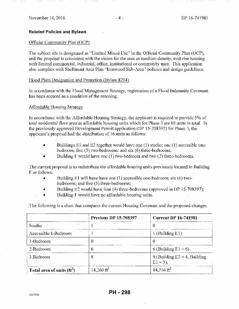
November 14,2016 -4- DP 16-741981
Related Policies and Bylaws
Official Community Plan (OCP)
The subject site is designated as "Limited Mixed Use" in the Official Community Plan (OCP), and the proposal is consistent with the vision for the area as medium-density, mid-rise housing with limited commercial, industrial, office, institutional or community uses. This application also complies with Shellmont Area Plan "Ironwood Sub-Area" policies and design guidelines.
Flood Plain Designation and Protection (Bylaw 8204)
In accordance with the Flood Management Strategy, registration of a Flood Indemnity Covenant has been secured as a condition of the rezoning.
Affordable Housing Strategy
In accordance with the Affordable Housing Strategy, the applicant is required to provide 5% of total residential floor area as affordable housing units which for Phase 3 are 16 units in total. In the previously approved Development Permit application (DP 15-708397) for Phase 3, the applicant's proposal had the distribution of 16 units as follows:
• Buildings E1 and E2 together would have one (1) studio; one (1) accessible onebedroom; five (5) two-bedrooms: and six (6) three-bedrooms;
• Building F would have one (1) two-bedroom and two (2) three-bedrooms.
The current proposal is to redistribute the affordable housing units previously located in Building F as follows:
• Building E1 will have have one (1) accessible one-bedroom; six (6) twobedrooms; and five (5) three-bedrooms;
• Building E2 would have four (4) three-bedrooms (approved in DP 15-708397); • Building F would have no affordable housing units.
The following is a chart that compares the current Housing Covenant and the proposed changes.
Previous DP 15-708397 Current DP 16-741981
Studio .)
1 0
Accessible 1-Bedroom 1 1 (Building E1)
1-Bedroom 0 0
2-Bedroom 6 6 (Building E1 = 6)
3 Bedroom 8 9 (Building E2 = 4, Building E1 = 5),
Total area of units (fr) 14,260 ft2 14,716 ft2
5217500 PH - 298
November 14, 2016 - 5- DP 16-741981
The affordable housing units in Building E2 ('Calla') are unaffected by this proposal and the affordable housing units in Building El ('Dahlia') are identified in the interior plans for the current proposal (DP 16-741981). The existing Housing Covenant must be amended to redistribute the 16 units and this amendment is included in the Development Permit conditions. As the Housing Agreement would remain the same, it is not necessary to amend the Housing Agreement Bylaw.
OCP Accessibility Policy
The proposal includes 15 out of 16 affordable housing units that would meet basic universal access design requirements to be easily adaptable to accommodate a resident in a wheelchair. These single-storey units are required to incorporate all accessibility provisions in the Basic Universal Housing Features section of Richmond Zoning Bylaw 8500.
The proposed development includes one (1) barrier-free unit in Building El to be designed to be fully accessible at the time of construction for a resident in a wheelchair.
OCP Crime Prevention Through Environmental Design (CPTED)
The development proposal will include standard CPTED features as articulated by the applicant in the Development Permit plans. For example, the size of the apartment buildings will ensure there are many sets of 'eyes on the street', and access to the underground parkade is restricted.
Public Art Program (Policy 8703)
Rezoning conditions for The Gardens included the provision of public art for all phases. Artist Joel Berman delivered two pieces for Phases 1 and 2. The remaining amount for Phase 3 was $143,419, which was secured prior to the issuance of the previous Development Permit (DP 15-708397) through a Letter of Credit with a letter from the applicant that commits to the time frame for the production and installation of public art.
Childcare Facility
In accordance with the rezoning conditions, registration of a legal agreement for the City-owned childcare facility was required prior to zoning bylaw adoption. The conditions of the earlier Phase 3 Development Permit (DP 15-708397) included the release and replacement ofthis agreement with a Restrictive Covenant (RC) to secure a construction agreement. The construction agreement has since been registered on title and includes plans, a budget and the completion and occupancy of the childcare facility, which must occur prior to occupancy of any Phase 3 building (DP 15-708397/ DP 16-741981).
Agricultural Landscape Buffer Zone and Maintenance Plan
The applicant is proposes no changes to the agricultural landscape buffer from the earlier Phase 3 application (DP 15-708397). Registration of a legal agreement for an Agricultural Landscape Buffer Zone and Maintenance Plan was also required as a condition of the rezoning. The legal
5217500 PH - 299
November 14,2016 - 6- DP 16-741981
agreement terms required that the applicant provide a plan with the appropriate details for the buffer zone between the north property line of the subject site and the 'Agricultural Park'. Prior to the issuance ofthe previous Development Permit (DP 15-708397), the agreement was released and simultaneously replaced with aRC with the landscape plan and maintenance provisions and a Statutory Right-of-Way to allow for the City to maintain the buffer area in the event that the strata corporation does not fulfill legal obligations for maintenance. Costs for the landscaping plan were included in the landscaping estimate for the subject site and were a component of the landscaping security.
Riparian Management Area Landscape and Maintenance Plan
The current proposal does not include any changes to the Riparian Management Area (RMA) along the east edge of the subject site. At the time of rezoning, the conditions included the registration of a legal agreement for a RMA Landscape and Maintenance Plan, prior to the bylaw adoption. This required that the applicant engage a qualified environmental professional (QEP) to prepare a plan to enhance the RMA in the short-term and preserve and maintain the RMA over the long-term. The RMA is partially located along the east edge of the subject site and partially on the Ministry of Transportation and Infrastructure (MoTI) lands along the Highway 99 corridor. The applicant's QEP prepared the RMA plan, including the MoTI portion, and the applicant agreed to cover all costs for the works through security for the off-site improvements. Prior to the issuance of the previous Development Permit (DP 15-708397), the agreement was released and replaced with a registered RC with the RMA plan and a Statutory Right -of-Way to allow for the City to maintain the RMA should the strata corporation not fulfill the legal obligations for long-term maintenance.
Noise and CHMC Standards
Registration of a legal agreement for noise attenuation was required as a condition of the rezoning. As per its requirements, the applicant has provided an acoustical engineering report which assesses that the proposed apartment and townhouse designs for Phase 3 (DP 15-708397/ DP 16-741981) will meet all of the applicable CMHC standards for mitigation of traffic-related noise. It should be noted that this report was based on the most recent available data for future conditions for Highway 99 as part of the George Massey Tunnel Replacement (GMTR) project.
Rezoning and Public Hearing Results
The Public Hearing for the rezoning application was held on October 19, 2009. While no objections to the proposed development were raised, some concerns were expressed about the traffic impact in the immediate vicinity. As a result, improvements were made in Phase 1 of 'The Gardens' to the Steveston Highway and No.5 Road intersection and a new signalized intersection was introduced along No.5 Road at the entry to the subject site.
Public Consultation
As The Gardens master plan vision at the time of rezoning was mid-rise buildings between four and six storeys, the applicant held an Open House on September 13, 2016, to gather feedback on the proposal primarily with respect to the height variance for the ten-storey apartment building.
5217500 PH - 300
November 14, 2016 -7- DP 16-741981
The applicant has provided a report that summarizes the steps taken in the public consultation (Attachment 3) and the feedback results. As stated in this report, a Public Notice was sent to households within an identified mail-out area, and a survey was available at the event. There were 43 public participants at the Open House and six (6) individuals completed the survey: four (4) respondents indicated support and two (2) had concerns related to traffic circulation at the intersections of Highway 99 and Steveston Highway and Steveston Highway and No.5 Road. Verbal comments included similar concerns about traffic conditions and noise impacts. Other feedback focused on the ten-storey apartment and ranged from support for creation of a dense urban environment to the visual prominence of the building as seen from the neighbourhood to the north and west, and the future park to the north.
Zoning ComplianceNariances
The proposed scheme attached to this report has satisfactorily addressed urban design issues and responded to staff comments in the review process for this Development Permit application. The proposal is generally consistent with applicable sections of the Official Community Plan (OCP) Bylaw 9000 and Schedule 2.8A- Shellmont Area- Ironwood Sub-Area Plan in the OCP Bylaw 7100 including site-specific design guidelines. Two (1) zoning variances are required as below.
The applicant requests to vary the provisions of Richmond Zoning Bylaw 8500 to:
(a) For the most westerly building (Building E1), increase the maximum height over a parkade structure from six (6) storeys and 25.0 m, to ten (10) storeys and 33.6 m.
Staff support the variance for building height because the relocation of residential floor area away from the future Highway 99 road interchange would significantly improve liveability for the more residents than the previous proposaL Additionally, the form and massing of Building El ('Dahlia J has been designed to minimize the visual impact of the increased height as seen from the internal high-street, the future park to the north, and the neighbourhood to northwest.
(b) For the most westerly building (Building E1), increase the allowable projection of unenclosed balconies into a side yard setback abutting the Agricultural Land Reserve, from a maximum of0.9 m to 1.8 m.
This regulation is part of the zone to protect farm uses in the ALR. The adjacent lands are located within the ALR but are not farmed as the property is dedicated to the City as a park. Staff support the proposed variance because the projection of unenclosed balconies further into the north (side) setback would help to connect the occupants of the apartment units to the people and activities in the park, and thereby promote animation. The balcony projections into the side setback would have no adjacency or other negative impacts, given the dwelling units would be facing a park and not sensitive land uses (e.g. adjacent residential buildings).
5217500 PH - 301
November 14, 2016 - 8- DP 16-741981
Urban Design Response
Advisory Design Panel Comments
The Advisory Design Panel recommended support for this Development Permit application. A copy of the relevant excerpt from the Advisory Design Panel Minutes from October 19, 2016 is attached (Attachment 3). The design response from the applicant is included immediately following the specific Design Panel comments and is identified in 'bold italics'.
Analysis
Conditions of Adjacency and Streetscape
The proposed design of Building El and Buildings Fl/F2/F3 respect adjacent properties and neighbouring land uses to ensure urban design is well-suited to the site in the following ways.
• Buildings El would have some shadow impacts on the 'Agricultural-Park' and nearby neighbourhood to the northwest but these are limited to the winter months.
• The proposed development would not have a negative impact on public views from the 'Agricultural Park', looking south: • The increased height for Building E 1 would not change the appearance of the
building at eye level as seen from the future park. Also the larger step backs in building form of the north elevation and the choice of white for exterior finishes would serve to lighten the building's appearance.
• Though the above-grade exterior of the parking roof deck would be visible along the north edges of the subject site, the 'blank wall' appearance would be softened through plantings in the Agricultural Buffer and trees in the front of Building Fl.
• The views of Buildings Fl/F2/F3 from Highway 99 would be somewhat screened from view due to the existing tall, evergreen hedge.
• The relationships between Buildings E 1, E2 and F2/F3 would form a north streetscape: • Building El would complete the sense of enclosure with Building D along the
internal road and the L-shaped mirroring of Buildings E 1 and E2 would create the edges of an enclosed plaza between the two buildings.
• The creation of three-storey brick veneer 'frame' along the south elevations of Buildings El and E2 would be complementary to the height of the commercial storeys along the north elevations of Buildings A and B. Together these four buildings would form the streetscape along an internal east-west retail street.
• The three-storey height of Buildings F2 would complement the three-storey podium of Building E2 and their respective east/west elevations would add a sense of enclosure around the 'pedestrian mews'.
Site and Functional Planning
• This site is located at an important southern gateway to Richmond from Highway 99 where the vision for multi-storey (above a parkade structure) mixed-use commercial and
5217500 PH - 302
November 14,2016 - 9- DP 16-741981
residential built forms spread throughout the site was intended to provide the genesis for a new neighbourhood along the north side of Steveston Highway.
• The original development vision included seven buildings all located on an internal eastwest 'high street' on top of the parking roof deck with apartments above ground-level commercial spaces. This pedestrian-scale retail street incorporates a variety of store frontages, a limited amount of surface parking, wide sidewalks, raised crosswalks, decorative paving and other special features intended to create an enjoyable pedestrian experience and to contribute to a vibrant 'urban village'.
• The proposed site plan for Buildings El, E2 and Fl/F2/F3 is generally consistent with the overall vision to create a vibrant, mixed-use, 'urban village'. • The public realm between Buildings El and E2 and between Building E2 and
Building F2 would consist ofhigh-quality gardens, courtyards, plazas, and the 'pedestrian mews' connecting to the 'Agricultural Park' with trees, shrubs, plantings, outdoor seating and viewing areas that are appropriately detailed.
• The site orientation of Building F2 in relation to Building E2 would create a generous 'mouth' at the south edge of the pedestrian mews and the 'funnel' effect would encourage pedestrians to move toward the plaza at the north end of the mews and to cross over the 'grand staircase' and Agricultural Landscape Buffer and into the 'Agricultural Park'.
• Interruption of the public realm at the vehicle entry point to the underground parkade, along the west elevation of Building El, would be softened through extensive plantings along the road and the private patios.
• Pedestrian connectivity would be further achieved through the completion of the sidewalk along the north side of the road between Buildings E 1, E2 and F2/F3.
Parking and Loading
• In Phase 1, the applicant provided a parking study and proposed a suite of transportation demand management (TDM) measures that Transportation staff accepted as sufficient to support a 10% reduction in the on-site parking requirements for the overall development.
• All required commercial spaces for the overall development were provided in Phase 1, and these stalls are shared as unassigned residential visitor parking for Phases 1 and 2.
• Vehicle parking stalls for Phase 3 (DP 15-708397/DP 16-741981) are based on the 10% reduction in ratios for apartment, townhome and affordable housing spaces, small car stalls, accessible and visitor spaces and loading spaces. • It should be noted that ten (10) surface parking stalls to the north ofBuilding F3
will be dedicated for the exclusive use of townhouse residents. Registration of a legal agreement on title for this purpose is required prior to Development Permit Issuance.
• Class 1 and Class 2 bicycle parking facilities also comply with the Bylaw requirements:
5217500
• All required visitor bicycle racks were provided in Phase 1;
• Phase 3 bicycle storage units would be located in the bike pavilion/parking structure that will be reserved for the use of residents in Building E2 ('Calla') and Building El ('Dahlia'). A legal agreement to secure the proposed cross-access is required, prior to the subdivision of the subject site ('Lot 2') into separate parcels.
PH - 303
November 14, 2016 - 10- DP 16-741981
• Phase 3 vehicle parking stalls would be provided partly in the underground parkade, and partly in the above-ground bicycle pavilion/parking structure to the east of Building F3.
Architectural Form and Character
• One central principle in the design guidelines for Shellmont Area- Ironwood Sub-Area is the 'pedestrian-first orientation' that would be achieved through the design as follows: • Buildings E1:
• This ten-storey building would mirror the L-shaped Building E2, which together would form an enclosed plaza and gardens as described above.
• Some units would have individual entrances and others would have patios that would connect the private and public realms.
• The form and massing would be stepped back at the sixth storey on all elevations where the building would terrace back at the ih -1oth storeys. The six-storey base would create a sense of human-scale and progressively stepping back would further help to reduce the pedestrians' experience of the bulk, size and scale through the creation of a 'bottom, middle and top'.
• Buildings F1/F2/F3: • Building F2 is sited at an angle to frame the 'pedestrian mews' and each
unit has an angled fas;ade which would connect the residents to the 'street' and complements the angled balconies along the east side of Building E2.
• Garage entrances are blended with upper storeys through the continuity of materials, texture and colours.
• Although the architectural features and expression of Buildings E1 and E2 are distinct from Buildings F1/F2/F3, they are well-integrated with the overall development. The podium along the south elevation of Buildings E1 and E2 takes cues from the datum line of the commercial storey ofBuildings A and Band the finishes and palettes on both sides of the retail street would be complementary.
Landscape Design and Open Space Design
• As part of the rezoning, the applicant was required to dedicate approximately 12.2 acres as an 'Agricultural Park' that will include trails, play areas, ponds, community gardens, horticultural and agricultural interpretive facilities in the various garden areas.
• Phase 1 and 2 provided a high quality of hard and soft landscape design, materials, detailing and furnishings. All soft landscape areas have an automatic irrigation system. Landscaping the internal road between Building D and E1 included 1.5 m wide boulevard planting strips with street trees and grass and 2.0 m wide sidewalks on both sides, which will also provide future pedestrian access to the 'Agricultural-Park'.
• Phase 3 landscaping would include the following:
5217500
• The courtyard between Buildings E1 and E2 would have five zones: a large amenity garden with a simple sheet of lawn and water feature; a summer flower
PH - 304
November 14,2016 - 11- DP 16-741981
garden; a children's play area; a covered outdoor dining area and large semiprivate patios for the units facing the common spaces.
• The pedestrian mews would have a linear path with textured concrete pavers in a charcoal colour alongside grasses and other plantings that would visually and physically connect the mews to the semi-private patios of Buildings E2 and F1/F2. Its south end would have a trellis structure with seating oriented to north, and way-finding to the staircase and ramp to provide universal access to the park.
• The bike pavilion has a green roof that would be accessible to townhouse residents as a common garden area.
• The Agricultural Landscape Buffer Area would have cedar hedging and a variety of thorny plantings that would serve as an effective barrier between the ALR buffer and the development site, while providing an attractive landscape strip when seen from the park and Buildings E1, E2 and Fl/F2/F3.
It should be noted that the landscape architecture remains the same from the earlier Phase 3 application (DP 15-708397) except for the removal of the dog park in the northeast section of the site plan. This was removed to anticipate the future land expropriation tied to the GMTR project. However, the proposal remains consistent with the site-specific design guidelines to provide a 'garden setting' with extensive outdoor amenity spaces.
Conclusions
The proposed design is responsive to the City of Richmond's urban design objectives within the Ironwood Sub-Area of the Shellmont neighbourhood, and is generally consistent with the master plan that was presented to Council at the time of rezoning. The siting of the proposed buildings and their respective forms, massing and heights would complete the envisioned streetscapes and urban design pattern of the central spine (i.e. retail street) courtyards, gardens, a large plaza (i.e. the south end ofthe mews) and pedestrian connections to the 'Agricultural Park'. The proposed architectural styles, features and exterior finishes are also complementary to the mixeduse buildings on Steveston Highway, and the apartment building which faces No.5 Road.
As the proposal would meet the design guidelines, staff recommend that the Development Permit be endorsed and issuance by Council is recommended . . +lele.r1 Ca.~ Helen Cain Planner 2 (604-276-4193)
HC:cas
Attachment 1 : Context Plan for Phases of The Gardens Development Attachment 2: Data Sheet Attachment 3: Report for Public Open House on Phase 3 Development Permit with Variances,
September 13, 2016, prepared by Townline Gardens Inc.
5217500 PH - 305
November 14, 2016 - 12- DP 16-741981
Attachment 4: Advisory Design Panel Minutes & Applicant Responses (inserted in bold italics)
The following are to be met prior to forwarding this Development Permit application to Council for approval:
I. Amendment of the existing CA5244228 and CA5244229 on Lot 2 in the Land Title Office, to provide the number of affordable housing units, together with their types, sizes (averages in Table I; minimums in Table 2), and unit mix, to the satisfaction of the City according the following schedule:
Phase 3 (Lot 2)
Buildings E1
Phase 3 (Lot 2)
Building E2
Studio
1 Bedroom Accessible 1 Bedroom
2 Bedroom
3 Bedroom
Sub-Total
Studio
1 Bedroom
Accessible 1 Bedroom
2 Bedroom
3 Bedroom
Sub-Total
0 0%
0 0%
8%
6 50%
5 42%
12 100%
0 0%
0 0%
0 0%
0 0% 4 100%
4 100%
':;:;~~~~y~· .. ::· •. ••••••.·\.: Tot~iX • · ::Amopnt(ft2
)
n/a n/a
n/a n/a
600 600
871 5,226
982 4,910
10,736
n/a n/a
n/a n/a
n/a n/a
n/a n/a
995 3,980
3,980
• rental rates and occupant income restrictions shall be in accordance with the City's Affordable Housing Strategy and guidelines for Low End Market Rental housing, according to the following schedule:
Bachelor 37 m2 (400 ft2) $850 $34,000 or less
One bedroom 50 m2 (535 ft2) $950 $38,000 or less
Two bedroom 80 m2 (860 ft2) $1 '162 $46,500 or less
Three bedroom 91 m2 (980 ft2) $1,437 $57,500 or less
Notes: 1 Denotes 2013 amounts adopted by Council on March 11, 2013 . 2 Household income may be increased annually by the Consumer Price Index.
2. Registration of a legal agreement on Lot 2 to secure the dedication of ten (1 0) surface parking stalls to the north of Building F3 for exclusive use of townhouse residents in perpetuity, to the satisfaction of the City.
*Prior to Building Permit Issuance, the developer must complete the following requirement
1. Incorporation of accessibility measures in Building Permit (BP) plans as determined via the Rezoning and/or Development Permit processes.
2. Obtain a Building Permit (BP) for any construction hoarding. If construction hoarding is required to temporarily occupy a public street, the air space above a public street, or any part thereof, additional City approvals and associated fees may be required as part of the Building Permit. For additional information, contact the Building Approvals Division at 604-276-4285.
5217500 PH - 306
November 14, 2016 - 13- DP 16-741981
*Prior to Subdivision, the developer must complete the following requirement
1. Registration of a legal agreement on Lot 2 to secure the access to the 'bike pavilion' for the exclusive use of residents of Building E1 and Building E2 in perpetuity, to the satisfaction of the City.
Note:
* This requires a separate application.
Where the Director of Development deems appropriate, the preceding agreements are to be drawn not only as personal covenants of the property owner but also as covenants pursuant to Section 219 of the Land Title Act.
All agreements to be registered in the Land Title Office shall have priority over all such liens, charges and encumbrances as is considered advisable by the Director of Development. All agreements to be registered in the Land Title Office shall, unless the Director of Development determines otherwise, be fully registered in the Land Title Office prior to the issuance of the Development Permit.
The preceding agreements shall provide security to the City including indemnities, warranties, equitable/rent charges, letters of credit and withholding permits, as deemed necessary or advisable by the Director of Development. All agreements shall be in a form and content satisfactory to the Director of Development.
Signed Date
5217500 PH - 307
n ""
"'"'n3
1 ., '·
·15~
;
AT
TA
C.H
ME
NT
1 '
~
cl!~u.,;
, __ -
r:m AR
EA
OF
PE
RM
IT
NO
T F
OR
" TH
E If
GA
RDEN
S T
HE
GA
RO
EN
S P
HA
SE
TH
RE
E
BU
ILD
ING
E1
: D
AH
LIA
, B
UIL
DI N
G E
2:
CA
LLA
, &
B
UIL
DIN
G F
: JA
SM
INE
,
ril
TO
WN
LIN
E
~ ~
CO
NT
EX
T P
LA
N
A-1
02 r
.•
PH - 308
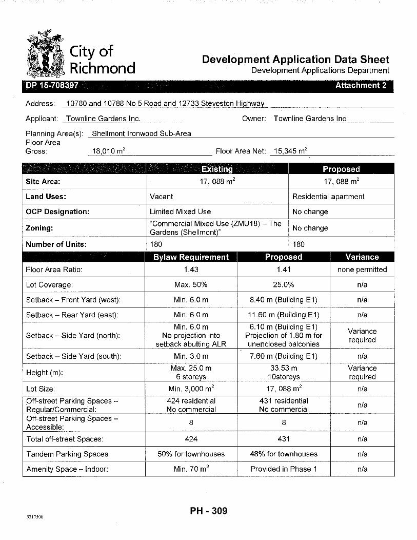
City of Richmond
Development Application Data Sheet Development Applications Department
--- ----------- ------ -- --- - - - ---- -- - - --- -
DP 15-708397 Attachment 2
Address: 10780 and 10788 No 5 Road and 12733 Steveston Highway
Applicant: Townline Gardens Inc.
Planning Area(s): Shellmont Ironwood Sub-Area Floor Area
Owner: Townline Gardens Inc.
Gross: 18,010 m2 Floor Area Net: 15,345 m2
-~----------- -~-----------
I Existing I Proposed
Site Area: 17, 088 m2 17, 088 m2
Land Uses: Vacant Residential apartment
OCP Designation: Limited Mixed Use No change
Zoning: "Commercial Mixed Use (ZMU18)- The
No change Gardens (Shellmont)"
Number of Units: 180 180
I Bylaw Requirement I Proposed I Variance
Floor Area Ratio: 1.43 1.41 none permitted
Lot Coverage: Max. 50% 25.0% n/a
Setback- Front Yard (west): Min. 6.0 m 8.40 m (Building E 1) n/a
Setback- Rear Yard (east): Min. 6.0 m 11.60 m (Building E1) n/a
Min. 6.0 m 6.10 m (Building E1) Variance
Setback- Side Yard (north): No projection into Projection of 1.80 m for required
setback abutting ALR unenclosed balconies '
Setback- Side Yard (south): Min. 3.0 m 7.60 m (Building E1) n/a
Height (m): Max. 25.0 m 33.53 m Variance
6 storeys 10storeys required
Lot Size: Min. 3,000 m2 17, 088 m2 n/a
Off-street Parking Spaces - 424 residential 431 residential n/a
Regular/Commercial: No commercial No commercial Off-street Parking Spaces-
8 8 n/a Accessible:
Total off-street Spaces: 424 431 n/a
Tandem Parking Spaces 50% for townhouses 48% for townhouses n/a
Amenity Space- Indoor: Min. 70m2 Provided in Phase 1 n/a
5217500 PH - 309
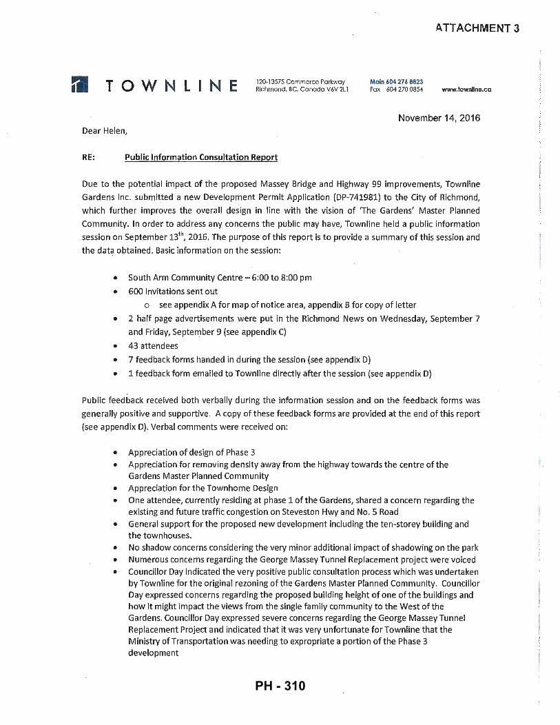
TOWN LINE 120-13575 Commerce Parkway Richmond, BC, Canada V6V 2Ll
Main 604 27 6 8823 Fax 604 270 0854
A. TTACHMENT 3
www.townllne.ca
November 14, 2016 Dear Helen,
RE: Public Information Consultation Report
Due to the potential impact of the proposed Massey Bridge and Highway 99 improvements, Townline
Gardens Inc_ submitted a new Development Permit Application (DP-741981) to the City of Richmond,
which furthe r improves the overall design in line with the vision of 'T\he Gardens' Master Planned
Community. In order to address any concerns the public may have, Townline held a public information
session on September 13th, 2016. The purpose of this report is to provide a summary of this session and
the data obtained. Basic information on the session:
• South Arm Community Centre - 6:00 to 8:00 pm
• 600 invitations sent out
o see appendix A for map of notice area, appendix B for copy of letter
• 2 half page advertisements were put in the Richmond News on Wednesday, September 7
and Friday, September 9 (see appendix C)
• 43 attendees
• 7 feedback forms handed in during the session (see appendix D)
• 1 feedback form emailed to Townline directly after the session (see appendix D)
Public feedback received both verbally during the informat ion session and on the feedback forms was
generally positive and supportive. A copy of these feedback forms are provided at the end of this report
(see appendix D). Verbal comments were received on:
• Appreciation of design of Phase 3 • Appreciation for removing density away from the highway towards the centre of the
Gardens Master Planned Community • Appreciation for the Townhome Design • One attendee, currently residing at phase 1 ofthe Gardens, shared a concern regarding the
existing and future traffic congestion on Steveston Hwy and No. 5 Road • General support for the proposed new development including the ten-storey building and
t he townhouses. • No shadow concerns considering the very minor additional impact of shadowing on the park • Numerous concerns regarding the George Massey Tunnel Replacement project were voiced • Councillor Day indicated the very positive public consultation process which was undertaken
by Townline for the original rezon ing of the Gardens Master Planned Community. Councillor Day expressed concerns regarding the proposed building height of one ofthe buildings and how it might impact the views from the single family community to the West of the Gardens. Councillor Day expressed severe concerns regarding the George Massey Tunnel Replacement Project and indicated that it was very unfort unate for Townline that the Ministry of Transportation was needing to expropriate a portion of the Phase 3 development
,, .
PH - 310
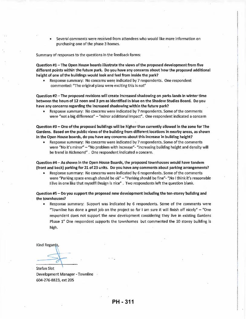
• Several comments were received from attendees who would like more information on purchasing one of the phase 3 homes.
Summary of responses to the questions in the feedback forms:
Question #1 -The Open House boards illustrate the views of the proposed development from five different points within the future park. Do you have any concerns about how the proposed additional height of one of the buildings would look and feel from inside the park?
• Response summary: No concerns were indicated by 7 respondents. One respondent commented: "The original plans were exciting this is not"
Question #2- The proposed revisions will create increased shadowing on parks lands in winter time between the hours of 12 noon and 3 pm as identified in blue on the Shadow Studies Board. Do you have any concerns regarding the increased shadowing within the future park?
• Response summary: No concerns were indicated by 7 respondents. Some of the comments were "not a big difference"- "minor additional impact". One respondent indicated a concern
Question #3- One of the proposed buildings will be higher than currently allowed in the zone for The Gardens. Based on the public views of the building from different locations in nearby areas, as shown in the Open House boards, do you have any concerns about this increase in building height?
• Response summary: No concerns were indicated by 7 respondents. Some of the comments were "No it's minor"- "No problem with increase"- "Increasing building height and density will be trend in Richmond" . One respondent indicated a concern.
Question #4- As shown in the Open House Boards, the proposed townhouses would have tandem (front and back) parking for 21 of 23 units. Do you have any comments about parking arrangements?
. • Response summary: No concerns were indicated by 6 respondents. Some of the comments were "Parking space enough should be ok"- "Parking should be fine"- "No I think it's reasonable I live in one like that myself! Design is nice" . Two respondents left the question blank.
Question #5- Do you support the proposed new development including the ten-storey building and the townhouses?
• Response summary: Support was indicated by 6 respondents. Some of the comments were
"Townline has done a great job on the project so far I am sure it will finish off nicely" - "One
respondent does not support the new development considering they live in existing Gardens
Phase 1" One respondent supports the townhomes but commented the 10 storey building is
high.
Stefan Slot
Development Manager- Townline
604-276-8823, ext 205
PH - 311
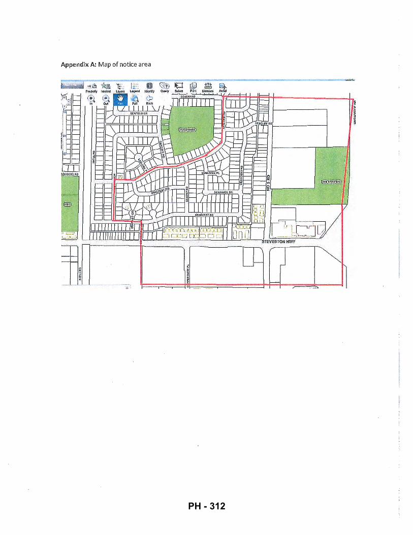
1ce area Appendix A: Map of not·
.. ' . . ~
l c !i
PH - 312
Appendix B: Copy of notice letter
TOWN LINE 120-1 3575 Commerce Parkway Richmond, BC. Canada V6V 2Ll
Main 604 276 8823 Fax 604 270 0854 www.townline.ca
August 29, 2016 Dear Neighbor,
RE: Public Information Session - Final Phase of 'The Gardens' Master Planned Community 10780, 10788 No.5 Road and 12733 Steveston Highway
Earlier this year, Council approved the Townline Gardens Inc. Development Permit Application (DP-15-708397) for the final phase of 'The Gardens' Master Planned Community - former 'Fantasy Gardens', located on the corner of No. 5 Road and Steveston Highway.
Due to the potential impact of the proposed Massey Bridge and Highway 99 improvements, Townline Gardens Inc. has submitted a new Development Permit Application (DP-741981) to the City of Richmond, which further improves the overall design in line with the vision of 'The Gardens' Master Planned Community.
'The Gardens' Master Planned Community is located on the corner of Steveston Hwy and No. 5 Road.
Townline is cordially inviting you to a public information session to present the proposed design and seeks your feedback.
Where: South Arm Community Centre 8880 Williams Rd, Richmond
When: September 13, 2016 Time: 6:00- 8:00 pm
ada
•
Final Phase Area
:! l obbl"fSCiltMII.Ut
'The .Garderts' Master Planned Community.
. .'
South Arm Community Centre Sept ember 13, 2016 6:00-S:OOpm Wil li <~ms Rd
__ Community Centre 29 min drive · home
''! ;
Wll li ~ 1
Please note that this is not a City of Richmond event however there will be a city planner present at the information session to answer general zoning and city process related questions.
For questions in advance of the public information session, please contact: Stefan Slot Development Manager- Townline 604-276-8823, ext 205
~ I I i .
PH - 313
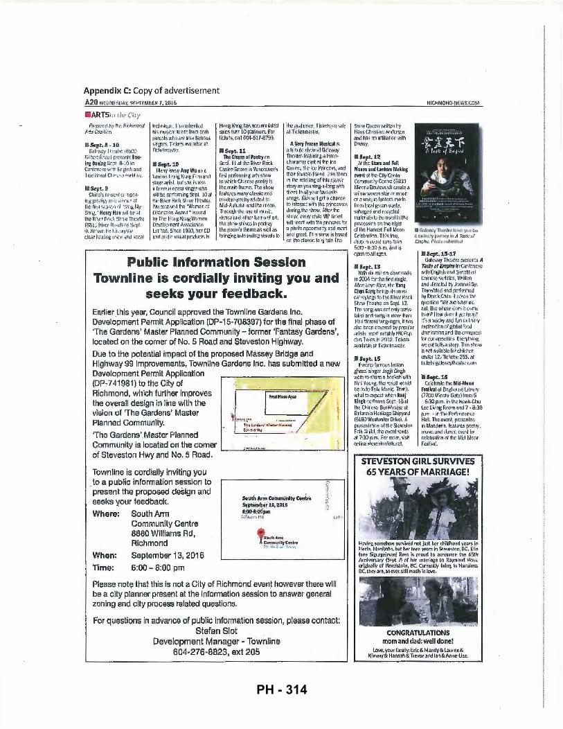
Appendix C: Copy of advertisement A2Q \'/ E[I.'lESOo\'1, S£PlEMB£f; 7, 2Gi6
ARTS;,, ,,.,, . (';1.y
rs:..·p.i fi. ! ~ .~y ,.J~- nt,:h,'fW7<.t A~_.::Cmltr;l·.tr,
1 Sept.8 -10 Gdlr:,\i;:,· !l ~;:il h': ~Qtr,:Q
Ei:::r.t nr .. :·;:: fJ'I'¥i}fll·i fiC'2· I~ Boeinz Sent a. ~0 in Cn,t-::n.a1c ·...- ·~ t, Er: .r!) J;:; t!ilrid ·lr;:t.i'ii i~ : n!tl ·Ch~·~~ .. ~; "'llrtil (·:.; .
I'll Sept. 9 Chiril''i n>?wr.st -::r.Tip:;:; ..
il: gr;r ::o.IIJ;.'!' !Jt" ~ l JA···,p ::r l!·•r 1ir;;t ~f~'i:;:;n c,t \~;mg IJt!-' So.:!r-&' He:.my Hu-1 •.'J ill h!:' .:-. ~ lho R··.v ~·-.r.h St·., •• , Th""''~ !'SSj J ~·l ·.•: :r Hr.<: ,; .l) .f { r Sq f ·;J. :Kr•t,lt'r. fc, ~ t.I::. r. ry~ t=i ~ cltr. r h::-:il ..ing, -..\·;j.::-. ~ iind \!U:al
ltx~hn~=-l .• llj , lii-•J intmriluJ hi:;. mus~-:;, ~ 1~ r:. r; t tr.)m ~th
r::tn:uts o·.·tr. ~'1? a ·s~ rn.~r:-i "!it r: gr.r~ . Tidr-s il '..r. ii b G i' .. ~ f;;;l! (: lrriJ~t:r
Sept.lG Mr.n); ~n:tw Amy Wu a:; 2:
lt"Jlfl~ljS l ft;; r•~ t(,.~ng n '·u i.lml Slligrc ~i!"fhrt. tut ::.-r.c~ 1:~ lt:fiO a fitTt1Ui u::tm sir®",J wnc1 will b:! f.i:rlrxrning &pl. 10 at PrL· Hl\·o.:.~ ' R~::h. st u1: n~~~~·J. l,'lu lL.~~)~w:tlh.: -wwmr:r. d DG.~ir .::ti:-, r, .;\•,nrd " ~-;..<;ur.d IJy tl o:: l hn~l<r-.KW::.·ro:: n Ot::•Jr,lr•;!o 'l\'!r.t ~:.·~-m:i~;;bo L!rr. .':·2d. Si.nr.~ l gf(J, !lr-:r CO ;J.:uJ il~dio lo'i5!i1.il rrr.duds in
t-k.r!l K1ng t.(t.;. 9-C.(. t tmt tlat6rJ sair5 i!Jr.t 10· p.~linurrl . -Fr.r lt hrls, r.a ll CC4-~1.7-87sr-}.
I!IScpt.li Tile Chorm or Poatq c.n
Sr:ri. 11".;1 ~h:! Ri.·~f:.!' P.ir.:k C::i5irlj Rr..m~ i~ 'lil:tL6Ln.~(~ I j~l, fi ~:; ( ,J IIrth• .g. ijfi'i !ll l\.\11
In 1\hlr.h t.t,nr$.0 r.mll')• i; ltt!ITv'l i r. fht.m~. Tt.~S t, r:t.•i f.;uh~r?; m;my ci:JSs~~ .nr..:i n· rJ :·:k:rri rJ.::"'.:: Iry rd;·:~t •.l tr• M~·A'oltt.rr.r. iind tt.r:! rr .. -,:m. Thrmtpjl dr:1 1115Ud J7!U5k:, · th::u:c ii.lld .::UJL' f fl,:Jrr;;d iltl. 1t13 !ih~~v str:\.(~~ In p:;rtr.;: the r. :-A~m·s L~e rrir: .;5 wrll a:; hringir1g_u;h:.-:tndlr:a vhm~li tv
·tl ~: m;zJ!f!r'o::, I k : ht~ l:; t~ l •.i!Jil; fliTidctmilstl!JI. ·
A Vel)' Frazop Musloal is f.i 1 1 -~~11 (~ ,;I ~J \'I i~ l Gi·~~fWil\' flln11fr= f&.i.fltrii' f. n t-~U'C:(!: d-... :~nu:;cr"C.ils t .:tf thlj leo Cuf:t r~ , ~-1 -.;: r.,;,: ftrl f:c;i;:;t-. :.Jntl ~t..;:lfr l ~·.r,!) ·r~ f-~F:Ild . l·11n tt.r:in Li ' I t~ ri'!l~"lng';:;f'lhi;; C.!Qi.SJ:
·R·:;r)• as )UU !;iJ"\g·il·h:ilg wi:h ~h~ ·rti lf\ ;Jil ) r.ur ,[M'l:lril t': :<JJf;?:-1. K~o<; w· I £f.l o i.honrK. .& L1 t~rar: l 'hi t~ lh::: r~~n"::t::..-!~· Jurin,g ~ h:! t:hm.·. ~flr:.r lhE '~'"''; r!•HY d rlhi 'liP lit:<N \\Ill tn!!~t w~h ~r.c p.rir~r;.S.".i \{.r f) phr:rn r.rJ;:~.r.ur.::V !lil'd m::r. ; ar:ct grr.~L n:; s~C,.,-.; i:;.tasrd r.r. t.!lnd;;..-;sir. f.:· fiJ ~iiiB Th:
Public Information Session Townline is cordially inviting you and
seeks your feedback. Earlierl11is year, Council approved the Townllne Gardens Inc. Development Permit Application (DP-15-708397) for the final phase of 'The Gardens' Master Planned Community- former 'Fantasy Gardens', located on the corner of No. 5 Road and Staveston Highway_ Due to tha potential impact of the proposed Massey Bridge and Highway 99 improvements, Town line Gardens I ric. has submitted a new Development Permit Application (DP-741981) to the City of Richmond, which further Improves the overall design in line with the vision of 'The Gardens' Master Planned Community.
'The Gardens'.Master Planned Community is located on the corner of Steveston Hwy and No. 5 Road.
Town line is cordially inviting you . to a public information session to present the proposed design and seeks your feedback.
Where: South Arm
When:
Time:
Community Centre 8880 Williams Rd, Richmond
September 13, 2016
6:00- 8:00 pni
South AflTI Comm•i"lty c.;,i,. s.i;tam~iitil; 2at5 · &:iJo:.a:cioltm ·
·~1·' ' !tll i 1 '~i l · h ~
• S01...ihAmt C<Yrim~.:l!i"tJ C:•nlro : ..• ·~· , io ~ I '"'"":
Please note that this is not a City of Richmond event however there will be a city planner present at the Information session to answer general zoning and city process related questions.
l.
For questions in advance of public information session, please contact: Stefan Slot
Development Manager ~ Townline 604~276-8823, ext 205
Sno~· Qh :tr• ~·.ril ~\liJ by t-r;ms t;t- r: str.;r~ Anrlcr:;r,n rmd hils nn ilffili7fiird w~h ro:, nt)'.
II Sopt. 12 o\t thE Slars and Fun
~~ ••• ,on~ Lanlum 14aking e1er.t ;; l l t~: ·cnyT(:r oln' Gc.mmlrr.::y r .. (!r.~ r~ {~:)!l t~1in:i r'U B:ul r::.'.,'il~di c.r~at~ a .. ·.·rr,,~,. 't,uwm st:.ir m mr:vfi or a ur.i~;.JC l11ntcrr.. malr: trr·-a-•lrr,., l E'i}.'"!n ~·~~~-~~ 3011\•agcd and r[C.)'Ch:d ma~:rials to:~ :t( : IJ-!J.!d in tl r{: f)li"'';(.$-"}ir. :-~ :1rr t.nr:~ nt!.lll d thr Hor1E..'il Fulll,1oon Cr"i:!b'Uiim. Tt's.irtC!, ~'i lfJIY 'I ~ ~ ... :ml· r~v1 ~t ~r:l rt"l r,!:i:) - FJ::m p m. ~jnrJ i:' .:pen t:i all r~i!s .
JUopt.l3 . Wilt'! ~hi mi .. ' r.~ ~;· .:r ... •rC:i).j(l.:;
lr. ~))~ tcr ~ h:! flt.511iinglr. . '"'.\';l! ·!.r.~r-r; .R.\~e. t~u Van~ Chen Gnttitirlr:.a,., il-:; 1n1 r~i \.,l 1 ~~1ir.is fli tt!u Ri\Dr rt r.d: St:tlio' Thcatm ;:,_:~ S!pl. E;;. Tt.c '!tog tm:. nt·~ i:.flly-~ran-;· kdo;S and surw, ~., m•·n: lhit~• 1.0 <! r.f,;ront t-;;r:g1 ''lg(~. it h:i) als-j hc·:n c.·w::rrd tr ~:;p·li: r arl~h. n:r'-' rr r.~a~1ly ~IK f'(lp (-:-~:o l'w~,ir~-; ln ;.1J .I ~. T~.kc:t ;; .'i'Ji!ililt·le at Tk:l:r.trn<:.:.:.:i:r.
• Scpt.lS lf·.-.~::r ~~'",::i rTl \tt~~ lo~liiin
lhazr.~ s.'.ns-;:r Jagjii ~ingh w: r·::~r· ~llumn t):z.-;.:r.ali \',it] N :~ l·t tu;i~. rh:: : (:'):JII Y.\:nJb. tor. tnko·FDI" lh.<lo;. TMt'~ .,,.t,.;l ~r. ~~xp~(t wh::n Ranj sinal! ;:<*""'" Stlr·1• l i><rl lh::· Cl1if·i.::O\: Dunhh!Jt·l~~~ ~ I Hfl.=:mr. l~ H..:rilag::: 5.hi1J}\3rd (5180 '/lr:Jstwnt.:!r Dri,~). A PIL.~:t• lii~klfl (If n:~! Sk\'!JSitlr. f~ i" Guilrl, <II:) q.,,,roi o;;M> ,, t 7:33 r..m. fm mc.•r; \isH •inJir;~ Sti!\-..;.Sili1~jl!t r: .::l ..
f!ICHMONO-NEWS.CtlM
II C':.',k\',\~ '; Tl ~iii ~! 1 :~7! ~!!. ·,\, :1 r., , f.: cu:ill.': f'y l :lu f;:H!~' i11 ,•1 f.'B'.!L••:.f to"Jt{·Y•~ fif.\'l.':.>-S!i.!l ir..\'W.!
• ~,;pt. lS-;1.7 Gatt':',\'ti}' Th~a:ra ;:ft!crl-::'i A
Tasto af Empiro in Cllr:t::n~c \'~irh f:n~.li ·;h i~!·,d S·n\~A i fit); ! r::.nln r.-s.rr S I ; :'fi';lr:~. Wrllt\;n ;:..nd dln:c.lr:d 111 Jcwmrti ~· : Transk11i::d nnr.l pr'f.:nl':lr:d tw Dnt.'l.. (~t: 11 it ~{•~(~:. 1m~ rtl m.;.tic.,'J'l•'.'(!. ,,r.:!t'.hJl" Wr F.lll. B 11': \',hwt -iur:s i~ ctJmr r:• ''n" llti!t'l (h:·:!-; II ~:~ tm ·t~? ::·~. 1l '""·.;.;;1\~' (1i"xf ftm q: L'l~-rr· D. fll cr.:~i:;n uf g~Jb31 'i:iui drrr·n;6:;n .~r-':-11hr:. crnqlt:!st f(•f n .. •r t'J/)}<(~I•IC~. ('Jt'.:o, l ;• in~ wn ~~ilt tc~ llsa !il . .JJ)•. Thi;; !3-hr,u i; n::t ~uiln~c fi,; chiki~.:arr tJO.i \-:r 12.· Ticr·;r:h: 255, t.Jf l·dt:h• w: h; \'iilj.1h~Jh .. :.( nln
lll 5ept.l6 Cc~t!hrrAo t:m Mid·Md~nl
re$1il'nl alt\r ~lttUJ;(O Lrl>r.:'Y (77~\ll/.irr.ru ·r.;.;tcl tro:.m 5 ·· 6:3) p.m. in '. t-o K·o~I;-Chu Lc-:! u~:71g R·::-1\:·Tl and 7 . 8:?.0 n.n~. - ITi PnJ f"(!~nm•iur(:t Hc: IL Thr: r::\Cnt, pr.::;;r:nta:! in Mar.darc,. f<AIU"« r,:;rtry, ft'IJ'ik: fJrd : l:.~n;)""_; l:'l lt' ll In r.r:~:b r.j li J:"·~ {If the. Mi~l-M ~o\•f't Fr-"iV1at
STEVESTON GIRL SURVIVES 65 YEARS. OF MARRIAGE!
CONGRATULATIONS mom and dad; Well done!
UwE;. yDJr fJ11~ty. Edt & M~f1dy& L:..weu & liirnnw& H.nnah&Trevor •I'd lan&Anne·U'".
PH - 314
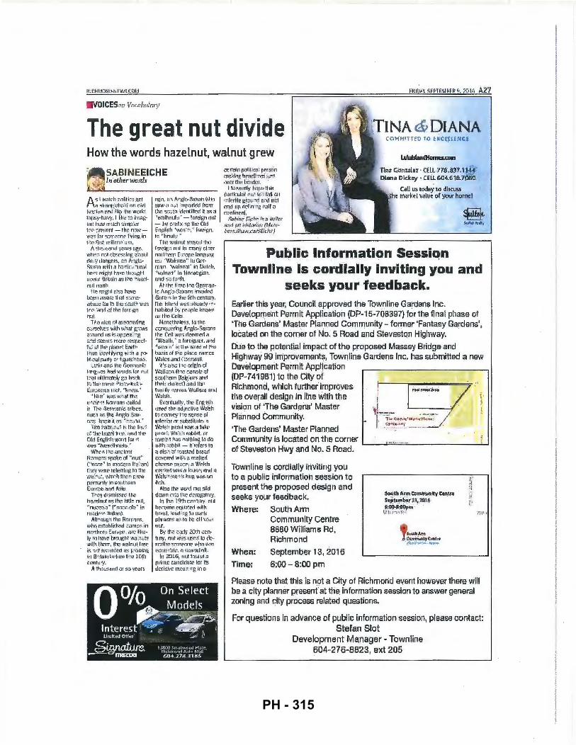
FRif.>iiV, l<F PTF.t.I ~FR 9, :?P I C. A27
VOICESm, Vacal"'h'r)'
The great nut divide TINA & DIANA
How the words hazelnut, walnut grew Lu~
SABINEEICHE c:'r:-.rli"fl"l p1.11iP.;:;1i p~s-;;n m~l-:inc hr;tdl :~;.:~~- i ~~' Ut.•cr· tll!! l.t!:illt!t . .
llna c;i<ln'liilol · Celt 77e .a:H.1 144 Diana Didc.ey • CELL &a4.618.7000
I' - ·~. , ln .olirer wotd•· '· ~
A-5 ~ ~·~'iJ ICh J•JiiH:;~ .~C I ;"! o:;lrtinr.:~h;:-16 on d••l
lf1::"ion or;~ rti11 ~ hl': WJJ rE lilf JS~1 ·tUIV~·· I Ilk<! ~ : J i tt: il~h m l11i1i rr:Ud'l ~Jw~: ~,!r fi1(! r)m:wnt -lh~ nw.• '-IHJ'!. fur ~.:; n· .r ;:onc lf\·inr:. in t•iO ~i r !i~ wi1tcnr 'on·1.
A ~h ::..,~nd 't<!nt~ il.i.].i ,
·whr.-.::. n;:-.f .:;Qr-r,>~inr:. ~~:11 .11 thl .\ ' al r:d'l,H.l~f~ , ;!f A .. ·t~ li.r s~)'Lill ·.~:hh a h::r.lc ;, ~urr~l ll r.-:'11 n1 l~ht IVJ'le ~h ::. ;i~ l 1 1 Ui)Jirl Bfitain a~ t--:-c 1h.rnr..lmrt nurlh.
Jt{ r.- rn'ghl n:t•·:: h!J•Jt! lu:c! ll illo'Ja!~ ! 1l ti:11 !::J' ru ~•'Ji u~;t! u~r t.:; II I ~! ~ {I LJI ; t \ 'Jil:S l.'!c ··.:mil \1t th :! furE-·an nuL 1 ~-"'o tdea of a~i~;:~:::ii.! lbtl
~o",P';'..{' I•IT:S ~·~ith \'b :Jt W•7iWS ~ ~·,lln (i 115 i ~ ;Jp :.c:(~~1 :i~ ·d !:i:.Crrtf; tT~.:lH.• ~ i!!::fJt~df·. t~• l1~ ftr l! f :h~fuo-~ l:o'J tt~t 1 hrm ~il·:!ll f ilying 'h' Jh a r·:tl!tt'~t1 1 p;3r1 ~, .. ;:.r f:~urr.:·h~·~:O.
~ ... :;r•in Qnd the GorniJni.:: l·,nf:! tt3 h!ld : ..... ::rd~ for r .. l 1 "~iJ \IIII. ir:n;llcl ~· £:) IJ:!,-;:1: ti1 ~ lru !;aJ~Il~ fi ~! ~f1"' 11J fJi.r !£t.Jt :A:C::I'1 11J.;:t, ' 'k:l (~U. ·•
" Nu>:" ~t;.Jr. ~t,tJH th~ r: •1cic·.,1 Rr.n• .=m~i callr.d it f to.,-. .:J~rrr}mic ::ribr.-s. r.1. 1 ::~ ~ t.lm ,•,nr,l!) ;?;1x• n"t.";, 1-:flc-1.• il t"i'; ·•t1 :tu ~o . ~
' ( i•!(! i•i'JZf!~ ::: :l 1-:\ til'.! b; ~ :/~I n.:o h;Jzd lra.!r~: ;'Jfld ~ Il l! ()Il l ErJglish 'IXifd fur ti '-'J\JS ' 'hm~clhm 1 IU . ~
·~'hr '1. 1 he ;mr: k·nt R ;:;l1i: •.!; ~f1iJ~~ · IJf ··nux" ("n::-.. ":r,-1 in mOC.~m l ~ ;: : 'im)
1 : '.l!~1 v;.: !tl~ IL:IL!rtlllf!. tL1 ~ llz ~ WIJ ~ "l l~~. \',l1iL:h ff)P. •l• ~.~('.W prim:mf\'· In suiJlrcrn Eurvr.c .:..nd A~; i ;J , 1>1~\' di.,,issr.d the
h;rmlnnl i"i,: lh:-: l i l ~ l~ mil, ·'m.l;::uli'.:s" !~· n:: ;::.~ t ·:dn .. in rti tuJ1 ~.m ~1:~ i 1> 1 r1) .
Altnuu_t:.:l !.he R·~l'fi8 11$ , '!o'i h Q I~ S":r1btish!!d r am::.s. Jn nnr.:hrrn ~IJriJ()Z1 , arr. li\•,iJ ~ I~· ~·1hiN" ·br.Jur;ht '-IW )il.~~ wil,.~ lh.'"!m, lh~ •.r;\.llntll. l rc.e i!. 'it~t'ta.!.::I'J t(~t! rl iti ~/"lh'; lug l11 ti·J~J inlu...: lum t~~( ! l Gih r.enh.! '\';
A ~h S•:~and tn ':VJ· ).'.rm~
I IL!r.•~i-l ll ~l l~tr~~ ~ ~ ~~~; t·Jrt ~:ul a r ~ 1111'' 1 f.~ ll ""
ogiJ. il'!. A-;il:;lr. ... :: ... J~vn \'tlliJ , ~ 'i redilo F:rv:r:rd ht~d iJiJI ::tu.• it n~•1 hnrmrh:>.~ froJm end rrp dC'tn·"TI·~ NJif u t.h.~ ~r:.r..; ~h fd(!nlifirx;. if. w: :'.1 i:~-nlinr. nl ; ·\"'~~ Ih1 u.tf.i~ • - ~awi~1 '' rJut _-:;., 1~111r.· f.{,:l~"J" J...:;;; •;i.·:,;tc: -- hy }:-:d •X ;~g 11i~ Ohl a:.-d _-!J1 f bi£.·t, itC~u (M<l:iti·
. Call us toda)i .to discuss the liiur~·~t v~lu ~ of your hotnel
E.n~;JIIsh '\~X'!U - ~; , " l m~"!ign, 8crs.Hli:rt'i:.:,lj..SEit :-hfl} t-:; •'hnut';t " ·
Thu •t...=Jl nut s'ii!YO(I ~ho ,..------------------------------------, f-:: rnif,~"! nl Jl in r:J;:H\.~' O f .i!~r nmC:ci"n [ 1r.:ope l;~m.1111:tn, ~! ''lf/,'-JhlW:!i" l tt . GL!f~ n: .~m, '\~,';J!n r.JI ' in Oulch, 't,n_ln;:.:t_~ In NiWIJ!}.QifJn.
iJJ)G' SO] ~[·'1h . Mthr. lrmr: f ,~.:~ Gonwm·
11::: !~,.,~~, . Sn:r.:;m! iri\~~ldr'(f. anm "~· ht ~In:~ ~ith t·!"!I I11U\'. t h~: l:i li!-:~d 'J,!:l$ ;:,l(.::::t:~y i-1 -ln"Jbilcd r,.t' rr.ojfJift lmJ\~ll a;; th~ Ccits Nijmth:'h?-~. f,J ~hr.
C·:inQ~.r(~rinr; .\1i t;: 1iJ-S:.ncvn~ t h..~ Cr.II ·*'Jit!':' tlr.~m~d ~~ ·~W.2 o~lh , ~ ::. frnt::Ulaltor, :1a<.cl · • ~\:if!.:L ; t " h: tin~ ~._jJI~! ;~ I t.±tt! bo..Gi~ ~if t1i.c pl1r.{! n11r r::i
Wali?s and Ct:•!.'t' .. NJII. lt'sal::..:t-f·;;omil!,in ;:;f
W;JII•J::·t~t (IN~ r..:!r. r.• l:! •1f ~;;::;tai ';-.IJrn tlelr;:tli.J :.1111i th:!lt tll::-~e~'"l ) ,;ll'nllhl! r.-m t ll•.' J.! :Jhl<.!~ W;:t l lu i!.~ : illltl w.(j1~11 .
E-.·.~ntiHii)', th~ En~lieh u~c-6 ~h r: adf;:>r.1i•m w~"": l sh l·1 (:(l fWt"f 1 ?-:~ ~nf.n Of lnfC.;:vr iJr ~tJb~lil.ulo: :!
W.:.!h.;;t tJC:":Itl•.r,';'i!i ,'J l~ ki!
f'lt·.'lr f; Wt~~iJ r r~hl 1it i lf rr:trc P-'i ?t.'J:. _ut hing J,j t1·J with r.Jbi:lil- h ' r~krs Ia i.l di::.:"\ "ti ~oost\-:d br~•Jrt r-G'~C i-l.'d w ir~;.; iJ m.~lt~rt ch~~::m :.;~ .a~r-: :t V/nl)h 1; f k!\lo: 1 ;:-~ 1.~'1:t !: ,·:t l:lll!:U; .;J/ul ;: Wcls~i"! :ru:: 'l ~ hu~ ~· .r'{:. r~n ltdJ_
~lsu th~ ¥mrd nut slid du,..m r.::-v 1~0 d'rro.'!_iJ ii1r~· .
In ll1r. 1 S~ h c.,.~~ ~ ") · nul bl."t";tmiv ~Qll~~ ~~.~ ~o,il.h lliSJtl , :l!:1d trt~ Ji'J !:Ud i
phmr.r.s -i!::. f•J b~ .:J tf Wn1'
nut. B1o· tht~ r.wl~~ 20':h \~en
till)', nut · .. h1-s. u::r.-J. t·J drp t- c: rib~ r. ro:ruxmr? ""'b:J ~"'-~~ L\'!C~! •>:r l;:., i'1 ~·i:: r e'l~ l~ll .
111 2{Jl6, nut ruursd .'.i plinrr.. c..·mdidr:~c f;:Jr its dr::risfvr.· mcmit ''~· in a
Public Information Sessic.,n T0,wnline is eordially inviting you and
seeks your feedback. Earlier this year, Cou11cil approved the Town line Gardens Inc. Development Permit Application (DP-15-708397) for the final phase of 'The Gardens' Master Planned Community- former 'Fantasy Gardens', located on the corner of No. 5 Road and Steveston Highway.
Due to the potential impact of the proposed Massey Bridge and HighWay 99 improvements, Town line Gardens Inc. has submitted a new Development Permit Application (DP-741981) tQ.the City of Richmond, which further improves the overall design in line with the vision of 'The Gardens' Master Planned Community. 'The Gardens' Master Planned Community is located on the corner of Steveston HvJy and No. 5 Road.
Townline is cordially inviting you to a public information sess!on to present the proposed design and seeks your feedback. Where:
When:
Time;
South Arm Community Centre. 88~0 Williams fld, Richmond September 13, 2016 6:00 - 8:00 pm
so~u. t..n> toJ!Liii~~~~.,. eoot"' Septom~r u, 101& S:OII-Il;OOpm .
~)· J \''·71~ F' i
• Sciid1Atrfi r!'Qffi~II)'C-rill,_
- ro:)p..:t' • flt
'{idll
Please note that this is not a City of Richmond event however there will be a city planner present' at tlie information session to answer general zoning and city process related questions.
For questions in advance of public information session, please contact: Stefan Slot
Development Manager- Town line 604-276-8823,ext205
PH - 315
i I
I I
Appendix D: Fe~dback forms recieved i.
rl roWNLINE
The Gardens Phase 3: Public Open House, September 13, 2016
Feedback Form
Town line thanks you for coming. Please review our presentation materials before you complete this
form. You a~e welcome to approach our staff with any questions. All comments are anonymous and
will be shared with the City of Richmond. I
Question #1 t The Open House boards illustrate the views of the pr0 posed development from five
different poirts within the future park. Do you have any concerns about how the proposed additional
heigh of one of the buildings would look and feel from Inside the park? J.:, r . - f ~ v I J
( I
~ I u I
Question #211
The proposed revisions will create increased shadowing on parks lands in winter time
between the hours of 12 noon and 3 pm as identified in blue on the Shadow Studies Board. Do you
have any concerns regarding the increased shadowing within the future park?
;wlt= 7& 1Li4 Lt-t.l~ ;.;G J_j._)J:.i-"- Uo~ - ~ I . - IL ,utJ "
I .
Question #3 tOne of the proposed buildings will be higher than currently allowed in the zone for The
Gardens. Based on the public views of the building from different locations in nearby areas, as shown
in the Ope; J touse boards, do you have any concerns about this increase in building height?
.At!JJ A/n hnhflv q I 1J & ( ~ · I I I - ! I .
5159781
PH - 316
Question #4- As shown in the Open House Boards, the proposed townhouses would have tandem
(front and back) parking for 21 of 23 units. Do you have any comments about parking arrangements?
~ I ' ;j
c. day ;t/Lv<..£.-- .e-l"t- tt~,..-f t.... , ' (f I I . -
Question #5- Do you support the proposed new development including the ten-storey building and
the townhouses?
Please provide other comments th;:~t you would like to share.
,J LJj\. I) tJ--t~ )JLIM f i·c;L !/
5159781
PH - 317
:I T O WNLIN E
The Gardens Phase 3: Public Open House, September 13, 2016
Feedback Form
Townline thanks you for coming. Please review our presentation materials before you complete this
form. You are welcome to approach our staff with any questions. All comments are anonymous and
will be shared with the City of Richmond.
Question #1- The Open House boards illustrate the views of the proposed development from five
different points within the future park. Do you have any concerns about how the proposed additional
height of one of the buildings would look and feel from inside the park?
Question #2- The proposed revisions will create increased shadowing on parks lands in winter time
between the hours of 12 noon and 3 pm as identified in blue on the Shadow Studies Board. Do you have any concerns regarding the increased shadowing within the future park?
Question #3- One of the proposed buildings will be higher than currently allowed in the zone for The
Gardens. Based on the public views of the building from different locations in nearby areas, as shown
in the Open House boards, do you have any concerns about this increase in building height?
5159781
PH - 318
Question #4- As shown in the Open House Boards, the proposed townhouses would have tandem
(front and back) parking for 21 of 23 units. Do you have any comments about parking arrangements?
Question #5- Do you support the proposed new development including the ten-storey building and
the townhouses?
Please provide other comments that you would like to share.
5159781
PH - 319
rl TOWNLINE
The Gardens Phase 3: Public Open House, September 13, 2016
Feedback Form
Townline thanks you for coming. Please review our presentation materials before you complete this
form. You are welcome to approach our staff with any questions. All comments are anonymous and
will be shared with the City of Richmond.
Question #1- The Open House boards illustrate the views of the proposed development from five
different points within the future park. Do you have any concerns about how the proposed additional
height of one of the buildings would look and feel from inside the park?
No. ·J- '~ N ~ , 1 L--oDit-s hm. A"c \r~t&> ,, KE
Question #2- The proposed revisions will create increased shadowing on parks lands in winter time
between the hours of 12 noon and 3 pm as identified in blue on the Shadow Studies Board. Do you
have any concerns regarding the increased shadowing within the future park?
NO.
Question #3- One of the proposed buildings will be higher than currently allowed in the zone for The
Gardens. Based on the public views of the building from different locations in nearby areas, as shown
in the Open House boards, do you have any concerns about this increase in building height?
5159781
PH - 320
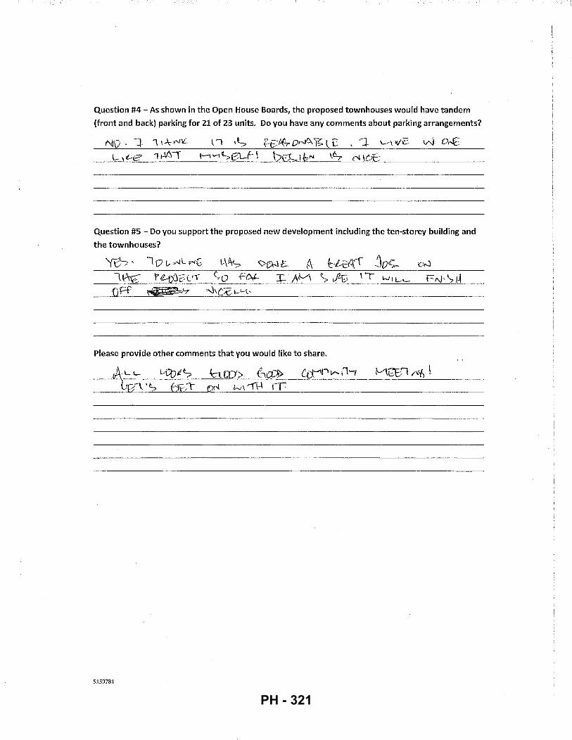
Question #4- As shown in the Open House Boards, the proposed townhouses would have tandem
(front and back) parking for 21 of 23 units. Do you have any comments about parking arrangements?
Question #5- Do you support the proposed new development including the ten-storey building and
the townhouses?
'(~'
Please provide other comments that you would like to share.
5159781
PH - 321
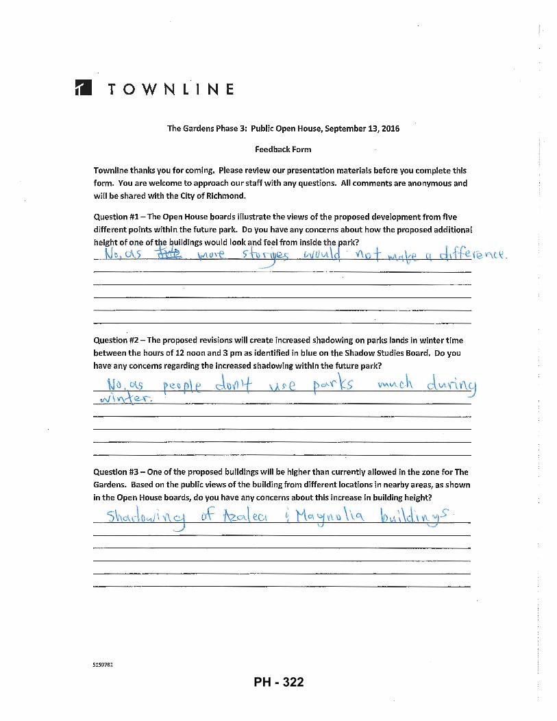
rl TOWNLINE
The Gardens Phase 3: Public Open House, September 13, 2016
Feedback Form
Townline thanks you for coming. Please review our presentation materials before you complete this
form. You are welcome to approach our staff with any questions. All comments are anonymous and
will be shared with the City of Richmond.
Question #1 - The Open House boards illustrate the views of the proposed development from five
different points within the future parlc. Do you have any concerns about how the proposed additional
height of one oft e buildings would loolc a~d fe~l from inside the parlc?
e,cJ\.5 ~ o,-e_ S"tt\1 vvvu\d V\ " , .f~efeV\l\: . _./ ~ - I
Question #2- The proposed revisions will create increased shadowing on paries lands in winter time
between the hours of 12 noon and 3 pm as identified in blue on the Shadow Studies Board. Do you
have any concerns regarding the increased shadowing within the future parlc?
f~ 11 p\ t J\)11 )± , P ' e ~c:i''<' ~s v"'"'"c.\\
Question #3- One of the proposed buildings will be higher than currently allowed in the zone for The
Gardens. Based on the public views of the building from different locations in nearby areas, as shown
in the Open House boards, do you have any concerns about this increase in building height?
'5~ du:\ o . ..J \ 'f\ cd ~ ·kz-~1 ec\ ~ M (}, ':( v\ \) \ \.q_
5159781
l ·I I I i
PH - 322
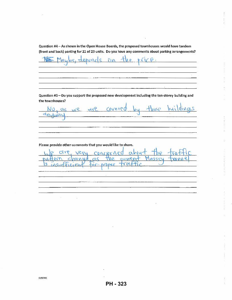
Question #4- As shown in the Open House Boards, the proposed townhouses would have tandem
(front and back) parking for 21 of 23 units. Do you have any comments about parking arrangements?
1&". {"\o\'j l J IC ; J~feY\d ~ l\Y\ -f1 ~ l (\{ e ·
Question #5- Do you support the proposed new development including the ten-storey building and
the townhouses?
5159781
PH - 323
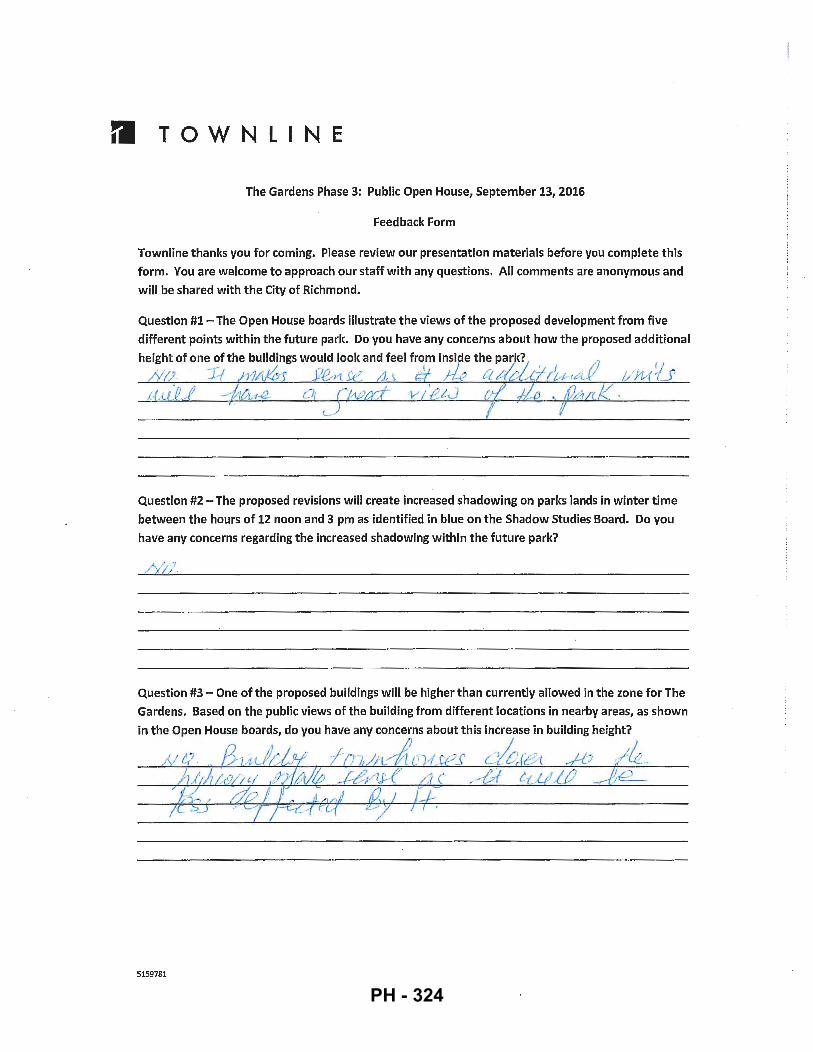
rl TOWN L INE
The Gardens Phase 3: Public Open House, September 13, 2016
Feedback Form
Townline thanks you for coming. Please review our presentation materials before you complete this
form. You are welcome to approach our staff with any questions. All comments are anonymous and
will be shared with the City of Richmond.
Question #1- The Open House boards illustrate the views of the proposed development from five
different points within the future park. Do you have any concerns about how the proposed additional
height of one of the buildings would look and feel from inside the pa~k?1 . 17 &;. -:Jf h1P"v0s .J7B-rt .w a , df ;k a .tla..c.7/u.--rA-V 1/U/U ;.f;iJ)Jl -:/14-~~ 1 j f.·wd ·v 1 'eL..J fl J.ie ~ f /1 RK ·
Question #2- The proposed revisions will create increased shadowing on parks lands in winter time
between the hours of 12 noon and 3 pm as identified in blue on the Shadow Studies Board. Do you
have any concerns regarding the increased shadowing within the future park?
Question #3- One of the proposed buildings will be higher than currently allowed in the zone for The
Gardens. Based on the public views of the building from different locations in nearby areas, as shown
5159781
PH - 324
Question #4- As shown in the Open House Boards, the proposed townhouses would have tandem
(front and back) parking for 21 of 23 units. Do you have any comments about parking arrangements?
/Yi;' 7/:n'lclt">r\_ u~# ;( CJAdJ? t.:UY»-rJZ/.-M-
Question #5- Do you support the proposed new development including the ten-storey building and
the townhouses?
rl · v
5159781
PH - 325

fl TOWNLINE
The Gardens Phase 3: Public Open House, September 13, 2016
Feedback Form
Townline thanks you for coming. Please review our presentation materials before you complete this
form. You are welcome to approach our staff with any questions. All comments are anonymous and
will be shared with the City of Richmond.
Question #1- The Open House boards illustrate the views of the proposed development from five
different points within the future park. Do you have any concerns about how the proposed additional
height of one of the buildings would look and feel from inside the park?
O !
Question #2- The proposed revisions will create increased shadowing on parks lands in winter time
between the hours of 12 noon and 3 pm as identified in blue on the Shadow Studies Board. Do you
have any concerns regarding the increased shadowing within the future park?
N O
Question #3- One of the proposed buildings will be higher than currently allowed in the zone for The
Gardens. Based on the public views of the building from different locations in nearby areas, as shown
in the Open House boards, do you have any concerns about this increase in building height?
N U 4) \.,~h,k-rv\., w \l vv\. 1-v-iX-,JJ~- lt-c, Q. 3 lt l.t~t · h~ -V I
5159781
PH - 326
Question #4- As shown in the Open House Boards, the proposed townhouses would have tandem
(front and back) parking for 21 of 23 units. Do you have any comments about parking arrangements?
Question #5- Do you support the proposed new development including the ten-storey building and
the townhouses? 1
~_, ' h..)
Please provide other comments that you would like to share.
5159781
PH - 327
rl TOWNLINE
The Gardens Phase 3: Public Open House, September 13, 2016
Feedback Form
Town line thanks you for coming. Please review our presentation materials before you complete this
. form. You are welcome to approach our staff with any questions. All comments are anonymous and
will be shared with the City of Richmond.
Question #1- The Open House boards illustrate the views of the proposed development from five
different points within the future park. Do you have any concerns about how the proposed additional
height of one of the buildings would look and feel from inside the park?
Question #2- The proposed revisions will create increased shadowing on parks lands in winter time
between the hours of 12 noon and 3 pm as identified in blue on the Shadow Studies Board. Do you
Question #3- One of the proposed buildings will be higher than currently allowed in the zone for The
Gardens. Based on the public views of the building from different locations in nearby areas, as shown
5159781
PH - 328
Question #4- As shown in the Open House Boards, the proposed townhouses would have tandem
(front and back) parking for 21 of 23 units. Do you have any comments about parking arrangements?
Question #5- Do you support the proposed new development including the ten-storey building and
the townhouses?
Please provide other comments that you would like to share.
5159781
PH - 329
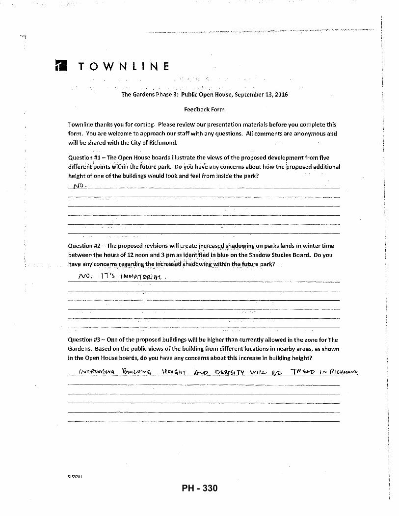
rl TOWNLINE
The Gardens Phase 3: Public Open House, September 13, 2016
Feedback Form
Town line thanks you for coming. Please review our presentation materials before you complete this
form. You are wel~ome to approach our staff with any questions. All comments are anonymous and
will be shared with the City of Richmond.
Question #1- The Open House boards illustrate the views of the proposed development from five
differerifpolrlts within the future park. Do you have any concerns abbot how the proposed additional
height of one of the buildings would look and feel from inside the park?
o.
Question #2- The proposed revisions willcr(!ate !ncreas(!d sh<!qpwing on parks lands in winter time . . . .... .·_ ... ,._. .:· .·.;··.--.·. ······ ,.. . ..
between the hours of 12 noon and 3 pm as identified in blue on the Shadow Studies Board. Do you
have any concerns reg;~rdiog the intreas~<fsh~doWihgwithin the future park? ... • _ ..... , ... , •. ,,_,;·.; ••. :----·0 ··'.·:.:;··--:':·. . ., .•••. ·• ..... ··--.·. '·. -·
NO, IT's IMMAT~lft..
Question #3- One of the proposed buildings will be higher than currently allowed in the zone for The
Gardens. Based on the public views of the building from different locations in nearby areas, as shown
in the Open House boards, do you have any concerns about this increase in building height?
5159781
PH - 330
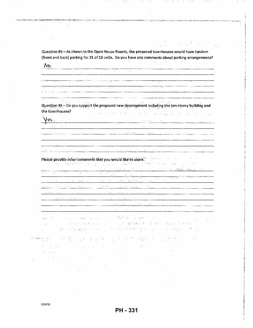
Question #4- As shown in the Open House Boards, the proposed townhouses would have tandem
(front and back) parking for 21 of 23 units. Do you have any comments about parking arrangements?
QIJeS~i,on #5- [)o you s9p~o,rtthe proposed new tl~yelppment incl~.:~ding the ten-storey l,luildii"!J5 ilnd
the townhouses?
_, .... '::;,~. ·~. ·" ···'·) ..... , .. _-: .. , .. -.
5159781
PH - 331
Excerpt from the Minutes from
The Design Panel Meeting
Wednesday, October 19, 2016-4:00 p.m. Rm. M.1.003
Richmond City Hall
ATTACHMENT 4
3. DP 16-741981- SECOND APPLICATION FOR THIRD PHASE MIXED USE DEVELOPMENT COMPRISED OF 1 0-STOREY AND 3-STOREY RESIDENTIAL BUILDINGS (168 MARKET UNITS & 12 LOW END MARKET RENTAL UNITS)
5217500
APPLICANT: Townline Gardens Inc.
PROPERTY LOCATION: 10780 and 10788 No.5 Road and 12733 Steveston Highway
Applicant's Presentation
Stephen Slot, Development Manager, Townline, Architect Joseph Lau, ZGF Cotter Architects, and Landscape Architect Jennifer Stamp, Durante Kreuk Ltd., presented the project and answered queries from the Panel on behalf of the applicant.
Panel Discussion
Comments from the Panel were as follows:
• the north fa<;ade of the project is not as successful at reading like a miniature cityscape as viewed from the park; buildings look disjointed and some building elements appear pasted on; As noted at panel, the model was damaged during transportation. Due to the "frame" not being on the model when it was presented, we believe that this de-emphasized the miniature cityscape concept of our design. The panel did note that the concept was clear on the renderings and other presentation material. Also in response to panel comments, we have lifted the northwest frame up one level to create a clearer read on the north volume and eliminated the 'tacked-on' feel of the expression.
• lower portions of the proposed ten-storey building appear tall; many floors look the same; the building massing appears more prominent when viewed from the park;
We have taken steps to break up the faf:ade on the courtyard side on Building El. We have set up a more gradual/progressive shift inform and texture on this faf:ade that we believe has broken up the mass and improved the
PH - 332
5217500
-2-
proportions of the building. By adding the 'zig-zag' balconies from level8 to levels 6 and 7, there is a cleaner read in the shift of the massing as it runs up the building. Both the "base" of the building and the transition to the upper, recessed tier is also more clearly read.
• consider a more continuous design for the lower portions of the ten-storey building; carefully designed townhouse buildings work but the design of the ten-storey building is not as successful;
As noted, we have made changes to the fafade to improve on the continuity and clarity of our design.
• consider a larger setback at the 4th or 5th level of the ten-storey building; the low datum line and multiple storeys above it makes the ten-storey building appear heavy; As noted, the introduction of the level 8 expression onto level 6 and 7 has made the read of the lower base levels read more clearly. The brick frame of the will be lifted on the north and west corners to visually bring up the datum.
• appreciate the overall scheme for the proposed development; "neighbourly" moves, e.g. creating interesting comers, introducing setbacks to the buildings behind the guardrails, and introducing bandings reduce the massing of the tenstorey building;
• the cluster of three 3-storey townhouse buildings are an improvement over the original proposal for a 4-storey apartment building;
• concerned about thermal bridging; thermal breaks for projections are difficult and expensive; concrete projections and fins act like "radiators";
• increasing the height of the building from eight to ten-storeys is not a concern; however, diminishing the height and massing of the additional upper floors is challenging; the applicant's approach to lighten the two uppermost floors appears more successful in the renderings than in the model; consider alternate ways to lighten the two uppermost floors, e.g. changing the proposed window specifications and wall systems; also consider design development and change materials for the wood soffit to visually reduce the apparent height of the tenstorey building;
The wood soffit of the roof overhang has been deleted to eliminate the cornice/cap effect as noted by panel. The transition up to the uppermost tier is more gradual as noted above.
• appreciate the proposed roof terraces in townhouse building "F2"; consider introducing skylights or glazing at the stairs to introduce natural lighting inside the townhouse units;
Glazing into the stair well has been added to the stair pop up to introduce natural light into the stairwell.
• nice project; provides beautiful views of the park to the north;
PH - 333
5217500
- 3 -
• the project is on the right track from a sustainability perspective;
• proposed window design of buildings create an opportunity for good views to the park; however, it is also a thermal comfort concern; applicant needs to address this issue;
• extensive use of spandrel glass is also a concern from a thermal performance sustainability perspective;
•
•
All spandrel panel is backed by an insulated drywall, back-up wall. While the exterior of the building reads as large field of window wall, from the interior, the wall reads more like punched openings. An energy model was already performed for Building E2. Due to the insulated, drywall backup wall being implemented on the window wall system, we are actually surpassing the required performance values. The same exercise will be performed for Building El.
the project's target of four energy points with residential heat pumps may not be achievable; This is a target only. The LEED certification is not being pursued.
use of LED lighting and low-flow fixtures will enable the project to gain more energy points;
All common area lights will be LED and all fzxtures will be low-flow.
• appreciate the applicant doing enhanced commissioning for energy credits; applicant needs to engage the commissioning agent as soon as possible; also appreciate the applicant doing measurement and verification to gain energy credits; not normally done in projects due to the additional costs involved;
The panelist was reading from an older DP submission. We are not pursuing points for either enhanced commissioning or verified measurements for this application as we currently have enough to satisfy the requirements.
• proposed use of compact fluorescent lighting is outdated and not currently considered a sustainable energy strategy; consider instead using LED lighting which is a more recent approach; All common area lighting will be LED
• appreciate the affordable units will include universal design features; applicant needs to include detailed unit lay-outs in future presentations of the project; Boards with larger scale unit layouts were available at panel but were not viewed.
• consider replacing swing doors in bathrooms of apartment and townhouse units with sliding doors (i.e., bam door type or pocket doors) to enhance accessibility and provide more floor space; Where possible, sliding doors will be implemented.
• agree with the comment that the proposed townhouse buildings are an improvement over the previous proposal;
PH - 334
5217500
-4-
• consider design development to the two uppermost floors of the ten-storey building as they currently appear "placed on"; As noted above.
• appreciate the height of buildings stepping down towards the highway;
• reconsider the reveal at the comer of building "E2" and consider a continuous treatment to read more as a fac;ade that wraps instead of having a notch at the comer;
The break in the roof is to follow the inside corner condition below. The cut corner of the roof will be maintained to mimic the massing below it. This also helps to break up the massiveness of the roof plane as viewed from the street level.
• townhouse residents should have access to the green roof to get views to the park; The space above the bike pavilion has been made accessible to the Building F3 townhome units, providing residents with additional outdoor space. The green roof material has been replaced with artificial tuif to enhance its usability for residents and raised planters provide a space for gardening for the residents.
• the proposed development is an improvement over the previous proposal;
• proposed increase in the height of building "El" is not a concern; views of buildings from the park works well and gives the park a feeling of enclosure;
• appreciate the proposed cluster of townhouse buildings; hope that the future development of the park will achieve its fullest potential and commensurate with the quality of development facing the park;D
• appreciate the wider walkway in the pedestrian mews;
• consider design development to the north end of the pedestrian mews to enhance the sense of openness from and to the park; look at the proposed structures and planting at the north end of the mews; The feature trellis at the north end of the mews will be designed as a tall, open cantilevered structure as demonstrated in Section G on sheet L-2.1. This structure will mark the plaza as the focal point of the mews and establish a strong visual connection with the public park to the north and the urban village to the south. The cantilevered design minimizes the number of posts at the ground plane allowing for various site furnishing opportunities, while the angled roof structure opens to the north and south further enhancing visual connectivity and openness through the structure.
• consider introducing interesting paving materials for the internal roads in the cluster of townhouse buildings; look at precedence in the Olympic Village;
Concrete banding has been introduced in the internal roads in the cluster of townhome buildings to break up the asphalt.
PH - 335
5217500
- 5-
• planting plan symbols in the plans provided by the applicant are hard to read;
Planting Plans on sheets L1.1 - 1.3 are at 118" scale. Tree fills have been turned off to improve the readability of the plant symbols.
• support the project and look forward to the City developing the park to match the quality of the proposed development;
• in relation to a previous comment, consider shifting up the brick frame on the south comer in building "E 1" so the setback will be above it; will raise up the outlines of the ten-storey buildings when viewed from the park; and
• agree with the comment that residents of the proposed cluster of townhouse buildings should have access to the extensive green roof over the bicycle pavilion to access views to the park.
Townhouse F3 will have access to the roof above the bike pavilion in lieu of having access to the park views to the north. The extensive green roof will be replaced with artificial turf to enhance usability. Raised planters will be placed to allow for gardening opportunities for residents.
Panel Decision
It was moved and seconded That DP 16-741981 be supported to move forward to the Development Permit Panel subject to the applicant giving consideration to the comments of the Advisory Design Panel.
CARRIED
PH - 336
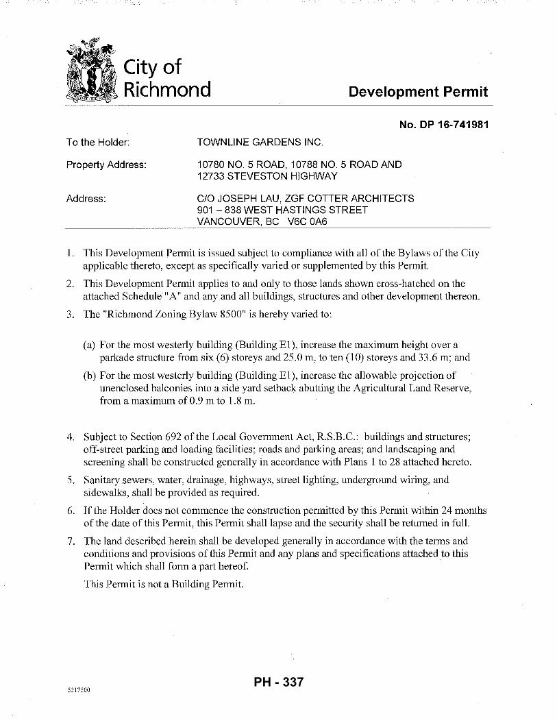
City of Richmond Development Permit
To the Holder:
Property Address:
Address:
No. DP 16-741981
TOWNLINE GARDENS INC.
10780 NO.5 ROAD, 10788 NO.5 ROAD AND 12733 STEVESTON HIGHWAY
C/0 JOSEPH LAU, ZGF COTTER ARCHITECTS 901-838 WEST HASTINGS STREET VANCOUVER, BC V6C OA6
1. This Development Permit is issued subject to compliance with all of the Bylaws of the City applicable thereto, except as specifically varied or supplemented by this Permit.
2. This Development Permit applies to and only to those lands shown cross-hatched on the attached Schedule "A" and any and all buildings, structures and other development thereon.
3. The "Richmond Zoning Bylaw 8500" is hereby varied to:
(a) For the most westerly building (Building E1), increase the maximum height over a parkade structure from six (6) storeys and 25.0 m, to ten (10) storeys and 33.6 m; and
(b) For the most westerly building (Building E 1 ), increase the allowable projection of unenclosed balconies into a side yard setback abutting the Agricultural Land Reserve, from a maximum of 0.9 m to 1.8 m.
4. Subject to Section 692 of the Local Government Act, R.S.B.C.: buildings and structures; off-street parking and loading facilities; roads and parking areas; and landscaping and screening shall be constructed generally in accordance with Plans 1 to 28 attached hereto.
5. Sanitary sewers, water, drainage, highways, street lighting, underground wiring, and sidewalks, shall be provided as required.
6. If the Holder does not commence the construction permitted by this Permit within 24 months of the date of this Permit, this Permit shall lapse and the security shall be returned in full.
7. The land described herein shall be developed generally in accordance with the terms and conditions and provisions of this Permit and any plans and specifications attached to this Permit which shall form a part hereof.
This Permit is not a Building Permit.
5217500 PH - 337
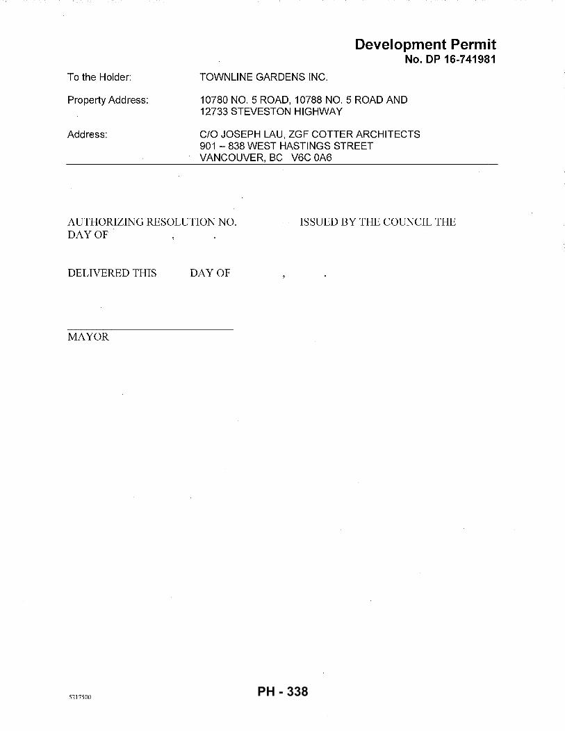
To the Holder:
Property Address:
Address:
TOWNLINE GARDENS INC.
Development Permit No. DP 16-741981
10780 NO. 5 ROAD, 10788 NO. 5 ROAD AND 12733 STEVESTON HIGHWAY
C/0 JOSEPH LAU, ZGF COTTER ARCHITECTS 901 - 838 WEST HASTINGS STREET VANCOUVER, BC V6C OA6
AUTHORIZING RESOLUTION NO. DAYOF'
ISSUED BY THE COUNCIL THE
DELIVERED THIS DAY OF
MAYOR
5217500 PH - 338
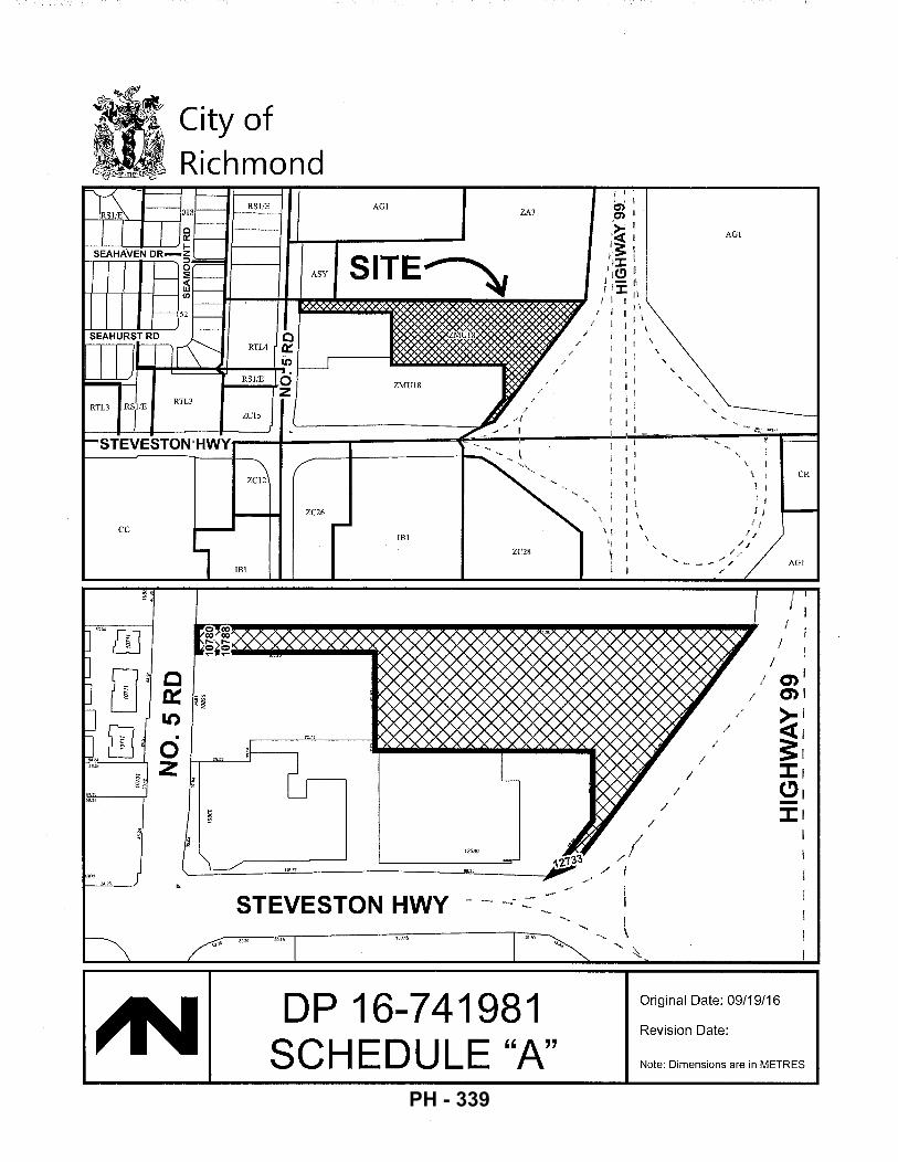
cc
991
City of Richmond
RSIIE
ASY
ZC12
ZC26
AGI
ZMU18
IBI
STEVESTON HWY
ZA3
DP 16-741981 SCHEDULE "A"
' '
AGI
I I
AGI
I I
I I
cnl 0')1
>' ~: J:i (!)i -:I: I
Original Date: 09/19/16
Revision Date:
Note: Dimensions are in METRES
PH - 339
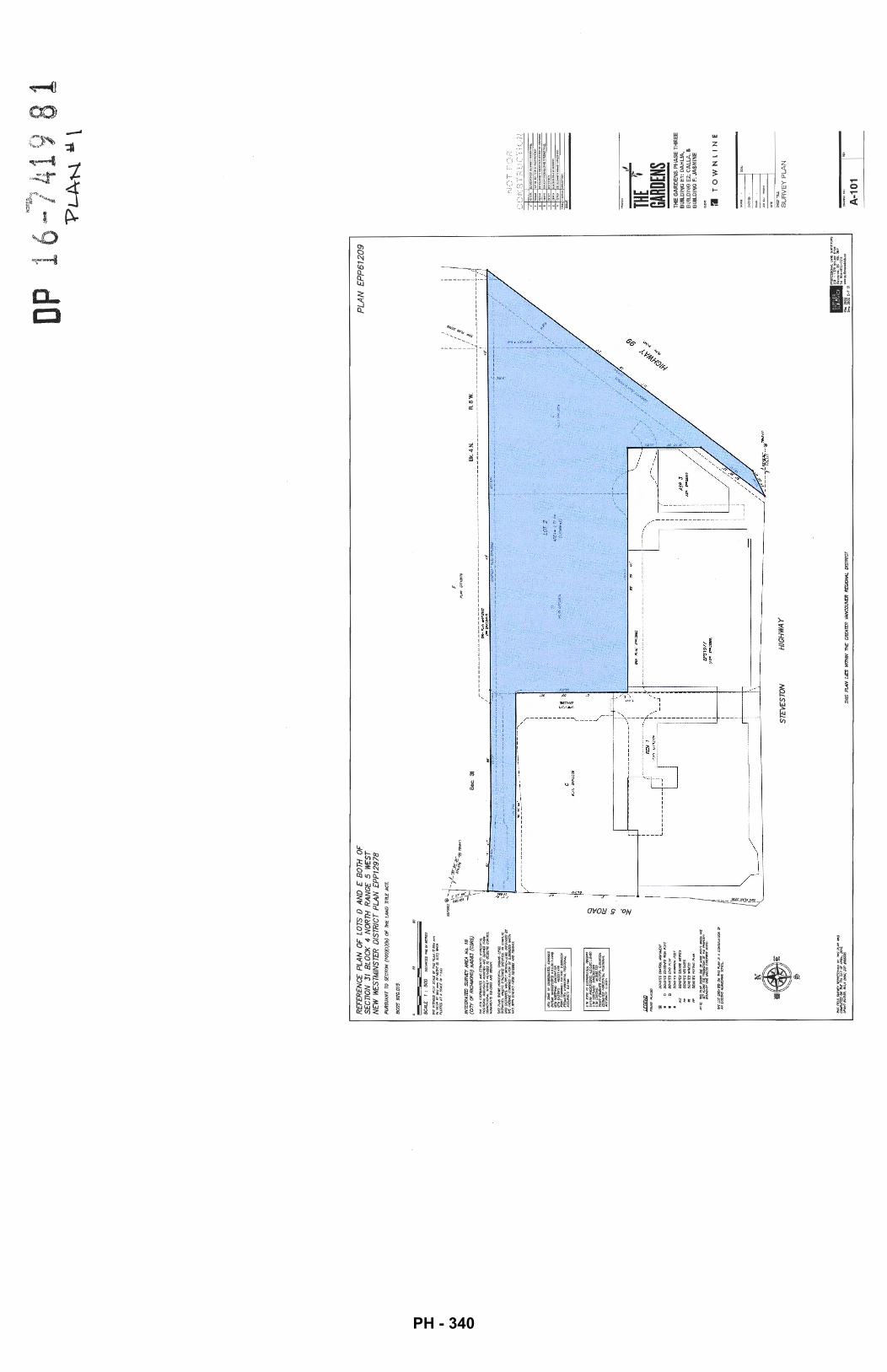
p 1
6 -N
OT7 4
19 8
1
RE
FER
EN
CE
PLA
N O
F L
OT
S D
A
ND
E B
OT
H
OF
SE
CTI
ON
31
B
LOC
K
4 N
OR
TH
RA
NG
E 5
W
ES
T N
EW
W
ES
TMIN
STE
R
DIS
TR
ICT
PL
AN
EP
P1
29
78
P
UR
SUA
NT
TO
S£
CT7
0N
(tO
O)(
I)(b
) O
F
THE
LAN
D
Tln
.E A
CT.
BC
GS
9Z
G.O
t5
SC
AL£
1
: 5
00
DtSLJNCfS#l£11f~S
I /!
/;
PLA
N
EP
P61
209
I I I I I fN
TE:C
RA.T
ED S
IJR
'It£Y
AR
EA
N
o.
18
(OT
Y O
F R
IO/M
ON
O)
NA
D83
{C
SRS)
S
ec.
31
Bk.
4 N
. R
5 w
. : ,
.' I
: I
'" . (J
(HO
TrS
,'OII
IWQ
.MQ
I/fJ
JI!J
Jr
DO
IOf£
SS
fNID
AIU
)IR
ON
f>O
ST
DC
N()
Il3
J.L
M)P
LU
G
DCN01U~-,
OO
<OT
D S
/JI/A
Ri:
ll£
ffl£
S
IIO
I'tl
MSPUN-IJC~IICIIC..OS,_NIE
5[T
A,U
IIC
I -~-DT
Jltr
l'ftO
I'P
I""
~~U#/:~011£11-'SC...,Inl
~~--------
----;:~
-~,;;--------------
-------------------------------
--------
----~r------
--------r~
w
n·
n·
/ (PPCPP~8•l1)
40"
._,
:s ---
'--.
:.~ --
--·--.
.,_ __
____
____
~~~~-=
--=-~-
--=--~
-=--=-
·~-=-~
~~---
----
----
----
----
----
--~--~-~~-
----
----
--;-11
.:-~::-_
____
____
____
__ ---
----
----
~---
---~
----
----
--~·
v
~i
---.
.... _
__
__
__
_ --------------·
1 :
~
I I
: I
I <
I
I <
r---
----
----
---_
,!!!:_o
o_:_O
i£ __
__
---
--------',
/ )
c
I I I I I I I I I ( ' ' ) I
LOT
2
A/i
O.•
I.li
"C
(1~2)
' ' I I I I I
I \
_...
..-·
·r~·
,,,
/ _
..,/
t
\
------
------
{ ~/
·t.:-·~1.----------
-"'::.~'
·~· 00-.
-. --
-r--
...:
:...
.---
+--
. :
~ S
N"'
P
UN
D'
f'l~
----
----
----
1 --
----
----
----
----
----
----
---
REM
1
"!, I\
I\
I I
,_ _
_;
I I I I I I I I I l £
PS
19
77
I I
STE
VE
S T
ON
H
IGH
WA
Y
THIS
PLA
N L
IES
W
TTHI
N
THE
GR
EATE
R V
AN
CO
IJ\If
R R
EGIO
NAL
D
ISTR
ICT
/
/
/
I ~
I
"PL
A-N
Y
\
NO
T F
OR
C
ON
ST
RU
CT
ION
ISS
UE
-~
' -
,, TH
E 1-
GARD
ENS
=
.
TH
E G
AR
DE
NS
PH
AS
E T
HR
EE
B
UIL
DIN
G E
1: D
AH
LIA
, B
UIL
DIN
G E
2: C
AL
LA
, &
BU
ILD
ING
F:
JAS
MIN
E
I'll
TO
WN
LIN
E
SU
RV
EY
PL
AN
A-1
01
PH - 340
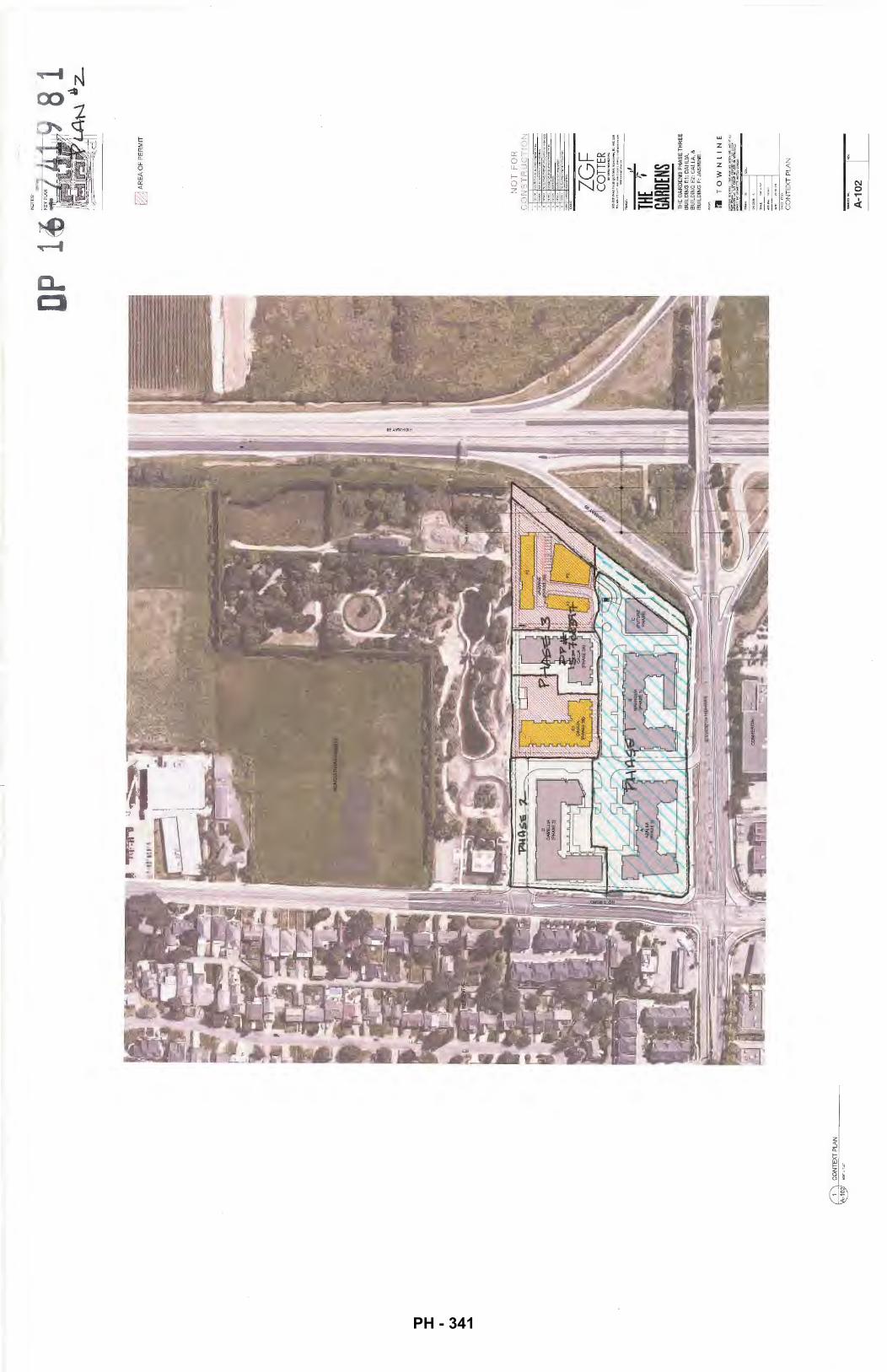
1
@ CO
NT
EX
T P
LAN
NO
TE
S: LJ AR
EA
OF
PE
RM
IT
NO
T F
OR
-CO
NS
TR
UC
TIO
N
~
=
. ~
" '
~
ISS
UI!
ZG
F
CO
TTER
,, TH
E ~
GARD
ENS
TH
E G
AR
DE
NS
PH
AS
E T
HR
EE
B
UIL
DIN
G E
1:
DA
HLI
A,
BU
ILD
ING
E2:
CA
LL
A, &
B
UIL
DIN
G F
: JA
SM
INE
l'l
TO
WN
LIN
E
CO
NT
EX
T P
LA
N
A-1
02
PH - 341
; I i
I' " ,. i! ;I
=! ' ,I fl ,. Jl
;I n 1!
i " ,, ,, it ::
If
'}
' i'
rr I " Cl
<(
, 0
1 0
:1
L();
o:
z~
'• '
'-f~-~
---=_:-
-~=~-~-==
---~=
~---=
-=:~=
,::.:<-l-
-I ,' fT_
::_~---~ ~--~=-
~~~-~=
~-~-~~
-=-~~
--'-,~--
! I I I I ; I
I : I I I I
I I
I i f
I '
-·---
---
---
-------
-------
_-: ~:
-_-:.
.::....:
_-:::~
-...:..
:..:_-_-.
:. ~,...
/
----
--·--
----
-S
TEV
ES
TON
HIG
HW
AY
·-
..........
.... --
---
.
r--
--
--
--
---
---,
I I
I I
I I
l (F
U~RE
;
//
: PH
ASE
) /
,'
I '
' I
/ '
~ /
~ I
I /'
I '
, I
// ,'
I '
' :
/<,'
/ /
L---~
. I
I
I
' ' I
, I
,
----!-.
, ___
-_-:.~:::.:
::..:...:..·_-
-_~---:.::..
..:..::-_-_-~:
: . .-..::..::....:_
-:::-./' '~
,_-~'
~ -~
c:::. __
____
_ \
···--------
.. --
----
----..
...... _
S
TE
VE
ST
ON
HIG
HW
AY
NO
TES
:
~ "
· \
i '
p
I
16-7
419
1
I ' ' I /
/
' ' I ' '
I
I ' '
I ' '
I
___
__
__
___
....
_ .
__
. ~
-Ocll;
-;1--'0"
-V'-'E
:::.RA
=LL::.
::S~IT
.=E~P~
1_cP:_
cA~R~K
:!.'IN
~Go_P'
:'LAN:
:c':~
I ' '
·---
----
-__
___
_ --
----
-_
__
_ --
(7':
::-,.!
--'0'-
'V'-'=Ee:
RA=LL~S
I~T!::
E.:.P~2
.:_Pc:_
A~R~KI
-::NooG~P~LAN~
~I
""?L
AN
..A3
NO
T F
OR
C
ON
ST
RU
CT
ION
ISSU
I!
' ~
' -~
ZGF
CO
TTER
a
ocm
o..-
..:t
t""
'
~:~~:~~$:
;:::
:..~
.~
THE
1-GA
ROEN
S TH
E G
AR
DE
NS
PH
AS
E T
HR
EE
B
UIL
DIN
G E
1: D
AH
LIA
, B
UIL
DIN
G E
2: C
AL
LA, &
B
UIL
DIN
G F
: JA
SM
INE
:1
TO
WN
LIN
E
OV
ER
AL
L S
ITE
P
AR
KIN
G P
LA
N
A-1
11
PH - 342
I I
! !
AG
RIC
ULT
UR
AL
RE
SE
RV
E
,.-..
-
• I
----
_ .... ,
---
( ·--
--, ... ~----
3m S
RW
/ALR
BU
FF
ER
' '
----
---
I. ---
·~.
:'! '·
.· /
/ .
' I
,. (_
. )
.r··
~· ··-...-
:_"·~
-7-·· .
... ·-:
/ ---
-
,·'1
ll
, .X
..
.·1
\}
~·
7 /I
,·.
:.. . ...
, __
\ •
I \.
...
_\,'
~
·-··
, .. r·
-\.\
\, .. /
•!.
! ,.
. ..
.L. _
___ _
-+-
THfn':i'A~f
-,'·1
~--
·
• .•
T
·-,
'
·~:-~ /~?
... ---~~
... -1
(i:
;~. i:
I I
---
--~ 1:
--!
I
I!
~~ ' I l,l I /
I I
I I
:1'·
• O
VE
RA
LL
SIT
E G
RO
UN
D F
LO
OR
PLA
N
'@
NO
TES
: NO
T F
OR
C
ON
ST
RU
CT
ION
- ' ~
'='
ZG
F
CO
TTER
901-438Wm~Strftt.V..,tuomr,BCV6COA6
... ,_,.._
, ... ,....
,_,_
,.,_ ·-~ ... -...
........
THE
t GA
RDEN
S T
HE
GA
RD
EN
S P
HA
SE
TH
RE
E
BU
ILD
ING
E1:
DA
HL
IA,
BU
ILD
ING
E2:
CA
LL
A,
&
BU
ILD
ING
F:
JAS
MIN
E
I'll
TO
WN
LIN
E
. 1-
Pit
t-
,.,.
,.,.
OV
ER
AL
L S
ITE
G
RO
UN
D F
LO
OR
PL
AN
A-1
12
PH - 343
,, . ,
.
'···
i t:, \
AG
RIC
UL
TU
RA
L R
ES
ER
VE
' .
. i
... :; ..
... ·--:
----
. ~
--·
.\.
I I
~--·
/ .:.
--+:::
TH
E:P
"AR
·K
·_:=•
·/
i
! d
.. i i ;'
!!
'1 L
.i
,--
-~
I ~---
---i
I ' I I I
'I
! '' '. I'
! !
I I I
/
/ /
i jl
~ i!
6
RM
AZ
ON
E
.,._
OV
ER
ALL
SIT
E R
OO
F P
LAN
NO
TES
: -741
9
NO
T F
OR
&CO
NS
TR
UC
TIO
N
~
-'
-· THE
~-GA
RDEN
S T
HE
GA
RD
EN
S P
HA
SE
TH
RE
E
BU
ILD
ING
E1:
DA
HLI
A,
BU
ILD
ING
E2
: C
AL
LA
, &
BU
ILD
ING
F:
JAS
MIN
E
:1
TO
WN
LIN
E
m:
S'IED~
OV
ER
AL
L S
ITE
R
OO
F P
LA
N
A-1
13
I~
PH - 344
~-
PH
AS
E3
f
1 '\
O
VE
RA
LL P
1 P
AR
KIN
G P
LAN
~~
1' lll
li"Y
1"-I
T
1-1
.'z
\ ~~t~~
FLO
OR
PA
RK
ING
PLA
N
\@C!
Y
/
I /
/
I /
I /
/
/
/
I /
/
/
/
I /
NO
T F
OR
-CO
NS
TR
UC
TIO
N
' =
~
' --
ISS\J~
ZG
F
CO
TTER
90
1-3l
aW ...
.. Ha<linpSUfti,V~or,BCV6COA6
.. ~ ......
.. ,., .. ,
...... .,
... ., , ..
.........
...........
. ~ -~ .....
...... ~-
THE
~GA
RDEN
S T
HE
GA
RD
EN
S P
HA
SE
TH
RE
E
BU
ILD
ING
E1
: D
AH
LIA
, B
UIL
DIN
G E
2: C
AL
LA
, &
BU
ILD
ING
F: J
AS
MIN
E
:J
TO
WN
LIN
E
PH
AS
E3
O
VE
RA
LL
PA
RK
ING
PL
AN
A-2
01
9 81
PH - 345
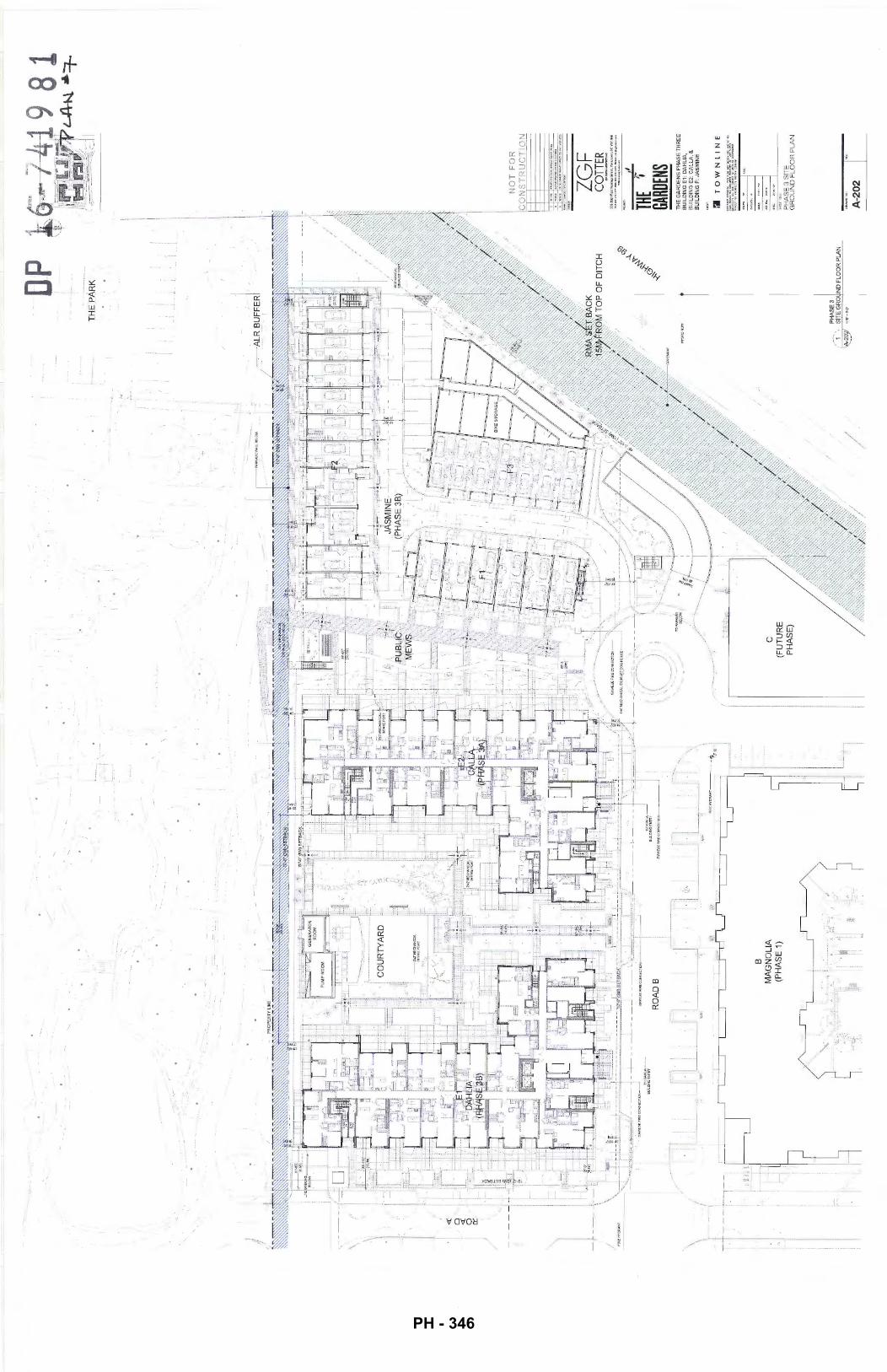
\ /
\ 'j 1 /
./.--···
-!
. ...
...
. ....... ~
,
·-... :··
.... :;.
B
MA
GN
OL
IA
(PH
AS
E 1
)
.....
.. -
~
c (F
UT
UR
E
PH
AS
E)
/
D:P
THE
PA
RK
·--AL~
BU
FF
ER
I
PHA
SE3
1 SI
TE G
RO
UIN
D F
LOO
R P
LAN
ZG
F
CO
TTER
THE
lf GA
RDEN
S T
HE
GA
RD
EN
S P
HA
SE
TH
RE
E
BU
ILD
ING
E1
: D
AH
LIA
, B
UIL
DIN
G E
2: C
AL
LA
, &
B
UIL
DIN
G F
: JA
SM
INE
:I
TO
WN
LIN
E
. 1-
Dol
tl.
, ..
....
.
PH
AS
E 3
SIT
E
GR
OU
ND
FL
OO
R P
LA
N
A-2
02
PH - 346
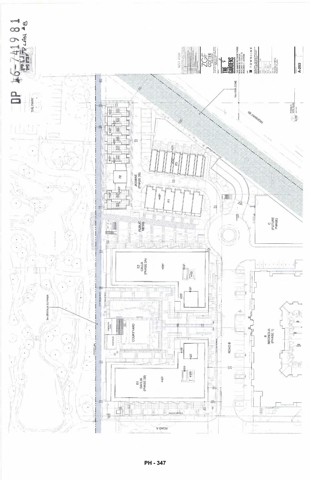
-:.'-
--
'i
<(
.0 <
( 0 a::
'-.
--~ _._ __
l. __
-;...
:..:
·--·
- '-,.
------
-··-:~
··----
... ..;--
·
E1
DA
HLI
A
(PH
AS
E 3
B)
'};.
._
'\
B
MA
GN
OL
IA
(PH
AS
E 1
)
.~.-::
---:::
_
'----.:.
: '.
.,
\ ~
3m S
RW
IALR
BU
FF
FE
R
•,'
-~
-----
,. ' I ;
-· . :'
I
• ).1
"\
\ I\
.•. -/
.
E2
CA
LL
A
(PH
AS
E 3
A)
\
•'
;/
./
(·
lltt
:.•.
:.•-
i ·:
....
. _..;-
,::.
,,
-. -
. ,_
.•
c (F
UT
UR
E
PH
AS
E)
·. I /
I,'
. I
'
/
:\
\'
.~.)
_ ___
;.....-:
-·--
·i
·--..---
/:
I,
/,
;I
' fl
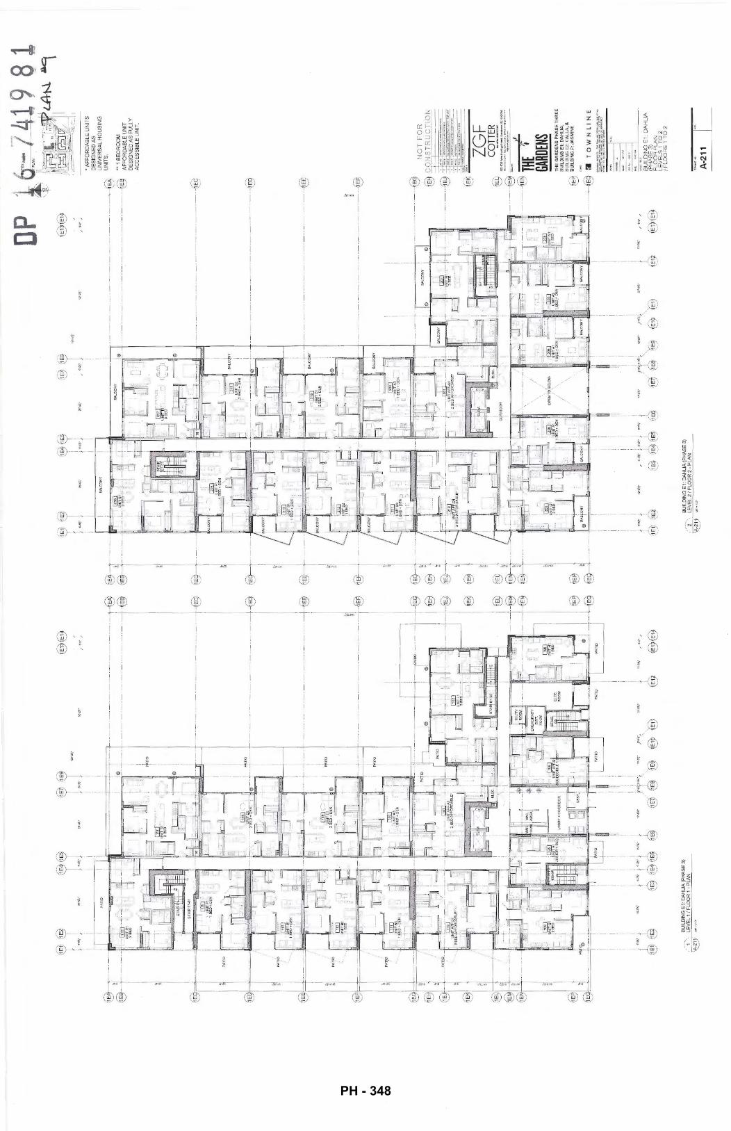
r.~r
f <
i I I I I
J;~~
@@
I ·-~-
1 (
-
i i
I -~
~~
I ,,...
I {
. (
12!'-V
\'
I I
i i
i ,~
; __
-~ .
@@
/
!i'..
()"
/
----------
---------------~
---
--------------
--------
-~
-----
-·--
----
----
----
----
--®
----------------
----·-
---
-~
)1.1$
V.:,
u-9¥
,·
' @
'@
I I i I i t @
,. s·
-cr"
'
@@
--@
f ---@
@. 2
Q
"j _
__
_ _
~
(Et-
DP
r~
~~
\@1
• .,. t
M-(
1'.'
t ,,. .
26"-
41'.'
11'-&
Y-'
/ -
@@
12
11'-U
,'
i i
' i
I I
BA
LCO
NY
I
I -t.
:;I=F=--:::="'"'2SP=~=P~r-------
:--r--
----
----
----------
----
----
-~
-
• A
FF
OR
DA
BLE
UN
ITS
D
ES
IGN
ED
AS
U
NIV
ER
SA
L H
OU
SIN
G
UN
ITS
.
19
'$,·
----------
----
----
------
--------~
--------
----
------
----
----
----
--~
-----
---
----
---
---
------
----
----
--@
·
.. 1
BE
DR
OO
M
AF
FO
RD
AB
LE U
NIT
D
ES
IGN
ED
AS
FU
LLY
A
CC
ES
SIB
LE U
NIT
.
--.-----
-r--
-.--
----
----
--€9
N
OT
FO
R
~-"1'1
""!~~,_-
--:-:,..
.....-br
ol'--~
@ C
0 N
ST
R U
C T
l 0 N
r'~
21'-9
1:'
®,~
'€1)
I I i i i (~
---:Jt~
~-· C
OTT
ER
THE
~GA
RDEN
S T
HE
GA
RD
EN
S P
HA
SE
TH
RE
E
BU
ILD
ING
E1
: D
AH
LIA
, B
UIL
DIN
G E
2: C
AL
LA
, &
B
UIL
DIN
G F
: JA
SM
INE
:J
TO
WN
LIN
E
BU
ILD
ING
E1:
DA
HLI
A
(PH
AS
E 3
) F
LO
OR
PL
AN
L
EV
EL
S 1
TO
2
I FL
OO
RS
1 T
O 2
A-2
11
PH - 348
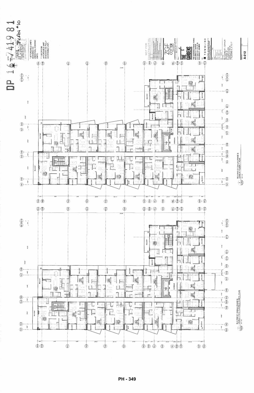
@@
1
I
J ,.,. l
@--
-j--
---1
~-----
('l j @t :) :
;!
@@-+E~1 :~
1E
' "' ~t I
@'~~
r.~T
{ -
{
126'
-2.¥
,"
I I
i I
I
! i
. l.
w,r.
.w,-
~ 13
'-ZV
,·
@@
@
®@
/
5'-Q
" /
i
®@
Jg
f-5Y
6",<
,,
@@
21'-e
Y."
/
~-..
o·
/
-@
@
-,---
@
I
E
~I
~
-. riE
J__l
_ 'C
7
'
@@
26
'-4."
I
l ,,. j
26'-4
,\:l"
i i
BA
LC
ON
Y
I I
BU
ILD
ING
E1:
DA
HL
IA (
PH
AS
E 3
) 2
LEV
EL
6 I
FLO
OR
7 -
PLA
N
1~~ ~
o-ro:-
1 I i
128'
-Zv,
"
13"-2
)<:"
52'-Z
V,"
)".{;X
~",
21'-g
jr,"
€1)
tE1)
@@
/
5'-(
J"
/
--------@
l;
--------
-@
@
• A
FF
OR
DA
BLE
UN
ITS
D
ES
IGN
ED
AS
U
NIV
ER
SA
L H
OU
SIN
G
UN
ITS
.
••1
BE
DR
OO
M
AF
FO
RD
AB
LE U
NIT
D
ES
IGN
ED
AS
FU
LLY
A
CC
ES
SIB
LE U
NIT
.
;~ ;
THE GARD
ENS
TH
E G
AR
DE
NS
PH
AS
E T
HR
EE
B
UIL
DIN
G E
1: D
AH
LIA
, B
UIL
DIN
G E
Z: C
AL
LA
, &
B
UIL
DIN
G F
: JA
SM
INE
--------
->c----~
l'ill
T
OW
NL
INE
I (E~ 13
'-8'"
'"
/ 6'
-0"
/
BU
ILD
ING
E1
: D
AH
LIA
(P
HA
SE
3)
FL
OO
R P
LA
N
LE
VE
LS
3 T
O 6
I F
LO
OR
S 3
, 5
TO
7
A-2
12
PH - 349
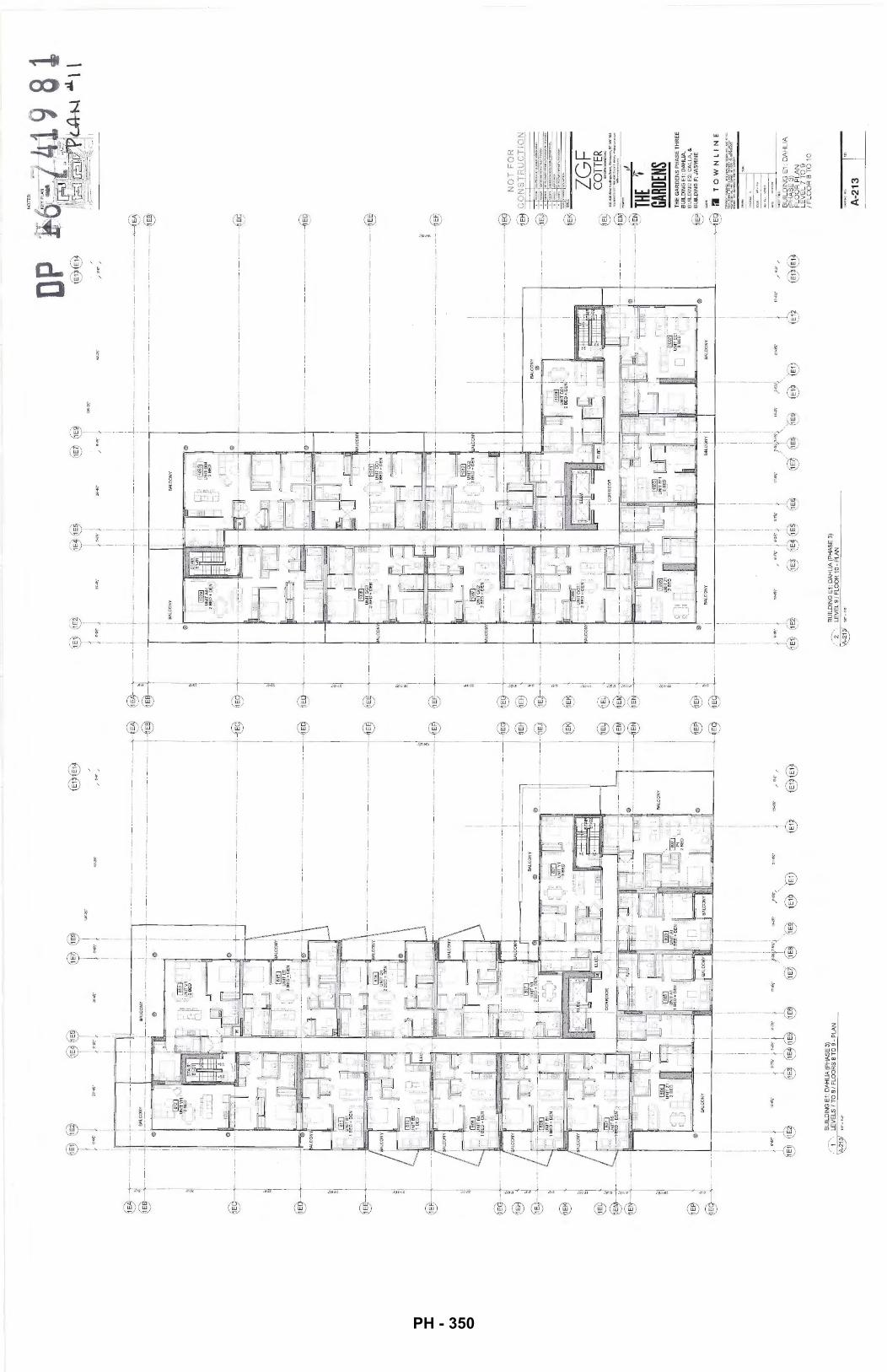
1.~-r
,~-r~1
i
i i
i T.~
T I
I
@@
52
'-2Y,
" /
5'-D
'" /
ifF""'"
+; -~........,r-~~i
I I
·---·-
11 -
-~·-
·-
-·
·-·-
-i--.
.
I
___
j __
_ L_~~~
v ___
___ J
·-·~
· o~~~~~~~
·~·
o !o
~--·Wli
. _,.
.,.y~~E~
1·
f{~.,:.:
··Gi.
1 -~.
~----
--+---0-:-: --
----
..;-
-:--
....
;:--
1 i
i i
i I
I I
i i
i I
~·~4
.. ~,.. ~-~~$~ •·
"" ~
·---·-·-·
-·-·-·-
·---·-·-·-·-
· -~
·-
·-·-·-·-·
-·-·-·-·-·-·-·-
-·-
--~
I i I ·-·-·-·-·-·-·-·-·
-[-·-
·-·-
·-·-
· ·-@
@
-·-·
-·-@
BA
LC
ON
Y
/ S'-
0'"
/
@@
@
·-@
·-
@
~~
t ·~· J
'
i (T..~
r i
'
NO
TE
S:
p @@
I I
i !
, ~
----
-~-
--~·
-·--
·---
-~--
-r·-
--·-·-·-·---·t·-
-·-
·-·-
·---
------
·-·-
·-·-·--~
1E
·-·--
, ,
, ·-·---·-·-·-·-·---·-·-·-·-·-·-·--~
@
I I
I i BA
lCO
NY
!
i B
ALC
ON
Y
0~~~~~~~~~~~~~~~~--~~~
0
--------·-·-----·-·-·-·-·-·-·-·-·~
------------------------------
----~
--·-·-·-·-
·-·---·-·-·-
----·-·-
·-·~
iii
·---
--·-
·-·-
·---
--·-
----
·-·-
·-·
; ·-@
I I I
, ,
I ·-
·---
·t·-
----
·---
1-·-
·-·-
--·-
·-·-@
N
OT
FO
R
I i I
~~
"i'E'i
'l""""""'~......,;;"r--·-·-t-
·-·
I I
@ C
ON
ST
RU
CT
ION
@ -
••---~
·-·-"~
a -----------<
•
10'1
'>;»
""~lt'll'"<"'i1"Cl'~'
p '"
""
.,.-. ..
.,..e
rr-."'
""""
'"""'"
'''""c
u e
, ...
,.,~
""'O<VU.""'•'-'"'.a
A
....
...
0£
....
....
,11
_..
,"""
f".>
IIIO
I!
@ ;;;;
·-ZG
F C
OTT
ER
·---
--·-~l T
HE
r GA
RDEN
S
=F--~~~~==~~_.~~~~======~-F~o
@
-·-·
-----®
THE
GA
RD
EN
S P
HA
SE
TH
RE
E
BU
ILD
ING
E1:
DA
HL
IA,
BU
ILD
ING
E2:
CA
LL
A,
&
BU
ILD
ING
F: J
AS
MIN
E
BA
LCO
NY
I I i i i I
(1;;·~~
~;~aJ .. , .. 0
~·
BU
ILD
ING
E1
: DA
HLI
A (
PH
AS
E 3
) LE
VE
L 9
/ F
LOO
R 1
0 ·P
LA
N
BA
LC
1N
Y !
BA
lCO
NY
I I i I i (~ /
3'..(
)'"
/
@@
1'1
TO
WN
LIN
E
BU
ILD
ING
E1
: D
AH
LIA
(P
HA
SE
3)
FL
OO
R P
LA
N
LE
VE
L 7
TO
9
I F
LO
OR
8 T
O 1
0
A-2
13
~, \
PH - 350
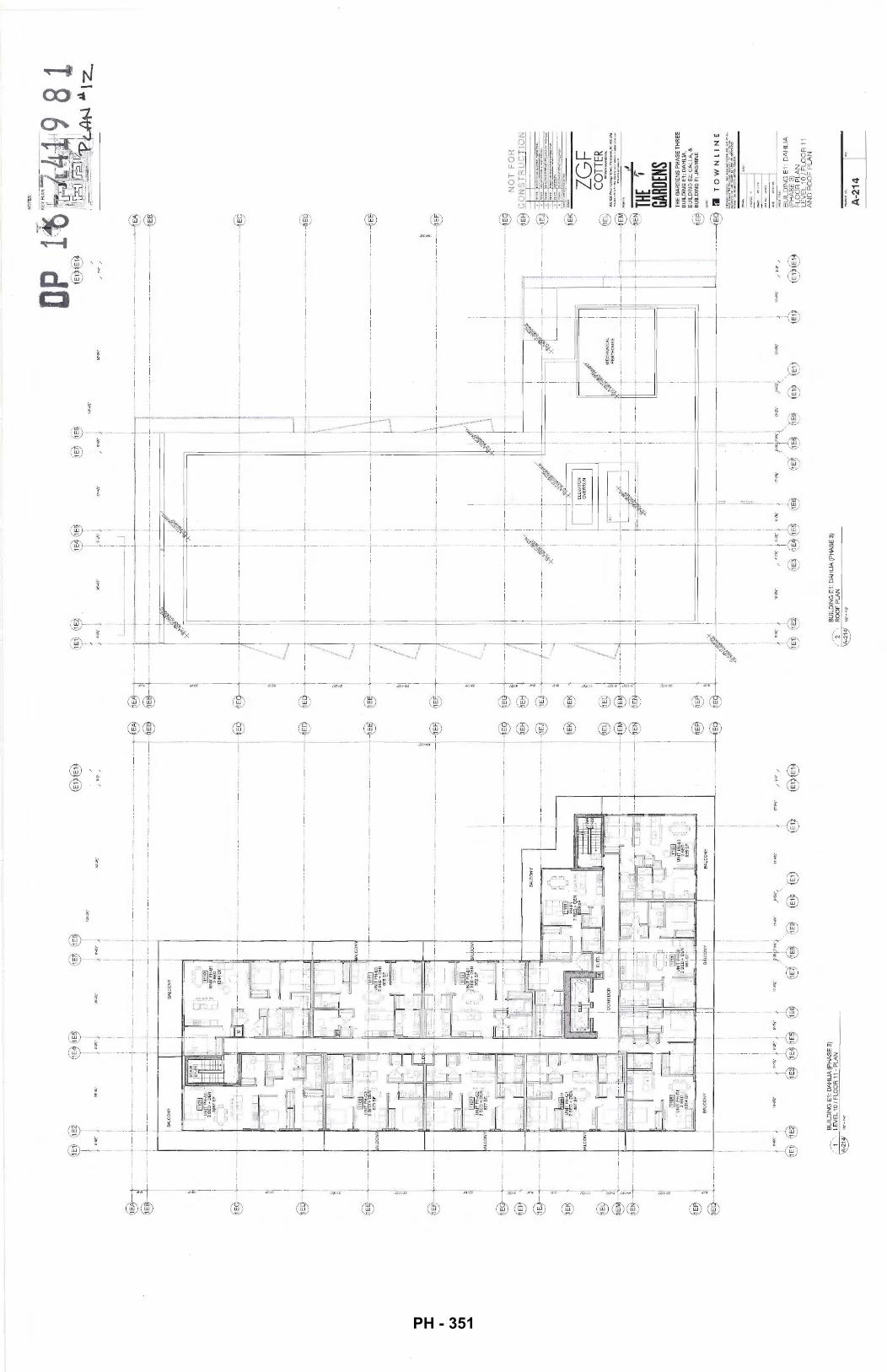
tT
.. tT
..
tT -
@@
i i
I I
I I
I I
! !
~~
-~-~+~-~~~-~-~-~-
~-~~
~-~~
~-~--~-~-~~~-
~~~-~-~-~-~-~-~-~-~-~-~-
~-~-~-~-~
' .
. .
. I
I 1
E
• ~-~-~~~-
~L~-~-~-
~-~-
~~~-~L~-~-~-~-~-~-~-~~~--~-~-~-~-~-~-~-
~-~-~-~---~-
~
@ ®-1 -
----
i .
i '
I
i BA
LCO
NY
B
ALC
ON
Y
I
i B
AL
CO
NY
i
~CtNY
! I
I I
I i
I .
. I
I i
I ,
, I
I i
I .
, I
I I
I I
I I
' I
, I
,
~-~---~-~-~-~-~-~-~-~-~-~-
~-~-~
~~
~-~-~-~-~-~-~-~-~-~-~-~-~-~-~-~ ~~
~---~---~--~-~-~-~-
~-~-~-~-~-~
~~
I I I i i i 1J
'-2Y.
" 21
'-9¥.
" 1J
'~~
-
@
~-~-~-~
--@
~-~-~-~
--@
@
@@
J;~~
J;-m
~~~
•-"•-~
1N
)I.·
;.
.qr,
v-w.·~
r~·:.,
~ 0I£'
4 '@
@
@
T.~-T
~~-(T.~
~T ,.~-
C@·~T
,,_~-
I / I { I '-...., I '
i .
i i
I
I L_
j ___
____
_ ----~
-i I
--~~
-~-~-~-~-~
-~-~
-~-~
-~-~
-~-~
-~~
~--L
~-~-~-~-~-~~~-~~~-~-~-
~-~-
~---
~~~~~-~-~-~-~-~-~-
~---~-~-~-
--~-~---~
·
I I I i I I
i
I ' I
i i I i
i ~-~-~-~-~-~,~-~,~-~-~-~-~-~
i i
i i
I I
i i
--~-
~-~-
~--J
--~L
--~-
~-~-
~-~
i i
i i
i i
i i
i i
~-----~---~l~-~~---~-~-~-~-
-
1 I
i i
i i
i i
~-~-~-~-~-~~
--~~~---~-~-~-~
i i
I I
! i
I I
i i
i ~-~-~-~-~-~-+-+-
~-+
--~-~-~
i i
I
~-~---
--~-~
-~~~~
-~~~-~
~
~-~
i '
i' I---+-~---,
i I I i i
~-~-~-~-
~-
-~-~~
~-~-~-~-~---
-+-
~~""
·-=~
-~=
I I I i i I i I I I I
li! " I i!! I i
I I I lj I i
~ ~1~-~-~-
~---~-~-
~-~-~-~-
~-~---~-
-~-~
I ~:
;<
I ____ :_=
r----~-~---
~-~-~---~---~-~---
---~
-€9
\ \ I
i
~ t ~J~-
~-~-
--~-
~-~-
~-~-
~-~-
~-~-
~-~-
-~-@
I'
..J
I
I M
EC
HA
NIC
AL
! '
PE
NT
HO
US
E
I ~T~-~-~-~-~-
-
, I
~-t--~-~-~---t
i . i I i ! I I
)·"~
i ·~-i
19'-!
!Yo"
/
•~n<
-t ·~~
-i 11'-
'tt;"
J 1T
-I!'lo
,"
r~ .. -~
,~
-21
'-IJY
.."
~ 13
'-1!1
:\"
~~}!
6.~?.1
Ci~~ ~J
~E~
(1_E~
~9-~
_!= .. '€~
@
@
,/
'SQ
/
@@
NO
TE
S:
NO
T F
OR
-1 ..
.... ·-·
D
Olt:
"'"
"'"'"
BU
ILD
ING
E1:
DA
HLI
A
(PH
AS
E3
) F
LO
OR
PL
AN
L
EV
EL
1 0
I F
LO
OR
11
AN
D R
OO
F P
LA
N
A-2
14
PH - 351
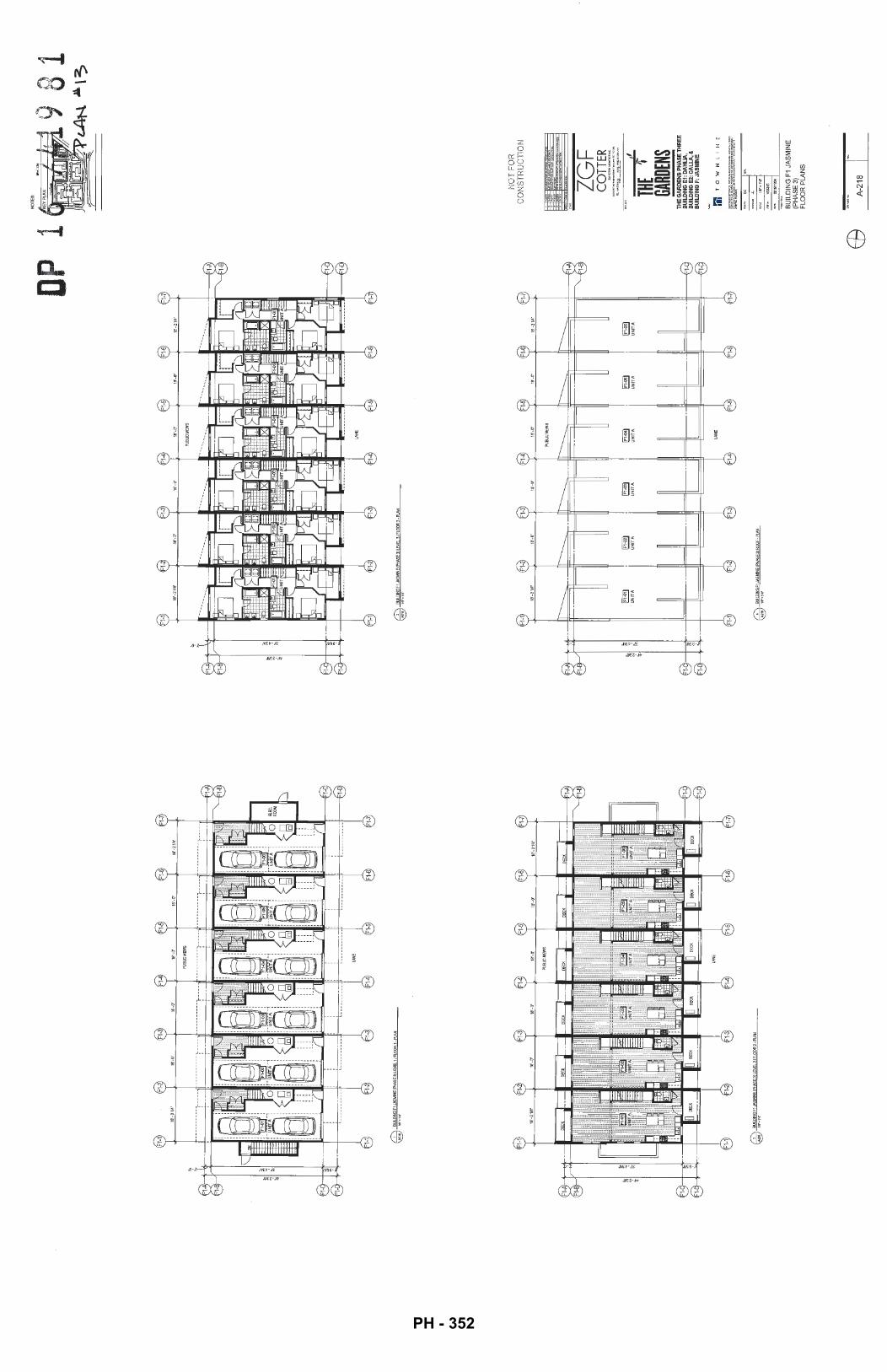
@ ~~
~~~~
F1JA
SMINE
IPHASE
3lLEVE
l.11Fl
CX>RI·
I'I..A
N
~
BU
ILD
ING
F1-"
SM
INE
!PH
AS
EJl
lEV
EL2
/FLO
OR
2-PI
..AN
~111"•1'-V
W
BUIL
DING
F1..L
ASM
INE
!PH
AS
E3l
lEV
8.3/
Flo
a:l3
-PlA
N
\§!7
11
1"•
\'..Q"
~
~
'U
NIT
A
UN
IT A
F1-1
F1-2
~
BU
LDIN
GF1
JAS1
.1N
E!PH
ASE
JJR
OC
F-P
LAN
~1,..
•1".G
"
1-3
~
~
UN
IT A
U
NIT
A
lAN
E
1-4
1-5
DP 1
1§
1
~
UN
IT A
U
NIT
A
F1-6
69
NO
TES
:
NO
T F
OR
C
ON
ST
RU
CT
ION
..........
... _...
.... ,_
., .....
.. ,.._.,"'!:.~"'-- ,,
THE
t GA
RDEN
S TH
E G
AR
DE
NS
PH
AS
E T
HR
EE
B
UIL
DIN
G E
1: D
AH
UA
, B
UIL
DIN
G E
2: C
ALL
A, &
B
UIL
DIN
G F
: JA
SM
INE
m T 0
W
N
l
I t-1
E
BU
ILD
ING
F1
JAS
MIN
E
(PH
AS
E 3
) F
LOO
R P
LAN
S
A-2
18
9 81
PH - 352
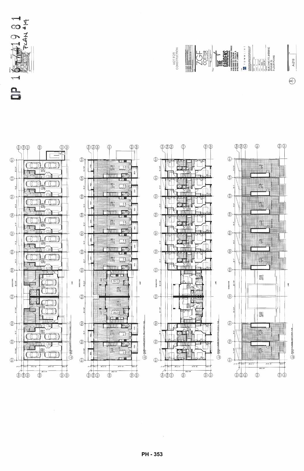
2 ~
2- 2-
~ -2-
~ " ! "
2-~
2-
W
Blll
OIN
GF'
2.JA
SMIN
E!F
'Ho'.
SE3l
lE'tE
L2/
FlO
OR
2·P
LAN
~l.s'
•!'-<1
"
2-1
F 2-
F2-3
18'-2
1/4'
1
8'·0
' -----
---
b lr
~~ ~~
~
~~
t=
N-2
114'
I r·
·----1 ·c:
-~
r:>:=
' 12
'!'
~~
d-~
~2~
~~ •
"jUNITA~ F~ U
NIT
C1
L
t]' F
u ~~ , ,
:;:,
I ,
~=
ft:
:.
I y
I y
·----
-----
·--
----
---
f7\
Btn
lDIN
GF2
JASM
tEIP
H.&
SE3l
lEV
B.J
fFL
OO
RJ-
PI..A
N ~111"•1'4'
2-1
F2-2
F2
-3
•----
-----
~ F2
-FJ-
--+
-4-t--
f7\
aun.DINGF'2JASMII£
!PHA
SE31
ROCF
-~
~11'J'•
!"l'
lAN
E
2-4
"""'
EN
PARI
< F2
-5
2-0
'l!J-2
114'
! --------~
D ~ -bH
~ '
f.J
UNITC
2~~
L.,;._
'~:11
' ~ -
: fttl'J'I
;,f;j{
-----
----~ lA
NE
2-4
GAA
OEN
PAAJ
<
~
UN
ITC
2
lAN
E
18'-
0'
-
~1
. "'-
~ ~
-· =•
ti I<
. ·
== F2~
l!l
. ~ U
NIT
ilijt:J
:ff /a
~\
L
:jL
..J
I --
-------~
"""
UN
ITA
2
18'-
D' ---
"'-~ ~
1::::=
IIJ<
, ti
l (
' ==
F2
..()6
=U
NIT
Al.+
•
~d
:jL
..J
I --
-------~
""''
UN
IT
2-7
18'-
0'
-----
"'-~ -~
lX~ +
.
~ !·+
F:
:: ""'
' C
:=
NITA
'1.}~-
~--~
~a
~
I ---------~
2-7
F2.
07
UN
IT
2-8
2-9
2-1
2-1
18
'·0' --
"' ~ -~
"
E
"""'
rtll
· C
:= U
NIT
;:;,
·H
·i
~a
I L
fL-J
.I
---------~
2-8
F2-
08
UN
ITA
2
18
'-D
' 18
'-211
4'
---
~
II
'-'II
II
rh L
-t! ~
4 11
)\,
+··
lX~
~
; .. '
' "
E
F2
-09
1!1
F2
-10
-.me
C:=
UNIT~
:!+}·
· t=
_uN
1TA
2
J~d
l -
L ~a
~
~
---
------~
----
----
-
2-9
2-1
2-1
18'-0
'
""''
UN
ITA
2
18'-2
114'
F2-1
0
NIT
-J
p 1
2 2-8
2 2 2 2- 2-
E9
NO
T F
OR
C
ON
ST
RU
CT
ION
ZGF
CO
TTER
,, TH
E t
GARD
ENS
TH
E G
AR
DE
NS
PH
AS
E T
HR
EE
B
UIL
DIN
G E
1: D
AH
LIA
, B
UIL
DIN
G E
2: C
ALL
A, &
B
UIL
DIN
G F
: JA
SM
INE
m T 0
W
N
l
I t-1
E
BU
ILD
ING
F2
JAS
MIN
E
(PH
AS
E 3
) F
LO
OR
PLA
NS
A-2
19
PH - 353
G\
BUWI
NGF3
..1'SMIN
EIPWISE3!LEVEL1/R~
1-PI.
AN \!
§7
W
'•I'
-G"
Ci:)
, B
lJILO
ING
F3JA
SMIN
E!PK
ASE
3llE
VEl
2/flO
OR
2-PI
.AN
~W'•I"''
··--._
~ ~"
b ~ ~
3-
3-1
14'-1
0114
'
8 BU
ILD
ING
F3J
I'.SM
INE!
PK&S
E3!L
EVEL
3/FL
OO
R 3
-PLA
N \t
§7
1
11
'•r .
. •
3-1
F3-2
F3
-3
14'-
101
14'
14
'·8'
~
~
.. U
NIT
S
.. U
NIT
B
F3-1
F3
-2
F3-3
~
BUIL
DIN
GFJ
-W;M
INEI
PHA
SE3l
R<X
:f"-P
I..AN
"\@
111
'•1'.0
"
el
.U
NIT
S
BIKE
PAVU
ON
R
OO
f
F3-4
F3
-5
F3-5
F3
-F3
-8
F3-4
BIKE
PAVI
.KJ.
I R
<Xlf
~
.. U
NIT
S
lAN
E
F3-5
14'-8
' 14
'-8'
14
'-10
114'
~
~
e.!
.
UN
ITS
,..
UN
ITS
..
UN
ITS
~ F3
-8
F3-7
3-
8
F3- 3- c:::.
\'::;
?
NO
T F
OR
C
ON
ST
RU
CT
ION
ZG
F
CO
TTER
"''"'"""'"--~·-•
1<"<0"0
l'il.oO•""!,;~.-;::·--
THE
t GA
RDEN
S TH
E G
AR
DE
NS
PH
AS
E T
HR
EE
B
UIL
DIN
G E
1: D
AH
LIA
, B
UIL
DIN
G E
2: C
ALL
A, &
B
UIL
DIN
G F
: JA
SM
INE
m TO
WN
LI
NE
BU
ILD
ING
F3
JAS
MIN
E
(PH
AS
E 3
) F
LOO
R P
LA
NS
A-2
20
PH - 354
l•-,
,. ·-·
-,_
,. ,._
,,.
_,,. .
_,,,
~-" ~-
•. .,_
I I
T.O
.R.O
OC
"Li.
ER
. r--,-
;(.~" :~
:.:;
~;
r---_
___ l.ml..
.ll.B-
~-~-s-
---,9
.6T
/6.
00m
'"""
IIR
OO
R
,_,.,
,. •• ,
,.,.,I,,
_,.,
,,..,
••••
I 1'
-'"1
I""'
"""I
1<
>•1
•••I
"'
'"I
,. ••
, ,._
,.,
T.O
.FW
DC
I<ll.
ER
~ ~
I~~
~ ~
~D ~
I ~~~
~~
@
~ I ~D
~ @~
~~
~ ~
~~
~ ~~
~~
@~
~~
~ ~~ ~
T.D.R.
~DCHIL
LER
:~·-~:
-~~· __
___ :
:::+-
-.!•-
----
----
'f--
---
----
----
---
· --
f-
·--
1-·
-· ---
~-=~
--=-t
-~-~-=-
-~--=-· --
-r--
· f-
---
----
-++·-
+-+_---~
-=++=1~~=-~=t=*~
"!'=" ~
i=-t=-
~1-../_
--~~
~-~-~::
. ·~~~~;
~'_ .... ~~·,~
,.·-~,.im •..• -
"~'-ET
. --~1[ _
___
----
-1-~lm'
I r
----
f---
1-----
------
-f-·
-·-
--
----
r---
-·
-----
--f
r!5:t
rl~-
f--r
----
, r.o
... ,~~'-
"'""'"
-'
l.O
YA
>W
't>
' l1
1'
IS 1
12"
I 0'
i 'I! "~~
;:::;;
s j_
l3~~-
''"LI
I.!!:
§.
I--
, __
__
/ m
srt
34.D
im
--0--~
~~~is:
~ ---r
--;.~-~
=~---
---c'1
:=-r
=m~*
=1~=
IJ~=
t=~~
JJt~
I=$m
~g~;
JJj~G;m~~=m~~m~=*=:g=trn=m£R'===J-~--~
1 ---
-4~~~~
~-9---
:1[ 1
11 fl
r=l
n 1111
1
r n n
n
n rr
1
1 rn
1 n
11
rn I;
I
I 1
1 I
I I
. I
! lP
JEl1
0/R
.OO
RII
'"'-""""
-112m
--
-r
--~]lA~~
--s-
--
-----I-
----~£Y.~:W}"~t~-&-
LP
JB.I
IR.O
OR
·
10.1
TIJ
.10m
BU
ILD
ING
El
QA
HL
IA M
AT
ER
IAL
LE
GE
ND
_.
61 ·
BR
ICK
TE
XT
UR
ED
FIN
ISH
(D
AR
K G
RA
Y)
Q.l
• $JE
E_L_
FRA
ME
Q.!3
lA.s
S C
AN
QP
Y
G1
-CL
EA
RG
IJIZ
ING
G
2 -
SP
AN
DR
EL
PA
NE
L {W
HIT
E)
GJ
·GL
AS
S G
UA
RD
RA
IL
NO
TE
S: -7
4 9
8 1
. ~ c.
A::N
. . ..&
L l (
o
NO
T F
OR
C
ON
ST
RU
CT
ION
.>~>~'
="'"""
'"""''
"..::
....
... "
1 .. --·-
•!I<I'U
" ... m_~.;..
~:!;
.'!'
!,'"-~""
J
THE
r GA
RDEN
S T
HE
GA
RD
EN
S P
HA
SE
TH
RE
E
BU
ILD
ING
E1
: D
AH
LIA
,·
BU
ILD
ING
E2
:· C
AL
LA
, &
B
UIL
DIN
G F
: JA
SM
INE
r.'l
TO
WN
liN
E
BU
ILD
ING
E1
DA
HLI
A
(PH
AS
E 3
) W
ES
T A
ND
EA
ST
ELE
VA
TIO
NS
.H A-
311
.. [~
F .
.
PH - 355
· · -0f
,~,Ft
~:~s:f-
LAJ¥~P~rni
r~,.::~=:
,:;:::...._::=:
==t~
~::;==
~ JH
:r~~
m \__
_ __
--0-
-f~~
~m~!-----
--+
--'-""
"'
.. -0-~l:~~-~-
:.. ~
~~~~~----
--
1-
BU
!Lp
!NG
E1
DA
HL
IA M
AT
ER
IAL
lE
GE
ND
C1
• SJ
"EE_
L, F
RAf
v'\EQ
~lASS C
AN
QP
Y
------~-~~~~
~ -
-~-~
·-.;;..:·
-~·-P:...!-~1-a~~
___
_ jg{Eilr%·~~~~
----
=--~:},~~
--
1----
----
-------
---
------
~-LE
Y~H-'
iJ.C
X:~
~---
----------
--------
--LEY¥J~~~
NO
TES
:
KE
Y P
lAN
-741
9 8
1 1
' LA
N. ~
\ '":J-
NO
T F
OR
C
ON
ST
RU
CT
ION
ZG
F
CO
TTER
..
.. ,.
0\ .
.. .....,.-.-.
....
. ec.
., ...
,.,_~ --'*
"--- tl
THE
t GA
RDEN
S T
HE
GA
RD
EN
S P
HA
SE
TH
RE
E
BU
ILD
ING
E1
: D
AH
I.:.IA
, B
UIL
DIN
G E
2:
CA
LL
A,
&
BU
ILD
ING
F:
JAS
MIN
E
:'i'l
TO
WN
liN
E
BU
ILD
ING
E1
DA
HLI
A
(PH
AS
E 3
) N
OR
TH
AN
D S
OU
TH
E
LEV
AT
ION
S
A-3
12
PH - 356
~ ~~3
4~ffl'
~~""--
-
---0
-~f,
-~Y~rm
----
('7
\ '8Ui
lD~F
1JAS
MINE
!PHA
SE3l
EAST
B.EV
ATIO
N ~
w·~•
·..,.
f7\
IMLO
ING
F1JA
SI.1
NE!
PHA
SE3l
SOO
lltB
.EV
A1J
ON
~,..., ....
~ ~
~3-,
~J~K
'...._
__
---0--
f?,'M
&m--
--
LU
8U!
LD1N
GF1
JASI
IINE!
F'H
ASE
31W
ESTB
..EY
AO
ON
~
w·•
r.f'
~-------~
-------~--------------
---~-----~---~
-----~-------~---~--
---~
----
---~----
BUIL
DIN
G F
: JAS
MIN
E M
ATER
IAL
LEG
END
B1 ·B
RIC
K T
EXTU
RED
FIN
ISH
(RED
OND
O
.. G
REY
)
G1· V
INYL
WIN
DO
WS
(WH
ITE
TRIM
) G
2 ·G
LAS
S G
UAR
DR
AIL
M1-
MET
AL S
CR
EEN
ING
/DET
AILI
NG
.M
2 • G
ARAG
E DO
OR
NO
TE
S: 7 4
19 8
1
'PL
A-N
M
.lB
NO
T F
OR
C
ON
ST
RU
CT
ION
ZGF
CO
TTER
"""'-:
<···--
·-· .. ,
... ... ....
'""'"!
: ·~
};~~~ ... -
- ,, TH
E 1
GARD
ENS
THE
GA
RD
EN
S P
HA
SE
TH
RE
E
BU
ILD
ING
E1:
DA
HU
A,
BUILDIN~ E
2:.C
AL
LA
, &
BU
ILD
ING
F:
JAS
MIN
E
m TO
WN
l\
I~E
BU
ILD
ING
F1
JAS
MIN
E
(PH
AS
E 3
) E
LEV
AT
ION
S
· A-3
15
1-
PH - 357
Q!l
T.O
. RO
OF
DECK
40
.34'
/12.
29m
\_
---0-se
rc:tM&
m---
-
Q..
BlH
l01N
GF2
JASM
1NEf
PHAS
E3l
EA
STE
LEV
AT1
00
~111
"•1'-
4'
---0
--}
.Q.§
W.fi
..EQ
P!J.f
..._
_ 49
.1T
/14.
99m
---0-
t[tM
.rom
---
f7\
8Uft.
OIN
GF2
JAS"
1NE
fPH
AS
E3l
SC
liJIH
ElE
\IA"O
ON
~W'
•I,_.
.
---0
-t[t
~_fo
m--
-
... G
:\ B
U!t.
OIO
OF2
JASM
INE
fPH
AS
E3!
't'IES
TEL
EVAT
10N
~~·.
, ....
BUIL
DIN
G F
: JAS
MIN
E M
ATER
IAL
LEG
END
B1 ·B
RIC
K T
EXTU
RED
ANIS
H (R
EDO
ND
O
GRE
Y)
G1· V
INYL
WIN
DOW
S (W
HIT
E TR
IM)
G2
·GLA
SS G
UAR
DR
AIL
M1·
MET
AL S
CREE
NING
/DET
AILI
NG
M
2 ·G
ARAG
E DO
OR
.
H1 ·
CEM
ENT
FIBR
E BO
ARD
SH
IPLA
P SI
DIN
G
'(LI~N
EN.
H2-
C
F
OAR
D (W
E)
H
3-c
D
oAR
o (~~
~GR£
H4
·C
F~OARD (D:t GR~
NO
T F
OR
C
ON
ST
RU
CT
ION
ZGF
CO
TTER
.....
,""'""-
-.. ··--~ ....
.... ,_
,...,'"
!!,; .
.:..
.-=~
~"-- ,,
THE
f GA
RDEN
S T
HE
GA
RD
EN
S P
HA
SE
TH
RE
E
BU
ilD
ING
E1:
DA
Hli
A,
BU
ilD
ING
E2:
CA
llA
, &
BU
ilD
ING
F:
JAS
MIN
E
ril T
OW
Nll
t~E
BU
ILD
ING
F2
JAS
MIN
E
( PH
AS
E 3
) E
LEV
ATI
ON
S
· A-3
16
8 1
PH - 358
~ ~
~J4~~~
CK"
-0-:,
'ro/,1
k--
--
. Cf:j
_. 9
UIL
OfN
GFJ
JA5M
IJiiE
IPH
ASE
'J)'E
ASTE
I.EVA
Tiot
:/'
~W
"•l'-
4'
~~W
e~m--
-~
------
----
------------
----
---~------------
-
Ci:'J
. BU
ILO
ING
FJJA
SMIIE
!FW
.SE
3lta
:ITH
ElE
VATI
ON
~W'
•1'-4
"
. ----01~~-~om--
·--+-+------
f7\
8UIL
OIN
GF3
..L4.S
MIN
E!P
HASE
3!SO
UTH
B..E
VA11
0N
\t§
7
lli"
•I'.O
"
T.O
.RO
OF
C!l
40.3
4'11
2.29
m
--0-f~
fn'&m----
... ~
8UilD
ING
FJJA
SM
IIEIP
HAS
E3lW
ESTB
..EVA
TlO
N
\.@
"' .
• ,._...
BIK
E P
AVIL
ION
TE
RRA
CE
--------
---~-~----
--
--
----
-------
---;---
---------
.---
-----------
--
--
------
:---
---------~--------------
--
BUIL
DIN
G F
: JAS
MIN
E M
ATER
IAL
LEG
END
B1 -
BR
ICK
TEX
TUR
ED R
NIS
H (R
EDO
ND
O
GR
EY)·
·
G1 -
VIN
YL
WIN
DOW
S (W
HIT
E TR
IM)
G2-
GLA
SS G
UAR
DR
AIL
M1-
MET
AL S
CR
EEN
ING
/DET
AILI
NG
M
2-G
ARAG
E DO
OR
H1 -~~~~D
NT FI
BR~E B
OAR
D SH
IPLA~P
SID~IN~
G H2
-CEM
E F
R
RD
(W
HIT
.H
3-C
EM
.F
R
RD
(LI
GH
T RE
Y
J H4
-GEM
O
ARD
(DAR
EY
)
NO
TES
: ~7419 8
1 -p
Lth-
..\_
1! Z
Q
NO
T F
OR
C
ON
ST
RU
CT
ION
ZGF
CO
TTER
...
.. ,.'=
""' ...
......
... ..
_ ...
.....
. . ....
.... ~-
"':!..~"'-- ,,
THE
t GA
RDEN
S TH
E G
AR
DE
NS
PH
AS
E T
HR
EE
B
UIL
DIN
G E
1: D
AH
LIA
, B
UIL
DIN
G E
2: C
ALL
A, &
B
UIL
DIN
G F
: JA
SM
INE
m TO
WN
L1
NE
BU
ILD
ING
F3
JAS
MIN
E
(PH
AS
E 3
) E
LEV
AT
ION
S
· A-3
17
PH - 359
S M
AX
BU
ILD
ING
HE
IGH
T 2
5M F
RO
M
, T.
O. P
AR
KA
DE
sT
Ru
CTuR
E -
--
--
J,
BUILD
ING
D H
EI§
j __
_ _
'f 5
8 00
' 117
sam
!;!j
" ;
::_
~ ~5
WL,~
,om
<
(1'
\ S
ITE
ELE
VA
TIO
N A
-A
%:_i
~y BU
ILD
ING
D:
CA
ME
LLIA
(P
HA
SE
2)
~ M
AX
BU
ILD
ING
H§_GijJ_~ f
fiO.M
_ _
__
_ _
f.
o.
PA
RK
.A.D
E S
TR
UC
TU
RE
f2'\
S
ITE
SE
CT
ION
A-A
\~~1
1
PH
AS
E 3
B
PH
AS
E 3
B
PH
AS
E3
A
BU
ILD
ING
E2
: CA
LL
A
(PH
AS
E3
A)
f P
HA
SE
3B
~ ;
]uB
uc "!
!;!~
--------
---"
"""'
~~~~
""'-
--------+
I i..-r~
~d:~.f:£N~
I I I I
, ,/ j
.I t~'/!l-~
----
-----
---
--_:
__:~~
-:~-:
:----
----------------------~
1!\\!ILR
!::~~~~~~~~
I;!
LEVE~
H
""'a:W
I'lll'l'oH
PH
AS
E 3
A
PH
AS
E 3
B
BU
ILD
ING
F: J
AS
MIN
E
(PH
AS
E 3
B)
LAN
DS
CA
PE
D
BU
FF
ER
*I >-I ii:l ~f T
O H
IGH
WA
Y 9
9
I I
MA
X. B
UIL
DIN
G )
-!EIG
HT
25
M F
RO
M I~
--
r-:o
. PA
RK
AD
E S
TR
ucT
UR
E
> N
OT
ES
: -7 41
9 8
1 -p
cA4
~2\
NO
T F
OR
-CO
NS
TR
UC
TIO
N
-=
.
- ' -- ZG
F
CO
TTER
901-8311WMtlmtinpSU..~Va...,.,.,...
-,scv6COO
tru..,
._m
_,.,
, ...
-.m
... n
'"'
"'~'
"••<
'"'"
'· .. ~
.....
..........
..........
.
THE
~-GA
RDEN
S T
HE
GA
RD
EN
S P
HA
SE
TH
RE
E
BU
ILD
ING
E1:
DA
HL
IA,
BU
ILD
ING
E2:
CA
LL
A,
&
BU
ILD
ING
F:
JAS
MIN
E
1'1
TO
WN
LIN
E
SIT
E E
LE
VA
TIO
NS
AN
D
SE
CTI
ON
S
A-4
01
PH - 360
~ ~g
~g
u
~ ~
~
~~
~ :
t ; m
f-(--~,.,::"':;,."':"'
~"'-,~~r:-~-c:_-:-:-
'~-"~'-'~-'A"''-"'-'-_-~-~
--'~!!i~-~---.'·1
·:::::
: •..• : ;;
·::,~i ~~:
::::::
::::::
1_~---"_jl ;
'~'
I' '"'
~~~~~O
A ~ 1
_]~ill~~:Q
I'!J:![Q!~
~---
--~
~\\~\!\"'~ -
--
--
-I
!::".
··~-··
··~
-+
---
------------------
----
----
:~i~
'j]-'~'
1f?l~
o'i)ji!~:~~lif!J,~
~oa
• _ _
r
--~---
~""'
: l
I
-··
: ~L-
---~---
1 ~L
--
--~---
~L-
-
-··
·1·\
SIT
EE
LEV
AT
ION
B-8
40
~')
SIT
E S
EC
TIO
N B
-8
040)
1
RO
AD
S
BU
ILD
ING
B:
MA
GN
OLI
A
(PH
AS
E 1
)
' I I
TO
ST
EV
ES
TO
N H
IGH
WA
Y
_1 1 i ~
,_~_UI~D
IN_? }-!
EIG
HT
25
M F
RO
M ~
~-
---
--
--
-·--
---
--
--
---
--
--
1 T
.O. P
AR
KA
DE
ST
RU
CT
UR
E
I : I
I I
_ -:;_~ __
____
____
____
__ -.
= ... ~.:
.::.::.:.-~ _
t -~-___
__ B_UI1D~~
~~~~
~ 7~ ~
I I
I I
>
NO
TE
S:
p 16~
7 19
81
-v LA~ ~z .. :z
...
NO
T F
OR
&CO
NS
TR
UC
TIO
N
. =
n
. =·
ZG
F
CO
TTER
J
THE
~GA
RDEN
S T
HE
GA
RD
EN
S P
HA
SE
TH
RE
E
BU
ILD
ING
E1
: D
AH
LIA
, B
UIL
DIN
G E
2: C
AllA
, &
B
UIL
DI N
G F
: JA
SM
INE
1'1
TO
WN
LIN
E
IC
~-
SIT
E E
LE
VA
TIO
NS
AN
D
SE
CT
ION
S
A-4
02
~-
PH - 361
-\· ..
._ """
" .. _ .. l.
u.t~.i
: !;;
0
,.
~.:..·
.•t>
Lan
dsc
ap
e R
atio
na
le:
.~-
.f?
,ot> ~..
.,""'1
}~1
.{,<
,>(1
•'1'
Ma
gn
olia
B
uild
ing
B
Bui
ldin
gs E
an
d F
are
re
sid
en
tial a
nd
pro
vid
e a
tra
nsiti
on f
rom
th
e m
ixe
d u
se d
eve
lop
me
nt t
o t
he
so
uth
{Th
e U
rban
V
!llo
ge
jto th
e fu
ftJre
pu
bff
c p
ort
to t
he
no
rth
. Th
e st
reet
ori
en
ted
uni
ts a
t B
uild
ing
E o
re m
ore
urb
an
In c
ha
ract
er
os
a re
spon
se t
o t
he
de
velo
pm
en
t acr
oss
the
str
eet.
Rai
sed
pla
nte
rs,
me
tal p
olio
gat
es, a
nd
ad
dre
ss p
iers
em
be
llish
th
e en
try
seq
ue
nce
to
the
se s
tree
t o
rie
nte
d u
nits
.
Bui
ldin
g E
Am
en
ity
Go
rde
n
Two
"l~
sha
pe
bu
ildin
gs
(Bui
ldin
g El
an
d E
2) e
nd
ose
a l
arg
e s
em
i-p
rivo
le c
ou
rtya
rd.
This
am
en
ity
ga
rde
n
co
n lo
ins
a w
ate
r fe
atu
re.
o si
mpl
e sh
ee
t of
!ow
n, o
sum
mer
flo
we
r g
ard
en
. o
idd'
s p
lay
are
a. a
nd
a d
inin
g a
rea
th
at
aff
ord
s re
side
nts
the
op
po
rtu
nit
y to
be
ou
tsid
e a
nd
me
et t
he
ir n
eigh
bour
s. L
org
e s
em
i-p
riva
te p
ati
os
ad
jace
nt
the
b
uild
ing
pe
rim
ete
r al
so e
nco
ura
ge
ou
tdo
or l
ivin
g.
Ped
estr
ian
Me
ws
loca
ted
be
twe
en
Bui
ldin
gs
E2 a
nd
Fa
J0'
/3m
wid
e p
ub
lic p
ath
wa
y c
on
ne
cts
the
Urb
an
Vill
ag
e a
nd
sur
roun
ding
n
eig
hb
ou
rho
od
to
th
e fu
ture
pu
blic
por
1c. t
o th
e n
ort
h.
A t
relli
s st
ruct
ure
wit
h s
eotn
g a
nd
wa
y fi
ndin
g o
llh
e s
ou
th e
nd
Roo
d 8
at
the
Mew
s g
uid
es
pe
de
stri
an
s n
ort
h t
o a
pet
it o
ver1
ook
with
a t
relis
an
d s
ea
ting
. F
rom
he
re a
ser
ies
of s
tairs
an
d r
om
ps
co
me
cts
th
e M
ews
to t
he
futu
re p
ork
to th
e n
ort
h.
Ge
ne
rou
s p
atio
s o
n t
he
ea
st s
ide
of
Bun
ding
E2
an
d t
he
we
st s
ide
of
Bui
ldin
g F
pro
vid
e g
oo
d o
vers
igh
t o
f th
e P
edes
tria
n M
ews.
No
rth
ern
Pro
pe
rty
lln
e
The
re o
re s
ever
al d
iffe
rin
g c
on
diti
on
s a
lon
g t
he
no
rth
pro
pe
rty
~ne o
f bul
ldln
gs E
en
d F
as
a m
ea
ns
to p
rovi
de
so
me
va
ria
tion
to t
he
pro
pe
rty
ed
ge
. In
fro
nt o
f bu
~cfW
Jg E
l th
e la
nd
sca
pe
ste
ps a
t th
e e
dg
e o
f th
e p
or1Q
ng
ga
rag
e. a
nd
th
en
slo
pe
s d
ow
n to
th
e fu
ture
pu
bff
c p
ork
. In
fro
nt o
f bui
ldin
g E
2 th
e la
nd
sca
pe
ag
ain
ste
ps a
t th
e
ed
ge
of
the
por1
c.in
g.
A 3
m A
gri
cultu
ral l
an
d R
eser
ve h
as
be
en
pro
tect
ed
an
d e
nch
an
ce
d a
lon
g th
e e
ntir
e N
ort
h e
dg
e o
f th
e s
ite.
Pu
blic
a
cce
ss !s
dis
cou
rag
ed
usi
ng o
va
rie
ty o
f lh
am
y. a
ttra
ctiv
e a
nd
ha
rdy
tres
pass
inh
ibiti
ng
pla
nts
. A r
eta
inin
g w
all a
lon
g
the
pro
pe
rtly
line
als
o d
isco
ura
ge
s a
cce
ss,
whn
e o
row
of c
oto
ne
ast
er
pla
nti
ng
will
ca
sca
de
ove
r th
e w
all,
so
fte
nin
g
the
ed
ge
. W
he
re p
ossi
bite
on
po
rk p
rop
ert
y th
e la
nd
sca
pe
co
n a
lso
stop
e u
p t
o m
ee
t th
e p
rop
ert
y lin
e a
nd
re
du
ce
the
he
igh
t of
the
wo
l. A
3.5
' ht m
eta
l fe
nce
set
be
hin
d t
he
ALR
bo
un
da
ry W
ill f
urt
he
r dis
cou
rag
e p
ed
est
ria
n
en
cro
och
me
nl i
nto
this
sp
ace
.
Alo
ng
the
pro
pe
rty
nne
no
rth
of
bu
ildin
g F
the
re Is
a 4
'/1.
2m w
ide
acc
ess
pa
th (
to th
e to
wn
ho
use
ent
ries)
wit
h p
lan
tin
g
eit
he
r sid
e.
Eas
tem
Pro
pert
y lln
e R
ipar
ian
Zon
e A
lon
g th
e e
ast
em
pro
pe
rty
Qne
th
ere
is a
rip
ari
an
set
back
.. Th
is a
rea
will
be
pla
nte
d a
s p
er
the
re
com
me
nd
ati
on
at
the
en
viro
rvn
en
tal c
on
sulta
nt.
The
exi
stin
g h
ed
ge
wll b
e p
rote
de
d a
nd
reta
ine
d.
an
d o
n e
xist
ing
go
p in
th
e h
ed
ge
w
ill b
e p
lan
ted
with
a s
imno
r sp
ecie
s. l
arg
e n
ati
ve c
on
ilero
us tr
ee
s o
re o
!so
pro
po
sed
to
be p
lan
ted
in t
he
rip
ari
an
zo
ne
as
o m
ea
ns
to b
uff
er
the
hig
hw
ay.
,, ,, ll 0
Pclh
Co
nn
ect
ion
to
P~b
lic P
ork
Bui
ldin
g C
Sus
tain
obili
ty
The
la
nd
sca
pe
wm uf
~!ze
o h
igh
eff
icie
ncy
dri
p ir
rig
atio
n s
yste
m a
nd
pla
nls
th
at
ore
dro
ug
ht
tole
ran
t in
ord
er
to r
ed
uce
th
e u
se o
f p
ota
ble
wa
ter.
Sh
ad
e t
rees
an
d p
lan
tin
g h
ave
be
en
m
axi
miz
ed
to
re
du
ce t
he
am
ou
nt o
f co
nst
ruct
ive
sur
face
s th
at h
ea
t up
an
d c
on
trib
ute
to
th
e h
ea
t Is
lan
d e
ffe
d.
Soi
l de
pth
s o
f 1
2-3
0"
ove
r th
e s
usp
en
de
d S
lob
will
slo
w s
torm
wa
ter
run
off
.
Pio
n!
Ma
teri
al
Pla
nt
ma
teri
al w
iB v
ary
ttvo
ug
ho
ut l
he
pro
ject
. A
lon
g t
he
str
eet
pe
rim
ete
r e
verg
ree
n s
hrub
s a
nd
h
ed
gin
g,
as w
ell
as s
mal
l tre
es w
iD b
uff
er
the
sid
ewal
l:: f
rom
th
e g
rou
nd
flo
or u
nits
. S
imila
rly
eve
rgre
en
he
dg
ing
an
d m
ed
ium
siz
ed s
ha
de
tre
es o
re p
rop
ose
d t
o b
uff
er
gro
un
d f
loo
r uni
ts f
rom
th
e p
ed
est
ria
n m
ews.
Pla
ntin
gs
In t
he
rip
olf
an
zon
e ~
I be
pre
do
min
an
tly
na
tive
pla
nts
. wh
ere
as
pla
nti
ng
s in
th
e a
me
nity
co
ort
yord
an
d a
lon
g th
e p
ed
est
ria
n m
ew
s w
ill h
ave
co
lou
r an
d s
ea
son
al v
ari
ati
on
I pe
ren
nia
ls a
nd
o
mo
me
nta
l gro
sses
).
,,
/
/ / /
./''1'
7 419
8 1
~u+~ ~2.~
"' N
ov04
.16
llsve
dlo
rDP
P
" Q
e!l
7_
!6
!Due
dfor
,o..
op
" A
ug
16_1
6 R
".tw
ed
rcrD
f'
" A
p-1
3_M
ln
u8
d retD~
"' -"
t!b1
9_M
~
~~~
" N
ov23
,.15
"' N
ov\2
.\S
!u
ued
la'A
OP
01
Nco
t06.
1S
lss>
.Hid
forO
f' no
..: I d
ele
: ]~em;
The
Ga
rde
ns
Ove
rall L
an
dsc
ap
e P
lan
1505
1
Ll.O
PH - 362
----
---
81
~2.4
Am
en
ity
Ga
rde
n
So
dd
ed to
wn
"' No-1~_16
lssu
edla
rDP
P
ro
0<:1
17_
16
lsru
ed
lorA
DP
"" ""
1116
..!6
R~letOP
"' .O
VI3
_16
!sw
ed
torD
PP
"' F
ebi9
_U
ID
Ued
fcrD
P
"' N
ov2
3_
15
ls:~uedforAOP
"' N
ov12
_1S
l.l!
ved
!QrA
OP
Dl
Nav
06_1
S tu
o.:e
dfor
OP
no.:
jdct
e:
jlte
m:
---,
---
-E
dg
eoiS
klb
....
The
Gar
den
s
Prq
ectN
o.:
Ro
ad
B
1505
1
Ll.
l
------
PH - 363
Ro
ad
B
··T P
~t6 -
1 FFE
,~-·
~"-'
~:--
o-,i
_l..J,
.:_~~
Jasm
ine
r
--J-<n
ls--'-
--~---
-_ 1B
uild
ing
F3"'"
'",~·:
_,-L
F
FE
10.1
7'
; ··
~.:.
:.· L~
_ _. c:,_
1--
---
"' N
Q.r
().l_
lt.
., O
cll
7_
16
lssu
edh:
Jr ..
. OP
"' A
Vg
lt,.
16
'"'"'"
''""""
"' A
;xll
_l6
b
:Ne
oiQ
rCW
"' Fe
b"-"
l"""
'dlc
rDP
"' No~:23_1S
lssuedlorAO~
" N
O'o
'12,
.1S
lmJ!
!dfc
rAO
P
" N
Oot
06_
1S
""""'"
""'
IIO.:
!dO
io:
fbot
m:
The
Gar
dens
La
nd
sc
ap
e P
lan
C
en
tra
l
PrcJec:INo
~
1505
1
L1.2
PH - 364
--------
----__
___ _._
.
/ /
/ /
/
--- -
--
/ /
/
/
/ /
/
---
r---
-·~
Hgmg
flle
lm
I
~~~-~:
~ J_
----------
--
---
,.-;;:
i'i'ii>
i1n:
OO
J-t-
-------------
;;;:,:
j:j,:;
r,.-
;;;;;----_
l _
I --
--r·-
----
r--·
----
'
I
";'---------
---;f----+---~
'---Sdmonberry
(R\Jbusspeclobilis).
Thi
mbl
eben
v (R
ubl.n
pav
l!lo
tus)
. an
d
Red
-Osl
er D
og
wo
od
(Com
us s
etlc
eo
&el
m r
isin
g u
p fr
om
Rip
aio
n S
elt
Klc
k U
le
if--
----
---"
"""JL
_ _
__
,I----
---J'----
8Jue
bu
nch
fescu
e{F
esh
Jcc!d
oho
ansl
s),
: I
Sto
necr
op (
Sed
um s
poth
uOio
Oum
). S
tone
crop
{S
edum
~eflellum)
an
d
Ind
ian
Pai
ntbr
ush
(Cas
tille
ja m
inlc
to)
I
I A
cer
po
lma
tvm
/ l.
Sh
i.S
pjl
l!aif
en
cll
wllhPo9ewt'eR~
f-----------f'-
----
--,1
----
--,''
---
Salo
l (G
ou
tth
erlo
std
on
).
: I
t'
I /
I
I J
I
I o.
vort
' ReQ
.Osl
efO
og
wo
od
{C
om
us
s. 'K
elys
eii')
. a
nd
S
na.v
berr
y (S
ymp
ho
rica
po
s a
tbu
s)
p 1
6-7 4
19 8
1
/ ,'
I ,'
/
I I
011
Ho
v0
4_
16
IJ
:a.o
edlo
rDP
P
01
OC
I7_
l6
ls!!
IJed
lorA
OP
06
N.l
ljl1
,_16
R
e-lu
.Jed
!c<
OI'
O
J A
l)f1
3_
16
la
uf:
d/Q
rCf'
l'
~ =~
=~~
=~~~
:;,.
O'
l N
ew1
2 .. ..1
S ts
sue<
:ltcr
AD
P
01
N0\
'06_
1$
Jssu
odlc
rDP
no.:JdOI~
)Hem
:
er-1
ng
llll
e:
lan
dsca
pe
Plan
Ea
st
Pro
ject
No.
:
1505
1 L1.3
~'\..\
. llz
.lo
PH - 365
A
Am
en
ity
Ga
rde
n •
Sec
Hon
Ll.l
sc
ole:
lt.r
"=r.
q
C
Bik~ P
arki
ng E
nclo
sure
• S
ecflo
n Ll
.l
Sccl
e:l/-
4"'=
1'.Q
"
-Uoe
@ Pe
dest
ria
n M
ews
• S
ed
fon
Li
.1
Sca
le:
1/4"
-l'..
a'
@ Po
rk O
verl
oo
k
L
@ Po
rk E
dge
at l
luD
dlng
F -S
ect
ion
@
Park
Edg
e a
t Eas
t E
dg
e-S
ecti
on
p 1
6-.7
41
GI=
CO
'o'C
nd
lref
"osS
IIV
Ciu
li-
A
bo
vei'Q
B:Q
veri
Qo
l:
L oa
NOVO
.._,,
07
O<;
t17
_16
06
Au
g1
6_
16
11
5 N
;x13
.16
().1
Feb
19_1
6 en
N
o¥23
_1s
Q2
No
v\2
.. ..15
Y'
....... ""
' ls
sued
i<J<
AO
f' R~edtorOP
IJW
edfO
O'D
PP
ls
sued
lorD
P ID
Jedl
crA
OP
b.
lved
fo(A
DI'
01
No~06.J5
luue
ck>
rDP
oo.:
!dc
to:
!Hem
:
The
Ga
rde
ns
Se
ctio
ns
Pro
ject
No~
1505
1
L·2.
1
81
PH - 366
Pla
nt
Lis
t S
ym
Qly
Bo
tan
ica
l NorM
Ace
r jo
po
nic
um
'Avr
eu
m'
Pinv
s fle
lll1is
Von
defw
olr's
Pyr
amid
'
Prv
nus
serr
ula
te 'S
now
Goo
se'
Pte~I'Upldo
12
Sta
wor
tlo p
seud
ocom
eno
Sty
roxj
op
oo
icc
Pav
ing
Lege
nd
Res
ilien
t W
oo
d R
be
r Pl
ay S
urfa
ce
Land
scap
e L
igh
ting
Leg
end
¥ W
all
Ligh
t
+
lig
ht
Bol
lard
-$-
Tre
llis
Dow
n U
gh
tlng
li.
Up
Ligh
ting
0 P
ooll
fght
Co
mm
on
No
me
Slze
/Sp
acln
g/C
om
me
nls
Go
lde
n f
ulm
oo
n M
ap
le
Scm
coi.
B&.II
.klp
on
ese
Mo
ple
S
cmco
l.e&
S
Red
Ma
ple
7
cm
co
l,II
&B
Jap
an
ese
Cyp
ress
2.
5mH
1.8&
8
Aow
erln
g oo
;woo
d S
cmc
al.
e&.B
Jap
an
ese
Wlc
h H
orol
S
cmco
i,B&
B
llullerfllesMog~oia
7cm
co
J,8&
8
Coe
fhoy
's 8
ele
Mo
gn
o&o
6
cmco
i,B
&B
B 'tz
ob
elh
Mog
nor1
0 7
cmco
l, B
&B
Um
ber P
ine
2S
mH
I.e&
8
Whi
te F
low
erin
g C
her
ry
6cm
co
i,B
&8
frog
rOt'I
IEpo
ulet
teT
ree
5cm
co1
.8&.
8
Jap
an
ese
Ste
wa
rt! a
7
cmco
l,!!
&8
Jop
cme
se S
now
bell
7c
mco
l,B&
.8
Pre
cede
nt Im
ages
Co
mm
on
Sp
ace
with
Wa
ter F
ecitu
re
Ca
mm
on
Sp
ace
Pa
ths
and
Pla
ntin
g
Sum
me
r Ro
we
r Ga
rde
n
Pa
vilio
n Tr
ellis
at
Pa
rk O
verlo
ok
Sym
Qty
B
ota
nic
al N
am
e
.......
AI
107
Am
leo
'N"&
'
" 82
3 A
roiO
o H
klo
Whi
te
A2
'" A
zole
ojop
onk:
:a 'E
sle
Lee'
8
217
r.uxu
s m
icro
phyt
lo "
Gre
en B
eaut
y'
• 21
2 lle
fber
is X
ch
eno
iJh
i en
19
1)
Olo
efiO
mel
es x
Su
per
bo
'Pin
k: L
ady'
"' .,
Com
us s
eoce
o 'IC
else
yl'
0 13
5 D
ap
hn
e c
ne
ON
m
L .,
Lon
ice
rop
ilea
to
p 19
8 P
h"o
de
lphu
s 'M
inlo
ture
Sr.
ow
flo
bf
" 82
R
ho
do
de
tld
"on
R
o "'
Ro
so'J
PC
on
nel
l' Sp
.. S
OI:
iii)U
ipu
reQ
'No
na
' So
21
S
arc
oco
cca
h. h
umlfl
S
s 73
S
pio
eo
101
" Si
107
Spi
toeo
Jop
onic
o 'li
Hie
Prin
cess
' G
13
05
Thu
]o o
ccld
en
talis
'Sm
ora
gd
' v
159
Vib
l.m
ilmd
ovl
dD
VI.,
..
v3
-4 C
lem
o tis
mo
ntc
ma
'Ru
bra
' v2
.t
P
orlh
enod
ssus
tric
usp
ido
to
Se
aso
na
!Pio
ntin
go
!Fro
niE
nlr
y
CommonNt~me
Dw
arf A
zole
o
OW
orf
Wh
ite A
ZO
ieo
Ja
pa
ne
se A
zale
a
llo><
Woo
d C
he
no
uli
Be
otb
erf
y Jo
po
ne
se
Aow
erin
g Q
uin
ce
D
wa
f R
ed-O
sier
Dog
woo
d R
ock
.Do
ph
ne
B
oxl
eo
l Ho
ne
ysvc
kle
M
acl
t.O
t:a
ng
e
Rh
od
od
en
dro
n
Yeno
wR
ose
Dw
arf A
rctic
Wilo
w
OW
orf
Him
Joyo
n lk
lK
Wh
ileS
ph
!c
Pink
: Sp
irea
Ce
da
r H
ed
ge
D
avl
d's
Vib
um
um
An
em
on
e C
!em
olis
B
osto
n Iv
y
~<40
sq.fl.
Ii
lliillill
e1
7sq
.tt.
S
um
me
r Ga
rde
n M
ixe
d P
ere
nri
o!s
+ G
rass
es •
rftlr
. 1
Ulli
ll688
sq.ll
. S
vnvn
er G
ord
en
Mix
ed
Pe
ren
nia
ls+
Gro
sse
s· m
br: 2
~170
sq.ll.
Urb
on
Ag
ricu
iNre
He
rbM
iK
Not
fveP
ian
tln
gA
tecs
~:~~
m: R
ubus
spe
ctob
ii'IS
R
ubus
paM
noru
s co
mu
sse
rice
o
Gou
Uhe
riosh
ollo
n C
om
uss
.l:e
tyse
i"
Syr
np
ho
rico
rpo
solb
us
113
40
F
esl
uco
ldo
ho
eru
h
3.40
S
ed
um
sp
oth
ulif
oliu
m
~
S~Jdumreflexum
_..
C
os!
IPfl
!a m
lnio
lo
Sa
lmo
nb
err
y Th
lmb
leb
err
y R
ed-a
sler
Do
gw
oo
d
So
"
Ow
orf R
ed-O
sier
Do
g.y
oo
d
So
o""
'"'
Blu
eb
un
ch fe
scu
e
Sto
ne
cro
p
Sto
ne
cro
p
Jndl
on
Pcl
ntb
Mh
Co
mm
on
Spa
ce
with
Wa
ter
Fea
ture
Str
eet
L eve
l Uni
t En
tries
Pub
lic Z
ig-z
ag
Ac
ess
ibte
Ra
mp
to P
ark
Ca
ntil
eve
red
Tre
ms
Siz
e /S
pa
cin
g I
Ca
mm
en
ts
112p
ol
lt2p
ol
i2p
ot
1#2p
ot
f2p
ol
12
po
l f2
po
l 12
pot
~2pol
12
po
t -4'
ht ..
co
nfi
rm c
oiO
U'S
wit
h L
A
12
po
l 1#2
po
l 12
po
t 1
2p
ol
ll2
po
l -4
'hi ..
II&
.B
ll2p
ot
Up
oi,
Uok
ed
li3
po
t.sto
k:ed
II p
ot
f2p
ot.
l8"0
.C.
12
pot.
ur o
.c.
#I
pol.
17'0
.C.
fl p
ot,
18'0
.C.
#I
pot,
18
'0.C
. It
po
t.IS
"O.C
.
Ill
po
i.1
8'0
.C.
Ill
po
t,18
"0.C
. #
I p
ot.
J8"0
.C.
#I p
ol,
1Z'
O.C
. It
! p
ot.
12'0
.C.
IJI
po
t, I
TO
.C.
11p
oi,
ITO
.C.
Wa
ter F
ea
ture
Spi
gots
Sym
Q
ty
lotc
:mlc
al
Na
me
hfe
nnl
ol$
L G
tou
nd
cove
n
I 8
Sopl
!51o
'Pur
ple
Sm
oke
' 10
20
Cor
exos
him
ensi
s'E
¥"er
gold
' 39
5 C
olon
a<ut
er d
am
me
ni
110
fe
sll.!
co 'S
lue
Glo
W
g 88
G
volth
erl
osh
ollo
n
ho
35
H
okO
I"Iec
Noo
m. '
AU
reol
a'
h 4
1?
He
vch
ero
'Obs
ld'.o
n'
he
21
Hcs
lc'S
um
cnd
Su
bs!
Ot'lc
e'
1 16
8 !O
eris
sem
pe
rvir
em
'Sno
wft
oke
' 0
92
~llbHc:o
Ia
605
lCJ'
Icn
du
kl'H
ldco
teB
iue
' 1
568 ~ 'S
tllerv
sun
proo
r -4
48
MO
NS
rep
tau
'Aib
us'
~
m2
m
l m
3 p cr
1-«
Mls
con
thus\1
1!1e
l011
ef1'
14
7 M
isco
nlh
us
'Mor
ning
Ug
hf
49
Mls
cot1
1hu
s'S
IIbe
rple
ll' 48
6 P
och
V5
(1Jl
dro
'Qe
enS
h.ee
n·
20
7
Pen
nis
etu
m 'H
om
eln
' 83
5 T
hym
Us
'pseudo
l~us·
26
Pol
vsff
chum
mvn
ltum
62
8 W
old
tte
lnlc
te
mo
lo
Plclnll~~gHote
t:
Co
mm
on
Na
me
Fols
e In
digo
E
verg
old
Se
dg
e
Co
ton
ew
le!'
B
lue
Fe
!cu
e
"'"'
Jo
pa
nes
e W
oo
dla
nd
Gro
ss
Ob
sicfo
cmC
orc
l8e
b
Ko
sta
E
\lerg
me
n C
on
dyt
uft
Slb
ertc
nrts
En
glish
La
ven
de
r V
od
eg
ote
dlil
ytu
lf
Cn
lep
ing
Ma
zus
Dw
ctfM
oide
n G
ros.s
M
oide
nG
ros.s
S~"e
!' A
rro
w M
old
en
Gto
u
Jop
an
ese
Sp
urg
e F
ounk
JinG
mu
Wo
oty
lhym
e
Wes
tem
Sw
oo::l
Fem
B
orr
en
Str
awbe
rry
"••!S
pac<••
' comm•o
p
N2
po
t I;
I pO
l 11
po
l #
1 p
ot
12p
ol
12
po
t #1
po
l #
2p
ot
112p
ol
If: I
po
l #
2p
ol
11 p
ol
lf:3
pol
ff3p
ol
#3
po
t #
2p
ol
112p
ol
.of'p
ot,
ff'O
.C.
12p
ot
#1 p
ot
1.
AI w
oR::
$hO
II m
nr
oruc
:eed
the
req
vl"e
me
nls
of
!he
Cl.l
rret
ll e
dllio
no
llh
•II.
C. LO~capeS
tCII'ldoiU
. Pla
nt fll~
ono
rela
ted
e
on
toin
ef d
ou
es
ore
s.pe
ci6e
c:l o
ec:o
n:ln
g lo
hla
nd
iCO
pe
Sto
ndO
fd. F
or e
on!C
iinef
dcm
es
13 o
nd
sm
elle
r. p!
Qnl
$ile
s sh
al b
e o
s U
\ow
rl in
me ~
nl k
l on
d !h
e S
ton
da
d: t
or
oe o
lher
p!Q
nts,
bo
lt\
pla
nt d
ze o
nd
conto~
ctou s
hall
be c
uho
W!'I
t-It
he
p!O
nt i
st.
Sp
ed
llc
dly
. wh
en rn
a pt
anlli
$T c
ol l
or I
S c
lew
co
nto
inet
l, th
ese
shal
l b•
os d
efin
ed In
th
e Lo~eape S
lan4
o"d.
2.
AU tr
ees ~a
l be
sto
ked
in c
cco
rdo
nce
Wilt
iS.C
. Lo
nth
cop
e S
tond
on::l
CU
rren!
Ed
illo
n.
3.
AII'
Sof
l Lcn
dK:Q
Pe Ala~ o
re lo
be
iltg
ote
d W
ith o
t'ig
h e
ffic
ien
cy de~ b
l.lid
i'ri
go
tion
Vf,l
lem
. O
mlg
rl o
lflig
olio
rl s
yste
m t
o b
e
rub
mille
d t
o c
:ons
uttc
nt a
nd
re
vie
we
d p
rio
rlo
insl
olo
tictl.
lh
e iT
'.SO
IIon
sysl
em
c!e
$ig
n a
nd
in$t
olol
lon
shoS
be W
I co
ccu
da
1'1
Ce
with
!he
n
igo
llo
n In
dust
ry o
l BC
Sla
rlda
tl!i
on
d G
uld
aW
!os.
3.
Pro
vid
e ct
leC
$1 <
18 tn
no
tice
lor
a1 p
lan
Is a
nd
tree
s to
be
revi
ew
ed
by
bn
dsc
op
e c
oosu
!to
nt a
t nu
rser
y pr
ior t
o d
eiv
ary
to li
te. m
pe
r lo
nd
sccp
esp
ed
llca
tion
.
"·
Ob
tain
Ccr
uu
lton
l rev
iew
an
d o
a:e
pla
nce
ol g
row
ing
rnec
furn
sam
ples
Ot\d
tes
t A:!
$lJ)
~ pr
ior
to d
riliv
ery
to s
ite a
s p
erl
on
dK
:op
e
spec
iroc
atio
ns.
S.
AI A
LL S
TREE
TTl!E
ES I
N!o
ll «
x 18
"0e
ep
Roo
t ao
me
rce
ntt
ed
01"1
ea
ch
tre
e b
etw
ee
n tr
ee p
i! a
nd
slc
lew
oBr.
{,;®
of t
ree
ad
jace
nt t
o
side
wal
l).
6.
Ref
er
to A
LR l
loun
dory
dra
win
g lo
r pO
nt q
uo
nili
les
with
in A
ll! a
rea
.
Co
nte
mp
ora
ry T
rellis
Co
mm
on
Law
n w
ith A
dja
ce
nt P
ath
s a
nd
Pla
ntin
g
Prtv
ate
Pat
ios
Ad
jace
nt
to P
ub
lic P
ath
wa
y
Na
tura
l Kid
s Pl
ay
-W
oo
d L
ogs
Ou
tdo
or
Din
ing
Line
ar
Wo
od
Be
nch
O
pen
Law
n R
ecre
ati
on
al S
pace
16
-7 41
9 8
1
08
"'IY
0ot,
l6
01
0<:'1
17_1
,
M
Aug
l'-"
(l5
Ap
-13
..1
6
04
Fe0
19_1
6 03
No~23,.15
02
No
¥1
2 .. ..1
' 01
-~ . ..1
5 no~ 1
dote
:
..-.
-r~ ~"Z
S
"""'""
""'
I!H
uu
edb
"OP
f'
Issu
ed IorDI'~
"""""'
"' ls
wed
f01A
OP
lm
.oe
d!a
rlo
DP
"""'"'"
"' I"
"'
The
Ga
rde
ns
O.O
wnb
y:
O!e
cteo
db
y:
~
Oro
wr'l
gr.t:
e:
Pla
nti
ng
I M
ate
ria
ls
Sch
ed
ule
&
Pre
ce
de
nt
Ima
ge
s
Pfl:
tect
NC>~
1505
1 L-3
.0
PH - 367
JUN
E 2
1@
9A
M
MA
RC
H/S
EP
TE
MB
ER
21
@ 9
AM
D
EC
EM
BE
R 2
1 @
9A
M
JUN
E 2
1 @
NO
ON
M
AR
CH
/SE
PT
EM
BE
R 2
1 @
NO
ON
D
EC
EM
BE
R 2
1 @
NO
ON
JUN
E 2
1@
3P
M
MA
RC
H/S
EP
TE
MB
ER
21
@ 3
PM
D
EC
EM
BE
R 2
1 @
3P
M
• ADDED SH
AD
OW
S C
AS
T
BY
TH
E P
RO
PO
SE
D
10-S
TO
RE
Y E
1:
DA
HLI
A
SH
AD
OW
S C
AS
T B
Y T
HE
O
RIG
INA
L 8-
ST
OR
EY
E1
: D
AH
LIA
NO
T F
OR
-CO
NS
TR
UC
TIO
N
' ~
. - '
-·~
·
ZG
F
CO
TTER
J
THE
r GA
RDEN
S T
HE
GA
RD
EN
S P
HA
SE
TH
RE
E
BU
ILD
ING
E1:
DA
HL
IA,
BU
ILD
ING
E2:
CA
LL
A,
&
BU
ILD
ING
F:
JAS
MIN
E
1'1
TO
WN
LIN
E
~----~
~~
:-=·-
I S
HA
DO
W S
TU
DIE
S
A-1
03
I~
PH - 368
E2
El
D
E2
El
F
E2
El
D
D
. .
DP 1
6 41
9 8
1 -
j .;
NO
T F
OR
C
ON
ST
RU
CT
ION
-=
~
·---
ZGF
CO
TTER
THE
~GA
RDEN
S T
HE
GA
RD
EN
S P
HA
SE
TH
RE
E
BU
ILD
ING
E1
: D
AH
LIA
, B
UIL
DIN
G E
2: C
ALL
A,
&
BU
ILD
ING
F:
JAS
MIN
E
:il
TO
WN
LIN
E
HE
IGH
T I
MP
AC
T
ST
UD
Y
A-1
04
I~
PH - 369
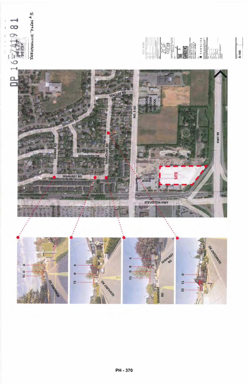
...
NO
TES
: NO
T F
OR
C
ON
ST
RU
CT
ION
' IS
SUE
--
-
ZG
F
CO
TTER
»
t<
rlft
l.-..:n
K
90
1-C
IWatH
ui .
.. S
Oft
l,.Y
-,B
CV
KO
A6
.... _,
_,.,,~"::'.!;"" =~
··---
THE
~GA
RDEN
S TH
E G
AR
DE
NS
PH
AS
E T
HR
EE
B
UIL
DIN
G E
1: D
AH
LIA
B
UIL
DIN
G E
2: C
ALL
A '&
B
UIL
DIN
G F
: JA
SM
INE
:1
TO
WN
LIN
E
HE
IGH
T I
MP
AC
T
Sl\
JDY
A-1
05
I~
PH - 370
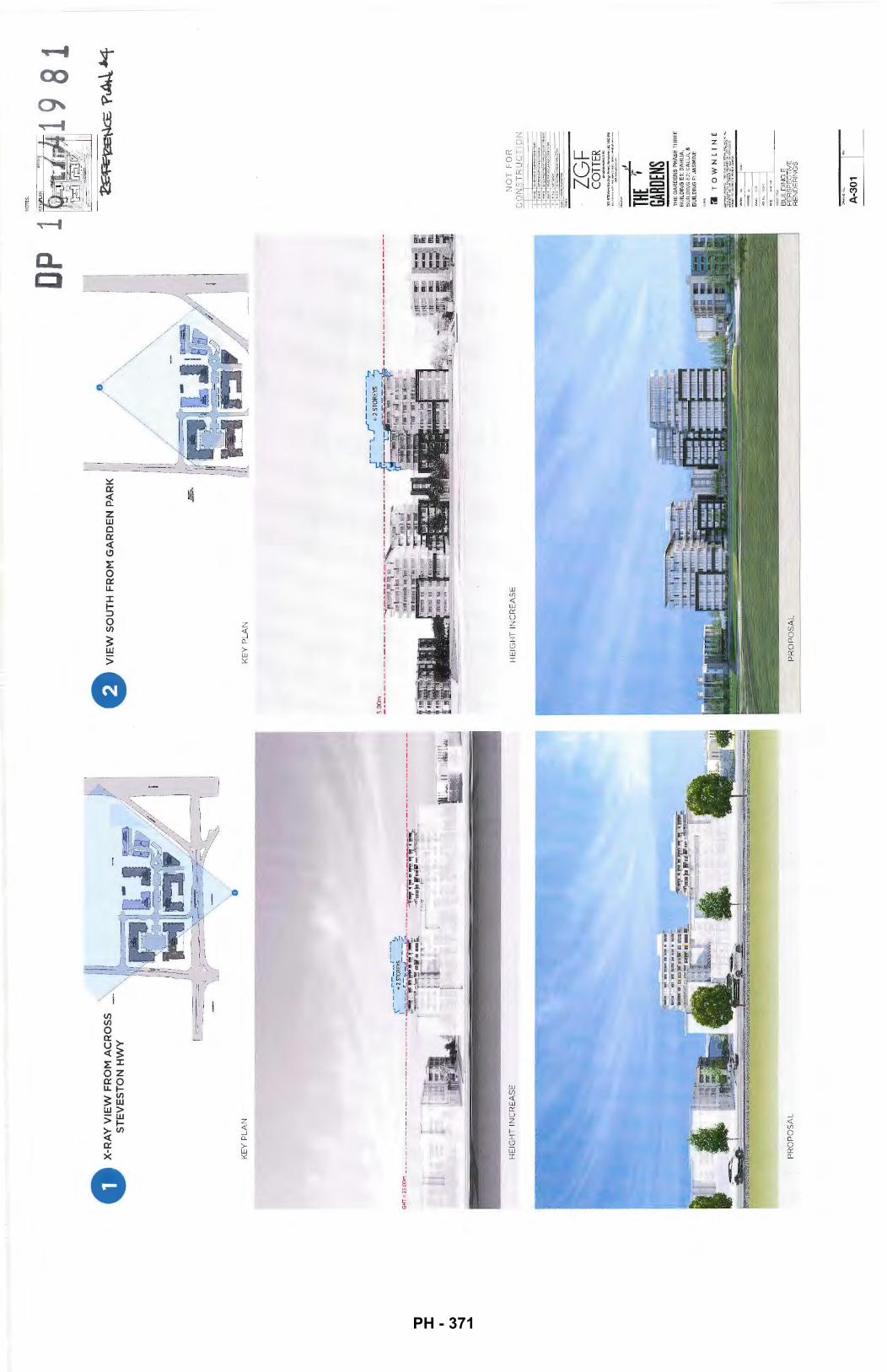
0 M
AC
RO
SS
X-
RA~:
~~~~
~~ H
WY
KE
Y P
LA
N
GH
T=
25
.00m
----
----
----·
-----
·----
----
-----
---
-·.· ....
··-·-~---·-~
-~-·.
,..·
;1,
• ..
-' ~-
<\-
';
.._
)
..,.,.
. .::..~~..:~,..
."
.... ~
« ~
/
HEI
GH
T I
NC
RE
AS
E
PR
OP
OS
AL
DP 1
HE
IGH
T I
NC
RE
AS
E
NOT
ES:
NO
T F
OR
-CO
NS
TR
UC
TIO
N
=
·-·-
TO
WN
LIN
E
II if:
A-3
01
PH - 371
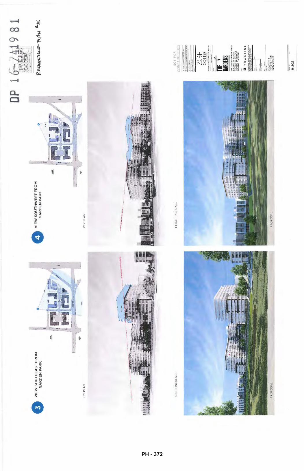
0 V
IEW
SO
UT
HE
AS
T F
RO
M
GA
RD
EN
PA
RK
KE
Y P
LA
N
HE
IGH
T I
NC
RE
AS
E
1 ! I
0 V
IEW
SO
UT
HW
ES
T F
RO
M
GA
RD
EN
PA
RK
KE
Y P
LA
N
HE
IGH
T I
NC
RE
AS
E
DP 1
NO
T F
OR
-CO
NS
TR
UC
TIO
N
' =
~
' ~
~
ZG
F
CO
TTER
901
-UIW~AHoni
iii<
SIIft!.VIIlCOIIft<,&CV6COAii
.........
,..,.,.
... ., ....
,.,.,
. ., .... ~ ....
.... ""'--
THE
t GA
RDEN
S T
HE
GA
RD
EN
S P
HA
SE
TH
RE
E
BU
ILD
ING
E1:
DA
HL
IA,
BU
ILD
ING
E2:
CA
LL
A, &
B
UIL
DIN
G F
: JA
SM
INE
II
TO
WN
LIN
E
BU
ILD
ING
E
PE
RS
PE
CT
IVE
R
EN
DE
RIN
GS
A-3
02
I""
9 81
PH - 372
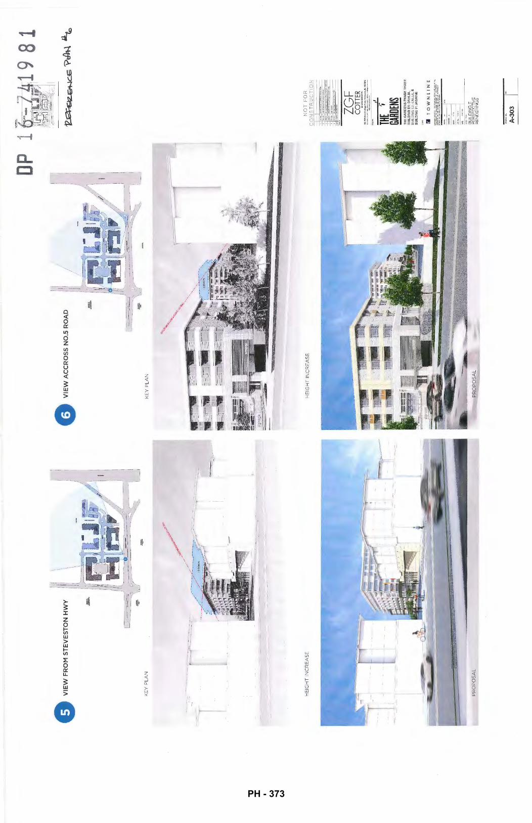
0 V
IEW
AC
CR
OS
S N
0.5
RO
AD
KE
Y P
LA
N
KE
Y P
LA
N
l I l
HE
IGH
T I
NC
RE
AS
E
HE
IGH
T I
NC
RE
AS
E
PR
OP
OS
AL
li ,/
.
I 1:!
DP i
; :
l. _
_j
j
NO
T F
OR
-CO
NS
TR
UC
TIO
N
' =
- ' ~
~·
ZG
F
CO
TTER
THE
~GA
RDEN
S T
HE
GA
RD
EN
S P
HA
SE
TH
RE
E
BU
ILD
ING
E1
: D
AH
LIA
, B
UIL
DIN
G E
2: C
AL
LA,
&
BU
ILD
ING
F:
JAS
MIN
E
:J
TO
WN
LI
NE
BU
ILD
ING
E
PE
RS
PE
CT
IVE
R
EN
DE
RIN
GS
A-3
03
I~
PH - 373
0 \,
VIE
W N
OR
TH
AL
ON
G R
OA
D A~
KE
Y P
LAN
HE
IGH
T I
NC
RE
AS
E
0 V
IEW
SO
UT
HE
AS
T F
RO
M
EN
D O
F R
OA
D A
KE
Y P
LAN
HE
IGH
T I
NC
RE
AS
E
DP
1
'--.....
........ _
----
----
~, ' I
NO
T F
OR
C
ON
ST
RU
CT
ION
-•ru
• -
ZGF
CO
TTER
~
'l0l
-.8l
8WMI
.Has
llfl
ii•.
SU.:
.~V.
.,..
,.,.
.tr,
8CV6
COAS
1U
,-.
J>1.
\0tt
,OO
>""'•>
tl•l
ol1
""0
"''
""'"
k0
Uoo.-
THE
~GA
RDEN
S T
HE
GA
RD
EN
S P
HA
SE
TH
RE
E
BU
ILD
ING
E1:
DA
HL
IA,
BU
ILD
ING
E2:
CA
LL
A,
&
BU
ILD
ING
F:
JAS
MIN
E
:'1
TO
WN
LIN
E
BU
ILD
ING
E
PE
RS
PE
CTI
VE
R
EN
DE
RIN
GS
A-3
04
I~
PH - 374
0 V
IEW
NO
RT
HE
AS
T F
RO
M
AZ
AL
EA
-4
TH
FL
OO
R
KE
Y P
LA
N
PR
OP
OS
AL
I 1
=
p
G VIEW
EA
ST
AL
ON
G R
OA
D B
=-
=
KE
Y P
LA
N
----
----
----
----
----
---
NO
T F
OR
-CO
NS
TR
UC
TIO
N
' ~
ZG
F
CO
TTER
~~~~
:~~;
2:I:
.::-:!
.:';;.~
THE
~GA
RDEN
S T
HE
GA
RD
EN
S P
HA
SE
TH
RE
E
BU
ILD
ING
E1:
DA
HL
IA,
BU
ILD
ING
E2
: C
AL
LA
, &
B
UIL
DIN
G F
: JA
SM
INE
1'1
TO
WN
LI
NE
BU
ILD
ING
E
PE
RS
PE
CT
IVE
R
EN
DE
RIN
GS
A-3
05
I""
PH - 375
VIE
W N
OR
TH
WE
ST
FR
OM
M
AG
NO
LIA
-4
TH
FL
OO
R
KE
Y P
LA
N
VIE
W N
OR
TH
WE
ST
FR
OM
R
OU
ND
AB
OU
T
KE
Y P
LA
N
HE
IGH
T I
NC
RE
AS
E
PR
OP
OS
AL
NO
T F
OR
-CO
NS
TR
UC
TIO
N
. ~
·=· Z
GF
C
OTT
ER
J
THE
~GA
RDEN
S T
HE
GA
RD
EN
S P
HA
SE
TH
RE
E
BU
ILD
ING
E1
: D
AH
LIA
, B
UIL
DIN
G E
2: C
AL
LA
, &
BU
ILD
ING
F:
JAS
MIN
E
1'1
TO
WN
LIN
E
--
1-~ .·
..... ~
BU
ILD
ING
E
PE
RS
PE
CT
IVE
R
EN
DE
RIN
GS
A-3
06
I'"
PH - 376
AE
RIA
L V
IEW
NO
RT
HW
ES
T
FR
OM
HW
Y 9
9
n KE
Y P
LA
N
e A
ER
IAL
VIE
W
i] II KE
Y P
LAN
PR
OP
OS
AL
PR
OP
OS
AL
NO
T F
OR
&CO
NS
TR
UC
TIO
N
' -
~·
ZG
F
CO
TTER
THE
f GA
RDEN
S TH
E G
AR
DE
NS
PH
AS
E T
HR
EE
B
UIL
DIN
G E
1: D
AH
LIA
, B
UIL
DIN
G E
2: C
AL
LA
, &
B
UIL
DIN
G F
: JA
SM
INE
:1
TO
WN
LIN
E
BU
ILD
ING
E
PE
RS
PE
CTI
VE
R
EN
DE
RIN
GS
A-3
07
I~
PH - 377
VIE
W O
F E
NT
RA
NC
E T
O
PE
DE
ST
RIA
N M
EW
S
r 1 I II l·i I I
I I
)l _
__
_ ---
'
KE
Y P
LAN
VIE
W N
OR
TH
AL
ON
G
PE
DE
ST
RIA
N M
EW
S
r i I, II I ll~
-==
-1 I /
__
)
KE
Y P
LAN
I- I
PR
OP
OS
AL
NO
T F
OR
Eii
CO
NS
TR
UC
TIO
N
' ~
~·
ZG
F
CO
TTER
THE
't GA
RDEN
S T
HE
GA
RD
EN
S P
HA
SE
TH
RE
E
BU
ILD
ING
E1:
DA
HLI
A,
BU
ILD
ING
E2:
CA
LL
A,
&
BU
ILD
ING
F:
JAS
MIN
E
:I
TO
WN
LIN
E
BU
ILD
ING
E
PE
RS
PE
CTI
VE
R
EN
DE
RIN
GS
A-3
08
I~
81
PH - 378
8 V
IEW
SO
UT
HW
ES
T F
RO
M G
AR
DE
N P
AR
K
n II r : I I I I I
sa./ I i J ( I
KE
Y P
LA
N
p 1
NO
T F
OR
-CO
NS
TR
UC
TIO
N
- ' ~
IS!U
f THE
1 -GA
RDEN
S T
HE
GA
RD
EN
S P
HA
SE
TH
RE
E
BU
ILD
ING
E1:
DA
HL
IA,
BU
ILD
ING
E2:
CA
LLA
, &
B
UIL
DIN
G F
: JA
SM
INE
:I
TO
WN
LIN
E
-.
1-li
:AI.
[:
... u
.
--=·
OOTE
: "'
""'~
-"
BU
ILD
ING
E
PE
RS
PE
CT
IVE
R
EN
DE
RIN
GS
A-3
09
I~
9 81
PH - 379
Correspondence
None.
Gallery Comments
None.
Panel Decision
Development Permit Panel Wednesday, November 30, 2016
It was moved and seconded That a Development Permit be issued which would:
1. Permit the construction of one (1) 10-storey residential building and three (3) 3-storey residential buildings at 10780 No.5 Road on a site zoned ucommercial Mixed Use (ZMU18)- The Gardens (Shellmont)"; and
2. Vary the provisions of Richmond Zoning Bylaw 8500 to:
a) For the most westerly building (Building E1), increase the maximum height over a parka de structure from six (6) storeys and 25. 0 m, to ten (1 0) storeys and 33.6 m; and
b) For the most westerly building (Building E1), increase the allowable projection of unenclosed balconies into a side yard setback abutting the Agricultural Land Reserve, from a maximum of 0. 9 m to 1. 8 m.
CARRIED
3. New Business
of Next Meeting: December 14, 2016
5.
It was moved and seconded That the meeting be adjourned at 3:5
CARRIED
5.
5243398
PH - 380
Development Permit Panel Wednesday, November 30, 2016
2. Development Permit 16-741981 (REDMS No. 5217500)
5243398
APPLICANT: T ownline Gardens Inc.
PROPERTY LOCATION: 10780 No. 5 Road
INTENT OF PERMIT:
1. Permit the construction of one (1) 10-storey residential building and three (3) 3-storey residential buildings at 10780 No. 5 Road on a site zoned "Commercial Mixed Use (ZMU18)- The Gardens (Shellmont)"; and
2. Vary the provisions of Richmond Zoning Bylaw 8500 to:
a) For the most westerly building (Building E1), increase the maximum height over a parkade structure from six (6) storeys and 25.0 m, to ten (10) storeys and 33.6 m; and
b) For the most westerly building (Building El), increase the allowable projection of unenclosed balconies into a side yard setback abutting the Agricultural Land Reserve, from a maximum of0.9 m to 1.8 m.
Applicant's Comments
Joseph Lau, ZGF Cotter Architects, accompanied by Stephen Slot, Townline Developments, provided background inf01mation on the proposed development and highlighted the following:
• the project is the last phase (Phase 3) of"The Gardens" mixed-used development;
• the original development permit application for Phase 3 was approved by Council in June 2016; however, the applicant is applying for a new development permit specifically for Building E1 and Buildings F1, F2 and F3 to respond to the Ministry of Transportation and Industry (Mo TI) plan for a future expansion of Highway 99 as part of the George Massey Tunnel Replacement (GMTR) project;
• the revised scheme for Phase 3 will redistribute the density from housing units adjacent to Highway 99 to the center of the subject site, through replacing the original proposal for a four-storey apartment building with a cluster of three 3-storey townhouse buildings and increasing the height of Building E 1 from eight to ten storeys; and
• the applicant is requesting a variance to increase the height of Building E1 and another variance to increase the projection of unenclosed balconies of Building E1 from 0.9 meters to 1.8 meters into the side yard setback abutting the park to the north.
3.
PH - 381
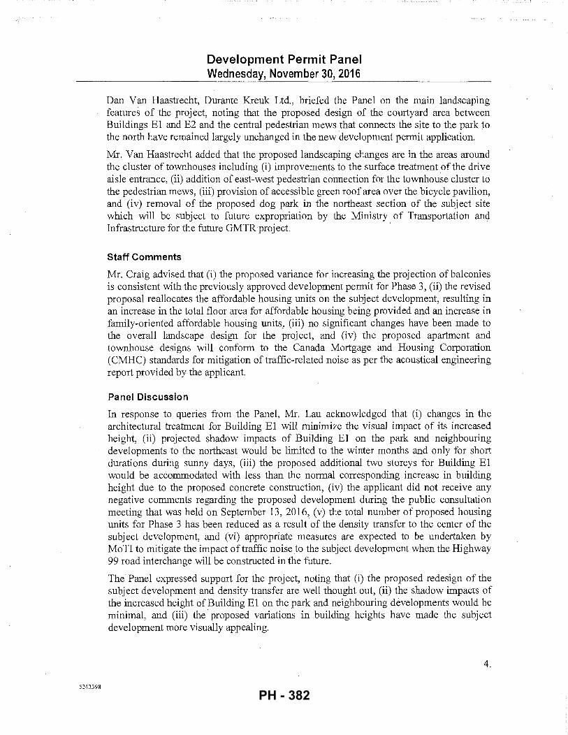
5243398
Development Permit Panel Wednesday, November 30, 2016
Dan Van Haastrecht, Durante Kreuk Ltd., briefed the Panel on the main landscaping features of the project, noting that the proposed design of the courtyard area between Buildings El and E2 and the central pedestrian mews that connects the site to the park to the north have remained largely unchanged in the new development permit application.
Mr. Van Haastrecht added that the proposed landscaping changes are in the areas around the cluster of townhouses including (i) improvements to the surface treatment of the drive aisle entrance, (ii) addition of east-west pedestrian connection for the townhouse cluster to the pedestrian mews, (iii) provision of accessible green roof area over the bicycle pavilion, and (iv) removal of the proposed dog park in the northeast section of the subject site which will be subject to future expropriation by the Ministry of Transportation and Infrastructure for the future GMTRproject. ·
Staff Comments
Mr. Craig advised that (i) the proposed variance for increasing the projection of balconies is consistent with the previously approved development permit for Phase 3, (ii) the revised proposal reallocates the affordable housing units on the subject development, resulting in an increase in the total floor area for affordable housing being provided and an increase in family-oriented affordable housing units, (iii) no significant changes have been made to the overall landscape design for the project, and (iv) the proposed apartment and townhouse designs will conform to the Canada Mortgage and Housing Corporation (CMHC) standards for mitigation of traffic-related noise as per the acoustical engineering report provided by the applicant.
Panel Discussion
In response to queries from the Panel, Mr. Lau acknowledged that (i) changes in the architectural treatment for Building El will minimize the visual impact of its increased height, (ii) projected shadow impacts of Building E1 on the park and neighbouring developments to the northeast would be limited to the winter months and only for short durations during sunny days, (iii) the proposed additional two storeys for Building E 1 would be accommodated with less than the normal corresponding increase in building height due to the proposed concrete construction, (iv) the applicant did not receive any negative comments regarding the proposed development during the public consultation meeting that was held on September 13, 2016, (v) the total number of proposed housing units for Phase 3 has been reduced as a result of the density transfer to the center of the subject development, and (vi) appropriate measures are expected to be undertaken by MoTI to mitigate the impact of traffic noise to the subject development when the Highway 99 road interchange will be constructed in the future.
The Panel expressed support for the project, noting that (i) the proposed redesign of the subject development and density transfer are well thought out, (ii) the shadow impacts of the increased height of Building El on the park and neighbouring developments would be minimal, and (iii) the proposed variations in building heights have made the subject development more visually appealing.
4.
PH - 382
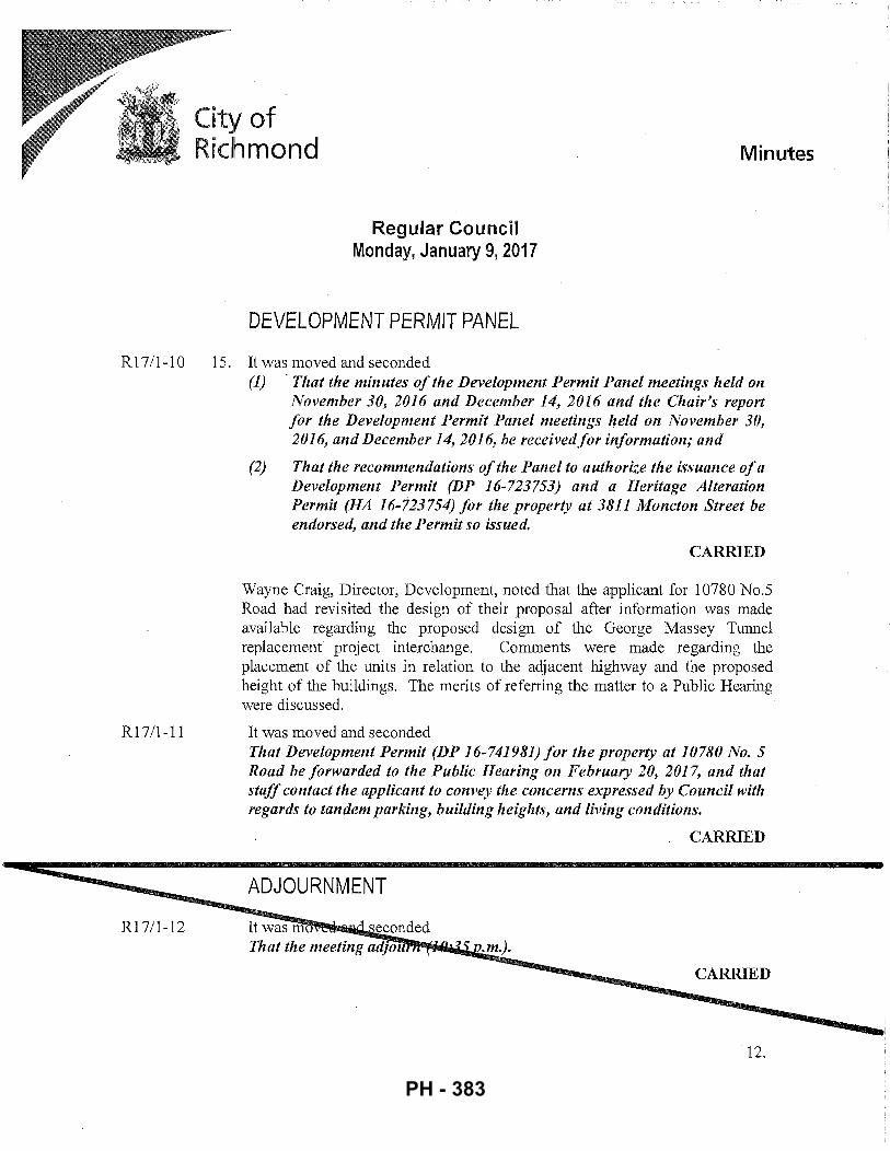
City of Richmond
Regular Council Monday, January 9, 2017
DEVELOPMENT PERMIT PANEL
Minutes
R 1 7/1-1 0 15. It was moved and seconded
R17/1-ll
R17/l-12
(1) · That the minutes of the Development Permit Panel meetings held on November 30, 2016 and December 14, 2016 and the Chair's report for the Development Permit Panel meetings held on November 30, 2016, and December 14, 2016, he received for information; and
(2) That the recommendations of the Panel to authorize the issuance of a Development Permit (DP 16-723753) and a Heritage Alteration Permit (HA 16-723754) for the property at 3811 Moncton Street be endorsed, and the Permit so issued.
CARRIED
Wayne Craig, Director, Development, noted that the applicant for 10780 No.5 Road had revisited the design of their proposal after information was made available regarding the proposed design of the George Massey Tunnel replacement project interchange. Comments were made regarding the placement of the units in relation to the adjacent highway and the proposed height of the buildings. The merits of referring the matter to a Public Hearing were discussed.
It was moved and seconded That Development Permit (DP 16-741981) for the property at 10780 No. 5 Road be fonvarded to the Public Hearing on February 20, 2017, and that staff contact the applicant to convey the concerns expressed by Council with regards to tandem parking, building heights, and living conditions.
CARRIED
ADJOURNMENT
It was econded That the meeting adJOU
CARRIED
12.
PH - 383
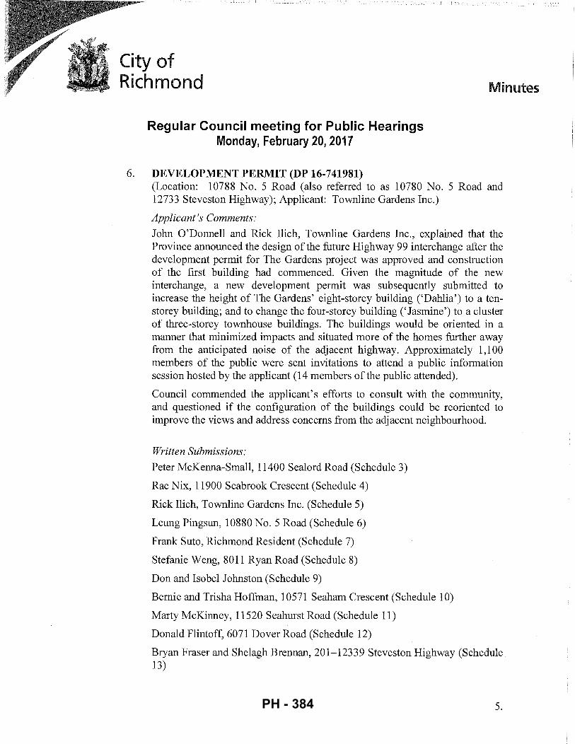
City of Richmond
Regular Council meeting for Public Hearings Monday, February 20, 2017
6. DEVELOPMENT PERMIT (DP 16-741981)
Minutes
(Location: 10788 No. 5 Road (also referred to as 10780 No. 5 Road and 12733 Steveston Highway); Applicant: Townline Gardens Inc.)
Applicant's Comments:
John O'Donnell and Rick Ilich, Townline Gardens Inc., explained that the Province announced the design of the future Highway 99 interchange after the development permit for The Gardens project was approved and construction of the first building had commenced. Given the magnitude of the new interchange, a new development permit was subsequently submitted to increase the height of The Gardens' eight-storey building ('Dahlia') to a tenstorey building; and to change the four-storey building(' Jasmine') to a cluster of three-storey townhouse buildings. The buildings would be oriented in a manner that minimized impacts and situated more of the homes further away from the anticipated noise of the adjacent highway. Approximately 1,100 members of the public were sent invitations to attend a public information session hosted by the applicant (14 members of the public attended).
Council commended the applicant's efforts to consult with the community, and questioned if the configuration of the buildings could be reoriented to improve the views and address concerns from the adjacent neighbourhood.
Written Submissions:
Peter McKenna-Small, 11400 Sealord Road (Schedule 3)
Rae Nix, 11900 Seabrook Crescent (Schedule 4)
Rick Ilich, Townline Gardens Inc. (Schedule 5)
Leung Pingsun, 10880 No.5 Road (Schedule 6)
Frank Suto, Richmond Resident (Schedule 7)
Stefanie Weng, 8011 Ryan Road (Schedule 8)
Don and Isobel Johnston (Schedule 9)
Bernie and Trisha Hoffman, 10571 Seaham Crescent (Schedule 10)
Marty McKinney, 11520 Seahurst Road (Schedule 11)
Donald Flintoff, 6071 Dover Road (Schedule 12)
Bryan Fraser and Shelagh Brennan, 201-12339 Steveston Highway (Schedule 13)
5. PH - 384
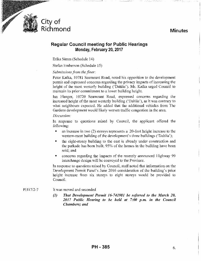
PH17/2-7
City of Richmond
Regular Council meeting for Public Hearings Monday, February 20, 2017
Erika Simm (Schedule 14)
Stefan Emberson (Schedule 15)
Submissions from the floor:
Minutes
Peter Kafka, 10781 Seamount Road, noted his opposition to the development permit and expressed concerns regarding the privacy impacts of increasing the height of the most westerly building ('Dahlia'). Mr. Kafka urged Council to maintain its prior commitment to a lower building height.
Ian Flanger, 10720 Seamount Road, expressed concerns regarding the increased height of the most westerly building ('Dahlia'), as it was contrary to what neighbours expected. He added that the additional vehicles from The Gardens development would likely worsen traffic congestion in the area.
Discussion:
In response to questions raised by Council, the applicant offered the following:
• an increase in two (2) storeys represents a 20-foot height increase to the western-most building of the development's three buildings ('Dahlia');
• the eight-storey building to the east is already under construction and the parkade has been built; 95% of the homes in the building have been sold; and
• concerns regarding the impacts of the recently announced Highway 99 interchange design will be conveyed to the Province.
In response to questions raised by Council, staff noted that information on the Development Permit Panel's June 2016 consideration of the building's prior height increase from six storeys to eight storeys would be provided to Council.
It was moved and seconded
(1) That Development Permit 16-741981 be referred to the March 20, 2017 Public Hearing to be held at 7:00 p.m. in the Council Chambers; and
6. PH - 385
PH17/2-8
City of Richmond Minutes
Regular Council meeting for Public Hearings Monday, February 20, 2017
(2) That DP 16-741981 be referred back to staff for an exhaustive analysis and review, with the applicant, of all possibilities and potential revisions to the proposed development in response to concerns raised at Public Hearing and report back at the next Public Hearing.
CARRIED
ADJOURNMENT
It was moved and seconded
That the meeting adjourn (8:13p.m.). CARRIED
Certified a true and correct copy of the Minutes of the Regular meeting for Public Hearings of the City of Richmond held on Monday, February 20, 2017.
Mayor (Malcolm D. Brodie) Acting Corporate Officer (Claudia Jesson)
7. PH - 386
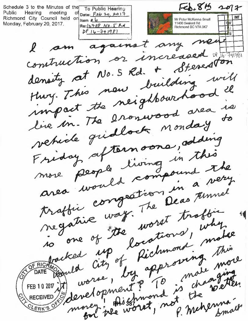
Schedule 3 to the Minutes of the To Public Hearing Public Hearing meeting o Date: 'f.M::J 1.-o - ~ 1-=iRichmond City Council held on Item '-~"'~---Monday, February 20, 2017, Re: ltd:tR ND · r f.-.4
pP lie -.ft 1'!£ I _ '
~-----:_J
"
{~!~ ' <v ~" ' 'I> ~ "" ~
Mr Peter McKenna-Small 11400 Sealord Rd Richmond BC V7 A 3K7
INT
PH - 387
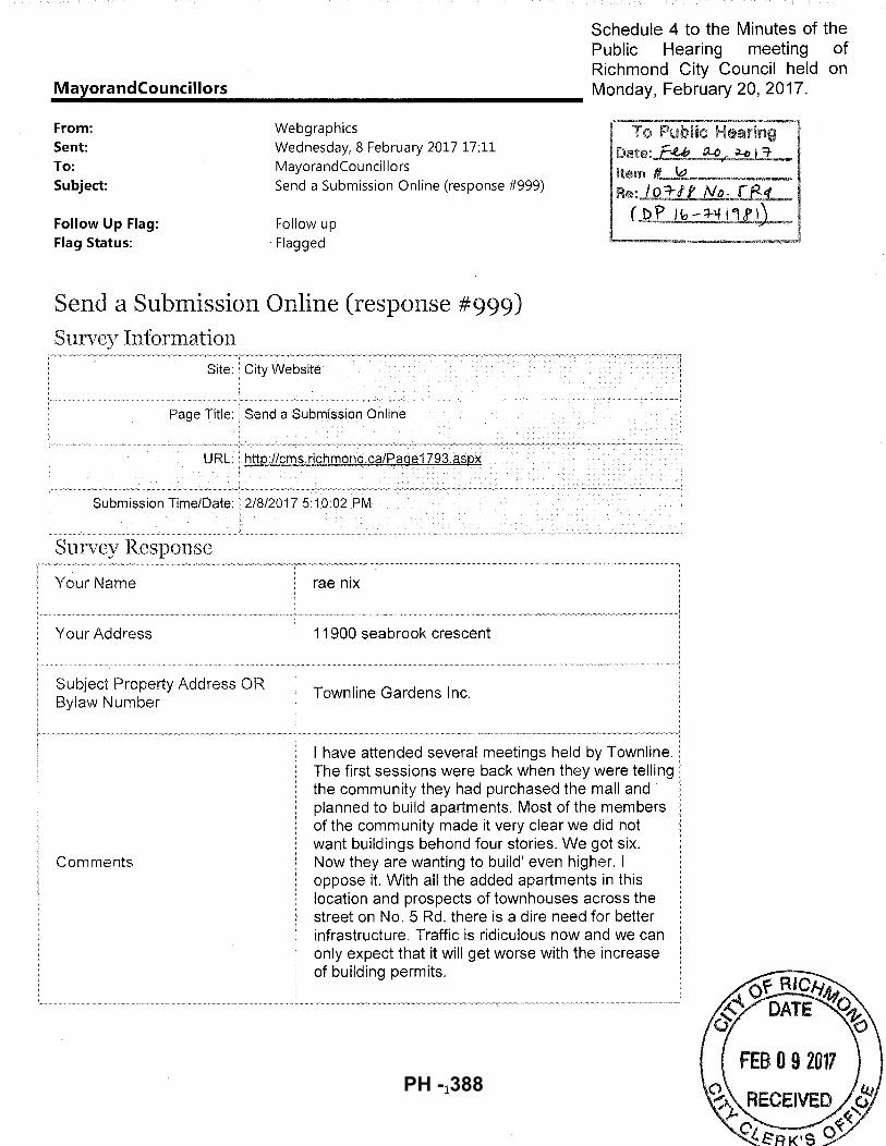
Schedule 4 to the Minutes of the Public Hearing meeting of Richmond City Council held on
-~-a~y~o_r_a_n_d_c_o_u_n_c_il_lo_r_s~~~~~~~~~~~~~~~~~ Monday, Februa~20, 2017.
From: Sent: To: Subject:
Follow Up Flag: Flag Status:
Webgraphics Wednesday, 8 February 2017 17:11 MayorandCouncillors Send a Submission Online (response #999)
Follow up Flagged
Date:.£Y 9...0 f.'.·~ I 'T.~
Item "--=-------Re:, to-=rtr N_(). re:~
( D \' I ~ - ::J-lf f'l f 1)
Send a Submission Online (response #999) Survey Information
Survey Response
Your Name
Your Address
Comments
City Website
rae nix
11900 seabrook crescent
Townline Gardens Inc.
I have attended several meetings held by The first sessions were back when they were telling the community they had purchased the mall and planned to build apartments. Most of the members of the community made it very clear we did not want buildings behond four stories. We got six. Now they are wanting to build' even higher. I oppose it. With all the added apartments in this location and prospects of townhouses across the street on No. 5 Rd. there is a dire need for better infrastructure. Traffic is ridiculous now and we can only expect that it will get worse with the increase of building permits.
1 PH - 388
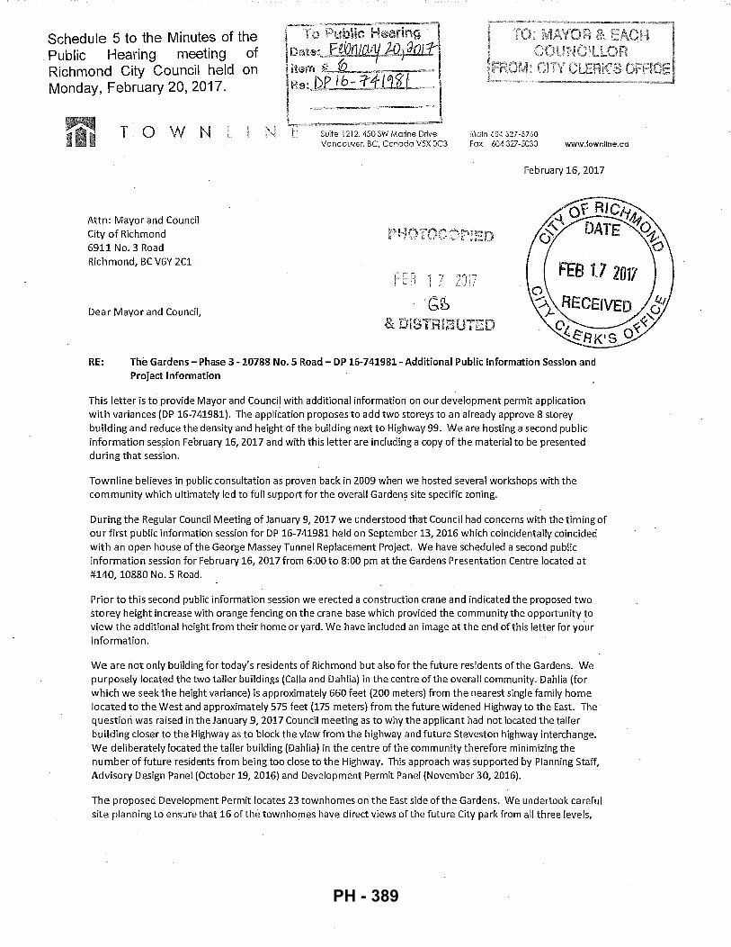
Schedule 5 to the Minutes of the . Public Hearing meeting of Richmond City Council held on Monday, February 20, 2017.
T 0 W N
Attn: Mayor and Council City of Richmond 6911 No. 3 Road Richmond, BC V6Y 2C1
Dear Mayor and Council,
·----==~-- ! r·- Public Hearing I I Date:JWlliOIJ!.ld2i Jar£~ !Item #. 0-~~ = l R~:J>-P i6:_3:1li~ i L,~=~~ · --~- ~---- _ . _. ==-l t Suite 1212, 450 SW Manne Drtve
Vancouver, BC, Canada V5X OC3 Main 604 327-37 60 Fax 604 327-5030 v;ww.townline.ca
February 16, 2017
FEG 1 7 l ;
·<;~
DISTRIBUTED
RE: The Gardens- Phase 3-10788 No.5 Road- DP 16-741981- Additional Public Information Session and Project Information
This letter is to provide Mayor and Council with additional information on our development permit application with variances (DP 16-741981). The application proposes to add two storeys to an already approve 8 storey building and reduce the density and height of the building next to Highway 99. We are hosting a second public information session February 16, 2017 and with this letter are including a copy of the material to be presented during that session.
Townline believes in public consultation as proven back in 2009 when we hosted several workshops with the community which ultimately led to full support for the overall Gardens site specific zoning.
During the Regular Council Meeting of January 9, 2017 we understood that Council had concerns with the timing of our first public information session for DP 16-741981 held on September 13, 2016 which coincidentally coincided with an open house of the George Massey Tunnel Replacement Project. We have scheduled a second public information session for February 16, 2017 from 6:00 to 8:00pm at the Gardens Presentation Centre located at #140, 10880 No. 5 Road.
Prior to this second public information session we erected a construction crane and indicated the proposed two storey height increase with orange fencing on the crane base which provided the community the opportunity to view the additional height from their home or yard. We have included an image at the end of this letter for your information.
We are not only building for to day's residents of Richmond but also for the future residents of the Gardens. We purposely located the two taller buildings (Calla and Dahlia) in the centre of the overall community. Dahlia (for which we seek the height variance) is approximately 660 feet (200 meters) from the nearest single family home located to the West and approximately 575 feet (175 meters) from the future widened Highway to the East. The question was raised in the January 9, 2017 Council meeting as to why the applicant had not located the taller building closer to the Highway as to block the view from the highway and future Steveston highway interchange. We deliberately located the taller building (Dahlia) in the centre of the community therefore minimizing the number of future residents from being too close to the Highway. This approach was supported by Planning Staff, Advisory Design Panel (October 19, 2016) and Development Permit Panel (November 30, 2016).
The proposed Development Permit locates 23 town homes on the East side of the Gardens. We undertook careful site planning to ensure that 16 of the townhomes have direct views of the future City park from all three levels,
PH - 389
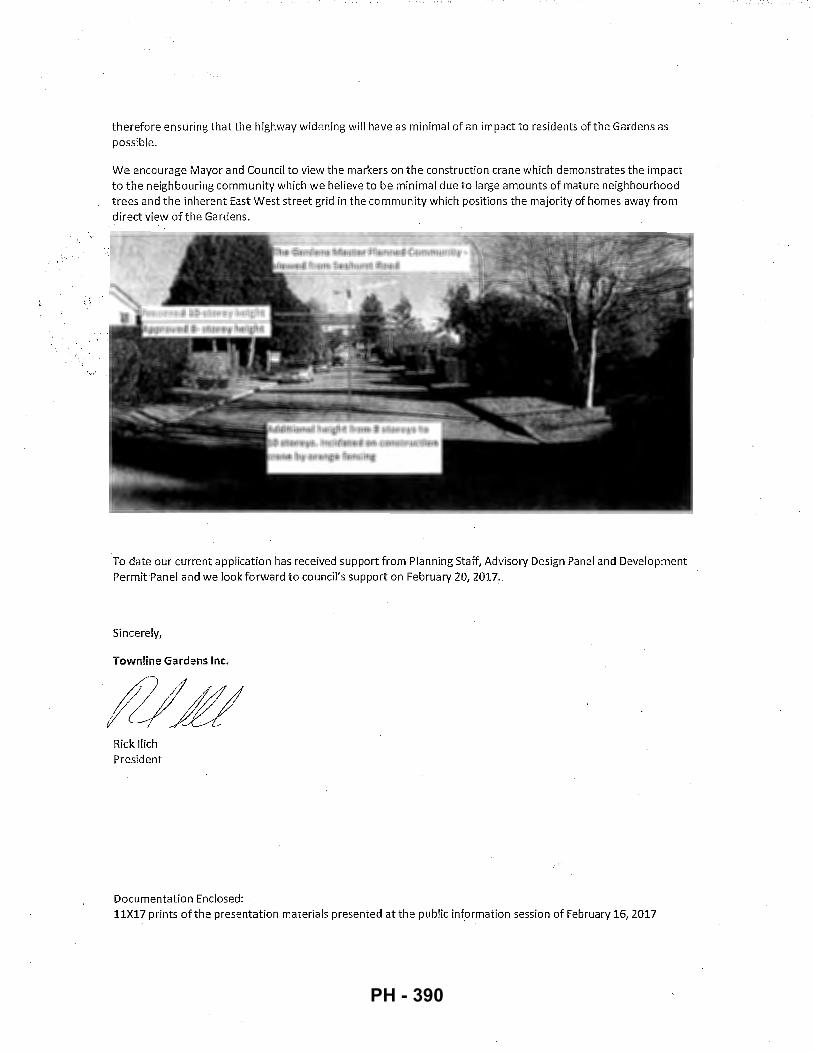
·,-,.
, '·
therefore ensuring that the highway widening will have as minimal of an impact to residents of the Gardens as possible.
We encourage Mayor and Council to view the markers on the construction crane which demonstrates the impact to the neighbouring community which we believe to be minimal due to large amounts of mature neighbourhood trees and the inherent East West street grid in the community which positions the majority of homes away from direct view of the Gardens.
To date our current application has received support from Planning Staff, Advisory Design Panel and Development Permit Panel and we look forward to council's support on February 20, 2017.
Sincerely,
Town line Gardens Inc.
Rick llich President
Documentation Enclosed: 11X17 prints of the presentation materials presented at the public information session of February 16, 2017
PH - 390
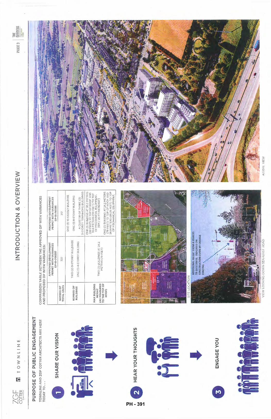
ZG
F C
OTT
ER
m TO'vVNL
II'-~
E
PU
RP
OS
E O
F P
UB
LIC
EN
GA
GE
ME
NT
T
OW
NL
INE
AN
D Z
GF
CO
TT
ER
AR
CH
ITE
CT
S A
RE
HE
RE
T
OD
AY
TO
...
0 S
HA
RE
OU
R V
ISIO
N
e H
EA
R Y
OU
R T
HO
UG
HT
S
A ii
i
0 E
NG
AG
E Y
OU
INT
RO
DU
CT
ION
& O
VE
RV
IEW
CO
MP
AR
ISO
N T
AB
LE
BE
TW
EE
N T
HE
AP
PR
OV
ED
DP
WIT
H V
AR
IAN
CE
S
AN
D P
RO
PO
SE
D D
P W
ITH
VA
RIA
NC
ES
:
NU
MB
ER
OF
T
OT
AL
UN
ITS
NU
MB
ER
OF
B
UIL
DIN
GS
MA
X B
UIL
DIN
G
HE
IGH
T
(AS
ME
AS
UR
ED
T
O T
HE
TO
P O
F
RO
OF
)
AP
PR
OV
ED
DE
VE
LO
I'ME
NT
P
RO
PO
SE
D D
EV
EL
OP
ME
NT
P
ER
MIT
WIT
H V
AR
IAN
CE
S
PE
RM
IT W
ITH
VA
RIA
NC
ES
D
P-1
5-7
08
39
7
DP
-16-
7419
81
32
2
312
ON
E (
1) 1
0-S
TO
RE
Y B
UIL
DIN
G
TW
O (
2)
8-S
TO
RE
Y B
UIL
DIN
GS
O
NE
(1)
8-S
TO
RE
Y B
UIL
DIN
G
ON
E (
1)
4-S
TO
RE
Y B
UIL
DIN
G
A C
LU
ST
ER
OF
TH
RE
E (
3)
3-S
TO
RE
Y T
OW
NH
OM
E B
UIL
DIN
GS
ON
E (
1) B
UIL
DIN
G A
T 3
0.2
ME
TE
RS
(9
9 F
EE
T)
TO
TO
P O
F R
OO
F A
ND
3
3.6
ME
TE
RS
(11
0 F
EE
T)
TO
TO
P
OF
ME
CH
AN
ICA
L E
QU
IPM
EN
T.
TW
O (
2)
BU
ILD
ING
S A
T 2
4.2
[6
M /
20
FT
IN
CR
EA
SE
] M
ET
ER
S (
79
FE
ET
) O
NE
(1)
BU
ILD
ING
AT
24
.2 M
ET
ER
S
(79
FE
ET
) T
O T
OP
OF
RO
OF
AN
D
26
.9 M
ET
ER
S (8
8.2
5 F
EE
T)
TO
TO
P
OF
ME
CH
AN
ICA
L E
QU
IPM
EN
T.
AD
DIT
ION
AL
HE
IGH
T FR
OM
8 S
TOR
EYS
TO 1
0 S
TOR
EYS.
IN
DIC
ATE
D O
N
CO
NS
TRU
CTI
ON
CR
ANE
BY O
RA
NG
E
VIE
W L
OO
KIN
G D
OW
N S
EA
HU
RS
T R
OA
D
AE
RIA
L V
IEW
THE
PHAS
E 3
GARD
ENS
t:;w
;:;ru.,
-:-.:N
t i:-
:~f'
..U.!i
PH - 391
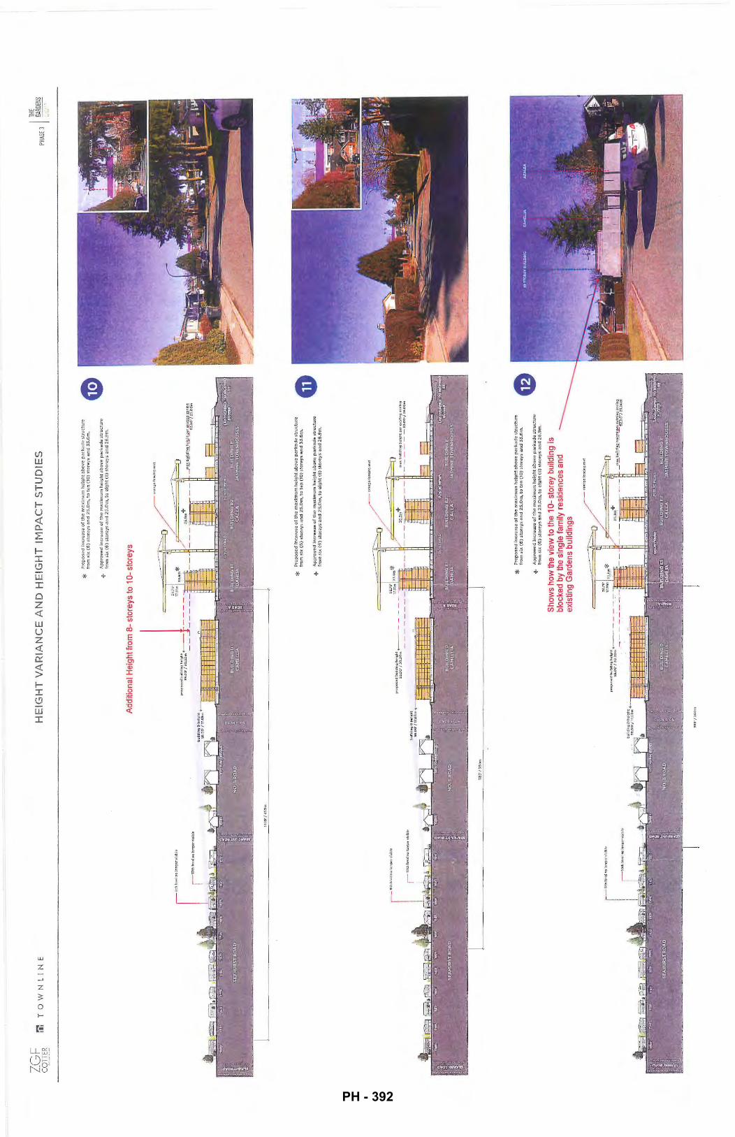
ZG
F
CO
TTER
r.'l
T
OW
NL
IN
E
~lOth
levelnolongervlsib!e
i
1~so·t.:som
HE
IGH
T V
AR
IAN
CE
AN
D H
EIG
HT
lfY
1PA
CT
ST
UD
IES
+
Ap
pro
ve
d i
nc
rea
se o
f th
e m
e::::
.im
um
he
igh
t c;
bove
p2
rka
de
str
uct
ure
fr
om s
ix (
6)
sto
rey
s an
d 2
5.0
m, t
o e
igh
t (8
) st
ore
ys
an
d 2
6.9
rn.
Add
ition
al H
eigh
t fro
m 8
-st
ore
ys to
1 0
-st
orey
s
* P
rop
os
ed i
ncr
ea
se o
f th
e m
axim
um
he
igh
t ab
ove
pa
rka
de
str
uctu
re
fro
m s
ix (
6)
sto
reys
an
d 2
S.O
m, to
te
n (
10
) sto
reys
an
d 3
3.6
m.
+ A
pp
rove
d i
ncr
ea
se o
f th
e m
axi
mu
m h
eig
ht a
bo
ve p
ark
a d
e s
tru
ctu
re
fro
m s
ix (
6)
sto
reys
an
d 2
S.O
m, to
eig
ht
(8)
sto
reys a
nd
26
.9m
.
ora
ng
efc
mcl
ng
mo
t
* P
rop
ose
d in
cre
ase
of th
e m
axim
um
he
igh
t ab
ove
pa
rka
de
str
uct
ure
fr
om s
i.x (
6)
sto
reys
an
d 2
5.0
m, t
o te
n (
10)
sto
rey
s an
d 3
3.6
m.
+ A
pp
rove
d In
cre
ase
of
the
ma
xim
um
he
igh
t a
bo
ve p
ark
ad
e s
tru
ctu
re
fro
m s
ix (
6)
.sto
reys
an
d 2
5.0
m, t
o e
igh
t (8
) st
ore
ys
and
26
.9m
.
Sh
ow
s h
ow
the
vie
w to
the
10
-st
orey
bui
ldin
g is
bl
ocke
d b
y th
e si
ng
le fa
mily
res
iden
ces
and
exis
ting
Gar
dens
bui
ldin
gs
or:.ragelen~iragmat
I THE
PHAS
E 3
~~~,~-~
NS
PH - 392
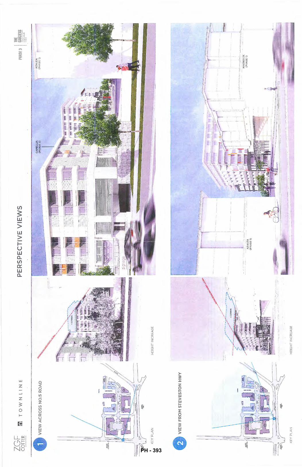
VIE
W AC
ROS-
:==~
------
-~
PE
RS
PE
CT
IVE
iS
NO
.SR
OA
D
~~---~
VIE
WS
1111"!
..'1111
•••
KE
Y P
LA
N
HE
IGH
T I
NC
RE
AS
E
VIE
WF
RO
tv1
ST
EV
ES
TO
N H
WY
HE
IGH
T I
NC
RE
AS
E
~ -i
. ! i
: II
:~·-=-'
-.---~~
~~~
-'-'\ .
..
::-::-:------~--
-_ --
I TH
E
PHAS
E 3
1 ~:~
~-~~s
, :~~r~~
\ -~
·.
-~
.. I
·-·-
-:_.-.
.=:.-
-:--·-
--:
:::: =-..;~
:::.
---=
. -----=
::.:..
..::::
=-_:
::__
MA
GN
OL
IA
-'-'
·=--
,-'--
--7'
(PH
AS
E 1
)
-L=-=
.--.
--·
·-·-
PH - 393
ZG
F
CO
TTER
'~
··:.:ua•t:•ff::'"" ..
. ~
~
•••
TO
WN
LI
NE
AE
RIA
L V
IEW
F
RO
M H
WY
g:O
RT
HW
ES
T
KE
Y P
LA
N
VIE
W S
OU
G
AR
DE
N p~~
~EST
FR
OM
KE
Y P
LA
N
HE
IGH
T I
NC
RE
AS
E
PE
RS
PE
CT
IVE
VIE
WS
PH
ASE
3
-· 1~ ·
I
,.' '·"
i"·,-
.i-·~-
, ..
I I
I .
\\\
-
PH - 394
IGF
C
OTT
ER
••
TO
WN
LIN
E
VIE
W S
OU
TH
FR
OM
GA
RD
EN
P
AR
K
KE
Y P
LA
N
r-----------------
~-
·---
-·----
---
--
PE
RS
PE
CT
IVE
VIE
WS
HE
IGH
T I
NC
RE
AS
E
-~--
----
-·--~-----~
r-
---,
r.f--------,_
,7
.J
L
_J
+
2 ST
ORE
YS
L
~
CA
ME
LL
IA
(PH
AS
E 2
)
THE
PHAS
E 3
GARD
ENS
L:'X
l~\'li
.T:::~
n <E
;·;,;::,
PH - 395
ZGF
CO
TTER
Il
l T
0 w
N l
I
N E
A
VIE
W S
OU
TH
FR
OM
GA
RD
EN
PA
RK
v
LO
OK
ING
AT
JA
SI'1
1NE
TO
WN
HO
ME
S
A
VIE
W O
F J
AS
MIN
E T
OW
NH
OM
ES
v
IN T
HE
PE
DE
ST
RIA
N M
EW
S
TO
WN
HO
ME
S P
RO
VID
ING
VA
RIE
TY
TO
TH
E G
AR
DE
NS
TH
E
PHAS
E 3
GARD
ENS
l\.15ti
:::,·u
:r::;
[·'l
~~::~;.,
PH - 396
LGF
C
OTT
ER
ri:
TO
WN
LIN
E
E2
El • .
/
D
HE
IGH
T I
MP
AC
T S
TU
DIE
S
RIC!
;\M0~
D €H~ISTI~N
SC
HQ
OfL
,,
• •• •
• .
---· .
••
••
••
•• .8
E2
El
THE
PHAS
E 3
GARD
ENS
ti1.rt
?."i !J
::::~:t
l ;~
:::·:
:J.
1 I
PH - 397
LGF
C
OTT
ER
:"1:
TO
WN
LIN
E
e ..... .
•• ...
-··
--
-·· -·
-..
-·-
-••
• ••
• •••
•••
••• •
•
HE
IGH
T I
MP
AC
T S
TU
DIE
S
0 .. • •
--
--.. ••
•• • •
•• •
--
---
! __
• • • •
THE
PH
ASE3
GA
RDEN
S
PH - 398
ZGF
CO
TTER
:i:
T
OW
NL
INE
El
A
••••
••
_qr
. ! . ~
---
HE
IGH
T I
MP
AC
T S
TU
DIE
S
' .,
e l-.~
• • • • •
THE
PHAS
E 3
GARD
ENS
tJ~!JM
'":.ti
:.'?:(l'f
iii?:•
~.!.
1 J
PH - 399
Schedule 6 to the Minutes of the Public Hearing meeting of Richmond City Council held on
-~-a~y~o_r_a_n_d_c_o_u_nc_i_ll_o_rs~~~~~~~~~~~~~~~~~Monday, Februa~20,2017.
From: Sent: To: Subject:
Follow Up Flag: Flag Status:
Webgraphics Wednesday, 8 February 2017 19:23
MayorandCouncillors
Send a Submission Online (response #1000)
Follow up
Flagged
Send a Submission Online (response #1000)
Survey Information City Website
URL: http://cms.richmond.ca/Page1793.aspx
Submission Time/Date: 2/8/2017 7:22:20 PM
Survey Response
Subject Property Address OR Bylaw Number
Comments
LEUNG PINGSUN
BYLAW 8500
REJECT TO INCREASE THE MAX HEIGHT OVER A PARKADE STRUCTURE FROM 6 STOREYS TO 10 STOREYS. THE INCREASE WILL CREATE TOO MUCH TRAFFIC TO THIS AREA.
1 PH - 400
MayorandCouncillors
From: Sent: To: Subject:
Follow Up Flag: Flag Status:
Feb 9, 2017
Frank Suto <[email protected]> Thursday, 9 February 2017 18:33 MayorandCouncillors The Gardens Public Hearing
Follow up Completed
Development Variances Requested by Townline for "The Gardens" project
Schedule 7 to the Minutes of the Public Hearing meeting of Richmond City Council held on Monday, February 20, 2017.
Hearing Date: fw. k, ~ t -=t Item ll;......:;;.I.P _____ _
Re: ro"t83 No. S" ftd.
lD~
Feb 8 letter regarding a Public Information Session and Public Hearing from Townline Undated Notice of Public Hearing from the City of Richmond
I received both missives yesterday and offer the following comments:
While both reference the same development permit number (DP 16-741981) there is considerable variation in the information presented which I found to be confusing and suspect most will find confusing.
The notice form the City indicates a request from the developer to increase the height of an approved six story 25.0 m high structure to a ten story 33.6 m high structure and a request to increase the allowable projection of unenclosed balconies from 0.9 m to 1.8 m. The notice from Townline indicates a request to increase the height of one of two approved eight-storey 24.2 m high structures to a ten-storey 30.2 m structure and moving from one four-storey structure to three three-story structures.
A call to the City provided a fuzzy clarification: While the City's notice was technically correct; the information within the Townline letter is a more complete description of what is already approved (including variances) and what is being requested.
I'm still scratching my head with regard to the difference between the City's notice and Townline's letter. Nevertheless as a resident of the area I am of the opinion that any structure taller than the approved 25.0 m height should not be approved. The approved 25.0 m height is, in my opinion, already too high and out of character for the area and will set a precedent and open the door for additional requests for tall structures in the area.
The new bridge will provide enough visual distraction without the addition of residential towers.
While I am sympathetic to Townline's issue of proximity to Hwy 99; Hwy 99 is still in the same place it was before the project was proposed. And based on what I've learned about the proposed Hwy 99 I Steveston Hwy interchange it won't be getting all that much closer.
As a result I would suggest that Townline stay with what's already approved or come up with a new plan that increases separation from Hwy 99 with increased low rise density (no more than four or five storeys) toward the western side of the property. The outcome may be a project with fewer than the presently approved 500 residential units.
Without an understanding of what structures would abut ALR land on the north side (and the setback) it's difficult to offer an opinion one way or another on balconies.
I'd also like to suggest that the City re-address the geometry of the No 5 Road and Westminster Hwy intersection. Anyone travelling westbound along Steveston Hwy has to make a 110 to 115 degree right turn (should be 90 degrees) into
1 PH - 401
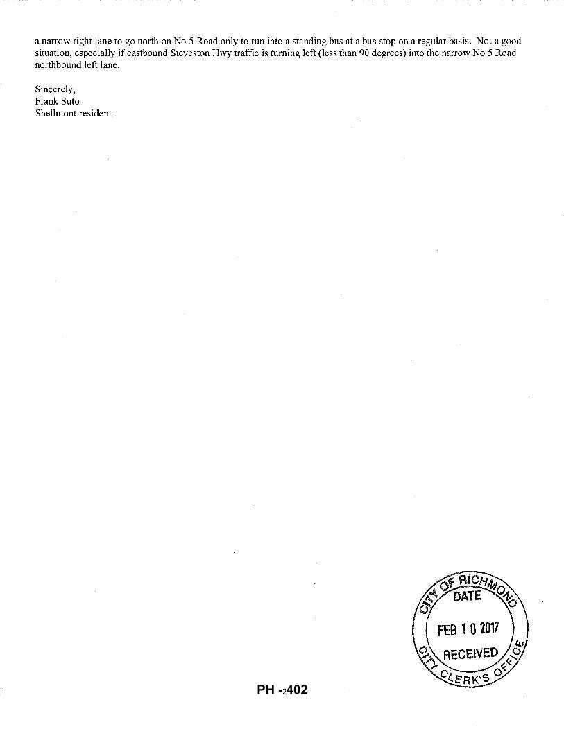
a narrow right lane to go north on No 5 Road only to run into a standing bus at a bus stop on a regular basis. Not a good situation, especially if eastbound Steveston Hwy traffic is turning left (less than 90 degrees) into the narrow No 5 Road northbound left lane.
Sincerely, Frank Suto Shellmont resident.
2 PH - 402
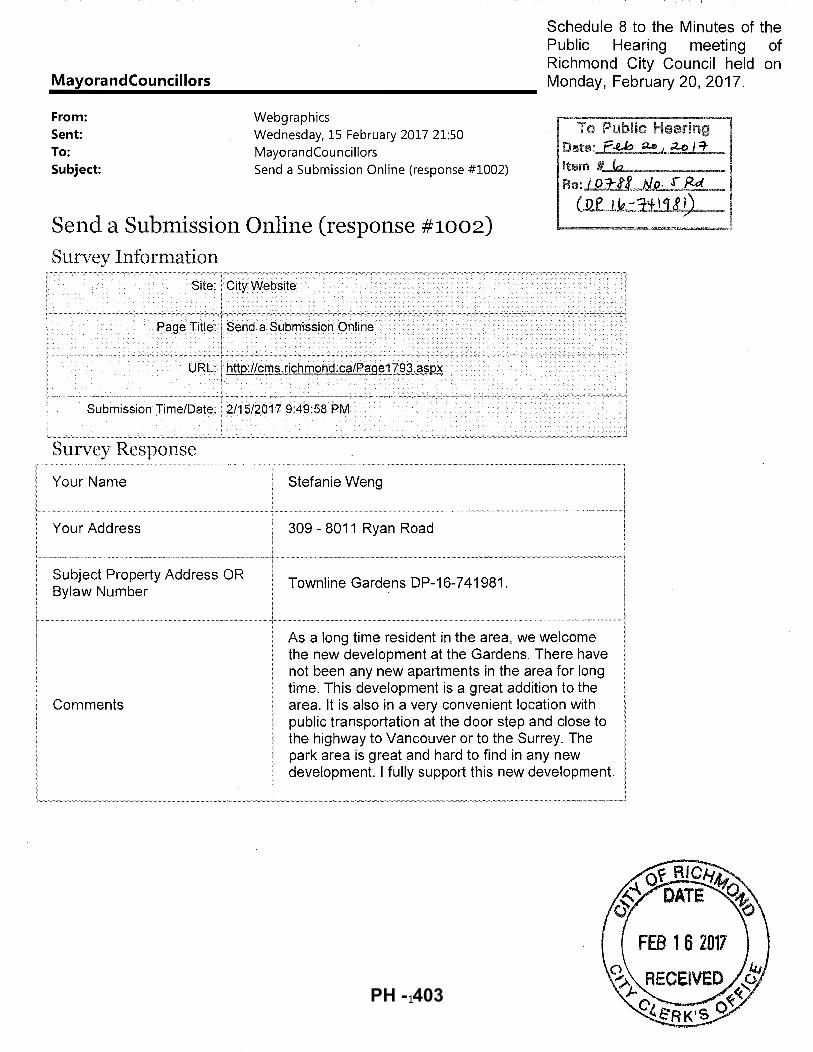
MayorandCouncillors
From: Webgraphics
Schedule 8 to the Minutes of the Public Hearing meeting of Richmond City Council held on Monday, February 20, 2017.
Sent: Wednesday, 15 February 2017 21:50 MayorandCouncillors To: Date:..£.-U:> a&, .2.o I 7
Item "'--"~-----Subject: Send a Submission Online (response #1002) Re: l D 1::1£ Nf2: :r /<d
...........
(Qe lt?-;HI'fJL~ Send a Submission Online (response #1002)
Survey Inforn1ation Site: City Website
Send a Submission Online
Survey Response
Your Name Stefanie Weng
Your Address 309- 8011 Ryan Road
Subject Property Address OR Townline Gardens DP-16-741981. Bylaw Number
As a long time resident in the area, we welcome the new development at the Gardens. There have not been any new apartments in the area for long time. This development is a great addition to the
Comments area. It is also in a very convenient location with public transportation at the door step and close to the highway to Vancouver or to the Surrey. The park area is great and hard to find in any new development. I fully support this new development.
'
1
/
PH - 403
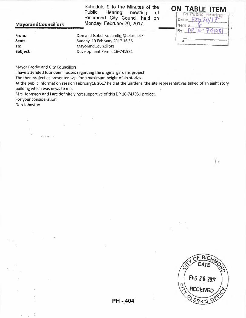
Schedule 9 to the Minutes of the Public Hearing meeting of Richmond City Council held on
_M_a1111
y,_o_r_a_nd_c_o_u_nc_i_ll_o_rs ____ Monday, February 20, 2017.
From: Sent: To: Subject:
Don and Isabel <[email protected]> Sunday, 19 February 2017 16:36 Mayora ndCou nci llors Development Permit 16-741981
Mayor Brodie and City Councillors. I have attended four open houses regarding the original gardens project. The then project as presented was for a maximum height of six stories.
ON TABLE ITEM · To Public Hearing Date: feta$Qjl1: Item #. 0 Rs: D~P~I GF-_-::P:-:1 .._,LE1J,...,.t [-
At the public information session February16 2017 held at the Gardens, the site representatives talked of an eight story building which was news to me. Mrs. Johnston and I are definitely not supportive of this DP 16-741981 project. For your consideration. Don Johnston
PH - 404
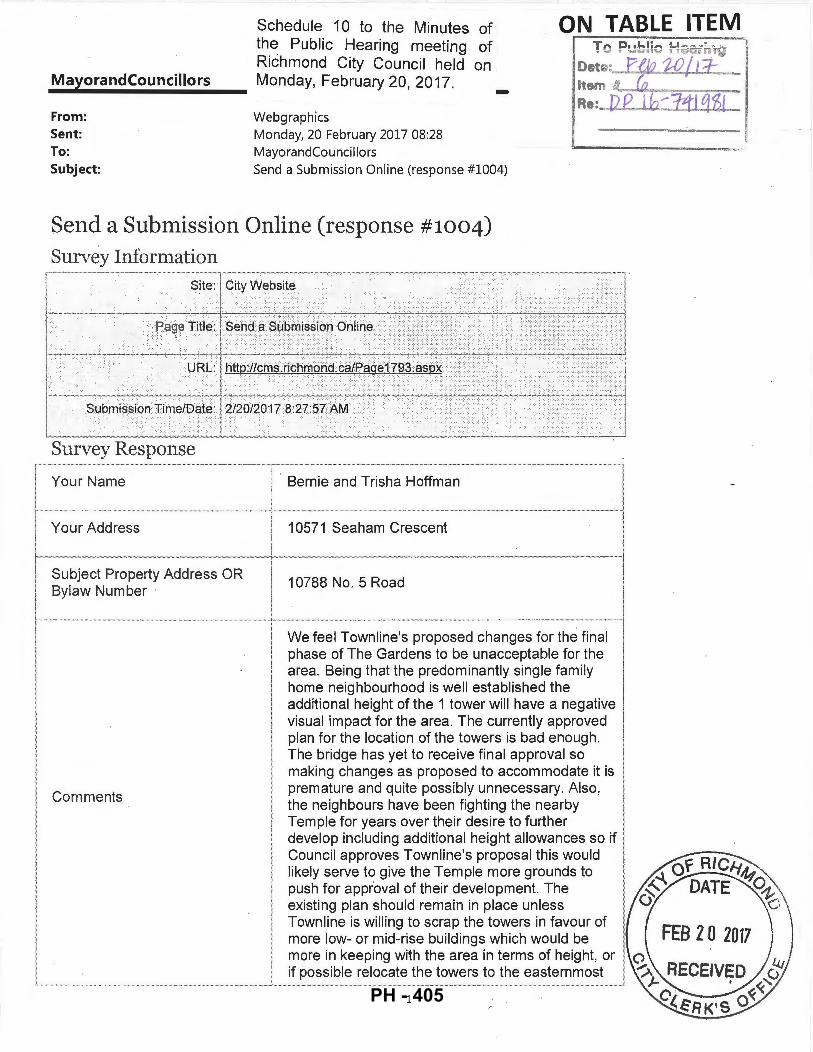
i i I
MayorandCouncillors
From: Sent: To:
Schedule 1 0 to the Minutes of the Public Hearing meeting of Richmond City Council held on Monday, February 20, 2017.
Webgraphics Monday, 20 February 2017 08:28 MayorandCouncillors
-Subject: Send a Submission Online (response #1004)
Send a Submission Online (response #1004)
Survey Information Site:
I.······· ............ . ......................... ............................ ............. !..!!.=.:;~"-'-'=!.~=+-=="-~==
l- ~;;;;~~....1: _____ ...;_;_;_:...;__ ________ __;,:...;__, ____ ~_;___ __ .,-.! Survey Response
... ··· ~·~~·~··· ·~·~·~·~········· · · · · ··· · ............................. ........................... ······························!···· ... B~·~·~i·~····~·~~··· ~~i~~~H offma n
Your Address
Subject Property Address OR Bylaw Number
Comments
1 0571 Sea ham Crescent
10788 No. 5 Road
We feel Townline's proposed changes for the final phase of The Gardens to be unacceptable for the area. Being that the predominantly single family home neighbourhood is well established the additional height of the 1 tower will have a negative visual impact for the area. The currently approved plan for the location of the towers is bad enough. The bridge has yet to receive final approval so making changes as proposed to accommodate it is premature and quite possibly unnecessary. Also , the neighbours have been fighting the nearby Temple for years over their desire to further develop including additional height allowances so if Counci l approves Townline's proposal this would likely serve to give the Temple more grounds to push for approval of their development. The existing plan should remain in place unless Townline is willing to scrap the towers in favour of more low- or mid-rise buildings which would be more in keeping with the area in terms of height, or if possible relocate the towers to the easternmost
1 PH - 405
portion of the development (closer to the highway) but ideally keep them no higher than the currently approved height.
2 PH - 406
MayorandCouncillors
From: Sent: To: Subject:
Schedule 11 to the Minutes of the Public Hearing meeting of Richmond City Council held on Monday, February 20, 2017.
Marty McKinney <[email protected] > Monday, 20 February 2017 09:07 MayorandCouncillors The Gardens Development
ON "[ABLE_ ITEM
-, .~
To Public He ring Date: f~ 10/11-ltem #. ~ RG : bJ--:-'0 1'""'""'6-,."'=J~:tt ~q &_.....-(
L ·----
Just a note to express my opposition to the addition of 2 more floor to The Gardens development. From what I read they have already had a variance to increase from 6 to 8 floors and now wish to go higher. If this is allowed it then sets a precedent for the rest of the 5 Road properties north of this development. More units adds up to more vehicles and even with the new interchange there are no changes to the #5 Road and Steveston Hwy corner merge mess.
Mrui:y lv1 cK~ 11520 Seciht.Nv~RciR~'BC .
V7A 3P2
1 PH - 407
MayorandCouncillors
From: Sent: To: Subject:
Dear Mr. Weber,
Schedule 12 to the Minutes of the Public Hearing meeting of Richmond City Council held on Monday, February 20, 2017. -
Don Flintoff <[email protected]> Monday, 20 February 2017 09:30 CityCierk; MayorandCouncillors Townline Gardens Inc.
ON TABLE ITEM
After reviewing the site plans, I would prefer the original 8-storey building along the lines of the original proposal.
My reasons for this are:
1. The 10-storey residential building should be reduced to the original 8 stories as it would be obtrusive in this area.
2. It should be sound-proofed similar to those near the airport to reduce the road noise.
3. The balconies should not protrude into the setbacks.
To be clear, I oppose the 1 0-storey building.
Cheers,
Donald Flintoff,
6071 Dover Rd.
1 PH - 408
Attention: City Clerk City of Richmond 6911 No. 3 Road Richmqnd, BC V6Y 2C1
Schedule 13 to the Minutes of the Public Hearing meeting of Richmond City Council held on Monday, February 20, 2017.
Dear Mayor and Council,
ON TABLE ITEM
We ar~ writing to express our support for the develo~ment permit (DP-15-70839~) plan for the final phase of 'The Gardens" community located at the corner pf No. 5 Road and Steveston HighWay. We believe this new plan successfully portrays the vision of 'The Gardens' whi!e minimizing the impact to the surrounding community. ·
. .
. .
As ow11ers of a residence in phase one ofthis project, we believe this final phase will turr) 'The Gardens' into the community that was envisioned when we purchased the unit. We understand the reasons for the design changes and feel that thi.s new proposal with the 10-storey building in the middle will benefit all reside~ts of 'The Gardens'. We are looking forward to seeing our community being qompleted. ·
Regar9s, r
~,0~~-'2-~'y~ Bryan FrJJr and Shelagh Brennan #20 1 - .12339 Steveston Hwy Richmond V6W 084
PH - 409
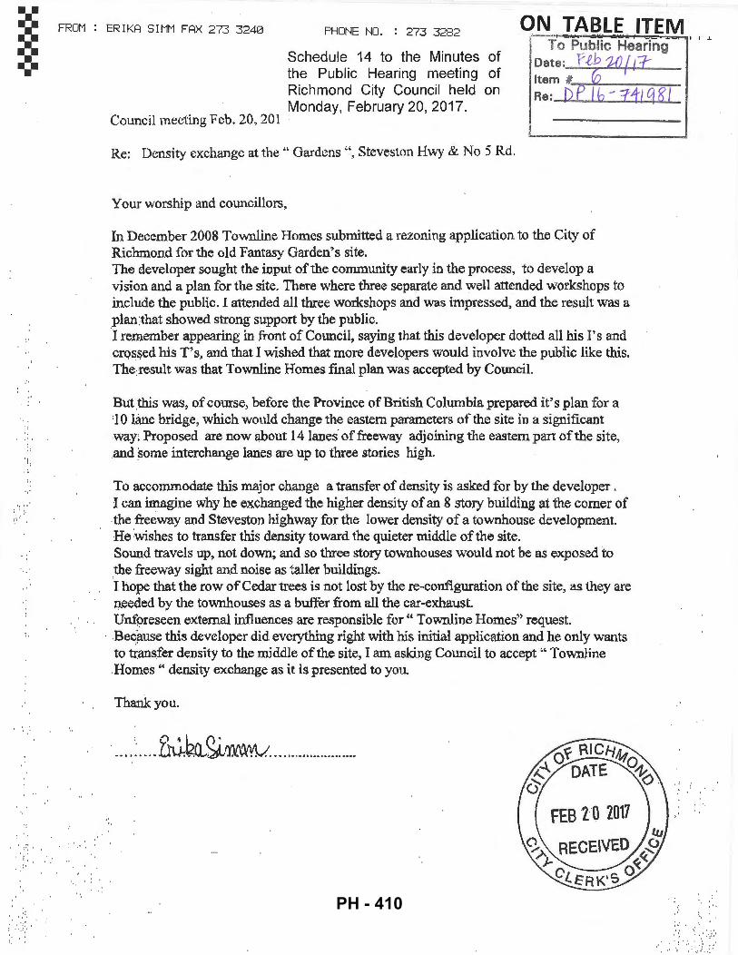
v·
' . ~ : •,.
; ..
FROM
. . . , .. ,
ERIKA SIMM FAX 273 3240 PHONE NO. : 273 3282 ON TABLE ITEM Schedule 14 to the Minutes of the Public Hearing meeting of Richmond City Council held on Monday, February 20, 2017.
· To Public Hearing
~=:·l l'tb :~ Re: DP ~_:_E.@ B:I
Council meeting Feb. 20, 201
Re: Density exchange at the" Gardens'", Steveston Hwy & No 5 Rd.
Your worship and councillors,
In December 2008 Townline Homes submitted a rezoning application to the City of Richmond for the old Fantasy Garden's site. The developer sought the input of the community early in the process, to develop a vision and a plan for the site. There where three sepEI:fate and well attended workshops to include the public. I attended all three workshops and was impressed, and the result was a plan:that showed strong support by the public. ·I remember appearing in front of Council, saying that this developer dotted all his I' s and cros~ed his T' s, and that I wished that more developers would involve the public like this. The:result was that Townline Homes final plan was accepted by Council.
Bu:tthis was, of course, before the Province of British Columbia prepared it's plan for a '1 0 lane bridge, which wonld change the eastern parameters of the site in a significant way~ Proposed are now ~bout 14lanes of freeway adjoining the eastern part of the site, .and some interchange lanes are up to three stories high.
To accommodate this major change a transfer of density is asked for by the developer . I can imagine why he exchanged the higher density of an 8 story building at the corner of the freeway and Steveston highway for the lower density of a townhouse development. He wishes to transfer this density toward the quieter middle of the site. Sound travels up, not down; and so three story townhouses would not be as exposed to .the freeway sight and noise as taller buildings. I hope that the row of Cedar trees is not lost by the re-configuration of the site, as they are needed by the townhouses as a bufter from all the car-exhaust. Unforeseen external influences are responsible for" Townline Homes" request.
· .Beqause this developer did everything right with his initial application and he only wants to transfer density to the middle of the site, I am asking Council to accept'" TownJine .Homes" density exchange as it is presented to you.
Thank you.
, 9.. ~ L~ () ~ · .... ~ .... L~~~~ ...................... .
' ' ~
I I .l.
. .. ·:' ·· ...
PH - 410
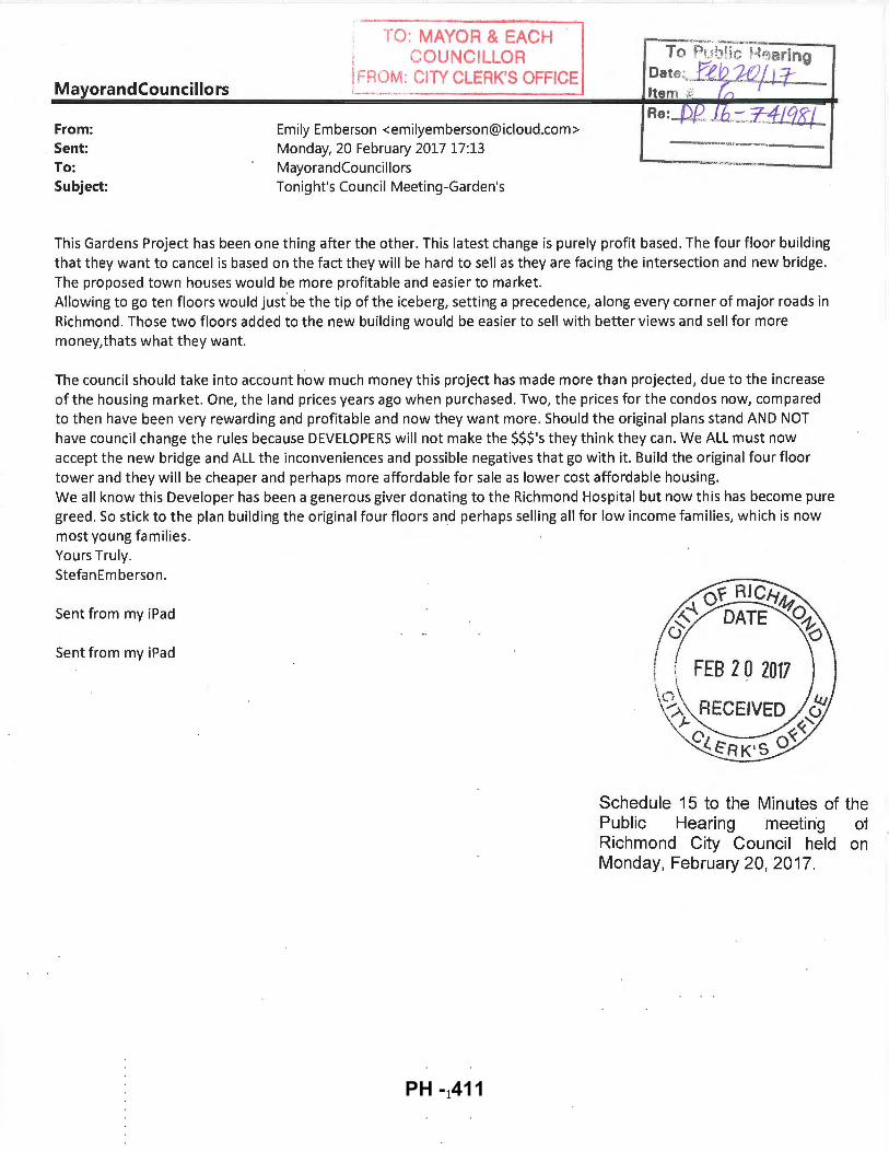
TO: MAYOR & EACH =:>.·:~ -~-
I COUNCILLOR To P~Jh!k Hqaring I
Oate:~~f'Lt?. ~ MayorandCouncillors
!FROM: CITY CLERK'S OFFICE -- ... ··-·-- ~ - Item '#:. 7:-,
From: Emily Emberson <[email protected]> Re: _J)J2 .. fh~-:::-L41Cf8j
Sent: Monday, 20 February 2017 17:13 ~--..-~.....,v.-..,......_.,,=~-.,- "<" "
To: MayorandCounc1llors """!l<><l<••..,
Subject: Tonight's Council Meeting-Garden's
This Gardens Project has been one thing after the other. This latest change is purely profit based. The four floor building that they want to cancel is based on the fact they will be hard to sell as they are facing the intersection and new bridge. The proposed town houses would be more profitable and easier to market. Allowing to go ten floors would just' be the tip of the iceberg, setting a precedence, along every corner of major roads in Richmond. Those two floors added to the new building would be easier to sell with better views and sell for more money,thats what they want.
The council should take into account how much money this project has made more than projected, due to the increase of the housing market. One, the land prices years ago when purchased. Two, the prices for the condos now, compared to then have been very rewarding and profitable and now they want more. Should the original plans stand AND NOT have council change the rules because DEVELOPERS will not make the $$$'s they think they can. We ALL must now accept the new bridge and ALL the inconveniences and possible negatives that go with it. Build the original four floor tower and they will be cheaper and perhaps more affordable for sale as lower cost affordable housing. We all know this Developer has been a generous giver donating to the Richmond Hospital but now this has become pure greed. So stick to the plan building the original four floors and perhaps selling all for low income families, which is now most young families. Yours Truly. StefanEmberson.
Sent from my iPad
Sent from my iPad
1
Schedule 15 to the Minutes of the Public Hearing meeting of Richmond City Council held on Monday, February 20, 2017.
PH - 411