Overarching Science Goals
• Search for Water (Mars, Moon, Europa)
• Search for Active Tectonism/Volcanism (Venus, Europa). On Io, quantify on-going processes.
• Improved Topography for geomorphology studies and landing sites characterization (Moon, Mars, Venus and Europa)

Moon: Investigate Polar Ices & Possible Landing Sites
• Image permanent shadow areas at poles
• Characterize topography at potential landing sites; meter-scale horizontal.
• Polar topo. to determine lighting geometry; 10-m scale resolution
• Global topography for crustal modeling; 50 – 75 m resolution.
• Composition of ices via dielectric properties
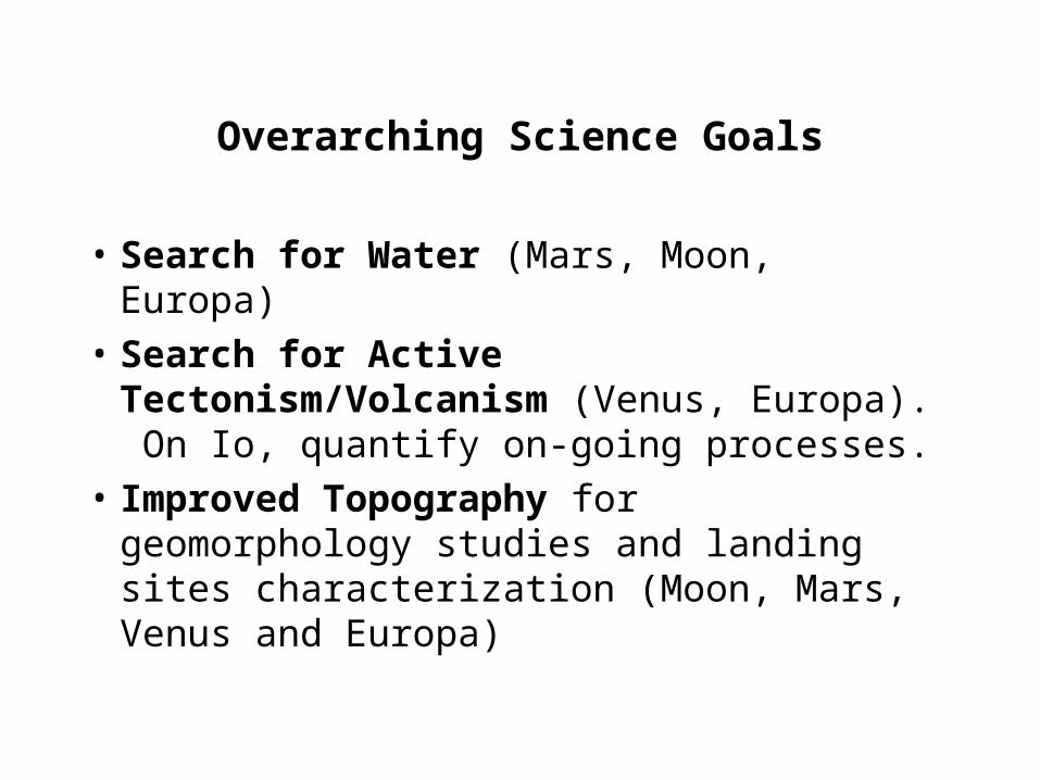
Mars: Follow the Water & Climate Change
• Does near-surface liquid water exist anywhere today?
• Polar cap studies – surface motion, seasonal variability, rates of change of cap.
• Ice sheet change detection (“swiss cheese”)
• Tracking seasonal ice/water interface across globe as detected by Mars Odyssey.
• Freeze/thaw seasonal variations (rock glaciers, crater gullies, polygons)

• Surface changes at lower latitudes (e.g., dunes, landslides)
• Topographic mapping at better than Mars Express resolution: landing site characterization, paleo-shorelines, paleo-climate geomorphology
• Subsurface topography to search for buried drainage channels (search for paleo-rainfall?)

Europa: Potential Habitability of the moon
• Radar sounding to determine thickness of icy crust – depth of brittle/ductile transition
• Determine topography of potential penetrator landing sites
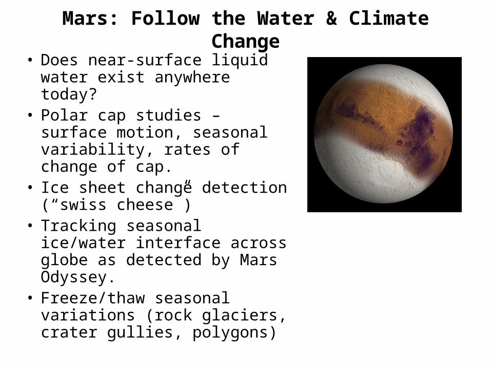
What is the Thickness of Europa’s Icy Crust?
• Investigate strange “cycloid” ridges – may be formed from daily fracturing
• Search for deformation along cracks to determine to see if brine is leaking to surface. One tidal cycle or longer time periods
• What is role of large tidal amplitudes (~30 m) on 1.8-Earth day time period?
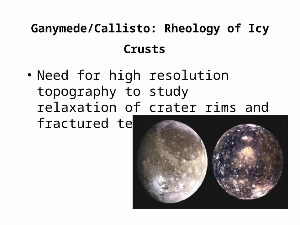
Ganymede/Callisto: Rheology of Icy Crusts
• Need for high resolution topography to study relaxation of crater rims and fractured terrain
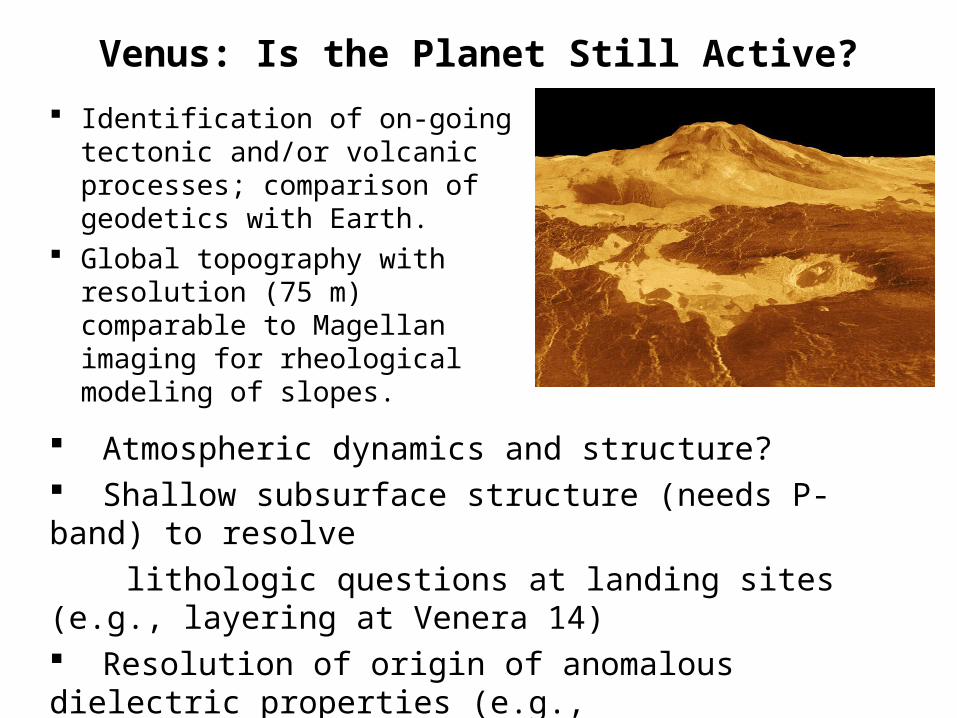
Venus: Is the Planet Still Active?
Identification of on-going tectonic and/or volcanic processes; comparison of geodetics with Earth.
Global topography with resolution (75 m) comparable to Magellan imaging for rheological modeling of slopes.
Atmospheric dynamics and structure? Shallow subsurface structure (needs P-band) to resolve
lithologic questions at landing sites (e.g., layering at Venera 14) Resolution of origin of anomalous dielectric properties (e.g.,
Maat Mons)
Technology Development for all Planets
• On-board processing for topographic recovery. Learn how to do this at Earth first to perfect data processing approach. Assume only 1 or 2 products with single-pass interferometry.
• Penetration would require longer wavelengths.• Extended mission duration for seasonal studies on
Mars.• SCAN-SAR best operating mode to repeatedly view
large areas (e.g., on Venus). Would need on-board processing.
• Spotlight imaging for selected sites for high resolution topography on Mars.

Galilean Satellite Technologies
• Radiation hardening of spacecraft.• Data recovery on Earth more challenging due to
Earth-Jupiter distance.• Challenging navigation of spacecraft for short
duration mission.• If sub-surface ice needs to be characterized, need
longer wavelength than P-band data. Do not how to do this at high power and voltage required for Jupiter mission.

Earth Analog Technology/Phenomenology Development
• Develop on-board processing of InSAR data
• Develop understanding of multi-wavelength volume scattering with radar penetration. Use of orbital or aircraft experiments OK
• Characterize compositional effects on dielectric properties of materials.