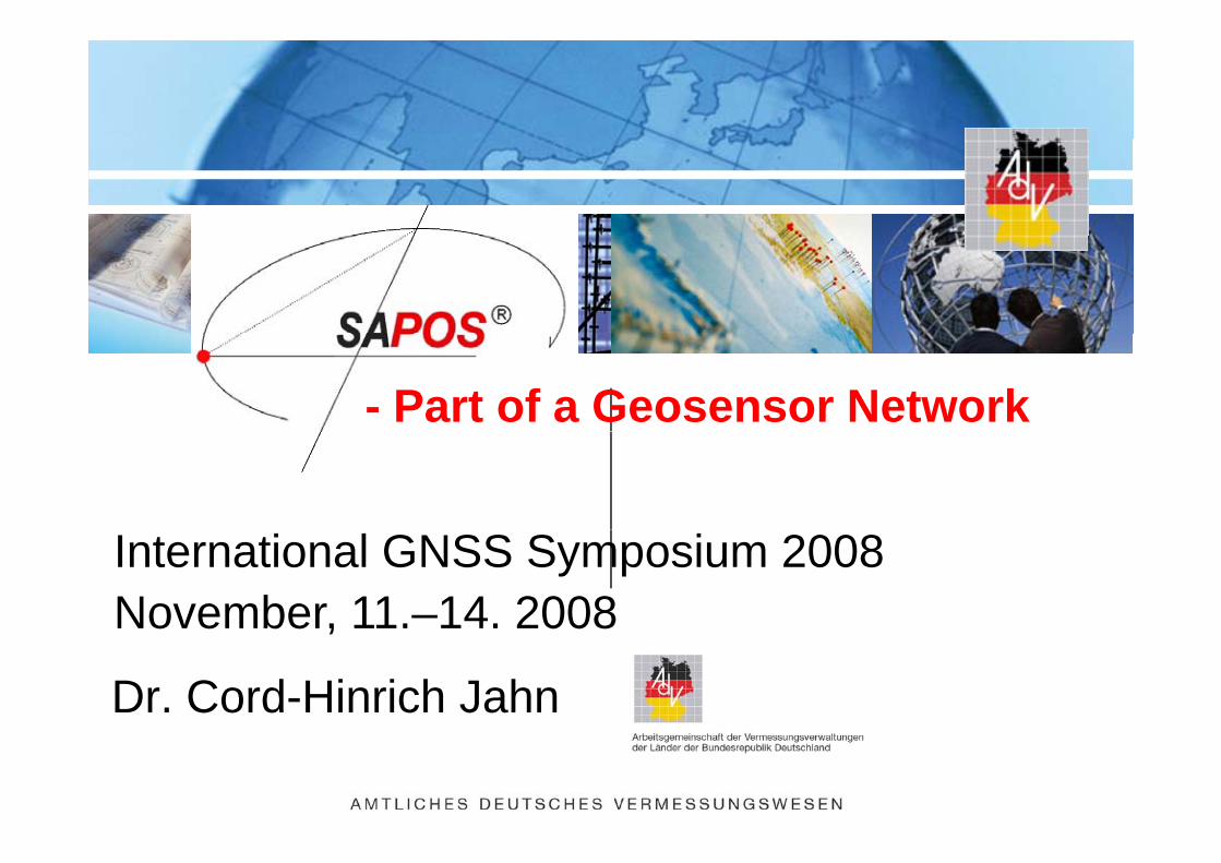
- Part of a Geosensor Network
International GNSS Symposium 2008November, 11.–14. 2008
Dr. Cord-Hinrich Jahn
November, 11. 14. 2008
Agenda
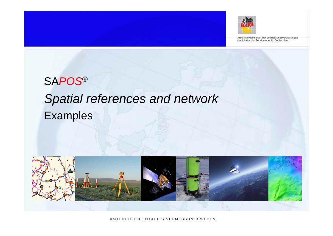
SAPOS®
Spatial references and networkExamplesExamples

What is SAPOS® ?What is SAPOS ?
Satellite Positioning Service of theSatellite Positioning Service of the German National Survey
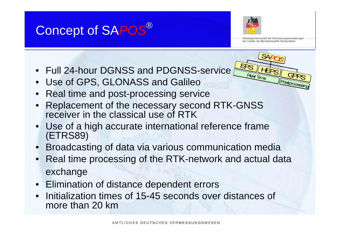
Concept of SAPOS®
• Full 24-hour DGNSS and PDGNSS-service• Use of GPS, GLONASS and Galileo• Real time and post processing service• Real time and post-processing service• Replacement of the necessary second RTK-GNSS
receiver in the classical use of RTK• Use of a high accurate international reference frame
(ETRS89)• Broadcasting of data via various communication media• Broadcasting of data via various communication media• Real time processing of the RTK-network and actual data
exchangeexchange• Elimination of distance dependent errors• Initialization times of 15-45 seconds over distances of
th 20 kmore than 20 km
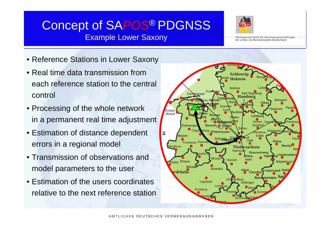
Concept of SAPOS® PDGNSSExample Lower SaxonyExample Lower Saxony
• Reference Stations in Lower Saxonyy
• Real time data transmission from each reference station to the central control
• Processing of the whole network in a permanent real time adjustment
• Estimation of distance dependent errors in a regional modelerrors in a regional model
• Transmission of observations and model parameters to the usermodel parameters to the user
• Estimation of the users coordinates relative to the next reference station

Milestones of SAPOS®
1994 Establishment of an expert group on reference stations1994 Establishment of an expert group on reference stations1996 Decision, to build up an „Satellite Positioning Service
of the German surveying authorities“1998 1 t SAPOS i H b1998 1st SAPOS symposium, Hamburg1999 Foundation of Technical Committee SAPOS2002 Introduction of nationwide compulsory SAPOS-HEPS2002 Introduction of nationwide compulsory SAPOS-HEPS
standards, e.g. network RTK, absolute antenna calibration
2003 250 ti l SAPOS f t ti2003 250 operational SAPOS reference stations2003 Establishment of Central Bureau SAPOS2003 1st PPP contract with Ruhrgas AG (ascos)2003 1st PPP contract with Ruhrgas AG (ascos)2005 Installation of ntrip caster (internet interface)2006 Framework paper on the future of SAPOS2007 270 operational SAPOS reference stations

SAPOS® -Reference Stationsin Germany Mai 2007in Germany, Mai 2007
- 270 stations- 270 stations- mean station distancies
between 25 - 60 km- dual frequency receivers- in the responsibility of the16 St t S Offi16 State Survey Offices

SAPOS® - Reference Stations
Antenna set up
SAPOS® - Reference Stations
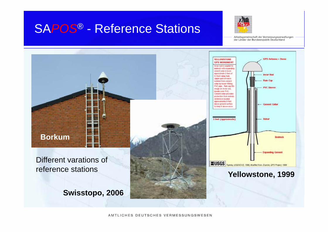
BorkumAufbau
Different varations of reference stations Yellowstone, 1999
Swisstopo, 2006
reference stations
Swisstopo, 2006
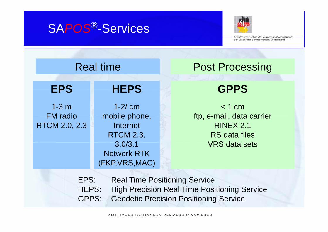
SAPOS®-Services
R l tiR l ti P t P iP t P iReal timeReal time Post ProcessingPost Processing
EPS HEPS GPPSEPS1-3 m
FM radio
HEPS1-2/ cm
mobile phone
GPPS< 1 cm
ftp e mail data carrierFM radioRTCM 2.0, 2.3
mobile phone, Internet
RTCM 2.3, 3 0/3 1
ftp, e-mail, data carrierRINEX 2.1
RS data filesVRS d t t3.0/3.1
Network RTK (FKP,VRS,MAC)
VRS data sets
EPS: Real Time Positioning ServiceHEPS: High Precision Real Time Positioning ServiceGPPS: Geodetic Precision Positioning Service
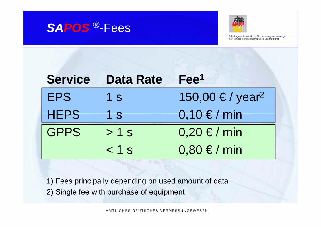
SAPOS ®-Fees
Service Data Rate Fee1
EPS 1 s 150,00 € / year2
HEPS 1 s 0 10 € / minHEPS 1 s 0,10 € / minGPPS > 1 s 0,20 € / min
< 1 s 0,80 € / min
1) Fees principally depending on used amount of data2) Single fee with purchase of equipment2) Single fee with purchase of equipment

Application of SAPOS®
State survey:P i i f
Additional applications:• Hydrography• Provision of
reference frame• Geodetic control
• Hydrography• Engineering surveys• Aerial photogrammetry• Geodetic control
measurements• Height transfer
Aerial photogrammetry• Airborne / terrestrial
laser scanning• Height transferCadastral survey
g• Geodynamic research• Weather service• Time transfer• All kinds of navigation

Conveyance of Cruise Liners from the shipyard Papenburg to the Northsee using SAPOS-EPSPapenburg to the Northsee using SAPOS EPS

Monitoring within the RTK network
Postprocessing of daily and weeklycoordinates of reference stationscoordinates of reference stations
Real time processing within theReal time processing within theRTK network processing
Continuous estimation of rover-coordinatesf t tifor a representative user
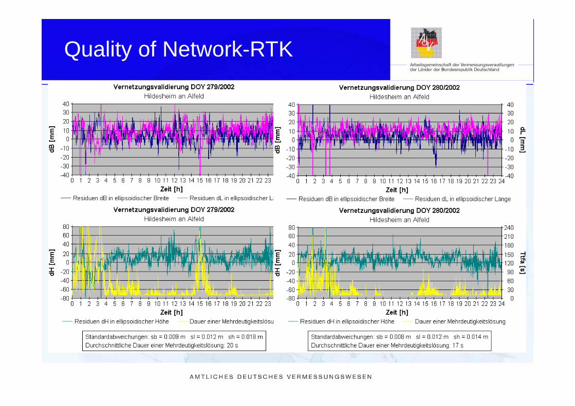
Quality of Network-RTK
SAPOS®
Spatial references and networkExamplesExamples

Basic tasks for Spatial Reference
• Based on the laws of 16 German Federal States• State survey authorities are responsible for y p
providing• a uniform, ,• homogenous• spatial reference system, p y
• 2D/3D positions, physical heights, and gravity,• employing monumented geodetic control• employing monumented geodetic control
networks (GCN)

Standardized Spatial Reference in Germany (AdV 2004)Germany (AdV 2004)
Bundeseinheitliches,homogenes
Festpunktfeld
Federal standardised and uniform network of control stationsFestpunktfeld
Geodetic land Height geodetic Gravity geodetic Reference stationnetwork points
(GGP)control points
(HFP)control stations
(SFP)points(RS)
3D 1D 1D 3DDSGN 94DHSN 96 SAPOS®DHHN 92
(DHHN 2011)(in discussion: DHHN 2011, ...)
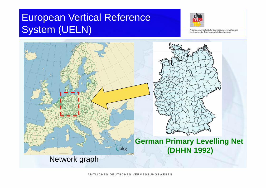
European Vertical Reference System (UELN)System (UELN)
German Primary Levelling Net(DHHN 1992)
Network graphNetwork graph

History of observation accuracy
Accuracy of German Levelling NetworksAccuracy of German Levelling Networks
2,5SNN 56
1 5
2
ustm
ent
0.5 ] NKN II – Grundnetz
NKN II – Küste
Niv-Netz 60
DHHN 85 = NKN III
DHHN 92
NKN I – Grundnetz
NKN I – Küste
RHN = DHHN 12
SNN 56
SNN 76
1
1,5
m n
et a
ddj
[mm
/km
0
Urnivellement
DHHN 2006-2011 (Genauigk. unb. )
0
0,5
s 0 fro
m
01860 1880 1900 1920 1940 1960 1980 2000 2020
Year

German Primary Levelling Net 2006-2011 006 0
• Levelling lines (~ 20000 km)• Levelling lines ( 20000 km)• 250 GNSS points• 100 Absolute gravity pointsg y p• 250 SAPOS reference stations• IGS, EPN, GREF• with sh ≤ 5 mm in mind• ITRF 2005 / IGS05
minimum obligation lines
optional lines
GNSS pointp
Absolut gravity point
GNSS + absolut gravity point
IGS/EPN/GREF station
SAPOS reference station
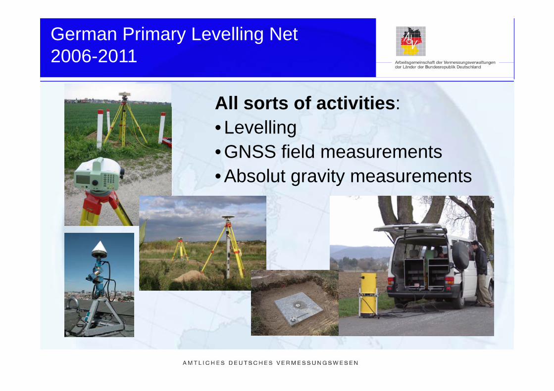
German Primary Levelling Net 2006-2011
All sorts of activities:
006 0
All sorts of activities:• Levelling• GNSS field measurements• GNSS field measurements• Absolut gravity measurements
SAPOS®
S ti l f d t kSpatial references and networkExamples

Project IKÜS
development of an integrated approach to altitudedevelopment of an integrated approach to altitude determination and monitoring in coastal regions
• Measurements made by different height sensors (levelling, gravity, GPS and water level) will be gathered and combined into an integrated kinematicand water-level) will be gathered and combined into an integrated kinematic approach under consideration of the accuracies of the different height sensors.
• Research project by the German Coastal Engineering Research Council
• Runtime: 10 2005 – 09 2008 (3 years)• Runtime: 10.2005 – 09.2008 (3 years)
(IKÜS A) (IKÜS B) (IKÜS C) (IKÜS D)coordination water-level algorithm software data of LGNcoordination water level, algorithm, software, data of LGN,GNSS, gravity alignment combination levelling,
Database
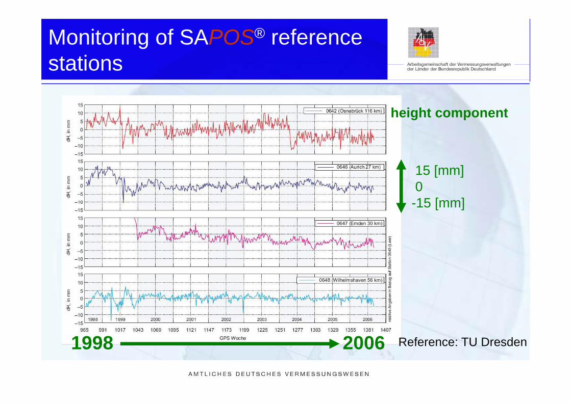
Monitoring of SAPOS® reference stationsstations
h i ht theight component
15 [mm]015 [mm]-15 [mm]
1998 2006 R f TU D d1998 2006 Reference: TU Dresden

Earth quake „Rotenburg (Wümme) 20042004
WD
R
0 D E 1 (2) © 0 D E 1 (2)
October 2004 - Magnitude 4,5

Salt domes and caverns
map scale: 20 kmmap scale: 20 km

Ground level subsidence and displacement
• Cavern Wilhelmshaven“
displacement
• Cavern „Wilhelmshaven• 1.200 - 1.400 m deep• about 12 Mio m3 oil• about 12 Mio. m oil
resources
• horizontal displacement (10 cm)• vertical subsidence (20 cm)
► as a consequence of fill and d l t d !deplete procedures!
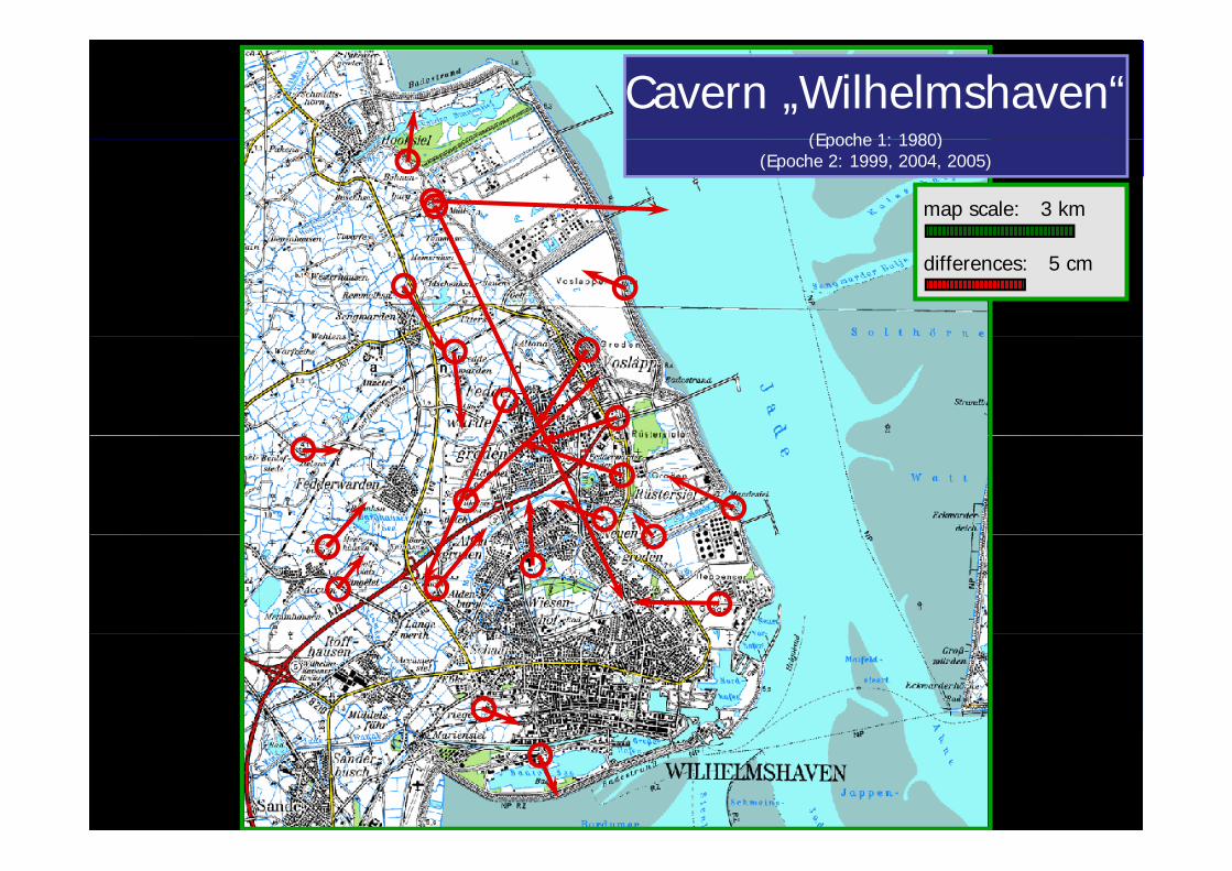
Cavern „Wilhelmshaven“(Epoche 1: 1980)(Epoche 1: 1980)
(Epoche 2: 1999, 2004, 2005)
map scale: 3 km
differences: 5 cm

Salt mine „Wunstorf Kolenfeld“(Epoche 1: 1982) (Epoche 2: 2002)
differences: 10 cm

Long time series of monthly mean sea level
time [a]
mean sea level► water-level observations
time [a]
(tide gauge) are relative!
► seemingly subsidence g yfrom postglacial uplift!
R f D Li b h BKGReference: Dr. Liebsch, BKG
Summary and Outlook
• SAPOS is actually a part of a geosensor network• The service provides real time and post processing• The service provides real time and post processing
data for all accuracies and for a lot of applications• SAPOS is a part of the new federal standardised p
uniform network• The combination of all parts of the new federal network
i th ti l d l b l d tin an common mathematical model can be lead to an integrated geosensor network