YOU ARE DOWNLOADING DOCUMENT

Please tick the box to continue:

Transcript
Page 1: GIZ.  Spatial Modelling: 1. Topography of the coastal areas or land elevations 2. Would you like a full study using numerical modelling tools to investigate.

Is Climate Change A threat Food Security?

GIS Attempts to answer

GIZ

Page 2: GIZ.  Spatial Modelling: 1. Topography of the coastal areas or land elevations 2. Would you like a full study using numerical modelling tools to investigate.

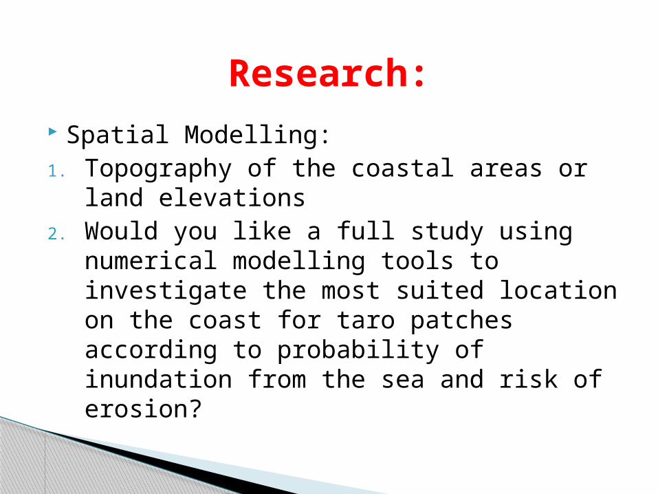
Spatial Modelling:1. Topography of the coastal areas or land

elevations 2. Would you like a full study using numerical

modelling tools to investigate the most suited location on the coast for taro patches according to probability of inundation from the sea and risk of erosion?

Research:

Page 3: GIZ.  Spatial Modelling: 1. Topography of the coastal areas or land elevations 2. Would you like a full study using numerical modelling tools to investigate.

Why Sea Level Rise Spatial Modelling

• Reliable and well documented sources

•Available Metadata

Page 4: GIZ.  Spatial Modelling: 1. Topography of the coastal areas or land elevations 2. Would you like a full study using numerical modelling tools to investigate.

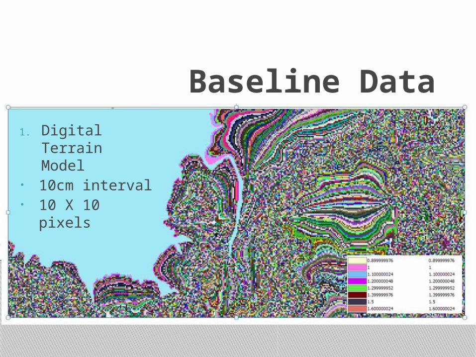
Baseline Data1. Digital

Terrain Model • 10cm interval• 10 X 10

pixels

Page 5: GIZ.  Spatial Modelling: 1. Topography of the coastal areas or land elevations 2. Would you like a full study using numerical modelling tools to investigate.

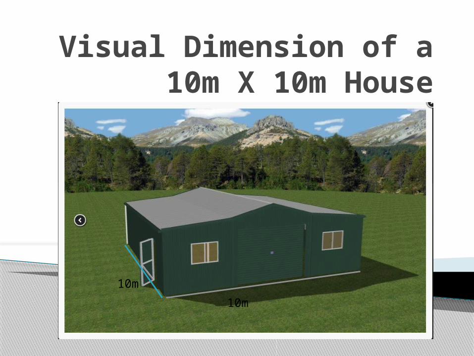
Visual Dimension of a 10m X 10m House

10m

10m

Page 6: GIZ.  Spatial Modelling: 1. Topography of the coastal areas or land elevations 2. Would you like a full study using numerical modelling tools to investigate.

Baseline Data2. PCSSP Sea Level Rise Scenario

• 2030 – 37cm• 2060 – 67 cm• 2100 – 117cm

Page 7: GIZ.  Spatial Modelling: 1. Topography of the coastal areas or land elevations 2. Would you like a full study using numerical modelling tools to investigate.

Baseline Data3. Mean sea level as the bench mark for predicting sea level rise

• 0.74m Average mean sea level

• 1.76m highest average mean sea level – Can be used to derive another simulation

Page 8: GIZ.  Spatial Modelling: 1. Topography of the coastal areas or land elevations 2. Would you like a full study using numerical modelling tools to investigate.

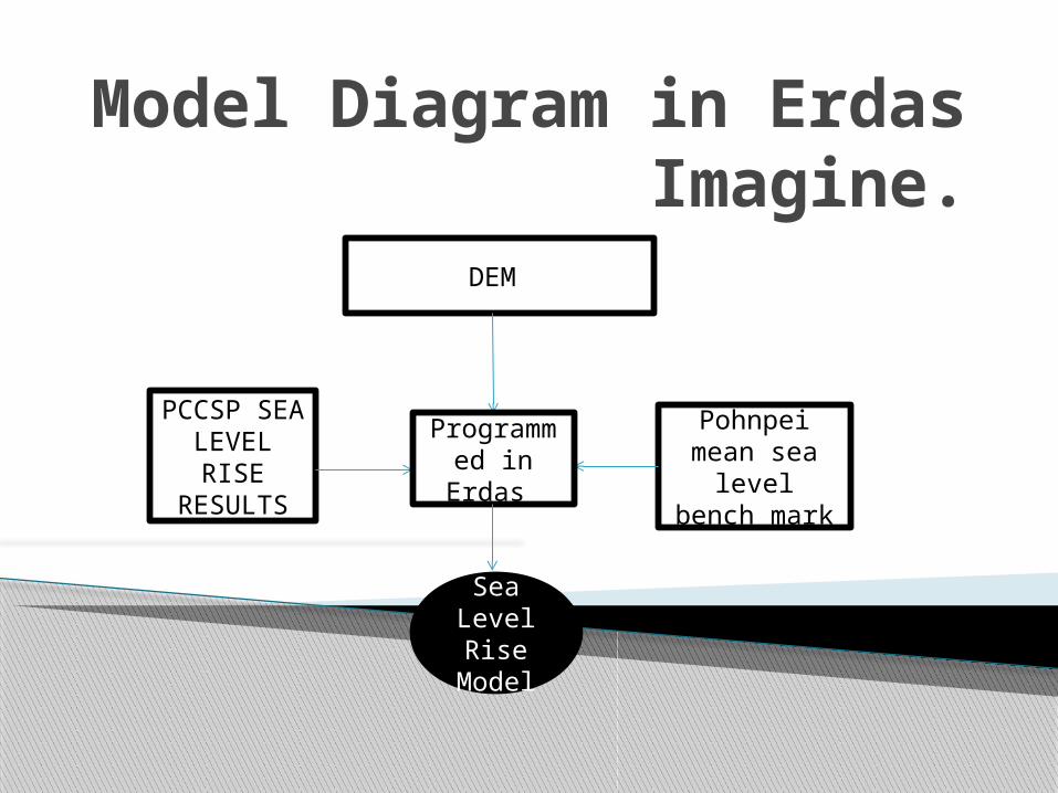
Model Diagram in Erdas Imagine.

DEM

Sea Level Rise

Model

Pohnpei mean sea

level bench mark

PCCSP SEA LEVEL

RISE RESULTS

Programmed in Erdas

Page 9: GIZ.  Spatial Modelling: 1. Topography of the coastal areas or land elevations 2. Would you like a full study using numerical modelling tools to investigate.

Result:

Page 10: GIZ.  Spatial Modelling: 1. Topography of the coastal areas or land elevations 2. Would you like a full study using numerical modelling tools to investigate.

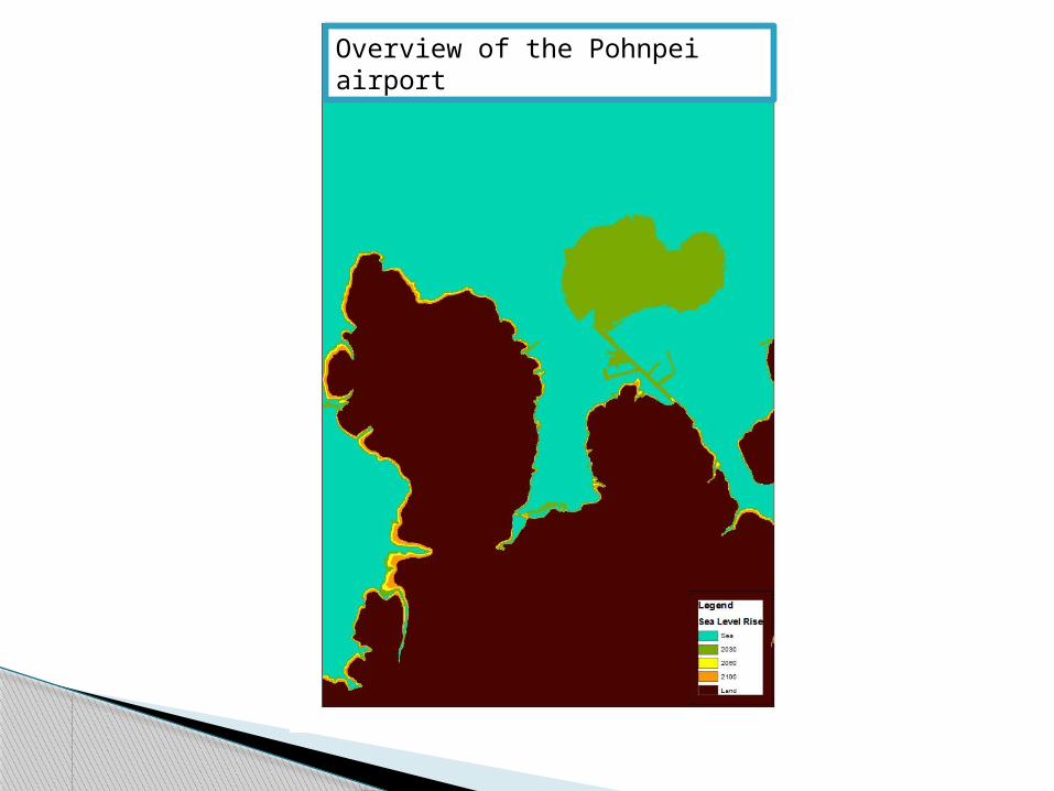
Overview of the Pohnpei airport

Page 11: GIZ.  Spatial Modelling: 1. Topography of the coastal areas or land elevations 2. Would you like a full study using numerical modelling tools to investigate.

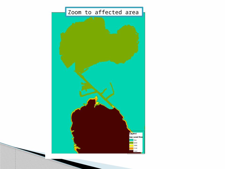
Zoom to affected area

Page 12: GIZ.  Spatial Modelling: 1. Topography of the coastal areas or land elevations 2. Would you like a full study using numerical modelling tools to investigate.

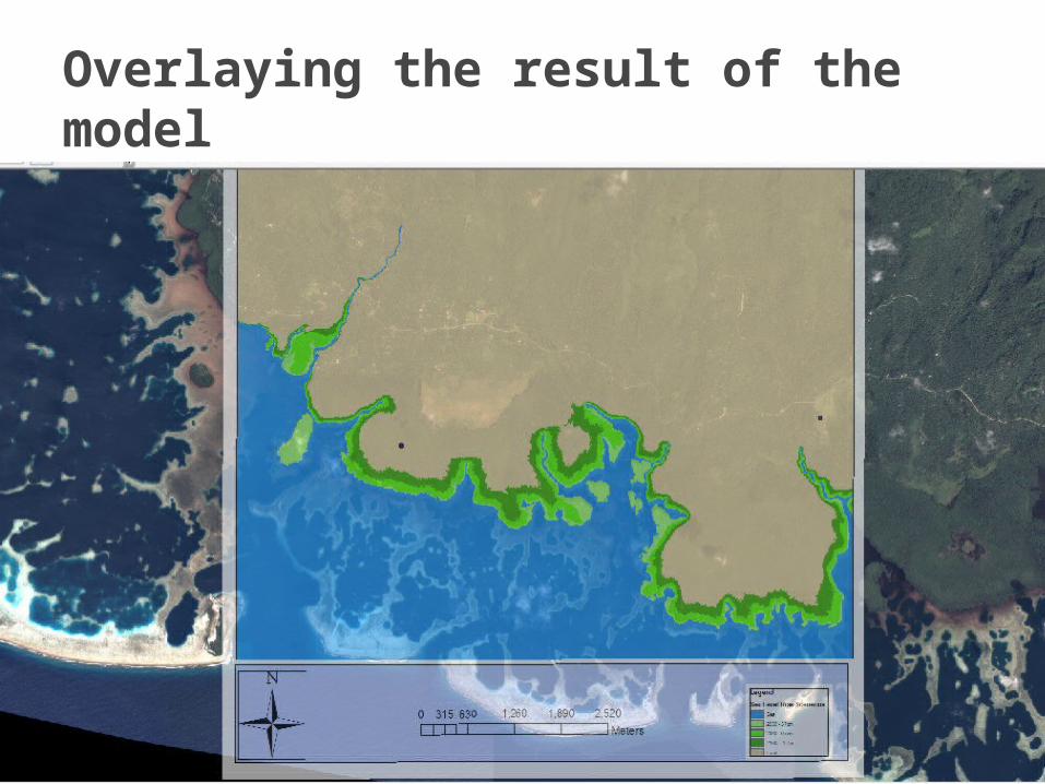
Overlaying the result of the model

Page 13: GIZ.  Spatial Modelling: 1. Topography of the coastal areas or land elevations 2. Would you like a full study using numerical modelling tools to investigate.

Include climatology data to better the current model

Explore TCRM model Your suggestions?????

Conclusion

Page 14: GIZ.  Spatial Modelling: 1. Topography of the coastal areas or land elevations 2. Would you like a full study using numerical modelling tools to investigate.

No Questions please

Vinaka


Related Documents