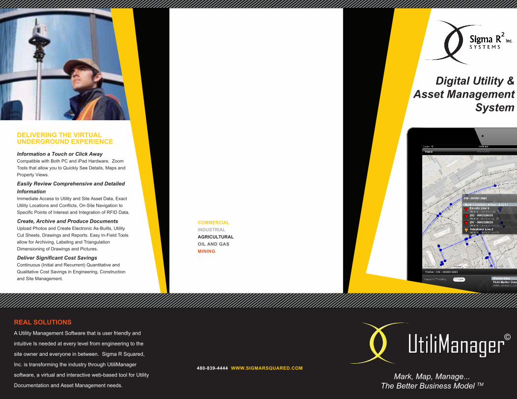
DELIVERING THE VIRTUALUNDERGROUND EXPERIENCE
Information a Touch or Click AwayCompatible with Both PC and iPad Hardware. ZoomTools that allow you to Quickly See Details, Maps andProperty Views.
Easily Review Comprehensive and DetailedInformationImmediate Access to Utility and Site Asset Data, ExactUtility Locations and Conflicts, On-Site Navigation toSpecific Points of Interest and Integration of RFID Data.
Create, Archive and Produce DocumentsUpload Photos and Create Electronic As-Builts, UtilityCut Sheets, Drawings and Reports. Easy In-Field Toolsallow for Archiving, Labeling and TriangulationDimensioning of Drawings and Pictures.
Deliver Significant Cost SavingsContinuous (Initial and Recurrent) Quantitative andQualitative Cost Savings in Engineering, Constructionand Site Management.
COMMERCIALINDUSTRIAL AGRICULTURALOIL AND GASMINING
480-839-4444 WWW.SIGMARSQUARED.COM
REAL SOLUTIONSA Utility Management Software that is user friendly and
intuitive Is needed at every level from engineering to the
site owner and everyone in between. Sigma R Squared,
Inc. is transforming the industry through UtiliManager
software, a virtual and interactive web-based tool for Utility
Documentation and Asset Management needs.
Digital Utility &Asset Management
System
Mark, Map, Manage...The Better Business Model TM
©

S O L U T I O N S P R O V I D E D :
GPS EQUIPMENT TRAINING
RFID INSTALLATION
SITE DOCUMENTATION
CONSULTING
LOCATOR TRAINING
SITE MAPPING
SOFTWARE SERVICES
UTILIMANAGER SOFTWARE FEATURES• Information about Utility Intersections and ..dUtility Conflicts when Excavating• Immediate Access to Electronic As-Builts• Exact Location of Utilities• Detailed Utility Information Requirements - GPS Coordinates and Elevation Data - Depth from Grade to Top / Bottom of dffddff Utilities - Type and Size of Utilities - Number of Conduits in Utility Banks• Archiving of 3D Depictions, Utility CutdSheets, Photos,Triangulation Dimensions,dZoom Tools, Maps and Property Views• Easy In-Field Labeling and DimensioningdTools• RFID Data Integration• On-Site Utility Navigation to Specific Pointsdof Interest• Significant Cost Savings inzEngineering,dConstruction and SitezManagement
COMPATIBILITY
Desktop Software: Windows XP, Vista, Win7Web Software: Mac OSX, WindowsHandheld Software: Apple iPad iOS
UtiliManagerUtility Documentation & AssetManagement Made Easy...UTILIMANAGER IS A MAPPING PROGRAM DESIGNED TO
IMPROVE THE PROCESS OF LOCATING, DOCUMENTING AND
MANAGING UTILITIES AND SITE ASSETS AT EVERY STAGE OF A
PROJECT.
UTILIMANAGERʼS INTUITIVE AND USER FRIENDLY DESIGN
MAKES COMPLEX UTILITY MANAGEMENT MADE EASY... FROM
THE DESIGN AND ENGINEERING STAGES, THROUGHOUT
CONSTRUCTION AND BEYOND WITH FUTURE SITE
MANAGEMENT.
A REAL PROBLEM
Over 20 million miles of underground utilitiesexist in the U.S., with that number increasing insize every day. Recent National Utility reportsshow that a utility strike occurs nearly everyminute of the day somewhere in the U.S.,resulting in substantial liabilities, significant costoverruns and increases in project relatedinjuries.
Lack of accurate public and private utilityrecords is one of the main contributing factorsto these challenges.
KNOW YOUR CONFLICTS BEFORE
IT'S TOO LATE
Mark, Map, Manage...The Better Business Model TM
©

![Time Lapses Guia Completa dZoom[1]](https://static.cupdf.com/doc/110x72/557202d64979599169a429ff/time-lapses-guia-completa-dzoom1.jpg)