7/11/2011
1
Complete Trail Wayfinding SystemsMapping, Signing and Marking
Randy Anderson, RLA, PrincipalEmily Duchon, LEED AP, DesignerAlta Planning + Design
2011 California Trails and Greenway Conference
What makes trail users happy?
• Good trails!and
• Good information!
*Planners* *GIS Specialists* *Designers* *Educators*
WRONG!
RIGHT!
What makes a complete wayfinding system?
• Trail system data: classify and characterize trails and related features
• Signs and markings: clear, complete, consistent• Public information: text, maps, images; printed, on site and on web
*Planners* *GIS Specialists* *Designers* *Educators*
Benefits of a Great Wayfinding System
Awareness, Usefulness:• Increased public awareness of the trails/system• Branding and public relations for the agency and sponsors/partners
• Legibility – public can research, plan and complete their trip
*Planners* *GIS Specialists* *Designers* *Educators*
7/11/2011
2
Increased use:• Increased bicycle and walking trips = reduced congestion and greenhouse gases
• Integration with regional bike and walk ways, transit• Health and recreational benefits
*Planners* *GIS Specialists* *Designers* *Educators*
Benefits of a Great Wayfinding System
A better trail experience:• Better safety, security and convenience• A more interesting and fun – can concentrate on scenery
*Planners* *GIS Specialists* *Designers* *Educators*
Benefits of a Great Wayfinding System
Better/Easier Management:• Fewer incidents, conflicts and impacts• Better agency and inter‐agency planning, coordination• Improved emergency and maintenance access and coordination
*Planners* *GIS Specialists* *Designers* *Educators*
Benefits of a Great Wayfinding System Steps to a Successful Wayfinding Program
1. Work with expert(s):– Agency and public engagement– ADA and traffic control standards – GIS data organization and mapping– Sign and marking graphic design and construction– Trail planning, design and management
Benefit from others’ experience!

7/11/2011
3
Steps to a Successful Wayfinding Program
2. Identify responsible parties/key stakeholders:– Trail manager(s)– Other agencies/departments with jurisdiction– Public safety and emergency response– Others who may use the route – flood control, utility, agricultural
Steps to a Successful Wayfinding Program
3. Establish agency/organization communication and coordination– Agree on basic objectives and scope
– Discuss current practices and systems
– Agree on basic wayfinding elements and concepts
– Agree on process
Steps to a Successful Wayfinding Program
4. Solicit public and stakeholder input – Trail use patterns and desires– Destinations and connections – existing and future– Comments on basic elements and concepts– Ideas for improvement
Steps to a Successful Wayfinding Program
5. Gather and analyze base data –use GIS to:– Inventory existing wayfinding elements
– Physical and use setting– trail types, allowed uses, support features, connecting trails
– Context: bike routes, transit, key destinations, jurisdictions

7/11/2011
4
Steps to a Successful Wayfinding Program
6. Coordinate or integrate traffic safety features and standards – Road or rail crossings– Crosswalks – traffic calming– Safety warnings, barriers, gates, signals
– CA MUTCD compliance highly desirable
American River Parkway Assessment
Steps to a Successful Wayfinding Program
7. Coordinate or integrate with signs for protection of resources, facilities, property
Steps to a Successful Wayfinding Program
8. Coordinate or integrate with info on use designations, regulations and courtesy
Steps to a Successful Wayfinding Program
9. Coordinate or integrate with interpretive and art elements
Trails at the North Carolina Museum of Art River Interpretive Media along the East Bank Esplanade in Portland, OR

7/11/2011
5
Steps to a Successful Wayfinding Program
10. Study, test and adapt the system to make sure it works
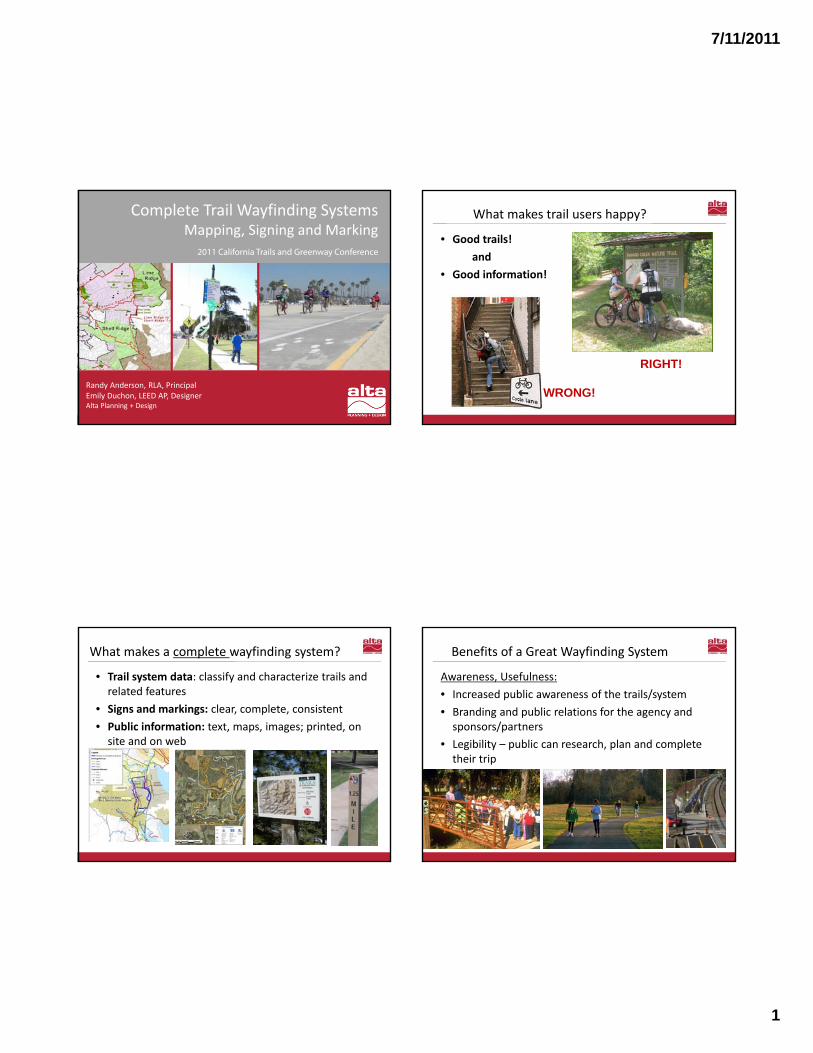
Elements of Mapping and Wayfinding
Trail System Maps and DataMaps Are the Basis of a Wayfinding Plan • GIS to inventory, organize, plan, and design the trail system;
wayfinding and other elements
Recycle Your Data!• Static/Paper Maps• Web Based Maps• “Your are here” Kiosk
Map
Trail System Maps and DataWhat should be on a User Map?• Trail type (paved, unpaved, class)• Designated/allowed uses• Accessibility information• Destinations, services and amenities• Jurisdictions, Park areas, Logos• How to access – Transit stops, Bicycle Routes, Parking• Scale, distance information, mileposts
7/11/2011
6
The Backbone Trail, Santa Monica Mountains
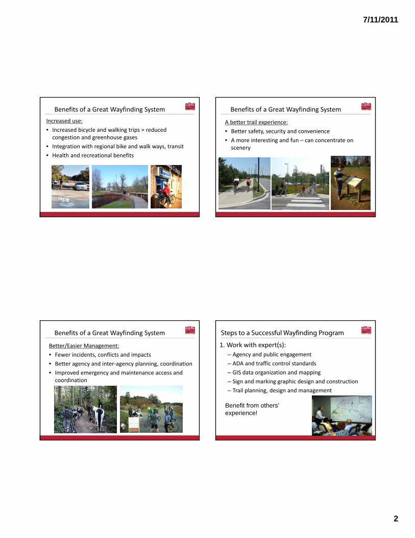
Web Based Maps
Map with Regional Trail Logo
Bay Area Ridge Trail Map
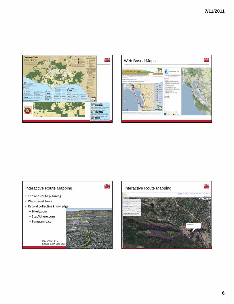
Interactive Route Mapping
• Trip and route planning • Web‐based tours• Record collective knowledge
– Bikely.com– StepWhere.com– Panoramio.com
City of San Jose Google Earth Trail Tour
Interactive Route Mapping
7/11/2011
7
Mapboards and Kiosks
• Orientation ‐ “you are here”• Map kiosks – static and interactive• Inlaid maps or art features
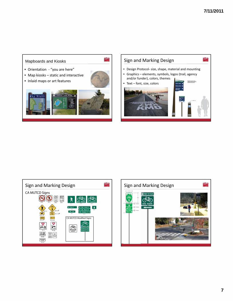
Sign and Marking Design
• Design Protocol‐ size, shape, material and mounting • Graphics – elements, symbols, logos (trail, agency and/or funder), colors, themes
• Text – font, size, colors
CA MUTCD Modified Signs
Sign and Marking DesignCA MUTCD Signs
Bike Route SignsSign and Marking Design

7/11/2011
8
• Symbols Are Universal
Sign and Marking Design
City of El Monte Pedestrian Wayfinding
Sign and Marking Design
Direction Signs
CA Coastal Trail – Northern CA
Destination & Distance Information
Springwater Trail, OR Willamette River Trail, OR
• Name of the Trail/ Corridor
• Direction of Local/Regional Destinations
• Connecting Trails• Distance / Time• Use Information• Agency Logos
Confirmation Signs
San Francisco Bay Trail, CA
Identification Signs Trail Medallions
San Francisco Bay Trail, CA California Coastal TrailLos Gatos Creek Trail, CA
Bay Area Ridge Trail
7/11/2011
9
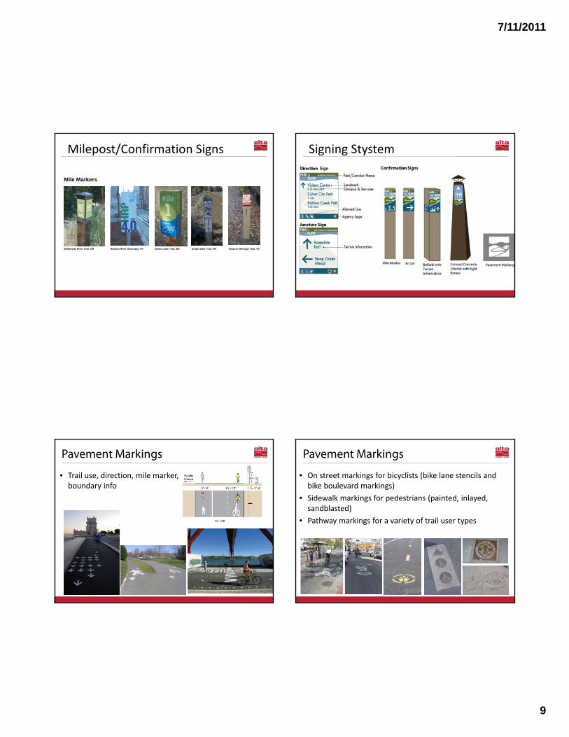
Milepost/Confirmation Signs
San Francisco Bay Trail, CA
Identification Signs
San Francisco Bay Trail, CA California Coastal TrailLos Gatos Creek Trail, CA
Willamette River Trail, OR
Mile Markers
Hudson River Greenway, NY Salem Lake Trail, MN Tobacco Heritage Trail, VAOC&E State Trail, OR
Schematic Concept 2 Signing Stystem
Pavement Markings
• Trail use, direction, mile marker, boundary info
• On street markings for bicyclists (bike lane stencils and bike boulevard markings)
• Sidewalk markings for pedestrians (painted, inlayed, sandblasted)
• Pathway markings for a variety of trail user types
Pavement Markings

7/11/2011
10
Pavement Markings Visual Cues
• Tactile and Auditory Cues– Tactile warning strips– Material changes
• Art Elements• Interpretive Elements
Gateway Elements Gateway Elements

7/11/2011
11
1. Expert advice/assistance2. Involve key agency partners and stakeholders3. Initiate a coordinated process4. Involve public and stakeholder groups5. Prepare a GIS database and plan – trail system and
wayfinding elements
Recap – Key Steps
6. Coordinate/integrate: – Traffic control and safety– Resource and property protection– Trail use regs and courtesies– Interpretive and art
7. Test and adapt in field
Recap – Key Steps
1. Static/printed user maps2. Web maps and info3. Site maps4. Directional and informational signs5. Route and info pavement markings6. Visual cues
Recap – Key Wayfinding Elements Questions?
Alta Planning + DesignRandy Anderson, [email protected]
Emily Duchon, [email protected]