Image: Florida Keys, FL | July 5, 2011 | 50cm DigitalGlobe Proprietary and Business Confidential Image: Yongbyon NPP, North Korea| January 26, 2012| 50cm
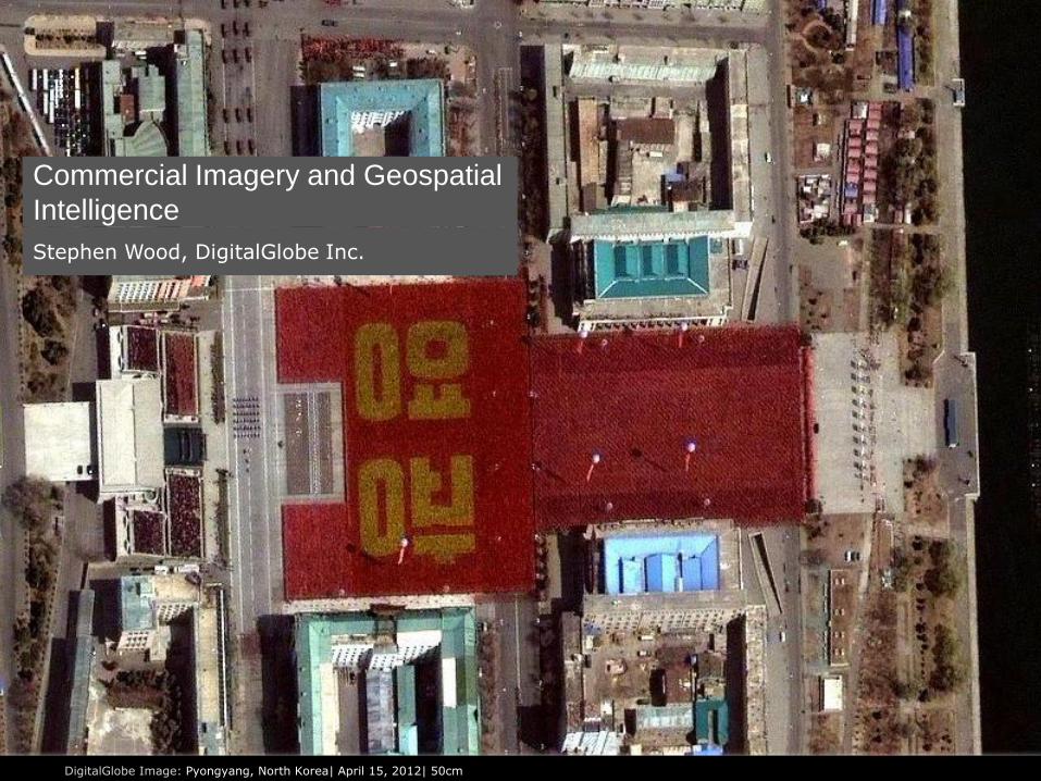
Stephen Wood, DigitalGlobe Inc.
Commercial Imagery and Geospatial
Intelligence
DigitalGlobe Image: Pyongyang, North Korea| April 15, 2012| 50cm
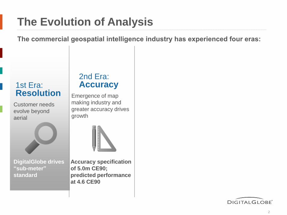
The Evolution of Analysis
2
The commercial geospatial intelligence industry has experienced four eras:
1st Era: Resolution
2nd Era: Accuracy
Customer needs evolve beyond aerial
DigitalGlobe drives “sub-meter” standard
Emergence of map making industry and
greater accuracy drives
growth
Accuracy specification of 5.0m CE90; predicted performance at 4.6 CE90

3
“The ultimate value of satellite data comes from integration with other
technologies of the information age. Satellite data becomes much more useful
after it has been analyzed and fused with other geospatial technologies…”
David B. Sandalow; Assistant Secretary for Oceans and International Environmental and Scientific Affairs; June 6, 2000
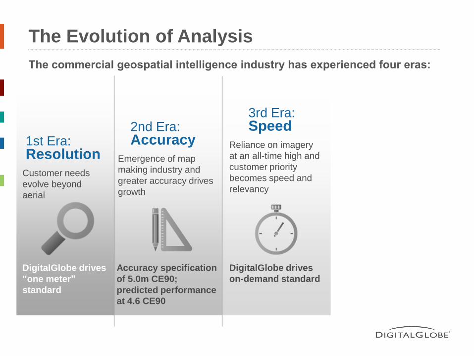
The Evolution of Analysis
The commercial geospatial intelligence industry has experienced four eras:
1st Era: Resolution
2nd Era: Accuracy
3rd Era: Speed
Customer needs evolve beyond aerial
DigitalGlobe drives “one meter” standard
Emergence of map making industry and
greater accuracy drives
growth
Accuracy specification of 5.0m CE90; predicted performance at 4.6 CE90
Reliance on imagery at an all-time high and
customer priority
becomes speed and
relevancy
DigitalGlobe drives on-demand standard
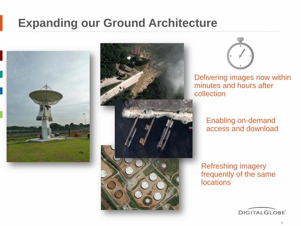
Expanding our Ground Architecture
5
Delivering images now within minutes and hours after collection
Enabling on-demand access and download
Refreshing imagery frequently of the same locations
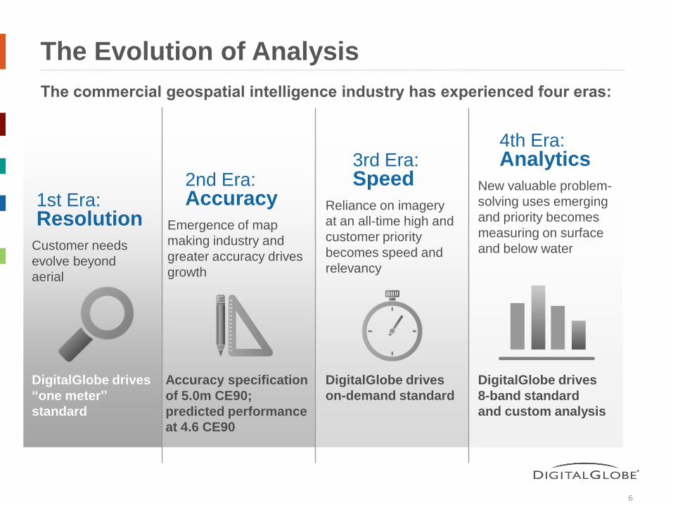
The Evolution of Analysis
6
The commercial geospatial intelligence industry has experienced four eras:
1st Era: Resolution
2nd Era: Accuracy
3rd Era: Speed
4th Era: Analytics
Customer needs evolve beyond aerial
DigitalGlobe drives “one meter” standard
Emergence of map making industry and
greater accuracy drives
growth
Accuracy specification of 5.0m CE90; predicted performance at 4.6 CE90
Reliance on imagery at an all-time high and
customer priority
becomes speed and
relevancy
DigitalGlobe drives on-demand standard
DigitalGlobe drives 8-band standard and custom analysis
New valuable problem- solving uses emerging
and priority becomes
measuring on surface
and below water
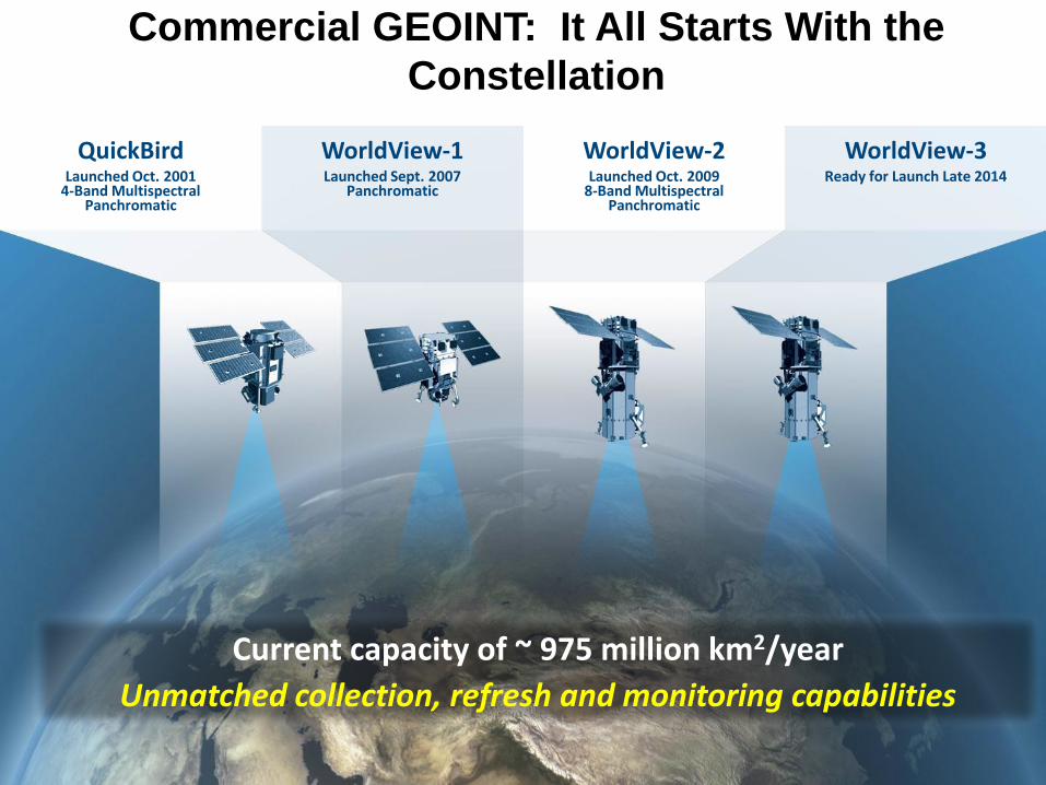
Current capacity of ~ 975 million km2/year
Unmatched collection, refresh and monitoring capabilities
Commercial GEOINT: It All Starts With the
Constellation
QuickBird
Launched Oct. 2001 4-Band Multispectral
Panchromatic
WorldView-1 Launched Sept. 2007
Panchromatic
WorldView-2 Launched Oct. 2009
8-Band Multispectral Panchromatic
WorldView-3 Ready for Launch Late 2014
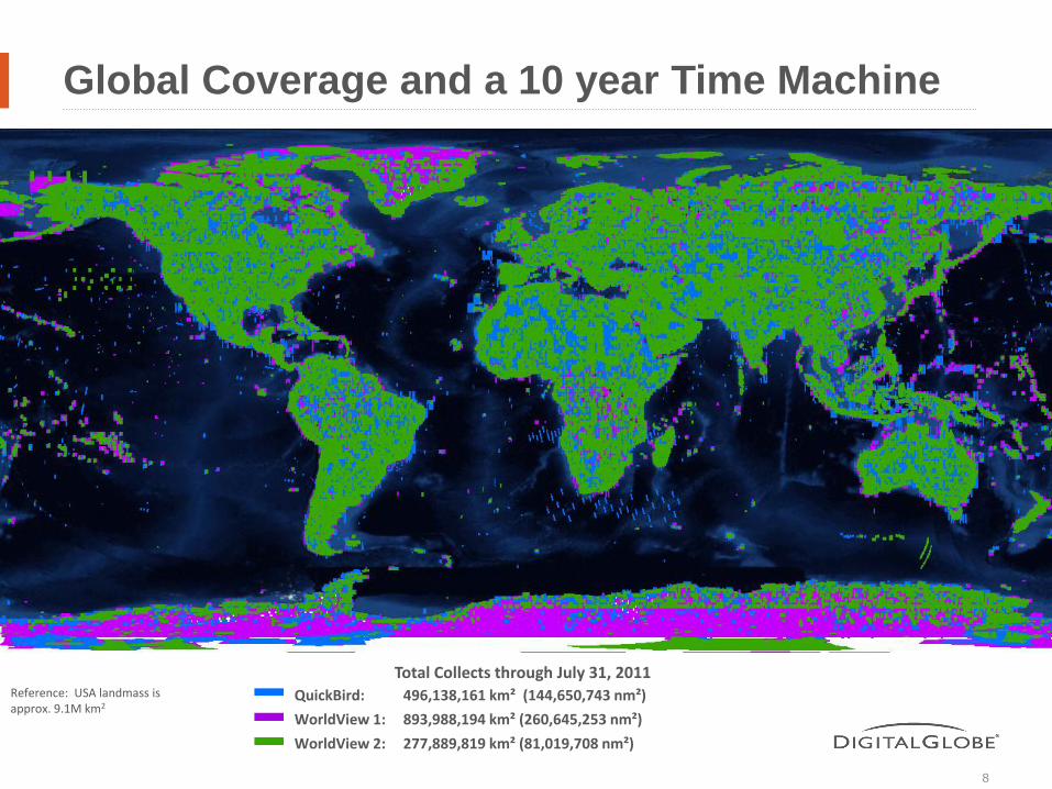
Global Coverage and a 10 year Time Machine
8
QuickBird: 496,138,161 km² (144,650,743 nm²)
WorldView 1: 893,988,194 km² (260,645,253 nm²)
WorldView 2: 277,889,819 km² (81,019,708 nm²)
Total Collects through July 31, 2011 Reference: USA landmass is approx. 9.1M km2
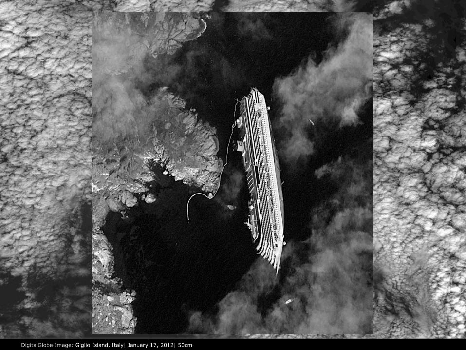
Image: Florida Keys, FL | July 5, 2011 | 50cm DigitalGlobe Image: Giglio Island, Italy| January 17, 2012| 50cm

5/5/2012 DigitalGlobe Proprietary and Business Confidential 10

An
aly
sis
Cen
ter Military Presence at Dumyat Oil Refinery and Port Facility
Dumyat, Egypt 31 27 02 N 31 45 05 E
N
DigitalGlobe’s Natural Color Satellite Image
February 3, 2011
APC
APC APC
APC
APC
Copyright DigitalGlobe 2011
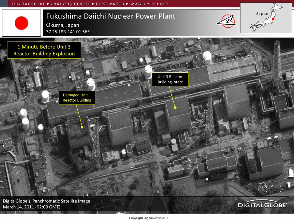
Fukushima Daiichi Nuclear Power Plant Okuma, Japan 37 25 18N 141 01 56E
1 Minute Before Unit 3 Reactor Building Explosion
DigitalGlobe’s Panchromatic Satellite Image March 14, 2011 (02:00 GMT)
Damaged Unit 1 Reactor Building
Unit 3 Reactor Building Intact
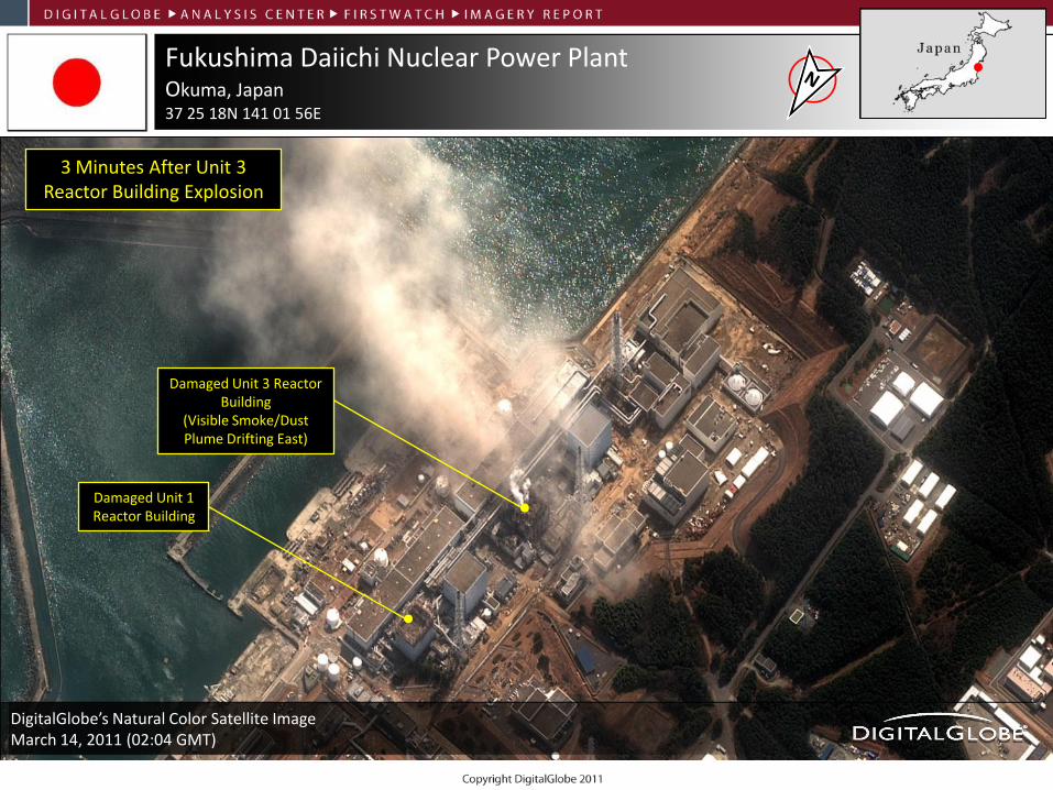
Fukushima Daiichi Nuclear Power Plant Okuma, Japan 37 25 18N 141 01 56E
DigitalGlobe’s Natural Color Satellite Image March 14, 2011 (02:04 GMT)
3 Minutes After Unit 3 Reactor Building Explosion
Damaged Unit 3 Reactor Building
(Visible Smoke/Dust Plume Drifting East)
Damaged Unit 1 Reactor Building
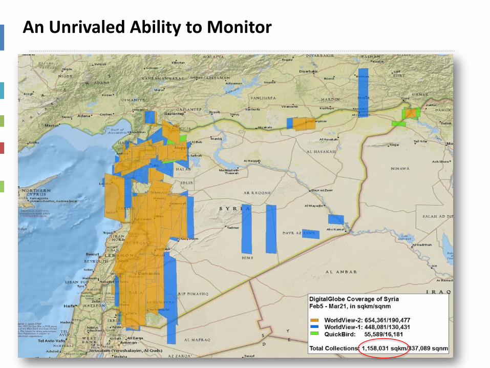
An Unrivaled Ability to Monitor
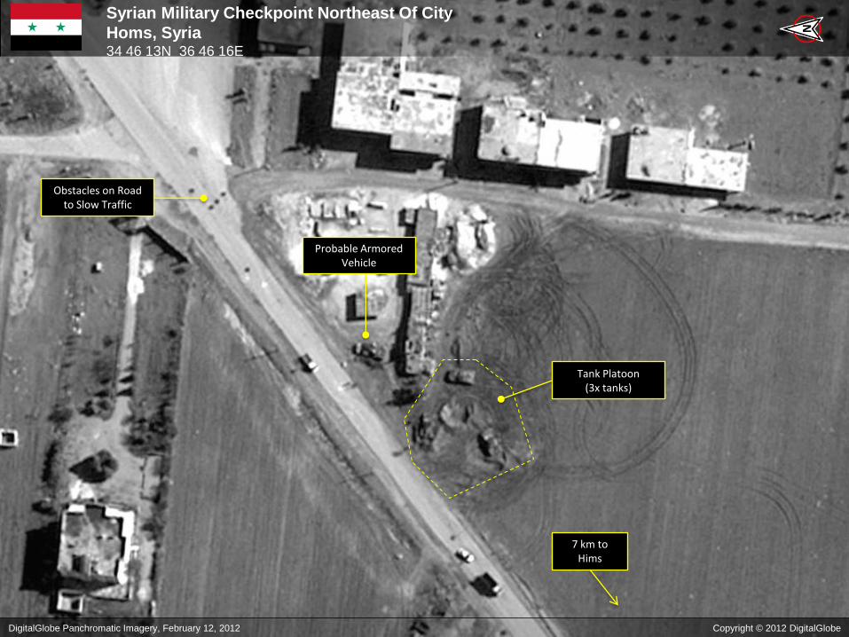
Syrian Military Checkpoint Northeast Of City
Homs, Syria 34 46 13N 36 46 16E
N
Tank Platoon (3x tanks)
Obstacles on Road to Slow Traffic
Probable Armored Vehicle
DigitalGlobe Panchromatic Imagery, February 12, 2012 Copyright © 2012 DigitalGlobe
7 km to Hims
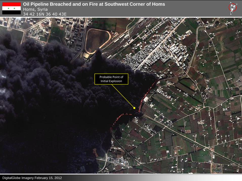
Oil Pipeline Breached and on Fire at Southwest Corner of Homs Homs, Syria 34 42 16N 36 40 43E
DigitalGlobe Imagery February 15, 2012
Probable Point of Initial Explosion
Customer Uses

DigitalGlobe Image: Tongch’ang Ni Launch Facility, North Korea | April 9,2012| 50cm

In-Depth Analysis

Analysts Without Borders
"We can witness in near real-time and put all parties on notice that if they commit war crimes, we will all be watching, and pressuring policymakers to take action.“ George Clooney
The Satellite Sentinel Project:
• Conceived by George Clooney
• Combines DigitalGlobe satellite imagery and analysis with additional
analysis, field reports and collaboration with the Enough Project and the
Harvard Humanitarian Initiative.
• Provides early warning system to deter mass atrocities. Focuses world
attention on human rights and human security concerns.


We Must Make it Easy to Use and Understand
Director of National Intelligence Photo