• Awareness
• Understanding
• Guided Practice
• Implementation

What is ISS EarthKAM?
• A NASA-sponsored, undergraduate student-operated educational program aimed at exciting and involving students in grades 5-12 in science (and geography is a science!)
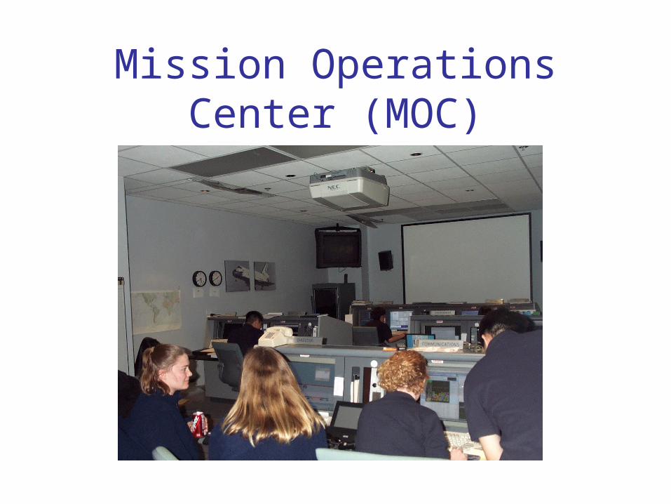
Mission Operations Center (MOC)

Who is the ISS
EarthKAM Team ?

Partnership…University of California San Diego
• Undergraduate students at the University of California, San Diego are responsible for the day-to-day operations of ISS EarthKAM
Johnson Space Center (Brion Au)
Jet Propulsion Laboratory (Paul Andries)• Texas A&M University and the Geography Community• TERC
• Center for Earth and Space Education


How Does it Work?• Individual teachers & schools sign up to
participate in a Mission– Receive necessary materials from EK-Help
• Slider map set• Code words• Emails with hints and timely information
• Students in participating classrooms use ISS EarthKAM’s web pages to control a digital camera mounted on the International Space Station
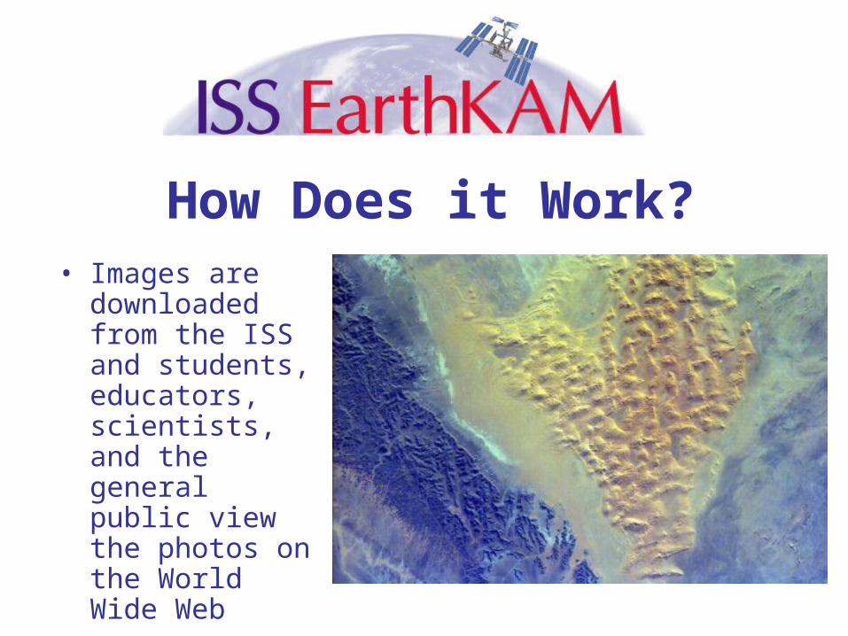
How Does it Work?• Images are
downloaded from the ISS and students, educators, scientists, and the general public view the photos on the World Wide Web
Add image

An ISS EarthKAM Mission• Students determine photo locations by
referencing maps, atlases, and slider maps--observational science

An ISS EarthKAM Mission• Students submit photo requests online
using ISS EarthKAM’s web pages
An ISS EarthKAM Mission
• MOC representatives compile photo requests and send them to Johnson Space Center, where they are uplinked to ISS

• Software onboard ISS reads the requested times, takes the photos, and then saves them onto a hard disk
• Captured photos are then downlinked to ISS EarthKAM computers at UCSD
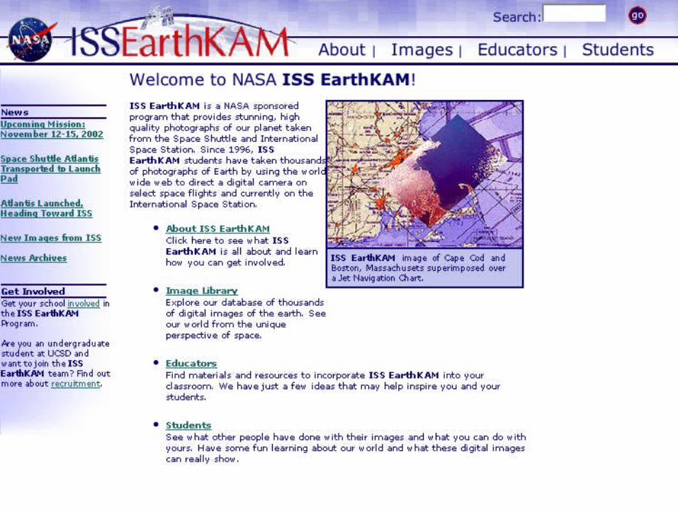
Images• Within hours, images are referenced and
made available to students at the website at:
http://www.earthkam.ucsd.edu

Mission GeographyHow Does it Work?
EarthKAMUCSD

When?• About three times a year…• Shuttle Missions: March 1996, January 1997,
September 1997, January 1998, February 2000• ISS Missions: October 2001, February 2002, March
2002, November 2002, January 2003, April 2003, May 2003, July 2003
• NEXT ONE: November 2003
http://earthkam.ucsd.edu/public/about/missions/past.shtml
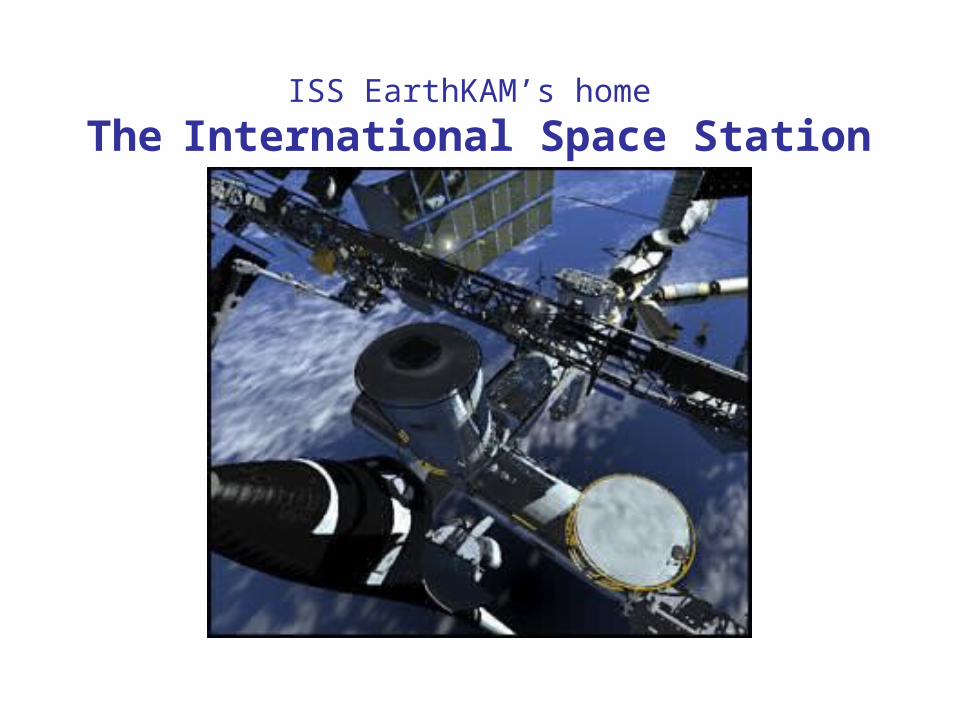
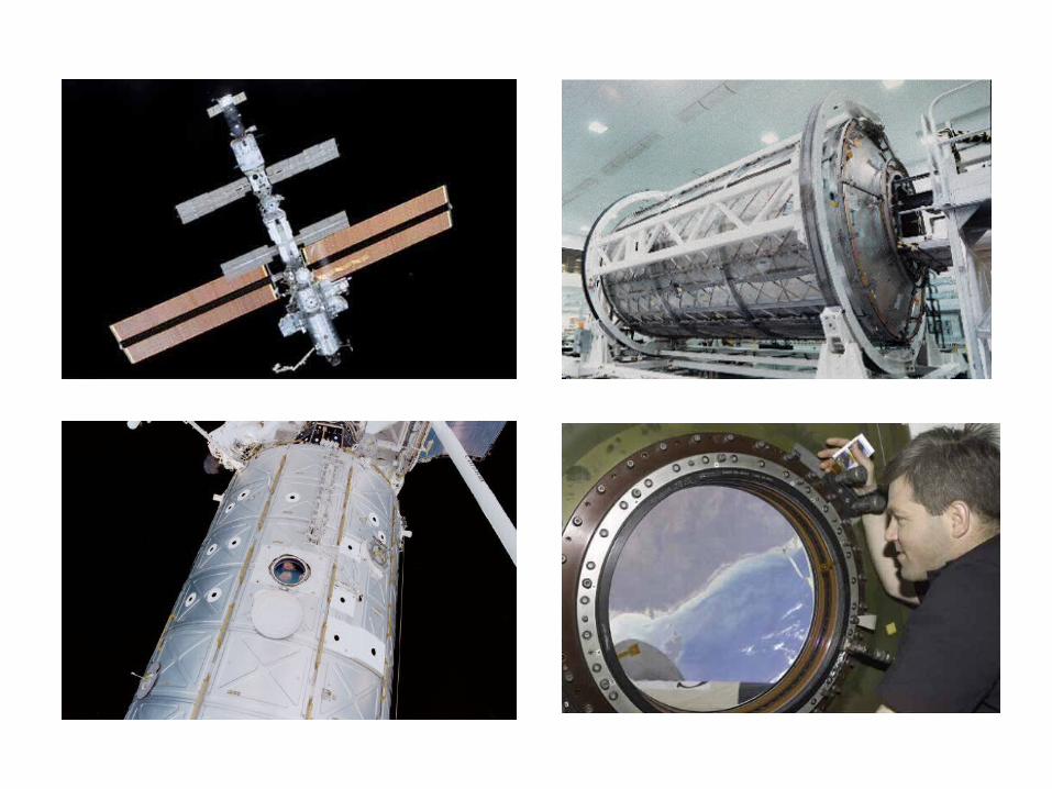
ISS EarthKAM’s home
The International Space Station

Benefits for Students?• With ISS EarthKAM, participating school
students can…– Share the excitement of a NASA space mission– Participate in real-time, cutting edge research in
many fields, including• Geography--using Mission Geography and related
materials• Earth Science• Environmental Science• …and many more!

Chesapeake Bay
Norfolk,Virginia
AlbemarleSound
East Coast U.S., Virginia and North Carolina
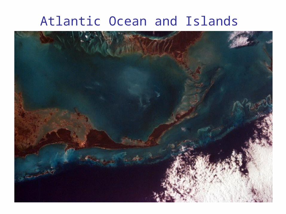
Atlantic Ocean and Islands

Tongue of the Ocean and Grand Bahama Bank

Sakhalin Island, Russia

Alluvial Fan in China

Images• After the completion of the mission,
UCSD students
– Verify time at which images were taken
– Locate images using atlases and targeting software
– Label areas of interest
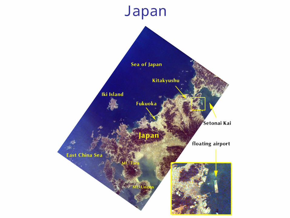
Japan

Middle East

Analysis by Students• Educators guide students in their investigation
of images– Preliminary observation
• Investigating the image for landmarks, places of interest
– Navigating the terrain• Locating longitude, latitude, global position, key features
– Thorough research• Cultural, historical, and general questions that require a
more in-depth understanding

Sample Student Investigation

Institute • Prepare geography educators to
participate in ISSEarthKAM
• Eight days, July, 2003, Texas A&M University
• Funded by the National Geographic Society