A Brief Review of the MimbresA Brief Review of the Mimbres
Elaine Hebard
January 23, 2009
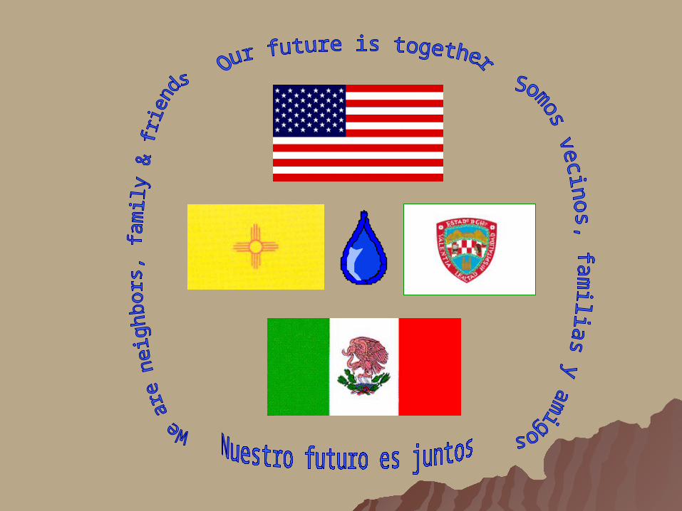
Border 2012 * Frontera 2012Water Subcommittee * Subcomité Del Agua

Arid * AridaArid * Arida
Estado deSonora
Estado de Sinaloa
Estado deDurango
Estados Unidosde América
Estado deCoahuila
25° N
26° N
27° N
28° N
29° N
30° N
110°
W
31° N
32° N
107°
W
109°
W
108°
W
106°
W
105°
W
104°
W
103°
W
500 100 kms.
E s c a l a g r á f i c a
CUENCAS CERRADASDEL NORTE
VERTIENTESDEL OESTE
ALTO BRAVO
CONCHOS - MAPIMI
COMISION NACIONAL DEL AGUA
Fecha: nov 96' API
Programa Hidráulico de Gran Visión C H I H U A H U A 1996 - 2020.
Est
e p
lan
o e
s e
squ
em
átic
o
Proyección Longitud - Latitud
DHTA PROINFRA
E X P L I C A C I O N
E X P L I C A C I O N
LIMITE ESTATAL
LIMITE INTERNACIONAL
NOMBRE DE LA REGION
REGIONES DE PLANEACION HIDROLOGICA
500 - 600
900 - 1000
800 - 900
700 - 800
600 - 700
1000 - 1200
MAS DE 1200
100 - 200
400 - 500
300 - 400
200 - 300
0 - 100
SIN DEFICIT
(mm DE DEFICIT)
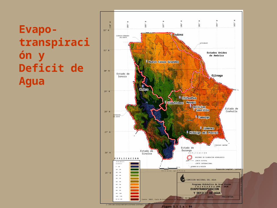
EVAPOTRANSPIRACIONY DEFICIT DE AGUA
Fuente: INEGI, Carta de Evotranspiración.
C:\VPO\CNA\CHIHUA\MAPINFO\EVOTRANS\EVOTRANS1.WOR
Figura 5.1.1.a - 84
MaderaMaderaMaderaMaderaMaderaMaderaMaderaMaderaMadera
MeoquiMeoquiMeoquiMeoquiMeoquiMeoquiMeoquiMeoquiMeoqui
OjinagaOjinagaOjinagaOjinagaOjinagaOjinagaOjinagaOjinagaOjinaga
JuárezJuárezJuárezJuárezJuárezJuárezJuárezJuárezJuárez
ChihuahuaChihuahuaChihuahuaChihuahuaChihuahuaChihuahuaChihuahuaChihuahuaChihuahua
Hidalgo del ParralHidalgo del ParralHidalgo del ParralHidalgo del ParralHidalgo del ParralHidalgo del ParralHidalgo del ParralHidalgo del ParralHidalgo del Parral
DeliciasDeliciasDeliciasDeliciasDeliciasDeliciasDeliciasDeliciasDelicias
CuauhtémocCuauhtémocCuauhtémocCuauhtémocCuauhtémocCuauhtémocCuauhtémocCuauhtémocCuauhtémoc
Nuevo Casas GrandesNuevo Casas GrandesNuevo Casas GrandesNuevo Casas GrandesNuevo Casas GrandesNuevo Casas GrandesNuevo Casas GrandesNuevo Casas GrandesNuevo Casas Grandes
CamargoCamargoCamargoCamargoCamargoCamargoCamargoCamargoCamargo
JiménezJiménezJiménezJiménezJiménezJiménezJiménezJiménezJiménez
SaucilloSaucilloSaucilloSaucilloSaucilloSaucilloSaucilloSaucilloSaucillo
Evapo-transpiración y Deficit de Agua
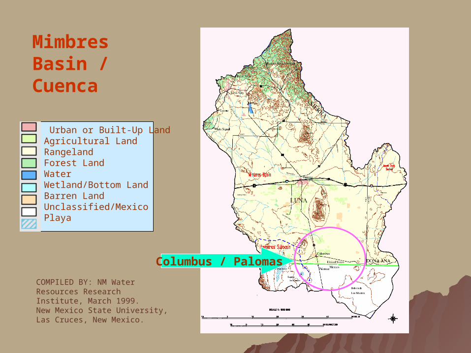
Mimbres Basin / Cuenca
COMPILED BY: NM Water Resources Research Institute, March 1999.New Mexico State University, Las Cruces, New Mexico.
Columbus / Palomas
Urban or Built-Up LandAgricultural LandRangelandForest LandWaterWetland/Bottom LandBarren LandUnclassified/MexicoPlaya

Mapa con Regiones Hidrológicas
http://chih.inegi.gob.mx/territorio/espanol/rh.html

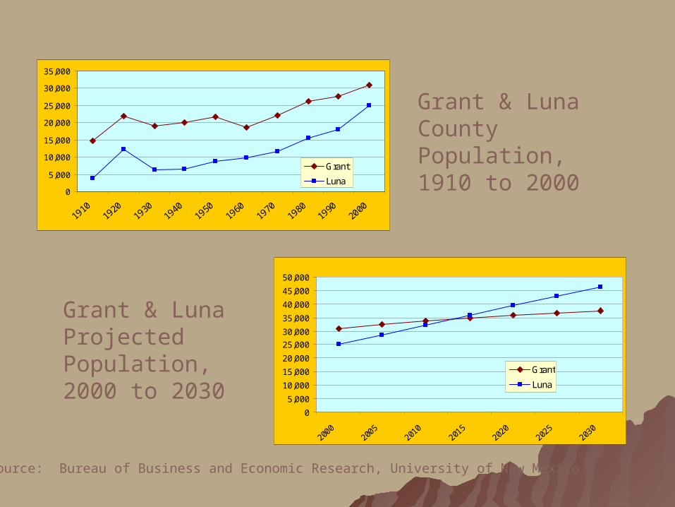
Population – a driving force
0
5,000
10,000
15,000
20,000
25,000
30,000
35,000
1910
1920
1930
1940
1950
1960
1970
1980
1990
2000
Grant
Luna
0
5,000
10,000
15,000
20,000
25,000
30,000
35,000
40,000
45,000
50,000
2000
2005
2010
2015
2020
2025
2030
Grant
Luna
Grant & Luna County Population, 1910 to 2000
Grant & Luna Projected Population, 2000 to 2030
Source: Bureau of Business and Economic Research, University of New Mexico.

0
5,000
10,000
15,000
20,000
25,000
1970 1980 1990 2000
XI Censo General de Población y Vivienda 1990 (12 de marzo de 1990), Conteo de Población y Vivienda 1995
Population Projections in the Closed Basins, 2000-2025
0
20,000
40,000
60,000
80,000
100,000
120,000
140,000
160,000
2000 2005 2010 2015 2020 2025
Cuatémoc
Nuevo CasasGrandes
Ciudadesmedias
Localidadesrurales
Municipio of Ascensión, 1970 to 2000

Population & economic activities Population & economic activities demand waterdemand water
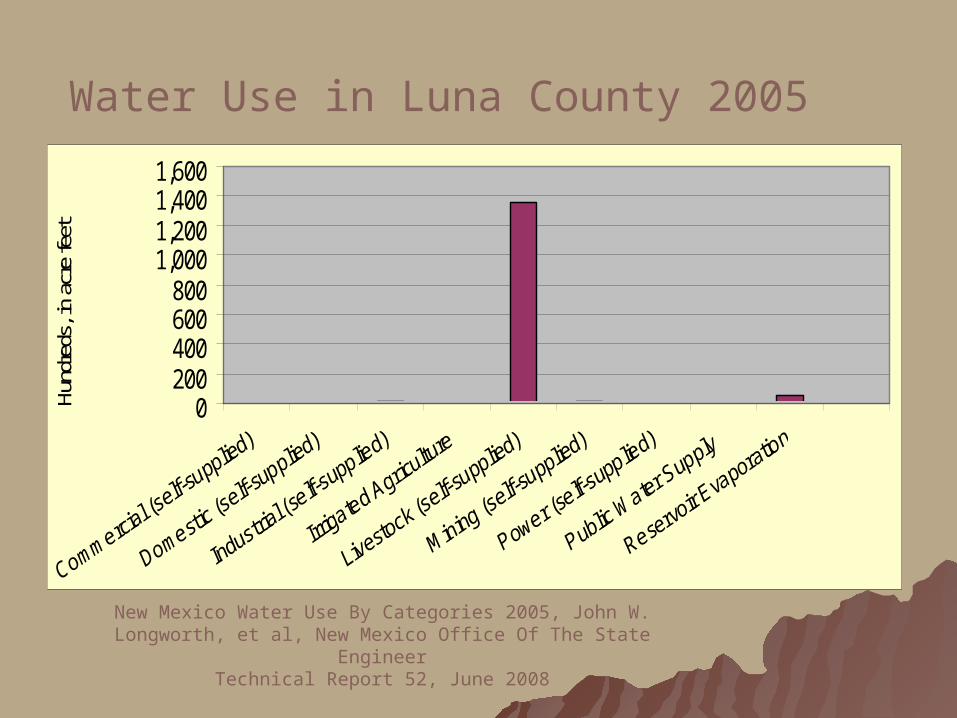
0200400600800
1,0001,2001,4001,600
Hund
reds
, in
acre
feet
Water Use in Luna County 2005
New Mexico Water Use By Categories 2005, John W. Longworth, et al, New Mexico Office Of The State Engineer
Technical Report 52, June 2008

020406080
100120140160180
mm
3
Ascensión
Palomas
Source: Plan Hidráulico Gran Visión, 1997
Water Use in Ascension, 1995
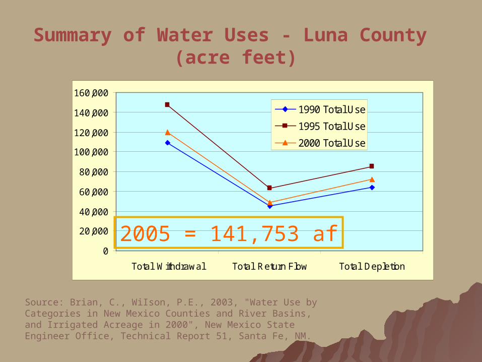
0
20,000
40,000
60,000
80,000
100,000
120,000
140,000
160,000
Total Withdrawal Total Return Flow Total Depletion
1990 Total Use
1995 Total Use
2000 Total Use
Source: Brian, C., WiIson, P.E., 2003, "Water Use by Categories in New Mexico Counties and River Basins, and Irrigated Acreage in 2000", New Mexico State Engineer Office, Technical Report 51, Santa Fe, NM.
Summary of Water Uses - Luna County (acre feet)
2005 = 141,753 af
Water Budgets
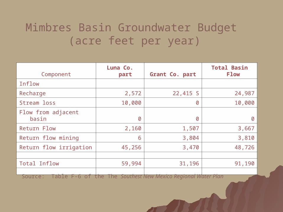
Component Luna Co. part Grant Co. part Total Basin Flow
Inflow
Recharge 2,572 22,415 S 24,987
Stream loss 10,000 0 10,000
Flow from adjacent basin 0 0 0
Return Flow 2,160 1,507 3,667
Return flow mining 6 3,804 3,810
Return flow irrigation 45,256 3,470 48,726
Total Inflow 59,994 31,196 91,190
Mimbres Basin Groundwater Budget (acre feet per year)
Source: Table F-6 of the The Southest New Mexico Regional Water Plan

Outflow
Municipal wells 4,320 3,013 7,333
Commercial (self-supplied) 176 24 199
Domestic wells 656 817 1,473
Irrigation wells 75,242 3,044 78,286
Industrial (self-supplied) 42 0 42
Livestock (self-supplied) 342 69 410
Mining (self-supplied) 7 18,714 18,721
Power (self-supplied) 0 280 280
Evapotranspiration 10,000 3,400 13,400
Springs / stream gain 4,800 4,800
Sub flow out 0 0 0
Total Outflow 90,784 34,161 124,945
Error and/or change in storage -30,790 -2,965 -33,755
Mimbres Basin Groundwater Budget (acre feet per year), continued
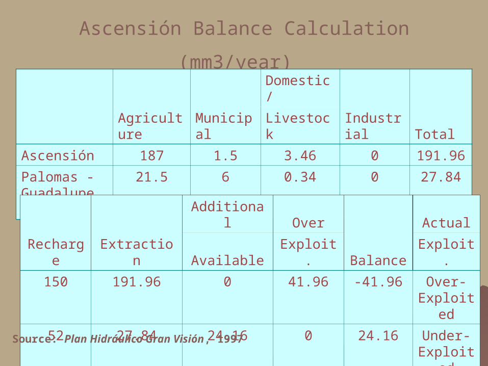
Ascensión Balance Calculation (mm3/year)
Agriculture Municipal
Domestic/
Industrial TotalLivestock
Ascensión 187 1.5 3.46 0 191.96
Palomas - Guadalupe Victoria
21.5 6 0.34 0 27.84
Recharge Extraction
Additional Over
Balance
Actual
Available Exploit. Exploit.
150 191.96 0 41.96 -41.96 Over-Exploited
52 27.84 24.16 0 24.16 Under-Exploited
Source: Plan Hidráulico Gran Visión, 1997
Common Aspects * Aspectos Común

population * populación
water demands * demandas de agua
depend on groundwater * depiende de
agua subterranea uses exceed recharge * usos exceden
recarga
Summed Up

Additional Issues
Water Quality: high levels of arsenic and fluoride
Thirsty Neighbors: Cd. Juarez, Santa Teresa and El Paso
Data: Lacking, Inconsistent and Incompatible
Concerns about drought & climate change

Mimbres Basin http://river.nmsu.edu/website/pdnwc/index.htm
Many questions concerning the aquifers remain:– How extensive are the aquifers?– Which directions are the aquifers flowing?– How deep are the aquifers?– What is the quality of the aquifers at various
depths?– How fast are they declining in supply and
quality?– What is the long-term availability?– What is the relationship between surface
supplies and aquifer recharge?

Octavo Informe de la Junta Ambiental del Buen Vecino: LA CUENCA DE MIMBRES - UN POSIBLE PROYECTO PILOTO PARA APLICAR MÉTODOS DE MANEJO DEL AGUA SUBTERRÁNEA EN LA ZONA FRONTERIZA MÉXICO-EE.UU.
http://www.epa.gov/ocem/gneb/gneb8threport/gneb8threport_sp.pdf
Good Neighbor Environmental Board Eighth Report: THE MIMBRES BASIN - A POSSIBLE PILOT PROJECT FOR APPLYING GROUNDWATER MANAGEMENT APPROACHES IN THE U.S.-MEXICO BORDER REGION<http://www.epa.gov/ocem/gneb/gneb8threport/gneb8threport.pdf>
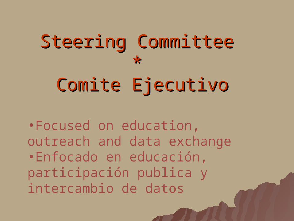
Steering Committee Steering Committee * *
Comite EjecutivoComite Ejecutivo
•Focused on education, outreach and data exchange•Enfocado en educación, participación publica y intercambio de datos
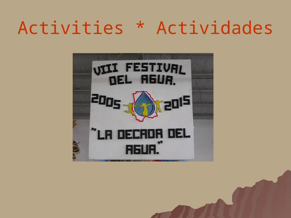
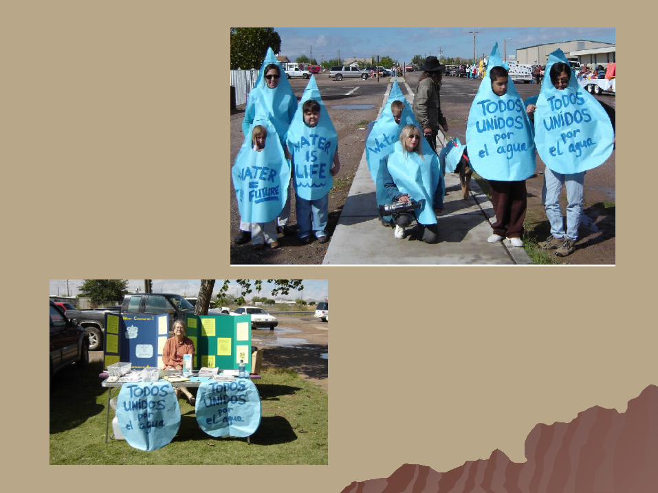
Activities * Actividades
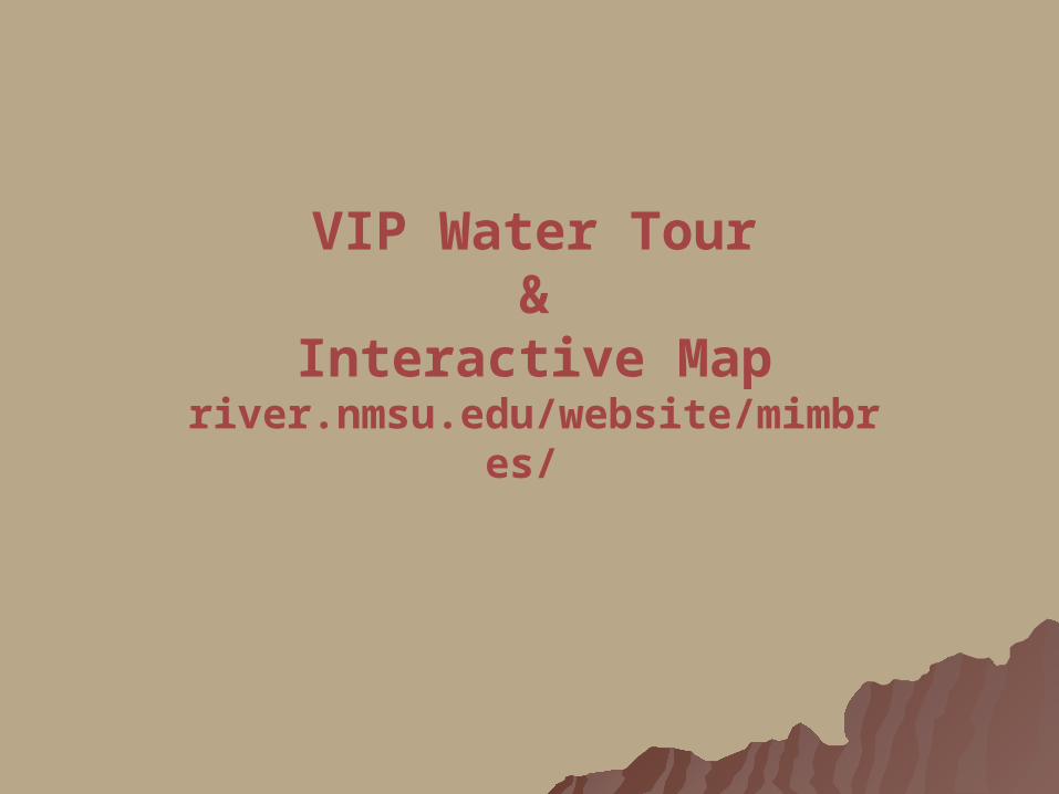
VIP Water Tour&
Interactive Mapriver.nmsu.edu/website/mimbres/

Contact InformationContact Information
Elaine Hebard, Project Facilitator Mimbres Basin Dialogue [email protected]
Celso Jaquez, Mexican Co-Leader [email protected] Allyson Siwik, U.S. Co-Leader [email protected]
RIO MIMBRESRIO MIMBRES
Columbus, New MexicoColumbus, New Mexico
&&
Palomas, ChihuahuaPalomas, Chihuahua
Nuestra Agua Común -- Nuestro Futuro ComúnNuestra Agua Común -- Nuestro Futuro Común
Our Shared Water -- Our Shared FutureOur Shared Water -- Our Shared Future

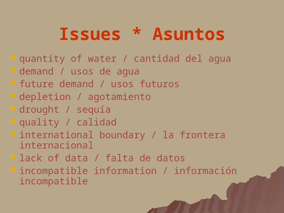
Issues * Asuntos quantity of water / cantidad del agua demand / usos de agua future demand / usos futuros depletion / agotamiento drought / sequía quality / calidad international boundary / la frontera internacional lack of data / falta de datos incompatible information / información incompatible