1
L2 and L5 Civil Signal Industry Day
2 May 2001
LCDR Richard Fontana
GPS Deputy Program Manager, DOT
2
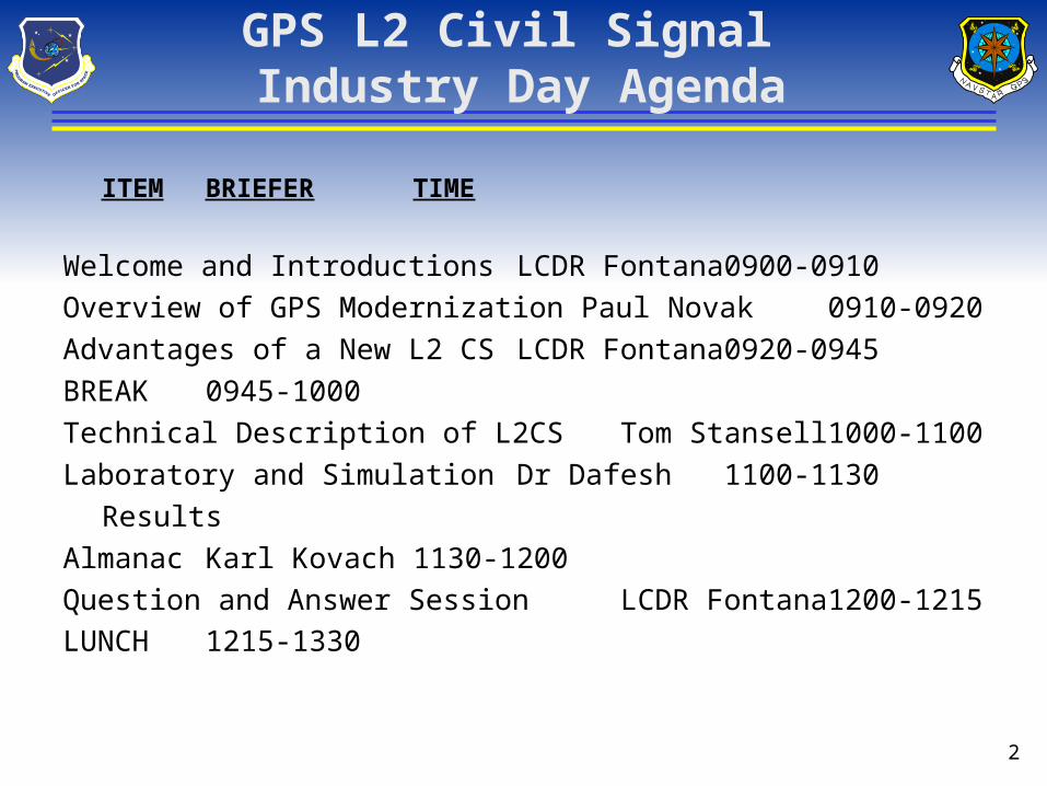
GPS L2 Civil Signal Industry Day Agenda
ITEM BRIEFER TIME
Welcome and Introductions LCDR Fontana 0900-0910
Overview of GPS Modernization Paul Novak 0910-0920
Advantages of a New L2 CS LCDR Fontana 0920-0945
BREAK 0945-1000
Technical Description of L2CS Tom Stansell 1000-1100
Laboratory and Simulation Dr Dafesh 1100-1130
Results
Almanac Karl Kovach 1130-1200
Question and Answer Session LCDR Fontana 1200-1215
LUNCH 1215-1330
3
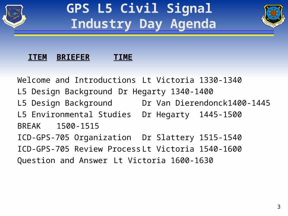
GPS L5 Civil Signal Industry Day Agenda
ITEM BRIEFER TIME
Welcome and Introductions Lt Victoria 1330-1340
L5 Design Background Dr Hegarty 1340-1400
L5 Design Background Dr Van Dierendonck 1400-1445
L5 Environmental Studies Dr Hegarty 1445-1500
BREAK 1500-1515
ICD-GPS-705 Organization Dr Slattery 1515-1540
ICD-GPS-705 Review Process Lt Victoria 1540-1600
Question and Answer Lt Victoria 1600-1630
4
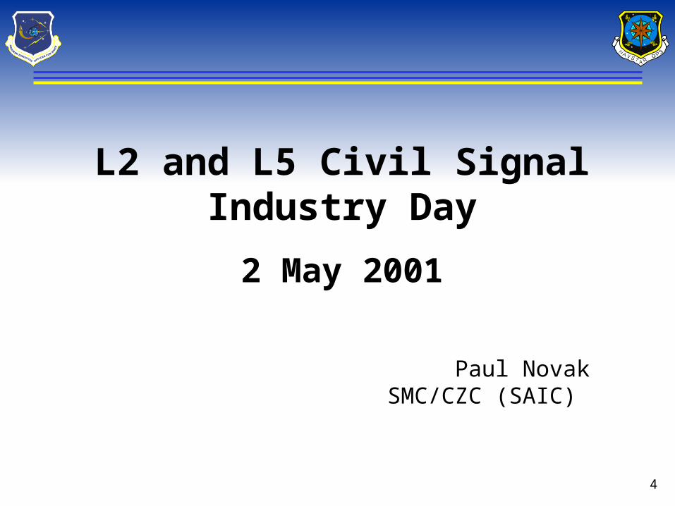
L2 and L5 Civil Signal Industry Day
2 May 2001
Paul NovakSMC/CZC (SAIC)
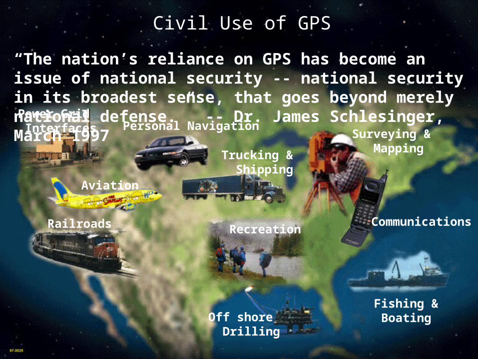
Communications
Surveying & Mapping
Fishing & BoatingOff shore
Drilling
Recreation
Trucking & Shipping
Personal Navigation
Aviation
Railroads
Power Grid Interfaces
Civil Use of GPS
“The nation’s reliance on GPS has become an issue of national security -- national security in its broadest sense, that goes beyond merely national defense.” -- Dr. James Schlesinger, March 1997
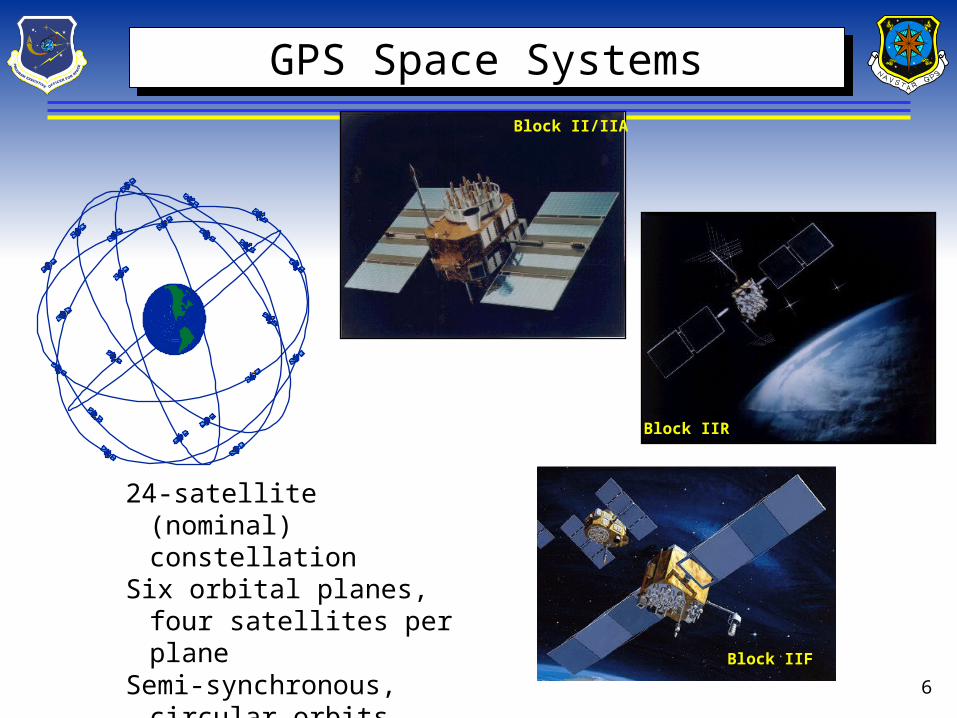
6
Block IIR
Block II/IIA
Block IIF
24-satellite (nominal) constellation
Six orbital planes, four satellites per plane
Semi-synchronous, circular orbits (~11,000 mi)
GPS Space Systems GPS Space Systems
7
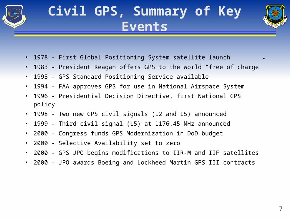
Civil GPS, Summary of Key Events
• 1978 - First Global Positioning System satellite launch
• 1983 - President Reagan offers GPS to the world “free of charge”
• 1993 - GPS Standard Positioning Service available
• 1994 - FAA approves GPS for use in National Airspace System
• 1996 - Presidential Decision Directive, first National GPS policy
• 1998 - Two new GPS civil signals (L2 and L5) announced
• 1999 - Third civil signal (L5) at 1176.45 MHz announced
• 2000 - Congress funds GPS Modernization in DoD budget
• 2000 - Selective Availability set to zero
• 2000 - GPS JPO begins modifications to IIR-M and IIF satellites
• 2000 - JPO awards Boeing and Lockheed Martin GPS III contracts
8
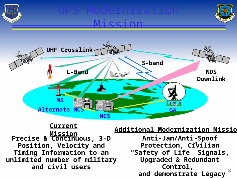
GPS Modernization Mission
Precise & Continuous, 3-D Position, Velocity and Timing Information to an unlimited number of military and
civil users
Current MissionAnti-Jam/Anti-Spoof Protection, Civilian “Safety of Life” Signals, Upgraded & Redundant Control,
and demonstrate Legacy and Upgraded Military Receivers.
MS
GAMCS
L-Band NDSDownlink
S-band
Alternate MCS
UHF Crosslink
Additional Modernization Mission
9
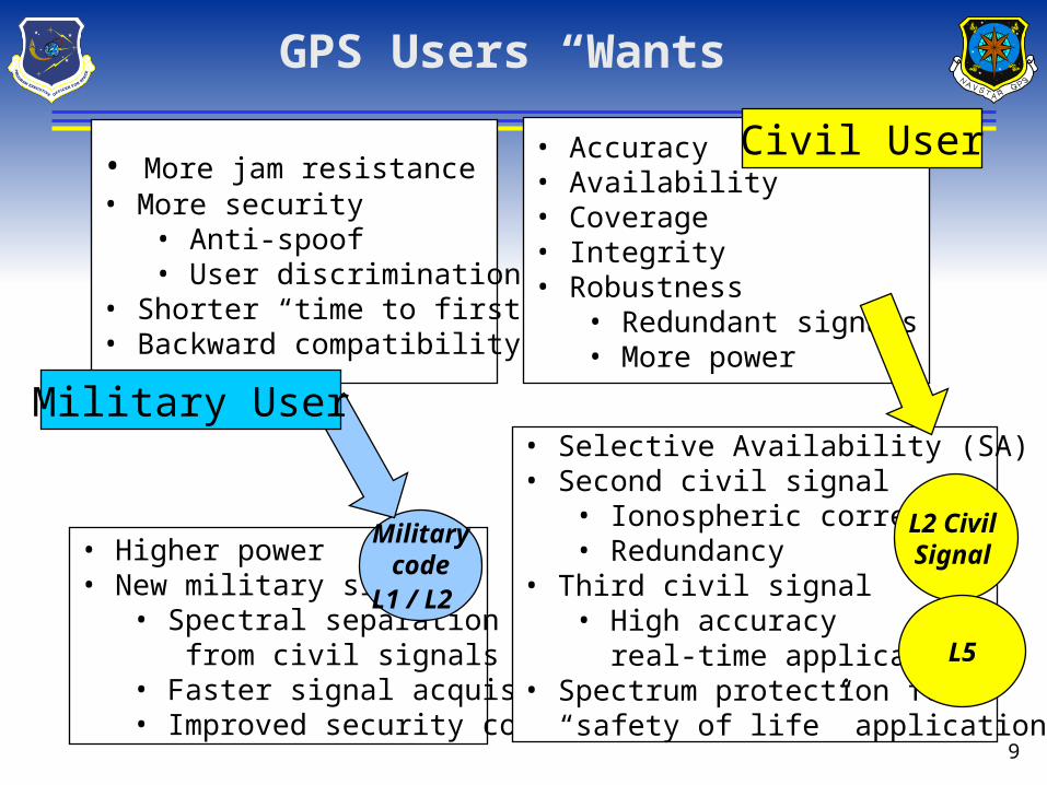
GPS Users “Wants”
• More jam resistance• More security
• Anti-spoof• User discrimination
• Shorter “time to first fix”• Backward compatibility
• Accuracy• Availability• Coverage• Integrity• Robustness
• Redundant signals• More power
• Higher power• New military signal
• Spectral separation from civil signals• Faster signal acquisition• Improved security codes
• Selective Availability (SA) to zero• Second civil signal
• Ionospheric correction• Redundancy
• Third civil signal• High accuracy real-time applications
• Spectrum protection for “safety of life” applications
Civil User
Militarycode
L1 / L2
L2 Civil Signal
Military User
L5
10
Why Modernize GPS?The Civil GPS Perspective
• Better support to civil GPS customers worldwide• New civil signals for improved accuracy, integrity and
continuity of service = robustness• Global utility = economic enabler• Optimize GPS PVT and augmentation systems in a
overall national network architecture
Presidential Decision Directive - Mar 96
Vice Presidential Announcements - Mar 98 and Jan 99
11
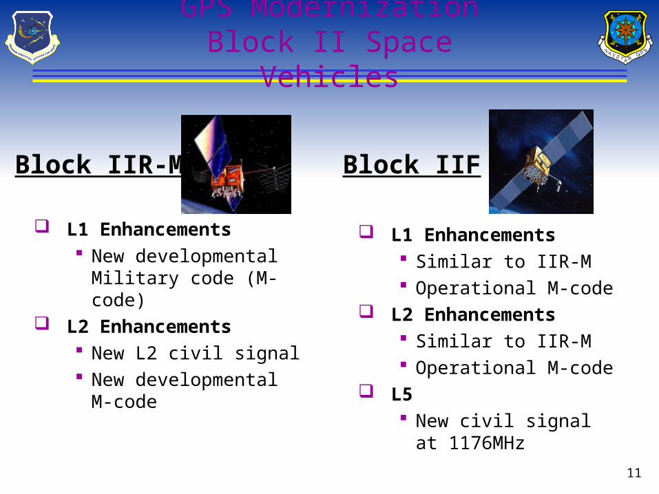
GPS ModernizationBlock II Space Vehicles
L1 Enhancements New developmental
Military code (M-code) L2 Enhancements
New L2 civil signal New developmental M-
code
L1 Enhancements Similar to IIR-M Operational M-code
L2 Enhancements Similar to IIR-M Operational M-code
L5 New civil signal at
1176MHz
Block IIR-M Block IIF
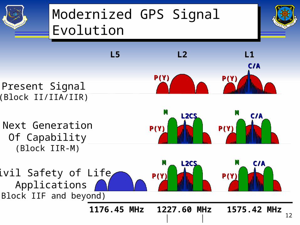
121227.60 MHz 1575.42 MHz1176.45 MHz
L2 L1L5
P(Y)P(Y)
C/AC/A
P(Y)P(Y)
C/AC/A
P(Y)P(Y)
P(Y)P(Y)
L2CSL2CS
P(Y)P(Y)
C/AC/A
P(Y)P(Y)
L2CSL2CS
MM MM
Present Signal(Block II/IIA/IIR)
Next GenerationOf Capability(Block IIR-M)
Civil Safety of LifeApplications
(Block IIF and beyond)
Modernized GPS Signal EvolutionModernized GPS Signal Evolution
MM MM
13
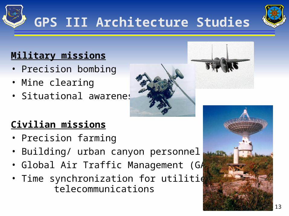
GPS III Architecture Studies
Military missions• Precision bombing• Mine clearing• Situational awareness
Civilian missions• Precision farming• Building/ urban canyon personnel tracking• Global Air Traffic Management (GATM)• Time synchronization for utilities/
telecommunications
14
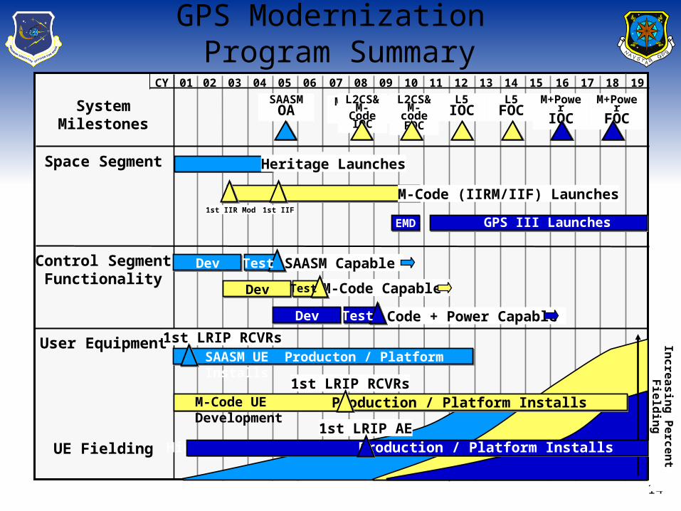
SystemMilestones
Space Segment
Control SegmentFunctionality
User Equipment
1801 02 03 04 05 06 07 08 09 10 11 12 13 14 15 16 17 19CY
M-Code (IIRM/IIF) Launches
UE Fielding
Heritage Launches
SAASM Capable
M-Code Capable
M-Code + Power Capable
1st LRIP RCVRs
SAASMOA
M-Code UE Development
M-CodeIOCM-Code
IOCL2CS&M-Code
IOC
M+PowerFOC
L2CS& M-code
FOC
M+PowerIOC
GPS III Launches1st IIR Mod 1st IIF
GPS III Launches
L5IOC
L5FOC
EMD
Dev Test
Dev Test
Dev Test
SAASM UE Producton / Platform Installs
1st LRIP RCVRs
High Power AE Development1st LRIP AE
Inc
rea
sin
g P
erc
en
t Fie
ldin
g
Production / Platform Installs
Production / Platform Installs
GPS Modernization Program Summary
L2 Civil Signal
LCDR Richard FontanaGPS Deputy Program Manager, DOT
May 2, 2001
16
Overview
Background
Advantages of New Signal
Design Considerations
17
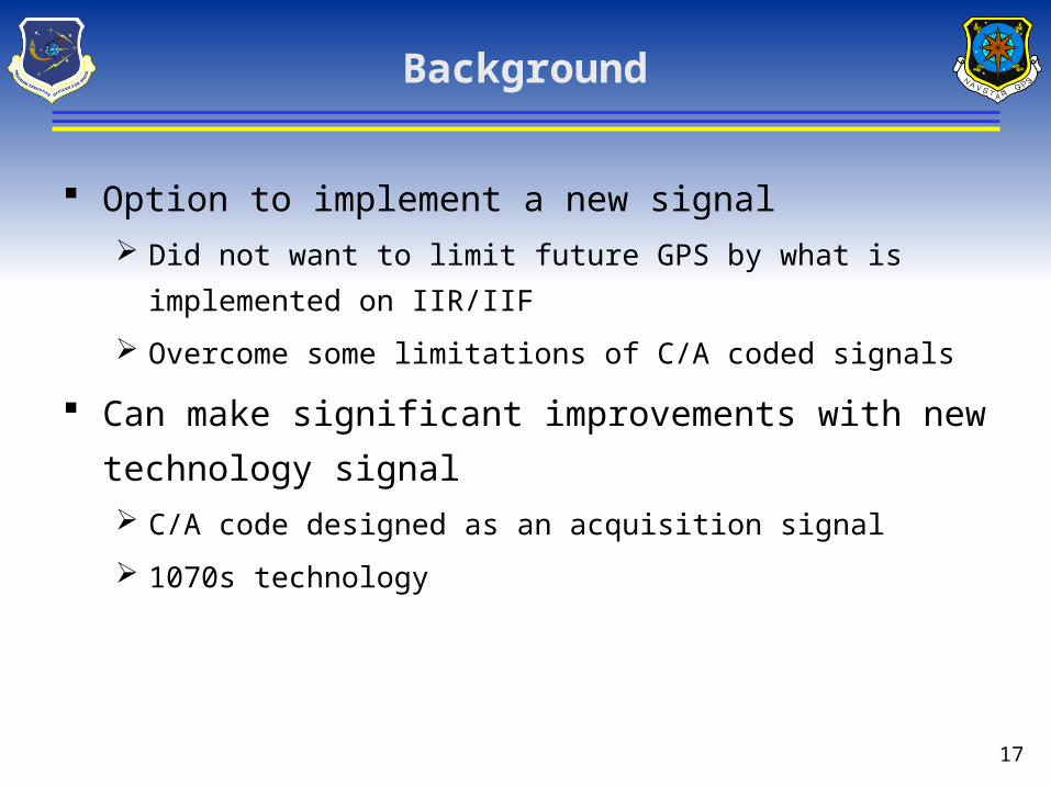
Background
Option to implement a new signal
Did not want to limit future GPS by what is implemented on
IIR/IIF
Overcome some limitations of C/A coded signals
Can make significant improvements with new technology
signal
C/A code designed as an acquisition signal
1070s technology
18
Advantages of a New Signal
Improved Cross Correlation Properties
Improves ability to transmit more signals (SBAS,Pseudolytes)
Improves the tolerance to interference
Improves susceptibility to self interference
Improves the dynamic rage of receivers
• Can receive weaker signals without self interference
Enables operation in more stressful environments (wooded area,
buildings, urban canyons)
Enables ability for higher power signals on future satellites
19
Advantages of a New Signal
Improved Tracking capability Enables operation in more stressful environments (wooded area,
buildings, urban canyons)
Improved Data Demodulation Want equivalent to tracking threshold
Again, enables operation in more stressful environments
Acquisition Capability Dependent on user equipment
Design trade with code length
Not limited by code. With right UE, can acquire signal in more stressful environments than C/A code
20
Design Considerations
Enhance existing professional/commercial dual frequency applicationsProvide more robust iono correction signal
Provide a more effective single frequency navigation signalDrives need for data
Simple to implement in the SV and UESchedule and Cost (both SV and UE)Replacement for C/A signal
21
Design Considerations (continued)
Compatible with L2 M-code Spectral Separation
Ensure no detriment to Codeless/Semi Codeless L2 P(Y) receivers As a result of two earlier objectives Same power level and spectral shape as C/A code…no
additional testing required
Risk Mitigation Design schedule short, IIR implementation schedule short,
coordination process short C/A code switch
22
Design Considerations (continued)
What is optimum in the future (GPS III) to determine the best step now. Did not want to artificially constrain thinking due to possible
IIR/IIF perceived limitations. Perceived cost/schedule limitations. Design for future, provide natural migration path
Then determine what portion could be implemented on IIR and IIF
L2 C/A code compatibility Assess impact on both military and civilian receivers Not a design driver but have C/A switch as risk mitigation
23
Signal Characteristics
Two codes one with & one without data Serves single and dual frequency users
Signal characteristics: Codes longer than C/A to minimize cross correlation Separated by time – Time Division Multiplexed (TDM) Narrow band signal – Spectral separation Improved data structure – Enhanced Data demodulation
Enhance cross correlation, tacking threshold, data demodulation threshold.
24
Signal Comparison
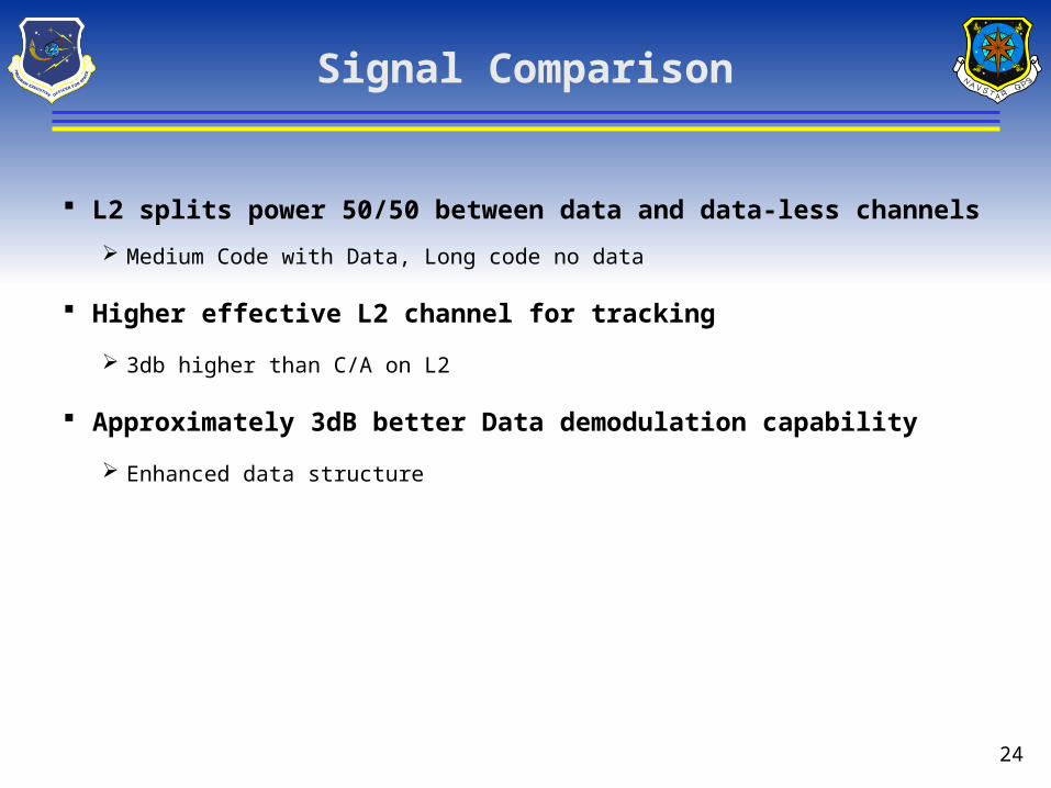
L2 splits power 50/50 between data and data-less channels
Medium Code with Data, Long code no data
Higher effective L2 channel for tracking
3db higher than C/A on L2
Approximately 3dB better Data demodulation capability
Enhanced data structure
25
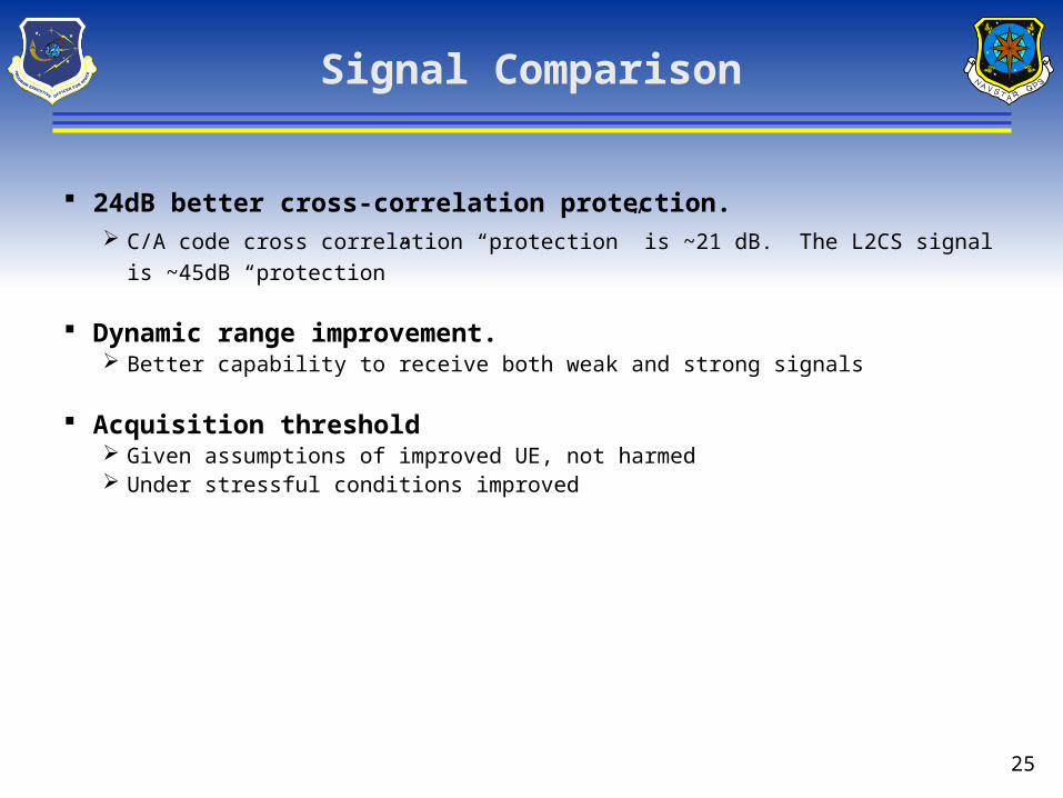
Signal Comparison
24dB better cross-correlation protection. C/A code cross correlation “protection” is ~21 dB. The L2CS signal is ~45dB
“protection”
Dynamic range improvement. Better capability to receive both weak and strong signals
Acquisition threshold Given assumptions of improved UE, not harmed Under stressful conditions improved
26
L2CS Summary
TDM service for both single and dual frequency Significant improvements in
Cross correlation performanceTracking thresholdData recovery thresholdAcquisition Capability
Modern signal for future GPS
27
Back up