DUAL-POL AND YOU What to make of this new radar technology Luke Madaus, UW Atmospheric Sciences 11/2/2011

What to make of this new radar technology Luke Madaus, UW Atmospheric Sciences 11/2/2011.
Dec 13, 2015
Welcome message from author
This document is posted to help you gain knowledge. Please leave a comment to let me know what you think about it! Share it to your friends and learn new things together.
Transcript

DUAL-POL AND YOUWhat to make of this new radar technology
Luke Madaus, UW Atmospheric Sciences11/2/2011

Outline
• Dual-Pol background• New dual-pol variables and products• A few examples from Pacific Northwest
weather• Further information
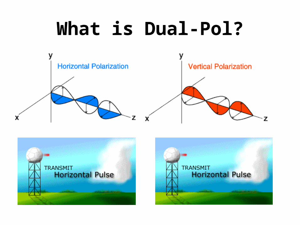
What is Dual-Pol?
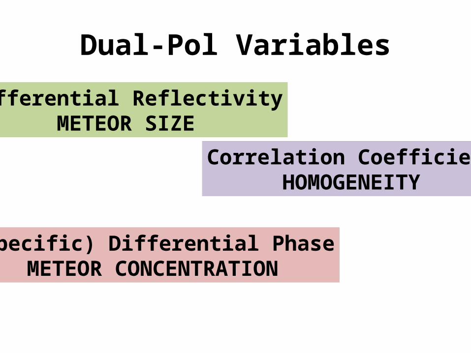
Dual-Pol Variables
Differential ReflectivityMETEOR SIZE
Correlation CoefficientHOMOGENEITY
(Specific) Differential PhaseMETEOR CONCENTRATION
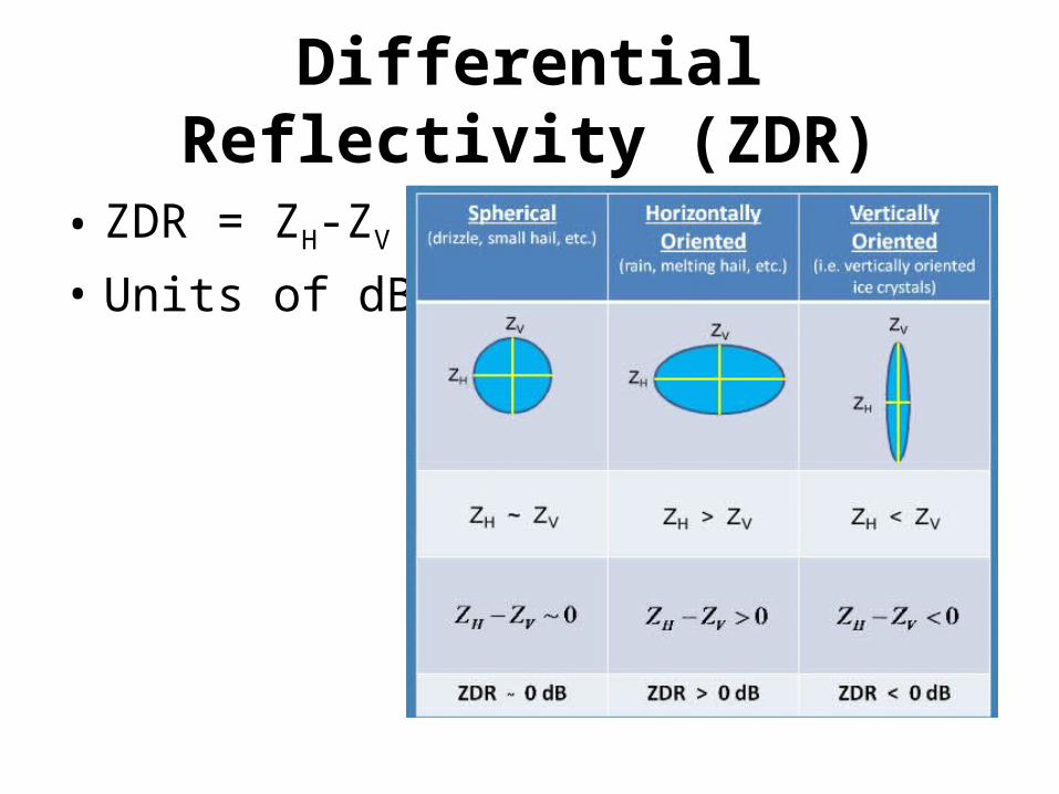
Differential Reflectivity (ZDR)
• ZDR = ZH-ZV
• Units of dB
Differential Reflectivity (ZDR)
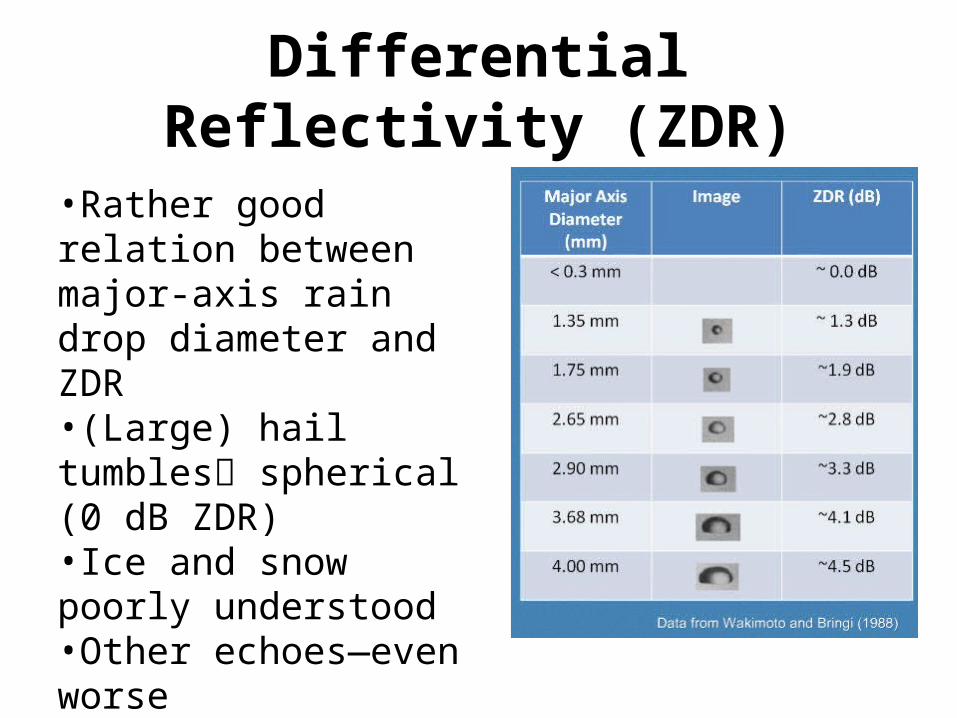
•Rather good relation between major-axis rain drop diameter and ZDR•(Large) hail tumbles spherical (0 dB ZDR)•Ice and snow poorly understood•Other echoes—even worse

Dual-Pol Variables
Differential ReflectivityMETEOR SIZE
Correlation CoefficientHOMOGENEITY
(Specific) Differential PhaseMETEOR CONCENTRATION
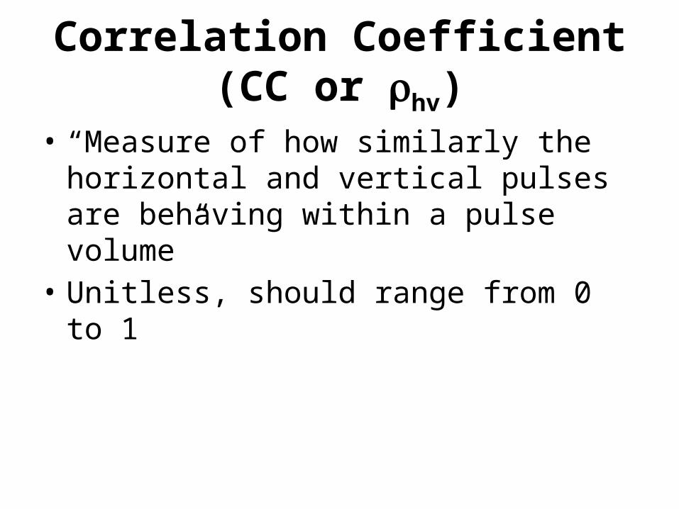
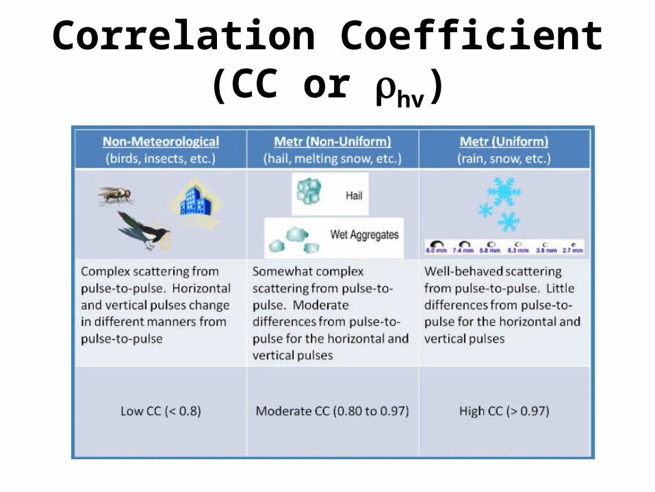
Correlation Coefficient (CC or rhv)
• “Measure of how similarly the horizontal and vertical pulses are behaving within a pulse volume”
• Unitless, should range from 0 to 1
Correlation Coefficient (CC or rhv)
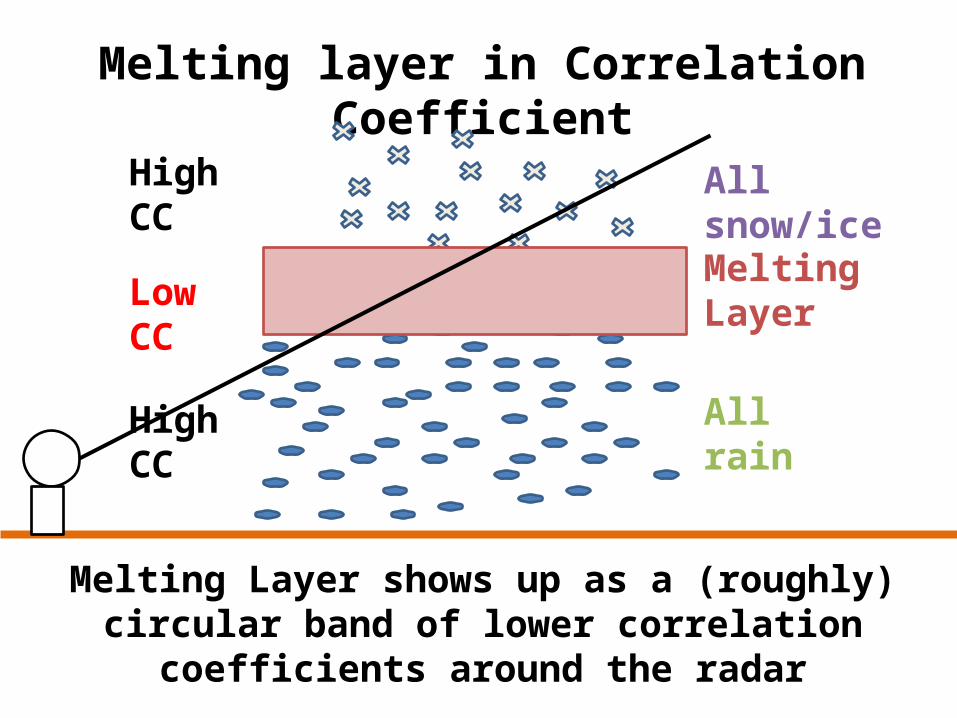
Melting layer in Correlation Coefficient
MeltingLayer
All rain
All snow/ice
High CC
Low CC
High CC
Melting Layer shows up as a (roughly) circular band of lower correlation coefficients around the radar
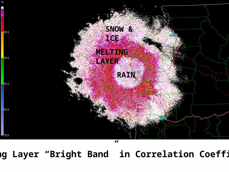
SNOW & ICE
MELTING LAYER
RAIN
Melting Layer “Bright Band” in Correlation Coefficient

Dual-Pol Variables
Differential ReflectivityMETEOR SIZE
Correlation CoefficientHOMOGENEITY
(Specific) Differential PhaseMETEOR CONCENTRATION
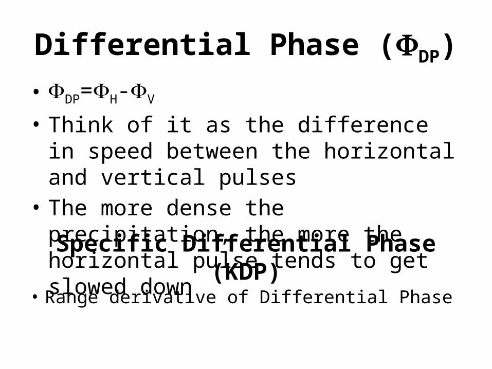
Differential Phase (FDP)• FDP=FH-FV
• Think of it as the difference in speed between the horizontal and vertical pulses
• The more dense the precipitation, the more the horizontal pulse tends to get slowed down
Specific Differential Phase (KDP)• Range derivative of Differential Phase
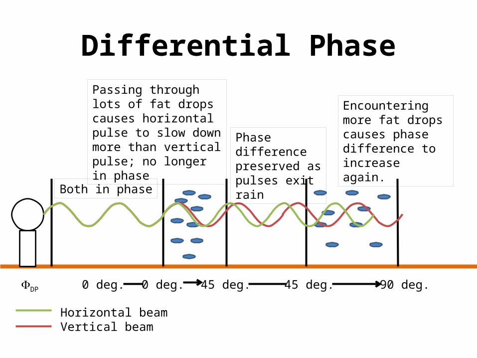
Differential Phase
Both in phase
Passing through lots of fat drops causes horizontal pulse to slow down more than vertical pulse; no longer in phase
Phase difference preserved as pulses exit rain
Encountering more fat drops causes phase difference to increase again.
FDP 0 deg. 45 deg. 45 deg.0 deg. 90 deg.
Horizontal beamVertical beam
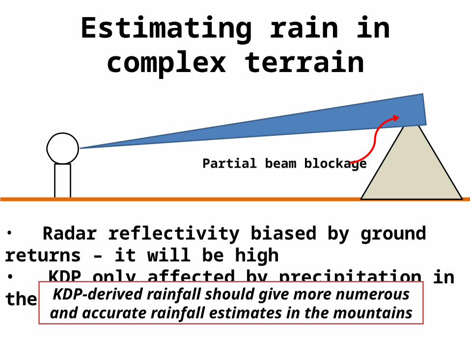
Estimating rain in complex terrain
• Radar reflectivity biased by ground returns – it will be high• KDP only affected by precipitation in the volume
Partial beam blockage
KDP-derived rainfall should give more numerous and accurate rainfall estimates in the mountains
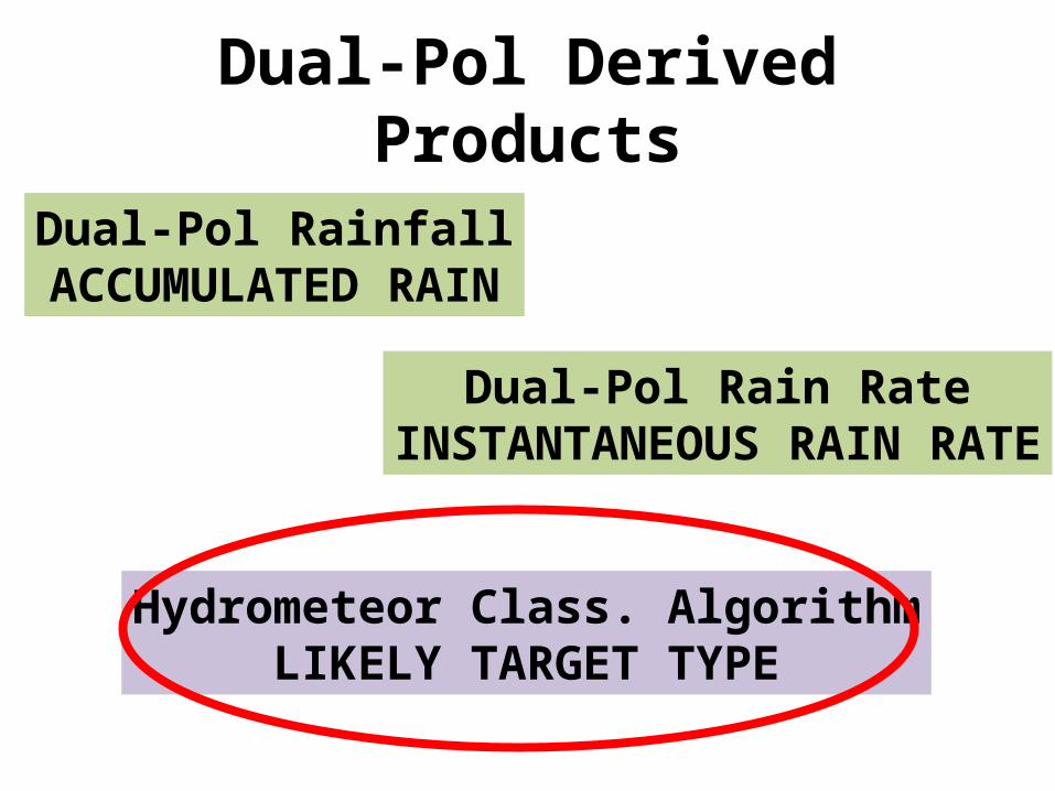
Dual-Pol Derived Products
Dual-Pol RainfallACCUMULATED RAIN
Hydrometeor Class. AlgorithmLIKELY TARGET TYPE
Dual-Pol Rain RateINSTANTANEOUS RAIN RATE
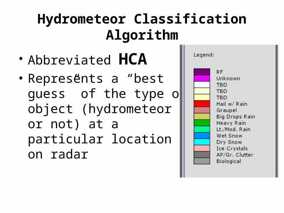
Hydrometeor Classification Algorithm
• Abbreviated HCA• Represents a “best guess” of
the type of object (hydrometeor or not) at a particular location on radar
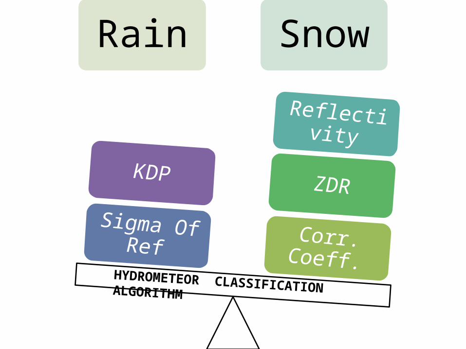
Rain Snow
Corr. Coeff.
ZDR
Reflectivity
Sigma Of Ref
KDP
HYDROMETEOR CLASSIFICATION ALGORITHM
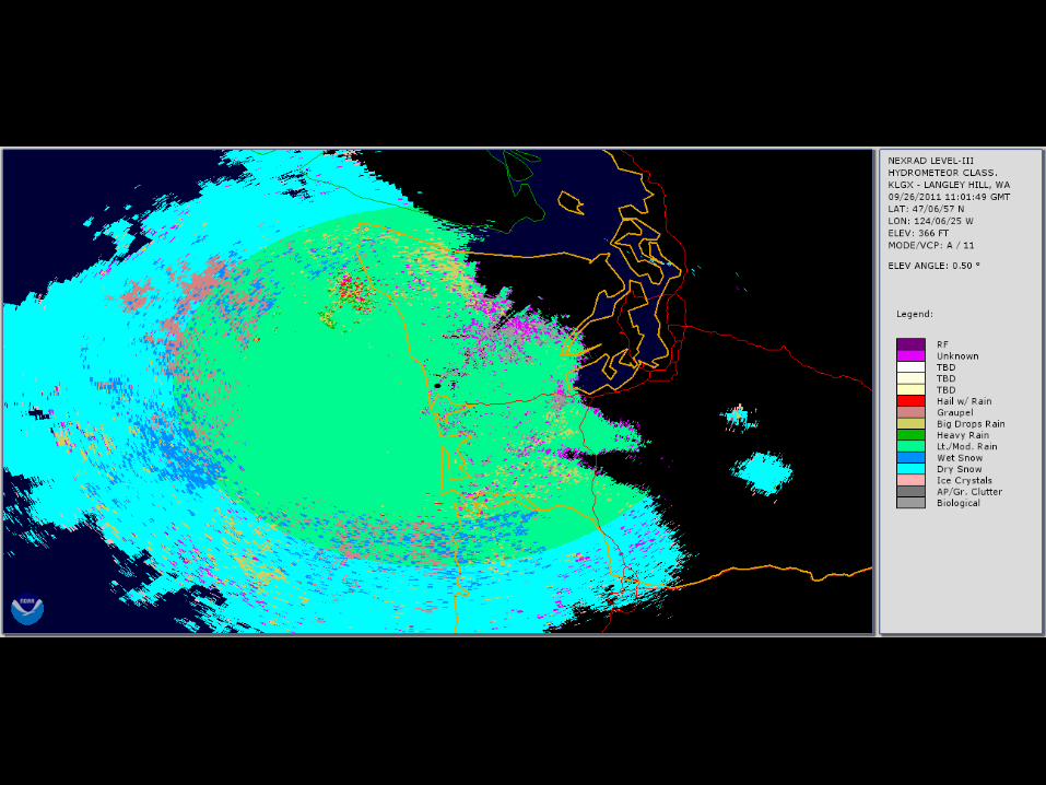
Pacific Northwest Examples
• Light Rain Case• Frontal Passage• Another, detailed frontal passage (GR2A)• Bird Migration (GR2A)

More training
• NSSL Dual-Pol Info (Terry Schuur)– http://www.cimms.ou.edu/~schuur/dualpol/
• ROC Dual Pol Training for NWS Partners– http://www.wdtb.noaa.gov/courses/dualpol/outreach/
• Luke’s Animations of Dual-Pol Products from KLGX and KATX– http://www.atmos.washington.edu/~lmadaus/radars/
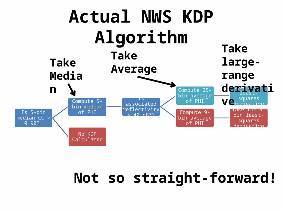
Actual NWS KDP Algorithm
Is 5-bin median CC > 0.90?
Compute 5-bin median of PHI
Is associated reflectivity < 40
dBZ?
Compute 25-bin average of PHI
Take 25-bin least-squares derivative
Compute 9-bin average of PHI
Take the 9-bin least-squares
derivative
No KDP Calculated
Take Median
Take Average
Take large-range derivative
Not so straight-forward!

Bird Migration
CC
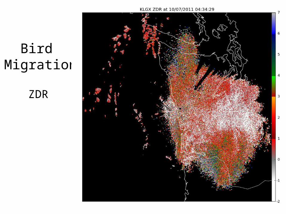
Bird Migration
ZDR
Dual-Pol Upgrade Drawbacks
• Slow deployment• Loss of clutter filtering until next build release
--Dual-pol derived clutter filtering not for many years
• Loss of sensitivity – “3 dB down”
3)5.0(log10 10
Related Documents