Cooperative Efforts and Practices of the Invasive Species Coordinator and Mapping Department

Vilas County Invasive Species Program
Jul 14, 2015
Welcome message from author
This document is posted to help you gain knowledge. Please leave a comment to let me know what you think about it! Share it to your friends and learn new things together.
Transcript
Cooperative Efforts and Practices of the
Invasive Species Coordinator and Mapping Department

Partnerships Departments
Resource Conservation and Development (RC&D)
Regional Groups
Equipment Pen/Paper
Handheld GPS
ArcPad
ArcGIS
Personal Mobile Devices?
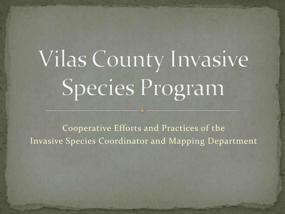
Find a usable coordinate format
Create a feature class from the XY table
Play connect-the-dots using point attributes
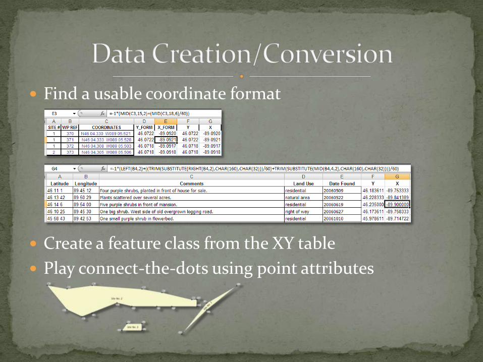
Objective: To quantify the extent of garlic mustard growing in the heart of town and identify on whose lands it was growing.
Field mapping equipment: Handheld basic GPS receiver
Paper & pen to record starting and ending waypoint for each polygon
Method: Collected polygon points around each patch
Requested map showing patch sizes and parcel lines


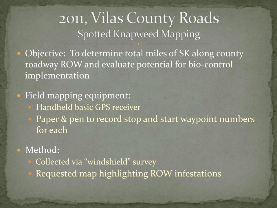
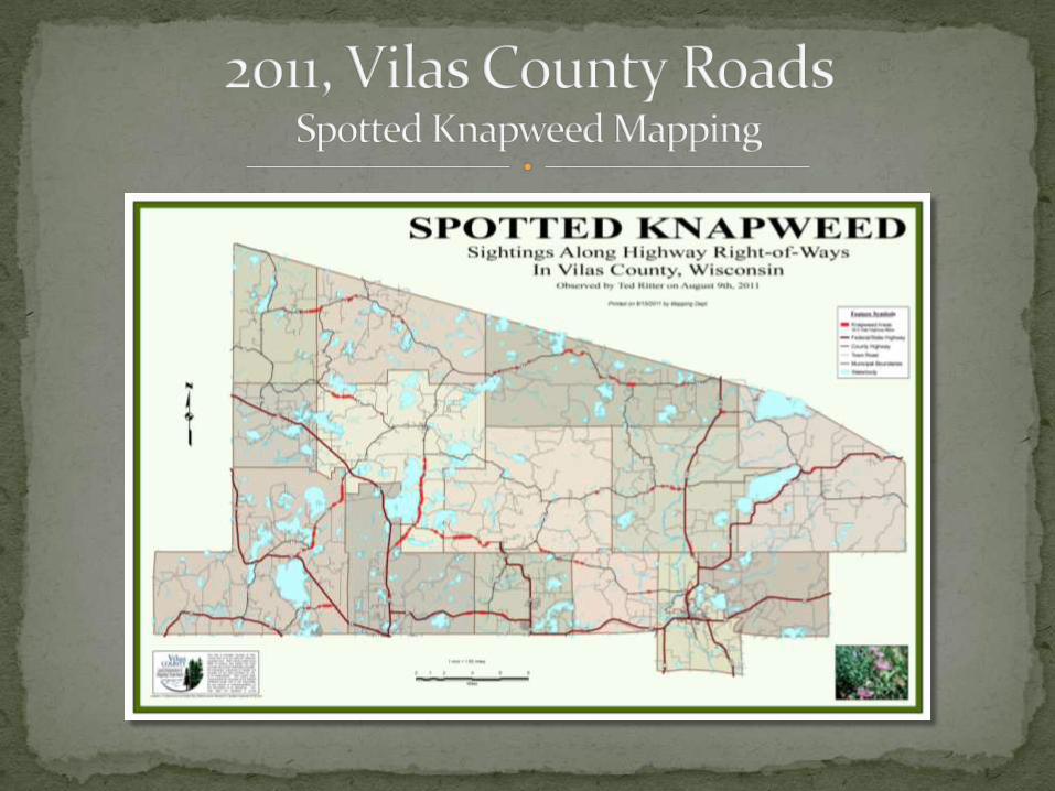
Objective: To determine total miles of SK along county roadway ROW and evaluate potential for bio-control implementation
Field mapping equipment: Handheld basic GPS receiver
Paper & pen to record stop and start waypoint numbers for each
Method:
Collected via “windshield” survey
Requested map highlighting ROW infestations

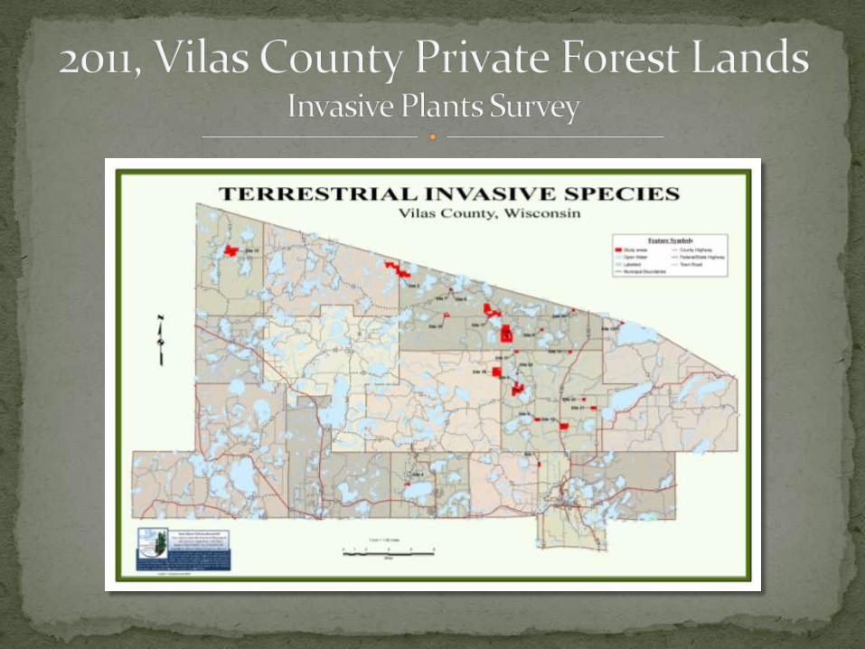
Objective: Evaluate selected private forest lands for presence of
invasive plants
To increase invasives awareness by landowners
Project partners: Local RC&D provided funding
Vilas County provided employment services for field technician
Conserve School provided housing for technician
WHIP (weed co-op) provided Trimble unit
Mapping Dept. programmed Trimble


Objective: Survey all county roads ROW for presence of invasive plants in advance of developing ROW invasive species management plans for Highway Commissioners
Project partners: Local RC&D provided funding and employment services
to hire two LTEs
WHIP providing use of two Trimble units and oversight of LTEs
Mapping Depts. programmed Trimble units
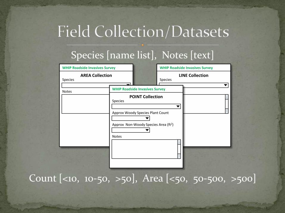
Species [name list], Notes [text]
Count [<10, 10-50, >50], Area [<50, 50-500, >500]
WHIP Roadside Invasives Survey
AREA CollectionSpecies
Notes
WHIP Roadside Invasives Survey
LINE CollectionSpecies
NotesWHIP Roadside Invasives Survey
POINT CollectionSpecies
Approx Woody Species Plant Count
Approx Non-Woody Species Area (ft2)
Notes
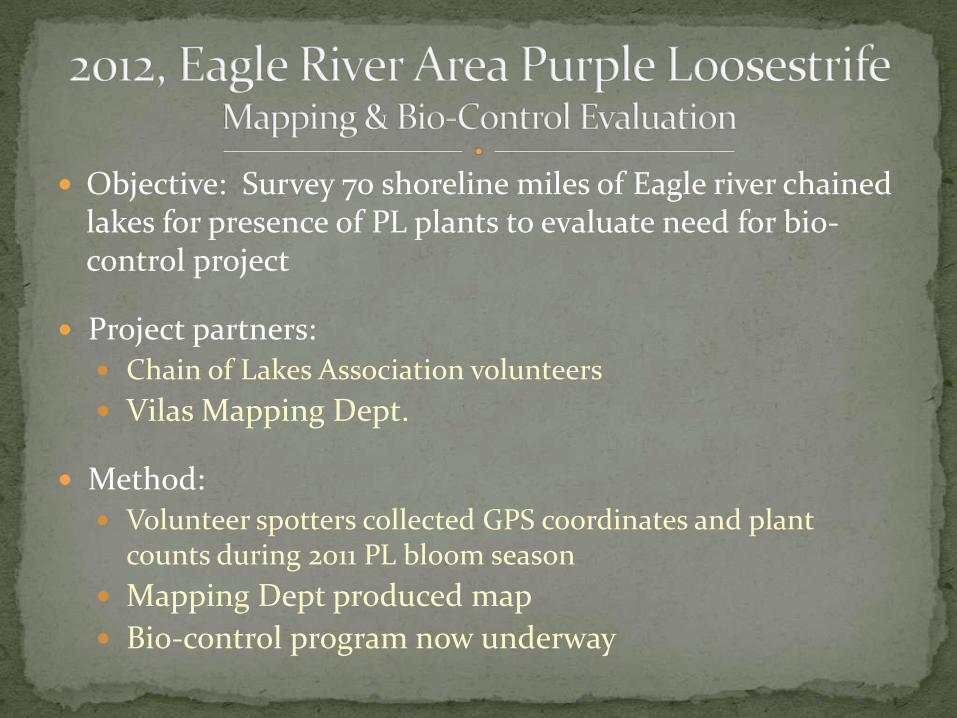
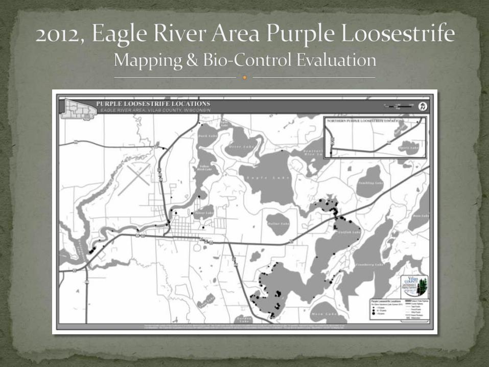
Objective: Survey 70 shoreline miles of Eagle river chained lakes for presence of PL plants to evaluate need for bio-control project
Project partners: Chain of Lakes Association volunteers
Vilas Mapping Dept.
Method: Volunteer spotters collected GPS coordinates and plant
counts during 2011 PL bloom season
Mapping Dept produced map
Bio-control program now underway


Department visibility
Consistent collection procedures
One-stop data storage Local data sharing
Regional data sharing
Enhanced products
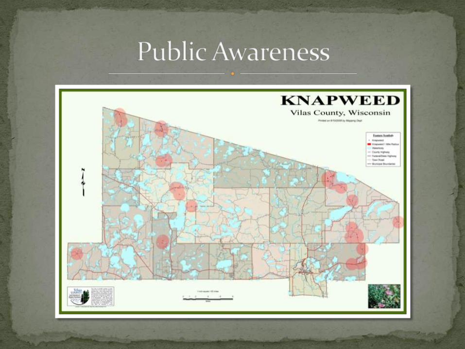
Public Awareness/Engagement
Related Documents