U.S. Department of the Interior U.S. Geological Survey Landsat Program Update October 2005 Presented By: U.S. Geological Survey, Center for EROS Sioux Falls, SD

U.S. Department of the Interior U.S. Geological Survey Landsat Program Update October 2005 Presented By: U.S. Geological Survey, Center for EROS Sioux.
Dec 27, 2015
Welcome message from author
This document is posted to help you gain knowledge. Please leave a comment to let me know what you think about it! Share it to your friends and learn new things together.
Transcript
U.S. Department of the Interior
U.S. Geological Survey
Landsat Program Update
October 2005
Presented By:
U.S. Geological Survey, Center for EROSSioux Falls, SD
2
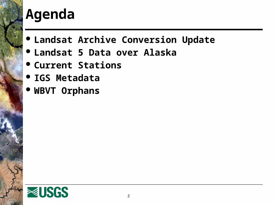
Agenda
Landsat Archive Conversion Update Landsat 5 Data over Alaska Current Stations IGS Metadata WBVT Orphans

3
Landsat Archive
Landsat 1-5 Data Over 9000 tapes in
basement archive Multiple tape formats
Landsat 7 Data Near-line silo 9940B tape technology
4
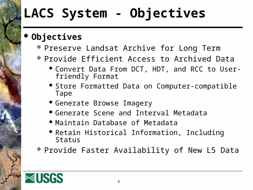
LACS System - Objectives
Objectives Preserve Landsat Archive for Long Term Provide Efficient Access to Archived Data
Convert Data From DCT, HDT, and RCC to User-friendly Format
Store Formatted Data on Computer-compatible Tape Generate Browse Imagery Generate Scene and Interval Metadata Maintain Database of Metadata Retain Historical Information, Including Status
Provide Faster Availability of New L5 Data
5
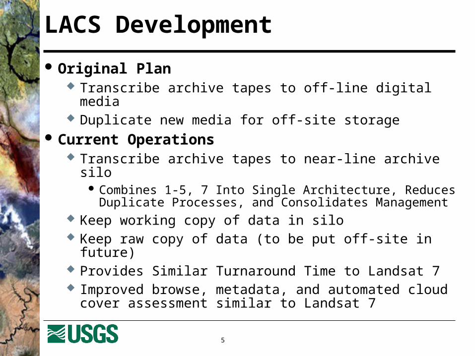
LACS Development
Original Plan Transcribe archive tapes to off-line digital media Duplicate new media for off-site storage
Current Operations Transcribe archive tapes to near-line archive silo
Combines 1-5, 7 Into Single Architecture, Reduces Duplicate Processes, and Consolidates Management
Keep working copy of data in silo Keep raw copy of data (to be put off-site in future) Provides Similar Turnaround Time to Landsat 7 Improved browse, metadata, and automated cloud cover
assessment similar to Landsat 7

6
Landsat Archive Conversion System

7
Transcription Duration Estimate
Data Type Data Quantity Transcription Duration
TM-R New Data Ongoing
TM-R4,781 HDTs (~24 TB)
3,431 DCTs (~147.5 TB)
COMPLETE
1,946 COMPLETE (57%)
TM-A 108 DCTs (3.6 TB) Est. Completion in FY06
MSS-A 277 DCTs (9.5 TB) Est. Completion in FY06
MSS-P 118 DTS (3.2 TB) Est. Completion in FY06
8
Landsat 5 Data over Alaska
Established Quid Pro Quo agreement with University of Alaska Geographic Information Network of Alaska (GINA) and NOAA/NESDIS Fairbanks Command & Data Acquisition Station (FCDAS)
Data received at FCDAS (at Gilmore Creek just outside Fairbanks, AK)
Transmitted by GINA via high speed network to EROS for processing
Agreement is year-to-year Discussions with GINA indicate willingness to continue
agreement for next growing season

9
Sheenjek Fire near Fort Yukon
On June 21, 2005, Landsat 5 captured this scene of the Sheenjek River fire near Fort Yukon, Alaska

10
Landsat Global Network

11
U.S. Landsat Archive Overview(Marketable Scenes through September 30, 2005)
ETM+: Landsat 7 497,969 scenes 450TB RCC and L0Ra Data Archive grows by 300GB Daily
TM: Landsat 4 & Landsat 5 621,988 scenes 171TB of RCC and L0Ra Data Archive Grows by 30GB Daily
MSS: Landsat 1 through 5 641,555 scenes 20TB of Data
12
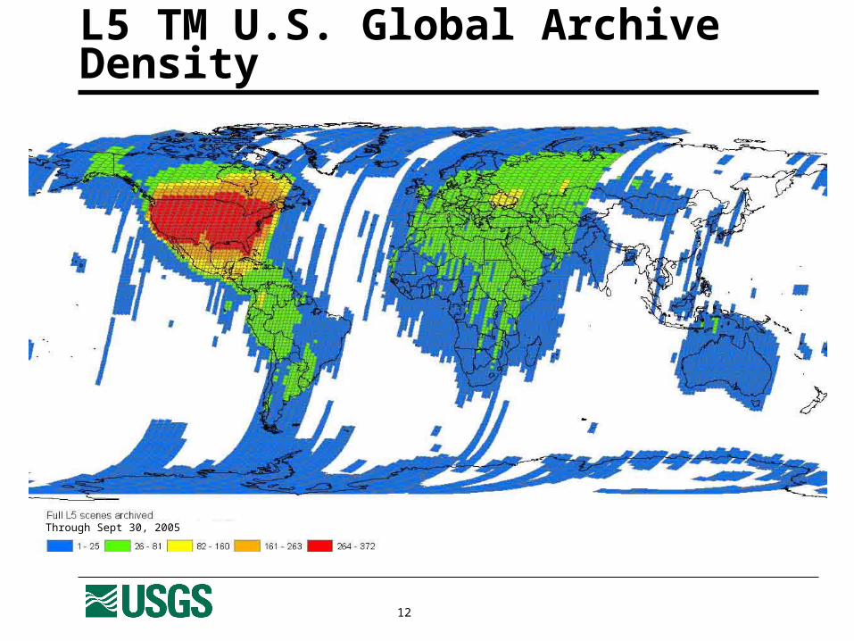
L5 TM U.S. Global Archive Density
Through Sept 30, 2005

13
L7 ETM+ U.S. Global Archive Density
Through Sept 30, 2005
14
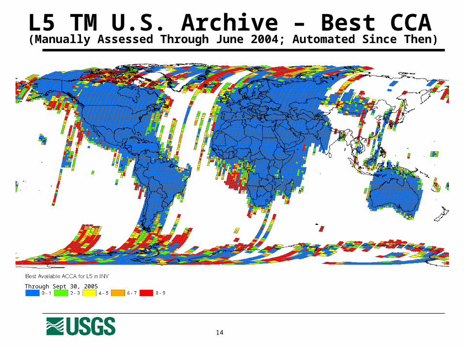
L5 TM U.S. Archive – Best CCA(Manually Assessed Through June 2004; Automated Since Then)
Through Sept 30, 2005

15
L7 ETM+ U.S. Archive – Best ACCA
Through Sept 30, 2005
16
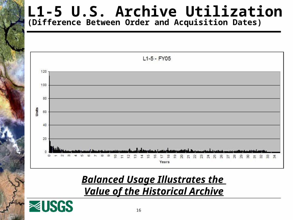
L1-5 U.S. Archive Utilization(Difference Between Order and Acquisition Dates)
Balanced Usage Illustrates the Value of the Historical Archive
17
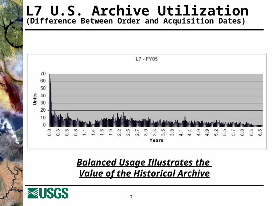
L7 U.S. Archive Utilization(Difference Between Order and Acquisition Dates)
Balanced Usage Illustrates the Value of the Historical Archive

18
IGS Metadata
Landsat 7 Metadata Currently ingesting Landsat 7 records from NASA Land
Processes Distributed Active Archive Center (LPDAAC) Search of metadata is available through EarthExplorer
Landsat 1-5 Metadata Working with current stations to collect metadata of ALL
Landsat holdings Discussed with stations in April 2005 at Landsat Technical
Working Group meeting November 2005 – Landsat Ground Station Operators
Working Group (LGSOWG) Will discuss plans with stations to collect metadata Draft metadata format for transfer is in work

19
EarthExplorer Search Capability

20
MSS Reception at IC Stations
YR727374757677787980818283848586878889909192
KEY: ASA BJC BKT FUI GNCCOA CPE CUB DKI HAJ IRAN ISP JSA SGI SHOE LSAT 1
LSAT 2
LSAT 3
LANDSAT 4
LANDSAT 5
KIS MPS PAC

21
TM Reception at IC Stations
YR
828384858687888990919293949596979899000102030405
KEY
ASA
BIS
BJC
BKT
CLT
COA
CPE
FUI
GNC
HAJ
CUB
DKI
DUB
HIJ
HOA
ISP
JSA
ULM
OHA
PAC
RSA
SEK
LANDSAT 4
LANDSAT 5
LSAT 7
SGI
MTI
NRK
NSG
KIS
LBG
MPS

22
Wide-Band Video Tape (WBVT)
Data Transcribed but Not Available Due to a processing issue, over 160,000 scenes are
unavailable Working on a fix with MDA to correct problem
Orphan Data Issue Approximately 5TB of data are unavailable for ordering Due to lack of ancillary data (such as telemetry of the
spacecraft) for many scenes, there is no way to identify the scene location of the data
Working on a process to frame the data and provide location information (?FY06 – still in planning stages)
Related Documents