tiourrnmrnt tinirttr PUBLISHED BY AUTHORITY ISSN 0155-9370 Vol. CCXCVIII] WEDNESDAY, 27 NOVEMBER, 1991 [No. 85 ELECTORAL AND ADMINISTRATIVE REVIEW COMMISSION NOTIFICATION UNDER SECTION 3.7 OF THE ELECTORAL DISTRICTS ACT 1991 DETERMINATION OF QUEENSLAND LEGISLATIVE ASSEMBLY ELECTORAL DISTRICTS

Welcome message from author
This document is posted to help you gain knowledge. Please leave a comment to let me know what you think about it! Share it to your friends and learn new things together.
Transcript
(@urrnslnn~ tiourrnmrnt tinirttr PUBLISHED BY AUTHORITY ISSN 0155-9370
Vol. CCXCVIII] WEDNESDAY, 27 NOVEMBER, 1991 [No. 85
ELECTORAL AND ADMINISTRATIVE REVIEW COMMISSION
NOTIFICATION UNDER SECTION 3.7 OF THE ELECTORAL DISTRICTS ACT 1991
DETERMINATION OF QUEENSLAND LEGISLATIVE ASSEMBLY ELECTORAL
DISTRICTS

[1347]
(@urrnslanh ~ourrnmrnt ~a~rttr PUBLISHED BY AUTHORITY
Vol. CCXCVIII] WEDNESDAY, 27 NOVEMBER, 1991
128762-142
ELECTORAL AND ADMINISTRATIVE REVIEW COMMISSION
NOTIFICATION UNDER SECTION 3.7 OF THE ELECTORAL DISTRICTS ACT 1991
DETERMINATION OF QUEENSLAND LEGISLATIVE ASSEMBLY ELECTORAL DISTRICTS
Pursuant to ss.3.7 and 3.8 of the Electoral Districts Act 1991 ('the Act') the Electoral and Administrative Review Commission ('the Commission') has prepared its determination of the distribution of the State into 89 electoral districts for the Legislative Assembly and its reasons for that determination.
The Commission has considered the following matters in preparing the distribution as required by s.3.3 of the Act:
(a) The quota of electors.
(b) A margin of allowance whereby the quota may be departed from by not more than one tenth more or one tenth less.
(c) In respect of a proposed electoral district of at least 100,000 square kilometres in area, the quota may be departed from in that case to an extent greater than one tenth less if the number of electors for that proposed electoral district is such that the sum of -
(i) the number of electors; and
(ii) a number that expresses the value of two per centum of the area of the proposed electoral district expressed in square kilometres,
equals the quota or conforms to the margin of allowance permitted to the Commission.
Subject to these matters the Commission has considered:
(a) community of interests within the proposed electoral district -including economic, social and regional interests; and
ISSN 0155-9370
[No. 85
1348 QUEENSLAND GOVERNMENT GAZETTE, No. 85 [27 November, 1991
2 Electoral Districts Act 1991
(b) means of communication and travel within the proposed electoral district; and
(c) the physical features of the proposed electoral district;
(d) demographic trends in the State with a view to ensuring, as far as practicable, on the basis of these trends, that the number of electors enrolled for the time being for the electoral district will remain -
(i) in the case of an electoral district of at least 100,000 square kilometres in area, within a margin of at least one tenth more or one tenth less than the number of electors accepted by the Commission for that electoral district in preparing the proposed distribution of the State;
(ii) in the case of any other electoral district, within a margin of one tenth more or one tenth less of the average district enrolment; and
(e) objections and comments on objections to the Commission's proposed electoral distribution under s.3.6.
Pursuant to s.3.5(2) of the Act the Commission has caused maps showing the names and boundaries of each electoral district in the State to be available for public perusal at the office of the Commission. Section 3.5(3) requires that in each electoral district a copy (or copies) of a map showing the boundaries of that electoral district be exhibited at a place or places to which the public has access. A list of these places is attached to this notice in Appendix A.
The determination was adopted unanimously at a meeting of the Commission on 25 November 1991. All Commissioners - the Chairman, Commissioner Hall, Commissioner Hughes, Commissioner Hunter and Commissioner Watson Blake - were present at the meeting.
TOM SHERMAN Chairman
27 November 1991.
27 November, 1991] QUEENSLAND GOVERNMENT GAZETTE, No. 85
Electoral Districts Act 1991 3
MAKING THE DETERMINATION
This document constitutes the determination of the Electoral and Administrative Review Commission (EARC) of the names and boundaries of the Electoral Districts of the State for the purposes of s.3.7 of the Act.
The document also contains the Commission's reasons for the determination as required by s.3.8 of the Act.
References have been made to a number of the public objections and comments on objections received by EARC during the preparation of the determination. All objections have been numbered and references to them will be by number. For example, 'Obj 21' is a reference to Objection No. 21. The full original set of distribution suggestions, objections and comments received by the Commission during the course of the distribution are available for perusal at the Commission's office in Brisbane. The full list of authors of objections and comments on objections is contained in Appendix B to this document.
DISPLAY OF ELECTORAL DISTRICT MAPS
Pursuant to s.3.7(2) of the Act the Commission has arranged for maps showing the names and boundaries of each electoral district in the State to be available for public perusal at the office of the Commission. In each electoral district a copy (or copies) of a map showing the boundaries of that electoral district is being exhibited at a place or places to which the public has access. A list of these places forms part of this notice at Appendix A.
PROCEDURES FOR THE DISTRIBUTION
Part 3 of the Act regulates the procedures for the distribution.
EARC was required as soon as practicable after the commencement of the distribution to place a notice in the Gazette and newspapers inviting suggestions for electoral district boundaries and names (s.3.1(1)). The notice appeared in the Gazette and newspapers on Saturday 20 April 1991.
The timetable for the distribution is shown in Table 1 below. Thirty days were allowed for the lodgement of initial suggestions (s.3.1(1)). This period ended on 20 May 1991 by which date 32 written suggestions had been received by EARC. The suggestions were bound together and distributed widely throughout Queensland to enable public comments on the initial suggestions.
Twenty-one days were prescribed for comments on the initial suggestions (s.3.1(1)). The close of the 21 day period was 11 June 1991, by which date a further 19 comments and further suggestions had been received. After 11 June 1991 8 more comments and suggestions were received.
1349
1350 QUEENSLAND GOVERNMENT GAZETTE, No. 85 [27 November, 1991
4 Electoral Districts Act 1991
On Tuesday 11 June 1991 the Commission calculated the average number of electors in each electoral district ('the quota' - see below) (s.3.2).
Following 11 June 1991 EARC prepared its proposals and reasons for the 89 electoral districts as required by ss.3.3 and 3.4 of the Act.
EARC was required by the Act to publish notices of the proposed distribution in the Gazette and newspapers, and to invite public objections to the proposals (s.3.5). The notices were accompanied by a map or maps showing the proposed names and boundaries of the 89 electoral districts. EARC was also required to advise in the Gazette and newspapers the availability for public perusal at the Commission's office and at other publicly accessible places, of copies of descriptions of proposed boundaries and reasons for the proposals.
Thirty days from the date of publication of the notice in the Gazette were prescribed for the lodging of written public objections to EARC's prol'osals (s.3.5(6)). The date of Gazettal was Friday 30 August 1991. Public objections closed with the Commission at 5pm on Monday 30 September 1991, being the expiry of the period of 30 days.
A further 10 days were then allowed for any public comments on the objections (s.3.6(2)). The objections were made available for public examination at the office of the Commission. Written public comments on the objections were accepted until 5pm on Thursday 10 October 1991.
From the date of closure of public objections EARC was allowed a further period of up to 60 days to prepare its final determination (including boundaries, descriptions, names and reasons) (s.3.7). EARC held public hearings in Brisbane on Monday 21 October 1991 to assist in preparing its final determination. The 60 day period ends on Friday 29 November 1991.
The Act specifies in s.3.7 that the final determination must be published in the Gazette. That determination and all associated documentation must be given to the Premier and tabled in Parliament (s.3.9). The electoral districts so notified will be the electoral districts in Queensland until the State is again distributed in accordance with law.
27 November, 1991] QUEENSLAND GOVERNMENT GAZETTE, No. 85
Electoral Districts Act 1991 5
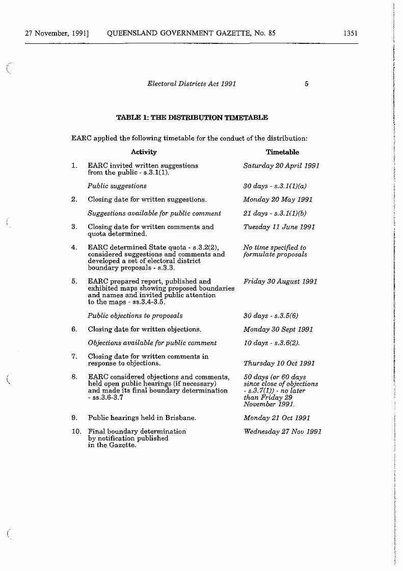
TABLE 1: THE DISTRIBUTION TIMETABLE
EARC applied the following timetable for the conduct of the distribution:
Activity
1. EARC invited written suggestions from the public - s.3.1(1).
Public suggestions
2. Closing date for written suggestions.
3.
4.
5.
Suggestions available for public comment
Closing date for written comments and quota determined.
EARC determined State quota - s.3.2(2), considered suggestions and comments and developed a set of electoral district boundary proposals - s.3.3.
EARC prepared report, published and exhibited maps showing proposed boundaries and names and invited public attention to the maps - ss.3.4-3.5.
Public objections to proposals
6. Closing date for written objections.
Objections available for public comment
7. Closing date for written comments in response to objections.
8. EARC considered objections and comments, held open public hearings (if necessary) and made its final boundary determination - ss.3.6-3. 7
9. Public hearings held in Brisbane.
10. Final boundary determination by notification published in the Gazette.
Timetable
Saturday 20 April 1991
30 days - s.3.l(l)(a)
Monday 20 May 1991
21 days - s.3.l(l)(b)
Tuesday 11June1991
No time specified to formulate proposals
Friday 30 August 1991
30 days - s.3.5(6)
Monday 30 Sept 1991
10 days - s.3.6(2).
Thursday 10 Oct 1991
50 days (or 60 days since close of objections - s.3. 7(1)) - no later than Friday 29 November 1991.
Monday 21 Oct 1991
Wednesday 27 Nau 1991
1351
1352 QUEENSLAND GOVERNMENT GAZETTE, No. 85 [27 November, 1991
6 Electoral Districts Act 1991
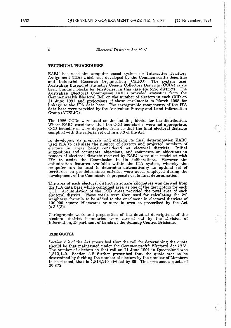
TECHNICAL PROCEDURES
EARC has used the computer based system for Interactive Territory Assignment (ITA) which was developed by the Commonwealth Scientific and Industrial Research Organisation (CSIRO). The system uses Australian Bureau of Statistics Census Collectors Districts (CCDs) as its basic building blocks for territories, in this case electoral districts. The Australian Electoral Commission (AEC) provided statistics from the Commonwealth Electoral Roll on the number of electors in each CCD on 11 June 1991 and projections of these enrolments to March 1995 for linkage to the ITA data base. The cartographic components of the ITA data base were provided by the Australian Survey and Land Information Group (AUSLIG).
The 1986 CCDs were used as the building blocks for the distribution. Where EARC considered that the CCD boundaries were not apfropriate, CCD boundaries were departed from so that the final electora districts complied with the criteria set out in s.3.3 of the Act.
In developing its proposals and making its final determination EARC used ITA to calculate the number of electors and projected numbers of electors in areas being considered as electoral districts. Initial suggestions and comments, objections, and comments on objections in respect of electoral districts received by EARC were also modelled with ITA to assist the Commission in its deliberations. However the optimisation features available within the ITA system, whereby the computer can be used to determine automatically an optimal set of territories on pre-determined criteria, were never employed during the development of the Commission's proposals or its final determination.
The area of each electoral district in square kilometres was derived from the ITA data base which contained area as one of the descriptors for each CCD. Accumulation of the CCD areas provided the total area of each electoral district. These totals were then used for calculating the 2% weightage formula to be added to the enrolment in electoral districts of 100,000 square kilometres or more in area as prescribed by the Act (s.3.3(3)).
Cartographic work and preparation of the detailed descriptions of the electoral district boundaries were carried out by the Division of Information, Department of Lands at the Sunmap Centre, Brisbane.
THE QUOTA
Section 3.2 of the Act prescribed that the roll for determining the quota should be that maintained under the Commonwealth Electoral Act 1918. The number of electors on that roll on 11 June 1991 in Queensland was 1,813,140. Section 3.2 further prescribed that the quota was to be determined by dividing the number of electors by the number of Members to be elected, that is 1,813,140 divided by 89. This produces a quota of 20,372.
27 November, 1991] QUEENSLAND GOVERNMENT GAZETTE, No. 85
Electoral Districts Act 1991 7
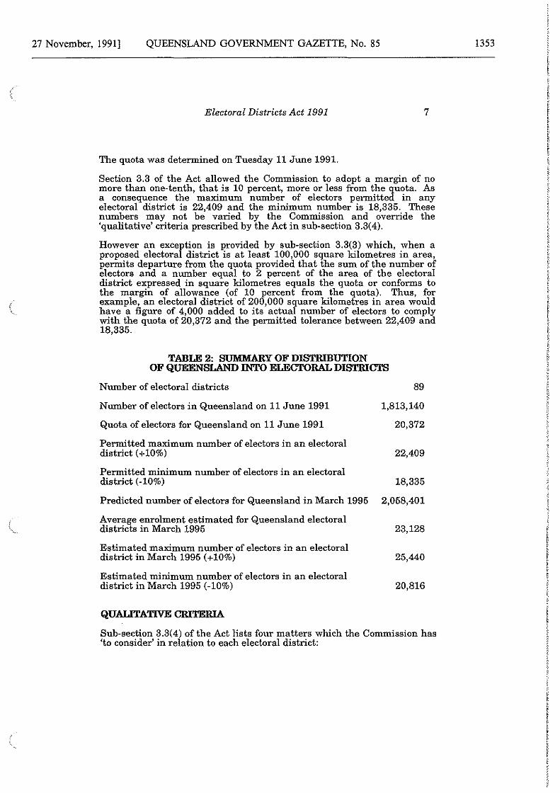
The quota was determined on Tuesday 11 June 1991.
Section 3.3 of the Act allowed the Commission to adopt a margin of no more than one-tenth, that is 10 percent, more or less from the quota. As a consequence the maximum number of electors permitted in any electoral district is 22,409 and the minimum number is 18,335. These numbers may not be varied by the Commission and override the 'qualitative' criteria prescribed by the Act in sub-section 3.3(4).
However an exceytion is provided by sub-section 3.3(3) which, when a proposed electora district is at least 100,000 square kilometres in area, permits departure from the quota provided that the sum of the number of electors and a number equal to 2 percent of the area of the electoral district expressed in square kilometres equals the quota or conforms to the margin of allowance (of 10 percent from the quota). Thus, for example, an electoral district of 200,000 square kilometres in area would have a figure of 4,000 added to its actual number of electors to comply with the quota of 20,372 and the permitted tolerance between 22,409 and 18,335.
TABLE 2: SUMMARY OF DISTRIBUTION OF QUEENSLAND INTO ELECTORAL DISTRICTS
Number of electoral districts 89
Number of electors in Queensland on 11 June 1991 1,813,140
Quota of electors for Queensland on 11June1991 20,372
Permitted maximum number of electors in an electoral district (+10%) 22,409
Permitted minimum number of electors in an electoral district (-10%) 18,335
Predicted number of electors for Queensland in March 1995 2,058,401
Average enrolment estimated for Queensland electoral districts in March 1995 23, 128
Estimated maximum number of electors in an electoral district in March 1995 (+10%) 25,440
Estimated minimum number of electors in an electoral district in March 1995 (-10%) 20,816
QUALITATIVE CRITERIA
Sub-section 3.3(4) of the Act lists four matters which the Commission has 'to consider' in relation to each electoral district:
1353
1354 QUEENSLAND GOVERNMENT GAZETTE, No. 85 [27 November, 1991
8 Electoral Districts Act 1991
(a) community of interests within the proposed electoral district including economic, social and regional interests;
(b) means of communication and travel within the proposed electoral district;
(c) the physical features of the electoral district; and
(d) demographic trends in the State.
Two possible criteria which are not included in the Act are the existing electoral district boundaries and the boundaries of local government authorities. Because the Act under which the current distribution was conducted abolished the four zones and introduced a single Statewide quota (subject to certain exceptions as a consequence of the 100,000 square kilometre provision), it is not surprising that existing electoral district boundaries would have been of limited utility. However it is still the case that some existing boundaries do reflect other criteria which are included in the Act, such as community of interest and physical features, and moreover the location of these boundaries is known to electors in the vicinity so that any unnecessary change which might lead to confusion on polling day has been minimised.
Similarly, Local Government boundaries also have some relevance for community of interest. This is especially so in rural areas where many local government areas correspond to a single town or smaller settlement and its closely connected hinterland. Electors are usually well aware of local government boundaries, and readily orientate to electoral boundaries that coincide with them. Consequently local government areas have in some cases, been used as appropriate community of interest 'building blocks' for the current distribution.
The means of communication and travel and physical features of a proposed electoral district are more readily identified. Normally physical features have to be of some size to be relevant, and it is usually a matter of whether or not· they constitute a barrier to effective communication within the proposed electoral district. A mountain range or a river may be crossed by a road or a bridge, and the electors on each side of that divide may share so many characteristics that the apparent barrier ought to be disregarded. Similarly a main road may link the communities which lie along it, which is especially likely in the country, or it may constitute a significant physical barrier and separate the suburbs on either side of it which is more likely in a large city.
Demographic trends in the State are made a criterion in a specific context: the Commission is required, by sub-section 3.3(4)(d) to seek to ensure, " ... as far as fracticable, on the basis of those trends'', that the electoral districts wil remain within a margin of one-tenth, that is 10 percent, of the average district enrolment until the next distribution of the State.

27 November, 1991] QUEENSLAND GOVERNMENT GAZETTE, No. 85
Electoral Districts Act 1991 9
Average district enrolment as the measurement criterion allows for the inevitable growth of enrolment in the State as a whole. Electoral districts which have come within the 100,000 square kilometre rule are treated differently under s.3.3(4) of the Act. In the case of electoral districts of over 100,000 sq kms in area demographic trends should be considered to ensure as far as practicable that the number of electors remains:
". .. within a margin of one-tenth more or one-tenth less of the number of electors accepted by the Commission for that electoral district in preparing the proposed distribution of the State."
However, in respect of demographic trends as for the other three 'qualitative' criteria of sub-section 3.3(4), the duty of the Commission is to "... give such weight to each of the matters . .. as it considers appropriate", whilst the numerical prescriptions of sub-section 3.3(2) and 3.3(3) in respect of the quota are mandatory. This differs from the situation under sub-section 66(3)(a) of the Commonwealth Electoral Act 1918 and s.17A of the Parliamentary Electorates and Elections Act 1912 (NSW) where future numbers of electors are a mandatory prescription.
In addressing this requirement, the Commission has referred to enrolment projections calculated by the Australian Electoral Commission (the AEC) for its concurrent redistribution of Commonwealth electoral divisions in the State. These, the Commission is informed, were produced by extrapolation of recent trends, subsequently assessed (and modified where appropriate) by the AEC's Divisional Returning Officers who have immediate responsibility for enrolment and election activities throughout the State and would thus be especially well informed on factors likely to affect enrolment trends at a local level.
NAMING ELECTORAL DISTRICTS
The Commission had regard to suggestions for district names and what appeared to have been past practice in the State, which was to use geographical or place names, and noted that this had been departed from only once, and that quite recently when a new electoral district was named after a recent Premier of the State, the late Sir Francis Nicklin. Only the Commonwealth, for the electoral divisions of the House of Representatives, and recently South Australia for electoral districts of the House of Assembly, appear to have a policy of using the names of distinguished persons.
It should be noted that, indirectly, many of the State's electoral districts have carried the names of distinguished persons from the State's past, but as a consequence of that name having first been given to a town, a local authority area, a pastoral district, a river or the like, and that place name being generally appropriate to the electoral district.
1355
1356 QUEENSLAND GOVERNMENT GAZETTE, No. 85 [27 November, 1991
10 Electoral Districts Act 1991
The Commission was unable to detect any widespread demand for a change of policy in Queensland, and subject to objections, considered that continuation of the policy of using llace names would assist recognition for a substantially altered electora map. Accordingly, it has used the name of the largest centre, area or feature within the electoral district, and generally retained existing electoral district names unless there was reason to depart from them, for example, because that would clash with the preceding policy or because the place which supplied the electoral district name and which had previously been within the district was within it no longer. When new names have been required, consideration has been given to reviving historic names that disappeared from the electoral map in previous redistributions.
SUMMARY OF ENROLMENTS FOR THE 89 ELECTORAL DISTRICTS
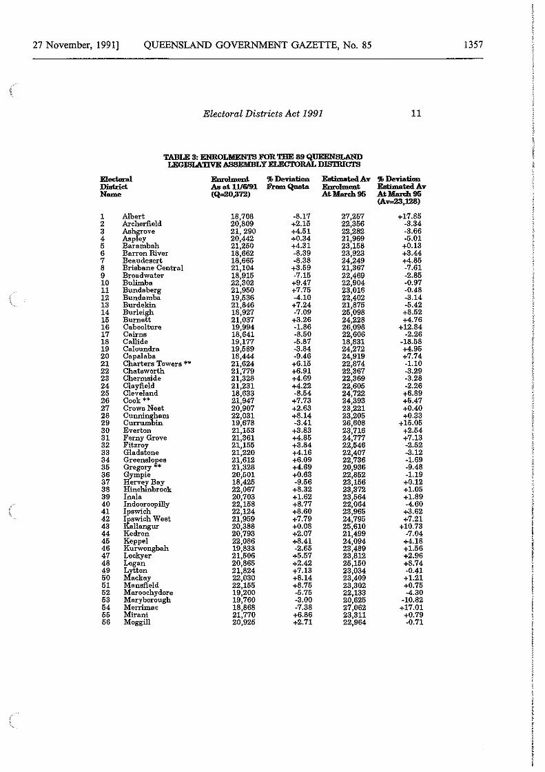
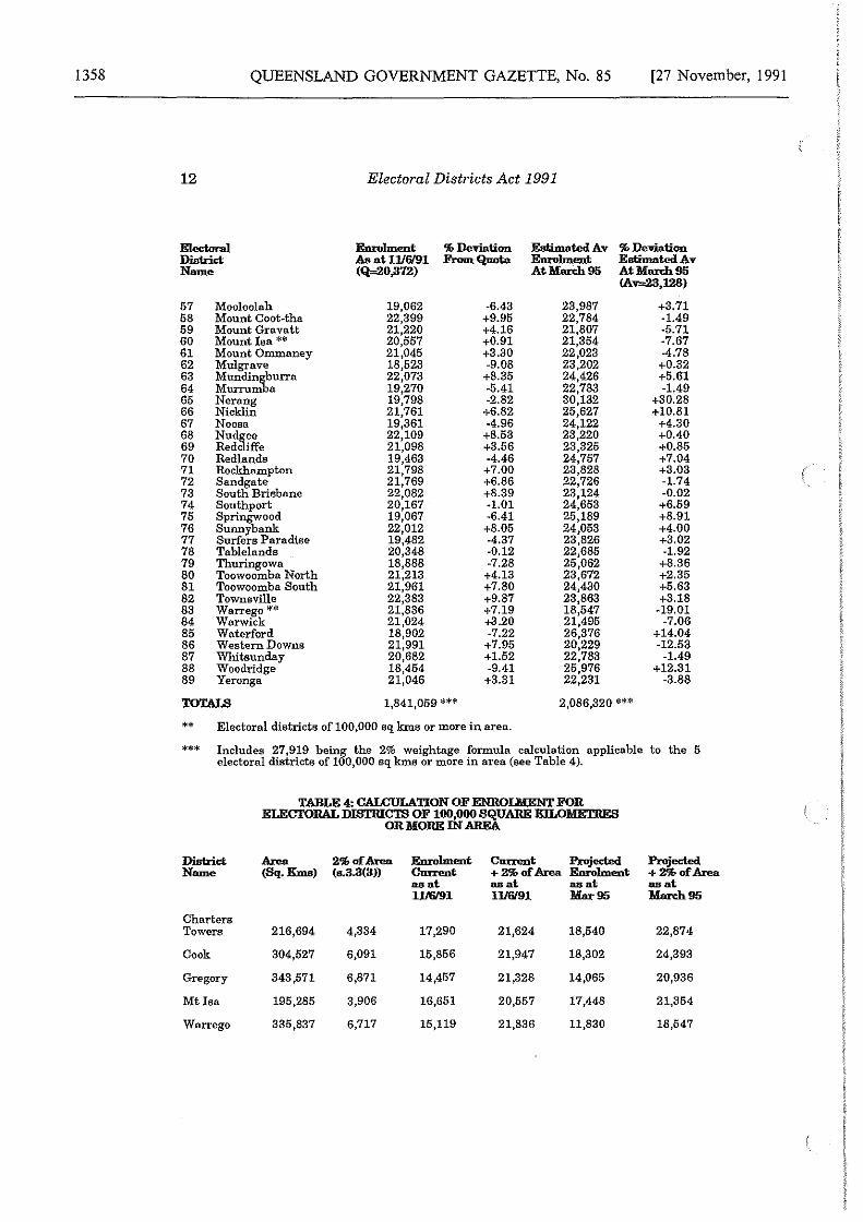
Table 3 below shows the names and enrolments for the Commission's final 89 electoral districts. The table also indicates the percentage deviation from the quota and estimated percentage deviation from the projected average district enrolment in March 1995. Table 4 shows the calculation of the 2 percent of the area formula for those electoral districts of over 100,000 sq kms.
27 November, 1991] QUEENSLAND GOVERNMENT GAZETTE, No. 85 1357
Electoral Districts Act 1991 11
TABLE 3: ENROLMKNTS FOR THE 89 QUEENSLAND LEGISLATIVEASSEMBLYELECTORALDI8'DUCTS
Electaral. Emolment % Deviation Eeti:mated Av % Deviation District As at 1116191 FromQuota Emolment Eeti:mated Av Name (Q=.20,372) AtMan:b.95 AtMan:b.95
(Av=23,128)
1 Albert 18,708 -8.17 27,257 +17.85 2 Archerfield 20,809 +2.15 22,356 -3.34 3 Ashr,::ove 21, 290 +4.51 22,282 -3.66 4 Asp ey 20,442 +0.34 21,969 -5.01 5 Barambah 21,250 +4.31 23,158 +0.13 6 Barron River 18,662 -8.39 23,923 +3.44 7 Beaudesert 18,665 -8.38 24,249 +4.85 8 Brisbane Central 21,104 +3.59 21,367 -7.61 9 Broadwater 18,915 -7.15 22,469 -2.85 10 Bulimba 22,302 +9.47 22,904 -0.97 11 Bunda berg 21,950 +7.75 23,016 -0.48 12 Bundamba 19,536 -4.10 22,402 -3.14 13 Burdeltin 21,846 +7.24 21,875 -5.42 14 Burleigh 18,927 -7.09 25,098 +8.52 15 Burnett 21,037 +3.26 24,228 +4.76 16 Caboolture 19,994 -1.86 26,098 +12.84 17 Cairns 18,641 -8.50 22,606 -2.26 18 Calli de 19,177 -5.87 18,831 -18.58 19 Caloundra 19,589 -3.84 24,272 +4.95 20 Capalaba 18,444 -9.46 24,919 +7.74 21 Charters Towers ** 21,624 +6.15 22,874 -1.10 22 Chatsworth 21,779 +6.91 22,367 -3.29 23 Chermaide 21,328 +4.69 22,369 -3.28 24 Clayfield 21,231 +4.22 22,605 -2.26 25 Cleveland 18,633 -8.54 24,722 +6.89 26 Cook** 21,947 +7.73 24,393 +5.47 27 Crows Nest 20,907 +2.63 23,221 +0.40 28 Cunnin~1am 22,031 +8.14 23,205 +0.33 29 Currum in 19,678 -3.41 26,608 +15.05 30 Everton 21,153 +3.83 23,716 +2.54 31 Ferny Grove 21,361 +4.85 24,777 +7.13 32 Fitzroy 21,155 +3.84 22,546 -2.52 33 Gladstone 21,220 +4.16 22,407 -3.12 34 Greenslo,p,es 21,612 +6.09 22,736 -1.69 35 Gregory * 21,328 +4.69 20,936 -9.48 36 film pie 20,601 +0.63 22,852 -1.19 37 erver Bay 18,425 -9.56 23,156 +0.12 38 Hinchinbrook 22,067 +8.32 23,372 +1.05 39 Ina la 20,703 +1.62 23,564 +1.89 40 Indooroopilly 22,158 +8.77 22,064 -4.60 41 Ipswich 22,124 +8.60 23,965 +3.62 42 ~wich West 21,959 +7.79 24,795 +7.21 43 llangur 20,388 +0.08 25,610 +10.73 44 Kedron 20,793 +2.07 21,499 -7.04 45 Keppel 22,086 +8.41 24,094 +4.18 46 Kurwongbah 19,833 -2.65 23,489 +1.56 47 Lockyer 21,506 +5.57 23,812 +2.96 48 Logan 20,865 +2.42 25,150 +8.74 49 k/:;ton 21,824 +7.13 23,034 -0.41 50 ckay 22,030 +8.14 23,409 +1.21 51 Mansfield 22,155 +8.75 23,302 +0.75 52 Maroochydore 19,200 -5.75 22,133 -4.30 53 Mary borough 19,760 -3.00 20,625 -10.82 54 Merrimac 18,868 -7.38 27,062 +17.01 55 Mirani 21,770 +6.86 23,311 +0.79 56 Moggill 20,925 +2.71 22,964 -0.71
1358 QUEENSLAND GOVERNMENT GAZETTE, No. 85
12
Electoral District Nmne
57 58 59 60 61 62 63 64 65 66 67 68 69 70 71 72 73 74 75 76 77 78 79 80 81 82 83 84 85 86 87 88 89
Mooloolah Mount Coot~tha Mount Gravatt Mount Isa** Mount Ommaney Mulgrave Mundingburra Murrumba Nerang Nicklin Noosa Nudgee Redcliffe Redlands Rockhnmpton Sandgate South Brisbane Southport Springwood Sunny bank Surfers Paradise Tablelands Thuringowa Toowoomba North Toowoomba South To\vnsville Warrego ** Warwick Waterford Western Downs Whitsunday Woodridge Yeronga
Electoral Districts Act 1991
Enrolment As at1116/91 (Q=20,372)
19,062 22,399 21,220 20,557 21,045 18,523 22,073 19,270 19,798 21,761 19,361 22,109 21,098 19,463 21,798 21,769 22,082 20,167 19,067 22,012 19,482 20,348 18,888 21,213 21,961 22,383 21,836 21,024 18,902 21,991 20,682 18,454 21,046
% Deviation FromQoota
-6.43 +9.95 +4.16 +0.91 +3.30 -9.08 +8.35 -5.41 -2.82 +6.82 -4.96 +8.53 +3.56 -4.46
+7.00 +6.86 +8.39 -1.01 -6.41 +8.05 -4.37 -0.12 -7.28 +4.13 +7.80 +9.87 +7.19 +3.20 -7.22 +7.95 +1.52 -9.41 +3.31
Estimated Av Enrolment At lllarch 95
23,987 22,784 21,807 21,354 22,023 23,202 24,426 22,783 30,132 25,627 24,122 23,220 23,325 24,757 23,828 22,726 23,124 24,653 25,189 24,053 23,826 22,685 25,062 23,672 24,430 23,863 18,547 21,495 26,376 20,229 22,783 25,976 22,231
[27 November, 1991
% De-viation Estimated Av At lllarch 95 (A~,128)
+3.71 -1.49 -5.71 -7.67 -4.78 +0.32 +5.61 -1.49
+30.28 +10.81
+4.30 +0.40 +0.85 +7.04 +3.03 -1.74 -0.02 +6.59 +8.91 +4.00 +3.02 -1.92
+8.36 +2.35 +5.63 +3.18
-19.01 -7.06
+14.04 -12.53
-1.49 +12.31
-3.88
1,841,059 *** 2,086,320 ***
** Electoral districts of 100,000 sq k.ms or more in area.
*** Includes 27,919 being the 2% weightage formula calculation applicable to the 5 electoral districts of 100,000 sq kma or more in area (see Table 4).
District Nmne
Charters Towers
Cook
Gregory
Mt Isa
Warrego
TABLE 4: CALCULATION OF ENROLMENT FOR ELECTORAL DISTRICTS OF 100,000 SQUARE KILOMETRES
OR MORE IN AREA
Area 2% af Area Enrolment Cn:n:ent Projected Projected (Sq. Kms) (e.3.3(3)) Cn:n:ent + 2')I, af Area Enrolment + 2')I, af Area
216,694
304,527
343,571
195,285
335,837
4,334
6,091
6,871
3,906
6,717
aaat 1116191
171290
15,856
14,457
16,651
15,119
as at 1116191
21,624
21,947
21,328
20,557
21,836
aaat Mar 95
18,540
18,302
14,065
17,448
11,830
aaat March95
22,874
24,393
20,936
21,354
18,547
27 November, 1991] QUEENSLAND GOVERNMENT GAZETTE, No. 85
Electoral Districts Act 1991 13
REASONS FOR THE DETERMINATION MADE BY THE ELECTORAL AND ADMINISTRATIVE REVIEW COMMISSION
Section 3.8 of the Act requires that EARC state, in writing, its reasons for the final determination of the State's 89 electoral district boundaries.
On 30 August 1991 the Commission unanimously adopted proposals for the Queensland Legislative Assembly electoral district names and boundaries. The proposals were published in the Gazette on Friday 30 August 1991 and in newspapers published in Queensland. The list of newspapers which carried the advertisements is at Appendix D.
The proposals were accompanied by notices of the proposed distribution which invited objections under s.3.5 of the Act. Public objections were lodged with EARC for a period of 30 days, ending on Monday 30 September 1991. Public comments on the objections were received for a further period of 10 days terminating on Thursday 10 October 1991.
Pursuant to s.3.6 of the Act, EARC was required to consider:
(a) any objection lodged with it that raised matters which, in its opinion, were not the same, or substantially the same, as any suggestion or comment lodged previously with it pursuant to notice published under s.3.1 of the Act, such matters having been considered in the makirig of the proposals adopted on 30 August 1991;and
(b) any written comment lodged with it in relation with an objection that it is required to consider.
A total of 195 objections and 8 written comments on objections were received, and those which required consideration pursuant to s.3.6 of the Act were duly considered.
Under s.3.10 of the Act EARC was empowered to conduct such public hearings as it considered to be appropriate and on Monday 21 October 1991 it held public hearings in Brisbane at which the following persons appeared:
Murgon Shire Council
Bill Roberts, Chairman Spencer Angel, Councillor Warren Hubner, Shire Clerk
Wondai Shire Council
Percy lszlaub, Chairman Alan Keates, Shire Clerk
Johnstone Shire Council
Ross Overton, Chairman
Margaret Woodgate, MLA
Bill Vaughan
Ian Olsson
Australian Labor Party
Wayne Swan
1359
1360 QUEENSLAND GOVERNMENT GAZETTE, No. 85
14
Gayndah Shire Council
Stan Ping, Chairman Bob Slatter, Shire Clerk
Pine Rivers Shire Council
Rob Akers, Chairman
Electoral Districts Act 1991
National Party of Australia
David Russell, QC
Liberal Party of Australia
David Fraser
Gary Bryce, Acting Shire Clerk
[27 November, 1991
A transcript of the hearings was made, and page references to it are given as "Tl", being page 1 of the transcript etc. The transcript is available for perusal in the Commission's office at Level 8, Capital Hill Building, 85 George Street, Brisbane.
At a meeting held on Monday 25 November 1991, pursuant to s.3.7 of the Act, EARC unanimously determined, the names and boundaries of the electoral districts into which the State was distributed. Section 3.8 of the Act requires that EARC state in writing its reasons for its determination.
In this statement of reasons, the electoral districts into which the State has been distributed are grouped for convenience in the same order as they were listed in the earlier Proposed Queensland Electoral Districts -Reasons, Descriptions and Maps. References to CCDs in this statement of reasons are to census collectors districts. A list of CCDs which have been split for this distribution is contained in Appendix C.
Electoral Districts Above 100,000 Sq Kins In Area (5 Districts)
There are five electoral districts which exceed 100,000 square kilometres in area (see Table 4) and, as a consequence, qualify for the area formula. The five electoral districts concerned are:
Cook
Cook Mount Isa Gregory
Charters Towers Warrego
Douglas Shire Council (Obj 38) and the Mossman District Canegrowers Executive (Obj 169) objected to the exclusion of a small portion of Douglas Shire from the electoral district of Cook and its inclusion in the electoral district of Barron River. EARC agreed that the boundary between the two electoral districts be altered to coincide with the boundary of Douglas Shire on the ground of community of interest.
F Cattarossi (Obj 118) objected to the inclusion of the Chillagoe area in the electoral district of Cook when its stronger community of interest was with Mareeba in the electoral district of Tablelands.
27 November, 1991] QUEENSLAND GOVERNMENT GAZETTE, No. 85
Electoral Districts Act 1991 15
EARC agreed that the boundary between the two electoral districts be altered to include Chillagoe and the nearby community of Mungana in the electoral district of Tablelands on the ground of community of interest.
The National Party of Australia - Queensland (Obj 156) objected to the inclusion in the electoral district of Cook of certain tobacco farms in the vicinity of the Dimbulah-Wolfram Road when their community of interest was solely with the electoral district of Tablelands. EARC agreed that the boundary between the two electoral districts be altered to include the tobacco farms in question in the electoral district of Tablelands on the ground of community of interest.
Mount Isa
No objections were made in respect of this proposed electoral district and no alterations to the boundaries of this electoral district have been agreed to.
Gregory
A number of objections (Obj 8, Obj 65, Obj 70, Obj 90, Obj 99, Obj 121, Obj 134, Obj 136, Obj 171) objected to the disappearance of the existing electoral district of Peak Downs and inclusion of portions of that electoral district in other districts, including Gregory, on the ground that Peak Downs had a clear community of interest. A consequence of the abolition of the zonal system operating under the previous Electoral Districts Act has been a substantial increase in the minimal enrolment necessary to comply with the requirements of the Act, and the result is inevitably a reduction in the total number of seats in this area. Were the areas previously contained in Peak Downs to be kept together as approximately half of a new electoral district, the consequences for the areas further west and north-west would be a great diminution in the community of interest provided in the new electoral districts of Charters Towers, Gregory and possibly Warrego. These objections are not agreed to.
However it was possible to ensure that the whole of Emerald Shire was contained in a single electoral district because of the small number of electors involved. EARC agreed that CCDs 308 0201 and 308 0202 be transferred from Fitzroy to Gregory on the ground of community of interest.
Barcaldine Branch of the Australian Labor Party (Obj 100) objected to the name of the electoral district on the ground that Barcoo was a more historic name in that area. EARC is of the view that as Gregory is also a historic name, is currently in use and relates to a substantial part of the area of the proposed electoral district, it should be retained. The objection is not agreed to.
1361
1362 QUEENSLAND GOVERNMENT GAZETTE, No. 85 [27 November, 1991
16 Electoral Districts Act 1991
Residents of the area known as Arcadia Valley (Obj 115, Obj 190) objected to inclusion of that area in the electoral district of Gregory when their community of interest and communication linked them to Injune in the electoral district of Western Downs. EARC agreed that the boundary between the two electoral districts be altered to include the properties in question in the electoral district of Western Downs on the ground of community of interest.
Following the transfer of the Arcadia Valley area, the remaining parts of the three census collectors districts concerned would better be included in the electoral district of Callide by virtue of their links with the township of Rolleston which would then no longer be divided by the proposed boundary of Gregory with Callide which had run along the Dawson Highway. The National Party of Australia - Queensland (Obj 156) had objected to the splitting of Rolleston. As the township's natural links are to the neighbouring town of Springsure, it recommended transfer of the remaining portion in Callide to Gregory. EARC agreed that the boundary between the two electoral districts be altered accordingly on the ground of community of interest.
Tambo Shire Council (Obj 170) and a number of its residents (Obj 178, Obj 187) objected to the inclusion of the Shire in the electoral district of Gregory when its community of interest lay southwards with the electoral district of Warrego. EARC agreed that the boundary between the two electoral districts be altered to include Tambo Shire in the electoral district ofWarrego on the ground of community of interest.
Charters Towers
Objections (Obj 8, Obj 65, Obj 70, Obj 90, Obj 99, Obj 121, Obj 134, Obj 136, Obj 171) to the disappearance of the existing electoral district of Peak Downs and inclusion of portions of that electoral district in other districts, including Charters Towers, have already been noted and the reason for not agreeing to them stated in relation to the electoral district of Gregory.
The Queensland District branch of the United Mineworkers Federation of Australia (Obj 123) objected to the boundary of the electoral districts of Charters Towers and Whitsunday on the ground of community of interest because Collinsville's association with mining looked westwards to other mining communities. Whilst this is so, Collinsville's road link is to Bowen and on the ground of communication and travel it should remain in Whitsunday. The objection has not been agreed to.
No alterations to the boundaries of this electoral district have been agreed to.
27 November, 1991] QUEENSLAND GOVERNMENT GAZETTE, No. 85
128762-143
Electoral Districts Act 1991 17
Warrego
An alteration to the boundary between the electoral districts of Gregory and Warrego to transfer Tambo Shire to Warrego has already been noted and the reason for it stated.
The Tara Shire Council (Obj 173) and a resident of the Shire (Obj 27) objected to the inclusion of the Shire in the electoral district on the ground that it had greater community of interest northwards with centres in the electoral district of Western Downs. Whilst EARC is aware that Tara Shire does have significant links with Western Downs, the enrolment of that electoral district consequent on it containing the two large centres of Dalby and Roma at 21,991 is already close to the permitted maximum (22,409) and could not accommodate an additional 2,362 electors from Tara Shire, although it could accommodate the 387 electors ofTambo Shire. The objection is not agreed to.
The Gold Coast Area (8 Districts)
The Gold Coast area comprises eight electoral districts, six of which are located along the coast and two inland. The electoral districts are:
Currumbin Burleigh Merrimac Surfers Paradise
Southport Broadwater Nerang Albert
B Alexander (Obj 124) objected to the boundaries of this and three other electoral districts in this area on the ground that a lower enrolment was possible and would have achieved better compliance with sub-section 3.3(4)(d) of the Act relating to future enrolment. That section requires consideration be given to a number of matters, and sub-section 3.3(5) allows EARC to give each such weight as it considers appropriate. It concluded that other matters, and especially community of interest, outweigh the small improvement in future enrolment which would be achieved. The objection is not agreed to.
An objection on the ground of community of interest was lodged by P Biddle (Obj 9) to splitting the Tallebudgera Valley by locating the north-western boundary along the Tallebudgera Creek Road on the ground of community of interest. EARC agreed that the boundary be altered by relocating it at the existing boundary with the electoral district of South Coast (now abolished) on the ground of community of interest. As a consequence the proposed electoral district of Nerang will fall below the permitted minimum enrolment and will require augmentation. (See reasons for Albert below).
1363
1364 QUEENSLAND GOVERNMENT GAZETTE, No. 85 [27 November, 1991
18 Electoral Districts Act 1991
Burleigh
No objections were made in respect of this electoral district and no alterations to its boundaries have been agreed to.
Merrimac
The objection by B Alexander (Obj 124) has already been noted in relation to the electoral district of Currumbin and the reason for not agreeing to it stated.
No alterations to the boundaries of this electoral district have been agreed to.
Surfers Paradise
No objections were made in respect of this electoral district and no alterations to its boundaries have been agreed to.
No objections were made in respect of this electoral district and no alterations to its boundaries have been agreed to.
Broadwater
No objections were made in respect of this electoral district and no alterations to its boundaries have been agreed to.
Nerang
The objection by B Alexander (Obj 124) has already been noted and the reason for not agreeing to it stated in relation to the electoral district of Currumbin.
An alteration to the boundary between the electoral districts of Currumbin and Nerang to reunite parts of the Tallebudgera Valley has already been noted and the reason for it stated in relation to the electoral district of Currumbin.
A number of objections (Objs 20, Obj 39, Obj 52, Obj 83, Obj 91, Obj 98, Obj 109, Obj 110, Obj 111, Obj 127) on the ground of community of interest were made by local residents in respect of the splitting of the town of Nerang by locating the northern boundary of the electoral district along the Nerang-Murwillumbah Road. As the proposed electoral district would lose some enrolment to Currumbin, as set out above, it has been possible to add a further part of the town of N erang to the electoral
27 November, 1991] QUEENSLAND GOVERNMENT GAZETTE, No. 85
Electoral Districts Act 1991 19
district. However, to draw the boundary widely enough to include all outlying areas associated with the town in the electoral district of Nerang would have reduced the enrolment of the electoral district of Albert to a level which would have required additions to Albert from other electoral districts and which would have been more detrimental to the community of interest in those areas.
Both electoral districts, Albert and Nerang, are among the fastest growing in the State and the options in varying their enrolment numbers are limited as a consequence. EARC agreed that the boundary between the two electoral districts be altered to add CCDs 316 0604 (part), 317 1712, and 317 1713 to Nerang on the ground of community of interest.
Albert
The objection by B Alexander (Obj 124) has already been noted and the reason for not agreeing to it stated in relation to the electoral district of Currumbin.
An alteration to the boundary between the electoral districts of Albert and Nerang to transfer the part of the town of Nerang to the electoral district of Nerang has already been noted and the reason for it stated.
As a consequence of that loss of enrolment, it is necessary to restore the enrolment of Albert to within the permitted tolerances. Accordingly EARC agreed (1) that the boundary between the electoral districts of Albert and Waterford be altered to add CCD 316 0403 to Albert on the ground of enrolment numerical requirements, and (2) that the boundary between the electoral districts of Albert and Beaudesert be altered to add CCDs 315 1601, 315 1702 (part) and 315 1705 (part) to Albert on the ground of enrolment numerical requirements.
The Area Between Brisbane and the Gold Coast (7 Districts)
This area corresponds to the City of Logan and the Shires of Redland and Beaudesert. It comprises seven electoral districts:
Cleveland Redlands Springwood Waterford
Logan Beaudesert Woodridge
1365
1366 QUEENSLAND GOVERNMENT GAZETTE, No. 85 [27 November, 1991
20 Electoral Districts Act 1991
Cleveland
A number of objections (Obj 72, Obj 103, Obj 137, Obj 138, Obj 139, Obj 140, Obj 141, Obj 142, Obj 143, Obj 144, Obj 145, Obj 147) from residents of St James' Park Estate, Birkdale, objected to exclusion of that area from the electoral district of Cleveland and its inclusion in the electoral district of Capalaba on the ground of community of interest. EARC agreed that the boundary between the two electoral districts be altered to add CCD 320 1904 to Cleveland on the ground of community of interest. As a consequence of other transactions involving the electoral district of Cleveland its enrolment would fall below the permissible limit. Accordingly EARC agreed that the boundary between the two electoral districts be further altered by transferring CCDs 320 1905 and 320 1906 containing 412 electors from Capalaba to Cleveland.
Several objections (Obj 61, Obj 152), including one from the Liberal Party (Obj 158) objected to inclusion of one or more of the Moreton Bay Islands in the electoral district of Cleveland rather than Redlands on grounds of community of interest and means of communication and travel. EARC agreed that the Moreton Bay islands other than North Stradbroke Island and Peel Island (comprising CCDs 320 2206 - 320 2211 inclusive) be transferred from Cleveland to Redlands on the grounds of community of interest and means of communication and travel.
Redlands
As a consequence of the loss of enrolment from the electoral district of Capalaba and the increase in enrolment to the electoral district of Redlands as consequences of the transactions just set out in respect of the electoral district of Cleveland, it is necessary to adjust the enrolment numbers of these two electoral districts. This is best achieved by transferring CCDs 320 2602, 320 2605 and 320 2606 from Redlands to Capalaba, and EARC agreed that the boundary between the two electoral districts be so altered on the ground of enrolment numerical requirements.
Springwood
No alterations to the boundaries of this electoral district have been agreed to.
Waterford
An alteration to the boundary between the electoral districts of Albert and Waterford has already been noted and the reason for it stated in relation to the electoral district of Albert.
27 November, 1991] QUEENSLAND GOVERNMENT GAZETTE, No. 85
Electoral Districts Act 1991 21
As a consequence of the loss of enrolment by Waterford, it is necessary to restore its enrolment numbers. This is best achieved by the transfer of CCDs 325 1606, 325 1607 (part) and 325 1707 (part) from the electoral district of Woodridge, and EARC agreed that the boundary between the two electoral districts be so altered on the ground of enrolment numerical requirements.
Logan
No objections were made in respect of this electoral district and no alterations to its boundaries have been agreed to.
Beaudesert
An alteration to the boundary between the electoral districts of Albert and Beaudesert has already been noted and the reason for it stated in relation to the electoral district of Albert.
N P Cannon of Kagaru via Woodhill (Obj 74) objected to the boundary of the electoral districts of Beaudesert and Lockyer on the ground of communication and travel because an area about Undullah Road and Wyatt Road included in Lockyer was more accessible from centres in the electoral district of Beaudesert. EARC is of the view that a number of areas along the Beaudesert-Lockyer boundary are similarly placed, and the community of interest consideration manifest in the shire boundary should be given greater weight. The objection is not agreed to.
Woodridge
An alteration to the boundary between the electoral districts of Waterford and Woodridge has already been noted and the reason for it stated in relation to the electoral district of Waterford.
Brisbane Sou.th of the Brisbane River (13 Districts)
This area comprises the following 13 electoral districts:
Capalaba
Capalaba Lytton Bulimba Chatsworth Mansfield Mount Gravatt Greenslopes
South Brisbane Yeronga Mount Ommaney Sunnybank Archerfield In ala
Alterations to the boundaries between the electoral districts of Capalaba and Cleveland, and of Capalaba and Redlands have already been noted and the reasons for them stated in relation to the electoral districts of Cleveland and Redlands respectively.
1367
1368 QUEENSLAND GOVERNMENT GAZETTE, No. 85 [27 November, 1991
22 Electoral Districts Act 1991
Lytton
No alterations to the boundaries of this electoral district have been agreed to.
Bulimba
No objections were made in respect of this electoral district and no alterations to the boundaries have been agreed to.
Chatsworth
The National Party of Australia - Queensland (Obj 156) objected to inclusion of/art of CCD 324 0706 in the electoral district of Mansfield and propose that it be included in the electoral district of Chatsworth on the ground of community of interest. EARC agreed that the boundary between the two electoral districts be so altered on the ground of community of interest and means of communication and travel.
Mansfield
An alteration to the boundary between the electoral districts of Chatsworth and Mansfield has already been noted and the reason for it stated in relation to the electoral district of Chatsworth.
The National Party of Australia - Queensland (Obj 156) objected to inclusion of Carindale Park, CCD 324 1004 in the electoral district of Mount Gravatt and proposed that it be included in the electoral district of Mansfield on the ground of community of interest. EARC agreed that the boundary between the two electoral districts be so altered on the ground of community of interest and transferred part of CCD 324 1004 from Mount Gravatt to Mansfield.
Mount Gravatt
An alteration to the boundary between the electoral districts of Mount Gravatt and Mansfield has already been noted and the reason for it stated in relation to the electoral district of Mansfield.
Greenslopes
No alterations to the boundaries of this electoral district have been agreed to.
South Brisbane
No alterations to the boundaries of this electoral district have been agreed to.
27 November, 1991] QUEENSLAND GOVERNMENT GAZETTE, No. 85
Electoral Districts Act 1991 23
Yeronga
No alterations to the boundaries of this electoral district have been agreed to.
Mount Ommaney
No objections were made in respect of this electoral district and no alterations to its boundaries have been agreed to.
Sunnybank
No objections were made in respect of this electoral district and no alterations to its boundaries have been agreed to.
Archerfield
No objections were made in respect of this electoral district and no alterations to its boundaries have been agreed to.
No objections were made in respect of this electoral district and no alterations to its boundaries have been agreed to.
The Ipswich Area (3 Districts)
The area comprises three electoral districts:
Bundamba
Bundamba Ipswich
Ipswich West
D Livingstone, MLA (Obj 167) objected to the boundary between the electoral districts of Bundamba and Ipswich on the ground of community of interest because it split the community of North Booval. EARC agreed that the boundary between the two electoral districts be altered by the transfer of CCDs 313 1203 and 313 1204 from Bundamba to Ipswich on the ground of community of interest.
Ipswich
An alteration to the boundary betwee.n the electoral district of Bundamba and Ipswich has already been noted and the reason for it stated in relation to the electoral district of Bundamba.
1369
1370
\
QUEENSLAND GOVERNMENT GAZETTE, No. 85 [27 November, 1991
24 Electoral Districts Act 1991
D Livingstone, MLA (Obj 167) and Ipswich City Council (Obj 154) objected to the boundary between the electoral districts of Ipswich and Ipswich West on the ground of community of interest because it removed part of the community of North Ipswich from the electoral district of Ipswich West. D Livingstone, MLA (Obj 167) also objected to the boundary on the same ground because it divided the community of Ipswich West.
EARC agreed that the boundary between the two electoral districts be altered by (1) the transfer of 5 CCDs 313 0804 - 313 0806, 313 1309 and 313 1310 from Ipswich to Ipswich West, and (2) the transfer of CCDs 313 0901 and 313 0902 from Ipswich West to Ipswich, both on the ground of community of interest.
Ipswich West
Two alterations to the boundary between the electoral districts of Ipswich and Ipswich West have already been noted and the reasons for them stated in relation to the electoral district ofipswich.
As a consequence of these alterations to the electoral district of Ipswich West, it is desirable that the district's enrolment be reduced somewhat. This is best achieved on the ground of community of interest by transfer of a rural area in the western part of the electoral district to the adjacent electoral district of Crows Nest. EARC agreed that CCDs 313 0301 and 313 0314 (part) which are adjacent to the township of Fernvale in Crows Nest, be transferred on the grounds of community of interest and enrolment numerical requirements.
Brisbane North of the Brisbane River (13 Districts)
The area contains 13 electoral districts. One of the 13, Indooroopilly, crosses the River and includes the suburbs of Chelmer, Graceville and part of Sherwood on the south bank of the Brisbane River. The 13 districts are:
Clavfield
Clayfield Nudgee Sandgate Brisbane Central Kedron Chermside Aspley
Everton Ferny Grove Ashgrove Mount Coot-tha Moggill Indooroopilly
No objections were made in respect of this electoral district and no alterations to its boundaries have been agreed to.
(
27 November, 1991] QUEENSLAND GOVERNMENT GAZETTE, No. 85
Electoral Districts Act 1991 25
Nudgee
No objections were made in respect of this electoral district and no alterations to its boundaries have been agreed to.
Sandgate
No objections were made in respect of this electoral district and no alterations to its boundaries have been agreed to.
Brisbane Central
K M, J P and J M O'Shea, residents in the vicinity of Enoggera and Ithaca Creeks objected (Obj 3) to the boundary between the electoral districts of Ashgrove and Brisbane Central on the ground that it attached a small area to the latter with which it has less community of interest and no ready means of communication and travel to that district. EARC agreed that the boundary between the two electoral districts be altered by the transfer of CCDs 322 0613 (part), 322 0708, 322 0709, and 322 1014 (part) from Brisbane Central to Ashgrove on the grounds of community of interest and means of communication and travel.
Kedron
T Sullivan, MLA (Obj 78) objected to the boundary between the electoral districts of Kedron and Chermside on the grounds of community of interest in the Wavell Heights area, means of communication and physical features. EARC agreed that the boundary between the two electoral districts be altered by the transfer of CCDs 322 1303, 322 1305, and 318 2005 - 318 2008 inclusive from Kedron to Chermside on the ground of community of interest, and a compensating transfer of CCDs 322 1205 - 322 1207 and 318 2008 (part) from Chermside to Kedron on the ground of enrolment numerical requirements and compatability with community of interest considerations.
Chermside
Alterations to the boundary between the electoral districts of Chermside and Kedron have already been noted and the reasons for them stated in relation to the electoral district of Kedron.
Alderman Brian J Hallinan (Obj 12) objected to the name of the electoral district on the ground that it was the same as a Brisbane City Council ward name. EARC is of the view that as for much of the history of the Brisbane City Council its wards (including Chermside) bore the same names as, and their boundaries coincided with Legislative Assembly districts, the likelihood of any confusion should not be a serious consideration. The objection is not agreed to.
1371
1372 QUEENSLAND GOVERNMENT GAZETTE, No. 85 [27 November, 1991
26 Electoral Districts Act 1991
The Liberal Party (Obj 158) objected to the boundary between the electoral districts of Chermside and Aspley on the ground of community of interest because between Trouts Road and Maundrell Terrace it divided a residential subdivision. EARC agreed that the boundary between the two electoral districts be altered by the transfer of CCD 318 2201 from Chermside to Aspley on the ground of community of interest.
Aspley
An alteration to the boundary between the electoral districts of Aspley and Chermside has already been noted and the reason for it stated in relation to the electoral district of Chermside.
M Woodgate, MLA (Obj 155), the Chairman of Pine Rivers Shire, Councillor R Akers (Obj 129), G Ashworth (Obj 126) and R Allen (Obj 160) objected to the boundary of the electoral districts of Aspley and Kurwongbah (previously Strathpine) on the ground of community of interest because the boundary split the urban community of Strathpine; some of the objections also objected to the inclusion of the Shire Chambers of Pine Rivers Shire in a predominantly Brisbane-based electoral district.
The enrolment of the area in question is 3,292 and to transfer that number of electors from Aspley to Kurwongbah would entail massive changes to Everton and Ferny Grove as well to re-establish enrolment numbers conforming to the Act, not least because in the two last-named electoral districts adequate numbers of electors to be transferred are not found to be close to the presently proposed boundaries. Whilst community of interest in the Strathpine area would be enhanced by transferring the eastern part of Strathpine to Kurwongbah, the loss of community of interest in the other districts outweighs the advantage, and the objection is not agreed to.
However, a minor adjustment of the boundary would permit the inclusion of the Pine Rivers Shire Chambers in an electoral district constituted solely from parts of that Shire, and EARC agreed that the boundary be adjusted accordingly by moving it eastwards from the northern railway line to the South Pine River and transferred CCD 312 0908 from Aspley to Kurwongbah.
L J Marshall (Obj 133) objected to the boundary of the electoral districts of Aspley and Everton on the ground of communication and travel because part of the suburb of McDowall contained in Aspley had vehicular access through Everton. EARC agreed that the boundary between the two electoral districts be altered by the transfer of part of CCD 322 0101 to Everton, thereby moving the boundary from Little Cabbage Tree Creek north to Hamilton Road, on the ground of communication and travel.
27 November, 1991] QUEENSLAND GOVERNMENT GAZETTE, No. 85
Electoral Districts Act 1991 27
Everton
An alteration to the boundary between the electoral districts of Aspley and Everton has already been noted and the reason for it stated in relation to the electoral district of Aspley.
The Hon J Fouras, MLA (Obj 113) and L J Marshall (Obj 133) objected to the boundary of the electoral districts of Everton and Ashgrove on the ground of community of interest because an area in Enoggera bounded by Norman Terrace, Lloyd Street, Stirling Street and Samford Road was included in Everton. EARC agreed that the boundary between the two electoral districts be altered by the transfer of part of CCD 322 0508 from Everton to Ashgrove on the grounds of community of interest and communication and travel.
L J Marshall (Obj 133) objected to the boundary of the electoral districts of Everton and Ferny Grove on the ground of communication and travel because an area south of Samford Road, bounded by Samford Road, Suez Street, Frasers Road, Coolum Street and the boundary of Enoggera Military Camp was included in Everton. EARC agreed that the boundary between the two electoral districts be altered by the transfer of CCDs 322 0307, 322 0509 and 322 0510 from Everton to Ferny Grove on the ground of communication and travel.
Ferny Grove
An alteration to the boundary between the electoral districts of Everton and Ferny Grove has already been noted and the reason for it stated in relation to the electoral district of Everton.
The Chairman of Pine Rivers Shire, Councillor R Akers (Obj 129) and several residents and local organisations (Obj 11, Obj 29, Obj 62, Obj 79, Obj 126) objected on the ground of community of interest to the boundary of the electoral districts of Ferny Grove and Strathpine because it divided the Samford Valley area. EARC agreed that the boundary between the two electoral districts be altered by the transfer of CCDs 312 1203, 312 1204 (part) and 312 1206 (part) from Strathpine to Ferny Grove on the ground of community of interest.
Ash grove
Alterations to the boundaries between the electoral districts of Brisbane Central and Ashgrove, and of Everton and Ashgrove have already been noted and the reasons for them stated in relation to the electoral districts of Brisbane Central and Everton respectively.
As a consequence of these transactions there has been an increase of enrolment by Ashgrove and it is necessary to reduce its enrolment numbers. This is best achieved by the transfer of CCDs 322 0801, 322 0802 and 323 0804 from Ashgrove to the electoral district
1373
1374 QUEENSLAND GOVERNMENT GAZETTE, No. 85 [27 November, 1991
28 Electoral Districts Act 1991
of Mount Coot-tha, and EARC agreed that the boundary between the two electoral districts be so altered on the ground of enrolment numerical requirements whilst retaining compatability of community of interest.
Mount Coot-tha
An alteration to the boundary between the electoral districts of Ashgrove and Mount Coot-tha has already been noted and the reason for it stated in relation to the electoral district of Ashgrove.
Alderman B J Hallinan (Obj 12) objected to the boundary of the electoral districts of Ashgrove and Mount Coot-tha on the ground of community of interest because an area south of Waterworks Road was included in Mount Coot-tha when its community of interest was stronger with Ashgrove. The area contains approximately 628 electors, and so large a number could not be added to Ashgrove without exceeding the permissible maximum and requiring major consequential change. The objection is not agreed to.
Moggill
No objections were made in respect of this electoral district and no alterations to its boundaries have been agreed to.
Indooroopilly
No objections were made in respect of this electoral district and no alterations to its boundaries have been agreed to.
Southern Queensland (7 Districts)
The remaining southern portion of the State lying between Brisbane and Ipswich and the electoral district of Warrego, one of the five remote electoral districts receiving weightage, comprises seven electoral districts.
Lockyer
Lockyer Crows Nest Toowoomba North Toowoomba South
Warwick Cunningham Western Downs
The objection by N P Cannon (Obj 7 4) has already been noted and the reason for not agreeing to it stated in relation to the electoral district of Beaudesert.
No alterations to the boundaries of this electoral district have been agreed to.
27 November, 1991) QUEENSLAND GOVERNMENT GAZETTE, No. 85
Electoral Districts Act 1991 29
Crows Nest
An alteration to the boundary between the electoral districts of Ipswich West and Crows Nest has already been noted and the reason for it stated in relation to the electoral district of Ipswich West.
Objections from Dr J Flynn, MLA (Obj 63), Crows Nest Shire Council (Obj 175) and A Smith (Obj 106) objected to the boundary between the electoral districts of Crows Nest and Toowoomba North on the ground of community of interest because the Blue Mountain Heights Estate area had been included in Toowoomba North when its community of interest was stronger with centres in Crows Nest. EARC agreed that the boundary between the two electoral districts be altered by the transfer of CCD 312 1915 from Toowoomba North to Crows Nest.
Objections from the Queensland Grain Growers Association (Obj 159) and Waggamba Shire Council (Obj 161) objected to the boundaries of the electoral districts of Crows Nest, Cunningham, Toowoomba North and Toowoomba South on the ground of community of interest because Cunningham would contain a substantial part of the city of Toowoomba whereas purely 'rural' electoral dJstricts could be represented more effectively and without conflicts of local interests. As the city of Toowoomba now contains an enrolment in total equivalent to two and a half electoral district quotas, inevitably a surplus half quota will have to be combined with some rural areas - whether the resulting electoral district be Cunningham, Crows Nest, or (as previously for many years) Lockyer. EARC is of the opinion that the rural areas south-west of Toowoomba do have substantial community of interest with the city itself. The objection is not agreed to.
Toowoomba North
An alteration to the boundary between the electoral districts of Toowoomba North and Crows Nest has already been noted and the reason for it stated in relation to the electoral dJstrict of Crows Nest.
The objection by the Queensland Grain Growers Association (Obj 159) and Waggamba Shire Council (Obj 161) has already been noted and the reason for not agreeing to it stated in relation to the electoral district of Crows Nest.
Toowoomba South
The objection by the Queensland Grain Growers Association (Obj 159) and Waggamba Shire Council (Obj 161) has already been noted and the reason for not agreeing to it stated in relation to the electoral dJstrict of Crows Nest.
No alterations to the boundaries of this electoral dJstrict have been agreed to.
1375
1376 QUEENSLAND GOVERNMENT GAZETTE, No. 85 [27 November, 1991
30 Electoral Districts Act 1991
Warwick
B Alexander (Obj 124) objected to the boundary of the electoral districts of Warwick and Cunningham on the ground that a higher enrolment in Warwick was possible and would have achieved better compliance with sub-section 3.3(4)(d) of the Act relating to future enrolment. EARC concluded that community of interest of the area (Clifton Shire and part of Cambooya Shire) which he recommended should be transferred from Cunningham to Warwick would be better achieved in Cunningham. The objection is not agreed to.
No alterations to the boundaries of this electoral district have been agreed to.
Cunningham
The objection by the Queensland Grain Growers Association (Obj 159 and Waggamba Shire Council (Obj 161) and the objection by B Alexander (Obj 124) have already been noted respectively and the reasons for not agreeing to them stated in relation to the electoral districts of Crows Nest and Warwick.
No alterations to the boundaries of this electoral district have been agreed to.
Western Downs
An alteration to the boundary between the electoral districts of Gregory and Western Downs has already been noted and the reason for it stated in relation to the electoral district of Gregory.
The objection by the Tara Shire Council (Obj 173) and one of its residents (Obj 27) has already been noted and the reason for not agreeing to it stated in relation to the electoral district ofWarrego.
The National Party - Queensland (Obj 156) and local residents (Obj 48, Obj 49) objected on the ground of community of interest to the exclusion of the northern part of Chinchilla Shire from the electoral district of Western Downs and its inclusion in the electoral district of Callide. EARC agreed that the boundary between the two electoral districts be altered to transfer CCDs 308 0901 - 308 0903, and 308 0904 (part) from Callide to Western Downs on community of interest grounds.
The Taroom Shire Council (Obj 90), the Graziers' Association of South eastern Queensland (Obj 119), the Wandoan Branch of the National Party-Queensland Women's Section (Obj 132) objected to the inclusion of the Shire in the electoral district of Callide on the ground that it had greater community of interest southwards with centres in the electoral district of Western Downs. Whilst EARC is aware that
27 November, 1991] QUEENSLAND GOVERNMENT GAZETTE, No. 85
Electoral Districts Act 1991 31
Taroom Shire does have significant links with Western Downs, the enrolment of that electoral district consequent on it containing the two large centres of Dalby and Roma at 21,991 is already close to the permitted maximum (22,409) and could not accommodate an additional 2,038 electors from Taroom Shire without major consequential change, although it could accommodate the 250 electors from the remaining part of Chinchilla Shire. The objection is not agreed to.
The Area Between Brisbane and the Sunshine Coast (5 Districts)
This area comprises the following five electoral districts:
Redcliffe
Redcliffe Murrumba Kallangur
Kurwongbah * (previously Strathpine)
Caboolture
No alterations to the boundaries of this electoral district have been agreed to.
Murrumba
The Deception Bay Sporting Association Inc. through D G Ross (Obj 96) objected to the boundary of the electoral districts of Murrumba and Kallangur on the ground of community of interest because different parts of the Deception Bay area had closer links westwards or southwards than with each other. Whilst recognising that such links also exist and are significant, EARC remains convinced that the proposed electoral district of Murrumba does have a substantial community of interest, and notes that this was the only objection to the contrary. The objection is not agreed to.
The Chairman of Pine Rivers Shire Council, Councillor R Akers (Obj 129, T 22) and G Ashworth (Obj 126) objected to the boundaries, inter alia, of Murrumba and Kallangur on the ground of community of interest in that Pine Rivers Shire was excessively divided amongst six different electoral districts and the community of Mango Hill forming a small part of the proposed Murrumba related instead to the Kallangur area to the west. EARC believes that the Bruce Highway constitutes an appropriate boundary, and that anticipated growth in the Mango Hill area will associate it more strongly with centres to the east. The objection is not agreed to.
Councillor Akers (Obj 129) also objected to the name Murrumba being applied to this proposed electoral district, believing that it was better applied to the proposed Kallangur. EARC believes that the name
1377
1378 QUEENSLAND GOVERNMENT GAZETTE, No. 85 [27 November, 1991
32 Electoral Districts Act 1991
Murrumba has been in use since 1910 for a much larger area which has gradually diminished as population in the area north of Brisbane has grown, and it should be retained. The objection is not agreed to.
No alterations to the boundaries of this electoral district have been agreed to.
Kallangur
The objections by the Deception Bay Sporting Association Inc through D G Ross (Obj 96) and by Councillor Akers (Obj 129) and G Ashworth (Obj 126) have already been noted and the reasons for not agreeing to them stated in relation to the electoral district ofMurrumba.
The objection by Councillor Akers (Obj 129) to the name of Kallangur has already been noted and the reason for not agreeing to it stated in relation to the electoral district of Murrumba.
G Ashworth (Obj 126) objected to the boundary of the electoral districts of Kallangur and Kurwongbah (previously Strathpine) on the ground of community of interest because it split the French's Forest estate and the Petrie area. EARC agreed that the boundary between the two electoral districts be altered by the transfer of CCDs 312 0605, 312 0610, 312 0612 (part) and 312 0614 involving 1,464 electors from Kallangur to Kurwongbah on the ground of community of interest.
Because of transfers of electors out of the electoral district of Kallangur, and having regard also to transfers of electors into the electoral district of Caboolture, it is necessary to adjust the enrolment numbers of both electoral districts. EARC has agreed to transfer CCDs 312 0501, 312 0506, 312 1307 and 312 1309 south of the Caboolture River from Caboolture to Kallangur on the ground of enrolment numerical requirements.
Kurwongbah (previously proposed as Strathpine)
An alteration to the boundary between the electoral districts of Kallangur and Kurwongbah (previously Strathpine) has already been noted and the reason for it stated in relation to the electoral district ofKallangur.
The objection to the boundary of Aspley and Kurwongbah (previously Strathpine) have already been noted in relation to the electoral district of Aspley and the reason for not agreeing to it, save for the minor adjustment which was agreed in respect of the Pine Rivers Shire Chambers, stated. The transaction identified in the previous paragraph can be offset against other small transfers out of Kurwongbah to Nicklin (set out below) and Ferny Grove (set out in relation to Ferny Grove), whereas the much more substantial proposal for the eastern part of Stra th pine to be transferred from Aspley to Kurwongbah could not be made without extensive changes elsewhere.
27 November, 1991] QUEENSLAND GOVERNMENT GAZETTE, No. 85
128762-144
Electoral Districts Act 1991 33
R Allen objected (Obj 160) to the use of the name Strathpine when a substantial part of the urban area of Strathpine was located in the electoral district of Aspley. EARC accepts that there could be confusion because of this, and agrees that the name of the proposed electoral district should be changed to Kurwongbah after Lake Kurwongbah which is a major geographical feature of the electoral district.
An alteration to the boundary between the electoral districts of Kurwongbah (formerly Strathpine) and Ferny Grove has already been noted and the reason for it stated in relation to the electoral district of Ferny Grove.
Councillor H Gibson (Obj 42), WR Johnston (Obj 77) and the Caboolture Branch of the National Party (Obj 53) objected to the boundaries of Kurwongbah (formerly Strathpine), Caboolture and Nicklin on the ground of community of interest in that the township of Wamuran was split by the boundaries. EARC agreed that the township's main community of interest was with Caboolture, and that the boundaries of the three electoral districts be altered by the transfer of part of CCD 312 1405 from Kurwongbah (formerly Strathpine) to Caboolture and of CCD 312 1406 from Nicklin to Caboolture.
The Chairman of the Pine Rivers Shire Council, Councillor R Akers (Obj 129) and local residents (Obj 68) objected to the boundaries of Kurwongbah (formerly Strathpine) and Nicklin on the ground of community of interest because the northern part of Kurwongbah including Mount Mee had closer ties with Woodford and thus the electoral district of Nicklin. EARC agreed that the boundary between the two electoral districts be altered by the transfer of CCDs 312 1403 and 312 1405 (part) from Kurwongbah to Nicklin on the ground of community of interest.
Caboolture
Alterations to the boundaries between the electoral districts of Kallangur and Caboolture, and of Kurwongbah (formerly Strathpine) and Caboolture have already been noted and the reasons for them stated in relation to the electoral districts of Kallangur and Kurwongbah respectively.
The National Party of Australia - Queensland (Obj 156), Councillor H Gibson (Obj 42), P J Brodie (Obj 26) and WE Johnston (Obj 77) objected to the boundaries of Caboolture and Nicklin on the ground of community of interest in that the township of Elimbah was split by the boundary. EARC agreed that the boundaries of the two electoral districts be altered by the transfer of CCD 312 1406, and 312 1510 (part) from Nicklin to Caboolture.
WE Johnston (Obj 77) and R G Bell (Obj 125) objected to the boundary of the electoral districts of Caboolture and Caloundra on the ground of community of interest because the uninhabited northern end of Bribie
1379
1380 QUEENSLAND GOVERNMENT GAZETTE, No. 85 [27 November, 1991
34 Electoral Districts Act 1991
Island was placed in Caboolture when its links were with Caloundra. EARC is of the opinion that although use is made of the area by residents of Caloundra, community of interest will be better achieved by having the entire island included in only one electoral district and that should be the district in which all the electors live. The objection is not agreed to.
In the Commission's Report on External Boundaries of Local Authorities the Commission has argued that the northern end of the island sho"uld be attached to Caloundra for land use reasons under the Local Government Act. For the Legislative Assembly the Commission argues that elector residence and convenience of serving a district are more important considerations than land use.
The Sunshine Coast Area (5 Districts)
The Sunshine Coast area contains five electoral districts, four on the coast and one inland.
Nicklin
Nicklin Caloundra Mooloolah
Maroochydore Noosa
Alterations to the boundaries between the electoral districts of Kurwongbah (formerly Strathpine ) and Nicklin, and of Caboolture and Nicklin have already been noted and the reasons for them stated in relation to the electoral districts of Kurwongbah and Caboolture respectively.
W E Johnston (Obj 77) objected to the boundaries of the electoral district of Nicklin with the electoral districts of Caloundra (involving the townships of Landsborough, Beerwah and Glasshouse), Mooloolah (involving the townships of Eudlo and Mooloolah and an area near Palmwoods) and Maroochydore (an area near Kulangoor) on the ground of community of interest. EARC agreed that the various boundaries be altered by: (1) the transfer of CCDs 311 1306 (part), and 311 1311 (part) from Caloundra to Nicklin; (2) the transfer of CCDs 311 1301 (part), and 312 1507 (part) from Nicklin to Caloundra; (3) the transfer of CCDs 311 0903 (part), 311 0906 (part), and 311 1301 (part) from Nicklin to Mooloolah; and (4) the transfer of CCDs 311 0501 (part), and 312 1607 (part) from Maroochydore to Nicklin, on the ground of community of interest.
W E Johnston (Obj 77) also objected to the name of Nicklin on the ground that the proposed electoral district bore little resemblance to the district previously bearing that name, and that the connection with the late Sir Francis Nicklin had been diminished by the inclusion of his farm at Palm woods in the electoral district of Mooloolah. EARC is of the opinion that because as an MLA he had represented the area generally the name remained appropriate. The objection is not agreed to.
27 November, 1991] QUEENSLAND GOVERNMENT GAZETTE, No. 85
Electoral Districts Act 1991 35
Caloundra
Alterations to the boundaries between the electoral districts of Caboolture and Caloundra, and of Nicklin and Caloundra have already been noted and the reasons for them stated in relation to the electoral districts of Caboolture and Nicklin respectively.
Because of transfers of electors out of the electoral district of Mooloolah, and having regard also to transfers of electors into the electoral district of Caloundra, it is necessary to adjust the enrolment numbers of both electoral districts. EARC agreed to transfer CCDs 311 1401 (part), 311 1407 (part), and 311 1413 (part) in the Warana area from Caloundra to Mooloolah on the ground of enrolment numerical requirements. It also agreed to a further adjustment of the boundary between Caloundra and Mooloolah to follow the Mooloolah River as a more readily identifiable boundary by transferring part of CCD 311 1307 from Caloundra to Mooloolah.
Mooloolah
Alterations to the boundaries between the electoral districts of Caloundra and Mooloolah, and of Nicklin and Mooloolah have already been noted and the reasons for them stated in relation to the electoral districts of Caloundra and Nicklin respectively.
EARC has also agreed to a further adjustment of the boundary between Mooloolah and Maroochydore to follow the Sunshine Motorway as a more readily identifiable boundary.
Maroochydore
Alterations to the boundaries between the electoral districts of Mooloolah and Maroochydore, and of Nicklin and Maroochydore have already been noted and the reasons for them stated in relation to the electoral districts ofMooloolah and Nicklin respectively.
A M Tate (Obj 122) objected to the boundaries of the electoral district of Maroochydore on the ground of community of interest because it contained a mixture of rural and residential and tourist areas. EARC is of the opinion that such mixes are inevitable in the Sunshine Coast area at the present time because the coastal settlements are relatively narrow and sometimes broken, whilst retaining close connections with their immediate hinterlands. The objection is not agreed to.
The Mount Coolum Residents Association (Obj 14) objected to the boundary of the electoral districts of Maroochydore and N oosa on the ground of community of interest because areas immediately south of Coolum were placed in a different electoral district. EARC agreed that the boundary between the two electoral districts be altered by the transfer of CCDs 311 0602, 311 0603 (part), 311 0604 (fart), and 311 0609 (part) from Maroochydore to Noosa on the ground o community of interest.
1381
1382 QUEENSLAND GOVERNMENT GAZETTE, No. 85 [27 November, 1991
36 Electoral Districts Act 1991
Alterations to the boundaries between the electoral districts of Maroochydore and Noosa have already been noted and the reasons for them stated in relation to the electoral district ofMaroochydore.
Wide Bay and Burnett Area (6 Districts)
Six electoral districts are located in this area:
Gympie
Gym pie Maryborough Hervey Bay
Bundaberg Burnett Barambah
No objections were made in respect of this electoral district and no alterations to its boundaries have been agreed to.
Maryborough
Biggenden Shire Council (Obj 73) objected to the boundary of the electoral district of Maryborough and sought transfer of the Shire to the electoral district of Burnett on the ground of community of interest. The Australian Labor Party (Obj 165) objected similarly but proposed the inclusion of Biggenden Shire in the electoral district of Callide. G Allison (Obj 199) subsequently disagreed with the ALP objection and argued for Biggenden to continue in the electoral district of Maryborough.
EARC invited the Shire Council to be present at its public hearing so that the matter might be examined further, but the Shire Council was unable to attend. EARC agreed with the objectors that Biggenden would be better associated with a predominantly rural electoral district on the ground of community of interest. Burnett has a higher enrolment than Callide and so EARC agreed that the boundary of Maryborough be altered to transfer Biggenden Shire to the electoral district of Callide on the grounds of community of interest, enrolment numerical requirements communication and travel.
Hervey Bay
No objections were made in respect of this electoral district and no alterations to its boundaries have been agreed to.
27 November, 1991] QUEENSLAND GOVERNMENT GAZETTE, No. 85
Electoral Districts Act 1991 37
Bunda berg
The National Party of Australia - Queensland (Obj 156), the Australian Labor Party (Obj 165), C Campbell, MLA (Obj 166), the Woongarra Shire Council (Obj 131) and a number oflocal residents (Obj 44, Obj 81, Obj 82, Obj 84, Obj 120, Obj 128) objected to the boundary of the electoral districts of Bundaberg and Burnett on the ground of community of interest because older parts of the city of Bundaberg were excluded from the electoral district of Bundaberg whilst more outlying centres along the coast were included. EARC agreed that the boundary between the two electoral districts be altered to correspond as closely as possible to the Bundaberg City Council boundary on the ground of community of interest, with only CCDs 307 1503 (part), and 307 1504 being excluded for enrolment numerical requirements.
Burnett
An alteration to the boundary between the electoral districts of Bundaberg and Burnett has already been noted and the reason for it stated in relation to the electoral district ofBundaberg.
Gayndah Shire Council (Obj 40, Obj 55, T 12-17) objected to the boundary between the electoral districts of Burnett and Callide on the ground of community of interest because the Shire had been traditionally associated with the Burnett area. EARC is conscious of the historic links in question, but the 1,888 electors of Gayndah could not be added to the electoral district of Burnett which is growing in enrolment along the coast and around Bundaberg without making a substantial deletion of enrolment somewhere else that would be as adverse to community of interest for those concerned. The objection is not agreed to.
Miriam Vale Shire Council (Obj 25) objected to the boundary of the electoral districts of Burnett and Gladstone on the ground of community of interest because a part of the Shire was excluded from Burnett and Turkey Beach township split. EARC agreed that the boundary be altered to coincide with the Shire boundary on the ground of community of interest. The number of electors to be added to Burnett thereby is 649, which can be accommodated, whereas the 1,137 electors of Biggenden Shire or the 1,888 of Gayndah Shire could not.
Barambah
Kilkivan Shire Council (Obj 16), Murgon Shire Council (Obj 35), Wondai Shire Council (Obj 51), the South Burnett Local Authorities Association (Obj 50), the Barambah Electorate Council of the National Party (Obj 162), Wondai Chamber of Commerce (Obj 22), the Wondai branch of the Queensland Graingrowers Association (Obj 92), the Proston branch of the
1383
1384 QUEENSLAND GOVERNMENT GAZETTE, No. 85 [27 November, 1991
38 Electoral Districts Act 1991
National Party (Obj 87), the Proston branch of the Cattlemen's Union (Obj 151), the Barambah Citizens Electoral Council (Obj 163), and various local residents (Obj 21, Obj 31, Obj 32, Obj 33, Obj 46, Obj 4 7, Obj 55, Obj 56, Obj 57, Obj 58, Obj 59, Obj 69, Obj 75, Obj 86, Obj 88, Obj 89, Obj 93, Obj 94, Obj 95, Obj 108, Obj 112 ) objected to the boundary between the electoral districts of Barambah and Callide on the ground of community of interest because parts of the three Shires, Kilkivan, Murgon and Wondai, had been excluded from Barambah and included in Callide. EARC agreed that the boundary be altered to coincide with the Shire boundaries on the ground of community of interest, thereby transferring CCDs 310 1501, 310 1601 - 310 1603, and 310 1701 - 310 1708 from Callide to Barambah. This will result in the Shires of Kilkivan, Murgon and Wondai all being located in Barambah.
Central Queensland (5 Districts)
This area comprises five electoral districts:
Gladstone Callide Rockhampton Fitzroy Keppel *(previously Rockhampton North)
Gladstone
An alteration to the boundary between the electoral districts of Burnett and Gladstone has already been noted and the reason for it stated in relation to the electoral district of Burnett.
J W Clark (Obj 7) objected to the name Gladstone on the ground that the change was arbitrary and unwarranted. EARC remains of the opinion that it is appropriate that every city have at least one electoral district identified clearly with it by name. The objection is not agreed to.
Rockhampton
The Australian Labor Party (Obj 165), R Schwarten, MLA (Obj 135), the Rockhampton City Council (Obj 179) and T F Moore (Obj 130) objected to the boundaries of Rockhampton, Fitzroy and Keppel (previously Rockhampton North) on the ground of community of interest because the urban area of the city of Rockhampton would be disadvantaged in various ways, and referred also to lack of correspondence with divisional boundaries of the Rockhampton City Council. The enrolment of the contiguous built-up areas of the city of Rockhampton amounts to approximately two quotas; thus it would be possible to have two wholly urban electoral districts, and a third encircling the two and itself containing a diversity of interests and smaller communities.
27 November, 1991] QUEENSLAND GOVERNMENT GAZETTE, No. 85
Electoral Districts Act 1991 39
EARC is of the opinion that there are meaningful links of economic and other interests between the southern parts of the city area and mining centres to the south-west and west in Fitzroy and between the northern parts of the city area and coastal centres like Emu Park and Yeppoon. The Australian Labor Party's proposal (Obj 165), whilst plausible as regards the community of economic interests in mining and grazing in the Nebo area (which it would add to the electoral district of Fitzroy from the electoral district of Mirani), appears to EARC to extend Fitzroy too far north and into the sphere of community of interest with Mackay more than the alternative extension of Mirani south along the coast intrudes into the sphere of community of interest of Rockhampton. The objection is not agreed to.
No alterations to the boundaries of this electoral district have been agreed to.
Keppel (previously proposed as Rockhampton North)
The objections by the Australian Labor Party (Obj 165), R Schwarten, MLA (Obj 135) and T F Moore (Obj 130) have already been noted and the reason for not agreeing to them stated in relation to the electoral district of Rockhampton.
Livingstone Shire Council (Obj 117) and local residents (Obj 67) objected to the name Rockhampton North and proposed in its place the name Keppel which had been previously used in the area. Capricorn (Obj 117) or Capricorn Coast (Obj 181, Obj 182) were also suggested, but these would have been likely to cause confusion with the overlapping federal electoral division of Capricornia. EARC agreed that the name be changed to Keppel.
Local residents (Obj 67) objected to the boundary between Keppel (previously Rockhampton North) and Fitzroy on the ground of communication and travel because the boundary running along the Bruce Highway splits The Caves community and the area to the west of the Highwaf is isolated. EARC agreed that the boundary between the two electora districts be altered by the transfer of CCD 306 0401 from Fitzroy to Keppel.
Livingstone Shire Council (Obj 117) objected to the boundaries of the electoral districts of Keppel (previously Rockhampton North), Fitzroy and Mirani on the ground of community of interest because the Shire was divided among the three electoral districts. EARC appreciates the wishes of most local authorities to be contained within a single electoral district if possible for effectiveness of representation, but in this instance Livingstone Shire is both large in enrolment (10,823) and area (11,883 sq klms) and cannot be matched readily with a single electoral district. To achieve this would have been disruptive of community of interest attained elsewhere in the area. The objection is not agreed to.
1385
1386 QUEENSLAND GOVERNMENT GAZETTE, No. 85 [27 November, 1991
40 Electoral Districts Act 1991
Callide
Alterations to the boundaries between the electoral districts of Gregory and Callide, Western Downs and Callide, and Barambah and Callide have already been noted and the reasons for them stated in relation to the electoral districts of Gregory, Western Downs and Barambah respectively.
The objections by Taroom Shire Council and others (Obj 90, Obj 119) and by Gayndah Shire Council (Obj 40) have already been noted and the reasons for not agreeing to them stated in relation to the electoral districts of Western Downs and Burnett respectively.
Fitzroy
The various objections (Obj 8, Obj 65, Obj 70, Obj 90, Obj 99, Obj 121, Obj 134, Obj 136, Obj 171) to the elimination of the existing electoral district of Peak Downs have already been noted and the reasons for not agreeing to them stated in relation to the electoral district of Gregory.
The objections by the Australian Labor Party (Obj 165), R Schwarten, MLA (Obj 135) and T F Moore (Obj 130) have already been noted and the reason for not agreeing to them stated in relation to the electoral district of Rockhampton.
An alteration to the boundary between the electoral district of Gregory and Fitzroy has already been noted and the reason for it stated in relation to the electoral district of Gregory.
Northern QueeD11land (12 Districts)
This area comprises 12 electoral districts:
Mirani
Mirani Mackay Whitsunday Burdekin Mundingburra Towns ville
Thuringowa Hinchinbrook Tablelands Mulgrave Cairns Barron River
The objections by the Australian Labor Party (Obj 165), R Schwarten, MLA (Obj 135) and T F Moore (Obj 130) have already been noted and the reasons for not agreeing to them stated in relation to the electoral district of Rockhampton.
No alterations to the boundaries of this electoral district have been agreed to.
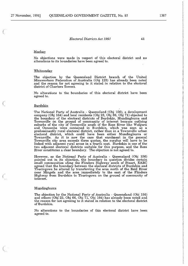
27 November, 1991] QUEENSLAND GOVERNMENT GAZETTE, No. 85
Electoral Districts Act 1991 41
Mackay
No objections were made in respect of this electoral district and no alterations to its boundaries have been agreed to.
Whitsunday
The objection by the Queensland District branch of the United Mineworkers Federation of Australia (Obj 123) has already been noted and the reason for not agreeing to it stated in relation to the electoral district of Charters Towers.
No alterations to the boundaries of this electoral district have been agreed to.
Burdekin
The National Party of Australia - Queensland (Obj 156), a development company (Obj 164) and local residents (Obj 23, Obj 66, Obj 71) objected to the boundary of the electoral districts of Burdekin, Mundingburra and Townsville on the ground of community of interest because outlying suburbs of the city of Townsville south of the Ross River like Wulguru and Oonoonba were contained in Burdekin, which was seen as a predominantly rural electoral district, rather than in a Townsville urban electoral district, which could have been either Mundingburra or Townsville. As it is now the case that enrolment in the general Townsville city area exceeds three quotas, the surplus will have to be linked with adjacent rural areas in a fourth seat. Burdekin is one of the two adjacent electoral districts suitable for this purpose, and the Ross River constitutes a clear boundary. The objection is not agreed to.
However, as the National Party of Australia - Queensland (Obj 156) pointed out in its objection, the boundary in question divides certain small communities along the Flinders Highway south of Stuart, EARC agreed that the boundary between the electoral districts of Burdekin and Thuringowa be altered by transferring the area north of the Reid River near Mingela and the area immediately to the east of the Flinders Highway from Burdekin to Thuringowa on the ground of community of interest.
Mundingburra
The objection by the National Party of Australia - Queensland (Obj 156) and others (Obj 23, Obj 66, Obj 71, Obj 164) has already been noted and the reason for not agreeing to it stated in relation to the electoral district ofBurdekin.
No alterations to the boundaries of this electoral district have been agreed to.
1387
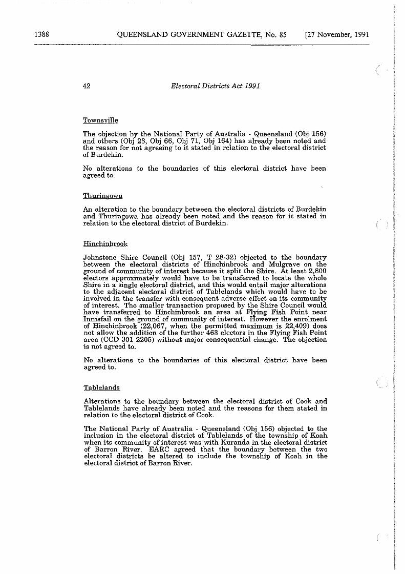
1388 QUEENSLAND GOVERNMENT GAZETTE, No. 85 [27 November, 1991
42 Electoral Districts Act 1991
Towns ville
The objection by the National Party of Australia - Queensland (Obj 156) and others (Obj 23, Obj 66, Obj 71, Obj 164) has already been noted and the reason for not agreeing to it stated in relation to the electoral district of Burdekin.
No alterations to the boundaries of this electoral district have been agreed to.
Thuringowa
An alteration to the boundary between the electoral districts of Burdekin and Thuringowa has already been noted and the reason for it stated in relation to the electoral district of Burdekin.
Hinchinbrook
Johnstone Shire Council (Obj 157, T 28-32) objected to the boundary between the electoral districts of Hinchinbrook and Mulgrave on the ground of community of interest because it split the Shire. At least 2,800 electors approximately would have to be transferred to locate the whole Shire in a single electoral district, and this would entail major alterations to the adjacent electoral district of Tablelands which would have to be involved in the transfer with consequent adverse effect on its community of interest. The smaller transaction proposed by the Shire Council would have transferred to Hinchinbrook an area at Flying Fish Point near Innisfail on the ground of community of interest. However the enrolment of Hinchinbrook (22,067, when the permitted maximum is 22,409) does not allow the addition of the further 463 electors in the Flying Fish Point area (CCD 301 2205) without major consequential change. The objection is not agreed to.
No alterations to the boundaries of this electoral district have been agreed to.
Tablelands
Alterations to the boundary between the electoral district of Cook and Tablelands have already been noted and the reasons for them stated in relation to the electoral district of Cook.
The National Party of Australia - Queensland (Obj 156) objected to the inclusion in the electoral district of Tablelands of the township of Koah when its community of interest was with Kuranda in the electoral district of Barron River. EARC agreed that the boundary between the two electoral districts be altered to include the township of Koah in the electoral district of Barron River.
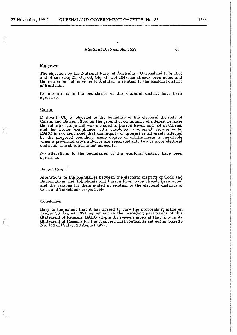
27 November, 1991] QUEENSLAND GOVERNMENT GAZETTE, No. 85
Electoral Districts Act 1991 43
Mulgrave
The objection by the National Party of Australia - Queensland (Obj 156) and others (Obj 23, Obj 66, Obj 71, Obj 164) has already been noted and the reason for not agreeing to it stated in relation to the electoral district of Burdekin.
No alterations to the boundaries of this electoral district have been agreed to.
Cairns
D Rivett (Obj 5) objected to the boundary of the electoral districts of Cairns and Barron River on the ground of community of interest because the suburb of Edge Hill was included in Barron River, and not in Cairns, and for better compliance with enrolment numerical requirements. EARC is not convinced that community of interest is adversely affected by the proposed boundary; some degree of arbitrariness is inevitable when a provincial city's suburbs are separated into two or more electoral districts. The objection is not agreed to.
No alterations to the boundaries of this electoral district have been agreed to.
Barron River
Alterations to the boundaries between the electoral districts of Cook and Barron River and Tablelands and Barron River have already been noted and the reasons for them stated in relation to the electoral districts of Cook and Tablelands respectively.
Conclusion
Save to the extent that it has agreed to vary the proposals it made on Friday 30 August 1991 as set out in the preceding paragraphs of this Statement of Reasons, EARC adopts the reasons given at that time in its Statement of Reasons for the Proposed Distribution as set out in Gazette No. 143 of Friday, 30 August 1991.
1389
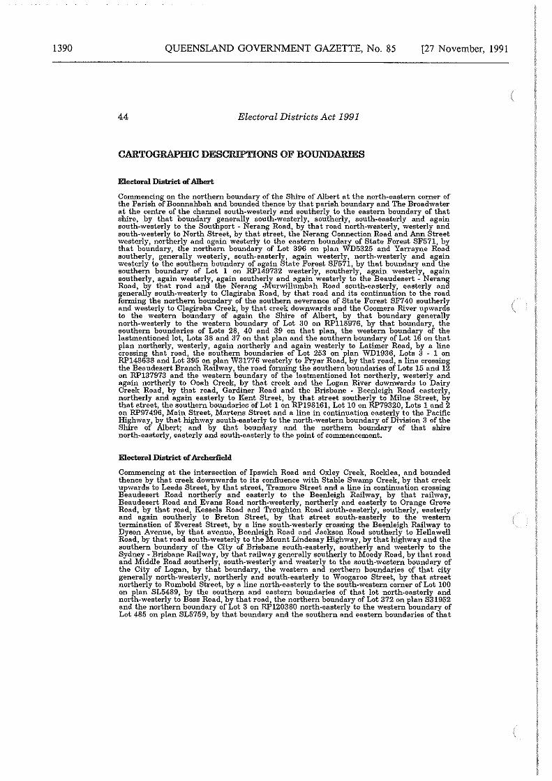
1390 QUEENSLAND GOVERNMENT GAZETTE, No. 85 [27 November, 1991
44 Electoral Districts Act 1991
CARTOGRAPHIC DESCRIPTIONS OF BOUNDARIES
Commencing on the northern boundary of the Shire of Albert at the north-eastern corner of the Parish of Boonnahbah and bounded thence by that parish boundary and The Broadwater at the centre of the channel south-westerly and southerly to the eastern boundary of that shire, by that boundary generally south-westerly, southerly, south-easterly and again south-westerly to the Southport - Nerang Road, by that road north-westerly, westerly and south-\vesterly to North Street, by that street, the Nerang Connection Road and Ann Street westerly, northerly and again westerly to the eastern boundary of State Forest SF571, by that boundary, the northern boundary of Lot 396 on plan WD5325 and Yarrayne Road southerly, generally westerly, south-easterly, again westerly, north-westerly and again westerly to the southern boundary of again State Forest SF571, by that boundary and the southern boundary of Lot 1 on RP149732 \Vesterly, southerly, again westerly, again southerly, again westerly, again southerly and again westerly to the Beaudesert - Nerang Road, by that road and the Nerang -Murwillumbah Road south-easterly, easterly and generally south-\vesterly to Clagiraba Road, by that road and its continuation to the road forming the northern boundary of the southern severance of State Forest SF740 southerly and westerly to Clagiraba Creek, by that creek downwards and the Coomera River upwards to the western boundary of again the Shire of Albert, by that boundary generally north-westerly to the western boundary of Lot 30 on RP118976, by that boundary, the southern boundaries of Lots 28, 40 and 39 on that plan, the western boundary of the lastmentioned lot, Lots 38 and 37 on that plan and the southern boundary of Lot 16 on that plan northerly, westerly, again northerly and again westerly to Latimer Road, by a line crossing that road, the southern boundaries of Lot 253 on/Ian WD1936, Lots 3 - 1 on RP148638 and Lot 395 on plan W31776 westerly to Fryar Roa , by that road, a line crossing the Beaudesert Branch Railway, the road forming the southern boundaries of Lots 15 and 12 on RP137973 and the western boundary of the lastmentioned lot northerly, westerly and again northerly to Ooah Creek, by that creek and the Logan River downwards to Dairy Creek Road, by that road, Gardiner Road and the Brisbane - Beenleigh Road easterly, northerly and again easterly to Kent Street, by that street southerly to Milne Street, by that street, the southern bormdaries of Lot 1 on RP198161, Lot 10 on RP79320, Lots 1 and 2 on RP97496, Main Street, Martens Street and a line in continuation easterly to the Pacific Highway, by that highway south·easterly to the north-\vestern boundary of Division 3 of the Shire of Albert; and by that boundary and the northern boundary of that shire north-easterly, easterly and south-easterly to the point of commencement.
Electoral District of Areherfield
Commencing at the intersection of Ipswich Road and Oxley Creek, Rocklea, and bounded thence by that creek downwards to its confluence with Stable Swamp Creek, by that creek upwards to Leeds Street, by that street, Tremore Street and a line in continuation crossing Beaudesert Road northerly and easterly to the Beenleigh Railway, by that railway, Beaudesert Road and Evans Road north-westerly, northerly and easterly to Orange Grove Road, by that road, Kessels Road and Troughton Road south-easterly, southerly, easterly and again southerly to Breton Street, by that street south-easterly to the western termination of Everest Street, by a line south-westerly crossing the Beenleigh Railway to Dyson Avenue, by that avenue, Beenleigh Road and Jackson Road southerly to Hellawell Road, by that road south-westerly to the Mount Lindesay Highway, by that highway and the southern boundary of the City of Brisbane south.easterly, southerly and westerly to the Sydney - Brisbane Railway, by that railway generally southerly to Moody Road, by that road and Middle Road southerly, south-westerly and westerly to the south-western boundary of the City of Logan, by that boundary, the western and northern boundaries of that city generally north-westerly, northerly and south.easterly to Woogaroo Street, by that street northerly to Rumbold Street, by a line north-easterly to the south-western corner of Lot 100 on plan SL5489, by the southern and eastern boundaries of that lot north-easterly and north-westerly to Boss Road, by that road, the northern bormdary of Lot 372 on plan 831952 and the northern boundary of Lot 3 on RP120380 north-easterly to the western boundary of Lot 485 on plan SL5759, by that bormdary and the southern and eastern boundaries of that
27 November, 1991] QUEENSLAND GOVERNMENT GAZETTE, No. 85
Electoral Districts Act 1991 45
lot southerly, easterly and northerly to the northern boundary of Lot 1 on RP161403, by that boundary north-easterly to Blunder Road, by that road north-westerly to the northern boundary of Lot 47 on plan M3133, by that boundary and a line in continuation north-easterly to Blunder Creek; and by that creek and Oxley Creek downwards to the point of commencement.
Commencing at the intersection of South Pine Road and the Ferny Grove Railway, Alderley, and bounded thence by that railway, Newmarket Road, Enoggera Road and Ashgrove Avenue south-easterly, south-westerly, again south-easterly and westerly to Enoggera Creek, by that creek downwards and Ithaca Creek upwards to Coopers Camp Road, by that road, Waterworks Road and Glenquarie Place north-westerly, westerly, and south-westerly and south.easterly to the northern boundary of Lot 34 on RP230018, by that boundary and the western boundary of that lot westerly, southerly and again westerly to the western boundary of Lot 101 on plan SL806690, by that boundary, the western boundary of Lot 36 on RP226489 and the northern boundary of Lot 1323 on plan 831983 southerly and westerly to Paten Road by that road, the eastern boundary of Lot 6 on plan SL12726 and the northern boundary of Lot 2 on RP200271 southerly and westerly to Whitehead Road, by that road, the southern boundary of Lot 1 on RP20542 southerly and westerly to Moggill Road, by that road
1 Highwood Road and Boscombe Road southerly, generally westerly and northerly to the
southern boundary of the Parish of Enoggera, by that boundary and the southern boundary of the Parish of Samford westerly to the western boundary of the City of Brisbane, by that boundary generally north-westerly, northerly, easterly, south-easterly, north-easterly and again easterly to the eastern boundary of State Forest SF309, by that boundary generally south-easterly to Monnt Glorious Road, by that road and Brompton Road easterly and northerly to the northern boundary of Lot 853 on plan SL1235, by that boundary, the northern boundaries of Lot 851 on plan 8311111, Lot 2 on RP20764, Lot 6 on RP211702, Lot 20 on plan SL12077, Lot 7 on RP211702 and Lot 1 on RP95250 easterly to Settlement Road, by that road and Yarrabee Road easterly and south·easterly to the southern boundary of Lot 1 on RP164172, by that boundary, the eastern boundary of that lot and Lot 2 on that plan, the northern boundary of Lot 1105 on plan SL5696, the south-western, western and northern boundaries of Lot 1 on RP20230 and the northern boundary of Lot 357 on plan S3117 easterly, north-easterly, again easterly, north-westerly and again easterly to the western bonndary of Lot 332 on plan S3127, by that boundary, the northern boundary of that lot, the northern boundary of Lot 331 on that plan, the north-western and eastern boundaries of Lot 1 on RP118537, again the northern boundary of Lot 331 on plan S3127, the southern boundaries of Lots 28 and 18 on RP112899, the southern termination of Nambour Street, the southern boundary of Lot 17 on that plan, the eastern boundary of that lot and Lots 16, 15 and 14 on that plan, the southern boundary of Lot 4 on RP85693, the southern termination ofWanimo Street, the southern boundary of Lot 6 on RP85693 and the southern boundaries of Lots 26 and 25 on that plan northerly and generally easterly to Taurama Street, by the western and southern alignments of that street, the southern boundary of Lot 47 on RP85694, the eastern boundary of that lot, the eastern and south-eastern boundaries of Lots 44 - 36 on RP85694, the north-eastern termination of again Taurama Street, the north-eastern boundary of Lot 35 on that plan and the south-eastern boundaries of Lots 9 - 42 on RP20235 generally north-easterly to Samford Road, by that road south-easterly to Railway Street; and by that street and South Pine Road north-easterly and north-westerly to the point of commencement.
Eleetornl Disbid of Aspley
Commencing on the North Pine River at its intersection with Gympie Road, Lawnton, and bonnded thence by that river downwards to Ogg Road, by that road and Brays Road north-easterly, northerly and north-westerly to Freshwater Creek, by that creek and Hays Inlet downwards to the Houghton Highway, by that high\vay south-westerly to the mouth of the Pine River, by that river and Bald Hills Creek upwards to the eastern boundary of Lot 258 on RP29044, by that boundary and the eastern boundary of Lot 259 on that plan southerly to Lacey Road, by that road southerly to again the North Coast Railway, by that
1391
1392 QUEENSLAND GOVERNMENT GAZETTE, No. 85 [27 November, 1991
46 Electoral Districts Act 1991
railway south-easterly to Murphy Road, by that road, Gympie Road, Webster Road, Pie Street, Maundrell Terrace and Hamilton Road southerly, south-westerly, north-westerly, again southerly, westerly, again south-westerly, again southerly and again westerly to the northern bonndary of the City of Brisbane, by that boundary generally northerly to the southern boundary of Lot 900 on RP1327901 by that boundary, the south-western boundary of that lot and Learmonth Street generally south-westerly to Gympie Road; and by that road north-westerly to the point of commencement.
Electontl District ofBaramboh
Commencing at the intersection of the northern boundaries of the Shires of Wondai and Kilkivan and bounded thence by the northern, north-eastern and south-eastern boundaries of the lastmentioned shire generally north-easterly south-easterly, easterly, again south-easterly and south-westerly to the northern boundary of the Shire of Kilcoy, by that boundary, the eastern, southern and western boundaries of that shire generally south-easterly, south-westerly and north-westerly to Neara Creek, by that creek downwards, the Brisbane River upwards, the northern boundary of Lot 3 on RP14981 and a line in continuation crossing the Brisbane Valley Highway westerly to Turtle Creek Road, by that road, the road forming the eastern boundary of Lot 2 on RP14955 and its continuation westerll and south-westerly to Maronghi Creek, by that creek upwards to the western boundary o the Shire of Esk, by that boundary generally north-westerly to the southern boundary of the Shire of Nanango, by that boundary and the eastern boundary of the Shire of Rosalie generallr south-westerly to the Cooyar - Mount Binga Road, by that road, the Kooralgin -Mount Bmga Road, the Cooyar - Kooralgin Road and the New England Highway north-westerly, south-westerly and again north-westerly to the southern boundary of again the Shire of Nanango, by that boundary generally north-westerly to the south-western boundary of the Shire of Kingaroy; and by that bonndary and the southern, western, north-western and northern boundaries of the Shire of Wondni north-westerly, westerly, generally northerly, generally north-easterly and south-easterly to the point of commencement.
Electontl District of Barron River
Commencing on the eastern seashore at the mouth of Saltwater Creek and bounded thence by that creek, Collins Avenue and Mayers Street upwards, south-westerly and southerly to the northern boundary of Lot 694 on plan NR7064, by that boundary, a line crossing Pease Street, the northern boundaries of Lot 1 on RP725844 and Lot 2 on RP739192 westerly to Jensen Street, by that street, Brooks Street and McManus Street generally southerly, westerly and again southerly to the Brinsmead -Kamerunga Road, by that road and Freshwater Creek westerly, north-westerly and downwards to the Cairns Railway, by that railway, the tramway intersecting Lot 6 on RP703158, its continuation and Fairweather Road south-westerly, north-westerly and southerly to the southern boundary of Lot 3 on RP703142, by that boundary, a line in continuation crossing the Brinsmead - Kamerunga Road and the southern boundaries of Lot 1 on RP711960 and Lot 2 on RP713195 westerly to Cowley Road, by that road and the Barron River northerly and upwards to the eastern boundary of the Shire of Mareeba, by that boundary generally southerly to the source of Shoteel Creek, by that creek, the Clohesy River, Davies Creek and the southern boundary of Lot 100 on plan NR2909 downwards, upwards and westerly to the southern boundary of Lot C on plan NR6967, by that boundary, the south-western boundary of that lot and Blackwater Creek south-westerly, north-westerly and downwards to the Cairns Railway, by that railway and 36 Mile Creek south-westerly and downwards to again the Barron River, by that river, Oaky Creek and the Great Dividing Range upwards and generally north-easterly to the north-eastern boundary of again the Shire of Mareeba, by that boundary and the north-eastern and northern boundaries of the Shire of Mulgrave south-easterly, generally north-easterly and easterly to a point northerly from Turtle Bay; and by a line south-westerly to Ellie Point and the eastern seashore south-westerly to the point of commencement.
27 November, 1991] QUEENSLAND GOVERNMENT GAZETTE, No. 85
Electoral Districts Act 1991 47
Electornl District of lleaud.sert
Commencing at the intersection of Oxley Creek and the northern boundary of the Shire of Beaudesert and bounded thence by that boundary generally easterly to the Logan River, by that river, Ooah Creek and the eastern boundary of Lot 270 on plan MAR6117 upwards and southerly to the road forming the northern boundary of Lot 268 on plan WD3799, by that road, its continuation and the road forming the western boundary of Lot 2 on RP27542 easterly and southerly to the north-western corner of Lot 90 on RP135486, by the northern boundaries of that lot, Lots 91 - 93 on that/'lan and Lots 94 - 110 on RP135487, a line in continuation and the northern boundary o Lot 17 on RP118976 easterly to the eastern boundary of that lot, by that boundary, the eastern boundary of Lots 18 - 20 on RP118976 and the northern boundaries of Lots 24 - 26 on RP118976 and Lots 4 and 5 on RP179780 southerly and easterly to the eastern boundary of again the Shire of Beaudesert1 by that boundary, the southern boundary of the State and the western boundary of again the Shire of Beaudesert south-easterly, southerly, south-westerly, westerly and north-easterly to Teviot Brook, by that brook downwards to the road forming the eastern boundary of Lot 77 on plan SL5520, by that road, Teviot Road and Pub Lane north-easterly, northerly and westerly to Oxley Creek; and by that creek downwards to the point of commencement.
Electornl District of Brisbane Cenb:al
Commencing on the Brisbane River at the centre of the stream at its confluence with Breakfast Creek and bounded thence by that river at the centre of the stream thereof upwards to a point south-easterly from the south-eastern termination of Boomerang Street, by a line thereto, by that street, the Main Line Railway, Countess Street and Kelvin Grove Road north-westerly, north-easterly and again north-westerly to Upper Clifton Terrace, by that terrace, Musgrave Road and Waterworks Road south-westerly and generally north-westerly to Ithaca Creek, by that creek downwards and Enoggera Creek upwards to Ashgrove Avenue, by that avenue, Enoggera Road, Newmarket Road and the Ferny Grove Railway easterly, north-westerly, north-easterly1 again easterly and again north-westerly to Wilston Road, by that road, Days Road, Jean Street, Daphne Street and Fuller Street north-easterly, northerly, easterly, again northerly and again easterly to Lutwyche Road, by that road, Fosbery Street and the eastern boundaries of Lots 3 and 2 on RP196893 southerly, easterly and again southerly to Albion Road, by that road, the Albion Overpass and the North Coast Railway easterly, south-easterly and southerly to Break.fast Creek; and by that creek downwards and a line in continuation south-easterly to the point of commencement.
Electornl District of Broadwater
Commencing on the western boundary of the City of Gold Coast at its intersection with the Gold Coast High\vay and bounded thence by that boundary generally northweasterly to The Broadwater at the centre of the channel, by that channel and the western and northern boundaries of the Parish of Currigee generally northerly and north-easterly to a point northerly from the northern seashore of South Stradbroke Island, by a line thereto, by that seashore, the eastern seashore of that island and a line in continuation southerly to the centre of the Gold Coast Seaway, by that seaway and again the centre of the channel of the Broadwater westerly and southerly to the southern boundary of Division 2 of the City of Gold Coast, by that boundary westerly to Turpin Road, by that road, Second Avenue, Wilson Street and Herder Avenue northerly, westerly, southerly and again westerly to again the southern boundary of Division 2 of that city, by that boundary south-westerly and westerly to Stephenson StreetL by that street and Olsen Avenue westerly and northerly to the northern boundary of ot 9 on plan WD6577, by that boundary and the northern boundaries of Lots 16, 17 and 18 on that plan westerly to Kendor Street, by that street and Captain Cook Drive north-westerlyJ westerly and northerly to the southern boundary of Division 1 of the City of Gold Coast; and by that boundary north-westerly to the point of commencement.
1393
1394 QUEENSLAND GOVERNMENT GAZETTE, No. 85 [27 November, 1991
48 Electoral Districts Act 1991
Electoral DWbict ofBulimba
Commencing on the Brisbane River at the centre of the stream at a point north-,vesterly from the mouth of Aquarium Passage and bounded thence by a line thereto, by that passage upwards to a point north-westerly from the south-western corner of Lot 482 OD: plan SL5815, by a line thereto, by the southern boundary of that lot, Wyuna Court, Anton Road, Gosport Street, Lindum Road, Kianawah Road, Wynnum Road and Fleming Road generally south-easterly, south-westerly and westerly to Bulimba Creek, by that creek upwards to Murarrie Road.l-. bl that road south-westerly to Queensport Road, by that road northerly to the Cleveland .Krulway, by that railway south-westerly to Creek Road, by that road, D'Arcy Road, Lossock Avenue, Tranters Avenue and Viminal Hill Crescent generally southerly, westerly and again generally southerly to Stanley Road, by that road, Wiles Street, Halland Terrace, \Vatson Street, Bennetts Road and Myall Street westerly, southerly, again \Vesterly, northerly and again westerly to again the Cleveland Railway, by that railway south-westerly to Landsdowne Street by that street and a line in continuation north-westerly to Norman Creek, by that creek downwards to its confluence with the Brisbane River at the centre of the stream; and by that river at the centre of the stream thereof downwards to the point of commencement.
Electoral DWbict ofBundaberg
Commencing on the south-eastern boundary of the City of Bundaberg at its intersection with the North Coast Railway and bounded thence by that boundary, Gerald Street and Fitzgerald Street south-westerly and north-westerly to Enterprise Street, by that street, the Isis Highway and Bolewski Street south-westerly, westerly, north-westerly, again south-westerly and again north-westerly to the western boundary of again the City of Bundaberg; and by that boundary and the northern, eastern and south-eastern boundaries of that city generally northerly, generally easterly, generally southerly and south-westerly to the point of commencement.
Electaral DWbict ofllnrulomba
Commencing on the northern boundary of the City of Ipswich at the confluence of the Brisbane and Bremer Rivers and bounded thence by the northern boundary of that city generally easterly to a point north-westerly from the north-western termination of Old Logan Road, by a line crossing the Ipswich Railway thereto, by that road southerly to the eastern boundary of again the City of Ipswich, by that boundary westerly, southerly and again westerly to Woogaroo Creek, by that creek up\vards to the northMwestern corner of Lot 42 on plan S31363, by the northern boundary of that lot, Meier Road and again Old Logan Road easterly and south-easterly to the eastern boundary of the Shire of Moreton, by that boundary and the southern boundary of that shire generally south-westerly to Ripley Road, by that road northerly, westerly, again northerly and north-westerly to the road forming the \Vestern boundary of Lot 181 on plan 8151860, by that road and the road forming the north-western boundary of that lot northerly, easterly and north-easterly to Bundamba Creek, by that creek downwards to the Bremer River; and by that river downwards and the northern boundary of the City of Ipswich generally easterly to the point of commencement.
Electaral DWbict ofBurdclrin
Commencing on the eastern seashore at the mouth of the Elliot River and bounded thence by that river upwards to the western boundary of Lot 38 on plan HR.1253, by the road forming the south-western boundary of the eastern severance of that lot and its continuation intersecting Aberdeen Holding, forming the southern boundaries of Lot 265 on
f;lan K124476 and Lot 30 on plan HR.540, intersecting Lots 26 and 25 on plan HR1317 and a ine in continuation southMeasterly and easterly to the Collinsville Branch Railway, by that
railway and the Bowen Developmental Road generally south-westerly to Strathmore Road, by that road generally westerly to the Bowen River, by that river downwards to the south-eastern boundary of Division 3 of the Shire of Dalrymple, by that boundary and the south-western and north-western boundaries of that division south-\vesterly, north-westerly and north-easterly to the \vestern boundary of the City of Thuringowa, by that
27 November, 1991] QUEENSLAND GOVERNMENT GAZETTE, No. 85
128762-145
Electoral Districts Act 1991 49
boundary, the norlh-•vestern boundary of Lot 2202 on plan PII680 and the Reid River generally northerly, easterly and do\vnwards to the road forming the \Vestern boundary of Lot 1 on plan EP1679, by that road, its continuation and the southern and eastern boundaries of Lot 510 on plan EP1653 northerly, south-easterly and again northerly to the western boundary of National Pnrk NP767, by that boundary, the western boundaries of Lot 52 on plan EP1313, Lot 29 on plan EP187 and Lot 51 on plan EP1228 generally north-westerly and generally northerly to the road forming the northern boundary of Lot 86 on plan El24345, by that road 1 its continuation, the road forming the western boundary of Lot 199 on plan 1{124503 and Stuart Creek \Vesterly, northerly and downwards to the southern boundary of the City of To\vnsville, by that boundary generally north-westerly to the Ross River, by that river downwards to its mouth on the eastern seashore, by a line north-easterly to Bremner Point on Magnetic Island, by a line east to the eastern extremity of the Great Barrier Reef, by the easternmost reefs thereof south-easterly to a point east from the point of commencement; and by a line thereto.
Commencing on the eastern seashore at a point north-east from the eastern termination of Palm Beach Avenue and bounded thence by that avenue south-westerly to the Pacific Highway, by that highv1ay north-\vesterly and wester1y to Tallebudgera Creek, by that creek upwards to the eastern boundary of Lot 1 on RPl 70496, by that boundary generally south-easterly to Guineas Creek Road, by that road north-westerly and south-westerly to Tallebudgera Connection Road, by that road and the road forming the eastern boundary of Lot 1 on plan WD4297 north-westerly and north-easterly to Old Coach Road, by that road and its un-named continuation north-westerly to the Pacific Highway, by that higlnvay, Robina Parkway and the road forming the northern boundary of Lot 61 on RP21887 north-westerly, north-easterly and easterly to the western boundary of Lot 981 on RP200239, by the south-western, southern and eastern boundaries of that lot and a line in continuation crossing Bermuda Street south-easterly, easterly, northerly, again easterly and again northerly to the eastern boundary of Lot 998 on RP177373, by that boundary northerly to the western boundary of the City of Gold Coast, by that boundary easterly, southerly, again easterly and northerly to Mountain View Avenue, by that avenue, Dawn Parade, the Gold Coast Highway, Chairlift Avenue, Chairlift Avenue East and a line in continuation north·westerly, north.easterly, again north-westerly, northerly and easterly to the eastern seashore; and by that seashore, a line crossing the mouth of Tallebudgera Creek and again by that seashore generally south-easterly to the point of commencement.
Electoral District ofllurnett
Commencing at the intersection of the Isis River and the Bruce High\vay and bounded thence by that higlnvny and the south-eastern and south-western boundaries of the Shire of Isis south·easterly, south-westerly and north-westerly to the southern boundary of the Shire of Kolan, by that boundary and the southern and western boundaries of the Shire of Perry generally south-westerly, westerly, north-westerly, northerly and south-easterly to the western boundary of again the Shire of Kalan, by that boundary and the \Vestern, north-\vestern, northern and eastern boundaries of the Shire of Miriam Vale generally northerly, north-easterly, easterly and south-easterly to Sandy Cape on Fraser Islandhby the north-western seashore of that island south-,vesterly to a point east from the mout of the Burnett River, by a line thereto, by the eastern and southern boundaries of the Shire of Woongarra south-easterly and westerly to the North Coast Railway, by that railway, Woodgate Road and Goodwood Road south-easterly, \Vesterly1 southerly, again westerly, again southerly and south-westerly to the tramway intersecting Lot 852 on plan C375871 by that tramway south-westerly to the Bruce Highway; and by that highway easterly and south-easterly to the point of commencement: exclusive of the whole of the Electoral District of Bundaberg described as commencing on the south-eastern boundary of the City of Bundaberg at its intersection with the North Coast Railway and bounded thence by that boundary, Gerald Street and Fitzgerald Street south-westerly and north-\vesterly to
1395
1396 QUEENSLAND GOVERNMENT GAZETTE, No. 85 [27 November, 1991
50 Electoral Districts Act 1991
Enterprise Street, by that street, the Isis Highway and Bolewsk.i Street south-westerly, westerly, north-westerly, again south-westerly and again north-westerly to the \Vestern boundary of again the City of Bunda.berg; and by that boundary and the northern, eastern and south-eastern boundaries of that city generally northerly, generally easterly, generally southerly and south-westerly to the point of commencement.
Electoral District of Cabooltme
Commencing on the southern boundary of Division 1 of the Shire ofCaboolture at the mouth of the Caboolture River and bounded thence by that boundary and the southern boundary of Division 3 of that shire generally north-westerly and westerly to the western boundary of Lot 84 on plan SL6771, by that boundary, a line crossing Campbells Pocket Road and the western and northern boundaries of Lot 8 on RP35939 northerly and easterly to again Campbells Pocket Road, by that road north-easterly and south-easterly to the western boundary of Lot 29 on plan 3311393, by that boundary, the eastern and northern boundaries of Lot 69 on plan SL283, the eastern and northern boundaries of Lot 119 on plan S312401 and the eastern boundary of Lot 23 on plan 8312528 northerly, westerly, again northerly~ again westerly and again northerly to Tidwell Road, by thnt road and Pedwell Road north-westerly and north-easterly to the northern boundary of Lot 106 on plnn CG49, by that boundary, the south-western, southern and south-eastern boundaries of Lot 51 on that plan, the south-eastern and north-eastern boundaries of Lot 69 on plan CG954 and the south-eastern boundary of Lot 2 on plan CG2096 easterly, generally south-easterly and generally north-easterly to the D'Aguilar Highway, by that highway, Raaen Road, its continuation and Connection RoaCl north-westerly, north-easterly, northerly, again north-westerly, again northerly and generally north-easterly to the northern boundary of State Forest SF589, by that boundary, the northern boundary of National Park NP233, a line crossing the North Coast Railway and Glasshouse Mountains Road, Moffntt Road, the western boundary of State Forest SF611 and Johnston Road generally north-easterly to the Bruce Highway, by that highway northerly to Coochin Creek, by that creek downwards to its conlluence with Pumicestone Channel, by that channel north-easterly and northerly to a point west from the northern extremity of Bribie Island, by a line thereto, by the northern eastern, southern and western seashores of that island south-easterly, south-westerly and north-westerly to a point east from Toorbul Point, by a line thereto; and by the eastern seashore south-westerly to the point of commencement.
Electoral District of Cairns
Commencing on the eastern seashore at Ellie Point and bounded thence by a line north-easterly to the northern boundary of the Shire of Mulgrave, by that boundary easterly to a point northerly from Little Fitzroy Island, by a line southerly to a point easterly from Taylor Point, by a line south-westerly to a point westerly from Lyons Point, by a line south-westerly to the mouth of Trinity Inlet, by that inlet, the southern boundary of the City of Cairns and the eastern boundary of Lot 328 on RP733850 south-westerly, north-westerly, generally south-westerly, westerly and southerly to the western.most corner of Lot 233 on RP731284, by a line, the southern boundary of Lot 2 on RP733421 and a line in continuation southerly and westerly to the Whitfield Range, by that range, Isley Hills and the southern watershed of Freshwater Creek south-easterly, south-westerly and north-westerly to Lambs Head on the western boundary of again the Shire of Mulgrave, by that boundary and the Barron River generally northerly and downwards to Co\vley Road.I.by that road, the southern boundaries of Lot 2 on RP713195 and Lot 1 on RP711960, a line crossin? the Brinsmead - Kamerunga Road, the southern boundary of Lot 3 on RP703142 and Fairweather Road southerly, easterly and northerly to the tramway intersecting Lot 96 on plan C157213, by that tramway, its continuation, the Cairns Railway and Freshwater Creek south-easterly, easterly and upwards to a point westerly from the north-western corner of Lot 4 on RP747027, by the Brinsmead - Kamerunga Road, McManus Street, Brooks Street and Jensen Street south-easterly, easterly, northerly, again easterly and again northerly to the northern boundary of Lot 2 on RP739192, by that boundary, the northern boundary of Lot 1 on RP725844, a line crossing Pease Street and the northern boundary of
(
27 November, 1991] QUEENSLAND GOVERNMENT GAZETTE, No. 85
Electoral Districts Act 1991 51
Lot 694 on plan NR7064 easterly to Mayers Street by that street and Collins Avenue northerly and north-easterly to Saltwater Creek, by that creek downwards to its mouth on the eastern seashore; and by that seashore generally north-easterly to the point of commencement.
Electoral District af Calli de
Commencing at the intersection of the northern boundaries of the Shires of Banana and Monto and bounded thence by the north-eastern and eastern boundaries of the lastmentioned shire, the north-eastern boundary of the Shire of Eidsvold, the northern boundary of the Shire of Gayndah and the north-western, north-eastern and south-eastern boundaries of the Shire of Biggenden south-easterly, southerly, easterly and south-westerly to the eastern boundary of again the Shire of Gayndah, by that boundary, the southern boundary of that shire and the eastern, southern and western boundaries of the Shire of Mundubbera southerly, generally south-westerly, westerly and northerly to the southern boundary of again the Shi.re of Eidsvold, by that boundary and the eastern, southern and western boundaries of the Shire of Taroom westerjy, southerly, again westerly and northerly to the north-eastern boundary of Lot 4 on plan TR34, by that boundary, the north-eastern boundary of Lot 5 on plan TR33 and the north-eastern and north-western boundaries of Lot 6 on plan TR34 north-westerly and south-westerly to the northern boundary of Lot 10 on plan TR37, by that boundary and the western and southern boundaries of that lot and the south-western boundaries of Lot 6 on plan TR34, Lot 5 on plan TR33 and Lot 4 on plan TR32 westerlyd south-westerly, south-easterly and again generally south-westerly to the northern boun ary of Lot 3 on plan TR35, by that boundary, the southern boundary of Lot 9 on plan CUE90, the Carnarvon Developmental Road and the northern and western boundaries of Lot 2 on plan TR59 north-westerly, south-westerly, again north-\vesterly, again south-westerly and southerly to the western.boundary of Lot 5 on{lan TR62, by that boundary, the north-\vestern and western boundaries of the Parish o Marengo and the eastern and northern boundaries of Lot 10 on plan WT330 southerly, south-westerly and generally southerly to the southern boundary of the Shire of Bauhinia, by that boundary~ the road intersecting Lot A on plan DSN939, its continuation, Meteor Creek, the road intersecting Lot 3 on plan DSN590 and its continuation north-westerly and north-easterly to the road forming the north-eastern boundary of Lot 3 on plan DN40130, by that road and the Dawson Highway north-westerly to Woolshed Creek, by that creek, Orion Creek and the Comet River downwards to the northern boundary of again the Shire of Bauhinia, by that boundary and the Blackwater -Rolleston Road generally south-easterly and northerly to Blackwater Creek, by that creek downwards, Stony Creek upwards, Spring Creek upwards and a line easterly to the source of Mimosa Creek, by that creek, the Fitzroy Developmental Road and the Baralaba - Woorabinda Road downwards, northerly and easterly to the western boundary of the Shire of Banana; and by that boundary and the north-western and north-eastern boundaries of that shire generally northerly, north-easterly and generally south-easterly to the point of commencement.
Electoral District af Calonndra
Commencing on the eastern seashore at Caloundra Head and bounded thence by that seashore, a line in continuation to the mouth of the Pum.icestone Channel and that channel generally south-westerly to Coochin Creek, by that creek upwards, the Bruce Highway and the southern boundary of State Forest SF561 northerly, westerly, southerly and generally north-westerly to the south-eastern corner of Lot 130 on plan CG155, by the eastern boundaries of that lot and Lot 2 on RP49040 and a line in continuation northerly to Bluegum Creek, by that creek upwards and the North Coast Railway northerly to a point east from the eastern termination of the road forming the southern boundary of Lot 88 on plan CG276, a line thereto, that road, the southern boundary of Lot 467 on plan CG2522, Old Gympie Road, the northern boundary of Lot 737 on plan C311189 and the eastern and northern boundaries of Lot 46 on plan C311162 westerly, south-westerly, again westerly, northerly and again westerly to the eastern boundary of lot 3 on plan CG6006, by that boundary, the eastern boundary of Lot 62 on plan C311251, the eastern and northern boundaries of Lot 736 on plan C311476 and the eastern boundaries of Lot 9 on RP8443 and
1397
1398 QUEENSLAND GOVERNMENT GAZETTE, No. 85 [27 November, 1991
52 Electoral Districts Act 1991
Lot 2 on RP119632 northerly, westerly and again northerly to the Landsborough - Maleny Road, by that road, the southern and eastern boundaries of Lot 1 on RP166989, the southern boundary of State Forest SF291, a line to the north-western corner of Lot 79 on plan CG431 and the north-•vestern boundary of that lot south-easterly, easterly, northerly, again easterly and generally north-easterly to Tunnel Ridge Road, by that road Kowalds Road and the northern boundary of Lot 269 on plan CG921 generally south-easterfy to Glasshouse Mountains Road, by that road and the 1\-Iooloolah River north-easterly and downwards to a point west from the western termination of Waterview Street, by a line thereto, by that street, a line crossing the Caloundra - Noosa Road, Minkara Street, a line crossing Oceanic Drive, the northern boundary of Lot 265 on plan W95537 and a line in continuation easterly to again the eastern seashore; and by that seashore generally southerly to the point of commencement.
Electoral District of Capalaba
Commencing on the western boundary of the Shire of Redland at its intersection with Jones Road and bounded thence by that road and Old Cleveland Road East easterly and north-easterly to Bailey Road, by that road, Randall Road and William Street easterly, southerly and again easterly to the northern boundary of Lot 816 on RP118148, by that boundary, the northern boundaries of Lot 815 - 807 on that plan and Lots 806 - 799 on RP118133 and the western boundaries of Lots 797 -793 on that plan and Lots 751 -745 on RP115096 easterly and northerly to Balmoral Street, by that street and Allenby Road North easterly and southerly to the north-western corner of Lot 2 of RP116104, by the northern boundary of that lot and the northern boundaries of Lots 6 and 2 on RP165038, Lot 2 on RP145474, Lots 4 and 5 on RP105672 and Lot 102 on RP142275 easterly to Hilliards Creek, by that creek upwards, Redland Bay Road, Taylor Road and Woodlands Drive generally southerly to Mount Cotton Road, by that road and the southern boundary of Lot 2 on plan SL12814 north-westerly and south-westerly to West Mount Cotton Road, by that road..h. the southern boundaries of Lot 1 on RP184461 and Lot 27 on RP113142 and Avalon J:<oad south-westerly, westerly and southerly to the western boundary of the Shire ofRedland; and by that boundary generally northerly to the point of commencement.
Electoral District of Charters Toworn
Commencing at the north-western comer of the Shire of McKinlay and bounded thence by the northern boundary of that shire, the northern boundary of the Shire of Richmond and the northern boundary of the Shire of Flinders generally easterly to the western boundary of the Shire of Dalrymple, by that boundary, the northern and eastern boundaries of that shire north-easterly, northerly.I easterly and south-easterly to the south-eastern boundary of Division 2 of that shire, by that boundary and the north-eastern boundary of Division 1 of that shire south-westerly and south-easterly to the western boundary of the Shire of Bowen, by that boundary easterly and north-easterly to its intersection with the Leichhardt Range, by that range generally south-easterly to its intersection with Bowen Developmental Road, by· that road and an un-named road intersecting Cerito Holding, Mount Lookout Holding and again Cerito Holding south-westerly and easterly to the Suttor River, by that river downwards and the south-eastern boundary of again the Shire of Bowen south-easterly and south-westerly to the northern boundary of the Shire of Belyando, by that boundary and the north-eastern and eastern boundaries of that shire generally easterly, southerly, south-westerly and south-easterly to the northern boundary of the Shire of Peak Downs, by that boundary generally south-easterly, northerly, north-easterly, south-easterly, south-westerly and again south-easterly to the road intersecting Lot 3 on/Ian CNS 19, by that road and its continuation south-,vesterly and Cotherstone Roa southerly and south-westerly to the Gregory Highway, by that highway, Capella Creek and Tea Tree Creek south-easterly and upwards to Yan Yan Road, by that road, the eastern boundaries of Lots 7 and 8 on RP613313, the eastern, southern and south-western boundaries of Lot 14 on that plan, the southern boundary of Lot 17 on plan TT461 and Johnston Street south-easterly, southerly, westerly, north-westerly and south-westerly to the Blair Athol Branch Railway, by that railway south-easterly to the southern boundary of again the Shire of Peak Downs, by that boundary and the south-western boundary of again the
27 November, 1991] QUEENSLAND GOVERNMENT GAZETTE, No. 85
Electoral Districts Act 1991 53
Shire of Belyando generally westerly and north-westerly to the southern boundary of again the Shire of Dalrymple, by that boundary and the southern boundary of again the Shire of Flinders \Vesterly, northerly, south-westerly and north-westerly to the southern boundary of again the Shire of Richmond; and by that boundary and the southern and western boundaries of again the Shire of McKinley generally south-westerly; and northerly to the point of commencement.
Electornl. District of Chabmurth
Commencing on the eastern boundary of the City of Brisbane at its intersection with Old Cleveland Road and bounded thence by that road and Reynolds Street north-westerly, westerly and again north-westerly to Bulimba Creek, by that creek upwards to Scrub Road, by that road southerly to the south-eastern corner of Lot 1 on RP102064, by the southern and western boundaries of that lot and the northern boundary of Lot 2 on that plan \Vesterly, northerly and again westerly to again Bulimba Creek, by that creek upwards and Pine Mountain Road westerly to Sankeys Road, by that road, Jones Road, Samuel Street, Burn Street, Abbott Street and Long Street north-easterly, northerly, westerly1 again northerly, easterly and again northerly to Old Cleveland Road, by that road \Vesterly to Clara Street, by that street and Stanley Road northerly and westerly to Viminal Hill Crescent, ~y that crescent, Tranters Avenue and Lossock Avenue north-easterly, easterly and generally northerly to D'Arcy Road, by that road and Creek Road easterly and generally northerly to the Cleveland Railway, by that railway, Queensport Road and Murarrie Road generally north-easterly to again Bulimba Creek, by that creek downwards to Fleming Road, by that road and Wynnum Road easterly and south-westerly to the northern boundary of Lot 12 on RP33345, by that boundary, the northern boundaries of Lots 13 and 14 on that plan, the northern boundaries of Lots 2 and 1 on RP162014 and by a line in continuation easterly to Wondall Road, by that road, Radford Road, Ringarra Street, Kamarin Street, Clifton Street and by a line in continuation generally easterly to the north-western corner of Lot 362 on plan SL923, by the western boundary of that lot southerly to Lota Creek, by that creek downwards to its mouth, by the easten1 alignment of the Esplanade and a line north-easterly and south-easterly to the eastern boundary of the City of Brisbane; by that boundary generally southerly to the point of commencement.
Electornl. District of Chermside
Commencing at the intersection of Sandgate Road and Rode Road, Wnvell Heights, and bounded thence by the lastmentioned road, Edinburgh Castle Road and Sha\V Road westerly, south-westerly and southerly to the northern boundary of Lot 406 on RP41767, by that boundary and the north-western boundary of that lot \Vesterly, northerly and south-westerly to the south-western termination of that street, by that termination, the north-eastern boundary of Lot 1 on RP41765, the eastern and northern boundaries of Lot 405 on RP41765 and the eastern boundary of Lot 111 on RP69740 north-westerly, northerly, westerly, south-\vesterly, again north-westerly and again northerly to again Edinburgh Castle Road, by that road south-westerly and westerly to Gympie Road, by that road northerly to IGtchener Road, by that road, Appleby Road and Redwood Street westerly, southerly and again westerly to Trouts Road, by that road generally northerly to Hamilton Road, by that road, Maundrell Terrace and Pie Street easterly, northerly, north-easterly and again easterly to Webster Road, by that road and Gympie Road northerly and south-easterly to Downfall Creek, by that creek downwards and the North Coast Railway south-easterly to Sandgate Road; and by that road generally southerly to the point of commencement.
Electornl. District of Clayficld
Commencing at the intersection of Rode Road and Sandgate Road, Nundah, and bounded thence by the lastmentioned road, Robinson Road, Ryans Road, Flower Street and the Sandgate Railway northerly! easterly, north-easterly, south-easterly and generally south-westerly to Schulz Cann 1 by that canal and the Gateway Arterial Road easterly and generally north-easterly to the north-western boundary of Lot 300 on plan M31101, by that boundary, the north-western and north-eastern boundaries of Lot 301 on that plan and the south-eastern and north-eastern boundaries of Lot 1219 on plan SL12187 north-easterly, south-easterly, again north-easterly and north-westerly to Nudgee
1399
1400 QUEENSLAND GOVERNMENT GAZETTE, No. 85 [27 November, 1991
54 Electoral Districts Act 1991
Road, by that road and its continuation northerly and north-easterly to the eastern seashore, by that seashore generally easterly and south-easterly to Luggage Point, by a line south-easterly to the Brisbane River at the centre of the stream, by that river at the centre of the stream thereof upwards to its confluence with Breakfast Creek, by that creek upwards and the North Coast Railway, Chalk Street, Ked.ron Park Road and Norman Street northerly, westerly, north-westerly and again westerly to Lutwyche Road, by that road, again Kedron Park Road, Park Road and Gorman Street northerly, easterly, north-easterly and north-westerly to the eastern boundary of Lot 959 on plan SL9515l by that boundary, the north-eastern boundary of that lot, Kedron Brook, Shaw Road and Edinburgh Castle Road generally north-westerly, downwards, northerly and north-easterly to Rode Road; and by that road easterly to the point of commencement.
Electoral District of Cleveland
Commencing on the eastern seashore at the eastern termination of South Street and bounded thence by that street and a line in continuation westerly to Hilliards Creek
1 by
that creek downwards to the northern boundary of Lot 102 on RP142275, by that boundary and the northern boundaries of Lots 5 and 4 on RP105672, Lot 2 on RP145474, Lots 2 and 6 on RP165038 and Lot 2 on RP116104 westerly to Allenby Road North.t by that road and Balmoral Street northerly and westerly to the eastern boundary ot Lot 138 on plan SL12339, by that boundary southerly and westerly to Randall Road, by that road and Bailey Road northerly and westerly to Old Cleveland Road East, by that road and Jones !Wad westerly, south-westerly and again westerly to the western boundary of the Shire of Redland, by that boundary generally north-\vesterly and generally northerly to the mouth of Tingalpa Creek, by a line north-easterly to the western extremity of Green Island, by a line northerly to the western extremity of St Helena Island, by the western seashore of that island and a line north-easterly to the western extremity of Mud Island, by the northern seashore of that island and a line easterly to Reeders Point on Moreton Island, by a line southerly to Amity Point on North Stradbroke Island, by the northern and eastern seashores of that island south-easterly and south-westerly to the southern boundary of again the Shire of Redland, by that boundary, the western boundary of Division 2 of that shire and a line in continuation generally westerly and generally north-westerly to a point east from the point of commencement; by a line thereto.
Electoral District of Cook
Commencing at the mouth of the Leichhardt River on the western boundary of the Shire of Carpentaria and bounded thence by a line north-east to the 141 degrees meridian of east longitude, by that meridian north to the Seabed Jurisdiction Line, by that line north-easterly and easterly to the eastern extremity of the Great Barrier Reef, by the easternmost reefs thereof southerly and south-easterly to the southern boundary of the Shire of Douglas, by that boundary and the south-western boundary of that shire westerly, generally south-westerly and generally north-westerly to a point east of the source of Half Ton Creek, by a line thereto, by that creek and the McLeod River downwards to the Peninsula Developmental Road1 by that road and a line westerly and south-westerly to the Mitchell River, by that river downwards to its confluence with the Hodgkinson River, by that river, the eastern boundary of Division 3 of the Shire of Mareeba and the Walsh River upwards, southerly and downwards to the eastern boundary of Lot 2 on plan BW802411, by that boundary, the southern boundary of that lot, the eastern boundary of the Parish of Reamba and the Tate River generally southerly and downwards to the Almaden - Forsayth Railway, by that railway generally south-westerly to the north-eastern boundary of the Shire of Etheridge, by that boundary and the eastern and southern boundaries of that shire generally south-easterly, southerly, south-westerly and westerly to the eastern boundary of the Shire of Croydon, by that boundary and the south-eastern boundary of that shire south-westerly, westerly? northerly and again westerly to the southern boundary of the Shire of Carpentaria; and by that boundary and the western boundary of that shire westerly and northerly to the point of commencement: inclusive of Aubussi, Boigu, Dauan, Deliverance, Kaumag, Moimi, Saibai and Turnagnin Islands; Anchor, Bramble East, Pearce and Turu Cays; Kerr Islet and Black Rocks, all lying north of the Seabed Jurisdiction Line and within or adjoining Torres Strait.
27 November, 1991] QUEENSLAND GOVERNMENT GAZETTE, No. 85
Electoral Districts Act 1991 55
Electoral District of Crows Nest
Commencing on the northern-eastern boundary of the Shire of Esk at its intersection with Neara Creek and bounded thence by that boundary, the eastern boundary of that shire and the Brisbane River generally south-easterly, westerly, southerly and downwards to the southern boundary of Lot l on plan CC2838, by that boundary, the Brisbane Valley Highway, the road forming the southern boundary of Lot 2 on plan CC3255 and its continuation westerly, south-easterly and south-westerly to the Glamorgan Vale Highway Road, by that road, the Marburg - Fern.vale Road, the Glamorgan Vale - Lowood Road and again the eastern boundary of the Shire of Esk north-westerly and generally south-westerly to the Warrego Highway, by that high\vay and the south-western boundary of again the Shire of Esk westerly, north-westerly and generally westerly to the south-eastern boundary of the Shire of Crows Nest, by that boundary and the southern boundary of that shire south-westerly, north-westerly, generally south-westerly and westerly to the eastern boundary of the Shire of Jondaryan, by that boundaryh the Toowoomba - Millmerran Road, Althaus Road, the Westbrook - Wyreema Road and t e Wyreema - Athol Road southerly, south-westerly and again southerly to Umbiram Road, by that road, the Umbiram -Banchory Road and Cornfords Road generally south-westerly to the southern boundary of again the Shire of Jondaryan, by that boundary, the western and north-western boundaries of that shire and the western and north-western boundaries of the Shire of Rosalie northerly, westerly, and generally north-easterly to again the New England Highway, by that highway, the Cooyar - Kooralgin Road, the Kooralgin - Mount Binga Road and the Cooyar - Mount Binga Road south-easterly, north-easterly and again south-easterly to the northern boundary of again the Shire of Crows Nest, by that boundary, Maronghi Creek, the road forming the western boundary of Lot 15 on RP14977 and its continuation north-easterly, south-easterly, downwards and again north-easterly to Turtle Creek Road, by that road, a line in continuation, the northern boundary of Lot 3 on RP14981 and the Brisbane River north-easterly, easterly and upwards to Neara Creek; and by that creek upwards to the point of commencement.
Elcctoral District of Cunningbnm
Commencing on the southern boundary of the State at its intersection with the western boundary of the Town of Goondiwindi and bounded thence by the lastmentioned boundary and the Leichhardt Highway northerly to the northern boundary of the Shire of Waggamba, by that boundary generally south-easterly to the western boundary of the Shire of Millmerran, by that boundary and the northern boundary of that shire northerly, generally easterly, again northerly and again generally easterly to the northern boundary of the Shire of Pittsworth, by that boundary and the eastern boundary of that shire generally easterly and southerly to Cornfords Road, by that road and the Umbiram - Banchory Road generally north-easterly to Umbiram Road, by that road, Wyreema Athol Road, Westbrook Wyreema Road and A1thans Road north-easterly, westerly, northerly, easterly and again northerly to the Toowoomba - Millmerran Road, by that road and the western boundary of the City of Toowoomba generally north-easterly and northerly to Spring Creek, by that creek upwardsj Greenwattle Street, Alderley Street, Hume Street, Boyett Street, Arlaw Street and Haze Street northerly, easterly, southerly, again easterly, again southerly and again easterly to Ramsay Street, by that street, Debra Street, Mackenzie Street, Spring Street and Flagstone Creek Road northerly, easterly, southerly, again easterly, again southerly and again easterly to the eastern boundary of the City of Toowoomba, by that boundary and the southern boundary of that City generally southerly and westerly, to the eastern boundary of the Shire of Cambooya, by that boundary and the eastern and southern boundaries of the Shire of Clifton generally south-easterly, south-westerly and westerly to the eastern boundary of again the Shire of Millmerran, by that boundary, the southern boundary of that shire and by the eastern boundary of again the Shire ofWaggamba generally south-westerly and southerly to again the southern boundary of the State; and by that boundary generally south-westerly and north-westerly to the point of commencement.
1401
1402 QUEENSLAND GOVERNMENT GAZETTE, No. 85 [27 November, 1991
56 Electoral Districts Act 1991
Commencing on the eastern seashore at Point Danger and bounded thence by the southern boundary of the State south-westerly, north-westerly, again south-westerly and again north-westerly to the western boundary of the Parish of Talllebudgera, by that boundary and the western boundary of Division 9 of the Sh.ire of Albert generally north-easterly to the road forming the northern boundary of Lot 2 on RP200716, by that road, Old Coach Road and the road forming the eastern boundary of Lot 1 on plan \VD4297 south-easterly and south-westerly to the Tallebudgera Connection Road, by that road and Guineas Creek Road south-easterly and north-easterly to the south-eastern boundary of Lot 1 on RPl 70496, by that boundary and the eastern boundary of that lot northerly to Tallebudgera Creek, by that creek downwards to the Pacific Highway, by that high•vay south-easterly to its intersection with Palm Beach Avenue, by that avenue and a line in continuation north-easterly to the eastern seashore; and by that seashore generally south-easterly and easterly to the point of commencement.
Elecloral District of Everton
Commencing at the intersection of Hamilton Road and Trouts Road, McDowell, and bounded thence by the lastmentioned road and a line in continuation crossing Stafford Road to the eastern boundary of Lot 655 on plan SL 7677, by that boundary southerly to Kedron Brook, by that brook upwards to South Pine Road, by that road and Wardell Street southerly to Samford Road, by that road, Dawson Parade and South Pine Road north-westerly, south-westerly, northerly and north-easterly to the eastern boundary of Lot 11 on RP90455, by that boundary, the northern boundary of that lot, the northern boundary of Lot 10 on RPl 71864, the north-eastern and eastern boundaries of Lots 9 - 1 on RP90455, the northern boundary of the lastmentioned lot, South Pine Road, the northern boundary of Lot 18 on plan B33415, the western boundary of Lot 750 on plan SL10425 and the western boundary of Lot 1 on RP208290 northerly, north-westerly, north-easterly easterly and northerly to Bunya Road, by that road and Francis Road westerly and generafly northerly to the southern boundary of Bunyaville State Forest SF69, by th.at boundary westerly and southerly to Bunya Road, by that road generally south-westerly to the northern boundary of Lot 62 on plan 831885, by that boundary, the northern boundary of Lot 55 on plan 831591, and the north-eastern boundary __ of Samford State Forest SF1376 generally westerly to Nigher Road, by that road, Mailmans Track and Bunyn Road northerly, westerly, north-easterly and south-easterly to the western boundary of again Bunyaville State Forest SF69, by that boundary and the northern boundary of that state forest northerly, easterly, again northerly and again easterly to Dugandan Road, by that road northerly to the South Pine River, by that river downwards to the northern boundary of the City of Brisbane; and by that boundary and Hamilton Road generally southerly and easterly to the point of commencement.
Elecloral District of Ferny Grave
Commencing at the intersection of Dawson Parade and Samford Road, Keperrn, and bounded thence by that road northMeasterly and south-easterly to the south-eastern boundary of Lot 42 on RP20235, by that boundary, the southMeastern boundaries of Lots 41 -9, the northMeastern boundary of Lot 35 on RP85694, the north-eastern termination of Taurama Street, the north-eastern boundary of Lot 36 on RP85694, the south~eastern boundary of that lot, Lots 37 and 38 on that plan, the eastern boundaries of Lots 39 - 44 on that plan and the eastern and southern boundaries of Lot 47 on RP85694 south-westerly, south-easterly, again south-westerly, southerly and again south-westerly to the southern termination of Taurama Street, by that termination, the western alignment of that street, the southern boundaries of Lots 25, 26 and 5 on RP85693, the southern termination of Wanimo Street, the southern boundary of Lot 4 on RP85693, the eastern boundaries of Lots 14 - 17 on RP112899, the southern boundary of the lastmentioned lot, the southern termination ofNambour Street and the southern boundaries of Lots 18 and 28 on RP112899 generally westerly, southerly and westerly to the southern termination of Coolum Street, by that termination, the eastern boundary of Lot 1 on RP118537, the northMwestern boundary of that lot, the northern boundary of lot 331 on plan S3127 and the northern and western
27 November, 1991] QUEENSLAND GOVERNMENT GAZETTE, No. 85
Electoral Districts Act 1991 57
boundaries of Lot 332 on that plan easterly, northerly, westerly, again northerly, south-westerly, again westerly and southerly to the northern boundary of Lot 357 on plan 83117, by that boundary, the northern, western and south-western boundaries of Lot 1 on RP20230, the northern boundary of Lot 1105 on plan SL5696 and the eastern and southern boundaries of Lots 2 and 1 on RP164172 westerly, southMeasterly, south-1vesterly and again westerly to Yarrabee Road, by that road, Settlement Road, the northern boundaries of Lot 1 on RP95250, Lot 7 on RP211702, Lot 20 on plan SL12077, Lot 6 on RP211702, Lot 2 on RP20764, Lot 851 on plan 8311111 and Lot 853 on plan 8311113 north-westerly and generally \vesterly to Brompton Road, by that road, Mount Glorious Road and the eastern boundary of State Forest SF309 southerly, westerly and generally north-westerly to the southern boundary of the Sh.ire of Pine Rivers, by that boundary and the 1vestern boundary of that shire generally westerly and north-westerly to Tenison Woods Mountain, by a line north-easterly to the source of Kobble Creek (South Branch), by that creek downwards and the western and southern full supply level of Lake Samsonvale generally southerly and generally easterly to the eastern boundary of Lot 351 on plan S312547, by that boundary and the eastern boundaries of Lots 17, 16 and 14 on RP80911 southerly to Ira Buckby Road, by that road, Clear Mountain Road and the Strathpine - Samford Road south-westerly, south-easterly, southerly and westerly to Cedar Creek, by that creek and the South Pine River downwards to Dugandan Road, by that road, the northern and western boundaries of Bunyaville State Forest SF69 generally south-westerly to Bunya Road, by that road, Mailmans Track and Nigher Road westerly, south-westerly, easterly and southerly to the north-eastern boundary of Samford State Forest SF1376, by that boundary, the northern boundaries of Lot 55 on plan S31591 and Lot 62 on plan 831885 generally easterly and northerly to again Bunya Road, by that road, the southern boundary of again Bunyaville State Forest SF69, Francia Road and again Bunya Road generaJly easterly, northerly, again easterly, southerly and again easterly to tP,e north-eastern corner of Lot 13 on plan B3346, by the eastern boundary of that lot the eastern boundary of Lot 16 on that plan and the eastern and southern boundaries of Lot 17 on plan B33438 southerly and westerly to South Pine Road, by that road, the northern, eastern and north·eastern boundaries of Lots 1 to 6 on RP90455 and a line in continuation south-westerly, easterly, again south-westerly and south-easterly to the north-eastern boundary of Lot 7 on that plan, by that boundary, the northern boundaries of Lots 8 and 9 on that plan, Lot 10 on RP171864 and the northern and eastern boundaries of Lot 11 on again RP90455 south-easterly, easterly and southerly to again South Pine Road, by that road westerly to Da1vson Parade; and by that parade southerly to the point of commencement.
Electoral Disb:ict of Fitzroy
Commencing at the mouth of the Fitzroy River on the eastern boundary of the Shire of Fitzroy and bounded thence by that boundary, the south-eastern boundary of that shire, the southern and \Vestern boundaries of the Sh.ire of Mount Morgan and the southern boundary of again the Sh.ire of Fitzroy easterly, south-westerly, north-\vesterly and again south-westerly to the eastern boundary of the Shire of Duaringa, by that boundary south-easterly, \Vesterly, generally southerly and again westerly to the Baralaba -Woorabinda Road, by that road and the Fitzroy Developmental Road westerly and southerly to Mimosa Creek, by that creek upwards to its source, by a line south-westerly to the source of Spring Creek, by that creek, Stony Creek and Blackwater Creek downwards and upwards to the Blackwater - Rolleston Road, by that road southerly to the southern boundary of again the Sh.ire of Duaringa, by that boundary, the south-\vestern boundary of that sh.ire and the southern boundary of the Shire of Broadsound westerly and generally north-\vesterly to the southern boundary of the Shire of Peak Downs, by that boundary generally westerly to the Blair Athol Branch Railway, by that railway, Johnston Road, the northern and eastern boundaries of Lot 183 on flan TT461, the eastern boundary of Lot 152 on plan 'IT446 and the \Vestern boundary o Lot 314 on plan TA4010 north-westerly, north-easterly, south-easterly, easterly and northerly to Yan Yan Road, by that road, Tea Tree Creek, Capella Creek and the Gregory Highway westerly, downwards and north-westerly to Cotherstone Road, by that road, the road forming the southern boundary of Lot 57 on plan TT180 and its continuation generally northerly and north-easterly to the \vestern boundary of the Shire of Broadsound, by that boundary
1403
1404 QUEENSLAND GOVERNMENT GAZETTE, No. 85 [27 November, 1991
58 Electoral Districts Act 1991
and the north-western boundary of that shire generally northerly and again generally north-easterly to the Marlborough - Sarina Road, by that road generally south-easterly to the south-eastern boundary of again the Shire of Broadsound, by that boundary and the northern boundary of again the Shire of Duaringa south-\vesterly, south-easterly and north-easterly to the northern boundary of again the Shire of Fitzroy, by that boundary generally easterly and generally south-easterly to the western boundary of the City of Rockhampton, by that boundary south-easterly and south-westerly to the road forming the northern boundary of Lot 255 on plan LN883, by that road, its continuation and Nine Mile Road easterly and south-easterly to the western boundary of Lot 6 on plan LN2936, by that boundary and the eastern boundary of that lot south-easterly and north-westerly to the southern boundary of Lot 353 on plan LN1642, by that boundary and the 'vestern boundary of that lot northerly to Pennycuick Street, by that street, Denham Street, Agnes Street, Caroline Street and the southern boundary of Lot 344 on plan LN1611 northerly, south-easterly, north-easterly, southerly and easterly to the North Coast Railway, by that railway south-westerly to a point westerly from the southern boundary of Lot 395 on plan LN2189, by a line thereto, by that boundary, a line crossing Campbell Street and the southern boundary of Lot 396 on plan LN2184 north-easterly and easterly to the northern boundary of again the Shire of Fitzroy; and by that boundary north-westerly, north-easterly and generally south-easterly to the point of commencement.
Electoral District of Gladstone
The whole of the City of Gladstone and the Shire of Calliope.
Electoral District of Greenslopes
Commencing at tlie intersection of Logan Road and Cornwall Street, Greenslopes, and bounded thence by that street, Rialto Street and Old Cleveland Road easterly, northerly and north-easterly to Harries Road, by that road, Gladstone Lane and a line in continuation crossing the Cleveland Railway north-westerly to Morley: Street, by that street, Clarence Street, Cavendish Road and Stanley Street East north-westerly, north-easterly, again north-westerly and westerly to Norman Creek, by that creek downwards to a point north-west from the northern termination of Landsdowne Street by a line thereto, by that street and a line in continuation south-westerly to the Cleveland RailwayJ .. fy that railway, Myall Street and Bennetts Road north-easterly, easterly and southerly to Watson Street, by that street, Halland Terrace, Wiles Street and Stanley Road easterly, northerly, and again easterly to Clara Street, by that street, Old Cleveland Road, Long Street, Abbott Street and Burn Street southerly, easterly, again southerly, \Vesterly and again southerly to Samuel Street by that street, Jones Road, Sankeys Road, Holland Road and Marshall Road easteriy, southerly and south-westerly to the South East Freeway., by that freeway, Shire Road and the northern boundary of Lot 822 on plan SL7727 soutn-easterly and generally westerly to Toohey Road, by that road, Esher Street and again the South East Freeway northerly, easterly and north-westerly to a point west from the western termination of Nicholson Street, by a line thereto, by that street easterly to the eastern boundary of Lot 571 on plan SL5020; and by that boundary, Denman Street and Logan Road north-westerly, easterly and generally north-westerly to the point of commencement.
Electoral District of Gregory
Commencing on the western boundary of the State at the north-western corner of the Shire of Diamantina and bounded thence by the northern boundary of that shire generally easterly and north-easterly to the western boundary of the Shire of Winton, by that boundary and the northern boundary of that shire northerly, north-easterly and south-easterly to the north-western boundary of the Shire of Aramac, by that boundary, the northern and north-eastern boundaries of that shire easterly, north-easterly, northerly, southerly, again easterly and again southerly to the northern boundary of the Shire of Jericho, !>Y that boundary generally south-easterly to the north-western boundary of the Shire of Emerald, by that boundary and the northern, eastern and southern boundaries of that shire generally easterly, south-easterly and north-westerly to the Comet River, by that river, Orion Creek and Woolshed Creek up\vards to the Da,vson Highway, by
27 November, 1991] QUEENSLAND GOVERNMENT GAZETTE, No. 85
Electoral Districts Act 1991 59
that highway, the road forming the north-eastern and south-eastern boundaries of the north-western severances of Lot 3 on plan DN40130 and its continuation south-easterly and south-westerly to Meteor Creek, by that creek upwards the road forming the south-eastern boundary of the northern severance of Lot 6 on plan D8N592 and its continuation generally south-westerly to the southern boundary of the Shire of Bauhinia, by that boundary south-westerly and north-westerly to the southern boundary of again the Shire of JerichoiJ by that boundary and the eastern, southern and western boundaries of the Shire of Blacka north-westerly, generally south-westerly, easterly, southerly and again generally north-westerly to the south-eastern boundary of the Shire of Isisford, by that boundary and the south-eastern and southern boundaries of the Shire of Barcoo generally south-westerly to the south-western boundary of the State; and by that boundary northerly, westerly and again northerly to the point of commencement.
Electaral. District af Gpnpie
Commencing at Double Island Point on the eastern boundary of the Shire of Widgee and bounded thence by that boundary southerly, westerly and again southerly to a point west from the south-western corner of Lot 14 on plan MCH2310, by a line southerly to the northern termination of Galloways Lane1 by that lane, Cootharaba Road and Junction Road generally southerly and south-easterly to Boreen Road, by that road south-westerly and Six Mile Creek downwards to the north-western corner of Lot 25 on plan MCH4403, by the western boundary of thnt lot, the road forming/art of the western boundary of that lot and its continuation southerly to again Boreen Roa , by that road, Ringtail Creek Road, Porters Road and a line in continuation easterly, south-easterly and southerly to the south-western corner of Lot 7 on plan MCH793, by a line south-westerly to llln IGn Road, by that road, the North Coast Railway, the southern boundary of Lot 1 on RP156938, the western boundary of Lot 10 on RP161776 and the eastern boundary of Lot 4 on RP71618 southerly, south-easterly, westerly and again southerly to Mary River Road, by that road, Lawnville Road, Evans Road and Old Ceylon Road generally south-easterly and southerly to the southern boundary of the Shire of Noosa, by that boundary and the eastern, southern, western and north-western boundaries of again the Shire of Widgee generally south-westerly, westerly, northerly and north-easterly to a point northerly from Inskip Point, by a line thereto; and by the eastern seashore south-easterly and southerly to the point of commencement.
Electaral.District of Hervey Bay
Commencing at the mouth of the Mary River on the southern boundary of the City of Hervey Bay and bounded thence by that boundary and the western boundary of that city generally westerly and generally northerly to the Bruce Highway, by that highway north-westerly and westerly to the tramway intersecting Lot 852 on plan C37587, by that tramway, Goodwood Road and Woodgate Road north-easterly, northerly, easterly, again northerly and again easterly to the North Coast Railway, by that railway northerly and north-westerly to the southern boundary of the Shire of Woongarra, by that boundary and the eastern boundary of that shire easterly and north-westerly to the mouth of the Burnett River, by a line east to a point on the north-western seashore of Fraser Island, by that seashore, the eastern seashore of that island, the south-eastern boundary of the City of Maryborough and the Great Sandy Strait north-easterly, generally southerly, generally south-westerly and generally north-westerly to a point north-easterly from the point of commencement; and by a line thereto.
Electoral District ofHinehinbrook
Commencing on the southern boundary of the Shire of Hinchinbrook at the mouth of Crystal Creek and bounded thence by the southern and western boundaries of that shire, the western boundary of the Shire of Cardwell, the western boundary of the Shire of Johnstone and the northern boundary of Division 6 of the lastmentioned shire generally westerly, northerly and easterly to the western boundary of National Park NP904, by that boundary and the southern boundary of that national park south~westerly and easterly to a point west
1405
1406 QUEENSLAND GOVERNMENT GAZETTE, No. 85 [27 November, 1991
60 Electoral Districts Act 1991
from the western termination of the road forming the northern boundary of Lot 189 on plan NR3485, by a line thereto, by that road, the road forming the northern boundaries of Lot 185 on that plan and Lot 186 on plan NR3479 and Mena Creek Road generally easterly to the Innisfail - Japoon Road, by that road north-easterly and the South Johnstone River down\vards to a point east from the north-eastern corner of Lot 3 on RP725919, by a line thereto, by the northern boundary of that lot, the northern boundary of Lot 14 on RP705111 and the eastern and northern boundaries of Lot 2 on RP712621 westerly, north-westerly and again westerly to the North Coast Raihvay, by that railway northerly to the north branch of Bamboo Creek, by that creek upwards to bak Street, by that street, Lawrences Road, Vidar Street and Hodgsons Lane westerly, northerly, easterly and again northerly to the Bruce Highway, by that highway westerly and north-westerly to the Johnstone River, by that river downwards to Flying Fish Point Road, by that road easterly to the western boundary of Lot 312 on plan NR5714, by that boundary and a line in continuation southerly to a tributary of the Johnstone River, by that tributary and that river downwards to the mouth of that river, by a line east to the eastern boundary of again the Shire of Johnstone, by that boundary and the eastern boundary of again the Shire of Cardwell generally south-easterly to a point east from the northern extremity of Pelorus Island, by a line thereto, by the western seashore of that island, a line to the northern extremity of Orpheus Island, the western seashore of that island, a line to the western seashore of Fantome Island, by that seashore, a line to the northern extremity of Dido Rock, by the western seashore of that rock and a line generally southerly to the \vestern extremity of Fly Island; and by a line south-westerly to the point of commencement.
Eleclorol District oflnala
Commencing on the Brisbane River at the centre of the stream at its confluence with Wolston Creek and bounded thence by that creek upwards to Wacol Station Road, by that road north-westerly and north-easterly to Sumners Road, by that road, Monier Road, Duporth Road, Seventeen Mile Rocks Road generally north-easterly and south-easterly to Pannard Street, by that street and a line crossing the Ipswich Railway south-easterly to Englefield Road, by that road, Douglas Street and Ipswich Road north~easterly, south-easterly and again north-easterly to Oxley Creek, by that creek and Blunder Creek upwards to a point north-easterly from the north-eastern corner of Lot 47 on plan M3133, by a line thereto, by the northern boundary of that lot south-westerly to Blunder Road, by that road south-easterly and southerly to the north-eastern corner of Lot 1 on RP161403, by the northern boundary of that lot, the eastern, southern and western boundaries of Lot 485 on plan SL5759, the northern boundary of Lot 3 on RP120380, the northern boundary of Lot 372 on plan S31952, Boss Road, the eastern and southern boundaries of Lot 100 on plan SL5489 and a line in continuation generally south-westerly to Woogaroo Street, by that street southerly to the southern boundary of the City of Brisbane, by that boundary north-westerly and generally southerly to Old Logan Road, by that road and Meier Road north-westerly and westerly to the north-eastern corner of Lot 42 on plan S31363, by the northern boundary of that lot \Veaterly to Woogaroo Creek, by that creek downwards to the north-eastern boundary of the Shire of Moreton, by that boundary generally northerly and easterly to again Old Logan Road, by that road and a line in continuation crossing the Ipswich Railway generally northerly to again the south-western boundary of the City of Brisbane, by that boundary westerly to the Brisbane River at the centre of the stream; by that river at the centre of the stream thereof downwards to the point of commencement.
Eleclorol District oflndooroapilly
Commencing on the Brisbane River at the centre of the stream at a point north~west from the mouth of Oxley Creek and bounded thence by a line thereto, by that creek upwards to Sherwood Road, by that road, Dewar Terrace, Marlborough Street, Berry Street, Ferry Street and a line in continuation westerly, northerly, again westerly, north-westerly and again westerly to again the Brisbane River at the centre of the stream, by that river at the centre of the stream thereof upwards to the Centenarl High\vay, by that highway northerly, north-easterly and north-\vesterly to Moggil Road, by that road north-
27 November, 1991] QUEENSLAND GOVERNMENT GAZETTE, No. 85
Electoral Districts Act 1991 61
easterly to the Western Freeway, by that freeway and Russell Terrace northerly and north-\vesterly to the northern boundary of Lot 1 on plan SL6574, by that boundary easterly to the western boundary of Lot 39 on RP183361, by that boundary and the •vestern boundaries of Lots 53, 56 and 58 on RP183362, Lots 60-62, 902 and 63 on RP183363 and Lots 26, 28 and 29 on RP86549 northerly to the northern boundary of the lastmentioned lot, by that boundary and the northern boundaries of Lots 30, 31, 32, 35 and 38 on the lastmentioned plan, Lots 21-25 and 27 on RP146174 and Lots 2 and 1 on RP153854 easterly to the road forming the southern boundary of Lot 1 on RP99072, by that road easterly to the Western Freeway, by that freeway northerly to Crag Road, by that road, Stanley Terrace and a line in continuation generally easterly to the Main Line railway, by that railway north-easterly to Whitmore Street, by that street, Oxford Terrace and Indooroopilly Road southerly, easterly and north-easterly to the south-western boundary of Lot 2 on RP23289,by that boundary south-easterly to Gailey Road, by that road north-easterly and north-westerly to Toowong Creek, by that creek downwards to the Brisbane River at the centre of the stream; and by that river at the centre of the stream thereof upwards to the point of commencement.
Electoral District of Ipswich
Commencing at the confluence of the Bremer River and Bundomba Creek and bounded thence by that creek upwards to the road forming the south-eastern boundary of Lot 178 on plan 8312852, by that road, the road forming the southern boundary of that lot and the road forming the eastern boundary of Lot 180 on plan SL5293 south-westerly, westerly and southerly to Ripley Road, by that road and Binnies Road north-westerly and westerly to Deebing Creek; and by that creek and the Bremer River downwards to the point of commencement.
Electoral District of Ipswich West
Commencing at the confluence of the Brisbane and Bremer Rivers and bounded thence by the lastmentioned river and Deebing Creek upwards to the road forming the southern boundary of Lot 185 on plan 83157, by that road nnd its continuation \Vesterly and north-westerly to the Cunningham Highway, by that highway westerly to Purga Creek, by that creek downwards to the south-western boundary of the City of Ipswich, by that boundary and the western boundary of that city generally westerly and generally northerly to again the Bremer River, by that river, Western Creek and a tributary thereof upwards to the Main Line railway, by that railway south-westerly and westerlr to the western boundary of the Shire of Moreton, by that boundary and a line in continuation generally north-easterly to the Warrego Highway, by that highway and again the western boundary of the Shire of Moreton easterly and generally north-easterly to the Glamorgan Vale - Lowood Road, by that road, the Marburg -Fern.vale Road and the Glamorgan Vale Highway Road south-easterly to the road forming the north-western boundary of Lot 96 on plan CH3113, by that road, its continuation, the Brisbane Valley Highway and the southern boundary of Lot 1 on plan CC2838 north-easterly, northerly and easterly to the Brisbane River; and by that river downwards to the point of commencement.
Electoral District of Kallangur
Commencing at the intersection of the Bruce Highway and Fresh Water Creek, Kallangur, and bounded thence by that creek, Brays Road, Ogg Road, the North Pine River and the North Coast Railway upwards, south-easterly, south-westerly, upwards and generally north-westerly to Cooper Road by that road and the western bormdary of the Parish of Redcliffe westerly and southerly to the northern boundary of Lot 3 on RP84357, by that bormdary and the northern boundaries of Lot 80 on plan SL3591, Lot 17 on RP111278, Lot 110 on plan SL6406, Lot 15 on RP111278, Lot 1 on RPll 7738, Denham Road and McCormack Road westerly and northerly to the southern boundary of Lot 72 on plan 3311058, by that boundary, Smiths Road, Mosquito Creek Theodore Road and again Smiths Road westerly, north-easterly, upwards and northerly to the southern boundary of the Shire of Caboolture, by that boundary and the northern boundary of Division 2 of that shire \Vesterly, northerly, north-westerly and easterly to the Bruce High\vay; and by that highway south-easterly to the point of commencement.
1407
1408 QUEENSLAND GOVERNMENT GAZETTE, No. 85 [27 November, 1991
62 Electoral Districts Act 1991
Electoral District of Kedron
Commencing at the intersection of Kitchener Road and Gym.pie Road, Kedron, and bounded thence by the lastmentioned road and Edinburgh Castle Road southerly, easterly and north-easterly to the eastern boundary of Loi 111 on RP69740, by that boundary, the northern and eastern boundaries of Lot 405 on RP41765 and the north-eastern boundary of Lot 1 on that plan southerly, south-easterly, north-easterly, easterly, again southerly and again south-easterly to the south-\vestern termination of Huet Street, by that termination and the north-western and northern boundaries of Lot 406 on RP41767 south-easterly, north-easterly, southerly and easterly to Shaw Road, by that road southerly to Ked.ron Brook, by that brook upwards to the north-eastern bonndary of Lot 959 on plan SL9515.,1 by that boundary, the eastern boundary of that lot, Gorman Street, Park Road and Kectron Park Road generally south-easterly, south-westerly and westerly to Lutwyche Road, by that road Norman Street, again Kedron Park Road and Chalk Street southerly, easterly, south-easterly and again easterly to the North Coast Railway, by that railway, the Albion Overpass, Albion Road, the eastern bonndary of Lots 2 and 3 on RP196893 and Fosbery Street southerly, south-westerly, westerly, northerly and again westerly to again Lutwyche Road, by that road, Fuller Street, Daphne Street, Jean Street, Days Road and Wilston Road northerly, westerly, southerly, again westerly and again southerly to the Ferny Grove Railway, by that railway, South Pine Road, Railway Street, Samford Road, Wardell Street and again South Pine Road north-westerly, south-easterly, south-westerly, westerly and northerly to again Ked.ron Brook, by that brook downwards to the eastern boundary of Lot 655 on plan SL7677 by that boundary, Trouts Road and Redwood Street northerly and easterly to Appleby Road; and by that road and Kitchener Road northerly and easterly to the point of commencement.
Electoral District of Keppel
Commencing on the southern boundary of the Shire of Livingstone at the mouth of the Fitzroy River and bounded thence by that boundary generally westerly and north-westerly to French.mans Creek, by that creek upwards, the northern boundary of Lot 345 on RP9591 and Robinson Street westerly to Dean Street, by that street and Simpson Street southerly and westerly to Moores Creek, by that creek downwards to the Bruce Highway, by that highway north-westerly to again the southern boundary of the Shire of Livingstone, by that bonndary generally south-westerly, north-westerly, again south-westerly, again north-\vesterly and north-easterly to Alligator Creek, by that creek upwards to again the Bruce Highway, by that highway and Milman Road south-easterly and northerly to the road forming the eastern boundary of Lot 20 on plan LN238, by that road and its continuation northerly to the road forming the southern boundary of Lot 52 on plan LN713, by that road, the road intersecting that lot Lot 51 on that plan and Lot 50 on plan LN599 and its continuation westerly, northeriy, north-easterly, north-westerly and northerly to the road forming the eastern boundary of the south-western severance of Lot 2289 on plan LIV40814, by that road1 the road forming the northern bonndary of that severance, its continuation crossing Canal Creek and intersecting Lot 2003 on plan LN 40666 north-westerly, westerly and again north-westerly to the road forming the eastern boundary of the western severance of again Lot 2289 on plan LIV40814, by that road and its continuation north-westerly crossing Costa Creek, Palm Tree Creek and \Vandilla Creek to the road forming the northern boundary of the mid-eastern severance of Lot 3 on plan LIV401267, by that road and a line in continuation westerly to East West Road, by that road and Shoalwater Creek north-easterly and downwards to the mouth of that creek, by a line to the western extremity of Triangular Island and its continuation northerly to the south-western extension of Strong Tide Passage, by that passage north-easterly to a point north from Reef Point, by a line east to the eastern bonndary of again the Shire of Livingstone; and by that boundary and the southern boundary of that shire southerly, westerly, south-westerly and again westerly to the point of commencement.
27 November, 1991] QUEENSLAND GOVERNMENT GAZETTE, No. 85
Electoral Districts Act 1991 63
Electoral District ofKnrwongbah
Commencing at the intersection of the North Coast Raihvay and the South Pine River and bounded thence by that river and Cedar Creek upwards to Strathpine-Samford Road, by that road, Clear Mountain Road and Ira Buckby Road easterly, northerly, north-westerly and north-easterly to the eastern boundary of Lot 14 on RPS0911, by that boundary and the eastern boundaries of Lot 16 and 17 on that plan and Lot 351 on plan 8312547 northerly to the southern full supply level of Lake Samsonvale, by that level and the western full supply level of that lake generally westerly and generally northerly to Kobble Creek (South Branch), by that creek up\vards to its source and a line south-westerly to Tenison Woods Mountain on the western boundary of the Shire of Pine Rivers, by that boundary and the northern boundary of that shire westerly, northerly, north·easterly and south-easterly to Smiths Road by that road, Theodore Road, Mosquito Creek downwards and again Smiths Road generahy southerly, generally easterly, south-easterly and south-westerly to the eastern boundary of Lot 88 on plan S311387l-.. by that boundary, the northern boundary of Lot 90 on plan 83111387, McCormack Road, venham Road and the northern boundaries of Lot 1 on RP117738, Lot 15 on RP111278, Lot 110 on plan SL6406, Lot 17 on RP111278, Lot 80 on plan SL3591 and Lot 3 on RP84357 easterly to the western boundary of the Parish of Redcliffe, by that boundary and Cooper Road northerly and easterly to the North Coast Railway, by that railway, the North Pine River downwards and Gym.pie Road generally south-easterly to Learmonth Street, by that street and the south-western and southern boundaries of Lot 900 on RP132790 north-easterly to the South Pine River; and by that river upwards to the point of commencement.
Electoral District of~
Commencing on the eastern boundary of the Shire of Laidley at its intersection with the Main Line railway and bounded thence by that railway, a tributary of Western Creek, that creek and the Bremer River easterly, north-easterly and downwards to the western boundary of the City of Ipswich, by that boundary, the south-western boundary of that city and Purga Creek generally southerly, easterly and upwards to the Cunningham Highway, by that highway, the road forming the northern boundaries of Lot 188 on plan CC3117, Lots 189, 257 and 190 on plan S3157 and Lot 330 on plan SL4460 and Binnies Road generally easterly to Ripley Road, by that road and the north-western boundary of the Shire of Beaudesert generally south-easterly, easterly, north-easterly and again south-easterly to Oxley Creek, by that creek upwards, Pub Lane<' Teviot Road and its continuation easterly, southerly and south-westerly to Teviot BrooK, by that brook upwards to the eastern boundary of the Shire of Boonah, by that boundary the southern boundary of the State and the western boundary of again the Shire of Boonah generally south-westerly, westerly and north-westerly to the southern boundary of again the Shire of Laidley, by that boundary and the western and northern boundaries of the Shire of Gatton generally westerly, north-westerly, northerly and easterly to the northern boundary of again the Shire of Laidley, by that boundary, the eastern boundary of that shire, the Warrego Highway and the eastern boundary of Lot 2 on RP144496 generally south-easterly to again the eastern boundary of the Shire of Laidley; and by that boundary generally southerly to the point of commencement.
Elcctornl District of Logan
Con:unencin~ on the northern boundary of the City of Logan at its intersection with the Sydney - Bnsbane Railway and bounded thence by that boundary easterly, northerly, again easterly, north-easterly, generally south-easterly and again north-easterly to Lyngrove Street, by that street southerly to Ariel Avenue, by that avenue, the north-western boundary of Lot 16 on RP109154, the eastern boundary of that lot and the eastern boundaries of Lots 17 - 22 on that plan and the eastern boundary of Lot 3 on RP133427 easterlr, north-easterly and southerly to Juers Street, by that street and the Brisbane -Beenle1gh Road easterly and south-easterly to Scrubby Creek, by that creek downwards to the southern boundary of Lot 26 on plan SL12646, by that boundary easterly to again the Brisbane - Beenleigh Road, by that road, Chambers Flat Road, the eastern boundary of
1409
1410 QUEENSLAND GOVERNMENT GAZETTE, No. 85 [27 November, 1991
64 Electoral Districts Act 1991
Division 8 of the City of Logan and the southern boundary of that city southerly, south-westerly, westerly, again southerly, again westerly and north-westerly to Middle Road; and by that road, Moody Road and the Sydney-Brisbane Railway easterly, north-easterly, northerly, again north-easterly, north-westerly and again northerly to the point of commencement.
Electoral District of Lytton
Commencing on the Brisbane River at the centre of the stream at a point north-westerly from the mouth of Aquarium Passage and bounded thence by that river at the centre of the stream thereof downwards to its mouth, by a line north-easterly to a point south-westerly from the most westerly point on Mud Island, by a line thereto, by a line south-westerly to North Point on St I-Ielena Island, by the \vestern seashore of that island south-westerly to the most westerly point on that island, by a line southerly to the most westerly point on Green Island, by a line south-westerly to the mouth of Tingalpa Creek, by a line westerly to the Esplanade, by that esplanade south-westerly to the mouth of Lota Creek, by that creek up\vards to the western bormdary of Lot 362 on plan SL923, by that boundary, Clifton Street, Kamarin Street, Ringara Street and Radford Road northerly, westerly, southerly and generally \Vesterly to Wondall Road, by that road north-easterly to the southern bom1dary of Lot 800 on RP223048, by that boundary and the southern boundaries of Lots 16 and 15 on RP146811 westerly to Wynnum Road, by that road, IGanawah Road, Lindum Road, Gosport Street, Anton Road and Wyuna Court north-easterly, north-westerly, northerly and generally north-westerly to the south-eastern corner of Lot 482 on plan SL5815, by the south-western bormdary of that lot north-westerly to Aquarium Passage; and by that passage downwards and a line in continuation north-westerly to the point of commencement.
Electoral District of Mackay
Commencing at the mouth of Bakers Creek on the eastern boundary of the City of Mackay and bounded thence by that boundary, the southern, south-western and western boundaries of that city generally north-westerly, generally northerly and north-easterly to a point south from the southern termination of Willets Road, by a line thereto, by that road, Malcolmson Street and Norris Road northerlyt easterly and again northerly to the northern boundary of Lot 91 on plan CI2983, by that boundary and the northern boundary of Lot 187 on plan Cl3946 easterly to Coles Road, by that road, Bedford Road, Andergrove Road and Keeleys Road easterly, northerly, north-easterly, again northerly and again north-easterly to the western boundary of Lot 1 on RP28266, by that boundary, the western and north-western boundaries of Lot 1 on RP29747 and the western boundary of Lot 8 on RP709648 generally northerly to the north-western corner of the lastmentioned lot, by a line north-easterly to the seashore at the mouth of McCreadys Creek, by that seashore north-easterly to Slade Point, by a line east to the 149 degrees 20 minutes meridian of east longitude, by that meridian south to a point east from the point of commencement; and by a line thereto.
ElecWral District ofl!lanafield
Commencing on the eastern boundary of the City of Brisbane at its intersection with Old Cleveland Road and bounded thence by that bormdary and the southern bormdary of that city southerly, north-westerly, westerly, again southerly and again westerly to Logan Road, by Underwood Road, Warngal Road and Padstow Road westerly, northerly and again westerly to Bulimba Creek by that creek do\vnwards and Mimosa Creek upwards to the north-western bormdary of Lot 451 on RP119988, by that boundary north-easterly to Wadley Street, by that street, the South East Freeway and Kessels Road northerly, north-\vesterly and north-easterly to Logan Road, by that road and Creek Road northerly and north-easterly to Cavendish Road, by that road, Bassett Street and Pine Mountain Road north-westerly, northerly and generally easterly to Bulimba Creek, by that creek down\vards to the northern boundary of Lot 2 on RP102064, by the northern and north-eastern boundaries of that lot easterly, southerly and again easterly to Scrub Road, by that road northerly to Bulimba Creek, by that creek downwards to Reynolds Street; and by that street and Old Cleveland Road south-easterly and easterly to the point of commencement.
27 November, 1991] QUEENSLAND GOVERNMENT GAZETTE, No. 85
128762-146
Electoral Districts Act 1991 65
Commencing on the eastern seashore at a point north-easterly from the eastern termination of Brisbane Road and bounded thence by a line thereto, by that road, First Avenue, a line in continuation, Venning Street, Goonawarra Drive and Amarina Avenue south-westerly, \vesterly, again south-westerly and northerly to the south-eastern corner of Lot 1 on RP803659, by the south-eastern boundaries of that lot and Lot 2 on that plan south-\.vesterly to the Sunshine Motorway, by that motorway north-westerly, westerly and again north-westerly to the southern boundary of Lot 1 on RP806167, by that boundary and the eastern boundary of Lot 4 on RP810564 generally south-1vesterly to Kerenjon Avenue, by that avenue, Buderim Mountain Road and Lindsay Road south-westerly, \Vesterly, north-westerly and generally south-westerly to the southern boundary of Lot 1 on RP814106, by that boundary, the eastern boundaries of Lot 2 on that plan and Lot 1 on RP28200, Brecon Crescent and the eastern boundary of Lot 11 on RP106370 westerly and southerly to Wilguy Crescent, by that crescent, Mons Road, Telco Road and Sawreys Road southerly, generally westerly, again southerly, westerly and south-westerly to the Bruce Highway, by that highway generally north-westerly to Ackermans Road, by that road, a line crossing the Kulangoor Ferntree Creek Road, the road forming the southern boundary of Lot 3 on RP48569, a line crossing the North Coast Railway, Mowett Road and the eastern boundary of State Forest SF368 generally \Vesterly and southerly to the southern boundary of Division 5 of the Shire of 1\faroochy, by that boundary, Image Flat Road and Kiamba Road southerly, westerly, generally north-westerly, again westerly and northerly to Rocky Creek, by that creek, Baranga Road and the southern boundary of Lot 1 on RP159003 upwards and generally north-westerly to the Blackall Range, by that range, a tributary of Belli Creek and Lockes Lane generally north-westerly, downwards and northerly to the Kenilworth -Eumundi Road, by that road, Jorgensen Road and the north-western boundary of Lot 130 on plan MCH400 south-westerly, north-westerly and north-easterly to the northern boundary of again the Shire ofMaroochy, by that boundary north-easterly and easterly to Musavale Road, by that roa<!J Pearce Road and Browns Creek Road easterly, southerly and generally south-easterly to uold Creek Road, by that road, Bunya Road and Main Street generally south-easterly to again the North Coast Railway, by that railway southerly to the North Arm Yandina Creek Roach by that road easterly, northerly, again easterly and again northerly to Toolborough .Koad, by that road, Yandina Coolum Road and Arcoona Road south-easterly, north-easterly and again south~easterly to the western boundary of Lot 999 on plan CG493, by that boundary, the southern boundary of that lot and Coolum Creek southMeasterly, easterly and downwards to the northern boundary of Division 2 of again the Shire of Maroochy; and by that boundary and the eastern seashore easterly, north-easterly and southerly to the point of commencement.
Commencing on the southern boundary of the City of Maryborough at a point westerly from Insk.ip Point and bounded thence by that boundary southerly to the eastern boundary of the Shire of Tiaro, by that boundary, the south-eastern and the southMwestern boundaries of that shire generally south-westerly and generally north-westerly to the southern boundary of the Shire of Woocoo, by that boundary and the \Vestern, northMwestern and northern boundaries of that shire westerly, northerly, north-easterly, southerly and easterly to the northern boundary of again the City of Maryborough, by that boundary generally easterly and north-easterly to the eastern boundary of the County of March; and by that boundary southMeasterly, south-westerly and again south-easterly to the point of commencement.
Electoral District of Merrimac
Commencing on the eastern seashore at a point east from the eastern termination of Chairlift Avenue East and bounded thence by a line thereto, by that avenue, Chairlift Avenue, the Gold Coast High,vay and Da\vn Parade \Vesterly, southerly, south-easterly and south-westerly to Mountain View Avenue, by that avenue southMeasterly to the
1411
1412 QUEENSLAND GOVERNMENT GAZETTE, No. 85 [27 November, 1991
66 Electoral Districts Act 1991
south-western boundary of the City of Gold Coast, by that boundary southerly, westerly, northerly and again westerly to the eastern boundary of Lot 998 on RP177373, by that boundary and a line in continuation crossing the Southport - Burleigh Road southerly to the eastern boundary of Lot 981 on RP200239, by that boundary and the southern boundary of that lot southerly, westerly, again southerly, again westerly and north-westerly to the road forming the northern boundary of Lot 61 on RP21887 by that road and Robina Parkway generally north-westerly, south-westerly and southeriy to the Pacific Highway, by that highway generally north-westerly to the Gold Coast - Springbrook Road, by that road generally north-easterly to Market Street, by that street north-westerly to Gin House Creek, by that creek downwards to the north-eastern boundary of the Shire of Albert, by that boundary generally easterly to a point west from the western termination of Sophie Avenue, by a line thereto, by that avenue Bermuda Street, Rudd Street and Rio Vista Boulevard easterly, southerly, again easteriy and northerly to T.E. Peters Drive, by that drive easterly and south-easterly to Tallebudgera Creek, by that creek downwards to a point south-west from the south-western termination of Britannia Avenue, by a line thereto, by that avenue and a line in continuation north-easterly to the eastern seashore; and by that seashore south-easterly to the point of commencement.
Electoral Diatrict uf:Mllani
Commencing on the eastern seashore at the mouth of Shoalwater Creek and bounded thence by that creek and East West Road upwards and generally south-westerly to a point west from the western termination of the road forming the northern boundary of the mid-eastern severance of Lot 3 on plan LIV 401267, by a line thereto, by a continuation of that road south-easterly crossing Wandilla Creek, Palm Tree Creek, Costa Creek and Canal Creek to the road intersecting Lot 2 on plan LIV401237, by that road and its continuation generally southerly to Milman Road, by that road, the Bruce Highway and Alligator Creek southerly, north-westerly and downwards to the southern boundary of the Shire of Livingstone, by that boundary and the western boundary of that shire generally westerly and north-westerly to the Marlborough - Sarina Road, by that road north-westerly to the southern boundary of the Shire of Nebo, by that boundary and the western and northern boundaries of that shire generally westerly, north-easterly and south-easterly to the road intersecting Lot 2 on plan HLN244, by that road and its continuation generally north-easterly to Broken River, by that river and Massey Creek downwards and upwards to the source of that creek, by a line south-easterly to 1-fount William on the eastern boundary of the Shire of Mirani, by that boundary and the northern boundaries of that shire and Division 9 of the Shire of Pioneer southerly and generally easterly to a point southerly from the south-western corner of Lot 2 on plan Cl2285, by a line thereto, by the road forming the western boundary of that lot and its continuation northerly, north-easterly and generally north-westerly to the Bruce Highway, by that highway, the Farleigh Sugar Mill tramway and the North Coast Railway north-westerly, north-easterly, again north-westerly and south-easterly to Wainai Road1 by that road, the road forming the northern boundary of Lot 2 on RP727595, ita continuation and the Mackay - Habana Road northerlyt easterly, again northerly and again easterly to the Mackay - Bucasia Road, by that road, the road forming the northern boundaries of Lot 1 on RP734291 and Lot 6 on RP732142, Harveys Road and Golflin.ks Road south-easterly and northerly to the western boundary of Lot 417 on plan Cl2879, by that boundary, the northern boundary of that lot and the eastern boundary of Lot 469 on plan K124562 northerly, easterly, again northerly, westerly and generally north-easterly to the northern boundary of Division 5 of again the Shire of Pioneer, by that boundary and the eastern boundary of that division easterly and southerly to the northern boundary of Lot 2 on RP714551, by that boundary and the eastern boundary of that lot generally easterly and southerly to Keeleys Road, by that road, Andergrove Road, Bedford Road and Coles Road south-\vesterly, southerly and westerly to the southern boundary of Lot 12 on RP727855, by that boundary, the southern boundaries of Lots 2 and 1 on RP733577, a line in continuation, Norris Road, Malcomson Street, Willets Road and again a line in continuation westerly and generally southerly to the northern boundary of the City of Mackay by that boundary, and the western and southern boundaries of that city generally southeriy and south-easterly to the mouth of Bakers Creek, by a line east to the 149 degrees
27 November, 1991] QUEENSLAND GOVERNMENT GAZETTE, No. 85
Electoral Districts Act 1991 67
20 minutes meridian of east longitude, by that meridian north to the 21 degrees 4 minutes parallel of south latitude, by that parallel east to the eastern boundary of again the Shire of Pioneer1 by that boundary and the eastern boundaries of the Shires of Broadsound and again Livingstone southerly to a point east from the northern ternrination of Strong Tide Passage, by a line thereto, by that passage, its extension and a line in continuation south-westerly to the western extremity of Triangular Island; and by a line southerly to the point of commencement.
Eleclorol Dislrict oCMoggill
Commencing on the north-western boundary of the Shire of Moreton at its intersection with the Brisbane River at the centre of the stream and bounded thence by that boundary, the northern and north-eastern boundaries of that shire northerly, easterly and southerly to the northern boundary of the Parish of Indooroopilly, by that boundary easterly to Boscombe Road, by that road, Highwood Road and Gap Creek Road southerly, easterly and again southerly to the southern boundary of Lot 270 on plan M33663, by that boundary and the western and southern boundaries of Lot 1 on RP99072 easterly, southerly, again easterly, north-easterly, again easterly and again southerly to the road forming the western boundary of Lot 2 on RP23621, by that road, Farnworth Street and Fleming Road southerly, easterly, again southerly and again easterly to the south-eastern boundary of again Lot 2 on RP23621, by that boundary northerly and easterly to Chapel Hill Road, by that road and Russell Terrace generally south-easterly to the Western Freeway, by that freeway, Moggill Road, the Centenary Highway and a line in continuation southerly, south-westerly, south-easterly, again south-westerly and again southerly to the Brisbane River at the centre of the stream; and by that river at the centre of the stream thereof upwards to the point of com.m.encement.
Eleclorol Dislrict aflllooloolah
Commencing at the intersection of Lindsay Road and Buderim Mountain Road, Buderim, and bounded thence by the lastmentioned road, Kerenjon Avenue and the eastern boundary of Lot 4 on RP810564 south-easterly, easterly and north-easterly to the southern boundary of Lot 1 on RP806167, by that boundary, the Sunshine Motorway and the south-eastern boundaries of Lots 2 and 1 on RP803659 generally easterly, south-easterly and north-easterly to Amarina Avenue, by that avenue, Goonawarra Drive and Venning Street south-easterly, north-easterly easterly and again north-easterly to First Avenue, by a line and First Avenue south-easterly to Brisbane Road, by that road, a line in continuation and the eastern seashore north-easterly, generally easterly and southerly to a point east from the south-eastern corner of Lot 264 on plan W95537, by a line thereto1 by the southern boundary of that lot, a line crossing Oceanic Drive, Minkara Street, a line crossing the Caloundra - Noosa Road, Waterview Street and a line in continuation westerly to the Mooloolah River, by that river and Glasshouse Mountains Road upwards and south-westerly to the south-western boundary of Lot 7 on RP166390, by that boundary, Kowalds Road and Turmel Ridge Road generally north-westerly to the south-eastern boundary of Lot 78 on plan CG431, by that boundary, a line to the south-eastern corner of State Forest SF291, the southern boundary of that state forest and the eastern and southern boundaries of Lot 1 on RP166989 generally south-westerly, westerly, southerly and westerly to the Landsborough -Maleny Road, by that road, the eastern boundary of Lot 2 on RP169036, the eastern and northern boundaries of Lot 86 on plan CG444 and the Mooloolah River north-westerly
1
westerly, northerly again westerly and downwards to the southern boundary of the Shire of Maroochy, by that boundary, the western boundary of that shire, Upper Landershute Road, Sunridge Road, Leeons Road and a line crossing Paskins Road generally northerly and generally north-easterly to the North Coast Railway, by that railway northerly to a point west from the south-western corner of Lot 1 on plan CG 1328, by a line easterly to the Palmwoods-Mooloolah Road, by that road, Chevallum Road, an un-named tributary
1 Eud.lo
Creek, the Bruce Highway and Sawreys Road generally easterly, do\vnwards, south-easterly and again generally easterly to Telco Road, by that road, Mons Road and Wilguy Crescent
1413
1414 QUEENSLAND GOVERNMENT GAZETTE, No. 85 [27 November, 1991
68 Electoral Districts Act 1991
northerly, generally easterly and northerly to the north-eastern boundary of Lot 11 on RP106370, by that boundary, Brecon Crescent, the western boundaries of Lot 20 on RP136891 and Lot 18 on RP121676, the eastern boundary of Lot 2 on RP814016 and the southern boundary of Lot 1 on RP814016 northerly and easterly to Lindsay Road; and by that road north-westerly and north-easterly to the point of commencement.
Electoral District of Mount Coot-Tha
Commencing at the intersection of Ithaca Creek and Water\vorks Road, Red Hill, and bounded thence by that road, Musgrave Road, Upper Clifton Terrace and Kelvin Grove Road south-easterly, north-easterly and again south-easterly to Countess Street, by that street, the Main Line railway, Boomerang Street and a line in continuation crossing Coronation Drive south-easterly, south-westerly and again south-easterly to the Brisbane River at the centre of the stream, by that river at the centre of the stream thereof upwards to a point easterly from the mouth of Toowong Creek, by a line thereto, by that creek upwards and Gailey Road south-easterly and south-westerly to the south-western boundary of Lot 2 on RP23289, by that boundary north-westerly to Indooroopilly Road, by that road Oxford Terrace and Whitmore Street south-westerly, westerly and northerly to again the Main Line railway, by that railway south-westerly to a point east from the eastern termination of Stanley Terrace, by a line crossing Moggill Road thereto, by that terrace, Crag Road and the Western Freeway generally westerly and southerly to a point east from the southern boundary of Lot 1 on RP99072, by a line thereto, by the southern boundary of that lot! the southern boundary of Lots 303 and 304 on plan M332201, the eastern and sout 1ern boundaries of Lot 2 on RP23621 and Chapel Hill Road westerly, southerly, again westerly and north-•vesterly to again the southern boundary of Lot 2 on RP23621, by that boundary westerly and southerly to Fleming Road, by that road, Farnworth Street and the road forming the western boundary of again Lot 2 on that plan westerly, northerly, again westerly, and again northerly to the southern boundary of Lot 55 on plan SL1498, by that boundary northerly, westerly, south-westerly, again westerly and again northerly to the southern boundary of Lot 270 on plan M33663, by that boundary, Gap Creek Road, Highwood Road and Moggill Road westerly, generally northerly and generally north-easterly to the northern boundary of Lot 823 on plan M331768, by that boundary, Whitehead Road, the northern boundary of Lot 2 on RP200271 and the eastern boundary of Lot 6 on plan SL12726 easterly, northerly, again easterly and again northerly to Paten Road, by that road, the northern boundary of Lot 1323 on plan 831983, the western boundaries of Lot 36 on RP226489 and Lot 101 on plan SL806690, the north-western boundary of Lot 34 on RP230018, and Glenquarie Place generally north-easterly to Waterworks Road,, by that road and Coopers Camp Road easterly and south-easterly to Ithaca Creek; and by that creek downwards to the point of commencement.
Electoral District of Mount Gravatt
Commencing at the junction of Evans Road, Orange Grove Road and Toohey Road, Salisbury, and bounded thence by Toohey Road generally northerly to the north-western corner of Lot 822 on plan SL7727, by the northern boundary of that lot south-easterly, easterly, northweasterly and again easterly to the South East Freeway, by that freeway north-westerly to Marshall Road, by that road, Holland Road and Boundary Road north-easterly to Pine Mountain Road, by that road generally easterly to Bassett Street, by that road and Cavendish Road southerly and south-easterly to Creek Road, by that road and Logan Road south-westerly and southerly to Kessels Road, by that road, again the South East Freeway and Wadley Street south-westerly, southweasterly and southerly to the northern corner of Lot 451 on RP119988, by the north-western boundary of that lot south-westerly to Mimosa Creek, by that creek downwards to Bulimba Creek, by that creek upwards to McCullough Street, by that street, Sherrington Street, Troughton Road and again Kessels Road westerly, northerly and again wester1y to Orange Grove Road; and by that road northerly and north->vesterly to the point of commencement.
27 November, 1991] QUEENSLAND GOVERNMENT GAZETTE, No. 85
Electoral Districts Act 1991 69
Eleetoral. District of Mount Isa
Commencing at the mouth of the Leichhardt River on the eastern boundary of the Shire of Burke and bounded thence by that boundary and the northern and eastern boundaries of the Shire of Cloncurry southerly, easterly and again southerly to the eastern boundary of the Shire of Boulia, by that boundary, the south-eastern and southern boundaries of that shire south-westerly and westerly to the western boundary of the State, by that boundary and a line in continuation north to the 16 degrees parallel of south latitude, by that parallel east to the 141 degrees meridian of east longitude; and by a line south-westerly to the point of commencement.
Eleetoral. District of Mount Ommaney
Commencing at the intersection of Sherwood Road and Dewar Terrace, Sherwood, and bounded thence by that road easterly to Oxley Creek, by that creek upwards to Ipswich Road, by that road, Douglas Street and Englefield Street south-\vesterly, north-westerly and ngain south-westerly to the Ipswich Railway, by a line north-westerly crossing that railway to Pannard Street, by that street and Seventeen Mile Rocks Road generally north-\vesterly to Duporth Road, by that road, Monier Road and Sumners Road generally south-westerly and westerly to Wacol Station Road, by that road south-westerly and south-easterly to Walston Creek, by that creek downwards to the Brisbane River at the centre of the stream, by that river at the centre of the stream thereof downwards to a point west from the western termination of Ferry Street, by a line thereto; and by that street, Berry Street, Marlborough Street and Dewar Terrace easterly, south-easterly, again easterly and southerly to the point of commencement.
Eleetoral. District ofMu!grave
Commencing on the eastern seashore at the mouth of the Johnstone River and bounded thence by that river, a tributary thereof and a line in continuation upwards and northerly to Flying Fish Point Road, by that road and again the Johnstone River generally westerly and again upwards to the Bruce Highway, by that highway, Hodgsons Lane, Vidar Street, Lawrences Road and Oak Street southerly, south-easterly, easterly, again southerly, westerly, again southerly and again easterly to the north branch of Bamboo Creek, by that creek and the North Coast Railway downwards and southerly to the northern boundary of Lot 2 on RP712621, by that boundary, the eastern boundary of that lot, the northern boundaries of Lot 14 on RP705111 and Lot 3 on RP725915 and a line in continuation generally south-easterly and easterly to the South Johnstone River, by that river upwards to the lnnisfail - Japoon Road, by that road, Mena Creek Road, the road forming the northern boundaries of Lot 186 on plan NR3479 and Lots 185 and 189 on plan NR3485 and a line in continuation generally south-westerly and westerly to the southern boundary of National Park NP904, by that boundary, the western boundary of that national park and the southern boundary of Division 3 of the Shire of Johnstone westerly, north-easterly and generally westerly to the western boundary of again the Shire of Johnstone, by that boundary, the northern boundary of that shire and the western boundary of the Shire of Mulgrave generally northerly, easterly and generally north-westerly to Lambs Head, by the southern watershed of Freshwater Creek, Isley Hills and the Whitfield Range south-easterly, generally north-easterly and north-westerly to a point westerly from the south-\vestern corner of Lot 2 on RP733421, by a line easterly to a point southerly from the westernmost comer of Lot 233 on RP731284, by a line thereto, by the easten1 boundary of Lot 328 on RP733850 generally northerly to the northern boundary of again the Shire of Mulgrave, by that boundary generally easterly, north-easterly, south-easterly and again north-easterly to the mouth of Trinity Inlet, by a line northerly to a point \Vesterly from Lyons Point, by a line north-easterly to a point easterly from Taylor Point and northerly from Little Fitzroy Island, by a line north to the northern boundary of again the Shire of Mulgrave, by that boundary and the eastern boundaries of that shire and again the Shire of Johnstone easterly and south-easterly to a point east from the point of commencement; and by a line thereto.
1415
1416 QUEENSLAND GOVERNMENT GAZETTE, No. 85 [27 November, 1991
70 Electoral Districts Act 1991
Elecl:aral District ol'Muodingburra
Commencing at the intersection of Main Dalrymple Road and Nathan Street and bounded thence by that street south-easterly to Fulham Road, by that road, Cambridge Street, Tyrrell Street and McLean Street south-easterly, northerly, north-easterly and again northerly to Palmerston Street, by that street, Kings Road and Bayswater Terrace easterly, northerly and again easterly to Charters Towers Road, by that road and Boundary Street north-easterly and easterly to Ross Creek, by that creek downwards to the North Coast Railway, by that railway south-easterly and southerly to the Ross River, by that river upwards to a point south from the sou them termination of Bamford Lane, by a line crossing Ross River Road thereto, hr, that lane and Charles Street northerly and easterly to the western boundary of the City of Townsville; and by that boundary and Main Dalrymple Road northerly and north-easterly to the point of commencement.
Elecl:aral District ol'Mtttrnmba
Commencing on the seashore of Bramble Bay at a point south from the southern termination of Maine Road, Clontarf, and bounded thence by that seashore, the Houghton Highway, Hays Inlet and Freshwater Creek south-westerly and upwards to the Bruce Highway, by that Wghway north-westerly to the Caboolture River, by that river downwards and the seashore of Deception Bay south-westerly, south-easterly, north-easterly and easterly to Albatross Canal, by that canal, and lines in continuation southerly, south-easterly and south-westerly to Ashmole Road, by that road, George Street and Trilby Street southerly, easterly and again southerly to MacDonnell Road; and by that road, Maine Road and a line in continuation crossing Hornibrook Esplanade westerly and southerly to the point of commencement.
Elecl:aral District ol'Nerang
Commencing on the southern boundary of the State at its intersection with the western boundary of the Shire of Albert and bounded thence by that shire boundary northerly to the Coomera River, by that river downwards and Clagiraba Creek upwards to the road forming the northern boundary of the southern severance of State Forest 740, by that road and its continuation easterly and northerly to Clagirabn Rond.t...!?.Y that road and the road forming the eastern and south-eastern boundaries of Lot 1 on .K.1:'135513, Lot 72 on plan WD2666, Lots 1 and 2 on RP164069 and Lots 2 and 1 on RP152093 and the south-western boundary of Lot 11 on RP140670 generally easterly, north-easterly and south-easterly to the Nerang -Murwillumbah Road, by that road and the Beaudesert - Nerang Road north-easterly, westerly and north-westerly to the south-western corner of Lot 1 on RP149732, by the southern boundaries of that lot and State Forest SF571 easterly, northerly, again easterly, again northerly, again easterly, again northerly and again easterly to Y nrrayne Road, by that road and the western and northern boundaries of Lot 396 on J?lan WD5325 easterly, south-easterly and generally easterly to the eastern boundary of agmn State Forest SF571
1 by that boundary, Ann Street and the Nerang Connection Road northerly, easterly and southerly to North Street, by that street and the Southport - Nerang Road easterly, north-easterly and south-easterly to the eastern boundary of the Shire of Albert, by that bowidary generally south-easterly to Gin House Creek, by that creek upwards to Market Street, by that street and the Gold Coast -Springbrook Road southerly and south-westerly to the Pacific Highway, by that highway, the road forming the eastern boundary of Lot 3 on RP171488, its continuation, the eastern boundary of Division 6 of again the Shire of Albert and the eastern boundary of the Parish of Numinbah south-easterly and generally south-\vesterly to the southern. boundary of the State; and by that boundary westerly, south-westerly and north-westerly to the point of commencement.
Elecl:aral District ol'Nicklin
Commencing at the intersection of the Stanley River and the western boundary of the Shire of Caboolture and bounded thence by that boundary and the western boundary of the City of Caloundra generally northerly and north-westerly to the western boundary of the Shire of Maroochy, by that boundary and the north-western boundary of that shire generally
27 November, 1991] QUEENSLAND GOVERNMENT GAZETTE, No. 85
Electoral Districts Act 1991 71
northerly, easterly, north-easterly, again easterly and south-easterly to the southern boundary of Lot 461 on plan MCH666, by that boundary, the north-western boundary of Lot 135 on plan MCH440, Jorgensen Road and the Eumundi - Kenilworth Road north-easterly, south-easterly and again north-easterly to Lockes Lane, by that lane, a tributary of Belli Creek and the Blackall Range southerly, upwards, and generally south-easterly to the ;northern boundary of Lot 17 on RP159003, by that boundary, Baranga Road, Rocky Creek, Kiamba Road and Image Flat Road south-easterly, north-easterly, downwards, southerly and a.gain south-easterly to the northern boundary of Division 2 of again the Shire of Maroochy, by that boundary, the eastern boundary of State Forest SF368, Mowett Road, a line crossing the North Coast Railway, the road forming the northern boundary of Lot 3 on RP48504, a line crossing the Kulangoor Fern.tree Creek Road and Ackermans Road easterly, northerly and again easterly to the Bruce High\vay, by that highway, Eudlo Creek, an un-named tributary, Chevallum Road and the Palm.woods - Mooloolah Road south-easterly, upwards, westerly and south-westerly to a point west from the south-western corner of Lot 1 on plan CG1328, by a line westerly to again the North Coast Railway, by that railway southerly to a point east from the eastern termination of Leeons Road, by a line thereto, by that road, Sunridge Road and Upper Landershute Road generally south-westerly to the northern boundary of again the City of Caloundra, by that boundary, the Mooloolah River and the eastern boundaries of Lot 86 on plan CG444 and Lot 2 on RP169036 generally southerly, upwards, easterly and again southerly to the Landsborough - Maleny Road, by that road, the eastern boundaries of Lot 2 on RP119632 and Lot 9 on RP8443, the northern and eastern boundaries of Lot 736 on plan 0311476 and the eastern boundaries of Lot 62 on plan C311251 and Lot 3 on plan CG6006 south-easterly, southerly, easterly and again southerly to the northern boundary of Lot 46 on plan 0311162, by that boundary, the eastern boundary of that lot, the northern boundary of Lot 737 on plan C311189, Old Gympie Road, the northern boundary of Lot 21 on plan CG4757, the road forming the southern boundary of Lot 88 on plan CG276 and a line in continuation easterly, southerly, again easterly, generally north-easterly and again easterly to again the North Coast Railway, by that railway and Bluegum Creek southerly and downwards to a point north from the north-eastern corner of Lot 7 on plan CG807782, by a line thereto, by the eastern boundaries of that lot, Lot 2 on RP49040 and Lot 130 on plan CG155 southerly to the southen1 boundary of State Forest SF561, by that boundary, the Bruce Highway, Johnston Road, the western boundary of State Forest SF611, Moffatt Road and a line in continuation crossing Glasshouse Mountains Road and the North Coast Railway generally south-easterly, south-westerly and westerly to the north-eastern corner of National Park NP233, by the northern boundaries of that national park and State Forest SF589, Connection Road, the road joining that road and Raaen Road and Raaen Road generally south-\vesterly, south-easterly and again south-westerly to the D'Aguilar Highway, by that highway, the south-eastern boundary of Lot 2 on plan CG2096, the north-eastern and south-eastern boundaries of Lot 69 on plan CG954, the south-eastern, southern and south-western boundaries of Lot 3 on RP98586 and the southern boundary of Lot 1 on RP141338 generally south-easterly, south-westerly, north-westerly and westerly to Pedwell Road, by that road, Tidwell Road, the eastern boundary of Lot 23 on plan 8312528, the northern and eastern boundaries of Lot 119 on plan 8312401 and Lot 69 on plan SL283 and the eastern boundaries of Lot 40 on plan 8312787 and Lot 28 on plan 8312633 south->vesterly, south-easterly, southerly, easterly, again southerly, again easterly and again southerly to Campbells Pocket Road, by that road, the northern and western boundaries of Lot 8 on RP35939, a line crossing again Campbells Pocket Road and the western boundary of Lot 84 on plan SL6771 north-westerly, south-westerly, westerly and southerly to the southern boundary of again the Shire of Caboolture; and by that boundary and again the western boundary of that shire westerly and northerly to the point of commencement.
Elecioral District afNoooa
Commencing on the eastern seashore at its intersection with the southern boundary of Division 5 of the Shire of Maroochy, by that boundary, Coolum Creek, the southern and western boundaries of Lot 999 on plan CG493 and Arcoona Road generally south-easterly, easterly, upwards and north-westerly to the Yandina Coolum Road, by that road, Toolborough Road, North Arm Yand.ina Creek Road and the
1417
1418 QUEENSLAND GOVERNMENT GAZETTE, No. 85 [27 November, 1991
72 Electoral Districts Act 1991
North Coast Railway south-westerly, north-westerly, again south-westerly, southerly, westerly, again southerly, again westerly and northerly to Main Street, by that street, Bunya Road and Gold Creek Road generally north-westerly to Browns Creek Road, by that road, Pearce Road and Musavale Road generally north-westerly, northerly and \Vesterly to the southern boundary of the Shire of Noosa, by that boundary westerly, southerly and again westerly to Old Ceylon Road, by that road, Evans Road, Lawnville Road and Mary River Road generally north-easterly to the eastern boundary of Lot 4 on RP71618, by that boundary, the western boundary of Lot 10 on RP161776, the southern boundary of Lot 1 on RP!56938 and the North Coast Railway northerly, easterly and generally north-westerly to Kin Kin Road, by that road north-westerly to a point south-westerly from the south-western corner of Lot 7 on plan MCH793, by a line thereto, by the western boundaries of that lot and Lot 4 on plan M371125 and a line in continuation north-easterly and northerly to Porters Road, by that road, Ringtail Creek Road and Boreen Road northerly, north-westerly and westerly to the road intersecting Lot 179 on plan MCH1052, by that road, the north-western boundary of Lot 25 on plan MCH4403, Six Mile Creek and again Boreen Road north-easterly, upwards and again north-easterly to Junction Road, by that road1
Cootharaba Road and Galloways Lane north-westerly and generally northerly to the northern termination of that lane, by a line in continuation and the northern boundary of the Shire of Noosa northerly and easterly to the eastern seashore; and by that seashore generally southerly to the point of commencement.
Electoral llislrict ofNu.ig,,e
Commencing at the intersection of Kedron Brook and the North Coast Railway, Clayfield, and bounded thence by that railway generally north-easterly to Flower Street, by that street, Ryans Road and Robinson Road north-westerly, south-westerly and westerly to Sandgate Road, by that road northerly to again the North Coast Railway, by that railway north-westerly to Downfall Creek, by that creek upwards to Gym.pie Road, by that road and Murphy Road north-westerly1 north-easterly and northerly to again the North Coast Railway, by that railway generally north-westerly to Cabbage Tree Creek, by that creek downwards to Beams Road, by that road, Muller Road and a line in continuation easterly and northerly to again Cabbage Tree Creek, by that creek downwards to the eastern seashore, by that seashore south-easterly to a point north-easterly from the north-eastern termination ofNudgee Road, by a line thereto, by that road south-westerly and southerly to the north-eastern boundary of Lot 1219 on plan SL12187, by that boundary, the south-eastern boundary of that lot, the north-eastern and north-western boundaries of Lot 301 on plan M31101 and the north-western boundary of Lot 300 on that plan south-easterly, south-westerly, north-westerly and again south-westerly to the Gateway Arterial Road, by that road generally south-westerly to Schulz Canal; and by that canal and !Cedron Brook upwards to the point of commencement. r
Electoral llislrict of Redclil!e
Commencing at Skirmish Point on the eastern seashore ofBribie Island and bounded thence by a line north-easterly to Comboyuro Point on the northern seashore of Moreton Island, by that seashore and the eastern seashore of that island north-easterly and southerly to Reeders Point, by a line westerly to the northern extremity of Mud Island, by a line north-westerly to Woody Point, by the seashore of Bramble Bay north-westerly and south-westerly to a point south from the southern termination of Maine Road, by a line thereto, by that road, MacDonnell Road, Trilby Street and George Street northerly, easterly, again northerly and westerly to Ashmole Road, by that road and lines in continuation northerly, north-easterly and north-westerly to Albatross Canal, by that canal, the seashore of Deception Bay and the seashore of Pumicestone Channel north-westerly, westerly, south-westerly and generally north-easterly to Toorbul Point, by a line easterly to a point on the western seashore of Bribie Island; and by that seashore and the southern seashore of that island south-easterly, easterly and north-easterly to the point of commencement.
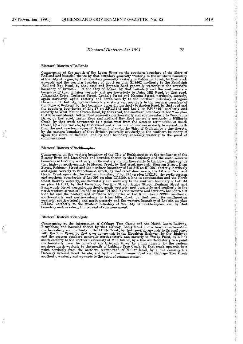
27 November, 1991] QUEENSLAND GOVERNMENT GAZETTE, No. 85
Electoral Districts Act 1991 73
Elcchmtl District of Redlands
Commencing at the mouth of the Logan River on the southern boundary of the Shire of Redland and bounded thence by that boundary generally westerl1'.' to the southern boundary of the City of Logan, by that boundary generally westerly to California Creek, by that creek upwards and the western boundary of Lot 2 on plan SL3962 northerly to the Beenleigh -Red.land Bay Road, by that road and Bryants Road generally westerly to the southern boundary of Division 6 of the City of Logan, by that boundary and the south-western boundary of that division westerly and north-westerly to Daisy Hill Road, by that road, Allamanda Drive, Coolcrest Street, Lyndale Street and Marana Street, northerly, easterly, again northerly, again easterly and north-easterly to the northern boundary of again Division 6 of that city, by that boundary easterly and northerly to the western boundary of the Shire ofRedland, by that boundary generally northerly to Avalon Road, by that road and the southern boundaries of Lot 27 on RP113142 and Lot 1 on RP184461 northerly and easterly to West Mount Cotton Road, by that road, the southern boundary of Lot 2 on plan SL12814 and Mount Cotton Road generally north-easterly and south-easterly to Woodlands Drive, by that road, Taylor Road and Redland Bay Road generally northerly to Hilliards Creek, by that creek downwards to a point west from the western termination of South Street, by a line thereto, by that street and a line in continuation easterly to a point north from the north-eastern corner of Division 5 of again the Shire of Redland, by a line thereto, by the eastern boundary of that division generally southerly to the southern boundary of again the Shire of Redland; and by that boundary generally westerly to the point of commencement.
Commencing on the western boundary of the City of Rockhampton at the confluence of the Fitzroy River and Lion Creek and bounded thence by that boundary and the north-western boundary of that city northerly, north-westerly and north-easterly to the Bruce Highway, by that highway south-easterly to l\-foores Creek, by that creek upwards, Simpson Street, Dean Street, Robinson Street and the northern boundary of Lot 345 on RP9591 easterly, northerly and again easterly to French.mans Creek, by that creek downwards, the Fitzroy River and Ga vial Creek upwards, the southern boundary of Lot 396 on plan LN2184, the south-eastern and southern boundaries of Lot 395 on plan LN2189, a line in continuation and the North Coast Railway westerly, south-westerly and northerly to the southern boundary of Lot 344 on plan LN1611, by that boundary, Caroline Street, Agnes Street, Denham Street and Pennycuick Street \Vesterly, northerly, south-westerly, north-westerly and southerly to the north-western corner of Lot 353 on plan LN1642, by the western and southern boundaries of that lot and the eastern and southern boundaries of Lot 6 on plan LN2936 southerly, south-easterly and north-westerly to Nine Mile Road, by that road, its continuation westerly, south-westerly and north-westerly and the western boundary of Lot 284 on plan LN1487 northerly to the western boundary of the City of Rockhampton; and by that boundary north-easterly to the point of commencement.
Elcchmtl District uf Sandgate
Commencing at the intersection of Cabbage Tree Creek and the North Coast Railway, Fitzgibbon, and bounded thence by that railway, Lacey Road and a line in continuation north-westerly and northerly to Bald Hills Creek, by that creek downwards to its confluence with the Pine River, by that river downwards to the Houghton Highway, by that highway and the eastern seashore generally north-easterly and easterly to Woody Point, by a line south-easterly to the northern extremity of Mud Island, by a line south-westerly to a point north-easterly from the mouth of the Brisbane River, by a line thereto, by the eastern seashore north-westerly to the mouth of Cabbage Tree Creek, by that creek upwards to a point northerly from the northern termination of Muller Road, by a line crossing the Gateway Arterial Road thereto; and by that road, Beams Road and Cabbage Tree Creek southerly, \Vesterly and upwards to the point of commencement.
1419
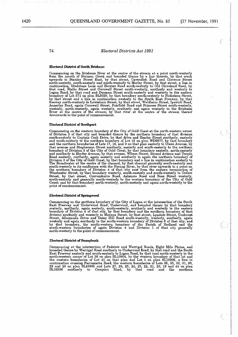
1420 QUEENSLAND GOVERNMENT GAZETTE, No. 85 [27 November, 1991
74 Electoral Districts Act 1991
Electoral District of South Brisbane
Commencing on the Brisbane River at the centre of the stream at a point north-westerly from the mouth of Norman Creek and bounded thence by a line thereto, by that creek upwards to Stanley Street East, by that street, Cavendish Road and Clarence Street north-easterly, south-easterly and south-westerly to Morley Street, by that street, a line in continuation, Gladstone Lane and Harries Road south-easterly to Old Cleveland Road, by that road, Rialto Street and Cornwall Street south-westerly, southerly and westerly to Logan Road, by that road and Denman Street south-easterly and westerly to the eastern boundary of Lot 571 on plan SL5020, by that boundary south-easterly to Nicholson Street, by that street and a line in continuation westerly to the South East Freeway, by that freeway north-westerly to Lewisham Street, by that ~trc>Pt, W11ldheim Street, Ipswich Road, Annerley Road, again Cornwall Street, Fairfield Road and Princess Street south-westerly, westerly, north-westerly, again westerly, southerly and again westerly to the Brisbane River at the centre of the stream; by that river at the centre of the stream thereof downwards to the point of commencement.
Electoral District of Southport
Commencing on the western boundary of the City of Gold Coast at the north-western corner of Division 2 of that city and bounded thence by the northern boundary of that division south-easterly to Captain Cook Drive, by that drive and Kendor Street southerly, easterly and south-easterly to the northern boundary of Lot 18 on plan WD6577, by that boundary and the northern boundaries of Lots 17, 16, and 9 on that plan easterly to Olsen Avenue, by that avenue and Stephenson Street southerly, easterly and south-easterly to the northern boundary of Division 3 of the City of Gold Coast,.by that boundary easterly, north-easterly and southerly to Harder Avenue, by that avenue, Wilson Street, Second Avenue and Turpin Road easterly, northerly, again easterly and southerly to again the northern boundary of Division 3 of the City of Gold Coast, by that boundary and a line in continuation easterly to The Broadwater at the centre of the channel, by that channel generally south-easterly and south-westerly to its confluence with the Nerang River, by that river upwards to a point on the southern boundary of Division 4 of that city east from the eastern termination of Winchester Street, by that boundary westerly, south-easterly and south-westerly to Cotlew Street, by that street, Currumburra Road, Ashmore Road and Ross Street westerly south-easterly and generally south-westerly to the western boundary of the City of Gold Coast; and by that boundary north-westerly, north-easterly and again north-westerly to the point of commencement.
Electoral District of Spriogwood
Commencing on the northern boundary of the City of Logan at the intersection of the South East Freeway and Underwood Road, Underwood, and bounded thence by that boundary easterly, northerly, again easterly, south-easterly, southerly and westerly to the eastern boundary of Division 4 of that city, by that boundary and the southern boundary of that division southerly and westerly to 1iarana Street, by that street, Lyndale Street, Coolcrest Street, Allamanda Drive and Daisy Hi11 Road south-westerly, westerly, southerly, again westerly and again southerly to the south-western boundary of Division 6 of that city; and by that boundary, the south-western boundary of the Parish of Red.land and the south-western boundaries of again Division 4 and Division 1 of that city generally north-westerly to the point of commencement.
Electoral District of Sunnybank
Commencing at the intersection of Padstow and Warrigal Roads, Eight Mile Plains, and bounded thence by Warrigal Road southerly to Underwood Road, by that road and the South East Freeway easterly and south-easterly to Logan Road, by that road north-westerly to the north-western corner of Lot 36 on plan SL10904, by the western boundary of that lot and the western boundaries of Lot 41 on that plan and Lot 1 on plan SL10905, a line in continuation crossing Parramatta Road, the western boundaries of Lots 35, 33, 32, 31, 30, 29 and 28 on plan SL10905 and Lots 27, 26, 25, 24, 23, 22, 21, 20, 19 and 44 on plan SL10906 southerly to Compton Road, by that road and the southern
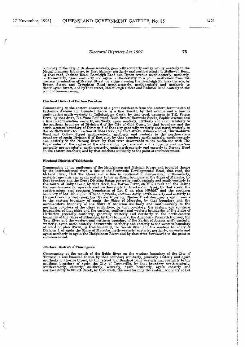
27 November, 1991] QUEENSLAND GOVERNMENT GAZETTE, No. 85
Electoral Districts Act 1991 75
boundary of the City of Brisbane westerly, generally southerly and generally westerly to the Mount Lindesay Highway, by that highway northerly and north-westerly to Hellawell Road, by that roadj Jackson Road, Beenleigh Road and Dyson Avenue north-easterly, northerly, north-wester y, again northerly and again north-westerly to a point south-west from the western termination of Everest Street, by a line crossing the Beenleigh Railway thereto, by Breton Street and Troughton Road north-westerly, north-easterly and northerly to Sherrington Street; and by that street, McCullough Street and Padstow Road easterly to the point of commencement.
Electoral District o£ 8m:fura Paradise
Commencing on the eastern seashore at a point north-east from the eastern termination of Britannia Avenue and bounded thence by a line thereto, by that avenue and a line in continuation south-westerly to Tallebudgera Creek, by that creek upwards to T.E. Peters Drive, by that drive, Rio Vista Boulevard, Rudd Street, Bermuda Street, Sophie Avenue and a line in continuation westerly, southerly, again westerly, northerly and again westerly to the southern boundary of Division 6 of the City of Gold Coast, by that boundary and the south-western boundary of Division 5 of that city generally westerly and north-westerly to the south-western termination of Ross Street, by that street, Ashmore Road, Curromburra Road and Cotlew Street north-easterly, northerly and easterly to the north-eastern boundary of again Division 5 of that city, by that boundary north-easterly, north-westerly and easterly to the Nerang River, by that river downwards to its confluence with The Broadwater at the centre of the channel, by that channel and a line in continuation generally north-easterly, north-westerly, again north-easterly and easterly to Nerang Head on the eastern seashore; and by that seashore southerly to the point of commencement.
Electoral District a£ Tablelands
Commencing at the confluence of the Hodgkinson and Mitchell Rivers and hounded thence by the lastmentioned river, a line to the Peninsula Developmental Road, that road, the McLeod River, Half Ton Creek and a line in continuation downwards, north-easterly, easterly, upwards and again easterly to the northern boundary of the Shire of Mareeba, by that boundary and the Great Dividing Range generally south-easterly and south-westerly to the source of Oaky Creek, by that creek, the Barron River, 36 Mile Creek and the Cairns Railway downwards, upwards and north-easterly to Blackwater Creek, by that creek, the south-western and southern boundaries of Lot C on plan NR6967 and the southern boundary of Lot 100 on plan NR2909 upwards, south-easterly.!. north-easterly and easterly to Davies Creek, by that creek, the Clohesy River and Shoteel ureek downwards and upwards to the eastern boundary of again the Shire of Mareeba, by that boundary and the north-eastern boundary of the Shire of Atherton southerly and south-easterly to the northern boundary of the Shire of Eacham, by that boundary, the eastern and southern boundaries of that shire and the eastern, southern and western boundaries of the Shire of Herberton generally southerly, generally westerly and northerly to the north-eastern boundary of the Shire of Etheridge, by that boundary, the Almaden - Forsayth Railway, the Tate River and the western and northern boundary of the Parish of Akama north-easterly, westerly, again north-easterly, downwards, northerly and easterly to the western boundary of Lot 4 on Flan BW18, by that boundary, the Walsh River and the western boundary of Division 1 o again the Shire of Mareeba north-westerly, easterly, northerly, upwards and again northerly to again the Hodgkinson River; and by that river downwards to the point of commencement.
Electoral District o£Thuringuwa
Commencing at the mouth of the Bohle River on the western boundary of the City of Townsville and bounded thence by that boundary southerly, generally easterly and again southerly to Charles Street, by that street and Bamford Lane westerly and southerly to the southern boundary of again the City of Townsville, by that boundary- south-westerly south-easterly, easterly, southerly, westerly, again southerly, agam easterly and north-easterly to Stuart Creek, by that creek, the road forming the eastern boundary of Lot
1421
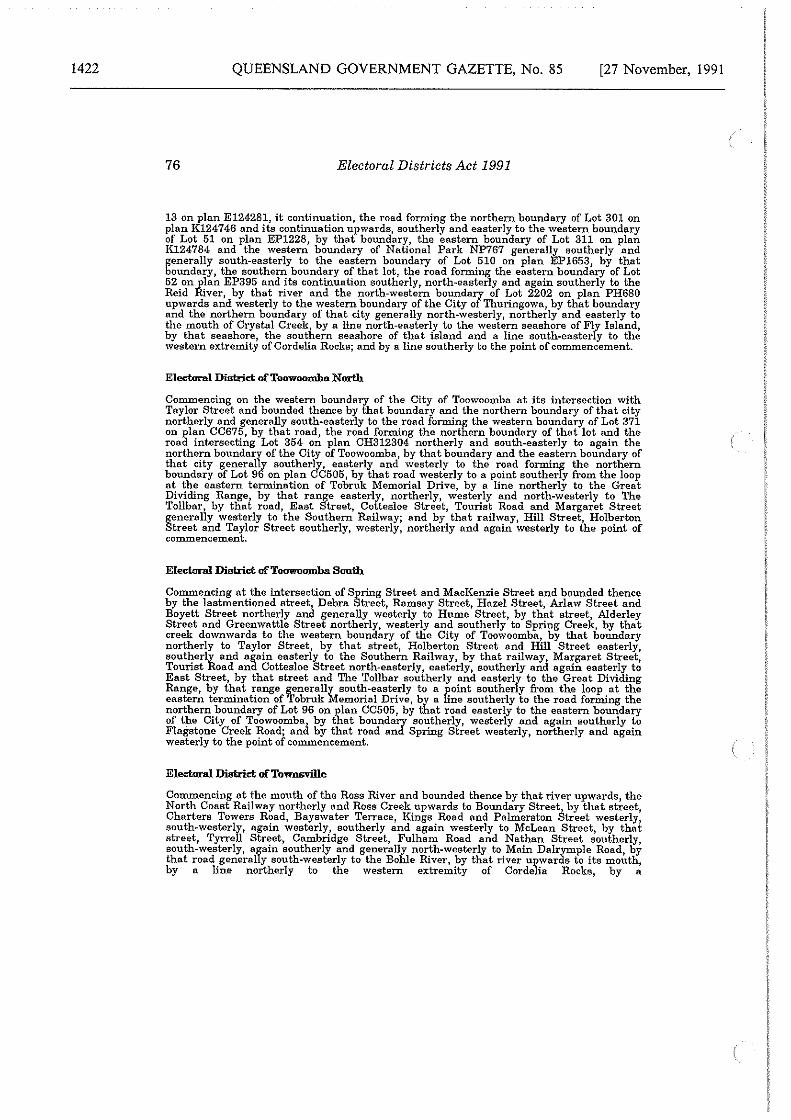
1422 QUEENSLAND GOVERNMENT GAZETTE, No. 85 [27 November, 1991
76 Electoral Districts Act 1991
13 on plan E124281, it continuation, the road forming the northern boundary of Lot 301 on plan K124746 and its continuation upwards, southerly and easterly to the \Vestem boundary of Lot 51 on plan EP1228, by that bonndary, the eastern boundary of Lot 311 on plan K124784 and the western boundary of National Park NP767 generally southerly and generally south-easterly to the eastern boundary of Lot 510 on plan EP1653, by that boundary, the southern boundary of that lot, the road forming the eastern boundary of Lot 52 on plan EP395 and its continuation southerly, north-easterly and again southerly to the Reid River, by that river and the north-western boundary of Lot 2202 on plan PH680 up\vards and westerly to the western boundary of the City of Thuringowa, by that boundary and the northern boundary of that city generally north-\vesterly, northerly and easterly to the mouth of Crystal Creek~ by a line north-easterly to the western seashore of Fly Island, by that seashore, the southern seashore of that island and a line south-easterly to the western extremity of Cordelia Rocks; and by a line southerly to the point of commencement.
Electmnl District ofToowoomba North
Commencing on the western boundary of the City of Toowoomba at its intersection with Taylor Street and bounded thence by that boundary and the northern boundary of that city northerly and generally south-easterly to the road forming the western boundary of Lot 371 on plan CC675, by that road, the road forming the northern boundary of that lot and the road intersecting Lot 354 on plan CH312304 northerly and south-easterly to again the northern boundary of the City of Toowoomba, by that boundary and the eastern boundary of that city generally southerly, easterly and \Vesterly to the road forming the northern boundary of Lot 96 on plan CC505, by that road westerly to a point southerly from the loop at the eastern termination of Tobruk Memorial Drive, by a line northerly to the Great Dividing Range, by that range easterly, northerly, westerly and north-westerly to The Tollbar, by that road, East Street, Cottesloe Street, Tourist Road and Margaret Street generally westerly to the Southern Railway; and by that rail\vay, Hill Street, Holberton Street and Taylor Street southerly, \Vesterly, northerly and again westerly to the point of commencement.
Electmnl District ofToowoomba South
Commencing at the intersection of Spring Street and MacKenzie Street and bounded thence by the lastmentioned street, Debra Street, Ramsay Street, Hazel Street, Arlaw Street and Boyett Street northerly and generally westerly to Hume Street, by that street, Alderley Street and Greenwattle Street northerly, westerly and southerly to Spring Creek, by that creek do\vnwards to the western boundary of the City of Toowoomba, by that boundary northerly to Taylor Street by that street, Holberton Street and Hill Street easterly, southerly and again easterly to the Southern Railway, by that railway Margaret Street, Tourist Road and Cottesloe Street north-easterly, easterly, southerly and again easterly to East Street, by that street and The Tollbar southerly and easterly to the Great Dividing Range, by that range ¥.enerally south-easterly to a point southerly from the loop at the eastern termination of robruk Memorial Drive, by a line southerly to the road forming the northern boundary of Lot 96 on plan CC505, by that road easterly to the eastern boundary of the City of Toowoomba, by that boundary southerly, westerly and again southerly to Flagstone Creek Road; and by that road and Spring Street westerly, northerly and again westerly to the point of commencement.
Electmnl District ofTownsville
Commencing at the mouth of the Ross River and bounded thence by that river upwards, the North Coast Railway northerly and Ross Creek upwards to Boundary Street, by that street, Charters Towers Road, Bays\vater Terrace, Kings Road and Palmerston Street westerly, south-westerly, again westerly, southerly and again westerly to McLean Street, by that street, Tyrrell Street, Cambridge Street, Fulham Road and Nathan Street southerly, south-westerly, again southerly and generally north-westerly to Main Dalrymple Road, by that road generally south-westerly to the Bohle River, by that river upwards to its mouth, by a line northerly to the western extremity of Cordelia Rocks, by a
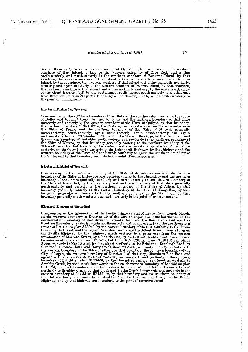
27 November, 1991] QUEENSLAND GOVERNMENT GAZETTE, No. 85
Electoral Districts Act 1991 77
line north-westerly to the southern seashore of Fly Island, by that seashore, the western seashore of that island, a line to the western extremity of Dido Rock and a line north-westerly and north-easterly to the southern seashore of Fantome Island..! by that seashore, the western seashore of that island, a line to the southern.seashore or Orpheus Island, by that seashore, the western seashore of that island and a line generally northerly, westerly and again northerly to the western seashore of Pelorus Island, by that seashore, the northern seashore of that island and a line northerly and east to the eastern extremity of the Great Banier Reef, by the easternmost reefs thereof south-easterly to a point east from Bremner Point on Magnetic Island, by a line thereto; and by a line south-westerly to the point of commencement.
Electornl District ofWarttgo
Commencing on the southern boundary of the State at the south-western corner of the Shire of Bulloo and bounded thence by that boundary and the northern boundary of that shire northerly and easterly to the western boundary of the Shire of Quilpie, by that boundary, the northern boundary of that shire, the western, north-western and northern boundaries of the Shire of Tambo and the northern boundary of the Shire of Murweh generally north-easterly, south-easterly, again north-easterly, again south-easterly and again north-easterly to the north-eastern boundary of the Shire of Booringa, by that boundary and the eastern boundary of that shire south-easterly and southerly to the northern boundary of the Shire of Warroo, by that boundary generally easterly to the northern boundary of the Shire of Tara, by that boundary, the eastern and south-eastern boundaries of that shire easterly, southerly and north-westerly to the Leichhardt Highway, by that highway and the western boundary of the Town of Goondiwindi southerly to again the southern boundary of the State; and by that boundary westerly to the point of commencement.
Electornl District ofWanrick
Commencing on the southern boundary of the State at its intersection with the western boundary of the Shire of Inglewood and bounded thence by tha i boundary and the northern boundary of that shire generally northerly and north-easterly to the western boundary of the Shire of Rosenthal, by that boundary and northern boundary of that shire generally north-easterly and easterly to the northern boundary of the Shire of Allora, by that boundary generally easterly to the eastern boundary of the Shire of Glengallan, by that boundary generally south-easterly to the southern boundary of the State; and by that boundary generally south-westerly and north-westerly to the point of commencement.
Electornl District ofWaterfiml
Commencing at the intersection of the Pacific Highway and Murra.ya Road, Tanah Merah, on the western boundary of Division 10 of the City of Logan and bounded thence by the north-western boundary of that division, Bryants Road and the Beenleigh - Red.land Bay Road south-easterly, easterly, again south-easterly and again easterly to the north-eastern corner of Lot 199 on plan SL3962, by the eastern boundary of that lot southerly to California Creek, by that creek and the Logan River down,vards and the Albert River upwards to again the Pacific Highway, by that highway north-westerly to a point east from the eastern termination of Martens Street, by a line thereto, by that Street, Main Street, the southern boundaries of Lots 2 and 1 on RP97496, Lot 10 on RP79320, Lot 1 on RP198161 and Milne Street westerly to Kent Street, by that street northerly to the Brisbane M Beenleigh Road, by that road, Gardiner Road and Dairy Creek Road westerly, southerly and again westerly to the western boundary of the Shire of Albert, by that boundary, the southern boundary of the City of Logan, the western boundary of Division 9 of that city, Chambers Flat Road and again the Brisbane - Beenleigh Road westerly, north-easterly and northerly to the southern boundary of Lot 26 on plan SL12646, by that boundary and its continuation westerly to Scrubby Creek, by that creek downwards to the south-western boundary of Lot 448 on plan SL10674, by that boundary and the western boundary of that lot north-westerly and northerly to Scrubby Creek, by that creek and Slacks Creek do\vnwards and upwards to the eastern boundary of Lot 83 on RP132110, by that boundary and the southern boundary of that lot southerly and \Vesterly to Meakin Road, by that road northerly to the Pacific Highway; and by that highway south-easterly to the point of commencement.
1423
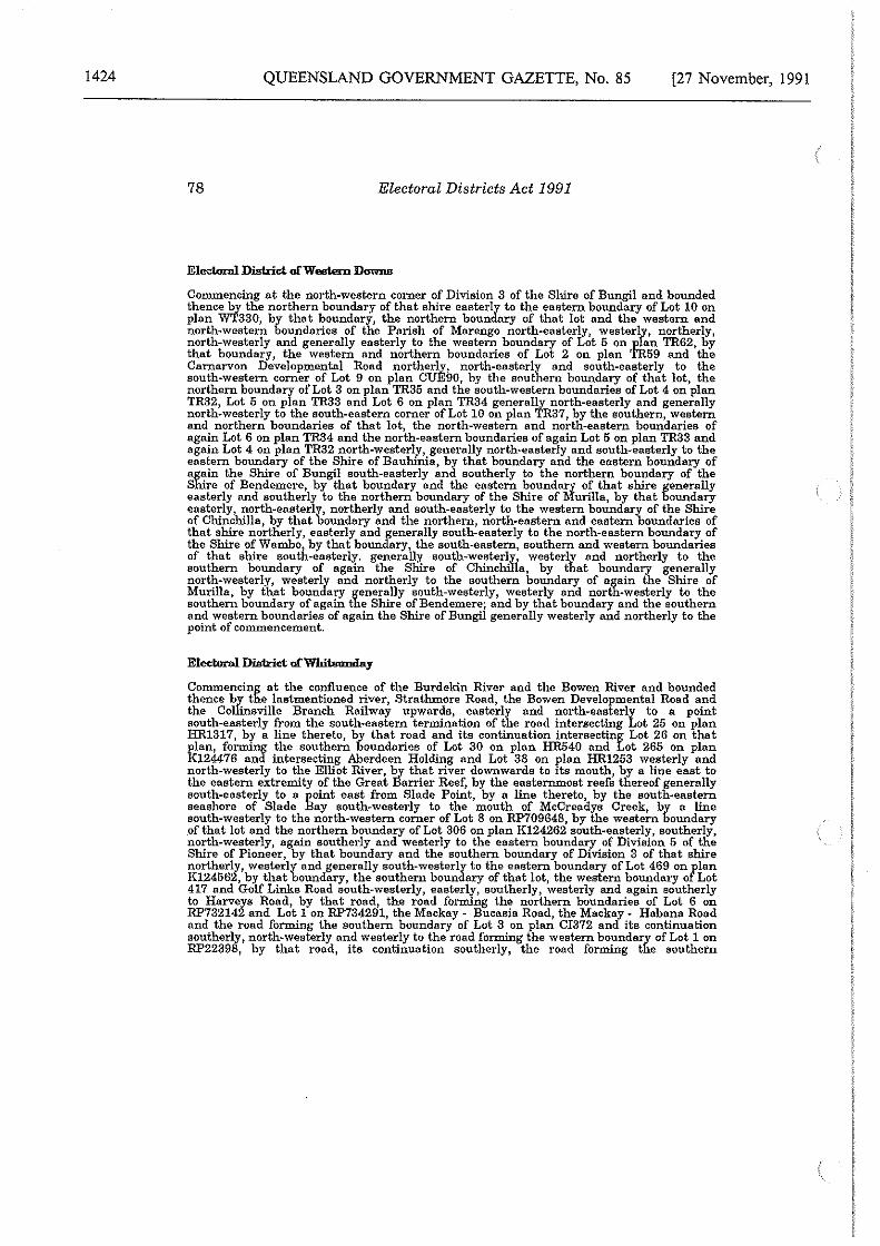
1424 QUEENSLAND GOVERNMENT GAZETTE, No. 85 [27 November, 1991
78 Electoral Districts Act 1991
Eledmal District of Western Downs
Commencing at the north-western corner of Division 3 of the Shire of Bungil and bounded thence by the northern boundary of that ehlre easterly to the eastern boundary of Lot 10 on plan WT330, by that boundary, the northern boundary of that lot and the western and north-western boundaries of the Parish of Marengo north-easterly, westerly, northerly, north-westerly and generally easterly to the western boundary of Lot 5 on plan TR62, by that boundary, the western and northern boundaries of Lot 2 on plan TR59 and the Carnarvon Developmental Road northerly, north-easterly and south-easterly to the south-western corner of Lot 9 on plan CUE90, by the southern boundary of that lot, the northern boundary of Lot 3 on plan TR35 and the south-western boundaries of Lot 4 on plan TR32, Lot 5 on plan TR33 and Lot 6 on plan TR34 generally north-easterly and generally north-westerly to the south-eastern corner of Lot 10 on plan TR37, by the southern, western and northern boundaries of that lot, the north-western and north-eastern boundaries of again Lot 6 on plan TR34 and the north-eastern boundaries of again Lot 5 on plan TR33 and again Lot 4 on plan TR32 north-westerly, generally north-easterly and south-easterly to the eastern boundary of the Shire of Bauhinia, by that boundary and the eastern boundary of again the Shire of Bungil south-easterly and southerly to the northern boundary of the Shire of Bendemere, by that boundary and the eastern boundary of that shire generally easterly and southerly to the northern boundary of the Shire of Murilla, by that boundary easterly, north-easterly, northerly and south-easterly to the western boundary of the Shire of Chinchilla, by that boundary and the northern, north-eastern and eastern boundaries of that shire northerly, easterly and generally south-easterly to the north-eastern boundary of the Shire ofWambo by that boundary, the south-eastern, southern and western boundaries of that shire south-easterly. generally south-westerly! westerly and northerly to the southern boundary of again the Shlre of ChinchiI a, by that boundary generally north-westerly, westerly and northerly to the southern boundary of again the Shire of Murilla, by that boundary generally south-westerly, westerly and north-westerly to the southern boundary of again the Shire of Bendemere; and by that boundary and the southern and western boundaries of again the Shire of Bungil generally westerly and northerly to the point of commencement.
Eledmal District of Whitsunday
Commencing at the confluence of the Burdekin River and the Bowen River and bounded thence by the lastmentioned river, Strathmore Road, the Bowen Developmental Road and the Collinsville Branch Railway upwards, easterly and north-easterly to a point south-easterly from the south-eastern termination of the road intersecting Lot 25 on plan HR1317, by a line thereto, by that road and its continuation intersecting Lot 26 on that plan, forming the southern boundaries of Lot 30 on plan HR540 and Lot 265 on plan K124476 and intersecting Aberdeen Holding and Lot 38 on plan HR1253 westerly and north-westerly to the Elliot River, ~y that river downwards to its mouth, by a line east to the eastern extremity of the Great Barrier Reef, by the eastern.most reefs thereof generally south-easterly to a point east from Slade Point, by a line thereto, by the south-eastern seashore of Slade Bay south-westerly to the mouth of McCreadys Creek, by a line south-westerly to the north-western corner of Lot 8 on RP709648, by the western boundary of that lot and the northern boundary of Lot 306 on plan K124262 south-easterly, southerly, north-westerly, again southerly and westerly to the eastern boundary of Division 5 of the Shire of Pioneer, by that boundary and the southern boundary of Division 3 of that shire northerly, westerly and generally south-westerly to the eastern boundary of Lot 469 onflan K124562, by that boundary, the southern boundary of that lot, the western boundary o Lot 417 and Golf Linke Road south-westerly, easterly, southerly, westerly and again southerly to Harveys Road, by that road, the road forming the northern boundaries of Lot 6 on RP732142 and Lot 1 on RP734291, the Mackay - Bucasia Road, the Mackay - Habana Road and the road forming the southern boundary of Lot 3 on plan Cl372 and its continuation southerly, north-westerly and westerly to the road forming the \Vestern boundary of Lot 1 on RP22398, by that road, its continuation southerly, the road forming the southern
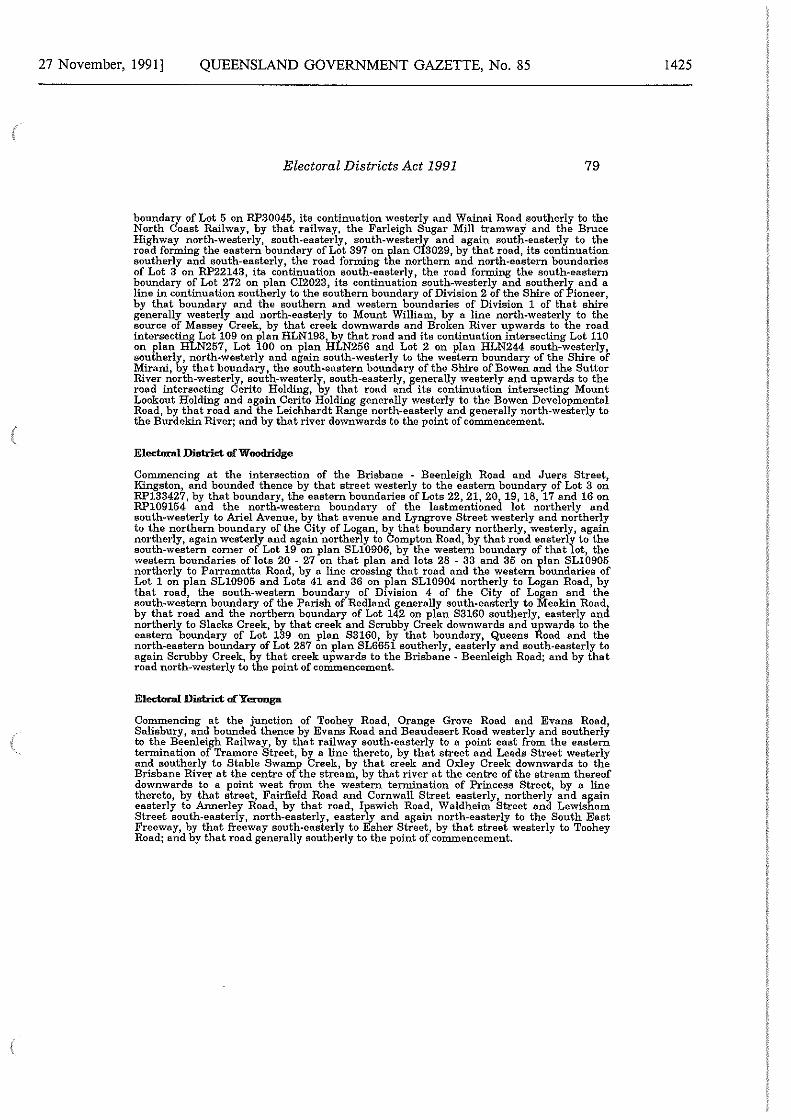
27 November, 1991] QUEENSLAND GOVERNMENT GAZETTE, No. 85
Electoral Districts Act 1991 79
boundary of Lot 5 on RP30045, its continuation westerly and Wainai Road .southerly to the North Coast Railway, by that railway, the Farleigh Sugar Mill tramway and the Bruce Highway north-westerly, south-easterly, south-westerly and again south-easterly to the road forming the eastern boundary of Lot 397 on plan 013029, by that road, its continuation southerly and south-easterly, the road forming the northern and north-eastern boundaries of Lot 3 on RP22143, its continuation south-easterly, the road forming the south-eastern boundary of Lot 272 on plan Cl2023, its continuation south-westerly and southerly and a line in continuation southerly to the southern boundary of Division 2 of the Shire of Pioneer, by that boundary and the southern and western boundaries of Division 1 of that shire generally westerly and north-easterly to Mount William, by a line north-westerly to the source of Massey Creek, by that creek downwards and Broken River upwards to the road intersecting Lot 109 on plan HLN198i..!>Y that road and its continuation intersecting Lot 110 on plan HLN257, Lot 100 on plan HLN256 and Lot 2 on plan HLN244 south-westerly, southerly, north-westerly and again south-westerly to the western boundary of the Shire of Mirani, by that boundary, the south-eastern boundary of the Shire of Bowen and the Sutter River north-westerly, south-westerly, south-easterly, generally westerly and upwards to the road intersecting Cerito Holding, by that road and its continuation intersecting Mount Lookout Holding and again Cerito Holding generally westerly to the Bo\ven Developmental Road, by that road and the Leichhardt Range north-easterly and generally north-westerly to the Burdekin River; and by that river down\vards to the point of commencement.
Electoral District of Woodridge
Commencing at the intersection of the Brisbane - Beenleigh Road and Juers Street, Kingston, and bounded thence by that street westerly to the eastern boundary of Lot 3 on RP133427, by that boundary, the eastern boundaries of Lots 22, 21, 20, 19, 18, 17 and 16 on RP109154 and the north-western boundary of the lastmentioned lot northerly and south-westerly to Ariel Avenue, by that avenue and Lyngrove Street westerly and northerly to the northern boundary of the City of Logan, by that boundary northerly, westerly, again northerly, again westerly and again northerly to Compton Road, by that road easterly to the south-western corner of Lot 19 on plan SL10906, by the western boundary of that lot, the western boundaries of lots 20 - 27 on that plan and lots 28 - 33 and 35 on plan SL10905 northerly to Parramatta Road, by a line crossing that road and the western boundaries of Lot 1 onJ'.lan SL10905 and Lots 41 and 36 on plan SL10904 northerly to Logan Road, by that roa , the south-western boundary of Division 4 of the City of Logan and the south-western boundary of the Parish of Redland generally south-easterly to Meakin Road: by that road and the northern boundary of Lot 142 on plan 83160 southerly, easterly anct northerly to Slacks Creek, by that creek and Scrubby Creek downwards and upwards to the eastern boundary of Lot 139 on plan S3160, by that boundary, Queens Road and the north-eastern boundary of Lot 287 on plan SL6651 southerly, easterly and south-easterly to again Scrubby Creek, by that creek upwards to the Brisbane - Beenleigh Road; and by that road north-westerly to the point of commencement.
Electoral District ofYcnmga
Commencing at the junction of Toohey Road, Orange Grove Road and Evans Road, Salisbury, and bounded thence by Evans Road and Beaudesert Road westerly and southerly to the Beenleigh Railway, by that railway south-easterly to a point east from the eastern termination of Tremore Street, by a line thereto, by that street and Leeds Street westerly and southerly to Stable Swamp Creek, by that creek and Oxley Creek down\vards to the Brisbane River at the centre of the stream, by that river at the centre of the stream thereof downwards to a point west from the western termination of Princess Street, by a line thereto, by that street, Fairfield Road and Cornwall Street easterly, northerly and again easterly to Annerley Road, by that road, Ipswich Road, Waldheim Street and Lewisham Street south-easterly, north-easterly, easterly and again north-easterly to the South East Freeway, by that freeway south-easterly to Esher Street, by that street westerly to Toohey Road; and by that road generally southerly to the point of commencement.
1425
1426
80
QUEENSLAND GOVERNMENT GAZETTE, No. 85
Electoral Districts Act 1991
DETERMINATION OF QUEENSLAND ELECTORAL DISTRICTS
NOVEMBER 1991
REGIONAL MAPS
REGION 1 - Queensland REGION 2 - Cairns REGION 3 - Townsville REGION 4 - Mackay REGION 5 - Rockhampton REGION 6 - Hervey Bay REGION 7 - Darling Downs REGION 8 - Sunshine Coast REGION 9 - Pine Rivers REGION 10 - Ipswich REGION 11 - Brisbane North REGION 12 - Brisbane South REGION 13 - Gold Coast
[27 November, 1991
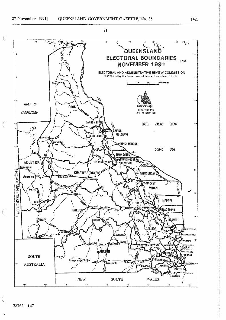
27 November, 1991]
·~· GULF OF
CARPENTARIA
SOUTH ,.
AUSTRALIA
,._ ..
128762-147
QUEENSLAND GOVERNMENT GAZETTE, No. 85
NEW
81
,.. '"00
QUEENSLAND ELECTORAL BOUNDARIES
NOVEMBER 1991
,. ..
ELECTORAL AND ADMINISTRATIVE REVIEW COMMISSION © Prepared by the Department of lands, Queensland, 1991.
Cunnamulla
I • SOUTH
,_ __ •;;:oo __ .. 200;_.....;;;m K•1ome11t~
M'lt'OOp © QUEENSLAND
DEPT OF LANDS 1991
SOUTH PACIFIC OCENI
CORAL SEA
.•. .•.
1427
..
...
..
,..
. •.
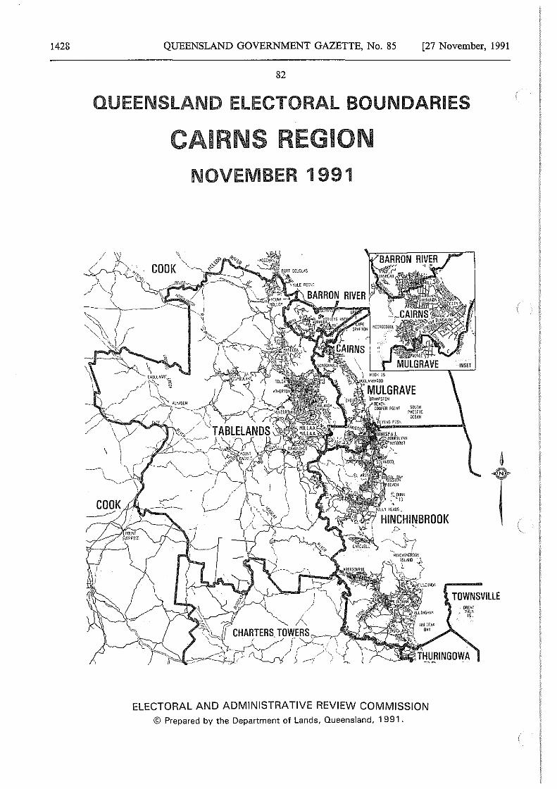
1428 QUEENSLAND GOVERNMENT GAZETTE, No. 85 [27 November, 1991
82
QUEENSLAND ELECTORAL BOUNDARIES
CAIRNS REGION NOVEMBER 1991
ELECTORAL AND ADMINISTRATIVE REVIEW COMMISSION © Prepared by the Department of Lands, Queensland, 1 991.
TOWNSVILLE
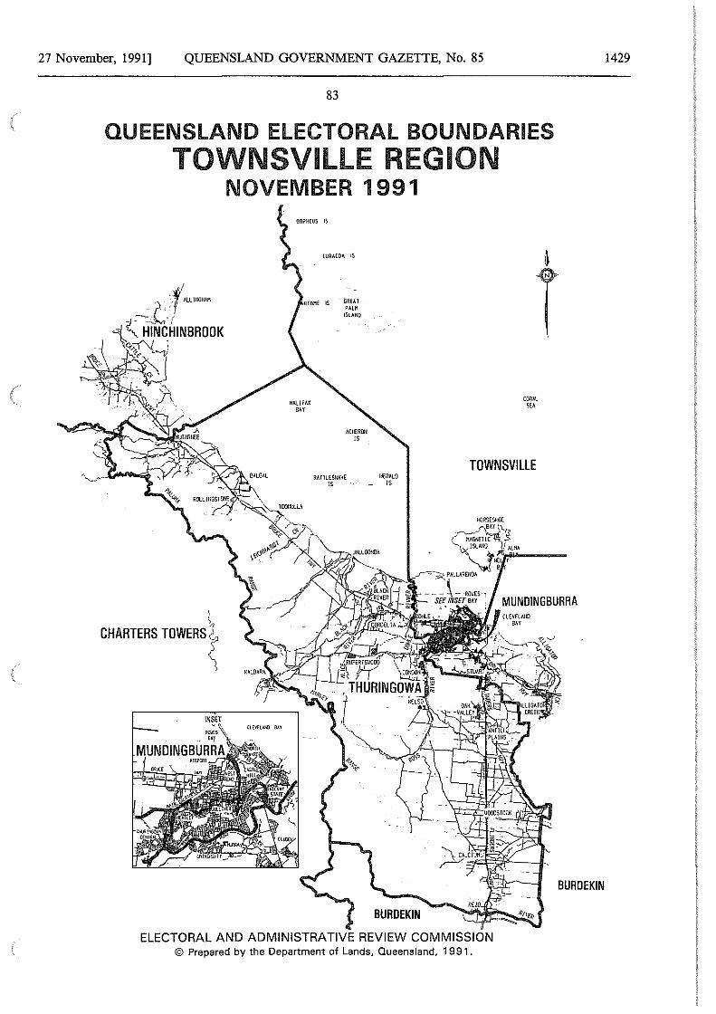
27 November, 1991] QUEENSLAND GOVERNMENT GAZETTE, No. 85
83
QUEENSLAND ELECTORAL BOUNDARIES TOWNSVlllE REGION
NOVEMBER 1991
\ CHARTERS TOWERS~
INSET ~s~ .. ,
MUNOINGBURRA
TOWNSVILLE RATTLESNAHE HCRALO
JS IS
BURDEKIN
ELECTORAL AND ADMINISTRATIVE REVIEW COMMISSION © Prepared by the Department of Lands, Queensland, 1991.
1429
BURDEKIN
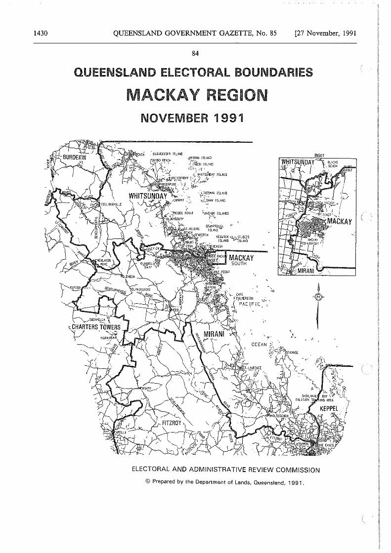
1430 QUEENSLAND GOVERNMENT GAZETTE, No. 85 [27 November, 1991
84
QUEENSLAND ELECTORAL BOUNDARIES
MACKAY REGION NOVEMBER 1 991
,_ CAPE -! PAl11ERSTOll _ "
i"ll~i;;'!<l, {"PAC!.~IC .v~. L-'c'l"""-d'\
··'
ELECTORAL AND ADMINISTRATIVE REVIEW COMMISSION
© Prepared by the Department of Lands, Queensland, 1991.
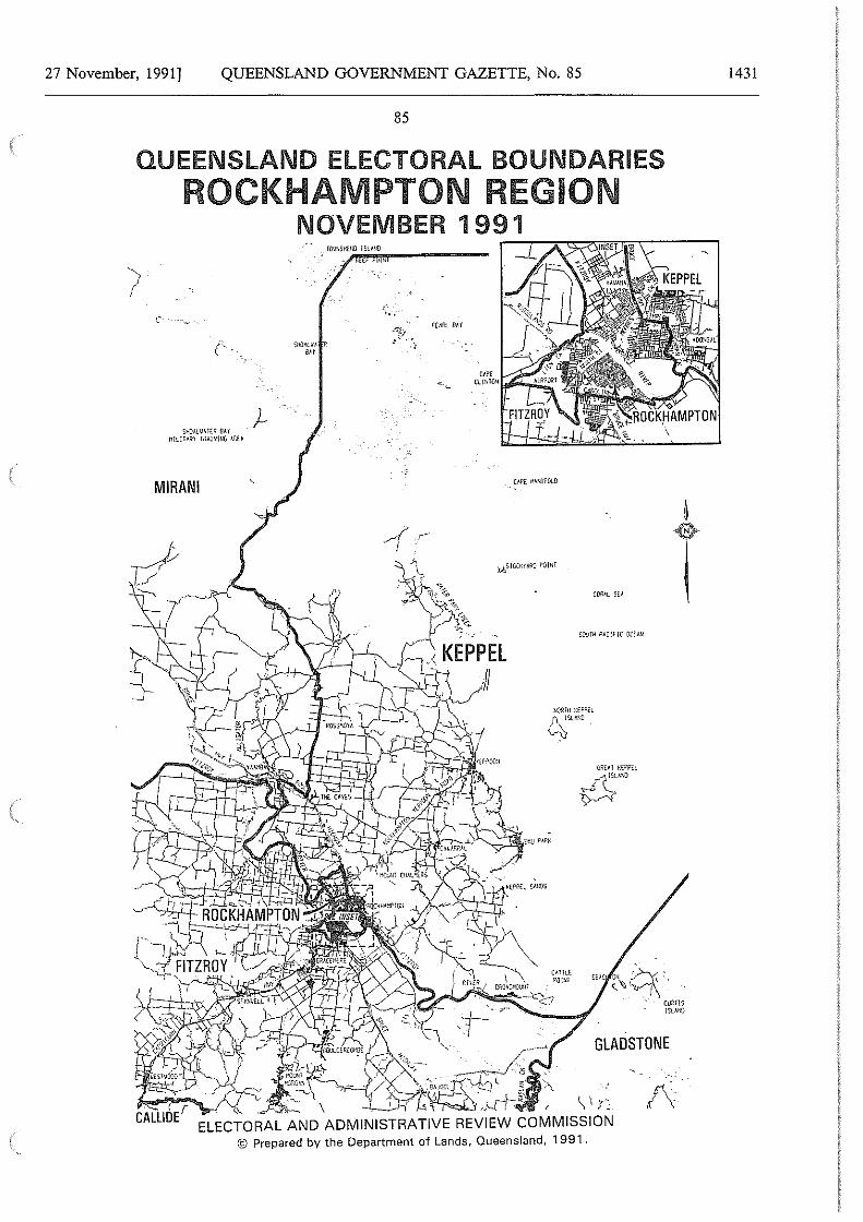
27 November, 1991] QUEENSLAND GOVERNMENT GAZETTE, No. 85
85
QUEENSLAND ELECTORAL BOUNDARIES ROCKHAMPTON REGION
NOVEMBER 1991
SHIJAlVA1£R flAY Mllllmr rnA!•!lfiG 1.Ru
MIRANI
... -
SCVIH PAC!HC (l(fAN
BEA[~\,'.~·, - cufll1s
l$~A>.!}
GLADSTONE
/\
1431
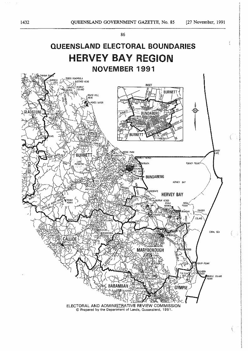
1432 QUEENSLAND GOVERNMENT GAZETTE, No. 85 [27 November, 1991
86
QUEENSLAND ELECTORAL BOUNDARIES
HERVEY BAY REGION NOVEMBER 1991
HERVEY BAY
ELECTORAL AND ADMINISTRATIVE REVIEW COMMISSION © Prepared by the Department of Lands, Queensland, 1991.
4
T
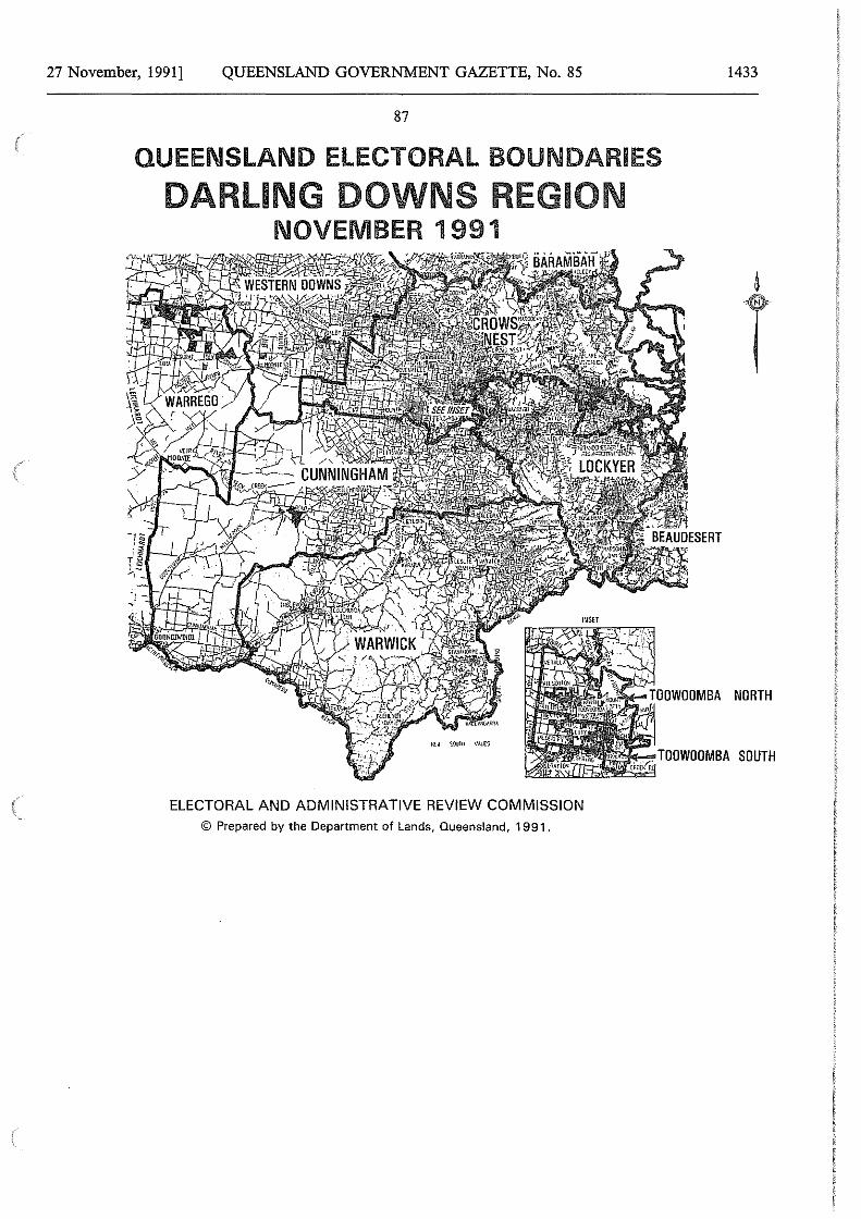
27 November, 1991] QUEENSLAND GOVERNMENT GAZETTE, No. 85
87
QUEENSLAND ELECTORAL BOUNDARIES
DARLING DOWNS REGION NOVEMBER 1991
ELECTORAL AND ADMINISTRATIVE REVIEW COMMISSION © Prepared by the Department of Lands, Queensland, 1991.
1433
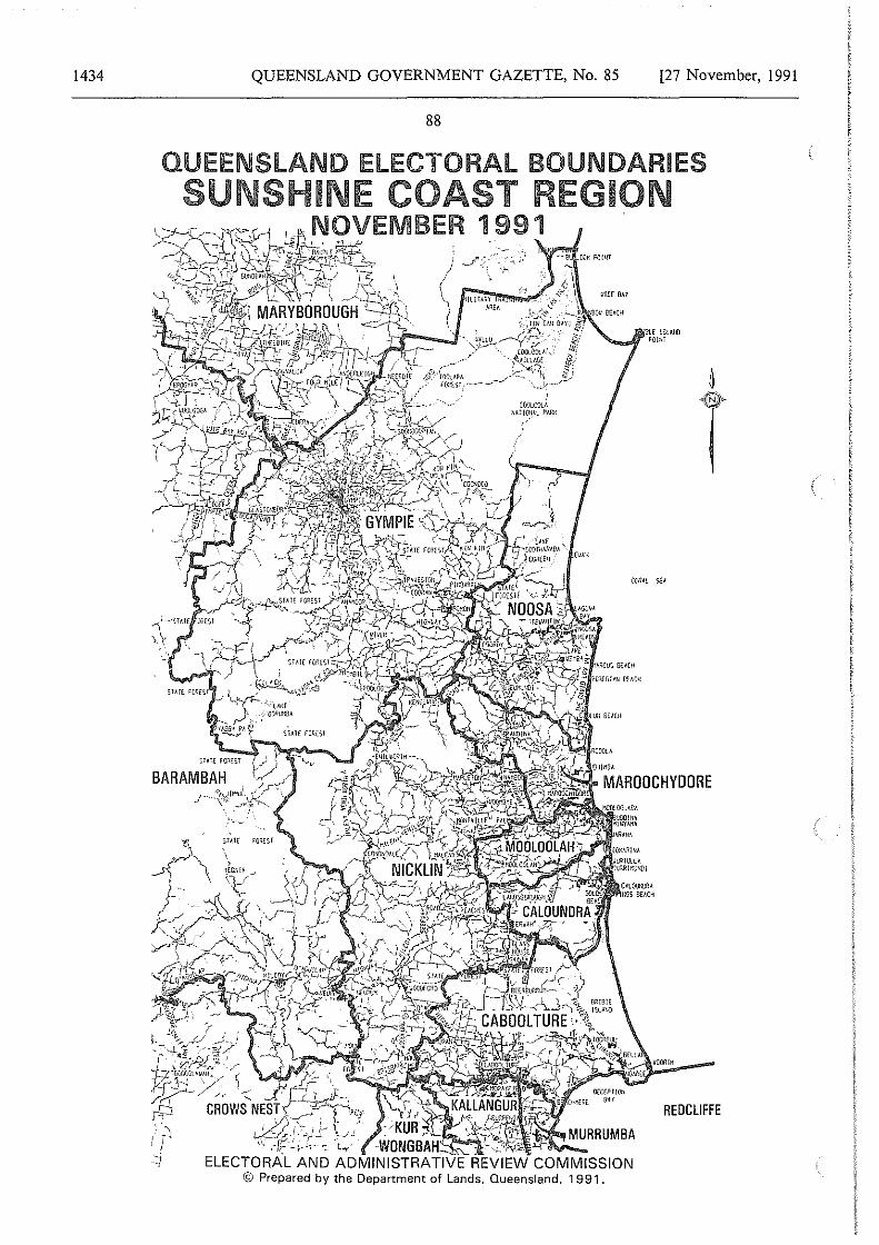
1434 QUEENSLAND GOVERNMENT GAZETTE, No. 85 [27 November, 1991
88
QUEENSLAND ELECTORAL BOUNDARIES SUNSHINE COAST REGION
NOVEMBER 1 991
CIY.!1..0GL/, li~l!G!Jll !'I.RH
© Prepared by the Department of Lands, Queensland, 1991.
iBtt lStlJiO ~OUll
REDCLIFFE
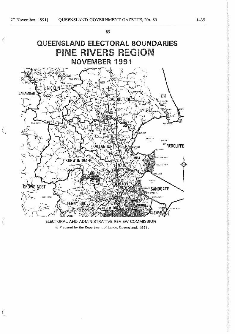
27 November, 1991] QUEENSLAND GOVERNMENT GAZETTE, No. 85
89
QUEENSLAND ELECTORAL BOUNDARIES
PINE RIVERS REGION NOVEMBER 1991
"" REOCLIFFE
ELECTORAL AND ADMINISTRATIVE REVIEW COMMISSION
© Prepared by the Department of Lands, Queensland, 1991.
1435
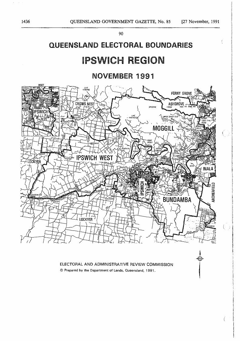
1436 QUEENSLAND GOVERNMENT GAZETTE, No. 85 [27 November, 1991
90
QUEENSLAND ELECTORAL BOUNDARIES
IPSWICH REGION
NOVEMBER 1991
ELECTORAL AND ADMINISTRATIVE REVIEW COMMISSION
©Prepared by the Department of Lands, Queensland, 1991.
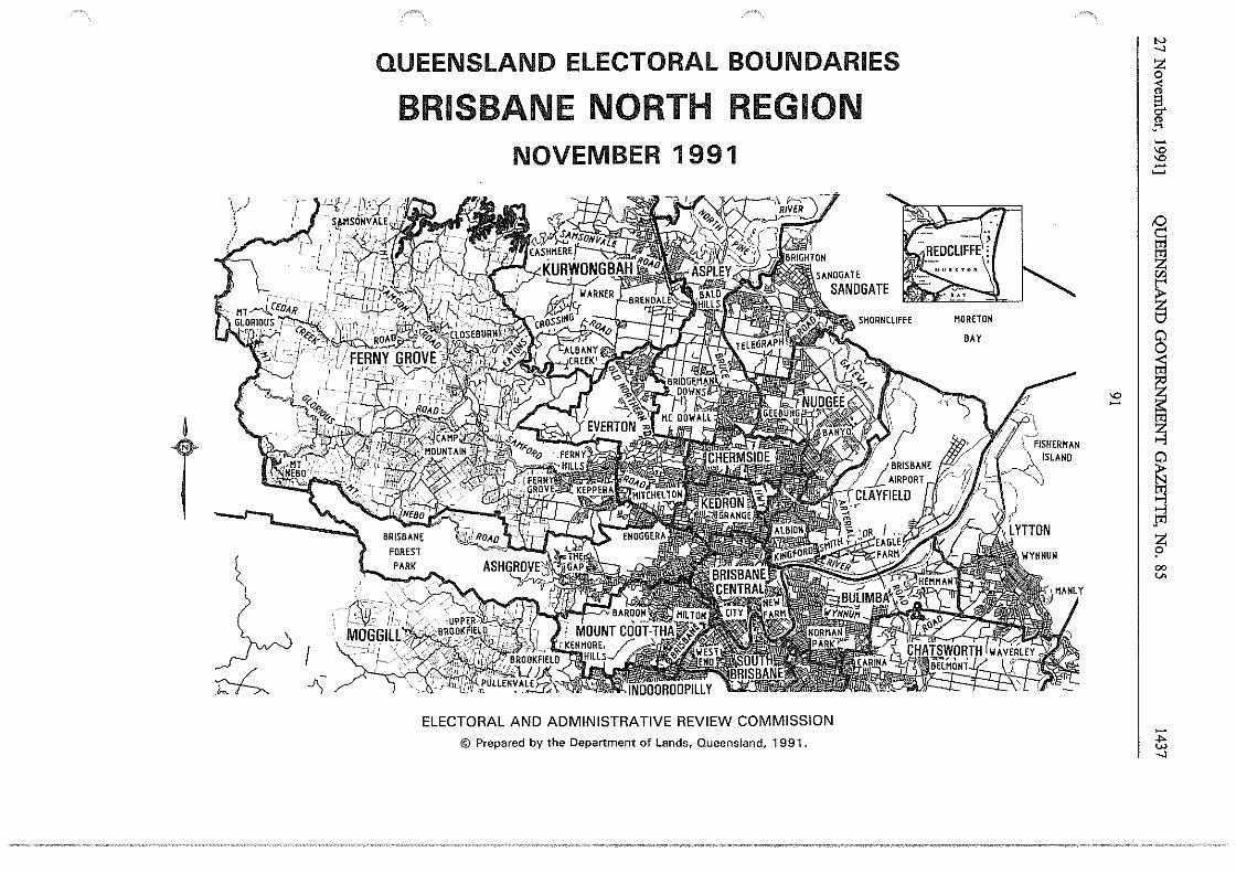
QUEENSLAND ELECTORAL BOUNDARIES
BRISBANE NORTH REGION NOVEMBER 1991
HORE TON
BAY
t L,
~I ~ -')-
ELECTORAL AND ADMINISTRATIVE REVIEW COMMISSION
© Prepared by the Department of Lands, Queensland, 1991.
I
"' I -
"' ...., z 0 < " g. " .... -"' "' -~ /:) c::: t'!1
~ "'
~ 0 0
I ~ ~ ~ Jrl z ? 00 V>
-.... "' ....,
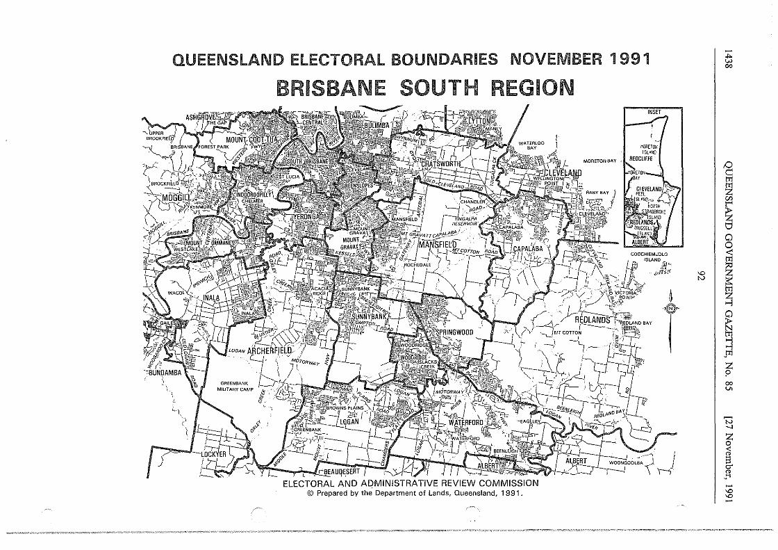
QUEENSLAND ELECTORAL BOUNDARIES NOVEMBER 1991
""· ~~ ( F'l===/U
BRISBANE SOUTH REGION
-J',4 };; I ~dlJE)i/ ') ~~ ~ ~ t lr ~ ~AUQESER~ .• ~ ~ ~- I _' '
Hi,\ "'"J::.. COOCHIEMUOLO
#_, \ ·~ ·~ /\'.' ll• '"AND •
r"'~' Ji ! r:; ' , '';{, fCflt' /Jvy''' . .w ,r·'· .~--' '1·P yicTORIA'Pl -· •.. , ~---~!NP' - G
,,(<\A~~ ~ : ,"-./~''o .. noC .----;·:~";'°'AN~"' j ; \ ·-~ ~ ~· F~ . I ~W' -~-·
J I .f-ri-\ ' • .i ~~c ,. · ~
",
ELECTORAL AND ADMINISTRATIVE REVIEW COMMISSION © Prepared by the Department of Lands, Queensland, 1991.
... w co
D c:: ~ "' ~ t:I Cl 0 ;ii
~I~ §l --l Cl f::i gi --l JTl z !' co v.
'N -.]
~ g. JI -"' "' -
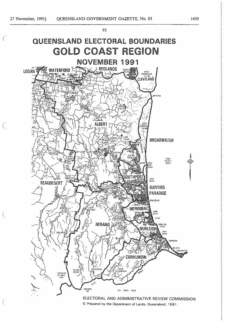
27 November, 1991] QUEENSLAND GOVERNMENT GAZETTE, No. 85
93
QUEENSLAND ELECTORAL BOUNDARIES
GOLD COAST REGION NOVEMBER 1991
l<EV SOUTH VALES
m:mrn S IRAOBROOKE
lSLMIO )
CLEVELAND,
BROADWATER
soorn PAC!r1c
OCEMJ
1439
ELECTORAL AND ADMINISTRATIVE REVIEW COMMISSION © Prepared by the Department of Lands, Queensland, 1991.
1440
94
QUEENSLAND GOVERNMENT GAZETTE, No. 85
Electoral Districts Act 1991
DETERMINATION OF QUEENSLAND ELECTORAL DISTRICTS
NOVEMBER 1991
MAPSOF89 INDIVIDUAL ELECTORAL DISTRICTS
[27 November, 1991
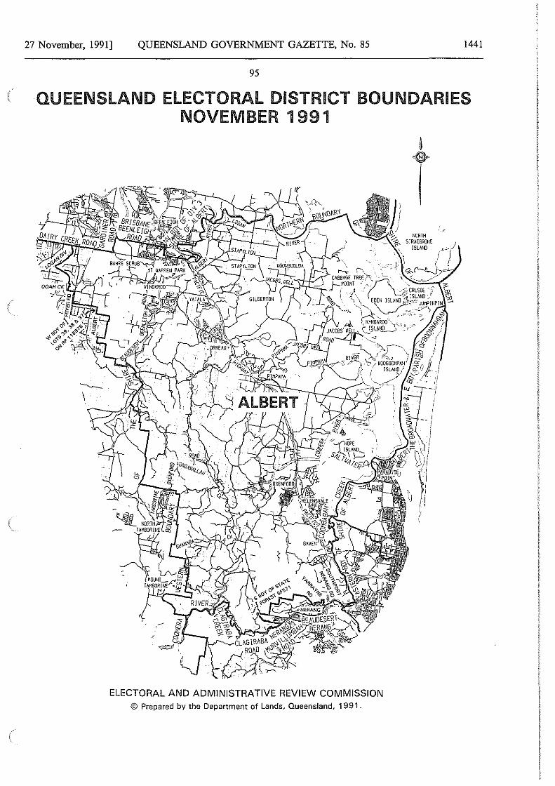
27 November, 1991] QUEENSLAND GOVERNMENT GAZETTE, No. 85 1441
95
QUEENSLAND ELECTORAL DISTRICT BOUNDARIES NOVEMBER 1991
ELECTORAL AND ADMINISTRATIVE REVIEW COMMISSION © Prepared by the Department of Lands, Queensland, 1991 .
NORTH STRAO!lROKE
ISlhNO
-. I
I
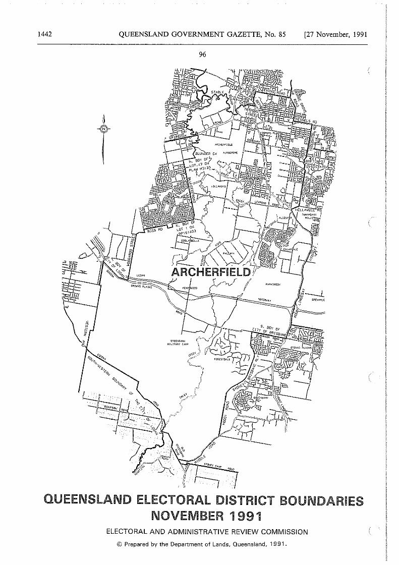
1442 QUEENSLAND GOVERNMENT GAZETTE, No. 85
Gil£E'<!lANI< •llUTARf CM\?
96
[27 November, 1991
ELECTORAL AND ADMINISTRATIVE REVIEW COMMISSION
© Prepared by the Department of Lands, Queensland, 1991.
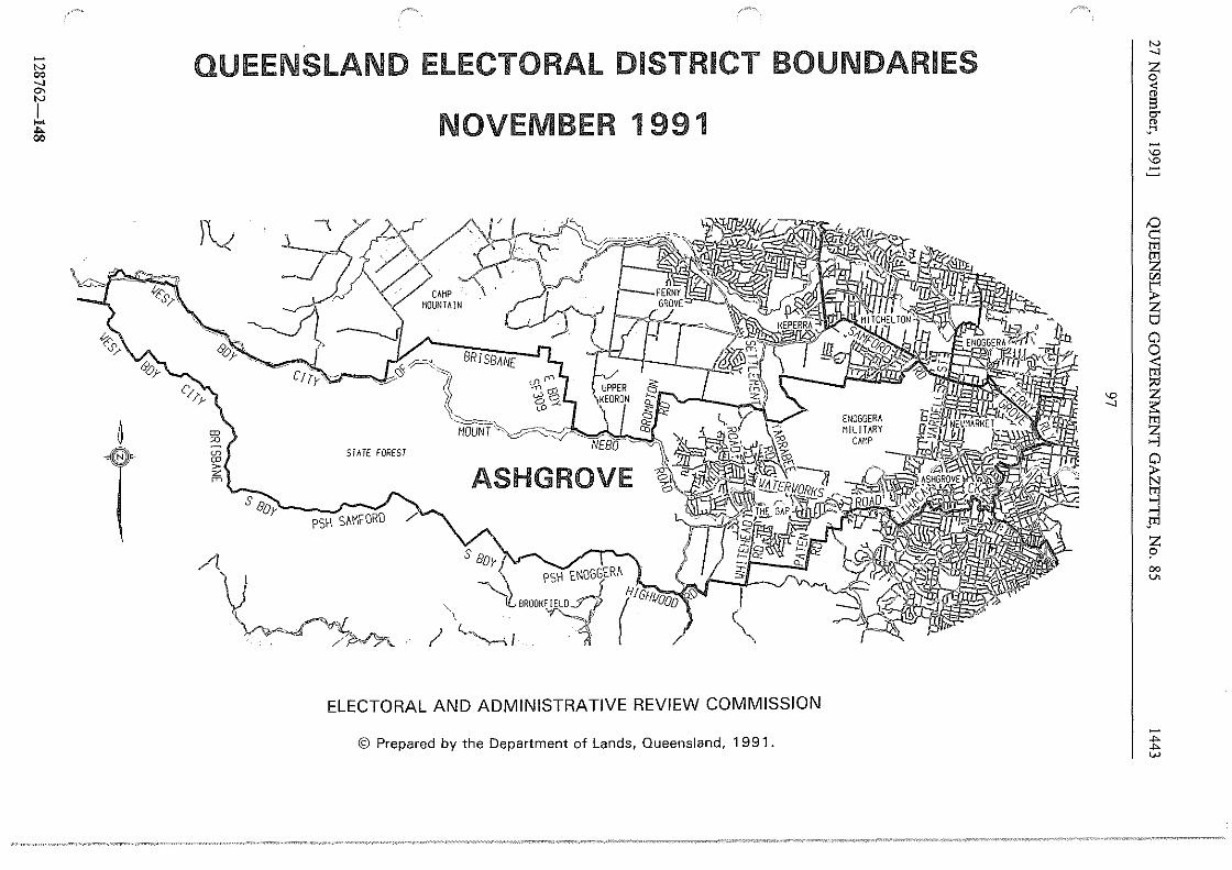
-N 00 _, °' N
I .... .... 00
#.C1' ~
QUEENSLAND ELECTORAL DISTRICT BOUNDARIES
)v
<D CD > z rn
s
NOVEMBER 1991
BRISBANE ~P~(j,
~ g MOuNT"·~~~~-iJEsir=·1 ~.·
STATE FOREST ASHGROVE \
Oo~ PSH S~MFORO
~~ PSH ENOGGER~
BROOH~~o-;-; (HI GHJiooo
! ~I '1 '\
ELECTORAL AND ADMINISTRATIVE REVIEW COMMISSION
© Prepared by the Department of Lands, Queensland, 1991.
:s I
N _,
i " ·"' -"' "' -D c:: tTl
91 "' ~ s Cl 0 < tTl
~ f5::
~ ~ tTl ..., ..., .m z
" 00 V>
.,,. .,,. w
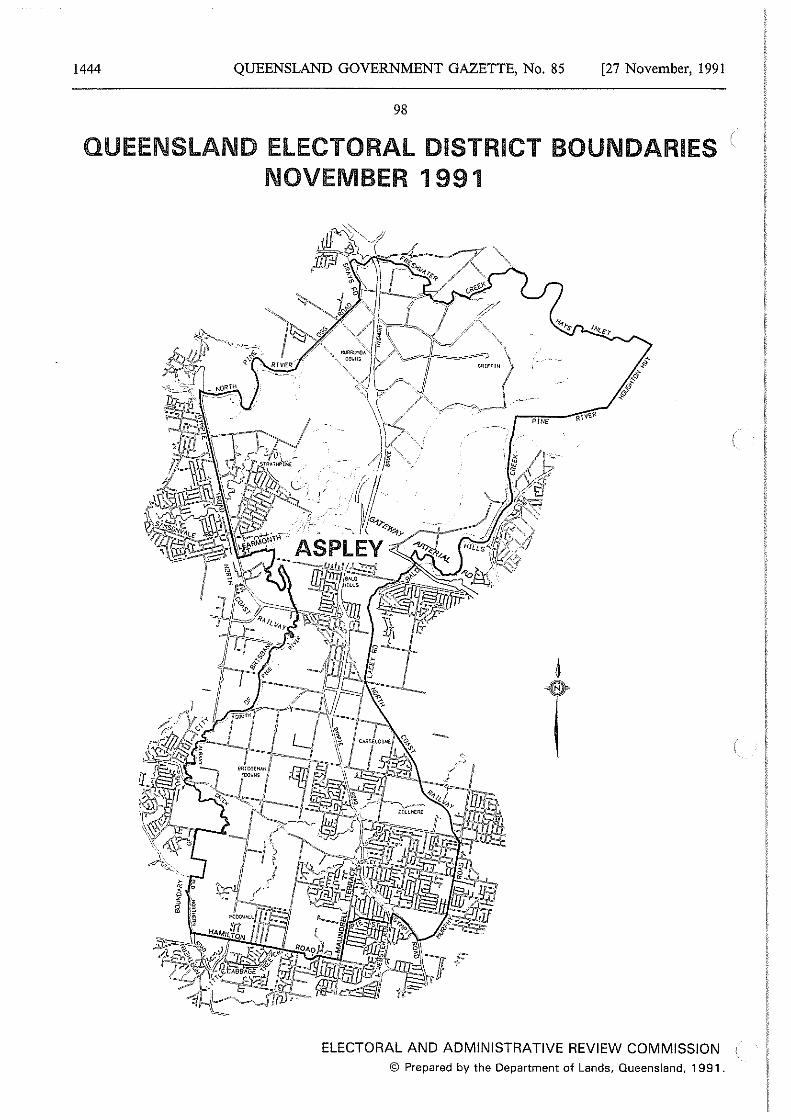
1444 QUEENSLAND GOVERNMENT GAZETTE, No. 85 [27 November, 1991
98
QUEENSLAND ELECTORAL DISTRICT BOUNDARIES NOVEMBER 1991
6
T
ELECTORAL AND ADMINISTRATIVE REVIEW COMMISSION © Prepared by the Department of Lands, Queensland, 1991.
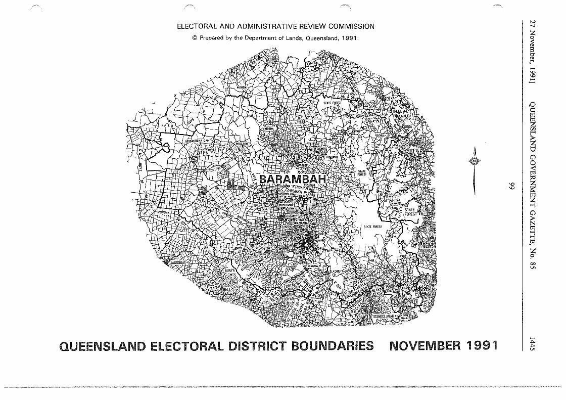
ELECTORAL AND ADMINISTRATIVE REVIEW COMMISSION
© Prepared by the Department of Lands, Queensland, 1991.
~
T
QUEENSLAND ELECTORAL DISTRICT BOUNDARIES NOVEMBER 1 991
"' "'
N __,
z 0 < " §. " _ ... -"' "' ..:::
~ gi z r.n
~ tJ Cl 0
~ ~ ~ .., ~ tr1
::J JI1 z p 00 V>
..,. ..,. V>
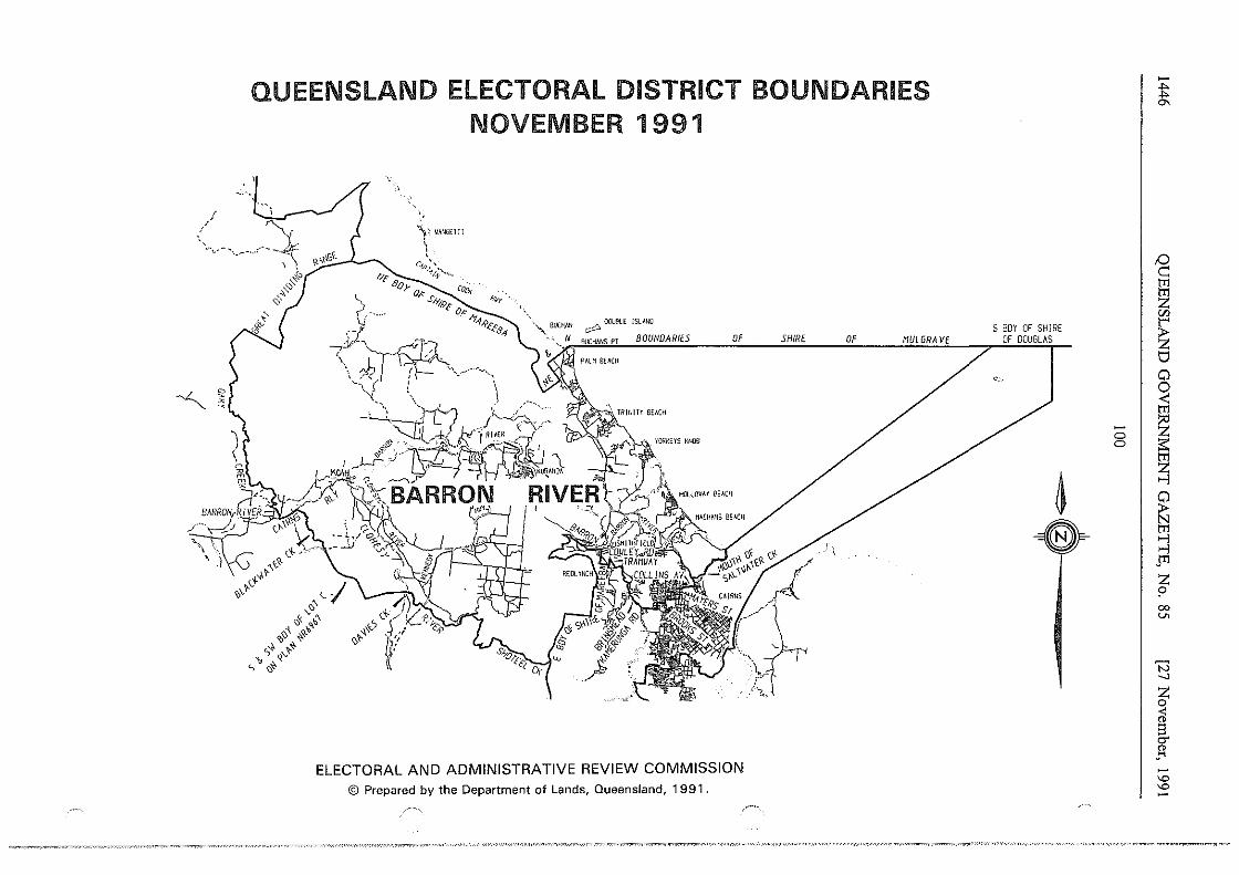
,/
QUEENSLAND ELECTORAL DISTRICT BOUNDARIES NOVEMBER 1991
)~ VANGEJ!!
" ..... ,_, - '·--~-._.: :,
~~
.I
"'\ · ... ' .\
c-w,.-r~;··., .. Ne Bo}- 0,K . CtJtk
(
S,y/.fl 'o, - • 11,,, l?£f'8
:/-4
·~ _,_. "--- ' \ J<T. · r • - , __
}{;):·.
~ 00.181.£ JSLM<O
BOUNDARIES OF
~I ~' ~ \, .;-
' •' ~~ +.~ .. +
'll s q'-'t
' ~~
ELECTORAL AND ADMINISTRATIVE REVIEW COMMISSION © Prepared by the Department of Lands, Queensland, 1991.
SHIRE OF MUL GRAVE S BOY OF SHIRE
OF DOUGLAS
<
~ a
0 I 0
-t "'
tO ~ m §1 "' ~ 0 0 < m :;ti
~ §1 ...,
~ ~ ..., .m z 9 00 v.
'N _,
~ < " !3 CT
" .... -'D 'D -
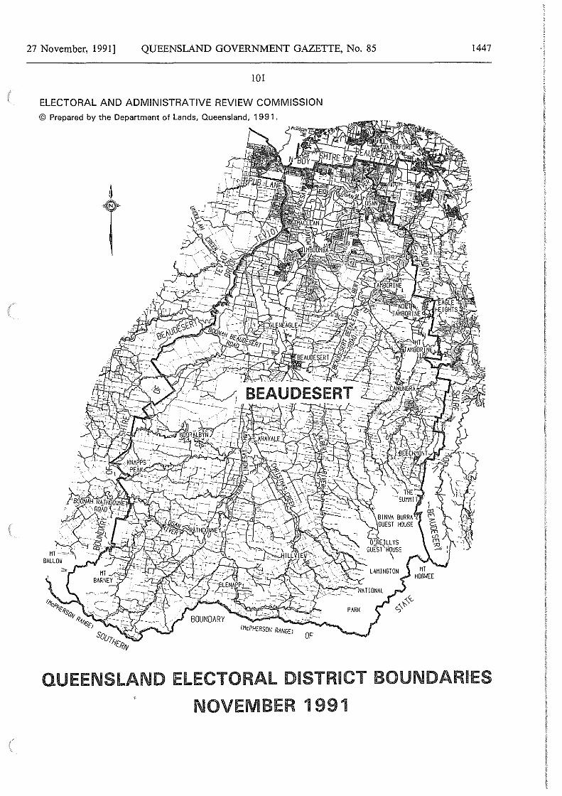
27 November, I99I] QUEENSLAND GOVERNMENT GAZETTE, No. 85
IOI
ELECTORAL AND ADMINISTRATIVE REVIEW COMMISSION
© Prepared by the Department of Lands, Queensland, 1991.
t
OF
1447
QUEENSLAND ELECTORAL DISTRICT BOUNDARIES
NOVEMBER 1991
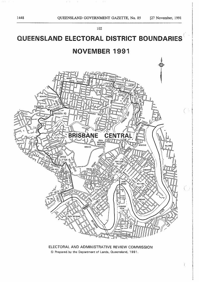
1448 QUEENSLAND GOVERNMENT GAZETTE, No. 85 [27 November, 1991
102
QUEENSLAND ELECTORAL DISTRICT BOUNDARIES t
NOVEMBER 1991
ELECTORAL AND ADMINISTRATIVE REVIEW COMMISSION © Prepared by the Department of Lands, Queensland, 1991.
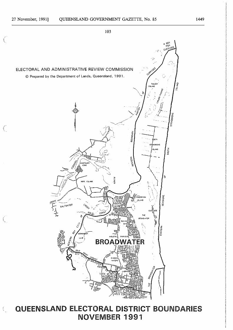
27 November, 1991] QUEENSLAND GOVERNMENT GAZETTE, No. 85
103
ELECTORAL AND ADMINISTRATIVE REVIEW COMMISSION
© Prepared by the Department of Lands, Queensland, 1991.
'rULEEN lSLWO
1449
QUEENSLAND ELECTORAL DISTRICT BOUNDARIES NOVEMBER 1991
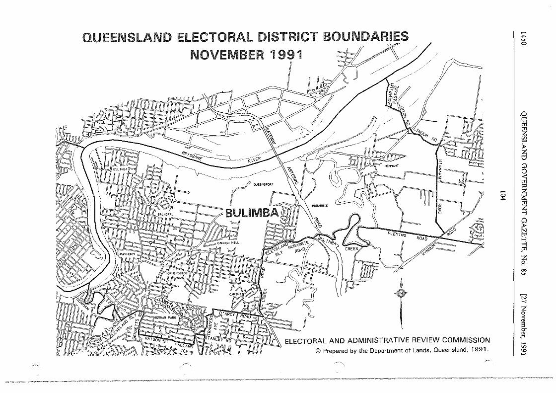
QUEENSLAND ELECTORAL DISTRICT BOUNDARIES
NOVEMBER 1991 ~~"
1)
/, /,
/,
Ro
f~
': -E5:::
l J ii~~
-.,,.. V> 0
D c
~ ~ Cl
~ ~ I ~
~
~ Jr!
t co V>
'N -.J
~
l -'° '° -
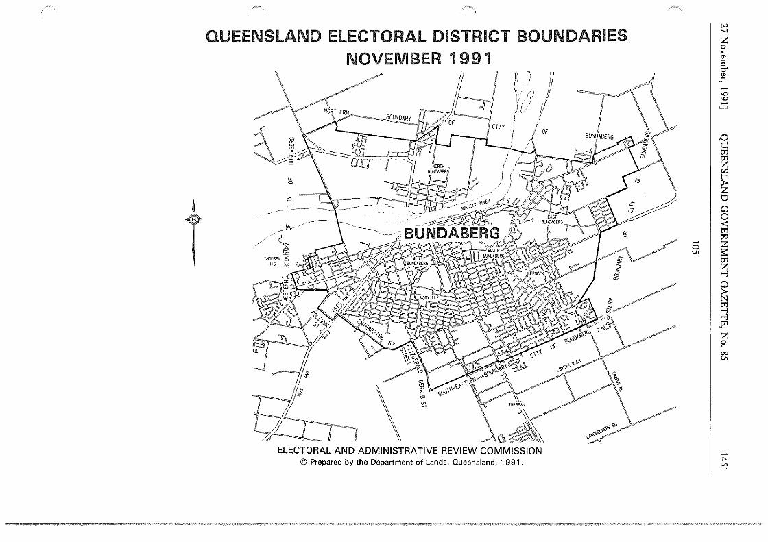
~
T
QUEENSLAND ELECTORAL DISTRICT BOUNDARIES NOVEMBER 1991
/4 _/-)
/;(Jb~~-
II ) II ~)/ t} ii.
~I v~ #cm I
~
ELECTORAL AND ADMINISTRATIVE REVIEW COMMISSION © Prepared by the Department of Lands, Queensland, 1991.
I !
OF
-0 v.
"' _,
~
_I "' "'
~ tT1
~ C/J
~ 0 0 < tT1 ?'
I ~ ~ 0 ~ s
$I1
~ 00 v.
... v.
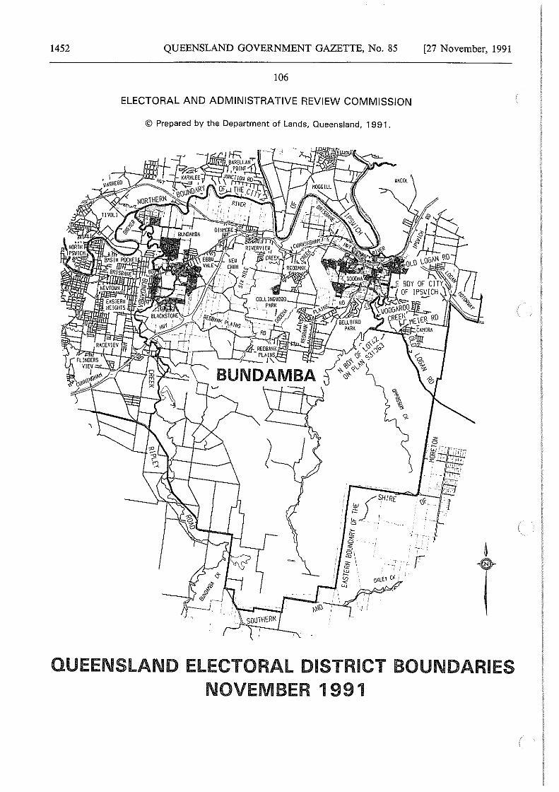
1452 QUEENSLAND GOVERNMENT GAZETTE, No. 85 [27 November, 1991
106
ELECTORAL AND ADMINISTRATIVE REVIEW COMMISSION
© Prepared by the Department of Lands, Queensland, 1991.
QUEENSLAND ELECTORAL DISTRICT BOUNDARIES NOVEMBER 1991
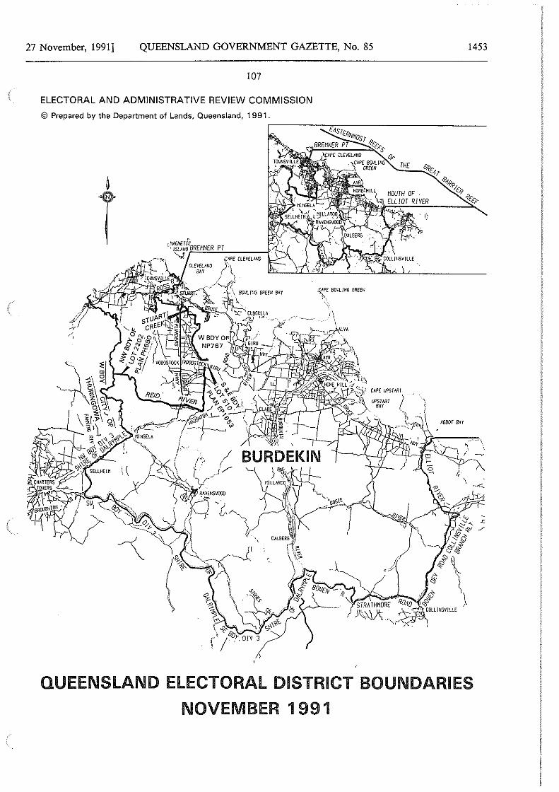
27 November, 1991] QUEENSLAND GOVERNMENT GAZETTE, No. 85
107
ELECTORAL AND ADMINISTRATIVE REVIEW COMMISSION
© Prepared by the Department of Lands, Queensland, 1991.
1<_PE BOJ.I!. ING GREEN
~ \' 1\
1453
ASBOT BAY
QUEENSLAND ELECTORAL DISTRICT BOUNDARIES
NOVEMBER 1 991
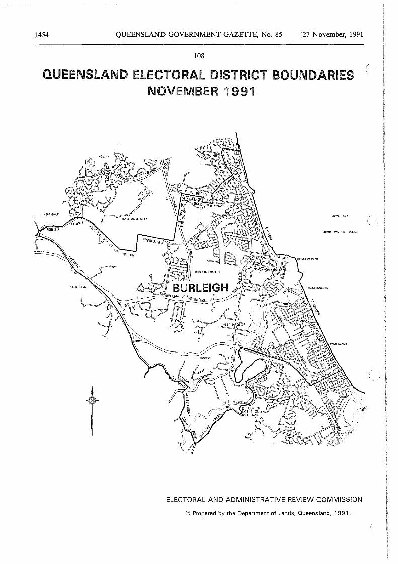
1454 QUEENSLAND GOVERNMENT GAZETTE, No. 85 [27 November, 1991
108
QUEENSLAND ELECTORAL DISTRICT BOUNDARIES NOVEMBER 1991
ELECTORAL AND ADMINISTRATIVE REVIEW COMMISSION
© Prepared by the Department of Lands, Queensland, 1991.
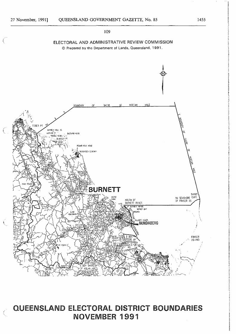
27 November, 1991] QUEENSLAND GOVERNMENT GAZETTE, No. 85
109
ELECTORAL AND ADMINISTRATIVE REVIEW COMMISSION © Prepared by the Department of Lands, Queensland, 1991.
BOUNDARY OF SHIRE OF
SUS HllO HEAO
ROU:lO Hill HHO
MIRIAM VALE
,::- wm.n r Hi:AOS q, Hf:llVEY (1AY
,,_aw&~RA 'l' ,; rnELLJOll KEAOS
~l'JOO"..,BUNDABERG
t
SANDY N\I SEASHORE CAPE OF FRASER IS
1455
FRASER ISLAND
/
··~· .' - .
\
QUEENSLAND ELECTORAL DISTRICT BOUNDARIES NOVEMBER 1991
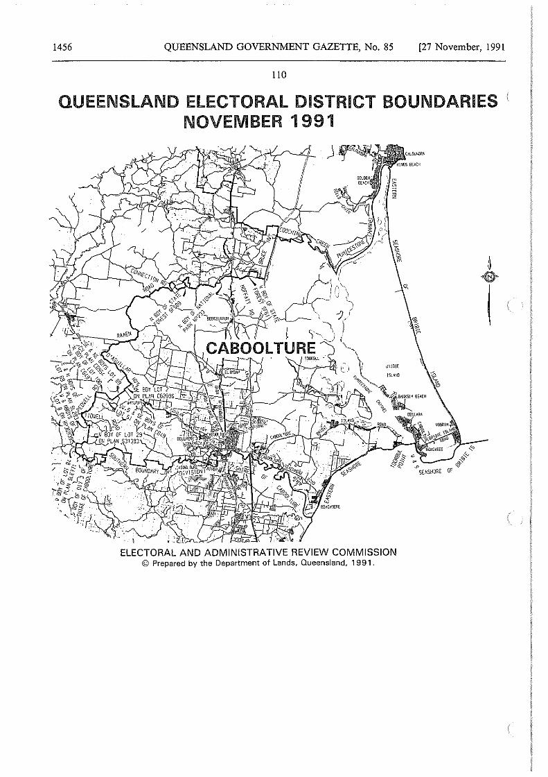
1456 QUEENSLAND GOVERNMENT GAZETTE, No. 85 [27 November, 1991
110
QUEENSLAND ELECTORAL DISTRICT BOUNDARIES NOVEMBER 1991
ELECTORAL AND ADMINISTRATIVE REVIEW COMMISSION © Prepared by the Department of Lands, Queensland, 1991.
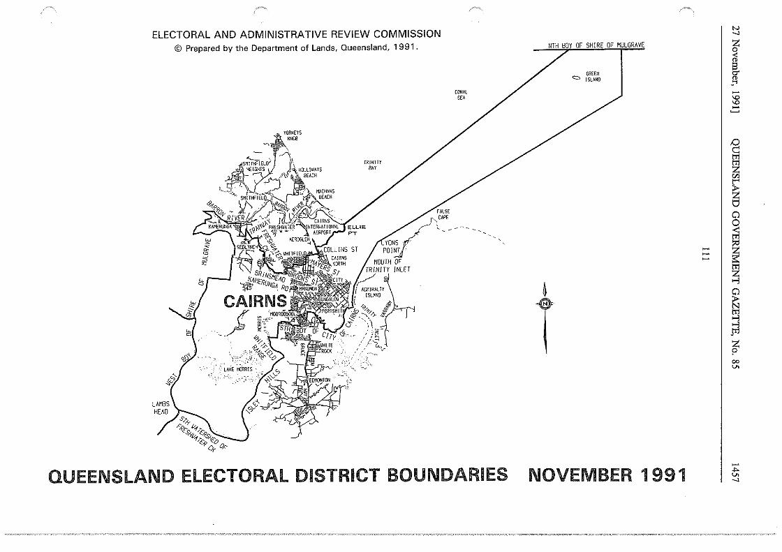
ELECTORAL AND ADMINISTRATIVE REVIEW COMMISSION © Prepared by the Department of Lands, Queensland, 1991.
/>;'
'"' Vi
:s
'Y>~~
~ ~<;?' 9" z,,_
. ~ j -9.~'
.· ;'' ;• 't/&1(: . ~-~ .·:> ,tJ ;,. l:<' 0
TRINITY / BAY
COR~l SEA
/
QUEENSLAND ELECTORAL DISTRICT BOUNDARIES
GREEN <:::.:> ISLAND
~
T
NOVEMBER 1991
!::l ~
J ~
"' "'
/:) c::
I ~ C/J
~ l:j
Cl 0 < m :>O
::: I ~
~ Cl ~ ~ jTl
z p 00 v.
~ .,,. v. -.J
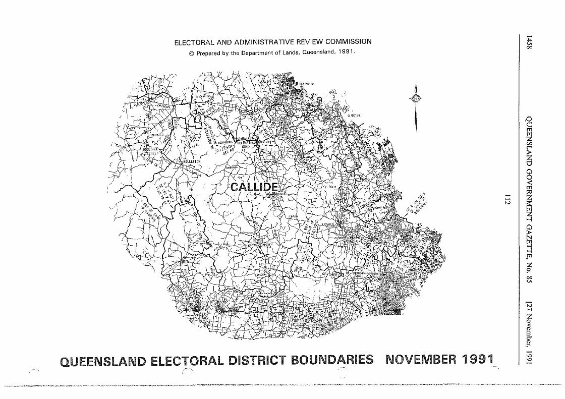
_/
I
'-'
ELECTORAL AND ADMINISTRATIVE REVIEW COMMISSION
© Prepared by the Department of Lands, Queensland, 1991.
QUEENSLAND ELECTORAL DISTRICT BOUNDARIES
~
T ,..,
''<>()¢
~"""'~~ '\J x--·+<:S *'rs.:"'"'<.; / ,,
NOVEMBER 1991
N I
-... v. co
;::) ~ tT1 tT1 z w
~ ti 0 0 <: tT1
~ ~ tT1 z >-'l
~ gj >-'l
.tT1
z ? co v.
w _, z 0 < " El <:T " ·'"' -"' "' -
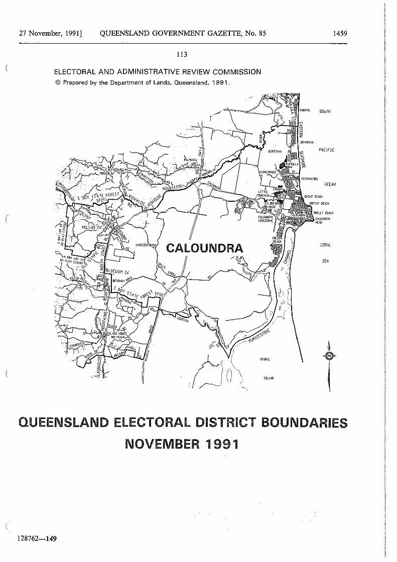
27 November, 1991] QUEENSLAND GOVERNMENT GAZETTE, No. 85
113
ELECTORAL AND ADMINISTRATIVE REVIEW COMMISSION
© Prepared by the Department of Lands, Queensland, 1991.
!SI.AUD .Ci Ell!BIE
VARA!IA
m > m m ~ z
OOKAR(NA
1459
SOUTH
PJ.C/F/C
OCE.l.N
CALOU!IORA HEl.O
CORAL
t QUEENSLAND ELECTORAL DISTRICT BOUNDARIES
NOVEMBER 1 991
128762-149
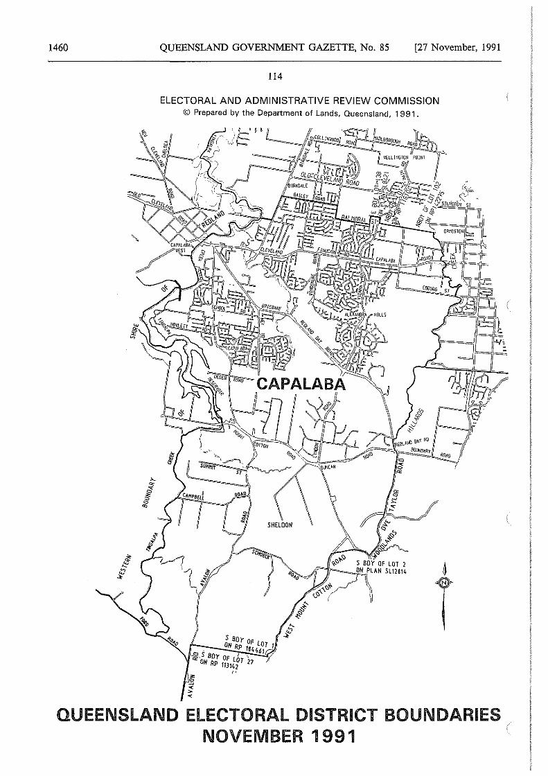
1460 QUEENSLAND GOVERNMENT GAZETTE, No. 85 [27 November, 1991
114
ELECTORAL AND ADMINISTRATIVE REVIEW COMMISSION <i;J Prepared by the Department of Lands, Queensland, 1991.
QUEENSLAND ELECTORAL DISTRICT BOUNDARIES NOVEMBER 1991
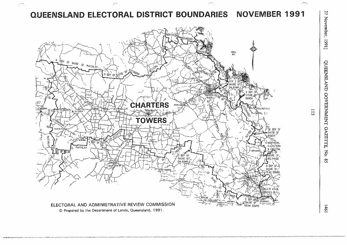
QUEENSLAND ELECTORAL DISTRICT BOUNDARIES
ELECTORAL AND ADMINISTRATIVE REVIEW COMMISSION © Prepared by the Department of Lands, Queensland, 1991.
NOVEMBER 1991
--U> I
N _, z 0 ;i g. Cl>
·"' -"' "' -~ !:) c::: t'Il t'Il z lZl
~ 0 0
~
~ ti >--l
~ >--l P1
~ 00 U>
-.... °' -
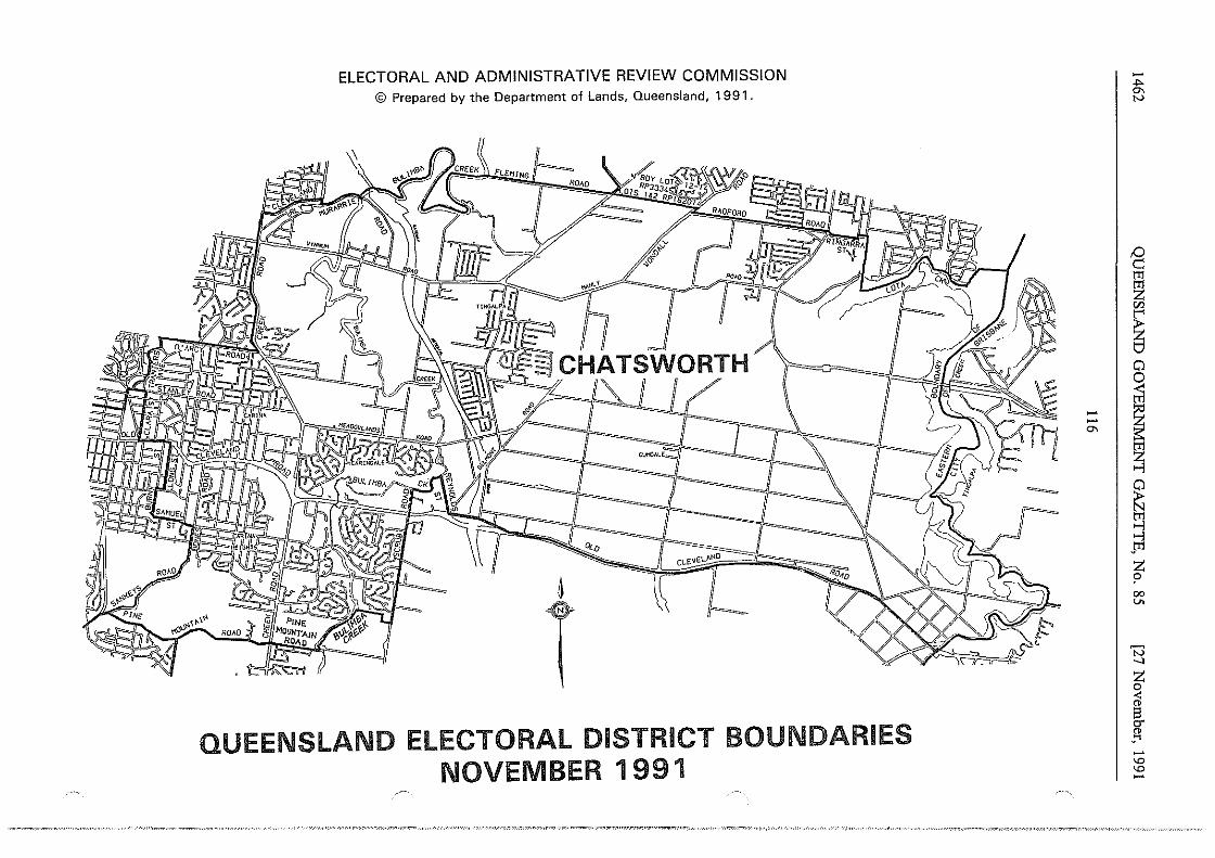
ELECTORAL AND ADMINISTRATIVE REVIEW COMMISSION © Prepared by the Department of Lands, Queensland, 1991.
~\~~\F0r '::;t CHATSWORTH
ci...EVEL"NO
1
T Ii==>
QUEENSLAND ELECTORAL DISTRICT BOUNDARIES NOVEMBER 1991
- I -°'
-.,.. °' N
§ m ~ "' ~ 0 0
I ~ ~ ..., ..., .m
~ 00 V>
'N _, z 0 < " g. " _ .... -'° '°
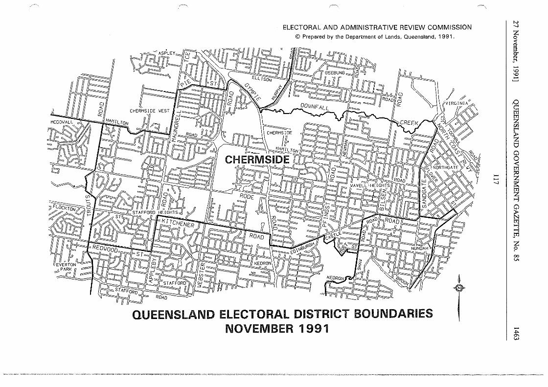
N _,
I -~ -"' "' -
1 ~
:::: I i _, ;:::
~
! t 00 v.
-... °' w
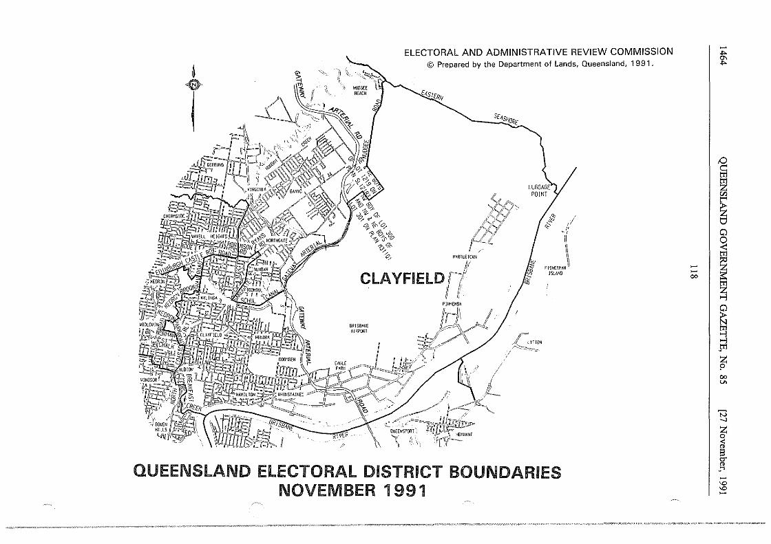
t '>. ~~ s
'.\
p
ELECTORAL AND ADMINISTRATIVE REVIEW COMMISSION © Prepared by the Department of Lands, Queensland, 1991.
HYRTLEIOVN
S[lfSffOR[ --.;;:
r JS-._ LYTTON ~-- -~--::;,
/
0 I ~ 11 '< ,,
"'~""~~ lSLMIO
QUEENSLAND ELECTORAL DISTRICT BOUNDARIES NOVEMBER 1991
- I -00
-_.,. °' _.,.
/:) c:: lTl
~ f/j
~ 0 0 <
~ ~ ~ ~ ..., ,lTl
~ 00 v.
t:3 _, z 0
<ii i3 O'
" ..... -"' "' -
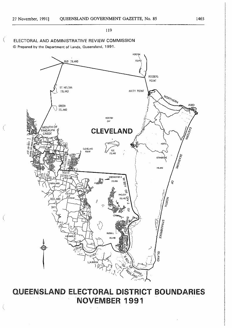
27 November, 1991] QUEENSLAND GOVERNMENT GAZETTE, No. 85
119
ELECTORAL AND ADMINISTRATIVE REVIEW COMMISSION © Prepared by the Department of Lands, Queensland, 1991.
ST HELENA ISLAND
ISLAND
H!JilET!lll
'"
AM!TY POINT
CLEVELAND
CLEVELWO ?OHH ~-
ISLAN[l t
REEOERS POINT
/" } ',12
)> z 0
1465
NORTH
QUEENSLAND ELECTORAL DISTRICT BOUNDARIES NOVEMBER 1991
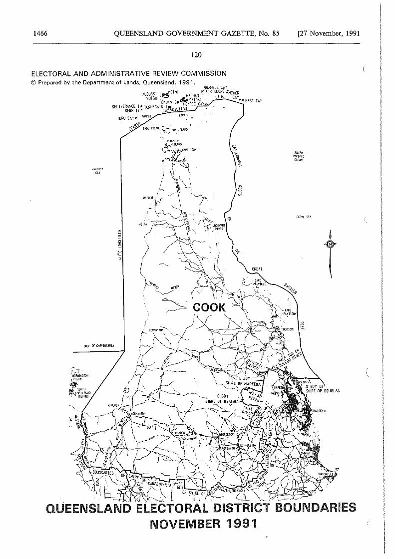
1466 QUEENSLAND GOVERNMENT GAZETTE, No. 85
120
ELECTORAL AND ADMINISTRATIVE REVIEW COMMISSION © Prepared by the Department of Lands, Queensland, 1991.
BRAMBLE CllY llUBUSSI I er.&HO!MI I BLACK ROCKS •ANCHOR
80\GU !~ ..,1{/\UMllG I LINE CAY DAUAN !O>QildllSAlBA! 1 ••EAST CAY
OEL!VERMKE I" TURNllG!dN [oOICTIOP~ARCE llY KERR IT • ~JU!)3Rj;\S~'""'"'--'
TURU CA y # liiRRfS SfRA!i
c,f,_'f:-'?Jr.,._'\:) lMOO ISLAliO :Jr llOA !SUiill ~ "~'"v . .
Gt.lf OF OJlPHllAR/h
[27 November, 1991
SWiii none
OCON
t
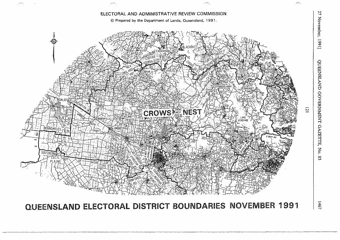
ELECTORAL AND ADMINISTRATIVE REVIEW COMMISSION
© Prepared by the Department of Lands, Queensland, 1 9 91 .
~
T
~
"'
QUEENSLAND ELECTORAL DISTRICT BOUNDARIES NOVEMBER 1991
"' I
"' ...., z 0 < s er " !1 -'D 'D -~ 0 c: tt1 §1 "' r;: z t;;I
0 0 ~
~ tt1
~
~ "°'.l Jr1 z 9 co V>
.... °' ....,
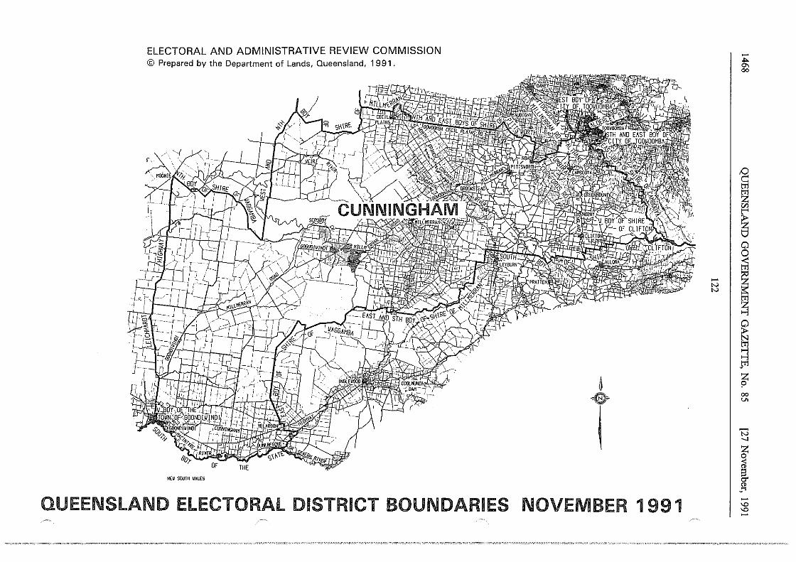
ELECTORAL AND ADMINISTRATIVE REVIEW COMMISSION © Prepared by the Department of Lands, Queensland, 1991.
NEii SOUTH VALES
QUEENSLAND ELECTORAL DISTRICT BOUNDARIES
-lV
"'
~
T NOVEMBER 1 991
I
-.... "' 00
,0 c:: tT1
~ en
~ 0 0 < tT1
~ ~ ~ ~ Jt1
~ 00 v.
'N _, z 0 < " 8 er " ..... -"' "' -
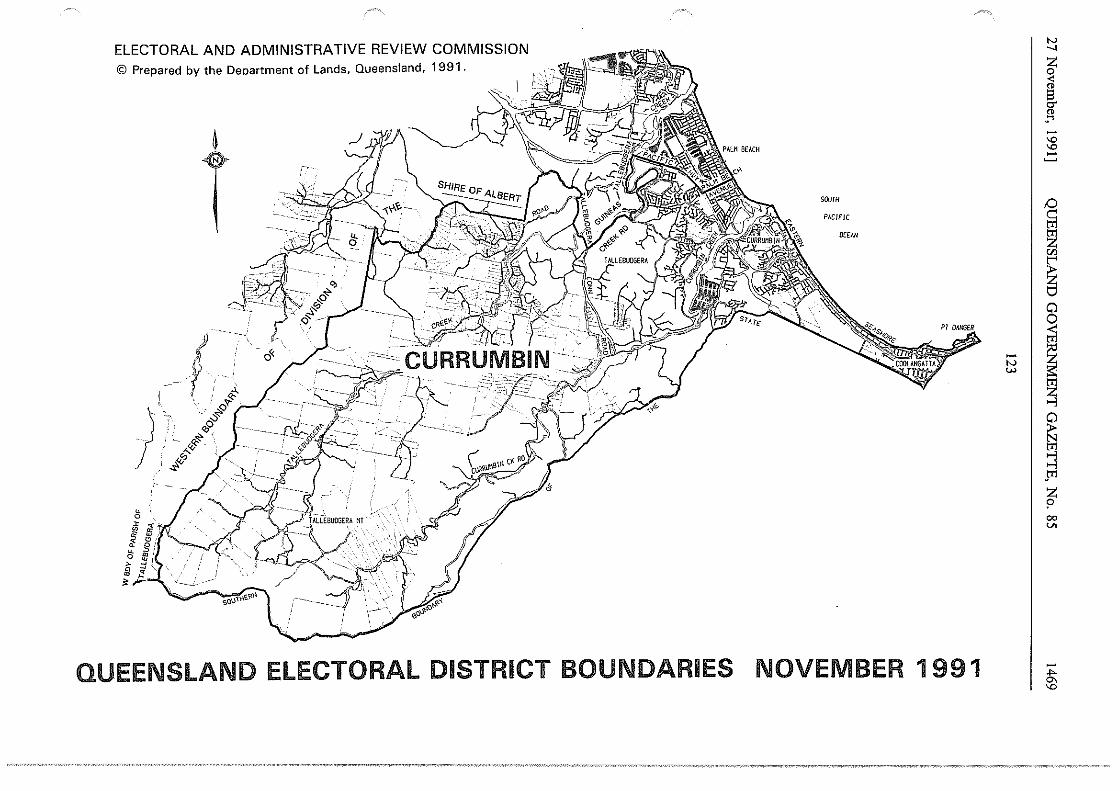
~
T
f ' )
. '_;""'"'~ . ~ ""'~&
. $' 4'
' '~<ij
t- --
i!;
QUEENSLAND ELECTORAL DISTRICT BOUNDARIES
SOUTH
PACIFIC
0CfAN
- I "' w
NOVEMBER 1991
"' _, z 0 < "' s c:r "' ..... -"' "' -~ /:) c:: tT1
~ "' ~ 0 0 ti1
~ ~ ~ ~ >-l jT1
z >' 00 v.
-,,. °' "'
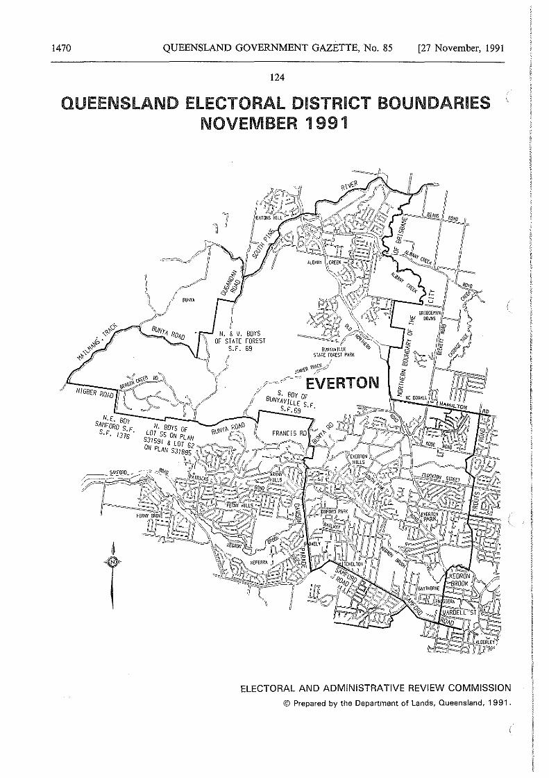
1470 QUEENSLAND GOVERNMENT GAZETTE, No. 85 [27 November, 1991
124
QUEENSLAND ELECTORAL DISTRICT BOUNDARIES NOVEMBER 1991
N.[. BOY SANFORD $
S.F, 137:·
6
T
fl l I
~\\ N. & V. BOYS \i OF STATE FOREST
I S.F. 69
-;I ( " /"' "\l
ELECTORAL AND ADMINISTRATIVE REVIEW COMMISSION
© Prepared by the Department of Lands, Queensland, 1991.
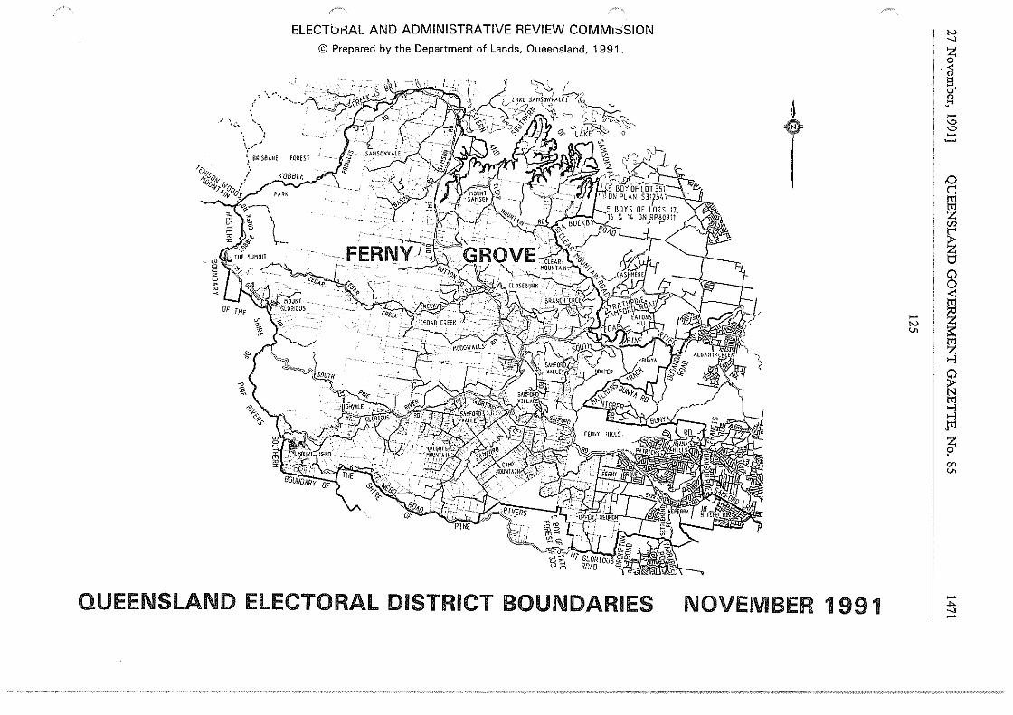
,-, '""'\
' , ...
ELECTui-lAL AND ADMINISTRATIVE REVIEW COMM1::>SION
© Prepared by the Department of Lands, Queensland, 1991.
i, BRIS0ANE fOHfST I \
r.-ws: / 1)10,0,.y ,
V-t;.ft-'o ( _,r ~ -t . _,' ,•f/..voos '-...:<'.
QUEENSLAND ELECTORAL DISTRICT BOUNDARIES
6
T
NOVEMBER 1991
"' _,
~ <ii g. §l -'° '° -~
I~ tTl
~ r;:i
~ ti 0
~ ~ I ~
~ ...,i
~ Fl z p 00 v.
,.,. _, -

ELECTORAL AND.ADMINISTRATIVE REVIEW COMMISSION © Prepared by the Department of Lands, Queensland, 1991.
~
T
PAC!F!C
OCEAN
QUEENSLAND ELECTORAL DISTRICT BOUNDARIES NOVEMBER 1991
-N
°'
-:':; N
D
iii fi "' ~ 0 0 < tr1
I ~ ~ ~ ..., ..., J'Il z p 00 ..,,
'N _, ~ < " g. " , .... -'° '° -
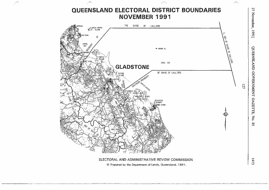
QUEENSLAND ELECTORAL DISTRICT BOUNDARIES NOVEMBER 1991
THE SHIRE .J1. GREAT KEPPEL ~ ISLAND
&
OF
~'\)'t-"?-"'O~'l
CALLIOPE
• HERON IS.
CORAL SEA
OF SHIRE OF CALLIOPE
ELECTORAL AND ADMINISTRATIVE REVIEW COMMISSION
© Prepared by the Department of Lands, Queensland, 1991.
Bl
4
T
"' ....,
~ a §. " ..... -'O 'O
.::
'° c::: tT1
~ w
~ 8 <
~ ~ ...,
~ gi ..., pl
z p 00 v.
-.... ...., w
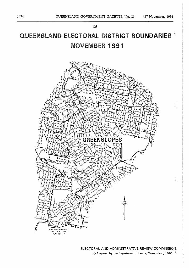
1474 QUEENSLAND GOVERNMENT GAZETTE, No. 85 [27 November, 1991
128
QUEENSLAND ELECTORAL DISTRICT BOUNDARIES i.
NORTHERN BOUNDARY OF LOT 822 ON
PLAN SL 1121
NOVEMBER 1991
ELECTORAL AND ADMINISTRATIVE REVIEW COMMISSION © Prepared by the Department of Lands, Queensland, 1991. i
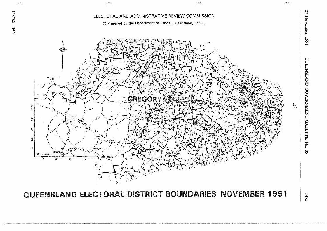
-N 00 _, °' I ..... g,J
w ~
"' ~ ii!
~ 0
~
65
~
POEFPEL CORNfR
sv
ELECTORAL AND ADMINISTRATIVE REVIEW COMMISSION
© Prepared by the Department of Lands, Queensland, 1991.
~
T
QUEENSLAND ELECTORAL DISTRICT BOUNDARIES NOVEMBER 1991
- I N
'°
N _, z 0
cl ~ " "' -'° '° -~ ,Q c:: trl
~
~ 0
~ ~ ~ ~ ~ JI1
t 00 v.
-... _, v.
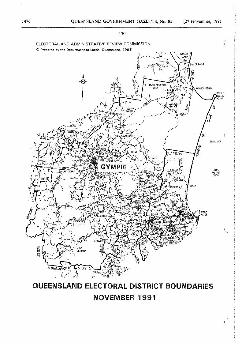
1476 QUEENSLAND GOVERNMENT GAZETTE, No. 85
130
ELECTORAL AND ADMINISTRATIVE REVIEW COMMISSION © Prepared by the Department of Lands, Queensland, 1991.
[27 November, 1991
TEEUAH
DOUBLE !SLAtlO
--~I POINT
NOOSA HEADS
CORAL SEA
SOUTH PACIFIC
OCEAN
QUEENSLAND ELECTORAL DISTRICT BOUNDARIES
NOVEMBER 1991
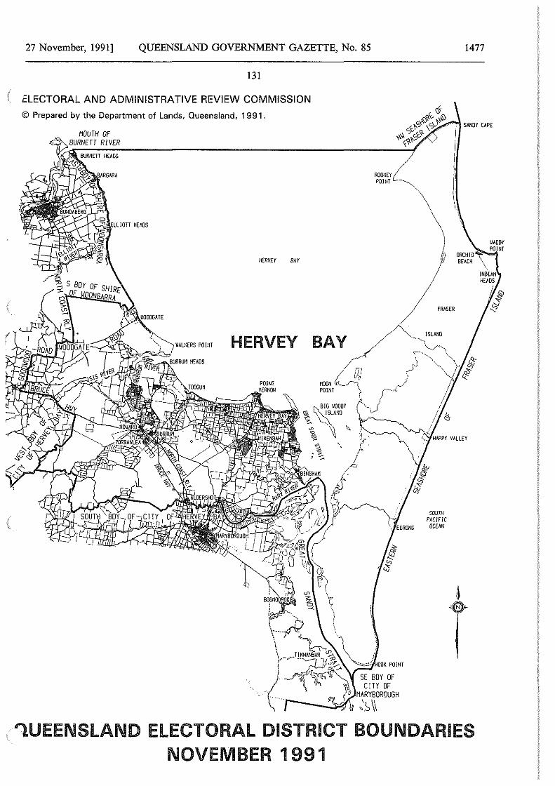
27 November, 1991] QUEENSLAND GOVERNMENT GAZETTE, No. 85
131
ELECTORAL AND ADMINISTRATIVE REVIEW COMMISSION
© Prepared by the Department of Lands, Queensland, 1991.
ELLJOTT HEADS
HERVEY a.i.r
HERVEY BAY
HOON t._,[lJ POINT
ROONEY POINT
FRASER
ISLAND
SOUTH P,1,C/FJC
OCEAN
1477
SANDY Cl.PE
1.UEENSLAND ELECTORAL DISTRICT BOUNDARIES NOVEMBER 1991
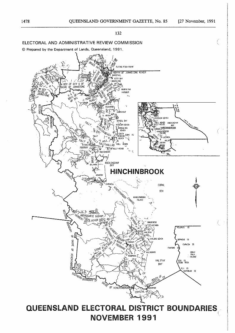
1478 QUEENSLAND GOVERNMENT GAZETTE, No. 85
132
ELECTORAL AND ADMINISTRATIVE REVIEW COMMISSION
© Prepared by the Department of Lands, Queensland, 1991.
1~ ::.$'.\ ,;:'ifi' FLYHIG FISH POINT
HINCHINBROOK
H!HCH!NilllOOK I ]SLANO
CQR,',L
SE'
[27 November, 1991
PELORUS IS
ORPHEUS !S
CURACOA IS
FAIHO~ I
GREAT PALH
!SLM-JO'
QUEENSLAND ELECTORAL DISTRICT BOUNDARIES NOVEMBER 1991
(
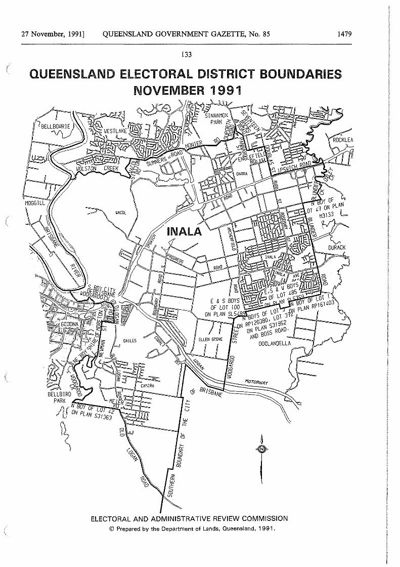
27 November, 1991] QUEENSLAND GOVERNMENT GAZETTE, No. 85 1479
133
QUEENSLAND ELECTORAL DISTRICT BOUNDARIES NOVEMBER 1991
"~~M
4
T ELECTORAL AND ADMINISTRATIVE REVIEW COMMISSION
© Prepared by the Oepartn1ent of Lands, Queensland, 1991.
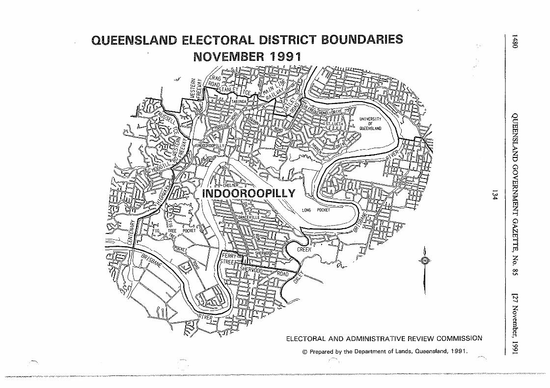
QUEENSLAND ELECTORAL DISTRICT BOUNDARIES NOVEMBER 1991
_,;'
~
T ELECTORAL AND ADMINISTRATIVE REVIEW COMMISSION
© Prepared by the Department of Lands, Queensland, 1991.
-w .... I
-.... 00 0
,0 c::
~ "' ~ 8
I ~ ~ s J11 z I' 00 V>
'N _, ~ ;ii i3 er "' _.., -"' "' -
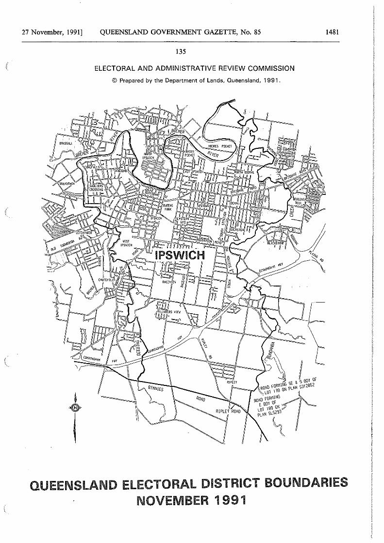
27 November, 1991] QUEENSLAND GOVERNMENT GAZETTE, No. 85 1481
135
ELECTORAL AND ADMINISTRATIVE REVIEW COMMISSION
© Prepared by the Department of Lands, Queensland, 1991.
QUEENSLAND ELECTORAL DISTRICT BOUNDARIES NOVEMBER 1991
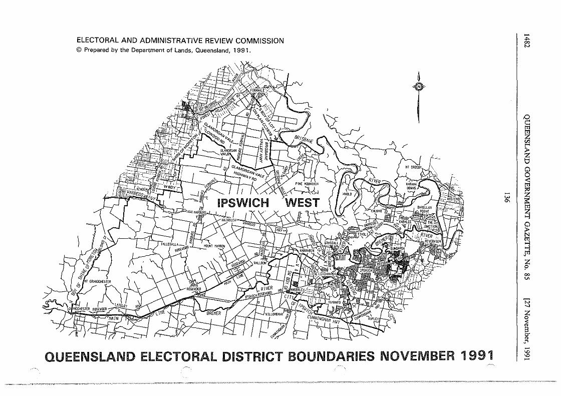
ELECTORAL AND ADMINISTRATIVE REVIEW COMMISSION © Prepared by the Department of Lands, Queensland, 1991.
6
T
QUEENSLAND ELECTORAL DISTRICT BOUNDARIES NOVEMBER 1991
~I
-... 00 N
~ ~ "' ~ 0 0
~ ~
~ jil
t 00 v.
'N .__,
z 0 <
~ _Ol -"' "' -
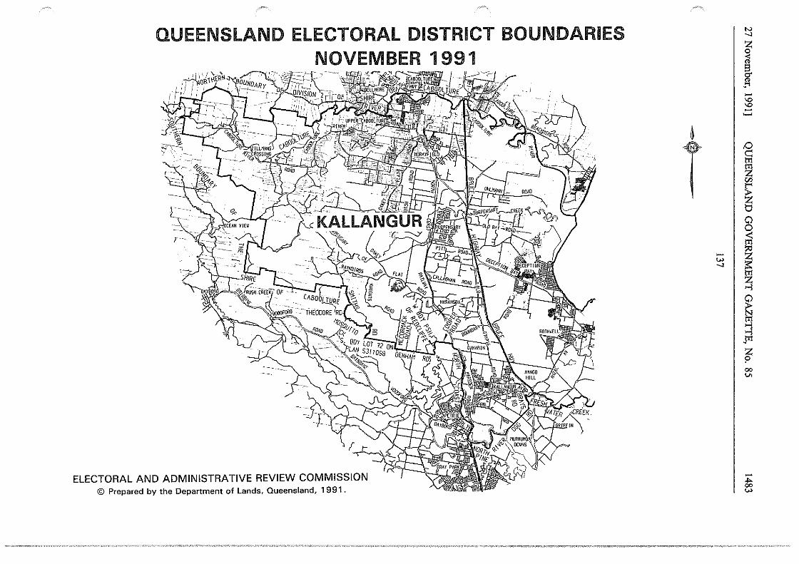
QUEENSLAND ELECTORAL DISTRICT BOUNDARIES NOVEMBER 1991
;~ ,-,~:i~'600Ul!lE -/· ·]i~'-C-, ''; ~ . ~1,. \ . ' '-.. ;,T~ _,-y;_,ffiflllr'f;t(ABOOt" .- . , '%·- -" TURE · ·· · ·
ELECTORAL AND ADMINISTRATIVE REVIEW COMMISSION © Prepared by the Department of Lands, Queensland, 1991.
~
N _,
~ ~ . .... -'° '° -~ I
~ ~
T ~
~ 8 ~
t;; I ~ _, trl
~
~ ~ .., .trl
z p 00 v.
-.... 00
"'
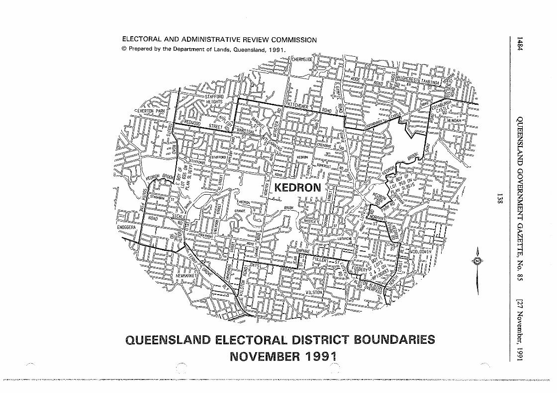
ELECTORAL AND ADMINISTRATIVE REVIEW COMMISSION
QUEENSLAND ELECTORAL DISTRICT BOUNDARIES NOVEMBER 1991
~
T
-.... 00 ....
/:)
g tT1
ti
~ 0
~ ~I~
~ ~ ~ pl
~ 00
"' I
B ~ ~ g" ..... -"' "' -
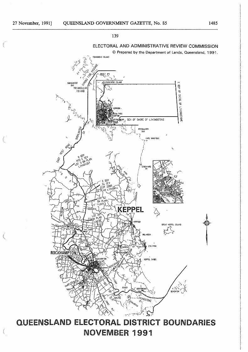
27 November, 1991] QUEENSLAND GOVERNMENT GAZETTE, No. 85 1485
139
ELECTORAL AND ADMINISTRATIVE REVIEW COMMISSION © Prepared by the Department of Lands, Queensland, 1991.
'~'"""
El'U PARK
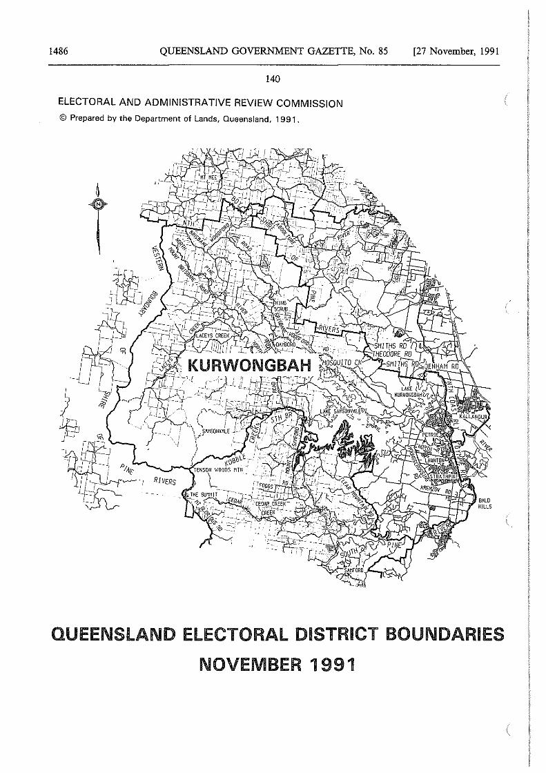
1486 QUEENSLAND GOVERNMENT GAZETTE, No. 85
140
ELECTORAL AND ADMINISTRATIVE REVIEW COMMISSION
© Prepared by the Department of Lands, Queensland, 1991.
[27 November, 1991
QUEENSLAND ELECTORAL DISTRICT BOUNDARIES
NOVEMBER 1991
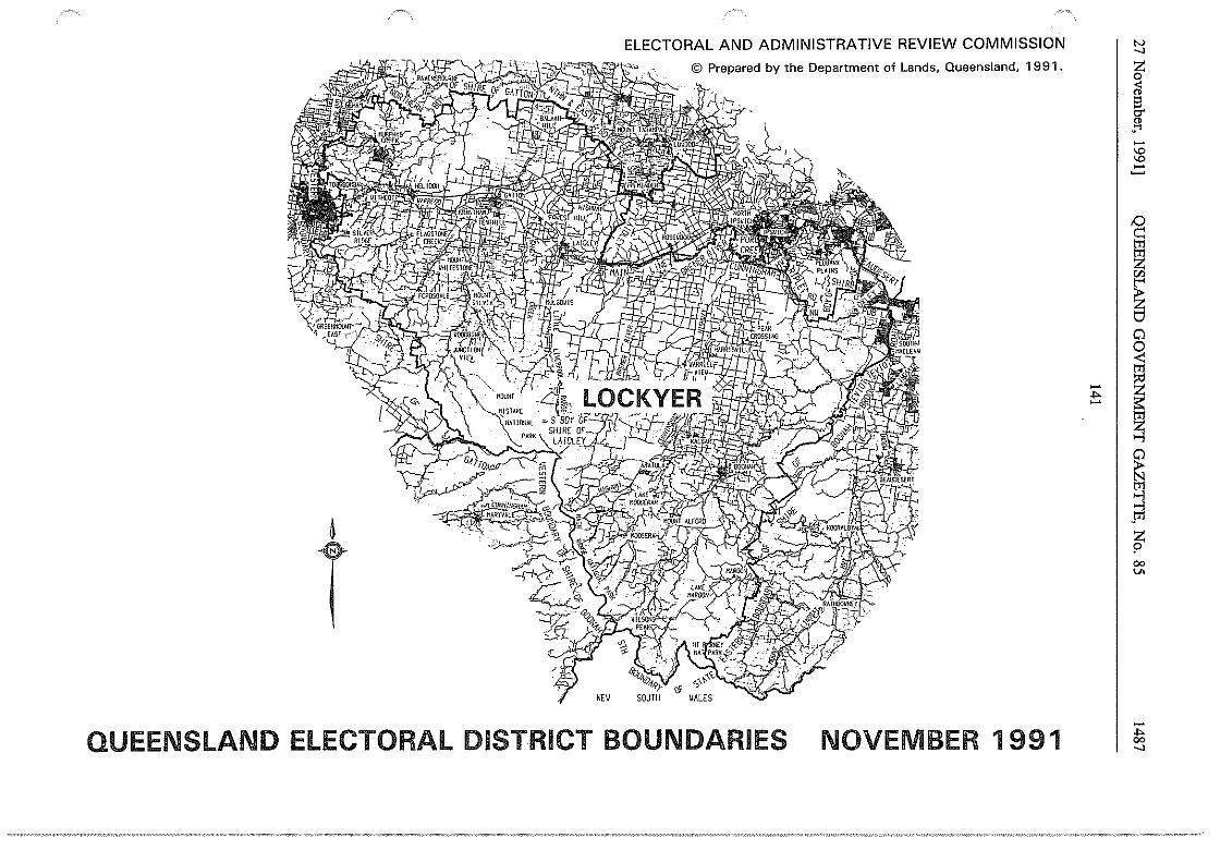
ELECTORAL AND ADMINISTRATIVE REVIEW COMMISSION
© Prepared by the Department of Lands, Queensland, 1 991 .
&
T NEV
QUEENSLAND ELECTORAL DISTRICT BOUNDARIES NOVEMBER 1991
.... I -
"' __,
I -'° '° -
~ z "'
~ 0
~ tTl
i ~
J ~ 00 V>
-.... 00 __,
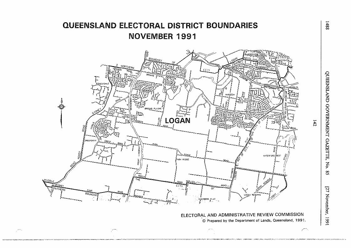
~
QUEENSLAND ELECTORAL DISTRICT BOUNDARIES NOVEMBER 1 991
'a td:
~ Q!;RfEN ~1 00 T 0
~
PM1K
,r--_ & § ~- I
CAMP
BouNo,.,R OP :R,o.
""'
" ARK RIDGE
OP
! CfM18f.RS {L_llT -.
RE,ERVE
~ &
1111 TERFORO ll.IEST
1,#;>
ELECTORAL AND ADMINISTRATIVE REVIEW COMMISSION © Prepared by the Department of Lands, Queensland, 1991.
El
-.... 00 00
'§ tt1
~ "'
~ 0
I ~ ~ s J!1 z $> 00 V>
'N _, ~ < " g. " ..... -'D 'D -
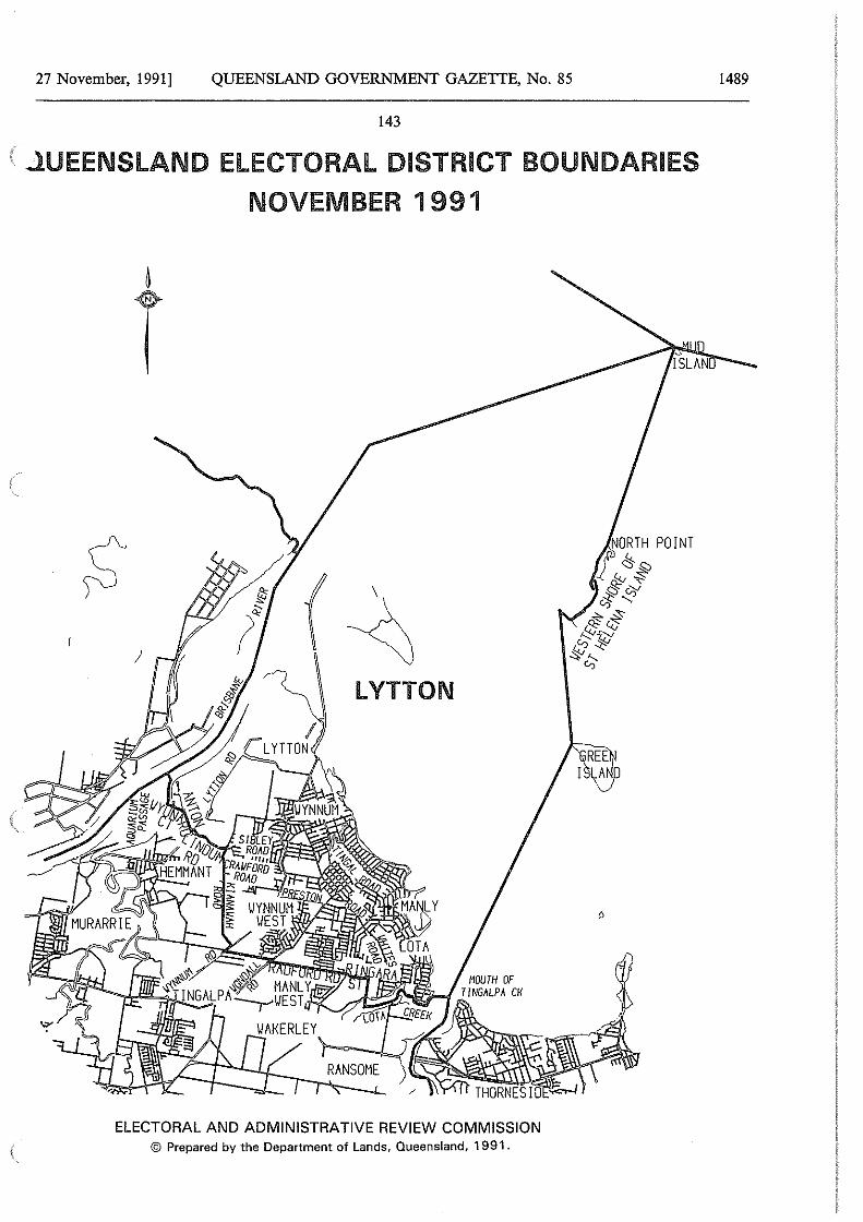
27 November, 1991] QUEENSLAND GOVERNMENT GAZETTE, No. 85
143
.l.UEENSlAND ELECTORAL DISTRICT BOUNDARIES
NOVEMBER 1991
/
LYTTON
ELECTORAL AND ADMINISTRATIVE REVIEW COMMISSION © Prepared by the Department of Lands, Queensland, 1991.
D
1489
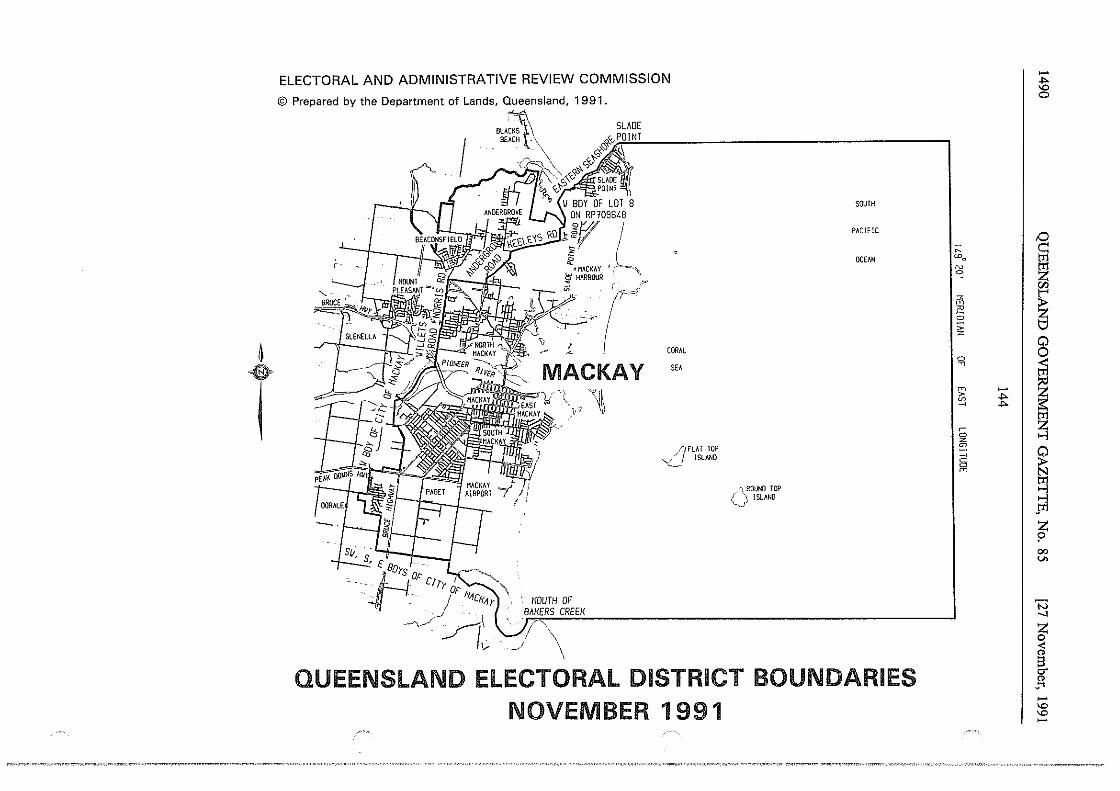
~
T
ELECTORAL AND ADMINISTRATIVE REVIEW COMMISSION
© Prepared by the Department of Lands, Queensland, 1991.
'BRUCE
I -1. s11, s '-If I · --' t Bors DF i Ll CJry DF
c . ..// ' . I i1-1C/(-1 y
~.//~
~r I ~ .. l,~
<MACKAY ! '<> ~HARBOUR p
:-r
MOUTH OF BAKERS CREEK
' '/\ ·~/ \
CORAL
SEA
/)FLAT TOP ~_) ISLAND
/~ROUND TOP C> !SLANO
SOUTH
PACIFIC
OCEAN
QUEENSLAND ELECTORAL DISTRICT BOUNDARIES NOVEMBER 1991
-~ 0
,0 ~
I ~ Wo
N z '" en " ~ m ~ 0 ;: z
0 0
0 I ;;] ~
:;i:l m
ti~ > ~ ~
~ • 0 z
0 ~
C'
~ 0 m
..., ..., pl
z ? 00 V>
'N _, ~ cl g. C1>
·'"' -'° '° -
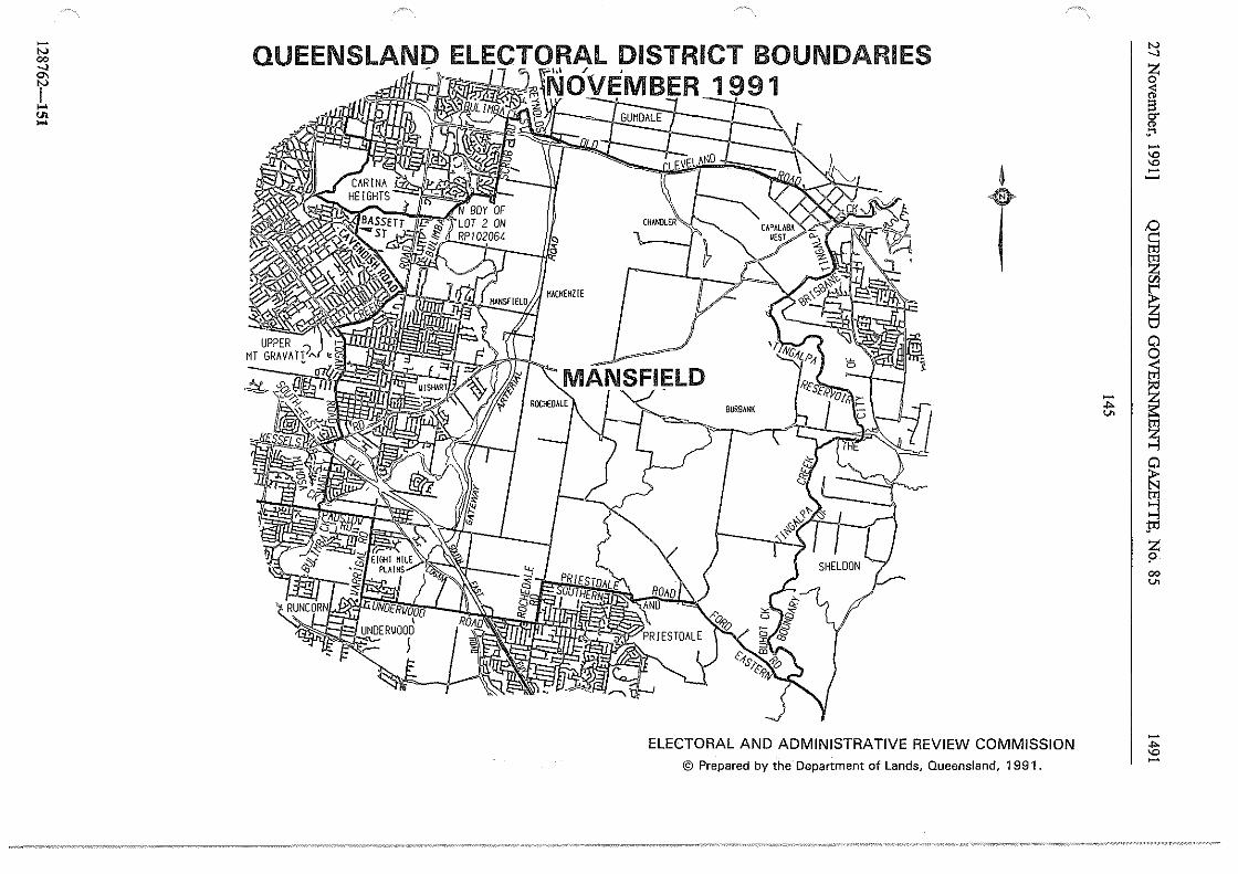
-"' 00 _,
f ... "' ...
QUEENSLAND ELECTORAL DISTRICT BOUNDARIES - - - ,,, / . 1m NOVEMBER 1991 '~ ~
~~;r_GU=MOAL:tE ==+:-~
4
T
ELECTORAL AND ADMINISTRATIVE REVIEW COMMISSION © Prepared by the Department of Lands, Queensland, 1991.
"' _, z ~ g. "' !" -'° '° I .:::
~ ~
i ~
'.;;'. I ~ "' tl1
~
~ ~ :i'1 z ? 00
"'
-"" '° -
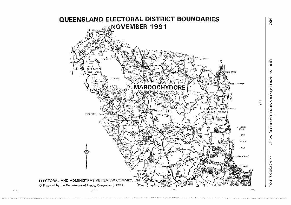
QUEENSLAND ELECTORAL DISTRICT BOUNDARIES -~ 1991
N
!:) c:: trl
~ "' ~ 0
~ - I ~ .... "'
STAIE Foru:;ST ~
I ~ .,,.111JDJl~A ...,
!SlhNO pi
sourn z ?
PACIFIC 00 ..,, DCfAN ~
'3 _, z 0
;i s T or -~ -'O
ELECTORAL AND ADMINISTRATIVE REVIEW COMMISS],IO:;;N~-~~~R.~'ifit5Ji_ ~~~~~ 'O -© Prepared by the Department of Lands, Queensland, 1991 .
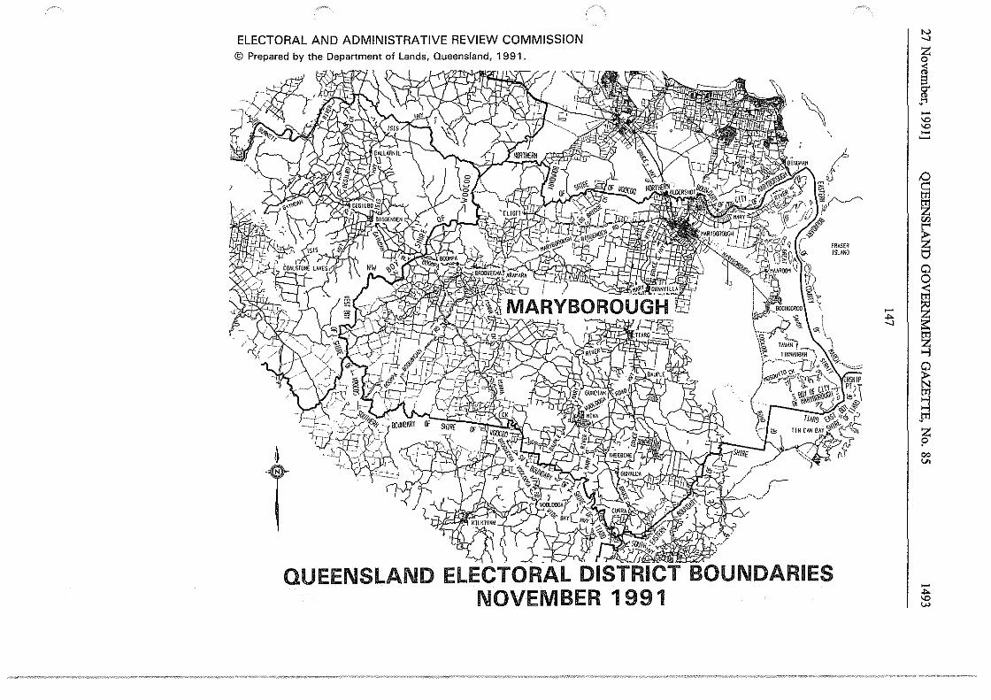
ELECTORAL AND ADMINISTRATIVE REVIEW COMMISSION © Prepared by the Department of Lands, Queensland, 1991.
4
T -~<fJ SOUTH~
) J ~ 1-)fi~)];~
\ "
fRAS€R ISUN!l
QUEENSLAND ELECTORAL DISTRICT BOUNDARIES NOVEMBER 1991
- I ,,. .__,
"' .__,
z 0
~ §. -~ -"° "° -~ tO c: ~ "' ~ 0 0 til ~ r;] J--:)
~ ::l .l:Il
z p co V>
-,,. "° w
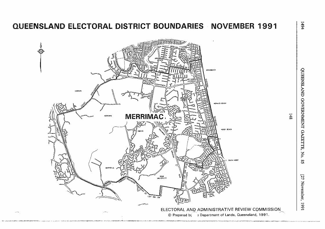
QUEENSLAND ELECTORAL DISTRICT BOUNDARIES NOVEMBER 1991
~
T
( MERfl:>CA•(
ELECTORAL ANQ ADMINISTRATIVE REVIEW COMMISSION © Prepared b\ ' Department of Lands, Queensland, 1991.
- I ,,. 00
-,,. "' ,,.
'° c: ~ "' ~ 0 0 < m
~ ~ ~ ~ >-l .m
t co v.
'N -.:i
~ a g. Cl> ..... -"' "' -
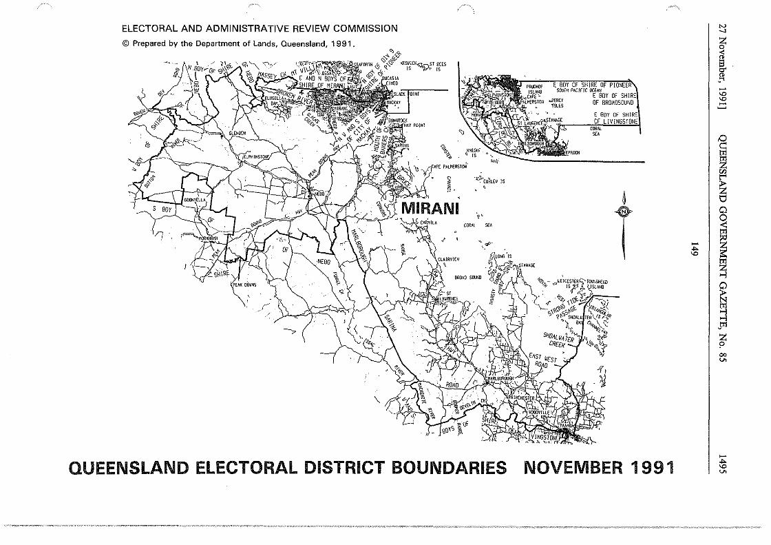
ELECTORAL AND ADMINISTRATIVE REVIEW COMMISSION N _, © Prepared by the Department of Lands, Queensland, 1991. ~
< " ~
t8[)Y--OF-SHIRE OF PIONEER ..... -srum PAc1F1c ocEEABov OF SHIRE "' "' ""'"'' OF BROAOSOUNO -1SLES ~
E BOY OF SHIRE OF L ! V ! NGSTONE
CORAL
'" I
§ ~ "' "HN~rr . f'POON
~ "' ~ VJ
~ ·~'cuhEll IS
~ ~- ' 6
/) T 0
·'i'-' 0 <: CORAL '" tr1
". ef!• - ~ ... "'
~ ~ ~ J!1 z ? 00 v.
.~
-QUEENSLAND ELECTORAL DISTRICT BOUNDARIES NOVEMBER 1991 ~ v.
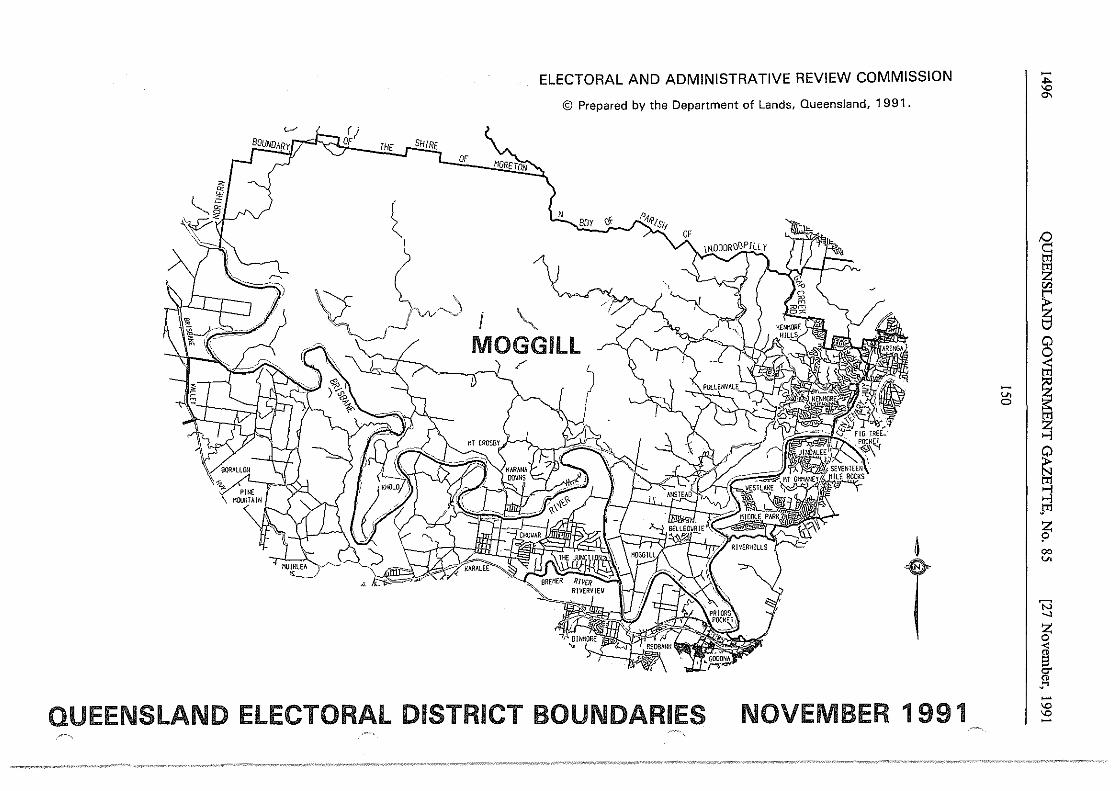
(_./ r; OF
THE
~ I
>
SHIRE OF
:z_J~~
.-\ '"·
I
ELECTORAL AND ADMINISTRATIVE REVIEW COMMISSION
© Prepared by the Department of Lands, Queensland, 1 9 91 .
N BOY ~\ -r
PifRJsff
MOGG Ill
~
T QUEENSLAND ELECTORAL DISTRICT BOUNDARIES NOVEMBER 1991
-,,. 'O
"'
D
~ Cll
~ 8 ~
~ I ~ ~ ~ tT1 ..., ..., .m z 9 00 U>
'3 _, z 0
~ CJ"
" ·'"' -"' "' -
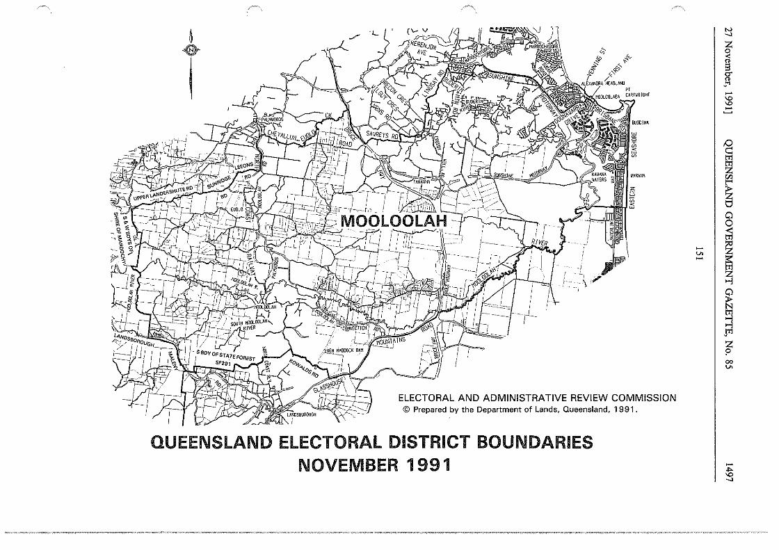
~
T
'=1-
-f- 1
(;; #' ~<,_,
" " it s-18 ~,«:-/ /
ALEXANORA HEAOLAllO er CARTVRIGHI
ELECTORAL AND ADMINISTRATIVE REVIEW COMMISSION © Prepared by the Department of Lands, Queensland, 1991.
QUEENSLAND ELECTORAL DISTRICT BOUNDARIES NOVEMBER 1991
-v. -
N _,
J -"' "' -~
I
I ~ 00 v.
-;!5 _,
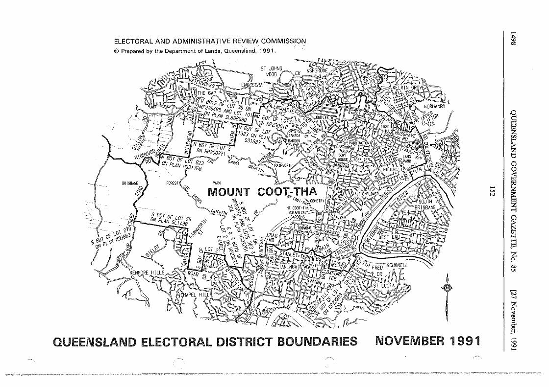
ELECTORAL AND ADMINISTRATIVE REVIEW COMMISSION © Prepared by the Department of Lands, Queensland, 1991.
'~,.
"' - . . t;J "'. ·"·· wi LO\ i10.
s eoi o\ ~ "33553 o~ ?L' I
I . Q.
'"'
FOREST _S'".'-P
"'~~- ~ i.n ·~,,~ w <.?,.. cP i oot:l
- Gg_!t~H ~~~f' (, ?Be; sf'"\ ~s:--1
S BDY OF LOT 55 '-0 ,,_ ON PLA::.J,L ",?!!_ ,;-{f-
#c} <"' ~
:--I -- :--1 _
:>.
QUEENSLAND ELECTORAL DISTRICT BOUNDARIES
-~ 00
!:) c: tT1
~ "' ~ 0 0
- I ~ v. N
~ ....j
~ ....j J"1l z p 00 v.
t 'N _, z 0 ;i s er " _...,
NOVEMBER 1991 -"' "' -
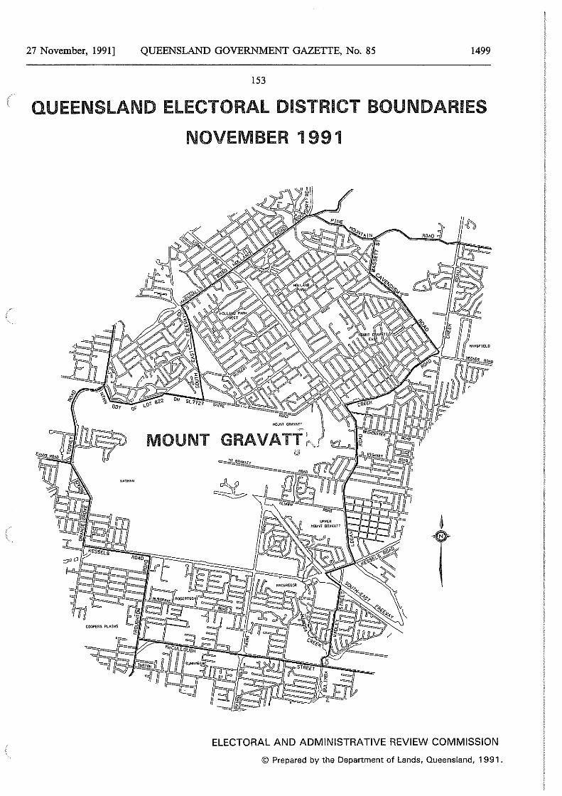
27 November, 1991] QUEENSLAND GOVERNMENT GAZETTE, No. 85 1499
153
QUEENSLAND ELECTORAL DISTRICT BOUNDARIES
NOVEMBER 1991
ELECTORAL AND ADMINISTRATIVE REVIEW COMMISSION
© Prepared by the Department of Lands, Queensland, 1991.
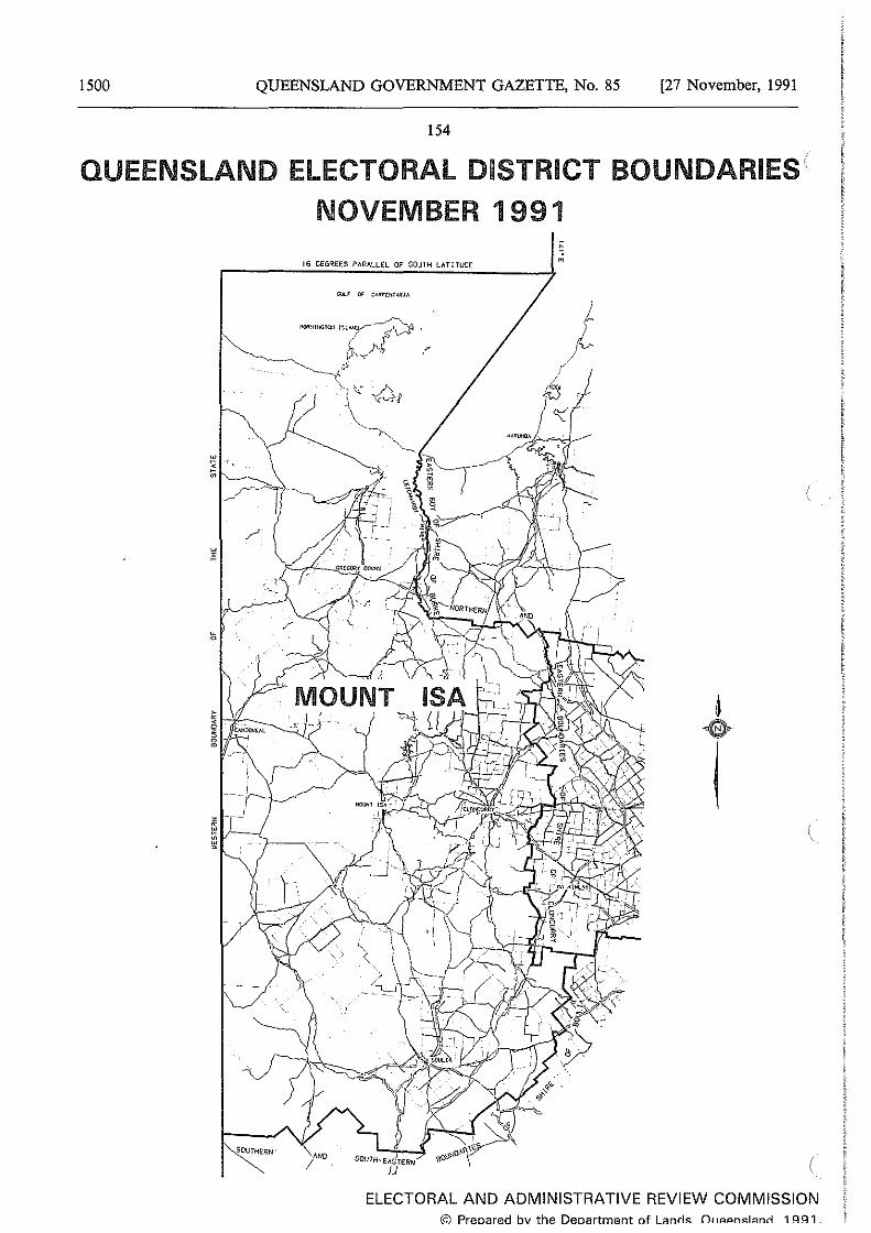
1500 QUEENSLAND GOVERNMENT GAZETTE, No. 85 [27 November, 1991
154
QUEENSLAND ELECTORAL DISTRICT BOUNDARIES
NOVEMBER 1991
16 DEGREES PllRALLEL OF SOUTH LllTITUDE
' m
N
ELECTORAL AND ADMINISTRATIVE REVIEW COMMISSION © Preoared bv the Deoartment of Lanrls_ Ot1AAnslanrl 1 ~~1
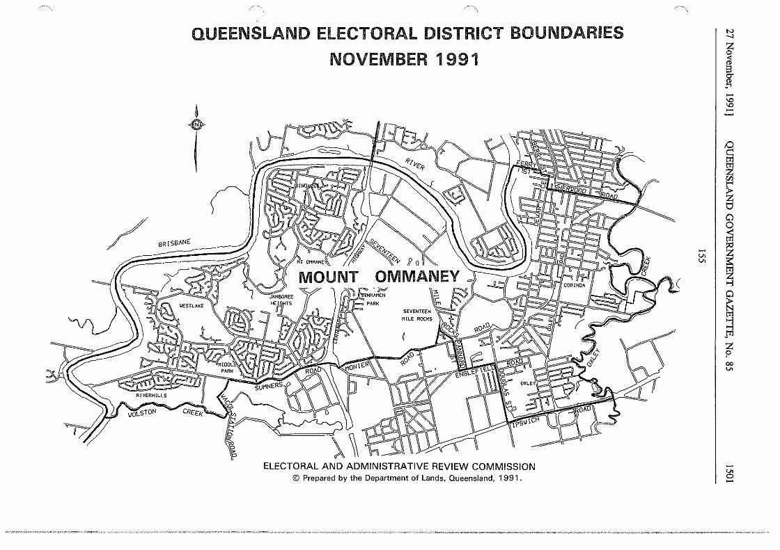
QUEENSLAND ELECTORAL DISTRICT BOUNDARIES
NOVEMBER 1991
t BRISBANE
ELECTORAL AND ADMINISTRATIVE REVIEW COMMISSION © Prepared by the Department of Lands, Queensland, 1991.
c ~
N _,
J -'° '° -;:)
~ Fi "' ~ ~
~I~ Fi ....j
~ 9 jTl
~ 00 v.
-v. 0 -
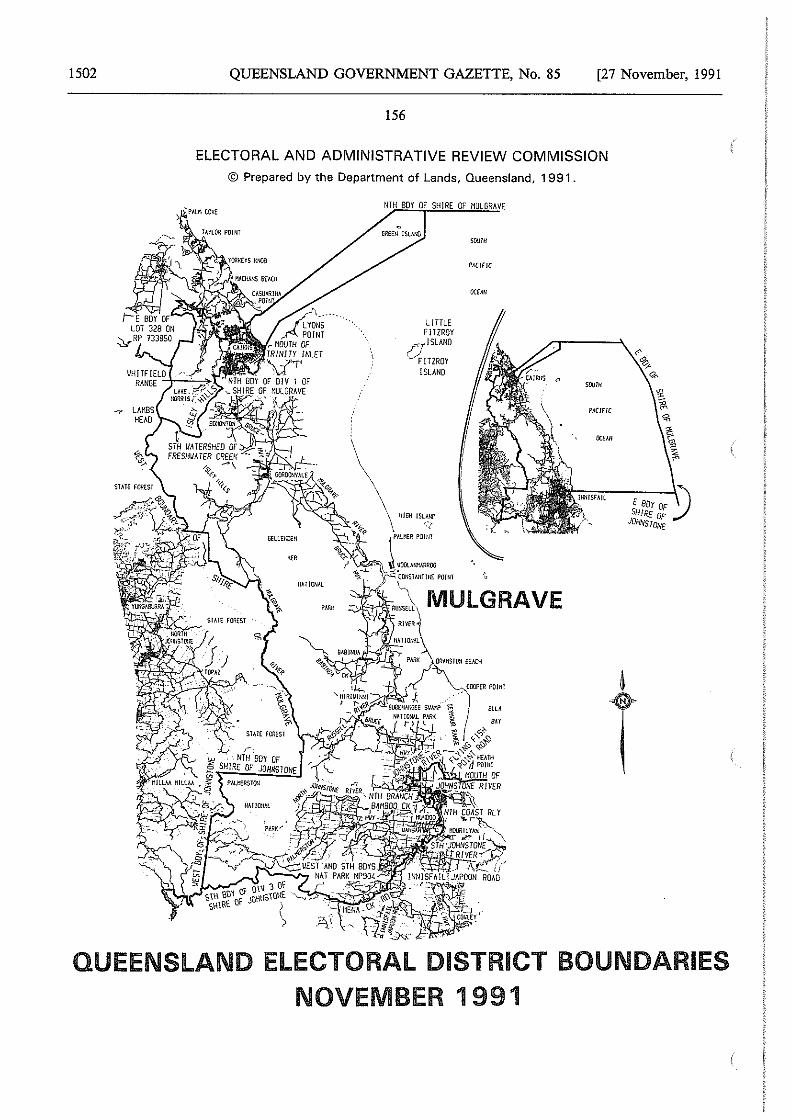
1502 QUEENSLAND GOVERNMENT GAZETTE, No. 85 [27 November, 1991
156
ELECTORAL AND ADMINISTRATIVE REVIEW COMMISSION
© Prepared by the Department of Lands, Queensland, 1991.
L !TTLE FITZROY ISLAND
q!TZROY ISLAND
sourn
PACIFIC
OCEMI
'""" PACIFIC
OCH/I
QUEENSLAND ELECTORAL DISTRICT BOUNDARIES NOVEMBER 1991
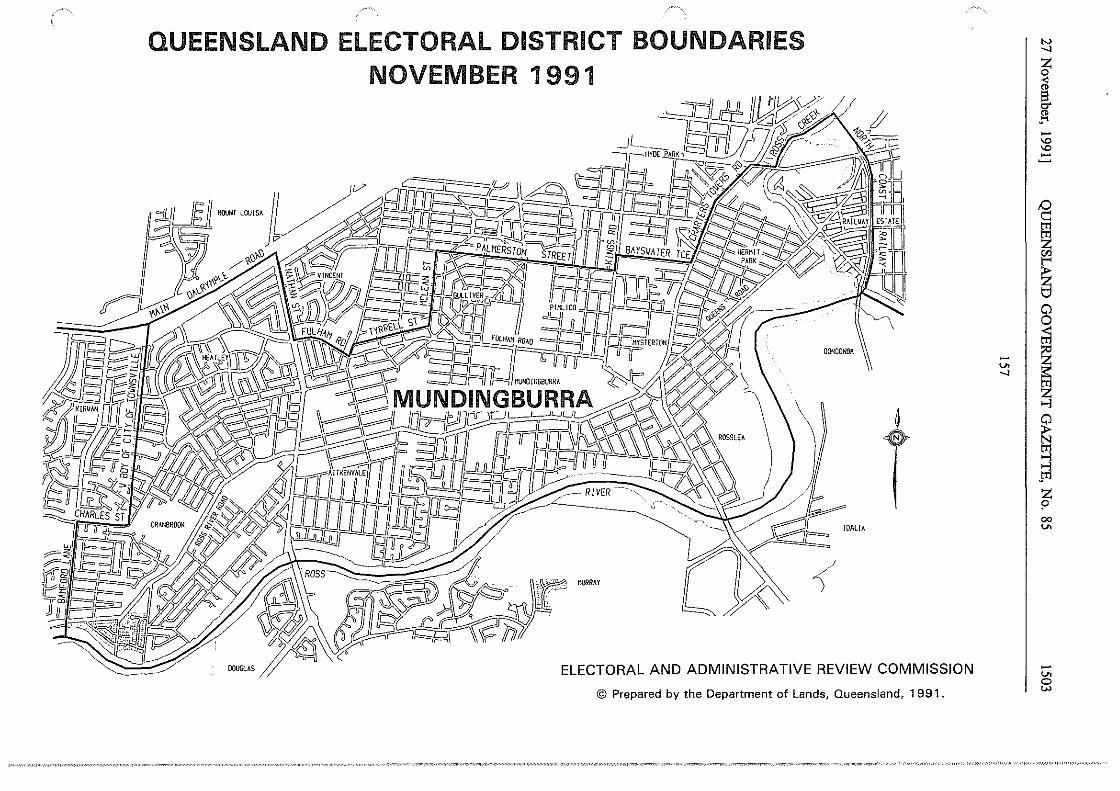
QUEENSLAND ELECTORAL DISTRICT BOUNDARIES NOVEMBER 1991
!DALIA
t
ELECTORAL AND ADMINISTRATIVE REVIEW COMMISSION
© Prepared by the Department of Lands, Queensland, 1991
N __,
.1 -"' "' -
i ~
5 I ~ ~
I ~ 00
"'
-"' 0 l;.)
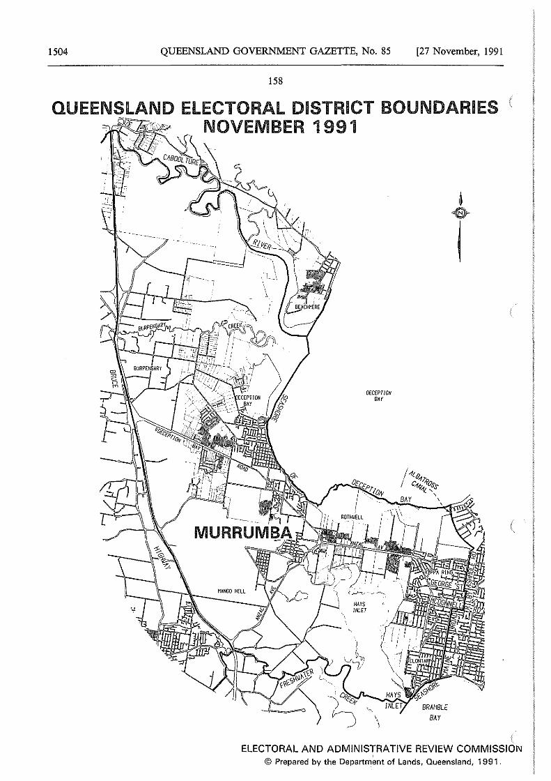
1504 QUEENSLAND GOVERNMENT GAZETTE, No. 85 [27 November, 1991
158
QUEENSLAND ELECTORAL DISTRICT BOUNDARIES NOVEMBER 1991
HANGO HILL
DECEPTION BAY
\ \
B~Y
I
ELECTORAL AND ADMINISTRATIVE REVIEW COMMISSION © Prepared by the Department of Lands, Queensland, 1991.

27 November, 1991] QUEENSLAND GOVERNMENT GAZETTE, No. 85 1505
159
QUEENSLAND ELECTORAL DISTRICT BOUNDARIES NOVEMBER 1991
ELECTORAL AND ADMINISTRATIVE REVIEW COMMISSION © Prepared by the Department of Lands, Queensland, 1991.
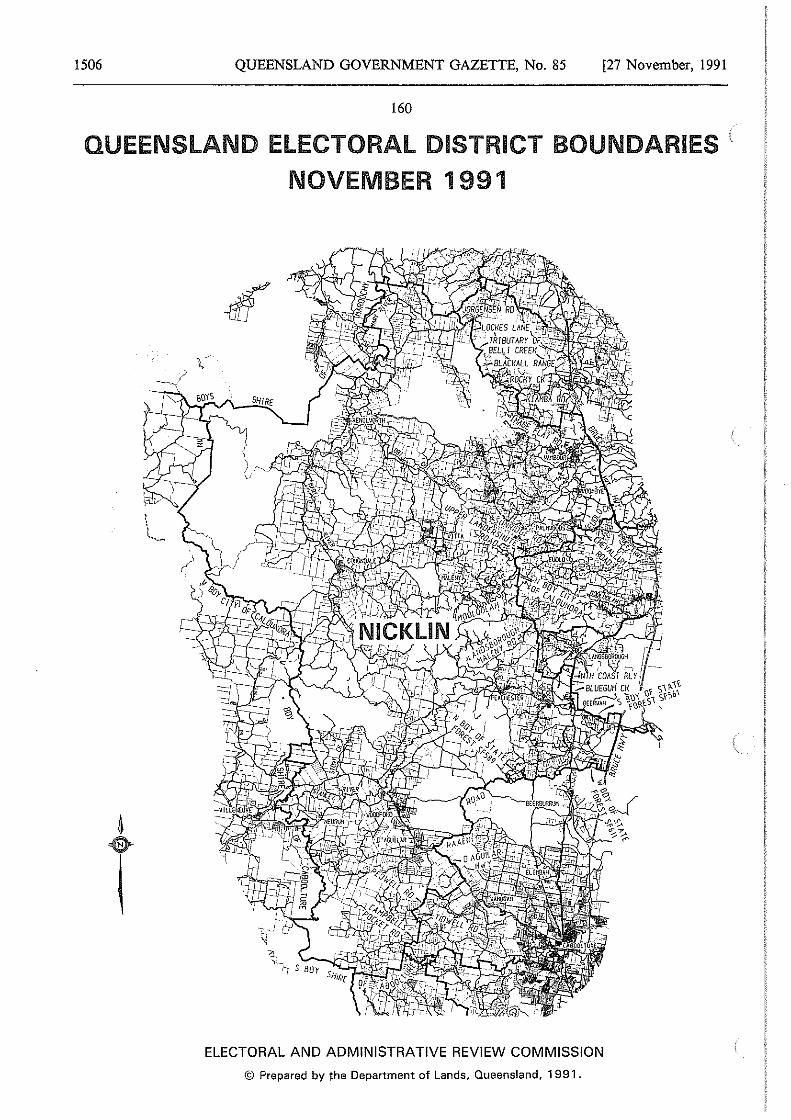
1506 QUEENSLAND GOVERNMENT GAZETTE, No. 85 [27 November, 1991
160
QUEENSLAND ELECTORAL DISTRICT BOUNDARIES
NOVEMBER 1991
ELECTORAL AND ADMINISTRATIVE REVIEW COMMISSION
© Prepared by the Department of Lands, Queensland, 1991.
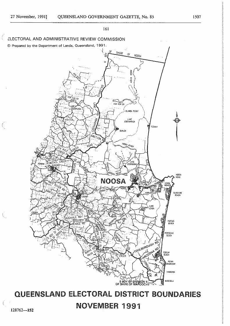
27 November, 1991] QUEENSLAND GOVERNMENT GAZETTE, No. 85
161
i:LECTORAL AND ADMINISTRATIVE REVIEW COMMISSION
© Prepared by the Department of Lands, Queensland, 1991.
\ ~ OF SHIRE c m
OF NOOSA
C.··
.
+/+'--· .. __ I.
.~ -; -~--:~·/
---~ ---- ,,jg,-------
NOOSA HEAD
SUNSHINE BEACH
MARCUS BEACH
MARCOOLA
1507
QUEENSLAND ELECTORAL DISTRICT BOUNDARIES
128762-152 NOVEMBER 1991
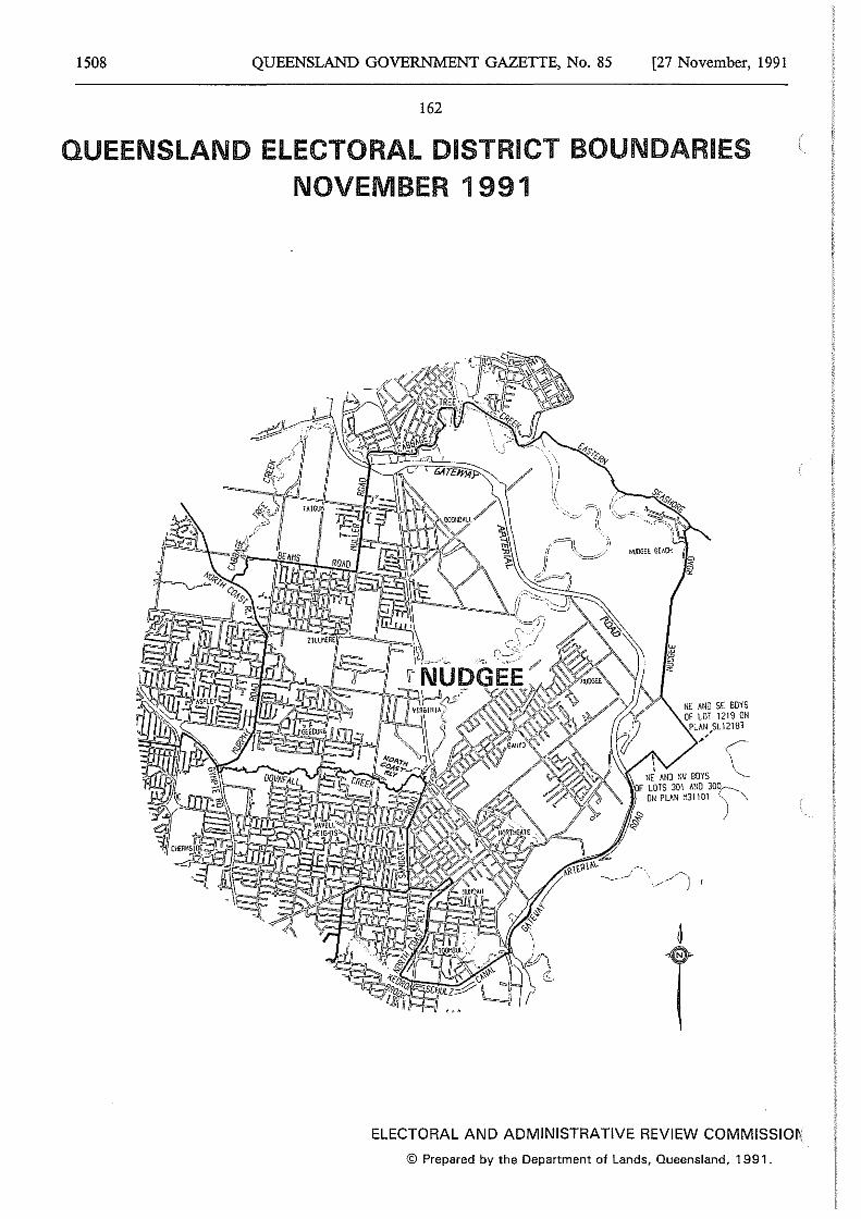
1508 QUEENSLAND GOVERNMENT GAZETTE, No. 85 [27 November, 1991
162
QUEENSLAND ELECTORAL DISTRICT BOUNDARIES NOVEMBER 1991
' ' ' NE Mm ml BOYS F LOTS 301 llNO 30~
%
"' ON PLAN H3l 101 "-), \
ELECTORAL AND ADMINISTRATIVE REVIEW COMMISSIO~
© Prepared by the Department of Lands, Queensland, 1991.
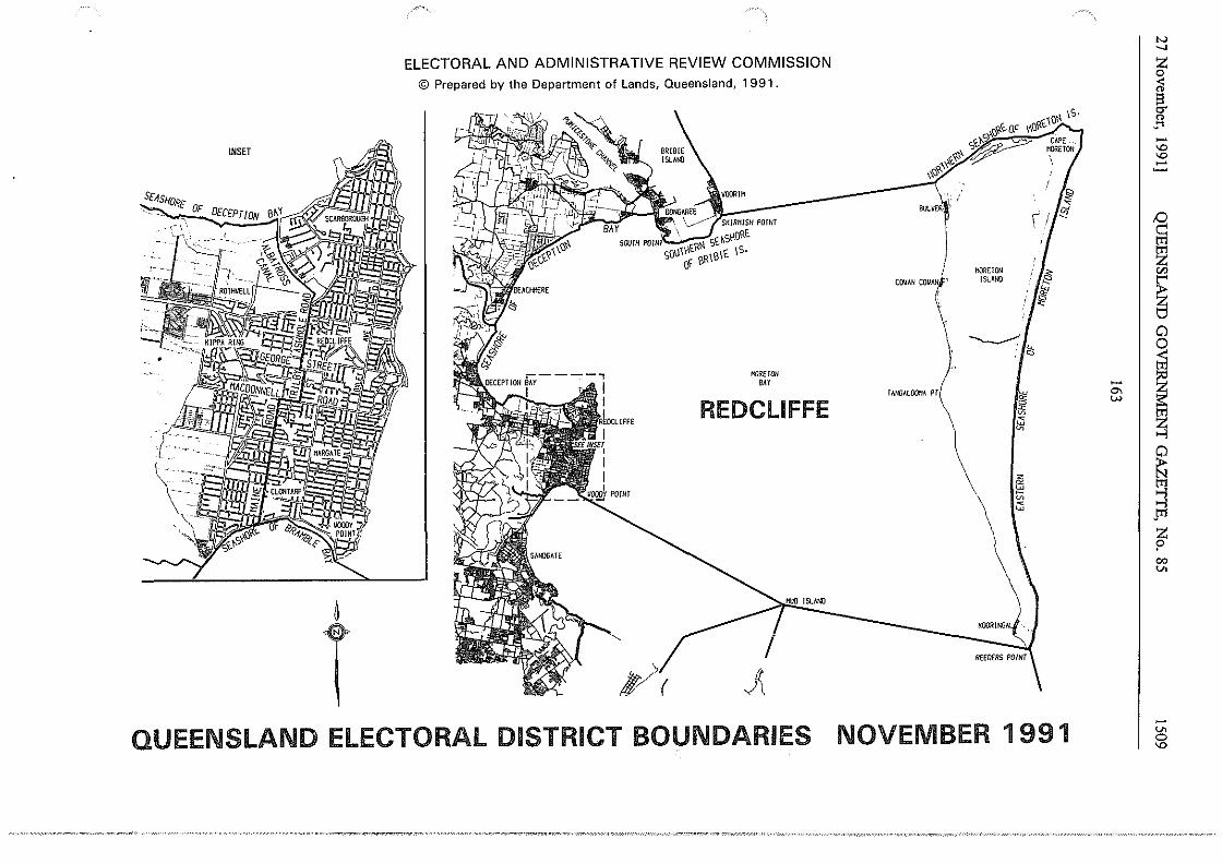
INSET
ELECTORAL AND ADMINISTRATIVE REVIEW COMMISSION © Prepared by the Department of Lands, Queensland, 1991.
BRIBIE !SLM©
SD1SHIJRE ·~
""I t'" BULVE~\' /
,- \ \
~
T ~\(
"'""°" BAY
REDCLIFFE
11UO ISLAND
QUEENSLAND ELECTORAL DISTRICT BOUNDARIES
HORElON CO\IAN COllANI'' ISLANO
TANGALOO'!A PT
KOORltro
,'~ ·~
iii
~ ~
;:;
NOVEMBER 1 991
N _, z 0 ;l g. " .... -'° '° -~ D c::: tt1 tt1 z !Zl
~ 8
- I ~ °' w
~ ~ ~ pl
z ? 00 v.
-v. 0
'°
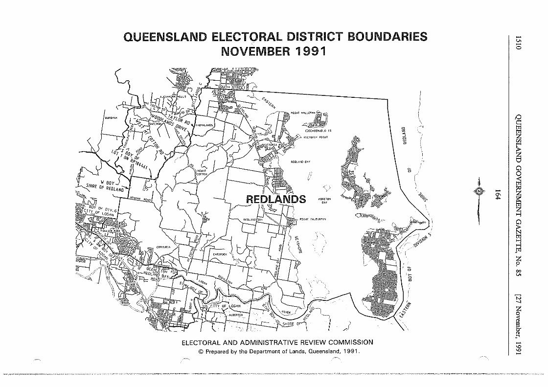
QUEENSLAND ELECTORAL DISTRICT BOUNDARIES NOVEMBER 1991
,"'"'~) COOCHIElllJOLO IS
V/CTOl!I~ POINI
ti
'
·' \
ffill!HON
'"
c~_, ~ I
OF1~v '··1 )
,,J
~ .·f>¢;/'. ··. ; i( i
I
~!:.-
ELECTORAL AND ADMINISTRATIVE REVIEW COMMISSION © Prepared by the Department of Lands, Queensland, 1991.
0 z ~ ~
:;J
"'
'5
~
0
'~ 0 ~
, I
I
\..,>'*-+.
"' i
~
T -°' .,,.
-"' -0
;::) c: gj z VJ
~ 0 0
~ ~ ~ ~ ....,i pl
z p 00
"'
'N _, ~ < " s it ..... -'° "' -
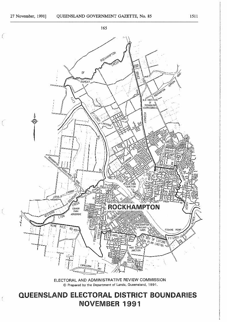
27 November, 1991]
6
T
QUEENSLAND GOVERNMENT GAZETTE, No. 85
165
T'~--y ___ :
. ·f···· r n ,~ : f i CAPRICORN.·· I t 1 . . , ~t;;;;;;::Jt;,f_
ELECTORAL AND ADMINISTRATIVE REVIEW COMMISSION © Prepared by the Department of Lands, Queensland, 1991.
1511
QUEENSLAND ELECTORAL DISTRICT BOUNDARIES NOVEMBER 1991
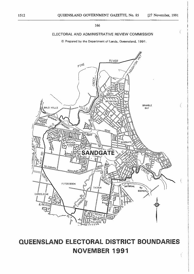
1512 QUEENSLAND GOVERNMENT GAZETTE, No. 85 [27 November, 1991
166
ELECTORAL AND ADMINISTRATIVE REVIEW COMMISSION
© Prepared by the Department of Lands, Queensland, 1991.
FITZGIBBON
i;j\ 'ii! I u
BRAMBLE BAY
QUEENSLAND ELECTORAL DISTRICT BOUNDARIES
NOVEMBER 1991
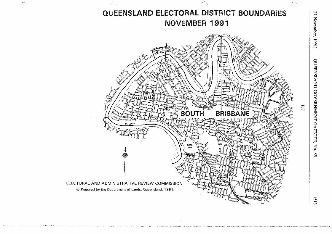
QUEENSLAND ELECTORAL DISTRICT BOUNDARIES NOVEMBER 1991
~
T © Prepared by the Department of Lands, Queensland, 1991.
-°' _,
N _, z 0
ii §.
_o: -'O 'O -~
1 Cll
~ ~
I~ ~ ~ gi ...., J"1 z ? 00 ..,,
-..,, -w
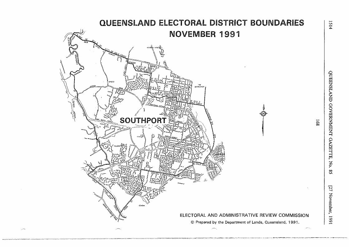
QUEENSLAND ELECTORAL DISTRICT BOUNDARIES NOVEMBER 1991
-
·~ mw;o"""R
~
T
ELECTORAL AND ADMINISTRATIVE REVIEW COMMISSION
© Prepared by the Department of Lands, Queensland, 1991.
- I "" co
-v. -....
0 c:: tT1
~ "' ~ 8
I ~ ~ gi ..., J"1
~ co v.
'N -..]
z 0 ;i §. "' ·"" -'° '° -
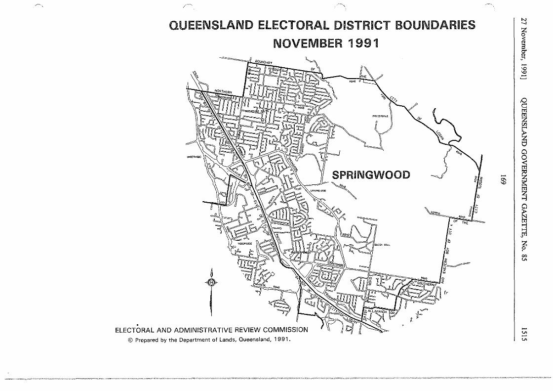
QUEENSLAND ELECTORAL DISTRICT BOUNDARIES
NOVEMBER 1991
P~IESl!MlE
~~(
C:::- SPRINGWOO J,\Y-~~ ~ D
~
T fi .
ELECTORAL AND ADMINISTRATIVE REVIEW COMMISSION © Prepared by the Department of Lands, Queensland, 1991.
81~ c
~
1" ' u ~~== , OP THE
~
> 0
~ > ~
iii ~~ ;;;
- I °' 'O
N _,
~ l -'O 'O -~ tT1
~ IJJ
~ 0 0 <:
~ ~ ~ ~
J"'1 z ? 00 V>
-V> -V>
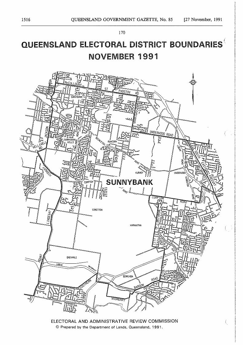
1516 QUEENSLAND GOVERNMENT GAZETTE, No. 85 [27 November, 1991
170
QUEENSLAND ELECTORAL DISTRICT BOUNDARIES {
NOVEMBER 1991
ELECTORAL AND ADMINISTRATIVE REVIEW COMMISSION © Prepared by the Department of Lands, Queensland, 1991.
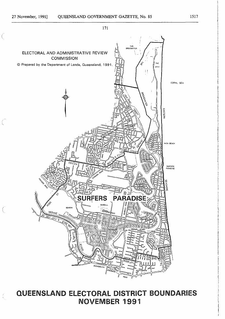
27 November, 1991] QUEENSLAND GOVERNMENT GAZETTE, No. 85
171
ELECTORAL AND ADMINISTRATIVE REVIEW 15 COMMISSION Joo
© Prepared by the Department of Lands, Queensland, 1991. buo PA fJ ..
:1
t
THE\ BROllOllHER
ii
, THE
SPIT
)
1517
CORJ\L SEJ..
Hll!N BEACH
QUEENSLAND ELECTORAL DISTRICT BOUNDARIES NOVEMBER 1991
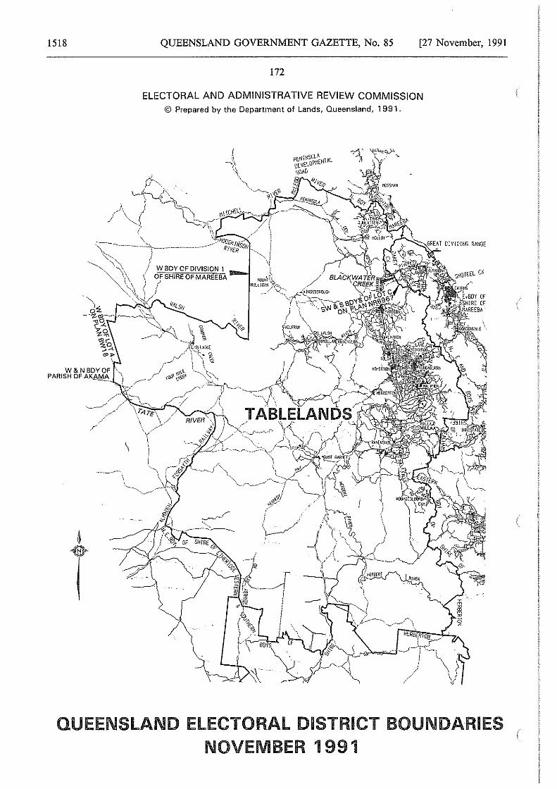
1518 QUEENSLAND GOVERNMENT GAZETTE, No. 85 [27 November, 1991
172
ELECTORAL AND ADMINISTRATIVE REVIEW COMMISSION © Prepared by the Department of Lands, Queensland, 1991.
i.~J ~,!
(
/ /' \_-----/
QUEENSLAND ELECTORAL DISTRICT BOUNDARIES NOVEMBER 1991
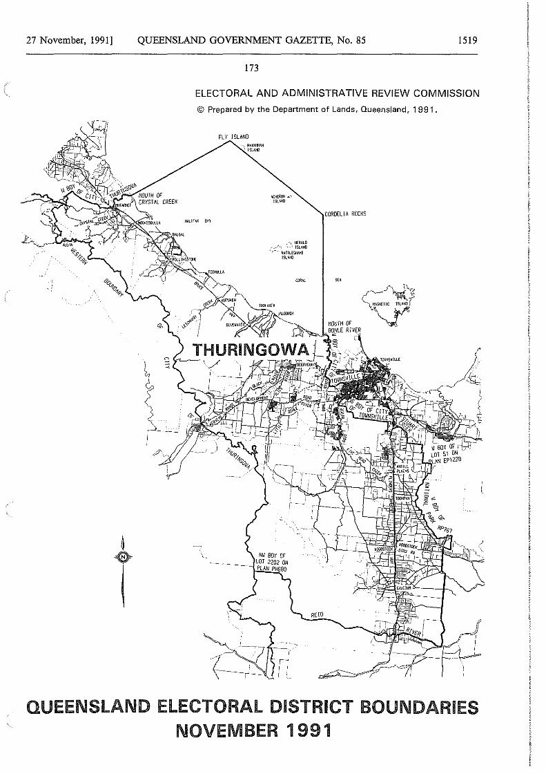
27 November, 1991] QUEENSLAND GOVERNMENT GAZETTE, No. 85 1519
173
ELECTORAL AND ADMINISTRATIVE REVIEW COMMISSION
© Prepared by the Department of Lands, Queensland, 1991.
!L\l.IFAX OAY
FLY ISLAND
,-, HERM.0 ,_ ISlllllO
--- RAlllESIW<E
) \
'"'"
NLI BOY OF - ------- LOT 2202 ON
- PLAN PH580
CORDELIA ROCKS
REIO
QUEENSLAND ELECTORAL DISTRICT BOUNDARIES NOVEMBER 1991
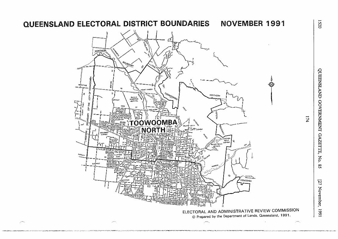
QUEENSLAND ELECTORAL DISTRICT BOUNDARIES NOVEMBER 1991
7 lt ·~ "€~111T•G£ ~ !!i
~'==-~ [ • "' ~cc~'"~" ll ' . \ ~~"' • CRANl.£Y
' w r • " • Je
~ lrt--rnW!l~ ·-e~~~
- '""1 · · NOi @1~,~~k ~
'tU?slcr
-i~ G\.E ... ALt
~
~ ~ ~
T - '' '\,
KA100>'1!A
L~~l' ~ 1
~' Ir
~~ !?gj; . ~ L
ELECTORAL ANO ADMINISTRATIVE REVIEW COMMISSION © Prepared by the Department of Lands, Queensland, 1991.
- I _, -I>
-"' ~
i "' ~ Cl 0
I ~ ~ ~ jt'l
z p 00
"'
t3 _, z 0
~ g. "' ..... -"' "' -
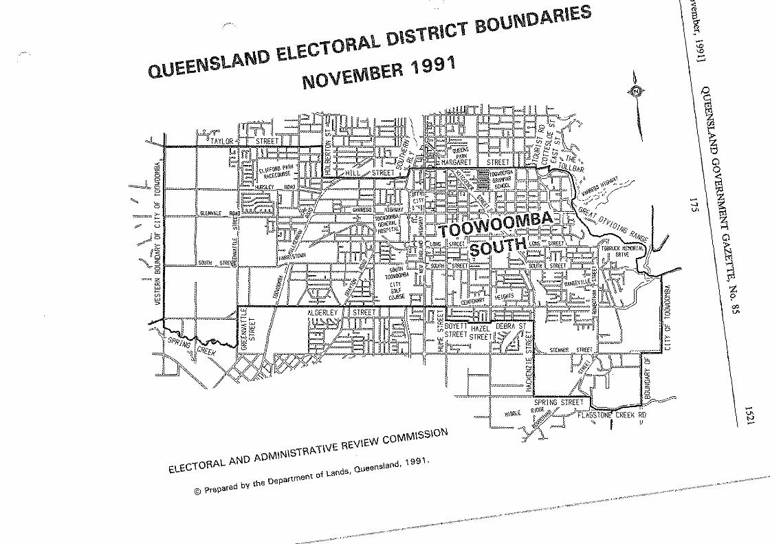
oUEElllSLAlllD ELECTORAL DISTRICT sou1110ARIES
NOVEMBER 1991
""' 15 ~1 ~~
~ w I
/~ ff~
~5 ill
=iE ~
~
:;!
'"'"" -""JI lf:',,i(;;,., 1mi-. 1hr4flirl,-JJJ.!
~
~
~
<
i ~
15 ,._ ~
JLJLits=u ""ff&. ~lt%-- "'""'' l'lnl ~ _J II
)'Jelfll l~u
~ ~ rc~LJL_J i
cLECWRAL AND ADMINIS1RA>'" "'""w coMMiSSiON
I SPRING ST 5 "l'l.WRJ.,t RIO~;># REE! :Jl ~ ,., ~~ -4,_,:I! ruo; l CREEK RD
:f " I 11
© ?re\lared by the Department oi Lands, Queensland, 1991.
~ z ~ a
CJ' ~ .... '° '° .... ......
°c m z ~ ~ tj
Cl
~ .... \ ~ 7]. ~
~ ,., Cl
~ ~ z ? 00 U>
.... "' ..., ....
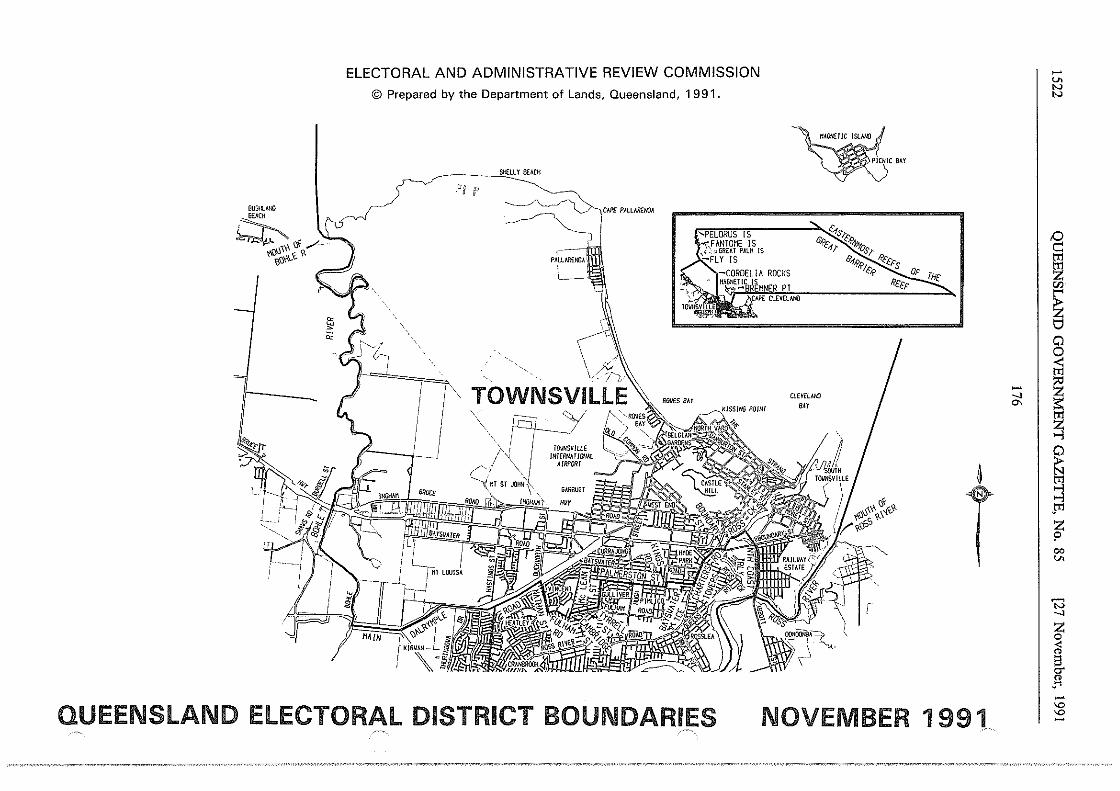
BUSHLAND
j~ ~ '"':<§ /
~l)~~~\.t. ?. iGn
l _.
ELECTORAL AND ADMINISTRATIVE REVIEW COMMISSION
©Prepared by the Department of Lands, Queensland, 1991.
SHELLY !lt:ACI! -.og ff'
/1\ I I
r J __ _J
~ CAP£ PJ\LLARfMlA -
-~ )
' ___..\:~.
\ ~· I ,, . ;v \v'.'.'-j'J.,·
TOWNSVlllE \ rq___y·
TOWSVILLE IHTfRNAT/Dtl.R
A/R?{)RT
···~"'"°""15~~~~-;;;;',s~~ .. "'"°"'no"' " 6.fc,, ""'os,
e...,R/> Rcc,.c-s ,., 'r'/C.f' VF
Rtcr
~
T
QUEENSLAND ELECTORAL DISTRICT BOUNDARIES NOVEMBER 1991 ,·-·-.
-v. N N
,0
~ ~ Cl 0 ;;i
~I~ ~
~ pl
~ 00 v.
'N _,
.1 -"' "' -
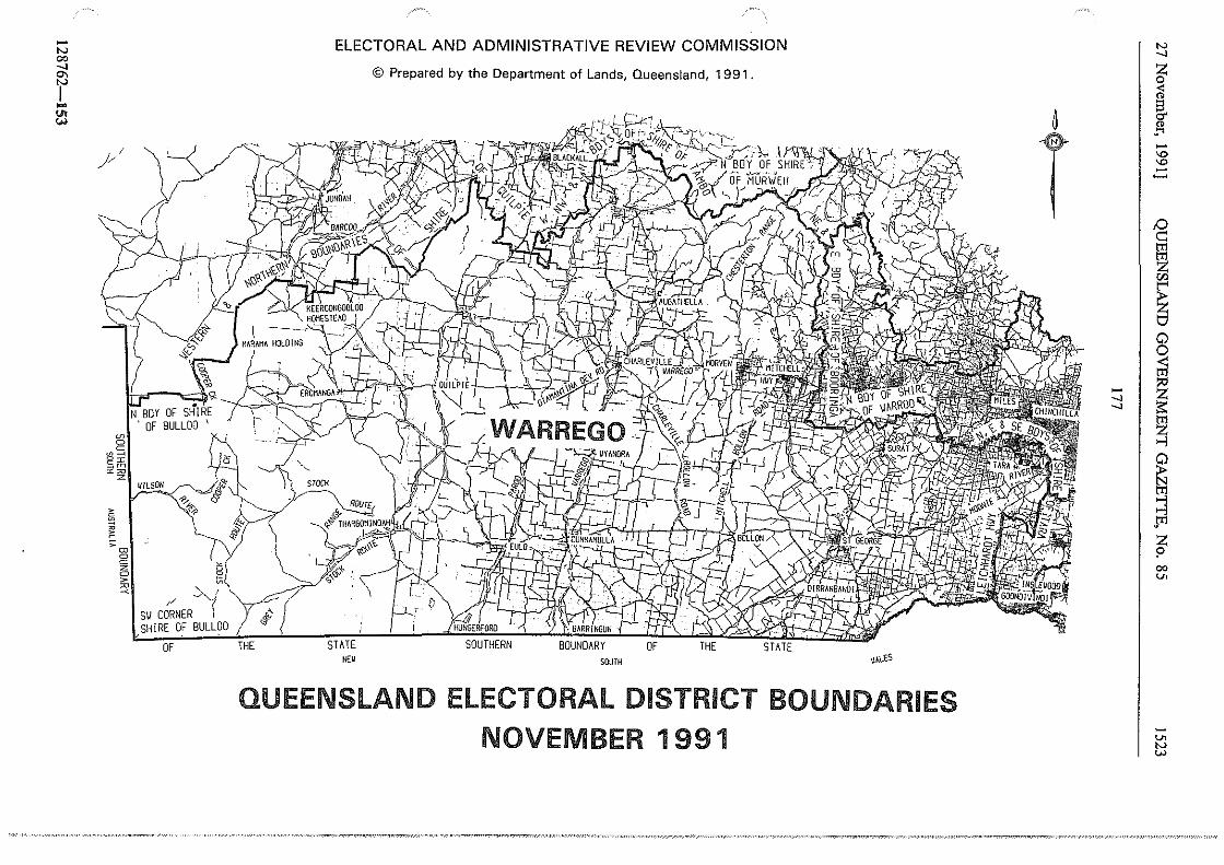
-"' 00 _, °' I ..... 1!J
j/
§ ~ ;; "'
0 c a > ~ ~ ;/ ~~
sv CORNER I SHIRE OF BULLOO
OF THE
ELECTORAL AND ADMINISTRATIVE REVIEW COMMISSION
STATE NEU
© Prepared by the Department of Lands, Queensland, 1991.
BOUNDARY SOUTH
OF THE STATE \It.\.£$
QUEENSLAND ELECTORAL DISTRICT BOUNDARIES NOVEMBER 1991
~
T
"' _, z 0
cl g. " .... -"' "' -~ D g ~
~ Cl 0 ;;:i
_, I ~ _, ~
~ s J'1 z ? 00 v.
-v.
"' w
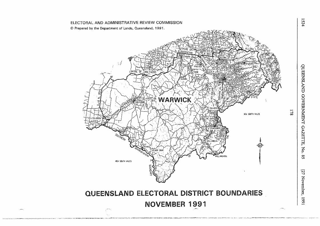
ELECTORAL AND ADMINISTRATIVE REVIEW COMMISSION © Prepared by the Department of Lands, Queensland, 1991.
,/
NE\/ SOUTH VALES
Nfll SOUTH \/ALES
t QUEENSLAND ELECTORAL DISTRICT BOUNDARIES
NOVEMBER 1991
~I
-v. ~
D g t] "' ~ 0 0 ;;l ~
~ ~ tT1
-~ ~ 00 v.
'N _, z ~ " g. " ..... -"" "" -
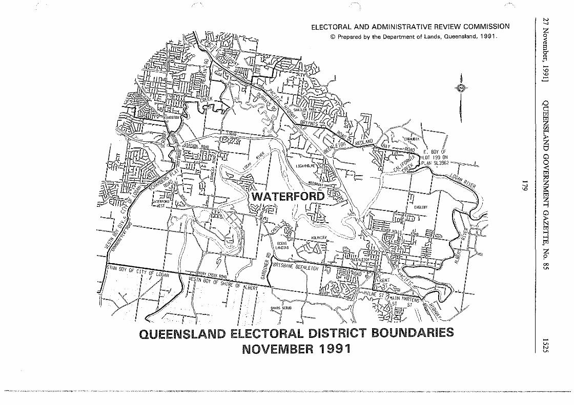
'Y
ELECTORAL AND ADMINISTRATIVE REVIEW COMMISSION © Prepared by the Department of Lands, Queensland, 1991.
t ·-/
E. BOY OF
~~t --- - ~ ENT~~ . T ,......_ /c ----c -- --~,,
....JJ.!1.!<~~f /,11Li, s("' .. ~/'-'-!-._ ~~~),..,/\~.1AIN IMRIENS~"'lll. ,
1~ROO ~~ '~~ST\\ \~J
IA/Ry CR ll[STN BO Efl<_ RQAD · · 1·zj \----+ ~w
·-QUEENSLAND ELECTORAL DISTRICT BOUNDARIES
NOVEMBER 1991
__, I \0
N __,
~ ii g. " ·"' -\0 \0 -~ /:) c:::
~ "' ~ t:i Cl 0 <:
~ s:: ~ ...,
~ ..., .m z p 00 ..,,
-"' N
"'
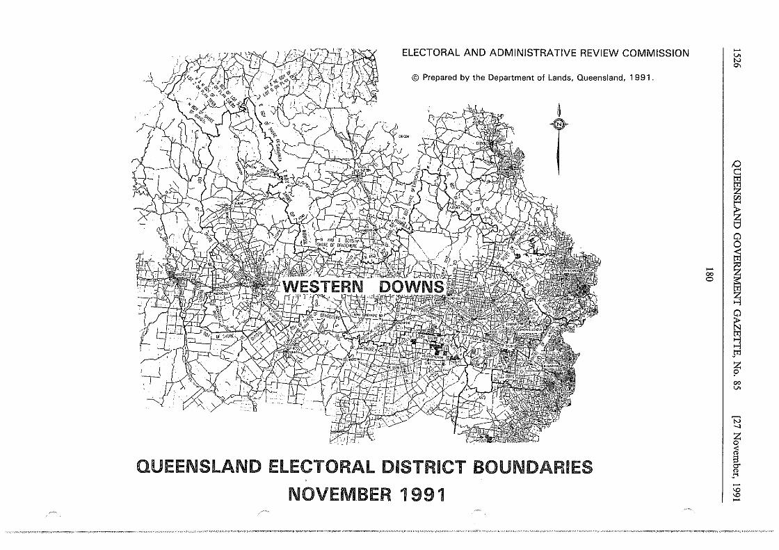
ELECTORAL AND ADMINISTRATIVE REVIEW COMMISSION
~ © Prepared by the Department of Lands, Queensland, 1991.
~
T
QUEENSLAND ELECTORAL DISTRICT BOUNDARIES
NOVEMBER 1991
-00 0 I
-v. N
°'
/:) c:: tr1
~
~ 0 0 < tr1
~ ~ ~ ~ >-l J'1
~ 00 v.
t3 _, z 0
<ii s c:r .f:l -"' "' -
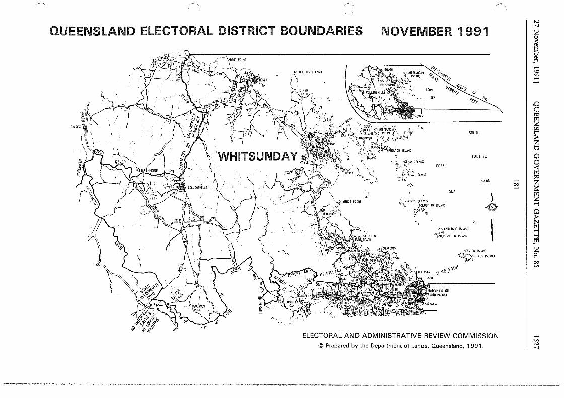
QUEENSLAND ELECTORAL DISTRICT BOUNDARIES NOVEMBER 1991
~~:,:" '"'~ SEACi;rj
"
('"'.s;; ,,,, C,c,.. '"!fis '(;ef/' /' ~~,~"""' , '"""""'"
,'· ~- ~~··.· ,f:_,•ISLIJIO 1.: . ~ ~~· .~ 'l.'- \~>-
.../-, I\ ,-,~ ... -.Pll-OS£Rf'I f\~:_ ··J.;
CORAL ""''s 84-fy O,c-1(,f> !ff('
,•
' " g,
""'''
•'' SOUTH
PAC!F!C
CORAL
OCEAN <'I'·
SEA
t ~~- ANCflDR !SlANOS t:.'\, • GOl.OS!lllll ISLAfllJ
;§\'< : ~
I> ~CARLISLE !SLAN!I
~.ElllAKf>lON ISLMtl
KESVJCK ISLMIO
~~ST.&£5 ISLAND ,_,,,, ?\)\\\i
S\..1-.l)t_
ELECTORAL AND ADMINISTRATIVE REVIEW COMMISSION
© Prepared by the Department of Lands, Queensland, 1991.
- I 00
~
J -"' "' -tO c: ~ "' ~ s 0 0 < trl
~ ~ 0 ~ s J'1 z p 00 v.
-v.
"' _,
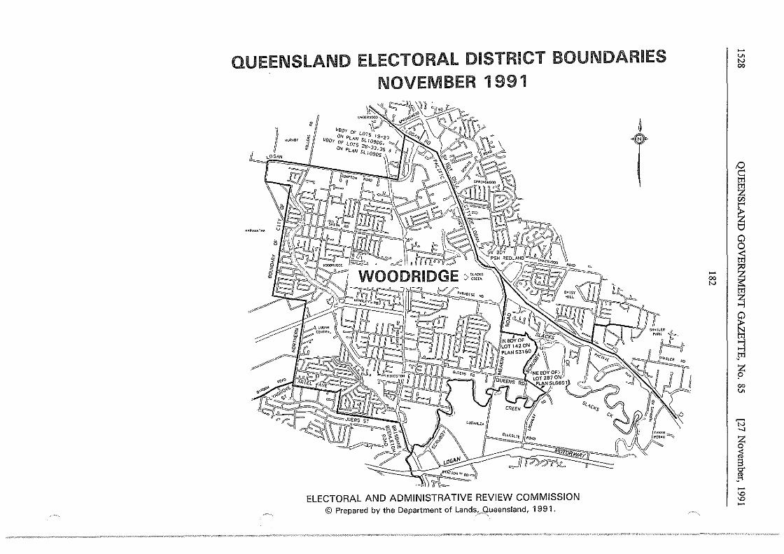
QUEENSLAND ELECTORAL DISTRICT BOUNDARIES NOVEMBER 1991
] -~'" i J[ LOGl\N
KAR•VhlHh
s~-iclr"s
'li(Ay
ELECTORAL AND ADMINISTRATIVE REVIEW COMMISSION © Prepared by the Department of Lands,_,9ueensland, 1991.
~
T
-v. N 00
I~ 65
~ 0
~ - I ~ 00 is: N tl1
~
~ gi ;;l z ? 00 ..,.
D -..)
z 0 <
~ " _ ... -"' "' -
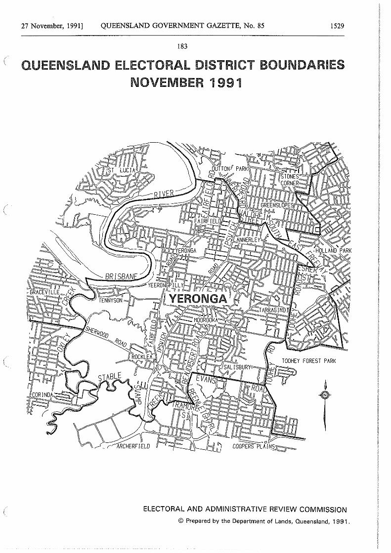
27 November, 1991] QUEENSLAND GOVERNMENT GAZETTE, No. 85 1529
183
QUEENSLAND ELECTORAL DISTRICT BOUNDARIES NOVEMBER 1991
ELECTORAL AND ADMINISTRATIVE REVIEW COMMISSION
© Prepared by the Department of Lands, Queensland, 1991.
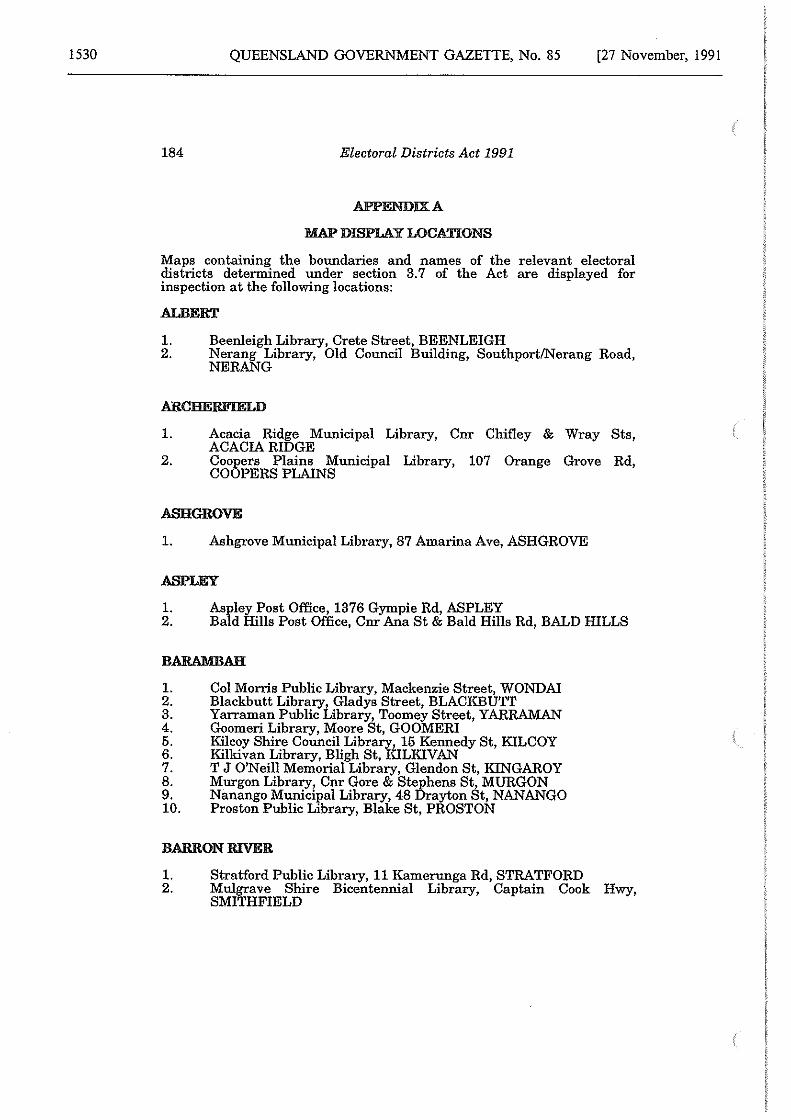
1530 QUEENSLAND GOVERNMENT GAZETTE, No. 85 [27 November, 1991
184 Electoral Districts Act 1991
APPENDIX A
MAP DISPLAY LOCATIONS
Maps containing the boundaries and names of the relevant electoral districts determined under section 3.7 of the Act are displayed for inspection at the following locations:
ALBERT
1. Beenleigh Library, Crete Street, BEENLEIGH 2. Nerang Library, Old Council Building, Southport/Nerang Road,
NERANG
1.
2.
Acacia Ridge Municipal Library, Cnr Chifley & Wray Sts, ACACIA RIDGE Coopers Plains Municipal Library, 107 Orange Grove Rd, COOPERS PLAINS
ASH GROVE
1. Ashgrove Municipal Library, 87 Amarina Ave, ASHGROVE
ASPLEY
1. 2.
Aspley Post Office, 1376 Gympie Rd, ASPLEY Bald Hills Post Office, Cnr Ana St & Bald Hills Rd, BALD HILLS
BARAMBAH
1. 2. 3. 4. 5. 6. 7. 8. 9. 10.
Col Morris Public Library, Mackenzie Street, WONDA! Blackbutt Library, Gladys Street, BLACKBUTI' Yarraman Public Library, Toomey Street, YARRAMAN Goomeri Library, Moore St, GOOMERI Kilcoy Shire Council Library, 15 Kennedy St, KILCOY Kilkivan Library, Bligh St, KILKIVAN T J O'Neill Memorial Library, Glendon St, KINGAROY Murgon Library, Cnr Gore & Stephens St, MORGON Nanango Municipal Library, 48 Drayton St, NANANGO Proston Public Library, Blake St, PROSTON
BARRON RIVER
1. Stratford Public Library, 11 Kamerunga Rd, STRATFORD 2. Mulgrave Shire Bicentennial Library, Captain Cook Hwy,
SMITHFIELD
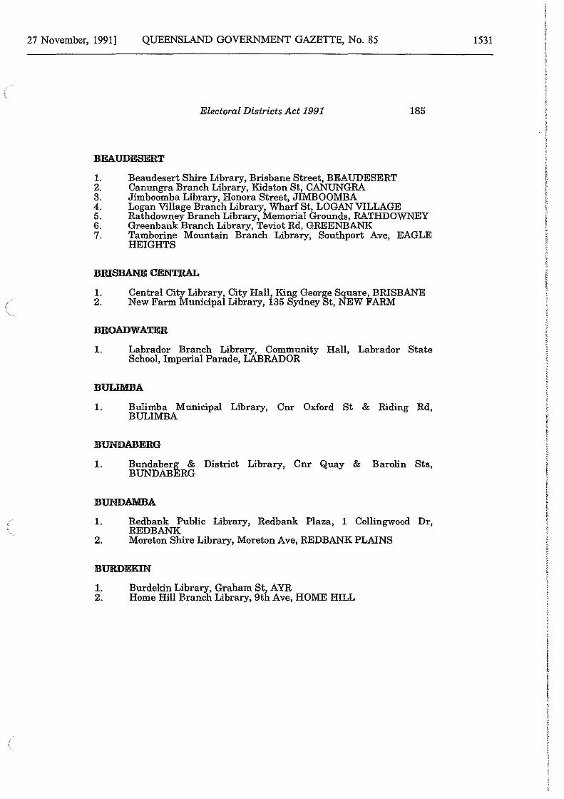
27 November, 1991] QUEENSLAND GOVERNMENT GAZETTE, No. 85
Electoral Districts Act 1991 185
BEAUDESERT
1. Beaudesert Shire Library, Brisbane Street, BEAUDESERT 2. Canungra Branch Library, Kidston St, CANUNGRA 3. Jimboomba Library, Honora Street, JIMBOOMBA 4. Logan Village Branch Library, Wharf St, LOGAN VILLAGE 5. Rathdowney Branch Library, Memorial Grounds, RATHDOWNEY 6. Greenbank Branch Library, Teviot Rd, GREENBANK 7. Tamborine Mountain Branch Library, Southport Ave, EAGLE
HEIGHTS
1. 2.
Central City Library, City Hall, King George Square, BRISBANE New Farm Municipal Library, 135 Sydney St, NEW FARM
BROADWATER
1. Labrador Branch Library, Community Hall, Labrador State School, Imperial Parade, LABRADOR
1. Bulimba Municipal Library, Cnr Oxford St & Riding Rd, BULIMBA
BUNDABERG
1. Bundaberg & District Library, Cnr Quay & Barolin Sts, BUNDABERG
BUNDAMBA
1. Redbank Public Library, Redbank Plaza, 1 Collingwood Dr, REDBANK
2. Moreton Shire Library, Moreton Ave, REDBANK PLAINS
BURDEKIN
1. Burdekin Library, Graham St, AYR 2. Home Hill Branch Library, 9th Ave, HOME HILL
1531
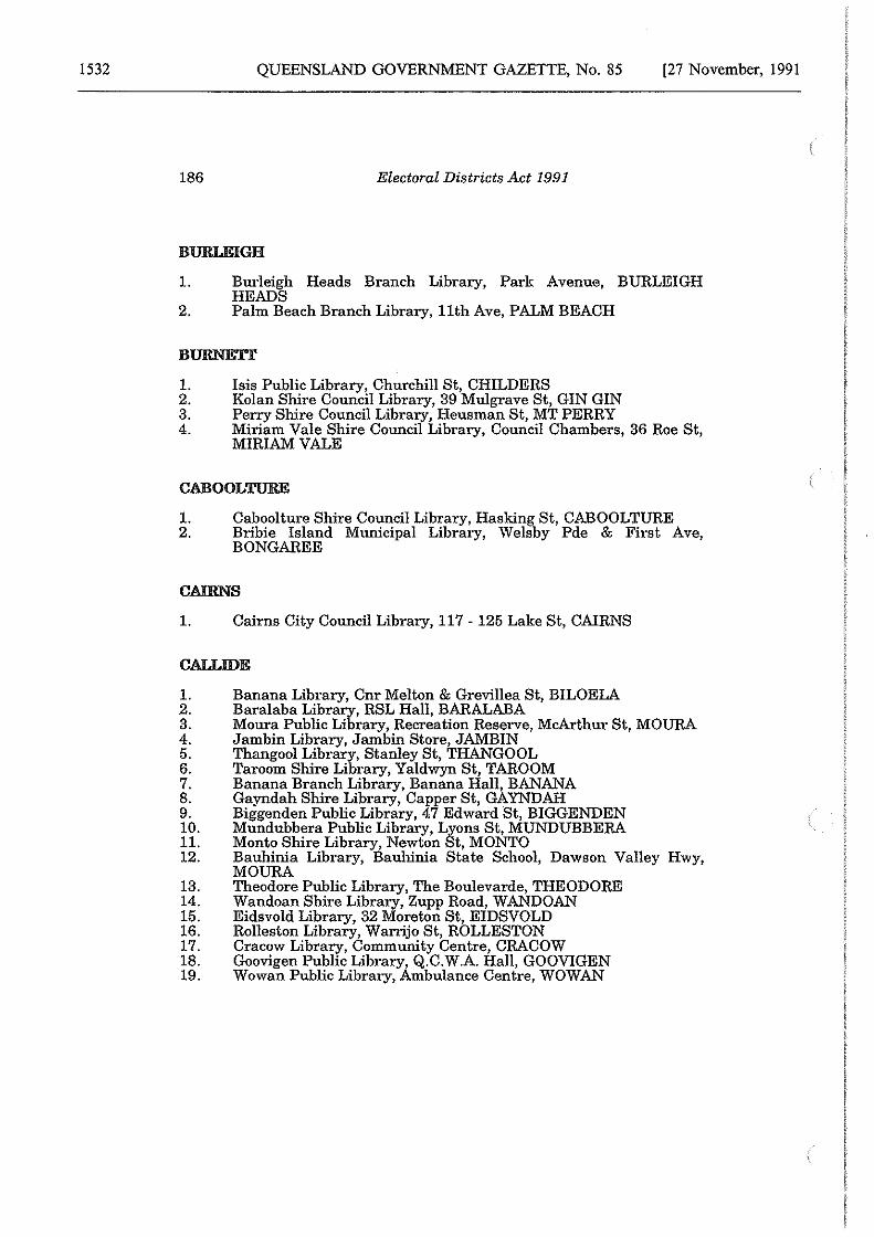
1532 QUEENSLAND GOVERNMENT GAZETTE, No. 85 [27 November, 1991
186 Electoral Districts Act 1991
BURLEIGH
1. Burleigh Heads Branch Library, Park Avenue, BURLEIGH HEADS
2. Palm Beach Branch Library, 11th Ave, PALM BEACH
BURNETT
1. Isis Public Library, Churchill St, CHILDERS 2. Kolan Shire Council Library, 39 Mulgrave St, GIN GIN 3. Perry Shire Council Library, Heusman St, MT PERRY 4. Miriam Vale Shire Council Library, Council Chambers, 36 Roe St,
MIRIAM VALE
CABOOLTURE
1. Caboolture Shire Council Library, Hasking St, CABOOLTURE 2. Bribie Island Municipal Library, Welsby Pde & First Ave,
BONGAREE
CAIRNS
1. Cairns City Council Library, 117 - 125 Lake St, CAIRNS
CALLIDE
1. 2. 3. 4. 5. 6. 7. 8. 9. 10. 11. 12.
13. 14. 15. 16. 17. 18. 19.
Banana Library, Cnr Melton & Grevillea St, BILOELA Baralaba Library, RSL Hall, BARALABA Moura Public Library, Recreation Reserve, McArthur St, MOURA Jambin Library, Jambin Store, JAMBIN Thangool Library, Stanley St, THANGOOL Taroom Shire Library, Yaldwyn St, TAROOM Banana Branch Library, Banana Hall, BANANA Gayndah Shire Library, Capper St, GAYNDAH Biggenden Public Library, 47 Edward St, BIGGENDEN Mundubbera Public Library, Lyons St, MUNDUBBERA Monto Shire Library, Newton St, MONTO Bauhinia Library, Bauhinia State School, Dawson Valley Hwy, MOURA Theodore Public Library, The Boulevarde, THEODORE Wandoan Shire Library, Zupp Road, WANDOAN Eidsvold Library, 32 Moreton St, EIDSVOLD Rolleston Library, Warrijo St, ROLLESTON Cracow Library, Community Centre, CRACOW Goovigen Public Library, Q.C.W.A. Hall, GOOVIGEN Wowan Public Library, Ambulance Centre, WOWAN

27 November, 1991] QUEENSLAND GOVERNMENT GAZETTE, No. 85
Electoral Districts Act 1991 187
CALOUNDRA
1. Caloundra City Library, Omrah Ave, CALOUNDRA
CAPALABA
1. Capalaba Post Office, 7-9 Dollery Rd, CAPALABA
CHARTERS TOWERS
1.
2. 3. 4.
Charters Towers Municipal Library, Gill St, CHARTERS TOWERS
5. 6. 7. 8.
Capella Library, Peak Downs St, CAPELLA Clermont Municipal Library, Daintree St, CLERMONT Kilcummin Public Library, Wondabah, Kilcummin VIA CLERMONT Moranbah Public Library, Griffin St, MORANBAH Julia Creek Municipal Library, Burke St, JULIA CREEK McKinlay Municipal Library, Middleton St, MCKINLAY Richmond Public Library, Goldring St, RICHMOND
CHATSWORTH
1. Carina Municipal Library, Cnr Mayfield & Nyrang Rd, CARINA
CHERMSIDE
1. Chermside Municipal Library, 763 Gympie Rd, CHERMSIDE
CLAYFIEW
1. Hamilton Municipal Library, Cnr Racecourse Rd & Rossiter Pde, ASCOT
2. Nundah Municipal Library, 1 Bage St, NUNDAH
CLEVELAND
1. Redland Shire Library, Bloomfield St, CLEVELAND 2. Dunwich Library, Ballow Rd, DUNWICH 3. Amity Point Library, Amity Point Public Hall, STRADBROKE
ISLAND 4. Point Lookout Library, Near Pt Lookout Public Hall, Point
Lookout, STRADBROKE ISLAND
1533
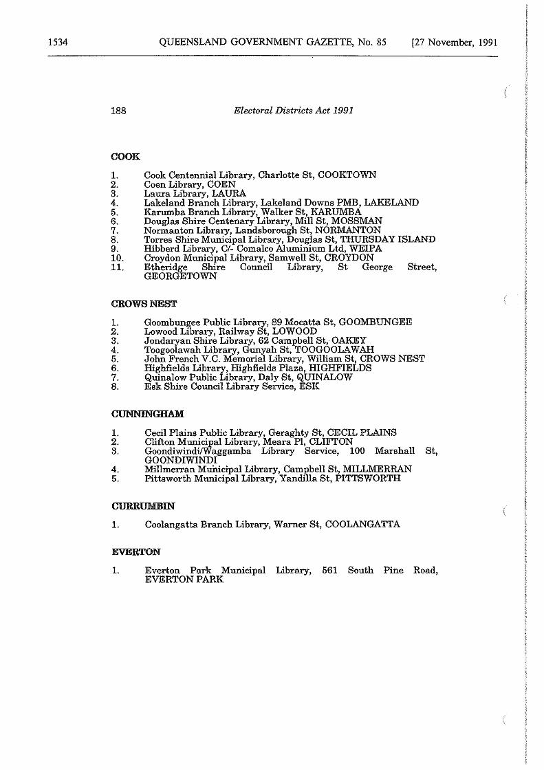
1534 QUEENSLAND GOVERNMENT GAZETTE, No. 85 [27 November, 1991
188 Electoral Districts Act 1991
COOK
1. Cook Centennial Library, Charlotte St, COOKTOWN 2. Coen Library, COEN 3. Laura Library, LAURA 4. Lakeland Branch Library, Lakeland Downs PMB, LAKELAND 5. Karumba Branch Library, Walker St, KARUMBA 6. Douglas Shire Centenary Library, Mill St, MOSSMAN 7. Normanton Library, Landsborough St, NORMANTON 8. Torres Shire Municipal Library, Douglas St, THURSDAY ISLAND 9. Hibberd Library, C/- Coma!co Aluminium Ltd, WEIPA 10. Croydon Municipal Library, Samwell St, CROYDON 11. Etheridge Shire Council Library, St George Street,
GEORGETOWN
CROWS NEST
1. 2. 3. 4. 5. 6. 7. 8.
Goombungee Public Library, 89 Mocatta St, GOOMBUNGEE Lowood Library, Railway St, LOWOOD Jondaryan Shire Library, 62 Campbell St, OAKEY Toogoolawah Library, Gunyah St, TOOGOOLA WAH John French V.C. Memorial Library, William St, CROWS NEST Highfields Library, Highfields Plaza, HIGHFIELDS Quinalow Public Library, Daly St, QUINALOW Esk Shire Council Library Service, ESK
CUNNINGHAM
1. 2. 3.
4. 5.
Cecil Plains Public Library, Geraghty St, CECIL PLAINS Clifton Municipal Library, Meara Pl, CLIFTON Goondiwindi/Waggamba Library Service, 100 Marshall St, GOONDIWINDI Millmerran Muiticipal Library, Campbell St, MILLMERRAN Pittsworth Municipal Library, Yandilla St, PITTSWORTH
1. Coolangatta Branch Library, Warner St, COOLANGATTA
EVERTON
1. Everton Park Municipal Library, 561 South Pine Road, EVERTON PARK
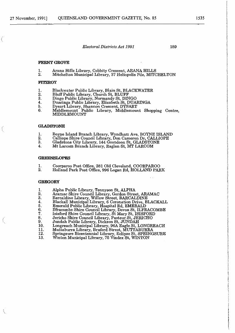
27 November, 1991] QUEENSLAND GOVERNMENT GAZETTE, No. 85
Electoral Districts Act 1991 189
FERNY GROVE
1. Arana Hills Library, Cobbity Crescent, ARANA HILLS 2. Mitchelton Municipal Library, 37 Heliopolis Pde, MITCHELTON
FITZROY
1. Blackwater Public Library, Blain St, BLACKWATER 2. Bluff Public Library, Church St, BLUFF 3. Dingo Public Library, Normandy St, DINGO 4. Duaringa Public Library, Elizabeth St, DUARINGA 5. Dysart Library, Shannon Crescent, DYSART 6. Middlemount Public Library, Middlemount Shopping Centre,
MIDDLEMOUNT
GLADSTONE
1. 2. 3. 4.
Boyne Island Branch Library, Wyndham Ave, BOYNE ISLAND Calliope Shire Council Library, Don Cameron Dr, CALLIOPE Gladstone City Library, 144 Goondoon St, GLADSTONE Mt Larcom Branch Library, Raglan St, MT LARCOM
GREENSLOPES
1. Coorparoo Post Office, 281 Old Cleveland, COORPAROO 2. Holland Park Post Office, 996 Logan Rd, HOLLAND PARK
GREGORY
1. Alpha Public Library, Tennyson St, ALPHA 2. Aramac Shire Council Library, Gordon Street, ARAMAC 3. Barcaldine Library, Willow Street, BARCALDINE 4. Blackall Municipal Library, 6 Coronation Drive, BLACKALL 5. Emerald Public Library, Hospital Rd, EMERALD 6. Ilfracombe Shire Council Library, Devon St, ILFRACOMBE 7. Isisford Shire Council Library, St Mary St, ISISFORD 8. Jericho Shire Council Library, Pasteur St, JERICHO 9. Jundah Public Library, Dickson St, JUNDAH 10. Longreach Municipal Library, 96A Eagle St, LONGREACH 11. Muttaburra Library, Bruford Street, MUTTABURRA 12. Springsure Bicentennial Library, Eclipse St, SPRINGSURE 13. Winton Municipal Library, 75 Vindex St, WINTON
1535
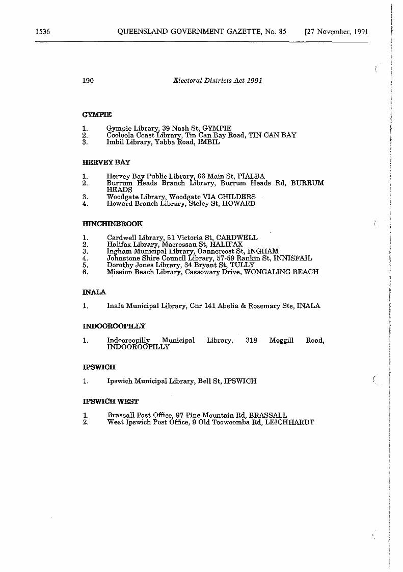
1536 QUEENSLAND GOVERNMENT GAZETTE, No. 85 [27 November, 1991
190 Electoral Districts Act 1991
1. Gympie Library, 39 Nash St, GYMPIE 2. Cooloola Coast Library, Tin Can Bay Road, TIN CAN BAY 3. Imbil Library, Yabba Road, IMBIL
HERVEY BAY
1. Hervey Bay Public Library, 66 Main St, PIALBA 2. Burrum Heads Branch Library, Burrum Heads Rd, BURRUM
HEADS 3. Woodgate Library, Woodgate VIA CHILDERS 4. Howard Branch Library, Steley St, HOWARD
HINCHINBROOK
1. 2. 3. 4. 5. 6.
IN ALA
Cardwell Library, 51 Victoria St, CARDWELL Halifax Library, Macrossan St, HALIFAX Ingham Municipal Library, Oannercost St, INGHAM Johnstone Shire Council Library, 57-59 Rankin St, INNISFAIL Dorothy Jones Library, 34 Bryant St, TULLY Mission Beach Library, Cassowary Drive, WONGALING BEACH
1. Inala Municipal Library, Cnr 141 Abelia & Rosemary Sts, INALA
INDOOROOPILLY
1. Indooroopilly Municipal Library, 318 Moggill Road, INDOOROOPILLY
IPSWICH
1. Ipswich Municipal Library, Bell St, IPSWICH
IPSWICH WEST
1. Brassall Post Office, 97 Pine Mountain Rd, BRASSALL 2. West Ipswich Post Office, 9 Old Toowoomba Rd, LEICHHARDT
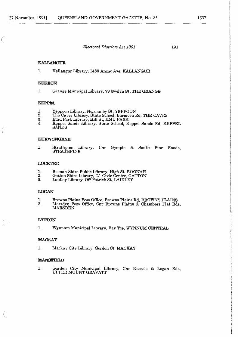
27 November, 1991] QUEENSLAND GOVERNMENT GAZETTE, No. 85
Electoral Districts Act 1991
KALLANGUR
1. Kallangur Library, 1480 Anzac Ave, KALLANGUR
KEDRON
1. Grange Municipal Library, 79 Evelyn St, THE GRANGE
KEPPEL
Yeppoon Library, Normanby St, YEPPOON The Caves Library, State School, Barmoya Rd, THE CAVES Emu Park Library, Hill St, EMU PARK
191
1. 2. 3. 4. Keppel Sands Library, State School, Keppel Sands Rd, KEPPEL
SANDS
KURWONGBAH
1. Strathpine Library, Cnr Gympie & South Pine Roads, STRATHPINE
LOCKYER
1. 2. 3.
Boonah Shire Public Library, High St, BOONAH Gatton Shire Library, Cl- Civic Centre, GATTON Laidley Library, Off Patrick St, LAIDLEY
LOGAN
1. Browns Plains Post Office, Browns Plains Rd, BROWNS PLAINS 2. Marsden Post Office, Cnr Browns Plains & Chambers Flat Rds,
MARSDEN
LY'TI'ON
1. Wynnum Municipal Library, Bay Tee, WYNNUM CENTRAL
MACKAY
1. Mackay City Library, Gordon St, MACKAY
MANSFIELD
1. Garden City Municipal Library, Cnr Kessels & Logan Rds, UPPER MOUNT GRAVATT
1537
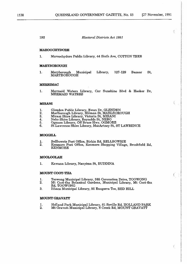
1538 QUEENSLAND GOVERNMENT GAZETTE, No. 85 [27 November, 1991
192 Electoral Districts Act 1991
1. Maroochydore Public Library, 44 Sixth Ave, COTTON TREE
:MARYBOROUGH
1. Maryborough Municipal Library, 127-129 Bazaar St, MARYBOROUGH
MERRIMAC
1. Mermaid Waters Library, Cnr Sunshine Blvd & Hooker Dr, MERMAID WATERS
1. 2. 3. 4. 5. 6.
Glenden Public Library, Ewan Dr, GLENDEN Marlborough Library, Milman St, MARLBOROUGH Mirani Shire Library, Victoria St, MIRAN! Nebo Shire Library, Reynolds St, NEBO Ogmore Library, Off Bruce Hwy, OGMORE St Lawrence Shire Library, MacArtney St, ST LAWRENCE
MOGGILL
1. Bellbowrie Post Office, Birkin Rd, BELLBOWRIE 2. Kenmore Post Office, Kenmore Shopping Village, Brookfield Rd,
KENMORE
MOOLOOLAH
1. Kawana Library, Nanyima St, BUDDINA
MOUNT COOT-TBA
1. Toowong Municipal Library, 585 Coronation Drive, TOOWONG 2. Mt Coot-tha Botanical Gardens, Municipal Library, Mt Coot-tha
Rd,TOOWONG 3. Ithaca Municipal Library, 95 Enogerra Tee, RED HILL
MOUNT GRAVATT
1. 2.
Holland Park Municipal Library, 81 Seville Rd, HOLLAND PARK Mt Gravatt Municipal Library, 8 Creek Rd, MOUNT GRAVATT
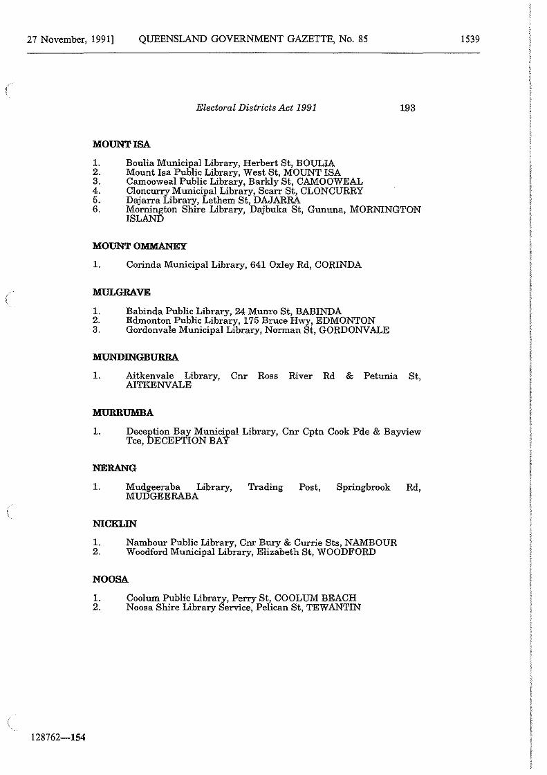
27 November, 1991] QUEENSLAND GOVERNMENT GAZETTE, No. 85
128762-154
Electoral Districts Act 1991 193
MOUNT ISA
1. Boulia Municipal Library, Herbert St, BOULIA 2. Mount Isa Public Library, West St, MOUNT ISA 3. Camooweal Public Library, Barkly St, CAMOOWEAL 4. Cloncurry Municipal Library, Scarr St, CLONCURRY 5. Dajarra Library, Lethem St, DAJARRA 6. Mornington Shire Library, Dajbuka St, Gununa, MORNINGTON
ISLAND
MOUNT OMMANEY
1. Corinda Municipal Library, 641 Oxley Rd, CORINDA
MULGRAVE
1. Babinda Public Library, 24 Munro St, BABINDA 2. Edmonton Public Library, 175 Bruce Hwy, EDMONTON 3. Gordonvale Municipal Library, Norman St, GORDONVALE
MUNDINGBURRA.
1. Aitkenvale Library, Cnr Ross River Rd & Petunia St, AITKENVALE
MURRUMBA
1. Deception Bay Municipal Library, Cnr Cptn Cook Pde & Bayview Tee, DECEPTION BAY
NERANG
1. Mudgeeraba Library, Trading Post, Springbrook Rd, MUDGEERABA
NICKLIN
1. Nambour Public Library, Cnr Bury & Currie Sts, NAMBOUR 2. Woodford Municipal Library, Elizabeth St, WOODFORD
NOOSA
1. Cool um Public Library, Perry St, COOL UM BEACH 2. Noosa Shire Library Service, Pelican St, TEWANTIN
1539
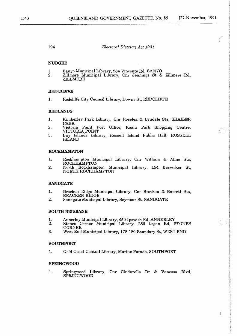
1540 QUEENSLAND GOVERNMENT GAZETTE, No. 85 [27 November, 1991
194 Electoral Districts Act 1991
NUDGEE
1. Banyo Municipal Library, 284 Vincents Rd, BANYO 2. Zillmere Municipal Library, Cnr Jennings St & Zillmere Rd,
ZILLMERE
1. Redcliffe City Council Library, Downs St, REDCLIFFE
REDLANDS
1. Kimberley Park Library, Cnr Roselea & Lyndale Sts, SHAILER PARK
2. Victoria Point Post Office, Koala Park Shopping Centre, VICTORIA POINT
3. Bay Islands Library, Russell Island Public Hall, RUSSELL ISLAND
ROCKRAMPI'ON
1. Rockhampton Municipal Library, Cnr William & Alma Sta, ROCKHAMPTON
2. North Rockhampton Municipal Library, 154 Berserker St, NORTH ROCKHAMPTON
SANDGATE
1. Bracken Ridge Municipal Library, Cnr Bracken & Barrett Sts, BRACKEN RIDGE
2. Sandgate Municipal Library, Seymour St, SANDGATE
SOUTH BRISBANE
1. Annerley Municipal Library, 450 Ipswich Rd, ANNERLEY 2. Stones Corner Municipal Library, 280 Logan Rd, STONES
CORNER 3. West End Municipal Library, 178-180 Boundary St, WEST END
SOUTHPORT
1. Gold Coast Central Library, Marine Parade, SOUTHPORT
SPRINGWOOD
1. Springwood Library, Cnr Cindarella Dr & Vanessa Blvd, SPRINGWOOD
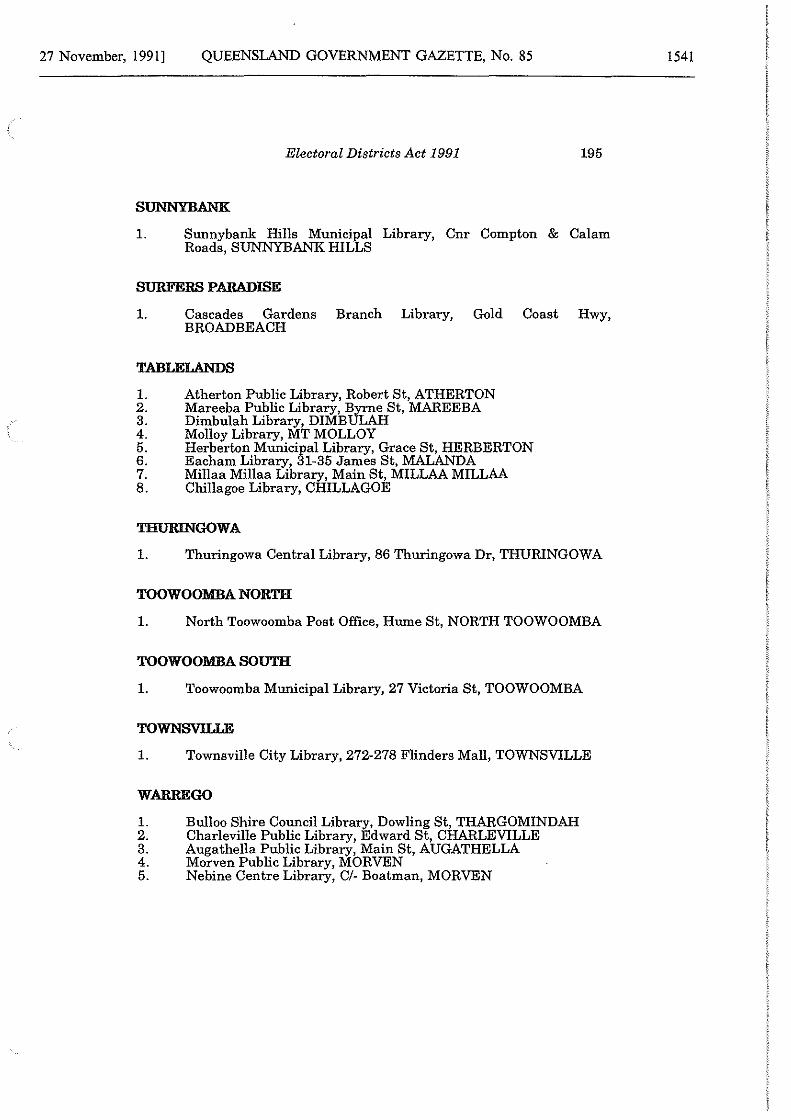
27 November, 1991] QUEENSLAND GOVERNMENT GAZETTE, No. 85
Electoral Districts Act 1991 195
SUNNYBANK
1. Sunnybank Hills Municipal Library, Cnr Compton & Calam Roads, SUNNYBANK HILLS
SURFERS PARADISE
1. Cascades Gardens Branch Library, Gold Coast Hwy, BROADBEACH
TABLELANDS
1. 2. 3. 4. 5. 6. 7. 8.
Atherton Public Library, Robert St, ATHERTON Mareeba Public Library, Byrne St, MAREEBA Dimbulah Library, DIMBULAH Molloy Library, MT MOLLOY Herberton Municipal Library, Grace St, HERBERTON Eacham Library, 31-35 James St, MALANDA Millaa Millaa Library, Main St, MILLAA MILLAA Chillagoe Library, CHILLAGOE
THURINGOWA
1. Thuringowa Central Library, 86 Thuringowa Dr, THURINGOWA
TOOWOOMBANORT.H
1. North Toowoomba Post Office, Hume St, NORTH TOOWOOMBA
TOOWOOMBA SOUTH
1. Toowoomba Municipal Library, 27 Victoria St, TOOWOOMBA
TOWNSVILLE
1. Townsville City Library, 272-278 Flinders Mall, TOWNSVILLE
WARREGO
1. Bulloo Shire Council Library, Dowling St, THARGOMINDAH 2. Charleville Public Library, Edward St, CHARLEVILLE 3. Augathella Public Library, Main St, AUGATHELLA 4. Morven Public Library, MORVEN 5. Nebine Centre Library, C/- Boatman, MORVEN
1541
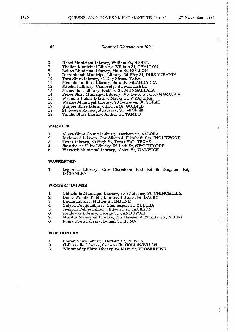
1542
196
QUEENSLAND GOVERNMENT GAZETTE, No. 85
Electoral Districts Act 1991
Hebel Municipal Library, William St, HEBEL Thallon Municipal Library, William St, THALLON Bollon Municipal Library, Main St, BOLLON Dirranbandi Municipal Library, 26 Kiry St, DIRRANBANDI Tara Shire Library, 31 Day Street, TARA Meandarra Shire Library, Sara St, MEANDARRA Mitchell Library, Cambridge St, MITCHELL Mungallala Library, Redford St, MUNGALLALA
[27 November, 1991
6. 7. 8. 9. 10. 11. 12. 13. 14. 15. 16. 17. 18. 19.
Paroo Shire Municipal Library, Stockyard St, CUNNAMULLA Wyandra Public Library, Macks St, WYANDRA Warroo Municipal Library, 73 Burrowes St, SURAT Quilpie Shire Library, Brolga St, QUILPIE St George Municipal Library, ST GEORGE Tambo Shire Library, Arthur St, TAMBO
WARWICK
1. Allora Shire Council Library, Herbert St, ALLORA 2. Inglewood Library, Cnr Albert & Elizabeth Sts, INGLEWOOD 3. Texas Library, 50 High St, Texas Hall, TEXAS 4. Stanthorpe Shire Library, 56 Lock St, STANTHORPE 5. Warwick Municipal Library, Albion St, WARWICK
WATERFORD
1. Loganlea Library, Cnr Chambers Flat Rd & Kingston Rd, LOGANLEA
WESTERN DOWNS
1. 2. 3. 4. 5. 6. 7. 8.
Chinchilla Municipal Library, 80-86 Heeney St, CHINCHILLA Dalby-Wambo Public Library, 1 Stuart St, DALBY Injune Library, Hutton St, INJUNE Yuleba Public Library, Stephenson St, YULEBA Jackson Public Library, Edward St, JACKSON Jandowae Library, George St, JANDOWAE Murilla Municipal Library, Cnr Dawson & Murilla Sts, MILES Roma Town Library, Bungil St, ROMA
WBl'l'SUNDAY
1. Bowen Shire Library, Herbert St, BOWEN 2. Collinsville Library, Conway St, COLLINSVILLE 3. Whitsunday Shire Library, 84 Main St, PROSERPINE
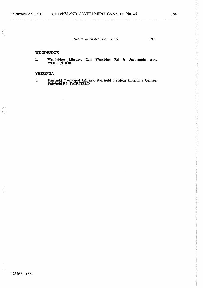
27 November, 1991] QUEENSLAND GOVERNMENT GAZETTE, No. 85
128762-155
Electoral Districts Act 1991 197
WOODRIDGE
1. Woodridge Library, Cnr Wembley Rd & Jacaranda Ave, WOODRIDGE
YERO NGA
1. Fairfield Municipal Library, Fairfield Gardens Shopping Centre, Fairfield Rd, FAIRFIELD
1543
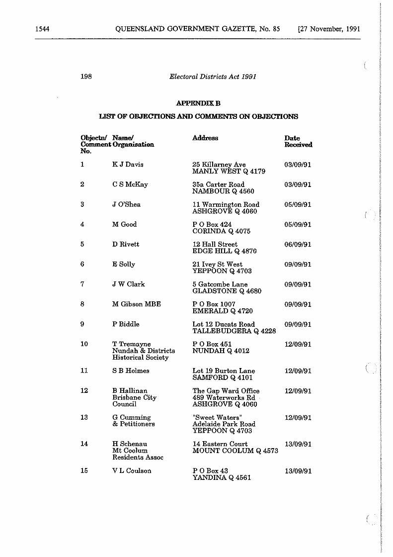
1544 QUEENSLAND GOVERNMENT GAZETTE, No. 85 [27 November, 1991
198 Electoral Districts Act 1991
APPENDIXB
LIST OF OBJEm'IONS AND COMMENTS ON OBJEcm:ONS
Objecto/ Name/ Address Date Cmoment Organisation Received No.
1 KJDavis 25 Killarney Ave 03/09/91 MANLYWESTQ4179
2 CS McKay 35a Carter Road 03/09/91 NAMBOUR Q 4560
3 J O'Shea 11 Warmington Road 05/09/91 ASHGROVE Q 4060
4 MGood P 0 Box424 05/09/91 CORINDA Q 4075
5 D Rivett 12 Hall Street 06/09/91 EDGE HILL Q 4870
6 E Solly 21 Ivey St West 09/09/91 YEPPOON Q 4703
7 JWClark 5 Gatcombe Lane 09/09/91 GLADSTONE Q 4680
8 M GibsonMBE P 0Box1007 09/09/91 EMERALD Q 4720
9 P Biddle Lot 12 Ducats Road 09/09/91 TALLEBUDGERA Q 4228
10 TTremayne P 0 Box451 12/09/91 Nundah & Districts NUNDAH Q 4012 Historical Society
11 SB Holmes Lot 19 Burton Lane 12/09/91 SAMFORD Q 4101
12 B Hallinan The Gap Ward Office 12/09/91 Brisbane City 489 Waterworks Rd Council ASHGROVE Q 4060
13 GCumming uSweet Waters 11 12/09/91 & Petitioners Adelaide Park Road
YEPPOON Q 4703
14 H Schenau 14 Eastern Court 13/09/91 Mt Coolum Residents Assoc
MOUNT COOLUM Q 4573
15 VL Coulson P 0 Box43 13/09/91 YANDINA Q 4561
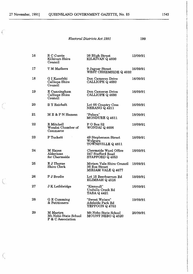
27 November, 1991] QUEENSLAND GOVERNMENT GAZETTE, No. 85 1545
Electoral Districts Act 1991 199
16 RC Currie 26 Bligh Street 13/09/91 Kilkivan Shire KILKIV AN Q 4600 Council
17 TM Mathers 9 Jaguar Street WEST CHERMSIDE Q 4032
16/09/91
18 GI Kanofski Don Cameron Drive 16/09/91 Calliope Shire Council
CALLIOPE Q 4680
19 E Cunningham Don Cameron Drive 16/09/91 Calliope Shire Council
CALLIOPE Q 4680
20 BY Reichelt Lot 06 Country Cres NERANG Q 4211
16/09/91
21 ME &PNHansen 11Palara" 18/09/91 MONDURE Q 4611
22 R Mitchell P 0Box52 18/09/91 Wondai Chamber of WONDA! Q 4606 Commerce
23 P Tuckett 49 Stephenson Street Wulguru TOWNSVILLE Q 4811
18/09/91
24 MHayes Chermside Ward Office 18/09/91 Alderman 24 7 Stafford Road for Chermside STAFFORD Q 4053
25 E JThorne Miriam Vale Shire Council 18/09/91 Shire Clerk 36 Roe Street
MIRIAM VALE Q 4677
26 P JBrodie Lot 15 Beerburrum Rd 18/09/91 ELIMBAH Q 4516
27 J K Lethbridge "Kinnoull '1 18/09/91 Undulla Creek Rd TARAQ4421
28 GE Cumming "Sweet Waters" 19/09/91 & Petitioners Adelaide Park Rd
YEPPOON Q 4703
29 MMartyn Mt Nebo State School 20/09/91 Mt Nebo State School MOUNT NEBO Q 4520 P & C Association
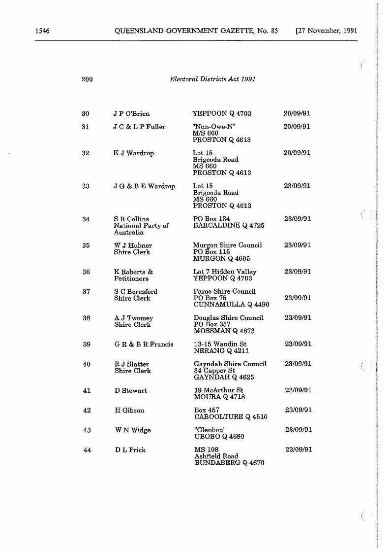
1546 QUEENSLAND GOVERNMENT GAZETTE, No. 85 [27 November, 1991
200 Electoral Districts Act 1991
30 JP O'Brien YEPPOON Q 4703 20/09/91
31 J C & L P Fuller •'Nun-Owe-N11 20/09/91 MIS 660 PROSTON Q 4613
32 KJWardrop Lot 15 20/09/91 Brigooda Road MS660 PROSTON Q 4613
33 JG & BE Wardrop Lot 15 23/09/91 Brigooda Road MS660 PROSTON Q 4613
34 SB Collins PO Box 134 23/09/91 National Party of BARCALDINE Q 4725 Australia
35 W JHubner Murgon Shire Council 23/09/91 Shire Clerk PO Box 115
MURGON Q 4605
36 KRoberts & Lot 7 Hidden Valley 23/09/91 Petitioners YEPPOON Q 4703
37 S C Beresford Paroo Shire Council Shire Clerk PO Box 75 23/09/91
CUNNAMULLA Q 4490
38 AJTwomey Shire Clerk
Douglas Shire Council PO Box 357
23/09/91
MOSSMAN Q 4873
39 G R & B R Francis 13-15 Wandin St 23/09/91 NERANG Q 4211
40 R J Slatter Gayndah Shire Council 23/09/91 Shire Clerk 34 Capper St
GAYNDAH Q 4625
41 D Stewart 19 McArthur St 23/09/91 MOURAQ4718
42 H Gibson Box457 23/09/91 CABOOLTURE Q 4510
43 WNWidge "Glenbon" 23/09/91 UBOBOQ4680
44 D LFrick MS 108 23/09/91 Ashfield Road BUNDABERG Q 4670
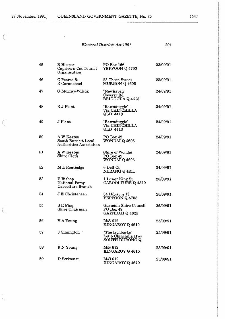
27 November, 1991] QUEENSLAND GOVERNMENT GAZETTE, No. 85 1547
Electoral Districts Act 1991 201
45 B Hooper PO Box 166 23/09/91 Capricorn Cst Tourist YEPPOON Q 4703 Organisation
46 CPearce & 23 Thorn Street 23/09/91 R Carmichael MURGON Q 4605
47 G Murray-Wilcox 11Newhaven11 24/09/91 CovertyRd BRIGOODA Q 4613
48 RJPlant 11
Bawndug~e" 24/09/91 Via CHIN HILLA QLD 4413
49 J Plant "Bawnd~8ie" 24/09/91 Via CHI HILLA QLD 4413
50 A WKeates PO Box42 24/09/91 South Burnett Local WONDAI Q 4606 Authorities Association
51 AW Keates Shire ofWondai 24/09/91 Shire Clerk PO Box42
WONDAI Q 4606
52 M L Routledge 6 Dell Ct 24/09/91 NERANG Q 4211
53 E Bishoy 1 Lower King St 25/09/91 Nationa Party CABOOLTURE Q 4510 Caboolture Branch
54 J E Christensen 34 Hibiscus Pl 25/09/91 YEPPOON Q 4703
55 SR Ping Gayndah Shire Council 25/09/91 Shire Chairman PO Box49
GAYNDAH Q 4625
56 VA Young MIS 612 25/09/91 KINGAROY Q 4610
57 J Simington · 11The Ironbarks 11 25/09/91 Lot 5 Chinchilla Hwy SOUTH DURONG Q
58 RN Young MIS 612 25/09/91 KINGAROY Q 4610
59 D Scrivener MIS 612 25/09/91 KINGAROY Q 4610
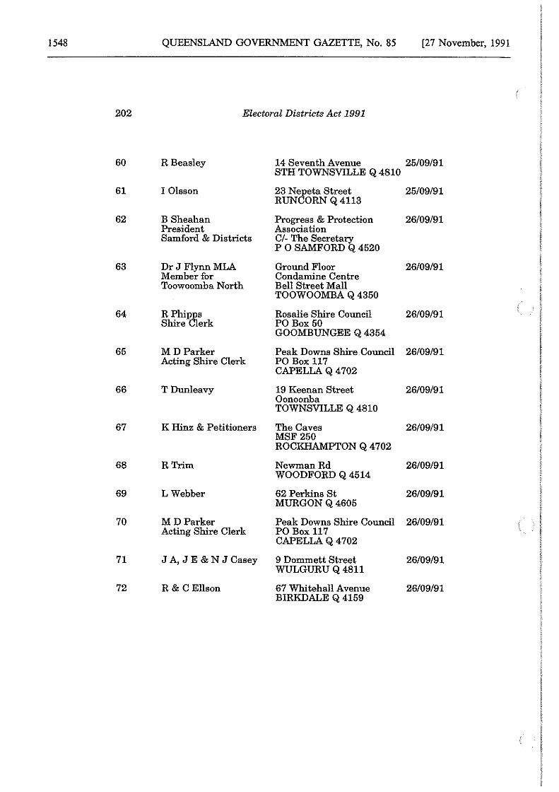
1548 QUEENSLAND GOVERNMENT GAZETTE, No. 85 [27 November, 1991
202 Electoral Districts Act 1991
60 R Beasley 14 Seventh Avenue 25/09/91 STH TOWNSVILLE Q 4810
61 I Olsson 23 N{fieta Street 25/09/91 RUN ORN Q 4113
62 B Sheahan Progress & Protection 26/09/91 President Association Samford & Districts Cl- The Secretary
P 0 SAMFORD Q 4520
63 Dr J Flynn MLA Ground Floor 26/09/91 Member for Condamine Centre Toowoomba North Bell Street Mall
TOOWOOMBA Q 4350
64 R Phi18Js Rosalie Shire Council 26/09/91 Shire Jerk PO Box 50
GOOMBUNGEE Q 4354
65 MD Parker Peak Downs Shire Council 26/09/91 Acting Shire Clerk PO Box 117
CAPELLA Q 4702
66 TDunleavy 19 Keenan Street 26/09/91 Oonoonba TOWNSVILLE Q 4810
67 K Hinz & Petitioners The Caves 26/09/91 MSF250 ROCKHAMPTON Q 4 702
68 RTrim Newman Rd 26/09/91 WOODFORD Q 4514
69 LWebber 62 Perkins St 26/09/91 MURGON Q 4605
70 MD Parker Peak Downs Shire Council 26/09/91 Acting Shire Clerk PO Box 117
CAPELLA Q 4702
71 JA,JE&NJCasey 9 Dommett Street 26/09/91 WULGURU Q 4811
72 R & C Ellson 67 Whitehall Avenue 26/09/91 BIRKDALE Q 4159
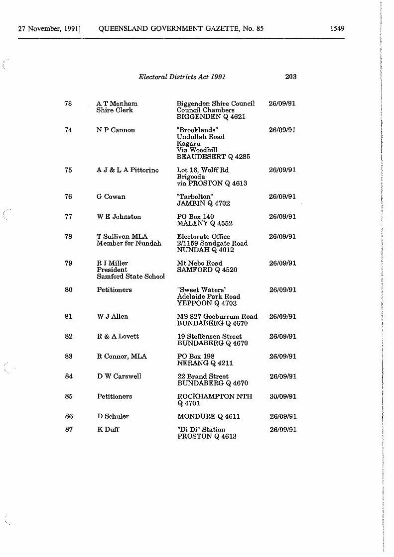
27 November, 1991] QUEENSLAND GOVERNMENT GAZETTE, No. 85 1549
Electoral Districts Act 1991 203
73 ATMenham Biggenden Shire Council 26/09/91 Shire Clerk Council Chambers
BIGGENDEN Q 4621
74 NP Cannon 11 Brooklands 11 26/09/91 Undullah Road Kagaru Via Woodhill BEAUDESERT Q 4285
75 A J & L A Pittorino Lot 16, Wolff Rd 26/09/91 Brigooda via PROSTON Q 4613
76 GCowan "Tarbolton" 26/09/91 JAMBIN Q 4702
77 WE Johnston PO Box 140 26/09/91 MALENY Q 4552
78 T Sullivan MLA Electorate Office 26/09/91 Member for N undah 2/1159 Sandgate Road
NUNDAH Q 4012
79 RI Miller Mt Nebo Road 26/09/91 President SAMFORD Q 4520 Samford State School
80 Petitioners "Sweet Waters" 26/09/91 Adelaide Park Road YEPPOON Q 4703
81 W J Allen MS 827 Gooburrum Road 26/09/91 BUNDABERG Q 4670
82 R&ALovett 19 Steffensen Street 26/09/91 BUNDABERG Q 4670
83 R Connor, MLA PO Box 198 26/09/91 NERANG Q 4211
84 DWCarswell 22 Brand Street 26/09/91 BUNDABERG Q 4670
85 Petitioners ROCKHAMPTON NTH 30/09/91 Q4701
86 D Schuler MONDURE Q 4611 26/09/91
87 KDuff "Di Di" Station 26/09/91 PROSTON Q 4613
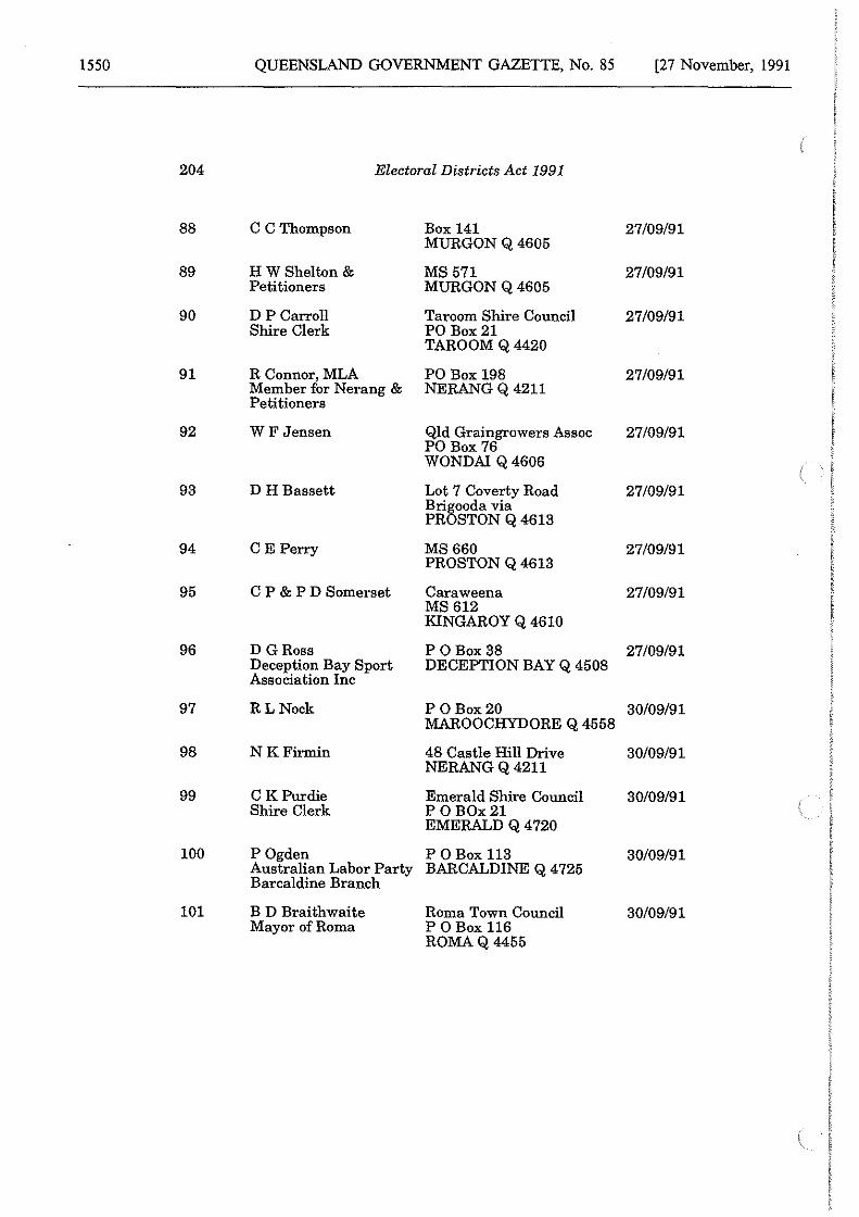
1550 QUEENSLAND GOVERNMENT GAZETTE, No. 85 [27 November, 1991
204 Electoral Districts Act 1991
88 C CThompson Box 141 27/09/91 MURGON Q 4605
89 HW Shelton & MS571 27/09/91 Petitioners MURGON Q 4605
90 DP Carroll Taroom Shire Council 27/09/91 Shire Clerk PO Box21
TAROOM Q 4420
91 R Connor, MLA PO Box 198 27/09/91 Member for Nerang & Petitioners
NERANG Q 4211
92 W F Jensen Qld Graingrowers Assoc PO Box 76
27/09/91
WONDAI Q 4606
93 DH Bassett Lot 7 Coverty Road 27/09/91 Bri5ooda via PR STON Q 4613
94 CE Perry MS660 27/09/91 PROSTON Q 4613
95 C P & P D Somerset Caraweena 27/09/91 MS612 KINGAROY Q 4610
96 D GRoss P 0Box38 27/09/91 Deception Bay Sport Association Inc
DECEPTION BAY Q 4508
97 RLNock P 0Box20 30/09/91 MAROOCHYDORE Q 4558
98 NKFirmin 48 Castle Hill Drive 30/09/91 NERANG Q 4211
99 C KPurdie Emerald Shire Council 30/09/91 Shire Clerk P 0 BOx21
EMERALD Q 4720
100 P Ogden P OBox 113 30/09/91 Australian Labor Party BARCALDINE Q 4725 Barcaldine Branch
101 B D Braithwaite Roma Town Council 30/09/91 Mayor of Roma P OBox 116
ROMAQ4455
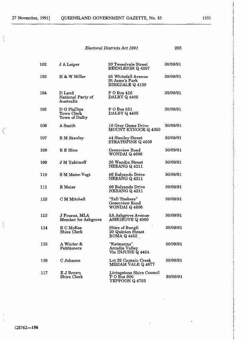
27 November, 1991] QUEENSLAND GOVERNMENT GAZETTE, No. 85 1551
Electoral Districts Act 1991 205
102 J A Leiper 30 Tweedvale Street 30/09/91 BEENLEIGH Q 4207
103 H &WMiller 65 Whitefall Avenue 30/09/91 St Jame's Park BIRKDALE Q 4159
104 D Land P 0Box416 30/09/91 National Party of DALBYQ4405 Australia
105 D G Philli~s P0Box551 30/09/91 Town Cler DALBYQ4405 Town of Dalby
106 A Smith 16 Grey Gums Drive 30/09/91 MOUNT KYNOCK Q 4350
107 RM Stanley 44 Stanley Street STRATHPINE Q 4500
30/09/91
108 RE Hine Greenview Road 30/09/91 WONDA! Q 4606
109 JMYakimoff 20 Wandin Street 30/09/91 NERANG Q 4211
110 SM Meier-Vogt 66 ~ando Drive 30/09/91 NE GQ4211
111 RMeier 66 ~ando Drive 30/09/91 NE GQ4211
112 CM Mitchell "Tall Timbers" 30/09/91 Greenview Road WONDA! Q 4606
113 J Fouras, MLA 5A Ashgrove Avenue 30/09/91 Member for Ashgrove ASHGROVE Q 4060
114 B CMcKee Shire of Bungil 30/09/91 Shire Clerk 20 Quinton Street
ROMAQ4455
115 A Winter& "Kaimanna 11 30/09/91 Petitioners Arcadia Valley
Via INJUNE Q 4454
116 C Johnson Lot 22 Ca~tain Creek 30/09/91 MIRIAM ALE Q 4677
117 E JBrown Livingstone Shire Council Shire Clerk 1'> 0 Box 600 30/09/91
YEPPOON Q 4703
128762-156
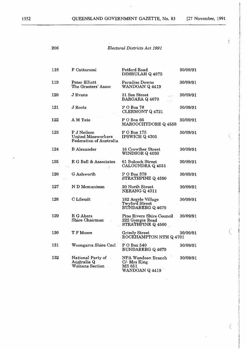
1552 QUEENSLAND GOVERNMENT GAZETTE, No. 85 [27 November, 1991
206 Electoral Districts Act 1991
118 F Cattarossi Petford Road 30/09/91 DIMBULAH Q 4872
119 Peter Elliott Paradise Downs 30/09/91 The Graziers' Assoc WANDOAN Q 4419
120 JEvans 31 See Street 30/09/91 BARGARA Q 4670
121 J Roots P 0 Box 78 30/09/91 CLERMONT Q 4721
122 AMTate P 0 Box66 30/09/91 MAROOCHYDORE Q 4558
123 P J Neilson P 0Box175 30/09/91 United Mineworkers IPSWICH Q 4305 Federation of Australia
124 B Alexander 16 Crowther Street 30/09/91 WINDSOR Q 4030
125 R G Bell & Associates 61 Bulcock Street 30/09/91 CALOUNDRA Q 4551
126 GAshworth P 0 Box379 30/09/91 STRATHPINE Q 4500
127 NDMcmanimm 20 North Street 30/09/91 NERANG Q 4211
128 C Lileudt 182 Argyle Village 30/09/91 Twyford Street BUNDABERG Q 4670
129 R GAlters Pine Rivers Shire Council 30/09/91 Shire Chairman 222 Gympie Road
STRATHPINE Q 4500
130 TFMoore Grimly Street 30/09/91 ROCKHAMPTON NTH Q 4701
131 Woongarra Shire Cncl P 0 Box540 30/09/91 BUNDABERG Q 4670
132 National Party of NPA Wandoan Branch 30/09/91 AU.s'.tralia Q Cl-Mrs King Wo'mens Section MS851
WANDOAN Q 4419
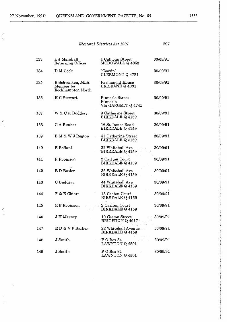
27 November, 1991] QUEENSLAND GOVERNMENT GAZETTE, No. 85 1553
Electoral Districts Act 1991 207
133 L JMarshall 4 Calhoun Street 30/09/91 Returning Officer MCDOWALL Q 4053
134 DM Cook 11 Coovin" 30/09/91 CLERMONT Q 4721
135 R Schwarten, MLA Parliament House 30/09/91 Member for BRISBANE Q 4001 Rockhampton North
136 KC Stewart Pinnacle Street 30/09/91 Pinnacle Via GARGETT Q 4741
137 W & CK Buddery 9 Catherine Street 30/09/91 BIRKDALE Q 4159
138 CA Bunker 16 St James Road 30/09/91 BIRKDALE Q 4159
139 BM&WJRegtop 41 Catherine Street 30/09/91 BIRKDALE Q 4159
140 E Bellani 32 Whitehall Ave 30/09/91 BIRKDALE Q 4159
141 R Robinson 2 Carlton Court 30/09/91 BIRKDALE Q 4159
142 RD Butler 35 Whitehall Ave 30/09/91 BIRKDALE Q 4159
143 C Buddery 44 Whitehall Ave 30/09/91 BIRKDALE Q 4159
144 F & E Chiara 13 Caston Court 30/09/91 BIRKDALE Q 4159
145 RF Robinson 2 Carl ton Court 30/09/91 BIRKDALE Q 4159
146 JHMarney 10 Creton Street 30/09/91 BRIGHTON Q 4017
147 E D & V F Barber 22 Whitehall Avenue 30/09/91 BIRKDALE Q 4159
148 J Smith P 0 Box84 30/09/91 LAWNTON Q 4501
149 J Smith P 0 Box84 30/09/91 LAWNTON Q 4501
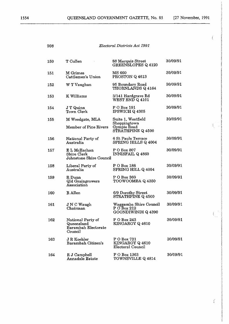
1554 QUEENSLAND GOVERNMENT GAZETTE, No. 85 [27 November, 1991
208 Electoral Districts Act 1991
150 T Cullen 88 Marquis Street GREENSLOPES Q 4120
30/09/91
151 M Grimes MS660 30/09/91 Cattlemen's Union PROSTON Q 4613
152 WT Vaughan 95 Boundary Road 30/09/91 THORNLANDS Q 4164
153 KWilliams 3/141 Hardgrave Rd 30/09/91 WEST END Q 4101
154 JT Quinn P OBox 191 30/09/91 Town Clerk IPSWICH Q 4305
155 M Woodgate, MLA Suite 1, Westfield 30/09/91 ShoppinJ:own
Member of Pine Rivers Gympie oad STRATHPINE Q 4500
156 National Party of 6 St Pauls Terrace 30/09/91 Australia SPRING HILLS Q 4004
157 E LMcEachan P 0 Box807 30/09/91 Shire Clerk INNISFAIL Q 4860 Johnstone Shire Council
158 Liberal Party of P 0Box188 30/09/91 Australia SPRING HILL Q 4004
159 RDunn P OBox 360 30/09/91 Qld Graingrowers TOOWOOMBA Q 4350 Association
160 RA!len 619 Dorothy Street 30/09/91 STRATHPINE Q 4500
161 JN C Waugh Wagiamba Shire Council 30/09/91 Chairman P 0 ox212
GOONDIWINDI Q 4390
162 National Party of P 0 Box243 30/09/91 Queensland KINGAROY Q 4610 Barambah Electorate Council
163 JR Koehler P 0 Box 731 30/09/91 Barambah Citizen's KINGAROY Q 4610
Electoral Council
164 RJCampbell P 0Box1363 30/09/91 Annadale Estate TOWNSVILLE Q 4814
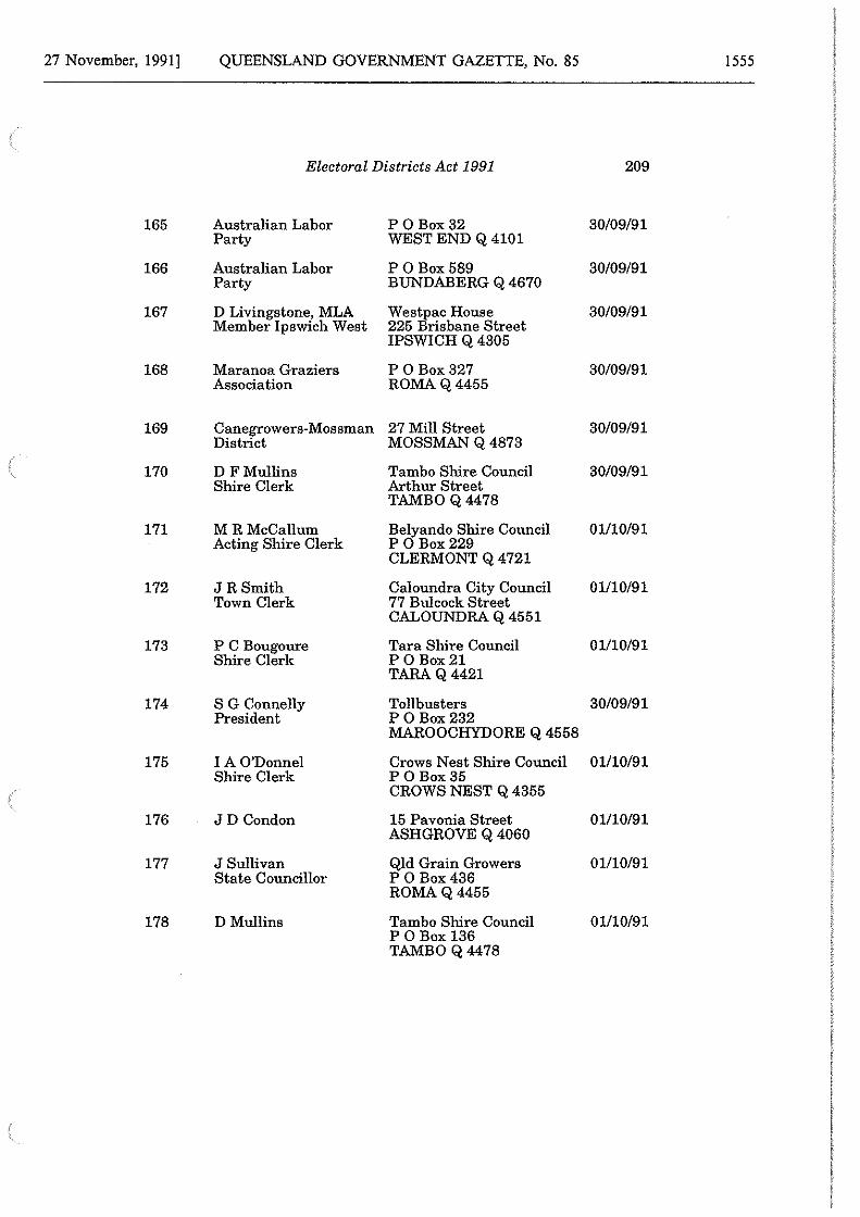
27 November, 1991] QUEENSLAND GOVERNMENT GAZETTE, No. 85 1555
Electoral Districts Act 1991 209
165 Australian Labor P 0 Box32 30/09/91 Party WEST END Q 4101
166 Australian Labor P 0 Box589 30/09/91 Party BUNDABERG Q 4670
167 D Livingstone, MLA Member Ipswich West
Westpac House 225 Brisbane Street
30/09/91
IPSWICH Q 4305
168 Maranoa Graziers PO Box327 30/09/91 Association ROMAQ4455
169 Canegrowers-Mossman 27 Mill Street 30/09/91 District MOSSMAN Q 4873
170 D FMullins Tambo Shire Council 30/09/91 Shire Clerk Arthur Street
TAMBOQ4478
171 MRMcCallum Belyando Shire Council 01/10/91 Acting Shire Clerk P 0 Box229
CLERMONT Q 4721
172 JR Smith Caloundra City Council 01/10/91 Town Clerk 77 Bulcock Street
CALOUNDRA Q 4551
173 PC Bougoure Tara Shire Council 01/10/91 Shire Clerk P 0 Box21
TARAQ4421
174 S G Connelly Tollbusters 30/09/91 President P 0 Box232
MAROOCHYDORE Q 4558
175 IAO'Donnel Crows Nest Shire Council 01110/91 Shire Clerk P 0 Box35
CROWS NEST Q 4355
176 JD Condon 15 Pavonia Street 01/10/91 ASHGROVE Q 4060
177 J Sullivan Qld Grain Growers 01/10/91 State Councillor P 0 Box436
ROMAQ4455
178 D Mullins Tambo Shire Council 01/10/91 P 0Box136 TAMBOQ4478
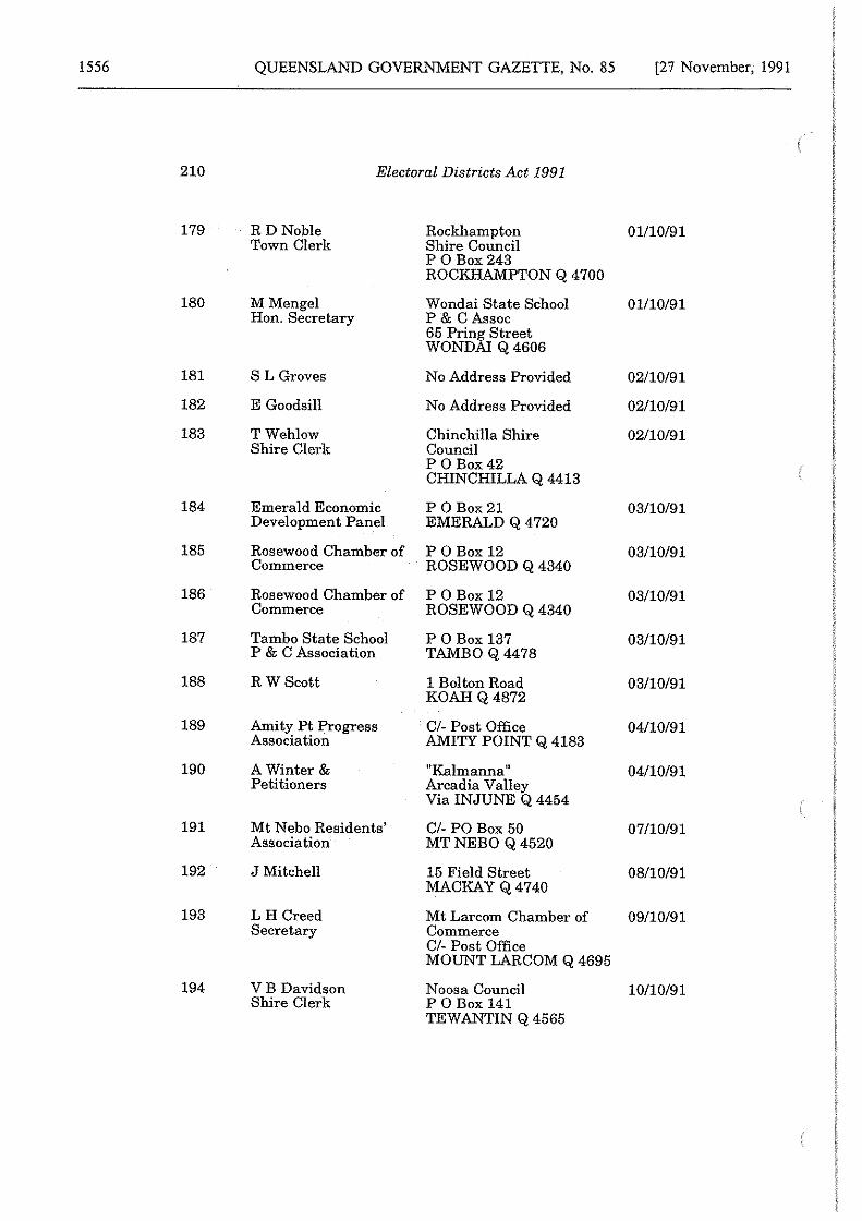
1556 QUEENSLAND GOVERNMENT GAZETTE, No. 85 [27 November, 1991
210 Electoral Districts Act 1991
179 RD Noble Rockhampton 01110191 Town Clerk Shire Council
P 0 Box243 ROCKHAMPTON Q 4700
180 M Mengel Wondai State School 01110191 Hon. Secretary P & CAssoc
65 Prin_L: Street WOND Q4606
181 SL Groves No Address Provided 02110191
182 E Goodsill No Address Provided 02110191
183 TWehlow Chinchilla Shire 02110191 Shire Clerk Council
P 0 Box42 CHINCHILLA Q 4413
184 Emerald Economic P 0Box21 03110191 Development Panel EMERALD Q 4 720
185 Rosewood Chamber of P 0Box12 03110191 Commerce ROSEWOOD Q 4340
186 Rosewood Chamber of P 0Box12 03110191 Commerce ROSEWOOD Q 4340
187 Tambo State School P 0Box137 03110191 P & C Association TAMBO Q4478
188 R WScott 1 Bo! ton Road 03110191 KOAHQ4872
189 Amity Pt Progress Cl- Post Office 04110191 Association AMITY POINT Q 4183
190 A Winter & 11Kalmanna" 04110191 Petitioners Arcadia Valley
Via INJUNE Q 4454
191 Mt Nebo Residents' Cl- PO Box 50 07110191 Association MT NEBO Q 4520
192 J Mitchell 15 Field Street 08110191 MACKAY Q 4740
193 L H Creed Mt Larcom Chamber of 09110191 Secretary Commerce
Cl- Post Office MOUNT LARCOM Q 4695
194 VB Davidson Noosa Council 10110191 Shire Clerk P 0Box141
TEW ANTIN Q 4565
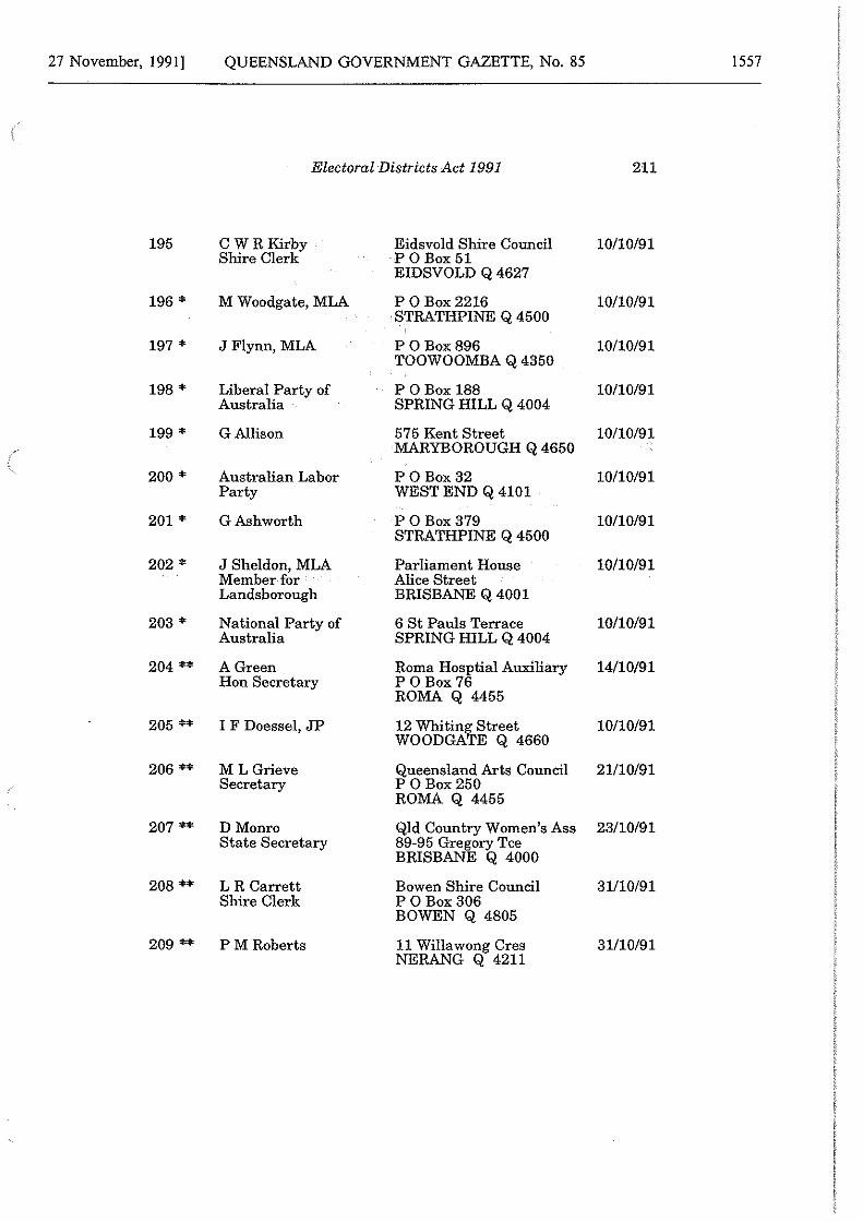
27 November, 1991] QUEENSLAND GOVERNMENT GAZETTE, No. 85 1557
Electoral Districts Act 1991 211
195 CWRKirby Eidsvold Shire Council 10/10/91 Shire Clerk POBox51
EIDSVOLD Q 4627
196 * M Woodgate, MLA P 0 Box2216 10/10/91 STRATHPINE Q 4500
197 * JFlynn, MLA P 0 Box896 10/10/91 TOOWOOMBA Q 4350
198 * Liberal Party of P OBox 188 10/10/91 Australia SPRING HILL Q 4004
199 * G Allison 575 Kent Street 10/10/91 MARYBOROUGH Q 4650
200 * Australian Labor POBox32 10/10/91 Party WEST END Q 4101
201 * GAshworth P 0 Box379 10/10/91 STRATHPINE Q 4500
202 * J Sheldon, MLA Parliament House 10/10/91 Member for Alice Street Landsborough BRISBANE Q 4001
203 * National Party of 6 St Pauls Terrace 10/10/91 Australia SPRING HILL Q 4004
204 ** AGreen Roma Hosptial Auxiliary 14/10/91 Hon Secretary P 0 Box 76
ROMA Q 4455
205 ** I F Doessel, JP 12 Whitin~ Street 10/10/91 WOODGA E Q 4660
206 ** ML Grieve Queensland Arts Council 21/10/91 Secretary P 0 Box250
ROMA Q 4455
207 ** D Monro Qld Country Women's Ass 23/10/91 State Secretary 89-95 Gregory Tee
BRISBANE Q 4000
208 ** LR Carrett Bowen Shire Council 31/10/91 Shire Clerk P 0 Box306
BOWEN Q 4805
209 ** PM Roberts 11 Willawong Cres NERANG Q 4211
31/10/91
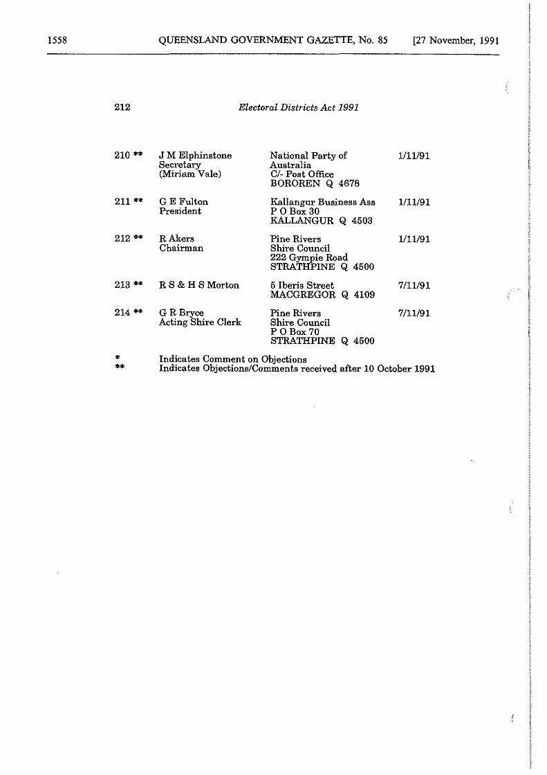
1558 QUEENSLAND GOVERNMENT GAZETTE, No. 85 [27 November, 1991
212 Electoral Districts Act 1991
210 ** J M Elphinstone National Party of 1/11/91 Secretary Australia (Miriam Vale) Cl- Post Office
BOROREN Q 4678
211 ** GE Fulton Kallangur Business Ass 1111/91 President P 0 Box30
KALLANGUR Q 4503
212 ** RAkers Pine Rivers 1/11/91 Chairman Shire Council
222 Gympie Road STRATHPINE Q 4500
213 ** R S & H S Morton 5 Iberis Street 7/11/91 MACGREGOR Q 4109
214 ** GR Bryce Pine Rivers 7/11/91 Acting Shire Clerk Shire Council
PO Box 70 STRATHPINE Q 4500
* Indicates Comment on Objections ** Indicates Objections/Comments received after 10 October 1991
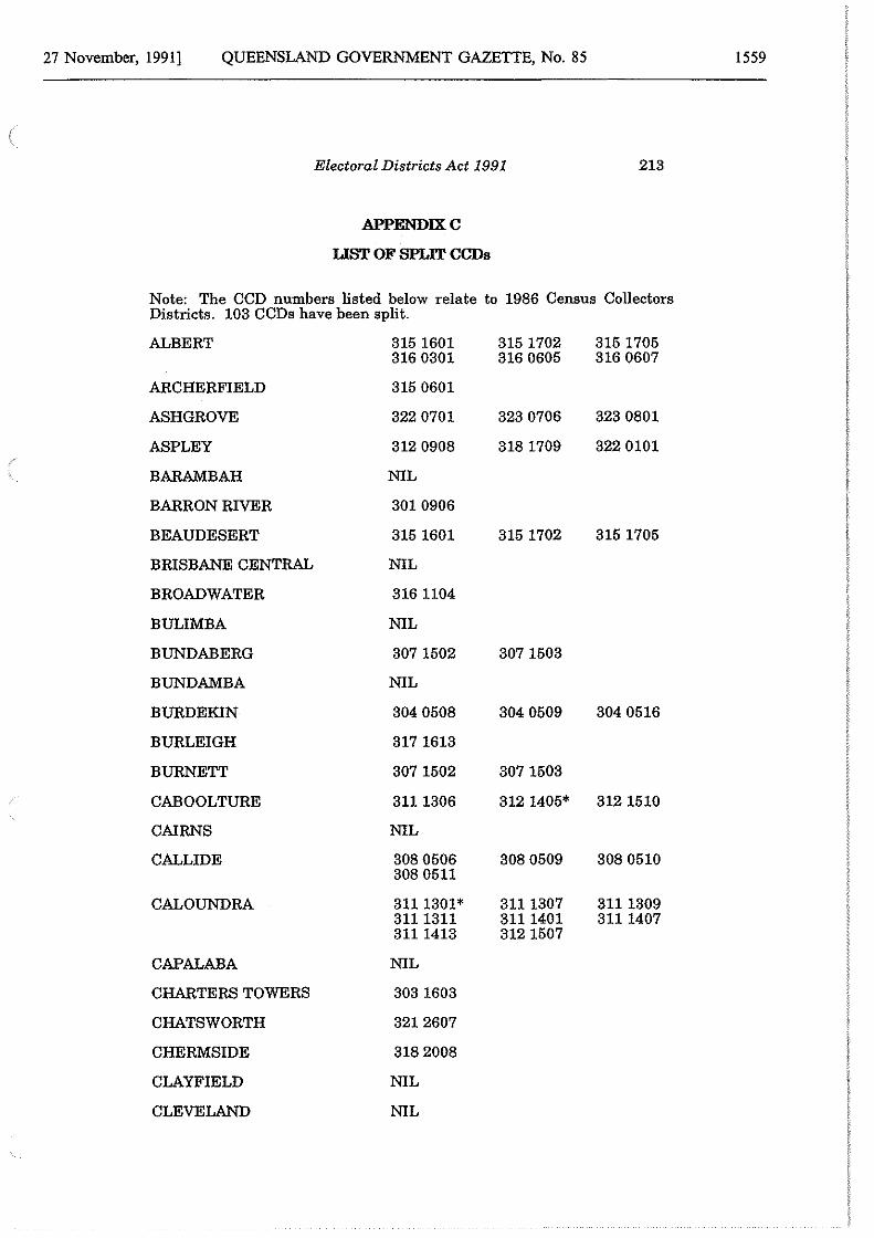
27 November, 1991] QUEENSLAND GOVERNMENT GAZETTE, No. 85 1559
Electoral Districts Act 1991 213
APPENDIXC
LIST OF SPLIT CCDs
Note: The CCD numbers listed below relate to 1986 Census Collectors Districts. 103 CCDs have been split.
ALBERT 315 1601 315 1702 315 1705 316 0301 316 0605 316 0607
ARCHERFIELD 315 0601
ASH GROVE 322 0701 323 0706 323 0801
ASPLEY 312 0908 318 1709 322 0101
BARAMBAH NIL
BARRON RIVER 301 0906
BEAUDESERT 315 1601 315 1702 315 1705
BRISBANE CENTRAL NIL
BROADWATER 316 1104
BULIMBA NIL
BUNDABERG 307 1502 307 1503
BUNDAMBA NIL
BURDEKIN 304 0508 304 0509 304 0516
BURLEIGH 317 1613
BURNETT 307 1502 307 1503
CABOOLTURE 3111306 312 1405* 312 1510
CAIRNS NIL
CALLIDE 308 0506 308 0509 308 0510 308 0511
CALOUNDRA 3111301* 3111307 3111309 3111311 3111401 3111407 3111413 312 1507
CAPALABA NIL
CHARTERS TOWERS 303 1603
CHATSWORTH 3212607
CHERMSIDE 318 2008
CLAYFIELD NIL
CLEVELAND NIL
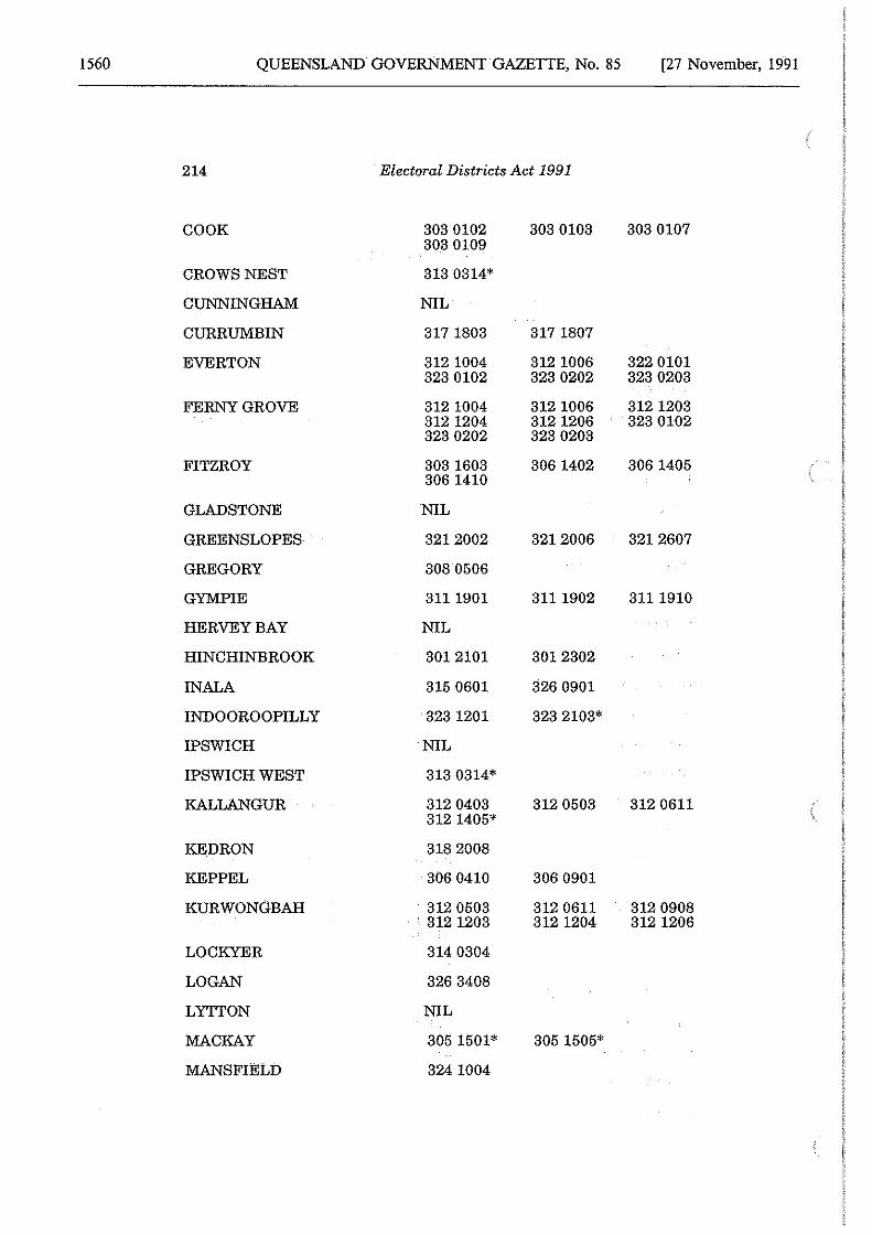
1560 QUEENSLAND GOVERNMENT GAZETTE, No. 85 [27 November, 1991
214 Electoral Districts Act 1991
COOK 303 0102 303 0103 303 0107 303 0109
CROWS NEST 313 0314*
CUNNINGHAM NIL
CURRUMBIN 317 1803 317 1807
EVERTON 312 1004 312 1006 322 0101 323 0102 323 0202 323 0203
FERNY GROVE 312 1004 312 1006 312 1203 312 1204 312 1206 323 0102 323 0202 323 0203
FITZROY 303 1603 306 1402 306 1405 306 1410
GLADSTONE NIL
GREENS LOPES 3212002 3212006 3212607
GREGORY 308 0506
GYMPIE 3111901 3111902 3111910
HERVEY BAY NIL
HINCHINBROOK 3012101 3012302
INALA 315 0601 326 0901
INDOOROOPILLY 323 1201 323 2103*
IPSWICH NIL
IPSWICH WEST 313 0314*
KALLANGUR 312 0403 312 0503 312 0611 312 1405*
KEDRON 318 2008
KEPPEL 306 0410 306 0901
KURWONGBAH 312 0503 312 0611 312 0908 . 312 1203 312 1204 312 1206
LOCKYER 314 0304
LOGAN 326 3408
LYTTON NIL
MACKAY 305 1501* 305 1505*
MANSFIELD 324 1004
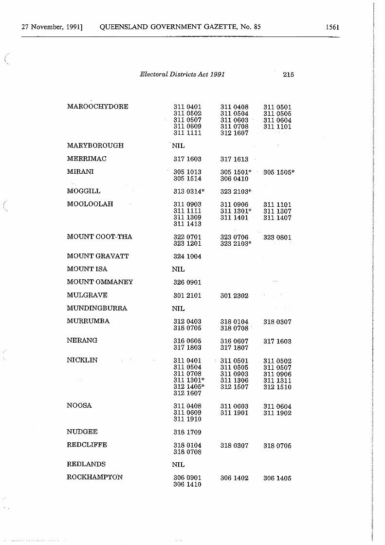
27 November, 1991] QUEENSLAND GOVERNMENT GAZETTE, No. 85 1561
Electoral Districts Act 1991 215
MAROOCHYDORE 311 0401 311 0408 311 0501 311 0502 311 0504 311 0505 311 0507 311 0603 311 0604 311 0609 311 0708 3111101 3111111 312 1607
MARYBOROUGH NIL
MERRIMAC 317 1603 317 1613
MIRANI 305 1013 305 1501* 305 1505* 305 1514 306 0410
MOGGILL 313 0314* 323 2103*
MOOLOOLAH 311 0903 311 0906 3111101 3111111 3111301* 3111307 3111309 3111401 3111407 3111413
MOUNT COOT-THA 322 0701 323 0706 323 0801 323 1201 323 2103*
MOUNT GRAVATT 324 1004
MOUNT ISA NIL
MOUNT OMMANEY 326 0901
MULGRAVE 3012101 3012302
MUNDINGBURRA NIL
MURRUMBA 312 0403 318 0104 318 0307 318 0705 318 0708
NE RANG 316 0605 316 0607 317 1603 317 1803 317 1807
NICKLIN 311 0401 311 0501 311 0502 311 0504 311 0505 311 0507 311 0708 311 0903 311 0906 3111301* 3111306 3111311 312 1405* 312 1507 312 1510 312 1607
NOOSA 311 0408 311 0603 311 0604 3110609 3il 1901 3111902 3111910
NUDGEE 318 1709
RED CLIFFE 318 0104 318 0307 318 0705 318 0708
REDLANDS NIL
ROCKHAMPTON 306 0901 306 1402 306 1405 306 1410
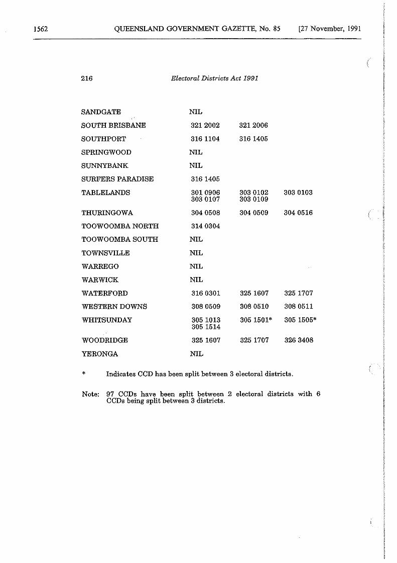
1562 QUEENSLAND GOVERNMENT GAZETTE, No. 85 [27 November, 1991
216 Electoral Districts Act 1991
SANDGATE NIL
SOUTH BRISBANE 3212002 3212006
SOUTHPORT 3161104 316 1405
SPRINGWOOD NIL
SUNNYBANK NIL
SURFERS PARADISE 316 1405
TABLELANDS 301 0906 303 0102 303 0103 303 0107 303 0109
THURINGOWA 304 0508 304 0509 304 0516
TOOWOOMBA NORTH 314 0304
TOOWOOMBA SOUTH NIL
TOWNSVILLE NIL
WARREGO NIL
WARWICK NIL
WATERFORD 316 0301 325 1607 325 1707
WESTERN DOWNS 308 0509 308 0510 308 0511
WHITSUNDAY 305 1013 305 1501* 305 1505* 305 1514
WOODRIDGE 325 1607 325 1707 326 3408
YERO NGA NIL
* Indicates CCD has been split between 3 electoral districts.
Note: 97 CCDs have been split between 2 electoral districts with 6 CCDs being split between 3 districts.
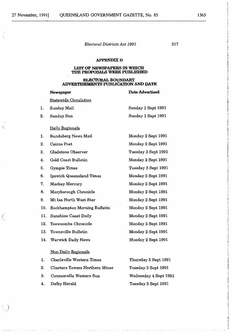
27 November, 1991] QUEENSLAND GOVERNMENT GAZETTE, No. 85 1563
Electoral Districts Act 1991 217
APPENDIXD
LIST OF NEWSPAPERS IN WHICH THE PROPOSALS WERE PUBLISHED
ELECTORAL BOUNDARY ADVERTISEMENTS PUBLICATION AND DATE
Newspaper Date Advertised
St~tewide Circulation
1. Sunday Mail Sunday 1 Sept 1991
2. Sunday Sun Sunday 1 Sept 1991
Daily Regionals
1. Bundaberg News Mail Monday 2 Sept 1991
2. Cairns Post Monday 2 Sept 1991
3. Gladstone Observer Tuesday 3 Sept 1991
4. Gold Coast Bulletin Monday 2 Sept 1991
5. Gympie Times Tuesday 3 Sept 1991
6. Ipswich Queensland Times Monday 2 Sept 1991
7. Mackay Mercury Monday 2 Sept 1991
8. Maryborough Chronicle Monday 2 Sept 1991
9. Mt Isa North West Star Monday 2 Sept 1991
10. Rockhampton Morning Bulletin Monday 2 Sept 1991
11. Sunshine Coast Daily Monday 2 Sept 1991
12. Toowoomba Chronicle Monday 2 Sept 1991
13. Townsville Bulletin Monday 2 Sept 1991
14. Warwick Daily News Monday 2 Sept 1991
Non-Daily Region~!§
1. Charleville Western Times Thursday 5 Sept 1991
2. Charters Towers Northern Miner Tuesday 3 Sept 1991
3. Cunnamulla Western Sun Wednesday 4 Sept 1991
4. Dalby Herald Tuesday 3 Sept 1991
)
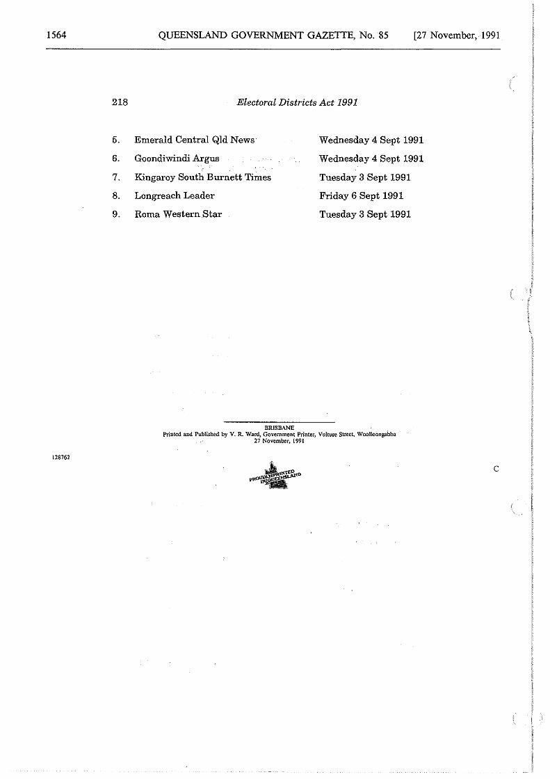
1564
218
5.
6.
7.
8.
9.
128762
QUEENSLAND GOVERNMENT GAZETTE, No. 85 [27 November, 1991
Electoral Districts Act 1991
Emerald Central Qld News Wednesday 4 Sept 1991
Goondiwindi Argus Wednesday 4 Sept 1991
Kingaroy South Burnett Times Tuesday 3 Sept 1991
Longreach Leader Friday 6 Sept 1991
Roma Western Star Tuesday 3 Sept 1991
BRISBANE Printed and Published by V. R. Ward, Government Printer, Vulture Street, Woolloongabba
27 November, 1991
c
Related Documents