No. 203 RED HILL California Historical Marker. Red Hill was a mining business at one time for Mercury and known for rattlesnakes. Three Spanish land grant Rancherias bounded the location of the ‘Red Hill Mine’ N 33° 45.392 W 117° 47.554 11S E 426599 N 3735443 Located at Red Hill Elementary School Between Mardick Road and Wyndham Court Rd. 11911 Red Hill Avenue, North Tustin, CA 92705 . The marker was presented by Michael & Boy Scout Troop 323 as a replacment of the original one set by the State of California. The once ‘Great Swamp’ filled the night air with the sound of millions of frogs from the back bay estuary marshland of Newport Bay. The swamp bog was drained for the Naval hangars to be built, the soil was a salty loam and only a few crops grew well such as lima beans & sugar beets in the reclaimed soil. Flooding and droughts were common to this area. In the 1950’s an aggressive flood control channel system was implemented to prevent massive heavy weather flooding, this lead to the demise of the vibrant frog population. You can visit the marker location but be mindful and respectful of the school CERRITO DE LAS RANAS – HILL OF THE FROGS California Chorus Frog Gabrielino-Tongva Indians referred to it as the Place of Refuge named Ktkt , it was a gathering place from significant floods; a location to withdraw to. Their legend was that people gathered there to weather The Great Flood and their campfires turned the hill red. Many artifacts have been found there, though no evidence of a permanent settlement. Spaniards called it the Hill of Frogs. The Spanish Grijalva scouting party (The Anza Expedition, 1776) identified the area from Santiago Creek to Red Hill as El Alisal, the ‘Sycamore Grove.’ 2 Naval Hangars-Lighter Than Air (LTA) 1

Welcome message from author
This document is posted to help you gain knowledge. Please leave a comment to let me know what you think about it! Share it to your friends and learn new things together.
Transcript

1
No. 203 RED HILLCalifornia Historical Marker. Red Hill was a mining business at one time for Mercury and known for rattlesnakes. Three Spanish land grant Rancherias
bounded the location of the ‘Red Hill Mine’
N 33° 45.392 W 117° 47.55411S E 426599 N 3735443
Located at Red Hill Elementary School Between Mardick Road and Wyndham Court Rd. 11911 Red Hill Avenue, North Tustin, CA 92705 . The marker was presented by Michael & Boy Scout Troop 323 as a replacment of the original one set by the State of California. The once ‘Great Swamp’ filled the night air
with the sound of millions of frogs from the back bay estuary marshland of Newport Bay. The swamp bog was drained for the Naval hangars to be built, the soil was a salty loam and only a few crops grew well such as lima beans & sugar beets in the reclaimed soil. Flooding and droughts were common to this
area. In the 1950’s an aggressive flood control channel system was implemented to prevent massive heavy weather flooding, this lead to the
demise of the vibrant frog population. You can visit the marker location but be mindful and respectful of the school hours and speed limits.
CERRITO DE LAS RANAS – HILL OF THE FROGS
California Chorus Frog
Gabrielino-Tongva Indians referred to it as the Place of Refuge named Katuktu, it was a gathering place from significant floods; a location to withdraw to. Their
legend was that people gathered there to weather The Great Flood and their campfires turned the hill red. Many artifacts have been found there, though no
evidence of a permanent settlement. Spaniards called it the Hill of Frogs. The Spanish Grijalva scouting party (The Anza Expedition, 1776) identified the
area from Santiago Creek to Red Hill as El Alisal, the ‘Sycamore Grove.’
2 Naval Hangars-Lighter Than Air (LTA)

2Sources: https://www.flickr.com/photos/34564322@N03/3610479572http://ochistorical.blogspot.com/2016/12/jim-sleeper-on-red-hill.html
ANN & HERSCHEL C LOGAN Kätuktu; Logan, Herschel C.
Herschel wrote a mini book regarding the Red Hill Mine and the original name of the Hill by the Native Indians. The fun of their company publishing name? Logan & Anne = Loganne Press
Herschel and Anne Logan are interredAt Fairhaven Memorial Park Mausoleum
in Santa Ana, Ca.
Sold for $10 Made in 1979, 2 3/4" x 2 1/8", 28 pp., cloth boards
Logan, Herschel C. Ka-tuk-tu (Red Hill). Santa Ana, CA: Log-Anne Press, 1979. 28 pp. 2 3/8″ x 2 1/8″. Colophon: Designed, illustrated, printed, and bound at the Log-Anne Press, which is at the foot of Red Hill, in Santa Ana, California. Text printed in red on french-fold paper with illustrations. Bound in red cloth with title stamped on front cover in black and a white title label pasted on the spine. Enclosed inside a white dust jacket with title on front and spine in red. 100 copies.

3
HERSCHEL C LOGANKätuktu; Logan, Herschel C. & Annie S. Lawrence Herschel
Herschel Logan (1901-1987) was a printmaker who concentrated on everyday scenes of Kansas in the 1930s. He made many woodcuts of farmhouses set among trees and fields beneath wide skies. Although he often showed the abandoned and derelict buildings that must have been symbols of the Great Depression, his images are more peaceful than political. During the time that Logan was active as a printmaker he was very prolific and popular, but he seems to have been largely forgotten by the 1950s. Most of Logan's scenes are serene or quiet He isn't really capturing motion, since the moment is frozen in time, but he certainly captures the power of his subject matter. Logan has used tiny dots rather than lines for the texture and shading of the dust cloud, and an effective but unexpected touch is the use of the dots mixed in with the lines showing the sky around the clouds. Herschel is one of the youngest founding members of the Prairie Print Makers, along with fellow relief printmakers Lloyd C. Foltz, Leo Courtney, Birger Sandzen, and Norma Bassett Hall. Their work is in the permanent collections of many of the museums in the state. Born in Missouri and raised in Winfield, Kansas, Herschel Logan grew up with a love for art, which led to a year studying at the Chicago Academy of Art. His job at McCormick Armstrong printing company brought him to Wichita where he was influenced by Robert Aitchison and C. A. Seward. It was through Seward that Herschel became a prolific woodblock printer during the height of the Arts and Crafts Movement. Herschel’s subject matter was that of everyday scenes in rural Kansas. Herschel C. Logan was an award winning commercial artist and wood engraver who began printing and publishing miniature books after his retirement in 1972. He was an authority on American firearms and edged weapons, as well as miniature printing presses, of which he had a large collection. He and his wife was Anne Lawrence; her mother’s last name was Burnell. They owned Loganne Press based in Santa Ana, Ca. Herschel’s mother’s maiden name was Bills. Anne and Herschel were hard working and dedicated to their craft. Their work is highly sought by collectors and they ran limited hand printed runs of their books. She and Herschel were cremated and she is interred with her beloved Herschel in the Mausoleum.
Source: https://www.thornbooks.com/pages/books/18566/herschel-c-logan/the-american-hand-press-its-origin-development-and-use

4
TONGVA PEOPLE
Source: http://www.gabrielinotribe.org/historical-sites-1/
Known as the San Gabriel Band of Mission Indians
Replica of a Tongva ki
5
TONGVA
Source: http://www.gabrielinotribe.org/historical-sites-1/
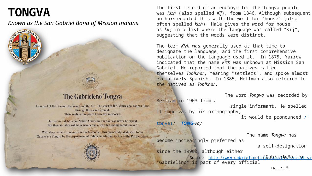
Known as the San Gabriel Band of Mission Indians
The first record of an endonym for the Tongva people was Kizh (also spelled Kij), from 1846. Although subsequent authors equated this with the word for "house" (also often spelled kizh), Hale gives the word for house as kītç in a list where the language was called "Kīj", suggesting that the words were distinct.
The term Kizh was generally used at that time to designate the language, and the first comprehensive publication on the language used it. In 1875, Yarrow indicated that the name Kizh was unknown at Mission San Gabriel. He reported that the natives called themselves Tobikhar, meaning "settlers", and spoke almost exclusively Spanish. In 1885, Hoffman also referred to the natives as Tobikhar.
The word Tongva was recorded by Merriam in 1903 from a single informant. He spelled it Tong-vā; by his orthography, it would be pronounced /ˈtɒŋveɪ/, TONG-vay.
The name Tongva has become increasingly preferred as a self-designation since the 1990s, although either "Gabrieleño" or "Gabrielino" is part of every official name.
The Gabrieleno/Tongva Tribal Council of San Gabriel on their website say that Tongva means "people of the earth." There is no independent evidence for this.

6
Aliso Creek in Orange County (also named as a parkway) which traditionally Marked the boundary between the Tongva
and the Juaneno.
Tongva/Gabrieleño/Fernandeño oral literature is relatively little known, due to their early Christianization in the 1770s by Spanish missions in California. The available evidence suggests strong cultural links with the group's linguistic kin and neighbors to the south and east, the Luisieño and the Cahuilla. According to Kroeber (1925), the pre-Christian Tongva had a "mythic-ritual-social six-god pantheon".
The principal deity was Chinigchinix, also known as Quaoar. Another important figure is Weywot, the god of the sky, who was created by Quaoar. Weywot ruled over the Tongva, but he was very cruel, and he was finally killed by his own sons. When the Tongva assembled to decide what to do next, they had a vision of a ghostly being who called himself Quaoar, who said he had come to restore order and to give laws to the people. After he had given instructions as to which groups would have political and spiritual leadership, he began to dance and slowly ascended into heaven.
Astronomers have used the name of Quaoar to name a large object in the Kuiper belt, 50000 Quaoar (2002), and named its satellite as Weywot (2009).
Source: https://en.wikipedia.org/wiki/Tongva_people
Mission San Gabriel Arcángel circa 1900. The trail in the foreground is part of the original El Camino Real
Many lines of evidence suggest that the Tongva are descended of Uto-Aztecan-speaking peoples from Nevada who moved southwest into coastal Southern California 3,500 years ago. These migrants either absorbed or pushed out the Hokan-speaking peoples in the region. By 500 AD, the Tongva had come to occupy all the lands now associated with them. A hunter-gatherer society, the Tongva traded widely with neighboring peoples. Over time, scattered communities came to speak distinct dialects of the Tongva language, part of the Takic subgroup of the Uto-Aztecan language family. There may have been five or more such dialects (three on the Channel Islands and at least two on the mainland). The Tongva language became extinct in the twentieth century, but a reconstructed form continues to be spoken today.
TONGVA PEOPLE

7
50000 Quaoar ("Kwawar") is a Kuiper belt object roughly half the size of Pluto, with a diameter of 1110±5 km. It is large enough and massive enough that it is probably a dwarf planet. Its orbit in the Kuiper belt is not in resonance with Neptune, which means it is a classical Kuiper belt object. Quaoar has one known moon, Weywot.
Quaoar was discovered in 2002 and its moon in 2007. It was named after the Tongva creator deity and its moon after his son.
Signs of water ice have been found, which suggests that cryovolcanism may be occurring. A small amount of methane is present on Quaoar's surface, which can only be retained by the largest Kuiper belt objects.
Source: https://en.wikipedia.org/wiki/50000_Quaoar
Quaoar is named for the Tongva creator god, following International Astronomical Union naming conventions for non-resonant Kuiper belt objects. The Tongva are the native people of the area around Los Angeles, where the discovery of Quaoar was made. Brown et al. had picked the name with the more intuitive spelling Kwawar, but the preferred spelling among the Tongva was Qua-o-ar.

8
SPANISH AND MEXICAN RANCHOS

9
RED HILL MINING - WREN RANCH
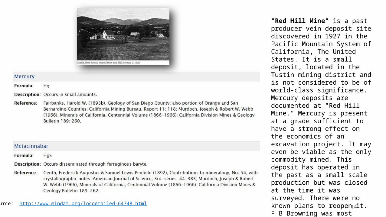
Various Names:1. Red Hill Mine2. Red Hill Deposit3. Red Hill Quicksilver Mine4. Tustin Mine5. San Joaquin Ranch Mine6. Rattlesnake Mine
Discovered in 1892 - Production ceased in 1929
Elevation: 344 feet (105 Meters)Mineralization is a baryte vein deposit hosted in Tertiary sandstone. Presently completely covered by housing developments. The hill was a source of petrified wood.
Primary Mineral: MercuryOre: CinnabarGangue: BaryteGangue: Metacinnabar
Lat/long: 33.74889, -117.79167
RED HILL: Serrita de las Ranas – Hill of the Frogs
How did Red Hill get its name? The earthen red color results from the mineral cinnabar
(mercuric sulfide, HgS, the major source of mercury)
Cinnabar is associated with being near volcanoes or hot springs. Used
for gold extractionMercury is extracted from cinnabar. During
WWI it was used in chemical testing.
"Red Hill Mine" is a past producer vein deposit site discovered in 1927 in the Pacific Mountain System of California, The United States. It is a small deposit, located in the Tustin mining district and is not considered to be of world-class significance. Mercury deposits are documented at "Red Hill Mine." Mercury is present at a grade sufficient to have a strong effect on the economics of an excavation project. It may even be viable as the only commodity mined. This deposit has operated in the past as a small scale production but was closed at the time it was surveyed. There were no known plans to reopen it. F B Browning was most closely involved in the discovery of this deposit. Production at this site spanned 1928-1929.
Source: https://thediggings.com/mines/usgs10040695

10
Spanish Era 1769-1821Mexican Era 1821-1848
American Era 1848-1880+
The nomadic Indians who lived in what is today the Tustin area were called the "Gabrielino" Indians, for they were under the jurisdiction of the San Gabriel Mission. Their dialect was similar to the native Shoshone language. The Spaniards changed the lives of native tribes by forcing and enslaving them to become far workers for the Missions up the California coast. San Gabriel Mission was where the local Tongva people and Juaneao Luiseno nations who inhabited this region. Gaspar de Portal in 1769 with the Spanish expedition lead by Father Junipero Serra named this valley area ast Vaelljo de Santa Ana. The Valel of Saint Anne or Santa Ana. Mission San Gabriel was founded on September 8, 1771 by Fray Angel Francisico de Sonera and Fray Pedro Benito Cambon
They were considered, according to the European standards of the time, to be "somewhat more sophisticated" than the"Juanenos" Indians, who were under the jurisdiction of the San Juan Capistrano Mission. Spanish land grants were issued beginning in 1801 with the Rancho San Antonio gifted to Jose Antonio Yorba.
The Takic languages are a putative group of Uto-Aztecan languages spoken by Californian Native Americans in southern California. The Takic languages appear to be two distinct branches of Uto Aztecan, Serran and Cupan, with similarities due to borrowing.
Source: http://gabrielinoindians.blogspot.com/
GABRIELINO INDIANS
REVITALIZATION As of 2012, members of the contemporary Tongva (Gabrieleño) tribal council are attempting to revive the language, by making use of written vocabularies, by comparison to better attested members of the Takic group to which Tongva belonged, and by offering classes. The Gabrielino- Tongva Language Committee has created Tongva grammar lessons and songs, and Tongva Facebook page "introduces an audio of a new word, phrase or song daily.“
'Eyoonak (Lord’s Prayer)'Eyoonak, 'eyooken tokuupanga'e xaa; hoyuuykoy motwaanyan; moxariin
kinswomen Tokugawa; maay mo'wiishme limey 'xor 'Freya Tokugawa. Hamaare, 'eyoone' maxaare' 'wee taamet, koy 'oovonre' 'eyoomamaayntar
momoohaysh, miyii 'eyaare ‘oovonax 'eyoohiino 'eyooyha'; koy xaare' maayn 'iitam momoohaysh,koy xaa mohuu'esh. ’Wee menee' xaa'e. hey

11
Father Junipero Serra

12 Catholic Church. Extensive repairs and retrofitting followed the earthquake of 1987

13Source: http://www.mindat.org/locdetailed-64748.html
"Red Hill Mine" is a past producer vein deposit site discovered in 1927 in the Pacific Mountain System of California, The United States. It is a small deposit, located in the Tustin mining district and is not considered to be of world-class significance. Mercury deposits are documented at "Red Hill Mine." Mercury is present at a grade sufficient to have a strong effect on the economics of an excavation project. It may even be viable as the only commodity mined. This deposit has operated in the past as a small scale production but was closed at the time it was surveyed. There were no known plans to reopen it. F B Browning was most closely involved in the discovery of this deposit. Production at this site spanned 1928-1929.
14Source: http://www.mindat.org/locdetailed-64748.html
"Red Hill Mine" is a past producer vein deposit site discovered in 1927 in the Pacific Mountain System of California, The United States. It is a small deposit, located in the Tustin mining district and is not considered to be of world-class significance. Mercury deposits are documented at "Red Hill Mine." Mercury is present at a grade sufficient to have a strong effect on the economics of an excavation project. It may even be viable as the only commodity mined. This deposit has operated in the past as a small scale production but was closed at the time it was surveyed. There were no known plans to reopen it. F B Browning was most closely involved in the discovery of this deposit. Production at this site spanned 1928-1929.
15
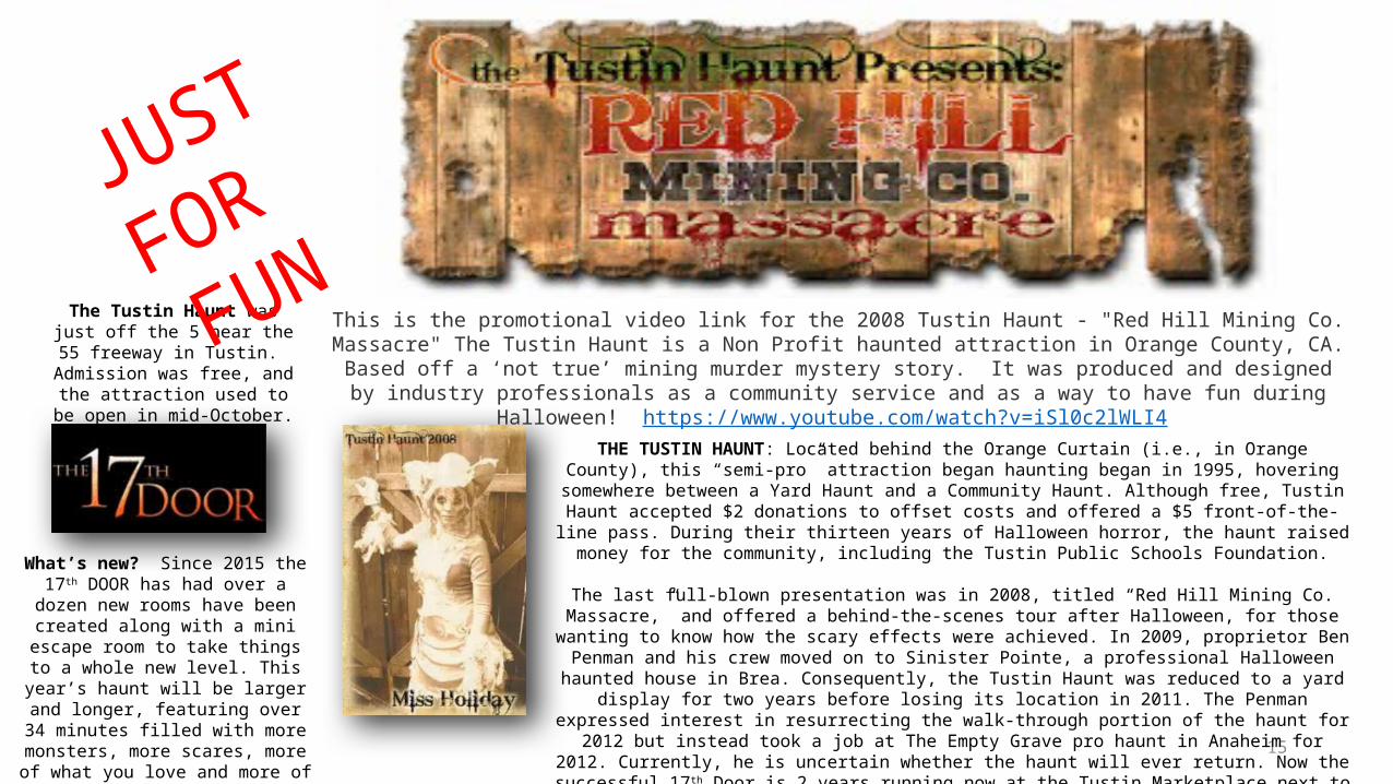
This is the promotional video link for the 2008 Tustin Haunt - "Red Hill Mining Co. Massacre" The Tustin Haunt is a Non Profit haunted attraction in Orange County, CA. Based off a ‘not true’ mining
murder mystery story. It was produced and designed by industry professionals as a community service and as a way to have fun during Halloween!
https://www.youtube.com/watch?v=iSl0c2lWLI4
What’s new? Since 2015 the 17th DOOR has had over a dozen new rooms have been created
along with a mini escape room to take things to a whole new level. This year’s haunt will be larger and longer, featuring over 34
minutes filled with more monsters, more scares, more of what you love and more of what
you hate!
The Tustin Haunt was just off the 5 near the 55
freeway in Tustin. Admission was free, and the attraction used to be open
in mid-October.THE TUSTIN HAUNT: Located behind the Orange Curtain (i.e., in Orange County), this
“semi-pro” attraction began haunting began in 1995, hovering somewhere between a Yard Haunt and a Community Haunt. Although free, Tustin Haunt accepted $2 donations to
offset costs and offered a $5 front-of-the-line pass. During their thirteen years of Halloween horror, the haunt raised money for the community, including the Tustin Public
Schools Foundation.
The last full-blown presentation was in 2008, titled “Red Hill Mining Co. Massacre,” and offered a behind-the-scenes tour after Halloween, for those wanting to know how the scary effects were achieved. In 2009, proprietor Ben Penman and his crew moved on to Sinister Pointe, a professional Halloween haunted house in Brea. Consequently, the Tustin Haunt
was reduced to a yard display for two years before losing its location in 2011. The Penman expressed interest in resurrecting the walk-through portion of the haunt for 2012 but
instead took a job at The Empty Grave pro haunt in Anaheim for 2012. Currently, he is uncertain whether the haunt will ever return. Now the successful 17th Door is 2 years
running now at the Tustin Marketplace next to Home Depot for paid fees & reservations.
JUST
FOR FUN


17
Tribal History – Lost Treaty Rights And Current Status
The “18 lost treaties” recognized the Tongva but were never adopted. In 1950, under the Eisenhower policy of “Assimilation” of Native American Tribes, the Gabrielino-Tongva were effectively terminated.The Mexican-American War was settled by the Treaty of Guadalupe, which ceded California to the United States. Section 1 of the protocol attachk, I’m makign a change to a page that hasn’t been touched to the Treaty required the United States to maintain and protect California Indians, including the Gabrielino Tribe recognized to inhabit the geographic area of the Los Angeles Basin, in the free enjoyment of their liberty, property and religion.
In 1851-53, three U.S. Government Treaty Commissioners appointed by President Fillmore signed the 18 “lost treaties”, setting aside 8.5 million acres in California for Indian reservations in return for the Indians’ quitclaim to 75 million acres of California land. After lobbying by California business interests, the U.S. Senate refused to ratify any of the Treaties, instead placing an “injunction of secrecy” on the documents for 50 years. They were discovered in a locked desk drawer in the Senate Archives in 1905.Source: http://www.gabrielinotribe.org/historical-sites-1/
“A war of extermination will continue to be waged between the two races until the Indian race becomes extinct.”
– California Governor Peter H. Burnett, January 1851

18
The approximately 1.2 million acres promised to the Gabrielino Tribe and other Mission Indians included 50,000 acres on the San Sebastian Reserve at the Tejon Pass at the edge of Los Angeles County, a temporary reservation to which a number of Gabrielino families had been relocated. This 50,000-acre reserve was never officially taken into trust, but instead ended up as the private property of the Superintendent of Indian Affairs, Edward Beale, who incorporated it into his newly named “Tejon Ranch“.
Based upon discovery of the 18 “lost treaties” in 1905, a series of efforts were made to address the treaty-less Gabrielino Tribe, or at least to compromise its claims to land in Los Angeles County. The California Jurisdiction Act of 1928 authorized the California Attorney General to represent the Gabrielino Tribe, among others, and to bring their land claims before the U.S. Court of Claims. The Court of Claims, in California Indians v. US (1941) 98 Ct. Cols, 583, recognized the arguments of the young California Attorney General, Earl Warren, that “a promise made to these tribes and bands of Indians and accepted by them but the treaties were never ratified so the promise was never fulfilled”.
Acting to “recognize the equitable claims” of the Gabrielinos and “all the Indians of California”, the Court awarded 7 cents an acre as compensation for the 8.5 million acres of land which was never set up as reservations under the 18 “lost treaties”. From this sum was deducted the cost of administration of the claims. In 1850, some 94 years earlier, no public lands were purchased for less than $1.50 per acre. The Court of Claims awarded no interest for the 94-year period between signature of the 1851-53 Treaties and payment of the monies in 1944.
Source: http://www.gabrielinotribe.org/historical-sites-1/
19
After WWII reminded the public of the sacrifices of Native American soldiers, and the 1944 payments were seen as woefully inadequate, a second effort to settle land claims was begun under new legislation in 1946. The Indian Claims Commission addressed the claims of the Gabrielino Tribe in Docket 80, where the Gabrielino group was treated as an Indian tribe, but only its members were named as plaintiffs. This legal fiction would appear to a modern lawyer to eviscerate the effectiveness of the land claims settlement, which addressed only the claims of individual Indians (and not the land claims of the Tribe itself).
In 1959, the Court of Claims entered a final order recognizing the aboriginal title of the Gabrielino Tribe and other California tribes to 64 million acres west of the Sierra Nevada Range. The Tribe’s title was recognized and $633 was paid to each Gabrielino in 1972. As part of the efforts to adjudicate the two land claim payments in 1944 and 1972, hundreds of Gabrielino tribal members were recognized as “Gabrielino Indians” on each of the BIA California Indian Rolls of 1928, 1950 and 1972.
The lands claim settlement effort begun in 1946 was incorporated into the “assimilation policy” of the Eisenhower Administration, expressed legislatively as House Concurrent Resolution 108 of 1953. Unfortunately for the Gabrielino Tribe, the US Government decided to pay cash to individual Gabrielino Indians, in lieu of granting a land base to the Gabrielino Tribe. This “assimilation policy” also led to the termination of 53 Indian rancherias, some of which were eventually restored by a federal judge in Hardwick v. United States in 1983.
Source: http://www.gabrielinotribe.org/historical-sites-1/

20
The Tribe has been indigenous to the Los Angeles Basin for 7,000 years. This history is well- documented through 2,800 archaeological sites, in State historical records and federal archives, and Catholic church records at San Gabriel Mission and San Fernando Mission.
A State historical site preserves the holy springs where the Portola Expedition, which founded the City of Los Angeles in the late 1700s, replenished their water. The Expedition encountered the Tongva, who guided them to their holy springs, at what is now University High School in West Los Angeles. The springs provide water to visitors today and are being restored with a $1 million state history grant.
Loyola Marymount University, a conservative Catholic university, in 2000 dedicated a garden to the history of the Tongva in Westchester. Marble plaques, granite walls and metal lettering describe two thousand years of Tongva history in the area, their cultural beliefs, and ends with a quotation from Martin Alcala, a current Council member. The LMU library exhibits artifacts from two Tongva village sites unearthed during construction of the Leavy campus.
The Tongva were enslaved to build the San Gabriel Mission in the City of San Gabriel and the San Fernando Mission in the City of Los Angeles. Other Gabrielino village sites were discovered at Cal State Long Beach, the Sheldon Reservoir in Pasadena and in Los Encinos State Historical Park in Encino.
Archaeology delineating the historical lands of the Tongva was substantially complete by 1930, when over 100 sites had been excavated. The number of archaeological sites has grown to 2,800 locations. The new locations largely confirm the work done by 1930, long before Indian gaming made such information economically important.Source: http://www.gabrielinotribe.org/historical-sites-1/
21
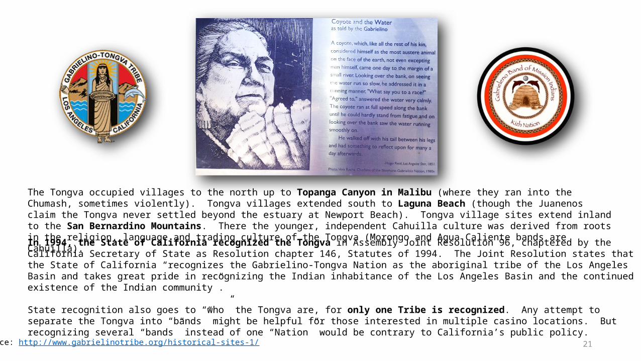
The Tongva occupied villages to the north up to Topanga Canyon in Malibu (where they ran into the Chumash, sometimes violently). Tongva villages extended south to Laguna Beach (though the Juanenos claim the Tongva never settled beyond the estuary at Newport Beach). Tongva village sites extend inland to the San Bernardino Mountains. There the younger, independent Cahuilla culture was derived from roots in the religion, language and trading culture of the Tongva (Morongo and Agua Caliente bands are Cahuilla).
In 1994, the State of California recognized the Tongva in Assembly Joint Resolution 96, chaptered by the California Secretary of State as Resolution chapter 146, Statutes of 1994. The Joint Resolution states that the State of California “recognizes the Gabrielino-Tongva Nation as the aboriginal tribe of the Los Angeles Basin and takes great pride in recognizing the Indian inhabitance of the Los Angeles Basin and the continued existence of the Indian community”.
State recognition also goes to “who” the Tongva are, for only one Tribe is recognized. Any attempt to separate the Tongva into “bands” might be helpful for those interested in multiple casino locations. But recognizing several “bands” instead of one “Nation” would be contrary to California’s public policy.
Source: http://www.gabrielinotribe.org/historical-sites-1/

22
State recognition accompanied by substantial rights is appropriate for the same reasons that California has, without federal approval, undertaken separate pollution-control standards and other statewide initiatives. We in California have a unique history, including a savage side against rather docile Native Americans.
The 18 “lost treaties”, enslavement by missionaries and early settlers, government-sponsored genocides against tribal groups, and the notorious 1851 Indian laws (allowing Indian child theft and slavery) are examples of savagery exercised, sponsored or condoned by the State of California.
Even California’s judiciary participated in an apartheid-like history of racism. See, e.g., People v. Hall (S.Ct. 1854), which enforced and expanded Section 394 of the Civil Practice Act providing “No Indian or Negro shall be allowed to testify as a witness in any action in which a White person is a party.” Our Supreme Court reasoned, “The evident intention of the Act was to throw around the citizen a protection for life and property, which could only be secured by removing him above the corrupting influences of degraded castes.”
Source: http://www.gabrielinotribe.org/historical-sites-1/
“The idea, strange as it may appear, never occurred to them (the Indians) that they were suffering for the great cause of civilization, which, in the natural course of things, must exterminate Indians.”
– Special Agent J. Ross Browne, Indian Affairs

23
When Governor Davis stated that he was ending the abusive chapters of the State’s history towards Indian tribes, by dealing with federally-recognized tribal sovereigns, he was only half right. There are over 50 well-documented Indian tribes that have not been officially recognized by the federal government and have received no assistance from the State. The Gabrielino-Tongva are one of two state-recognized tribes and the best documented tribe in
the State without federal recognition.
Source: http://www.gabrielinotribe.org/historical-sites-1/

24
HISTORIC EL CAMINO REAL – THE KINGS HIGHWAY – THE ROYAL ROAD
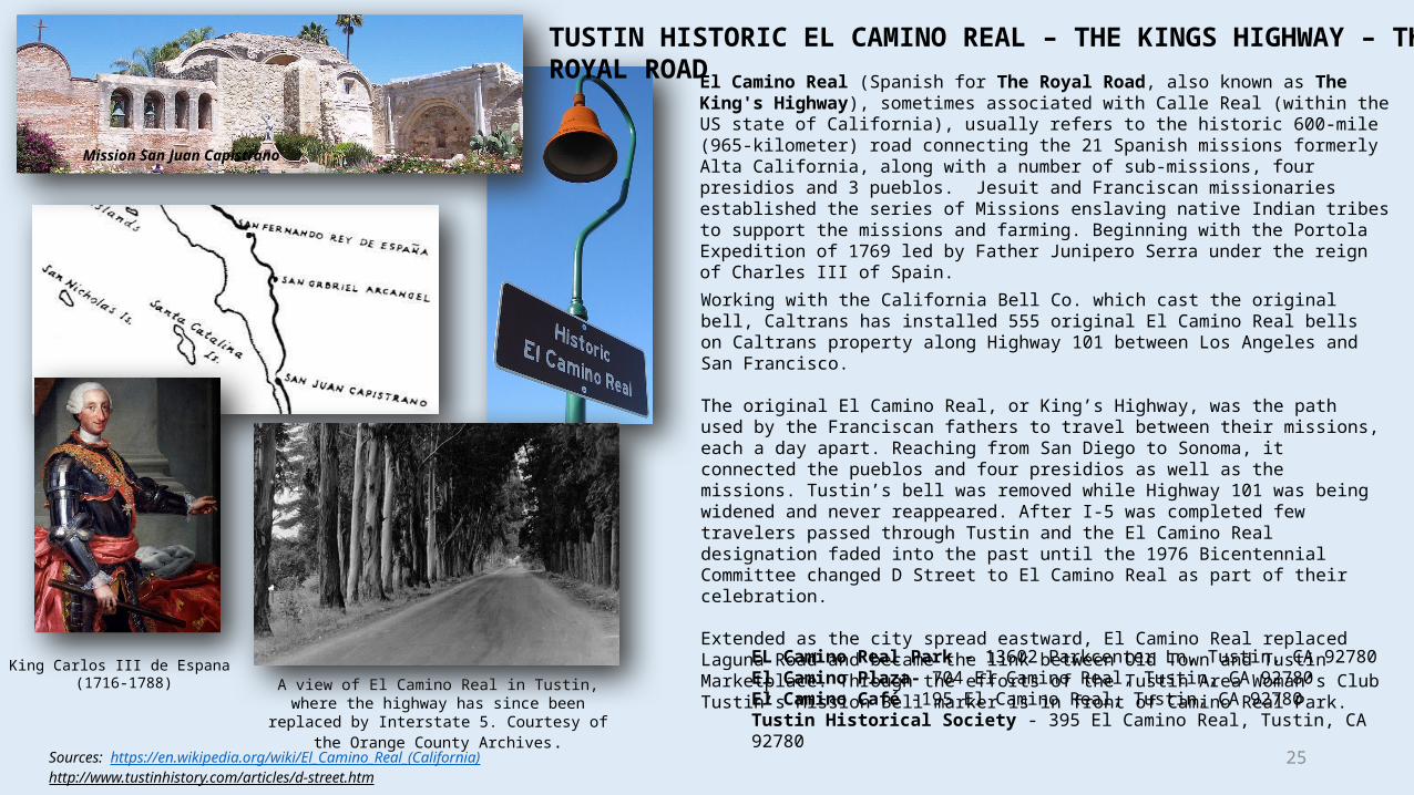
El Camino Real (Spanish for The Royal Road, also known as The King's Highway), sometimes associated with Calle Real (within the US state of California), usually refers to the historic 600-mile (965-kilometer) road connecting the 21 Spanish missions formerly Alta California, along with a number of sub-missions, four presidios and 3 pueblos. Jesuit and Franciscan missionaries established the series of Missions enslaving native Indian tribes to support the missions and farming. Beginning with the Portola Expedition of 1769 led by Father Junipero Serra under the reign of Charles III of Spain.
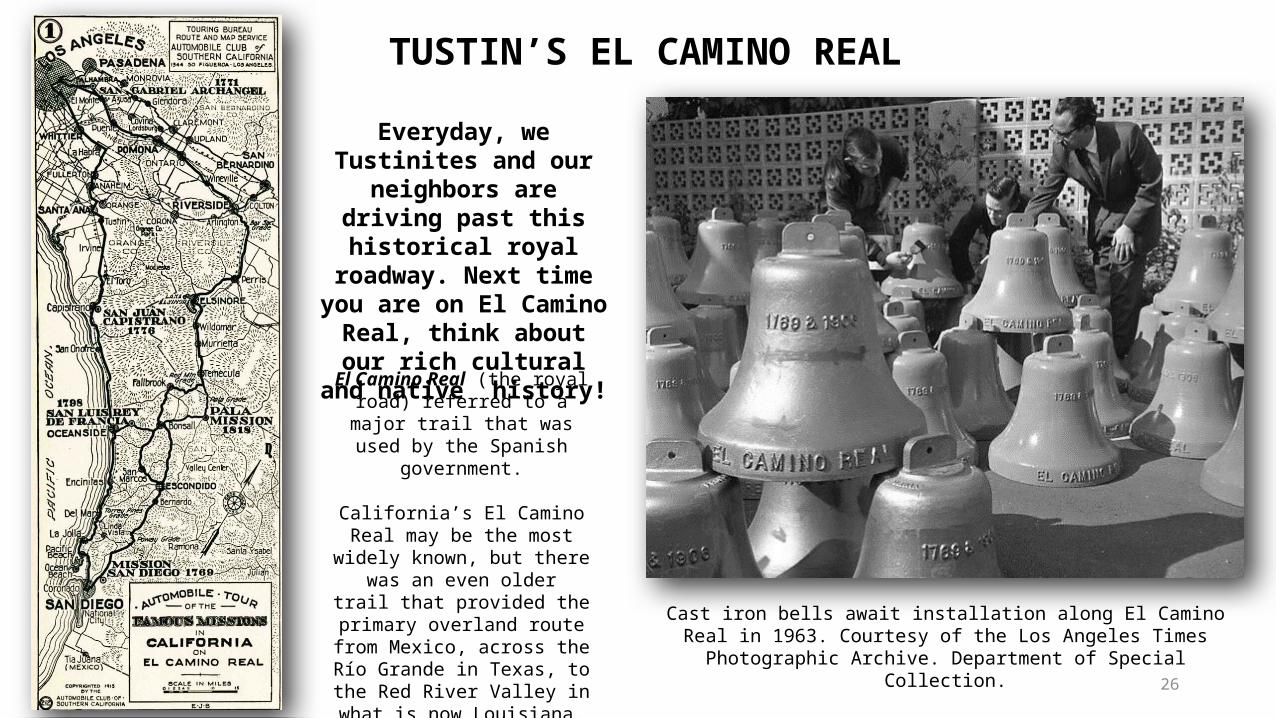
History of Commemorative Bell-MarkersHistorical marker situated along El Camino Real. In 1892, Anna Pitcher initiated an effort to preserve the as-yet un-commemorated route of Alta California’s Camino Real, an effort adopted by the California Federation of Women's Clubs in 1902. Modern El Camino Real was one of the first state highways in California. Given the lack of standardized road signs at the time, it was decided to place distinctive bells along the route, hung on supports in the form of an 11-foot (3.4 m) high shepherd's crook, also described as "a Franciscan walking stick." The first of 450 bells were unveiled on August 15, 1906, at the Plaza Church in the Pueblo near Olvera Street in Los Angeles, Ca.
The original organization which installed the bells fragmented, and the Automobile Club of Southern California and associated groups cared for the bells from the mid-1920s through 1931. The State took over bell maintenance in 1933. Most of the bells eventually disappeared due to vandalism, theft or simple loss due to the relocation or rerouting of highways and roads. After a reduction in the number of bells to around 80, the State began replacing them, at first with concrete, and later with iron. A design first produced in 1960 by Justin Kramer of Los Angeles was the standard until the California Department of Transportation (Caltrans) began a restoration effort in 1996.
Keith Robinson, Principal Landscape Architect at Caltrans developed an El Camino Real restoration program which resulted in the installation of 555 El Camino Real Bell Markers in 2005. The Bell Marker consists of a 460 mm diameter cast metal bell set atop a 75 mm diameter Schedule 40 pipe column that is attached to a concrete foundation using anchor rods. The original 1906 bell molds were used to fabricate the replacement bells. The replacement and original bells were produced by the California Bell Company, and are most typically marked 1769 & 1906, and include a designer's copyright notice. The two dates represent the date of the founding of the first Alta-California mission in San Diego, and the date of the setting of the first commemorative bell-marker, respectively.
Source: https://en.wikipedia.org/wiki/El_Camino_Real_(California)
25
El Camino Real (Spanish for The Royal Road, also known as The King's Highway), sometimes associated with Calle Real (within the US state of California), usually refers to the historic 600-mile (965-kilometer) road connecting the 21 Spanish missions formerly Alta California, along with a number of sub-missions, four presidios and 3 pueblos. Jesuit and Franciscan missionaries established the series of Missions enslaving native Indian tribes to support the missions and farming. Beginning with the Portola Expedition of 1769 led by Father Junipero Serra under the reign of Charles III of Spain.
Sources: https://en.wikipedia.org/wiki/El_Camino_Real_(California)http://www.tustinhistory.com/articles/d-street.htm
King Carlos III de Espana (1716-1788)
Mission San Juan Capistrano
Working with the California Bell Co. which cast the original bell, Caltrans has installed 555 original El Camino Real bells on Caltrans property along Highway 101 between Los Angeles and San Francisco.
The original El Camino Real, or King’s Highway, was the path used by the Franciscan fathers to travel between their missions, each a day apart. Reaching from San Diego to Sonoma, it connected the pueblos and four presidios as well as the missions. Tustin’s bell was removed while Highway 101 was being widened and never reappeared. After I-5 was completed few travelers passed through Tustin and the El Camino Real designation faded into the past until the 1976 Bicentennial Committee changed D Street to El Camino Real as part of their celebration.
Extended as the city spread eastward, El Camino Real replaced Laguna Road and became the link between Old Town and Tustin Marketplace. Through the efforts of the Tustin Area Woman’s Club Tustin’s Mission Bell marker is in front of Camino Real Park.
EL Camino Real Park - 13602 Parkcenter Ln, Tustin, CA 92780El Camino Plaza- 704 El Camino Real, Tustin, CA 92780El Camino Café -195 El Camino Real, Tustin, CA 92780Tustin Historical Society - 395 El Camino Real, Tustin, CA 92780
A view of El Camino Real in Tustin, where the highway has since been replaced by Interstate 5.
Courtesy of the Orange County Archives.
TUSTIN HISTORIC EL CAMINO REAL – THE KINGS HIGHWAY – THE ROYAL ROAD
26
Cast iron bells await installation along El Camino Real in 1963. Courtesy of the Los Angeles Times Photographic Archive. Department
of Special Collection.
El Camino Real (the royal road) referred to a major trail that was
used by the Spanish government.
California’s El Camino Real may be the most widely known, but
there was an even older trail that provided the primary overland route from Mexico, across the
Río Grande in Texas, to the Red River Valley in what is now
Louisiana.
Everyday, we Tustinites and our neighbors are driving past this historical royal
roadway. Next time you are on El Camino Real, think
about our rich cultural and native history!
TUSTIN’S EL CAMINO REAL
27
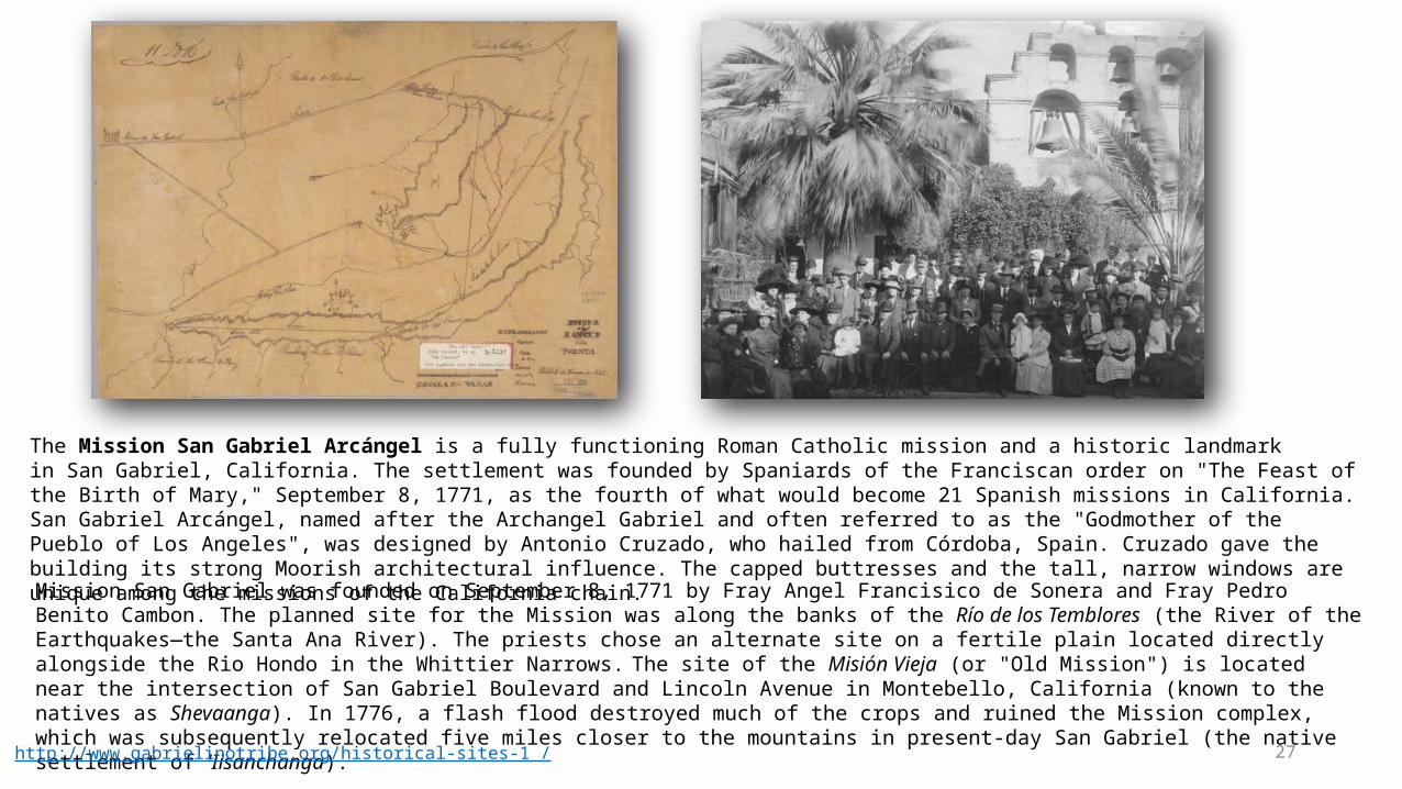
The Mission San Gabriel Arcángel is a fully functioning Roman Catholic mission and a historic landmark in San Gabriel, California. The settlement was founded by Spaniards of the Franciscan order on "The Feast of the Birth of Mary," September 8, 1771, as the fourth of what would become 21 Spanish missions in California. San Gabriel Arcángel, named after the Archangel Gabriel and often referred to as the "Godmother of the Pueblo of Los Angeles", was designed by Antonio Cruzado, who hailed from Córdoba, Spain. Cruzado gave the building its strong Moorish architectural influence. The capped buttresses and the tall, narrow windows are unique among the missions of the California chain.
Mission San Gabriel was founded on September 8, 1771 by Fray Angel Francisico de Sonera and Fray Pedro Benito Cambon. The planned site for the Mission was along the banks of the Río de los Temblores (the River of the Earthquakes—the Santa Ana River). The priests chose an alternate site on a fertile plain located directly alongside the Rio Hondo in the Whittier Narrows. The site of the Misión Vieja (or "Old Mission") is located near the intersection of San Gabriel Boulevard and Lincoln Avenue in Montebello, California (known to the natives as Shevaanga). In 1776, a flash flood destroyed much of the crops and ruined the Mission complex, which was subsequently relocated five miles closer to the mountains in present-day San Gabriel (the native settlement of 'Iisanchanga).
Source: http://www.gabrielinotribe.org/historical-sites-1 /

28
The Mission is the base from which the pueblo that became the city of Los Angeles was sent. On December 9, 1812 (the "Feast Day of the Immaculate Conception of the Blessed Virgin"), a series of massive earthquakes shook Southern California. The 1812 Wrightwood earthquake caused the three-bell campanario, located adjacent to the chapel's east façade, to collapse. A larger, six-bell structure was subsequently constructed at the far end of the capilla. While no pictorial record exists to document what the original structure looked like, architectural historian Rexford Newcomb deduced the design and published a depiction in his 1916 work The Franciscan Mission Architecture of Alta California.
Source: https://en.wikipedia.org/wiki/Mission_San_Gabriel_Arc%C3%A1ngel

29
Legend has it that the founding expedition was confronted by a large group of native Tongva peoples whose intention was to drive the strangers away. One of the priests laid a painting of "Our Lady of Sorrows" on the ground for all to see, whereupon the natives, designated by the settlers as the Gabrieliños, immediately made peace with the missionaries, because they were so moved by the painting's beauty. Today the 300-year-old work hangs in front of and slightly to the left of the old high altar and reredos in the Mission's sanctuary.
A large stone cross stands in the center of the campo santo (cemetery), first consecrated in 1778 and then again on January 29, 1939 by the Los Angeles Archbishop John Cantwell. It serves as the final resting place for some 6,000 "neophytes;" a small stone marker denotes the gravesite of José de Los Santos, the last American Indian to be buried on the grounds, at the age of 101 in February 1921. Also interred at the Mission are the bodies of numerous Franciscan priests who died during their time of service, as well as the remains of Reverend Raymond Catalan, C.M.F., who undertook the restoration of the Mission's gardens. Entombed at the foot of the altar are the remains of eight Franciscan priests (listed in order of interment): Miguel Sánchez, Antonio Cruzado, Francisco Dumetz, Roman Ulibarri, Joaquin P. Nuez, Gerónimo Boscana, José Bernardo Sánchez, and Blas Ordaz. Buried among the priests is centenarian Eulalia Perez de Guillén Mariné, the "keeper of the keys" under Spanish rule; her grave is marked by a bench dedicated in her memory.
Source: https://en.wikipedia.org/wiki/Mission_San_Gabriel_Arc%C3%A1ngel
(1870) Early view of the cemetery located on the grounds of Mission San Gabriel

30Source: https://en.wikipedia.org/wiki/Mission_San_Gabriel_Arc%C3%A1ngelhttp://www.missionscalifornia.com/content/native-americans-san-gabriel-arc%C3%A1ngel.html
Well over 25,000 baptisms were conducted at San Gabriel between 1771 and 1834, making it the most prolific in the mission chain. In its heyday it furnished food and supplies to settlements and other missions throughout California. A majority of the Mission structures fell into ruins after it was secularized in November 1834. The once-extensive vineyards were falling to decay, with fences broken down and animals roaming freely through it.
The Mission's chapel functioned as a parish church for the City of San Gabriel from 1862 until 1908, when the Claretian Missionaries came to San Gabriel and began the job of rebuilding and restoring the Mission. On October 1, 1987 the Whittier Narrows earthquake damaged the property. A significant portion of the original complex has since been restored.
Drawing of the miracle of San Gabriel1832 Painting of San Gabriel by Ferdinand Deppe
Related Documents