The Many Interactive Maps of WVGES Presented by: John M. Bocan West Virginia Geological and West Virginia Geological and Economic Survey Economic Survey

The Many Interactive Maps of WVGES Presented by: John M. Bocan West Virginia Geological and Economic Survey.
Dec 21, 2015
Welcome message from author
This document is posted to help you gain knowledge. Please leave a comment to let me know what you think about it! Share it to your friends and learn new things together.
Transcript

The Many Interactive Maps of WVGES
Presented by:John M. Bocan
West Virginia Geological and West Virginia Geological and Economic SurveyEconomic Survey

Some HistorySome History
The Coal Bed Mapping Project spearheaded the need for our own in-house web services.
PTTC regional oil and gas through NRCCE at WVU and created by the WVU Tech Center and is still used today.
ArcView IMS 2.x on two SGI IRIX boxes of which one housed the web portion.
Eventually it went to ArcIMS 3.1 Dell Precision 340 machine with 1 GB RAM and an Intel Pentium 4 CPU 1.90 GHz with Windows 2000
All were shapefile based and using HTML image server.
ArcSDE was implemented and fully operational in 2005. Coal data now pulled from an Oracle database.
Why no ArcGIS Server yet?Why no ArcGIS Server yet?
• Many ArcIMS services• Most ArcIMS services tied into ArcSDE/Oracle• Concerns for custom, in-house applications• Staff busy with other projects• Financial and budgetary concerns• Concerns with earlier version of ArcGIS Server

Current Discussions and Possible PlansCurrent Discussions and Possible Plans
• With the addition of some new Federally sponsored projects—hardware and software upgrades.• New project requirements for WMS services, ability to have mash-ups, etc.• Concerns for serving the public with better means
• More people accustomed to Google Maps• “Slippy map” vs “refresh”
• More templates and possibilities with the Javascript and FLEX APIs. • Some work already in progress on an ArcGIS Server development machine.• Need to fully develop and implement a “battle plan” among all sections of the Survey.

Current SetupCurrent Setup
• Dell Server, Windows 2003 Server with ArcSDE and ArcIMS 9.3.1• We have 93 total IMS services running:
• 76 individual coal beds• 2 coal “conglomerate” services (e.g., All Coal, Pocahontas Formation)• 4 oil and gas services (past few years)• 1 topographic index• 5 “service” maps (i.e., overview maps)• 5 testing or prototypes
• Of the 93:• 3 incorporate data and mapping from other states (PTTC, TBR, ATG)• 8 are ArcMap Image Services (obviously the first candidates for transition)
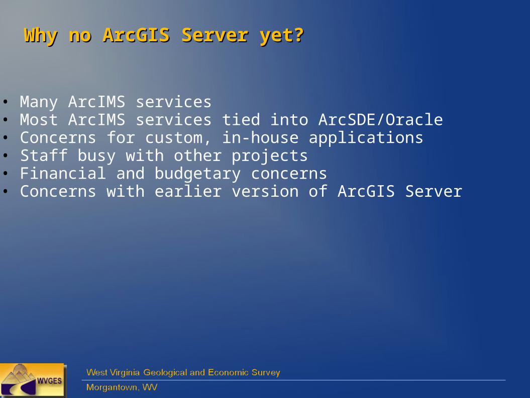
CBMP: Kanawha Formation Coals (Example)CBMP: Kanawha Formation Coals (Example)Via http://www.wvgs.wvnet.edu/www/coal/cbmp/coalims.html
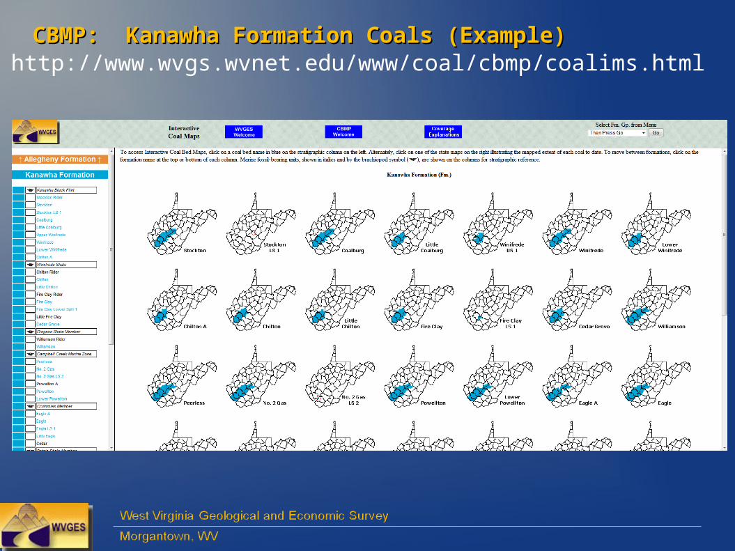
CBMP: Pittsburgh CoalCBMP: Pittsburgh Coalhttp://ims.wvgs.wvnet.edu/PGH
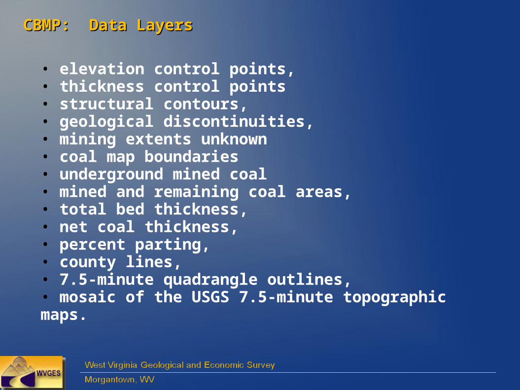
CBMP: Data LayersCBMP: Data Layers
• elevation control points, • thickness control points• structural contours, • geological discontinuities,• mining extents unknown• coal map boundaries • underground mined coal• mined and remaining coal areas, • total bed thickness, • net coal thickness, • percent parting, • county lines, • 7.5-minute quadrangle outlines,• mosaic of the USGS 7.5-minute topographic maps.
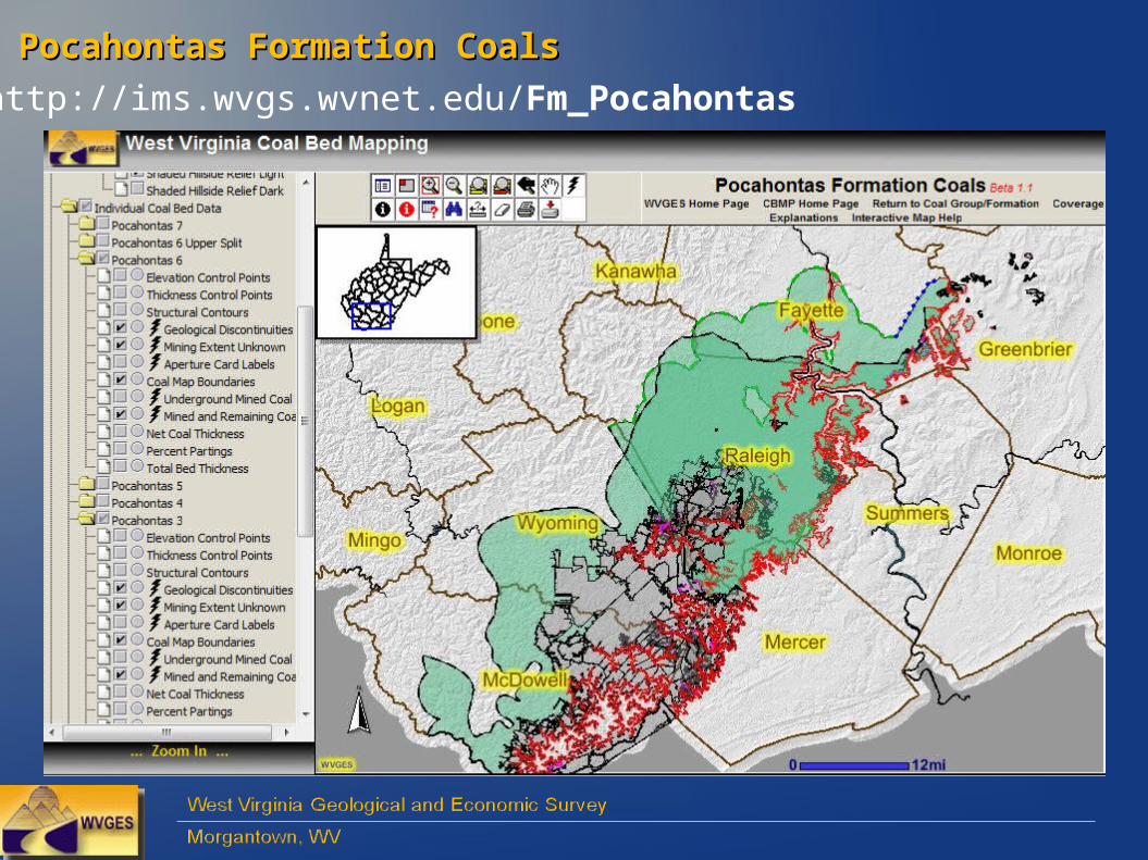
Pocahontas Formation CoalsPocahontas Formation Coals
http://ims.wvgs.wvnet.edu/Fm_Pocahontas
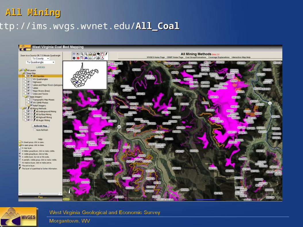
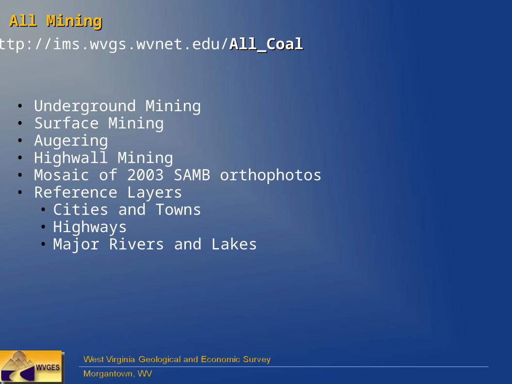
All Mining All Mining
http://ims.wvgs.wvnet.edu/All_CoalAll_Coal
All Mining All Mining
http://ims.wvgs.wvnet.edu/All_CoalAll_Coal
• Underground Mining• Surface Mining• Augering• Highwall Mining• Mosaic of 2003 SAMB orthophotos • Reference Layers
• Cities and Towns• Highways• Major Rivers and Lakes
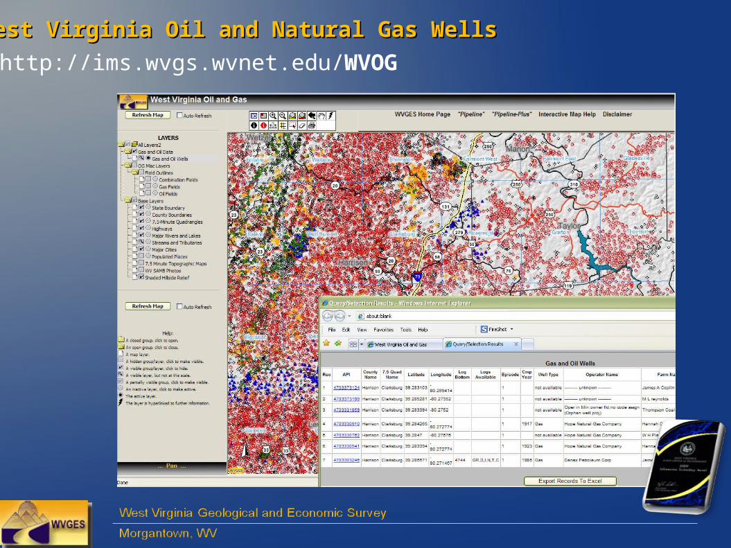
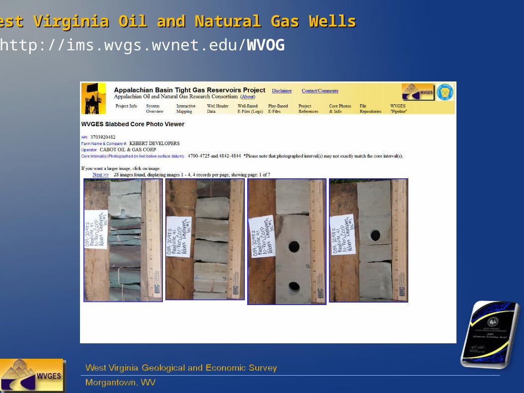
West Virginia Oil and Natural Gas WellsWest Virginia Oil and Natural Gas Wells
http://ims.wvgs.wvnet.edu/WVOG
West Virginia Oil and Natural Gas WellsWest Virginia Oil and Natural Gas Wells
http://ims.wvgs.wvnet.edu/WVOG
• Well type “groupings” (at smaller scale) •Access to over 145,000 oil and gas wells (at larger scale)
• Gas• Oil• Oil and Gas (combined)• Dry• Service • Others (including permits)
• Ties into our interactive database “pipeline-plus”• Over 190,000 views, 2nd half of 2009
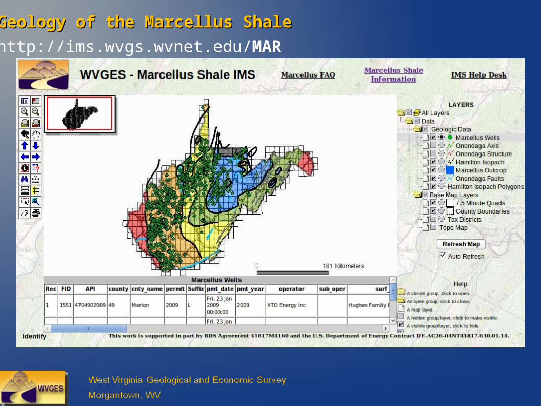
Geology of the Marcellus ShaleGeology of the Marcellus Shale
http://ims.wvgs.wvnet.edu/MAR
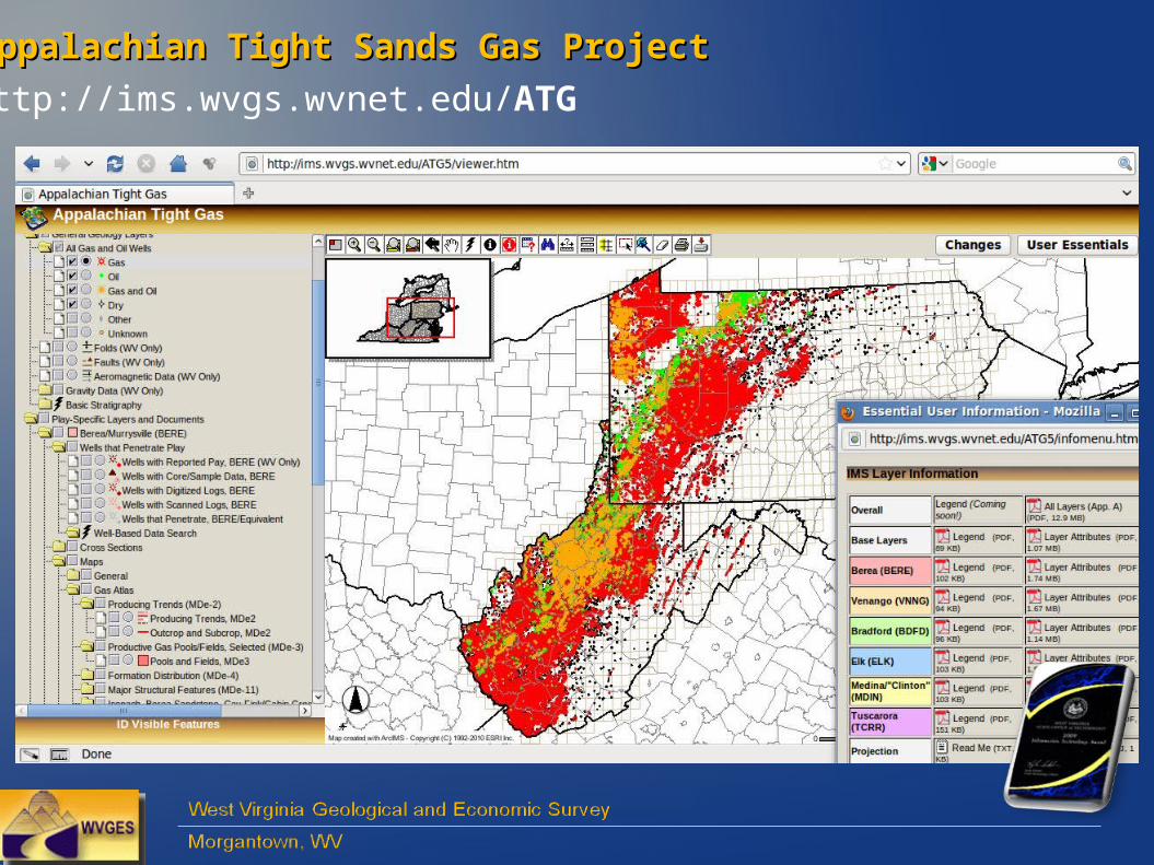
Appalachian Tight Sands Gas ProjectAppalachian Tight Sands Gas Project
http://ims.wvgs.wvnet.edu/ATG
West Virginia Oil and Natural Gas WellsWest Virginia Oil and Natural Gas Wells
http://ims.wvgs.wvnet.edu/WVOG
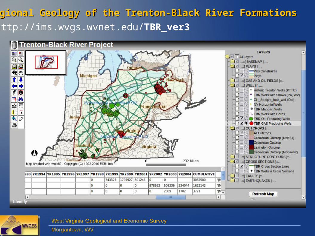
Regional Geology of the Trenton-Black River FormationsRegional Geology of the Trenton-Black River Formations
http://ims.wvgs.wvnet.edu/TBR_ver3

Selected Appalachian Region Oil and Gas WellsSelected Appalachian Region Oil and Gas Wells
http://ims.wvgs.wvnet.edu/PTTC
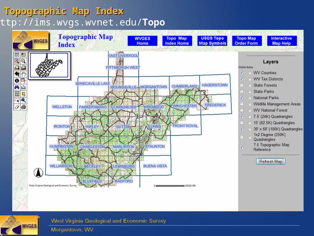
Topographic Map IndexTopographic Map Indexhttp://ims.wvgs.wvnet.edu/Topo

- - Prototype - -
Geologic Map (ala 1968) – Prototype, “Phase 1”Geologic Map (ala 1968) – Prototype, “Phase 1”
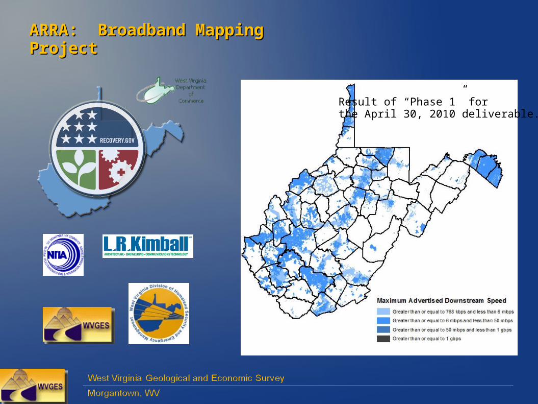
ARRA: Broadband Mapping ProjectARRA: Broadband Mapping Project
Result of “Phase 1” forthe April 30, 2010 deliverable.
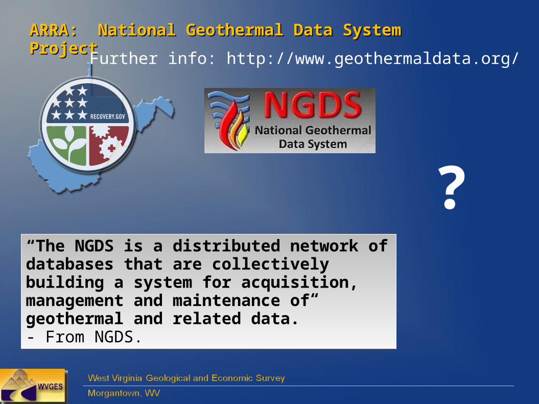
ARRA: National Geothermal Data System ProjectARRA: National Geothermal Data System Project
“The NGDS is a distributed network of databases that are collectively building a system for acquisition, management and maintenance of geothermal and related data.”- From NGDS.
“The NGDS is a distributed network of databases that are collectively building a system for acquisition, management and maintenance of geothermal and related data.”- From NGDS.
?
Further info: http://www.geothermaldata.org/

Interactive Map PortalInteractive Map Portal
http://ims.wvgs.wvnet.edu
John M. Bocan Email: [email protected]
Related Documents