APRIL 2017

Welcome message from author
This document is posted to help you gain knowledge. Please leave a comment to let me know what you think about it! Share it to your friends and learn new things together.
Transcript

THE COASTAL ZONE
APRIL 2017

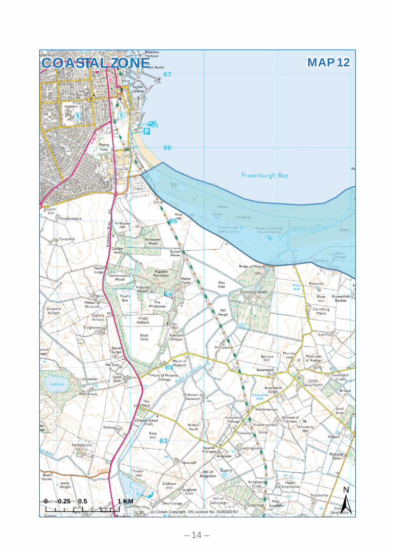
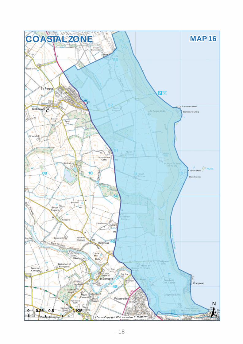
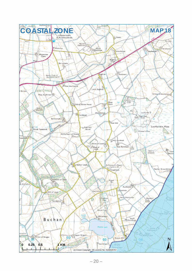
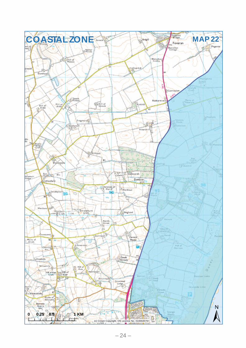
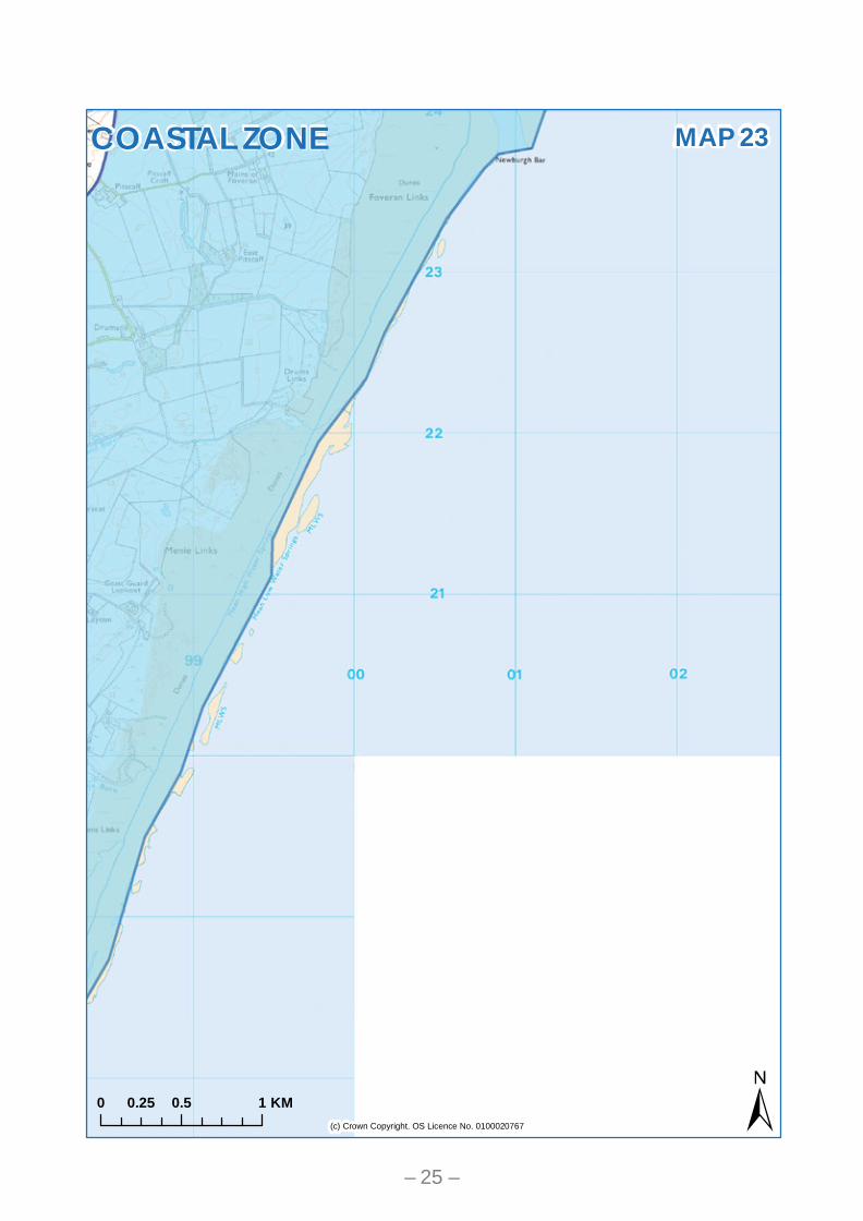
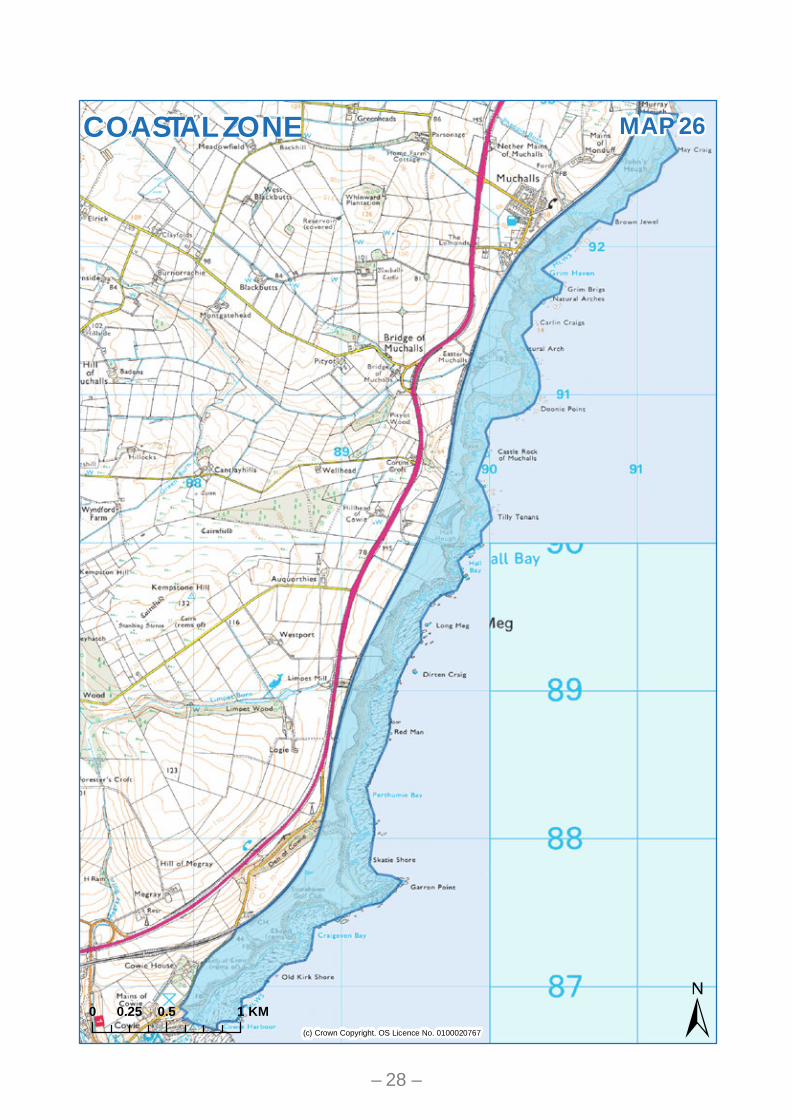
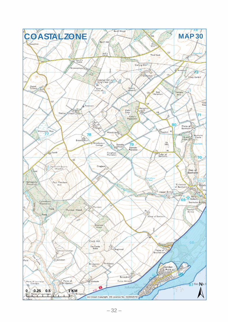
Supplementary Guidance The Coastal Zone Policy R1 of the Aberdeenshire Local Development Plan identifies the coastal zone as a special rural area in which new development must require a coastal location to proceed, unless it is the redevelopment of an existing building, or within the curtilage of an existing building. The Coastal zone is shown on the “Development in the Countryside” proposals map of the Local Development Plan. That map is insufficiently detailed to allow the identification of specific boundaries and the following maps allow the boundaries of this area to be accurately defined. These boundaries reflect the local application of this policy area and do not impact on either the principle of the policy (which is established by Policy R1), or the spatial strategy of the wider plan area. For the avoidance of doubt the area marked on these maps is an area subject to significant constraint in the context of paragraph 89 of Scottish Planning Policy. Coastal locations within settlements and specific allocation of “R” reserved and “P” protected sites, such as at Peterhead, are “developed coast”.
– 1 –

5 8 976421 3 10
14 15
17
20
29
30
18
23
21
28
31
12 13
26
22
24
27
19
16
3332
25
11
Marr
Formartine
Buchan
Garioch
Banff and Buchan
Kincardine and Mearns
(c) Crown Copyright. OS Licence No. 0100020767
0 9 184.5 KMCOASTAL ZONE
KEYMAP– 2 –

(c) Crown Copyright. OS Licence No. 0100020767
MAP 1
0 0.5 10.25 KM
COASTAL ZONE
– 3 –
(c) Crown Copyright. OS Licence No. 0100020767
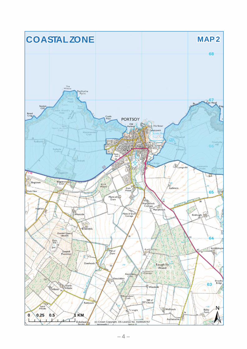
MAP 2
0 0.5 10.25 KM
COASTAL ZONE
– 4 –

(c) Crown Copyright. OS Licence No. 0100020767
MAP 3
0 0.5 10.25 KM
COASTAL ZONE
– 5 –

(c) Crown Copyright. OS Licence No. 0100020767
MAP 4
0 0.5 10.25 KM
COASTAL ZONE
– 6 –

(c) Crown Copyright. OS Licence No. 0100020767
MAP 5
0 0.5 10.25 KM
COASTAL ZONE
– 7 –

(c) Crown Copyright. OS Licence No. 0100020767
MAP 6
0 0.5 10.25 KM
COASTAL ZONE
– 8 –

(c) Crown Copyright. OS Licence No. 0100020767
MAP 7
0 0.5 10.25 KM
COASTAL ZONE
– 9 –

(c) Crown Copyright. OS Licence No. 0100020767
MAP 8
0 0.5 10.25 KM
COASTAL ZONE
– 10 –
(c) Crown Copyright. OS Licence No. 0100020767
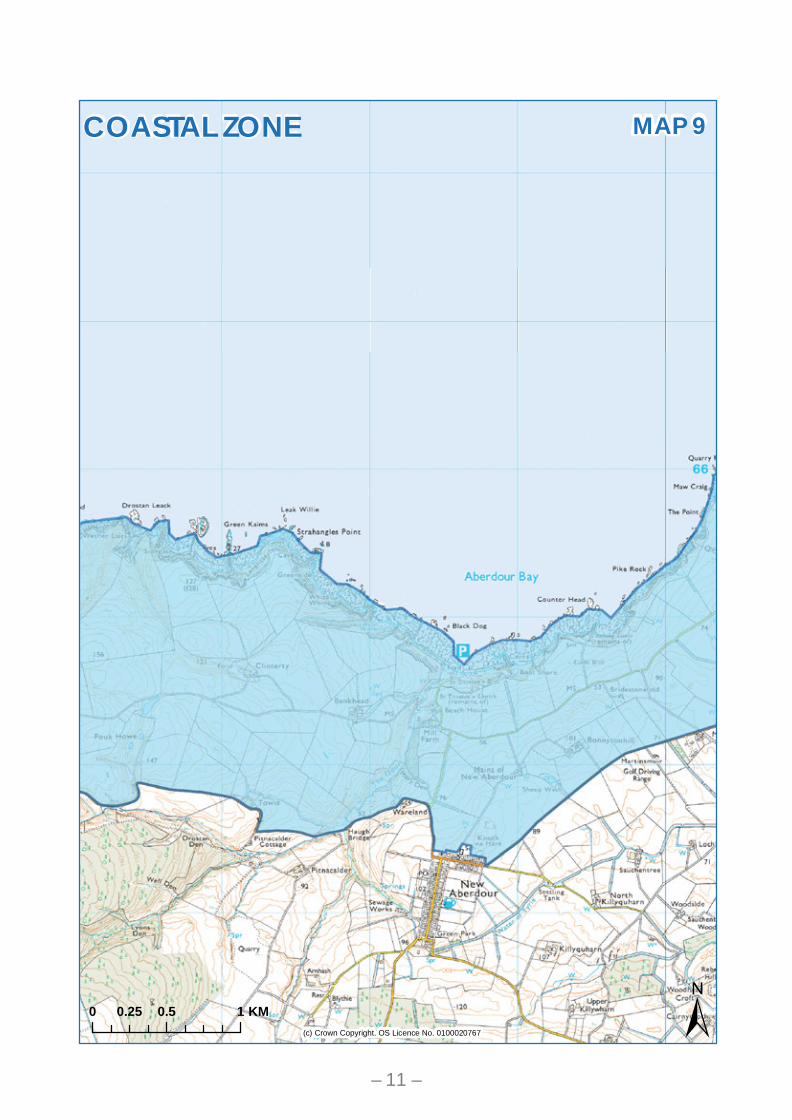
MAP 9
0 0.5 10.25 KM
COASTAL ZONE
– 11 –

(c) Crown Copyright. OS Licence No. 0100020767
MAP 10
0 0.5 10.25 KM
COASTAL ZONE
– 12 –

(c) Crown Copyright. OS Licence No. 0100020767
MAP 11
0 0.5 10.25 KM
COASTAL ZONE
– 13 –
(c) Crown Copyright. OS Licence No. 0100020767
MAP 12
0 0.5 10.25 KM
COASTAL ZONE
– 14 –

(c) Crown Copyright. OS Licence No. 0100020767
MAP 13
0 0.5 10.25 KM
COASTAL ZONE
– 15 –

(c) Crown Copyright. OS Licence No. 0100020767
MAP 14
0 0.5 10.25 KM
COASTAL ZONE
– 16 –

(c) Crown Copyright. OS Licence No. 0100020767
MAP 15
0 0.5 10.25 KM
COASTAL ZONE
– 17 –
(c) Crown Copyright. OS Licence No. 0100020767
MAP 16
0 0.5 10.25 KM
COASTAL ZONE
– 18 –

(c) Crown Copyright. OS Licence No. 0100020767
MAP 17
0 0.5 10.25 KM
COASTAL ZONE
– 19 –
(c) Crown Copyright. OS Licence No. 0100020767
MAP 18
0 0.5 10.25 KM
COASTAL ZONE
– 20 –

(c) Crown Copyright. OS Licence No. 0100020767
MAP 19
0 0.5 10.25 KM
COASTAL ZONE
– 21 –

(c) Crown Copyright. OS Licence No. 0100020767
MAP 20
0 0.5 10.25 KM
COASTAL ZONE
– 22 –

(c) Crown Copyright. OS Licence No. 0100020767
MAP 21
0 0.5 10.25 KM
COASTAL ZONE
– 23 –
(c) Crown Copyright. OS Licence No. 0100020767
MAP 22
0 0.5 10.25 KM
COASTAL ZONE
– 24 –
(c) Crown Copyright. OS Licence No. 0100020767
MAP 23
0 0.5 10.25 KM
COASTAL ZONE
– 25 –

(c) Crown Copyright. OS Licence No. 0100020767
MAP 24
0 0.5 10.25 KM
COASTAL ZONE
– 26 –

(c) Crown Copyright. OS Licence No. 0100020767
MAP 25
0 0.5 10.25 KM
COASTAL ZONE
– 27 –
(c) Crown Copyright. OS Licence No. 0100020767
MAP 26
0 0.5 10.25 KM
COASTAL ZONE
– 28 –

(c) Crown Copyright. OS Licence No. 0100020767
MAP 27
0 0.5 10.25 KM
COASTAL ZONE
– 29 –

(c) Crown Copyright. OS Licence No. 0100020767
MAP 28
0 0.5 10.25 KM
COASTAL ZONE
– 30 –

(c) Crown Copyright. OS Licence No. 0100020767
MAP 29
0 0.5 10.25 KM
COASTAL ZONE
– 31 –
(c) Crown Copyright. OS Licence No. 0100020767
MAP 30
0 0.5 10.25 KM
COASTAL ZONE
– 32 –

(c) Crown Copyright. OS Licence No. 0100020767
MAP 31
0 0.5 10.25 KM
COASTAL ZONE
– 33 –

(c) Crown Copyright. OS Licence No. 0100020767
MAP 32
0 0.5 10.25 KM
COASTAL ZONE
– 34 –

(c) Crown Copyright. OS Licence No. 0100020767
MAP 33
0 0.5 10.25 KM
COASTAL ZONE
– 35 –
Related Documents