SURVEY CAMP REPORT(CIVIL 3RD YEAR) By ASHISH KUMAR VERMA , JITENDER SINGH YADAV, ASHISH CHAURASIA,ABHILASH DUBEY,ARPIT CHAWALA,MANISH GAUTAM.

Survey camp report(civil 3 rd year)
Aug 19, 2015
Welcome message from author
This document is posted to help you gain knowledge. Please leave a comment to let me know what you think about it! Share it to your friends and learn new things together.
Transcript
SURVEY CAMP REPORT(CIVIL 3RD YEAR) By ASHISH KUMAR VERMA , JITENDER SINGH YADAV, ASHISH CHAURASIA,ABHILASH DUBEY,ARPIT CHAWALA,MANISH GAUTAM.

LIST OF PRACTICALS
• 1. TO STUDY AND USE PLANE TABLE SURVEY BY RADIATION AND INTERSECTION METHOD.
• 2. TO STUDY ESSENTIAL PARTS DUMPY LEVEL AND REDUCTION OF LEVEL.
• 3. TO MEASURE DIRECT ANGLE ,DEPLECTION ANGLE• AND MAGNETIC BEARING OF LINE BY USING THEODOLITE.
• 4. TO TRAVERSE AN AREA ,AND PLOT IT ON DRAWING SHEET.
• 5. TO MEASURE HORIZONTAL ANGLE AT A POINT BY METHOD OF REITERATION.
•
PLANE TABLE SURVEYING• AIM:- To study and use the plane table survey by radiation and intersection method.
• THEORY: Plane tabling is a graphical method of surveying in which field book and plotting are done
• simultaneously. It is most suitable for filling in detail about between the stations previously fixed by
• triangulation. It is particularly adopted on small scale or medium scale marking in which detail is required
• for graphical survey.
•Accessories for plane table survey:• 1) Drawing board-Made up of well-seasoned wood such as teak
or pine and its size is 40x30 cm to• 75x60cm. It is mounted on midpoint after levelling about interior
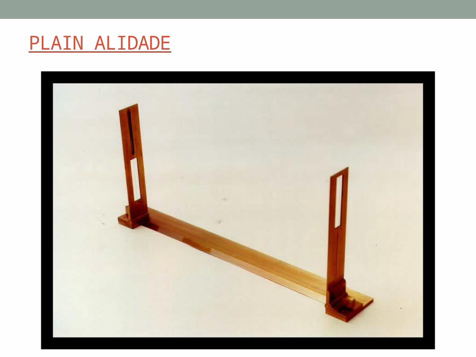
axis.• 2) Alidade- Alidade consists of brass or metal or wood straight
edge or ruler about 50cm long line• levelled edge. It is used for sighting the object to the located
point.• 3) Trough compass- A trough compass or circular box compass
with magnetic needle at centre is used for• measuring north direction on drawing sheet.• 4)U-fork – Once the line of fork/plumb bob is attached and upper
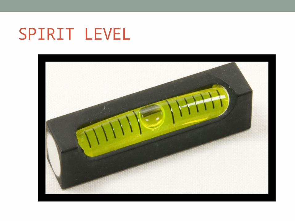
arm is same what to indicate which• point on table is vertically over the station point on ground.• 5) Bubble Tube: There is a bubble in the tube when the bubble
comes exactly in the centre of the tube• then indicates that the bubble corner is exactly horizontal to
ground.
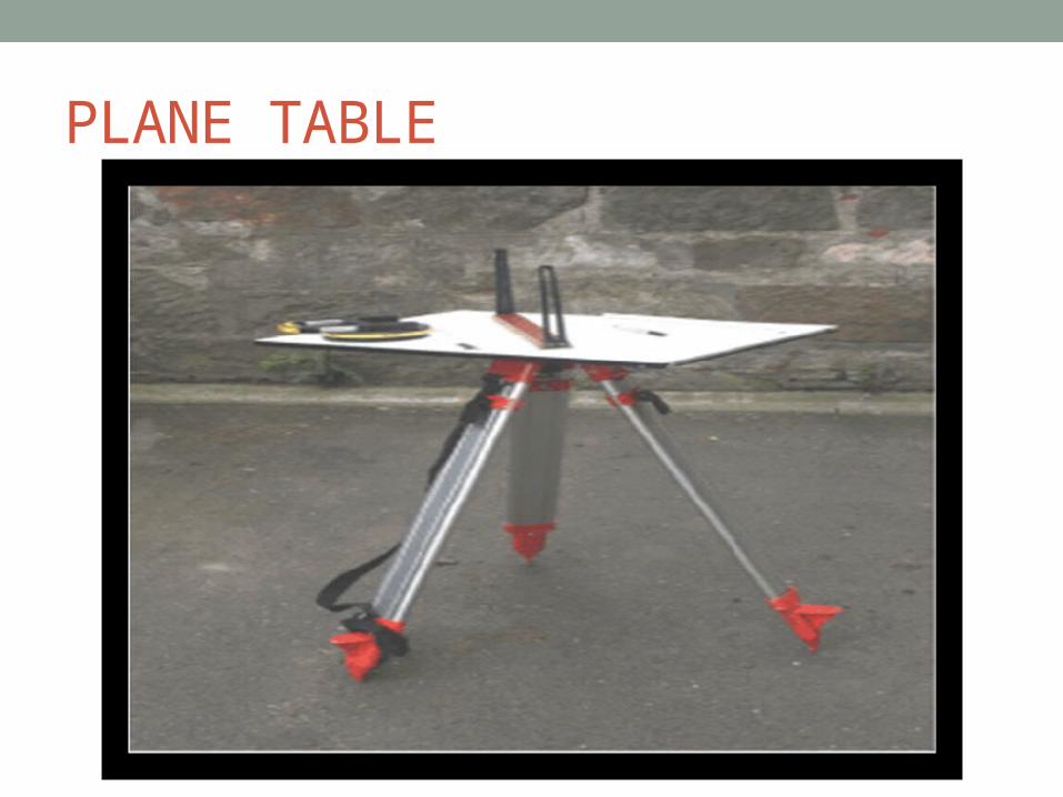
PLANE TABLE
PLAIN ALIDADE
SPIRIT LEVEL
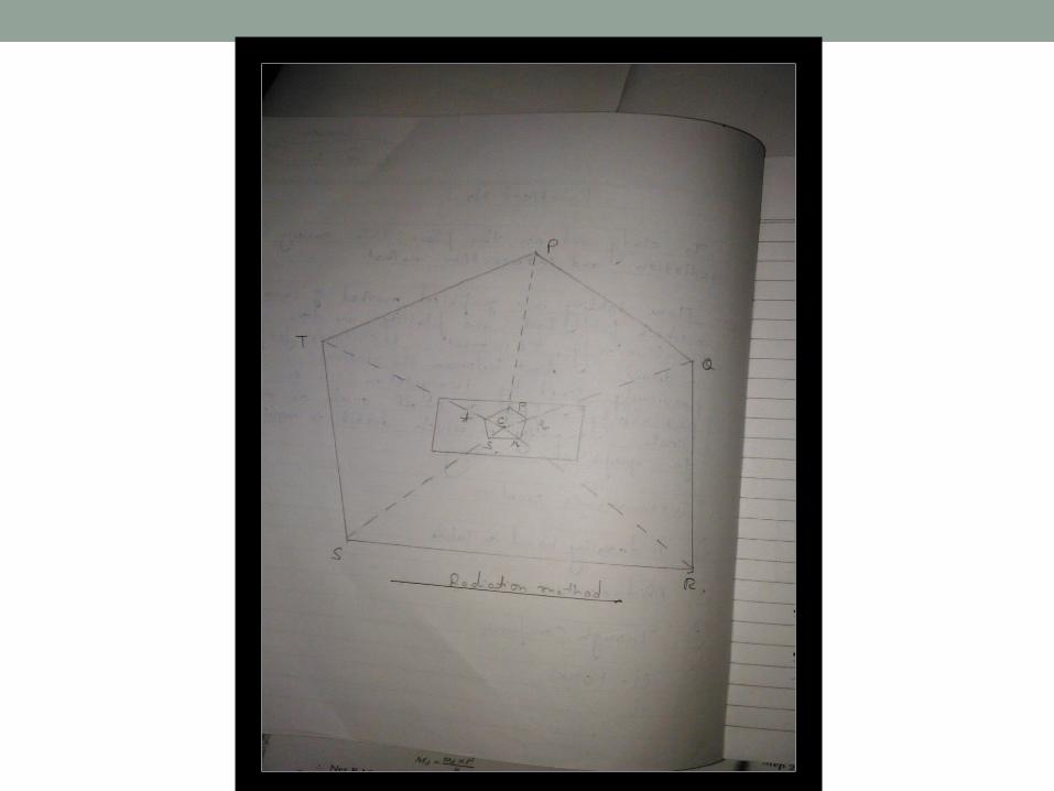
Methods of plane table surveying:• 1. Radiation: In this method point is located on plan by drawing a
ray from plane table stat. to the• point and plotting to scale along the ray. The distance measured
from station to the point. This• method is suitable for small area which can be commanded from a
single station.• Procedure –• 1) Select point P such that all points to be located visible from it.• 2) Set up the table at C and after levelling it clamp the board.• 3) Using U-fork selected point C is traversed to table.• 4) Mark direction of magnetic meridian with the help of trough
compass right top corner of sheet.• 5) Centring the alidade on C and sight point. P to Q, R, S,T etc. and
draw rays on table along them• 6) Measure distance CP, CQ,CR,CS,CT by chain or tape.• 7) Taking suitable scale plot these distances on sheets

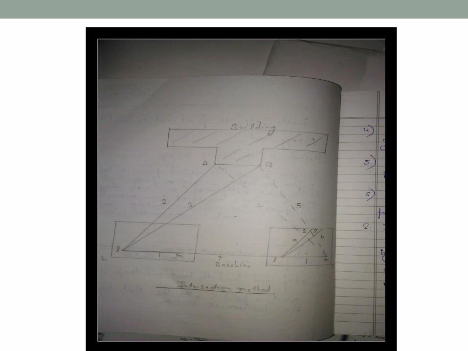
• Intersection method- In this method point is fixed on plan by the intersection of rays drawn from
• the two instrument stations. The line joining these stations is called base line. It is suitable when distances
• are very large and having observations between them.• Procedure-• 1)SELECT TWO POINTS L AND M IN A COMMANDING POSITION• 2]THE LINE JOINING THE STATION L AND M IS KNOWN AS BASE LINE • 3]MEASURE THE BASE LINE LM• 4]SET UP THE TABLE AT THE STATION L AND MARK POINT l ON SHEET OVER L• 5]ORIENT THE BOARD BY PLACING ALIDADE ALONG l m AND TURN THE
BOARD UNTIL THE RANGING ROD AT B IS BISECTED CLAMP THE BOARD
• 6]WITH ALIDADE TOUCHING POINT l DRAW RAYS 1,2,3 OF INDEFINITE LENGTH AS SHOWN IN FIG.
• 7]THE TABLE IS THEN SHIFTED TO STATION M ,ORIENT IT BY BACKSIGHTING METHOD ON L
• 8]THROUGH m DRAW RAYS TOWARDS THE POINT PREVIOUSLY
SIGHTED 4,5 ARE DRAWN DETERMINE THE POINTS ON INTERSECTION a AND b

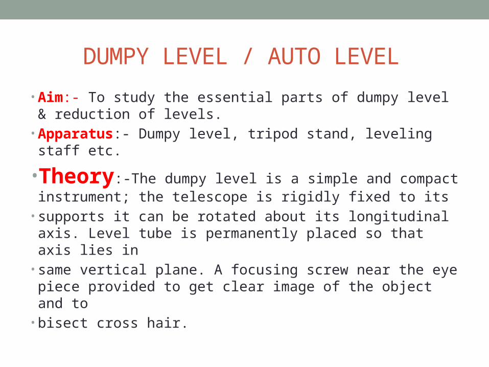
DUMPY LEVEL / AUTO LEVEL• Aim:- To study the essential parts of dumpy level & reduction of levels.
• Apparatus:- Dumpy level, tripod stand, leveling staff etc.
•Theory:-The dumpy level is a simple and compact instrument; the telescope is rigidly fixed to its
• supports it can be rotated about its longitudinal axis. Level tube is permanently placed so that axis lies in
• same vertical plane. A focusing screw near the eye piece provided to get clear image of the object and to
• bisect cross hair.
•Bench mark: - It is point of known elevation. It is used either as a starting point or as a check point before
• closing.
•Axis of telescope: - It is line joining the object, optical centre of the glass to the centre of the eye piece.
•Line of collimation (Line of sight):- It is line joining intersection of cross hair to the optical centre of the
• glass.

Parts of dumpy level: -• 1. Tripod: - The tripod consists of three legs, lower ends of it
fitted with steel shoes.• 2. Leveling head: - It consists of two parallel triangular plates
to supports the foots screws.• 3. Foot Screws: - It is provided between trivet and tribatch, by
turning the screws the tribatch can be• raised or lowered to bring bubble tube at the centre.• 4. Telescope: - It consist of an object glass and eye piece on
opposite end, a diaphragm is fixed with• the telescope just in front of eye piece.• 5. Bubble tube: - Two bubble tubes one longitudinal and one
cross bubble provided right angles to• each other. The bubble is brought to the centre with the help
of foot screws.• 6. Compass: - A compass is provided just below the telescope
for taking magnetic bearing of a line• required.


REDUCTION OF LEVEL• H.I method:-• The reduced level of the line of collimation is said to be the height of the instrument. In this system height
• of the line of collimation is found out by adding back side reading to the R.L of bench mark on which BS
• is taken. Then RL of intermediate points and the change point are obtained by subtracting the respective
• staff reading from the height of instrument (HI). To find new HI of change point BS is taken on last point
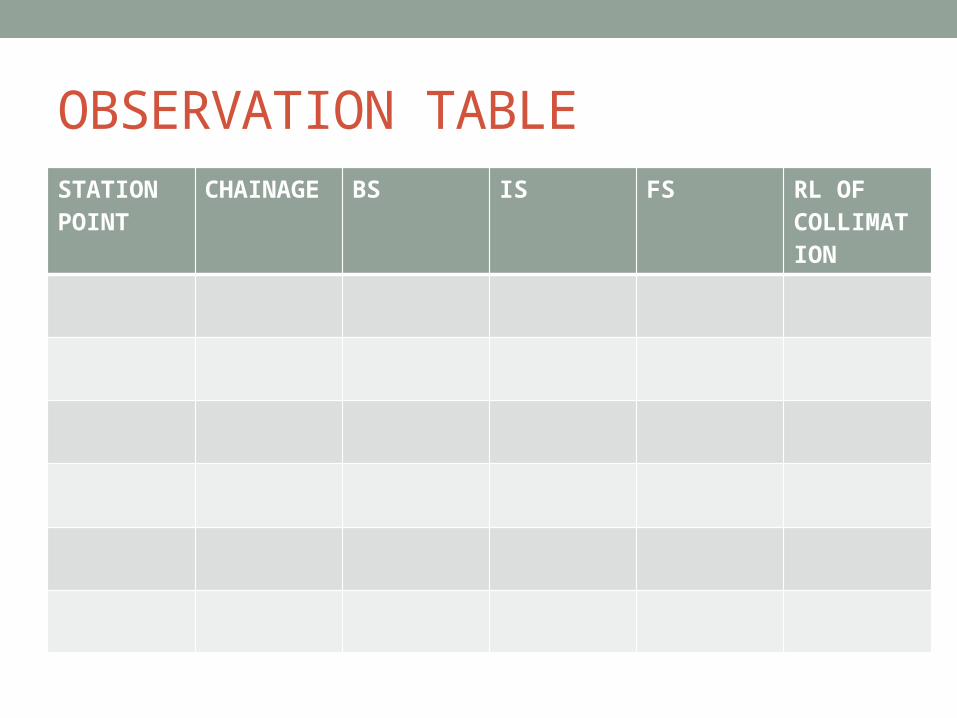
OBSERVATION TABLESTATION POINT
CHAINAGE BS IS FS RL OF COLLIMATION

THEODOLITE SURVEYING• Aim: - To measure direct angle, deflection angle and magnetic bearing of line by using theodolite
• Apparatus: - Transit theodolite, ranging rod, pegs etc.
• Direct Angle:• The angle measured clockwise from preceding line to the following line. They may vary 0° to 360°.
• Procedure:-• - Set up the theodolite at O and level it accurately set vernier A to 0°0΄0˝.Loose the lower plate
• and take back sight on A.• - Loose upper plate rotate telescope clockwise and bisect B exactly read both vernier.
• Plunge the telescope turns the instrument about its outer axis and take back sight on A the reading
• on vernier A will be same as in Step 1.• - Loose the upper plate, turn the telescope clockwise and again bisect B exactly.
• - Read both verniers. The reading will be twice the previous, <AOB will be obtain by dividing the
• final reading by 2.

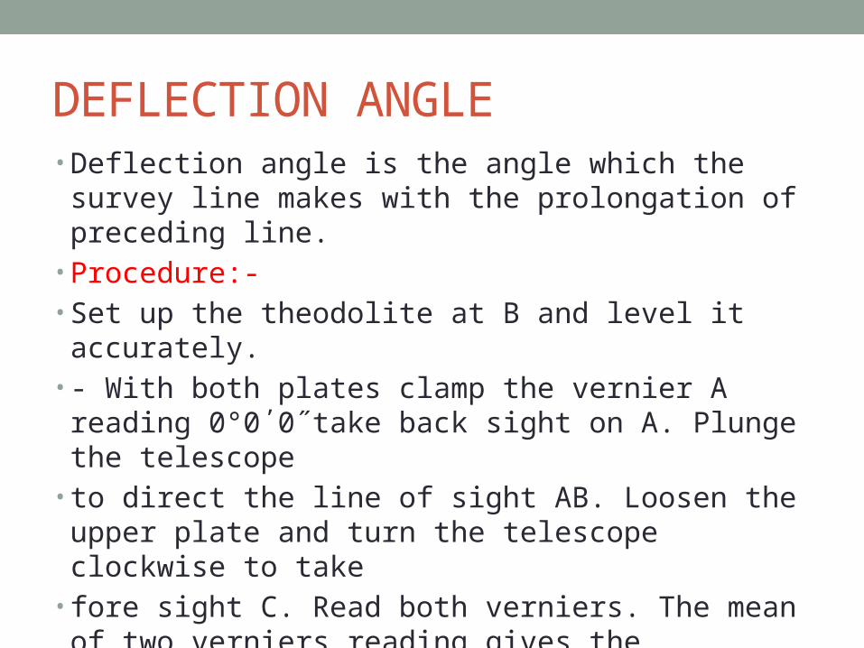
DEFLECTION ANGLE• Deflection angle is the angle which the survey line makes with the prolongation of preceding line.
• Procedure:-• Set up the theodolite at B and level it accurately.• - With both plates clamp the vernier A reading 0°0΄0˝take back sight on A. Plunge the telescope
• to direct the line of sight AB. Loosen the upper plate and turn the telescope clockwise to take
• fore sight C. Read both verniers. The mean of two verniers reading gives the approximate value
• of deflection at B &clamp upper clamp.• -

• Loosen the lower clamp and turns the telescope horizontally to back sight on A. The vernier will
• read the same reading as in step 4 and telescope transited. Plunge the telescope and unclamped
• the plates and again bisect C. Read both verniers. Find the mean of final readings. Thus the
• deflection angle is doubled and hence one half of its average value given accurate value of
• deflection angle at B
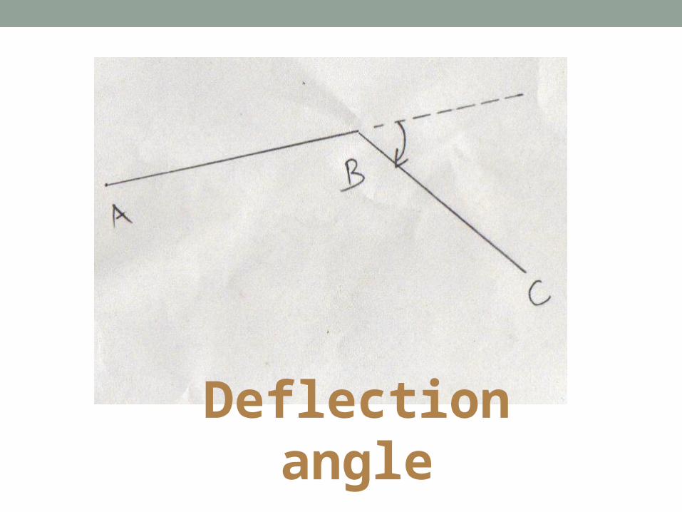
Deflection angle
MAGNETIC BEARING• The angle which a line makes with the magnetic meridian is called a magnetic bearing of a line.
• Procedure:-• For measuring hearing through compass or tabular compass is attached to theodolite.
• Set the vernier A to 0°0΄0˝ of the horizontal circle after setting theodolite over 0 and level it.
• Loosen the lower clamp magnetic needle is then realized to swing on pivot of compass. Rotate
• the instrument till needle roughly point to the north by using lower tangent screw and correct
• direction of magnetic needle is obtain

• Loose the upper clamp and direct the telescope towards A and bisect it exactly by using upper
• clamp and upper tangent screw. Read both verniers.
• - Change the face and repeat the process. The average of two values gives correct bearing of line
• AB.
• :
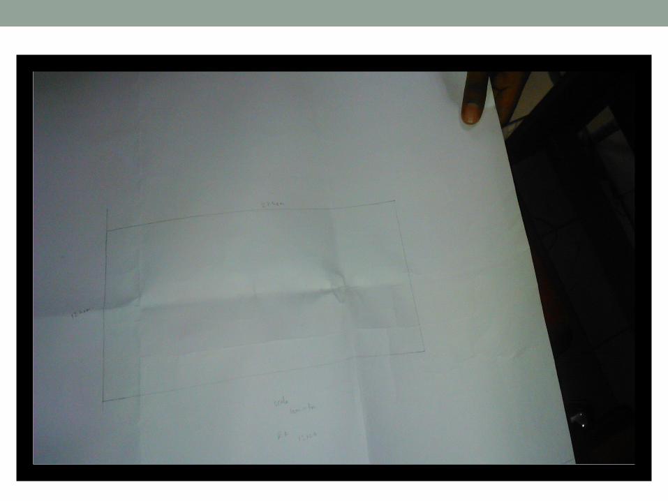
TRAVERSING AN AREA• AIM:- TO TRAVERSE THE GIVEN AREA ,PLOT IT ON DRAWING SHEET.
• INSTRUMENTS:- PLANE TABLE WITH TRIPOD ,ALIDADE,TAPE,RANGING ROD ,COMPASS U FORK WITH PLUMB BOB ,SPIRIT LEVEL,DRAWING SHEET.
• THEORY:- IN SURVEYING TRAVERSE MEANS DETERMING THE LENGTH AND DIRECTION OF CONSEQUTIVE LINE ,THE LINEAR DISTANCE ARE MEASURED BY TAPE ,RELATIVE DIRECTION OF LINE ARE MEASURED BY COMPASS.THE INTEGRATED MEASUREMENT PROVIDE DATA FOR DETERMINING TWO DIMENSIONAL DATA,FOR DETERMINING
• LAND AREA .TRAVERSING CONSISTS OF RECONNAISSANCE ,PICKING UP THE DETAILS AND BOOKING FIELD NOTES TRAVERSE ARE CLASSIFIED AS OPEN OR CLOSE .
• PROCEDURE :- A,B,C,D AND E WERE GIVEN STATION RECONNASSIANCE SURVEY WAS DONE AND TABLE WAS SET UP AT A ,STATION POINT WAS TRANSFERRED TO PAPER AS A LAND POINTNG AT A AND SIGHTING B RAY WAS DRAWN .THE DISTANCE WAS MEASURED USING TAPE AND B MARKED AT SCALE ,SHIFT TABLE TO B LEVEL IT SIGHT A CONTINUE IT FOR OTHERS .CLOSING RAY OF TRAVERSE IS GRAPHICALLY ADJUSTED

•Thank you
Related Documents