Cloud Cover Validation using Surface Instruments R. Welch 1 , T. Berendes 1 , D. Berendes 1 , E. Dutton 2 , T. Uttal 3 , P. Minnett 4 , E. Clothiaux 5 1 Dept. of Atmospheric Sciences, Univ. of Alabama in Huntsville 2 NOAA/Climate Monitoring and Diagnostics Laboratory 3 NOAA/Environmental Technology Laboratory 4 Rosenstiel School of Marine and Atmospheric Science, Univ. of Miami 5 Dept. of Meteorology, Pennsylvania State University

Welcome message from author
This document is posted to help you gain knowledge. Please leave a comment to let me know what you think about it! Share it to your friends and learn new things together.
Transcript
Cloud Cover Validation usingSurface Instruments
R. Welch1, T. Berendes1, D. Berendes1,E. Dutton2, T. Uttal3, P. Minnett4 , E. Clothiaux5
1 Dept. of Atmospheric Sciences, Univ. of Alabama in Huntsville2 NOAA/Climate Monitoring and Diagnostics Laboratory3 NOAA/Environmental Technology Laboratory4 Rosenstiel School of Marine and Atmospheric Science, Univ. of Miami5 Dept. of Meteorology, Pennsylvania State University
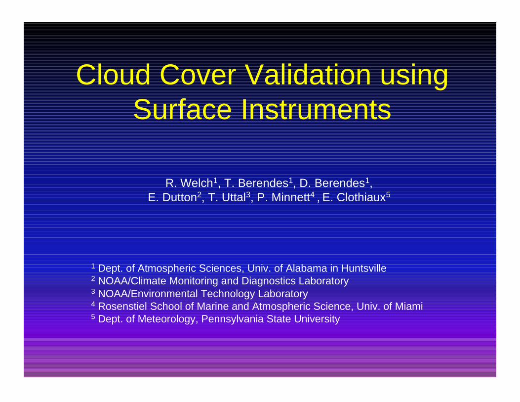
Cloud Mask Evaluation
λ Visual using IVICS - subjectiveλ Quick feedback for training processλ Analyst interpretation may be biased
λ NNW accuracyλ Independent samplesλ Hard numbersλ Analyst may be unable to discern cirrus
and sub-resolution cumulus
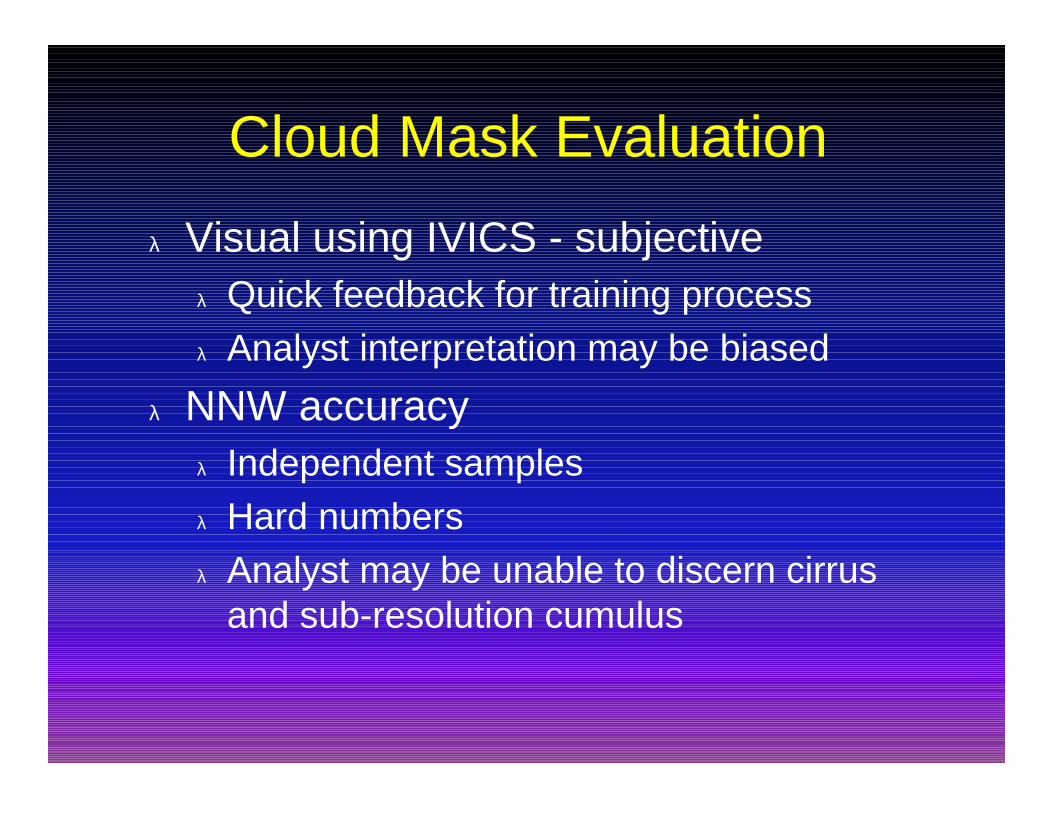
Cloud Mask Evaluation cont.
λ “Validation” using surface instrumentsλ Data independent of satelliteλ Minimal analyst interpretationλ Multiple instruments and sitesλ Applicable to any cloud masking algorithmλ Expandable databaseλ Batch mode processingλ Integrated with IVICS - user friendly
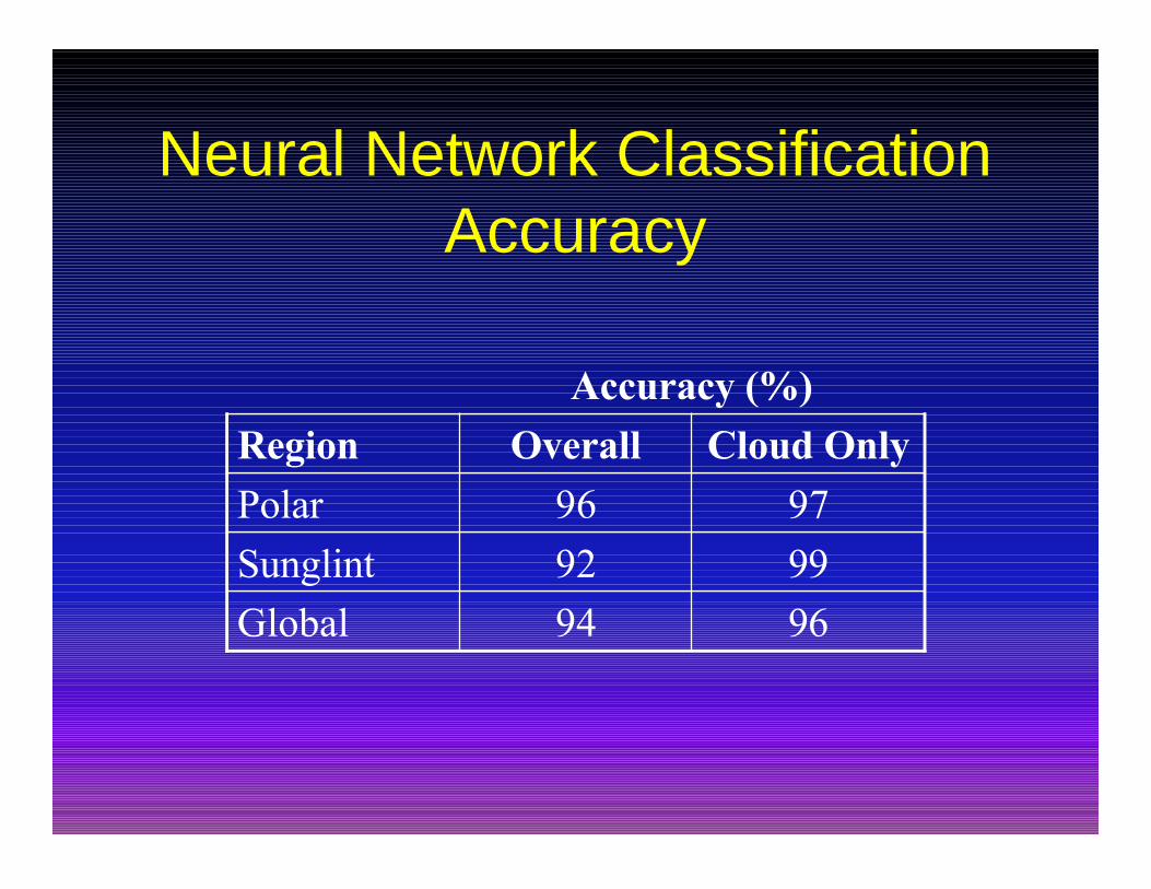
Neural Network ClassificationAccuracy
Accuracy (%)
9992Sunglint
9694Global
9796Polar
Cloud OnlyOverallRegion
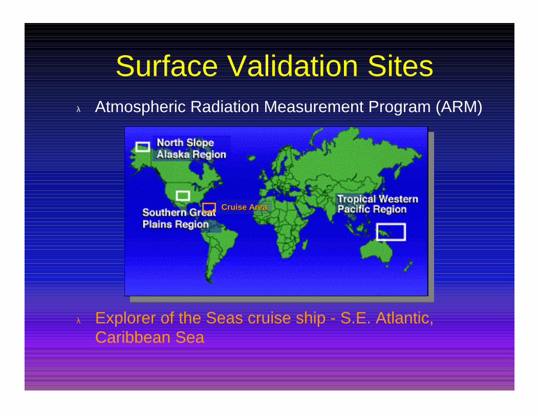
Surface Validation Sitesλ Atmospheric Radiation Measurement Program (ARM)
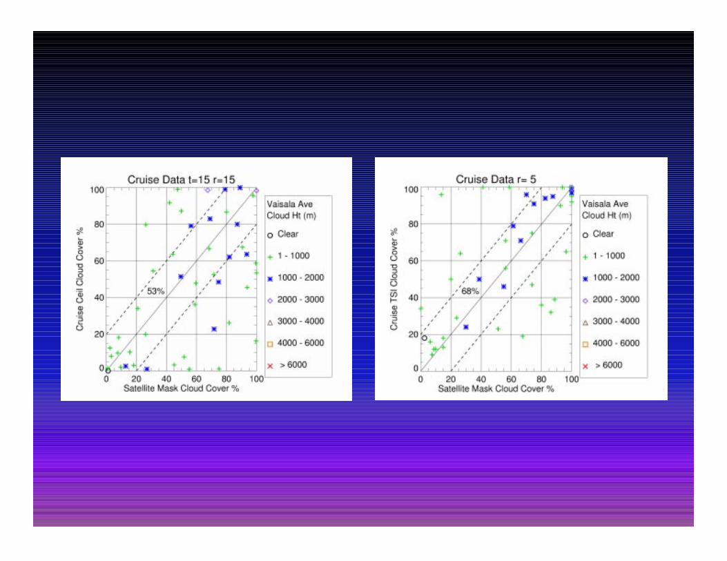
λ Explorer of the Seas cruise ship - S.E. Atlantic,Caribbean Sea
Cruise AreaCruise Area
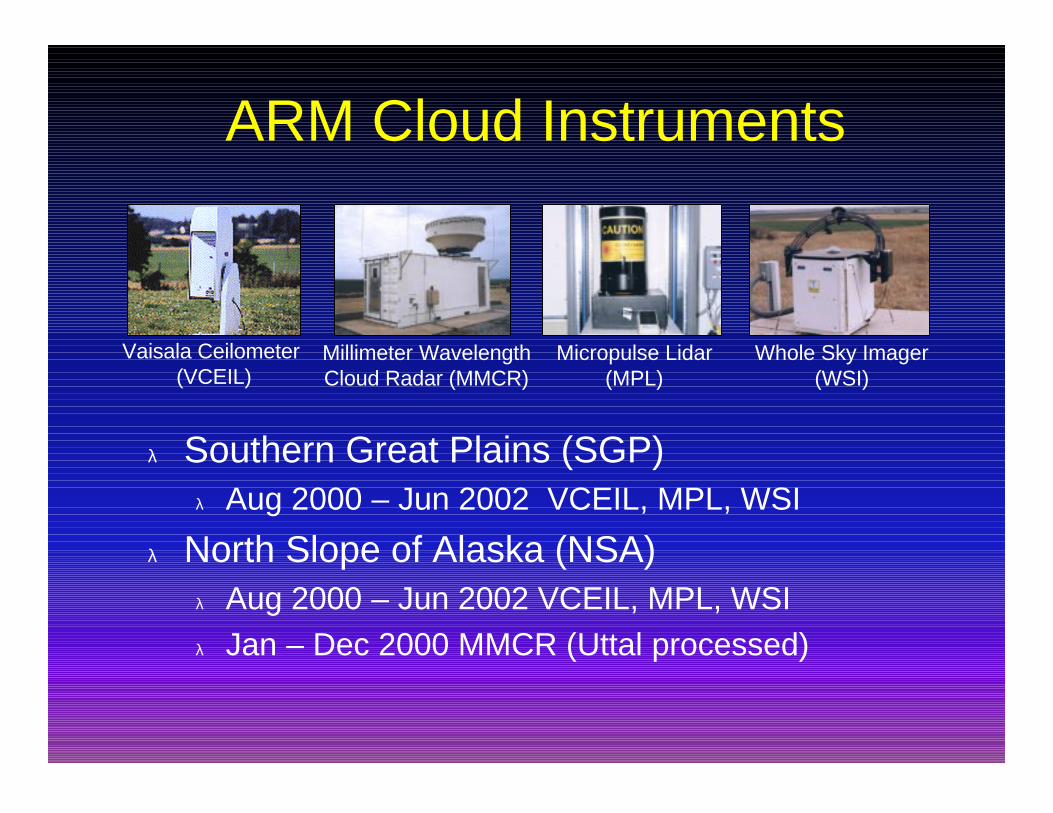
ARM Cloud Instruments
Vaisala Ceilometer (VCEIL)
Micropulse Lidar(MPL)
Millimeter WavelengthCloud Radar (MMCR)
Whole Sky Imager(WSI)
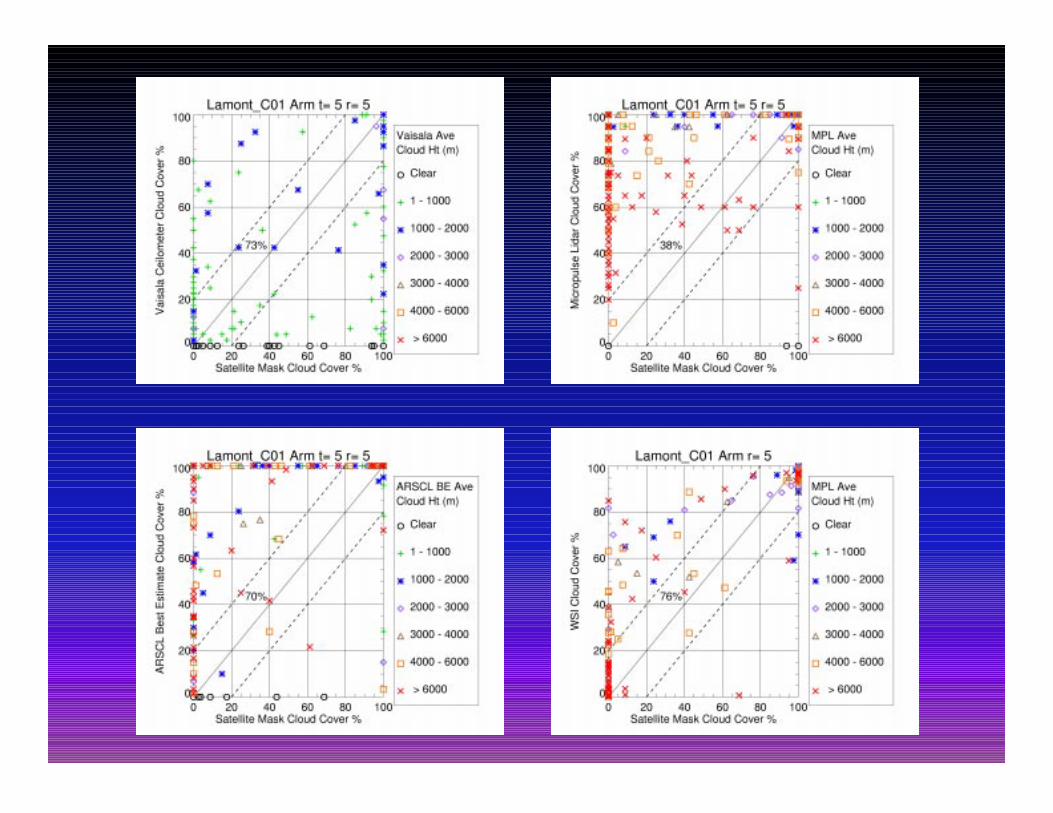
λ Southern Great Plains (SGP)λ Aug 2000 – Jun 2002 VCEIL, MPL, WSI
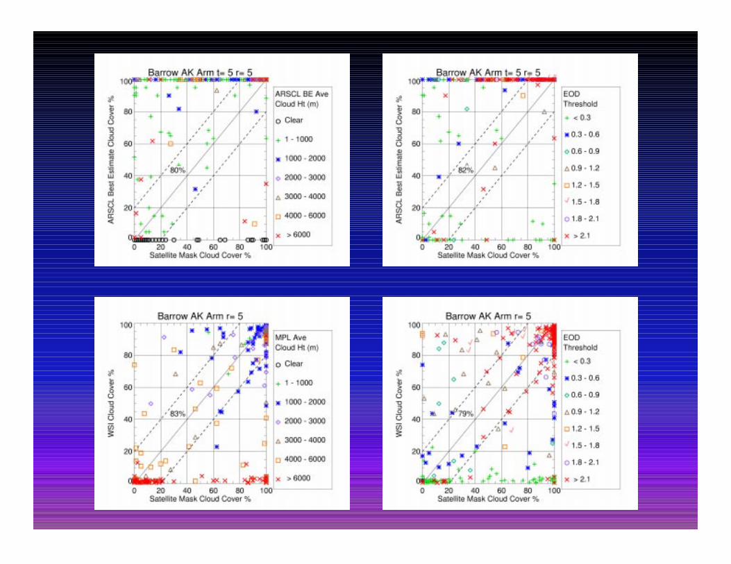
λ North Slope of Alaska (NSA)λ Aug 2000 – Jun 2002 VCEIL, MPL, WSIλ Jan – Dec 2000 MMCR (Uttal processed)
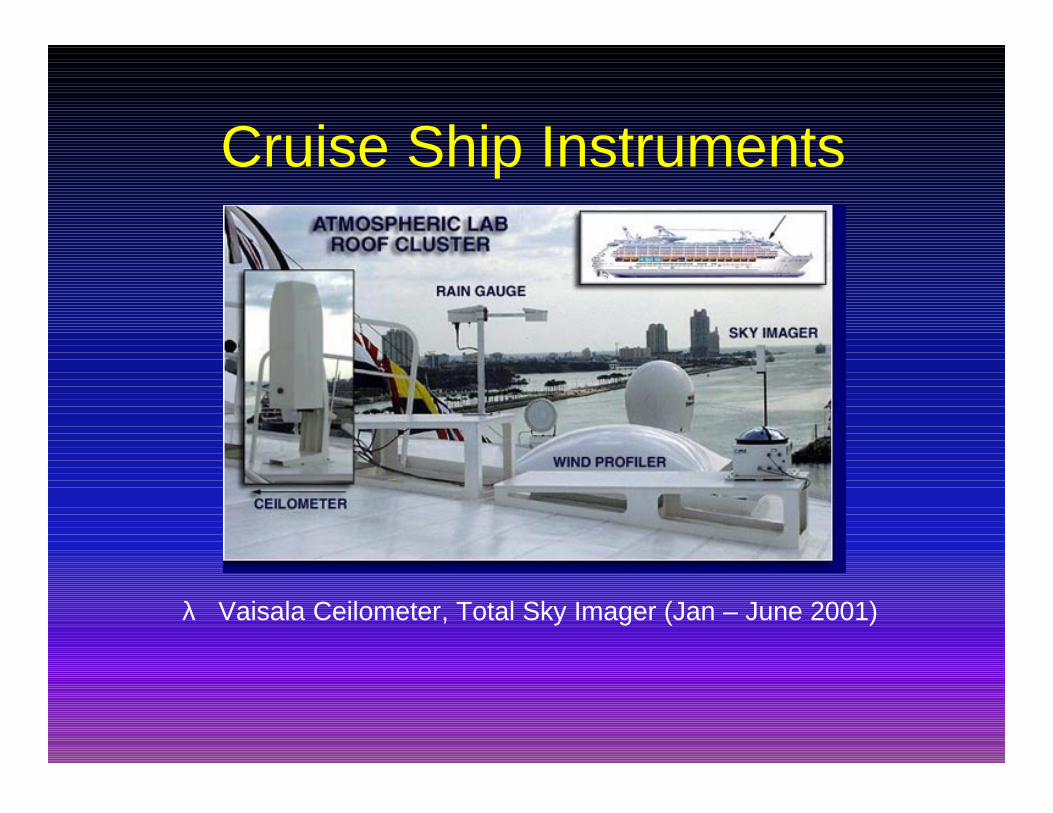
Cruise Ship Instruments
λ Vaisala Ceilometer, Total Sky Imager (Jan – June 2001)
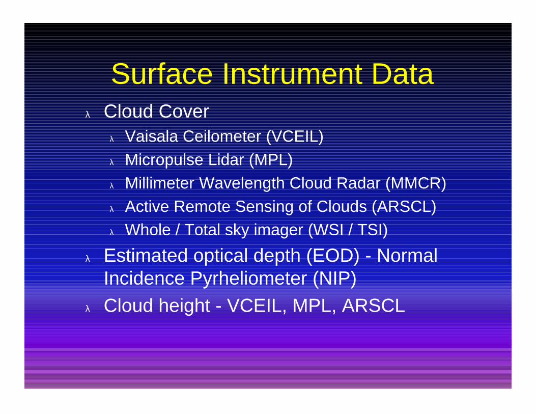
Surface Instrument Dataλ Cloud Cover
λ Vaisala Ceilometer (VCEIL)λ Micropulse Lidar (MPL)λ Millimeter Wavelength Cloud Radar (MMCR)λ Active Remote Sensing of Clouds (ARSCL)λ Whole / Total sky imager (WSI / TSI)
λ Estimated optical depth (EOD) - NormalIncidence Pyrheliometer (NIP)
λ Cloud height - VCEIL, MPL, ARSCL
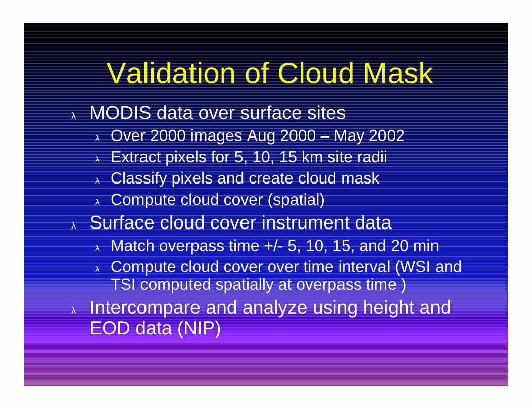
Validation of Cloud Maskλ MODIS data over surface sites
λ Over 2000 images Aug 2000 – May 2002λ Extract pixels for 5, 10, 15 km site radiiλ Classify pixels and create cloud maskλ Compute cloud cover (spatial)
λ Surface cloud cover instrument dataλ Match overpass time +/- 5, 10, 15, and 20 minλ Compute cloud cover over time interval (WSI and
TSI computed spatially at overpass time )
λ Intercompare and analyze using height andEOD data (NIP)
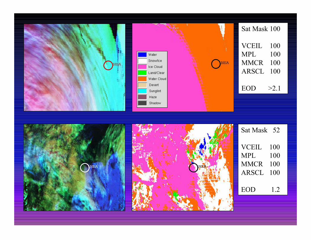
Sat Mask 100
VCEIL 100MPL 100MMCR 100ARSCL 100
EOD >2.1
Sat Mask 52
VCEIL 100MPL 100MMCR 100ARSCL 100
EOD 1.2
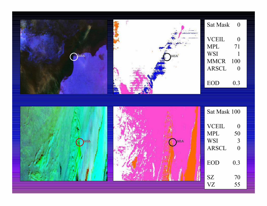
Sat Mask 0
VCEIL 0MPL 71WSI 1MMCR 100ARSCL 0
EOD 0.3
Sat Mask 100
VCEIL 0MPL 50WSI 3ARSCL 0
EOD 0.3
SZ 70VZ 55
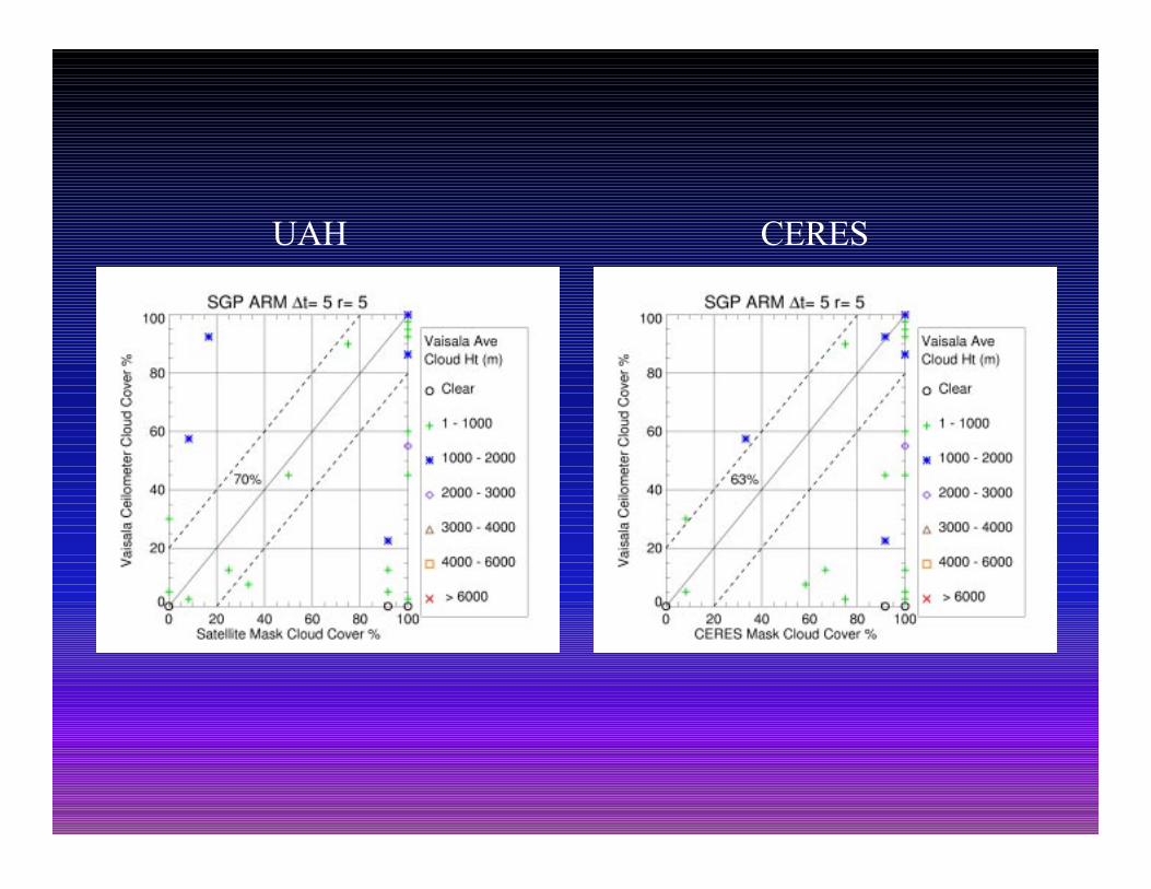
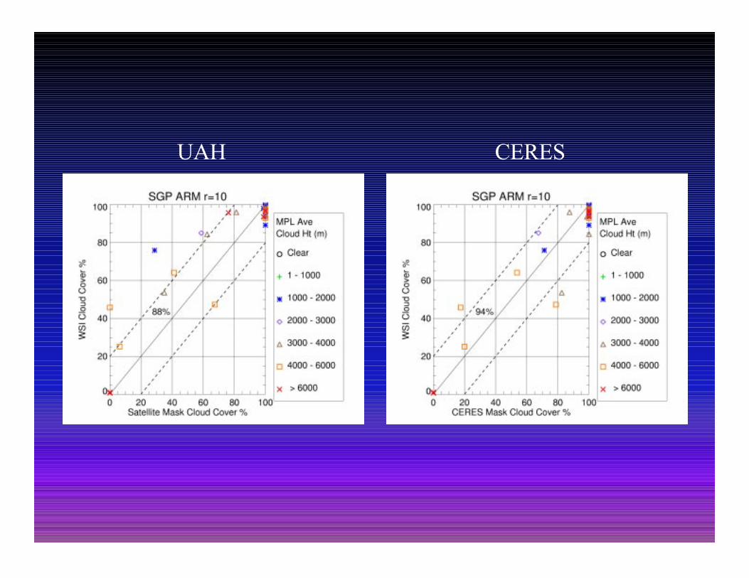
CERESUAH
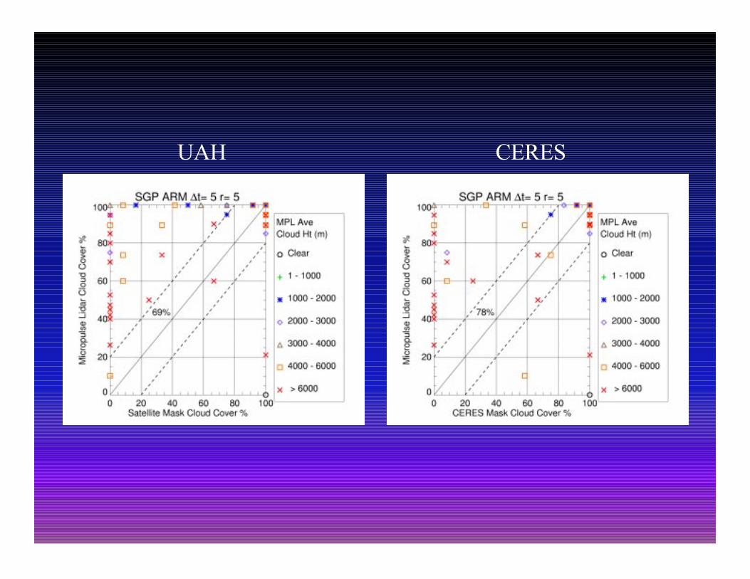
CERESUAH
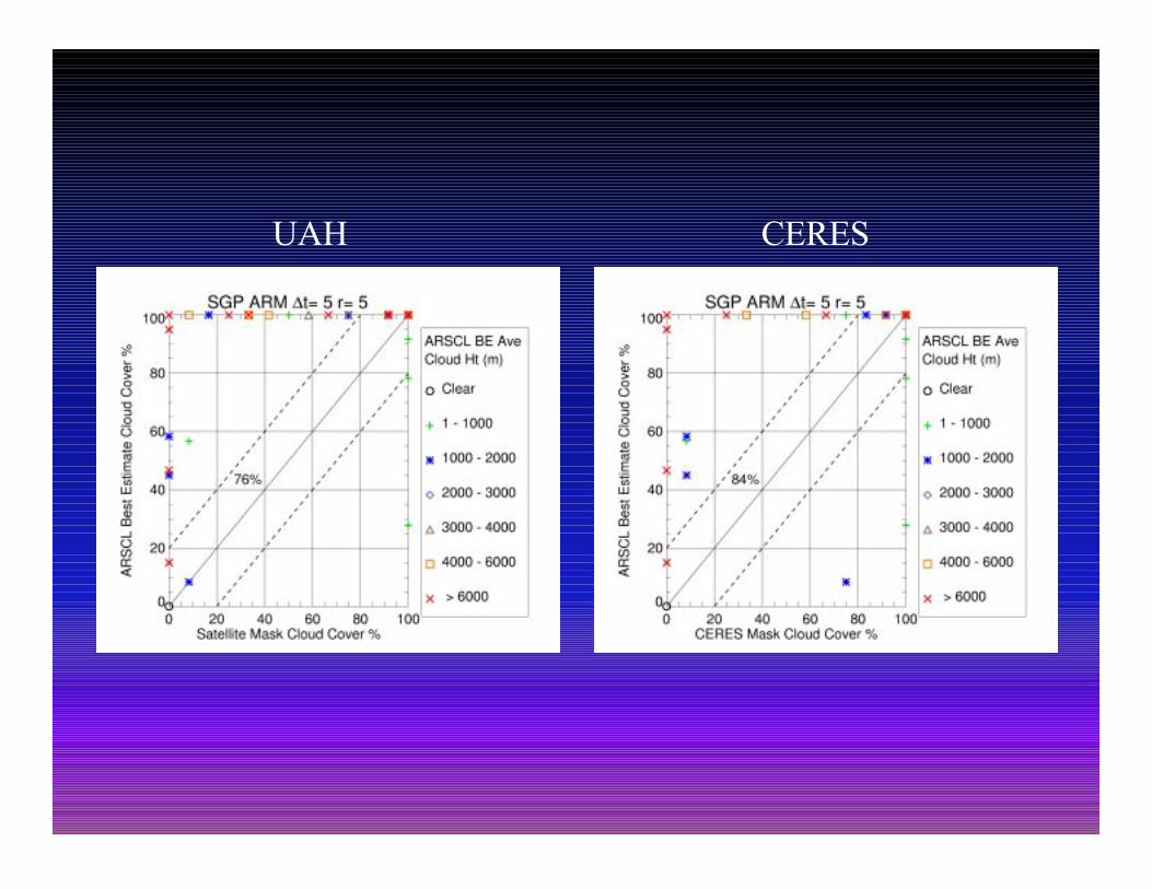
CERESUAH
CERESUAH
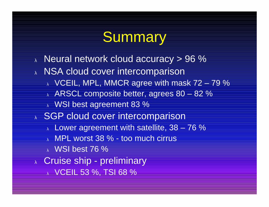
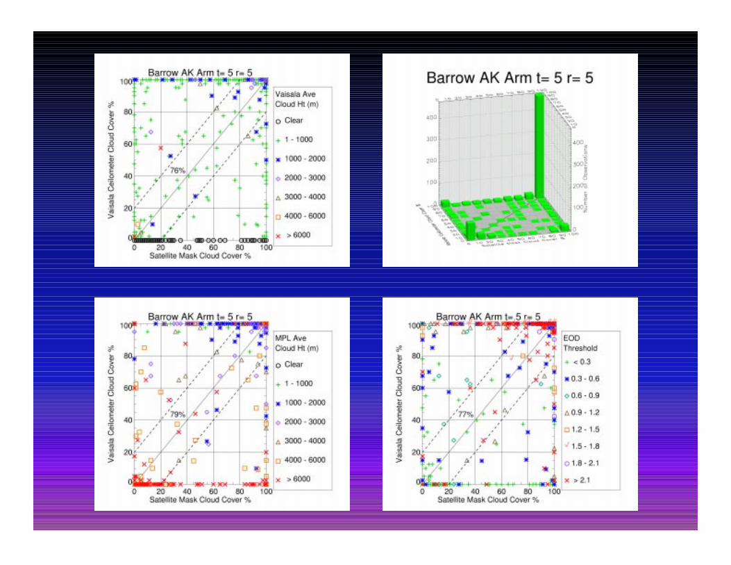
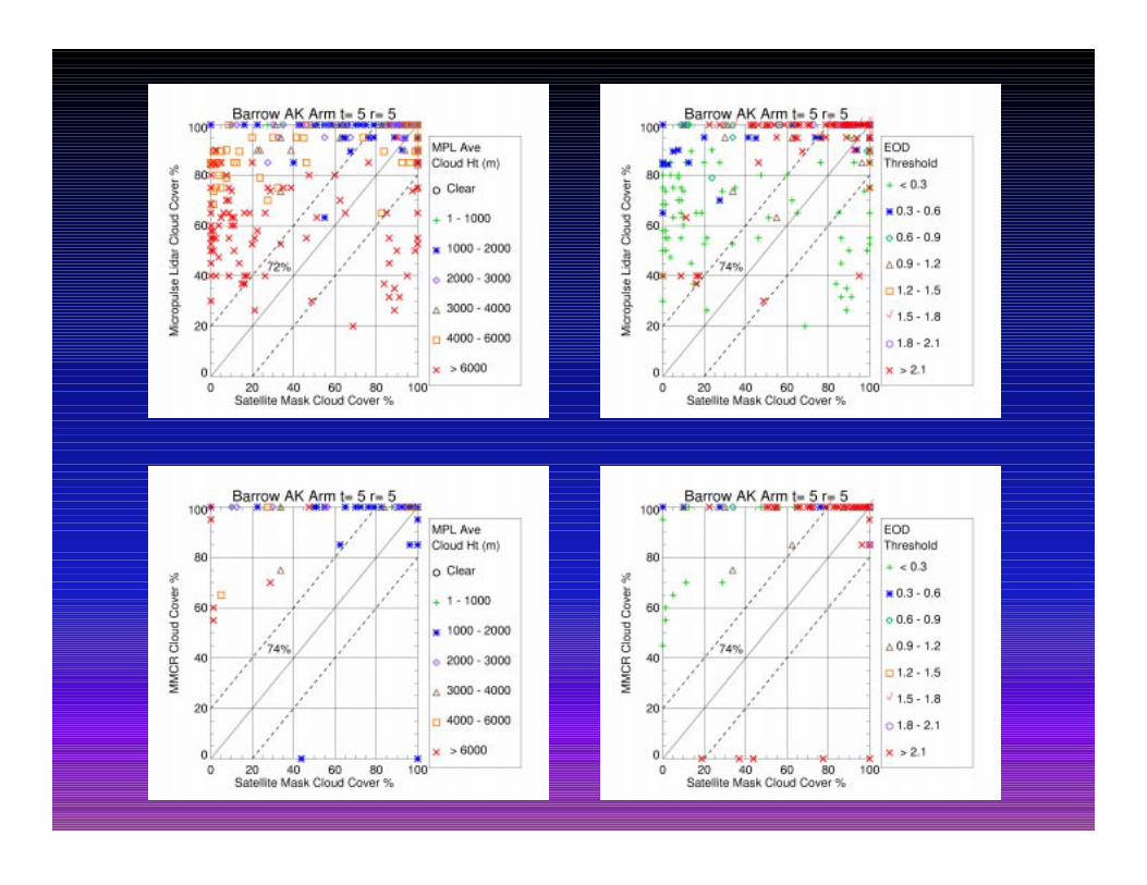
Summaryλ Neural network cloud accuracy > 96 %λ NSA cloud cover intercomparison
λ VCEIL, MPL, MMCR agree with mask 72 – 79 %λ ARSCL composite better, agrees 80 – 82 %λ WSI best agreement 83 %
λ SGP cloud cover intercomparisonλ Lower agreement with satellite, 38 – 76 %λ MPL worst 38 % - too much cirrusλ WSI best 76 %
λ Cruise ship - preliminaryλ VCEIL 53 %, TSI 68 %
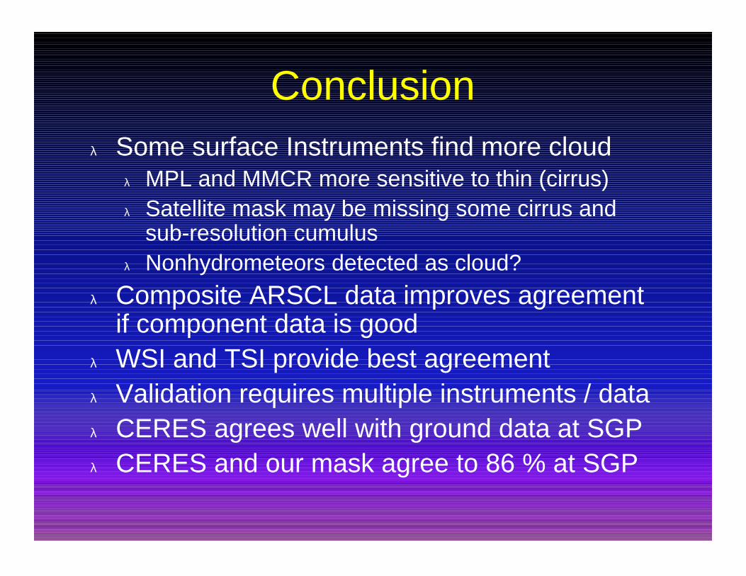
Conclusionλ Some surface Instruments find more cloud
λ MPL and MMCR more sensitive to thin (cirrus)λ Satellite mask may be missing some cirrus and
sub-resolution cumulusλ Nonhydrometeors detected as cloud?
λ Composite ARSCL data improves agreementif component data is good
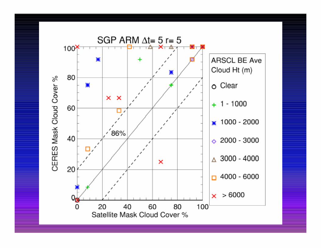
λ WSI and TSI provide best agreementλ Validation requires multiple instruments / dataλ CERES agrees well with ground data at SGPλ CERES and our mask agree to 86 % at SGP
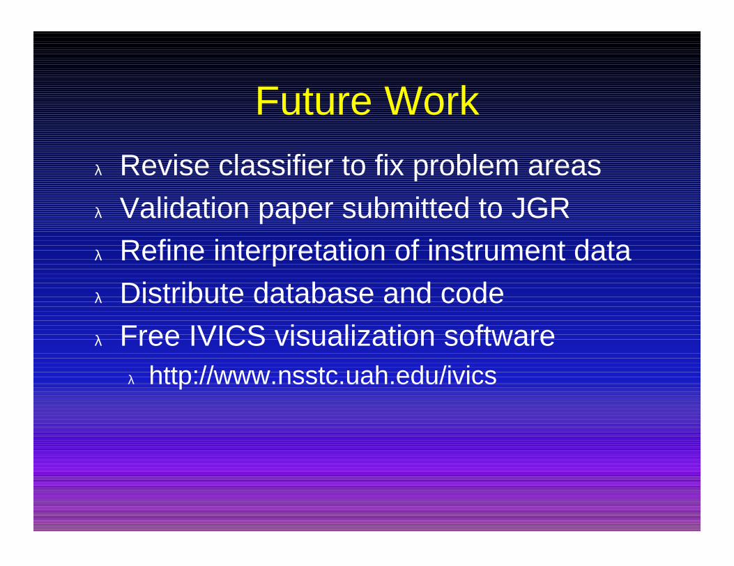
Future Work
λ Revise classifier to fix problem areasλ Validation paper submitted to JGRλ Refine interpretation of instrument dataλ Distribute database and codeλ Free IVICS visualization software
λ http://www.nsstc.uah.edu/ivics
Related Documents