Inter Surface Ge CSIR-National Report on rnational Training Workshop on eophysics for Groundw (02 nd – 12 th December, 2014) at l geophysical Research Institute, Hyderab 1 water bad,

Welcome message from author
This document is posted to help you gain knowledge. Please leave a comment to let me know what you think about it! Share it to your friends and learn new things together.
Transcript

Intern
Surface Geo
CSIR-National g
Report on
ternational Training Workshop
on
Geophysics for Groundwa
(02nd
– 12th
December, 2014)
at
al geophysical Research Institute, Hyderaba
1
dwater
rabad,

2
Contents
1. Introduction of the course
2. Background of the course
3. Objectives of the course
4. Preparatory phase
5. Faculty for the training
6. Participants
7. Knowledge generation
8. Field campaign
9. Feedback
10. Test hour
11. Light moments and snapshots

3
1. Introduction of the course
An International training workshop was organized by CSIR-NGRI, USGS and Aarhus
University, Denmark sponsored by the World Bank and Department for International
Development [DFID]. The 10 days rigorous classes were arranged at CSIR-NGRI,
Hyderabad from 2-12 December, 2014. The course was designed to provide practical
training on the use of Electrical, Electromagnetic and Passive Seismic geophysical
methods for groundwater exploration and to understand the physical parameters
which govern the aquifer system.
2. Background of the course
In context with the Hydrology Project II programme, the World Bank has funded a
collaborative project of “Aquifer Mapping on the pilot areas”. The project was taken
up in June 2012 and mapping of all 6 pilot areas was covered in May 2014. This
ambitious project has utilized the expertise of Geophysical community by the
application of electrical and electromagnetic methods. After successful completion of
the pilot areas, the World Bank aimed towards up-scaling the same programme on the
national level. Thus there was a need to relay the hydrogeophysical capability from
National to State level. In order to commute the expertise of hydro-geophysicist
involved in the project to the state officers, the World Bank formulated this training
program on Surface Geophysics. A part of the same program was designed for
Borehole Geophysics and was taken up by Indian Institute of Technology,
Kharaghpur in 2014.
3. Objectives of the course
The broad objectives covered during the training course are
� Explanation of the basic theory of hydrogeophysical methods,
� Data acquisition strategy and layout of different electrical and electromagnetic
instruments.
� Processing of the acquired data for different parameters, noise elimination and
inversion modeling of the data acquired.
� Interpretation of the processed datasets with an aim towards groundwater
exploration and delineation of aquifer.
� Explanation of various case studies in terms of success of geophysical
methods as well as failure.
� Stressing over the necessity of the use of integrated methods towards
accomplishment of the specified hydrogeological target.
� Illustration of the limitation and scope of individual methods and application
of the same in purview of the target objective.
4. Preparatory phase
Dr. Shakeel Ahmed, Chief Scientist, NGRI was the coordinator of the workshop
and the main nodal contact for the same. To make necessary arrangement towards
field logistics, registration, accommodation and food, an internal committee was

4
formed at NGRI which includes, Mr. V.K.Somvanshi (Principal Scientist), Dr.
Tanvi Arora (Scientist), Mr. Sateesh Chandrapuri (Scientist) and Dr. Sarah
(Research Associate). Support was also taken by few students working at Indo-
French Centre for Groundwater Research. This committee was also responsible to
take care of necessary instruments for the field campaigns.
Various arrangements included the
� Site selection and preparation for 3 parallel profiles at NGRI campus
towards the layout of Electrical Resistivity Tomography [ERT], Vertical
Electrical Sounding [VES] and Gradient Resistivity Profile [GRP].
� Site selection and making necessary arrangements for Time Domain
Electromangnetic method and passive Seismic stations.
� Availability of boreholes towards calibration and validation of acquired
datasets. Preparation of well lithologs and make them available for the
trainees.
� Arrangement of the venue , along with the availability of desktop
computers, for hands-on exercise for individual trainees.
� Supply of registration kits including the printed copies of relevant lectures,
� Necessary arrangements for the evaluation of individual trainees along
with the award of certificates upon completion.
� Necessary boarding and lodging facility within NGRI campus
� Arrangement of transportation for field campaigns; sightseeing; local
shopping as well as pick-up and drop to airport for participants as well as
faculty.
5. Faculty of the course
The faculty included experts from United States Geological Survey (USGS), Aarhus
University, Denmark, NGRI and World Bank, listed below:
Dr. John W. Lane USGS USA
Dr. Eric White USGS USA
Dr. Jesper Bjergsted Pedersen Aarhus University Denmark
Dr. P. C. Chandra World Bank India
Dr. S. K. Verma CSIR-NGRI Hyderabad, India
Dr. D. Muralidharan CSIR-NGRI hyderabad, India
Dr. Subash Chandra CSIR-NGRI Hyderabad, India
Dr. Shakeel Ahmed CSIR-NGRI Hyderabad, India

5
TRAINING SCHEDULE
Day & Date Time Details Instructor
Tuesday Dec. 2, 2014
10.00-10.30 hrs Welcome & Registration (Room No. 115 GWB) TA
10.30-11.40 hrs Opening Ceremony & Introduction of the faculty and participants
11.45-12.45 hrs Visit to CSIR-NGRI: Seismic Observatory, Groundwater Projects & IFCGR RR
12.45-14.00 hrs Lunch
14.00-15.00 hrs Keynote Address - Applications of Surface Groundwater Geophysics in India: A Retrospective
PCC
15:30-17:30 Course Overview and Intent; Physical Properties of the Earth; Conceptual Hydrologic models, Geophysical methods in Groundwater Exploration
JWL
Wednesday Dec. 3, 2014
09.30-11.30 hrs 1D Electrical Methods- Basics, Profiling, Soundings, GRP, Principle of Equivalence, etc.
PCC
11.30-13.00 hrs Examples and field Applications DM
14.00-17.30hrs Electrical Resistivity Tomography (ERT) Basics: Forward and Inverse Modeling
JWL
Thursday Dec. 4, 2014
09.30-13.00 hrs Electrical Resistivity Tomography (ERT) Basics: Forward and Inverse Modeling - Continued
JWL
14.00-14.45 hrs ERT Field Instrument and Survey Design SC
14.45-15.30 Hrs Introduction to Field site in NGRI Campus DM
16.00-17.30 hrs Passive seismic HVSR - theory and case studies JWL + EW
Friday Dec. 5, 2014
09.30-13.00 hrs
ERT and HVSR field data collection- Layout, Collection, Data Transfer, etc: Group I
JWL,EW NCM+SS+ARD
ERT and HVSR field data collection- Layout, Collection, Data Transfer, etc: Group II
JWL,EW TA+NVB+EN
14.00-17.30 hrs ERT and HVSR Data Processing JWL, SC,EW
Saturday Dec. 6, 2014
09.30-13.00 hrs ERT and HVSR field data collection II- Layout, Collection, Data Transfer, etc: Group-I & II
JWL,EW NCM+SS+ARD TA+NVB+EN
14.00-17.30 hrs ERT and HVSR Data Processing II - Integration of VES, ERT and Passive Seismic Data and Comparison with Borehole data
SC, JWL,EW
Sunday Dec. 7, 2014
Week-end Free
Monday Dec. 8, 2014
09.30-13.00 hrs Electromagnetic Methods- Basics SKV
14.00-17.30 hrs Electromagnetic methods: FEM,VLF and TEM comparison with applications and limitations; India and International Case Studies
JBP+JWL
Tuesday Dec. 9, 2014
09.30-18.00 Full scale geophysical (TEM, Passive seismic, & ERT)data collection at Experimental Hydrogeological Park
JBP, SC
JBP,SC
Wednesday Dec. 10, 2014 09.30-17.30 hrs
Field Cont….Spare alternate day…/ ERT and TEM data processing and discussion
JWL,JBP, SC
Thursday Dec. 11, 2014
09.30-13.00 hrs ERT and TEM data processing and discussion JWL, JBP, SC
14.00-17.30 hrs ERT and TEM data processing and discussion--continued JWL, JBP, SC
Friday Dec. 12,
2014
09.30-13.00 hrs Airborne and Surface Geophysics Case Studies
SC, JBP, JWL
14.00-17.30 hrs Exam, Suggestions/Recommendations, Result declaration, certificate distribution and Closing Ceremony
JWL, SA
Shakeel Ahmed-SA, John William Lane-JWL, Prabhat Chandra Chandra-PCC, Jesper Bjergsted Pedersen- JBP, Eric White –EW, Saurabh K. Verma-SKV, Subash Chandra-SC, D. Muralidharan- DM, Tanvi Arora-TA, NC Mondal-NCM, Sahebrao Sonkamble-SS, A Ramadevi-ARD, N Veerababu-NVB, E. Nagaiah-EN

6
6. Participants
There were total 43 trainees from different government organization of AP, Gujarat,
Jharkhand, Karnataka, Maharashtra, Rajasthan, Tamil Nadu, Telangana, West Bengal
and France.The list of participants includes:
Sr. Nr Name Organisation Place
1 N. Veerababu CSIR-NGRI Hyderabad
2 Kanithi Chinnababu AP GWD Srikakulam
3 P. Harish AP GWD Karimnagar
4 Anuradha Mallarapu AP GWD Eluru
5 S. Sarah CSIR-NGRI Hyderabad
6 Somnath Paira SWID-WB Burdwan
7 Reddypogu Suvarna Kumar APGWD Ananthapur
8 Arun Mondal SWID-WB Coochbehar
9 E. Nagaiah CSIR-NGRI Hyderabad
10 Ratan Kumar Samadder SWID-WB Kolkata
11 Tanvi Arora CSIR-NGRI Hyderabad
12 Sandip Kumar Das SWID-WB Kolkata
13 Shamik Chaterjee SWID-WB Kolkata
14 N.C. Mondal CSIR-NGRI Hyderabad
15 K. Ravishankar AP GWD Medak
16 Anuj Kumar Agarwal RGWD Kota
17 Rhitwik Chatterjee SWID-WB Kolkata
18 Mousumi Neogi Adhikari SWID-WB Kolkata
19 Joy Chaudhary CSIR-NGRI Hyderabad
20 A. Ramadevi CSIR-NGRI Hyderabad
21 Nishat Ahmed GSDA Nasik
22 K Srinivasarao GSDA Amrawati
23 Rajinder kumar Rana RGWD Jaipur
24 Naresh Bhatia RGWD Jaipur
25 Animesh kumar N. Palchoudhary. GWRD-Guj Gandhinagar
26 Prakash Chandra Das WRD-CG Durg
27 Gautam Kumar WAPCOS Delhi
28 A. Suhail Ahmad PWD-TN Chennai
29 Virendra Kumar Upadhyay UPGWD Lucknow
30 Karnati Shankaraiah TSGWD Hyderabad
31 Sajal Kumar Das SWID-WB West Bengal

7
7. Knowledge Generation
The concept of the course was “Experiential Learning”, with a mixture of classroom
lectures and field exercises. The focus was on the concepts, practical tools and
applications. Keeping in mind the target participants of different specialization within
Earthscience, theoretical equations were not included in the teaching material. The
basic idea was to make participants learn from the practical examples, apply the basic
principles of the physics, to gain confidence over the results acquired and also to
recognize the limitations of every method.
The topics covered theoretical and as well as field experience of the application of
Electrical, Seismic and Electromagnetic methods like Electrical Resistivity
Tomography [ERT]; Time Domain Electromagnetics [TDEM]; Horizontal to Vertical
Spectral Ratio [HVSR] to groundwater studies. A special emphasis was given on
alluvial aquifer systems including sand/gravel aquifers or silt/clay aquitards. The
complete transformation of conceptual model into computer model was illustrated in
order to determine if a geophysical survey can locate freshwater in a hydrologic
setting.
There were 2 days of rigorous field data acquisition, processing and interpretation in
Choutuppal as well as within NGRI campus.
A clear need of geophysical methods was envisaged with objectives and solutions
towards; formulation of a tractable problem in hydrological setting ; noticeable
difference in physical properties emerges a need to be the presence of physical
contrast; the contrast need to be detected through ground
geophysics/borehole/Airborne; and the geophysical survey need to be logistically
feasible in terms of time/cost/environmental conditions.
32 T.Raja Babu CGWB Hyderabad
33 G.Krishnamurthy CGWB Bangaluru
34 K.Ramesh Reddy CGWB Ranchi
35 Thomas Schwarz IFCGR France
36 Sateesh Chandrapuri NGRI Hyderabad
37 Farooq Ahmad Dar NGRI Hyderabad
38 Sahebrao Sonkamble NGRI Hyderabad
39 Ankita Chatterjee NGRI Hyderabad
40 Taufique Warsi NGRI Hyderabad
41 Md. Wajhiuddin NGRI Hyderabad
42 K.Swathi NGRI Hyderabad
43 K.Lohith Kumar NGRI Hyderabad

8
An overview of the geophysical property to be measured, relevant hydrologic
parameter evaluated and the most practical acquisition method to be adopted is tabled
below:
Method Geophysical
Property
Relevant Hydrologic
Property/Parameter
Acquisition
method (s)
DC Electrical
Resistivity [ERT,
VES, GRP]
Electrical
Resistivity
Water content,
salinity, pore fluid,
porosity, lithology
Lab, borehole,
crosshole,
surface
Electromagnetic
[EM]
Electrical
Resistivity
Water content,
salinity, pore fluid,
porosity, lithology
Lab, borehole,
crosshole,
surface, airborne
Seismic
refraction &
reflection, HVSR
Seismic
velocities &
reflectivity (bulk
& shear moduli)
Depth to bedrock,
water table, aquifer
boundaries
Lab, borehole,
crosshole,
surface
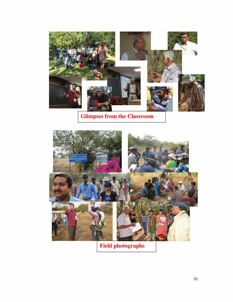
8. Field Campaign
Two sites were chosen for the demonstration of the geophysical instrument, one
NGRI campus and another was Experimental Hydrogeological Park developed by
NGRI at Choutuppal. The Experimental Hydrogeological Park (EHP) located in
Choutuppal, 45 km south-east of Hyderabad. Vadose zone of EHP comprises an
uppermost thin layer of red soil (<1m), sandy regolith (1m-3m), saprolite (10 m – 15
m), and then the a fissured layer until the bedrock (42 m). Both the sites are in the
hard rock terrene. NGRI field site was prepared to measure 3 parallel ERT profile at
the distance of 20 mts. Along the chosen site all VES, GPR, ERT and passive seismic
data was acquired in subsequent timings. Whole of the class was divided into three
groups for better understanding. Being in the urban environment TDEM data was all
noisy.
The processes involved for interpretation of raw resistivity data were:
• Processing of 2D ERT datasets with various parameters along with
• Interpretation of 2D ERT datasets acquired in different terrenes
• Detailed knowledge about the theoretical background for Resistivity
• Hands on experience in 2D, processing and visualization of data
Similarly the HVSR Ambient-Noise Seismic method was used to acquire data at the
location of electrodes along the ERT profiles. A special consideration was given to
locations where the Borehole litholog data is already available. A low frequency 3C
geophone or 3C medium period seismotmeter was employed from company called
Tromino from US. A single-station measurements were recorded. This helped iin
determining the resonant frequency of the site from which we can estimate the
sediment thickness.
The basic approach towards single-station measurement of HVSR data was:
• Set up and level the seismometer
• Collect data (10-60 minutes)
9
• Calculate amplitude spectrum of vertical and horizontal components of
seismic noise (windows)
• Average the spectrum of the two horizontal (N-S and E-W) components
• Calculate the ratio of the H and V spectrums
• Examine the resonance peak
• After calculating the peak, we calculate the depth-to-rock using
local/regional regression equation relating resonant frequency to sediment
thickness
9. Feedback
In general, there were few common suggestions from the participants, as below:
• The duration of training should be 15 days instead of 10 days and out of which
7-8 days to be mandatorily dedicated to field demonstrations and operations.
• Supply of sufficient reading material through email, before the
commencement of the course.
• Considering the diversity of fields, more stress should be given to explain the
basics of the course.
• A continuous field work in different terrene will be good enough to acquire
more exposure of the data and its interpretation.
• The course should be repeated at frequent interval.
• National institutes such as NGRI should support the state offices for the
detailed training and procurement of geophysical equipment.
• Such type of training are “A MUST” for hydrogeologist.
• The selection of students should commence in a more lenient way.
• A single person should be allowed to attend both surface as well as borehole
geophysical training simultaneously. There should not be a bar to “ATTEND
ONLY ONE”
10. Test hour
At the end of the training there was an examination conducted and top student award
was conferred to 4 participants, along with certificate distribution. The students are:
1. Mr. Nishat Ahmed, GSDA, Nasik. Maharashtra
2. Mr. Rhitwik Chatterjee, SWID-WB, Kolkata
3. Mr. Anuradha Mallarapu, AP GWD, Eluru, AP
4. Dr. Farooq Ahmad Dar, CSIR-NGRI, Hyderabad
11. Light moments and snapshots
Inauguration by
Director NGRI
10
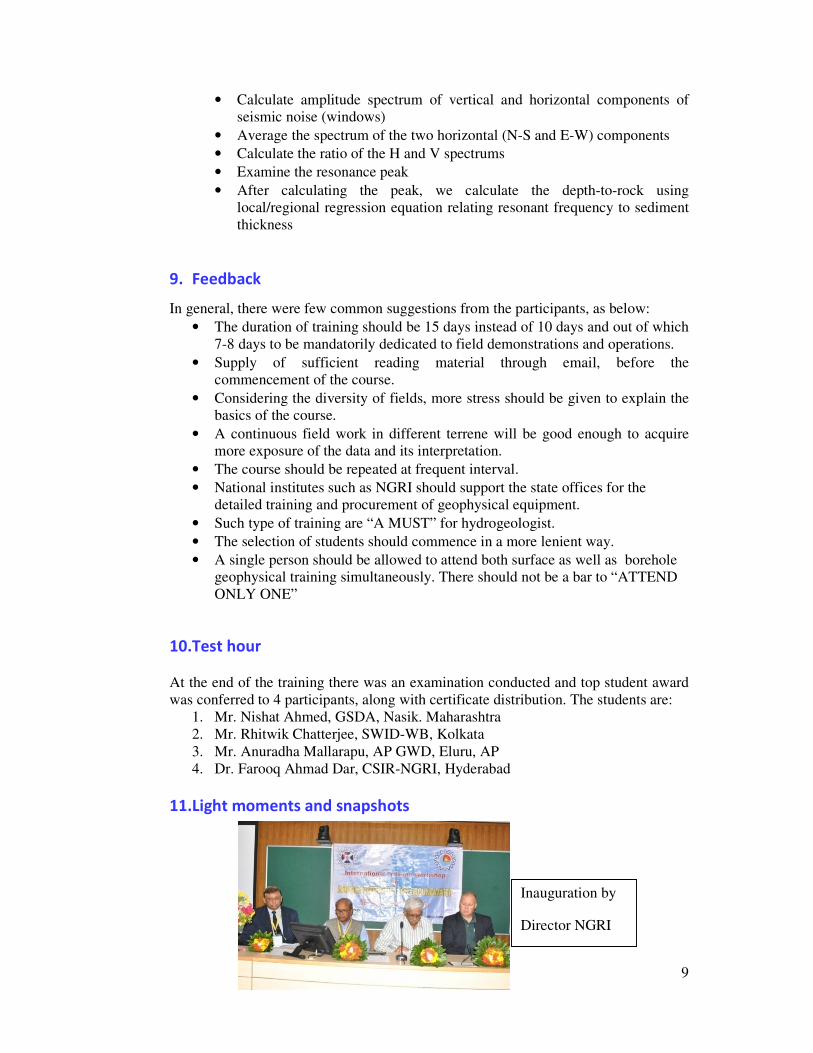
Glimpses from the Classroom
Field photographs

Research on groundwater Choutuppal:
Around 50 scientists across International aChoutuppal Mandal for delineating the groand seismic methodology were tested in surface without drilling. They tested thesproject.
Field visit by International and National Dr. Shakeel Ahmed said that water is life,workshop organized at NGRI funded by Wto educate the researchers using modernThese studies are conducted in Mondhollag Exchange of technology -Dr Eric WhiteSame instruments are using In USA, Denmapplying methodology. It is more importantechniques to the researchers. Still need to do research in groundwaterWhole day we discussed regarding the exploration at Mondhollagudem, Choutuppgain more knowledge on this research.
English translation of the news in Telugu n
N
er
l and national level from various organizations are visited Mondho groundwater signatures in subsurface layers. Different methods in this program for locating groundwater potential zones and itese methods in Hydrgeological Park established by NGRI un
al researchers -Dr Shakeel Ahmed, Chief Scientist, NGRI ife, if these resources are depleted there is no life. Ten days Inte World Bank for surface geophysics for groundwater. The aim ofern surface geophysical instruments for delineating groundwaterllagudem, Choutuppal.
ite, USGS enmark and India for delineating groundwater potential zones. Brtant to study on groundwater resources. In this programme we
ter -Jesper Bjergsted Pedersen, Denmark he importance of seismic methodology and Terameter in fielduppal. Experimentally we understand the same in this field. Res
u newspaper
News in local newspaper
Scien
v
Mondh
11
dhollagudem village, ds like geomagnetic its depth from the
I under Indo-French
International training of this workshop is ter prospect zones.
. But difference is in we are teaching our
ield of groundwater esearchers have to
entists have
visited
dhollagudem

12
Acknowledgements: The most important contribution and genesis of this successful course has been form the World Bank and the special force behind the entire program has been Dr. Anju Gaur with her very dynamic efforts this very important event was possible. Of course, Profs. John Lane and Eric White from USGS and Dr. Jesper B. Pedersen from Aarhus University have come from out of India and spared their valuable time to complete the course. The course has run very smoothly with support of Director, CSIR-NGRI and his large team. Lastly the organizations who have sponsored the participants to reach Hyderabad with a short notice are also acknowledged.
Related Documents