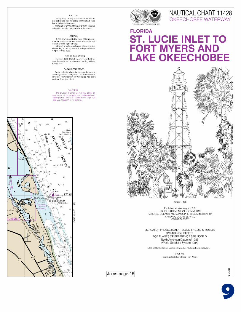
BookletChart ™ St. Lucie Inlet to Fort Myers and Lake Okeechobee NOAA Chart 11428 A reduced-scale NOAA nautical chart for small boaters When possible, use the full-size NOAA chart for navigation.

Welcome message from author
This document is posted to help you gain knowledge. Please leave a comment to let me know what you think about it! Share it to your friends and learn new things together.
Transcript

BookletChart™ St. Lucie Inlet to Fort Myers and Lake Okeechobee NOAA Chart 11428
A reduced-scale NOAA nautical chart for small boaters When possible, use the full-size NOAA chart for navigation.
2
Published by the National Oceanic and Atmospheric Administration
National Ocean Service Office of Coast Survey
www.NauticalCharts.NOAA.gov 888-990-NOAA
What are Nautical Charts?
Nautical charts are a fundamental tool of marine navigation. They show water depths, obstructions, buoys, other aids to navigation, and much more. The information is shown in a way that promotes safe and efficient navigation. Chart carriage is mandatory on the commercial ships that carry America’s commerce. They are also used on every Navy and Coast Guard ship, fishing and passenger vessels, and are widely carried by recreational boaters.
What is a BookletChart?
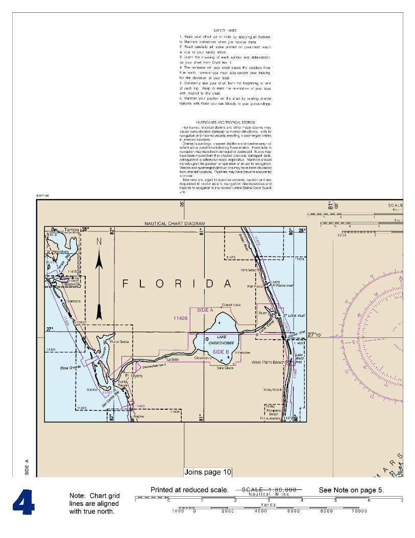
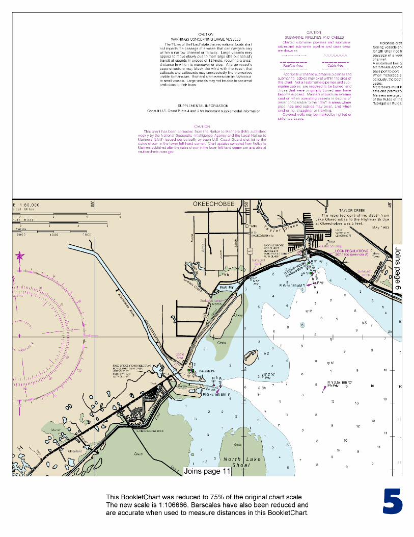
This BookletChart is made to help recreational boaters locate themselves on the water. It has been reduced in scale for convenience, but otherwise contains all the information of the full-scale nautical chart. The bar scales have also been reduced, and are accurate when used to measure distances in this BookletChart. See the Note at the bottom of page 5 for the reduction in scale applied to this chart.
Whenever possible, use the official, full scale NOAA nautical chart for navigation. Nautical chart sales agents are listed on the Internet at http://www.NauticalCharts.NOAA.gov.
This BookletChart does NOT fulfill chart carriage requirements for regulated commercial vessels under Titles 33 and 44 of the Code of Federal Regulations.
Notice to Mariners Correction Status
This BookletChart has been updated for chart corrections published in the U.S. Coast Guard Local Notice to Mariners, the National Geospatial Intelligence Agency Weekly Notice to Mariners, and, where applicable, the Canadian Coast Guard Notice to Mariners. Additional chart corrections have been made by NOAA in advance of their publication in a Notice to Mariners. The last Notices to Mariners applied to this chart are listed in the Note at the bottom of page 7. Coast Pilot excerpts are not being corrected.
For latest Coast Pilot excerpt visit the Office of Coast Survey website at http://www.nauticalcharts.noaa.gov/nsd/searchbychart.php?chart=11428
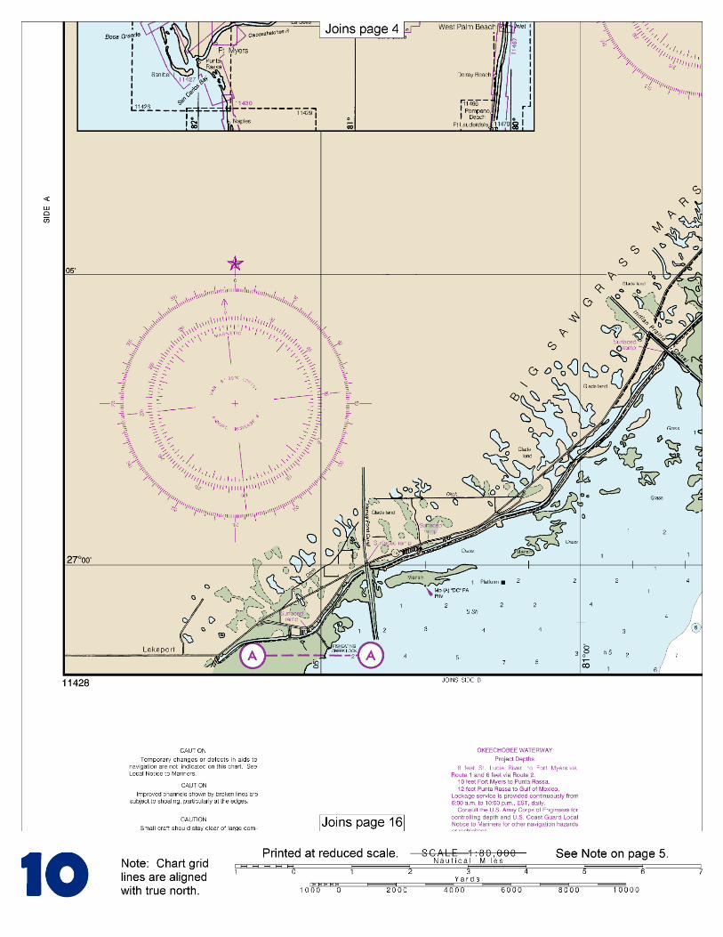
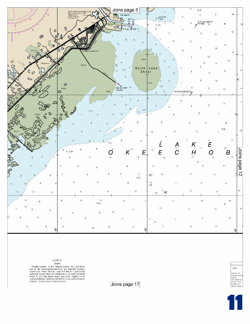
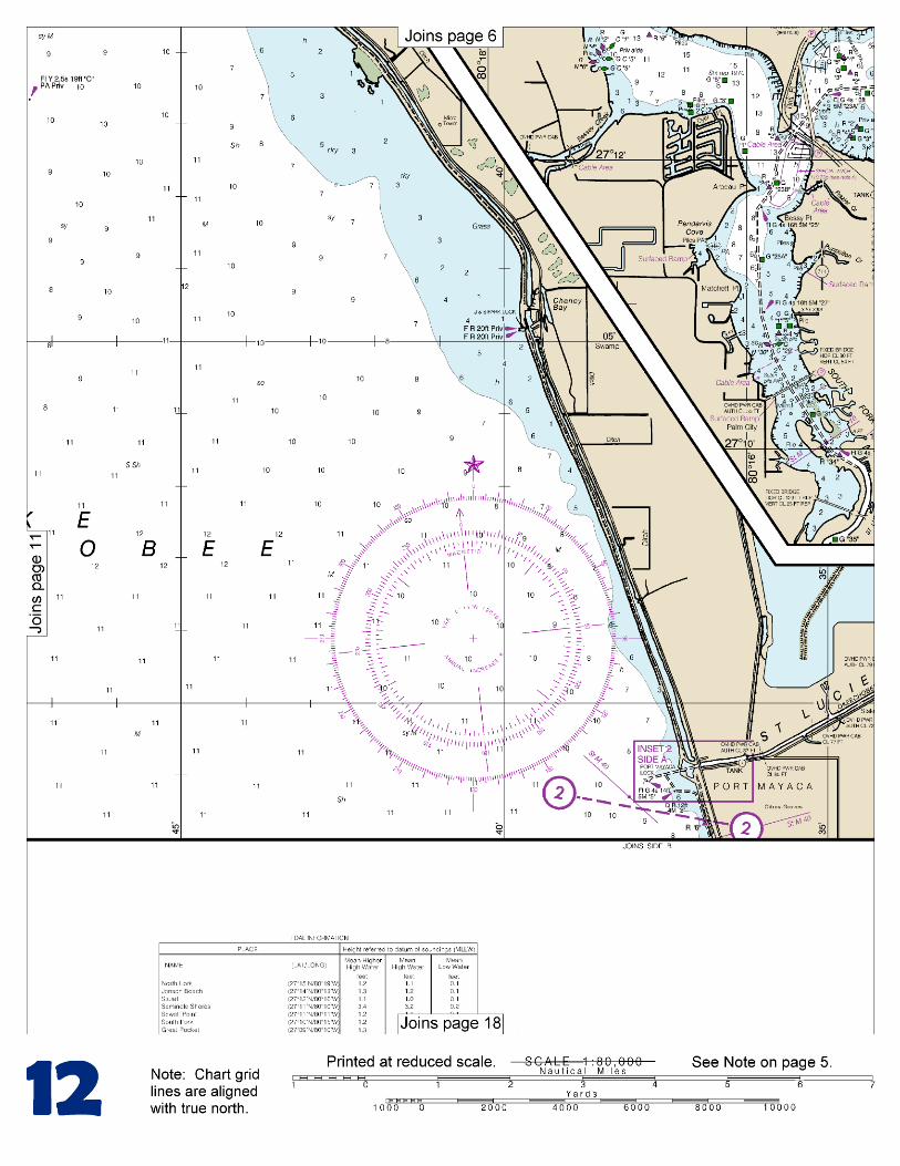
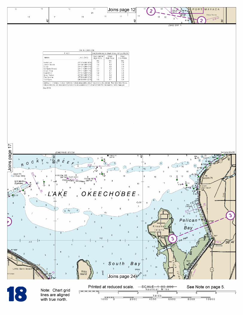
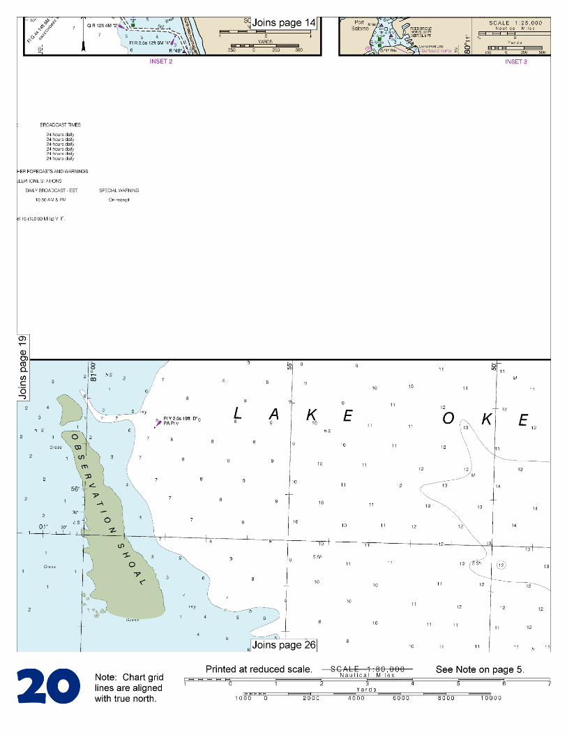
[Coast Pilot 5, Chapter 9 excerpts]. The total length of the Okeechobee Waterway is 155 miles. The Federal project for the Okeechobee Waterway provides a channel with a depth of 8 feet from the Intracoastal Waterway near Stuart via Okeechobee Lake Route 1 to Fort Myers; thence 10 feet to Punta Rassa; thence 12 feet to the Gulf of Mexico; a channel 6 feet deep in Taylor Creek from the town of Okeechobee to the lake, and a depth of 6 feet for Route 2 along the south
shore of Lake Okeechobee from Port Mayaca westward to Clewiston. Controlling depths are published in local Notice to Mariners.
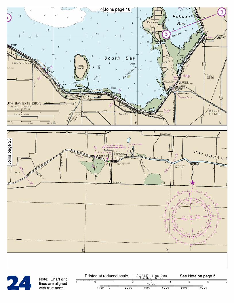
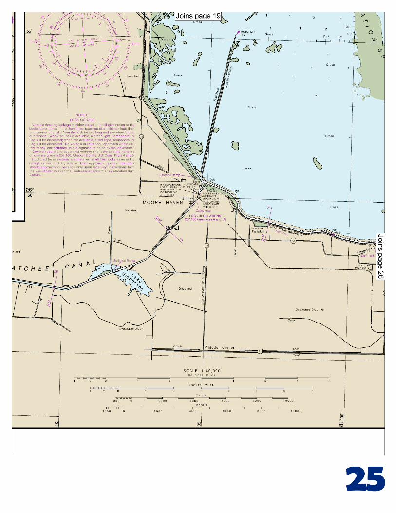
This route across the peninsula encounters a variety of climatic conditions. In general, temperatures over the inland portions are slightly cooler in winter, particularly the lows, and warmer in summer. The west coast also exhibits some of these continental tendencies, due mainly to the prevalence of easterly winds. For example, temperatures climb to 90°F (32.2°C) or above, on 106 days annually at Fort Myers, compared to 131 days at La Belle and 92 days near Stuart. Freezing temperatures are infrequent on the coast and occur on an average of 1 to 2 days inland. Tides and currents.–The diurnal range of tide is 1.2 feet at Fort Myers and 2.4 feet at Punta Rassa. At the eastern end of the waterway, tidal influence is perceptible to St. Lucie Lock (Mile 15.1) and at the western end, at low-water stage, is perceptible at Ortona Lock (Mile 93.5). Cross currents at the junction of St. Lucie River with the Intracoastal Waterway make the short turn at that point hazardous. Locks.–Three of the five locks in the waterway have a length of 250 feet, width of 50 feet, and depth over the sill of 10 feet. The Port Mayaca Lock, Mile 40.0, has a length of 400 feet, width of 56 feet, and a depth of 16 feet. The W.P. Franklin Lock at Olga, Mile 121.4, has a length of 400 feet, width of 56 feet, and depth over the sills of 14 feet. General regulations governing bridges and locks and the handling of tows are given in 207.160, chapter 2. The five navigation locks on the Okeechobee Waterway are operated from 0600 to 2130 daily; operating personnel are not on duty at other hours. Caution.–The St. Lucie, Port Mayaca, Moore Haven, Ortona, and W.P. Franklin Locks are used, when conditions require, for discharging water from Lake Okeechobee. All vessels approaching these locks during periods of discharge should exercise caution. The depth over the upper sill of St. Lucie Lock is reduced from 13.5 feet to 8 feet when water is being discharged from Lake Okeechobee. The St. Lucie Lock, Mile 15.1, has a width of 50 feet, length of 250 feet, and a depth of 12 feet over the sill. High water in Lake Okeechobee may cause the lock to be closed to navigation for parts of the day. Caution should be used when approaching the lock when it is being used to discharge water from Lake Okeechobee. Limited tieup facilities are available at the lock. Port Mayaca Lock, about 300 yards west-southwest of the U.S. Routes 98-441 highway bridge, has a length of 400 feet, width of 56 feet, and a depth of 16 feet over the sill. Moore Haven Lock, Mile 78.0, has a width of 50 feet, a length of 250 feet, and a least depth of 10 feet over the sills. Two standby areas have been established for vessels waiting to pass through. The first area is about 275 yards northwest of the lock at the junction of the canals, and the second area is 150 yards southwest of it. During periods of discharge through the lock, the currents and turbulence are extremely hazardous to all craft. Under no circumstances shall any craft approach nearer to the lock than the standby areas until discharge has been stopped and the water pool stabilized. A public address system at the Moore Haven Lock is an aid to navigation and safety feature. Craft coming to the lock should approach the passage only upon receiving instructions from the locktender through the loudspeaker system, and enter the lock chamber only after signal from him.
U.S. Coast Guard Rescue Coordination Center 24 hour Regional Contact for Emergencies
RCC New Orleans Commander 8th CG District (504) 589-6225 New Orleans, LA
G
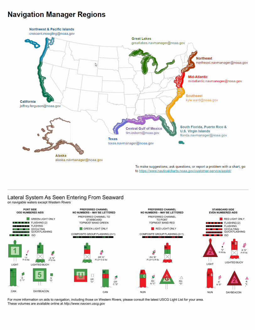
Lateral System As Seen Entering From Seaward on navigable waters except Western Rivers
PORT SIDE ODD NUMBERED AIDS
GREEN LIGHT ONLY FLASHING (2)
PREFERRED CHANNEL NO NUMBERS – MAY BE LETTERED
PREFERRED CHANNEL TO STARBOARD
TOPMOST BAND GREEN
PREFERRED CHANNEL NO NUMBERS – MAY BE LETTERED
PREFERRED CHANNEL TO PORT
TOPMOST BAND RED
STARBOARD SIDE EVEN NUMBERED AIDS
RED LIGHT ONLY FLASHING (2)
FLASHING FLASHING OCCULTING GREEN LIGHT ONLY RED LIGHT ONLY OCCULTING QUICK FLASHING QUICK FLASHING ISO COMPOSITE GROUP FLASHING (2+1) COMPOSITE GROUP FLASHING (2+1) ISO
"1"
Fl G 6s
G "9"
Fl G 4s
GR "A"
Fl (2+1) G 6s
RG "B"
Fl (2+1) R 6s
"2"
Fl R 6s
8
R "8" Fl R 4s
LIGHT
G
C "1"
LIGHTED BUOY
G "5"
GR "U"
GR
C "S"
RG
N "C"
RG "G"
LIGHT
6
R
N "6"
LIGHTED BUOY
R
"2"
CAN DAYBEACON
CAN NUN NUN
DAYBEACON
For more information on aids to navigation, including those on Western Rivers, please consult the latest USCG Light List for your area. These volumes are available online at http://www.navcen.uscg.gov
2
2
C U 5
1


VHF Marine Radio channels for use on the waterways:Channel 6 – Inter-ship safety communications.Channel 9 – Communications between boats and ship-to-coast.Channel 13 – Navigation purposes at bridges, locks, and harbors.Channel 16 – Emergency, distress and safety calls to Coast Guard and others, and to initiate calls to other
vessels. Contact the other vessel, agree to another channel, and then switch.Channel 22A – Calls between the Coast Guard and the public. Severe weather warnings, hazards to navigation and safety warnings are broadcast here.Channels 68, 69, 71, 72 and 78A – Recreational boat channels.
Getting and Giving Help — Signal other boaters using visual distress signals (flares, orange flag, lights, arm signals); whistles; horns; and on your VHF radio. You are required by law to help boaters in trouble. Respond to distress signals, but do not endanger yourself.
EMERGENCY INFORMATION
Distress Call Procedures
• Make sure radio is on.• Select Channel 16.• Press/Hold the transmit button.• Clearly say: “MAYDAY, MAYDAY, MAYDAY.”• Also give: Vessel Name and/or Description;Position and/or Location; Nature of Emergency; Number of People on Board.• Release transmit button.• Wait for 10 seconds — If no responseRepeat MAYDAY call.
HAVE ALL PERSONS PUT ON LIFE JACKETS!
This Booklet chart has been designed for duplex printing (printed on front and back of one sheet). If a duplex option is not available on your printer, you may print each sheet and arrange them back-to-back to allow for the proper layout when viewing.
QR
Quick ReferencesNautical chart related products and information - http://www.nauticalcharts.noaa.gov
Interactive chart catalog - http://www.charts.noaa.gov/InteractiveCatalog/nrnc.shtmlReport a chart discrepancy - http://ocsdata.ncd.noaa.gov/idrs/discrepancy.aspx
Chart and chart related inquiries and comments - http://ocsdata.ncd.noaa.gov/idrs/inquiry.aspx?frompage=ContactUs
Chart updates (LNM and NM corrections) - http://www.nauticalcharts.noaa.gov/mcd/updates/LNM_NM.html
Coast Pilot online - http://www.nauticalcharts.noaa.gov/nsd/cpdownload.htm
Tides and Currents - http://tidesandcurrents.noaa.gov
Marine Forecasts - http://www.nws.noaa.gov/om/marine/home.htm
National Data Buoy Center - http://www.ndbc.noaa.gov/
NowCoast web portal for coastal conditions - http://www.nowcoast.noaa.gov/
National Weather Service - http://www.weather.gov/
National Hurrican Center - http://www.nhc.noaa.gov/
Pacific Tsunami Warning Center - http://ptwc.weather.gov/
Contact Us - http://www.nauticalcharts.noaa.gov/staff/contact.htm
NOAA’s Office of Coast Survey The Nation’s Chartmaker
For the latest news from Coast Survey, follow @NOAAcharts
NOAA Weather Radio All Hazards (NWR) is a nationwide network of radio stations broadcasting continuous weather information directly from the nearest National Weather Service office. NWR broadcasts official Weather Service warnings, watches, forecasts and other hazard information 24 hours a day, 7 days a week. http://www.nws.noaa.gov/nwr/
Related Documents