ADOPTED APRIL 2006 Centre City Development Corporation RISING ON THE PACIFIC

Welcome message from author
This document is posted to help you gain knowledge. Please leave a comment to let me know what you think about it! Share it to your friends and learn new things together.
Transcript
ADOPTED APRIL 2006
Centre City Development Corporation
RISING ON THE PACIFIC
STEERING COMMITTEE
Hal Sadler, ChairmanRepresenting Office of Mayor
Jim Dawe, Vice ChairmanSeltzer Caplan
Sub-Committee Chairs
Coleen Clementson, Circulation Subcommittee Co-ChairCity of San Diego Planning Department
Kevin DeFreitas, Neighborhoods Subcommittee ChairEast Village Association
Gary Gallegos, Circulation Subcommittee Co-ChairSan Diego Association of Governments
Robert Lankford, Economic Development Subcommittee ChairCommercial Developer
Candice Lopez, Arts and Culture Subcommittee ChairArts & Culture
Rob Quigley, Urban Design Subcommittee ChairRepresenting Council District 2
Steering Committee Members
Susanah AguileraU.S. Navy
Neal ArthurSan Diego Housing Commission
Malin BurnhamBurnham Real Estate Services
Donald CohenCenter for Policy Initiatives
Greg CoxCounty Board of Supervisors
Steve CushmanSan Diego Unified Port District
John DaviesAllen Matkins
Julie DillonCentre City Development Corporation
Sister RayMonda DuVallSocial Services Provider
Tom FatLittle Italy Association
Salvatore GiamettaSan Diego Convention & Visitors Bureau
Sherry Jones, Scott TurcotteWestfield Shopping Center Owner and Manager
Stath KarrasEconomic Development Corporation
Reint ReindersSan Diego Convention and Visitors Bureau
Paul E. RobinsonHecht, Solberg, Robinson, Goldberg, Bagley LLP
James SchmidtGaslamp Quarter Association
Greg ShannonDowntown San Diego Partnership
Gary SmithDowntown Residents Association
Joyce SummerCentre City Advisory Committee (Designated Community Planning Group)
Carol WallaceConvention Center Corporation
Leon WilliamsMetropolitan Transit Development Board
Steve WilliamsBuilding Owner & Manager
Douglas WilsonResidential Project Developer
Tom WornhamSan Diego Regional Chamber of Commerce
AD HOC MEMBERS (VOTING)
Chair – CCDC
President – CCDC
Mayor, City of San Diego
District 2 Council Member
CCDC PROJECT STAFF
Garry Papers, AIA Manager – Architecture & Planning
Alexandra Elias, AICPSenior Planner
CCDC BOARD OF DIRECTORS
Jennifer LeSar, Chair
Fred Maas, Vice-Chair
Harold “Gil” Johnson, Secretary
Robert A. McNeely, Treasurer
Wayne Raffesberger, Director
AMENDMENTS
1st Amendment
Adopted May 22, 2012 by Resolution R-307480
2nd Amendment
Adopted May 16, 2013 by Resolution R-308138
Prepared by
i
TABLE OF CONTENTS
1 INTRODUCTIONANDOVERVIEW............................................................................. 1-1
1.1 GUIDINGPRINCIPLES...................................................................................................... 1-3
1.2 DOWNTOWN:ACAPSULEHISTORY................................................................................. 1-6
EarlyEfforts.......................................................................................................................................... 1-6
Horton’sHeyday................................................................................................................................... 1-6
TemporarySetback............................................................................................................................... 1-6
HeretoStay.......................................................................................................................................... 1-7
TheWarYears....................................................................................................................................... 1-8
DeclineandRebirth.............................................................................................................................. 1-8
1.3 CONTEXT......................................................................................................................... 1-9
Regional............................................................................................................................................... 1-9
Citywide............................................................................................................................................... 1-9
SurroundingNeighborhoods...............................................................................................................1-12
2 THEPLANNINGPROCESS........................................................................................ 2-1
2.1 SCOPEANDPURPOSEOFTHECOMMUNITYPLAN..........................................................2-2
Purpose................................................................................................................................................2-2
PlanOrganization.................................................................................................................................2-3
2.2 PUBLICPARTICIPATIONINTHE2005COMMUNITYPLANUPDATE..................................2-4
2.3 DOWNTOWNPLANNINGJURISDICTIONS........................................................................2-4
2.4 RELATIONSHIPSTOOTHERPLANS,DEVELOPMENTREGULATIONS,ANDGUIDELINES..2-6
RelationshiptoRedevelopmentPlans..................................................................................................2-6
RelationshiptotheGeneralPlan.......................................................................................................... 2-7
RelationshiptoPlannedDistrictandOtherDevelopmentOrdinances.................................................2-8
RelationshiptoNeighborhoodDesignGuidelines................................................................................2-9
RelationshiptoWaterfrontPlans..........................................................................................................2-9
2.5 RELATEDDOCUMENTS...................................................................................................2-11
EnvironmentalImpactReport..............................................................................................................2-11
ExistingConditions,Opportunities,andChallenges.......................................................................... 2-12
OtherWorkingPapers........................................................................................................................ 2-12
ii
3 LANDUSEANDHOUSING........................................................................................ 3-1
3.1 STRUCTUREANDLANDUSE...........................................................................................3-2
SizeandPhysicalStructure..................................................................................................................3-2
ExistingLandUse.................................................................................................................................3-6
LandUseDiagram................................................................................................................................3-6
LandUseClassificationSystem............................................................................................................ 3-7
3.2 DEVELOPMENTINTENSITYANDINCENTIVES,ANDPLANBUILDOUT............................ 3-17
DevelopmentIntensity........................................................................................................................3-17
Incentives............................................................................................................................................3-17
TransferofDevelopmentRights(TDR)...............................................................................................3-22
Buildout.............................................................................................................................................3-26
3.3 HOUSING......................................................................................................................3-29
3.4 AFFORDABLEHOUSING.................................................................................................3-30
3.5 NEIGHBORHOODSANDCENTERS.................................................................................3-34
DistinctandDifferentNeighborhoods................................................................................................ 3-35
Neighborhoods.................................................................................................................................. 3-35
3.6LARGEFACILITIES..........................................................................................................3-38
4 PARKS,OPENSPACE,ANDRECREATION................................................................. 4-1
4.1 OpenSpaceSystem........................................................................................................4-2
5 URBANDESIGN....................................................................................................... 5-1
5.1 STREETGRID,ANDVIEWS..............................................................................................5-2
StreetGrid............................................................................................................................................5-2
Views.................................................................................................................................................... 5-3
5.2 CENTERSANDMAINSTREETS........................................................................................ 5-7
StructureoftheCenters....................................................................................................................... 5-7
5.3 BULK,SKYLINE,ANDSUNACCESS............................................................................... 5-10
SunAccess......................................................................................................................................... 5-10
BulkandGrain.................................................................................................................................... 5-10
Skyline............................................................................................................................................... 5-12
5.4 STREETSCAPEANDBUILDINGINTERFACE.................................................................... 5-16
Streetscape........................................................................................................................................ 5-16
Building/StreetOrientation................................................................................................................5-17
5.5 WATERFRONT................................................................................................................5-20
iii
5.6 LINKAGESTOSURROUNDINGNEIGHBORHOODS........................................................5-23
BalboaPark........................................................................................................................................ 5-23
Uptown...............................................................................................................................................5-24
NeighborhoodstotheEast/Southeast...............................................................................................5-24
NewConnectionsandGateways........................................................................................................5-24
5.7 WAYFINDINGANDSIGNS..............................................................................................5-26
Wayfinding.........................................................................................................................................5-26
Signs..................................................................................................................................................5-26
5.8 SUSTAINABLEDEVELOPMENT....................................................................................... 5-27
5.9 PROJECTDESIGNREVIEW.............................................................................................5-29
6 NEIGHBORHOODSANDDISTRICTS......................................................................... 6-1
6.1 CIVIC/CORE.....................................................................................................................6-3
6.2 COLUMBIA......................................................................................................................6-7
6.3 MARINA..........................................................................................................................6-11
6.4 HORTONPLAZA/GASLAMPQUARTER........................................................................... 6-15
6.5 EASTVILLAGE................................................................................................................ 6-19
6.6 CORTEZ.........................................................................................................................6-29
6.7 LITTLEITALY..................................................................................................................6-33
6.8 CONVENTIONCENTER................................................................................................... 6-37
7 TRANSPORTATION.................................................................................................. 7-1
7.1 STREETSYSTEM.............................................................................................................. 7-2
7.2 PEDESTRIANANDBICYCLEMOVEMENT.......................................................................... 7-7
7.3 TRANSITSYSTEM............................................................................................................7-8
LookingAhead................................................................................................................................... 7-10
7.4 PARKING....................................................................................................................... 7-14
7.5 TRANSPORTATIONANDMANAGEMENT........................................................................ 7-16
8 PUBLICFACILITIESANDAMENITIES....................................................................... 8-1
8.1 EDUCATIONALFACILITIES...............................................................................................8-2
8.2 POLICEANDFIREFACILITIES...........................................................................................8-3
8.3 OTHERCOMMUNITYFACILITIES......................................................................................8-4
8.4 CIVICCENTER..................................................................................................................8-5
8.5 LIBRARIES.......................................................................................................................8-7
iv
9 HISTORICPRESERVATION...................................................................................... 9-1
9.1 HISTORICCONSERVATION....................................................................................................................9-3
9.2 INTEGRATINGHERITAGEINDOWNTOWN’SFUTURE............................................................................9-5
10 ARTSANDCULTURE.............................................................................................. 10-1
10.1 PUBLICART................................................................................................................... 10-2
10.2 FACILITIES..................................................................................................................... 10-3
10.3 ARTISTLIVE/WORKSPACE............................................................................................ 10-7
11 ECONOMICDEVELOPMENT................................................................................... 11-1
11.1 PATTERNSANDTRENDS................................................................................................11-2
Offices.................................................................................................................................................11-2
HotelsandVisitors..............................................................................................................................11-2
Retail,Restaurants,andEntertainment...............................................................................................11-3
OtherSectors......................................................................................................................................11-3
11.2 THEREDEVELOPMENTAGENCY’SROLE.........................................................................11-3
Partnerships........................................................................................................................................11-4
BusinessIncentivesandFinancialAssistance.....................................................................................11-6
11.3 ECONOMICDEVELOPMENTSTRATEGY...........................................................................11-7
12 HEALTHANDHUMANSERVICES........................................................................... 12-1
12.1 HUMANSERVICES......................................................................................................... 12-2
12.2 FACILITIES..................................................................................................................... 12-3
12.3 HOMELESSNESSPREVENTIONSTRATEGIES................................................................. 12-3
12.4 HEALTHCARE................................................................................................................ 12-4
13 HEALTHANDSAFETY............................................................................................. 13-1
13.1 GEOLOGICANDSEISMICHAZARDS.............................................................................. 13-2
13.2 HAZARDOUSMATERIALS.............................................................................................. 13-5
13.3 AIRPORTINFLUENCE..................................................................................................... 13-5
13.4 NOISE............................................................................................................................ 13-6
13.5 EMERGENCYPREPAREDNESS....................................................................................... 13-8
14 PLANNINGPROCESSANDIMPLEMENTATION...................................................... 14-1
IMPLEMENTATIONOFTHECOMMUNITYPLAN.............................................................. 14-2
AMENDMENTSTOTHECOMMUNITYPLAN................................................................... 14-2
FIVEYEARREVIEW........................................................................................................ 14-2
v
APPENDIXA:FEIRMITIGATIONMONITORINGANDREPORTINGPROGRAM
ACKNOWLEDGEMENTS
LISTOFFIGURES
Figure1-1:DowntownRegionalLocation....................................................................................1-10
Figure1-2:SurroundingNeighborhoods.................................................................................... 1-11
Figure2-1:DowntownJurisdictionalBoundaries........................................................................2-5
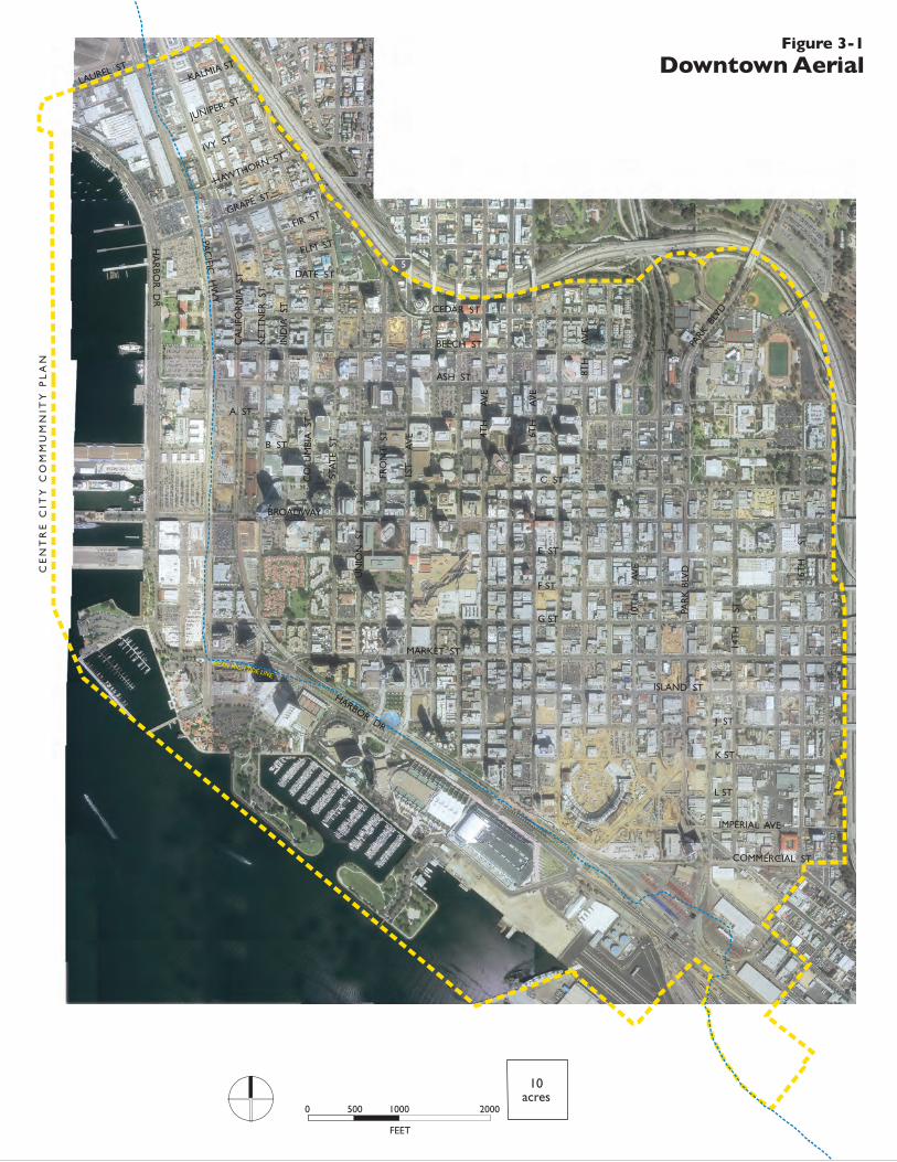
Figure3-1:DowntownAerial.......................................................................................................3-4
Figure3-2:DowntownStructure.................................................................................................3-5
Figure3-3:LandUseandOpportunitySites...............................................................................3-8
Figure3-4:LandUse...................................................................................................................3-9
Figure3-5:OverallViewwithLandUseandOpportunitySites................................................. 3-10
Figure3-6:EmploymentRequired,LargeFloorplate,andFineGrainedAreas........................... 3-14
Figure3-7:StreetLevelActiveFrontageRequirements............................................................. 3-16
Figure3-8:IncreasedIntensities.............................................................................................. 3-19
Figure3-9:BaseMinimumandMaximumFAR..........................................................................3-20
Figure3-10:MaximumFARThroughBonusPayment................................................................ 3-21
Figure3-11:TotalBonusFARAvailable(includingthroughbonuspayment).............................3-23
Figure3-12:MaximumFAR(withbonuses)...............................................................................3-24
Figure3-13:PotentialBuildoutIntensities................................................................................3-25
Figure4-1:ParksandOpenSpaces.............................................................................................4-3
Figure5-1:ViewCorridors........................................................................................................... 5-5
Figure5-2:BuildingHeightandSunAccess............................................................................. 5-14
Figure7-1:StreetTypologies....................................................................................................... 7-3
Figure7-2:NewStreetsandRoadwayModifications.................................................................. 7-5
Figure7-3:PedestrianPriorityZones..........................................................................................7-9
Figure7-4:TransitNetwork....................................................................................................... 7-13
Figure9-1:HistoricResourcesandDistricts................................................................................9-2
Figure10-1:ArtsandRenewalLocations................................................................................... 10-5
Figure11-1:RenewalCommunityandMetroEnterpriseZoneBoundaries..................................11-5
Figure13-1:Topography,FaultsandLiquefaction...................................................................... 13-3
vi
LISTOFTABLES
Table2-1:CommunityPlanOrganization....................................................................................2-3
Table3-1:ExistingDowntownLandUseDistribution(2004).......................................................3-6
Table3-2:EstimatedBuildout................................................................................................... 3-27
Table3-3:RedevelopmentandToolsforAffordableHousing....................................................3-33
Table4-1:ParkAcreage...............................................................................................................4-4
Table5-1:ViewCorridorStepbacks.............................................................................................5-4
Table5-2:NeighborhoodCentersLocatorandDescriptions.......................................................5-9
Chapter6EstimatedBuildoutTables:
Civic/Core...................................................................................................................6-6
Columbia....................................................................................................................6-9
Marina...................................................................................................................... 6-14
HortonPlaza/GaslampQuarter................................................................................ 6-18
EastVillage...............................................................................................................6-28
Cortez....................................................................................................................... 6-31
LittleItaly.................................................................................................................6-36
ConventionCenter....................................................................................................6-40
Table9-1:HistoricDesignationsandPreservationGoals............................................................9-3
Table10-1:CapacityofExistingPerformanceFacilities............................................................. 10-4
LISTOFCHARTS
Chart3-1:ExistingDowntownLandUseDistribution(2004)......................................................3-6
LISTOFBOXES
Box1-1:CommunityPlanGuidingPrinciples............................................................................... 1-3
Box3-1:AffordableHousingStrategies.................................................................................... 3-31
Box4-1:PotentialParkElements................................................................................................ 4-7
Box5-1:GuidelinesforDesignofKeyStreets........................................................................... 5-19
Box7-1:StreetTypologies........................................................................................................... 7-4
Box7-2:TransitNetwork............................................................................................................7-11
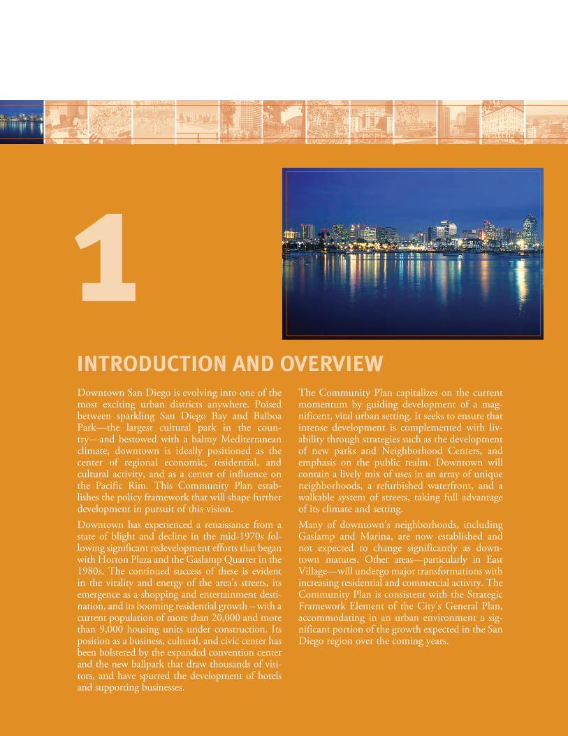
Downtown San Diego is evolving into one of the most exciting urban districts anywhere. Poised between sparkling San Diego Bay and Balboa Park—the largest cultural park in the coun-try—and bestowed with a balmy Mediterranean climate, downtown is ideally positioned as the center of regional economic, residential, and cultural activity, and as a center of influence on the Pacific Rim. This Community Plan estab-lishes the policy framework that will shape further development in pursuit of this vision.Downtown has experienced a renaissance from a state of blight and decline in the mid-1970s fol-lowing significant redevelopment efforts that began with Horton Plaza and the Gaslamp Quarter in the 1980s. The continued success of these is evident in the vitality and energy of the area’s streets, its emergence as a shopping and entertainment desti-nation, and its booming residential growth – with a current population of more than 20,000 and more than 9,000 housing units under construction. Its position as a business, cultural, and civic center has been bolstered by the expanded convention center and the new ballpark that draw thousands of visi-tors, and have spurred the development of hotels and supporting businesses.
The Community Plan capitalizes on the current momentum by guiding development of a mag-nificent, vital urban setting. It seeks to ensure that intense development is complemented with liv-ability through strategies such as the development of new parks and Neighborhood Centers, and emphasis on the public realm. Downtown will contain a lively mix of uses in an array of unique neighborhoods, a refurbished waterfront, and a walkable system of streets, taking full advantage of its climate and setting. Many of downtown’s neighborhoods, including Gaslamp and Marina, are now established and not expected to change significantly as down-town matures. Other areas—particularly in East Village—will undergo major transformations with increasing residential and commercial activity. The Community Plan is consistent with the Strategic Framework Element of the City’s General Plan, accommodating in an urban environment a sig-nificant portion of the growth expected in the San Diego region over the coming years.
INTRODUCTION AND OVERVIEW
1
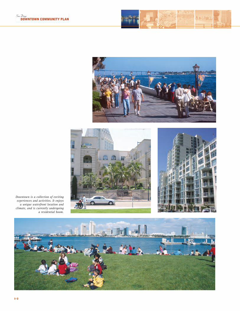
Downtown is a collection of exciting experiences and activities. It enjoys
a unique waterfront location and climate, and is currently undergoing
a residential boom.
1-2
1.1 GUIDING PRINCIPLESThe Guiding Principles are at the heart of the Community Plan. They express a vision for downtown and its emergence as a major center “Rising on the Pacific”, together creating the overarching goals that the Plan strives to achieve. The Principles are the target for the future, and provide the platform for the detailed policies of the Plan and imple-menting ordinances. They have been shaped by input from community members and stakeholders, research into overall existing conditions and opportunities, enduring historical and cultural attributes, and specific issues such as economic and market conditions.
1-3
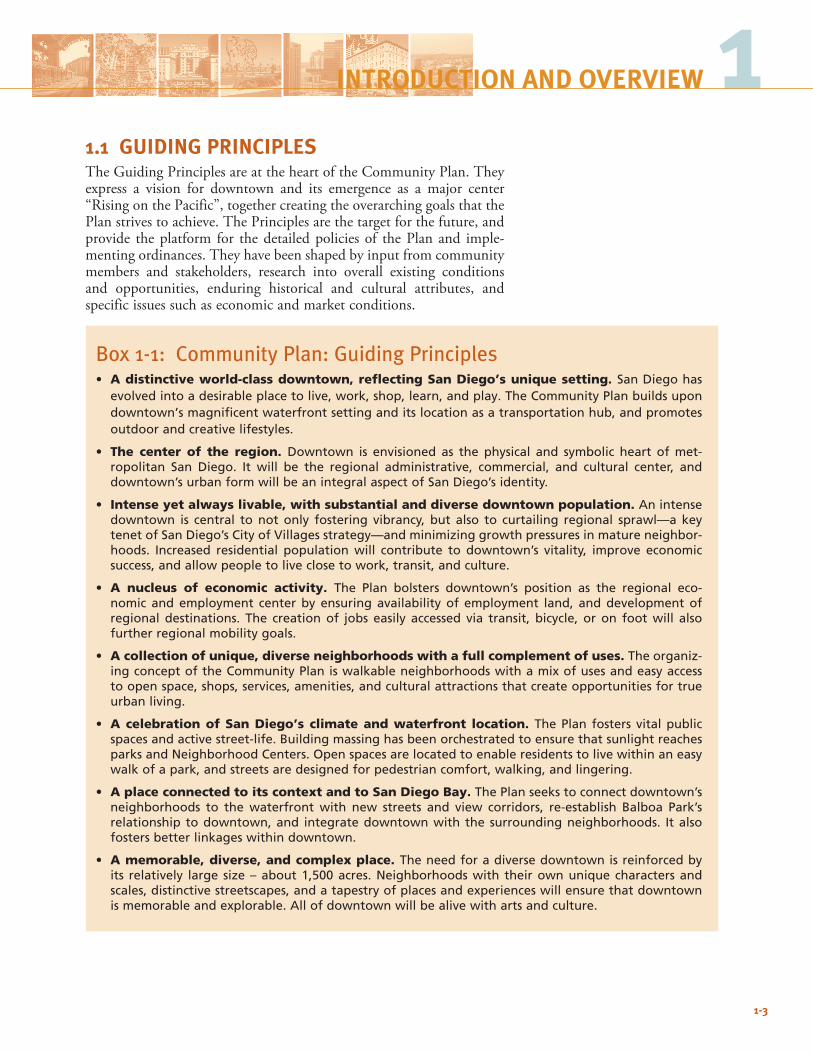
1INTRODUCTION AND OVERVIEW
Box 1-1: Community Plan: Guiding Principles• A distinctive world-class downtown, reflecting San Diego’s unique setting. SanDiegohas
evolvedintoadesirableplacetolive,work,shop,learn,andplay.TheCommunityPlanbuildsupondowntown’smagnificentwaterfrontsettinganditslocationasatransportationhub,andpromotesoutdoorandcreativelifestyles.
• The center of the region. Downtown is envisioned as the physical and symbolic heart ofmet-ropolitan San Diego. It will be the regional administrative, commercial, and cultural center, anddowntown’surbanformwillbeanintegralaspectofSanDiego’sidentity.
• Intense yet always livable, with substantial and diverse downtown population. Anintensedowntown is central tonotonly fostering vibrancy, but also to curtailing regional sprawl—akeytenetofSanDiego’sCityofVillagesstrategy—andminimizinggrowthpressuresinmatureneighbor-hoods. Increased residential populationwill contribute to downtown’s vitality, improve economicsuccess,andallowpeopletoliveclosetowork,transit,andculture.
• A nucleus of economic activity. The Plan bolsters downtown’s position as the regional eco-nomicandemployment centerbyensuringavailabilityof employment land, anddevelopmentofregional destinations. The creationof jobs easily accessed via transit, bicycle, oron footwill alsofurtherregionalmobilitygoals.
• A collection of unique, diverse neighborhoods with a full complement of uses. Theorganiz-ingconceptoftheCommunityPlaniswalkableneighborhoodswithamixofusesandeasyaccesstoopenspace,shops,services,amenities,andculturalattractionsthatcreateopportunitiesfortrueurbanliving.
• A celebration of San Diego’s climate and waterfront location. ThePlan fostersvitalpublicspacesandactivestreet-life.BuildingmassinghasbeenorchestratedtoensurethatsunlightreachesparksandNeighborhoodCenters.Openspacesarelocatedtoenableresidentstolivewithinaneasywalkofapark,andstreetsaredesignedforpedestriancomfort,walking,andlingering.
• A place connected to its context and to San Diego Bay. ThePlanseekstoconnectdowntown’sneighborhoods to thewaterfrontwith new streets and view corridors, re-establish Balboa Park’srelationship todowntown,and integratedowntownwith the surroundingneighborhoods. Italsofostersbetterlinkageswithindowntown.
• A memorable, diverse, and complex place. Theneedforadiversedowntownisreinforcedbyits relatively large size–about1,500acres.Neighborhoodswith theirownuniquecharactersandscales,distinctivestreetscapes,andatapestryofplacesandexperienceswillensurethatdowntownismemorableandexplorable.Allofdowntownwillbealivewithartsandculture.

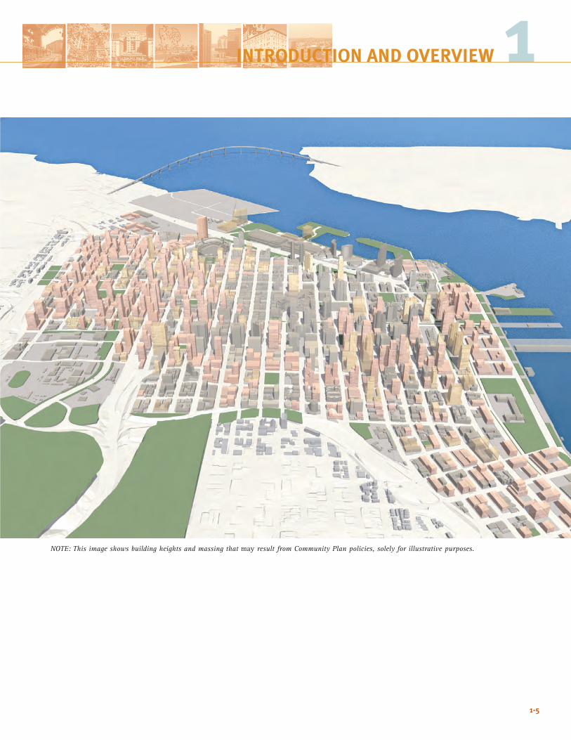
This comparison of downtown San Diego today (left) and in the future (right) shows transformation of the urban fabric, with the greatest change occurring in the eastern neighborhoods, including some of the highest building intensities, mix of uses, and new open space.
1-4
1-5
NOTE: This image shows building heights and massing that may result from Community Plan policies, solely for illustrative purposes.
1INTRODUCTION AND OVERVIEW
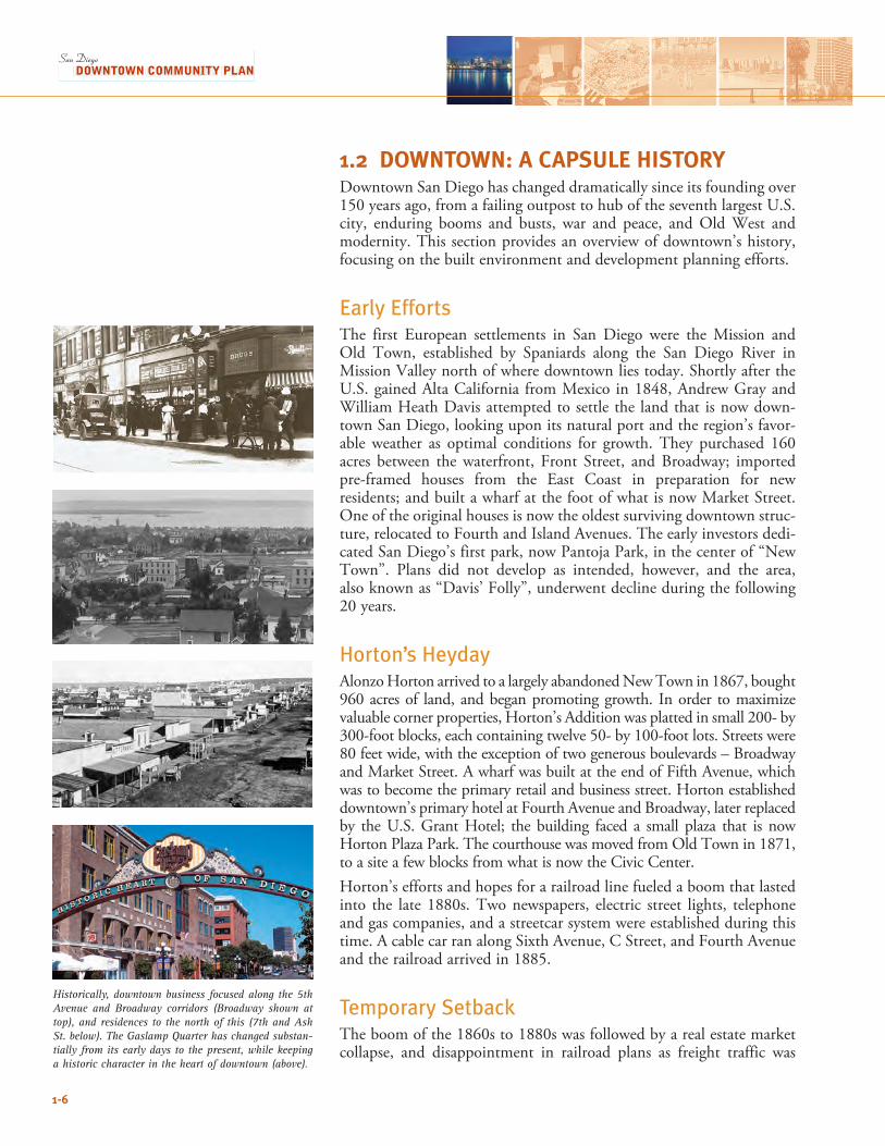
Historically, downtown business focused along the 5th Avenue and Broadway corridors (Broadway shown at top), and residences to the north of this (7th and Ash St. below). The Gaslamp Quarter has changed substan-tially from its early days to the present, while keeping a historic character in the heart of downtown (above).
1-6
1.2 DOWNTOWN: A CAPSULE HISTORYDowntown San Diego has changed dramatically since its founding over 150 years ago, from a failing outpost to hub of the seventh largest U.S. city, enduring booms and busts, war and peace, and Old West and modernity. This section provides an overview of downtown’s history, focusing on the built environment and development planning efforts.
Early EffortsThe first European settlements in San Diego were the Mission and Old Town, established by Spaniards along the San Diego River in Mission Valley north of where downtown lies today. Shortly after the U.S. gained Alta California from Mexico in 1848, Andrew Gray and William Heath Davis attempted to settle the land that is now down-town San Diego, looking upon its natural port and the region’s favor-able weather as optimal conditions for growth. They purchased 160 acres between the waterfront, Front Street, and Broadway; imported pre-framed houses from the East Coast in preparation for new residents; and built a wharf at the foot of what is now Market Street. One of the original houses is now the oldest surviving downtown struc-ture, relocated to Fourth and Island Avenues. The early investors dedi-cated San Diego’s first park, now Pantoja Park, in the center of “New Town”. Plans did not develop as intended, however, and the area, also known as “Davis’ Folly”, underwent decline during the following 20 years.
Horton’s HeydayAlonzo Horton arrived to a largely abandoned New Town in 1867, bought 960 acres of land, and began promoting growth. In order to maximize valuable corner properties, Horton’s Addition was platted in small 200- by 300-foot blocks, each containing twelve 50- by 100-foot lots. Streets were 80 feet wide, with the exception of two generous boulevards – Broadway and Market Street. A wharf was built at the end of Fifth Avenue, which was to become the primary retail and business street. Horton established downtown’s primary hotel at Fourth Avenue and Broadway, later replaced by the U.S. Grant Hotel; the building faced a small plaza that is now Horton Plaza Park. The courthouse was moved from Old Town in 1871, to a site a few blocks from what is now the Civic Center. Horton’s efforts and hopes for a railroad line fueled a boom that lasted into the late 1880s. Two newspapers, electric street lights, telephone and gas companies, and a streetcar system were established during this time. A cable car ran along Sixth Avenue, C Street, and Fourth Avenue and the railroad arrived in 1885.
Temporary SetbackThe boom of the 1860s to 1880s was followed by a real estate market collapse, and disappointment in railroad plans as freight traffic was
1-7
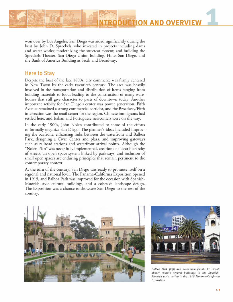
Balboa Park (left) and downtown (Santa Fe Depot; above) contain several buildings in the Spanish-Moorish style, dating to the 1915 Panama-California Exposition.
won over by Los Angeles. San Diego was aided significantly during the bust by John D. Spreckels, who invested in projects including dams and water works; modernizing the streetcar system; and building the Spreckels Theater, San Diego Union building, Hotel San Diego, and the Bank of America Building at Sixth and Broadway.
Here to StayDespite the bust of the late 1800s, city commerce was firmly centered in New Town by the early twentieth century. The area was heavily involved in the transportation and distribution of items ranging from building materials to food, leading to the construction of many ware-houses that still give character to parts of downtown today. Another important activity for San Diego’s center was power generation. Fifth Avenue remained a strong commercial corridor, and the Broadway/Fifth intersection was the retail center for the region. Chinese immigrants had settled here, and Italian and Portuguese newcomers were on the way.In the early 1900s, John Nolen contributed to some of the efforts to formally organize San Diego. The planner’s ideas included improv-ing the bayfront, enhancing links between the waterfront and Balboa Park, designing a Civic Center and plaza, and improving gateways such as railroad stations and waterfront arrival points. Although the “Nolen Plan” was never fully implemented, creation of a clear hierarchy of streets, an open space system linked by parkways, and inclusion of small open spaces are enduring principles that remain pertinent to the contemporary context.At the turn of the century, San Diego was ready to promote itself on a regional and national level. The Panama-California Exposition opened in 1915, and Balboa Park was improved for the occasion with Spanish-Moorish style cultural buildings, and a cohesive landscape design. The Exposition was a chance to showcase San Diego to the rest of the country.
1INTRODUCTION AND OVERVIEW
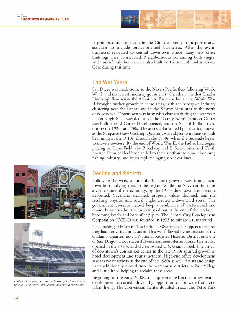
Horton Plaza (top) was an early catalyst of downtown renewal, and Petco Park (above) has been a recent one.
1-8
It prompted an expansion in the City’s economy from port-related activities to include service-oriented businesses. After the event, businesses relocated to central downtown where many new office buildings were constructed. Neighborhoods containing both single- and multi-family homes were also built on Cortez Hill and in Civic/Core during this time.
The War YearsSan Diego was made home to the Navy’s Pacific fleet following World War I, and the aircraft industry got its start when the plane that Charles Lindbergh flew across the Atlantic to Paris was built here. World War II brought further growth in these areas, with the aerospace industry clustering near the airport and in the Kearny Mesa area to the north of downtown. Downtown was busy with changes during the war years – Lindbergh Field was dedicated, the County Administration Center was built, the El Cortez Hotel opened, and the Star of India arrived during the 1920s and ’30s. The area’s colorful red light district, known as the Stingaree (now Gaslamp Quarter), was subject to numerous raids beginning in the 1910s, through the 1930s, when the sex trade began to move elsewhere. By the end of World War II, the Padres had begun playing on Lane Field, the Broadway and B Street piers and Tenth Avenue Terminal had been added to the waterfront to serve a booming fishing industry, and buses replaced aging street car lines.
Decline and RebirthFollowing the wars, suburbanization took growth away from down-town into outlying areas in the region. While the Navy continued as a cornerstone of the economy, by the 1970s downtown had become depressed. Vacancies escalated, property values declined, and the resulting physical and social blight created a downward spiral. The government presence helped keep a semblance of professional and service businesses but the area emptied out at the end of the workday, becoming lonely and bare after 5 p.m. The Centre City Development Corporation (CCDC) was founded in 1975 to initiate a turnaround. The opening of Horton Plaza in the 1980s attracted shoppers to an area they had not visited in decades. This was followed by restoration of the Gaslamp Quarter, now a National Register Historic District and one of San Diego’s most successful entertainment destinations. The trolley opened in the 1980s, as did a renovated U.S. Grant Hotel. The arrival of downtown’s convention center in the late 1980s spurred growth in hotel development and tourist activity. High-rise office development saw a wave of activity at the end of the 1980s as well. Artists and design firms additionally moved into the warehouse districts in East Village and Little Italy, helping to reclaim these areas.Beginning in the early 2000s, an unprecedented boom in residential development occurred, driven by opportunities for waterfront and urban living. The Convention Center doubled in size, and Petco Park
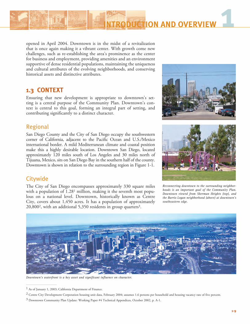
Reconnecting downtown to the surrounding neighbor-hoods is an important goal of the Community Plan. Downtown viewed from Sherman Heights (top), and the Barrio Logan neighborhood (above) at downtown’s southeastern edge.
1-9
opened in April 2004. Downtown is in the midst of a revitalization that is once again making it a vibrant center. With growth come new challenges, such as re-establishing the area’s prominence as the center for business and employment, providing amenities and an environment supportive of dense residential populations, maintaining the uniqueness and cultural attributes of the evolving neighborhoods, and conserving historical assets and distinctive attributes.
1.3 CONTEXTEnsuring that new development is appropriate to downtown’s set-ting is a central purpose of the Community Plan. Downtown’s con-text is central to this goal, forming an integral part of setting, and contributing significantly to a distinct character.
RegionalSan Diego County and the City of San Diego occupy the southwestern corner of California, adjacent to the Pacific Ocean and U.S./Mexico international border. A mild Mediterranean climate and coastal position make this a highly desirable location. Downtown San Diego, located approximately 120 miles south of Los Angeles and 30 miles north of Tijuana, Mexico, sits on San Diego Bay in the southern half of the county. Downtown is shown in relation to the surrounding region in Figure 1-1. CitywideThe City of San Diego encompasses approximately 330 square miles with a population of 1.281 million, making it the seventh most popu-lous on a national level. Downtown, historically known as Centre City, covers about 1,450 acres. It has a population of approximately 20,8002, with an additional 5,350 residents in group quarters3.
1 As of January 1, 2003; California Department of Finance.2 Centre City Development Corporation housing unit data, February 2004; assumes 1.6 persons per household and housing vacancy rate of five percent. 3 Downtown Community Plan Update: Working Paper #4 Technical Appendices, October 2002, p. A-1.
Downtown’s waterfront is a key asset and significant influence on character.
1INTRODUCTION AND OVERVIEW
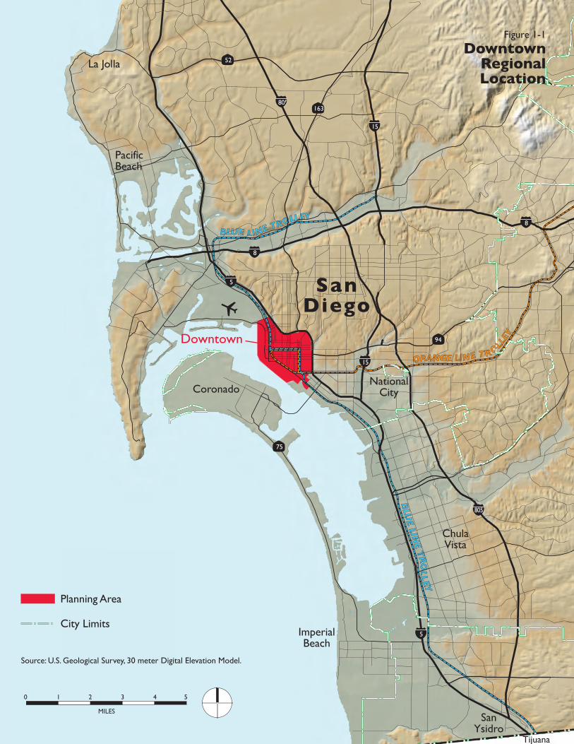
0 1 2 53 4
MILES
ORANGE LINE T ROLLEY
BLUE LINE TROLLEY
BLU
E LINE T
RO
LL
EY
5
94
163
75
5
8
8
15
15
805
805
52
Coronado
ChulaVista
ImperialBeach
SanYsidro
NationalCity
SanDiego
PacificBeach
La Jolla
Tijuana
Downtown
Figure 1-1
DowntownRegional Location
Source: U.S. Geological Survey, 30 meter Digital Elevation Model.
Planning Area
City Limits
HA
RBO
R D
R
LAUREL ST
PACIFIC
HW
Y
BROADWAY
ASH ST
MARKET STHARBOR DR
PAR
K B
LVD
10T
H
AV
E
14T
H
ST
16T
H
ST
8TH
AV
E
6TH
A
VE
4TH
AV
E
1ST
A
VE
FRO
NT
ST
UN
ION
ST
STAT
E S
T
CO
LUM
BIA
ST
IND
IA S
T
KET
TN
ER B
LVD
CA
LIFO
RN
IA S
T
JUNIPER ST
IVY ST
HAWTHORN ST
GRAPE ST
FIR ST
DATE ST
CEDAR ST
BEECH ST
A ST
B ST
C ST
E ST
F ST
G ST
ISLAND AVE
J ST
K ST
L ST
IMPERIAL AVE
COMMERCIAL ST
PARK
BLV
D
28T
H
AV
E
University AveWASHINGTON ST
6TH
A
VE
4TH
A
VE
BROADWAY
MARKET ST
LOGAN AVENATIONAL AVE
16TH
ST
SIGSB
EEBE
ARDSL
EY
Commercial Corridor
Civic/Institutional
Park/Open Space
Major Street
CCDC Boundary
Mean High Tide Line (Port Jurisdiction)
Imperial Ave
25thStreet
ChicanoPark
Hillcrest
MissionHills
Middletown UPTOMIDWA
LINDBERGHBALBOA P
SHERMAN HEIGHTS/
BARRIOCORONADO
San DiegoInternational Airport BANKERS
HILL
5
5
75
94
163
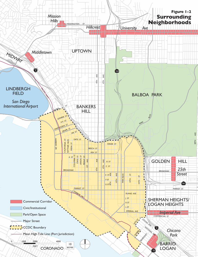
Figure 1-2
SurroundingNeighborhoods
FEET
0 1000 2000 400010
acres
1-12
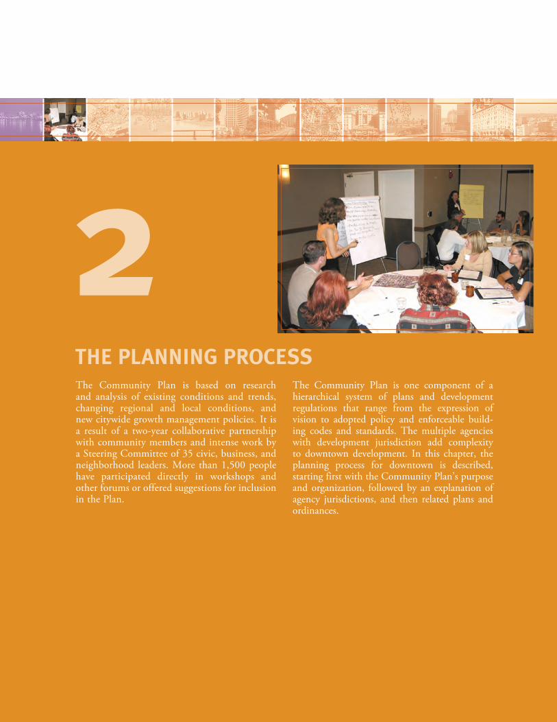
Balboa Park lies to the north of downtown, and is an important amenity for the area.
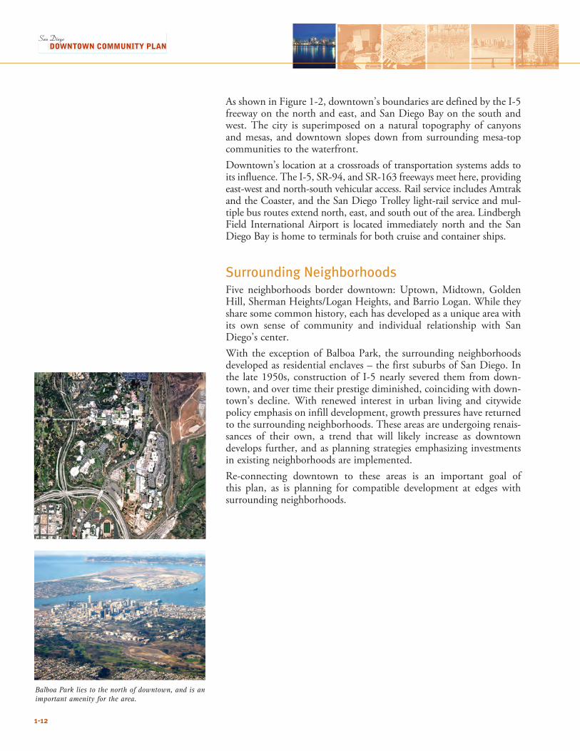
As shown in Figure 1-2, downtown’s boundaries are defined by the I-5 freeway on the north and east, and San Diego Bay on the south and west. The city is superimposed on a natural topography of canyons and mesas, and downtown slopes down from surrounding mesa-top communities to the waterfront.Downtown’s location at a crossroads of transportation systems adds to its influence. The I-5, SR-94, and SR-163 freeways meet here, providing east-west and north-south vehicular access. Rail service includes Amtrak and the Coaster, and the San Diego Trolley light-rail service and mul-tiple bus routes extend north, east, and south out of the area. Lindbergh Field International Airport is located immediately north and the San Diego Bay is home to terminals for both cruise and container ships.
Surrounding NeighborhoodsFive neighborhoods border downtown: Uptown, Midtown, Golden Hill, Sherman Heights/Logan Heights, and Barrio Logan. While they share some common history, each has developed as a unique area with its own sense of community and individual relationship with San Diego’s center. With the exception of Balboa Park, the surrounding neighborhoods developed as residential enclaves – the first suburbs of San Diego. In the late 1950s, construction of I-5 nearly severed them from down-town, and over time their prestige diminished, coinciding with down-town’s decline. With renewed interest in urban living and citywide policy emphasis on infill development, growth pressures have returned to the surrounding neighborhoods. These areas are undergoing renais-sances of their own, a trend that will likely increase as downtown develops further, and as planning strategies emphasizing investments in existing neighborhoods are implemented. Re-connecting downtown to these areas is an important goal of this plan, as is planning for compatible development at edges with surrounding neighborhoods.
The Community Plan is based on research and analysis of existing conditions and trends, changing regional and local conditions, and new citywide growth management policies. It is a result of a two-year collaborative partnership with community members and intense work by a Steering Committee of 35 civic, business, and neighborhood leaders. More than 1,500 people have participated directly in workshops and other forums or offered suggestions for inclusion in the Plan.
The Community Plan is one component of a hierarchical system of plans and development regulations that range from the expression of vision to adopted policy and enforceable build-ing codes and standards. The multiple agencies with development jurisdiction add complexity to downtown development. In this chapter, the planning process for downtown is described, starting first with the Community Plan’s purpose and organization, followed by an explanation of agency jurisdictions, and then related plans and ordinances.
THE PLANNING PROCESS
2
2.1 SCOPE AND PURPOSE OF THE COMMUNITY PLANThe Community Plan is a key document among the system of plans that governs downtown, being targeted directly toward growth and development in the whole of the downtown area. This section outlines its purpose and explains its organization.
PurposeThe Downtown Community Plan is a document adopted by the City Council that serves several purposes:• Establishes land use vision and development policies for downtown,
as a component of the City of San Diego’s General Plan and Progress Report (see Section 2.4: Relationship to Other Plans, Development Regulations, and Guidelines);
• Provides strategies and specific implementing actions that will allow this vision to be accomplished;
• Establishes a basis for evaluating whether specific development pro-posals and public projects are consistent with Plan policies and stan-dards;
• Allows the Centre City Development Corporation (CCDC) and/or the Redevelopment Agency, other public agencies, and private developers to design projects that will enhance the character of the community, taking advantage of its setting and amenities; and
• Provides the basis for detailed plans and implementing programs, such as the Centre City Planned District Ordinance (PDO), Redevelopment Plan for the Centre City Project Area, and Neighborhood Design Guidelines.
A wide range of planning topics—including land use and housing, parks and open space, urban design, transportation, arts and culture, and history—are addressed in the Plan, encompassing the full spectrum of issues related to downtown’s physical development. While the Community Plan articulates a vision for downtown, it is not merely a compendium of ideas and wish lists. The Plan is both general and long-range. Plan policies focus on what is concrete and achievable and set forth actions to be undertaken by CCDC and/or the Redevelopment Agency.
Plan Organization The Community Plan is organized into four parts and 14 chapters, as outlined in Table 2.1. Each chapter contains an approach section at the beginning that describes its contents and relationship to the Plan. Many chapters are divided into sections that deal with specific topics. Each chapter also contains goals and policies (excluding the two introductory ones, and Chapter 6, which only contains goals). These describe major objectives and implementing actions to be taken in order to realize them:
2-2
2-3
• Goals express broad intent;• Policies reflect specific direction, practice, guidance, or directives.
In some instances policies may need to be developed further and/or carried out through implementing plans by CCDC, the Redevelopment Agency, the City or another agency. Where appropriate, standards—items that can be mapped or measured—are also articulated; these standards may be fixed (such as building height) or be performance-based (such as noise level).
Table 2-1: Community Plan Organization
Part Chapter Contents
I. Overview 1. Introduction and Overview
Guiding Principles, history, context
2. The Planning Process
Purpose and scope of the Plan; public participation; planning jurisdictions; relationship to other plans, development regulations, and guidelines; related documents
II. Physical Development 3. Land Use and Housing
Key features of downtown’s structure; land use diagram; intensity and incen-tives; introduction to neighborhoods and centers; residential development; affordable housing, and large facilities
4. Parks, Open Space, and Recreation
Overall concept for open space system including possible new public parks and plazas
5. Urban Design Street grid and views; centers and main street configurations; building bulk, skyline, and sun access criteria; streetscape design; urban design at the water-front; links to surrounding neighborhoods; wayfinding and signs; sustainable development
6. Neighborhoods Background, vision, structure and form of each neighborhood
III. Transportation and Public Facilities
7. Transportation Downtown’s street system; bicycles and pedestrians; transit; parking; demand management
8. Public Facilities and Amenities
Facilities and amenities related to educational resources; police and fire; other community facilities; the civic center; and libraries
9. Historic Resources Description of resources in the downtown area and preservation mechanisms
IV. Community Development
10. Arts and Culture Arts resources and methods to support and enhance the presence of arts
11. Economic Development
Patterns and trends in different sectors; economic development and strategy
12. Health and Human Services
Resources and integration in downtown neighborhoods
13. Safety and Noise Geologic and seismic hazards; hazardous materials; airport influence; and noise
14. Planning Process and Implementation
Process for implementation and amendment, and five-year reviews
2THE PLANNING PROCESS
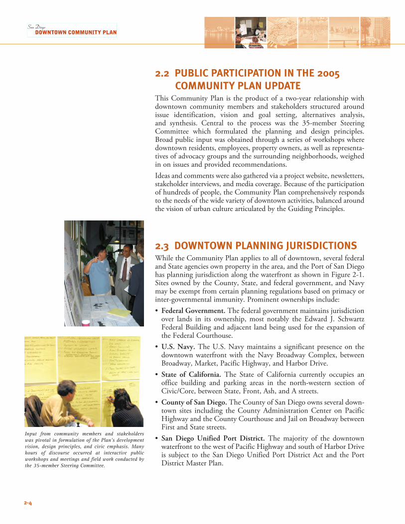
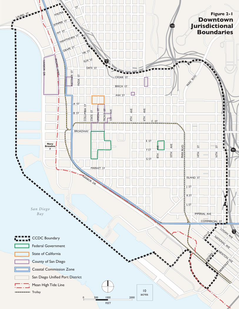
Input from community members and stakeholders was pivotal in formulation of the Plan’s development vision, design principles, and civic emphasis. Many hours of discourse occurred at interactive public workshops and meetings and field work conducted by the 35-member Steering Committee.
2.2 PUBLIC PARTICIPATION IN THE 2005 COMMUNITY PLAN UPDATEThis Community Plan is the product of a two-year relationship with downtown community members and stakeholders structured around issue identification, vision and goal setting, alternatives analysis, and synthesis. Central to the process was the 35-member Steering Committee which formulated the planning and design principles. Broad public input was obtained through a series of workshops where downtown residents, employees, property owners, as well as representa-tives of advocacy groups and the surrounding neighborhoods, weighed in on issues and provided recommendations.Ideas and comments were also gathered via a project website, newsletters, stakeholder interviews, and media coverage. Because of the participation of hundreds of people, the Community Plan comprehensively responds to the needs of the wide variety of downtown activities, balanced around the vision of urban culture articulated by the Guiding Principles.
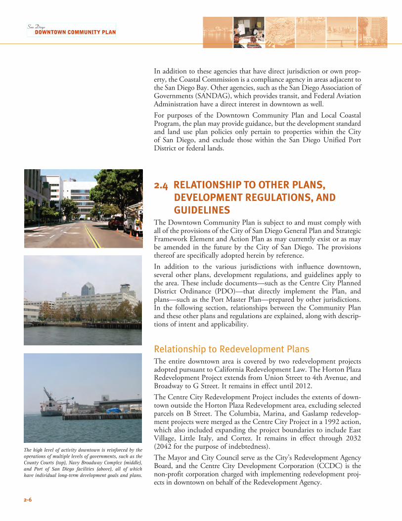
2.3 DOWNTOWN PLANNING JURISDICTIONSWhile the Community Plan applies to all of downtown, several federal and State agencies own property in the area, and the Port of San Diego has planning jurisdiction along the waterfront as shown in Figure 2-1. Sites owned by the County, State, and federal government, and Navy may be exempt from certain planning regulations based on primacy or inter-governmental immunity. Prominent ownerships include:• Federal Government. The federal government maintains jurisdiction
over lands in its ownership, most notably the Edward J. Schwartz Federal Building and adjacent land being used for the expansion of the Federal Courthouse.
• U.S. Navy. The U.S. Navy maintains a significant presence on the downtown waterfront with the Navy Broadway Complex, between Broadway, Market, Pacific Highway, and Harbor Drive.
• State of California. The State of California currently occupies an office building and parking areas in the north-western section of Civic/Core, between State, Front, Ash, and A streets.
• County of San Diego. The County of San Diego owns several down-town sites including the County Administration Center on Pacific Highway and the County Courthouse and Jail on Broadway between First and State streets.
• San Diego Unified Port District. The majority of the downtown waterfront to the west of Pacific Highway and south of Harbor Drive is subject to the San Diego Unified Port District Act and the Port District Master Plan.
2-4
San DiegoBay
94
163
5
5LOGAN AVENATIONAL AVE
NEWTON AVE
HA
RBO
R D
R
LAUREL ST
PAC
IFIC H
WY
BROADWAY
ASH ST
MARKET ST
HARBOR DRPA
RK
BLV
D
PARK
BLV
D
10T
H
AV
E
14T
H
ST
16T
H
ST
8TH
A
VE
6TH
A
VE
4TH
A
VE
1ST
A
VE
FRO
NT
ST
UN
ION
ST
STAT
E S
T
CO
LUM
BIA
ST
IND
IA S
T
KET
TN
ER S
T
JUNIPER ST
IVY ST
HAWTHORN ST
GRAPE ST
FIR ST
KALMIA
ST
ELM ST
DATE ST
CEDAR ST
BEECH ST
A ST
B ST
C ST
E ST
F ST
G ST
ISLAND ST
J ST
K ST
L ST
IMPERIAL AVE
COMMERCIAL ST
NavyBroadwa
y
16TH
STSIG
SBEE
BEARD
SLEY
CCDC Boundary
Federal Government
State of California
County of San Diego
Coastal Commission Zone
San Diego Unified Port District
Mean High Tide Line
Trolley
Figure 2-1
DowntownJurisdictional
Boundaries
FEET
0 500 1000 2000
10acres
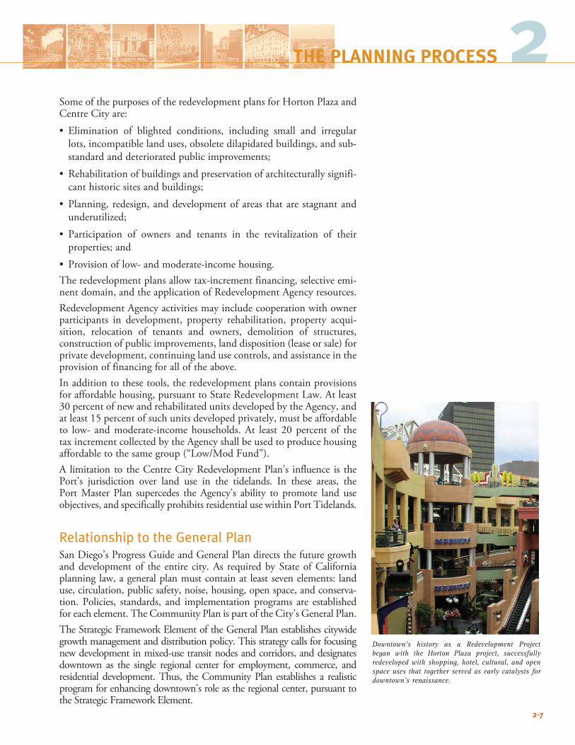
The high level of activity downtown is reinforced by the operations of multiple levels of governments, such as the County Courts (top), Navy Broadway Complex (middle), and Port of San Diego facilities (above), all of which have individual long-term development goals and plans.
2-6
In addition to these agencies that have direct jurisdiction or own prop-erty, the Coastal Commission is a compliance agency in areas adjacent to the San Diego Bay. Other agencies, such as the San Diego Association of Governments (SANDAG), which provides transit, and Federal Aviation Administration have a direct interest in downtown as well.For purposes of the Downtown Community Plan and Local Coastal Program, the plan may provide guidance, but the development standard and land use plan policies only pertain to properties within the City of San Diego, and exclude those within the San Diego Unified Port District or federal lands.
2.4 RELATIONSHIP TO OTHER PLANS, DEVELOPMENT REGULATIONS, AND GUIDELINESThe Downtown Community Plan is subject to and must comply with all of the provisions of the City of San Diego General Plan and Strategic Framework Element and Action Plan as may currently exist or as may be amended in the future by the City of San Diego. The provisions thereof are specifically adopted herein by reference.In addition to the various jurisdictions with influence downtown, several other plans, development regulations, and guidelines apply to the area. These include documents—such as the Centre City Planned District Ordinance (PDO)—that directly implement the Plan, and plans—such as the Port Master Plan—prepared by other jurisdictions. In the following section, relationships between the Community Plan and these other plans and regulations are explained, along with descrip-tions of intent and applicability.
Relationship to Redevelopment PlansThe entire downtown area is covered by two redevelopment projects adopted pursuant to California Redevelopment Law. The Horton Plaza Redevelopment Project extends from Union Street to 4th Avenue, and Broadway to G Street. It remains in effect until 2012. The Centre City Redevelopment Project includes the extents of down-town outside the Horton Plaza Redevelopment area, excluding selected parcels on B Street. The Columbia, Marina, and Gaslamp redevelop-ment projects were merged as the Centre City Project in a 1992 action, which also included expanding the project boundaries to include East Village, Little Italy, and Cortez. It remains in effect through 2032 (2042 for the purpose of indebtedness).The Mayor and City Council serve as the City’s Redevelopment Agency Board, and the Centre City Development Corporation (CCDC) is the non-profit corporation charged with implementing redevelopment proj-ects in downtown on behalf of the Redevelopment Agency.
Downtown’s history as a Redevelopment Project began with the Horton Plaza project, successfully redeveloped with shopping, hotel, cultural, and open space uses that together served as early catalysts for downtown’s renaissance.
2-7
Some of the purposes of the redevelopment plans for Horton Plaza and Centre City are:• Elimination of blighted conditions, including small and irregular
lots, incompatible land uses, obsolete dilapidated buildings, and sub-standard and deteriorated public improvements;
• Rehabilitationofbuildingsandpreservationofarchitecturallysignifi-cant historic sites and buildings;
• Planning,redesign,anddevelopmentofareas thatarestagnantandunderutilized;
• Participation of owners and tenants in the revitalization of their properties; and
• Provisionoflow-andmoderate-incomehousing.The redevelopment plans allow tax-increment financing, selective emi-nent domain, and the application of Redevelopment Agency resources. Redevelopment Agency activities may include cooperation with owner participants in development, property rehabilitation, property acqui-sition, relocation of tenants and owners, demolition of structures, construction of public improvements, land disposition (lease or sale) for private development, continuing land use controls, and assistance in the provision of financing for all of the above. In addition to these tools, the redevelopment plans contain provisions for affordable housing, pursuant to State Redevelopment Law. At least 30 percent of new and rehabilitated units developed by the Agency, and at least 15 percent of such units developed privately, must be affordable to low- and moderate-income households. At least 20 percent of the tax increment collected by the Agency shall be used to produce housing affordable to the same group (“Low/Mod Fund”). A limitation to the Centre City Redevelopment Plan’s influence is the Port’s jurisdiction over land use in the tidelands. In these areas, the Port Master Plan supercedes the Agency’s ability to promote land use objectives, and specifically prohibits residential use within Port Tidelands.
Relationship to the General PlanSan Diego’s Progress Guide and General Plan directs the future growth and development of the entire city. As required by State of California planning law, a general plan must contain at least seven elements: land use, circulation, public safety, noise, housing, open space, and conserva-tion. Policies, standards, and implementation programs are established for each element. The Community Plan is part of the City’s General Plan. The Strategic Framework Element of the General Plan establishes citywide growth management and distribution policy. This strategy calls for focusing new development in mixed-use transit nodes and corridors, and designates downtown as the single regional center for employment, commerce, and residential development. Thus, the Community Plan establishes a realistic program for enhancing downtown’s role as the regional center, pursuant to the Strategic Framework Element.
2THE PLANNING PROCESS
The City’s Local Coastal Program (LCP) guides development and improvements in the city’s coastal zones under the jurisdiction of the California Coastal Commission. In downtown, this encompasses the area roughly three blocks inland from the San Diego Bay, as shown in Figure 2-1. The overarching goals of the LCP (mandated by the Coastal Commission) are to protect public shoreline access, coastal resources, and views, and ensure sufficient visitor-serving and recreational uses. The Community Plan along with the applicable PDOs for downtown together comprise the LCP for Centre City.As a component of the General Plan and Progress Guide, the Downtown Community Plan is consistent with the policies, standards, and imple-mentation programs established for the seven elements. Similarly, the Community Plan, along with the revised Centre City PDO, meets the California Coastal Commission requirements for the LCP.
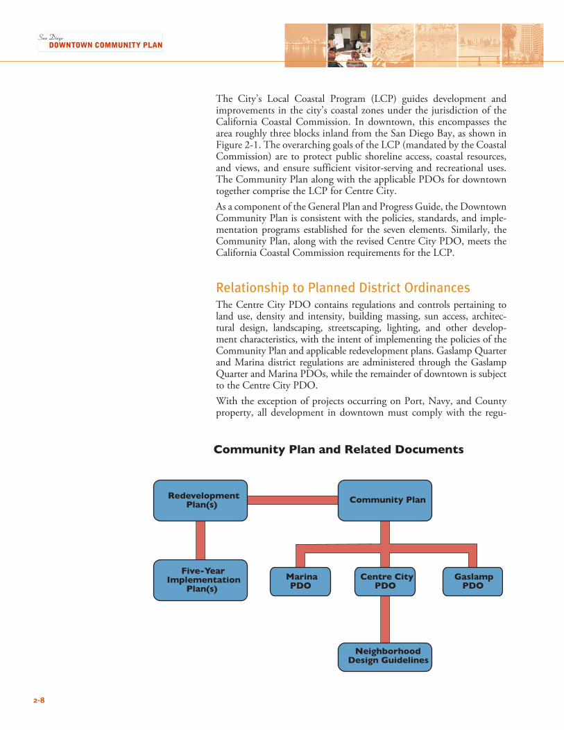
Relationship to Planned District OrdinancesThe Centre City PDO contains regulations and controls pertaining to land use, density and intensity, building massing, sun access, architec-tural design, landscaping, streetscaping, lighting, and other develop-ment characteristics, with the intent of implementing the policies of the Community Plan and applicable redevelopment plans. Gaslamp Quarter and Marina district regulations are administered through the Gaslamp Quarter and Marina PDOs, while the remainder of downtown is subject to the Centre City PDO.With the exception of projects occurring on Port, Navy, and County property, all development in downtown must comply with the regu-
Community Plan and Related Documents
NeighborhoodDesign Guidelines
Community Plan
Centre CityPDO
MarinaPDO
GaslampPDO
RedevelopmentPlan(s)
Five-YearImplementation
Plan(s)
2-8
lations set forth in the downtown PDOs (Centre City, Marina, and Gaslamp Quarter). These documents supersede the conventional city-wide zoning in the Land Development Code. For those development matters where the PDOs are silent, the regulations of the citywide zoning apply.
Relationship to Neighborhood Design GuidelinesDowntown San Diego is a collection of unique neighborhoods with their own histories and culture, development trends, and environmen-tal characteristics. The Neighborhood Design Guidelines elaborate on implementation of the policies and regulations in the Community Plan and PDOs, for the purpose of protecting and nurturing the individual qualities of the neighborhoods. While the Community Plan and PDOs are regulatory, the Neighborhood Design Guidelines are not; they are advisory and to be used as the basis for design review by CCDC and/or the Redevelopment Agency. Preparation of the Neighborhood Design Guidelines will follow adoption of the Community Plan.The Neighborhood Design Guidelines fulfill three major purposes: • Serve as a companion to the Community Plan and the PDOs.
Complementing the policies in the Community Plan and quanti-fied development and design standards defined in the PDOs, the Guidelines address qualitative aspects related to design and develop-ment (such as color, building materials, and facade articulation).
• Provide greater detail, where appropriate, on streetscapes, parks, and other aspects of the public realm.
• Help identify priorities for streetscape and other public improve-ments within each neighborhood.
All aspects of the Guidelines will be fully consistent with all aspects of the Community Plan and the PDOs.
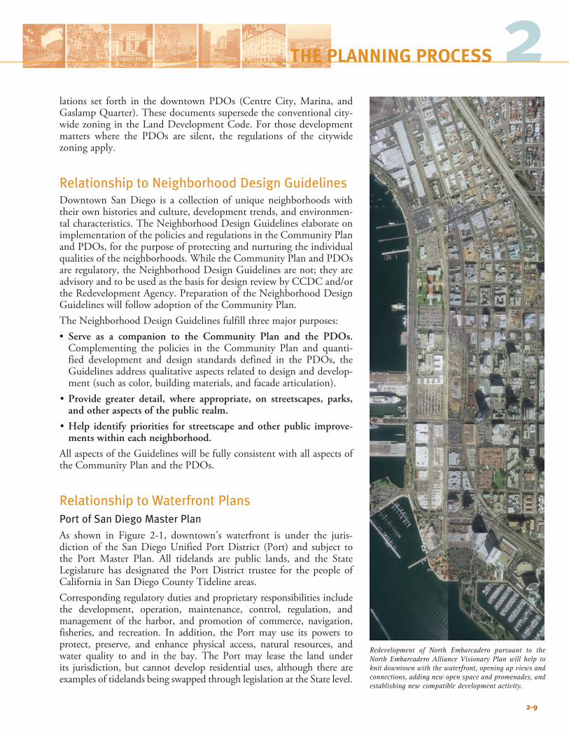
Relationship to Waterfront PlansPort of San Diego Master Plan As shown in Figure 2-1, downtown’s waterfront is under the juris-diction of the San Diego Unified Port District (Port) and subject to the Port Master Plan. All tidelands are public lands, and the State Legislature has designated the Port District trustee for the people of California in San Diego County Tideline areas.Corresponding regulatory duties and proprietary responsibilities include the development, operation, maintenance, control, regulation, and management of the harbor, and promotion of commerce, navigation, fisheries, and recreation. In addition, the Port may use its powers to protect, preserve, and enhance physical access, natural resources, and water quality to and in the bay. The Port may lease the land under its jurisdiction, but cannot develop residential uses, although there are examples of tidelands being swapped through legislation at the State level.
2-9
Redevelopment of North Embarcadero pursuant to the North Embarcadero Alliance Visionary Plan will help to knit downtown with the waterfront, opening up views and connections, adding new open space and promenades, and establishing new compatible development activity.
2THE PLANNING PROCESS
2-10
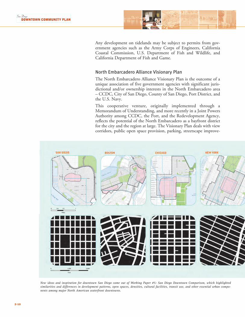
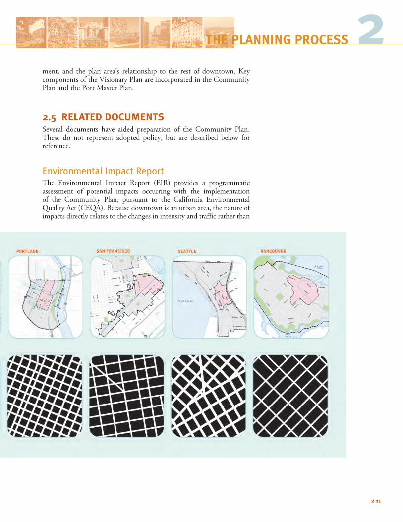
New ideas and inspiration for downtown San Diego came out of Working Paper #5: San Diego Downtown Comparison, which highlighted similarities and differences in development patterns, open spaces, densities, cultural facilities, transit use, and other essential urban compo-nents among major North American waterfront downtowns.
Any development on tidelands may be subject to permits from gov-ernment agencies such as the Army Corps of Engineers, California Coastal Commission, U.S. Department of Fish and Wildlife, and California Department of Fish and Game.
North Embarcadero Alliance Visionary PlanThe North Embarcadero Alliance Visionary Plan is the outcome of a unique association of five government agencies with significant juris-dictional and/or ownership interests in the North Embarcadero area – CCDC, City of San Diego, County of San Diego, Port District, and the U.S. Navy.This cooperative venture, originally implemented through a Memorandum of Understanding, and more recently in a Joint Powers Authority among CCDC, the Port, and the Redevelopment Agency, reflects the potential of the North Embarcadero as a bayfront district for the city and the region at large. The Visionary Plan deals with view corridors, public open space provision, parking, streetscape improve-
2-11
ment, and the plan area’s relationship to the rest of downtown. Key components of the Visionary Plan are incorporated in the Community Plan and the Port Master Plan.
2.5 RELATED DOCUMENTSSeveral documents have aided preparation of the Community Plan. These do not represent adopted policy, but are described below for reference.
Environmental Impact ReportThe Environmental Impact Report (EIR) provides a programmatic assessment of potential impacts occurring with the implementation of the Community Plan, pursuant to the California Environmental Quality Act (CEQA). Because downtown is an urban area, the nature of impacts directly relates to the changes in intensity and traffic rather than
2THE PLANNING PROCESS
2-12
effects on natural resources. Potential impacts were anticipated during preparation of the Community Plan, and many of the policies and implementing regulations are designed to reduce or avoid such impacts.CCDC has an established process for accomplishing environmental review for individual development projects. As projects are proposed, CCDC prepares a Secondary Study to determine whether the poten-tial impacts of the development are anticipated in the EIR analysis. Depending on the conclusions of the secondary study, a determina-tion is made on the requirement for a Negative Declaration, Mitigated Negative Declaration, or Supplemental or Focused EIR for the project. To the extent that a project is consistent with the EIR no further envi-ronmental review may be necessary.
Existing Conditions, Opportunities, and ChallengesA key step in the preparation of the Downtown Community Plan was preparation of Working Paper #6:DowntownOpportunities andChallenges,which evaluates background conditions and development prospects. It focuses on key components relating to downtown’s physi-cal structure: land use, urban design, parks, connections and linkages, arts and culture, social service facilities, public health and safety, and historic and environmental resources. Maps depicting opportunities and challenges related to these planning components are included as well. This working paper served as one of the bases for preparing the land use and urban design alternatives considered during preparation of the Community Plan.
Other Working PapersA series of working papers and studies gathering community input, compiling background information, and comparing downtown to other major city centers was prepared as part of the Community Plan update. They are:•WorkingPaper#1–ReportonStakeholderInterviews•WorkingPaper#2–ReportonPublicWorkshops,PlanningIssues,
and Vision•WorkingPaper#3–DraftPlanningPrinciples• WorkingPaper#4–DemographicandMarketAssessment•WorkingPaper#5–SanDiegoDowntownComparison•WorkingPaper#6–DowntownOpportunitiesandChallenges•WorkingPaper#7–Alternatives• DowntownArtsFacilitiesDemandStudy• PreliminaryDraftPreferredPlan
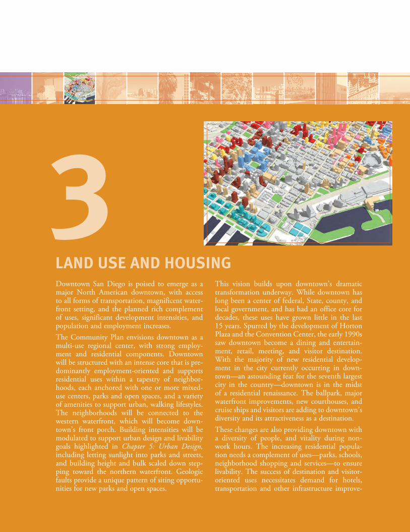
Downtown San Diego is poised to emerge as a major North American downtown, with access to all forms of transportation, magnificent water-front setting, and the planned rich complement of uses, significant development intensities, and population and employment increases.The Community Plan envisions downtown as a multi-use regional center, with strong employ-ment and residential components. Downtown will be structured with an intense core that is pre-dominantly employment-oriented and supports residential uses within a tapestry of neighbor-hoods, each anchored with one or more mixed-use centers, parks and open spaces, and a variety of amenities to support urban, walking lifestyles. The neighborhoods will be connected to the western waterfront, which will become down-town’s front porch. Building intensities will be modulated to support urban design and livability goals highlighted in Chapter 5: Urban Design, including letting sunlight into parks and streets, and building height and bulk scaled down step-ping toward the northern waterfront. Geologic faults provide a unique pattern of siting opportu-nities for new parks and open spaces.
This vision builds upon downtown’s dramatic transformation underway. While downtown has long been a center of federal, State, county, and local government, and has had an office core for decades, these uses have grown little in the last 15 years. Spurred by the development of Horton Plaza and the Convention Center, the early 1990s saw downtown become a dining and entertain-ment, retail, meeting, and visitor destination. With the majority of new residential develop-ment in the city currently occurring in down-town—an astounding feat for the seventh largest city in the country—downtown is in the midst of a residential renaissance. The ballpark, major waterfront improvements, new courthouses, and cruise ships and visitors are adding to downtown’s diversity and its attractiveness as a destination.These changes are also providing downtown with a diversity of people, and vitality during non-work hours. The increasing residential popula-tion needs a complement of uses—parks, schools, neighborhood shopping and services—to ensure livability. The success of destination and visitor-oriented uses necessitates demand for hotels, transportation and other infrastructure improve-
LAND USE AND HOUSING
3
ments, as well as parking. The synergies between various uses will draw new workers and residents; support an increasing array of museums, theaters, and arts; and enable sharing of infrastructure and resources. Achieving the vision for downtown requires continued redevelopment with an array of uses; ensuring balanced neighborhood development; expansion of arts and culture; improved connections; more “people places”; and better integration of downtown with the waterfront, Balboa Park, and surrounding communities. This chapter of the Community Plan focuses on strategies to: • Ensureanoverallbalanceofusesthatfurthersdowntown’sroleasthe
premier regional population, commercial, civic, cultural, and visitor center;
• Fosteradiversemixofusesineachneighborhoodtosupporturbanlifestyles;
• Achievebuildingintensitiesthatensureefficientuseofavailableland;• Attainanoverallemploymentlevelofapproximately165,000quality
jobs to reflect downtown’s role as the premier employment center in the region;
• Target a residential buildout population of approximately 90,000people of diverse incomes to create vitality, a market for a broad array of supporting stores and services, and opportunities for living close to jobs and transit; and
• Enhance livability through arrangement of land uses and develop-ment intensities, including development of a system of neighbor-hoods sized for walking.
3.1 STRUCTURE AND LAND USESize and Physical StructureSizeDowntown encompasses 1,445 acres, and its population could reach approximately 90,000 under this Plan. A walk across the area takes approximatelyonehalfhourfromthewaterfrontto16thStreetorfromLittle Italy to the ballpark – longer than most people would usually spend to run an errand. Of the eight downtowns compared in Working Paper #5: San Diego Downtown Comparison, San Diego’s was one of the largest. Smaller neighborhoods sized for walking will support overall down-town legibility and complexity, especially critical given downtown’s size. Locating parks and open spaces along fault lines, and distinct land use concentrations, building intensities, and bulk requirements will help establish differentiation, so that the urban panorama, character, and sense of space, will change across different neighborhoods. In addi-tion, Neighborhood Design Guidelines—customized for individual neighborhoods—will help establish distinction and identity.
3-2
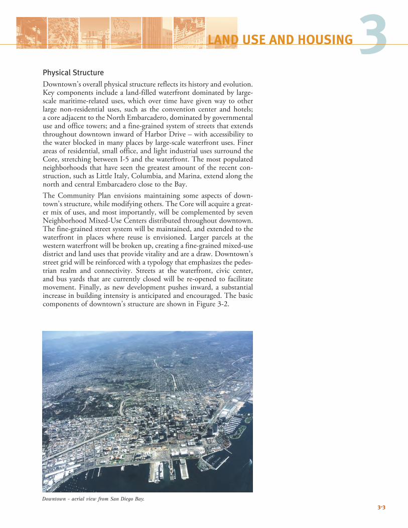
3Physical StructureDowntown’s overall physical structure reflects its history and evolution. Key components include a land-filled waterfront dominated by large-scale maritime-related uses, which over time have given way to other large non-residential uses, such as the convention center and hotels; acoreadjacenttotheNorthEmbarcadero,dominatedbygovernmentaluse and office towers; and a fine-grained system of streets that extends throughout downtown inward of Harbor Drive – with accessibility to thewaterblockedinmanyplacesbylarge-scalewaterfrontuses.Finerareas of residential, small office, and light industrial uses surround the Core, stretching between I-5 and the waterfront. The most populated neighborhoods that have seen the greatest amount of the recent con-struction, such as Little Italy, Columbia, and Marina, extend along the northandcentralEmbarcaderoclosetotheBay.The Community Plan envisions maintaining some aspects of down-town’s structure, while modifying others. The Core will acquire a great-er mix of uses, and most importantly, will be complemented by seven Neighborhood Mixed-Use Centers distributed throughout downtown. The fine-grained street system will be maintained, and extended to the waterfront in places where reuse is envisioned. Larger parcels at the western waterfront will be broken up, creating a fine-grained mixed-use district and land uses that provide vitality and are a draw. Downtown’s street grid will be reinforced with a typology that emphasizes the pedes-trian realm and connectivity. Streets at the waterfront, civic center, and bus yards that are currently closed will be re-opened to facilitate movement.Finally,asnewdevelopmentpushes inward,a substantialincrease in building intensity is anticipated and encouraged. The basic componentsofdowntown’sstructureareshowninFigure3-2.
3-3
LAND USE AND HOUSING
Downtown - aerial view from San Diego Bay.
CE
NT
RE
CIT
Y C
OM
MU
MN
ITY
PL
AN
HA
RBO
R D
R
LAUREL ST
PAC
IFIC H
WY
ASH ST
MARKET ST
HARBOR DR
PAR
K B
LVD
PARK
BLV
D
10T
H
AV
E
14T
H
ST
16T
H
ST
8TH
A
VE
6TH
A
VE
4TH
A
VE
1ST
A
VE
FRO
NT
ST
UN
ION
ST
STAT
E S
T
CO
LUM
BIA
ST
IND
IA S
T
KET
TN
ER S
T
CA
LIFO
RN
IA S
T
JUNIPER ST
IVY ST
HAWTHORN ST
GRAPE ST
FIR ST
KALMIA ST
ELM ST
DATE ST
CEDAR ST
BEECH ST
A ST
B ST
C ST
E ST
F ST
G ST
ISLAND ST
J ST
K ST
L ST
IMPERIAL AVE
COMMERCIAL ST
BROADWAY
5
FEET
0 500 1000 2000
10acres
MEAN HIGH TIDE LINE
Figure 3-1
Downtown Aerial
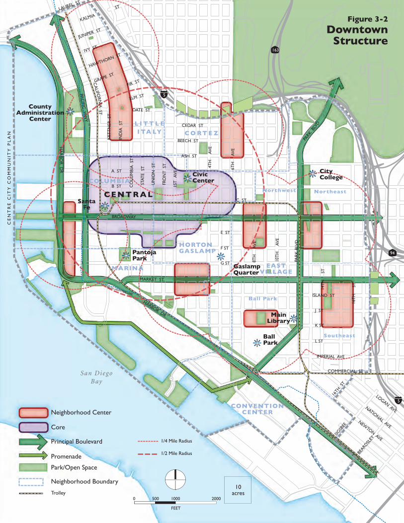
C O RT E Z
L I T T L EI TA LY
COLUMBIA
HORTONGASLAMP
EASTVILLAGE
CONVENTIONCENTER
San DiegoBay
CE
NT
RE
CIT
Y C
OM
MU
NIT
Y P
LA
N
Principal Boulevard
Promenade
1/4 Mile Radius
1/2 Mile Radius
Park/Open Space
Trolley
Neighborhood Boundary
Neighborhood Center
Core
Santa Fe
FEET
0 500 1000 2000
10acres
LOGAN AVENATIONAL AVE
NEWTON AVE
HA
RBO
R D
R
LAUREL ST
PAC
IFIC H
WY
BROADWAY
ASH ST
MARKET ST
HARBOR DR
PAR
K B
LVD
PARK
BLV
D
10T
H
AV
E
14T
H
ST
16T
H
ST
8TH
A
VE
6TH
A
VE
4TH
A
VE
1ST
A
VE
FRO
NT
ST
UN
ION
ST
STAT
E S
T
CO
LUM
BIA
ST
IND
IA S
T
KET
TN
ER S
T
JUNIPER ST
IVY ST
HAWTHORN ST
GRAPE ST
FIR ST
KALMIA
ST
ELM ST
DATE ST
CEDAR ST
BEECH ST
A ST
B ST
C ST
E ST
F ST
G ST
ISLAND ST
J ST
K ST
L ST
IMPERIAL AVE
COMMERCIAL ST
CA
LIFORN
IA ST
94
163
5
5
C E N T R A L
16TH
ST
SIGSB
EE
BEARD
SLEY
MEAN HIGH TIDE LINE
MARINA
Figure 3-2
DowntownStructure
CivicCenter
PantojaPark
GaslampQuarter
Ball Park
MainLibrary
BallPark
Southeast
City College
Northwest Northeast
CountyAdministration
Center
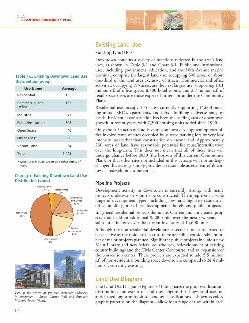
Two of the scores of projects currently underway in downtown – Smart Corner (left) and Pinnacle Museum Tower (right).
3-6
Other Uses46%
Vacant Land2% Residential
9%
Commercialand Office
13%
Public/Institutional
22%
Open Space3%
Industrial5%
Existing Land UseExisting Land UseDowntown contains a variety of functions reflected in the area’s land uses, as shown inTable 3-1 andChart 3-1. Public and institutionaluses, including government, education, and the 10th Avenue marine terminal,comprisethelargestlanduse,occupying308acres,oraboutone-third of the land area exclusive of streets. Commercial and office activities,occupying195acres,arethenextlargestuse,supporting13.1millions.f.ofofficespace,8,800hotelrooms,and2.7millions.f.ofretail space (uses are those expected to remain under the Community Plan). Residentialusesoccupy135acres,currentlysupporting14,600hous-ing units—SROs, apartments, and lofts—fulfilling a diverse range of needs. Residential construction has been the leading area of downtown growthinrecentyears,with7,300housingunitsaddedsince1990.Onlyabout34acresoflandisvacant,somostdevelopmentopportuni-ties involve reuse of sites occupied by surface parking lots or very low intensity uses rather than construction on vacant land. Approximately 230 acres of land have reasonable potential for reuse/intensificationover the long-term. This does not mean that all of these sites will undergochangebefore2030(thehorizonofthiscurrentCommunityPlan), or that other sites not included in this acreage will not undergo change; this acreage simply provides a reasonable assessment of down-town’s redevelopment potential.
Pipeline ProjectsDevelopment activity in downtown is currently strong, with many projects underway or soon to be constructed. These represent a wide range of development types, including low- and high-rise residential, office buildings, mixed-use developments, hotels, and public projects. In general, residential projects dominate. Current and anticipated proj-ects could addanadditional9,200unitsover thenext fewyears– asubstantialincreaseoverthecurrentinventoryof14,600units.Although the non-residential development sector is not anticipated to be as active as the residential sector, there are still a considerable num-ber of major projects planned. Significant public projects include a new Main Library and new federal courthouses, redevelopment of existing county buildings and the Civic Center Concourse, and an expansion of the convention center. These projects are expected to add 5.5 million s.f.ofnon-residentialbuildingspacedowntown,comparedto24.4mil-lion s.f. currently existing.
Land Use DiagramTheLandUseDiagram(Figure3-4)designatestheproposedlocation,distribution, and extent of landuses. Figure 3-3 shows landuses onanticipatedopportunitysites.Landuseclassifications—shownascolor/graphic patterns on the diagram—allow for a range of uses within each
Use Name Acreage
Residential 135
Commercial and Office
195
Industrial 77
Public/Institutional 308
Open Space 46
Other Uses* 650
Vacant Land 34
Total 1,445
* Other uses include streets and other rights-of-way.
Chart 3-1: Existing Downtown Land Use Distribution (2004)
Table 3-1: Existing Downtown Land Use Distribution (2004)
3-7
Downtown has a comprehensive range of uses, including hotels (top), mixed-use developments (offic-es, hotel, and Symphony Hall; middle), and court-houses (bottom).
3classification.Allowablebuildingintensities(floorarearatiosorFARs)areindependentofuse,andaredelineatedinSection3.2.The diagram is a graphic representation of policies contained in the Community Plan; it is to be used and interpreted only in conjunction with the text and other figures contained in the Community Plan. The legend of the Land Use Diagram abbreviates the land use classifications describedbelow.Forgreaterspecificityonallowedlandusesonspecificsites, the pertinent Planned District Ordinances (Centre City, Marina, and Gaslamp Quarter) should be consulted.
Land Use Classification SystemThe classifications in this section represent adopted policy and are meant to be broad enough to provide flexibility in implementation, but clear enough to provide sufficient direction to carry out the Community Plan. In addition to the direction related to the uses provided here, public uses, including parks, government offices, police and fire stations, and public schools, are permitted in all land use classifications.
Ballpark Mixed Use Mixed uses in the Ballpark District will accommodate major sporting facilities and visitor attractions. The classification contains a broad array of other uses, including eating and drinking establishments, hotels, offices, research and development facilities, cultural and residential uses, live/workuse,andparking.
Core This classification is primarily intended to encourage, support, and enhance the Core as a high-intensity office and employment center. AreaswiththisdesignationincludeCivic/CoreandmostofColumbia.The Community Plan supports the Core’s role as a center of regional importance and as a primary hub for business, communications, office, and hotels, with fewer restrictions on building bulk and tower separa-tion than in other districts. The Core accommodates mixed-use (office combined with hotel, residential, and other uses) projects as important components of the area’s vitality. Retail, cultural, educational, civic and governmental, and entertainment uses are also permitted. All develop-ment is required to be pedestrian-oriented.
Employment/Residential Mixed-Use This classification provides synergies between educational institutions and residential neighborhoods, or transition between the Core and residential neighborhoods. It also encompasses Horton Plaza. The clas-sification permits a variety of uses, including office, residential, hotel, research and development, and educational and medical facilities.
LAND USE AND HOUSING
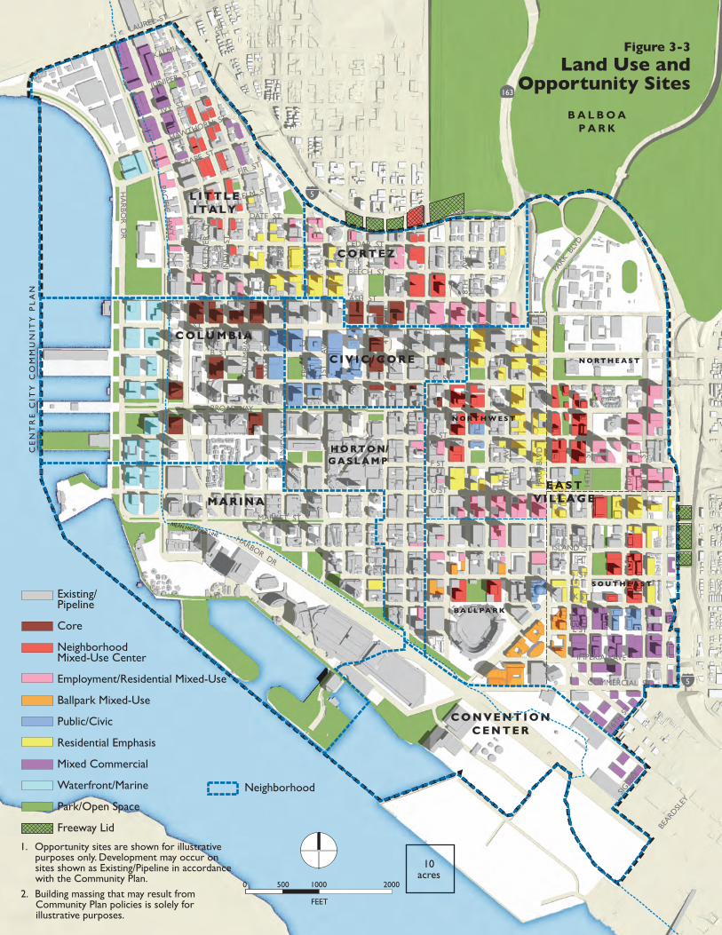
CE
NT
RE
CIT
Y C
OM
MU
NIT
Y P
LA
N
1. Opportunity sites are shown for illustrative purposes only. Development may occur on sites shown as Existing/Pipeline in accordance with the Community Plan.
2. Building massing that may result from Community Plan policies is solely for illustrative purposes.
N O R T H W E S T
N O R T H E A S T
S O U T H E A S T
B A L L PA R K
Existing/Pipeline
Core
NeighborhoodMixed-Use Center
Employment/Residential Mixed-Use
Ballpark Mixed-Use
Public/Civic
Residential Emphasis
Mixed Commercial
Waterfront/Marine
Park/Open Space
Freeway Lid
Neighborhood
MEAN HIGH TIDE LINE
Figure 3-3
Land Use andOpportunity Sites
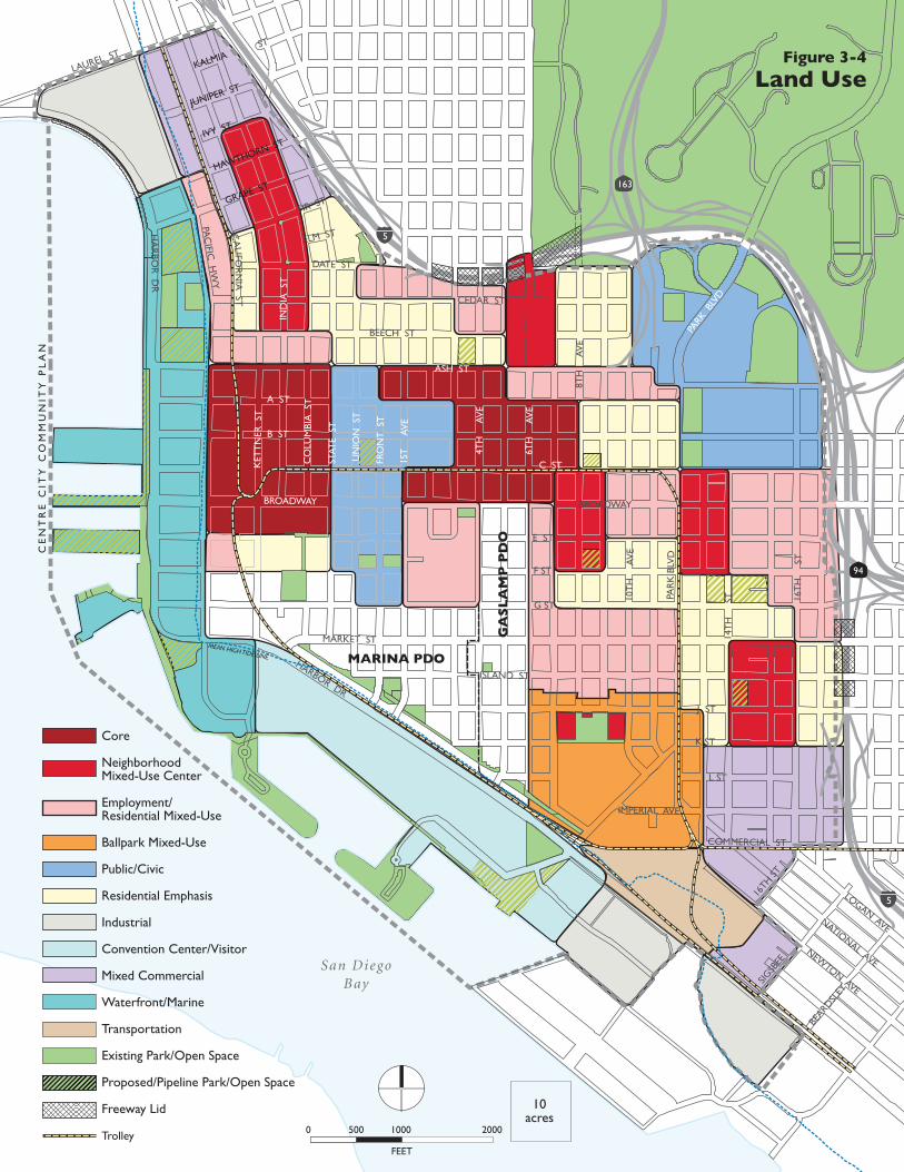
CE
NT
RE
CIT
Y C
OM
MU
NIT
Y P
LA
N
San DiegoBay
Core
NeighborhoodMixed-Use Center
Employment/Residential Mixed-Use
Ballpark Mixed-Use
Public/Civic
Residential Emphasis
Industrial
Convention Center/Visitor
Mixed Commercial
Waterfront/Marine
Transportation
Existing Park/Open Space
Proposed/Pipeline Park/Open Space
Freeway Lid
Trolley
HA
RBO
R D
R
LAUREL ST
PAC
IFIC H
WY
ASH ST
MARKET ST
HARBOR DR
PAR
K B
LVD
PARK
BLV
D
10T
H
AV
E
14T
H
ST 16
TH
S
T
8TH
A
VE
6TH
A
VE
4TH
A
VE
1ST
A
VE
FRO
NT
ST
UN
ION
ST
STAT
E S
T
CO
LUM
BIA
ST
IND
IA S
T
KET
TN
ER S
T
JUNIPER ST
IVY ST
HAWTHORN ST
GRAPE ST
FIR ST
KALMIAST
ELM ST
DATE ST
CEDAR ST
BEECH ST
A ST
B ST
C ST
E ST
F ST
G ST
ISLAND ST
J ST
K ST
L ST
IMPERIAL AVE
COMMERCIAL ST
BROADWAY
163
94
5
5CA
LIFOR
NIA
ST
BROADWAY
16TH
ST
SIGSB
EE
BEARD
SLEY
GA
SL
AM
P P
DO
LOGAN AVENATIONAL AVE
NEWTON AVE
FEET
0 500 1000 2000
10acres
MEAN HIGH TIDE LINE
Figure 3-4
Land Use
MARINA PDO
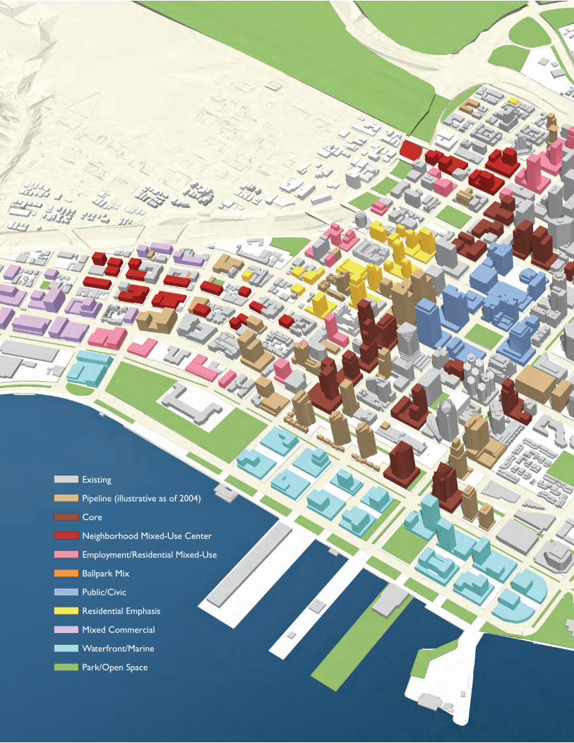
Figure 3-5Overall View with Land Use
and Opportunity Sites
Existing
Pipeline (illustrative as of 2004)
Core
Neighborhood Mixed-Use Center
Employment/Residential Mixed-Use
Ballpark Mix
Public/Civic
Residential Emphasis
Mixed Commercial
Waterfront/Marine
Park/Open Space
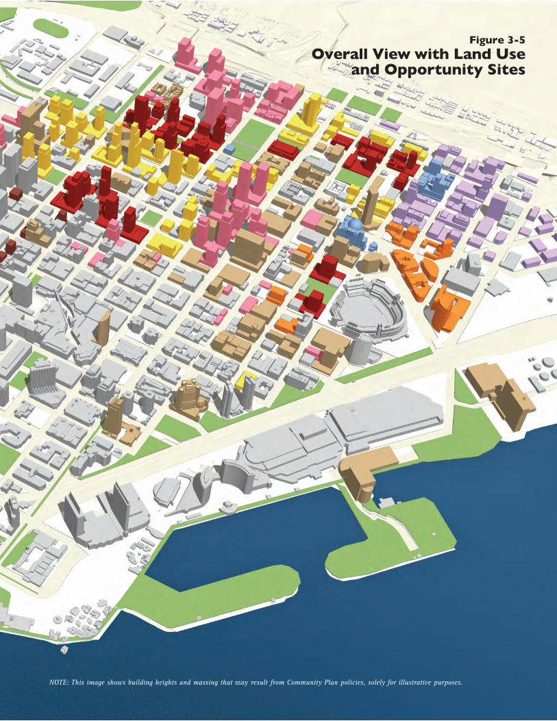
Figure 3-5Overall View with Land Use
and Opportunity Sites
Existing
Pipeline (illustrative as of 2004)
Core
Neighborhood Mixed-Use Center
Employment/Residential Mixed-Use
Ballpark Mix
Public/Civic
Residential Emphasis
Mixed Commercial
Waterfront/Marine
Park/Open Space
NOTE: This image shows building heights and massing that may result from Community Plan policies, solely for illustrative purposes.
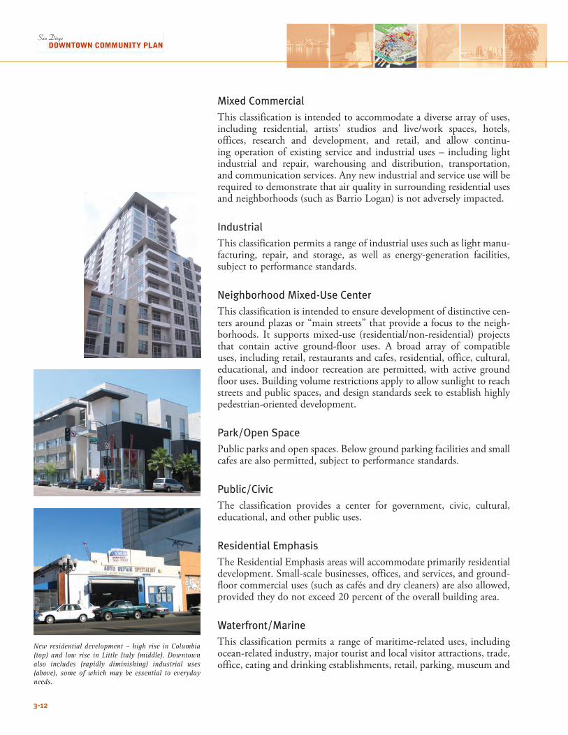
3-12
Mixed Commercial This classification is intended to accommodate a diverse array of uses, including residential, artists’ studios and live/work spaces, hotels,offices, research and development, and retail, and allow continu-ing operation of existing service and industrial uses – including light industrial and repair, warehousing and distribution, transportation, and communication services. Any new industrial and service use will be required to demonstrate that air quality in surrounding residential uses and neighborhoods (such as Barrio Logan) is not adversely impacted.
Industrial This classification permits a range of industrial uses such as light manu-facturing, repair, and storage, as well as energy-generation facilities, subject to performance standards.
Neighborhood Mixed-Use Center This classification is intended to ensure development of distinctive cen-ters around plazas or “main streets” that provide a focus to the neigh-borhoods. It supportsmixed-use (residential/non-residential) projectsthat contain active ground-floor uses. A broad array of compatible uses, including retail, restaurants and cafes, residential, office, cultural, educational, and indoor recreation are permitted, with active ground floor uses. Building volume restrictions apply to allow sunlight to reach streets and public spaces, and design standards seek to establish highly pedestrian-oriented development. Park/Open Space Public parks and open spaces. Below ground parking facilities and small cafes are also permitted, subject to performance standards.
Public/Civic The classification provides a center for government, civic, cultural, educational, and other public uses.
Residential Emphasis TheResidentialEmphasisareaswillaccommodateprimarilyresidentialdevelopment. Small-scale businesses, offices, and services, and ground-floor commercial uses (such as cafés and dry cleaners) are also allowed, providedtheydonotexceed20percentoftheoverallbuildingarea.
Waterfront/Marine This classification permits a range of maritime-related uses, including ocean-related industry, major tourist and local visitor attractions, trade, office, eating and drinking establishments, retail, parking, museum and
New residential development – high rise in Columbia (top) and low rise in Little Italy (middle). Downtown also includes (rapidly diminishing) industrial uses (above), some of which may be essential to everyday needs.
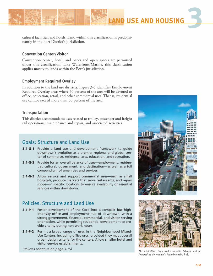
cultural facilities, and hotels. Land within this classification is predomi-nantly in the Port District’s jurisdiction.
Convention Center/VisitorConvention center, hotel, and parks and open spaces are permitted under this classification. Like Waterfront/Marine, this classificationapplies mostly to lands within the Port’s jurisdiction.
Employment Required OverlayInadditiontothelandusedistricts,Figure3-6identifiesEmploymentRequired Overlay areas where 50 percent of the area will be devoted to office, education, retail, and other commercial uses. That is, residential use cannot exceed more than 50 percent of the area.
TransportationThis district accommodates uses related to trolley, passenger and freight rail operations, maintenance and repair, and associated activities.
Goals: Structure and Land Use3.1-G-1 Provide a land use and development framework to guide
downtown’s evolution as a premier regional and global cen-ter of commerce, residence, arts, education, and recreation.
3.1-G-2 Provide for an overall balance of uses—employment, residen-tial, cultural, government, and destination—as well as a full compendium of amenities and services.
3.1-G-3 Allow service and support commercial uses—such as small hospitals, produce markets that serve restaurants, and repair shops—in specific locations to ensure availability of essential services within downtown.
Policies: Structure and Land Use3.1-P-1 Foster development of the Core into a compact but high-
intensity office and employment hub of downtown, with a strong government, financial, commercial, and visitor-serving orientation, while permitting residential development to pro-vide vitality during non-work hours.
3.1-P-2 Permit a broad range of uses in the Neighborhood Mixed-Use Centers, including office uses, provided they meet overall urban design criteria for the centers. Allow smaller hotel and visitor-service establishments.
(Policies continue on page 3-15)
3-13
The Civic/Core (top) and Columbia (above) will be fostered as downtown’s high-intensity hub.
3LAND USE AND HOUSING
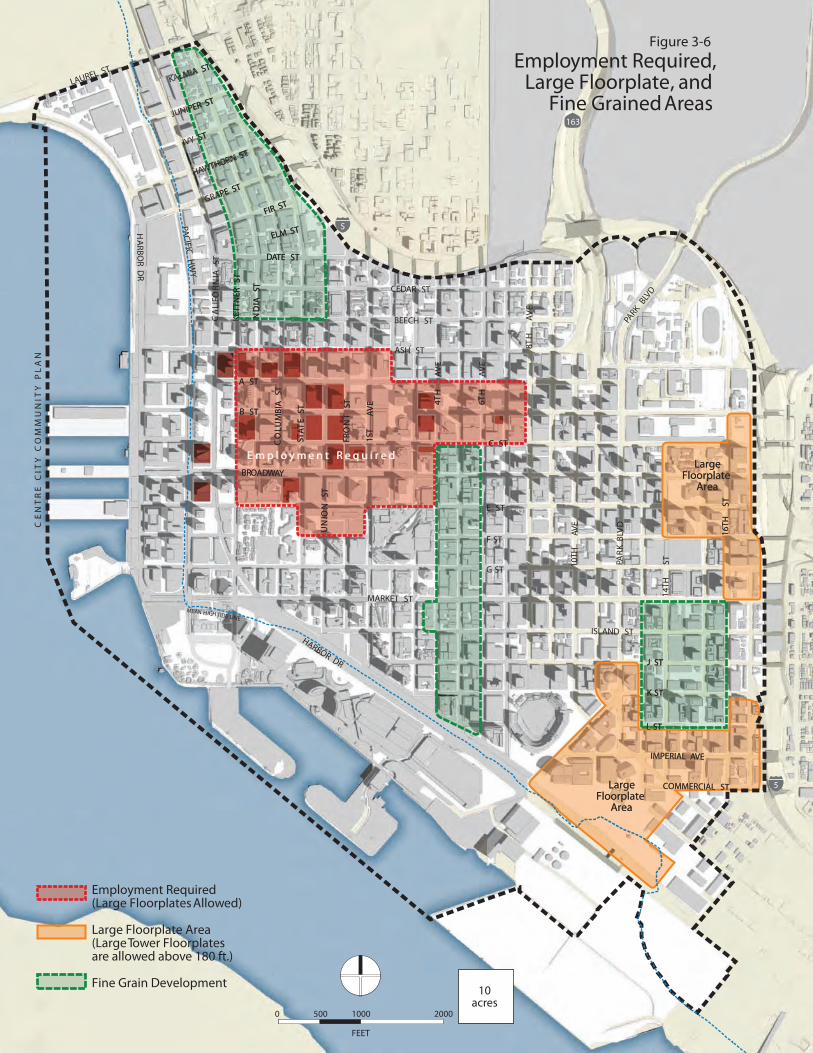
J ST
K ST
L ST
TSAI
DNKE
TTN
ERST
IPER ST
Y ST
WTHORN ST
GRAPE ST
FIR ST
ALMIA ST
ELM ST
DATE ST
IMPERIAL AVE
COMMERCIAL STLargeFloorplate
Area
6TH
4TH
EVA
TS1
TST
NORF
TSN
OIN
U
TS ETATS
TS AIB
MUL
OC
A ST
B ST
C ST
BROADWAY
E m p l o y m e n t R e q u i r e d
16TH
S
T
LargeFloorplate
Area
CE
NT
RE
CIT
YC
OM
MU
NIT
YP
LA
NFigure 3-6
Employment Required,Large Floorplate, and
Fine Grained Areas
HA
RBOR D
R
LAUREL ST
PACIFICH
WY
ASH ST
MARKET ST
HARBOR DR
DVLB
KR
APPA
RKBLV
D
10TH
AVE
14TH
ST
16TH
S
T
EVA
HT8
EVA
HT6
EVA
HT4E
VATS1
TST
NORF
TSN
OIN
U
TS ETATS
TS AIB
MUL
OC
TSAI
DNIKE
TTN
ERST
TSAI
NR
OFILA
C
JUNIPER ST
IVY ST
HAWTHORN ST
GRAPE ST
FIR ST
KALMIA ST
ELM ST
DATE ST
CEDAR ST
BEECH ST
A ST
B ST
C ST
E ST
F ST
G ST
ISLAND ST
J ST
K ST
L ST
IMPERIAL AVE
COMMERCIAL ST
BROADWAY
163
5
5
LargeFloorplate
Area
LargeFloorplate
Area
E m p l o y m e n t R e q u i r e d
Employment Required(Large Floorplates Allowed)
Large Floorplate Area(Large Tower Floorplatesare allowed above 180 ft.)
Fine Grain Development
FEET
0 500 1000 2000
10acres
MEAN HIGHTIDE LINE
3-15
3(Policies continued from page 3-13)
3.1-P-3 To ensure vitality, develop concentrations of retail centers and streets as shown in Figure 3-7 with:
• Required retail, restaurants, and other similar active com-mercial uses at the ground level along designated Main Streets.
• Required commercial (such as offices, live/work spaces, galleries, hotel lobbies, retail, or other business establish -ments) at the ground level along designated Commercial Streets.
• Limitations on retail in other areas in accordance with the designated Land Use Classification
3.1-P-4 Allow a diverse range of retail establishments of any size in the Main Streets and Neighborhood Centers, provided they are integrated with the centers, maintain a pedestrian orientation and active street frontage, and discourage block consolidation or street closure.
3.1-P-5 Encourage a maritime-supporting and diverse mix of uses along the waterfront; allow residential uses where not pro-hibited by State tidelands restrictions.
3.1-P-6 Accommodate public and/or open space uses on the freeway lid bridging between Cortez and Uptown, and open space uses on the lid between Bayside and Sherman Heights. Public uses might include arts or civic facilities.
LAND USE AND HOUSING
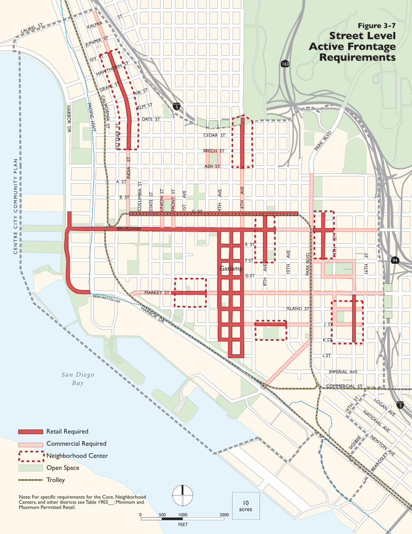
CE
NT
RE
CIT
Y C
OM
MU
NIT
Y P
LA
N
San DiegoBay
94
163
5
5
HA
RBO
R D
R
LAUREL ST
PAC
IFIC H
WY
BROADWAY
ASH ST
MARKET ST
HARBOR DR
PAR
K B
LVD
PARK
BLV
D
10T
H
AV
E
14T
H
ST
16T
H
ST
8TH
A
VE
4TH
A
VE
1ST
A
VE
FRO
NT
ST
UN
ION
ST
STAT
E S
T
CO
LUM
BIA
ST
IND
IA
ST
KET
TN
ER S
T
JUNIPER ST
IVY ST
HAWTHORN ST
GRAPE ST
FIR ST
KALMIAST
ELM ST
DATE ST
CEDAR ST
BEECH ST
A ST
B ST
C ST
E ST
F ST
G ST
ISLAND ST
J ST
K ST
L ST
IMPERIAL AVE
COMMERCIAL ST
CA
LIFOR
NIA
ST
16TH
ST
SIGSB
EE
BEARD
SLEY
6TH
A
VE
Retail Required
Commercial Required
Neighborhood Center
Open Space
Trolley
Gaslamp
LOGAN AVENATIONAL AVE
NEWTON AVE
Figure 3-7
Street LevelActive Frontage
Requirements
Note: For specific requirements for the Core, Neighborhood Centers, and other districts see Table 1903__: Minimum and Maximum Permitted Retail.
FEET
0 500 1000 2000
10acres
MEAN HIGH TIDE LINE
3-17
33.2 DEVELOPMENT INTENSITY AND INCENTIVES, AND PLAN BUILDOUTDevelopment IntensityThe Community Plan establishes intensity standards for various parts of downtown.IntensityismeasuredasFloorAreaRatio(FAR),obtainedby dividing gross floor area by lot area. The implementing zoning regu-lations (Centre City, Marina, and Gaslamp Quarter Planned District Ordinances – “PDOs”, as well as the Land Development Code, define in detail how gross floor area is measured; in general, all floor area above grade (including that devoted to parking) is included. Development intensityisonlyregulatedthroughFARs–noseparateresidentialden-sity standards are established. Figure 3-9 shows the allowable minimum and maximum FARs forvarious sites. Proposed base development intensities in the Community Planrangefrom2.0to10.0,modulatedtoprovidediversityofscale,aswellashighintensitiesinselectedlocations.MaximumFARsshownonthe map may not be attainable on all sites as superseding development regulations,suchassunaccessrestrictionsand/orsiteconditions,mayreduce development potential.Within the northern portions of the Little Italy and Cortez neighbor-hoods, development intensities may be restricted due to the location of the San Diego International Airport–Lindbergh Field approachpath even below the Base Minimums shown in this Plan. Intensities will be restricted in these areas according to the Centre City Planned District Ordinance provisions consistent with the Airport Land Use Compatibility Plan (ALUCP).
IncentivesIntensity Bonuses and Exemptions The Community Plan establishes several kinds of incentives/exemp-tions to promote desirable civic benefits: • Retail Along Active Streets. In order to facilitate vital retail districts instrategiclocations,theCommunityPlanexemptsretail/commer-
Downtown (circa 2030) as seen from across the Coronado Bridge. Similar massing and heights may result from Community Plan policies; view is solely for illustrative purposes
LAND USE AND HOUSING
3-18
Looking toward the San Diego Bay – 2003 (above) and 2030 (facing page).
cialusesandotherpublicusesonthegroundfloorfromFARcalcula-tionsondesignatedMainStreetsandCommercialStreets(Figure3-7).
• Historical Resources. The gross floor area of a designated historic structuremaybeexcludedfromthecalculationofthetotalFARoftheprojectso longas thehistoric,and/orarchitecturalcharacterofthe structure is rehabilitated and not adversely affected.
• Affordable Housing. To promote affordable housing downtown and to ensure consistency with California Government Code Section 65915, FARbonus (applied to the residential component of aproject) is available for projects meeting on-site affordable housing requirements.BonusFARwouldvarydependingontheamountandkindofaffordablehousingprovided,withthemaximumFARbonusbeing35percent.Detailsoftheaffordablehousingbonusesarepro-vided in the PDO.
• Bonus Program for Parks and Public Infrastructure. In specific locations, increases in FARs (beyond base FARs shown on Figure3-9) are available through payment into the FARBonus PaymentProgram, in order to promote downtown parks and public infra-structure.ThemaximumbonusFARavailableunderthisprogramisshownonFigure3-10.TheCityofSanDiegoisauthorizedtoestab-lishaFloorAreaRatio (FAR)BonusPaymentProgramwithin theRedevelopment Project Areas covered by the Downtown Community
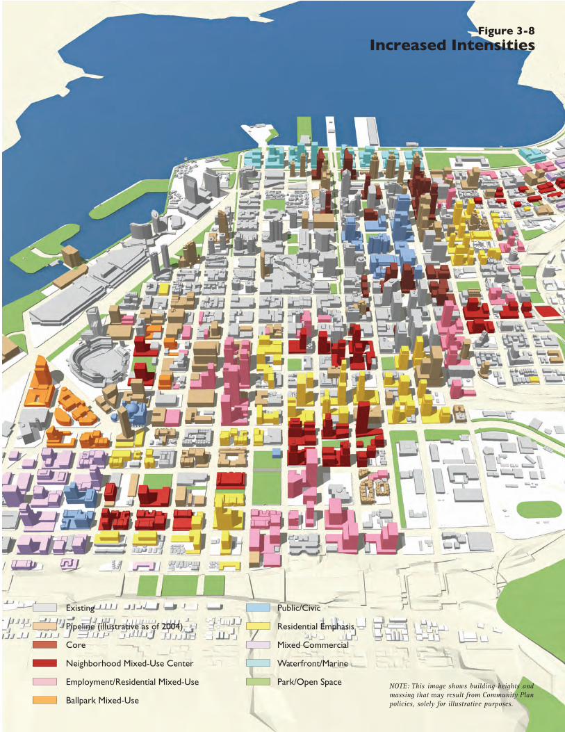
Public/Civic
Residential Emphasis
Mixed Commercial
Waterfront/Marine
Park/Open Space
Figure 3-8Increased Intensities
Existing
Pipeline (illustrative as of 2004)
Core
Neighborhood Mixed-Use Center
Employment/Residential Mixed-Use
Ballpark Mixed-Use
NOTE: This image shows building heights and massing that may result from Community Plan policies, solely for illustrative purposes.
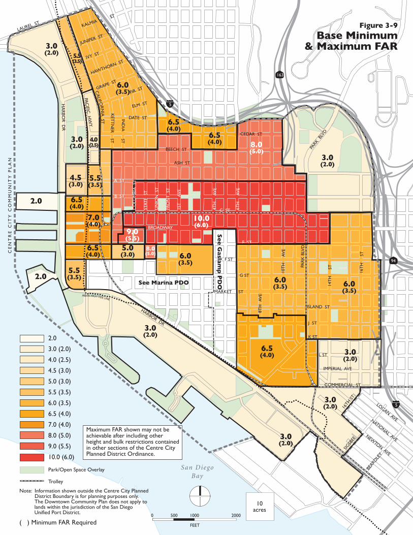
Maximum FAR shown may not be achievable after including other height and bulk restrictions contained in other sections of the Centre City Planned District Ordinance.
San DiegoBay
3.0(2.0)
7.0(4.0)
5.5(3.5)
4.5(3.0)
4.0(2.5)
5.5(3.5)
6.5(4.0)
6.0(3.5)
9.0(5.5)
8.0(5.0)
6.5(4.0)
3.0(2.0)
6.5(4.0)
6.5(4.0)
5.5(3.5)
3.0(2.0)
6.5(4.0)
6.0(3.5)
3.0(2.0)
3.0(2.0)
2.0
2.0
10.0(6.0)
CE
NT
RE
CIT
Y C
OM
MU
NIT
Y P
LA
N
HA
RBO
R D
R
LAUREL ST
PAC
IFIC H
WY
BROADWAY
ASH ST
MARKET ST
HARBOR DR
PAR
K B
LVD
PARK
BLV
D
10T
H
AV
E
14T
H
ST
16T
H
ST
8TH
A
VE
6TH
A
VE
4TH
A
VE
1ST
A
VE
FRO
NT
ST
UN
ION
ST
STAT
E S
T
IND
IA
ST
KET
TN
ER
ST
JUNIPER ST
IVY ST
HAWTHORN ST
GRAPE ST
FIR ST
KALMIAST
ELM ST
DATE ST
CEDAR ST
BEECH ST
A ST
B ST
C ST
E ST
F ST
G ST
ISLAND ST
J ST
K ST
L ST
IMPERIAL AVE
COMMERCIAL ST
LOGAN AVENATIONAL AVENEW
TON AVE
163
5
5
94
Figure 3-9
Base Minimum& Maximum FAR
Note: Information shown outside the Centre City Planned District Boundary is for planning purposes only.
The Downtown Community Plan does not apply to lands within the jurisdiction of the San Diego Unified Port District.
2.0
3.0 (2.0)
4.0 (2.5)
4.5 (3.0)
5.0 (3.0)
5.5 (3.5)
6.0 (3.5)
6.5 (4.0)
7.0 (4.0)
8.0 (5.0)
9.0 (5.5)
10.0 (6.0)
( ) Minimum FAR Required
Park/Open Space Overlay
Trolley
10acres
FEET
0 500 1000 2000
MEAN HIGH TIDE LINE
5.0(3.0) 6.0
(3.5)
6.0(3.5)
3.0(2.0)
8.0(5.0)
3.0(2.0)
CO
LUM
BIA
ST
16TH
ST
SIGSB
EE
BEARD
LEY
CA
LIFOR
NIA
ST
See Marina PDO
Se
e G
aslam
p P
DO
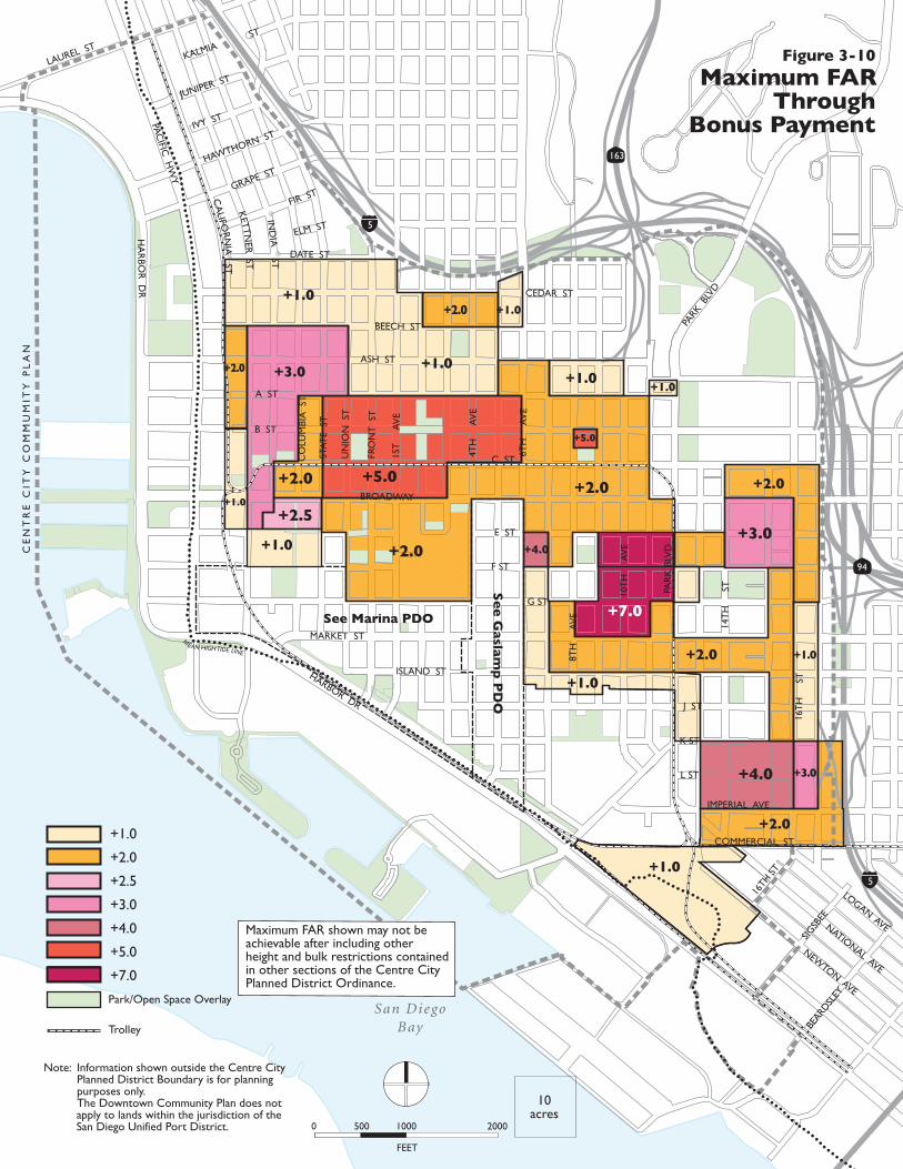
CE
NT
RE
CIT
Y C
OM
MU
MIT
Y P
LA
N
San DiegoBay
94
163
5
5
HA
RBO
R D
R
LAUREL ST
PAC
IFIC H
WY
BROADWAY
ASH ST
MARKET ST
HARBOR DR
PAR
K B
LVD
PARK
BLV
D
10T
H
AV
E
14T
H
ST
16T
H
ST
8TH
A
VE
6TH
A
VE
4TH
A
VE
1ST
A
VE
FRO
NT
ST
UN
ION
ST
STAT
E S
T
CO
LUM
BIA
ST
JUNIPER ST
IVY ST
HAWTHORN ST
GRAPE ST
FIR ST
KALMIAST
ELM ST
DATE ST
CEDAR ST
BEECH ST
A ST
B ST
C ST
E ST
F ST
G ST
ISLAND ST
J ST
K ST
L ST
IMPERIAL AVE
COMMERCIAL ST
LOGAN AVENATIONAL AVE
NEWTON AVE
CA
LIFORN
IA ST
IND
IA ST
KETTN
ER ST
BEARD
SLEY
SIGSB
EE
16TH
ST
+5.0
+1.0
+2.0
+1.0
+1.0
+2.0
+4.0
+1.0
+2.0
+1.0
+3.0
+2.0
+3.0
+1.0+2.0
+7.0
+4.0
+5.0
+2.0
+2.5
+2.0+1.0
+1.0+3.0
+2.0 +1.0
+1.0
+1.0
+2.0
+2.5
+3.0
+4.0
+5.0
+7.0
Trolley
Park/Open Space Overlay
FEET
0 500 1000 2000
10acres
Maximum FAR shown may not be achievable after including other height and bulk restrictions contained in other sections of the Centre City Planned District Ordinance.
MEAN HIGH TIDE LINE
See Marina PDO
Se
e G
aslam
p P
DO
Figure 3-10
Maximum FARThrough
Bonus Payment
Note: Information shown outside the Centre City Planned District Boundary is for planning purposes only.
The Downtown Community Plan does not apply to lands within the jurisdiction of the San Diego Unified Port District.
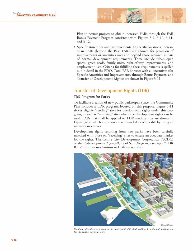
PlantopermitprojectstoobtainincreasedFARsthroughtheFARBonus Payment Program consistent with Figures 3-9, 3-10, 3-11,and3-12.
• Specific Amenities and Improvements. In specific locations, increas-es in FARs (beyond the Base FARs) are allowed for provision ofimprovements or amenities over and beyond those required as part of normal development requirements. These include urban open spaces, green roofs, family units, right-of-way improvements, and employment uses. Criteria for fulfilling these requirements is spelled outindetailinthePDO.TotalFARbonuseswithallincentives(forSpecific Amenities and Improvements, through Bonus Payment, and TransferofDevelopmentRights)areshowninFigure3-11.
Transfer of Development Rights (TDR)TDR Program for ParksTofacilitatecreationofnewpublicparks/openspace,theCommunityPlan includesaTDRprogram, focusedon thispurpose.Figure3-11shows eligible “sending” sites for development rights under this pro-gram, as well as “receiving” sites where the development rights can be used.FARs that shall be applied toTDR sending sites are shown inFigure3-12,whichalsoshowsmaximumFARsachievablebyusingallintensity incentives.Development rights resulting from new parks have been carefully matched with those on “receiving” sites to ensure an adequate market for the rights. The Centre City Development Corporation (CCDC) ortheRedevelopmentAgency/CityofSanDiegomaysetupa“TDRBank” or other mechanisms to facilitate transfers.
3-22
Building intensities step down to the waterfront. Potential building heights and massing are for illustrative purposes only.
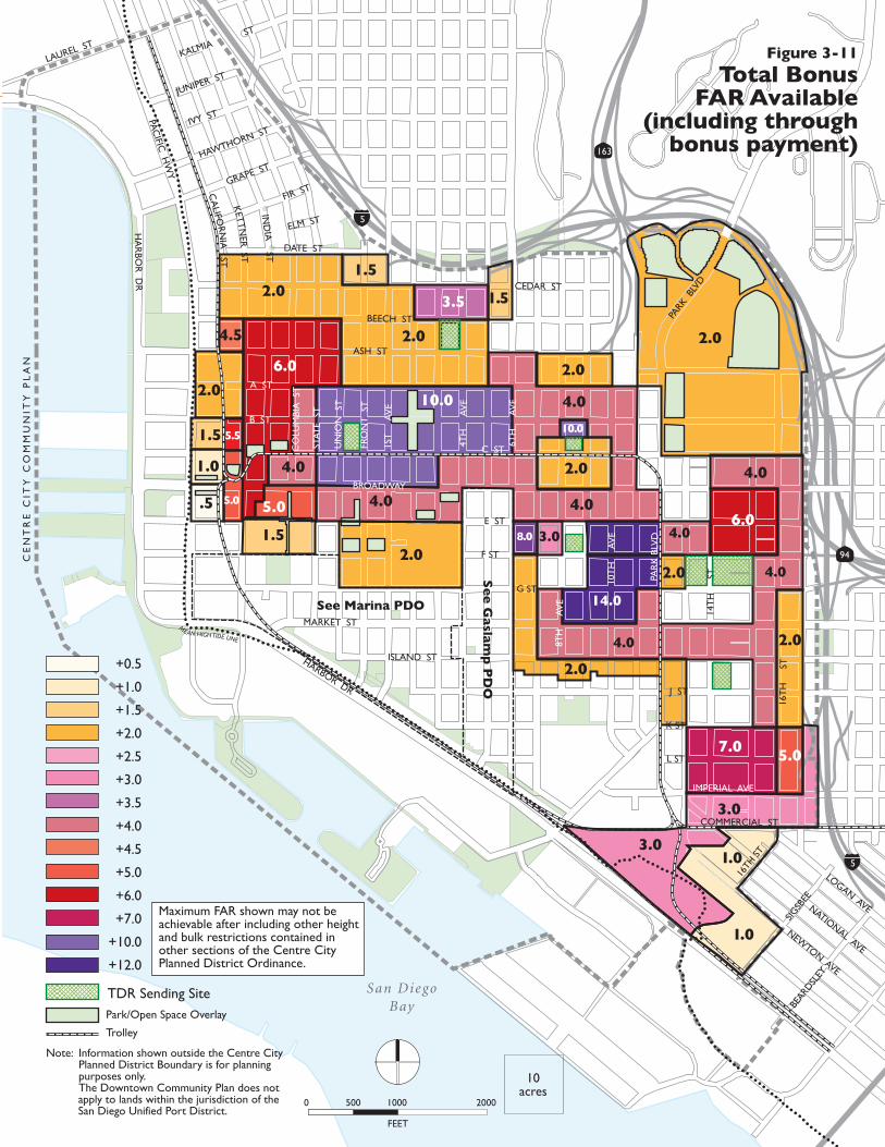
San DiegoBay
94
163
5
5
HA
RBO
R D
R
LAUREL ST
PAC
IFIC H
WY
BROADWAY
ASH ST
MARKET ST
HARBOR DR
PAR
K B
LVD
PARK
BLV
D
10T
H
AV
E
16T
H
ST
8TH
A
VE
6TH
A
VE
4TH
A
VE
1ST
A
VE
FRO
NT
ST
UN
ION
ST
STAT
E S
T
CO
LUM
BIA
ST
JUNIPER ST
IVY ST
HAWTHORN ST
GRAPE ST
FIR ST
KALMIAST
ELM ST
DATE ST
CEDAR ST
BEECH ST
A ST
B ST
C ST
E ST
F ST
G ST
ISLAND ST
J ST
K ST
L ST
IMPERIAL AVE
COMMERCIAL ST
LOGAN AVENATIONAL AVE
NEWTON AVE
CA
LIFORN
IA ST
IND
IA ST
KETTN
ER ST
BEARD
SLEY
SIGSB
EE
16TH
ST
14T
H
ST
2.01.5
4.5
6.0
5.0
3.06.0
4.0
2.0
7.0
3.0
5.0
3.5 1.5
5.0
14.0
2.0
2.0
1.0
2.0
4.0
2.0
2.0
2.0
5.5
2.0
1.5
1.0
.5
2.01.5
4.0
4.010.0
1.0
+0.5
+1.0
+1.5
+2.0
+2.5
+3.0
+3.5
+4.0
+4.5
+5.0
+6.0
+7.0
+10.0
+12.0
Trolley
Park/Open Space Overlay
TDR Sending Site
3.0
4.0
10.0
4.0
Figure 3-11
Total BonusFAR Available
(including throughbonus payment)
Note: Information shown outside the Centre City Planned District Boundary is for planning purposes only.
The Downtown Community Plan does not apply to lands within the jurisdiction of the San Diego Unified Port District.
4.0
4.08.0
FEET
0 500 1000 2000
10acres
Maximum FAR shown may not be achievable after including other height and bulk restrictions contained in other sections of the Centre City Planned District Ordinance.
CE
NT
RE
CIT
Y C
OM
MU
NIT
Y P
LA
N
MEAN HIGH TIDE LINE
See Marina PDO
Se
e G
aslam
p P
DO
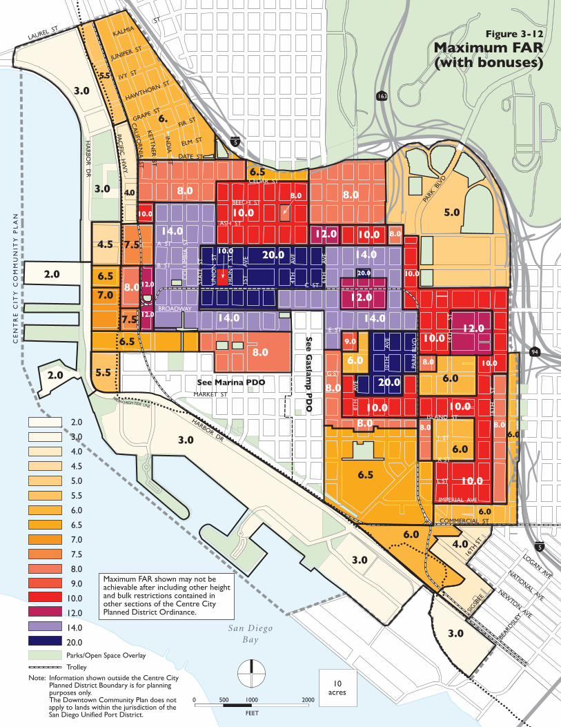
Figure 3-13
Potential Buildout Intensities
Proposed Development
Pipeline Development
Existing Development
CE
NT
RE
CIT
Y C
OM
MU
NIT
Y P
LA
N
San DiegoBay
94
163
5
5
10.0
10.0
12.0
12.0
10.0
9.0
8.0
8.08.0
8.0
8.0
10.0
3.0
3.0
5.58.0
6.5
6.0
3.0
6.5
7.0
6.5
7.54.5
4.0
5.5
6.
5.0
4.0
6.06.0
14.0
20.0
14.0
2.0
3.0
4.0
4.5
5.0
5.5
6.0
6.5
7.0
7.5
8.0
9.0
10.0
12.0
14.0
20.0
6.5
6.0
8.0
10.0
10.0
3.0
12.0
20.0
8.0
10.0
8.0
10.0
10.0
8.0
7.5
8.0
6.0
3.0
14.0
MEAN HIGH TIDE LINE
14.0
6.0
Parks/Open Space Overlay
Trolley
HA
RBO
R D
R
LAUREL ST
PAC
IFIC H
WY
BROADWAY
ASH ST
MARKET ST
HARBOR DR
PAR
K B
LVD
PARK
BLV
D
10T
H
AV
E 14T
H
ST
16T
H
ST
8TH
A
VE
6TH
A
VE
4TH
A
VE
1ST
A
VE
FRO
NT
ST
UN
ION
ST
STAT
E S
T
CO
LUM
BIA
ST
JUNIPER ST
IVY ST
HAWTHORN ST
GRAPE ST
FIR ST
KALMIAST
ELM ST
DATE ST
CEDAR ST
BEECH ST
A ST
B ST
C ST
E ST
F ST
G ST
ISLAND ST
J ST
K ST
L ST
IMPERIAL AVE
COMMERCIAL ST
LOGAN AVENATIONAL AVE
NEWTON AVE
CA
LIFORN
IA ST
IND
IA ST
KETTN
ER ST
16TH
ST
SIGSB
EE
BEARD
SLEY
Note: Information shown outside the Centre City Planned District Boundary is for planning purposes only.
The Downtown Community Plan does not apply to lands within the jurisdiction of the San Diego Unified Port District.
2.0
2.0
Figure 3-12
Maximum FAR(with bonuses)
Maximum FAR shown may not be achievable after including other height and bulk restrictions contained in other sections of the Centre City Planned District Ordinance.
FEET
0 500 1000 2000
10acres
See Marina PDO
Se
e G
aslam
p P
DO
10.020.0
12.0
12.0
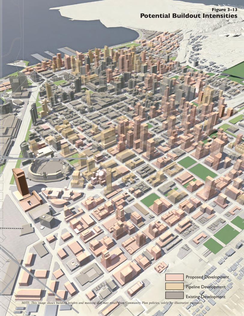
NOTE: This image shows building heights and massing that may result from Community Plan policies, solely for illustrative purposes.
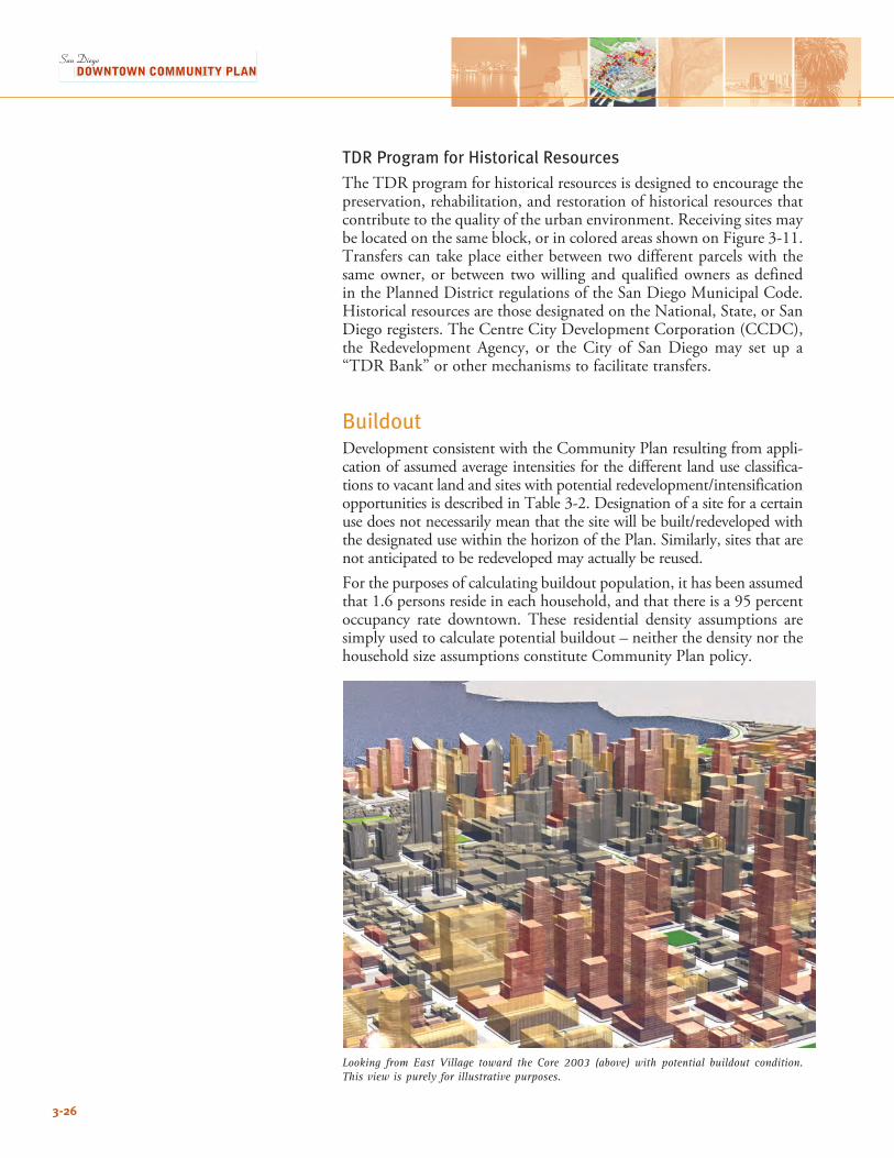
3-26
TDR Program for Historical ResourcesThe TDR program for historical resources is designed to encourage the preservation, rehabilitation, and restoration of historical resources that contribute to the quality of the urban environment. Receiving sites may belocatedonthesameblock,orincoloredareasshownonFigure3-11.Transfers can take place either between two different parcels with the same owner, or between two willing and qualified owners as defined in the Planned District regulations of the San Diego Municipal Code. Historical resources are those designated on the National, State, or San Diego registers. The Centre City Development Corporation (CCDC), the Redevelopment Agency, or the City of San Diego may set up a “TDR Bank” or other mechanisms to facilitate transfers.
BuildoutDevelopment consistent with the Community Plan resulting from appli-cation of assumed average intensities for the different land use classifica-tionstovacantlandandsiteswithpotentialredevelopment/intensificationopportunitiesisdescribedinTable3-2.Designationofasiteforacertainusedoesnotnecessarilymeanthatthesitewillbebuilt/redevelopedwiththe designated use within the horizon of the Plan. Similarly, sites that are not anticipated to be redeveloped may actually be reused. Forthepurposesofcalculatingbuildoutpopulation,ithasbeenassumedthat1.6personsresideineachhousehold,andthatthereisa95percentoccupancy rate downtown. These residential density assumptions are simply used to calculate potential buildout – neither the density nor the household size assumptions constitute Community Plan policy.
Looking from East Village toward the Core 2003 (above) with potential buildout condition. This view is purely for illustrative purposes.
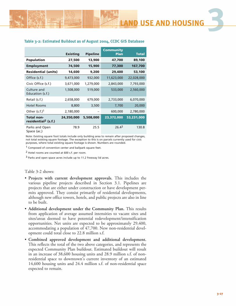
3-27
3
Table3-2shows:• Projects with current development approvals. This includes the various pipeline projects described in Section 3.1. Pipelines areprojects that are either under construction or have development per-mits approved. They consist primarily of residential developments, although new office towers, hotels, and public projects are also in line to be built.
• Additional development under the Community Plan. This results from application of average assumed intensities to vacant sites and sites/areas deemed to have potential redevelopment/intensificationopportunities.Net units are expected to be approximately 29,400,accommodatingapopulationof47,700.Newnon-residentialdevel-opmentcouldtotalcloseto22.8millions.f.
• Combined approved development and additional development. This reflects the total of the two above categories, and represents the expectedCommunityPlanbuildout.Estimatedbuildoutwill resultinanincreaseof38,600housingunitsand28.9millions.f.ofnon-residential space to downtown’s current inventory of an estimated 14,600housingunitsand24.4millions.f.ofnon-residential spaceexpected to remain.
LAND USE AND HOUSING
Table 3-2: Estimated Buildout as of August 2004, CCDC GIS Database
Existing PipelineCommunity
Plan Total
Population 27,500 13,900 47,700 89,100
Employment 74,500 15,900 77,300 167,700
Residential (units) 14,600 9,200 29,400 53,100
Office (s.f.) 9,473,000 932,000 11,623,000 22,028,000
Civic Office (s.f.) 3,671,000 1,279,000 2,843,000 7,793,000
Culture and Education (s.f.)
1,508,000 519,000 533,000 2,560,000
Retail (s.f.) 2,658,000 679,000 2,733,000 6,070,000
Hotel Rooms 8,800 3,500 7,700 20,000
Other (s.f.)1 2,180,000 – 600,000 2,780,000
Total non-residential2 (s.f.)
24,350,000 5,508,000 23,372,000 53,231,000
Parks and Open Space (ac.)
78.9 25.5 26.43 130.8
Note: Existing square foot totals include only building area to remain after proposed changes, not total existing square footage. The exception to this is on parcels currently used for civic purposes, where total existing square footage is shown. Numbers are rounded.
1 Composed of convention center and ballpark square feet.
2 Hotel rooms are counted at 600 s.f. per room.
3 Parks and open space acres include up to 11.2 freeway lid acres.
3-28
Goals: Development Intensities and Incentives, and Plan Buildout3.2-G-1 Target a residential population of approximately 90,000, and
downtown employment of over 165,000 by 2030, to create vitality, a market for a broad array of supporting stores and services, opportunities for living close to jobs and transit, and support regional growth strategies.
3.2-G-2 Maintain a range of development intensities to provide diver-sity, while maintaining high overall intensities to use land efficiently and permit population and employment targets to be met.
3.2-G-3 Provide incentives to encourage development of public ame-nities, retail, and other active uses in Neighborhood Centers, and promote affordable housing and conservation of histori-cal resources.
3.2-G-4 Use transfer of development rights as a mechanism to create new parkland/open space and preserve historic resources.
Policies: Development Intensities and Incentives, and Plan Buildout3.2-P-1 Require a minimum FAR on all development sites, as shown
in Figure 3-9, avoid exceptions unless conditioned on finding of hardship, exceptional circumstances, or public health and welfare.
3.2-P-2 Exempt the following from intensity calculations:
• Required active ground level uses, as well as publicly owned and used facilities, on the first floor, in areas where ground level active uses are required, as shown in Figure 3-7.
• Area included in a designated historic structure on a specif-ic site, so long as the historic and/or architectural character of the structure is rehabilitated and not adversely affected.
3.2-P-3 Allow intensity bonuses for development projects in specific locations established by this plan that provide public ameni-ties/benefits beyond those required for normal development approvals.
3.2-P-4 Establish a TDR program for parkland creation, and historic resource preservation. Explore the feasibility of establishing a TDR “bank” to facilitate transfers.
3.2-P-5 Restrict building intensities underneath the approach path to Lindbergh Field consistent with the Airport Land Use Compatibility Plan (ALUCP).
3.2-P-6 Work proactively with the transit agencies to prioritize the redevelopment of the four block site located at K, Imperial, 14th and 16th streets by relocating the bus yards to an area of more compatible uses.
3-29
3LAND USE AND HOUSING
3.3 HOUSINGDowntown San Diego has traditionally possessed a strong residential component, mixed with the office, shopping, entertainment, and ware-housing/manufacturing sectors. Blight conditions resulting from thedeclineofthedowntowneconomyinthe1960sand1970ssignificantlydiminished downtown’s appeal for residents. As a result, downtown’s housing stock significantly deteriorated, leaving few options other than affordable and institutional housing.One of the essential underpinnings of downtown’s renaissance is an intense and wide-range of housing choices, meeting the various needs of a mixed population. Diversity among residents—by age, income, family status, ethnicity, and vocation—is one of the hallmarks of great urban environments. By establishing downtown as the center for the highest residential densities in the region, housing options will be available for the multitude of downtown employees consistent with the Strategic Framework Element of the City’s General Plan population distribu-tion and economic development framework. In addition, the strong presence of residents will enliven the various downtown neighborhoods and districts, and create day and night vitality that makes downtown attractive to visitors and commerce.Housing takes many forms in downtown—from luxury penthouses with panoramic views to single-room occupancy (SRO) hotels, compact living units (CLUs), studios, lofts, living units, and rental and owner-ship multi-room units. While mostly concentrated in neighborhoods with residential emphasis, housing is also considered an integral part of mixed-use centers and districts. Achieving residential population goals requires new neighborhood-oriented parks and open spaces and local shopping and services, as discussed in Section 3.3 above;Chapter 4: Parks, Open Space, and Recreation; and Chapter 6: Neighborhoods.
Goals: Housing3.3-G-1 Provide a range of housing opportunities suitable for urban
environments and accommodating a diverse population.
3.3-G-2 Ensure supplies of housing for downtown employees commen-surate with their means to reduce automobile trips and achieve related air quality benefits.
Policies: Housing3.3-P-1 Establish minimum FARs to achieve city and regional goals for
making downtown a major population center.
3.3-P-2 Allow residential activity in all land use classifications (with exception of tidelands pursuant to the Port Master Plan and lands classified as Industrial). Allow for higher standard of review for residential development adjacent to industrial land use districts.
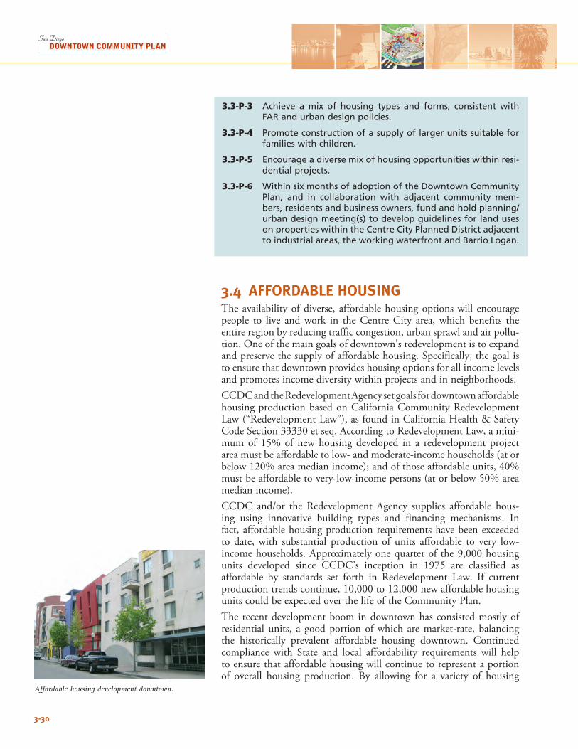
3-30
3.3-P-3 Achieve a mix of housing types and forms, consistent with FAR and urban design policies.
3.3-P-4 Promote construction of a supply of larger units suitable for families with children.
3.3-P-5 Encourage a diverse mix of housing opportunities within resi-dential projects.
3.3-P-6 Within six months of adoption of the Downtown Community Plan, and in collaboration with adjacent community mem-bers, residents and business owners, fund and hold planning/urban design meeting(s) to develop guidelines for land uses on properties within the Centre City Planned District adjacent to industrial areas, the working waterfront and Barrio Logan.
3.4 AFFORDABLE HOUSINGThe availability of diverse, affordable housing options will encourage people to live and work in the Centre City area, which benefits the entire region by reducing traffic congestion, urban sprawl and air pollu-tion. One of the main goals of downtown’s redevelopment is to expand and preserve the supply of affordable housing. Specifically, the goal is to ensure that downtown provides housing options for all income levels and promotes income diversity within projects and in neighborhoods.CCDC and the Redevelopment Agency set goals for downtown affordable housing production based on California Community Redevelopment Law (“Redevelopment Law”), as found in California Health & Safety CodeSection33330etseq.AccordingtoRedevelopmentLaw,amini-mum of 15% of new housing developed in a redevelopment project area must be affordable to low- and moderate-income households (at or below120%areamedianincome);andofthoseaffordableunits,40%must be affordable to very-low-income persons (at or below 50% area median income). CCDC and/or the Redevelopment Agency supplies affordable hous-ing using innovative building types and financing mechanisms. In fact, affordable housing production requirements have been exceeded to date, with substantial production of units affordable to very low-income households. Approximately one quarter of the 9,000 housing units developed since CCDC’s inception in 1975 are classified asaffordable by standards set forth in Redevelopment Law. If current productiontrendscontinue,10,000to12,000newaffordablehousingunits could be expected over the life of the Community Plan.The recent development boom in downtown has consisted mostly of residential units, a good portion of which are market-rate, balancing the historically prevalent affordable housing downtown. Continued compliance with State and local affordability requirements will help to ensure that affordable housing will continue to represent a portion of overall housing production. By allowing for a variety of housing
Affordable housing development downtown.
3-31
3LAND USE AND HOUSING
densities and types, the Community Plan, in part, facilitates continued affordable housing production in compliance with applicable policies and regulations. Concerns about reductions in housing opportunities for moderate income households-due to rising land values and past emphasis on housing production for the lowest income brackets-need to be addressed when establishing assistance priorities for future afford-able housing projects.The Community Plan establishes goals and policies intended to comple-ment effective Redevelopment Law to maximize affordable housing production. Solutions address housing needs where the private market is not providing enough affordability. The policies include land use and financial tools for CCDC and the Redevelopment Agency to facilitate an economically and socially balanced population. Given the need for a broad range of affordable housing options, the Community Plan’s focus is on two levels: (1) incentives for the private sector to provide affordable housingwithoutpublicsubsidyand,(2)specificareasforthepublicsec-tor to provide subsidies to address gaps in the housing market. A closer look at downtown’s affordable housing inventory reveals some challenging policy issues:Affordable For-Sale Housing – All of downtown’s affordable housing unitsdevelopedfrom1975to2005arerentalunits.Ideally,morenewcondominiums and other home ownership opportunities would be available to moderate income households.Housing for Middle Income Households – The City of San Diego’s GeneralPlanHousingElementidentifiesthatthereissignificantneedfor housing for persons between 120% and 150% of area medianincome, which is above the income levels eligible to receive public sub-sidies. There is a need to include lower-priced, market-rate housing for middle income households among the priorities for future downtown housing.Income Diversity – The majority of downtown’s affordable housing units, about60%, are for very low-incomehouseholds.Given that alarge number of downtown workers earn more than minimum wage and would fall into a broader range of income categories, downtown could benefit from having more units affordable to low- and moderate-income households. Unfortunately, state and federal funding sources prioritize projects for very low-income households and, therefore, it is very difficult for local public agencies to create affordable units for a broader range of incomes. Family Housing – The majority of downtown’s affordable housing units, over 90%, are studio or one-bedroom units. Some observers say that downtown should have larger affordable units to provide options for families with children. Rising land and development costs often make it economically infeasible to develop family housing projects, even as market-rate projects, in downtown.
Box 3-1: Affordable Housing Strategies
Affordable For-Sale HousingStrategy: To address the need for more affordable for-sale housing, the Community plan includes development intensity bonuses to encourage develop-ers to build more units on a site. CCDC will secure price restrictions in perpetu-ity when possible, and offer homebuyer assistance programs to expand afford-ability.
Income DiversityStrategy: To achieve income diversity within projects, the Community Plan prioritizes the development of mixed-income rental projects with a mix of market rate and affordable units restrict-ed to different income levels.
Family HousingStrategy: To address the need for fam-ily housing, the Community Plan sets a goal to secure sites for development of new projects in downtown on pub-licly-owned land or on sites outside of downtown in surrounding communities where densities may be more appropriate for low-rise, wood-frame construction.
Single Room Occupancy UnitsStrategy: To address the need for more SRO units, the Community Plan expands the zones where builders can construct new SROs, and sets a goal to preserve existing units through historic preservation and rent restrictions.
HomelessnessStrategy: To address the need for hous-ing for downtown’s homeless popula-tion, the Community Plan prioritizes development of permanent supportive housing to provide rental apartments linked to supportive services for both families and individuals.
In addition, goals for downtown affordable housing production must take into account policies to maximize downtown density and growth. The City Council has directed CCDC to adopt policies to boost aver-age housing density in new housing being developed to maximize downtown residential growth. With few exceptions, affordable family housing projects are developed utilizing low-rise, wood frame construc-tion (Type III or V), which produce less expensive units but are limited to about five stories in height. High-rise construction requires the use ofsteeland/orconcrete(TypeI)construction,whichincreasesthecostper unit. Downtown may not reach targets for residential population if a large number of low-density, affordable family housing projects are developed on the shrinking supply of land available for redevelopment. Single Room Occupancy Units – The City of San Diego currently has about 5,400 residential hotel rooms, also known as SRO units, which serve as an important source of affordable housing for very low-income persons. Over 4,900 of the units (90%) are located in downtown. Since 1977, theCityhashadregulations intendedtoprotect the supplyofSRO hotels. The regulations have been amended several times, most recently in2000,buthave retainedaprimary feature to require thatSRO rooms be replaced upon conversion or demolition, and that dis-placed tenants receive relocation assistance. SROs serve as an important source of housing affordable to very low-income persons. They provide small, furnished rooms with utilities included in the weekly or monthly rent. SRO rooms are occupied by students, seniors, and downtown workers representing occupations such as housekeepers, waiters, construction workers and security guards. Over the last five years, about600of the approximately4,000SROunits located in downtown have been demolished or closed to facilitate the expansion of the federal courthouse and other development proj-ects. Local regulations intended to require one-for-one replacement of demolished or converted SRO units have been difficult to enforce due to overriding exemptions under state and federal laws. This has sparked numerous discussions among policy-makers and community groups about how to preserve and expand the supply of SRO units.Homelessness – Affordable Housing is one of several crucial compo-nents to reducing the street population. Three types of housing are needed to serve downtown’s diverse homeless population:• Emergencyshelterbeds(housingforupto60days)• Transitionalhousingbeds(housingforupto2years);and• Permanentsupportivehousing(rentalhousinglinkedtosocialservices)Most of downtown’s existing homeless facilities would be classified as transitional housing, often catering to a specific target population (i.e. battered women, homeless families with children, mentally ill persons, etc.) In recent years, homeless population experts and funding agen-cies have urged policy-makers to prioritize the expansion of permanent supportive housing. Rental units with affordability for extremely low income persons and links to services for substance abuse recovery, job placement, and employment training are considered a necessary long-term solution to homelessness.
3-32
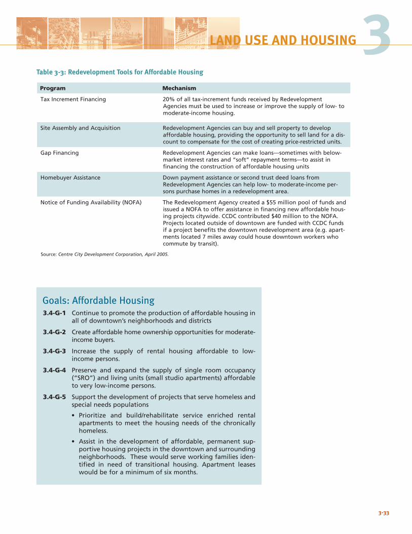
Program Mechanism
Tax Increment Financing 20% of all tax-increment funds received by Redevelopment Agencies must be used to increase or improve the supply of low- to moderate-income housing.
Site Assembly and Acquisition Redevelopment Agencies can buy and sell property to develop affordable housing, providing the opportunity to sell land for a dis-count to compensate for the cost of creating price-restricted units.
Gap Financing Redevelopment Agencies can make loans—sometimes with below-market interest rates and “soft” repayment terms—to assist in financing the construction of affordable housing units
Homebuyer Assistance Down payment assistance or second trust deed loans from Redevelopment Agencies can help low- to moderate-income per-sons purchase homes in a redevelopment area.
Notice of Funding Availability (NOFA) The Redevelopment Agency created a $55 million pool of funds and issued a NOFA to offer assistance in financing new affordable hous-ing projects citywide. CCDC contributed $40 million to the NOFA. Projects located outside of downtown are funded with CCDC funds if a project benefits the downtown redevelopment area (e.g. apart-ments located 7 miles away could house downtown workers who commute by transit).
Source: Centre City Development Corporation, April 2005.
Goals: Affordable Housing3.4-G-1 Continue to promote the production of affordable housing in
all of downtown’s neighborhoods and districts
3.4-G-2 Create affordable home ownership opportunities for moderate-income buyers.
3.4-G-3 Increase the supply of rental housing affordable to low-income persons.
3.4-G-4 Preserve and expand the supply of single room occupancy (“SRO”) and living units (small studio apartments) affordable to very low-income persons.
3.4-G-5 Support the development of projects that serve homeless and special needs populations
• Prioritize and build/rehabilitate service enriched rental apartments to meet the housing needs of the chronically homeless.
• Assist in the development of affordable, permanent sup-portive housing projects in the downtown and surrounding neighborhoods. These would serve working families iden-tified in need of transitional housing. Apartment leases would be for a minimum of six months.
3-33
3LAND USE AND HOUSING
Table 3-3: Redevelopment Tools for Affordable Housing
Policies: Affordable Housing3.4-P-1 Utilize land-use, regulatory and financial tools to facilitate
the development of housing affordable to all income levels, including:
• Homebuyer assistance programs for moderate-income buyers.
• Development intensity bonuses for builders creating affordable units.
• Acquisition and site assembly of sites for future develop-ment.
• Agreements to secure long-term affordability restrictions
3.4-P-2 Assist in financing the construction of for-sale housing with long-term affordability restrictions for low- and moderate-income households earning up to 120% of area median income. Encourage the development of moderately priced, market-rate (unsubsidized) housing affordable to middle income households earning up to 150% of area median income.
3.4-P-3 Assist in securing sites and financing the construction of rent-al housing, with emphasis on creating one- and two-bedroom units affordable to households earning up to 80% of area median income. Leverage Agency resources with other public and private funds for low-income housing. Explore opportu-nities to develop projects in other neighborhoods outside of downtown.
3.4-P-4 Encourage preservation and construction of SRO and living units with the following actions:
• Provide funds to renovate older buildings and secure rent restrictions.
• Allow construction of new SROs, living units, and other similar forms of housing in all appropriate mixed use dis-tricts.
• Allow reduced parking for projects with rent-restricted units.
3.4-P-5 Secure funding and locations for housing linked to supportive services for homeless and other special needs populations.
3.5 NEIGHBORHOODS AND CENTERS Neighborhoods unique in history and setting are one of downtown’s finest assets, offering a diversity of experiences and lifestyle choices. The neighborhoods not only provide a sense of place and community for many downtown residents, an important value in a downtown as large as San Diego’s, but also an opportunity to ensure richness and complexity that makes downtown an exciting place both to live and tovisit.Focusingonneighborhoodsisalsousefulinensuringthatresi-dents have convenient, walkable access to a diverse array of shops and services, parks, and schools.
3-34
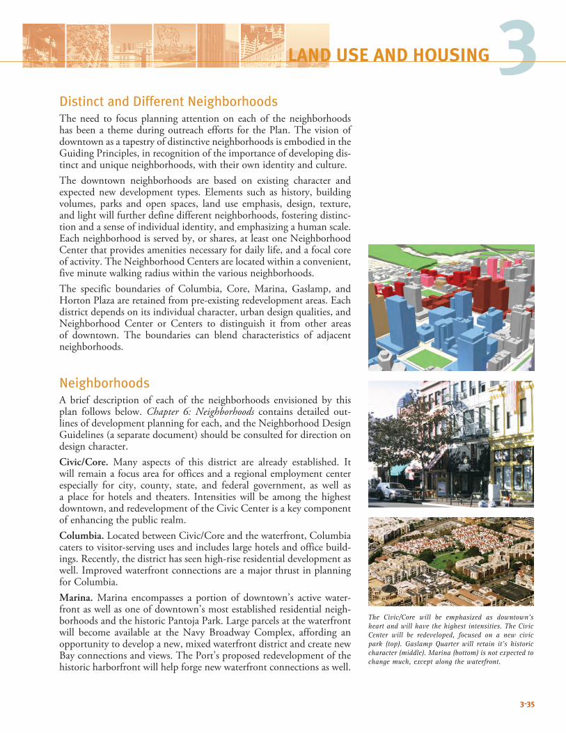
Distinct and Different NeighborhoodsThe need to focus planning attention on each of the neighborhoods has been a theme during outreach efforts for the Plan. The vision of downtown as a tapestry of distinctive neighborhoods is embodied in the Guiding Principles, in recognition of the importance of developing dis-tinct and unique neighborhoods, with their own identity and culture. The downtown neighborhoods are based on existing character and expected newdevelopment types. Elements such as history, buildingvolumes, parks and open spaces, land use emphasis, design, texture, and light will further define different neighborhoods, fostering distinc-tion and a sense of individual identity, and emphasizing a human scale. Eachneighborhoodisservedby,orshares,atleastoneNeighborhoodCenter that provides amenities necessary for daily life, and a focal core of activity. The Neighborhood Centers are located within a convenient, five minute walking radius within the various neighborhoods.The specific boundaries of Columbia, Core, Marina, Gaslamp, and HortonPlazaareretainedfrompre-existingredevelopmentareas.Eachdistrict depends on its individual character, urban design qualities, and Neighborhood Center or Centers to distinguish it from other areas of downtown. The boundaries can blend characteristics of adjacent neighborhoods.
NeighborhoodsA brief description of each of the neighborhoods envisioned by this plan follows below. Chapter 6: Neighborhoods contains detailed out-lines of development planning for each, and the Neighborhood Design Guidelines (a separate document) should be consulted for direction on design character.Civic/Core. Many aspects of this district are already established. It will remain a focus area for offices and a regional employment center especially for city, county, state, and federal government, as well as a place for hotels and theaters. Intensities will be among the highest downtown, and redevelopment of the Civic Center is a key component of enhancing the public realm.Columbia.LocatedbetweenCivic/Coreandthewaterfront,Columbiacaters to visitor-serving uses and includes large hotels and office build-ings. Recently, the district has seen high-rise residential development as well. Improved waterfront connections are a major thrust in planning for Columbia.Marina. Marina encompasses a portion of downtown’s active water-front as well as one of downtown’s most established residential neigh-borhoods and the historic Pantoja Park. Large parcels at the waterfront will become available at the Navy Broadway Complex, affording an opportunity to develop a new, mixed waterfront district and create new Bay connections and views. The Port’s proposed redevelopment of the historic harborfront will help forge new waterfront connections as well.
3-35
3LAND USE AND HOUSING
The Civic/Core will be emphasized as downtown’s heart and will have the highest intensities. The Civic Center will be redeveloped, focused on a new civic park (top). Gaslamp Quarter will retain it’s historic character (middle). Marina (bottom) is not expected to change much, except along the waterfront.
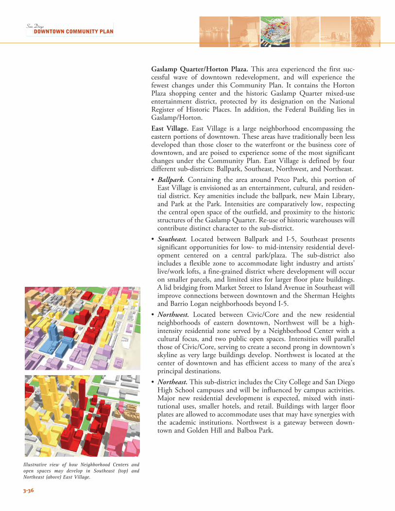
Gaslamp Quarter/Horton Plaza. This area experienced the first suc-cessful wave of downtown redevelopment, and will experience the fewest changes under this Community Plan. It contains the Horton Plaza shopping center and the historic Gaslamp Quarter mixed-use entertainment district, protected by its designation on the National Register ofHistoric Places. In addition, the Federal Building lies inGaslamp/Horton.East Village. East Village is a large neighborhood encompassing theeastern portions of downtown. These areas have traditionally been less developed than those closer to the waterfront or the business core of downtown, and are poised to experience some of the most significant changes under theCommunityPlan.EastVillage is defined by fourdifferent sub-districts: Ballpark, Southeast, Northwest, and Northeast.• Ballpark. Containing the area around Petco Park, this portion of EastVillageisenvisionedasanentertainment,cultural,andresiden-tial district. Key amenities include the ballpark, new Main Library, and Park at the Park. Intensities are comparatively low, respecting the central open space of the outfield, and proximity to the historic structures of the Gaslamp Quarter. Re-use of historic warehouses will contribute distinct character to the sub-district.
• Southeast. Located between Ballpark and I-5, Southeast presents significant opportunities for low- to mid-intensity residential devel-opment centered on a central park/plaza. The sub-district alsoincludes a flexible zone to accommodate light industry and artists’ live/worklofts,afine-graineddistrictwheredevelopmentwilloccuron smaller parcels, and limited sites for larger floor plate buildings. A lid bridging from Market Street to Island Avenue in Southeast will improve connections between downtown and the Sherman Heights and Barrio Logan neighborhoods beyond I-5.
• Northwest. Located between Civic/Core and the new residentialneighborhoods of eastern downtown, Northwest will be a high-intensity residential zone served by a Neighborhood Center with a cultural focus, and two public open spaces. Intensities will parallel thoseofCivic/Core,servingtocreateasecondprongindowntown’sskyline as very large buildings develop. Northwest is located at the center of downtown and has efficient access to many of the area’s principal destinations.
• Northeast. This sub-district includes the City College and San Diego High School campuses and will be influenced by campus activities. Major new residential development is expected, mixed with insti-tutional uses, smaller hotels, and retail. Buildings with larger floor plates are allowed to accommodate uses that may have synergies with the academic institutions. Northwest is a gateway between down-town and Golden Hill and Balboa Park.
3-36
Illustrative view of how Neighborhood Centers and open spaces may develop in Southeast (top) and Northeast (above) East Village.
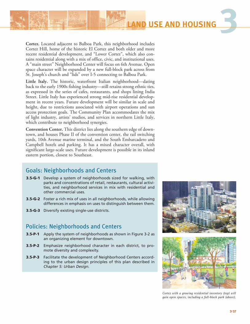
Cortez. Located adjacent to Balboa Park, this neighborhood includes CortezHill,homeofthehistoricElCortezandbotholderandmorerecent residential development, and “Lower Cortez”, which also con-tains residential along with a mix of office, civic, and institutional uses. A“mainstreet”NeighborhoodCenterwillfocuson6thAvenue.Openspace character will be expanded by a new full-block park across from St. Joseph’s church and “lids” over I-5 connecting to Balboa Park.Little Italy. The historic, waterfront Italian neighborhood—dating back to the early 1900s fishing industry—still retains strong ethnic ties, as expressed in the series of cafes, restaurants, and shops lining India Street. Little Italy has experienced strong mid-rise residential develop-mentinrecentyears.Futuredevelopmentwillbesimilarinscaleandheight, due to restrictions associated with airport operations and sun access protection goals. The Community Plan accommodates the mix of light industry, artists’ studios, and services in northern Little Italy, which contribute to neighborhood synergies.Convention Center. This district lies along the southern edge of down-town, and houses Phase II of the convention center, the rail switching yards,10thAvenuemarineterminal,andtheSouthEmbarcaderoandCampbell hotels and parking. It has a mixed character overall, with significantlarge-scaleuses.Futuredevelopmentispossibleinitsinlandeastern portion, closest to Southeast.
Goals: Neighborhoods and Centers3.5-G-1 Develop a system of neighborhoods sized for walking, with
parks and concentrations of retail, restaurants, cultural activi-ties, and neighborhood services in mix with residential and other commercial uses.
3.5-G-2 Foster a rich mix of uses in all neighborhoods, while allowing differences in emphasis on uses to distinguish between them.
3.5-G-3 Diversify existing single-use districts.
Policies: Neighborhoods and Centers3.5-P-1 Apply the system of neighborhoods as shown in Figure 3-2 as
an organizing element for downtown.
3.5-P-2 Emphasize neighborhood character in each district, to pro-mote diversity and complexity.
3.5-P-3 Facilitate the development of Neighborhood Centers accord-ing to the urban design principles of this plan described in Chapter 5: Urban Design.
3-37
3LAND USE AND HOUSING
Cortez with a growing residential inventory (top) will gain open spaces, including a full-block park (above).
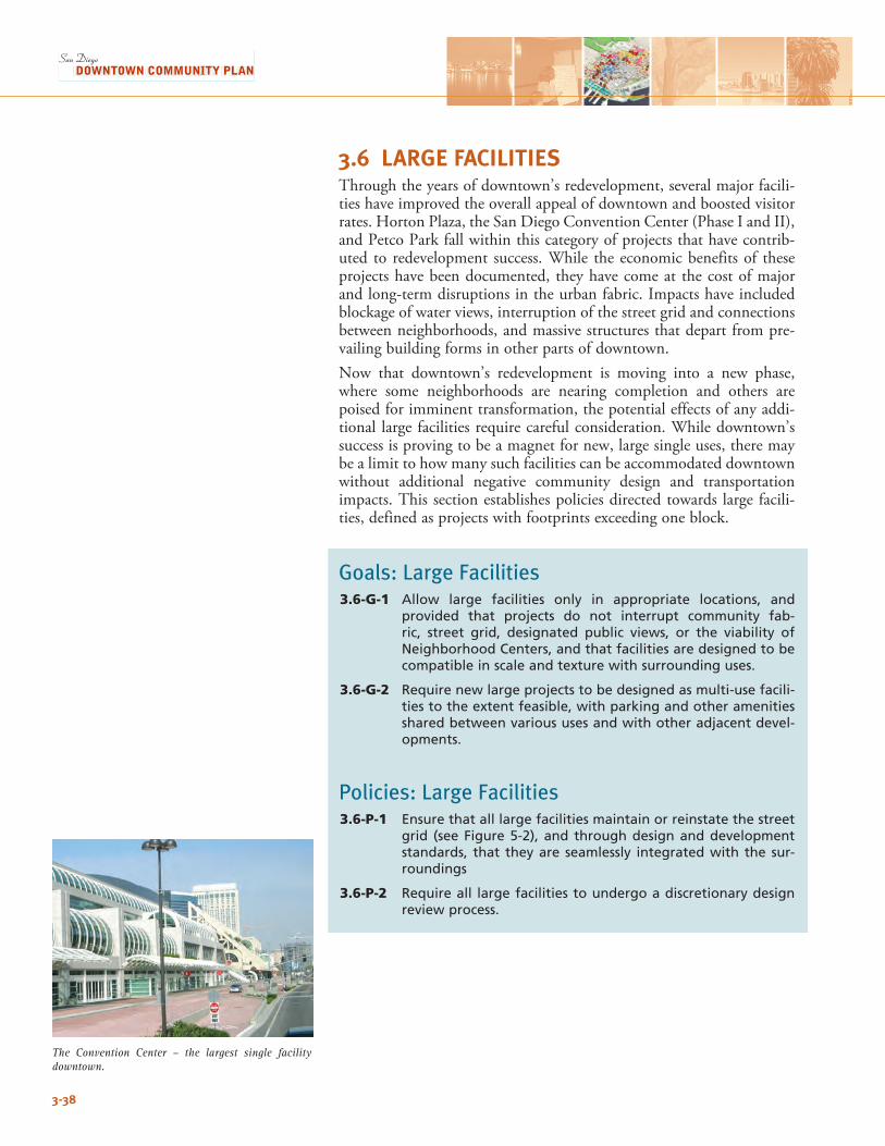
3.6 LARGE FACILITIESThrough the years of downtown’s redevelopment, several major facili-ties have improved the overall appeal of downtown and boosted visitor rates. Horton Plaza, the San Diego Convention Center (Phase I and II), and Petco Park fall within this category of projects that have contrib-uted to redevelopment success. While the economic benefits of these projects have been documented, they have come at the cost of major and long-term disruptions in the urban fabric. Impacts have included blockage of water views, interruption of the street grid and connections between neighborhoods, and massive structures that depart from pre-vailing building forms in other parts of downtown.Now that downtown’s redevelopment is moving into a new phase, where some neighborhoods are nearing completion and others are poised for imminent transformation, the potential effects of any addi-tional large facilities require careful consideration. While downtown’s success is proving to be a magnet for new, large single uses, there may be a limit to how many such facilities can be accommodated downtown without additional negative community design and transportation impacts. This section establishes policies directed towards large facili-ties, defined as projects with footprints exceeding one block.
Goals: Large Facilities3.6-G-1 Allow large facilities only in appropriate locations, and
provided that projects do not interrupt community fab-ric, street grid, designated public views, or the viability of Neighborhood Centers, and that facilities are designed to be compatible in scale and texture with surrounding uses.
3.6-G-2 Require new large projects to be designed as multi-use facili-ties to the extent feasible, with parking and other amenities shared between various uses and with other adjacent devel-opments.
Policies: Large Facilities3.6-P-1 Ensure that all large facilities maintain or reinstate the street
grid (see Figure 5-2), and through design and development standards, that they are seamlessly integrated with the sur-roundings
3.6-P-2 Require all large facilities to undergo a discretionary design review process.
3-38
The Convention Center – the largest single facility downtown.
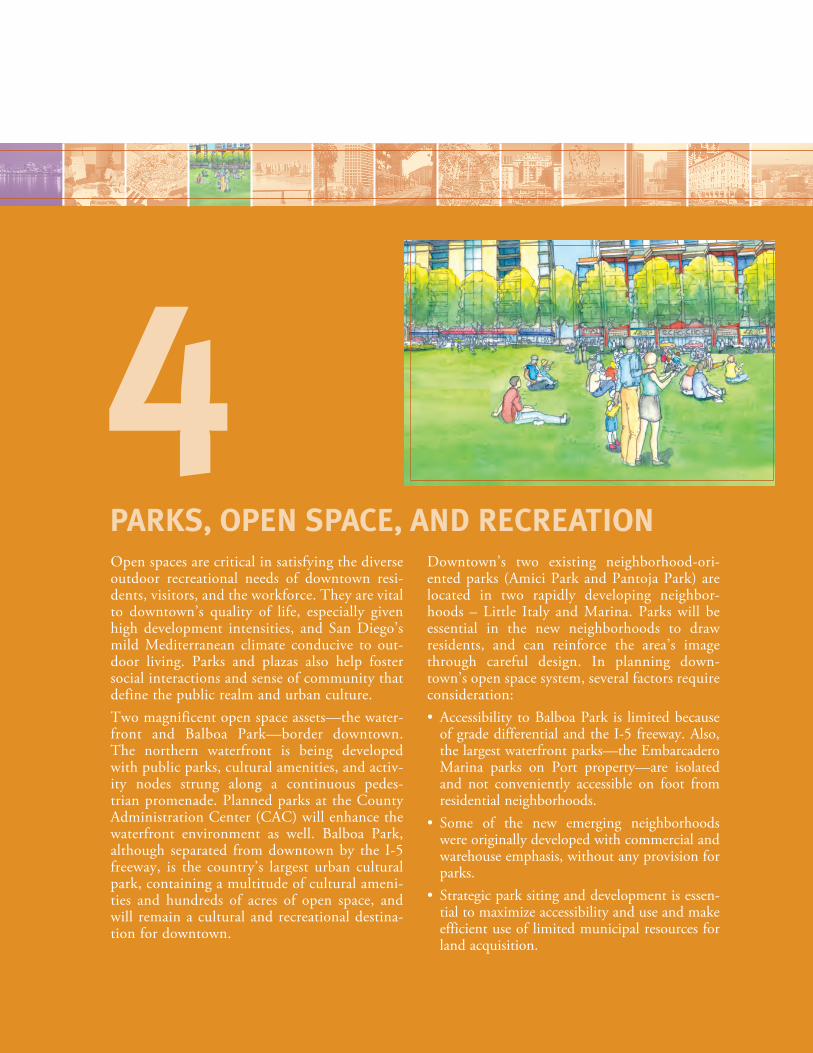
Open spaces are critical in satisfying the diverse outdoor recreational needs of downtown resi-dents, visitors, and the workforce. They are vital to downtown’s quality of life, especially given high development intensities, and San Diego’s mild Mediterranean climate conducive to out-door living. Parks and plazas also help foster social interactions and sense of community that define the public realm and urban culture. Two magnificent open space assets—the water-front and Balboa Park—border downtown. The northern waterfront is being developed with public parks, cultural amenities, and activ-ity nodes strung along a continuous pedes-trian promenade. Planned parks at the County Administration Center (CAC) will enhance the waterfront environment as well. Balboa Park, although separated from downtown by the I-5 freeway, is the country’s largest urban cultural park, containing a multitude of cultural ameni-ties and hundreds of acres of open space, and will remain a cultural and recreational destina-tion for downtown.
Downtown’s two existing neighborhood-ori-ented parks (Amici Park and Pantoja Park) are located in two rapidly developing neighbor-hoods – Little Italy and Marina. Parks will be essential in the new neighborhoods to draw residents, and can reinforce the area’s image through careful design. In planning down-town’s open space system, several factors require consideration:• Accessibility toBalboaPark is limitedbecause
of grade differential and the I-5 freeway. Also, the largest waterfront parks—the Embarcadero Marina parks on Port property—are isolated and not conveniently accessible on foot from residential neighborhoods.
• Some of the new emerging neighborhoodswere originally developed with commercial and warehouse emphasis, without any provision for parks.
• Strategicparksitinganddevelopmentisessen-tial to maximize accessibility and use and make efficient use of limited municipal resources for land acquisition.
PARKS, OPEN SPACE, AND RECREATION
4
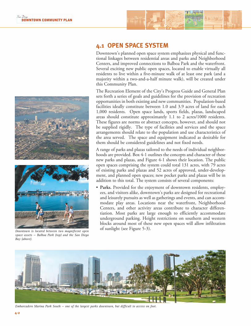
Embarcadero Marina Park South — one of the largest parks downtown, but difficult to access on foot.
4-2
4.1 OPEN SPACE SYSTEMDowntown’s planned open space system emphasizes physical and func-tional linkages between residential areas and parks and Neighborhood Centers, and improved connections to Balboa Park and the waterfront. Several exciting new public open spaces, located to enable virtually all residents to live within a five-minute walk of at least one park (and a majority within a two-and-a-half minute walk), will be created under this Community Plan. The Recreation Element of the City’s Progress Guide and General Plan sets forth a series of goals and guidelines for the provision of recreation opportunities in both existing and new communities. Population-based facilities ideally constitute between 1.0 and 3.9 acres of land for each 1,000 residents. Open space lands, sports fields, plazas, landscaped areas should constitute approximately 1.1 to 2 acres/1000 residents. These figures are norms or abstract concepts, however, and should not be supplied rigidly. The type of facilities and services and the space arrangements should relate to the population and use characteristics of the area served. The space and equipment indicated as desirable for them should be considered guidelines and not fixed needs. A range of parks and plazas tailored to the needs of individual neighbor-hoods are provided. Box 4-1 outlines the concepts and character of these new parks and plazas, and Figure 4-1 shows their location. The public open spaces comprising the system could total 131 acres, with 79 acres of existing parks and plazas and 52 acres of approved, under-develop-ment, and planned open spaces; new pocket parks and plazas will be in addition to this total. The system consists of several components:• Parks. Provided for the enjoyment of downtown residents, employ-
ees, and visitors alike, downtown’s parks are designed for recreational and leisurely pursuits as well as gatherings and events, and can accom-modate play areas. Locations near the waterfront, Neighborhood Centers, and other activity areas contribute to character differen-tiation. Most parks are large enough to efficiently accommodate underground parking. Height restrictions on southern and western blocks around most of these new open spaces will allow infiltration of sunlight (see Figure 5-3).
Downtown is located between two magnificent open space assets — Balboa Park (top) and the San Diego Bay (above).
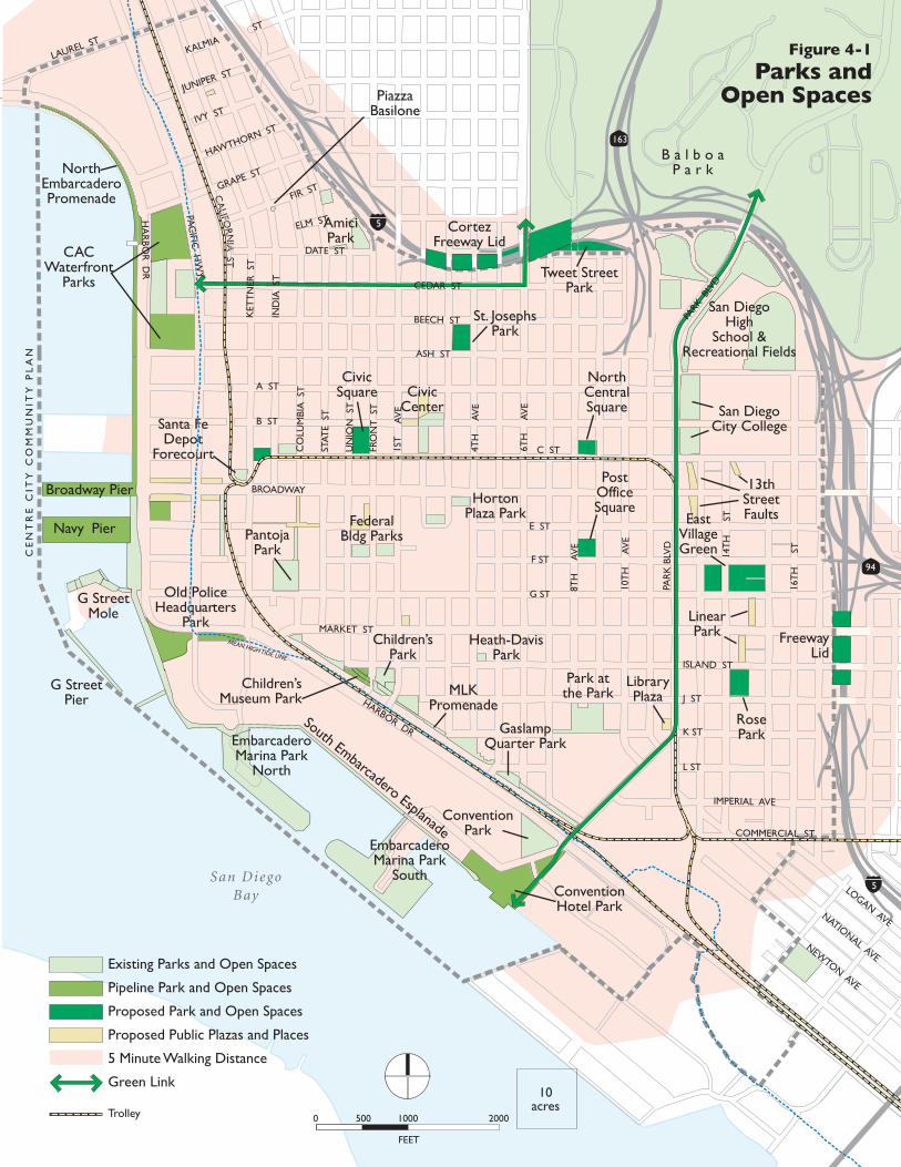
CA
LIFORN
IA ST
CE
NT
RE
CIT
Y C
OM
MU
NIT
Y P
LA
N
San DiegoBay
94
163
5
5
EmbarcaderoMarina Park
North
Embarcadero Marina Park
South
MLKPromenade
Children’sPark
ConventionPark
ConventionHotel Park
Old PoliceHeadquarters
Park
South Embarcadero Esplanade
G StreetMole
G StreetPier
Broadway Pier
Santa Fe Depot
Forecourt
CACWaterfront
Parks
NorthEmbarcaderoPromenade
PantojaPark
FederalBldg Parks
HortonPlaza Park
AmiciPark
San DiegoHigh
School &Recreational Fields
Tweet StreetPark
B a l b o aP a r k
CivicCenter
Park atthe Park
GaslampQuarter Park
Children’sMuseum Park
San DiegoCity College
PiazzaBasilone
Navy Pier
LibraryPlaza
PostOfficeSquare
13thStreetFaultsEast
VillageGreen
LinearPark Freeway
Lid
NorthCentralSquare
St. JosephsPark
CortezFreeway Lid
CivicSquare
RosePark
LOGAN AVENATIONAL AVE
NEWTON AVE
HA
RBO
R D
R
LAUREL ST
PAC
IFIC H
WY
BROADWAY
ASH ST
MARKET ST
HARBOR DR
PAR
K B
LVD
PARK
BLV
D
10T
H
AV
E
14T
H
ST
16T
H
ST
8TH
A
VE
6TH
A
VE
4TH
A
VE
1ST
A
VE
FRO
NT
ST
UN
ION
ST
STAT
E S
T
CO
LUM
BIA
ST
IND
IA S
T
KET
TN
ER S
T
JUNIPER ST
IVY ST
HAWTHORN ST
GRAPE ST
FIR ST
KALMIAST
ELM ST
DATE ST
CEDAR ST
BEECH ST
A ST
B ST
C ST
E ST
F ST
G ST
ISLAND ST
J ST
K ST
L ST
IMPERIAL AVE
COMMERCIAL ST
Existing Parks and Open Spaces
Pipeline Park and Open Spaces
Proposed Park and Open Spaces
Proposed Public Plazas and Places
5 Minute Walking Distance
Green Link
Trolley
Heath-DavisPark
Figure 4-1
Parks andOpen Spaces
FEET
0 500 1000 2000
10acres
MEAN HIGH TIDE LINE
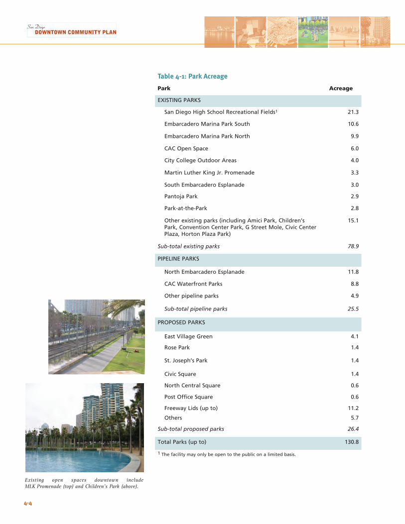
Existing open spaces downtown include MLK Promenade (top) and Children’s Park (above).
4-4
Table 4-1: Park Acreage
Park Acreage
EXISTING PARKS
San Diego High School Recreational Fields1 21.3
Embarcadero Marina Park South 10.6
Embarcadero Marina Park North 9.9
CAC Open Space 6.0
City College Outdoor Areas 4.0
Martin Luther King Jr. Promenade 3.3
South Embarcadero Esplanade 3.0
Pantoja Park 2.9
Park-at-the-Park 2.8
Other existing parks (including Amici Park, Children’s Park, Convention Center Park, G Street Mole, Civic Center Plaza, Horton Plaza Park)
15.1
Sub-total existing parks 78.9
PIPELINE PARKS
North Embarcadero Esplanade 11.8
CAC Waterfront Parks 8.8
Other pipeline parks 4.9
Sub-total pipeline parks 25.5
PROPOSED PARKS
East Village Green 4.1
Rose Park 1.4
St. Joseph’s Park 1.4
Civic Square 1.4
North Central Square 0.6
Post Office Square 0.6
Freeway Lids (up to) 11.2
Others 5.7
Sub-total proposed parks 26.4
Total Parks (up to) 130.8
1 The facility may only be open to the public on a limited basis.
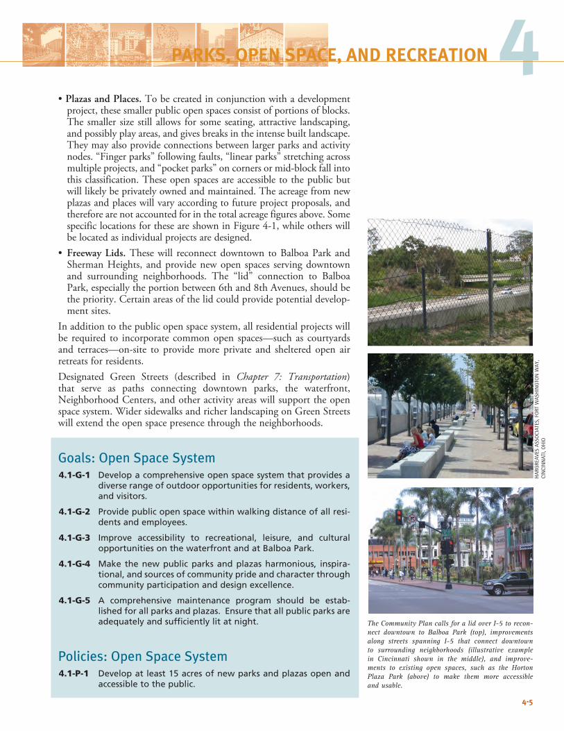
4-5
The Community Plan calls for a lid over I-5 to recon-nect downtown to Balboa Park (top), improvements along streets spanning I-5 that connect downtown to surrounding neighborhoods (illustrative example in Cincinnati shown in the middle), and improve-ments to existing open spaces, such as the Horton Plaza Park (above) to make them more accessible and usable.
4•Plazas and Places. To be created in conjunction with a development
project, these smaller public open spaces consist of portions of blocks. The smaller size still allows for some seating, attractive landscaping, and possibly play areas, and gives breaks in the intense built landscape. They may also provide connections between larger parks and activity nodes. “Finger parks” following faults, “linear parks” stretching across multiple projects, and “pocket parks” on corners or mid-block fall into this classification. These open spaces are accessible to the public but will likely be privately owned and maintained. The acreage from new plazas and places will vary according to future project proposals, and therefore are not accounted for in the total acreage figures above. Some specific locations for these are shown in Figure 4-1, while others will be located as individual projects are designed.
• Freeway Lids. These will reconnect downtown to Balboa Park and Sherman Heights, and provide new open spaces serving downtown and surrounding neighborhoods. The “lid” connection to Balboa Park, especially the portion between 6th and 8th Avenues, should be the priority. Certain areas of the lid could provide potential develop-ment sites.
In addition to the public open space system, all residential projects will be required to incorporate common open spaces—such as courtyards and terraces—on-site to provide more private and sheltered open air retreats for residents. Designated Green Streets (described in Chapter 7: Transportation) that serve as paths connecting downtown parks, the waterfront, Neighborhood Centers, and other activity areas will support the open space system. Wider sidewalks and richer landscaping on Green Streets will extend the open space presence through the neighborhoods.
Goals: Open Space System 4.1-G-1 Develop a comprehensive open space system that provides a
diverse range of outdoor opportunities for residents, workers, and visitors.
4.1-G-2 Provide public open space within walking distance of all resi-dents and employees.
4.1-G-3 Improve accessibility to recreational, leisure, and cultural opportunities on the waterfront and at Balboa Park.
4.1-G-4 Make the new public parks and plazas harmonious, inspira-tional, and sources of community pride and character through community participation and design excellence.
4.1-G-5 A comprehensive maintenance program should be estab-lished for all parks and plazas. Ensure that all public parks are adequately and sufficiently lit at night.
Policies: Open Space System4.1-P-1 Develop at least 15 acres of new parks and plazas open and
accessible to the public.
HAR
GRE
AVES
ASS
OCI
ATES
, FO
RT W
ASH
ING
TON
WAY
, CI
NCI
NN
ATI,
OH
IO
PARKS, OPEN SPACE, AND RECREATION
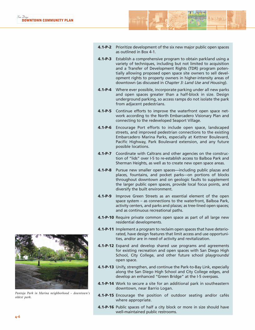
4-6
4.1-P-2 Prioritize development of the six new major public open spaces as outlined in Box 4-1.
4.1-P-3 Establish a comprehensive program to obtain parkland using a variety of techniques, including but not limited to acquisition and a Transfer of Development Rights (TDR) program poten-tially allowing proposed open space site owners to sell devel-opment rights to property owners in higher-intensity areas of downtown (as discussed in Chapter 3: Land Use and Housing).
4.1-P-4 Where ever possible, incorporate parking under all new parks and open spaces greater than a half-block in size. Design underground parking, so access ramps do not isolate the park from adjacent pedestrians.
4.1-P-5 Continue efforts to improve the waterfront open space net-work according to the North Embarcadero Visionary Plan and connecting to the redeveloped Seaport Village.
4.1-P-6 Encourage Port efforts to include open space, landscaped streets, and improved pedestrian connections to the existing Embarcadero Marina Parks, especially at Kettner Boulevard, Pacific Highway, Park Boulevard extension, and any future possible locations.
4.1-P-7 Coordinate with Caltrans and other agencies on the construc-tion of “lids” over I-5 to re-establish access to Balboa Park and Sherman Heights, as well as to create new open space areas.
4.1-P-8 Pursue new smaller open spaces—including public plazas and places, fountains, and pocket parks—on portions of blocks throughout downtown and on geologic faults to supplement the larger public open spaces, provide local focus points, and diversify the built environment.
4.1-P-9 Improve Green Streets as an essential element of the open space system – as connections to the waterfront, Balboa Park, activity centers, and parks and plazas; as tree-lined open spaces; and as continuous recreational paths.
4.1-P-10 Require private common open space as part of all large new residential developments.
4.1-P-11 Implement a program to reclaim open spaces that have deterio-rated, have design features that limit access and use opportuni-ties, and/or are in need of activity and revitalization.
4.1-P-12 Expand and develop shared use programs and agreements for existing recreation and open spaces with San Diego High School, City College, and other future school playgrounds/open space.
4.1-P-13 Unify, strengthen, and continue the Park-to-Bay Link, especially along the San Diego High School and City College edges, and develop an enhanced “Green Bridge” at the I-5 overpass.
4.1-P-14 Work to secure a site for an additional park in southeastern downtown, near Barrio Logan.
4.1-P-15 Encourage the position of outdoor seating and/or cafés where appropriate.
4.1-P-16 Public spaces of half a city block or more in size should have well-maintained public restrooms.
Pantoja Park in Marina neighborhood – downtown’s oldest park.
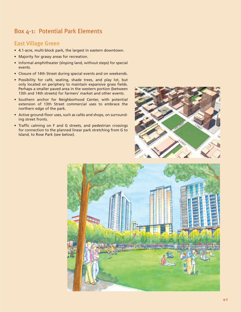
East Village Green• 4.1-acre, multi-block park, the largest in eastern downtown.
• Majority for grassy areas for recreation.
• Informal amphitheater (sloping land, without steps) for special events.
• Closure of 14th Street during special events and on weekends.
• Possibility for café, seating, shade trees, and play lot, but only located on periphery to maintain expansive grass fields. Perhaps a smaller paved area in the western portion (between 13th and 14th streets) for farmers’ market and other events.
• Southern anchor for Neighborhood Center, with potential extension of 13th Street commercial uses to embrace the northern edge of the park.
• Active ground-floor uses, such as cafés and shops, on surround-ing street fronts.
• Traffic calming on F and G streets, and pedestrian crossings for connection to the planned linear park stretching from G to Island, to Rose Park (see below).
Box 4-1: Potential Park Elements
14TH STREET F STREET
G STREET
4-7
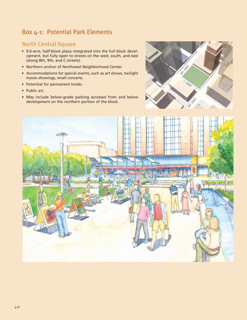
North Central Square• 0.6-acre, half-block plaza integrated into the full block devel-
opment, but fully open to streets on the west, south, and east (along 8th, 9th, and C streets).
• Northern anchor of Northwest Neighborhood Center.
• Accommodations for special events, such as art shows, twilight movie showings, small concerts.
• Potential for permanent kiosks.
• Public art.
• May include below-grade parking accessed from and below development on the northern portion of the block.
Box 4-1: Potential Park Elements
8TH S
TREE
T
C STREET
4-8
9TH S
TREE
T
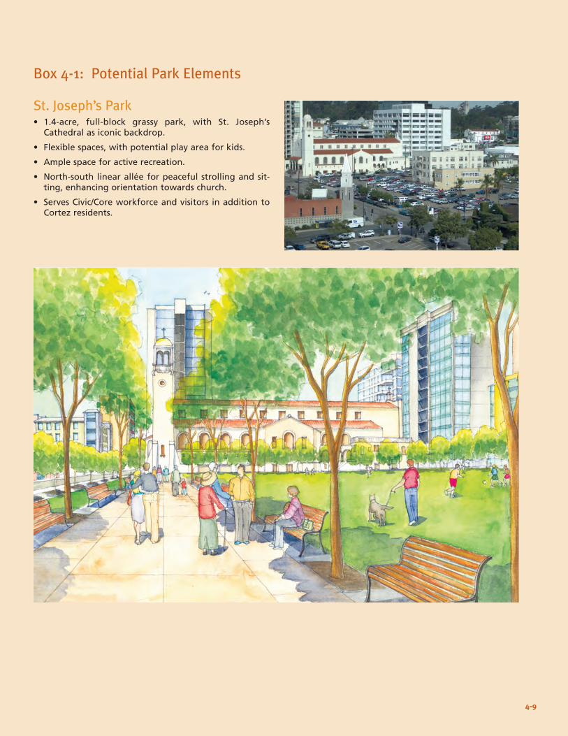
4PARKS, OPEN SPACE, AND RECREATION
St. Joseph’s Park• 1.4-acre, full-block grassy park, with St. Joseph’s
Cathedral as iconic backdrop.
• Flexible spaces, with potential play area for kids.
• Ample space for active recreation.
• North-south linear allée for peaceful strolling and sit-ting, enhancing orientation towards church.
• Serves Civic/Core workforce and visitors in addition to Cortez residents.
Box 4-1: Potential Park Elements
4-9
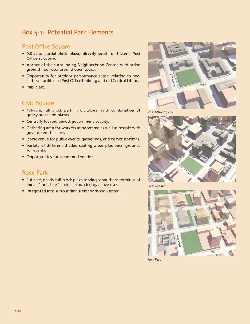
Box 4-1: Potential Park Elements
Post Office Square• 0.6-acre, partial-block plaza, directly south of historic Post
Office structure.
• Anchor of the surrounding Neighborhood Center, with active ground floor uses around open space.
• Opportunity for outdoor performance space, relating to new cultural facilities in Post Office building and old Central Library.
• Public art.
Civic Square• 1.4-acre, full block park in Civic/Core, with combination of
grassy areas and plazas.
• Centrally located amidst government activity.
• Gathering area for workers at noontime as well as people with government business.
• Iconic venue for public events, gatherings, and demonstrations.
• Variety of different shaded seating areas plus open grounds for events.
• Opportunities for some food vendors.
Rose Park• 1.4-acre, nearly full-block plaza serving as southern terminus of
linear “fault-line” park, surrounded by active uses.
• Integrated into surrounding Neighborhood Center.
4-10
Civic Square
Rose Park
8TH AVENUE
F STREET
14TH STREET
J STREET
UNION STREET
B STREE
T
Post Office Square
Old
Central Library
Post Office
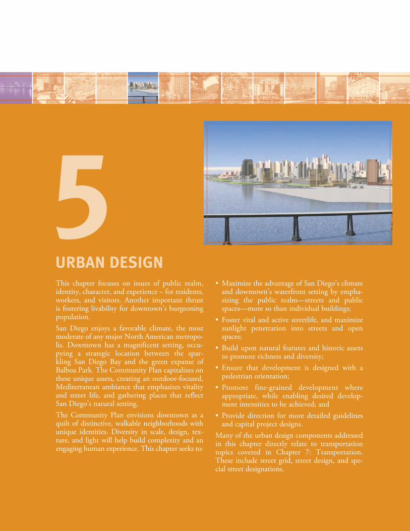
This chapter focuses on issues of public realm, identity, character, and experience – for residents, workers, and visitors. Another important thrust is fostering livability for downtown’s burgeoning population. San Diego enjoys a favorable climate, the most moderate of any major North American metropo-lis. Downtown has a magnificent setting, occu-pying a strategic location between the spar-kling San Diego Bay and the green expanse of Balboa Park. The Community Plan capitalizes on these unique assets, creating an outdoor-focused, Mediterranean ambiance that emphasizes vitality and street life, and gathering places that reflect San Diego’s natural setting.The Community Plan envisions downtown as a quilt of distinctive, walkable neighborhoods with unique identities. Diversity in scale, design, tex-ture, and light will help build complexity and an engaging human experience. This chapter seeks to:
• MaximizetheadvantageofSanDiego’sclimateand downtown’s waterfront setting by empha-sizing the public realm—streets and public spaces—more so than individual buildings;
• Fostervitalandactivestreetlife,andmaximizesunlight penetration into streets and open spaces;
• Builduponnatural featuresandhistoricassetsto promote richness and diversity;
• Ensure that development is designed with apedestrian orientation;
• Promote fine-grained development whereappropriate, while enabling desired develop-ment intensities to be achieved; and
• Providedirection formoredetailed guidelinesand capital project designs.
Many of the urban design components addressed in this chapter directly relate to transportation topics covered in Chapter 7: Transportation. These include street grid, street design, and spe-cial street designations.
URBAN DESIGN
5
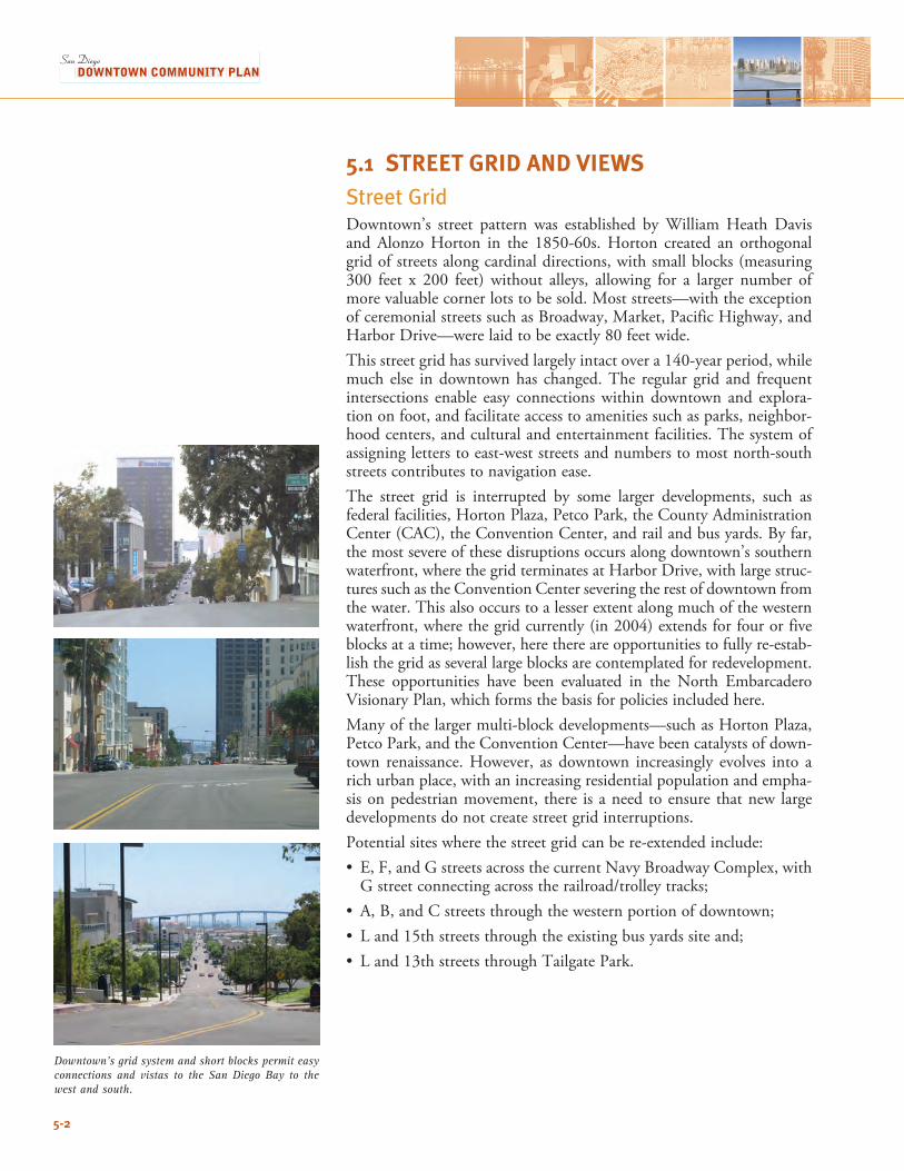
5.1 STREET GRID AND VIEWSStreet Grid Downtown’s street pattern was established by William Heath Davis and Alonzo Horton in the 1850-60s. Horton created an orthogonal grid of streets along cardinal directions, with small blocks (measuring 300 feet x 200 feet) without alleys, allowing for a larger number of more valuable corner lots to be sold. Most streets—with the exception of ceremonial streets such as Broadway, Market, Pacific Highway, and Harbor Drive—were laid to be exactly 80 feet wide. This street grid has survived largely intact over a 140-year period, while much else in downtown has changed. The regular grid and frequent intersections enable easy connections within downtown and explora-tion on foot, and facilitate access to amenities such as parks, neighbor-hood centers, and cultural and entertainment facilities. The system of assigning letters to east-west streets and numbers to most north-south streets contributes to navigation ease.The street grid is interrupted by some larger developments, such as federal facilities, Horton Plaza, Petco Park, the County Administration Center (CAC), the Convention Center, and rail and bus yards. By far, the most severe of these disruptions occurs along downtown’s southern waterfront, where the grid terminates at Harbor Drive, with large struc-tures such as the Convention Center severing the rest of downtown from the water. This also occurs to a lesser extent along much of the western waterfront, where the grid currently (in 2004) extends for four or five blocks at a time; however, here there are opportunities to fully re-estab-lish the grid as several large blocks are contemplated for redevelopment. These opportunities have been evaluated in the North EmbarcaderoVisionary Plan, which forms the basis for policies included here. Many of the larger multi-block developments—such as Horton Plaza, Petco Park, and the Convention Center—have been catalysts of down-town renaissance. However, as downtown increasingly evolves into a rich urban place, with an increasing residential population and empha-sis on pedestrian movement, there is a need to ensure that new large developments do not create street grid interruptions. Potential sites where the street grid can be re-extended include: • E,F,andGstreetsacrossthecurrentNavyBroadwayComplex,withGstreetconnectingacrosstherailroad/trolleytracks;
• A,B,andCstreetsthroughthewesternportionofdowntown;• Land15thstreetsthroughtheexistingbusyardssiteand;• Land13thstreetsthroughTailgatePark.
Downtown’s grid system and short blocks permit easy connections and vistas to the San Diego Bay to the west and south.
5-2
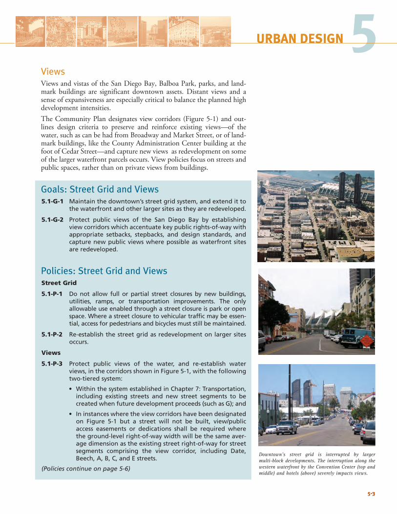
5-3
5URBAN DESIGN 5
5-3
Downtown’s street grid is interrupted by larger multi-block developments. The interruption along the western waterfront by the Convention Center (top and middle) and hotels (above) severely impacts views.
URBAN DESIGN
ViewsViews and vistas of the San Diego Bay, Balboa Park, parks, and land-mark buildings are significant downtown assets. Distant views and a sense of expansiveness are especially critical to balance the planned high development intensities. TheCommunityPlandesignatesviewcorridors(Figure5-1)andout-lines design criteria to preserve and reinforce existing views—of the water, such as can be had from Broadway and Market Street, or of land-mark buildings, like the County Administration Center building at the foot of Cedar Street—and capture new views as redevelopment on some of the larger waterfront parcels occurs. View policies focus on streets and public spaces, rather than on private views from buildings.
Goals: Street Grid and Views5.1-G-1 Maintain the downtown’s street grid system, and extend it to
the waterfront and other larger sites as they are redeveloped.
5.1-G-2 Protect public views of the San Diego Bay by establishing view corridors which accentuate key public rights-of-way with appropriate setbacks, stepbacks, and design standards, and capture new public views where possible as waterfront sites are redeveloped.
Policies: Street Grid and ViewsStreet Grid
5.1-P-1 Do not allow full or partial street closures by new buildings, utilities, ramps, or transportation improvements. The only allowable use enabled through a street closure is park or open space. Where a street closure to vehicular traffic may be essen-tial, access for pedestrians and bicycles must still be maintained.
5.1-P-2 Re-establish the street grid as redevelopment on larger sites occurs.
Views
5.1-P-3 Protect public views of the water, and re-establish water views, in the corridors shown in Figure 5-1, with the following two-tiered system:
• Within the system established in Chapter 7: Transportation, including existing streets and new street segments to be created when future development proceeds (such as G); and
• In instances where the view corridors have been designated on Figure 5-1 but a street will not be built, view/public access easements or dedications shall be required where the ground-level right-of-way width will be the same aver-age dimension as the existing street right-of-way for street segments comprising the view corridor, including Date, Beech, A, B, C, and E streets.
(Policies continue on page 5-6)
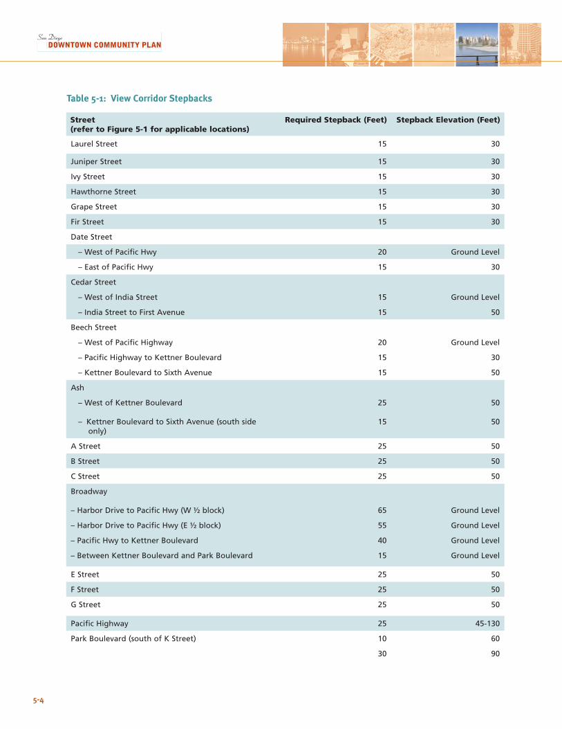
5-4
Street (refer to Figure 5-1 for applicable locations)
Required Stepback (Feet) Stepback Elevation (Feet)
Laurel Street 15 30
Juniper Street 15 30
Ivy Street 15 30
Hawthorne Street 15 30
Grape Street 15 30
Fir Street 15 30
Date Street
– West of Pacific Hwy 20 Ground Level
– East of Pacific Hwy 15 30
Cedar Street
– West of India Street 15 Ground Level
– India Street to First Avenue 15 50
Beech Street
– West of Pacific Highway 20 Ground Level
– Pacific Highway to Kettner Boulevard 15 30
– Kettner Boulevard to Sixth Avenue 15 50
Ash
– West of Kettner Boulevard 25 50
– Kettner Boulevard to Sixth Avenue (south side only)
15 50
A Street 25 50
B Street 25 50
C Street 25 50
Broadway
– Harbor Drive to Pacific Hwy (W ½ block) 65 Ground Level
– Harbor Drive to Pacific Hwy (E ½ block) 55 Ground Level
– Pacific Hwy to Kettner Boulevard 40 Ground Level
– Between Kettner Boulevard and Park Boulevard 15 Ground Level
E Street 25 50
F Street 25 50
G Street 25 50
Pacific Highway 25 45-130
Park Boulevard (south of K Street) 10 60
30 90
Table 5-1: View Corridor Stepbacks
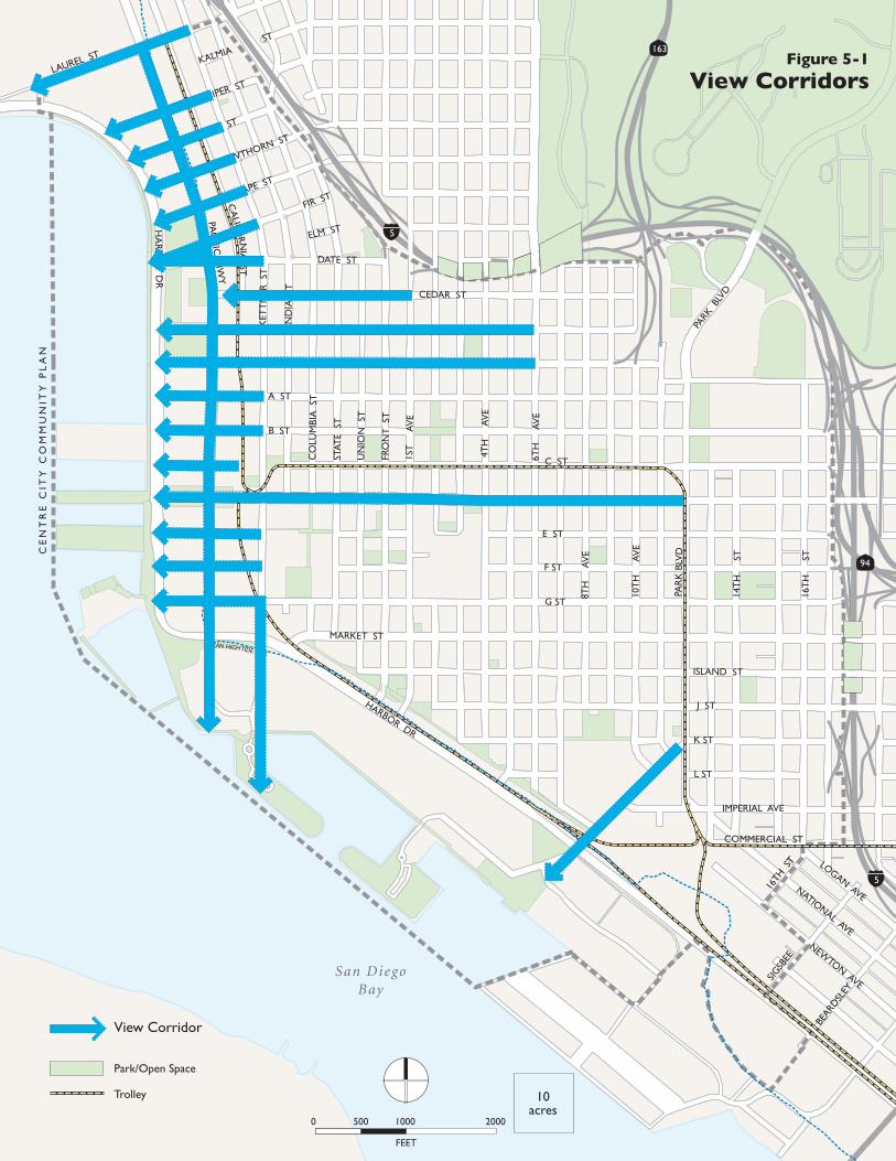
5-5
5URBAN DESIGN
CE
NT
RE
CIT
Y C
OM
MU
NIT
Y P
LA
N
San DiegoBay
94
163
5
5
HA
RBO
R D
R
LAUREL ST
PAC
IFIC H
WY
BROADWAY
ASH ST
MARKET ST
HARBOR DR
PAR
K B
LVD
PARK
BLV
D
10T
H
AV
E
14T
H
ST
16T
H
ST
8TH
A
VE
6TH
A
VE
4TH
A
VE
1ST
A
VE
FRO
NT
ST
UN
ION
ST
STAT
E S
T
CO
LUM
BIA
ST
IND
IA S
T
KET
TN
ER S
T
JUNIPER ST
IVY ST
HAWTHORN ST
GRAPE ST
FIR ST
KALMIAST
ELM ST
DATE ST
CEDAR ST
BEECH ST
A ST
B ST
C ST
E ST
F ST
G ST
ISLAND ST
J ST
K ST
L ST
IMPERIAL AVE
COMMERCIAL ST
CA
LIFOR N
IA ST
16TH
ST
SIGSB
EE
BEARD
SLEY
View Corridor
Park/Open Space
Trolley
LOGAN AVENATIONAL AVE
NEWTON AVE
FEET
0 500 1000 2000
10acres
MEAN HIGH TIDE LINE
Figure 5-1
View Corridors
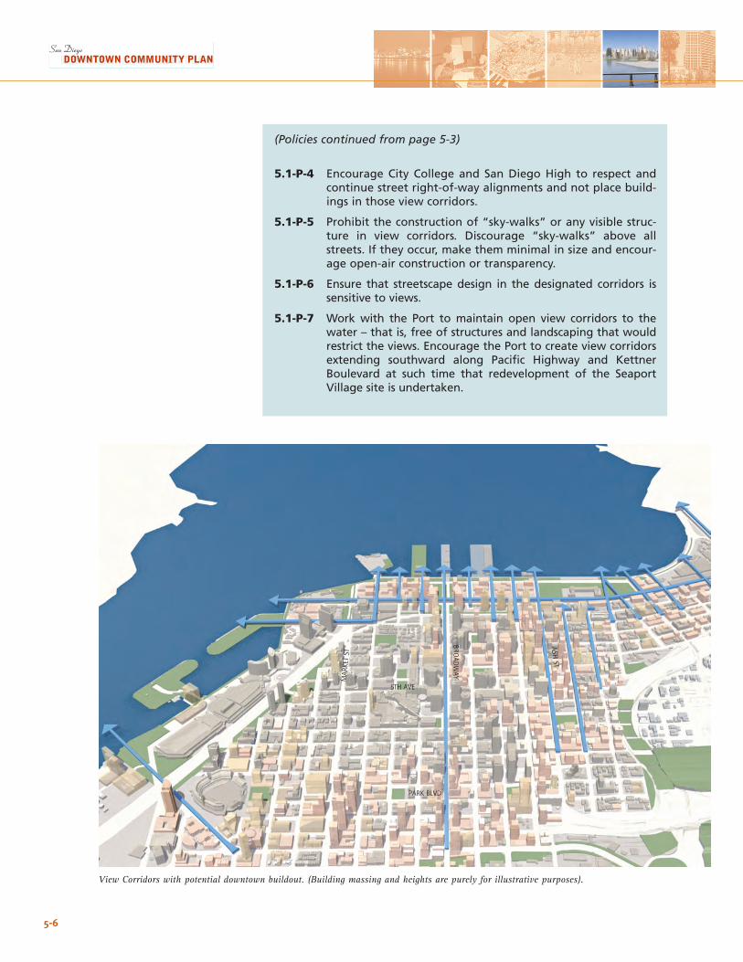
5-6
(Policies continued from page 5-3)
5.1-P-4 Encourage City College and San Diego High to respect and continue street right-of-way alignments and not place build-ings in those view corridors.
5.1-P-5 Prohibit the construction of “sky-walks” or any visible struc-ture in view corridors. Discourage “sky-walks” above all streets. If they occur, make them minimal in size and encour-age open-air construction or transparency.
5.1-P-6 Ensure that streetscape design in the designated corridors is sensitive to views.
5.1-P-7 Work with the Port to maintain open view corridors to the water – that is, free of structures and landscaping that would restrict the views. Encourage the Port to create view corridors extending southward along Pacific Highway and Kettner Boulevard at such time that redevelopment of the Seaport Village site is undertaken.
PARK BLVD
5TH AVE
BROADW
AY
ASH ST
MAR
KET
ST
View Corridors with potential downtown buildout. (Building massing and heights are purely for illustrative purposes).
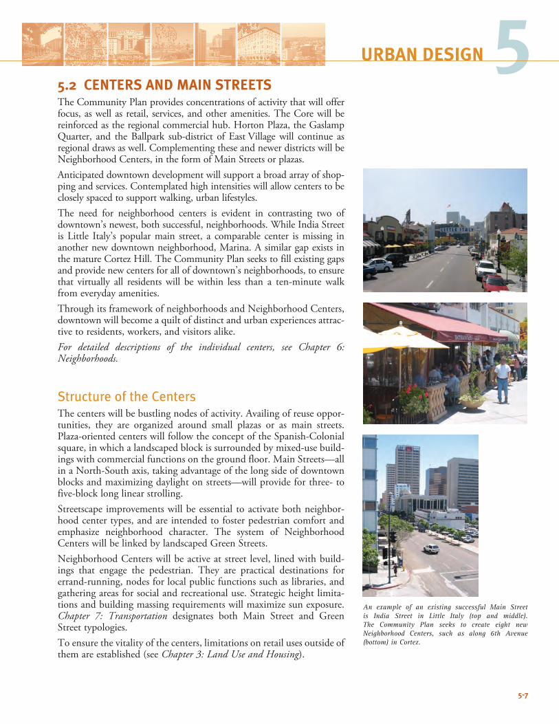
5URBAN DESIGN
5-7
An example of an existing successful Main Street is India Street in Little Italy (top and middle). The Community Plan seeks to create eight new Neighborhood Centers, such as along 6th Avenue (bottom) in Cortez.
5.2 CENTERS AND MAIN STREETSThe Community Plan provides concentrations of activity that will offer focus, as well as retail, services, and other amenities. The Core will be reinforcedastheregionalcommercialhub.HortonPlaza,theGaslampQuarter, and theBallpark sub-district of EastVillagewill continue asregional draws as well. Complementing these and newer districts will be Neighborhood Centers, in the form of Main Streets or plazas. Anticipated downtown development will support a broad array of shop-ping and services. Contemplated high intensities will allow centers to be closely spaced to support walking, urban lifestyles. The need for neighborhood centers is evident in contrasting two of downtown’s newest, both successful, neighborhoods. While India Street is Little Italy’s popularmain street, a comparable center ismissing inanother new downtown neighborhood, Marina. A similar gap exists in the mature Cortez Hill. The Community Plan seeks to fill existing gaps and provide new centers for all of downtown’s neighborhoods, to ensure that virtually all residents will be within less than a ten-minute walk from everyday amenities. Through its framework of neighborhoods and Neighborhood Centers, downtown will become a quilt of distinct and urban experiences attrac-tive to residents, workers, and visitors alike.For detailed descriptions of the individual centers, see Chapter 6: Neighborhoods.
Structure of the CentersThe centers will be bustling nodes of activity. Availing of reuse oppor-tunities, they are organized around small plazas or as main streets. Plaza-oriented centers will follow the concept of the Spanish-Colonial square, in which a landscaped block is surrounded by mixed-use build-ings with commercial functions on the ground floor. Main Streets—all in a North-South axis, taking advantage of the long side of downtown blocks and maximizing daylight on streets—will provide for three- to five-block long linear strolling. Streetscape improvements will be essential to activate both neighbor-hood center types, and are intended to foster pedestrian comfort and emphasize neighborhood character. The system of Neighborhood CenterswillbelinkedbylandscapedGreenStreets.Neighborhood Centers will be active at street level, lined with build-ings that engage the pedestrian. They are practical destinations for errand-running, nodes for local public functions such as libraries, and gathering areas for social and recreational use. Strategic height limita-tions and building massing requirements will maximize sun exposure. Chapter 7: Transportation designates both Main Street and GreenStreet typologies.To ensure the vitality of the centers, limitations on retail uses outside of them are established (see Chapter 3: Land Use and Housing).
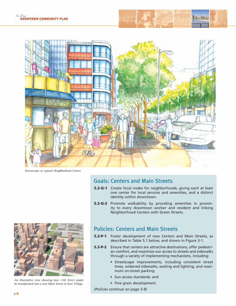
5-8
An illustrative view showing how 13th Street might be transformed into a new Main Street in East Village.
Goals: Centers and Main Streets5.2-G-1 Create focal nodes for neighborhoods, giving each at least
one center for local services and amenities, and a distinct identity within downtown.
5.2-G-2 Promote walkability by providing amenities in proxim-ity to every downtown worker and resident and linking Neighborhood Centers with Green Streets.
Policies: Centers and Main Streets5.2-P-1 Foster development of new Centers and Main Streets, as
described in Table 5.1 below, and shown in Figure 3-1.
5.2-P-2 Ensure that centers are attractive destinations, offer pedestri-an comfort, and maximize sun access to streets and sidewalks through a variety of implementing mechanisms, including:
• Streetscape improvements, including consistent street trees, widened sidewalks, seating and lighting, and maxi-mum on-street parking.
• Sun access standards; and
• Fine grain development.
(Policies continue on page 5-9)
F ST
13TH
ST
Streetscape at typical Neighborhood Center.
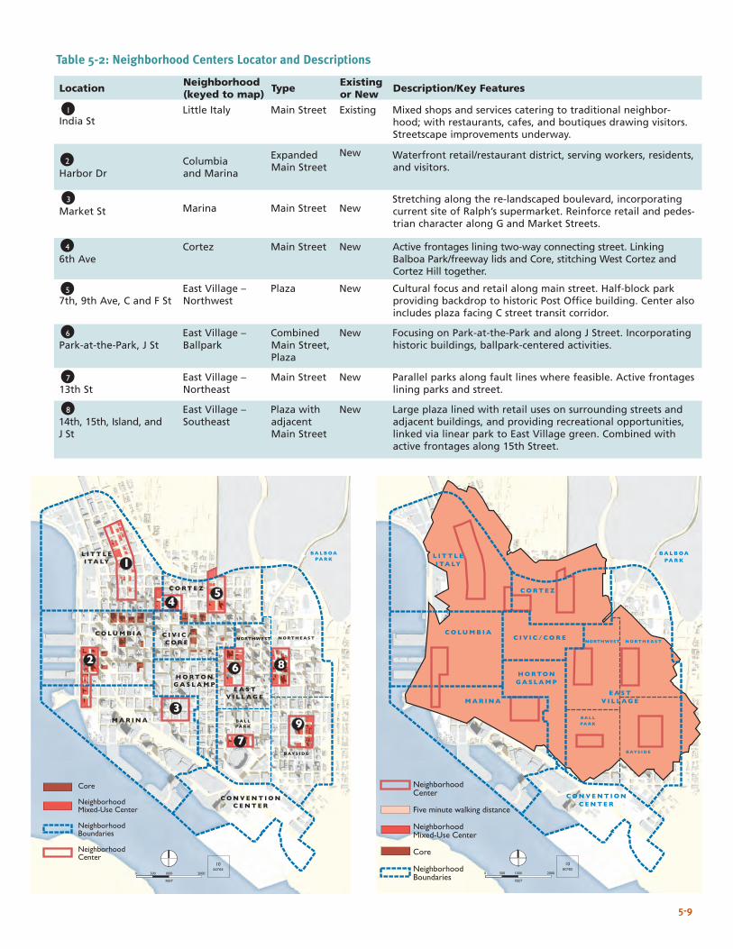
NeighborhoodCenter
Five minute walking distance
NeighborhoodMixed-Use Center
Core
NeighborhoodBoundaries
MAR INA
HORTONGASLAMP
L I TTL EI TALY
BALBOAPARK
BALLPARK
CONVENT IONCENTER
NORTHEAST
BAYS ID E
C I V I C / CORECOLUMB IA
CORTEZ
EASTV I L LAGE
FEET
0 500 1000 2000
10acres
NORTHWEST
Location Neighborhood (keyed to map) Type Existing
or New Description/Key Features
India St
Little Italy
Main Street
Existing
Mixed shops and services catering to traditional neighbor-hood; with restaurants, cafes, and boutiques drawing visitors. Streetscape improvements underway.
Harbor Dr
Columbia and Marina
Expanded Main Street
New Waterfront retail/restaurant district, serving workers, residents, and visitors.
Market St Marina Main Street New
Stretching along the re-landscaped boulevard, incorporating current site of Ralph’s supermarket. Reinforce retail and pedes-trian character along G and Market Streets.
6th Ave
Cortez Main Street New Active frontages lining two-way connecting street. Linking Balboa Park/freeway lids and Core, stitching West Cortez and Cortez Hill together.
7th, 9th Ave, C and F St
East Village – Northwest
Plaza New Cultural focus and retail along main street. Half-block park providing backdrop to historic Post Office building. Center also includes plaza facing C street transit corridor.
Park-at-the-Park, J St
East Village – Ballpark
Combined Main Street, Plaza
New Focusing on Park-at-the-Park and along J Street. Incorporating historic buildings, ballpark-centered activities.
13th St
East Village – Northeast
Main Street New Parallel parks along fault lines where feasible. Active frontages lining parks and street.
14th, 15th, Island, and J St
East Village – Southeast
Plaza with adjacent Main Street
New Large plaza lined with retail uses on surrounding streets and adjacent buildings, and providing recreational opportunities, linked via linear park to East Village green. Combined with active frontages along 15th Street.
Table 5-2: Neighborhood Centers Locator and Descriptions
1
2
3
4
5
6
7
8
Core
NeighborhoodMixed-Use Center
NeighborhoodBoundaries
NeighborhoodCenter
MAR INA
HORTONGASLAMP
L I TTL EI TALY
BALBOAPARK
BALLPARK
CONVENT IONCENTER
NORTHEAST
BAYS ID E
C I V I C /CORE
COLUMB IA
CORTEZ
EASTV I L LAGE
FEET
0 500 1000 2000
10acres
3
7
9
86
54
1
2
NORTHWEST
5-9
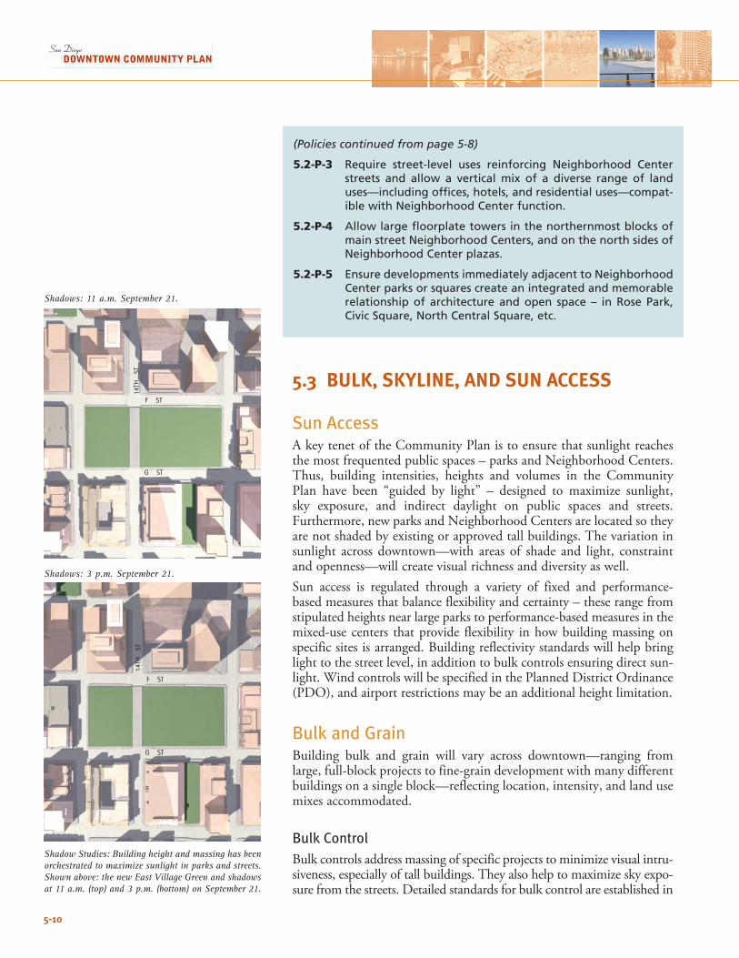
5-10
Shadow Studies: Building height and massing has been orchestrated to maximize sunlight in parks and streets. Shown above: the new East Village Green and shadows at 11 a.m. (top) and 3 p.m. (bottom) on September 21.
(Policies continued from page 5-8)
5.2-P-3 Require street-level uses reinforcing Neighborhood Center streets and allow a vertical mix of a diverse range of land uses—including offices, hotels, and residential uses—compat-ible with Neighborhood Center function.
5.2-P-4 Allow large floorplate towers in the northernmost blocks of main street Neighborhood Centers, and on the north sides of Neighborhood Center plazas.
5.2-P-5 Ensure developments immediately adjacent to Neighborhood Center parks or squares create an integrated and memorable relationship of architecture and open space – in Rose Park, Civic Square, North Central Square, etc.
5.3 BULK, SKYLINE, AND SUN ACCESS
Sun AccessA key tenet of the Community Plan is to ensure that sunlight reaches the most frequented public spaces – parks and Neighborhood Centers. Thus, building intensities, heights and volumes in the Community Plan have been “guided by light” – designed to maximize sunlight, sky exposure, and indirect daylight on public spaces and streets. Furthermore,newparksandNeighborhoodCentersarelocatedsotheyare not shaded by existing or approved tall buildings. The variation in sunlight across downtown—with areas of shade and light, constraint and openness—will create visual richness and diversity as well.Sun access is regulated through a variety of fixed and performance-based measures that balance flexibility and certainty – these range from stipulated heights near large parks to performance-based measures in the mixed-use centers that provide flexibility in how building massing on specific sites is arranged. Building reflectivity standards will help bring light to the street level, in addition to bulk controls ensuring direct sun-light. Wind controls will be specified in the Planned District Ordinance (PDO), and airport restrictions may be an additional height limitation.
Bulk and GrainBuilding bulk and grain will vary across downtown—ranging from large, full-block projects to fine-grain development with many different buildings on a single block—reflecting location, intensity, and land use mixes accommodated.
Bulk Control Bulk controls address massing of specific projects to minimize visual intru-siveness, especially of tall buildings. They also help to maximize sky expo-sure from the streets. Detailed standards for bulk control are established in
F ST
G ST
14TH
ST
F ST
G ST
14TH
ST
Shadows: 3 p.m. September 21.
Shadows: 11 a.m. September 21.
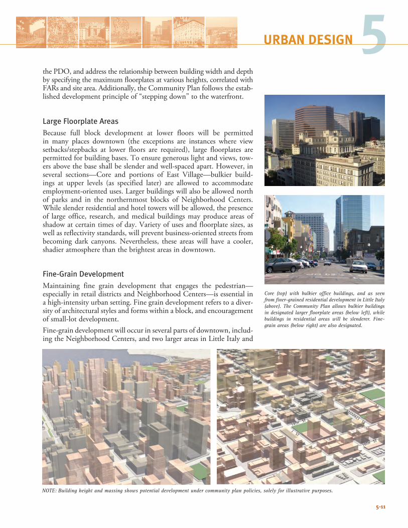
5-11
5URBAN DESIGN
Core (top) with bulkier office buildings, and as seen from finer-grained residential development in Little Italy (above). The Community Plan allows bulkier buildings in designated larger floorplate areas (below left), while buildings in residential areas will be slenderer. Fine-grain areas (below right) are also designated.
the PDO, and address the relationship between building width and depth by specifying the maximum floorplates at various heights, correlated with FARsandsitearea.Additionally,theCommunityPlanfollowstheestab-lished development principle of “stepping down” to the waterfront.
Large Floorplate AreasBecause full block development at lower floors will be permitted in many places downtown (the exceptions are instances where view setbacks/stepbacks at lower floors are required), large floorplates arepermitted for building bases. To ensure generous light and views, tow-ers above the base shall be slender and well-spaced apart. However, in several sections—Core and portions of East Village—bulkier build-ings at upper levels (as specified later) are allowed to accommodate employment-orienteduses.Largerbuildingswillalsobeallowednorthof parks and in the northernmost blocks of Neighborhood Centers. While slender residential and hotel towers will be allowed, the presence of large office, research, and medical buildings may produce areas of shadow at certain times of day. Variety of uses and floorplate sizes, as well as reflectivity standards, will prevent business-oriented streets from becoming dark canyons. Nevertheless, these areas will have a cooler, shadier atmosphere than the brightest areas in downtown.
Fine-Grain DevelopmentMaintaining fine grain development that engages the pedestrian— especially in retail districts and Neighborhood Centers—is essential in ahigh-intensityurbansetting.Finegraindevelopmentreferstoadiver-sity of architectural styles and forms within a block, and encouragement of small-lot development.Fine-graindevelopmentwilloccurinseveralpartsofdowntown,includ-ingtheNeighborhoodCenters,andtwolargerareasinLittleItalyand
MARKET ST
J ST
14TH ST
16TH ST
NOTE: Building height and massing shows potential development under community plan policies, solely for illustrative purposes.
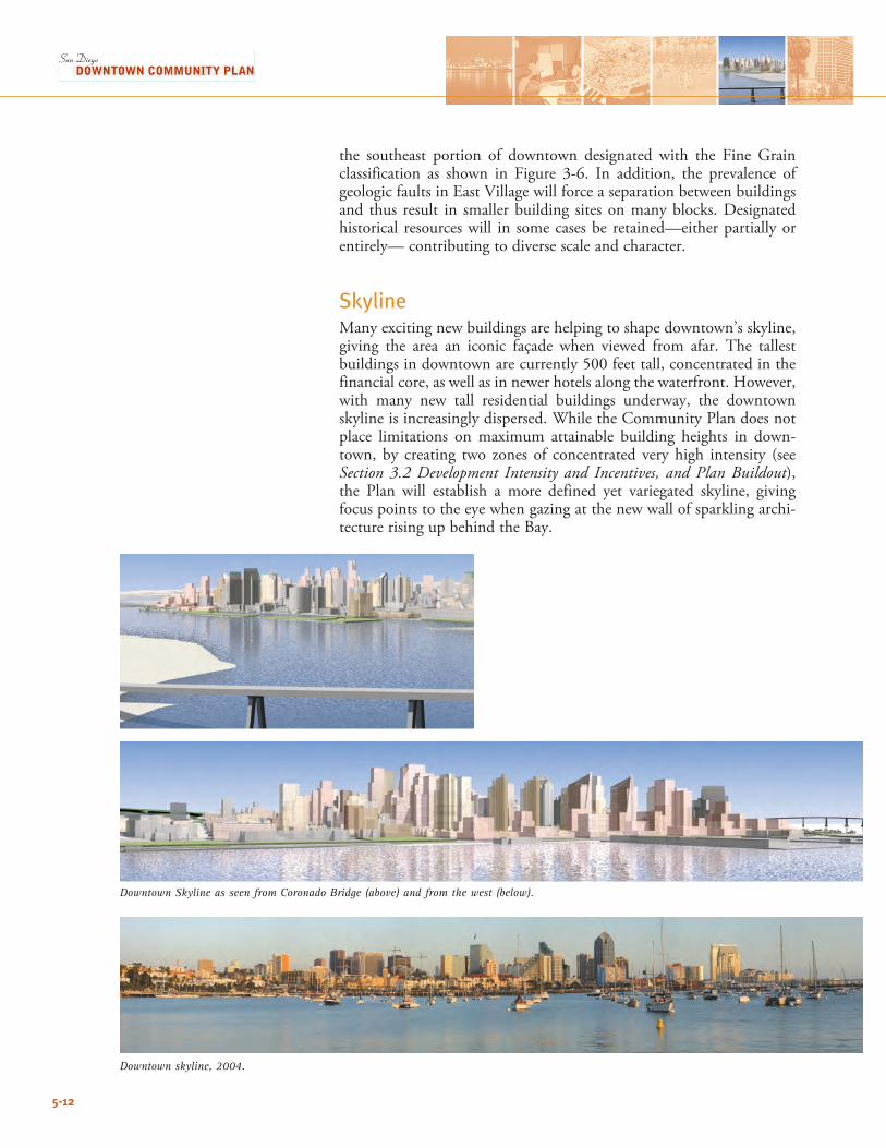
5-12
the southeast portion of downtown designated with the Fine Grainclassification as shown in Figure 3-6. In addition, the prevalence ofgeologicfaultsinEastVillagewillforceaseparationbetweenbuildingsand thus result in smaller building sites on many blocks. Designated historical resources will in some cases be retained—either partially or entirely— contributing to diverse scale and character.
SkylineMany exciting new buildings are helping to shape downtown’s skyline, giving the area an iconic façade when viewed from afar. The tallest buildings in downtown are currently 500 feet tall, concentrated in the financial core, as well as in newer hotels along the waterfront. However, with many new tall residential buildings underway, the downtown skyline is increasingly dispersed. While the Community Plan does not place limitations on maximum attainable building heights in down-town, by creating two zones of concentrated very high intensity (see Section 3.2 Development Intensity and Incentives, and Plan Buildout), the Plan will establish a more defined yet variegated skyline, giving focus points to the eye when gazing at the new wall of sparkling archi-tecture rising up behind the Bay.
Downtown Skyline as seen from Coronado Bridge (above) and from the west (below).
Downtown skyline, 2004.
5-13
5URBAN DESIGN
Goals: Bulk, Skyline, and Sun Access5.3-G-1 Permit bulkier buildings in the Core while striving for slen-
derer towers in the neighborhoods that permit greater sky exposure for adjacent sidewalks as well as from a distance.
5.3-G-2 Ensure that building height, massing, and tower spacing allows for greater visual penetration closer to the water.
5.3-G-3 Create a variegated skyline with peaks in the Core and high-intensity East Village residential area, stepping down to the waterfront and surrounding neighborhoods.
5.3-G-4 Ensure uninterrupted sunlight during designated periods on all major parks, and maintain standards to ensure adequate sunlight on sidewalks and streets in Neighborhood Centers and residential areas.
5.3-G-5 Maximize sky exposure for streets and public spaces.
Policies: Bulk, Skyline, and Sun AccessHeights and Sun Access
5.3-P-1 Restrict building heights as follows (Figure 5-2):
• Around parks to maintain uninterrupted sunlight with spe-cific criteria delineated in the PDO;
• In Marina and Gaslamp for sunlight and urban design con-siderations;
• Stepping down towards the water in the North Embarcadero area;
• Surrounding the CAC; and
• Throughout downtown, consistent with policies and regu-lations for airport operations established by the Federal Aviation Administration (FAA), the Airport Land Use Compatibility Plan (ALUCP), and the Airport Approach Overlay Zone.
5.3-P-2 Apply Sun Access Envelope criteria in Little Italy, as shown in Figure 5-2, to maintain adequate sunlight and air to sidewalks.
5.3-P-3 Establish performance-based Sun Access requirements in the Neighborhood Centers, which provide flexibility in building massing.
5.3-P-4 Maintain standards for building reflectivity to maximize day-light on sidewalks and streets.
(Policies continue on page 5-15)
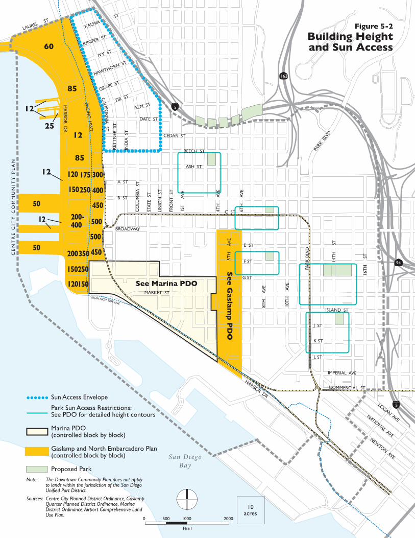
5-14
San DiegoBay
See Marina PDO
Se
e G
aslam
p P
DO
HA
RBO
R D
R
LAUREL ST
PAC
IFIC H
WY
BROADWAY
ASH ST
MARKET ST
HARBOR DR
PAR
K B
LVD
PARK
BLV
D
10T
H
AV
E
14T
H
ST
16T
H
ST
8TH
A
VE
6TH
A
VE
4TH
A
VE
1ST
A
VE
FRO
NT
ST
UN
ION
ST
STAT
E S
T
CO
LUM
BIA
ST
IND
IA S
T
KET
TN
ER S
T
JUNIPER ST
IVY ST
HAWTHORN ST
GRAPE ST
FIR ST
KALMIAST
ELM ST
DATE ST
CEDAR ST
BEECH ST
A ST
B ST
C ST
E ST
F ST
G ST
ISLAND ST
J ST
K ST
L ST
IMPERIAL AVE
COMMERCIAL ST
LOGAN AVENATIONAL AVE
NEWTON AVE
CA
LIFOR
NIA
ST
5TH
A
VE
CE
NT
RE
CIT
Y C
OM
MU
NIT
Y P
LA
N
Figure 5-2
Building Heightand Sun Access
FEET
0 500 1000 2000
10acres
MEAN HIGH TIDE LINE
12
60
85
12
85
25
120 175 300
150250 400
500
500
450
450350200
150250
150120
50
50
12
12
200-400
Sun Access Envelope
Park Sun Access Restrictions:See PDO for detailed height contours
Marina PDO(controlled block by block)
Gaslamp and North Embarcadero Plan(controlled block by block)
Proposed Park
Sources: Centre City Planned District Ordinance, Gaslamp Quarter Planned District Ordinance, Marina District Ordinance, Airport Comprehensive Land Use Plan.
Note: The Downtown Community Plan does not apply to lands within the jurisdiction of the San Diego Unified Port District.
163
94
5
5
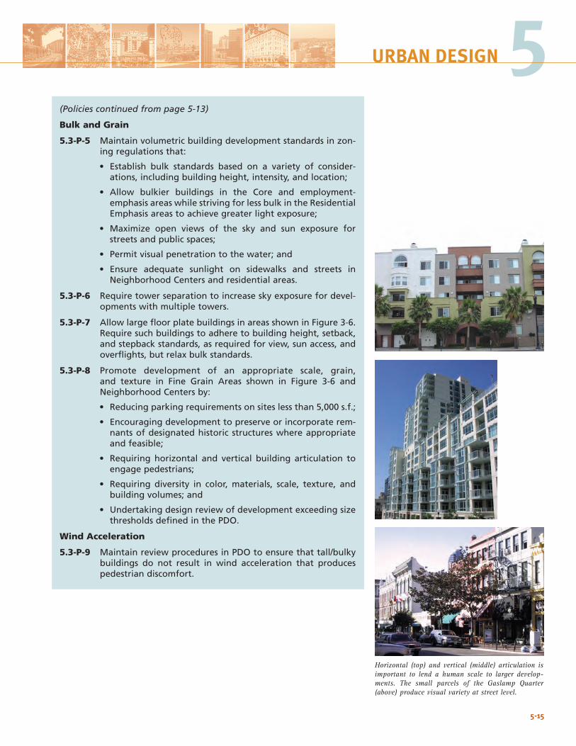
5-15
5URBAN DESIGN
(Policies continued from page 5-13)
Bulk and Grain
5.3-P-5 Maintain volumetric building development standards in zon-ing regulations that:
• Establish bulk standards based on a variety of consider-ations, including building height, intensity, and location;
• Allow bulkier buildings in the Core and employment-emphasis areas while striving for less bulk in the Residential Emphasis areas to achieve greater light exposure;
• Maximize open views of the sky and sun exposure for streets and public spaces;
• Permit visual penetration to the water; and
• Ensure adequate sunlight on sidewalks and streets in Neighborhood Centers and residential areas.
5.3-P-6 Require tower separation to increase sky exposure for devel-opments with multiple towers.
5.3-P-7 Allow large floor plate buildings in areas shown in Figure 3-6. Require such buildings to adhere to building height, setback, and stepback standards, as required for view, sun access, and overflights, but relax bulk standards.
5.3-P-8 Promote development of an appropriate scale, grain, and texture in Fine Grain Areas shown in Figure 3-6 and Neighborhood Centers by:
• Reducing parking requirements on sites less than 5,000 s.f.;
• Encouraging development to preserve or incorporate rem-nants of designated historic structures where appropriate and feasible;
• Requiring horizontal and vertical building articulation to engage pedestrians;
• Requiring diversity in color, materials, scale, texture, and building volumes; and
• Undertaking design review of development exceeding size thresholds defined in the PDO.
Wind Acceleration
5.3-P-9 Maintain review procedures in PDO to ensure that tall/bulky buildings do not result in wind acceleration that produces pedestrian discomfort.
Horizontal (top) and vertical (middle) articulation is important to lend a human scale to larger develop-ments. The small parcels of the Gaslamp Quarter (above) produce visual variety at street level.
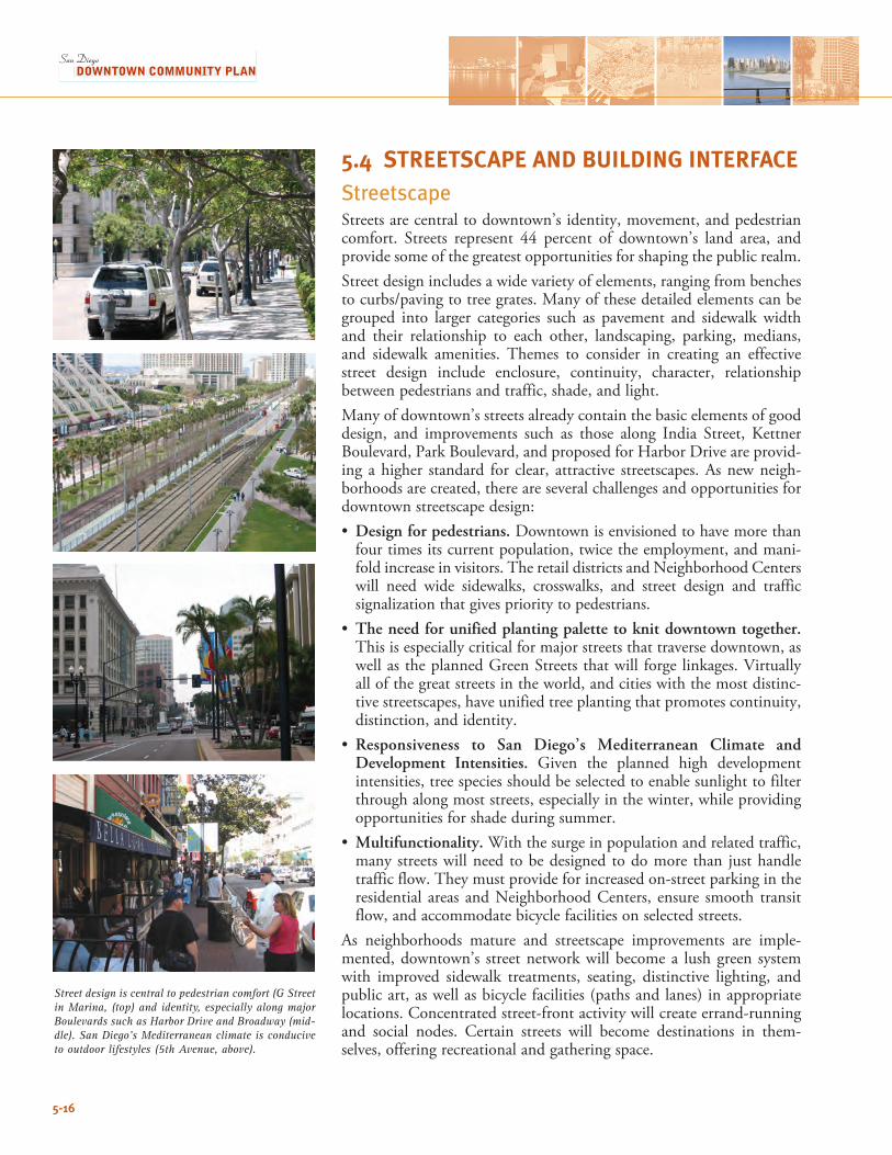
5-16
Street design is central to pedestrian comfort (G Street in Marina, (top) and identity, especially along major Boulevards such as Harbor Drive and Broadway (mid-dle). San Diego’s Mediterranean climate is conducive to outdoor lifestyles (5th Avenue, above).
5.4 STREETSCAPE AND BUILDING INTERFACEStreetscape Streets are central to downtown’s identity, movement, and pedestrian comfort. Streets represent 44 percent of downtown’s land area, and provide some of the greatest opportunities for shaping the public realm. Street design includes a wide variety of elements, ranging from benches tocurbs/pavingtotreegrates.Manyofthesedetailedelementscanbegrouped into larger categories such as pavement and sidewalk width and their relationship to each other, landscaping, parking, medians, and sidewalk amenities. Themes to consider in creating an effective street design include enclosure, continuity, character, relationship between pedestrians and traffic, shade, and light. Many of downtown’s streets already contain the basic elements of good design, and improvements such as those along India Street, Kettner Boulevard, Park Boulevard, and proposed for Harbor Drive are provid-ing a higher standard for clear, attractive streetscapes. As new neigh-borhoods are created, there are several challenges and opportunities for downtown streetscape design: • Design for pedestrians. Downtown is envisioned to have more than
four times its current population, twice the employment, and mani-fold increase in visitors. The retail districts and Neighborhood Centers will need wide sidewalks, crosswalks, and street design and traffic signalization that gives priority to pedestrians.
• The need for unified planting palette to knit downtown together. This is especially critical for major streets that traverse downtown, as wellastheplannedGreenStreetsthatwill forge linkages.Virtuallyall of the great streets in the world, and cities with the most distinc-tive streetscapes, have unified tree planting that promotes continuity, distinction, and identity.
• Responsiveness to San Diego’s Mediterranean Climate and Development Intensities. Given the planned high developmentintensities, tree species should be selected to enable sunlight to filter through along most streets, especially in the winter, while providing opportunities for shade during summer.
• Multifunctionality. With the surge in population and related traffic, many streets will need to be designed to do more than just handle traffic flow. They must provide for increased on-street parking in the residential areas and Neighborhood Centers, ensure smooth transit flow, and accommodate bicycle facilities on selected streets.
As neighborhoods mature and streetscape improvements are imple-mented, downtown’s street network will become a lush green system with improved sidewalk treatments, seating, distinctive lighting, and public art, as well as bicycle facilities (paths and lanes) in appropriate locations. Concentrated street-front activity will create errand-running and social nodes. Certain streets will become destinations in them-selves, offering recreational and gathering space.
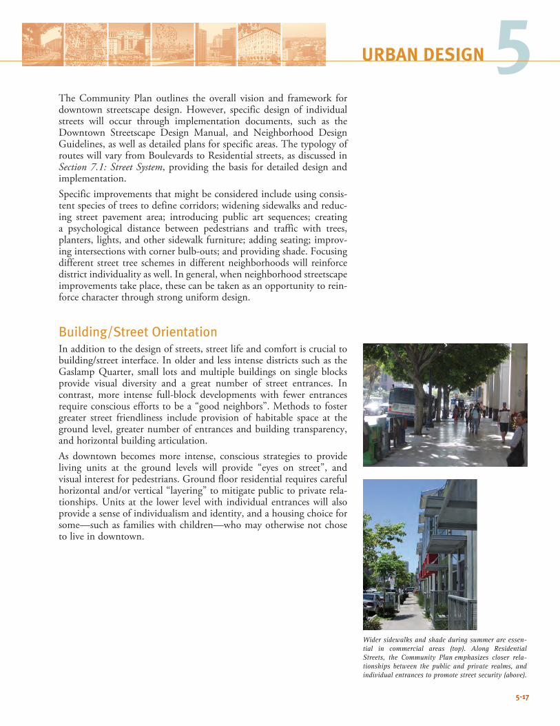
5-17
5URBAN DESIGN
The Community Plan outlines the overall vision and framework for downtown streetscape design. However, specific design of individual streets will occur through implementation documents, such as the Downtown Streetscape Design Manual, and Neighborhood Design Guidelines,aswellasdetailedplansforspecificareas.ThetypologyofrouteswillvaryfromBoulevardstoResidentialstreets,asdiscussedinSection 7.1: Street System, providing the basis for detailed design and implementation.Specific improvements that might be considered include using consis-tent species of trees to define corridors; widening sidewalks and reduc-ing street pavement area; introducing public art sequences; creating a psychological distance between pedestrians and traffic with trees, planters, lights, and other sidewalk furniture; adding seating; improv-ingintersectionswithcornerbulb-outs;andprovidingshade.Focusingdifferent street tree schemes in different neighborhoods will reinforce district individuality as well. In general, when neighborhood streetscape improvements take place, these can be taken as an opportunity to rein-force character through strong uniform design.
Building/Street OrientationIn addition to the design of streets, street life and comfort is crucial to building/streetinterface.InolderandlessintensedistrictssuchastheGaslampQuarter, small lots andmultiple buildings on single blocksprovide visual diversity and a great number of street entrances. In contrast, more intense full-block developments with fewer entrances require conscious efforts to be a “good neighbors”. Methods to foster greater street friendliness include provision of habitable space at the ground level, greater number of entrances and building transparency, and horizontal building articulation. As downtown becomes more intense, conscious strategies to provide living units at the ground levels will provide “eyes on street”, and visualinterestforpedestrians.Groundfloorresidentialrequirescarefulhorizontaland/orvertical“layering”tomitigatepublictoprivaterela-tionships. Units at the lower level with individual entrances will also provide a sense of individualism and identity, and a housing choice for some—such as families with children—who may otherwise not chose to live in downtown.
Wider sidewalks and shade during summer are essen-tial in commercial areas (top). Along Residential Streets, the Community Plan emphasizes closer rela-tionships between the public and private realms, and individual entrances to promote street security (above).
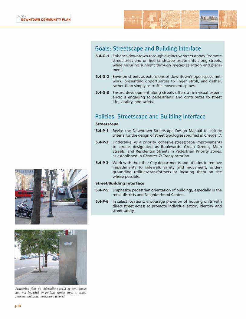
5-18
Pedestrian flow on sidewalks should be continuous, and not impeded by parking ramps (top) or trans-formers and other structures (above).
Goals: Streetscape and Building Interface5.4-G-1 Enhance downtown through distinctive streetscapes. Promote
street trees and unified landscape treatments along streets, while ensuring sunlight through species selection and place-ment.
5.4-G-2 Envision streets as extensions of downtown’s open space net-work, presenting opportunities to linger, stroll, and gather, rather than simply as traffic movement spines.
5.4-G-3 Ensure development along streets offers a rich visual experi-ence; is engaging to pedestrians; and contributes to street life, vitality, and safety.
Policies: Streetscape and Building InterfaceStreetscape
5.4-P-1 Revise the Downtown Streetscape Design Manual to include criteria for the design of street typologies specified in Chapter 7.
5.4-P-2 Undertake, as a priority, cohesive streetscape improvements to streets designated as Boulevards, Green Streets, Main Streets, and Residential Streets in Pedestrian Priority Zones, as established in Chapter 7: Transportation.
5.4-P-3 Work with the other City departments and utilities to remove impediments to sidewalk safety and movement, under-grounding utilities/transformers or locating them on site where possible.
Street/Building Interface
5.4-P-5 Emphasize pedestrian orientation of buildings, especially in the retail districts and Neighborhood Centers.
5.4-P-6 In select locations, encourage provision of housing units with direct street access to promote individualization, identity, and street safety.
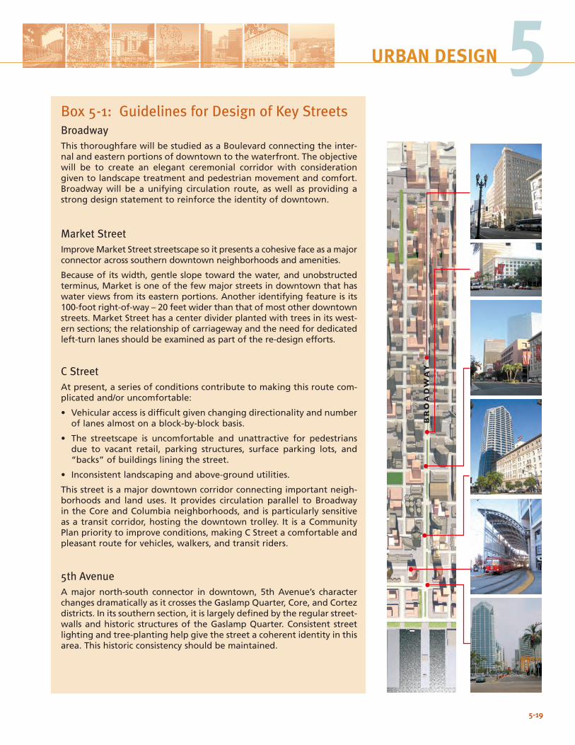
5-19
5URBAN DESIGN
Box 5-1: Guidelines for Design of Key StreetsBroadwayThis thoroughfare will be studied as a Boulevard connecting the inter-nal and eastern portions of downtown to the waterfront. The objective will be to create an elegant ceremonial corridor with consideration given to landscape treatment and pedestrian movement and comfort. Broadway will be a unifying circulation route, as well as providing a strong design statement to reinforce the identity of downtown.
Market StreetImprove Market Street streetscape so it presents a cohesive face as a major connector across southern downtown neighborhoods and amenities.
Because of its width, gentle slope toward the water, and unobstructed terminus, Market is one of the few major streets in downtown that has water views from its eastern portions. Another identifying feature is its 100-foot right-of-way – 20 feet wider than that of most other downtown streets. Market Street has a center divider planted with trees in its west-ern sections; the relationship of carriageway and the need for dedicated left-turn lanes should be examined as part of the re-design efforts.
C StreetAt present, a series of conditions contribute to making this route com-plicated and/or uncomfortable:
• Vehicular access is difficult given changing directionality and number of lanes almost on a block-by-block basis.
• The streetscape is uncomfortable and unattractive for pedestrians due to vacant retail, parking structures, surface parking lots, and “backs” of buildings lining the street.
• Inconsistent landscaping and above-ground utilities.
This street is a major downtown corridor connecting important neigh-borhoods and land uses. It provides circulation parallel to Broadway in the Core and Columbia neighborhoods, and is particularly sensitive as a transit corridor, hosting the downtown trolley. It is a Community Plan priority to improve conditions, making C Street a comfortable and pleasant route for vehicles, walkers, and transit riders.
5th AvenueA major north-south connector in downtown, 5th Avenue’s character changes dramatically as it crosses the Gaslamp Quarter, Core, and Cortez districts. In its southern section, it is largely defined by the regular street-walls and historic structures of the Gaslamp Quarter. Consistent street lighting and tree-planting help give the street a coherent identity in this area. This historic consistency should be maintained.
BROADW
AY
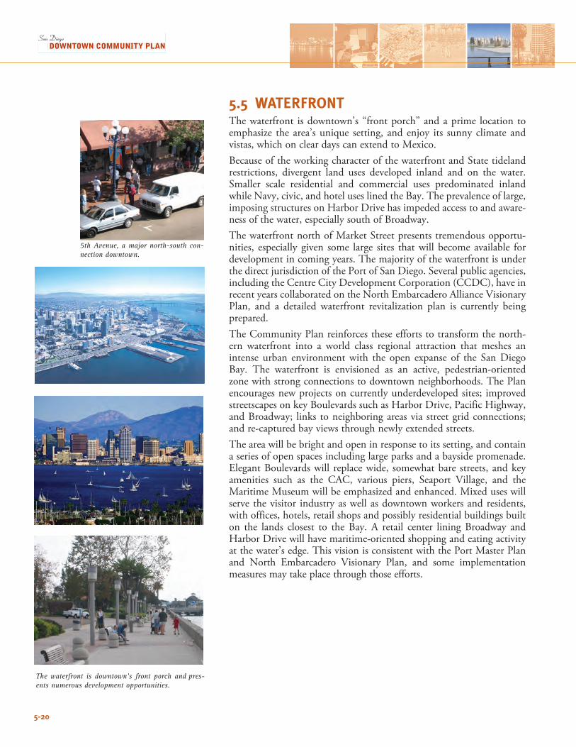
5-20
The waterfront is downtown’s front porch and pres-ents numerous development opportunities.
5.5 WATERFRONTThe waterfront is downtown’s “front porch” and a prime location to emphasize the area’s unique setting, and enjoy its sunny climate and vistas, which on clear days can extend to Mexico. Because of the working character of the waterfront and State tideland restrictions, divergent land uses developed inland and on the water. Smaller scale residential and commercial uses predominated inland while Navy, civic, and hotel uses lined the Bay. The prevalence of large, imposing structures on Harbor Drive has impeded access to and aware-ness of the water, especially south of Broadway.The waterfront north of Market Street presents tremendous opportu-nities, especially given some large sites that will become available for development in coming years. The majority of the waterfront is under the direct jurisdiction of the Port of San Diego. Several public agencies, including the Centre City Development Corporation (CCDC), have in recentyearscollaboratedontheNorthEmbarcaderoAllianceVisionaryPlan, and a detailed waterfront revitalization plan is currently being prepared.The Community Plan reinforces these efforts to transform the north-ern waterfront into a world class regional attraction that meshes an intense urban environment with the open expanse of the San Diego Bay. The waterfront is envisioned as an active, pedestrian-oriented zone with strong connections to downtown neighborhoods. The Plan encourages new projects on currently underdeveloped sites; improved streetscapes on key Boulevards such as Harbor Drive, Pacific Highway, and Broadway; links to neighboring areas via street grid connections; and re-captured bay views through newly extended streets.The area will be bright and open in response to its setting, and contain a series of open spaces including large parks and a bayside promenade. ElegantBoulevardswill replacewide, somewhatbare streets, andkeyamenities such as the CAC, various piers, Seaport Village, and the Maritime Museum will be emphasized and enhanced. Mixed uses will serve the visitor industry as well as downtown workers and residents, with offices, hotels, retail shops and possibly residential buildings built on the lands closest to the Bay. A retail center lining Broadway and Harbor Drive will have maritime-oriented shopping and eating activity at the water’s edge. This vision is consistent with the Port Master Plan and North Embarcadero Visionary Plan, and some implementationmeasures may take place through those efforts.
5th Avenue, a major north-south con-nection downtown.
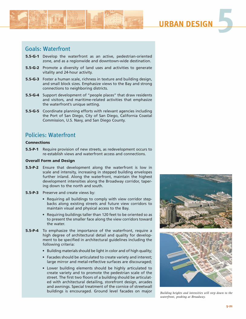
5-21
5URBAN DESIGN
Goals: Waterfront5.5-G-1 Develop the waterfront as an active, pedestrian-oriented
zone, and as a regionwide and downtown-wide destination.
5.5-G-2 Promote a diversity of land uses and activities to generate vitality and 24-hour activity.
5.5-G-3 Foster a human scale, richness in texture and building design, and small block sizes. Emphasize views to the Bay and strong connections to neighboring districts.
5.5-G-4 Support development of “people places” that draw residents and visitors, and maritime-related activities that emphasize the waterfront’s unique setting.
5.5-G-5 Coordinate planning efforts with relevant agencies including the Port of San Diego, City of San Diego, California Coastal Commission, U.S. Navy, and San Diego County.
Policies: WaterfrontConnections
5.5-P-1 Require provision of new streets, as redevelopment occurs to re-establish views and waterfront access and connections.
Overall Form and Design
5.5-P-2 Ensure that development along the waterfront is low in scale and intensity, increasing in stepped building envelopes further inland. Along the waterfront, maintain the highest development intensities along the Broadway corridor, taper-ing down to the north and south.
5.5-P-3 Preserve and create views by:
• Requiring all buildings to comply with view corridor step-backs along existing streets and future view corridors to maintain visual and physical access to the Bay.
• Requiring buildings taller than 120 feet to be oriented so as to present the smaller face along the view corridors toward the water.
5.5-P-4 To emphasize the importance of the waterfront, require a high degree of architectural detail and quality for develop-ment to be specified in architectural guidelines including the following criteria:
• Building materials should be light in color and of high quality;
• Facades should be articulated to create variety and interest; large mirror and metal-reflective surfaces are discouraged;
• Lower building elements should be highly articulated to create variety and to promote the pedestrian scale of the street. The first two floors of a building should be articulat-ed with architectural detailing, storefront design, arcades and awnings. Special treatment of the cornice of streetwall buildings is encouraged. Ground level facades on major Building heights and intensities will step down to the
waterfront, peaking at Broadway.
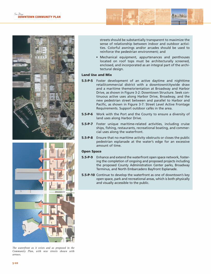
5-22
The waterfront as it exists and as proposed in the Community Plan, with new streets shown with arrows.
streets should be substantially transparent to maximize the sense of relationship between indoor and outdoor activi-ties. Colorful awnings and/or arcades should be used to reinforce the pedestrian environment; and
• Mechanical equipment, appurtenances and penthouses located on roof tops must be architecturally screened, enclosed, and incorporated as an integral part of the archi-tectural design.
Land Use and Mix
5.5-P-5 Foster development of an active daytime and nighttime retail/commercial district with a downtown/citywide draw and a maritime theme/orientation at Broadway and Harbor Drive, as shown in Figure 3-2: Downtown Structure. Seek con-tinuous active uses along Harbor Drive, Broadway, and the new pedestrian street between and parallel to Harbor and Pacific, as shown in Figure 3-7: Street Level Active Frontage Requirements. Support outdoor cafés in the area.
5.5-P-6 Work with the Port and the County to ensure a diversity of land uses along Harbor Drive.
5.5-P-7 Foster unique maritime-related activities, including cruise ships, fishing, restaurants, recreational boating, and commer-cial uses along the waterfront.
5.5-P-8 Ensure that no maritime activity obstructs or closes the public pedestrian esplanade at the water’s edge for an excessive amount of time.
Open Space
5.5-P-9 Enhance and extend the waterfront open space network, foster-ing the completion of ongoing and proposed projects including the proposed County Administration Center parks, Broadway Terminus, and North Embarcadero Bayfront Esplanade.
5.5-P-10 Continue to develop the waterfront as one of downtown’s key open space, park and recreational areas, which is both physically and visually accessible to the public.
HAR
BOR
D
R
PACI
FIC
HW
Y
BROADWAY
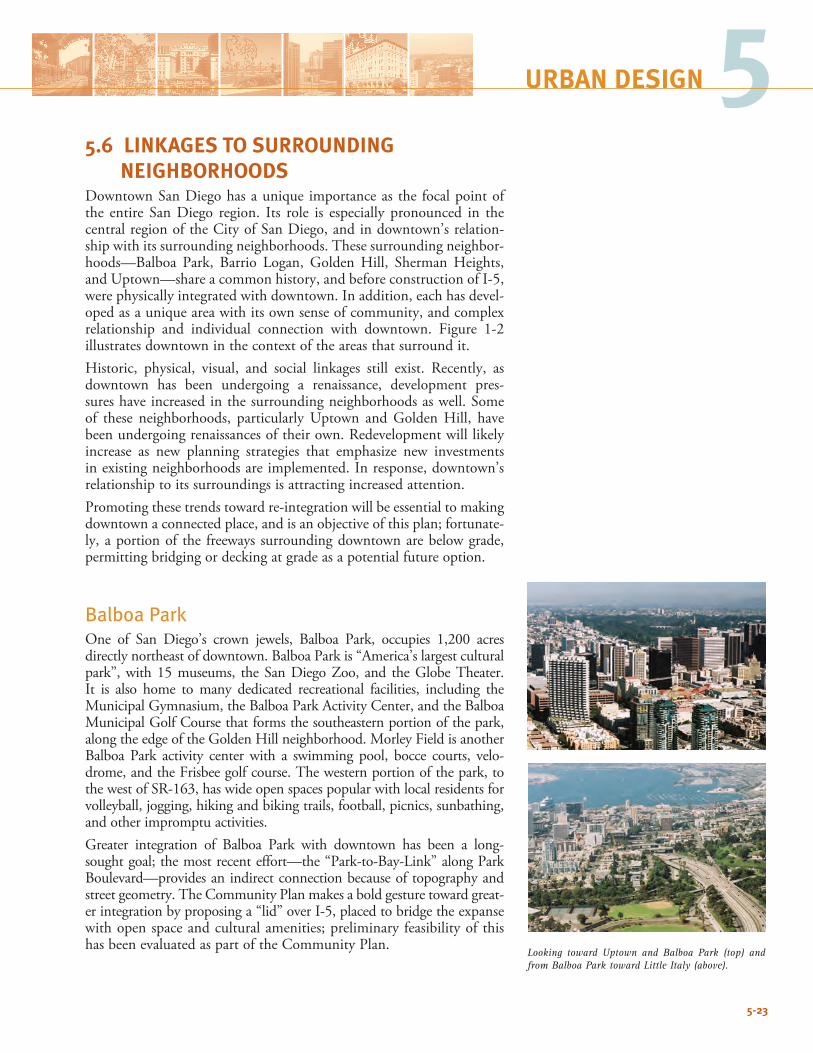
5-23
5URBAN DESIGN
Looking toward Uptown and Balboa Park (top) and from Balboa Park toward Little Italy (above).
5.6 LINKAGES TO SURROUNDING NEIGHBORHOODSDowntown San Diego has a unique importance as the focal point of the entire San Diego region. Its role is especially pronounced in the central region of the City of San Diego, and in downtown’s relation-ship with its surrounding neighborhoods. These surrounding neighbor-hoods—Balboa Park, Barrio Logan, GoldenHill, ShermanHeights,and Uptown—share a common history, and before construction of I-5, were physically integrated with downtown. In addition, each has devel-oped as a unique area with its own sense of community, and complex relationship and individual connection with downtown. Figure 1-2illustrates downtown in the context of the areas that surround it. Historic, physical, visual, and social linkages still exist. Recently, asdowntown has been undergoing a renaissance, development pres-sures have increased in the surrounding neighborhoods as well. Some of these neighborhoods, particularlyUptown andGoldenHill, havebeenundergoingrenaissancesoftheirown.Redevelopmentwilllikelyincrease as new planning strategies that emphasize new investments in existing neighborhoods are implemented. In response, downtown’s relationship to its surroundings is attracting increased attention. Promoting these trends toward re-integration will be essential to making downtown a connected place, and is an objective of this plan; fortunate-ly, a portion of the freeways surrounding downtown are below grade, permitting bridging or decking at grade as a potential future option.
Balboa ParkOne of San Diego’s crown jewels, Balboa Park, occupies 1,200 acres directly northeast of downtown. Balboa Park is “America’s largest cultural park”,with15museums, theSanDiegoZoo, and theGlobeTheater.It is also home to many dedicated recreational facilities, including the MunicipalGymnasium,theBalboaParkActivityCenter,andtheBalboaMunicipalGolfCoursethatformsthesoutheasternportionofthepark,alongtheedgeoftheGoldenHillneighborhood.MorleyFieldisanotherBalboa Park activity center with a swimming pool, bocce courts, velo-drome,andtheFrisbeegolfcourse.Thewesternportionofthepark,tothewestofSR-163,haswideopenspacespopularwithlocalresidentsforvolleyball, jogging, hiking and biking trails, football, picnics, sunbathing, and other impromptu activities. Greater integration of Balboa Park with downtown has been a long-soughtgoal;themostrecenteffort—the“Park-to-Bay-Link”alongParkBoulevard—provides an indirect connection because of topography and street geometry. The Community Plan makes a bold gesture toward great-er integration by proposing a “lid” over I-5, placed to bridge the expanse with open space and cultural amenities; preliminary feasibility of this has been evaluated as part of the Community Plan.
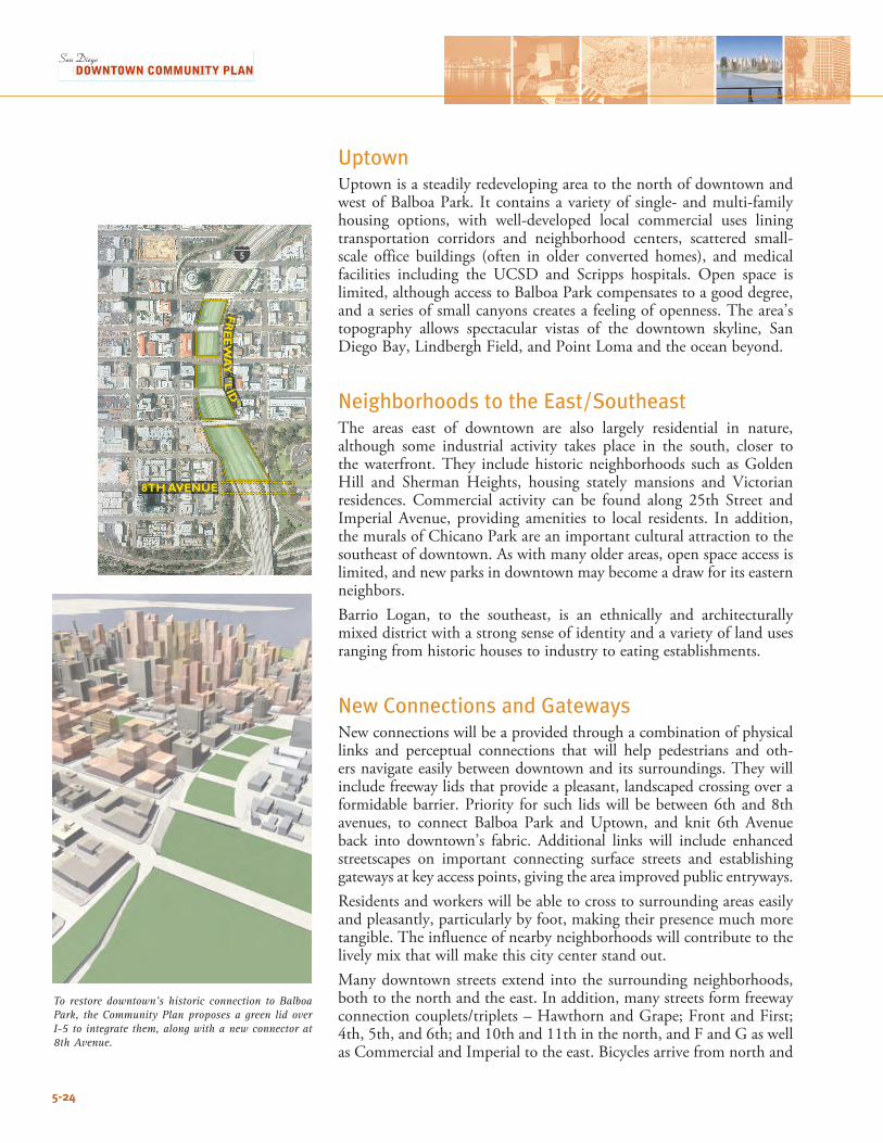
5-24
To restore downtown’s historic connection to Balboa Park, the Community Plan proposes a green lid over I-5 to integrate them, along with a new connector at 8th Avenue.
UptownUptown is a steadily redeveloping area to the north of downtown and west of Balboa Park. It contains a variety of single- and multi-family housing options, with well-developed local commercial uses lining transportation corridors and neighborhood centers, scattered small-scale office buildings (often in older converted homes), and medical facilities including the UCSD and Scripps hospitals. Open space is limited, although access to Balboa Park compensates to a good degree, and a series of small canyons creates a feeling of openness. The area’s topography allows spectacular vistas of the downtown skyline, San DiegoBay,LindberghField,andPointLomaandtheoceanbeyond.
Neighborhoods to the East/SoutheastThe areas east of downtown are also largely residential in nature, although some industrial activity takes place in the south, closer to thewaterfront.They includehistoricneighborhoods such asGoldenHill and Sherman Heights, housing stately mansions and Victorian residences. Commercial activity can be found along 25th Street and Imperial Avenue, providing amenities to local residents. In addition, the murals of Chicano Park are an important cultural attraction to the southeast of downtown. As with many older areas, open space access is limited, and new parks in downtown may become a draw for its eastern neighbors. Barrio Logan, to the southeast, is an ethnically and architecturallymixed district with a strong sense of identity and a variety of land uses ranging from historic houses to industry to eating establishments.
New Connections and GatewaysNew connections will be a provided through a combination of physical links and perceptual connections that will help pedestrians and oth-ers navigate easily between downtown and its surroundings. They will include freeway lids that provide a pleasant, landscaped crossing over a formidable barrier. Priority for such lids will be between 6th and 8th avenues, to connect Balboa Park and Uptown, and knit 6th Avenue back into downtown’s fabric. Additional links will include enhanced streetscapes on important connecting surface streets and establishing gateways at key access points, giving the area improved public entryways.Residentsandworkerswillbeabletocrosstosurroundingareaseasilyand pleasantly, particularly by foot, making their presence much more tangible. The influence of nearby neighborhoods will contribute to the lively mix that will make this city center stand out.Many downtown streets extend into the surrounding neighborhoods, both to the north and the east. In addition, many streets form freeway connectioncouplets/triplets–HawthornandGrape;FrontandFirst;4th,5th,and6th;and10thand11thinthenorth,andFandGaswellas Commercial and Imperial to the east. Bicycles arrive from north and
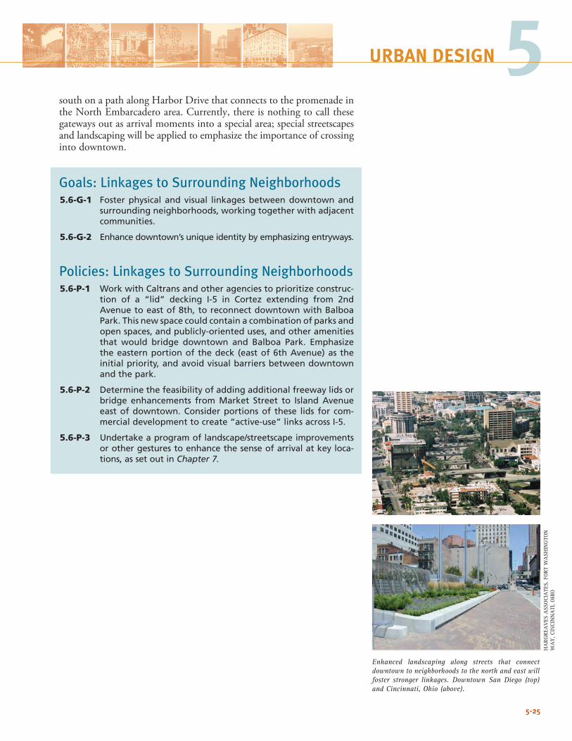
5-25
5URBAN DESIGN
Enhanced landscaping along streets that connect downtown to neighborhoods to the north and east will foster stronger linkages. Downtown San Diego (top) and Cincinnati, Ohio (above).
south on a path along Harbor Drive that connects to the promenade in theNorthEmbarcaderoarea.Currently,thereisnothingtocallthesegateways out as arrival moments into a special area; special streetscapes and landscaping will be applied to emphasize the importance of crossing into downtown.
Goals: Linkages to Surrounding Neighborhoods 5.6-G-1 Foster physical and visual linkages between downtown and
surrounding neighborhoods, working together with adjacent communities.
5.6-G-2 Enhance downtown’s unique identity by emphasizing entryways.
Policies: Linkages to Surrounding Neighborhoods5.6-P-1 Work with Caltrans and other agencies to prioritize construc-
tion of a “lid” decking I-5 in Cortez extending from 2nd Avenue to east of 8th, to reconnect downtown with Balboa Park. This new space could contain a combination of parks and open spaces, and publicly-oriented uses, and other amenities that would bridge downtown and Balboa Park. Emphasize the eastern portion of the deck (east of 6th Avenue) as the initial priority, and avoid visual barriers between downtown and the park.
5.6-P-2 Determine the feasibility of adding additional freeway lids or bridge enhancements from Market Street to Island Avenue east of downtown. Consider portions of these lids for com-mercial development to create “active-use” links across I-5.
5.6-P-3 Undertake a program of landscape/streetscape improvements or other gestures to enhance the sense of arrival at key loca-tions, as set out in Chapter 7.
HA
RGRE
AV
ES A
SSO
CIA
TES,
FO
RT W
ASH
ING
TON
W
AY
, CIN
CIN
NA
TI, O
HIO
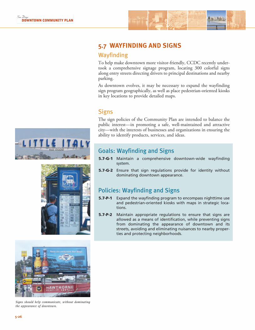
5-26
5.7 WAYFINDING AND SIGNS Wayfinding To help make downtown more visitor-friendly, CCDC recently under-took a comprehensive signage program, locating 300 colorful signs along entry streets directing drivers to principal destinations and nearby parking. As downtown evolves, it may be necessary to expand the wayfinding sign program geographically, as well as place pedestrian-oriented kiosks in key locations to provide detailed maps.
SignsThe sign policies of the Community Plan are intended to balance the public interest—in promoting a safe, well-maintained and attractive city—with the interests of businesses and organizations in ensuring the ability to identify products, services, and ideas.
Goals: Wayfinding and Signs5.7-G-1 Maintain a comprehensive downtown-wide wayfinding
system.
5.7-G-2 Ensure that sign regulations provide for identity without dominating downtown appearance.
Policies: Wayfinding and Signs5.7-P-1 Expand the wayfinding program to encompass nighttime use
and pedestrian-oriented kiosks with maps in strategic loca-tions.
5.7-P-2 Maintain appropriate regulations to ensure that signs are allowed as a means of identification, while preventing signs from dominating the appearance of downtown and its streets, avoiding and eliminating nuisances to nearby proper-ties and protecting neighborhoods.
Signs should help communicate, without dominating the appearance of downtown.
5-27
5URBAN DESIGN
5.8 SUSTAINABLE DEVELOPMENT Sustainable development means providing for the needs of the pres-ent without jeopardizing the needs of the future. It also means ensur-ing that the fruits of growth and development are shared in a socially equitable and just manner. Promoting sustainability is an adopted City goal – in January 2002, the City Council unanimously approved the goals and objectives of the Community Sustainability Program. This program covers various aspects of sustainability and measures outcomes through a series of indicators. In the context of downtown San Diego, sustainable development can be examined at three levels: • Planning. This entails promoting infill, adaptive reuse, and redevelop-ment;reducingautodependencebycoordinatinglanduse/transporta-tion, promoting mixed-use development, and encouraging alternative modes (including transit and walking); and allowing high intensities to make efficient use of land. The Community Plan already does this through policies interspersed throughout the document.
• Urban Design/Relationships. At the scale of building groupings or individual districts, sustainability can be examined at the relationship between buildings and the public domain – will buildings allow light to penetrate through to reduce the need for artificial light? Will they cast shadows on each other? Will they provide comfort and shade when needed?
The design of streets is central to sustainability, as trees provide shade and comfort (and reduce air conditioning costs), absorb air toxins, and mitigate urban heat island impacts. Downtown will have approximately 53 miles of streets upon buildout – an average gener-ous spacing of 30 feet between trees on either side of 75 percent of the street length could result in nearly 14,000 trees (not including trees in open spaces). Trees and new open spaces downtown, as out-lined in Chapter 4: Parks, Open Space, and Recreation, will also result in decreased stormwater flow.
• Green Building. At the scale of individual buildings, perhaps the greatest contribution green design can make from a downtown perspective is to reduce urban heat island impacts through reduced ongoing energy use – by allowing air to flow through and light to penetrate into buildings (especially given San Diego’s mild climate), and through insulation, roof design, and use of heat reflecting mate-rials. In addition, re-using structures and the use of recycled and ecologically appropriate materials can reduce life-cycle environmental impacts.Hydrologic benefits can be achieved by roof gardens, landscaped courtyards, permeable pavement, and other techniques that reduce surface runoff pollutant concentrations and volumes.
Sustainability also encompasses non-design and construction-related activities, such as waste reduction and recycling. These will continue to be guided by citywide goals and policies.
5-28
Goal: Sustainable Development5.8-G-1 Promote sustainable development and design downtown.
Policies: Sustainable Development5.8-P-1 Prepare and implement Green Building guidelines and/or
standards, appropriate to the intense San Diego downtown context, to ensure high levels of energy efficiency and reduc-tion of life-cycle environmental impacts associated with con-struction and operations of buildings.
5.8-P-2 In cooperation with other agencies, undertake a program of street tree planting, maintaining a target of 10,000 trees downtown by 2030.
5.8-P-3 Maintain building volume standards that allow sunlight to reach streets and public spaces. Explore the feasibility of building reflectivity standards to maximize ambient light in streets and other public spaces, without glare.
5.8-P-4 Reduce auto-dependency, pollution impacts, and waste of valuable downtown real estate by encouraging shared park-ing, automated parking, transit-use, carpools, and non-polluting mobility nodes such as electric vehicles, pedicabs, bicycling, and walking.
5.8-P-5 Encourage the use of daylighting, natural ventilation, photo-voltaics, district energy plants, insulation, and other energy conserving techniques and strategies.
5.8-P-6 In new development and re-use projects alike, encourage use of Low Impact Development principles such as eco-roofs, roof gardens, landscaped courtyards, grass filter strips, permeable pavement, and rainwater systems, to reduce surface runoff volumes and pollutants as well as reduce heat-island effects.
5.8-P-7 Promote biodiversity and indigenous plantings that require low or no irrigation. Encourage habitats for songbirds and non-pest animals.
5.8-P-8 In accordance with established City policy, ensure that public projects-including buildings, streets, and parks-incorporate sustainable design and construction practices.
5.8-P-9 Promote adaptive re-use of historic resources as an effective means to reduce construction materials, energy, and waste.
5-29
5URBAN DESIGN
5.9 PROJECT DESIGN REVIEW As downtown builds out and projects become more intense and com-plex, the need grows for more thoughtful analysis, a structured design and review process, and tailored design solutions. To support and fur-ther design excellence in public and private projects, the CCDC design review process deserves evaluation and improvement. Any future design review process should result in projects of high design caliber that enhance the public realm and contribute to neighborhood place-making by being customized to Community Plan goals and poli-cies for specific places and situations, and reinforcing local trends in building materials, form, articulation, open spaces, and landscaping. At the same time, such a process should acknowledge the value of flexible, unique architecture and avoid excessive delays in project processing. Earlycoordinationwithprojectapplicantstocommunicateestablishedgoals and expectations is essential. Consideration should be given to using a panel of design experts, which other downtowns have found quite helpful to provide meaningful, practical input to applicants.
Goal: Project Design Review5.9-G-1 Strengthen and improve the design review process to ensure
architectural and urban design excellence and a high-quality public realm throughout downtown.
Policies: Project Design Review5.9-P-1 Strengthen the design review process by establishing
Downtown Urban Design Guidelines to guide design teams and structure the deliberations of approval bodies.
5.9-P-2 Explore the creation of an Urban Design Panel, made up of qualified and recognized design professionals, to assist the staff and advise the designated approval bodies.
5.9-P-3 Apply high standards of design excellence and urban design quality to both private architectural projects and to parks, streetscapes, civic buildings and other public works.
5.9-P-4 Maintain the involvement of citizens through the designated Community Planning Group, and keep design meetings open to public input.
5.9-P-5 Strive for consistency and time efficiency for applicants throughout the design review and approval process.

5-30
This page intentionally left blank.
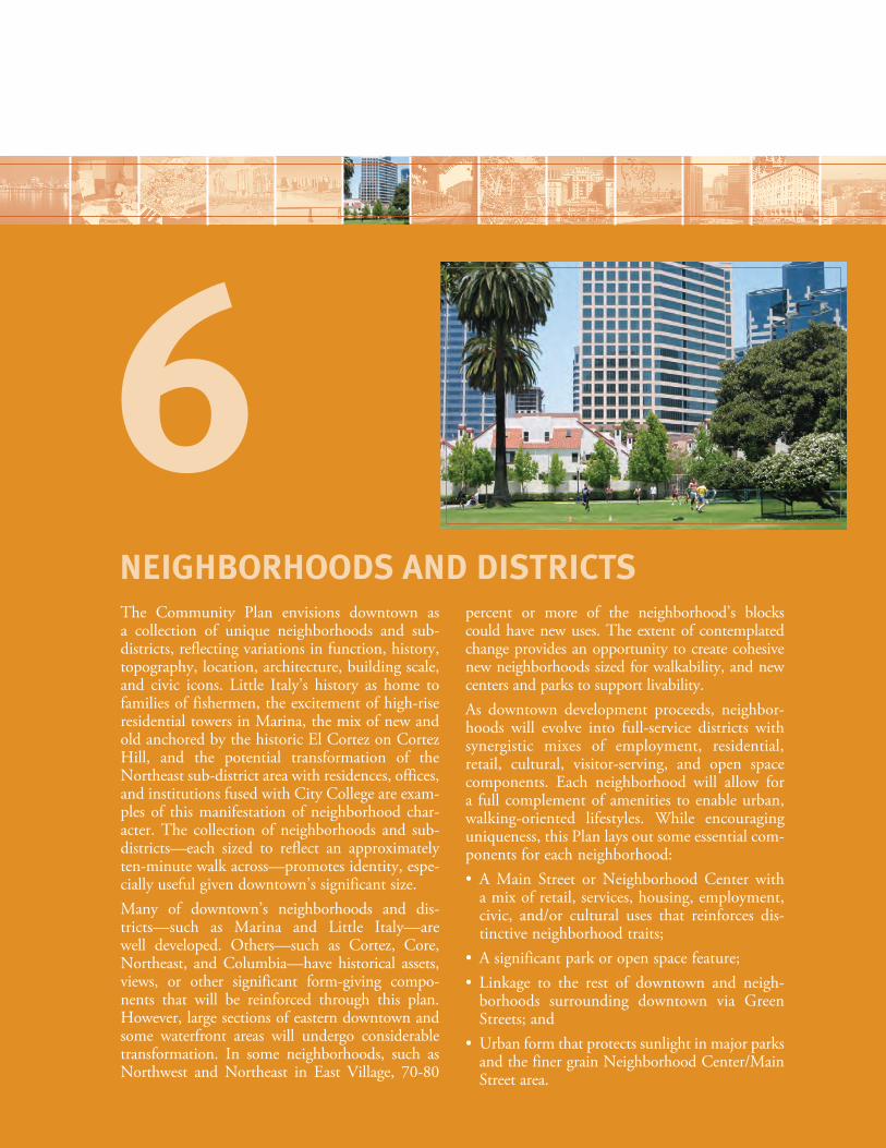
The Community Plan envisions downtown as a collection of unique neighborhoods and sub- districts, reflecting variations in function, history, topography, location, architecture, building scale, and civic icons. Little Italy’s history as home to families of fishermen, the excitement of high-rise residential towers in Marina, the mix of new and old anchored by the historic El Cortez on Cortez Hill, and the potential transformation of the Northeast sub-district area with residences, offices, and institutions fused with City College are exam-ples of this manifestation of neighborhood char-acter. The collection of neighborhoods and sub- districts—each sized to reflect an approximately ten-minute walk across—promotes identity, espe-cially useful given downtown’s significant size. Many of downtown’s neighborhoods and dis-tricts—such as Marina and Little Italy—are well developed. Others—such as Cortez, Core, Northeast, and Columbia—have historical assets, views, or other significant form-giving compo-nents that will be reinforced through this plan. However, large sections of eastern downtown and some waterfront areas will undergo considerable transformation. In some neighborhoods, such as Northwest and Northeast in East Village, 70-80
percent or more of the neighborhood’s blocks could have new uses. The extent of contemplated change provides an opportunity to create cohesive new neighborhoods sized for walkability, and new centers and parks to support livability. As downtown development proceeds, neighbor-hoods will evolve into full-service districts with synergistic mixes of employment, residential, retail, cultural, visitor-serving, and open space components. Each neighborhood will allow for a full complement of amenities to enable urban, walking-oriented lifestyles. While encouraging uniqueness, this Plan lays out some essential com-ponents for each neighborhood: • A Main Street or Neighborhood Center with
a mix of retail, services, housing, employment, civic, and/or cultural uses that reinforces dis-tinctive neighborhood traits;
• Asignificantparkoropenspacefeature;• Linkage to the rest of downtown and neigh-
borhoods surrounding downtown via Green Streets; and
• Urbanformthatprotectssunlightinmajorparksand the finer grain Neighborhood Center/Main Street area.
NEIGHBORHOODS AND DISTRICTS
6
The Community Plan incorporates these key elements into each neighborhood, with differing land use mixes, open space locations, and building intensities capitalizing on available opportunities. This framework—together with future policies and guidelines unique to each neighborhood that address streetscape, views, block patterns, development grain, and diversity of activity—will further distinction and identity. Finally, the Community Plan embraces flexibility and a certain level of spontaneity, allowing neighborhood culture to evolve over time, and permitting a wide latitude of development typologies to fosterdiversityattheprojectscale,anduniquenessandidentityattheneighborhood scale. This chapter describes the broad character of each neighborhood, and outlines goals to guide the development and evolution of the variousdistricts.Urbandesignstandardsare included in thePlannedDistrict Ordinances (downtown’s zoning), and will be supplemented by Neighborhood Design Guidelines, which will be developed with specific policies for each neighborhood. Goals in this chapter should be readinconjunctionwiththoseinotherchapters,including:• Chapter 3: Land Use and Housing, which establishes the mix and
intensity of uses for downtown. • Chapter 5: Urban Design, describes the various designated
Neighborhood Centers, building bulk and shadow protection, and prototypes for street improvements. Additional details can be found in the separate Neighborhood Design Guidelines.
• Chapter 7: Transportation, establishes the circulation network for internal connectivity and linkages to the region. Boulevards are recognized in downtown’s transportation planning, and a series of Green Streets connect neighborhoods and activity points.
Plan drawings of neighborhoods and districts in the sections that follow are drawn at the same scale, with the exception of East Village.
6-2
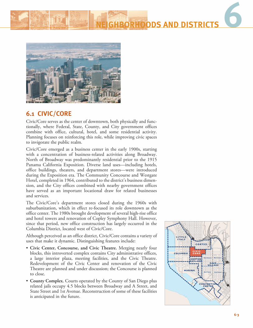
6
6.1 CIVIC/CORECivic/Core serves as the center of downtown, both physically and func-tionally, where Federal, State, County, and City government offices combine with office, cultural, hotel, and some residential activity. Planning focuses on reinforcing this role, while improving civic spaces to invigorate the public realm.Civic/Core emerged as a business center in the early 1900s, starting with a concentration of business-related activities along Broadway. North of Broadway was predominantly residential prior to the 1915 Panama California Exposition. Diverse land uses—including hotels, office buildings, theaters, and department stores—were introduced during the Exposition era. The Community Concourse and Westgate Hotel, completed in 1964, contributed to the district’s business dimen-sion, and the City offices combined with nearby government offices have served as an important locational draw for related businesses and services.The Civic/Core’s department stores closed during the 1960s with suburbanization, which in effect re-focused its role downtown as the office center. The 1980s brought development of several high-rise office and hotel towers and renovation of Copley Symphony Hall. However, since that period, new office construction has largely occurred in the Columbia District, located west of Civic/Core. Although perceived as an office district, Civic/Core contains a variety of uses that make it dynamic. Distinguishing features include:• Civic Center, Concourse, and Civic Theatre. Merging nearly four
blocks, this introverted complex contains City administrative offices, a large interior plaza, meeting facilities, and the Civic Theatre. Redevelopment of the Civic Center and renovation of the Civic Theatre are planned and under discussion; the Concourse is planned to close.
• County Complex. Courts operated by the County of San Diego plus relatedjailsoccupy4.5blocksbetweenBroadwayandAStreet,andState Street and 1st Avenue. Reconstruction of some of these facilities is anticipated in the future.
6-3
94
5
5
C O RT E Z
L I T T L EI TA LY
COLUMBIA
MARINA
HORTONGASLAMP
EASTVILLAGE
Northwest Northeast
SoutheastBall Park
CONVENTIONCENTER
C I V I CC O R E
NEIGHBORHOODS AND DISTRICTS
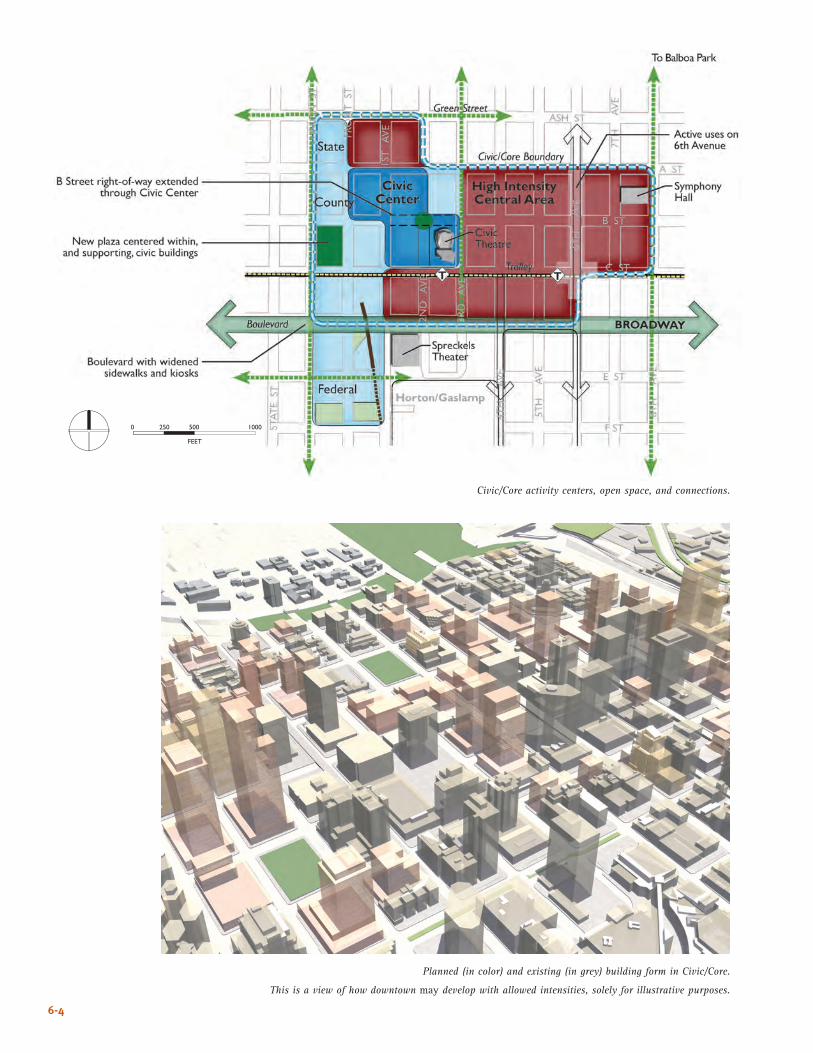
6-4
Civic/Core activity centers, open space, and connections.
Planned (in color) and existing (in grey) building form in Civic/Core.
This is a view of how downtown may develop with allowed intensities, solely for illustrative purposes.
����
� ��� ��� ����
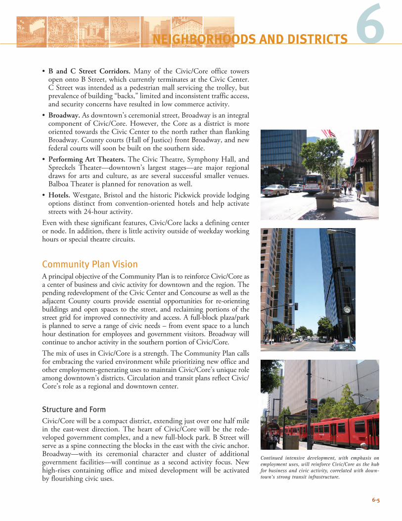
6-5
Continued intensive development, with emphasis on employment uses, will reinforce Civic/Core as the hub for business and civic activity, correlated with down-town’s strong transit infrastructure.
6• B and C Street Corridors. Many of the Civic/Core office towers
open onto B Street, which currently terminates at the Civic Center. C Street was intended as a pedestrian mall servicing the trolley, but prevalence of building “backs,” limited and inconsistent traffic access, and security concerns have resulted in low commerce activity.
• Broadway. As downtown’s ceremonial street, Broadway is an integral component of Civic/Core. However, the Core as a district is more oriented towards the Civic Center to the north rather than flanking Broadway. County courts (Hall of Justice) front Broadway, and new federal courts will soon be built on the southern side.
• Performing Art Theaters. The Civic Theatre, Symphony Hall, and Spreckels Theater—downtown’s largest stages—are major regionaldraws for arts and culture, as are several successful smaller venues. Balboa Theater is planned for renovation as well.
• Hotels. Westgate, Bristol and the historic Pickwick provide lodging options distinct from convention-oriented hotels and help activate streets with 24-hour activity.
Even with these significant features, Civic/Core lacks a defining center or node. In addition, there is little activity outside of weekday working hours or special theatre circuits.
Community Plan Vision AprincipalobjectiveoftheCommunityPlanistoreinforceCivic/Coreasa center of business and civic activity for downtown and the region. The pending redevelopment of the Civic Center and Concourse as well as the adjacent County courts provide essential opportunities for re-orientingbuildings and open spaces to the street, and reclaiming portions of the street grid for improved connectivity and access. A full-block plaza/park is planned to serve a range of civic needs – from event space to a lunch hour destination for employees and government visitors. Broadway will continue to anchor activity in the southern portion of Civic/Core.The mix of uses in Civic/Core is a strength. The Community Plan calls for embracing the varied environment while prioritizing new office and other employment-generating uses to maintain Civic/Core’s unique role among downtown’s districts. Circulation and transit plans reflect Civic/Core’s role as a regional and downtown center.
Structure and FormCivic/Corewillbeacompactdistrict,extendingjustoveronehalfmilein the east-west direction. The heart of Civic/Core will be the rede-veloped government complex, and a new full-block park. B Street will serve as a spine connecting the blocks in the east with the civic anchor. Broadway—with its ceremonial character and cluster of additional government facilities—will continue as a second activity focus. New high-rises containing office and mixed development will be activated by flourishing civic uses.
NEIGHBORHOODS AND DISTRICTS
Civic/Core will be distinguished from the other neighborhoods with its concentration of tall buildings and generous floorplate and bulk standards.
Goals and Buildout: Civic/Core6.1-G-1 Create an intense district with large and tall buildings reflect-
ing Civic/Core’s character as San Diego’s business and political center, while promoting a mix of uses.
6.1-G-2 Strengthen Civic/Core as a focus of civic uses and govern-ment activity, and reconnect government buildings and open spaces to the public realm.
Although visually dominated by tall office towers, Civic/Core possesses a wide mix of building forms accommodating hotel, cultural, and civic activities, such as the historic federal courts (top). B Street (above) serves as a focus for historic and contempo-rary development in Civic/Core, as well as a vehicular and pedestrian spine connecting to the Civic Center.
6-6
Estimated Buildout1: Civic/Core
Population2 5,000
Employment 35,000
1 Total reflects rounded numbers.
2 Includes group quarters population; assumes 1.6 persons per household and a 95% occupancy rate.
Continued enhancement of Broadway as downtown’s ceremonial boulevard will help to elevate Civic/Core’s public orientation.
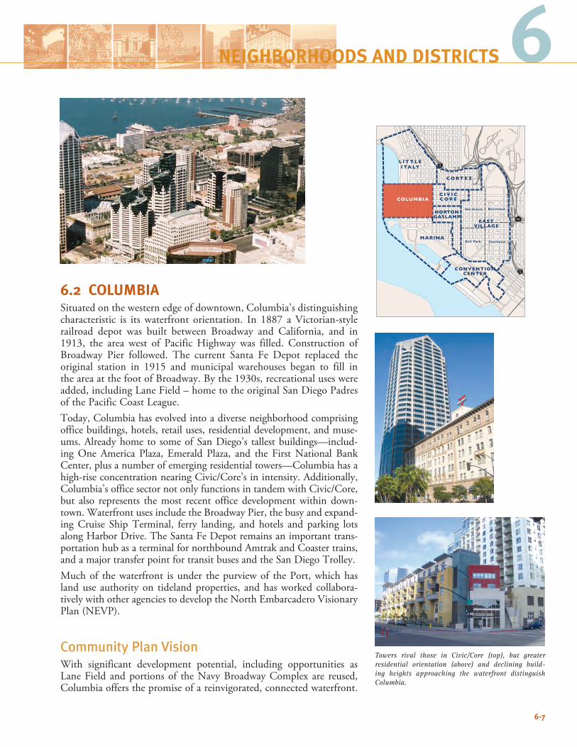
6
6.2 COLUMBIASituated on the western edge of downtown, Columbia’s distinguishing characteristic is its waterfront orientation. In 1887 a Victorian-style railroad depot was built between Broadway and California, and in 1913, the area west of Pacific Highway was filled. Construction of Broadway Pier followed. The current Santa Fe Depot replaced the original station in 1915 and municipal warehouses began to fill in the area at the foot of Broadway. By the 1930s, recreational uses were added, including Lane Field – home to the original San Diego Padres of the Pacific Coast League. Today, Columbia has evolved into a diverse neighborhood comprising office buildings, hotels, retail uses, residential development, and muse-ums. Already home to some of San Diego’s tallest buildings—includ-ing One America Plaza, Emerald Plaza, and the First National Bank Center, plus a number of emerging residential towers—Columbia has a high-rise concentration nearing Civic/Core’s in intensity. Additionally, Columbia’s office sector not only functions in tandem with Civic/Core, but also represents the most recent office development within down-town. Waterfront uses include the Broadway Pier, the busy and expand-ing Cruise Ship Terminal, ferry landing, and hotels and parking lots along Harbor Drive. The Santa Fe Depot remains an important trans-portation hub as a terminal for northbound Amtrak and Coaster trains, and a major transfer point for transit buses and the San Diego Trolley. Much of the waterfront is under the purview of the Port, which has land use authority on tideland properties, and has worked collabora-tively with other agencies to develop the North Embarcadero Visionary Plan (NEVP).
Community Plan Vision With significant development potential, including opportunities as Lane Field and portions of the Navy Broadway Complex are reused, Columbia offers the promise of a reinvigorated, connected waterfront.
6-7
94
5
5
C O RT E Z
L I T T L EI TA LY
MARINA
HORTONGASLAMP
EASTVILLAGE
Northwest Northeast
SoutheastBall Park
CONVENTIONCENTER
C I V I CC O R ECOLUMBIA
NEIGHBORHOODS AND DISTRICTS
Towers rival those in Civic/Core (top), but greater residential orientation (above) and declining build-ing heights approaching the waterfront distinguish Columbia.
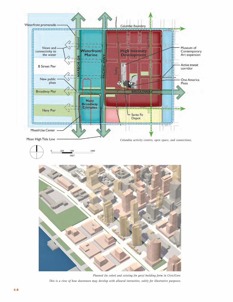
6-8
Columbia activity centers, open space, and connections.
Planned (in color) and existing (in grey) building form in Civic/Core.
This is a view of how downtown may develop with allowed intensities, solely for illustrative purposes.
����
� ��� ��� ����
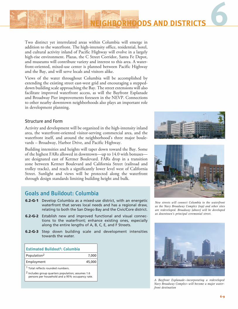
6-9
A Bayfront Esplanade—incorporating a redeveloped Navy Broadway Complex—will become a major water-front destination
6NEIGHBORHOODS AND DISTRICTS
Two distinct yet interrelated areas within Columbia will emerge in addition to the waterfront. The high-intensity office, residential, hotel, and cultural activity inland of Pacific Highway will evolve in a largely high-rise environment. Plazas, the C Street Corridor, Santa Fe Depot, and museums will contribute variety and interest to this area. A water-front-oriented, mixed-use center is planned between Pacific Highway and the Bay, and will serve locals and visitors alike. Views of the water throughout Columbia will be accomplished by extending the existing street east-west grid and encouraging a stepped-down building scale approaching the Bay. The street extensions will also facilitate improved waterfront access, as will the Bayfront Esplanade and Broadway Pier improvements foreseen in the NEVP. Connections to other nearby downtown neighborhoods also plays an important role in development planning.
Structure and FormActivity and development will be organized in the high-intensity inland area, the waterfront-oriented visitor-serving commercial area, and the waterfront itself, and around the neighborhood’s three major boule-vards – Broadway, Harbor Drive, and Pacific Highway. Building intensities and heights will taper down toward the Bay. Some of the highest FARs allowed in downtown—up to 14.0 with bonuses—are designated east of Kettner Boulevard. FARs drop in a transition zone between Kettner Boulevard and California Street (railroad and trolley tracks), and reach a significantly lower level west of California Street. Sunlight and views will be protected along the waterfront through design standards limiting building height and bulk.
Goals and Buildout: Columbia6.2-G-1 Develop Columbia as a mixed-use district, with an energetic
waterfront that serves local needs and has a regional draw, relating to both the San Diego Bay and the Civic/Core district.
6.2-G-2 Establish new and improved functional and visual connec-tions to the waterfront; enhance existing ones, especially along the entire lengths of A, B, C, E, and F Streets.
6.2-G-3 Step down building scale and development intensities towards the water.
Estimated Buildout1: Columbia
Population2 7,000
Employment 45,000
1 Total reflects rounded numbers.
2 Includes group quarters population; assumes 1.6 persons per household and a 95% occupancy rate.
New streets will connect Columbia to the waterfront as the Navy Broadway Complex (top) and other sites are redeveloped. Broadway (above) will be developed as downtown’s principal ceremonial street.

6-10
This page intentionally left blank.
6-10
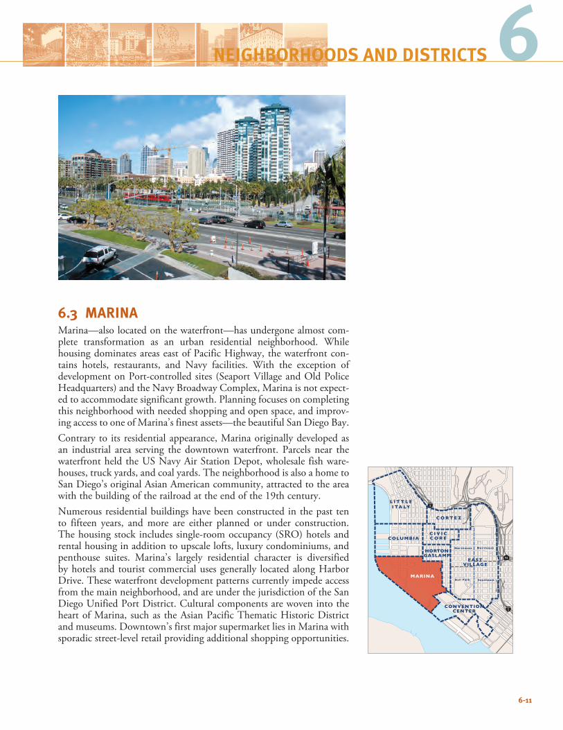
6.3 MARINAMarina—also located on the waterfront—has undergone almost com-plete transformation as an urban residential neighborhood. While housing dominates areas east of Pacific Highway, the waterfront con-tains hotels, restaurants, and Navy facilities. With the exception of development on Port-controlled sites (Seaport Village and Old Police Headquarters) and the Navy Broadway Complex, Marina is not expect-ed to accommodate significant growth. Planning focuses on completing this neighborhood with needed shopping and open space, and improv-ing access to one of Marina’s finest assets—the beautiful San Diego Bay.Contrary to its residential appearance, Marina originally developed as an industrial area serving the downtown waterfront. Parcels near the waterfront held the US Navy Air Station Depot, wholesale fish ware-houses, truck yards, and coal yards. The neighborhood is also a home to San Diego’s original Asian American community, attracted to the area with the building of the railroad at the end of the 19th century. Numerous residential buildings have been constructed in the past ten to fifteen years, and more are either planned or under construction. The housing stock includes single-room occupancy (SRO) hotels and rental housing in addition to upscale lofts, luxury condominiums, and penthouse suites. Marina’s largely residential character is diversified by hotels and tourist commercial uses generally located along Harbor Drive. These waterfront development patterns currently impede access from the main neighborhood, and are under the jurisdiction of the San Diego Unified Port District. Cultural components are woven into the heart of Marina, such as the Asian Pacific Thematic Historic District and museums. Downtown’s first major supermarket lies in Marina with sporadic street-level retail providing additional shopping opportunities.
6-11
94
5
5
C O RT E Z
L I T T L EI TA LY
MARINA
HORTONGASLAMP
EASTVILLAGE
Northwest Northeast
SoutheastBall Park
CONVENTIONCENTER
C I V I CC O R ECOLUMBIA
6NEIGHBORHOODS AND DISTRICTS
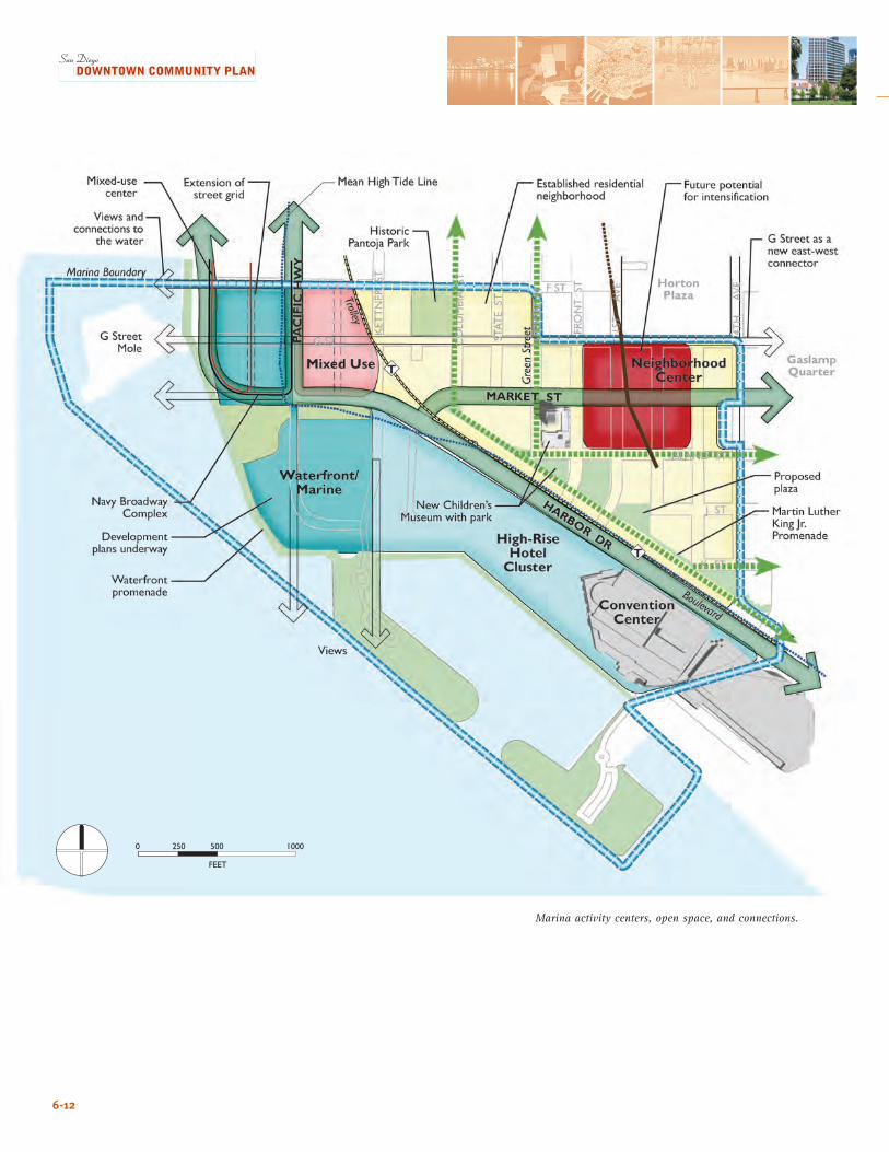
6-12
Marina activity centers, open space, and connections.
����
� ��� ��� ����
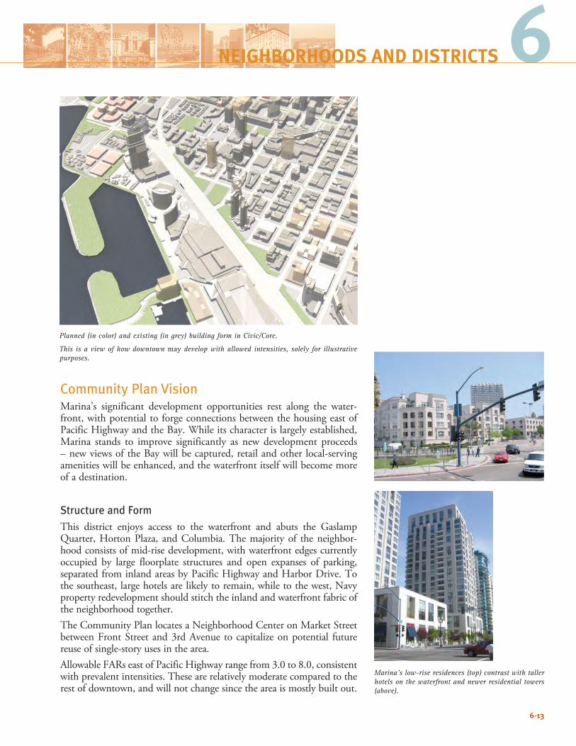
6-13
Community Plan Vision Marina’s significant development opportunities rest along the water-front, with potential to forge connections between the housing east of Pacific Highway and the Bay. While its character is largely established, Marina stands to improve significantly as new development proceeds – new views of the Bay will be captured, retail and other local-serving amenities will be enhanced, and the waterfront itself will become more of a destination.
Structure and Form This district enjoys access to the waterfront and abuts the Gaslamp Quarter, Horton Plaza, and Columbia. The majority of the neighbor-hood consists of mid-rise development, with waterfront edges currently occupied by large floorplate structures and open expanses of parking, separated from inland areas by Pacific Highway and Harbor Drive. To the southeast, large hotels are likely to remain, while to the west, Navy property redevelopment should stitch the inland and waterfront fabric of the neighborhood together. The Community Plan locates a Neighborhood Center on Market Street between Front Street and 3rd Avenue to capitalize on potential future reuse of single-story uses in the area.Allowable FARs east of Pacific Highway range from 3.0 to 8.0, consistent with prevalent intensities. These are relatively moderate compared to the rest of downtown, and will not change since the area is mostly built out.
Planned (in color) and existing (in grey) building form in Civic/Core.
This is a view of how downtown may develop with allowed intensities, solely for illustrative purposes.
Marina’s low-rise residences (top) contrast with taller hotels on the waterfront and newer residential towers (above).
6NEIGHBORHOODS AND DISTRICTS
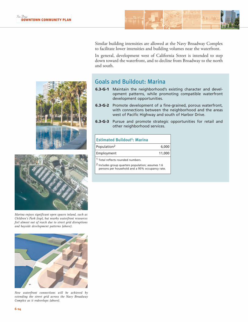
6-14
Similar building intensities are allowed at the Navy Broadway Complex to facilitate lower intensities and building volumes near the waterfront.In general, development west of California Street is intended to step down toward the waterfront, and to decline from Broadway to the north and south.
Goals and Buildout: Marina6.3-G-1 Maintain the neighborhood’s existing character and devel-
opment patterns, while promoting compatible waterfront development opportunities.
6.3-G-2 Promote development of a fine-grained, porous waterfront, with connections between the neighborhood and the areas west of Pacific Highway and south of Harbor Drive.
6.3-G-3 Pursue and promote strategic opportunities for retail and other neighborhood services.
Estimated Buildout1: Marina
Population2 6,000
Employment 11,000
1 Total reflects rounded numbers.
2 Includes group quarters population; assumes 1.6 persons per household and a 95% occupancy rate.
New waterfront connections will be achieved by extending the street grid across the Navy Broadway Complex as it redevelops (above).
Marina enjoys significant open spaces inland, such as Children’s Park (top), but nearby waterfront resources feel almost out of reach due to street grid disruptions and bayside development patterns (above).
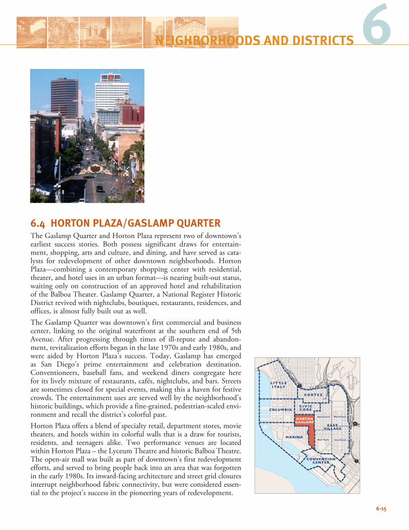
6-15
6NEIGHBORHOODS AND DISTRICTS
6.4 HORTON PLAZA/GASLAMP QUARTERThe Gaslamp Quarter and Horton Plaza represent two of downtown’s earliest success stories. Both possess significant draws for entertain-ment, shopping, arts and culture, and dining, and have served as cata-lysts for redevelopment of other downtown neighborhoods. Horton Plaza—combining a contemporary shopping center with residential, theater, and hotel uses in an urban format—is nearing built-out status, waiting only on construction of an approved hotel and rehabilitation of the Balboa Theater. Gaslamp Quarter, a National Register Historic District revived with nightclubs, boutiques, restaurants, residences, and offices, is almost fully built out as well. The Gaslamp Quarter was downtown’s first commercial and business center, linking to the original waterfront at the southern end of 5th Avenue. After progressing through times of ill-repute and abandon-ment, revitalization efforts began in the late 1970s and early 1980s, and were aided by Horton Plaza’s success. Today, Gaslamp has emerged as San Diego’s prime entertainment and celebration destination. Conventioneers, baseball fans, and weekend diners congregate here for its lively mixture of restaurants, cafés, nightclubs, and bars. Streets are sometimes closed for special events, making this a haven for festive crowds. The entertainment uses are served well by the neighborhood’s historic buildings, which provide a fine-grained, pedestrian-scaled envi-ronment and recall the district’s colorful past.Horton Plaza offers a blend of specialty retail, department stores, movie theaters, and hotels within its colorful walls that is a draw for tourists, residents, and teenagers alike. Two performance venues are located within Horton Plaza – the Lyceum Theatre and historic Balboa Theatre. The open-air mall was built as part of downtown’s first redevelopment efforts, and served to bring people back into an area that was forgotten in the early 1980s. Its inward-facing architecture and street grid closures interrupt neighborhood fabric connectivity, but were considered essen-tial to the project’s success in the pioneering years of redevelopment.
94
5
5
C O RT E Z
L I T T L EI TA LY
MARINA
HORTONGASLAMP
EASTVILLAGE
Northwest Northeast
SoutheastBall Park
CONVENTIONCENTER
C I V I CC O R ECOLUMBIA
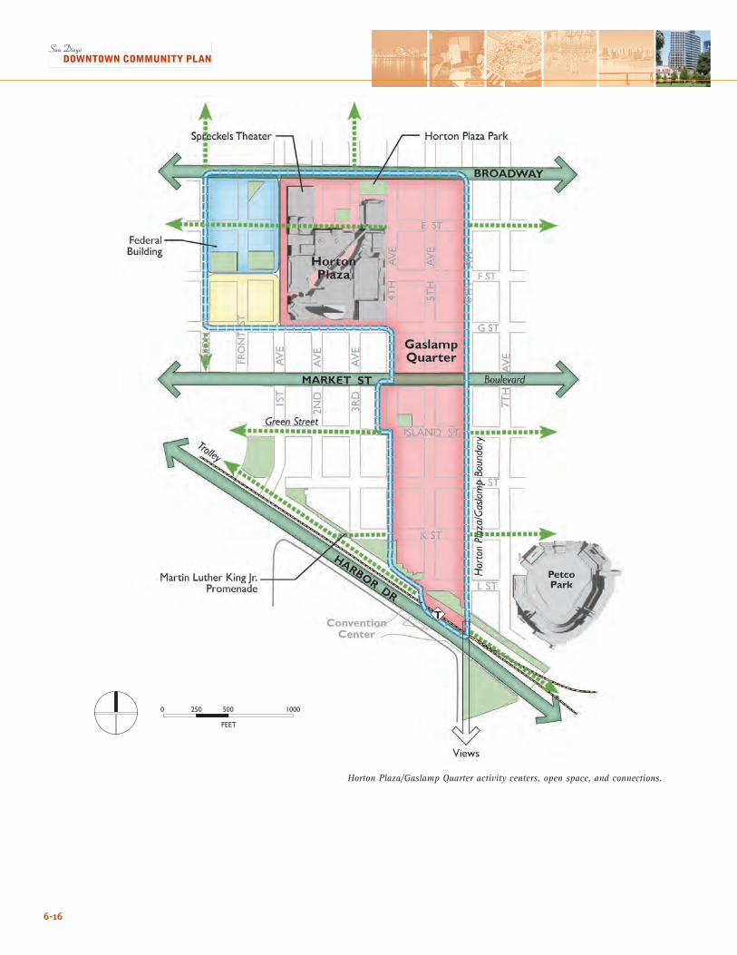
6-16
Horton Plaza/Gaslamp Quarter activity centers, open space, and connections.
����
� ��� ��� ����
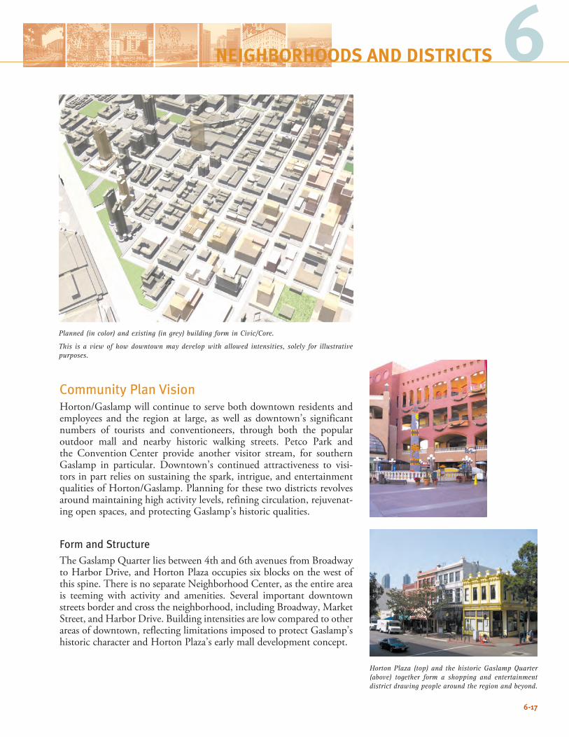
6-17
6NEIGHBORHOODS AND DISTRICTS
Community Plan VisionHorton/Gaslamp will continue to serve both downtown residents and employees and the region at large, as well as downtown’s significant numbers of tourists and conventioneers, through both the popular outdoor mall and nearby historic walking streets. Petco Park and the Convention Center provide another visitor stream, for southern Gaslamp in particular. Downtown’s continued attractiveness to visi-tors in part relies on sustaining the spark, intrigue, and entertainment qualities of Horton/Gaslamp. Planning for these two districts revolves around maintaining high activity levels, refining circulation, rejuvenat-ing open spaces, and protecting Gaslamp’s historic qualities.
Form and StructureThe Gaslamp Quarter lies between 4th and 6th avenues from Broadway to Harbor Drive, and Horton Plaza occupies six blocks on the west of this spine. There is no separate Neighborhood Center, as the entire area is teeming with activity and amenities. Several important downtown streets border and cross the neighborhood, including Broadway, Market Street, and Harbor Drive. Building intensities are low compared to other areas of downtown, reflecting limitations imposed to protect Gaslamp’s historic character and Horton Plaza’s early mall development concept.
Planned (in color) and existing (in grey) building form in Civic/Core.
This is a view of how downtown may develop with allowed intensities, solely for illustrative purposes.
Horton Plaza (top) and the historic Gaslamp Quarter (above) together form a shopping and entertainment district drawing people around the region and beyond.
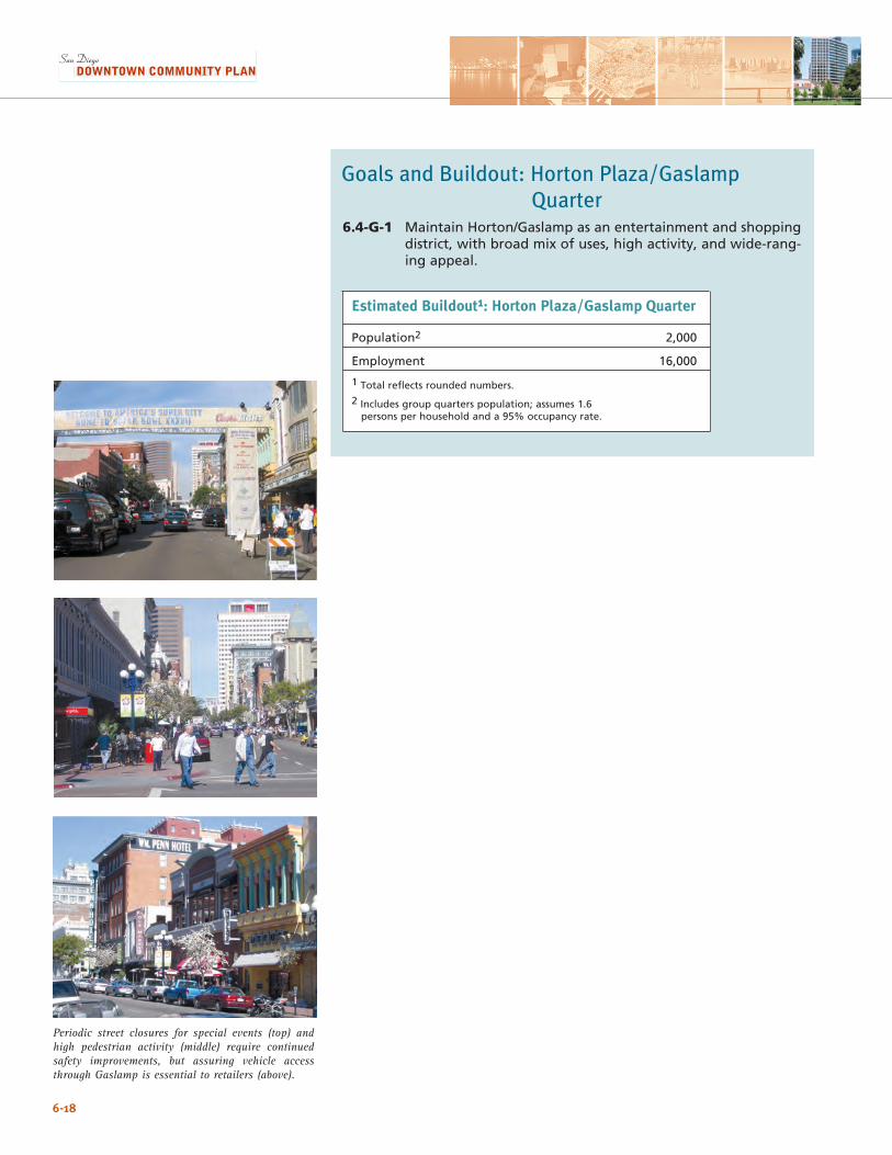
6-18
Goals and Buildout: Horton Plaza/Gaslamp Quarter6.4-G-1 Maintain Horton/Gaslamp as an entertainment and shopping
district, with broad mix of uses, high activity, and wide-rang-ing appeal.
Periodic street closures for special events (top) and high pedestrian activity (middle) require continued safety improvements, but assuring vehicle access through Gaslamp is essential to retailers (above).
Estimated Buildout1: Horton Plaza/Gaslamp Quarter
Population2 2,000
Employment 16,000
1 Total reflects rounded numbers.
2 Includes group quarters population; assumes 1.6 persons per household and a 95% occupancy rate.
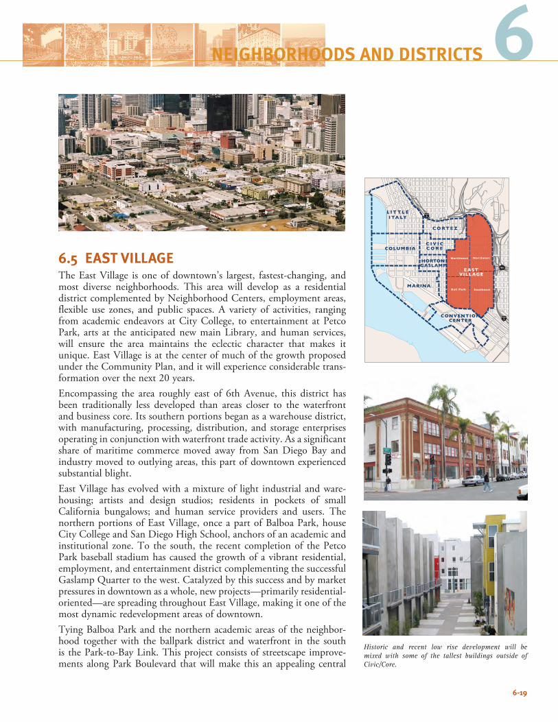
94
5
5
C O RT E Z
L I T T L EI TA LY
MARINA
HORTONGASLAMP
EASTVILLAGE
Northwest Northeast
SoutheastBall Park
CONVENTIONCENTER
C I V I CC O R ECOLUMBIA
6
6.5 EAST VILLAGEThe East Village is one of downtown’s largest, fastest-changing, and most diverse neighborhoods. This area will develop as a residential district complemented by Neighborhood Centers, employment areas, flexible use zones, and public spaces. A variety of activities, ranging from academic endeavors at City College, to entertainment at Petco Park, arts at the anticipated new main Library, and human services, will ensure the area maintains the eclectic character that makes it unique. East Village is at the center of much of the growth proposed under the Community Plan, and it will experience considerable trans-formation over the next 20 years. Encompassing the area roughly east of 6th Avenue, this district has been traditionally less developed than areas closer to the waterfront and business core. Its southern portions began as a warehouse district, with manufacturing, processing, distribution, and storage enterprises operating in conjunction with waterfront trade activity. As a significant share of maritime commerce moved away from San Diego Bay and industry moved to outlying areas, this part of downtown experienced substantial blight. East Village has evolved with a mixture of light industrial and ware-housing; artists and design studios; residents in pockets of small California bungalows; and human service providers and users. The northern portions of East Village, once a part of Balboa Park, house City College and San Diego High School, anchors of an academic and institutional zone. To the south, the recent completion of the Petco Park baseball stadium has caused the growth of a vibrant residential, employment, and entertainment district complementing the successful Gaslamp Quarter to the west. Catalyzed by this success and by market pressures in downtown as a whole, new projects—primarily residential-oriented—are spreading throughout East Village, making it one of the most dynamic redevelopment areas of downtown. Tying Balboa Park and the northern academic areas of the neighbor-hood together with the ballpark district and waterfront in the south is the Park-to-Bay Link. This project consists of streetscape improve-ments along Park Boulevard that will make this an appealing central
6-19
NEIGHBORHOODS AND DISTRICTS
Historic and recent low rise development will be mixed with some of the tallest buildings outside of Civic/Core.
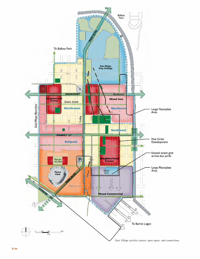
6-20
East Village activity centers, open space, and connections.
����
� ��� ��� ����
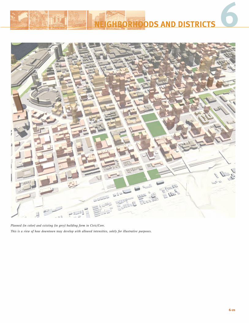
6-21
Planned (in color) and existing (in grey) building form in Civic/Core.
This is a view of how downtown may develop with allowed intensities, solely for illustrative purposes.
6NEIGHBORHOODS AND DISTRICTS
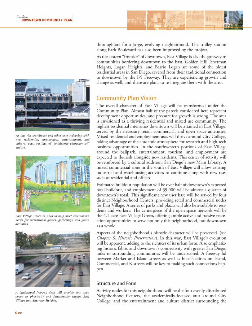
6-22
thoroughfare for a large, evolving neighborhood. The trolley station along Park Boulevard has also been improved by the project.As the eastern “frontier” of downtown, East Village is also the gateway to communities bordering downtown to the East. Golden Hill, Sherman Heights, Logan Heights, and Barrio Logan are some of the oldest residential areas in San Diego, severed from their traditional connection to downtown by the I-5 Freeway. They are experiencing growth and change as well, and there are plans to re-integrate them with the area.
Community Plan VisionThe overall character of East Village will be transformed under the Community Plan. Almost half of the parcels considered here represent development opportunities, and pressure for growth is strong. The area is envisioned as a thriving residential and mixed use community. The highest residential intensities downtown will be attained in East Village, served by the necessary retail, commercial, and open space amenities. Mixed residential and employment uses will thrive around City College, taking advantage of the academic atmosphere for research and high-tech business opportunities. In the southwestern portions of East Village around the ballpark, entertainment, tourism, and employment are expected to flourish alongside new residents. This center of activity will be reinforced by a cultural addition: San Diego’s new Main Library. A mixed commercial zone in the south of East Village will allow existing industrial and warehousing activities to continue along with new uses such as residential and offices.Estimated buildout population will be over half of downtown’s expected total buildout, and employment of 39,000 will be almost a quarter of downtown’s total. This significant new user base will be served by four distinct Neighborhood Centers, providing retail and commercial nodes for East Village. A series of parks and plazas will also be available to resi-dents and workers. The centerpiece of the open space network will be the 4.1-acre East Village Green, offering ample active and passive recre-ation opportunities to serve not only this neighborhood, but downtown as a whole. Aspects of the neighborhood’s historic character will be preserved. (see Chapter 9: Historic Preservation). In this way, East Village’s evolution will be apparent, adding to the richness of its urban form. Also emphasiz-ing historic fabric and downtown’s connectivity with greater San Diego, links to surrounding communities will be underscored. A freeway lid between Market and Island streets as well as bike facilities on Island, Commercial, and K streets will be key to making such connections hap-pen.
Structure and FormActivity nodes for this neighborhood will be the four evenly-distributed Neighborhood Centers, the academically-focused area around City College, and the entertainment and culture district surrounding the
As low rise warehouse and other uses redevelop with new residential, employment, entertainment, and cultural uses, vestiges of the historic character will endure.
A landscaped freeway deck will provide new open space to physically and functionally engage East Village and Sherman Heights.
East Village Green is sized to help meet downtown’s needs for recreational games, gatherings, and youth activities.
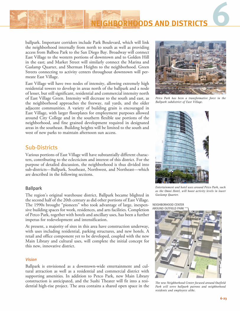
6-23
6NEIGHBORHOODS AND DISTRICTS
ballpark. Important corridors include Park Boulevard, which will link the neighborhood internally from north to south as well as providing access from Balboa Park to the San Diego Bay. Broadway will connect East Village to the western portions of downtown and to Golden Hill in the east; and Market Street will similarly connect the Marina and Gaslamp Quarter, and Sherman Heights to the neighborhood. Green Streets connecting to activity centers throughout downtown will per-meate East Village.East Village will have two nodes of intensity, allowing extremely high residential towers to develop in areas north of the ballpark and a node of lesser, but still significant, residential and commercial intensity north of East Village Green. Intensity will decrease to the south and east, as the neighborhood approaches the freeway, rail yards, and the older adjacent communities. A variety of building grain is encouraged in East Village, with larger floorplates for employment purposes allowed around City College and in the southern flexible use portions of the neighborhood, and fine grained development required in designated areas in the southeast. Building heights will be limited to the south and west of new parks to maintain afternoon sun access.
Sub-DistrictsVarious portions of East Village will have substantially different charac-ters, contributing to the eclecticism and interest of this district. For the purpose of detailed discussion, the neighborhood is thus divided into sub-districts—Ballpark, Southeast, Northwest, and Northeast—which are described in the following sections.
BallparkThe region’s original warehouse district, Ballpark became blighted in the second half of the 20th century as did other portions of East Village. The 1990s brought “pioneers” who took advantage of large, inexpen-sive building spaces for work, residences, and arts facilities. Completion of Petco Park, together with hotels and ancillary uses, has been a further impetus for redevelopment and intensification. At present, a majority of sites in this area have construction underway, with uses including residential, parking structures, and new hotels. A retail and office component yet to be developed, coupled with the new Main Library and cultural uses, will complete the initial concept for this new, innovative district.
Vision
Ballpark is envisioned as a downtown-wide entertainment and cul-tural attraction as well as a residential and commercial district with supporting amenities. In addition to Petco Park, new Main Library construction is anticipated, and the Sushi Theater will fit into a resi-dential high-rise project. The area contains a shared open space in the
The new Neighborhood Center focused around Outfield Park will serve ballpark patrons and neighborhood residents and employees alike.
NEIGHBORHOOD CENTER AROUND OUTFIELD PARK
Petco Park has been a transformative force in the Ballpark subdistrict of East Village.
Entertainment and hotel uses around Petco Park, such as the Omni Hotel, will boost activity levels in lower Gaslamp Quarter.
6-24
Park-at-the-Park, surrounded by commercial uses that form one of East Village’s four Neighborhood Centers, and the central focus of energy for this sub-district. Important corridors are Market Street and Park Boulevard, providing links within downtown, to Balboa Park, and to the Bay; as well as Island and Imperial avenues and Commercial Street, which will afford pedestrian and vehicular access to neighborhoods east of downtown. Compared to areas to the north and east, Ballpark will have low to mid-level intensity buildings, maintaining sun access at Petco Park, and a mid-rise character for a neighborhood that bridges between the historic Gaslamp Quarter and high rises expected north of Market Street. South and east of Petco Park, areas allowing large floorplates will offer flexibility for a variety of employment uses.
SoutheastSoutheast promises to become an eclectic area with a mix of housing types, and the interest and intrigue that accompany diverse environ-ments. Much of this sub-district is intended for a “fine grain” scale of development with multiple buildings per block, and lower building intensity than in most other neighborhoods. At present, rail, shipping yards, and the I-5 freeway surround this portion of East Village, and a mix of industrial, warehousing, trans-portation, and repair uses are housed in the area, largely in single-story structures. Also present are bus yards, occupying a six-block area (with two double-wide and two regular blocks), several vacant buildings, and since the late 1980s some of the region’s largest human service facilities. The sub-district offers several distinct advantages – it is near Petco Park, next to the trolley line and trolley transfer station, and directly adjacent to the Main Library site. It is served by the Park-to-Bay Link, and quick freeway access will benefit future residents, businesses, and public activity. Additionally, Southeast provides transition to the Sherman Heights and Barrio Logan neighborhoods. Vision
Zoning will allow a mix of residential, office, retail, and convention center growth, while retaining light industrial uses and support infra-structure such as auto repair shops. New uses will exist in close proxim-ity to existing ones in mixed commercial zones, creating a diverse urban environment, with residential uses throughout. The sub-district’s energy will focus on Rose Park and the surrounding Neighborhood Center, potentially complemented by adjacent conven-tion center activities. A linear park will connect to the East Village Green, and Fifteenth Street will become an important corridor. Market and J streets are strong connecting spines in the east-west direction. These, together with a freeway lid and surface streets to the south, will provide access to adjacent eastern neighborhoods. L and 15th streets will extend across the existing bus
yards site in Southeast.
Southeast, which currently has some of the lowest intensities downtown, will be transformed under the Community Plan.
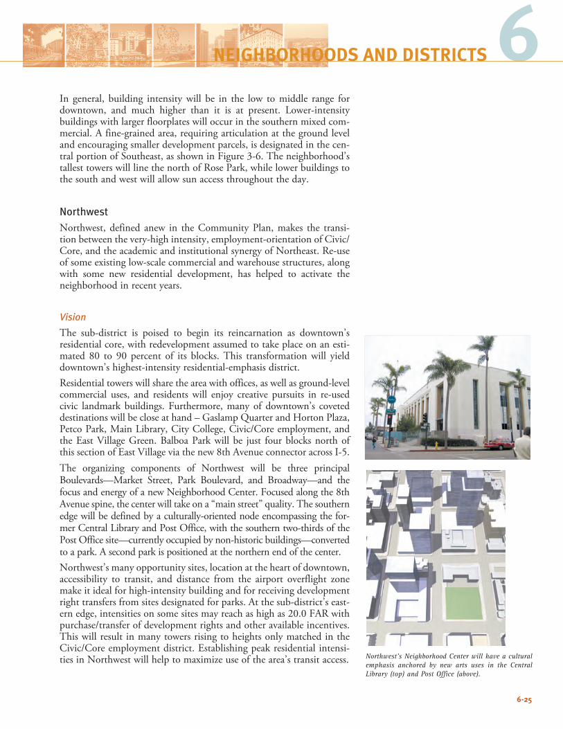
6-25
6NEIGHBORHOODS AND DISTRICTS
In general, building intensity will be in the low to middle range for downtown, and much higher than it is at present. Lower-intensity buildings with larger floorplates will occur in the southern mixed com-mercial. A fine-grained area, requiring articulation at the ground level and encouraging smaller development parcels, is designated in the cen-tral portion of Southeast, as shown in Figure 3-6. The neighborhood’s tallest towers will line the north of Rose Park, while lower buildings to the south and west will allow sun access throughout the day.
NorthwestNorthwest, defined anew in the Community Plan, makes the transi-tion between the very-high intensity, employment-orientation of Civic/Core, and the academic and institutional synergy of Northeast. Re-use of some existing low-scale commercial and warehouse structures, along with some new residential development, has helped to activate the neighborhood in recent years.
Vision
The sub-district is poised to begin its reincarnation as downtown’s residential core, with redevelopment assumed to take place on an esti-mated 80 to 90 percent of its blocks. This transformation will yield downtown’s highest-intensity residential-emphasis district.Residential towers will share the area with offices, as well as ground-level commercial uses, and residents will enjoy creative pursuits in re-used civic landmark buildings. Furthermore, many of downtown’s coveted destinations will be close at hand – Gaslamp Quarter and Horton Plaza, Petco Park, Main Library, City College, Civic/Core employment, and the East Village Green. Balboa Park will be just four blocks north of this section of East Village via the new 8th Avenue connector across I-5.The organizing components of Northwest will be three principal Boulevards—Market Street, Park Boulevard, and Broadway—and the focus and energy of a new Neighborhood Center. Focused along the 8th Avenue spine, the center will take on a “main street” quality. The southern edge will be defined by a culturally-oriented node encompassing the for-mer Central Library and Post Office, with the southern two-thirds of the Post Office site—currently occupied by non-historic buildings—converted to a park. A second park is positioned at the northern end of the center.Northwest’s many opportunity sites, location at the heart of downtown, accessibility to transit, and distance from the airport overflight zone make it ideal for high-intensity building and for receiving development right transfers from sites designated for parks. At the sub-district’s east-ern edge, intensities on some sites may reach as high as 20.0 FAR with purchase/transfer of development rights and other available incentives. This will result in many towers rising to heights only matched in the Civic/Core employment district. Establishing peak residential intensi-ties in Northwest will help to maximize use of the area’s transit access. Northwest’s Neighborhood Center will have a cultural
emphasis anchored by new arts uses in the Central Library (top) and Post Office (above).
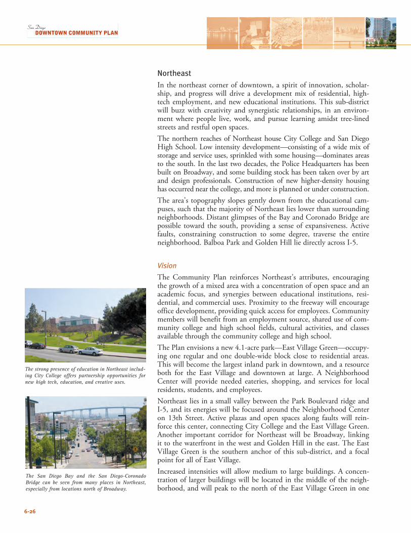
6-26
NortheastIn the northeast corner of downtown, a spirit of innovation, scholar-ship, and progress will drive a development mix of residential, high-tech employment, and new educational institutions. This sub-district will buzz with creativity and synergistic relationships, in an environ-ment where people live, work, and pursue learning amidst tree-lined streets and restful open spaces.The northern reaches of Northeast house City College and San Diego High School. Low intensity development—consisting of a wide mix of storage and service uses, sprinkled with some housing—dominates areas to the south. In the last two decades, the Police Headquarters has been built on Broadway, and some building stock has been taken over by art and design professionals. Construction of new higher-density housing has occurred near the college, and more is planned or under construction.The area’s topography slopes gently down from the educational cam-puses, such that the majority of Northeast lies lower than surrounding neighborhoods. Distant glimpses of the Bay and Coronado Bridge are possible toward the south, providing a sense of expansiveness. Active faults, constraining construction to some degree, traverse the entire neighborhood. Balboa Park and Golden Hill lie directly across I-5.
Vision
The Community Plan reinforces Northeast’s attributes, encouraging the growth of a mixed area with a concentration of open space and an academic focus, and synergies between educational institutions, resi-dential, and commercial uses. Proximity to the freeway will encourage office development, providing quick access for employees. Community members will benefit from an employment source, shared use of com-munity college and high school fields, cultural activities, and classes available through the community college and high school. The Plan envisions a new 4.1-acre park—East Village Green—occupy-ing one regular and one double-wide block close to residential areas. This will become the largest inland park in downtown, and a resource both for the East Village and downtown at large. A Neighborhood Center will provide needed eateries, shopping, and services for local residents, students, and employees.Northeast lies in a small valley between the Park Boulevard ridge and I-5, and its energies will be focused around the Neighborhood Center on 13th Street. Active plazas and open spaces along faults will rein-force this center, connecting City College and the East Village Green. Another important corridor for Northeast will be Broadway, linking it to the waterfront in the west and Golden Hill in the east. The East Village Green is the southern anchor of this sub-district, and a focal point for all of East Village. Increased intensities will allow medium to large buildings. A concen-tration of larger buildings will be located in the middle of the neigh-borhood, and will peak to the north of the East Village Green in one
The San Diego Bay and the San Diego-Coronado Bridge can be seen from many places in Northeast, especially from locations north of Broadway.
The strong presence of education in Northeast includ-ing City College offers partnership opportunities for new high tech, education, and creative uses.
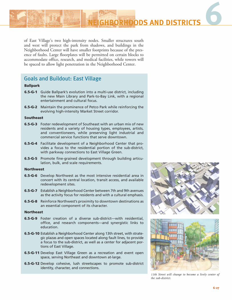
6-27
6NEIGHBORHOODS AND DISTRICTS
of East Village’s two high-intensity nodes. Smaller structures south and west will protect the park from shadows, and buildings in the Neighborhood Center will have smaller footprints because of the pres-ence of faults. Large floorplates will be permitted on certain blocks to accommodate office, research, and medical facilities, while towers will be spaced to allow light penetration in the Neighborhood Center.
Goals and Buildout: East VillageBallpark
6.5-G-1 Guide Ballpark’s evolution into a multi-use district, including the new Main Library and Park-to-Bay Link, with a regional entertainment and cultural focus.
6.5-G-2 Maintain the prominence of Petco Park while reinforcing the evolving high-intensity Market Street corridor.
Southeast
6.5-G-3 Foster redevelopment of Southeast with an urban mix of new residents and a variety of housing types, employees, artists, and conventioneers, while preserving light industrial and commercial service functions that serve downtown.
6.5-G-4 Facilitate development of a Neighborhood Center that pro-vides a focus to the residential portion of the sub-district, with parkway connections to East Village Green.
6.5-G-5 Promote fine-grained development through building articu-lation, bulk, and scale requirements.
Northwest
6.5-G-6 Develop Northwest as the most intensive residential area in concert with its central location, transit access, and available redevelopment sites.
6.5-G-7 Establish a Neighborhood Center between 7th and 9th avenues as the activity focus for residents and with a cultural emphasis.
6.5-G-8 Reinforce Northwest’s proximity to downtown destinations as an essential component of its character.
Northeast
6.5-G-9 Foster creation of a diverse sub-district—with residential, office, and research components—and synergistic links to education.
6.5-G-10 Establish a Neighborhood Center along 13th street, with strate-gic plazas and open spaces located along fault lines, to provide a focus to the sub-district, as well as a center for adjacent por-tions of East Village.
6.5-G-11 Develop East Village Green as a recreation and event open space, serving Northeast and downtown at-large.
6.5-G-12 Develop cohesive, lush streetscapes to promote sub-district identity, character, and connections.
13th Street will change to become a lively center of the sub-district.
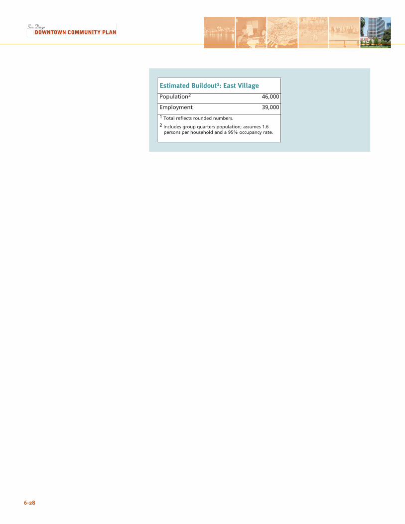
6-28
Estimated Buildout1: East Village
Population2 46,000
Employment 39,000
1 Total reflects rounded numbers.
2 Includes group quarters population; assumes 1.6 persons per household and a 95% occupancy rate.
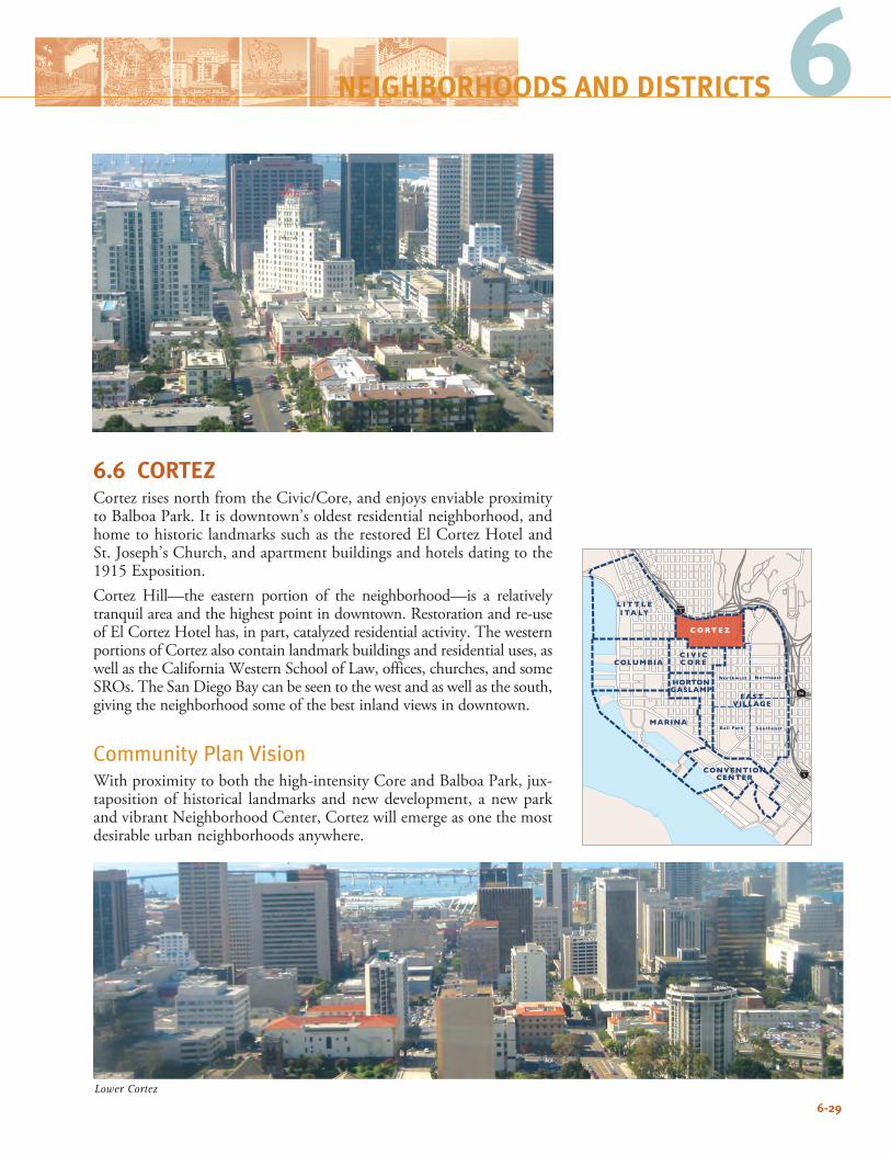
6-29
66
6.6 CORTEZCortez rises north from the Civic/Core, and enjoys enviable proximity to Balboa Park. It is downtown’s oldest residential neighborhood, and home to historic landmarks such as the restored El Cortez Hotel and St. Joseph’s Church, and apartment buildings and hotels dating to the 1915 Exposition. Cortez Hill—the eastern portion of the neighborhood—is a relatively tranquil area and the highest point in downtown. Restoration and re-use of El Cortez Hotel has, in part, catalyzed residential activity. The western portions of Cortez also contain landmark buildings and residential uses, as well as the California Western School of Law, offices, churches, and some SROs. The San Diego Bay can be seen to the west and as well as the south, giving the neighborhood some of the best inland views in downtown.
Community Plan Vision With proximity to both the high-intensity Core and Balboa Park, jux-taposition of historical landmarks and new development, a new park and vibrant Neighborhood Center, Cortez will emerge as one the most desirable urban neighborhoods anywhere.
94
5
5
C O RT E Z
L I T T L EI TA LY
COLUMBIA
MARINA
HORTONGASLAMP
EASTVILLAGE
Northwest Northeast
SoutheastBall Park
CONVENTIONCENTER
C I V I CC O R E
Lower Cortez
NEIGHBORHOODS AND DISTRICTS
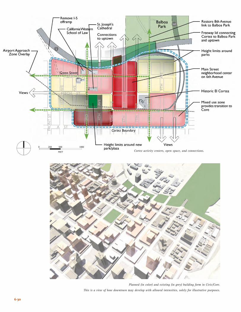
6-30
Cortez activity centers, open space, and connections.
Planned (in color) and existing (in grey) building form in Civic/Core.
This is a view of how downtown may develop with allowed intensities, solely for illustrative purposes.
����
� ��� ��� ����
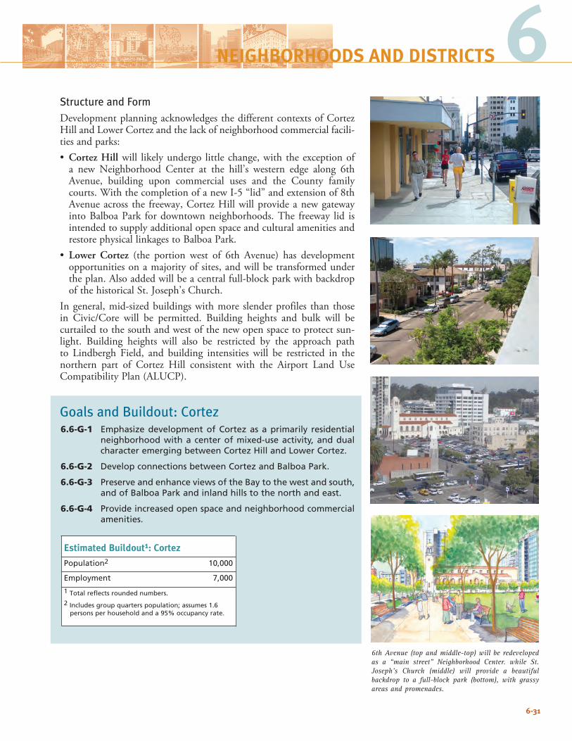
6-31
6Structure and FormDevelopment planning acknowledges the different contexts of Cortez Hill and Lower Cortez and the lack of neighborhood commercial facili-ties and parks:• Cortez Hill will likely undergo little change, with the exception of
a new Neighborhood Center at the hill’s western edge along 6th Avenue, building upon commercial uses and the County family courts. With the completion of a new I-5 “lid” and extension of 8th Avenue across the freeway, Cortez Hill will provide a new gateway into Balboa Park for downtown neighborhoods. The freeway lid is intended to supply additional open space and cultural amenities and restore physical linkages to Balboa Park.
• Lower Cortez (the portion west of 6th Avenue) has development opportunities on a majority of sites, and will be transformed under the plan. Also added will be a central full-block park with backdrop of the historical St. Joseph’s Church.
In general, mid-sized buildings with more slender profiles than those in Civic/Core will be permitted. Building heights and bulk will be curtailed to the south and west of the new open space to protect sun-light. Building heights will also be restricted by the approach path to Lindbergh Field, and building intensities will be restricted in the northern part of Cortez Hill consistent with the Airport Land Use Compatibility Plan (ALUCP).
Goals and Buildout: Cortez6.6-G-1 Emphasize development of Cortez as a primarily residential
neighborhood with a center of mixed-use activity, and dual character emerging between Cortez Hill and Lower Cortez.
6.6-G-2 Develop connections between Cortez and Balboa Park.
6.6-G-3 Preserve and enhance views of the Bay to the west and south, and of Balboa Park and inland hills to the north and east.
6.6-G-4 Provide increased open space and neighborhood commercial amenities.
NEIGHBORHOODS AND DISTRICTS
Estimated Buildout1: Cortez
Population2 10,000
Employment 7,000
1 Total reflects rounded numbers.
2 Includes group quarters population; assumes 1.6 persons per household and a 95% occupancy rate.
6th Avenue (top and middle-top) will be redeveloped as a “main street” Neighborhood Center. while St. Joseph’s Church (middle) will provide a beautiful backdrop to a full-block park (bottom), with grassy areas and promenades.

6-32
This page intentionally left blank.
6-32
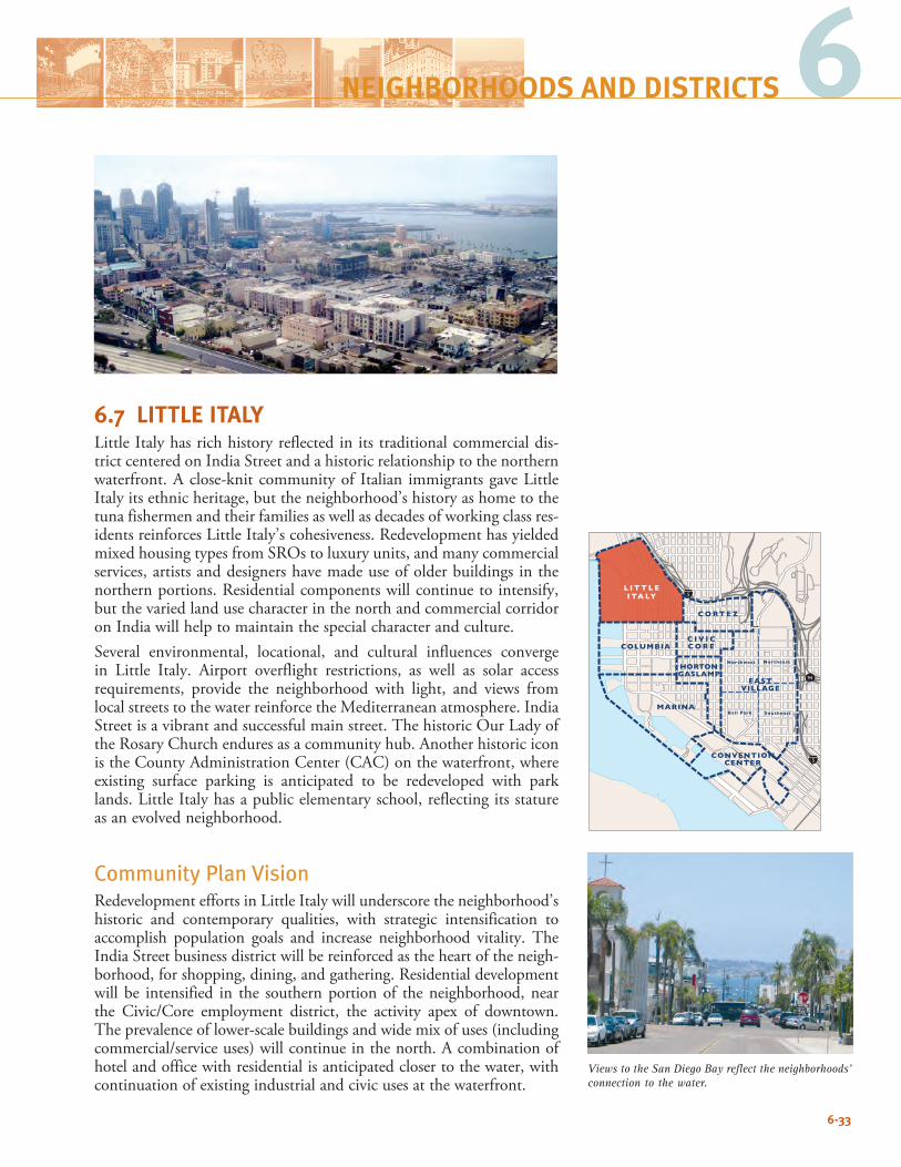
6
6.7 LITTLE ITALYLittle Italy has rich history reflected in its traditional commercial dis-trict centered on India Street and a historic relationship to the northern waterfront. A close-knit community of Italian immigrants gave Little Italy its ethnic heritage, but the neighborhood’s history as home to the tuna fishermen and their families as well as decades of working class res-idents reinforces Little Italy’s cohesiveness. Redevelopment has yielded mixed housing types from SROs to luxury units, and many commercial services, artists and designers have made use of older buildings in the northern portions. Residential components will continue to intensify, but the varied land use character in the north and commercial corridor on India will help to maintain the special character and culture.Several environmental, locational, and cultural influences converge in Little Italy. Airport overflight restrictions, as well as solar access requirements, provide the neighborhood with light, and views from local streets to the water reinforce the Mediterranean atmosphere. India Street is a vibrant and successful main street. The historic Our Lady of the Rosary Church endures as a community hub. Another historic icon is the County Administration Center (CAC) on the waterfront, where existing surface parking is anticipated to be redeveloped with park lands. Little Italy has a public elementary school, reflecting its stature as an evolved neighborhood.
Community Plan VisionRedevelopment efforts in Little Italy will underscore the neighborhood’s historic and contemporary qualities, with strategic intensification to accomplish population goals and increase neighborhood vitality. The India Street business district will be reinforced as the heart of the neigh-borhood, for shopping, dining, and gathering. Residential development will be intensified in the southern portion of the neighborhood, near the Civic/Core employment district, the activity apex of downtown. The prevalence of lower-scale buildings and wide mix of uses (including commercial/service uses) will continue in the north. A combination of hotel and office with residential is anticipated closer to the water, with continuation of existing industrial and civic uses at the waterfront.
6-33
6NEIGHBORHOODS AND DISTRICTS
94
5
5
C O RT E Z
L I T T L EI TA LY
COLUMBIA
MARINA
HORTONGASLAMP
EASTVILLAGE
Northwest Northeast
SoutheastBall Park
CONVENTIONCENTER
C I V I CC O R E
Views to the San Diego Bay reflect the neighborhoods’ connection to the water.
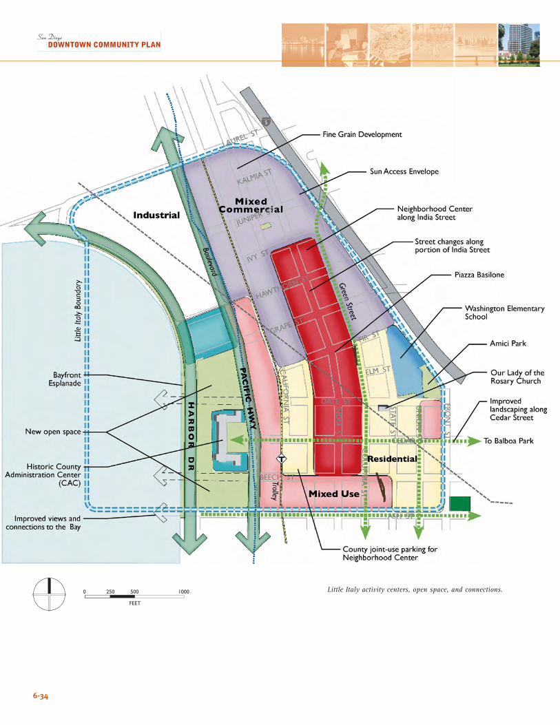
6-34
Little Italy activity centers, open space, and connections.
����
� ��� ��� ����
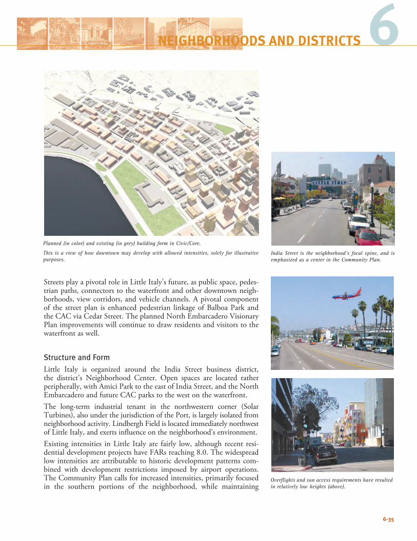
6-35
6NEIGHBORHOODS AND DISTRICTS
Streets play a pivotal role in Little Italy’s future, as public space, pedes-trian paths, connectors to the waterfront and other downtown neigh-borhoods, view corridors, and vehicle channels. A pivotal component of the street plan is enhanced pedestrian linkage of Balboa Park and the CAC via Cedar Street. The planned North Embarcadero Visionary Plan improvements will continue to draw residents and visitors to the waterfront as well.
Structure and FormLittle Italy is organized around the India Street business district, the district’s Neighborhood Center. Open spaces are located rather peripherally, with Amici Park to the east of India Street, and the North Embarcadero and future CAC parks to the west on the waterfront. The long-term industrial tenant in the northwestern corner (Solar Turbines), also under the jurisdiction of the Port, is largely isolated from neighborhood activity. Lindbergh Field is located immediately northwest of Little Italy, and exerts influence on the neighborhood’s environment.Existing intensities in Little Italy are fairly low, although recent resi-dential development projects have FARs reaching 8.0. The widespread low intensities are attributable to historic development patterns com-bined with development restrictions imposed by airport operations. The Community Plan calls for increased intensities, primarily focused in the southern portions of the neighborhood, while maintaining
Planned (in color) and existing (in grey) building form in Civic/Core.
This is a view of how downtown may develop with allowed intensities, solely for illustrative purposes.
Overflights and sun access requirements have resulted in relatively low heights (above).
India Street is the neighborhood’s focal spine, and is emphasized as a center in the Community Plan.
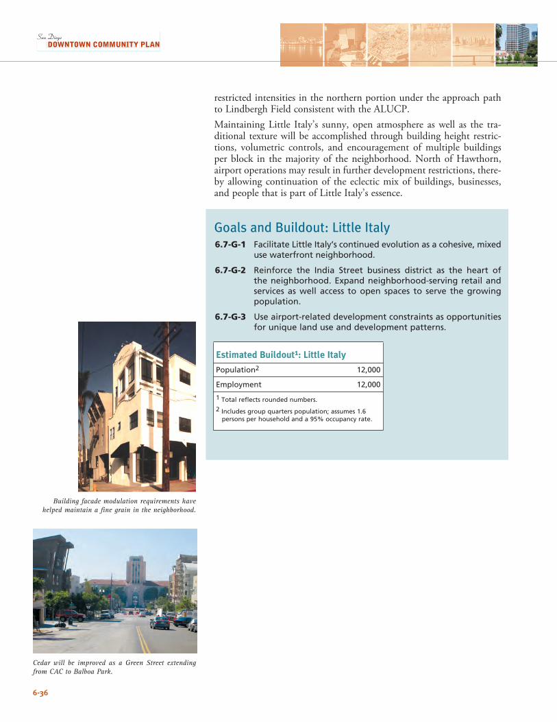
6-36
Building facade modulation requirements have helped maintain a fine grain in the neighborhood.
restricted intensities in the northern portion under the approach path to Lindbergh Field consistent with the ALUCP. Maintaining Little Italy’s sunny, open atmosphere as well as the tra-ditional texture will be accomplished through building height restric-tions, volumetric controls, and encouragement of multiple buildings per block in the majority of the neighborhood. North of Hawthorn, airport operations may result in further development restrictions, there-by allowing continuation of the eclectic mix of buildings, businesses, and people that is part of Little Italy’s essence.
Goals and Buildout: Little Italy6.7-G-1 Facilitate Little Italy’s continued evolution as a cohesive, mixed
use waterfront neighborhood.
6.7-G-2 Reinforce the India Street business district as the heart of the neighborhood. Expand neighborhood-serving retail and services as well access to open spaces to serve the growing population.
6.7-G-3 Use airport-related development constraints as opportunities for unique land use and development patterns.
Estimated Buildout1: Little Italy
Population2 12,000
Employment 12,000
1 Total reflects rounded numbers.
2 Includes group quarters population; assumes 1.6 persons per household and a 95% occupancy rate.
Cedar will be improved as a Green Street extending from CAC to Balboa Park.
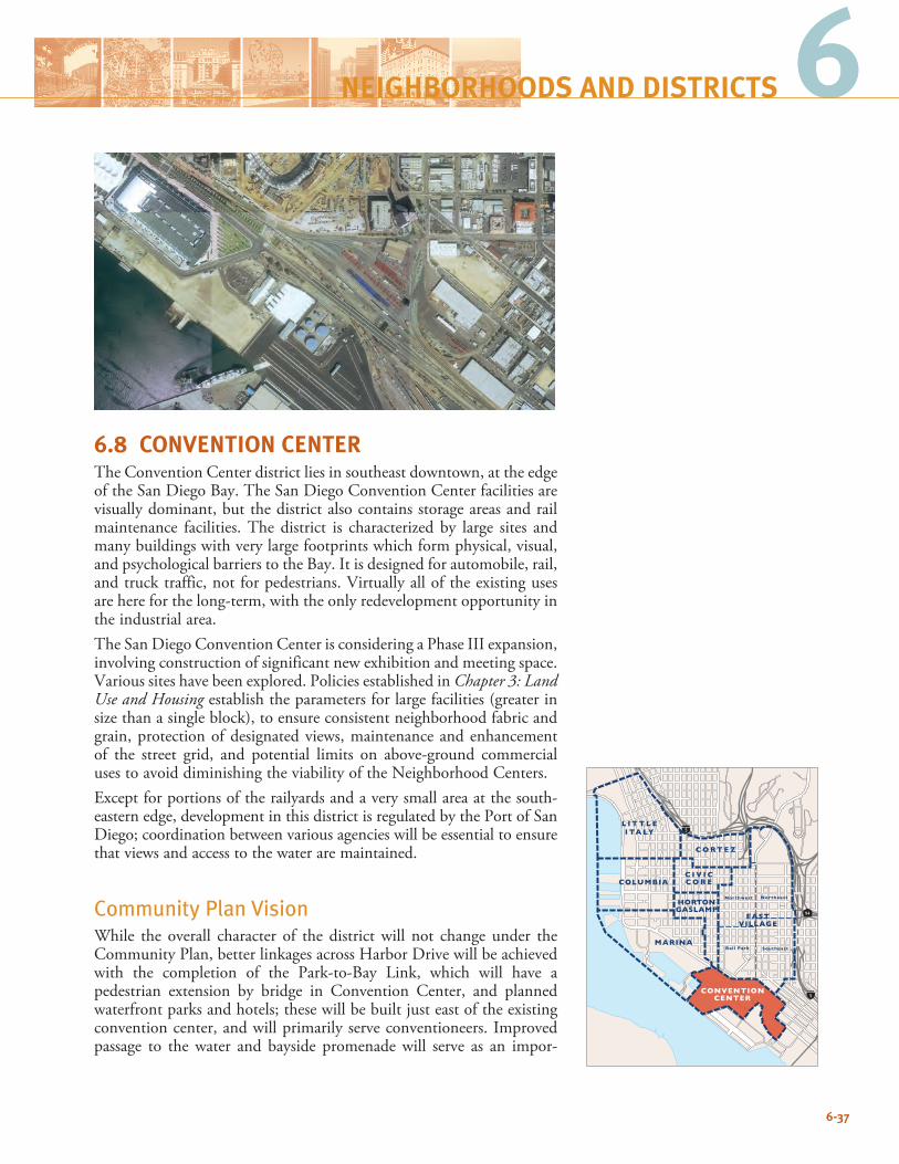
6-37
66
6.8 CONVENTION CENTERThe Convention Center district lies in southeast downtown, at the edge of the San Diego Bay. The San Diego Convention Center facilities are visually dominant, but the district also contains storage areas and rail maintenance facilities. The district is characterized by large sites and many buildings with very large footprints which form physical, visual, and psychological barriers to the Bay. It is designed for automobile, rail, and truck traffic, not for pedestrians. Virtually all of the existing uses are here for the long-term, with the only redevelopment opportunity in the industrial area. The San Diego Convention Center is considering a Phase III expansion, involving construction of significant new exhibition and meeting space. Various sites have been explored. Policies established in Chapter 3: Land Use and Housing establish the parameters for large facilities (greater in size than a single block), to ensure consistent neighborhood fabric and grain, protection of designated views, maintenance and enhancement of the street grid, and potential limits on above-ground commercial uses to avoid diminishing the viability of the Neighborhood Centers.Except for portions of the railyards and a very small area at the south-eastern edge, development in this district is regulated by the Port of San Diego; coordination between various agencies will be essential to ensure that views and access to the water are maintained.
Community Plan Vision While the overall character of the district will not change under the Community Plan, better linkages across Harbor Drive will be achieved with the completion of the Park-to-Bay Link, which will have a pedestrian extension by bridge in Convention Center, and planned waterfront parks and hotels; these will be built just east of the existing convention center, and will primarily serve conventioneers. Improved passage to the water and bayside promenade will serve as an impor-
NEIGHBORHOODS AND DISTRICTS
94
5
5
C O RT E Z
L I T T L EI TA LY
MARINA
HORTONGASLAMP
EASTVILLAGE
Northwest Northeast
SoutheastBall Park
CONVENTIONCENTER
C I V I CC O R ECOLUMBIA
6-38
Convention Center activity centers, open space, and connections.
����
� ��� ��� ����
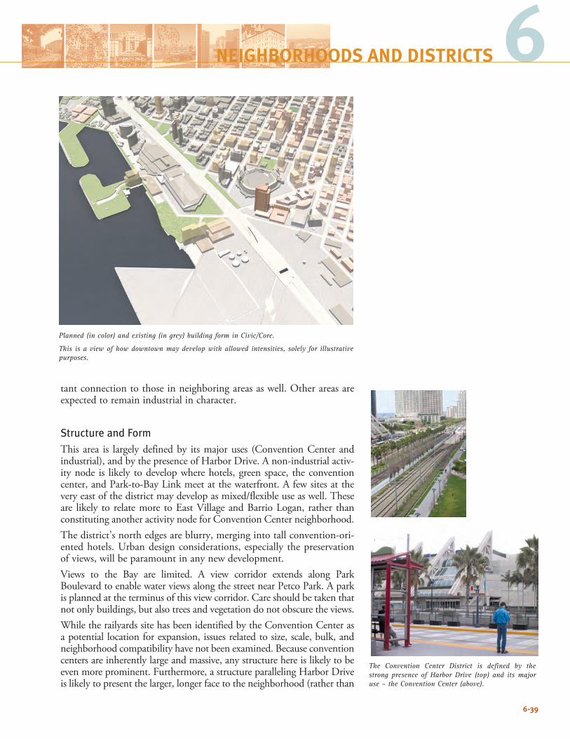
6-39
6NEIGHBORHOODS AND DISTRICTS
tant connection to those in neighboring areas as well. Other areas are expected to remain industrial in character.
Structure and FormThis area is largely defined by its major uses (Convention Center and industrial), and by the presence of Harbor Drive. A non-industrial activ-ity node is likely to develop where hotels, green space, the convention center, and Park-to-Bay Link meet at the waterfront. A few sites at the very east of the district may develop as mixed/flexible use as well. These are likely to relate more to East Village and Barrio Logan, rather than constituting another activity node for Convention Center neighborhood.The district’s north edges are blurry, merging into tall convention-ori-ented hotels. Urban design considerations, especially the preservation of views, will be paramount in any new development. Views to the Bay are limited. A view corridor extends along Park Boulevard to enable water views along the street near Petco Park. A park is planned at the terminus of this view corridor. Care should be taken that not only buildings, but also trees and vegetation do not obscure the views.While the railyards site has been identified by the Convention Center as a potential location for expansion, issues related to size, scale, bulk, and neighborhood compatibility have not been examined. Because convention centers are inherently large and massive, any structure here is likely to be even more prominent. Furthermore, a structure paralleling Harbor Drive is likely to present the larger, longer face to the neighborhood (rather than
Planned (in color) and existing (in grey) building form in Civic/Core.
This is a view of how downtown may develop with allowed intensities, solely for illustrative purposes.
The Convention Center District is defined by the strong presence of Harbor Drive (top) and its major use – the Convention Center (above).
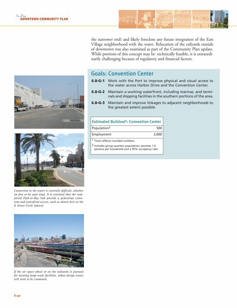
6-40
the narrower end) and likely foreclose any future integration of the East Village neighborhood with the water. Relocation of the railyards outside of downtown was also examined as part of the Community Plan update. While portions of this concept may be technically feasible, it is extraordi-narily challenging because of regulatory and financial factors.
Goals: Convention Center6.8-G-1 Work with the Port to improve physical and visual access to
the water across Harbor Drive and the Convention Center.
6.8-G-2 Maintain a working waterfront, including marinas, and termi-nals and shipping facilities in the southern portions of the area.
6.8-G-3 Maintain and improve linkages to adjacent neighborhoods to the greatest extent possible.
Estimated Buildout1: Convention Center
Population2 500
Employment 3,000
1 Total reflects rounded numbers.
2 Includes group quarters population; assumes 1.6 persons per household and a 95% occupancy rate.
If the air space above or on the railyards is pursued for locating large-scale facilities, urban design issues will need to be examined.
Connection to the water is currently difficult, whether on foot or by auto (top). It is essential that the com-pleted Park-to-Bay link provide a pedestrian exten-sion and waterfront access, such as shown here at the K Street Circle (above).
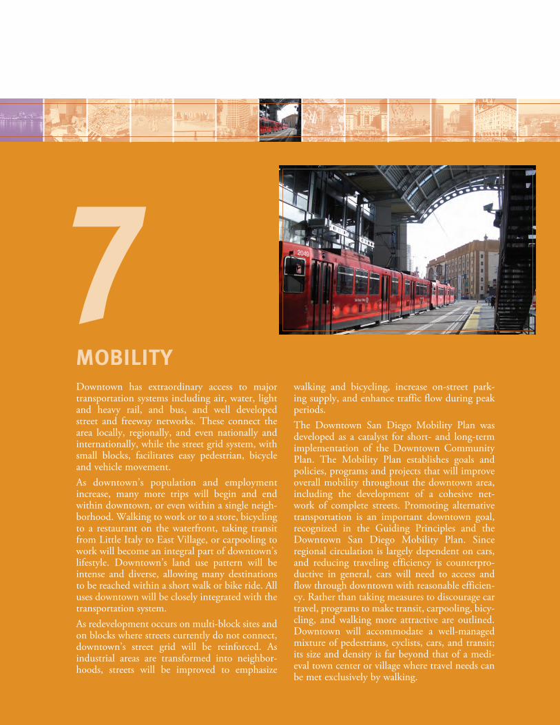
Downtown has extraordinary access to major transportation systems including air, water, light and heavy rail, and bus, and well developed street and freeway networks. These connect the area locally, regionally, and even nationally and internationally, while the street grid system, with small blocks, facilitates easy pedestrian, bicycle and vehicle movement. As downtown’s population and employment increase, many more trips will begin and end within downtown, or even within a single neigh-borhood. Walking to work or to a store, bicycling to a restaurant on the waterfront, taking transit from Little Italy to East Village, or carpooling to work will become an integral part of downtown’s lifestyle. Downtown’s land use pattern will be intense and diverse, allowing many destinations to be reached within a short walk or bike ride. All uses downtown will be closely integrated with the transportation system.As redevelopment occurs on multi-block sites and on blocks where streets currently do not connect, downtown’s street grid will be reinforced. As industrial areas are transformed into neighbor-hoods, streets will be improved to emphasize
walking and bicycling, increase on-street park-ing supply, and enhance traffic flow during peak periods. The Downtown San Diego Mobility Plan was developed as a catalyst for short- and long-term implementation of the Downtown Community Plan. The Mobility Plan establishes goals and policies, programs and projects that will improve overall mobility throughout the downtown area, including the development of a cohesive net-work of complete streets. Promoting alternative transportation is an important downtown goal, recognized in the Guiding Principles and the Downtown San Diego Mobility Plan. Since regional circulation is largely dependent on cars, and reducing traveling efficiency is counterpro-ductive in general, cars will need to access and flow through downtown with reasonable efficien-cy. Rather than taking measures to discourage car travel, programs to make transit, carpooling, bicy-cling, and walking more attractive are outlined. Downtown will accommodate a well-managed mixture of pedestrians, cyclists, cars, and transit; its size and density is far beyond that of a medi-eval town center or village where travel needs can be met exclusively by walking.
MOBILITY
7
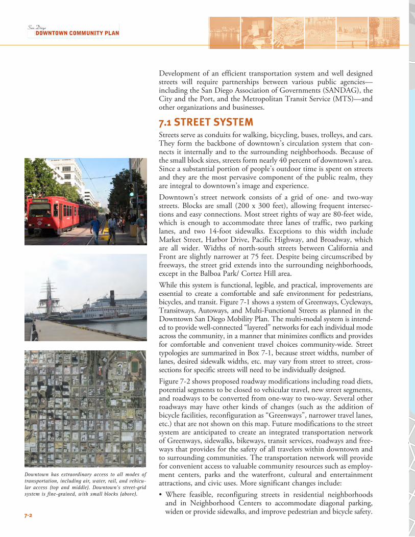
Development of an efficient transportation system and well designed streets will require partnerships between various public agencies—including the San Diego Association of Governments (SANDAG), the City and the Port, and the Metropolitan Transit Service (MTS)—and other organizations and businesses.
7.1 STREET SYSTEMStreets serve as conduits for walking, bicycling, buses, trolleys, and cars. They form the backbone of downtown’s circulation system that con-nects it internally and to the surrounding neighborhoods. Because of the small block sizes, streets form nearly 40 percent of downtown’s area. Since a substantial portion of people’s outdoor time is spent on streets and they are the most pervasive component of the public realm, they are integral to downtown’s image and experience. Downtown’s street network consists of a grid of one- and two-way streets. Blocks are small (200 x 300 feet), allowing frequent intersec-tions and easy connections. Most street rights of way are 80-feet wide, which is enough to accommodate three lanes of traffic, two parking lanes, and two 14-foot sidewalks. Exceptions to this width include Market Street, Harbor Drive, Pacific Highway, and Broadway, which are all wider. Widths of north-south streets between California and Front are slightly narrower at 75 feet. Despite being circumscribed by freeways, the street grid extends into the surrounding neighborhoods, except in the Balboa Park/ Cortez Hill area.While this system is functional, legible, and practical, improvements are essential to create a comfortable and safe environment for pedestrians, bicycles, and transit. Figure 7-1 shows a system of Greenways, Cycleways, Transitways, Autoways, and Multi-Functional Streets as planned in the Downtown San Diego Mobility Plan. The multi-modal system is intend-ed to provide well-connected “layered” networks for each individual mode across the community, in a manner that minimizes conflicts and provides for comfortable and convenient travel choices community-wide. Street typologies are summarized in Box 7-1, because street widths, number of lanes, desired sidewalk widths, etc. may vary from street to street, cross-sections for specific streets will need to be individually designed.Figure 7-2 shows proposed roadway modifications including road diets, potential segments to be closed to vehicular travel, new street segments, and roadways to be converted from one-way to two-way. Several other roadways may have other kinds of changes (such as the addition of bicycle facilities, reconfiguration as “Greenways”, narrower travel lanes, etc.) that are not shown on this map. Future modifications to the street system are anticipated to create an integrated transportation network of Greenways, sidewalks, bikeways, transit services, roadways and free-ways that provides for the safety of all travelers within downtown and to surrounding communities. The transportation network will provide for convenient access to valuable community resources such as employ-ment centers, parks and the waterfront, cultural and entertainment attractions, and civic uses. More significant changes include:• Where feasible, reconfiguring streets in residential neighborhoods
and in Neighborhood Centers to accommodate diagonal parking, widen or provide sidewalks, and improve pedestrian and bicycle safety.
Downtown has extraordinary access to all modes of transportation, including air, water, rail, and vehicu-lar access (top and middle). Downtown’s street-grid system is fine-grained, with small blocks (above).
7-2 . l
N0 0.20 1 Mi es
94
S a n D i e g o B a y
5
5
Multi-Functional StreetAutowayTransitwayCyclewayGreenway
Laurel St
Kalmia St
Ivy St
Grape St
C St
B St
A St
Ash St
Beech St
Cedar St
Island Ave
Market St
G St
F St
E St
Broadway
Imperial Ave
L St
K St
J St
Commercial St
Seco
nd A
ve
Firs
t Ave
Fron
t St
Unio
n St
Stat
e St
Colu
mbi
a St
Park
Bl
Elev
enth
Ave
Sixt
h Av
e
Fifth
Ave
Four
th Av
e
Third
Ave
15th
St
14th
St
Tent
h Av
e
Nint
h Av
e
Eigh
th A
ve
Seve
nth
Ave
16th
St
17th
St
Date St
Juniper St
Hawthorn St
Indi
a St
Kett
ner B
l
Harb
or D
r
13th
St
W. Fir StElm St
163
Figure 7-1Street Typologies
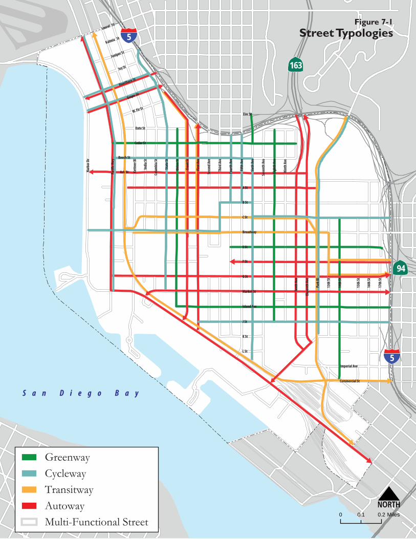
. l
N0 0.20 1 Mi es
94
S a n D i e g o B a y
5
5
Multi-Functional StreetAutowayTransitwayCyclewayGreenway
Laurel St
Kalmia St
Ivy St
Grape St
C St
B St
A St
Ash St
Beech St
Cedar St
Island Ave
Market St
G St
F St
E St
Broadway
Imperial Ave
L St
K St
J St
Commercial St
Seco
nd A
ve
Firs
t Ave
Fron
t St
Unio
n St
Stat
e St
Colu
mbi
a St
Park
Bl
Elev
enth
Ave
Sixt
h Av
e
Fifth
Ave
Four
th Av
e
Third
Ave
15th
St
14th
St
Tent
h Av
e
Nint
h Av
e
Eigh
th A
ve
Seve
nth
Ave
16th
St
17th
St
Date St
Juniper St
Hawthorn St
Indi
a St
Kett
ner B
l
Harb
or D
r
13th
St
W. Fir StElm St
163
Figure 7-1Street Typologies
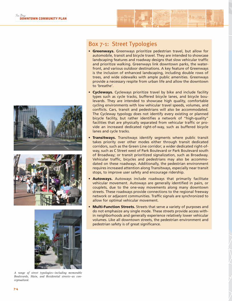
7-4
Box 7-1: Street Typologies• Greenways. Greenways prioritize pedestrian travel, but allow for
automobile, transit and bicycle travel. They are intended to showcase landscaping features and roadway designs that slow vehicular traffic and prioritize walking. Greenways link downtown parks, the water-front, and various outdoor destinations. A key feature of Greenways is the inclusion of enhanced landscaping, including double rows of trees, and wide sidewalks with ample public amenities. Greenways provide a necessary respite from urban life and allow the downtown to ‘breathe’.
• Cycleways. Cycleways prioritize travel by bike and include facility types such as cycle tracks, buffered bicycle lanes, and bicycle bou-levards. They are intended to showcase high quality, comfortable cycling environments with low vehicular travel speeds, volumes, and conflicts. Cars, transit and pedestrians will also be accommodated. The Cycleway typology does not identify every existing or planned bicycle facility, but rather identifies a network of “high-quality” facilities that are physically separated from vehicular traffic or pro-vide an increased dedicated right-of-way, such as buffered bicycle lanes and cycle tracks.
• Transitways. Transitways identify segments where public transit takes priority over other modes either through transit dedicated corridors, such as the Green Line corridor; a wider dedicated right-of-way, such as C Street west of Park Boulevard or Park Boulevard south of Broadway; or transit prioritized signalization, such as Broadway. Vehicular traffic, bicycles and pedestrians may also be accommo-dated on these roadways. Additionally, the pedestrian environment requires increased attention along Transitways, especially near transit stops, to improve user safety and encourage ridership.
• Autoways. Autoways include roadways that primarily facilitate vehicular movement. Autoways are generally identified in pairs, or couplets, due to the one-way movements along many downtown streets. These roadways provide connections to the regional freeway network or adjacent communities. Traffic signals are synchronized to allow for optimal vehicular movement.
• Multi-Function Streets. Streets that serve a variety of purposes and do not emphasize any single mode. These streets provide access with-in neighborhoods and generally experience relatively lower vehicular volumes. Like all downtown streets, the pedestrian environment and pedestrian safety is of great significance.
A range of street typologies—including memorable Boulevards, Main, and Residential streets—as con-ceptualized.
.0 1
N0 0 2. Miles
5
94
Laurel St
Kalmia St
Ivy St
Grape St
C St
B St
A St
Ash St
Beech St
Cedar St
Island Ave
Market St
G St
F St
Broadway
Imperial Ave
L St
K St
J St
Commercial St
Seco
nd A
ve
Firs
t Ave
Fron
t St
Unio
n St
Stat
e St
Colu
mbi
a St
Park
Bl
Elev
enth
Ave
Sixt
h Av
e
Fifth
Ave
Four
th A
ve
15th
St
14th
St
13th
St
Tent
h Av
e
Nint
h Av
e
Eigh
th Av
e
Seve
nth
Ave
16th
St
17th
St
Date St
Juniper St
Hawthorn St
Indi
a St
Kett
ner B
l
Harb
or D
r
S a n D i e g o B a y
163
W. Fir St
5
Elm St
Potential Road C losure to Vehicular Travel
Proposed Road Diets
Proposed New Connection (Roadway or Pedestrian Only)
Proposed New Connection (Roadway)
Proposed One-Way to Two-Way Street Conversion
E St
Third
Ave
Figure 7-2Roadway Modifications
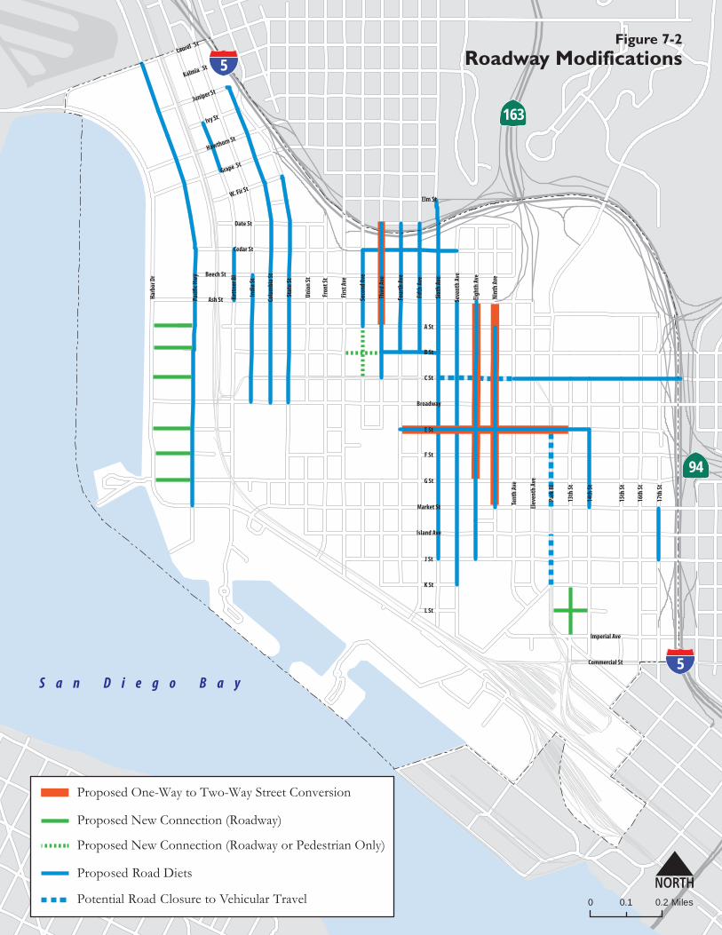
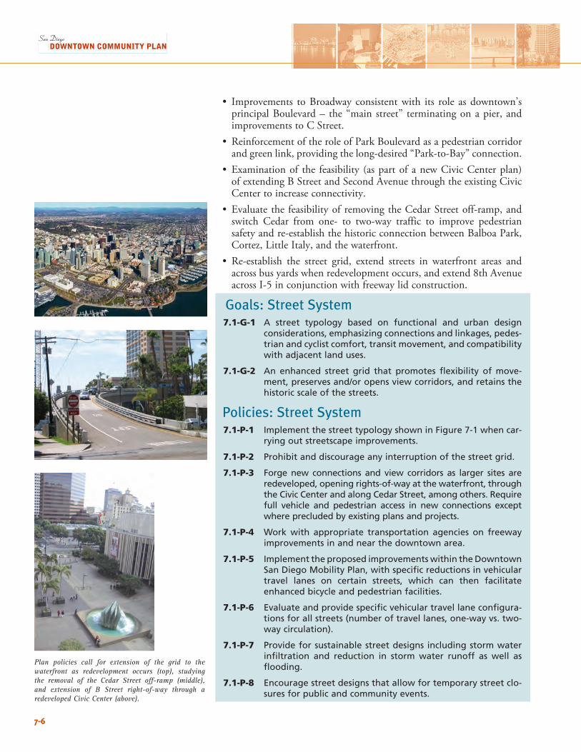
7-67-6
Plan policies call for extension of the grid to the waterfront as redevelopment occurs (top), studying the removal of the Cedar Street off-ramp (middle), and extension of B Street right-of-way through a redeveloped Civic Center (above).
• Improvements to Broadway consistent with its role as downtown’s principal Boulevard – the “main street” terminating on a pier, and improvements to C Street.
• Reinforcement of the role of Park Boulevard as a pedestrian corridor and green link, providing the long-desired “Park-to-Bay” connection.
• Examination of the feasibility (as part of a new Civic Center plan)of extending B Street and Second Avenue through the existing Civic Center to increase connectivity.
• Evaluate the feasibility of removing the Cedar Street off-ramp, and switch Cedar from one- to two-way traffic to improve pedestrian safety and re-establish the historic connection between Balboa Park, Cortez, Little Italy, and the waterfront.
• Re-establish the street grid, extend streets in waterfront areas and across bus yards when redevelopment occurs, and extend 8th Avenue across I-5 in conjunction with freeway lid construction.
Goals: Street System7.1-G-1 A street typology based on functional and urban design
considerations, emphasizing connections and linkages, pedes-trian and cyclist comfort, transit movement, and compatibility with adjacent land uses.
7.1-G-2 An enhanced street grid that promotes flexibility of move-ment, preserves and/or opens view corridors, and retains the historic scale of the streets.
Policies: Street System7.1-P-1 Implement the street typology shown in Figure 7-1 when car-
rying out streetscape improvements.
7.1-P-2 Prohibit and discourage any interruption of the street grid.
7.1-P-3 Forge new connections and view corridors as larger sites are redeveloped, opening rights-of-way at the waterfront, through the Civic Center and along Cedar Street, among others. Require full vehicle and pedestrian access in new connections except where precluded by existing plans and projects.
7.1-P-4 Work with appropriate transportation agencies on freeway improvements in and near the downtown area.
7.1-P-5 Implement the proposed improvements within the Downtown San Diego Mobility Plan, with specific reductions in vehicular travel lanes on certain streets, which can then facilitate enhanced bicycle and pedestrian facilities.
7.1-P-6 Evaluate and provide specific vehicular travel lane configura-tions for all streets (number of travel lanes, one-way vs. two-way circulation).
7.1-P-7 Provide for sustainable street designs including storm water infiltration and reduction in storm water runoff as well as flooding.
7.1-P-8 Encourage street designs that allow for temporary street clo-sures for public and community events.
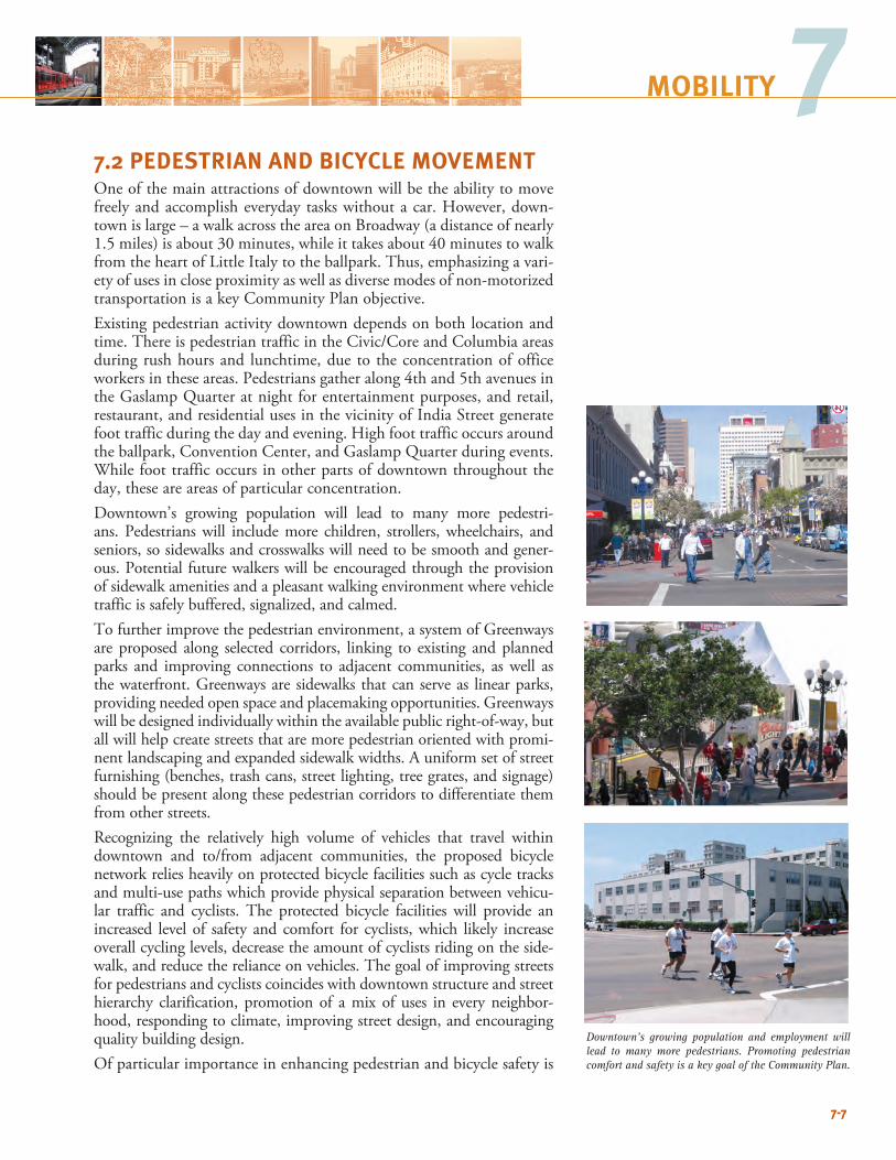
7-7
7MOBILITY
7-7
7
Downtown’s growing population and employment will lead to many more pedestrians. Promoting pedestrian comfort and safety is a key goal of the Community Plan.
7.2 PEDESTRIAN AND BICYCLE MOVEMENTOne of the main attractions of downtown will be the ability to move freely and accomplish everyday tasks without a car. However, down-town is large – a walk across the area on Broadway (a distance of nearly 1.5 miles) is about 30 minutes, while it takes about 40 minutes to walk from the heart of Little Italy to the ballpark. Thus, emphasizing a vari-ety of uses in close proximity as well as diverse modes of non-motorized transportation is a key Community Plan objective. Existing pedestrian activity downtown depends on both location and time. There is pedestrian traffic in the Civic/Core and Columbia areas during rush hours and lunchtime, due to the concentration of office workers in these areas. Pedestrians gather along 4th and 5th avenues in the Gaslamp Quarter at night for entertainment purposes, and retail, restaurant, and residential uses in the vicinity of India Street generate foot traffic during the day and evening. High foot traffic occurs around the ballpark, Convention Center, and Gaslamp Quarter during events. While foot traffic occurs in other parts of downtown throughout the day, these are areas of particular concentration.Downtown’s growing population will lead to many more pedestri-ans. Pedestrians will include more children, strollers, wheelchairs, and seniors, so sidewalks and crosswalks will need to be smooth and gener-ous. Potential future walkers will be encouraged through the provision of sidewalk amenities and a pleasant walking environment where vehicle traffic is safely buffered, signalized, and calmed.To further improve the pedestrian environment, a system of Greenways are proposed along selected corridors, linking to existing and planned parks and improving connections to adjacent communities, as well as the waterfront. Greenways are sidewalks that can serve as linear parks, providing needed open space and placemaking opportunities. Greenways will be designed individually within the available public right-of-way, but all will help create streets that are more pedestrian oriented with promi-nent landscaping and expanded sidewalk widths. A uniform set of street furnishing (benches, trash cans, street lighting, tree grates, and signage) should be present along these pedestrian corridors to differentiate them from other streets.Recognizing the relatively high volume of vehicles that travel within downtown and to/from adjacent communities, the proposed bicycle network relies heavily on protected bicycle facilities such as cycle tracks and multi-use paths which provide physical separation between vehicu-lar traffic and cyclists. The protected bicycle facilities will provide an increased level of safety and comfort for cyclists, which likely increase overall cycling levels, decrease the amount of cyclists riding on the side-walk, and reduce the reliance on vehicles. The goal of improving streets for pedestrians and cyclists coincides with downtown structure and street hierarchy clarification, promotion of a mix of uses in every neighbor-hood, responding to climate, improving street design, and encouraging quality building design. Of particular importance in enhancing pedestrian and bicycle safety is
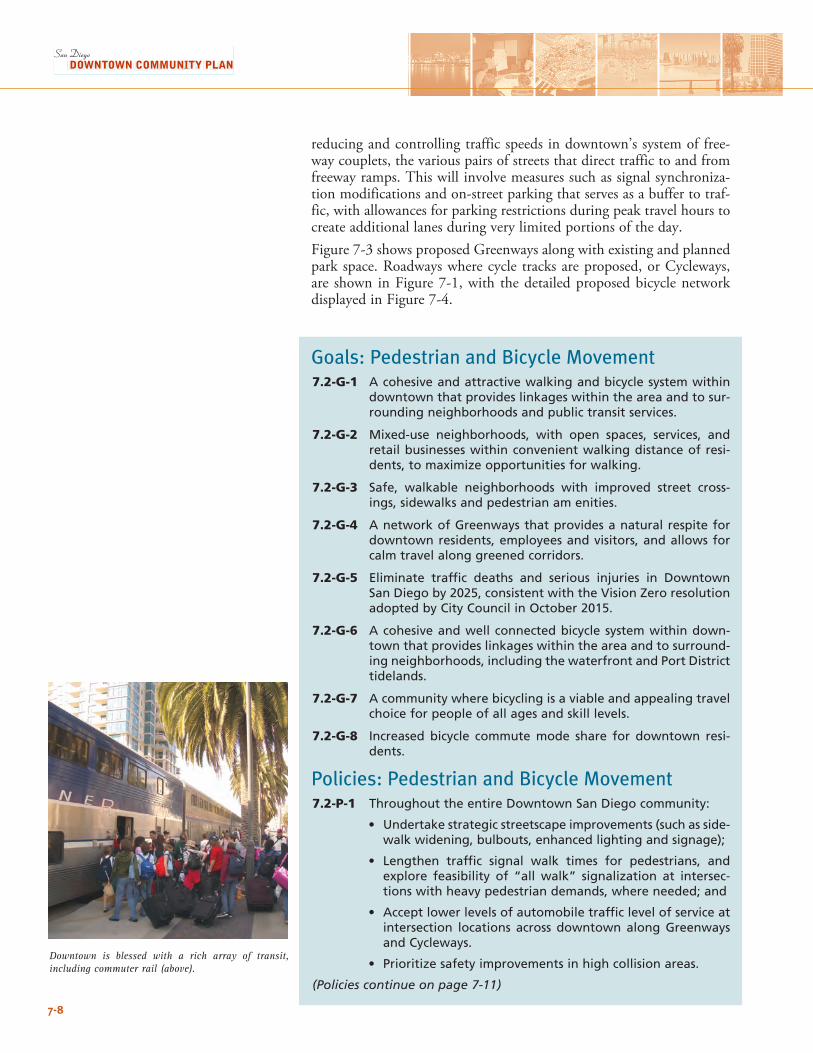
7-8
Downtown is blessed with a rich array of transit, including commuter rail (above).
reducing and controlling traffic speeds in downtown’s system of free-way couplets, the various pairs of streets that direct traffic to and from freeway ramps. This will involve measures such as signal synchroniza-tion modifications and on-street parking that serves as a buffer to traf-fic, with allowances for parking restrictions during peak travel hours to create additional lanes during very limited portions of the day.Figure 7-3 shows proposed Greenways along with existing and planned park space. Roadways where cycle tracks are proposed, or Cycleways, are shown in Figure 7-1, with the detailed proposed bicycle network displayed in Figure 7-4.
Goals: Pedestrian and Bicycle Movement7.2-G-1 A cohesive and attractive walking and bicycle system within
downtown that provides linkages within the area and to sur-rounding neighborhoods and public transit services.
7.2-G-2 Mixed-use neighborhoods, with open spaces, services, and retail businesses within convenient walking distance of resi-dents, to maximize opportunities for walking.
7.2-G-3 Safe, walkable neighborhoods with improved street cross-ings, sidewalks and pedestrian am enities.
7.2-G-4 A network of Greenways that provides a natural respite for downtown residents, employees and visitors, and allows for calm travel along greened corridors.
7.2-G-5 Eliminate traffic deaths and serious injuries in Downtown San Diego by 2025, consistent with the Vision Zero resolution adopted by City Council in October 2015.
7.2-G-6 A cohesive and well connected bicycle system within down-town that provides linkages within the area and to surround-ing neighborhoods, including the waterfront and Port District tidelands.
7.2-G-7 A community where bicycling is a viable and appealing travel choice for people of all ages and skill levels.
7.2-G-8 Increased bicycle commute mode share for downtown resi-dents.
Policies: Pedestrian and Bicycle Movement7.2-P-1 Throughout the entire Downtown San Diego community:
• Undertake strategic streetscape improvements (such as side-walk widening, bulbouts, enhanced lighting and signage);
• Lengthen traffic signal walk times for pedestrians, and explore feasibility of “all walk” signalization at intersec-tions with heavy pedestrian demands, where needed; and
• Accept lower levels of automobile traffic level of service at intersection locations across downtown along Greenways and Cycleways.
• Prioritize safety improvements in high collision areas.
(Policies continue on page 7-11)
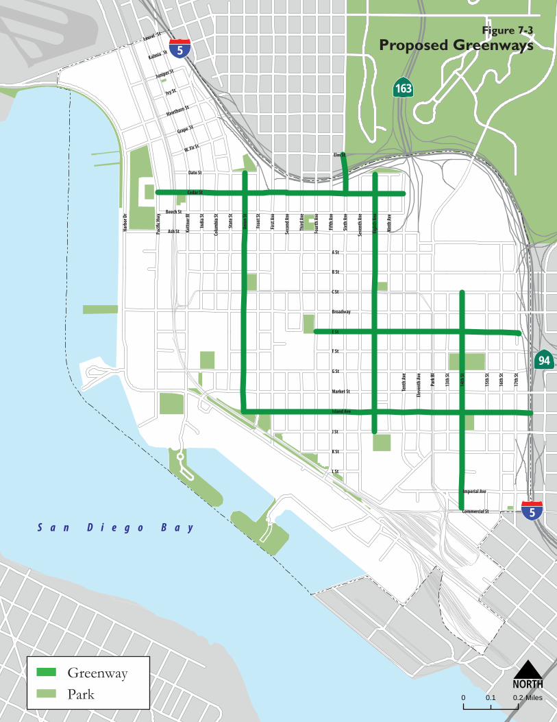
.
N0 0.20 1 Miles
94
S a n D i e g o B a y5
W. Fir St
5
ParkGreenway
Elm St
Laurel St
Kalmia St
Ivy St
Grape St
C St
B St
A St
Ash St
Beech St
Cedar St
Island Ave
Market St
G St
F St
E St
Broadway
Imperial Ave
L St
K St
J St
Commercial St
Seco
nd A
ve
Firs
t Ave
Fron
t St
Unio
n St
Stat
e St
Colu
mbi
a St
Park
Bl
Elev
enth
Ave
Sixt
h Av
e
Fifth
Ave
Four
th Av
e
Third
Ave
15th
St
14th
St
Tent
h Av
e
Nint
h Av
e
Eigh
th A
ve
Seve
nth
Ave
16th
St
17th
St
Date St
Juniper St
Hawthorn St
Indi
a St
Kett
ner B
l
Harb
or D
r
13th
St
163
Figure 7-3Proposed Greenways
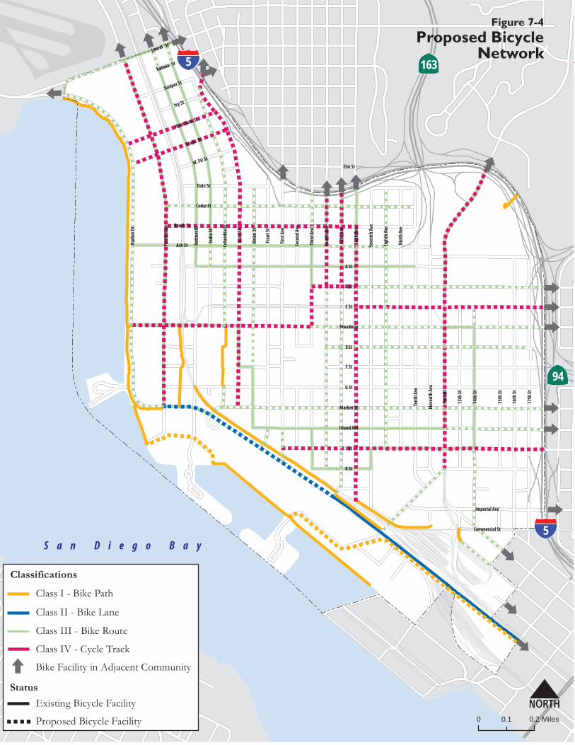
7-10
""
""
""
""
""
"" " " " " " " " " " " " " " " " " " " " " " " " " " "
""
""
""
""
""
""
""
""
""
""
""
" " " " " " " " " " " " """
""
""
""
""
""
""
""
""
""
""
""
""
""
""
""
""
"""""""""""""""""
" " " " " " " " " " "
""
""
""
" " "
""
""
""
""
""
""
""
"
" " " " " " " " " " " " " " "
""
""
""
""
""
""
"""""""
""
""
" " " " " " " " " " " " """
"
"""""
""
""
""
"
" "
""
""
""
""
"
" " "
""
""
""
""
"
""
""
""
" "
"""""""""""""" ""
""
""
""""""""""" ""
""
""
""
""
""
""
"
""
""""
""""""
""
"
""
"""
""
""""""
""""
"
""""
""
"
"
"
"
"
""
""
""
""
""
""
""
"
"
"
"
""
"
"
"
"
"
"
"
"
"
"
"
"
"
"
"
""
""
""
""
""
""
""
""
""
""
""
""""
""
""
""
""
""
""
""
""
"
""
""
""
""
""
""
""
"
" " " " " " " " " " " " " " " "
""
""
""
""
""
""
""
""
""
""
""
""
""
" " " " " " """
""
""
""
"
""
""
""
""
"
" " " " " " " " " " " " " " " " " " " " " """
""
""
""
""
""
""
""
""
""
""
""
"
" " " """
"
"""""""""""""" ""
"
""""
" " " " " " " " " " " " " " " "
""
""""
"""""""
"
"" "
"""""""
" " " " " " " """"""""""""""""""""""""""
""
""
""
""
""
""
""
""
""
""
""
""
""
""
""
""
""
""
""
""
""
""
""
""
""
""
""
""
"
""
""
"
"
""""""""
"""""""
""
""
"""
""
"""""""""""
""
""
""
""
""
""
""
""
""
""
""
""
""
""
""
""
""
""
""
""
""
""
"
"
"
""
""
""
""
""
""
""
""
""
""
""
""
""
""
""
""
""
""
""
""
""
""
""
""
""
""
""
""
""
"
""
"
" " " " " " " " "
" " " " " " " " " " " " " " " " " " " " " " " " " " " " "
"""""""""""""""""""""""""""""""""""""""""""""""""""
"
" " " " " " " " " " " " " " " " " " " " " " " " " " " " " " " " " " " "
""
""
""
""
""
""
""
""
"
N0 0.20.1 Miles
Class IV - Cycle Track
Bike Facility in Adjacent Community
Existing Bicycle Facility
Proposed Bicycle Facility" " " "
Status
Class III - Bike Route
Classifications
Class I - Bike Path
Class II - Bike Lane
5
94
163Laurel St
Kalmia St
Ivy St
Grape St
C St
B St
A St
Ash St
Beech St
Cedar St
Market St
G St
F St
E St
Broadway
Imperial Ave
K St
J St
Commercial St
Seco
nd A
ve
Firs
t Ave
Fron
t St
Unio
n St
Stat
e St
Colu
mbi
a St
Park
Bl
Elev
enth
Ave
Sixt
h Av
e
Fifth
Ave
Four
th A
ve
15th
St
14th
St
13th
St
Tent
h Av
e
Nint
h Av
e
Eigh
th A
ve
Seve
nth
Ave
16th
St
17th
St
Date St
Juniper St
Hawthorn St
Indi
a St
Kett
ner B
l
Harb
or D
r
S a n D i e g o B a y
W. Fir St
5
Elm St
Third
Ave
Island Ave
Figure 7-4Proposed Bicycle
Network
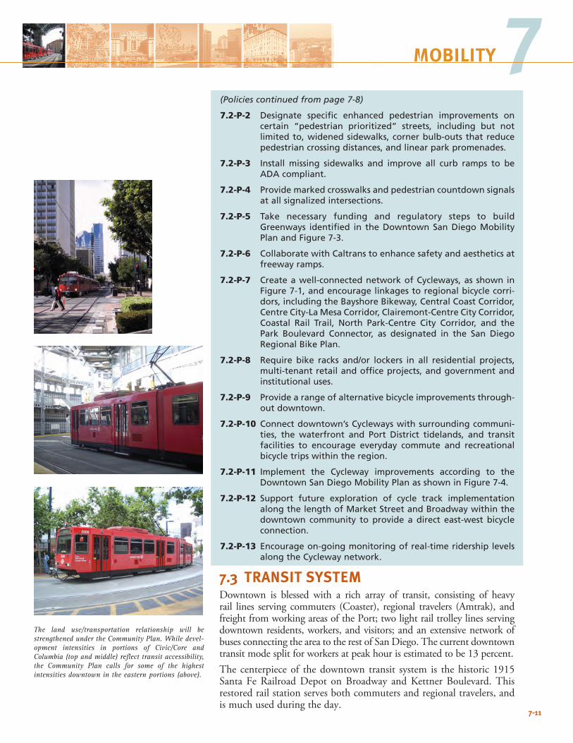
7-11
7MOBILITY
The land use/transportation relationship will be strengthened under the Community Plan. While devel-opment intensities in portions of Civic/Core and Columbia (top and middle) reflect transit accessibility, the Community Plan calls for some of the highest intensities downtown in the eastern portions (above).
(Policies continued from page 7-8)
7.2-P-2 Designate specific enhanced pedestrian improvements on certain “pedestrian prioritized” streets, including but not limited to, widened sidewalks, corner bulb-outs that reduce pedestrian crossing distances, and linear park promenades.
7.2-P-3 Install missing sidewalks and improve all curb ramps to be ADA compliant.
7.2-P-4 Provide marked crosswalks and pedestrian countdown signals at all signalized intersections.
7.2-P-5 Take necessary funding and regulatory steps to build Greenways identified in the Downtown San Diego Mobility Plan and Figure 7-3.
7.2-P-6 Collaborate with Caltrans to enhance safety and aesthetics at freeway ramps.
7.2-P-7 Create a well-connected network of Cycleways, as shown in Figure 7-1, and encourage linkages to regional bicycle corri-dors, including the Bayshore Bikeway, Central Coast Corridor, Centre City-La Mesa Corridor, Clairemont-Centre City Corridor, Coastal Rail Trail, North Park-Centre City Corridor, and the Park Boulevard Connector, as designated in the San Diego Regional Bike Plan.
7.2-P-8 Require bike racks and/or lockers in all residential projects, multi-tenant retail and office projects, and government and institutional uses.
7.2-P-9 Provide a range of alternative bicycle improvements through-out downtown.
7.2-P-10 Connect downtown’s Cycleways with surrounding communi-ties, the waterfront and Port District tidelands, and transit facilities to encourage everyday commute and recreational bicycle trips within the region.
7.2-P-11 Implement the Cycleway improvements according to the Downtown San Diego Mobility Plan as shown in Figure 7-4.
7.2-P-12 Support future exploration of cycle track implementation along the length of Market Street and Broadway within the downtown community to provide a direct east-west bicycle connection.
7.2-P-13 Encourage on-going monitoring of real-time ridership levels along the Cycleway network.
7.3 TRANSIT SYSTEMDowntown is blessed with a rich array of transit, consisting of heavy rail lines serving commuters (Coaster), regional travelers (Amtrak), and freight from working areas of the Port; two light rail trolley lines serving downtown residents, workers, and visitors; and an extensive network of buses connecting the area to the rest of San Diego. The current downtown transit mode split for workers at peak hour is estimated to be 13 percent. The centerpiece of the downtown transit system is the historic 1915 Santa Fe Railroad Depot on Broadway and Kettner Boulevard. This restored rail station serves both commuters and regional travelers, and is much used during the day.
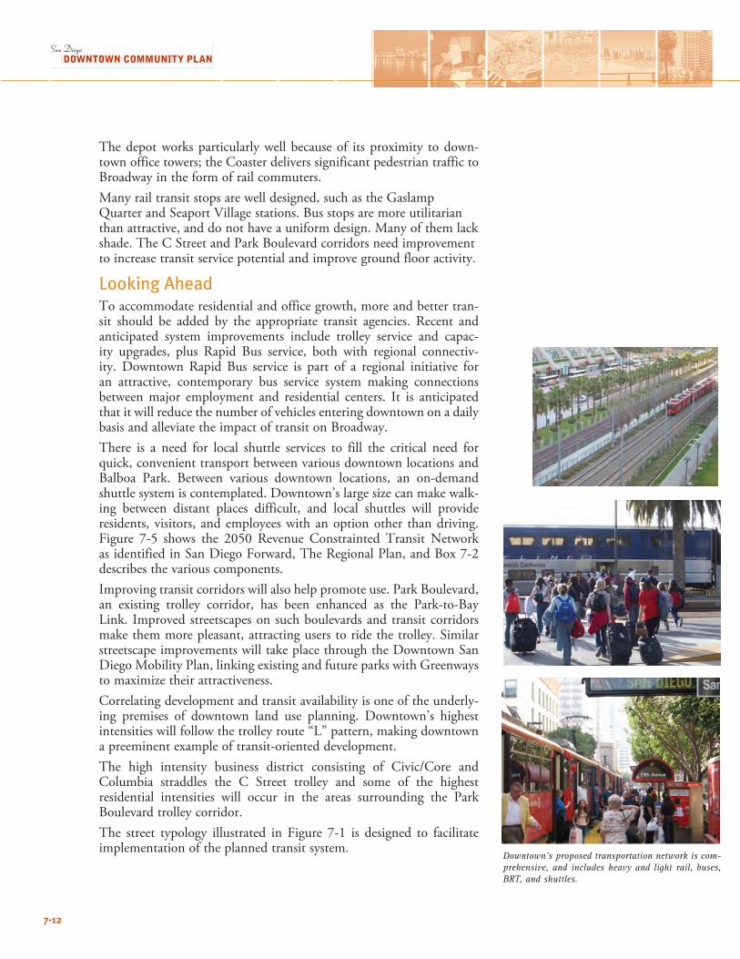
7-12
The depot works particularly well because of its proximity to down-town office towers; the Coaster delivers significant pedestrian traffic to Broadway in the form of rail commuters.Many rail transit stops are well designed, such as the Gaslamp Quarter and Seaport Village stations. Bus stops are more utilitarian than attractive, and do not have a uniform design. Many of them lack shade. The C Street and Park Boulevard corridors need improvement to increase transit service potential and improve ground floor activity.
Looking AheadTo accommodate residential and office growth, more and better tran-sit should be added by the appropriate transit agencies. Recent and anticipated system improvements include trolley service and capac-ity upgrades, plus Rapid Bus service, both with regional connectiv-ity. Downtown Rapid Bus service is part of a regional initiative for an attractive, contemporary bus service system making connections between major employment and residential centers. It is anticipated that it will reduce the number of vehicles entering downtown on a daily basis and alleviate the impact of transit on Broadway.There is a need for local shuttle services to fill the critical need for quick, convenient transport between various downtown locations and Balboa Park. Between various downtown locations, an on-demand shuttle system is contemplated. Downtown’s large size can make walk-ing between distant places difficult, and local shuttles will provide residents, visitors, and employees with an option other than driving. Figure 7-5 shows the 2050 Revenue Constrainted Transit Network as identified in San Diego Forward, The Regional Plan, and Box 7-2 describes the various components.Improving transit corridors will also help promote use. Park Boulevard, an existing trolley corridor, has been enhanced as the Park-to-Bay Link. Improved streetscapes on such boulevards and transit corridors make them more pleasant, attracting users to ride the trolley. Similar streetscape improvements will take place through the Downtown San Diego Mobility Plan, linking existing and future parks with Greenways to maximize their attractiveness. Correlating development and transit availability is one of the underly-ing premises of downtown land use planning. Downtown’s highest intensities will follow the trolley route “L” pattern, making downtown a preeminent example of transit-oriented development. The high intensity business district consisting of Civic/Core and Columbia straddles the C Street trolley and some of the highest residential intensities will occur in the areas surrounding the Park Boulevard trolley corridor. The street typology illustrated in Figure 7-1 is designed to facilitate implementation of the planned transit system.
Downtown’s proposed transportation network is com-prehensive, and includes heavy and light rail, buses, BRT, and shuttles.
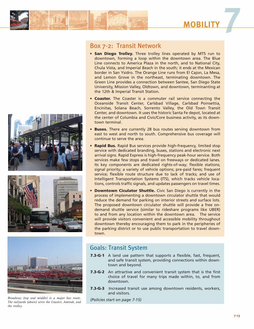
7-13
7MOBILITY
Broadway (top and middle) is a major bus route. The railyards (above) serve the Coaster, Amtrak, and the trolley.
Box 7-2: Transit Network• San Diego Trolley. Three trolley lines operated by MTS run to
downtown, forming a loop within the downtown area. The Blue Line connects to America Plaza in the north, and to National City, Chula Vista, and Imperial Beach in the south; it ends at the Mexican border in San Ysidro. The Orange Line runs from El Cajon, La Mesa, and Lemon Grove in the northeast, terminating downtown. The Green Line provides a connection between Santee, San Diego State University, Mission Valley, Oldtown, and downtown, terminanting at the 12th & Imperial Transit Station.
• Coaster. The Coaster is a commuter rail service connecting the Oceanside Transit Center, Carlsbad Village, Carlsbad Poinsettia, Encinitas, Solana Beach, Sorrento Valley, the Old Town Transit Center, and downtown. It uses the historic Santa Fe depot, located at the center of Columbia and Civic/Core business activity, as its down-town terminal.
• Buses. There are currently 28 bus routes serving downtown from east to west and north to south. Comprehensive bus coverage will continue to serve the area.
• Rapid Bus. Rapid Bus services provide high-frequency, limited stop service with dedicated branding, buses, stations and electronic next arrival signs. Rapid Express is high-frequency peak-hour service. Both services make few stops and travel on freeways or dedicated lanes. Its key components are dedicated rights-of-way; flexible stations; signal priority; a variety of vehicle options; pre-paid fares; frequent service; flexible route structure due to lack of tracks; and use of Intelligent Transportation Systems (ITS), which tracks vehicle loca-tions, controls traffic signals, and updates passengers on travel times.
• Downtown Ciculator Shuttle. Civic San Diego is currently in the process of implementing a downtown circulator shuttle that would reduce the demand for parking on interior streets and surface lots. The proposed downtown circulator shuttle will provide a free on-demand shuttle service (similar to rideshare programs like UBER) to and from any location within the downtown area. The service will provide visitors convenient and accessible mobility throughout downtown thereby encouraging them to park in the peripheries of the parking district or to use public transportation to travel down-town.
Goals: Transit System7.3-G-1 A land use pattern that supports a flexible, fast, frequent,
and safe transit system, providing connections within down-town and beyond.
7.3-G-2 An attractive and convenient transit system that is the first choice of travel for many trips made within, to, and from downtown.
7.3-G-3 Increased transit use among downtown residents, workers, and visitors.
(Policies start on page 7-15)
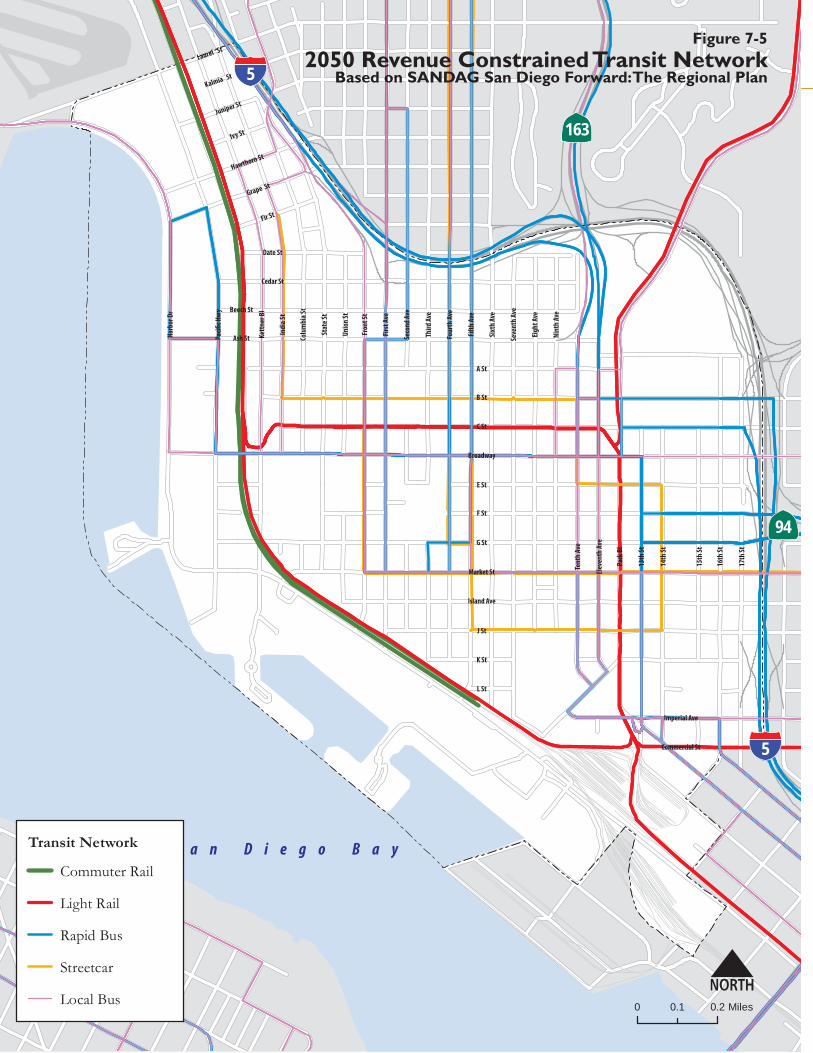
5
94
Laurel St
Kalmia St
Ivy St
Grape St
Fir St
C St
B St
A St
Ash St
Beech St
Cedar St
Island Ave
Market St
G St
F St
E St
Broadway
Imperial Ave
L St
K St
J St
Commercial St
Seco
nd Av
e
Firs
t Ave
Fron
t St
Unio
n St
Stat
e St
Colu
mbi
a St
Park
Bl
Elev
enth
Ave
Sixt
h Av
e
Fifth
Ave
Four
th Av
e
Third
Ave
15th
St
14th
St
13th
St
Tent
h Av
e
Nint
h Av
e
Eigh
t Ave
Seve
nth
Ave
16th
St
17th
St
Date St
Juniper St
Hawthorn St
Indi
a St
Kett
ner B
l
Harb
or D
r
S a n D i e g o B a y
163
5
N0 0.20.1 Miles
Transit Network
Commuter Rail
Light Rail
Rapid Bus
Streetcar
Local Bus
Figure 7-52050 Revenue Constrained Transit Network
Based on SANDAG San Diego Forward: The Regional Plan
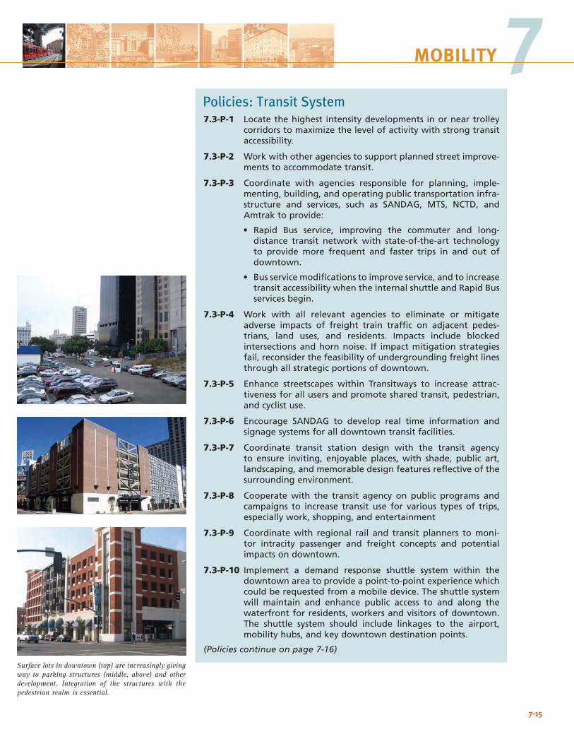
7-15
7MOBILITY
Surface lots in downtown (top) are increasingly giving way to parking structures (middle, above) and other development. Integration of the structures with the pedestrian realm is essential.
Policies: Transit System7.3-P-1 Locate the highest intensity developments in or near trolley
corridors to maximize the level of activity with strong transit accessibility.
7.3-P-2 Work with other agencies to support planned street improve-ments to accommodate transit.
7.3-P-3 Coordinate with agencies responsible for planning, imple-menting, building, and operating public transportation infra-structure and services, such as SANDAG, MTS, NCTD, and Amtrak to provide:
• Rapid Bus service, improving the commuter and long-distance transit network with state-of-the-art technology to provide more frequent and faster trips in and out of downtown.
• Bus service modifications to improve service, and to increase transit accessibility when the internal shuttle and Rapid Bus services begin.
7.3-P-4 Work with all relevant agencies to eliminate or mitigate adverse impacts of freight train traffic on adjacent pedes-trians, land uses, and residents. Impacts include blocked intersections and horn noise. If impact mitigation strategies fail, reconsider the feasibility of undergrounding freight lines through all strategic portions of downtown.
7.3-P-5 Enhance streetscapes within Transitways to increase attrac-tiveness for all users and promote shared transit, pedestrian, and cyclist use.
7.3-P-6 Encourage SANDAG to develop real time information and signage systems for all downtown transit facilities.
7.3-P-7 Coordinate transit station design with the transit agency to ensure inviting, enjoyable places, with shade, public art, landscaping, and memorable design features reflective of the surrounding environment.
7.3-P-8 Cooperate with the transit agency on public programs and campaigns to increase transit use for various types of trips, especially work, shopping, and entertainment
7.3-P-9 Coordinate with regional rail and transit planners to moni-tor intracity passenger and freight concepts and potential impacts on downtown.
7.3-P-10 Implement a demand response shuttle system within the downtown area to provide a point-to-point experience which could be requested from a mobile device. The shuttle system will maintain and enhance public access to and along the waterfront for residents, workers and visitors of downtown. The shuttle system should include linkages to the airport, mobility hubs, and key downtown destination points.
(Policies continue on page 7-16)
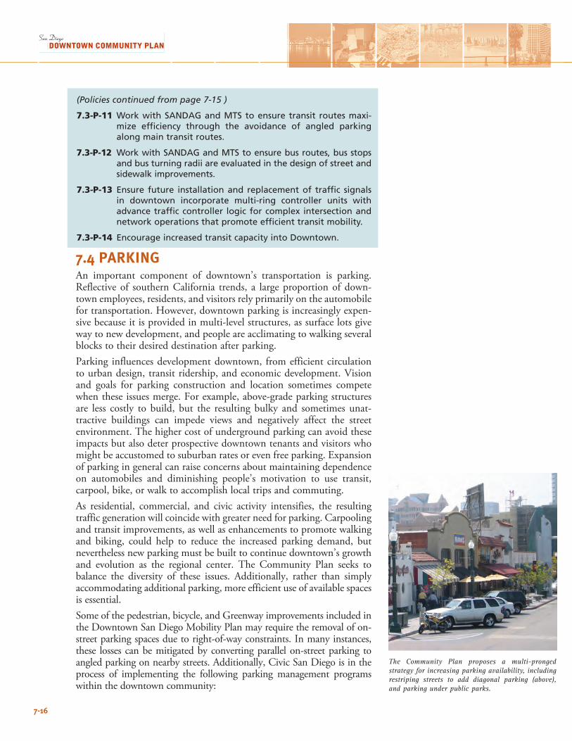
7-16
The Community Plan proposes a multi-pronged strategy for increasing parking availability, including restriping streets to add diagonal parking (above), and parking under public parks.
(Policies continued from page 7-15 )
7.3-P-11 Work with SANDAG and MTS to ensure transit routes maxi-mize efficiency through the avoidance of angled parking along main transit routes.
7.3-P-12 Work with SANDAG and MTS to ensure bus routes, bus stops and bus turning radii are evaluated in the design of street and sidewalk improvements.
7.3-P-13 Ensure future installation and replacement of traffic signals in downtown incorporate multi-ring controller units with advance traffic controller logic for complex intersection and network operations that promote efficient transit mobility.
7.3-P-14 Encourage increased transit capacity into Downtown.
7.4 PARKINGAn important component of downtown’s transportation is parking. Reflective of southern California trends, a large proportion of down-town employees, residents, and visitors rely primarily on the automobile for transportation. However, downtown parking is increasingly expen-sive because it is provided in multi-level structures, as surface lots give way to new development, and people are acclimating to walking several blocks to their desired destination after parking.Parking influences development downtown, from efficient circulation to urban design, transit ridership, and economic development. Vision and goals for parking construction and location sometimes compete when these issues merge. For example, above-grade parking structures are less costly to build, but the resulting bulky and sometimes unat-tractive buildings can impede views and negatively affect the street environment. The higher cost of underground parking can avoid these impacts but also deter prospective downtown tenants and visitors who might be accustomed to suburban rates or even free parking. Expansion of parking in general can raise concerns about maintaining dependence on automobiles and diminishing people’s motivation to use transit, carpool, bike, or walk to accomplish local trips and commuting. As residential, commercial, and civic activity intensifies, the resulting traffic generation will coincide with greater need for parking. Carpooling and transit improvements, as well as enhancements to promote walking and biking, could help to reduce the increased parking demand, but nevertheless new parking must be built to continue downtown’s growth and evolution as the regional center. The Community Plan seeks to balance the diversity of these issues. Additionally, rather than simply accommodating additional parking, more efficient use of available spaces is essential. Some of the pedestrian, bicycle, and Greenway improvements included in the Downtown San Diego Mobility Plan may require the removal of on-street parking spaces due to right-of-way constraints. In many instances, these losses can be mitigated by converting parallel on-street parking to angled parking on nearby streets. Additionally, Civic San Diego is in the process of implementing the following parking management programs within the downtown community:
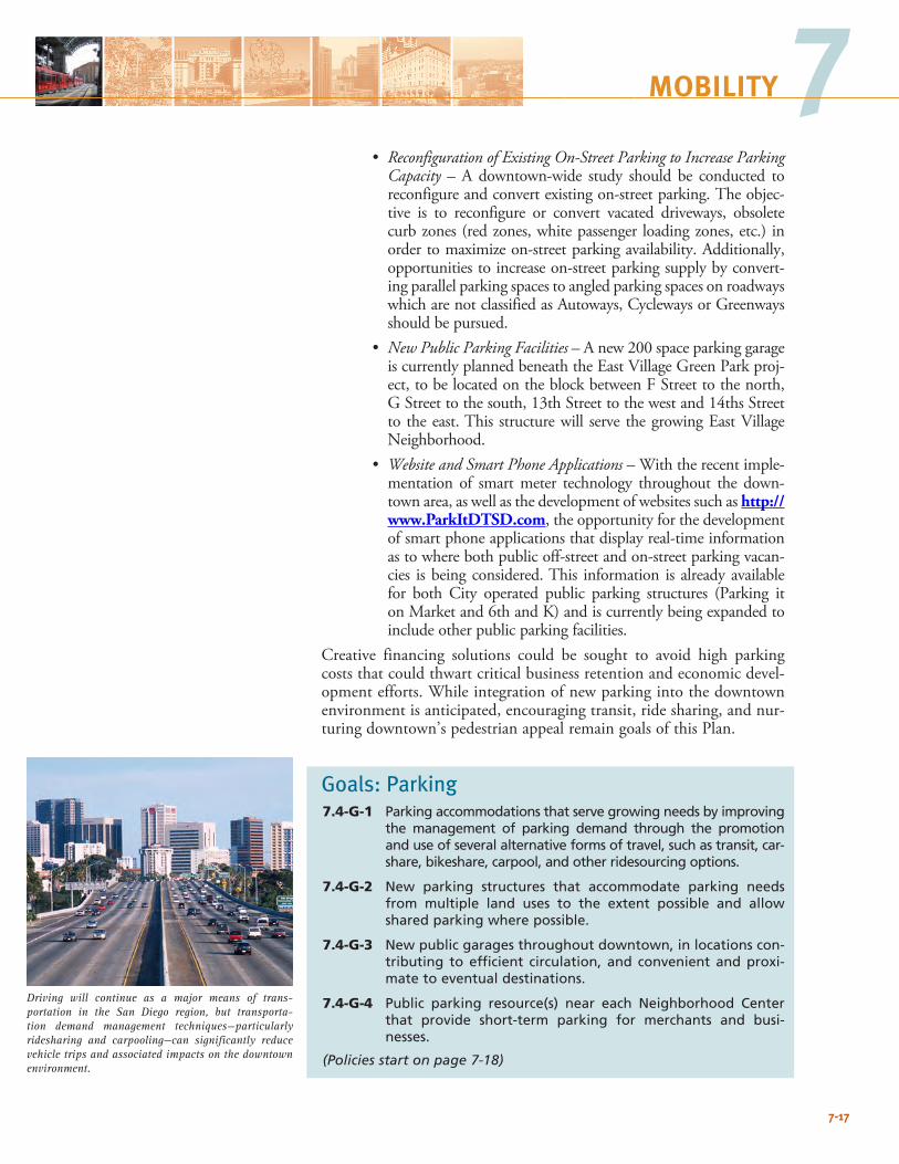
7-17
7MOBILITY
• Reconfiguration of Existing On-Street Parking to Increase Parking Capacity – A downtown-wide study should be conducted to reconfigure and convert existing on-street parking. The objec-tive is to reconfigure or convert vacated driveways, obsolete curb zones (red zones, white passenger loading zones, etc.) in order to maximize on-street parking availability. Additionally, opportunities to increase on-street parking supply by convert-ing parallel parking spaces to angled parking spaces on roadways which are not classified as Autoways, Cycleways or Greenways should be pursued.
• New Public Parking Facilities – A new 200 space parking garage is currently planned beneath the East Village Green Park proj-ect, to be located on the block between F Street to the north, G Street to the south, 13th Street to the west and 14ths Street to the east. This structure will serve the growing East Village Neighborhood.
• Website and Smart Phone Applications – With the recent imple-mentation of smart meter technology throughout the down-town area, as well as the development of websites such as http://www.ParkItDTSD.com, the opportunity for the development of smart phone applications that display real-time information as to where both public off-street and on-street parking vacan-cies is being considered. This information is already available for both City operated public parking structures (Parking it on Market and 6th and K) and is currently being expanded to include other public parking facilities.
Creative financing solutions could be sought to avoid high parking costs that could thwart critical business retention and economic devel-opment efforts. While integration of new parking into the downtown environment is anticipated, encouraging transit, ride sharing, and nur-turing downtown’s pedestrian appeal remain goals of this Plan.
Goals: Parking7.4-G-1 Parking accommodations that serve growing needs by improving
the management of parking demand through the promotion and use of several alternative forms of travel, such as transit, car-share, bikeshare, carpool, and other ridesourcing options.
7.4-G-2 New parking structures that accommodate parking needs from multiple land uses to the extent possible and allow shared parking where possible.
7.4-G-3 New public garages throughout downtown, in locations con-tributing to efficient circulation, and convenient and proxi-mate to eventual destinations.
7.4-G-4 Public parking resource(s) near each Neighborhood Center that provide short-term parking for merchants and busi-nesses.
(Policies start on page 7-18)
Driving will continue as a major means of trans-portation in the San Diego region, but transporta-tion demand management techniques—particularly ridesharing and carpooling—can significantly reduce vehicle trips and associated impacts on the downtown environment.
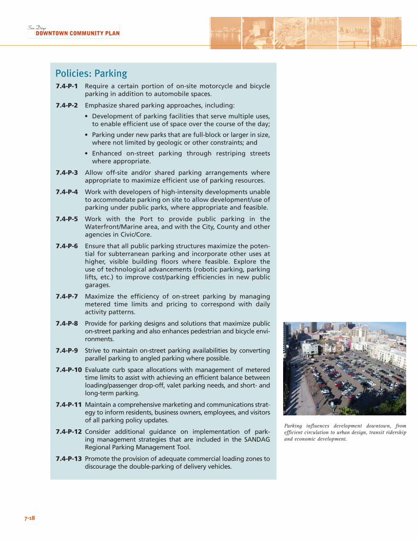
7-18
Policies: Parking7.4-P-1 Require a certain portion of on-site motorcycle and bicycle
parking in addition to automobile spaces.
7.4-P-2 Emphasize shared parking approaches, including:
• Development of parking facilities that serve multiple uses, to enable efficient use of space over the course of the day;
• Parking under new parks that are full-block or larger in size, where not limited by geologic or other constraints; and
• Enhanced on-street parking through restriping streets where appropriate.
7.4-P-3 Allow off-site and/or shared parking arrangements where appropriate to maximize efficient use of parking resources.
7.4-P-4 Work with developers of high-intensity developments unable to accommodate parking on site to allow development/use of parking under public parks, where appropriate and feasible.
7.4-P-5 Work with the Port to provide public parking in the Waterfront/Marine area, and with the City, County and other agencies in Civic/Core.
7.4-P-6 Ensure that all public parking structures maximize the poten-tial for subterranean parking and incorporate other uses at higher, visible building floors where feasible. Explore the use of technological advancements (robotic parking, parking lifts, etc.) to improve cost/parking efficiencies in new public garages.
7.4-P-7 Maximize the efficiency of on-street parking by managing metered time limits and pricing to correspond with daily activity patterns.
7.4-P-8 Provide for parking designs and solutions that maximize public on-street parking and also enhances pedestrian and bicycle envi-ronments.
7.4-P-9 Strive to maintain on-street parking availabilities by converting parallel parking to angled parking where possible.
7.4-P-10 Evaluate curb space allocations with management of metered time limits to assist with achieving an efficient balance between loading/passenger drop-off, valet parking needs, and short- and long-term parking.
7.4-P-11 Maintain a comprehensive marketing and communications strat-egy to inform residents, business owners, employees, and visitors of all parking policy updates.
7.4-P-12 Consider additional guidance on implementation of park-ing management strategies that are included in the SANDAG Regional Parking Management Tool.
7.4-P-13 Promote the provision of adequate commercial loading zones to discourage the double-parking of delivery vehicles.
Parking influences development downtown, from efficient circulation to urban design, transit ridership and economic development.
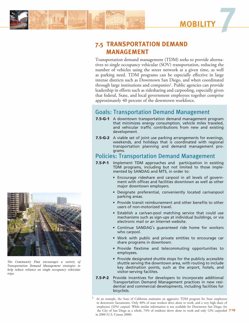
7-19
7MOBILITY
7.5 TRANSPORTATION DEMAND MANAGEMENT Transportation demand management (TDM) seeks to provide alterna-tives to single occupancy vehicular (SOV) transportation, reducing the number of vehicles using the street network at a given time, as well as parking need. TDM programs can be especially effective in large intense districts such as Downtown San Diego, and when coordinated through large institutions and companies1. Public agencies can provide leadership in efforts such as ridesharing and carpooling, especially given that federal, State, and local government employees together comprise approximately 40 percent of the downtown workforce.
Goals: Transportation Demand Management 7.5-G-1 A downtown transportation demand management program
that minimizes energy consumption, vehicle miles traveled, and vehicular traffic contributions from new and existing development.
7.5-G-2 A viable set of joint use parking arrangements for evenings, weekends, and holidays that is coordinated with regional transportation planning and demand management pro-grams.
Policies: Transportation Demand Management 7.5-P-1 Implement TDM approaches and participation in existing
TDM programs, including but not limited to those imple-mented by SANDAG and MTS, in order to:
• Encourage rideshare and carpool in all levels of govern-ment with offices and facilities downtown as well as other major downtown employers.
• Designate preferential, conveniently located car/vanpool parking areas.
• Provide transit reimbursement and other benefits to other users of non-motorized travel.
• Establish a car/van-pool matching service that could use mechanisms such as sign-ups at individual buildings, or via electronic mail or an Internet website.
• Continue SANDAG’s guaranteed ride home for workers who carpool.
• Work with public and private entities to encourage car share programs in downtown.
• Provide flextime and telecommuting opportunities to employees.
• Provide designated shuttle stops for the publicly accessible shuttle serving the downtown area, with routing to include key destination points, such as the airport, hotels, and visitor-serving facilites.
7.5-P-2 Provide incentives for developers to incorporate additional Transportation Demand Management practices in new resi-dential and commercial developments, including facilities for bicyclists.
1 As an example, the State of California maintains an aggressive TDM program for State employees in downtown Sacramento. Only 40% of state workers drive alone to work, and a very high share of employees (32%) carpool. While similar information is not available for Downtown San Diego, for the City of San Diego as a whole, 74% of residents drove alone to work and only 12% carpooled in 2000 (U.S. Census 2000).
The Community Plan encourages a variety of Transportation Demand Management strategies to help reduce reliance on single occupancy vehicular trips.
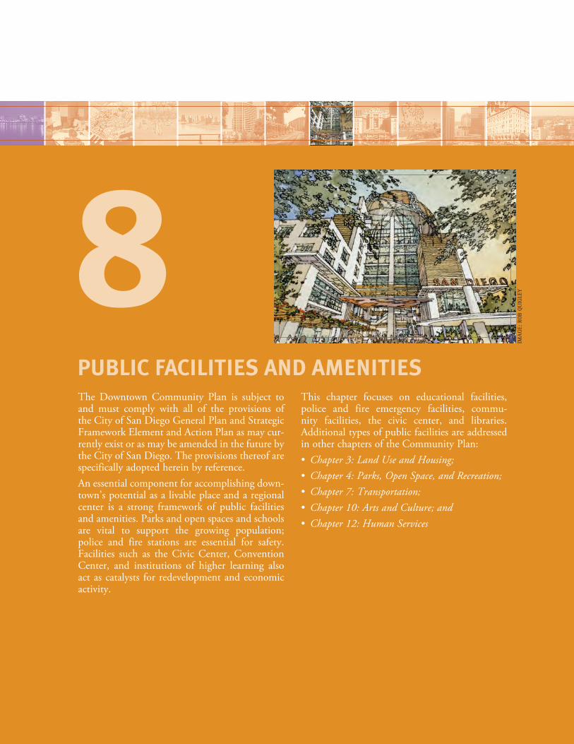
The Downtown Community Plan is subject to and must comply with all of the provisions of the City of San Diego General Plan and Strategic Framework Element and Action Plan as may cur-rently exist or as may be amended in the future by the City of San Diego. The provisions thereof are specifically adopted herein by reference.An essential component for accomplishing down-town’s potential as a livable place and a regional center is a strong framework of public facilities and amenities. Parks and open spaces and schools are vital to support the growing population; police and fire stations are essential for safety. Facilities such as the Civic Center, Convention Center, and institutions of higher learning also act as catalysts for redevelopment and economic activity.
This chapter focuses on educational facilities, police and fire emergency facilities, commu-nity facilities, the civic center, and libraries. Additional types of public facilities are addressed in other chapters of the Community Plan: • Chapter 3: Land Use and Housing; • Chapter 4: Parks, Open Space, and Recreation; • Chapter 7: Transportation; • Chapter 10: Arts and Culture; and • Chapter 12: Human Services
PUBLIC FACILITIES AND AMENITIES
8IM
AG
E: R
OB
QU
IGLE
Y
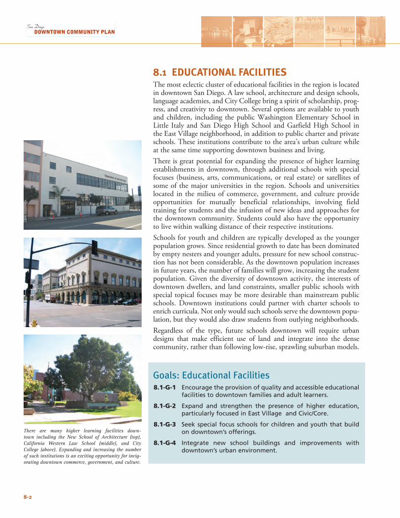
8.1 EDUCATIONAL FACILITIESThe most eclectic cluster of educational facilities in the region is located in downtown San Diego. A law school, architecture and design schools, language academies, and City College bring a spirit of scholarship, prog-ress, and creativity to downtown. Several options are available to youth and children, including the public Washington Elementary School in Little Italy and San Diego High School and Garfield High School in the East Village neighborhood, in addition to public charter and private schools. These institutions contribute to the area’s urban culture while at the same time supporting downtown business and living. There is great potential for expanding the presence of higher learning establishments in downtown, through additional schools with special focuses (business, arts, communications, or real estate) or satellites of some of the major universities in the region. Schools and universities located in the milieu of commerce, government, and culture provide opportunities for mutually beneficial relationships, involving field training for students and the infusion of new ideas and approaches for the downtown community. Students could also have the opportunity to live within walking distance of their respective institutions. Schools for youth and children are typically developed as the younger population grows. Since residential growth to date has been dominated by empty nesters and younger adults, pressure for new school construc-tion has not been considerable. As the downtown population increases in future years, the number of families will grow, increasing the student population. Given the diversity of downtown activity, the interests of downtown dwellers, and land constraints, smaller public schools with special topical focuses may be more desirable than mainstream public schools. Downtown institutions could partner with charter schools to enrich curricula. Not only would such schools serve the downtown popu-lation, but they would also draw students from outlying neighborhoods.Regardless of the type, future schools downtown will require urban designs that make efficient use of land and integrate into the dense community, rather than following low-rise, sprawling suburban models.
Goals: Educational Facilities8.1-G-1 Encourage the provision of quality and accessible educational
facilities to downtown families and adult learners.
8.1-G-2 Expand and strengthen the presence of higher education, particularly focused in East Village and Civic/Core.
8.1-G-3 Seek special focus schools for children and youth that build on downtown’s offerings.
8.1-G-4 Integrate new school buildings and improvements with downtown’s urban environment.
There are many higher learning facilities down-town including the New School of Architecture (top), California Western Law School (middle), and City College (above). Expanding and increasing the number of such institutions is an exciting opportunity for invig-orating downtown commerce, government, and culture.
8-2
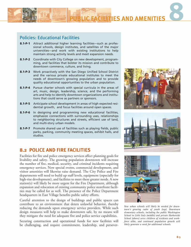
8Policies: Educational Facilities8.1-P-1 Attract additional higher learning facilities—such as profes-
sional schools, design institutes, and satellites of the major universities—and work with existing institutions to help maintain strong activity levels and meet expansion needs.
8.1-P-2 Coordinate with City College on new development, program-ming, and facilities that bolster its mission and contribute to downtown commerce, culture, and living.
8.1-P-3 Work proactively with the San Diego Unified School District and the various private educational institutes to meet the needs of downtown’s growing population and to provide quality educational opportunities to the urban population.
8.1-P-4 Pursue charter schools with special curricula in the areas of art, music, design, leadership, science, and the performing arts and help to identify downtown organizations and institu-tions that could serve as partners or sponsors.
8.1-P-5 Anticipate school development in areas of high expected resi-dential growth, and focus facilities around open spaces.
8.1-P-6 In designing and programming new educational facilities, emphasize connections with surrounding uses, relationships to neighboring structures and streets, efficient use of land, and multi-story urban models.
8.1-P-7 Promote shared use of facilities such as playing fields, public parks, parking, community meeting spaces, exhibit halls, and studios.
8.2 POLICE AND FIRE FACILITIESFacilities for fire and police emergency services affect planning goals for livability and safety. The growing population downtown will increase the number of fire, medical, security, and criminal incidents requiring emergency services. New special events, commercial development, and visitor amenities will likewise raise demand. The City Police and Fire departments will need to build up staff levels, equipment (especially for high-rise development), and facilities to meet these greater needs. A new station(s) will likely be more urgent for the Fire Department, although expansion and relocation of existing community police storefront facili-ties may be called for as well. The presence of the Police Department headquarters in East Village benefits public safety efforts.Careful attention to the design of buildings and public spaces can contribute to an environment that deters unlawful behavior, thereby reducing the demands upon emergency service providers. While such design measures will help to make downtown safe, by no means will they mitigate the need for adequate fire and police service capabilities.Securing construction and operational funds for new facilities will be challenging, and require commitment, leadership, and persever-
8-3
New urban schools will likely be needed for down-town’s growing cadre of youth (top). Downtown elementary schools, including the public Washington School in Little Italy (middle) and private Harborside School (above) serve children of residents and work-force alike, and continued population growth will likely generate a need for additional schools.
PUBLIC FACILITIES AND AMENITIES
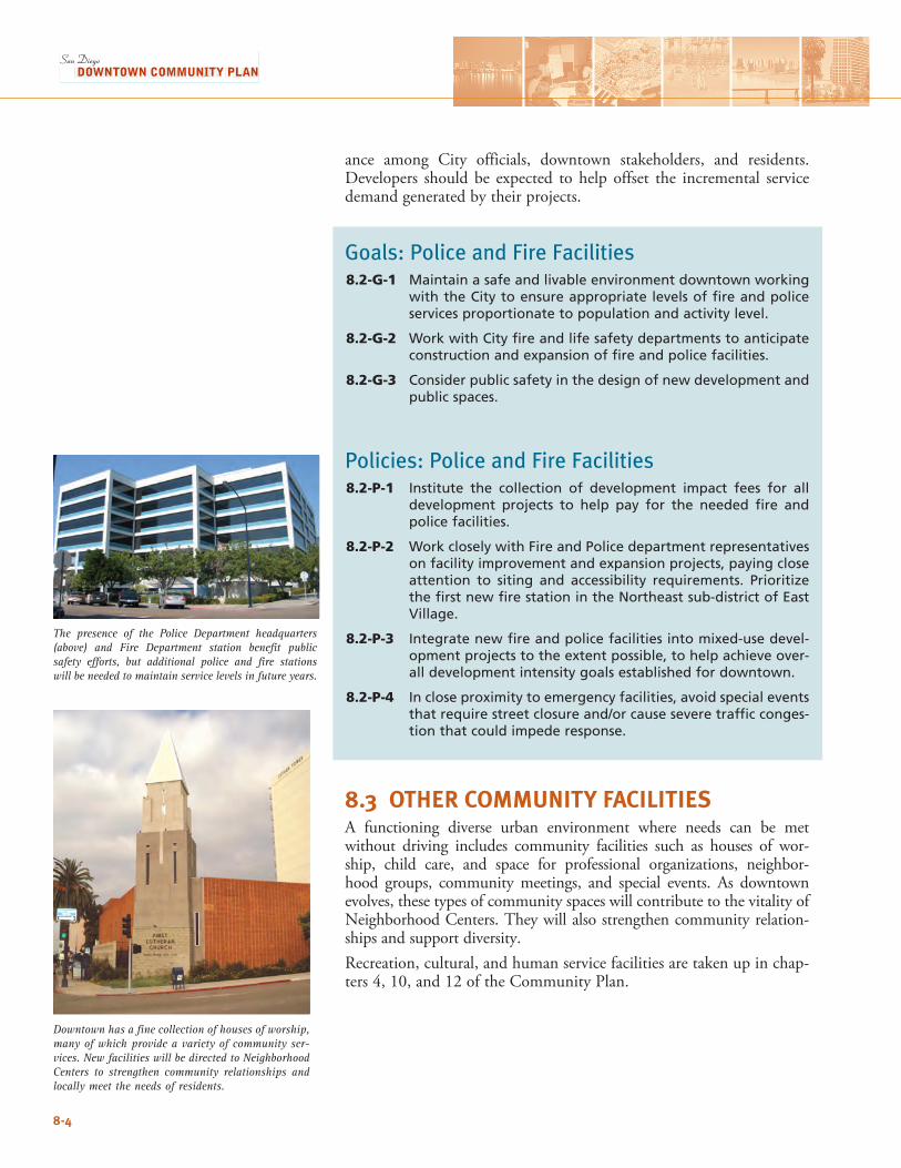
ance among City officials, downtown stakeholders, and residents. Developers should be expected to help offset the incremental service demand generated by their projects.
Goals: Police and Fire Facilities8.2-G-1 Maintain a safe and livable environment downtown working
with the City to ensure appropriate levels of fire and police services proportionate to population and activity level.
8.2-G-2 Work with City fire and life safety departments to anticipate construction and expansion of fire and police facilities.
8.2-G-3 Consider public safety in the design of new development and public spaces.
Policies: Police and Fire Facilities8.2-P-1 Institute the collection of development impact fees for all
development projects to help pay for the needed fire and police facilities.
8.2-P-2 Work closely with Fire and Police department representatives on facility improvement and expansion projects, paying close attention to siting and accessibility requirements. Prioritize the first new fire station in the Northeast sub-district of East Village.
8.2-P-3 Integrate new fire and police facilities into mixed-use devel-opment projects to the extent possible, to help achieve over-all development intensity goals established for downtown.
8.2-P-4 In close proximity to emergency facilities, avoid special events that require street closure and/or cause severe traffic conges-tion that could impede response.
8.3 OTHER COMMUNITY FACILITIESA functioning diverse urban environment where needs can be met without driving includes community facilities such as houses of wor-ship, child care, and space for professional organizations, neighbor-hood groups, community meetings, and special events. As downtown evolves, these types of community spaces will contribute to the vitality of Neighborhood Centers. They will also strengthen community relation-ships and support diversity.Recreation, cultural, and human service facilities are taken up in chap-ters 4, 10, and 12 of the Community Plan.
8-4
Downtown has a fine collection of houses of worship, many of which provide a variety of community ser-vices. New facilities will be directed to Neighborhood Centers to strengthen community relationships and locally meet the needs of residents.
The presence of the Police Department headquarters (above) and Fire Department station benefit public safety efforts, but additional police and fire stations will be needed to maintain service levels in future years.
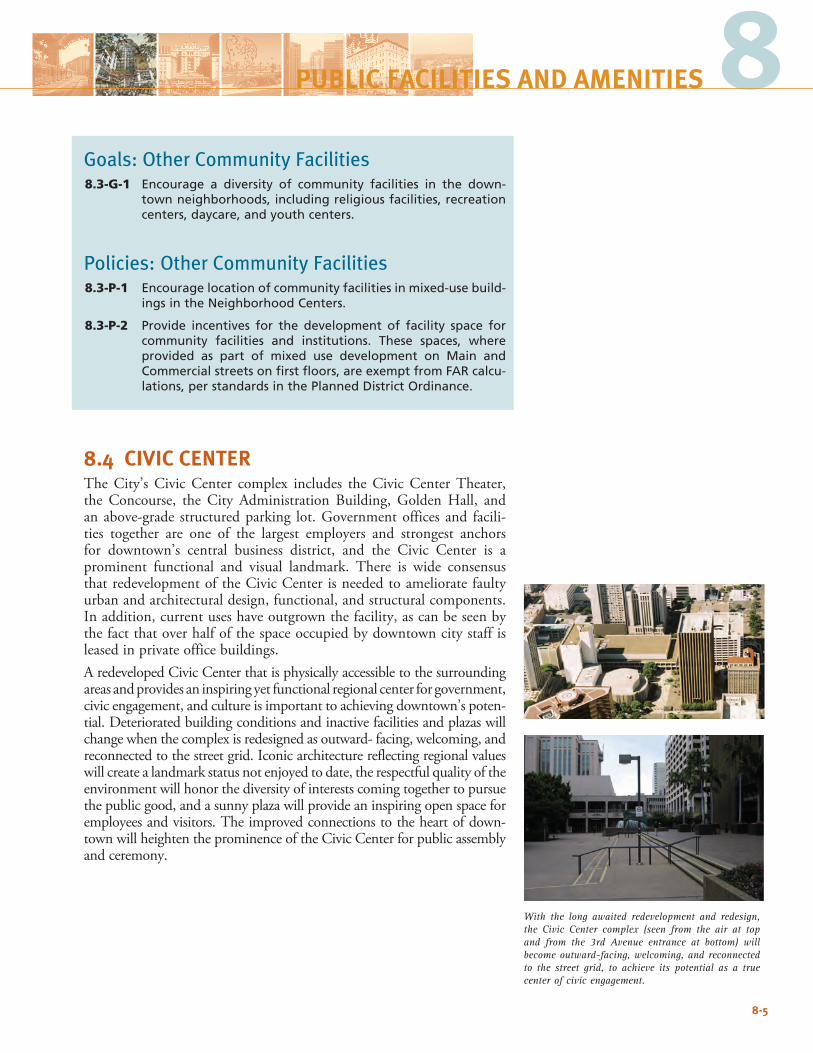
8-5
8PUBLIC FACILITIES AND AMENITIES
Goals: Other Community Facilities8.3-G-1 Encourage a diversity of community facilities in the down-
town neighborhoods, including religious facilities, recreation centers, daycare, and youth centers.
Policies: Other Community Facilities8.3-P-1 Encourage location of community facilities in mixed-use build-
ings in the Neighborhood Centers.
8.3-P-2 Provide incentives for the development of facility space for community facilities and institutions. These spaces, where provided as part of mixed use development on Main and Commercial streets on first floors, are exempt from FAR calcu-lations, per standards in the Planned District Ordinance.
8.4 CIVIC CENTERThe City’s Civic Center complex includes the Civic Center Theater, the Concourse, the City Administration Building, Golden Hall, and an above-grade structured parking lot. Government offices and facili-ties together are one of the largest employers and strongest anchors for downtown’s central business district, and the Civic Center is a prominent functional and visual landmark. There is wide consensus that redevelopment of the Civic Center is needed to ameliorate faulty urban and architectural design, functional, and structural components. In addition, current uses have outgrown the facility, as can be seen by the fact that over half of the space occupied by downtown city staff is leased in private office buildings. A redeveloped Civic Center that is physically accessible to the surrounding areas and provides an inspiring yet functional regional center for government, civic engagement, and culture is important to achieving downtown’s poten-tial. Deteriorated building conditions and inactive facilities and plazas will change when the complex is redesigned as outward- facing, welcoming, and reconnected to the street grid. Iconic architecture reflecting regional values will create a landmark status not enjoyed to date, the respectful quality of the environment will honor the diversity of interests coming together to pursue the public good, and a sunny plaza will provide an inspiring open space for employees and visitors. The improved connections to the heart of down-town will heighten the prominence of the Civic Center for public assembly and ceremony.
With the long awaited redevelopment and redesign, the Civic Center complex (seen from the air at top and from the 3rd Avenue entrance at bottom) will become outward-facing, welcoming, and reconnected to the street grid, to achieve its potential as a true center of civic engagement.
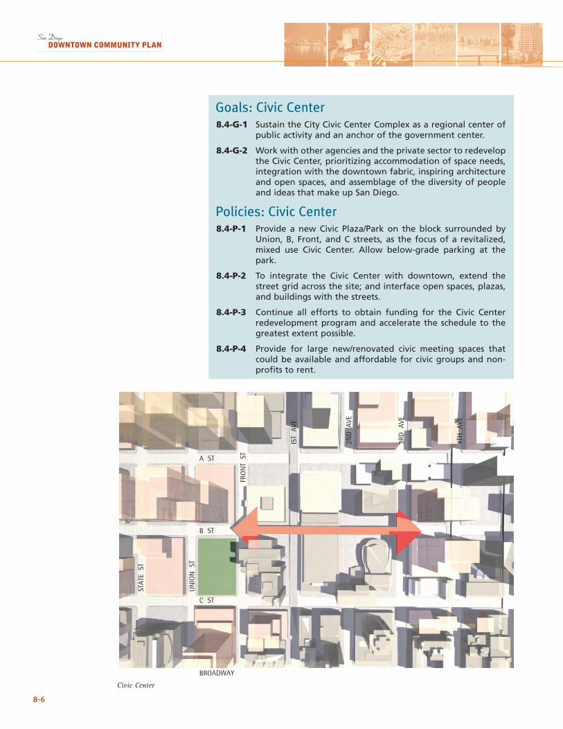
8-6
Civic Center
Goals: Civic Center8.4-G-1 Sustain the City Civic Center Complex as a regional center of
public activity and an anchor of the government center.
8.4-G-2 Work with other agencies and the private sector to redevelop the Civic Center, prioritizing accommodation of space needs, integration with the downtown fabric, inspiring architecture and open spaces, and assemblage of the diversity of people and ideas that make up San Diego.
Policies: Civic Center8.4-P-1 Provide a new Civic Plaza/Park on the block surrounded by
Union, B, Front, and C streets, as the focus of a revitalized, mixed use Civic Center. Allow below-grade parking at the park.
8.4-P-2 To integrate the Civic Center with downtown, extend the street grid across the site; and interface open spaces, plazas, and buildings with the streets.
8.4-P-3 Continue all efforts to obtain funding for the Civic Center redevelopment program and accelerate the schedule to the greatest extent possible.
8.4-P-4 Provide for large new/renovated civic meeting spaces that could be available and affordable for civic groups and non-profits to rent.
A ST
B ST
C ST
BROADWAY
FRO
NT
ST
UN
ION
ST
STAT
E S
T
IST
AVE
2ND
AVE
3RD
AVE
4TH
AVE
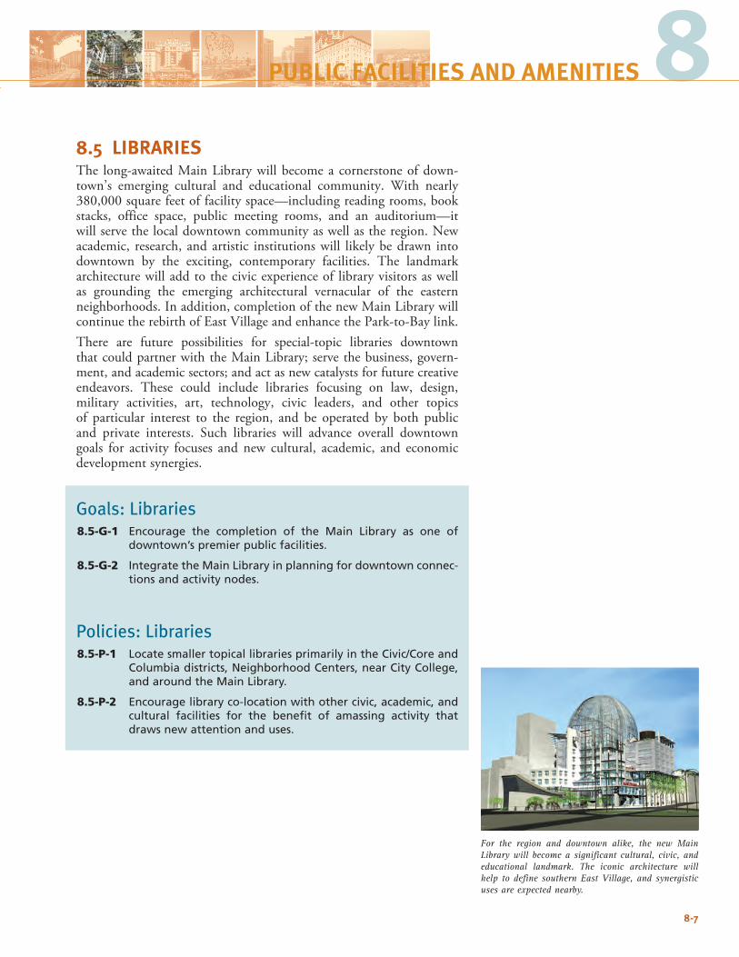
8.5 LIBRARIESThe long-awaited Main Library will become a cornerstone of down-town’s emerging cultural and educational community. With nearly 380,000 square feet of facility space—including reading rooms, book stacks, office space, public meeting rooms, and an auditorium—it will serve the local downtown community as well as the region. New academic, research, and artistic institutions will likely be drawn into downtown by the exciting, contemporary facilities. The landmark architecture will add to the civic experience of library visitors as well as grounding the emerging architectural vernacular of the eastern neighborhoods. In addition, completion of the new Main Library will continue the rebirth of East Village and enhance the Park-to-Bay link.There are future possibilities for special-topic libraries downtown that could partner with the Main Library; serve the business, govern-ment, and academic sectors; and act as new catalysts for future creative endeavors. These could include libraries focusing on law, design, military activities, art, technology, civic leaders, and other topics of particular interest to the region, and be operated by both public and private interests. Such libraries will advance overall downtown goals for activity focuses and new cultural, academic, and economic development synergies.
Goals: Libraries8.5-G-1 Encourage the completion of the Main Library as one of
downtown’s premier public facilities.
8.5-G-2 Integrate the Main Library in planning for downtown connec-tions and activity nodes.
Policies: Libraries8.5-P-1 Locate smaller topical libraries primarily in the Civic/Core and
Columbia districts, Neighborhood Centers, near City College, and around the Main Library.
8.5-P-2 Encourage library co-location with other civic, academic, and cultural facilities for the benefit of amassing activity that draws new attention and uses.
8-7
8PUBLIC FACILITIES AND AMENITIES
For the region and downtown alike, the new Main Library will become a significant cultural, civic, and educational landmark. The iconic architecture will help to define southern East Village, and synergistic uses are expected nearby.

8-8
This page intentionally left blank.
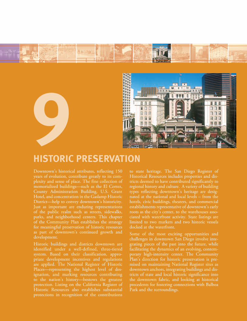
Downtown’s historical attributes, reflecting 150 years of evolution, contribute greatly to its com-plexity and sense of place. The fine collection of memorialized buildings—such as the El Cortez, County Administration Building, U.S. Grant Hotel, and concentration in the Gaslamp Historic District—help to convey downtown’s historicity. Just as important are enduring representations of the public realm such as streets, sidewalks, parks, and neighborhood centers. This chapter of the Community Plan establishes the strategy for meaningful preservation of historic resources as part of downtown’s continued growth and development.Historic buildings and districts downtown are identified under a well-defined, three-tiered system. Based on their classification, appro-priate development incentives and regulations are applied. The National Register of Historic Places—representing the highest level of des-ignation, and marking resources contributing to the nation’s history—bestows the greatest protection. Listing on the California Register of Historic Resources also establishes substantial protections in recognition of the contributions
to state heritage. The San Diego Register of Historical Resources includes properties and dis-tricts deemed to have contributed significantly to regional history and culture. A variety of building types reflecting downtown’s heritage are desig-nated at the national and local levels – from the hotels, civic buildings, theaters, and commercial establishments representative of downtown’s early roots as the city’s center, to the warehouses asso-ciated with waterfront activity. State listings are limited to two markers and two historic vessels docked at the waterfront.Some of the most exciting opportunities and challenges in downtown San Diego involve inte-grating pieces of the past into the future, while facilitating the dynamics of an evolving, contem-porary high-intensity center. The Community Plan’s direction for historic preservation is pre-mised on maintaining National Register sites as downtown anchors, integrating buildings and dis-tricts of state and local historic significance into the downtown fabric, and looking at historical precedents for fostering connections with Balboa Park and the surroundings.
HISTORIC PRESERVATION
9
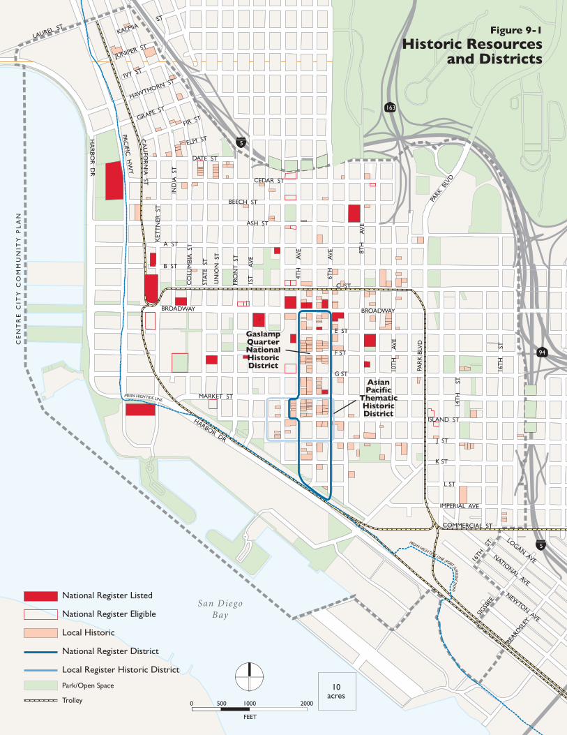
Berkeley
Star ofIndia
CE
NT
RE
CIT
Y C
OM
MU
NIT
Y P
LA
N
San DiegoBay
National Register Listed
National Register Eligible
Local Historic
National Register District
Local Register Historic District
Park/Open Space
Trolley
HA
RBO
R D
R
LAUREL ST
PAC
IFIC H
WY
ASH ST
MARKET ST
HARBOR DR
PAR
K B
LVD
PARK
BLV
D
10T
H
AV
E
14T
H
ST
16T
H
ST
8TH
A
VE
6TH
A
VE
4TH
A
VE
1ST
A
VE
FRO
NT
ST
UN
ION
ST
STAT
E S
T
CO
LUM
BIA
ST
IND
IA S
T
KET
TN
ER S
T
JUNIPER ST
IVY ST
HAWTHORN ST
GRAPE ST
FIR ST
KALMIAST
ELM ST
DATE ST
CEDAR ST
BEECH ST
A ST
B ST
C ST
E ST
F ST
G ST
ISLAND ST
J ST
K ST
L ST
IMPERIAL AVE
COMMERCIAL ST
BROADWAY
163
94
5
5
CA
LIFOR
NIA
ST
BROADWAY
16TH
ST
SIGSB
EE
BEARD
SLEY
LOGAN AVENATIONAL AVE
NEWTON AVE
GaslampQuarterNationalHistoricDistrict
AsianPacific
ThematicHistoricDistrict
Figure 9-1
Historic Resourcesand Districts
FEET
0 500 1000 2000
10acres
MEAN HIGH TIDE LINE (PORT JURISDICTIO
N)
MEAN HIGH TIDE LINE
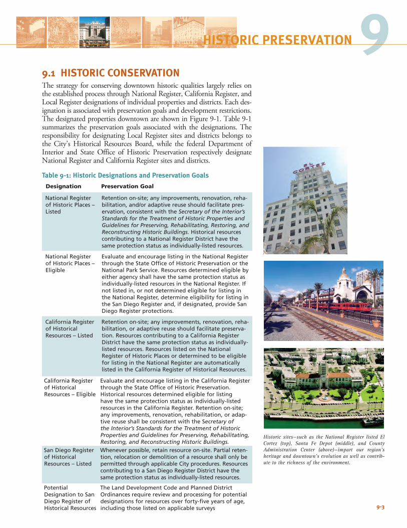
9-3
Historic sites—such as the National Register listed El Cortez (top), Santa Fe Depot (middle), and County Administration Center (above)—impart our region’s heritage and downtown’s evolution as well as contrib-ute to the richness of the environment.
9HISTORIC PRESERVATION
9.1 HISTORIC CONSERVATIONThe strategy for conserving downtown historic qualities largely relies on the established process through National Register, California Register, and Local Register designations of individual properties and districts. Each des-ignation is associated with preservation goals and development restrictions. The designated properties downtown are shown in Figure 9-1. Table 9-1 summarizes the preservation goals associated with the designations. The responsibility for designating Local Register sites and districts belongs to the City’s Historical Resources Board, while the federal Department of Interior and State Office of Historic Preservation respectively designate National Register and California Register sites and districts.
Table 9-1: Historic Designations and Preservation Goals
Designation Preservation Goal
National Register of Historic Places – Listed
Retention on-site; any improvements, renovation, reha-bilitation, and/or adaptive reuse should facilitate pres-ervation, consistent with the Secretary of the Interior’s Standards for the Treatment of Historic Properties and Guidelines for Preserving, Rehabilitating, Restoring, and Reconstructing Historic Buildings. Historical resources contributing to a National Register District have the same protection status as individually-listed resources.
National Register of Historic Places – Eligible
Evaluate and encourage listing in the National Register through the State Office of Historic Preservation or the National Park Service. Resources determined eligible by either agency shall have the same protection status as individually-listed resources in the National Register. If not listed in, or not determined eligible for listing in the National Register, determine eligibility for listing in the San Diego Register and, if designated, provide San Diego Register protections.
California Register of Historical Resources – Listed
Retention on-site; any improvements, renovation, reha-bilitation, or adaptive reuse should facilitate preserva-tion. Resources contributing to a California Register District have the same protection status as individually-listed resources. Resources listed on the National Register of Historic Places or determined to be eligible for listing in the National Register are automatically listed in the California Register of Historical Resources.
California Register of Historical Resources – Eligible
Evaluate and encourage listing in the California Register through the State Office of Historic Preservation. Historical resources determined eligible for listing have the same protection status as individually-listed resources in the California Register. Retention on-site; any improvements, renovation, rehabilitation, or adap-tive reuse shall be consistent with the Secretary of the Interior’s Standards for the Treatment of Historic Properties and Guidelines for Preserving, Rehabilitating, Restoring, and Reconstructing Historic Buildings.
San Diego Register of Historical Resources – Listed
Whenever possible, retain resource on-site. Partial reten-tion, relocation or demolition of a resource shall only be permitted through applicable City procedures. Resources contributing to a San Diego Register District have the same protection status as individually-listed resources.
Potential Designation to San Diego Register of Historical Resources
The Land Development Code and Planned District Ordinances require review and processing for potential designations for resources over forty-five years of age, including those listed on applicable surveys
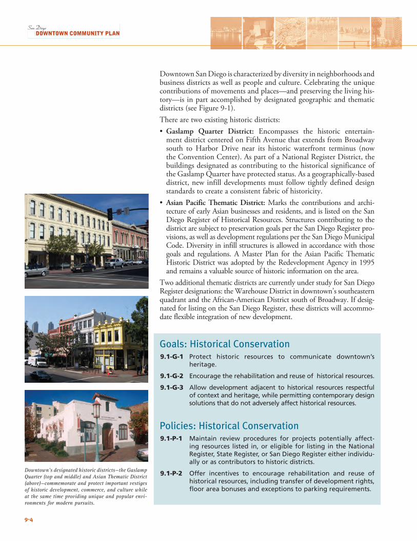
Downtown’s designated historic districts—the Gaslamp Quarter (top and middle) and Asian Thematic District (above)—commemorate and protect important vestiges of historic development, commerce, and culture while at the same time providing unique and popular envi-ronments for modern pursuits.
9-4
Downtown San Diego is characterized by diversity in neighborhoods and business districts as well as people and culture. Celebrating the unique contributions of movements and places—and preserving the living his-tory—is in part accomplished by designated geographic and thematic districts (see Figure 9-1). There are two existing historic districts:• Gaslamp Quarter District: Encompasses the historic entertain-
ment district centered on Fifth Avenue that extends from Broadway south to Harbor Drive near its historic waterfront terminus (now the Convention Center). As part of a National Register District, the buildings designated as contributing to the historical significance of the Gaslamp Quarter have protected status. As a geographically-based district, new infill developments must follow tightly defined design standards to create a consistent fabric of historicity.
• Asian Pacific Thematic District: Marks the contributions and archi-tecture of early Asian businesses and residents, and is listed on the San Diego Register of Historical Resources. Structures contributing to the district are subject to preservation goals per the San Diego Register pro-visions, as well as development regulations per the San Diego Municipal Code. Diversity in infill structures is allowed in accordance with those goals and regulations. A Master Plan for the Asian Pacific Thematic Historic District was adopted by the Redevelopment Agency in 1995 and remains a valuable source of historic information on the area.
Two additional thematic districts are currently under study for San Diego Register designations: the Warehouse District in downtown’s southeastern quadrant and the African-American District south of Broadway. If desig-nated for listing on the San Diego Register, these districts will accommo-date flexible integration of new development.
Goals: Historical Conservation9.1-G-1 Protect historic resources to communicate downtown’s
heritage.
9.1-G-2 Encourage the rehabilitation and reuse of historical resources.
9.1-G-3 Allow development adjacent to historical resources respectful of context and heritage, while permitting contemporary design solutions that do not adversely affect historical resources.
Policies: Historical Conservation9.1-P-1 Maintain review procedures for projects potentially affect-
ing resources listed in, or eligible for listing in the National Register, State Register, or San Diego Register either individu-ally or as contributors to historic districts.
9.1-P-2 Offer incentives to encourage rehabilitation and reuse of historical resources, including transfer of development rights, floor area bonuses and exceptions to parking requirements.
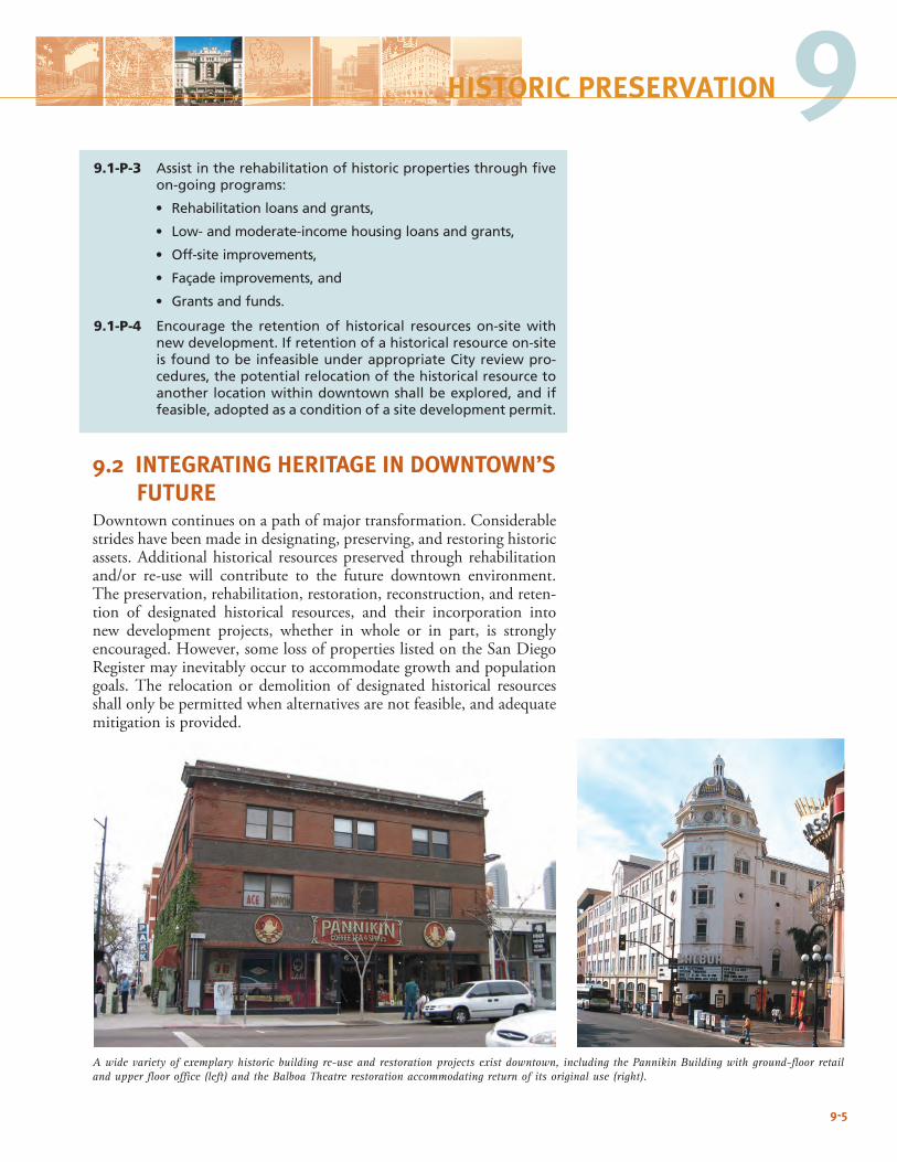
9-5
A wide variety of exemplary historic building re-use and restoration projects exist downtown, including the Pannikin Building with ground-floor retail and upper floor office (left) and the Balboa Theatre restoration accommodating return of its original use (right).
9HISTORIC PRESERVATION
9.1-P-3 Assist in the rehabilitation of historic properties through five on-going programs:
• Rehabilitation loans and grants,
• Low- and moderate-income housing loans and grants,
• Off-site improvements,
• Façade improvements, and
• Grants and funds.
9.1-P-4 Encourage the retention of historical resources on-site with new development. If retention of a historical resource on-site is found to be infeasible under appropriate City review pro-cedures, the potential relocation of the historical resource to another location within downtown shall be explored, and if feasible, adopted as a condition of a site development permit.
9.2 INTEGRATING HERITAGE IN DOWNTOWN’S FUTURE
Downtown continues on a path of major transformation. Considerable strides have been made in designating, preserving, and restoring historic assets. Additional historical resources preserved through rehabilitation and/or re-use will contribute to the future downtown environment. The preservation, rehabilitation, restoration, reconstruction, and reten-tion of designated historical resources, and their incorporation into new development projects, whether in whole or in part, is strongly encouraged. However, some loss of properties listed on the San Diego Register may inevitably occur to accommodate growth and population goals. The relocation or demolition of designated historical resources shall only be permitted when alternatives are not feasible, and adequate mitigation is provided.
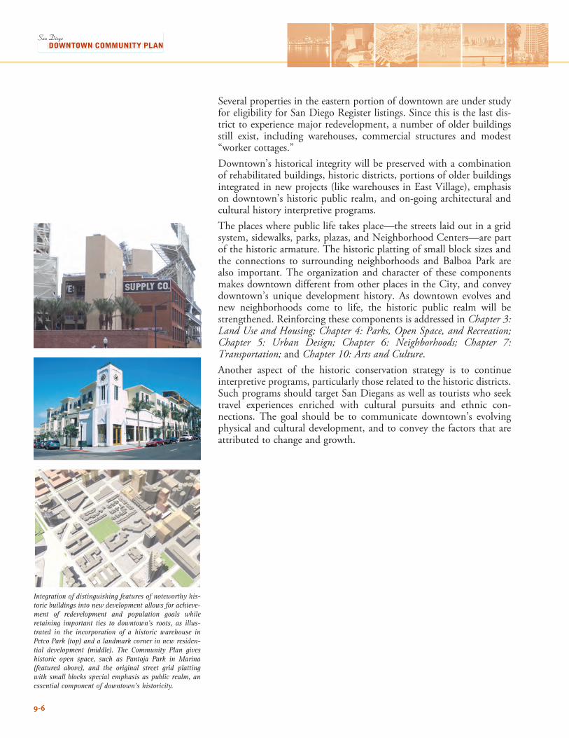
Integration of distinguishing features of noteworthy his-toric buildings into new development allows for achieve-ment of redevelopment and population goals while retaining important ties to downtown’s roots, as illus-trated in the incorporation of a historic warehouse in Petco Park (top) and a landmark corner in new residen-tial development (middle). The Community Plan gives historic open space, such as Pantoja Park in Marina (featured above), and the original street grid platting with small blocks special emphasis as public realm, an essential component of downtown’s historicity.
9-6
Several properties in the eastern portion of downtown are under study for eligibility for San Diego Register listings. Since this is the last dis-trict to experience major redevelopment, a number of older buildings still exist, including warehouses, commercial structures and modest “worker cottages.”Downtown’s historical integrity will be preserved with a combination of rehabilitated buildings, historic districts, portions of older buildings integrated in new projects (like warehouses in East Village), emphasis on downtown’s historic public realm, and on-going architectural and cultural history interpretive programs.The places where public life takes place—the streets laid out in a grid system, sidewalks, parks, plazas, and Neighborhood Centers—are part of the historic armature. The historic platting of small block sizes and the connections to surrounding neighborhoods and Balboa Park are also important. The organization and character of these components makes downtown different from other places in the City, and convey downtown’s unique development history. As downtown evolves and new neighborhoods come to life, the historic public realm will be strengthened. Reinforcing these components is addressed in Chapter 3: Land Use and Housing; Chapter 4: Parks, Open Space, and Recreation; Chapter 5: Urban Design; Chapter 6: Neighborhoods; Chapter 7: Transportation; and Chapter 10: Arts and Culture.Another aspect of the historic conservation strategy is to continue interpretive programs, particularly those related to the historic districts. Such programs should target San Diegans as well as tourists who seek travel experiences enriched with cultural pursuits and ethnic con-nections. The goal should be to communicate downtown’s evolving physical and cultural development, and to convey the factors that are attributed to change and growth.
9-7
9HISTORIC PRESERVATION
Goals: Integrating Heritage in Downtown’s Future9.2-G-1 Integrate historical resources into the downtown fabric while
achieving policies for significant development and population intensification.
9.2-G-2 Preserve and enhance downtown’s historic public realm in redevelopment planning.
9.2-G-3 Keep history alive through interpretive programs.
Policies: Integrating Heritage in Downtown’s Future
9.2-P-1 Incorporate elements of historical buildings in new projects to impart heritage.
9.2-P-2 Partner with business, community, cultural, and historic orga-nizations associated with designated historical resources to prepare and implement interpretive programs, such as walk-ing and audio tours or a “story pole,” permanent displays and signage, informational pamphlets, banners, and special events celebrating downtown’s history.
9.2-P-3 Promote the adaptive re-use of intact buildings (designated or not) and/or significant elements, as a cultural and sustain-ability goal.
9.2-P-4 Encourage the historic interpretation of various cultural resources as they are established over time, including but not limited to Asian-Pacific, African American, warehouse build-ings, etc.

9-8
This page intentionally left blank.
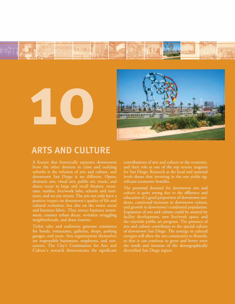
A feature that historically separates downtowns from the other districts in cities and outlying suburbs is the infusion of arts and culture, and downtown San Diego is no different. Opera, dramatic arts, visual arts, public art, music, and dance occur in large and small theaters, muse-ums, studios, live/work lofts, schools and insti-tutes, and on city streets. The arts not only have a positive impact on downtown’s quality of life and cultural evolution, but also on the entire social and business fabric. They attract business invest-ment, counter urban decay, revitalize struggling neighborhoods, and draw tourists.Ticket sales and audiences generate commerce for hotels, restaurants, galleries, shops, parking garages, and more. Arts organizations themselves are responsible businesses, employers, and con-sumers. The City’s Commission for Arts and Culture’s research demonstrates the significant
contributions of arts and culture to the economy, and their role as one of the top tourist magnets for San Diego. Research at the local and national levels shows that investing in the arts yields sig-nificant economic benefits.The potential demand for downtown arts and culture is quite strong due to the affluence and education of a good proportion of downtown resi-dents, continued increases in downtown visitors, and growth in downtown’s residential population. Expansion of arts and culture could be assisted by facility development, new live/work space, and the citywide public art program. The presence of arts and culture contributes to the special culture of downtown San Diego. The synergy in cultural energies will allow the arts community to flourish, so that it can continue to grow and better serve the needs and interests of the demographically diversified San Diego region.
ARTS AND CULTURE
10
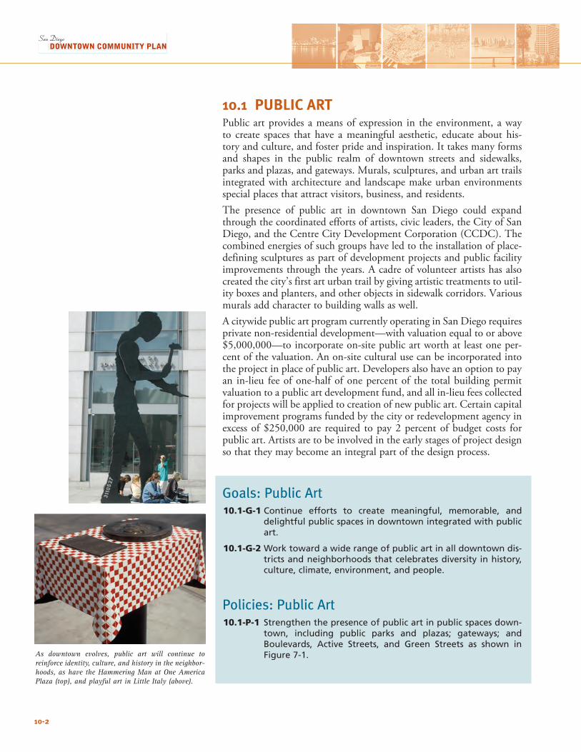
10.1 PUBLIC ARTPublic art provides a means of expression in the environment, a way to create spaces that have a meaningful aesthetic, educate about his-tory and culture, and foster pride and inspiration. It takes many forms and shapes in the public realm of downtown streets and sidewalks, parks and plazas, and gateways. Murals, sculptures, and urban art trails integrated with architecture and landscape make urban environments special places that attract visitors, business, and residents.The presence of public art in downtown San Diego could expand through the coordinated efforts of artists, civic leaders, the City of San Diego, and the Centre City Development Corporation (CCDC). The combined energies of such groups have led to the installation of place-defining sculptures as part of development projects and public facility improvements through the years. A cadre of volunteer artists has also created the city’s first art urban trail by giving artistic treatments to util-ity boxes and planters, and other objects in sidewalk corridors. Various murals add character to building walls as well.A citywide public art program currently operating in San Diego requires private non-residential development—with valuation equal to or above $5,000,000—to incorporate on-site public art worth at least one per-cent of the valuation. An on-site cultural use can be incorporated into the project in place of public art. Developers also have an option to pay an in-lieu fee of one-half of one percent of the total building permit valuation to a public art development fund, and all in-lieu fees collected for projects will be applied to creation of new public art. Certain capital improvement programs funded by the city or redevelopment agency in excess of $250,000 are required to pay 2 percent of budget costs for public art. Artists are to be involved in the early stages of project design so that they may become an integral part of the design process.
Goals: Public Art10.1-G-1 Continue efforts to create meaningful, memorable, and
delightful public spaces in downtown integrated with public art.
10.1-G-2 Work toward a wide range of public art in all downtown dis-tricts and neighborhoods that celebrates diversity in history, culture, climate, environment, and people.
Policies: Public Art10.1-P-1 Strengthen the presence of public art in public spaces down-
town, including public parks and plazas; gateways; and Boulevards, Active Streets, and Green Streets as shown in Figure 7-1.As downtown evolves, public art will continue to
reinforce identity, culture, and history in the neighbor-hoods, as have the Hammering Man at One America Plaza (top), and playful art in Little Italy (above).
10-2
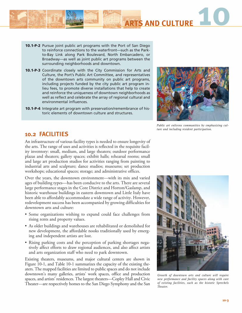
1010.1-P-2 Pursue joint public art programs with the Port of San Diego
to reinforce connections to the waterfront—such as the Park-to-Bay Link along Park Boulevard, North Embarcadero, or Broadway—as well as joint public art programs between the surrounding neighborhoods and downtown.
10.1-P-3 Coordinate closely with the City Commission for Arts and Culture, the Port’s Public Art Committee, and representatives of the downtown arts community on public art programs, including projects funded by the city public art program in-lieu fees, to promote diverse installations that help to create and reinforce the uniqueness of downtown neighborhoods as well as reflect and celebrate the array of regional cultural and environmental influences.
10.1-P-4 Integrate art program with preservation/remembrance of his-toric elements of downtown culture and structures.
10.2 FACILITIES An infrastructure of various facility types is needed to ensure longevity of the arts. The range of uses and activities is reflected in the requisite facil-ity inventory: small, medium, and large theaters; outdoor performance plazas and theaters; gallery spaces; exhibit halls; rehearsal rooms; small and large art production studios for activities ranging from painting to industrial arts and sculpture; dance studios; museums; set production workshops; educational spaces; storage; and administrative offices. Over the years, the downtown environment—with its mix and varied ages of building types—has been conducive to the arts. There are several large performance stages in the Core District and Horton/Gaslamp, and historic warehouse buildings in eastern downtown and Little Italy have been able to affordably accommodate a wide range of activity. However, redevelopment success has been accompanied by growing difficulties for downtown arts and culture:• Some organizations wishing to expand could face challenges from
rising rents and property values.• Asolderbuildingsandwarehousesarerehabilitatedordemolishedfor
new development, the affordable nooks traditionally used by emerg-ing and independent artists are lost.
• Risingparking costs and theperceptionofparking shortagesnega-tively affect efforts to draw regional audiences, and also affect artists and arts organization staff who need to park downtown.
Existing theaters, museums, and major cultural centers are shown in Figure 10-1, and Table 10-1 summarizes the capacity of the existing the-aters. The mapped facilities are limited to public spaces and do not include downtown’s many galleries, artists’ work spaces, office and production spaces, and artists’ residences. The largest theaters—Copley Hall and Civic Theater—are respectively homes to the San Diego Symphony and the San
10-3
Growth of downtown arts and culture will require new performance and facility spaces along with care of existing facilities, such as the historic Spreckels Theater.
ARTS AND CULTURE
Public art enlivens communities by emphasizing cul-ture and including resident participation.
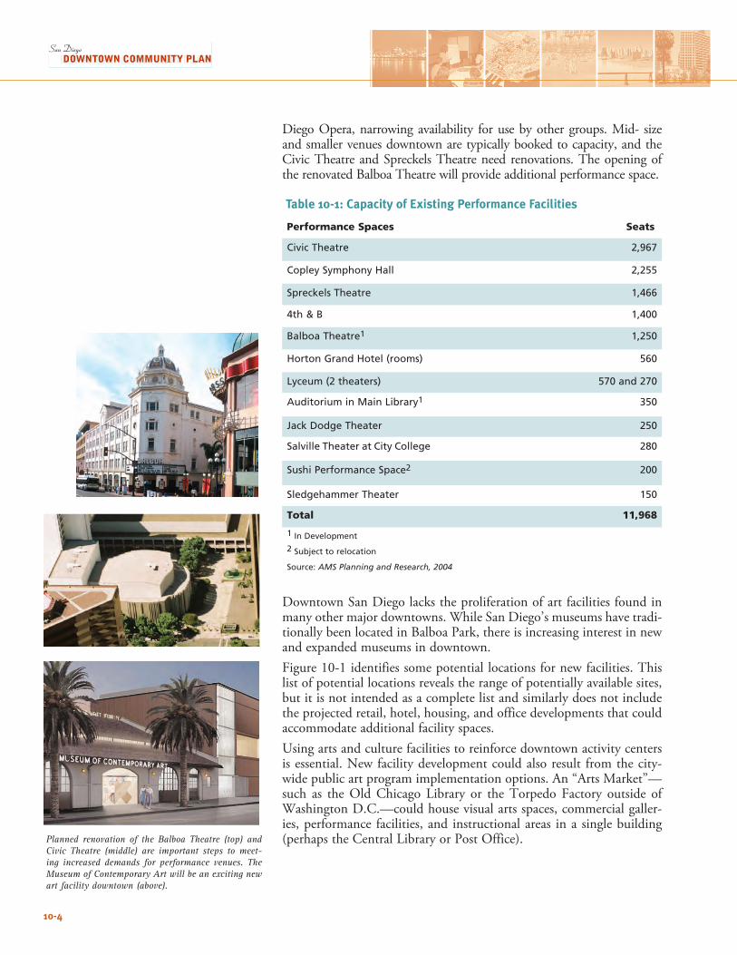
Diego Opera, narrowing availability for use by other groups. Mid- size and smaller venues downtown are typically booked to capacity, and the Civic Theatre and Spreckels Theatre need renovations. The opening of the renovated Balboa Theatre will provide additional performance space.
Downtown San Diego lacks the proliferation of art facilities found in many other major downtowns. While San Diego’s museums have tradi-tionally been located in Balboa Park, there is increasing interest in new and expanded museums in downtown. Figure 10-1 identifies some potential locations for new facilities. This list of potential locations reveals the range of potentially available sites, but it is not intended as a complete list and similarly does not include the projected retail, hotel, housing, and office developments that could accommodate additional facility spaces. Using arts and culture facilities to reinforce downtown activity centers is essential. New facility development could also result from the city-wide public art program implementation options. An “Arts Market”—such as the Old Chicago Library or the Torpedo Factory outside of Washington D.C.—could house visual arts spaces, commercial galler-ies, performance facilities, and instructional areas in a single building (perhaps the Central Library or Post Office).Planned renovation of the Balboa Theatre (top) and
Civic Theatre (middle) are important steps to meet-ing increased demands for performance venues. The Museum of Contemporary Art will be an exciting new art facility downtown (above).
10-4
Table 10-1: Capacity of Existing Performance Facilities
Performance Spaces Seats
Civic Theatre 2,967
Copley Symphony Hall 2,255
Spreckels Theatre 1,466
4th & B 1,400
Balboa Theatre1 1,250
Horton Grand Hotel (rooms) 560
Lyceum (2 theaters) 570 and 270
Auditorium in Main Library1 350
Jack Dodge Theater 250
Salville Theater at City College 280
Sushi Performance Space2 200
Sledgehammer Theater 150
Total 11,968
1 In Development
2 Subject to relocation
Source: AMS Planning and Research, 2004
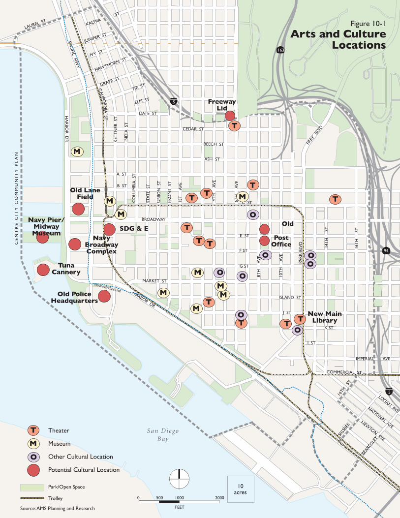
CE
NT
RE
CIT
Y C
OM
MU
NIT
Y P
LA
N
San DiegoBay
94
163
5
5
HA
RBO
R D
R
LAUREL ST
PAC
IFIC H
WY
BROADWAY
ASH ST
MARKET ST
HARBOR DRPA
RK
BLV
DPA
RK B
LVD
10T
H
AV
E
14T
H
ST
16T
H
ST
8TH
A
VE
6TH
A
VE
4TH
A
VE
1ST
A
VE
FRO
NT
ST
UN
ION
ST
STAT
E S
T
CO
LUM
BIA
ST
IND
IA S
T
KET
TN
ER S
T
JUNIPER ST
IVY ST
HAWTHORN ST
GRAPE ST
FIR ST
KALMIAST
ELM ST
DATE ST
CEDAR ST
BEECH ST
A ST
B ST
C ST
E ST
F ST
G ST
ISLAND ST
J ST
K ST
L ST
IMPERIAL AVE
COMMERCIAL ST
CA
LIFORN
IA ST
16TH
ST
SIGSB
EE
BEARD
SLEY
Theater
Museum
Other Cultural Location
Potential Cultural Location
Park/Open Space
Trolley
Source: AMS Planning and Research
LOGAN AVENATIONAL AVE
NEWTON AVE
Figure 10-1
Arts and CultureLocations
FEET
0 500 1000 2000
10acres
OM
M
M
M
TT
T
M
O
T
T T
O OO
TTT
O
O
MM
TM
M
Navy Pier/Midway Museum
TunaCannery
Old LaneField
NavyBroadwayComplex
SDG & E
Old PoliceHeadquarters
Old
PostOffice
T
M
O
FreewayLid
O
T
New MainLibrary
MEAN HIGH TIDE LINE
T
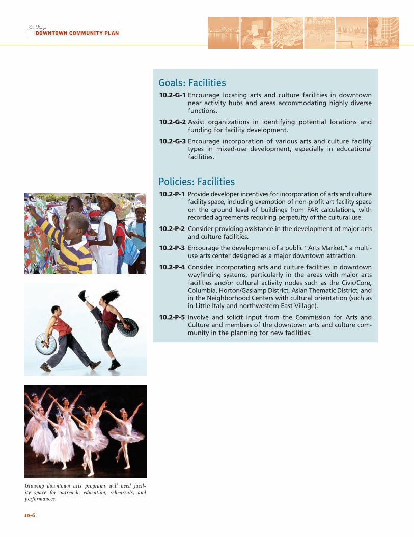
Growing downtown arts programs will need facil-ity space for outreach, education, rehearsals, and performances.
10-6
Goals: Facilities10.2-G-1 Encourage locating arts and culture facilities in downtown
near activity hubs and areas accommodating highly diverse functions.
10.2-G-2 Assist organizations in identifying potential locations and funding for facility development.
10.2-G-3 Encourage incorporation of various arts and culture facility types in mixed-use development, especially in educational facilities.
Policies: Facilities10.2-P-1 Provide developer incentives for incorporation of arts and culture
facility space, including exemption of non-profit art facility space on the ground level of buildings from FAR calculations, with recorded agreements requiring perpetuity of the cultural use.
10.2-P-2 Consider providing assistance in the development of major arts and culture facilities.
10.2-P-3 Encourage the development of a public “Arts Market,” a multi-use arts center designed as a major downtown attraction.
10.2-P-4 Consider incorporating arts and culture facilities in downtown wayfinding systems, particularly in the areas with major arts facilities and/or cultural activity nodes such as the Civic/Core, Columbia, Horton/Gaslamp District, Asian Thematic District, and in the Neighborhood Centers with cultural orientation (such as in Little Italy and northwestern East Village).
10.2-P-5 Involve and solicit input from the Commission for Arts and Culture and members of the downtown arts and culture com-munity in the planning for new facilities.
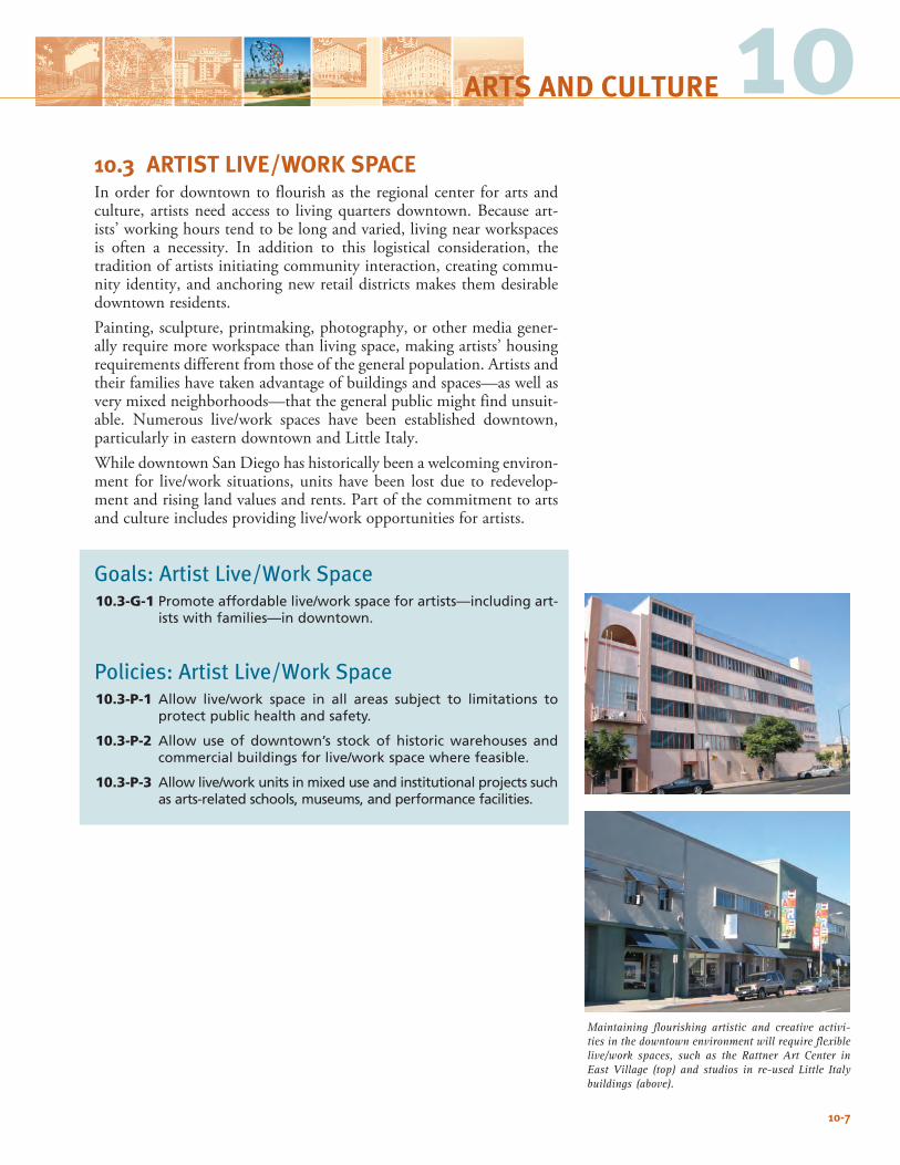
10-7
Maintaining flourishing artistic and creative activi-ties in the downtown environment will require flexible live/work spaces, such as the Rattner Art Center in East Village (top) and studios in re-used Little Italy buildings (above).
1010.3 ARTIST LIVE/WORK SPACEIn order for downtown to flourish as the regional center for arts and culture, artists need access to living quarters downtown. Because art-ists’ working hours tend to be long and varied, living near workspaces is often a necessity. In addition to this logistical consideration, the tradition of artists initiating community interaction, creating commu-nity identity, and anchoring new retail districts makes them desirable downtown residents.Painting, sculpture, printmaking, photography, or other media gener-ally require more workspace than living space, making artists’ housing requirements different from those of the general population. Artists and their families have taken advantage of buildings and spaces—as well as very mixed neighborhoods—that the general public might find unsuit-able. Numerous live/work spaces have been established downtown, particularly in eastern downtown and Little Italy.While downtown San Diego has historically been a welcoming environ-ment for live/work situations, units have been lost due to redevelop-ment and rising land values and rents. Part of the commitment to arts and culture includes providing live/work opportunities for artists.
Goals: Artist Live/Work Space10.3-G-1 Promote affordable live/work space for artists—including art-
ists with families—in downtown.
Policies: Artist Live/Work Space10.3-P-1 Allow live/work space in all areas subject to limitations to
protect public health and safety.
10.3-P-2 Allow use of downtown’s stock of historic warehouses and commercial buildings for live/work space where feasible.
10.3-P-3 Allow live/work units in mixed use and institutional projects such as arts-related schools, museums, and performance facilities.
ARTS AND CULTURE

10-8
This page intentionally left blank.
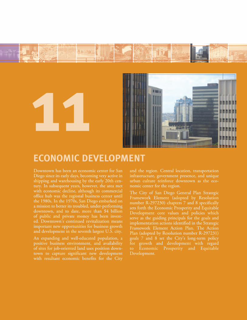
Downtown has been an economic center for San Diego since its early days, becoming very active in shipping and warehousing by the early 20th cen-tury. In subsequent years, however, the area met with economic decline, although its commercial office hub was the regional business center until the 1980s. In the 1970s, San Diego embarked on a mission to better its troubled, under-performing downtown, and to date, more than $4 billion of public and private money has been invest-ed. Downtown’s continued revitalization means important new opportunities for business growth and development in the seventh largest U.S. city.An expanding and well-educated population, a positive business environment, and availability of sites for job-oriented land uses position down-town to capture significant new development with resultant economic benefits for the City
and the region. Central location, transportation infrastructure, government presence, and unique urban culture reinforce downtown as the eco-nomic center for the region. The City of San Diego General Plan Strategic Framework Element (adopted by Resolution number R-297230) chapters 7 and 8 specifically sets forth the Economic Prosperity and Equitable Development core values and policies which serve as the guiding principals for the goals and implementation actions identified in the Strategic Framework Element Action Plan. The Action Plan (adopted by Resolution number R-297231) goals 7 and 8 set the City’s long-term policy for growth and development with regard to Economic Prosperity and Equitable Development.
ECONOMIC DEVELOPMENT
11
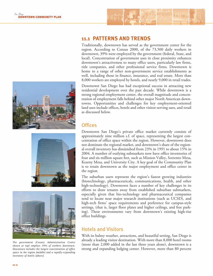
11.1 PATTERNS AND TRENDS Traditionally, downtown has served as the government center for the region. According to Census 2000, of the 73,500 daily workers in downtown, 39% were employed by the government (federal, State, and local). Concentration of government uses in close proximity enhances downtown’s attractiveness to many office users, particularly law firms, title companies, and other professional service firms. Downtown is home to a range of other non-government service establishments as well, including those in finance, insurance, and real estate. More than 8,000 workers are employed by hotels, and nearly 9,000 in retail trades. Downtown San Diego has had exceptional success in attracting new residential development over the past decade. While downtown is a strong regional employment center, the overall magnitude and concen-tration of employment falls behind other major North American down-towns. Opportunities and challenges for key employment-oriented land uses include offices, hotels and other visitor-serving uses, and retail as discussed below.
OfficesDowntown San Diego’s private office market currently consists of approximately nine million s.f. of space, representing the largest con-centration of office space within the region. However, downtown does not dominate the regional market, and downtown’s share of the region-al overall inventory has diminished from 23% in 1991 to about 15% in 2004. A number of outlying submarkets now have office inventories of four and six million square feet, such as Mission Valley, Sorrento Mesa, Kearny Mesa, and University City. A key goal of the Community Plan is to retain downtown as the major employment and office center in the region.The suburban users represent the region’s fastest growing industries (biotechnology, pharmaceuticals, communications, health, and other high-technology). Downtown faces a number of key challenges in its efforts to draw tenants away from established suburban submarkets, especially given that bio-technology and pharmaceutical companies tend to locate near major research institutions (such as UCSD), and high-tech firms’ space requirements and preference for campus-style settings, (that is, larger floor plates and higher ceilings, and free park-ing). These environments vary from downtown’s existing high-rise office buildings.
Hotels and VisitorsWith its balmy weather, attractions, and beautiful setting, San Diego is already a leading visitor destination. With more than 8,000 hotel rooms (more than 2,000 added in the last three years alone), downtown is a strong and expanding lodging center. However, more than 80 percent
The government (County Administration Center shown at top) employs 39% of workers downtown. Downtown includes the largest concentration of office space in the region (middle) and a rapidly-expanding inventory of hotels (above).
11-2
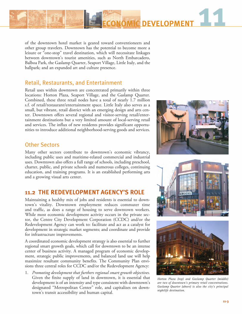
11of the downtown hotel market is geared toward conventioneers and other group travelers. Downtown has the potential to become more a leisure or “one-stop” travel destination, which will necessitate linkages between downtown’s tourist amenities, such as North Embarcadero, Balboa Park, the Gaslamp Quarter, Seaport Village, Little Italy, and the ballpark; and an expanded art and culture presence.
Retail, Restaurants, and Entertainment Retail uses within downtown are concentrated primarily within three locations: Horton Plaza, Seaport Village, and the Gaslamp Quarter. Combined, these three retail nodes have a total of nearly 1.7 million s.f. of retail/restaurant/entertainment space. Little Italy also serves as a small, but vibrant, retail district with an emerging design and arts cen-ter. Downtown offers several regional and visitor-serving retail/enter-tainment destinations but a very limited amount of local-serving retail and services. The influx of new residents provides significant opportu-nities to introduce additional neighborhood-serving goods and services.
Other SectorsMany other sectors contribute to downtown’s economic vibrancy, including public uses and maritime-related commercial and industrial uses. Downtown also offers a full range of schools, including preschool, charter, public, and private schools and numerous colleges, continuing education, and training programs. It is an established performing arts and a growing visual arts center.
11.2 THE REDEVELOPMENT AGENCY’S ROLEMaintaining a healthy mix of jobs and residents is essential to down-town’s vitality. Downtown employment reduces commuter time and traffic, as does a range of housing to serve downtown workers. While most economic development activity occurs in the private sec-tor, the Centre City Development Corporation (CCDC) and/or the Redevelopment Agency can work to: facilitate and act as a catalyst for development in strategic market segments; and coordinate and provide for infrastructure improvements.A coordinated economic development strategy is also essential to further regional smart growth goals, which call for downtown to be an intense center of business activity. A managed program of economic develop-ment, strategic public improvements, and balanced land use will help maximize resultant community benefits. The Community Plan envi-sions three central roles for CCDC and/or the Redevelopment Agency:1. Promoting development that furthers regional smart growth objectives.
Given the finite supply of land in downtown, it is essential that development is of an intensity and type consistent with downtown’s designated “Metropolitan Center” role, and capitalizes on down-town’s transit accessibility and human capital.
11-3
Horton Plaza (top) and Gaslamp Quarter (middle) are two of downtown’s primary retail concentrations. Gaslamp Quarter (above) is also the city’s principal nightlife destination.
ECONOMIC DEVELOPMENT
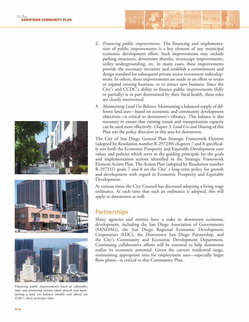
2. Financing public improvements. The financing and implementa-tion of public improvements is a key element of any municipal economic development effort. Such improvements may include parking structures, downtown shuttles, streetscape improvements, utility undergrounding, etc. In many cases, these improvements provide the necessary incentive and establish a commitment and design standard for subsequent private sector investment redevelop-ment. In others, these improvements are made in an effort to retain or expand existing business, or to attract new business. Since the City’s and CCDC’s ability to finance public improvements (fully or partially) is in part determined by their fiscal health, these roles are closely intertwined.
3. Maintaining Land Use Balance. Maintaining a balanced supply of dif-ferent land uses—based on economic and community development objectives—is critical to downtown’s vibrancy. This balance is also necessary to ensure that existing transit and transportation capacity can be used more effectively. Chapter 3: Land Use and Housing of this Plan sets the policy direction in this area for downtown.
The City of San Diego General Plan Strategic Framework Element (adopted by Resolution number R-297230) chapters 7 and 8 specifical-ly sets forth the Economic Prosperity and Equitable Development core values and policies which serve as the guiding principals for the goals and implementation actions identified in the Strategic Framework Element Action Plan. The Action Plan (adopted by Resolution number R-297231) goals 7 and 8 set the City’ s long-term policy for growth and development with regard to Economic Prosperity and Equitable Development.At various times the City Council has discussed adopting a living wage ordinance. At such time that such an ordinance is adopted, this will apply to downtown as well.
PartnershipsMany agencies and entities have a stake in downtown economic development, including the San Diego Association of Governments (SANDAG), the San Diego Regional Economic Development Corporation (EDC), the Downtown San Diego Partnership, and the City’s Community and Economic Development Department. Continuing collaborative efforts will be essential to help downtown realize its economic potential. Given the current residential surge, maintaining appropriate sites for employment uses—especially larger floor plates—is critical to this Community Plan.
Financing public improvements (such as sidewalks; top), and promoting intense smart growth and main-taining a land use balance (middle and above) are CCDC’s three principal roles.
11-4

CE
NT
RE
CIT
Y C
OM
MU
NIT
Y P
LA
N
San DiegoBay
94
163
5
5LOGAN AVENATIONAL AVE
NEWTON AVE
HA
RBO
R D
R
LAUREL ST
PAC
IFIC H
WY
BROADWAY
ASH ST
MARKET ST
HARBOR DR
PAR
K B
LVD
PARK
BLV
D
10T
H
AV
E
14T
H
ST
16T
H
ST
8TH
A
VE
6TH
A
VE
4TH
A
VE
1ST
A
VE
FRO
NT
ST
UN
ION
ST
STAT
E S
T
CO
LUM
BIA
ST
IND
IA S
T
KET
TN
ER S
T
JUNIPER ST
IVY ST
HAWTHORN ST
GRAPE ST
FIR ST
KALMIA
ST
ELM ST
DATE ST
CEDAR ST
BEECH ST
A ST
B ST
C ST
E ST
F ST
G ST
ISLAND ST
J ST
K ST
L ST
IMPERIAL AVE
COMMERCIAL ST
16TH
ST
SIGSB
EE
BEARD
SLEY
Center City Development Corporation
Renewal Community Boundary
Metro Enterprise Zone Boundary
Trolley
Figure 11-1
Renewal Community& Metro Enterprise
Zone Boundaries
FEET
0 500 1000 2000
10acres
MEAN HIGH TIDE LINE
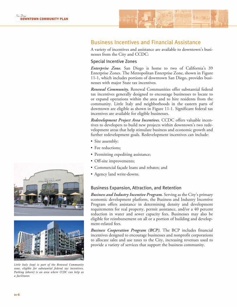
Little Italy (top) is part of the Renewal Community zone, eligible for substantial federal tax incentives. Parking (above) is an area where CCDC can help as a facilitator.
11-6
Business Incentives and Financial Assistance A variety of incentives and assistance are available to downtown’s busi-nesses from the City and CCDC:
Special Incentive Zones Enterprise Zone. San Diego is home to two of California’s 39 Enterprise Zones. The Metropolitan Enterprise Zone, shown in Figure 11-1, which includes portions of downtown San Diego, provides busi-nesses with major State tax incentives. Renewal Community. Renewal Communities offer substantial federal tax incentives generally designed to encourage businesses to locate to or expand operations within the area and to hire residents from the community. Little Italy and neighborhoods in the eastern parts of downtown are eligible as shown in Figure 11-1. Significant federal tax incentives are available for eligible businesses.Redevelopment Project Area Incentives. CCDC offers valuable incen-tives to developers to build new projects within downtown’s two rede-velopment areas that help stimulate business and economic growth and further redevelopment goals. Redevelopment incentives can include: • Site assembly;• Fee reductions; • Permitting expediting assistance; • Off-site improvements; • Commercial façade loans and rebates; and• Agency land write-downs.
Business Expansion, Attraction, and Retention Business and Industry Incentive Program. Serving as the City’s primary economic development platform, the Business and Industry Incentive Program offers assistance in determining density and development requirements for real property, permit assistance, and/or a 40 percent reduction in water and sewer capacity fees. Businesses may also be eligible for reimbursement on all or a portion of building and develop-ment-related fees. Business Cooperation Program (BCP). The BCP includes financial incentives designed to encourage businesses and nonprofit corporations to allocate sales and use taxes to the City, increasing revenues used to provide a variety of services that support the business community.
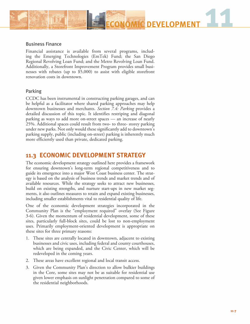
11-7
11ECONOMIC DEVELOPMENT
Business Finance Financial assistance is available from several programs, includ-ing the Emerging Technologies (EmTek) Fund; the San Diego Regional Revolving Loan Fund; and the Metro Revolving Loan Fund. Additionally, a Storefront Improvement Program provides small busi-nesses with rebates (up to $5,000) to assist with eligible storefront renovation costs in downtown.
ParkingCCDC has been instrumental in constructing parking garages, and can be helpful as a facilitator where shared parking approaches may help downtown businesses and merchants. Section 7.4: Parking provides a detailed discussion of this topic. It identifies restriping and diagonal parking as ways to add more on-street spaces — an increase of nearly 25%. A dditional spaces could result from two- to three- storey parking under new parks. Not only would these significantly add to downtown’s parking supply, public (including on-street) parking is inherently much more efficiently used than private, dedicated parking.
11.3 ECONOMIC DEVELOPMENT STRATEGYThe economic development strategy outlined here provides a framework for ensuring downtown’s long-term regional competitiveness and to guide its emergence into a major West Coast business center. The strat-egy is based on the analysis of business trends and market trends and of available resources. While the strategy seeks to attract new businesses, build on existing strengths, and nurture start-ups in new market seg-ments, it also outlines measures to retain and expand existing businesses, including smaller establishments vital to residential quality of life. One of the economic development strategies incorporated in the Community Plan is the “employment required” overlay (See Figure 3-6). Given the momentum of residential development, some of these sites, particularly full-block sites, could be lost to non-employment uses. Primarily employment-oriented development is appropriate on these sites for three primary reasons: 1. These sites are centrally located in downtown, adjacent to existing
businesses and civic uses, including federal and county courthouses, which are being expanded, and the Civic Center, which will be redeveloped in the coming years.
2. These areas have excellent regional and local transit access.3. Given the Community Plan’s direction to allow bulkier buildings
in the Core, some sites may not be as suitable for residential use given lower emphasis on sunlight penetration compared to some of the residential neighborhoods.
11-8
Goals: Economic Development Strategy11.3-G-1 Maintain and enhance downtown’s unique and attractive
climate for conducting business, including mixed-use environ-ment, waterfront orientation, vibrant outdoor spaces, hous-ing choices, and cultural amenities.
11.3-G-2 In partnership with business and community groups, proac-tively participate in downtown’s economic development.
11.3-G-3 Establish economic development priorities and undertake targeted investments to facilitate expansion, retention and attraction of businesses that meet downtown’s economic development objectives.
11.3-G-4 Undertake a leadership role in the coordination and comple-tion of infrastructure improvements, and in provision of parking and other amenities, particularly where CCDC and/or the Redevelopment Agency can provide these services more effectively than the private sector.
Policies: Economic Development Strategy11.3-P-1 Preserve sites in Core/Columbia for business or primarily
employment-oriented development to ensure that down-town’s employment potential is maintained.
11.3-P-2 Permit office and other employment-oriented development in a variety of locations across downtown, and allow mixed-use development in all neighborhoods.
11.3-P-3 Ensure a balanced inventory of land for appropriate use des-ignations and development intensities in strategic locations.
11.3-P-4 Emphasize shared parking and merchant-serving parking approaches, including:
• Development of parking facilities that serve multiple uses, to enable efficient use of space over the course of the day;
• Consider providing parking under all new parks, minimiz-ing ramp impacts to urban design, where not limited by geologic or other constraints; and
• Maximize short-term, on-street parking through restriping streets and minimal “red-curbs” where appropriate.
11.3-P-5 In collaboration with other public and private agencies, main-tain a business attraction program to assist with site identifi-cation, incentive programs, permitting assistance, and other aspects of relocating or establishing a business.
11.3-P-6 Establish an inventory of targeted industry clusters and iden-tify locational characteristics and determine the effects of CCDC/City policy and regulation on the operation and con-tinued success of these clusters; work closely with industry contacts to identify specific needs to be addressed.
11.3-P-7 Ensure that downtown zoning allows home occupation/ home-based businesses in appropriate locations.
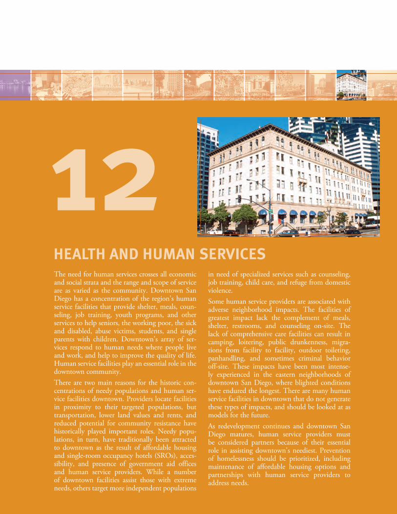
The need for human services crosses all economic and social strata and the range and scope of service are as varied as the community. Downtown San Diego has a concentration of the region’s human service facilities that provide shelter, meals, coun-seling, job training, youth programs, and other services to help seniors, the working poor, the sick and disabled, abuse victims, students, and single parents with children. Downtown’s array of ser-vices respond to human needs where people live and work, and help to improve the quality of life. Human service facilities play an essential role in the downtown community.There are two main reasons for the historic con-centrations of needy populations and human ser-vice facilities downtown. Providers locate facilities in proximity to their targeted populations, but transportation, lower land values and rents, and reduced potential for community resistance have historically played important roles. Needy popu-lations, in turn, have traditionally been attracted to downtown as the result of affordable housing and single-room occupancy hotels (SROs), acces-sibility, and presence of government aid offices and human service providers. While a number of downtown facilities assist those with extreme needs, others target more independent populations
in need of specialized services such as counseling, job training, child care, and refuge from domestic violence. Some human service providers are associated with adverse neighborhood impacts. The facilities of greatest impact lack the complement of meals, shelter, restrooms, and counseling on-site. The lack of comprehensive care facilities can result in camping, loitering, public drunkenness, migra-tions from facility to facility, outdoor toileting, panhandling, and sometimes criminal behavior off-site. These impacts have been most intense-ly experienced in the eastern neighborhoods of downtown San Diego, where blighted conditions have endured the longest. There are many human service facilities in downtown that do not generate these types of impacts, and should be looked at as models for the future. As redevelopment continues and downtown San Diego matures, human service providers must be considered partners because of their essential role in assisting downtown’s neediest. Prevention of homelessness should be prioritized, including maintenance of affordable housing options and partnerships with human service providers to address needs.
HEALTH AND HUMAN SERVICES
12
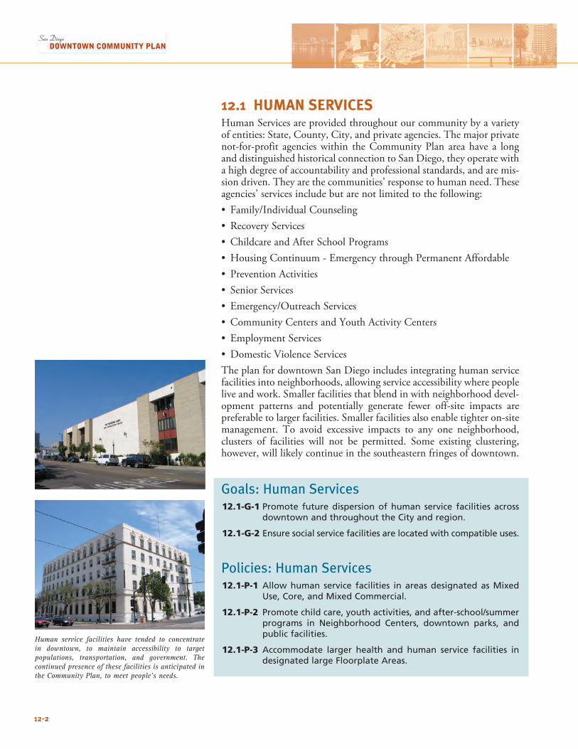
12.1 HUMAN SERVICESHuman Services are provided throughout our community by a variety of entities: State, County, City, and private agencies. The major private not-for-profit agencies within the Community Plan area have a long and distinguished historical connection to San Diego, they operate with a high degree of accountability and professional standards, and are mis-sion driven. They are the communities’ response to human need. These agencies’ services include but are not limited to the following: • Family/IndividualCounseling• RecoveryServices• ChildcareandAfterSchoolPrograms• HousingContinuum-EmergencythroughPermanentAffordable• PreventionActivities• SeniorServices• Emergency/OutreachServices• CommunityCentersandYouthActivityCenters• EmploymentServices• DomesticViolenceServicesThe plan for downtown San Diego includes integrating human service facilities into neighborhoods, allowing service accessibility where people live and work. Smaller facilities that blend in with neighborhood devel-opment patterns and potentially generate fewer off-site impacts are preferable to larger facilities. Smaller facilities also enable tighter on-site management. To avoid excessive impacts to any one neighborhood, clusters of facilities will not be permitted. Some existing clustering, however, will likely continue in the southeastern fringes of downtown.
Goals: Human Services12.1-G-1 Promote future dispersion of human service facilities across
downtown and throughout the City and region.
12.1-G-2 Ensure social service facilities are located with compatible uses.
Policies: Human Services12.1-P-1 Allow human service facilities in areas designated as Mixed
Use, Core, and Mixed Commercial.
12.1-P-2 Promote child care, youth activities, and after-school/summer programs in Neighborhood Centers, downtown parks, and public facilities.
12.1-P-3 Accommodate larger health and human service facilities in designated large Floorplate Areas.
Human service facilities have tended to concentrate in downtown, to maintain accessibility to target populations, transportation, and government. The continued presence of these facilities is anticipated in the Community Plan, to meet people’s needs.
12-2
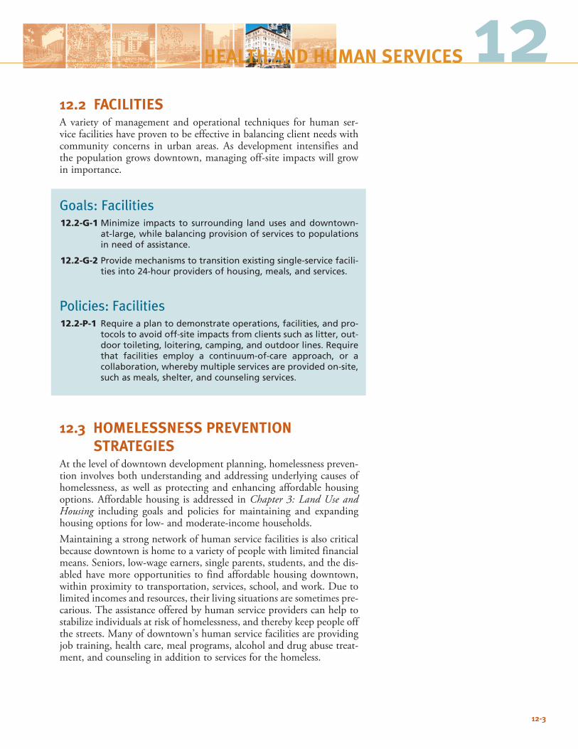
1212.2 FACILITIESA variety of management and operational techniques for human ser-vice facilities have proven to be effective in balancing client needs with community concerns in urban areas. As development intensifies and the population grows downtown, managing off-site impacts will grow in importance.
Goals: Facilities12.2-G-1 Minimize impacts to surrounding land uses and downtown-
at-large, while balancing provision of services to populations in need of assistance.
12.2-G-2 Provide mechanisms to transition existing single-service facili-ties into 24-hour providers of housing, meals, and services.
Policies: Facilities12.2-P-1 Require a plan to demonstrate operations, facilities, and pro-
tocols to avoid off-site impacts from clients such as litter, out-door toileting, loitering, camping, and outdoor lines. Require that facilities employ a continuum-of-care approach, or a collaboration, whereby multiple services are provided on-site, such as meals, shelter, and counseling services.
12.3 HOMELESSNESS PREVENTION STRATEGIESAt the level of downtown development planning, homelessness preven-tion involves both understanding and addressing underlying causes of homelessness, as well as protecting and enhancing affordable housing options. Affordable housing is addressed in Chapter 3: Land Use and Housing including goals and policies for maintaining and expanding housing options for low- and moderate-income households.Maintaining a strong network of human service facilities is also critical because downtown is home to a variety of people with limited financial means. Seniors, low-wage earners, single parents, students, and the dis-abled have more opportunities to find affordable housing downtown, within proximity to transportation, services, school, and work. Due to limited incomes and resources, their living situations are sometimes pre-carious. The assistance offered by human service providers can help to stabilize individuals at risk of homelessness, and thereby keep people off the streets. Many of downtown’s human service facilities are providing job training, health care, meal programs, alcohol and drug abuse treat-ment, and counseling in addition to services for the homeless.
12-3
HEALTH AND HUMAN SERVICES
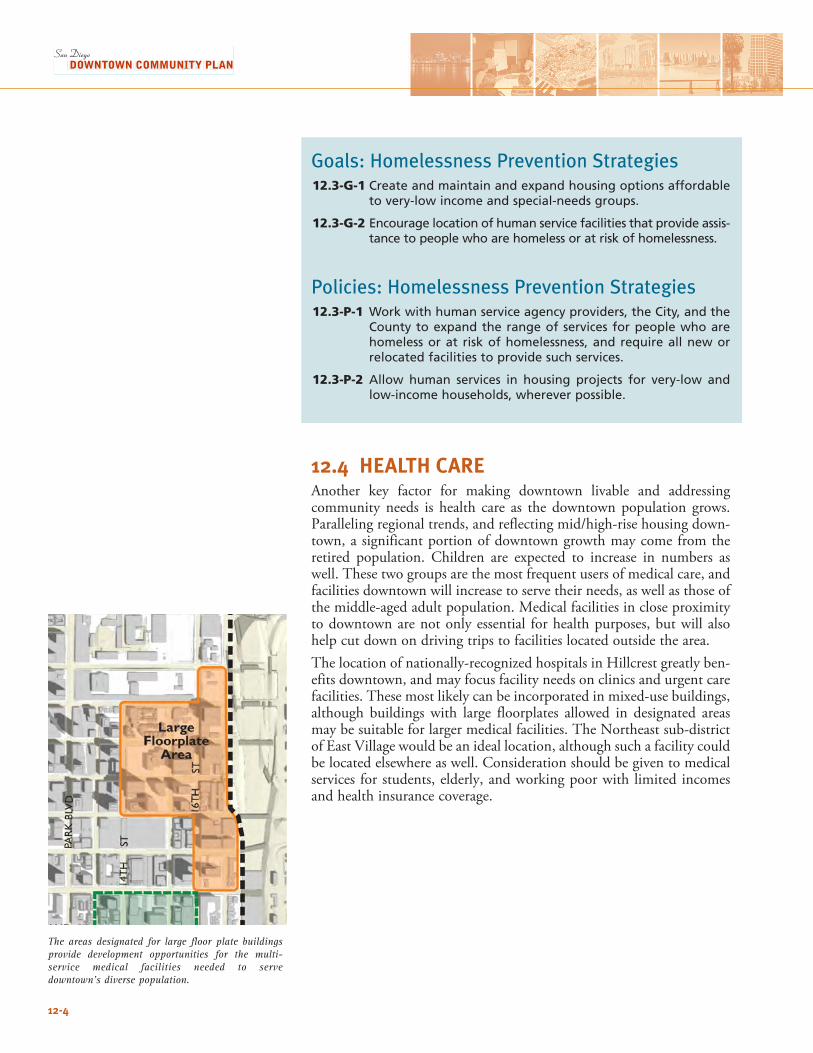
Goals: Homelessness Prevention Strategies12.3-G-1 Create and maintain and expand housing options affordable
to very-low income and special-needs groups.
12.3-G-2 Encourage location of human service facilities that provide assis-tance to people who are homeless or at risk of homelessness.
Policies: Homelessness Prevention Strategies12.3-P-1 Work with human service agency providers, the City, and the
County to expand the range of services for people who are homeless or at risk of homelessness, and require all new or relocated facilities to provide such services.
12.3-P-2 Allow human services in housing projects for very-low and low-income households, wherever possible.
12.4 HEALTH CAREAnother key factor for making downtown livable and addressing community needs is health care as the downtown population grows. Parallelingregionaltrends,andreflectingmid/high-risehousingdown-town, a significant portion of downtown growth may come from the retired population. Children are expected to increase in numbers as well. These two groups are the most frequent users of medical care, and facilities downtown will increase to serve their needs, as well as those of the middle-aged adult population. Medical facilities in close proximity to downtown are not only essential for health purposes, but will also help cut down on driving trips to facilities located outside the area.The location of nationally-recognized hospitals in Hillcrest greatly ben-efits downtown, and may focus facility needs on clinics and urgent care facilities. These most likely can be incorporated in mixed-use buildings, although buildings with large floorplates allowed in designated areas may be suitable for larger medical facilities. The Northeast sub-district ofEastVillagewouldbeanideallocation,althoughsuchafacilitycouldbe located elsewhere as well. Consideration should be given to medical services for students, elderly, and working poor with limited incomes and health insurance coverage.
12-4
The areas designated for large floor plate buildings provide development opportunities for the multi- service medical facilities needed to serve downtown’s diverse population.
Goals: Health Care12.4-G-1 Encourage the provision of sufficient and easily accessible
health care facilities to meet needs of all sectors of the grow-ing downtown population.
12.4-G-2 Allow for the integration of new clinics or larger facilities in the downtown fabric, following established community design goals.
Policies: Health Care12.4-P-1 Coordinate new medical care facility development carefully
with providers, addressing both practical needs and down-town development and design objectives.
12.4-P-2 Pursue a diversity of facilities to meet the long- and short-term medical needs of downtown residents, the poor, visitors, and employees.
12.4-P-3 Encourage the location of a small hospital or similar facility downtown.
12-5
12HEALTH AND HUMAN SERVICES

This page intentionally left blank.
12-6
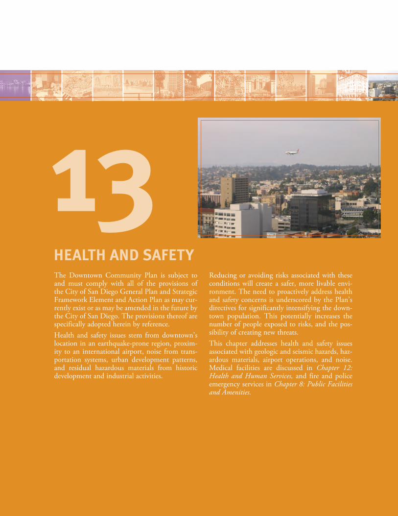
The Downtown Community Plan is subject to and must comply with all of the provisions of the City of San Diego General Plan and Strategic Framework Element and Action Plan as may cur-rently exist or as may be amended in the future by the City of San Diego. The provisions thereof are specifically adopted herein by reference.Health and safety issues stem from downtown’s location in an earthquake-prone region, proxim-ity to an international airport, noise from trans-portation systems, urban development patterns, and residual hazardous materials from historic development and industrial activities.
Reducing or avoiding risks associated with these conditions will create a safer, more livable envi-ronment. The need to proactively address health and safety concerns is underscored by the Plan’s directives for significantly intensifying the down-town population. This potentially increases the number of people exposed to risks, and the pos-sibility of creating new threats.This chapter addresses health and safety issues associated with geologic and seismic hazards, haz-ardous materials, airport operations, and noise. Medical facilities are discussed in Chapter 12: Health and Human Services, and fire and police emergency services in Chapter 8: Public Facilities and Amenities.
HEALTH AND SAFETY
13
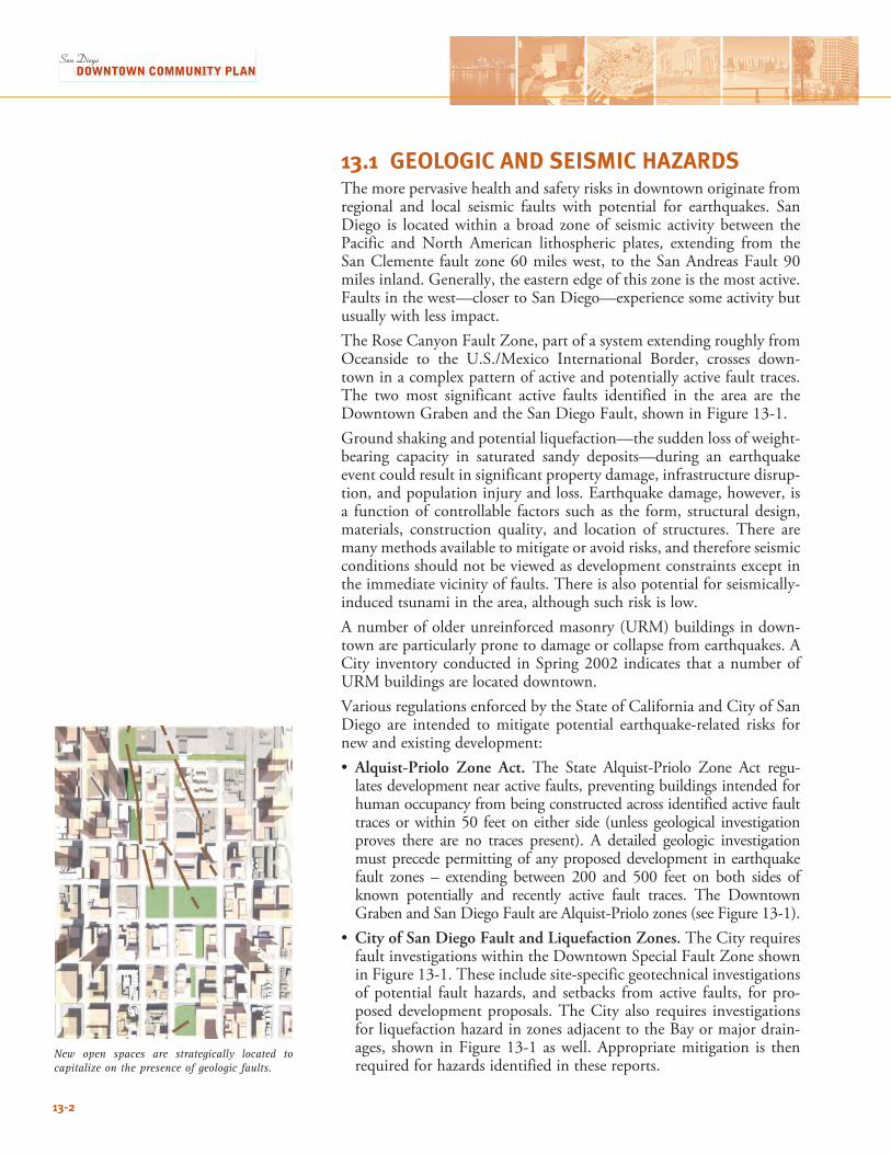
13.1 GEOLOGIC AND SEISMIC HAZARDSThe more pervasive health and safety risks in downtown originate from regional and local seismic faults with potential for earthquakes. San Diego is located within a broad zone of seismic activity between the Pacific and North American lithospheric plates, extending from the San Clemente fault zone 60 miles west, to the San Andreas Fault 90 miles inland. Generally, the eastern edge of this zone is the most active. Faults in the west—closer to San Diego—experience some activity but usually with less impact. The Rose Canyon Fault Zone, part of a system extending roughly from Oceanside to the U.S./Mexico International Border, crosses down-town in a complex pattern of active and potentially active fault traces. The two most significant active faults identified in the area are the Downtown Graben and the San Diego Fault, shown in Figure 13-1. Ground shaking and potential liquefaction—the sudden loss of weight-bearing capacity in saturated sandy deposits—during an earthquake event could result in significant property damage, infrastructure disrup-tion, and population injury and loss. Earthquake damage, however, is a function of controllable factors such as the form, structural design, materials, construction quality, and location of structures. There are many methods available to mitigate or avoid risks, and therefore seismic conditions should not be viewed as development constraints except in the immediate vicinity of faults. There is also potential for seismically-induced tsunami in the area, although such risk is low. A number of older unreinforced masonry (URM) buildings in down-town are particularly prone to damage or collapse from earthquakes. A City inventory conducted in Spring 2002 indicates that a number of URM buildings are located downtown. Various regulations enforced by the State of California and City of San Diego are intended to mitigate potential earthquake-related risks for new and existing development: • Alquist-Priolo Zone Act. The State Alquist-Priolo Zone Act regu-
lates development near active faults, preventing buildings intended for human occupancy from being constructed across identified active fault traces or within 50 feet on either side (unless geological investigation proves there are no traces present). A detailed geologic investigation must precede permitting of any proposed development in earthquake fault zones – extending between 200 and 500 feet on both sides of known potentially and recently active fault traces. The Downtown Graben and San Diego Fault are Alquist-Priolo zones (see Figure 13-1).
• City of San Diego Fault and Liquefaction Zones. The City requires fault investigations within the Downtown Special Fault Zone shown in Figure 13-1. These include site-specific geotechnical investigations of potential fault hazards, and setbacks from active faults, for pro-posed development proposals. The City also requires investigations for liquefaction hazard in zones adjacent to the Bay or major drain-ages, shown in Figure 13-1 as well. Appropriate mitigation is then required for hazards identified in these reports.
New open spaces are strategically located to capitalize on the presence of geologic faults.
13-2
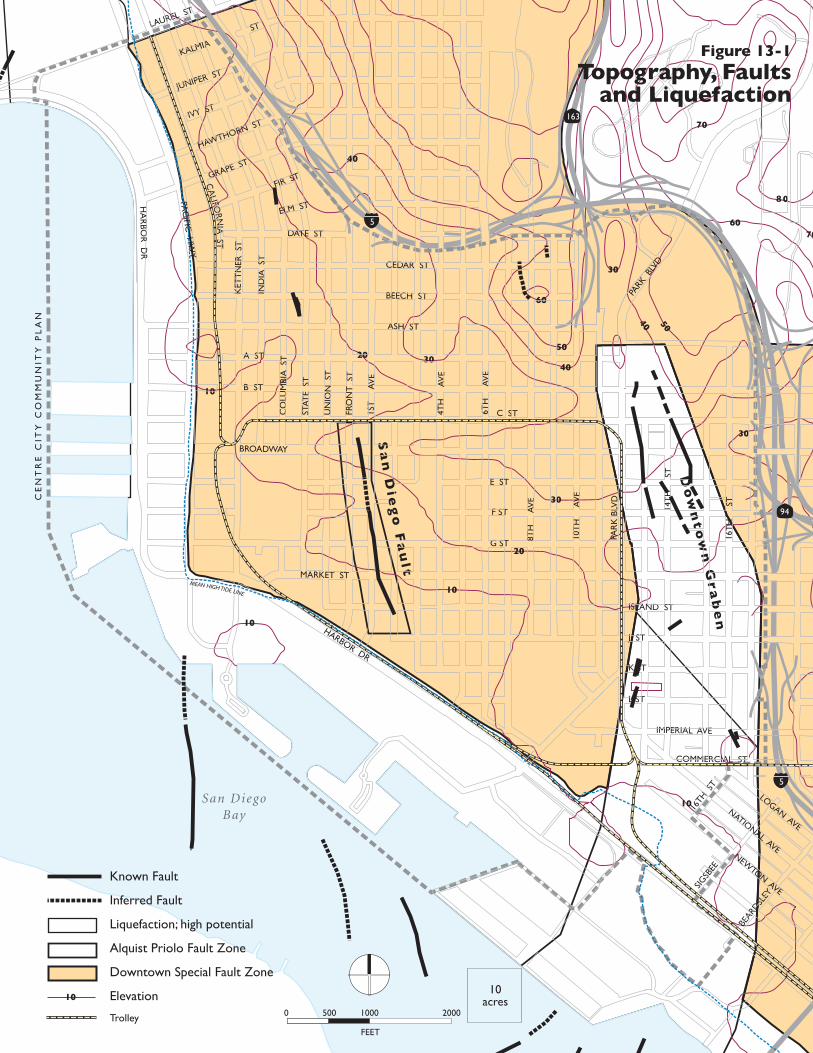
10
10
20
30
40
50
60
30
40 50
30
3020
10
40
10
Sa
n D
ieg
o F
au
l t
Do
wn
to
wn
Gr
ab
en
60
70
70
8 0
CE
NT
RE
CIT
Y C
OM
MU
NIT
Y P
LA
N
San DiegoBay
94
163
LOGAN AVE
NATIONAL AVENEW
TON AVE
HA
RBO
R D
R
LAUREL ST
PAC
IFIC H
WY
BROADWAY
ASH ST
MARKET ST
HARBOR DR
PAR
K B
LVD
PARK
BLV
D
10T
H
AV
E
14T
H
ST
16T
H
ST
8TH
A
VE
6TH
A
VE
4TH
A
VE
1ST
A
VE
FRO
NT
ST
UN
ION
ST
STAT
E S
T
CO
LUM
BIA
ST
IND
IA S
T
KET
TN
ER S
T
JUNIPER ST
IVY ST
HAWTHORN ST
GRAPE ST
FIR ST
KALMIA
ST
ELM ST
DATE ST
CEDAR ST
BEECH ST
A ST
B ST
C ST
E ST
F ST
G ST
ISLAND ST
J ST
K ST
L ST
IMPERIAL AVE
COMMERCIAL ST
CA
LIFORN
IA ST
16TH
ST
SIGSB
EE
BEARD
SLEY
Figure 13-1
Topography, Faultsand Liquefaction
FEET
0 500 1000 2000
10acres10
Known Fault
Inferred Fault
Liquefaction; high potential
Alquist Priolo Fault Zone
Downtown Special Fault Zone
Elevation
Trolley
5
5
MEAN HIGH TIDE LINE
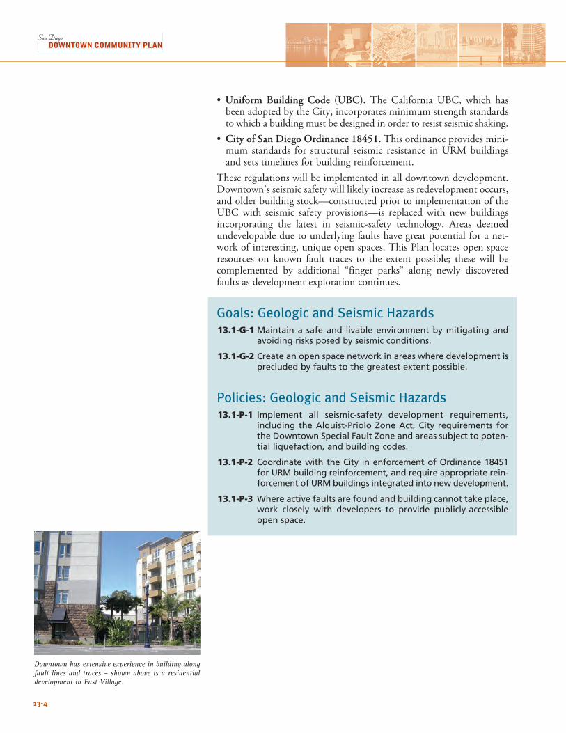
Downtown has extensive experience in building along fault lines and traces – shown above is a residential development in East Village.
13-4
•Uniform Building Code (UBC). The California UBC, which has been adopted by the City, incorporates minimum strength standards to which a building must be designed in order to resist seismic shaking.
• City of San Diego Ordinance 18451. This ordinance provides mini-mum standards for structural seismic resistance in URM buildings and sets timelines for building reinforcement.
These regulations will be implemented in all downtown development. Downtown’s seismic safety will likely increase as redevelopment occurs, and older building stock—constructed prior to implementation of the UBC with seismic safety provisions—is replaced with new buildings incorporating the latest in seismic-safety technology. Areas deemed undevelopable due to underlying faults have great potential for a net-work of interesting, unique open spaces. This Plan locates open space resources on known fault traces to the extent possible; these will be complemented by additional “finger parks” along newly discovered faults as development exploration continues.
Goals: Geologic and Seismic Hazards13.1-G-1 Maintain a safe and livable environment by mitigating and
avoiding risks posed by seismic conditions.
13.1-G-2 Create an open space network in areas where development is precluded by faults to the greatest extent possible.
Policies: Geologic and Seismic Hazards13.1-P-1 Implement all seismic-safety development requirements,
including the Alquist-Priolo Zone Act, City requirements for the Downtown Special Fault Zone and areas subject to poten-tial liquefaction, and building codes.
13.1-P-2 Coordinate with the City in enforcement of Ordinance 18451 for URM building reinforcement, and require appropriate rein-forcement of URM buildings integrated into new development.
13.1-P-3 Where active faults are found and building cannot take place, work closely with developers to provide publicly-accessible open space.
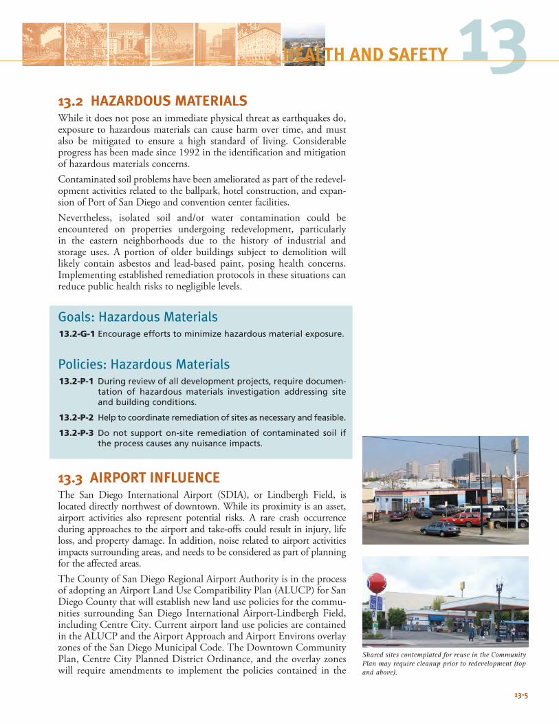
13.2 HAZARDOUS MATERIALSWhile it does not pose an immediate physical threat as earthquakes do, exposure to hazardous materials can cause harm over time, and must also be mitigated to ensure a high standard of living. Considerable progress has been made since 1992 in the identification and mitigation of hazardous materials concerns. Contaminated soil problems have been ameliorated as part of the redevel-opment activities related to the ballpark, hotel construction, and expan-sion of Port of San Diego and convention center facilities.Nevertheless, isolated soil and/or water contamination could be encountered on properties undergoing redevelopment, particularly in the eastern neighborhoods due to the history of industrial and storage uses. A portion of older buildings subject to demolition will likely contain asbestos and lead-based paint, posing health concerns. Implementing established remediation protocols in these situations can reduce public health risks to negligible levels.
Goals: Hazardous Materials13.2-G-1 Encourage efforts to minimize hazardous material exposure.
Policies: Hazardous Materials13.2-P-1 During review of all development projects, require documen-
tation of hazardous materials investigation addressing site and building conditions.
13.2-P-2 Help to coordinate remediation of sites as necessary and feasible.
13.2-P-3 Do not support on-site remediation of contaminated soil if the process causes any nuisance impacts.
13.3 AIRPORT INFLUENCE The San Diego International Airport (SDIA), or Lindbergh Field, is located directly northwest of downtown. While its proximity is an asset, airport activities also represent potential risks. A rare crash occurrence during approaches to the airport and take-offs could result in injury, life loss, and property damage. In addition, noise related to airport activities impacts surrounding areas, and needs to be considered as part of planning for the affected areas.The County of San Diego Regional Airport Authority is in the process of adopting an Airport Land Use Compatibility Plan (ALUCP) for San Diego County that will establish new land use policies for the commu-nities surrounding San Diego International Airport-Lindbergh Field, including Centre City. Current airport land use policies are contained in the ALUCP and the Airport Approach and Airport Environs overlay zones of the San Diego Municipal Code. The Downtown Community Plan, Centre City Planned District Ordinance, and the overlay zones will require amendments to implement the policies contained in the
13-5
13HEALTH AND SAFETY
Shared sites contemplated for reuse in the Community Plan may require cleanup prior to redevelopment (top and above).
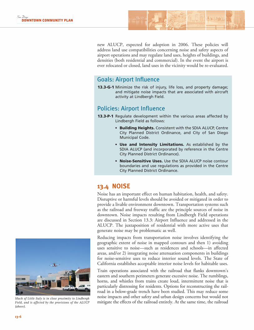
13-6
new ALUCP, expected for adoption in 2006. These policies will address land use compatibilities concerning noise and safety aspects of airport operations and may regulate land uses, heights of buildings, and densities (both residential and commercial). In the event the airport is ever relocated or closed, land uses in the vicinity would be re-evaluated.
Goals: Airport Influence13.3-G-1 Minimize the risk of injury, life loss, and property damage;
and mitigate noise impacts that are associated with aircraft activity at Lindbergh Field.
Policies: Airport Influence13.3-P-1 Regulate development within the various areas affected by
Lindbergh Field as follows:
• Building Heights. Consistent with the SDIA ALUCP, Centre City Planned District Ordinance, and City of San Diego Municipal Code.
• Use and Intensity Limitations. As established by the SDIA ALUCP (and incorporated by reference in the Centre City Planned District Ordinance).
• Noise-Sensitive Uses. Use the SDIA ALUCP noise contour boundaries and use regulations as provided in the Centre City Planned District Ordinance.
13.4 NOISENoise has an important effect on human habitation, health, and safety. Disruptive or harmful levels should be avoided or mitigated in order to provide a livable environment downtown. Transportation systems such as the railroad and freeway traffic are the principle sources of noise in downtown. Noise impacts resulting from Lindbergh Field operations are discussed in Section 13.3: Airport Influence and addressed in the ALUCP. The juxtaposition of residential with more active uses that generate noise may be problematic as well. Reducing impacts from transportation noise involves identifying the geographic extent of noise in mapped contours and then 1) avoiding uses sensitive to noise—such as residences and schools—in affected areas, and/or 2) integrating noise attenuation components in buildings for noise-sensitive uses to reduce interior sound levels. The State of California establishes acceptable interior noise levels for habitable uses. Train operations associated with the railroad that flanks downtown’s eastern and southern perimeters generate excessive noise. The rumblings, horns, and whistles from trains create loud, intermittent noise that is particularly distressing for residents. Options for reconstructing the rail-road in a below-grade trench have been studied. This may reduce some noise impacts and other safety and urban design concerns but would not mitigate the effects of the railroad entirely. At the same time, the railroad
Much of Little Italy is in close proximity to Lindbergh Field, and is affected by the provisions of the ALUCP (above).
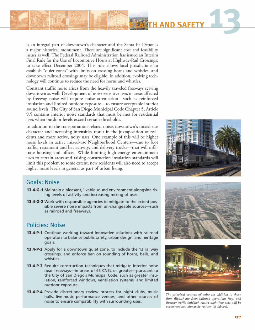
The principal sources of noise (in addition to those from flights) are from railroad operations (top) and freeway traffic (middle). Active nighttime uses will be accommodated alongside residential (above).
13-7
13HEALTH AND SAFETY
is an integral part of downtown’s character and the Santa Fe Depot is a major historical monument. There are significant cost and feasibility issues as well. The Federal Railroad Administration has issued an Interim Final Rule for the Use of Locomotive Horns at Highway-Rail Crossings, to take effect December 2004. This rule allows local jurisdictions to establish “quiet zones” with limits on crossing horns and whistles, and downtown railroad crossings may be eligible. In addition, evolving tech-nology will continue to reduce the need for horns and whistles. Constant traffic noise arises from the heavily traveled freeways serving downtown as well. Development of noise-sensitive uses in areas affected by freeway noise will require noise attenuation—such as reinforced insulation and limited outdoor exposure—to ensure acceptable interior sound levels. The City of San Diego Municipal Code Chapter 5, Article 9.5 contains interior noise standards that must be met for residential uses when outdoor levels exceed certain thresholds. In addition to the transportation-related noise, downtown’s mixed-use character and increasing intensities result in the juxtaposition of resi-dents and more active, noisy uses. One example of this will be higher noise levels in active mixed-use Neighborhood Centers—due to foot traffic, restaurant and bar activity, and delivery trucks—that will infil-trate housing and offices. While limiting high-energy entertainment uses to certain areas and raising construction insulation standards will limit this problem to some extent, new residents will also need to accept higher noise levels in general as part of urban living.
Goals: Noise13.4-G-1 Maintain a pleasant, livable sound environment alongside ris-
ing levels of activity and increasing mixing of uses.
13.4-G-2 Work with responsible agencies to mitigate to the extent pos-sible severe noise impacts from un-changeable sources—such as railroad and freeways.
Policies: Noise13.4-P-1 Continue working toward innovative solutions with railroad
operators to balance public safety, urban design, and heritage goals.
13.4-P-2 Apply for a downtown quiet zone, to include the 13 railway crossings, and enforce ban on sounding of horns, bells, and whistles.
13.4-P-3 Require construction techniques that mitigate interior noise near freeways—in areas of 65 CNEL or greater—pursuant to the City of San Diego’s Municipal Code, such as greater insu-lation, reinforced windows, ventilation systems, and limited outdoor exposure.
13.4-P-4 Provide discretionary review process for night clubs, music halls, live-music performance venues, and other sources of noise to ensure compatibility with surrounding uses.
13-7
13-8
13.5 EMERGENCY PREPAREDNESSEmergency preparedness in an urban setting takes two primary forms: one, establishing appropriate levels of safety in the built environment, and two, the ability to respond to emergency situations. The majority of recent downtown development is Type 1 construc-tion, and meets the high-rise building code, providing the highest levels of occupant fire and life safety protection. Additionally, code compliance is closely coordinated with the Fire Department both through the development process and following through construction. Coordination with relevant code review and enforcement authorities is ongoing and shall continue to provide best practice safety for users of all building types.The ability for an area to effectively address emergency situations—natural or man-made—is of critical importance for the health of a com-munity. Ongoing responsibility for emergency response is borne by the City of San Diego through its Emergency Operations Plan, and its role in the Unified San Diego County Emergency Services Organization to assure regional cooperation and assistance with emergencies. The City also conducts drills and training simulations to assure improved opera-tions in the event of a disaster. As a result, modifications may be made to street operations or parking to accommodate evacuation needs. CCDC will continue to work in partnership with agencies with responsibility for emergency operations throughout the implementation of the Community Plan.
Goals: Emergency Preparedness13.5-G-1 Maintain high levels of emergency preparedness.
Policies: Emergency Preparedness13.5-P-1 Participate proactively in the efforts of other agencies to plan
for emergencies, and work to identify areas where CCDC could contribute to safety improvements downtown.
13.5-P-2 Work with relevant code review, enforcement and inspection authorities to ensure all building types are constructed and operated to highest accepted safety standards.
13.5-P-3 Work with rail owners and operators to reduce and eliminate the blocking of street intersections.
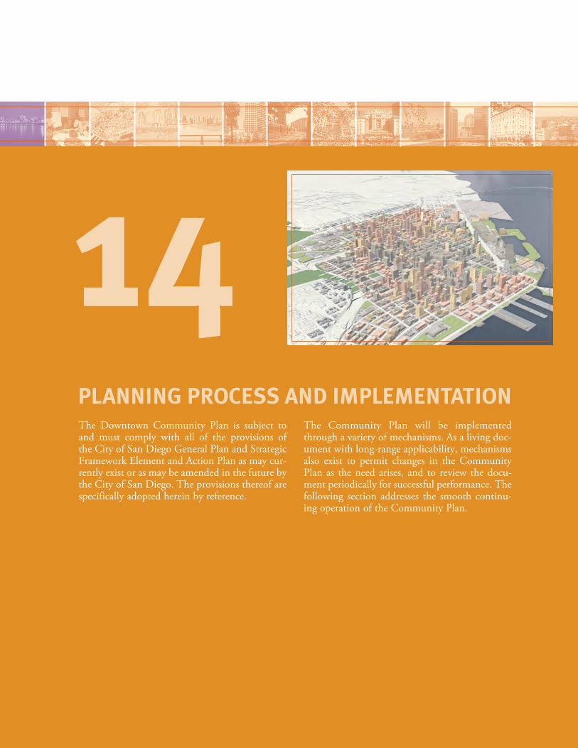
The Downtown Community Plan is subject to and must comply with all of the provisions of the City of San Diego General Plan and Strategic Framework Element and Action Plan as may cur-rently exist or as may be amended in the future by the City of San Diego. The provisions thereof are specifically adopted herein by reference.
The Community Plan will be implemented through a variety of mechanisms. As a living doc-ument with long-range applicability, mechanisms also exist to permit changes in the Community Plan as the need arises, and to review the docu-ment periodically for successful performance. The following section addresses the smooth continu-ing operation of the Community Plan.
PLANNING PROCESS AND IMPLEMENTATION
14
Implementation of the Community PlanA variety of tools will be used to implement the Community Plan:Zoning. The zoning regulations in downtown’s Planned District Ordinance (PDO) will be consistent with the goals and policies of the Community Plan, and serve to implement them.TDR Programs. Programs will be put in place to facilitate the transfer of development rights for parks and historic resources. Capital Improvements. Specific streetscapes, parks, and other ameni-ties will be required to be consistent with the Community Plan.Master Plans for Specific Components. These could range from a transit plan to a streetscape master plan.Neighborhood Design Guidelines. The Neighborhood Design Guidelines will provide specific, detailed guidance for design in each of downtown’s neighborhoods.
Amendments to the Community PlanChanges to the Plan may be proposed in order to address circumstances and opportunities. If approved, they will take the form of amendments. Because the Community Plan is part of the City General Plan any amendments to this document constitute a General Plan amendment as well.A series of agencies will be responsible for reviewing and evaluat-ing recommendations, and/or approving any amendments, listed (in sequential order) below:• CentreCityAdvisoryCommittee(CCAC);• CCDCBoard;• PlanningCommission;and• CityCouncil.Any proposed amendment is also subject to environmental review.
Five-Year ReviewConducting periodic reviews is important to ensure the Plan’s proper functioning over time. Changing conditions may also affect the effec-tiveness of implementing actions. Reviews offer an opportunity to examine the directives of the Plan, check in on the planning process to see whether goals and objectives are being achieved, and make changes in the case that they are not.State General Plan legislative requirements do not necessitate a manda-tory review cycle for Community Plans. Nevertheless, given the pace of development and magnitude of transformations occurring down-town, a five-year review should be conducted to make sure the Plan is on track.
14-2
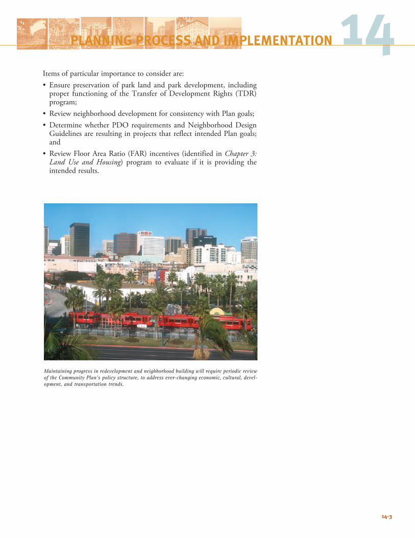
14-3
14PLANNING PROCESS AND IMPLEMENTATION
Items of particular importance to consider are:• Ensurepreservationofpark land andparkdevelopment, including
proper functioning of the Transfer of Development Rights (TDR) program;
• ReviewneighborhooddevelopmentforconsistencywithPlangoals;• DeterminewhetherPDOrequirements andNeighborhoodDesignGuidelinesareresultinginprojectsthatreflectintendedPlangoals;and
• ReviewFloorAreaRatio(FAR)incentives(identifiedinChapter 3: Land Use and Housing) program to evaluate if it is providing the intended results.
Maintaining progress in redevelopment and neighborhood building will require periodic review of the Community Plan’s policy structure, to address ever-changing economic, cultural, devel-opment, and transportation trends.

14-4
This page intentionally left blank.
INDEX
13th Street 4-7, 5-2, 5-9 6-26, 6-27
14th Street 5-9
15th Street 5-2, 5-9
active streets 3-17, 7-7, 10-2
affordable housing 2-3, 2-7, 3-18, 3-28, 3-30, 3-31, 3-32, 3-33, 3-34, 12-1, 12-3
air quality 3-12, 3-29
airport 1-8, 1-12, 2-3, 3-37, 6-25, 7-14, 7-16, 6-33, 6-35, 6-36, 13-1, 13-5, 13-6
airport environs overlay 13-5
Alonzo Horton 1-6, 5-2
Alquist-Priolo Zone 13-2, 13-4
Amici Park 4-1, 4-4, 6-35
arts 1-3, 2-2, 2-3, 2-12, 3-2, 3-13, 3-15, 6-5, 6-15, 6-23, 8-2, 8-3, 10-1, 10-3, 10-4, 10-6, 10-7, 11-3, 6-23
Asian Pacific Thematic Historic District 6-11
Asian Thematic District 9-4, 10-6
B Street 1-8, 2-6, 6-5, 7-2,
Balboa Park 1-1, 1-3, 1-7, 1-12, 3-2, 3-36, 3-37, 4-1, 4-2, 4-5, 4-6, 5-1, 5-3, 5-23, 5-24, 5-25, 6-19, 6-23, 6-24, 6-25, 6-26, 6-29, 6-31, 6-35, 7-2, 7-4, 7-10, 7-11, 9-1, 9-6, 10-4, 11-3
ballpark 1-1, 3-1, 3-2, 3-7, 3-27, 3-36, 5-7, 5-9, 6-19, 6-22, 6-23, 6-24, 6-27, 7-7, 11-3, 13-5
Barrio Logan 1-12, 3-12, 3-36, 4-6, 5-23, 5-24, 6-22, 6-24, 6-39
Bay (See San Diego Bay)
bicycle 2-3, 5-16, 5-24, 7-2, 7-7, 7-8, 7-15
bike lanes 7-4
bike paths 7-4
bike routes 7-2
bicycle parking 1-3, 7-15
bike facilities 6-22, 7-4
bikeway 7-4, 7-8
block size 5-21, 7-2, 9-6
boulevard 1-6, 4-6, 5-9, 5-17, 5-18, 5-19, 5-20, 6-2, 6-9, 6-19, 6-22, 6-24, 6-25, 6-26, 7-2, 7-4, 7-8, 7-10, 7-11, 10-2, 10-3
Broadway 1-6, 1-7, 1-8, 2-4, 2-6, 5-2, 5-3, 5-19, 5-20, 5-21, 5-22, 6-3, 6-5, 6-7, 6-9, 6-11, 6-14, 6-17, 6-23, 6-25, 6-26, 7-2, 7-4, 7-7, 7-8, 7-10, 9-3, 9-4, 10-3
Broadway Pier 6-7, 6-9
buildout 3-2, 3-17, 3-26, 3-27, 3-28, 5-27, 6-6, 6-9, 6-14, 6-18, 6-22,
bulk 2-3, 3-1, 3-2, 3-7, 5-10, 5-11, 5-13, 5-15, 6-2, 6-6, 6-9, 6-27, 6-31, 6-39,
C Street 1-6, 4-8, 5-2, 5-9, 5-19, 6-5, 6-9, 7-2, 7-8, 7-10, 8-6
capital improvement 10-2, 14-2
CCDC 1-8, 2-2, 2-3, 2-6, 2-9, 2-10, 2-12, 3-22, 3-26, 3-30, 3-31, 3-32, 3-33, 5-20, 5-26, 5-29, 7-1, 10-2, 11-3, 11-4, 11-6, 11-7, 11-8, 13-8, 14-2
Cedar Street 5-3, 6-35, 7-2, 7-6
child care 8-4, 12-1, 12-2
City College 3-36, 4-4, 4-6, 5-6, 6-1, 6-19, 6-22, 6-23, 6-25, 6-26, 8-2, 8-3, 8-7, 10-4
City of Villages 1-3
Civic Center 1-1, 1-6, 1-7, 2-3, 3-3, 3-6, 3-35, 4-4, 6-3, 6-5, 6-6, 7-2, 7-6, 8-1, 8-5, 8-6, 11-7
Civic/Core 1-8, 2-4, 3-7, 3-35, 3-36, 4-9, 4-10, 6-3, 6-4, 6-5, 6-6, 6-7, 6-8, 6-9, 6-25, 6-29, 6-31, 6-33, 7-7, 7-10, 7-11, 7-15, 8-2, 8-7, 10-6, 10-7
Columbia 2-6, 3-3, 3-7, 3-12, 3-13, 3-35, 5-9, 5-19, 6-1, 6-3, 6-7, 6-8, 6-9, 6-13, 7-7, 7-10, 7-11, 8-7, 10-6, 11-8
commercial 1-1, 1-3, 1-7, 3-2, 3-6, 6-9, 6-15, 6-22, 6-24, 6-27, 7-14, 8-3, 9-1, 9-6, 10-4, 10-7, 11-1, 11-3, 11-6, 13-6
commercial service 6-27, 6-33
community design 3-38, 12-5
community facilities 2-3, 8-1, 8-4, 8-5
commuting 7-14
Concourse 3-6, 6-3, 6-5, 8-5
connections 4-2, 4-6, 5-2, 5-20, 5-21, 5-24, 6-9
connectivity 3-3, 6-2, 6-5, 6-15, 6-22, 7-2, 7-10, 7-12, 7-14
convention center 1-1, 1-8, 3-1, 3-3, 3-6, 3-13, 3-27, 3-37, 3-38, 4-4, 5-2, 6-24, 6-37, 6-39, 6-40, 7-7, 8-1, 9-3, 13-5
Core 1-8, 3-1, 3-3, 3-7, 3-13, 3-35, 3-36, 4-9, 4-10, 5-7, 5-9, 5-11, 5-12, 5-13, 5-15, 5-19, 6-1, 6-3, 6-5, 6-6, 6-7, 6-9, 6-13, 6-19, 6-25, 6-29, 6-31, 6-33, 7-7, 7-10, 7-11, 8-2, 8-7, 10-3, 10-6, 10-7, 11-7, 11-8, 12-2
Cortez 1-8, 2-6, 3-15, 3-37, 4-9, 5-9, 5-19, 6-1, 6-29, 6-31, 7-2, 9-1,
Cortez Hill 1-8, 3-37, 5-7, 5-9, 6-1, 6-29, 6-31, 7-2
County Administration Center (CAC) 1-8, 2-4, 4-1, 5-2, 5-3, 5-13, 5-20, 5-22, 6-33
couplet 7-7
cultural resources 9-7
density 2-8, 3-17, 3-26, 3-31, 3-32, 6-26, 7-1, 11-6
depot 6-7, 6-9, 6-11, 7-8, 7-11, 13-7
design guidelines 2-2, 2-9, 3-2, 3-35, 5-16, 5-29, 6-2, 14-2, 14-3
design review 2-9, 3-38, 5-15, 5-29
development intensity 3-17, 3-34, 5-12, 8-4
development rights 3-22, 3-28, 4-5, 6-25, 14-2, 14-3
E Street 5-3, 6-9
earthquakes 13-1, 13-2, 13-5
East Village 1-1, 1-8, 2-6, 3-36, 4-4, 5-2, 5-7, 5-9, 5-11, 5-12, 5-13, 6-1, 6-2, 6-19, 6-22, 6-23, 6-24, 6-25,
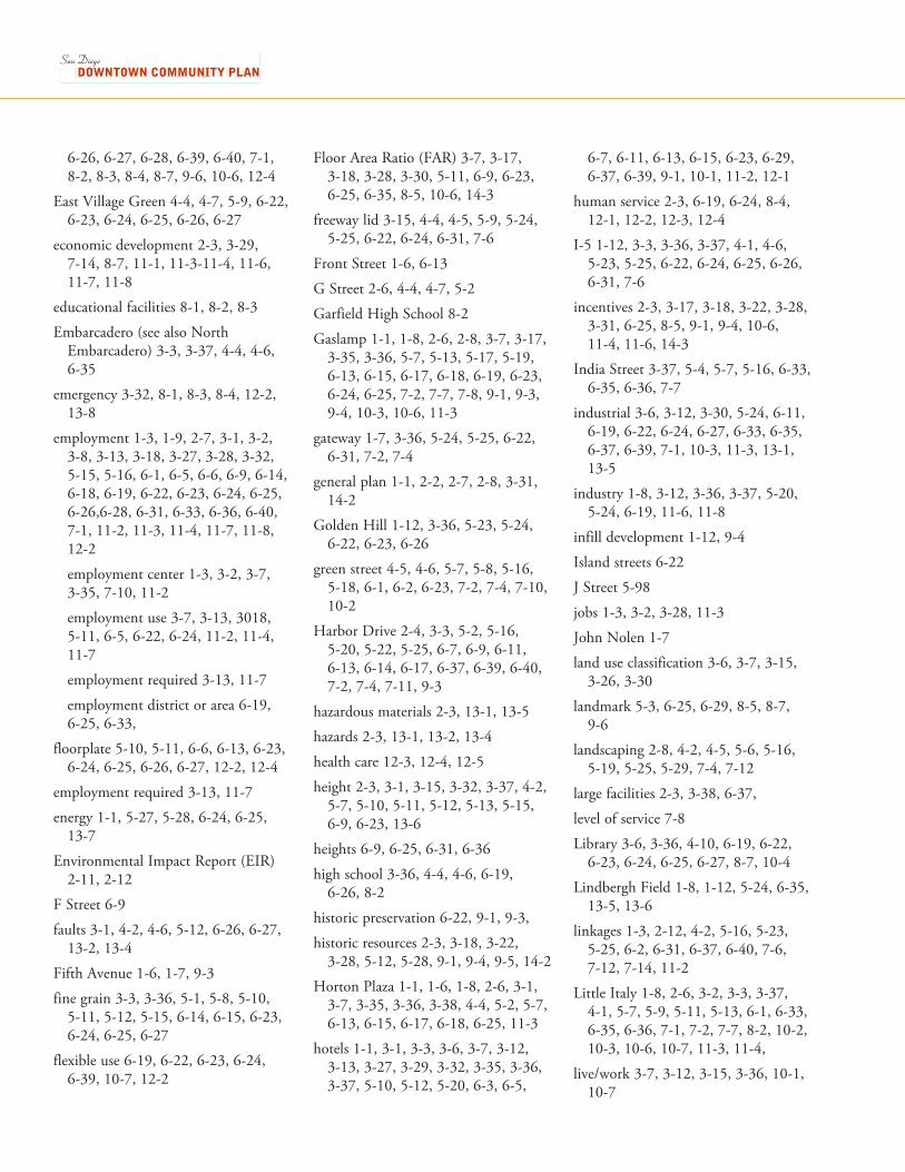
6-26, 6-27, 6-28, 6-39, 6-40, 7-1, 8-2, 8-3, 8-4, 8-7, 9-6, 10-6, 12-4
East Village Green 4-4, 4-7, 5-9, 6-22, 6-23, 6-24, 6-25, 6-26, 6-27
economic development 2-3, 3-29, 7-14, 8-7, 11-1, 11-3-11-4, 11-6, 11-7, 11-8
educational facilities 8-1, 8-2, 8-3
Embarcadero (see also North Embarcadero) 3-3, 3-37, 4-4, 4-6, 6-35
emergency 3-32, 8-1, 8-3, 8-4, 12-2, 13-8
employment 1-3, 1-9, 2-7, 3-1, 3-2, 3-8, 3-13, 3-18, 3-27, 3-28, 3-32, 5-15, 5-16, 6-1, 6-5, 6-6, 6-9, 6-14, 6-18, 6-19, 6-22, 6-23, 6-24, 6-25, 6-26,6-28, 6-31, 6-33, 6-36, 6-40, 7-1, 11-2, 11-3, 11-4, 11-7, 11-8, 12-2
employment center 1-3, 3-2, 3-7, 3-35, 7-10, 11-2
employment use 3-7, 3-13, 3018, 5-11, 6-5, 6-22, 6-24, 11-2, 11-4, 11-7
employment required 3-13, 11-7
employment district or area 6-19, 6-25, 6-33,
floorplate 5-10, 5-11, 6-6, 6-13, 6-23, 6-24, 6-25, 6-26, 6-27, 12-2, 12-4
employment required 3-13, 11-7
energy 1-1, 5-27, 5-28, 6-24, 6-25, 13-7
Environmental Impact Report (EIR) 2-11, 2-12
F Street 6-9
faults 3-1, 4-2, 4-6, 5-12, 6-26, 6-27, 13-2, 13-4
Fifth Avenue 1-6, 1-7, 9-3
fine grain 3-3, 3-36, 5-1, 5-8, 5-10, 5-11, 5-12, 5-15, 6-14, 6-15, 6-23, 6-24, 6-25, 6-27
flexible use 6-19, 6-22, 6-23, 6-24, 6-39, 10-7, 12-2
Floor Area Ratio (FAR) 3-7, 3-17, 3-18, 3-28, 3-30, 5-11, 6-9, 6-23, 6-25, 6-35, 8-5, 10-6, 14-3
freeway lid 3-15, 4-4, 4-5, 5-9, 5-24, 5-25, 6-22, 6-24, 6-31, 7-6
Front Street 1-6, 6-13
G Street 2-6, 4-4, 4-7, 5-2
Garfield High School 8-2
Gaslamp 1-1, 1-8, 2-6, 2-8, 3-7, 3-17, 3-35, 3-36, 5-7, 5-13, 5-17, 5-19, 6-13, 6-15, 6-17, 6-18, 6-19, 6-23, 6-24, 6-25, 7-2, 7-7, 7-8, 9-1, 9-3, 9-4, 10-3, 10-6, 11-3
gateway 1-7, 3-36, 5-24, 5-25, 6-22, 6-31, 7-2, 7-4
general plan 1-1, 2-2, 2-7, 2-8, 3-31, 14-2
Golden Hill 1-12, 3-36, 5-23, 5-24, 6-22, 6-23, 6-26
green street 4-5, 4-6, 5-7, 5-8, 5-16, 5-18, 6-1, 6-2, 6-23, 7-2, 7-4, 7-10, 10-2
Harbor Drive 2-4, 3-3, 5-2, 5-16, 5-20, 5-22, 5-25, 6-7, 6-9, 6-11, 6-13, 6-14, 6-17, 6-37, 6-39, 6-40, 7-2, 7-4, 7-11, 9-3
hazardous materials 2-3, 13-1, 13-5
hazards 2-3, 13-1, 13-2, 13-4
health care 12-3, 12-4, 12-5
height 2-3, 3-1, 3-15, 3-32, 3-37, 4-2, 5-7, 5-10, 5-11, 5-12, 5-13, 5-15, 6-9, 6-23, 13-6
heights 6-9, 6-25, 6-31, 6-36
high school 3-36, 4-4, 4-6, 6-19, 6-26, 8-2
historic preservation 6-22, 9-1, 9-3,
historic resources 2-3, 3-18, 3-22, 3-28, 5-12, 5-28, 9-1, 9-4, 9-5, 14-2
Horton Plaza 1-1, 1-6, 1-8, 2-6, 3-1, 3-7, 3-35, 3-36, 3-38, 4-4, 5-2, 5-7, 6-13, 6-15, 6-17, 6-18, 6-25, 11-3
hotels 1-1, 3-1, 3-3, 3-6, 3-7, 3-12, 3-13, 3-27, 3-29, 3-32, 3-35, 3-36, 3-37, 5-10, 5-12, 5-20, 6-3, 6-5,
6-7, 6-11, 6-13, 6-15, 6-23, 6-29, 6-37, 6-39, 9-1, 10-1, 11-2, 12-1
human service 2-3, 6-19, 6-24, 8-4, 12-1, 12-2, 12-3, 12-4
I-5 1-12, 3-3, 3-36, 3-37, 4-1, 4-6, 5-23, 5-25, 6-22, 6-24, 6-25, 6-26, 6-31, 7-6
incentives 2-3, 3-17, 3-18, 3-22, 3-28, 3-31, 6-25, 8-5, 9-1, 9-4, 10-6, 11-4, 11-6, 14-3
India Street 3-37, 5-4, 5-7, 5-16, 6-33, 6-35, 6-36, 7-7
industrial 3-6, 3-12, 3-30, 5-24, 6-11, 6-19, 6-22, 6-24, 6-27, 6-33, 6-35, 6-37, 6-39, 7-1, 10-3, 11-3, 13-1, 13-5
industry 1-8, 3-12, 3-36, 3-37, 5-20, 5-24, 6-19, 11-6, 11-8
infill development 1-12, 9-4
Island streets 6-22
J Street 5-98
jobs 1-3, 3-2, 3-28, 11-3
John Nolen 1-7
land use classification 3-6, 3-7, 3-15, 3-26, 3-30
landmark 5-3, 6-25, 6-29, 8-5, 8-7, 9-6
landscaping 2-8, 4-2, 4-5, 5-6, 5-16, 5-19, 5-25, 5-29, 7-4, 7-12
large facilities 2-3, 3-38, 6-37,
level of service 7-8
Library 3-6, 3-36, 4-10, 6-19, 6-22, 6-23, 6-24, 6-25, 6-27, 8-7, 10-4
Lindbergh Field 1-8, 1-12, 5-24, 6-35, 13-5, 13-6
linkages 1-3, 2-12, 4-2, 5-16, 5-23, 5-25, 6-2, 6-31, 6-37, 6-40, 7-6, 7-12, 7-14, 11-2
Little Italy 1-8, 2-6, 3-2, 3-3, 3-37, 4-1, 5-7, 5-9, 5-11, 5-13, 6-1, 6-33, 6-35, 6-36, 7-1, 7-2, 7-7, 8-2, 10-2, 10-3, 10-6, 10-7, 11-3, 11-4,
live/work 3-7, 3-12, 3-15, 3-36, 10-1, 10-7
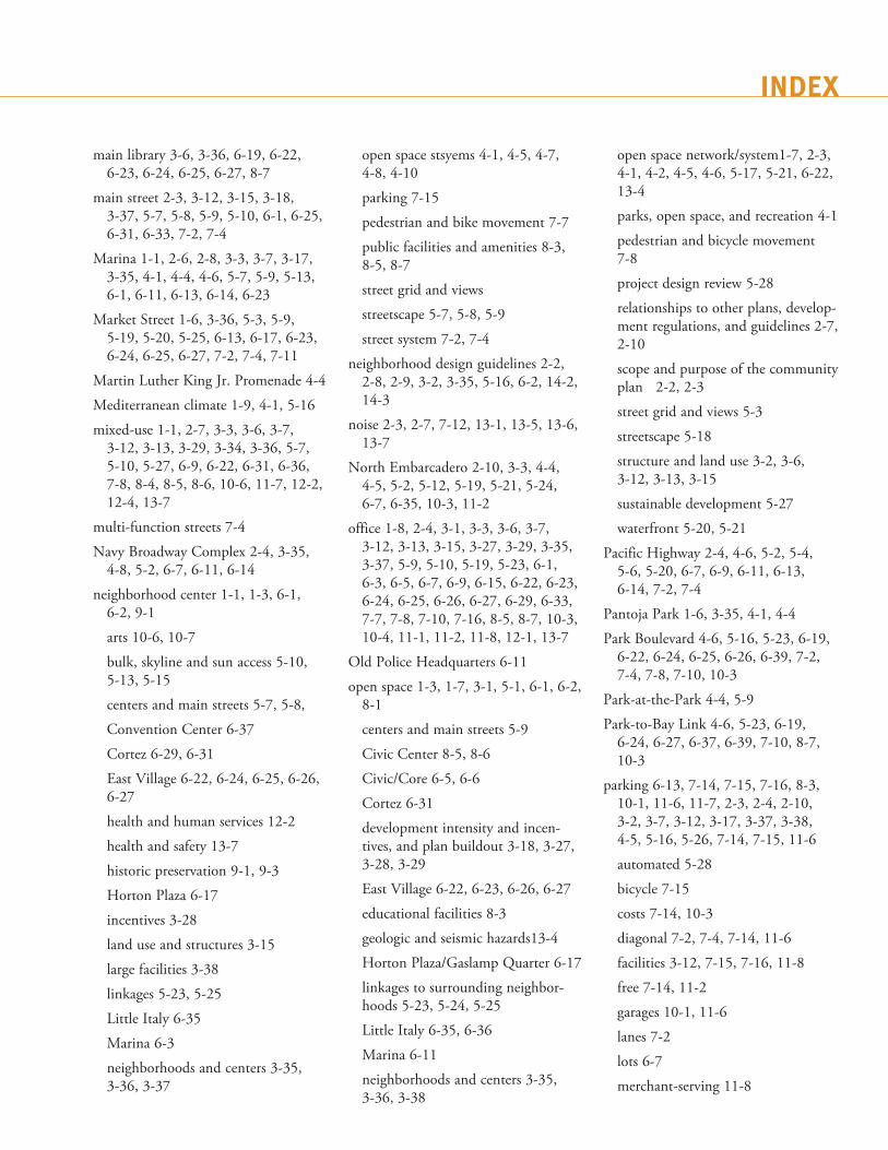
INDEX
main library 3-6, 3-36, 6-19, 6-22, 6-23, 6-24, 6-25, 6-27, 8-7
main street 2-3, 3-12, 3-15, 3-18, 3-37, 5-7, 5-8, 5-9, 5-10, 6-1, 6-25, 6-31, 6-33, 7-2, 7-4
Marina 1-1, 2-6, 2-8, 3-3, 3-7, 3-17, 3-35, 4-1, 4-4, 4-6, 5-7, 5-9, 5-13, 6-1, 6-11, 6-13, 6-14, 6-23
Market Street 1-6, 3-36, 5-3, 5-9, 5-19, 5-20, 5-25, 6-13, 6-17, 6-23, 6-24, 6-25, 6-27, 7-2, 7-4, 7-11
Martin Luther King Jr. Promenade 4-4
Mediterranean climate 1-9, 4-1, 5-16
mixed-use 1-1, 2-7, 3-3, 3-6, 3-7, 3-12, 3-13, 3-29, 3-34, 3-36, 5-7, 5-10, 5-27, 6-9, 6-22, 6-31, 6-36, 7-8, 8-4, 8-5, 8-6, 10-6, 11-7, 12-2, 12-4, 13-7
multi-function streets 7-4
Navy Broadway Complex 2-4, 3-35, 4-8, 5-2, 6-7, 6-11, 6-14
neighborhood center 1-1, 1-3, 6-1, 6-2, 9-1
arts 10-6, 10-7
bulk, skyline and sun access 5-10, 5-13, 5-15
centers and main streets 5-7, 5-8,
Convention Center 6-37
Cortez 6-29, 6-31
East Village 6-22, 6-24, 6-25, 6-26, 6-27
health and human services 12-2
health and safety 13-7
historic preservation 9-1, 9-3
Horton Plaza 6-17
incentives 3-28
land use and structures 3-15
large facilities 3-38
linkages 5-23, 5-25
Little Italy 6-35
Marina 6-3
neighborhoods and centers 3-35, 3-36, 3-37
open space stsyems 4-1, 4-5, 4-7, 4-8, 4-10
parking 7-15
pedestrian and bike movement 7-7
public facilities and amenities 8-3, 8-5, 8-7
street grid and views
streetscape 5-7, 5-8, 5-9
street system 7-2, 7-4
neighborhood design guidelines 2-2, 2-8, 2-9, 3-2, 3-35, 5-16, 6-2, 14-2, 14-3
noise 2-3, 2-7, 7-12, 13-1, 13-5, 13-6, 13-7
North Embarcadero 2-10, 3-3, 4-4, 4-5, 5-2, 5-12, 5-19, 5-21, 5-24, 6-7, 6-35, 10-3, 11-2
office 1-8, 2-4, 3-1, 3-3, 3-6, 3-7, 3-12, 3-13, 3-15, 3-27, 3-29, 3-35, 3-37, 5-9, 5-10, 5-19, 5-23, 6-1, 6-3, 6-5, 6-7, 6-9, 6-15, 6-22, 6-23, 6-24, 6-25, 6-26, 6-27, 6-29, 6-33, 7-7, 7-8, 7-10, 7-16, 8-5, 8-7, 10-3, 10-4, 11-1, 11-2, 11-8, 12-1, 13-7
Old Police Headquarters 6-11
open space 1-3, 1-7, 3-1, 5-1, 6-1, 6-2, 8-1
centers and main streets 5-9
Civic Center 8-5, 8-6
Civic/Core 6-5, 6-6
Cortez 6-31
development intensity and incen-tives, and plan buildout 3-18, 3-27, 3-28, 3-29
East Village 6-22, 6-23, 6-26, 6-27
educational facilities 8-3
geologic and seismic hazards13-4
Horton Plaza/Gaslamp Quarter 6-17
linkages to surrounding neighbor-hoods 5-23, 5-24, 5-25
Little Italy 6-35, 6-36
Marina 6-11
neighborhoods and centers 3-35, 3-36, 3-38
open space network/system1-7, 2-3, 4-1, 4-2, 4-5, 4-6, 5-17, 5-21, 6-22, 13-4
parks, open space, and recreation 4-1
pedestrian and bicycle movement 7-8
project design review 5-28
relationships to other plans, develop-ment regulations, and guidelines 2-7, 2-10
scope and purpose of the community plan 2-2, 2-3
street grid and views 5-3
streetscape 5-18
structure and land use 3-2, 3-6, 3-12, 3-13, 3-15
sustainable development 5-27
waterfront 5-20, 5-21
Pacific Highway 2-4, 4-6, 5-2, 5-4, 5-6, 5-20, 6-7, 6-9, 6-11, 6-13, 6-14, 7-2, 7-4
Pantoja Park 1-6, 3-35, 4-1, 4-4
Park Boulevard 4-6, 5-16, 5-23, 6-19, 6-22, 6-24, 6-25, 6-26, 6-39, 7-2, 7-4, 7-8, 7-10, 10-3
Park-at-the-Park 4-4, 5-9
Park-to-Bay Link 4-6, 5-23, 6-19, 6-24, 6-27, 6-37, 6-39, 7-10, 8-7, 10-3
parking 6-13, 7-14, 7-15, 7-16, 8-3, 10-1, 11-6, 11-7, 2-3, 2-4, 2-10, 3-2, 3-7, 3-12, 3-17, 3-37, 3-38, 4-5, 5-16, 5-26, 7-14, 7-15, 11-6
automated 5-28
bicycle 7-15
costs 7-14, 10-3
diagonal 7-2, 7-4, 7-14, 11-6
facilities 3-12, 7-15, 7-16, 11-8
free 7-14, 11-2
garages 10-1, 11-6
lanes 7-2
lots 6-7
merchant-serving 11-8

new 7-14, 7-15
on-street 5-8, 5-16, 7-1, 7-4, 7-7, 7-15, 11-6, 11-8
public 7-15
reduced 3-34, 5-15
requirements 5-15, 9-4
restrictions 7-7
shared 5-27, 7-15, 11-6, 11-8
short-term 7-15
structures 5-19, 6-23, 7-14, 7-15, 8-5, 11-3
surface 3-6, 5-19, 6-33
under parks 4-5, 7-15, 11-6, 11-8
underground, subterranean, below-ground, below-grade 3-12, 4-2, 4-8, 7-14, 8-6
parks 1-1, 3-1, 4-1, 6-1, 8-1, 9-1
arts and culture 10-2
bulk, skyline and sun access 5-10, 5-11, 5-13
centers and main streets 5-9
Convention Center 6-37
Cortez 6-31
development intensity and incen-tives, and plan buildout 3-22, 3-27
East Village 6-22, 6-23, 6-25
economic development 11-6, 11-8
guiding principles 1-3
health and human services 12-2
health and safety 13-4
housing 3-29
integrating heritage in downtown’s future 9-7
linkages to surrounding neighbor-hoods 5-24, 5-25
Little Italy 6-35
neighborhoods and centers 3-24, 3-25, 3-37
parking 7-14, 7-15
parks, open space and recreation 4-2, 4-4, 4-5, 4-6
project design review 5-29
related documents 2-12
relationships to other plans, develop-ment regulations, and guidelines 2-9
scope and purpose of the community plan 2-2, 2-3
street grid and views 5-2, 5-3
street system 7-4
structure and land use 3-2, 3-7, 3-12, 3-12
sustainable development 5-28
the planning process and plan imple-mentation 14-2
waterfront 5-20, 5-21
PDO 2-2, 2-6, 2-8, 2-9, 3-17, 3-18, 5-10, 5-11, 5-13, 5-15, 14-2, 14-3
pedestrian 1-3, 2-3, 3-3, 3-7, 3-12, 3-15, 4-1, 4-5, 4-6, 4-7, 5-1, 5-2, 5-3, 5-7, 5-8, 5-9, 5-11, 5-15, 5-16, 5-17, 5-18, 5-19, 5-20, 5-21, 5-22, 5-24, 5-26, 6-5, 6-15, 6-24, 6-35, 6-37, 7-1, 7-2, 7-4, 7-6, 7-7, 7-8, 7-12, 7-14, 7-15
Petco Park 1-8, 3-36, 3-38, 5-2, 6-17, 6-19, 6-23, 6-24, 6-25, 6-27, 6-39
plaza 1-6, 1-7, 2-3, 3-12, 3-36, 4-1, 4-2, 4-4, 4-5, 4-6, 4-8, 4-10, 5-7, 5-9, 5-10, 6-3, 6-5, 6-9, 6-22, 6-26, 6-27, 7-4, 8-5, 8-6, 9-6, 10-2, 10-3
police 2-3, 3-7, 6-11, 6-26, 8-1, 8-3, 8-4, 13-1
population 1-1, 1-3, 1-9, 3-1, 3-2, 3-26, 3-27, 3-28, 3-29, 3-30, 3-31, 3-32, 3-33, 3-34, 5-1, 5-2, 5-16, 6-6, 6-9, 6-14, 6-18, 6-22, 6-28, 6-31, 6-33, 6-36, 6-40, 7-1, 7-7, 8-1, 8-2, 8-3, 8-4, 9-5, 9-7, 10-1, 10-7, 11-1, 12-3, 12-4, 12-5, 13-1, 13-2
port (See also San Diego Unified Port District) 3-35, 4-1, 4-6, 5-6, 5-20, 5-21, 6-7, 6-11, 6-35, 6-40, 7-1, 7-8, 7-14, 7-15, 10-3
Port Master Plan 2-6, 2-7, 2-9, 2-10, 3-30, 5-20
Port of San Diego 2-4, 2-9, 5-20, 5-21, 6-37, 10-3, 13-5
post office 4-4, 4-10, 5-9, 6-25, 10-4
public art 4-8, 4-10, 5-16, 5-17, 7-4, 7-12, 10-1, 10-2, 10-3, 10-4
public facilities 2-3, 8-1, 8-7, 12-2,
public participation 2-3, 2-4
rail 1-12, 3-37, 5-2, 6-23, 6-24, 6-37, 7-1, 7-8, 7-11, 7-12, 13-7
railroad 1-6, 1-7, 5-2, 6-7, 6-9, 6-11, 7-8, 13-6, 13-7
recycling 5-27
redevelopment 1-1, 2-6, 2-7, 2-8, 3-2, 3-6, 3-26, 3-27, 3-30, 3-32, 3-33, 3-35, 3-36, 3-38, 5-2, 5-3, 5-6, 5-21, 5-23, 5-27, 6-3, 6-5, 6-13, 6-15, 6-19, 6-23, 6-25, 6-27, 6-33, 6-37, 7-1, 7-6, 8-1, 8-5, 8-6, 9-6, 9-7, 10-2, 10-3, 10-7, 11-4, 11-6, 12-1, 13-4, 13-5
redevelopment plan 2-2, 2-6, 2-7, 2-8
redevelopment agency 2-2, 2-3, 2-6, 2-7, 2-9, 2-10, 3-22, 3-30, 3-31, 3-33, 11-3, 11-7
redevelopment law 2-6, 2-7, 3-30, 3-31
regional 1-1, 1-3, 1-7, 1-9, 2-1, 2-7, 3-1, 3-2, 3-7, 3-13, 3-28, 3-30, 3-35, 5-7, 5-20, 6-5, 6-9, 6-27, 7-1, 7-8, 7-10, 7-12, 7-14, 7-16, 8-1, 8-5, 8-6, 9-1, 10-3, 10-7, 11-1, 11-2, 11-3, 11-4, 11-6, 11-7, 12-4, 13-2, 13-5
residential 1-1, 1-2, 1-3, 1-8, 1-9, 1-12, 3-27, 3-28, 3-29, 3-30, 3-32, 3-35, 3-36, 3-37, 4-1, 4-2, 4-5, 5-10, 5-12, 5-13, 5-15, 5-16, 5-17, 5-18, 5-20, 5-24, 6-1, 6-3, 6-7, 6-9, 6-11, 6-15, 6-19, 6-22, 6-23, 6-24, 6-25, 6-26, 6-27, 6-29, 6-31, 6-33, 7-2, 7-4, 7-7, 7-8, 7-10, 7-14, 8-2, 8-3, 10-1, 10-2, 11-2, 11-4, 11-7, 13-6, 13-7
residential density 3-17, 3-26
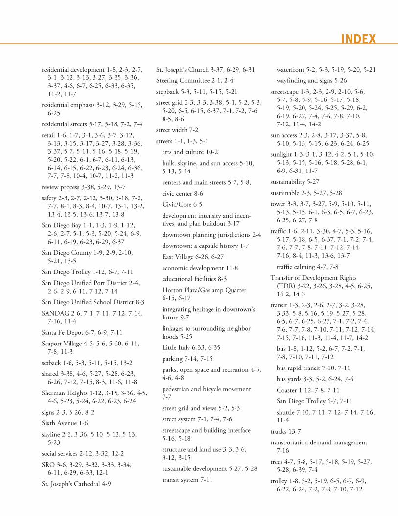
INDEX
residential development 1-8, 2-3, 2-7, 3-1, 3-12, 3-13, 3-27, 3-35, 3-36, 3-37, 4-6, 6-7, 6-25, 6-33, 6-35, 11-2, 11-7
residential emphasis 3-12, 3-29, 5-15, 6-25
residential streets 5-17, 5-18, 7-2, 7-4
retail 1-6, 1-7, 3-1, 3-6, 3-7, 3-12, 3-13, 3-15, 3-17, 3-27, 3-28, 3-36, 3-37, 5-7, 5-11, 5-16, 5-18, 5-19, 5-20, 5-22, 6-1, 6-7, 6-11, 6-13, 6-14, 6-15, 6-22, 6-23, 6-24, 6-36, 7-7, 7-8, 10-4, 10-7, 11-2, 11-3
review process 3-38, 5-29, 13-7
safety 2-3, 2-7, 2-12, 3-30, 5-18, 7-2, 7-7, 8-1, 8-3, 8-4, 10-7, 13-1, 13-2, 13-4, 13-5, 13-6, 13-7, 13-8
San Diego Bay 1-1, 1-3, 1-9, 1-12, 2-6, 2-7, 5-1, 5-3, 5-20, 5-24, 6-9, 6-11, 6-19, 6-23, 6-29, 6-37
San Diego County 1-9, 2-9, 2-10, 5-21, 13-5
San Diego Trolley 1-12, 6-7, 7-11
San Diego Unified Port District 2-4, 2-6, 2-9, 6-11, 7-12, 7-14
San Diego Unified School District 8-3
SANDAG 2-6, 7-1, 7-11, 7-12, 7-14, 7-16, 11-4
Santa Fe Depot 6-7, 6-9, 7-11
Seaport Village 4-5, 5-6, 5-20, 6-11, 7-8, 11-3
setback 1-6, 5-3, 5-11, 5-15, 13-2
shared 3-38, 4-6, 5-27, 5-28, 6-23, 6-26, 7-12, 7-15, 8-3, 11-6, 11-8
Sherman Heights 1-12, 3-15, 3-36, 4-5, 4-6, 5-23, 5-24, 6-22, 6-23, 6-24
signs 2-3, 5-26, 8-2
Sixth Avenue 1-6
skyline 2-3, 3-36, 5-10, 5-12, 5-13, 5-23
social services 2-12, 3-32, 12-2
SRO 3-6, 3-29, 3-32, 3-33, 3-34, 6-11, 6-29, 6-33, 12-1
St. Joseph’s Cathedral 4-9
St. Joseph’s Church 3-37, 6-29, 6-31
Steering Committee 2-1, 2-4
stepback 5-3, 5-11, 5-15, 5-21
street grid 2-3, 3-3, 3-38, 5-1, 5-2, 5-3, 5-20, 6-5, 6-15, 6-37, 7-1, 7-2, 7-6, 8-5, 8-6
street width 7-2
streets 1-1, 1-3, 5-1
arts and culture 10-2
bulk, skyline, and sun access 5-10, 5-13, 5-14
centers and main streets 5-7, 5-8,
civic center 8-6
Civic/Core 6-5
development intensity and incen-tives, and plan buildout 3-17
downtown planning jurisdictions 2-4
downtown: a capsule history 1-7
East Village 6-26, 6-27
economic development 11-8
educational facilities 8-3
Horton Plaza/Gaslamp Quarter 6-15, 6-17
integrating heritage in downtown’s future 9-7
linkages to surrounding neighbor-hoods 5-25
Little Italy 6-33, 6-35
parking 7-14, 7-15
parks, open space and recreation 4-5, 4-6, 4-8
pedestrian and bicycle movement 7-7
street grid and views 5-2, 5-3
street system 7-1, 7-4, 7-6
streetscape and building interface 5-16, 5-18
structure and land use 3-3, 3-6, 3-12, 3-15
sustainable development 5-27, 5-28
transit system 7-11
waterfront 5-2, 5-3, 5-19, 5-20, 5-21
wayfinding and signs 5-26
streetscape 1-3, 2-3, 2-9, 2-10, 5-6, 5-7, 5-8, 5-9, 5-16, 5-17, 5-18, 5-19, 5-20, 5-24, 5-25, 5-29, 6-2, 6-19, 6-27, 7-4, 7-6, 7-8, 7-10, 7-12, 11-4, 14-2
sun access 2-3, 2-8, 3-17, 3-37, 5-8, 5-10, 5-13, 5-15, 6-23, 6-24, 6-25
sunlight 1-3, 3-1, 3-12, 4-2, 5-1, 5-10, 5-13, 5-15, 5-16, 5-18, 5-28, 6-1, 6-9, 6-31, 11-7
sustainability 5-27
sustainable 2-3, 5-27, 5-28
tower 3-3, 3-7, 3-27, 5-9, 5-10, 5-11, 5-13, 5-15. 6-1, 6-3, 6-5, 6-7, 6-23, 6-25, 6-27, 7-8
traffic 1-6, 2-11, 3-30, 4-7, 5-3, 5-16, 5-17, 5-18, 6-5, 6-37, 7-1, 7-2, 7-4, 7-6, 7-7, 7-8, 7-11, 7-12, 7-14, 7-16, 8-4, 11-3, 13-6, 13-7
traffic calming 4-7, 7-8
Transfer of Development Rights (TDR) 3-22, 3-26, 3-28, 4-5, 6-25, 14-2, 14-3
transit 1-3, 2-3, 2-6, 2-7, 3-2, 3-28, 3-33, 5-8, 5-16, 5-19, 5-27, 5-28, 6-5, 6-7, 6-25, 6-27, 7-1, 7-2, 7-4, 7-6, 7-7, 7-8, 7-10, 7-11, 7-12, 7-14, 7-15, 7-16, 11-3, 11-4, 11-7, 14-2
bus 1-8, 1-12, 5-2, 6-7, 7-2, 7-1, 7-8, 7-10, 7-11, 7-12
bus rapid transit 7-10, 7-11
bus yards 3-3, 5-2, 6-24, 7-6
Coaster 1-12, 7-8, 7-11
San Diego Trolley 6-7, 7-11
shuttle 7-10, 7-11, 7-12, 7-14, 7-16, 11-4
trucks 13-7
transportation demand management 7-16
trees 4-7, 5-8, 5-17, 5-18, 5-19, 5-27, 5-28, 6-39, 7-4
trolley 1-8, 5-2, 5-19, 6-5, 6-7, 6-9, 6-22, 6-24, 7-2, 7-8, 7-10, 7-12
U.S. Navy 2-4, 2-10, 5-21
UBC 13-4
uptown 1-12, 3-15, 5-23, 5-24
urban design 6-2
bulk, skyline and sun access 5-10
Convention Center 6-39
economic development 11-8
educational facilities 8-2
health and safety 13-6, 13-7
housing 3-30
neighborhoods and centers 3-35, 3-37
parking 7-14
project design review 5-29
related documents 2-12
scope and purpose of the community plan 2-2, 2-3
street system 7-6
structure and land use 3-13
sustainable development 5-27
vendors 4-10
views 2-3, 2-8, 3-29, 3-35, 3-38, 5-2, 5-3, 5-6, 5-11, 5-15, 5-19, 5-20, 5-21, 6-1, 6-2, 6-9, 6-13, 6-29, 6-31, 6-33, 6-37, 6-39, 7-2, 7-4, 7-14
visitor-serving 2-8, 3-13, 3-35, 6-1, 6-9, 7-16, 11-2, 11-3
water quality 2-9
waterfront 1-1, 3-1, 3-2, 5-3, 5-11, 5-12, 5-13, 5-19, 5-20, 5-21, 5-22, 5-24, 6-1, 7-1, 7-12, 7-14, 7-15, 9-1
arts and culture 10-3
bulk, skyline, and sun access 5-10, 5-13
centers and main streets 5-7, 5-8
Columbia 6-7, 7-10
context 1-12
Convention Center 6-37, 6-39, 6-40
downtown planning jurisdictions 2-4, 2-9
downtown: a capsule history 1-6, 1-7, 1-8
East Village 6-19
economic development 11-7
guiding principles 1-3
historic conservation 9-3
Horton Plaza/Gaslamp Quarter 6-15
linkages to surrounding neighbor-hoods 5-25
Little Italy 6-33, 6-35, 6-36
Marina 6-11, 6-13, 6-14
neighborhoods and centers 3-35, 3-37
parking 7-15
parks, open space and recreation 4-1, 4-2, 4-4, 4-5, 4-6
scope and purpose of the community plan 2-3
street grid and views 5-2, 5-3
street system 7-2, 7-4, 7-6
streetscape and building interface 5-16, 5-18
structure and land use 3-2, 3-3, 3-12, 3-13, 3-15
transit system 7-11
Waterfront/Marine 3-8, 3-9, 3-10, 3-12, 3-13, 3-19, 7-15
zoning 2-8, 3-17, 5-15, 6-2, 6-24, 11-8, 14-2

Appendix A
pare
Typewritten Text
FEIR Mitigation Monitoring and Reporting Program for the Downtown Community Plan
pare
Typewritten Text
pare
Typewritten Text
pare
Typewritten Text
pare
Typewritten Text
pare
Typewritten Text
pare
Typewritten Text
pare
Typewritten Text
pare
Typewritten Text
pare
Typewritten Text
pare
Typewritten Text
pare
Typewritten Text
pare
Typewritten Text
pare
Typewritten Text
pare
Typewritten Text
pare
Typewritten Text
pare
Typewritten Text
pare
Typewritten Text
pare
Typewritten Text
pare
Typewritten Text
pare
Typewritten Text
pare
Typewritten Text
pare
Typewritten Text
Adopted March 14, 2006 by Redevelopment Agency Resolution R-301264 Revised April 23, 2010 by Redevelopment Agency Resolution R-385760 Revised June 21, 2016 by San Diego City Council Resolution R-310562
pare
Typewritten Text
pare
Typewritten Text
pare
Typewritten Text
pare
Typewritten Text
pare
Typewritten Text
pare
Typewritten Text
pare
Typewritten Text
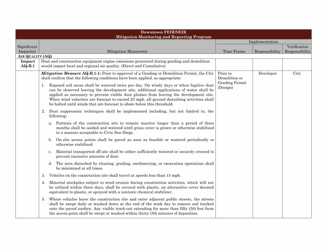
Downtown FEIR/SEIR Mitigation Monitoring and Reporting Program
Significant Impact(s) Mitigation Measure(s)
Implementation
Time Frame Responsibility Verification
Responsibility AIR QUALITY (AQ)
Impact AQ-B.1
Dust and construction equipment engine emissions generated during grading and demolition would impact local and regional air quality. (Direct and Cumulative)
Mitigation Measure AQ-B.1-1: Prior to approval of a Grading or Demolition Permit, the City shall confirm that the following conditions have been applied, as appropriate:
1. Exposed soil areas shall be watered twice per day. On windy days or when fugitive dustcan be observed leaving the development site, additional applications of water shall beapplied as necessary to prevent visible dust plumes from leaving the development site.When wind velocities are forecast to exceed 25 mph, all ground disturbing activities shallbe halted until winds that are forecast to abate below this threshold.
2. Dust suppression techniques shall be implemented including, but not limited to, thefollowing:
a. Portions of the construction site to remain inactive longer than a period of threemonths shall be seeded and watered until grass cover is grown or otherwise stabilizedin a manner acceptable to Civic San Diego.
b. On-site access points shall be paved as soon as feasible or watered periodically orotherwise stabilized.
c. Material transported off-site shall be either sufficiently watered or securely covered toprevent excessive amounts of dust.
d. The area disturbed by clearing, grading, earthmoving, or excavation operations shallbe minimized at all times.
3. Vehicles on the construction site shall travel at speeds less than 15 mph.
4. Material stockpiles subject to wind erosion during construction activities, which will notbe utilized within three days, shall be covered with plastic, an alternative cover deemedequivalent to plastic, or sprayed with a nontoxic chemical stabilizer.
5. Where vehicles leave the construction site and enter adjacent public streets, the streetsshall be swept daily or washed down at the end of the work day to remove soil trackedonto the paved surface. Any visible track-out extending for more than fifty (50) feet fromthe access point shall be swept or washed within thirty (30) minutes of deposition.
Prior to Demolition or Grading Permit (Design)
Developer City
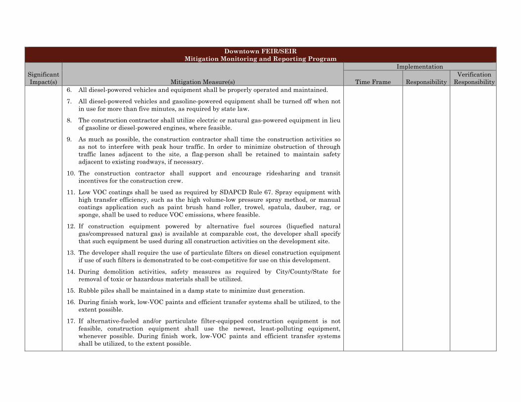
Downtown FEIR/SEIR Mitigation Monitoring and Reporting Program
Significant Impact(s) Mitigation Measure(s)
Implementation
Time Frame Responsibility Verification
Responsibility 6. All diesel-powered vehicles and equipment shall be properly operated and maintained.
7. All diesel-powered vehicles and gasoline-powered equipment shall be turned off when not in use for more than five minutes, as required by state law.
8. The construction contractor shall utilize electric or natural gas-powered equipment in lieu of gasoline or diesel-powered engines, where feasible.
9. As much as possible, the construction contractor shall time the construction activities so as not to interfere with peak hour traffic. In order to minimize obstruction of through traffic lanes adjacent to the site, a flag-person shall be retained to maintain safety adjacent to existing roadways, if necessary.
10. The construction contractor shall support and encourage ridesharing and transit incentives for the construction crew.
11. Low VOC coatings shall be used as required by SDAPCD Rule 67. Spray equipment with high transfer efficiency, such as the high volume-low pressure spray method, or manual coatings application such as paint brush hand roller, trowel, spatula, dauber, rag, or sponge, shall be used to reduce VOC emissions, where feasible.
12. If construction equipment powered by alternative fuel sources (liquefied natural gas/compressed natural gas) is available at comparable cost, the developer shall specify that such equipment be used during all construction activities on the development site.
13. The developer shall require the use of particulate filters on diesel construction equipment if use of such filters is demonstrated to be cost-competitive for use on this development.
14. During demolition activities, safety measures as required by City/County/State for removal of toxic or hazardous materials shall be utilized.
15. Rubble piles shall be maintained in a damp state to minimize dust generation.
16. During finish work, low-VOC paints and efficient transfer systems shall be utilized, to the extent possible.
17. If alternative-fueled and/or particulate filter-equipped construction equipment is not feasible, construction equipment shall use the newest, least-polluting equipment, whenever possible. During finish work, low-VOC paints and efficient transfer systems shall be utilized, to the extent possible.
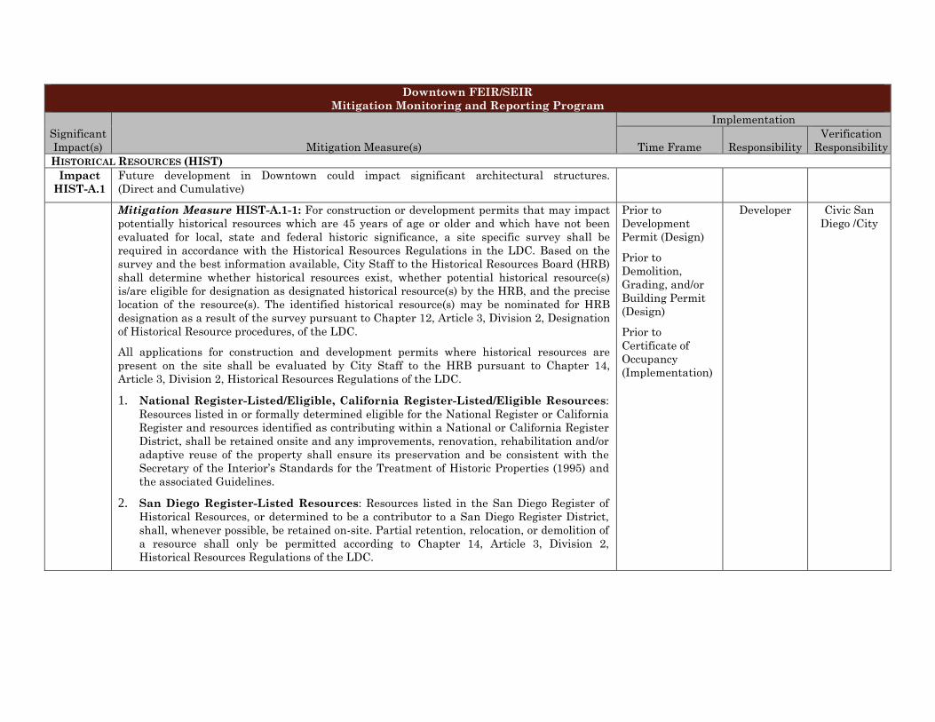
Downtown FEIR/SEIR Mitigation Monitoring and Reporting Program
Significant Impact(s) Mitigation Measure(s)
Implementation
Time Frame Responsibility Verification
Responsibility HISTORICAL RESOURCES (HIST)
Impact HIST-A.1
Future development in Downtown could impact significant architectural structures. (Direct and Cumulative)
Mitigation Measure HIST-A.1-1: For construction or development permits that may impact potentially historical resources which are 45 years of age or older and which have not been evaluated for local, state and federal historic significance, a site specific survey shall be required in accordance with the Historical Resources Regulations in the LDC. Based on the survey and the best information available, City Staff to the Historical Resources Board (HRB) shall determine whether historical resources exist, whether potential historical resource(s) is/are eligible for designation as designated historical resource(s) by the HRB, and the precise location of the resource(s). The identified historical resource(s) may be nominated for HRB designation as a result of the survey pursuant to Chapter 12, Article 3, Division 2, Designation of Historical Resource procedures, of the LDC.
All applications for construction and development permits where historical resources are present on the site shall be evaluated by City Staff to the HRB pursuant to Chapter 14, Article 3, Division 2, Historical Resources Regulations of the LDC.
1. National Register-Listed/Eligible, California Register-Listed/Eligible Resources: Resources listed in or formally determined eligible for the National Register or California Register and resources identified as contributing within a National or California Register District, shall be retained onsite and any improvements, renovation, rehabilitation and/or adaptive reuse of the property shall ensure its preservation and be consistent with the Secretary of the Interior’s Standards for the Treatment of Historic Properties (1995) and the associated Guidelines.
2. San Diego Register-Listed Resources: Resources listed in the San Diego Register of Historical Resources, or determined to be a contributor to a San Diego Register District, shall, whenever possible, be retained on-site. Partial retention, relocation, or demolition of a resource shall only be permitted according to Chapter 14, Article 3, Division 2, Historical Resources Regulations of the LDC.
Prior to Development Permit (Design)
Prior to Demolition, Grading, and/or Building Permit (Design)
Prior to Certificate of Occupancy (Implementation)
Developer Civic San Diego /City
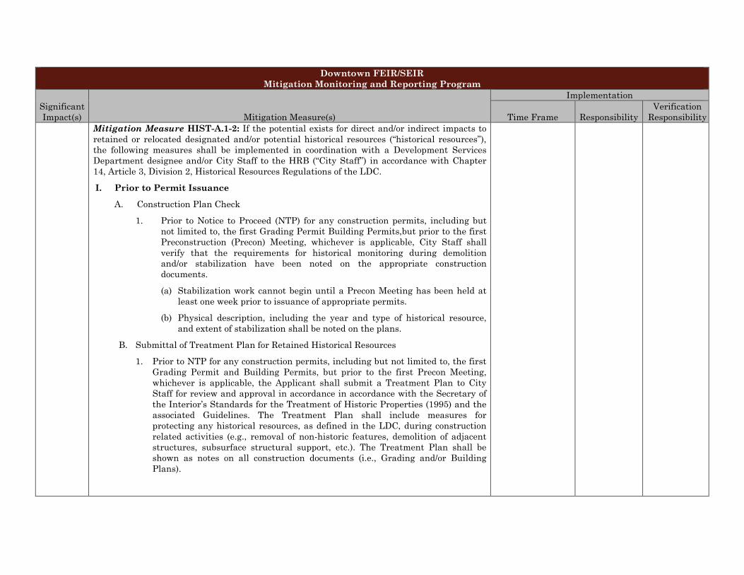
Downtown FEIR/SEIR Mitigation Monitoring and Reporting Program
Significant Impact(s) Mitigation Measure(s)
Implementation
Time Frame Responsibility Verification
Responsibility Mitigation Measure HIST-A.1-2: If the potential exists for direct and/or indirect impacts to
retained or relocated designated and/or potential historical resources (“historical resources”), the following measures shall be implemented in coordination with a Development Services Department designee and/or City Staff to the HRB (“City Staff”) in accordance with Chapter 14, Article 3, Division 2, Historical Resources Regulations of the LDC.
I. Prior to Permit Issuance
A. Construction Plan Check
1. Prior to Notice to Proceed (NTP) for any construction permits, including but not limited to, the first Grading Permit Building Permits,but prior to the first Preconstruction (Precon) Meeting, whichever is applicable, City Staff shall verify that the requirements for historical monitoring during demolition and/or stabilization have been noted on the appropriate construction documents.
(a) Stabilization work cannot begin until a Precon Meeting has been held at least one week prior to issuance of appropriate permits.
(b) Physical description, including the year and type of historical resource, and extent of stabilization shall be noted on the plans.
B. Submittal of Treatment Plan for Retained Historical Resources
1. Prior to NTP for any construction permits, including but not limited to, the first Grading Permit and Building Permits, but prior to the first Precon Meeting, whichever is applicable, the Applicant shall submit a Treatment Plan to City Staff for review and approval in accordance in accordance with the Secretary of the Interior’s Standards for the Treatment of Historic Properties (1995) and the associated Guidelines. The Treatment Plan shall include measures for protecting any historical resources, as defined in the LDC, during construction related activities (e.g., removal of non-historic features, demolition of adjacent structures, subsurface structural support, etc.). The Treatment Plan shall be shown as notes on all construction documents (i.e., Grading and/or Building Plans).
Downtown FEIR/SEIR Mitigation Monitoring and Reporting Program
Significant Impact(s) Mitigation Measure(s)
Implementation
Time Frame Responsibility Verification
Responsibility C. Letters of Qualification have been submitted to City Staff
1. The applicant shall submit a letter of verification to City Staff identifying the Principal Investigator (PI) for the project and the names of all persons involved in this MMRP (i.e., Architectural Historian, Historic Architect and/or Historian), as defined in the City of San Diego HRG.
2. City Staff will provide a letter to the applicant confirming that the qualifications of the PI and all persons involved in the historical monitoring of the project meet the qualification standards established by the HRG.
3. Prior to the start of work, the applicant must obtain approval from City Staff for any personnel changes associated with the monitoring program.
II. Prior to Start of Construction
A. Documentation Program (DP)
1. Prior to the first Precon Meeting and/or issuance of any construction permit, the DP shall be submitted to City Staff for review and approval and shall include the following:
(a) Photo Documentation
(1) Documentation shall include professional quality photo documentation of the historical resource(s) prior to any construction that may cause direct and/or indirect impacts to the resource(s) with 35mm black and white photographs, 4x6 standard format, taken of all four elevations and close-ups of select architectural elements, such as, but not limited to, roof/wall junctions, window treatments, and decorative hardware. Photographs shall be of archival quality and easily reproducible.
(2) Xerox copies or CD of the photographs shall be submitted for archival storage with the City of San Diego HRB and the Civic San Diego Project file. One set of original photographs and negatives shall be submitted for archival storage with the California Room of the City of San Diego Public Library, the San Diego Historical Society and/or other relative historical society or group(s).
Downtown FEIR/SEIR Mitigation Monitoring and Reporting Program
Significant Impact(s) Mitigation Measure(s)
Implementation
Time Frame Responsibility Verification
Responsibility (b) Required drawings
(1) Measured drawings of the building’s exterior elevations depictingexisting conditions or other relevant features shall be produced fromrecorded, accurate measurements. If portions of the building are notaccessible for measurement, or cannot be reproduced from historicsources, they should not be drawn, but clearly labeled as not accessible.Drawings produced in ink on translucent material or archivally stablematerial (blueline drawings) are acceptable). Standard drawing sizesare 19 by 24 inches or 24 by 36 inches, standard scale is 1/4 inch = 1foot.
(2) One set of measured drawings shall be submitted for archival storagewith the City of San Diego HRB, the Civic San Diego Project file, theSouth Coastal Information Center, the California Room of the City ofSan Diego Public Library, the San Diego Historical Society and/or otherhistorical society or group(s).
2. Prior to the first Precon Meeting, City Staff shall verify that the DP has beenapproved.
B. PI Shall Attend Precon Meetings
1. Prior to beginning any work that may impact any historical resource(s) which is/aresubject to this MMRP, the Applicant shall arrange a Precon Meeting that shallinclude the PI, Construction Manager (CM) and/or Grading Contractor, ResidentEngineer (RE), Historical Monitor(s), Building Inspector (BI), if appropriate, andCity Staff. The qualified Historian and/or Architectural Historian shall attend anygrading/excavation related Precon Meetings to make comments and/or suggestionsconcerning the Historical Monitoring program with the Construction Managerand/or Grading Contractor.
(a) If the PI is unable to attend the Precon Meeting, the Applicant shall schedule afocused Precon Meeting with City Staff, the PI, RE, CM or BI, if appropriate,prior to the start of any work that requires monitoring.
2. Historical Monitoring Plan
(a) Prior to the start of any work that is subject to an Historical Monitoring Plan,
Downtown FEIR/SEIR Mitigation Monitoring and Reporting Program
Significant Impact(s) Mitigation Measure(s)
Implementation
Time Frame Responsibility Verification
Responsibility the PI shall submit an Historical Monitoring Plan which describes how the monitoring would be accomplished for approval by City Staff. The Historical Monitoring Plan shall include an Historical Monitoring Exhibit (HME) based on the appropriate construction documents (reduced to 11x17 inches) to City Staff identifying the areas to be monitored including the delineation of grading/excavation limits.
(b) Prior to the start of any work, the PI shall also submit a construction schedule to City Staff through the RE indicating when and where monitoring will occur.
(c) The PI may submit a detailed letter to City Staff prior to the start of work or during construction requesting a modification to the monitoring program. This request shall be based on relevant information such as review of final construction documents which indicate site conditions such as underpinning, shoring and/or extensive excavation which could result in impacts to, and/or reduce impacts to the on-site or adjacent historical resource.
C. Implementation of Approved Treatment Plan for Historical Resources
1. Implementation of the approved Treatment Plan for the protection of historical resources within the project site may not begin prior to the completion of the Documentation Program as defined above.
2. The qualified Historical Monitor(s) shall attend weekly jobsite meetings and be on-site daily during the stabilization phase for any retained or adjacent historical resource to photo document the Treatment Plan process.
3. The qualified Historical Monitor(s) shall document activity via the Consultant Site Visit Record (CSVR). The CSVR’s shall be faxed by the CM to the RE the first day and last day (Notification of Monitoring Completion) of the Treatment Plan process and in the case of ANY unanticipated incidents. The RE shall forward copies to City Staff.
4. Prior to the start of any construction related activities, the applicant shall provide verification to City Staff that all historical resources on-site have been adequately stabilized in accordance with the approved Treatment Plan. This may include a site visit with City Staff, the CM, RE or BI, but may also be accomplished through submittal of the draft Treatment Plan photo documentation report.
Downtown FEIR/SEIR Mitigation Monitoring and Reporting Program
Significant Impact(s) Mitigation Measure(s)
Implementation
Time Frame Responsibility Verification
Responsibility 5. City Staff will provide written verification to the RE or BI after the site visit or
upon approval of draft Treatment Plan report indicating that construction related activities can proceed.
III. During Construction
A. Qualified Historical Monitor(s) Shall be Present During Grading/Excavation/ Trenching
1. The Qualified Historical Monitor(s) shall be present full-time during grading/excavation/trenching activities which could result in impacts to historical resources as identified on the HME. The Construction Manager is responsible for notifying the RE, PI, and City Staff of changes to any construction activities.
2. The Qualified Historical Monitor(s) shall document field activity via the CSVR. The CSVR’s shall be faxed by the CM to the RE the first day of monitoring, the last day of monitoring, monthly (Notification of Monitoring Completion), and in the case of ANY incidents involving the historical resource. The RE shall forward copies to City Staff.
3. The PI may submit a detailed letter to City Staff during construction requesting a modification to the monitoring program when a field condition arises which could effect the historical resource being retained on-site or adjacent to the construction site.
B. Notification Process
1. In the event of damage to a historical resource retained on-site or adjacent to the project site, the Qualified Historical Monitor(s) shall direct the contractor to temporarily divert construction activities in the area of historical resource and immediately notify the RE or BI, as appropriate, and the PI (unless Monitor is the PI).
2. The PI shall immediately notify City Staff by phone of the incident, and shall also submit written documentation to City Staff within 24 hours by fax or email with photos of the resource in context, if possible.
Downtown FEIR/SEIR Mitigation Monitoring and Reporting Program
Significant Impact(s) Mitigation Measure(s)
Implementation
Time Frame Responsibility Verification
Responsibility C. Determination/Evaluation of Impacts to a Historical Resource
1. The PI shall evaluate the incident relative to the historical resource.
(a) The PI shall immediately notify City Staff by phone to discuss the incident and shall also submit a letter to City Staff indicating whether additional mitigation is required.
(b) If impacts to the historical resource are significant, the PI shall submit a proposal for City Staff review and written approval in accordance with Chapter 14, Article 3, Division 2, Historical Resources Regulations of the LDC and the Secretary of the Interior’s Standards for the Treatment of Historic Properties (1995) and the associated Guidelines. Direct and/or indirect impacts to historical resources from construction activities must be mitigated before work will be allowed to resume.
(c) If impacts to the historical resource are not considered significant, the PI shall submit a letter to City Staff indicating that the incident will be documented in the Final Monitoring Report. The letter shall also indicate that that no further work is required.
IV. Night Work
A. If night and/or weekend work is included in the contract
1. When night and/or weekend work is included in the contract package, the extent and timing shall be presented and discussed at the Precon Meeting.
2. The following procedures shall be followed.
(a) No Impacts/Incidents
In the event that no historical resources were impacted during night and/or weekend work, the PI shall record the information on the CSVR and submit to City Staff via fax by 8 a.m. of the next business day.
(b) Potentially Significant Impacts
If the PI determines that a potentially significant impact has occurred to a historical resource, the procedures detailed under Section III - During
Downtown FEIR/SEIR Mitigation Monitoring and Reporting Program
Significant Impact(s) Mitigation Measure(s)
Implementation
Time Frame Responsibility Verification
Responsibility Construction shall be followed.
(c) The PI shall immediately contact City Staff, or by 8 a.m. of the next business day to report and discuss the findings as indicated in Section III-B, unless other specific arrangements have been made.
B. If night and/or weekend work becomes necessary during the course of construction:
1. The Construction Manager shall notify the RE, or BI, as appropriate, a minimum of 24 hours before the work is to begin.
2. The RE, or BI, as appropriate, shall notify City Staff immediately.
C. All other procedures described above shall apply, as appropriate.
V. Post Construction
A. Submittal of Draft Monitoring Report
1. The PI shall submit two copies of the Draft Monitoring Report (even if negative), prepared in accordance with the Historical Resources Guidelines (HRG) and Appendices which describes the results, analysis, and conclusions of all phases of the Historical Monitoring Plan (with appropriate graphics) to City Staff for review and approval within 90 days following the completion of monitoring.
(a) The preconstruction Treatment Plan and Documentation Plan (photos and measured drawings) and Historical Commemorative Program, if applicable, shall be included and/or incorporated into the Draft Monitoring Report.
(b) The PI shall be responsible for updating (on the appropriate State of California Department of Park and Recreation forms-DPR 523 A/B) any existing site forms to document the partial and/or complete demolition of the resource. Updated forms shall be submitted to the South Coastal Information Center with the Final Monitoring Report.
2. City Staff shall return the Draft Monitoring Report to the PI for revision or, for preparation of the Final Report.
3. The PI shall submit revised Draft Monitoring Report to City Staff for approval.
Downtown FEIR/SEIR Mitigation Monitoring and Reporting Program
Significant Impact(s) Mitigation Measure(s)
Implementation
Time Frame Responsibility Verification
Responsibility 4. City Staff shall provide written verification to the PI of the approved report.
5. City Staff shall notify the RE or BI, as appropriate, of receipt of all Draft Monitoring Report submittals and approvals.
B. Final Monitoring Report(s)
1. The PI shall submit one copy of the approved Final Monitoring Report to the RE or BI as appropriate, and one copy to City Staff (even if negative), within 90 days after notification from City Staff that the draft report has been approved.
2. The RE shall, in no case, issue the Notice of Completion until receiving a copy of the approved Final Monitoring Report from City Staff.
Mitigation Measure HIST-A.1-3: If a designated or potential historical resource (“historical resource”) as defined in the LDC would be demolished, the following measure shall be implemented in accordance with Chapter 14, Article 3, Division 2, Historical Resources Regulations of the LDC.
I. Prior to Issuance of a Demolition Permit
A. A DP shall be submitted to City Staff to the HRB (“City Staff”) for review and approval and shall include the following:
1. Photo Documentation
(a) Documentation shall include professional quality photo documentation of the structure prior to demolition with 35 millimeter black and white photographs, 4x6 inch standard format, taken of all four elevations and close-ups of select architectural elements, such as, but not limited to, roof/wall junctions, window treatments, decorative hardware. Photographs shall be of archival quality and easily reproducible.
(b) Xerox copies or CD of the photographs shall be submitted for archival storage with the City of San Diego HRB and the Civic San Diego Project file. One set of original photographs and negatives shall be submitted for archival storage with the California Room of the City of San Diego Public Library, the San Diego Historical Society and/or other relative historical society or group(s).

Downtown FEIR/SEIR Mitigation Monitoring and Reporting Program
Significant Impact(s) Mitigation Measure(s)
Implementation
Time Frame Responsibility Verification
Responsibility 2. Required drawings
(a) Measured drawings of the building’s exterior elevations depicting existing conditions or other relevant features shall be produced from recorded, accurate measurements. If portions of the building are not accessible for measurement, or cannot be reproduced from historic sources, they should not be drawn, but clearly labeled as not accessible. Drawings produced in ink on translucent material or archivally stable material (blueline drawings are acceptable). Standard drawing sizes are 19 by 24 inches or 24 by 36 inches, standard scale is 1/4 inch = 1 foot.
(b) One set of measured drawings shall be submitted for archival storage with the City of San Diego HRB, the Civic San Diego Project file, the South Coastal Information Center, the California Room of the City of San Diego Public Library, the San Diego Historical Society and/or other historical society or group(s).
B. Prior to the first Precon Meeting City Staff shall verify that the DP has been approved.
C. In addition to the Documentation Program, the Applicant shall comply with any other conditions contained in the Site Development Permit pursuant to Chapter 14, Article 3, Division 2, Historical Resources Regulations of the LDC.
Impact HIST-B.1
Development in Downtown could impact significant buried archaeological resources. (Direct and Cumulative)
Mitigation Measure HIST-B.1-1: If the potential exists for direct and/or indirect impacts to significant buried archaeological resources, the following measures shall be implemented in coordination with a Development Services Department designee and/or City Staff to the HRB (“City Staff”) in accordance with Chapter 14, Article 3, Division 2, Historical Resources Regulations of the LDC. Prior to issuance of any permit that could directly affect an archaeological resource, City Staff shall assure that all elements of the MMRP are performed in accordance with all applicable City regulations and guidelines by an Archaeologist meeting the qualifications specified in Appendix B of the San Diego LDC, Historical Resources Guidelines. City Staff shall also require that the following steps be taken to determine: (1) the presence of archaeological resources and (2) the appropriate mitigation for any significant resources which may be impacted by a development activity. Sites may include residential and commercial properties, privies, trash pits, building foundations, and industrial features
Prior to Demolition or Grading Permit (Design)
Prior to Certificate of Occupancy (Implementation)
Developer City Staff
Downtown FEIR/SEIR Mitigation Monitoring and Reporting Program
Significant Impact(s) Mitigation Measure(s)
Implementation
Time Frame Responsibility Verification
Responsibility representing the contributions of people from diverse socio-economic and ethnic backgrounds. Sites may also include resources associated with pre-historic Native American activities. Archeological resources which also meet the definition of historical resources or unique archaeological resources under CEQA or the SDMC shall be treated in accordance with the following evaluation procedures and applicable mitigation program:
Step 1–Initial Evaluation
An initial evaluation for the potential of significant subsurface archaeological resources shall be prepared to the satisfaction of City Staff as part of an Environmental Secondary Study for any activity which involves excavation or building demolition. The initial evaluation shall be guided by an appropriate level research design in accordance with the City’s LDC, Historical Resources Guidelines. The person completing the initial review shall meet the qualification requirements as set forth in the Historical Resources Guidelines and shall be approved by City Staff. The initial evaluation shall consist , at a minimum, of a review of the following historical sources: The 1876 Bird’s Eye View of San Diego, all Sanborn Fire Insurance Company maps, appropriate City directories and maps that identify historical properties or archaeological sites, and a records search at the South Coastal Information Center for archaeological resources located within the property boundaries. Historical and existing land uses shall also be reviewed to assess the potential presence of significant prehistoric and historic archaeological resources. The person completing the initial review shall also consult with and consider input from local individuals and groups with expertise in the historical resources of the San Diego area. These experts may include the University of California, San Diego State University, San Diego Museum of Man, Save Our Heritage Organization, local historical and archaeological groups, the Native American Heritage Commission (NAHC), designated community planning groups, and other individuals or groups that may have specific knowledge of the area. Consultation with these or other individuals and groups shall occur as early as possible in the evaluation process.
When the initial evaluation indicates that important archaeological sites may be present on a project site but their presence cannot be confirmed prior to construction or demolition due to obstructions or spatially limited testing and data recovery, the applicant shall prepare and implement an archaeological monitoring program as a condition of development approval to the satisfaction of City Staff. If the NAHC Sacred Lands File search is positive for Native American resources within the project site, then additional evaluation must include participation of a local Native American consultant in accordance with CEQA Sections 15064.5(d), 15126.4(b)(3) and Public Resources Code Section 21083.2.
Downtown FEIR/SEIR Mitigation Monitoring and Reporting Program
Significant Impact(s) Mitigation Measure(s)
Implementation
Time Frame Responsibility Verification
Responsibility No further action is required if the initial evaluation demonstrates there is no potential for subsurface resources. The results of this research shall be summarized in the Secondary Study.
Step 2–Testing
A testing program is required if the initial evaluation demonstrates that there is a potential for subsurface resources. The testing program shall be conducted during the hazardous materials remediation or following the removal of any structure or surface covering which may be underlain by potential resources. The removal of these structures shall be conducted in a manner which minimizes disturbance of underlying soil. This shall entail a separate phase of investigations from any mitigation monitoring during construction.
The testing program shall be performed by a qualified Historical Archaeologist meeting the qualifications specified in Appendix B of the San Diego LDC, HRG. The Historical Archaeologist must be approved by City Staff prior to commencement. Before commencing the testing, a treatment plan shall be submitted for City Staff approval that reviews the initial evaluation results and includes a research design. The research design shall be prepared in accordance with the City’s HRG and include a discussion of field methods, research questions against which discoveries shall be evaluated for significance, collection strategy, laboratory and analytical approaches, and curation arrangements. All tasks shall be in conformity with best practices in the field of historic urban archaeology.
A recommended approach for historic urban sites is at a minimum fills and debris along interior lot lines or other areas indicated on Sanborn maps.
Security measures such as a locked fence or surveillance shall be taken to prevent looting or vandalism of archaeological resources as soon as demolition is complete or paved surfaces are removed. These measures shall be maintained during archaeological field investigations. It is recommended that exposed features be covered with steel plates or fill dirt when not being investigated.
The results of the testing phase shall be submitted in writing to City Staff and shall include the research design, testing results, significance evaluation, and recommendations for further treatment. Final determination of significance shall be made in consultation with City Staff , and with the Native American community, if the finds are prehistoric. If no significant resources are found and site conditions are such that there is no potential for further discoveries, then no further action is required. If no significant resources are found but results of the initial evaluation and testing phase indicates there is still a potential for resources to be
Downtown FEIR/SEIR Mitigation Monitoring and Reporting Program
Significant Impact(s) Mitigation Measure(s)
Implementation
Time Frame Responsibility Verification
Responsibility present in portions of the property that could not be tested, then mitigation monitoring is required and shall be conducted in accordance with the provisions set forth in Step 4 - Monitoring. If significant resources are discovered during the testing program, then data recovery in accordance with Step 3 shall be undertaken prior to construction. If the existence or probable likelihood of Native American human remains or associated grave goods area discovered through the testing program, the Qualified Archaeologist shall stop work in the area, notify the City Building Inspector, City staff, and immediately implement the procedures set forth in CEQA Guidelines Section 15064.5 and the California PRC Section 5097.98 for discovery of human remains. This procedure is further detailed in the Mitigation, Monitoring and Reporting Program (Step 4). City Staff must concur with evaluation results before the next steps can proceed.
Step 3–Data Recovery
For any site determined to be significant, a Research Design and Data Recovery Program shall be prepared in accordance with the City’s Historical Resources Guidelines, approved by City Staff, and carried out to mitigate impacts before any activity is conducted which could potentially disturb significant resources. The archaeologist shall notify City Staff of the date upon which data recovery will commence ten (10) working days in advance.
All cultural materials collected shall be cleaned, catalogued and permanently curated with an appropriate institution. Native American burial resources shall be treated in the manner agreed to by the Native American representative or be reinterred on the site in an area not subject to further disturbance in accordance with CEQA section 15164.5 and the Public Resources Code section 5097.98. All artifacts shall be analyzed to identify function and chronology as they relate to the history of the area. Faunal material shall be identified as to species and specialty studies shall be completed, as appropriate. All newly discovered archaeological sites shall be recorded with the South Coastal Information Center at San Diego State University. Any human bones and associated grave goods of Native American origin encountered during Step 2-Testing, shall, upon consultation, be turned over to the appropriate Native American representative(s) for treatment in accordance with state regulations as further outlined under Step 4-Monitoring (Section IV. Discovery of Human Remains).
A draft Data Recovery Report shall be submitted to City Staff within twelve months of the commencement of the data recovery. Data Recovery Reports shall describe the research design or questions, historic context of the finds, field results, analysis of artifacts, and conclusions. Appropriate figures, maps and tables shall accompany the text. The report shall also include a
Downtown FEIR/SEIR Mitigation Monitoring and Reporting Program
Significant Impact(s) Mitigation Measure(s)
Implementation
Time Frame Responsibility Verification
Responsibility catalogue of all finds and a description of curation arrangements at an approved facility, and a general statement indicating the disposition of any human remains encountered during the data recovery effort (please note that the location of reinternment and/or repatriation is confidential and not subject to public disclosure in accordance with state law). Finalization of draft reports shall be subject to City Staff review.
Step 4 – Monitoring
If no significant resources are encountered, but results of the initial evaluation and testing phase indicates there is still a potential for resources to be present in portions of the property that could not be tested, then mitigation monitoring is required and shall be conducted in accordance with the following provisions and components:
I. Prior to Permit Issuance
A. Construction Plan Check
1. Prior to NTP for any construction permits, including but not limited to, the first Grading Permit, Demolition Permits and Building Permits, but prior to the first Precon Meeting, whichever is applicable, City Staff shall verify that the requirements for Archaeological Monitoring and Native American monitoring, where the project may impact Native American resources, have been noted on the appropriate construction documents.
B. Letters of Qualification have been submitted to City Staff
1. The applicant shall submit a letter of verification to City Staff identifying the PI for the project and the names of all persons involved in the archaeological monitoring program, as defined in the City of San Diego HRG. If applicable, individuals involved in the archaeological monitoring program must have completed the 40-hour Hazardous Waste Operations and Emergency Response training with certification documentation.
2. City Staff will provide a letter to the applicant confirming that the qualifications of the PI and all persons involved in the archaeological monitoring of the project meet the qualifications established in the HRG.
3. Prior to the start of work, the applicant must obtain written approval from City Staff for any personnel changes associated with the monitoring program.
Downtown FEIR/SEIR Mitigation Monitoring and Reporting Program
Significant Impact(s) Mitigation Measure(s)
Implementation
Time Frame Responsibility Verification
Responsibility II. Prior to Start of Construction
A. Verification of Records Search
1. The PI shall provide verification to City Staff that a site-specific records search (1/4 mile radius) has been completed. Verification includes, but is not limited to a copy of a confirmation letter from South Coastal Information Center, or, if the search was in-house, a letter of verification from the PI stating that the search was completed.
2. The letter shall introduce any pertinent information concerning expectations and probabilities of discovery during trenching and/or grading activities.
3. The PI may submit a detailed letter to City Staff requesting a reduction to the 1/4 mile radius.
B. PI Shall Attend Precon Meetings
1. Prior to beginning any work that requires monitoring, the Applicant shall arrange a Precon Meeting that shall include the PI, Native American consultant/monitor (where Native American resources may be impacted), CM and/or Grading Contractor, RE, the Native American representative(s) (where Native American resources may be impacted), BI, if appropriate, and City Staff. The qualified Archaeologist and the Native American consultant/monitor shall attend any grading/excavation related Precon Meetings to make comments and/or suggestions concerning the Archaeological Monitoring program with the Construction Manager and/or Grading Contractor.
(a) If the PI is unable to attend the Precon Meeting, the Applicant shall schedule a focused Precon Meeting with City Staff, the PI, RE, CM or BI, if appropriate, prior to the start of any work that requires monitoring.
2. Archaeological Monitoring Plan (AMP)
(a) Prior to the start of any work that requires monitoring, the PI shall submit an Archaeological Monitoring Plan (with verification that the AMP has been reviewed and approved by the Native American consultant/monitor when Native American resources may be impacted) which describes how the monitoring would be accomplished for approval by City Staff and the Native American monitor. The AMP shall include an Archaeological Monitoring
Downtown FEIR/SEIR Mitigation Monitoring and Reporting Program
Significant Impact(s) Mitigation Measure(s)
Implementation
Time Frame Responsibility Verification
Responsibility Exhibit (AME) based on the appropriate construction documents (reduced to 11 by 17 inches) to City Staff identifying the areas to be monitored including the delineation of grading/excavation limits.
(b) The AME shall be based on the results of a site-specific records search as well as information regarding existing known soil conditions (native or formation).
(c) Prior to the start of any work, the PI shall also submit a construction schedule to City Staff through the RE indicating when and where monitoring will occur.
(d) The PI may submit a detailed letter to City Staff prior to the start of work or during construction requesting a modification to the monitoring program. This request shall be based on relevant information such as review of final construction documents which indicate site conditions such as depth of excavation and/or site graded to bedrock, etc., which may reduce or increase the potential for resources to be present.
III. During Construction
A. Monitor(s) Shall be Present During Grading/Excavation/Trenching
1. The Archaeological monitor shall be present full-time during all soil disturbing and grading/excavation /trenching activities which could result in impacts to archaeological resources as identified on the AME. The Construction Manager is responsible for notifying the RE, PI, and City Staff of changes to any construction activities.
2. The Native American consultant/monitor shall determine the extent of their presence during soil disturbing and grading/excavation/trenching activities based on the AME, and provide that information to the PI and City Staff. If prehistoric resources are encountered during the Native American consultant/ monitor’s absence, work shall stop and the Discovery Notification Processes detailed in Sections III.B-C, and IVA-D shall commence.
3. The archeological and Native American consultant/monitor shall document field activity via the CSVR. The CSVR’s shall be faxed by the CM to the RE the first day of monitoring, the last day of monitoring, monthly (Notification of Monitoring Completion), and in the case of ANY discoveries. The RE shall forward copies to City Staff.
Downtown FEIR/SEIR Mitigation Monitoring and Reporting Program
Significant Impact(s) Mitigation Measure(s)
Implementation
Time Frame Responsibility Verification
Responsibility 4. The PI may submit a detailed letter to City Staff during construction
requesting a modification to the monitoring program when a field condition such as modern disturbance post-dating the previous grading/trenching activities, presence of fossil formations, or when native soils are encountered that may reduce or increase the potential for resources to be present.
B. Discovery Notification Process
1. In the event of a discovery, the Archaeological Monitor shall direct the contractor to temporarily divert all soil disturbing activities, including but not limited to, digging, trenching, excavating, or grading activities in the area of discovery and in the area reasonably suspected to overlay adjacent resources and immediately notify the RE or BI, as appropriate.
2. The Monitor shall immediately notify the PI (unless Monitor is the PI) of the discovery.
3. The PI shall immediately notify City Staff by phone of the discovery, and shall also submit written documentation to City Staff within 24 hours by fax or email with photos of the resource in context, if possible.
4. No soil shall be exported off-site until a determination can be made regarding the significance of the resource specifically if Native American resources are encountered.
C. Determination of Significance
1. The PI and Native American consultant/monitor, where Native American resources are discovered, shall evaluate the significance of the resource.
If Human Remains are involved, follow protocol in Section IV below.
(a) The PI shall immediately notify City Staff by phone to discuss significance determination and shall also submit a letter to City Staff indicating whether additional mitigation is required.
(b) If the resource is significant, the PI shall submit an Archaeological Data Recovery Program which has been reviewed by the Native American consultant/monitor when applicable, and obtain written approval from City Staff and the Native American representative(s), if applicable. Impacts to
Downtown FEIR/SEIR Mitigation Monitoring and Reporting Program
Significant Impact(s) Mitigation Measure(s)
Implementation
Time Frame Responsibility Verification
Responsibility significant resources must be mitigated before ground disturbing activities in the area of discovery will be allowed to resume.
(c) If the resource is not significant, the PI shall submit a letter to City Staff indicating that artifacts will be collected, curated, and documented in the Final Monitoring Report. The letter shall also indicate that that no further work is required.
IV. Discovery of Human Remains
If human remains are discovered, work shall halt in that area and no soil shall be exported off-site until a determination can be made regarding the provenance of the human remains; and the following procedures set forth in CEQA Section 15064.5(e), the California Public Resources Code (Sec. 5097.98) and State Health and Safety Code (Sec. 7050.5) shall be undertaken:
A. Notification
1. Archaeological Monitor shall notify the RE or BI as appropriate, City Staff, and the PI, if the Monitor is not qualified as a PI. City Staff will notify the appropriate Senior Planner in the Environmental Analysis Section of the Development Services Department to assist with the discovery process.
2. The PI shall notify the Medical Examiner after consultation with the RE, either in person or via telephone.
B. Isolate discovery site
1. Work shall be directed away from the location of the discovery and any nearby area reasonably suspected to overlay adjacent human remains until a determination can be made by the Medical Examiner in consultation with the PI concerning the provenance of the remains.
2. The Medical Examiner, in consultation with the PI, will determine the need for a field examination to determine the provenance.
3. If a field examination is not warranted, the Medical Examiner will determine with input from the PI, if the remains are or are most likely to be of Native American origin.
Downtown FEIR/SEIR Mitigation Monitoring and Reporting Program
Significant Impact(s) Mitigation Measure(s)
Implementation
Time Frame Responsibility Verification
Responsibility C. If Human Remains are determined to be Native American
1. The Medical Examiner will notify the NAHC within 24 hours. By law, ONLY the Medical Examiner can make this call.
2. NAHC will immediately identify the person or persons determined to be the Most Likely Descendent (MLD) and provide contact information.
3. The MLD will contact the PI within 24 hours or sooner after the Medical Examiner has completed coordination, to begin the consultation process in accordance with CEQA Section 15064.5(e) and the California Public Resources and Health & Safety Codes.
4. The MLD will have 48 hours to make recommendations to the property owner or representative, for the treatment or disposition with proper dignity, of the human remains and associated grave goods.
5. Disposition of Native American Human Remains will be determined between the MLD and the PI, and if:
(a) The NAHC is unable to identify the MLD, OR the MLD failed to make a recommendation within 48 hours after being notified by the Commission; OR;
(b) The landowner or authorized representative rejects the recommendation of the MLD and mediation in accordance with PRC 5097.94 (k) by the NAHC fails to provide measures acceptable to the landowner, THEN,
(c) In order to protect these sites, the Landowner shall do one or more of the following:
(1) Record the site with the NAHC;
(2) Record an open space or conservation easement on the site;
(3) Record a document with the County.
6. Upon the discovery of multiple Native American human remains during a ground disturbing land development activity, the landowner may agree that additional conferral with descendants is necessary to consider culturally appropriate treatment of multiple Native American human remains. Culturally appropriate treatment of such a discovery may be ascertained from review of the site utilizing
Downtown FEIR/SEIR Mitigation Monitoring and Reporting Program
Significant Impact(s) Mitigation Measure(s)
Implementation
Time Frame Responsibility Verification
Responsibility cultural and archaeological standards. Where the parties are unable to agree on the appropriate treatment measures the human remains and buried with Native American human remains shall be reinterred with appropriate dignity, pursuant to Section 5.c., above.
D. If Human Remains are not Native American
1. The PI shall contact the Medical Examiner and notify them of the historic era context of the burial.
2. The Medical Examiner will determine the appropriate course of action with the PI and City staff (PRC 5097.98).
3. If the remains are of historic origin, they shall be appropriately removed and conveyed to the San Diego Museum of Man for analysis. The decision for internment of the human remains shall be made in consultation with City Staff, the applicant/landowner and the San Diego Museum of Man.
V. Night and/or Weekend Work
A. If night and/or work is included in the contract
1. When night and/or weekend work is included in the contract package, the extent and timing shall be presented and discussed at the Precon Meeting.
2. The following procedures shall be followed.
(a) No Discoveries
In the event that no discoveries were encountered during night and/or weekend work, the PI shall record the information on the CSVR and submit to City Staff via fax by 8 am of the next business day.
(b) Discoveries
All discoveries shall be processed and documented using the existing procedures detailed in Sections III - During Construction, and IV – Discovery of Human Remains. Discovery of human remains shall always be treated as a significant discovery.
Downtown FEIR/SEIR Mitigation Monitoring and Reporting Program
Significant Impact(s) Mitigation Measure(s)
Implementation
Time Frame Responsibility Verification
Responsibility (c) Potentially Significant Discoveries
If the PI determines that a potentially significant discovery has been made, the procedures detailed under Section III - During Construction and IV-Discovery of Human Remains shall be followed.
(d) The PI shall immediately contact City Staff, or by 8 am of the next business day to report and discuss the findings as indicated in Section III-B, unless other specific arrangements have been made.
B. If night and/or weekend work becomes necessary during the course of construction
1. The Construction Manager shall notify the RE, or BI, as appropriate, a minimum of 24 hours before the work is to begin.
2. The RE, or BI, as appropriate, shall notify City Staff immediately.
C. All other procedures described above shall apply, as appropriate.
VI. Post Construction
A. Submittal of Draft Monitoring Report
1. The PI shall submit two copies of the Draft Monitoring Report (even if negative) prepared in accordance with the HRG and Appendices which describes the results, analysis, and conclusions of all phases of the Archaeological Monitoring Program (with appropriate graphics) to City Staff, for review and approval within 90 days following the completion of monitoring,
(a) For significant archaeological resources encountered during monitoring, the Archaeological Data Recovery Program shall be included in the Draft Monitoring Report.
(b) Recording sites with State of California Department of Parks and Recreation
The PI shall be responsible for recording (on the appropriate State of California Department of Park and Recreation forms-DPR 523 A/B) any significant or potentially significant resources encountered during the Archaeological Monitoring Program in accordance with the City’s Historical Resources Guidelines, and submittal of such forms to the South Coastal Information Center with the Final Monitoring Report.
Downtown FEIR/SEIR Mitigation Monitoring and Reporting Program
Significant Impact(s) Mitigation Measure(s)
Implementation
Time Frame Responsibility Verification
Responsibility 2. City Staff shall return the Draft Monitoring Report to the PI for revision or, for
preparation of the Final Report.
3. The PI shall submit revised Draft Monitoring Report to City Staff for approval.
4. City Staff shall provide written verification to the PI of the approved report.
5. City Staff shall notify the RE or BI, as appropriate, of receipt of all Draft Monitoring Report submittals and approvals.
B. Handling of Artifacts and Submittal of Collections Management Plan, if applicable
1. The PI shall be responsible for ensuring that all cultural remains collected are cleaned and catalogued.
2. The PI shall be responsible for ensuring that all artifacts are analyzed to identify function and chronology as they relate to the history of the area; that faunal material is identified as to species; and that specialty studies are completed, as appropriate.
3. The PI shall submit a Collections Management Plan to City Staff for review and approval for any project which results in a substantial collection of historical artifacts.
C. Curation of artifacts: Accession Agreement and Acceptance Verification
1. The PI shall be responsible for ensuring that all artifacts associated with the survey, testing and/or data recovery for this project are permanently curated with an appropriate institution. This shall be completed in consultation with City Staff and the Native American representative, as applicable.
2. The PI shall include the Acceptance Verification from the curation institution in the Final Monitoring Report submitted to the RE or BI and City Staff.
3. When applicable to the situation, the PI shall include written verification from the Native American consultant/monitor indicating that Native American resources were treated in accordance with state law and/or applicable agreements. If the resources were reinterred, verification shall be provided to show what protective measures were taken to ensure no further disturbance in accordance with section IV – Discovery of Human Remains, subsection 5.(d).
Downtown FEIR/SEIR Mitigation Monitoring and Reporting Program
Significant Impact(s) Mitigation Measure(s)
Implementation
Time Frame Responsibility Verification
Responsibility D. Final Monitoring Report(s)
1. The PI shall submit one copy of the approved Final Monitoring Report to the RE or BI as appropriate, and one copy to City Staff (even if negative), within 90 days after notification from City Staff that the draft report has been approved.
2. The RE shall, in no case, issue the Notice of Completion until receiving a copy of the approved Final Monitoring Report from City Staff which includes the Acceptance Verification from the curation institution.
LAND USE (LND) Impact LU-B.1
Noise generated by major ballpark events could cause interior noise levels in noise-sensitive uses (e.g. residential and hotels) within four blocks of the ballpark to exceed the 45 dB(A) limit mandated by Title 24 of the California Code. (Direct)
Implementation of the noise attenuation measures required by Mitigation Measure NOI-B.2-1 would reduce interior noise levels to 45 dB (A) CNEL and reduce potential impacts to below a level of significance.
Prior to Building Permit (Design)
Prior to Certificate of Occupancy (Implementation)
Developer Civic San Diego/City
Impact LU-B.2
Noise generated by I-5 and highly traveled grid streets could cause noise levels in noise-sensitive uses not governed by Title 24 to exceed 45 dB(A). (Direct)
Mitigation Measures NOI-B.1-1 and NOI-C.1.1, as described below. Prior to Building Permit (Design)
Prior to Certificate of Occupancy (Implementation)
Developer Civic San Diego/City
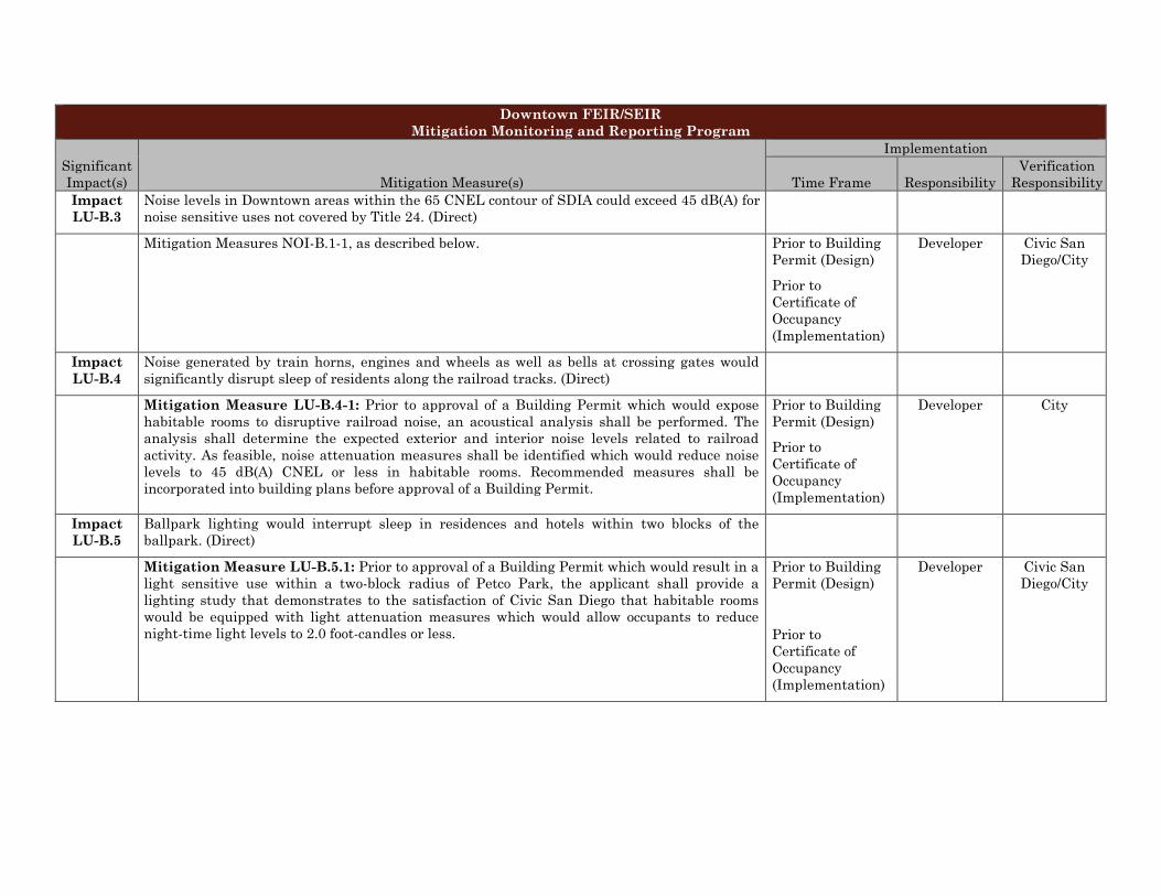
Downtown FEIR/SEIR Mitigation Monitoring and Reporting Program
Significant Impact(s) Mitigation Measure(s)
Implementation
Time Frame Responsibility Verification
Responsibility Impact LU-B.3
Noise levels in Downtown areas within the 65 CNEL contour of SDIA could exceed 45 dB(A) for noise sensitive uses not covered by Title 24. (Direct)
Mitigation Measures NOI-B.1-1, as described below. Prior to Building Permit (Design)
Prior to Certificate of Occupancy (Implementation)
Developer Civic San Diego/City
Impact LU-B.4
Noise generated by train horns, engines and wheels as well as bells at crossing gates would significantly disrupt sleep of residents along the railroad tracks. (Direct)
Mitigation Measure LU-B.4-1: Prior to approval of a Building Permit which would expose habitable rooms to disruptive railroad noise, an acoustical analysis shall be performed. The analysis shall determine the expected exterior and interior noise levels related to railroad activity. As feasible, noise attenuation measures shall be identified which would reduce noise levels to 45 dB(A) CNEL or less in habitable rooms. Recommended measures shall be incorporated into building plans before approval of a Building Permit.
Prior to Building Permit (Design)
Prior to Certificate of Occupancy (Implementation)
Developer City
Impact LU-B.5
Ballpark lighting would interrupt sleep in residences and hotels within two blocks of the ballpark. (Direct)
Mitigation Measure LU-B.5.1: Prior to approval of a Building Permit which would result in a light sensitive use within a two-block radius of Petco Park, the applicant shall provide a lighting study that demonstrates to the satisfaction of Civic San Diego that habitable rooms would be equipped with light attenuation measures which would allow occupants to reduce night-time light levels to 2.0 foot-candles or less.
Prior to Building Permit (Design)
Prior to Certificate of Occupancy (Implementation)
Developer Civic San Diego/City
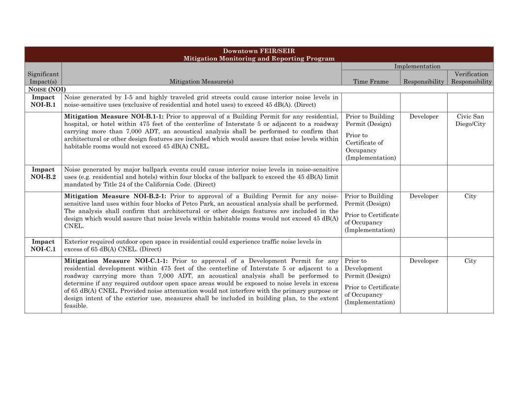
Downtown FEIR/SEIR Mitigation Monitoring and Reporting Program
Significant Impact(s) Mitigation Measure(s)
Implementation
Time Frame Responsibility Verification
Responsibility NOISE (NOI)
Impact NOI-B.1
Noise generated by I-5 and highly traveled grid streets could cause interior noise levels in noise-sensitive uses (exclusive of residential and hotel uses) to exceed 45 dB(A). (Direct)
Mitigation Measure NOI-B.1-1: Prior to approval of a Building Permit for any residential, hospital, or hotel within 475 feet of the centerline of Interstate 5 or adjacent to a roadway carrying more than 7,000 ADT, an acoustical analysis shall be performed to confirm that architectural or other design features are included which would assure that noise levels within habitable rooms would not exceed 45 dB(A) CNEL.
Prior to Building Permit (Design)
Prior to Certificate of Occupancy (Implementation)
Developer Civic San Diego/City
Impact NOI-B.2
Noise generated by major ballpark events could cause interior noise levels in noise-sensitive uses (e.g. residential and hotels) within four blocks of the ballpark to exceed the 45 dB(A) limit mandated by Title 24 of the California Code. (Direct)
Mitigation Measure NOI-B.2-1: Prior to approval of a Building Permit for any noise-sensitive land uses within four blocks of Petco Park, an acoustical analysis shall be performed. The analysis shall confirm that architectural or other design features are included in the design which would assure that noise levels within habitable rooms would not exceed 45 dB(A) CNEL.
Prior to Building Permit (Design)
Prior to Certificate of Occupancy (Implementation)
Developer City
Impact NOI-C.1
Exterior required outdoor open space in residential could experience traffic noise levels in excess of 65 dB(A) CNEL. (Direct)
Mitigation Measure NOI-C.1-1: Prior to approval of a Development Permit for any residential development within 475 feet of the centerline of Interstate 5 or adjacent to a roadway carrying more than 7,000 ADT, an acoustical analysis shall be performed to determine if any required outdoor open space areas would be exposed to noise levels in excess of 65 dB(A) CNEL. Provided noise attenuation would not interfere with the primary purpose or design intent of the exterior use, measures shall be included in building plan, to the extent feasible.
Prior to Development Permit (Design)
Prior to Certificate of Occupancy (Implementation)
Developer City
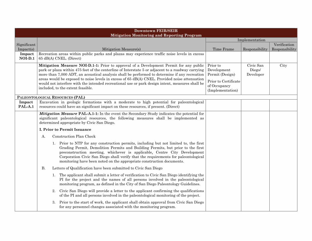
Downtown FEIR/SEIR Mitigation Monitoring and Reporting Program
Significant Impact(s) Mitigation Measure(s)
Implementation
Time Frame Responsibility Verification
Responsibility Impact NOI-D.1
Recreation areas within public parks and plazas may experience traffic noise levels in excess 65 dB(A) CNEL. (Direct)
Mitigation Measure NOI-D.1-1: Prior to approval of a Development Permit for any public park or plaza within 475 feet of the centerline of Interstate 5 or adjacent to a roadway carrying more than 7,000 ADT, an acoustical analysis shall be performed to determine if any recreation areas would be exposed to noise levels in excess of 65 dB(A) CNEL. Provided noise attenuation would not interfere with the intended recreational use or park design intent, measures shall be included, to the extent feasible.
Prior to Development Permit (Design)
Prior to Certificate of Occupancy (Implementation)
Civic San Diego/
Developer
City
PALEONTOLOGICAL RESOURCES (PAL) Impact PAL-A.1
Excavation in geologic formations with a moderate to high potential for paleontological resources could have an significant impact on these resources, if present. (Direct)
Mitigation Measure PAL-A.1-1: In the event the Secondary Study indicates the potential for significant paleontological resources, the following measures shall be implemented as determined appropriate by Civic San Diego.
I. Prior to Permit Issuance
A. Construction Plan Check
1. Prior to NTP for any construction permits, including but not limited to, the first Grading Permit, Demolition Permits and Building Permits, but prior to the first preconstruction meeting, whichever is applicable, Centre City Development Corporation Civic San Diego shall verify that the requirements for paleontological monitoring have been noted on the appropriate construction documents.
B. Letters of Qualification have been submitted to Civic San Diego
1. The applicant shall submit a letter of verification to Civic San Diego identifying the PI for the project and the names of all persons involved in the paleontological monitoring program, as defined in the City of San Diego Paleontology Guidelines.
2. Civic San Diego will provide a letter to the applicant confirming the qualifications of the PI and all persons involved in the paleontological monitoring of the project.
3. Prior to the start of work, the applicant shall obtain approval from Civic San Diego for any personnel changes associated with the monitoring program.
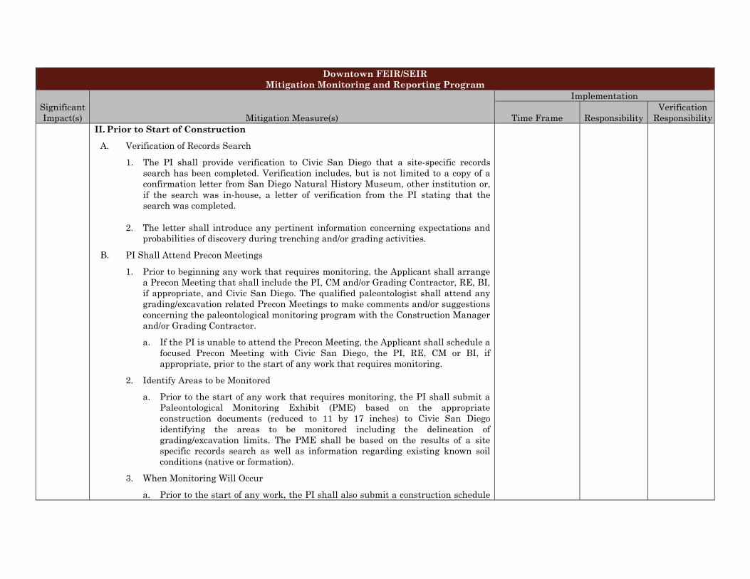
Downtown FEIR/SEIR Mitigation Monitoring and Reporting Program
Significant Impact(s) Mitigation Measure(s)
Implementation
Time Frame Responsibility Verification
Responsibility II. Prior to Start of Construction
A. Verification of Records Search
1. The PI shall provide verification to Civic San Diego that a site-specific records search has been completed. Verification includes, but is not limited to a copy of a confirmation letter from San Diego Natural History Museum, other institution or, if the search was in-house, a letter of verification from the PI stating that the search was completed.
2. The letter shall introduce any pertinent information concerning expectations and probabilities of discovery during trenching and/or grading activities.
B. PI Shall Attend Precon Meetings
1. Prior to beginning any work that requires monitoring, the Applicant shall arrange a Precon Meeting that shall include the PI, CM and/or Grading Contractor, RE, BI, if appropriate, and Civic San Diego. The qualified paleontologist shall attend any grading/excavation related Precon Meetings to make comments and/or suggestions concerning the paleontological monitoring program with the Construction Manager and/or Grading Contractor.
a. If the PI is unable to attend the Precon Meeting, the Applicant shall schedule a focused Precon Meeting with Civic San Diego, the PI, RE, CM or BI, if appropriate, prior to the start of any work that requires monitoring.
2. Identify Areas to be Monitored
a. Prior to the start of any work that requires monitoring, the PI shall submit a Paleontological Monitoring Exhibit (PME) based on the appropriate construction documents (reduced to 11 by 17 inches) to Civic San Diego identifying the areas to be monitored including the delineation of grading/excavation limits. The PME shall be based on the results of a site specific records search as well as information regarding existing known soil conditions (native or formation).
3. When Monitoring Will Occur
a. Prior to the start of any work, the PI shall also submit a construction schedule
Downtown FEIR/SEIR Mitigation Monitoring and Reporting Program
Significant Impact(s) Mitigation Measure(s)
Implementation
Time Frame Responsibility Verification
Responsibility to Civic San Diego through the RE indicating when and where monitoring will occur.
b. The PI may submit a detailed letter to Civic San Diego prior to the start of work or during construction requesting a modification to the monitoring program. This request shall be based on relevant information such as review of final construction documents which indicate conditions such as depth of excavation and/or site graded to bedrock, presence or absence of fossil resources, etc., which may reduce or increase the potential for resources to be present.
III. During Construction
A. Monitor Shall be Present During Grading/Excavation/Trenching
1. The monitor shall be present full-time during grading/excavation/trenching activities as identified on the PME that could result in impacts to formations with high and moderate resource sensitivity. The Construction Manager is responsible for notifying the RE, PI, and Civic San Diego of changes to any construction activities.
2. The monitor shall document field activity via the CSVR. The CSVR’s shall be faxed by the CM to the RE the first day of monitoring, the last day of monitoring, monthly (Notification of Monitoring Completion), and in the case of any discoveries. The RE shall forward copies to Civic San Diego.
3. The PI may submit a detailed letter to Civic San Diego during construction requesting a modification to the monitoring program when a field condition such as trenching activities that do not encounter formational soils as previously assumed, and/or when unique/unusual fossils are encountered, which may reduce or increase the potential for resources to be present.
B. Discovery Notification Process
1. In the event of a discovery, the Paleontological Monitor shall direct the contractor to temporarily divert trenching activities in the area of discovery and immediately notify the RE or BI, as appropriate.
Downtown FEIR/SEIR Mitigation Monitoring and Reporting Program
Significant Impact(s) Mitigation Measure(s)
Implementation
Time Frame Responsibility Verification
Responsibility 2. The Monitor shall immediately notify the PI (unless Monitor is the PI) of the
discovery.
3. The PI shall immediately notify Civic San Diego by phone of the discovery, and shall also submit written documentation to Civic San Diego within 24 hours by fax or email with photos of the resource in context, if possible.
C. Determination of Significance
1. The PI shall evaluate the significance of the resource.
a. The PI shall immediately notify Civic San Diego by phone to discuss significance determination and shall also submit a letter to Civic San Diego indicating whether additional mitigation is required. The determination of significance for fossil discoveries shall be at the discretion of the PI.
b. If the resource is significant, the PI shall submit a Paleontological Recovery Program and obtain written approval from Civic San Diego. Impacts to significant resources must be mitigated before ground disturbing activities in the area of discovery will be allowed to resume.
c. If resource is not significant (e.g., small pieces of broken common shell fragments or other scattered common fossils) the PI shall notify the RE, or BI as appropriate, that a non-significant discovery has been made. The Paleontologist shall continue to monitor the area without notification to Civic San Diego unless a significant resource is encountered.
d. The PI shall submit a letter to Civic San Diego indicating that fossil resources will be collected, curated, and documented in the Final Monitoring Report. The letter shall also indicate that no further work is required.
IV. Night Work
A. If night work is included in the contract
1. When night work is included in the contract package, the extent and timing shall be presented and discussed at the precon meeting.
Downtown FEIR/SEIR Mitigation Monitoring and Reporting Program
Significant Impact(s) Mitigation Measure(s)
Implementation
Time Frame Responsibility Verification
Responsibility 2. The following procedures shall be followed.
a. No Discoveries
(1)In the event that no discoveries were encountered during night work, The PI shall record the information on the CSVR and submit to Civic San Diego via fax by 9 a.m. the following morning, if possible.
b. Discoveries
(1)All discoveries shall be processed and documented using the existing procedures detailed in Sections III - During Construction.
c. Potentially Significant Discoveries
(1)If the PI determines that a potentially significant discovery has been made, the procedures detailed under Section III - During Construction shall be followed.
d. The PI shall immediately contact Civic San Diego, or by 8 a.m. the following morning to report and discuss the findings as indicated in Section III-B, unless other specific arrangements have been made.
B. If night work becomes necessary during the course of construction
1. The Construction Manager shall notify the RE, or BI, as appropriate, a minimum of 24 hours before the work is to begin.
2. The RE, or BI, as appropriate, shall notify Civic San Diego immediately.
C. All other procedures described above shall apply, as appropriate.
V. Post Construction
A. Submittal of Draft Monitoring Report
1. The PI shall submit two copies of the Draft Monitoring Report (even if negative) which describes the results, analysis, and conclusions of all phases of the Paleontological Monitoring Program (with appropriate graphics) to Civic San Diego for review and approval within 90 days following the completion of monitoring,
a. For significant paleontological resources encountered during monitoring, the
Downtown FEIR/SEIR Mitigation Monitoring and Reporting Program
Significant Impact(s) Mitigation Measure(s)
Implementation
Time Frame Responsibility Verification
Responsibility Paleontological Recovery Program shall be included in the Draft Monitoring Report.
b. Recording Sites with the San Diego Natural History Museum
(1) The PI shall be responsible for recording (on the appropriate forms) any significant or potentially significant fossil resources encountered during the Paleontological Monitoring Program in accordance with the City’s Paleontological Guidelines, and submittal of such forms to the San Diego Natural History Museum with the Final Monitoring Report.
2. Civic San Diego shall return the Draft Monitoring Report to the PI for revision or, for preparation of the Final Report.
3. The PI shall submit revised Draft Monitoring Report to Civic San Diego for approval.
4. Civic San Diego shall provide written verification to the PI of the approved report.
5. Civic San Diego shall notify the RE or BI, as appropriate, of receipt of all Draft Monitoring Report submittals and approvals.
B. Handling of Fossil Remains
1. The PI shall be responsible for ensuring that all fossil remains collected are cleaned and catalogued.
2. The PI shall be responsible for ensuring that all fossil remains are analyzed to identify function and chronology as they relate to the geologic history of the area; that faunal material is identified as to species; and that specialty studies are completed, as appropriate
C. Curation of fossil remains: Deed of Gift and Acceptance Verification
1. The PI shall be responsible for ensuring that all fossil remains associated with the monitoring for this project are permanently curated with an appropriate institution.
2. The PI shall include the Acceptance Verification from the curation institution in the Final Monitoring Report submitted to the RE or BI and Civic San Diego.
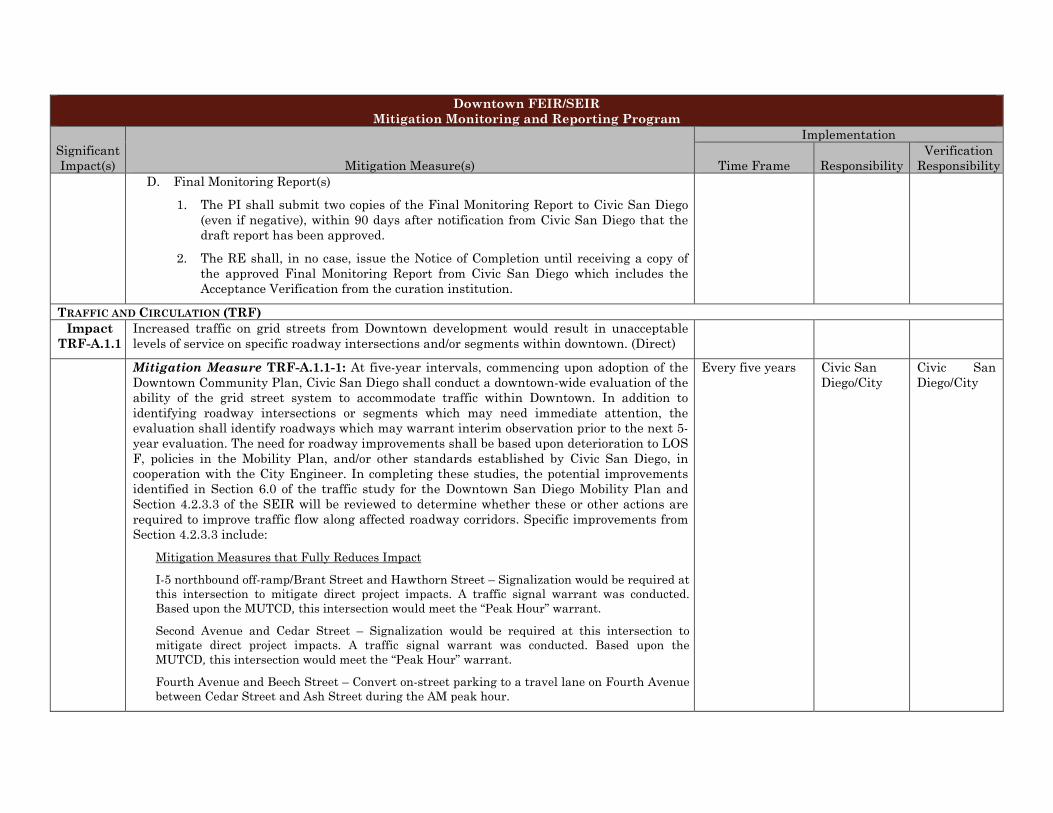
Downtown FEIR/SEIR Mitigation Monitoring and Reporting Program
Significant Impact(s) Mitigation Measure(s)
Implementation
Time Frame Responsibility Verification
Responsibility D. Final Monitoring Report(s)
1. The PI shall submit two copies of the Final Monitoring Report to Civic San Diego (even if negative), within 90 days after notification from Civic San Diego that the draft report has been approved.
2. The RE shall, in no case, issue the Notice of Completion until receiving a copy of the approved Final Monitoring Report from Civic San Diego which includes the Acceptance Verification from the curation institution.
TRAFFIC AND CIRCULATION (TRF) Impact
TRF-A.1.1 Increased traffic on grid streets from Downtown development would result in unacceptable levels of service on specific roadway intersections and/or segments within downtown. (Direct)
Mitigation Measure TRF-A.1.1-1: At five-year intervals, commencing upon adoption of the Downtown Community Plan, Civic San Diego shall conduct a downtown-wide evaluation of the ability of the grid street system to accommodate traffic within Downtown. In addition to identifying roadway intersections or segments which may need immediate attention, the evaluation shall identify roadways which may warrant interim observation prior to the next 5-year evaluation. The need for roadway improvements shall be based upon deterioration to LOS F, policies in the Mobility Plan, and/or other standards established by Civic San Diego, in cooperation with the City Engineer. In completing these studies, the potential improvements identified in Section 6.0 of the traffic study for the Downtown San Diego Mobility Plan and Section 4.2.3.3 of the SEIR will be reviewed to determine whether these or other actions are required to improve traffic flow along affected roadway corridors. Specific improvements from Section 4.2.3.3 include:
Mitigation Measures that Fully Reduces Impact
I-5 northbound off-ramp/Brant Street and Hawthorn Street – Signalization would be required at this intersection to mitigate direct project impacts. A traffic signal warrant was conducted. Based upon the MUTCD, this intersection would meet the “Peak Hour” warrant.
Second Avenue and Cedar Street – Signalization would be required at this intersection to mitigate direct project impacts. A traffic signal warrant was conducted. Based upon the MUTCD, this intersection would meet the “Peak Hour” warrant.
Fourth Avenue and Beech Street – Convert on-street parking to a travel lane on Fourth Avenue between Cedar Street and Ash Street during the AM peak hour.
Every five years Civic San Diego/City
Civic San Diego/City
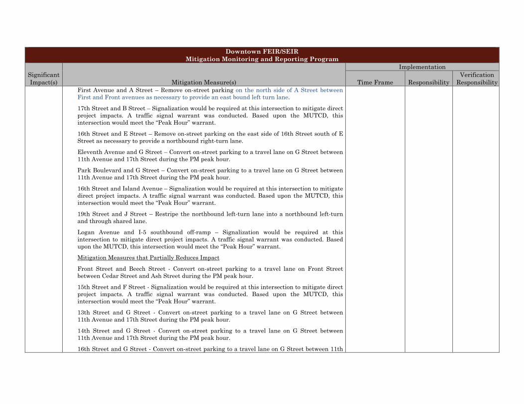
Downtown FEIR/SEIR Mitigation Monitoring and Reporting Program
Significant Impact(s) Mitigation Measure(s)
Implementation
Time Frame Responsibility Verification
Responsibility First Avenue and A Street – Remove on-street parking on the north side of A Street between First and Front avenues as necessary to provide an east bound left turn lane.
17th Street and B Street – Signalization would be required at this intersection to mitigate direct project impacts. A traffic signal warrant was conducted. Based upon the MUTCD, this intersection would meet the “Peak Hour” warrant.
16th Street and E Street – Remove on-street parking on the east side of 16th Street south of E Street as necessary to provide a northbound right-turn lane.
Eleventh Avenue and G Street – Convert on-street parking to a travel lane on G Street between 11th Avenue and 17th Street during the PM peak hour.
Park Boulevard and G Street – Convert on-street parking to a travel lane on G Street between 11th Avenue and 17th Street during the PM peak hour.
16th Street and Island Avenue – Signalization would be required at this intersection to mitigate direct project impacts. A traffic signal warrant was conducted. Based upon the MUTCD, this intersection would meet the “Peak Hour” warrant.
19th Street and J Street – Restripe the northbound left-turn lane into a northbound left-turn and through shared lane.
Logan Avenue and I-5 southbound off-ramp – Signalization would be required at this intersection to mitigate direct project impacts. A traffic signal warrant was conducted. Based upon the MUTCD, this intersection would meet the “Peak Hour” warrant.
Mitigation Measures that Partially Reduces Impact
Front Street and Beech Street - Convert on-street parking to a travel lane on Front Street between Cedar Street and Ash Street during the PM peak hour.
15th Street and F Street - Signalization would be required at this intersection to mitigate direct project impacts. A traffic signal warrant was conducted. Based upon the MUTCD, this intersection would meet the “Peak Hour” warrant.
13th Street and G Street - Convert on-street parking to a travel lane on G Street between 11th Avenue and 17th Street during the PM peak hour.
14th Street and G Street - Convert on-street parking to a travel lane on G Street between 11th Avenue and 17th Street during the PM peak hour.
16th Street and G Street - Convert on-street parking to a travel lane on G Street between 11th
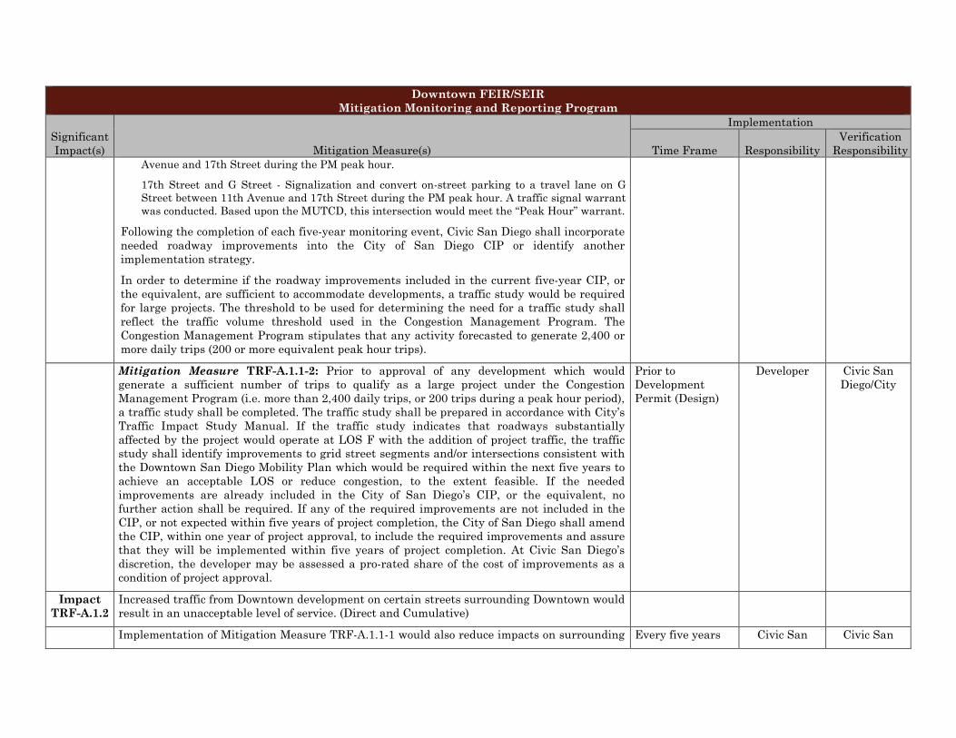
Downtown FEIR/SEIR Mitigation Monitoring and Reporting Program
Significant Impact(s) Mitigation Measure(s)
Implementation
Time Frame Responsibility Verification
Responsibility Avenue and 17th Street during the PM peak hour.
17th Street and G Street - Signalization and convert on-street parking to a travel lane on G Street between 11th Avenue and 17th Street during the PM peak hour. A traffic signal warrant was conducted. Based upon the MUTCD, this intersection would meet the “Peak Hour” warrant.
Following the completion of each five-year monitoring event, Civic San Diego shall incorporate needed roadway improvements into the City of San Diego CIP or identify another implementation strategy.
In order to determine if the roadway improvements included in the current five-year CIP, or the equivalent, are sufficient to accommodate developments, a traffic study would be required for large projects. The threshold to be used for determining the need for a traffic study shall reflect the traffic volume threshold used in the Congestion Management Program. The Congestion Management Program stipulates that any activity forecasted to generate 2,400 or more daily trips (200 or more equivalent peak hour trips).
Mitigation Measure TRF-A.1.1-2: Prior to approval of any development which would generate a sufficient number of trips to qualify as a large project under the Congestion Management Program (i.e. more than 2,400 daily trips, or 200 trips during a peak hour period), a traffic study shall be completed. The traffic study shall be prepared in accordance with City’s Traffic Impact Study Manual. If the traffic study indicates that roadways substantially affected by the project would operate at LOS F with the addition of project traffic, the traffic study shall identify improvements to grid street segments and/or intersections consistent with the Downtown San Diego Mobility Plan which would be required within the next five years to achieve an acceptable LOS or reduce congestion, to the extent feasible. If the needed improvements are already included in the City of San Diego’s CIP, or the equivalent, no further action shall be required. If any of the required improvements are not included in the CIP, or not expected within five years of project completion, the City of San Diego shall amend the CIP, within one year of project approval, to include the required improvements and assure that they will be implemented within five years of project completion. At Civic San Diego’s discretion, the developer may be assessed a pro-rated share of the cost of improvements as a condition of project approval.
Prior to Development Permit (Design)
Developer Civic San Diego/City
Impact TRF-A.1.2
Increased traffic from Downtown development on certain streets surrounding Downtown would result in an unacceptable level of service. (Direct and Cumulative)
Implementation of Mitigation Measure TRF-A.1.1-1 would also reduce impacts on surrounding Every five years Civic San Civic San

Downtown FEIR/SEIR Mitigation Monitoring and Reporting Program
Significant Impact(s) Mitigation Measure(s)
Implementation
Time Frame Responsibility Verification
Responsibility roadways but not necessarily below a level of significance. Diego/City Diego/City
Impact TRF-
A.2.1-1
Elimination of Cedar St. off-ramp would impact other freeway ramps by redirecting traffic to other off ramps serving downtown. (Direct)
Mitigation Measure TRF A.2.2-1: Prior to elimination of the Cedar Street off-ramp from I-5, a traffic study shall be done by Civic San Diego in consultation with the City of San Diego and Caltrans to determine the potential effects associated with elimination of the off-ramp and the conversion of Cedar Street from one- to two-way. The report shall also identify roadway modifications that would minimize potential impacts on local surface streets and I-5.
Prior to elimination of Cedar Street off-ramp (Design/ Implementation)
Civic San Diego/City
Civic San Diego/City
Acknowledgements
This plan, including all drawings, prepared by:
Dyett & Bhatia Urban and Regional Planners
Rajeev Bhatia, Principal-in-Charge and Project Manager
Joan Isaacson, Deputy Project Manager
Jenny Johnston, Project Planner
Mark Chambers, Graphics Manager
Diana Nankin, Senior Graphic Designer
Anna Hutchinson, GIS Specialist
Sarah Manning, Urban Designer/Renderer
Sarah Nurmela, Planner/Urban Designer/Renderer
Ofelia Rodriguez, Planner/Urban Designer
Janice Lum, Graphic Designer
The following firms contributed to background working papers and analysis:
Hargreaves AssociatesLandscape Architects
Mary Margaret Jones, Principal
Jacob Petersen, Senior Associate
Samir Khanna, Landscape Architect
Jerry Allen and Associates
Arts & Culture Consultants
Jerry Allen, Director of Cultural Affairs for the City of San Jose
Ellena Brokaw Myles, Director of Community Services for the City of Ventura
Keyser Marston AssociatesEconomic and Market Assessment
Paul Marra, Principal
Linnie Gavino, Manager
Project Design ConsultantsEnvironmental Consultants
Bruce McIntyre, Senior Vice President
Ellery Foster, Environmental Planner
Skidmore Owings & MerrillArchitects and Planners
John Kriken, Partner
Ellen Lou, Associate Partner


D Y E T T & B H AT I AUrban and Reg iona l P lanners
755 Sansome Street, Suite 400San Francisco, California 94111
415 956 4300 415 956 7315
Related Documents