Remote Sensing Image Analysis Introduction Raul Q. Feitosa Gilson. A. O. P. Costa Patrick N. Happ

Welcome message from author
This document is posted to help you gain knowledge. Please leave a comment to let me know what you think about it! Share it to your friends and learn new things together.
Transcript

Remote Sensing Image AnalysisIntroduction
Raul Q. FeitosaGilson. A. O. P. Costa
Patrick N. Happ

Contents
Definitions
Applications
History
Current Systems
2
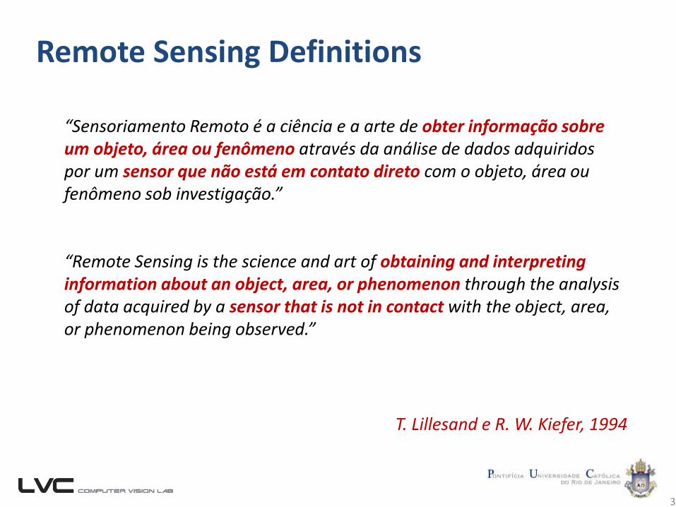
Remote Sensing Definitions
3
“Sensoriamento Remoto é a ciência e a arte de obter informação sobre um objeto, área ou fenômeno através da análise de dados adquiridos por um sensor que não está em contato direto com o objeto, área ou fenômeno sob investigação.”
“Remote Sensing is the science and art of obtaining and interpreting information about an object, area, or phenomenon through the analysis of data acquired by a sensor that is not in contact with the object, area, or phenomenon being observed.”
T. Lillesand e R. W. Kiefer, 1994
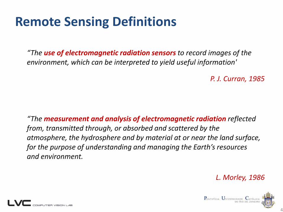
Remote Sensing Definitions
4
“The use of electromagnetic radiation sensors to record images of the environment, which can be interpreted to yield useful information'
“The measurement and analysis of electromagnetic radiation reflected from, transmitted through, or absorbed and scattered by the atmosphere, the hydrosphere and by material at or near the land surface, for the purpose of understanding and managing the Earth’s resources and environment.
L. Morley, 1986
P. J. Curran, 1985
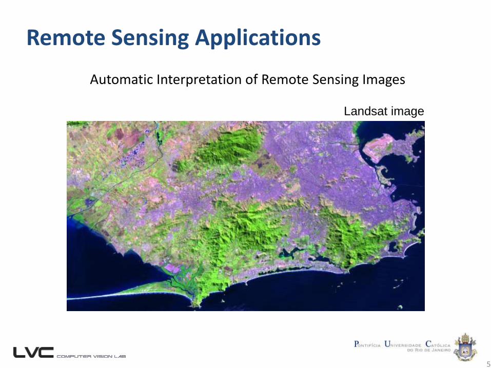
Remote Sensing Applications
5
Automatic Interpretation of Remote Sensing Images
Landsat image
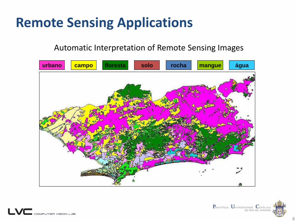
Remote Sensing Applications
6
Automatic Interpretation of Remote Sensing Images
rocha mangueurbano floresta solo águacampo
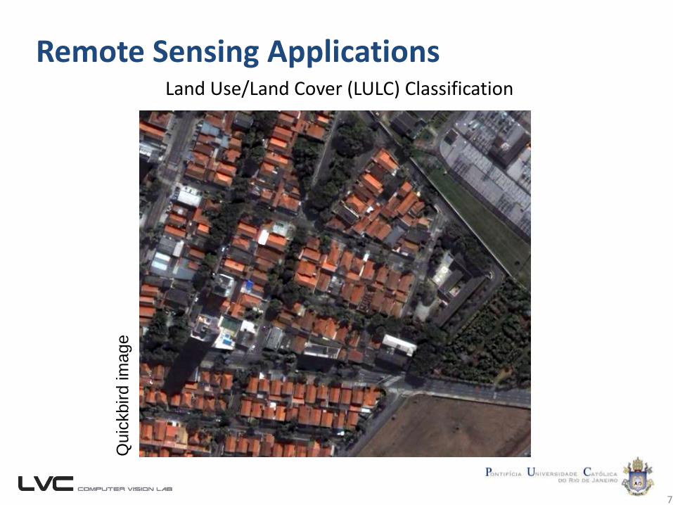
Remote Sensing Applications
7
Land Use/Land Cover (LULC) Classification
Quic
kbird im
age
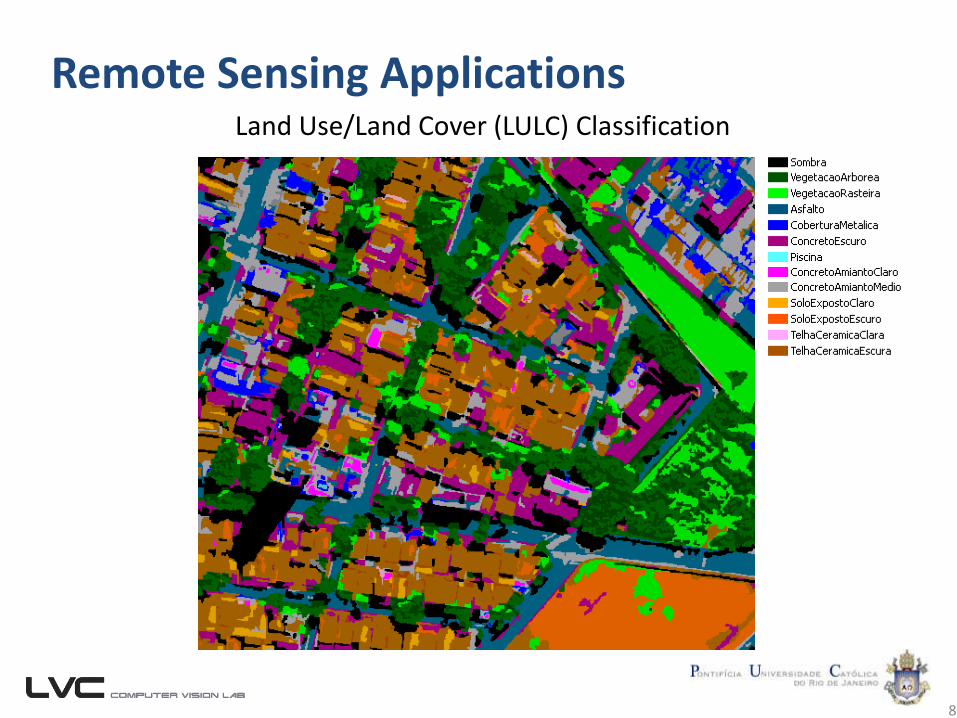
Remote Sensing Applications
8
Land Use/Land Cover (LULC) Classification
Remote Sensing Applications
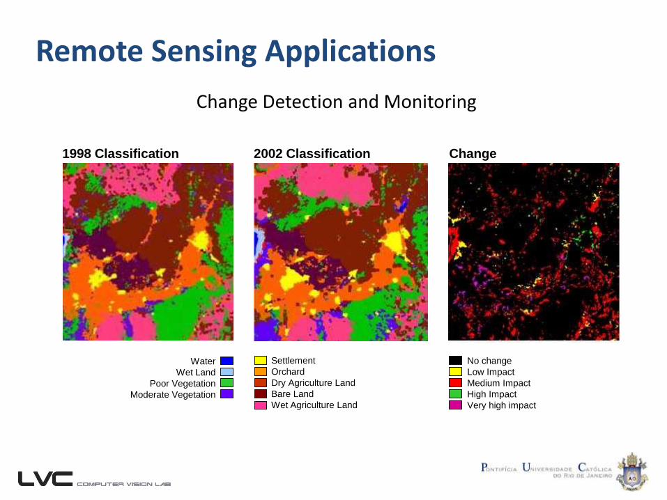
Change Detection and Monitoring
No change
Low Impact
Medium Impact
High Impact
Very high impact
Water
Wet Land
Poor Vegetation
Moderate Vegetation
1998 Classification 2002 Classification Change
Settlement
Orchard
Dry Agriculture Land
Bare Land
Wet Agriculture Land
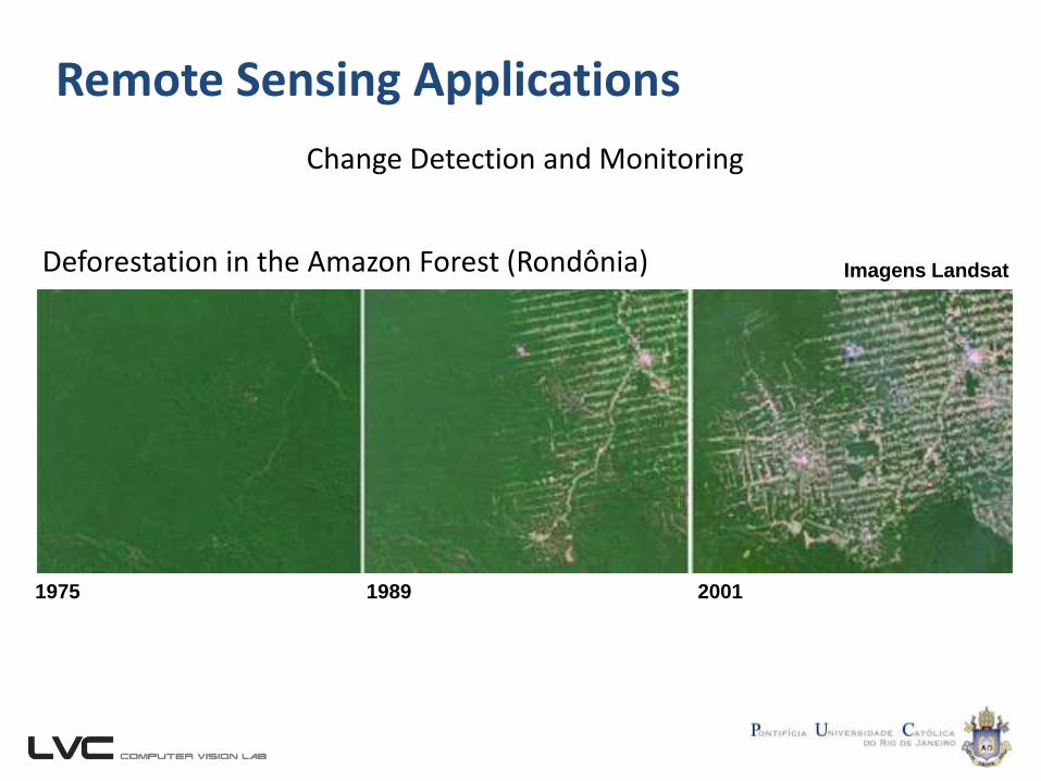
Remote Sensing Applications
Change Detection and Monitoring
Deforestation in the Amazon Forest (Rondônia)
1975 1989 2001
Imagens Landsat
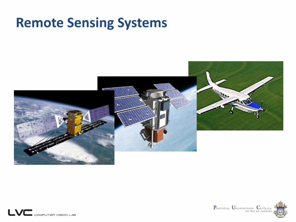
Remote Sensing Systems
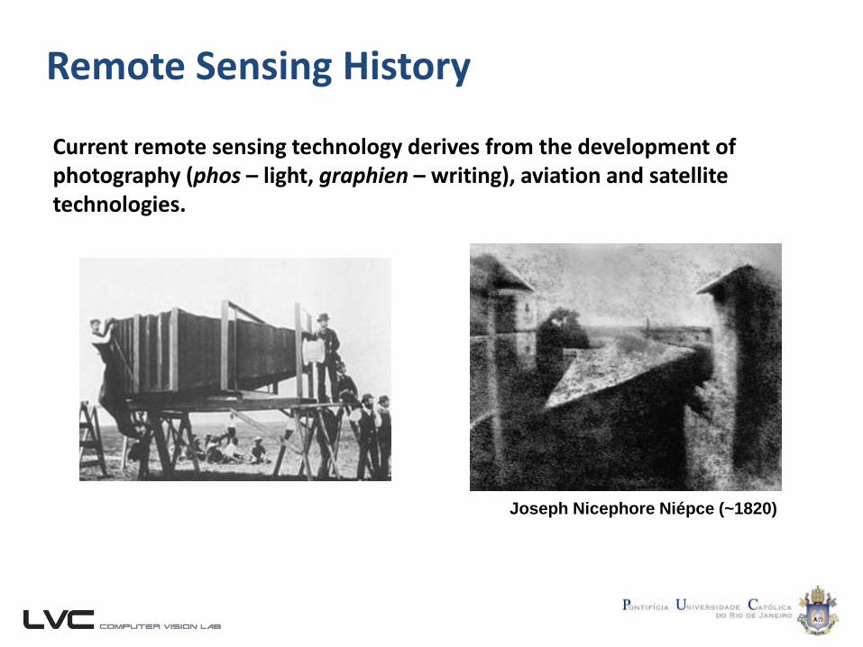
Remote Sensing History
Current remote sensing technology derives from the development of photography (phos – light, graphien – writing), aviation and satellite technologies.
Joseph Nicephore Niépce (~1820)
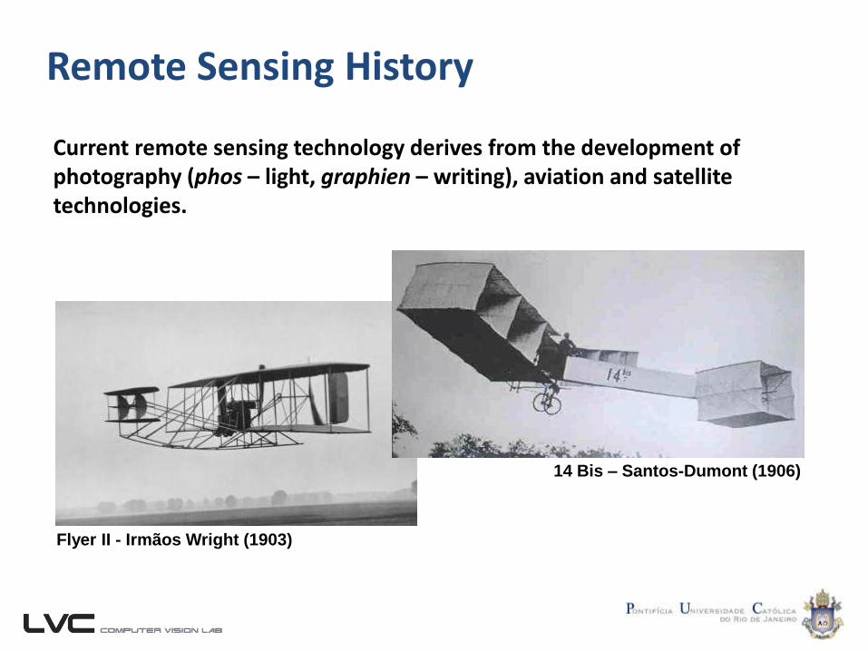
Remote Sensing History
Current remote sensing technology derives from the development of photography (phos – light, graphien – writing), aviation and satellite technologies.
Flyer II - Irmãos Wright (1903)
14 Bis – Santos-Dumont (1906)
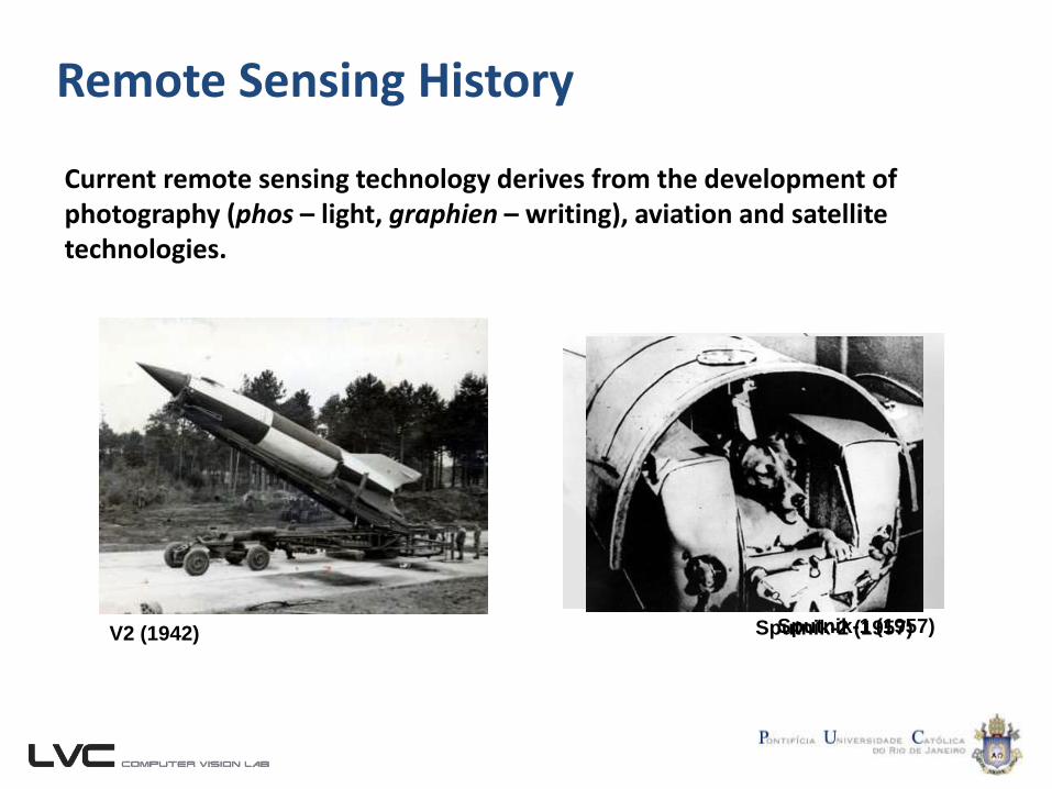
Remote Sensing History
Current remote sensing technology derives from the development of photography (phos – light, graphien – writing), aviation and satellite technologies.
V2 (1942) Sputnik-1 (1957)Sputnik-2 (1957)
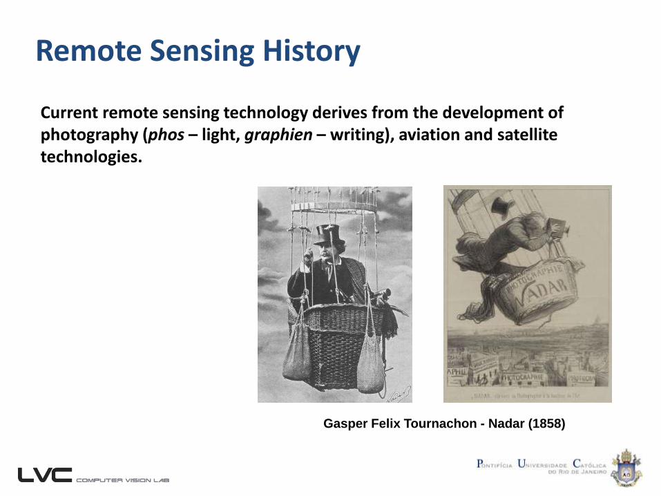
Remote Sensing History
Current remote sensing technology derives from the development of photography (phos – light, graphien – writing), aviation and satellite technologies.
Gasper Felix Tournachon - Nadar (1858)
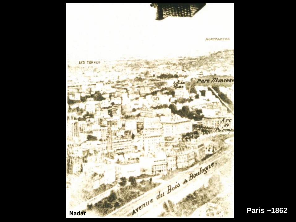
Paris ~1862Nadar

Boston 1860James Wallace Black
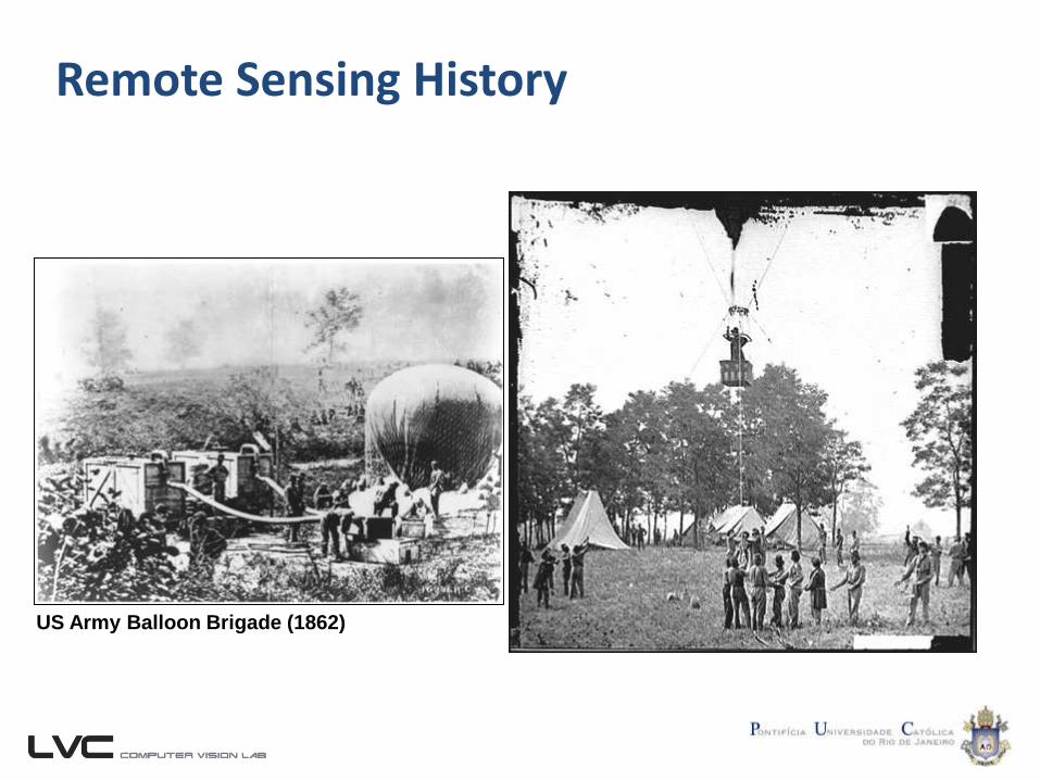
Remote Sensing History
US Army Balloon Brigade (1862)
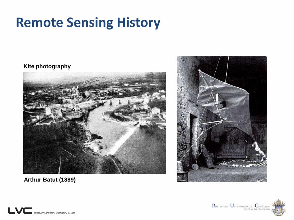
Remote Sensing History
Arthur Batut (1889)
Kite photography
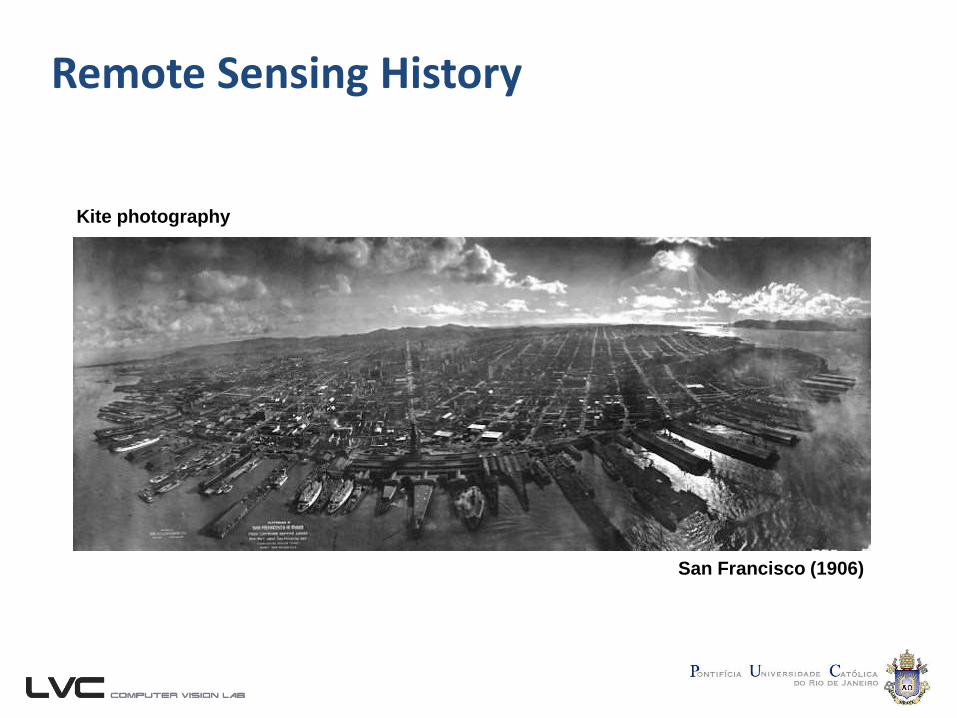
Remote Sensing History
Kite photography
San Francisco (1906)
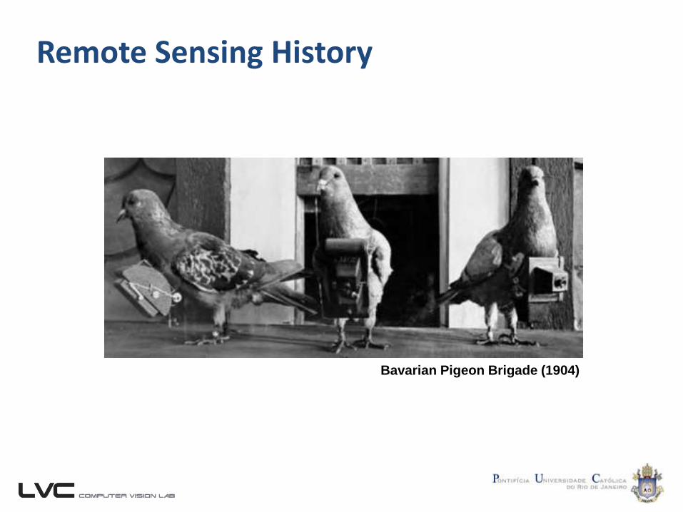
Remote Sensing History
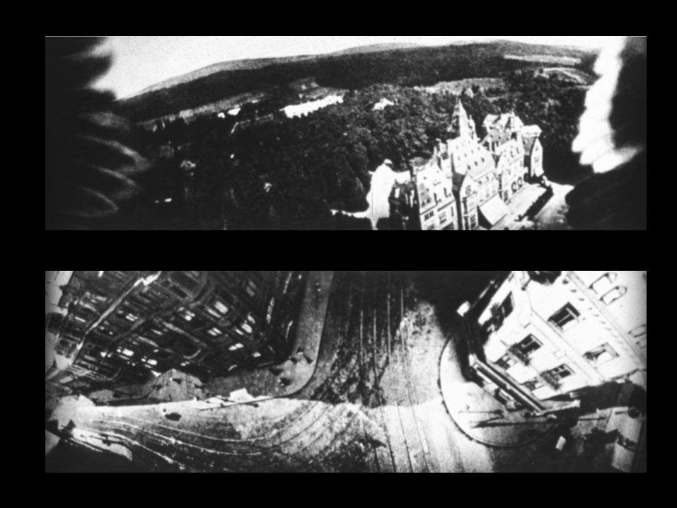
Bavarian Pigeon Brigade (1904)
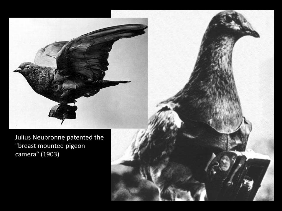
Julius Neubronne patented the "breast mounted pigeon camera“ (1903)
Remote Sensing History
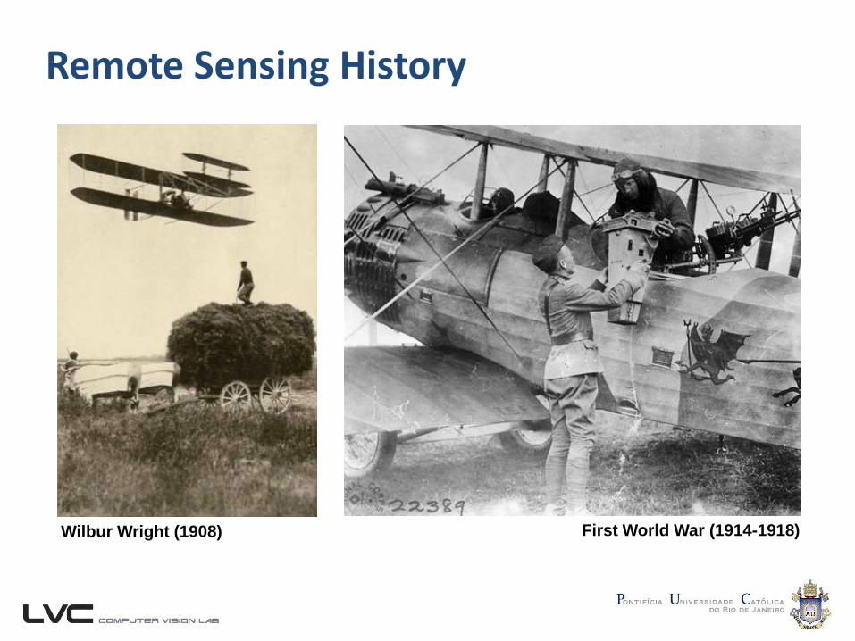
First World War (1914-1918)Wilbur Wright (1908)
Remote Sensing History
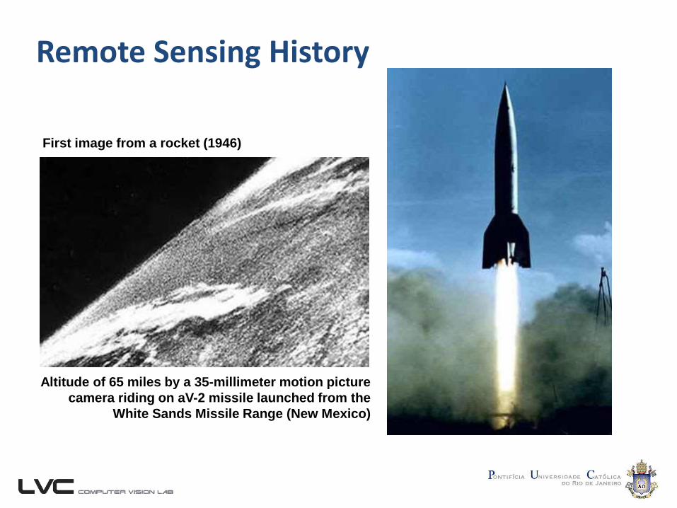
First image from a rocket (1946)
Altitude of 65 miles by a 35-millimeter motion picture
camera riding on aV-2 missile launched from the
White Sands Missile Range (New Mexico)

Remote Sensing History
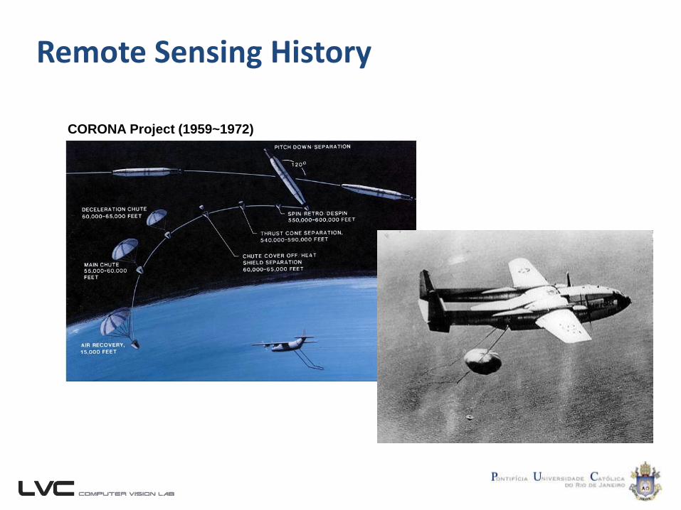
CORONA Project (1959~1972)
Remote Sensing History
CORONA Project (1959~1972)
Remote Sensing History
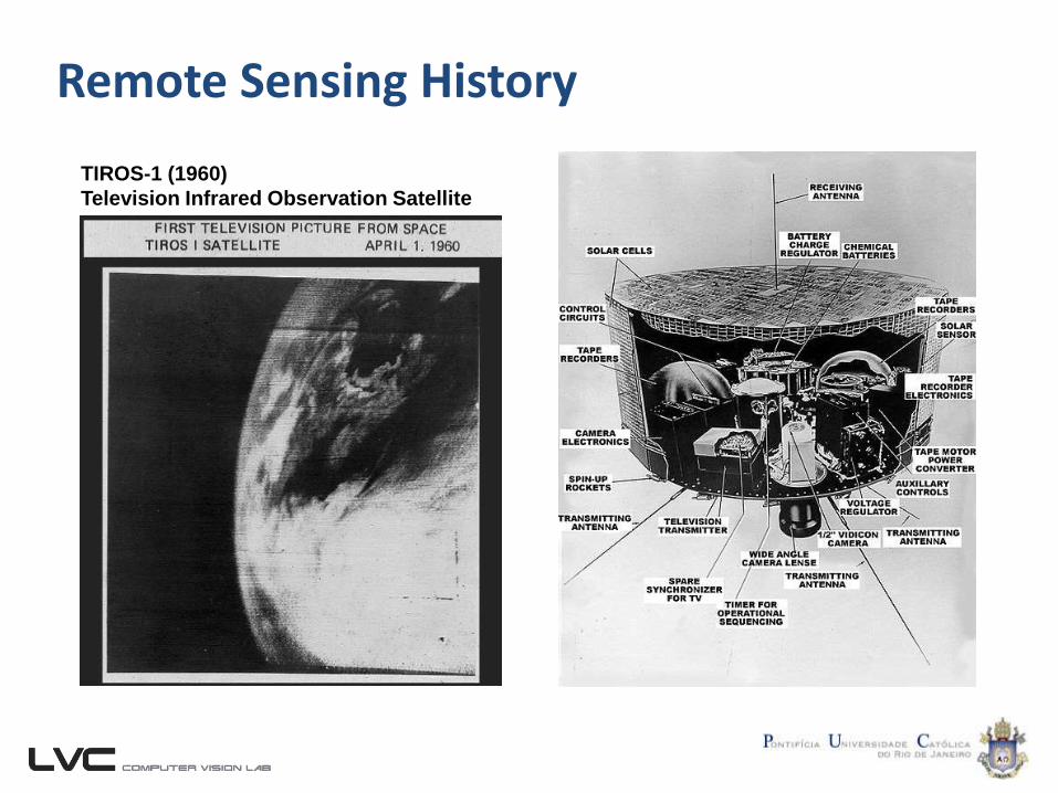
TIROS-1 (1960)
Television Infrared Observation Satellite
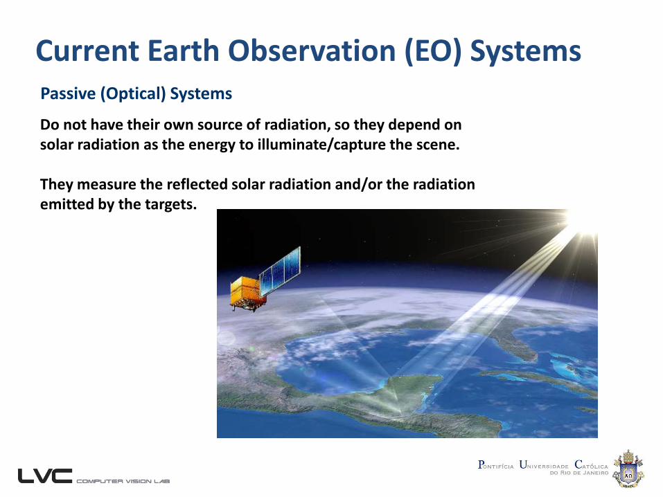
Current Earth Observation (EO) SystemsPassive (Optical) Systems
Do not have their own source of radiation, so they depend on solar radiation as the energy to illuminate/capture the scene.
They measure the reflected solar radiation and/or the radiation emitted by the targets.
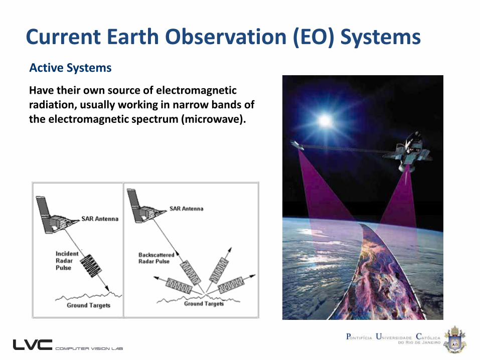
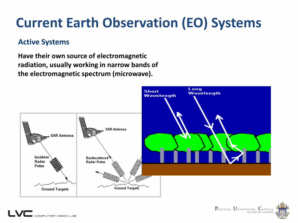
Current Earth Observation (EO) SystemsActive Systems
Have their own source of electromagnetic radiation, usually working in narrow bands of the electromagnetic spectrum (microwave).
Current Earth Observation (EO) SystemsActive Systems
Have their own source of electromagnetic radiation, usually working in narrow bands of the electromagnetic spectrum (microwave).
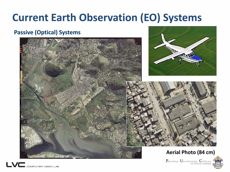
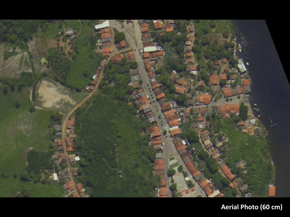
Current Earth Observation (EO) SystemsPassive (Optical) Systems
Aerial Photo (84 cm)
Características dos SensoresSensores Passivos
Fotografia Aérea (84 cm)
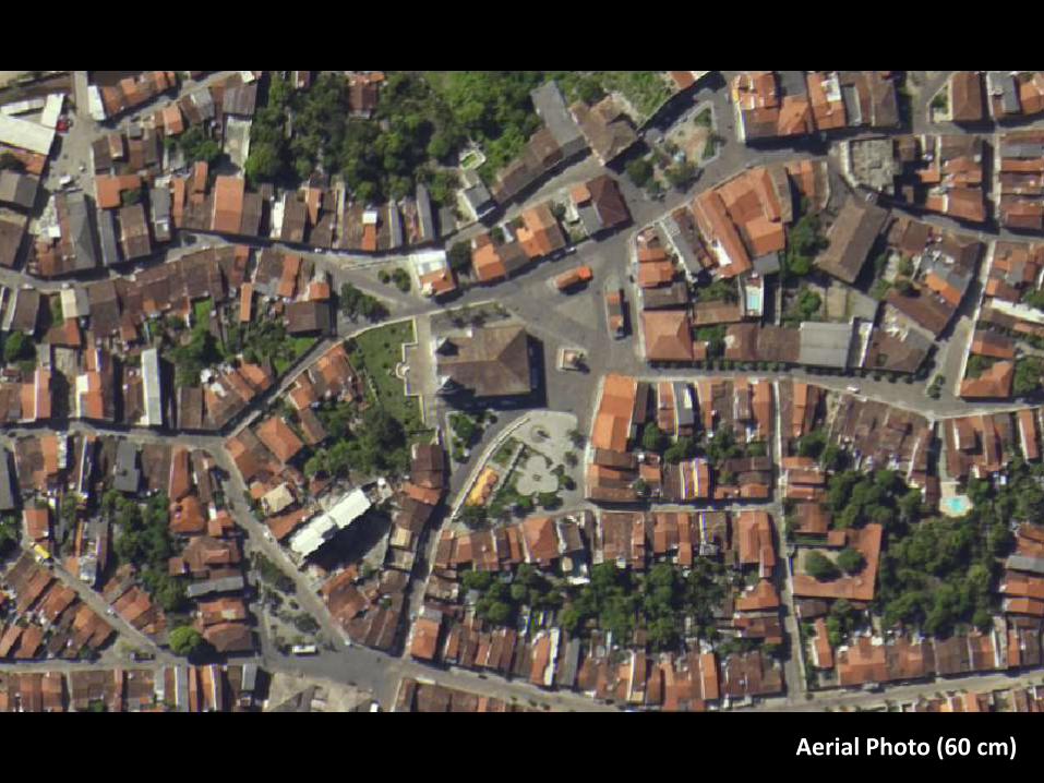
Aerial Photo (60 cm)
Características dos SensoresSensores Passivos
Fotografia Aérea (84 cm)
Aerial Photo (60 cm)
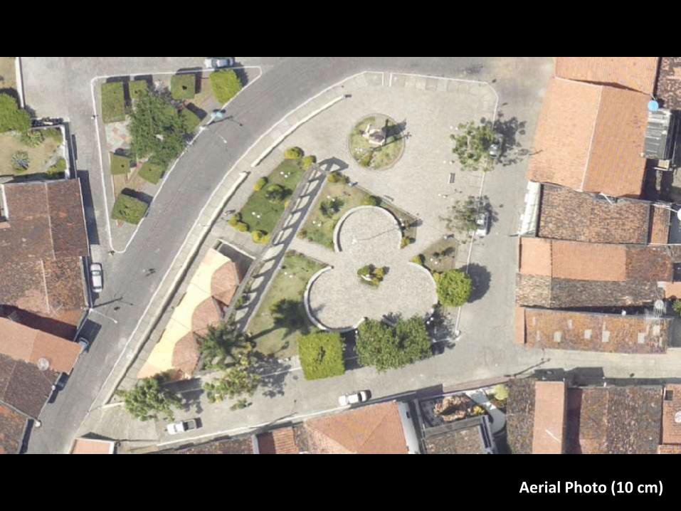
Características dos SensoresSensores Passivos
Fotografia Aérea (84 cm)
Aerial Photo (10 cm)
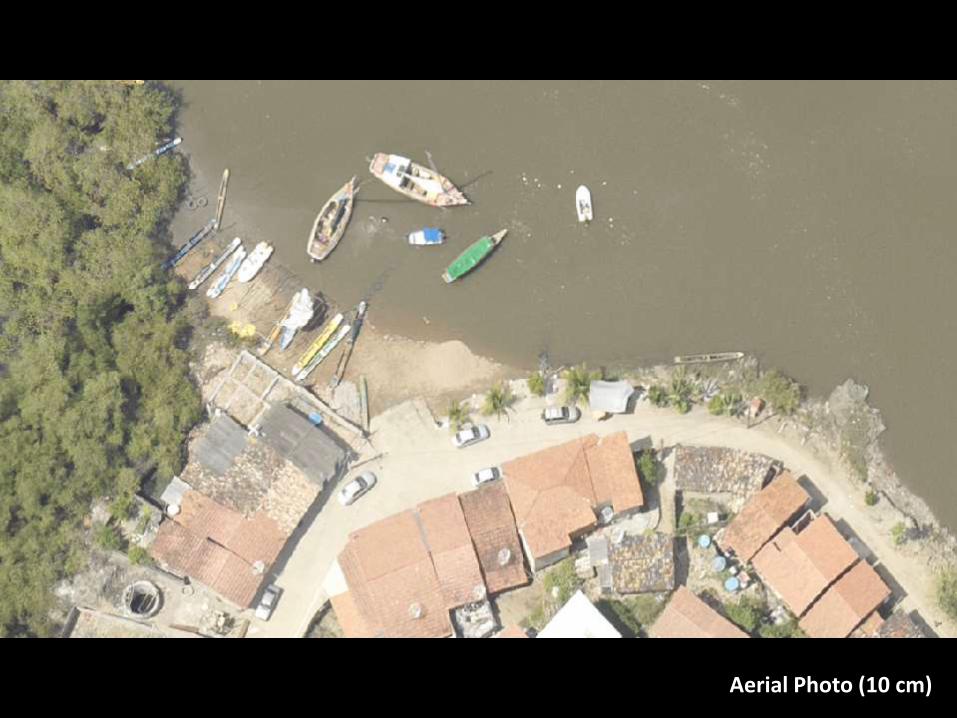
Características dos SensoresSensores Passivos
Fotografia Aérea (84 cm)
Aerial Photo (10 cm)
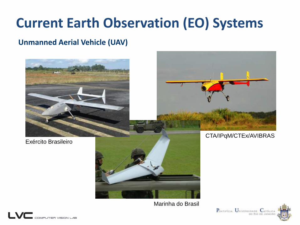
Current Earth Observation (EO) SystemsUnmanned Aerial Vehicle (UAV)
CTA/IPqM/CTEx/AVIBRAS
Marinha do Brasil
Exército Brasileiro
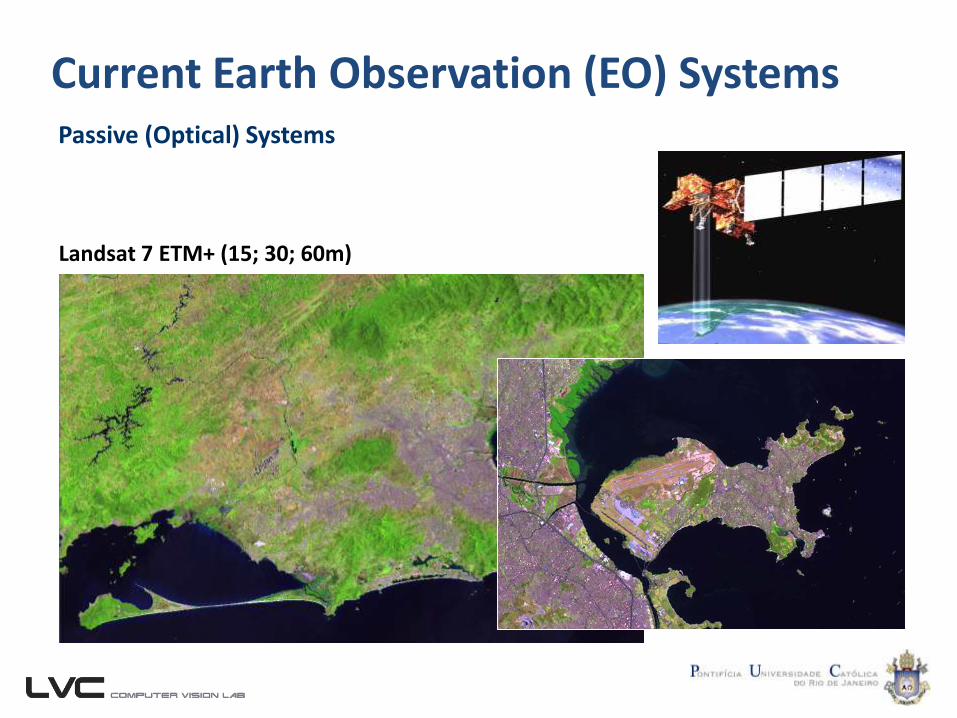
Current Earth Observation (EO) SystemsPassive (Optical) Systems
Landsat 7 ETM+ (15; 30; 60m)
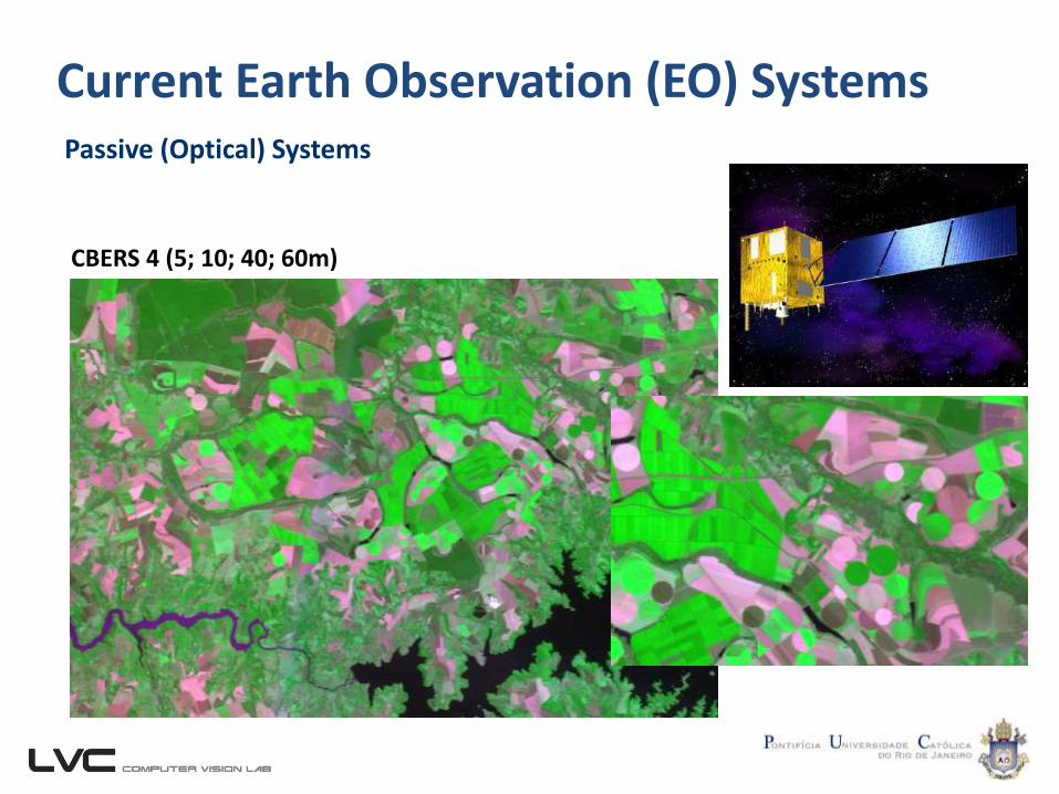
Current Earth Observation (EO) SystemsPassive (Optical) Systems
CBERS 4 (5; 10; 40; 60m)
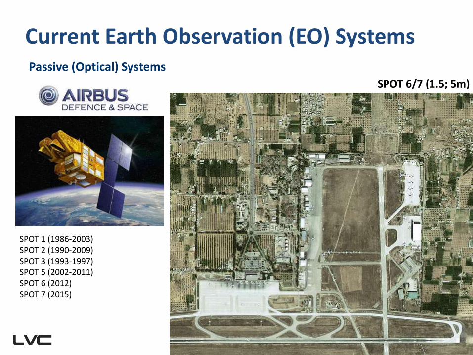
Current Earth Observation (EO) SystemsPassive (Optical) Systems
SPOT 1 (1986-2003)SPOT 2 (1990-2009)SPOT 3 (1993-1997)SPOT 5 (2002-2011)SPOT 6 (2012)SPOT 7 (2015)
SPOT 6/7 (1.5; 5m)
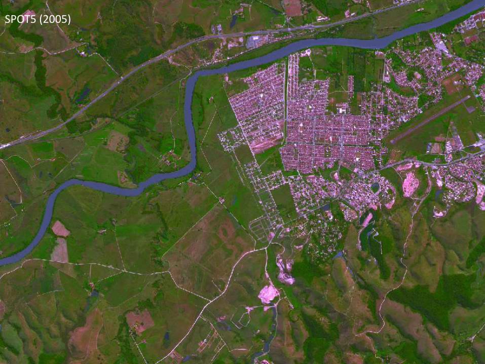
Imagens do Município
SPOT5 (2005)
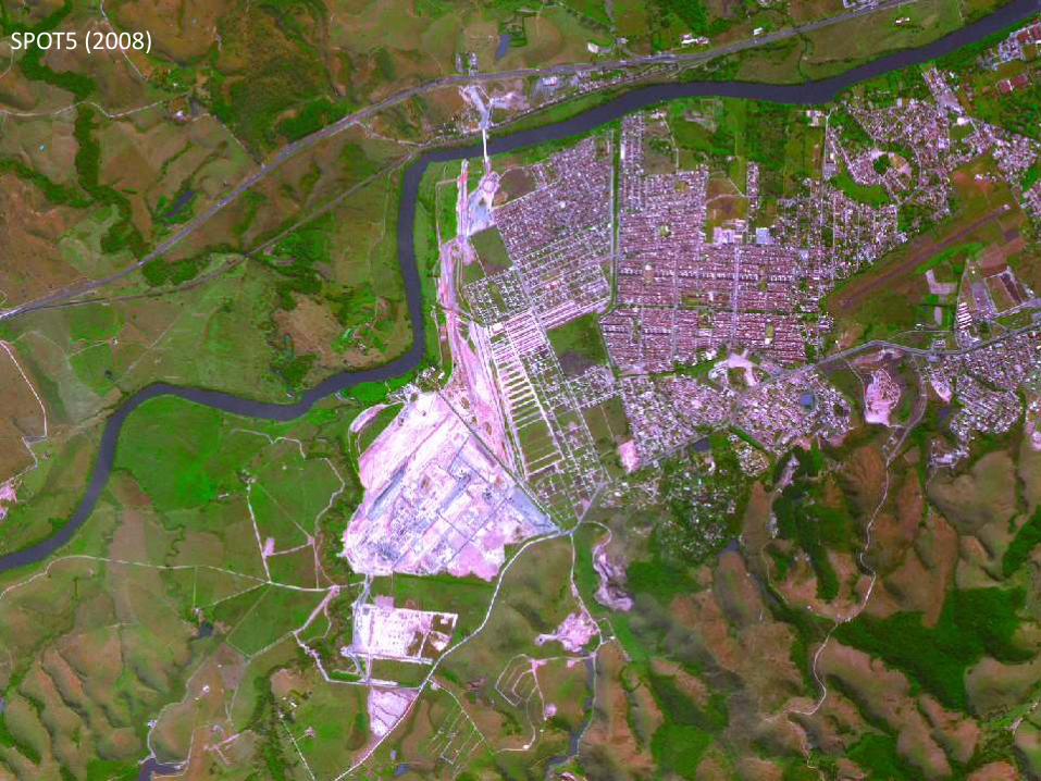
Imagens do Município
SPOT5 (2008)
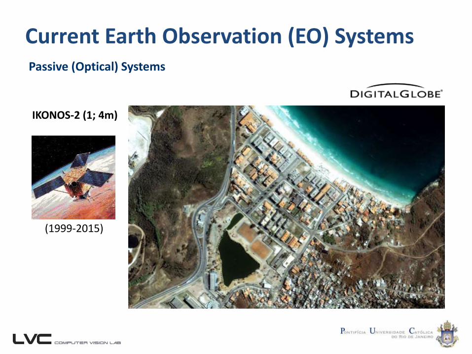
Current Earth Observation (EO) SystemsPassive (Optical) Systems
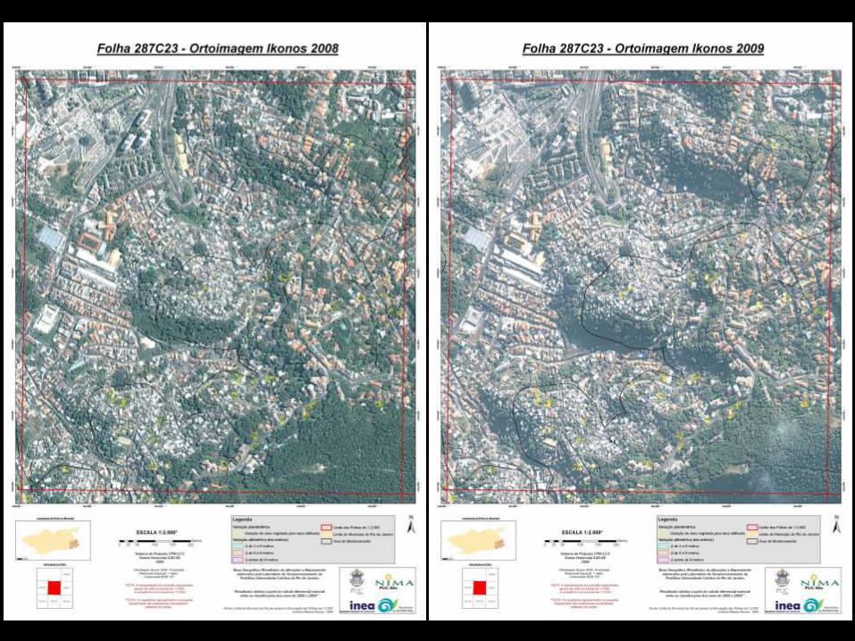
IKONOS-2 (1; 4m)
(1999-2015)
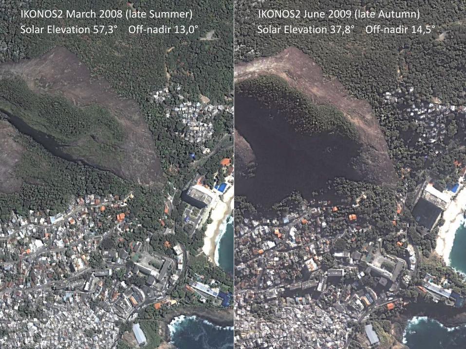
IKONOS2 March 2008 (late Summer) IKONOS2 June 2009 (late Autumn)
Solar Elevation 57,3° Off-nadir 13,0° Solar Elevation 37,8° Off-nadir 14,5°
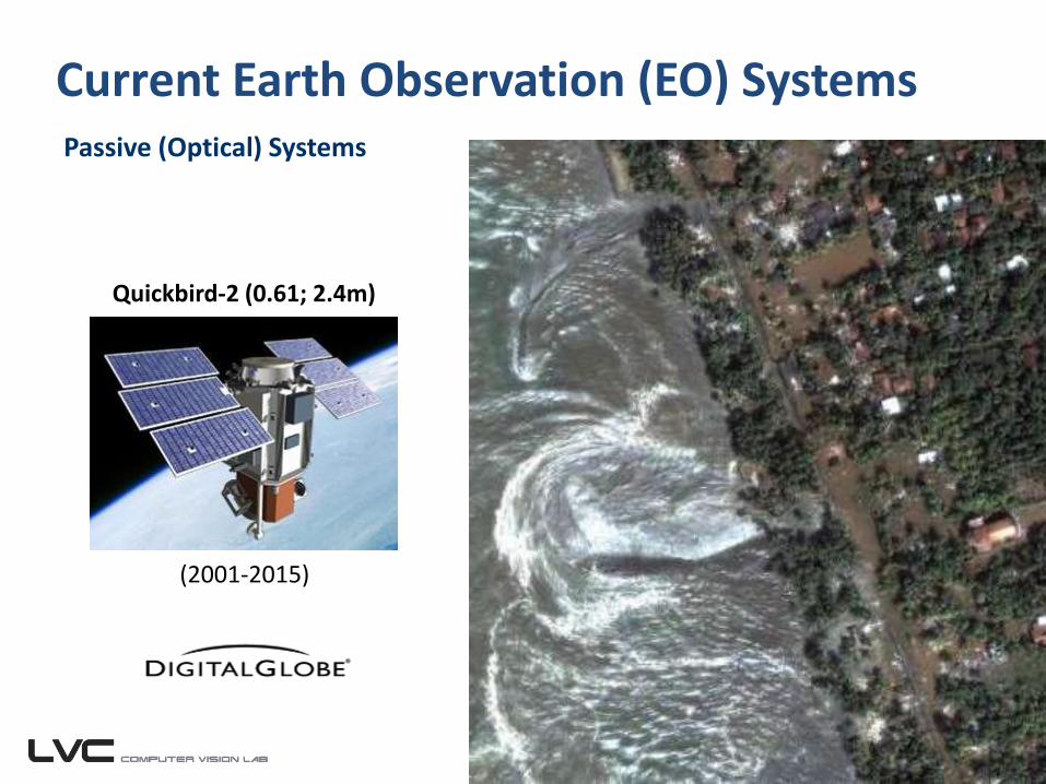
Current Earth Observation (EO) SystemsPassive (Optical) Systems
Quickbird-2 (0.61; 2.4m)
(2001-2015)
Current Earth Observation (EO) SystemsPassive (Optical) Systems
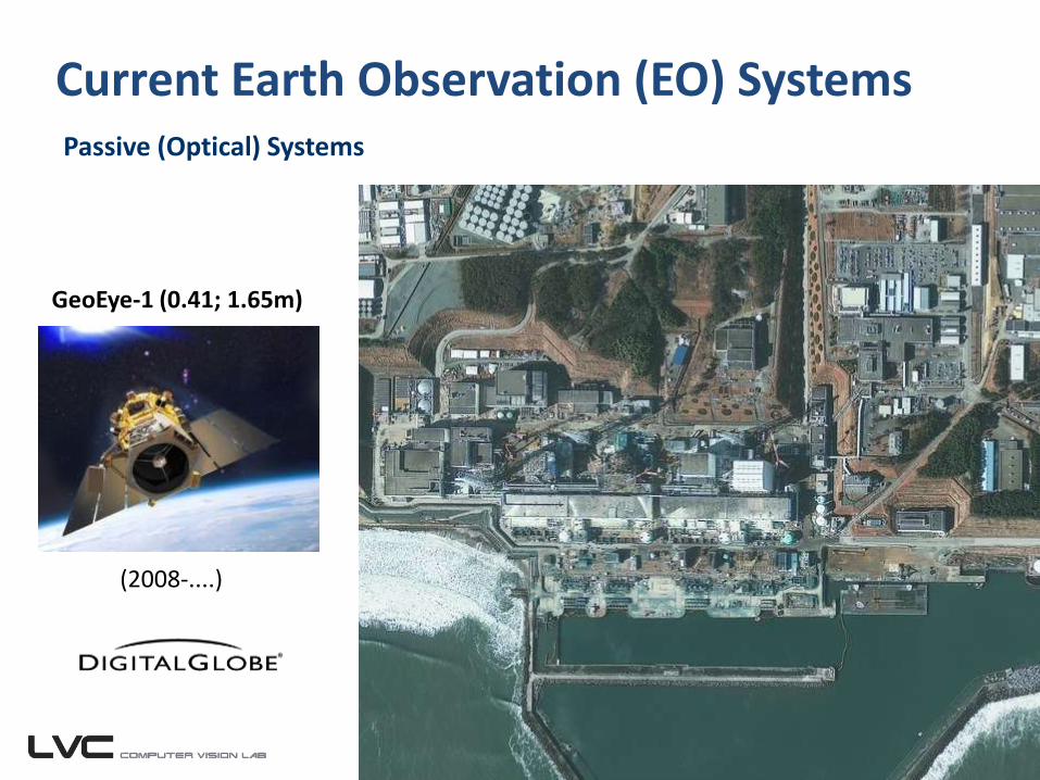
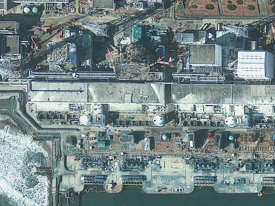
GeoEye-1 (0.41; 1.65m)
(2008-....)
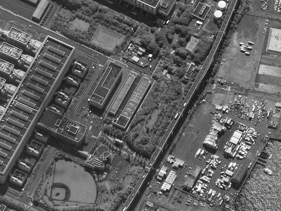
Current Earth Observation (EO) SystemsPassive (Optical) Systems
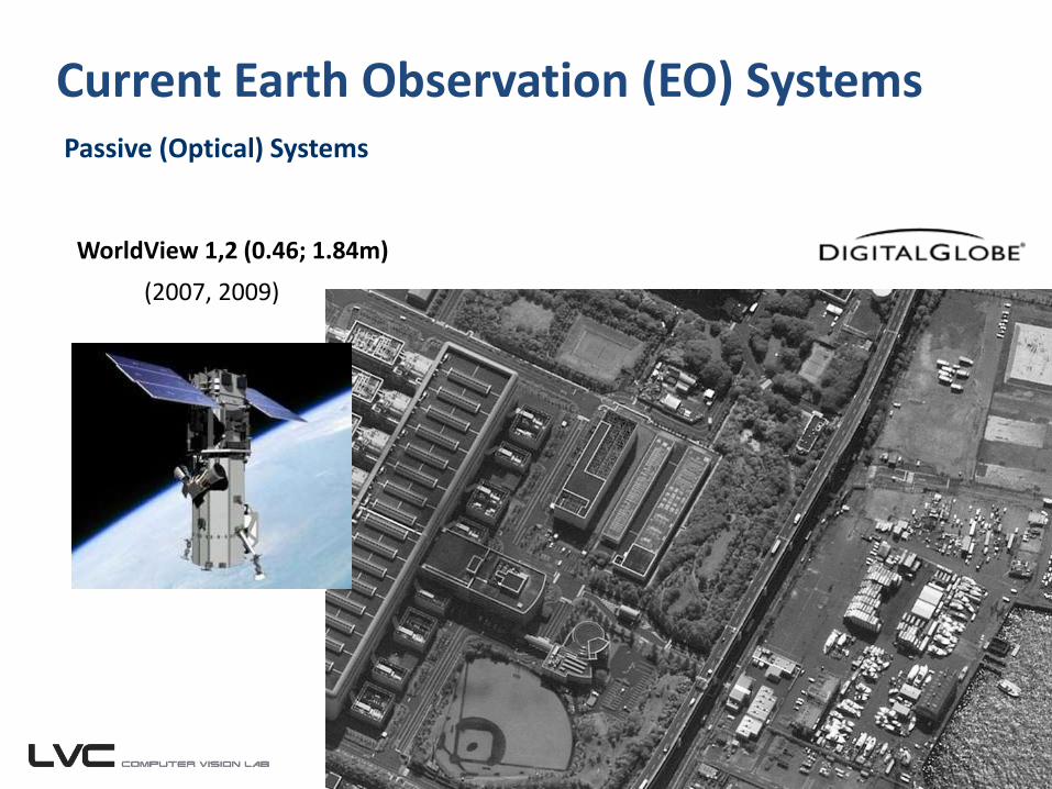
WorldView 1,2 (0.46; 1.84m)
(2007, 2009)
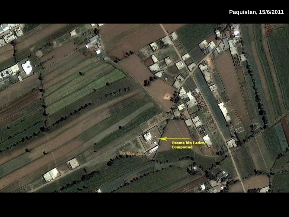
Paquistan, 15/6/2011
Current Earth Observation (EO) SystemsPassive (Optical) Systems
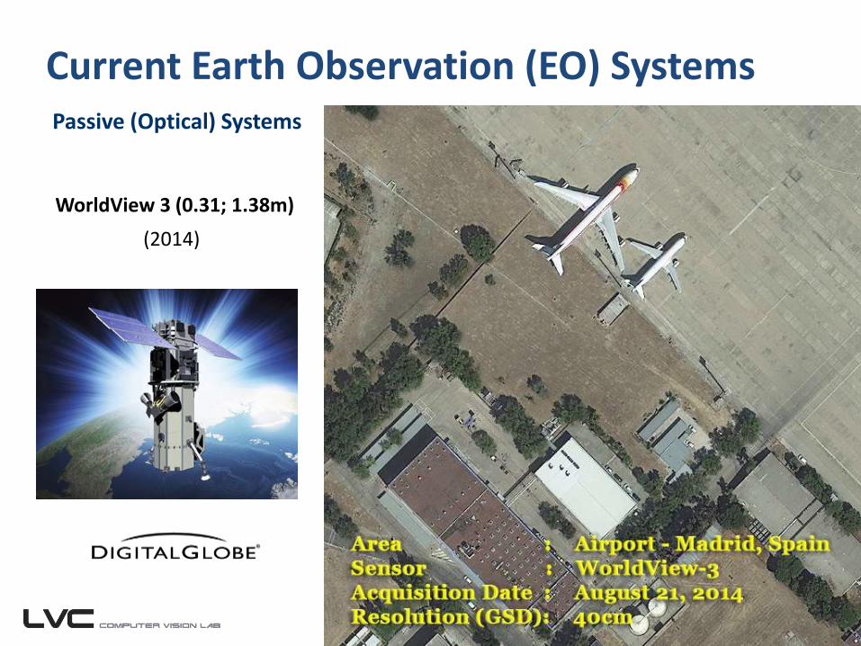
WorldView 3 (0.31; 1.38m)
(2014)
Current Earth Observation (EO) SystemsPassive (Optical) Systems
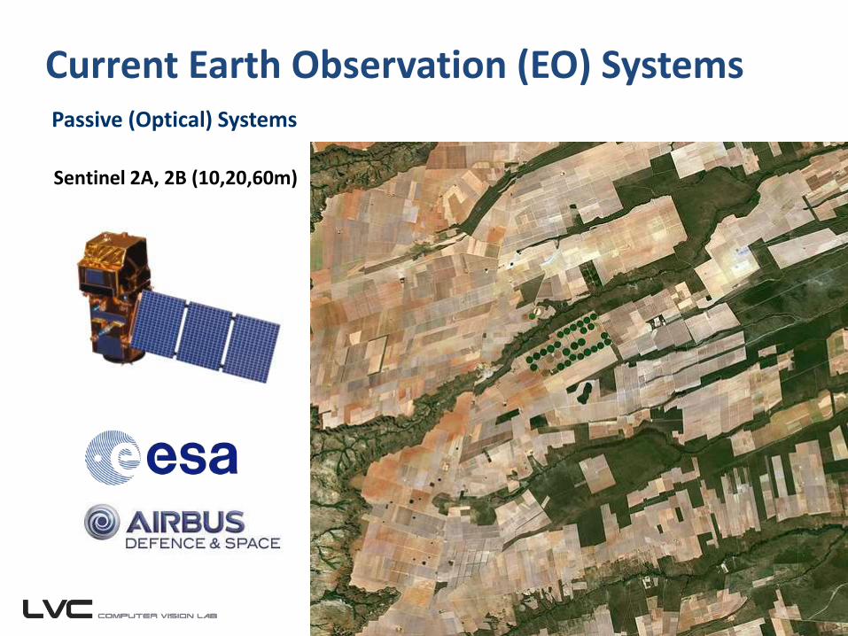
Sentinel 2A, 2B (10,20,60m)
Current Earth Observation (EO) SystemsPassive (Optical) Systems
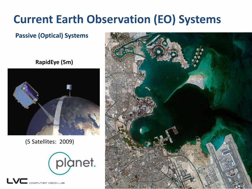
RapidEye (5m)
(5 Satellites: 2009)
Current Earth Observation (EO) SystemsPassive (Optical) Systems
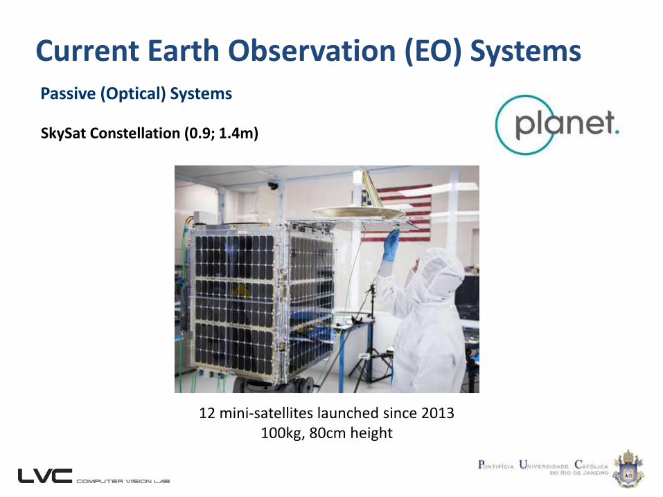
SkySat Constellation (0.9; 1.4m)
12 mini-satellites launched since 2013100kg, 80cm height
Current Earth Observation (EO) SystemsPassive (Optical) Systems
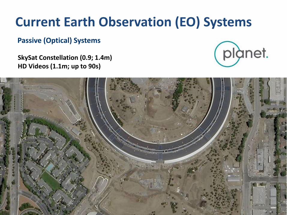
SkySat Constellation (0.9; 1.4m)HD Videos (1.1m; up to 90s)
12 mini-satellites launched since 2013100kg, 80cm height
Current Earth Observation (EO) SystemsPassive (Optical) Systems
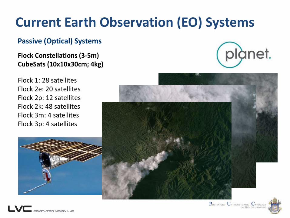
Flock Constellations (3-5m)CubeSats (10x10x30cm; 4kg)
Flock 1: 28 satellitesFlock 2e: 20 satellitesFlock 2p: 12 satellitesFlock 2k: 48 satellitesFlock 3m: 4 satellitesFlock 3p: 4 satellites

Current Earth Observation (EO) SystemsActive Systems
Have their own source of electromagnetic radiation, usually working in narrow bands of the electromagnetic spectrum (microwave).
Current Earth Observation (EO) SystemsActive Systems
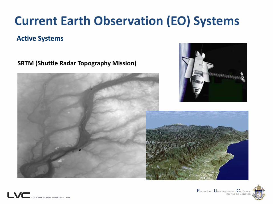
SRTM (Shuttle Radar Topography Mission)
28/10/2001
Current Earth Observation (EO) SystemsActive Systems
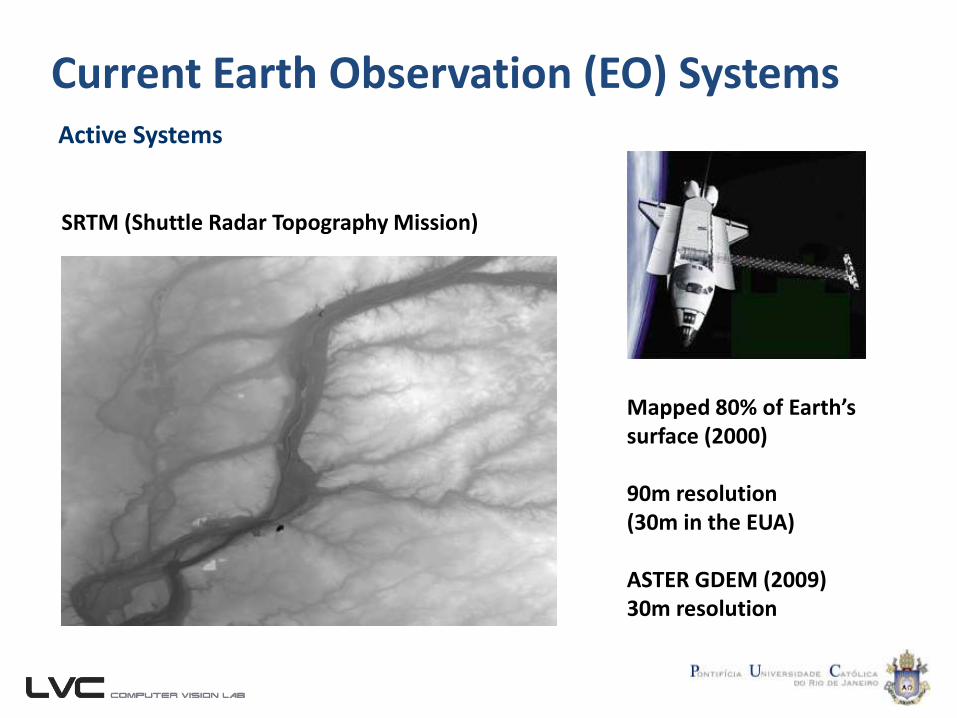
SRTM (Shuttle Radar Topography Mission)
28/10/2001
Mapped 80% of Earth’ssurface (2000)
90m resolution(30m in the EUA)
ASTER GDEM (2009)30m resolution
Current Earth Observation (EO) SystemsActive Systems
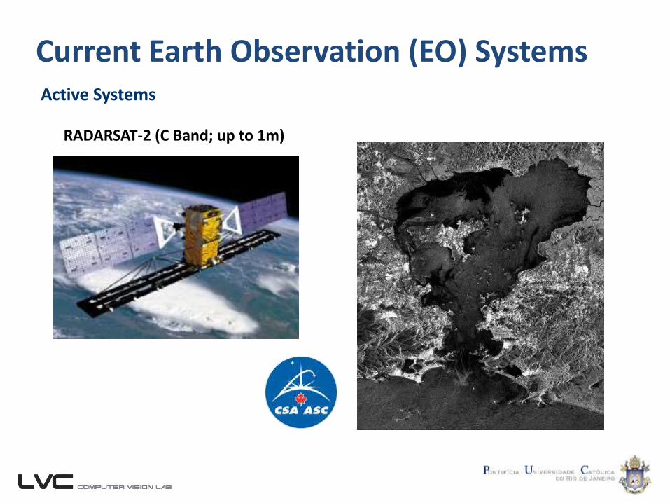
28/10/2001
RADARSAT-2 (C Band; up to 1m)
28/10/2001
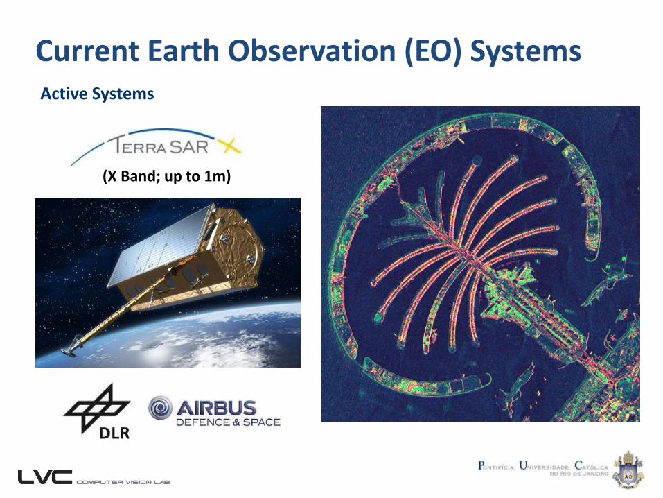
Current Earth Observation (EO) SystemsActive Systems
(X Band; up to 1m)
28/10/2001
Current Earth Observation (EO) SystemsActive Systems
28/10/2001
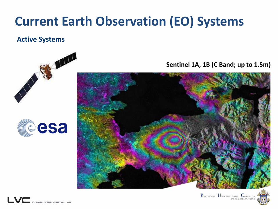
Sentinel 1A, 1B (C Band; up to 1.5m)
Current Earth Observation (EO) SystemsActive Systems
28/10/2001
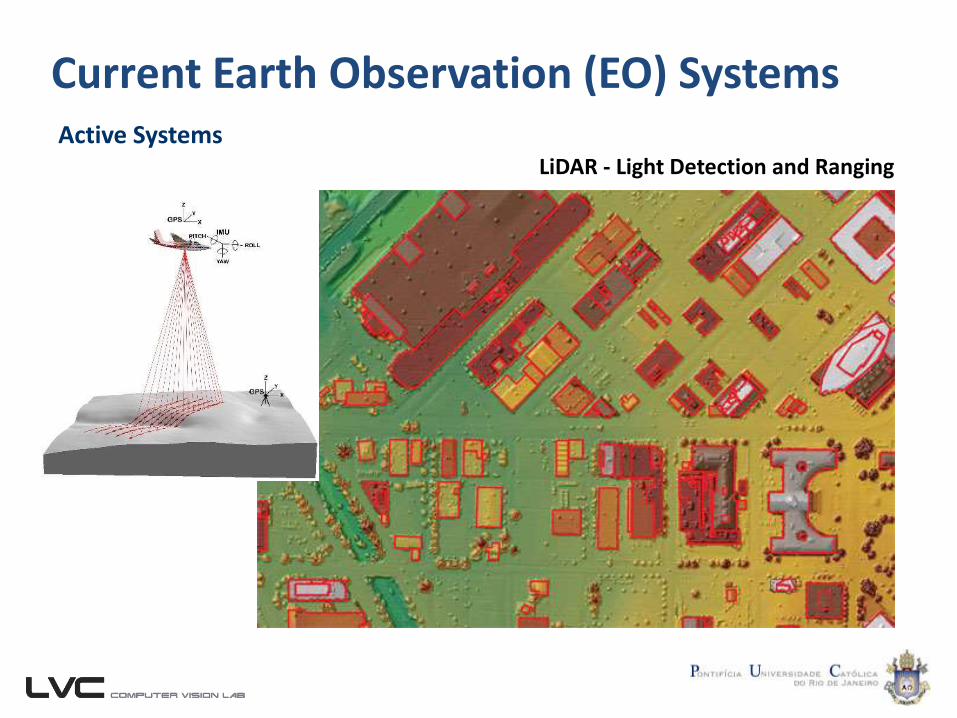
LiDAR - Light Detection and Ranging
Current Earth Observation (EO) Systems
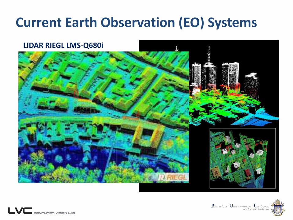
LIDAR RIEGL LMS-Q680i
Current Earth Observation (EO) Systems
28/10/2001
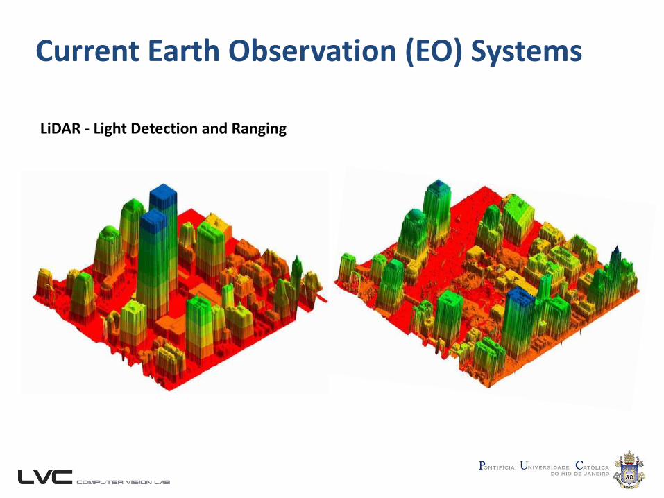
LiDAR - Light Detection and Ranging
Current Earth Observation (EO) Systems
List of Earth Observation Satellites (Wikipedia)
28/10/2001
https://en.wikipedia.org/wiki/List_of_Earth_observation_satellites
Remote Sensing Image AnalysisIntroduction
Raul Q. FeitosaGilson. A. O. P. Costa
Patrick N. Happ
Related Documents