SIRENS ACTIVATION AND DEACTIVATION

Presentasi Lengkap Ina Tews English 2014
Oct 22, 2015
Welcome message from author
This document is posted to help you gain knowledge. Please leave a comment to let me know what you think about it! Share it to your friends and learn new things together.
Transcript
SIRENS ACTIVATION AND DEACTIVATION
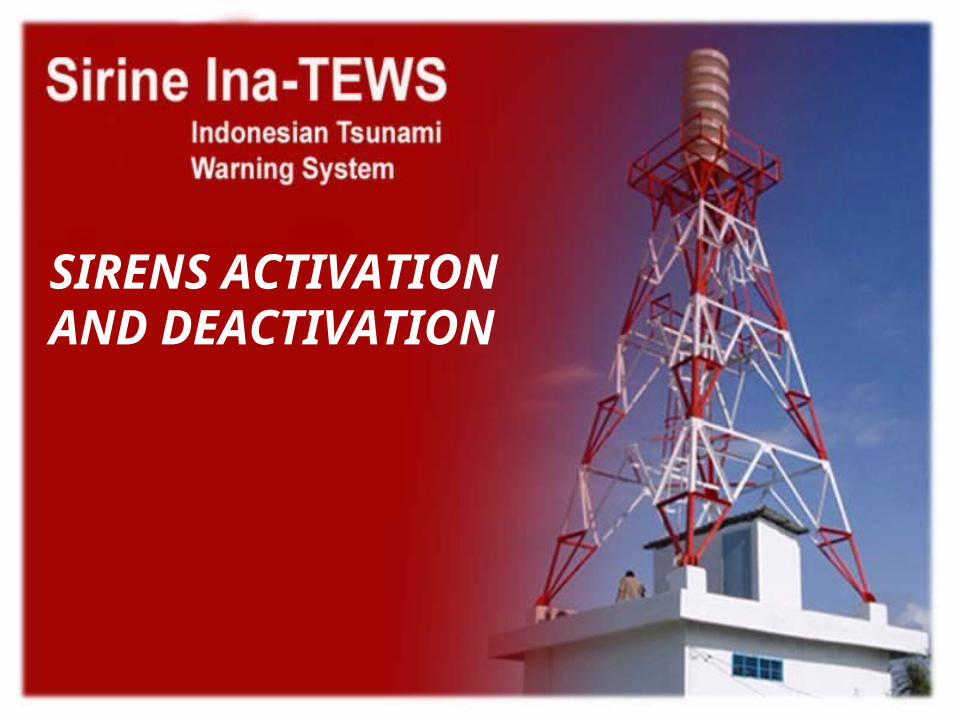
SOP for decision making
Beware
Prepare
alert
out guidance for evacuation
Meteorological CLimatological and Geophysical Agency Indonesia
Active the
Siren
out guidance for evacuation
out guidance for Alertaway from the coast
and rivers
Information Earthquake :there is no tsunami threat
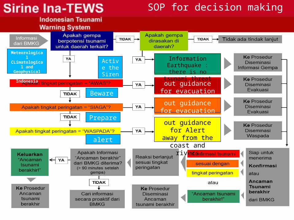
1. From the southern Indo-Australian Plate to infiltrate the Euro-Asian plates in relative terms, the collision zone in the South Indian Ocean Bali (Insecurity First)
2. As a result of the collision of these plates, in North Bali came up active faults (back arc thrust) which is a destructive earthquake in Bali generator (Second Insecurity)
subduction zone
WHERE WE LIVE?
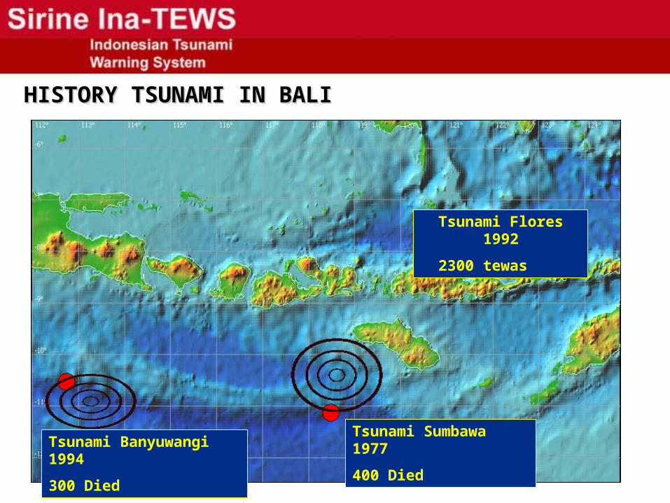
HISTORY TSUNAMI IN BALIHISTORY TSUNAMI IN BALI
? zona rawan ? Tsunami Sumbawa 1977
400 Died
Tsunami Flores 1992
2300 tewas
Tsunami Banyuwangi 1994
300 Died
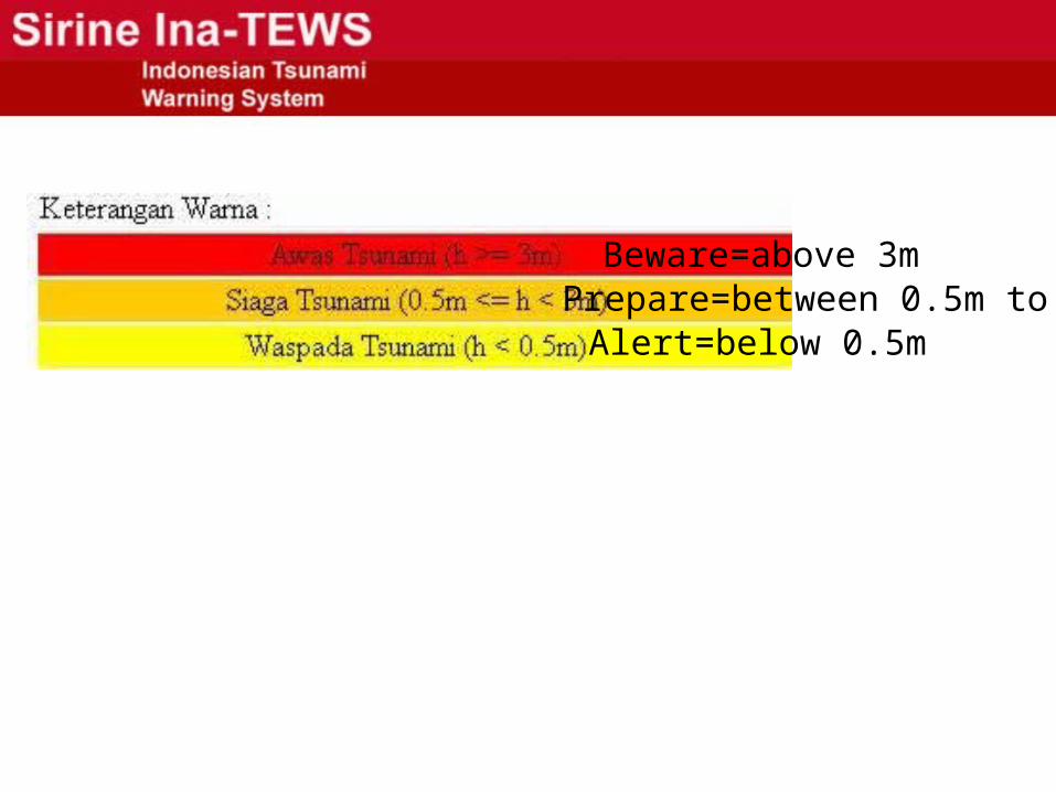
Prepare=between 0.5m to 3mAlert=below 0.5m
Beware=above 3m
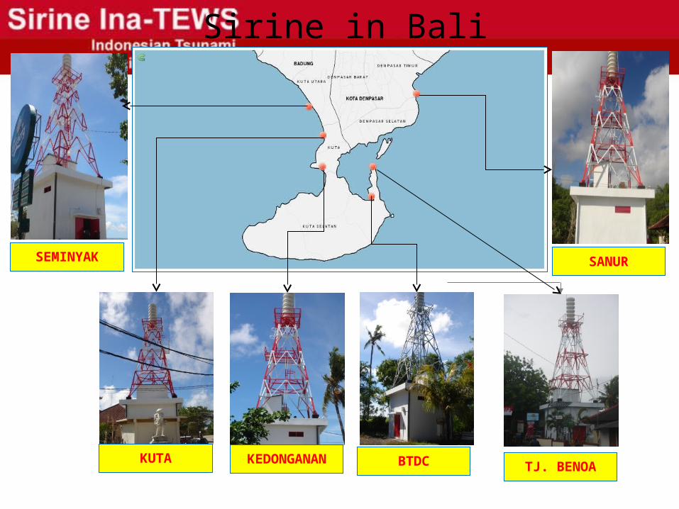
Sirine in Bali
TJ. BENOA
SEMINYAK
KUTA BTDCKEDONGANAN
SANUR
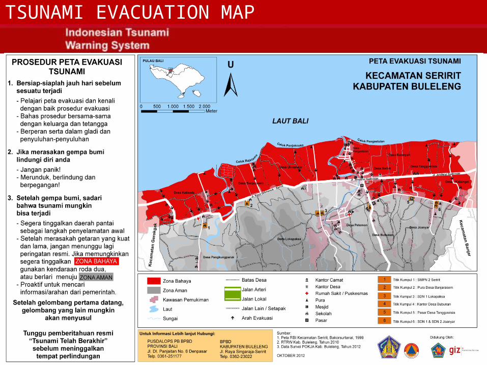
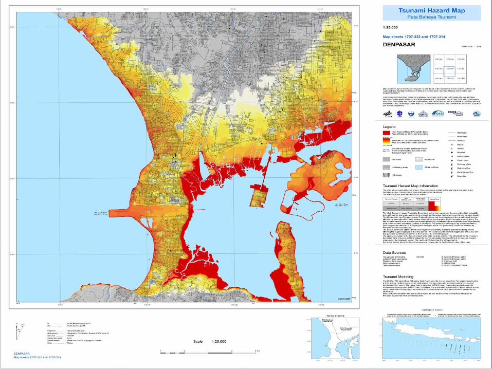
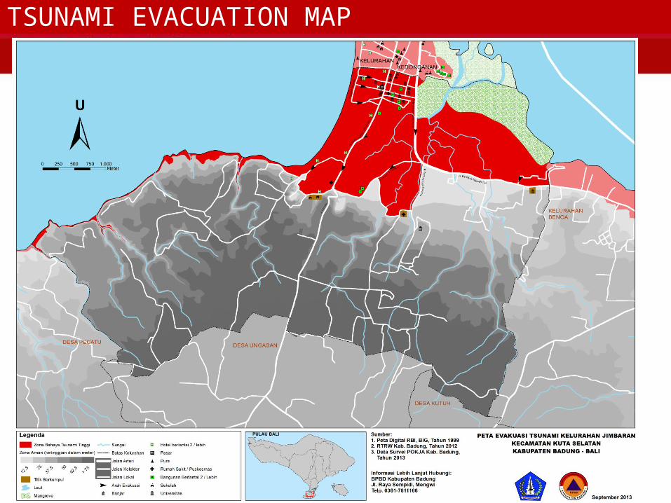
TSUNAMI EVACUATION MAP
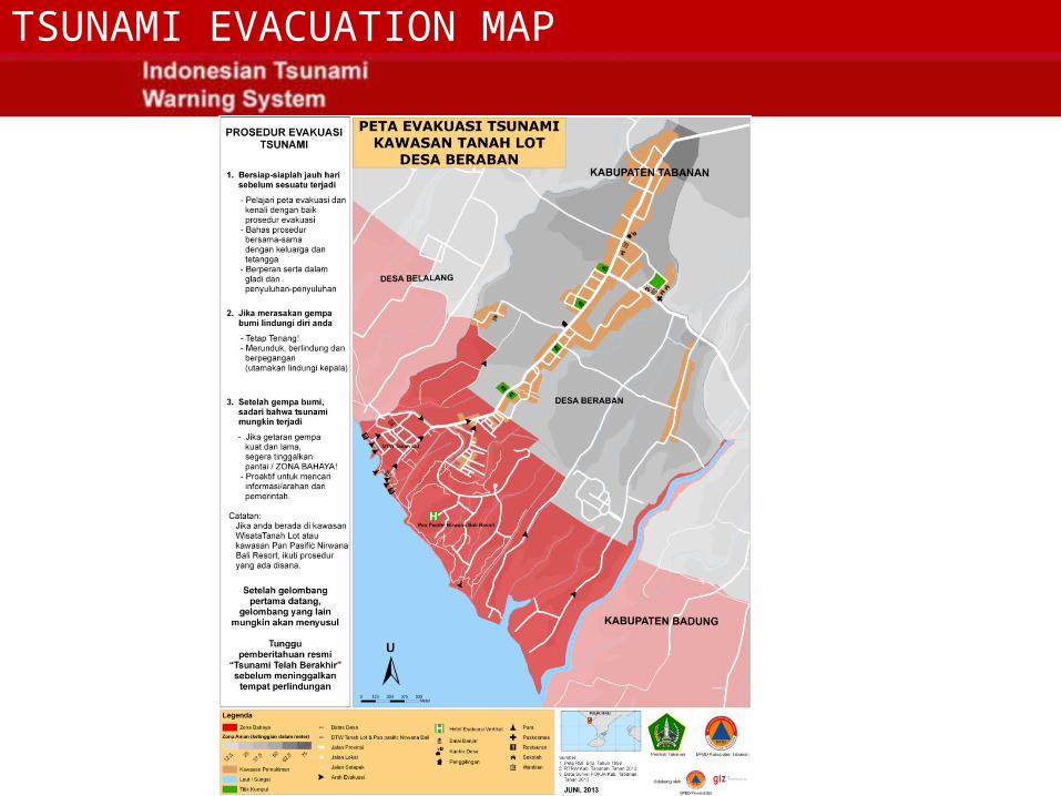
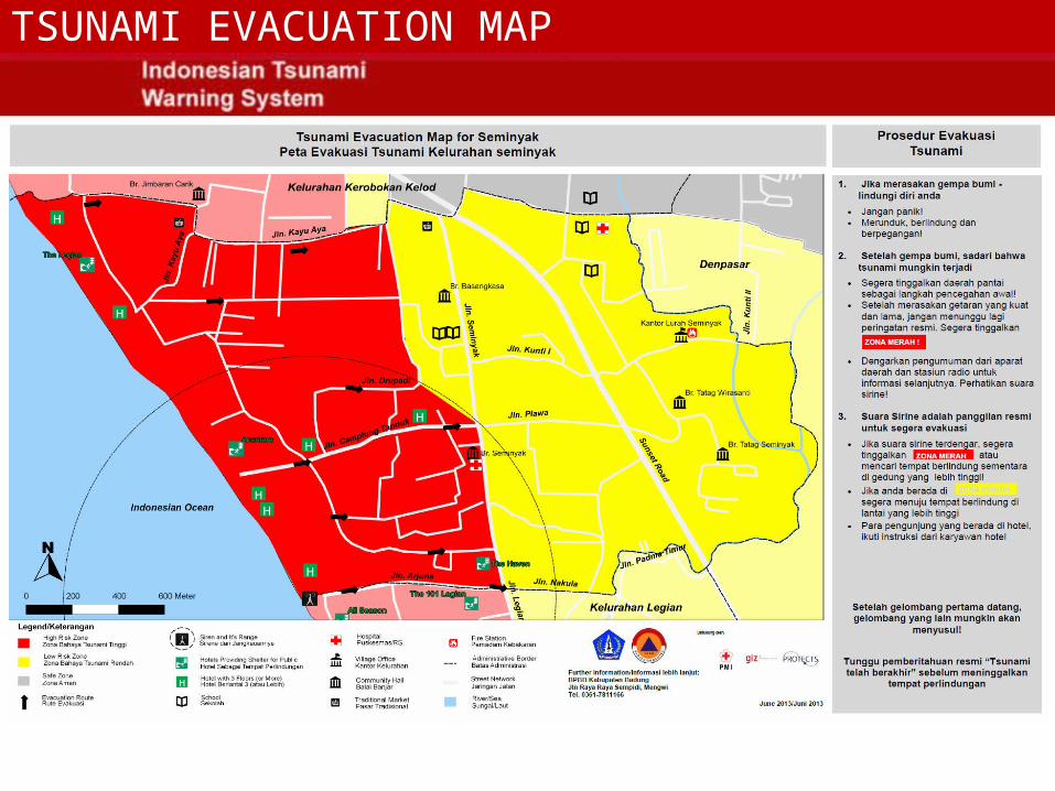
TSUNAMI EVACUATION MAP
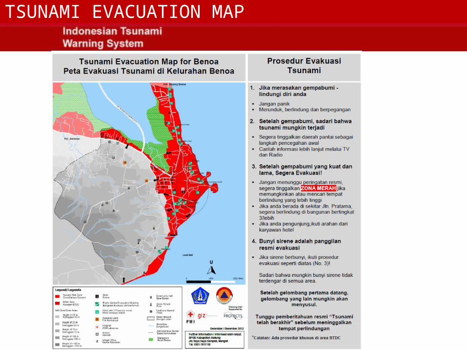
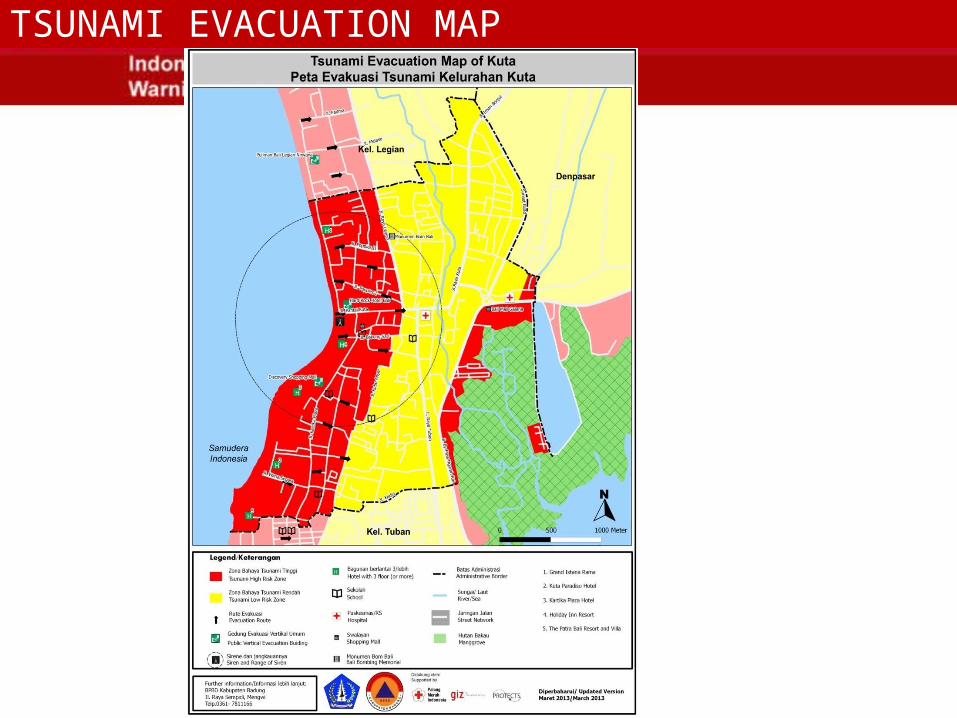
TSUNAMI EVACUATION MAP
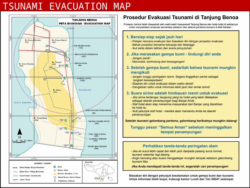
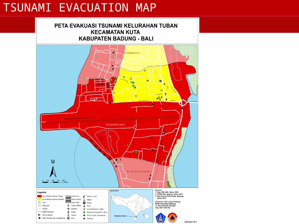
TSUNAMI EVACUATION MAP
TSUNAMI EVACUATION MAP
TSUNAMI EVACUATION MAP

TSUNAMI EVACUATION MAP
TSUNAMI EVACUATION MAP
TSUNAMI EVACUATION MAP

TSUNAMI EVACUATION MAP
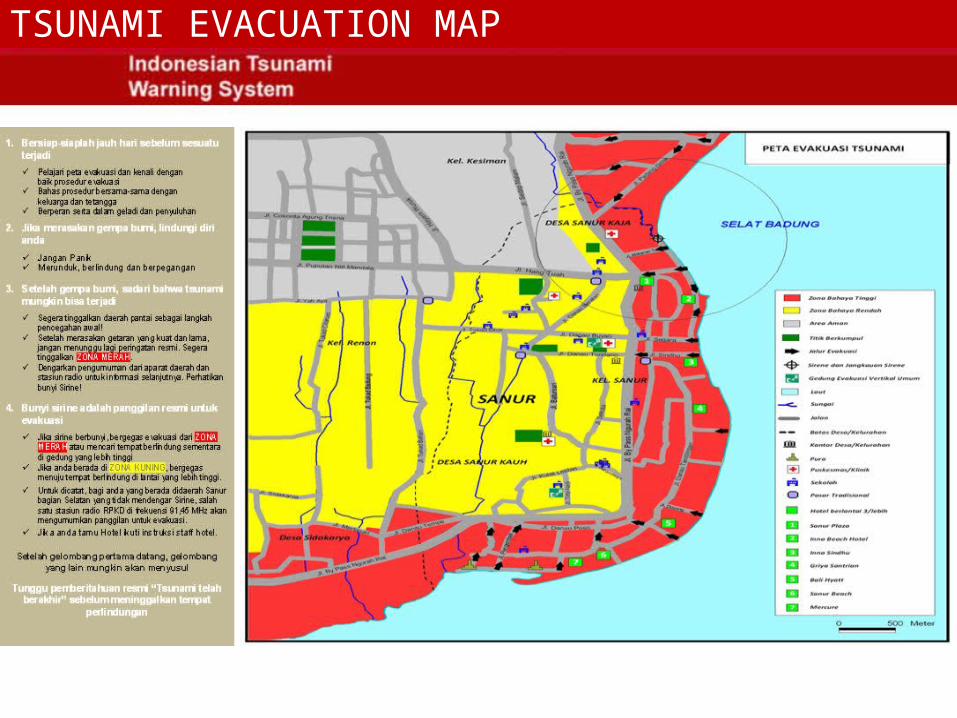
TSUNAMI EVACUATION MAP
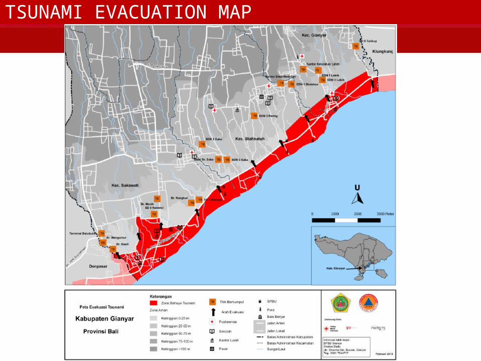
TSUNAMI EVACUATION MAP
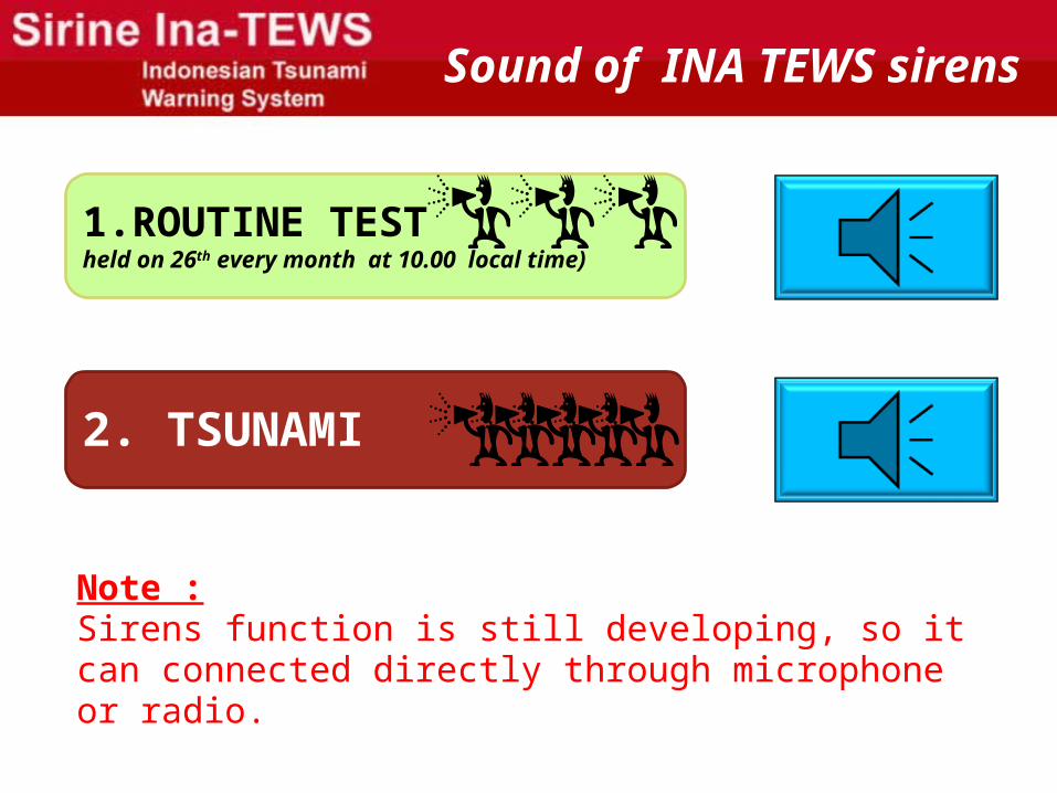
Sound of INA TEWS sirens
1.ROUTINE TESTheld on 26th every month at 10.00 local time)
2. TSUNAMI
Note :Sirens function is still developing, so it can connected directly through microphone or radio.

thank you for your attention, and Good day
WEB :www.balisafety.baliprov.go.id
EMAIL:[email protected]
Phone (0361) 251177FAX (0361) 263926 / 261238
Sosial Network
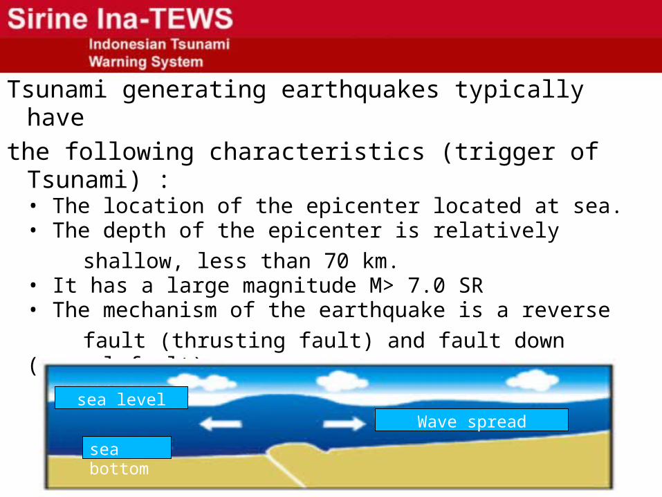
Tsunami generating earthquakes typically have
the following characteristics (trigger of Tsunami) :• The location of the epicenter located at sea.• The depth of the epicenter is relatively
shallow, less than 70 km.• It has a large magnitude M> 7.0 SR• The mechanism of the earthquake is a reverse
fault (thrusting fault) and fault down (normal fault)
sea bottom
sea levelWave spread
Related Documents