ICETCESD 2012 March 10-12, 2012, Sylhet, Bangladesh Planning and Optimizing the Route for Collection and Disposal of Municipal Solid Waste at Khulna City Using GIS Md. Rafizul Islam 1 , Saiful Azim 2 , Md. Risvi Kizer 1 and Muhammed Alamgir 1 ABSTRACT: Khulna is the third largest metropolitan city of Bangladesh and well-known as an industrial city. Municipal Solid Waste (MSW) is the useless and discarded materials considering the place produced mainly by daily activities. With the rapid growth of population, amount of MSW is also increasing in Khulna city. So, it is necessary to ensure effective collection and disposal of MSW and route of collection and disposal is a very important factor here. This study focuses to develop an optimized route plans having minimum travel distance regarding to accessibility of road for collection and disposal of MSW from secondary disposal site (SDS) to ultimate disposal site (UDS) in this city using GIS. The present study reveals that there is no systematic time and route plan for the storage, collection and disposal of MSW from SDS to UDS. There are more than 40 SDSs are available from where Khulna City Corporation (KCC) vehicles are collected the MSW and approximately 26 Haul Containers (HCs) and 1200 community bins, located on roadsides throughout the city. To investigate the present situation of SDSs and the existing collection and disposal route network, questionnaire and interview survey has been conducted and the feedback was recorded. Moreover, transportation facilities, types of vehicles were investigated and finally the Lat-Lon of SDSs, KCC garage and UDS were recorded using GPS to point out the locations. After collecting all the required information, optimized route plans were developed in GIS using ArcGIS through network Analyst tool. 1. Introduction Khulna is the third largest metropolitan city of Bangladesh and well-known as an industrial city. It is located in the southwestern part near the Sundarbans, the largest mangrove forest of the world (Alamgir et al. 2005; Rafizul et al. 2009) shown in Figure 1. It is situated below the tropic of cancer, around intersection of latitude 22.49º north and longitude 89.34º east (KCC 2009). Total area of KCC is 47.0 sq. km. comprising 31 wards (BBS, 2001). Surrounding districts are Satkhira at west, Bagerhat at east, Narail at north and Jessore at noth-west, and the Sundarbans, then the Bay of Bengal at its south. It lies along the Bhairab River. The city stands on the bank of Rupsha River and has an important river port. It is connected by river, road and rail to the major cities of the southern Gangetic delta. It is a linear city extending from southeast to northeast along the Bhairab-Rupsha River, major highway and railway. The spontaneous nature of city 1 Department of Civil Engineering, Khulna University of Engineering & Technology (KUET) Khulna-9203 Bangladesh, [email protected]; [email protected] and [email protected] 2 Assistant Urban Planner, DDC limited, Bangladesh, Khulna, Bangladesh, [email protected]

Welcome message from author
This document is posted to help you gain knowledge. Please leave a comment to let me know what you think about it! Share it to your friends and learn new things together.
Transcript
ICETCESD 2012
March 10-12, 2012, Sylhet, Bangladesh
Planning and Optimizing the Route for Collection and Disposal of Municipal Solid Waste at
Khulna City Using GIS
Md. Rafizul Islam1, Saiful Azim
2, Md. Risvi Kizer
1 and Muhammed Alamgir
1
ABSTRACT: Khulna is the third largest metropolitan city of Bangladesh and well-known as an
industrial city. Municipal Solid Waste (MSW) is the useless and discarded materials considering
the place produced mainly by daily activities. With the rapid growth of population, amount of
MSW is also increasing in Khulna city. So, it is necessary to ensure effective collection and
disposal of MSW and route of collection and disposal is a very important factor here. This study
focuses to develop an optimized route plans having minimum travel distance regarding to
accessibility of road for collection and disposal of MSW from secondary disposal site (SDS) to
ultimate disposal site (UDS) in this city using GIS. The present study reveals that there is no
systematic time and route plan for the storage, collection and disposal of MSW from SDS to UDS.
There are more than 40 SDSs are available from where Khulna City Corporation (KCC) vehicles
are collected the MSW and approximately 26 Haul Containers (HCs) and 1200 community bins,
located on roadsides throughout the city. To investigate the present situation of SDSs and the
existing collection and disposal route network, questionnaire and interview survey has been
conducted and the feedback was recorded. Moreover, transportation facilities, types of vehicles
were investigated and finally the Lat-Lon of SDSs, KCC garage and UDS were recorded using
GPS to point out the locations. After collecting all the required information, optimized route
plans were developed in GIS using ArcGIS through network Analyst tool.
1. Introduction
Khulna is the third largest metropolitan city of Bangladesh and well-known as an industrial city.
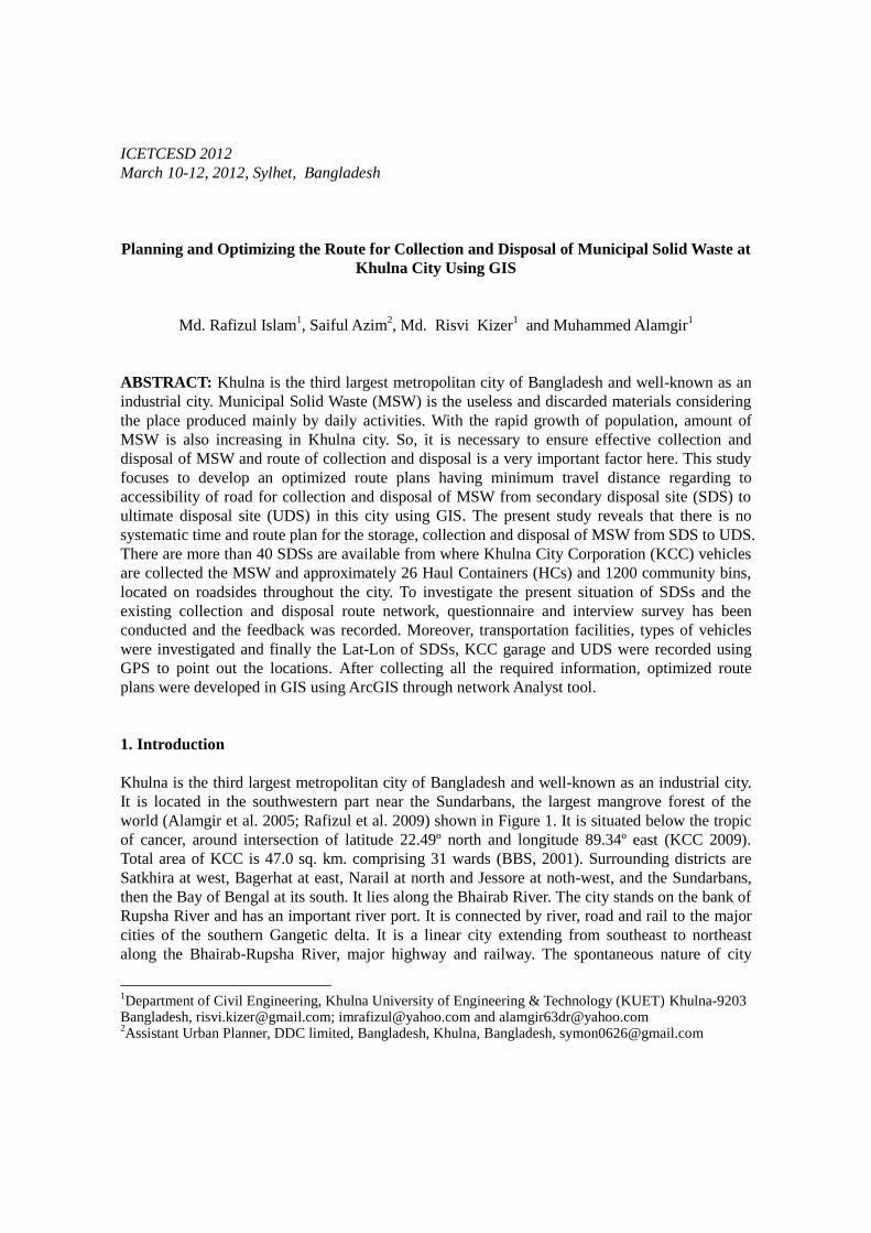
It is located in the southwestern part near the Sundarbans, the largest mangrove forest of the
world (Alamgir et al. 2005; Rafizul et al. 2009) shown in Figure 1. It is situated below the tropic
of cancer, around intersection of latitude 22.49º north and longitude 89.34º east (KCC 2009).
Total area of KCC is 47.0 sq. km. comprising 31 wards (BBS, 2001). Surrounding districts are
Satkhira at west, Bagerhat at east, Narail at north and Jessore at noth-west, and the Sundarbans,
then the Bay of Bengal at its south. It lies along the Bhairab River. The city stands on the bank of
Rupsha River and has an important river port. It is connected by river, road and rail to the major
cities of the southern Gangetic delta. It is a linear city extending from southeast to northeast
along the Bhairab-Rupsha River, major highway and railway. The spontaneous nature of city
1Department of Civil Engineering, Khulna University of Engineering & Technology (KUET) Khulna-9203
Bangladesh, [email protected]; [email protected] and [email protected] 2Assistant Urban Planner, DDC limited, Bangladesh, Khulna, Bangladesh, [email protected]
growth and its shape are greatly influenced by the rivers Bhairab-Rupsha and Khulna-Dhaka
highway.
Figure 1 Location of Khulna city as study area
MSW collections in Khulna city are mainly done by Non-government organization (NGOs) and
community based organization (CBOs) by the supervision of KCC (Ahsan et al. 2005). Door-to-
door collection systems are adopted for MSW collection from generation sources and then
dispose major portion of it to the nearest SDS. From there KCC vehicles collect the MSW and
transport it to the UDS. Some NGOs transfer their collected organic wastes like clinical wastes to
composting plant. Whilst city authority has some limited numbers of non-motorized Rickshaw
Vans and Hand trolley those are mainly used for the collection of MSW from community bins
located at roadside, home side, near market and transfer to SDS. Besides this drain sludge’s are
also collected by this van. It is necessary for the KCC vehicles to have optimized collection and
disposal route plan to ensure effectiveness in MSW disposal. To these attempts, To investigate the
present situation of SDSs and the existing collection and disposal route network questionnaire
and interview survey was conducted and the feedback was recorded and transportation facilities,
types of vehicles were investigated and finally the Lat-Lon of SDSs, KCC garage and UDS were
recorded using GPS. After collecting all the required information, optimized route plans were
developed in GIS using ArcGIS through network Analyst tool.
2. Present Scenario of MSW Management In Khulna City
In Khulna city, KCC generally manages the MSW and recently, some NGOs, CBOs and private
organization are working for door-to-door collection with KCC (Rafizrul et al. 2009). Door-to-
door collection systems are introduced recently for MSW collection from generation sources,
mainly from households, and then dispose major portion of it to the nearest SDS (Alamgir et al.
2005; Akter et al. 2008). KCC collects these MSW and transfer it to the UDS but it is a very
complicated one for the management MSW. Due to severe financial constraints, lack of route
networking, lack of motivation, absence of effective legislation to protect the environment, lack
of commitment of authority, the MSW has becoming a threat for city dwellers, planners and other
concerned stakeholders (WasteSafe 2005). The management tiers of MSW can be categorized
and hence discussed in followings.
2.1. Primary Collection
In Khulna city, MSW are collected from generation sources by NGOs, CBOs and KCC by door-
to-door collection systems, and most of the cases owner by himself disposes it to the nearest
community bins/SDS/open land/road sides/drains (Ahsan et al. 2005). Whilst city authority has
some limited numbers of non-motorized rickshaw vans and hand trolley those are mainly used for
the collection of MSW from community bins and transfer to SDS.
2.2. On-site Storage
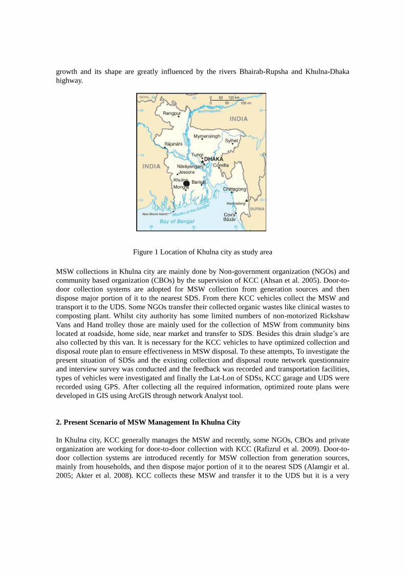
On-site storage is the SDS and transfer station which receives MSW from primary source and
transfer to the designated location for processing/recycling/treatment/ultimate disposal (Jahan et
al. 2011). SDS is considered as the facilities where large amount of MSW are accumulated and
finally transferred to the desired sites by large vehicles such as open or closed trucks,
demountable haul container truck, etc (Tinmaz et al. 2005; Apaydin et al. 2007). The SDS are
located in the selected places based on population, space availability, accessibility and other local
factors such as desire of influential city dwellers or public representatives (Akter et al. 2005). The
wide variety of types and shapes of community bins are built by the civic bodies and/or KCC,
which are located on the roadsides at frequent intervals. MSW from community bins are
transferred to SDS mostly by city authorities through non-motorized Rickshaw van and hand
trolley. Figure 2 is showing the present scenarios of SDS for MSW in Khulna city.
Figure 2 Present scenarios of SDS in Khulna City
2.3. Secondary collection and transportation
The functional element of collection includes not only the gathering of MSW and recyclable but
also the transportation after collection, to the location where the collection vehicle is emptied
(Chowdhury et al. 2008). Only respective city authority is responsible for collecting MSW from
SDS and transported it by motorized vehicles/trucks and finally disposed in the designated UDS.
Although NGOs and CBOs collect MSW from households/ generation points and dump it to the
SDS, they do not take responsibility for the collection & transportation of MSW, which they
deposited in the nearby SDS (Ahsan et al. 2005). Conservancy department of KCC setup the
time-schedule and types of vehicle for collection and transportation of MSW. Generally,
collection vehicles such as dump truck, normal truck, open truck, tractor with trolley, tipping
truck (container carrier), de-sledging vacuum tanker with tractor, power tiller with trolley stands
in the road nearest to the SDS for operation. Typical collection methods from SDS and MSW
heaped transport vehicles. But there is no designed optimized route network for this collection
and transportation from SDS to UDS.
3. Optimizing Routes for Collection and Disposal of MSW
3.1. Geographical Information System (GIS) Approach
GIS is a system which can make both spatial aspatial analysis of the situation along with a future
trend and simulation. GIS is very helpful for any types of decision making in planning. In case of
MSW, GIS can make MSW generation map of different areas, existing MSW collection and
disposal pattern from SDS to UDS, employment distribution in different wards and existing route
plan of MSW lifting (Ghosh et al. 2005; Thanh et al. 2009). From these layers the analysis can be
achieved to derive the logistics and spatial simulation, decision making and planning (Ogra,
2003). There are many suggestions in this spatial planning proposal which are said to be
considered while working on optimizing route of MSW in GIS and they are (i) identification of
exact location of MSW bins with GPS demarcating on the base map; (ii) maintaining a record of
SDSs; (iii) a map showing the road network in different areas; (iv) a map showing the distances
between the bins; (v) location of the SDSs; (vi) record of available vehicles and equipment for
MSW management; (vii) allocating a unique number to all the SDSs so it can be easily and
quickly located in case of any complaint registered or planning and maintenance; (viii)
maintaining a record about the type of SDSs and (ix) record of the responsibilities and
assignment of work, equipments, vehicles etc. of the MSW maintenance and also the logistics
information about the transportation involved in the system.
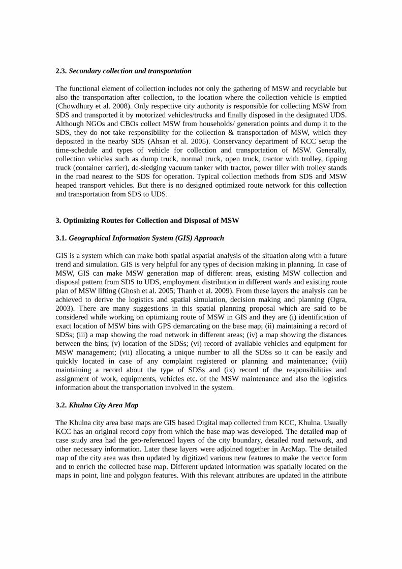
3.2. Khulna City Area Map
The Khulna city area base maps are GIS based Digital map collected from KCC, Khulna. Usually
KCC has an original record copy from which the base map was developed. The detailed map of
case study area had the geo-referenced layers of the city boundary, detailed road network, and
other necessary information. Later these layers were adjoined together in ArcMap. The detailed
map of the city area was then updated by digitized various new features to make the vector form
and to enrich the collected base map. Different updated information was spatially located on the
maps in point, line and polygon features. With this relevant attributes are updated in the attribute
tables of the vector data. The detailed updated base map of city area with vector data attributes is
seen in Figure 3.
Figure 3 Detailed geo-referenced base map of Khulna city with vector data attribute
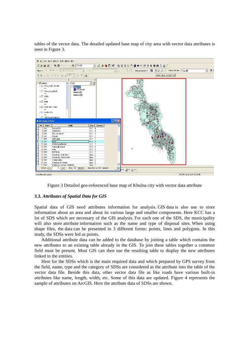
3.3. Attributes of Spatial Data for GIS
Spatial data of GIS need attributes information for analysis. GIS data is also use to store
information about an area and about its various large and smaller components. Here KCC has a
lot of SDS which are necessary of the GIS analysis. For each one of the SDS, the municipality
will also store attribute information such as the name and type of disposal sites. When using
shape files, the data can be presented in 3 different forms: points, lines and polygons. In this
study, the SDSs were fed as points.
Additional attribute data can be added to the database by joining a table which contains the
new attributes to an existing table already in the GIS. To join these tables together a common
field must be present. Most GIS can then use the resulting table to display the new attributes
linked to the entities.
Here for the SDSs which is the main required data and which prepared by GPS survey from
the field, name, type and the category of SDSs are considered as the attribute into the table of the
vector data file. Beside this data, other vector data file as like roads have various built-in
attributes like name, length, width, etc. Some of this data are updated. Figure 4 represents the
sample of attributes on ArcGIS. Here the attribute data of SDSs are shown.
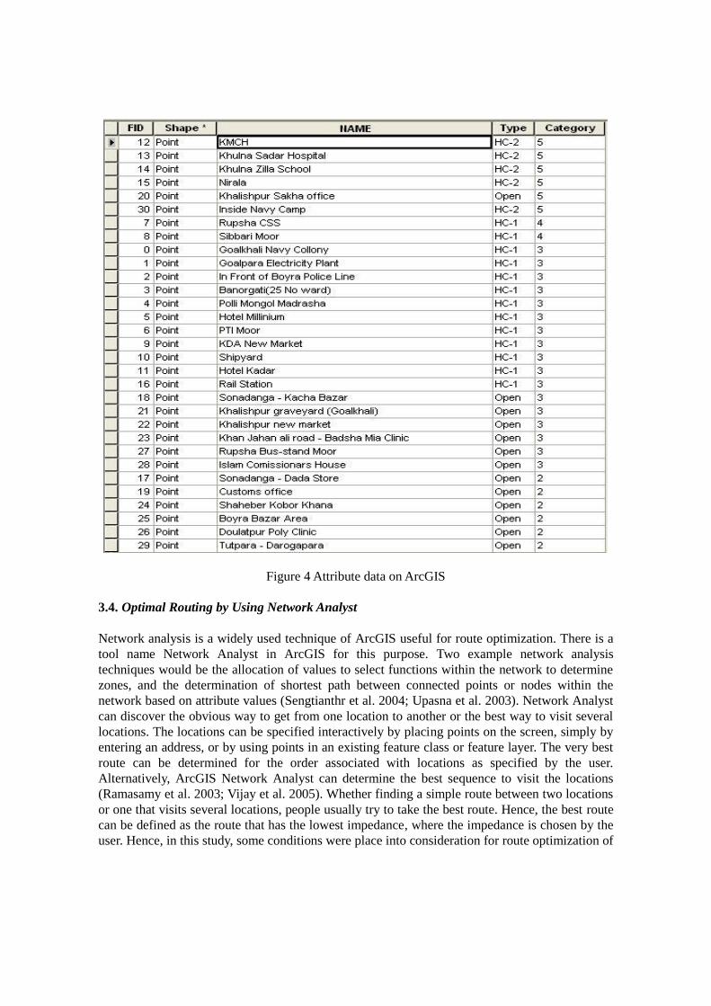
Figure 4 Attribute data on ArcGIS
3.4. Optimal Routing by Using Network Analyst
Network analysis is a widely used technique of ArcGIS useful for route optimization. There is a
tool name Network Analyst in ArcGIS for this purpose. Two example network analysis
techniques would be the allocation of values to select functions within the network to determine
zones, and the determination of shortest path between connected points or nodes within the
network based on attribute values (Sengtianthr et al. 2004; Upasna et al. 2003). Network Analyst
can discover the obvious way to get from one location to another or the best way to visit several
locations. The locations can be specified interactively by placing points on the screen, simply by
entering an address, or by using points in an existing feature class or feature layer. The very best
route can be determined for the order associated with locations as specified by the user.
Alternatively, ArcGIS Network Analyst can determine the best sequence to visit the locations
(Ramasamy et al. 2003; Vijay et al. 2005). Whether finding a simple route between two locations
or one that visits several locations, people usually try to take the best route. Hence, the best route
can be defined as the route that has the lowest impedance, where the impedance is chosen by the
user. Hence, in this study, some conditions were place into consideration for route optimization of
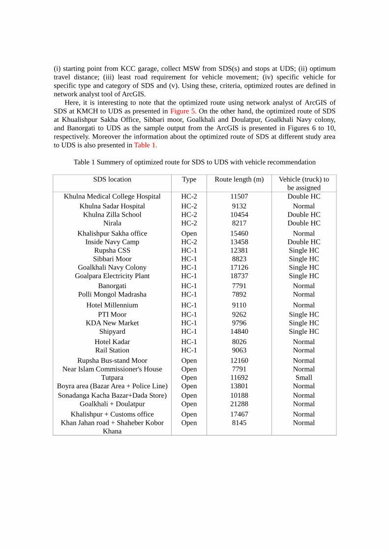
(i) starting point from KCC garage, collect MSW from SDS(s) and stops at UDS; (ii) optimum
travel distance; (iii) least road requirement for vehicle movement; (iv) specific vehicle for
specific type and category of SDS and (v). Using these, criteria, optimized routes are defined in
network analyst tool of ArcGIS.
Here, it is interesting to note that the optimized route using network analyst of ArcGIS of
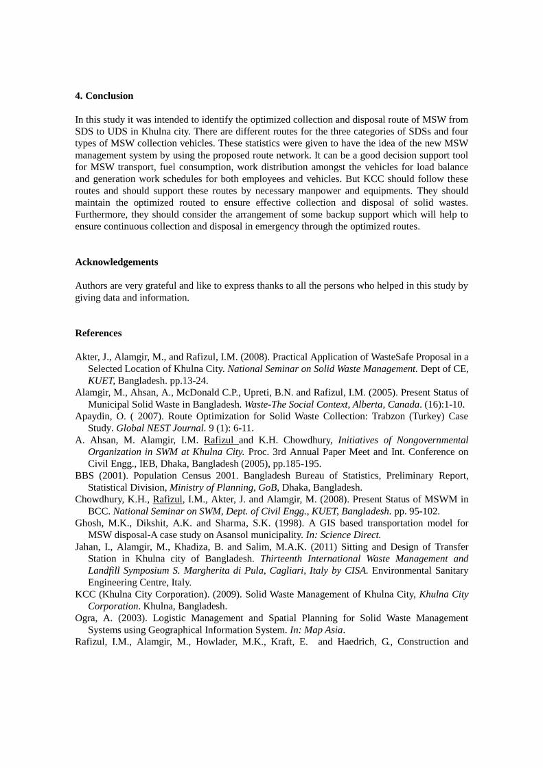
SDS at KMCH to UDS as presented in Figure 5. On the other hand, the optimized route of SDS
at Khualishpur Sakha Office, Sibbari moor, Goalkhali and Doulatpur, Goalkhali Navy colony,
and Banorgati to UDS as the sample output from the ArcGIS is presented in Figures 6 to 10,
respectively. Moreover the information about the optimized route of SDS at different study area
to UDS is also presented in Table 1.
Table 1 Summery of optimized route for SDS to UDS with vehicle recommendation
SDS location Type Route length (m) Vehicle (truck) to
be assigned
Khulna Medical College Hospital HC-2 11507 Double HC
Khulna Sadar Hospital HC-2 9132 Normal
Khulna Zilla School HC-2 10454 Double HC
Nirala HC-2 8217 Double HC
Khalishpur Sakha office Open 15460 Normal
Inside Navy Camp HC-2 13458 Double HC
Rupsha CSS HC-1 12381 Single HC
Sibbari Moor HC-1 8823 Single HC
Goalkhali Navy Colony HC-1 17126 Single HC
Goalpara Electricity Plant HC-1 18737 Single HC
Banorgati HC-1 7791 Normal
Polli Mongol Madrasha HC-1 7892 Normal
Hotel Millennium HC-1 9110 Normal
PTI Moor HC-1 9262 Single HC
KDA New Market HC-1 9796 Single HC
Shipyard HC-1 14840 Single HC
Hotel Kadar HC-1 8026 Normal
Rail Station HC-1 9063 Normal
Rupsha Bus-stand Moor Open 12160 Normal
Near Islam Commissioner's House Open 7791 Normal
Tutpara Open 11692 Small
Boyra area (Bazar Area + Police Line) Open 13801 Normal
Sonadanga Kacha Bazar+Dada Store) Open 10188 Normal
Goalkhali + Doulatpur Open 21288 Normal
Khalishpur + Customs office Open 17467 Normal
Khan Jahan road + Shaheber Kobor
Khana
Open 8145 Normal
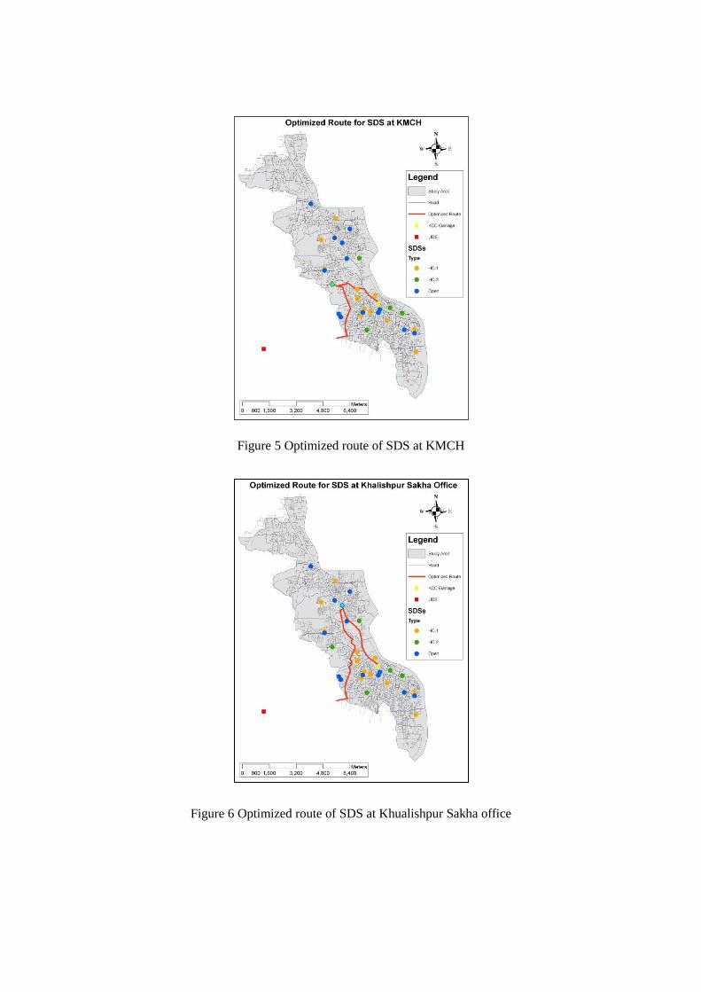
Figure 5 Optimized route of SDS at KMCH
Figure 6 Optimized route of SDS at Khualishpur Sakha office
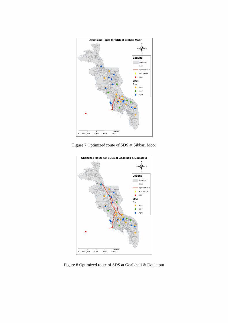
Figure 7 Optimized route of SDS at Sibbari Moor
Figure 8 Optimized route of SDS at Goalkhali & Doulatpur
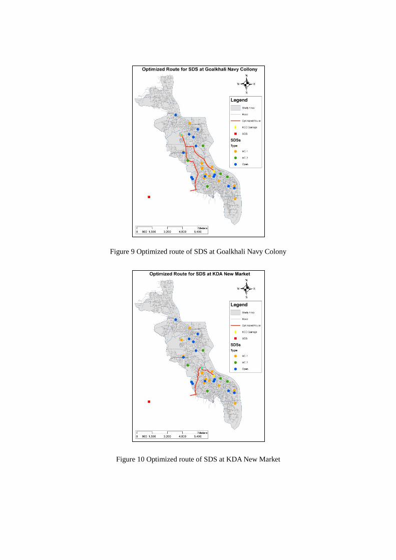
Figure 9 Optimized route of SDS at Goalkhali Navy Colony
Figure 10 Optimized route of SDS at KDA New Market
4. Conclusion
In this study it was intended to identify the optimized collection and disposal route of MSW from
SDS to UDS in Khulna city. There are different routes for the three categories of SDSs and four
types of MSW collection vehicles. These statistics were given to have the idea of the new MSW
management system by using the proposed route network. It can be a good decision support tool
for MSW transport, fuel consumption, work distribution amongst the vehicles for load balance
and generation work schedules for both employees and vehicles. But KCC should follow these
routes and should support these routes by necessary manpower and equipments. They should
maintain the optimized routed to ensure effective collection and disposal of solid wastes.
Furthermore, they should consider the arrangement of some backup support which will help to
ensure continuous collection and disposal in emergency through the optimized routes.
Acknowledgements
Authors are very grateful and like to express thanks to all the persons who helped in this study by
giving data and information.
References
Akter, J., Alamgir, M., and Rafizul, I.M. (2008). Practical Application of WasteSafe Proposal in a
Selected Location of Khulna City. National Seminar on Solid Waste Management. Dept of CE,
KUET, Bangladesh. pp.13-24.
Alamgir, M., Ahsan, A., McDonald C.P., Upreti, B.N. and Rafizul, I.M. (2005). Present Status of
Municipal Solid Waste in Bangladesh. Waste-The Social Context, Alberta, Canada. (16):1-10.
Apaydin, O. ( 2007). Route Optimization for Solid Waste Collection: Trabzon (Turkey) Case
Study. Global NEST Journal. 9 (1): 6-11.
A. Ahsan, M. Alamgir, I.M. Rafizul and K.H. Chowdhury, Initiatives of Nongovernmental
Organization in SWM at Khulna City. Proc. 3rd Annual Paper Meet and Int. Conference on
Civil Engg., IEB, Dhaka, Bangladesh (2005), pp.185-195.
BBS (2001). Population Census 2001. Bangladesh Bureau of Statistics, Preliminary Report,
Statistical Division, Ministry of Planning, GoB, Dhaka, Bangladesh.
Chowdhury, K.H., Rafizul, I.M., Akter, J. and Alamgir, M. (2008). Present Status of MSWM in
BCC. National Seminar on SWM, Dept. of Civil Engg., KUET, Bangladesh. pp. 95-102.
Ghosh, M.K., Dikshit, A.K. and Sharma, S.K. (1998). A GIS based transportation model for
MSW disposal-A case study on Asansol municipality. In: Science Direct.
Jahan, I., Alamgir, M., Khadiza, B. and Salim, M.A.K. (2011) Sitting and Design of Transfer
Station in Khulna city of Bangladesh. Thirteenth International Waste Management and
Landfill Symposium S. Margherita di Pula, Cagliari, Italy by CISA. Environmental Sanitary
Engineering Centre, Italy.
KCC (Khulna City Corporation). (2009). Solid Waste Management of Khulna City, Khulna City
Corporation. Khulna, Bangladesh.
Ogra, A. (2003). Logistic Management and Spatial Planning for Solid Waste Management
Systems using Geographical Information System. In: Map Asia.
Rafizul, I.M., Alamgir, M., Howlader, M.K., Kraft, E. and Haedrich, G., Construction and
Evaluation of Sanitary Landfill Lysimeter in Bangladesh. (2009). Int. Conference on SWM,
Technical, Environment and Socio-Economical Contexts. Dept. of CE, KUET, Khulna,
Bangladesh. pp.475-484.
Ramasamy, S.M., Kumanan, C.J. and Palanivel, K. (2003). GIS Based Solutions for Waste
Disposals. In: GIS Development, India
Sengtianthr, V. and Lao, P.D.R. (2004). Solid waste Management in Urban Areas of Vientiane
Capita City Using GIS. In: 30th WEDC International Conference, Vientiane.
Thanh, N.P. (2009). GIS application for estimating the current status and improvement on
municipal solid waste collection and transport system: Case study at Can Tho city, Vietnam.
Asian Journal on Energy and Environment.
Tinmaz, E. and Demir, I. (2005). Research on solid waste management systems: To improve
existing situation in Corlu Town of Turkey. In: Science Direct.
Upasna, S. and Natwat, M. S. (2003). Selection of potential waste disposing sites around Ranchi
Urban Complex using Remote Sensing and GIS techniques. In: Map India.
Vijay, R., Gupta, A., Kalamdhad, A.S., Devotta, S. (2005). Estimation and allocation of solid
waste to bin through geographical information systems. In: ISWA.
WasteSafe. (2005). Integrated Management and Safe Disposal of MSW in LDACs. A recent
feasibility study under the Asia Pro Eco Programme of EC, Dept. of CE, KUET.
Related Documents