GIS placement at Sahmakum Teang Tnaut Wilfred Waters | Geospatial Analyst

Placement at Sahmakum Teang Tnaut funded by Engineers Without Borders Australia
Jul 13, 2015
Welcome message from author
This document is posted to help you gain knowledge. Please leave a comment to let me know what you think about it! Share it to your friends and learn new things together.
Transcript

GIS placement at Sahmakum Teang Tnaut
Wilfred Waters | Geospatial Analyst
Sahmakum Teang Tnaut (STT)
Mission: to provide pro-poor technical assistance for housing and infrastructure and to inform dialogue and raise awareness about urban issues
Helping communities in Phnom Penh to communicate their concerns about
land rights issues to local and international media, donors and other non
government organisations (NGOs) & INGOs

Some Context
• About 400 urban poor communities (“slums”) in
Phnom Penh
• Subject to increasingly violent evictions
• Not always given relocation sites or compensation
– Relocation sites often have substandard
conditions
• Subject of report by Zoe Daniel on ABC‟s Foreign
Correspondent last week

87 displacement events since 1990
100,000+ people
Second time for some: whole city evicted by Pol Pot

Capacity building
• Building something for an organisation
VS
• Building something with staff of an
organisation
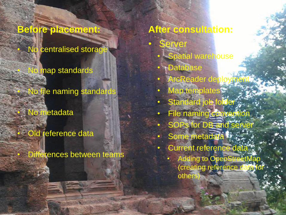
Before placement:
• No centralised storage
• No map standards
• No file naming standards
• No metadata
• Old reference data
• Differences between teams
After consultation:
• Server
• Spatial warehouse
• Database
• ArcReader deployment
• Map templates
• Standard job folder
• File naming convention
• SOPs for DB and server
• Some metadata
• Current reference data
• Adding to OpenStreetMap
(creating reference data for
others)
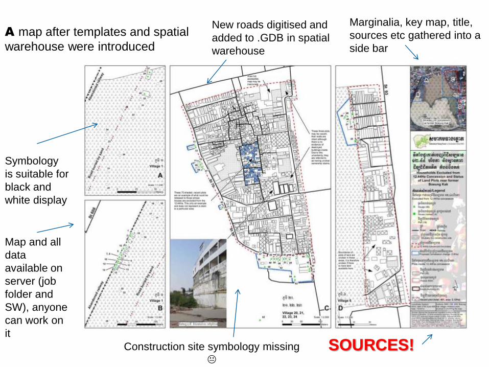
Construction site symbology missing
A map after templates and spatial
warehouse were introduced
New roads digitised and
added to .GDB in spatial
warehouse
Marginalia, key map, title,
sources etc gathered into a
side bar
Symbology
is suitable for
black and
white display
Map and all
data
available on
server (job
folder and
SW), anyone
can work on
it
SOURCES!
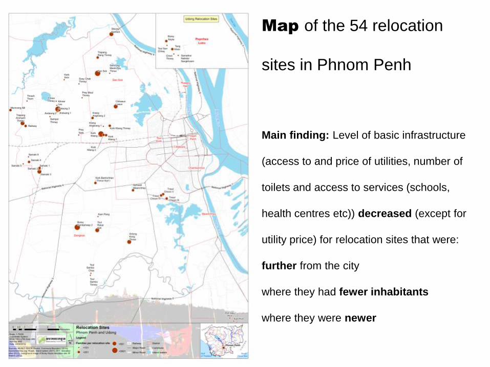
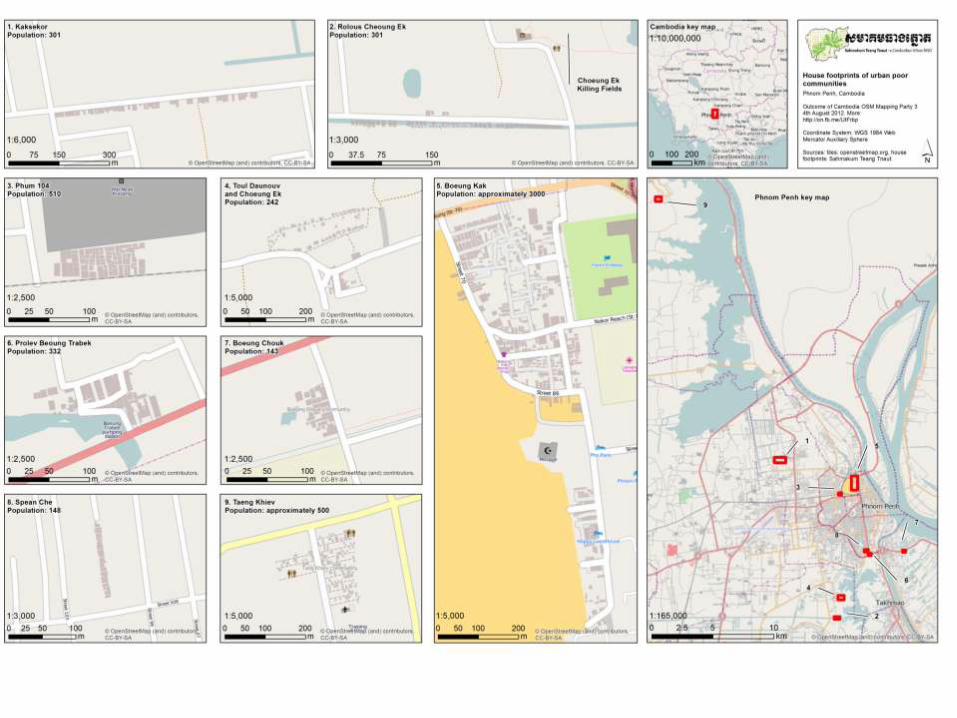
Map of the 54 relocation
sites in Phnom Penh
Main finding: Level of basic infrastructure
(access to and price of utilities, number of
toilets and access to services (schools,
health centres etc)) decreased (except for
utility price) for relocation sites that were:
further from the city
where they had fewer inhabitants
where they were newer
Problem description for database
• „Black hole‟ for data storage
• 6 years‟ worth of demographic, point data in spreadsheets
• Data entry errors were frequent
• Data was hard to exploit, such as:
comparing new datasets with old ones about the same issue
retrieving information across different datasets about one
particular location

Solution: relational database

STT relational database
• On server
• Backend to ArcGIS
• MS Access
• because usually one person doing data entry,
• 3-4 simultaneous users (via Access itself or
ArcReader or ArcMap)
Flow map
• Date, from and to information for evictions
• Fed a query from the DB into ArcMap’s XY to
Line tool
• Lines represent ‘relocation waves’
• Easier to understand the information about
internally displaced people in Cambodia

An early map of evictions information

Flow map animation
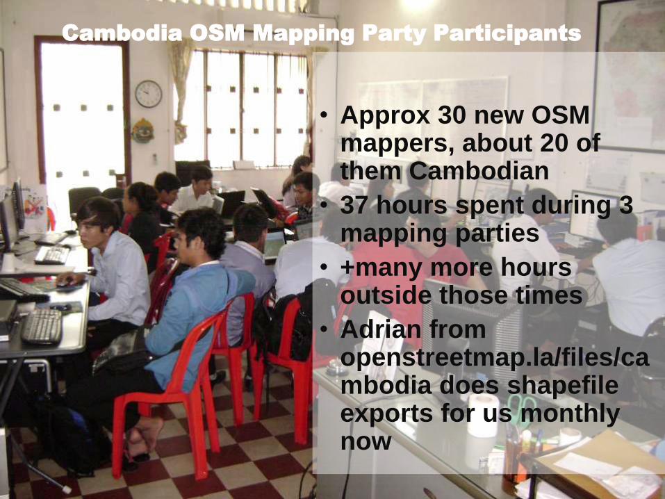
Cambodia OSM Mapping Party Participants
• Approx 30 new OSM mappers, about 20 of them Cambodian
• 37 hours spent during 3 mapping parties
• +many more hours outside those times
• Adrian from openstreetmap.la/files/cambodia does shapefileexports for us monthly now
Outcomes
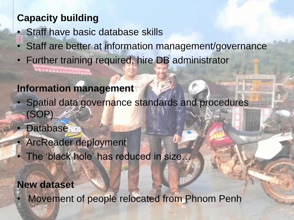
Capacity building
• Staff have basic database skills
• Staff are better at information management/governance
• Further training required, hire DB administrator
Information management
• Spatial data governance standards and procedures
(SOP)
• Database
• ArcReader deployment
• The ‘black hole’ has reduced in size…
New dataset
• Movement of people relocated from Phnom Penh

Final note - networking
• Many mappers in
Phnom Penh
• Monthly Phnom Penh
Mapping Meetup
• 23 presenters over 9
meetups
• Search Facebook for
the Phnom Penh
Mapping Meetup
• Next: 17 December
Related Documents