sustainable mobility at home Supported by www.iee-promotion.eu Intelligent Energy Europe For an energy efficient territory New neighbourhoods and mobility

Welcome message from author
This document is posted to help you gain knowledge. Please leave a comment to let me know what you think about it! Share it to your friends and learn new things together.
Transcript

8/6/2019 New Neighbour Hoods and Mobility
http://slidepdf.com/reader/full/new-neighbour-hoods-and-mobility 1/98
s u s t a i n a b l e m o b i l i t y a t h o m e
Supported by
www.iee-promotion.eu
Intelligent Energy Europe
For an energy efficient territory
New neighbourhoods and mobility

8/6/2019 New Neighbour Hoods and Mobility
http://slidepdf.com/reader/full/new-neighbour-hoods-and-mobility 2/98
8/6/2019 New Neighbour Hoods and Mobility
http://slidepdf.com/reader/full/new-neighbour-hoods-and-mobility 3/98
Introduction 2
The general outlookof an nr fcint 4neighbourhood
1.1 A strategic usage-based approach 6
1.2 Three cross-discip linary orientations 7
Mobility at the heartof the neighbourhood 16creation process
2.1 A decisive preliminary lever: connecting urban and transport plannings 18
2.2 The programme phase 19
2.3 The neighbourhood project 23
2.4 Local niourood lif 25
Mobilising andinvolv ing local stakeholders 28
in the project
3.1 Key factors for mobilising inhabitants 30
3.2 Creating a favourable setting for dialogue and providing information 33
3.3 Continuous participation 38
Technicalrcommndations 44
4.1 Uran plannin 46
4.2 Parin allocatd to uildins 49
4.3 Road ntwors and trafc 51
4.4 Dvlopmnt of altrnativ transport 56
4.5 Moilit manamnt 59
Summary
1.
2.
3.
4.
1SUMMARY

8/6/2019 New Neighbour Hoods and Mobility
http://slidepdf.com/reader/full/new-neighbour-hoods-and-mobility 4/98
IntroductionMoilit is a asic issu for niourood procts aimd at nr fcinc. Urban development and transport
planning are, in eect, the central areas o action or sustainable development.
Mobility thereore plays a central role in projects pertaining to eco-neighbourhoods, sustainable neighbourhoods or those or energy ecient transport. It responds to a wide range o sustainable development objectives in these pro-
jects, in particular under the ramework o a Local Agenda 21:
• Solidarity objectives: guarantee access to mobility or the whole population (those without motorised
vehicles, children, older people and people with reduced mobility); propose more collective services(car-sharing, lit-sharing, walking/cycling buses etc.).
• Octivs for local nvironmntal protction and uman wll-in: limit the nuisances linked
to trac/guarantee quality o lie (road saety, noise, pollution, streets and quality o public spaces).
• Objectives for combating c limate change: limit greenhouse gas emissions by motorised vehicles.
• Objectives for the preservation of natural resources: limit ossil uel consumption by transport;
protect the town’s biodiversity.
• Objectives for eco-responsibility of t he local public authority: in terms o the example set by its sta
and amenities, in terms o its public policies or the development and promotion o alternatives
to the private car (lit-sharing, car-sharing, sel-service cycle hire etc.), in order to provide solutions
or reducing, or renouncing private car travel.
This guide is connected to the various outputs o the European project PRO.MOTION; our concerns are centred on theoctivs for nr fcint transport.
PRO.MOTION: fostrin nr fcinttransport forms in t oint ldof housing and mobility
PRO.MOTION is a European project initiated under the ramework o the IEE programme (Intelligent Energy
– Europe), put in place by the Directorate-General o Mobility and Transport (DG MOVE) at the European Com-mission. The project lasted 3 years, rom 2007 to 2010, and brought together 17 European partners.
Aware o the act that the majority o journeys (80%) start rom home, PRO.MOTION concentrated its approach
on modal coics wic ar mad in t om.
The project’s aim is to ormalise and diuse know-how and good practices pertaining to the subject o energy
ecient transport in residential neighbourhoods. To achieve this, PRO.MOTION proposes three complementaryareas o intervention:
1. Improving objective conditi ons of transport in order to provide the best environment for changingmodal use; by developing inrastructures (e.g. pedestrian paths or cycle route links with other districts
in the town), or services (implementation o organisational measures such as lit-sharing),
through the connection o town and transport planning;
2. Raisin awarnss amonst inaitants (and other local actors) aout nr fcint transport mods
in order to change the way these modes are perceived by the population and encourage their use;
3. Motivating inhabitants to change of mobility behaviour in involving them into the planning process
such as an energy ecient neighbourhood.
The oer o transport, awareness and public participation are determining factors in changing the travelhabits of inhabitants.
The implementation o the project was based on three principal missions:
– ormalising the good practices /recommendations gathered rom 14 sites;
– producing transerable know-how or European countries;
– disseminating the acquired know-how: guidelines, training sessions in 12 countries andwide dissemination across Europe and in each partner country.
This guide represents one o the products for dissminatin t lssons larnd trou t PRO.MOTION
project.
2 Nw Nighourhoods and Moility
8/6/2019 New Neighbour Hoods and Mobility
http://slidepdf.com/reader/full/new-neighbour-hoods-and-mobility 5/98
Scope of recommendations
Objec t ives and target groups
The primary objective o this guide is to provide help or local public authorities in achieving the best possiblegains, in terms o mobility, when runnin a nw nr fcint niourood proct.
Apart rom the city’s head o project, other key actors in the transport and planning sector could nd the inormation
contained in this book useul.
Firstly, the city’s services sector.
And secondly, the proessionals involved in the creation o neighbourhoods:
– architects and more generally the co-developers;
– promoters;
– developers together with other co-contractors (engi-
neers, Roads and utilities etc.);
– construction and property management companies;
– transport and mobility service providers;
– local energy agencies;
– tenant or home-owner associations.
Contents and use of th is gu ide
The guide deals with the integration o energy ecient mobility into new (primarily residential) neighbourhoods. Itsprincipal target is thereore t moilit of tos wo liv tr.
This practical guide provides several materials.
A book containing guidelines, methods, recommendations and examples.
15 ood practics forms presenting experience eedback.
A CD-ROM containing various materials:
• Moilit and Nw Niouroods tool (a decision help tool in the orm o a table o questions);
• Code o practice (results rom the 14 PRO.MOTION application sites);
• nal brochure and its summary (presentation of the project and its results);
• guidelines on energy saving tips for inhabitants (habitat and mobility).
T oo is mad up of 4 captrs.
Chapter 1 presents the nral outloo of an nr fcint transport niourood. It oers a cross-cutting
vision o this type o project. This section is aimed at providing inormation and understanding about the underlyingstrategic orientations or projects concerning energy ecient transport in neighbourhoods. It is particularly useul
or understanding the policy choices, planning issues and technical requirements which are inextricably linked to
this type o project. These elements or comprehension are illustrated by eedback rom experiences in Europe
in order to give a concrete picture o those neighbourhoods which s to aciv transport nr fcinc.
This chapter will be o particular interest to local councillors wishing to develop projects o this type.
Chapter 2 makes recommendations on methodology for optimis ing the integration of mobility into the neigh-bourhood planning process. It proposes a step-by-step approach.
This chapter will be o particular use to the project head, and more generally to the general contractor and allsubcontractors and partners, when organising the project.
Chapter 3 rolls out the keys to success or a participative process in avour o mobilising the key stakeholders.Experience eedback is included to enhance recommendations.
This chapter will be useul or the project head or or the responsible for the participative process (internal or external).
Captr 4 concludes with the technical requirements or optimising integration o mobility into the various domains
o the actions concerned. The approach used is sectoral in order to acilitate collaoration twn t proct
head and the various services and key actors.
This chapter will be o particular interest to the project head; however, its contents will also be helpul to many o
the actors involved, accordin to tir own aras of action and autorit.
Happy reading !
3INTRODUCTION
8/6/2019 New Neighbour Hoods and Mobility
http://slidepdf.com/reader/full/new-neighbour-hoods-and-mobility 6/98
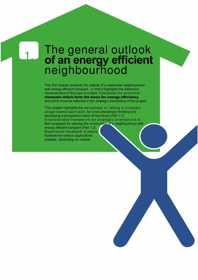
The general outlookof an nr fcintneighbourhoodThis rst chapter presents the outlook of a residential neighourhood
with energ efcient transport – in that it highlights the distinctie
characteristics of this tpe of proect. It pin-points the essent ia l
elements which form the basis for energy efciency and which must e reected in the strategic orientations of the proect.
This chapter highlights the advantage o f t ak ing a s t ra teg ic
usage-based appr oach , for cross-disciplinar thinking and
deeloping a prospectie ision of the future (Part 1.1).A t ransfe rab le f ramew ork fo r s t ra teg ic o r ien ta t ions is
then proposed for steering the construction of a neighourhood with
energ efcient transport (Part 1.2 ).
Experience feedback is usd to
illustrate the arious applications
possile, depending on context.
1.
8/6/2019 New Neighbour Hoods and Mobility
http://slidepdf.com/reader/full/new-neighbour-hoods-and-mobility 7/98
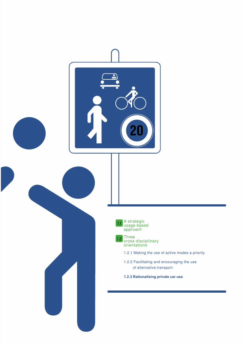
A strategicusage-basedapproach
Three
cross-disciplinaryorientations
1.2.1 Making the use of active modes a priority
1.2.2 Facilitating and encouraging the use
of alternative transport
1.2.3 Rationalisin privat car us
1.1
1.2
20

8/6/2019 New Neighbour Hoods and Mobility
http://slidepdf.com/reader/full/new-neighbour-hoods-and-mobility 8/98
A strategicusage-basedapproach
For a neighbourhood project, targeting energy efcient transport is
synonymous with the choice or energy efcient modes o travel.
In eect, although the ultimate determining actor is the oer o transport, the choices
and usage o transport made by the territory’s actors will always be decisive.
This prerequisite must be taken into account right rom the commitment stage – and in particular
during the strategy and programming phase.
The strategic orientations or an energy ecient neighbourhood project must thereore be formulatedin respect of expected usage. The rst deciding actor(s) or consideration is the targeted usage. This
involves placing usage at the centre of the strategy, and not the oer: it is the mobility model.
The strategic orientations will emerge i we examine aspects o the desired model or mobility. Or more
specically, i we ask ourselves whether journeys by residents or visitors can be made taking into account:
– the energy ecient modes which are available (realistic objectives with regards to the currentand uture oer o travel);
– acceptance by the targeted public (acceptable objectives);
– the time scale or change/take-up (time-related objectives);
– their evaluation (quantied, measurable objectives);
– their impact on the project’s energy eciency goals (objectives which translate into energy andGreen House Gas savings).
The model or mobility must lead to a model for futu re usage and travel habits to guide decisionmakers in their choices.
It should harmonise:
– on one hand, t prformanc of nr fcinc tarts in the neighbourhood and the
performance of the chosen model for mobility ;
– and on the other, the desired usage (mobility model) and planning issues – as well as thecorresponding technical requirements (action).
FIgURe 1. Rol and plac of t moilit modl
Niourood tarts for nr fcinc
Chosen model for mobility: usage and performance
Plannin coics and tcnical rcommndations (proramm)
This iterative process will ensure the acceptability o f policy and technical choices made by the
decision makers throughout the project. It uses a cross-disciplinary approach (opening up sectoral
approaches), centred on usage.
This method enables a ramework or action which is clear, coherent and eective, due to:
– the denition o quantied strategic objectives (mobility model: a rame o reerence or desired
usage and results);
– the ormulation o relevant indicators;
– a prospective vision o neighbourhood lie;
– the proposition o variants.
1.1
6 Nw Nighourhoods and Moility

8/6/2019 New Neighbour Hoods and Mobility
http://slidepdf.com/reader/full/new-neighbour-hoods-and-mobility 9/98
8/6/2019 New Neighbour Hoods and Mobility
http://slidepdf.com/reader/full/new-neighbour-hoods-and-mobility 10/98
Making the useof active modes a priority
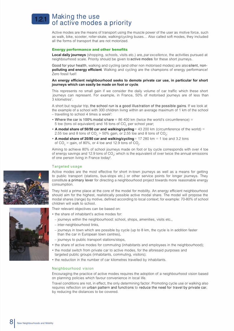
Active modes are the means o transport using the muscle power o the user as motive orce, such
as walk, bike, scooter, roller-skate, walking/cycling buses… Also called sot modes, they included
all the orms o transport that are not motorized.
Energy performance and other benets
Local dail ourns (shopping, schools, visits etc.) are, par excellence, the activities pursued at
neighbourhood scale. Priority should be given to active modes or these short journeys.
Good for your health, walking and cycling (and other non motorised modes) are also silent, non-pollutin and nr fcint. Walking and cycling are the champions o energy perormance!
Zero ossil uel!
An nr fcint niourood ss to dmot privat car us, in particular for sort ourns wic can asil mad on foot or ccl.
This represents no small gain i we consider the daily volume o car trac which these short
journeys can represent. For example, in France, 50% o motorised journeys are o less than
3 kilometres1.
A short but regular trip, the school run is a good illus tration of the possible gains. I we look at
the example o a school with 300 children living within an average maximum o 1 km o the school
– travelling to school 4 times a week
2
:• Where the car is 100% modal share = 86 400 km (twice the world’s circumerence) =
5 toe (tons oil equivalent) and 16 tons o CO2per school year;
• A modal sar of 50/50 car and walin/cclin = 43 200 km (circumerence o the world) =
2.55 toe and 8 tons o CO2> 50% gain, or 2.55 toe and 8 tons o CO
2;
• A modal sar of 20/80 car and walin/cclin = 17 280 km = 1 toe and 3.2 tons
o CO2> gain, o 80%, or 4 toe and 12.9 tons o CO
2.
Aiming to achieve 80% o school journeys made on oot or by cycle corresponds with over 4 toeo energy savings and 12.9 tons o CO
2; which is the equivalent o over twice the annual emissions
o one person living in France today3.
Targeted usage
Active modes are the most eective or short in-town journeys as well as a means or getting
to public transport (stations, bus-stops etc.) or other service points or longer journeys. They
constitute a primary lever or directing a neighbourhood project towards more reasonable energy
consumption.
They hold a prime place at the core o the model or mobility. An energy ecient neighbourhoodshould aim or the highest, realistically possible active modal share. The model will propose the
modal shares (range) by motive, dened according to local context; or example: 70-80% o school
children will walk to school.
Their relevant objectives can be based on:
• the share of inhabitant’s active modes for:
– journeys within the neighbourhood: school, shops, amenities, visits etc.,
– inter-neighbourhood links,
– journeys in town which are possible by cycle (up to 8 km, the cycle is in addition aster than the car in European town centres),
– journeys to public transport stations/stops,
• the share of active modes for commuting (inhabitants and employees in the neighbourhood);
• the modal switch from private car to active modes, for the aforesaid purposes and
targeted public groups (inhabitants, commuting, visitors);
• the reduction in the number of car kilometres travelled by inhabitants.
Neighbourhood v is ion
Encouraging the practice o active modes requires the adoption o a neighbourhood vision based
on planning policies which avour convenience in local lie.
Travel conditions are not, in eect, the only determining actor. Promoting cycle use or walking alsorequires refection on urban pattern and functions to reduce the need for travel by private car,by reducing the distances to be covered.
1.2.1
Nw Nighourhoods and Moility8

8/6/2019 New Neighbour Hoods and Mobility
http://slidepdf.com/reader/full/new-neighbour-hoods-and-mobility 11/98
Functional diversity is a crucial lever. By ensuring diversity o use in a neighbourhood, that is to
say placing homes, business, services and oces within easy reach o each other, the distances
involved in daily activities (shops, schools, cultural activities etc.) are reduced. Inhabitants will have
less need to use their cars to travel because the urban abric and transport conditions avour the use
o sot modes. The neighbourhood’s population must be suciently dense to ensure the long termsurvival o shops, services and local amenities.
Finally, the rst orientation will point the project’s conception towards an energy ecient neighbour-
hood by:
– opting or an urban shape, as well as economic and cultural development (commercial
and cultural activities), which will promote the use o green modes (reducing distances,unctional diversity and density etc.);
– creating pedestrian/cycle-riendly conditions (including disabled access) or getting around
and parking in the neighbourhood and on inter-neighbourhood links;
– developing the services which acilitate cycle use (links to a sel-service cycle hire scheme,
close proximity o cycle centre etc.);
– involving inhabitants in the project (acceptability o the project, group activities such
as the school walking buses);
– raising awareness o active modes by proposing lessons on in-town cycling (cycle training).
Areas of ac t ion
From a sectoral point o view, giving priority t o the use of soft modes will refect on the neighbour-hood concept at the ollowing levels:
– the involvement o inhabitants;
– its town planning;
– its buildings;
– its public roadways;
– its alternative transports;
– the management o mobility.
For more inormation on each sector, go to Chapter 3
and try out the Moilit and Nw Niouroods tool.
Examples of appl icat ion
The experience eedback rom numerous sustainable, eco-riendly or energy ecient neighbour-
hoods shows that active modes were a constant priority. The ollowing neighbourhoods havetackled the use o active modes as a major issue.
• T kronsr niourood (Hanover, Germany) put the accent on avourable town andrailway conditions or active modes (diversity, services to amenities, quality o public spaces
and 30 zones etc.).
• T bO01 (Malmö, Sweden), Andromède (Blagnac, France), Temps durables (Limeil-Bré-vannes, France) and Lac d bordaux niouroods (France) all give priority to active
modes in terms o trac calming, shared public spaces and mobility management (walking
buses, inormation etc.).
• The bonn usinss par (Grenoble, France), the bdZeD (Sutton, United Kingdom) andHammarby Sjöstad (Stockholm, Sweden) neighbourhoods aimed at providing optimum acces-
sibility or pedestrians, in particular or the disabled, both on the neighbourhood streets and inits inter-neighbourhood links.
Spotlit on t Vauan Niourood in Friur im brisau (grman)
The deelopment plan aims to reduce the distances people hae to trael and to
limit car trafc, in faour of a safer and more welcoming street enironment that
promotes actie modes and a irant municipalit life.
Conceied as a “walkale neighourhood”, the local shops, serices, schools and
plagrounds are all within eas distance on foot or iccle from the housing units
(serices within walking and ccling distance – maximum distance: 700 m, aerage
distance: 300 m).
Uran adantages are reinforced the organisation of the pulic road network:
its conguration and speed limits faour local life and green transport options and
demote motorised trafc ow and parking.
For further information on each example, see the good practice forms.
1. Global Transport Study , 2001.
2. Hypothesis: 300 pupils (not taking into account siblings); 4 school days/week and 36 weeks school/year; 1 km one way – 2 km/day;
car: 59 grams o oil equivalent/person.km and 186g CO2person.km. Source unitary actors: RATP; www.ratp.r
3. Source: www.statistiques.developpement-durable.gouv.r/
1. The geNeRAL OUTLOOk OF AN eNeRgy eFFICIeNT NeIghbOURhOOD 9

8/6/2019 New Neighbour Hoods and Mobility
http://slidepdf.com/reader/full/new-neighbour-hoods-and-mobility 12/98
Facilitatingand encouraging the useof alternative transport
Energy performance and other benets
The oer o public transport has a strong impact on a neighbourhood’s energy eciency (Figure 2).
Their proximity encourages their use.
Public transport is in eect the best perorming motorised mode (Figure 3). A tram is approximately10 times less uel thirsty than the car – a bus is two times less (in km travelled).
Thereore, an employee commuting 20 km per day (a two-way trip) by car can make the ollowing
yearly savings4, i there is the alternative o travelling by:
– bus, 1 758 euros, 962.20 kg CO2and 381.30 litres o petrol;
– tram, 1 758 euros, 1224.40 kg CO2and 480 litres o petrol.
For a neighbourhood with, or example, an economically active population o 500, the use o public
transport represents an important gain. This 20 km daily commute would represent 648 tons o
CO2and 253 250 litres o petrol, or 2 532 500 kWh, equating to the annual consumption o energy
required to heat 118 standard built homes or 422 energy ecient homes.
With a modal share o 30% bus and 10% cycle, CO2emissions could be reduced by 209 tons per
year 5 and energy consumption by over 82 000 litres (or 820 000 kWh) equating to the annual uel
consumption or heating 67 standard built homes and 137 energy ecient homes.
FIgURe 2. Energy consumption and urban developments
Source : T&E 1996. (PT : public transport)
Targeted usage
For all journeys which cannot be made solely using active modes (walking, cycling etc.) the neigh-
bourhood must provide an alternative mode to the car which encourages multi-modal use and
facilitates inter-modality (combination o several modes or one journey). For the user, the mostimportant thing is to have a choice o transport mode or day to day living.
The interoperability o public transport and other alternative modes (walking, cycling, lit-sharing,
car-sharing etc.) is thereore essential; it ensures the right conditions or a sustainable modal shift.
The model or mobility is designed to operate on
the journeys or which alternative modes can beencouraged:
– commuting;
– leisure activities;
– journeys made by the elderly or young people;
– visitors to public amenitiesin the neighbourhood etc.
0
50
100
150
200
250
300
kWh/pers/semaine
279
4131
1.2.2
Uran centres Peripher with PT Peripher without PT
10 Nw Nighourhoods and Moility

8/6/2019 New Neighbour Hoods and Mobility
http://slidepdf.com/reader/full/new-neighbour-hoods-and-mobility 13/98
FIgURe 3. Energy consumption and CO2
emissions by urban transport modes
Source: RATP; www.ratp.r
Sharing our experienceS
The ADD HOME proect (ILS Studies 2008) has highlighted that the proximit of pulic transport is the 3rd most impor-
tant factor for choice out of recent pulic choices for location, after the cost and presence of green spaces.
Pulic transport is ecoming a selling point!
For more inormation: www.addhome.eu
According to context, the model can or example speciy:
– the modal share o public transport, all reasons, and commuter travel or inhabitants
and those working in the neighbourhood;
– the number o people getting on and o at public transport stops in the neighbourhood;
– the share o company employees (or more generally those working in the sector,or the inhabitants) using a lit-sharing scheme – according to the scheme in place;
– the number o users and uses (in usage, in km) o a car-sharing scheme;
– the number o bicycles hired and the number o km travelled by users etc.
Neighbourhood v is ion
I we aim to encourage optimal use o alternative modes within a neighbourhood project, then
consideration must be given to coic of location – wll for t concption sta. It must
provide continuity with the urban abric and be close to the existing pub lic transport networks to
encourage their use by uture inhabitants.
The neighbourhood project must obviously be connected to the existing oer; but it should also
develop additional offrs adaptd to t niourood’s spcic rquirmnts. Journeys into
town should be easy to make using alternative modes to the private car. The success o a project
to encourage multi-modal use depends on the provision o a mixed range of alternative options.
4. Source: eco-calculator ADEME: www.ademe.r/eco-deplacements/calculette/
5. Source: TScheidler/ILS, energy agency NRW de Wuppertal, 1997. For comparison, heating a house or one year requires on average 13 500 kWh/year
or a standard construction and 6 000 kWh/year or an energy ecient construction.
Grammes CO2
Equivalences in g CO2 /passenger.km Equivalences in g fuel/passenger.km
Transport modes
Grammes fuel
186
59
29 27
6,9 6,5 5,40
99
23
3,5 3,3 2,8 00
50
100
150
200
0
60
40
20
Regional trains Metro Tramway
111. The geNeRAL OUTLOOk OF AN eNeRgy eFFICIeNT NeIghbOURhOOD

8/6/2019 New Neighbour Hoods and Mobility
http://slidepdf.com/reader/full/new-neighbour-hoods-and-mobility 14/98
The second orientation will steer the neighbourhood’s vision towards energy eciency through:
– public transport access to the neighbourhood (proximity, inter-neighbourhood links by publictransport, links with the main regional centres);
– good trac conditions or public transport;
– the development o additional services (taxis, car-sharing or cycle hire centres, lit-sharing
parks, deliveries etc.);
– the involvement o inhabitants (acceptability o the project, participation in its processes etc.)
and local actors (public transport operators and mobility services);
– raising the awareness o inhabitants and other transport users.
Areas of ac t ion
From a sectoral point o view, promoting the use of alternative transport should be refected in
the conception o the neighbourhood at the level o:
– the involvement o inhabitants;
– its buildings;
– its public roadways;
– its alternative transports;
– the management o mobility.
For more inormation on each sector, go to Chapter 3
and try out the Moilit and Nw Niouroods tool.
Examples of appl icat ion
The development o alternatives to the private car constitutes a recurrent objective or those neigh-
bourhoods seeking optimum energy perormance. Experience eedback has shown that a largenumber o neighbourhoods have chosen the objective o encouraging use o alternative modes.
This is or example demonstrated:
– by providing easy access to an attractive oer o public transport as in the ollowing
neighbourhoods : Bonne (France), Temps durables, Andromède and Ginko (France),
BedZED (United-Kingdom), Vauban (Germany);
– by inormation and/or awareness campaigns such as at Andromède, Temps durables
and Ginko, BO01 (Sweden), Sarriguren (Spain), Vauban;
– by the implementation o mobility services (sel-service cycle hire) or mobility centresuch as those in the Temps durables neighbourhood and BO01;
– by the lit-sharing services in Sarriguren, Andromède, Temps durables, BO01;
– by the car-sharing services in Hammarby Sjöstad (Sweden), Bonne, Andromède,
Temps durables, BO01, Vauban and BedZED.
Carclubs and lit-sharing services also contribute in a big way to the third orientation and as suchare urther developed in the ollowing section.
Sharing our experienceS
In brmn, Germany, the public transport and car-sharing operator Cambio has been oering the “Bremer Karte Plus
AutoCard” since 1998 – this is a yearly season ticket which provides cheaper rates on the car-sharing scheme.
Sources: European Moses project, www.managenergy.net/products/R465.htm)
CERTU study reports: Car-sharing and Lit-sharing in France and Europe.
Spotlit on t hammar Söstad Niourood, Stocolm (Swdn)
The concept of this neighourhood was aimed at reducing priate car use in faour of more energ-efcient modes. To
achiee this, the programme targeted the deelopment of alternatie modes to the priate car; in particular through the
implementation of an effectie pulic transport sstem which includes a tramwa, car ferries to the town centre and clean
uses (io-fuel or hrid). In addition, electric or iogas ehicles were made aailale to residents (through car-sharing
scheme) in order to limit household motor ehicle use and reduce the numer of parking places. This offer of transport
was complemented infrastructures and amenities for pedestrians and cclists. Finall, educational actions, made
possile the creation of a “green” learning centre and workshops, were implemented in local schools.
For further information, see the good practice form 13.
12 Nw Nighourhoods and Moility
8/6/2019 New Neighbour Hoods and Mobility
http://slidepdf.com/reader/full/new-neighbour-hoods-and-mobility 15/98
Rationalisinprivate car use
Energy performance and other benets
The private car is at the high end of energy and space consumption . High in GHG (green house
gas) emissions, the motorised vehicle is also a source o pollution which is harmul to our health.
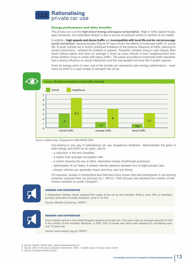
In addition, i spds and dns trafc are incompatil wit local lif and do not ncoura
social connection. Several studies (Figure 4)6 have shown the eects o motorised trac on social
lie. A study carried out in Zurich produced evidence o the positive infuence o trac calming onsocial connections – whether or children or parents. Thereore, children living in calm streets oten
travel without adults and have on average 4 times as many riends in their neighbourhood thanthose children living on roads with heavy trac7. The place accorded to motorised trac thereore
has a strong infuence on social interaction and the way people live local lie in public spaces.
From an energy point o view, use o the private car represents poor energy perormance – even
more so when it is used simply to transport the driver.
FIgURe 4. Social connctions and trafc dnsit
Source: Adams etal., Diagramme FGM-AMOR 2005
Car-sharing is one way o rationalising car use. Experience eedback demonstrates the gains inboth energy and GHG by its users, due to:
– a reduction in the kms travelled;
– a higher than average occupation rate;
– a switch towards the use o other, alternative modes (multimodal practices);
– optimisation o car feets: A shared vehicle replaces between our to eight private cars;
– shared vehicles are generally newer and thus, less uel thirsty.
For example, studies in Switzerland and Germany have shown that new participants in car-sharing
schemes reduced their car journeys by 1 000 to 1 600 km/year and doubled the number o kilo-metres travelled on public transport 7.
Sharing our experienceS
In Switzerland, Mobility clients reduced their usage o the car by kms travelled. What is more, 80% o member’s
journeys were done on public transport, cycle or on oot.
Source: Mobility Carsharing, CERTU7.
Sharing our experienceS
Each Carplus vehicle in the United Kingdom replaces 6 private cars. The users make an average reduction o 50%in the number o kms travelled. Moreover, in 2005, 45% o private cars which were replaced by car-sharing were
over 10 years old.
Source: www.carplus.org.uk, CERTU7.
1.2.3
0
1
2
3
4
5
6
7
3
6,3
1,2
4
0,8
3,1
6. Source: Studies Adams etal., www.transportlearning.net.
7. Source: Kids on the move, European Commission, 2002 – In-depth study on 5 year olds in Zurich.
8. Source: European Moses project.
friends
calmed trafc aerage trafc dense trafc
nightours
131. The geNeRAL OUTLOOk OF AN eNeRgy eFFICIeNT NeIghbOURhOOD

8/6/2019 New Neighbour Hoods and Mobility
http://slidepdf.com/reader/full/new-neighbour-hoods-and-mobility 16/98
Targeted usage
To achieve a substantial alternative modal share, and guarantee energy eciency in the neigh-
bourhood, inhabitants’ use o the private car and its importance in the neighbourhood have to be
a primary element or consideration. This third directional line is inter-linked and dependant on the
rst two orientations.
An energy ecient neighbourhood seeks in eect to reduce the number o private car journeys
and rationalise car use; the model or mobility will thereore target:
– a reduction in the rate of private car use in particular within the neighbourhood: the discoura-
gement o car use in avour o alternative modes, in particular or local journeys (coherent and
complementary to the rst two orientations); – alternative use of the car: car-sharing (through associations, commercial enterprise or by
arrangement between individuals), or sharing a personal car (lit-sharing);
– non use of the car: renunciation o car ownership, consumer practices which do not involve
travelling (deliveries or distance services provided by the internet).
The model can also be used to set objectives:
– linked to ownrsip: limit the rate o household motorisation (respect or speed limits), limit the
number o parking places being created etc.;
– linked to behaviour: curb the habits o dangerous, energy thirsty and inappropriate driving
(eco-driving) in residential neighbourhoods (peace o mind and saety).
Neighbourhood v is ion
The place given to the car (buildings, streets, public spaces) impacts heavily on energy peror-
mance and quality o a new neighbourhood (and its costs). T coic for an nr fcint
neighbourhood implies acceptance of the need for smart car use.
The third orientation depends on the acceptance o the choices made about street planning,
usage and development o services to encourage and rame this intelligent use o the car. It pro-vides the avourable conditions or:
– discourain car trafc and parin: non car-riendly streets (speed limits etc.), limited par-
king away rom homes;
– nw car-us practics wic dissociat ownrsip from us: lit-sharing and car-sharing;
– avoid the need for indiv idual journeys through the use of services: deliveries, distance
services on the internet;
– raisin awarnss amonst inaitants and, mor particularl, drivrs (compliance with
parking and driving restrictions);
– the involvement of inhabitants (commitment and acceptance to a car-ree neighbourhood,advice on mobility).
Areas of ac t ion
From a sectoral point o view, rationalising car use should be refected in the conception o the
neighbourhood at the level o:
– the involvement o inhabitants;
– its town planning;
– its buildings;
– its public roadways;
– its alternative transports;
– the management o mobility.
For more inormation on each sector, go to Chapter 3
and try out the Moilit and Nw Niouroods tool .
14 Nw Nighourhoods and Moility

8/6/2019 New Neighbour Hoods and Mobility
http://slidepdf.com/reader/full/new-neighbour-hoods-and-mobility 17/98
8/6/2019 New Neighbour Hoods and Mobility
http://slidepdf.com/reader/full/new-neighbour-hoods-and-mobility 18/98
Mobility at the heart ofthe neighbourhood
creation processChapter 2 makes recomm endat ions on
methodo logy fo r opt im is ing the in tegra t ion
o f mob i l i ty in to the ne ighbourhood
planning process.
If mobility is to effectively contribute to the energyfcinc oals of a niourood, it must
an integral part of the project and, as such, dalt wit in each s tage o f the p rocess :
– durin t prorammin pas (section 2.2 );
– durin Proct roll-out (section 2.3 );
– and trouout niourood lif (section 2.4 ).
Moreover, the municipality can take a preliminary look
at t xistin rulator lvrs; and coos to
synchronise these planning and transport documentsin ordr to nt from t regu la to ry advantages
and ensure energy efciency in their
neighbourhood pro jects ; as wll tos of privat
landlords (section 2.1).
These recommendations are centred on the variousaspects of method or organisation, independentlyof the procedures in force in each country, in order
to stalis a procss wic can asil transfrrd.
For lp wit intratin moilit into our proct’s
steering, consult the question table
in the Mobi l i ty and New Neighbourhoods toolon t CD-ROM wic accompanis tis uid.
2.

8/6/2019 New Neighbour Hoods and Mobility
http://slidepdf.com/reader/full/new-neighbour-hoods-and-mobility 19/98
A decisive preliminary lever:connecting urban andtransport plannings
2.1.1 Integrated urban development-transportplanning at local scale
2.1.2 The possib le levers
The programme
phase
2.2.1 Commi tment phase
2.2.2 Study and diagnostic phase
2.2.3 Strategy and programming phases
The neighbourhoodproject
2.3.1 Conception phase
2.3.2 Implmntation of wors pas
Localneighbourhood life
2.4.1 Raisin awarnss and providin informationto support change
2.4.2 Monitoring and assessing the project
2.1
2.2
2.3
2.4

8/6/2019 New Neighbour Hoods and Mobility
http://slidepdf.com/reader/full/new-neighbour-hoods-and-mobility 20/98
A decisive preliminary lever:connecting urban andtransport plannings
The consistency o urban and transport plannings at local scale (local urban
and/or habitat plans, urban or local travel plans) is a key advantage or energy
ecient urban development.
Thereore, recommendations relating to urban planning can also appear in travel planning docu-
ments; and inversely, recommendations relating to transport can be imposed by local urban deve-
lopment and habitat plans (or other planning documents).
Integrated urban development-transportplanning at local scale
For example, in France, the connection between the Uran Travl Plan (which is mandatory or
metropolitan areas over 100 000 inhabitants and oten an intermunicipal initiative) and the UranDvlopmnt Plan (which is taken at city scale), can oster the development o neighbourhoods
with energy ecient transport.
On one hand, the urban travel plan sets perimeters in which the conditions o access by publictransport permit the reduction or suppression o requirements (minimum) set by the urban develop-
ment/housing plan or the creation o parking places (article 12). This requirement rom transport
plan is thereore imposed on the urban development plan. Within these perimeters, maximum
quotas, or restrictions, can be applied or the creation o car parking places or new constructions,
and minimum quotas or cycle parking.
However, experience eedback shows that municipalities can also set these perimeters out directlyin their urban development plan.
On the other hand, the urban development plan (article 3) makes the provision or access to land
which is set aside or development. It can be drated with a view to promoting access by publictransport or active modes (see example o Lille).
An optimum connection o travel and urban development plans help to put in place the successulconditions or the construction o energy ecient neighbourhoods by:
– avouring the densication o those areas with good public transport services;
– imposing maximum quotas or car parking;
– imposing minimum quotas or cycle parking with quality requirements.
Sharing our experienceS
The uran dvlopmnt plan of Nants (France) applies a reduction o 15% compared to the number o places
usually required where “the site (even partially) is located within t ara of inunc of stops and stations on
restricted lanes of public transport (within a radius o 400 metres around the station).”
Sharing our experienceS
The uran dvlopmnt plan of Lill (France) mapped the perimeters of good public transport service; thisshowed the perimeters o a 500 metres radius around railway stations (underground, tramways and regional train
stations with more than 10 stops per day per direction).
The urban development plan stipulates or one o its urban zones (article 3) that within the perimeters o good
service by railway stations shown on the plan, access to the land parcel must be designed to connect it as closelyas possible to a railway station (underground, tramway or regional train) where this is technically possible; on areas
or development, article 3 stipulates that every new road development projects must “guarantee the comort o
pedestrians and cyclists under conditions which are sae or all modes o travel.”
2.1
2.1.1
18 Nw Nighourhoods and Moility
8/6/2019 New Neighbour Hoods and Mobility
http://slidepdf.com/reader/full/new-neighbour-hoods-and-mobility 21/98
The possiblelevers
Although local planning documents are specic to each European Union member state, leverscan be proposed because there were converging developments over the last 15 years in Europe
on regional or urban planning processes – from land use planning to strategic land planning.
Propositions for connctin urban development plans and urban travel plans made here are
duplicable according to the regulations in orce in each country.
Uran travl plans can play an important role in ensuring the adequacy o the car parking oer innew buildings to the supply o public transport.
Thereore, these plans can dene the areas within which the quality o access by public transport
permits (according to each case):
– a reduction in the mandatory quota (minimum) to build parking spaces in new buildings;
– the suppression of minimum quotas in favour of maximum quotas thus limiting the creationo parking spaces in residential neighbourhoods around the transport hubs;
– the imposition of minimum quotas for cycle parking in new constructions, which would pree-
rably include criterion or quality.
Local uran dvlopmnt plans also represent a crucial lever or developing energy ecient
neighbourhoods, which go beyond the issues o specic zones.
In view o the act that they determine both land occupation and use, they can: – synchronise uture land occupanc wit t supplis of transport;
– dene the urban areas and those or development in continuit wit t uran nvironmnt
or uran rnwal (renovation, interstitial spaces);
– avour dense urbanisation in proximity to the main public transport routes or hubs ;
– avour the mixed use development of neighbourhoods – adapted to the use o sot modes
(shortened distances).
In addition, according to regulatory context, urban development plans set the conditions o accessor lands designated or construction (see example: Lille in France). In this case, they can give
preerence to access by public transport, by cycling or by walking.
The subject o parking will be covered in greater detail in Chapter 4. This paragraph provided the
prerequisite conditions in order to acilitate the construction o an energy ecient neighbourhood.
The programmephase
Commitmentphase
Dening aspi rat ions in coherence w i th local po l ic ies
This preliminary phase, beore dening the mobility model, rames the strategic orientations in
accordance with local policies on travel, energy and sustainable development. It ensures the pro- ject’s coherence with the municipal strategy in applying objectives set in dierent policies (urban
travel plans, local agenda 21, climate plan etc.). Ultimately, this rst stage is aimed at drawing up
an outline or the neighbourhood’s outlook regarding mobility issues.
2.2
2.1.2
2.2.1
192. MObILITy AT The heART OF The NeIghbOURhOOD CReATION PROCeSS

8/6/2019 New Neighbour Hoods and Mobility
http://slidepdf.com/reader/full/new-neighbour-hoods-and-mobility 22/98
Choosing a s i te
Depending on the contexts (land availability), the site is more or less dened at the very start o theproject. In all cases, the “mobility” criterion must be integrated into the choice o site, in particular:
– continuous urban development (limit sprawl towards arm lands or the countryside), urban deve-lopment o interstitial spaces in the existing urban abric, extension o a pre-existing urban core;
– the proximity o existing public transport networks, and, where necessary, the easibility o
providing connections;
– the current condition o links with other neighbourhoods: proportion o roads to create, links
with other neighbourhoods which can provide unctions, activities or services which are not
available in the new neighbourhood.
At this stage, mobility should be included as a consideration when choosing a site, i energy per-
ormance is to be optimised.
For urther inormation, please consult the urban development section in Chapter 4.
Organisat ion
Steering and transversality are organised in order to ensure the good coordination o the city sta and external key actors on mobility issues. A steering committee and joint working groups avour
ecient transmission o the project and create a sense o belonging by all stakeholders.
The project (site and aspirations) is communicated to services and other key actors involved in the
project, in order to provide them with inormation (public meetings, letters, Town newspaper, Town
website etc.) and ensure their early mobilisation.
From country to country, assistance can be sought during the very early stages o the project to
provide backing and support in the choice o site, running analysis and dening the programme.
In this case, care should be taken to write down the required competences in transport.
Study anddiagnosis phase
Running diagnosis and pre-operat ional s tudies
The pre-operational stage or, more specically, the consideration o available options is a decisive one.
It should be done in partnership with the contracting authority and all other parties involved. Assuch, the mandatory procedures in place, such as a public enquiry or an impact study will ensure
– according to country – that the public has had access to certain items o inormation and were
consulted beore implementation o the project.
The diagnosis is aimed at making a study o the site: context, requirements, constraints, potential,
regulations etc. The mobility and accessibility analysis will shed light on the problems and issues o mobility on the site. Diagnosis is based on an analysis o the oer and demand or mobility – both
existing and envisaged – as well as their adequacy. It is, in particular, a study o mobility requi-
rements (what is required o the oer? what will be the newly generated trac?) or the necessary
parking regulations in order to pre-identiy the project’s possible obstacles or levers.
The diagnosis should be done in partnership with the neighbourhood’s uture users and/or existinginhabitants in the area. Inhabitants will provide their own user expertise which will help with sharing
the diagnosis.
Complementary or mandatory studies (e.g. the urban development zone impact studies), will pro-
vide urther inormation or diagnosis on specic or technical aspects. For example:
– accessibility in the planned or existing neighbourhood;
– trac generated by existing inrastructures (street networks, public transport);
– how the public transport oer will be connected in order to prepare the ground or inter-opera-
bility o urban development and transport planning.
2.2.2
20 Nw Nighourhoods and Moility
8/6/2019 New Neighbour Hoods and Mobility
http://slidepdf.com/reader/full/new-neighbour-hoods-and-mobility 23/98
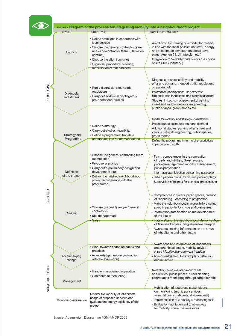
FIgURe 5. Diaram of t procss for intratin moilit into a niourood proct
Source: Adams etal., Diagramme FGM-AMOR 2005
STAGES OBJECTIVES CONCERNING MOBILITY
Launch
• Define ambitions in coherence with
local policies
• Choose the general contractor team
and/or co-contractor team (Definition
contract)
• Choose the site (Scenario)
• Organise: procedure, steering,
mobilisation of stakeholders
Ambitions: 1st framing of a model for mobility
in line with the local policies on travel, energy
and sustainable development (local travel
plans, Agenda 21, climate plan etc.)
Integration of “mobility” criterion for the choiceof site (see Chapter 3 )
P R O G R A M M E
Diagnosis
and studies
• Run a diagnosis: site, needs,
regulations…
• Carry out additional or obligatory
pre-operational studies
Diagnosis of accessibility and mobility:
offer and demand, induced traffic, regulations
on parking etc.
Information/participation: user expertise
diagnosis with inhabitants and other local actors
Studies: impacts, management of parking
street and various network engineering,
public spaces, green modes etc.
Strategy and
Programme
• Define a strategy
• Carry out studies: feasibility…
• Define a programme: translate
orientations into recommendations
Model for mobility and strategic orientations
Proposition of scenarios: offer and demand
Additional studies: parking offer, street and
various network engineering, public spaces,
green modes
Define the programme in terms of prescriptions
impacting on mobility
Accompanying
change
• Work towards changing habits and
practices
• Acknowledgement (in conjunction
with the evaluation)
- Awareness and information of inhabitants
and other local actors, mobility advice
> see Mobility Management heading
- Acknowledgement for exemplary behaviour
and initiatives
N E I G H T B O U R
L I F E
Management
• Handle management/operation
• Contribute to monitoring
Neighbourhood maintenance: roads
and utilities, public places, street cleaning
contribute to monitoring through caretaker role
Monitoring-evaluation
Monitor the mobility of inhabitants,usage of proposed services and
evaluate the energy efficiency of the
project
- Mobilisation of resources stakeholders
on monitoring (municipal services,
associations, inhabitants, shopkeepers)
- Implementation of « mobility » monitoring tools
- Evaluation: achievement of objectives
for mobility, corrective measures
P R O J E C T
Definition
of the project
• Choose the general contracting team
(competition)
• Propose scenarios
• Carry out a preliminary design and
development plan
• Deliver the finished neighbourhoodproject in coherence with the
programme
- Team: competences in the conception
of roads and utilities, Green routes,
parking management, mobility management,
public participation
- Information/participation concerning conception
- Urban pattern plans, traffic and parking plans
- Supervision of respect for technical prescriptions
Creation
• Choose builder/developer/general
contractors
• Site management
• Sales
- Competences in streets, public spaces, creation
of car parking – according to programme
- Make the neighbourhood’s accessibility a selling
point, in particular for shops and businesses
- Information/participation on the development
of the site or
- Inauguration of the neighbourhood: demonstration
of its ease of access using alternative transport
- Awareness raising-information on the arrival
of inhabitants and other actors
212. MObILITy AT The heART OF The NeIghbOURhOOD CReATION PROCeSS

8/6/2019 New Neighbour Hoods and Mobility
http://slidepdf.com/reader/full/new-neighbour-hoods-and-mobility 24/98
Strategy andprogramming phases
Using the model for mobility to dene strategy
Beore deciding on a programme, it is important that a strategy is dened, that is to say the directions
which will guide the project in its concept and creation. This approach will guarantee coherencetwn local polic lins and t aspird oals of t niourood. To achieve these transport
energy perormance objectives, the neighbourhood project must encourage inhabitants and visitors to
choose energy ecient modes o travel.
When refecting on this, the dened mobility model can be used upstream o the project to help
local councillors dene appropriate strategic orientations, in step with their mission to reduce energy
consumption and greenhouse gas emissions.
This is an exercise in forecasting common preferences, concerning usage and priorities given to
public spaces and trac, in order to set realistic and ambitious goals. Projections will be based on thealignment o initial political ambitions or the neighbourhood with ndings on current usages and the
actual and potential oer o transport. The question is primarily about which usage and journeys will
lead to optimal energy eciency? This question table can also help with refections when dening the
model or mobility i you have not already done so.
This approach is recommended, on one hand, or coordinating the development o the neighbourhoodwith the local travel plan, and on the other hand it will help with dening orientations or trac and
parking within a new neighbourhood. Finally, it will enable you to spot the obstacles or constraints, or unwelcome-eects (such as induced trac) on the end goal o energy eciency, particularly in regu-
latory terms (coherence with the Local Urban Development Plan or regulated zones).
Dening a mobility model means ormulating a prospective model of usage and travelling habits. A
number o ormulations are possible:
• priorit of usa (unquantid):
The mobility model assigns priorities or usage without quantiying them. The priorities should
thereore be indicated in terms o modes, motives and users.
For example: by dening that all or part o the streets and public spaces are prioritised or inha-
bitants – to promote local lie.In the absence o pre-existing policy objectives, prioritising issues will have the advantage o
being easier to ormulate than, or example, modal shares.
• modal sar:The mobility model denes the expected usage in terms o modal share, that is to say a % o
journeys by motive and by target (inhabitants, employees etc.).
For example: % o journeys made on oot by inhabitants to school, or to the local shops.It can be based on the objectives o the local travel plan.
The advantage o quantiying expected travel habits is that it will provide important elements or
the programme in terms o energy consumption and greenhouse gas emissions (orecast).
Within a neighbourhood which seeks to achieve energy eciency, the mobility model which is
dened must be ambitious in respect o local or regional authority travel policies, according tocontext (urban travel plan). But it must also take into account the current practices observed in the
territory. For example, it aims to make walking an important modal share, to school (greater than
60-70-80%), or to the local shops (60%) etc. In any event, these quantied objectives are relative
to local context in each case (conormity with mandatory ratios).
Once the model or mobility has been decided upon, it is then used to dene the oer o streetparking, the spaces allocated to buildings, as well as the priorities or trac (in accordance withthe regulatory context).
The reader is invited to try out the Mobility and New Neighbourhoods tool included
on the CD-ROM – to check whether the issue o energy efcient transport has been
properly integrated into prospective thinking – beore deciding upon the strategic orientations.
Study ing the pro jec t ’s feas ib i l i ty
Once the compass has been set, some other issues will need to be studied in order to ascer-
tain the project’s easibility in terms o mobility: the oer o parking, design o streets and other networks, public spaces, green modes.
2.2.3
22 Nw Nighourhoods and Moility

8/6/2019 New Neighbour Hoods and Mobility
http://slidepdf.com/reader/full/new-neighbour-hoods-and-mobility 25/98
Thereore, additional studies can be carried out on:
– easibility o a mobility service;
– intelligent parking management (global approach at neighbourhood scale, including streets
and buildings);
– easibility o connecting up with the public transport oer – in anticipation o interoperability
with transport planning;
– easibility o shared multi-storey parking etc.
Dening a programme
The programme translates strategic orientations into technical requirements. It portrays a detailedpicture o the neighbourhood’s outlook. It species the requirements, constraints and expectations
o the municipality or this project, in particular in terms o mobility.
The technical requirements impacting on mobility can be ound in the ollowing elds:
– town planning;
– buildings;
– public roadways;
– alternative transports;
– and the management o mobility.
Technical requirements are dealt with urther in Chapter 4.
Readers can use the CD-ROM’s Moilit and Nw Niouroods tool to examinethe area specifc questions relating to the technical requirements.
The development plan should be supported by an accompaniment plan to ensure the project’s
continuity. This plan will determine an appropriate usage, in line with the project’s energy goals –
both or transport and buildings. In particular, it is aimed at supporting:
– the desired changes in habit and behaviour;
– the use o the new services on oer;
– the involvement o inhabitants in mobility projects (see Chapter 3).
The neighbourhood
projectConceptionphase
Choos ing the cont rac t managem ent team
Once the programme has been dened, according to the procedures in orce the town needs to
form a contract management team (developer, building contractor etc.) and co-contractor (or
several depending the projects and actions in hand); one which is able to meet the municipality’s
requirements (in particular those concerning mobility) according to the project’s specic goals (low
energy streets, raising awareness amongst inhabitants, communication etc.) The required compe-
tences are detailed in the Special Technical Clause Specications.
Proposing scenar ios
The choice o a scenario involves the creation o a composition plan which will dene the varioususage o each space (public spaces and dwellings etc.), as well as the drating o regulations
which will supplement rules on access and service routes to each land parcel.
T cost of strts, parin and ntwors will inunc t cost of t proct, their conceptionmust thereore be considered in the development o proposed scenarios by taking into account the
expected usage and the uture management o amenities and inrastructure.
The plan must speciy the dierent usage o public spaces, indicating the areas to be put in place(home zone, zone 30 etc.) and the parking spaces, by stating its type (underground, surace,
multi-storey, mixed etc.).
Regarding the specic regulations that dene the project, it must also take into account the prio-
rit usa witin t niourood (active modes) or access roads to land parcels. Scenarioscan be set up in partnership with the key actors involved.
By taking this approach, several dierent scenarios, which are more or less pro-active in terms
o energy eciency, can be proposed, which will help local councillors in their decision making.
2.3
2.3.1
232. MObILITy AT The heART OF The NeIghbOURhOOD CReATION PROCeSS
8/6/2019 New Neighbour Hoods and Mobility
http://slidepdf.com/reader/full/new-neighbour-hoods-and-mobility 26/98
Creat ing a pre l im inary des ign and a development p lan
The neighbourhood project is specied through a “preliminary design” or approval by localcouncillors. The preliminary design must contain all the elements which make it possible to ascertaintir accordanc wit tcnical rquirmnts in trms of moilit (all domains): urban patternand trac plans, development plans (buildings, streets, public spaces), car and cycle parking etc.
The town can ascertain whether the preliminary design has properly integrated the requirements
o the programme and the contributions made by stakeholder participation.
Consult the Moilit and Nw Niouroods tool on CD-ROM
to fnd out how the action is perorming and measure the energy efciency o mobility,
at all stages o the project.
Implementationof wors pas
Launch and moni tor ing of wor ks
It is recommended that site management is put in place (o an environmental management sys-
tems type) not only to reduce the impacts on local lie but also to increase the energy peror-
mances (transport o materials and waste).
In addition, the town can publish inormation concerning the launch o works and the project
under construction (inormation panels, town newspaper, mayor’s newsletter etc.). This should be
ollowed up with regular bulletins to local inhabitants concerning the stage o works. It is important
to highlight the notions o leading by example and respect or the neighbourhood environment.
In partnership with the contractor(s), the town can organise local inhabitant visits to the site in order
to encourage their acceptance o the project and enable them to discover the new neighbourhood
under construction.
Sharing our experienceS
During the construction o Hammarby neighbourhood (22 buildings, Stockholm, Sweden), a communal logistics plat-
orm was put in place or use by the various developers and business in order to optimise delivery o materials and the
management o waste rom the site. By reducing the number o lorries required, 900 litres o diesel per day were saved.
(Source: Sustainable Neighbourhoods in Europe, ARENE-IMBE, 2005.)
Read the good practice form 13.
In tegrat ing mobi l i ty as a s t rategic se l l ing point
Requirements or energy ecient transport can constitute a commercial opportunity to attract:
• inhabitants: The proximity o public transport, the presence o new services and good qualityo lie in the neighbourhood are elements which attract local convenience shops, and represent
a reduction in the cost o parking;
• businesses: : Access to the neighbourhood by means o alternative modes is a actor
in productivity, competitiveness and the quality o working conditions o which businesses,
in particular those which are pro-active on sustainable development or social andenvironmental responsibility, can be made aware;
• and local shops : The quality o pedestrian streets and cycle routes, the quality o
public spaces and the priority given to local lie are incentives or shops keepers to openin the neighbourhood.
Handover of w orks
Once works have been delivered, these must be checked or conormity with the dened project.
Thereore, beore the residents move in, a site visit should be carried out to ascertain conormity
with the programme (quality o amenities in streets and public spaces, cycle parking, disabledaccess etc.). The visit can be organised with a group o representatives rom technical services
and/or local councillors as well as the uture inhabitants/owners.
Following this, the neighbourhood can be ocially opened by local councillors in order to mark the
importance o the project or the municipality. This event is a perect opportunity to demonstrate
the ease o access to alternative transport and the new services in place (car-sharing, lit-sharing
park, sel-service cycle hire, home zones etc.).
2.3.2
24 Nw Nighourhoods and Moility
8/6/2019 New Neighbour Hoods and Mobility
http://slidepdf.com/reader/full/new-neighbour-hoods-and-mobility 27/98
Localneighbourhood life
Neighbourhood projects which target energy ecient mobility cannot
succeed by acting solely on the oer o transport and buildings.
They also need to support the local actors in changing their travel habits.
The project must thereore be totally absorbed into local lie.
Raisin awarnss andproviding informationto support change
The move towards change can be based on several actions:
– raisin t awarnss of inaitants and other local actors to the use o active modes,and more generally to the alternative modes (public transport etc.). In particular by oering
them the opportunity to test out new modes – experimenting with a walking or cycle bus
or the school run, organising walking or cycle tours o the district or cycle training courses;
– providing information about mobility services in place and the transport oer
(cycle route network etc.), particularly through the use o an inormation brochure delivered
to new residents concerning the terms o access and trac in the neighbourhood;
– providing mobility advice;
– promoting exemplary behaviour and initiatives (in relation with evaluation).
For more technical inormation please go to Chapter 4 and
the Moilit and Nw Niouroods tool (see section on the Management o Mobility).
It will also be helpul to read about public commitments in Chapter 3.
Monitoring andassessing the project
Once it has been in place or some years, it will be possible to evaluate the neighbourhood, in
order to measure the energy eciency o the project and estimate to what degree it has met the
preliminary objectives and public expectations.
In order to do this the municipality should:
– put in place the right monitoring and evaluation tool or measuring obtained results
and whether or not the energy eciency objectives have been reached;
– mobilise the actors involved in monitoring (town hall services, associations, inhabitants,
shop-keepers);
– advertise the results amongst inhabitants and give credit or their involvement;
– take the necessary corrective measures; – study the eedback on experiences in other neighbourhoods to help with continuous
improvement.
Monitoring can be carried out on the basis o a survey and various counts, examination o com-
plaints, meetings or assessments or observations by technical services.
Maintenance services in the neighbourhood (roads and utilities, public spaces, cleaning services)
can also contribute eectively to monitoring by their regular presence in the neighbourhood (or
example: the presence o illegally parked cars which cause danger or cyclists). The quality o lighting, road markings, obstacles on cycle lanes and paths should also be regularly checked.
2.4
2.4.1
2.4.2
252. MObILITy AT The heART OF The NeIghbOURhOOD CReATION PROCeSS
8/6/2019 New Neighbour Hoods and Mobility
http://slidepdf.com/reader/full/new-neighbour-hoods-and-mobility 28/98
Sharing our experienceS
The Vauban Forum (a public association), having coordinated public participation (see Chapter 3), was also char-
ged with acilitating the task o gathering inormation in the neighbourhood, particularly rom residents. Gathered
inormation was used or comparison with a series o indicators or monitoring the evolution o the project and itsperormance. Concerning mobility, the ollowing indicators were used:
– number o cars or 1 000 inhabitants: 450 (against 960 in town);
– share o housing units with no allocated parking: 70% (against ~ 1% in town);
– share o public transport (in % o passenger/km travelled): 50% (against an average o 24% in town); – % o streets where children can play: 55% (no local reerence).
Read the good practice form 3.
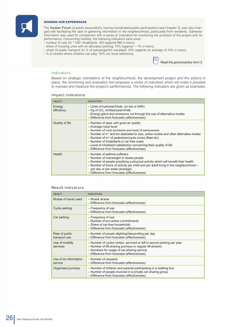
Ind icators
Based on strategic orientations o the neighbourhood, the development project and the actions in
place, the monitoring and evaluation tool proposes a series o indicators which will make it possible
to oversee and measure the project’s perormances. The ollowing indicators are given as examples.
Impac t ind ica to rs
ObjeCT INDICATORS
enrgyefcienc
– Litres of fuel/ear/inha. (or toe or kWh)
– Kg of CO2
emitted/ear/inha.
– Energ gains and emissions cut through the use of alternatie modes – Difference from forecasts (effectieness)
Qualit of life – Numer of das with good air qualit – Aerage noise leel
– Numer of road accidents and leel of seriousness – Numer of m2 and km dedicated to cars, actie modes and other alternatie modes – Numer of m2 of pedestrian/ccle zones (eet etc)
– Numer of inhaitants in car free roads – Leel of inhaitant satisfaction concerning their qualit of life – Difference from forecasts (effectieness)
Halth – Numer of asthma sufferers – Numer of oerweight or oese people – Numer of people practising a phsical actiit which will enet their health
– Numer of hours of actiit per child and per adult liing in the neighourhood –
per da or per week (aerage)
– Difference from forecasts (effectieness)
Resul t ind icat ors
ObjeCT INDICATORS
Modes of trael used – Modal shares
– Difference from forecasts (effectieness)
Ccle parking – Frequenc of use
– Difference from forecasts (effectieness)
Car parking – Frequenc of use
– Numer of pro-actie commitments – Share of car-free households
– Difference from forecasts (effectieness)Rate of pulic
transport use
– Numer of people alighting/descending per da – Difference from forecasts (effectieness)
Use of moilit
serices
– Numer of ccles rented, sericed or left in secure parking per ear
– Numer of lift-sharing ournes or regular lift-sharers – Numers for usage of car-sharing serice – Difference from forecasts (effectieness)
Use of an information
serice
– Numer of requests – Difference from forecasts (effectieness)
Organised ournes – Numer of children and parents participating in a walking us – Numer of people inoled in a priate car-sharing group
– Difference from forecasts (effectieness)
26 Nw Nighourhoods and Moility

8/6/2019 New Neighbour Hoods and Mobility
http://slidepdf.com/reader/full/new-neighbour-hoods-and-mobility 29/98
Achievement ind icator s
ObjeCT INDICATORS
Offer of alternatie
transport
– Numer of km of ccle routes (paths, lanes, zones 30 kph, home zones etc.) – Numer of km of pedestrian paths – Numer of pulic transport stops within 500 m of the neighourhood – Difference from forecasts (effectieness)
Moilit management – Numer of awareness campaigns and pulic reached – Numer of leaets and information kits distriuted amongst inhaitants
– Numer of personalised moilit adice sessions
– Numer of companies and emploees inoled in the inter-compan commuter plan
– Numer of educational estalishments and students inoled in the trael plan – Numer of oint proects led inhaitants – Difference from forecasts (effectieness)
Participation – Numer of inhaitants inoled in the creation of the neighourhood
– Numer of inhaitants wishing to take part in the deelopment of neighourhood life
Indicators for resources and efciency
ObjeCT INDICATORS
Infrastructures and
amenities
– Cost of infrastructures per mode – Difference from forecasts (effectieness)
Serices – Cost of serices (time spent)
– Difference from forecasts (effectieness)Information
communication actions
– Cost of actions (time spent) – Difference from forecasts (effectieness)
Participation – Costs for participatie actiities (time spent)
Efcienc – Costs incurred for achieing a modal switch towards alternatie of actie modes – Costs incurred for 1 km on foot, car or ccle etc. – Modal switch otained for 1 euro incurred (per mode) – …
Sharing our experienceS
To evaluate the Hammarby Sjöstad neighbourhood, Stockholm used its own 17 sustainable development indicators,dened during the development o their LA21 with residents (30 round tables). The indicators are based on the 4 ol-
lowing themes: – living in a sae and healthy urban environment;
– minimising the impact o travel on the environment;
– minimising the consumption o natural resources;
– increasing the decision making power o residents and their infuence on the town’s development.
Indicators – Energy consumption per inhabitant.
– Carbon dioxide produced per inhabitant. – Number o days with good air quality.
– Percentage o public transport compared to other modes o transport.
– Number o asthma suerers.
– Number o inhabitants wishing to take part in the development o neighbourhood lie.
Amongst other things, an online tool was put in place or calculating one’s personal (or household) environmental
prole according to various consumer habits (lie-style, leisure activities, journeys etc.). The programme uses datawhich are specic to Stockholm. It is available online: www.miljoporten.stockholm.se
Read the good practice form 13.
272. MObILITy AT The heART OF The NeIghbOURhOOD CReATION PROCeSS

8/6/2019 New Neighbour Hoods and Mobility
http://slidepdf.com/reader/full/new-neighbour-hoods-and-mobility 30/98
Mobilising andinvolving localstakeholdersin the projectThe mobi l isat ion and involvement of t he residents
for t coic of nr fcint mods are de te rmin ingfacto rs fo r the succ ess o f a p ro jec t o f an energy
efcient neighbourhood. It is, in effect, the usage
pract ic ed by inhab itan ts , and more generally by mobi lityusers in the neighbourhood, of t he proposed of fer wic will determine its level of energy efciency.
Moilisation of ts staoldrs will trfor aim
at gather ing and involv ing them in t he co l lect ive
pro jec t of a nw niourood. Tir stron support,
or even their membership for and contributionto the project, are sought right f rom its launch.
Morovr, associatin t pulic wit t dnition
of their future transport conditions in itself constitutesa means for promot ing change in futu re p ract ices .
This chapter highlights the different keys to success
wn moilisin and nain staoldrs,
by citing feedback on experience and proposingrecommendations for the par t ic ipa t ive p rocess
for energy efcient mobility.
The recommendations in this chapter do not take
into account t spcic lal oliations rlativ to
each country, but are placed in a pro-active context.
3.
8/6/2019 New Neighbour Hoods and Mobility
http://slidepdf.com/reader/full/new-neighbour-hoods-and-mobility 31/98
Key factorsfor mobilisinginhabitants
3.1.1 Identifying the key actors
3.1.2 Obstacles and levers
Creating a favourablesetting for dialogueand providing information
3.2.1 A transparnt and idntial proct
3.2.2 Accessible participation
3.2.3 Acnowldin t valu of participation
3.2.4 Coosin activ mods of participation
Continuousparticipation
3.3.1 Mobilising the key actors right from the start
3.3.2 Supplementing s tudies through the input of inhabitants
3.3.3 Worin wit inaitants towards a strat for moilit
3.3.4 Dnin a common proct
3.3.5 Consolidating acceptance through commitment
3.1
3.2
3.3

8/6/2019 New Neighbour Hoods and Mobility
http://slidepdf.com/reader/full/new-neighbour-hoods-and-mobility 32/98
Key factorsfor mobilisinginhabitants
This section highlights the actors which infuence the involvement
o key actors in the project; in particular the inhabitants,
bearing in mind that it is their choices and practices which will
determine the level o energy eciency.
Identifyingthe key actors
When approaching the subject o new neighbourhoods, one o the rst questions relating to partici-
pation is “who will be associated with the project?” In general, the actors outside o the local authority
which are associated with the neighbourhood will be:
• the inhabitants;
• the economic actors;
• the actors from non-governmental associations;
• the technical partners.
The inhabi tants
For those new neighbourhoods which are as yet unoccupied, the ollowing groups can be associated wherepossible:
– the future inhabi tants where they are already known; this is usually the case or a project being led
with or by owner residents. Coming together as an association or citizens’ group can help themparticipate in the process and be actively involved in the project;
– residents’ associations which exist in the sector can eectively re-group themselves in order tobecome involved in the neighbourhood project;
– consultation committees, bringing together resident representatives (neighbourhood council,
extra-municipal commission etc.) existing in the sector;
– a representative panel of expected inhabitants, chosen from amongst the local population :
their contribution could be paid or, in order to guarantee a good rate o participation i this is
judged to be necessary;
– the surrounding population which will also be concerned and aected by this new neighbourhood.
The economic ac to rs
It is important that dialogue with the local economic establishments is not excluded. Mobility also repre-
sents a growing concern or employers, in terms o their workorce, their clients and their suppliers.
The participatory approach will also thereore involve:
– the uture tenants/owners o commercial premises as well as those o oce and service buildings;
– companies, shops or commercial zone managers in the proximity o the neighbourhood;
– business associations and clubs.
The neighbourhood project can or example constitute an opportunity to initiate dialogue with existing
and/or uture businesses concerning the advantages o an inter-company commuter plan.
The ac t ors f rom non-government a l assoc iat ions
The additional input o outside, independent opinions will not only be useul but will also demonstratethe municipality’s commitment to transparency and open dialogue. Thereore, various types o local
associations can be o interest:
– those or environmental protection or sustainable development;
– cyclist, pedestrian or public transport user associations;
– those involved in environmental or road saety education; – student parent associations etc.
These groups are usually consulted, or associated at the same time as the inhabitants. Where these
groups are actively involved they can also be the subject o specic joint working groups (or example:a student parent association which is leading a walking bus project).
3.1.1
3.1
30 Nw Nighourhoods and Moility
8/6/2019 New Neighbour Hoods and Mobility
http://slidepdf.com/reader/full/new-neighbour-hoods-and-mobility 33/98
The technica l par tners
These are mainly the service operators and competent partners:
– delegate or the contracting authority and in general all the proessional actors participating
in the conception and construction o the neighbourhood (architect, general contractor etc.);
– transport companies and local transport authority (where this is not the municipality);
– energy operators and other urban services;
– technical experts: local energy agency, regional environmental agency etc.;
– any nancial partners.
Their participation concerns, thereore, operational interests (concerning connections to the publictransport network or the development o new services etc.). During the course o any necessary work
meetings with the city sta, they can eectively contribute to a public debate session.
The l ia is ing par tners for par t ic ipat ion and comm unicat ion
The contracting authority can make good use o local inormation relays in order to eectively reach its
target public. These channels are or example the social centres, neighbourhood councils, local public
amenities (sports, culture etc.), the associations already mobilised etc.
The cons t i tu t ion o f an ad hoc assoc iat ion
There are advantages to re-grouping the existing local associations and inhabitants to create a singleassociation which can perorm diverse roles in the construction o the project:
– to represent the inhabitants during consultation and decision meetings;
– to relay inormation to inhabitants;
– to provide advice to inhabitants;
– to manage resources;
– to run joint projects;
– to participate in the project’s evaluation.
On this point, the examples o Forum Vauban and the eco-neighbourhood o Camp Countal show the
wide range o roles which can be played by these sorts o citizens associations – depending on the
regulations in orce locally.
Sharing our experienceS
In 1995, the town o Friur im brisau (Germany) initiated a public participation process or the creation o the
Vauban neighbourhood and appointed the Forum Vauban association to the task o managing and coordinating thisprocess. The Forum was consulted right rom the initial planning stage o the neighbourhood.
Forum Vauban is made up o citizen associations (up to 250 members), which are guided by the principles o sustai-nable development. It is unded by the town and played an important role in both dening and supporting the project.
A mission to informThe Forum is served by a local citizen’s inormation centre. Its principal mission or providing inormation led Forum Vau-ban to publish a magazine aimed at raising awareness about the conception and monitoring o actions associated with
the neighbourhood. This promotional tool also strengthened the neighbourhood’s identity and attracted new residents.
A rol in raisin awarnss
It also played a vital role in raising the awareness o inhabitants about the various levers or energy eciency, such asbio-climatic systems or the use o renewable uels. A reduction in the number o private cars in the area was also one
o the primary targets, particularly through the encouragement o car-ree housing units.
An advisory and management roleA group o multi-disciplinary experts (legal expert, biologist, town planner, physicist, geographer, economist, banking
expert, environmental technician), unded by the German Foundation o the environment, the town and the Lie pro-gramme, came together with the Forum in order to accompany and organise work groups and to ormulate technical
advice and recommendations or uture inhabitants.
The role of developerCertain members o the Forum – the “developer-owners” (construction groups) – participated in regular meetings to
dene the design and amenities which would surround their uture land parcel or residential block. They subsequently
orwarded their project to the general contractors. Compared to traditional methods or building developments, thisapproach resulted in a reduction in construction costs.
A role in evaluationThe Forum was also charged with acilitating the task o gathering inormation in the neighbourhood, particularly rom
residents. Gathered inormation was used or comparison with a series o indicators or monitoring the evolution theproject and its perormance.
Read the good practice form 3.
313. MObILISe AND INVOLVe LOCAL STAkehOLDeRS IN The PROjeCT
8/6/2019 New Neighbour Hoods and Mobility
http://slidepdf.com/reader/full/new-neighbour-hoods-and-mobility 34/98
Sharing our experienceS
In line with its 2002 Citizen’s Charter, the Séquestre municipality decided to give priority to existing and uture inhabi-
tants, in the creation o the Camp Countal eco-neighbourhood.
In 2004, the population was consulted over the choice o the main HQE targets or this urban development. The project
was also monitored by residents’ advisory committees comprising: The 2004 to 2008 Town Planning Advisory Commit-
tee and the 2008 Economic, Social and Environmental Committee.
Finally, the constitution o a uture residents’ association brought these bodies together with an architect appointed to
ensure the correct application o existing recommendations or urban development. Together, they drew up an outline
or the proposed development (a blueprint or the housing units and general outline o neighbourhood regulations).
Read the good practice form 12.
Obstaclesand levers
Apart rom the task o identiying which public groups should be associated, the real diculty lies
in achieving the successul, constructive and continuous mobilisation o the project’s key actors –in particular the inhabitants.
However, there are three primary obstacles to get around:
• t capacit of inaitants to participat and t involvd;
• tir attitud towards t proct;
• tir motivation for participation.
The capac i t y of inhabi tants to par t ic ipate and get involved
Their capacity will depend on the relationship between:
– their personal constraints: working hours, child care etc.;
– and the opportunities or participation which are on oer (time, place, conditions).
These are essentially material constraints.
The i r a t t i t ude towards the p ro jec t
Indierence to a project will not inspire the desire to act upon it. It is thereore vital that inhabitants areencouraged to have an opinion on what is being proposed.
Their attitude will depend on:
– their knowledge o the subject;
– their understanding o the project;
– as well as recognition o the added value they can bring to the project and thereore o their relevance and personal interest in contributing to it.
The obstacles here are mainly cognitive.
Thei r mot ivat ion
Ultimately, inhabitant motivation is a decisive actor which will aect both their involvement in the par-
ticipative process and the implementation o the project. A lack o motivation amongst inhabitants to
participate and take on board the project is mainly due to weaknesses in the project and its participa-tive processes, such as the lack o:
– visibility concerning the individual and common benets;
– ownership o the project;
– clarity o the participative process;
– opportunity to infuence the project’s direction and play an active role.
These obstacles should be taken seriously, since the motivation o actors is not only a triggering actor
but will also increase levels o involvement.
3.1.2
32 Nw Nighourhoods and Moility

8/6/2019 New Neighbour Hoods and Mobility
http://slidepdf.com/reader/full/new-neighbour-hoods-and-mobility 35/98
The levers for mobi l is ing inhabi tants
To eectively involve inhabitants, three conditions must be brought together. Inhabitants must:
– be able to easily participate and involve themselves;
– determine their position in respect of the project;
– feel motivated to take part.
To bring these conditions together, three types of lever, echoing the aorementioned obstacles, can
be used throughout the project in order to encourage aliation and thereore ensure that behaviour
in support o the project is sustained over time.
Leers which are linked to the participatie process
The quality o this process is a determining actor or mobilising the population. It is recommended that
a avourable setting or dialogue is put in place using the ollowing levers:
– proposing a transparent and multiaceted setting;
– a commitment to recognising the value o contributions rom inhabitants;
– providing a participative process which is continuous and active.
The leers which are linked to communication
Good communication can also contribute to providing better inormation or inhabitants, in that it
enables sharing and recognition o the project.
The leers linked to the nature of the proect
In order to ensure permanent changes in travelling habits, the neighbourhood must be seen as:
– a united, shared project, by inciting individual and common commitment;
– beyond the conception and construction stage, by supporting residents in their choices
and usage once they have moved into the neighbourhood.
Creating a favourablesetting for dialogue andproviding information
The right conditions or initiating dialogue and inorming inhabitants
must be put in place i we are to encourage them to take part in the process.
As with all ambitious projects, it is a good idea to initially coordinate the participation and communi-cation plans which can be adapted as the project progresses. In addition to this precautionary step,
several levers can be used to help with mobilising, associating and involving residents in the neigh-
bourhood creation process.
A transparent andidntial proct
In order to ensure that the participative process is solid, it is recommended that the specic roles o the various parties involved are clearly stated, as well as their scope o infuence on the project. It is
important that those involved are not led to hold the wrong expectations. The scope o participation
must be explained at the initial stage o the process.
Considering their involvement, it is clear that inhabitants must be accorded sinicant room for
improvement on the project. As a rule, the greater the room or improvement, the greater their invol-vement and take up will be in the project. The project should not be denitively dened in its initial
stage; participation can thereore produce the opposite to desired results (rejection o the project and
the participative process).
3.2.1
3.2
333. MObILISe AND INVOLVe LOCAL STAkehOLDeRS IN The PROjeCT

8/6/2019 New Neighbour Hoods and Mobility
http://slidepdf.com/reader/full/new-neighbour-hoods-and-mobility 36/98
By establishing an initial participation and communication plan it will be possible to dene their objec-
tives at each stage o the project (development, construction, local lie).
For each stage it will thereore be necessary to speciy:
• what is expected of inhabitants: opinions, co-productions etc.;
• the weight of their contribution;
• the means of communication.
It is also important that the residents have access to a liaison ocer in charge o the process who canprovide an link between the contracting authority and themselves. This relay, or coordination role can
be played by:
– either a representative rom the contracting authority who, depending on the size o the project,could be the project head themselves or someone rom another service working in the eld
(local democracy or citizenship or example);
– or by an association appointed by the contracting authority (such as the Vauban Forum).
Moreover, the participative process is aligned to communications wherever possible, in order to give
identity to the project, to gather inormation on a regular basis and to raise awareness, question andinvite the active participation o residents. Communication will play a determining role in making the
project visible and attractive and ensuring the clarity o its participative process.
Thereore, the ollowing items need to be in place:
• an identity to create membership to the neighbourhood: residents can be associated in various
ways (competitions, on-line suggestions etc.) to the naming and visual identity o the project;
• communication tools wic tart:
– the residents concerned by the participative process,
– the local population in general;
• various media: creation o a neighbourhood newspaper, town newspaper or mayor’s newsletter,
personally addressed letters, local TV, internet, posters, mail shots, site inormation ocer etc.;
• information relays at neighbourhood scale and surrounding areas (neighbourhood councils,
business or residents associations, leisure centres, schools, markets etc.).
Accessibleparticipation
In order to remove the material obstacles, a wide range o opportunities should be oered in order tooptimise the number o participants. Bearing this in mind it is a good idea to think about:
– the physical conditions o access to participation: by varying times and locations,
to avoid problems o transport;
– distance access: through the creation o a dedicated website or a page on the local authority website.
Enabling access to the par t ic ipat ive process
> Keeping the rhythm of participative activities in step with people’s day to day lives:
– in the evenings during week days;
– during the day on non school-days or week-ends;
– during school holidays.
> Racin out wrvr possil to t rsidnts concerned through the deployment o inormationsites and participative activities:
– at the town hall or its annexes;
– in a recreational setting: taking advantage o estival events such as the European Mobility Week,
or those o a slightly more diverse nature such as the Spring estival etc.;
– during consultation committees: sourcing a relay within the neighbourhood council,
advisory committee, association orums etc.;
– within local or neighbourhood relays: leisure centre, school, town hall annexes, public amenities etc.;
– within residents’ homes: organisation o coee morning debates by residents in their homes.
Best results will be achieved i a permanent site for participation and information is available within
the neighbourhood (citizens’ advice centre, local municipality centre etc.). Management o this postand its missions can be done through a local partnership between the contracting authority and the
general contractor and other operators, neighbourhood associations or representatives to dene theterms or unding and operation. The option will thereore be available to coner all or part o its mis-
sions on the residents’ association(s) representative(s). These missions or participation, promotion,
awareness and inormation will be pertinent both in the initial conception stage and the post-handover stage or supporting changes in behaviour (see section 3.5).
3.2.2
arriguren neighbourhood
pain). Inormation point,
activity led duringe PRO.MOTION project.
34 Nw Nighourhoods and Moility
8/6/2019 New Neighbour Hoods and Mobility
http://slidepdf.com/reader/full/new-neighbour-hoods-and-mobility 37/98
The experiences o the Vauban project (above), the Muette neighbourhood (Garges-lès-Gonesse) and
Hammarby Sjöstad (below) demonstrate the benets o having an inormation/awareness centre in
terms o increasing inhabitant’s participation.
Sharing our experienceS
Mindul o the need or transparency during the creation o the Hammarby Sjöstad neighbourhood, an environmentalinormation centre (GlashusEtt) was created at the initiative o the Stockholm water company, the town’s building and
transport managers and the Nordic Electricity company (Fortum). The role o this centre is to provide informationand advice to inhabitants about the technologies being developed in the neighbourhood and the conservationof natural resources. It raises awareness on the “eco-cycle” model o Hammarby where public transport is one o
6 environmental objectives.
It oers the public the chance to enjoy exhibitions on an environmental theme, teaching activities as well as nd inor-
mation concerning new technologies and take part in debates.
Read the good practice form 13.
Sharing our experienceS
Garges-lès-Gonesse created a dedicated project site as part o their renovation programme or the Muette neighbour-hood: “the project house”. Its role was to provide public inormation on the stage o works as well as a platorm or public
opinions. The councillors or town planning and project technicians were present on a weekly basis.
Communication tools supported this action:
– a town newsletter dedicated to the project and the neighbourhood; – the I3F gazette (a social landlord present in the district);
– audiovisual documents, neighbourhood memory project; – creation o competitive intelligence les.
Read the good practice form 4.
Sharing our experienceS
The BedZED inormation Centre was rst opened during the creation o the bdZeD niourood in Sutton. It is
co-run by the Bioregional Development Group and the Bill Dunster architectural practice.
It promotes the neighbourhood and provides inormation concerning its concept and development: – organisation of guided tours;
– seminaries; – permanent themed exhibition centre.
Read the good practice form 15.
> Managing journeys: provide specic inormation about the options or access by public transport,on oot or by cycle, propose a shuttle service or organise lit-sharing.
> Consider parents problems: propose child-care or learning activities or children in order to leave
parents ree to take part in meetings.
Onl ine in format ion and par t ic ipat ion
New technologies mean that we now have access, at anytime and anywhere, to inormation about the
project as well as the option to contribute or take part in online discussions. It is also represents a lessdaunting opportunity or the more timid inhabitants to express themselves.
The creation o a dedicated website can itsel represent an initial participatory activity with residents
when dening the unctions o this interactive, collaborative tool:
– inormation about the project and its stage o progress;
– online contributions;
– social network: orum or exchanges between residents;
– joint projects led by residents.
The advantage o a website is that it can be developed as a useul tool to:
– provide inhabitants with inormation about local lie;
– raise awareness o inhabitants about the best travel practices to adopt;
– provide access to mobility services in the neighbourhood (car-sharing, lit-sharing, walking bus etc.); – oer a orum or discussions between neighbours on joint projects.
The website can be jointly managed by the contracting authority and a residents’ association represen-
tative. This method provides a more spontaneous context or associations and inhabitants to express
themselves about the project – without prompting or manipulation by the contracting authority.
353. MObILISe AND INVOLVe LOCAL STAkehOLDeRS IN The PROjeCT

8/6/2019 New Neighbour Hoods and Mobility
http://slidepdf.com/reader/full/new-neighbour-hoods-and-mobility 38/98
Sharing our experienceS
Although this was not a neighbourhood creation project (redevelopment operation linked to the arrival o a newtramway), the example o the Coteaux neighbourhood in Mulhouse (France) is interesting in terms o its partici-
pative approach – which successully mobilised inhabitants on the project’s construction.
T arrival of a tramwa in t niourood represented a major issue or debate, in that many o the inha-
bitants were against the idea o a station within the neighbourhood as well as the associated changes in trac.
The main cause or concern was the potential risk o accidents involving children playing in public spaces. Fear o accident and concerns over other undesirable side eects caused by trams (noise etc.) were signicant obstacles
to gaining acceptance or the project.
T niourood council was t principal lvr for tis action.
They represented not only the inhabitants but also the associations which were brought together on the “council o
associations”. Around 50 individuals were prepared to involve urther studies on the possible arrival o a tramway,in particular concerning the question: “should the tramway run through, or alongside the neighbourhood?” In the
end, 20 people ormed the core o the study group (largely due to problems o availability).
Two visits wr carrid out to Friur im brisau and to Strasour to provide rst hand experience o the
way in which tramway inrastructures can transorm the urban landscape. These visits were nanced by the town
hall rom the Town Contract and PIC URBAIN unds. Meetings between local councillors, a school complex and
residents rom the social districts o Strasbourg were organised with the study group, Town Hall representativesand the SITRAM (public transport authority).
Following these visits, the group put together a work plan and timetable or studies between June and September
2000. Several scenarios were thus developed; they were validated by the neighbourhood council and the SITRAM
used these blueprints as a basis or work.
T SITRAM launcd a communications campain durin tis priod through the implementation o a mobile
exhibition within the neighbourhood. Other communication tools were used at each dierent stage o the project: – creation and publication o a project inormation update document;
– implementation o a communication campaign (using various means: local media, press and radio, posters,
mail shots etc.); – neighbourhood newspapers to document the discussions, options and decisions made in terms o transport
related consultation.
Acnowldinthe value of participation
T involvmnt of rsidnts and rsults of tir contriution must acnowldd, that is to say:
– treated with respect: Local councillors are present during dialogue and services must givecredit to contributions rom the public;
– which are integrated into the project: The level o integration (policy decisions) should preerably
be enthusiastic, contributions are brought to the ore;
– recognised: the local population should be made aware o contributions made by residents.
It is vital that inhabitants are rconisd as in actors in t proct – as wll as for tir xprtis
at user level.
Acknowledgement should also be given to the advantages which the participative process can bringor inhabitants. I dialogue is to be productive, it is vital that all parties involved understand each other.
As with the case o a complex sustainable development project, the initial programming o know-how
transfer activities is recommended (at project start up). These will help with understanding o the
project (or issue) and in making group choices. These activities will also enable residents to acquirenowld aout t proct, its issues and the various technical possibilities (existing examples etc).
They will also reveal the details which will help them to dene their respective position and thus giveinormed opinions on the project.
A series o transer activities can be implemented with various goals in mind:
– since the beginning of the process, to improve comprehension o a neighbourhoodwith energy ecient transport: explain, why? what does it mean? what are the benets
and commitments involved?
– en route, to explain the various possible strategic and technical strategies – as well as their
consequences;
– after its inauguration, on the theme o “living in an energy ecient neighbourhood”to raise awareness amongst inhabitants about their role in the neighbourhood’s energy eciency,
and the choices and practices which should be adopted in line with the project.
3.2.3
36 Nw Nighourhoods and Moility
8/6/2019 New Neighbour Hoods and Mobility
http://slidepdf.com/reader/full/new-neighbour-hoods-and-mobility 39/98
In all cases, the activities are based as much as possible on solid principles which will acilitate
exchanges between the parties involved such as:
– experience feedback: explain and demonstrate the easibility through examples;
– site visits: visualise the possible options and their consequences(set the project in the real context o the site and the city);
– a study visit outside of the city: enable a representative group o the stakeholders
(local councillors, inhabitants, associations, developers etc.) to see the reality o such projectin a dierent context.
These activities can be conerred to partners, or outsourced where the necessary competences
cannot be provided internally: environmental education actors, communication agencies (seeexample: Kronsberg), training-awareness consultants etc.
Sharing our experienceS
As part o its kronsr proct, t town of hanovr created KUKA, an environmental mediation and communicationcentre which is run as a limited liability company (51% o its capital is held by the town and 49% by a consortium o
local actors, investors, architects etc.).
Its role or relay inormation and mediation between the dierent actors has led to:
– the edition o several publications – prospectus, inormation bulletins, the neighbourhood’s own magazineas well as inormation les;
– the organisation o debates, discussion, events, seminars and workshops;
– oering personalised advice; – carrying out online training sessions and creating visual web supports (posters, exhibitions, slide shows
and video clips); – putting in place the procedures or public consultation.
Apart rom the task o dispensing environmental messages, KUKA acts as an agent or the transmission o good prac-tices and specialises in the eld o eco-citizenship, that is to say raising the awareness o residents to a new way o
living in accordance with the requirements or sustainable development.
Choosing activemodes of participation
Opinions are generally gathered using standard public participation methods – whether this is through
workshops or working groups using various techniques (brainstorming, pinboard, world caé, consen-
sus conerences etc.).In addition to these more typical activities, the development o an active, recreational programmewill constitute an attractive oer which will be accessible to the widest possible public group –
including children.
It is a good idea to choose methods o public participation which will appeal to inhabitants – on
creative or recreational themes, or involving a physical activity.
Sharing our experienceS
Under the ramework o its project or the renovation o the Muette neighbourhood,Garges-lès-Gonesse– apart rom public meetings and consultation by sector works-hops – organised a monthly “walking analysis” to identiy any dysunctional aspects o
the neighbourhood and hold coordination meetings with its managers. Councillors, tech-
nicians and tenants’ associations involved in the project took part in this active diagnosis.
Cultural projects were also put in place to encourage inhabitants to participate in the project:
– A Forum Theatre performance about the neighbourhood’s renovation was
organised through opinion workshops – aimed at providing a ree platorm
or residents to air their views. Short sketches were perormed by inhabitants;
– The “Chimney” project, backed by the Commun’art Association was aimedat encouraging ownership o the neighbourhood and thereore support or those
who were moving. Giant murals were created by teams rom the municipality which
were then photographed and printed onto a 150 m long banner, which was then draped over the gable endo a condemned building.
Finally, an annual event “En chantier de vous connaître” (this is a pun which substitutes the French word or building site
(“chantier”) or “enchanté” meaning “how do you?”) has been organised to raise awareness o inhabitants to the issues
o renovation and its consequences. This event is the basis or various activities:
– a photo rally: organised around a neighbourhood memory project;
– a science rally – based on the renovation o the neighbourhood : eld visits to include presentations
by students (scientic) o the technical elements o equipment, water and waste management, demolitionprocesses (danger on building sites), presentation o scale models o the neighbourhood etc.;
– a street theatre presentation was put together based on real-lie situations in the neighbourhood; – show house visits;
– planting workshops;
– photo competitions on a theme o transormation;
– street painting competitions.
3.2.4
373. MObILISe AND INVOLVe LOCAL STAkehOLDeRS IN The PROjeCT

8/6/2019 New Neighbour Hoods and Mobility
http://slidepdf.com/reader/full/new-neighbour-hoods-and-mobility 40/98
Moreover, some orms o collaboration can help to persuade the more reticent inhabitants to have their
say and contribute in public (as part o a mural creation team or by taking part in a competition etc.).
It can also represent, or the more extrovert neighbourhood «personalities», a great opportunity to take
centre stage (orum theatre).
Following this, a large number o actions can be put in place:
> by proposing artistic activities:
– a project bringing together adults and children around the creation o a mural showingdierent visions o the neighbourhood and public expectations,
– the creation o a scale model by local college students,
– the creation o specially designed site hoardings;
> by organising recreational events:
– picnics, coee morning debates,
– organising an inauguration event;
> by using recreational events:
– a competition amongst the town’s population or naming the neighbourhood,
or designing its visual identity – this can be the subject o an online vote,
– role playing or orum theatre: simulation o daily lie situations according to planning issues(e.g. possible conficts o use on streets);
> by using the active modes:
– walking or cycling analysis, walking workshops to identiy any dysunctional areasin the neighbourhood or other districts (avoid the pitalls o previous projects),
– eld visits to experience and discuss, on site, the realities o town planning(depending on the project’s objectives, this could or example be to an existing home zone
or one with no cycle amenities or with newly installed tram stop).
Moreover, participative activities can eectively be linked to the town’s programme o public events, in
order to benet rom the increased number o people these attract.
Continuousparticipation
The ultimate aim o the participative process is to involve residents
and local actors in a neighbourhood project, in order to encourage
acceptance rom its uture users (residents, business owners etc.)
and ensure that it is adapted to their requirements; it should also be
designed to help them choose and adopt travel practices which are
coherent with the neighbourhood’s vision. Participative activities oten
represent the additional advantage o raising awareness amongst
a targeted public group; it is thereore important to seize
these opportunities to inorm inhabitants o the choices to be
made about energy ecient journeys.
Once the pre-requisite conditions are in place, public participation and information should be conti-nuous and properly invested, in order to avoid the phenomenon o public detachment rom a project
which requires time to produce results.
The contribution o residents is pertinent at all stages o the project as described in Chapter 2. Publicparticipation should be a part o the development stage o the project.
3.3
udapest (Hungary):
play idea to enable inhabitants,
all ages, to get inormationn the works in progress and
n a works implementation.
38 Nw Nighourhoods and Moility
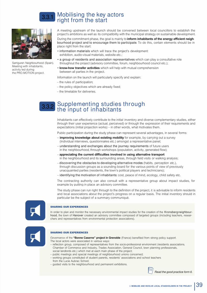
8/6/2019 New Neighbour Hoods and Mobility
http://slidepdf.com/reader/full/new-neighbour-hoods-and-mobility 41/98

8/6/2019 New Neighbour Hoods and Mobility
http://slidepdf.com/reader/full/new-neighbour-hoods-and-mobility 42/98
3.3.4
Worin wit inaitants towardsa strategy for mobility
As o its strategy phase, an energy ecient transport neighbourhood project can be a co-produc-tion by local councillors, technicians and inhabitants (as well as other targeted public groups), in
order to encourage its uptake.
This collective eort will produce a project which is acceptable to its users and which will thereore
help to ensure its acceptance in the uture. In particular, it will encourage acceptance rom:
– inhabitants, in terms o their choices or mobility (in coherence with the project);
– local councillors and technicians in terms o its realistic objectives, available optionsand the service and planning requirements necessary or their achievement.
Initially, residents can contribute to dening the strategy that will broadly govern the project, its
ultimate goals or sustainable development and in particular or energy consumption.
Where nr fcint octivs or the project are not already determined by policy directions,
these can be dened in association with residents in order to produce shared goals or achieve-ment. However, the approach to this should be educational – by clearly describing the available
levers or energy eciency (buildings, town planning, transport etc.), as well as pragmatic – by
illustrating the possible gains using concrete examples o daily lie. For example, it is possible to
make a comparison between the impacts o commuting to school or work according to the mode
employed (private car, public transport, walking, cycling etc.) in terms o energy, CO2, air quality
(noise, air, road saety) and household budget.At this stage, the main aim is to obtain a consensus on the project’s ultimate goals, in particular
concerning energy eciency (regulatory level, individual ootprint etc.) and the elds in which they
are refected – transport being one. The objectives can subsequently be quantied during the
strategy and programming phases using the mobility model.
At a later time, the inhabitants can be called upon using a sectoral or thematic approach (mobility,habitat etc.), which will acilitate dialogue between actors.
The mobility model (see Chapter 2, section 2.1) is a useul tool when constructing the shared vision
o the neighbourhood, in that it takes a sequential view o the questions involved, based on work
concerning anticipated usage. Using examples o the daily lives and motivations o each indivi-
dual, it simplies the task o including inhabitants in the denition o mobility strategy.
The inhabitants are thereore asked to consider the desired usage o mobility, in terms o energy
eciency objectives, in the context o their uture neighbourhood. In order to acilitate joint thin-king, concrete situations can be suggested, such as:
– What are the desired/preerable methods o trac in the neighbourhood?
– Which orms o transport should be used on short journeys?
– Which orms o transport or commuting?
– How should parking be managed in the neighbourhood?
The inhabitants can also be asked about their expectations concerning the use o public spaces
(public, common) which will impact on trac within the neighbourhood.
The various possible options should be placed in the context o legal obligations (norms, levels
o requirements etc.) and their impacts on energy eciency – as well as on quality o lie. Thepresence o outside experts and independent associations will be helpul during discussion work-
shops to help explain the various choices available to the public.
Dnina common project
The inhabitants can then participate during the step o clarif t stratic orintations to dn a
detailed project. Guidelines of the programme should be dened in partnership with everyone in-volved (councillors, inhabitants, technical partners etc.) which are coherent with the targeted usage,
in terms o the transport oer and mobility management and, where necessary, the technical choices.
3.3.3
40 Nw Nighourhoods and Moility

8/6/2019 New Neighbour Hoods and Mobility
http://slidepdf.com/reader/full/new-neighbour-hoods-and-mobility 43/98
When associating inhabitants, particular attention should be given to:
– avoid startin from a pr-dnd proct: the municipality could possibly initiate dialogueby proposing various situations (or scenarios) or comparison, but they should, wherever possible,
avoid infuencing or limiting public imagination. They can also draw attention to the legal obligations
(disabled access, cycle trac etc.);
– explain the various potential options that would meet user requirements in a manner and
with a vocabulary that is accessible to the general public;
– put the subject into a solid context by pointing out the impacts on the daily lives o inhabitants:
public space planning, arrival o heavy goods vehicles, management o parking etc.;
– use visual aids (graphics, maps, scale models, 3D simulations etc.) to create mental maps, visualiseand compare the dierent options (maps o local public spaces away rom trac, green routes etc.).
In particular, the inhabitants can contribute to a denition o the future offer of transport in terms oft strt ntwors and srvics, or example:
– the regulations or car trac and parking in the neighbourhood;
– the approach to green routes (public highway, clean streets, cycle parking);
– access to public transport;
– parking which is linked to buildings;
– public spaces planning;
– mobility services.
Working or survey groups oer the chance to conrm the type and scale o the proposed services, by
identiying: – potential uses and users;
– the possible risks and obstacles which should be anticipated;
– the possible levers.
The programme should highlight the contributions and motivations o local actors, in particular the inha-
bitants, in order to bring them to the attention o the project’s uture contractors as early as possible.
The general contracting team must be closely involved in meetings with local actors and inhabitants,
they can moreover be charged with the task o organising communication and public participationduring the Project phase.
It is crucial that the team take on board the results o previous participative activities during the project
phase, in order to have a clear vision o the expectations and motivations o inhabitants.
Their participation can take various orms according to the level o participation desired by councillors(or imposed by the law):
– inhabitant representative participating in the project selection (steering committee);
– meetings or project presentation by the general contracting team;
– discussion meetings on the preliminary design, the development and trac plans
(working group, workshop);
– inhabitants representative participating in the project validation (steering committee).
During the developmental stages, it may prove useul to consider the project’s various options rom
both a conceptual and practical standpoint, and to use educational tools such as models and 3D
simulations. A scale model will in particular enable inhabitants to examine and eventually reposition or
adapt “elements” o the project. I the general contractor and contracting authority are present, they
will be able to give clear explanations o the positive or negative consequences o the dierent options.
These actions and exchanges will help encourage take up o the project by inhabitants.Giving proper consideration to uses is more likely to lead to a productive and practical dialogue and
will help involve residents on the strategy as well as on technical requirements. This will urther help
the dialogue or negotiation phase, according to the chosen level o public participation or this stage.
Besides the proposed development project, it would be pertinent to instigate a dialogue ocussed on
the city lie o the neighbourhood and residents’ involvement either via collaborative projects, or per-sonal commitments.
Sharing our experienceS
Under the ramework o the PRO.MOTION project, CRANA and NASURSA worked with the local partners during
the implementation o a participative action to associate inhabitants with the questions o mobility in the Sarriguren
neighbourhood.
6 workshops were organised bringing together 40 individuals. Resulting exchanges produced additional elements or diagnosis and solutions – through work based on proposition plans and orms. These measures were then studied per
transport mode.
Read the good practice form 11.
Sarriguren Neighbourhood (Spain).
Meeting with inhabitants,
activity led during
the PRO.MOTION project.
413. MObILISe AND INVOLVe LOCAL STAkehOLDeRS IN The PROjeCT

8/6/2019 New Neighbour Hoods and Mobility
http://slidepdf.com/reader/full/new-neighbour-hoods-and-mobility 44/98
Consolidating acceptancethrough commitment
Commitment at individual or group level will consolidate support or the project. On the other hand, itdoes not require the same type o action and impetus.
Calling upon user expertise, taking into account the public’s vision or the neighbourhood and giving
credit to their contributions are pre-conditions o the project.
Suppor t ing co l lec t ive commitment
To inspire “buy in”, it is essential that there is a signicant scope or ownership o the project. In addi-
tion to this condition, a project owner may, via their participative process:
– solicit involvement by creating opportunities or exchange between uture residents
and by being a source o ideas or collaborative neighbourhood projects which can
be managed by the inhabitants;
– ormalise commitments (contracts).
Inhabitants are in the best position to consider their role and potential involvement in neighbourhood
lie. On these questions, it is obviously essential to ensure the acceptability and uptake o joint projects.
Consultation with uture inhabitants (or with a representative association o inhabitants) is thereore
preerable – even i this means waiting until they have moved in.
The object o this will be to involve them in mobility projects as well as those or the use o public
spaces which will underpin local lie (by excluding omnipresence o the private car right rom the start).
For more technical inormation, see section 4.5, Mobility Management in Chapter 4.
Work ing wi t h ind iv idual comm itment
Citizn commitmnt is xprssd a coic for t us of nr fcint transport mods .
Thereore, this also reers to a commitment to uture mobility practices (individual/household).
Once the neighbourhood project has been handed over, it is vital that mobility management actions
are carried out amongst the local population in order to encourage them to use alternative modes and,
i possible, abandon use o their own personal cars. This aspect should not be overlooked in that it is
the inhabitants who will determine the usage o transport, and thereore the energy eciency o theneighbourhood.
This action is even more pertinent in the sense that movin to a nw niourood can also pr-
sent a change in life-style – including travel practices –, because it represents the opportunity tobreak old habits and explore new opportunities.
Aandonin t us of a privat car constituts a rm commitmnt inaitants . Also, it is
essential that the choice is willingly made and ormalised (sale or termination o agreement).
To work with residents in the use o an energy ecient transport oer, the municipality and its partners
should put in place a series o measures to encourage the use o alternative modes and any mobility
services which have been created.
When doing this it is recommended that the ollowing steps are taken to:
– improv nowld aout t offr of altrnativ transport, in particular by making known
any new services; practical inormation being a pre-requisite or all modal choices;
– make sure that residents and visitors can asil undrstand ow t niourood wors:
its public spaces, roads and paths, parking restrictions etc.;
– rais t awarnss of adults and cildrn livin in t niourood aout t nw coics
on offer and their advantages (individual and common benets);
– encourage use through practical implementation: oer the chance to test services,
organise in-town cycle training, walks or rides, walking buses etc.
All o these missions can be conerred upon a mobility agency.
3.3.5
42 Nw Nighourhoods and Moility
8/6/2019 New Neighbour Hoods and Mobility
http://slidepdf.com/reader/full/new-neighbour-hoods-and-mobility 45/98
Sharing our experienceS
As part o the creation o t bO01 niourood, t town of Malmö put in place a broad consultation processbringing together public authorities, businesses, inhabitants and associations.
In order to encourage and help inhabitants to adopt eco-responsible practices, the Town also implemented envi-
ronmentally themed educational actions in an eort to accompany residents in their move to switch travel habits.
They were put in place by the mobility agency (Mobility Oce) created by the Malmö town hall.
Read the good practice form 9.
Sharing our experienceS
During theCasrn d bonn neighbourhood project in Grenoble, operation “Moth” was organisedas part o an inormation campaign about illegal overnight parking on streets (leafets containing details).
Over a period o 5 weeks, a campaign was launched to inorm local residents about cheap night
rates in existing car parks (rom 76 cts to 2.29 euros per night). “Moth” stickers were thereore ap-plied to the windscreens o illegally/inconveniently parked cars (on crossings and pavements etc.).
This campaign is reinstated at the start o every summer season and at the beginning o school term.
With a rise o 20 to 25% in the use o existing car parks, the impact o this campaign is obvious. By dint o its “voluntary”
character – this campaign is particularly well received by the public.
Read the good practice form 6.
For more technical inormation,
see the Parking and Mobility Management sections (4.2 and 4.5) in Chapter 4.
See the part concerning the participative process
in the Moilit and Nw Niouroods tool.
433. MObILISe AND INVOLVe LOCAL STAkehOLDeRS IN The PROjeCT

8/6/2019 New Neighbour Hoods and Mobility
http://slidepdf.com/reader/full/new-neighbour-hoods-and-mobility 46/98

8/6/2019 New Neighbour Hoods and Mobility
http://slidepdf.com/reader/full/new-neighbour-hoods-and-mobility 47/98
Uranplanning
4.1.1 Coosin a sit4.1.2 Dnsit and functional divrsit
4.1.3 Uran pattrn
4.1.4 Pulic spacs
Parin allocatdto buildings
4.2.1 Car parin
4.2.2 Ccl parin
Road ntworsand trafc
4.3.1 Oranisation of trafc
4.3.2 Trafc calmin
4.3.3 eas trafc for activ mods
4.3.4 Intelligent on-street parking
The developmentof alternative transport
4.4.1 Pulic transport offr
4.4.2 Mobility services
Mobilitymanagement
4.5.1 Information and awarnss
4.5.2 Mobility advice
4.5.3 Organisation and commitment of inhabitants
4.1
4.2
4.3
4.4
4.5
8/6/2019 New Neighbour Hoods and Mobility
http://slidepdf.com/reader/full/new-neighbour-hoods-and-mobility 48/98
Uranplanning
There is a clear inter-operability between town planning and travelling.
The urban shape directly infuences transport practices and, in return,
the organisation o travel in the sector aects the urban structure o a city.
Choosinga site
I we are to encourage optimal use o alternative modes within a neighbourhood project, then conside-
ration must be given to choice o location – well beore the conception stage.
An energy ecient neighbourhood is developed in continuit wit t uran faric (in particular or
the renewal o wasteland) in order to tackle urban sprawl (increasing distances) and benet rom theproximity of pre-existing activities in the city and of neighbourhoods that offer complementaryservices (15 mins max by cycle and 20 mins on oot).
Energy-ecient town planning avours the localisation o urban zones and continuing urban develop-
ment/renewal (rehabilitation, interstitial zones, extending a pre-existing core) and discourages incur-sions into natural/agricultural zones.
Sites are chosen, where this is possible (land availability), in the proximity of existing public transportntwors (station, hub, stop). This proximity will acilitate connection to the existing network (reduce
costs) and avour their use by residents – and more generally the uptake o multi-modal choices.
Dnsit andfunctional diversity
Residential density is a condition which will ensure the viability o uture transport services. The ol-
lowing markers should be useul9:
– or small towns and market town extensions: 20 or 25 dwellings/hectares (dwe/ha) (roads and publicspaces included);
– in peri-urban zones: 30 – 40 dwe/ha;
– in urban districts 45-50 dwe/ha;
– and in proximity o public transport: up to 70 – 90 dwe/ha.
To avoid creating dormitory towns, the project must also generate employment in dierent sectors
(services, retail, government, industry) which will then provide a good indicator o the areas’ social
and unctional diversity. Comparison with the experiences studied (good practices, see table below)highlights the ollowing employment densities:
– very similar inhabitant per job ratios o 0.3 – 0.4;
– more varied job per inhabitant ratios o 1 job or 2.5 to 8 inhabitants;
– and jobs per hectare o 16 to 87 jobs/ha.Modal choices will be particularly infuenced by the urban unctions o the neighbourhood. Functional
diversity is an indispnsal condition for “walal” uran dvlopmnt. It reduces the need or
motorised journeys by reducing the distances which need to be covered.
Diversiying the neighbourhood’s unctions, by placing shops, services, residential zones and ocesside by side, contributes to the development o those liestyles which are adapted to the use o green
modes (such as walking or cycling). They are, thereore the key elements o an energy ecient deve-
lopment programme.
4.1.1
4.1.2
4.1
46 Nw Nighourhoods and Moility
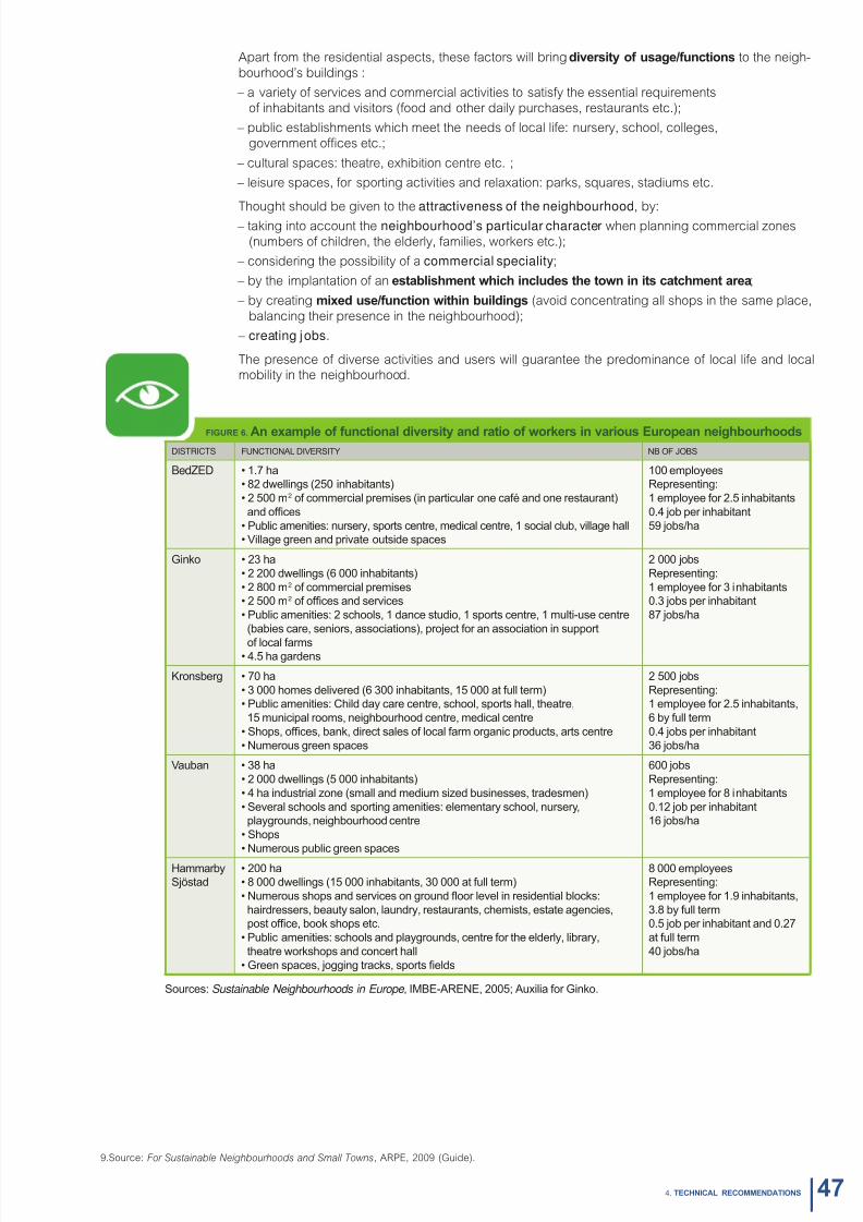
8/6/2019 New Neighbour Hoods and Mobility
http://slidepdf.com/reader/full/new-neighbour-hoods-and-mobility 49/98
Apart rom the residential aspects, these actors will bring divrsit of usa/functions to the neigh-
bourhood’s buildings :
– a variety o services and commercial activities to satisy the essential requirements
o inhabitants and visitors (ood and other daily purchases, restaurants etc.);
– public establishments which meet the needs o local lie: nursery, school, colleges,
government oces etc.;
– cultural spaces: theatre, exhibition centre etc. ;
– leisure spaces, or sporting activities and relaxation: parks, squares, stadiums etc.
Thought should be given to the attractiveness of the neighbourhood, by:
– taking into account the neighbourhood’s particular character when planning commercial zones
(numbers o children, the elderly, amilies, workers etc.);
– considering the possibility o a commercial speciality;
– by the implantation o an stalismnt wic includs t town in its catcmnt ara;
– by creating mixd us/function witin uildins (avoid concentrating all shops in the same place,
balancing their presence in the neighbourhood);
– creating jobs.
The presence o diverse activities and users will guarantee the predominance o local lie and localmobility in the neighbourhood.
FIgURe 6. An xampl of functional divrsit and ratio of worrs in various europan niouroods
DISTRICTS FUNCTIONAL DIvERSITy Nb OF jObS
bdZeD • 1.7 ha
• 82 dwellings (250 inhaitants)
• 2 500 m2 of commercial premises (in particular one café and one restaurant)
and ofces
• Pulic amenities: nurser, sports centre, medical centre, 1 social clu, illage hall
• village green and priate outside spaces
100 emploees
Representing:
1 emploee for 2.5 inhaitants
0.4 o per inhaitant
59 os/ha
Ginko • 23 ha
• 2 200 dwellings (6 000 inhaitants)
• 2 800 m2 of commercial premises
• 2 500 m2 of ofces and serices
• Pulic amenities: 2 schools, 1 dance studio, 1 sports centre, 1 multi-use centre
(aies care, seniors, associations), proect for an association in support
of local farms• 4.5 ha gardens
2 000 os
Representing:
1 emploee for 3 inhaitants
0.3 os per inhaitant
87 os/ha
Kronserg • 70 ha
• 3 000 homes deliered (6 300 inhaitants, 15 000 at full term)
• Pulic amenities: Child da care centre, school, sports hall, theatre,
15 municipal rooms, neighourhood centre, medical centre
• Shops, ofces, ank, direct sales of local farm organic products, arts centre
• Numerous green spaces
2 500 os
Representing:
1 emploee for 2.5 inhaitants,
6 full term
0.4 os per inhaitant
36 os/ha
vauan • 38 ha
• 2 000 dwellings (5 000 inhaitants)
• 4 ha industrial zone (small and medium sized usinesses, tradesmen)
• Seeral schools and sporting amenities: elementar school, nurser,
plagrounds, neighourhood centre
• Shops
• Numerous pulic green spaces
600 os
Representing:
1 emploee for 8 inhaitants
0.12 o per inhaitant
16 os/ha
Hammar
Söstad
• 200 ha
• 8 000 dwellings (15 000 inhaitants, 30 000 at full term)
• Numerous shops and serices on ground oor leel in residential locks:
hairdressers, eaut salon, laundr, restaurants, chemists, estate agencies,
post ofce, ook shops etc.
• Pulic amenities: schools and plagrounds, centre for the elderl, lirar,
theatre workshops and concert hall
• Green spaces, ogging tracks, sports elds
8 000 emploees
Representing:
1 emploee for 1.9 inhaitants,
3.8 full term
0.5 o per inhaitant and 0.27
at full term
40 os/ha
Sources: Sustainable Neighbourhoods in Europe , IMbE-ARENE, 2005; Auxilia for Ginko.
9.Source: For Sustainable Neighbourhoods and Small Towns, ARPE, 2009 (Guide).
474. TeChNICAL ReCOMMeNDATIONS
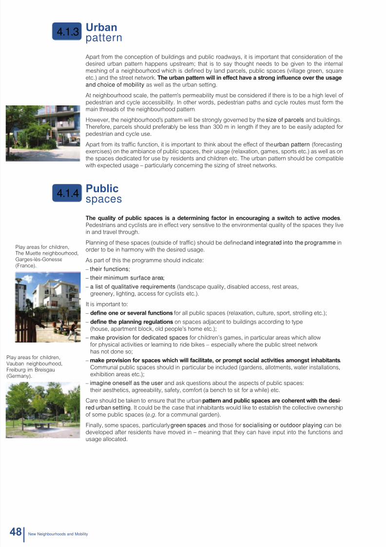
8/6/2019 New Neighbour Hoods and Mobility
http://slidepdf.com/reader/full/new-neighbour-hoods-and-mobility 50/98
Uranpattern
Apart rom the conception o buildings and public roadways, it is important that consideration o thedesired urban pattern happens upstream; that is to say thought needs to be given to the internal
meshing o a neighbourhood which is dened by land parcels, public spaces (village green, square
etc.) and the street network. T uran pattrn will in ffct av a stron inunc ovr t usa
and choice of mobility as well as the urban setting.
At neighbourhood scale, the pattern’s permeability must be considered i there is to be a high level o pedestrian and cycle accessibility. In other words, pedestrian paths and cycle routes must orm themain threads o the neighbourhood pattern.
However, the neighbourhood’s pattern will be strongly governed by the size of parcels and buildings.
Thereore, parcels should preerably be less than 300 m in length i they are to be easily adapted or
pedestrian and cycle use.
Apart rom its trac unction, it is important to think about the eect o the urban pattern (orecastingexercises) on the ambiance o public spaces, their usage (relaxation, games, sports etc.) as well as on
the spaces dedicated or use by residents and children etc. The urban pattern should be compatible
with expected usage – particularly concerning the sizing o street networks.
Pulicspaces
T qualit of pulic spacs is a dtrminin factor in ncourain a switc to activ mods .Pedestrians and cyclists are in eect very sensitive to the environmental quality o the spaces they live
in and travel through.
Planning o these spaces (outside o trac) should be dened and integrated into the programme in
order to be in harmony with the desired usage.
As part o this the programme should indicate:
– their functions;
– their minimum surface area;
– a list of qualitative requirements (landscape quality, disabled access, rest areas,greenery, lighting, access or cyclists etc.).
It is important to:
– dn on or svral functions or all public spaces (relaxation, culture, sport, strolling etc.);
– dn t plannin rulations on spaces adjacent to buildings according to type
(house, apartment block, old people’s home etc.);
– make provision for dedicated spaces or children’s games, in particular areas which allow
or physical activities or learning to ride bikes – especially where the public street network
has not done so;
– ma provision for spacs wic will facilitat, or prompt social activitis amonst inaitants.
Communal public spaces should in particular be included (gardens, allotments, water installations,
exhibition areas etc.);
– imagine oneself as the user and ask questions about the aspects o public spaces:their aesthetics, agreeability, saety, comort (a bench to sit or a while) etc.
Care should be taken to ensure that the urban pattrn and pulic spacs ar cornt wit t dsi-red urban setting. It could be the case that inhabitants would like to establish the collective ownership
o some public spaces (e.g. or a communal garden).
Finally, some spaces, particularly green spaces and those or socialising or outdoor playing can be
developed ater residents have moved in – meaning that they can have input into the unctions andusage allocated.
4.1.4
4.1.3
Play areas or children,The Muette neighbourhood,
Garges-lès-Gonesse
(France).
ay areas or children,
uban neighbourhood,eiburg im Breisgau
ermany).
48 Nw Nighourhoods and Moility

8/6/2019 New Neighbour Hoods and Mobility
http://slidepdf.com/reader/full/new-neighbour-hoods-and-mobility 51/98
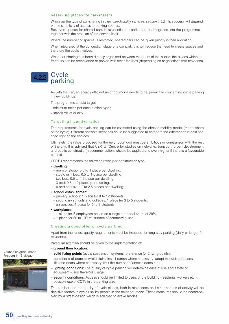
8/6/2019 New Neighbour Hoods and Mobility
http://slidepdf.com/reader/full/new-neighbour-hoods-and-mobility 52/98
Reserv i ng places for car-sharers
Whatever the type o car-sharing in view (see Mobility services, section 4.4.2), its success will depend
on the simplicity o access to parking spaces.
Reserved spaces or shared cars in residential car parks can be integrated into the programme –together with the creation o the service itsel.
Where the number o spaces is restricted, shared cars can be given priority in their allocation.
When integrated at the conception stage o a car park, this will reduce the need to create spaces and
thereore the costs involved.
When car-sharing has been directly organised between members o the public, the places which arereed-up can be reconverted or pooled with other acilities (depending on negotiations with residents).
Cycleparking
As with the car, an energy ecient neighbourhood needs to be pro-active concerning cycle parking
in new buildings.
The programme should target:
– minimum ratios per construction type ;
– standards o quality.
Target ing incent ive rat ios
The requirements or cycle parking can be estimated using the chosen mobility model (modal share
o the cycle). Dierent possible scenarios could be suggested to compare the dierences in cost andshed light on the choices.
Ultimately, the ratios proposed or the neighbourhood must be ambitious in comparison with the rest
o the city. It is advised that CERTU (Centre or studies on networks, transport, urban development
and public construction) recommendations should be applied and even higher i there is a avourable
context.
CERTU recommends the ollowing ratios per construction type:
• dwllin:
– room or studio: 0.5 to 1 place per dwelling, – studio or 1 bed: 0.5 to 1 place per dwelling,
– two bed: 0.5 to 1.5 place per dwelling,
– 3 bed: 0.5 to 2 places per dwelling,
– 4 bed and over: 2 to 2.5 places per dwelling;
• school establishment: – primary schools: 1 place or 8 to 12 students,
– secondary schools and colleges: 1 place or 3 to 5 students,
– universities: 1 place or 5 to 8 students;
• worplacs:
– 1 place or 5 employees based on a targeted modal share o 20%,
– 1 place or 50 to 100 m2 surace o commercial use.
Creat ing a good of fer o f cyc le park ing
Apart rom the ratios, quality requirements must be imposed or long stay parking (daily or longer or
residents).
Particular attention should be given to the implementation o:
– round oor location;
– solid xin points (avoid suspension systems, preerence or 2 xing points);
– conditions of access: Avoid stairs, install ramps where necessary, adapt the width o accesslits and doors where necessary, limit the number o access doors etc.;
– lighting conditions: The quality o cycle parking will determine ease o use and saety o
equipment – and thereore usage!
– security conditions: Access should be limited to users o the building (residents, workers etc.),
possible use o CCTV in the parking area.
The number and the quality o cycle places, both in residences and other centres o activity will be
decisive actors in cycle use by people in the neighbourhood. These measures should be accompa-
nied by a street design which is adapted to active modes.
4.2.2
uban neighbourhood,
iburg im Breisgau.
50 Nw Nighourhoods and Moility
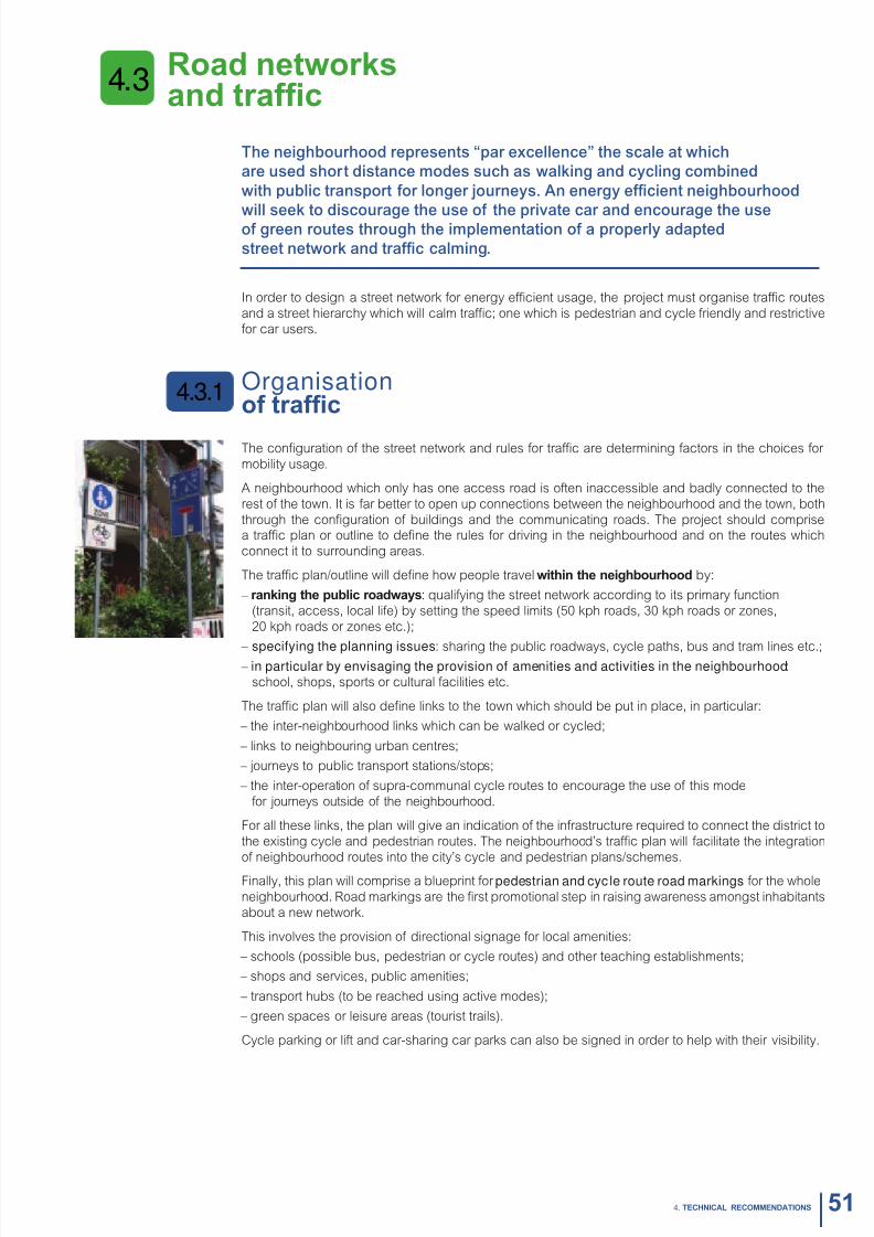
8/6/2019 New Neighbour Hoods and Mobility
http://slidepdf.com/reader/full/new-neighbour-hoods-and-mobility 53/98
Road ntworsand trafc
The neighbourhood represents “par excellence” the scale at which
are used short distance modes such as walking and cycling combined
with public transport or longer journeys. An energy ecient neighbourhood
will seek to discourage the use o the private car and encourage the useo green routes through the implementation o a properly adapted
street network and trac calming.
In order to design a street network or energy ecient usage, the project must organise trac routes
and a street hierarchy which will calm trac; one which is pedestrian and cycle riendly and restrictive
or car users.
Organisationof trafc
The conguration o the street network and rules or trac are determining actors in the choices or
mobility usage.
A neighbourhood which only has one access road is oten inaccessible and badly connected to the
rest o the town. It is ar better to open up connections between the neighbourhood and the town, both
through the conguration o buildings and the communicating roads. The project should comprisea trac plan or outline to dene the rules or driving in the neighbourhood and on the routes which
connect it to surrounding areas.
The trac plan/outline will dene how people travel witin t niourood by:
– ranin t pulic roadwas: qualiying the street network according to its primary unction
(transit, access, local lie) by setting the speed limits (50 kph roads, 30 kph roads or zones,
20 kph roads or zones etc.);
– specifying the planning issues: sharing the public roadways, cycle paths, bus and tram lines etc.; – in particular by envisaging the provision of amenities and activities in the neighbourhood:
school, shops, sports or cultural acilities etc.
The trac plan will also dene links to the town which should be put in place, in particular:
– the inter-neighbourhood links which can be walked or cycled;
– links to neighbouring urban centres;
– journeys to public transport stations/stops;
– the inter-operation o supra-communal cycle routes to encourage the use o this mode
or journeys outside o the neighbourhood.
For all these links, the plan will give an indication o the inrastructure required to connect the district to
the existing cycle and pedestrian routes. The neighbourhood’s trac plan will acilitate the integration
o neighbourhood routes into the city’s cycle and pedestrian plans/schemes.
Finally, this plan will comprise a blueprint or pedestrian and cyc le route road markings or the whole
neighbourhood. Road markings are the rst promotional step in raising awareness amongst inhabitants
about a new network.
This involves the provision o directional signage or local amenities:
– schools (possible bus, pedestrian or cycle routes) and other teaching establishments;
– shops and services, public amenities;
– transport hubs (to be reached using active modes);
– green spaces or leisure areas (tourist trails).
Cycle parking or lit and car-sharing car parks can also be signed in order to help with their visibility.
4.3.1
4.3
514. TeChNICAL ReCOMMeNDATIONS
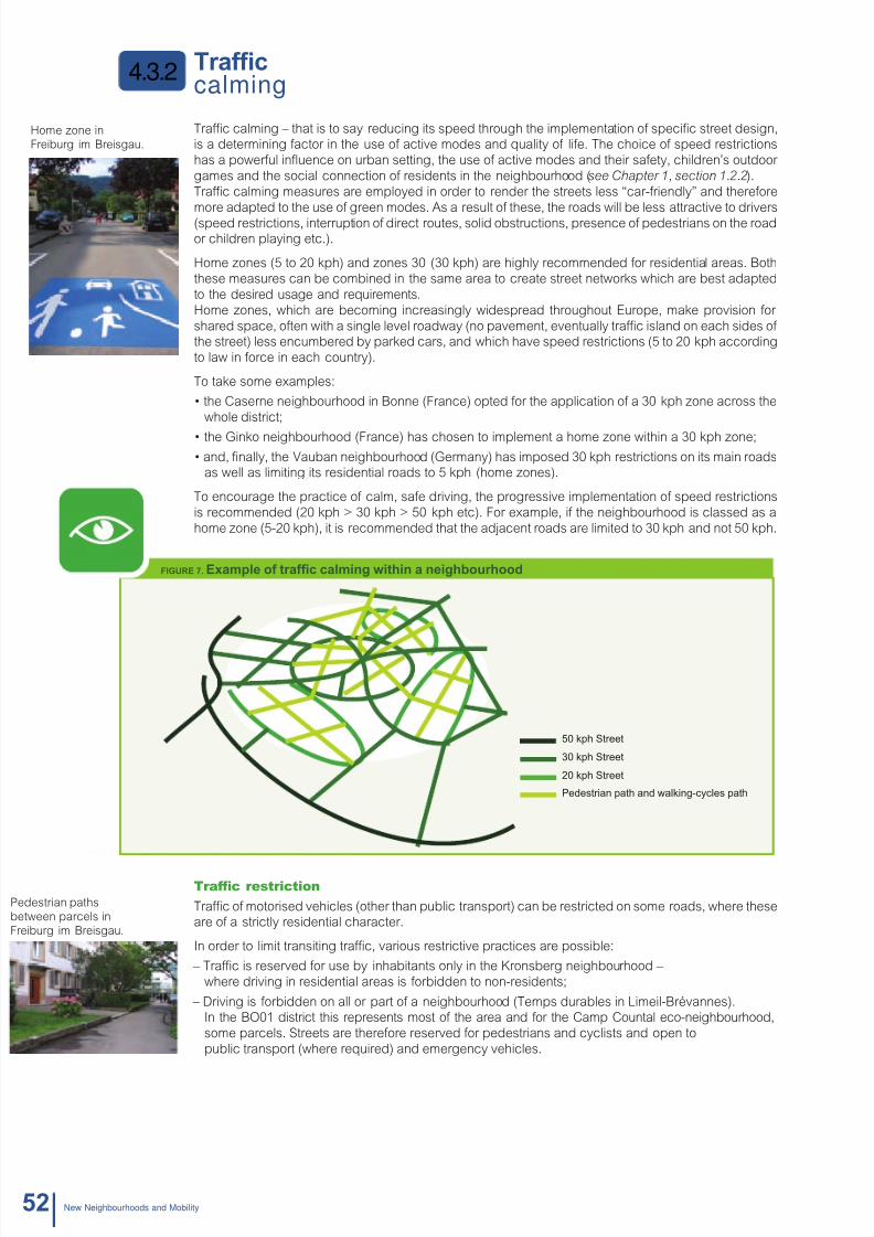
8/6/2019 New Neighbour Hoods and Mobility
http://slidepdf.com/reader/full/new-neighbour-hoods-and-mobility 54/98
destrian paths
ween parcels in
burg im Breisgau.
4.3.2
Home zone in
Freiburg im Breisgau.
52 Nw Nighourhoods and Moility
Trafccalming
Trac calming – that is to say reducing its speed through the implementation o specic street design,is a determining actor in the use o active modes and quality o lie. The choice o speed restrictions
has a powerul infuence on urban setting, the use o active modes and their saety, children’s outdoor
games and the social connection o residents in the neighbourhood (see Chapter 1, section 1.2.2).
Trac calming measures are employed in order to render the streets less “car-riendly” and thereore
more adapted to the use o green modes. As a result o these, the roads will be less attractive to drivers
(speed restrictions, interruption o direct routes, solid obstructions, presence o pedestrians on the roador children playing etc.).
Home zones (5 to 20 kph) and zones 30 (30 kph) are highly recommended or residential areas. Both
these measures can be combined in the same area to create street networks which are best adapted
to the desired usage and requirements.
Home zones, which are becoming increasingly widespread throughout Europe, make provision or
shared space, oten with a single level roadway (no pavement, eventually trac island on each sides o the street) less encumbered by parked cars, and which have speed restrictions (5 to 20 kph according
to law in orce in each country).
To take some examples:
• the Caserne neighbourhood in Bonne (France) opted for the application of a 30 kph zone across the
whole district;
• the Ginko neighbourhood (France) has chosen to implement a home zone within a 30 kph zone;
• and, nally, the Vauban neighbourhood (Germany) has imposed 30 kph restrictions on its main roadsas well as limiting its residential roads to 5 kph (home zones).
To encourage the practice o calm, sae driving, the progressive implementation o speed restrictions
is recommended (20 kph > 30 kph > 50 kph etc). For example, i the neighbourhood is classed as a
home zone (5-20 kph), it is recommended that the adjacent roads are limited to 30 kph and not 50 kph.
FIgURe 7. exampl of trafc calmin witin a niourood
Trafc restriction
Trac o motorised vehicles (other than public transport) can be restricted on some roads, where theseare o a strictly residential character.
In order to limit transiting trac, various restrictive practices are possible:
– Trac is reserved or use by inhabitants only in the Kronsberg neighbourhood –
where driving in residential areas is orbidden to non-residents;
– Driving is orbidden on all or part o a neighbourhood (Temps durables in Limeil-Brévannes).In the BO01 district this represents most o the area and or the Camp Countal eco-neighbourhood,
some parcels. Streets are thereore reserved or pedestrians and cyclists and open to
public transport (where required) and emergency vehicles.
50 kph Street
30 kph Street
20 kph Street
Pedestrian path and walking-ccles path

8/6/2019 New Neighbour Hoods and Mobility
http://slidepdf.com/reader/full/new-neighbour-hoods-and-mobility 55/98
eas trafcfor active modes
The internal street network o a neighbourhood should be accessible to pedestrians, cyclists and other non-motorised users (roller blades/skates, scooters etc.).
A high qual i ty pedes t r ian netw ork
The pedestrian network in a neighbourhood covers all accessible pedestrian routes (pavements, paths,
public spaces etc.). In order to guarantee access or all and a good level o comort, the entire streetnetwork and pedestrian pathways need to have access or people with reduced mobility.
Pedestrian amenities should be designed and put in place according to the required standards (com-
ort, saety etc.):
– minimum unencumbered width (over and above legal obligations, e.g. 1.4 m in France
required by the 2005 law);
– resuracing and levelling o pavements (to remove dierences in road/pavement heights);
– tactile paving or audible pedestrian trac lights at crossings or the visually impaired;
– visibility on crossings, in particular o children;
– levelling o pavements at bus stops.
A ood qualit pdstrian ntwor wic is saf, continuous and comfortal constitutes an impor-
tant element in the quality o lie. The presence o pedestrians on the streets and in public places
makes a big contribution to the vibrancy and security o neighbourhood lie.
An efcient cycle network
The choice or trac calming will greatly help the trac o green modes in the neighbourhood, byavouring the design or shared streets and multi-modal use – without implanting cycle-specic ameni-
ties (other than two-way cycle lanes).
Where trac calming measures are not in place, the neighbourhood street network (or at least those
leading to amenities in the neighbourhood) should constitute a continuous thread o direct, sae routes
or cyclists.
The network should respond to requirements or the saety and comort o its users. Cyclist amenities
are implemented according to the standardised quality requirements (speed, comort and saety):
– directness and continuity o cycle routes;
– widespread implementation o two-way cycle lanes in one way streets;
– choice o suraces;
– choice o design and amenities: cycle lanes or paths, bicycle boxes etc.;
– road saety: visibility on crossings, 50 cm saety margins between parked cars and cycle lanes
(or opening car doors);
– cycle riendly road markings.
The use o two-way cycle lanes on one way streets is a useul tool in the development o cycle networks
which avour cycle use by providing shorter or more direct routes. The issues o design and implemen-tation are less weighty and can be varied according the physical constraints imposed by the street:
– a cycle lane (physically separated);
– a cycle path (marked on the road surace);
– a shared space (without boundaries, cycle pictogram road marking); – a bus-cycle lane…
Apart rom roadway, cycling and/or walking network can be complemented by routes dedicated to
pedestrians and/or cyclists (without motorized trac):
– to offer short cuts or areas for st rolling and leisure pursuits. (For example: a pedestrian and
cycling paths, green routes, green spaces etc.);
– to ncoura social contact and appropriation of pulic aras for privat/collctiv us
(public/private gardening spaces or those or meeting, relaxing or playing games etc.).
A sae and convenient cycling network oers an ecient alternative to substitute or motorized trips
under 8 km which are thereore a signicant part o urban travels.
4.3.3
534. TeChNICAL ReCOMMeNDATIONS

8/6/2019 New Neighbour Hoods and Mobility
http://slidepdf.com/reader/full/new-neighbour-hoods-and-mobility 56/98
Intelligenton-street parking
An important increase in the number o cars during the second hal o the 20th century has causedthe progressive growth in the requirement or parking spaces. These have, in the main, been to the
detriment o pedestrians and cyclists, public spaces and diversity o un-built areas (gardens have
disappeared to make way or car parks). However, a number o studies have shown that the choice or
car ownership is mainly determined by the availability and cost o parking.
An energy ecient neighbourhood will attempt to redress this imbalance by the implementation o cycle parking. However, the sensitive question o parking cannot be settled at neighbourhood scalewithout recourse to the more global policies at local authority or regional scale (new build ratios, syn-
chronisation o parking ees, relay parks, station car parks etc.).
Several levers have been proposed in this guide which will make it possible to dene a more reaso-
nable oer o parking or cycles and cars (as well as two-wheeled motor vehicles).
A s imi lar approach
In both cases, the oer o parking is dened by taking into account the mobility model, (targeted
modal split) and the requirements o the various neighbourhood users (particularities). knowld of
the neighbourhood’s functions is crucial, as is a study o the main trac generating hubs in the area(or its close proximity), i we are to anticipate parking requirements.
The oer o on-street parking should be dened in accordance with:
– the expected modal split (car, cycle, lit-sharing etc.) or diverse purposes
(school, work, local shopping etc.);
– residents’ requirements (consultation);
– and their options for parking (ratios within buildings).
Thereore the number o jobs or students or visitors to public buildings will determine, based on modalsplit, the best adapted ratios or the targeted usage (deductions o oers in buildings).
The oer o street parking should be seen as complementary to that which is oered or buildings and
used primarily to make up any shortall:
– when they do not reach the objectives or modal split;
– when they do not meet the requirements or all usage: or example,a business which may have enough places or sta but none or customers.
Where this is possible, consultation with representatives o a neighbourhood’s existing or uture activi-
ties is vital in order to learn about their requirements and discuss the proposed oer o street parking.
An of fer which d iscourages car ow nership
I the question o car parking cannot be managed at purely neighbourhood scale, various measures
can however be implemented in order to propose a solution which will meet requirements without
provoking increased use.
Local authority power over street parking can permit several actions:
– restricting the number o parking spaces;
– locating car parking away rom the living areas;
– limiting the length o time allowed (rotational parking or business customers);
– charging ees or parking; – reserving spaces or lit or car-sharing schemes;
– encouraging residents’ parking (special taris), where the number o household spaces allocated
are insucient.
Restricting the numer of spaces and distancing their location
To ree up public spaces or other use (games, sports, gardening, walking, meeting places, cycle
parks etc.), the choice can be made to restrict the oer o car parking, particularly in residential streets.
This could be:
– partial restriction: As with home zones where parking can be considerably reduced
when a «car-ree neighbourhood» project is shared with inhabitants (low level o motorisation)
and those who have cars have somewhere to park;
– total restriction: as with car-free neighbourhoods (see Mobility management, section 4.5).
The programme can choose to regroup all or part o the street places into one central surace area, in
order to leave the streets unencumbered or walking or cycling and to promote local lie. It is thereore
advisable to ascertain at what level this will be accepted by inhabitants.
4.3.4
Parking places can begathered at entrances or
inside the neighbourhood.
54 Nw Nighourhoods and Moility
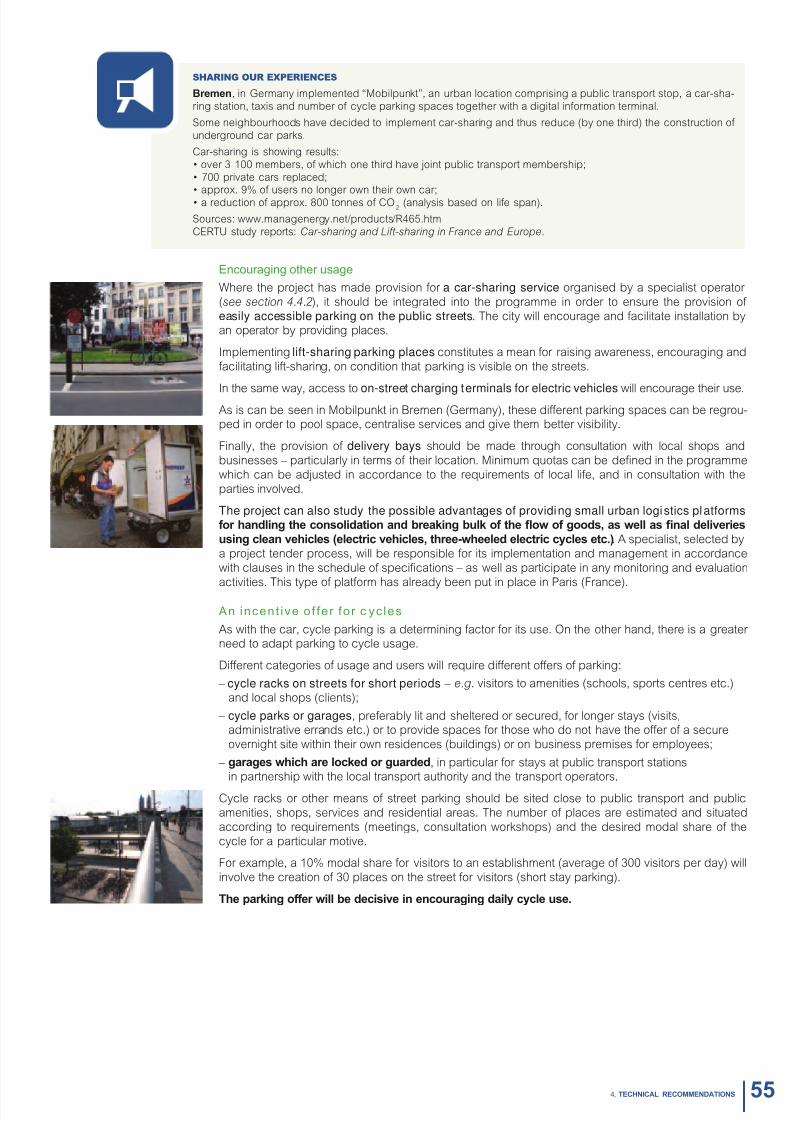
8/6/2019 New Neighbour Hoods and Mobility
http://slidepdf.com/reader/full/new-neighbour-hoods-and-mobility 57/98
Sharing our experienceS
brmn, in Germany implemented “Mobilpunkt”, an urban location comprising a public transport stop, a car-sha-
ring station, taxis and number o cycle parking spaces together with a digital inormation terminal.
Some neighbourhoods have decided to implement car-sharing and thus reduce (by one third) the construction o
underground car parks.
Car-sharing is showing results:
• over 3 100 members, of which one third have joint public transport membership;
• 700 private cars replaced;• approx. 9% of users no longer own their own car;
• a reduction of approx. 800 tonnes of CO2(analysis based on lie span).
Sources: www.managenergy.net/products/R465.htm
CERTU study reports: Car-sharing and Lit-sharing in France and Europe.
Encouraging other usage
Where the project has made provision or a car-sharing service organised by a specialist operator
(see section 4.4.2), it should be integrated into the programme in order to ensure the provision o
easily accessible parking on the public streets. The city will encourage and acilitate installation byan operator by providing places.
Implementing lift-sharing parking places constitutes a mean or raising awareness, encouraging and
acilitating lit-sharing, on condition that parking is visible on the streets.
In the same way, access to on-street charging terminals for electric vehicles will encourage their use.As is can be seen in Mobilpunkt in Bremen (Germany), these dierent parking spaces can be regrou-ped in order to pool space, centralise services and give them better visibility.
Finally, the provision o delivery bays should be made through consultation with local shops and
businesses – particularly in terms o their location. Minimum quotas can be dened in the programme
which can be adjusted in accordance to the requirements o local lie, and in consultation with the
parties involved.
The project can also study the possible advantages of providing small urban logistics platformsfor andlin t consolidation and rain ul of t ow of oods, as wll as nal dlivris
usin clan vicls (lctric vicls, tr-wld lctric ccls tc.). A specialist, selected by
a project tender process, will be responsible or its implementation and management in accordance
with clauses in the schedule o specications – as well as participate in any monitoring and evaluation
activities. This type o platorm has already been put in place in Paris (France).
An incent ive of fer for c yc les
As with the car, cycle parking is a determining actor or its use. On the other hand, there is a greater need to adapt parking to cycle usage.
Dierent categories o usage and users will require dierent oers o parking:
– cycle racks on streets for short periods – e.g. visitors to amenities (schools, sports centres etc.)
and local shops (clients);
– cycle parks or garages, preerably lit and sheltered or secured, or longer stays (visits,administrative errands etc.) or to provide spaces or those who do not have the oer o a secure
overnight site within their own residences (buildings) or on business premises or employees;
– aras wic ar locd or uardd, in particular or stays at public transport stationsin partnership with the local transport authority and the transport operators.
Cycle racks or other means o street parking should be sited close to public transport and public
amenities, shops, services and residential areas. The number o places are estimated and situated
according to requirements (meetings, consultation workshops) and the desired modal share o the
cycle or a particular motive.
For example, a 10% modal share or visitors to an establishment (average o 300 visitors per day) will
involve the creation o 30 places on the street or visitors (short stay parking).
T parin offr will dcisiv in ncourain dail ccl us.
554. TeChNICAL ReCOMMeNDATIONS
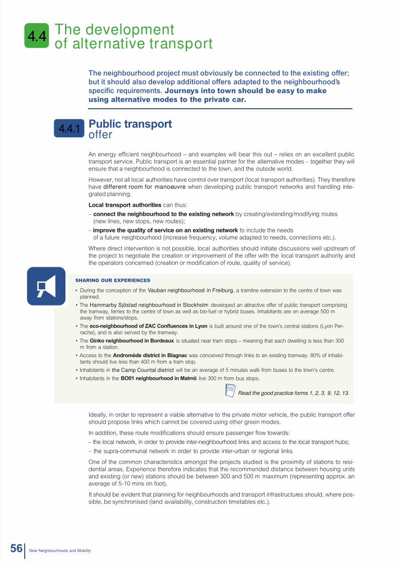
8/6/2019 New Neighbour Hoods and Mobility
http://slidepdf.com/reader/full/new-neighbour-hoods-and-mobility 58/98
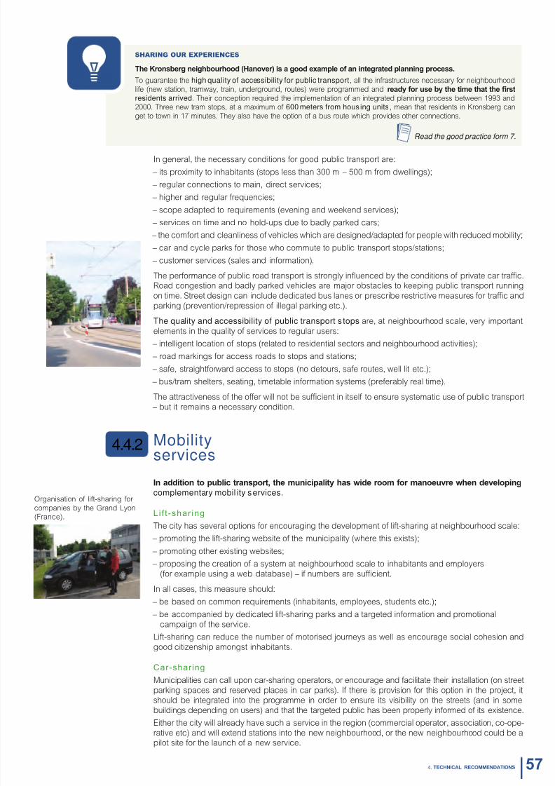
8/6/2019 New Neighbour Hoods and Mobility
http://slidepdf.com/reader/full/new-neighbour-hoods-and-mobility 59/98
Sharing our experienceS
T kronsr niourood (hanovr) is a ood xampl of an intratd plannin procss.
To guarantee the high quality of accessibility for public transport, all the inrastructures necessary or neighbourhood
lie (new station, tramway, train, underground, routes) were programmed and rad for us t tim tat t rst
residents arrived. Their conception required the implementation o an integrated planning process between 1993 and2000. Three new tram stops, at a maximum o 600 meters from hous ing units , mean that residents in Kronsberg can
get to town in 17 minutes. They also have the option o a bus route which provides other connections.
Read the good practice form 7.
In general, the necessary conditions or good public transport are:
– its proximity to inhabitants (stops less than 300 m – 500 m rom dwellings);
– regular connections to main, direct services;
– higher and regular requencies;
– scope adapted to requirements (evening and weekend services);
– services on time and no hold-ups due to badly parked cars;
– the comort and cleanliness o vehicles which are designed/adapted or people with reduced mobility;
– car and cycle parks or those who commute to public transport stops/stations;
– customer services (sales and inormation).
The perormance o public road transport is strongly infuenced by the conditions o private car trac.Road congestion and badly parked vehicles are major obstacles to keeping public transport running
on time. Street design can include dedicated bus lanes or prescribe restrictive measures or trac and
parking (prevention/repression o illegal parking etc.).
The quality and accessibility of public transport s tops are, at neighbourhood scale, very important
elements in the quality o services to regular users:
– intelligent location o stops (related to residential sectors and neighbourhood activities);
– road markings or access roads to stops and stations;
– sae, straightorward access to stops (no detours, sae routes, well lit etc.);
– bus/tram shelters, seating, timetable inormation systems (preerably real time).
The attractiveness o the oer will not be sucient in itsel to ensure systematic use o public transport
– but it remains a necessary condition.
Mobilityservices
In addition to pulic transport, t municipalit as wid room for manouvr wn dvlopin
complementary mobil ity services.
Lif t -shar ing
The city has several options or encouraging the development o lit-sharing at neighbourhood scale:
– promoting the lit-sharing website o the municipality (where this exists);
– promoting other existing websites; – proposing the creation o a system at neighbourhood scale to inhabitants and employers
(or example using a web database) – i numbers are sucient.
In all cases, this measure should:
– be based on common requirements (inhabitants, employees, students etc.);
– be accompanied by dedicated lit-sharing parks and a targeted inormation and promotional
campaign o the service.
Lit-sharing can reduce the number o motorised journeys as well as encourage social cohesion and
good citizenship amongst inhabitants.
Car-sharing
Municipalities can call upon car-sharing operators, or encourage and acilitate their installation (on street
parking spaces and reserved places in car parks). I there is provision or this option in the project, itshould be integrated into the programme in order to ensure its visibility on the streets (and in some
buildings depending on users) and that the targeted public has been properly inormed o its existence.
Either the city will already have such a service in the region (commercial operator, association, co-ope-
rative etc) and will extend stations into the new neighbourhood, or the new neighbourhood could be apilot site or the launch o a new service.
4.4.2
Organisation o lit-sharing or
companies by the Grand Lyon(France).
574. TeChNICAL ReCOMMeNDATIONS

8/6/2019 New Neighbour Hoods and Mobility
http://slidepdf.com/reader/full/new-neighbour-hoods-and-mobility 60/98
Sharing our experienceS
An innovative car-sharing system (gas or electric vehicles) was put in place in Hammarby Sjöstad. It is the resulto competitive tendering by several petrol companies or the implantation o a service station and the organisation o a
car-sharing system. In exchange or this best oer, Statoil has the monopoly on uel sales rom the only petrol station
implanted on the site.
Statoil is currently managing this system which is open to everyone living in Hammarby Sjöstad. The best parking places
throughout the neighbourhood are permanently reserved or the scheme. In 2004, 16 cars were in service and already
attracting use by 10% o amilies.
Read the good practice form 13.
Sharing our experienceS
The “Car Frei” (car-ree) Association which brings together 1 500 members, manages a car-sharing system or residents
in the Vauan Niourood in Friur.
It purchases one car or 20 members, which represents approximately 63 cars. These vehicles are parked in communal
car parks – away rom residences.
Read the good practice form 3.
In bdZeD in Sutton, 3 cars (LPG, electric) are available to 35 resident members o the car-sharing service (or 14% o residents, 1 car or 12 inhabitants).
Read the good practice form 15.
Serv ices for cyc l is ts
Various services can be proposed to cyclists at neighbourhood scale, in order to acilitate their journeys:
– maintenance-repair centre;
– cycle hire and electrically assisted cycles (and accessories);
– cycle centres: multiservice centres or cyclists which include: hire, secure storage, repairs,
training in urban cycling, inormation and advice, organised rides etc.
I the city is already running a sel-service cycle hire in the region, this can also be extended to
the new neighbourhood.
Mobility centres/ofces
In order to bring greater visibility to these alternatives, and pool the necessary resources, the various
services as well as any communication, inormation and awareness actions can be allocated to a
mobility advice team (see Mobility Management, section 4.5). The programme should thereore includethe creation o a site adapted to these requirements (storage o cycles, vehicles and materials etc.).
The mobility oce can also contribute to the monitoring o mobility indicators:
• an intrfac twn pulic dcision mars and usrs;
• reporting on the development of usage (use o services), needs and expectations o the targeted public.
Sharing our experienceS
When the Vauban neighbourhood was created, a mobility agency (Mobility Ofce) was set up within the town’s muni-
cipal services in Malmö. Its aim was to encourage the use o ecological travel modes and implement awareness pro-
grammes or inhabitants.
Read the good practice form 3.
In the same vein, the Temps durables district in Limeil-Brévannes programmed a mobility agency project to inorm resi-
dents about transport options and manage services such as: cycle hire, car and lit-sharing.
Read the good practice form 8.
The example o the BO01 neighbourhood in Malmö demonstrates the opportunities or making
transport energy savings by creating a mobility centre that is useul during the conception andater or users.
58 Nw Nighourhoods and Moility
8/6/2019 New Neighbour Hoods and Mobility
http://slidepdf.com/reader/full/new-neighbour-hoods-and-mobility 61/98
Home del iver ies
The development o online purchasing and delivery services can reduce and replace motorised journeys by regrouping goods or transport. It clearly represents an important daily lie solution or
members o the public who have diculty travelling – older people, people with reduced mobility or
those with no personal transport.
The municipality can orm partnerships with the local shops and supermarkets, or those arther aeld,
to provide home delivery services.
Moreover, deliveries can be optimised in terms o nancial savings and the environment through:
– “last ilomtr” loistics platforms witin t niourood (see on section 4.3.4);
– deliveries by bicycle (standard or electrically assisted);
– roupin ordrs twn usinsss in t ara.
Mobilitymanagement
Energy saving actions should not simply be linked to the neighbourhood’s
conception, but should also extend to helping and encouraging its residents
to adopt sustainable travel practices in their daily lives.
The management o mobility goes hand-in-hand with a pro-active policyor the oer and networks or transport. It brings together measures
which are directed towards the demand or travel policies.
Mobility management is characterised by:
– its targeted response: by actor (company etc.) and/or by purpose (school, work etc.);
– its tailored response: a response based on the understanding o uses, requirements and
participation o the target group;
– its evolutionary response: this can be developed through evaluation;
– in t intanil lds: inormation, communication, organisation, awareness, mobility advice etc.
(other than the services addressed in alternative transport, see section 4.4.2);
– low cost to support investment in the inrastructure, amenities and services implemented.This involves changing habits and practices amongst users, decision makers and technicians alike.Apart rom the awareness actions aimed at encouraging uptake o alternative modes (described in
Chapter 3), tr main lds of action for manain moilit are described below:
– multi-modal information;
– advice on mobility;
– and journey management.
Moving house is a particularly good time to take up new habits. It is thereore a prime moment or rai-
sing awareness, inorming and advising inhabitants about energy ecient modes o travel.
Informationand awarnss
To work with inhabitants to move to using energy ecient practices rom the moment they move in,
the municipality must act beyond the neighbourhood construction itself, by providing inormation to
people, as they arrive, about the alternatives to the private car which are on oer.
The municipality should take care to produce clear, targeted inormation:
– on inhabitants’ access to the neighbourhood using alternative transport;
– on the regulations or car trac and parking;
– on the available active modes or children and parents travelling to school;
– on the access to employment areas or employers and sta.
The inormation should be disseminated using all possible media or communication.
4.5.1
4.5
594. TeChNICAL ReCOMMeNDATIONS
A lot o other mobility services
can be developed.
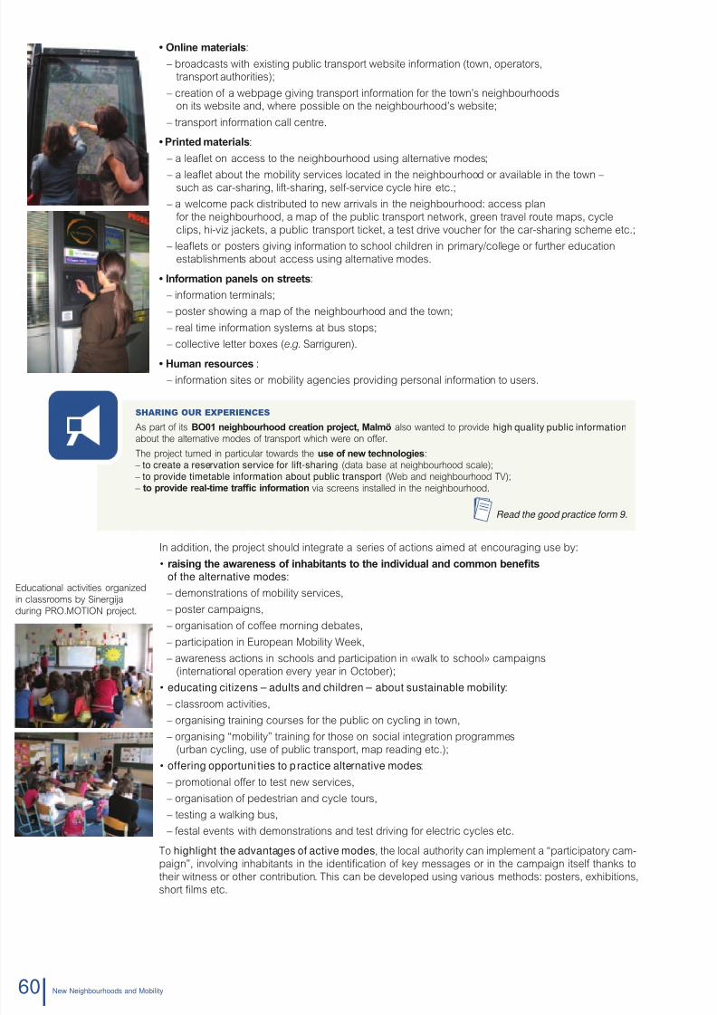
8/6/2019 New Neighbour Hoods and Mobility
http://slidepdf.com/reader/full/new-neighbour-hoods-and-mobility 62/98
• Onlin matrials:
– broadcasts with existing public transport website inormation (town, operators,transport authorities);
– creation o a webpage giving transport inormation or the town’s neighbourhoodson its website and, where possible on the neighbourhood’s website;
– transport inormation call centre.
• Printd matrials:
– a leafet on access to the neighbourhood using alternative modes;
– a leafet about the mobility services located in the neighbourhood or available in the town –such as car-sharing, lit-sharing, sel-service cycle hire etc.;
– a welcome pack distributed to new arrivals in the neighbourhood: access plan
or the neighbourhood, a map o the public transport network, green travel route maps, cycle
clips, hi-viz jackets, a public transport ticket, a test drive voucher or the car-sharing scheme etc.;
– leafets or posters giving inormation to school children in primary/college or urther education
establishments about access using alternative modes.
• Information panls on strts:
– inormation terminals;
– poster showing a map o the neighbourhood and the town;
– real time inormation systems at bus stops;
– collective letter boxes (e.g. Sarriguren).
• human rsourcs :
– inormation sites or mobility agencies providing personal inormation to users.
Sharing our experienceS
As part o its bO01 niourood cration proct, Malmö also wanted to provide high quality public information
about the alternative modes o transport which were on oer.
The project turned in particular towards the us of nw tcnolois:
– to create a reservation service for lift-sharing (data base at neighbourhood scale);
– to provide timetable information about public transport (Web and neighbourhood TV);
– to provid ral-tim trafc information via screens installed in the neighbourhood.
Read the good practice form 9.
In addition, the project should integrate a series o actions aimed at encouraging use by:
• raisin t awarnss of inaitants to t individual and common nts
of the alternative modes:
– demonstrations o mobility services,
– poster campaigns,
– organisation o coee morning debates,
– participation in European Mobility Week,
– awareness actions in schools and participation in «walk to school» campaigns
(international operation every year in October);
• educating citizens – adults and children – about sustainable mobility:
– classroom activities,
– organising training courses or the public on cycling in town,
– organising “mobility” training or those on social integration programmes
(urban cycling, use o public transport, map reading etc.);
• offering opportuni ties to practice alternative modes:
– promotional oer to test new services,
– organisation o pedestrian and cycle tours,
– testing a walking bus,
– estal events with demonstrations and test driving or electric cycles etc.
To highlight the advantages of active modes, the local authority can implement a “participatory cam-
paign”, involving inhabitants in the identication o key messages or in the campaign itsel thanks to
their witness or other contribution. This can be developed using various methods: posters, exhibitions,
short lms etc.
ducational activities organized
classrooms by Sinergija
uring PRO.MOTION project.
60 Nw Nighourhoods and Moility
8/6/2019 New Neighbour Hoods and Mobility
http://slidepdf.com/reader/full/new-neighbour-hoods-and-mobility 63/98
Sharing our experienceS
As part o the PRO.MOTION project, CRANA and NASURSA together with
local partners, put in place an awareness campaign entitled: Gym startsin the home! It aimed to encourage inhabitants to travel to the sportscentres using active modes rather than driving . Posters and leafets,
showing a map o the neighbourhood, gave the distances (in metres) in-
volved in crossing the various districts.
The campaign was monitored using an original orm o participative evalua-
tion. A letter box was installed on the road leading to the sports centre. Inha-bitants were invited to post a card to validate their journey on oot or cycle.
Two campaigns were put in place in October 2009 and June 2010 which mobilised 104 and 144 individuals. The rstedition saved 578 motorised journeys, representing 1 357 km, or 200 kg o CO
2(which would be the equivalent o 2 tons
per year).
Read the good practice form 11.
Sharing our experienceS
Under the ramework o the PRO.MOTION project, the application implemented in Graz by Austrian Mobility ResearchFGM-AMOR on the Alpawolf neighbourhood was centred on an awareness campaign concerning daily and leisure
journeys using alternative transport. The campaign was developed around the creation o a website providing inorma-
tion about the oer centred on raising awareness to sustainable mobility.
Read the good practice form 5.
Mobilityadvice
Mobility advice in Europe has been a subject or development over the last several years throughvarious local initiatives. These actions are being led both by local communities and associations.
It involves supportin t mov towards can of us, or of coic, t local population in a
id to aciv mor fcint and mor sustainal moilit. The role o these advisors is to encou-
rage and help the various actors to rationalise their habits, choices and practices according to criterion
which can be either socio-economic (health, budget, time-management) or environmental (impact on
air, noise and energy consumption etc.).
Oten conused with multi-modal inormation, mobility advice will:
– provide solutions for individuals or entities seeking information and advice about mobility,oten linked to changes in circumstances. These changes can be either voluntary
(career path, a need to reduce costs, concern or the planet) or imposed (relocation,
change in working hours etc.);
– develop over time according to the needs identied, ollowing several stages starting
rom an initial diagnosis o the situation;
– use existing services as a baseline or developing initial practices. The presence o
complementary services will reinorce the pertinence and eectiveness o advice (and vice versa).
Mobility advice supports the development of more sustainable mobility practices:
– through playing a prompting role (a starting point): question, raise awareness, thought
and dialogue (communication);
– by making the local stakeholders responsible or their own choices or mobility (awareness);
– by providing suggestions and support: advice will be ollowed up with actions according
to the needs, targets and process or changing habits which will be maintained over time(accompaniment, organisation).
4.5.2
614. TeChNICAL ReCOMMeNDATIONS
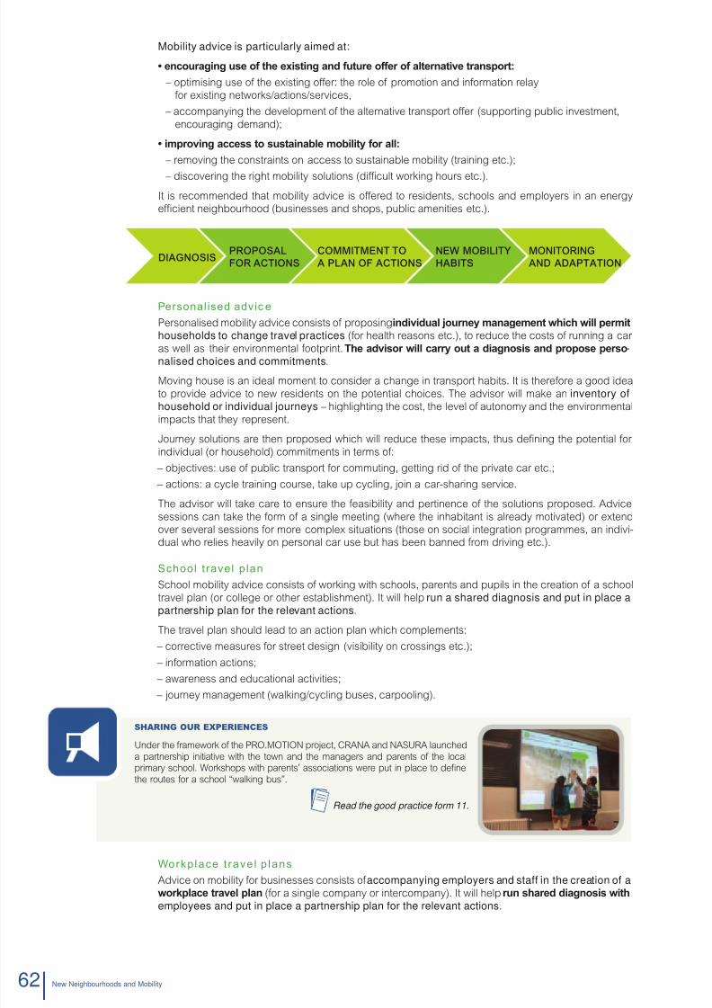
8/6/2019 New Neighbour Hoods and Mobility
http://slidepdf.com/reader/full/new-neighbour-hoods-and-mobility 64/98
Mobility advice is particularly aimed at:
• ncourain us of t xistin and futur offr of altrnativ transport:
– optimising use o the existing oer: the role o promotion and inormation relay
or existing networks/actions/services,
– accompanying the development o the alternative transport oer (supporting public investment,
encouraging demand);
• improvin accss to sustainal moilit for all:
– removing the constraints on access to sustainable mobility (training etc.);
– discovering the right mobility solutions (dicult working hours etc.).
It is recommended that mobility advice is oered to residents, schools and employers in an energy
ecient neighbourhood (businesses and shops, public amenities etc.).
Personalised advic e
Personalised mobility advice consists o proposing individual ourn manamnt wic will prmit
households to change travel practices (or health reasons etc.), to reduce the costs o running a car
as well as their environmental ootprint. T advisor will carr out a dianosis and propos prso-nalised choices and commitments.
Moving house is an ideal moment to consider a change in transport habits. It is thereore a good idea
to provide advice to new residents on the potential choices. The advisor will make an inventory ofhousehold or individual journeys – highlighting the cost, the level o autonomy and the environmental
impacts that they represent.
Journey solutions are then proposed which will reduce these impacts, thus dening the potential or
individual (or household) commitments in terms o:
– objectives: use o public transport or commuting, getting rid o the private car etc.;
– actions: a cycle training course, take up cycling, join a car-sharing service.
The advisor will take care to ensure the easibility and pertinence o the solutions proposed. Advice
sessions can take the orm o a single meeting (where the inhabitant is already motivated) or extend
over several sessions or more complex situations (those on social integration programmes, an indivi-dual who relies heavily on personal car use but has been banned rom driving etc.).
School t ravel plan
School mobility advice consists o working with schools, parents and pupils in the creation o a school
travel plan (or college or other establishment). It will help run a shared diagnosis and put in place apartnership plan for the relevant actions.
The travel plan should lead to an action plan which complements:
– corrective measures or street design (visibility on crossings etc.);
– inormation actions;
– awareness and educational activities;
– journey management (walking/cycling buses, carpooling).
Sharing our experienceS
Under the ramework o the PRO.MOTION project, CRANA and NASURA launched
a partnership initiative with the town and the managers and parents o the localprimary school. Workshops with parents’ associations were put in place to dene
the routes or a school “walking bus”.
Read the good practice form 11.
Workplace t ravel p lans
Advice on mobility or businesses consists o accompanying employers and staff in the creation of aworplac travl plan (or a single company or intercompany). It will help run sard dianosis wit
employees and put in place a partnership plan for the relevant actions .
PROPOSAL
FOR ACTIONS
COMMITMENT TO
A PLAN OF ACTIONS
NEW MOBILITY
HABITS
MONITORING
AND ADAPTATIONDIAGNOSIS
62 Nw Nighourhoods and Moility
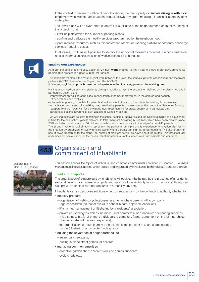
8/6/2019 New Neighbour Hoods and Mobility
http://slidepdf.com/reader/full/new-neighbour-hoods-and-mobility 65/98
In the context o an energy ecient neighbourhood, the municipality can initiat dialou wit local
employers who wish to participate (individual ollowed by group meetings) in an inter-company com-
muter plan.
The travel plans will be even more eective i it is initiated at the neighbourhood conception phase o the project in that:
– it will help determine the number o parking places;
– conrm and calibrate the mobility services programmed or the neighbourhood;
– pool material resources such as teleconerence rooms, car-sharing stations or company concierge
services (reducing costs).
In all cases, it will make it possible to identiy the additional measures required in other areas: awa-
reness, inormation, organisation o working hours, lit-sharing etc.
Sharing our experienceS
Although the school eco-mobility action at gif-sur-yvtt (France) is not linked to a new urban development, itsparticipative process is a good subject or transer.
The school travel plan is the result o joint work between the town, the schools, parents associations and technical
partners (ARENE, Ile-de-France Region, and the ADEME).
It avoured a loal approac asd on a ston action involvin parnts: t walin us .
Having associated parents and students during a mobility survey, the actors then dened and implemented a ull
partnership action plan:
– improvement on walking conditions: rehabilitation o paths, improvement in the comort and security
o pedestrians and cyclists; – inormation: printing o leafets or parents about access to the school and how the walking bus operates;
– organisation by parents o a walking bus; creation by parents o a website or the bus at the Neuveries School;
– support rom the Town Hall or the walking bus: road marking or stops, supply o hi-viz jackets etc.; – awareness actions: awareness day, Walking to School Week etc.
Two walking buses are actually operating in the school sectors o Neuveries and the Centre; a third is to be launched
in time or the next school year at Sablons. In total, there are 5 walking buses lines which have been created since
2007 and which enable around 60 children to walk to school every day with the help o around 40 parents.The strong involvement o all actors represents the particular principle o this experience. Innovation also lies in
the creation by organizers o two web sites (Wiki) where parents can sign up to be monitors. The site is easy to
use. It gives timetables or the stops, the names o monitors as well as news about the routes. This practical toolunderlines the social aspect o the action, which has been a rank success with both parents and children.
Organisation andcommitment of inhabitants
This section echoes the topics o individual and common commitments contained in Chapter 3. Journeys
management includes actions which are led and organised by inhabitants, both individually and as a group.
Jo in t run p ro jec ts
The organisation o joint projects by inhabitants will obviously be helped by the presence o a residents’
association which can manage projects and apply or local authority unding. The local authority can
also provide technical support (recourse to a mobility advisor).
Inhabitants can also propose solutions or act on suggestions by the contracting authority whether or:
• mobility projects:
– organisation o walking/cycling buses: a scheme where parents will accompany
together children (on oot or cycle) to school in sae, enjoyable conditions,
– lit-sharing: management o lit-sharing by a residents’ association,
– private car-sharing: as well as the more usual commercial or associative car-sharing schemes,
it is also possible or 2 or more individuals to come to a ormal agreement on the joint purchaseo a car or shared use (and expenses),
– the organisation o group journeys: inhabitants come together to share shopping trips
by car (lit-sharing) or by cycle (cycling bus);
• building the keystones of neighbourhood life:
– an annual street party,
– putting in place street games or children;
• managing common amenities: – collective garden shed, children’s outside games cupboard,
– cycle sheds etc.;
4.5.3
Walking bus in
Bois-le-Roi (France).
634. TeChNICAL ReCOMMeNDATIONS
8/6/2019 New Neighbour Hoods and Mobility
http://slidepdf.com/reader/full/new-neighbour-hoods-and-mobility 66/98
• a reduction in pr ivate parking:
– possibility or pooling and positioning throughout the neighbourhood,
– getting rid o personal parking spaces in avour o shared vehicles.
The object o this will be to involve them in mobility projects as well as those or the use o public spaces whichwill underpin local lie (by excluding the omnipresence o the private car right rom the start). The atmosphere
and relationship between inhabitants are actors which will determine the success o these types o action.
Svral ars into t proct, t mila travlld rsidnts as n rducd 64% compa-
red to the national average – and t rsidnts now an avra of 20 niours nam.
Sharing our experienceS
During its Temps durables neighbourhood project, the Cit of Limil-brévanns brought together the school andstudent parents in a walking bus project to accompany children to the local school.
Read the good practice form 8.
Sharing our experienceS
In bdZeD in Sutton, the residents’ associations are responsible or running social events in the neighbourhood as well
as managing acilities or inhabitants (nurseries or example).
Read the good practice form 15.
Pro-ac t ive com mitm ent t o a car f ree neighbourhood
Aandonin t us of a privat car constituts a rm commitmnt inaitants. Also, it is essen-
tial that the choice is made willingly and ormalised (sale or termination o agreement). It should be the
choice or a liestyle prompted by desired and accepted circumstances.
In order to ensure the acceptance and respect or restrictions on the ownership o vehicles, experience
eedback will highlight several levers:
– formalising the pro-active commitment o individuals through sale or leasing contracts;
– appointing a management structure or the allocation o spaces (owner or residents associations etc.);
– dnin t critria for allocation: priority or disabled badge-holders, those with health problems,car-sharers, eco-uel vehicles etc.
For more inormation on recommended ratios, the reader is advised toconsult the section 4.2, dealing with parking allocated to buildings.
Sharing our experienceS
T grünnstrass niourood, brmn (grman)
Creation o a 23 home neighbourhood (40 tenants, 0.08 ha) car-ree since 1995:
– 5 car spaces in all by order o the managing association (criterion);
– 2 spaces or the disabled; – commitment by tenants to neither use nor own a private car is included in their rental and tenancy agreement;
– creation o a nearby car-sharing station (operated by Cambio).
Source : ADD HOME, www.addhome.eu
Sharing our experienceS
T Am kornw niourood, hamur (grman)
New car-ree neighbourhood with 65 housing units (220 programmed at ull term): – signature o commitment by residents not to own a car is included in their rental and tenancy agreement;
– 0.2 car spaces per dwelling;
– payment o compensation tax to obtain a space by order o the owners’ association (or example due to health reasons);
– car-sharing project (between individuals or with an operator).
Source : ADD HOME, www.addhome.eu
Sharing our experienceS
T Floridsdorf district in Vinna (Austria)
– 250 homes and only 20 parking places (1/10) or the car-sharing and cycles (500 places with workshop); – Signature o commitment by tenants to respect the rules o the car-ree neighbourhood;
– Space savings were used or collective amenities: hall, launderette, solar powered hot water, green spaces;
– 80% o homes rented, 90% o inhabitants with public transport season tickets and 20% have a driving licence.
Source : ADD HOME, www.addhome.eu
Nw Nighourhoods and Moility64
8/6/2019 New Neighbour Hoods and Mobility
http://slidepdf.com/reader/full/new-neighbour-hoods-and-mobility 67/98
IdentIty
Territory Greater Toulouse(located on Blagnac and Beauzelle towns)
Andromède neighbourhood
Surace area 366 km2 210 ha
Inhabitants ~ 703 000 4 000 dwellings,10 000 inhabitants
Context
Andromède neighbourhood is situated in the outlying suburbs o Blagnac and Beauzelle towns, in the Haute-Ga-ronne, an area where private-car use is an entrenched cultural norm.
The programme aims at developing, on 210 hectares, 4 000 housing units, 70 hectares o public natural spaces,activities, services and public acilities that meet the needs o the local population.
From the outset in 2001, the project managers wanted to implement an urban development in accordance with sus-tainable development. Andromède breaks with the periurban private housing estate pattern.
Programme regardIng energy-effICIent mobIl Ity
This neighbourhood’s asset regarding energy-ecient transport depends on 4 major principles o urban develop-ment:
1- Functional and social diversity to create a lively neighbourhood and to give citizens opportunities for social ties:
– 3 700 dwellings o which 20% will be public housing;
– oces, services and shops; 6 000 m2 o shops are planned in mixed-use buildings (ground foor)on the Avenue o Andromède, 130 000 m2 dedicated to activities in the service sector;
– local public acilities; a secondary and two primary schools, a leisure centre, sports pitches and a running track,a police station and a acility or the elderly;
– 1/3 o the total surace area is reserved or green and leisure spaces: 5 planted grounds (north-south)intersected by a “green corridor” (east-west).
2- Integrated access to a public transport system that anticipates future needs of mobili ty:
– connection to the tramway line (line E), in order to connect the district to the Toulouse underground network(at Arènes station). The tram will run every 5 minutes at peak times and every 8 minutes at o-peak hours;
– 80% o residents will live less than 400 m rom a tram stop.
3- Trafc management within the area to favour the use of active modes, thanks to:
– a road network ranking (organization into a hierarchy);
– paths or sot modes across the whole district, including green spaces, bicycle paths andwide pavements to be laid alongside the main roads;
– access roads designed with narrow one-way car lanes in order to highlight a share o uses andthe priority given to bicycles;
– green corridors as ootpaths;
– ootpaths connected to the existing inrastructure o the surrounding neighbourhoods (or a seamless network);
– a pro-active parking policy.
4- The development of tr ansport services:
– inormation and resources;
– lit-sharing;
– car-sharing.
g Pc ic New Neighbourhoods and Mobility
Andromède neighbourhoodGreater Toulouse, France1
8/6/2019 New Neighbour Hoods and Mobility
http://slidepdf.com/reader/full/new-neighbour-hoods-and-mobility 68/98
Progress
Launch 2001
Delivery Since 2009 until 2015
K ey aCtors
Project owners(or their delegates)
Greater ToulouseDeveloper: SEM Constellation
Project manager andproject assistance
Project management team: Treuttel-Garcias-TreuttelAssistance on Sustainable Development: CRP Consulting
For more information:Sources: ADDHOME project: www.add-home.euPour des hameaux et quartiers durables en Midi-Pyrénées, Guide ARPE-ADEME, 2009(www.arpe-mip.com/html/1-6159-DADD-n3-Pour-des-quartiers-et-hameaux-durables-en-Midi-Pyrenees.php)Website or Blagnac: www.mairie-blagnac.r ; www.mairie-blagnac.r/article/archive/70/Developer’s website: www.semconstellation.com/spip.php?rubrique59Quartiers durables, premiers retours d’expériences en Midi-Pyrénées, ARPE, ADEME,PRELUDDE (2000-2006): www.ademe.r/midi-pyrenees/documents/publications/quartiers_durables.pd
sustainable mobility at home
Publication date: November 2010
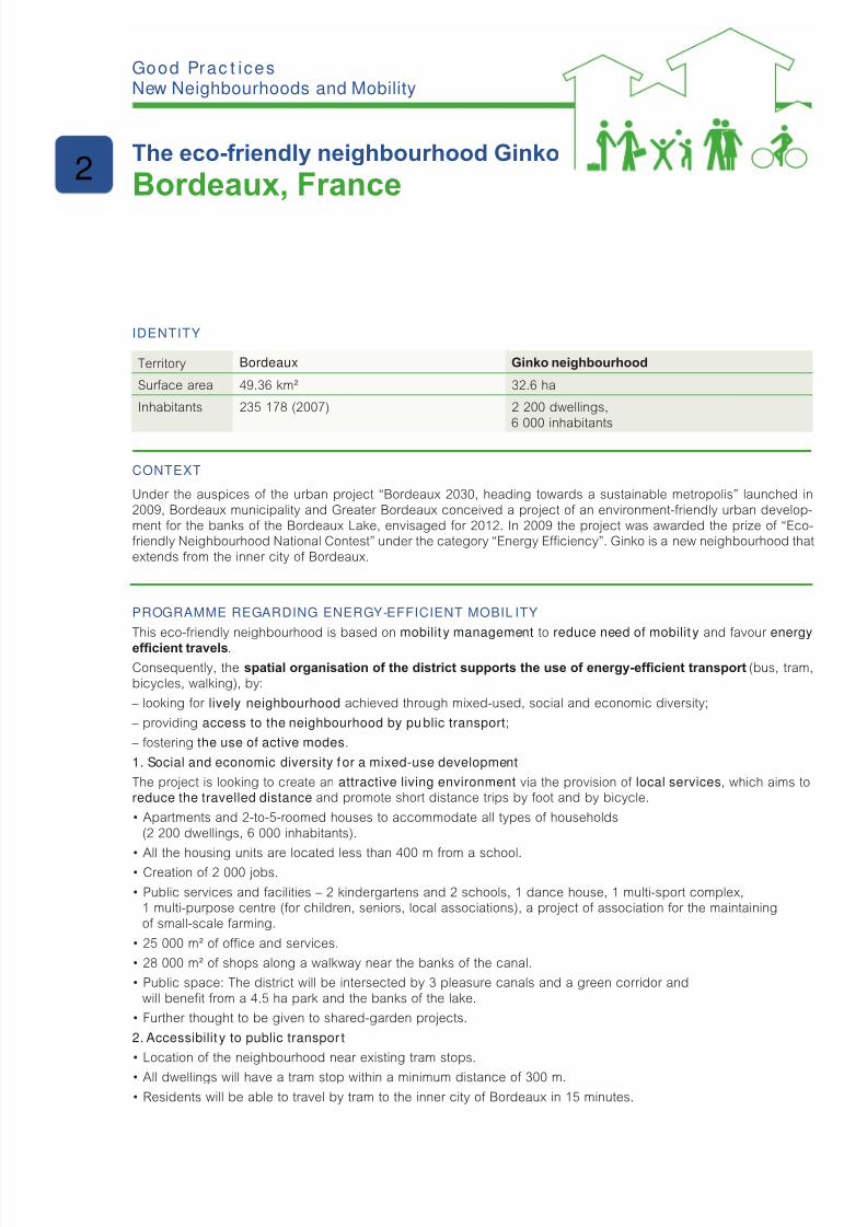
8/6/2019 New Neighbour Hoods and Mobility
http://slidepdf.com/reader/full/new-neighbour-hoods-and-mobility 69/98
IdentIty
Territory Bordeaux Ginko neighbourhood
Surace area 49.36 km² 32.6 ha
Inhabitants 235 178 (2007) 2 200 dwellings,6 000 inhabitants
Context
Under the auspices o the urban project “Bordeaux 2030, heading towards a sustainable metropolis” launched in2009, Bordeaux municipality and Greater Bordeaux conceived a project o an environment-riendly urban develop-ment or the banks o the Bordeaux Lake, envisaged or 2012. In 2009 the project was awarded the prize o “Eco-riendly Neighbourhood National Contest” under the category “Energy Eciency”. Ginko is a new neighbourhood thatextends rom the inner city o Bordeaux.
Programme regardIng energy-effICIent mobIl Ity
This eco-riendly neighbourhood is based on mobilit y management to reduce need of mobilit y and avour energy
efcient travels.Consequently, the spatial organisation of the district supports the use of energy-efcient transport (bus, tram,bicycles, walking), by:
– looking or lively neighbourhood achieved through mixed-used, social and economic diversity;
– providing access to the neighbourhood by public transport ;
– ostering the use of active modes.
1. Social and economic diversity f or a mixed-use development
The project is looking to create an attractive living environment via the provision o local services, which aims toreduce the travelled distance and promote short distance trips by oot and by bicycle.
• Apartments and 2-to-5-roomed houses to accommodate all types of households
(2 200 dwellings, 6 000 inhabitants).
• All the housing units are located less than 400 m from a school.
• Creation of 2 000 jobs.
• Public services and facilities – 2 kindergartens and 2 schools, 1 dance house, 1 multi-sport complex,1 multi-purpose centre (or children, seniors, local associations), a project o association or the maintainingo small-scale arming.
• 25 000 m² of ofce and services.
• 28 000 m² of shops along a walkway near the banks of the canal.
• Public space: The district will be intersected by 3 pleasure canals and a green corridor and
will benet rom a 4.5 ha park and the banks o the lake.
• Further thought to be given to shared-garden projects.
2. Accessibilit y to public transpor t
• Location of the neighbourhood near existing tram stops.
• All dwellings will have a tram stop within a minimum distance of 300 m.
• Residents will be able to travel by tram to the inner city of Bordeaux in 15 minutes.
g Pc ic New Neighbourhoods and Mobility
The eco-friendly neighbourhood Ginko
Bordeaux, France2

8/6/2019 New Neighbour Hoods and Mobility
http://slidepdf.com/reader/full/new-neighbour-hoods-and-mobility 70/98
3. Priority given to active modes
The project aims at encouraging the use o non-motorized modes o transport by trafc calming measures, bysharing public spaces and by mobi lity management.
• In residential streets and tram routes the speed limit is 30 kph.
• The street “Canal Nord” (north canal) to be developed as a home zone (20 kph, priority to non-motorised trafc).
• Walking and cycling buses.
• Network of secure bicycle paths serving schools and facilities: 6 km of cycle tracks and 1 km of green paths.
• 50% of the public road network dedicated to soft modes and to the tramway.
Progress
Launch 2006
Delivery 2012 (1st phase) – 2014
K ey aCtors
Project owners(or their delegates)
Bordeaux town – Greater Bordeaux (Communauté urbaine de Bordeaux)Bouygues Immobilier
Project managers Brochet/Lajus/Pueyo Agency and Christian Devillers and associates(housing and architecture)Signes Agency (landscaping)
Other project mana-gers and project
assistance
AMO Environment and Sustainable Development: Terre-éco (conception)Elan (Project research)
Saulnier & associates (energy)Carbone 4 (carbon ootprint assessment)
For more information:Sources:Bordeaux town website: www.bordeaux.r/ebx/portals/ebx.portal?_npb=true&_pageLabel=pgPresStand8&classocontent=presentationStandard&id=4205www.ecoquartier-ginko.r/
Contact:
Bouygues Immobilier: Franck Potier CUB: Patrick Dandieu
sustainable mobility at home
Publication date: November 2010
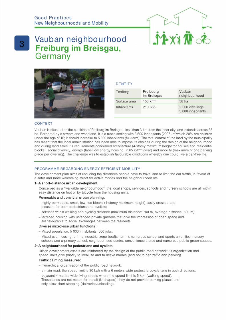
8/6/2019 New Neighbour Hoods and Mobility
http://slidepdf.com/reader/full/new-neighbour-hoods-and-mobility 71/98
IdentIty
Territory Freibourgim Breisgau
Vaubanneighbourhood
Surace area 153 km² 38 ha
Inhabitants 219 665 2 000 dwellings,
5 000 inhabitants
Context
Vauban is situated on the outskirts o Freiburg im Breisgau, less than 3 km rom the inner city, and extends across 38ha. Bordered by a stream and woodland, it is a rustic setting with 3 600 inhabitants (2005) o which 20% are childrenunder the age o 10; it should increase to 5 000 inhabitants (ull-term). The total control o the land by the municipalityhas meant that the local administration has been able to impose its choices during the design o the neighbourhoodand during land sales. Its requirements concerned architecture (4-storey maximum height or houses and residentialblocks), social diversity, energy (label low energy housing, < 65 kW/m2/year) and mobility (maximum o one parkingplace per dwelling). The challenge was to establish avourable conditions whereby one could live a car-ree lie.
Programme regardIng energy-effICIent mobIl Ity
The development plan aims at reducing the distances people have to travel and to limit the car trac, in avour o a saer and more welcoming street or active modes and the neighbourhood lie.
1• A short-distance urban development
Conceived as a “walkable neighbourhood”, the local shops, services, schools and nursery schools are all withineasy distance on oot or by bicycle rom the housing units.
Permeable and convivial u rban planning:
– highly permeable, small, low-rise blocks (4-storey maximum height) easily crossed andpleasant or both pedestrians and cyclists;
– services within walking and cycling distance (maximum distance: 700 m, average distance: 300 m);
– terraced housing with unenced private gardens that give the impression o open space andare avourable to social exchanges between the residents.
Diverse mixed-use urban functions :
– Mixed population: 5 000 inhabitants, 600 jobs;
– Mixed-use: housing, a 4 ha industrial zone (cratsman…), numerous school and sports amenities, nurseryschools and a primary school, neighbourhood centre, convenience stores and numerous public green spaces.
2• A neighbourhood for pedestrians and cyclists
Urban development assets are reinorced by the design o the public road network: its organization andspeed limits give priority to local lie and to active modes (and not to car trac and parking).
Trafc calming measures:
– hierarchical organisation o the public road network;
– a main road: the speed limit is 30 kph with a 6 meters-wide pedestrian/cycle lane in both directions;
– adjacent 4 meters-wide living streets where the speed limit is 5 kph (walking speed).
These lanes are not meant or transit (U-shaped), they do not provide parking places andonly allow short stopping (deliveries/unloading).
g Pc ic New Neighbourhoods and Mobility
Vauban neighbourhoodFreiburg im Breisgau,
Germany
3
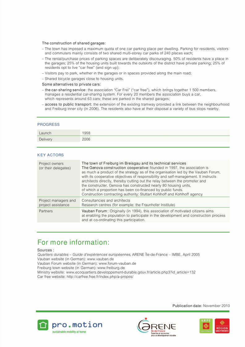
8/6/2019 New Neighbour Hoods and Mobility
http://slidepdf.com/reader/full/new-neighbour-hoods-and-mobility 72/98
The construction of shared garages:
– The town has imposed a maximum quota o one car parking place per dwelling. Parking or residents, visitorsand commuters mainly consists o two shared multi-storey car parks o 240 places each;
– The rental/purchase prices o parking spaces are deliberately discouraging. 50% o residents have a place inthe garages; 25% o the housing units built towards the outskirts o the district have private parking; 25% o residents opt to live “car ree” (and sign up);
– Visitors pay to park, whether in the garages or in spaces provided along the main road;
– Shared bicycle garages close to housing units.
Some alternatives to private cars:
– the car-sharing service: the association “Car Frei” (“car ree”), which brings together 1 500 members,manages a residential car-sharing system. For every 20 members the association buys a car,which represents around 63 cars; these are parked in the shared garages;
– access to public transport: the extension o the existing tramway provided a link between the neighbourhoodand Freiburg inner city (in 2006). The residents also have at their disposal a variety o bus stops nearby.
Progress
Launch 1998
Delivery 2006
K ey aCtors
Project owners(or their delegates)
The town of Freiburg im Breisgau and its technical servicesThe Genova const ruction cooperative: ounded in 1997, the association isas much a product o the strategy as o the organisation led by the Vauban Forum,with its cooperative objectives o responsibility and sel-management. It instructs
architects directly, thereby cutting out the relay between the promoter andthe constructer. Genova has constructed nearly 80 housing units,o which a proportion has been co-nanced by public unds.Construction contracting authority: Stuttart Kohlho and Kohlho agency
Project managers andproject assistance
Consultancies and architectsResearch centres (or example: the Fraunhoer Institute)
Partners Vauban Forum: Originally (in 1994), this association o motivated citizens aimsat enabling the population to participate in the development and construction processand at co-ordinating this participation.
For more information:Sources : Quartiers durables – Guide d’expériences européennes, ARENE Île-de-France – IMBE, April 2005Vauban website (in German): www.vauban.deVauban Forum website (in German): www.orum-vauban.deFreiburg town website (in German): www.reiburg.deMinistry website: www.ecoquartiers.developpement-durable.gouv.r/article.php3?id_article=132Car ree website: http://carree.ree.r/index.php/a-propos/
sustainable mobility at home
Publication date: November 2010

8/6/2019 New Neighbour Hoods and Mobility
http://slidepdf.com/reader/full/new-neighbour-hoods-and-mobility 73/98
IdentIty
Territory The Town of Garges-lès-Gonesse
La Muette
Surace area 5.5 km²
Inhabitants 39 098 4 000 inhabitants
1 291 dwellings
Context
In 2005 Garges-lès-Gonesse decided to embark on the creation of an eco-friendly neighbourhood under the rame-work o an Urban Renewal Agreement signed with the National Agency or Urban Renewal. Garges-lès-Gonessereceived the “Urban Renewal and Sustainable Urban Planning” prize or this project in 2009. In the same year, italso won the “Eco-riendly Neighbourhood National Contest” under the category “Density and Urban Pattern”, withspecial mention or “Urban Renewal Project” rom the French Ministry or Ecology, Energy, Sustainable Developmentand Sea.
The neighbourhood comprises 4 000 residents in 1 291 dwellings o which 94% are in apartment blocks and
80 individual homes. 90% o dwellings in these neighbourhoods are part o the social housing.
PartICIPatIon regardIng energy-effICIent mobIl Ity
This environment-riendly neighbourhood project takes into account the issues relating to sustainable mobility, notablyby the implementation o a cycle route network, the provision o a regional rail station car park, and o securedbicycle racks in renovated and new apartment blocks as well as by increasing the offer of public transport. A actwhich is also borne out by the implementation o multimodal links (new town entrance, connexion to the Dame Blanchedistrict, the station, the hypermarket and the business park etc.) and by the construction, in 2011, o a tramway linkingthe city o Saint-Denis to the Garges-Sarcelles train station.
Within this ramework, an in-depth campaign of consultation and information was undertaken by the town:
• A dedicated site, the Project Centre/House (inormation point);
• “Conventional” consultation activities: – public meetings,
– town planning workshop on the development o Mandela Square,
– workshops or dialogue per block, “walking audits”,
– discussion on the “Urban project” during neighbourhood joint committee meetings (every two months),
– day to day presence o the local development manager and the urban management manager;
• Cultural projects:
– “Chimney” project: installation o giant fresco,
– working memory using photographic as well as audiovisual documents (3 documentary lms and 7 short lms),
– forum theatre perormance (role-play);
• Festive occasions: An annual day-long event “En chantier de vous connaître” (kind o street party) celebrates
building projects with visits to show homes, a photo rally, street theatre and street painting competitions.
g Pc ic New Neighbourhoods and Mobility
Participation by residents
in the Muette neighbourhood
Garges-lès-Gonesse, France
4
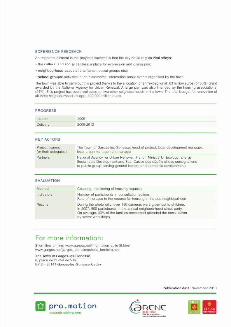
8/6/2019 New Neighbour Hoods and Mobility
http://slidepdf.com/reader/full/new-neighbour-hoods-and-mobility 74/98
exPerIenCe feedbaCK
An important element in the project’s success is that the city could rely on vital relays:
• the cultural and social centres: a place or expression and discussion;
• neighbourhood associations (tenant social groups etc);
• school groups: activities in the classrooms, inormation about events organised by the town.
The town was able to carry out this project thanks to the allocation o an “exceptional” 63 million euros (or 36%) grantawarded by the National Agency or Urban Renewal. A large part was also nanced by the housing associations(44%). This project has been replicated on two other neighbourhoods in the town. The total budget or renovation o all three neighbourhoods is app. 400 000 million euros.
Progress
Launch 2005
Delivery 2009-2012
K ey aCtors
Project owners(or their delegates)
The Town o Garges-lès-Gonesse: head o project, local development manager,local urban management manager
Partners National Agency or Urban Renewal, French Ministry or Ecology, Energy,Sustainable Development and Sea, Caisse des dépôts et des consignations(a public group serving general interest and economic development).
evaluatIon
Method Counting, monitoring o housing requests
Indicators Number o participants in consultation actionsRate o increase in the request or housing in the eco-neighbourhood
Results During the photo rally, over 150 cameras were given out to children.In 2007, 500 participants in the annual neighbourhood street party.On average, 40% o the amilies concerned attended the consultationby sector workshops.
For more information:Short lms on-line: www.garges.net/inormation_suite18.htmlwww.garges.net/garges_demain/echelle_territoire.html
The Town of Garges-lès-Gonesse 8, place de l’Hôtel de VilleBP 2 – 95141 Garges-lès-Gonesse Cedex
sustainable mobility at home
Publication date: November 2010
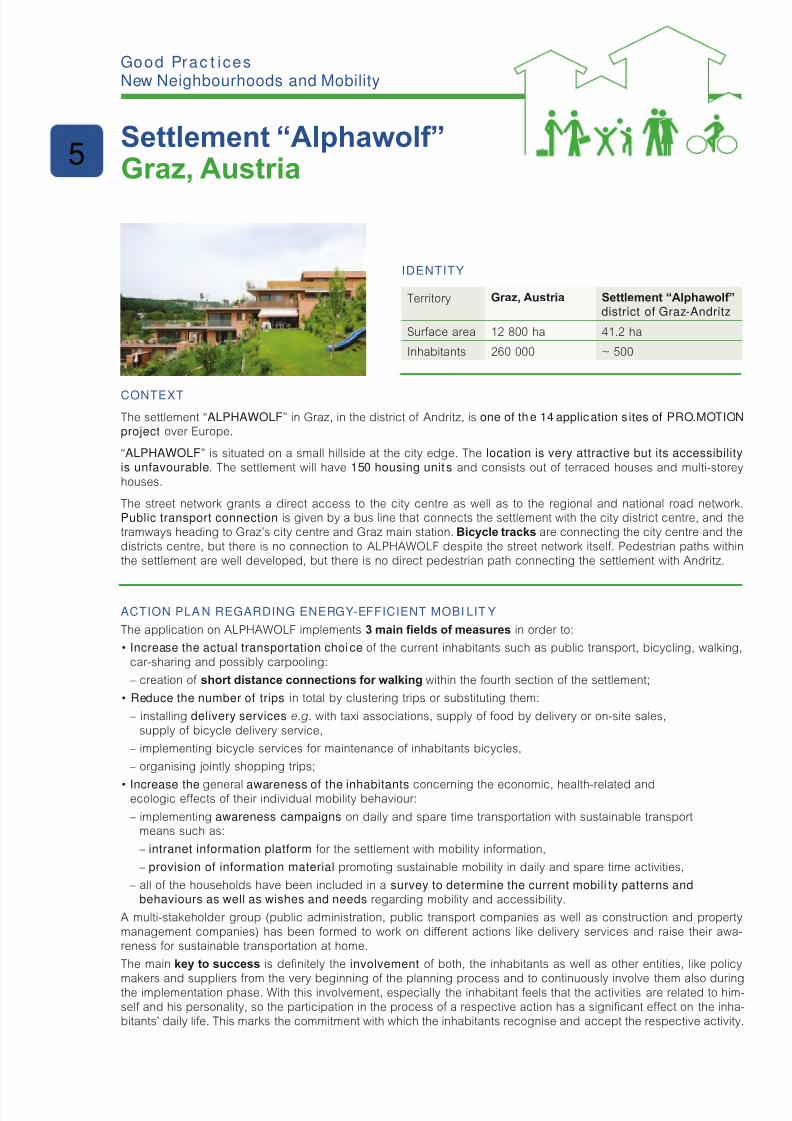
8/6/2019 New Neighbour Hoods and Mobility
http://slidepdf.com/reader/full/new-neighbour-hoods-and-mobility 75/98
IdentIty
Territory Graz, Austria Settlement “Alphawolf”
district of Graz-Andritz
Surace area 12 800 ha 41.2 ha
Inhabitants 260 000 ~ 500
Context
The settlement “ALPHAWOLF” in Graz, in the district o Andritz, is one of the 14 application s ites of PRO.MOTIONproject over Europe.
“ALPHAWOLF” is situated on a small hillside at the city edge. The location is very attractive but its accessibilityis unfavourable. The settlement will have 150 housing unit s and consists out o terraced houses and multi-storeyhouses.
The street network grants a direct access to the city centre as well as to the regional and national road network.Public transport connection is given by a bus line that connects the settlement with the city district centre, and thetramways heading to Graz’s city centre and Graz main station. Bicycle tracks are connecting the city centre and thedistricts centre, but there is no connection to ALPHAWOLF despite the street network itsel. Pedestrian paths withinthe settlement are well developed, but there is no direct pedestrian path connecting the settlement with Andritz.
aCtIon Pla n regardIng energy-effICIent mobI lIt y
The application on ALPHAWOLF implements 3 main elds of measures in order to:
• Increase the actual transportation choice o the current inhabitants such as public transport, bicycling, walking,car-sharing and possibly carpooling:
– creation o short distance connections for walking within the ourth section o the settlement;
• Reduce the number of trips in total by clustering trips or substituting them:
– installing delivery services e.g. with taxi associations, supply o ood by delivery or on-site sales,supply o bicycle delivery service,
– implementing bicycle services or maintenance o inhabitants bicycles,
– organising jointly shopping trips;
• Increase the general awareness of the inhabitants concerning the economic, health-related andecologic eects o their individual mobility behaviour:
– implementing awareness campaigns on daily and spare time transportation with sustainable transportmeans such as:
– intranet information platform or the settlement with mobility inormation,
– provision of information material promoting sustainable mobility in daily and spare time activities,
– all o the households have been included in a survey to determine the current mobili ty patterns andbehaviours as well as wishes and needs regarding mobility and accessibility.
A multi-stakeholder group (public administration, public transport companies as well as construction and propertymanagement companies) has been ormed to work on dierent actions like delivery services and raise their awa-reness or sustainable transportation at home.
The main key to success is denitely the involvement o both, the inhabitants as well as other entities, like policy
makers and suppliers rom the very beginning o the planning process and to continuously involve them also duringthe implementation phase. With this involvement, especially the inhabitant eels that the activities are related to him-sel and his personality, so the participation in the process o a respective action has a signicant eect on the inha-bitants’ daily lie. This marks the commitment with which the inhabitants recognise and accept the respective activity.
g Pc ic New Neighbourhoods and Mobility
Settlement “Alphawolf”Graz, Austria
5
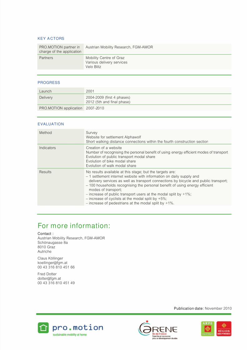
8/6/2019 New Neighbour Hoods and Mobility
http://slidepdf.com/reader/full/new-neighbour-hoods-and-mobility 76/98
Key a Ctors
PRO.MOTION partner incharge o the application
Austrian Mobility Research, FGM-AMOR
Partners Mobility Centre o Graz
Various delivery servicesVelo Blitz
Progress
Launch 2001
Delivery 2004-2009 (rst 4 phases)2012 (5th and nal phase)
PRO.MOTION application 2007-2010
evaluatIon
Method SurveyWebsite or settlement Alphawol Short walking distance connections within the ourth construction section
Indicators Creation o a websiteNumber o recognising the personal benet o using energy ecient modes o transportEvolution o public transport modal shareEvolution o bike modal shareEvolution o walk modal share
Results No results available at this stage; but the targets are: – 1 settlement internet website with inormation on daily supply and
delivery services as well as transport connections by bicycle and public transport;
– 100 households recognising the personal benet o using energy ecientmodes o transport;
– increase o public transport users at the modal split by +1%; – increase o cyclists at the modal split by +5%; – increase o pedestrians at the modal split by +1%.
For more information:Contact :Austrian Mobility Research, FGM-AMORSchönaugasse 8a8010 GrazAutriche
Claus Köllinger [email protected] 43 316 810 451 66
Fred Dotter [email protected] 43 316 810 451 49
sustainable mobility at home
Publication date: November 2010
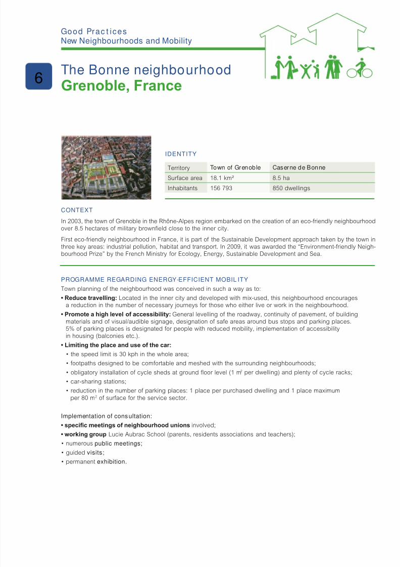
8/6/2019 New Neighbour Hoods and Mobility
http://slidepdf.com/reader/full/new-neighbour-hoods-and-mobility 77/98
IdentIty
Territory Town of Grenoble Caserne de Bonne
Surace area 18.1 km² 8.5 ha
Inhabitants 156 793 850 dwellings
Context
In 2003, the town o Grenoble in the Rhône-Alpes region embarked on the creation o an eco-riendly neighbourhoodover 8.5 hectares o military browneld close to the inner city.
First eco-riendly neighbourhood in France, it is part o the Sustainable Development approach taken by the town inthree key areas: industrial pollution, habitat and transport. In 2009, it was awarded the “Environment-riendly Neigh-bourhood Prize” by the French Ministry or Ecology, Energy, Sustainable Development and Sea.
Programme regardIng energy-effICIent mobIl Ity
Town planning o the neighbourhood was conceived in such a way as to:
• Reduce travelling: Located in the inner city and developed with mix-used, this neighbourhood encouragesa reduction in the number o necessary journeys or those who either live or work in the neighbourhood.
• Promote a high level of accessibility: General levelling o the roadway, continuity o pavement, o buildingmaterials and o visual/audible signage, designation o sae areas around bus stops and parking places.5% o parking places is designated or people with reduced mobility, implementation o accessibilityin housing (balconies etc.).
• Limiting the place and use of the car:
• the speed limit is 30 kph in the whole area;
• footpaths designed to be comfortable and meshed with the surrounding neighbourhoods;
• obligatory installation of cycle sheds at ground oor level (1 m2 per dwelling) and plenty o cycle racks;
• car-sharing stations;
• reduction in the number of parking places: 1 place per purchased dwelling and 1 place maximum
per 80 m2 o surace or the service sector.
Implementation of consultation:
• specic meetings of neighbourhood unions involved;
• working group Lucie Aubrac School (parents, residents associations and teachers);
• numerous public meetings;
• guided visits;
• permanent exhibition.
g Pc ic New Neighbourhoods and Mobility
The Bonne neighbourhood
Grenoble, France6

8/6/2019 New Neighbour Hoods and Mobility
http://slidepdf.com/reader/full/new-neighbour-hoods-and-mobility 78/98
exPerIenCe feedbaCK
Strong policy support has made the project a success. Objectives were clearly and contractually dened. Contrac-tors were supported by a team o experts to provide the best possible adaptation o the project. All partners wereable to adapt the project at every stage. The evaluation process was thought right rom the start o the project.
The innovative and exemplary nature o this operation, its constructive participative process and, above all, its gover-
nance and contractual monitoring gave rise to numerous visits at both national and international levels (over 2 500people).
Progress
Launch 2003
Delivery 2009
K ey aCtors
Project owners(or their delegates)City of Grenoble
Partners Ministry of Defence, neighbourhood unions,
student parents, resident and teacher associations
evaluatIon
Method Mobility studyMonitoring o participation in car-sharing scheme and use o public transportin relation with the operators
Indicators • Modal share of the car • Number of inscriptions for car-sharing • Journeys made by public transport, on foot and by bike (in km per year)
Results • Reduction of 54% to 44% of the car’s modal share • Reduction of 83% in number of car journeys by those who have sold their cars in
avour o using the car-sharing scheme: dropped rom 9 300 km to 1 600 km per year • Increase of 35% in the use of public transport: increased from 5 700 km to 7 700 km
per year • Increase of 70% in walking and cycle use: increased from 1 000 km to 1 700 km
per year
For more information:Ville de Grenoble 11, boulevard Jean Pain
BP 106638021 Grenoble Cedex 100 33 (0)4 76 76 36 36
SEM SAGES (aménageur)1, place Firmin Gautier 38027 Grenoble Cedex 100 33 (0)4 76 48 48 [email protected] www.debonne-grenoble.r
sustainable mobility at home
Publication date: November 2010
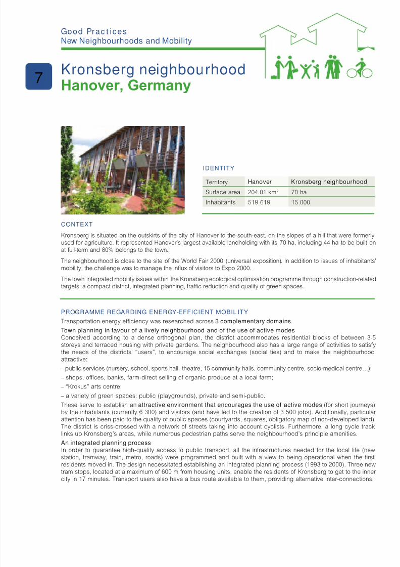
8/6/2019 New Neighbour Hoods and Mobility
http://slidepdf.com/reader/full/new-neighbour-hoods-and-mobility 79/98
IdentIty
Territory Hanover Kronsberg neighbourhood
Surace area 204.01 km² 70 ha
Inhabitants 519 619 15 000
Context
Kronsberg is situated on the outskirts o the city o Hanover to the south-east, on the slopes o a hill that were ormerlyused or agriculture. It represented Hanover’s largest available landholding with its 70 ha, including 44 ha to be built onat ull-term and 80% belongs to the town.
The neighbourhood is close to the site o the World Fair 2000 (universal exposition). In addition to issues o inhabitants’mobility, the challenge was to manage the infux o visitors to Expo 2000.
The town integrated mobility issues within the Kronsberg ecological optimisation programme through construction-relatedtargets: a compact district, integrated planning, trac reduction and quality o green spaces.
Programme regardIng energy-effICIent mobIl Ity
Transportation energy eciency was researched across 3 complementary domains.
Town planning in favour of a lively neighbourhood and of the use of active modesConceived according to a dense orthogonal plan, the district accommodates residential blocks o between 3-5storeys and terraced housing with private gardens. The neighbourhood also has a large range o activities to satisythe needs o the districts’ “users”, to encourage social exchanges (social ties) and to make the neighbourhoodattractive:
– public services (nursery, school, sports hall, theatre, 15 community halls, community centre, socio-medical centre…);
– shops, oces, banks, arm-direct selling o organic produce at a local arm;
– “Krokus” arts centre;
– a variety o green spaces: public (playgrounds), private and semi-public.These serve to establish an attractive environment that encourages the use of active modes (or short journeys)by the inhabitants (currently 6 300) and visitors (and have led to the creation o 3 500 jobs). Additionally, particular attention has been paid to the quality o public spaces (courtyards, squares, obligatory map o non-developed land).The district is criss-crossed with a network o streets taking into account cyclists. Furthermore, a long cycle tracklinks up Kronsberg’s areas, while numerous pedestrian paths serve the neighbourhood’s principle amenities.
An integrated planning processIn order to guarantee high-quality access to public transport, all the inrastructures needed or the local lie (newstation, tramway, train, metro, roads) were programmed and built with a view to being operational when the rstresidents moved in. The design necessitated establishing an integrated planning process (1993 to 2000). Three newtram stops, located at a maximum o 600 m rom housing units, enable the residents o Kronsberg to get to the inner city in 17 minutes. Transport users also have a bus route available to them, providing alternative inter-connections.
g Pc ic New Neighbourhoods and Mobility
Kronsberg neighbourhoodHanover, Germany
7

8/6/2019 New Neighbour Hoods and Mobility
http://slidepdf.com/reader/full/new-neighbour-hoods-and-mobility 80/98
Restricti ons on car useMotorised trac is orbidden in residential areas except or local inhabitants. Along other roads, trac is calmed(30 kph as speed limits), with priority given to the right and road-narrowing oering urther saety advantages to thepedestrians. The planting o a variety o tree species has also enhanced the atmosphere o the dierent streets.The majority o motorised trac is channelled alongside the tramway lines. Parking is restricted to some areas andto private underground car parks (roughly 1/3rd). The town has scheduled an ambitious ratio o 0.8 parking space/dwelling, however it has also provided additional on-street parking spaces.
Progress
Launch 1995
Delivery 2000
K ey aCtors
Project owners Hanover town, Environment serviceExpo 2000 environmental planning group
Project managers andassistants
Promoters, architects, BTP enterprises…Agency or communication and mediationKUKA
Partners Lower-Saxony GovernmentAid programmes or social housingKronsberg consultation committeeThe Centre or Energy and the EnvironmentThe Institute or Building ResearchThe Technical Centre or Proessional TrainingLower-Saxony Consumer AssociationCentre or Protection o the Environment o the Chamber o Trade
For more information:Sources:Quartiers durables – Guide d’expériences européennes, ARENE Île-de-France – IMBE, April 2005« Guide du quartier de Hanovre – Kronsberg – Un modèle à vivre, un modèle à suivre », Projet SIBART,City o Hanover, French version (Énergie-cités, ADEME), May 2003.Hanover website (in German): www.hannover.de
sustainable mobility at home
Publication date: November 2010
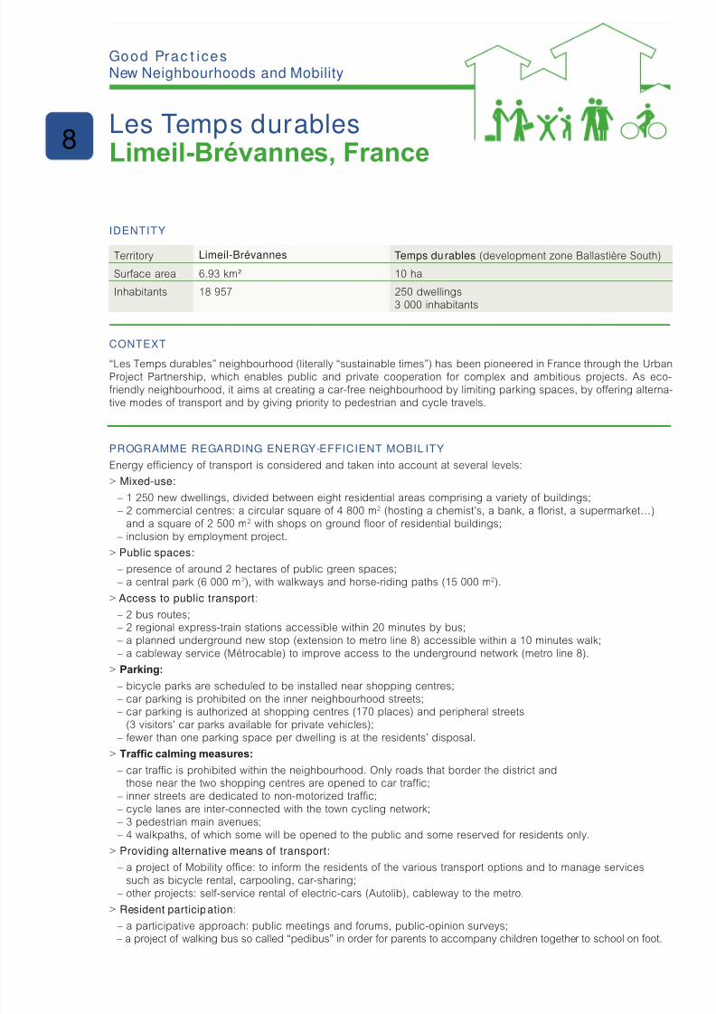
8/6/2019 New Neighbour Hoods and Mobility
http://slidepdf.com/reader/full/new-neighbour-hoods-and-mobility 81/98
IdentIty
Territory Limeil-Brévannes Temps durables (development zone Ballastière South)
Surace area 6.93 km² 10 ha
Inhabitants 18 957 250 dwellings3 000 inhabitants
Context
“Les Temps durables” neighbourhood (literally “sustainable times”) has been pioneered in France through the UrbanProject Partnership, which enables public and private cooperation or complex and ambitious projects. As eco-riendly neighbourhood, it aims at creating a car-ree neighbourhood by limiting parking spaces, by oering alterna-tive modes o transport and by giving priority to pedestrian and cycle travels.
Programme regardIng energy-effICIent mobIl Ity
Energy eciency o transport is considered and taken into account at several levels:
> Mixed-use:
– 1 250 new dwellings, divided between eight residential areas comprising a variety o buildings; – 2 commercial centres: a circular square o 4 800 m2 (hosting a chemist’s, a bank, a forist, a supermarket…)
and a square o 2 500 m2 with shops on ground foor o residential buildings;
– inclusion by employment project.> Public spaces:
– presence o around 2 hectares o public green spaces; – a central park (6 000 m2), with walkways and horse-riding paths (15 000 m2).
> Access to public transport:
– 2 bus routes; – 2 regional express-train stations accessible within 20 minutes by bus; – a planned underground new stop (extension to metro line 8) accessible within a 10 minutes walk; – a cableway service (Métrocable) to improve access to the underground network (metro line 8).
> Parking:
– bicycle parks are scheduled to be installed near shopping centres; – car parking is prohibited on the inner neighbourhood streets;
– car parking is authorized at shopping centres (170 places) and peripheral streets(3 visitors’ car parks available or private vehicles);
– ewer than one parking space per dwelling is at the residents’ disposal.
> Trafc calming measures:
– car trac is prohibited within the neighbourhood. Only roads that border the district andthose near the two shopping centres are opened to car trac;
– inner streets are dedicated to non-motorized trac; – cycle lanes are inter-connected with the town cycling network; – 3 pedestrian main avenues; – 4 walkpaths, o which some will be opened to the public and some reserved or residents only.
> Providing alternative means of transport:
– a project o Mobility oce: to inorm the residents o the various transport options and to manage servicessuch as bicycle rental, carpooling, car-sharing;
– other projects: sel-service rental o electric-cars (Autolib), cableway to the metro.> Resident participation:
– a participative approach: public meetings and orums, public-opinion surveys; – a project o walking bus so called “pedibus” in order or parents to accompany children together to school on oot.
g Pc ic New Neighbourhoods and Mobility
Les Temps durablesLimeil-Brévannes, France
8

8/6/2019 New Neighbour Hoods and Mobility
http://slidepdf.com/reader/full/new-neighbour-hoods-and-mobility 82/98
Progress
Launch 2006
Delivery 2012
K ey aCtors
Project owners(or their delegates)
Town o Limeil-BrévannesDeveloper: the Public-Private Partnership (SEM ALB) and mixed-sector constructors(public, cooperative and private) gathered by the Centre or Urban Development (“Cen-trale de création urbaine”)
Project manager Development zone architect: Roland Castro
Partners Regional Agency or Environment and New Energy in Ile-de-France (ARENE)
For more information:Sources: District website: www.lestempsdurables.comPress dossier, November 2009Town website: www.limeil-brevannes.r/dossiers/index.php?2007/04/16/13-le-quartier-des-temps-durables-un-quartier-durable
Contact :
Julie Rossignol, head of project management 00 33 (0)1 45 10 77 19 [email protected]
sustainable mobility at home
Publication date: November 2010
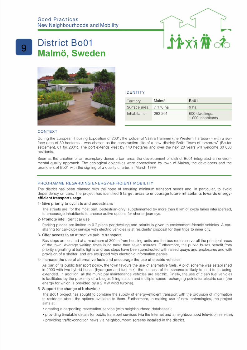
8/6/2019 New Neighbour Hoods and Mobility
http://slidepdf.com/reader/full/new-neighbour-hoods-and-mobility 83/98
IdentIty
Territory Malmö Bo01
Surace area 7 176 ha 9 ha
Inhabitants 292 201 600 dwellings,1 000 inhabitants
Context
During the European Housing Exposition o 2001, the polder o Västra Hamnen (the Western Harbour) – with a sur-ace area o 30 hectares – was chosen as the construction site o a new district: Bo01 “town o tomorrow” (Bo or settlement, 01 or 2001). The port extends west by 140 hectares and over the next 20 years will welcome 30 000residents.
Seen as the creation o an exemplary dense urban area, the development o district Bo01 integrated an environ-mental quality approach. The ecological objectives were concretised by town o Malmö, the developers and thepromoters o Bo01 with the signing o a quality charter, in March 1999.
Programme regardIng energy-effICIent mobIl ItyThe district has been planned with the hope o ensuring minimum transport needs and, in particular, to avoiddependency on cars. The project has identied 5 target areas to encourage future inhabitants towards energy-efcient transport usage.
1- Give priority to cyclis ts and pedestrians
The streets are, or the most part, pedestrian-only, supplemented by more than 8 km o cycle lanes interspersed,to encourage inhabitants to choose active options or shorter journeys.
2- Promote intelligent car use
Parking places are limited to 0.7 place per dwelling and priority is given to environment-riendly vehicles. A car-sharing (or car-club) service with electric vehicles is at residents’ disposal or their trips to inner city.
3- Offer access to an attractive publi c transport
Bus stops are located at a maximum o 300 m rom housing units and the bus routes serve all the principal areas
o the town. Average waiting times is no more than seven minutes. Furthermore, the public buses benet rompriority signalling at trac lights and bus stops have been constructed with raised quays and enclosures and withprovision o a shelter, and are equipped with electronic inormation panels.
4- Increase the use of alternative fuels and encourage the use of electric vehicles
As part o its public transport policy, the town avours the use o alternative uels. A pilot scheme was establishedin 2003 with two hybrid buses (hydrogen and uel mix); the success o the scheme is likely to lead to its beingextended. In addition, all the municipal maintenance vehicles are electric. Finally, the use o clean uel vehiclesis acilitated by the proximity o a biogas lling station and multiple speed recharging points or electric cars (theenergy or which is provided by a 2 MW wind turbine).
5- Support the change of behaviour
The Bo01 project has sought to combine the supply o energy-ecient transport with the provision o inormationto residents about the options available to them. Furthermore, in making use o new technologies, the projectaims at:
• creating a carpooling reservation service (with neighbourhood databases);
• providing timetable details for public transport services (via the Internet and a neighbourhood television service);
• providing trafc-condition news via neighbourhood screens installed in the district.
g Pc ic New Neighbourhoods and Mobility
District Bo01Malmö, Sweden
9

8/6/2019 New Neighbour Hoods and Mobility
http://slidepdf.com/reader/full/new-neighbour-hoods-and-mobility 84/98
In addition, the Mobility Oce, set up as part o the Malmö municipal services, encourages the use o environment-riendly transport and has implemented awareness programmes intended or local residents.
To save energy rom transport, the Bo01 project demonstrates that it is necessary to act on project design at incep-tion (transport oer) and on mobility management till the delivery (mobility demand).
Progress
Launch 1998
Delivery 2001 (1st phase, 350 dwellings)
K ey aCtors
Project owners(or their delegates)
City of Malmö
Project managersand project assistance
The construc tion companies directly involved in the programme and its qualitycontrols, broader conditions and environmental objectives.Sydkraf and E-on (renewable energy suppliers)Bo01AB (neighbourhood quality control programme)
Partners European Union, government, the Swedish Energy Agency Lund University
For more information:Sources:Quartiers durables – Guide d’expériences européennes, ARENE Île-de-France – IMBE, April 2005Malmö town website: www.malmo.se/sustainablecitywww.malmo.se/English/Sustainable-City-Development/Bo01---Western-Harbour/Mobility.htmlWebsite with inormation about Bo01 or local residents: www.ekostaden.com/
Energy cities : www.energie-cites.org ; www.energy-cities.eu/IMG/pd/BO01_FR.pd Managenergy : www.managenergy.net/download/r122.pd Ministry or Ecology, Energy, Sustainable Development and Sea (MEEDM):www.ecoquartiers.developpement-durable.gouv.r/article.php3?id_article=138
sustainable mobility at home
Publication date: November 2010
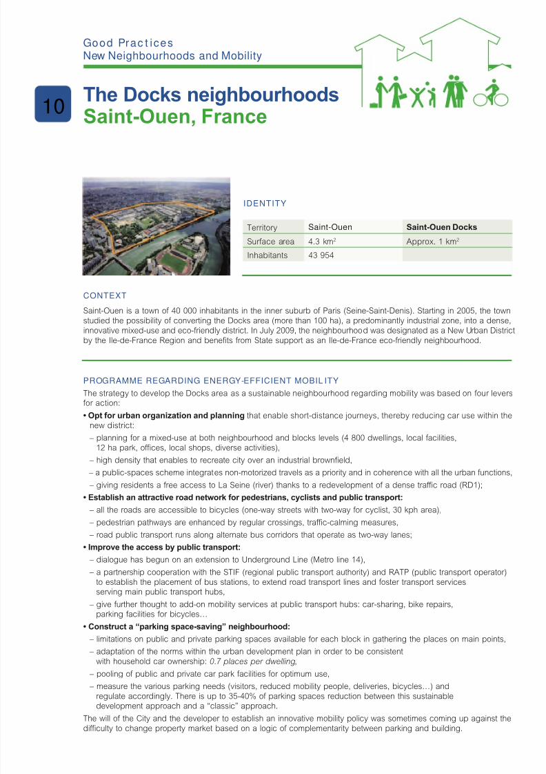
8/6/2019 New Neighbour Hoods and Mobility
http://slidepdf.com/reader/full/new-neighbour-hoods-and-mobility 85/98
IdentIty
Territory Saint-Ouen Saint-Ouen Docks
Surace area 4.3 km2 Approx. 1 km2
Inhabitants 43 954
Context
Saint-Ouen is a town o 40 000 inhabitants in the inner suburb o Paris (Seine-Saint-Denis). Starting in 2005, the townstudied the possibility o converting the Docks area (more than 100 ha), a predominantly industrial zone, into a dense,innovative mixed-use and eco-friendly district. In July 2009, the neighbourhood was designated as a New Urban District
by the Ile-de-France Region and benets rom State support as an Ile-de-France eco-riendly neighbourhood.
Programme regardIng energy-effICIent mobIl Ity
The strategy to develop the Docks area as a sustainable neighbourhood regarding mobility was based on our levers
or action:• Opt for urban organization and planning that enable short-distance journeys, thereby reducing car use within the
new district:
– planning or a mixed-use at both neighbourhood and blocks levels (4 800 dwellings, local acilities,12 ha park, oces, local shops, diverse activities),
– high density that enables to recreate city over an industrial browneld,
– a public-spaces scheme integrates non-motorized travels as a priority and in coherence with all the urban unctions,
– giving residents a ree access to La Seine (river) thanks to a redevelopment o a dense trac road (RD1);
• Establish an attractive road network for pedestrians, cyclists and public transport:
– all the roads are accessible to bicycles (one-way streets with two-way or cyclist, 30 kph area),
– pedestrian pathways are enhanced by regular crossings, trac-calming measures,
– road public transport runs along alternate bus corridors that operate as two-way lanes;
• Improve the access by public transport:
– dialogue has begun on an extension to Underground Line (Metro line 14),
– a partnership cooperation with the STIF (regional public transport authority) and RATP (public transport operator)to establish the placement o bus stations, to extend road transport lines and oster transport servicesserving main public transport hubs,
– give urther thought to add-on mobility services at public transport hubs: car-sharing, bike repairs,parking acilities or bicycles…
• Construct a “parking space-saving” neighbourhood:
– limitations on public and private parking spaces available or each block in gathering the places on main points,
– adaptation o the norms within the urban development plan in order to be consistentwith household car ownership: 0.7 places per dwelling,
– pooling o public and private car park acilities or optimum use, – measure the various parking needs (visitors, reduced mobility people, deliveries, bicycles…) andregulate accordingly. There is up to 35-40% o parking spaces reduction between this sustainabledevelopment approach and a “classic” approach.
The will o the City and the developer to establish an innovative mobility policy was sometimes coming up against thediculty to change property market based on a logic o complementarity between parking and building.
g Pc ic New Neighbourhoods and Mobility
The Docks neighbourhoodsSaint-Ouen, France
10
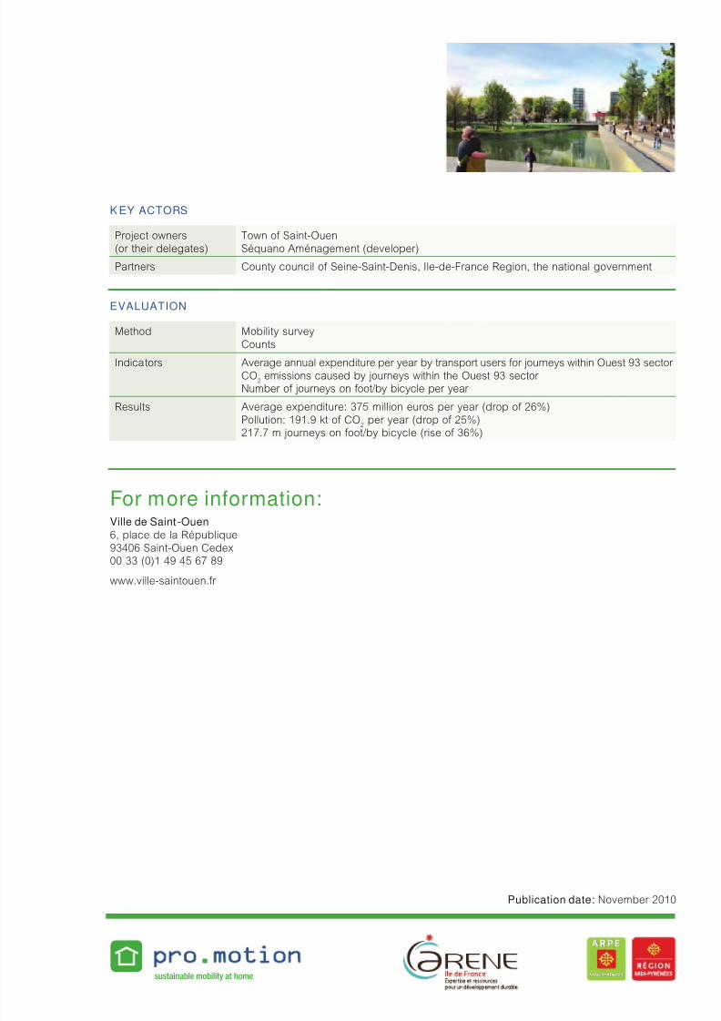
8/6/2019 New Neighbour Hoods and Mobility
http://slidepdf.com/reader/full/new-neighbour-hoods-and-mobility 86/98
K ey aCtors
Project owners(or their delegates)
Town o Saint-OuenSéquano Aménagement (developer)
Partners County council o Seine-Saint-Denis, Ile-de-France Region, the national government
evaluatIon
Method Mobility surveyCounts
Indicators Average annual expenditure per year by transport users or journeys within Ouest 93 sector CO
2emissions caused by journeys within the Ouest 93 sector
Number o journeys on oot/by bicycle per year
Results Average expenditure: 375 million euros per year (drop o 26%)Pollution: 191.9 kt o CO
2per year (drop o 25%)
217.7 m journeys on oot/by bicycle (rise o 36%)
For more information:Ville de Saint -Ouen
6, place de la République93406 Saint-Ouen Cedex00 33 (0)1 49 45 67 89
www.ville-saintouen.r
sustainable mobility at home
Publication date: November 2010

8/6/2019 New Neighbour Hoods and Mobility
http://slidepdf.com/reader/full/new-neighbour-hoods-and-mobility 87/98
IdentIty
Territory Sarriguren
Surace area 150 ha. Housing units: 5 372.Density: 36 housing units/ha.
Inhabitants 3 154 inhabitants at the beginning o the project(October 2007) and 9 984 at the end (October 2010)
Context
The Sarriguren neighbourhood in Pamplona is one of the 14 application sites of PRO.MOTION project over Europe.As many others cities, the metropolitan area o Pamplona (main city o the Spanish region o Navarre) has experiencedan important urban sprawl phenomenon in parallel with an important increase in car use over the last two decades.
The Sarriguren residential area has been selected because o its location (Pamplona is located within the Egüés Valleymunicipality, outside the ring road, connected to the road network by a roundabout) and its size (5 372 housing unitsand about 12 000 inhabitants) to analyse relations between urban planning and residents mobility patterns as well as toprevent the increase o car use in this specic site which could have an important impact in the whole metropolitan area.
Final aims are to provide solutions that could help the inhabitants o Sarriguren to walk, to cycle and to use publictransport as well as to reduce car use and to provide knowledge and specic tools or planners to prevent problemsin uture neighbourhoods.
aCtIon Pla n regardIng energy-effICIent mobI lIt y
With a view to improving the conditions for a sustainable mobility in the site o Sarriguren, the ollowing steps were taken:
– Beore implementation, all measures or mobility services were initially the subject o rst stage consultation with residents (through surveys) in order to assess their potential success.
– In order to gather their proposals for improvement, consultation with residents was carried out using maps andwork-sheets o the site, discussions on priorities, timing and the various authorities aected by the proposed solutions.
– Residents’ proposals (most o them relating how to overcome urban planning barriers and public transport)have been presented to the responsible authorities (public transport authority, municipality o Valle de Egüésand the departments o Land Planning, Public Works and Transport o the Navarre Government);the inhabitants have been inormed o any progress.
– Carpooling arrangements and individual mobility advice services have been implemented to provideresidents with alternative solutions whilst attempts are being made to overcome the barriers to increasethe efcient use of transport.
– Promotional campaigns and activities have also been developed, in particular to prevent car use inside the site.The two most successul campaigns were “Gym Starts at Home” (to encourage inhabitants to walk and cycleto the sports center) and “Walk to School” to encourage amilies to travel to primary school on oot.
g Pc ic New Neighbourhoods and Mobility
Promoting solutions to reduce car usein the Sarriguren residential area
Navarre, Spain
11
8/6/2019 New Neighbour Hoods and Mobility
http://slidepdf.com/reader/full/new-neighbour-hoods-and-mobility 88/98
exPerIenCe feedbaCK
In order to overcome existing inrastructural and social barriers to reduce car use in Sarriguren the ollowing process hasbeen rolled out: a social and spatial analysis has been done based on surveys and eld work, a participative process was carried out involving inhabitants who have completed analysis and made proposals that were developed by differentauthorities also involved in the process, such as carpooling, individual mobility advice and promotional campaigns.
In order to support changes in the urban planning process and its orientation towards sustainable mobility, the stakehol-ders have been involved in a process which has included a shared denition o a check-list based on a wider technicaldocument on “sustainable mobility in land and urban planning” and an in-depth training on various related issues.
There has been an initial agreement on the use of this check-list as a tool to drive planners’ thinking and design andas an evaluation tool or the Land and Urban planning department o the Navarre Government when planning or the uture.
Progress
Launch 2007
Delivery 2010
K ey aCtors
PRO.MOTION partner
in charge o steering
Implementation o the project was possible within the ramework
o the European STEER program project (EACI) called PRO.MOTIONand developed by Centro de Recursos Ambientales de Navarra (CRANA)and Navarra de Suelo Residencial (NASURSA).
Partners Inhabitants already established in the Sarriguren residential area,the Municipality o Valle de Egüés, Mancomunidad de la Comarca de Pamplona(PT authority in the metropolitan area o Pamplona), the departments o the Government o Navarre Land Use, Public Works and Transport.
evaluatIon
Methods Continuous evaluation o the project has been done using the SUMO tool.Direct results o the implementation o the project and surveys have been
considered to evaluate results thanks to indicators.Indicators Indicators have been divided into groups at various levels. Principally:
– at motivational level: number o inhabitants involved in participative process(consultation meetings…) as well as number o planning stakeholders involvedin working groups and training;
– at behavioral level: number o people participating in promotional activities andcampaigns and requesting the development o services;
– at objective level: number o proposals arising rom the participative process.
Results Around 40 people involved in consultation, around 50 planning stakeholdersinvolved in working groups and training.Around 250 people involved in promotional activities and requesting services.6 o the main proposals or improving planning conditions consideredand implemented (completed or on progress).
For more information:Contact: Maribel GómezEnvironmental Resources Centre o Navarre, CRANAPadre Adoain 217, bajo - Pampelune 31015 - [email protected] 34 948 33 88 22Website: www.promotionsarriguren.org
sustainable mobility at home
Publication date: November 2010
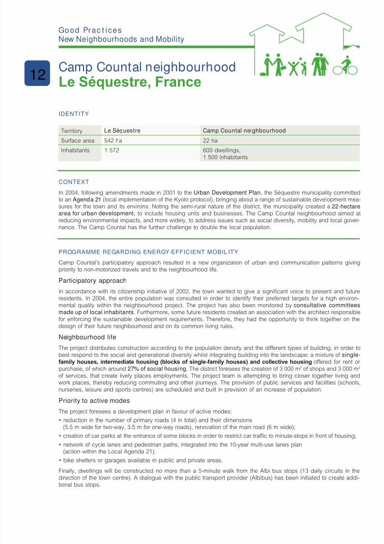
8/6/2019 New Neighbour Hoods and Mobility
http://slidepdf.com/reader/full/new-neighbour-hoods-and-mobility 89/98
IdentIty
Territory Le Séquestre Camp Countal neighbourhood
Surace area 542 ha 22 ha
Inhabitants 1 572 600 dwellings,1 500 inhabitants
Context
In 2004, ollowing amendments made in 2001 to the Urban Development Plan, the Séquestre municipality committedto an Agenda 21 (local implementation o the Kyoto protocol), bringing about a range o sustainable development mea-sures or the town and its environs. Noting the semi-rural nature o the district, the municipality created a 22-hectarearea for urban development, to include housing units and businesses. The Camp Countal neighbourhood aimed atreducing environmental impacts, and more widely, to address issues such as social diversity, mobility and local gover-nance. The Camp Countal has the urther challenge to double the local population.
Programme regardIng energy-effICIent mobIl Ity
Camp Countal’s participatory approach resulted in a new organization o urban and communication patterns givingpriority to non-motorized travels and to the neighbourhood lie.
Participatory approach
In accordance with its citizenship initiative o 2002, the town wanted to give a signicant voice to present and utureresidents. In 2004, the entire population was consulted in order to identiy their preerred targets or a high environ-mental quality within the neighbourhood project. The project has also been monitored by consultative committeesmade up of local inhabitants. Furthermore, some uture residents created an association with the architect responsibleor enorcing the sustainable development requirements. Thereore, they had the opportunity to think together on thedesign o their uture neighbourhood and on its common living rules.
Neighbourhood life
The project distributes construction according to the population density and the dierent types o building, in order tobest respond to the social and generational diversity whilst integrating building into the landscape: a mixture o single-family houses, intermediate housing (blocks of single-family houses) and collective housing oered or rent or purchase, o which around 27% of social housing. The district oresees the creation o 3 000 m2 o shops and 3 000 m2
o services, that create lively places employments. The project team is attempting to bring closer together living and
work places, thereby reducing commuting and other journeys. The provision o public services and acilities (schools,nurseries, leisure and sports centres) are scheduled and built in prevision o an increase o population.
Priority to active modes
The project oresees a development plan in avour o active modes:
• reduction in the number of primary roads (4 in total) and their dimensions
(5.5 m wide or two-way, 3.5 m or one-way roads), renovation o the main road (6 m wide);
• creation of car parks at the entrance of some blocks in order to restrict car trafc to minute-stops in front of housing;
• network of cycle lanes and pedestrian paths, integrated into the 10-year multi-use lanes plan(action within the Local Agenda 21);
• bike shelters or garages available in public and private areas.
Finally, dwellings will be constructed no more than a 5-minute walk rom the Albi bus stops (13 daily circuits in the
direction o the town centre). A dialogue with the public transport provider (Albibus) has been initiated to create addi-tional bus stops.
g Pc ic New Neighbourhoods and Mobility
Camp Countal neighbourhoodLe Séquestre, France
12
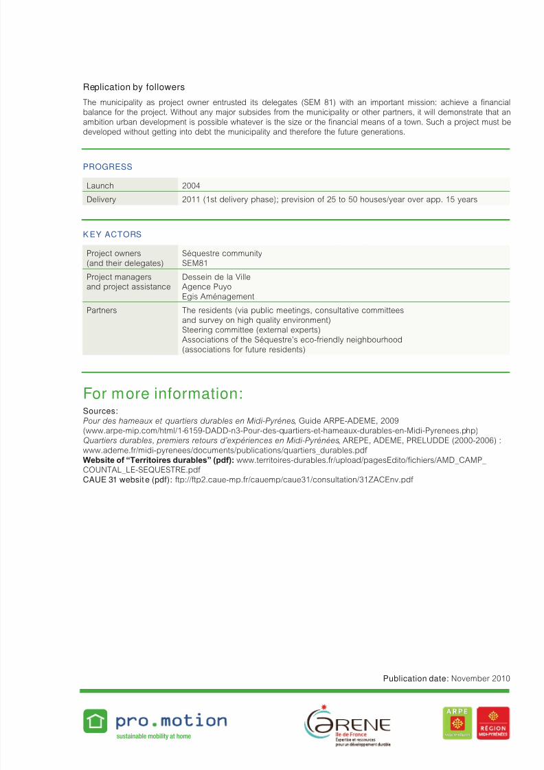
8/6/2019 New Neighbour Hoods and Mobility
http://slidepdf.com/reader/full/new-neighbour-hoods-and-mobility 90/98
Replication by followers
The municipality as project owner entrusted its delegates (SEM 81) with an important mission: achieve a nancialbalance or the project. Without any major subsides rom the municipality or other partners, it will demonstrate that anambition urban development is possible whatever is the size or the nancial means o a town. Such a project must be
developed without getting into debt the municipality and thereore the uture generations.
Progress
Launch 2004
Delivery 2011 (1st delivery phase); prevision o 25 to 50 houses/year over app. 15 years
K ey aCtors
Project owners(and their delegates)
Séquestre communitySEM81
Project managersand project assistance
Dessein de la VilleAgence PuyoEgis Aménagement
Partners The residents (via public meetings, consultative committeesand survey on high quality environment)Steering committee (external experts)Associations o the Séquestre’s eco-riendly neighbourhood(associations or uture residents)
For more information:Sources: Pour des hameaux et quartiers durables en Midi-Pyrénes, Guide ARPE-ADEME, 2009(www.arpe-mip.com/html/1-6159-DADD-n3-Pour-des-quartiers-et-hameaux-durables-en-Midi-Pyrenees.php)Quartiers durables, premiers retours d’expériences en Midi-Pyrénées, AREPE, ADEME, PRELUDDE (2000-2006) :www.ademe.r/midi-pyrenees/documents/publications/quartiers_durables.pd Website of “Territoires durables” (pdf): www.territoires-durables.r/upload/pagesEdito/chiers/AMD_CAMP_COUNTAL_LE-SEQUESTRE.pd CAUE 31 website (pdf): tp://tp2.caue-mp.r/cauemp/caue31/consultation/31ZACEnv.pd
sustainable mobility at home
Publication date: November 2010

8/6/2019 New Neighbour Hoods and Mobility
http://slidepdf.com/reader/full/new-neighbour-hoods-and-mobility 91/98
IdentIty
Territory Stockholm Hammarby Sjöstad
Surace area 187 km2 200 ha
Inhabitants 825 057 8 000 dwelllings15 000 inhabitants(growing to 30 000 at ull term)
Context
Previously an industrial harbour area and partly browneld site, with a surace area o approx. 200 hectares, Hammarbylies in the south. It is in close proximity to both the inner city o Stockholm and a nature reserve. The Town opted or a high-level application o technologies in the elds o water, energy, waste management, building techniques and transport. Thenorms chosen or this application are twice stringent as those currently in orce in Stockholm! Concerning transport, theobjective is to develop an ecient public transport system which proposes several alternatives to private car use.
Programme regardIng energy-effICIent mobIl Ity
The implemented programme aimed at reducing private car use in avour o more energy-ecient modes. Objectivesor 2005 expected 80% o commuter journeys by public transport, on oot or cycle and 15% o the local authority feetrunning on biogas or electricity. These objectives have now been increased and, by 2015, aim or 90% o commuter
journeys by public transport, on oot or cycle and 25% o the local authority feet running on biogas or electricity.
A policy for the development of public transport was put in place right rom the start o the project according to anintegrated planning: creation o bus routes (biogas), erries to Södermalm Island and a tramway.
Delivered in 2002 (1.5 km o lane and 4 stops), the tramway beneted directly rom the existing inter-connections withother means o transport, including the bus service. Thus the maximum distance between residential buildings and theclosest transport stops was only 500 m. Current gures show that 19 000 people use the line on a daily basis.
New ferry services were opened in order to create direct links between Hammarby and Stockholm centre. They are inaddition to the bus and tram lines which already operate in the neighbourhood.
An innovative car-sharing system (gas or electric vehicles) was put in place. It is the result o competitive tenderingby several petrol companies or the implementation o a car-sharing system. Statoil is currently managing this systemwhich is open to everyone living in Hammarby Sjöstad. The best parking places all around the neighbourhood arepermanently reserved or the shared vehicles. In 2004, 16 cars were in service and already attracting use by 10% o amilies. In exchange or this best oer, Statoil obtained the running o the only petrol station implanted on the site.
Cycle parking and access to active modes
Cyclists have the choice o a large range o both covered and open cycle parking places. The streets, which are desi-gned to be accessible by disabled people, oer a high level o comort or pedestrians.
For the best possible management of available parking places (kept to a minimum through choice), a number o spaces are shared between residents and workers: during the day, the spaces are used by sta rom the local oces,
and in the evenings by the residents. In addition, heavy goods vehicles must adhere to trac restrictions in some zoneso the neighbourhood.
Finally, Hammarby oers all the necessary services required by a fourishing neighbourhood (schools, libraries, shopsand services, sports elds and jogging lanes etc.).
g Pc ic New Neighbourhoods and Mobility
Hammarby SjöstadStockholm, Sweden
13
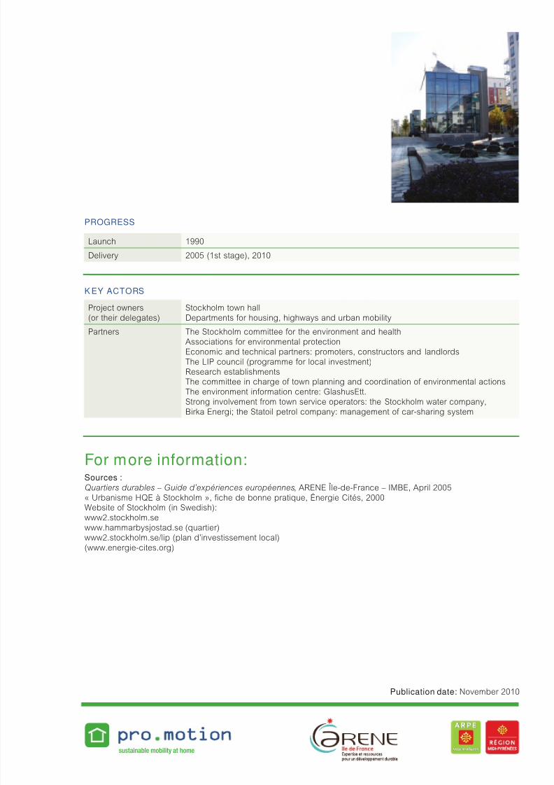
8/6/2019 New Neighbour Hoods and Mobility
http://slidepdf.com/reader/full/new-neighbour-hoods-and-mobility 92/98
Progress
Launch 1990
Delivery 2005 (1st stage), 2010
K ey aCtors
Project owners(or their delegates)
Stockholm town hallDepartments or housing, highways and urban mobility
Partners The Stockholm committee or the environment and healthAssociations or environmental protectionEconomic and technical partners: promoters, constructors and landlordsThe LIP council (programme or local investment)Research establishmentsThe committee in charge o town planning and coordination o environmental actionsThe environment inormation centre: GlashusEtt.Strong involvement rom town service operators: the Stockholm water company,
Birka Energi; the Statoil petrol company: management o car-sharing system
For more information:Sources : Quartiers durables – Guide d’expériences européennes, ARENE Île-de-France – IMBE, April 2005« Urbanisme HQE à Stockholm », che de bonne pratique, Énergie Cités, 2000Website o Stockholm (in Swedish):www2.stockholm.sewww.hammarbysjostad.se (quartier)www2.stockholm.se/lip (plan d’investissement local)
(www.energie-cites.org)
sustainable mobility at home
Publication date: November 2010

8/6/2019 New Neighbour Hoods and Mobility
http://slidepdf.com/reader/full/new-neighbour-hoods-and-mobility 93/98
IdentIty
Territory Municipalityof Suresnes
Carnot Gambettaneighbourhood today
Carnot Gambettaneighbourhood when completed
Surace area 379 ha 52 ha 52 ha
Inhabitants 44 738 8 400 Estimated at 10 100
Number o employees 29 700 (2008) 13 000 (2008) Estimated at 18 000
Context
The town o Suresnes seized the opportunity oered by the implementation o signicant development projects in theCarnot-Gambetta neighbourhood, to embark on the way towards sustainable development. Themes ranging rom water,energy and waste management to urban travel were integrated into this wide-ranging project leading by example regar-ding environment.
One o the main challenges o the project is to reconcile the main issues o sustainable urban development projects withnecessary changes in the behaviour and habits o the neighbourhood’s inhabitants.
Programme regardIng energy-effICIent mobIl Ity
The main objective is a 25% reduction in greenhouse gas emissions (GHG) at district level by 2013. Supplementaryobjectives (or 2013) are the reductions of 25% in the consumption of non-renewable energies by buildings, 30% incar trafc-related air pollution, 20% in drinking-water consumption, 5% o rainall water into the town’s water network,25% in residual household waste and 15% in construction waste.
Currently, the Carnot-Gambetta neighbourhood has an urban density o more than 10 000 inhab./km 2. The district is cha-racterised by its mixed-use nature: it consists o apartment buildings, oces, shops and public institutions.
Beginning in 2009, travel-related measures were implemented in the Carnot-Gambetta neighbourhood, in particular withthe renewal o Ledru-Rollin/Salomon de Rothschild streets. These streets were transormed in a 30 kph zones and home
zones (20 kph), with general implementation o two-way bicycle street. Other developments included more generalimprovements such as widening the pavements, introducing raised intersections and crossings, installing bicycle par-king areas, planting tree etc. Although these modications have been well received, car users had diculties adjustingto the new two-way bicycle streets, despite the presence o additional road signs and municipal inormation campaign.The town representatives received several letters and telephone calls rom people using these streets, claiming that the
modications were dangerous.Ater 16 months in eect, complaints are rare and drivers, pedestrians and cyclists appear to have got used to the two-way cycle streets. Nonetheless, in order to reinorce behavioural changes, an information/communication campaign isplanned (to launch end 2010/start o 2011), notably with new xed signs at the entrances and exits o the 30 kph zonesand home zones in order to increase users awareness.
g Pc ic New Neighbourhoods and Mobility
Carnot-Gambettaneighbourhood
Suresnes, France
14
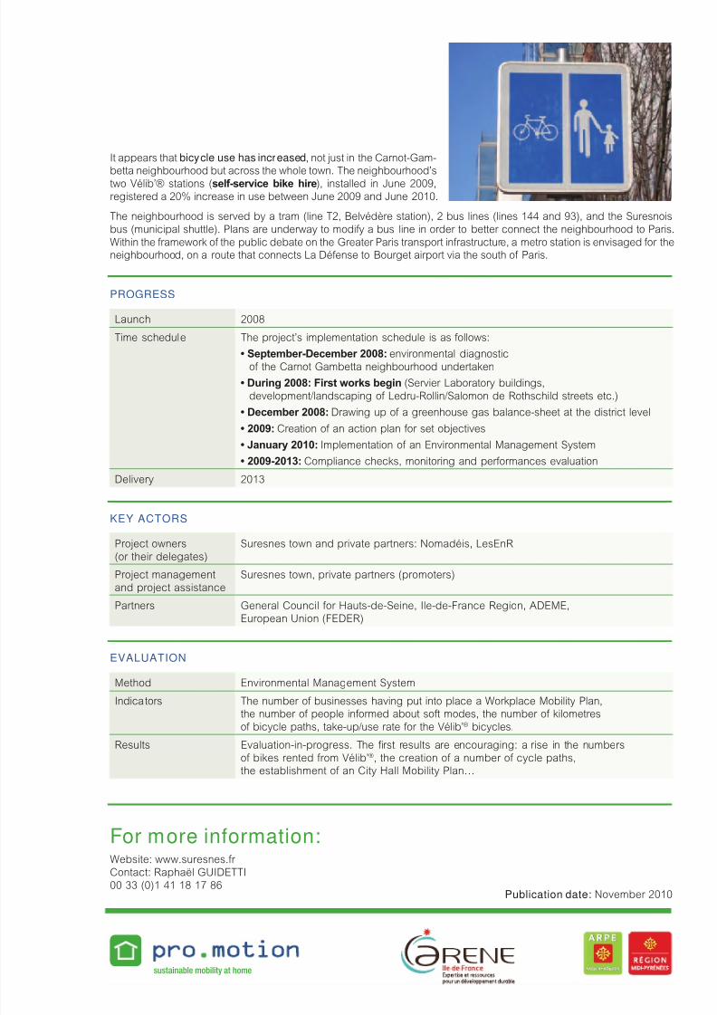
8/6/2019 New Neighbour Hoods and Mobility
http://slidepdf.com/reader/full/new-neighbour-hoods-and-mobility 94/98
It appears that bicycle use has increased, not just in the Carnot-Gam-betta neighbourhood but across the whole town. The neighbourhood’stwo Vélib’® stations (self-service bike hire), installed in June 2009,
registered a 20% increase in use between June 2009 and June 2010.
The neighbourhood is served by a tram (line T2, Belvédère station), 2 bus lines (lines 144 and 93), and the Suresnoisbus (municipal shuttle). Plans are underway to modiy a bus line in order to better connect the neighbourhood to Paris.Within the ramework o the public debate on the Greater Paris transport inrastructure, a metro station is envisaged or theneighbourhood, on a route that connects La Déense to Bourget airport via the south o Paris.
Progress
Launch 2008
Time schedule The project’s implementation schedule is as ollows:
• September-December 2008: environmental diagnostico the Carnot Gambetta neighbourhood undertaken
• During 2008: First works begin (Servier Laboratory buildings,development/landscaping o Ledru-Rollin/Salomon de Rothschild streets etc.)
• December 2008: Drawing up o a greenhouse gas balance-sheet at the district level
• 2009: Creation o an action plan or set objectives
• January 2010: Implementation o an Environmental Management System
• 2009-2013: Compliance checks, monitoring and perormances evaluation
Delivery 2013
Key aCtors
Project owners(or their delegates)
Suresnes town and private partners: Nomadéis, LesEnR
Project managementand project assistance
Suresnes town, private partners (promoters)
Partners General Council or Hauts-de-Seine, Ile-de-France Region, ADEME,European Union (FEDER)
evaluatIon
Method Environmental Management System
Indicators The number o businesses having put into place a Workplace Mobility Plan,
the number o people inormed about sot modes, the number o kilometreso bicycle paths, take-up/use rate or the Vélib’® bicycles.
Results Evaluation-in-progress. The rst results are encouraging: a rise in the numberso bikes rented rom Vélib’®, the creation o a number o cycle paths,the establishment o an City Hall Mobility Plan…
For more information:Website: www.suresnes.r Contact: Raphaël GUIDETTI
00 33 (0)1 41 18 17 86
sustainable mobility at home
Publication date: November 2010

8/6/2019 New Neighbour Hoods and Mobility
http://slidepdf.com/reader/full/new-neighbour-hoods-and-mobility 95/98
IdentIty
Territory Sutton, United Kingdom
BedZEDneighbourhood
Surace area 43.82 km2 1.7 ha
Inhabitants 185 900 ~ 82 dwellings,250 residents
Context
The Beddington Zero Energy Development – so called BedZED – in Sutton, is the UK’s rst large-scale “carbon neu-tral” urban development. In 1986, the borough o Sutton committed an Environmental Statement. By 1994, Sutton hadalready embarked on its Local Agenda 21. The City imposed, in January 1999, to its suppliers to get environmental cer -tication. This strong Local Authority commitment, combined with the conviction and motivation o architect Bill Dunster,proved to be the driving orce behind this unique opportunity or the development o a sustainable neighbourhood.
Programme regardIng energy-effICIent mobIl Ity
A “Green Travel Plan” was adopted in order to reduce the environmental impact o journeys undertaken by the resi-dents o BedZED. The objective was to reduce transport energy consumption by 50%. Peabody Foundation and Biore-
gional association committed to integrate this target as a mandatory requirement in the allocation o building permits.BedZED’s location, close to the existing transport networks, was one o the determining actors.
The transport plan is hinged on four main objectives.
1• Reducing the need to travel
• The mixed use o the neighbourhood enables residents working in the area to reduce their need to travel,in that oces and other services are close to their homes. BedZED comprises: 82 homes and 2 500 m2 o oces,services and shops. Other on-site acilities include a community centre, a show hall, private andpublic green spaces, a community medical centre, a sports centre, a nursery, a bar and a restaurant.
• An on-line shopping service has been put in place in association with a local supermarket which handles deliveries.
2• Promoting public transport
• The neighbourhood is served by two bus routes.
• Two railway stations within walking distance of BedZED (Hackbridge and Mitcham Junction) provide direct links
to Sutton and Victoria Train Station in London as well as access to the Thameslink suburban loop to North London.• A new tramline from Mitcham Junction provides a link to Wimbledon.
3• Offering alternative options to private cars
• Cycle parking (1.42 m2 o bike shelter per dwelling) and cycle lanes.
• Streets and public roadways are designed in home zone, and therefore are accessible for disabled people.
• 26 charging terminals for electric vehicles: ten years from now, BedZED would like to be able to produce
enough electricity rom its photovoltaic roos to charge 40 electric vehicles.
• 3 cars (liquid petrol gas, electric) are available to 35 residents who are members of the car-sharing service.
g Pc ic New Neighbourhoods and Mobility
BedZEDSutton, United Kingdom
15
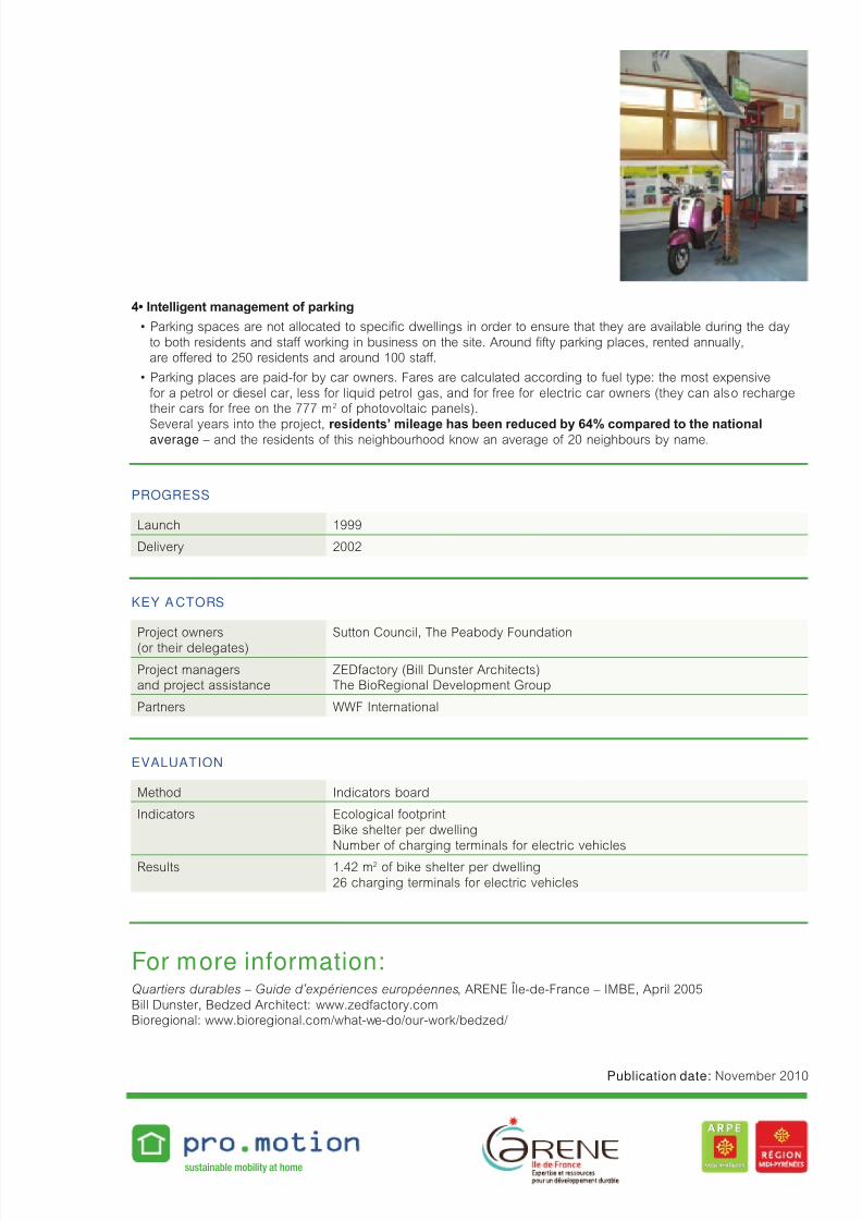
8/6/2019 New Neighbour Hoods and Mobility
http://slidepdf.com/reader/full/new-neighbour-hoods-and-mobility 96/98
4• Intelligent management of parking
• Parking spaces are not allocated to specic dwellings in order to ensure that they are available during the day
to both residents and sta working in business on the site. Around ty parking places, rented annually,are oered to 250 residents and around 100 sta.
• Parking places are paid-for by car owners. Fares are calculated according to fuel type: the most expensive
or a petrol or diesel car, less or liquid petrol gas, and or ree or electric car owners (they can also rechargetheir cars or ree on the 777 m2 o photovoltaic panels).
Several years into the project, residents’ mileage has been reduced by 64% compared to the nationalaverage – and the residents o this neighbourhood know an average o 20 neighbours by name.
Progress
Launch 1999
Delivery 2002
Key a Ctors
Project owners(or their delegates)
Sutton Council, The Peabody Foundation
Project managersand project assistance
ZEDactory (Bill Dunster Architects)The BioRegional Development Group
Partners WWF International
evaluatIon
Method Indicators board
Indicators Ecological ootprintBike shelter per dwellingNumber o charging terminals or electric vehicles
Results 1.42 m2 o bike shelter per dwelling26 charging terminals or electric vehicles
For more information:Quartiers durables – Guide d’expériences européennes, ARENE Île-de-France – IMBE, April 2005Bill Dunster, Bedzed Architect: www.zedactory.comBioregional: www.bioregional.com/what-we-do/our-work/bedzed/
sustainable mobility at home
Publication date: November 2010

8/6/2019 New Neighbour Hoods and Mobility
http://slidepdf.com/reader/full/new-neighbour-hoods-and-mobility 97/98
Translated by: Marko Typo and ARENE
Design : TrocadéroTechnical support: AuxiliaPhoto credits: ARENE, Céline Meunier, Conseil général du Morbihan,
CRANA and NASURSA, FGM-AMOR, APMS, Sinergija, La Petite Reine,
towns and other actors thanked.Date : December 2010
The sole responsibility or the content o this publication lies
with the authors. It does not represent the opinion
o the European Communities. The European Commission is
not responsible or any use that may be made o the inormationcontained therein.

8/6/2019 New Neighbour Hoods and Mobility
http://slidepdf.com/reader/full/new-neighbour-hoods-and-mobility 98/98
Acnowldmnts for tir frindl xprincs fdac:
ast Mblty rs, FgM-aMor,crana d naSurSa,
Bl,Bd,
Fb m Bs,gs-lès-gss,
gbl,hv,
L Séqst,Lml-Bévs,
Mlmö,St-o,
Sss,Stklm,Stt.
Editorial partnership:arene Îl-d-F d arpe Md-pyéés
Editorial control:cél M,
arene Îl-d-F
Communication coordination:psl cé d psl gs,
arene Îl-d-F
Related Documents