CODE OF PRACTICE Mines survey Second edition

Mines survey - Department of Mines, Industry Regulation · PDF fileEmail: [email protected] (general queries) [email protected] (publication orders) Foreword. ...
Mar 17, 2018
Welcome message from author
This document is posted to help you gain knowledge. Please leave a comment to let me know what you think about it! Share it to your friends and learn new things together.
Transcript
CODE OF PRACTICE
Mines surveySecond edition


CODE OF PRACTICE
Mines surveySecond edition

I I
Disclaimer
The information contained in this publication is provided in good faith and believed to be reliable and accurate at the time of publication. However, the information is provided on the basis that the reader will be solely responsible for assessing the information and its veracity and usefulness.
The State shall in no way be liable, in negligence or howsoever, for any loss sustained or incurred by anyone relying on the information, even if such information is or turns out to be wrong, incomplete, out-of-date or misleading.
In this disclaimer:
State means the State of Western Australia and includes every Minister, agent, agency, department, statutory body corporate and instrumentality thereof and each employee or agent of any of them.
Information includes information, data, representations, advice, statements and opinions, expressly or implied set out in this publication.
Loss includes loss, damage, liability, cost, expense, illness and injury (including death).
Reference
The recommended reference for this publication is: Department of Mines and Petroleum, 2011, Mines survey — code of practice (2nd edition): Resources Safety, Department of Mines and Petroleum, Western Australia, 20 pp.
ISBN 978 1 921163 70 8
© Department of Mines and Petroleum 2011
Except where the Copyright Act otherwise allows, reproduction in whole or part of this publication will be permitted only with the prior written permission of the Department of Mines and Petroleum. Applications for permission should be addressed to the Communications Manager, Resources Safety.
This publication is available on request in other formats for people with special needs.
This publication is also available in digital format (PDF) online at www.dmp.wa.gov.au/ResourcesSafety
Further details of publications produced by Resources Safety can be obtained by contacting:
Resources Safety Department of Mines and Petroleum 100 Plain Street EAST PERTH WA 6004
Telephone: + 61 8 9358 8002 (general queries) + 61 8 9358 8154 (publication orders)
NRS: 13 36 77 Facsimile: + 61 8 9358 8000 Email: [email protected] (general queries) [email protected] (publication orders)
ForewordBasis for code of practice
This code of practice was developed by the Mines Survey Board. It is issued by Resources Safety under the Mines Safety and Inspection Act 1994, with endorsement by the Mining Industry Advisory Committee (MIAC) and approval from the Minister for Mines and Petroleum.
Scope
The code provides guidance on meeting the requirements in the Mines Safety and Inspection Act 1994 and Mines Safety and Inspection Regulations 1995 relating to surveys at mining operations.
Who should use this code of practice?
All mine surveyors employed on mine sites in Western Australia and in particular at:
• undergound mining operations; and
• surface mining operations.
The Act
The Mines Safety and Inspection Act 1994 sets objectives to promote and improve occupational safety and health standards within the minerals industry.
The Act sets out broad duties, and is supported by a further tier of statute, commonly referred to as regulations, together with lower tiers of non-statutory codes of practice and guidelines.
Regulations
The Act is supported by regulations, which provide more specific requirements for a range of activities. Like the Act, regulations are enforceable and breaches may result in prosecution, fines or directions to cease operations and undertake remedial action.
Application
The provisions of this code of practice apply to all mining operations as defined in the Act [s. 4(1)].
Acknowledgements
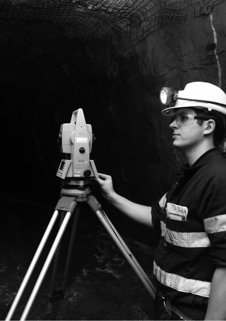
Photographs courtesy of Mincor Resources NL and the Western Australian School of Mines.
Contents
II I
Foreword .................................................................................................................................................................................. ii
Chapter 1 Introduction ..............................................................................................................................................1
1.1 Application .............................................................................................................................................................................2
1.2 Preparation ............................................................................................................................................................................2
1.3 Compilation ............................................................................................................................................................................2
1.4 Conversion to MGA94 .............................................................................................................................................................2
1.5 Symbols .................................................................................................................................................................................2
Chapter 2 Survey standards and procedures ..............................................................................................3
2.1 Overview ................................................................................................................................................................................4
2.2 Origin of coordinates ...............................................................................................................................................................4
2.3 Surface baseline .....................................................................................................................................................................4
2.4 Underground baseline .............................................................................................................................................................4
2.5 Traverses ...............................................................................................................................................................................4
2.6 Correlation of surface and underground surveys .......................................................................................................................5
2.7 Accuracy of levelling ...............................................................................................................................................................5
2.8 Survey records and supply of survey information ......................................................................................................................5
2.9 Requirements when workings are to be inaccessible .................................................................................................................6
2.10 Maintenance and adjustment of survey equipment ...................................................................................................................6
Chapter 3 Mine plan ....................................................................................................................................................7
3.1 Authorisation of plan ...............................................................................................................................................................8
3.2 Preparation of plan .................................................................................................................................................................8
3.3 Composition of plan ................................................................................................................................................................8
3.4 Preparation by digital methods .................................................................................................................................................8
3.5 Manually drafted plans ............................................................................................................................................................8
3.6 Additional information .............................................................................................................................................................9
3.7 Certification of plan .................................................................................................................................................................9
3.8 Action upon suspension or abandonment .................................................................................................................................9
3.9 Cessation of duties of the appointed mine surveyor ..................................................................................................................9
3.10 Other plans required ...............................................................................................................................................................9
3.11 Plan lodgement requirements ................................................................................................................................................10
Chapter 4 Mine plan format and content .....................................................................................................11
4.1 Sheet format ........................................................................................................................................................................12
4.2 Mine plan content .................................................................................................................................................................12
Appendices .........................................................................................................................................................................15
Appendix 1 Legislative provisions ...........................................................................................................................................16
Appendix 2 Glossary ..............................................................................................................................................................18
I V

INTRODUCTION
1M
ines
sur
vey
– CO
DE O
F PR
ACTI
CE
1

Mines survey – CODE OF PRACTICE
2
1.1 Application
This code of practice is to be used in the compilation of a mine plan for each mining operation. The legislative basis for the code is outlined in Appendix 1, and definitions and abbreviations are listed in Appendix 2.
The mine plan is defined in this code of practice as the set of plans, cross sections and longitudinal sections showing the entire workings of a mining or quarrying operation.
Other plans may be required as set out in Section 3.10.
There is also a need to keep a survey book in the survey office. This book should be in hard copy and should comply with requirements of section 89 of the Act. This does not prevent the same information being stored in electronic form in addition to the hard copy. Results of survey department audits can be noted in this book, as well as records of significant survey information.
1.2 Preparation
This code of practice provides for both three-dimensional digital and two-dimensional non-digital recording, preparation and storage of a mine plan.
1.3 Compilation
So far as is practicable, and particularly for new mines, the mine plan should be compiled on the Map Grid of Australia 1994 (MGA94) based on the Geocentric Datum of Australia 1994 (GDA94). If not, the connection between local grid and MGA94 must be documented in the survey book, along with local false origin and datum details.
The mine plan should be sectionalised into sheets conforming to a referenced index that is documented in the survey book, while complying with the sheet format and maximum scale requirements recommended here.
All plans used in the compilation of the mine plan should be regarded with suspicion until their accuracy has been verified. A documented effort should be made to obtain all existing information about the extent and location of old workings. This documentation should be referenced in the survey book.
Where old workings are known and could constitute a danger to proposed or existing development, they should be clearly shown on the mine plan and annotated as to whether they contain water or fill. The annotation should be amended if this initial view is proved to be incorrect.
Workings that have become inaccessible or may constitute a hazard (i.e. bad ground, caving, no road), should be annotated on the mine plan by the authorised mine surveyor. The annotation should correctly describe the condition rendering the ground inaccessible or dangerous.
1.4 Conversion to MGA94
Transformation of the mine plan to MGA94 is recommended. However, this may not be practicable for mines with extensive workings. It is suggested that new mines begin with MGA94.
If the mine plan is transformed to MGA94, all information on the existing mine plan must be transferred to the new plan. The date of transformation of the mine plan to MGA94 must be documented in the survey book and precautions taken to ensure that the old plan is archived and not further updated.
An existing mine operating to a local grid and height datum must show the relationship between the grid and MGA94, and height datum and Australian Height Datum 1971 (AHD), as required under regulation 3.50(2). These relationships should be recorded in the survey book.
A notation should appear on the mine plan as to the location of any additional information relevant to the mine plan, including reference to any datum used. This additional information is to be recorded in the survey book.
Sufficient points of known coordinates in both the local mine grid and MGA94 must be provided to allow transformation of the mine plan onto the MGA94 grid. The datum reference points should be chosen to give a broad coverage of the mine lease area. This additional information must be recorded in the survey book.
1.5 Symbols
Technical symbols, sign conventions and definitions for strata shown on the mine plan should be detailed in the survey book.
Australian Standard AS 4368:1996 Mine plans – Preparation and symbols provides a common set of rules and principles for drafting symbols that may be useful.
1 Introduction

SURVEY STANDARDS AND PROCEDURES
2M
ines
sur
vey
– CO
DE O
F PR
ACTI
CE
3

Mines survey – CODE OF PRACTICE
4
2 Survey standards and procedures2.1 Overview
All surface and underground check or control surveys for the production of a mine plan should be carried out in accordance with this code of practice.
A district inspector may, in a particular case, approve in writing the carrying out of a check or control survey of a mine by means other than those specified in regulation 3.49(1), if he or she considers that the means will be sufficiently accurate.
In general, the standard of accuracy required in this code of practice is 1 in 5,000 or better. Control surveys should be to 1:5,000 or to within 0.5 m absolute error to mine datum. A lower order of accuracy may be acceptable in the case of inaccessible workings or where reflectorless electronic distance-measuring (EDM) or laser-ranging equipment is employed for cavity measurement.
It is the responsibility of the authorised mine surveyor to become conversant with the survey methods that will achieve the standards of accuracy set out above.
The choice of technique is a professional decision of the authorised mine surveyor, based on sound practice, and will be acceptable provided the methods employed comply with all existing legislation and the safe working practices of the mine.
2.2 Origin of coordinates
The authorised mine surveyor should ensure that if a local grid system is in use at a mine, the relationship between that grid and MGA94 is established in terms of distance and coordinates,with respect to orientation, and that these details are recorded in the survey book.
All surveys and plans should originate from the mine baseline. All control surveys must be connected to the mine baseline.
At each end of the mine baseline there should be a durable reference mark connected by bearing and distance to the baseline.
2.3 Surface baseline
The surface mine baseline should not be less than 250 m in length and each end should be substantially marked.
Mine baseline stations for both opencut and underground mines should be permanent marks, preferably tagged with the station name and set in concrete. A witness plate should be placed adjacent to this mark.
Where permanent marks are placed for a surface baseline, they should be shown on the mine plans. The authorised mine
surveyor should ensure that both hard copies and electronic copies of all reference materials are recorded in the survey book.
2.4 Underground baseline
A baseline should be established in the underground workings of each level off a shaft or at least every 750 m of traverse in a decline access. The underground baseline should be in a suitable position and be as long as practicable, but at least 100 m in length.
The marks should be stable and durable, and the location should be chosen to minimise movement or damage caused by blasting, ground movement or mobile equipment. The station number or identifier of the stations used must be painted on the adjacent wall. A durable tag indicating the station number or identifier should be attached to the station.
Permanent baseline details should be recorded on the mine plan.
2.5 Traverses
The position of mine workings should be established with an accuracy of 1:5,000 or to within 0.5 m absolute error to mine datum. In the case of inaccessible workings or where reflectorless EDM or laser-ranging equipment is employed for cavity measurement, a lower order of accuracy may be acceptable.
Instrumentation: The instrumentation used for control surveys and traversing should adhere to the following precision specifications:
• angular measurements (horizontal and vertical) — maximum standard error of ± 5”;
• distance measurements — maximum standard error of ± (3 mm + 5 ppm);
• GPS positioning — maximum standard error of horizontal positioning of ± (10 mm + 10 ppm); and
• levelling — maximum standard error of levelling per kilometre of double run of ± 4 mm.
Accuracy: Each underground control survey and check survey should, where possible, be closed to the highest standard of accuracy that can be practically achieved. If loop closure is not practicable, the survey technique recommended is to undertake a two-way check traverse, closing within the accuracies mentioned in Section 2.1.
Marking: Each underground control station should be adequately referenced and substantially marked. The station number should be painted adjacent to the survey station and also on the adjacent wall. A durable tag indicating the station number should also be attached. As far as practicable, the marks should

Min
es s
urve
y –
CODE
OF
PRAC
TICE
5
be placed in a position least likely to be disturbed by the effects of ground movement or mobile equipment. The stations should be shown on the mine plans.
All mine survey control stations should be part of a network of traverses with redundant observations allowing for rigorous adjustment of their positions and assessment of their positional accuracy.
2.6 Correlation of surface and underground surveys
Correlation between surface and underground surveys should be to the highest accuracy practicable.
The correlation of surface and underground surveys may be by:
• traversing through an adit or a decline or incline ramp;
• plumbing or plummeting one or more vertical shafts;
• using a gyrotheodolite to establish azimuth; or
• a combination of these methods.
Where methods other than direct traverse through an adit or decline or incline ramp are employed for azimuth or coordinate transfer, the authorised mine surveyor should certify that the survey is accurate and meets regulatory requirements.
Where vertical measurement is necessary for transfer of values from the surface baseline to a nominated underground baseline, care should be taken to minimise errors.
2.7 Accuracy of levelling
Datum
Where an established mine uses a local height datum (LHD):
• the relationship between the LHD and AHD should be detailed in the survey book; and
• the relationship should also be shown on the mine plans as required under regulation 3.50(2).
Order of accuracy of survey control marks
Relative levels of forward stations should be checked with redundant measurements. For conventional traversing, this could be either a re-survey or a level traverse. Failure to check the one-off measurements of instrument and target heights, either at the time of the initial survey or at some later stage, is unacceptable.
Order of accuracy of position of workings
All level traverses should be closed. The vertical closure rates of traverses should be better than 12K mm, where K is the traverse length in kilometres (i.e. a closure rate of 12 mm/km). More precise levelling may be required under some circumstances where precision is critical (e.g. in certain construction or installation work).
2.8 Survey records and supply of survey information
Systematic care should be taken for the safe and fireproof preservation of mine plans, notebooks, computer data files, traverse records and associated calculations, correlation records and associated calculations, coordinate books or sheets, and other records from which the workings have been plotted.
Survey records for each of the following purposes should be kept at the survey office for the mine:
• surface surveys;
• surface levelling;
• underground control surveys (which should also be recorded in the survey book);
• underground check surveys (which should also be recorded in the survey book);
• surface check surveys;
• underground levelling;
• calculations; and
• any other relevant information.
Such survey records should be maintained either manually on a stable material or by electronic means that must be available at all times to all authorised personnel.
Where survey records are maintained in manual form, the requirements listed below are to be observed.
• All survey books should be maintained in good order and should have the following description attached:
– titled with the mine name;
– sufficient information to indicate the location within the mine of the surveys contained in the survey book; and
– consecutive index number.
• Where practicable, the following procedures should be adopted for entries into survey books:
– all survey observations and measurements should be recorded at the time of survey;
– if a mistake is corrected, there should be no erasure (the erroneous entry should be struck through and the correction written above);
– the datum line of the survey and the azimuth adopted should be clearly indicated;
– lengths should be entered at the time they are measured and, where appropriate, corrections should be noted and the lengths deduced therefrom should be clearly indicated;
– bearing and distance from reference marks must be clearly shown;
– control stations and bench marks placed by the authorised mine surveyor should be so noted and their positions and descriptions should be shown by a sketch in the appropriate book;

Mines survey – CODE OF PRACTICE
6
– lines remeasured should be so specified and original distances and bearings shown; and
– the authorised mine surveyor should sign the field book to indicate that the work shown therein was performed under his or her supervision and indicate the date on which the work was performed.
Complete duplicate copies of survey records must be kept and stored separately from the originals, on paper, microfilm, magnetic tape, disk or other permanent medium.
If requested by the district inspector of mines, the registered manager or authorised mine surveyor of any mine should provide, on a stable material, all or any survey records requested or certified copies thereof.
The mine plan must be revised as necessary, or at least every three months, to show any significant changes to the workings.
Plans for lodgement with the Department of Mines and Petroleum must be compiled according to regulation 3.52, and lodged within the time stated by this regulation.
When suspension or abandonment of mining operations is imminent, the employer, or if a receiver has been appointed in respect of a principal employer, the receiver, or the registered manager, must ensure the authorised mine surveyor updates the mine plan to accurately reflect the surveyed mine workings at the time of suspension or abandonment.
Upon suspension of mining operations, a copy of the mine plan must be submitted as soon as practicable to the State mining engineer, as described by regulations 3.14 and 3.52.
Upon abandonment of a mining operation, a copy of the mine plan must be submitted to the State mining engineer as described by regulations 3.16 and 3.52. All survey records relevant to the mine plan should be preserved on paper or microfilm, and on magnetic tape, disc or other permanent electronic medium.
2.9 Requirements when workings are to be inaccessible
Before any part of the workings of a mine becomes inaccessible, where practicable and safe to do so, the position of all points of the workings should be established. Sufficient levels should be taken to clearly indicate the height of the floor of the workings on all mining levels, benches or berms on the mine plan.
2.10 Maintenance and adjustment of survey equipment
Survey equipment used for baseline or other precise surveys should be maintained regularly and kept in good adjustment.
EDM equipment used for precise surveys should be verified against the surface baseline at least annually and immediately after service or repair.
GPS equipment should be verified against an approved control network upon acquisition and after any change in software, firmware or hardware.

MINE PLAN
3M
ines
sur
vey
– CO
DE O
F PR
ACTI
CE
7

Mines survey – CODE OF PRACTICE
8
3 Mine plan3.1 Authorisation of plan
The mine plan is required to be produced, maintained and kept under section 87 of the Act and regulation 3.51. The plan must be certified and signed by the authorised mine surveyor.
This code of practice also requires the lodgement of mine plans with the Department of Mines and Petroleum at nominated intervals for all opencut and underground mines.
3.2 Preparation of plan
The mine plan must:
• include any previous workings at the mine if any part of the mine has been worked in the past or if the mine was previously abandoned;
• be drawn to a scale that allows for legibility, including legibility when copied;
• be revised when necessary to show any significant changes to the mine workings; and
• be produced, on request, to a district inspector of mines or to any other person authorised in writing by the district inspector of mines to inspect it.
3.3 Composition of plan
The mine plan may be produced digitally or manually.
Digital methods: prepared from the digital form of the plan held on a computer. It should be produced in hard copy for lodgement with the Department of Mines and Petroleum. A digital document in a software format compatible with the Department’s software may also be lodged.
Manual methods: manually drafted and reproduced in hard copy.
For an underground mine, the hard copy of the digital mine plan or hand-drafted plan should consist of sheets for each mine level.
For an opencut mine, the hard copy of the digital mine plan or hand-drafted plan should consist of sheets for each deposit being worked.
If a mine is worked from ramps and not from regular levels or sublevels, the mine plan should include as many plan sheets as required to adequately show the full extent of mine workings.
A reference in this code of practice to the mine plan includes any plans, cross sections or longitudinal sections of the workings of the mine, or correct copies or tracings of original plans and sections.
3.4 Preparation by digital methods
When preparing the mine plan, the following information should be captured:
• mine lease boundary;
• area of mine development;
• survey stations and their identification;
• mine shafts, adits and declines;
• grid lines and values;
• all workings in the deposit, including workings of adjacent mines within 50 m of the lease boundary;
• for underground mines, the boundaries of all old workings on the horizon being shown on that plan;
• for underground mines, a detailed outline of current or associated workings in any direction of any development shown on a level plan sheet or section sheet on the horizon being shown on that plan;
• underground service holes clearly annotated as to their use; and
• boreholes on the horizon being shown on that plan.
Revisions
A copy of the revised mine plan should be prepared from the digitally held data and presented in the legible form described in Chapter 4.
Revised plan and section sheets should be produced as hard copy on durable medium. The previous copies may be archived or destroyed.
3.5 Manually drafted plans
Where the mine plan has been produced manually:
• it should be drawn on durable, stable polyester matt drafting material in the form set out in Chapter 4 of this code of practice; and
• all drafting and printing must be in ink.
Care should be taken to ensure that the inks used are durable and colourfast.
International Standards Organisation (ISO) standard sheet sizes should be used.
When compiling a mine plan manually:
• the survey grid used should be clearly identified; and
• all surveys on a plan should be plotted so that all points in the survey are correct to within 1 mm (plan scale) of their calculated coordinate position.

Min
es s
urve
y –
CODE
OF
PRAC
TICE
9
If the mine plan is reproduced photographically:
• the reproduction must be an accurate same-scale copy of the mine plan with no error or distortions; and
• the reproduction should be on durable, stable polyester matt drafting material.
3.6 Additional information
The authorised mine surveyor may include appropriate and useful additional information on the mine plan provided it is shown in a manner consistent with this code of practice.
The authorised mine surveyor should ensure that any information about a danger to the mine, adjacent mines, or adjacent strata if worked, is recorded accurately on the plan.
3.7 Certification of plan
Certification of the mine plan must be in the following form as required by regulation 3.51(2).
This is to certify that this survey has been done by myself (or by persons under my own supervision), subject to adequate inspection and field check, and is the actual result of the observations and measurements, and the survey and plan have been done in accordance with the requirements of the Mines Safety and Inspection Act 1994 and the regulations made under that Act.
DATED the ......................... day of ......................... 20..........Authorised Mine Surveyor Grade ............................................ Certificate No. .......................................................................
Where any information shown on the mine plan is in doubt or there is any other information that the authorised mine surveyor considers requires endorsement, the mine plan should be suitably endorsed. An example of a schedule of endorsements is shown below.
Schedule of endorsements
Ref Date Description Signed
By signing and dating the certification, the authorised mine surveyor declares that:
• the mine plan has been prepared in accordance with the Act; and
• the surveys shown on the mine plan have been completed to an accuracy as prescribed in the Mines Safety and Inspection Regulations 1995.
3.8 Action upon suspension or abandonment
Authorisation
Regulations 3.52(c) and 3.52(d) require the mine plan to be amended and lodged when operations at a mine are suspended or abandoned.
Action upon suspension or abandonment or a mine
Where any mine for which a mine plan is required is suspended or abandoned, a survey of the final position of the workings must be undertaken and the mine plan amended. The amended mine plan must be certified, dated and signed by the authorised mine surveyor on the date of suspension or abandonment.
Upon the suspension or abandonment of a mine, the mine plan should be produced on durable polyester matt film as soon as practicable after such suspension or abandonment, and forwarded to the Sate mining engineer. The mine plan should be accompanied by a copy in electronic form.
A digital record, in a form suitable for archiving and future reference, and a plan on durable polyester matt film should be retained at the mine office.
3.9 Cessation of duties of the appointed mine surveyor
Upon permanent cessation of duties of the appointed mine surveyor, the mine plan should be amended, dated and signed by the appointed mine surveyor.
The outgoing mine surveyor should, where possible (i.e. with the consent of the mine owner), take a copy of the mine plan for his or her own record.
The incoming appointed mine surveyor should make a copy of the current mine plan at the start of his or her tenure.
3.10 Other plans required
Combined plans
The authorised mine surveyor may combine one or more of the following plans with the mine plan, provided the legibility of the combined plan is retained.
Ventilation plan (underground mines)
The authorised mine surveyor must ensure that all major ventilating fans, air doors, brattices or other ventilating devices or controls in use at the mine are recorded on the plans and sections of the mine.
Mines survey – CODE OF PRACTICE
10
Surface plan
For an opencut mine, the surface plan should show all detail as set out in Chapter 4, and all streets, roads, reservoirs, swamps, water bodies and any other permanent features that, if disturbed by mining operations, could cause damage to or danger in the mine.
Accident plan
Regulation 3.54 states the requirements for survey when a fatal accident occurs. The accident location must not be disturbed except with the permission of the Coroner.
A survey of the accident location is required, and an accident plan must be produced.
In the case of a serious but non-fatal accident, an inspector may require a survey to be carried out or an accident plan to be prepared.
Where possible, photographs of the accident location should accompany the accident plan.
Where conditions or continuing danger prevent a location survey being made, the position of the accident should be indicated on a copy of a mine plan sheet, and annotated by the authorised mine surveyor.
The information required on an accident plan is set out in detail in Chapter 4 and must include:
• an outline of the mine workings;
• the location within the mine;
• the location of all fixed and mobile plant;
• the location of personal apparatus, equipment or clothing; and
• sufficient annotation and labelling to clearly describe the condition and name of each object at the accident location.
Emergency plan
An emergency plan should be produced using the mine plan as its basis.
The emergency plan should be revised at least every three months, following the most recent revision of the mine plan, and contain relevant and up-to-date information on the following:
• mine egress;
• firefighting system and appliances; and
• mine rescue and safety.
The emergency plan should be at a scale of not less than 1:2,000, and consist of a number of plan sheets adequately describing the major mine workings.
This plan should show:
• shafts, ramps and the main level development;
• the means of egress from each part of the mine to the surface;
• the direction of the primary and secondary airflows, positions of pipe mains, hydrants, isolation valves, fire substations and fire depots;
• the location of electrical substations and other major electrical installations, and other isolation points;
• the positions of stoppings, trapdoors, regulators, seals, prepared seal sites, overcasts, air crossings, ventilation doors, belt conveyors, main electric supply cables, fixed electrical apparatus and the direction of ventilation in the main development headings;
• the location of refuge chambers, fresh air bases, first aid stations, underground telephone locations, and any air quality or gas monitoring points, together with the route of such monitoring; and
• bad or inaccessible ground, accumulations of water, filled voids, and any information identified as necessary for dealing with an emergency at the mine.
A copy of the emergency plan must be maintained on view at the mine, with an up-to-date copy kept in an accessible place in case of emergency.
3.11 Plan lodgement requirements
Underground mines
The mine plan must be lodged with the State mining engineer within one year of the commencement of mining operations and every five years thereafter.
If a mine is to be suspended or abandoned, a final mine plan in hard copy must be lodged with the State mining engineer as soon as practicable after the date of suspension or abandonment. Where practicable, an electronic copy of the mine plan should be included.
Opencut mines
The mine plan must be lodged with the State mining engineer within one year of the commencement of mining operations.
If a mine is to be suspended or abandoned, a final mine plan in hard copy must be lodged with the State mining engineer as soon as practicable after the date of suspension or abandonment. Where practicable, an electronic copy of the mine plan should be included.
MINE PLAN FORMAT AND INFORMATION
4M
ines
sur
vey
– CO
DE O
F PR
ACTI
CE
11

Mines survey – CODE OF PRACTICE
12
4.1 Sheet format
Plan sheet
As required by regulation 3.51, each mine working sheet should show the details listed below.
In the sheet heading:
• the name of the mine (e.g. Red Rocks gold mine); and
• the number of the level or mine horizon according to the adopted mine nomenclature.
In the sheet surround:
• the reduction ratio (or representative fraction) and a graphical (bar) scale, together with a statement that all measurements are in metres, or grid line values labelled appropriately;
• a north point indicating true north in relation to the local grid and MGA94;
• a schedule of symbols used on the particular sheet as detailed in the survey book;
• a sheet index showing all the sheets necessary to cover the mine holding and the number of each sheet with the particular sheet indicated by a heavy outline;
• a schedule of survey dates and certifications;
• the origin of levels, and the grid bearing and major survey stations of the surface baseline;
• a table of survey marks and benchmarks containing their identification, coordinates and height (or shown on plan area); and
• sheet size (e.g. A0, A1, A3).
In the plan area:
All detail should be plotted at a scale that will allow copying with retention of legibility, and show the following:
• a grid showing coordinates;
• the position of survey stations or benchmarks and their identification;
• labelled lines showing the position of any cross sections provided;
• mining lease boundaries; and
• all abandoned or historical workings within 50 m of the current lease boundaries and on the horizon being shown on that plan.
Section sheets
Separate cross section sheets should be provided that adequately represent the form and extent of mine workings.
Each cross section should be compiled from information gained from the actual workings and not from borehole information.
As required by regulation 3.51, each cross section sheet should show the details listed below.
In the sheet heading:
• the name of the mine; and
• the grid coordinate or reference line to which the section refers.
In the sheet surround:
• the reduction ratio (or representative fraction) and a graphical (bar) scale, together with a statement that all measurements are in metres, or with grid line values labelled appropriately; and
• sheet size (e.g. A0, A1, A3).
4.2 Mine plan content
Details required
The types of information listed below are minimum requirements only, and it is at the discretion of the authorised mine surveyor whether additional information is shown.
Mine plans — underground mines
Surface plan
A surface plan of the mining lease should show the true positions of:
• mining lease boundaries;
• all buildings, both fixed and portable, including offices, workshops, warehouses, power stations, crushing and grinding plant, metallurgical plant, and storage and loading facilities;
• access roads and car parks;
• haulage (brace level) and ventilation shafts, and ventilation fans;
• conveyors and stockpile areas, including reclaim tunnels;
• transformer yards;
• overhead and underground power transmission lines;
• explosives and detonator magazines;
• ANFO plants and storage;
• rail sidings;
• bulk chemical storage bins and process vessels;
• fuel storage tanks and fuelling areas;
4 Mine plan format and content

Min
es s
urve
y –
CODE
OF
PRAC
TICE
13
• the extents of open shafts, stopes or open pits at the surface;
• the extents of caved ground due to underground mining;
• decline portals and access roads;
• site fencing and gates;
• tailings dams;
• waste dumps;
• drainage and water retention structures, dams and water tanks;
• surface and underground pipelines;
• drainage and service boreholes;
• boreholes that could affect the safety of the mine;
• natural features, including water courses and lakes;
• any disused buildings, plant or shafts from older or defunct mine workings within the mining lease or claim area;
• surface spot levels or contours; and
• survey reference marks and baseline.
Underground level plans
The level plans should show the development at each primary haulage or drilling level, and the true positions of:
• man, haulage and ventilation shafts;
• all development drives and crosscuts, and working faces;
• stope outlines at the level;
• winzes, raises, ore passes, fill passes, ladderways and chutes;
• refuge chambers;
• electrical substations;
• rail track;
• crib rooms and offices;
• workshops, including overhead cranes and monorails;
• explosives and detonator magazines;
• skip loading pockets;
• ore bins;
• conveyor drives and crushing stations;
• pumping stations and sumps;
• boreholes that could affect the safety of the mine;
• the outline of development or stoping within 5 m of a mine level; and
• ramps and access declines.
A composite plan showing ramps or access declines and inclines between levels should be provided where these are only partially shown on the level plans.
Underground sections
As far as practicable, at a scale that accords with good engineering practice, underground sections should provide:
• longitudinal sections or projections that show all underground mining operations; and
• sufficient cross sections or projections to show mined-out and remaining orebody.
The sections should also show mine workings that are:
• filled or partially filled with water; or
• filled or partially filled with mine back-fill material, and indicate its composition.
Mine plans — opencut mines
Surface plan
A surface plan of the mining lease should show the true positions of:
• mining lease boundaries;
• all buildings, both fixed and portable, including offices, workshops, warehouses, power stations, crushing and grinding plant, metallurgical plant, and storage and loading facilities;
• access roads and car parks;
• haulage (brace level) and ventilation shafts, and ventilation fans;
• conveyors and stockpile areas, including reclaim tunnels;
• transformer yards;
• overhead and underground power transmission lines;
• explosives and detonator magazines;
• ANFO plants and storage;
• rail sidings;
• bulk chemical storage bins and process vessels;
• fuel storage tanks and fuelling areas;
• the extents of open shafts, stopes or open pits at the surface;
• the extents of caved ground due to underground mining;
• decline portals and access roads;
• site fencing and gates;
• tailings dams;
• waste dumps;
• drainage and water retention structures, dams and water tanks;
• surface and underground pipelines;
• drainage and service boreholes;
• boreholes that could affect the safety of the mine;
• natural features, including water courses and lakes;
• any disused buildings, plant or shafts from older or defunct mine working within the mining lease or claim area;
• surface spot levels or contours; and
• survey reference marks and baseline.

Mines survey – CODE OF PRACTICE
14
Opencut plans
The openpits may be shown on the surface plan. However, where site facilities, such as crushing, milling and administration, are at a distance from the openpits, a series of plans should be provided to show the relevant detail. This detail should include the positions of:
• tops and toes of all batters;
• berms and benches;
• haulage and access ramps between berms;
• in-pit crushing plant and storage bins;
• spot height levels of berms or benches;
• pumps and sumps;
• overhead powerlines; and
• adjacent underground workings (current and abandoned) in relation to the openpit.
Opencut sections
So far as is practicable, at a scale that accords with good engineering practice, opencut sections should provide:
• sufficient cross sections to show advances made in the quarry operations and areas reclaimed or filled in; and
• sufficient cross sections or projections to show mined-out and remaining orebody.
Accident plans
Section 3.10 sets out the requirements for producing an accident plan. The plan should be surveyed and drafted according to the requirements below.
The accident plan can be one or more plan sheets, section sheets or other plans that correctly describe the accident location.
A locality plan or sketch must be included showing the area described by the accident plan in relation to the whole of the mine workings.
The scale of the plan should be chosen to adequately show the required detail. This would typically be a scale of no more than 1:50. A sheet of the mine plan may be used as a base provided the scale is adequate for the required detail. The current position of working faces must be shown.
The following information must be shown in the sheet surround of every sheet used:
• the mine name, level name, and information to accurately describe the area of the mine where the accident occurred;
• the reduction ratio (or representative fraction) and a graphical (bar) scale, together with a statement that all measurements are in metres;
• a north point indicating mine grid north;
• a schedule of symbols used on the particular sheet or each symbol annotated as detailed in the survey book;
• the label “Accident plan” written prominently to clearly differentiate the plan from any sheet of the mine plan; and
• sheet size (e.g. A0, A1, A3).
The title block for the accident plan should include the following information:
• scene of (fatal) accident to (name);
• (location) (shift) (date);
• (company name);
• drawing number;
• scale;
• authorised mine surveyor’s certification and annotation as to accuracy and completeness; and
• field or level book numbers used in accident plan survey.
The plan must show all detail that existed immediately before the accident, together with any detail that has been positioned as a result of the accident. All detail must be accurately labelled.
One section or sectional elevation must be drawn to the same scale as the plan view, and its position must be shown on that plan. The same level of detail must be shown on the section as required for the accident plan.
The detail shown must include:
• the real or assumed position of the injured person or persons — it is expected that injured or fatally injured persons will have been removed from the scene;
• the position of other personnel at the time of the accident;
• the position of articles of protective clothing such as helmets and gloves;
• the position of equipment used in rescue operations;
• the general environment and position of mining equipment and plant;
• the location and direction from which any photographs were taken; and
• other relevant information as directed by an inspector.
The plans concerning fatal accidents should not be viewed or made available to any person other than:
• an inspector of mines;
• an authorised member of Resources Safety’s investigations unit;
• the mine general manager;
• the Coroner; and
• a board of inquiry into the accident.
The accident plan should be stored in a secure place under the direct control of the authorised mine surveyor.

APPENDICESM
ines
sur
vey
– CO
DE O
F PR
ACTI
CE
15
Mines survey – CODE OF PRACTICE
16
Appendix 1 Legislative provisionsMines Safety and Inspection Act 1994
Plans to be furnished
s. 87
(1) The manager of a mine must procure and keep in the office of the mine accurate plans of the mine that —
(a) in accordance with the regulations, are kept up to date; and
(b) are prepared on a scale that accords with good engineering practice; and
(c) contain the particulars required by the regulations.
(2) The manager of a mine must provide to the State mining engineer free of charge copies of the plans referred to in subsection (1) in accordance with the regulations.
(3) If the State mining engineer has reason to believe that a plan provided under this section is inaccurate or incomplete, the State mining engineer may direct the principal employer to have a check survey conducted at the principal employer’s own cost and the principal employer must comply with such a direction without delay.
(4) The plans referred to in subsection (1) must be produced by the manager at the mine to an inspector, an assistant inspector, or any other person authorised for the purpose in writing by the State mining engineer, and the manager must, if requested by that inspector, assistant inspector, or other person, mark on such plans the progress of the operations of the mine up to the time the plans are produced to the inspector, assistant inspector, or other person, and must allow that person to examine and take a copy of those plans.
(5) A person who contravenes subsection (1), (2), (3), or (4) commits an offence.
(6) A manager who knowingly causes or permits to be omitted from any plan prepared for the purposes of this section any part of the workings of a mine commits an offence.
(7) This section does not apply to mines at which the mining operations consist only of exploration operations.
Plans for abandonment or suspension
s. 88
(1) Where mining operations are about to be abandoned or suspended, the principal employer, or if a receiver has been appointed in respect of a principal employer, that receiver, or the manager must cause to be prepared to the satisfaction of the district inspector for the region in which the mine is situated an accurate plan or plans of the mining operations to the time of abandonment or discontinuance and must furnish that plan or those plans to the State mining engineer
in accordance with the regulations before the mining operations are abandoned or suspended.
(2) A principal employer, receiver, or manager who contravenes subsection (1) commits an offence.
Mines Safety and Inspection Regulations 1995
Instruments and accuracy
r. 3.49
(1) A person who carries out a survey at a mine must ensure that —
(a) the survey is carried out using instruments and equipment of precision equal to best current industry standards and technology; and
(b) the survey is carried out to a standard that accords with good engineering practice and is to an accuracy of not less than 1:5000.
Penalty: See regulation 17.1.
(2) Subregulation (1) does not apply to a person who carries out a survey of a mine in accordance with an approval given by the district inspector under subregulation (3).
(3) The district inspector may, in a particular case, approve in writing the carrying out by a person of a survey of a mine by means other than those specified in subregulation (1) if the district inspector considers that the means will be sufficiently accurate.
Datum station and co-ordinator
r. 3.50
(1) A person who carries out a survey of a mine must establish, in the general vicinity of the mine, a datum station which is to serve as the origin for the survey and the co-ordinate system used.
Penalty: See regulation 17.1.
(2) The position of the datum station referred to in subregulation (1) must be established in terms of the Map Grid of Australia 1994 co-ordinate system and the Australian Height Datum (AHD).
(3) A person who carries out a survey of a mine must ensure that if a local grid system is used for mine surveying and management the relationship between that grid system and the Map Grid of Australia 1994 in terms of distance and with respect to true bearing is established.
Penalty: See regulation 17.1.
Min
es s
urve
y –
CODE
OF
PRAC
TICE
17
Particulars required in mine plans
r. 3.51
(1) For the purposes of section 87(1)(c) of the Act, the following particulars must be contained in plans referred to in that section —
(a) a plan of the lease or tenement in which the mine is situated showing —
(i) the datum station established as the origin of the survey;
(ii) the relationship to the Map Grid of Australia 1994; and
(iii) the relationship to the local grid system;
(b) in relation to quarry operations, a plan showing the true size and shape of all excavations and sufficient cross-sections showing advances made in the quarry operations and the areas reclaimed or again filled in;
(c) a general plan of any underground levels to a scale that accords with good engineering practice that shows, so far as is practicable, the true size and shape of all development openings, but a composite plan may be accepted if each level on that plan can be clearly seen;
(d) if any underground drill holes at the mine contain potentially hazardous services including electrical power cables, compressed air lines or diesel fuel lines, details of the location of those holes;
(e) so far as is practicable, longitudinal sections or projections to a scale that accords with good engineering practice that shows all underground mining operations;
(f) so far as is practicable, sufficient cross-sections or projections to a scale that accords with good engineering practice that clearly shows the ore bodies and the parts of ore bodies mined out;
(g) the date when the plan was made; and
(h) certification by the person who made the plan that the plan is correct.
(2) In relation to a plan of underground mine operations the certification referred to in subregulation (1)(h) must be in the following form —
“This is to certify that this survey has been done by myself (or by persons under my own supervision), subject to adequate inspection and field check, and is the actual result of the observations and measurements, and the survey and plan have been done in accordance with the requirements of the Mines Safety and Inspection Act 1994 and the regulations made under that Act.
DATED the .............day of ...............................20 .............Authorised Mine Surveyor Grade ........................................Certificate No. ..................................................................”
When plans must be provided to State mining engineer
r. 3.52
For the purposes of section 87(2) of the Act, the plans referred to in subsection (1) of that section must be provided to the State mining engineer —
(a) within one year after the commencement of mining operations at the mine;
(b) in the case of any mine where there are underground operations, at intervals not exceeding 5 years following the initial provision of plans;
(c) before any planned period of suspension of mining operations at the mine; and
(d) as soon as practicable after the mine is closed.
Form of plans
r. 3.53
For the purposes of section 87(2) of the Act, the plans referred to in subsection (1) of that section must be provided to the State mining engineer —
(a) in the case of the initial set of plans, in hard copy form;
(b) in the case of plans provided before any suspension of mining operations at the mine or when the mine is closed, in hard copy form accompanied, so far as is practicable, by a copy in electronic form; and
(c) in the case of any plans provided at times other than those referred to in paragraph (a) or (b) —
(i) if the State mining engineer approves, in micro film or in electronic form;
(ii) if the State mining engineer does not approve of the plans being given in micro film or electronic form, in hard copy form.
Plan of scene of fatal accident
r. 3.54
(1) This regulation applies if the Coroner or deputy Coroner or an inspector requires a survey to be carried out or a location plan to be prepared of the scene of any fatal accident at a mine (whether underground or elsewhere at the mine).
(2) If this regulation applies, the manager of the mine must ensure that a person is not engaged to carry out the survey or to prepare the location plan unless the person is the holder of an authorised mine surveyor’s certificate.
Penalty: See regulation 17.1.
Note: The only authorised versions of the Act and regulations are those available from the State Law Publisher (www.slp.wa.gov.au), the official publisher of Western Australian legislation and statutory information.

Mines survey – CODE OF PRACTICE
18
Appendix 2 GlossaryAbandoned: A mine is deemed to be abandoned where the working of the mine or deposit has ceased, and there is no ongoing care-and-maintenance program in place
Act: Mines Safety and Inspection Act 1994
Adit: A horizontal or moderately graded development opening into a mine through which persons and materials are transported and services, including ventilation, are maintained, or any combination of these functions or services is maintained
AHD: Australian Height Datum 1971
ANFO: blasting agent comprising slurry of ammonium nitrate (AN) and fuel oil (FO)
Annotation: A note on the mine plan providing additional explanation of some feature or characteristic of the workings not otherwise evident from viewing the plan. For example, the words “No access”, on a level plan would indicate a non-trafficable or inaccessible section of the mine. Similarly, the notation “Old workings nearby — no survey” would alert the plan viewer to the possibility of workings of unknown extent and condition near the working mine
Appointed mine surveyor: An appointed mine surveyor is a person who is an authorised mine surveyor as defined under regulation 3.47(3) and is nominated by the manager of a mine under regulation 3.46 (3) of the Mines Safety and Inspection Regulations 1995
Authorised mine surveyor: The person referred to in regulation 3.47(3) of the Mines Safety and Inspection Regulations 1995. The duties of the authorised mine surveyor are to:
• ensure that surveys are carried out using instruments and equipment of precision equal to best current industry standards and technology;
• ensure that surveys are carried out to a standard that accords with good engineering practice and to an accuracy of not less than 1:5,000; and
• prepare or supervise the preparation, update and maintenance of the mine plan and associated survey records to this recommended standard
Bad ground: Any ground made inaccessible or non-trafficable because of instability. The term includes any area of a mine where there is heavily faulted, stressed or caved ground, or where there has been pillar fracturing or failure
Batter of a face or profile of opencut: The angle that the face or side of an opencut mine makes with the horizontal
Bench: The horizontal step or floor along which ore, stone or overburden is worked or mined
Berm: A level surface or bench left or specially cut in the side of an opencut mine for the purposes of trapping falling material and for pit wall stability
Bin: A structure used to hold loose material
Borehole: Any hole, including auger holes, which may affect the safety of the mine, drilled for:
• exploration (either vertically, horizontally or inclined);
• gas or water drainage;
• transport of materials, including (but not limited to) sand, inflammable materials or fuels, cement, slurry, sewage and water; or
• services such as power and water.
Brace: A platform area around a shaft on the surface of a mine
Certification: A written statement or a schedule signed by the authorised mine surveyor attesting that the surveying procedures and plan preparation for the period certified have been carried out pursuant to the standard required by the Act and regulations
“This is to certify that this survey has been done by myself (or by persons under my own supervision), subject to adequate inspection and field check, and is the actual result of the observations and measurements, and the survey and plan have been done in accordance with the requirements of the Mines Safety and Inspection Act 1994 and the regulations made under that Act.
DATED the .................day of ..................................20 ...........Authorised Mine Surveyor Grade .........................................Certificate No. .....................................................................”
Check survey: A survey traverse carried out to the same or higher order of accuracy to check or improve a previously run survey, or the closing of two open-ended control surveys through a new opening
Control surveys: Substantially marked surveys developed from a mine baseline to define the direction and position of the workings of a mine
Cross section sheet: A sheet prepared as part of the mine plan for opencut or underground operations that shows the cross sections referred to on the plan sheets of the mine plan
Decline: A development opening driven down from the surface to any level or between any two levels in a mine at gradients permitting the use of trackless equipment
Development: In relation to a mining operation, includes all work undertaken to open up a mine by driving access openings or pre-stripping an opencut body of ore

Min
es s
urve
y –
CODE
OF
PRAC
TICE
19
Development opening or development heading: In relation to an underground mine, means any drive, crosscut, tunnel, adit, incline, decline, ramp, winze, rise or shaft that is driven to provide access and services to underground operations, however excavated
Suspended: An opencut or underground mine or a deposit that has ceased being mined is deemed to be suspended if it is subject to a care-and-maintenance program
Endorsement: A significant notation by the authorised mine surveyor on a plan prepared in accordance with this code of practice. Any such notations may draw attention to any aspect of the compilation of the mine plan that is considered necessary or informative. For example, any major event at the mine that creates a significant hazard, such as an inrush of mud, a pillar failure or the failure of a stope fill bulkhead, would warrant endorsement
Face: The current or most recently surveyed position of advance of a mine development or excavation
First aid facilities: Includes first aid kits, special first aid equipment, safety showers and eyewashes
Geocentric Datum of Australia 1994 (GDA94) and Map Grid of Australia 1994 (MGA94) coordinate system: The datum for surveys in Western Australia is known as the Geocentric Datum of Australia 1994 (GDA94). GDA94 is based on the Geodetic Reference System 1980 (GRS80) ellipsoid. The eight points used to define the GDA94 are known as the Australian Fiducial Network (AFN) and were computed in terms of the International Terrestrial Reference Frame 1992 (ITRF92). Grid coordinates are obtained using a Transverse Mercator projection known as the Map Grid of Australia 1994 (MGA94) having the following specifications:
• The central meridians and the designation of the several zones are as follows:
Central meridian Designation
Longitude east of Greenwich MGA94 zone
117° 50
123° 51
129° 52
• The central meridian scale factor is 0.9996
• The zone width is 6° longitude plus 0.5° overlaps on each side
• The coordinates of a point on the earth’s surface, to be used in expressing the position or location of each point in the appropriate zone, consists of two distances expressed in metres and decimals of a metre; the first expressed of these distances, the East, or E, coordinate gives the position in an east direction, the second expressed, the North, or N, coordinate gives the position in a north direction
• The origin of coordinates of each zone is at the intersection of the central meridian of that zone with the equator, which origin is given the value of E 500 000 m; N 10 000 000 m
• The units used will be the international metre
• Coordinates stated for any point in the system should be coordinate values determined in accordance with the principles of the projection of the MGA94, and should depend upon and conform to the coordinates of the State survey control marks
GPS: Global positioning system. This term covers all types of satellite positioning system in this code of practice. This includes both the US Department of Defence GPS NAVSTAR system and the Russian GLONASS system, and includes any other current or future satellite positioning system with the same purpose or functionality
Hazard: In relation to a person, means anything that could result in injury to the person or harm to the health of the person
Height datum: All levels should be related to Australian Height Datum (AHD). Where a mine survey is based on another datum, the method of reducing to AHD must be indicated on the mine plan and should be recorded in the survey book
Incline: A development opening driven up from any level to the surface or between any two levels in a mine at gradients permitting the use of trackless equipment
Inspector: An inspector of mines appointed under section 17 of the Act
Longitudinal: A sheet prepared as part of the mine plan for opencut or underground operations, which shows the longitudinal sections referred to on the plan
Magazine: A building, storehouse, structure or place in which any explosive or blasting agent is kept or stored, whether in or about a mine, and including detonator storage buildings and buildings containing capped fuses
Mine baseline: A permanently marked survey line established on the surface or part of the State survey control network. The mine baseline may be computed from conventional or GPS observations
Mine evacuation, emergency or rescue plan: Plan prepared showing required information for the surface of the mine or the underground workings, and any other information that could assist in the case of an emergency
Mine manager: The person appointed under section 33 of the Act as the registered mine manager
Mine surface plan: Plan showing surface features of a mine and prepared in accordance with Chapter 3

Mines survey – CODE OF PRACTICE
20
Mine plans: The plans required to be kept under regulation 3.51 under the Mines Safety and Inspection Regulations 1995, to accurately show the position of the mine workings, and compiled in accordance with this code of practice
• Digital or electronic format: A digital image file of the mine plan in accordance with Chapter 3
• Hard copy: A copy of the mine plan plotted on the appropriate medium in accordance with Chapter 4
Opencut, openpit or quarry: A surface mining operation in which mineral or rock is extracted from the earth by excavating into a natural surface gradient and including:
• harvesting evaporites;
• strip mining;
• extraction of sand, clay and gravel;
• hydraulic mining; and
• solution mining through boreholes or existing openings within the earth, whether natural or resulting from previous mining.
Ore pass: An underground opening through which broken material is transferred, by gravity, from a higher level to a lower level
Plan and sections: Correct copies of any original plan and section sheet forming part of the mine plan. Sections include both cross and longitudinal sections
Plat: A platform area around a shaft at an underground level
Quarry: See opencut, openpit or quarry
Raise or rise: A vertical or steeply inclined development opening driven upward from any level in an underground mine
Ramp: A development opening driven up or down from any level development or down from the surface, or between any two mining horizons in a mine at gradients permitting the use of trackless equipment
Refuge chamber: A refuge to provide safe haven for people working in the immediate area in the event of the atmosphere becoming irrespirable
Shaft: A vertical or inclined development opening into or within a mine through which persons and materials are raised and lowered using winding engines, and through which services including ventilation may be provided; or a vertical or inclined development opening into or within a mine used for ventilation. It does not include a winze constructed from the surface nor an underground level that may be used temporarily for the raising and lowering of persons or materials unless, in the opinion of an inspector, the winze is used as a shaft
Stope: An excavation, other than development workings, made for the purpose of excavating ore
Supervision: When a survey is carried out in accordance with this code of practice, the authorised mine surveyor must exercise such immediate oversight and personal direction of the work as is necessary to ensure that the authorised mine surveyor has the knowledge to certify all aspects of the survey and that the survey has been carried out in accordance with sound professional practice and the Mines Safety and Inspection Regulations 1995
Survey book: A book that is retained in a safe location at the mine that contains cross-referenced information relating to survey records
Survey records: Field books, level books, coordinate books, computer data files, calculations and any other note books, sheets or plans used for recording relevant survey data, survey observations, compilations and other relevant survey data whether recorded or stored in manual form or by electronic or other device
Underground: In relation to mining operations, means any operations beneath the natural surface of the earth that are covered overhead by natural rock or earth, or by any earth, rock, fill, timber or other material placed in the course of mining operations, and including tunnels, drifts, shafts and winzes used in mining operations and more than 2 m deep sunk from the surface
Underground baseline: A permanently marked survey line established in underground workings from which underground surveys are developed
Vertical or subvertical openings: Stopes, access rises, fill passes, ore and waste passes, ventilation rises and shafts, and escape ways
Winze: A vertical or steeply inclined development opening sunk downward from any level in an underground mine, or from the surface into a mine
Working face: The area of excavation that is being worked


Resources Safety Department of Mines and Petroleum 100 Plain Street EAST PERTH WA 6004
Telephone: + 61 8 9358 8002 NRS: 13 36 77 Facsimile: + 61 8 9358 8000 Email: [email protected] Website: www.dmp.wa.gov.au/ResourcesSafety
RS
DA
pr11
_103
Related Documents