Mapping Oil & Gas Data – A Focus on the FracTracker Mobile App By Samantha Malone, MPH, CPH Manager of Education, Communications, & Partnerships, FracTracker Alliance The Advocate’s Toolkit: Resources for Tracking the Harms of Fracking Halt The Harm Webinar • April 8, 2015

Mapping Oil & Gas Data – A Focus on the FracTracker Mobile App
Jul 17, 2015
Welcome message from author
This document is posted to help you gain knowledge. Please leave a comment to let me know what you think about it! Share it to your friends and learn new things together.
Transcript
Mapping Oil & Gas Data – A Focus on the FracTracker Mobile App
By Samantha Malone, MPH, CPHManager of Education, Communications, & Partnerships,
FracTracker Alliance
The Advocate’s Toolkit: Resources for Tracking the Harms of Fracking
Halt The Harm Webinar • April 8, 2015
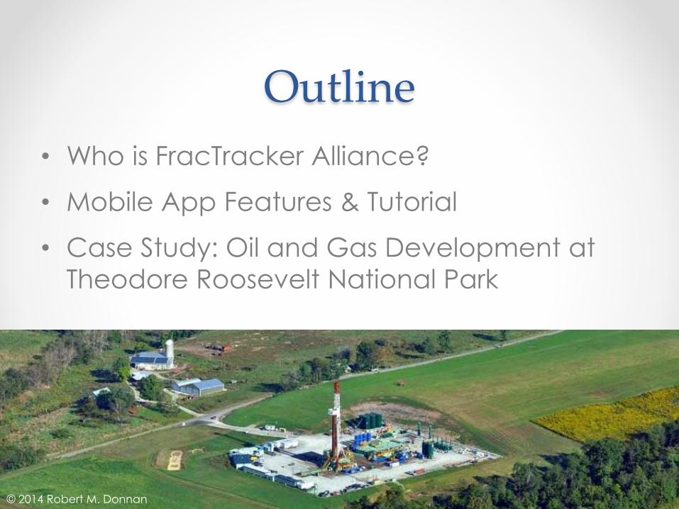
Outline
• Who is FracTracker Alliance?
• Mobile App Features & Tutorial
• Case Study: Oil and Gas Development at
Theodore Roosevelt National Park
© 2014 Robert M. Donnan

About Us
• Our Mission: We share maps, data, and analyses to
communicate impacts of the global oil and gas
industry and inform actions that positively shape our
energy future.
• Our website, FracTracker.org, provides a variety of
online oil and gas resources:
• Articles
• Analyses
• Photos
• Collaborative Projects
• Maps: Static (paper or
image file) and Dynamic
(ArcGIS Online)
• Raw Data

We look at oil and gas issues broadly
Analysis of national data, March 2015
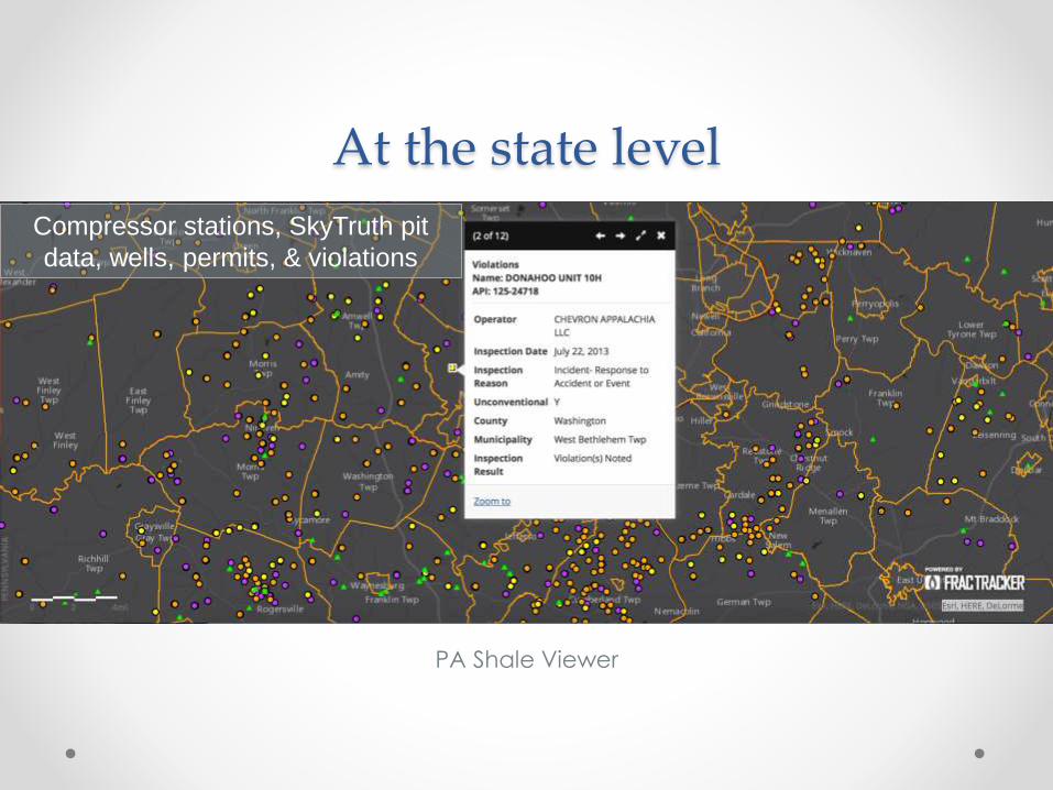
At the state level
PA Shale Viewer
Compressor stations, SkyTruth pit
data, wells, permits, & violations
And more closely at thematic
and timely issues…
• Addressing these data collection issues led us to
develop a mobile app that tracks oil and gas
activity in the U.S.
• Available for iPhones and Androids
• Download the app: fractracker.org/app

App Features
See oil and gas wells
near you on a map
Submit oil and gas
reports about nearby
activity and issues
Upload your oil and gas
photos

Quick Walk ThroughDownload the app: fractracker.org/app
Open the app on your
phone. Select “allow
location” as this with
enable you to take full
advantage of the app’s
features.
Fill in your name and email
on the next screen (shown
right) to get started. Tap “Save”
1
2
3
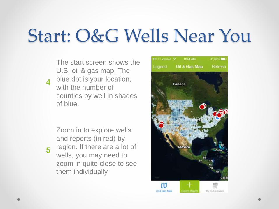
Start: O&G Wells Near YouThe start screen shows the
U.S. oil & gas map. The
blue dot is your location,
with the number of
counties by well in shades of blue.
4
5
Zoom in to explore wells
and reports (in red) by
region. If there are a lot of
wells, you may need to
zoom in quite close to see them individually
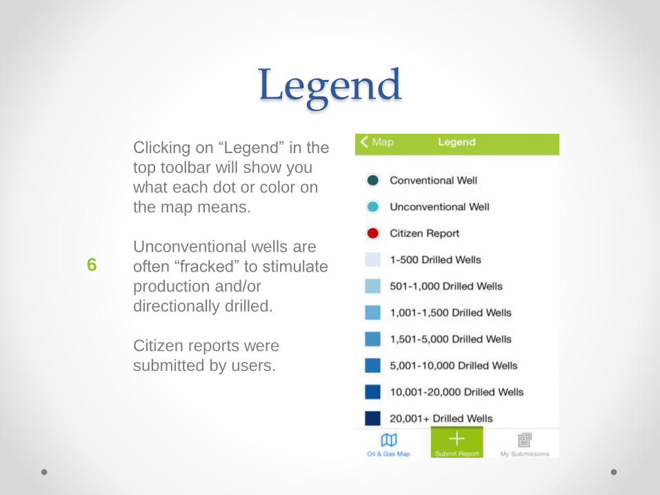
LegendClicking on “Legend” in the
top toolbar will show you
what each dot or color on
the map means.
Unconventional wells are
often “fracked” to stimulate
production and/or
directionally drilled.
Citizen reports were
submitted by users.
6

Explore a Site
7Once zoomed in on the
map, tap on a dot to learn about the site.
In the popup box, tap
to see more details about
that location, such as a well’s API number.
Tap “Submit Report” in the
bottom toolbar to add an observation of your own.
8
9
i

Submit Report
Share observations about
oil & gas activity near you
through this form,
including the issue, facility,
& location. Upload photos, too!
Change the location
associated in this report
(e.g. in case of poor
reception in the field) by
tapping “Add a different
location.”
Tap “Save” to submit.
10

Previous Submissions
Once we have reviewed
your report, a red dot will
appear on the oil & gas
map based on the location you provided.
Tap on “My Submissions”
to view your previous
reports & their statuses in the review queue.
Share a report via social media by tapping “Share.”
11
12
13

Oil & gas development at Theodore Roosevelt National Park w/NPCA
with FracTracker’s Mobile App • www.fractracker.org/app
explore the map
Contact Information
Samantha Malone, MPH, CPH
Manager of Education, Communications, &
Partnerships – FracTracker Alliance
412-802-0273
www.fractracker.org
Related Documents


