Malin Landslide One Day Workshop on Forensic Geotechnical E Mr. Shivaji M. Sarvade Mr. Pratik S. Khadatare (Fabtech Technical Campus, College of Solapur, Maharashtra.) e: A Case Stud Engineering, GNDEC, Ludhiana Engineering & Research.

Welcome message from author
This document is posted to help you gain knowledge. Please leave a comment to let me know what you think about it! Share it to your friends and learn new things together.
Transcript
Malin Landslide
One Day Workshop on Forensic Geotechnical E
Mr. Shivaji M. Sarvade
Mr. Pratik S. Khadatare(Fabtech Technical Campus, College of E
Solapur, Maharashtra.)
ide: A Case Stud
l Engineering, GNDEC, Ludhiana
of Engineering & Research.

"Engineering is a noble sport . . . bu
the game. Let it be your ambition
announce your blunders. . . . Once youannounce your blunders. . . . Once you
blunders in the face of reasonable evid
sport. You are already a crank or a grou
but occasional blundering is a part of
to be the first one to discover and
you begin to feel tempted to deny youryou begin to feel tempted to deny your
evidence you have ceased to be a good
grouch.”
~ Karl Terzaghi
2
Introdu
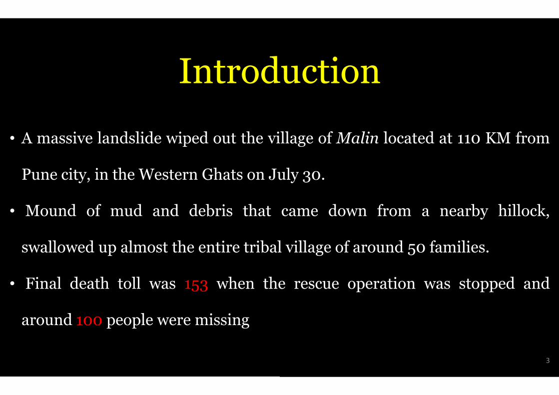
• A massive landslide wiped out the vil
Pune city, in the Western Ghats on Jul
• Mound of mud and debris that
swallowed up almost the entire tribal
• Final death toll was 153 when the
around 100 people were missing
oduction
village of Malin located at 110 KM from
July 30.
came down from a nearby hillock,
al village of around 50 families.
the rescue operation was stopped and
3
Introduoduction
4
GEOGRAPHICAL
• Malin village is a part of westernHeritage Site and is one of the eigdiversity in the world with average
Basalt is the predominant rock fou• Basalt is the predominant rock fouof 3 km. Other rock types foundgneisses etc. with detached occurrore, dolerites and anorthosites.
• Malin is southern part of AmbegaonSahyadri Mountain range and is tow
AL BACKGROUND
ern ghat which is a UNESCO Worldeight "hottest hotspots" of biological
rainfall of 1171 mm.
found in the hills reaching a thicknessfound in the hills reaching a thicknessnd are granite gneiss, metamorphicrrences of crystalline limestone, iron
aon taluka which falls to the foothill oftowards the west side of Pune city.
5
CULPR
• Very Heavy Rainfall.
• Deforestation and Levelling Of Land
• Change in Agriculture Practice
• Backwater of Dimbhe Dam.
• Human Interference in Nature.
PRITS…
and on the Hill for Cultivation.
6
CULPR
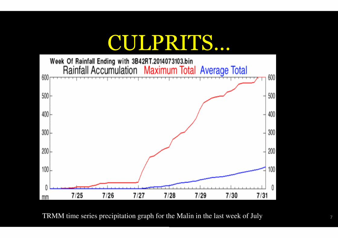
TRMM time series precipitation graph for the
PRITS…
the Malin in the last week of July 7
CULPR
• Very Heavy Rainfall.
• Deforestation and Levelling of Land
• Change in Agriculture Practice
• Backwater of Dimbhe Dam.
• Human Interference in Nature.
PRITS…
nd on the Hill for Cultivation.
8

CULPR
• Very Heavy Rainfall.
• Deforestation and Levelling Of Land
• Change in Agriculture Practice
• Backwater of Dimbhe Dam.
• Human Interference in Nature.
PRITS…
and on the Hill for Cultivation.
9
CULPR
• Very Heavy Rainfall.
• Deforestation and Levelling Of Land
• Change in Agriculture Practice
• Backwater of Dimbhe Dam.
• Human Interference in Nature.
PRITS…
and on the Hill for Cultivation.
10
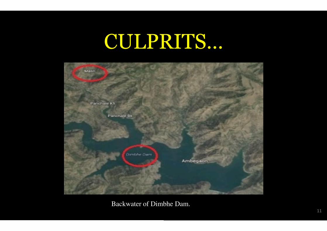
CULPR
Backwater of Dimbhe
PRITS…
mbhe Dam.11
CULPR
• Very Heavy Rainfall.
• Deforestation and Levelling Of Land
• Change in Agriculture Practice
• Backwater of Dimbhe Dam.
• Human Interference in Nature.
PRITS…
and on the Hill for Cultivation.
12

MITIGA
• Land Assessment.
• Slope Stabilization and Developmen
• Prepare Slope Stability Maps.• Prepare Slope Stability Maps.
• Prepare Landslide Inventory Datab
• Redirect Debris Channel.
• Vegetation.
GATION
ent.
abase.
13

MITIGA
• Land Assessment.
• Slope Stabilization and Developmen
• Prepare Slope Stability Maps.• Prepare Slope Stability Maps.
• Prepare Landslide Inventory Datab
• Redirect Debris Channel.
• Vegetation.
GATION
ent.
abase.
14
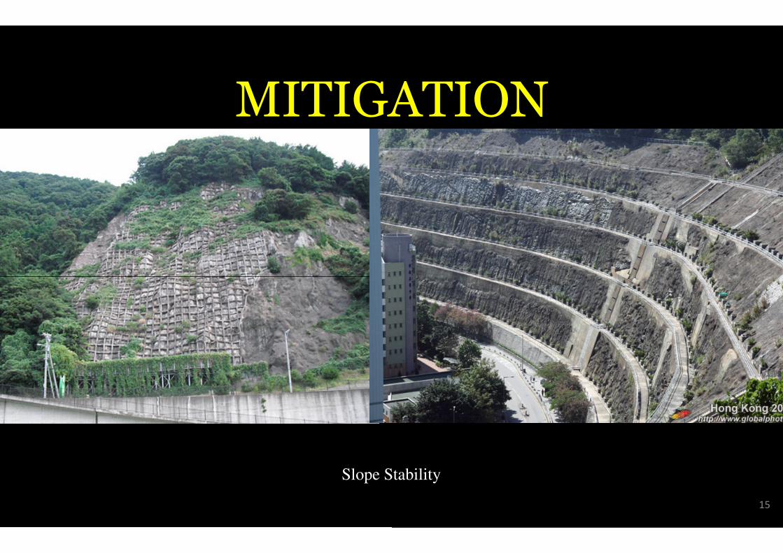
MITIGA
Slope S
GATION
Stability
15
MITIGA
• Land Assessment.
• Slope Stabilization and Developmen
• Prepare Slope Stability Maps.• Prepare Slope Stability Maps.
• Prepare Landslide Inventory Datab
• Redirect Debris Channel.
• Vegetation.
GATION
ent.
abase.
16
MITIGA
• Land Assessment.
• Slope Stabilization and Developmen
• Prepare Slope Stability Maps.• Prepare Slope Stability Maps.
• Prepare Landslide Inventory Datab
• Redirect Debris Channel.
• Vegetation.
GATION
ent.
abase.
17

MITIGA
• Land Assessment.
• Slope Stabilization and Developmen
• Prepare Slope Stability Maps.• Prepare Slope Stability Maps.
• Prepare Landslide Inventory Datab
• Redirect Debris Channel.
• Vegetation.
GATION
ent.
abase.
18
MITIGA
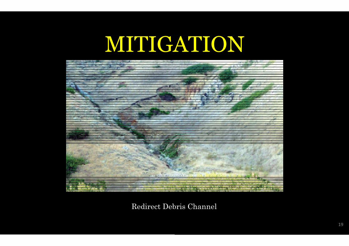
Redirect Deb
GATION
ebris Channel
19
MITIGA
• Land Assessment.
• Slope Stabilization and Developmen
• Prepare Slope Stability Maps.• Prepare Slope Stability Maps.
• Prepare Landslide Inventory Datab
• Redirect Debris Channel.
• Vegetation.
GATION
ent.
abase.
20
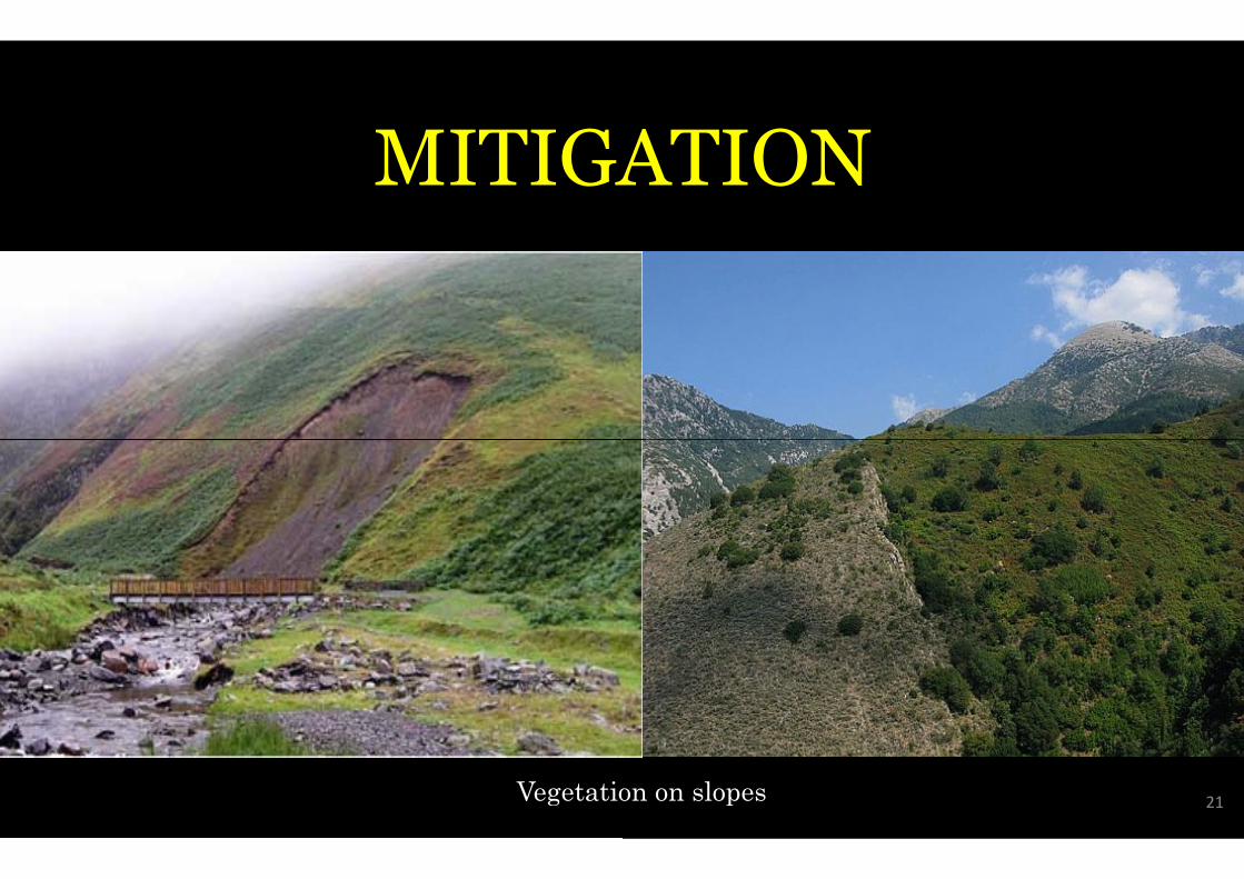
MITIGA
Vegetation
GATION
tion on slopes21
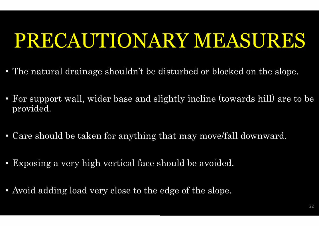
PRECAUTIONAR
• The natural drainage shouldn’t be d
• For support wall, wider base and sligprovided.provided.
• Care should be taken for anything t
• Exposing a very high vertical face sh
• Avoid adding load very close to the
ARY MEASURES
disturbed or blocked on the slope.
slightly incline (towards hill) are to be
that may move/fall downward.
should be avoided.
edge of the slope.
22
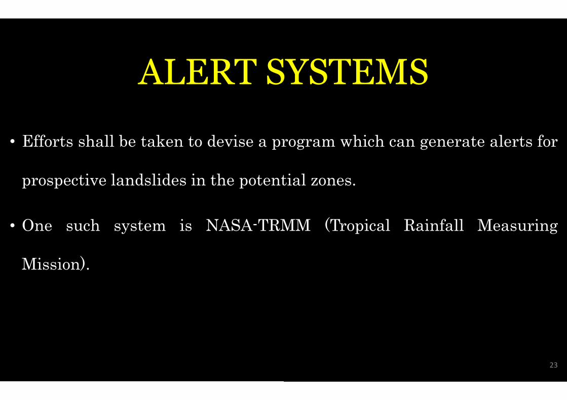
ALERT SY
• Efforts shall be taken to devise a pr
prospective landslides in the potent
• One such system is NASA-TRM
Mission).
SYSTEMS
program which can generate alerts for
ential zones.
RMM (Tropical Rainfall Measuring
23
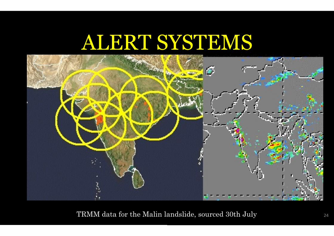
ALERT SY
TRMM data for the Malin la
SYSTEMS
landslide, sourced 30th July 24

Concluding
• Landslides are common in the arearuns from June through September
• Similar deforestation and environmand landslides in other parts of India
• Similar deforestation and environmand landslides in other parts of India
• Last year, more than 6,000 peopleswept through Uttarakhand state d
ing Remarks.
rea during the monsoon season, whicher.
onmental damage have caused floodsndia.onmental damage have caused floodsndia.
were killed as floods and landslidesduring the monsoon season.
25
Concluding
• According to the information obtain
22,483 hutment in 327 hilly areas a
the city, including Western and Eathe city, including Western and Ea
the people living there need to be sh
• In the main city, 49 spots are dang
3986, while in Mumbai Suburb 278
ing Remarks.
ained under RTI, In Mumbai city over
across 25 Assembly constituencies in
Eastern suburbs, are dangerous andEastern suburbs, are dangerous and
shifted as soon as possible.
angerous in which total hutments are
78 spots are most dangerous.
26

Related Documents