3/6/2013 1 Advanced Geographic Information Systems Fine tuning cartography skills Vector manipulation Attribute data and vector calculations Lab 3 USGS Geologic Map of the Logan 30’ x 60’ Quadrangle

Welcome message from author
This document is posted to help you gain knowledge. Please leave a comment to let me know what you think about it! Share it to your friends and learn new things together.
Transcript

3/6/2013
1
Advanced Geographic Information Systems
Fine tuning cartography skills Vector manipulation Attribute data and vector calculations
Lab 3 USGS Geologic Map of the Logan 30’ x 60’ Quadrangle

3/6/2013
2
Lab 3 You will add USGS layers to map project and clip out subsection
Lab 3
Task 1: Recreating portion of map • Focus on details
• Alignment • Symbology • Legends • Fonts
• No Representative Fractions
Task 2: Area calculation • Go beyond tutorials • Make graph symbology and title
effective

3/6/2013
3
N 4,634,200
E 500,000
E 430,400
16,510 m
19,050 m
E 446,910
N 4,615,150
Lab 3 UTM central
meridian
Dimensions of
bounding box
Calculating UTM coordinate pairs to define bounding box
Lab 3
Highlight elements
that contain the most
useful information
3/6/2013
4
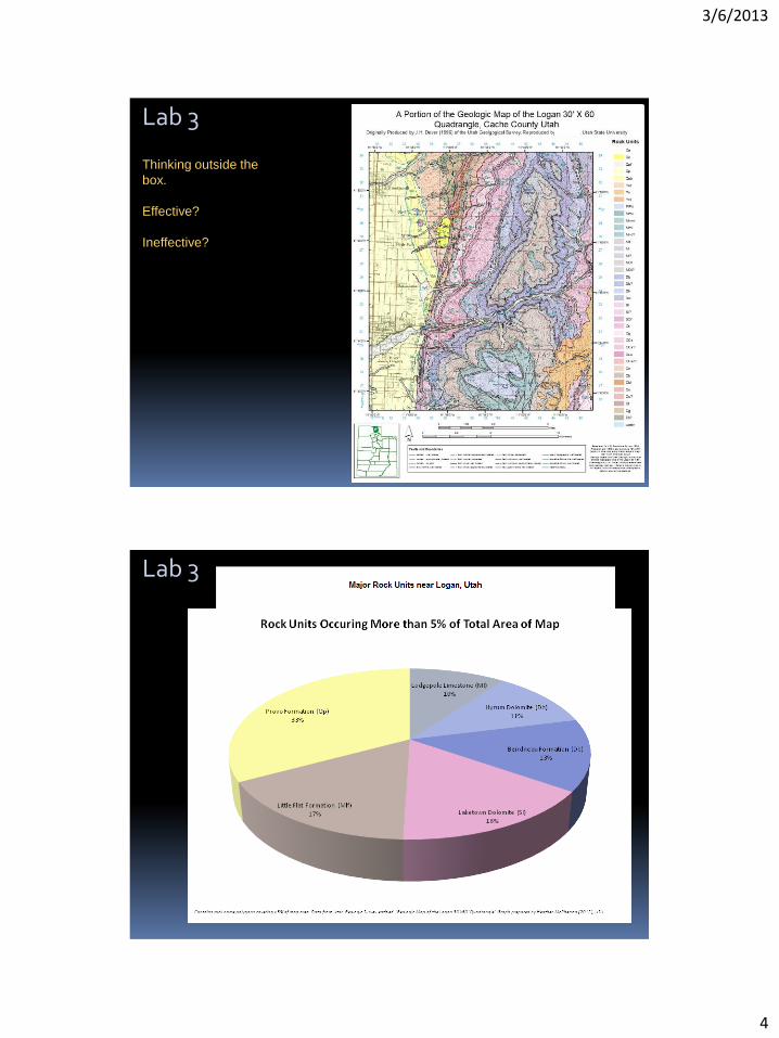
Lab 3
Thinking outside the
box.
Effective?
Ineffective?
Lab 3
3/6/2013
5
Select export
Questions? Submit URL to Canvas
Next week before lab
Related Documents