Draft Environmental Assessment Kenmore Federal Navigation Channel Maintenance Dredging and Disposal FY2020 King County, Washington March 2020

Welcome message from author
This document is posted to help you gain knowledge. Please leave a comment to let me know what you think about it! Share it to your friends and learn new things together.
Transcript

Draft Environmental Assessment Kenmore Federal Navigation Channel Maintenance Dredging and Disposal FY2020 King County, Washington
March 2020

Kenmore Federal Navigation Channel Maintenance – Draft Environmental Assessment Page i
Draft Environmental Assessment Kenmore Federal Navigation Channel Maintenance Dredging and Disposal FY2020 Responsible Agency: The responsible agency for this navigation project is the U.S. Army Corps of Engineers, Seattle District.
Abstract:
In accordance with the National Environmental Policy Act, this Environmental Assessment evaluates the impacts of the proposed maintenance of the Kenmore Federal Navigation Channel. The authorized navigation channel is approximately 2,900 feet (ft) long and 100 to 120 ft wide. The channel is adjacent to the Sammamish River at the north end of Lake Washington. The U.S. Army Corps of Engineers (USACE) completed construction of the Kenmore Federal Navigation Channel in March 1981 and performed maintenance dredging in the channel once in 1998. Maintenance need is determined by hydrographic condition surveys, indicating that shoaling (settling of suspended sediments) has altered the channel from the authorized dimensions. The authorized channel depth is 15 ft below low lake level in Lake Washington (equivalent to +20 feet MLLW). The Hiram M. Chittenden Locks at the Lake Washington Ship Canal (“Locks”) connects the salt water of Puget Sound to the freshwater of Lake Union and Lake Washington. The Locks provide for transport of commercial cargo vessels as well as recreational vessels. Additionally, the Locks provides for passage of anadromous fish and also maintains the level of Lake Washington between +20 and +22 feet MLLW. The authorized navigation channel dimensions allow safe navigation during all lake levels. The purpose for channel maintenance is to support the navigation activities and regular shipping traffic for regional economic development. The channel provides access to the Kenmore Industrial Park, which occupies 97 acres of industrially zoned land. Businesses within the industrial park rely upon the waterway for shipping. Barges are towed between Kenmore and Puget Sound through the Lake Washington Ship Canal. The primary activity is transportation of sand and gravel, as well as materials for the production of concrete. Other activities include the operation of seaplanes associated with Kenmore Air, which operates the largest international seaplane facility in the country. To maintain the navigation channel, the USACE proposes to remove up to about 45,000 cubic yards (cy) of accumulated sediment from the navigation channel. Dredging would occur within the in-water work window of 16 November 2020 through 1 February 2021. The dredging will be accomplished using a mechanical clamshell dredge designed to minimize the potential for impacts to the surrounding environment (e.g. excessive turbidity or re-sedimentation). Dredged material will be placed in sealed barges for dewatering and transportation to a transloading site (location to be defined by the Contractor). Dewatering of material will occur in open water near the navigation channel. All dredging and dewatering will be performed in accordance with the water quality monitoring plan (Appendix A) developed

Kenmore Federal Navigation Channel Maintenance Dredging – Draft Environmental Assessment Page ii
for this project. Transfer to the disposal location will use sealed, non-leaking containers or trucks, in order to meet standards of the water quality monitoring plan or other regulated conditions. Dredging may take up to the 77 days of the in-water work window, depending on total quantity of material removed, mechanical breakdowns, and weather conditions. Based on analysis in this document, a Draft Finding of No Significant Impact (FONSI) is included for review (Appendix C). The Draft EA and Draft FONSI will be available for a 30-day public review 8 June through 8 July 2020.
This document is available online as “Kenmore Federal Navigation Channel Maintenance Dredging” http://www.nws.usace.army.mil/Missions/Environmental/Environmental-Documents/
June 2020

Kenmore Federal Navigation Channel Maintenance Dredging – Draft Environmental Assessment Page iii
Table of Contents 1. Proposal for Federal Action ................................................................................... 2
1.1 Project Location ................................................................................................. 2
1.2 Authority ............................................................................................................. 6
1.3 Purpose and Need ............................................................................................. 6
2. Proposed Action and Alternatives ........................................................................ 6
2.1 Alternative 1 – No Action .................................................................................... 6
2.2 Alternative 2 – Dredging and Open-Water Disposal in Puget Sound Disposal Site 7
2.3 Alternative 3 – Dredging and Upland Disposal ................................................. 11
2.4 Preferred Alternative Selection ......................................................................... 13
3. Issues for Comparison of the Alternatives ......................................................... 13
3.1 Hydraulics and Geomorphology ....................................................................... 16
3.2 Water Quality ................................................................................................... 17
3.3 Sediment Quality .............................................................................................. 21
3.4 Vegetation ........................................................................................................ 23
3.5 Fish .................................................................................................................. 26
3.6 Wildlife ............................................................................................................. 31
3.7 Benthic Invertebrates ....................................................................................... 32
3.8 Threatened and Endangered Species .............................................................. 33
3.9 Cultural Resources ........................................................................................... 35
3.10 Indian Treaty Rights ......................................................................................... 36
3.11 Air Quality and Greenhouse Gas Emissions .................................................... 37
3.12 Recreational Value ........................................................................................... 39
3.13 Socioeconomic Resources ............................................................................... 41
4. Cumulative Effects Analysis ................................................................................ 42
5. Mitigation and Monitoring for Adverse Environmental Effects ........................ 44
6. Coordination ......................................................................................................... 44
7. Environmental Compliance ................................................................................. 44
7.1 National Environmental Policy Act ................................................................... 44
7.2 Endangered Species Act .................................................................................. 45
7.3 Magnuson-Stevens Fishery Conservation and Management Act ..................... 45
7.4 Fish and Wildlife Coordination Act ................................................................... 46

Kenmore Federal Navigation Channel Maintenance Dredging – Draft Environmental Assessment Page iv
7.5 Clean Water Act ............................................................................................... 46
7.6 Coastal Zone Management Act ........................................................................ 46
7.7 National Historic Preservation Act .................................................................... 46
7.8 Clean Air Act .................................................................................................... 47
7.9 Native American Tribal Treaty Rights ............................................................... 47
7.10 Migratory Bird Treaty Act and Executive Order 13186 Migratory Bird Habitat Protection ................................................................................................................... 48
7.11 Executive Order 13175 Consultation and Coordination with Indian Tribal Governments ............................................................................................................. 48
7.12 Executive Order 12898, Environmental Justice ................................................ 49
7.13 Executive Order 11990, Protection of Wetlands ............................................... 49
8. Unavoidable Adverse Impacts ............................................................................. 49
9. Comparison of No-Action and Preferred Alternative ......................................... 50
10. Public Interest Evaluation Factors for Maintenance Dredging Activities ........ 51
11. Summary ............................................................................................................... 51
12. References ............................................................................................................ 52
Appendix A Water Quality Monitoring Plan (WQMP) ................................................. 1
Appendix B Air Quality – Air Emissions Calculations ............................................... 1
Appendix C Draft Finding of No Significant Impact ................................................... 1
Appendix D Coastal Zone Consistency Determination .............................................. 1
Appendix E Cultural Resources Stakeholder Letter .................................................. 1
Appendix F Endangered Species Act – Agency Letters ............................................ 1
List of Tables Table 3-1. List of resources considered for detailed effects analysis and rationale for inclusion or exclusion. ................................................................................................... 13 Table 3-2. Species listed under the Endangered Species Act with status and critical habitat designation. ....................................................................................................... 33 Table 3-3. Estimated emissions in metric tons per year for pollutants of concern. ........ 38 Table 3-4. Demographic estimates for the City of Kenmore and King County, 2018. ... 41 Table 9-1. Comparison of impacts of alternative actions. .............................................. 50
Kenmore Federal Navigation Channel Maintenance Dredging – Draft Environmental Assessment Page v
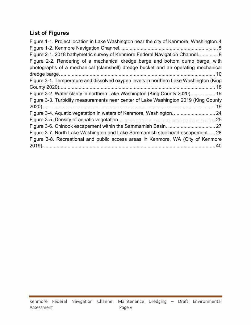
List of Figures Figure 1-1. Project location in Lake Washington near the city of Kenmore, Washington. 4 Figure 1-2. Kenmore Navigation Channel. ...................................................................... 5 Figure 2-1. 2018 bathymetric survey of Kenmore Federal Navigation Channel. ............. 8 Figure 2-2. Rendering of a mechanical dredge barge and bottom dump barge, with photographs of a mechanical (clamshell) dredge bucket and an operating mechanical dredge barge. ................................................................................................................ 10 Figure 3-1. Temperature and dissolved oxygen levels in northern Lake Washington (King County 2020). ................................................................................................................ 18 Figure 3-2. Water clarity in northern Lake Washington (King County 2020). ................. 19 Figure 3-3. Turbidity measurements near center of Lake Washington 2019 (King County 2020). ............................................................................................................................ 19 Figure 3-4. Aquatic vegetation in waters of Kenmore, Washington. .............................. 24 Figure 3-5. Density of aquatic vegetation. ..................................................................... 25 Figure 3-6. Chinook escapement within the Sammamish Basin. .................................. 27 Figure 3-7. North Lake Washington and Lake Sammamish steelhead escapement ..... 28 Figure 3-8. Recreational and public access areas in Kenmore, WA (City of Kenmore 2019). ............................................................................................................................ 40

Kenmore Federal Navigation Channel Maintenance Dredging – Draft Environmental Assessment Page 1
ACRONYMS AND ABBREVIATIONS BMP best management practice CAA Clean Air Act cy cubic yards CWA Clean Water Act D/F dioxins/furans DMMP dredged material management program DMMU dredged material management unit DNR Washington State Department of Natural Resources DO dissolved oxygen EA environmental assessment EFH essential fish habitat EPA U.S. Environmental Protection Agency ESA Endangered Species Act ft feet FY fiscal year kg kilograms MLLW mean lower low water µg micrograms NEPA National Environmental Policy Act ng nanograms NMFS National Marine Fisheries Service USFWS U.S. Fish and Wildlife Service USACE U.S. Army Corps of Engineers, Seattle District USGS U.S. Geological Survey

Kenmore Federal Navigation Channel Maintenance Dredging – Draft Environmental Assessment Page 2
1. Proposal for Federal Action Under the Council on Environmental Quality regulations, 40 CFR § 1500.1(c) and 40 CFR § 1508.9(a)(1), implementing the National Environmental Policy Act (NEPA) of 1969 (as amended), the purpose of an Environmental Assessment (EA) is to “provide sufficient evidence and analysis for determining whether to prepare an environmental impact statement or a finding of no significant impact” on actions authorized, funded, or carried out by the Federal government, and to assist agency officials to make decisions that are based on understanding of “environmental consequences, and take actions that protect, restore, and enhance the environment.” This EA evaluates environmental effects of proposed maintenance dredging by the U.S. Army Corps of Engineers, Seattle District (USACE), beginning in the fall of 2020 through 1 February 2021 of the Kenmore Federal Navigation Channel (Kenmore Navigation Channel). The only maintenance dredging was completed by USACE in January 1998, about 17 years post-construction and 22 years ago, currently, and removed 49,126 cubic yards (cy) of sediment.
The Kenmore Navigation Channel is located in King County, Washington. The channel provides a navigable route from deeper waters of Lake Washington to the Kenmore Industrial Park, which occupies 97 acres of industrially zoned land. Barges are towed by tug boats between Kenmore and Puget Sound through the Lake Washington Ship Canal. Deep-draft tug boats, appropriate to the size of the barge load and shipping demand, use the navigation channel to deliver barges to the industrial park. In recent years, shoaling has reduced the depth of the channel, hindering and preventing larger tug boats and other deeper draft vessels access in the channel. Barges must be light-loaded with a reduced quantity of material, in relation to the towing capacity of smaller tug boats able to access the channel. Continued shoaling will continue to reduce the usability of the industrial park and hamper the economic development.
This EA addresses the effects of routine maintenance dredging of the Kenmore Navigation Channel. Dredging will occur once in fall 2020 / winter 2021, and subsequent dredging, to be addressed by additional consultations and assessments, is anticipated to occur approximately every 15-20 years as needed. Dredging is conducted during defined in-water work windows to protect species listed under the Endangered Species Act (ESA). The proposed dredged material has been determined to be unsuitable for aquatic disposal therefore the material will be disposed at an upland location. The scope of activities analyzed for environmental effects in this document are the routine maintenance dredging and transloading of material for disposal at an upland site.
1.1 Project Location The Kenmore Navigation Channel is located in the northern margin of Lake Washington, approximately 11 miles north of Seattle (Figure 1-1). The navigation channel runs between the Sammamish River and the two marinas, North Lake Marina and Harbour

Kenmore Federal Navigation Channel Maintenance Dredging – Draft Environmental Assessment Page 3
Village Marina from deeper Lake Washington waters to the Kenmore Industrial Park (Figure 1-2).

Kenmore Federal Navigation Channel Maintenance Dredging – Draft Environmental Assessment Page 4
Figure 1-1. Project location in Lake Washington near the city of Kenmore, Washington.

Kenmore Federal Navigation Channel Maintenance Dredging – Draft Environmental Assessment Page 5
Figure 1-2. Kenmore Navigation Channel.

Kenmore Federal Navigation Channel Maintenance Dredging – Draft Environmental Assessment Page 6
1.2 Authority The construction and maintenance dredging of the Kenmore Navigation Channel was authorized by Congress in Section 107 of the Rivers and Harbors Act of 1960.
1.3 Purpose and Need The purpose of the action is to provide for safe navigation by maintaining the authorized depth for navigation access to the Kenmore Industrial Park, which occupies 97 acres of industrially zoned land. Businesses within the industrial park rely upon the waterway for shipping. Barges are towed by tug boat between Kenmore and Puget Sound through the Lake Washington Ship Canal. The primary activity is transportation of sand and gravel, as well as materials for the production of concrete. Other activities include the operation of seaplanes associated with Kenmore Air, which operates the largest international seaplane facility in the country. The purpose for channel maintenance is to support the navigation activities and regular shipping traffic for regional economic development.
The tug boats used to transport barges require the full authorized channel depth of 15 ft below low lake level in Lake Washington (equivalent to +20 feet mean lower low water (MLLW)). As shoaling has reduced the depth of the channel, the deep-draft tug boats have not been able to access the channel. Barges must be light-loaded with a reduced quantity of material, in relation to the towing capacity of smaller tug boats able to access the channel. Maintenance need is determined by hydrographic condition surveys, indicating that shoaling (settling of suspended sediments) has altered the channel from the authorized dimensions required for safe navigation of commercial vessels. The most recent survey, performed 16 July 2018, indicated areas of the channel were more than two feet above the authorized elevation.
2. Proposed Action and Alternatives According to the identified need for maintenance dredging, USACE formulated, evaluated, and screened alternatives for determining the action that qualifies as the Federal Standard or preferred alternative. The Federal Standard is defined in USACE regulations as the least costly alternative that is consistent with sound engineering practices and meets all federal environmental requirements. This chapter describes the range of alternatives that were evaluated and screened for selection of the preferred alternative and identifies the preferred alternative that was selected.
2.1 Alternative 1 – No Action The No-Action Alternative is analyzed as the future without-project conditions for comparison with the action alternatives. If the USACE takes no action to remove sediment above authorized project depth from the Kenmore Navigation Channel, continued shoaling would pose increasing risk to tug boats and other deep-draft vessels that may run aground when transiting the channel. Eventually, accumulated sediments would reduce the depths of the channel, greatly restricting use by deep draft vessels. This would

Kenmore Federal Navigation Channel Maintenance Dredging – Draft Environmental Assessment Page 7
have a negative effect on the local maritime economy and the businesses associated with the Kenmore industrial park. This alternative would not meet the project purpose and need, but is carried forward for evaluation purposes.
2.2 Alternative 2 – Dredging and Open-Water Disposal in Puget Sound Disposal Site The Kenmore Navigation Channel would be dredged to its authorized depth with allowable overdepth with disposal of the dredged material at the Elliot Bay open water disposal site. The project consists of removing up to 45,000 cy of material dredged (estimated total is 34,350 cy) from station 0+00 to station 33+00 of the main channel to its authorized depth of 15 feet below low lake level (+20 feet MLLW), plus two feet of allowable overdepth. Quantities are estimated conservatively for environmental impacts analysis and include the amount of allowable overdepth. Survey data from July 2018 indicate accumulation above the authorized mudline elevation (Figure 2-1). Accumulated sediments are predominantly silt with sand.

Kenmore Federal Navigation Channel Maintenance Dredging – Draft Environmental Assessment Page 8
Figure 2-1. 2018 bathymetric survey of Kenmore Federal Navigation Channel.

Kenmore Federal Navigation Channel Maintenance Dredging – Draft Environmental Assessment Page 9
Dredging may take up to 77 days, depending on total quantity of material removed, mechanical breakdowns, and weather conditions. The dredging project will occur up to 24 hours per day, seven days per week. The USACE approved in-water work window for northern Lake Washington is 16 July through 31 July and 16 November through 1 February to protect migrating salmonids (USACE 2013). 2020 dredging activities are anticipated to be scheduled during the fall/winter work window (16 November 2020 – 1 February 2021), pending any updates to tribal fishing needs. USACE will coordinate with potentially affected Tribes prior to finalizing the work schedule.
A clamshell dredge operation includes a dredge barge with a deck-mounted crane, a clamshell bucket, at least one tug boat, and at least one sediment transport barge. During active dredging, a transport barge is tied to the dredge barge. The clamshell dredge (a type of mechanical dredge) utilizes a bucket deployed by a crane, mounted on a dredge barge, to remove the sediment. The bucket is sufficiently heavy to sink into the substrate. The dredge bucket has two jaws that are hinged in such a fashion that the bucket is open while descending through the water column (Figure 2-2). There are a variety of bucket types designed for different substrate conditions, and best management practices (BMPs) call for the use of a bucket designed to minimize the potential for impacts to the surrounding environment (e.g. excessive turbidity or re-sedimentation). After closing, the top portion of the bucket remains open as the bucket is retrieved. A “controlled lowering” of the bucket reduces turbulence and the amount of suspended sediment generated. After the bucket penetrates the substrate, the bucket is closed, taking a “bite” out of the substrate. The bucket is retrieved and swung over to a transport barge where the sediment is placed for transport to a disposal site. With the top and/or bottom of the bucket open, the probability of catching and retaining mobile organisms is minimal.

Kenmore Federal Navigation Channel Maintenance Dredging – Draft Environmental Assessment Page 10
Figure 2-2. Rendering of a mechanical dredge barge and bottom dump barge, with photographs of a mechanical (clamshell) dredge bucket and an operating mechanical dredge barge.
The dredge barge is equipped with vertical steel pipes, called spuds that are sunk into the substrate to anchor the dredge barge in one location. To move the dredge barge, the spuds are retrieved and a tug moves the dredge barge to a new location. The spuds are again sunk into the substrate to secure the dredge barge and dredging continues. Dredge barges are not self-propelled, but some dredge barges can, on occasion, move short distances by setting the dredge bucket into the substrate, retrieving the spuds, then pulling on the dredge bucket cable, and then inserting the spuds in the new location.
Disposal at the Elliot Bay Puget Sound dredged material disposal site is subject to analysis by the dredged material management program (DMMP) agencies (USACE, Washington State Department of Ecology (Ecology), US Environmental Protection Agency (EPA), and Washington State Department of Natural Resources (DNR)). Potential dredge material was tested according to the DMMP guidance and found to be unsuitable for disposal for open-water disposal. Due to irregularities in the larval development bioassay, it was not possible to eliminate the influence of non-treatment effects on the test results (DMMP 2019). Because of these confounding effects, DMMP agencies were not able to make a decision regarding the suitability of the dredged material and concluded that, provided the current data, the material must be considered unsuitable for open-water disposal. Therefore, the analysis does not consider open-water, or aquatic, disposal as an alternative action that would meet the environmental requirements of the Federal Standard.

Kenmore Federal Navigation Channel Maintenance Dredging – Draft Environmental Assessment Page 11
2.3 Alternative 3 – Dredging and Upland Disposal Under this alternative, dredging would occur as described for Alternative 2, but material would not be disposed of in open-water. Sediments in the navigation channel have been determined to be unsuitable for aquatic disposal due to bioassay results and therefore the material will be disposed of at an upland location. Dredged material will be placed in a sealed barge for dewatering and transportation to a transloading site. Dewatering of material will occur in open water near the navigation channel.
Transloading and upland disposal sites are to be identified by the dredging contractor with final approval of sites and plans by USACE. Implementation of dredging best management practices (BMPs) will be guided by the monitoring of turbidity as detailed in the water quality monitoring plan (WQMP) (Appendix A). Transfer to the disposal location will use sealed, non-leaking containers or trucks, as defined by BMPs or other regulated conditions.
Dredging will be performed within the established navigation channel and no expansion of the channel or creation of new channel(s) will occur. Therefore, actions will only involve previously disturbed benthic habitat. The following conservation measures and BMPs will be implemented to reduce the impacts to ESA-listed species:
Conservation Measures
• Any disturbance of the upland area by transloading activities or equipment, will be restored to the original pre-project conditions upon the immediate completion of construction.
• Existing habitat features such as native vegetation and large wood will be retained on-site to the extent possible.
Best Management Practices
The following BMPs are intended to avoid and minimize impacts to aquatic species and the natural environment from dredging and transfer-related effects such as underwater noise or suspended sediment:
• In-water work will be limited to the in-water work window (16 November to 1 February), which would not interfere with tribal fisheries, and is outside the known migration periods for adult Chinook and coho salmon and mostly avoids juvenile migration periods.
• Project is limited to specific authorized dimensions and will be executed within the Congressional authority for the project.
• Maintenance dredging is conducted based on the results of site-specific, current hydrographic condition surveys conducted for each dredging event.

Kenmore Federal Navigation Channel Maintenance Dredging – Draft Environmental Assessment Page 12
• USACE will use a clamshell (mechanical) dredge, where project requirements allow this equipment, to minimize the possibility of entraining or otherwise harming ESA-listed species.
• USACE obtained a suitability determination of the sediment following DMMP protocols for sediment disposal and places material at the appropriate designated disposal sites. Material determined unsuitable for open-water disposal is disposed at appropriate upland sites.
• USACE coordinates dredging projects with the local Indian Tribes that have usual and accustomed fishing rights in each project area.
• Clamshell dredging operations are conducted in a manner that minimizes spillage of sediments from the dredge bucket and transport barge.
• Clamshell bucket will be raised and lowered through the water column at a slow rate to minimize turbidity increases, if monitoring results indicate this BMP is needed to avoid an exceedance.
• Bucket is only filled to capacity – bucket is not overfilled. • Bucket is paused at the surface, after its ascent through the water column, to
minimize turbidity by allowing free water to drain from the bucket prior to swinging the bucket to the scow.
• Careful placement of material from a clamshell bucket into a barge to limit splash and prevent spillage.
• Once the material has been removed, the dredged material will not be dumped back into the water.
• Barges used to transport the dredged material to the disposal or transfer sites will not be filled beyond their capacity and will completely contain the dredged material.
• Equipment holding dredged material will be sealed to prevent losses during transit. • Dredging bucket utilized for digging should be designed to minimize turbidity while
dredging. • Transfer locations will be established to confine any accidental spillage and
prevent releasing dredged material back into the environment. • Equipment used near and in the water will be cleaned prior to construction. • The contractor will take care to prevent any petroleum products, chemicals, or
other toxic or deleterious materials from construction equipment and vehicles from entering the water.
• A spill containment kit, including oil-absorbent materials will be kept on-site during construction in the event of a spill or if any oil product is observed in the water. If a spill were to occur, work would be stopped immediately, steps would be taken to contain the material, and appropriate agency notifications would be made.

Kenmore Federal Navigation Channel Maintenance Dredging – Draft Environmental Assessment Page 13
• Turbidity will be monitored to ensure construction activities are in conformance with the protocols and criteria in the WQMP (Appendix A).
2.4 Preferred Alternative Selection and Alternatives Eliminated from Further Consideration
The USACE rejected Alternative 1 because it would not meet the project purpose and need. Alternative 2 is substantially less costly than Alternative 3, but sediments do not meet environmental standards required for open-water disposal and therefore the alternative must be rejected. Alternative 2 was not carried forward for detailed analysis because it was not a viable option. Alternative 3 meets the Federal standard, and is consistent with sound engineering practices that meet environmental standards and is carried forward for detailed analysis. While the No Action Alternative (Alternative 1) is not recommended, it is carried forward for further evaluation to serve as a base condition for evaluation of other alternatives.
3. Issues for Comparison of the Alternatives This section provides information on the existing conditions of resources within the project area and issues relevant to the decision process for selecting the preferred alternative. Existing conditions are the physical, chemical, biological, and socioeconomic characteristics of the project area. Factors for selecting the preferred alternative include considering which of the alternatives would be the least costly, environmentally acceptable, consistent with engineering practices, and meets the purpose and need of the project. Table 3-1 identifies the resources evaluated for detailed analysis with a rationale for inclusion or exclusion. Resources were excluded from detailed analysis if they are not potentially affected by the alternatives or have no material bearing on the decision-making process. Table 3-1. List of resources considered for detailed effects analysis and rationale for inclusion or exclusion.
Resource
Included in Detailed Analysis (Y/N) Rationale for inclusion or exclusion
Hydraulics and Geomorphology
Y Alteration of the bathymetric condition may affect local hydraulics and geomorphology. The proposed action requires study of these characteristics.
Groundwater N The proposed action is limited to the subtidal environment. No groundwater would be affected.

Kenmore Federal Navigation Channel Maintenance Dredging – Draft Environmental Assessment Page 14
Resource
Included in Detailed Analysis (Y/N) Rationale for inclusion or exclusion
Water and Sediment Quality
Y Analysis is required to determine the intensity of potential changes to the condition of water and sediments in and around the project location.
Vegetation Y Aquatic vegetation exists in the nearshore of Lake Washington, although unlikely in the navigation channel.
Fish Y Many different fish species may be present. Analysis is required to determine which species would be present, the intensity of effects, and how to avoid or minimize effects.
Wildlife (mammals and birds)
Y Mammals that may occur in the study area include river otters, raccoons, and rodents. Bird species present are also likely to be those well habituated to human activity and development. Noise and turbidity from construction may be temporarily disruptive.
Benthic Invertebrates
Y Benthic macroinvertebrate populations are known to recover quickly from the type of action proposed, but community structure can change under disturbance regimes. Significant negative effects are not anticipated, but analysis is required to determine intensity of effects.
Threatened and Endangered Species
Y The proposed action may affect ESA-listed species in the study area. Analysis is required to determine the intensity of effects and how to avoid or minimize impacts.
Cultural Resources
Y Analysis is required to investigate cultural resources and to determine the extent of any potential effects.
Tribal Treaty Rights
Y The study area is within treaty-reserved fishing areas, called Usual & Accustomed areas. No substantial negative effects are anticipated, but analysis is required to avoid and minimize effects.
Air Quality Y The air-pollutant concentrations in the study area have consistently been below the National Ambient Air Quality
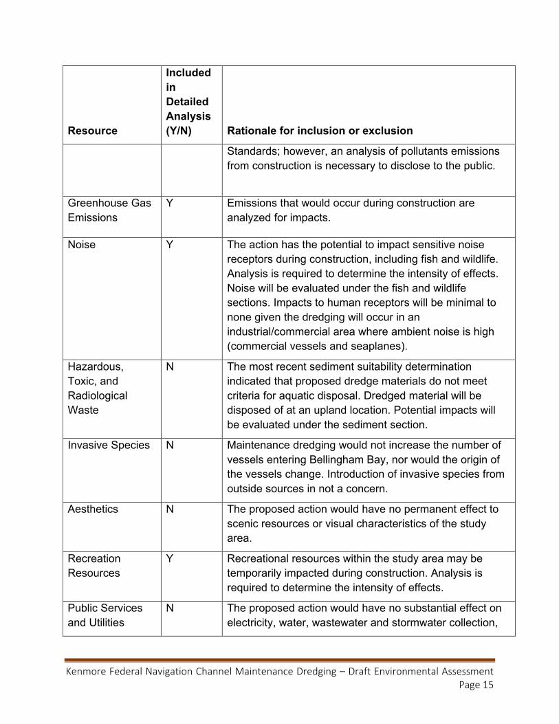
Kenmore Federal Navigation Channel Maintenance Dredging – Draft Environmental Assessment Page 15
Resource
Included in Detailed Analysis (Y/N) Rationale for inclusion or exclusion
Standards; however, an analysis of pollutants emissions from construction is necessary to disclose to the public.
Greenhouse Gas Emissions
Y Emissions that would occur during construction are analyzed for impacts.
Noise Y The action has the potential to impact sensitive noise receptors during construction, including fish and wildlife. Analysis is required to determine the intensity of effects. Noise will be evaluated under the fish and wildlife sections. Impacts to human receptors will be minimal to none given the dredging will occur in an industrial/commercial area where ambient noise is high (commercial vessels and seaplanes).
Hazardous, Toxic, and Radiological Waste
N The most recent sediment suitability determination indicated that proposed dredge materials do not meet criteria for aquatic disposal. Dredged material will be disposed of at an upland location. Potential impacts will be evaluated under the sediment section.
Invasive Species N Maintenance dredging would not increase the number of vessels entering Bellingham Bay, nor would the origin of the vessels change. Introduction of invasive species from outside sources in not a concern.
Aesthetics N The proposed action would have no permanent effect to scenic resources or visual characteristics of the study area.
Recreation Resources
Y Recreational resources within the study area may be temporarily impacted during construction. Analysis is required to determine the intensity of effects.
Public Services and Utilities
N The proposed action would have no substantial effect on electricity, water, wastewater and stormwater collection,

Kenmore Federal Navigation Channel Maintenance Dredging – Draft Environmental Assessment Page 16
Resource
Included in Detailed Analysis (Y/N) Rationale for inclusion or exclusion
sewer and solid waste, natural gas, oil/petroleum, or telecommunications services.
Socioeconomics Y A purpose of the project is to maintain safe navigation for commercial and industrial uses, thus maintaining affected economies.
Public Health and Safety
Y The proposed dredging will improve safe navigation. All material is will be disposed of at an appropriate upland location.
Land-based Transportation and Traffic
N None of the alternatives would cause changes to local traffic or surface transport of import and export goods and commodities.
3.1 Hydraulics and Geomorphology The Cedar River – Lake Washington watershed includes the Cedar River to the south and receives the output of the Sammamish River at the northern margin. Lake Washington and the Sammamish River were substantially altered by the construction of the Lake Washington Ship Canal connecting Lake Washington to the Puget Sound rather than the historic connection via the Black River. Lake Washington was lowered by approximately 9 feet. Shallow water habitat became dry ground, and the overall surface area of the lake was reduced. Lake Washington generally lacks complex shoreline habitat or structure features such as shade, submerged and overhanging large wood, log jams and beaver dams, aquatic vegetation, large rocks and boulders, side channels, and undercut banks.
The historic Sammamish River corridor contained vast wetlands with many meandering and braided channels (Tetra Tech, Inc. 2002). The river is low-gradient (average bed slope of 0.019 percent below transition from Lake Sammamish, King County 2012) with substantial amounts of fine material within the substrate. Since the 1880s, the diverse assemblage of wetland, riparian, and old-growth forest habitats has been reduced to a single, channelized river disconnected from floodplain or wetland habitat.
3.1.1 Alternative 1 – No-Action Under the No-Action alternative, sediment would continue to accumulate in the navigation channel. Shoaling of sediment would continue to hamper vessel passage to and from the

Kenmore Federal Navigation Channel Maintenance Dredging – Draft Environmental Assessment Page 17
Kenmore industrial park. Continued shoaling would result in less water depth throughout the channel and, if allowed to continue unimpeded, could reduce or eliminate vessel traffic.
3.1.2 Alternative 3 – Dredging and Upland Disposal Maintenance dredging would return the channel to its authorized depth of 15 ft plus two feet of overdepth. Safe access would likely continue over the next 15 years if previous trends in sedimentation persist. The channel may act as a sink for sediments being deposited at the mouth of the Sammamish River, but effects are anticipated to be negligible.
Water movement in the area is highly modified and regulated compared to historic conditions due to the construction of the Lake Washington Ship Canal and the flood management and development actions along the Sammamish River. The dredging of accumulated sediments from the navigation channel will not alter the existing water movement processes. Maintenance of the channel is not likely to significantly affect the hydraulics or geomorphology outside of the channel.
3.2 Water Quality The Sammamish River contributes 27 percent of the hydraulic load to Lake Washington, and, while Lake Washington is noted as ‘exceptional’ for a large urbanized lake (King County 2020), Sammamish River water has been considerably degraded. The river is on Ecology’s 303(d) list of impaired waterways due to seasonally high water temperatures and low dissolved oxygen levels (Ecology 2020a). Lake Washington is designated by Ecology as core summer salmonid habitat with corresponding temperature criteria of not to exceed a 7-day average of daily maximum temperatures of 16°C. Lack of large vegetation (trees and large shrubs) in the riparian zone has been cited as a significant cause of elevated temperature in the Sammamish River. Due to heavy industrial and agricultural use, there is a near complete lack of riparian trees along the shoreline of the lower Sammamish River. Dissolved oxygen levels correlate to water temperatures as colder water can contain greater quantities of dissolved gases. Criteria within Lake Washington is greater than 9.5 mg/L dissolved oxygen for the lowest 1-day minimum. Dissolved oxygen regularly drops below this threshold concurrent to increases in temperature above the state (Ecology’s) criteria (Figure 3-1).

Kenmore Federal Navigation Channel Maintenance Dredging – Draft Environmental Assessment Page 18
Figure 3-1. Temperature and dissolved oxygen levels in northern Lake Washington (King County 2020).
Turbidity is often a concern for dredging operations depending upon the background turbidity in the environment and the nature of the sediments being disturbed (likelihood of being suspended in the water column). Turbidity and water clarity measurements are related but not equivalent values, and there are a variety of methods for measuring each. Water clarity, as measured by the depth at which a Secchi disk is still visible, in northern Lake Washington has varied between less than one to greater than eight meters of visibility (Figure 3-2) (King County 2020). Water tends to get clearer over the summer with peak clarity in the fall. Visibility depths decreased as water runoff and winds in late fall and winter likely increased suspended solids in the water column. Direct measurements of turbidity near the middle of Lake Washington showed little variability for the majority of the year 2019 (Figure 3-3). Turbidity, measured as NTU, was generally around 1.0 NTU with occasional, short term increases above 2.0.
0
5
10
15
20
25
30
10/2
6/20
093/
22/2
010
6/29
/201
09/
28/2
010
2/14
/201
15/
23/2
011
9/13
/201
11/
9/20
125/
14/2
012
8/15
/201
211
/6/2
012
3/25
/201
36/
25/2
013
9/24
/201
31/
15/2
014
5/13
/201
48/
12/2
014
11/1
0/20
143/
24/2
015
6/22
/201
59/
28/2
015
1/4/
2016
5/9/
2016
8/8/
2016
11/1
4/20
163/
27/2
017
6/26
/201
79/
25/2
017
1/8/
2018
5/17
/201
88/
15/2
018
11/5
/201
83/
25/2
019
6/24
/201
99/
23/2
019
Average of Dissolved Oxygen (mg/L) Average of Temperature (ーC)

Kenmore Federal Navigation Channel Maintenance Dredging – Draft Environmental Assessment Page 19
Figure 3-2. Water clarity in northern Lake Washington (King County 2020).
Figure 3-3. Turbidity measurements near center of Lake Washington 2019 (King County 2020).
0
1
2
3
4
5
6
7
8
91/
12/2
010
5/10
/201
08/
10/2
010
11/8
/201
04/
11/2
011
7/13
/201
110
/12/
2011
3/13
/201
26/
11/2
012
9/12
/201
212
/10/
2012
4/22
/201
37/
24/2
013
10/2
8/20
133/
12/2
014
6/10
/201
49/
15/2
014
12/8
/201
44/
29/2
015
7/29
/201
510
/26/
2015
3/14
/201
66/
13/2
016
9/13
/201
612
/12/
2016
4/24
/201
77/
25/2
017
10/2
3/20
173/
12/2
018
6/11
/201
89/
10/2
018
12/1
0/20
184/
22/2
019
7/22
/201
910
/28/
2019
Secchi Disk Depth Visibility (m)
0
1
2
3
4
5
6
7
8
9
Turbidity (NTU)

Kenmore Federal Navigation Channel Maintenance Dredging – Draft Environmental Assessment Page 20
3.2.1 Alternative 1 – No-Action The No-Action Alternative would have no effect on the water quality in northern Lake Washington.
3.2.2 Alternative 3 – Dredging and Upland Disposal This alternative would have a minor and short term impact on water quality conditions in the vicinity of the dredging equipment. Expected effects include a small reduction in dissolved oxygen and increase in turbidity.
Sediment suspension during dredging can result in localized and temporary reduction of dissolved oxygen (DO), primarily due to fine-grained, anaerobic sediments that create an oxygen demand when suspended. Temporary decreases in DO associated with increased suspended sediments are possible in the immediate dredging plume area. Short-term effects of decreases in DO could include avoidance of the dredging area by mobile aquatic organisms, and reduced foraging opportunity during and immediately after dredging as fish avoid areas of depressed DO. The ambient DO levels during the winter are regularly over 10.0 mg/L (see Figure 3-1), and a minor reduction of DO is not anticipated to reduce levels below the state target of 9.5 mg/L. Additionally, fish may avoid the area for foraging due to other disturbances such as noise.
Dredging operations would cause turbidity due to short-term resuspension of sediments in the water column; the amount of resuspended sediment would decrease with distance from the dredging. Proposed dredge material is comprised mainly of fine material (greater than 50 percent silt and clay), which is more likely to remain in suspension than coarse material. A WQMP has been developed to guide the implementation of BMPs for the preservation of water quality (Appendix A). This includes reviewing existing BMPs and those yet to be implemented, confirming exceedances with additional testing, or increasing monitoring to confirm the turbidity level has dropped. In some cases, dredging may be suspended until turbidity levels have been reduced or an environmental source of turbidity (e.g., heavy rains) can be confirmed. Turbidity will be kept within industry standards, also approximately within the natural range measured in Lake Washington (Figure 3-3). Industry standard, adopted from Ecology guidance (WAC 173-201A-200), is an increase of 5 NTU (nephelometric turbidity units) above background levels. USACE anticipates maintaining these turbidity levels at a distance not to exceed 300 ft from the dredging action.
These water quality effects would not be considered significant because they would:
• maintain conditions similar to the measured annual range of DO and turbidity; • be confined to a small area immediately surrounding the channel; • not extend beyond the time required for dredging; • and would be mitigated for by the implementation of BMPs as indicated by the
WQMP.

Kenmore Federal Navigation Channel Maintenance Dredging – Draft Environmental Assessment Page 21
3.3 Sediment Quality The DMMP agencies evaluate the suitability of dredged material for disposal at aquatic sites through sediment characterization (DMMP 2018). Sediments are mostly a homogenous, fine grained material (greater than 50 percent silt and clay) that has been deposited since maintenance dredging of the channel in 1998 and since construction in 1981 in areas not part of the maintenance dredging.
Sediment characterization was performed in 2019 according to DMMP guidance. Forty-five sediment cores were collected and composited into 9 samples, each representing a Dredged Material Management Unit (DMMU) as shown in Suitability Determination Memorandum (SDM) Figure 2 (DMMP 2019). Each sample was analyzed for the DMMP chemicals of concern plus dioxins/furans (D/Fs) and tributyltin.
DMMUs with chemical concentrations present at levels above the screening level (SL) require biological testing before a decision can be made on the suitability for unconfined, open-water disposal. Bioaccumulative compounds are also screened against a “bioaccumulation trigger” (BT). If any chemical of concern exceeds the BT guideline value, additional information gained via bioaccumulation testing is required in order to determine whether dredged material is suitable for unconfined, open-water disposal.
Chemical results for the 9 samples are provided in SDM Tables 5 and 6 with key information summarized below:
• Butyl benzyl phthalate was above the SL of 63 micrograms per kilogram (µg/kg) in two DMMUs (92.9 and 70.7 µg/kg). The standard suite of three marine bioassay tests were triggered for these two samples.
o Both DMMUs passed the amphipod and juvenile polychaete tests. The larval development test was considered inconclusive due to several irregularities encountered during the testing, specifically with acclimation of freshwater sediment to marine conditions.
• Chlordane initially had no detected exceedances of SLs, but had elevated detection limits due to matrix interference. 4,4’-DDE also had a non-detect exceedance of the SL due to elevated reporting limits in one DMMU. Eight of the 9 DMMU samples were reanalyzed by a high resolution mass spectrometry method that provided lower detection limits. In the reanalyzed samples, 4.4’-DDE was not detected in the sample below the SL and chlordane was slightly above the SL of 2.8 µg/kg in all eight samples (concentration range of 2.92 to 3.66 µg/kg). All concentrations were J-flagged, indicating that they are estimated concentrations. The laboratory noted that these concentrations were below the lowest calibration standard.
o The reanalyzed data was received well after the bioassay holding time had expired, so further bioassay testing could not be triggered with the existing sediment.

Kenmore Federal Navigation Channel Maintenance Dredging – Draft Environmental Assessment Page 22
o The Washington State Sediment Management Standards does not have Sediment Quality Standards for pesticide compounds, the SL is only applicable to the open-water disposal sites.
• D/Fs, which pose a bioaccumulation risk, exceeded the disposal site management objective of 4 nanograms/kg (ng/kg) toxicity equivalents (standard method for summing all D/F congeners to evaluate potential toxicity) in all DMMUs and exceeded the BT in two DMMUs.
o Bioaccumulation was run on the DMMU with the highest concentration and a “supercomposite” of the other 8 DMMUs. Both test sediments were determined not to be a significant bioaccumulation impact to the disposal site, and were approved for open-water disposal.
In summary, only three chemicals exceeded the DMMP open-water disposal SL (and BT for D/Fs). The bioaccumulative D/Fs were determined not to be a significant bioaccumulation impact to the disposal site. The bioassay tests were triggered to assess benthic toxicity of the other two compounds that slightly exceeded SLs (butyl benzyl phthalate and chlordane). The 10-day amphipod mortality and 20-day juvenile infaunal growth test assessed acute and chronic toxicity, respectively, and passed. The inconclusive larval development test led to the DMMP agencies’ decision to deem the larval test results invalid. Without the full suite of bioassay test results, the DMMP agencies were unable to determine that the proposed dredged material was suitable for open-water disposal. None of this data substantiates toxicity during dredging; only the suitability of the material for placement at the marine open-water disposal site in Elliott Bay.
Sediments exposed by dredging are also evaluated according to DMMP guidance (DMMP 2008). Testing was completed in 2014, and included analysis of freshwater bioassays due to elevated nickel throughout the project. Nickel is considered to have an elevated natural background in the area (RSET 2015). All samples passed bioassay testing. The DMMP agencies reviewed the previous testing results and determined the results were still valid for deep sediments that have been undisturbed since the 2014 testing.
Therefore, the sediment to be exposed by dredging is not considered to be degraded relative to the currently exposed sediment surface. On this basis the DMMP agencies concluded that this project is in compliance with the State of Washington anti-degradation policy.
3.3.1 Alternative 1 – No-Action The No-Action Alternative would have no effect to sediment quality in the navigation channel or northern Lake Washington. This alternative would allow sediment to continue accumulating, which would eventually jeopardize the ability for safe navigation through the channel. This alternative would not meet the project purpose and need because the

Kenmore Federal Navigation Channel Maintenance Dredging – Draft Environmental Assessment Page 23
Kenmore Navigation Channel would not maintain its authorized depth as regularly performed bathymetric surveys have shown.
3.3.2 Alternative 3 – Dredging and Upland Disposal USACE anticipates a minor movement of sediments via suspension during the process of placing the dredge bucket on the sediment surface and retrieving it through the water column. Based on past monitoring, the USACE expects that dredging will produce only a minor amount of suspended sediments and the material will disperse and settle through the water column. The material will likely be undetectable or in a thin layer, and largely back within the navigation channel.
As summarized in the SDM, the sediments exposed by dredging have been evaluated and are similar to the natural, background condition of the area. The deeper exposed sediments are likely to be anaerobic and cause a reduction in dissolved oxygen levels in waters near the surface of the sediment. The USACE anticipates that any temporary localized reduction in ambient DO would not be sufficient to cause detrimental effects on the demersal and infaunal communities in nearby areas because the effects would quickly dissipate beyond a thin layer of water above the most recently dredged location. Furthermore, there would be few organisms in the area to be impacted. Benthic organisms will be removed by the dredge bucket and mobile organisms are likely to avoid the area due to the disturbance.
This alternative would maintain the navigation channel at its authorized depth. The direct effect of this alternative on sediments would be removal of accumulated surface sediments and exposure of underlying sediments to the water of Lake Washington and the Sammamish River. Project sediment characterization and past monitoring data indicate that the action would not alter the nature of the benthic habitat within or around the Kenmore Navigation Channel. Benthic organism populations within the channel are likely to return to pre-dredge status over a few seasons (approximately 6 – 9 months).
3.4 Vegetation The dominant aquatic vegetation within the Kenmore Navigation Channel are the white-stemmed pondweed and tapegrass (Figure 3-4, from Herrera 2017). However, densities in and near the channel are very low to zero, potentially due to the regular vessel traffic within the channel (Figure 3-5, from Herrera 2017).
Widespread growth of noxious weeds is an ongoing concern for Lake Washington and the City of Kenmore in particular. Three aquatic noxious weeds (Eurasian watermilfoil, Brazilian Egeria, and fragrant waterlily) and two emergent weeds (garden and purple loosestrife) are identified for control (Herrera 2017). The weeds interfere with commercial and recreational uses including swimming, kayaking, boating, and others. Local residents and business owners along with aquatic plant biologists and management experts have created an Integrated Aquatic Vegetation Management Plan, which is funded by a WA

Kenmore Federal Navigation Channel Maintenance Dredging – Draft Environmental Assessment Page 24
Ecology grant. Physical removal and prevention via bottom barriers as well as chemical control (selected herbicides include glyphosate, triclopyr, imazapyr, and diquat) measures will be applied.
Figure 3-4. Aquatic vegetation in waters of Kenmore, Washington.
Approximate Project Location

Kenmore Federal Navigation Channel Maintenance Dredging – Draft Environmental Assessment Page 25
Figure 3-5. Density of aquatic vegetation.
Approximate Project Location

Kenmore Federal Navigation Channel Maintenance – Draft Environmental Assessment Page 26
3.4.1 Alternative 1 – No-Action The No-Action Alternative would have no effect to any vegetation or tidal wetlands in the project area. Commercial and recreational vessels would continue to use the area and reduced amounts of vegetation would continue to grow in the project area.
3.4.2 Alternative 3 – Dredging and Upland Disposal Short-term, localized increases in turbidity are likely to occur during dredging activities. Turbidity would reduce the penetration of light in the water column. A small number of plants would be directly removed by the dredging action. However, the effects are anticipated to be discountable for a number of reasons:
• dredging will occur during the fall and winter when light penetration will already be low and plant growth is minimal;
• existing aquatic vegetation in the project area is very sparse and the numbers and extent of native vegetation will not be substantially impacted;
• fallback of sediment during dredging will largely occur within the channel, where vegetation has already been removed;
• conditions post dredging would be fundamentally the same as current conditions, allowing for a similar development of vegetation.
Impacts of this alternative do not rise to the level of significance.
3.5 Fish Lake Washington supports a variety of freshwater and migrating anadromous fish, although the populations and species composition has been significantly altered from historic conditions. Salmon and trout populations have declined with three populations listed as threatened or endangered, including coastal/Puget Sound bull trout (Salvelinus confluentus), Puget Sound Chinook salmon (Oncorhynchus tshawytscha), and Puget Sound steelhead (Oncorhynchus mykiss)
Piscivorous fish in Lake Washington include cutthroat trout (Oncorhynchus clarkii), northern pikeminnow (Ptychocheilus oregonensis), smallmouth bass (Micropterus dolomieu), and yellow perch (Perca flavescens). Pelagic forage fishes include longfin smelt (Spirinchus thaleichthys), threespine stickleback (Gasterosteus aculeatus), and juvenile sockeye salmon (O. nerka), which reside 1.5 years in the lake before migrating to the ocean. There are at least 20 non-native fish including centrarchid, cyprinidae, and ictalurid species that have been introduced into Lake Washington (U.S. Geological Survey, USGS 2020). Many of the non-native piscivorous fish (e.g. smallmouth and largemouth bass) are more tolerant of warmer water than native species. As water temperatures increase due to climate change, non-native species may gain a competitive edge over rearing salmonids.
Sockeye salmon are the most numerous naturally reproducing salmonid in the Lake Washington basin and, in years of high abundance, the population has supported a

Kenmore Federal Navigation Channel Maintenance – Draft Environmental Assessment Page 27
significant Tribal treaty harvest and one of the largest sport fisheries in the state. The 2019 returns to the basin, 17,411 fish, was the lowest count in the past 50 years (Locks fish counts, WDFW unpublished). Out-migration of juvenile coho salmon from the Bear Creek tributary is typically about 30,000 individuals. Total production for the 2017 migration year was the lowest in the history of the WDFW assessments at the site, at 6,004 individuals (WDFW 2018). There is one Chinook salmon hatchery in the watershed at Issaquah Creek. They release approximately 2 million Chinook salmon smolts each year (Berge et al. 2006). Sammamish Chinook, formerly called North Lake Washington Tribs Chinook, were identified as a stock based on their distinct spawning distribution. Sammamish Chinook primarily spawn in Issaquah Creek, Bear Creek, and Cottage Lake Creek. Additional areas that support Chinook spawning include larger tributaries to the Sammamish River (North, Swamp, and Little Bear Creeks) and larger tributaries to Lake Washington (Kelsey, Coal, May, Thornton, and McAleer Creeks). Escapement of Sammamish Basin Chinook has ranged between 482 and 2,223 total adults over the past 15 years (WDFW 2019a) (Figure 3-6). Natural origin spawners on average represented 12% of total escapement counts.
Figure 3-6. Chinook escapement within the Sammamish Basin.
Steelhead in North Lake Washington/ Sammamish tributaries and in the Cedar River are demographically independent populations (DIP) within the ESA-listed Puget Sound steelhead Distinct Population Segment (DPS) (NMFS 2018). The recent Proposed Recovery Plan for the Puget Sound Steelhead DPS (NMFS 2018), states that the North Lake Washington DIP is “nearly extirpated” citing impacts from sea lion predation at the Ballard (Hiram M. Chittenden) Locks. The current abundance estimate for the North Lake

Kenmore Federal Navigation Channel Maintenance – Draft Environmental Assessment Page 28
Washington is 0 fish (Figure 3-6) with recovery goals set at 4,800-16,000 in North Lake Washington (NMFS 2018).
Figure 3-7. North Lake Washington and Lake Sammamish steelhead escapement
Local recreational fishing reports indicate people often pursue non-native warm water species such as large and small mouth bass and carp. Native that were most often encountered were the northern pike minnow (Ptychocheilus oregonensis) and less commonly cutthroat trout (O. clarkii).
3.5.1 Alternative 1 – No-Action The No-Action Alternative would have no negative effects to fish species.
3.5.2 Alternative 3 – Dredging and Upland Disposal The potential impacts of the preferred action include: entrainment, resulting in direct mortality; physiological and behavioral effects of increases in turbidity and underwater noise; and a reduction in prey items (benthic macroinvertebrates).
Entrainment
There is little evidence of mechanical dredge (i.e., clamshell) entrainment, bucket strike, or direct collision of mobile organisms such as fish (NMFS 2018). The small size of the bucket, compared against the distribution of the organisms across the available habitat make this situation very unlikely, and that likelihood decreases after the first few bucket cycles because mobile organisms are most likely to move away from the disturbance. Further, mechanical dredges move very slowly during dredging operations, with the barge typically staying in one location for many minutes to several hours, while the bucket is repeatedly lowered and raised within an area limited to the range of the crane arm. Mobile organisms such as fish, in the vicinity of the clamshell dredge at the start of the operation would likely swim away to avoid the noise and activity (NMFS 2018). The use of in-water

Kenmore Federal Navigation Channel Maintenance – Draft Environmental Assessment Page 29
work windows further reduces the chances of entrainment. The risk of clamshell bucket strike or entrainment by clamshell dredge is discountable due to the ability of mobile organisms to move away from the threat.
A few individuals of smaller species, such as sculpin or three-spine sticklebacks, may be entrained by the dredge bucket during the first bucket cycles. However, these species are populous and the loss of few individuals will have no effect on populations. The large majority of fish are likely to avoid the area due to the disturbance caused by turbidity and noise.
Underwater Noise
Fishes’ sensitivity to hearing varies, but most exhibit a response to sounds in the range of 50 Hz to 2 kHz, with a minimum threshold around 70 dB (Hastings and Popper 2005). Noise frequencies from clamshell and hydraulic dredging fall within this range (Dickerson et al. 2001). The impacts vary by species, their behavior, and habitat. Noise generated by clamshell dredges is characterized as continuous (or non-pulsed), since the elevated sound pressure occurs over seconds (not milliseconds, as is the case with pulsed noise). Injuries to fish are generally limited to high intensity pulsed sounds (e.g. explosions, pile-driving, airguns) (McQueen et al. 2018). The following are noise thresholds for various forms of effects on salmonids for pile driving (which apply to both impact and vibratory) (Fisheries Hydroacoustic Working Group 2008). Note that vibratory pile driving is also considered continuous:
• 150 dBRMS for harassment for continuous noise for fish of all sizes • 187dB cumulative SEL for injury of fish ≥ 2 grams • 183dB cumulative SEL for injury of fish < 2 grams • 206 dBpeak for injury of fish of all sizes
The following are noise thresholds based on Popper et al. (2014): Continuous sound (vibratory pile driving):
• For fish with swim bladders that are involved in hearing (e.g. minnows) o 170 dBRMS for 48 hours for recoverable injury o 158 dBRMS for 12 hours for TTS (Temporary Threshold Shift, or complete
recovery of hearing loss) • There is no direct evidence for mortality or potential mortal injury for continuous
noise. • There are no continuous noise thresholds set for fish without swim bladders or
those with bladders that are not involved in hearing (salmonids).
Data for how continuous sound affects fish are limited and in the technical report of sound exposure guidelines prepared by Popper et al. (2014), they rank the level of risk of injury as high, moderate, or low for most categories of fish instead of presenting number thresholds for harm. According to Popper, the risk of mortality for continuous sound such

Kenmore Federal Navigation Channel Maintenance – Draft Environmental Assessment Page 30
as clamshell and hydraulic dredging is low for all categories of fish at all distances from the sources of sound. The risk of recoverable injury is similar except for fish with a swim bladder used for hearing, which does not apply to salmonids, bass, or carp.
The area affected by dredging associated noise varies according to water depth, substrate type, water surface condition, salinity, and total suspended solids (Suedel et al. 2019). Absent site-specific data the National Marine Fisheries Service (NMFS 2018) has recommended the use of the following generalized equation to approximate the received level of noise from a source at a given range:
𝑅𝑅𝑅𝑅 = 𝑆𝑆𝑅𝑅 − #𝑅𝑅𝐿𝐿𝐿𝐿(𝑅𝑅) − 𝛼𝛼
Where: RL = Received level (dB) SL = Source level (dB) # = Spreading loss coefficient R = Range (meters) α = Absorption coefficient (dB(R/km))
The spreading loss coefficient is estimated at 20 for spherical spreading, 10 for conical spreading, and in nearshore environments acoustic measurements indicate a value close to 15. For this analysis we will assume spherical spreading. The absorption coefficient varies in relation to the frequency of the source noise. For frequencies below 10,000 Hz the coefficient approaches 0 and can be appropriately disregarded. Dickerson et al. (2001) reported noise from clamshell dredging in the frequency range of 20 to 1000 Hz and a peak output of 169 dB (calculated using equation above for source level when RL = 124 dB at a range of 154m). Because the frequency range is well below 10,000 Hz, the absorption coefficient may be disregarded in this application. Additionally, the peak output of 169 dB was produced by the impact of the clamshell dredge in contact with a hard substrate composed of coarse sand and gravel, and project sediments are mainly silt. Noise from bucket strikes are likely to be much less than this scenario. Given that the lowest sound threshold of concern is 150 dB, the equation can be solved for the range defining the zone of potential impacts:
150 𝑑𝑑𝑑𝑑 = 169 𝑑𝑑𝑑𝑑 − 20𝑅𝑅𝐿𝐿𝐿𝐿(𝑅𝑅)
𝑅𝑅 = 8.9 𝑚𝑚𝑚𝑚𝑚𝑚𝑚𝑚𝑚𝑚𝑚𝑚 𝐿𝐿𝑚𝑚 29.2 𝑓𝑓𝑚𝑚𝑚𝑚𝑚𝑚
There is potential for behavioral responses of all fish via harassment since there is potential for the sound levels to exceed the minimum hearing threshold of 70 dB, but these impacts would be temporary. Because of the avoidance of the dredge, and the low likelihood that noise injury thresholds would be exceeded, this alternative would not have significant effects to fish communities. Furthermore, the impacts of noise on fish would

Kenmore Federal Navigation Channel Maintenance – Draft Environmental Assessment Page 31
be insignificant since there are high levels of ambient noise from vessel and seaplane traffic.
Turbidity
The temporary increases in suspended solids could affect fish in the immediate dredging area through decreased visibility for foraging/ predation avoidance and impaired oxygen exchange due to clogged or lacerated gills. The available evidence indicates that total suspended solids (TSS) levels sufficient to cause physiological effects would be limited in extent. LeGore and Des Voigne (1973) conducted 96-hour bioassays on juvenile coho salmon using re-suspended Duwamish River sediments from five locations. Up to 5% sediment in suspension (28,800 mg/l dry weight), well above levels expected to be suspended during dredging, had no acute effects. Salo et al. (1979) reported a maximum of only 94 mg/l of sediment in solution in the immediate vicinity of a working dredge in Hood Canal. This indicates that turbidity effects are likely to be limited to the behavior of fish.
The most common behavior impact will be avoidance of the affected area, but a few individuals may be directly affected by increased turbidity. Affected fish may have reduced feeding rates while within the area of increased of turbidity; however, the impact would be temporary and only very near to the dredging action. Some could be more prone to predation to fish better adapted to turbid conditions. Behavioral effects would have a negligible effect on all populations of fish and the effects would only last as long as the dredging.
Because of the avoidance of the dredge, and only temporary and minor impacts from turbidity, this alternative would not have significant effects to fish communities.
3.6 Wildlife The highly developed Sammamish River and Lake Washington do not support significant populations of wildlife due to the prevalent human activity, noise, and a lack of habitat and food. Mammal species present may include the river otter (Lontra canadensis) and raccoons and rodents along the shoreline. Bird observations tend to be those most habituated to human activity and waterfowl that are able to maintain a distance from humans. 108 species of birds have been observed at St. Edwards State Park, about one mile south of the project site. The top five reported sightings include: American crow (Corvus brachyrhynchus), common merganser (Mergus merganser), pine siskin (Pinus spinus), American robin (Turdis migratorius), and European starling (Sturnis vulgaris) (ebird 2020). However, the park contains a large amount of upland habitat, while none exists in proximity to the project. The project area may support occasional, seasonal migrants, but is likely used primarily by birds well habituated to humans (e.g. gulls, crows, and pigeons).

Kenmore Federal Navigation Channel Maintenance – Draft Environmental Assessment Page 32
3.6.1 Alternative 1 – No-Action The No-Action Alternative would have no effect on mammals or birds.
3.6.2 Alternative 3 – Dredging and Upland Disposal Maintenance dredging of the Kenmore navigation channel would have a low level of disturbance to wildlife due to noise and presence of humans on the dredge vessel. This may temporarily displace a small number of birds and mammals. Due to the regular traffic around the Kenmore navigation channel by commercial and recreational vessels and seaplanes, maintenance dredging is not expected to cause more than the usual amount of disturbance to birds or mammals; however, the constant noise from the operating dredge (clamshell or hopper) may cause mammals and birds to avoid the immediate area around the dredge during dredging and prefer areas with only ambient noise. Lights operating on the dredge would temporarily increase ambient lighting levels at night in the immediate vicinity of the dredge, but are not expected to adversely affect adjacent habitats beyond the immediate vicinity of the dredge operation. In-air noise levels are expected to be minimal, limited in space and time, and somewhat masked by ambient noise in the project area due to considerable human activity.
Maintenance dredging would have no lasting impacts to the native populations or habitat. Some birds, potentially migratory birds less habituated to human activity, may be temporarily displaced. This will not substantially impact the individuals as it is a small area of a large lake that will be affected, and the existing surrounding habitat is not conducive to supporting wildlife. Migratory species and those sensitive to human activity are more likely to inhabit areas like St Edwards State Park to the south. This action would not have significant impacts on wildlife.
3.7 Benthic Invertebrates No data was identified for benthic invertebrates in the vicinity of the project. Given the conditions at the site (sandy silt, slow water-flow, and disturbance from vessel traffic), the organisms most likely to thrive include chironomids (fly midges), oligochaetes (roundworms), and the non-native corbicula clam (Corbicula fluminea) that is present throughout Lakes Washington and Sammamish (USGS 2020). These organism classes/ species are known to be highly productive in regularly disturbed areas. They typically are some of the first organisms to recolonize disturbed areas and can quickly develop substantial populations. Chironomids develop from eggs to pupae (the preferred food of juvenile salmon) in a matter of 7 – 14 days. Their entire life-cycle may be less the six weeks.
3.7.1 Alternative 1 – No-Action The No-Action Alternative would have no negative effects to benthic invertebrates. The navigation channel and surrounding area appears to experience regular disturbances as it is the only area of that portion of Lake Washington nearly void of aquatic vegetation. USACE is aware of accounts of deeper draft vessels causing direct disturbance with

Kenmore Federal Navigation Channel Maintenance – Draft Environmental Assessment Page 33
propellers contacting the sediment. These occurrences very likely have resulted in the current condition of low vegetative cover and would limit the benthic community to those species able to compensate for the regular disturbances. No maintenance dredging would allow for the continued regular disturbance and probable reduced species diversity as well as overall population sizes of benthic invertebrates within the navigation channel.
3.7.2 Alternative 3 – Dredging and Upland Disposal Maintaining the channel would remove benthic organisms from the portion of the channel that is dredged. The material to be dredged mainly occurs in the middle portion of the navigation channel nearest to the mouth of the Sammamish River (Figure 2-1). The dredging area is small relative to the total benthic area covered by the invertebrate populations; the loss of a relatively small number of benthic organisms to dredging compared to total habitat available in the project area would not impact the total population. Furthermore, the elimination of propeller disturbances to the sediment may allow for the development of a more diverse community of benthic species as well a greater number of individuals. Shallow water and fine grained sediment as benthic habitat, such as in the project area, is associated with r-selected benthic assemblages (Wilber & Clarke 2007). R-selected benthic organisms are those that reproduce frequently and in typically in larger number than k-selected species. Organisms such as chironomids and oligochaetes would rapidly recolonize the area, resulting in a temporary loss of a relatively small number of native benthic invertebrates. The action would not have a significant impact to benthic invertebrates.
3.8 Threatened and Endangered Species North Lake Washington potentially hosts 6 species that are federally listed under the Endangered Species Act; these appear in Table 3-2 with their critical habitat status. There are historic data for the occurrence of fish species in the area, while the birds on the list are not documented in the area and habitat conditions are probably not suitable to sustain the listed bird species. Table 3-2. Species listed under the Endangered Species Act with status and critical habitat designation.
Common Name Scientific Name Designated Critical Habitat
Coastal/Puget Sound bull trout Salvelinus confluentus Yes
Puget Sound Chinook salmon Oncorhynchus tshawytscha
Yes
Puget Sound steelhead salmon Oncorhynchus mykiss No* Yellow-billed cuckoo Coccyzus americanus No
Marbled murrelet Brachyramphus marmoratus
No
Streaked horned lark Eremophila alpestris strigata
No

Kenmore Federal Navigation Channel Maintenance – Draft Environmental Assessment Page 34
* Critical habitat is designated for this species, but the project area is excluded from designation. The Kenmore Navigation Channel is located within Water Resource Inventory Area (WRIA) 8, which has two ESA-listed threatened populations of Chinook salmon: the Cedar population (Cedar River and tributaries) and the Sammamish population (Sammamish River, North Lake Washington tributaries, Little Bear Creek, Bear/Cottage Lake Creek, Issaquah Creek, Kelsey Creek) (WRIA 8 Steering Committee 2017). The nearshore of Lake Washington is designated as critical habitat for Puget Sound Chinook salmon. Hatchery populations included in the listing that are present with the Lake Washington watershed are the Issaquah Creek Chinook stock (70 FR 37174). The presence of Chinook in the system is well documented and studied. Adults migrate from Salmon Bay to tributaries of the Sammamish River June through September and spawn through November (WRIA 8 Steering Committee 2017). The Sammamish River population primarily uses the Bear Creek tributary for spawning and occasionally Little Bear Creek. The main-stem of the Sammamish River is not used for spawning due to the lack of appropriate habitat in the low-grade and heavily silted channel (Puget Sound Indian Tribes and WDFW 2017). Juvenile Chinook move to Lake Washington as fry or fingerlings from February to June then pass through the Locks from May to September with peak smolt outmigration occurring in June (PSP 2005).
Lake Washington is documented rearing habitat for bull trout and according to WDFW (WDFW 2019b) and is designated as critical habitat. The only Lake Washington population of bull trout is located in the upper Cedar River above an impassable barrier. Bull trout that are observed in the lower Cedar River are adult or possibly sub-adult fish that have likely been entrained through the powerhouse at the base of the upper Cedar River barrier. These fish cannot return to the upper watershed to spawn. Bull trout found in other areas of the watershed could have originated from the Cedar or from other river basins outside the Lake Washington watershed such as the Snohomish River. Bull trout are infrequently found in other areas outside the Cedar River including Lake Washington and Sammamish River. These areas are critical habitat and identified as foraging, overwintering, and migration habitat for bull trout. Over 20 years, a small number of adult and sub-adult bull trout have been observed in Lake Washington and the Hiram H. Chittenden Locks in the Lake Washington Ship Canal. Bull trout have been reported below the Locks in marine waters and one or more have been observed passing through the fish ladder at the Locks from late spring through early summer (May through July). Excessive summer water temperatures (July through September) probably limit bull trout use of the Sammamish River and nearshore areas of Lake Washington.
Puget Sound steelhead trout are listed as threatened under the ESA (72 FR 26722). Anadromous steelhead can spend up to 7 years in freshwater prior to moving into marine

Kenmore Federal Navigation Channel Maintenance – Draft Environmental Assessment Page 35
waters. They can spend up to 3 years in salt water before migrating back to natal streams to spawn. Unlike Pacific salmon, steelhead may spawn more than once during their lifetime. Steelhead can be split into two separate runs for spawning: summer and winter. Only a winter run is recognized for the Lake Washington/ Sammamish Tributaries DIP. As described in section 3.5 and represented in Figure 3-7, this DIP is nearly extirpated and highly unlikely to occur in the project area.
3.8.1 Alternative 1 – No-Action This alternative would have no effect on ESA-listed species or their designated critical habitat because dredging would not occur.
3.8.2 Alternative 3 – Dredging and Upland Disposal This alternative represents the recurring maintenance dredging program at the Kenmore Navigation Channel as occurs approximately every 15 years. The effects of maintenance dredging will be intermittent and limited in physical effect and duration, and will result largely in maintaining existing conditions. Potential effects of maintenance dredging with a clamshell dredges include entrainment, elevated underwater noise, increased turbidity, and altered benthic habitat. Entrainment, noise, and turbidity and their potential to effect fish are discussed in detail in section 3.5.
The effects to benthic invertebrates as described in section 3.7 have the potential to have a minor effect on the ESA listed fish. Out-migrating juvenile salmonids from the Sammamish River primarily feed on benthic organisms such as chironomids. The reduction in benthic organisms would have a minor and temporary effect on the foraging opportunities for juvenile salmon, but no effect to larger sub-adult and adult fish as they feed primarily on organisms in the water column. The juveniles that may have reduced foraging opportunity would be the earliest emerging fish, which are often less fit individuals that naturally experience low survival rates. These fish are often pushed downstream by late-winter storm stream flows, resulting in very low survival rates (Quinn 2018). USACE anticipates that the effect to juvenile salmonids by a small and temporary reduction of benthic organisms would be less than measurable.
It is highly unlikely that impacts of this alternative would rise to the level of significance. USACE anticipates that the application of Reasonable and Prudent Measures, as provided by the Services, would ensure impacts to listed species are non-significant.
3.9 Cultural Resources The USACE has coordinated its review of cultural resources impacts under Section 106 of the National Historic Preservation Act (NHPA). The USACE has determined the area of potential effect (APE) for both direct and indirect effects to encompass the Federal navigation channel, portions of Lake Washington, and the adjacent shoreline to include a total area of approximately 340 acres. Ground disturbance from dredging would take

Kenmore Federal Navigation Channel Maintenance – Draft Environmental Assessment Page 36
place only within the established navigation channel, an area 100 to 120 feet wide, approximately 2,900 feet long for a total area of approximately 11 acres.
A USACE staff archaeologist conducted a records search and literature review for the APE, including a records search of the archaeological and historic site records at the Washington State Department of Archaeology and Historic Preservation (DAHP) online database and a review of archival records available at the USACE, Seattle District. The literature review revealed that there are no historic properties located within the project APE.
3.9.1 Alternative 1 – No-Action The No-Action Alternative would have no effect to cultural resources.
3.9.2 Alternative 3 – Dredging and Upland Disposal Alternative 3 would have no effect on cultural resources. There are no cultural resources located within the APE and the USACE anticipates a finding of No Historic Properties Affected.
3.10 Indian Treaty Rights In addition to the Federal government’s responsibilities under NHPA, the Federal government must consider the effects its actions may have on American Indian treaty rights. The Federal basis of a tribe’s legal status rests within the context of U.S. Constitutional provisions for Federal government’s powers for treaty making with other sovereign nations, and American Indian tribes’ inherent sovereignty. One of the treaty-reserved rights for certain Tribes is the ability to conduct fishing activities at all Usual and Accustomed locations. Tribal fisheries are central to the cultural and economic existence of the Tribes and their members.
Native American tribes that may be affected by the proposed action include the Yakama Nation, the Muckleshoot, Snoqualmie, Suquamish, and Tulalip Indian Tribes. The Muckleshoot and Suquamish Tribes are co-managers alongside Washington Department of Fish and Wildlife (WDFW) of the Lake Washington Chinook fishery. Fisheries occur annually depending on the number of returning adults. Small returns may result in only ceremonial and subsistence salmon fishing within the Lake Washington system (includes Lakes Washington, Sammamish, and Union and the Ship Canal) (WDFW 2020).
3.10.1 Alternative 1 – No-Action The No-Action Alternative would have no impact on fisheries or Indian treaty rights.
3.10.2 Alternative 3 – Dredging and Upland Disposal Maintenance dredging would result in no significant impact to fish populations as described in Section 3.5. In order to avoid any potential impact with Tribal fisheries, timing of dredging will be coordinated with all Tribes potentially affected. Previous maintenance dredging was performed from December to February in consultation with the Muckleshoot

Kenmore Federal Navigation Channel Maintenance – Draft Environmental Assessment Page 37
Indian Tribe. The in-water work is tentatively scheduled for 16 November 2020 to 1 February 2021, and is not expected to overlap with Tribal salmon fishing.
This action would be performed after consulting with potentially affected Tribes, and scheduled in order to not have any significant effect on Indian treaty rights.
3.11 Air Quality and Greenhouse Gas Emissions In accordance with the Clean Air Act (CAA), the EPA set National Ambient Air Quality Standards (NAAQS) for pollutants considered harmful to the environment and public health. The six principal pollutants, also known as “criteria” pollutants, are ozone, lead, particulate matter, carbon monoxide, nitrogen dioxide, and sulfur dioxide. The proposed project is located in King County, which is not a non-attainment or maintenance area for all six principal pollutants, meaning that all NAAQS are met. The Puget Sound Clean Air Agency monitors air quality in Snohomish, King, Pierce, and Kitsap Counties. Air quality is generally good in western Washington and King County. According to the Puget Sound Clean Air Agency, there are two criteria pollutants of concern in the area, particulate matter and ozone. In 2014, a portion of Pierce County did not meet standards for particulate matter and was deemed a non-attainment area. The project area is in an attainment zone for all air quality parameters meaning that it meets NAAQS.
Anthropogenic sources of greenhouse gases (primarily carbon dioxide, methane, and water vapor) have been increasing over the past 150 years, and have reached a rate of contribution that is causing climate change. In 2013, the largest contributor of greenhouse gases in Washington was the transportation sector when fuel is used in cars, trucks, ships, trains, and planes (44.6%; Ecology 2020b). Significant point sources of greenhouse in the vicinity were the University of Washington, Northwest Pipeline GC, Puget Sound Energy, and Enwave Seattle, which combined released a total of 284,603 metric tons of CO2e in 2018 (EPA 2018). CO2e includes all greenhouse gases in terms of an amount of CO2 that would have an equivalent effect.
3.11.1 Alternative 1 – No-Action The No-Action Alternative would have no effect on regional or local air quality and would have no output of greenhouse gases.
3.11.2 Alternative 3 – Dredging and Upland Disposal The dredge and the tugs necessary to move the dredge and barges are fossil fuel powered and thus contribute to air pollution. The EPA established threshold levels of pollutants of concern for nonattainment or maintenance areas; however, the Kenmore navigation channel is not located in a nonattainment or maintenance area because air quality in King County does not have air quality worse than the NAAQS (EPA 2020a). Furthermore, the EPA sets threshold levels for the requirement of a conformity determination for key NAAQS pollutants in a nonattainment or maintenance area, but in addition to the proposed action not being located in a nonattainment or maintenance area,

Kenmore Federal Navigation Channel Maintenance – Draft Environmental Assessment Page 38
the thresholds do not apply to “maintenance dredging and debris disposal where no new depths are required, applicable permits are secured, and disposal will be at an approved disposal site” which would result in an increase in emissions that is clearly de minimis (40 CFR 93.153(c)(2)).
Air Emissions Calculation Methodology
To calculate anticipated emissions for a project, projected equipment hours were multiplied by composite emission factors for each class of equipment. Emission factors provide a way to convert equipment hours to pounds of pollutants. Emissions were estimated using the 2016 Puget Sound Maritime Emissions Inventory (Puget Sound Maritime Air Forum 2018) in conjunction with EPA calculation methods (EPA 2009). The emissions factors were then multiplied by the estimated predicted hours or miles for each unit of equipment to produce an estimated emission. A summation of each equipment emissions was then created (in tons). Assumptions and calculations are documented in Appendix B, Emissions Calculations. Table 3-3. Estimated emissions in metric tons per year for pollutants of concern. Air Pollutant Estimated annual emissions in
tons Nitrogen Oxide (NOx) 14.3 Volatile organic compounds (VOCs)
0.5
Carbon Monoxide (CO) 2.3 Particulate Matter (PM10) 0.4 Sulfur Dioxide (SO2) 0.1 Carbon Dioxide (CO2) 1,513.1
The proposed action would not occur in a nonattainment or maintenance area. Emissions are not expected to cause adverse health effects or result in violation of applicable air quality standards, therefore, impacts will be inconsequential and result in no more than a de minimis increase in criteria pollutant emissions over no-action conditions.
Operation of the dredge and associated support vessels would emit greenhouse gasses from burning fossil fuels. The anticipated maximum of 77 days of work would emit an estimated 1,513 tons of carbon dioxide, in comparison to the 4.92 million metric tons of CO2 emissions produced in 2017 from the industrial sector in Washington (Ecology 2020b). The minor contribution of the proposed dredging would not constitute a measurable or significant effect among the impacts of climate change and sea level rise.
According to this analysis, the effects of the proposed action to air quality would not be significant.

Kenmore Federal Navigation Channel Maintenance – Draft Environmental Assessment Page 39
3.12 Recreational Value Recreation opportunities near to the project area are primarily boating, paddling, swimming, and fishing. Fishers target small and largemouth bass, carp, northern pike minnow, trout, and salmon. Recreational boating includes canoeing, kayaking, and other small, recreational vessels. Due to the predominant weather conditions of western Washington, the vast majority of outdoor recreation occurs during the months of July-September. Public access points and parks are outside of the industrial area that is serviced by the navigation channel (Figure 3-8).

Kenmore Federal Navigation Channel Maintenance – Draft Environmental Assessment Page 40
Figure 3-8. Recreational and public access areas in Kenmore, WA (City of Kenmore 2019).
3.12.1 Alternative 1 – No-Action The No-Action Alternative would have no effect on recreation until shoaling makes navigation for pleasure craft around Kenmore difficult. This alternative would have no effect to the ability of the public to enjoy the region’s waterfront and public beach access.
3.12.2 Alternative 3 – Dredging and Upland Disposal During dredging, there would be minimal effects to recreation since recreational boaters and fishers would be required to avoid the immediate area of the dredge and disposal

Kenmore Federal Navigation Channel Maintenance – Draft Environmental Assessment Page 41
barge for safety reasons, but that area is small compared to the entire surface area of northern Lake Washington. Access would be maintained at all of the public lake and river access points, and the dredging would not prevent use of adjacent marinas. Recreational use would be very low during the work window of 16 November to 1 February, and the chance of impacting public recreation is negligible. Lights operating on the dredge would temporarily increase ambient lighting levels at night in the immediate vicinity of the dredge, but are not expected to adversely affect recreation beyond the immediate vicinity of the dredge operation. In-air noise levels are expected to be minimal, limited in space and time, and somewhat masked by ambient noise in the project area due to substantial nearby road traffic.
Impacts to recreation would be negligible and would not extend beyond the period of dredging. Therefore, impacts are considered non-significant.
3.13 Socioeconomic Resources A purpose of the project is to maintain vessel access to industrial areas to preserve economic conditions and opportunities. The project area is contained in Kenmore, King County, at the northern margin of Lake Washington. According to the U.S. Census Bureau (2020), Kenmore has a population of 23,093, and median household income of $105,007 (Table 3-4). The largest employer in the city is Bastyr University, but many people work outside of Kenmore in the aerospace and technology industries. There are nearly 500 small businesses including many multi-generational companies such as Kenmore Air, Plywood Supply, and Kenmore Camera. The Kenmore navigation channel has been used for many years for shipping of concrete products and materials by CalPortland and was also used for transporting materials and equipment for the recent improvements made to the SR-520 floating bridge. Table 3-4. Demographic estimates for the City of Kenmore and King County, 2018. City of Kenmore King County Total Population 23,093 2,233,163 Households 8,699 865,627 Employment Rate 70.0% 69.8% Median Household Income $105,007 $89,418 Per Capita Income $49,360 $49,298
3.13.1 Alternative 1 – No-Action The No-Action Alternative poses risk to the existing and future opportunities of the region’s industrial sector. The load size of barges using the Kenmore industrial park would have to be reduced as shoaling reduces the water depth. Eventually, industrial use may be infeasible, eliminating the current industrial jobs as well as future growth potential in the area.

Kenmore Federal Navigation Channel Maintenance – Draft Environmental Assessment Page 42
3.13.2 Alternative 3 – Dredging and Upland Disposal Maintaining the navigability of the channel would preserve the socioeconomics of the area by maintaining access to the Kenmore industrial park, and use of barges to their full capacity. The proposed continued maintenance dredging would not have a significant negative impact on the socioeconomics of the area and may provide for increased future opportunities at the Kenmore industrial park.
3.14 Public Health and Safety The project area is used for recreation and commercial and industrial transportation. Safe navigation for each user group is important for the safety of all users. A deep-draft vessel becoming stuck due to the shoaling of sediments could pose a safety risk to recreational boaters in the summer or the frequent seaplanes transiting the area.
3.14.1 Alternative 1 – No-Action The No-Action Alternative would result in continued shoaling within the navigation channel and increased potential for interferences with navigation. The lack of safe navigation routes could pose a risk to the public if a vessel becomes stuck. The need for additional loads of material from the Kenmore Industrial Park, due to light loading, may also increase public safety risks as navigation paths could become increasingly congested.
3.14.2 Alternative 3 – Dredging and Upland Disposal Removal of shoaled sediments from the navigation channel would allow for safe passage of vessels and continuation of existing uses. Potential public health and safety risks would be reduced following the completion of the maintenance dredging. This alternative would not result in a significant negative effect to public health and safety.
4. Cumulative Effects Analysis The NEPA defines cumulative effects as the impact on the environment that results from the incremental impact of the action when added to other past, present, and reasonably foreseeable future actions regardless of what agency (Federal or non-Federal) or person undertakes such other actions (40 CFR §1508.7).
Lake Washington and the Sammamish River are highly modified systems due to industrial and residential development dating back more than 100 years. In 1916, USACE constructed the Lake Washington Ship Canal connecting Lake Washington to the Puget Sound rather than the historic connection via the Black River. This action also lowered the lake level by 9 feet. The lowering of Lake Washington reduced the amount of shallow water habitat and available shoreline. Approximately 1,334 acres of shallow water habitat was exposed, lake surface area was reduced by 7%, and the shoreline was reduced by 12.8% (Chrzastowski 1983). Lake Washington is heavily developed and generally lacks shoreline habitat features such as shade, submerged and overhanging large wood, log

Kenmore Federal Navigation Channel Maintenance – Draft Environmental Assessment Page 43
jams and beaver dams, aquatic vegetation, large rocks and boulders, side channels, and undercut banks. Of the total remaining shoreline of Lake Washington, 70% has been armored by riprap or bulkhead while the remainder is beach, naturally vegetated, or landscaped (Toft 2001).
Historically, the Sammamish River system was well connected to large wetlands and complex side-channel systems providing refuge for salmon during high flows (Tetra Tech, Inc. 2002). The area has been drained, filled, and had dykes installed over the last 150 years, reducing the system to a single, channelized river disconnected from floodplain or wetland habitat and essentially devoid of riparian habitat.
Initial construction of the Kenmore navigation channel was completed in March 1981. The most recent maintenance dredging of the Kenmore Navigation Channel occurred in January 1998 which removed 49,126 cy of sediment. At that time, two DMMUs failed to meet suitability criteria for open-water disposal and it was decided to leave the material in place. The two DMMUs (S-4 and S-10) have not been dredged since project completion in 1981. The current area to be dredged is the portion of the Federal navigation channel that contain material above project depth and includes the two DMMUs not dredged in 1998.
Construction on a new West Sammamish River Bridge was estimated to begin in 2019; however, the project has been delayed until winter 2020 due to permitting delays caused by the Federal government shutdown early in 2019 (City of Kenmore 2019). The project will replace the existing southbound lanes with a new structure to parallel the northbound lanes. Removal of the current bridge and construction of the new bridge are scheduled to take about two and a half years. The bridge is just within the eastern boundary of the action area.
Treatment of aquatic noxious weeds, as described in Section 3.4, using physical and chemical measures, may have effects on the biological community in the action area. Physical removal of plants may disturb the benthic community and temporarily increase turbidity. Chemicals selected for aquatic and emergent noxious weeds include glyphosate, triclopyr, and diquat. All are approved for aquatic use by EPA and WA Ecology. Application of chemicals will result in a considerable amount of dead plant material on top of sediments. The breakdown of the vegetation may lead to localized decreases in dissolved oxygen near the sediment surface and smothering of sessile benthic invertebrates.
The proposed maintenance dredging and placement would cause a minor, temporary loss of benthic invertebrates, but would maintain authorized depths of the navigation channel. In consideration of past developments leading to the existing conditions within Lake Washington and the Sammamish River, and the limited amount of anticipated future alterations within the area, the proposed routine maintenance of the Kenmore navigation channel is not a significant addition to cumulative impacts in Lake Washington and the

Kenmore Federal Navigation Channel Maintenance – Draft Environmental Assessment Page 44
Sammamish River. The USACE concludes that there would be no continuing, additive, and significant relationship to previous effects by the proposed maintenance dredging and upland disposal actions.
5. Mitigation and Monitoring for Adverse Environmental Effects No compensatory mitigation is proposed for this action as no loss of wetlands, no substantial adverse effects to ESA-listed species, and no significant impacts to commercially important species are anticipated to occur based on the analyses in this document. The Corps will implement several avoidance and minimization measures to ensure impacts are no greater than minimal, short-term effects. These measures are provided in section 2.3.
6. Coordination The USACE has coordinated with Federal and state agencies and tribes regarding maintenance dredging of the Kenmore Navigation Channel. During the development of this EA and supporting documents, the USACE consulted and coordinated with the following entities and agencies:
• Environmental Protection Agency • National Marine Fisheries Service • U.S. Fish and Wildlife Service • Muckleshoot Indian Tribe • Snoqualmie Indian Tribe • Suquamish Indian Tribe • Tulalip Indian Nation • Yakama Nation • Washington Department of Ecology • Washington Department of Natural Resources
7. Environmental Compliance The USACE has analyzed the environmental effects of the alternatives and the following sections describe how the preferred alternative complies with all pertinent environmental laws and executive orders.
7.1 National Environmental Policy Act The National Environmental Policy Act (NEPA) (42 U.S.C. §4321 et seq.) commits Federal agencies to considering, documenting, and publicly disclosing the environmental effects of their actions and to solicit public comment on the proposal. As required by NEPA, this EA describes existing environmental conditions in the project area, the proposed action and alternatives, potential environmental effects of the proposed project, and measures to minimize environmental effects. Alternative 3 is the agency preferred

Kenmore Federal Navigation Channel Maintenance – Draft Environmental Assessment Page 45
alternative. The purpose of this document is to solicit public comment and fulfill USACE’s documentation requirements under NEPA. A 30-day public comment period will be held from 8 June to 8 July, 2020. Although NMFS has determined the impacts are likely to adversely affect Puget Sound Chinook, USACE anticipates to include all Reasonable and Prudent Measures from NMFS and that this will ensure any impacts are not significant from the NEPA standpoint. A draft Finding of No Significant Impact/ Statement of Findings (FONSI/SOF) can be found in Appendix C.
7.2 Endangered Species Act The Endangered Species Act (16 U.S.C. §1531-1544), Section 7(a) requires that Federal agencies consult with NMFS and U.S. Fish and Wildlife Service (USFWS), as appropriate, to ensure that proposed actions are not likely to jeopardize the continued existence of endangered or threatened species or adversely modify or destroy their critical habitats.
The USACE determined that the proposed maintenance dredging and dredged material placement at nearshore and upland sites may affect, but is not likely to adversely affect any ESA-listed species or designated critical habitat and prepared documentation of this determination (USACE 2019). The USFWS agreed with this determination and the USACE received a letter of concurrence 12 March 2020, with respect to Puget Sound bull trout and their critical habitat. However, NMFS concluded that Puget Sound Chinook salmon and their critical habitat are likely to be adversely affected by the proposed action. While a biological opinion is being prepared by NMFS, USACE anticipates a conclusion that the action would not cause jeopardy to these species or adversely modify critical habitat. An incidental take statement is expected to be included with the biological opinion from NMFS. The ESA consultation with NMFS will be concluded prior to any action being taken.
NMFS often requires the USACE to implement Reasonable and Prudent Measures in the biological opinion by following terms and conditions to minimize the level of “take” associated with the proposed action for these species. The USACE will incorporated the measures into the Mitigation and Monitoring section of the final EA for maintenance dredging and upland disposal. The USACE will comply with the reasonable and prudent measures of the biological opinions to avoid and minimize adverse impacts to ESA-listed species.
7.3 Magnuson-Stevens Fishery Conservation and Management Act The Magnuson-Stevens Fishery Conservation and Management Act (16 U.S.C. §1801 et. seq.) requires Federal agencies to consult with NMFS on activities that may adversely affect Essential Fish Habitat (EFH). The objective of an EFH assessment is to determine whether the proposed action(s) “may adversely affect” designated EFH for relevant commercial, federally managed fisheries species within the proposed action area. The assessment must describe conservation measures proposed to avoid, minimize, or

Kenmore Federal Navigation Channel Maintenance – Draft Environmental Assessment Page 46
otherwise offset potential adverse effects to designated EFH resulting from the proposed action.
The USACE determined that maintenance dredging of the Federal navigation channel may adversely affect EFH, because removal of dredged material would constitute a detectable effect to EFH (USACE 2019). The effect is the removal of the dredged material and associated benthos; however, as described in Sections 3.3 and 3.7, the impact to sediment quality and benthic invertebrates does not rise to the level of significant. Concurrence from NMFS is pending and will be complete prior to finalization of this EA.
7.4 Fish and Wildlife Coordination Act The Fish and Wildlife Coordination Act (16 USC 661 et seq.) requires that wildlife conservation receive equal consideration and be coordinated with other features of water resource development projects. USFWS coordination is not required for maintenance work such as the proposed project. 7.5 Clean Water Act The Federal Clean Water Act requires Federal agencies to protect waters of the United States. USACE evaluated Section 404(b)(1) and the potential application to this project. This section authorizes the Secretary to issue permits “for the discharge of dredged or fill material into the navigable waters at specified disposal sites”. The proposed action will have no explicit discharge of dredged material into navigable waters as all material will be taken for upland disposal. Mechanical dredging with a clamshell dredge would not result in a discharge under 404(b)(1) regulation.
The proposed project, representing the Federal standard and in accordance with 33 CFR 337.2, is environmentally responsible and largely consistent with state water quality standards, with consideration of the BMPs included for the action (Section 5).
7.6 Coastal Zone Management Act The Coastal Zone Management Act of 1972 as amended (16 U.S.C. §1451-1464) requires Federal agencies to conduct activities in a manner that is consistent to the maximum extent practicable with the enforceable policies of the approved State Coastal Zone Management Program. The USACE is substantively consistent with the enforceable polices of the Kenmore Shoreline Master Program and provided documentation of this through a consistency determination submitted to Ecology (Appendix D). Concurrence is pending and will be completed upon finalization of this EA.
7.7 National Historic Preservation Act Section 106 of the National Historic Preservation Act (16 USC 470) requires Federal agencies to take into account the effects of proposed federal undertakings on historic properties included or eligible for the National Register of Historic Places. The implementing regulations for Section 106 (36 C.F.R. § 800) requires Federal agencies to consult with various parties, including the Advisory Council on Historic Preservation, the

Kenmore Federal Navigation Channel Maintenance – Draft Environmental Assessment Page 47
State Historic Preservation Office (SHPO), and Indian tribes, to identify and evaluate historic properties, and to assess and resolve effects to historic properties.
The USACE has consulted with the Washington SHPO and affected Tribes for this project. Based on the results of literature and records review, the absence of known or recorded cultural resources within the area of potential effect (APE), and consultation with the SHPO and the Tribe, the USACE determined that there are no historic properties located within the APE and found there would be no historic properties affected by the continued maintenance dredging of the Kenmore navigation channel. On 21 January 2020 the Corps sent letters to the Muckleshoot, Snoqualmie, Suquamish, and Tulalip Indian Tribes soliciting Tribal knowledge and concerns with any historic properties of cultural or religious significance that would be affected by the project. An additional letter was sent to the Yakama Nation on 21 May 2020. Notified tribes were given the opportunity to review and comment within 30 days. No responses or comments were received about the proposed project, as of this draft EA the comment period for the Yakama Nation is open. A letter to document the APE was sent to SHPO on January 17, 2020. The SHPO agreed with the USACE determination of the APE on January 21, 2020. A final letter stating the USACE determination that no historic properties would be affected has been drafted and will be sent to SHPO. Concurrence with the determination is expected, potentially with stipulations for incidental findings of historic items.
7.8 Clean Air Act The CAA as amended (42 U.S.C. §7401, et seq.) prohibits Federal agencies from approving or conducting any action that does not conform to an approved state, tribal, or Federal implementation plan. Under the CAA General Conformity Rule (Section 176(c)(4)), Federal agencies are prohibited from approving any action that causes or contributes to a violation of an NAAQS in a nonattainment area. According to 40 CFR Section 93.153 (c)(2)(ix), the requirement for a conformity determination is waived where the proposal will result in a clearly de miminis increase in emissions, as long as the project involves maintenance dredging and disposal operations in which no new depths are required and approved disposal sites are used. The proposed action is maintenance dredging and placement at an upland site with no new widths or depths, in an attainment area where no more than de minimis increase in emissions would be generated, and is therefore exempt from the requirement for a General Conformity Determination.
7.9 Native American Tribal Treaty Rights In the mid-1850s, the United States entered into treaties with many Native American tribes in the Northwest. These treaties guaranteed the signatory tribes the right to "take fish at usual and accustomed grounds and stations . . . in common with all citizens of the territory" [U.S. v. Washington, 384 F. Supp. 312 at 332 (WDWA 1974)]. In U.S. v. Washington, 384 F. Supp. 312 at 343 - 344, the court resolved that the Treaty tribes have the right to take up to 50 percent of the harvestable anadromous fish runs passing through

Kenmore Federal Navigation Channel Maintenance – Draft Environmental Assessment Page 48
those grounds, as needed to provide them with a moderate standard of living (Fair Share). Over the years, the courts have held that this right comprehends certain subsidiary rights, such as access to their "usual and accustomed" fishing grounds. More than de minimis effects to access to usual and accustomed fishing area may violate this treaty right [Northwest Sea Farms v. Wynn, F. Supp. 931 F. Supp. 1515 at 1522 (WDWA 1996)]. In U.S. v. Washington, 759 F.2d 1353 (9th Cir 1985) the court indicated that the obligation to prevent degradation of the fish habitat would be determined on a case-by-case basis.
A number of tribes may have fishing rights in the project area, and are listed in section 3.10. USACE has consulted and will continue to consult with tribal leaders and natural resource directors regarding avoiding impacts to tribal fisheries resources.
The USACE has concluded the following:
(1) The work timing would be coordinated to protect access to usual and accustomed fishing and gathering areas;
(2) The work would not cause the degradation of fish runs in usual and accustomed fishing grounds or with fishing activities and habitat; and
(3) The work will not impair the Treaty tribes' ability to meet moderate living needs.
7.10 Migratory Bird Treaty Act and Executive Order 13186 Migratory Bird Habitat Protection
The Migratory Bird Treaty Act (16 U.S.C. §703-712) as amended protects over 800 bird species and their habitat, and commits that the U.S. will take measures to protect identified ecosystems of special importance to migratory birds against pollution, detrimental alterations, and other environmental degradations. Executive Order (EO) 13186 directs Federal agencies to evaluate the effects of their actions on migratory birds, with emphasis on species of concern, and inform the USFWS of potential negative effects to migratory birds.
Implementation of the preferred alternative would not have any direct and deliberate negative effects to migratory birds. There would be no adverse effect on habitat and the project would only have minor and temporary effects to a small number of individual birds that may be present in the project area. No permit application for “take” of migratory birds is thus required. These birds are assumed to be habituated to the noise and activity near the city of Kenmore.
7.11 Executive Order 13175 Consultation and Coordination with Indian Tribal Governments
EO 13175 (6 November 2000) reaffirmed the Federal government’s commitment to a government-to-government relationship with Indian tribes, and directed Federal agencies to establish procedures to consult and collaborate with tribal governments when new agency regulations would have tribal implications. The USACE has a government-to-

Kenmore Federal Navigation Channel Maintenance – Draft Environmental Assessment Page 49
government consultation policy to facilitate the interchange between decision makers to obtain mutually acceptable decisions. In accordance with this EO, the USACE has engaged in regular and meaningful consultation and collaboration with the federally recognized tribes surrounding the project area, the Muckleshoot, Snoqualmie, Suquamish, and Tulalip Indian Tribes, and the Yakama Nation. Letters were sent to the federally recognized tribes to solicit their input prior to releasing the draft EA for public review. No responses were received.
7.12 Executive Order 12898, Environmental Justice EO 12898, “Federal Actions to Address Environmental Justice in Minority Populations and Low-Income Populations” provides that each Federal agency shall make achieving environmental justice part of its mission by identifying and addressing disproportionately high and adverse human health or environmental effects of its programs, policies, and activities on minority populations and low-income populations. Environmental justice concerns may arise from impacts on the natural and physical environment, such as human health or ecological impacts on minority populations, low-income populations, and Indian tribes or from related social or economic impacts.
The USACE evaluated the nature and location of the proposed construction site and used the EPA EJScreen online map service to determine whether minority populations, low-income populations, or Indian tribes are present in the action area and may be affected (EPA 2020b). The USACE has analyzed the potential effects of the alternatives on communities within a 3-mile radius of the proposed action and found that there would be no disproportionately high and adverse human health impacts to any environmental justice communities.
7.13 Executive Order 11990, Protection of Wetlands EO 11990 entitled Protection of Wetlands (24 May 1977) requires Federal agencies to take action to avoid adversely impacting wetlands wherever possible, to minimize wetlands destruction and to preserve the values of wetlands, and to prescribe procedures to implement the policies and procedures of this EO. The preferred alternative of dredging with placement of dredged material at an upland disposal sites would have no effect to any tidal wetlands, as dredging would maintain existing conditions and the disposal site would be in a permitted, upland location.
8. Unavoidable Adverse Impacts The primary unavoidable adverse impact would be disruption of the benthic community in Kenmore navigation channel. Invertebrate communities are likely to recover within the basin due to infrequency of dredging. Another unavoidable adverse impact would be air pollution and greenhouse gas emissions from the dredge and associated machinery. Both air pollution and greenhouse gas emissions would be de minimis.

Kenmore Federal Navigation Channel Maintenance – Draft Environmental Assessment Page 50
There would be some effects to water quality in the immediate vicinity of the active dredge, particularly turbidity. Any effects to water quality would be short lived and small scale. Therefore, any effects to water quality would be insignificant. Effects to aquatic wildlife would be minimized by working during times of the year when ecologically important aquatic species (including ESA-listed species) would not be in the area or in low abundance, and using a clamshell dredge, which has low entrainment potential. The maintenance dredging project would not negatively affect the present geomorphology of northern Lake Washington. Noise and light impacts would be temporarily increased by the proposed dredging operation, but to a minor degree.
9. Comparison of No-Action and Preferred Alternative Some effects to the human environment would be greater under the preferred alternative than under the no action alternative. A comparison of negative and beneficial impacts of both alternatives is presented below. This list may not be exhaustive, but provides a thorough overview of the most significant potential impacts. Table 9-1. Comparison of impacts of alternative actions. No Action Alternative Negative Impacts Beneficial Impacts Reduced vessel access to industrial park and eventually the marinas for recreational vessels
Less vessel traffic may lead to minor improvements of local air quality
Ongoing disturbance of benthic habitat by deeper draft vessels
EFH remains unaltered (excepting vessel prop disturbances)
Preferred Alternative Negative Impacts Beneficial Impacts Temporary and minor effects to water quality
Safe navigation for industrial and recreation vessels
Temporary reduction of benthic invertebrates
Continuation of industrial operations and associated local jobs
Temporary additional noise and underwater noise
Improved economic opportunities at Kenmore industrial park
Minor (de minimis) additions to air pollution
Long-term (~15 years) stability of benthic habitat through reduced prop disturbances
Measurable alteration of EFH
The no action alternative would allow shoaling that would eventually reduce the human use opportunities in northern Lake Washington, while the preferred alternative would cause minor and temporary impacts to the environment. The no action alternative was rejected because it does not meet the purpose and need for the project. The preferred alternative (maintenance dredging and upland disposal) is recommended because it would fully achieve the project purpose. The preferred alternative would have a greater

Kenmore Federal Navigation Channel Maintenance – Draft Environmental Assessment Page 51
effect on the environment than the no action alternative, but effects would be minor and not alter the character of the human or natural environment. The preferred alternative would be cost effective relative to meeting the purpose and need of the proposed project, and would provide the greatest safety for industrial and recreational vessels and seaplanes using north Lake Washington. Although the preferred alternative would have a greater effect on the aquatic environment, work window restrictions and other mitigation measures would avoid or minimize impacts to species or their habitat.
10. Public Interest Evaluation Factors for Maintenance Dredging Activities
The USACE normally conducts an evaluation of the dredging and discharge activity in light of the public interest factors prescribed in 33 CFR 336.1(c). These factors typically include: navigation and the Federal standard for dredged material disposal; water quality; coastal zone consistency; wetlands; endangered species; historic resources; scenic and recreation values; fish and wildlife; marine sanctuaries; and applicable state/regional/local land use classifications, determinations, and/or policies. These factors are considered with respect to the effects of disposal of dredged material. As described in section 2.2 there will be no discharge of material into waters of the U.S. Due to this determination, dredging and upland disposal represent the least costly option consistent with engineering requirements and conducted in an environmentally acceptable manner. Because there is no discharge to waters of the U.S., accordingly no public interest review was conducted beyond what was evaluated in this EA.
11. Summary As described, the proposed Federal action of dredging for channel maintenance with placement of dredged materials at an upland site would not have significant impacts to the quality of the human environment of northern Lake Washington and the mouth of the Sammamish River. The BMPs listed in section 2.3 are sufficient to avoid significant impacts to natural resources. The USACE will pursue and complete compliance with all environmental laws including ESA and CZMA prior to finalization of the EA and FONSI.

Kenmore Federal Navigation Channel Maintenance – Draft Environmental Assessment Page 52
12. References Berge, H.B., M.L. Hammer, and S.R. Foley. 2006. Timing, abundance, and population
characteristics of spawning Chinook salmon in the Cedar/Sammamish Watershed. King County Conservation District.
Chrzastowski, M. 1983. Historical changes to Lake Washington and route of the Lake Washington Ship Canal, King County, Washington. United States Geological Society. Report 81-1182.
City of Kenmore. 2019. City of Kenmore, Walkways and Waterways, Bond Measure Update. Available online:http://kenmorewa.gov/sites/default/files/Fall%202019%20Walkways%20%26%20Waterways%20Newsletter%20J24463%20City%20of%20Kenmore%20crx1%20proof.pdf. Accessed 18 March 2020.
City of Kenmore. 2020. City Data and Demographics. Available online: http://www.kenmorewa.gov/citydata Accessed 19 March 2020.
Dickerson, Charles, Kevin J. Reine, and Douglas G. Clarke. 2001. Characterization of underwater sounds produced by bucket dredging operations. Vicksburg, Mississippi: U.S. Army Engineer Research and Development Center. http://acwc.sdp.sirsi.net/client/search/asset/1003957.
DMMP. 2008. Quality of Post-Dredge Sediment Surfaces (Updated). A Clarification Paper Prepared by David Fox (USACE), Erika Hoffman (EPA) and Tom Gries (Ecology) for the Dredged Material Management Program, June 2008.
DMMP. 2018. Dredged Material Evaluation and Disposal Procedures (Users Manual). Prepared by the Seattle District Dredged Material Management Office for the Dredged Material Management Program, December 2018.
DMMP. 2019. Determination Regarding the Suitability of Proposed Dredged Material from the Kenmore Federal Navigation Channel Evaluated Under Section 404 of the Clean Water Act for Unconfined Open-Water Disposal at the Elliott Bay Non-Dispersive Disposal Site. Available online: https://www.nws.usace.army.mil/Portals/27/docs/civilworks/dredging/Suitability%20Determinations/2020/WEB_Final%20SDM%20Kenmore%202019_3%20Dec%202019_508.pdf?ver=2019-12-05-200055-033. Accessed 4 March 2020.
ebird. 2020. Public bird counts at St. Edwards State Park. Available online: https://ebird.org/hotspot/L860816?yr=all&m=&rank=hc&hs_sortBy=count&hs_o=desc . Accessed 20 March 2020.
Ecology. 2020a. Water Quality Atlas Map. Available online: https://fortress.wa.gov/ecy/waterqualityatlas/map.aspx Accessed 24 February 2020.

Kenmore Federal Navigation Channel Maintenance – Draft Environmental Assessment Page 53
Ecology. 2020b. 2017 Greenhouse Gas Data. Available online: https://ecology.wa.gov/Air-Climate/Climate-change/Greenhouse-gases/2017-greenhouse-gas-data Accessed 18 March 2020.
EPA (U.S. Environmental Protection Agency). 2009. Current Methodologies in Preparing Mobile Source Port-Related Emissions Inventories. Available online: https://www.epa.gov/sites/production/files/2016-06/documents/2009-port-inventory-guidance.pdf
EPA. 2018. Facility Level Information on Greenhouse Gases Tool (FLIGHT). Available online: https://ghgdata.epa.gov/ghgp/main.do
EPA. 2020a. Current Nonattainment Counties for all Criteria Pollutants. Available online: https://www3.epa.gov/airquality/greenbook/ancl.html. Accessed 31 March 2020.
EPA. 2020b. EJSCREEN: Environmental Justice Screening and Mapping Tool. Available online: https://www.epa.gov/ejscreen Accessed 30 March 2020.
Fisheries Hydroacoustic Working Group. 2015. Technical Guidance for Assessment and Mitigation of the Hydroacoustic Effects of Pile Driving on Fish. November 2015.
Hastings, M.C. and A. Popper. 2005. Effects of Sound on Fish. Final Report #CA05-0537. Project P476 Noise Thresholds for Endangered Fish. California Department of Transportation, Sacramento, CA.
Herrera Environmental Consultants, Inc. 2017. Lake Washington and the Sammamish River within the City of Kenmore, Washington; Integrated Aquatic Vegetation Management Plan. City of Kenmore. Kenmore, WA.
King County. 2012. Sammamish Transition Zone Sediment Removal Feasibility Study. Department of Natural Resources and Parks, Water and Land Resources Division. Seattle, WA.
King County. 2020. Stream Report, Sammamish River-0450. Available online: https://green2.kingcounty.gov/streamsdata/watershedinfo.aspx?Locator=0450 Accessed: 24 February 2020.
LeGore, R.S. and D.M. Des Voigne. 1973. Absence of acute effects on three-spine sticklebacks (Gasterosteus aculeatus) and coho salmon (Oncorhynchus kisutch) exposed to resuspended harbor sediment contamination. Journal of the Fisheries Research Board of Canada 30 (8): 1240-1242.
McQueen, A. D., B. C. Suedel, J. L. Wilkens, and M. P. Fields. 2018. “Evaluating biological effects of dredging-induced underwater sound,” Proceedings of the Western Dredging Association Dredging Summit & Expo ‘18, Norfolk, VA,USA, 25 – 28 June 2018.
Kenmore Federal Navigation Channel Maintenance – Draft Environmental Assessment Page 54
NMFS. 2018. Proposed Recovery Plan for the Puget Sound Steelhead Distinct Population Segment (Oncorhynchus mykiss). National Marine Fisheries Service. Seattle, WA.
Popper, A.N., A.D. Hawkins, R.R. Fay, D.A. Mann, S. Bartol, T.J. Carlson, S. Coombs, W.T. Ellison, R.L. Gentry, M.B. Halvorsen, S. Løkkeborg, P.H. Rogers, B.L. Southall, D.G. Zeddies, and W.N. Tavolga. 2014. Sound Exposure Guidelines for Fishes and Sea Turtles: A Technical Report prepared by ANSI-Accredited Standards Committee S3/SC1. ASA S3/SC1.4 TR-2014.
PSP (Puget Sound Partnership). 2005. Final Lake Washington/Cedar/Sammamish Watershed (WRIA 8) Chinook salmon conservation plan volume 1. July 2005. Available online http://www.psp.wa.gov/salmon-watershed-recovery-plans.php.
Puget Sound Indian Tribes and WDFW (Washington Department of Fish and Wildlife). 2017. Comprehensive Management Plan for Puget Sound Chinook: Harvest Management Component. December 2017.
Puget Sound Maritime Air Forum. 2018. Puget Sound Maritime Emissions Inventory 2016. Produced by Starcrest Consulting Group, LLC. Poulsbo, WA. October 2018.
Quinn, T. P. 2018. The Behavior and Ecology of Pacific Salmon and Trout. Seattle, WA. University of Washington Press, in association with American Fisheries Society. Bethesda, MD.
RSET, 2015. Proposal to Revise Freshwater Sediment Screening Levels. RSET White prepared by Laura Inouye (Ecology), Jeremy Buck (USFWS), June Bergquist (IDEQ), Jonathan Freedman (EPA), and James McMillan (USACE) for the Regional Sediment Evaluation Team, November 17, 2014. Parts 1 and 3 were adopted by DMMP in October 2015.
Suedel, B.C., A.D. McQueen, J.L. Wilkens, and M.P. Fields. 2019. Evaluating Effects of Dredging-Induced Underwater Sound on Aquatic Species: A Literature Review. Vicksburg, Mississippi: U.S. Army Engineer Research and Development Center. ERDC/EL TR-19-18.
Tetra Tech, Inc. 2002. Sammamish River Corridor Action Plan Final Report. Prepared for US Army Corps of Engineers Seattle District.
Toft, J. D. 2001. Shoreline and Dock Modifications in Lake Washington. Prepared for King County Department of Natural Resources. University of Washington, School of Aquatic & Fishery Sciences. Seattle, WA.
USACE. 2013. Approved work windows for fish protection for waters within national park boundaries, Columbia River, Snake River, and lakes by watercourse. Modified 21 March 2013. Available online: https://www.nws.usace.army.mil/Portals/27/docs/regulatory/ESA%20forms%20and%20templates/work_windows%20Waters_in_NPs_CR_SR_Lakes.pdf . Accessed 14 November 2019.

Kenmore Federal Navigation Channel Maintenance – Draft Environmental Assessment Page 55
USACE. 2019. Kenmore Federal Navigation Channel Maintenance Dredging, King County, Washington, Biological Assessment.
U.S. Census Bureau. 2020. “Explore Census Data”. Available online: https://data.census.gov/cedsci/ . Accessed 11 April 2020.
USGS. 2020. Non-indigenous Aquatic Species. Available online: https://nas.er.usgs.gov/viewer/omap.aspx?SpeciesID=92#. Accessed 19 March 2020.
WDFW. 2019a. Salmonid stock inventory population escapement. Available online: https://data.wa.gov/Natural-Resources-Environment/WDFW-Salmonid-Stock-Inventory-Population-Escapemen/fgyz-n3uk. Accessed 21 October 2019.
WDFW. 2019b. Salmonscape online mapping tool. Available online: http://apps.wdfw.wa.gov/salmonscape/map.html. Accessed 22 October 2019.
WDFW. 2020. 2019-2020 Co-Manager’s List of Agreed Fisheries (1 May 2019 – 30 April 2020). Available online: https://wdfw.wa.gov/sites/default/files/publications/02067/2019-20agreement.pdf . Accessed 20 March 2020.
Wilber, D.H. and D.G. Clarke. 2007. Defining and Assessing Benthic Recovery Following Dredging and Dredged Material Disposal. Proceedings XXVII World Dredging Congress 2007:603-618.
WRIA 8 Steering Committee (WRIA 8). 2017. Final WRIA 8 Chinook salmon recovery plan.

Kenmore Federal Navigation Channel Maintenance – Draft Environmental Assessment Page 1
Appendix A Water Quality Monitoring Plan (WQMP)

A-1 Kenmore Federal Navigation Channel Maintenance Dredging
Appendix A DRAFT Water Quality Monitoring Plan

A-2 Kenmore Federal Navigation Channel Maintenance Dredging
Water Quality Monitoring Plan (Mechanical Dredging) Kenmore Federal Navigation Channel
Maintenance Dredging and Disposal FY 2021 December 10, 2019
Constituents Monitored: The Kenmore Federal Navigation Channel Maintenance Dredging and Disposal project will be conducted in accordance with the following water quality monitoring parameters pursuant to Coastal Zone Management Act Consistency and WAC 173-201A-200: Turbidity applicable criteria:
o Point of Compliance (POC) is 300 feet beyond the maximum swing radius of the dredge plant and within the navigation channel. This is an extension from the standard 150 feet due to safety concerns of working in proximity to large, moving overhead equipment.
o Turbidity readings at the POC shall not exceed 5 NTU (nephelometric turbidity units) over background when the background is 50 NTU or less, or a 10 percent increase in turbidity when the background turbidity is more than 50 NTU.
o Visual turbidity anywhere at or past the POC from the activity and/or the disposal location shall be considered a possible exceedance of the standard and shall be verified through measured turbidity sampling.
Frequency of Monitoring: The contractor’s dredging equipment shall operate for at least one hour prior to the collection of
turbidity readings to ensure readings and observations are representative of water quality conditions during active operations.
The contractor’s water quality monitoring sampling times will be at least three (3) hours apart, to the extent these times adequately reflect periods of active dredging and occur during daylight hours.
The contractor shall monitor for turbidity, instrument measured and visual, during daily dredging activities during daylight hours: o Take and record readings twice daily at one (1) background and three (3) down-current
locations at the Point of Compliance during the first five (5) consecutive days of dredging, assuming no exceedances.
o Record visible turbidity down-current of the point of compliance recorded at each reading collected at the point of compliance the first five (5) consecutive days of dredging, assuming no exceedances.
o Take and record readings once a day along a transect across the navigation channel at the point of compliance during the first five (5) consecutive days of dredging, assuming no exceedances.
o Record visible turbidity within the disposal area for every disposal action during daylight hours during the first five (5) consecutive days of dredging and disposal, assuming no exceedances.
o No monitoring shall occur before sunrise or after sunset unless authorized by USACE.

A-3 Kenmore Federal Navigation Channel Maintenance Dredging
Upon completion of the instrument measured monitoring days, the contractor shall send the monitoring data report daily to USACE within 24 hours of completion of monitoring activity. o If there are no exceedances in water quality within the five (5) consecutive days, the contractor
shall discontinue instrument monitoring, unless otherwise directed by USACE. o If there are exceedances in water quality within the five (5) consecutive days, the contractor
shall continue monitoring following the steps listed in “Exceedances and Exceedances Protocol.”
The contractor shall continue to monitor and record (written) daily visual turbidity monitoring at the dredging Point of Compliance every day (daylight hours only) the dredge is in operation. At any point, if visual monitoring indicates a turbidity plume, the contractor shall take a physical reading to confirm/verify if an exceedance has occurred. If an exceedance is confirmed/verified through physical monitoring, the exceedance protocol listed below shall be followed.
Sampling Approach: The contractor shall establish water quality conditions according to the following:
o The contractor shall measure turbidity with a meter (HydroLab or similar), starting at least one hour after the dredging equipment has been operating, to ensure readings and observations are reflective of conditions during active operations.
o The contractor shall verify the calibration of the meter and calibrate as necessary with standardized samples prior to the start of each day’s monitoring, per the manufacturer’s specifications.
o At each sampling location, the contractor shall collect readings within the water strata:
• near the surface (~ 2 feet below)
• mid-depth
• near the bottom (~2 feet above) The contractor shall compare water quality readings taken at the point of compliance to
background levels within the water column strata (i.e., surface level at points of compliance compared to surface level at background stations) to determine compliance with constituent standards.
The contractor shall visually observe turbidity during daylight hours beyond the point of compliance and record the findings at the same time the turbidity levels are measured.
Monitoring Locations: The area of mixing point of compliance for turbidity during clamshell dredging will be 300 feet
from the point of clamshell dredging/bucket and thus will move as the dredging progresses. The contractor shall establish Monitoring Points at:
o Measured Background: Outside of the area being dredged, and a minimum of 600 feet from the dredging.
o Measured Early Warning – 150 feet beyond the maximum swing radius of the dredge plant.

A-4 Kenmore Federal Navigation Channel Maintenance Dredging
o Measured Point of Compliance – 300 feet radius beyond the maximum swing radius of the dredge plant.
o Visual Point of Compliance - visual turbidity observed at or beyond 300 feet of the maximum swing radius of the dredge plant will be recorded at the same time the turbidity levels are measured.
The contractor shall establish channel transect Monitoring Points across the navigation channel located at the Point of Compliance. This transect shall be: o Monitored once per day o Located at a minimum of three (3) points spaced roughly equidistant across the navigation
channel o Collect three (3) readings within the water strata; 1) just below the surface (~ 2 feet below), 2)
mid- depth, and 3) near the bottom (~2 feet above) A map of sample locations will be included in the final plan, which will be developed by the
dredge contractor.
Elevations at the Early Warning If measurements taken at the Early Warning and/or Extended Point locations show recorded
turbidity is greater than 5 NTU over background where the background is less than 50 NTU, or if more than a 10 percent increase in turbidity when the background turbidity is more than 50 NTU, that sample is recorded as an ELEVATION. Assuming dredging continues, the contractor shall continue to monitor per the protocol below: o Review existing BMPs, including, but not limited to:
• Check the seal on the bucket, remove any obstructions, repair/replace bucket if point of closure does not fully close
• Do not overfill bucket – only fill to bucket’s capacity
• Slow speed of lifts from bottom to surface and swing from surface to barge
• Do not allow water in barge to excessively overtop o Evaluate potential new BMPs.
Exceedances and Exceedance Protocol If measurements taken at the Point of Compliance show recorded turbidity are greater than 5 NTU
over background where the background is less than 50 NTU, or if more than a 10 percent increase in turbidity when the background turbidity is more than 50 NTU, that sample is recorded as an EXCEEDANCE. Assuming dredging continues, the contractor shall continue to monitor per the exceedance protocol below:

A-5 Kenmore Federal Navigation Channel Maintenance Dredging
o Step 1: Verification of the problem
• If monitoring indicates an exceedance at the Point of Compliance, the contractor shall collect, within ten (10) minutes of the initial reading, another series of readings (~ 2 feet below), mid-depth, and near the bottom (~2 feet above) in the same location.
• If the exceedance still exists, the contractor shall photograph conditions at the point of compliance and then collect another series of readings at the nearest up-current background station to determine if the exceedance is caused by the dredging and disposal or by a change in background conditions (for example due to a heavy rainfall event).
• The contractor shall notify USACE by telephone within 30 minutes after there has been a measured confirmed exceedance.
• USACE will direct the contractor to implement best management practices (BMPs), as appropriate and applicable, to reduce turbidity. Example BMPs include, but not limited to: Check the seal on the bucket, remove any obstructions, repair/replace bucket if point
of closure does not fully close Do not overfill bucket – only fill to bucket’s capacity Slow speed of lifts from bottom to surface and swing from surface to barge Do not allow water in barge to excessively overtop
• In the event of exceedances such that dredging is temporarily stopped by the Contracting Officer during the five (5) consecutive days of monitoring, USACE will consult with WA Ecology and five (5) additional consecutive days monitoring will be required with no exceedances in order to discontinue monitoring.
o Step 2: Increased monitoring
• The contractor shall collect another reading no more than one (1) hour after the exceedance is recorded to verify the dredging operation has been altered to reduce the exceedance to within acceptable limits.
• If this second reading, taken 1 hour later, still shows an exceedance, the contractor shall immediately notify USACE by telephone that there is still a measured exceedance.
• USACE will again direct the contractor of the situation and require the contractor take all measures possible to reduce turbidity.
• Finally, the contractor shall collect a third reading, taken no more than two (2) hours after the first exceedance is recorded.
• Contractor shall notify USACE that a reportable exceedance occurred, the reason for the exceedance, as well as BMPs to prevent reoccurrence, and provide documentation from the incident to USACE to forward to WA Ecology. Based on WA Ecology’s response, the Contracting Officer may order the contractor to stop dredging until compliance is achieved.
o Step 3a: Continued sampling until compliance is achieved, assuming dredging continues
• Once a reportable exceedance is confirmed and reported, monitor every 2 hours until sunset or until two consecutive readings that do not exceed standards.

A-6 Kenmore Federal Navigation Channel Maintenance Dredging
• Return to twice per day for 5 consecutive days of no further exceedances of water quality monitoring.
• USACE will again direct the contractor to take all measures possible to reduce turbidity.
• The contractor shall resume the normal schedule of water quality monitoring as per specific requirements above until directed by USACE to cease monitoring.
• If compliance cannot be achieved, the Contracting Officer may order the contractor to stop dredging until compliance is achieved.
o Step 3b: Continued sampling until compliance is achieved, assuming dredging has been stopped.
• After the contractor has stopped dredging, the contractor shall collect readings at hourly intervals until sunset and resume the following morning until water quality levels return to background.
• Once compliance has again been achieved, the Contracting Officer will order the contractor to resume dredging.
• USACE will notify WA Ecology that dredging has resumed.
• Once dredging has resumed, the contractor will return to twice a day for 5 consecutive days of no further exceedances of water quality monitoring, which shall become the responsibility of the contractor.
• The contractor shall continue the normal schedule of water quality monitoring as per specific requirements above until directed by USACE to cease monitoring.
Reporting: USACE will report exceedances at the Point of Compliance, including potential causes and BMPs
to prevent reoccurrence, and/or dredging shut downs to WA Ecology by telephone and email as soon as is practicable, but within 24 hrs.
The contractor shall document any dredging shut downs with an Incident Report, which will be transmitted to USACE by email and through the QCS/RMS system within 24 hours of the exceedance.
The Incident Report shall document all exceedances at the Point of Compliance and will include the date, time, location, activity, turbidity data collected, name of person collecting the data, names of persons notified of the exceedance, photographs if taken, and summary of how the exceedance was resolved following the above protocol.
USACE will send the Incident Report to WA Ecology within five (5) days of the exceedance. If there is an exceedance at the Point of Compliance, USACE will require the restart of the five (5)
consecutive days of instrument measured turbidity monitoring, which shall be the responsibility of the contractor, until compliance is achieved.
USACE will send weekly turbidity (visual or measured) reporting to WA Ecology. Within 60 days of termination of the dredging and disposal activities, USACE will submit a
summary report of the measured turbidity results to WA Ecology.

A-7 Kenmore Federal Navigation Channel Maintenance Dredging
Responsibility and Communication Plan: USACE will oversee turbidity monitoring conducted by the contractor. USACE will be responsible for coordinating with WA Ecology and submitting the Turbidity
Monitoring Reports and data provided by the contractor. USACE will notify WA Ecology within 24 hours if an exceedance occurs. USACE will coordinate with the dredging contractor. The contractor shall provide Turbidity Monitoring Report and data to USACE, as directed. The contractor shall notify USACE within 2 hours if a confirmed exceedance occurs. The contractor POC will be provided in the Contractor Water Quality Monitoring Plan. The USACE Point of Contact for turbidity monitoring will be Elizabeth Chien, Project Manager
(206-316-3968). Official reporting of any incidents are to be sent to both the WA Ecology Point of Contact AND to
the [email protected] inbox.

Kenmore Federal Navigation Channel Maintenance – Draft Environmental Assessment Page B-1
Appendix B Air Quality – Air Emissions Calculations

Assumptionsone tug boatone powered derrick bargetwo excavator type equipment3000 dump truck loads @ 15cy yards eachdisposal site 20 miles from transloading locationall equipment running 24hr/day for 77 days
EquationsVessel emissionsE=kW*A*LF*EF*FCF
Excavator type equipment emissionsE=EF*HP*LF*A
Truck emissionsE=EF*A
Where:E is the total for a given pollutant emissionkW is the rated power of engines in kilowatts (1kW = 1.341HP)EF is emissions factor in grams/(hp*hour)FCF is a dimensionless fuel correction factorHP is horsepowerLF is a dimensionless load factorA is activity (hours of use)
TOTALS (tons) NOx VOC CO SO2 PM10 CO214.29 0.52 2.35 0.13 0.45 1513.13
emissions factors were taken from "Puget Sound Maritime Emissions Inventory" by Puget Sound Maritime Air Forum 2018

Tug (main engine) NOx VOC CO SO2 PM10 PM2.5 CO2power (kW) 717 717 717 717 717 717 717Act (hours) 1848 1848 1848 1848 1848 1848 1848Load Factor 0.31 0.31 0.31 0.31 0.31 0.31 0.31EF 10 0.27 1.5 1.3 0.3 0.28 690FCF 1 1 1 0.005 0.86 0.86 1Emissions (g) 4105426 110846.5 615814 2668.527 105920 98858.67 2.83E+08Emissions (tons) 4.525382 0.122185 0.678807 0.002941 0.116755 0.108971 312.2513
Tug (auxilliary engine) NOx VOC CO SO2 PM10 PM2.5 CO2717 717 717 717 717 717 717
1848 1848 1848 1848 1848 1848 18480.43 0.43 0.43 0.43 0.43 0.43 0.43
10 0.27 1.5 1.3 0.3 0.28 6901 1 1 0.005 0.86 0.86 1
5694624 153754.8 854193.6 3701.505 146921.3 137126.5 3.93E+086.277143 0.169483 0.941571 0.00408 0.16195 0.151154 433.1228
NOx VOC CO SO2 PM10 PM2.5 CO2230 230 230 230 230 230 230
1848 1848 1848 1848 1848 1848 18480.43 0.43 0.43 0.43 0.43 0.43 0.43
10 0.27 1.5 1.3 0.3 0.28 6901 1 1 0.005 0.86 0.86 1
1831050 49438.34 274657.4 1190.182 47241.08 44091.68 1.26E+08
power (kW) A (hours) LF EFFCFEmissions (g) Emissions (tons)
Derrick barge power (kW) A (hours) LF EFFCFEmissions (g) Emissions (tons) 2.018353 0.054496 0.302753 0.001312 0.052074 0.048602 139.2663
Excavator type equip. NOx VOC CO SO2 PM10 PM2.5 CO2EF 0.3 0.17 0.1 0.16 0.01 0.01 530.6HP 312 312 312 312 312 312 312LF 0.57 0.57 0.57 0.57 0.57 0.57 0.57A 1848 1848 1848 1848 1848 1848 1848Emissions (g) 98594.5 55870.21 32864.83 52583.73 3286.483 3286.483 1.74E+08Emissions (tons) 0.10868 0.061585 0.036227 0.057963 0.003623 0.003623 192.2187
Dump truck (15cy, 3000 round trips) NOx VOC CO SO2 PM10 PM2.5 CO2EF (g/mi) 9.5 0.396 2.67 0.016 0.823 0.758 1845A (Total Miles (est. 20 e 120000 120000 120000 120000 120000 120000 120000Emissions (g) 1140000 47520 320400 1920 98760 90960 2.21E+08Emissions (tons) 1.256614 0.052381 0.353175 0.002116 0.108862 0.100265 244.0476

Kenmore Federal Navigation Channel Maintenance – Draft Environmental Assessment Page C-1
Appendix C Draft Finding of No Significant Impact

1
CENWS-PMP
DRAFT FINDING OF NO SIGNIFICANT IMPACT Kenmore Federal Navigation Channel Maintenance Dredging
Fiscal Year 2020 King County, Washington
1. Name of Waterway: Kenmore Federal Navigation Channel 2. Background: The U.S. Army Corps of Engineers (USACE) is undertaking the following project as authorized by Congress in Section 107 of the Rivers and Harbors Act of 1960. The Navigation Project was completed in March 1981. The most recent maintenance dredging of the Kenmore Navigation Channel occurred in January 1998, and removed 49,126 cubic yards (cy) of sediment. The Kenmore Navigation Channel is adjacent to the Sammamish River at the north end of Lake Washington. Authorized features of the Federal navigation project include a channel from deep water to the Kenmore Industrial Park that is 2,900 feet long and 100 to 120 feet wide. The authorized channel depth is 15 feet below low lake level in Lake Washington (equivalent to +20 feet mean lower low water (MLLW)) plus two feet of allowable overdepth. The authorized navigation channel dimensions allow safe navigation during all lake levels. Maintenance dredging is necessary for safe navigation conditions to the Kenmore industrial park and surrounding areas. Existing businesses using the channel include CalPortland and Kenmore Air. When the channel becomes too shallow, barges must be loaded to less than capacity in order to use smaller tugboats that will not run aground. This leads to significant inefficiencies for existing users and reduces the potential for new business at the industrial park. 3. Action: The USACE proposes to conduct maintenance dredging of accumulated sediment from the Kenmore navigation channel. Maintenance dredging will consist of removing up 45,000 cubic yards (CY) of material, mostly between stations 8+00 and 24+00. Based on the rate of shoaling observed maintenance dredging is anticipated to be required approximately every 15 to 20 years. The method will be mechanical dredging with material placed on a barge then transferred to trucks for disposal at an upland facility. The details of the dredging, transloading and disposal can be found in sections 2.2 and 2.3 of the Environmental Assessment (EA). USACE expects the duration of dredging and disposal to take up to 77 days. Dredging may occur up to 24 hours a day, 7 days a week. Dredging and disposal will occur within the approved Washington Department of Fish and Wildlife in-water construction window of 16 November to 1 February to avoid vulnerable life stages of sensitive and ESA-listed species. 4. Coordination: The Federal action is described in the EA Kenmore Federal Navigation Channel Maintenance Dredging and Disposal FY 2020, dated June 2020, and is hereby incorporated by reference.

2
a. Letters of Comment and Response: A public comment period on the Draft EA will take place from 8 June 2020 to 8 July 2020.
b. Federal Agencies: The United States Department of Commerce, National
Oceanic and Atmospheric Administration, National Marine Fisheries Service (NMFS), and the Department of the Interior, U.S. Fish and Wildlife Service (USFWS) are responsible for the Endangered Species Act of 1973 (ESA) listed species in and around Keystone Harbor. The USACE submitted Biological Assessment (BA) for maintenance dredging to NMFS and USFWS (the Services). USFWS concurred with USACE’s determination of “may affect, not likely to adversely affect” (NLAA) for bull trout and their critical habitat on 12 March 2020. However, NMFS concluded that Puget Sound Chinook salmon and their critical habitat are likely to be adversely affected by the proposed action. While a biological opinion is being prepared by NMFS, USACE anticipates a conclusion that the action would not cause jeopardy to the species. An incidental take statement is expected to be included with the biological opinion from NMFS as well as Reasonable and Prudent Measures for the protection of Puget Sound Chinook. USACE expects that the application of these measures would ensure that any effects to Puget Sound Chinook would not be considered significant from the NEPA perspective. The ESA consultation with NMFS will be concluded prior to any action being taken. An Essential Fish Habitat (EFH) determination for the maintenance dredging of the Kenmore navigation channel was included in the BA submitted to NMFS. The USACE has determined that maintenance dredging may adversely affect EFH, because removal of dredged material will constitute a detectable effect to EFH by disturbing the substrate and associated water quality impacts. Concurrence from NMFS is pending and will be complete prior to any action being taken. NMFS typically provides conservation measures to minimize and/or avoid adverse impacts to EFH. USACE will coordinate with NMFS to administer all reasonable measures and provide a detailed response to NMFS within 30 days as required by section 3.5(b)(4)(B) of the Magnuson-Stevens Fisheries Conservation and Management Act. The USACE response to the EFH conservation recommendations concludes the EFH consultation requirements.
c. State and Local Agencies
(1) The USACE has determined that the proposed project is consistent to the maximum extent practicable with the enforceable policies of the approved Washington State Coastal Zone Management Program, using the City of Kenmore Final Comprehensive Plan and Kenmore Shoreline Master Program. The USACE has prepared a Coastal Zone Consistency Determination and has submitted it to WDOE.
(2) No cultural resources have been identified within the Kenmore navigation channel.

3
(3) Treaty Tribes: Five Native American tribes may have usual and accustomed fishing rights within the area of the proposed dredging and disposal of material. The USACE has sent letters to the tribal chairs and tribal biologists soliciting feedback to avoid impacts to tribal fisheries resources.
5. Environmental Effects and Impacts.
a. Summary of Effects: The EA for Kenmore Federal Navigation Channel
Maintenance Dredging and Disposal, describes the effects of the proposed project. Unavoidable adverse effects include disruption of benthic communities, minor and temporary water quality impacts through turbidity, elevated noise, and minor emissions of air pollutants and greenhouse gases. However, these effects will be temporary and localized and are not expected to be significant.
b. Compliance with Applicable Environmental Laws:
• Clean Water Act, Sections 404 and 401: The proposed action does not include
any section 404 regulated discharge, and is therefore not subject to 401 water quality certification. USACE prepared a water quality monitoring plan (WQMP) in the same manner as those previously required in water quality certificates provided by Washington Department of Ecology (Ecology). A standard WQMP has been developed in coordination between USACE and Ecology and has been used as a template for this project. The WQMP is attached as Appendix A of the EA and includes details on reporting final data to Ecology and discussing any water quality exceedances as they occur.
• Coastal Zone Management Act: The USACE prepared a coastal zone
consistency determination and determined that the proposed action is consistent to the maximum extent practicable (Appendix D of the EA). USACE submitted this consistency determination to WDOE and is awaiting their response.
• National Environmental Policy Act: The USACE has prepared a Draft EA and is circulating the document for a 30-day public comment period from 8 June 2020 to 8 July 2020.
• Endangered Species Act: The USACE submitted a BA for maintenance dredging to the Services. USFWS concurred with USACE’s determination of “may affect, not likely to adversely affect” (NLAA) for bull trout and their critical habitat on 12 March 2020. NMFS did not concur with all of USACE’s effects determinations of NLAA, but is expected to determine that action would not cause jeopardy to these species. A Biological Opinion and incidental take statement is pending and will be finalized prior to USACE taking any action.
• Magnuson-Stevens Fishery Conservation and Management Act: An EFH
determination for the maintenance dredging of the Kenmore navigation channel was

4
included in the BA submitted to NMFS. The USACE has determined that maintenance dredging may adversely affect EFH for the maintenance dredging program because removal of dredged material will constitute a detectable effect to EFH by disturbing the substrate and associated water quality impacts. NMFS concurrence and recommended conservation measures are pending and will be finalized prior to USACE taking any action.
• Clean Air Act: Maintenance dredging and disposal activities under this project
will result in emissions that are clearly de minimis and will constitute maintenance dredging where no new depths are required and no new disposal sites are designated, so the project is exempt from any requirement to conform to a State Implementation Plan under 40 CFR 93.153 (c)(2)(ix).
• National Historic Preservation Act: The National Historic Preservation Act (16 U.S.C. § 470) requires that the effects of proposed Federal undertakings on sites, buildings structures, or objects included or eligible for the National Register of Historic Places must be identified and evaluated. USACE, Seattle District has reviewed the proposed action and conducted an analysis in accordance with Section 106 of the NHPA’s implementing regulations at 36 C.F.R.§ 800. Review of the proposed dredging finds that the activity will have no effect to known archaeological or cultural resources within the area of potential effect. No further archaeological work is recommended. USACE is preparing a determination of effect letter for State Historic Preservation Officer review and concurrence, who will respond within 30 days. Tribal notification letters are being prepared and will be sent to the Muckleshoot, Snoqualmie, Suquamish, and Tulalip Indian Tribes, and the Yakama Nation. Notified tribes will review and comment within 30 days. This determination completes the NHPA process.
• Tribal Treaty Fishing Rights: Interference with treaty fishing rights will be avoided by performing dredging operations at times that do not conflict with treaty-protected fishing activities. Letters were sent to all tribes with usual and accustomed fishing rights (U&A) in the area soliciting comments on the proposed dredging and disposal.
• Executive Order 12898, Environmental Justice: Maintenance dredging in the
Kenmore Navigation Channel is not expected to result in any disproportionate adverse environmental effects or impacts on the health of minority/low-income populations. Maintenance of the existing navigation project would not negatively affect property values in the area or socially stigmatize local residents or businesses.
• Executive Order 11988, Floodplain Management: The USACE has determined that the proposed action is not in the base floodplain, does not increase flood risk, and there is no practicable alternative that meets the project purpose. 6. Determination.

5
a. Results of the Environmental Analysis for the Kenmore Navigation Channel Maintenance Dredging Project: The EA prepared for this project recommended this FONSI. The proposed project will not constitute a major Federal action significantly affecting the quality of the human environment.
b. Alternatives: Three alternatives were considered in the EA for the Maintenance Dredging of the Kenmore Navigation Channel, dated June 2020: (1) no action, (2) dredging with disposal in a Puget Sound open-water disposal site, and (3) dredging with upland disposal.
The USACE rejected Alternative 1 because it would not meet the project purpose and need. Alternative 2 was rejected due to the inability to conclude that there would be no unacceptable environmental impacts associated with open-water disposal.
c. Individual and Cumulative Environmental Effects: Based on the analysis
presented in the EA, the additional incremental effect of the preferred alternative is insignificant. No significant adverse effects on recreation, aesthetics, or the economy are anticipated. Alternative 3 was selected because it would restore the project to congressionally authorized depths, ensuring that safe navigation could continue. The USACE has determined that there will be no significant adverse effects to aquatic ecosystem functions and values by this action.
7. Summary of Impacts and Compliance: Impacts of the proposed work will be minor and temporary. This project complies with the ESA: a biological assessment addressing the dredging activity has been prepared and was transmitted to the Services. USFWS concurred with USACE’s determination of “may affect, not likely to adversely affect” (NLAA) for bull trout and their critical habitat. NMFS did not concur with all of USACE’s effects determinations of NLAA, but is expected to determine that the action would not cause jeopardy to these species. A Biological Opinion and incidental take statement is pending and will be finalized prior to USACE taking any action. An Essential Fish Habitat (EFH) determination for the maintenance dredging of the Kenmore Navigation Channel was included in the Biological Assessment submitted to NMFS. The USACE has determined that maintenance dredging may adversely affect EFH, because removal of dredged material will constitute a detectable effect to EFH by disturbing the substrate and associated water quality impacts. Concurrence from NMFS is pending and will be complete prior to any action by USACE. There will be no discharge subject to Sections 401 and 404 of the Clean Water Act. A consistency determination with the enforceable policies of the Coastal Zone Management Act was provided to the WDOE and concurrence is pending. The project complies with the NHPA. The USACE has coordinated with the Washington SHPO, the Muckleshoot, Snoqualmie, Suquamish and Tulalip Indian Tribes, and the Yakama Nation, and is awaiting their response.
8. District Engineer’s Findings and Conclusions: I have evaluated the dredging activity and evaluated the following factors as considerations potentially impacting the

6
quality of the human environment in the accompanying EA and coastal zone consistency evaluation: navigation and the Federal Standard, water quality, coastal zone consistency, wetlands, endangered species, historic resources, scenic values, recreational values, fish and wildlife, and application of non-Federal land use policies. No additional impacts to state/regional/local land use classifications, determinations, and/or policies are anticipated as the project will maintain a federally authorized navigation channel that is already used for vessel transit. The preferred alternative represents the least costly alternative that is consistent with sound engineering practices and environmental standards. Based on the Final EA, I have determined that the selected action will not have significant effects on the quality of the human environment and does not require preparation of an environmental impact statement.
_______________ ________________________ Date MARK A. GERALDI
COL, EN Commanding

Kenmore Federal Navigation Channel Maintenance – Draft Environmental Assessment Page D-1
Appendix D Coastal Zone Consistency Determination

1
COASTAL ZONE MANAGEMENT ACT CONSISTENCY DETERMINATION
Kenmore Federal Navigation Channel Maintenance Dredging Kenmore, Washington
Submitted by the U.S. Army Corps of Engineers, Seattle District
February 2020

2
1 Introduction The Coastal Zone Management Act of 1972, as amended, requires Federal agencies to carry out their activities in a manner which is consistent to the maximum extent practicable with the enforceable policies of the approved state Coastal Zone Management (CZM) Programs. The Shoreline Management Act of 1972 (SMA; RCW 90.58) is the core of Washington's CZM Program. Primary responsibility for the implementation of the SMA is assigned to the local government. According to 15 CFR Ch. IX § 930.30, the Federal Government is directed to ensure “that all Federal agency activities including development projects affecting any coastal use or resource will be undertaken in a manner consistent to the maximum extent practicable with the enforceable policies of approved management programs.” The Kenmore Federal Navigation Channel Maintenance Dredging project occurs within the coastal zone governed by the City of Kenmore. Maintenance Dredging and Disposal are activities undertaken by a Federal agency; the following constitutes a Federal consistency determination with the enforceable policies of the approved Washington Coastal Zone Management Program. Authority The construction and maintenance dredging of the Kenmore Federal Navigation Channel (Kenmore Navigation Channel) was authorized by Congress in Section 107 of the Rivers and Harbors Act of 1960. The design depth of the channel is –15 feet (ft) low lake level in Lake Washington, (equivalent to +20 ft Mean Lower Low Water) with a 2-foot allowable over depth. The dimensions are 100 to 120 ft wide by 2,900 ft long. Action Area The action area is within the northern margin of Lake Washington near to the city of Kenmore (Figures 1 and 2).

3
Figure 1. Project location in Lake Washington near to the city of Kenmore, Washington.

4
Figure 2. Kenmore Navigation Channel
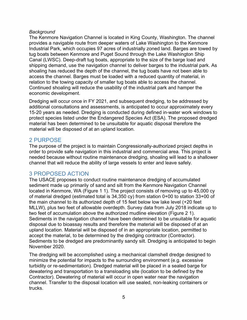
5
Background The Kenmore Navigation Channel is located in King County, Washington. The channel provides a navigable route from deeper waters of Lake Washington to the Kenmore Industrial Park, which occupies 97 acres of industrially zoned land. Barges are towed by tug boats between Kenmore and Puget Sound through the Lake Washington Ship Canal (LWSC). Deep-draft tug boats, appropriate to the size of the barge load and shipping demand, use the navigation channel to deliver barges to the industrial park. As shoaling has reduced the depth of the channel, the tug boats have not been able to access the channel. Barges must be loaded with a reduced quantity of material, in relation to the towing capacity of smaller tug boats able to access the channel. Continued shoaling will reduce the usability of the industrial park and hamper the economic development. Dredging will occur once in FY 2021, and subsequent dredging, to be addressed by additional consultations and assessments, is anticipated to occur approximately every 15-20 years as needed. Dredging is conducted during defined in-water work windows to protect species listed under the Endangered Species Act (ESA). The proposed dredged material has been determined to be unsuitable for aquatic disposal therefore the material will be disposed of at an upland location.
2 PURPOSE The purpose of the project is to maintain Congressionally-authorized project depths in order to provide safe navigation in this industrial and commercial area. This project is needed because without routine maintenance dredging, shoaling will lead to a shallower channel that will reduce the ability of large vessels to enter and leave safely.
3 PROPOSED ACTION The USACE proposes to conduct routine maintenance dredging of accumulated sediment made up primarily of sand and silt from the Kenmore Navigation Channel located in Kenmore, WA (Figure 1 1). The project consists of removing up to 45,000 cy of material dredged (estimated total is 34,350 cy) from station 0+00 to station 33+00 of the main channel to its authorized depth of 15 feet below low lake level (+20 feet MLLW), plus two feet of allowable overdepth. Survey data from July 2018 indicate up to two feet of accumulation above the authorized mudline elevation (Figure 2 1). Sediments in the navigation channel have been determined to be unsuitable for aquatic disposal due to bioassay results and therefore the material will be disposed of at an upland location. Material will be disposed of in an appropriate location, permitted to accept the material, to be determined by the dredging contractor (Contractor). Sediments to be dredged are predominantly sandy silt. Dredging is anticipated to begin November 2020. The dredging will be accomplished using a mechanical clamshell dredge designed to minimize the potential for impacts to the surrounding environment (e.g. excessive turbidity or re-sedimentation). Dredged material will be placed in a sealed barge for dewatering and transportation to a transloading site (location to be defined by the Contractor). Dewatering of material will occur in open water near the navigation channel. Transfer to the disposal location will use sealed, non-leaking containers or trucks.

6
Dredging may take up to 77 days, depending on total quantity of material removed, mechanical breakdowns, and weather conditions. The dredging project will occur up to 24 hours per day, seven days per week. The USACE approved in-water work window for northern Lake Washington is 16 July through 31 July and 16 November through 1 February to protect migrating salmonids (USACE 2013). Maintenance dredging is proposed during the work window of 16 November to 1 February, when aquatic endangered species are not expected to be present, and work will not likely interfere with tribal fisheries.
4 JURISDICTION AND CONSISTENCY REQUIREMENTS Washington’s CZM Program defines the State’s coastal zone to include the 15 counties with marine shorelines, which includes King County. Primary responsibility for the implementation of the SMA is assigned to local government. The City of Kenmore, where the dredging will occur, fulfilled this requirement with their Shoreline Master Program (SMP). The City of Kenmore adopted King County’s original 1978 SMP when the City incorporated in 1998. The SMP has since been updated to align with the City’s current shoreline conditions and land use plans. New updates are currently in a review and comment period, so the version used during this determination was that posted as approved on Washington Department of Ecology’s (Ecology) website (amended March 2012).
4.1 Consistency Requirements The USACE is seeking state concurrence with this Coastal Zone Management Act (CZMA) Consistency Determination for the proposed Kenmore Navigation Channel dredging from Ecology per CZMA Section 307 (c) and 15 CFR 930.34. Under Washington’s program, Federal projects that are reasonably anticipated to affect uses or resources of the coastal zone must demonstrate consistency with the enforceable policies of the approved State CZM program. Each of these policies is addressed below. 4.1.1 Clean Water Act & State Water Pollution Control Act The Federal Clean Water Act (CWA) requires Federal agencies to protect waters of the United States. USACE has evaluated this project under Section 404 of the CWA. This section authorizes the Secretary of the Army to issue permits “for the discharge of dredged or fill material into the navigable waters at specified disposal sites”. USACE has determined the proposed action will not result in a discharge of dredged material into navigable waters. Mechanical dredging with a clamshell dredge will not result in a discharge as defined under Section 404, when accomplished as outlined in this document and the accompanying appendix. The proposed upland disposal of dredged materials similarly will not result in a regulated discharge. The proposed project, representing the Federal standard and in accordance with 33 cfr 337.2, is environmentally responsible and consistent with state water quality standards, with consideration of the best management practices (BMPs) included for the action. The following BMPs are intended to avoid and minimize impacts to aquatic species and the natural environment from dredging and transfer-related effects such as underwater noise or suspended sediment:

7
• In-water work will be limited to the in-water work window (16 November to 1 February), which will not interfere with tribal fisheries, and is outside the known migration periods for adult Chinook and coho salmon and mostly avoids juvenile migration periods.
• Project is limited to specific authorized dimensions and will be executed within the Congressional authority for the project.
• Maintenance dredging is conducted based on the results of site-specific, current hydrographic condition surveys conducted for each dredging event.
• USACE will use a clamshell (mechanical) dredge, where project requirements allow this equipment, to minimize the possibility of entraining or otherwise harming ESA-listed species.
• USACE obtained a suitability determination of the sediment following Dredged Material Management Program (DMMP) protocols for sediment disposal and places material at the appropriate designated disposal sites. Material determined unsuitable for open-water disposal is disposed at appropriate upland sites.
• USACE coordinates dredging projects with the local Indian Tribes that have usual and accustomed fishing rights in each project area.
• Clamshell dredging operations are conducted in a manner that minimizes spillage of sediments from the dredge bucket and transport barge.
• Clamshell bucket will be raised and lowered through the water column at a slow rate to minimize turbidity increases if monitoring results indicate this BMP is needed to avoid an exceedance.
• Bucket is only filled to capacity – bucket is not overfilled • Bucket is paused at the surface, after its ascent through the water column, to
minimize turbidity by allowing free water to drain from the bucket prior to swinging the bucket to the scow.
• Careful placement of material from a clamshell bucket into a barge to limit splash and prevent spillage
• Once the material has been removed, the dredged material will not be dumped back into the water, except into an appropriate disposal or beneficial use site.
• Barges used to transport the dredged material to the disposal or transfer sites will not be filled beyond their capacity and will completely contain the dredged material.
• Equipment holding dredged material will be sealed to prevent losses during transit.
• Dredging bucket utilized for digging should minimize turbidity while dredging. • Transfer locations will be established to confine any accidental spillage and
prevent releasing dredged material back into the environment. • Equipment used near and in the water will be cleaned prior to construction.

8
• The contractor will take care to prevent any petroleum products, chemicals, or other toxic or deleterious materials from construction equipment and vehicles from entering the water.
• A spill containment kit, including oil-absorbent materials will be kept on-site during construction in the event of a spill or if any oil product is observed in the water. If a spill were to occur, work will be stopped immediately, steps will be taken to contain the material, and appropriate agency notifications will be made.
• Turbidity will be monitored to ensure construction activities are in conformance with the protocols and criteria in the draft water quality monitoring plan (draft WQMP) (Appendix A).
4.1.2 Clean Air Act Section 176 of the Clean Air Act (CAA), 42 USC 7506(c), prohibits Federal agencies from approving any action that does not conform to an approved state or Federal implementation plan. Maintenance dredging and disposal activities under this project will result in emissions that are clearly de minimis and will constitute maintenance dredging where no new depths are required and no new disposal sites are designated, so the project is exempt from any requirement to conform to a State Implementation Plan under 40 CFR 93.153 (c)(2)(ix). 4.1.3 Ocean Resources Management Act The proposed action is entirely within Lake Washington, near to the mouth of the Sammamish River. The enforceable policies of Chapter 43.143 RCW apply to coastal waters of the Pacific Ocean. The proposed action consists of maintenance dredging and disposal activities for safe transit through the Kenmore navigation channel in northern Lake Washington. There will be no significant long-term impacts to coastal or marine resources or uses of the Puget Sound. 4.1.4 Shoreline Management Act As a basis for the dredging of materials in the Kenmore Navigation Channel, the City of Kenmore 2012 Shoreline Master Program (SMP), will be used. Applicable policies of these documents are presented in Section 5, below, and details are provided on how the proposed maintenance dredging and disposal activities are consistent with policy is in bold italics.
5 Consistency Determination
City of Kenmore 2012 SMP The City of Kenmore jurisdiction includes a portion of Lake Washington, “including the entire water body waterward from the ordinary high water mark from its centerline or point, all water below the surface and associated shorelands’. The area encompasses the proposed project area and is designated as “Aquatic.” Furthermore, because Lake Washington surface acreage is over 1,000 acres, the area is considered a shoreline of statewide significance. Based on these designations, the following elements of the City

9
of Kenmore Shoreline Master Program are applicable to the project. Responses regarding consistency are below in bold italics. Final Comprehensive Plan, Shoreline Sub-Element 2012 Shorelines of Statewide Significance Policy LU-16.1.1 – The public interest in the use and enjoyment of shorelines of statewide significance in the City of Kenmore shall be paramount. Consistent: The proposed project will not have long-term effects to the public use and enjoyment of the shoreline. Access within the project area would be reduced during dredging operations, but dredging is scheduled for fall and winter when on-water activities are much reduced.
Policy LU-16.1.2 In developing and implementing its Shoreline Master Program for Lake Washington the City of Kenmore shall give preference, in the following order, to uses that: 1. Recognize and protect the statewide interest over local interest; 2. Preserve the natural character of the shoreline; 3. Result in long-term over short-term benefit; 4. Protect the resources and ecology of the shoreline; 5. Increase public access to publicly owned areas of the shorelines; 6. Increase recreational opportunities for the public in the shoreline; and 7. Provide for any other element as defined in RCW 90.58.100.
Consistent: The proposed project will maintain an existing federally authorized channel that supports economic development while not adversely affecting the character of the existing shoreline. Maintenance dredging would result in long-term improvements to safe navigation with only minor, short-term impacts to aquatic resources. There would be no change to public access or recreational opportunities.
17.5 Aquatic Environment Policy LU-17.5.4 All developments and uses on navigable waters or their beds should be located and designed to minimize interference with surface navigation, to consider any adverse impacts to public views, and to allow for the safe unobstructed passage of fish and wildlife, particularly those species dependent on migration. Consistent: Dredging of the Kenmore navigation channel will maintain congressionally authorized depths for vessel navigation. Migrating fish are not likely in the area during the scheduled work window (16 November – 1 February). Any fish in the area would be able to avoid the dredging area and would have access to migration paths.
Policy LU-17.5.5 Uses that adversely affect the ecological functions of critical freshwater habitats should not be allowed except where necessary to achieve the objectives of RCW 90.58.020 and impacts shall be mitigated.

10
Consistent: The proposed project is outside of the designated critical areas (Figure 3).
Policy LU-17.5.6 Shoreline uses and modifications should be designed and managed to prevent degradation of water quality and alteration of natural hydrologic conditions. Consistent: Maintenance of the navigation channel will have negligible effects to the hydrologic conditions of Lake Washington and the Sammamish River. BMPs will be implemented to prevent the degradation of water quality (see section 4.1.2).
General Shoreline Management Policies
18. Economic Development Goal 18.1. Shoreline dependent development should provide long range economic benefits while ensuring compatibility with environmental and land use goals.
Policy LU-18.1.1 Kenmore should plan for the location and design of industries, industrial projects of statewide significance, transportation facilities, tourist facilities, commerce and other developments that are particularly dependent on their location on or use of the shorelines of the state. Consistent: The initial construction of the navigation channel connected the deeper waters of Lake Washington to the Kenmore industrial park for the safe navigation of commercial and industrial vessels. The proposed project will maintain the functions of the navigation channel.
Goal 18.2. Shoreline economic development should provide public physical and visual availability to the water, consistent with public health and safety.
Policy LU-18.2.3 Structures placed in the water for economic purposes should be designed to prevent adverse impacts to shoreline ecological processes and functions. Consistent: The proposed project would maintain the ecological processes and functions of the shoreline as conditions would be similar to the surrounding environment. Policy LU-18.2.4 Economic development in the shoreline should be prohibited in identified environmentally critical areas. Consistent: The project is outside of all environmentally critical areas as provided in Streams and Wetlands, Kenmore Critical Areas Mapping (Figure 3)
11
Figure 3. Kenmore, WA environmentally critical areas, and approximate project location.
Approximate channel location

12
Goal 18.4. Priority should be given to those shoreline economic developments which maintain options for future users of the water.
Policy LU-18.4.1 Development of commercial and recreational fisheries should be encouraged through measures to protect and restore fish habitat and provision for boating facilities. Consistent: The work timing and BMPs of the proposed project will be protective of fish and fish habitat. Policy LU-18.4.2 Mining, dredging, channelizing or filling of shoreline should be discouraged. Consistent: The proposed project is maintenance dredging of an existing federally authorized channel and provides a channel for industrial and commercial uses in an area designated for these uses. Policy LU-18.4.4 In order to ensure that treaty rights are respected, public notice of application should be provided to affected tribes on all projects requiring general public notice. Consistent: All potentially affected tribes have been notified and comments were requested with respect to archaeological and environmental concerns for the proposed project.
21. Conservation and Protection Goal 21.1. Preserve or develop shorelines, adjacent uplands, and adjacent water areas in a manner that ensures no net loss of shoreline ecological processes and functions.
Policy LU-21.1.4 Environmentally critical areas in the shoreline, including critical freshwater habitats, should be protected from uses or activities that will have adverse effects. Consistent: The project is outside of all environmentally critical areas as provided in Streams and Wetlands, Kenmore Critical Areas Mapping (Figure 3)
Goal 21.2. Ensure preservation of unique and non-renewable natural resources and ensure conservation of renewable natural resources for the benefit of existing and future generations and the public interest.
Policy LU-21.2.1 Shorelines and shorelands that are of unique or valuable natural character should be acquired and preserved wherever feasible. Consistent: The project area is similar to the surrounding lake habitat and the character will not be changed by the proposed action. Policy LU-21.2.2 Kenmore should encourage the conservation of fish, wildlife, and other renewable resources. Consistent: The proposed project would cause only minor and temporary effects to benthic resources, and would be timed to avoid impacting migratory fish.

13
Policy LU-21.2.4 Shoreline activities, and developments should be planned, constructed and operated to maintain or enhance the quality of air, soil, and water on the shorelines. Consistent: BMPs will assure maintenance of the quality of the environment in the project area. Policy LU-21.2.6 Any structure or activity in or near the water should be constructed in such a way that it will prevent adverse physical or chemical effects on water quality, vegetation, fish, or wildlife. Consistent: USACE would apply standard BMPs that are protective of water quality, fish and wildlife in the aquatic environment. Policy LU-21.2.7 Uses or activities that degrade the natural resources of the shoreline should not be allowed. Consistent: The proposed project would cause only minor and temporary effects to benthic resources. Natural recovery of benthic resources is expected to be rapid, as the habitat within the channel will support reestablishment of benthic species.
22. Archaeological, Historic and Cultural Resources Goal 22.1 Historic properties in the shoreline jurisdiction should be protected to prevent the destruction of, or damage to, any site having archaeological, historic, cultural, or scientific value through coordination and consultation with the appropriate local, state and federal authorities, including affected tribes. Consistent: In accordance with the regulations implementing Section 106 of the National Historic Preservation Act, the USACE has conducted a review of historic properties and is coordinating with the State Historic Preservation Officer and affected tribes. The proposed dredging is confined to the removal of recently deposited sediments within the previously dredged channel dimensions. USACE anticipates a determination of no historic properties affected.
23. Shoreline Use 23.7 In-water structures Policy LU-23.7.1 In-water structures shall provide for the protection and preservation of shoreline ecological processes and functions, and cultural resources including, but not limited to, fish and fish passage, wildlife and water resources, critical areas, hydro-geological processes, and natural scenic vistas. Consistent: Maintenance of the navigation channel would not alter the shoreline ecological processes and functions. Cultural resources are not anticipated to be affected as the material being dredged has been deposited subsequent to construction of the channel in 1981.
24. Shoreline Modification General Modification Policies
14
Policy LU-24.1.1 Allow structural shoreline modifications only where they are demonstrated to be necessary to support or protect an allowed primary structure or legally existing shoreline use that is in danger of loss or substantial damage or are necessary for reconfiguration of the shoreline for mitigation or enhancement purposes. Consistent: Foregoing maintenance of the navigation channel will lead to further filling of the channel by deposition from the Sammamish River. Current uses will be impacted by the reduced accessibility to the Kenmore industrial park. Policy LU-24.1.2 Reduce the effects of shoreline modifications and, as much as possible, limit shoreline modifications in number and extent. Consistent: Effects would be managed by the BMPs implemented and the extent of the action would be confined to the dimensions of the federally authorized channel. Policy LU-24.1.3 Allow only shoreline modifications that are appropriate to the specific type of shoreline and environmental conditions for which they are proposed. Consistent: Environmental conditions will be largely unchanged by the relatively small change in depth required for maintaining safe navigation in the channel. Policy LU-24.1.4 Ensure that shoreline modifications individually and cumulatively do not result in a net loss of ecological processes or functions. Consistent: The maintenance dredging will be conducted with timing and dredging equipment restrictions to avoid and minimize ecological impact, with only minor and temporary effects to benthic resources. Small and short-term pulses of turbidity are associated with dredging; however, this temporary effect will be minimized and will not continue beyond the end of dredging. No aspect of the action will permanently alter the existing ecological processes or functions. 24.6 Dredging Policy LU-24.6.2 Kenmore shall allow dredging for the purpose of establishing, expanding, or relocating or reconfiguring navigation channels and basins when necessary to ensure safe and efficient accommodation of existing navigational uses. Adverse ecological impacts shall be minimized and mitigation shall be provided such that there is no net loss of ecological processes and functions. Maintenance dredging of established navigation channels and basins should be restricted to maintaining previously dredged or existing authorized location, depth, and width. Consistent: The proposed action will maintain the previously authorized and constructed dimensions of the navigation channel. Policy LU-24.6.3 Kenmore shall not allow dredging waterward of the ordinary high-water mark for the primary purpose of obtaining fill material, except when the material is necessary for the restoration of ecological processes and functions. When allowed, the site where the fill is to be placed shall be located waterward of the ordinary high-water mark. The project must be either associated with a habitat restoration project under the Model Toxics Control Act or the Comprehensive Environmental Response, Compensation, and Liability Act, or, if approved through a shoreline conditional use permit, any other significant habitat enhancement project.

15
Consistent: The proposed action is not for obtaining fill. All dredged material will be disposed of at an upland facility. Policy LU-24.6.4 Kenmore shall not allow disposal of dredge material on shorelands and in side-channels within a channel relocation or stream meander area. Kenmore shall not allow disposal of dredge material in wetlands located within the shoreline jurisdiction. In the limited instances where it is allowed, such disposal shall require a shoreline conditional use permit. Consistent: Disposal of dredged material will occur at an appropriate upland facility as selected by the dredging contractor and approved by USACE. Policy LU-24.6.5 Dredging and excavation in environmentally critical areas within the shoreline should not be allowed. Consistent: The proposed action is outside of environmentally critical areas. Policy LU-24.6.6 Dredging operations should be scheduled so as to not materially interfere with the migration of native fish. Consistent: BMPs were developed to include this concern. Policy LU-24.6.8 Dredging should be allowed only in the Aquatic shoreline environment and to support water dependent uses. Consistent: The proposed action is entirely within the Aquatic shoreline environment and is being maintained for safe navigation of vessels. Policy LU-24.6.9 Disposal of dredge and excavation spoils within shorelines should be prohibited except when the material is necessary for the restoration of ecological processes and functions. Consistent: Dredged material will be disposed of at an appropriate upland facility. Kenmore Municipal Code 16.45.010 General shoreline development requirements. A. Kenmore shall ensure that uses and modifications within the shoreline jurisdiction do not cause a net loss of shoreline ecological functions and processes. Mitigation for impacts resulting in uses and modifications shall follow the mitigation sequencing requirements of KMC 18.55.210 and consider the priorities specified in the shoreline protection and restoration plan. Consistent: The proposed action would result in short-term impacts to the ecological functions which will be minimized by best management practices that are described above and in section 5 of the EA. Impacts to migrating salmon would be avoided by working within the designated in-water work window. There are no long-term impacts to ecological function anticipated as the completed maintenance will result in similar environmental conditions as currently exist in the channel and surrounding area. No mitigation is proposed as the project is maintenance dredging of a regularly maintained navigation channel.

16
B. All shoreline uses and developments shall be subject to the following general development standards: 1. The location, design, construction and management of all shoreline developments and uses shall protect the quality and quantity of surface and groundwater on and adjacent to the lot and shall adhere to the guidelines, policies, standards and regulations of applicable water quality management programs and regulatory agencies. Best management practices such as fugitive dust controls and other good housekeeping measures to prevent contamination of land or water shall be required. Consistent: BMPs have been developed through consultation with state and federal agencies and the draft WQMP would ensure BMPs are sufficiently protective.
2. Solid and liquid wastes and untreated effluents shall not enter any bodies of water or be discharged onto the land. Consistent: The proposed action does not include the discharge of any solid or liquid wastes or untreated effluents.
4. The release of oil, chemicals or other hazardous materials onto or into the water shall be prohibited. Equipment for the transportation, storage, handling or application of such materials shall be maintained in a safe and leak proof condition. If there is evidence of leakage, the further use of such equipment shall be suspended until the deficiency has been satisfactorily corrected. The use of chemicals to control invasive aquatic weeds is prohibited, except that milfoil may be removed using chemicals; provided, that the chemicals are applied by a licensed pesticide applicator and approved for aquatic use. Consistent: No chemicals would be used for control of invasive aquatic weeds. BMPs include the prevention of leakage of petroleum products, chemicals, or other toxic or deleterious materials into the water.
7. All shoreline developments and uses shall be located, designed, constructed and managed to avoid disturbance of or minimize adverse impacts to protect fish and wildlife habitat conservation areas, including, but not limited to, spawning, nesting, rearing and habitat areas, and migratory routes. Where avoidance of adverse impacts is not practicable, the director may require that mitigation measures to protect species and habitat functions be developed in consultation with state resource management agencies and federally recognized tribes. Consistent: Maintenance dredging would not extend beyond the boundaries of the authorized navigation channel. In-water work will be restricted to the work window of 16 November – 1 February in order to avoid impacts to migrating salmon. The project area does not include any spawning or nesting habitat for ESA listed species or other species of concern.
8. All shoreline developments and uses shall be located, designed, constructed and managed to minimize interference with or adverse impacts to beneficial natural shoreline processes such as water circulation, erosion and accretion.

17
Consistent: The dredging depth within the Kenmore navigation channel would not affect shoreline processes within Lake Washington or the nearby Sammamish River.
9. All shoreline developments and uses shall be located, designed, constructed and managed in a manner that minimizes adverse impacts to surrounding land and water uses and is compatible with the affected area. Consistent: The proposed action will maintain the existing channel at a safe depth for continued operation of commercial and industrial vessels in the area.
11. All shoreline development shall be located, constructed and operated so as to protect public health, safety and welfare. Consistent: The proposed action will not alter the location of the existing channel, and increased depth will help protect the public through safer navigation.
12. All development activities shall be located and designed to minimize or prevent the need for shoreline defense and stabilization measures and flood protection works such as bulkheads, other bank stabilization, landfills, levees, dikes, groins, jetties or substantial site regrades. Consistent: Dredging is offshore and would not require shoreline defense or stabilization.
14. Navigation channels shall be kept free of hazardous or obstructing development or uses. Consistent: Dredging will keep the navigation free of accumulated sediments that could be hazardous to industrial and commercial uses.
15. Historic properties, including historic buildings, sites, objects, districts and landscapes, prehistoric and historic archaeological resources, and traditional cultural places, shall be protected within shoreline environments as follows: a. Known Historic Properties (1) Known historic properties inventoried by King County and Washington Department of Archaeology and Historic Preservation are subject to the procedures delineated in Chapter 2.20 KMC. Disturbance of known archaeological sites is also subject to state regulations, including Chapters 27.44, 27.53 and 68.80 RCW; (2) If a known archaeological site or traditional cultural place is affected by a development proposal, the director shall require a site inspection or evaluation by a professional archaeologist and inform and consult with the Washington State Department of Archaeology and Historic Preservation and any concerned Native American tribes. To the extent feasible, the director shall coordinate county and state required permitting and compliance procedures and requirements to avoid substantial duplication of effort by permit applicants; and (3) In considering shoreline permits or shoreline exemptions, the department may attach conditions to provide sufficient time for the director to consult with the

18
Washington State Department of Archaeology and Historic Preservation and any concerned Native American tribes, and to ensure that historic properties are properly protected, or for appropriate agencies to contact property owners regarding purchase or other longterm stewardship and protection arrangements. Provision for the protection and preservation of historic properties shall be incorporated in permits and exemptions to the maximum extent practical. Consistent: In accordance with the regulations implementing Section 106 of the National Historic Preservation Act, the USACE is coordinating with the State Historic Preservation Officer and affected tribes. b. Inadvertent Discovery (1) Consistent with the definitions and requirements contained in Chapters 27.44, 27.53 and 68.80 RCW, whenever potentially significant historic properties or archaeological artifacts are discovered in the process of development on shorelines, work on that portion of the development site shall be stopped immediately and the find reported as soon as possible to the director and, if an archaeological site or artifacts have been discovered, the Washington State Department of Archaeology and Historic Preservation, any concerned Native American tribes and other appropriate agencies; (2) The director shall require that a historic property assessment be conducted immediately by a professional archaeologist, ethnographer or historic preservation professional, as applicable, in consultation with state and tribal officials as appropriate, to determine the significance of the discovery and the extent of damage that may have occurred to the resource. The historic property assessment shall be provided to the director and, if an archaeological site, archaeological artifacts or a traditional cultural place have been discovered, the Washington State Department of Archaeology and Historic Preservation, and any concerned Native American tribes to determine the significance of the discovery in accordance with Chapter 27.53 RCW and Chapter 25-48 WAC; and (3) Upon receipt of a positive determination of a property’s significance, or if available information suggests that a negative determination is erroneous, the director may require that a historic property management plan be prepared by a qualified professional archaeologist or other appropriate professional if such action is reasonable and necessary to implement related program objectives. Consistent: If historic properties are discovered during the course of the proposed action, USACE would follow protocols in accordance with regulations implementing Section 106 of the National Historic Preservation Act.
16.55.060 Grading, dredging, dredge material disposal and filling. Grading, dredging, dredge material disposal and filling must be consistent with Chapter 16.90 KMC (Repealed by Ord. 19-0488) and may be permitted in shorelines only as follows: B. Grading, dredging, and filling shall be located, designed, and constructed to protect shoreline ecological functions and ecosystem-wide processes, including channel migration, and mitigation shall employ the mitigation sequence in KMC 18.55.210.

19
Consistent: The proposed action will maintain the authorized design and location of the Kenmore navigation channel, would not have long-term ecological impacts, and would not alter ecological functions or ecosystem-wide processes.
C. Dredging and dredged material disposal below the ordinary high water mark shall be permitted only: 1. When necessary for the operation of a water-dependent use; 2. When necessary to mitigate conditions that endanger public safety or fisheries resources; 3. For establishing, maintaining, expanding, relocating or reconfiguring navigation channels and basins when necessary to ensure safe and efficient accommodation of existing navigation uses when: a. Significant ecological impacts are minimized; b. Mitigation is provided, employing the mitigation sequence in KMC 18.55.2 10; and c. Dredging is maintained to the existing authorized location, depth and width; Consistent: The proposed maintenance dredging meets all of the above requirements. Potential effects are mitigated through implementation of BMPs.
D. Dredging is not allowed waterward of the ordinary high water mark for the primary purpose of obtaining fill material. Consistent: Material is being removed for the safe passage of vessels and not for the collection of fill material.
E. Disposal of dredged material shall be done only in approved upland disposal sites and is not allowed within critical areas or their buffers. Consistent: The upland disposal site is to be selected by the dredging contractor, with approval by USACE to ensure the site meets the above restrictions.
F. Stockpiling of dredged material in or under water is prohibited. Consistent: This constraint is provided in the BMPs and will be required of the dredging contractor.

Kenmore Federal Navigation Channel Maintenance – Draft Environmental Assessment Page E-1
Appendix E Cultural Resources Stakeholder Letter


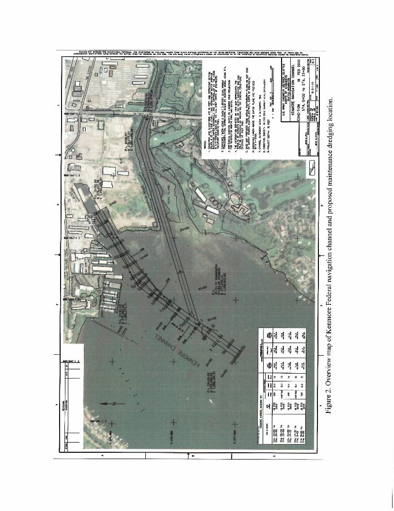


Kenmore Federal Navigation Channel Maintenance – Draft Environmental Assessment Page F-1
Appendix F Endangered Species Act – Agency Letters

Ilnited States Department of the InteriorFISH AND WILDLIFE SERVICE
Washington Fish and Wildlife Office510 Desmond Dr. S.E., Suite 102
Lacey, Washington 98503In Reply Refer To:01EWFW0O-2020-r-0526 Ì'1AR 1 2 2020
Laura Boerner, ChiefPlanning, Environmental, and Cultural Resources BranchSeattle District, U.S. Army Corps of EngineersATTN: Mike ScuderiP.O. Box 3755Seattle, Washington 98124-37 55
Dear Ms. Boerner:
Subject: Kenmore Navigational Channel Dredging
This letter is in response to your January 28,2020, request for our concurrence with yourdetermination that the proposed action in Lake Washington, Kenmore, King County,Washington,oomay affect, but is not likely to adversely affect" federally listed species. Wereceived your letter and Biological Assessment providing information in support of "may affect,not likely to adversely affect" determinations, on January 28,2020.
Project Description:The U.S. Army Corps of Engineers'Planning, Environmental and Cultural Resources Branchproposes to dredge up to 45,000 cubic yards of sediment from the Kenmore Navigation Channelin Lake Washington. Dredging will occur to the authorized depth of 15 feet below low lakelevel, plus two feet of allowable overdepth. Sediments will be disposed of at an upland location.
Specifically, you requested informal consultation pursuant to section 7(a)(2) of the EndangeredSpecies Act of 1973, as amended (16 U.S.C. l53l et seq.) (ESA) for the federally listed speciesand critical habitat identified below.
Bull trout (Salvelinus confluentus)
Bull trout designated critical habitat
o
a
INTEzuOR REGION 9CO LUMB IA-PAC I F IC NO RTHWEST
INTEzuOR RTGION 12
PACIFIC ISLANDS
I DAHO, MONTANA-, OREGON-, WASHINGTON AMERICAN SAMOA, GUAM, HAWAII, NORTHERNMARIANA ISLANDS-PARTIAL

Laura Boerner
We think that sufficient information has been provided to determine the effects of the proposedaction and to conclude whether it would adversely affect federally listed species and/ordesignated critical habitat. Our concurrence is based on information provided by the actionagency, best available science, and complete and successful implementation of the conservationmeasures included by the action agency.
EFFECTS SPECIFIC TO BULL TROUT
Exposures are extremely unlikely (discountable) to bull trout because of the following
o The action is located in Lake V/ashington, where, at present, bull trout occurrence israre and exposure to this action is extremely unlikely.
o The action will be completed when bull trout are least likely to be present.
o The action will occur during a time of year (November 16 to February l) when few, ifany, bull trout arc prcscnt in thc action arca.
EFFECTS TO DESIGNATED BULL TROUT CRITICAL HABITAT
The final revised rule designating bull trout critical habitat (75 FR 63898 [October 18, 2010])identifies nine Primary Constituent Elements (PCEs) essential for the conservation of thespecies. The 2010 designation of critical habitat for bull trout uses the term PCE. The newcritical habitat regulations (81 FR 7214) replace this term with physical or biological features(PBFs). This shift in terminology does not change the approach used in conducting our analyses,whether the original designation identified PCEs, physical or biological features, or essentialfeatures. In this letter, the term PCE is synonymous with PBF or essential features of criticalhabitat.
The following PCEs are in the action area. Of the PCEs present, some will not be affected by theproposed action.
PCE2: Migration habitats with minimal physical, biological, or water quality impedimentsbetween spawning, rearing, overwintering, andfreshwater and marineþraging habítats,íncluding but not limited to permanent, partíal, intermittent, or seasonal barciers.
The action may temporarily introduce an impediment or barrier within migrationhabitat; however, it will not preclude bull trout movement through the area, eitherduring or after construction, and any effects will be temporary. The migration habitatwill not be permanently altered, destroyed, or degraded.
2
a

Laura Boerner
PCE 3: An abundantfood base, including teruestrial organisms of riparian origin, aquaticmacroinvertebrates, and forage fish.
o The action may temporarily reduce the food base via a small reduction of preyresources, degradation of aquatic habitat, and/or removal or alteration of riparianvegetation. However, the impacts will be temporary and/or components of the projectdesign will avoid, reduce, or compensate for them.
PCE 4: Complex river, stream, lake, reservoir, and marine shoreline aquatic environments, andprocesses that establish and maintain these aquatic envíronments, withfeatures such as largewood, side channels, pools, undercut banl<s and unembedded substrates, to provide a vøriety ofdepths, gradients, velocities, and structure.
a The action will have no effect on this PCE.
PCE 5: Water temperatures rangingfrom 2 to 15 oC (36 to 59 "F), with adequate thermalrefugia availableþr temperatures that exceed the upper end of this range. Specifictemperatures within this range will depend on bull trout life-history stage andform; geography,elevation; diurnal and seasonal variation; shading, such as thøt provided by riparian habitat;streamflow; and local groundwater ínfluence.
o The action will have no effect on this PCE.
PCE 7: A natural hydrograph, including peak, high, low, and baseflows within historic andseasonal ranges or, ifflows are controlled, minimalflow departurefrom a natural hydrograph.
o The action will have no effect on this PCE.
PCE 8: Sfficient water quality and quantity such that normal reproduction, growth, andsurvival are not inhibited.
The action may impact water quantity and/or quality. However, the effects will betemporary; components of the project design include actions to avoid, reduce, orcompensate for the effects; and/or we would be unable to measure, detect, or evaluatethe effects.
PCE 9: Sfficiently low levels of occuruence of nonnative predatory @.9., lake trout, walleye,northern pike, smøllmouth bass); interbreeding (e.g., brook trout); or competíng (e.g., browntrout) species that, if present, are adequately temporally ønd spatially isolatedfrom bull trout.
o The action will have no effect on this PCE.
J

Laura Boemer
Conclusion
This concludes consultation pursuant to the regulations implementing the ESA (50 CFR 402.13).Our review and concurrence with your effect determinations is based on implementation of theproject as described. It is the responsibility of the federal action agency to ensure that theprojects they authorize oÍ cafry out are in compliance with the regulatory permit and ESA. If apermittee or the federal action agency deviates from the measures outlined in a permit or projectdescription, the federal action agency has the obligation to reinitiate consultation and complywith section 7(d).
This project should be re-analyzed and re-initiation may be necessary if 1) new informationreveals effects of the action that may affect listed species or critical habitat in a manner, or to anextent, not considered in this consultation, 2) if the action is subsequently modified in a mannerthat causes an effect to a listed species or critical habitat that was not considered in thisconsultation, and/or 3) a new species is listed or critical habitat is designated that may beaffected by this project.
This letter and its enclosure(s) constitute a complete response by the U.S. Fish and WildlifeService to your request for informal consultation. A complete record of this consultation is onfile at the Washington Fish and V/ildlife Office, in Lacey, Washington. If you have anyquestions about this letter or our shared responsibilities under the ESA, please contact theconsulting biologist identified below.
U.S. Fish and V/ildlife Service Consultation Biologist(s)Jim Muck (360-753-9586)
Sincerely,
t4/{^^- L- {*e^-a/ Brad Thompson, State Supervisor
Washington Fish and V/ildlife Office
4
Related Documents