1 KARNATAKA NEERAVARI NIGAMA LIMITED (A Government of Karnataka Enterprise) REQUEST FOR PROPOSALS (RFP NO……… ) SELECTION OF CONSULTANTS FOR PREPARATION OF DPR TO RESTORE THE TUNGABHADRA DAM TO ITS ORIGINAL CAPACITY/UTILISATION BY STUDYING VARIOUS ALTERNATIVES. KARNATAKA NEERAVARI NIGAMA LIMITED (A Government of Karnataka Enterprise) 4th floor, Coffee board building, No.1 Dr. B.R.Ambedakar Veedi, Bangalore-560001

Welcome message from author
This document is posted to help you gain knowledge. Please leave a comment to let me know what you think about it! Share it to your friends and learn new things together.
Transcript

1
KARNATAKA NEERAVARI NIGAMA LIMITED
(A Government of Karnataka Enterprise)
REQUEST FOR PROPOSALS (RFP NO……… )
SELECTION OF CONSULTANTS FOR PREPARATION OF DPR TO RESTORE
THE TUNGABHADRA DAM TO ITS ORIGINAL CAPACITY/UTILISATION BY
STUDYING VARIOUS ALTERNATIVES.
KARNATAKA NEERAVARI NIGAMA LIMITED
(A Government of Karnataka Enterprise)
4th floor, Coffee board building,
No.1 Dr. B.R.Ambedakar Veedi, Bangalore-560001
2
CONTENTS
Section Description Page No.
Section I Letter of Invitation
Section II Information to Consultants (ITC)
Data Sheet – Information to Consultants
Section III Technical Proposal – Standard Forms
Section IV Financial Proposal – Standard Forms
Section V Terms of Reference
Section VI Contract for Consultant‘s Services
I Form of Contract
II General Conditions of Contract
III Special Conditions of Contract
IV Appendices
ANNEXURES
Annex – 2.1
Annex – 2.2
Annex – 2.3
Annex – 2.4
Annex – 2.5
Annex – 2.6
Annex – 2.7
Annex – 2.8
Annex – 3.1
Annex – 3.2
3
SECTION 1. LETTER OF INVITATION
[Location and Date]
Dear [Name of Consultant]:
1. Karnataka Neeravari Nigama Limited invites Proposals from Consultants for
preparation of DPR to restore the Tungabhadra dam to its original capacity/Utilisation by
studying various alternatives. More details on the Services are provided in the attached Terms
of Reference.
2. The RFP has been addressed to the consultants shortlisted based on the application
submitted pursuant to EOI No: WRD/KNNL/02 on 25/10/2014 and addendum-1 issued on
25/11/2014.
3. The Consultant will be selected under Quality-and Cost-Based Selection (QCBS) and
procedures described in this RFP.
4. The RFP includes the following documents:
Section 1 - Letter of Invitation
Section 2 - Information to Consultants
Section 3 - Technical Proposal - Standard Forms
Section 4 - Financial Proposal - Standard Forms
Section 5 - Terms of Reference
Section 6 - Standard Form of Contract.
6. Please inform us, upon receipt:
- That you received the letter of invitation; and
- Whether you will submit a proposal alone or in association with other entity as
Joint Venture with joint and several responsibilities.
Yours sincerely,
Managing Director,
Karnataka Neeravari Nigam Limited
Bengaluru..
4
SECTION 2. INFORMATION TO CONSULTANTS
1. Introduction
1.1 The Client named in the ―Data Sheet‖ will select a firm among those listed in the Letter
of Invitation, in accordance with the method of selection indicated in the Data Sheet.
1.2 The consultants are invited to submit a Technical Proposal and a Financial Proposal, as
specified in the Data Sheet (the Proposal) for consulting services required for the Assignment
named in the Data Sheet. The Proposal will be the basis for contract negotiations and
ultimately for a signed contract with the selected Consultant.
1.3 The Assignment shall be implemented in accordance with the phasing indicated in the
Data Sheet. When the Assignment includes several phases, the performance of the consultant
under each phase must be to the client‘s satisfaction before work begins on the next phase.
1.4 The Consultants must familiarize themselves with local conditions and take them into
account in preparing their Proposals. To obtain first-hand information on the Assignment and
on the local conditions, consultants are encouraged to pay a visit to the Client before submitting
a Proposal, and to attend a pre-proposal conference if one is specified in the Data Sheet.
Attending the pre-proposal conference is optional. The Consultant‘s representative should
contact the officials named in the Data Sheet to arrange for their visit or to obtain additional
information on the pre-proposal conference. Consultants should ensure that these officials are
advised of the visit in adequate time to allow them to make appropriate arrangements. Apart
from this, the Client may, before the deadline for the submission of the proposals, give an
opportunity to the interested consultant to suggest any improvement in the Terms of Reference
provided in Section 5, in the form of presentation to the Client. The time and date shall be
intimated by the Client.
1.5 The Client will provide the inputs specified in the Data Sheet, assist the firm in
obtaining licenses and permits needed to carry out the services, and make available relevant
project data and reports.
1.6 Please note that (i) the costs of preparing the proposal and of negotiating the contract,
including a visit to the Client, are not reimbursable as a direct cost of the Assignment; and (ii)
the Client is not bound to accept any of the Proposals submitted.
1.7 KNNL expects consultants to provide professional, objective, and impartial advice and
at all times hold the Client‘s interests paramount, without any consideration for future work,
and strictly avoid conflicts with other assignments or their own corporate interests. Consultants
shall not be hired for any assignment that would be in conflict with their prior or current
obligations to other clients, or that may place them in a position of not being able to carry out
the assignment in the best interest of the Client.
1.7.1 Without limitation on the generality of this rule, consultants shall not be hired under the
circumstances set forth below:
(a) A firm which has been engaged by the Client to provide goods or works for a project,
and any of their affiliates, shall be disqualified from providing consulting services for the same
project. Conversely, firms hired to provide consulting services for the preparation or

5
implementation of a project, and any of their affiliates, shall be disqualified from subsequently
providing goods or works or services related to the initial assignment (other than a continuation
of the firm‘s earlier consulting services) for the same project.
(b) Consultants or any of their affiliates shall not be hired for any assignment which, by its
nature, may be in conflict with another assignment of the consultants.
1.7.2 As pointed out in para. 1.7.1 (a) above, consultants may be hired for downstream work,
when continuity is essential, in which case this possibility shall be indicated in the Data Sheet
and the factors used for the selection of the consultant should take the likelihood of
continuation into account. It will be the exclusive decision of the Client whether or not to have
the downstream assignment carried out, and if it is carried out, which consultant will be hired
for the purpose.
1.8 It is GOK‘s policy to require that consultants observe the highest standard of ethics
during the execution of such contracts. In pursuance of this policy, the GOK:
(a) defines, for the purposes of this provision, the terms set forth below as follows:
(i) ―corrupt practice‖ means the offering, giving, receiving, or soliciting of anything of
value to influence the action of a public official in the selection process or in contract
execution; and
(ii) ―fraudulent practice‖ means a misrepresentation of facts in order to influence a
selection process or the execution of a contract to the detriment of GOK, and includes collusive
practices among consultants (prior to or after submission of proposals) designed to establish
prices at artificial, noncompetitive levels and to deprive GOK of the benefits of free and open
competition.
(b) will reject a proposal for award if it determines that the firm recommended for award
has engaged in corrupt or fraudulent activities in competing for the contract in question;
(d) will declare a firm ineligible, either indefinitely or for a stated period of time, to be
awarded GOK-financed contract if it at any time determines that the firm has engaged in
corrupt or fraudulent practices in competing for, or in executing, a GOK-financed contract; and
(e) will have the right to require that, GOK to inspect consultant‘s accounts and records
relating to the performance of the contract and to have them audited by auditors appointed by
GOK.
1.9 Consultants shall not be under a declaration of ineligibility for corrupt and fraudulent
practices issued by GOK in accordance with the above sub para 1.8 (d).
1.10 Consultants shall be aware of the provisions on fraud and corruption stated in the
standard contract under the clauses indicated in the Data Sheet
2. Clarification and Amendment of RFP Documents
2.1 Consultants may request a clarification of any item of the RFP document up to the
number of days indicated in the Data Sheet before the Proposal submission date. Any request
for clarification must be sent in writing by paper mail, or electronic mail to the Client‘s address
indicated in the Data Sheet. The Client will respond by paper mail, or electronic mail to such
requests and will send copies of the response (including an explanation of the query but without
identifying the source of inquiry) to all invited consultants who intend to submit proposals.
6
2.2 At any time before the submission of Proposals, the Client may, for any reason, whether
at its own initiative or in response to a clarification requested by an invited firm, modify the
RFP documents by amendment. Any amendment shall be issued in writing through addenda.
Addenda shall be sent by paper mail, or electronic mail to all invited consultants and will be
binding on them. The Client may at its discretion extend the deadline for the submission of
Proposals.
3. Preparation Of Proposal
3.1 Consultants are requested to submit a Proposal (para 1.2) written in the language(s)
specified in the Data Sheet.
Technical Proposal
3.2 In preparing the Technical Proposal, consultants are expected to examine the documents
comprising this RFP in detail. Material deficiencies in providing the information requested
may result in rejection of a Proposal.
3.3 While preparing the Technical Proposal, consultants must give particular attention to
the following:
Where the shortlisted consultant is a Joint Venture/Consortium there shall be no change in the members
of the Joint Venture/Consortium.
It is desirable that the majority of the key professional staff proposed be permanent employees of the firm
or have an extended and stable working relation with it.
Proposed key professional staff must at a minimum have the experience indicated in the Data Sheet.
Alternative key professional staff shall not be proposed, and only one curriculum vitae (CV) may be
submitted for each position.
Reports to be issued by the consultants as part of this assignment must be in the language(s) specified in
the Data Sheet. It is desirable that the firm‘s personnel have a working knowledge of the Client‘s official
language.
3.4 The Technical Proposal should provide the following information using the attached
Standard Forms (Section 3):
(i) A brief description of the consultant‘s organization and an outline of their experience
during the last 5 (five) years on assignments (Section 3B) of a similar nature. For each
assignment, the outline should indicate, inter alia, the profiles and names of the staff provided,
duration of the assignment, contract amount, and firm‘s involvement.
(ii) Any comments or suggestions on the Terms of Reference and on the data, a list of
services, and facilities to be provided by the Client (Section 3C).
(iii) A description of the methodology and work plan for performing the assignment
(Section 3D).
(iv) The list of the proposed staff team by speciality, the tasks that would be assigned to each
staff team member, and their timing (Section 3E).

7
(v) CVs recently signed by the proposed key professional staff and the authorized
representative submitting the proposal (Section 3F). Key information should include number
of years working for the firm/entity, and degree of responsibility held in various assignments
during the last three (3) years.
(vi) Estimates of the total staff effort (professional and support staff; staff time) to be
provided to carry out the Assignment, supported by bar chart diagrams showing the time
proposed for each key professional staff team member. (Sections 3E and 3G).
(vii) A detailed description of the proposed methodology and staffing. ,
(viii)Any additional information requested in the Data Sheet.
3.5 The Technical Proposal shall not include any financial information.
Financial Proposal
3.6 In preparing the Financial Proposal, consultants are expected to take into account the
requirements and conditions of the RFP documents. The Financial Proposal should be
submitted in the format given in Section 4. It includes all costs associated with the Assignment,
including (a) remuneration for staff , and (b) transportation (national and local, for mobilization
and demobilization), services and equipment (vehicles, office equipment, furniture, and
supplies), office rent, insurance, printing of documents, surveys; if it is a major component of
the assignment.
3.7Consultants shall express the price of their services in Indian Rupees.
3.8 The Data Sheet indicates how long the proposals must remain valid after the submission
date. During this period, the consultant is expected to keep available the key professional staff
proposed for the assignment. The Client will make its best effort to complete negotiations
within this period. If the Client wishes to extend the validity period of the proposals, the
consultants who do not agree have the right not to extend the validity of their proposals.
4. Submission, Receipt, And Opening Of Proposals
4.1 The original Proposal (Technical Proposal and Financial Proposal; see para 1.2) shall be
prepared in indelible ink. It shall contain no inter-lineation or overwriting, except as necessary
to correct errors made by the firm itself. Any such corrections must be initialed by the person
or persons who sign(s) the Proposals.
4.2 An authorized representative of the Consultant initials all pages of the Proposal. The
representative‘s authorization is confirmed by a written power of attorney accompanying the
Proposal.
4.3 For each Proposal, you should prepare the number of copies indicated in the Data Sheet.
Each Technical Proposal and Financial Proposal should be marked ―Original‖ or ―Copy‖ as
appropriate. If there are any discrepancies between the original and the copies of the Proposal,
the original governs.
4.4 The completed Technical and Financial Proposal must be submitted on or before the
time and date stated in the Data Sheet. Any Proposal received after the closing time for
submission of proposals shall be returned unopened.
8
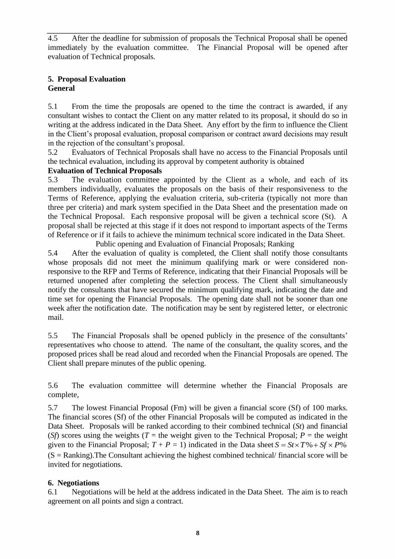
4.5 After the deadline for submission of proposals the Technical Proposal shall be opened
immediately by the evaluation committee. The Financial Proposal will be opened after
evaluation of Technical proposals.
5. Proposal Evaluation
General
5.1 From the time the proposals are opened to the time the contract is awarded, if any
consultant wishes to contact the Client on any matter related to its proposal, it should do so in
writing at the address indicated in the Data Sheet. Any effort by the firm to influence the Client
in the Client‘s proposal evaluation, proposal comparison or contract award decisions may result
in the rejection of the consultant‘s proposal.
5.2 Evaluators of Technical Proposals shall have no access to the Financial Proposals until
the technical evaluation, including its approval by competent authority is obtained
Evaluation of Technical Proposals
5.3 The evaluation committee appointed by the Client as a whole, and each of its
members individually, evaluates the proposals on the basis of their responsiveness to the
Terms of Reference, applying the evaluation criteria, sub-criteria (typically not more than
three per criteria) and mark system specified in the Data Sheet and the presentation made on
the Technical Proposal. Each responsive proposal will be given a technical score (St). A
proposal shall be rejected at this stage if it does not respond to important aspects of the Terms
of Reference or if it fails to achieve the minimum technical score indicated in the Data Sheet.
Public opening and Evaluation of Financial Proposals; Ranking
5.4 After the evaluation of quality is completed, the Client shall notify those consultants
whose proposals did not meet the minimum qualifying mark or were considered non-
responsive to the RFP and Terms of Reference, indicating that their Financial Proposals will be
returned unopened after completing the selection process. The Client shall simultaneously
notify the consultants that have secured the minimum qualifying mark, indicating the date and
time set for opening the Financial Proposals. The opening date shall not be sooner than one
week after the notification date. The notification may be sent by registered letter, or electronic
mail.
5.5 The Financial Proposals shall be opened publicly in the presence of the consultants‘
representatives who choose to attend. The name of the consultant, the quality scores, and the
proposed prices shall be read aloud and recorded when the Financial Proposals are opened. The
Client shall prepare minutes of the public opening.
5.6 The evaluation committee will determine whether the Financial Proposals are
complete,
5.7 The lowest Financial Proposal (Fm) will be given a financial score (Sf) of 100 marks.
The financial scores (Sf) of the other Financial Proposals will be computed as indicated in the
Data Sheet. Proposals will be ranked according to their combined technical (St) and financial
(Sf) scores using the weights (T = the weight given to the Technical Proposal; P = the weight
given to the Financial Proposal; T + P = 1) indicated in the Data sheet %% PSfTStS
(S = Ranking).The Consultant achieving the highest combined technical/ financial score will be
invited for negotiations.
6. Negotiations
6.1 Negotiations will be held at the address indicated in the Data Sheet. The aim is to reach
agreement on all points and sign a contract.

9
6.2 Negotiations will include a discussion of the Technical Proposal, the proposed
methodology (work plan), staffing and any suggestions made by the firm to improve the Terms
of Reference. The Client and Consultant will then work out final Terms of Reference, staffing,
and bar charts indicating activities, staff, periods in the field and in the home office, staff-
months, logistics, and reporting. The agreed work plan and final Terms of Reference will then
be incorporated in the ―Description of Services‖ and form part of the contract. Special
attention will be paid to getting the most the Consultant can offer within the available budget
and to clearly defining the inputs required from the Client to ensure satisfactory implementation
of the Assignment.
6.3 Unless there are exceptional reasons, the financial negotiations will not involve amount
specified in the Financial Proposal.
6.4 Having selected the Consultant on the basis of, among other things, an evaluation of
proposed key professional staff, the Client expects to negotiate a contract on the basis of the
experts named in the Proposal. Before contract negotiations, the Client will require assurances
that the experts will be actually available. The Client will not consider substitutions during
contract negotiations unless both parties agree that undue delay in the selection process makes
such substitution unavoidable or that such changes are critical to meet the objectives of the
assignment. If this is not the case and if it is established that key staff was offered in the
proposal without confirming their availability, the Consultant may be disqualified.
6.5 The negotiations will conclude with a review of the draft form of the contract. To
complete negotiations the Client and the Consultant will initial the agreed contract. If
negotiations fail, the Client will invite the firm whose proposal received the second highest
score to negotiate a contract.
7. Confidentiality
7.1 Information relating to evaluation of proposals and recommendations concerning
awards shall not be disclosed to the consultants who submitted the proposals or to other persons
not officially concerned with the process, until the winning Consultant has been notified that it
has been awarded the contract.
DATA SHEET
Information to Consultants
Clause
Reference
1.0 The name of the Client is: KARNATAKA NEERAVARI NIGAMA LIMITED
The method of selection is: Quality-and Cost-Based Selection (QCBS)

10
1.1
1.2
A technical and a Financial Proposals are requested: Yes
The name, objectives and description of the Assignment are:
Selection of Consultants for preparation of DPR to restore the Tungabhadra dam to its
original capacity/utilisation by studying various alternatives.
The main objectives of the studies are :
Conduct the capacity and sedimentation study of the TB Reservoir.
Deploy best consultant team to carry out studies and implement the work.
Estimate the current capacity of TB Reservoir using latest technical know-how assisted
by the differential global positioning system
Estimate the quantity of silt to be removed from the reservoir to restore to its original
design capacity/Utilization.
Examine various alternatives of restoring the design capacity of TB reservoir/Utilization
and provide opinion
Evaluate cost benefit analysis of the alternatives.
Document best practices-global experience.
suggest best alternative. (s)
Proposal for methodology to restore the design capacity/Utilization using the most
appropriate and latest technologies, strictly adhering to the safety conditions and
logistical guide lines stipulated by GOI laws/ acts.
Provide a cost estimate for each solution with a timeline of activities.
Prepare a Detailed Project report (DPR) of Global standards.
Evaluate project implementation and provide a report.
Study on effect of climate change and Environmental Impact Assessment on the flows
and water availability must be considered while arriving at the optimal capacity of the
proposed reservoir.
Sedimentation study and its impact on stage-discharge relationship and the storage
reservoir.
Preparation of Detailed Project Report as per the guidelines of CWC for approval of the
scheme.
To study the causes of siltation and prevention measures to reduce the formation of silt.
1.3 The Assignment is phased: No
1.4 A pre-proposal conference will be held: Yes
Date:- 16-11-2015
Time:- 11:00 AM
Venue:-Office of the Managing Director
KARNATAKA NEERAVARI NIGAMA LIMITED
(A Government of Karnataka Enterprise)
4th floor, Coffee board building,

11
No.1 Dr. B.R.Ambedakar Veedi, Bangalore-560001
The name(s), address(es), and telephone/numbers of the Client‘s Official(s) are:
1) Managing Director,
Karnataka Neeravari Nigama Limited,
4th floor, Coffee board building,
No.1 Dr. B.R.Ambedakar Veedi, Bangalore-560001.
Telephone:22283074/78, Tele Fax:22386015 .
Email: [email protected]
2) Chief Engineer
Chief Engineer, KNNL,
Irrigation Central Zone, Munirabad.
Phone No: 08539-270026
Email: [email protected]
3) Superintending Engineer
Superintending Engineer, KNNL,
Tungabhadra Projet Circle
Munirabad.
Phone No: 08539-270236
Email:[email protected]
4) Executive Engineer
Exicutive Engineer,(I/C)
T.R. Division,
Munirabad.
Phone No: 08539-270306
Email:[email protected]
2.0 The Client will provide the following inputs: The Client will provide all the information
available with respect to the assignment.
2.1 The Client envisages the need for continuity for downstream work: Yes.
2.2 Clarifications may be requested upto 7 (seven) days before the pre- proposal conference.
The address for requesting clarifications is:
KARNATAKA NEERAVARI NIGAMA LIMITED
(A Government of Karnataka Enterprise)
4th floor, Coffee board building,
No.1 Dr. B.R.Ambedakar Veedi, Bangalore-560001
Telephone:22283074/78, Tele Fax:22386015 . Email: [email protected]
3.0 Proposals and Reports which are part of the assignment should be submitted in the
following language(s): English
3.1 (i) Shortlisted consultant may associate with other shortlisted consultant: No
(ii) The time period for completion of the assignment is 6 months from the date of
agreement.
3.2 Additional Information in the Technical Proposal includes: The consultant would be
required to make a presentation on the Technical Proposal to the evaluation committee
constituted by the Client.
3.3
Proposals must remain valid 180 (One hundred and Eighty) days after the submission
date
4.0 Consultants must submit an original and one additional copy of each proposal.

12
4.1
The proposal submission address is:
KARNATAKA NEERAVARI NIGAMA LIMITED
(A Government of Karnataka Enterprise)
4th floor, Coffee board building,
No.1 Dr. B.R.Ambedakar Veedi, Bangalore-560001
Telephone:22283074/78, Tele Fax:22386015 . Email: [email protected]
The information on the outer envelope should also include:
Selection of Consultants for preparation of DPR to restore the Tungabhadra dam to its
original capacity/ Utilisation by studying various alternatives.
4.2 Proposals must be submitted not later than the following date and time:
Date: 9/12/2015
Time: up to 5:30 PM.

13
5.0
5.1
THE NUMBER OF POINTS TO BE GIVEN UNDER EACH OF THE EVALUATION CRITERIA ARE:
THE NUMBER OF POINTS TO BE GIVEN UNDER EACH OF THE EVALUATION SUB-CRITERIA FOR
DETAILED METHODOLOGY AND PROVIDING INNOVATIVE SOLUTION:
SL.NO DESCRIPTION POINTS
1 Alternative No. 1:- Increasing the live storage of
existing Tungabhadra reservoir by increasing the
height of Dam and spill way. For this the agencies
should have done the following studies.
1. Assessment of the stability of existing Dam,
structures and foundation.
2. Assessment of additional submergence of land, its
impact like Rehabilitation and Resettlement,
Environmental Impact Assessment. etc including cost
benefit analysis.
If a study is made and detailed project report submitted
for a work of similar nature, work done certificate shall be
produced.
Narrative report on methodology in finding the solutions
for the present task adopting the above alternative.
5
3
2 Alternative No.2:- Construction of new Dam/ Dams
either Up-stream or down-stream of existing Dam or
at any other suitable location. For this the agencies
should have done the following studies.
1) Hydrological study and all other studies required
for constructions of new dam of capacity 32
TMC and above.
2) Survey, investigation, soil exploration, stability
and structural design, preparation of DPR and all
other studies required for construction of new
SL NO DESCRIPTION Points
1 DETAILED METHODOLOGY AND PROVIDING INNOVATIVE
SOLUTION FOR THE STUDY 60
2 THE SHORTLISTED BIDDER/ CONSULTANTS HAVE TO MAKE A
PRESENTATION BEFORE THE EMPLOYER ON THE DATE
INTIMATED BY THE EMPLOYER. THE PRESENTATION SHALL BE
FOCUSED ON THE TECHNICAL APPROACH AND WORK PLAN. THE CONSULTANTS SHALL ALSO CORRELATE IN THE
PRESENTATION ITS PAST EXPERIENCE OF THE RELEVANT
PROJECT EXECUTED BY THEM AND EXPERIENCE AND SKILLS
OF THE KEY PROFESSIONALS PROPOSED TO BE DEPLOYED TO
PROVE ITS CAPABILITIES AND PREPAREDNESS TO EXECUTE
THE WORK ADHERING PLANNED TECHNICAL APPROACH AND
WORK PLAN
30
3 KEY PROFESSIONAL REQUIREMENT 10

14
dam of capacity 32 TMC and above.
3) Assessment of submergence of and study of
other issues connected with submergence like
Rehabilitation and Resettlement, Environmental
Impact Assessment etc.
4) Suggest details of linking new dam to the
existing command of Tungabhadra Project.
5) Preparation of DPR including all above and
calculation of cost benefit analysis.
If a study is made and detailed project report submitted
for a work of similar nature, work done certificate shall be
produced.
Narrative report on methodology in finding the solutions
for the present task adopting the above alternative.
5
3
3 Alternative No.3:- Diverting the floods in
Tungabhadra river during the peak monsoon by
having a flood flow channel and creating additional
storage in the adjoining areas. For this the agencies
should have done the following studies.
1. Study and provide detailed report on quantity of water
diverted during surplus period and provide detailed
hydrological study and hydraulic design of canals,
structures.
2. Study of all other issues connected with constructions
of new canal and storages and suggests methods of
linking it to the present canal network.
If a study is made and detailed project report submitted for a
work of similar nature, work done certificate shall be produced.
Narrative report on methodology in finding the
solutions for the present task adopting the above alternative.
5
3

15
4 Alternative No.4:- Desilting of Tungabhadra
reservoir has to be considered. For this, the
agencies should have done the following studies.
1. Assessment of silt quantity and qualitative analysis of
its components like clay, sand, minerals etc to estimate
its economic value.
2. Method of silt removal and disposal which include
identification of place of disposal and the cost involoved
along with recommendations on other issues connected
with desilting.
3. Study of cost of recovery of desilting by assessing
economic value of silt.
If a study is made and detailed project report submitted
for a work of similar nature, work done certificate shall be
produced.
Narrative report on methodology in finding the solutions
for the present task adopting the above alternative.
5
3
5 Alternative No.5:- Suggestions which include
combination of any two or more alternatives
mentioned above.
If a study is made and detailed project report submitted
for a work of similar nature, work done certificate shall be
produced.
Narrative report on methodology in finding the solutions
for the present task adopting the above alternative.
5
3
6 Alternative No.6:- Other Options:
Consultant is free to suggest any other feasible
solution/ solutions, and should justify the alternative in
terms of technical and economical viability which will
meet the desired objective
If a study is made and detailed project report submitted
for a work of similar nature, work done certificate shall be
produced.
Narrative report on methodology in finding the solutions
for the present task adopting the above alternative.
5
3
7 DETAILED METHODOLOGY AND PROVIDING TECHO
ECONOMICAL VIABLE SOLUTION AFTER MAKING
COMPARATIVE ANALYSIS OF THE ABOVE ALTERNATIVES
12
THE MINIMUM TECHNICAL SCORE REQUIRED TO PASS IS: 75 POINTS
16
5.2
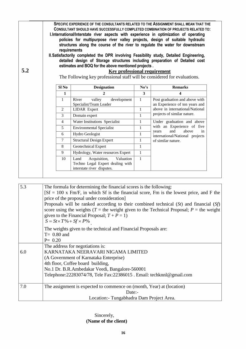
SPECIFIC EXPERIENCE OF THE CONSULTANTS RELATED TO THE ASSIGNMENT SHALL MEAN THAT THE
CONSULTANT SHOULD HAVE SUCCESSFULLY COMPLETED COMBINATION OF PROJECTS RELATED TO: I. International/Interstate river aspects with experience in optimization of operating
policies for multipurpose river valley projects, design of suitable hydraulic structures along the course of the river to regulate the water for downstream requirements
II. Satisfactorily completed the DPR involving Feasibility study, Detailed Engineering, detailed design of Storage structures including preparation of Detailed cost estimates and BOQ for the above mentioned projects .
Key professional requirement
The Following key professional staff will be considered for evaluations.
Sl No Designation No’s Remarks
1 2 3 4
1 River valley development
Specialist/Team Leader
1 Post graduation and above with
an Experience of ten years and
above in international/National
projects of similar nature. 2 LIDAR Expert 1
3 Domain expert 1
4 Water Institutions Specialist 1 Under graduation and above
with an Experience of five
years and above in
international/National projects
of similar nature.
5 Environmental Specialist 1
6 Hydro Geologist 1
7 Structural Design Expert 1
8 Geotechnical Expert 1
9 Hydrology, Water resources Expert 1
10 Land Acquisition, Valuation
Techno Legal Expert dealing with
interstate river disputes.
1
5.3 The formula for determining the financial scores is the following:
[Sf = 100 x Fm/F, in which Sf is the financial score, Fm is the lowest price, and F the
price of the proposal under consideration]
Proposals will be ranked according to their combined technical (St) and financial (Sf)
score using the weights (T = the weight given to the Technical Proposal; P = the weight
given to the Financial Proposal; T + P = 1) %% PSfTStS .
The weights given to the technical and Financial Proposals are:
T= 0.80 and
P= 0.20
6.0
The address for negotiations is:
KARNATAKA NEERAVARI NIGAMA LIMITED
(A Government of Karnataka Enterprise)
4th floor, Coffee board building,
No.1 Dr. B.R.Ambedakar Veedi, Bangalore-560001
Telephone:22283074/78, Tele Fax:22386015 . Email: [email protected]
7.0 The assignment is expected to commence on (month, Year) at (location)
Date:-
Location:- Tungabhadra Dam Project Area.
Sincerely,
(Name of the client)

17
SECTION 3. TECHNICAL PROPOSAL - STANDARD FORMS
3A. Technical Proposal submission form.
3B. Consultant‘s references.
3C. Comments and suggestions on the Terms of Reference and on data
services, and facilities to be provided by the Client.
3D. Description of the methodology and work plan for performing the
assignment.
3E. Team composition and task assignments.
3F. Format of Curriculum Vitae of proposed key professional staff.
3G. Time schedule for professional personnel.
3H. Activity (work) schedule.
18
3A. Technical Proposal Submission Form
[Location, Date]
FROM: (Name of Consultant) TO:
The Managing Director, KARNATAKA NEERAVARI NIGAMA LIMITED
(A Government of Karnataka Enterprise)
4th floor, Coffee board building,
No.1 Dr. B.R.Ambedakar Veedi, Bangalore-
560001
Telephone:22283074/78, Tele Fax:22386015
Email: [email protected]
______________________
______________________
______________________
Ladies/Gentlemen:
Subject: Selection of Consultants for preparation of DPR to restore the
Tungabhadra dam to its original capacity/utilisation by studying various
alternatives
We, the undersigned, offer to provide the consulting services for the above in
accordance with your Request for Proposal dated [Date], and our Proposal. We are hereby
submitting our Proposal which includes a Technical Proposal, and a Financial Proposal sealed
under separate envelopes.
If negotiations are held during the period of validity of the Proposal, i.e., before [Date]
we undertake to negotiate on the basis of the proposed staff. Our Proposal is binding upon us
and subject to the modifications resulting from contract negotiations.
We understand you are not bound to accept any Proposal you receive.
We remain,
Yours sincerely,
Authorized Signature:
Name and Title of Signatory:
Name of Consultant:
Address:

19
3B. consultant’s References
Relevant Services Carried Out in the Last Five Years
That Best Illustrate Qualifications
Using the format below, provide information on each reference assignment for which your
firm/entity, either individually as a corporate entity or as one of the major companies within an
association, was legally contracted. Consultants would be required to provide certificate of
satisfactory completion of work from the client/statutory auditor.
Assignment Name:
Country:
Location within Country:
Key professional staff Provided
by Your Firm/entity(profiles):
Name of Client:
No. of Staff:
Address:
Start Date (Month/Year):
Completion Date
(Month/Year):
Approx. Value of Services (Rs.):
Name of Associated Consultants, if any:
No. of Months of Key
professional staff, provided by
Associated Consultants:
Name of Senior Staff (Project Director/Coordinator, Team Leader) involved and functions
performed:
Narrative Description of Project:
Description of Actual Services Provided by Your Staff:
Consultant‘s Name:
20
3C. Comments And Suggestions Of Consultants On The Terms Of Reference And On
Data, Services, And Facilities To be Provided By The Client
On the Terms of Reference:
1.
2.
3.
4.
5.
On the data, services, and facilities to be provided by the Client
1.
2.
3.
4.
5.
Consultant‘s Name:
.

21
3D. Description of the Methodology And Work Plan
For Performing The Assignment
22
3E. Team Composition and Task Assignments
1. Key Professional
Sl. No. Name Position Task
1.
2.
3.
4.
..
..
2. Support Staff
Sl. No. Name Position Task
1.
2.
3.
4.
..
..

23
3F. Format Of Curriculum Vitae (CV) For
Proposed Key professional staff
Proposed Position:
Name of Consultant:
Name of Staff:
Profession:
Date of Birth:
Years with Firm/Entity: Nationality:
Membership in Professional Societies:
Detailed Tasks Assigned:
Key Qualifications:
[Give an outline of staff member‘s experience most pertinent to tasks on assignment. Describe
degree of responsibility held by staff member on relevant previous assignments and give dates
and locations. Use about half a page.]
Education:
[Summarize college/university and other specialized education of staff member, ]
Employment Record:
[Starting with present position, list in reverse order every employment held. List all positions
held by staff member since graduation, giving dates, names of employing organizations, titles
of positions held, and locations of assignments. ]

24
Languages:
[For each language indicate proficiency: excellent, good, fair, or poor; in speaking, reading, and
writing ]
Certification:
I, the undersigned, certify that to the best of my knowledge and belief, these data correctly
describe me, my qualifications, and my experience.
Date:
[Signature of staff member and authorized representative of the Consultant] Day/Month/Year
Full name of staff member:______________________________________
Full name of authorized representative: ___________________________

25
3G. Time Schedule For Professional Personnel
Months (in the form of a Bar Chart)*
Sl.
No.
Name Position Reports
Due/Activities
1 2 3 4 5 6 7 8 9 10 11 12 Number of
Months
1.
Subtotal (1)
2.
Subtotal (2)
3.
Subtotal (3)
4.
Subtotal (4)
Full-time: Part-time:
Reports Due:
Activities Duration:
Signature:
* The Schedule should be for the period of completion of assignment (Authorized Representative)
Full Name:
Title:
Address:

26
3H. Activity (Work) Schedule
A. Field Investigation and Study Items:
Monthwise Program (in form of Bar Chart) ++
[1st, 2nd, etc. are months from the start of assignment]
Sl.
No.
Item of Activity (Work)
1st
2nd
3rd
4th
5th
6th
7th
8th
9th
10th
11th
12th
_______________
_______________
_______________
_______________
_______________
++ The Program should be period of completion of assignment.
B. Completion and Submission of Reports
Reports: * Programme: (Date)
1. Inception Report
2. Interim Progress Report
3. Draft Detailed Project Report
4. Final Detailed Project Report

27
SECTION 4. FINANCIAL PROPOSAL - STANDARD FORMS
4A.Financial proposal submission form.
4B. Summary of cost.
4C. Break down of cost.

28
4A. FINANCIAL PROPOSAL SUBMISSION FORM
[Location, Date]
FROM: (Name of Consultant) TO:
The Managing Director, KARNATAKA NEERAVARI NIGAMA LIMITED
(A Government of Karnataka Enterprise)
4th floor, Coffee board building,
No.1 Dr. B.R.Ambedakar Veedi, Bangalore-
560001
Telephone:22283074/78, Tele Fax:22386015
Email: [email protected]
______________________
______________________
Ladies/Gentlemen:
Subject: SELECTION OF CONSULTANTS FOR PREPARATION OF DPR
TO RESTORE THE TUNGABHADRA DAM TO ITS ORIGINAL
CAPACITY/UTILISATION BY STUDYING VARIOUS ALTERNATIVES -
FINANCIAL PROPOSAL.
We, the undersigned, offer to provide the consulting services for the above in
accordance with your Request for Proposal dated : , and our Proposal (technical and
Financial Proposals). We would require a sum of ________ (amount in words and figures) for
providing the consultancy services inclusive of service tax.
Our financial proposal shall be binding upon us subject to the modifications resulting
from contract negotiations, up to expiration of the validity period of the Proposal, i.e., [Date].
We undertake that, in competing for (and, if the award is made to us, in executing) the
above contract, we will strictly observe the laws against fraud and corruption in force in India
namely ―Prevention of Corruption Act 1988‖.
We understand you are not bound to accept any Proposal you receive.
We remain,
Yours sincerely,
Authorized Signature:
Name and Title of Signatory:
Name of the Consultant:
Address:

29
4B. SUMMARY OF COSTS
No.
Description @ Amount
(Rupees)
I
II
III
IV
V
VI
VII
VIII
IX
Remuneration for Key professional staff
Supporting Staff
Transportation
Duty Travel to Site
Office Rent
Office Supplies, Utilities and Communication
Office Furniture and Equipment
Reports and Document Printing
Surveys
TOTAL COST
Consultancy Services Tax
TOTAL COSTS (Including Service Tax)
Note: The ceiling cost of the consultancy is as shown in the Summary of Costs. Payments will be made as per
stipulations of the Special Conditions of Contract. The break-up of cost as given in formats 4C is to facilitate
assessment of reasonableness of costs and conducting negotiations in accordance with clause 6 of the
Information to Consultants.
@
Modify the items as appropriate for the consultancy assignment.

30
4C. BREAKDOWN OF COSTS (RS)
I REMUNERATION FOR STAFF
No.
Position
Name
Rate* ( (Rs.)
SM
Amo (Rs)
Key pr Professional staff
1.
2.
3.
4.
5.
6.
Sub-Total
Sub-K Key professional staff
1.
2.
3.
4.
5.
6.
Sub-Total
TOTAL
SM = Staff Month
II. Support Staff
No. Position Name Staff Months Rate* ( Rs) Amount( Rs )
1
2
3
4
Total :
* Provide the breakup of the rates to show the basic salary, social costs and overhead.
III Transportation (Reimbursable) *
Total:
IV. Duty Travel to Site (Reimbursable)*
Total:

31
V Office Rent (Reimbursable) *
Total:
*Prepare details as appropriate for the consultancy assignment.
VI. Office Supplies, Utilities and Communication (Reimbursable)
No.
Item
Item*
Months
Monthly
Rate (Rs)
Amount in
(Rs)
1.
2.
3.
4.
TOTAL : ----------------------------
* Prepare details as appropriate for the consultancy assignment.

32
VII. Office Furniture and Equipment (Reimbursable)
No. Description(*) Unit Quantity Rate
( )
Amount
( )
1
2
3
4
5
6
1
2
3
4
5
6
Office Furniture (Purchase)
Office Equipment (Purchase)*
Total
* Prepare details as appropriate for the consultancy assignment
VIII. Reports and Document Printing
No. Description* Number No. of
Copies
Rate per
Copy
( Rs.)
Amount (
Rs. )
1
2
3
4
5
Total
IX. Topographical Surveys (if any)*
_____________________________
Prepare details as appropriate for the consultancy assignment

33
SECTION 5.
Terms Of Reference

34
5.1 Introduction:
Tungabhadra river is one of the tributaries of Krishna river in south India, Tungabhadra river
dervies its name from confluence of two streams the Tunga & Bhadra, both of which rise in
wooded eastern slopes of the western ghats in the Karnataka state and flow east wards. After
confluence of two streams at Kudali near Shivamogga, the Tungabhadra river runs for 531 Km
and joins river Krishna in Sangmeshwara near Kurnool in the state of Andhra Pradesh. The
river runs for 382 Km in Karnataka there after forms the boundary between Karnataka & Andhra
Pradesh for 58 Kms, flows for the remaining 91 Kms in the Andra Pradesh.
The Tungabhadra dam is constructed across the Tungabahdra River , a tributory of the
Krishna River. The dam is near the town of Hospet in Karnataka. It is a multi purpose dam
serving Irrigation, electricity generation flood control, etc, this is a joint project of erstwhile
Hyderabad state and erstwhile Madras Presidency when the construction was strated: later it
became a joint project of Karnataka and Andra Pradesh after its completion in 1953.
The dam creates the biggest reservoir on the Tungabhadra river with 100.855 TMC of gross
storage capacity at full reservoir level (FRL) 498m MSL, an water spread area of 378 square
kilometer , the dam is 49.5 meter high above its deepest foundation. The two left bank canals and
RayaBasavanna canal on right side of the reservoir supply water for Irrigation entirely in
Karnataka state.Two right bank canals are constructed, one at low level and the other at high level
serving Irrigation in Karnataka and Rayal seema region of Andra Pradesh, Hydropower units are
installed on canal drops. The reservoir water also assist downstream projects, Rajolibanda
Diversion Scheme, K.C canal and Vijayanagar canals. The identified water use from the project is
230 TMC ft as allocated by the Krishna water Disputes Tribunal. Karnataka and Andra Pradesh
got 151.49 TMC ft and 78.51 TMC ft water use entitlement respectively.
5.2Allocation of water to various states under Krishna Water Dispute Tribunal
Award(KWDT Award)
As more priority was provided to irrigation in the initial five year plans, the states of the
nascent republic embarked on construction of new projects for utilization of water
resources. This eventually led to conflicting interests in the inter-state rivers and the
disputes among the states on sharing the waters of the inter-state rivers prolonged without
finding any viable solution to the vexed issues. This was precisely the case with the river
Krishna and its basin States.
35
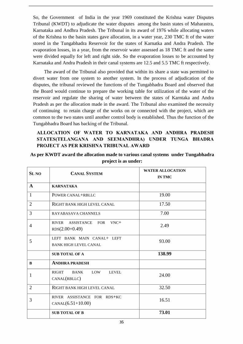
So, the Government of India in the year 1969 constituted the Krishna water Disputes
Tribunal (KWDT) to adjudicate the water disputes among the basin states of Maharastra,
Karnataka and Andhra Pradesh. The Tribunal in its award of 1976 while allocating waters
of the Krishna to the basin states gave allocation, in a water year, 230 TMC ft of the water
stored in the Tungabhadra Reservoir for the states of Karnatka and Andra Pradesh. The
evaporation losses, in a year, from the reservoir water assessed as 18 TMC ft and the same
were divided equally for left and right side. So the evaporation losses to be accounted by
Karnataka and Andra Pradesh in their canal systems are 12.5 and 5.5 TMC ft respectively.
The award of the Tribunal also provided that within its share a state was permitted to
divert water from one system to another system. In the process of adjudication of the
disputes, the tribunal reviewed the functions of the Tungabhadra Board and observed that
the Board would continue to prepare the working table for utilization of the water of the
reservoir and regulate the sharing of water between the states of Karntaka and Andra
Pradesh as per the allocation made in the award. The Tribunal also examined the necessity
of continuing to retain charge of the works on or connected with the project, which are
common to the two states until another control body is established. Thus the function of the
Tungabhadra Board has backing of the Tribunal.
ALLOCATION OF WATER TO KARNATAKA AND ANDHRA PRADESH
STATES(TELANGANA AND SEEMANDHRA) UNDER TUNGA BHADRA
PROJECT AS PER KRISHNA TRIBUNAL AWARD
As per KWDT award the allocation made to various canal systems under Tungabhadra
project is as under:
SL NO CANAL SYSTEM WATER ALLOCATION
IN TMC
A KARNATAKA
1 POWER CANAL+RBLLC 19.00
2 RIGHT BANK HIGH LEVEL CANAL 17.50
3 RAYABASAVA CHANNELS 7.00
4 RIVER ASSISTANCE FOR VNC+
RDS(2.00+0.49) 2.49
5 LEFT BANK MAIN CANAL+ LEFT
BANK HIGH LEVEL CANAL 93.00
SUB TOTAL OF A 138.99
B ANDHRA PRADESH
1 RIGHT BANK LOW LEVEL
CANAL(RBLLC) 24.00
2 RIGHT BANK HIGH LEVEL CANAL 32.50
3 RIVER ASSISTANCE FOR RDS+KC
CANAL(6.51+10.00) 16.51
SUB TOTAL OF B 73.01

36
GRAND TOTAL EXCLUDING
EVAPORATION (A+B) 212.00
C EVAPORATION LOSSES
KARNATAKA 12.50
ANDHRA PRADESH 5.50
SUB TOTAL OF C 18.00
GRAND TOTAL ALLOCATION FOR
TUNGABHADRA PROJECT UNDER
K-8 SUB BASIN(A+B+C)
230.00
5.3 Sedimentation details of Tungabhadra Reservoir are as follows:
Periodic assessement of the capacity of the Reservoir has been made since
impounding of water in 1953.The gross storage capacity of the Reservoir
was assessed in 1953 as 3,751.17 MCum(132.47 TMC) at FRL
497.738m(1633 ft) and dead storage capacity as 32.83 MCum(1.160TMC)
at 472.440m (1550ft). A siltation rate of 4.29 ha m/100 Sq. KM/year (0.427
TMC/Year) was adopted in the design of the project.
Periodic assessement of the capacity of the Reservoir has been made since
impounding of water in 1953.
CAPACITIES OF TUNGABHADRA RESERVOIR FROM 1953 TO 2008.
Capacity in TMCft
Year of
Survey
Dead Storage
capacity
Live
Storage
Gross storage Annual rate of
decrease in
reservoir
capacity(between
successive surveys)
Remarks
1953 1.159 131.312 132.473 - Original survey
1963 7.04 114.411 114.66 1.7812 To find annual rate
of decrease in
reservoir capacity
for the year 1972,
the original
capacity of the
reservoir in 1953
has been considerd.
1972 0.073 121.007 121.08 0.5995
1978 Nil 117.695 117.695 0.5642
1981 Nil 115.680 115.680 0.6717
1985 Nil 111.832 111.832 0.9620
1993 Nil 111.50 111.50 0.0415
2004 Nil 104.34 104.34 0.652
2008 Nil 100.855 100.855
Note: Dead storage is below RL 472.440m
Live storage in between RL 472.44m and 497.738m

37
SALIENT FEATURES OF TUNGABHADRA PROJECT
1 Name of the Project Tungabhadra
2 River basin Krishna
3 Name of stream/Sub basin Tungabhadra
4 Location
a) Near by village/ town Mallapuram
b) Taluk Hospet
c) District Bellary
d) Latitude 15 15' 19" N
e) Longitude 76 20' 10" E
5 Catchment area (Sq.Kms) 28177
6 Estimated annual Yeild in
(TMC)
407.107
7 Storage in TMC
Year
1953 1993 2004
a) Gross 132.471 111.507 104.34
b) Live 131.312 111.507 104.34
c) Dead 1.159 0 0
8 Planned utilisation in TMC Pertaining to Karnataka state only as per
master plan.
a) Withdrawals by canals 119.50
b) Reservoir losses 12.50
c) Gross utilisation 132.00
9 Irrigable area 363738 Ha
10 Submersiion
a) Area (Ha) 37810
b) Village affected (Nos) 90
c) Population affected (Nos) 54452
11 Dam
a) Type Composit
b) Height (Mtr)
i) Above river bed 35.37
ii) Above foundation level 49.39
iii) Average heigt of composite
dam
21.30
iv) Average height of earthen
dam
9.10
c) Length (Mtr)
i) Masonry dam including
Spillway (701M)
1040
ii) Composit dam (Mtrs) 546.8
iii) Earthen Dam (Mtrs) 152.4
d) MWL (Mtr) 497.74
e) FRL (Mtr) 497.74
f) MDDL (Mtr) 477.01
12 Spillway
a) Location Central
b) Length (Mtr) 701
c) Flood lift (Mtr) 6.10
d) Discharge capacity in cumes 18406

38
e) Gates 33 Nos. (18.29m x 6.10m )
Vertical crest gates.
13 Canals
a) Right Bank Canal
(0.00Km to 21.09Km, the canal is
called power canal and from
there for a length of 348.20Km it
is called RBLLC)
Power canal RBLLC
i) Length in Km 21.09 348.20
ii) Capacity in cumes 70.79 50.97
iii) Area in Ha. 101106 Ha (Karnataka – 37518 Ha
Andhra Pradesh – 63588 Ha)
b) Left Bank Main Canal
i) Length in Km 227.00
ii) Capacity in cumes 116.10
iii) Area in Ha. 2,45,616
c) Right Bank High Level Canal
i) Length in Km 196.43
ii) Capacity in cumes 113.27
iii) Area in Ha. 1,57,877 (Karnataka – 80939 Ha
Andhra Pradesh – 76937 Ha)
d) Left Bank High Level Canal
i) Length in Km 15.00
ii) Capacity in cumes 0.95
iii) Area in Ha. 468
14 Power Generation
A) Hampi Power House
a) No. of Power units 4 Nos. 9000 KW each
b) Capacity (in MW) 36
B) Dam Power House Right side
a) No. of Power units 4 Nos. 9000 KW each
b) Capacity (in MW) 36
C) Dam Power House Left side
a) No. of Power units 3 Nos. 9000 KW each
b) Capacity (in MW) 27
5.4 PROJECT OBJECTIVES
The main objectives of this studies are :
Conduct the capacity and sedimentation study of the TB Reserviour.
Deploy best consultant team to carry out studies and implement the work.
Estiamte the current capacity of TB Reseviour using latest technical know-how
assited by the differential global positioning system
Estimate the quantity of silt to be removed from the reservoir to restore to its original
design capacity.
Examine various alternatives of restoring the design capacity/utilisation of TB
reservoir and provide opinion.
Evalauate cost benefit analysis of the alternatives.
Document best practices-global exlerience.
suggest best alternatives. (s)

39
Proposal a methodology to restore the design capacity/utilisation using the most
appropriate and latest technologies, strictly adhering to the safety conditions and
logistical guide lines stipulated by Go I laws/ acts.
Provide a cost estimate for each solution with a timeline of activities.
Prepare a Detailed Project report (DPR) of Global standards.
Evaluate project implemention and provide a report.
5.5 Report deliverables:
Inception Report:
The inception report shall be submitted to the Client by the consultant within 21 days
from the date of entering into the agreement and shall comprise the following:
Project Appreciation and Reconnaissance survey
Detailed Approach and Methodology to meet the requirement of TOR; including
scheduling of various sub-activities to be carried out for completion of various
stages of the work stating out clearly their approach & methodology for project
preparation after due inspection of the entire project stretch and collection/
collation of necessary information
Task Assignment and Manning Schedule
Work Programme
Quality Assurance Plan (QAP)
Proforma for data collection and Engineering surveys.
Feasibility Report:
Feasibility report shall be submitted to the Client by the consultant within 60 days
comprising of the proposal for alternative locations including the finalized Techno
Economical location of reservoir for detailed studies. The report shall cover the
following:
Reconnaissance report
Report on preliminary survey
Alternative studies conducted
Preliminary Analysis
Preliminary report on all the tasks as per Scope of work
Finalization of Techno Economical location of proposed reservoir
Detailed Project Report
The DPR reporting shall be as per the guidelines for Preparation of Detailed
Project Reports of Irrigation and Multi purpose Projects. The Detailed Project
Report shall be prepared as per the laid out guidelines (Refer Annex-3.2) and
shall have the following Annex as a minimum.
• The overall plan of the envisaged development
• Results of Assessment of Feasibility Reports
• Results of the EIA & Socio-economic studies.
• Results of the Topographic & Allied Surveys
• Results of Geological & Geophysical Investigations
• Results of the Geotechnical & Construction material Investigations

40
• Results of the Hydrological and Meteorological Investigations
• Results of the Numerical Model Studies and assessments
• Detailed Layouts and Engineering Drawings.
• Construction Programme.
s part of reporting, the following Action Plan documents shall also be prepared and
submitted as Annex to the main report.
• Action Plan for Compensatory Afforestation
• Action Plan for Water Logging & Salinity
• Action Plan for De-siltation
• Action Plan for Catchment Area Treatment
• Action Plan for Eco-system
• Action Plan for Tourism
• Action Plan for Water Quality Maintenance
• Action Plan for Disaster Management
• Action Plan for Project Implementation and Monitoring
The reporting of all the activities shall be in three components viz.data, text and
drawing.
Simultaneous to the hard copy submissions, the DPR shall also be submitted in soft
copy i.e. CD. The text of the report shall be in MS WORD, data sheets shall be MS
EXCEL, and the drawings shall be in Auto CAD.
The DPR shall also include all the relevant documents, analysis and results with back up
calculations, drawings, inter active models and schemes, estimates etc. as per the scope
of work. Specified number of draft final reports along with all the Annex and subsequent
final report shall be submitted in both hard and soft copies.
Submissions
All approved drawings original in tracing : One copy
All drawings to scale in colour : Five copies
All reports : Five copies
Soft copies (in editable format) : Two copies on CD
5.6 Time Frame:
Sl No Description of Milestones
Timelines from the date
of signing the
Agreement
1. Inception Report 21 days
2. Feasibility Report 60 days
3. Draft Detailed Project
Reports with cost estimates 150 days
4. Final Detailed Project
Report 180 days

41
5.7 Terms of payment:
Key
Date No
Description of
Milestones Timeline
Payment
milestone
1. Inception Report On approval of Inception Report
by Client 10%
2. Feasibility Report On approval of Feasibility
Report by Client 30%
3. Draft Detailed Project
Report with cost
estimates
On approval of draft Detailed
Project Report by Client 30%
4. Final Detailed Project
Report
On approval of draft final
Detailed Project Report by
Client
30%
10% of the agreed lump sum amount of the project will be released as advance after the
approval of the inception report subject to production of bank guarantee for the
equivalent amount by the consultant issued by nationalized / scheduled banks valid for a
period not less than 6 months.
Further 30% of the agreed lump sum amount will be released after submission of the
feasibility report by the consultant and acceptance of the same by the Client.
The further 30% of the agreed lump sum amount will be released after submission of the
draft report (DPR) as per standard practice by the consultant to the Client.
Based on the recommendation of the Client and subject to corrections if any to be
effected in the DPR the balance 30% of the lump sum amount will be released by the
Client after getting such corrections attended and seeking competent approval of the
Estimate Review Committee and the Board of KNNL to the DPR.
No payments under this contract will carry interest.
42
SECTION 6-
STANDARD FORM OF CONTRACT
CONTRACT FOR CONSULTANT’S SERVICES
between
____________________________
KARNATAKA NEERAVARI NIGAMA LIMITED
(A Government of Karnataka Enterprise)
4th floor, Coffee board building,
No.1 Dr. B.R.Ambedakar Veedi, Bangalore-560001
and
____________________________
[Name of Consultants]
Dated :

43
I. FORM OF CONTRACT
This CONTRACT (hereinafter called the "Contract") is made the _________ day of the month
of ______________, 20___ , between, on the one hand, Karnataka Neeravari Nigama Limited
(hereinafter called the "Client") and, on the other hand, _______________(hereinafter called the
"Consultants").
[*Note: If the Consultants consist of more than one entity, the above should be partially amended to
read as follows:
“......(hereinafter called the "Client") and, on the other hand, a joint venture consisting of the
following entities, each of which will be jointly and severally liable to the Client for all the
Consultants' obligations under this Contract, namely, ________________ and
_______________________ (hereinafter called the "Consultants.")”]
WHEREAS
(a) the Client has requested the Consultants to provide certain consulting services as defined in the
General Conditions of Contract attached to this Contract (hereinafter called the "Services");
(b) the Consultants, having represented to the Client that they have the required professional skills,
and personnel and technical resources, have agreed to provide the Services on the terms and
conditions set forth in this Contract;
NOW THEREFORE the parties hereto hereby agree as follows:
1. The following documents attached hereto shall be deemed to form an integral part of this
Contract:
(a) The General Conditions of Contract (hereinafter called "GC");
(b) The Special Conditions of contract (hereinafter called "SC");
(c) The following Appendices:
Appendix A: Description of the Services ______________
Appendix B: Reporting Requirements ______________
Appendix C: Key Personnel ______________
Appendix D: Services and Facilities to be provided by the Client _____________
Appendix E: Form of Guarantee for Advance Payments ______________
[Note: If any of these Appendices are not used, the words "Not Used" should be inserted below
next to the title of the Appendix on the sheet attached hereto carrying the title of that
Appendix.]
2. The mutual rights and obligations of the Client and the Consultants shall be as set forth in
the Contract, in particular:
(a) The Consultants shall carry out the Services in accordance with the provisions of the
Contract; and

44
(b) The Client shall make payments to the Consultants in accordance with the provisions of
the Contract.
IN WITNESS WHEREOF, the Parties hereto have caused this Contract to be signed in their
respective names as of the day and year first above written.
FOR AND ON BEHALF OF
KARNATAKA NEERAVARI NIGAMA LIMITED
By
(Authorized Representative)
FOR AND ON BEHALF OF
[NAME OF CONSULTANT]
By
(Authorized Representative)
[Note: If the Consultants consist of more than one entity, all of these entities should appear as
signatories, e.g., in the following manner:]
FOR AND ON BEHALF OF EACH OF
THE MEMBERS OF THE CONSULTANTS
[Name of Member]
By
(Authorized Representative)
[Name of Member]
By
(Authorized Representative)
etc.
45
II. GENERAL CONDITIONS OF CONTRACT
1. GENERAL PROVISIONS
1.1 Definitions
Unless the context otherwise requires, the following terms whenever used in this Contract
have the following meanings:
(a) "Applicable Law" means the laws and any other instruments having the force of law
in India, as they may be issued and in force from time to time;
(b) "Contract" means the Contract signed by the Parties, to which these General
Conditions of Contract (GC) are attached, together with all the documents listed in Clause
1 of such signed Contract;
(c) ―Effective Date‖ means the date on which this Contract comes into force and effect
pursuant to Clause GC 2.1
(d) ―Contract Price‖ means the price to be paid for the performance of the Services, in
accordance with Clause 6;
(e) "GC" means these General Conditions of Contract;
(f) "Government" means the Government of Karnataka;
(g) "Local currency" means Indian Rupees;
(h) "Member", in case the Consultants consist of a joint venture of more than one entity,
means any of these entities, and "Members" means all of these entities; ‗Member in
Charge‘ means the entity specified in the SC to act on their behalf in exercising all the
Consultants‘ rights and obligations towards the Client under this Contract.
(i) "Party" means the Client or the Consultants, as the case may be, and Parties means
both of them;
(j) "Personnel" means persons hired by the Consultants as employees and assigned to the
performance of the Services or any part thereof; and ‗key personnel‘ means the personnel
referred to in Clause GC4.2 (a)
(k) "SC" means the Special Conditions of Contract by which these General Conditions of
Contract may be amended or supplemented;
(l) "Services" means the work to be performed by the Consultants pursuant to this
Contract as described in Appendix A; and
(m)‗Third party‖ means any person or entity other than the Government, the Client or the
Consultants.
1.2 Law Governing the Contract
This Contract, its meaning and interpretation, and the relation between the Parties shall be
governed by the Applicable Law.

46
1.3 Language
This Contract has been executed in English language, which shall be the binding and controlling
language for all matters relating to the meaning or interpretation of this Contract.
1.4 Notices
Any notice, request or consent made pursuant to this Contract shall be in writing and shall be
deemed to have been made when delivered in person to an authorized representative of the Party
to whom the communication is addressed, or when sent by registered mail, telex, telegram or
facsimile to such Party at the address specified in the SC.
1.5 Location
The Services shall be performed at such locations as are specified in Appendix A and, where the
location of a particular task is not so specified, at such locations, whether in Karnataka or
elsewhere, as the Client may approve.
1.6 Authorized Representatives
Any action required or permitted to be taken, and any document required or permitted to be
executed, under this Contract by the Client or the Consultants may be taken or executed by the
officials specified in the SC.
1.7 Taxes and Duties
The Consultants and their Personnel shall pay such taxes, duties, fees and other impositions as
may be levied under the Applicable Law, the amount of which is deemed to have been
included in the Contract Price.
1.8 Headings
The headings shall not limit, alter or affect the meaning of this Contract.
1.9 Authority of Member in Charge
In case the Consultants consist of a joint venture of more than one entity, the Members hereby
authorize the entity specified in the SC to act on their behalf in exercising all the Consultants rights
and obligations towards the Client under this Contract, including without limitation the receiving of
instructions and payments from the Client.
2. Commencement, Completion, Modification and termination of Contract
2.1 Effectiveness of Contract
This Contract shall come into effect on the date the Contract is signed by both Parties
or such other later date as may be stated in the SC.

47
2.2 Commencement of Services
The Consultants shall begin carrying out the Services within fifteen (15) days after
the date the Contract becomes effective, or at such other date as may be specified in
the SC.
2.3 Expiration of Contract
Unless terminated earlier pursuant to Clause 2.7, this Contract shall terminate at the
end of such time period after the Effective Date as is specified in the SC.
2.4 Modification
Modification of the terms and conditions of this Contract, including any modification
of the scope of the Services or of the Contract Price, may only be made by written
agreement between the Parties.
2.5 Force Majeure
2.5.1 Definition
For the purposes of this Contract, "Force Majeure" means an event which is
beyond the reasonable control of a Party, and which makes a Party's performance
of its obligations under the Contract impossible or so impractical as to be
considered impossible under the circumstances and includes, but is not limited to,
war, riots, civil disorder, earthquake, fire, explosion, storm, flood or other adverse
weather conditions, strikes, lockouts or other industrial action (except where such
strikes, lockouts or other industrial action are within the power of the Party
invoking Force Majeure to prevent), confiscation or any other action by
Government agencies.
Force Majeure shall not include (i) any event which is caused by the negligence or
intentional action of a Party or such Party‘s Experts, Sub-consultants or agents or
employees, nor (ii) any event which a diligent Party could reasonably have been
expected to both (A) take into account at the time of the conclusion of this
Contract, and (B) avoid or overcome in the carrying out of its obligations
hereunder.
Force Majeure shall not include insufficiency of funds or failure to make any
payment required hereunder.
2.5.2 No Breach of Contract
The failure of a Party to fulfill any of its obligations under the contract shall not be
considered to be a breach of, or default under this Contract insofar as such inability
arises from an event of Force Majeure, provided that the Party affected by such an
event (a) has taken all reasonable precautions, due care and reasonable alternative
measures in order to carry out the terms and conditions of this Contract, and (b) has
informed the other Party as soon as possible about the occurrence of such an event.

48
2.5.3 Extension of Time
Any period within which a Party shall, pursuant to this Contract, complete any action
or task, shall be extended for a period equal to the time during which such Party was
unable to perform such action as a result of Force Majeure.
2.5.4 Payments
During the period of their inability to perform the Services as a result of an event of
Force Majeure, the Consultants shall be entitled to continue to be paid under the terms
of this Contract, as well as to be reimbursed for additional costs reasonably and
necessarily incurred by them during such period for the purposes of the Services and in
reactivating the Service after the end of such period.
2.5.5 Consultation
Not later than thirty (30) days after the Consultants, as the result of an event of Force
Majeure, have become unable to perform a material portion of the Services, the Parties
shall consult with each other with a view to agreeing on appropriate measures to be
taken in the circumstances.
2.6 Suspension:
The Client may by written notice of suspension to the Consultants, suspend all
payments to the Consultants hereunder if the Consultants fail to perform any of their
obligations under this contract, including the carrying out of the Services, provided that
such notice of suspension (i) shall specify the nature of the failure, and (ii) shall request
the Consultants to remedy such failure within a period not exceeding thirty (30) days
after receipt by the Consultants of such notice of suspension.
2.7 Termination
2.7.1 By the Client
The Client may terminate this Contract, by not less than thirty (30) days‘ written
notice of termination to the Consultants, to be given after the occurrence of any of the
events specified in paragraphs (a) through (d) of this Clause 2.7.1 and sixty (60) days‘
in the case of the event referred to in (e):
a. if the Consultants do not remedy a failure in the performance of their
obligations under the Contract, within thirty (30) days of receipt after being
notified or within such further period as the Client may have subsequently
approved in writing;
b. if the Consultants (or any of their Members) become insolvent or bankrupt;
c. if, as the result of Force Majeure, the Consultants are unable to perform a
material portion of the Services for a period of not less than sixty (60)
days; or

49
d. if the consultant, in the judgment of the Client has engaged in corrupt or
fraudulent practices in competing for or in executing the Contract.
e. For the purpose of this clause:
―corrupt practice‖ means the offering, giving, receiving or soliciting of
anything of value to influence the action of a public official in the selection
process or in contract execution.
―Fraudulent practice‖ means a misrepresentation of facts in order to
influence a selection process or the execution of a contract to the detriment
of GOK, and includes collusive practice among consultants (prior to or
after submission of proposals) designed to establish prices at artificial non-
competitive levels and to deprive GOK of the benefits of free and open
competition.
f. if the Client, in its sole discretion and for any reason whatsoever, decides
to terminate this Contract.
2.7.2 By the Consultants
The Consultants may terminate this Contract, by not less than thirty (30) days'
written notice to the Client, such notice to be given after the occurrence of any of
the events specified in paragraphs (a) through (c) of this Clause 2.7.2:
(a) If the Client fails to pay any monies due to the Consultants pursuant to this Contract
and not subject to dispute pursuant to Clause 7 hereof within forty-five (45) days
after receiving written notice from the Consultants that such payment is overdue;
(b) If the Client is in material breach of its obligations pursuant to this Contract and
has not remedied the same with in forty-five (45) days (or such longer period as
the Consultants may have subsequently approved in writing) following the receipt
by the Client of the Consultants‘ notice specifying such breach;
(c) If, as the result of Force Majeure, the Consultants are unable to perform a material
portion of the Services for a period of not less than sixty (60) days.
2.7.3 Cessation of Rights and Obligations
Upon termination of this Contract pursuant to Clause GC 2.7 , or upon expiration
of this Contract pursuant to Clause GC 2.3, all rights and obligations of the
Parties hereunder shall cease, except :
(i) such rights and obligations as may have accrued on the date of termination
or expiration;
(ii) the obligation of confidentiality set forth in Clause GC 3.3 hereof;
(iii) any right which a Party may have under the Applicable Law.
50
2.7.4 Cessation of Services
Upon termination of this Contract by notice of either Party to the other pursuant to
Clauses GC 2.7.1 or GC 2.7.2 hereof, the Consultants shall, immediately upon
dispatch or receipt of such notice, take all necessary steps to bring the Services to a
close in a prompt and orderly manner and shall make every reasonable effort to
keep expenditures for this purpose to a minimum. With respect to documents
prepared by the Consultants and equipment and materials furnished by the Client,
the Consultants shall proceed as provided, respectively, by Clauses GC 3.7 and GC
3.8 .
2.7.5 Payment upon Termination
Upon termination of this Contract pursuant to Clauses 2.7.1 or 2.7.2, the Client shall
make the following payments to the Consultants:
(a) remuneration pursuant to Clause 6 for Services satisfactorily performed prior to the
effective date of termination;
b) except in the case of termination pursuant to paragraphs (a) and (b) of Clause 2.7.1,
reimbursement of any reasonable cost incident to the prompt and orderly termination
of the Contract.
3. Obligations of the Consultants:
3.1 General
The Consultants shall perform the Services and carry out their obligations hereunder
with all due diligence, efficiency and economy, in accordance with generally
accepted professional techniques and practices, and shall observe sound management
practices, and employ appropriate advanced technology and safe methods. The
Consultants shall always act, in respect of any matter relating to this Contract or to
the Services, as faithful advisers to the Client, and shall at all times support and
safeguard the Client's legitimate interests in any dealings with third parties.
3.2 Conflict of Interests
3.2.1 Consultants Not to Benefit from Commissions, Discounts, etc.
The remuneration of the Consultants pursuant to Clause 6 shall constitute the
Consultants' sole remuneration in connection with this Contract or the Services, and
the Consultants shall not accept for their own benefit any trade commission,
discount or similar payment in connection with activities pursuant to this Contract or
to the Services or in the discharge of their obligations under the Contract, and the
Consultants shall use their best efforts to ensure that the Personnel, and agents of
either of them, similarly shall not receive any such additional remuneration.
3.2.2 Procurement Rules of Funding Agencies
If the Consultants, as part of the Services, have the responsibility of advising the
Client on the procurement of goods, works or services, the Consultants shall comply
51
with any applicable procurement guidelines of the funding agencies and shall at all
times exercise such responsibility in the best interest of the Client. Any discounts or
commissions obtained by the Consultants in the exercise of such procurement
responsibility shall be for the account of the Client.
3.2.3 Consultants and Affiliates Not to engage in certain Activities
The Consultants agree that, during the term of this Contract and after its termination,
the Consultants and their affiliates, as well as any of its affiliates, shall be
disqualified from providing goods, works or services (other than the Services and
any continuation thereof) for any project resulting from or closely related to the
Services.
3.2.4 Prohibition of Conflicting Activities
Neither the Consultants nor the Personnel shall engage, either directly or
indirectly, in any of the following activities:
(a) during the term of this Contract, any business or professional activities in the
Government's country which would conflict with the activities assigned to them
under this Contract; or
(b) after the termination of this Contract, such other activities as may be
specified in the SC.
3.3 Confidentiality
The Consultants, and the Personnel of either of them shall not, either during the term or
within two (2) years after the expiration of this Contract, disclose any proprietary or
confidential information relating to the Project, the Services, this Contract, or the
Client's business or operations without the prior written consent of the Client.
3.4 Insurance to Be Taken out by the Consultants
The Consultants (a) shall take out and maintain, at their own cost but on terms and
conditions approved by the Client, insurance against the risks, and for the coverage, as
shall be specified in the SC; and (b) at the Client's request, shall provide evidence to the
Client showing that such insurance has been taken out and maintained and that the
current premiums have been paid.
3.5 Consultants’ Actions Requiring Client’s Prior Approval
The Consultants shall obtain the Client‘s prior approval in writing before taking any of
the following actions:
(a) appointing such members of the Personnel not listed by name in Appendix C (―Key
Personnel‖), and
(b) any other action that may be specified in the SC.

52
3.6 Reporting Obligations
The Consultants shall submit to the Client the reports and documents specified in
Appendix B in the form, in the numbers, and within the periods set forth in the said
Appendix.
3.7 Documents Prepared by the Consultants to Be the Property of the Client
All plans, drawings, specifications, designs, reports and other documents and software
submitted by the Consultants in accordance with Clause 3.6 shall become and remain
the property of the Client, and the Consultants shall, not later than upon termination or
expiration of this Contract, deliver all such documents and software to the Client,
together with a detailed inventory thereof. The Consultants may retain a copy of such
documents and software. Restrictions about the future use of these documents, if any,
shall be specified in the SC.
3.8 Equipment and Materials Furnished by the Client
Equipment and materials made available to the Consultants by the Client or
purchased by the Consultants with funds provided by the Client shall be the
property of the Client and shall be marked accordingly. Upon termination or
expiration of this Contract, the Consultants shall make available to the Client an
inventory of such equipment and materials and shall dispose of such equipment and
materials in accordance with the Client‘s instructions. While in possession of such
equipment and materials, the Consultants, unless otherwise instructed by by the
Client in writing, shall insure them at the expense of the Client in an amount equal
to their replacement value.
3.9 Liability of the Consultants
Subject to additional provisions, if any, set forth in the SC, the Consultants
liability under this Contract shall be as provided by the Applicable Law.
4. Consultants’ Personnel
4.1 Description of Personnel
The titles, agreed job descriptions, minimum qualifications and estimated periods of
engagement in the carrying out of the Services of the Consultants' Key Personnel are
described in Appendix C. The Key Personnel listed by title as well as by name in
Appendix C are hereby approved by the Client.
4.2 Removal and/or Replacement of Personnel
(a) Except as the Client may otherwise agree, no changes shall be made in the
Key Personnel. If, for any reason beyond the reasonable control of the
Consultants, it becomes necessary to replace any of the Key Personnel, the
Consultants shall forthwith provide as a replacement a person of equivalent or
better qualifications.
(b) If the Client finds that any of the Personnel have (i) committed serious
misconduct or has been charged with having committed a criminal action, or
(ii) have reasonable cause to be dissatisfied with the performance of any of the
Personnel, then the Consultants shall, at the Client's written request specifying
53
the grounds therefor, forthwith provide as a replacement a person with
qualifications and experience acceptable to the Client.
(c) The Consultants shall have no claim for additional costs arising out of or
incidental to any removal and/or replacement of Personnel.
5. Obligations of the Client
5.1 Assistance and Exemptions
Unless otherwise specified in the SC, the Client shall use its best efforts to ensure
that the Government shall:
a) issue to officials, agents and representatives of the Government all such
instructions as may be necessary or appropriate for the prompt and effective
implementation of the Services;
b) assist the Consultants and the Personnel employed by the Consultants for the
Services from any requirement to register or obtain any permit to practice their
profession or to establish themselves either individually or as a corporate entity
according to the Applicable Law;
c) provide to the Consultants and Personnel any such other assistance as may be
specified in the SC.
d) Provide the Consultants and Personnel with work permits and such other
documents as shall be necessary to enable the Consultants and Personnel to
perform the Services;
5.2 Services and Facilities
The Client shall make available to the Consultants and the Personnel, for the purposes of
the services and free of any charge, the services, facilities and property described in
Appendix D at the times and in the manner specified in said Appendix D, provided that
if such services, facilities and property shall not be made available to the Consultants as
and when so specified, the Parties shall agree on (i) any time extension that it may be
appropriate to grant to the Consultants for the performance of the Services, (ii) the
manner in which the Consultants shall procure any such services, facilities and property
from other sources, and (iii) the additional payments, if any, to be made to the
Consultants as a result thereof.
6. Payment to the Consultants:
6.1 Lump Sum Remuneration
The Consultant‘s total remuneration shall not exceed the Contract Price and shall be a
fixed lump sum including all staff costs, printing, communications, travel,
accommodation, and the like, and all other costs incurred by the Consultant in carrying
out the Services described in Appendix A. Except as provided in Clause 5.2, the
Contract Price may only be increased above the amounts stated in clause 6.2 if the Parties
have agreed to additional payments in accordance with Clause 2.4.
54
6.2 Contract Price
The Contract price is Rs. ------
6.4 Terms and Conditions of Payment
Payments will be made to the account of the Consultants and according to the
payment schedule stated in the SC. Unless otherwise stated in the SC, the first
payment shall be made against the provision by the Consultants of a bank guarantee
for the same amount, and shall be valid for the period stated in the SC. Any other
payment shall be made after the conditions listed in the SC for such payment have
been met, and the Consultants have submitted an invoice to the Client specifying
the amount due.
7. Settlement of disputes
a) If any dispute or difference of any kind whatsoever were to arise between the
Executive Engineer / Superintending Engineer and the Contractor regarding the
following matter namely.
(i) The meaning of the specifications design, drawings and instructions
herein before mentioned.
(ii) The quantity of workmanship or materials used on the work and
(iii) Any other question, claim, right, matter, thing whatsoever, in any
way arising out of or relating to the contract, designs, drawings,
specifications, estimates, instructions, or orders or those conditions or
failure to execute the same whether arising during the progress of the
work, or after the completion, termination or abandonment thereof, the
dispute shall, in the first place, be referred to the Chief Engineer who has
jurisdiction over the work specified in the contract. The Chief Engineer
shall, within a period of Sixty days from the date of being requested by
the contractor to do so, give written notice of his decision to the
contractor. If the contractor is aggrieved by the decision of the Chief
Engineer, or if the Chief Engineer fails to give written notice of his
decision within the above said period of sixty days, the contractor may
appeal to the Managing Director, KNNL, within 60 days from the
receipt of written notice of the Chief Engineer‘s decision of from the
expiry of first named period of 60 days.
(b) Subject to the Managing Director‘s decision on appeal and subject to other
form of settlement hereafter provided, the Chief Engineer‘s decision in respect
of every dispute or difference so referred shall be final binding upon the
contractor. The said decision shall forthwith be given effect to and contractor
shall proceed with the execution of the work with all due diligence.
Remedy when Managing Director’s decision on appeal is not acceptable to
contractor
(c) In case the decision of the Managing Director is not acceptable to the
contractor, he may approach the law courts in the jurisdiction for settlement of
dispute after giving due written notice in this regard to the Managing Director
within a period of ninety days from the date of receipt of the written notice of
the decision of the Managing Director.
Time limit for notice to approach law court by contractor
(d) If the Managing Director has given written notice to the contractor of his
decision on his appeal and no written notice to approach the law court has been
communicated to him by the contractor within a period of ninety days from

55
receipt of such notice, the said decision shall be final and binding upon the
contractor.
Time limit for notice to approach law court by contractor when decision is
not given by Managing Director
(e) If the Managing Director fails to give notice of decision within a period of
his ninety days from the receipt of the contractor‘s appeal, the contractor may
within ninety days after the expiry of the above named period of ninety days
approach the Law Courts in the jurisdiction giving due notice to the Managing
Director.
(f) Whether the claim is referred to the Chief Engineer or Managing Director to
the Law Courts, as the case may be, the contractor shall proceed to execute and
complete the works with all due diligence pending settlement of the said dispute
or differences.
Obligations of the Executive Engineer and contractor shall remain
unaltered during considerations of dispute:
(g) The reference of any dispute or difference to the Chief Engineer or
Managing Director or the Law Court may proceed not withstanding that the
work shall then be or be alleged to be complete, provided always that the
obligations of the Executive Engineer and the contractor shall not be altered by
reason of the said dispute or difference being referred to the Chief Engineer or
Managing Director or the Law Court during the progress of the works.
Aggrevated Contractor to Approach Civil Court:
(h) It is clearly understood and agreed upon by both the parties that no part of
the above clause shall be construed to be an Arbitration Clause. In the event of
any dispute or difference arising between the parties to this contract; upon
exhausting the remedies under clauses 29(a) to (g); the only remedy available
shall be to approach the jurisdictional Civil Court by filing a suit in accordance
with law.
8. Fairness and Good Faith
8.1 Good Faith
The Parties undertake to act in good faith with respect to each other‘s rights
under this Contract and to adopt all reasonable measures to ensure the
realization of the objectives of this Contract.
8.2 Operation of the Contract
The Parties recognize that it is impractical in this Contract to provide for
every contingency which may arise during the life of the Contract, and the
Parties hereby agree that it is their intention that this Contract shall operate
fairly as between them, and without detriment to the interest of either of them,
and that, if during the term of this Contract either Party believes that this
Contract is operating unfairly,
The Parties will use their best efforts to agree on such action as may be
necessary to remove the cause or causes of such unfairness, but no failure to
agree on any action pursuant to this Clause shall give rise to a dispute subject
to settlement in accordance with Clause GC 7 hereof.

56
III. SPECIAL CONDITIONS OF CONTRACT
Number of Amendments of, and Supplements to, Clauses in the General
GC Clause * Conditions of Contract
Client : The Managing Director, KARNATAKA NEERAVARI NIGAMA LIMITED
(A Government of Karnataka Enterprise)
4th floor, Coffee board building,
No.1 Dr. B.R.Ambedakar Veedi, Bangalore-
560001
Telephone:22283074/78, Tele Fax:22386015
Email: [email protected]
Consultants :_______________
_______________
_______________
Attention :_______________
Telex :_______________
Facsimile :_______________
E-mail :------------------------
1.4 Notice shall be deemed to be effective as follows:
(a) in the case of personal delivery or registered mail, on delivery;
(b) in the case of telexes/e-mail, 24 hours following confirmed
transmission; and
(c) in the case of facsimiles, 24 hours following confirmed transmission.]
1.6 The Authorized Representatives are:
For the Client : Chief Engineer, KNNL,
Irrigation Central Zone, Munirabad.
e-mail: [email protected]
For the Consultant : _______________
[Note: Fill in the blanks]
1.7.1 The consultants and the personnel shall pay the taxes, duties, fees, levies and other
impositions levied under the existing, amended or enacted laws during life of this
contract and the client shall perform such duties in regard to the deduction of such tax
as may be lawfully imposed.
1.7.2 However the Consultancy Services tax payable for this Consultancy Services shall
be paid/ reimbursed by the Client separately.]
2.1 The date on which this Contract shall come into effect is:

57
2.2 The time period shall be 15 (fifteen) days or such other time period as the parties
may agree in writing
2.3 The period shall be six (06) months or such other period as the parties may agree
in writing.
3.4 The risks and the coverage shall be:
(1) Third Party motor vehicle liability insurance as required under Motor Vehicles
Act, 1988, in respect of motor vehicles operated in India by the Consultants or
their Personnel or their Personnel, for the period of Consultancy;
(2) Third Party liability insurance, with a minimum coverage for Rs. 20 (twenty)
lakhs for the period of Consultancy;
(3) Client‘s liability and workers' compensation insurance in respect of the
Personnel of the Consultants, in accordance with the relevant provisions of the
Applicable Law, as well as, with respect to such Personnel, any such life, health,
accident, travel or other insurance as may be appropriate;
(4) Professional liability insurance, with a minimum coverage equal to total contract
value for this consultancy; and
(5) Insurance against loss of or damage to (i) equipment purchased in whole or in
part with funds provided under this Contract, (ii) the Consultants' property used
in the performance of the Services, and (iii) any documents prepared by the
Consultants in the performance of the Services.
3.7 The Consultants shall not use these documents for purposes unrelated to this
Contract without the prior written approval of the Client.
3.9 Limitation of the Consultants Liability towards the Client
(a) Except in case of gross negligence or willful misconduct on the part of the
Consultants or on the part of any person or firm acting on behalf of the
Consultants in carrying out the Services, the Consultants, with respect to
damage caused by the Consultants to the Client's property, shall not be
liable to the Client:
(i) for any indirect or consequential loss or damage; and
(ii) for any direct loss or damage that exceeds (A) the total
payments for Professional Fees made or expected to be made to
the Consultants hereunder, or (B) the proceeds the Consultants may be
entitled to receive from any insurance maintained by the Consultants to
cover such a liability, whichever of (A) or (B) is higher.

58
(b) This limitation of liability shall not affect the Consultants liability, if any, for
damage to Third Parties caused by the Consultants or any person or firm
acting on behalf of the Consultants in carrying out the Services.
6.2 The amount of Contract is Rs. .
6.4 The account is :Rs ……………………. ]
Payments shall be made according to the following schedule :
Note : (a) the following installments are indicative only; (b) if applicable, detail further
the nature of the report evidencing performance, as may be required, e.g., submission of
study or specific phase of study, survey, drawings, draft bidding documents, etc., as
listed in Appendix B, Reporting Requirements. In the example provided, the bank
guarantee for the repayment is released when the payments have reached 50 per cent of
the lump sum price, because it is assumed that at that point, the advance has been
entirely set off against the performance of services.
a. Ten (10) percent of the lump sum amount shall be paid upon submission of the
inception report and submission of a bank guarantee for the same equivalent amount
valid for a period not less than 6 months.
b. Thirty (30) percent of the lump sum amount shall be paid upon submission of the
interim report.
c. Thirty (30) percent of the lump sum amount shall be paid upon the submission of the
draft final detailed project report.
d. Thirty (30) percent of the lump sum amount shall be paid upon approval of the draft
final detailed project report.
6.5 Payment shall be made within 45 (forty five) days of receipt of the invoice and the
relevant documents specified in Clause 6.4, and within 60 (sixty) days in the case
of the final payment.
No interest will be provided in case of delayed payment beyond the specified time.
59
IV. APPENDICES
Appendix A: Description of the Services
[Give detailed descriptions of the Services to be provided; dates for completion of various tasks, place of
performance for different tasks; specific tasks to be approved by Client, etc.]
A.1 Collection and review of available data
Collection of all necessary data including details of existing networks for basin development,
feasibility report and review of the data determining the nature, extent, adequacy, validity, nearest
GTS BM, Toposheets of the area, meteorological details of the area, current schedule of rates,
issue rates and royalty charges for construction materials etc, complete as per the specification and
standard guidelines and identifying the data gaps, which shall include but not limited to the
following aspects:
• General and Salient features
• Topography, Geological & Geotechnical
• Construction Materials
• Hydrological and Hydro geological
• Power and Existing Hydraulic works
• Tourism
• Sociological and Socio-economic
• Environmental
• Infrastructure
• Legal, and Cadastral details
• Metorological data from IMD (Viz., Rainfall, Humidity, Temperature, Wind Speed, Solar
radiation and other variables).
The consultants are required to collect the information regarding the earlier feasibility
reports prepared by KPCL and continue the further studies for preparation of DPR by adopting
the advanced technology.
A.1.1 Planning and development of data base:
Consequent upon the collection of data, desk studies shall be carried out so as to undertake
preliminary planning and development of a comprehensive database. This shall form the basic input
for all future reference and shall be a mosaic of spatial data with linkage of non-spatial attribute data.
The broad activities shall include:
A.1.2 Development of Database
Study and review the information, as available, on land and water resources including
identification of gaps, data adequacy and inconsistency to be checked and reconciled.
Detailed study the river course from downstream side of Bhadra dam upto RajoLibanda
Diversion Scheme on Toposheets, available satellite imageries, identification of suitable
locations for locating impounding reservoirs, assessment of storage capacities as per
standard guidelines of Central Board of Irrigation and Power (CBIP) publications, CWC
guidelines on River valley projects.
Collect and interpret topographic maps, satellite images and aerial photographs or images
to generate multi-layered geo-referenced digital maps on a G.I.S. platform, with the basic
inputs of available information. The collected data will have to be linked with the earlier
data set for deriving the information on required aspects. At times if one data set does not
reflect the details, required additional data set is to be collected, analysed and linked.
These comprehensive maps shall cover the following aspects:
• Geomorphology.
• Geology and Structural elements including lineaments.
• Soil type, texture and depth.

60
• Slope Map (angle and aspect).
• Drainage analysis.
• Hydrogeology along with Ground water potential zone.
• Surface water bodies and wetlands.
• Drought Assessment.
• Flood damage and Risk Assessment.
• Forest Coverage and Biennial forest mapping.
• Resources viz. mineral deposits, ornamental stones, construction materials
• Construction Borrow area.
• RAMSAR Wetland Protocols.
• Any other spatial and temporal data etc.
• Extent of use of remote sensing techniques for DPR works to be decided on
case to case basis depending on site conditions.
The other map layers shall include surface water, soil type, geology, and
geomorphology and hydrogeology themes.
Derived thematic maps shall also be prepared based on the available information on
irrigation and agricultural practice.
The developed comprehensive multi-layered maps shall be integrated with collateral
data; socio-economic data etc. and an action plan shall be developed.
The Remote Sensing based information shall be integrated appropriately in the on-site
surveys and investigations.
All the remote sensing data shall be obtained from / through the organisations of Dept.
of Space, Govt. of India viz. National Data Center, NRSA, Hyderabad and ANTRIX
Corporation, Bangalore.
A.2 Survey and investigations
Carrying out reconnaissance survey for the locations identified on Topo sheets, fixing
location on ground, study of dam location, and finalization of locations of Dam for
conducting detailed study. The location of the Dam and impounding reservoir shall be
most ideal in terms of storage capacity, possibility of power generation, minimum
submergence of land on the upstream, generally avoiding forest submergence,
availability of good foundation strata etc. as per the standard guidelines of Survey of
India.
For segments that need to be covered in detail by on-site investigations, topographic and
hydrographic surveys shall be carried out by ARIAL LIDAR, DGPS and digital total stations
and echo sounders respectively. However, in order to have a precise and faster coverage
regarding the topographic information for reservoir the airborne surveys/satellite data may
also be used.
Carrying out double check tertiary leveling from nearest GTS Bench Mark and establishing
TBMs on both flanks of the river at identified locations of Impounding Reservoirs, and at
every 500m interval all along the river on upstream of the river up to FRL level. Benchmarks
shall be established on permanent structure like culverts, exposed rocks, survey boundary
stones etc., and establishment of control points on the same using DGPS instrument complete
as per the standard guidelines of Survey of India.
Topographical survey for taking Cross sections at regular intervals as specified by CWC :
o All along the course of River from the downstream side of Bhadra dam, if
applicable/necessary.
Block level survey for a width of 500 m U/s and D/s at the proposed dam locations shall be
carried out at every 10 m interval grid for detailed design of the Dam as per the standard
guidelines of Survey of India
61
However, for the entire basin topographic and other details shall be extracted from the
available Survey of India Topo sheets in the scale of 1: 50,000 and 1: 25,000.
Broad requirement of topographic surveys for the various components of the project as per
norms, is briefly indicated below:
River Surveys (bathymetric)
Reservoirs and Capacity surveys.
Head works such as Dams, Dykes, Weirs and Barrage.
Intake and Out fall points.
Bypassing arrangement for en-routing the hydro power.
Power House site, Switchyard, Tail race, surge shaft etc.
Plant site & Colony.
In addition to the aforesaid topographic surveys the following allied surveys shall also be
undertaken in order to define suitability of the project site.
Archeological Survey
Resources Surveys viz. minerals
Source for Construction Materials
Surveys for assessment of existing infrastructure facilities
Right of Way and Right of Use
Legal and Cadastral Surveys
Inputs from the detailed surveys shall be incorporated with the comprehensive maps
prepared. GIS software such as Arc GIS, Arc View or similar shall form the front end
for pictorial representation and analysis. Subsequently the results of the entire
field campaign shall be superimposed on these geo-dataset.
Note: All the level should be w.r.t. Mean sea levels (MSL) only.
For detailed guidelines refer Annex-2.1. Guidelines for Topographic & Allied Surveys.
A.2.1 Geological & Geophysical investigations
Geological, Geomorphological and Geophysical investigations shall be carried out
using competent organisations approved by Owner and detailed geological reports and
maps covering the following shall be prepared:
Regional Geological Assessment
Based on the available data, maps, feasibility reports and airborne survey results the
regional geological setting shall be assessed. Following minimum maps and cross
section details shall be prepared:
Regional Geological Maps.
Regional Geological Cross Sections.
Seismo-Tectonic Maps.
Detailed Local Geology and Geophysical Assessments
Subsequent to regional assessment, detailed geological and geophysical studies shall
be carried out for the following project facilities, but not limited to the following:
• Reservoirs.

62
• Dams and Dykes.
• Head Works, and energy dissipation area.
• In take, Out fall points and regulator site .
• Bypassing arrangement for en-routing the hydro power.
• Power House site.
• Sources of construction material.
• Communication routes.
The detailed studies shall cover the following
Digital Terrain Model
• Stratigraphic sequence
• Litho logy and Structural Set-up
• Seismio-tectonic Set-Up
• Drainage and Ground water assessment.
• Soil cover and Bed Rock profile.
• Mineral deposits, its nature and quantum
• Suitability of site for construction and for borrow area.
• Estimation of quantities of the materials
• Preparation of maps, and layouts
• Identification of any feature with adverse impact on the design such as rock
falls, structurally weak zones, stress in rock, geothermal gradients.
• Design aspects such as reservoir leakage, water tightness along the rim etc.
For detailed guidelines refer Annex-2.2. Guidelines for Geological and Geophysical
Investigations.
A.2.2 Geotechnical Investigations:
Detailed geotechnical investigations for various structures & components such as
dams & appurtenants, tunnels & adit areas, pump and power house shall be carried out
using competent organisations approved by Owner to establish the soil & rock strata
along with their properties in sufficient detail for engineering and construction.
The investigations shall include boring in soil, coring in rock, pits & drifts, sampling,
in-situ tests, laboratory test & reporting.
• Minimum requirements of the number & depth of borings/pits/drifts are listed
in Annex-2.3. Guidelines for Geotechnical Investigations.
• Disturbed & undisturbed samples shall be collected at 1.5m interval or change
of strata.
• In situ testing shall include standard penetration tests, cone penetration tests,
plate load tests, permeability tests, field density tests, other in-situ tests as per
design requirements.
• Laboratory testing shall include compressibility, strength, mechanical &
chemical tests to adequately establish the properties of soil & rock.
• For underground works, where high rock stress are anticipated field tests to
determine their extent and magnitude shall be carried out.
• Detailed report including foundation recommendations.

63
Subsequent to completion of Geological, Geophysical and Geotechnical
investigations, following minimum deliverables shall be prepared:
• General geological assessment report of Project Geologist
• Geological Logs of drill holes
• Three-dimensional geological logs of drifts
• Detailed geological cross sections along the structures
• Detailed geological maps of the project site including dams & structures
For detailed guidelines refer Annex-2.3. Guidelines for Geotechnical Investigations.
A.2.3 Construction Material Survey
Adequate coverage survey shall be carried out at the proposed site for identification of
suitable site for construction material. This shall cover:
• Investigation for identification of locations of potential quarries for sand, soils,
core materials, rock and aggregates etc. and preparation of maps, identifying the
borrow areas
• Estimation of quantities of the materials at different locations
• Collection of samples from borrow areas
• Testing of samples and evaluation of its suitability
• ASR study for coarse aggregates
• Preparation of location maps, road maps etc. showing the transport road upto the
borrow area, relating the same to the construction site(s)
• Identification of source for Steel, Cements, Limestone and Bricks
Location maps of the borrow areas, estimates of the quantity of material for each
location, details of sample collection/testing of the materials, suitability of the
material, road maps showing the transport road upto the borrow area in relation to
the construction site(s) shall be provided
For detailed guidelines refer Annex-2.4. Guidelines for Construction Material
Survey
A.2.4. Hydrological and Meteorological Survey
Based on the review of available database, the following parameters shall be
collected from the respective regional/ local agencies for validation of model
studies to be used for assessments. Required on-site assessments shall cover all
seasons and transitional periods. Multi sensor-weather stations (self-recording
automatic weather stations) for met data collection shall be used.
While, determination of project Maximum Flood and Standard Project Flood
shall form the main objective of the hydro-meteorological surveys and data
analysis.
Following are the list of parameters for Hydrological and Meteorological
Surveys:

64
1 Rainfall 2 Wind
3 Cyclone 4 Cloud Cover
5 Humidity 6 Visibility
7 Temperature 8 River Flows
9 Sedimentation 10 Water Quality
11 Evaporation 12 Sunshine
The above datas and any other data necessary for the generation of flow duration
curve and storage capacity curves, flood & drought estimation and submergence etc., should
be given.
An index map with bar chart shall be prepared showing location of the stations
along with the available and collected data. A brief note shall also be attached to
the map stating the extent of data, data quality, utility and consistency for DPR
purpose. Based on the hydrological and meteorological data an analysis of water
flows, sediment flows, evaporation and by power potential study are to be made.
For detailed guidelines refer Annex-2.5. Guidelines for Hydrological
Investigations
Updation of Database
The developed database shall be updated with the inputs collected through on-site field
investigation campaigns. This shall be further augmented with additional inputs from
preliminary environmental and socio-economic aspects. This updated database shall
form the basic input for all further studies, analysis and computations and a convenient
retrieval system shall be built-in into the database.
A.3 WATER RESOURCES ASSESSMENT STUDIES
The water assessment studies shall be carried out in detail for optimum utilization of
water resources including water-planning studies in a comprehensive manner and the
various steps to be followed for the purpose of the study shall generally include but
not limited to the following:
A.3.1 Assessment of Data
• Compilation of historical updated data of discharges at nodal/derived locations and
preparation of records on 10-daily basis, for about 30 years or more, as available with
CWC and state Govts. along with data available at Reservoir and weir sites.
• Compilation of 10-daily withdrawals/utilisation for irrigation/other uses as available
for various affecting points on the rivers/canals/weirs etc. including pumping data to
assess present utilisations/committed uses.
• Data of existing/ongoing/contemplated (proposed) projects as regards to utilisations
for various uses.
• Data of regenerations as available from irrigation, industrial, domestic and other
utilisations.
• Demographic data of various townships/villages located in the basins with assessment
of present/proposed utilisation.

65
• Preparation of hydrological, metrological and environmental database including the
proposed development scenario.
• Representative periods with drought, medium and high flood conditions shall be
selected for analysis of hydraulic conditions.
• Study of climate change and its impact on the flows and water availability must be
considered while arriving at the optimal capacity of the proposed reservoirs.
• Sedimentation study and its impact on stage-discharge relationship for measuring the
flow in the Cauvery Basin as well as the reservoirs capacity.
A.3.2 Numerical Model Studies and Assessments
• Studies for validation of hydrological data, compilation and processing including
extension and generation of data, preparation of hydrological inputs for simulation
studies.
• Assessment of historic flows at identified locations and assessment of surpluses or
deficits for each basin and sub basin at identified locations.
• Assessment of existing water requirements, requirements with proposed schemes in
the command of basin
• Assessment of flood and its control.
• Assessments for groundwater recharge vis-à-vis impact on wetlands and water quality
etc.
• Assessments of sedimentation in existing reservoirs based on data available with
CWC and state governments. However, conjunctive use of available SRS data may
also be used with Hydrographic surveys data.
• Preparation of Conceptual layouts for numerical model studies for the proposed
facilities. This shall also include model studies to ascertain the possible impacts and
its mitigation measures and disaster management plans.
Assessment of effect of project on hydro-geologic regime. For achieving the above
objectives, validated numerical model studies shall be undertaken for the aspects, but
not limited to the following:
• Rainfall - Run off
• Water in-flow including low, normal and flood scenarios
• Impact of Reservoir and Reservoir Operation
• Hydro-power
• Water Supply
• Diversion and Routing
• Evapo-Transpiration
• Surface to ground water re-charge
• Sedimentation
• Conjunctive use of Hydrographic and SRS data
• Hydraulic structures
• Risk Analysis
Detail are furnished at Annex-2.6. Guidelines for Model Studies and Assessments.
A.4 ENGINEERING & DESIGN STUDIES
Engineering and other allied studies shall be carried out to ensure that the
benefits envisaged are sustainable over a long period besides quality aspects
and operational requirements. These shall include but not limited to the
following:

66
A.4.1 Hydrological-Meteorological & Hydro-geological Assessments
• Compilation, processing and validation of hydrological, hydro-geological and
meteorological data
• Reservoir level, capacity and fixation of hydrologic criteria for design flood
for dam/weir/barrage/cross-drainage structures etc.
• Determination of design flood, flood during construction and flood cushion for
reservoir Fixation of spillway capacity, maximum flood outflow through spill
way and capacity of head regulators
• Dam Break Analysis & flood routing.
• Reservoir sediment studies, area-capacity curves and life of reservoir
• Afflux & back water studies at structures and confluence points
• Estimation of yield and probabilities
• Preparation of Catchment Area (direct draining) plan for proposed reservoirs.
• Preparation of hydro-geological mapping indicating the status of ground water
at different locations over time
• Submergence studies for reservoirs.
• Water tightness of Reservoir
• Direct draining catchment area erosion upstream of reservoir and catchment
area treatment
• Impact on existing structures due to envisaged schemes of the project.
• Morphological Assessments
• Hydrological review of Tungabhadra Reservoir. The updation of elevation area
capacity curve can be carried out by using remote sensing technique.
A.4.2 Geological & Geotechnical Assessment
• Regional geological assessment of the area and detailed geological assessment
of project site.
• Geotechnical assessment for foundations structures, dam site, reservoir and
appurtenant.
• Seismic assessment of the area with recommended seismic coefficient for the
project site and facilities.
• Identification of any distinctive feature with possible adverse impact on the
proposed facilities.
• Delineation of areas of Rock falls and Subsidence.
A.4.3 Engineering Assessment
Studies shall be carried out for confirmation / realignment of the site and type of
water storage facilities. These shall include finalization of location, layout, alignment
and dimensions of the Hyraulic structures, etc. for the facilities listed as below:
• Dam & Head works.
• Spillways and Energy Dissipation Arrangements
• Power House & water conveyance system.
• Tunnels

67
• Pumping Stations, if applicable
• Balancing Reservoirs
The present network of the existing facilities, the possible potentials and the
possibilities of utilising the network in connection with the construction of the project
shall be studied, techniques identified and remedial measures for updating the network
shall be discussed and the cost of such updation shall be prepared and included in the
project cost.
The selected design along with the hydraulic conditions and seismic co-efficients shall
be finalised as per standards.
Front End Engineering
Structural and hydraulic design of the various components including head works,
tunnel, pump house and lifting arrangement, power house and other facilities, CAD
works, infrastructure network, etc. shall be carried out and necessary drawings shall
be prepared in sufficient details for facilitating preparation of bill of quantities for
various items of work and preparation of cost estimates, for undertaking benefit-cost
analysis of the project. The essential structural calculations including stability
analysis, loading programs, forces & stresses considered, seismicity factors, etc., shall
be recorded in respect of the various important structures of the project. Assumptions,
if any shall be considered for drawing up the Front End Engineering Document
(FEED). Such assumptions and their basis shall also be clearly furnished. The aspects
to be considered for the design of different structures shall include but not limited to
the following:
Head Works (Storage/Diversion Structure) :
Summary of geological, geotechnical, seismic and hydraulic parameters and
assessments.
Type of structure (earth/rockfill/masonry/concrete dam/barrage/well) layout of
dam, spillway and appurtenant works.
Design flood and sediment studies.
Siltation studies and soil conservation plans in Catchment for monsoon and non-
monsoon periods.
• Slope protection and reservoir rim stability studies
• River diversion arrangements
• Section and economic zoning of earth/ rock-fill dams
• Cutoff, key arrangements
• Upstream blanket, rip-rap, filters, rock-toe
• Stability analysis and factor of safety (operating, draw-down and seismic)
• Grout curtain and drainage or alternative foundation treatments
• Uplift
• Sliding factor

68
Energy dissipation arrangements
• Spillway gates, hoisting arrangements and stop plugs
• Spillway bridge
• River sluices
• Galleries, adits, shafts, stairs, wells etc.
Tunnel, Adit and Portals
• Nature of overburden
• Shape and size of tunnel
• Velocity in the tunnel, critical velocity
• Design of lining/support system (temporary and permanent)
• Stability of slopes in the portal areas and along the alignment
• Design of grouting
Lifting arrangement
• Foundation of pump house
• Stability analysis of slopes in the pump house and surrounding areas
• Quantum of lift
• Design of pumps and its foundations
• Water hammer studies
• Design of rising mains and anchoring arrangements and analysis of its
stability
• Fixing the capacity of balancing reservoir including the duration for storage
• Design of earth embankments, outlets for the balancing reservoir.
Power facilities
• Design of intake intake gates and trash racks.
• Design of power channel, fixing capacity, bed slopes, side slopes, bed width and
lining details
• Design of fore-bay including gates and hoists
• Design of tunnel and pressure shafts
• Reservoir water balancing
• De-silting arrangements
• Design of penstocks and surge shaft considering economic studies for diameter fixation,
criterion for water hammer, surge shaft shape and size, structural design of surge shaft
• Stability of slopes in the penstock alignment
• Anchor blocks for penstock
• Power-house design including stability of power-house and slopes around power-house
area.
• Design of appropriate power generation units (turbine and assessories) including
schematization of various components
• Design of tail race
• Design of power and electrical facilities
• Switchyard design
• Instrumentation
Flood Control and Drainage Works
• Study of flood data, flood damages (year wise)

69
• Existing flood storages, flood control works, natural depressions and wetlands
• Flood control by the proposed project
• Design of flood control measures including cost estimation
• Drainage characteristics of the basin
• Existing drainage pattern and its sufficiency
• Drainage requirements including alternative layout of drains
• Design of drainage works including cost estimation
• Flood route & emergency action plan
Miscellaneous
• Instrumentation to monitor the performance of various structures such as dams,
tunnels, barrages etc. This shall include instrumentation to monitor stresses,
deformation, seepage, pore pressure and vibration.
• Reservoir stability measures.
• Industrial and Urban use of water resources including transportation, storage,
treatment and water cess.
Infrastructure Studies
• Existing and proposed roads and rail-heads with connectivity, related to the various
components of the project
• Telecommunication scenario in the project area with details about the existing and
proposed Telecommunication Network
• Details of the existing power availabilities and transmission network including
future planning
• Details of existing water supply including future requirements
• Need for any re-routing of existing road and rail-way networks, power system, or
other facilities
• Plant colony
Power
• Present status of power in the region including projected power requirements over
a period of 50 years.
• Power potential study and finalisation of operating levels of reservoirs
• Study on unit size and power installation
• Power absorption study
• Design and cost estimation of all the components
• Possible power generation through the subject scheme, and cost of energy proposed to be
generated per KwH, including comparison with alternative sources available in the region.
• Power transmission, distribution and operational requirements as per the Central Electrical
Regulatory Authority Guidelines.
• Fitment of proposed scheme in planning of power development in the region.
• Supportive studies covering load flow, short circuit and stability.
• Power Requirements for pumped storage schemes including costs.
• Determination of installed capacity of power taking the peak loads (Necessary loads
curves to be provided).
• Maximization of Hydro power.
Tourism
• Existing transport System and Navigability of the river reaches
• Commercial and traffic surveys for tourism purpose for determining the potential.
•

70
• Requirements of dredging for de-bottlenecking and construction of new facilities. And use
of the dredged / excavated materials for reclamation or sale to users.
• Existing toll rates and fees
• Proposal and Action Plan to develop tourism sector and means of developing local tourism
interests including recreation centers around the reservoir and floating recreation centers.
A.5. PREPARATION OF EIA & EMP REPORTS
The Environmental Impact Assessment (EIA) and Environmental Management Plan
(EMP) report as a part of Detailed Project Report (DPR) shall be prepared considering all
the relevant notifications issued by Ministry of Environment and Forest (MoEF) or any
other competent authorities (viz. EIA notification, 1994 and subsequent
notifications/amendments issued time to time) and in accordance to all the relevant
guidelines issued by MoEF or any other competent authorities. The EIA report will be
prepared considering all these notifications/guidelines required for obtaining
Environmental Clearances from the regulatory/statutory authorities besides the
requirement of Impact Assessment Agency (IAA) spelled out during the review of the EIA
report.
As outlined in the notification cited above, Public hearing shall be carried out as per the
requirements of the fulfillment of EIA notification as a part of consultation with civil
society of the affected area.
As part of the assignment, the Consultant shall, in consultation with the Client, associate
with the Forest Department for collection of necessary available data including obtaining
required permissions.
As part of the assignment the bidder should study and report the Man-Animal conflicts
Guidelines for EIA & EMP and Methodologies for data collection and monitoring as
specified in the Guidelines for preparation of EIA and EMP by MoEF are furnished at
Annex-2.7.
A.6 CONSTRUCTION, MANPOWER DEPLOYMENT & PLANT PLANNING
The entire development scheme shall be differentiated into various units such as head
works and reservoirs, hydro-power generation. Accordingly, each unit shall be further
divided for development in stages. The identification of such stages shall be such that the
construction activity can be undertaken concurrently.
• Details of year-wise construction program for each of the major components of the
project shall be prepared.
• Bar chart showing the system program, quantity-wise, item-wise and year-wise target of
construction shall be prepared.
• Detailed planning for procurement of key construction materials like cement, steel,
explosives, petroleum, oil and lubricants shall be prepared including various
alternative sources of supply, supply route, possible bottlenecks and other related
aspects.
• An action plan for construction monitoring and scheduling shall also be prepared for
implementation of the Project. This shall include Project Cost, Financial Analysis
and Time Schedule for execution.

71
The aspects to be considered for the construction planning of different structures
shall include:
• River Diversion Planning
• Construction material quarries and haulage plans
• Construction Plant requirements – materials and equipment
• Stores and Workshop facilities, temporary buildings and their disposal
• Permanent Buildings, Colony, Plant site and Attendant facilities
• Provision of water and power supply during construction
• Construction Program formulation – CPM/PERT Charts
• Materials Planning – quantum, haulage and storing
• Equipment Planning – Type, procurement details and usage
• Manpower Planning – organization needed and mobilization
• Excavation and Disposal plans- quantum, disposal sites and etc.
• Financial planning – Funds/cash flow requirements
• Monitoring mechanisms for complaints of any nature
A.7 PREPARATION OF PROJECT OPERATIONAL PHILOSOPHY
o The Project shall have various structures such as reservoirs, head regulators, pump
houses and lifting arrangements, hydro power stations, tunnels, etc.
o An overall project operational guideline and philosophy shall be prepared for the
envisaged facilities.
o A performance monitoring system shall be identified and the proposed action plan for
such a monitoring system shall be prepared. This shall have provisions of performing
the impact assessment at a regular interval after completion of the project. This shall
also ensure assessment of impacts that may evolve long after completion of the
project and is non- existent as of now.
A.8. SOCIO ECONOMIC ASPECTS AND PREPARATION OF R&R
The project shall not cause any R&R issues and it is contemplated to plan & design of
balancing reservoir in such a way that the project shall cause minimum submergence so
that forest & ecology shall be protected.
A.9. BENEFIT COST RATIO CALCULATION
The Benefit Cost Ratio (BCR) calculation shall be prepared based on all such impacts.
The project shall be grouped under separate units such as Head works, Hydro-electric
installations, Water supply works etc.
Detailed cost of each of the units shall be separately calculated based on the design,
front end engineering, bill of quantities, cost of materials including transportation upto
sites, cost of labour, cost of Petroleum Oil and Lubricants (POL), etc.

72
For details and guidelines for preparation of benefit cost ratio and cost allocations the
consultant shall refer to the Guidelines prepared by Ministry of Water Resources
(MoWR) and Central Electricity Authority (CEA).
The capital cost of the components shall be assessed after adding the cost of surveys
and investigations, cost of engineering, cost of work, cost of establishment, tools and
plant, cost of land acquisition, cost of environment management and any other related
cost including cost of possible anticipated negative impact which is to be directly borne
by the project.
The unit rates of material and labours shall be obtained from the prevalent rates for
specific area / basin for costing purpose. Ongoing similar projects in the area / basin can
form the basis for the rates or otherwise the same shall be analysed as required.
The operation and maintenance cost of the structures during construction shall also be
added and the abstract of costs of various components and the project should be
prepared.
Costs for monitoring of assessment of impacts, during and after construction shall also
be taken into account.
In addition the following components shall also be addressed:
• Benefits from additional employment viz. during execution of the project both
direct and in-direct employment opportunity,jobs created in other rural and urban
industries.
• Benefits from water supply
• Benefits from savings of existing expenditure due to supply of drinking water,
power generation etc.
• Benefits from Flood & Drought control, Hydro power generation, Tourism
• Benefits from rejuvenated wetlands, compensatory afforestations, beneficial
impacts of catchment area restoration and treatment, beneficial impacts of the
reservoir viz. Stimulation of economic scenario, increased fisheries, improved
micro-climate.
All tangible and intangible benefits shall be evaluated and quantified for arriving
with the total benefit figure.
A.10 FINANCIAL AND ECONOMIC ANALYSIS
Financial analysis shall include assessment of Benefit Cost Ratio and evaluation of
the estimated project cost both in terms total cost of the project and annual cost for
the entire duration of the project execution. Based on above analysis, prioritization
of implementation of the various components of the project shall be prepared.
This study shall also include aspects such as water pricing, water laws, water trade,
water rights and economic & efficient use of water (limited to append the
information). During the financial analysis, past project experiences shall be studied
and reflected as part of the DPR preparation activities. Guidelines for detailed
Financial Analysis are given in Annex-2.9.
Preparation of Detailed Project covering all the aspects as per Guide Lines of
Central Water Commission for river valley projects for construction of impounding
reservoir across Cauvery River complete as directed by Engineer-in-charge.
73
Appendix-B: Reporting Requirements
(List format, frequency, contents of reports and number of copies: person to receive
them:dates of submission, etc .. If no reports are to be submitted, state here “ Not
applicable”)
B.1 Report deliverables:
Inception Report:
The inception report shall be submitted to the Client by the consultant within 21 days
from the date of entering into the agreement and shall comprise the following:
Project Appreciation and Reconnaissance survey
Detailed Approach and Methodology to meet the requirement of TOR; including
scheduling of various sub-activities to be carried out for completion of various
stages of the work stating out clearly their approach & methodology for project
preparation after due inspection of the entire project stretch and collection/
collation of necessary information
Task Assignment and Manning Schedule
Work Programme
Quality Assurance Plan (QAP)
Proforma for data collection and Engineering surveys.
B.2 Feasibility Report:
Feasibility report shall be submitted to the Client by the consultant within 60 days
comprising of the proposal for alternative locations including the finalized Techno
Economical location of reservoir for detailed studies. The report shall cover the
following:
Reconnaissance report
Report on preliminary survey
Alternative studies conducted
Preliminary Analysis
Preliminary report on all the tasks as per Scope of work
Finalization of Techno Economical location of proposed reservoir
B.3 Detailed Project Report
The DPR reporting shall be as per the guidelines for Preparation of Detailed Project
Reports of Irrigation and Multi purpose Projects. The Detailed Project Report shall
be prepared as per the laid out guidelines (Refer Annex-3.2) and shall have the
following Annex as a minimum.
• The overall plan of the envisaged development
• Results of Assessment of Feasibility Reports
• Results of the EIA.
• Results of the Topographic & Allied Surveys
• Results of Geological & Geophysical Investigations
• Results of the Geotechnical & Construction material Investigations
• Results of the Hydrological and Meteorological Investigations
• Results of the Numerical Model Studies and assessments

74
• Detailed Layouts and Engineering Drawings
As part of reporting, the following Action Plan documents shall also be prepared and
submitted as Annex to the main report.
• Action Plan for Compensatory Afforestation
• Action Plan for Water Logging & Salinity
• Action Plan for De-siltation
• Action Plan for Catchment Area Treatment
• Action Plan for Eco-system
• Action Plan for Tourism
• Action Plan for Water Quality Maintenance
• Action Plan for Disaster Management
• Action Plan for Project Implementation and Monitoring
The reporting of all the activities shall be in three components viz.data, text and
drawing.
Simultaneous to the hard copy submissions, the DPR shall also be submitted in soft
copy i.e. CD. The text of the report shall be in MS WORD, data sheets shall be MS
EXCEL, and the drawings shall be in Auto CAD.
The DPR shall also include all the relevant documents, analysis and results with back
calculations , drawings, inter active models and schemes, estimates etc. as per the scope
of work. Specified number of draft final reports along with all the Annex and subsequent
final report shall be submitted in both hard and soft copies.
Submissions
All approved drawings original in tracing : One copy
All drawings to scale in colour : Five copies
All reports : Five copies
Soft copies (in editable format) : Two copies on CD

75
Appendix C: Key Personnel
[List under: C-1 Titles [and names, if already available], detailed job descriptions and
minimum qualifications. experience of Key Personnel to be assigned
to work , and staff-months for each.

76
Appendix D: Services and Facilities to be provided by the Client
[List here under:
D-1 Services, facilities and property to be made available to the Consultants by
the Client.]

77
Appendix E: Form of Bank Guarantee for Advance Payments (Reference SC Clause 6.4 of Contract)
(To be stamped in accordance with Applicable Stamp Act, if any)
Ref: _______________ Bank Guarantee: ________________Date: _______________
Dear Sir,
In consideration of M/s. KARNATAKA NEERAVARI NIGAMA LIMITED (hereinafter referred as the ―Client‖, which
expression shall, unless repugnant to the context or meaning thereof include it successors, administrators and assigns) having
awarded to M/s. ____________________ (hereinafter referred to as the ―Consultant‖ which expression shall unless repugnant
to the context or meaning thereof, include its successors, administrators, executors and assigns), a contract by issue of client‘s
Contract Agreement No. ________________ dated __________ and the same having been unequivocally accepted by the
Consultant, resulting in a Contract valued at ___________________ for __________________ Contract (hereinafter called the
―Contract‖)
(scope of work)
and the Client having agreed to make an advance payment to the Consultant for performance of the above Contract amounting
to ____________________ (in words and figures) as an advance against Bank Guarantee to be furnished by the Consultant.
We _____________ (Name of the Bank) having its Head Office at _______________ (hereinafter referred to as the Bank),
which expression shall, unless repugnant to the context or meaning thereof, include its successors, administrators executors
and assigns) do hereby guarantee and undertake to pay the client immediately on demand any or, all monies payable by the
Consultant to the extent of _______________ as aforesaid at any time upto _________ @ __________ without any demur,
reservation, contest, recourse or protest and/or without any reference to the consultant. Any such demand made by the client
on the Bank shall be conclusive and binding notwithstanding any difference between the Client and the Consultant or any
dispute pending before any Court, Tribunal, Arbitrator or any other authority. we agree that the Guarantee herein contained
shall be irrevocable and shall continue to be enforceable till the Client discharges this guarantee.
The Client shall have the fullest liberty without affecting in any way the liability of the Bank under this Guarantee, from time
to time to vary the advance or to extend the time for performance of the contract by the Consultant. The Client shall have the
fullest liberty without affecting this guarantee, to postpone from time to time the exercise of any powers vested in them or of
any right which they might have against the Client and to exercise the same at any time in any manner, and either to enforce or
to forebear to enforce any covenants, contained or implied, in the Contract between the Client and the Consultant any other
course or remedy or security available to the Client. The bank shall not be relieved of its obligations under these presents by
any exercise by the Client of its liberty with reference to the matters aforesaid or any of them or by reason of any other act or
forbearance or other acts of omission or commission on the part of the Client or any other indulgence shown by the Client or
by any other matter or thing whatsoever which under law would but for this provision have the effect of relieving the Bank.
The Bank also agrees that the Client at its option shall be entitled to enforce this Guarantee against the Bank as a principal
debtor, in the first instance without proceeding against the Consultant and notwithstanding any security or other guarantee that
the Client may have in relation to the Consultant‘s liabilities.
Notwithstanding anything contained herein above our liability under this guarantee is limited to _______ and it shall remain in
force upto and including ______________ ________ and shall be extended from time to time for such period (not exceeding
one year), as may be desired by M/s. ________________ on whose behalf this guarantee has been given.
Dated this _______________ day of _____________ 19______ at ____________________
WITNESS
_________________________ __________________________
(signature) (signature)
_________________________ __________________________
(Name) (Name)
________________________ __________________________
(Official Address) Designation (with Bank stamp)
Attorney as per Power of
Attorney No._______________Dated ___________________
Note : The bank guarantee shall be issued either by a bank (Nationalized/Scheduled) located in India

78
Annex-2.1
GUIDELINES FOR TOPOGRAPHIC & ALLIED SURVEYS
1.0 GENERAL
As part of the field investigation campaign for preparation of Detailed
Project Report (DPR) , detailed topographic surveys shall be carried out. The
following sections enumerate the minimum requirements for undertaking the
topographic surveys, so as to establish the field setting of the project site.
2.0 METHODOLOGY
The minimum requirements for carrying out the surveys shall be as follows:
Sl.
No
.
Description
Extent of surveys
Scale / Contour Interval
Remarks
1. From u/s of
Tungabhara
Resevior Dam.
i) Upstream L-section upto MWL + 5m or to a
point up to which the back water
effect is likely to extend from the
axis of the structure, whichever is
higher. In case of any headworks
situated upstream within MWL+5m
or the farthest point affected by back
water, L-Section to be taken upto the
headworks.
1:10,000 H, 1:100 V
Levelling at 50m interval
along the fair
weather deep
channel.
ii) Downstream 10 km from the axis of the structure
or upto nearest headwork whichever
is higher
- do - - do -
b) X-Section i) Upstream
X-section at every 50 m intervals
nearing to the dams and 100m
intervals upto MWL + 5m or 1 km
on either side of the firm bank
whichever is higher and for a
distance of 2 km from the axis of
the structure and thereafter at one
km interval corresponding to the
length of the L-Section.
1:2500 H
1:100 V
Levelling
at
50m
intervals.

79
ii) Downstream
X-section at every 50 m intervals
nearing to the dams and 100m
intervals upto historical/observed
HFL+1m on either side of firm bank
for a distance of 2 to 5 km from
the axis of the structure depending
upon the mendering nature of the
river
- do - - do -
iii) Along the axis of the structure 1:2500H
1: 100 V
- do -
2. Reservoirs Contour plan covering an area
upto an elevation of MWL + 5m
1:2500 H
Contou
interval
0.5 m
leveling
grid
interval
of 50m.
3. Dam and Dyke Topographic plan of the site with
contours, covering the area upto
4 H on upsteam and downstream of
the axis or a minimum of 250m on
the upstream and 500m on the
downstream of the axis, and
extending upto MWL+ 5m where
H is the height of dam (tail
channel area shall be adequately
covered).
1:2500 H
Contou
interval
0.5 m
leveling grid
interval of
10m.
4. Barrage/Weir Topographic plan with contours of the site covering an area upto
1 km on either side of the firm bank
and 500 m from the
upstream/downstream tip of the
guide bunds, parallel to the flow (tail
channel area shall be adequately
covered)
1:2500 H
Contou interval 0.5 m
leveling grid interval of 50m or less depending on the slope
of the land.
7. Power House &
associated
facilities.
Contour plan of the site to cover full area of the component(s) and alternative layouts. Area to include 100m on all sides of the component(s)
1:2500 H
Contou interval
0.5 m
- do -
8. Plant and Colony Contour plan of required area 1:2500 H Contour
interval
0.5 m
- do -
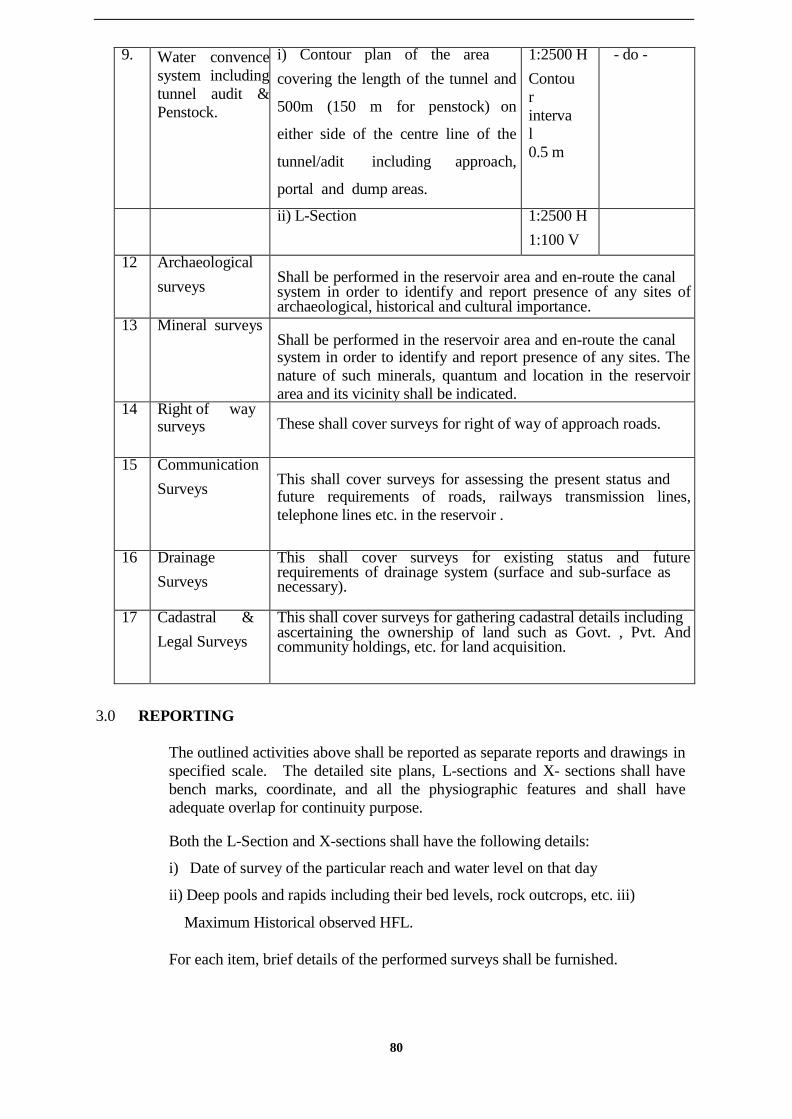
80
9. Water convence
system including
tunnel audit &
Penstock.
i) Contour plan of the area covering the length of the tunnel and
500m (150 m for penstock) on
either side of the centre line of the
tunnel/adit including approach,
portal and dump areas.
1:2500 H Contou
r
interva
l
0.5 m
- do -
ii) L-Section 1:2500 H 1:100 V
12 Archaeological surveys
Shall be performed in the reservoir area and en-route the canal system in order to identify and report presence of any sites of archaeological, historical and cultural importance.
13 Mineral surveys Shall be performed in the reservoir area and en-route the canal system in order to identify and report presence of any sites. The
nature of such minerals, quantum and location in the reservoir
area and its vicinity shall be indicated.
14 Right of way surveys
These shall cover surveys for right of way of approach roads.
15 Communication Surveys
This shall cover surveys for assessing the present status and future requirements of roads, railways transmission lines,
telephone lines etc. in the reservoir .
16 Drainage Surveys
This shall cover surveys for existing status and future requirements of drainage system (surface and sub-surface as necessary).
17 Cadastral &
Legal Surveys
This shall cover surveys for gathering cadastral details including ascertaining the ownership of land such as Govt. , Pvt. And community holdings, etc. for land acquisition.
3.0 REPORTING
The outlined activities above shall be reported as separate reports and drawings in
specified scale. The detailed site plans, L-sections and X- sections shall have
bench marks, coordinate, and all the physiographic features and shall have
adequate overlap for continuity purpose.
Both the L-Section and X-sections shall have the following details:
i) Date of survey of the particular reach and water level on that day
ii) Deep pools and rapids including their bed levels, rock outcrops, etc. iii)
Maximum Historical observed HFL.
For each item, brief details of the performed surveys shall be furnished.

81
Annex-2.2
GUIDELINES FOR GEOLOGICAL INVESTIGATIONS
1.0 GENERAL
Detailed geological surveys shall be carried out as part of the field investigation campaign for
preparation of Detailed Project Report (DPR). The following sections enumerate the minimum
requirements for undertaking the geological surveys. These details shall form inputs to perform
site assessments of various facilities and further engineering design and execution.
2.0 METHODOLOGY
2.1 Regional Geological Assessment
Regional geological setting of the project area shall be compiled from the available published
literature and maps. However, for areas or segments where geological maps are not available
such data shall be collected on 1:50,000 scale maps by undertaking traverses. These regional
traverses shall be undertaken with standard practices of geological mapping with respect to the
topographical maps. In the regional scale, the geomorphology and general geological
features of the region shall be studied through digital remote sensing data products. Suitable
ground traverses shall be made for ground truth verification.
Airborne surveys shall be carried out for the project site. These digital data collection shall
provide a quick insight of the regional setting with a 3-D visualization and analysis model.
Based on the results obtained there of, segments or areas of engineering geological concerns
shall be identified for further on-land geological and geophysical investigations.
2.2 Detailed Geological and Geophysical Assessment
Detailed engineering geological mapping shall be carried out for identified segments of concerns.
This shall be followed by on-site geophysical investigations through both seismic and electrical
resistivity surveys.
These detailed investigations shall provide both surface and sub–surface geology so as to
establish suitability of the site for the intended purpose such as dams, tunnels, and penstock etc.
In addition to the standard practices followed for engineering geological assessment coupled with
on- site geotechnical investigations, the following details shall be addressed.
• Brief description of the over burden shall be provided classifying clay, silt, sand,
gravel, water table etc.
• The rock type at the site shall be described supported by thin section studies and geo-
chemical analysis.
• Rock weathering lateritisation with its type, intensity & extent and effect on excavation
shall be addressed.
• Demarcation of the zones of rock falls and landslides shall be done on plan.
• Magnitude of landslide and the volume of the material involved in the slide shall be
estimated.

82
• Structurally weak zones such as faults, shear zones, joint planes and fracture zones
shall be demarcated on plan. Thereby, the anticipated causes of instability and proposed
remedial measures shall be outlined. The geological setting of the area of submergence due to
reservoir site shall be studied in detail for delineation of such structurally weak zones, which
could be possible avenues of leakage of reservoir water. Such cases shall be discussed with
anticipated and permitted extent of loss of water.
• Anticipated undesirable rock stresses along with their likely extent and magnitude for
underground works such as cavities, tunnels etc. shall be defined on the basis of the on site
field test results.
• Possible zones of squeezing ground shall also be demarcated and design remedial
measures shall be outlined. Physical, experimental data and field evidences gathered
from geological mapping, geophysical and geotechnical investigations shall be provided
along with the cause and reasons of such neo-tectonic activities.
• For under ground works, anticipated high temperature anomaly zones with magnitude
and likely extents shall be estimated and mapped.
• Similarly, anticipated presence of undesirable gases either at surface or in underground
excavations shall also be provided along with the details of occurrence and geologic
associations.
• Other adverse features such as heavy siltation, ground water problem etc. shall also be
discussed based on the geological investigations.
2.3 Seismicity
In addition to the outlined geological investigations, seismicity of the region shall be assessed in
detail as follows:
• History of earthquakes in the project site with epicenter (s) date(s) of occurrence etc.
and details of seismological data collected from theseismological observatory(s) and
other available sources and evaluation of seismic status of faults, thrusts and other weak
features etc.
• Availability of seismological observatory(s) instrument(s) near the project site or
need for establishing a seismological observatory at and around the project site with proposed
locations.
• Based on the available information and assessment of local and regional
seismicity, the seismic design criteria of structures shall be calculated.
3.0 REPORTING
The outlined activities above shall be reported as individual reports, geological maps and
drawings in specified scale.
The detailed site plans, L-sections and X-sections shall have bench marks, coordinate, and all the
delineated geological features and shall have adequate overlap for continuity purpose.

83
Details of local geology of the foundations and evaluation of physical parameters, depth and
nature of overburden, fresh sound rock, summary of the field work, results of investigations and
recommendations shall be furnished.
Detailed report on Regional Geological Assessment, Local Geological Assessment and
Seismicity shall form an Annex to the Detailed Project Report.

84
Annex-2.3
GUIDELINES FOR GEOTECHNICAL INVESTIGATIONS
1.0 GENERAL
Subsequent to the geological surveys, geotechnical investigations shall be carried out as part of
the field investigation campaign for preparation of Detailed Project Report (DPR) . The following
sections enumerate the minimum requirements for undertaking the geotechnical investigations.
These details shall further form inputs to perform site assessments of various facilities and
further engineering design and execution.
2.0 METHODOLOGY
2.1 Earth and rock fill dam/barrage/weir etc.
• Details the location of the auger/drill holes, pits and drifts excavated and in-situ
tests conducted for the foundation investigations alongwith axis, abutments and other
locations.
• Logging of the auger/drill holes, pits and drifts, description of sub strata, including weak
and vulnerable zones.
• Details of the disturbed and undisturbed soil samples collected for classification of
the foundation material and result of the laboratory tests thereof.
• Details and results of the in-situ tests(density, shear, permeability, bearing
capacity, penetration etc.) conducted at different depths in selected boreholes and other
location..
• Description of the foundation rocks, detail of samples collected and its properties
including core recovery, permeability etc.
• Summary of the field observations, investigations and in-situ and laboratory tests
data, evaluation of the design parameters and treatment proposed.
• In case of earth and rock-fill dams, type of cut off chosen viz.
Conventional open trench/diaphragm/sheet pile etc. and its depth as well as nature
such as positive or partial with or without a grout curtain may be furnished.
• Details regarding testing for determination of dynamic properties of soil or liquefaction
susceptibility
• Details regarding testing for determination of dynamic properties of rock foundation
strata.
2.2 Masonry/concrete dam/weirs etc
Details and location of the drill holes, along the dam axis and abutment, along toe line of
the dam (river bed and spillway) and along a line upstream of the dam axis at a distance
equal to the distance betweenthe dam axis and toe line (river bed and spillway or at
locations decided in consultation with the geologist) and in-situ tests conducted for
function investigation including other locations.
Details and location of pits/drills excavated in the abutments
Logging of the drill holes and drifts and description of sub-strata including weak
and vulnerable areas.

85
Details of the rock samples collected and results of the laboratory test.
Details and results of the in-situ permeability tests conducted in different rock
strata at various depths in selected boreholes to check the water tightness of the
foundation.
Details and results of the in-situ rock mechanic tests carried out in the
foundation/drifts/other locations.
Summary of the field investigations/observations, in-situ and laboratory tests data,
evaluation of the design parameters and treatment proposed.
2.4 Power house tunnels, de-silting chamber, surge tanks, transformer cavern etc.
• Details and location of drill holes/pits/drifts excavated and in-situ tests conducted.
• Logging of the drill holes/pits/drifts and description of the material at the site of in-situ
tests etc.
• Details of the samples collected for classification of materials and results of in-situ
and laboratory tests.
• Summary of the field observations/investigation works and in-situ and laboratory
tests, evaluation of properties of the foundation materials and suggested locations of the
various components.
Annex-2.4
GUIDELINES FOR CONSTRUCTION MATERIAL SURVEYS
1.0 GENERAL
As part of the field investigation campaign for preparation of Detailed Project Report
(DPR) , comprehensive surveys shal be carried out for construction materials. This shall
establish source, reach, quality and quantity of construction materials available for the
project. The following sections enumerate the minimum requirements for undertaking the
surveys and investigation for assessment of suitability of the material and adequate
availability of the same for the intended purpose. These details shall further form inputs to
engineering design and execution philosophy.
2.0 METHODOLOGY
2.1 Construction Materials
Soils and rock-fill Location(s) of different types of soils in the borrow
area, quantities, properties, lead etc.
Sand Location(s) of sand quarry/other source (brushed
sand) quantity available, properties, lead etc.

86
Rock & Aggregates Location(s) of the quarries for different types of
rocks available and their properties, quantity available,
lead etc.
Bricks & Tiles Location(s) of the soils suitable for manufacture of
bricks & tiles, quantum available, properties of the
soil & bricks including lead etc.
Pozzolana Location of the natural pozzolonic material fly ash or
soil suitable for manufacture of surkhi, available
quantity, properties, lead, etc.
Cement &lime stone Location of the lime stone quarry, quantity available
for manufacture of cement & lime, properties, lead etc.
Cement and steel Location of the rail head & stockyard and lead from the
site of work(s). Scarce Materials Source, quantities required and procedures for
procurement etc
Investigation of material that is available from compulsory excavation like
underground power house, foundation for overflow and non-overflow structures etc.
Any other material
2.2 Testing Procedures
The sample for testing shall be collected by qualified persons from the testing laboratory.
Alternatively, sufficient quantity of samples shall be collected as per procedure prescribed in IS
and in consultation with the laboratory.
•Soils
Pits/auger holes(diameter 150mm to 300mm shall be taken in the proposed borrow area on
30 to 50 meter grid and representative samples shall be collected and tested for different types of
strata/soil to determine their properties and delineate the soil zones.
The depth of the pits & auger holes shall depend upon the availability of the soils and
economic exploitation.
The borrow area shall be located as near the dam site as possible but at least at a distance 5-10
times the head(H) of water away from the toe or heal of the dam (for small and medium dams the
distance shall not be less than 10H and for high dams not less than 5 H)
The plan and section showing the stratification of the borrow area shall be provided along with
the lead for different types of soils from the site(s) of work for different borrow areas.
• Aggregate and rocks
113

87
Samples from the different approved rock quarry(s) for different type of rocks shall be collected
for laboratory tests. Lead from the site(s) of work of different quarry(s) shall be indicated. For
assessment of quantities drill holes shall be taken in consultation with geologist, if required.
• Natural/crushed sand
Samples from the approved quarry/source shall be collected for Laboratory tests. The type i.e.,
natural/crushed sand shall be indicated clearly. The lead from the sources to the site(s) of work
and quantity available shall be indicated.
• Bricks & Tiles
Samples shall be collected from the proposed areas demarcated for preparation of bricks/tiles
for laboratory tests to prove the suitability of the soil. For preparation of Surkhi to be used for
pozzolanic material representative samples of bricks shall be collected and tested in the
laboratory to prove the suitability. The average lead from the site(s) of work shall be
indicated.
• Natural Pozzolona
Samples shall be collected from the quarry for laboratory test to prove its suitability. The lead
and quantity available shall be indicated.
• Lime Stone
Samples shall be collected for laboratory tests to prove its suitability for manufacture of
cement/lime. The lead to the proposed site(s) of manufacture of cement/lime and quantity
available shall be indicated.
• Cement
The source of cement and the distance from the nearest railhead to the site(s) of work shall be
indicated.
• Steel
The sources/stockyard etc. and its distance from the work site(s) shall be indicated.
• Scarce material
The source of the scarce material shall be indicated.
• Any other material
Required details as indicated in the earlier items shall be indicated.
3.0 REPORTING
The outlined activities above shall be reported as individual reports, geological maps and
drawings in specified scale i.e. Plan & Sections 1:
114

88
2000 H & 1: 100 V.
Detailed report on the investigation of the following materials and more, if any, as relevant to the
project shall form an Annex to the Detailed Project Report. The report shall discuss the details
of the field work undertaken logging of the bore/auger holes/pits, profile of the soils along the
grids, samples collected, tests results and evaluation of the design parameters as relevant to
each material.
Summary of the investigations shall form this chapter of the Detailed Project Report
discussing the quantitative and aspects and bringing out clearly the conclusions based on the field
observations/investigations/laboratory tests.

89
Type of information
Desirable
length of
record
Frequency
1. River Gauge data 30 years Daily at 0800 hrs. during low flows seasons
Thrice daily at 0800, 1300 and 1800 hrs
during high flow season
Continuous with an automatic water level
recorder with backup arrangements, for
hourly, quarter
hourly observations manually for flood
periods and
peak(s) respectively.
2. River Flows Discharge 30 years Daily during low flow season, Daily during high
flow season. 3. Sediment flow
and
grain size composition
3 years - do – alongwith discharge observations
4. Water Quality 3 years About once a month with more frequent
observation
during low flows and concurrent with
discharge observations. 5. Water Salinity 3 years Same as above but additional observations in
tidal
reach of the river twice a month and at
closer interval (3 hours), during spring and
neap tides.
6. River profiles
cross sections showing
flow levels
-
The surveys may have to be repeated
occasionally for moveable bed rivers.
Information to cover all
major floods and all critical low flows in
recent years. 7. Pan evaporation etc. 3 years Daily
concurrent with ordinary rain gauge and
observations measuring temperature (max.
and min. – dry and bulb wind velocity,
sunshine 8. Rainfall 30 yrs. Ordinary rain gauge as necessary for
strengthening
existing network Concurrent with flow
observations for rainfall – runoff co-relation
and longer period as available for hindcasting 9. Self Recording Rain
Gauge
30 yrs Continous to be tabulated as hourly / quarter
hourly concurrent with flow observation
Annex-2.5
GUIDELINES FOR HYDROLOGICAL INVESTIGATIONS
GENERAL
Hydrological data requirement for the envisaged project shall be as per the outlined requirements
under data collection for various aspects such as water resources assessment and as per the listed
sections of Hydrology volume of the Detail Project Report. However, the extent of these
investigations shall be determined by the nature and purpose of development i.e. the use to which
these data would be put to availability of hydrological and meteorological data in the general
region from existing networks/sites.
2.0 METHODOLOGY
Guidelines, regarding the desirable length and frequency of hydrological observations are
indicated in the table below. However, in situations where long term data of any hydrological
phenomenon which is likely to be co- related with the relevant phenomenon are not available
in the vicinity, longer data would be required.

90
The observed data would not be available for desired locations or for desired length of period and
therefore the inputs shall have to be prepared using data transfer and data extension techniques.
In case of non availability of sufficient / representative data, on-site observations shall be carried
out so as to collect in-situ information for sufficient period for validation and extrapolation as the
case may be, and subsequent use.
All locations of sites and observations shall be as per IS/IMD Standards. Where these are not
available the location/methodology adopted shall be described.
Discharge measurement shall be done by area velocity method using current meter or floats based
on the flow conditions.
Hydraulic structures across the rivers can also be used for flow measurement provided the
structures have been properly calibrated preferably by model tests.
In case of storage reservoirs, lake levels, reasonably accurate area capacity tables and
withdrawal and lake evaporation data would be required for indirect computation of flow
volumes.
Rainfall, Pan evaporation and other meteorological data measurement stations shall be set up at
major storage reservoir sties and keeping in view the availability of such stations.
While deciding the location of additional hydrological and meteorological stations, future
requirements for operational stage of the project shall be kept in view. The data collection shall
be continued at these locations.
3.0 REPORTING
The report shall be prepared as per the laid out guideline in the Annex 3.2. However, specific site
activities and investigations performed, as part of data collection campaign shall be annexed
as a separate report to the main DPR. This shall also have the entire data set both in
tabulated manner and pictorial representation along with the analysis.

91
Annex-2.6
GUIDELINES FOR MODEL STUDIES & ASSESSMENTS
1.0 GENERAL
Numerical Simulation studies and assessments shall be carried out for various aspects of the
project so as to create a ―real like‖ or ―as implemented‖ situation for subsequent analysis of the
possible consequences and also on the future conditions. This shall provide necessary in sight to
the envisaged development and shall perform as a Decision Support System. All the software
licenses purchased and used for the model studies shall be in the name of CNNL.
Following are the minimum requirements for the numerical model studies and assessments
envisaged for the project.
2.0 METHODOLOGY
In order to perform hydrological, hydraulic analysis & design the following aspects shall be
carried out.
• data screening – to complete missing data
• data generation – to generate data by combing several sets of data
• frequency analysis – to undertake classification according to frequency analysis &
excellence level.
• The data set shall be maintained with a Database Management System. The
input data file shall have provision for customization or editing. The output file shall be a
―delimited file‖ that can be imparted into a spreadsheet for further analysis.
2.1 Rain fall and Run off Modelling
Based on available daily, monthly, annual records of rainfall and runoff, a suitable rainfall–runoff
model shall be developed. Justification for adopting the developed model shall be given based on
goodness of fit criteria. The water use corresponding to hydrologic data shall be properly
accounted for, while developing the model.
The details of model calibration and validation shall be given separately. The acceptability of
data for developing the model shall be explained. The modeling procedure shall also be
explained.
2.2 Water Balance Modelling
The hydrological consequences of surface water developments of the river link shall be evaluated
through simulation. Thereby, the hydrological reliability of the development configurations in
terms of meeting performance target levels shall be assessed.

92
This shall included information on water availability, concurrent usage, etc. and the conditions
shall be evaluated corresponding to present condition and future conditions upto next 50 years.
In order to perform the numerical model the following minimum inputs shall be used.
• Flow inputs: representing locations where water enters the river system
• Reservoir input: representing either a storage reservoir or a storage with associated
hydroelectric plant.
• Municipal & industrial water supply.
• Diversion and Routing inputs: representing man-made diversion structures
• Hydrograph inputs: representing flow parameters at locations where minimum guaranteed
flow is to be maintained.
• Confluence inputs: representing the location details of confluence of water systems
• Ground water input: representing the aquifer system
• Flow control inputs
• Terminal inputs: representing locations of end points and boundary.
2.3 Hydrodynamic Modeling System
Numerical simulation studies shall be carried out for obtaining information concerning water
levels, discharges and velocities at different point in the channel and over specified period of
time. This shall be used for
• Estimation of Transport capacity of the Water Transport System. (Needs to be
studied under different reservoir operation policies to meet the hydrological conditions of
upstream as well as downstream)
• Operation of water regulation & control structures in reservoir
• Selection of spillway parameters for the design flood conditions
• Location and alignment of hydraulic structures
• Understanding effects of integrated reservoir operation including power generation,
irrigation, flood control, frequency & duration of different reservoir levels and discharges
through turbines and spillway.
• Computation of height of river banks down stream of the dam
• Evaluation of impacts of the project on downstream flood control
2.4 Assessments of Morphological Processes in Open channels
In order to study the morphological processes of river systems and the impacts of engineering
involving aggradations & degradation of the alluvial river system, the assessments shall be
carried out. The following impacts shall be considered:
• Impact of short-cuts of river channels.
• Impact of closure of secondary branches.
• Impact of water abstraction
• Impact of water level regulation
• Impact of canals connecting river systems.
• And degradation processes downstream of dams.

93
2.5 Assessments of water Quality
Water quality studies of the entire network shall be carried out in order to assess the impact of
the project. This shall have, as a minimum, spreading of pollution in river and network of
canals under diversified flow and pollutant discharge conditions as existing.
As a minimum the following shall be studied
• Spreading of conservative & non-conservative contaminants such as bacteria, organic
matter, chemicals, and heavy metals originating from pollutant discharges.
• Salt and silt intrusions.
• Oxygen balance in channel and river system
• Seasonal variations in water quality in ecologically sensitive zones.
• Estimation of Water quality downstream
• Effect of water quality on the construction of the reservoir
• Estimation of quantity of water to be released from reservoir in order to improve the
water quality downstream to acceptable standards for industrial, agricultural & domestic use and
to maintain acceptance ecological links. This shall be used to fine tune the reservoir regulation
and flow diversion operation.
2.6 Risk Analysis, Probabilistic Design
The risk analysis shall commence with an inventory of the hazards & mechanism. Then
the consequences of failure shall be evaluated, along with characterisation of damage, structural
damage and duration of load shall be estimated.
The risk shall be weighed against the cost of construction. Disaster
Management Plan shall be prepared for probable risks.
2.7 Database Management System
A central database shall be generated with provisions of data inputs from multiple sources and
shall be capable of generating outputs in the form of tables, graphs, reports & data files. The
output files shall be used in conjunction with software, spreadsheets, CAD packages, word
processors, statistical software and simulation models.
The numerical models shall be able to import data directly from the database including GIS maps
and return data into the database for presentation and further analysis. The system shall be
capable of handling data sets of, as a minimum, following types
• Constant time step
• Variable time step
• Instantaneous values
• Average values
• Cumulative values
• Extreme values
• Set points

94
The DBMS shall have facilities
• for punching data either manually on automatically
• for updation & retrieval in uniform manner
• for generation of datasets of various types.
•forre-assessmentandre-visiting.
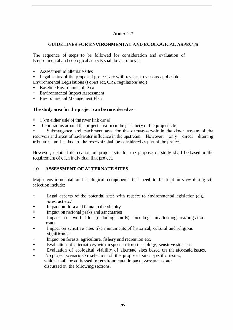
95
Annex-2.7
GUIDELINES FOR ENVIRONMENTAL AND ECOLOGICAL ASPECTS
The sequence of steps to be followed for consideration and evaluation of
Environmental and ecological aspects shall be as follows:
• Assessment of alternate sites
• Legal status of the proposed project site with respect to various applicable
Environmental Legislations (Forest act, CRZ regulations etc.)
• Baseline Environmental Data
• Environmental Impact Assessment
• Environmental Management Plan
The study area for the project can be considered as:
• 1 km either side of the river link canal
• 10 km radius around the project area from the periphery of the project site
• Submergence and catchment area for the dams/reservoir in the down stream of the
reservoir and areas of backwater influence in the upstream. However, only direct draining
tributaries and nalas in the reservoir shall be considered as part of the project.
However, detailed delineation of project site for the purpose of study shall be based on the
requirement of each individual link project.
1.0 ASSESSMENT OF ALTERNATE SITES
Major environmental and ecological components that need to be kept in view during site
selection include:
• Legal aspects of the potential sites with respect to environmental legislation (e.g.
Forest act etc.)
• Impact on flora and fauna in the vicinity
• Impact on national parks and sanctuaries
• Impact on wild life (including birds) breeding area/feeding area/migration
route
• Impact on sensitive sites like monuments of historical, cultural and religious
significance
• Impact on forests, agriculture, fishery and recreation etc.
• Evaluation of alternatives with respect to forest, ecology, sensitive sites etc.
• Evaluation of ecological viability of alternate sites based on the aforesaid issues.
• No project scenario On selection of the proposed sites specific issues,
which shall be addressed for environmental impact assessments, are
discussed in the following sections.
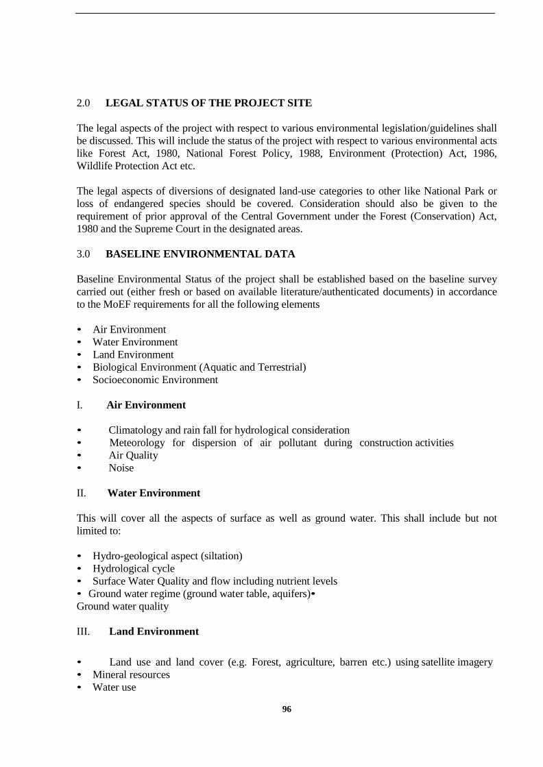
96
2.0 LEGAL STATUS OF THE PROJECT SITE
The legal aspects of the project with respect to various environmental legislation/guidelines shall
be discussed. This will include the status of the project with respect to various environmental acts
like Forest Act, 1980, National Forest Policy, 1988, Environment (Protection) Act, 1986,
Wildlife Protection Act etc.
The legal aspects of diversions of designated land-use categories to other like National Park or
loss of endangered species should be covered. Consideration should also be given to the
requirement of prior approval of the Central Government under the Forest (Conservation) Act,
1980 and the Supreme Court in the designated areas.
3.0 BASELINE ENVIRONMENTAL DATA
Baseline Environmental Status of the project shall be established based on the baseline survey
carried out (either fresh or based on available literature/authenticated documents) in accordance
to the MoEF requirements for all the following elements
• Air Environment
• Water Environment
• Land Environment
• Biological Environment (Aquatic and Terrestrial)
• Socioeconomic Environment
I. Air Environment
• Climatology and rain fall for hydrological consideration
• Meteorology for dispersion of air pollutant during construction activities
• Air Quality
• Noise
II. Water Environment
This will cover all the aspects of surface as well as ground water. This shall include but not
limited to:
• Hydro-geological aspect (siltation)
• Hydrological cycle
• Surface Water Quality and flow including nutrient levels
• Ground water regime (ground water table, aquifers)•
Ground water quality
III. Land Environment
• Land use and land cover (e.g. Forest, agriculture, barren etc.) using satellite imagery
• Mineral resources
• Water use
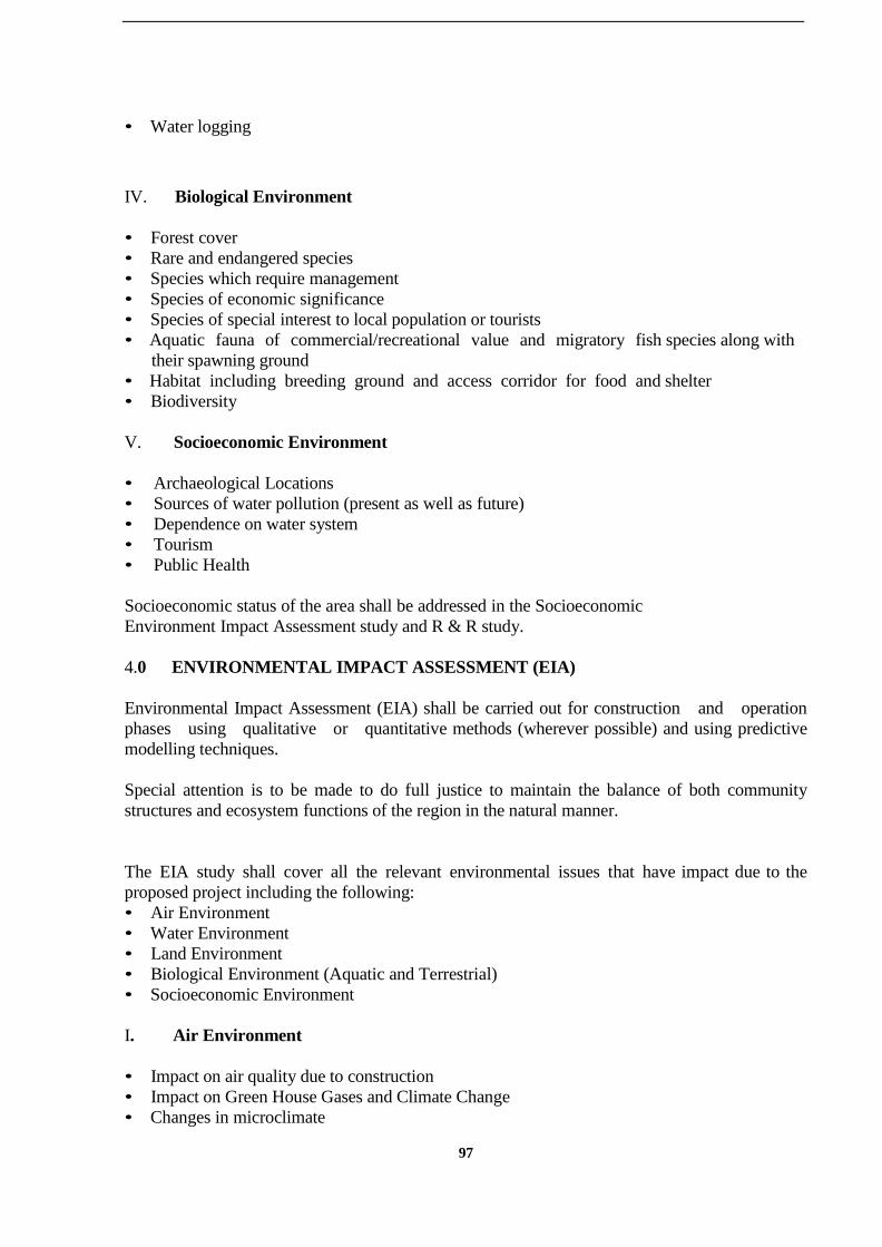
97
• Water logging
IV. Biological Environment
• Forest cover
• Rare and endangered species
• Species which require management
• Species of economic significance
• Species of special interest to local population or tourists
• Aquatic fauna of commercial/recreational value and migratory fish species along with
their spawning ground
• Habitat including breeding ground and access corridor for food and shelter
• Biodiversity
V. Socioeconomic Environment
• Archaeological Locations
• Sources of water pollution (present as well as future)
• Dependence on water system
• Tourism
• Public Health
Socioeconomic status of the area shall be addressed in the Socioeconomic
Environment Impact Assessment study and R & R study.
4.0 ENVIRONMENTAL IMPACT ASSESSMENT (EIA)
Environmental Impact Assessment (EIA) shall be carried out for construction and operation
phases using qualitative or quantitative methods (wherever possible) and using predictive
modelling techniques.
Special attention is to be made to do full justice to maintain the balance of both community
structures and ecosystem functions of the region in the natural manner.
The EIA study shall cover all the relevant environmental issues that have impact due to the
proposed project including the following:
• Air Environment
• Water Environment
• Land Environment
• Biological Environment (Aquatic and Terrestrial)
• Socioeconomic Environment
I. Air Environment
• Impact on air quality due to construction
• Impact on Green House Gases and Climate Change
• Changes in microclimate

98
• Impact on ambient Noise level specially during construction period
II. Water Environment
• Likely change in the regime of the river
• Impact due to change in hydrological cycle
• Impact on siltation preferably using quantitative techniques
• Impact due to spread of contamination due to agro-chemicals and organic/heavy metals
• Impact due to transportation of fluorides, Nitrates, toxic chemicals, heavy metals
• Impact due to acidification of lakes and water bodies due to presence soils with rich
minerals
• Impact on water quality (surface/ground)
• Impact on ground water levels and recharge potential
• Impact on ground water pollution due to seepage from canal system and reservoir (ground
water level and quality)
• Impact due to change in waste assimilation capacity of the river system
III. Land Environment
• Impact on land use/land cover and change in designated land-use
• Impact due to irrigation induced salinity and water logging
• Impact due to inundation of mineral resources
• Impact on soil erosion
IV. Biological Environment
Terrestrial environment
• Impact on forest area and National park and sanctuaries and other sensitive
ecosystem
• Impact on biota and biodiversity loss particularly with special reference to the rare and
threatened species, endemic species of both animals and plants.
• Impact on habitat loss particularly with special reference to the rare and threatened
species, endemic species of both animals and plants.
• Impact due to habitat change having effect like corridor loss and loss of migratory path
for wildlife including birds.
• Impacts on the breeding grounds of species and on access of animals to food and
shelter.
Aquatic environment
• Impact on flora and fauna in the connecting basins as well as along the link.
• Impact on aquatic ecology including fisheries and endangered species
• Impact on sensitive ecosystem
• Impact due to bio-accumulation and bio-magnification in aquatic life and biota
• Impact due to change in ecological functioning of river system
• Impact on growth of aquatic weed
• Impacts on fish spawning and migration including impact on their breeding ground.
• River both at head as well as mouth regions would be considered while addressing the issues

99
on submergence of wild life and breeding places.
V. Socioeconomic Environment
• Impact on public health due to vector borne diseases
• Impact on sensitive locations like archeological sites etc.
• Impact on change in occupational pattern especially for those who are dependent on the
water resources
• Impact on tourism
• Impact on human settlement
• Biodiversty aspects require due consideration
5.0 ENVIRONMENTAL MANAGEMENT PLAN (EMP)
Based on environmental impact assessment, mitigation / enhancement measures need to be
specified in the form of environmental management plan. The components of the EMP will
inter-alia deal with the following as may be relevant to specific project site:
• Environmental safeguards (management) during construction activities
• Siltation Erosion Management
• Plan for restoration of quarry areas/burrow areas and areas for dumping excavated
material.
• Management to arrest salinity/ alkalinity in the wake of recharge of water in the
interlinking channels.
• Problems associated with transportation of silt across basins and utilization there of in
environmentally/ecologically benign manner
• Compensatory Afforestation plan along with cost benefit analysis
• Forest management including action plan for improvement of quality (like density,
naturalness), and quantity (extent) of forest in low forest cover districts/areas which are
served by interlinking program
• Plan for green belt (other than catchment area).
• Comments/observations/recommendations of Chief Wildlife Warden in- case Wildlife
habitat/migratory path exists within 7 Kilometers of project site
• Conservation plan for affected flora/fauna including rehabilitation plan for
rare/endangered species including action plan for alternate breeding ground and access
corridor for food and shelter.
• Index map of catchment areas with yearly target (physical & financial).
• Watershed management
• Ground water management including harnessing of ground water in conjunction
with surface water.
• Land use management with special emphasis on water logging problem
• Management of flora and fauna in the connecting basins as well as along the link
including action plan for alternate breeding grounds.
• Alien flora and aquatic weeds management
• Wetland management
• Protection of sensitive and archeological monument sites
• Action plan for health delivery systems
• Post project environmental monitoring plan

100
Methodoloy for environmental data collection is given here under in
Tables1to7.

101
Attributes Sampling Measurement
Method
Remarks
A. Air Environment Network Frequency
Meteorological
• Wind speed
• Wind direction
• Dry bulb
temperature
• Wet bulb
temperature
• Relative
humidity
• Rainfall
• Solar radiation
• Cloud cover
• Environmental
Lapse Rate
Minimum 1
site in the
project impact
area
1 hourly
continuous
Mechanical/automat
ic weather station
Rain gauge As per
IMD specifications
As per IMD
specifications
Mini Sonde /SODAR
IS 5182 Part 1-
20
Site specific
primary data is
essential
Secondary data
from IMD,
New Delhi
CPCB
guidelines
Pollutants
SPM
RPM
SO2
NOx CO H2S*
NH*3
HC*
Fluoride* Pb*
10 to 15
locations in the
project impact
area
24 hourly
twice a
week
(Please
refer
National
Ambient
Air Quality
Standards,
CPCB
Notification
dated 11th
April, 1994)
8 hourly
twice a
week
24 hourly
twice a
week
Gravimetric (High-
Volume)
Gravimetric (High-
Volume with
Cyclone)
EPA Modified West
& Gaeke method
Arsenite modified
Jacob & Hochheiser
NDIR technique
Methylene-blue
Nessler’s method
Infra Red analyser
Specific Ion meter
Monitoring
Network
Minimum 2
locations in
upwind side,
more sites in
downwind side
/ impact zone
All the sensitive
receptors need
to be covered
Measurement
Methods
As per CPCB
standards for
NAQM, 1994
MEHODOLOGY FOR ENVRIONMENTAL DATA COLLECTION AS PER OF EIA
GUIDELINE
Table 1: Guidance for assessment of representativeness and reliability of baseline
environmental attributes
(Refer CPCB Guidelines on Methods of Monitoring & Analysis)

102
*Project Specific
Table 2 : Guidance for assessment of representativeness and reliability of baseline
environmental attributes
Attributes Sampling Measurement
Method
Remarks
B. Noise Network Frequency
Hourly equivalent
noise levels
Identified study
area
Once in each
season
Instrument: Noise
level meter
IS:4954-1968 as
adopted by CPCB
Hourly equivalent
noise levels
Inplant (1.5 metre
from machinery)
Once Instrument: Noise
level meter
CPCB/OSHA
Hourly equivalent
noise levels
Highways Once in each
season
Instrument: Noise
level
meter
CPCB/IS:4954-
1968
Peak particle
velocity
150-200m from
blast site
Once PPV meter
C. Water
Parameters for
water quality
pH, temp,
turbidity,
magnesium
hardness, total
alkalinity, chloride,
sulphate, nitrate,
fluoride, sodium,
potassium, salinity
total nitrogen,
total phosphorus,
DO, BOD, COD,
Phenol,
Heavy metals
Total coliforms,
faecal coliforms
Phyto plankton
Zoo plankton
Set of grab samples
during pre and
post-
monsoon for
ground and surface
water for
10 km distance
Diurnal and
Season wise
Samples for water
quality should be
collected and
analysed as per
:
IS : 2488 (Part
1-5) methods for
sampling and
testing of
Industrial effluents
Standard methods
for examination of
water and
wastewater
analysis published
by
American Public
Health
Association.
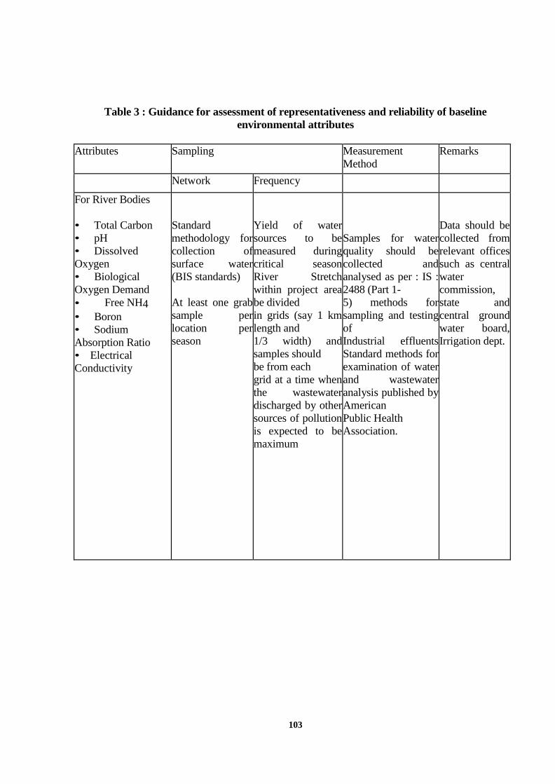
103
Table 3 : Guidance for assessment of representativeness and reliability of baseline
environmental attributes
Attributes Sampling Measurement
Method
Remarks
Network Frequency
For River Bodies
• Total Carbon
• pH
• Dissolved
Oxygen
• Biological
Oxygen Demand
• Free NH4
• Boron
• Sodium
Absorption Ratio
• Electrical
Conductivity
Standard
methodology for
collection of
surface water
(BIS standards)
At least one grab
sample per
location per
season
Yield of water
sources to be
measured during
critical season
River Stretch
within project area
be divided
in grids (say 1 km
length and
1/3 width) and
samples should
be from each
grid at a time when
the wastewater
discharged by other
sources of pollution
is expected to be
maximum
Samples for water
quality should be
collected and
analysed as per : IS :
2488 (Part 1-
5) methods for
sampling and testing
of
Industrial effluents
Standard methods for
examination of water
and wastewater
analysis published by
American
Public Health
Association.
Data should be
collected from
relevant offices
such as central
water
commission,
state and
central ground
water board,
Irrigation dept.

104
Table 4 : Guidance for assessment of representativeness and reliability of baseline
environmental attributes
Attributes Sampling Measurement
Method
Remarks
Network Frequency
D. Land
Environment
Soil
• Particle size
distribution
• Texture
• pH
• Electrical
conductivity
• Cation
exchange capacity
• Alkali metals
• Sodium
Absorption Ratio
(SAR)
• Permeability
• Water holding
capacity
• Porosity
One surface
sample from each
village,
(soil samples be
collected as per
BIS
specifications)
Season-wise Collected and
analysed as per
soil analysis
reference book,
M.I.Jackson and
soil analysis
reference book by
C.A. Black
Land use/Landscape
• Location code
• Total project area
• Topography
• Drainage
(natural)
• Cultivated,
forest, plantations,
water bodies, roads
and settlements
At least 20 points
along the
boundary
Global positioning
system
Topo sheets
Satellite Imageries*
(1:25,000) Satellite
Imageries*
(1:25,000)
*Project specific

105
Table 5 : Guidance for assessment of representativeness and reliability of
baseline environmental attributes
Attributes Sampling Measurement
Method
Remarks
Network Frequency
Solid Waste
Domestic Waste
• Per capita
contribution
• Collection,
transport and disposal
system
• Process waste
• Quality (oily,
chemical, biological)
Grab and
composite samples
Season-wise Guidelines
IS 9569 : 1980
IS 10447 : 1983
IS 12625 : 1989
IS 12647 : 1989
IS 12662 (PTI)
1989
Quality
• Loss on heating
• pH
• EC
• Calorific value, metals
etc.
Grab and
composite samples
Season-wise Analysis
IS 9334 : 1979
IS 9235 : 1979
IS 10158 : 1982
azardous Waste
• Permeability and
porosity
• Moisture pH
• Electrical
conductivity
• Loss on ignition
• Phosphorous
• Total nitrogen
• Cation exchange
capacity
• Particle size
distribution
• Heavy metal
• Arsenic
• Fluoride
Grab and
composite samples
Analysis
IS 9334 : 1979
IS 9235 : 1979
IS 10158 : 1982

106
Table 6 : Guidance for assessment of representativeness and reliability of
baseline environmental attributes
Attributes Sampling Measurement
Method
Remarks
Network Frequency
E : Biological Environment
Aquatic
• Primary
productivity
• Aquatic weeds
• Enumeration of
phyto plankton, zoo
plankton and benthos
• Fisheries
• Diversity indices
• Tropic levels
• Rare and
endangered species
• Marine Parks/
Sanctuaries/ closed areas
/coastal regulation zone
(CRZ)
Terrestrial
• Vegetation- species
list, economic importance,
forest produce, medicinal
value
• Importance value
index (IVI) of trees
• Fauna
Considering
probable
impact, sampling
points
and number of
samples to be
decided on
personal
judgment within
10/25 km radius
from the
proposed site
Samples to
collect from
upstream and
downstream of
discharge point,
nearby
tributaries at
down stream,
and also from
dug wells close
to activity site
Season wise Standard techniques
(APHA
et. al. 1995, Rau
and Wooten 1980)
to be followed for
sampling and
measurement
Seasonal sampling
for
aquatic biota
One season for
terrestrial biota, in
addition to vegetation
studies during
monsoon season
Preliminary
assessment
Microscopic analysis
of
plankton and me
bents, studies of
macro fauna,
aquatic vegetation
and application of
indices, viz. Shannon,
similarity, dominance
IVI etc.
Point quarter plot less
method for terrestrial
vegetation
survey

107
Table 7: Guidance For assessment of representativeness and reliability of baseline
environmental attributes
Attributes Sampling Measurement
Method
Remarks
Network Frequency
• Avi fauna
• Rare and
endangered
species
•
Sanctuarie
s / National park
/ Biosphere
reserve
• Migratory
routes
For forest
studies,
direction of wind
should be
considered
while selecting
forests
Secondary data to
collect from
Government
offices, NGOs,
published literature
Plankton net
Sediment dredge
Depth sampler
Microscope
Field binocular
F. Socio-economic
• Demographic
structure
• Infrastructure
resource
base
• Economic
resource base
• Health
status: Morbidity
pattern
• Cultural
and aesthetic
attributes
• Education
Socio-economic
survey is based
on proportionate,
stratified and
random
sampling
method
Minimum for
two phases of
the project
Primary data
collection through
questionnaire
Secondary data
from census
records, statistical
hard books, Topo
sheets, health
records and
relevant official
records available
with Govt. agencies
108
ANNEX- 2.8
GUIDELINES FOR FINANCIAL ANALYSIS
1.0 INTRODUCTION
Financial analysis should cover estimation of annual costs and annual benefits of the
project in monetised terms. The benefits should be estimated by compiling the tangible
benefits to be accrued from the project on various accounts (explained later).
In addition, the intangible benefits like creation of employment, improvement of
the standard of living, health and environment, etc should also be assessed (as accurately as
possible in monetised terms) and duly considered for economic analysis. Based on above
analysis, prioritisation of implementation of the various components of the project could be
prepared.
Planned large investment on any infrastructure project need to be evaluated on the basis of
detailed feasibility analysis. Financial Analysis (FA) will provide three very useful quantitative
project evaluation measures- Cost Benefit Ratio, Economic Internal Rate of Return (EIRR)2
and
Financial Internal Rate of Return (FIRR). The EIRR is the evaluation of the projects from the
viewpoint of the national economy. The FIRR takes into account only the financial inflows,
exclusive of economic benefits, and shows the financial/ commercial viability of the project,
which is often a condition for long run sustainability of the project (these terms are explained in
the next sub-section).
2.0 CASH FLOW ANALYSIS
Cash Flow Analysis will consist of two countervailing parts- the outflows (basically, the
proposed costs) and expected inflows (returns) over the years.
A) Outflows: First, we enlist the cost items relevant for 'financial' analysis,
where we take the market prices for consideration.
(1) Costs during pre-construction phase: These are the early requirements.
Most of the funds need to be collected from budget allotment or loan from co-operative banks,
etc (as recently resorted to in Sardar Sarovar Project). Private equity participation in this
initial phase will not be large, as they are more concerned with immediate return. The pre-
construction costs are-
a) Expenditure on geological, economic, engineering, etc feasibility studies, excluding the
govt. officials of the project implementation departments. Using the terminology of Asian Development Bank (ADB)
(2) Costs during Construction phase: These costs could be financed in part by domestic
internal borrowing, aided by external assistance and loans. The precise estimation costs on capital
assets (inclusive of a provision for inflation) is very crucial since any cost overrun could lead to
delay the construction activity, which will, in turn, delay the realisation of returns.
109
Capital Assets: They include the expenses on basic structure and equipment
mentioned in the technical specification of the project (i.e. head works on main
dam, canals, barrages, reservoir, embankments, etc including the provisions for
distributaries, electricity generation and distribution, drinking water supply
works).
The unit cost of digging, leveling, clearing and reclamation should be
estimated for one representative hectare of each terrain type and then
extrapolated for the whole project area.
Capital costs are irreversible and confined to the construction phase (post-
construction expenditure on renovations will need to be provided- see
below).
Wages: In ILR project, labour (both unskilled and expert supervision)
cost will be a major outflow of funds given the'labour intensive' nature of
irrigation projects. In view of the typical rigidity of wage rates in India in the
face of abundant unemployed workers, this cost component will be fairly
stable. This heading must include the expenses on temporary dwellings,
schools and hospitals for migrant labourers.
Annual Loan Repayment: For its calculation, the conditions regarding the
year of first repayment installment, year by which loan has to be repaid and
the interest rebate will need to be finalised by the time of CF analysis.
Logically, repayment will start from the end of the first year of project
implementation when the water charges will be collected (these details should
be obtained from the recommended financing plan).
(3) Costs during Operational Phase: For full realisation of benefits, the long run financial
viability of the project is very crucial. So a Maintenance & Operation Manual has to be
prepared showing-
(a) Working Capital Funds: Since water charges and maintenance cess are often
collected once in a year, sufficient funds should be available with the maintenance units for
operation, small repairs; administrative cost of determination, collection and audit of water-
charges, including electricity, fuels, rents for vehicles hired, etc.
For the project component like power plants also, working capital will be need to meet operating
costs as the billing cycles involves unavoidable time lag.
(b) Renovations: Funds should be available for renewals of worn-out portions of canal, plants
and equipment and also for unforeseen major contingencies. For initial years these needs do not
arise. They could be considered as constant recurrent costs after a gap of 4/ 5 years.
B) Inflows: The inflows appearing in the cash flow tables that are relevant from
commercial viewpoint are as follows-
1) Revenue from water charges (on the farmers and industrial users): Depending on the
development of the project measured in hectare), the number of beneficiaries will rise gradually.
Hence the actual number of beneficiaries and the charges per hectare of irrigated land should be
110
estimated (even at the feasibility analysis level) to get the series of revenue over different future
years. The rate adopted for the recovery should be explained through a note on the
methodology, addressing the issues of affordability and acceptability of water charges.
Since the project will take a few years to complete the entire construction, revenue collection may
be started as soon as a portion is completed. They would accrue from the end of the first year of
the supply of irrigated water.
The industrial users can be charged higher than the farmers. In addition a ‗betterment fee‘ could
be levied on those people benefiting by presence of water in their place of living (i.e. watering of
cattle by dairy farms, enhanced productivity of fruit gardens, rise in ground water level (if any)
around canal areas, etc
2) Maintenance cess: Once this flat rate (per hectare) is decided, the total expected revenue
collection from the cess would be arrived at (the methodology adopted for fixing the rate should
be explained).
3) Revenues from hydro-electricity units and drinking water supply, if any.
4) International assistance/ loan and domestic donations (if any): The latter may come in parts
and might be converted to domestic currency.
5) Miscellaneous: Auction of ferry services, lease of lands for shops in colony area, etc
6) Increased land revenues on irrigated land, minus the revenue lost on the
lands submerged by canals and dam, etc.
7) Receipts and recoveries on capital account.
8) Residual value and working capital funds: This amount will be
available in the last year of economic operation of the scheme.
9) Appropriate apportionment of benefits among various stake
holders
2.1 Calculation of Internal Rate of Return
By subtracting total outflows for a year from that year's total inflow, we get the net cash flow at
current prices for that particular year. The series over all the relevant years will have both
positive (if returns exceeds the costs) and negative entities. The rate of discount that will make
the sum of their PVs equal to zero is the IRR of the project (i.e. IRR makes the present values of
costs equal to the present values of benefits). Comparing it with the alternative investment
option (like, minor irrigation) or the market rate of interest (or a reference level like 10 to 12
per cent followed by ADB / World Bank ), we can decide whether the project is worth
implementing or not.
The same table can be used for 'Economic Cost-Benefit Ratio Analysis' and calculation of
EIRR, which shows the total outflows required and various tangible and intangible benefits
emerging from the project. The changes that need to be made are as follows-
(1) On the costs side, for economic IRR we take constant prices (i.e. with reference to a base
year prices) instead of current prices so as to reflect the real cost and real benefits free of
inflation.

111
(2) We use 'shadow prices' for inputs used, lands submerged; shadow wage rates to show the
opportunity cost of the labour and shadow exchange rate. The shadow prices reflect the true value
of the resources to the national economy by removing the distortionary margin (subsidy/ taxes)
from the market prices.
On the benefits side, in place of revenues from water charges, etc we put benefits from:
i. Additional3
crop production
ii. Additional livestock production
iii. Flood control (in terms of crops and property worth saved).
The estimate of Cost Benefit ratio for flood control aspect alone could also be calculated.
iv. Drinking water supply and reduction of water-borne diseases.
v. Employment generation in 'mandays per hectare' or in terms of
'Wage bill paid out': (a) During the construction activities (b) Out
of
3 'Additional' implies the difference between the output of the 'with' the project scenario and
'without' the project scenario.
Multiple cropping (c) Increased farm-labourers, if any (possibility of reduction in employment
through mechanisation should not be overlooked as irrigation is observed to be accompanied in
many areas by adaptation of mechanised farming practices).
vi. Pisciculture, if any.
vii. Indirect benefits from expansion of ancillary industries.
viii. Indirect benefit due to over all development of area such as increase in taxes, stamp
duty etc.
2.2 Exhaustive list of estimates required for Cash Flow analysis
1. A pre-determined Discount Rate: The need for discount rate arises in calculating the Cost
Benefit Ratio and calculation of shadow prices. The costs and returns will occur in streams over
different years. To make them comparable they need to be discounted to present values (PV).
Different options are available for the discount rate- the interest rate prevailing in the country, the
open market rate on borrowing for public investment, or a combination of spot and forward
interest rates. Market rates are often distorted by the imperfections of financial market. The
choice will depend on the real opportunity cost of capital to the society (society has a lower rate
of discount or time preference) or the rate of return on capital to the economy (i.e. creation of
GDP).
2. Year wise expected realisation of revenues/ returns from water charges: Since commend area
development may be spread over many years, the ratio of irrigated land to total cropped land will
gradually rise. Only these fractions of realisation and the target area should be forecasted to get
the year wise probable additional revenue series.
3. Lifetime of the project: The year up to which the scheme is expected to operate viably (both
technically and economically) needs to be specified at the outset. After 30 or 40 years the present
values of returns become very small.

112
2.3 Survey Requirement
A survey is necessary for determination of the time required by farmers to opt for new crops and
adapt to multiple cropping practices under irrigated water and their plan for substitution of labour
for mechanised and chemical inputs. Once water security is provided the use of modern inputs
rises. So the survey should also gauge the fertiliser and hi-breed seeds requirement and the need
for agricultural advisory services, along with the ability and willingness to pay the water charges.
This survey will be covered under the socio-economic survey.
2.4 Sensitivity Analysis
All economic forecasting involves uncertainty. So the designer of the project must make
every effort to minimise the uncertainty and make every possible allowance for risks. There are
two types of risks:
Natural risks arise from the hazards of the weather that may cause fluctuation in water supply and
crop yields. Probability calculations in hydrological surveys show that drought could occur in one
or two or even three consecutive years. In calculations of average yields, it must be borne in mind
that in about one year out of ten no more than 70% of the normal yield may be expected, but a
total crop failure is unlikely. With the help of statistical methods (Arithmetic Mean) it is possible
to calculate reasonable average yields on the basis of the known climate of the area and the actual
yields achieved by the farms. Also using the past record the probability of risks through
unforeseen factors need to calculated.
Economic risks regarding prices could be estimated. Concurrent technological progress (both
productivity raising and input cost reducing) may lead to steady decline in prices as supply
exceeds demand. Also the maintenance costs may rise due to high inflation.
Since it is very difficult to forecast the scale of probable fluctuations in yields and prices
with any accuracy, the only solution is to test the sensitivity of calculations to these
fluctuations. This may be done by using other parameters than those considered probable in the
initial calculation and by finding out what parameter(s) have the strongest effects on the
profitability of the projects for a given percentage variation (i.e. increase in investment costs,
increase in operation costs, decrease in average yields, price decline and extension of
construction and farmers' adaptation periods). So, it is desirable to calculate the upper and
lower limit of IRR and Cost-Benefit Ratio.
There are some contingent cost items like the cost of complementary afforestation if
substantial forest land has been submerged, health safeguards to be incorporated during the
construction so as to reduce the incidence of health hazards in the operational phase, preventive
measures like spraying of mosquito repellent to prevent water-borne diseases, environmental
replenishment measures, etc. The negative impact of them on financial returns will be
analysed in the sensitivity analysis as, by nature, they are contingent. The impact of delays in
construction due to inter-state disputes over sharing of water, reduction in the project life due
to higher than the expected siltation, etc. will be similarly incorporated.
Also the items like the loss of medicinal plants, deltas, disappearance of ports and consequent
rise in transportation cost (if any), the opportunity cost of fuels lost in cases of water-lifting,
etc will be considered in the sensitivity analysis for the economic cost- benefit analysis.

113
2.5 Financial Compartmentalisation
The objective should be to identify the different project components in such detail as will enable
the most accurate possible estimation of the financial outflows and financial inflows (as distinct
from overall economic benefits). For purpose of the outflows, the parts forming the project
proper, as listed in section 10 will each form a separate item. In addition, cash outflow will also
cover cost estimates on pre-construction preparatory works and Operation and Maintenance
needed during the Construction Phase.
Forecasts should be made on the liabilities arising after the project is commissioned. While
grouped under the head of ‗Operation and Maintenance‘, detailed estimation should be made for
each project component figuring in the O&M Plan referred in respective section. The following
are the main items of expenditure that will figure in this estimation:
a) Total salary bill of Maintenance staff b) Fuel, electricity, rents
c) Repairs and renovations, preventive maintenance works
d) Administrative costs and accounts (regarding revenue collection and audit, etc)
e) Financing costs – interest payments, loan repayments.
On the ‗inflow‘ side, the Water Charges (for irrigated water) and Maintenance Cess are the
standard sources directly accruing from the canal link. In addition, expected inflows from
power generation, drinking water supply use should be separately assessed for the full life of the
project. On power generation, the total operating expenses and the expected revenues from bulk
sale of electricity should be estimated separately, and the ‗net‘ inflow worked out so as to provide
the expected bidders with a FIRR of power plant alone. Similarly the water supply aspect can be
entrusted to some agency with own budget for upgrading and distributing the drinking water
and own revenue target under BOT or similar arrangement.
2.6 Participatory Involvement
Implementation of the Project can be facilitated and opposition to it mitigated by involving the
affected population and local resources in the project execution. The factors that plays crucial role
as inducements for participation are-
(1) Satisfactory Rehabilitation packages: If apart from resettlement in newplaces, the
dislocated people are also provided with employment by opening up collective dairy
farm, brick-yard, etc according to their preferences and provision of medical facilities, it will
reduce the opposition.
(2) Complementary Institutional arrangements: Collection and maintenance can
be entrusted to agricultural co-operatives, panchayat, Gram Sabhas, etc which will increase
the direct involvement in protecting the scheme and reduction of cost of maintenance. The
possibility of limited financial participation by local institutions should also be considered (this
would impart financial decentralisation to the scheme).
(3) Incentives: Assurance of subsidised inputs along with advisory services on new
technique of cultivation (through existing govt. agencies in these fields or NGOs) for farmers will

114
encourage the use of irrigated water throughout the year. After the project is
commissioned, the socio-economic benefits from it can be increased by encouraging
the farmers to adopt multiple cropping and providing them information and access to the
needed inputs.
(4) Formal interaction: If advance 'consent contracts' are signed between the
expected beneficiaries (without involving any payment of cash) then a fair idea of demand for
water will be achieved along with commitment.
(5) Decentralisation of Decision process: If the concerned people are involved in the
determination of water charges, it will impart a sense of ownership to the scheme.
2.7 Timeline
Financial Analysis require inputs from all aspects such as technical and socio-economic.
Financial analysis should be done after the completion of technical and socio-economic studies
and in last four months before final writing of the DPR.
115
Annex-3.1
GUIDELINES FOR GIS and SPATIAL PORTAL
1.0 GENERAL
The following methodology shall be adopted for performing analysis of Satellite Remote Sensing
Data, Development of a Decision Support System using GIS as a front end tool and a RDBMS
as the back hand tool and also development of a Spatial Portal.
2.0 METHODOLOGY
The software / information system shall have facilities for user interface design and inter
operability. It shall be developed with standard software such as Visual Basic for application,
SQL SERVER and ORACLE for database management system and a G.I.S. tool such as Arc GIS
or similar for display and analysis of thematic layers of information.
All the licensed purchased or used for this job shall be in the name of the Owner and all the
source code of the developed application software shall be provided to the owner.
The data model shall be designed so as to have compatibility with any of the GIS package and
similarly compatibility of the propriety software with other software shall be ensured.
The information system shall provide a collaborative environment for multi user editing,
updating, analysis, visualization and decision-making. To be operated through stand-alone
desktop PC, the devised system shall have the minimum features as mentioned here under:
• Data Access
• Mapping, Customisation
• Hot link, Query Run and Decision Support System
• Editing, Data Conversion
• Geo-processing, High-quality Cartography
• Internet-enabled
• On-the-fly projection
• Geo-coding
• Wizard-driven tools
• Support for metadata standards using XML
• COM-based customization Extensible architecture
• Direct read of more than 40 data formats
The data inputs for the system shall be digital remote sensing data such as FCC, Aerial
Photography, and Airborne Laser Terrain Mapping survey results. In addition to these
inputs the system shall be designed to have facilities for punching real time on site
investigation results such as geological, geomorphological, geophysical, geotechnical and
hydrological parameters developed through Auto CAD or similar platforms. The system shall
also have features to amalgamate numerical model study results for geo-processing.

116
The system shall have add on features for carrying out the following:
• Spatial Modeling and Analysis of both raster and vector data in order to create
buffers, generate density maps, create surfaces and derive contour, slope, aspect maps, perform
Boolean queries and algebraic calculation, perform grid classification etc. It should also be able
to do the following:
• Create, query, map, and analyze cell-based raster data. Perform integrated
raster/vector analysis.
• Derive new information from existing data.
• Query information across multiple data layers.
• Fully integrate cell-based raster data with traditional vector data sources.
The system should be able to perform spatial analytical tasks such as
• Surface analysis
• Terrain analysis
• Map algebra
Three Dimensional Visualization for Topographic Analysis i.e. perform inter active perspective
viewing. It should also be able to perform certain topographic analysis like View shed analysis.
The solution should enable users to effectively visualize and analyse surface data. Using the
system one should view a surface from multiple viewpoints, query a surface, determine what is
visible from a chosen location on a surface, and create a realistic perspective image draping raster
and vector data over a surface.
The perspective viewing shall have features such pan, zoom, rotate, and tilt, fly- through
simulation, for both presentation and analysis. The three dimensional viewing shall have
facilities for generation of sub- surface models for engineering purpose and hydro geological
analysis such as ground water/ aquifer modelling. Ground water and surface creation. This shall
also have features to calculate surface area, volume, slope, and aspect and perform engineering
analysis.
Concurrent to the project development, in order to host an web enabled spatial portal, the system
shall have the features of a common platform for exchange and sharing of the entire gamut of
both spatial and non spatial information through a collaborative environment. In order to
facilitate web related display requirements vis-à-vis transmission through bandwidth, all the data
shall be developed in digital format. The spatial portal shall be designed with Arc IMS or similar
GIS tool as front-end display, which shall be coupled with the developed information system and
shall have restricted access for designated and authorized user. The proposed web solution
should have following features:
• Ability to combine data from multiple sources
• Secure access to map services
• Wide range of GIS capabilities
• Highly scalable architecture
• Standards-based communication
• Support for a wide range of clients

117
Annex-3.2
TEMPLATES FOR DETAIL PROJECT REPORT
The Detailed Project Report shall be prepared as per the laid out guidelines and shall be presented
in the following sections:
Section-1 Check list (Will be as per CWC/MOWR Guidelines) Section-2 Salient
Features(Will be as per CWC/MOWR Guidelines) Section-3 Report (shall contain the
Volumes of DPR as given below )
Volume No. Description
Executive Summary
Vol. I Introduction
Vol. II Surveys & Investigation
Vol. III Hydrology & Water Assessment
Vol. IV Design Aspects
Vol. V Reservoir & Power
Vol. VI Construction Program, Manpower Deployment & Plant Planning
Vol. VII Environment Impact Assessment & Environment Management Plan
Vol. VIII Cost Estimate, Financial Aspects
Vol. IX Project Operation Philosophy
Vol.X Other Aspects
Section -4 List of Drawings(Will be as per CWC/MOWR Guidelines) Section-5 List of
Appendices
Note: All the activities shall be carried out as per the latest applicable & relevant codes and
established practices such as MOWR guidelines for preparation of DPR.

118
EXECUTIVE SUMMARY
Executive Summary of the DPR shall contain the following in brief:
No. Description
1.0 Index Map
2.0 Salient Features
3.0 Aims & Objective of the Project and Description of works
4.0 Methodology adopted
5.0 Climate
6.0 Topography & Physiography
7.0 Population
8.0 Geology, Geophysical, Geotechnical & Seismic study
9.0 Hydrology and Water Assessment
10.0 Flood Control & Drainage
11.0 Reservoir & Power
12.0 Design Features
13.0 Construction Materials
14.0 Accessibility & Infrastructure
15.0 Construction & Equipment Planning
16.0 Environmental and Ecological aspects of the Project
17.0 Cost Estimate
18.0 Economic & Financial evaluation
19.0 Clearances Required
20.0 Database

119
Volume I
INTRODUCTION
1.1 Out line of the Project
1.2 Justification & Objective of the Project
1.3 Lessons Learned from Previous Projects
1.4 National Perspective on Water Resources
1.5 Selection of proposed Schemes
1.6 Project Planning and Optimisation of Benefits
1.7 Methodology Adopted.
1.7.1 Data collection
1.7.2 Planning and layouts
1.7.3 Surveys and investigations
1.7.4 Engineering assessments and Front end engineering
1.7.5 Ecological, Socio-economic and Financial Aspects
1.8 Clearances Required
##: Covering Govt. Policies, incentives, technical profiles of the projects etc.

Volume II
SURVEY AND INVESTIGATION
2.1 Topographical surveys
2.1.1 River
2.1.2 Reservoir
2.1.3 Headworks (Dams including dykes, barrages, weirs etc.)
2.1.4 Plant and colony, layout
2.1.5 Powerhouse, switchyards, surge-shaft, tailrace, etc.
2.1.6 Tunnel, Adits and Penstocks
2.1.7 Any other
2.2 Other Allied surveys
2.2.1 Archaeological surveys in the reservoir area
2.2.2 Mineral, (useful and harmful) surveys in the catchment reservoir areas.
2.2.3 Right of way surveys for the reservoir
2.2.4 Communication surveys
2.2.5 Drainage surveys
2.2.6 Soil surveys
2.3 Geology, Geophysical & Seismic Investigations
2.3.1 Geology
2.3.2 Seismicity
2.4 Foundation Investigations
2.4.1 Earth and rock fill dam/barrage/weir etc.
120

2.4.2 Masonry/concrete dam/weirs etc.
2.4.3 Power house tunnels, and canal structures
2.5 Construction Material Investigations
2.5.1 Soils-.
2.5.2 Sand-
2.5.3 Rock and aggregates-
2.5.4 Bricks tiles-
2.5.5 Pozzolana-
2.5.6 Cement/lime stone-
2.5.7 Cement and steel-
2.5.8 Scarce Materials-
2.5.9 Any other material
2.6 Hydrological and Meteorological Investigations
2.6.1 Rainfall and runoff
2.6.2 Sunshine, cloud cover and visibility
2.6.3 Wind and cyclones
2.6.4 Humidity
2.6.5 Temperature
2.6.6 Discharge
2.6.7 Sedimentation
2.6.8 Water quality
2.6.9 Evaporation.
121

Volume III
HYDROLOGY & WATER ASSESMENT
3 General climate and Hydrology
3.1 General information about regions
3.1.1 Specific information
3.1.1.1 Drainage basin
3.1.1.2 Floods and drainage
3.1.1.3 River Geometry
3.1.1.4 Ground water recharge
3.1.1.5 Reservoir area
3.1.1.6 Other water usage
3.1.2 Data availability
3.1.2.1 Rainfall and snowfall
3.1.2.2 Pan evaporation
3.1.2.3 Climatological parameters like temperature, humidity, wind etc.
3.1.2.4 River, gauge and discharge
3.1.2.5 Sediment (suspended & bed load) inflow and grain size composition
3.1.2.6 Water quality
3.2 Hydrological data requirements
3.2.1 Alternatives and classifications
3.2.2 Inputs
3.2.2.1 Type of inputs
3.2.2.2 Time unit for simulation studies
3.2.2.3 Hydrological inputs
3.2.3 Requirement of the inputs for the Project
122
3.3 Compilation and processing of basic hydrological data
3.3.1 Hydrological investigation
3.3.2 Data from other sources
3.3.3 Processing of data
3.3.3.1 Qualityofdata.
3.3.3.2 Filling up of short data gaps
3.3.4 Adjustment of records
3.3.5 Consistency of data
3.3.5.1 Internal
3.3.5.2 External
3.3.6 Presentation of data
3.3.7 Data for studies other than simulation
3.4 Presentation of Hydrologic inputs for simulation
3.4.1 Water inflows
3.4.1.1 Storage projects
3.4.1 Extension of Data
3.4.2 Data generation
3.4.2.1 Diversion and small pondages
3.4.3 Extension of data
3.4.4 Lake evaporation
3.4.5 Sedimentation studies
3.4.5.1 Revised area capacity curves
3.4.5.2 Rate of sedimentation
3.4.6 Potential evapo-transpiration and rainfall
3.4.7 Flood inputs
3.4.8 Inputs for water quality
123

3.4.9 Low flow inputs
3.4.10 Surface to groundwater recharge
3.5 Preparation of hydrological inputs for studies other than simulation
3.5.1 Design floods for safety of structures
3.5.1.1 Criteria for selection of design flood for each structures taking into account the
importance of each structures
3.5.1.2 Overall approach adopted
3.5.2 Hydro meteorological approach
3.5.3 Frequency approach
3.5.3.1 Comparison of design flood estimate.
3.5.4 Design flood for determination of flood storage & flood control works
3.5.4.1 Flood problems
3.5.4.2 Degree of protection
3.5.4.3 Design flood for fixing flood storage & design of structures
downstream
3.5.5 Studies for design of drainage
3.5.5.1 The problem
3.5.5.2 Surface drainage
3.5.6 Design flood for diversion arrangements
3.5.7 Studies for determination of levels for locating structures on outlets
3.5.7.1 Location of structures
3.5.7.2 Location of outlets
3.5.8 Tail water rating curves.
3.6 Simulation studies
3.6.1 Model Studies
3.6.2 Project performance
3.6.3 Minimum flow for environmental considerations
3.7 Effect of project on hydrologic regime
3.7.1 Effect on low flows
3.7.2 Effect on peak flood
3.7.3 Effect on total runoff
3.7.4 Effect on sediment flows
3.8 Water allocation & Interstate Aspects.
124

Volume IV
DESIGN ASPECTS
4.1 Engineering Assessment
4.1.1 General – Brief
4.1.2 Geology, seismicity and foundation – Brief
4.1.3 Alternative studies carried out for selection of site and type of structures.
4.1.4 Choice of final layout of all major components of the project and reason details
4.1.5 Design flood and sediment studies – details
4.1.6 Free board
4.1.7 River diversion arrangements – choice of design flood with hydrographs.
4.1.8 Construction materials – Brief
4.1.9 Details of the model studies for important structures‘
4.2 Dam
4.2.1 Earth and/or Rock fill Dam – Design criteria and stability analysis
4.2.2 Concrete/Masonry dam/weirs, Non-overflow section – design criteria, stability analysis,
Spillway section – design criteria.
4.2.3 Opening through dams
4.3 Barrages/Weirs and Head regulator
4.3.1 Sediment data
4.3.2 Assumed retrogression at maximum and minimum discharges.
4.3.3 Looseness factor
4.3.4 Scour depth
4.3.5 Intensity of discharge under design/super flood condition.
4.3.6 Co-efficient of discharge
4.3.7 Exit gradient value
4.3.8 Stress allowed
4.3.9 Type (concrete/Masonry) /profile cut off, upstream and down stream aprons, uplift
pressure Relief arrangements etc.
4.3.10 Various conditions of MWL, TWL, Drainage earthquake etc, considered for stability
analysis of different components of barrages (Spillway, under- sluice, divide wall, canal
way, fish ladder, bridge et) and values of factor safety.
4.3.11 Gates, types of gates and hoist bridge and stop logs
4.3.12 Detail of spillway bridge guide and afflux bunds, sheet piles, abutments, divide wall,
wings wall, flare out walls, upstream/downstream protection wall.
125

4.6 Power House-
4.6.1 Intake
4.6.2 Power channel
4.6.3 Tunnels/Pressure shafts
4.6.4 Balancing reservoir
4.6.5 Fore bay
4.6.6 Penstocks and surge shaft
4.6.7 Main Power house
4.6.8 Instrumentation
4.6.9 Powerhouse at canal falls and estimates thereof.
4.7 Infrastructure Studies
4.8 Industrial and urban use
4.9 Instrumentation
4.11 Operation and Maintenance
4.12 Other Studies.
126

Volume V
RESERVOIR & POWER
5.1 Fixation of Storage and Reservoir Levels Approach- Criteria
5.1.1 Dead storage level
5.1.2 Low water level
5.1.3 Full reservoir level
5.1.4 Maximum water level
5.1.5 Maximum backwater at full reservoir level and maximum water levels and its
effect points to which backwater effect is felt. Maximum distance of such
points from the axis of the structure
5.1.6 Fetch
5.1.7 Direction of wind-Velocity of wind-wave height –Free board-Top of dam
5.2 Sedimentation data and studies
5.2.1 Rate of sedimentation with basis
5.2.2 Sedimentation fraction
5.2.3 Quantity of sediment
5.2.4 Types and shape of Reservoir
5.2.5 Sediment studies
5.2.6 Sedimentation in the reservoir after 50 and 100 years
5.3 Life of Reservoir in years with basis
5.4 Capacity
5.4.1 Capacities
5.4.2 Storage in mcm
5.4.3 Water tightness of the reservoir
5.4.4 Annual losses (mcm) and basis
5.4.5 Flood absorption (mcm)
127

5.5 Effects on sub soil water table in the adjoining areas particularly
downstream of the dam.
5.6 Reservoir rim stability
5.7 Area of submergence
5.7.1 Maximum water level
5.7.2 Full reservoir level
5.7.3 Submergence Ratio submerged (Cultivated) area/CCA
5.8 Land Acquisition –Property submerged-rehabilitation
5.8.1 Land acquisition (ha)
5.8.2 Detail of property submerged
5.8.3 Rehabilitation of oustee‘s
5.9 Recreation facilities
5.10 Pisciculture
5.11 Need and recommendation for soil conservation measure in the catchment
5.12 Any other relevant information
5.13 Power
5.13.1 Present status of power development in the state/region
5.13.1.1 Available generating capacity in the state/region from different sources
with location and category wise
5.13.1.2 Present status of utilisation of power produced
5.13.1.3 Energy availability (KWH) peaking capability month wise on a
dependable year basis (90%)
5.13.1.4 Shortages/Surpluses and import/export of power form the
neighboring states/regions
5.13.1.5 Transmission system-layout of transmission network and operation voltages
128

5.13.2 Power requirement
5.13.3 Existing
5.13.3.1 Anticipated requirements of energy and peak load with daily, monthly and
annual variations up to the likely year of completion of project report say 10-15
years
5.13.3.2 Future plans of power developments in the state/regions
5.13.3.3 Schemes under construction/expansions with locality
5.13.3.4 New schemes under constructions/expansions with locality
5.13.3.5 New schemes sanctioned brief
5.13.3.6 Month wise energy and capacity contribution from the schemes existing under
construction/expansion and new for design year including the power generation if any
from canal falls
5.13.3.7 Integrated operations studies of the regional power system-short fall/surplus,
if any and proposals, to meet the shortfall/disposal of surplus energy
5.13.3.8 Status of the present proposal in overall planning based on the
study of alternative mode of generation viz. Thermal, Atomic, and Tidal etc.
5.13.4 Assessment of the power benefits of the proposed projects
5.13.4.1 Nature of multipurpose project in runoff of the river, storage, based with and
without carryover brief
5.13.4.2 Hydrology, sedimentation studies and criteria for fixing up full reservoir
level and minimum draw down level brief
5.13.4.3 Mode of operation of reservoir depending upon the requirement of the
irrigation power flood control, water supply, riparian rights etc.
5.13.4.4 Water power studies depending upon the nature of project. The period of
simulation studies.
5.13.4.5 Month wise availability of firm and seasonal power
5.13.5 Installed capacity
5.13.5.1 Anticipated load factor of operation of the power house
5.13.5.2 Total installed capacities to be provided base on the power benefits and
anticipated load factor of operations
5.13.5.3 Size and type of generating units, their designed and rated head with
justification for the selection of the type and size of units5.13.5.4 Number of
generating units including stand by units to be installed
5.13.5.5 Layout of the power generating units including auxiliary equipment‘s and
switchyards, choice of step-up voltage transformer
5.13.6 Annual Energy generated (Firm seasonal and total) in dependable/lean year.
5.13.7 Proposal for transmission of power form the power station to the existing canal grid
5.13.8 Allocated cost of head works
5.13.9 Comparison of the total cost of the hydroelectric components of the project with any
other viable category viz. Thermal, Atomic, and Tidal etc.
129

VOLUME VI
CONSTRUCTION PROGRAM AND MANPOWER AND PLANT PLANNING
7.1 Construction program and manpower and plant planning
7.1.1 Details of year wise construction program for each of the major components of the work.
The program shall be supported by critical path methods highlighting the critical activities.
7.1.2 Bar charts showing the construction program quantity-wise item-wise and year wise target
of construction
7.2 Key material planning
7.2.1 Special material and their year-wise requirements
7.2.2 Suggested source of supply for each key item and availability, Irrigation proposed mode of
transportation and constraints and limitations
7.3 Plant/Equipment planning
7.3.1 Quantities of excavation involved
7.3.2 Dewatering
7.3.3 Dredging
7.3.4 Drilling and grouting
7.3.5 Earthworks and rock-fill
7.3.6 Concreting/masonry
7.3.7 List of requisite plants & equipments along with cost based on current prices
7.3.8 Workshop and store facilities
7.4 Manpower planning
7.4.1 Year-wise requirements and source
7.4.2 Facilities and amenities proposed to be provided.
130

Volume VII
ENVIRONMENTAL IMPACT ASSESSMENT
8.1 The proposed project
Project background
Project justification
Project description
8.2 Site selection
Alternate site
No Project option
8.3 Legal status of the project
8.4 Baseline Environmental Data
8.5 Environmental Impact Assessment
8.6 Environmental Management and Monitoring Plan.
131

VOLUME VIII
COST ESTIMATE, BENEFIT COST (BC) RATIO AND FINANCIAL BENEFITS
10.1 Classification of units
The project shall be grouped into following units
10.1.1 Unit 1 — Head works including main dam and auxiliary dam, dykes, spillway, outlet
works, energy dissipation devices, barrages, weir, regulator including intake structures and
diversion works.
10.1.2 Unit III- Hydroelectric installation
10.1.3 Unit V – Water supply works
10.2 Classification of minor heads/ sub-heads
10.2.1 Direct charges
10.2.2 Indirect charges
10.2.3 The provisions under the minor head-I – works shall be further sub-divided into A to Y
sub-heads.
A. Preliminary
B. Land (Resettlement & Rehabilitation)
C. Works
D. Regulators and measuring devices
E. Falls (for canals only)
F. Bridges (for canals only)
G. Escapes (For canals only)
H. Power plant appurtenances (civil works)
I Buildings
J. Plantations
K. Tanks and Reservoirs
L Miscellaneous
M. Maintenance
N Special tool and plants
O Communications
P. Power plant and electrical-mechanical system
Q. Water supply works
R Distributaries, minors and sub minors
S Water courses
T Drainage
V. Environment and ecology
W. Losses on stock and unforeseen
132

10.3 Establishment
10.4 T&P
10.5 Suspense
10.6 Receipts and recoveries on capital account
10.7 Indirect charges
The provisions for these shall be made for two items as under:
10.7.1 Audit and account charges
10.7.2 Abatement of land revenue
10.8 Revenues
10.8.1 Yearly program of development w.r.t date of starting of construction of the project
10.8.2 Sources of Revenue
10.8.2.3 Power rate
10.8.2.4 Other sources (Pisciculture, tourism, etc)
10.8.3 Concession in cargo and passenger rates, etc.
10.8.4 Administrative charges for supply of water and collection of revenues etc.
10.8.5 If the area to be irrigated is prone to scarcity, the expenditure normally incurred to
redress the scarcity
10.8.6 Year in which the revenue would start accruing from various sources counting from
the first year of construction
10.8.7 Total income from various sources indicated in 11.9.2.
10.8.8 Details of staff proposed for collection of revenues and its basis
10.8.9 Net revenue expected from different components of project
10.8.10 Productivity of project in terms of percentage financial returns.
10.8.11 Justification for sponsoring unproductive project components.
133
Related Documents