HCVF into Spatial Planning WWF Indonesia/ By Barano Siswa Sulistyawan HCVF/A IDENTIFY WITHIN ECOREGION Integrating Conservation Planning Into Regional Spatial Planning Case in Trans Fly Ecoregion By Barano Siswa Sulistyawan Protected Area and Conservation Planning Coordinator WWF Indonesia Kantor Taman A9, Unit A-1 Jl. Mega Kuningan Lot 8-9/A9 Kawasan Mega Kuningan Jakarta 12950 INDONESIA

Welcome message from author
This document is posted to help you gain knowledge. Please leave a comment to let me know what you think about it! Share it to your friends and learn new things together.
Transcript
HCVF into Spatial Planning
WWF Indonesia/ By Barano Siswa Sulistyawan
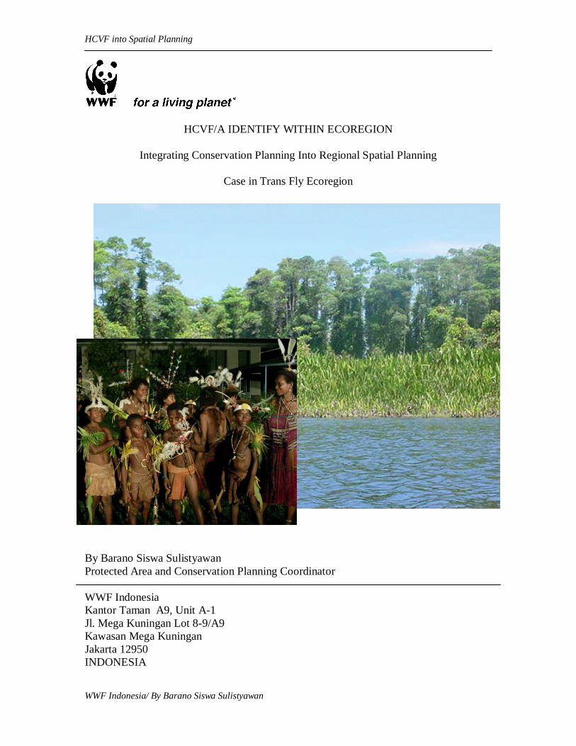
HCVF/A IDENTIFY WITHIN ECOREGION
Integrating Conservation Planning Into Regional Spatial Planning
Case in Trans Fly Ecoregion
By Barano Siswa Sulistyawan Protected Area and Conservation Planning Coordinator WWF Indonesia Kantor Taman A9, Unit A-1 Jl. Mega Kuningan Lot 8-9/A9 Kawasan Mega Kuningan Jakarta 12950 INDONESIA

2
List of Contents
I. HCVF/A principle & WWF Global 200 Ecoregional
II. Regional Spatial Planning
III. Steps HCVF/A into Spatial Planning
IV. Case in Trans Fly V. Conclusion
3
I. A. High Conservation Value Forest/Area The concept on High Conservation Value Forest (HCVF) has introduced by Forest Stewardship Council (FSC) in 1999. Now, this approach is adopting in several country for strengthen conservation efforts and reducing natural forest conversion especially in out side protected area. Although, each country have self interpretation and definition on HCVF, but the tool are containing same principles and values. The HCVF toolkit has published for identify, manage and monitoring forest in Indonesia by WWF and IKEA. This document prepared by Rainforest Alliance and Pro Forest. WWF Indonesia has been implementing HCVF toolkit in Papua, Sumatera and Kalimantan since 2003. The toolkit has applied in oil palm concession, logging concession and in landscape level. The latest progress is using HCVF assessment inside ecoregion unit. The ecoregion boundary has become analysis unit for identified the biodiversity, ecological and social culture values. Based on experienced HCVF assessed inside ecoregion unit has extended the value into other ecosystem. Basic of ecoregion analysis is based on spatial approach. So, the result from synthesis six high conservation values will produce High Conservation Value Areas (HCVA map). The principle of HCVF assessment is precautionary approach. The HCVF concept is containing six basic values. Definition of High Conservation Value Forests is below:
HCV1 Forest/ areas containing globally, regionally or nationally significant concentrations of biodiversity values (e.g. endemism, endangered species, refugia).
HCV2 Forest/ areas containing globally, regionally or nationally significant large
landscape level forests, contained within, or containing the management unit, where viable populations of most if not all naturally occurring species exist in natural patterns of distribution and abundance.
HCV3 Forest/ areas that are in or contain rare, threatened or endangered
ecosystems.
HCV4 Forest/ areas that provide basic services of nature in critical situations (e.g. watershed protection, erosion control).
HCV5 Forest/ areas fundamental to meeting basic needs of local communities
(e.g. subsistence, health).
HCV6 Forest/ areas critical to local communities’ traditional cultural identity (areas of cultural, ecological, economic or religious significance identified in cooperation with such local communities).
FSC Principles and Criteria, February 2000 (in Identifying, Managing, and Monitoring High Conservation Value Forests in Indonesia: A Toolkit for Forest Managers and other Stakeholders, Rainforest Alliance and ProForest on behalf of the WWF and IKEA Co-operation)
4
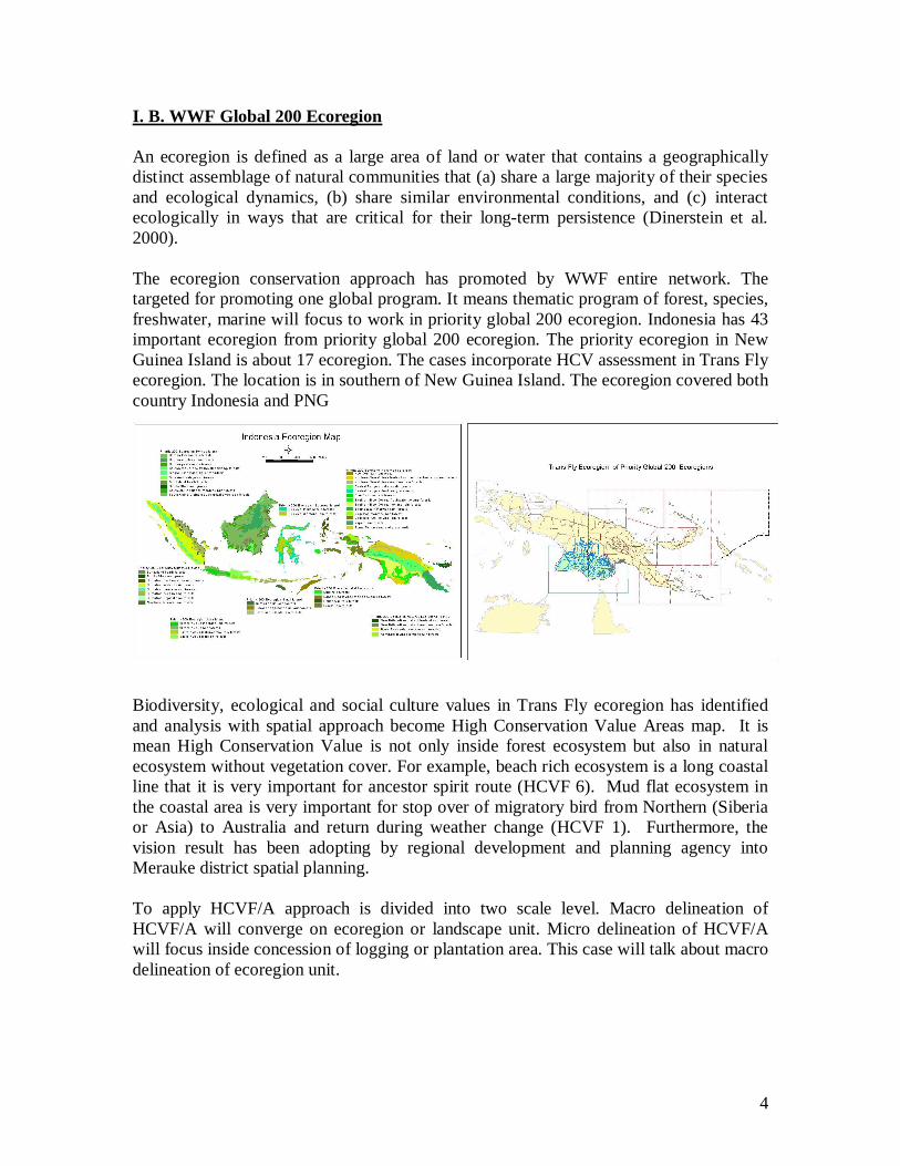
I. B. WWF Global 200 Ecoregion An ecoregion is defined as a large area of land or water that contains a geographically distinct assemblage of natural communities that (a) share a large majority of their species and ecological dynamics, (b) share similar environmental conditions, and (c) interact ecologically in ways that are critical for their long-term persistence (Dinerstein et al. 2000). The ecoregion conservation approach has promoted by WWF entire network. The targeted for promoting one global program. It means thematic program of forest, species, freshwater, marine will focus to work in priority global 200 ecoregion. Indonesia has 43 important ecoregion from priority global 200 ecoregion. The priority ecoregion in New Guinea Island is about 17 ecoregion. The cases incorporate HCV assessment in Trans Fly ecoregion. The location is in southern of New Guinea Island. The ecoregion covered both country Indonesia and PNG Biodiversity, ecological and social culture values in Trans Fly ecoregion has identified and analysis with spatial approach become High Conservation Value Areas map. It is mean High Conservation Value is not only inside forest ecosystem but also in natural ecosystem without vegetation cover. For example, beach rich ecosystem is a long coastal line that it is very important for ancestor spirit route (HCVF 6). Mud flat ecosystem in the coastal area is very important for stop over of migratory bird from Northern (Siberia or Asia) to Australia and return during weather change (HCVF 1). Furthermore, the vision result has been adopting by regional development and planning agency into Merauke district spatial planning. To apply HCVF/A approach is divided into two scale level. Macro delineation of HCVF/A will converge on ecoregion or landscape unit. Micro delineation of HCVF/A will focus inside concession of logging or plantation area. This case will talk about macro delineation of ecoregion unit.

5
II. Regional Spatial Planning In Indonesia regulation development and planning is under managed by regional development and planning agency. During last three decade, development is rapidly growing, but it is not acceptably designing and implementing. The economic interest is very strong dominating spatial plan design. Now, spatial planning regulation has revised become act No. 26, 2007 and it has replaced act No. 24, 1992. The spatial planning is containing structure and spatial pattern. The classification of spatial planning is define into two category cultivation/ build area and protected area. The land use inside cultivation/ build area can be divided into forestry cultivation area and non forestry cultivation area. The illustration of spatial planning classification is below. The picture below is linkage among HCVF, ecoregion and spatial planning.
Cultivation/ Built Area
Protect Area
Forestry Cultivation Area
Non Forestry Cultivation Area
Plantation Agriculture Settlement area
Production forest
Protected Forest
Conservation Areas
National/ local strategic area
National/ local strategic area
Regional Spatial Planning
Figure 2. Structure and spatial plan classification
HCV’s 1-6
Ecoregion
Biodiversity Social Culture
Vision (HCVA)
Integration into Regional
Spatial Planning
Cost Analysis
Figure 1. Analysis flow and integration process

6
III. Steps HCVF/A into Spatial Planning Followed steps CVF identify into spatial planning process. 1. Define unit analysis
Regional spatial planning base on municipality, regency or province administration boundary.
The conservation planning base on ecological or ecosystem region such as wild life home range, watershed area, geographic landscape, ecoregion.
Conservation planning has to analysis large area of land or water to contribute into regional spatial planning. It will give wide create in your mind of existing conservation area, potential corridor between conservation area or conservation area network, and mosaic conservation area within built area. Furthermore, the analysis in large area will assign threaten natural ecosystem out side of conservation area. For example HCVF/A areas in production forest. The result from conservation planning will overlay with management unit area such administration boundary, concession boundary etc. Integration of conservation planning result with proposes land use by other sector will develop new design of regional spatial planning with deep considers on environmental and social culture values. 2. Define conservation target inside ecoregion area.
Six elements of HCV as a target for define and delineate into spatial format as well as the analysis unit.
For design six elements of HCV could use primary or secondary data. Each HCV’s delineate process can be used some spatial method.
3. Data spatial collecting method
HCV 1: Use field survey data such as coordinate of GPS or compilation from researcher data result. To define and delineate process could be done by experts. Not all species habitat will delineate but important species such some endemic area or threaten species habitat. To fine big mammal habitat such elephant or tiger could use radio tracking data monitoring or field survey with GPS.
Type of data: Threatened species - globally or regionally threatened Range-restricted species Keystone species Wide-ranging species - eg, large carnivores Important sites for key species - eg, roosting or breeding sites Economically important species - eg, important for tourism or trophy hunting Culturally important species Species that have been mapped by previous projects

7
HCV 2: Extrapolation from remote sensing data such as LANDSAT, SPOT, MODIS, RADAR to get forest cover or others important landscape.
Types of data: Land cover or forest cover from satellite imagery (such large intact forest, natural fragmentation or artificial fragmentation by road)
HCV 3: The threaten ecosystem or forest could define from synthesis of land system, land form and vegetation map.
Type of data: Elevation and slope Geology type Land system Soil type Vegetation map Land cover
HCV 4: Use hydrology data, elevation, peat land, land form to important fine ecological function and services.
Types of data: Corridors - eg, for gene dispersal or response to climate change Sand dune systems Hydrological systems Peat land areas
HCV 5 & 6: Use participatory mapping approach. The method assumes local knowledge inside of community leader mind (mental map). So, technically just provide or facilitate transform process from mental map into spatial map.
Types of data: Traditional hunting and cultivation Sacred sites - eg, sacred groves and burial sites Sites containing archaeological artifacts - eg, cave paintings View points - eg, sites with views of attractive scenery. For analysis is not all data types have to collect at least representing of available data from many types data we have. 4. Define planning unit During analysis with GIS application we will define shape and size of planning unit. Shape of planning unit:
Watershed unit or sub catchments unit Sub district boundary, district, and municipality. Computer unit such hexagon or square
Size of planning unit: The size of planning unit is not influence resolution but it will influence to get fine calculation of unit

8
5. Cost Analysis The conservation assessment is usually using difference cost values such as human population increase, infrastructure development, threat etc. Define cost analysis is very important to ignore unimportant area from conservation target analysis. 6. Set Conservation Target It is very difficult to set up target area for conservation. Usually expert advice is required for acceptable area delineation. During this process multi stakeholder involve is very important. It is very useful facilitate workshop with among stakeholders such represent from community leader, government, civil society organization, private sector to define where area for conservation and how much they want to conserve. It is including communication between countries if the area covered several countries. For example, Heart of Borneo ecoregion covered Indonesia, Malaysia and Brunei. Trans Fly ecoregion covered Indonesia and PNG. This is very important to build common understanding in different level of stakeholders. In community level, the indigenous communities in Indonesia side, they have family relationship with tribe in PNG side. In the government level, they have policy for development in border area. It is including developing economic access from one side to other side, such as road infrastructure, education and medical facilities, market place etc. It means the target conservation set up have to linkage with among stakeholders need and they all have to well understanding how to develop this region together. This is process increasing common understanding for whole stakeholder living inside the ecoregion area. This process will produce similar criteria and principle on sustainable development entire ecoregion and it will adopt as well as existing regulation in both country.

9
IV. Case in Trans Fly
Ecoregion Boundary Determine ecosystem region based on similarity of environment condition. This is region have monsoonal climate, the vegetation type such as swampy forest, monsoonal forest, grass land, and have unique ecosystem such as mud flat and beach ridge.
Important Community Places The secrete places and area for support community livelihood such as traditional hunting area, area for collect sago, fishing ground, clean water sources. The secrete places such as ancestor route, history places, derivation totem places
State Protected Area The area has declared by government for protection area such national park, wild life sanctuary area, nature reserve, forest protection. Some areas of important community places inside and out side of protected area.
Mangrove & Flood Plain Area Important mangrove forest in coastal area has identified and included flood plain area. The flood plain area is very important for water space during raining season. During dry season, this region will become grazing area for wild animal including hunting area by community

10
Rivers buffer BIKUMA watershed forum has agreed the river buffer is about 5 km from both edges of the main river tributary. Several segment of river buffer overlap with flood plain area in central or down stream of watershed.
Threaten Ecosystem & buffer of Community Important Area The green area is result from systematic conservation planning. The analysis process used thematic layer such as land system, monsoonal forest cover, land form and important habitat for endemic species. To avoid doesn’t important area into analysis, it has delineated cost area such as settlement, road, agriculture area etc.
Developed Area in Trans Fly The existing developed area such field rice area, oil palm plantation, road, settlement. All developed area fixed inside biodiversity and social Trans Fly vision map.
Based on all data above, it is overlaying become new product called High Conservation Value Area map. This is map become vision for support sustainable development in Trans Fly ecoregion. The map has signed by Malind Anim Ha tribe and adopted by Regional Planning and Development Agency in Merauke district for review existing spatial planning.

11
V. Conclusion The ecoregional and HCVF approach will improve the conservation planning in landscape and ecoregion level. Furthermore, it is very useful to enrich the current model of spatial planning. Conservation organization will give significant information of High Conservation Value Forest/ Areas whereas the target area will be designed into one planning for conservation and development into promoting sustainable development. The ecoregion boundary will give good understanding of ecosystem unit inside the region. The HCVF principle will become features of the ecoregion unit. During put into practice the HCVF assessment, it could be extend into other ecosystem such as mud flat area, beach ridge, flood plain area. The HCVF/A features can be defined with different spatial technical approach for every layer. Biodiversity data such as list of species in the region, number of endemic species, endanger species, or list of protection species, it will provide information to make decision for determine important species for symbolic representation such umbrella species, keystone species or flagship species etc. Landscape value could be defined from much kind of remote sensing data and other existing forest cover map. The threat of ecosystem and forest type can determine from systematic and synthesis several thematic layers represent from bio and physical feature. The ecological services are derivation from several environment features such as watershed regime, ecosystem type, slope and other geography information. The community knowledge is basic of information on important places such as secrete places and area for supporting their livelihood. The systematic conservation planning based on ecoregion analysis approach can be combined with other knowledge from experts and communities. Flexibility of process and combining information from multi stakeholder such as expert, community, government, and private, it will contribute to make easier endorsement and advocacy process into decision maker. References Daryatun, Anne Gouyon, Sigit Hardwinarto, Jeffrey Hayward, Marc Hiller, Jim Jarvie,
Ben Jarvis, Steve Jennings, Neil Judd, Darrell Kitchener, Dwi Rahmad Mutaman, Edward Pollard, Alan Purbawiyatna, Diah Raharjo, Niken Sakuntaladewi, Tonny Soehartono, Sigit Hardwinarto, Doug Sheil, Sugardjito, 2003, Identifying, Managing, and Monitoring High Conservation Value Forests in Indonesia: A Toolkit for Forest Managers and other Stakeholders, Prepared by the Rainforest Alliance and ProForest on behalf of the WWF and IKEA Co-operation on Forest Projects.
Colby Loucks, Jenny Springer, Sue Palminteri, John Morrison, and Holly Strand, 2004, From the Vision to the Ground: A guide to implementing ecoregion conservation in priority areas, WWF US Conservation Science Program.

12
Fanny Adelyn Yaninen, Michele Bowe, 2006, Metadata and Description of Trans Fly Conservation Scenario Process, WWF PNG.
Anonim, 2006, Prosiding: Hasil Identifikasi Tempat Penting Masyarakat Suku Besar Malind Anim dalam Bio Visi Ecoregion Trans Fly, WWF Indonesia - Merauke Office.
Bob Smith, 2007, Systematic conservation assessments: before you start, http://www.mosaic-conservation.org/cluz/steps_before.html
Related Documents