Geoprofiling Crime: Engaging students with lessons from applied geography Stephen Matthews Ballarat Grammar Former Consultant Criminal Intelligence Analyst (Geographic Profiler) Victoria Police

Welcome message from author
This document is posted to help you gain knowledge. Please leave a comment to let me know what you think about it! Share it to your friends and learn new things together.
Transcript
Geoprofiling Crime:
Engaging students with lessons from applied geography
Stephen Matthews Ballarat Grammar
Former Consultant Criminal Intelligence Analyst (Geographic Profiler) Victoria Police

Presentation overview
• Context – My background
• Purpose - practical lessons – Making geography real and accessible – Thinking/working geographically ‘by default’ – Spatial technologies at work
• Case studies • The Australian Curriculum • Questions/discussion (if time!)
Memorise this face!
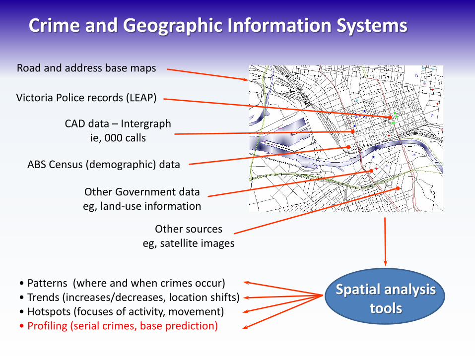
Crime and Geographic Information Systems
Victoria Police records (LEAP)
CAD data – Intergraph ie, 000 calls
ABS Census (demographic) data
Other Government data eg, land-use information
Other sources eg, satellite images
Road and address base maps
Spatial analysis tools
• Patterns (where and when crimes occur) • Trends (increases/decreases, location shifts) • Hotspots (focuses of activity, movement) • Profiling (serial crimes, base prediction)

Geography’s key integrating role
Geography
Psychology Criminology
Spatial crime analysis Crime mapping,
Distribution & patterns, journey to crime (1800s onwards)
Behavioural geography/ Environmental psychology
Understanding human spatial behaviour – spatial reasoning
& decision making (1970s onwards)
Criminal Investigative Analysis FBI-style profiling – Identification of an
unknown offender by their characteristics (1970s onwards)
Geographic Profiling (1990s onwards)
Matthews 2012

Some Theory

Place, time, crime • Crime is not random
– If it were, there would be an equal chance of crime occurring anywhere at any time
– Actually crime is not randomly distributed; it clusters, there are spatial and temporal patterns
– Criminal opportunities are not random; targets/victims have patterns (eg, land-use and urban morphology or personal activities and routines)
• Both victims and offenders are not pathological in their use of time and space – ie, not the product of mental illness; reasoned, ordered

Spatial decisions – crime templates
• As individuals undertake activities and move through space, they make decisions – When activities are repeated frequently, the
decisions become regularised – Regularisation creates an abstract guiding
template – For decisions to commit crime, this becomes a
crime template
• Templates operate within the built urban environment – Urban structure of roads, activity centres, etc

Crime templates continued
• Individuals or networks of individuals commit crimes when: – There is a triggering event – A process for locating a target/victim – A fit with an offender’s crime template
• Criminals accumulate experience which influences and informs future actions
Individual Trigger event
Experience
Crime attempt
Success/failure

Cognitive (Mental) Map Model
Matthews, 2013 after Reginald Golledge and Robert Simpson, 1997
Sensory input
Personality
Experiences
Culture
Gender
Class
Ethnicity
Primary - experienced Secondary - indirect
Environmental information
Perceptual filters
Cognitive or Mental Map
Past crimes Other offenders
Maps Images Media
Bases Visits
Awareness Space + Activity Space = Potential Offence Space
Organised/disorganised Success/failure & ‘comfort’ level
Applied to Crime
Potential target ‘suitability’ & availability

Principle of Least Effort • Time is a commodity and almost all people act
in a manner to conserve its use – When travelling, people assess factors such as
time, effort and cost
• The principle of least effort leads to the effect of ‘distance decay’
• For most persistent offenders the density of their crime sites decreases with increasing distance from home
• Studies show there is a buffer of no offending

Shopper behaviour analogy • The Principle of Least Effort has a caveat that
ties to how people shop: – Low order (convenience) goods and services – High order (specialty) goods and services
• Impacted by access to/ease of transport and urban morphology
• Therefore, for acquisitive crimes (eg, robbery and burglary), distance has been found to be proportional to anticipated gain – Implications for thieves who also commit offences
against the person
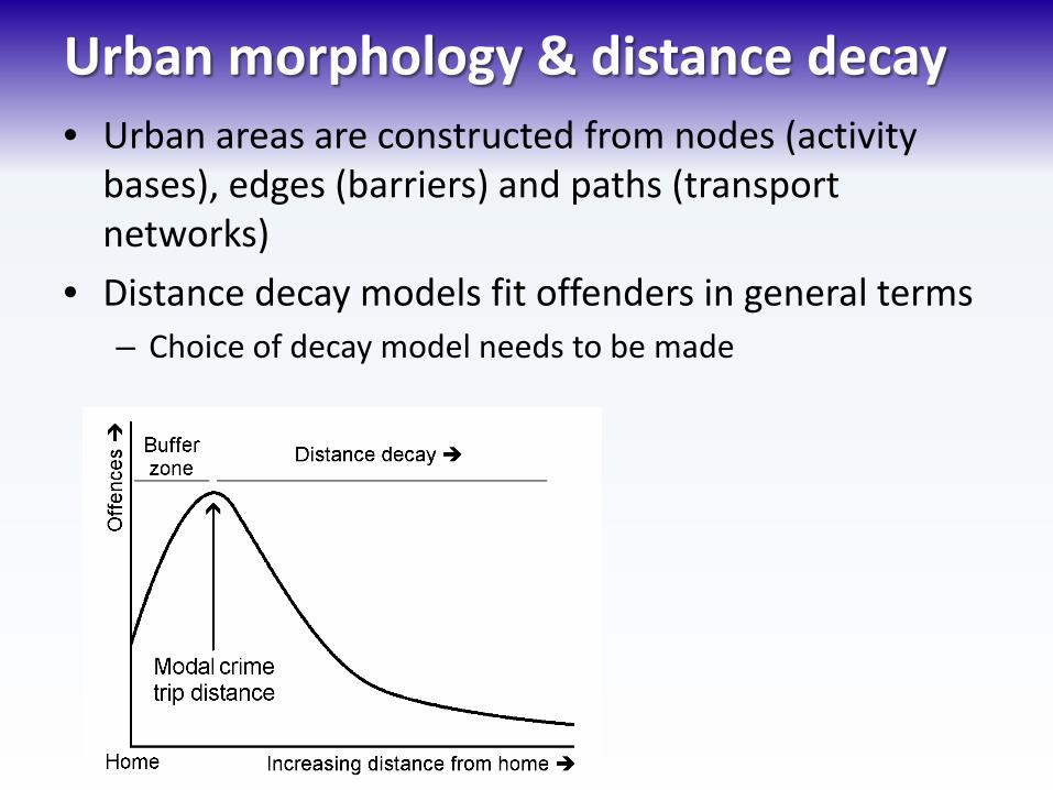
Urban morphology & distance decay • Urban areas are constructed from nodes (activity
bases), edges (barriers) and paths (transport networks)
• Distance decay models fit offenders in general terms – Choice of decay model needs to be made

Making sense of crime space & places Residence
Work
+
'
Target Areas
Offence locations
Buffer zone % Shopping/
Entertainment
Family/friends
Recreation
% % %
% %
%
%
% +
%
Matthews, 2013 after Brantingham & Brantingham, 1981

The role of Geographic Profiling • Mapping all locations linked to a serial crime • Serial crimes can include robberies, burglaries,
theft, arsons, sex offences and homicides • Many locations are often associated with an
incident • Working back to establish probabilities of
offender base location • Prioritise suspects for investigators • Prediction of spatial behaviours • Advise on surveillance locations or areas for
intensive investigation, eg, canvasses

The Cases
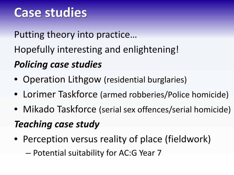
Case studies Putting theory into practice… Hopefully interesting and enlightening! Policing case studies • Operation Lithgow (residential burglaries)
• Lorimer Taskforce (armed robberies/Police homicide)
• Mikado Taskforce (serial sex offences/serial homicide)
Teaching case study • Perception versus reality of place (fieldwork)
– Potential suitability for AC:G Year 7

Operation Lithgow
• Serial burglaries
• Phases with breaks
• Day and night
• Nominated suspect
• Spatial patterns
• Surveillance advice
Prepared by Stephen MATTHEWS Intelligence Data Centre 13/9/99
IN CONFIDENCE


Focus on urban morphology

Urban morphology
Considerations… • Ease of ingress and egress
– Travel mode – Travel distance/efficiency – Presence of barriers – Offence proceeds
• Visibility versus concealment – Seeing who is nearby – Avoiding being seen – Vegetation? Lighting? CCTV?

• Operation Pigout – 28 armed robberies, 1991-1994 • Operation Hamada – 11 armed robberies, 1998 • Sgt Gary Silk & S/C Rod Miller shot by the offenders
whilst on a stakeout, 16 August 1998
• Geographic profiling was requested within weeks of the offence
Lorimer Taskforce

Lorimer continued... • Two years of intensive investigation • Nearly 2000 leads chased down • Hyundai Excel damaged, 35 000 cars reduced to 2000 to eliminate • Two arrested, 25 July 2000. Sent to trial 15 August 2002, convicted,
sentenced 24 February 2003 • Debs later convicted (2007 and 2011) of two more murders
through DNA linking
Bandali Debs: life, no parole Jason Roberts: life
On TV Underbelly: Tell Them Where Lucifer Lives
9 Network, aired 7 February 2011

The Age, 26 July 2000
Approximately 40 km

• Committed his first offence at age 15 • In and out of psychiatric facilities and prisons
for most of his life • Re-offended very shortly after release • Profiled for sex offender research database • One month later, Nicole Patterson was
murdered and mutilated in her home (19 April 1999)
• Intensive analysis and incident linkage including mapping Dupas’ activity space
Mikado Taskforce – Peter Norris Dupas

Mikado continued...
• Other potentially linked homicides identified...
Helen McMahon Murdered 13/2/85
Renita Brunton Murdered 11/11/93
Margaret Maher Murdered 4/10/97
Mersina Halvagis Murdered 1/11/97
Kathleen Downes Murdered 31/12/97
Nicole Patterson Murdered 19/4/99
Convicted 17/8/00
Convicted 11/8/04
Convicted 10/8/07 (appealed) Re-convicted 19/11/10 (appeal rejected)
Open investigation Open investigation
Open investigation

Peter Norris Dupas
Sentence: life with no possibility of parole; he will die in custody ... this story continues: second appeal denied in December 2012
Dupas was portrayed on TV in Killing Time, filmed in 2009 but only aired on 2 November 2011, based on a 2008 book by disgraced lawyer Andrew Fraser
Local area liveability perceptions • One example of a geography class inquiry with
fieldwork – Potentially suited to Australian Curriculum: Geography Year 7
human unit ‘Places are for living in’ (K&U CDs 1-3) • Identify a range of small sub-areas within a local area
that have potentially different perceived characteristics – eg, safety/security (crime), residential character, service
amenity, public transport access, etc • Construct a survey to administer in the area that ranks
perceptions of sub-areas against these characteristics • Use official data to test the perceptions against the
‘real’ situation – Neighbourhood Watch data in the case of crime

Crime – a great topic for geography
• Crime is interesting for, and relevant to students (and it makes for good geography!) – Very spatial, at a range of scales – Relevant: ubiquitous but spatially non-uniform – Diverse: nature and characteristics – Motivating: the ‘CSI effect’, amateur Sherlock – Accessible: data is out there
• An obvious consideration is the of suitability of topic material to student age – Naturally we are not trying to teach students how
to do crime!
Potential benefits to students
• Understanding of a common phenomenon by thinking geographically – Practical application of geographic concepts – Inquiry methodology applies exceptionally well – Spatial technologies (GIS) applications
• Seeing their surroundings with ‘new eyes’ • Application to personal security
– Knowing how, when and where common offences are committed from a geographic standpoint and taking simple preventative measures for personal safety

Do it yourself? • Online serial crime case sites • Reality versus perception – local area crime • Accessing spatial crime data
– Local police: make contact – Neighbourhood watch: search/make contact – State/Territory Police: search online – Australian Bureau of Statistics – Australian Institute of Criminology
http://www.aic.gov.au/statistics.html
– Australian Government data http://australia.gov.au/topics/law-and-justice/crime

Thank you! Presentation PDF downloads: https://dl.dropbox.com/u/96698219/ AGTA_2013_Geoprofiling_Matthews.pdf
https://dl.dropbox.com/u/96698219/ AGTA_2013_Geoprofiling_Notes_Matthews.pdf
Contact:
Stephen Matthews Ballarat Grammar [email protected] @srmdrummer on Twitter
Related Documents
![¢y« ( geography ) · 1 [Document title] [Document subtitle] Abstract [Draw your reader in with an engaging abstract. It is typically a short summary of the document.](https://static.cupdf.com/doc/110x72/60189ae86f0a5834c43aa8b9/y-geography-1-document-title-document-subtitle-abstract-draw-your-reader.jpg)