Geographic Information Systems Systems (GIS) (GIS) for Epidemiology and Public for Epidemiology and Public Health Health Dr. Ming-Hsiang Tsou Dr. Ming-Hsiang Tsou Department of Geography, San Diego State Department of Geography, San Diego State University University PPT slides: http://map.sdsu.edu/publications/2005GISpublichealthtsou.ppt

Geographic Information Systems (GIS) for Epidemiology and Public Health Dr. Ming-Hsiang Tsou Department of Geography, San Diego State University PPT slides:
Dec 19, 2015
Welcome message from author
This document is posted to help you gain knowledge. Please leave a comment to let me know what you think about it! Share it to your friends and learn new things together.
Transcript
Geographic Information SystemsGeographic Information Systems(GIS) (GIS)
for Epidemiology and Public Healthfor Epidemiology and Public Health
Dr. Ming-Hsiang TsouDr. Ming-Hsiang Tsou
Department of Geography, San Diego State Department of Geography, San Diego State UniversityUniversity
PPT slides: http://map.sdsu.edu/publications/2005GISpublichealthtsou.ppt
AcknowledgementAcknowledgement
Thank Dr. Brett A. Bryan for the permission of Thank Dr. Brett A. Bryan for the permission of using some of his slides and GIS examples using some of his slides and GIS examples (from The University of Adelaide, AUSTRALIA.(from The University of Adelaide, AUSTRALIA.
http://www.gisca.adelaide.edu.au/~bbryan/http://www.gisca.adelaide.edu.au/~bbryan/
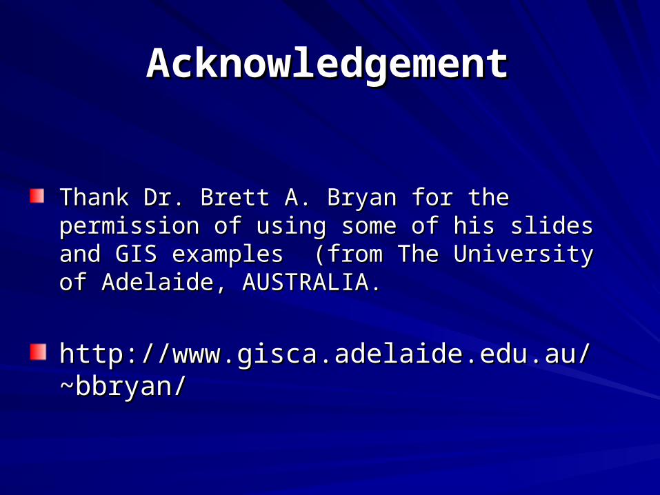
GIS is about geography and
about thinking
geographically. --- Demers,
(Google Earth Movie)
Http://earth.google.com (download)
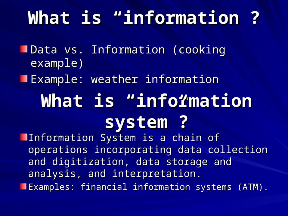
What is “information”?What is “information”?
Data vs. Information (cooking example)Data vs. Information (cooking example)
Example: weather informationExample: weather information
What is “information system”?What is “information system”?
Information System is a chain of Information System is a chain of operations incorporating data collection operations incorporating data collection and digitization, data storage and analysis, and digitization, data storage and analysis, and interpretation.and interpretation.Examples: financial information systems (ATM).Examples: financial information systems (ATM).
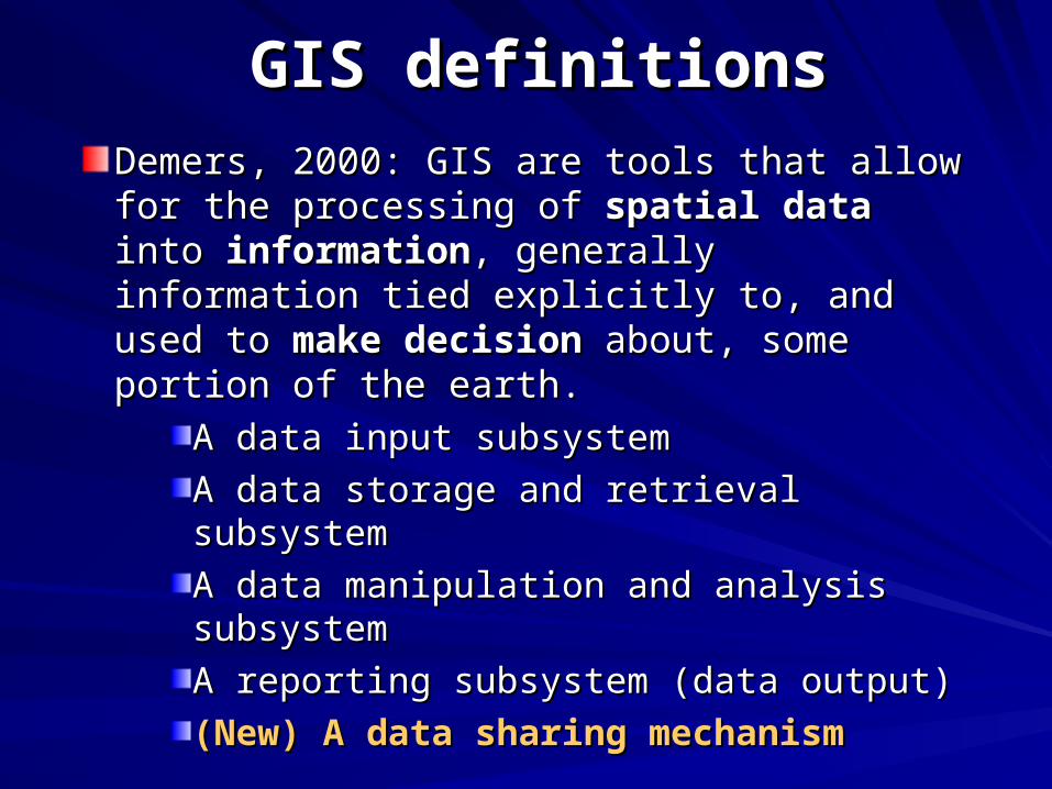
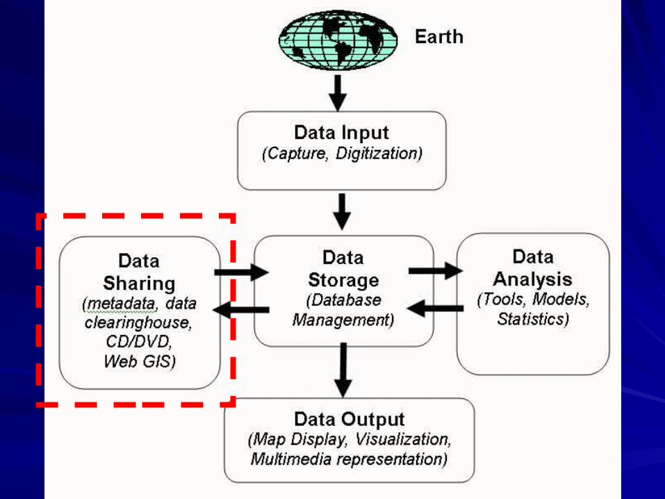
GIS definitionsGIS definitions
Demers, 2000: GIS are tools that allow for Demers, 2000: GIS are tools that allow for the processing of the processing of spatial dataspatial data into into informationinformation, generally information tied , generally information tied explicitly to, and used to explicitly to, and used to make decisionmake decision about, some portion of the earth.about, some portion of the earth.
A data input subsystemA data input subsystem
A data storage and retrieval subsystemA data storage and retrieval subsystem
A data manipulation and analysis A data manipulation and analysis subsystemsubsystem
A reporting subsystem (data output) A reporting subsystem (data output)
(New) A data sharing mechanism(New) A data sharing mechanism
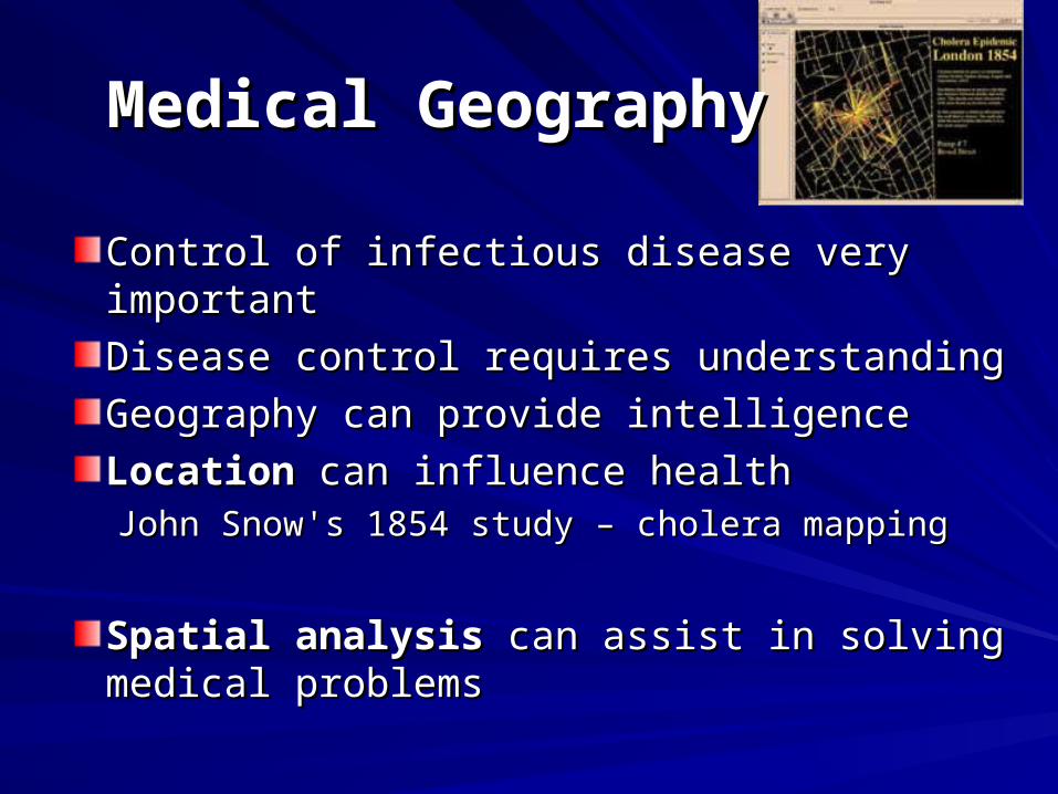
Medical GeographyMedical Geography
Control of infectious disease very important Control of infectious disease very important
Disease control requires understandingDisease control requires understanding
Geography can provide intelligenceGeography can provide intelligence
LocationLocation can influence health can influence healthJohn Snow's 1854 study – cholera mappingJohn Snow's 1854 study – cholera mapping
Spatial analysisSpatial analysis can assist in solving can assist in solving medical problemsmedical problems
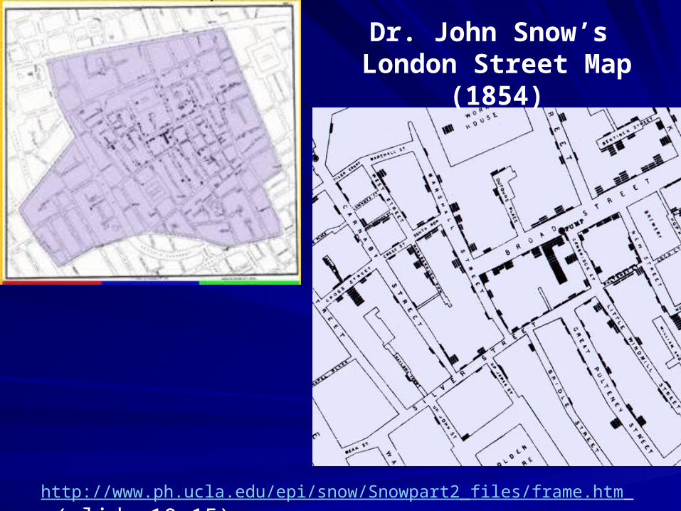
Dr. John Snow’s London Street Map (1854)
http://www.ph.ucla.edu/epi/snow/Snowpart2_files/frame.htm (slide 10-15)
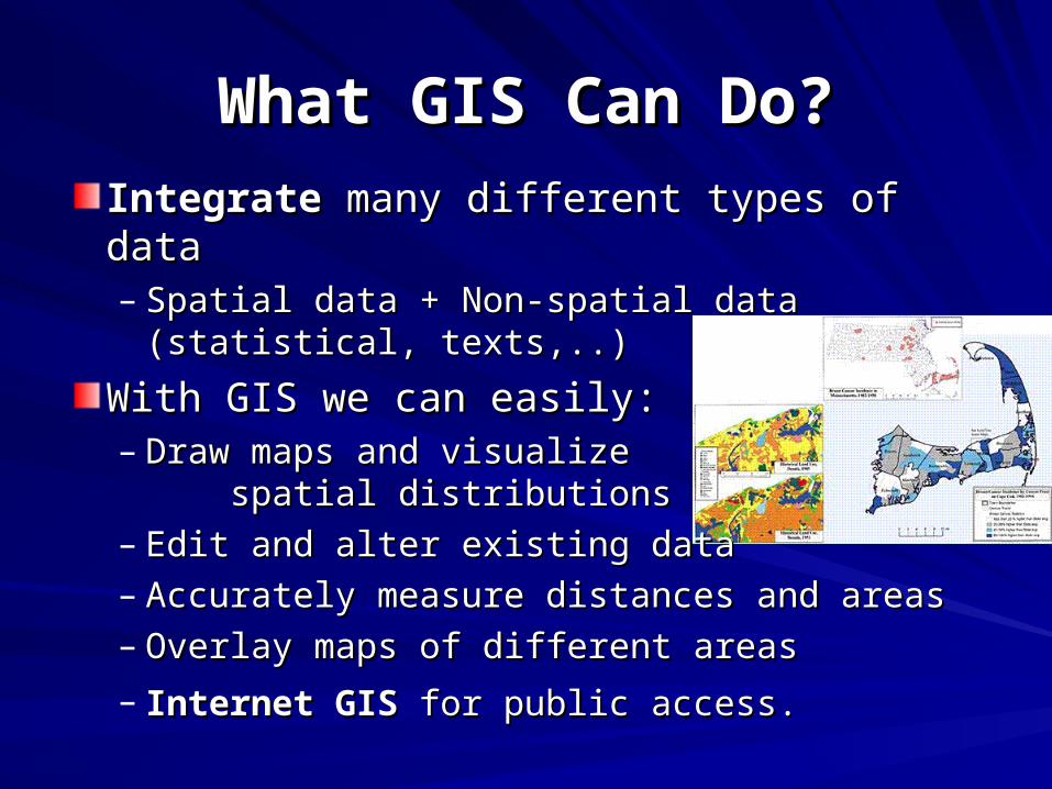
IntegrateIntegrate many different types of data many different types of data– Spatial data + Non-spatial data (statistical, Spatial data + Non-spatial data (statistical,
texts,..)texts,..)
With GIS we can easily:With GIS we can easily:– Draw maps and visualize Draw maps and visualize
spatial distributionsspatial distributions– Edit and alter existing dataEdit and alter existing data– Accurately measure distances and areasAccurately measure distances and areas– Overlay maps of different areasOverlay maps of different areas
– Internet GISInternet GIS for public access. for public access.
What GIS Can Do?What GIS Can Do?
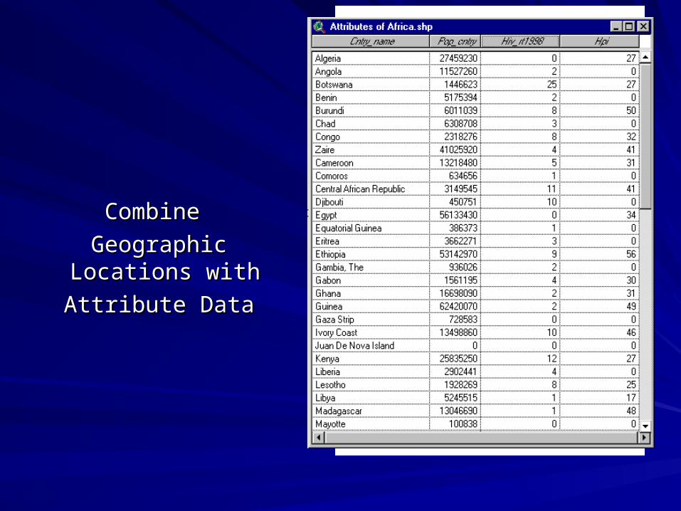
Combine Combine
Geographic Geographic Locations with Locations with
Attribute DataAttribute Data
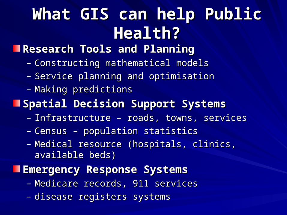
What GIS can help Public Health?What GIS can help Public Health?
Research Tools and PlanningResearch Tools and Planning– Constructing mathematical modelsConstructing mathematical models– Service planning and optimisationService planning and optimisation– Making predictionsMaking predictions
Spatial Decision Support SystemsSpatial Decision Support Systems– Infrastructure – roads, towns, servicesInfrastructure – roads, towns, services– Census – population statisticsCensus – population statistics– Medical resource (hospitals, clinics, available beds)Medical resource (hospitals, clinics, available beds)
Emergency Response SystemsEmergency Response Systems– Medicare records, 911 servicesMedicare records, 911 services– disease registers systemsdisease registers systems
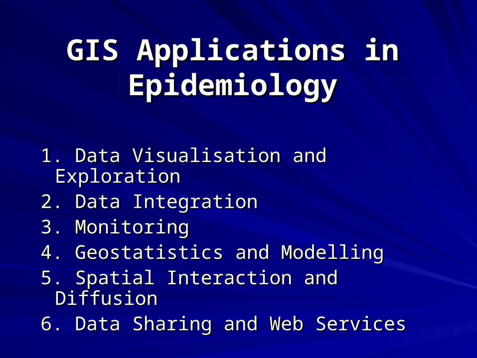
GIS Applications in GIS Applications in EpidemiologyEpidemiology
1. Data Visualisation1. Data Visualisation and Exploration and Exploration2. 2. Data IntegrationData Integration3. 3. MonitoringMonitoring4. 4. GeosGeostatistictatistics and Ms and Modellingodelling5. Spatial Interaction and Diffusion5. Spatial Interaction and Diffusion6. Data Sharing and Web Services6. Data Sharing and Web Services
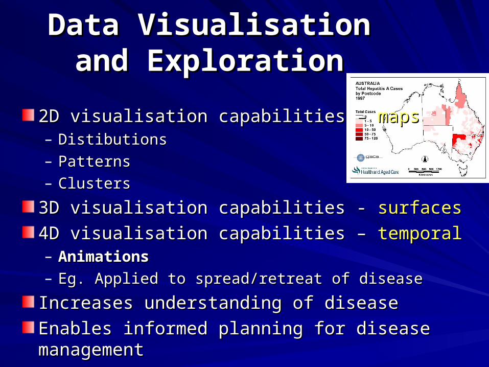
2D visualisation capabilities – 2D visualisation capabilities – mapsmaps– DistibutionsDistibutions– PatternsPatterns– ClustersClusters
3D visualisation capabilities - 3D visualisation capabilities - surfacessurfaces
4D visualisation capabilities – 4D visualisation capabilities – temporaltemporal– AnimationsAnimations– Eg. Applied to spread/retreat of diseaseEg. Applied to spread/retreat of disease
Increases understanding of diseaseIncreases understanding of disease
Enables informed planning for disease managementEnables informed planning for disease management
Data Visualisation and Data Visualisation and ExplorationExploration
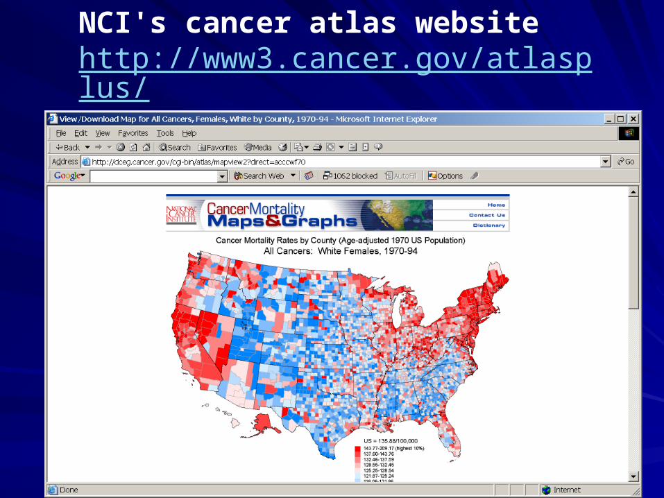
NCI's cancer atlas website http://www3.cancer.gov/atlasplus/
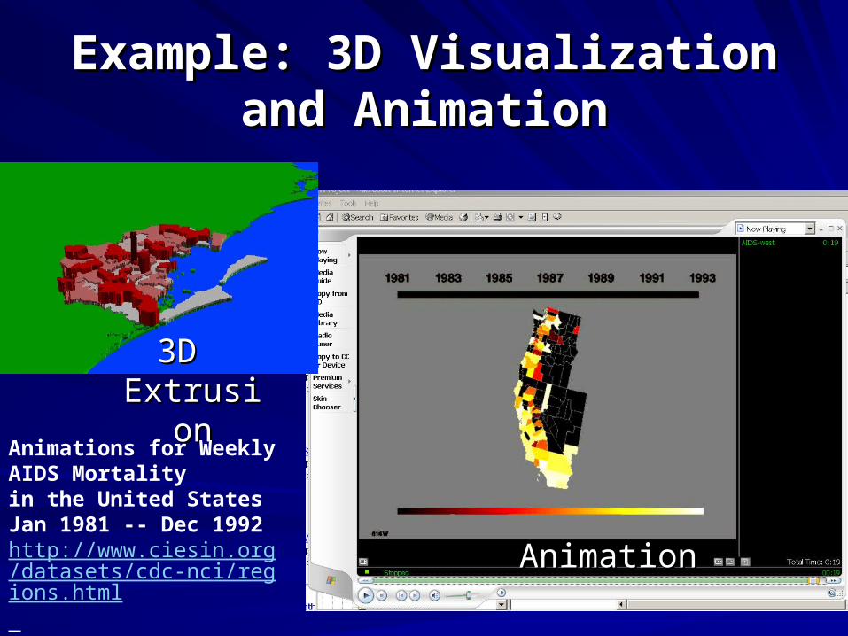
Example: 3D Visualization and Example: 3D Visualization and AnimationAnimation
3D 3D ExtrusioExtrusio
nnAnimations for Weekly AIDS Mortality in the United States Jan 1981 -- Dec 1992http://www.ciesin.org/datasets/cdc-nci/regions.html
AnimationAnimation
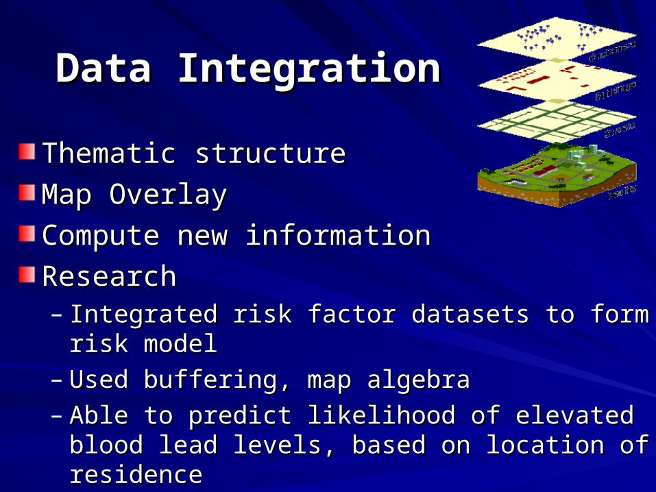
Thematic structureThematic structure
Map Overlay Map Overlay
Compute new information Compute new information
ResearchResearch– Integrated risk factor datasets to form risk modelIntegrated risk factor datasets to form risk model– Used buffering, map algebraUsed buffering, map algebra– Able to predict likelihood of elevated blood lead Able to predict likelihood of elevated blood lead
levels, based on location of residencelevels, based on location of residence
Data IntegrationData Integration
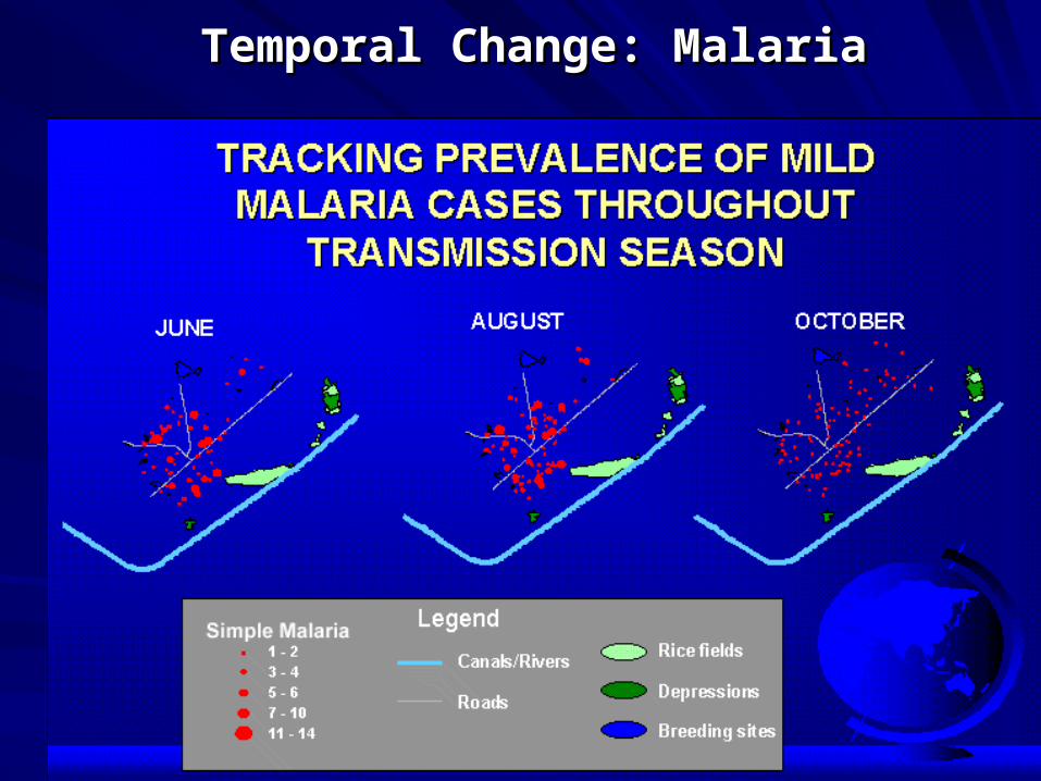
Temporal Change: MalariaTemporal Change: Malaria
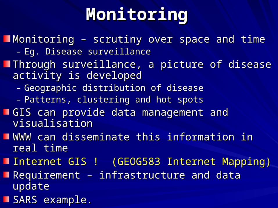
Monitoring – scrutiny over space and time Monitoring – scrutiny over space and time – Eg. Disease surveillanceEg. Disease surveillance
Through surveillance, a picture of disease activity is Through surveillance, a picture of disease activity is developeddeveloped– Geographic distribution of diseaseGeographic distribution of disease– Patterns, clustering and hot spotsPatterns, clustering and hot spots
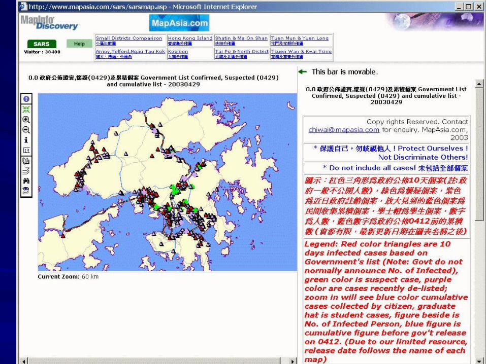
GIS can provide data management and visualisationGIS can provide data management and visualisationWWW can disseminate this information in real timeWWW can disseminate this information in real timeInternet GIS ! (GEOG583 Internet Mapping)Internet GIS ! (GEOG583 Internet Mapping)Requirement – infrastructure and data updateRequirement – infrastructure and data updateSARS example. SARS example.
MonitoringMonitoring
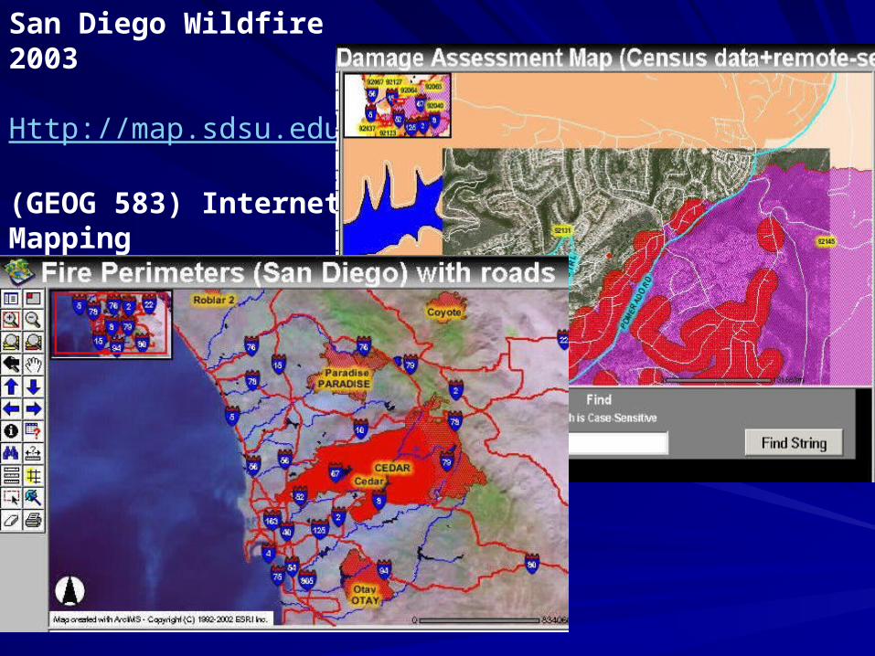
San Diego Wildfire 2003
Http://map.sdsu.edu
(GEOG 583) Internet Mapping
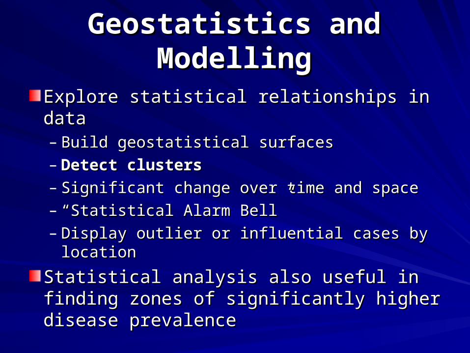
Explore statistical relationships in dataExplore statistical relationships in data– Build geostatistical surfacesBuild geostatistical surfaces– Detect clustersDetect clusters– Significant change over time and space Significant change over time and space – ““Statistical Alarm Bell”Statistical Alarm Bell”– Display outlier or influential cases by locationDisplay outlier or influential cases by location
Statistical analysis also useful in finding Statistical analysis also useful in finding zones of significantly higher disease zones of significantly higher disease prevalenceprevalence
Geostatistics and ModellingGeostatistics and Modelling
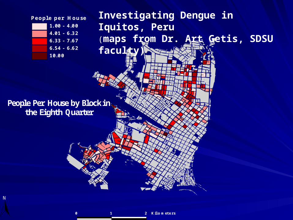
People Per House by Block in the Eighth Quarter
P e o p l e p e r H o u s e
1 . 0 0 - 4 .0 0
4 . 0 1 - 6 .3 2
6 . 3 3 - 7 .6 7
6 . 5 4 - 6 .6 2
1 0 .0 0
N
0 1 2 K il o m e t e r s
Investigating Dengue in Iquitos, Peru(maps from Dr. Art Getis, SDSU faculty)
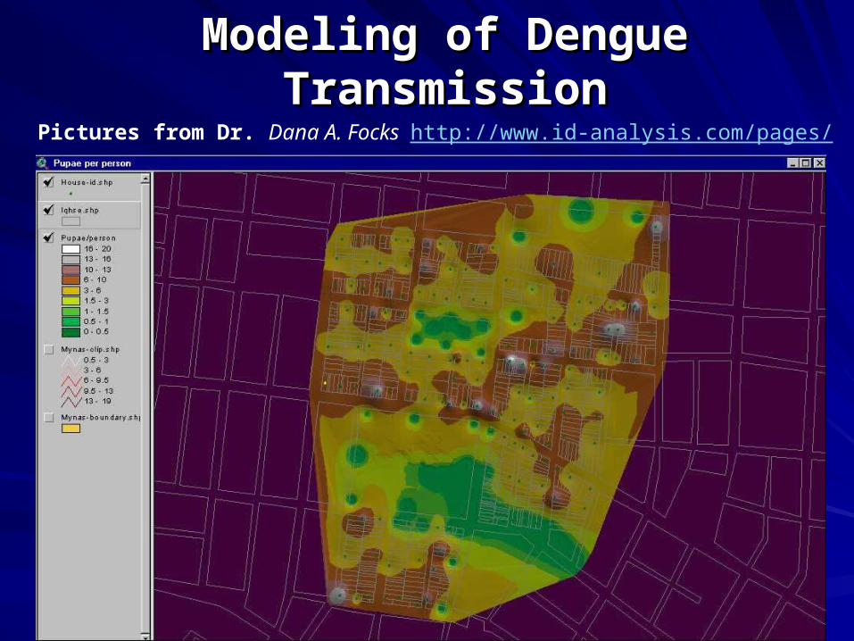
Modeling of Dengue TransmissionModeling of Dengue TransmissionPictures from Dr. Dana A. Focks http://www.id-analysis.com/pages/
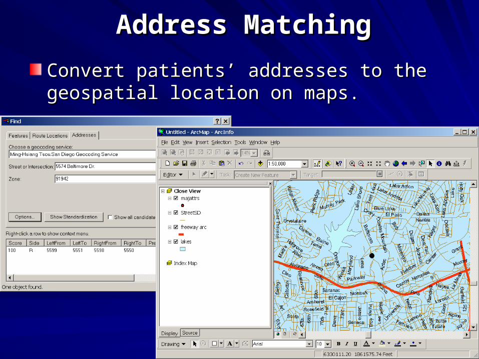
Address MatchingAddress Matching
Convert patients’ addresses to the geospatial Convert patients’ addresses to the geospatial location on maps.location on maps.

ESRI User conference 2004
Keynote: Dr. Rita Colwell, Former Director of National Science Foundation,
Professor of Microbiology and Biotechnology
(on leave) at the University Maryland
(WMV Movie)
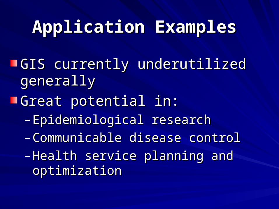
Application Examples Application Examples
GIS currently underutilized generallyGIS currently underutilized generally
Great potential in:Great potential in:– Epidemiological researchEpidemiological research
– Communicable disease controlCommunicable disease control
– Health service planning and optimizationHealth service planning and optimization
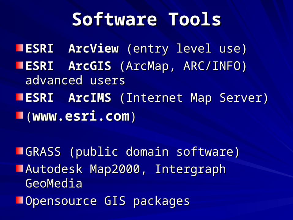
Software ToolsSoftware Tools
ESRI ArcView ESRI ArcView (entry level use)(entry level use)
ESRI ArcGIS ESRI ArcGIS (ArcMap, ARC/INFO) (ArcMap, ARC/INFO) advanced usersadvanced users
ESRI ArcIMS ESRI ArcIMS (Internet Map Server)(Internet Map Server)
((www.esri.comwww.esri.com))
GRASS (public domain software)GRASS (public domain software)
Autodesk Map2000, Intergraph GeoMediaAutodesk Map2000, Intergraph GeoMedia
Opensource GIS packagesOpensource GIS packages
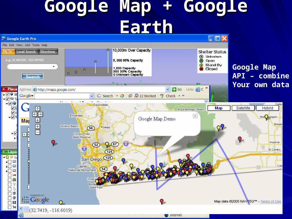
Google Map + Google EarthGoogle Map + Google Earth
Google MapAPI – combine Your own data
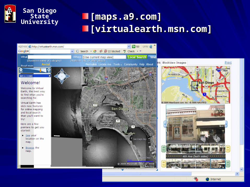
[maps.a9.com][maps.a9.com] [virtualearth.msn.com][virtualearth.msn.com]
San Diego State University
Limitations of GISLimitations of GIS
Communication GapsCommunication Gaps between between epidemiologists & spatial professionalsepidemiologists & spatial professionals
RequireRequire uniform data standardsuniform data standards– Eg. Address recording 1/32 Main St. or Unit 1 32 Eg. Address recording 1/32 Main St. or Unit 1 32
Main St.Main St.– Unit record data accessUnit record data access– Consistent and meaningful areal unitsConsistent and meaningful areal units– EEnable consistency & comparisonnable consistency & comparison
Privacy issuesPrivacy issues and spatial aggregation and spatial aggregation
SummarySummary
GIS can GIS can provides spatial dimensionprovides spatial dimension to to epidemiological researchepidemiological research (visualization, (visualization, modeling…).modeling…).
GIS can be used for many public heath GIS can be used for many public heath applications and services.applications and services. ((efficient efficient allocation of health care resources, allocation of health care resources, equity inequity in accessibility to services…)accessibility to services…)
Internet GISInternet GIS can provide the public health can provide the public health information in real-time. (information in real-time. (evaluation, decision evaluation, decision support systems, emergency response…)support systems, emergency response…)
GIS Sources for Public HealthGIS Sources for Public HealthESRI ESRI http://www.esri.com/industries/health/index.htmlhttp://www.esri.com/industries/health/index.html
Books:Books: – GIS and Public HealthGIS and Public Health by Ellen Cromley by Ellen Cromley
and Sara McLafferty. The Guilford Press. and Sara McLafferty. The Guilford Press. 2002.2002.
– Internet GISInternet GIS by Zhong-Ren Peng and by Zhong-Ren Peng and Ming-Hsiang Tsou. Wiley, 2003.Ming-Hsiang Tsou. Wiley, 2003.
– GIS for Health and Human ServicesGIS for Health and Human Services , , Laura Lang, ESRI press.Laura Lang, ESRI press.
GIS course in Geography, SDSUGIS course in Geography, SDSU
GEOG 381GEOG 381 (Computerized Map (Computerized Map Design)Design)GEOG 484 (Intro GIS)GEOG 484 (Intro GIS)GEOG 581 (Cartographic Design)GEOG 581 (Cartographic Design)– http://map.sdsu.edu/geog581http://map.sdsu.edu/geog581
GEOG 584 (Intermediate GIS)GEOG 584 (Intermediate GIS)GEOG 583 (Internet Mapping)GEOG 583 (Internet Mapping)– http://map.sdsu.edu/geog583http://map.sdsu.edu/geog583
PPT slides: http://map.sdsu.edu/publications/2005GISpublichealthtsou.ppt
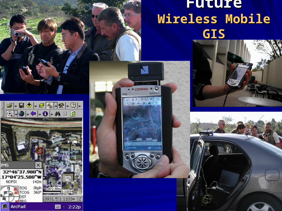
FutureFutureWireless Mobile GISWireless Mobile GIS
Related Documents