Oceanography

Geo l5 oceanography_part1_0.2
Aug 18, 2015
Welcome message from author
This document is posted to help you gain knowledge. Please leave a comment to let me know what you think about it! Share it to your friends and learn new things together.
Transcript
Oceanography
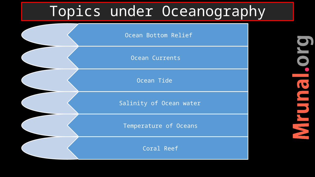
Topics under Oceanography
Ocean Bottom Relief
Ocean Currents
Ocean Tide
Salinity of Ocean water
Temperature of Oceans
Coral Reef

Oceanic crust –first order relief – most fundamental –basaltic
Oceanic crust thickness = 1-3 km, darker in colour, higher density
Oceanic crust created at MOR and destroyed at trenches
Ocean floor is not flat. More diversity than on continents
Ocean Bottom Relief

Ocean Bottom Relief

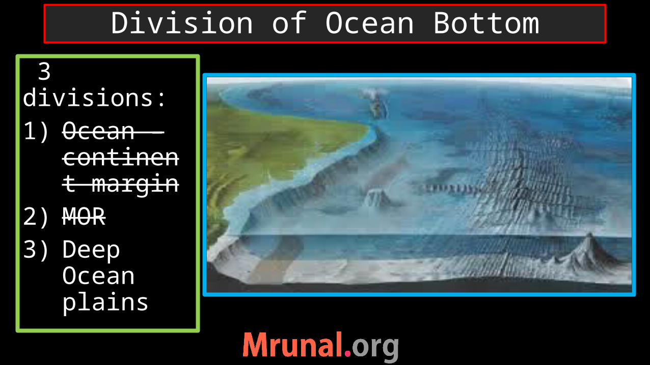
3 divisions:1) Ocean –
continent margin
2) Deep Ocean plains
3) MOR
Division of Ocean Bottom

1) Continental shelf2) Continental slope3) Continental rise
Ocean-Continent margins
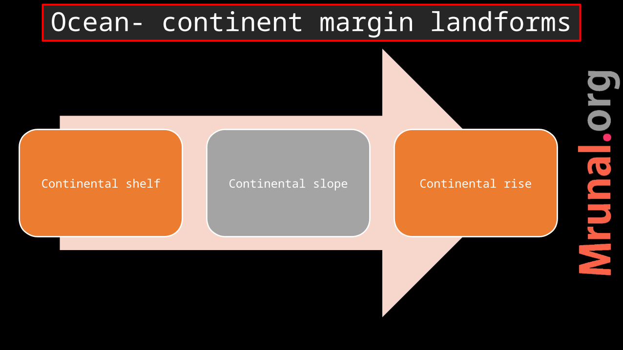
Continental shelf Continental slope Continental rise
Ocean- continent margin landforms

•Shallowest part•Depth ~ 200 m• photic zone•Marine life- floating planktons, benthos (crabs) and nektons (fishes)•sediments from land = terrigenous
Continental shelf

•90 % of Petroleum reserves of the world found in continental shelves
Bombay high, gulf of Cambay, Persian Gulf, North Sea, Barents sea, gulf of Mexico, Norwegian sea
Resources from continental shelf

Petroleum reserves Strait of Hormuz
Persian gulf

•Petroleum reserve•Russia started exploration•Protest from environmentalists – Greenpeace•“Rainbow warriors”
Oil exploration in Barents sea

•Melting due to global warming•New sea route from Europe to Russia•Potential petroleum reserve•Artic ocean- global commons•Arctic council
Arctic Ocean

•Sulphur – rarely found on land. Available in sea during marine volcanism.
Ex. Gulf of Mexico – rich source of sulphur
Resource at continental shelf

Placer depositsWave action erode the beach rocks some stable minerals freed from the rocks due to weatheringwaves shift the lighter material more rapidly than heavierconcentration of heavy minerals on shelf
Resources from continental shelf

•monazite sand (source of thorium) at Kerala coast
•Gold (Alaska)•Zircon (Brazil, Australia)•Diamond (South Africa)
Resources from continental shelf
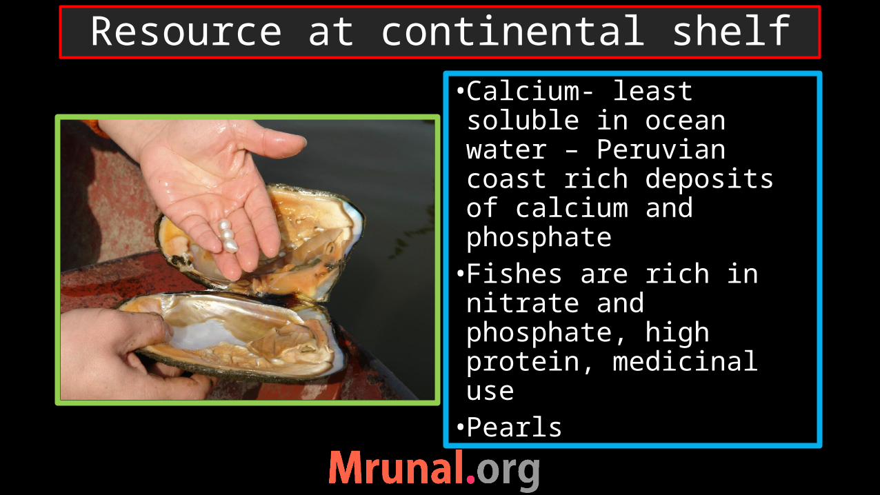
•Calcium- least soluble in ocean water – Peruvian coast rich deposits of calcium and phosphate•Fishes are rich in nitrate and phosphate, high protein, medicinal use•Pearls
Resource at continental shelf

Continental shelf Continental slope Continental rise
Ocean- continent margin landforms

•Very steep slope•Massive landslides of terrigenous deposits•Rivers like, Ganga, Indus, Mississippi, Yukon and Congo have created submarine canyons•Highest waterfall on earth – under Denmark Strait.
Continental slope

Continental shelf Continental slope Continental rise
Ocean- continent margin landforms

•Transition zone between continental block and oceanic block
Continental Rise

•They are absent near trenches, as subduction near trenches consumes the deposition of Continental rise
Continental rise

Continental shelf Continental slope Continental rise
Ocean- continent margin landforms
3 divisions:1) Ocean –
continent margin
2) MOR3) Deep
Ocean plains
Division of Ocean Bottom

•Occupies 40% of the ocean floor•Tremendous diversity in terms of landforms • It has deposits from continents (terrigenous), marine life (biogenous) and salts and mineral (inorganic)
Abyssal Plain
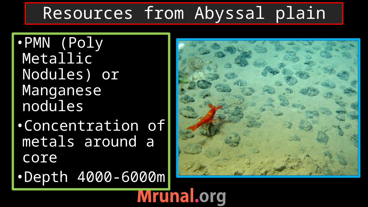
•PMN (Poly Metallic Nodules) or Manganese nodules•Concentration of metals around a core•Depth 4000-6000m
Resources from Abyssal plain

•First found in Kara sea, Arctic ocean•These nodules are found in the all the oceans –economically viable -central Indian Ocean and Eastern Pacific Ocean.
Global distribution of PMN

PMN
•PMN are small nodules of metals like, Manganese, Iron, Silicon, Al, Nickel and Cobalt etc.•some of the minerals are rare on land.•Countries are in race to explore and extract PMN

2002- India got approval from ISA – ‘Pioneer Investor’ for 15 years
India - 1,50,000 ml ha ocean stretch in central Indian Ocean out of 10 to15 ml ha of PMN
India RV Samudra Ratnakar + equipment from S Korea
NIOT – developing tech for exploration
2011 - China acquired 10,000 ha area
2013 – UK co. in Pacific ocean
PMN
India

UN convention on Laws of the seas1983 60 countries signedcame into force in 19931) Decides the maritime boundary2) Deep sea mining (ISA,
Kingston, Jamaica)3) Environment protection4) Dispute settlement
UNCLOS
ISA

•Decides territorial waters, contiguous zone and EEZ for coastal countries•EEZ – special right of the state to explore minerals or produce energy from the area
UNCLOS

Mains2014
Q. Critically evaluate the various resources of the oceans which can be harnessed to meet the resource crisis in the world (10)
UPSC
Question

4 types of Islands:1) Volcanic (plate/ hot spot)2) Continental3) Coral islands 4) Sand bar islands
Types of Islands

Island Formationcontinental Once part of large
continentvolcanic O-O plate collision,
Hot spotcoral Formed due to coral
reefsSand-bar island Accumulation of sand
near the coast
Types of Islands

Continental Islands Volcanic islands
Types of Islands
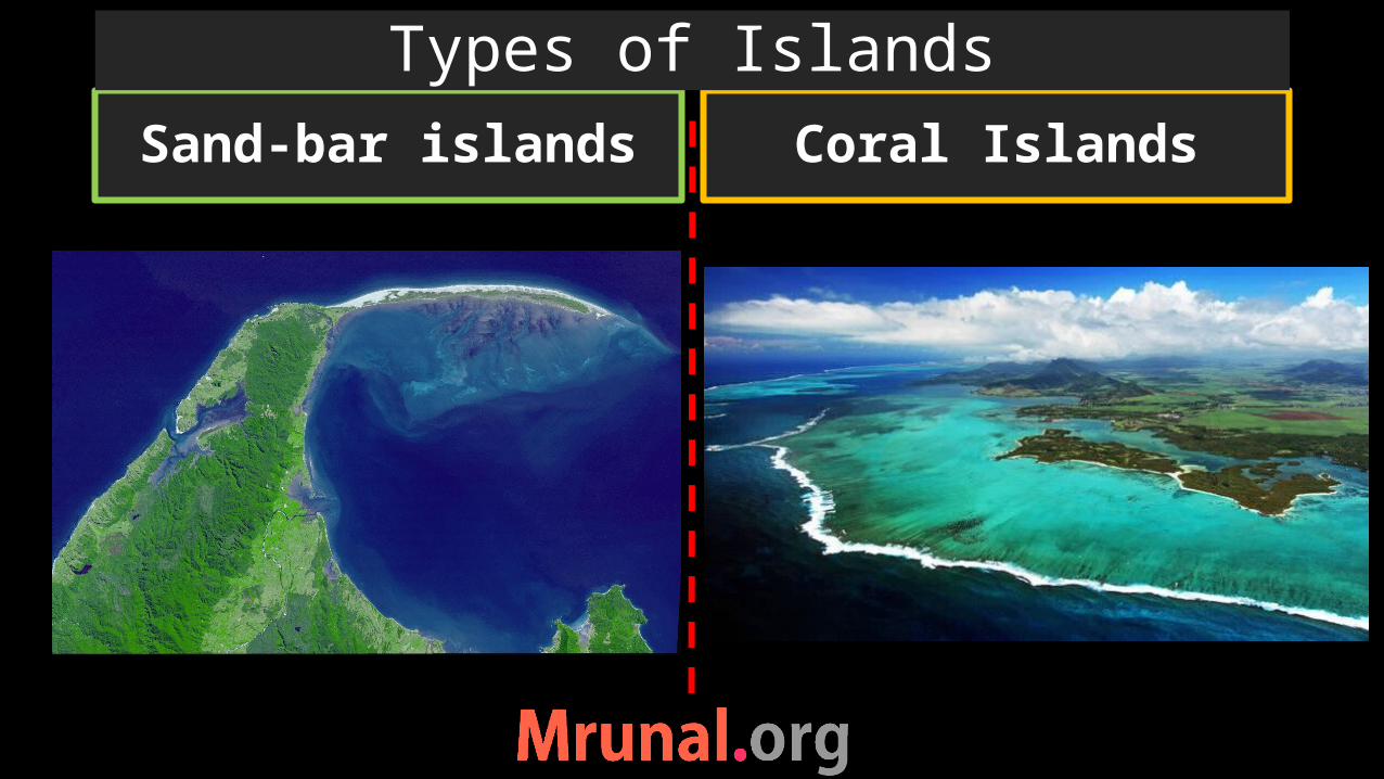
Sand-bar islands Coral Islands
Types of Islands
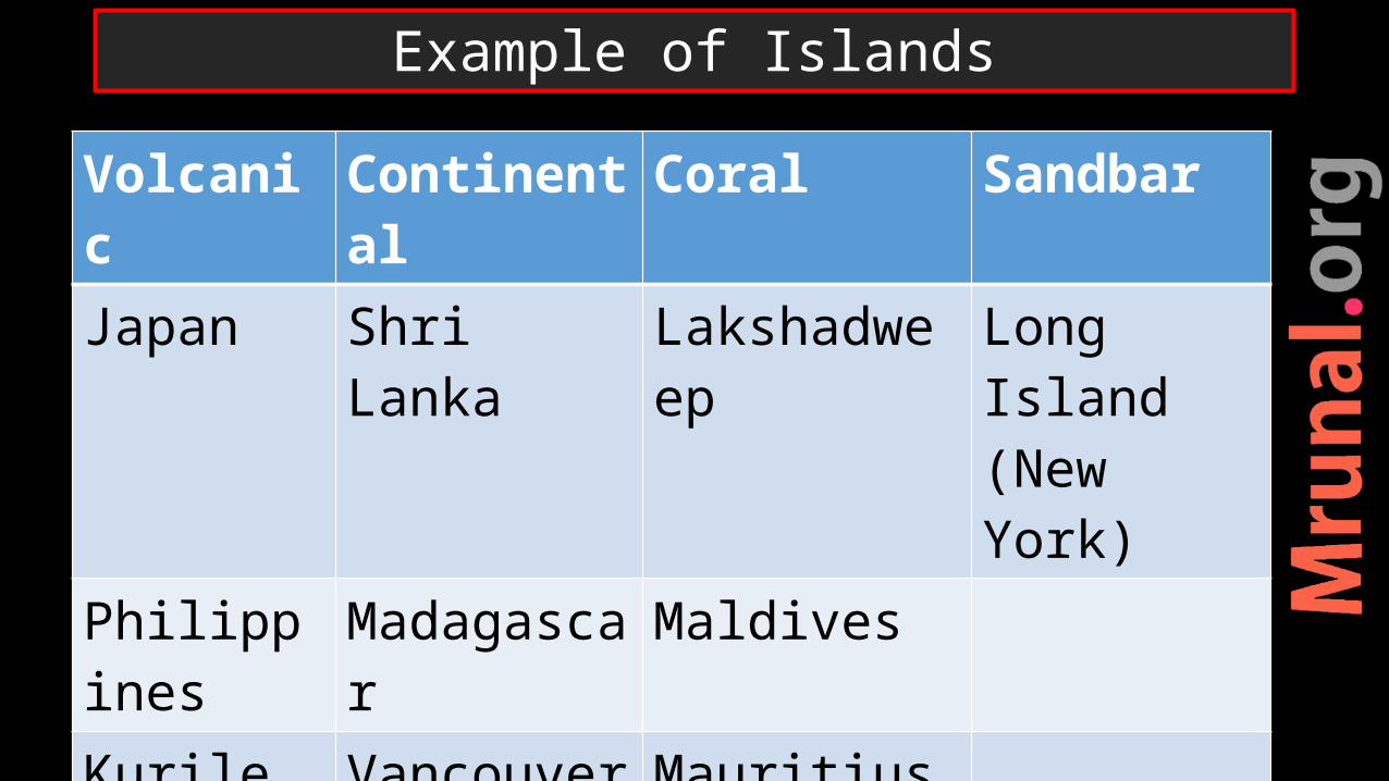
Volcanic Continental Coral Sandbar
Japan Shri Lanka Lakshadweep Long Island (New York)
Philippines Madagascar Maldives
Kurile Vancouver Mauritius
Aleutian Baffin Island Bahama, Bermuda
Example of Islands

• Indicative of health of Marine ecology•Primary food-chain•Source of great biodiversity
Coral Reefs

Corals = tiny fleshy sea anemones polyps. They extract Ca from the sea water for their skeletons to protect their bodies.
One generation die on previous generation.
Corals live symbiotic relationship with microscopic plant – Zooxanthalae, photosynthesis capabilities.
Zooxanthalae provide food to corals and corals provide protection to zooxanthalae
Coral Reefs

Need submarine shallow platform (50 meter deep)– to receive sun light
Temperature- 25-27 degreeWarm, tropical and low latitude watersSalinity – 33 pptNot at mouth of river, No turbulent water
Need circulating nutrient rich water
Condition for growth of Corals

Spatial distribution of Corals

•When corals are in stress they expel zooxanthalae – that’s why coral seem white => coral bleaching. Ultimately, without food coral die
Coral Bleaching

Global warming => increase in sea surface temperature
Ozone depletion => increase in solar irradiation
Ocean acidification algal bloomIncrease sedimentation from riversMarine pollution – oil spillDiseases
Reason of coral Bleaching
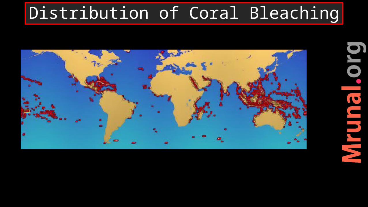
Distribution of Coral Bleaching

•Corals can be developed both at the margins of the continents or around islands•3 stages of coral formation
1) Fringing reef2) Barrier reef3) Atoll
Formation of coral reef

•Coral reef developed along margin of an island• If Gap is created between corals and the surface of island •Small water bodies = lagoons
Fringing reef

•Reef is not continuous but broken•Lagoon can connect to open ocean •Most extensive • If they are parallel to coast -> barrier reef
Barrier reef

•The hill submerged •Only narrow ring of coral is visible
Atoll

Fringing Reef Atolls
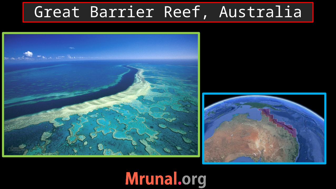
Great Barrier Reef, Australia

•Dangerous for marine biodiversity•Marine diversity is the wealth of the earth•Harmful to global environment
Marine pollution

Marine pollutionIssue effectOil spill Marine life – devoid of
sunlight and oxygenRun-off from land Eutrophication - Algal
bloomAtmospheric input makes ocean water acidicDumping of toxic elements Toxicity harms marine
organismBallistic water issue Danger to biodiversity

•Tar balls — lumps of petroleum•oil spillage from tankers •The wax-like lumps are caused due to the reaction of the oil with sea water•Sticky and greasy
Tar balls

Ocean bottom relief:1) Continental shelf2) Continental slope3) Continental rise4) Abyssal plain Types of islandsFormation of coralMarine pollution

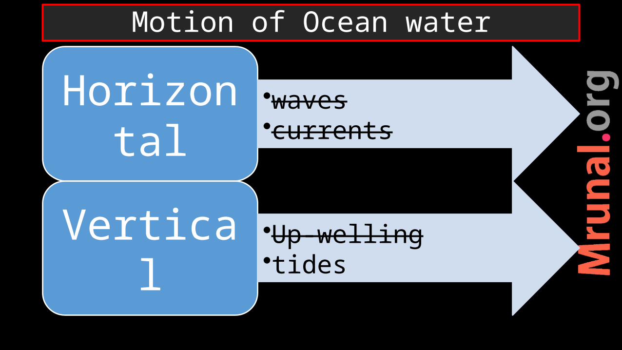
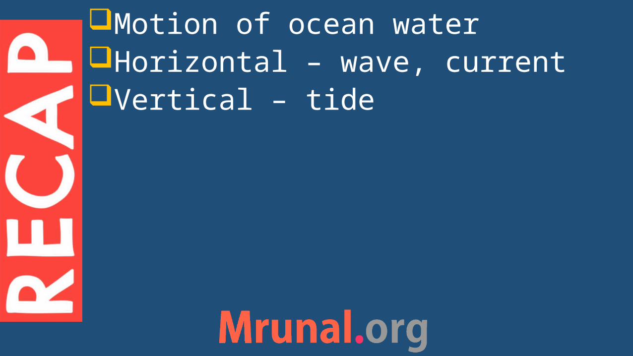
Horizontal •waves•currents
Vertical •tides•Up-welling
Motion of Ocean water
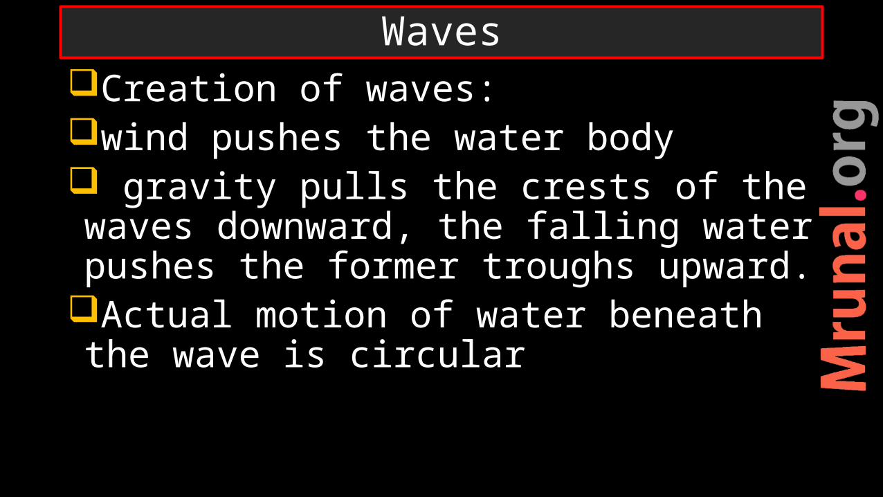
Creation of waves:wind pushes the water body gravity pulls the crests of the waves downward, the falling water pushes the former troughs upward.
Actual motion of water beneath the wave is circular
Waves

Waves
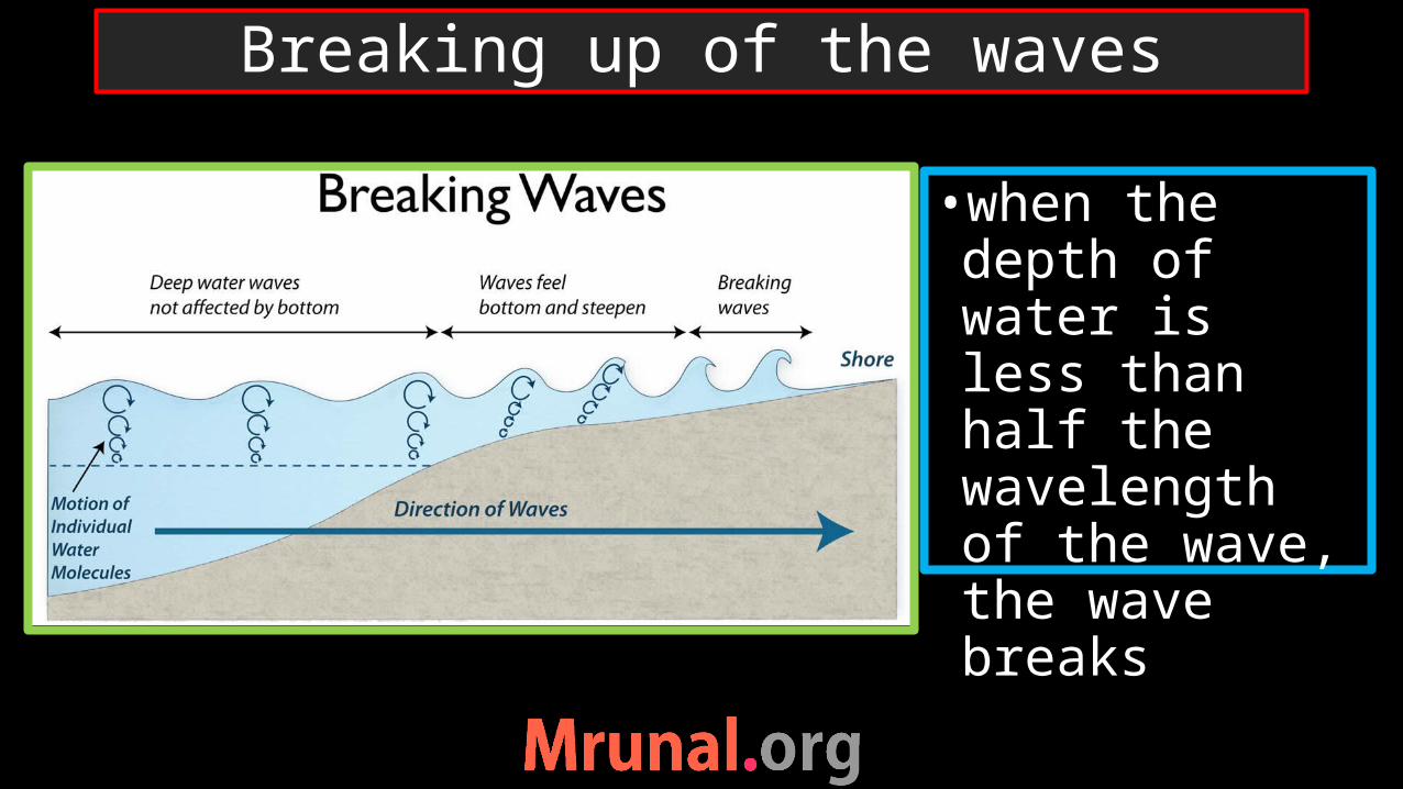
•when the depth of water is less than half the wavelength of the wave, the wave breaks
Breaking up of the waves

Horizontal •waves•currents
Vertical •tides•Up-welling
Motion of Ocean water
Ocean currents are narrow and shallow (up to 500 meter deep), stream of water circulating along the Ocean margins
Circumnavigate the earth
Ocean Currents

• Heat distribution – from Poles to Eq.•warm water from equator •Cold water from Poles
Ocean currents
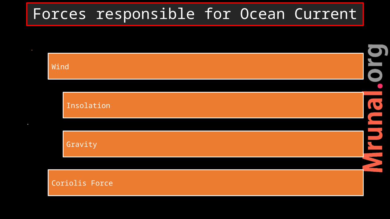
Wind
Insolation
Gravity
Coriolis Force
Forces responsible for Ocean Current

•Most of the currents follow the direction of the trade winds, Westerlies and polar easterlies
Dominant force : wind

Water expands under high temperatureCold water near polesWater lighter near equator, than at the poles
Cold water - heavier (denser) sinks downward
Cold water from pole flow towards equator at subsurface level, to balance loss of water at equator
Insolation: temperature gradient

Insolation: temperature gradient

Salinity increases density of waterDenser water sinks at depthLess saline water move towards high saline water on the surface
High saline water move towards less saline water at sub-surface
Equator – rainfall –less saline waterPoles – iceberg – high saline water
Insolation: Salinity gradient

Factor deflect the path of the currents: Coastlines modify the path of the currents
coriolis force deflect the path
Factors modifying the ocean currents
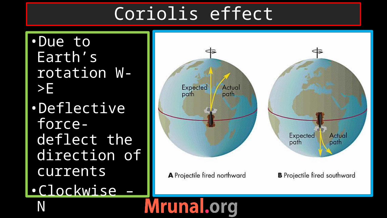
•Due to Earth’s rotation W->E•Deflective force- deflect the direction of currents•Clockwise – N•Anti-clockwise -S
Coriolis effect

Prelims 2012
Q. Consider the following factors:1. Rotation of the earth2. Air pressure and wind3. Density of ocean water4. Revolution of the earthWhich of the above factors influence ocean currents?
UPSC
oceano

Prelims 2012
a) 1 and 2b) 1,2,3c) 1 and 4d) 2,3,4
Ans. B)Rotation of the earth -> coriolis forceAir pressure and wind -> planetary windsDensity of water -> salinity
UPSC
oceano
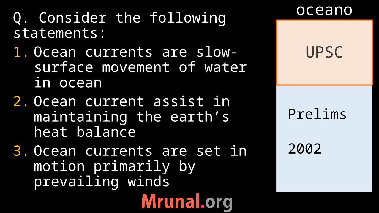
Prelims 2002
Q. Consider the following statements:1. Ocean currents are slow-
surface movement of water in ocean
2. Ocean current assist in maintaining the earth’s heat balance
3. Ocean currents are set in motion primarily by prevailing winds
UPSC
oceano

Prelims 2002
4. Tropical currents are affected by the configuration of the oceanWhich of the statements are correct?a) 1 and 2b) 2,3 and 4c) 1,3 and 4d) 1,2,3 and 4Ans. B)
UPSC
oceano
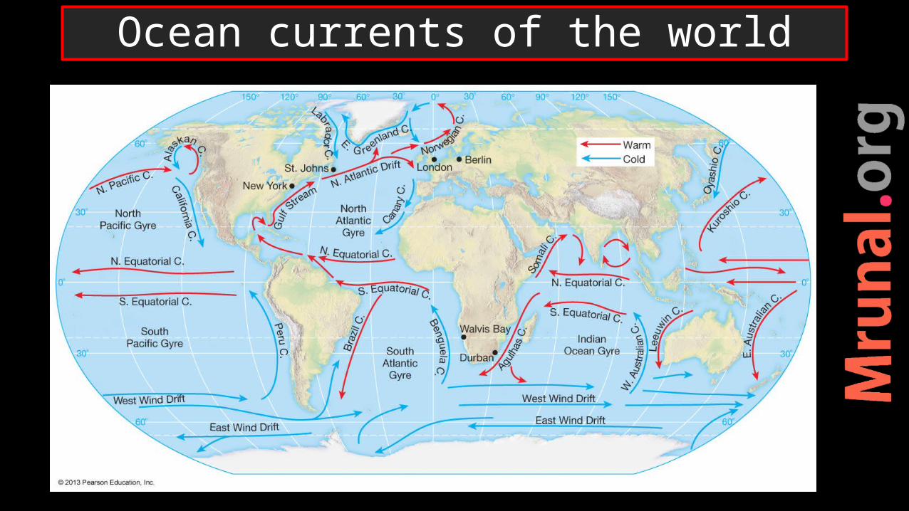
Ocean currents of the world
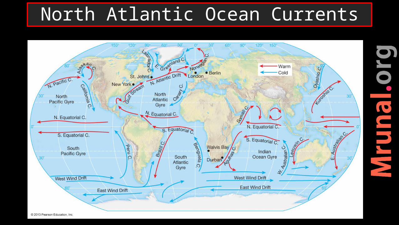
North Atlantic Ocean Currents

•Meeting of gulf stream and Labrador current at new found land•fishing ground = grand banks•Foggy area – dangerous for shipping
New found land

•warming effects to Western Europe• ports of Norway Narvik, Hammerfest operating in winter- at same latitude ports in Russia freeze during winter
North Atlantic drift
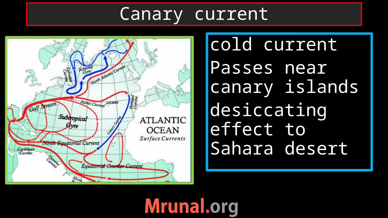
cold currentPasses near canary islandsdesiccating effect to Sahara desert
Canary current

•Gyre of north equatorial current, gulf stream and canary current•Water confined –calm and motionless•HP zone – high salinity• ‘Sargassum’- sea weed –obstruct navigation•Devoid of nutrients – poor marine life
Sargasso sea

South Atlantic Ocean Currents

•Meeting of warm Brazilian and cold Falkland current• Important fishing ground
Bahia Blanca

•Cold current•Desiccating effect to Namib desert
Benguela current

North Pacific Ocean Currents

•cold Californian current•Chilling effect on western coast of N. America•Drying effect to Mojave desert, Sonoran desert in California
Desiccating effect of cold current

Meeting of cold-warm current near Japan
•Meeting of warm Kuroshio and cold Oyashio current near southern Japan•Rich fishing ground•Foggy area
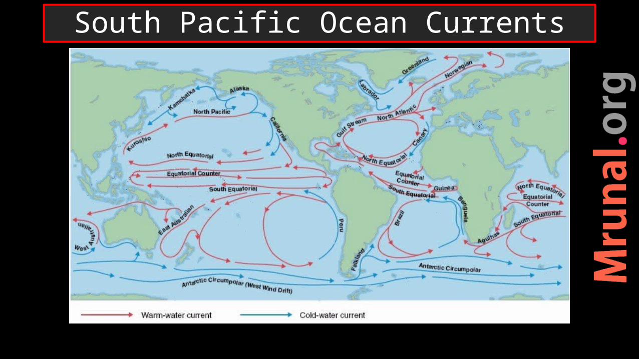
South Pacific Ocean Currents

•Cold Peru/Humboldt current – desiccating effect to Atacama dessert•Peruvian coast – upwelling – rich fishing ground
Upwelling on Peruvian coast

North Indian Ocean Currents

• In summer: wind and current flow towards India – Arabia to India• In winter: wind + current flow towards Arabia - sea vessel from India to Arabia• Important for sea-trade, cultural interaction
Navigation in Indian Ocean

South Indian Ocean Currents

Prelims 1997
Q. Which one the following factor is responsible for the change in regular direction of the ocean currents in the Indian ocean?a) Indian ocean is half an oceanb) Indian ocean has monsoon driftc) Indian ocean is a land-locked
oceand) Indian ocean has greater
variation in salinityAns. B)
UPSC
oceano

Prelims 2013
Q. The most important fishing ground of the world are found in the regions where:a) Warm and cold atmospheric
currents meetb) Rivers drain out large
amount of fresh water into sea
c) Warm and cold oceanic currents meet
UPSC
oceano

Prelims 2013
d) Continental shelf is inundating
Ans. C) 1) New found land2) Bahia Blanca3) Japanese coast
UPSC
oceano

Horizontal •waves•currents
Vertical •Up-welling•tides
Motion of Ocean water

•The wind exerts stress on the ocean surface proportional to the square of the wind speed and in the direction of the wind. •This motion extends to a depth of ~ 100 m
Ekman layer

•Wind force balanced by coriolis force and friction•Water defect 45 deg under coriolis force•Depth – wind force reduce- deflect away from wind direction
Ekman spiral

Ekman spiral 90 deg = Ekman transport•Deflect Right in N. hemi•Deflect Left in S. hemi•Due to coriolis force
Ekman Transport

•When Ekman transport induce divergence at the coast•divergence draws water from below to the surface
Up-welling

Ekman transport Peruvian coast
Ekman transport in southern hemisphere

Up-welling
•cool and nutrient rich water come at the surface•Phytoplankton reproduce rapidly in this condition – zooplankton -> nekton

•Cold current •Humboldt current = Peruvian coast•Gulf of Guinea, Iberian coast•Up-welling – rich nutrients => fishing
Up-welling regions

•When Ekman transport induce convergence at the coast•convergence forces surface water downward
Down-welling

•Descending water -warm water - saline •push down at the bottom
Down-welling
Horizontal •waves•currents
Vertical •Up-welling•tides
Motion of Ocean water

•Rise and fall of sea water due to gravitation forces of sun and moon is called tides•Gravitational + centrifugal forces
Ocean tide

• If moon stationary – every place on earth experience 2 HT and 2 LT in 24 hours
Ocean tides

•But moon also revolves around earth in 27.5 days•So, same location comes under moon not exactly after 24 hours but 24.52 min•So, diurnal frequency of HT and LT is 12.26 min
Ocean tides

•Difference between High tide and Low Tide•Depends upon:1) Depth of ocean
water2) Configuration
of coastline3) Openness and
closeness of the sea
Tidal range

World: Bay Fundy India: Gulf of Khambhat
Highest tidal range

The time between the high tide and low tide, when the water level is falling, is called the ebb.
The time between the low tide and high tide, when the tide is rising, is called the flow or flood
Ebb – Flood/Flow

•Moon’s orbit around the earth –elliptical•Perigee tides – higher than apogee tides
Apogee and Perigee tides
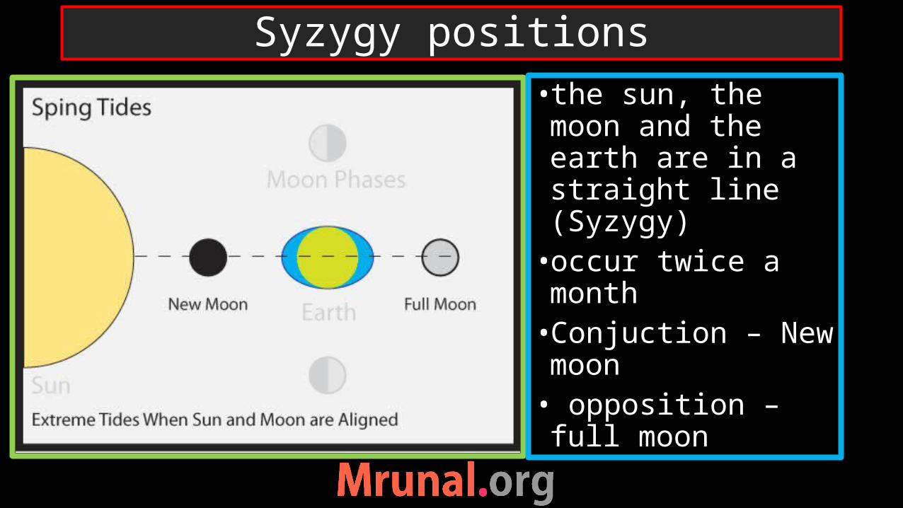
Syzygy positions• the sun, the moon and the earth are in a straight line (Syzygy)•occur twice a month•Conjuction – New moon• opposition – full moon

Quadrature positionsun and moon are at right angles to each other (Quadrature)The forces of the sun and moon – counteract7/8 D of every fortnight

- Spring , neap = High tideSpring – highest HTNeap – Lowest HT- there is a 7 Days interval between the spring tides and neap tides.
Spring – Neap Tide

Spring tide
HT higher than usual
LT lower than usualSyzygy positionGravitational force from both sun and moon together
HT lower than usualLT higher than usualQuadrature positionGravitational force of sun and moon counter-act
Neap tide
comparison

Prelims
2001
A) During the neap tides, high tide is lower and low tide is higher than usual
R) The neap tide, unlike spring tide, occurs on new moon instead of full moon.
Ans. A true, R is incorrect
UPSC
Question

•When the tide is channelled between islands or into bays and estuaries •Coastward = flood current•Seaward = ebb current• Reversing tidal currents great velocity
Tidal currents
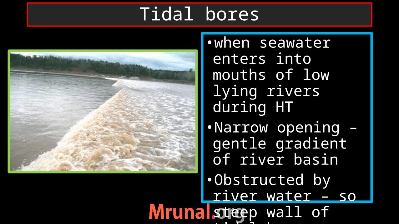
•when seawater enters into mouths of low lying rivers during HT•Narrow opening – gentle gradient of river basin•Obstructed by river water – so steep wall of tidal bore
Tidal bores

Prelims
2004
Q. Which of the following statement is NOT correct?a) Gulf with narrow fronts and
wider rears experience high tide
b) Tidal currents take place when a gulf is connected with open sea by narrow channel
c) Tidal bore occurs when a tide enters the narrow shallow estuary of river
UPSC
Question

If a mouth of a river is low-lying and submerged under sea-waterRiver deposit create long-narrow delta = estuary deltas Ex. Deltas of Tapi, Narmada
Estuary

Prelims
2004
d) The tidal nature of the mouth of river Hooghly is of the crucial importance to Kolkata port Ans. D)Tidal bores at Hooghly are constraints for shipping at port- Rushing current imbalance the docking ships
UPSC
Question

Hooghly -Distributary of Ganga•Kolkata on left bank of Hooghly•Tidal bores in Kolkata port
Hooghly river
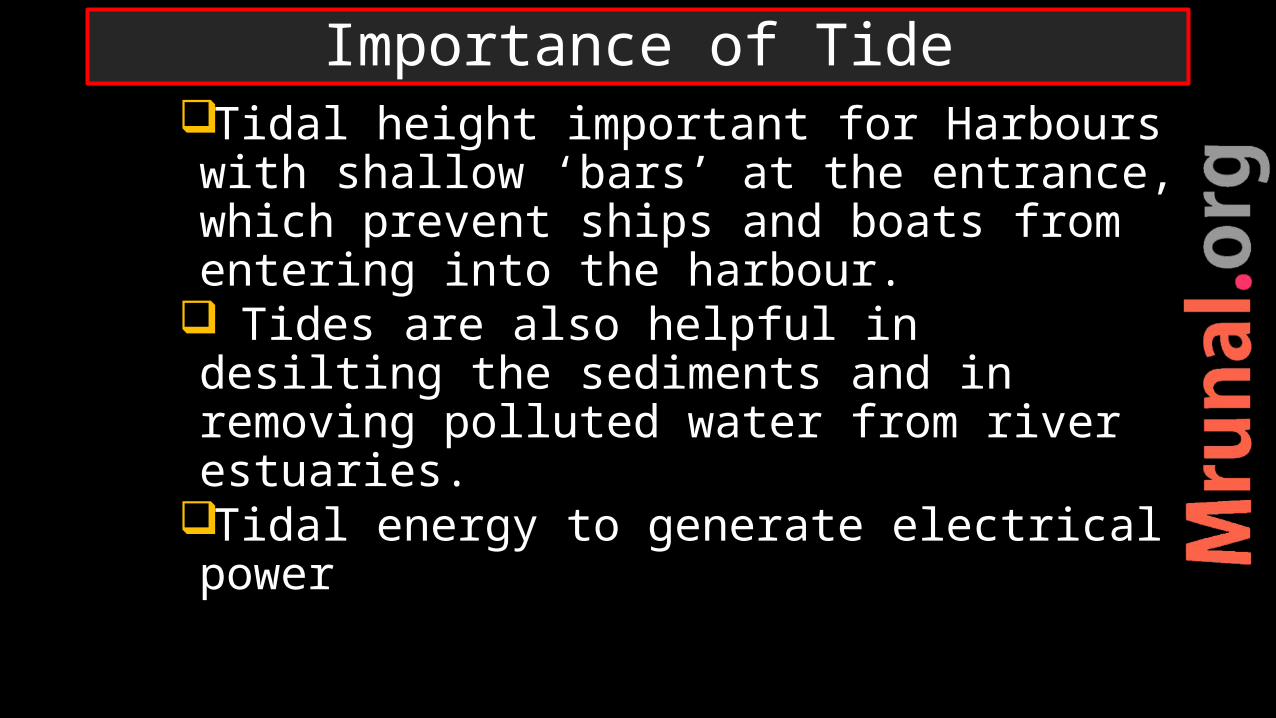
Tidal height important for Harbours with shallow ‘bars’ at the entrance, which prevent ships and boats from entering into the harbour.
Tides are also helpful in desilting the sediments and in removing polluted water from river estuaries.
Tidal energy to generate electrical power
Importance of Tide

Prelims 2000
Q. Consider the following statements:1) Tides are great help in
navigation and fishing2) High tide enable big ships to
enter or leave the harbour safely
3) Tide prevents siltation of harbor
4) Kandla and diamond harbor are tidal ports
UPSC
Question

Prelims2000
a) 1 and 4b) 2,3 and 4c) 1,2 and 3d) 1,2,3 and 4
Statement 1 is wrong. Tide not helpful in navigation
Ans. B)
UPSC
Question
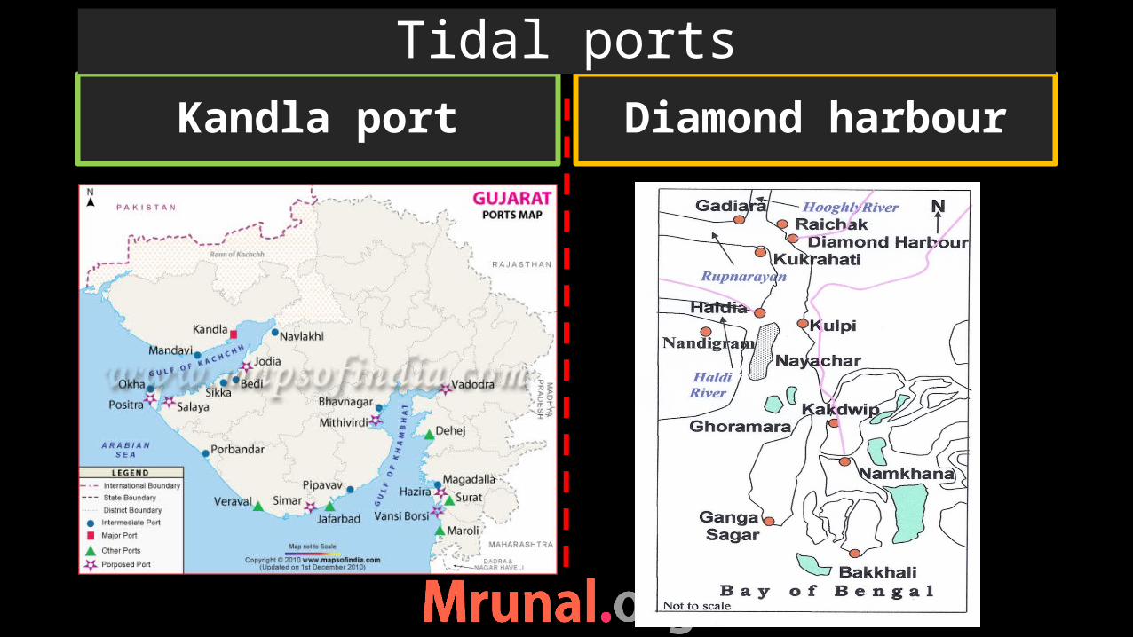
Kandla port Diamond harbour
Tidal ports

Tidal ports
Feed by sea water during high tide
Located on coastEx. Kandla
Feed by riversRelatively in-land Ex. Kolkata port
Non-tidal ports
Ports

port facts
Kandla First port developed after independence
JNPT To decongest Mumbai port
Murmagao, KN Known for iron ore export
New Manglore port Export iron ore from Kudremukh mine in KN
Kochi At the entrance of a lagoon
Tuticorin port Also Handles cargo of Shri Lanka and Maldives
Chennai Oldest artificial port
vishakhapatnam Deepest landlocked port, export iron ore
Kolkata port Riverine port
Haldia To decongest Kolkata port
Paradip port, Odisha Initially to export iron ore
12 major ports of India
Motion of ocean waterHorizontal – wave, currentVertical – tide

•Power is harnessed taking advantage of difference of level between HT and LT•A dam is constructed to clock receding water during LT•Water is released from dam – turbine - electricity
Tidal energy

•La Rance, France•Scotland, UK•potential of 8000MW in India•Gulf of Cambay, gulf of Kutch, Sundarban (WB)•50 MW plant in gulf of Kutch 2012
Tidal energy in world

•Turbines are placed on ocean floor•Turbine are run by fast moving ocean currents•Fastest ocean currents: gulf stream off East USA
Tidal stream energy

Horizontal •waves•currents
Vertical •tides•Up-welling
Motion of Ocean water

Motion of ocean waterHorizontal – wave, currentVertical – tide, upwelling –down welling
Tidal energy
Related Documents